|
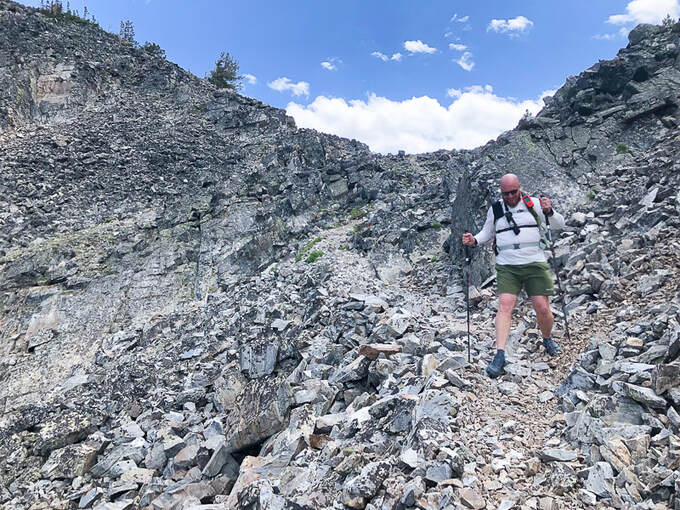
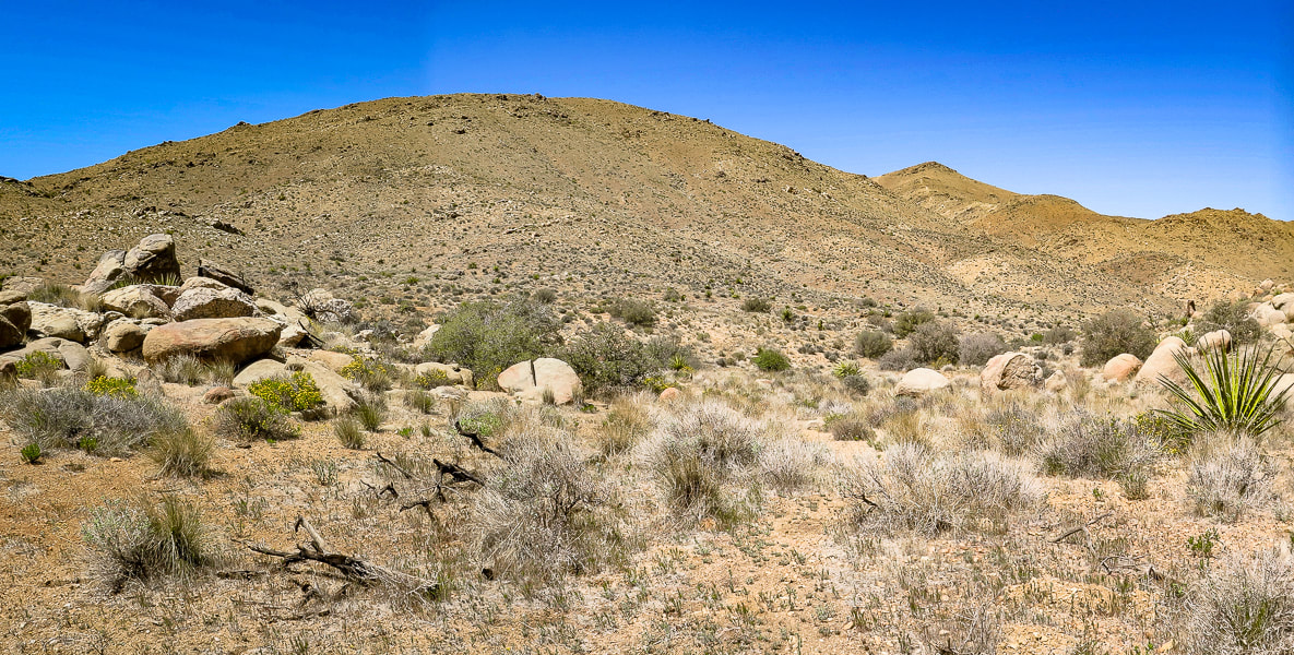
If you like short, Class 1 hikes to the highest summit of a spectacular mountain range, this hike in the unfrequented Tushar Mountains is for you. While you're there, sample the meadows and forests of the Skyline National Recreation Trail for a good dose of solitude.
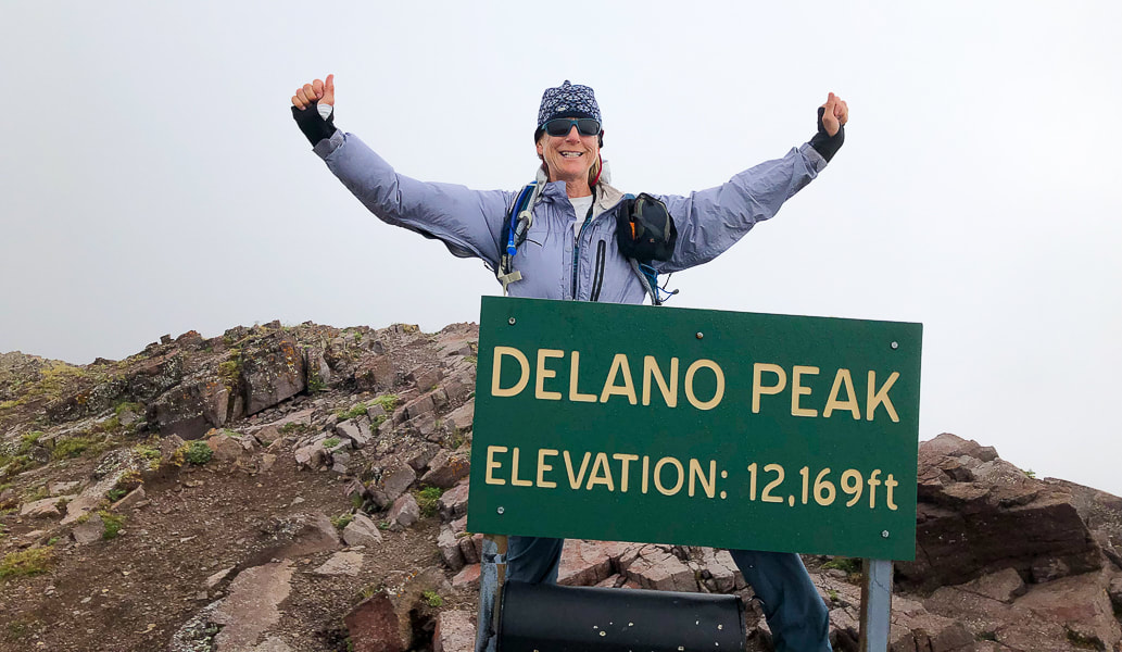
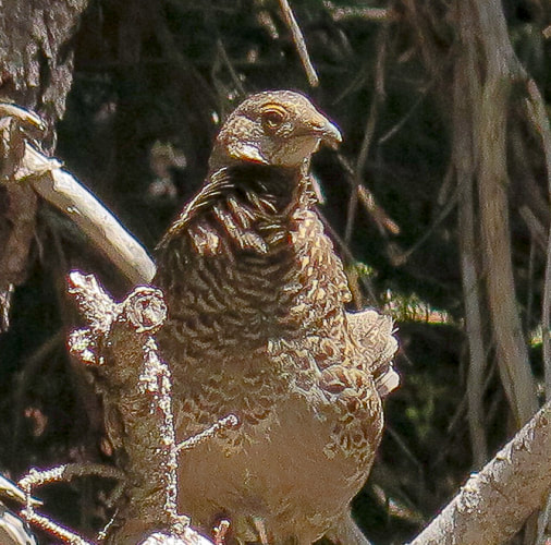
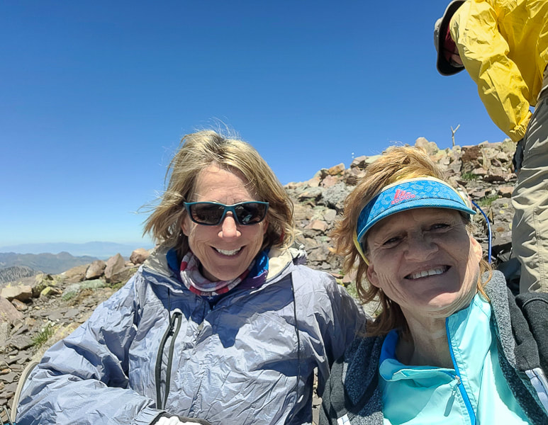
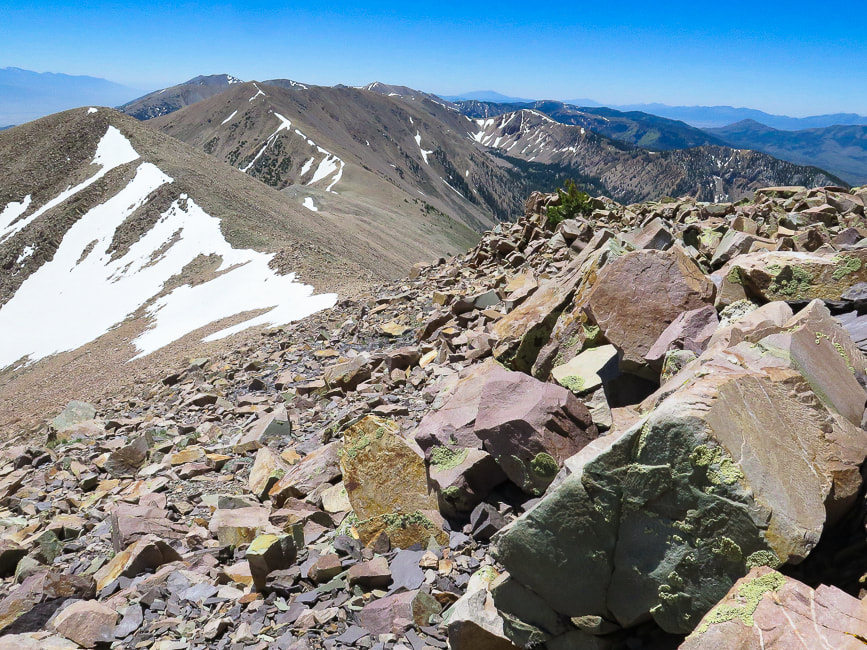
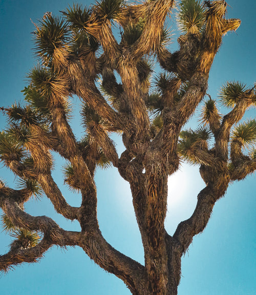
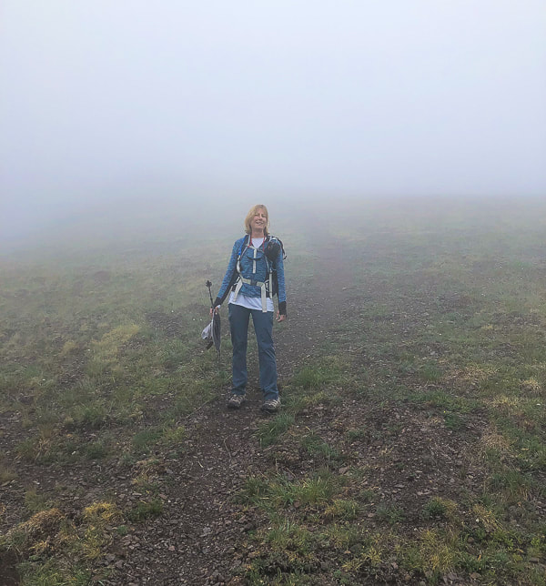
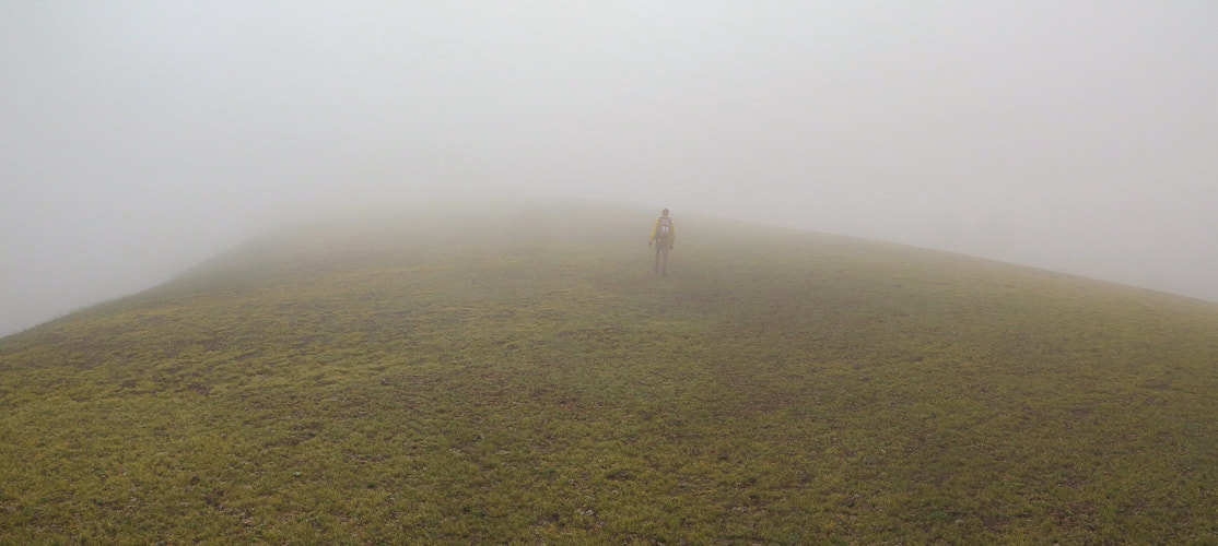
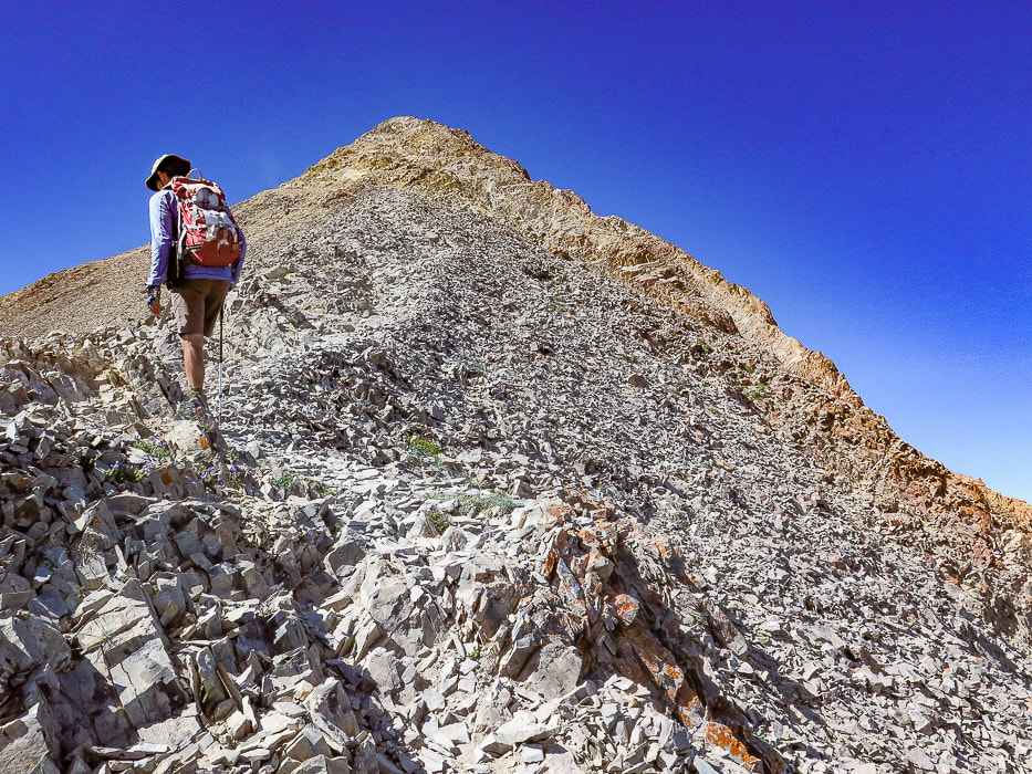
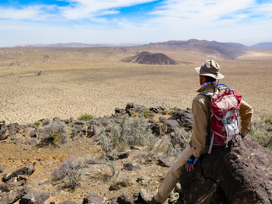
Looking like I'm going to fly away in Delano Peak's high winds.
Related in Explorumentary:
List with Links for Utah Hikes/Bikes Hike Mount Nebo - On Top of the Wasatch
Trip Stats for Delano Peak
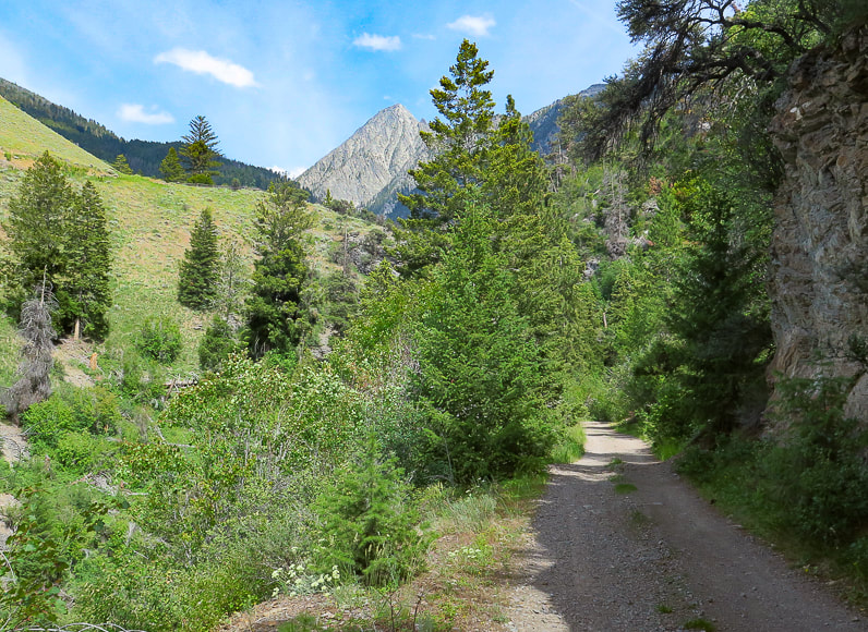
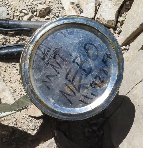
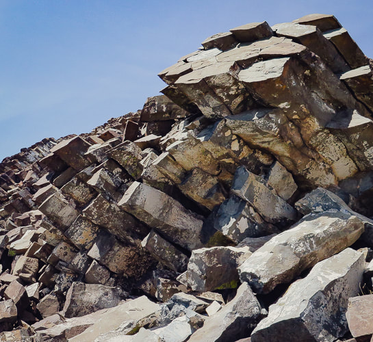
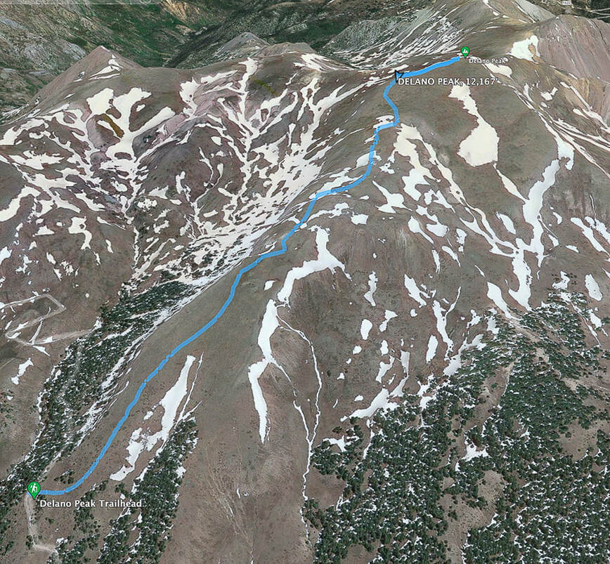
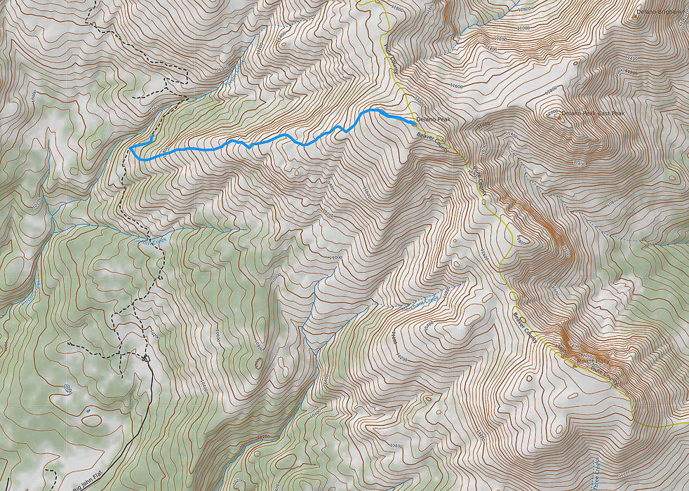
Location: Fishlake NF, Tushar Mountains, Trail #224, near Beaver, Utah. Fishlake National Forest - Beaver Ranger District. Prominence: 4,689'. Distance/Elevation gain: West ridge approach = 3 miles round trip - 1,625' gain. Trailhead = 10,500', summit = 12,169'. Difficulty: Moderate Class 1 on cairned trail to Delano Peak. Coordinates: Trail head = 38.36753, -112.39561 Delano Peak = 38.36917, -112.37137 Date Hiked: 8/1/22 Maps and Apps: AllTrails Delano Peak, Fishlake National Forest Beaver and Fillmore Ranger Districts Travel Map - USDA. Considerations: most passenger cars can drive the graded dirt/gravel road to trailhead (FR 123). This road is also part of the Paiute ATV trail, so there is some ATV use on roads nearby. No motorized vehicles allowed on hiking trails. History: named after Columbus Delano (1809–1896), Secretary of the Interior during the Grant administration. He was instrumental in establishing Yellowstone National Park after supervising the first federally-funded scientific expedition into Yellowstone in 1871, and the first Secretary of the Interior to request congress to protect preservation of a nationally important site (from Wikipedia). Geology: The Tushar Mountains are remnants of volcanos whose first eruption period was 22-35 million years ago (Bullion Canyon Volcanics) and second eruption 21 million years ago (Mt. Belknap Volcanics). Delano Peak resides in the Bullion Canyon Volcanics. It is the highest point on the edge of Big John's Caldera, a concealed structure on Delano's west side that subsided ~ 23 million years ago during ash flow eruptions. This caldera filled and eroded over time. The second eruption created the source rock for the mined uranium of the Marysvale mining district north and east of Delano Peak. (See "For the Geocurious" below).
The Skyline National Recreation Trail Links
Ramblers - Beaver County, Utah How to Day Hike Three Different Sections of the Scenic 23-Mile Skyline Trail - Utah - Life Elevated 
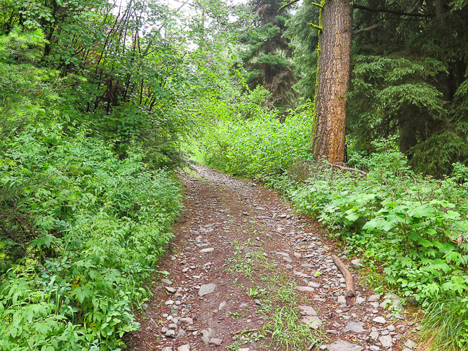
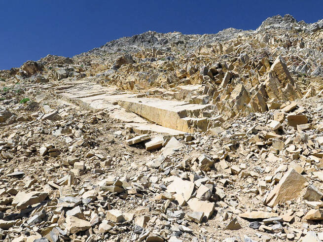
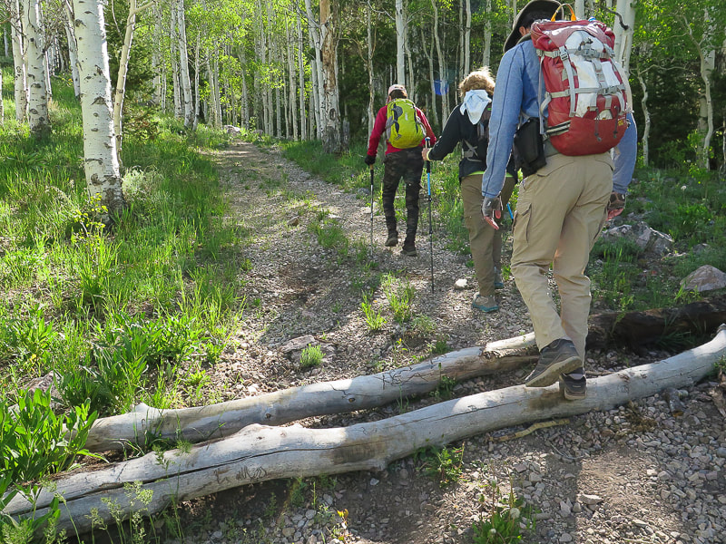
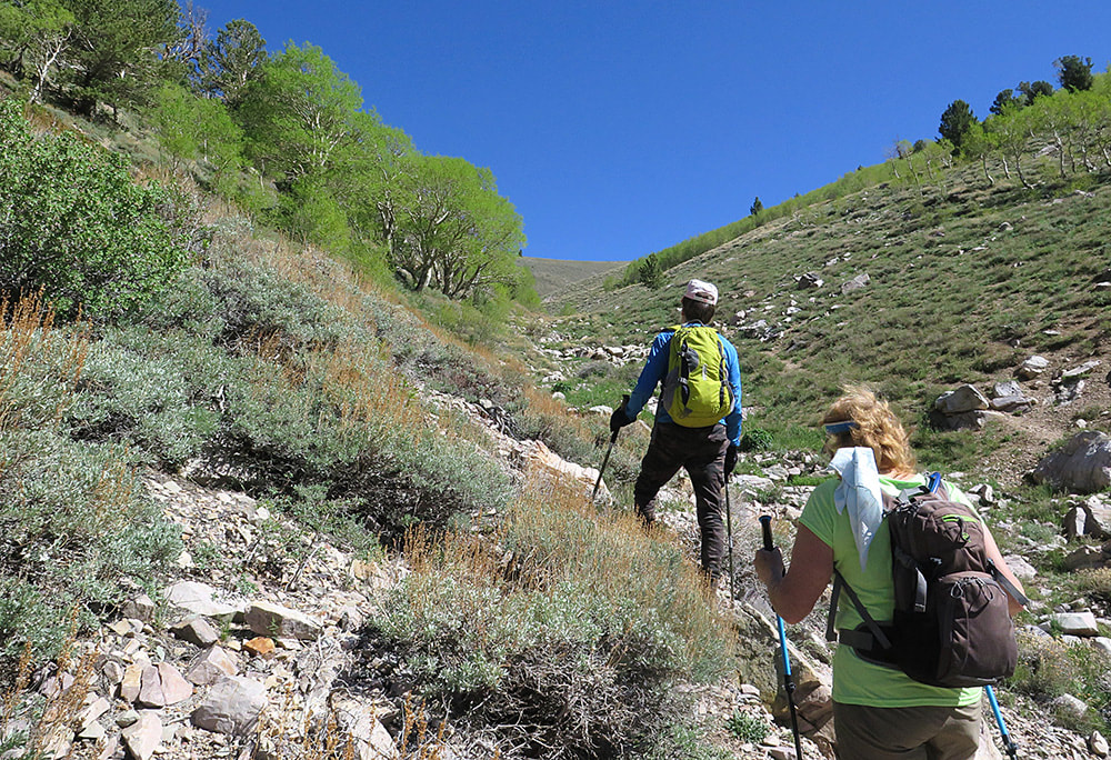
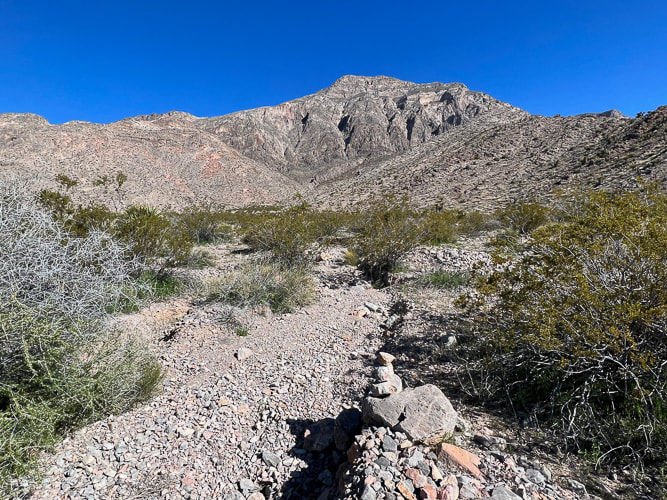
On the morning drive up FR 123 to the trailhead.
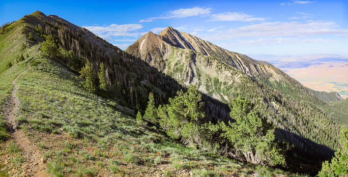
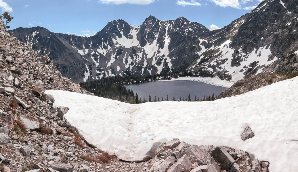
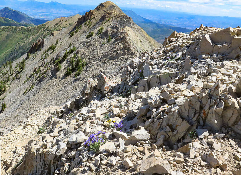
Delano Peak
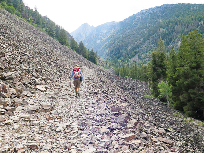
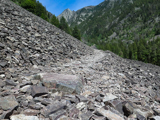
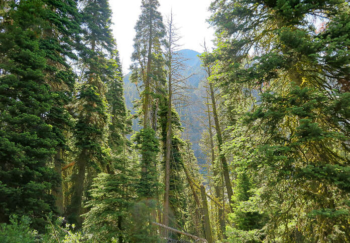
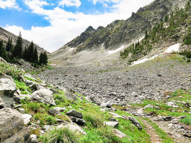
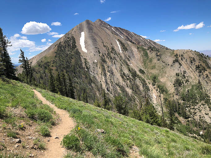
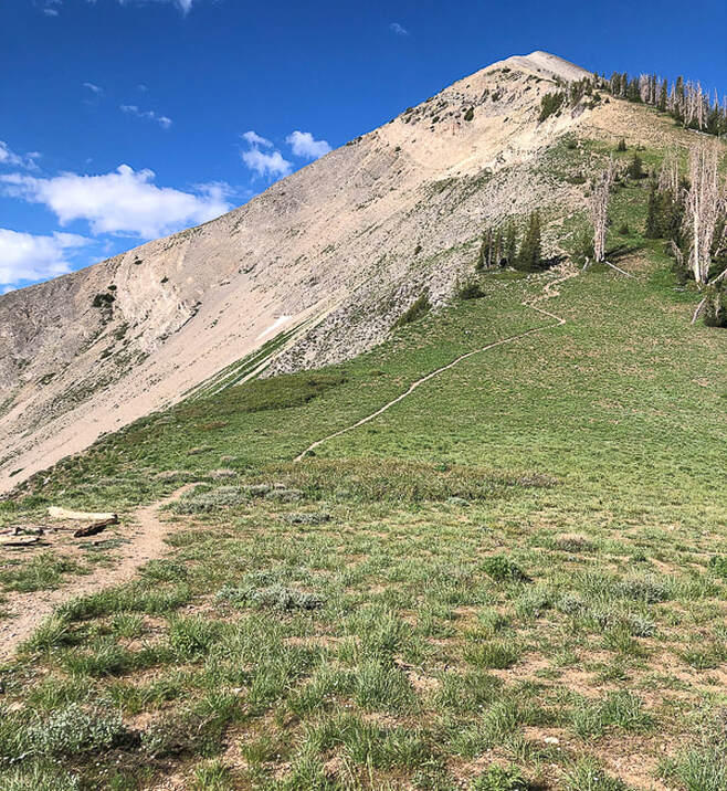
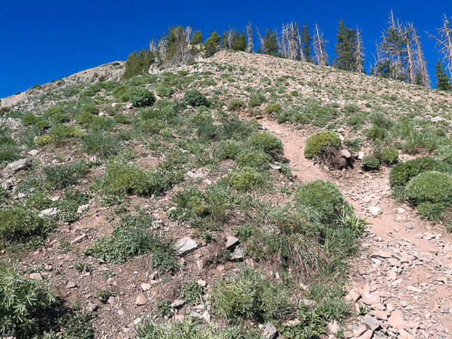
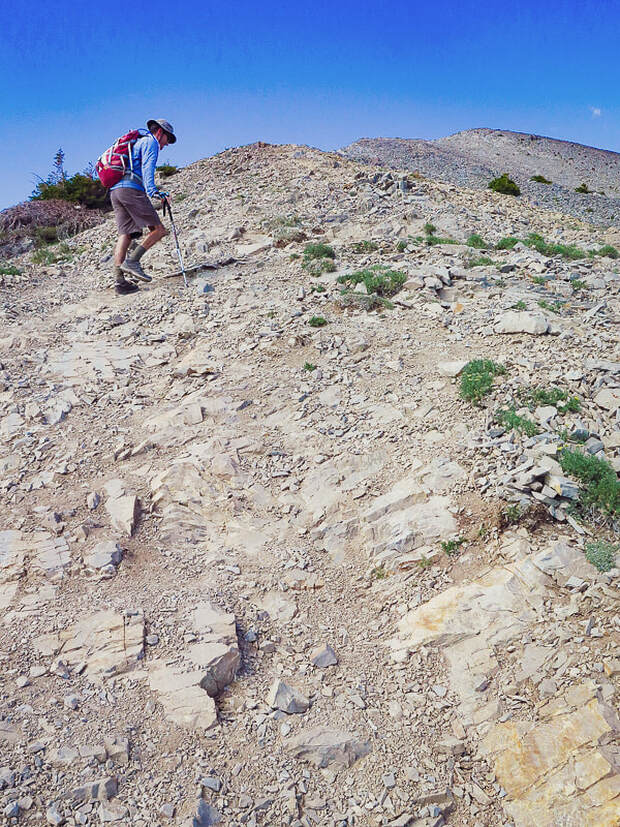
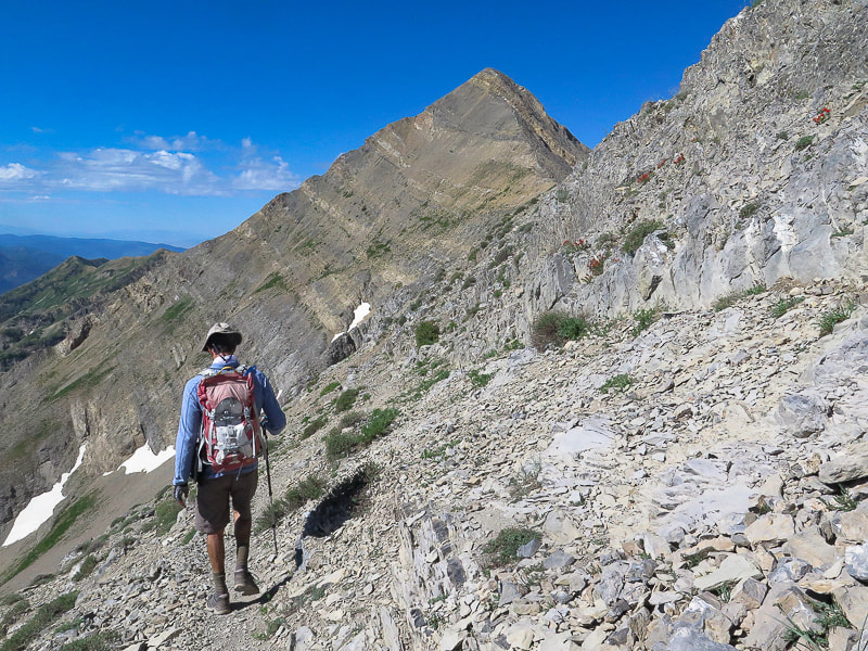
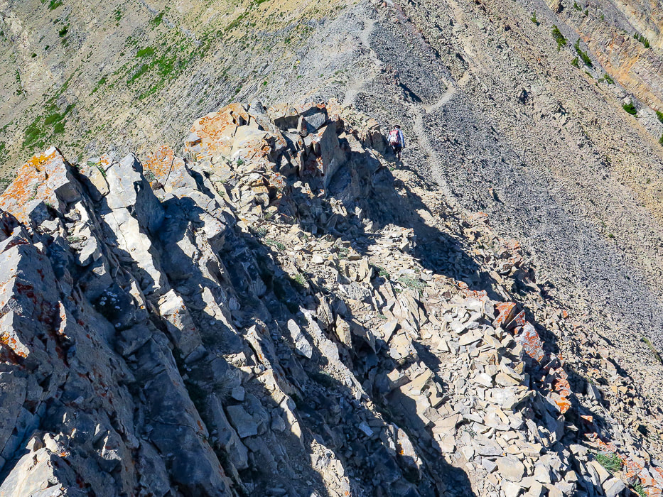
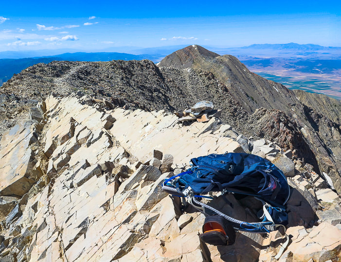
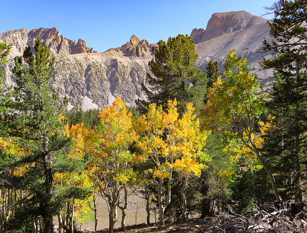
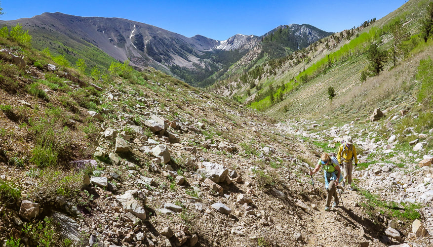
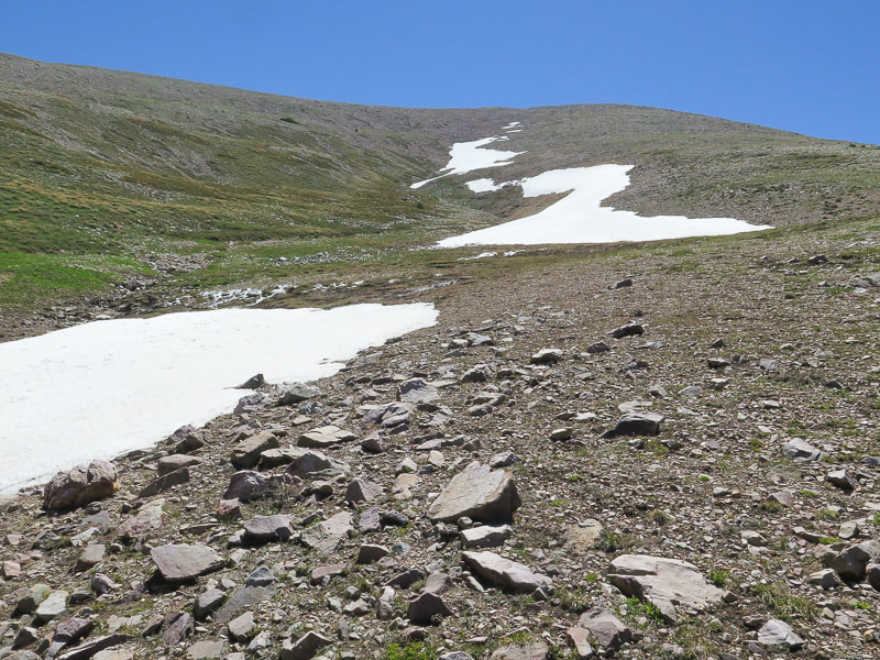
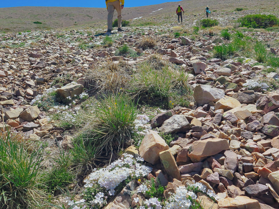
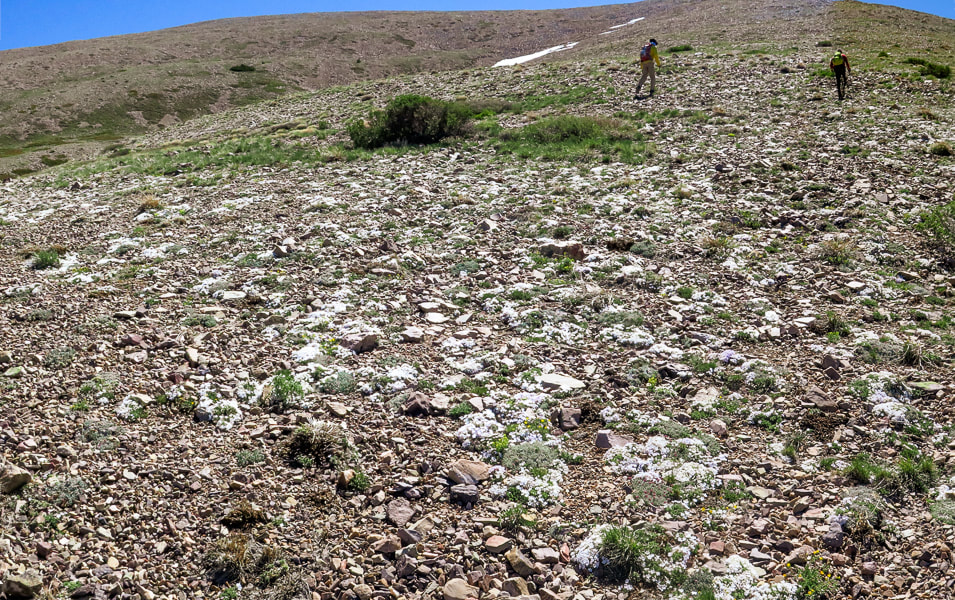
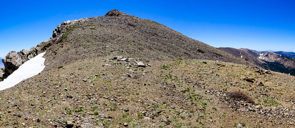
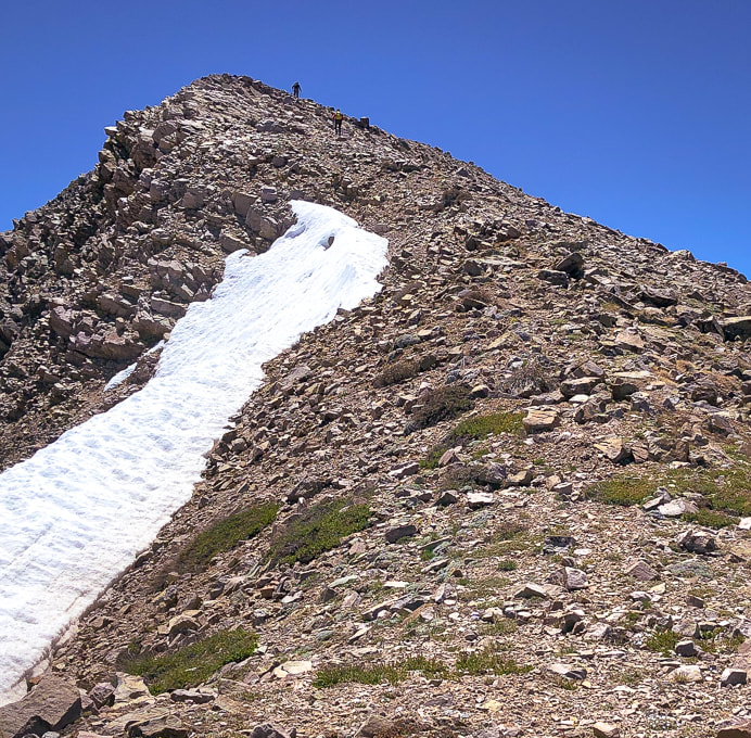
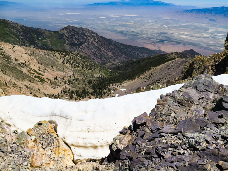
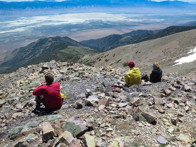
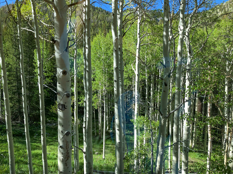
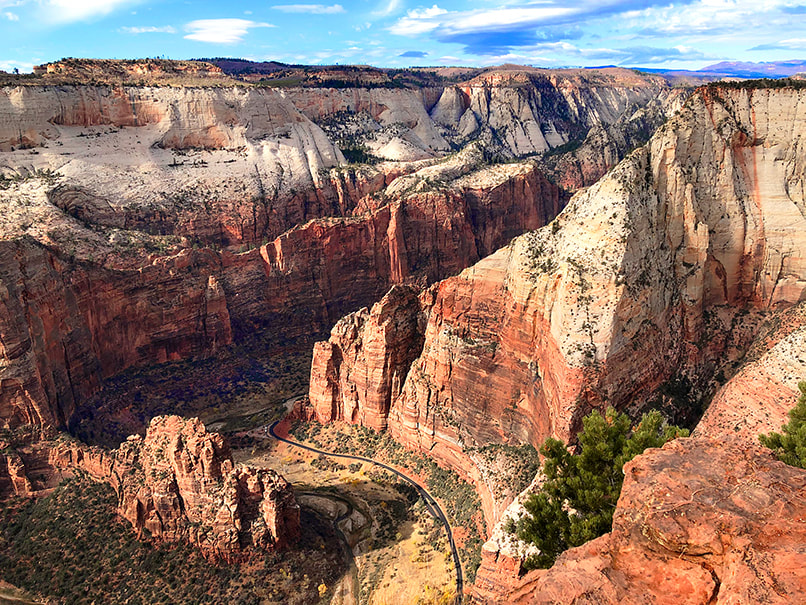
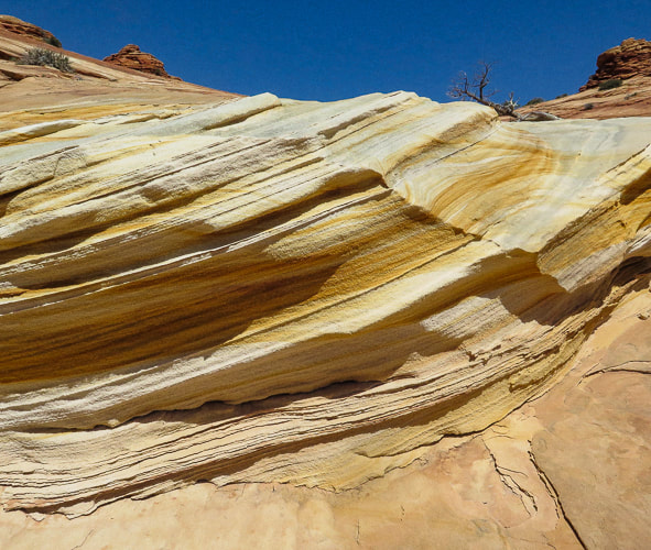
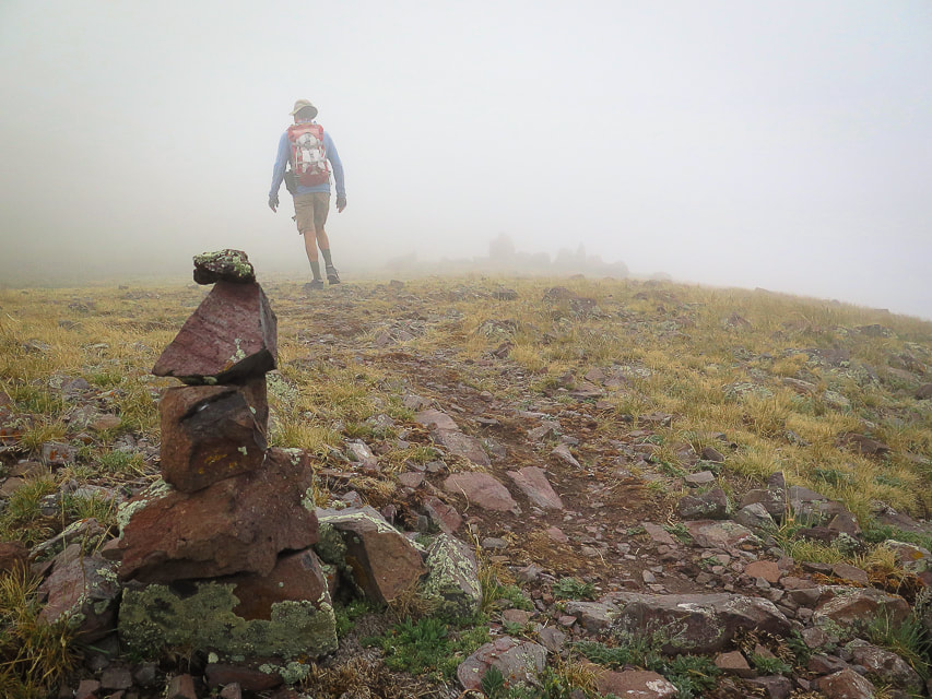
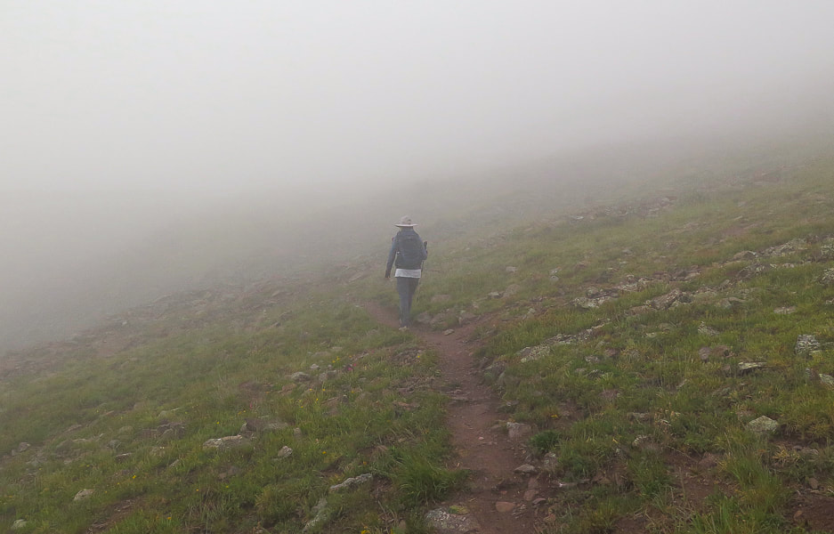
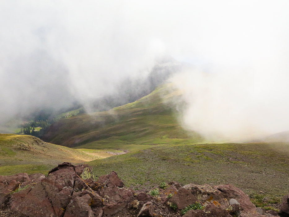
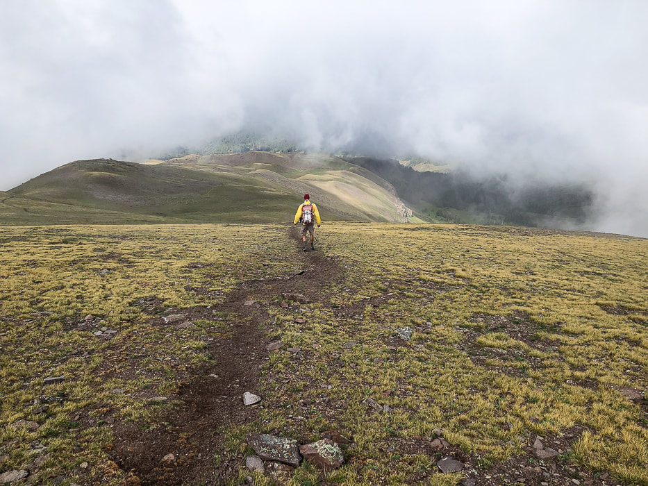
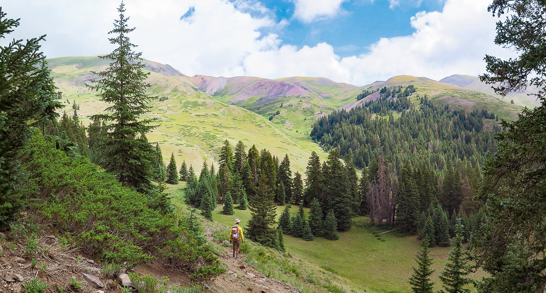
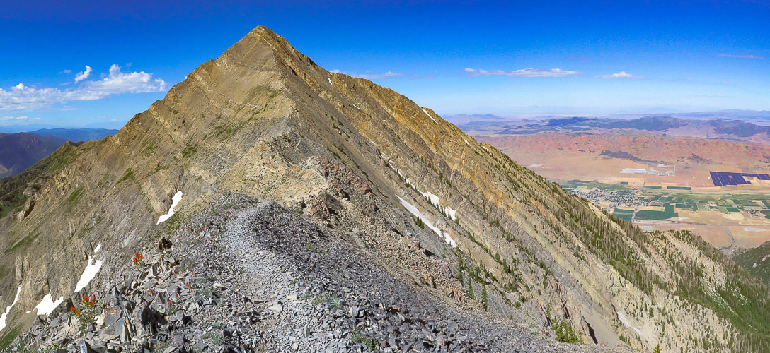
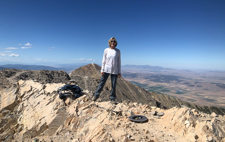
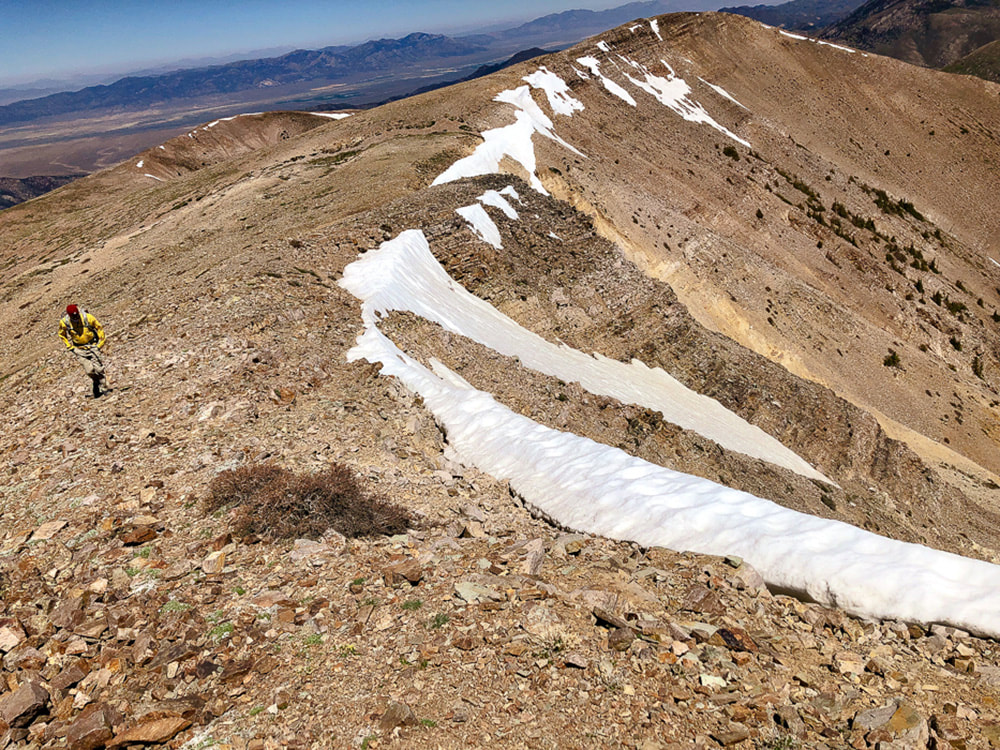
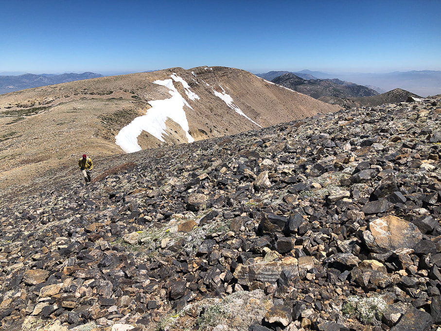
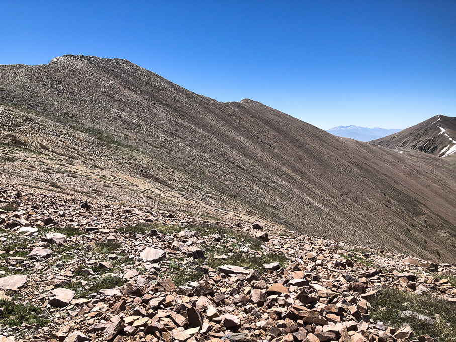
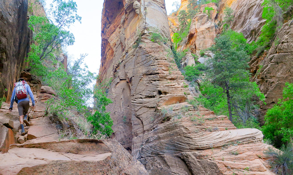
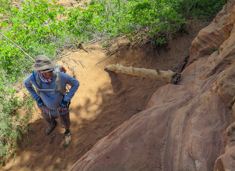
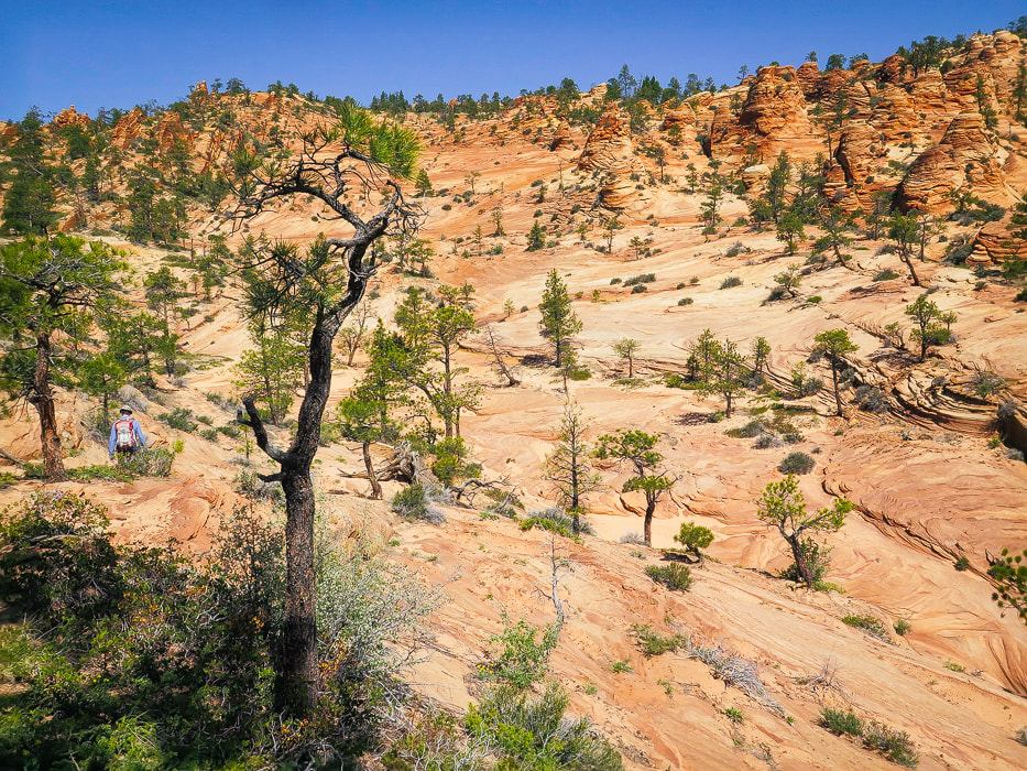
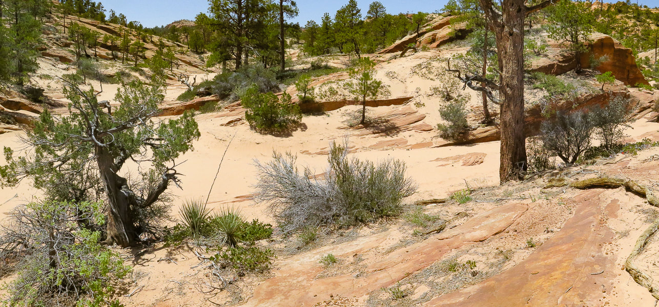
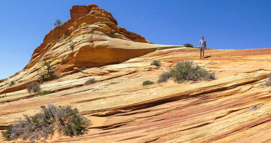
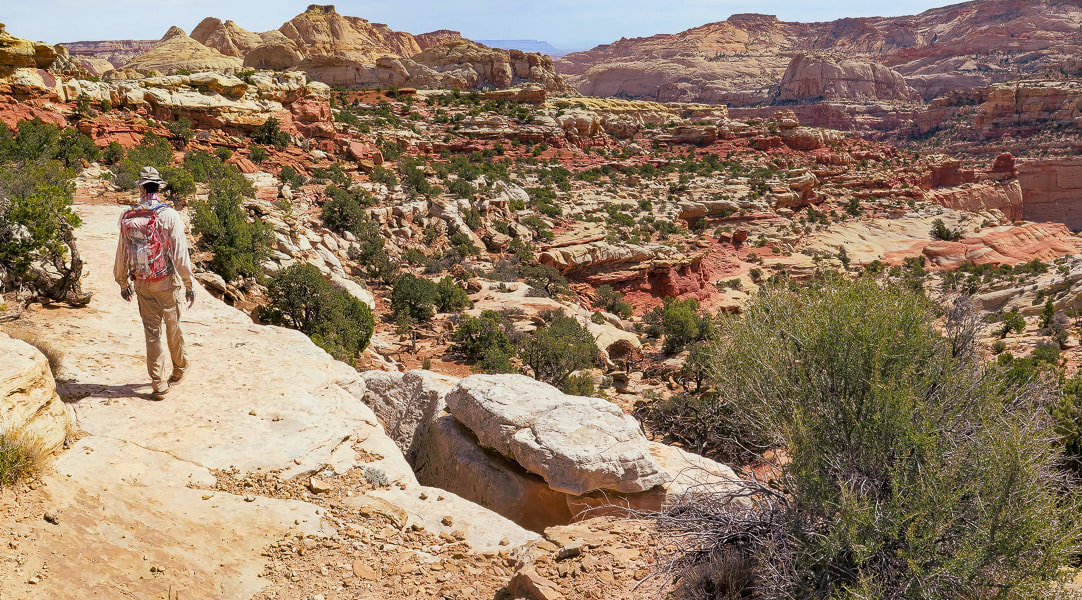
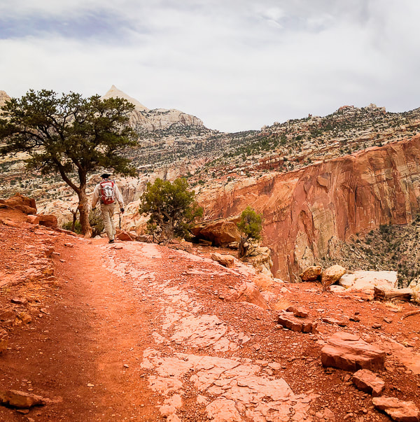
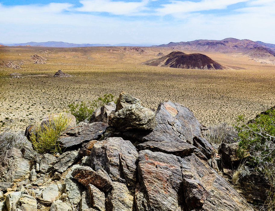
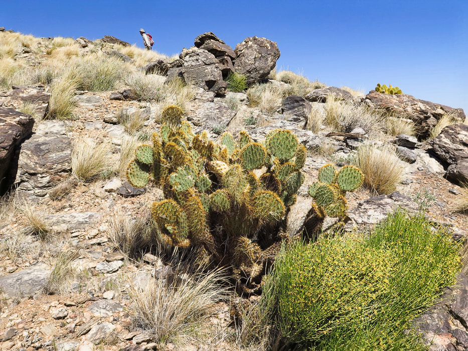
We had planned to hike a loop on on the Tushar range's highest ridge to Delano Peak and Mount Holly further down the ridge, but when we got to Delano's summit, we could barely see each other, let alone the ridge. A few times, Fred got ahead of me and vanished into the huge clouds that engulfed the summit. The terrain below was occasionally revealed as sunny and bright green, but not for long. Getting cold with the wind blowing us around, we descended the short trail to our truck and drove to the Skyline National Recreation Trail trailhead. Mount Holly can be accessed from this trail. Delano Peak is the highest summit in the Tushar Mountains - the third-highest range in Utah, after the Uinta and the La Sal Mountain ranges. The Geologic Map of the Tushar Mountains looks like a chaotic Jackson Pollock painting and one that would bring a sparkle to any geologist's eyes. It's a symphony of color blotches and random hatched lines that represent almost all major forms of volcanic rocks and structural features. Red Hills Tuff, Grey Hills Rhyolite and Blue Lake Rhyolite are just a few of the members of volcanic assemblages. Thrust faults, caldera walls and breakaway scarps scatter about this complicated terrain. Delano Peak's summit sits at the top of Big John Caldera. Four more calderas exist, as well as eight major mining centers. We were surprised that such a large, gorgeous wilderness area with more than a few peaks over 11,000 feet had so few visitors. While hikers flock to the Wasatch and Uinta ranges, the Tushars are not as well-known. There are ATV trails that course through parts of this range, but there are plenty of hiking trails where they are not allowed. This is a quick hike on a trail through grass and small rocks - only 1.5 miles to the summit. It is a bit challenging because you start at 10,000 feet. Delano Peak can also be summited from the northeast; in fact, this trail continues from the summit down to the base of Mt. Brigham. We plan on giving our loop another try.
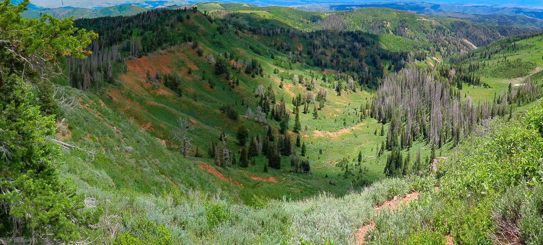
Skyline National Recreation Trail
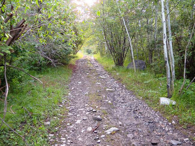
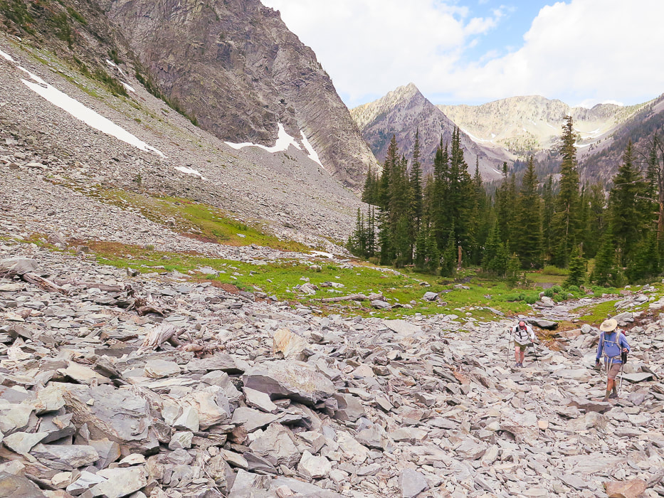
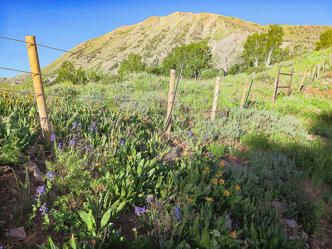
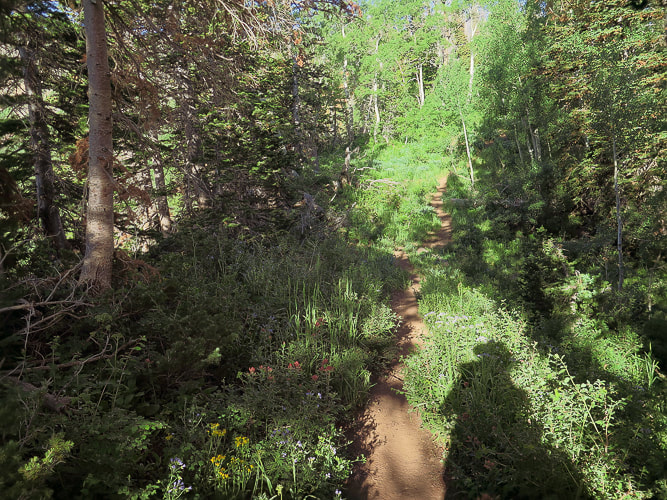
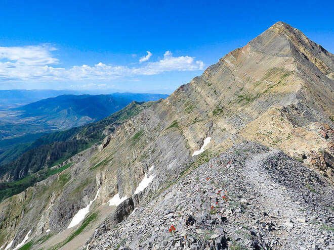
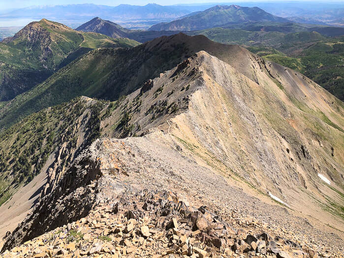
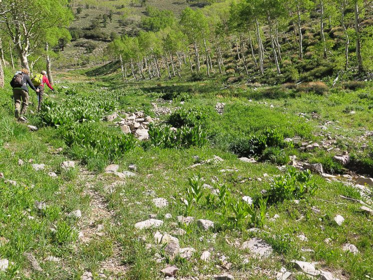
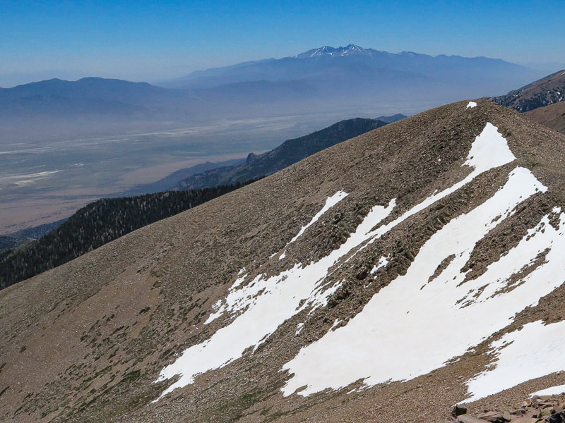
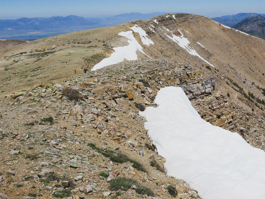
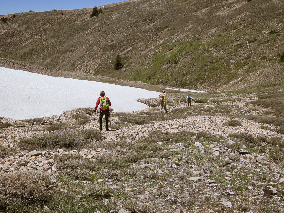
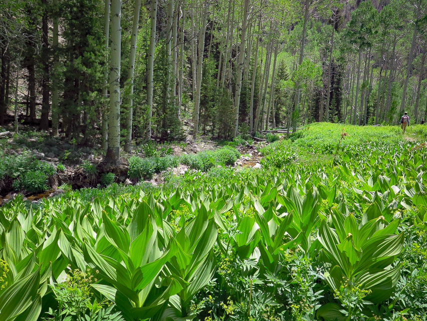
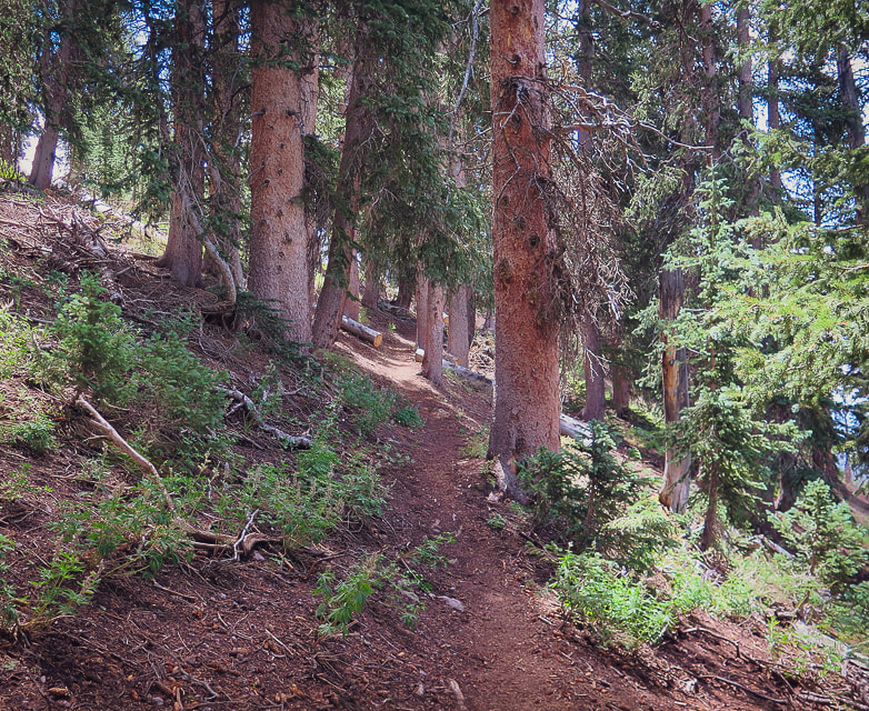
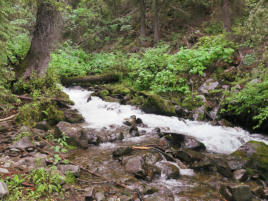
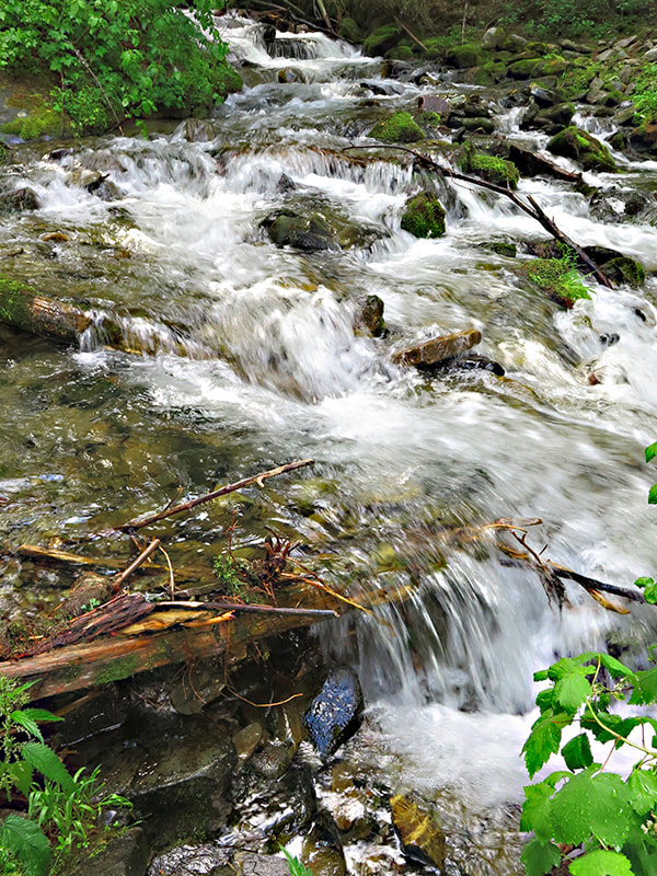
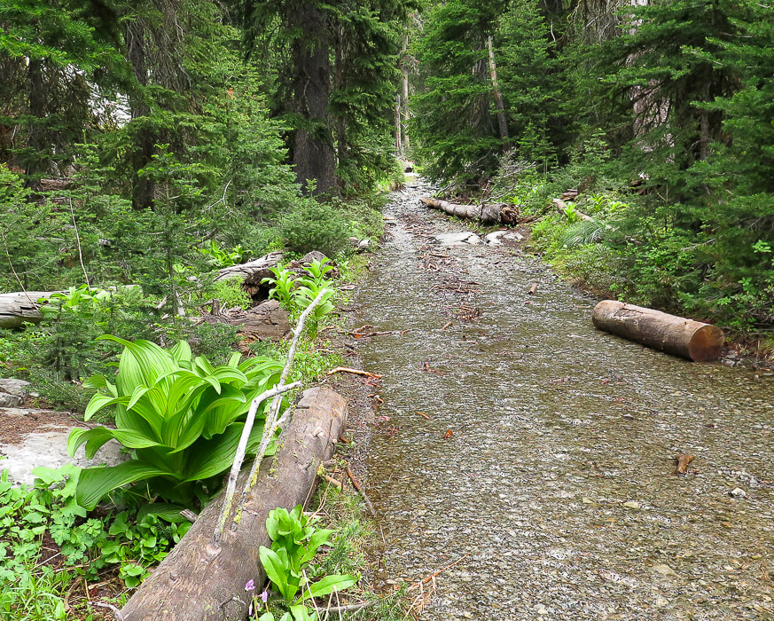
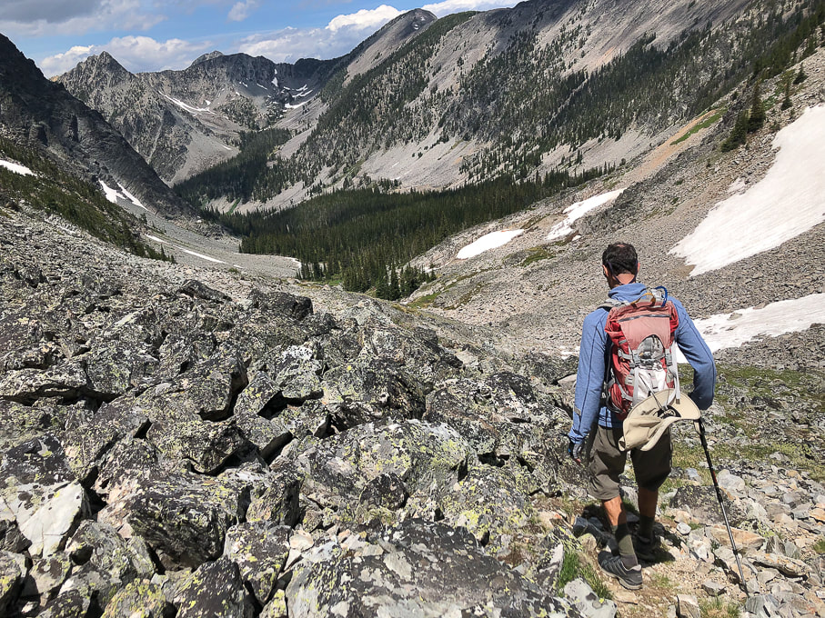
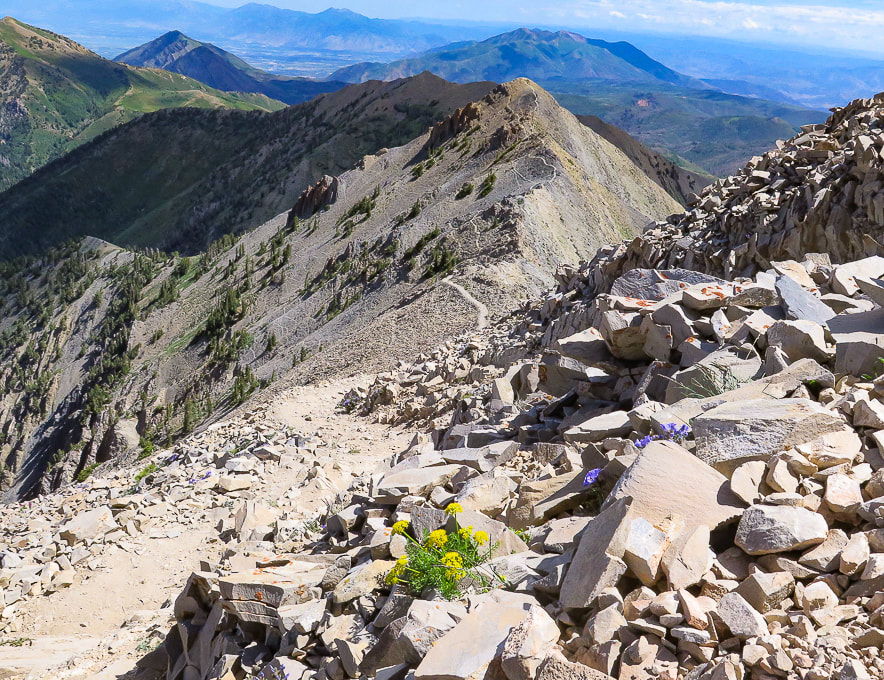
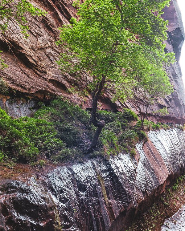
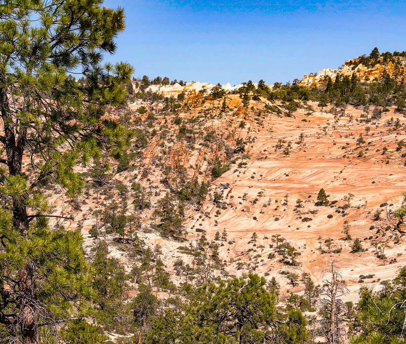
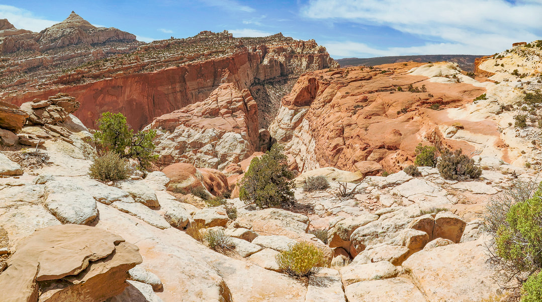
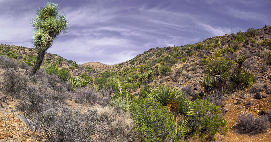
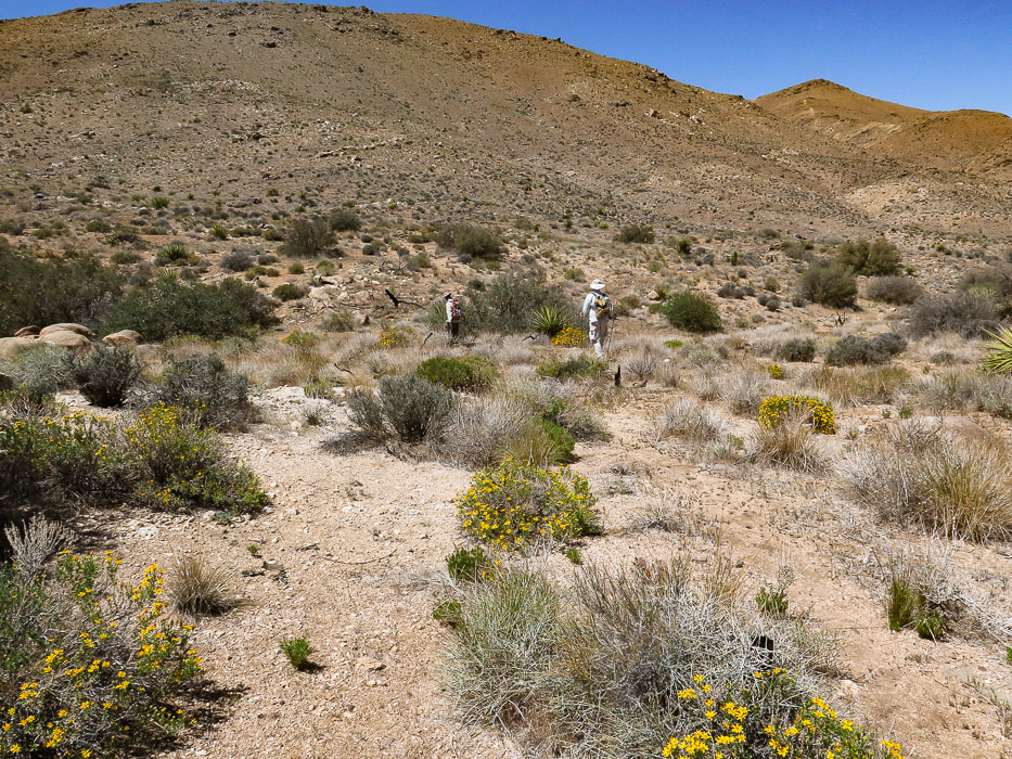
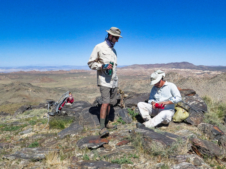
The SNRT is an 8.3-mile trail that is part of the panoramic Tushar Skyline Trail stretching 23 miles and passes under Delano Peak, the highest mountain in southwestern Utah. It takes you through streams, meadows, and forests. In 1986 and 1988, 25 mountain goats were introduced into the Tushars from the Wasatch range in northern Utah and Olympic National Park. They have prospered to number 120 goats, and some have been transplanted to other areas. They can be seen on the Delano-Holly ridge line. We entered the SNRT where it intersects with FR 123, ~ 1 mile south of Delano Peak trailhead and hiked toward Mt. Holly's base. The high Tushar's grassy slopes don't appear intimidating; no major cliffs or talus slopes. By this time, the clouds had retreated from the high ridge, but we decided to enjoy a rambling hike rather than a climb up Mount Holly. Ah, maybe we are getting soft in our "old age"!! Any time out in the wilderness, whether we get to our planned destination or not, is cherished.
"Why do they say we’re over the hill? I don’t even know what that means and why it’s a bad thing. When I go hiking and I get over the hill, that means I’m past the hard part and there’s a snack in my future."
- Ellen DeGeneres
Keep On Exploring! Keep Moving! Your Body and Mind will Love you for it!
For the Geocurious: Volcanos and the creation of Uranium
Just east of the Tushar Mountains, the Mount Belknap Volcanics erupted radioactive lava flows and ash-flow tuffs (rocks of consolidated ash) ~ 21 million years ago. Unique geologic processes then created the uranium deposits that formed in a shallow water vein system in the Central Mining Area near Marysvale, a short distance from the Tushars. The veins formed 19 million years ago above a magma chamber, filling in open spaces and fractures with fluids rich in fluorine, molybdenum, and uranium. Hydrothermal fluids and rock reacted to precipitate uranium. Nine mines in the Central Mining area produced uranium. Because of decreased demand for uranium, Utah's mines were closed before 2000. 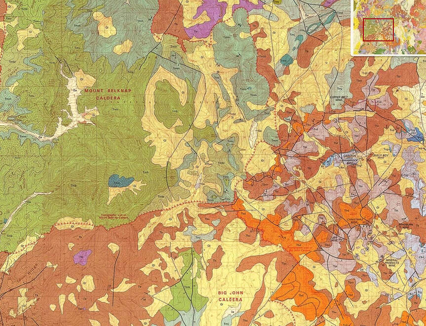
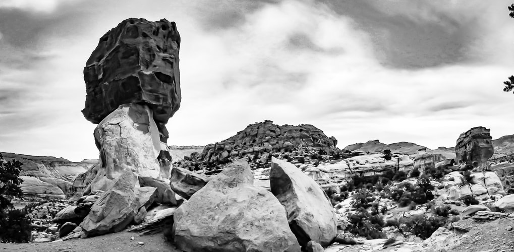
A small part of the geologic map of the Tushar Mountains that shows rock units and structural features of the highest part of the range.
click on photo for complete geologic map of the Tushar Mountains
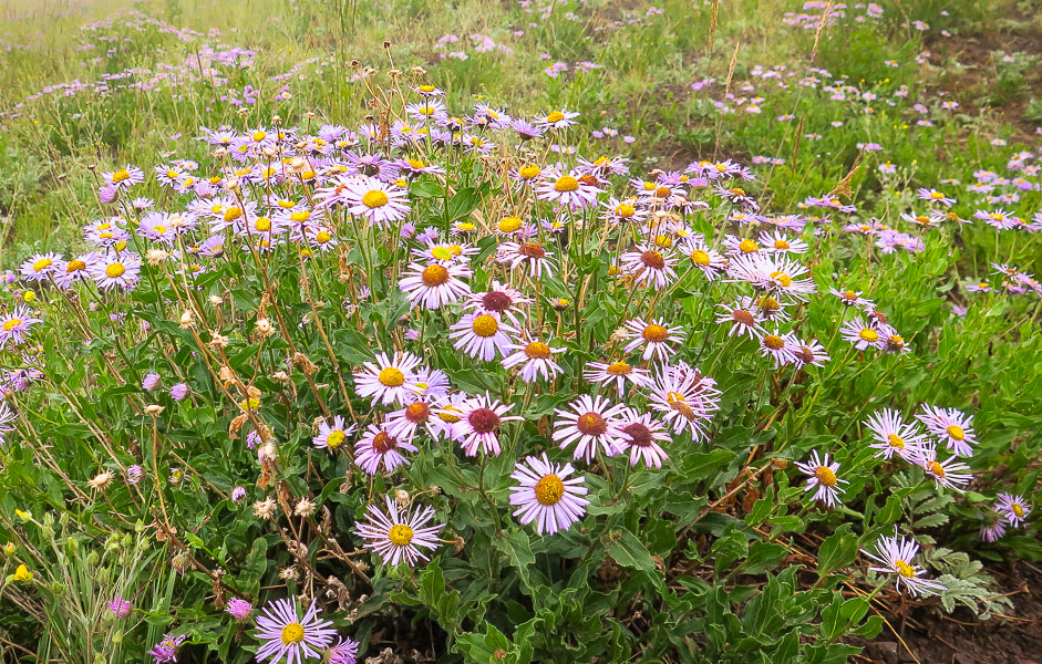
Fleabane
Liking the cool moist air!
Are you sure this isn't Scotland?
Nearing Delano Peak's summit.
Looking down from near the summit.
Clouds beginning to clear on the lower hike down.
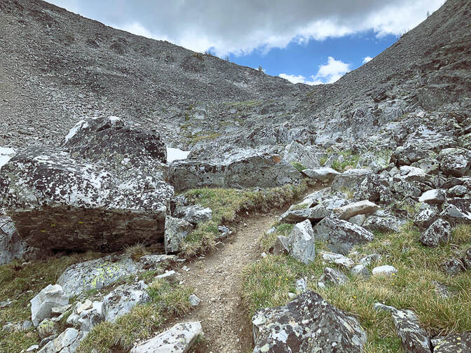
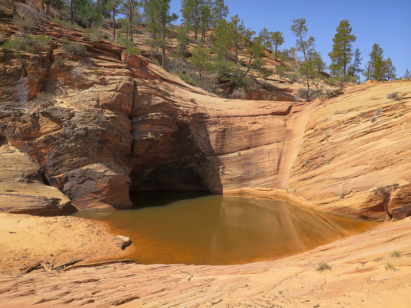
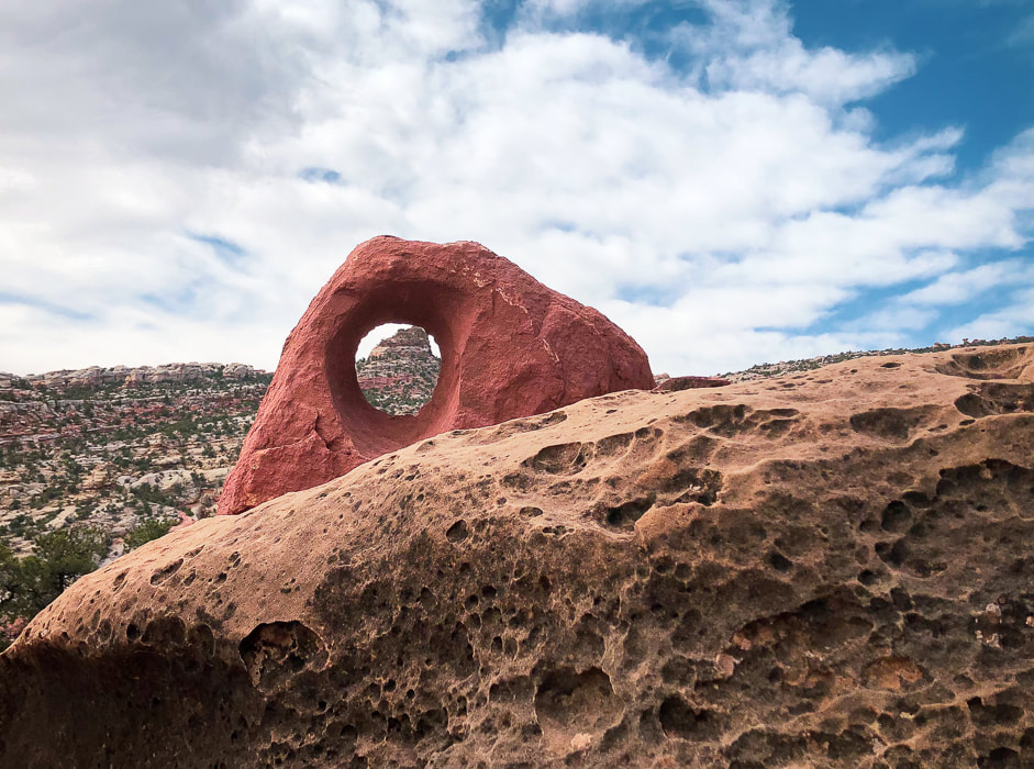
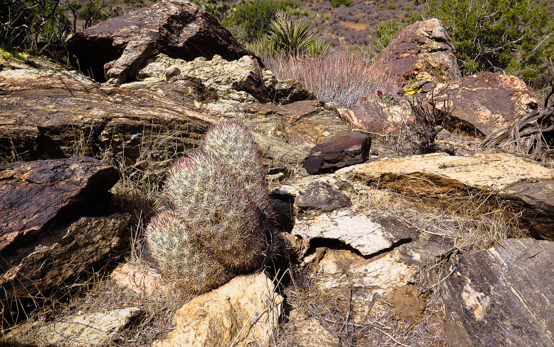
Some cool stuff on the trail.
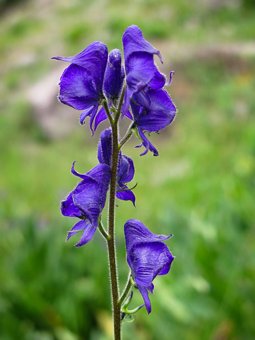
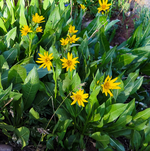
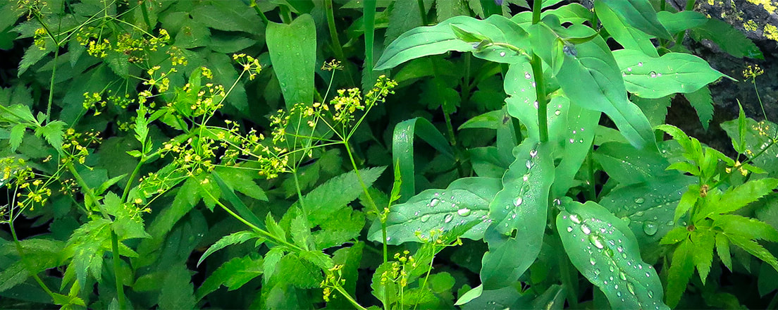
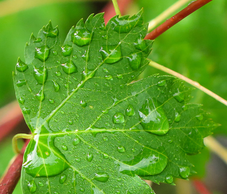
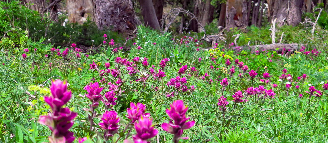
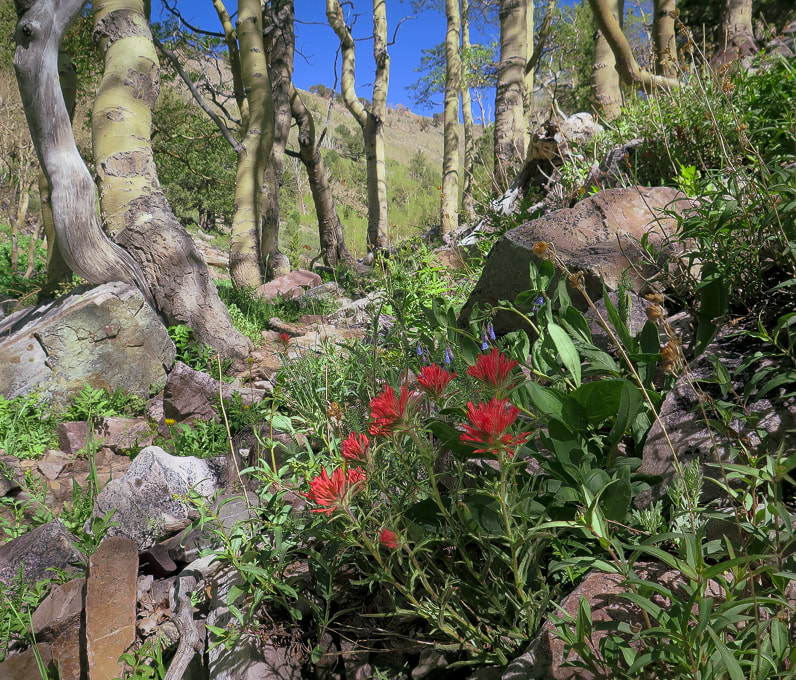
Columbian monkshood found near small streams.
These wildflowers like to grow in rich, moist soils - water use is high. They are poisonous to humans if ingested. 
Skyline National Recreation Trail heading southeast toward Mt. Holly on right horizon.
Google Earth image of our GPS tracks to Delano Peak. North points to the top left of the photo.
Caltopo image of our GPS tracks: North points to top of photo. Mount Holly located on ridge lower right.
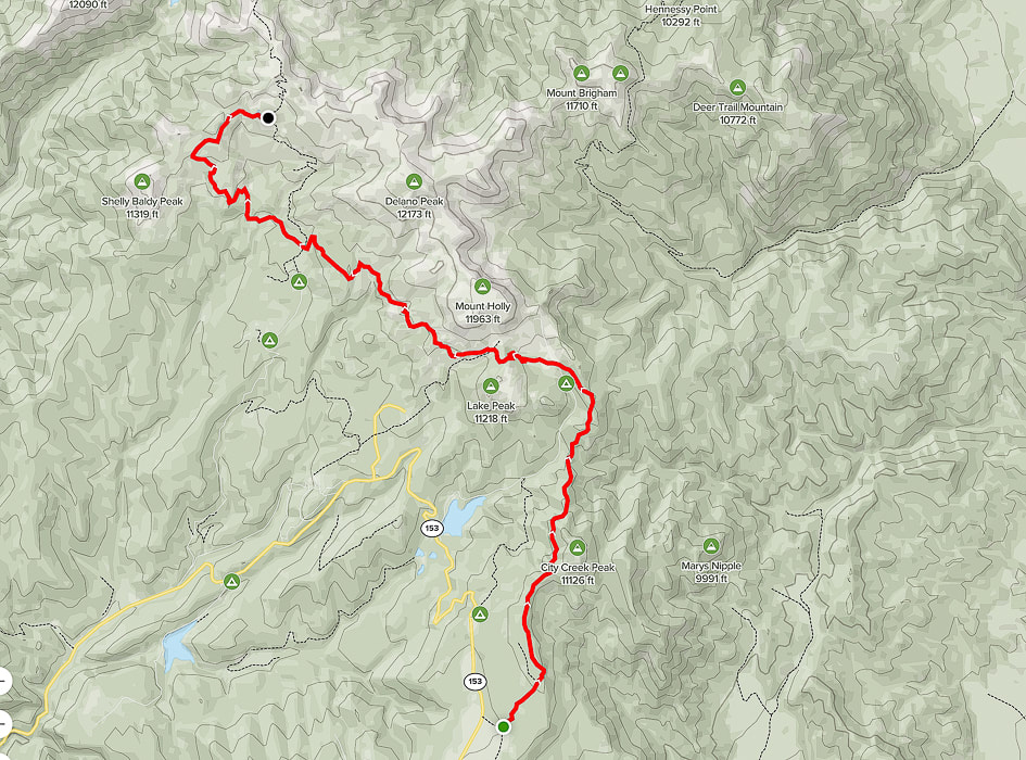
AllTrails map with GPS tracks on the Skyline National Recreation Trail: Big Flat Trailhead (south) to Mud Lake (north).
click on map for link to AllTrails website.
References:
Cunningham, C.G., Rasmussen, J. D., Steven, T.A., Rye, R.O., Rowley. P.D., Romberger , S.B., Selverstone. J. 1998. Mineralium Deposita, 33:477. Delano Peak - Wikipedia Geologic map of the Tushar Mountains and adjoining areas, Marysvale volcanic field, Utah. USGS National Geologic Map Database. Mindat.org. Marysvale Mining District. Plant Database: Aconitum columbianum. The University of Texas at Austin website. Ringholz, R. C. Uranium Mining in Utah. Utah History Encyclopedia. Steven, T. 2013. Igneous Activity and Related Ore Deposits in the Western and Southern Tushar Mountains, Marysvale Volcanic Field, West-Central Utah: USGS Professional Paperback.
2 Comments
Follow Freeman Creek in the lush Beaverhead Mountains to a high pass on the Idaho/Montana border to look over Upper Miner Lakes, still partially covered by snow in July.
Standing on the Continental Divide - Montana/Idaho border overlooking the highest of the Upper Miner Lakes and Sacajawea Peaks across the lake.
Related in Explorumentary
Alpine Peak, 9,861': Sawtooth Mountain Wilderness - Never Stop Climbing Mountains Leatherman Peak, 12,228': On Top of Idaho Mackay Peak, 10,273', and Mackay Mine Hill Tour - Idaho Reward Peak, 10,074' via Upper Redfish Lakes - Sawtooth Mountain Wilderness Complete list of Idaho hikes on this website Upper Redfish Lakes Cross-Country Hike - Sawtooth Mountain Wilderness Moving Makes You Feel Better: The Latest Research
Overview
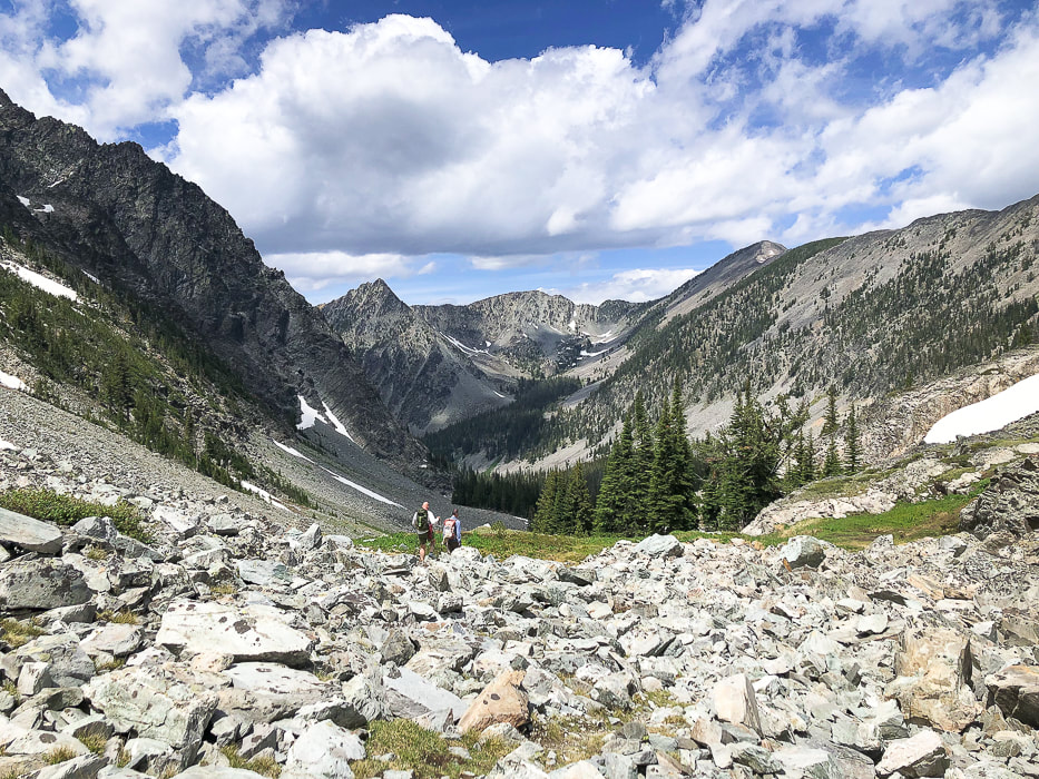
The Freeman Peak Trail (#6033) out of Carmen, Idaho, just north of Salmon, follows an old mining road past the climbing route to Freeman Peak's east flank, through a glaciated cirque to the 3,100-mile Continental Divide Trail on the Idaho/Montana border. The pass affords a "wow!" moment with a great view of Montana's Upper Miner Lake, 400 feet below, surrounded by snow-covered jagged mountains. During its almost 4,000-foot gain, this hike will take you from relatively dry and sparse woodlands, through a lush forest with water tumbling over the trail, to alpine tundra above tree line. Rain storms the past few days seemed to leave water everywhere: white water rumbled in Freeman Creek and drops of moisture dotted leaves. Freeman Peak dominates the Salmon skyline to the northeast. The Salmon-Challis National Forest is a pretty incredible place. It's one of the largest national forests in the lower 48 states. It contains most of the land mass of the second-largest wilderness in all of the U.S., named Frank Church River of No Return Wilderness. The Middle Fork of the Salmon River runs unrestricted through this wilderness - "perhaps the best river trip in the world" - according to the website, Whitewater Guidebook. Our trip to escape southern Utah's searing heat included a climb up the Wasatch range's highest summit, Mount Nebo on the way up to Salmon, Idaho. We were familiar with this "neck of the woods" since we had spent 20 fantastic years living in Boise, and had done many hikes in Idaho. We stayed at a wonderful Carmen Airbnb that had beautiful horses and green pastures.
Our Hike
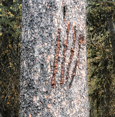
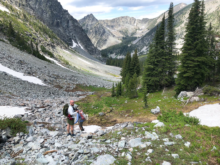
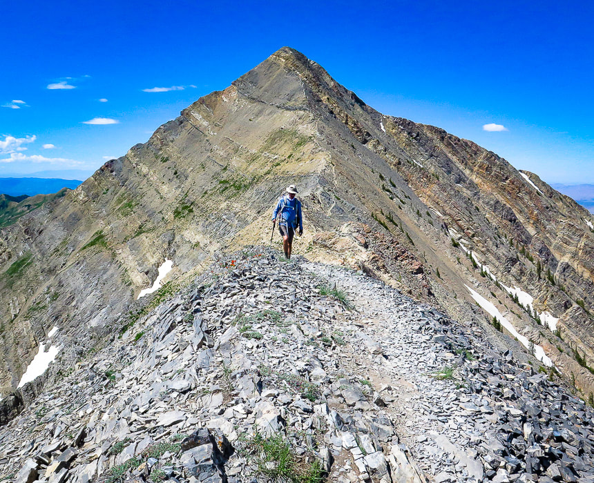
Trailhead to cabin at base of Freeman Peak - 4.6 miles To avoid driving on the steep, narrow access road along Freeman Creek, we parked at the "flat" intersection of Freeman Creek Road and a road that heads due south toward Golway and Kirtley Creek (three miles after taking a right off of Carmen Creek Road). You can drive up further than we did, and we saw a small pick-up parked higher up on the way back, but it gets pretty narrow. Our walk took us quickly to Freeman Creek rushing noisily beside us, thick vegetation blocking our view of waterfalls. The road/trail climbs steadily east-northeast with one good view of the small stepped waterfalls in Freeman Creek. As with many mining roads in Idaho, it traverses a large talus slope, flattening its base as it goes, and then enters the dense forest. We met Eric, a hiker that caught up to us while we took a break. He had his bear spray canister mounted on his pack's chest strap. We had seen bear claw scratches on one tree (see below). He ended up hiking with us the rest of the way in this bear country - safety in numbers! He was a great hiking companion and he said his wife felt better knowing he was with other hikers. Run-off from side creeks flowed over the road for a few stretches. The looming point of Freeman Peak comes into view through the trees. A sturdy log cabin sits at its base looking at the steep, snow-filled couloir, the daunting route up Freeman Peak. According to a hiker we met on the trail who had summited it a few times, it's better to climb it with someone who has done it before. It seemed a bit much for me, but I could be talked into trying Freeman Peak with a guide. Tom Lopez, in his book Idaho: A Climbing Guide, states that "This route involves sustained Class 3 climbing and route-finding difficulties. The route can be very slippery when wet or icy." Ore Cash Mine, extracting gold from 1897-1912 is near this site. Cabin to Continental Divide at 5.9 miles The road continues past the cabin, ending at tree line. From here, hiking toward the lowest point on the horizon (the pass), we eventually found a trail that ascends to the pass for ~ 0.5 miles. We picked our way through this alpine terrain strewn with rocks and low-profile wildflowers, including one of my favorites, Western Moss Heather. It also grows on the slopes of Alpine Peak in the Sawtooth Mountain Wilderness. It was great to have Eric hiking with us because we got another source of encouragement. The view we three saw from the Continental Divide was about as picture-perfect as you can get. We stood on packed snow overlooking a small steel-blue lake surrounded by the Beaverhead Mountains, with snow clinging to steep talus fields and couloirs, the clouds reflecting in the water. The actual Continental Divide Trail avoids these high peaks and steep terrain; it heads in an easterly direction just north of Freeman peak to traverse by lakes. In Summary.... There's a feeling of celebration when you head back to the trail head, a subconscious bonding with your fellow hikers. Inspiring scenes, camaraderie and movement combine to create a certain elation, not to mention the good brain chemicals that are released during exercise in nature. Movement makes you feel better! On our way down the alpine valley, most of the clouds had drifted away, and the forest we had ascended was now illuminated by the sun. It's one of those transient scenes - a fleeting moment of time that I add on to all of the treasured memories I have accumulated while feeling so small in the grandeur of the American West.
"I never knew a man who felt self-important in the morning after spending the night in the open on an Idaho mountainside under a star-studded summer sky."
- Frank Church, former U.S. Senator from Idaho, instrumental in creation of Idaho's River of No Return Wilderness in 1980.
Stay Curious! Keep On Exploring!
For the Geocurious: Ore Cash Mine
This trail gets close to the remains of cabins and some equipment of the Ore Cash Mine. Gold was the primary mineral mined from Oro Cache Mine (on map called "Ore Cash" mine) between 1897 and 1912. The host rock was quartzite (metamorphic quartz sandstone) of neoproterozoic age (1/2 to 1 billion years ago). The deposits were from four veins; the Oro Cache vein was 4-6 feet wide in a shear zone (zone of strong rock deformation). There were 9 adits that became inaccessible in 1976. 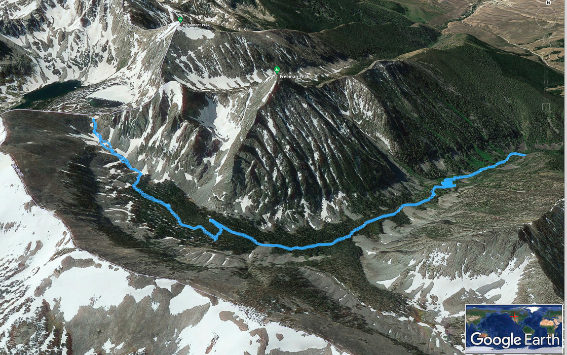
Our GPS tracks on Freeman Peak Trail, trailhead to the right, trekking around the base of Freeman Peak to the Continental Divide on left side of map. North points toward bottom of photo. Salmon, Idaho is in valley to the south, at top right in photo.
Freeman Creek
Freeman Creek in July!
Water flowing over trail in a few places.
Some cool stuff on the trail.
Reaching the pass at the continental divide; Montana's Upper Miner Lake below.
Heading back toward Freeman Creek head waters.
Western moss heather
Sue and Fred on the way down towards remains of Ore Cash Mine.
Looking northwest to Copperhead Peak (right horizon) - another peak seen from Salmon, Idaho.
Click on interactive map of our GPS tracks.
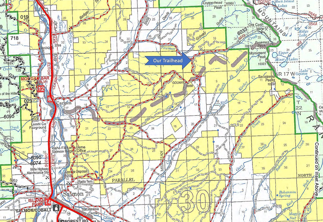
Map of roads from Salmon, Idaho to our trailhead.
from Salmon-Challis National Forest, Idaho - Visitor Atlas 2020. 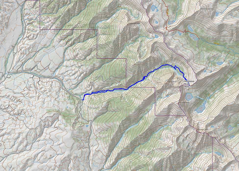
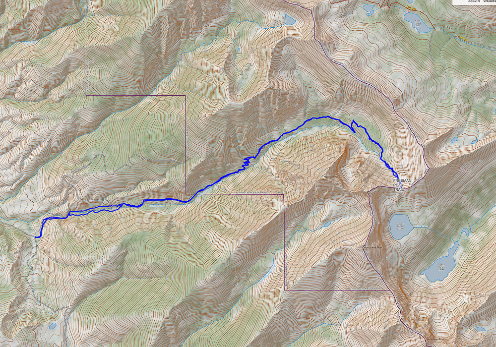
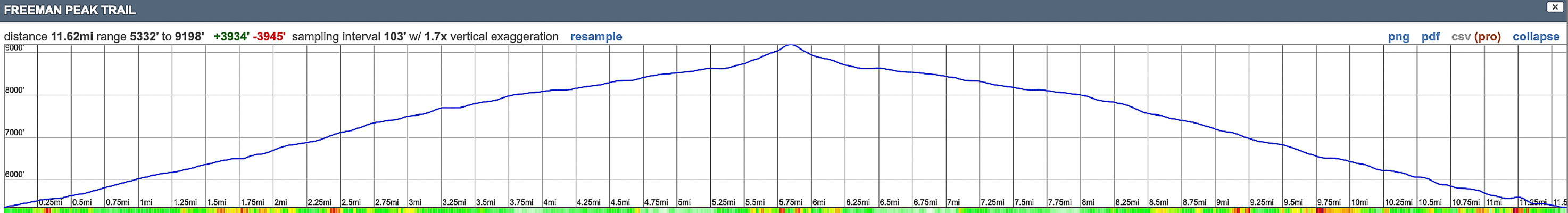
Our GPS tracks and elevation profile for Freeman Peak Trail hike. North points to top of map. Trail head on left; Continental Divide (Idaho/Montana border) on right.
One of the "ultra-prominent peaks" in the lower 48 states, this excellent hike treks through blankets of wildflowers, up a steep slope and across a long, thin ridge to the summit of the Wasatch Range's highest peak.
Fred walking over Wolf Pass Peak, with Mount Nebo behind him. Actual summit is just behind the high point in the photo.
Related in Explorumentary
Utah Hikes: List and Links Utah's Red Rock Country Moving Makes You Feel Better: The Latest Research Experiencing "Flow" - The Secret to Happiness
Maps and Apps: Trails Illustrated Wasatch Front South #701, AllTrails track.
Weather forecast: mountain-forecast.com Date Hiked: July 6, 2022. Directions to trailhead from Nephi, Utah: From the town of Nephi, take UT 132 (I-15 exit 225) east. Drive 4.8 miles from I-15 to Mount Nebo Scenic Loop Road (FR 015), take a left. Drive 13.4 miles to junction of Mona Pole Road (FR 160), at Monument Trailhead. Take Mona Pole road - drive 0.4 miles on good dirt road to parking area on left. Geology: Mount Nebo is comprised of the Oquirrh Formation: interbedded limestone and sandstone.
Overview
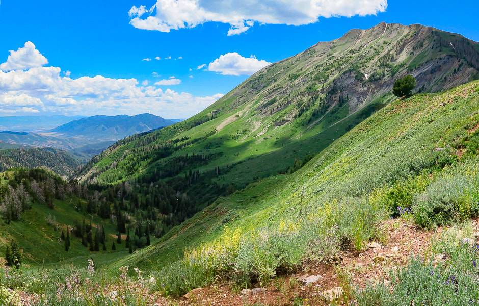
Mount Nebo, a towering bare hunk of tilted limestone, is aptly named to mean "Sentinel of God" by early Mormon pioneers. You can't miss this impressive-looking mountain that dominates the Nephi (pronounced NEE-fy) skyline, close to Utah's I-15. Some people think Mt. Timpanogos, another impressive peak near Provo, is the highest in the Wasatch range; however it is 179 feet lower than Mount Nebo. I was advised by a sales associate at The Desert Rat, St. George's outdoor specialty store to NOT summit Nebo via the southern route, Nebo Peak Trail. After telling me to hike the North Peak Trail, its trailhead north of Mount Nebo, he said, "You should probably see some great wildflowers." He was right on both accounts: the trail was great and profuse wildflowers of every color covered the forest understory. The trailhead is at 9,254 feet and the summit is 11,928 feet. However, you lose elevation on the way to the summit and gain elevation on the way back, making the cumulative gain 3,700 feet. The trail passes over Wolf Pass Peak (Point 11,440') first before it tackles the great pyramid-shaped Mount Nebo. There's a really steep pitch on Wolf Pass Peak's northeast slope. It's short switchbacks make for a heart-pounding climb of over 800 feet in just 0.4 miles. Glad I had my hiking pole for the way down! We hiked Nebo on a weekday and ran into four other parties. I imagine this is a busy trail on weekends. But that would not deter me - this hike is fantastic! Mount Nebo is #39 out of 57 ultra-prominence peaks in the lower 48 states. To qualify as"ultra-prominence", the summit of a peak has to rise at least 1,500 meters (4,921 feet) above its key saddle, which is the lowest contour that encircles it, and no other peak.
Our Hike
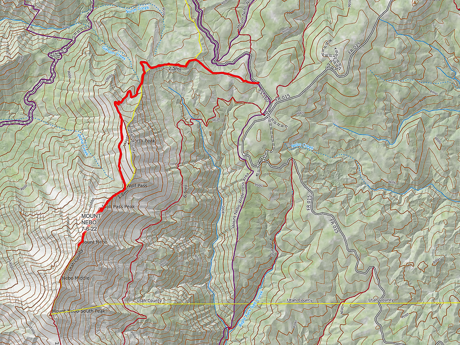
North Peak Trailhead to Wolf Pass: Miles 0 - 3.5 with a 1,350' gain We began our hike at 7:20 a.m. to ensure we would be off the most exposed part of the peak around noon. The North Peak Trail ascends through a lush forest with lots of wildflowers and vegetation spilling over to arrive at a bare avalanche area where we crossed a small snow field and continued steeply up to a saddle on North Peak's north ridge for the first incredible view of Mount Nebo. You also get a great view of Juab Valley and Mona Reservoir to the west. From here, the trail splits in 0.2 miles to the left to summit North Mountain. Keep right on the main trail to traverse North Mountain's shady west flank to arrive at Wolf Pass, just south of North Mountain. Here's a place with great views to both the west and the east, and an opportunity to rest a bit before tackling Wolf Pass Peak.
Wolf Pass to Mount Nebo summit: Miles 3.5 - 4.5 with a 1,300' gain
I felt quite small standing on Wolf Pass, an immediate 800 feet of climbing staring me in the face. We put our heads down and used a modified rest-step to get up this steep and rocky pitch efficiently. We use this technique for long, steep pitches, especially at elevation to save energy: use momentum to kick your foot forward while keeping back knee straight - rest a second and repeat with other leg, going in a measured, rhythmical gait, not over-using your quads or glutes. Before topping off on Wolf Pass Peak, we followed a trail going left, traversing just under the summit for a short distance. We had to scramble back up to the ridge just after the summit. We avoided that on the way back and just stayed on the ridge over Wolf Pass Peak. The walk on the ridge to Mount Nebo's summit was divine. A feeling of being on the top of everything else in the region with steep basins and canyons with names like Hell Hole, Middle, North and South Basin dropping for a long way on both sides. Occasional scant stands of scraggly trees line a few steep couloirs. The ridge trail is wide and stable enough so it doesn't feel precarious or scary. As soon as we reached what we thought was the summit, suddenly there was the "true" summit just behind it, only about 40 feet higher. The summit is narrow and long, a trail leads to the next high point to the south, Nebo Middle and then after that, Mount Nebo South Peak. The summit register consisted of a glass mason jar stuffed with sticky notes with lots of names, dates, and comments. A couple of things were remarkable about the descent. The first was Wolf Pass Peak's steep, rocky pitch - it reminded me of a short version of Mt. Borah's (the highest peak in Idaho) descent - steep and slippery. The second was the abundant wildflowers, reminding me of Colorado hikes. We didn't know that Utah's high country could be so beautiful. Our adventure possibilities have just expanded - again. Wouldn't it be great if the years of our lives expanded accordingly? I guess the key is in living in the moment and fully appreciating that we have the ability to get to the "top of the world" and see Indian paintbrush splash the forest with magenta.
"So, if you cannot understand that there is something in man which responds to the challenge of this mountain and goes out to meet it, that the struggle is the struggle of life itself upward and forever upward, then you won’t see why we go. What we get from this adventure is just sheer joy. And joy is, after all, the end of life. To struggle and to understand. Never the last without the first. That is the law."
- George Mallory, mountaineer who climbed with the first three British expeditions to Mt. Everest in the 1920's.
Keep on Moving! Keep on Exploring!
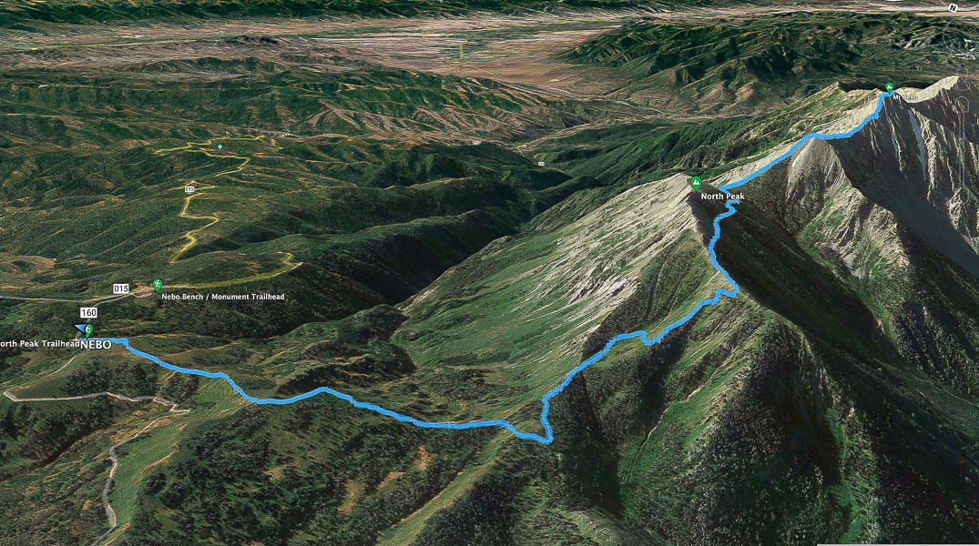
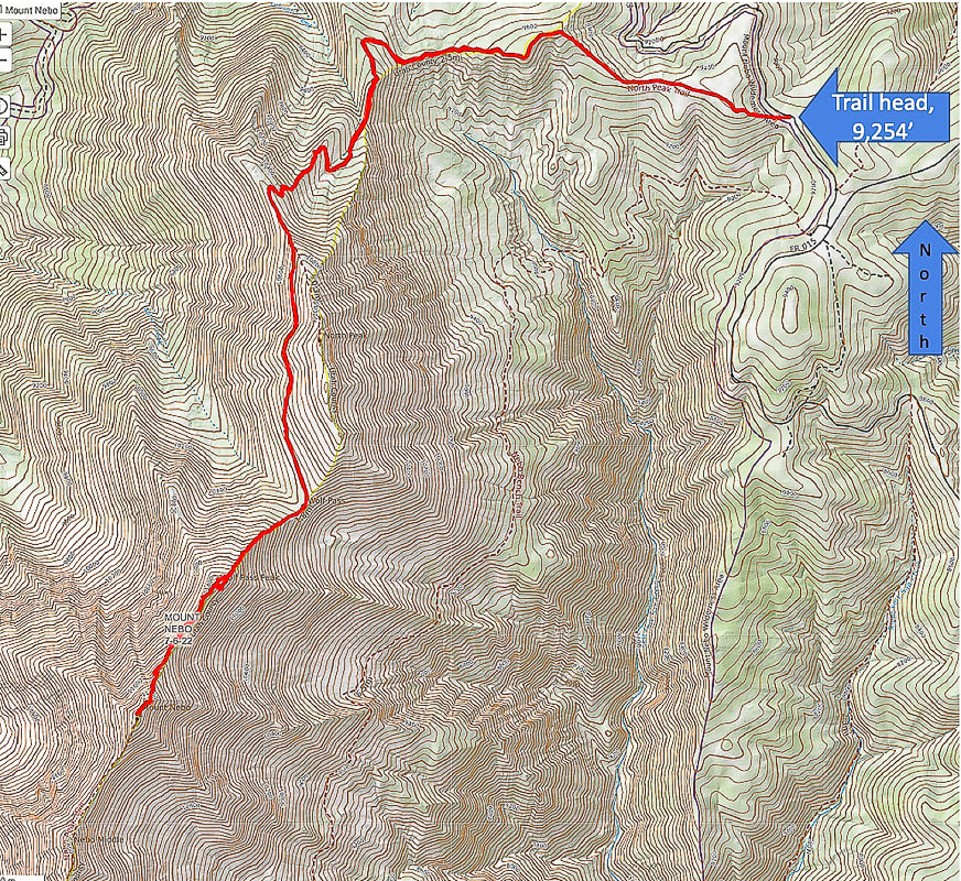
Google Earth image of our tracks heading from North Peak Trailhead west to ridge, then south to Mount Nebo summit on the right. Mount Nebo Scenic Loop road (015) approaches trailhead upper left. South points to the upper right.
View of Mount Nebo from Mount Nebo Scenic Loop Road.
Indian paintbrush
Gorgeous summit!
On Mount Nebo's summit looking east.
Heading back - trail goes over the top of Wolf Pass Peak (Point 11,440').
Some cool stuff on the trail.
On the way down
North Mountain from near the trailhead.
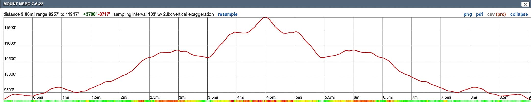
Our GPS tracks and elevation profile for Mount Nebo.
This short hike to the fifth most prominent peak in Nevada rewards you with solitude and a dramatic view of Wheeler Peak and eastern Great Basin mountain ranges and valleys.
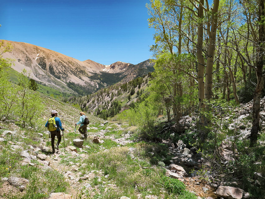
Approaching Schell Creek Range summit ridge just under North Schell Peak.
Trailhead directions from Summitpost.org: From Ely, drive north on US 93 to McGill. From McGill, drive north on US 93 about five more miles, then turn right onto NV 486. Drive east on NV 486 through the Gallagher Gap, then south through a valley. After about eight miles, turn left onto the signed Forest Road 425 to Timber Creek. Drive east on Forest Road 425 about four miles to the Timber Creek Campground. The road is blocked off a short distance past the campground.
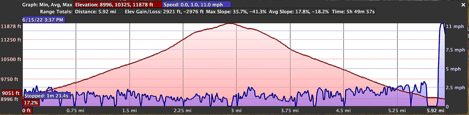
Difficulty: Moderate Class 1-2 on discernible but unmarked trail; scrambling and easy route-finding on firm talus. Coordinates: Trailhead = 39.40025 -114.61907. Summit = 39.41332 -114.59959. Maps and Apps: (see our tracks below). Avenza High Schells Wilderness, Humboldt-Toiyabe Wilderness - USFS, Stav Is Lost's hike description, USGS topo map Date Hiked: June 15, 2022.
Related Posts:
Our GPS tracks for 6.2 miles out and back to North Schell Peak.
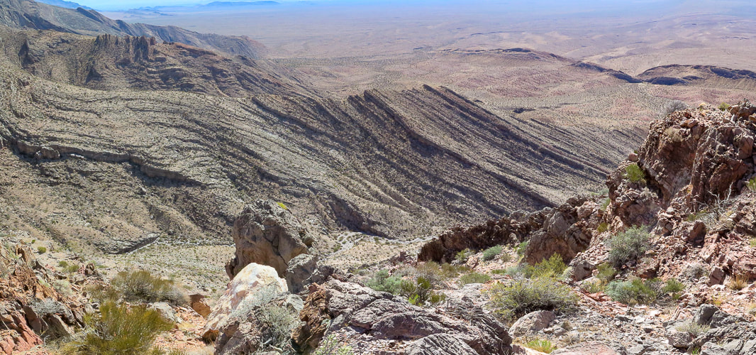
Nevada is a remarkable state for many reasons - Las Vegas is the "Entertainment Capital of the World", and Elko sponsors the National Cowboy Poetry Gathering. It also contains the most mountains of any state, most arranged in long parallel north/south trending ranges, with low valleys in between. The forces that made the earth spread starting 50 million years ago produced normal faults that formed horsts and grabens, making parallel valleys and raising mountains so we can hike them today. This spreading and faulting has doubled the width of Nevada in those millions of years.
Our Hike
After an early morning drive from Ely to the south, we passed a few primitive campgrounds along the good forest road whose end is the trailhead and a brown kiosk signboard. Start walking on the road after parking. It turns north (left) into a discernible path that ascends an aspen-forested valley and stays near the stream, crossing it a few times. The aspen forest opens to the head of this creek and North Schell's western talus/grass slopes. The trail, not marked is easy to follow. Once we got to the head of the creek and the end of the dirt path, we took the steeper, rockier and shorter way to Schell Creek ridge, taking more of an acute right-hand turn heading east/southeast than we needed to. When we descended, we stayed further north, following the grassy areas as much as we could just under the ridge to avoid the prolonged talus slopes (see map of our tracks, below). The talus slope was filled with patches of abundant and robust wildflowers - mats of phlox and buckwheat. We headed to the saddle left (north) of the dark North Schell summit and encountered freezing winds which required a slight wardrobe change into windbreakers and warmer hats (or no hats!). A short walk on the ridge brought us to the summit block. When we reached the summit, walking on a path through the rocks, wind was no longer a problem. We identified Wheeler Peak in the Snake Range - the next parallel range to the southeast. The Schell Creek range ridge south to the next high points - one of them Middle Schell Peak, looked inviting; follow it and you can walk on top of eastern Nevada for a few more miles! The eye-catching view on the way down is that of the cirque above the headwaters of Timber Creek to the south. Its U-shaped valley and the peaks above it look inviting. We passed a few small snow patches in the grass/talus and then easily located the path along the creek to head back to the trailhead. Val and John are training for Mt. Idaho, Idaho's seventh tallest peak. Fred and I just hiked Mt. Nebo, the highest peak in Utah's Wasatch range. Maybe we go a little bit slower than the 20-somethings, but we can get to the "top of the world" and savor it, if just for a few moments.
"The greatest danger in life is not to take the adventure."
- George Mallory, took part in the first three British expeditions to Mt. Everest in the 1920's.
Never Stop Climbing Mountains! Keep On Exploring!

Low-profile and abundant wildflower gardens - phlox and buckwheat.
Fred approaching summit.
Looking at North Schell Peak from under its saddle.
Summit celebration!
Some cool stuff on the trail.
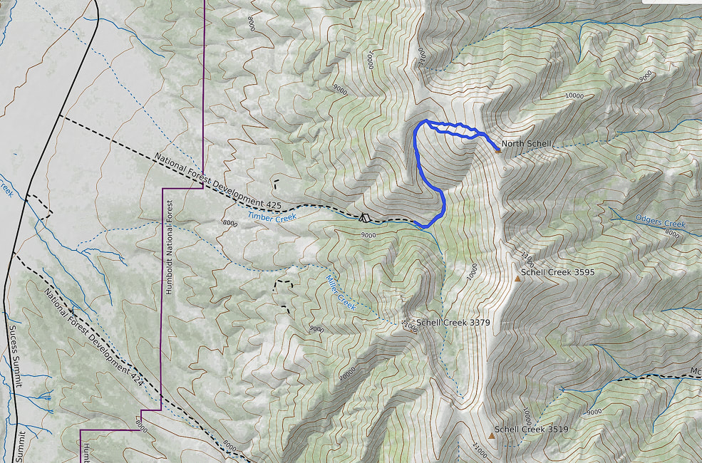
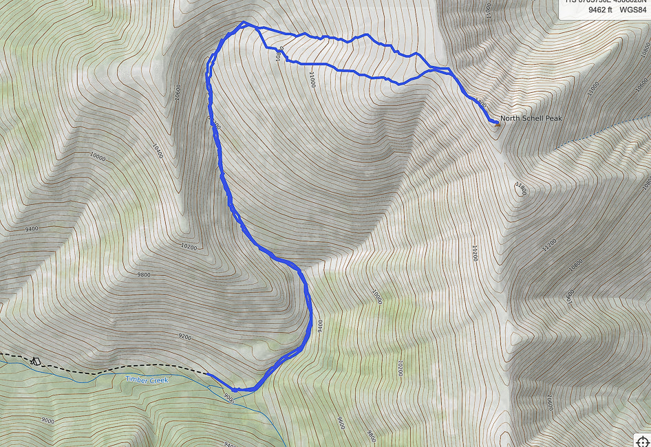
Our GPS tracks from trailhead (south) to North Schell Peak. The southern-most route was our ascent. The northern route was our descent; it avoided much of the continuous talus we encountered on our ascent.
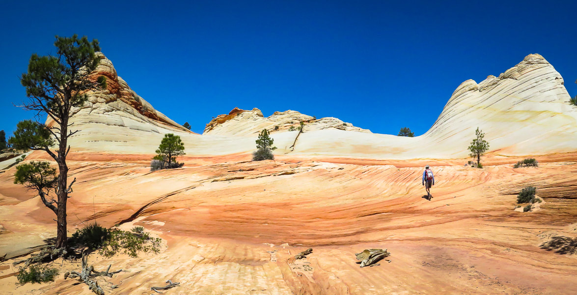
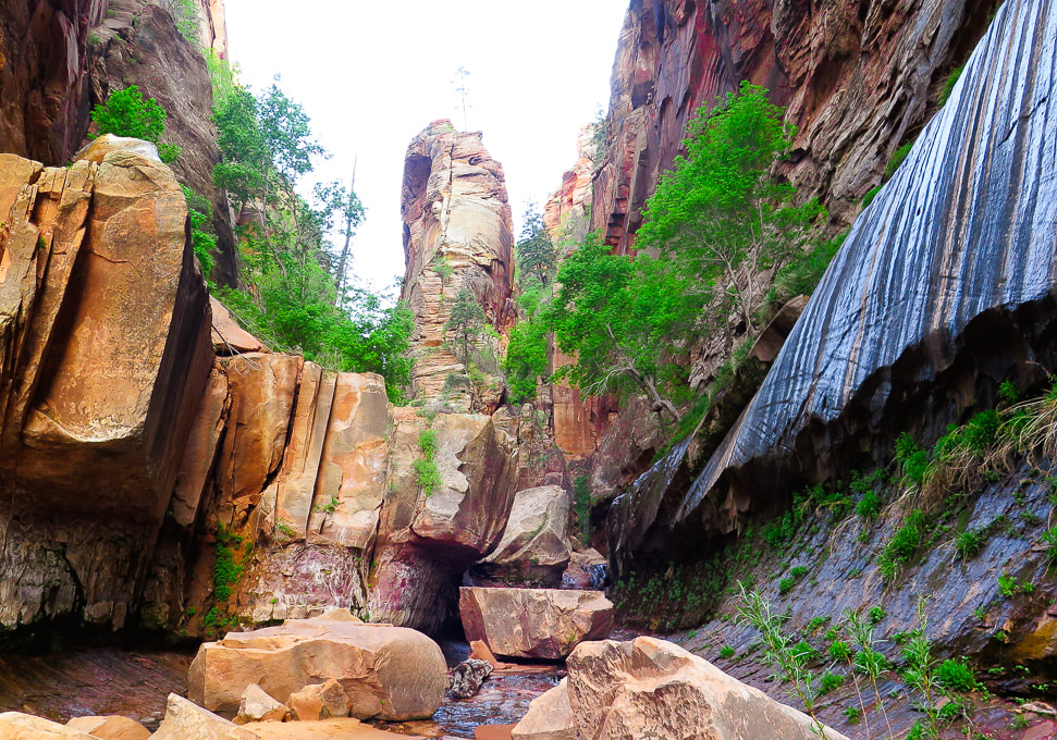
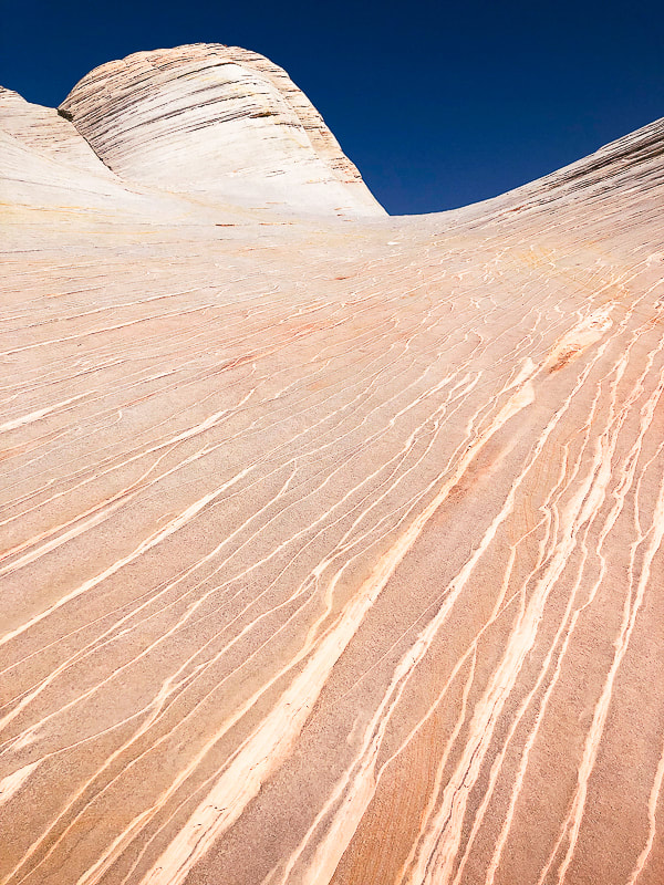
Walk on the surreal slick rock of White Domes, near the top of Canaan Mountain as you climb out of Water Canyon. This is a an extraordinary hike in a gorgeous, remote and rugged wilderness.
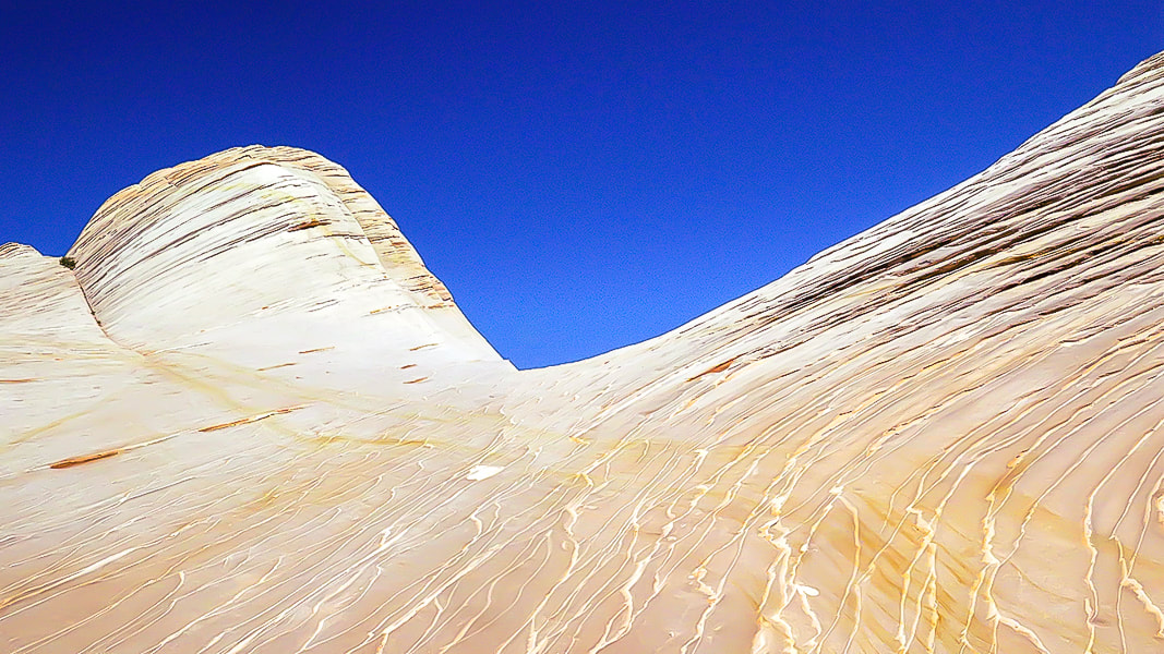
White Domes - Canaan Mountain, Utah
Related in Explorumentary:
Canaan Mountain via Squirrel Canyon Utah's Red Rock Country Southern Utah Hiking and Biking in a Pandemic: Wire Mesa, Snow Canyon, Zion National Park Mt. Kinesava Hike - Zion NP Angels Landing in Zion - Not for the Faint of Heart Utah Hikes
Coordinates: Trailhead = 37.03681, -112.95364. White Domes = 37.06259, -112.98348.
Maps and Apps: (See topo maps of our trail at end of post). USGS 7.5 min topo, Hildale, Utah-Arizona, AllTrails White Domes via Water Canyon Trail, Avenza and physical map of St. George, Springdale, Hurricane & Zion NP, Utah by Adventure Maps, Inc. Link to Zion topo Map of Canaan Mountain Considerations: Take GPS coordinates when you top off out of Water Canyon so you can return to the same point to descend. Once on the plateau, experience with navigation using physical topo maps as well as smart phone apps is advised; trails are not marked and "social trails" go in various directions. There are limited openings through the Water Canyon cliffs, so you must return to the same point at which you entered the wilderness above the cliffs. Allow enough time to get off the mountain. Date Hiked: May 8, 2022. Directions to Water Canyon Trailhead: From Hwy 59 in the border town of Hildale, Utah, turn left on Utah Ave., which heads 2 miles east before turning north (left) onto Canyon St. In less than a mile, turn right at the intersection of Maxwell Canyon Rd. and Water Canyon Rd. Follow this dirt road for another 2 miles to park at one of two parking lots at the trailhead. Can be treacherous driving on this road if it is wet. Geology: Block of Navajo sandstone originally deposited on the continent of Pangea, which included today's North America, Africa, Europe, and South America, existing as a single continent. Sand was wind-blown and deposited in a huge sand sea - creating the petrified sand dunes seen in many Utah state and national parks. The parallel sand layers are cross-beds: the inclination of the layering was caused by aeolian (wind-blown) sand, migrating down-wind. Related:
Overview - Canaan Mountain Wilderness
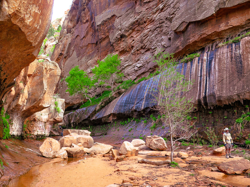
Navajo Sandstone cliffs, 2,000 feet high, surround Canaan Mountain on three sides, making this an exceptional wilderness with limited access. The landscape is always interesting and gorgeous; around every corner, atop every plateau and rising up out of sandy washes are the various landforms sculpted by wind, water and ice erosion. The red and orange Vermillion Cliffs form its base. The cream, yellow, red, orange and white colors compliment greens of scattered ponderosa and pinyon pines, scrub oak and gambel oak, creating a striking color palette. Cross-bedded cliff walls, pinnacles, domes, slot canyons, hoodoos, natural arches, ledges, open slickrock, waterfalls, seeps with hanging gardens, and carved pools are some of the things you see in this extraordinary land. It has only a few primitive routes, with one rocky and sandy 4WD road, the Sawmill Trail/Canaan Mountain Trail, a historic logging route that enters from the east. To us it is comparable in beauty to Zion NP, and we get to practice our navigation skills.
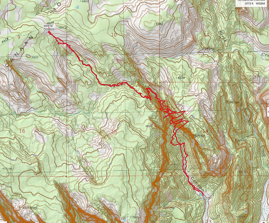
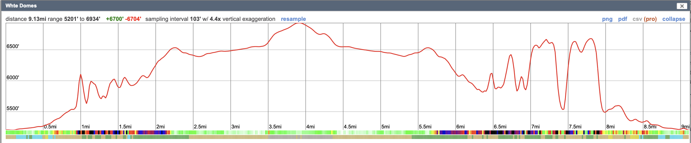
Hike Summary
Miles 0 - 2.2: Water Canyon trailhead to top of cliffs/entry onto mesa at "Top Rock". Miles 2.2 - 3.9: "Top Rock" through mesa to White Domes/Canaan Mountain Ridge. Fred and I got "temporarily bewildered", not exactly lost, when we attempted this hike a few years ago. We neglected to take a waypoint at our Water Canyon exit onto Canaan Mountain plateau's unmarked wilderness. We followed the wrong path and found ourselves further from the White Domes. When we decided to head back to the canyon rim, we took a waypoint just in case because there were a few paths there, but nothing marked - no cairns or signs. We came close to our entry at the canyon rim but missed it by a short distance. So, we returned back (one mile!) to our waypoint, carefully retraced our footsteps, and finally got back to our entry, the only way we knew to get back down. The lesson: when hiking in Southern Utah's canyon country, there may be only one entrance/exit point and it is crucial to know how to navigate back to that point when there is no marked trail. This wild and spectacular country is filled with numerous washes, pedestal rocks, slick rock, and boulders; it can turn into a maze where landmarks can look similar. This time we were ready, armed with AllTrails and Avenza maps, as well as our physical map. My Garmin GPS insured we were backtracking successfully. We took the crucial waypoint at Top Rock (see below). We followed Joe's Guide to Zion NP - Water Canyon and Canaan Mountain hike directions. Occasional rock cairns helped, too.
Interactive map. The large-amplitude swings in GPS tracks are the GPS trying to find satellites while deep in Water Canyon.
See more topo maps at end of post 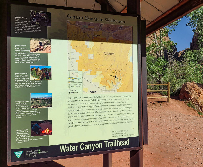
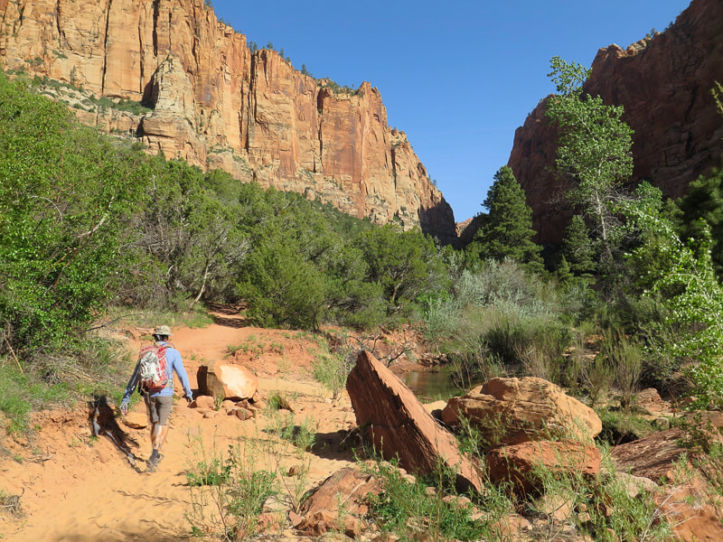
Starting out - Water Canyon to the right.
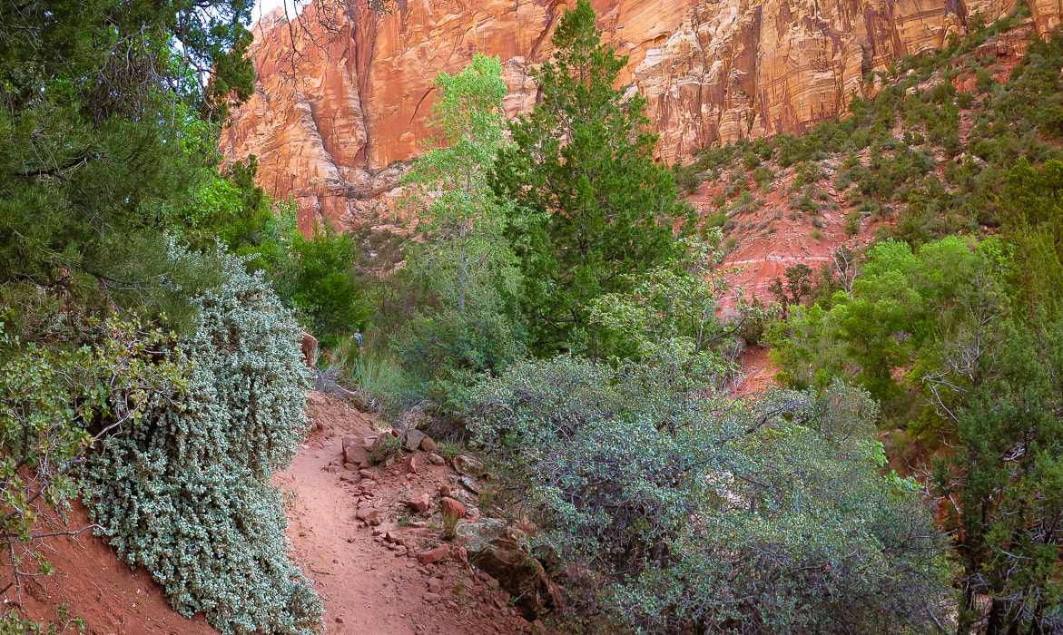
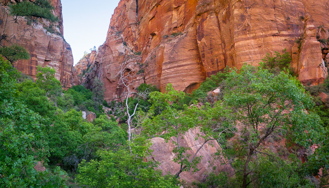
Climbing out of Water Canyon
Fred and I began trudging (at times) through sand, passing under canopies of pine and juniper to the picturesque waterfall section of Water Canyon. Here, the canyon is dark and narrow; walls drip water onto bright green leaves, and a series of small waterfalls tumble over sandstone. Long striped walls on both sides converge at a slot where you walk through the shallow stream. Just past this, at about one mile into the hike, you start to climb steeply up the west (left) cliffs of Water Canyon, passing more waterfalls, walking over a series of rock ledges, hoisting over boulders now and then, and even walking over a log propped against a ledge to gain access to the top of it. This trail to the plateau above is a masterfully-planned route through available ledges and passages with the canyon at times dropping steeply below to the right, but you won't feel overly exposed. There are some rock cairns to follow. At about 1.9 miles into the hike, the trail makes a U-turn and heads south to ascend the final wall to the opening into the plateau, and to Canaan Mountain Wilderness boundary. Impressive towering walls of cross-bedded sandstone seem close as the canyon widens. Shortly, "Top Rock" is reached - a large, weathered sandstone rock on a flat area (see Fred and I sitting on it, below). A few websites and topographical maps refer to this landmark as Top Rock. RECORD YOUR COORDINATES NEAR PLATEAU ENTRY - We recorded "Top Rock" coordinates for a waypoint.
Canaan Mountain plateau to White Domes
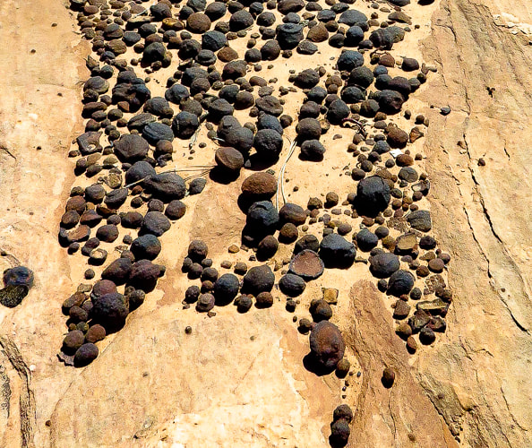
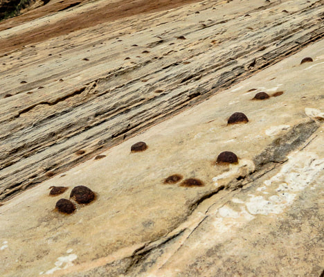
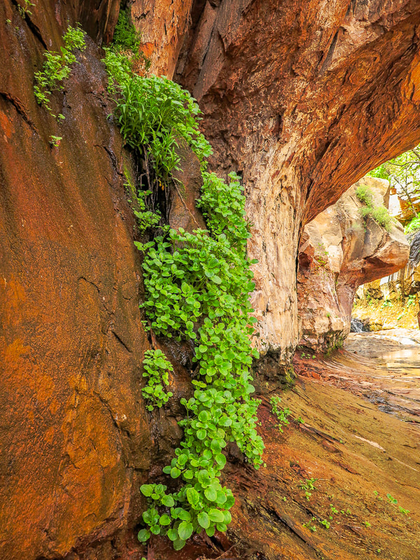
As you stand at Top Rock, the White Domes on Canaan Mountain's ridge to the northwest are 400 feet higher. We walked straight towards them, initially descending, finding a discernible path marked often by small rock cairns, hiking in a northwest direction. Our route took us through the forest, down through small drainages and short stretches of slick rock into a larger sandy wash (upper Water Canyon), where I placed some tree branches to mark our entry into the wash. We followed this creek west upstream for ~ 0.25 miles, going around a few dry waterfalls to their north (right) side. Reach a wide intersection between two washes; take the side wash to the right (NW) and follow it for ~1.0 mile to the domes. Walking over sand and slick rock is exquisite as you pass by sandstone walls and moqui marble collections - round sandstone balls coated with dark red or black iron oxide. As you near the top of this side wash, White Domes come into view - you exit the canyon and start hiking steeply up pure white sandstone. Top out on Canaan Mountain's ridge between these layered domes to see the temples and mountains of Zion National Park to the north. Walking on the bright white, bare sandstone with cream-colored veins flowing through it and bright blue sky above is an almost surreal experience. The curves between the domes have been masterfully formed by wind and water, and make it easy to walk around them. A website describes this area as "wondrous" - I would have to agree. We returned, using my GPS to backtrack, as there are a few shallow canyons coming down from White Domes, and no rock cairns. I'm glad I marked the exit out of the upper Water Canyon wash with branches because the distance back in the wash seemed shorter than the morning's distance. From White Domes, the Sawmill Trail, an old jeep road continues west toward a few more landmarks that represent Canaan Mountain's lumber history. The trail leads to the southwestern edge of Canaan Mountain to the windlass ruins, the remains of a cable system that lowered timber to the valley floor. It continues to the highest point on Canaan Mountain at 7,363' (~400' higher than White Domes) and Sawmill Spring, the remains of the sawmill. Again, we feel lucky to be able to hike to these awesome places. So many adventures to be had, so many beautiful things to see, so much appreciation for the American west. Ah, but so little time.....
Keep Moving and Keep Exploring!

CrossFit athlete at CrossFit Dixie in St. George, Utah.
Getting deeper into the canyon.
Reaching waterfall section where walls converge to make slot to walk through.
Dripping walls at waterfalls section of Water Canyon.
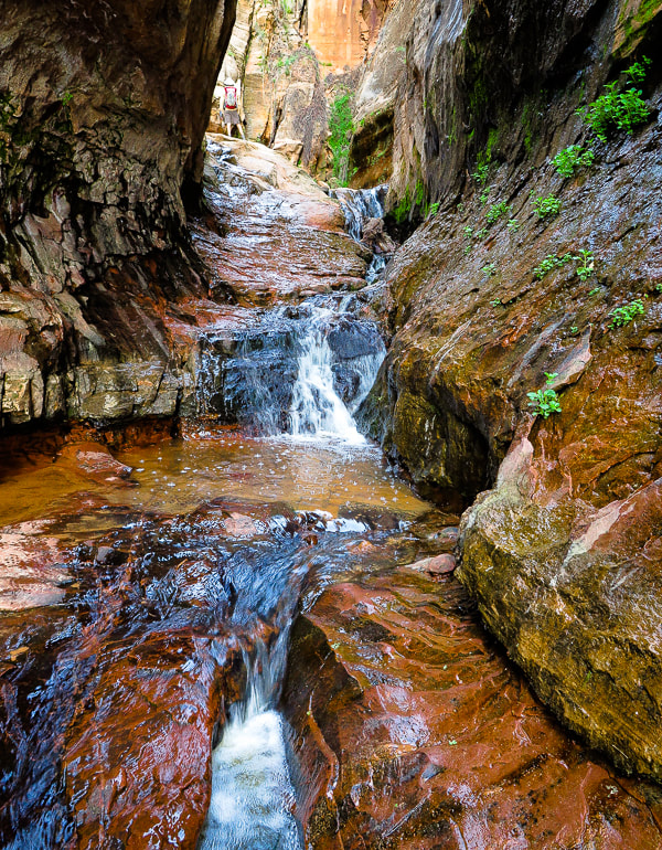
Walk through shallow stream at slot.
Walking above the waterfall section, about ready to start climbing west canyon wall.
Long, narrow waterfalls as you ascend Water Canyon.
Starting to climb canyon wall.
Very helpful way to get up this tall ledge!
Rock cairn marking ledge up west cliff climb; nearing the canyon opening at the top.
Fred and Sue on "Top Rock", at entrance to plateau from Water Canyon. 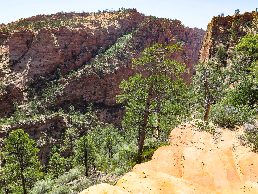
Looking down Water Canyon from near top of its west wall.
Looking across to Water Canyon's east wall.
View from "Top Rock" above exit from Water Canyon of White Domes on Canaan Mountain.
Descending down into upper Water Canyon wash, then we walked 1/4 mile west to intersection with wash that leads NW to White Domes.
Waterfall #1
Waterfall #2
Intersection of washes - we took the wash on the right, out of the main wash; it leads up to White Domes ~ 1.1 mile.
Slick rock scenes on ascent to White Domes.
On the way to White Domes
Looking at Zion NP to the north.
Some cool stuff on the trail.
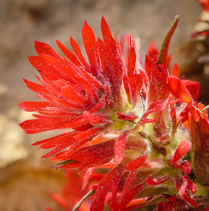
Indian paintbrush (Castilleja)
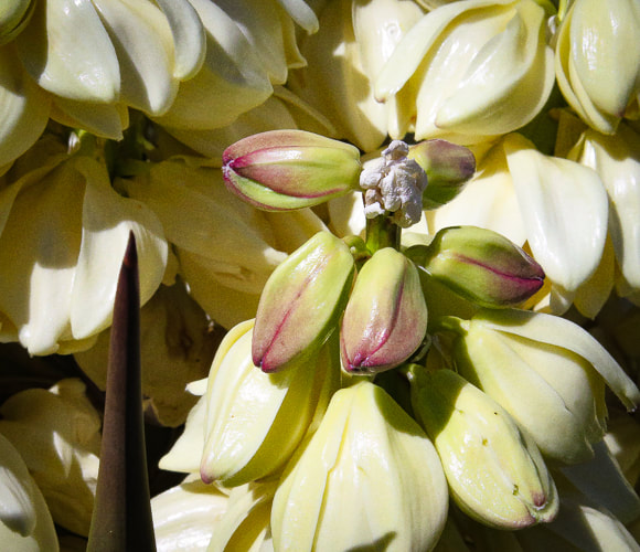
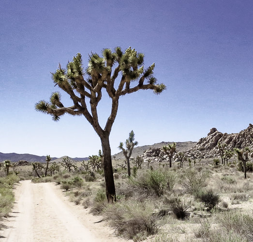
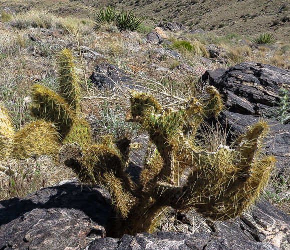
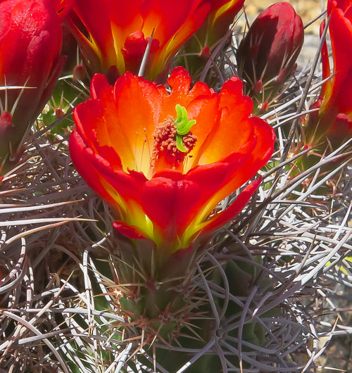
DESERT PLANTS 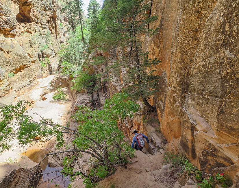
Heading back down.
Our GPS tracks reflect an inaccuracy due to inadequate number of satellites signals while hiking in the canyon. According to CalTopo, it takes a minimum of 4 satellites communicating with your GPS to get accurate elevation and location measurements. It's not uncommon for satellites to be close to the horizon, so they may be blocked depending on the terrain you're hiking on.
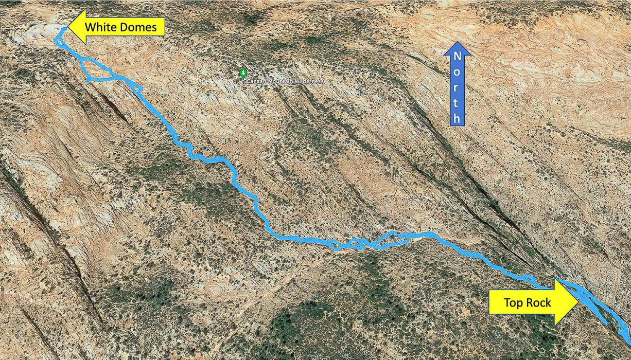
Google Earth image of our route from Top Rock just out of Water Canyon to White Domes, going cross-country to drop down into upper Water Canyon wash, then following side wash straight to White Domes in NW direction. Distance from Top Rock to White Domes = ~ 1.7 miles.
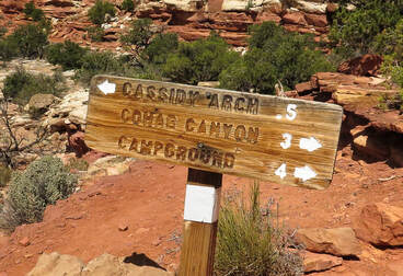
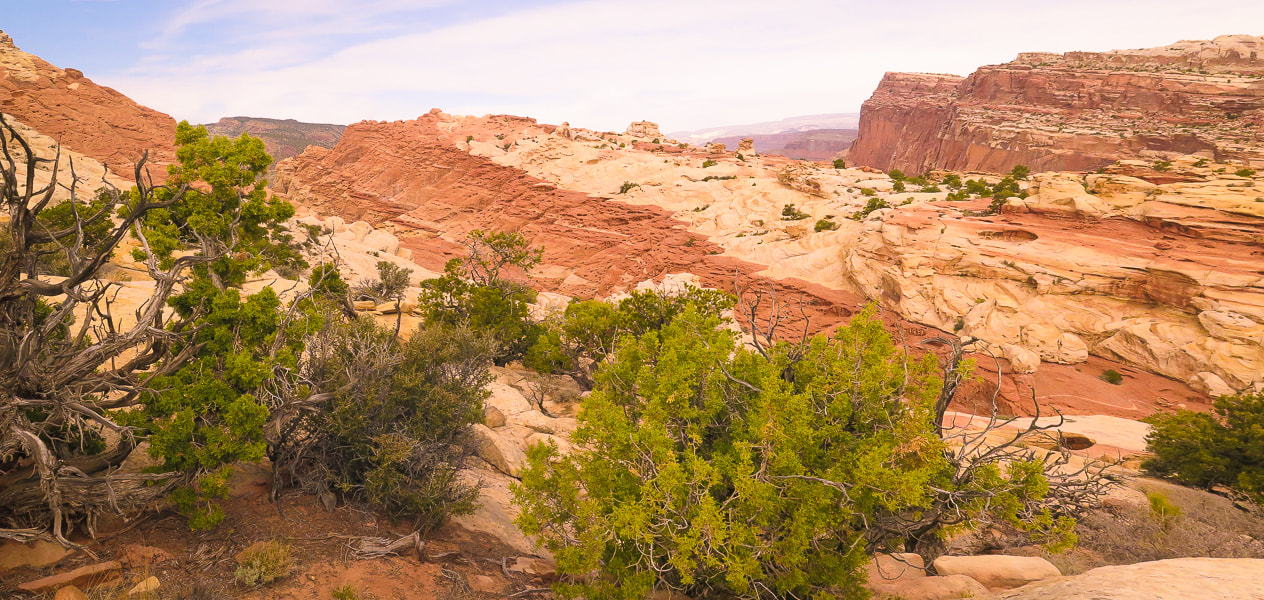
Cassidy Arch is only one feature of many on this spectacular hike on the Waterpocket Fold that will capture your imagination and make you feel minuscule as you hike over open slickrock and between towering walls.
Related:
Utah's Red Rock Country Hiking Mt. Kinesava, Zion NP Southern Utah Hiking/Biking in a Pandemic: Snow Canyon State Park, Wire Mesa, and Zion NP Red Mountain Primitive Trail, St. George, Utah In Search of the Rattlesnake Petroglyph Desert Plant Photos 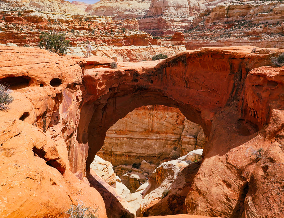
Fred (upper left) standing on top of Cassidy Arch, Capitol Reef NP.
Trip Stats
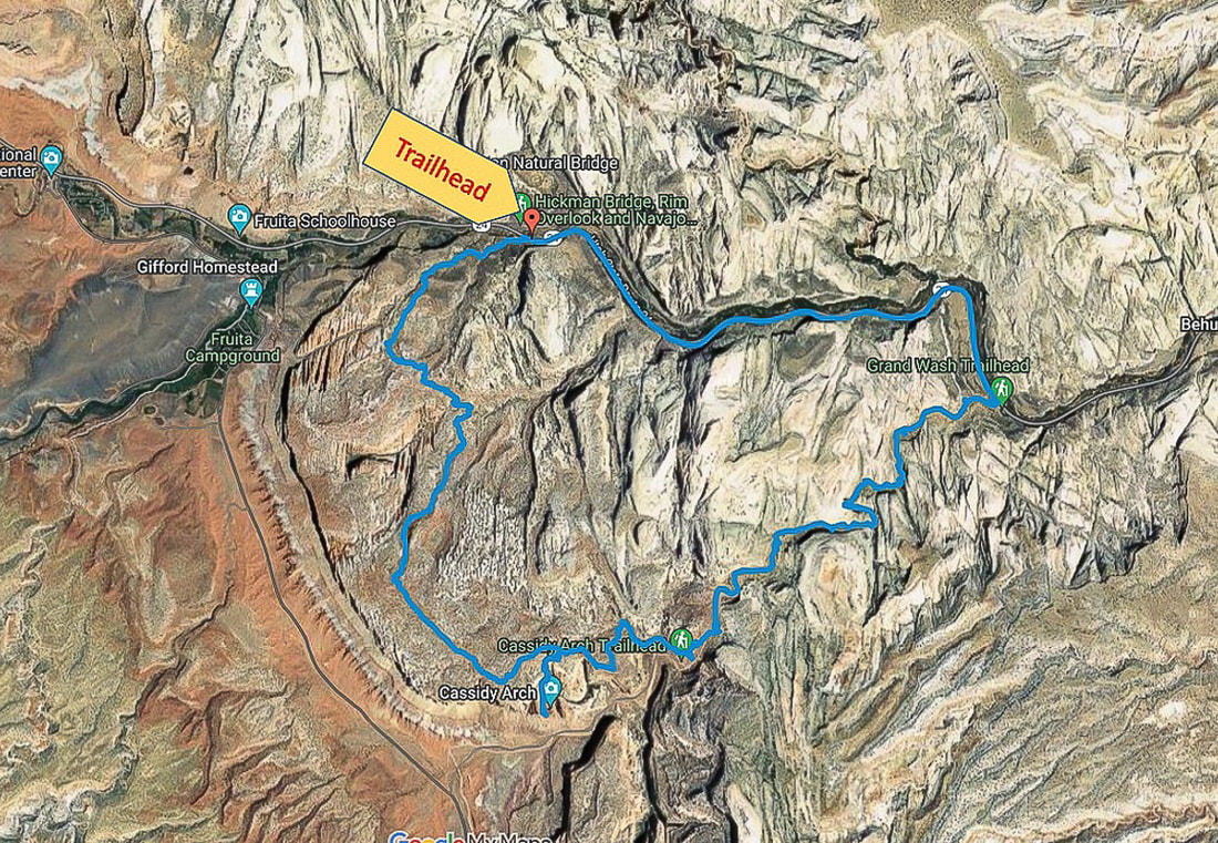
Overview: Maximize your already overloaded visual experience in Capitol Reef by hiking a trail less-traveled to Cassidy Arch, then descending through the soaring heights of Grand Wash. The only drawback on this spectacular loop is the 2.6-mile walk on the park's road (Hwy 24) back to the trailhead. Location: Hickman Bridge Trailhead, 2 miles from Capitol Reef NP visitor center on main park road. Coordinates: Trailhead: 38.287936, -111.226906.
Difficulty: Moderate Class 1 with signs and rock cairn markers.
Permit/Fee: $20 for private vehicle pass good for 7 days. Navigational aids: Hiking Map and Guide - Capitol Reef National Park (topo map), Stav Is Lost's route description. Date Hiked: April 28, 2022. Geology: Capitol Reef NP encompasses its main geologic feature - the Waterpocket Fold, a nearly 100-mile crimp in the Earth (see "For the Geocurious" below.)
Our Hike
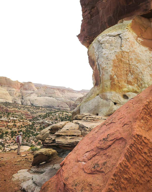
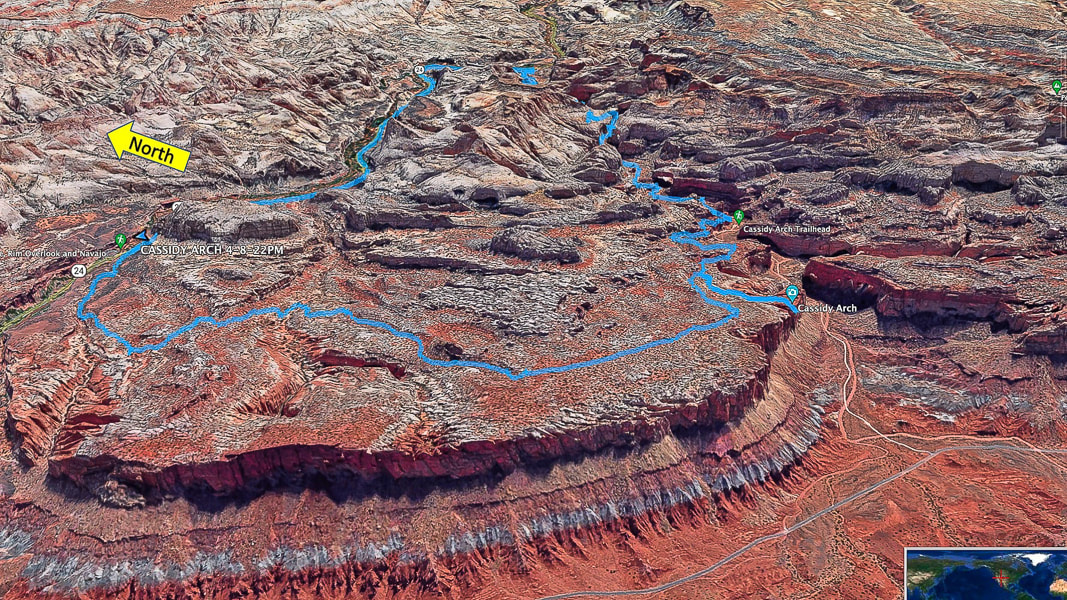
Seems like the last few hikes we've done have histories of late 1880's wild west rustlers and outlaws. Two of them - Mount Minerva Hoyt and Lost Horse Mountain in Joshua Tree NP look over valleys where cattle rustlers hid their "stock". Cassidy Arch, the premier feature of this hike is named after Butch Cassidy, leader of the "Wild Bunch" - bank robbers who hid in the remote canyons of Capitol Reef. Wild west characters - one of the many things I like about living in America's magnificent west. One of the best attributes of this hike is variety; Frying Pan Trail elevates you to a spectacular high point and a rock wonderland with eroding sandstone towers scattered about, then drops you down to the intersecting trail that leads you to Cassidy Arch's cavernous opening. The grand finale is a walk through a long deep canyon aptly named Grand Wash. To get back to our car, we had to walk on the main park road which snaps you out of a dream world of hoo-doos, warm-colored rock layers, scented junipers and ancient petroglyphs to bring you back to the real world of traffic and tourists. It would be optimal to have two vehicles - one at Hickman Bridge trailhead and one at Lower Grand Wash trailhead on Highway 24. Cohab Canyon/Frying Pan Trail Start at the sign for Frying Pan Trail/Cohab Canyon across and slightly down the main park road from Hickman Bridge parking. According to local lore, Cohab Canyon got its name because it was a polygamist hideout if lawmen came around. But, lack of diaries and documents from Fruita, the Mormon settlement at Cohab Canyon, indicate it's probably more lore than truth. Intersect with Frying Pan Trail in 0.55 miles, taking a left to head south under Frying Pan Peak. Cohab Canyon Trail continues to the right (west) to Fruita site.
Cassidy Arch Trail - out and back
Hike over cairned and open slick rock 0.5 miles to Cassidy Arch where without warning the sandstone drops below to a spacious opening. It seems appropriate to be named after Butch Cassidy because it's hidden until you are practically on top of it. This a great place to take a break and watch people walk over its top. Stav is Lost describes a canyoneering trip report that begins next to the arch and does several rappels into narrows, a grotto and more arches, and ends up at Grand Wash Road and trailhead. Head back to intersection from which you came and take a right to descend on Frying Pan Trail for 1.0 mile to the intersection with Grand Wash Trail. Cassidy Arch looks like a big tunnel high up on the mesa overlooking Grand Wash. 
Large basalt flows erupted and accumulated in the Boulder Mountains, west of Capitol Reef 20 million years ago. These rounded and vesicular boulders are scattered about everywhere in Capitol Reef, brought there by melt-waters from glaciers that had spread out over the lava flows. Many miles of rolling and tumbling sculpted them into these beautiful shapes.
Frying Pan Trail is well-marked.
View from Frying Pan Trail to the southwest.
Those are some thick sandstone layers!
Topping off on Frying Pan Trail.
On the way down toward intersection with Cassidy Arch Trail. Fern's Nipple on the horizon. Great view of titled layers of the Waterpocket Fold.
Heading down toward intersection with Cassidy Arch Trail.
Cassidy Arch Trail swings down to the right: Cassidy Arch is under the sandstone on the right mesa - its opening on the left edge of that mesa. Fern's Nipple on left horizon.

Suddenly it's there: first view of Cassidy Arch.
From Cassidy Arch looking down onto Grand Wash Road.
Grand Wash Trail
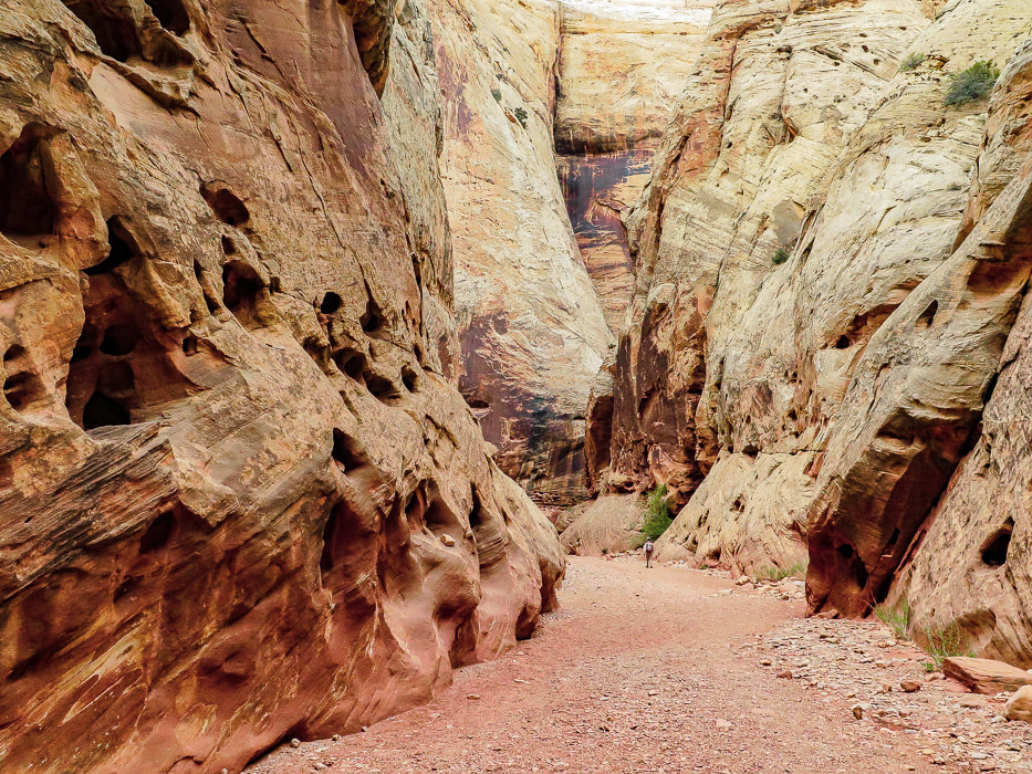
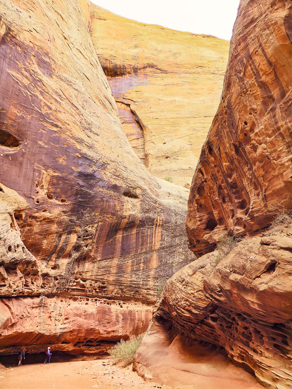
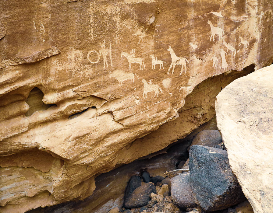
After you get back onto Frying Pan from Cassidy Arch, you'll probably run into hikers coming from the Grand Wash Trailhead to the southeast. Frying Pan Trail is longer but so beautiful and less populated. Grand Wash is a peaceful walk between high walls with dark stripes of manganese and iron minerals contrasting with orange and light yellow sandstone. There's many interesting erosion features such as honeycomb weathering, or tafoni - holes produced in the sandstone from water, wind and ice on surfaces facing the sun. Every turn, every bend brings another great sight to see. Petroglyphs, pecked into sandstone panels, appear near the end of the wash. I'm always intrigued by the people who made these - what did they look like? What tools did they use? What did they eat? I had a great time learning about them when I was writing my petroglyph post - In Search of the Rattlesnake Petroglyph. The road walk back to the trailhead was worth it - It's hard to top Frying Pan Trail - thanks to Stav is Lost for giving us the idea! There is so much more to explore in Capitol Reef, we plan on getting back to this incredible land. I recommend hiking Upper Muley Twist Trail off Burr Road in the southern part of Capitol Reef - it elevates you to an amazing view of the Waterpocket Fold.
Keep on Exploring!
View of Cassidy Arch (top right) from Cassidy Arch Trail descending into wash with intersection to Grand Wash Trail.
Grand Wash
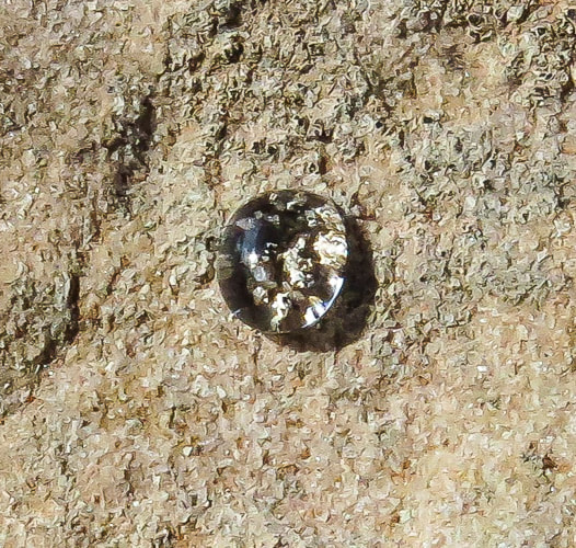
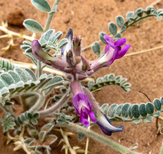
Some cool stuff on the trail: click on the milkvetch and petroglyph photos for more information.
For the Geocurious - The Waterpocket Fold
As national parks go, the map of Capitol Reef is unusual. It's long and vertical area encompasses the Waterpocket Fold, a part of the Earth created during the Rocky Mountain building phase ~ 70 - 50 million years ago. Horizontal rock layers were pushed up by compressional stresses on one side by an underlying fault, creating a classic monocline (mono = one, cline = incline), a steep "ramp" of rocks 4,000 feet higher on the west side than the east. It was further uplifted 15 million years ago, exposing more of the strata to erosion to create "waterpockets" - holes in the rock of varying sizes. Increased tilt of the layers created increased gradient of streams, which accelerated erosion. This unique geological phenomenon revealed strata laid down hundreds of millions years ago in red rock country that has weathered into domes, canyons, arches and cliffs. There are a few scenic loop drives in Capitol Reef NP - a popular drive is Notom-Bullfrog Road/Burr Trail/Scenic Highways 12 and 24 loop. Burr Road crosses the Waterpocket Fold and is incredibly scenic, giving ample geologic "feast for the eyes", especially for the "geocurious". 
Image of Waterpocket Fold from NASA Earth Observatory
A good You Tube video features Capitol Reef park rangers describing in simple terms the creation of Waterpocket Fold:
Monocline Explained: Capitol Reef National Park 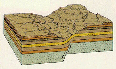
Illustration from Written In Stone - Seen Through My Lens of a classic monocline like the Waterpocket Fold. Compression in the brittle underlying bed rock causes faulting and folding with east-directed forces during mountain-building and the whole Colorado plateau was uplifted. The western block was pushed onto and over the east block causing the fold. This was initiated by the Farallon Plate sliding under the North American Plate.
Our GPS tracks for entire loop - on top of the Waterpocket Fold.
Fred in Grand Wash.
Grand Wash
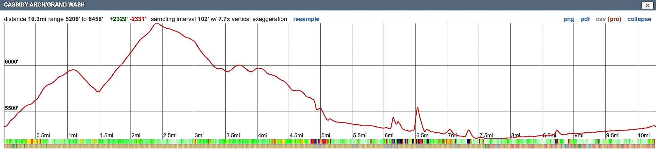
Our GPS tracks and profile. We hiked counterclockwise from Hickman Trailhead on Hwy 24 to Grand Wash Trailhead.
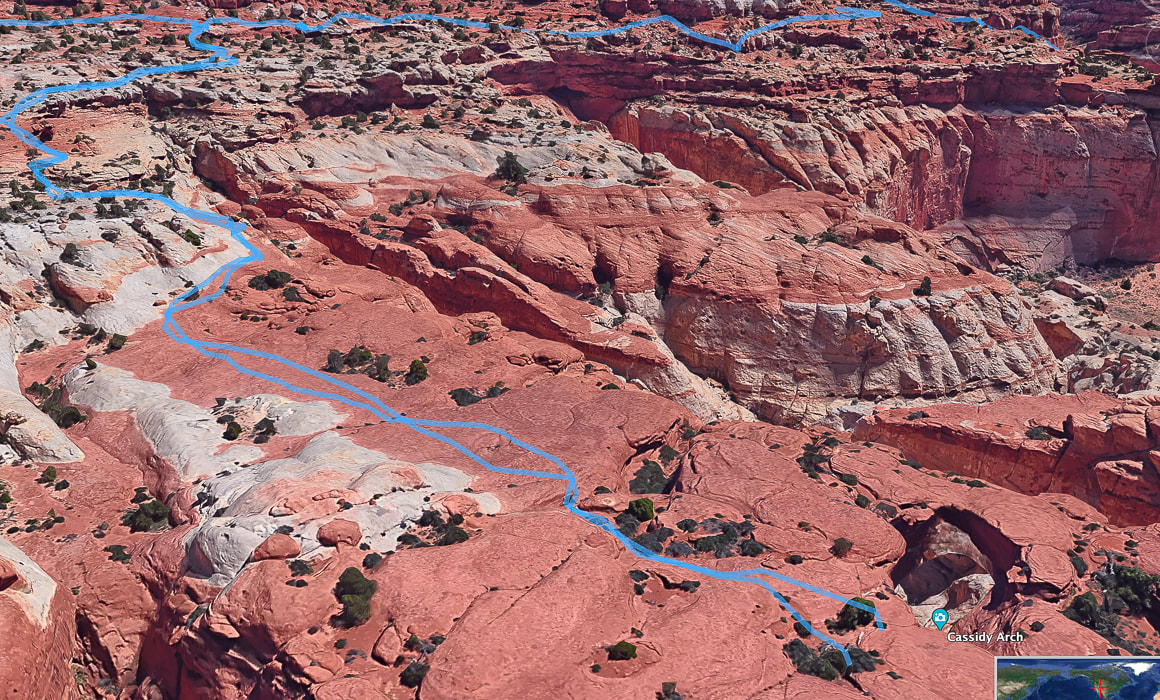
Google Earth image of our tracks from intersection of Cassidy Arch Trail/Frying Pan Trail (top left) to Cassidy Arch (bottom right).
References
Butch Cassidy- Outlaw - His Early Years. Capitol Reef Country (website). Wayne County Tourism. Capitol Reef Administrative History. Chapter 4: Mormon Settlement. U.S. National Park Service. Capitol Reef: The Waterpocket Fold. Capitol Reef Country. Flight Plan: Part II – Geology of the Circle Cliffs Uplift and the Waterpocket Fold at Capitol Reef National Park. From website: Written In Stone - Seen Through My Lens. NASA Earth Observatory. Traces of an Ancient Watery World In Capitol Reef. Website entry on 5/2/22. Olson, V, Olson, H. 1990. Capitol Reef: The Story Behind the Scenery. KC Publications, Inc.
Hike three high points and view the historic Lost Horse Mine along this western Joshua Tree NP trail.
Starting in Quail Wash.
Trip Stats
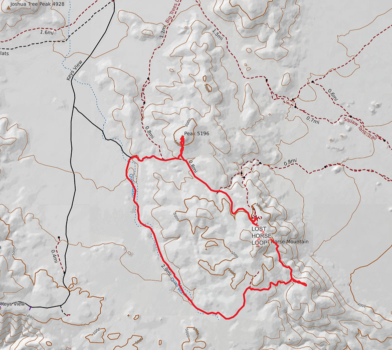
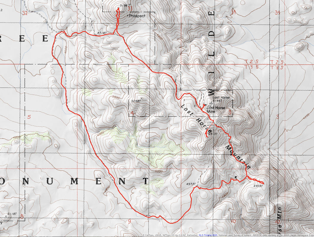
Overview: Make the Lost Horse Loop hike even more interesting by bagging a few peaks along its route to get a feeling of the vastness of Joshua Tree NP and wilderness, with views of San Jacinto Peak in Palm Springs. Check out the plaque that commemorates Lost Horse Mine stamp mill, one of the best-preserved of its kind in our national park system. Coordinates: Lost Horse Mountain = 33°.56'13.74" N 116°.08'10.01" W.
Navigational aids: Trails Illustrated Joshua Tree National Park #226 map.
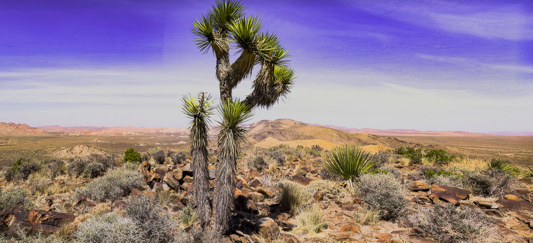
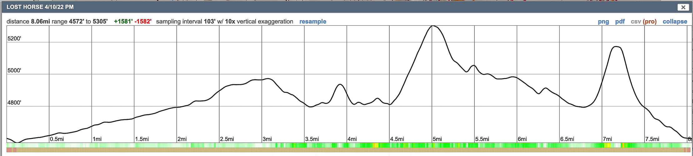
Date Hiked: 4/10/22 Geology: The Lost Horse Loop trail and mine is located in granitic quartz biotite gneiss (metamorphic) related to Pinto gneiss age 1.7 billion years ago - some of the oldest rocks in California. Biotite is dark mica mineral. The Lost Horse Mountains are one of only three occurrences of basalt in Joshua Tree NP.
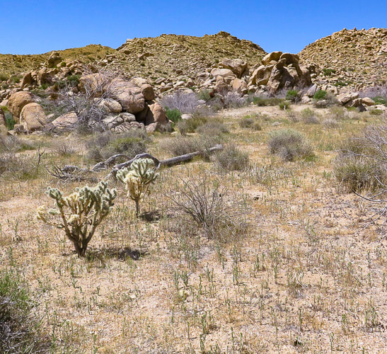
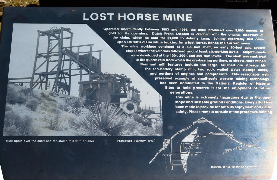
Cattle rustlers and Gold Mining in Lost Horse Valley
If you were a cattle rustler in the 1870's southwest, you would look for a remote and hidden area with enough water and good stands of trees and plenty of native grasses and other vegetation to feed your "stock". A place where the nearest law enforcement officials were at least 50 miles away. For the McHaney brothers, this place turned out to be the higher, western side of what is now Joshua Tree National Park, in Lost Horse Valley and Hidden Valley. Bill McHaney's gang took cattle from Mexico and Arizona to hide them in other Joshua Tree valleys as well, then returned stolen horses. Johnny Lang also drove cattle into Lost Horse Valley after his brother was gunned down in New Mexico. He woke up one morning to find his horse gone. He tracked it to the McHaney's place but was told to leave the area. Luckily, Lang met "Dutch" Frank who had discovered a mining claim, but was afraid to set up mining operations because he was also being hassled by the McHaney gang. Lang bought the rights to the mine and called it "Lost Horse", after enlisting three partners to protect the claim against claim jumpers in 1893. The Lost Horse Mine ultimately produced 10,500 ounces of gold and 16,000 ounces of silver. Today, the Lost Horse Mine stamp mill is considered one of the best preserved in a National Park service unit. We hiked three high points along this loop. The most interesting summit was Peak 5196 because of the columnar basalt at the top. In a land dominated by granite, this is one of only three occurrences of basalt. From its summit, just northeast of the trailhead, are extensive views of Queen Valley to the east and Lost Horse Valley to the west. A few days before, we had hiked Mt. Minerva Hoyt, named after the woman instrumental in President Franklin Roosevelt's proclamation to designate Joshua Tree National Monument.
Sign at trailhead. We hiked the trail counter-clockwise.
Our Hike in the Mojave
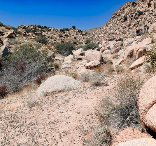
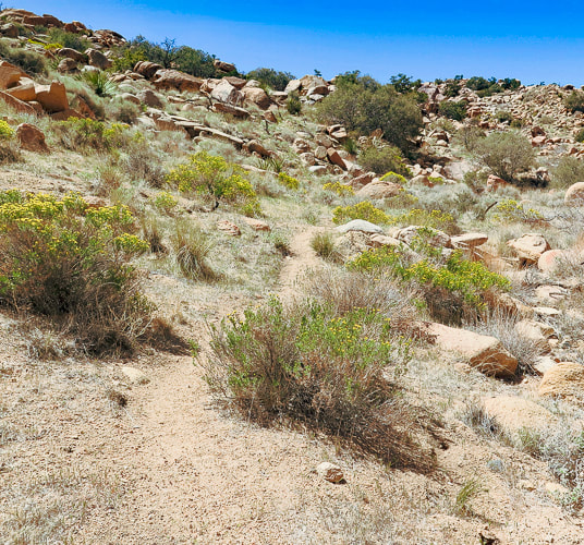
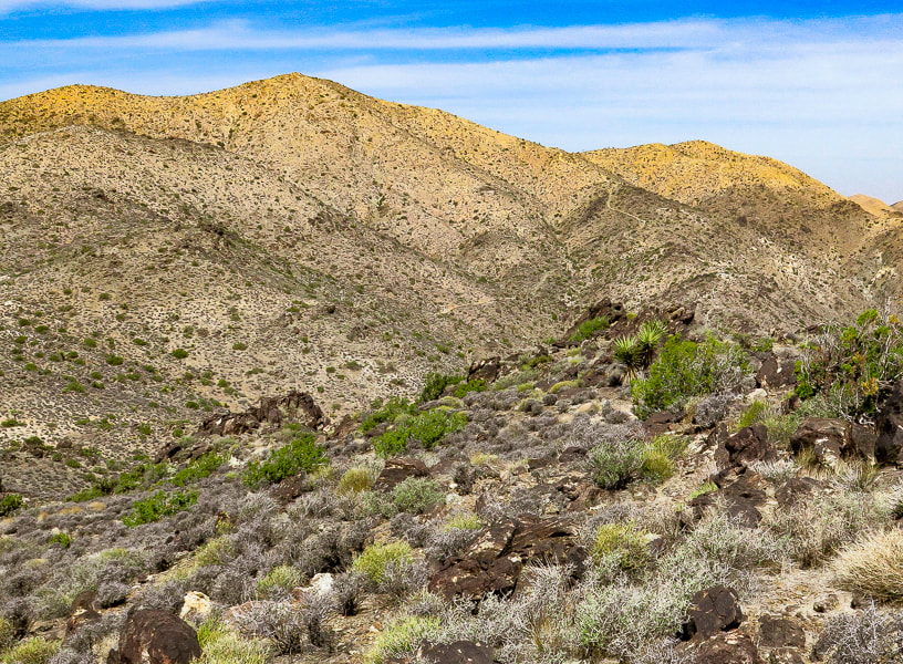
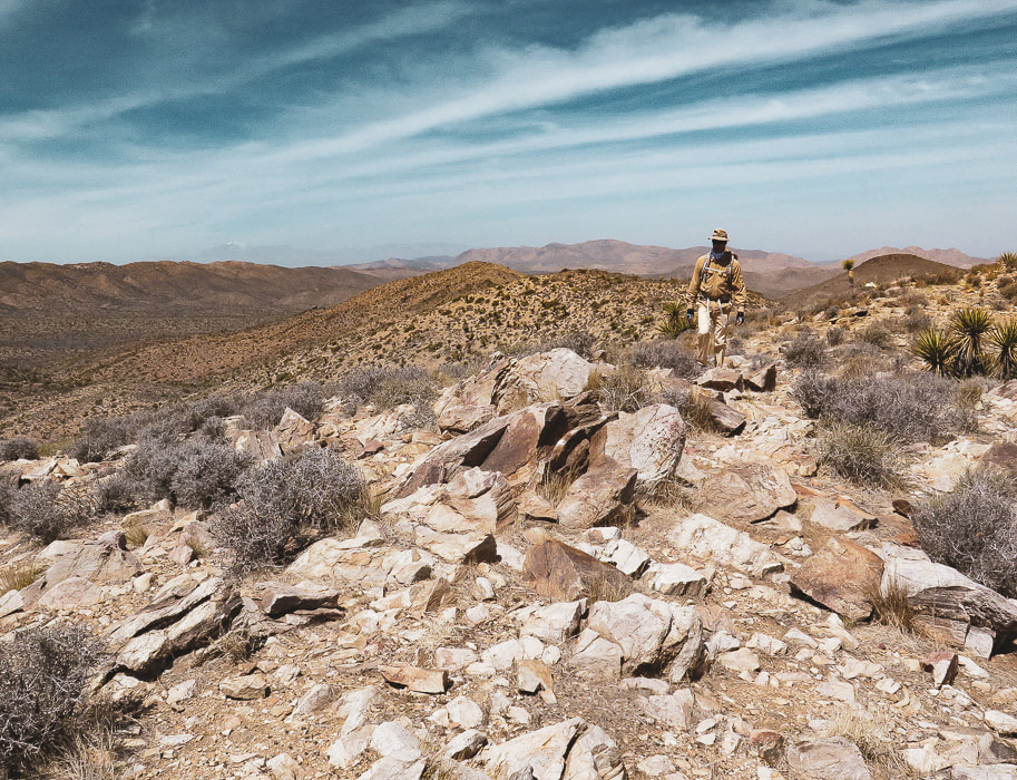
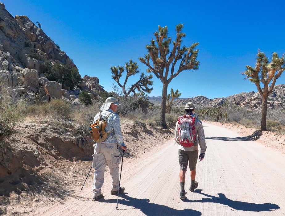
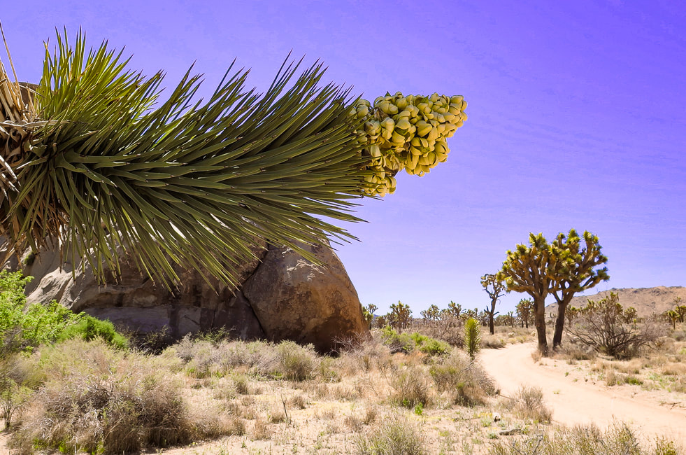
As the road to Lost Horse Trail climbs to around 4,000 feet elevation in the western, Mojave desert section of Joshua Tree NP, the amount of Joshua trees, junipers and yuccas is more prevalent compared to lower, dryer Sonoran desert Pinto Basin to the east at 1,700 feet. Although it's a moderately-used trail, you get the feeling of remoteness surrounded by mountain ranges. The trail circles Lost Horse Mountain, trekking through Quail Wash and over juniper and shrub-covered hills darkly punctuated by scattered gneiss boulders.
By the time we got back to the trailhead parking lot, it was full. Another fun day in Joshua Tree's Mojave desert. The three extra summits were the "icing on the cake" - worth the effort.
Time and Space in the Desert
Joshua Tree is an awe-inspiring land shaped by Earth's events spanning the Proterozoic alteration of pre-existing rocks into gneiss, to the five Proterozoic through Cretaceous intrusions of plutons that produced gold and silver and its famous sculpted rocks, to the relatively recent faulting that uplifted mountains and blocked canyons. A landscape that has a tumultuous origin, but a relaxing presence. Dark and rubbly mountains spring out of flat, buff - colored valleys. A slight haze of dust still hangs in the air after last night's wind storm. I stand looking over it all - breathing space. Back straightens, chest raises, diaphragm brings in creosote and sand-scented air. To some, this expanse and space feels intimidating; to me it feels comfortable. To some it looks formidable with its hot, dry stillness and sharp- spined cacti; but I admire their motivation to survive under the hot, penetrating sun. To walk in browns and buffs for awhile and then suddenly come upon magenta and bright yellow cactus blooms is cause for celebration. I remember liking these ragged and gangly Joshua trees and contrasting smooth, rounded boulders the first time I saw them 38 years ago. I revel in the sublime space and quiet that calms my mind. Grateful for the feeling of being connected to this land.
"Time and space. In the desert there is space. Space is the twin sister of time. If we have open space then we have open time to breathe, to dream, to dare, to play, to pray to move freely, so freely, in a world our minds have forgotten but our bodies remember. We remember why we love the desert; it is our tactile response to light, to silence, and to stillness."
- Terry Tempest Williams
Never Stop Exploring!
From summit of Point 4959, looking at Malapai Hill.
Beautiful 1.7 billion-year old gneiss - and hedgehog (?) cactus.
Circling around Lost Horse Mountain (on far horizon) to hike up its northeast ridge.
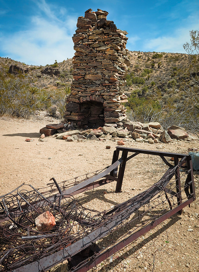
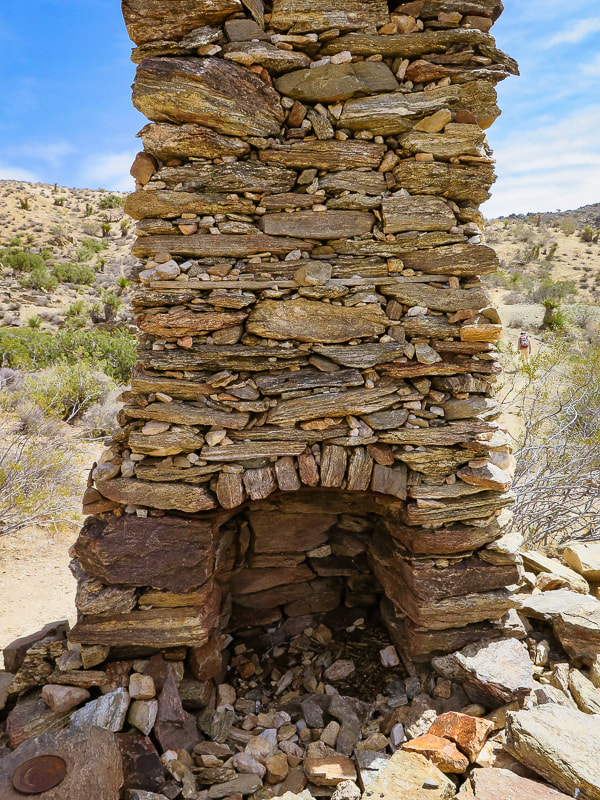
Remains of a very sturdy fire place and bed frame.

Our first summit - Point 4959.
Three types of rock: great example of gneissic banding - a textural lineation of minerals in metamorphic rock created by pressure and intense heat (foreground). Malapai Hill in middle of valley created by magma. Valley rock is monzogranite.
Looking at Lost Horse Mountain from the slopes of Point 4959. You can see Lost Horse Trail as it climbs to the saddle on its northeast ridge. Hike that ridge to the summit.
Some cool stuff on the trail.
Summit of Lost Horse Mountain
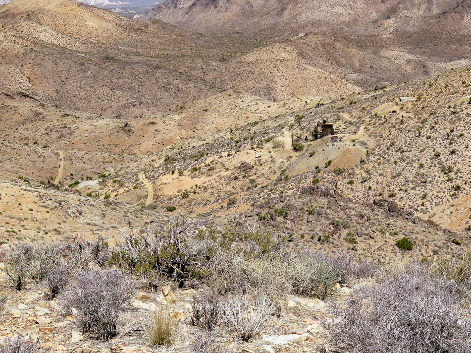
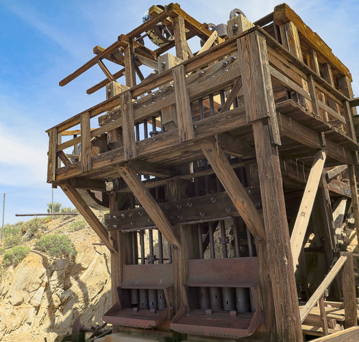
From Lost Horse Mountain's ridge: a view of Lost Horse Mine.
Lost Horse Mine stamp mill through chain-link fence.
Walking up to Point 5196.
Beavertail cactus just before the blooms.
Columnar basalt on Point 5196.
References
California Geology. 1998. Department of Conservation, Division of Mines and Geology. Dilsaver, L.M. 2015. Joshua Tree National Park: A History of Preserving the Desert. Prepared for National Park Service, Joshua Tree National Park, Twentynine Palms. Joshua Tree Geology Tour Road. Joshua Tree National Park Geology - Rock Types. Digital-Desert: Mojave Desert. Trent, D.D. Geology and History of MInes, Joshua Tree National Park.
Named after the woman who lead conservation efforts for what is now Joshua Tree National Park, Mount Minerva Hoyt looks over wide, sandy valleys of Joshua trees and piles of weathered granite boulders, famous for their climbing routes.
Trip Stats
Overview: To honor the woman behind Joshua Tree NP's conservation campaign, hike to her namesake summit. Bag nearby Quail Mountain, Joshua Tree's highest summit, for a tour of two peaks and great views on top of Joshua Tree. Experience all of the famed attributes: Joshua tree groves, rock climbers scaling eroded granite, a glimpse of the private historic Randolph Ranch, a beautiful wildflower-filled canyon and an enjoyable ridge walk. Location: Joshua Tree National Park/Wilderness - North Entrance Station out of Joshua Tree, Southern California. Distance/Elevation gain: 12 miles out and back. Trailhead = 4,061', Summit = 5,405'. Net gain = 1,700'. Coordinates: Parking = 34.02926 N -116.17905 W. Summit = 34.01347 N -116.22694 W. Difficulty: Moderate Class 1-2 Fees/Permit: $30 entrance fee, good for 7 days. Navigational aids: AllTrails map, Trails Illustrated Joshua Tree National Park #226. Date Hiked: 4/9/2022. Geology: Begin in the eroded boulder piles of monzogranite, a deep intrusive igneous rock uplifted and eroded to create large depths of coarse rock-fill in the valleys. Monzogranites are a biotite (mica) granite that are the final crystallized product of magma, after other minerals have solidified (like olivine). Mount Minerva Hoyt summit is made of orthogneiss, a metamorphic igneous rock. Interesting to note that the summit of nearby Quail Mountain is not made of this gneiss, but instead made up of monzogranite. Good explanation of magma crystallization. 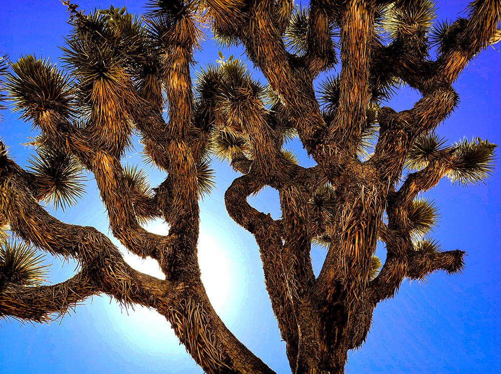
Hike Summary
There's a few ways to hike to Mount Minerva Hoyt and nearby Quail Mountain, Joshua Tree NP's highest. Both are listed on Sierra Club's Hundred Peaks Section. Years ago, Roger and Maria Keezer led us up Quail Mountain from the west. This time Fred, Scott and I approached from the east, parking at a lot on Park Drive, ~ one mile south of the Boy Scout Trailhead reached from Joshua Tree's west entrance. You could also begin the hike from the Hidden Valley Nature Trail parking. The weather was perfect - sunny and warm. Scott met us for the hike, as he has for many over the years. We have recently hiked Monument Mountain and Pinto Mountain in Joshua Tree together, and Pahrump Point near Death Valley. Hiking Directions
Joshua Tree NP's area is 795,000 acres, slightly bigger than the state of Rhode Island. Thankfully, almost 430,000 acres of it is wilderness, so there is a lot of space to roam and discover. If you want solitude, you can quickly get away from popular spots. If you want to climb to get a view, there are six mountain ranges. Pay attention to maps and apps, because you can easily get disoriented in this huge desert. By getting out there, smelling, touching, and seeing the life of the Mojave, you will gain a sense of wonder and admiration for the species that survive there.
The land in Joshua Tree has had a varied and interesting history, from the Pinto Culture, its initial transitory hunter-gatherer inhabitants to the miners and ranchers that arrived in the 1800's, to people seeking wellness from tuberculosis, and today's recreational visitors. The year 2021 saw the first time that park visitors totaled more than three million. Minerva Hoyt created a desert conservation exhibit for the Garden Club of America show in New York in 1928 that also appeared in London, England. Her magnificent exhibits not only stressed the beauty of these American deserts, but also the fragility and potential dangers. The widespread attention her exhibits brought influenced many southern California residents to decorate their own gardens with transplanted cacti. Vegetation was taken from the natural desert gardens in the pass entering Palm Springs, California, easily accessible to those traveling on the major highway between that city and Los Angeles. Commercial florists added to this theft. The same occurred in the Mojave desert, where small Joshua trees were uprooted and planted in yards, and larger Joshua trees were harvested for their wood. Joshua trees were set ablaze so that people could signal to each other. Today, it's hard to believe this destruction actually occurred, because we have learned to respect these beautiful deserts - appreciation has grown significantly. It took this destruction to motivate Minerva Hoyt into action to preserve this awesome park. When I lived and worked in the Palm Springs area in the 1990's, I was fortunate to be a volunteer to survey desert tortoises along with my hiking friends. We worked with the Joshua Tree National Monument's biologist, walking through the Pinto Basin, a vast sublime open desert. Upon coming across a tortoise, we weighed it, counted its scutes, measured it and glued an identification tag onto its shell, so it could be tracked. This was the beginning of my fascination for desert ecology, and of great memories that we friends still recall today.
Keep Exploring our Deserts!
Starting off on road that leaves from parking area off Park Boulevard near Hidden Valley. This road leads to an intersection with a trail that leads 0.5 miles to the Hidden Valley picnic area, another place to start this hike.
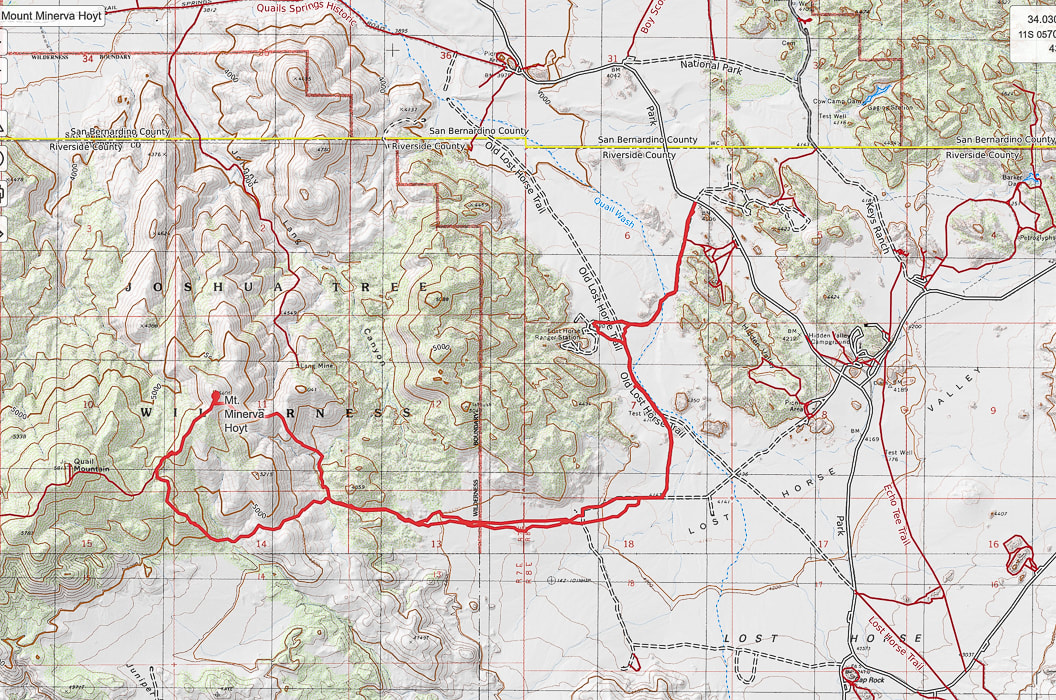
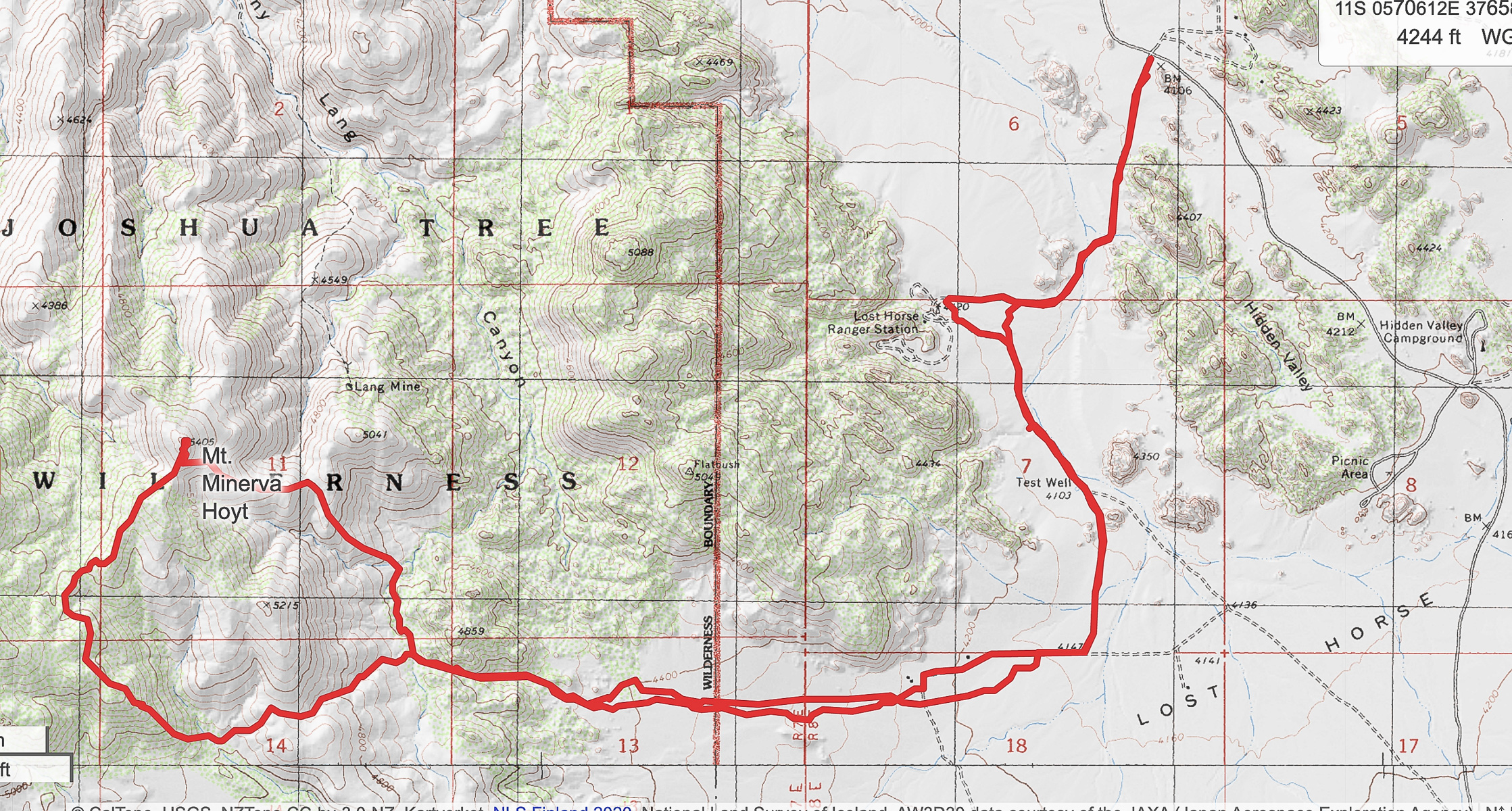
Our GPS tracks leading from Park Boulevard to a loop ascending Mount Minerva Hoyt.
Continuing west along Old Lost Horse Trail
Old Randolph Ranch - go around fenced property. I could not find much on the history of this ranch. It appears the owner had a sense of humor (see photo below).
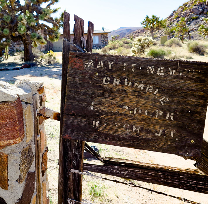
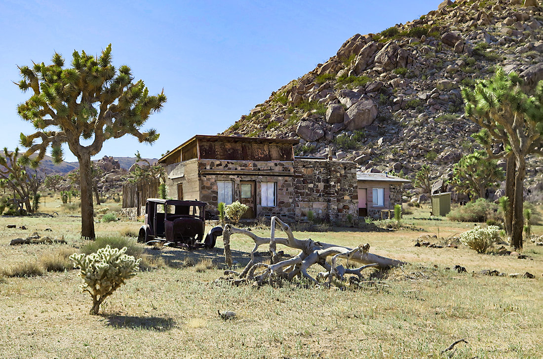
Randolph Ranch - "May it Never Crumble".
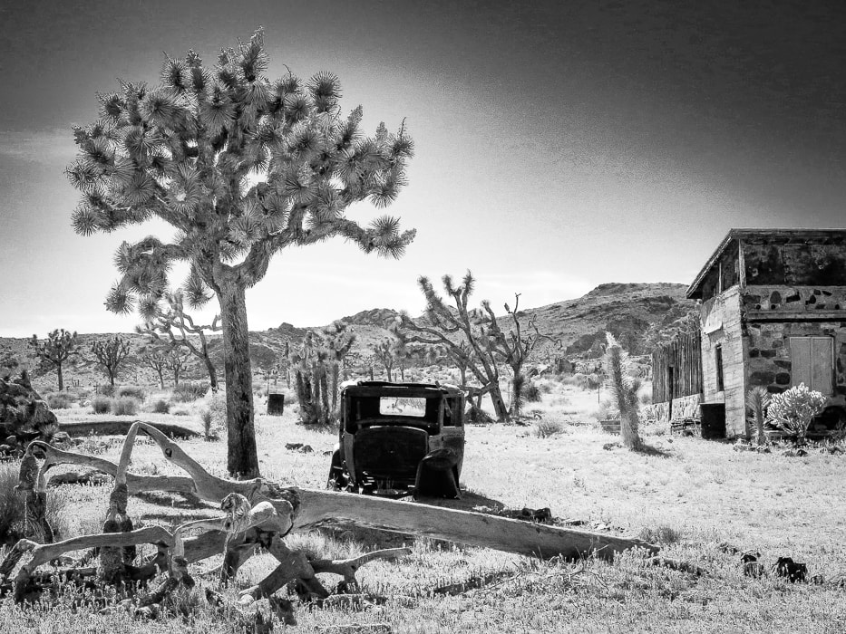
Randolph Ranch, a private inholding in Joshua Tree NP.
Hiking west up Lost Horse Valley past Randolph Ranch. Mount Minerva Hoyt is dark-covered peak on the right.
Some cool stuff on the trail.
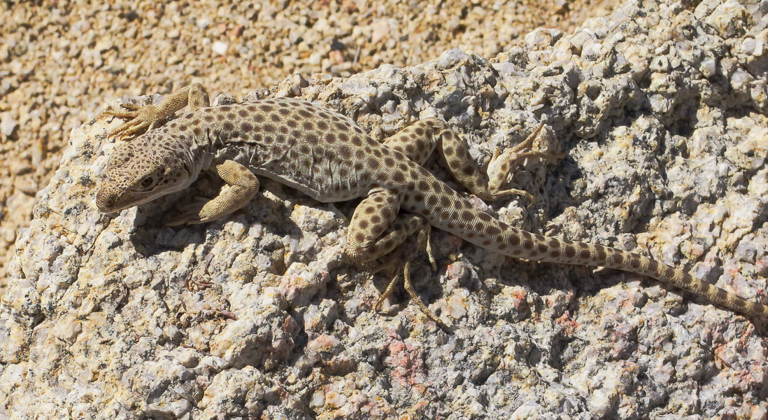
Long-nosed leopard lizard
Gambelia wislizenii
The end of Lost Horse Valley funnels you into a small canyon or draw with visible path leading to saddle where you then descend into wash at base of Mt. Minerva Hoyt and Quail Mountain.
Arriving at the saddle before the drop into the wash at base of mountains. We climbed this ridge westward toward Quail Mountain and then headed northeast on the cross country trail between Quail and Minerva Hoyt to hike Mt. Minerva's southwest ridge to the summit (point on horizon to the right).
Dropping 200' down into wash after saddle. Mount MInerva Hoyt on the right horizon. On the way up, we ascended the ridge in front of us in this photo; we descended Minerva Hoyt's east ridge seen on horizon to end up in this wash.
View of Mt. San Jacinto (overlooking Palm Springs), still covered with a lot of snow.
Walking up ridge toward Quail Mountain after getting out of wash.
Looks like a trail marker on the ridge up. Looking back at the saddle we crossed over to get into wash below.
Scott on ridge trail.
Hiking on cross-country trail that connects Quail Mountain to Mt. Minerva Hoyt. Summit on the left - there is a guy standing up there!
The last 200' climb to the summit is easy, punctuated with beautiful metamorphic boulders and cactus gardens, plus a spectacular view of the desert that Minerva Hoyt fought so hard to protect.
Fred and Scott signing summit register.
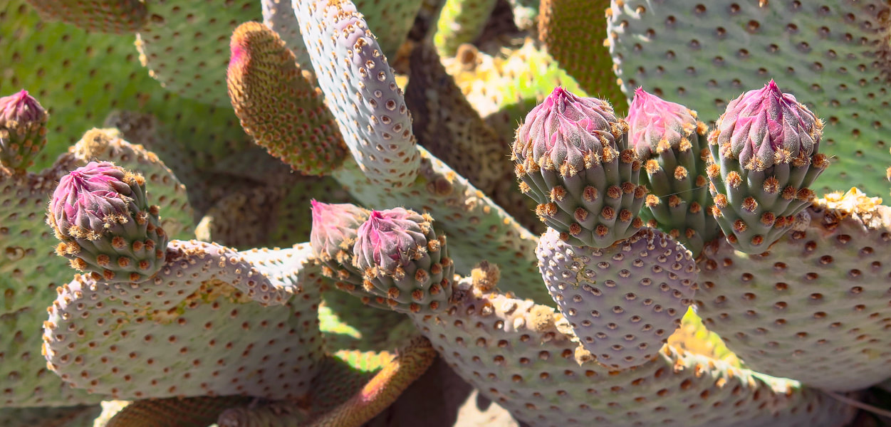
One of the beautiful "cactus gardens" on the summit.
One of the biggest prickly pears (may be a dollarjoint prickly pear) I have seen! The saddle that we ascended is just above Scott's head and slightly to the right under the two rock summits - aiming for that landmark on our way back!
Claret cup hedgehog
Echinocereus triglochidiatus 
Minerva Hoyt's east ridge path - headed toward wash below.
Getting near wash and saddle, our entry point into Lost Horse Valley.
On the way back.
Our GPS tracks
Click for larger map 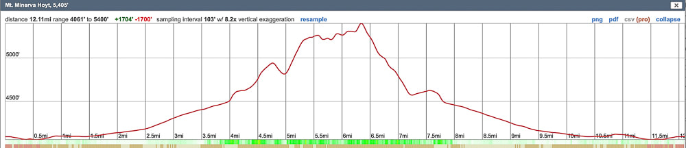
Elevation profile
References
Earle, S. Crystallization of Magma from Physical Geology. BC Campus. Minerva Hoyt. National Park Service. 2015. Dilsaver, L.M. 2015. Joshua Tree National Park: A History of Preserving the Desert. Prepared for National Park Service, Joshua Tree National Park, Twentynine Palms. A high point in one of the Basin and Range mountain ranges, Davidson Peak is a fun ridge scramble on ancient sea limestone with great views of eastern Nevada and western Arizona.  Approaching Davidson Peak from the south on Sheep Pens Road. Trip Stats
Overview: Observe in solitude the raw geologic events and forces that shaped the eastern Great Basin from the tilted limestone sediment summit of Davidson Peak. The fun, rocky scramble up its east ridge has a steep "limestone slickrock" section and circumvents the huge gulch stretching down from the peak. Pass over bryozoan and bright orange brachiopods on slopes with healthy Joshua trees and hedgehog cacti. Location: East Mormon Mountains in Mormon Mountain Wilderness BLM, near Mesquite, Nevada. Distance/Elevation: 5 miles round trip; 2,200' elevation gain. Start = 3,163', summit = 5,315'. Difficulty: Moderate-strenuous Class 2 ridge hike. Coordinates: Trailhead = Sheep Pens Road = 36°53'59.14" N 114°17'51.92" W. Summit = 36°53'45.36" N 114°19'27.51" W. Navigational aids: Bureau of Land Management - Nevada/Overton topo map, Stav is Lost's trip report. Date Hiked: 4/3/22 Geology: East-tilted Cambrian through Pennsylvanian block rooted to its Precambrian basement rocks. Related Posts:
“A million years is a short time - the shortest worth messing with for most problems. You begin tuning your mind to a time scale that is the planet's time scale. For me, it is almost unconscious now and is a kind of companionship with the earth.” - John McPhee, Basin and Range A high point to one of the many parallel Great Basin mountain ranges, the horn-shaped summit of Davidson Peak with its steep west-facing cliffs rises solitary over the expansive Mojave desert as you drive on I-15 heading north from Las Vegas. Formed during the time of shallow seas, when North America was closer to the equator, its rocks are 500 - 300 million years old and contain coral and brachiopod fossils. This hike is a ridge ramble for the entire 2.5 miles to the summit, gaining roughly 1,000 feet per mile, and is surprisingly scenic and full of intriguing sights, like bright orange fossils and a gaping, seemingly bottomless gulch. Our goal this year is to hike to as many high points of the Great Basin mountain ranges as we can, and Davidson is our third. We hiked Wheeler Peak and Virgin Peak last autumn, both in the eastern-most Basin and Range region. From Davidson's summit, we could see another target summit, Mormon Peak, the highest point in the Mormon Mountain Wilderness, northwest of Mesquite, a town on the border of Nevada and Arizona. Nevada is the most mountainous state, so we have a lot of choices! Another planned summit is North Schell Peak, a nearly 12,000-foot high point near Ely, Nevada. Our Hike The hike begins after a 12-mile drive north from I-15 that initially follows the Old Spanish Trail. It is a good gravel road but nevertheless slow-going. We parked on Sheep Pens Road just north of the radio towers. A short spur road takes you to the base of Davidson's east ridge. We walked to the end of this road and started up the ridge on the left side of a wide gulch; a few cairns were present. About 1/3 of the way up, we encountered large rocks, so we skirted the left side of the ridge. After skirting the ridge top, enter a beautiful valley/saddle with great places to take a break and enjoy very healthy Joshua trees, red barrel and prickly pear cacti. Ahead, confront a steep climb to remain on the east ridge. On the way up, we circumvented the actual ridge top to the right, looking down into the deep and wide gulch coming from the peak. Davidson Peak is an easy scramble straight ahead. However, it is not too difficult to stay on top of the ridge, requiring some use of hands for hoisting and balance, but mostly a Class 2. The ridge to the summit is long and flat. Summit Views Mormon Peak is seen to the northwest, and the solitary hulk of Moapa Peak to the southwest. The west side drops almost straight down . We could see Virgin Peak to the southeast, an 8,000' summit we hiked last autumn, out of the Gold Butte National Monument. On the way down, we stayed on top of the ridge all the way to the saddle, hiking over a fun, steep, smooth and relatively rockless limestone slab which elevated us high above steep drops on both sides. We stayed for the most part on the ridge the rest of the way down and then descended through a shallow canyon to arrive at the spur road lined with yellow poppies. The ancient Basin and Range mountain ranges rise above a stark and dusty desert; it appears as if there is not much there to discover. But when you get into the "heart" of them, walk over their scratchy limestone and volcanic rocks, circumvent sharp yucca leaves and cactus spines, catch the sudden crimson blooms of a claret cup hedgehog, and feel the desert space you know you are in a special, unique and maybe even spiritual place. Keep On Exploring! From Davidson Peak summit; looking at the ridge we ascended and Moapa Peak in the distance.  I'm not sure what this is - appears to be a fossil that has been exposed to a lot of iron - maybe a brachiopod? If anyone knows what this may be, please let me know! 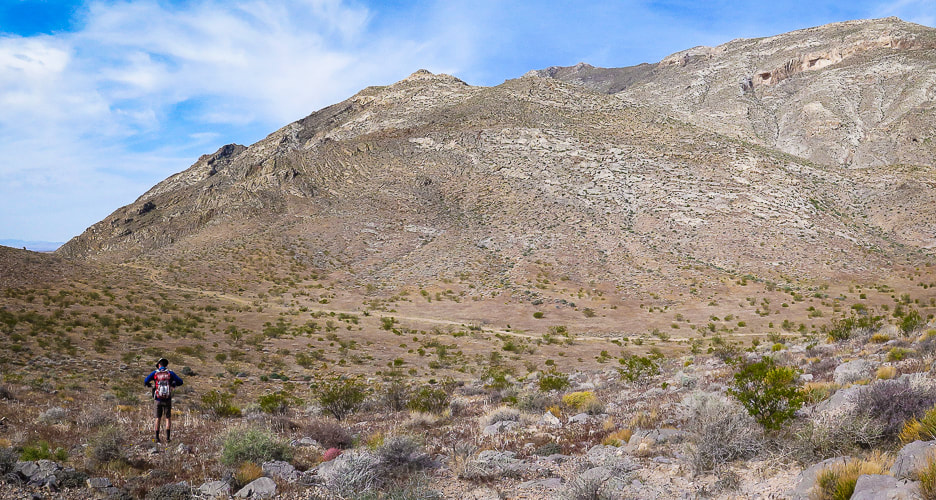 Start of hike; we parked on Sheep Pens Road before it ascended to communication towers and walked cross-country to a spur road from Sheep Pens that led to the base of Davidson's east ridge (right on photo). Davidson Peak is highest point on the right. 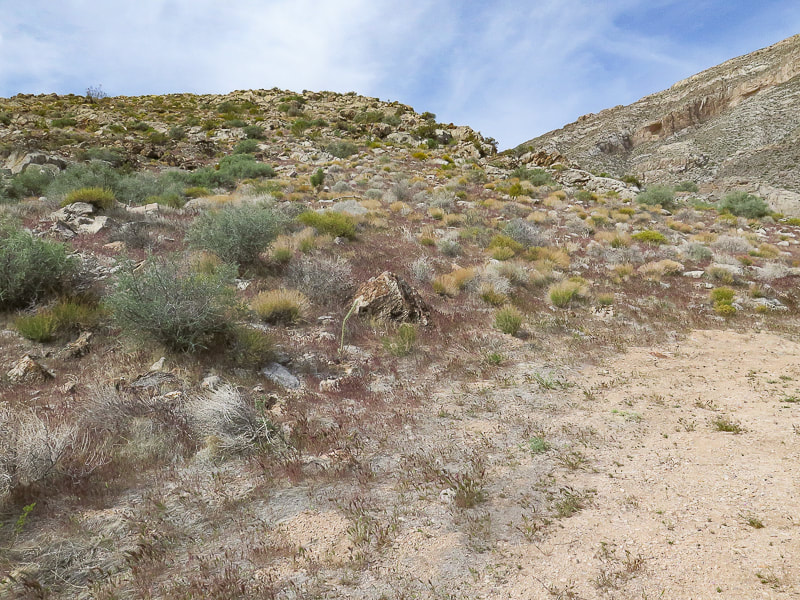 At end of spur road, we hiked up this east ridge with the large gulch to the right. Stay on ridge to the top. 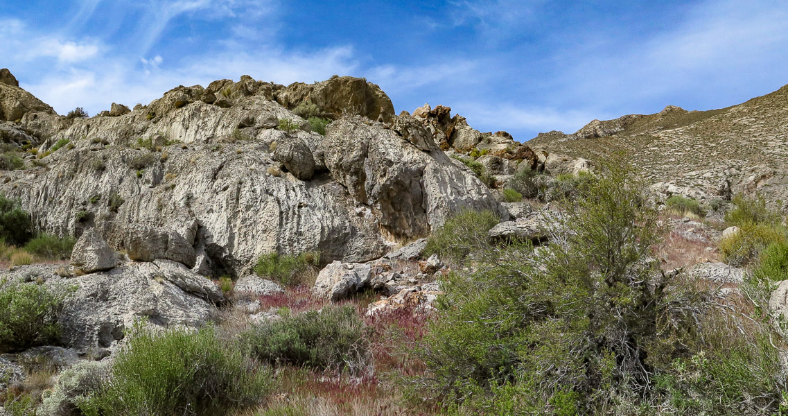 On the ridge 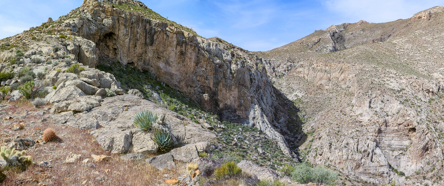 On the ridge, gulch below - summit far right 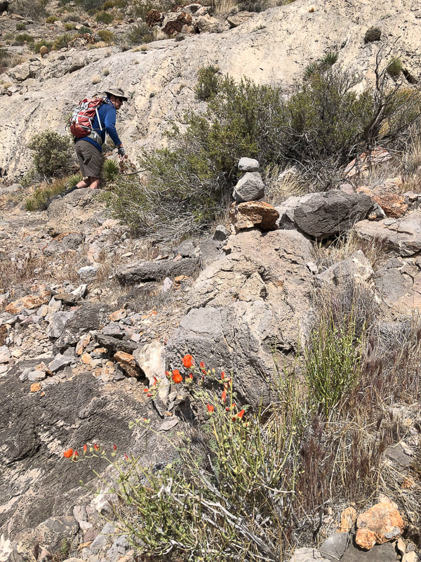 Skirting top of ridge cliffs by hiking on the left side of it ~ 1/3 of the way up.  After skirting to the left side of cliffs, regain the ridge to arrive at beautiful saddle. 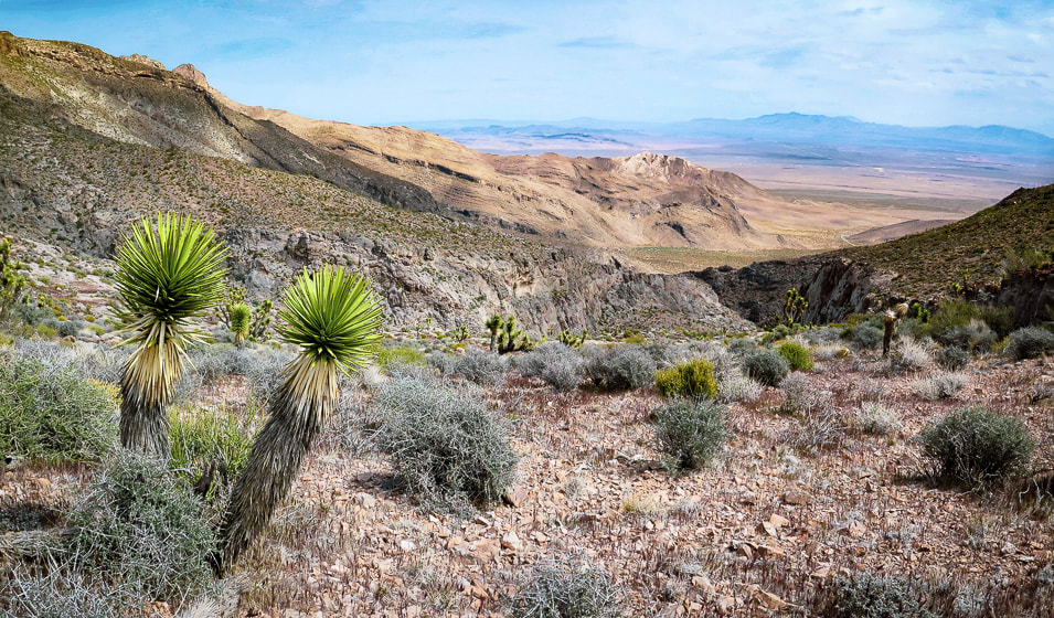 On saddle looking back at ridge on the right and large gully - approach road faintly seen on desert floor. 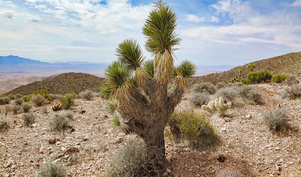 Taking a break on the saddle; Joshua tree, hedgehog cactus, and prickly pear. Some cool stuff on the trail: Fishhook cactus, Indian Paintbrush on the summit, two photos of fossils (corals?), Joshua tree bloom, red barrel cactus. 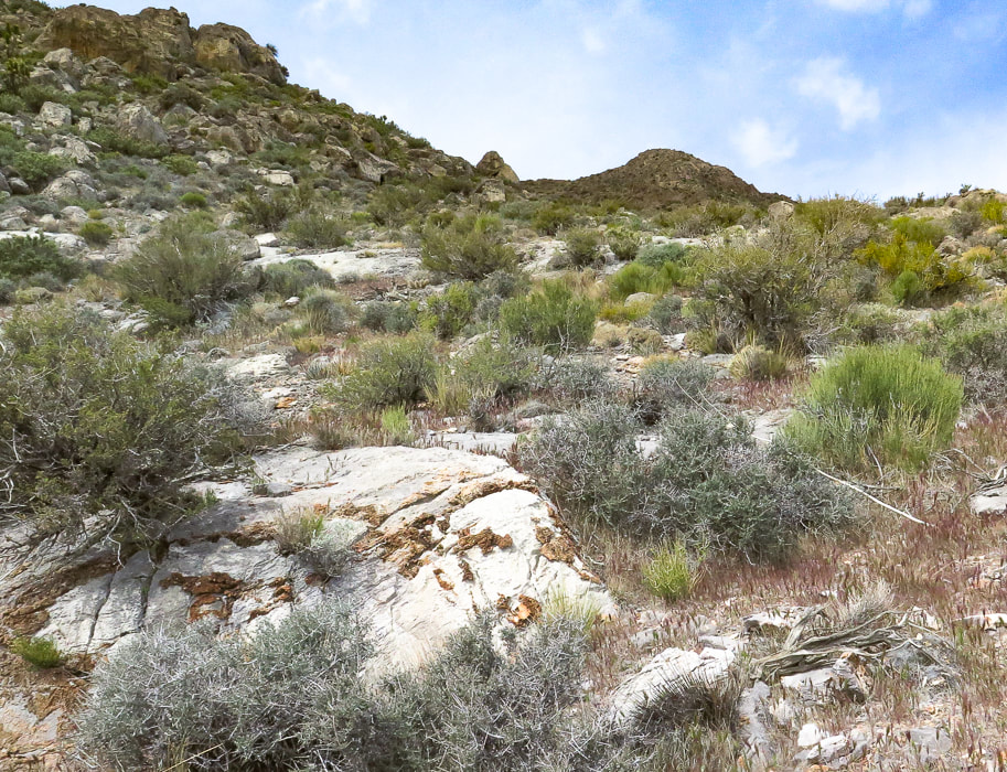 The climb from the saddle up to the summit - about one mile to go! Note limestone with brown chert (microcrystalline quartz) nodules. 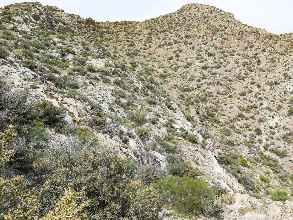 A good look at the summit - easy enough to stay on ridge. 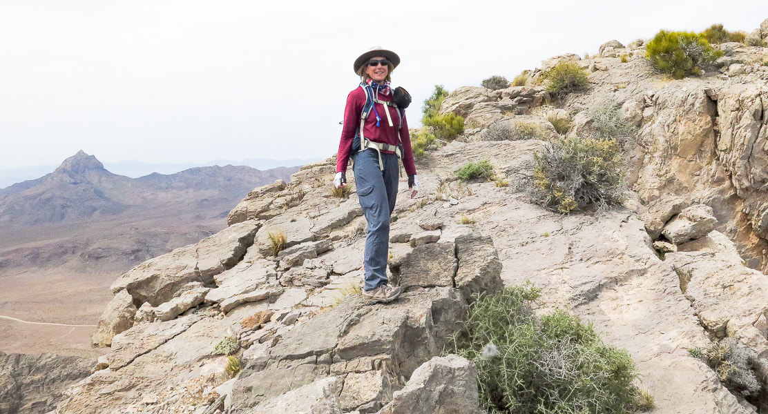 Sue on fun "slickrock" section on ridge - Moapa Peak in background.  Fun walking on ridge line 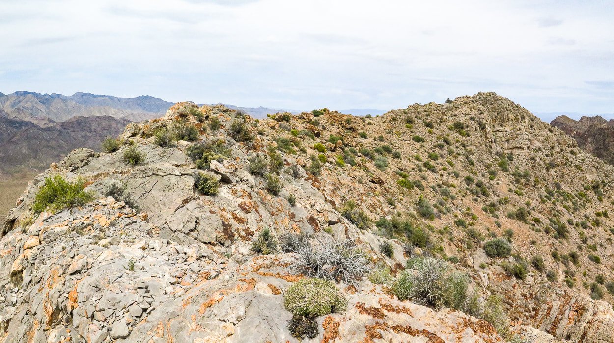 Summit ridge - summit at right 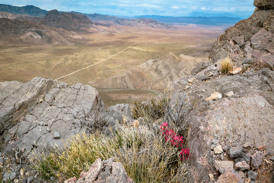 Indian paintbrush on summit. looking northwest to the Mormon Mountains. 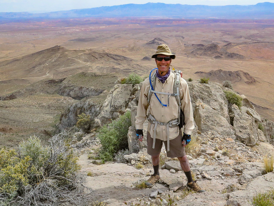 Fred on Davidson Peak summit - what better way to spend Sunday afternoon than summit a Basin and Range peak? 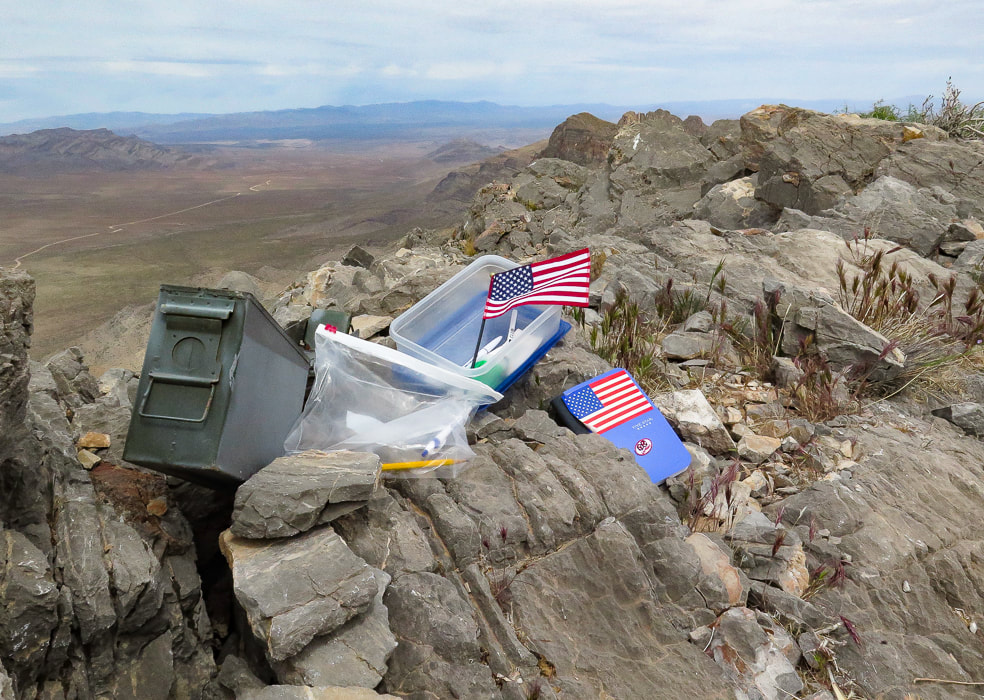 A very patriotic and organized peak register. 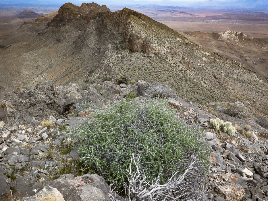 On summit looking north at the East Mormon Mountains ridge. 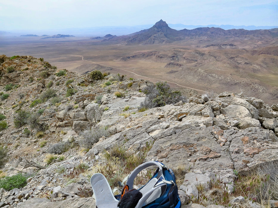 On summit looking at Moapa Peak to the southwest, south of Mormon Mountains. (looks like a fun peak to climb).  Descending from the summit to follow the ridge back down.  Limestone "slickrock" section! 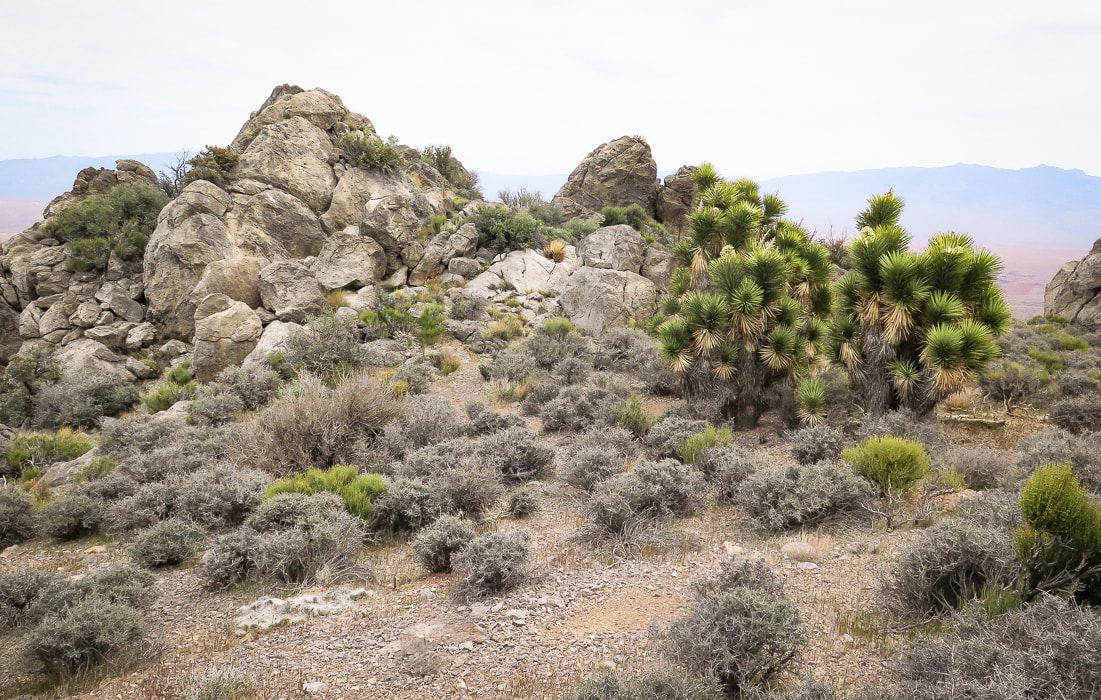 Back to the Joshua trees in the saddle or flat part of the ridge. We went around to the right.   Looking back - we came down the small gulley just off the ridge instead of following ridge to toe.  Parting shot of Davidson Peak. 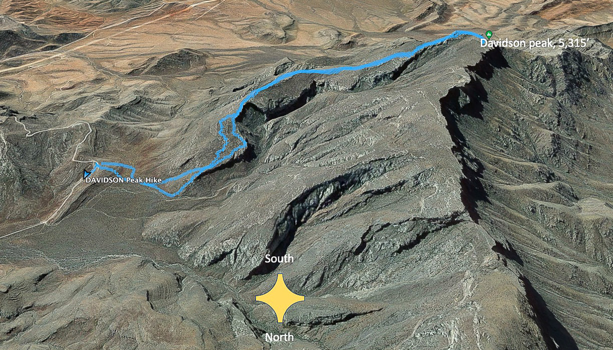 Our tracks - South direction at top of map. The road we started at is Sheep Pens Road; there is a spur road off of Sheep Pen that a good 4-WD vehicle could drive to the base of Davidson's east ridge. 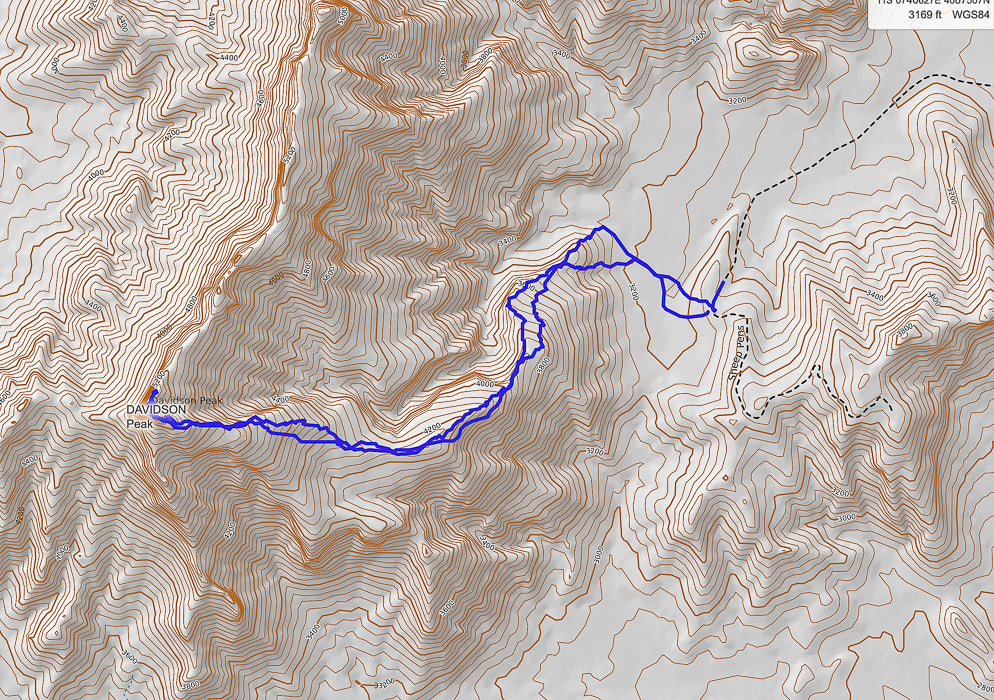 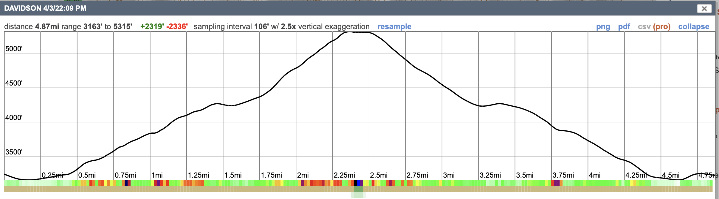 GPS tracks and profile. References
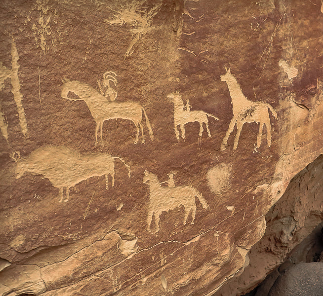
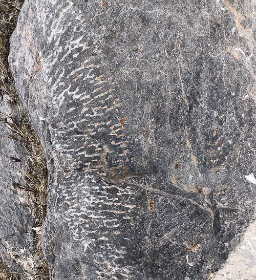
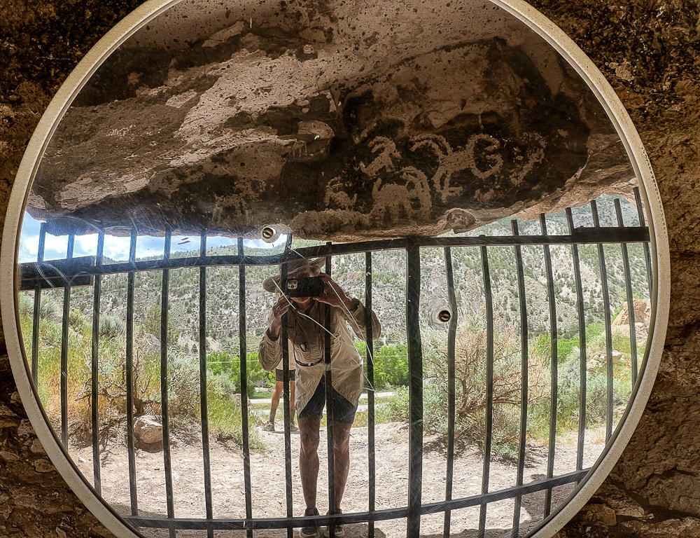
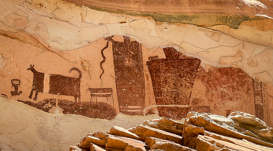
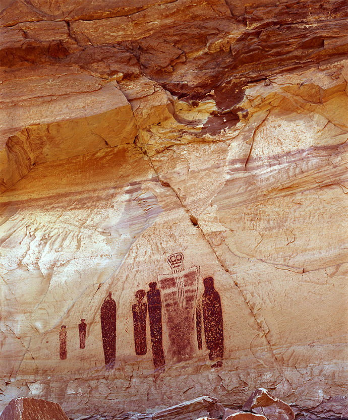
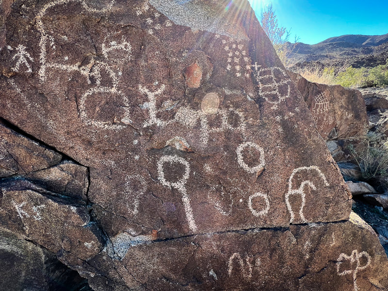
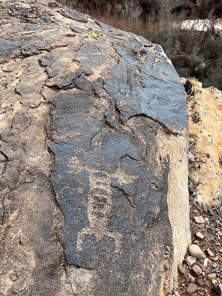
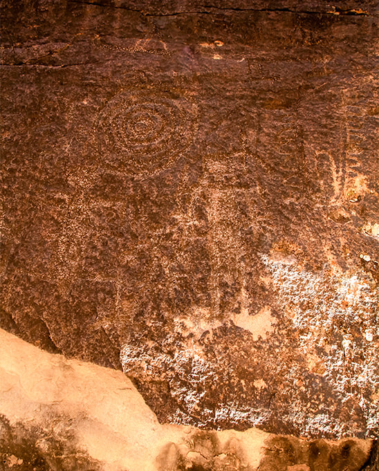
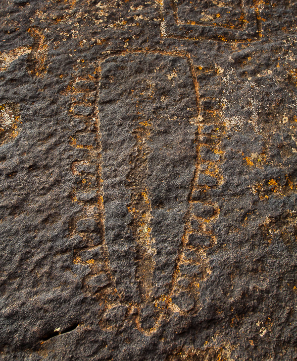
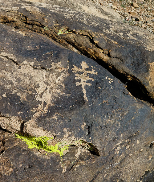
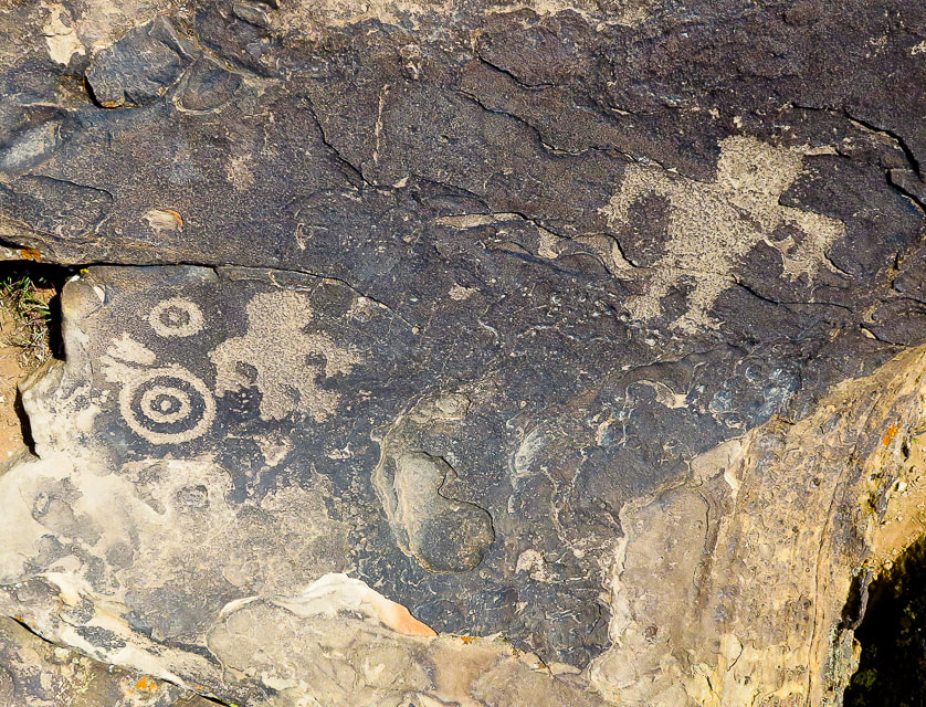
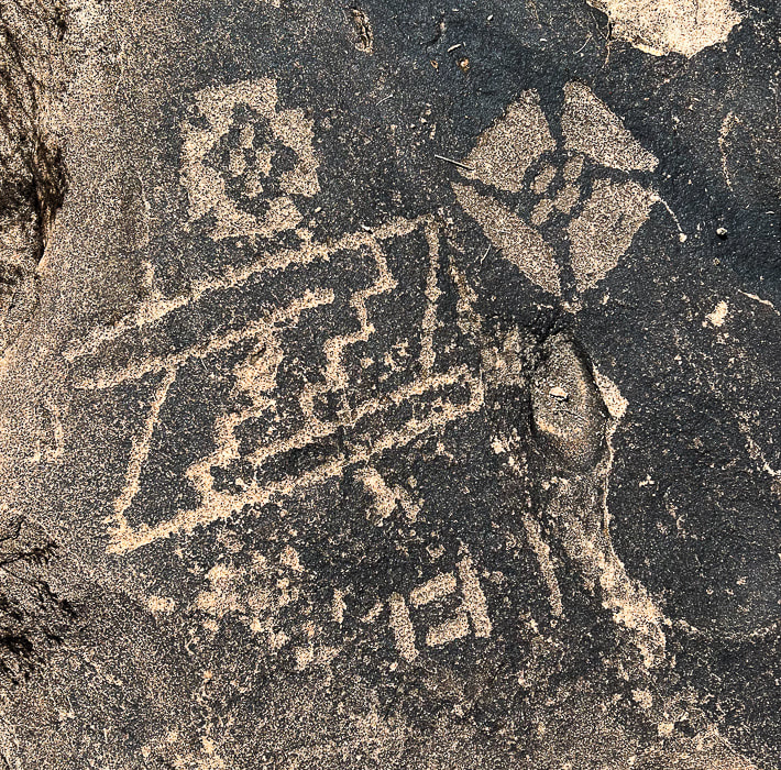
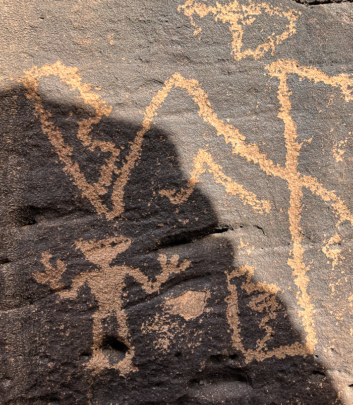
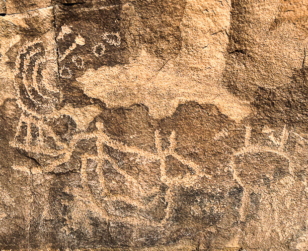
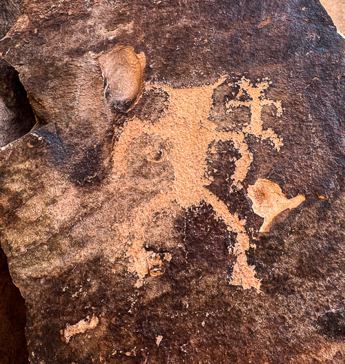
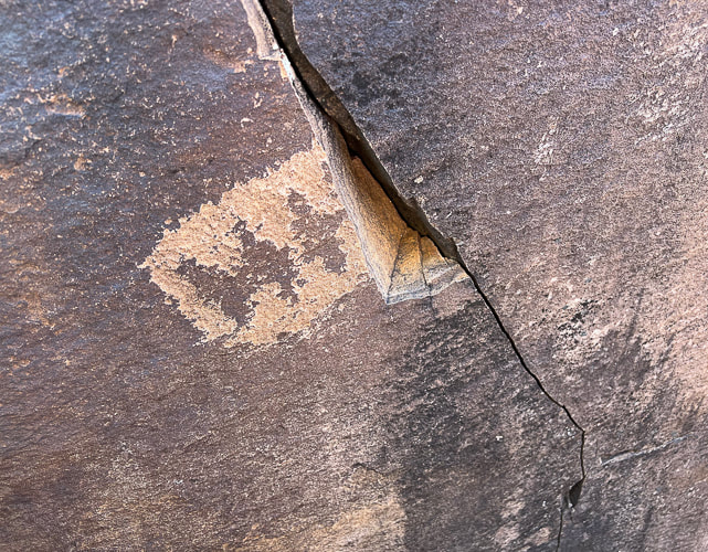
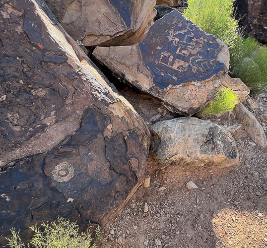
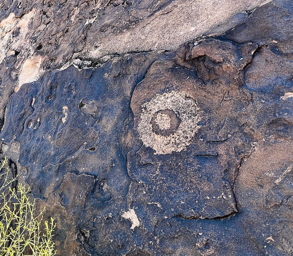
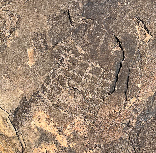
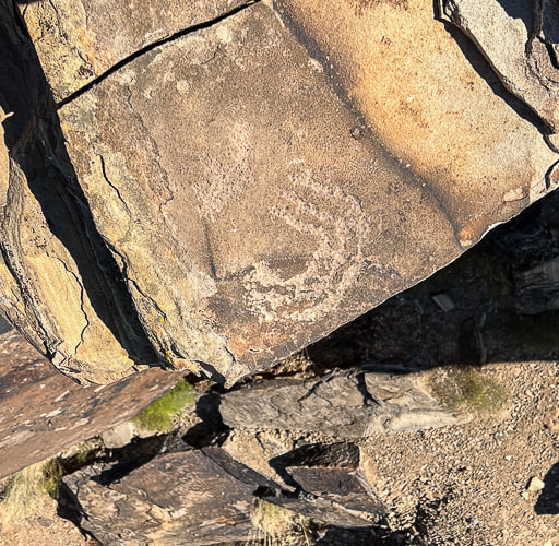
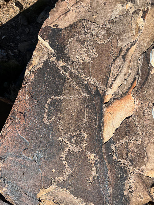
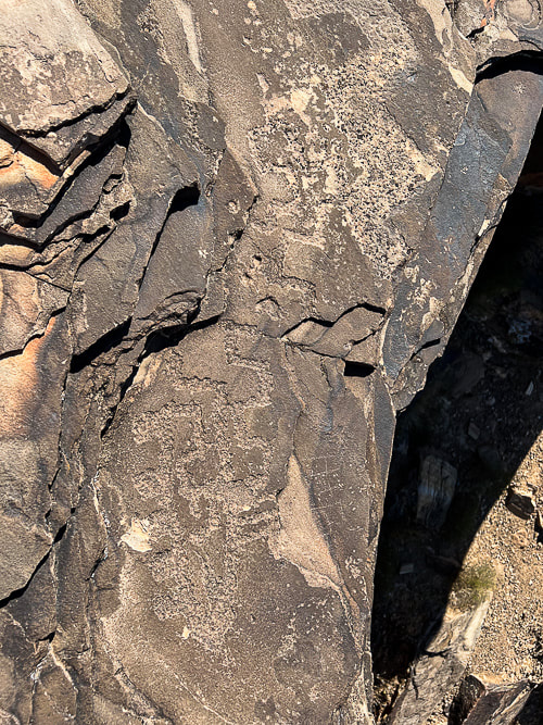
Axen, G.J. , Wernicke, B.P., Skelly, M.F., Taylor, W.J. 1990. Mesozoic and Cenozoic tectonics of the Sevier thrust belt in the Virgin River Valley area, southern Nevada. Geological Society of America - Memoir 176. In the book, Basin and Range Extensional Tectonics near the latitude of Las Vegas, Nevada. Simplified geologic map of the Mormon Mountains - Tule Springs Hills - Beaver Dam Mountains transect. Uploaded by Gary Axen. www.ResearchGate.net. We found the hidden and amazing "rattlesnake" petroglyph in the Santa Clara River Reserve which led to discoveries of a mix of representational and abstract-geometric designs in the St. George, Utah area. Utah is the Rock Art State. On March 6, 2017, Utah's governor signed into law designating Native American rock art as Utah's official works of art.
Panel of petroglyphs high above the Santa Clara River on the Anasazi Trail in Ivins, Utah. This area was used by both Ancestral Puebloans and Southern Paiutes.
Related posts:
What do they "mean"? Thirty years ago, I liked to hike to a single large boulder with a petroglyph of a rattlesnake curved around a recumbent human reaching for a cross in the Indian Canyons of Palm Springs, California (see below). It's made of connected squares, a concentric circle, and a line-enclosed cross. At least that was my interpretation of this petroglyph in the Agua Caliente Band of Cahuilla Indians Reservation. But after reading more about petroglyphs, I've discovered that it might not represent a rattlesnake at all, but a series of connected abstract shapes such as chained squares. Many archaeologists have concluded that questions of "what does this mean?" cannot be answered, especially regarding abstract geometric rock carvings. Instead of attempting to decipher meanings and assign symbols, scientists try to identify similarities in rock art and its occurrence in certain southwestern regions. In some cases, however, a definitive symbol or meaning can be attributed to certain petroglyph images, like zigzags that portray lightning to the present-day Hopi Indians. The spiral petroglyph is consistently interpreted as multiple migrations. In his book, Other Truths not Guessed: The Story of the Sevier Fremont Indian, Kenneth Olsen Kohler says, "The study to interpret the meaning of this pecking or painting may never be found as it lies hidden in the heart of those who understood what they wanted to communicate upon the rock." ** Since writing this post, a reader, who is passionate about petroglyph sites, contacted me with a book recommendation that I found helpful: A Field Guide to Rock Art Symbols of the Greater Southwest by Alex Patterson. It is a comprehensive guide to identifying petroglyph symbolism for human-like, animal-like and abstract forms. It illustrates and explains a large array of petroglyphs. Thanks for the suggestion! 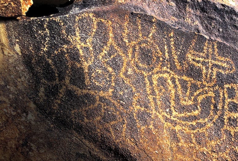 Petroglyph in Indian Canyons, Agua Caliente Indian Reservation, Palm Springs, California. Photograph by Anthony W. Purnel, featured in Palm Springs Life Magazine (see reference below). 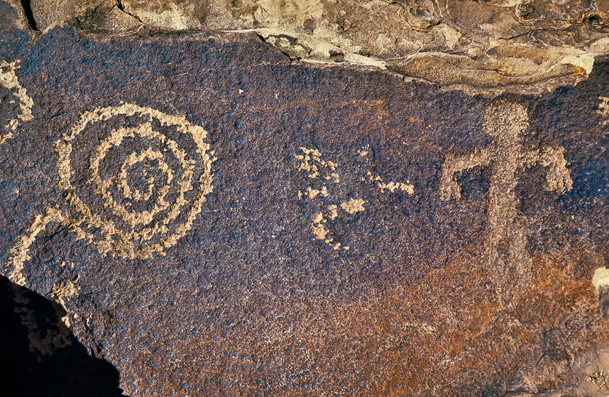 A spiral petroglyph on Anasazi Valley Trail, Ivins, Utah The Search for the Rattlesnake A few months ago, Fred and I met a Bureau of Land Management guy patrolling 4-wheel drive roads near St. George, Utah. He gave us a "tip" about a "rattlesnake" petroglyph on a giant boulder overlooking the Santa Clara River. A short bike ride took us to what might be the boulder we were searching for, but there were no petroglyphs on the side facing the river. It had tumbled down from the vertical cliffs above. We grounded our bikes and made a short steep hike to its backside facing the cliff and there it was - a serpentine form weaving around different abstract images, most of them ovals of connected circles, reminding me of necklaces. The whole rock, petroglyphs included are covered with lichen. The bottom markings are mostly obscured by desert varnish, a thin dark coating made of clay minerals and manganese and iron oxides - more so than the top petroglyphs. We were amazed that most of this boulder was covered with various carved shapes, including animals, perhaps desert bighorn sheep, which are among the most prevalent animal petroglyphs in the southwest. The lower petroglyphs could have been made before the upper petroglyphs, because they were covered with desert varnish. 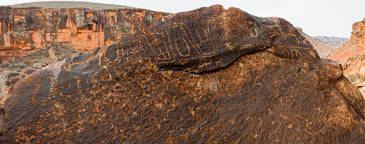 Huge boulder with lots of abstract-geometric petroglyphs in the Santa Clara River Reserve near St. George, Utah. The lower petroglyphs are covered more with rock varnish than the top markings. 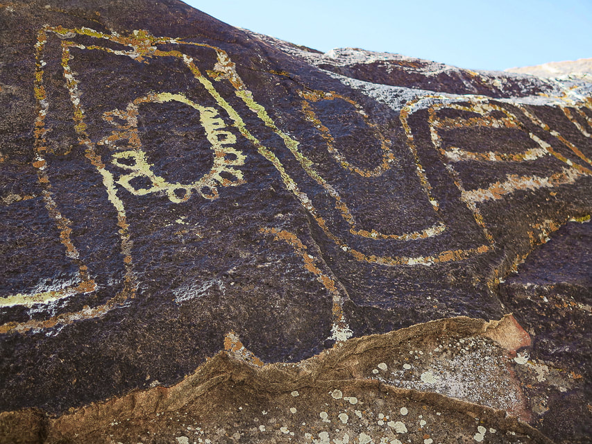 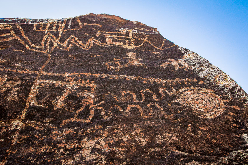 Both images above are close-ups of "rattlesnake" boulder in Santa Clara River Reserve. Most of the petroglyphs shown here are located in the Santa Clara River Reserve, administered by the Bureau of Land Management near St. George, Utah. The Anasazi Valley Trail (Tempi'po'op) leads to petroglyphs on tops and sides of sandstone boulders. Many were made about 1,000 years ago by ancestral Puebloans who were farmers in permanent settlements. It must have been an inspiring site for these ancient people because it overlooks the Santa Clara River far below, steadily eroding a route over the millennia, a huge valley of tilted layered rock mesas and drainages, and the Beaver Dam Mountains, snow-covered in winter. Since moving to the St. George area, petroglyph-finding missions have yielded not only fascinating ancient rock art, but also countless places to explore and a growing appreciation of southern Utah as one of the most beautiful places on Earth. 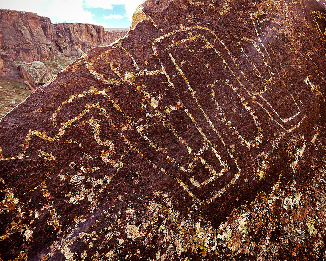 Looks like the head of a snake? 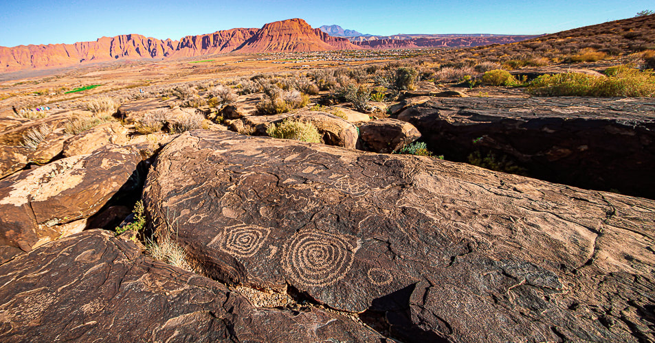 The Tempi'po'op (means "rock writing" in Southern Paiute language) trail near Ivins, Utah. Red Mountain and Snow Canyon State Park in the distance. The "Geometric Enigma" Some of the oldest petroglyphs in the New World are 13,000 - 14,000 years old - coinciding with the final stages of the last ice age (Pleistocene epoch). An excellent book, Early Rock Art of the American West: The Geometric Enigma thoroughly discusses abstract-geometric petroglyphs, the oldest form of rock art. In the American West, the authors call this art the "Western Archaic Tradition." It preceded figurative art such as human and animal forms. The authors, who have written other books on prehistoric art, propose theories as to why early American West inhabitants created art, and discuss ancestral minds and symbolism and hypotheses regarding the "peopling" of the Americas. This book proposes a number of hypotheses explaining why prehistoric humans made abstract markings. The Sexual Duality Hypothesis identified a sexual polarity symbolism which included male signs of dots, barbed elements, short strokes, and spear-thrower signs. Female geometric designs included oval, triangular and quadrangular shapes. The Shamanistic hypothesis indicates that shamans acted as a connection to the spiritual world through altered states of consciousness. The initial stage of the shamanistic trance identifies geometric mental images such as grids, sets of parallel lines, dots and flecks, and zigzags. After emerging from the third stage of shamanistic trance, a participant would pay tribute to their visionary experiences by engraving them on rock surfaces. Yet a third hypothesis is the Neurovisual Resonance Theory, whose premise is that geometric shapes and patterns are appealing to humans, and they were built into the neural structuring part of our brain millions of years ago. Making these petroglyphs helped humans to feel emotionally rewarded and reinforce survival behavior. The brain's visual cortex "resonates" when geometric shapes and patterns are made and a feedback loop is created that provides the stimulus for making abstract marks. We may never know exactly why these abstract-geometric designs were made and what specific purposes they had, but we may conclude that they are evidence of the artist's desire to to find meaning by presenting it in a tangible form - a petroglyph. Viewing petroglyphs in an inspirational setting causes one to suspend time for a few minutes and imagine how it was made hundreds and thousands of years ago. I added some images of petroglyphs from my post Utah's Red Rock Country from other adventures in southeast Utah. For the Geocurious - The Rock Varnish Enigma Many petroglyphs are created by carving, pecking, and hammering through a very thin (measured in nanometers), dark coating of desert varnish to reveal the lighter-colored rock underneath. This coating is enriched with iron and manganese oxides that cement clay minerals to the rock and is abundant in arid regions. Some scientists say that it is a sedimentary layer that contains bacterial microorganisms, so it has a microbial origin. How exactly desert varnish is formed is still under debate. Studies use microscale imaging techniques to try and figure out its ingredients. Do microorganisms create varnish or do they use varnish as a habitat? Varnish contains 2 to 3 times more manganese than the underlying rock indicating manganese enrichment. Varnish grows slowly - tens of microns over a thousand years. Lately scientists have considered rock varnish to be of environmental significance because it could show change in paleoclimate through the varying thickness of its manganese layers. 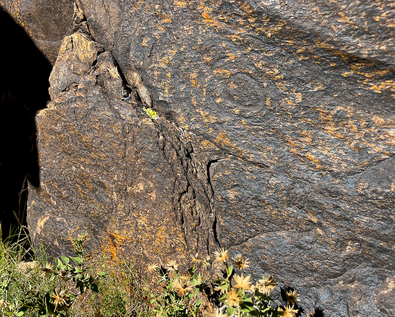 Fully re-patinated spiral on Tempi'po'op Trail. The rock also exhibits slickensides: smooth polished rock surface as a result of frictional movement of rocks along a fault. The direction of the lines runs from top left to bottom right. 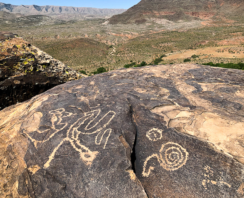  The Holy Ghost panel in the Great Gallery, Horseshoe Canyon, Utah The tallest painted figure is called the Holy Ghost and is ~ 8 feet in height. These figures are thought to represent spirits. Utah's Red Rock Country 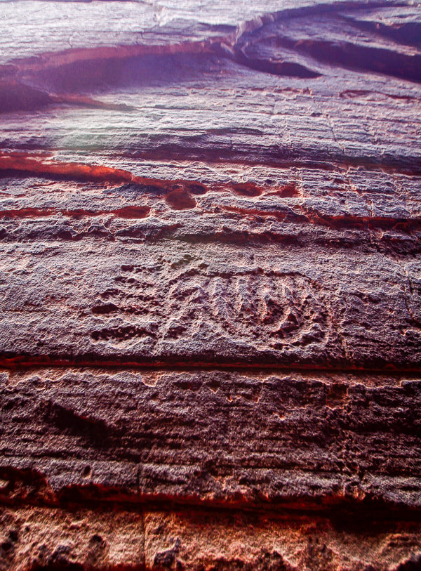 Slot canyon in Snow Canyon State Park 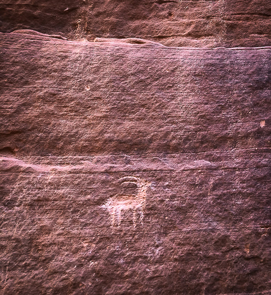 Wire Pass near Buckskin Gulch in Paria Canyon-Vermillion Cliffs Wilderness Area. 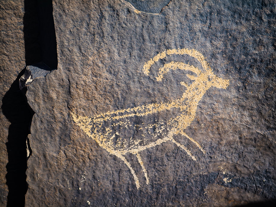
Recently added to this post: Every time I go to the Santa Clara River Reserve, I find more petroglyphs! 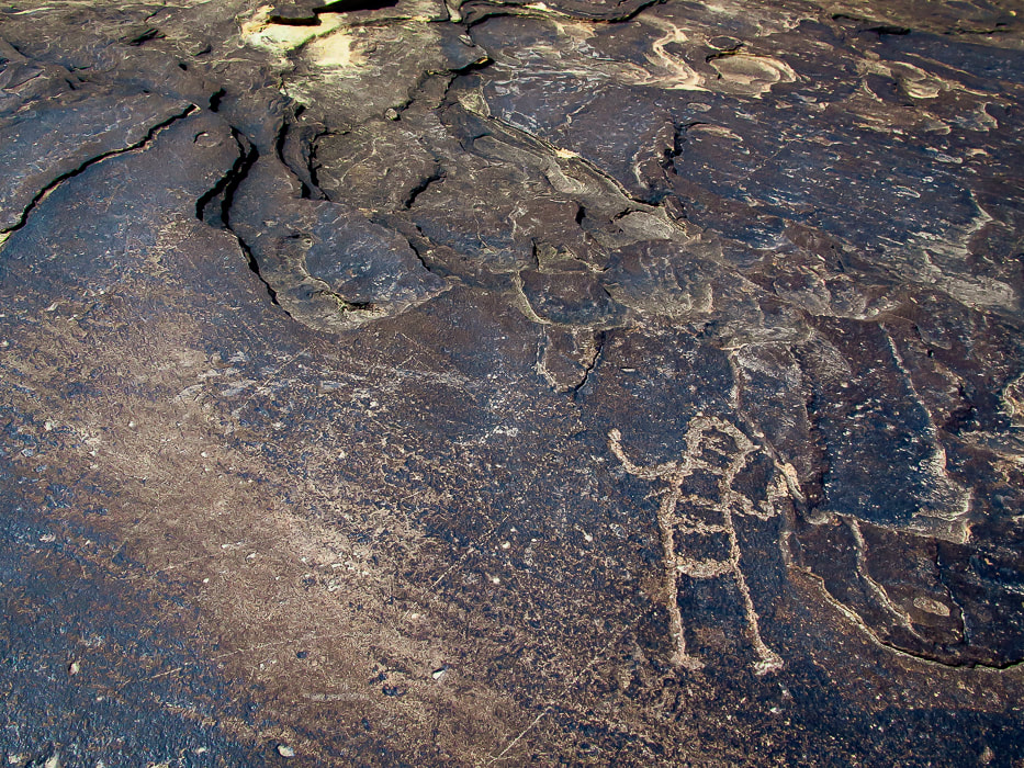 Ancestral Puebloan-style petroglyph on the Anasazi Valley Trail, overlooking the Santa Clara River. Petroglyphs from Tempi'po'op Trail The top two images are from the "rattlesnake" petroglyph in Santa Clara River Reserve. They are positioned on the bottom of the boulder where the carvings appear to have more desert varnish than the upper petroglyphs. 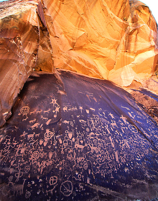 Newspaper Rock Newspaper Rock State Historic Monument, Utah. 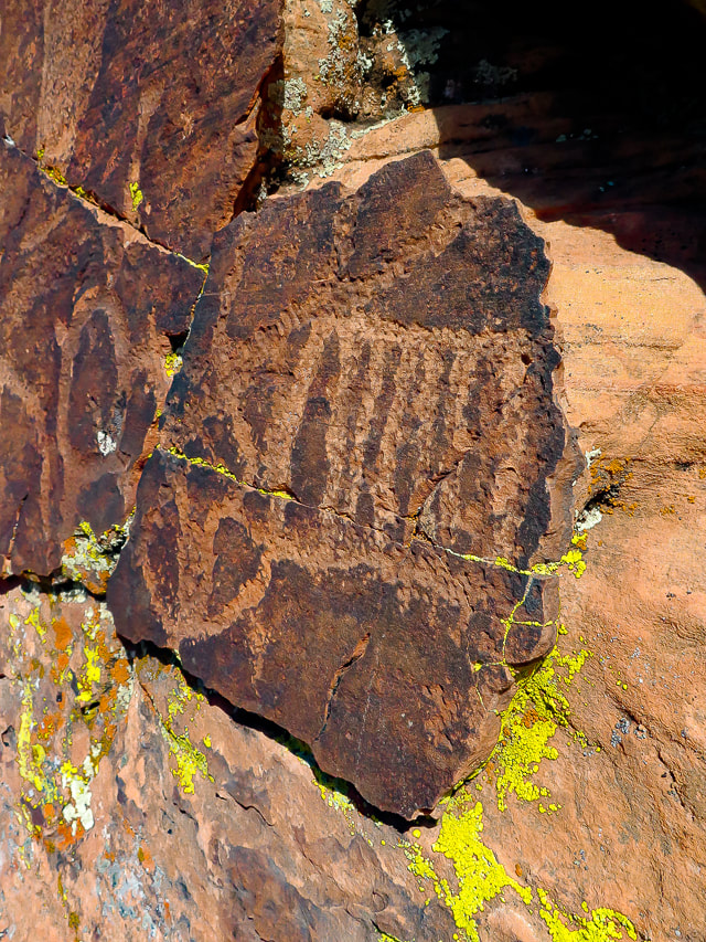 Geometric petroglyphs near Snow Canyon State Park, Utah. 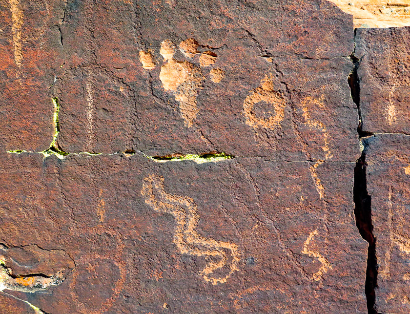 Near Snow Canyon State Park. Note the petroglyph on the left is covered with varnish more so than the petroglyphs to the right. 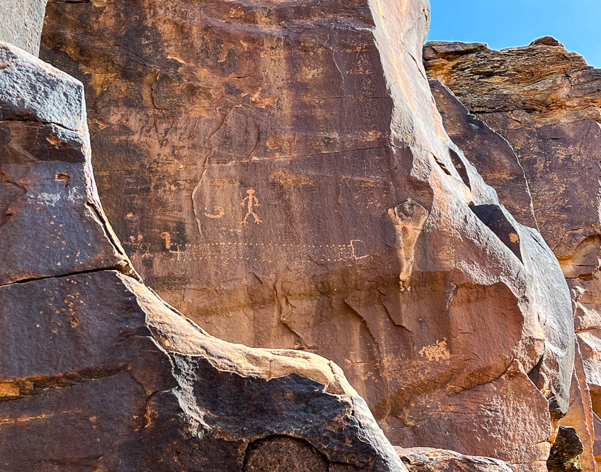 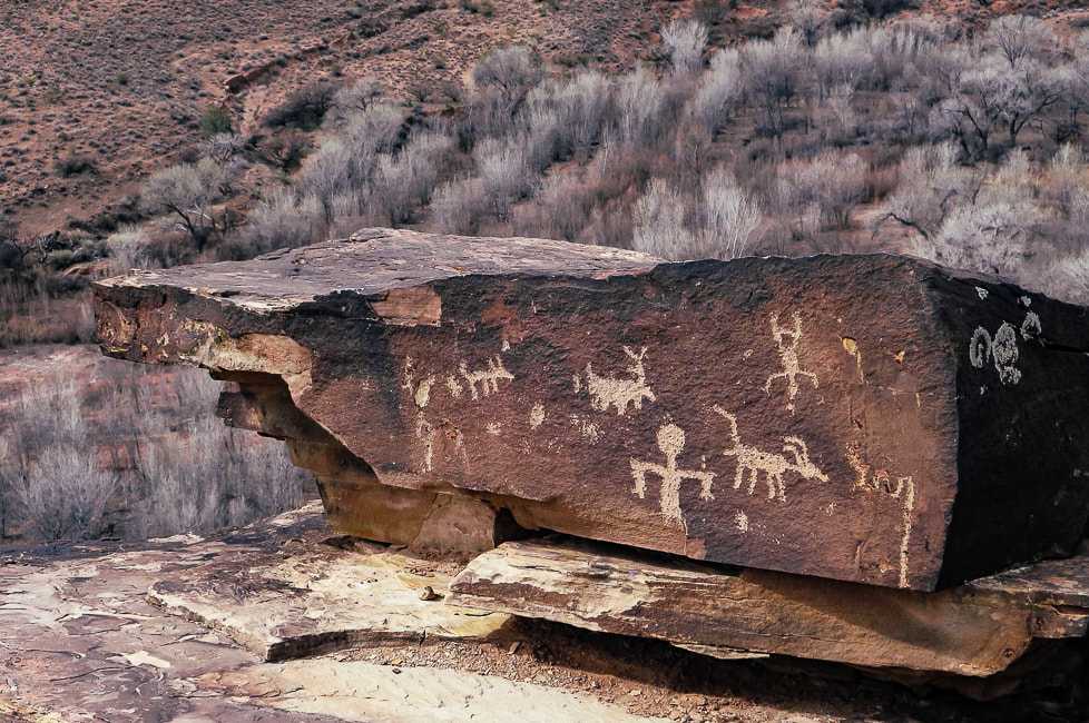 Ancestral Puebloan panel on the Tempi'po'op Trail. 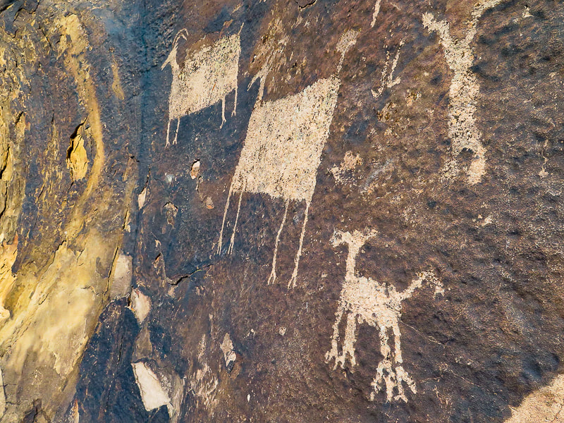 Anasazi Valley Trail 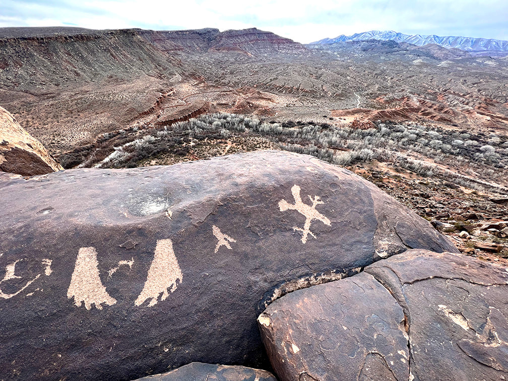 Looking toward the west from the Anasazi Valley Trail over Santa Clara River and Beaver Dam Mountains on the horizon. 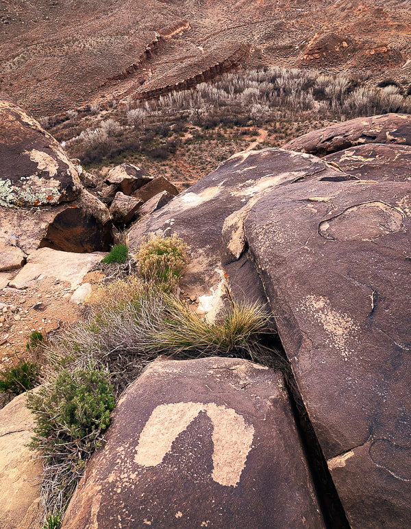 These may be an example of the "fat footprints" representative of the Western Virgin Kayenta Style that appear in Puebloan sites in the St. George, Utah area. Overlooking the Santa Clara River. 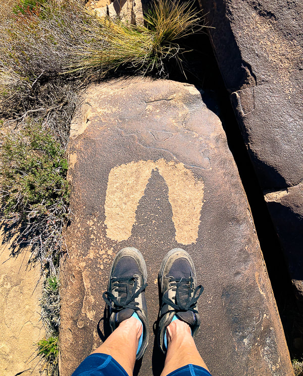 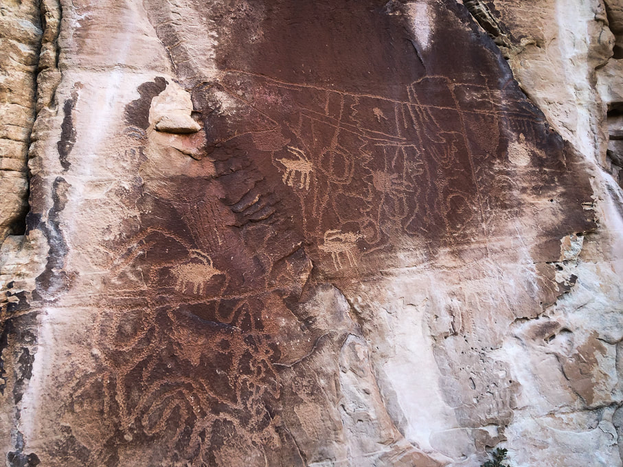 You can tell the older from the "newer". Near Snow Canyon 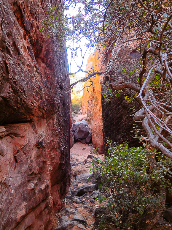 Canyon leading to petroglyphs in Snow Canyon State Park, Utah. 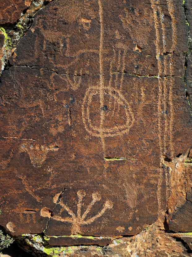 Petroglyphs just off the Gila Trail in Snow Canyon State Park. Some appear to be older than others. 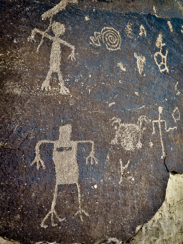 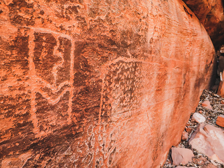 Deeply pecked abstract geometric petroglyphs near Gila Trail in Snow Canyon. 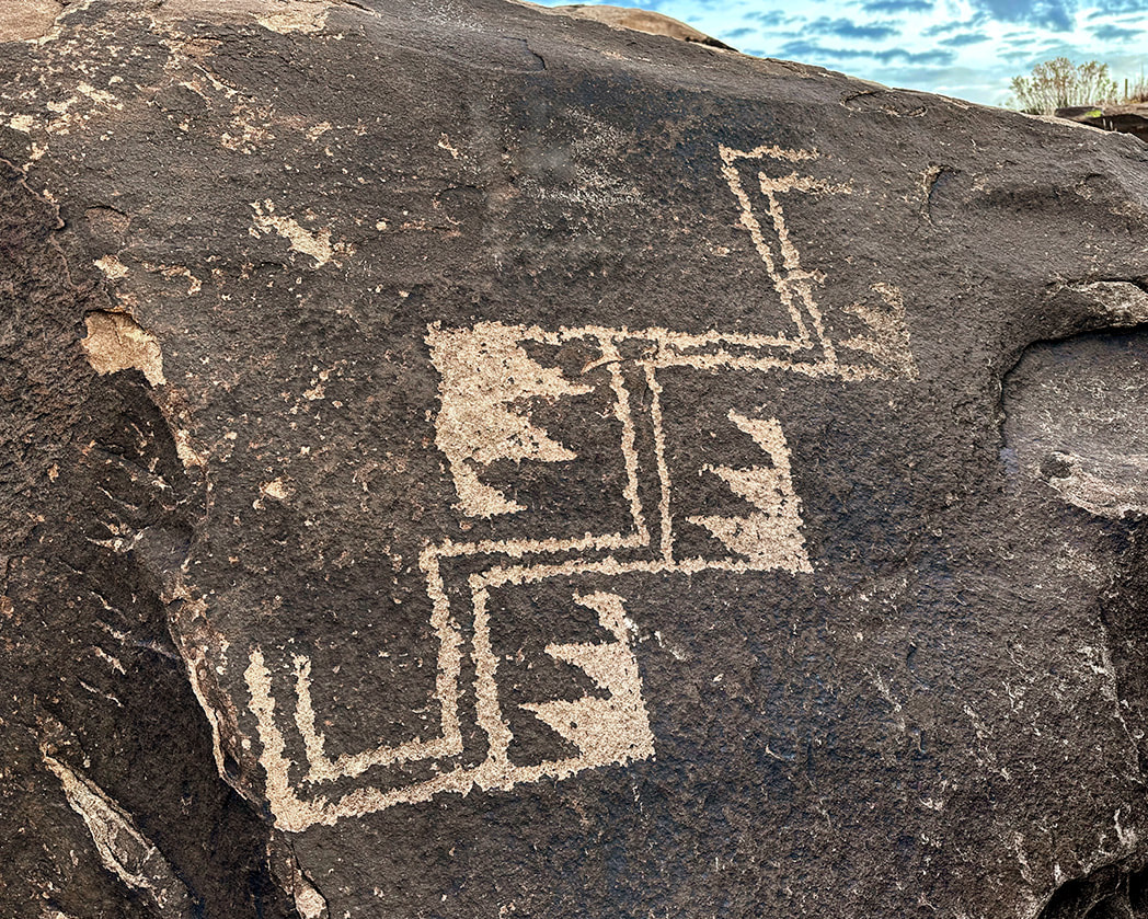 Overlooking the Santa Clara River near Ivins.
I recently found these and keep adding to the collection of images on this post. I find new petroglyphs quite often at the Tempi'po'op Trail. These appear to be re-patinated. 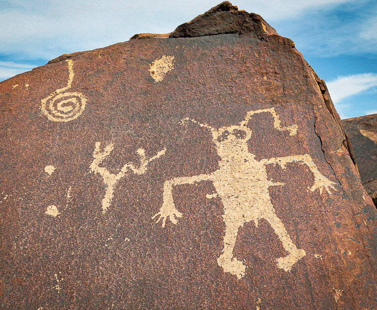 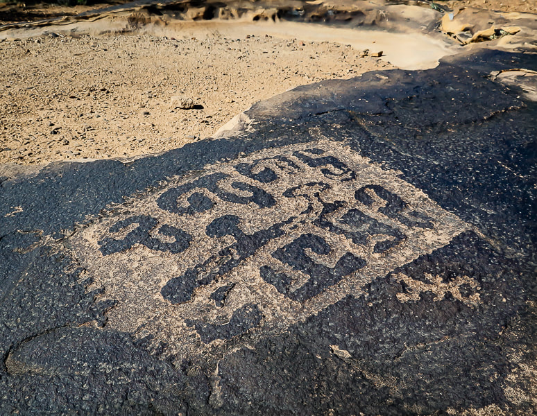 I just happened to stumble upon this amazing petroglyph as I was trying to find a trail down to my house. 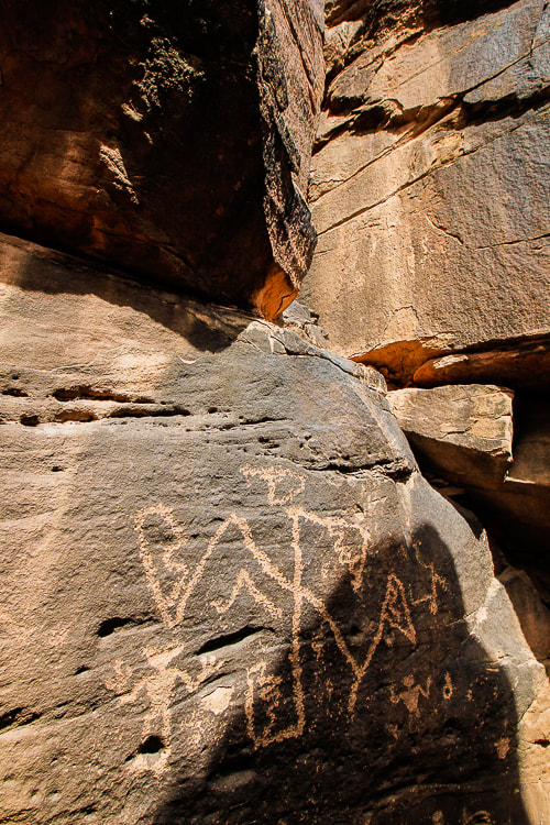 You have to climb through two narrow openings to get to this one, and then there are more petroglyphs higher than this that I was not able to climb to. 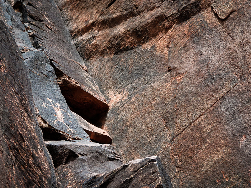 I couldn't climb up to this one; this is my best attempt at sticking my camera over my head. 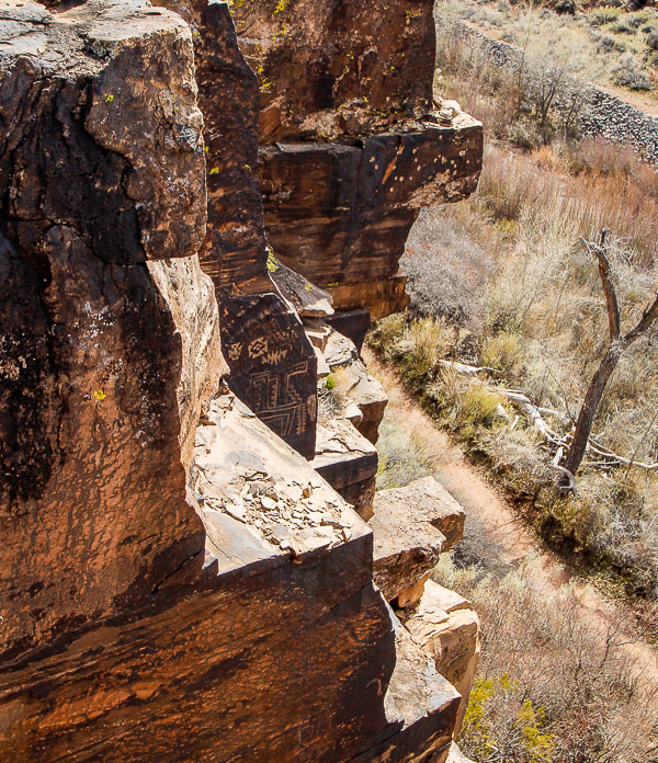 How did they get to these places? Obviously better climbers than me! 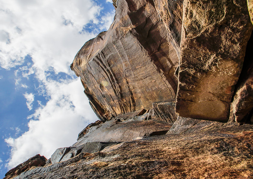 There are a few small petroglyphs on this wall. 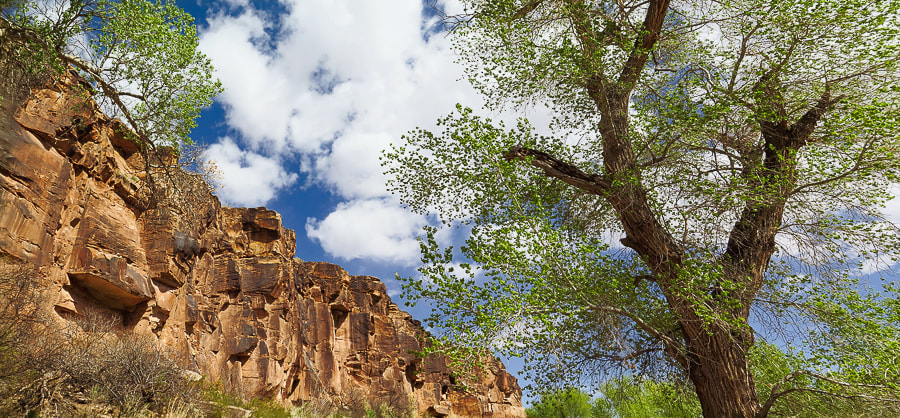 Cottonwoods along Santa Clara River are just beginning to leaf out. 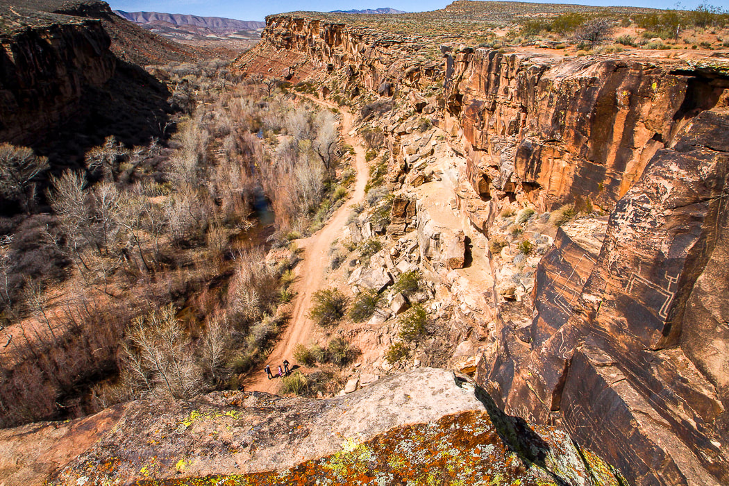 Santa Clara River Reserve - note petroglyphs on cliffs to the right. 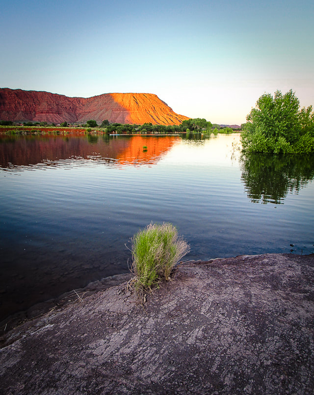 Ivins Reservoir and Red Mountain References
Breeding, A. 2019. Written in Stone. Palm Springs Life Magazine. Desert Publications, Inc. Jones, K. 2019. Standing on the Walls of Time: Ancient Art of Utah's Cliffs and Canyons. University of Utah Press. Lingappa, U., Yeager, C., Sharma, A., Fischer, W. 6/14/2021. An Ecophysiological Explanation for Manganese Enrichment in Rock Varnish. Proceedings of the National Academy of Sciences. (from the internet). Malotki, E., Dissanayake, E. 2018. Early Rock Art of the American West: A Geometric Enigma. University of Washington Press. |
Categories
All

Sue and Fred

About this blogExploration documentaries – "explorumentaries" list trip stats and highlights of each hike or bike ride, often with some interesting history or geology. Years ago, I wrote these for friends and family to let them know what my husband, Fred and I were up to on weekends, and also to showcase the incredible land of the west.
To Subscribe to Explorumentary adventure blog and receive new posts by email: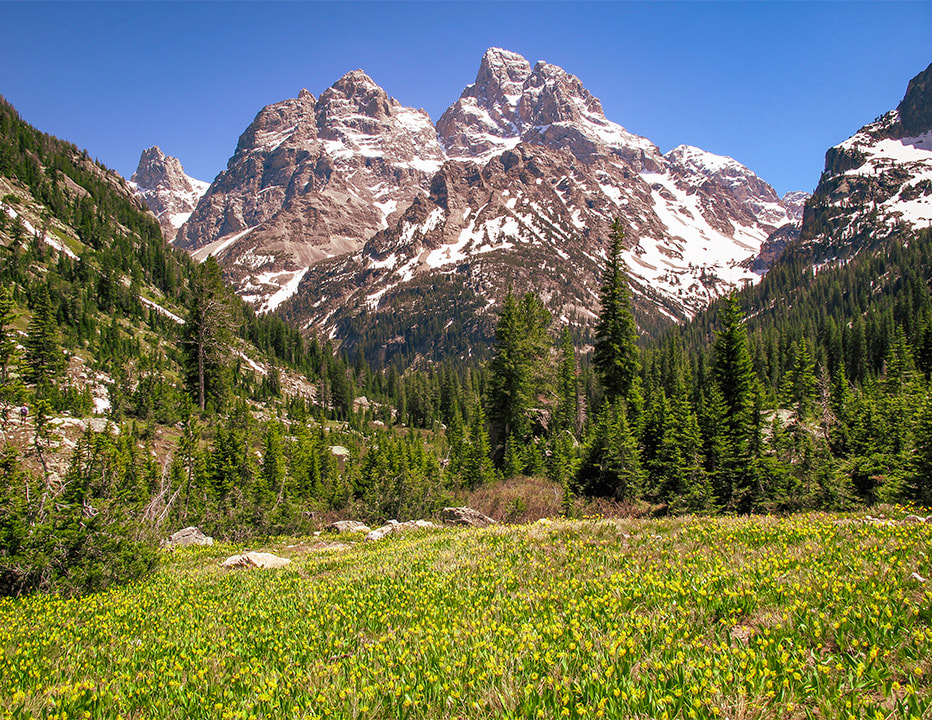
Happy Spring!

About the Author
|