EXPLORUMENTARY
  • Home
    • Cactus to Clouds Hike
    • More Quotes
    • Ann Zwinger Quotes
    • Mary Oliver Poems
  • Hikes by State
    • Idaho
    • Southern Utah
    • Arizona
    • California Desert
    • Nevada
    • Wyoming
  • BLOGS
    • Adventure Blog
    • Women and the Land
  • GALLERY
    • DESERT PLANTS >
      • Beavertail cactus
      • Brittlebush
      • Christmas Cactus
      • Arizona Barrel Cactus
      • Parry's penstemon
      • Agave
      • Arizona Rainbow Hedgehog
      • Claret Cup Hedgehog
      • Desert Agave
      • Palmer's Penstemon
      • Silver Cholla
      • Cristate Saguaro
      • Indian Paintbrush
      • Ocotillo
      • Santa Rita Prickly Pear
      • Spiny Cliffbrake
      • California Barrel Cactus
      • Engelmann Prickly Pear
      • Velvet Mesquite
      • Joshua Tree
      • Buckhorn Cholla
      • Hedgehog Cactus
      • Fishhook cactus
      • Thompson's Woolly Locoweed
    • NATURE
    • BOISE
    • EARTH + SKY
    • URBAN
    • WATER
    • PATRIOT
    • ORCHIDS
  • Fit After 50
    • Brian Holgate
    • Fred Birnbaum
    • Dave Brasuell
    • Bus' Little Black Book
    • Mike Carlson
    • Ray Wilson
    • Bryan Krouse
    • Vickie Kearney
    • Maria Keezer
    • DOUG TRAUBEL
    • Boise Cross Fit Masters Ladies
    • Tim Clemens
    • Marcia Bondy
    • Becky Borczon Blake >
      • Becky B Downtown
    • Jennifer Cera and Sue Birnbaum
    • Dave Brasuell
    • Vance Powell
  • About
    • CONTACT

Davidson Peak - Eastern Great Basin, Nevada

4/23/2022

2 Comments

 
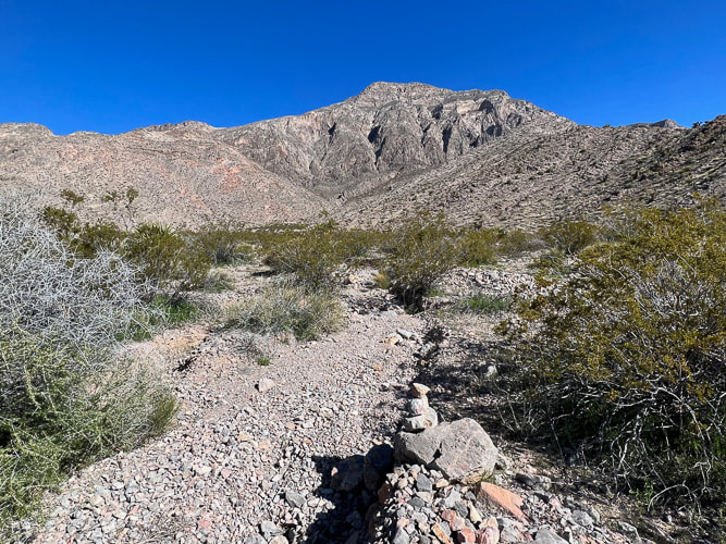
A high point in one of the Basin and Range mountain ranges, Davidson Peak is a fun ridge scramble on ancient sea limestone with great views of eastern Nevada and western Arizona.  ​
Related:
Wheeler Peak: 13,063', Great Basin NP, Nevada
​Virgin Peak: 8,071':  Seeking Solitude in the Mojave   
​
Explore Gold Butte NM and Little Virgin Peak, Nevada
Nevada Hikes - see sidebar
​Desert Plants
Picture
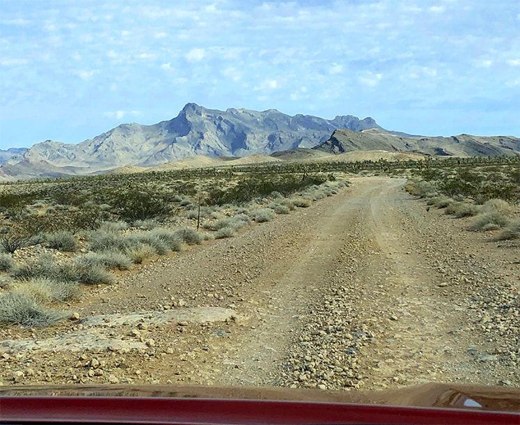
Approaching Davidson Peak from the south on Sheep Pens Road.
Trip Stats
Overview:  Observe in solitude the raw geologic events and forces that shaped the eastern Great Basin from the tilted limestone sediment summit of Davidson Peak.  The fun, rocky scramble up its east ridge has a steep "limestone slickrock" section and circumvents the huge gulch stretching down from the peak.  Pass over bryozoan and bright orange brachiopods on slopes with healthy Joshua trees and hedgehog cacti.
Location:  East Mormon Mountains in Mormon Mountain Wilderness BLM, near Mesquite, Nevada.
Distance/Elevation:  5 miles round trip;  2,200' elevation gain.  Start = 3,163',  summit = 5,315'.
Difficulty:  Moderate-strenuous Class 2 ridge hike.

Coordinates:  Trailhead = Sheep Pens Road = 36°53'59.14" N  114°17'51.92" W.   Summit = 36°53'45.36" N  114°19'27.51" W.
Navigational aids:  Bureau of Land Management - Nevada/Overton topo map,  Stav is Lost's trip report.
Date Hiked:  4/3/22
Geology:  East-tilted Cambrian through Pennsylvanian block rooted to its Precambrian basement rocks.
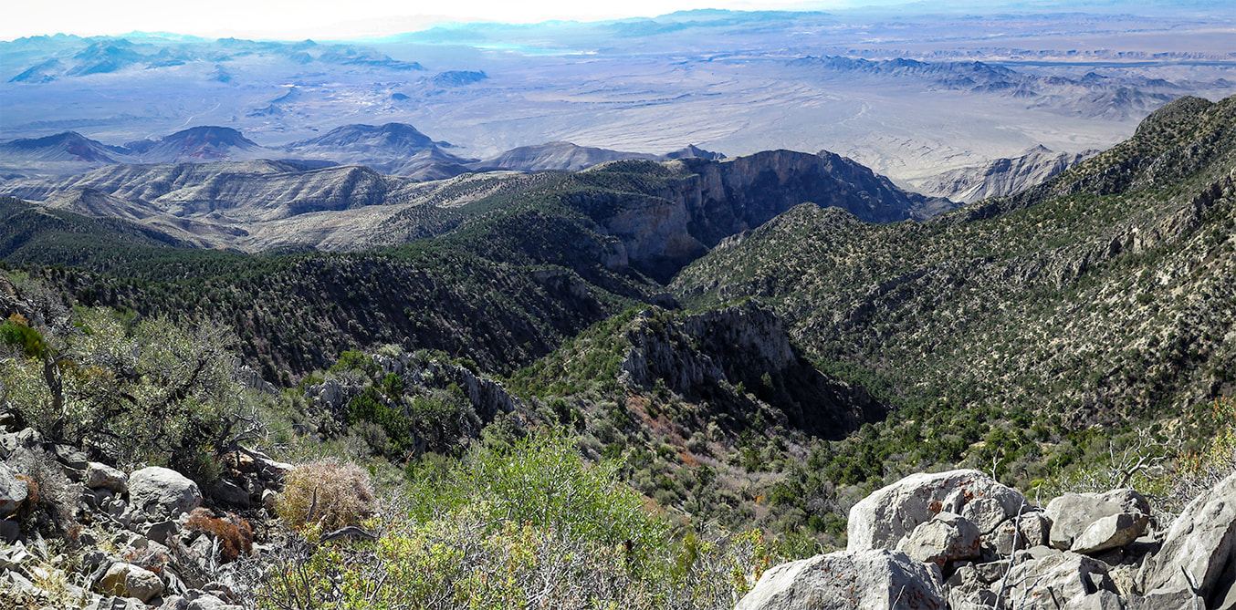
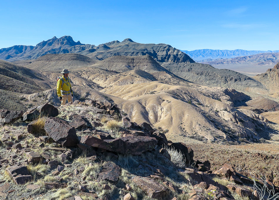
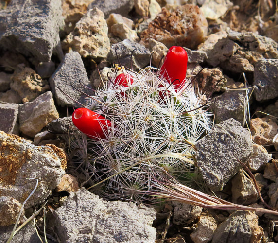
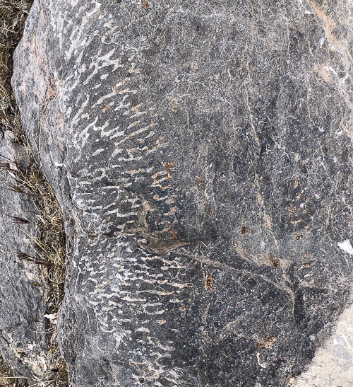
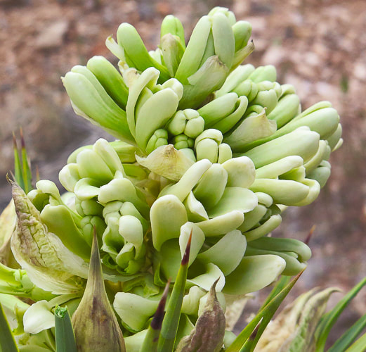
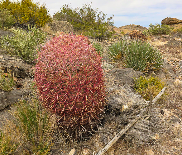
“A million years is a short time - the shortest worth messing with for most problems. You begin tuning your mind to a time scale that is the planet's time scale.  For me, it is almost unconscious now and is a kind of companionship with the earth.”
-  John McPhee, Basin and Range

​A high point to one of the many parallel Great Basin mountain ranges, the horn-shaped summit of Davidson Peak with its steep west-facing cliffs rises solitary over the expansive Mojave desert as you drive on I-15 heading north from Las Vegas.  Formed during the time of shallow seas, when North America was closer to the equator, its rocks are 500 - 300 million years old and contain coral and brachiopod fossils.   This hike is a ridge ramble for the entire 2.5 miles to the summit, gaining roughly 1,000 feet per mile, and is surprisingly scenic and full of intriguing sights, like bright orange fossils and a gaping, seemingly bottomless gulch.

Our goal this year is to hike to as many high points of the Great Basin mountain ranges as we can, and Davidson is our third.  We hiked Wheeler Peak and Virgin Peak last autumn, both in the eastern-most Basin and Range region.  From Davidson's summit, we could see another target summit, Mormon Peak, the highest point in the Mormon Mountain Wilderness, northwest of Mesquite, a town on the border of Nevada and Arizona.  Nevada is the most mountainous state, so we have a lot of choices!

Another planned summit is North Schell Peak, a nearly 12,000-foot high point near Ely, Nevada.

Our Hike
The hike begins after a 12-mile drive north from I-15 that initially follows the Old Spanish Trail.  It is a good gravel road but nevertheless slow-going.  We parked on Sheep Pens Road just north of the radio towers.  A short spur road takes you to the base of Davidson's east ridge.  We walked to the end of this road and started up the ridge on the left side of a wide gulch;  a few cairns were present.   About 1/3 of the way up,  we encountered large rocks, so we skirted the left side of the ridge.

After skirting the ridge top, enter a beautiful valley/saddle with great places to take a break and enjoy very healthy Joshua trees, red barrel and prickly pear cacti.  Ahead, confront a steep climb to remain on the east ridge.  On the way up, we circumvented the actual ridge top to the right, looking down into the deep and wide gulch coming from the peak.  Davidson Peak is an easy scramble straight ahead.  However, it is not too difficult to stay on top of the ridge, requiring some use of hands for hoisting and balance, but mostly a Class 2.  The ridge to the summit is long and flat.

Summit Views
Mormon Peak is seen to the northwest, and the solitary hulk of Moapa Peak to the southwest.  The west side drops almost straight down .  We could see Virgin Peak to the southeast, an 8,000' summit we hiked last autumn, out of the Gold Butte National Monument.

On the way down, we stayed on top of the ridge all the way to the saddle, hiking over a fun, steep, smooth and relatively rockless limestone slab which elevated us high above steep drops on both sides.  We stayed for the most part on the ridge the rest of the way down and then descended through a shallow canyon to arrive at the spur road lined with yellow poppies.

The ancient Basin and Range mountain ranges rise above a stark and dusty desert; it appears as if there is not much there to discover.  But when you get into the "heart" of them, walk over their scratchy limestone and volcanic rocks, circumvent sharp yucca leaves and cactus spines, catch the sudden crimson blooms of a claret cup hedgehog, and feel the desert space you know you are in a special, unique and maybe even spiritual place.  
Keep On Exploring!
From Davidson Peak summit; looking at the ridge we ascended and Moapa Peak in the distance.
Picture
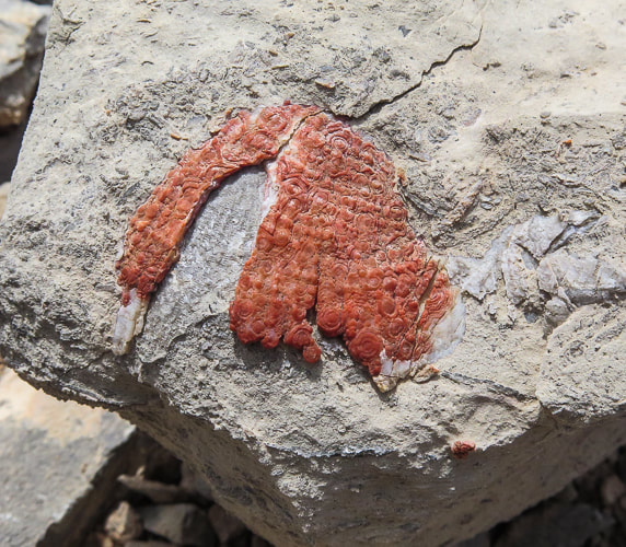
I'm not sure what this is - appears to be a fossil that has been exposed to a lot of iron - maybe a brachiopod?   If anyone knows what this may be, please let me know!
Picture
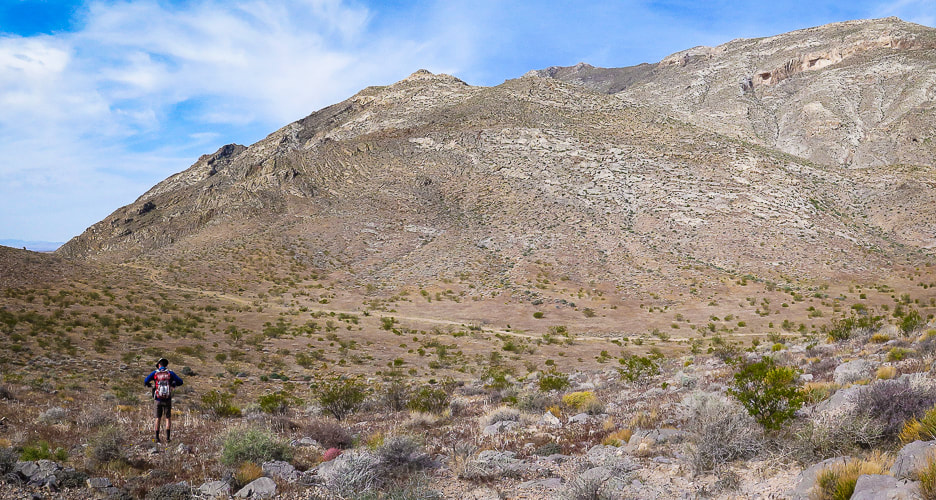
Start of hike; we parked on Sheep Pens Road before it ascended to communication towers and walked cross-country to a spur road from Sheep Pens that led to the base of Davidson's east ridge (right on photo).  Davidson Peak is highest point on the right.
Picture
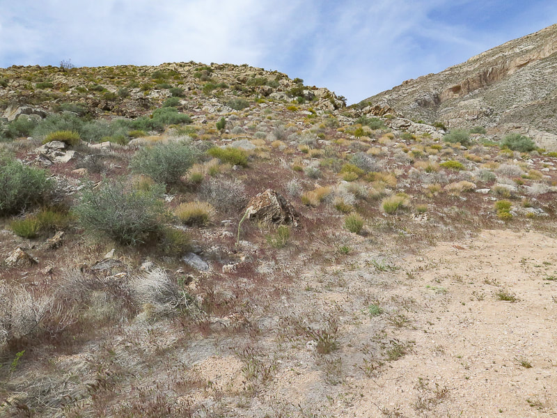
At end of spur road, we hiked up this east ridge with the large gulch to the right.  Stay on ridge to the top.
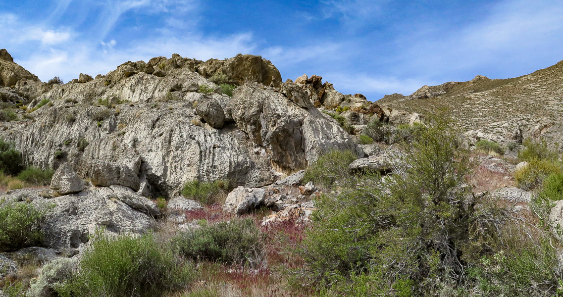
Picture
On the ridge
Picture
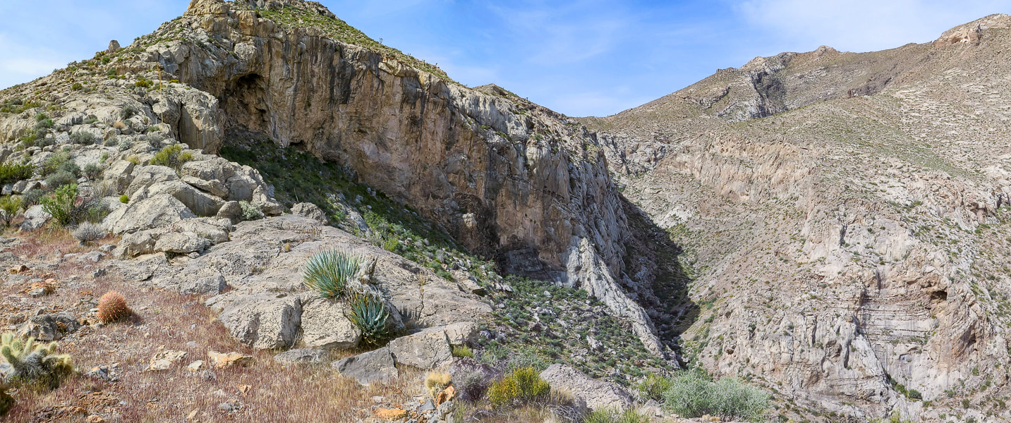
On the ridge, gulch below - summit far right
Picture
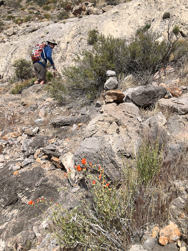
Skirting top of ridge cliffs by hiking on the left side of it ~ 1/3 of the way up.
Picture
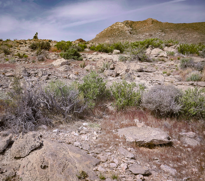
After skirting to the left side of cliffs, regain the ridge to arrive at beautiful saddle.
Picture
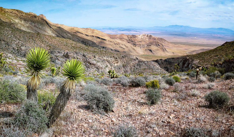
On saddle looking back at ridge on the right and large gully  - approach road faintly seen on desert floor.
Picture
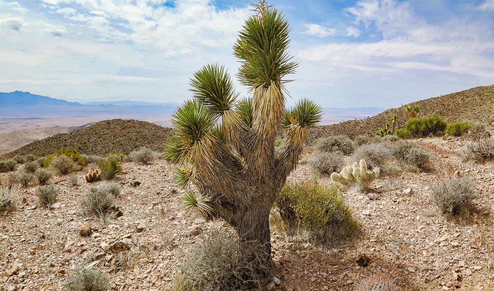
  Taking a break on the saddle; Joshua tree, hedgehog cactus, and prickly pear.
Some cool stuff on the trail:
Fishhook cactus, Indian Paintbrush on the summit, two photos of fossils (corals?), Joshua tree bloom, red barrel cactus.

Picture
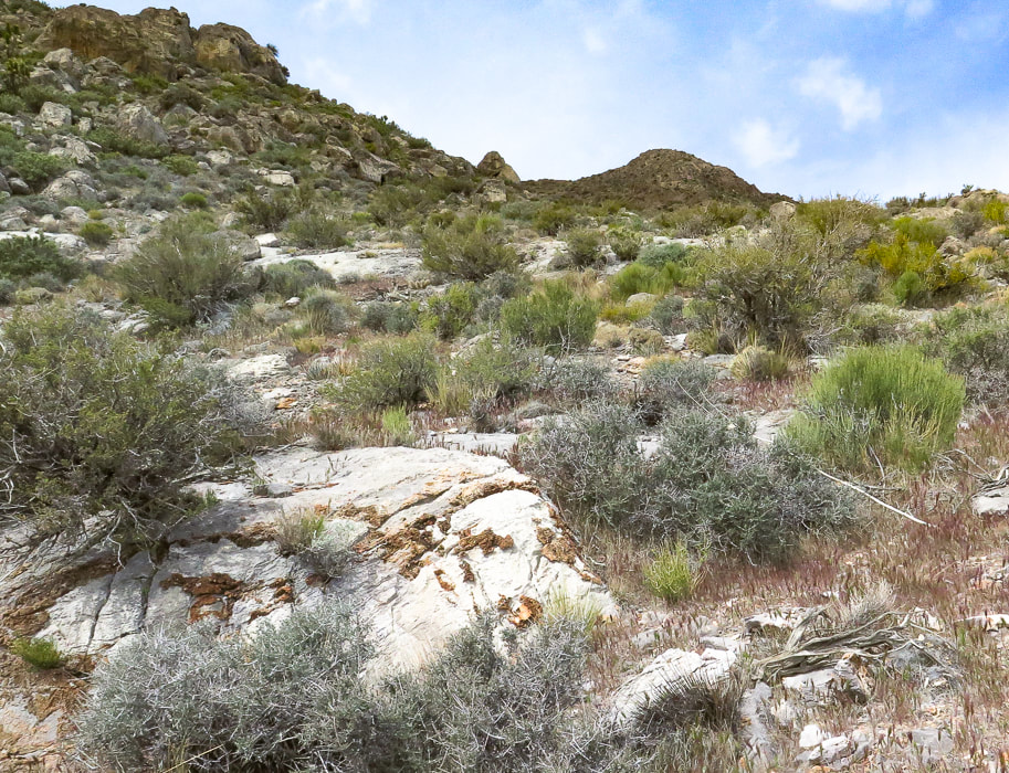
The climb from the saddle up to the summit - about one mile to go!  Note limestone with brown chert (microcrystalline quartz) nodules.
Picture
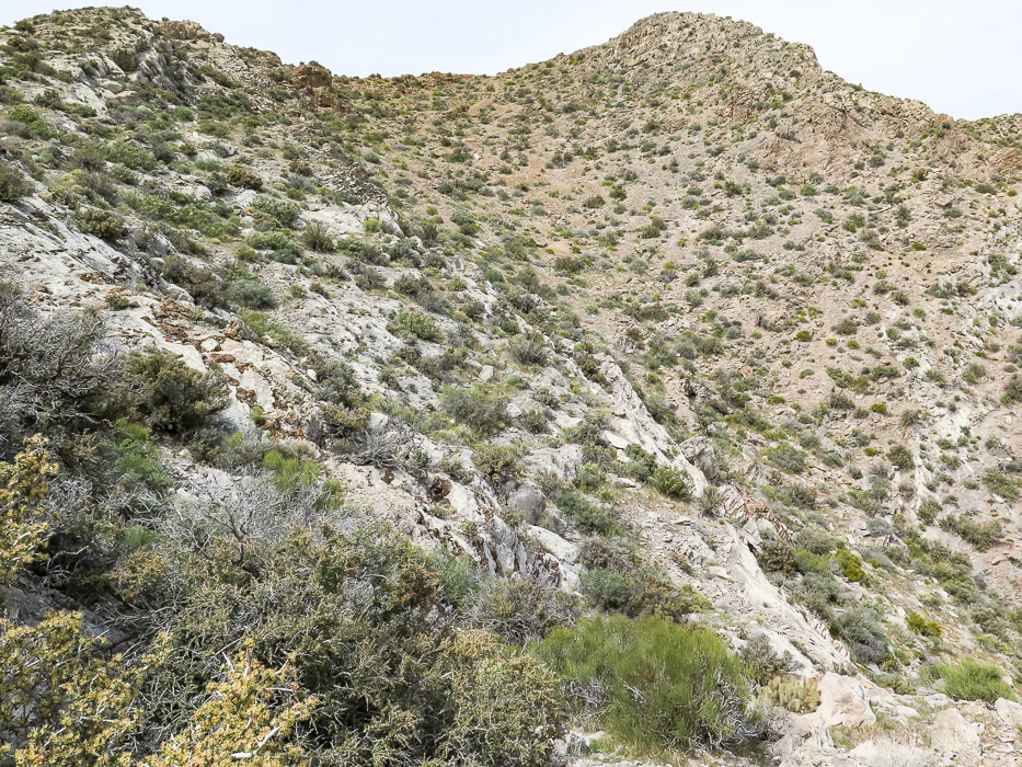
A good look at the summit - easy enough to stay on ridge.
Picture
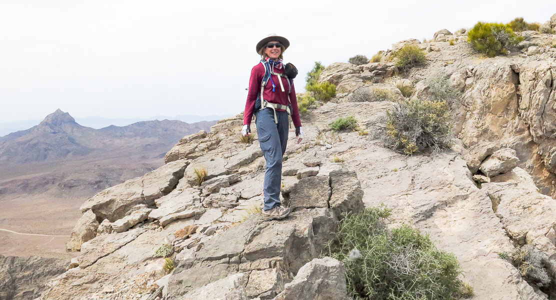
Sue on fun "slickrock" section on ridge - Moapa Peak in background.
Picture
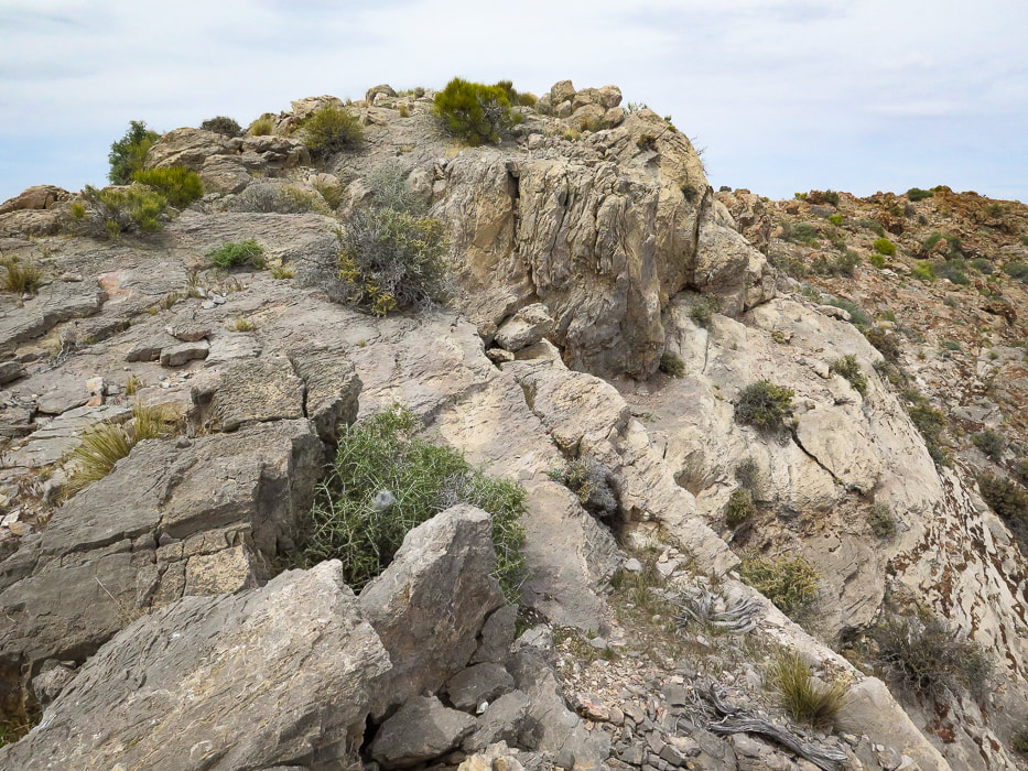
Fun walking on ridge line
Picture
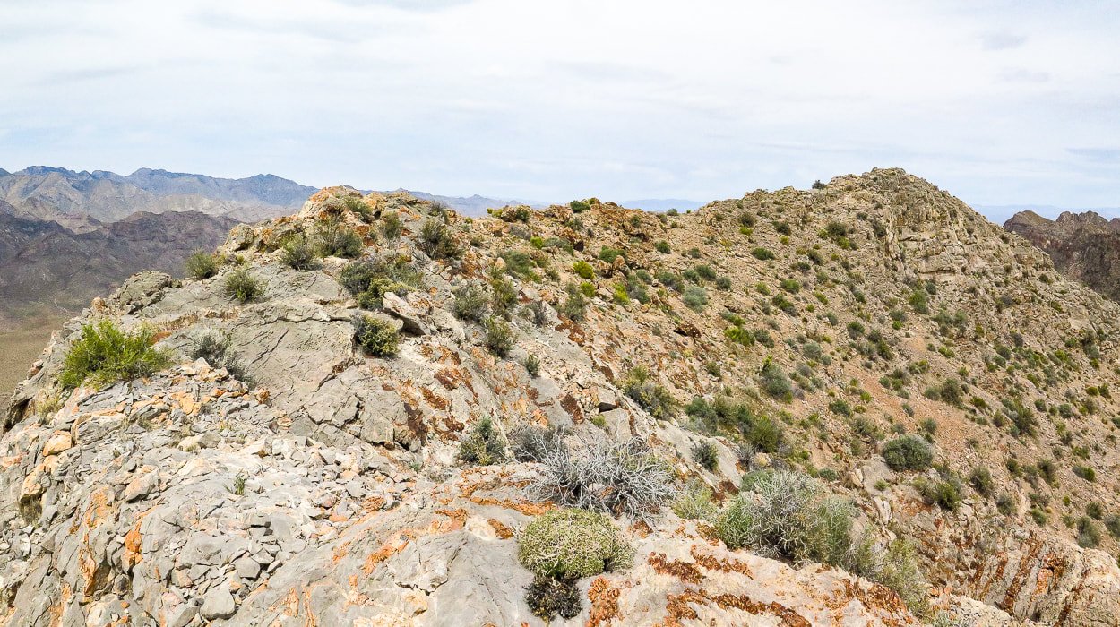
Summit ridge - summit at right
Picture
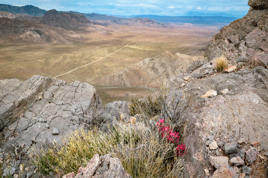
Indian paintbrush on summit.  looking northwest to the Mormon Mountains.
Picture
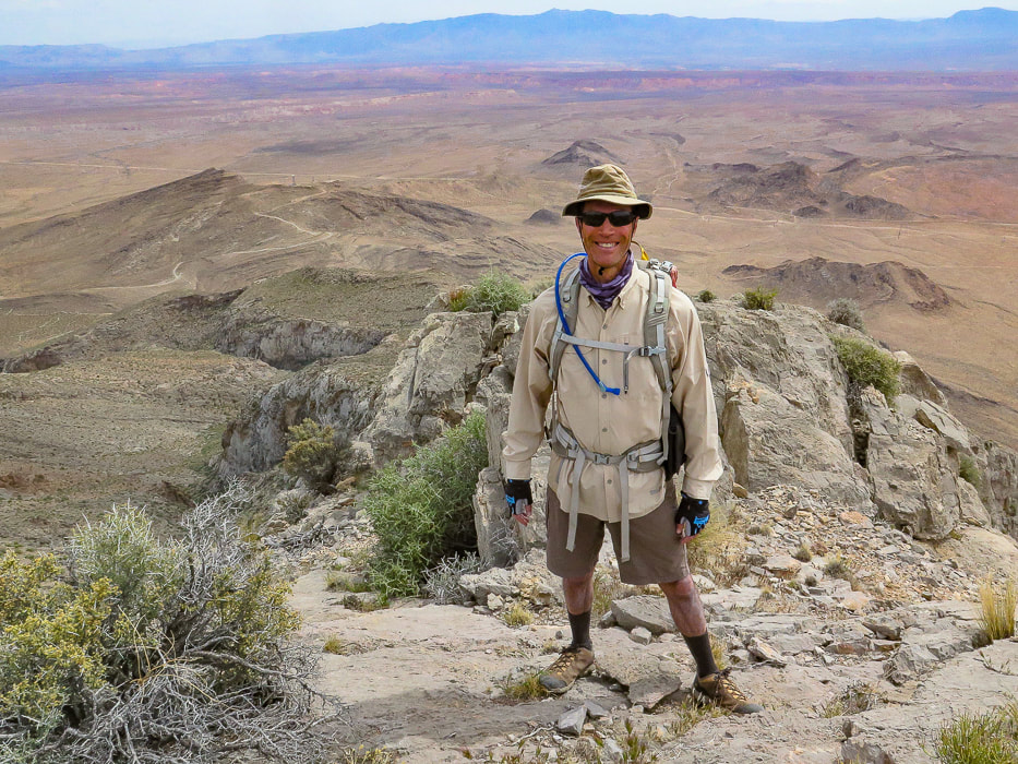
Fred on Davidson Peak summit - what better way to spend Sunday afternoon than summit a Basin and Range peak?
Picture
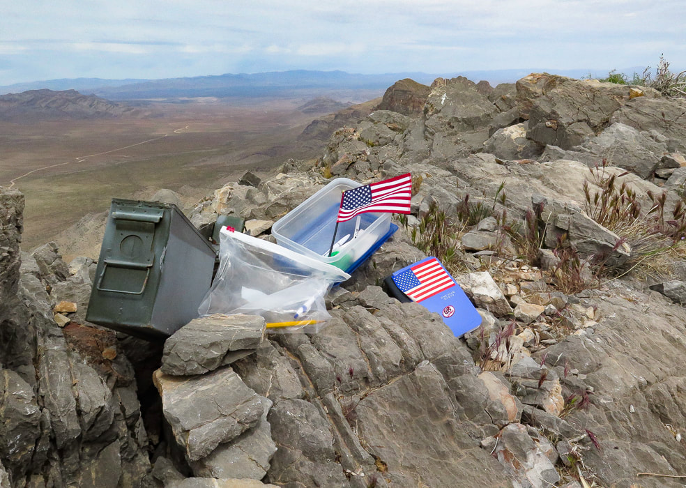
A very patriotic and organized peak register.
Picture
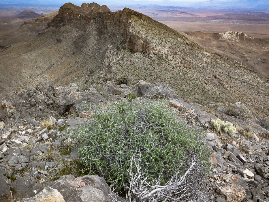
On summit looking north at the East Mormon Mountains ridge.
Picture
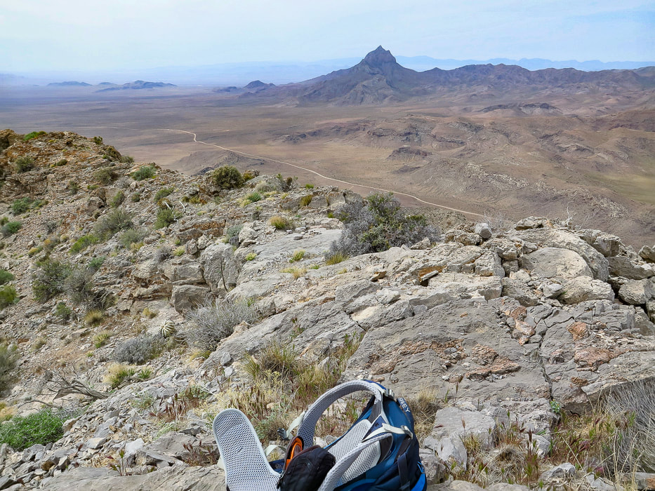
On summit looking at Moapa Peak to the southwest, south of Mormon Mountains.
(looks like a fun peak to climb).

Picture
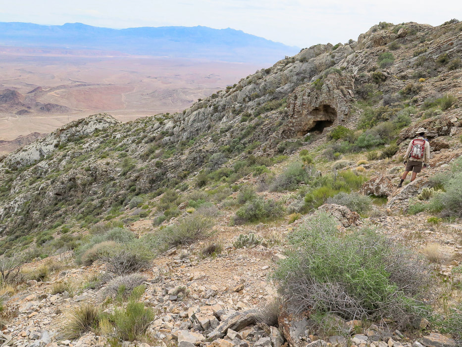
Descending from the summit to follow the ridge back down.
Picture
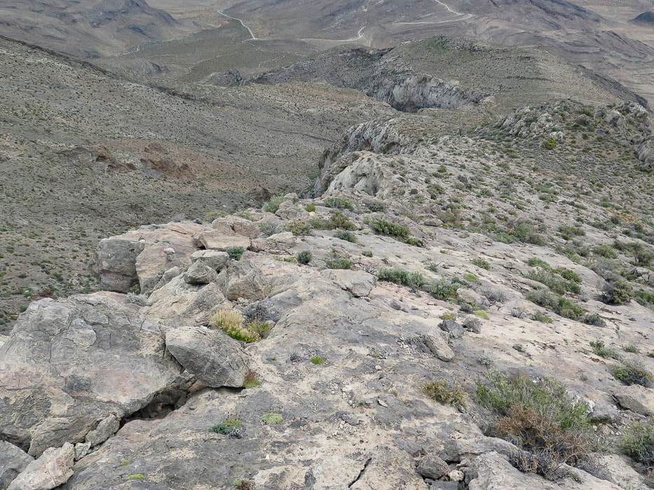
Limestone "slickrock" section!
Picture
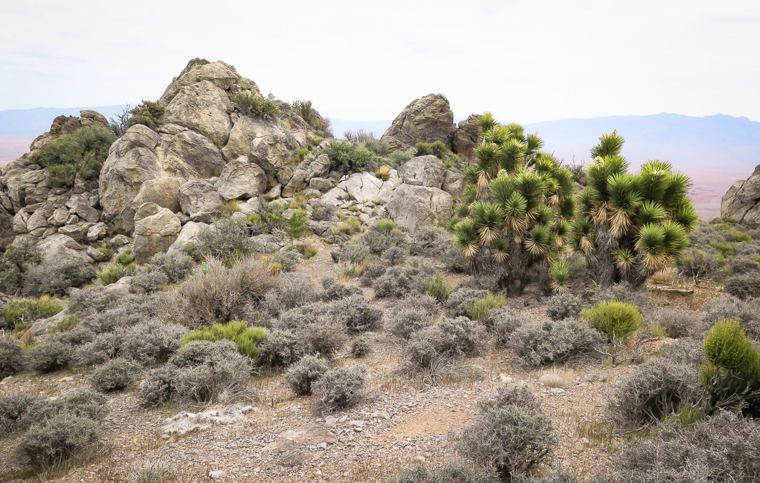
Back to the Joshua trees in the saddle or flat part of the ridge.  We went around to the right.
Picture
Picture
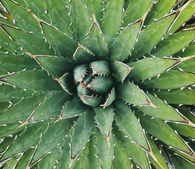
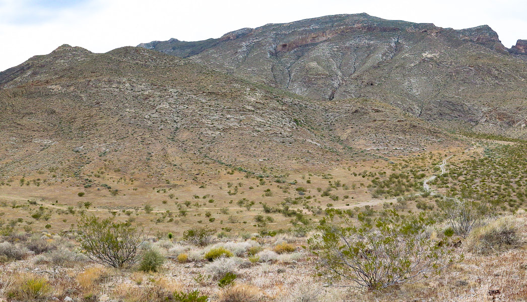
Looking back - we came down the small gulley just off the ridge instead of following ridge to toe.
Picture
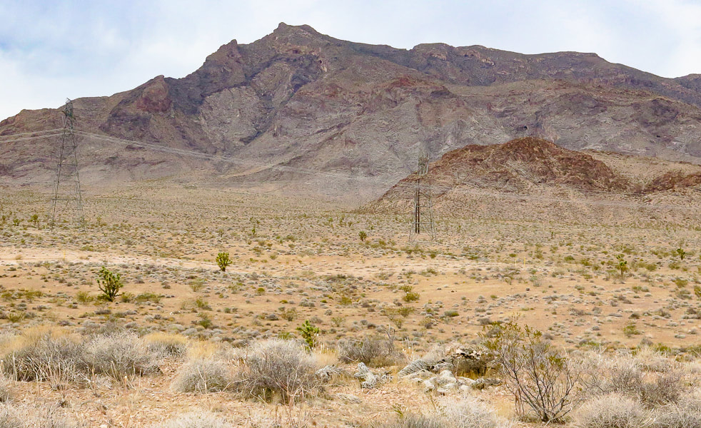
Parting shot of Davidson Peak.
Picture
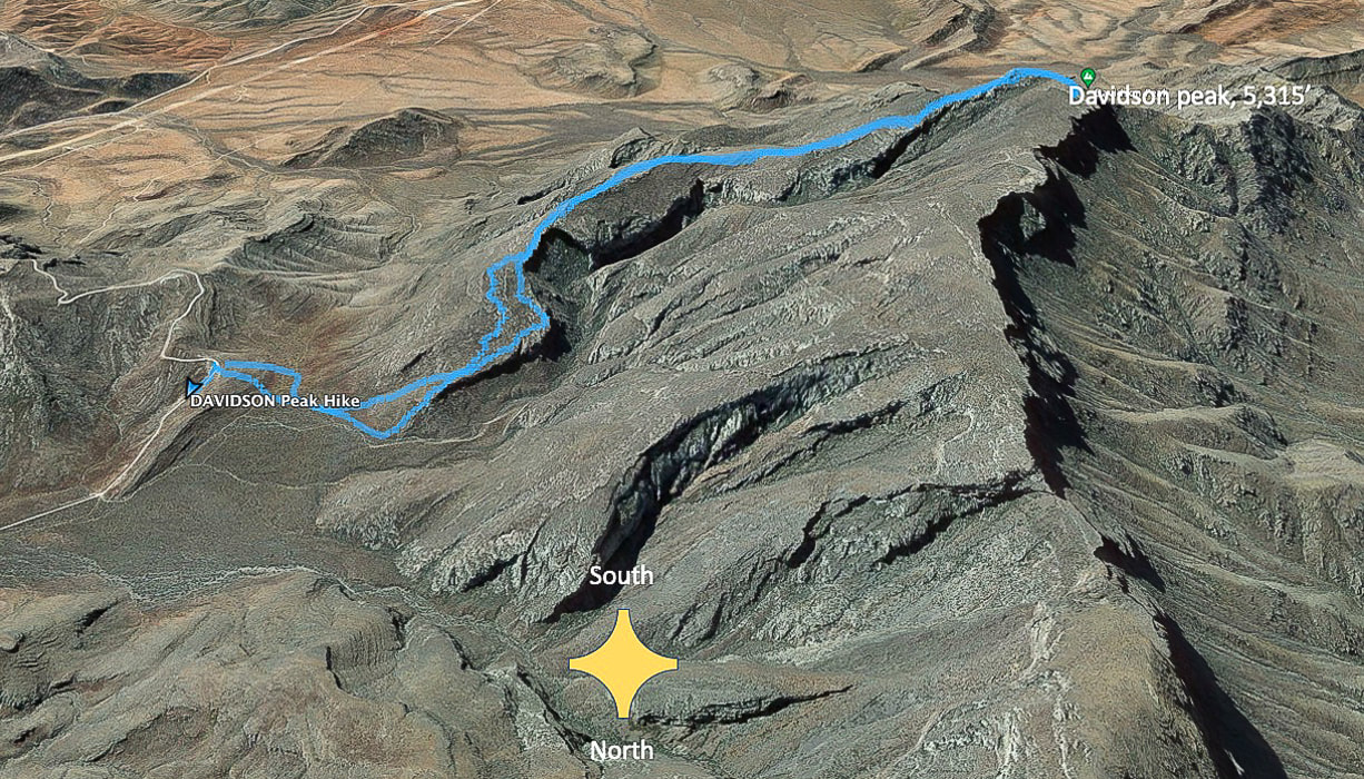
Our tracks - South direction at top of map.  The road we started at is Sheep Pens Road;  there is a spur road off of Sheep Pen that a good 4-WD vehicle could drive to the base of Davidson's east ridge.
Picture
Picture
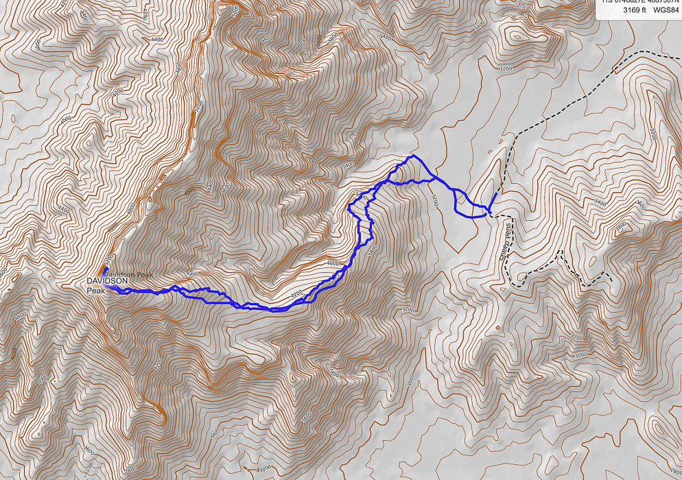
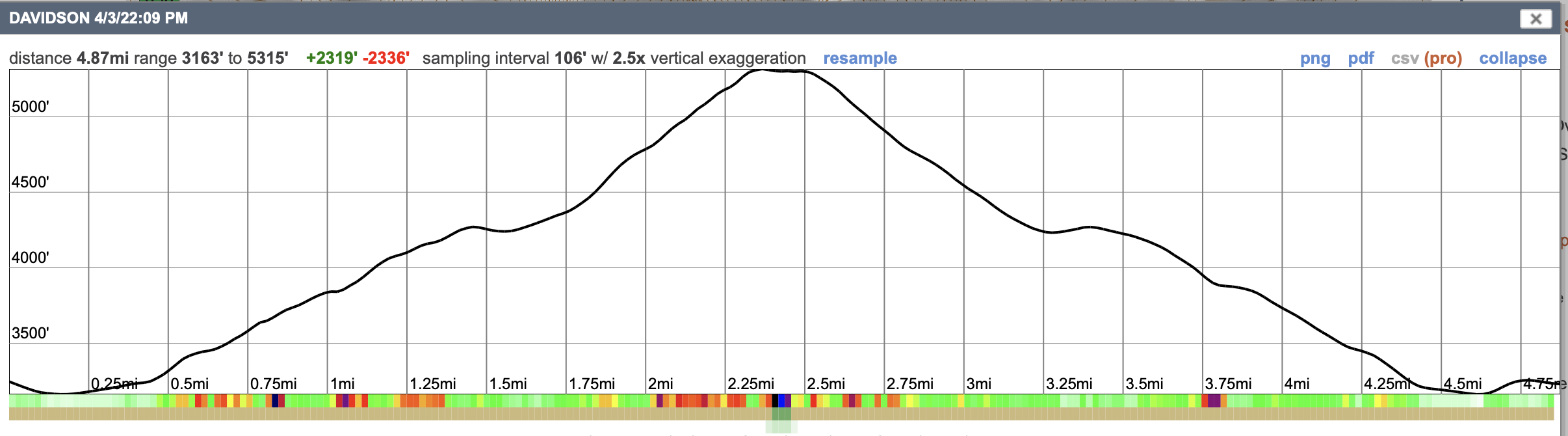
GPS tracks and profile.
References
Axen, G.J. , Wernicke, B.P., Skelly, M.F., Taylor, W.J.  1990.  Mesozoic and Cenozoic tectonics of the Sevier thrust belt in the Virgin River Valley area, southern Nevada.  Geological Society of America - Memoir 176.  In the book, Basin and Range Extensional Tectonics near the latitude of Las Vegas, Nevada.
​

Simplified geologic map of the Mormon Mountains - Tule Springs Hills - Beaver Dam Mountains transect.  Uploaded by Gary Axen.  www.ResearchGate.net.
2 Comments
Linda Paul
4/30/2022 03:12:41 pm

As usual, you images are amazing. You have the unique ability to make a landscape that doesn't normally appeal to me much look breathtakingly beautiful!

I kept returning to the image right below the first map. You didn't label it. At first I wondered if there was some sort of specialized bee colony going on there, but I guess it's the brown chert you speak of later?

Reply
Sue link
4/30/2022 08:28:45 pm

Linda,
Thanks for making your comments. Gives me good feedback that I appreciate.
The Great Basin definitely is not what most people would describe as "beautiful". But I guess beauty is in the eye of the beholder. What is fun about hiking in this terrain is that from far away, the mountains look bare and mostly lifeless, but when you actually get in there and look, there are unique things to see that reflect their history and mystery.
I am not sure what the fossil in the image is that you are asking about. My first impression is that it's a brachiopod. When I looked it up I found that fossils will turn orange if they are produced because there is a lot of iron present. I really appreciate you asking about it because I went back to add a caption. What I need to do is ask an expert! It is not chert. So much to learn, so little time!

Reply


Leave a Reply.

    Categories

    All
    Arizona Hikes
    California Desert Hiking
    Idaho Summits
    Nevada Hikes
    Snowshoe Hikes
    Southern Utah Hikes/Bikes

    Complete list of Hikes/Bikes on HOME page
    Picture
    Sue and Fred
    Picture

    About this blog

    Exploration documentaries          –  "explorumentaries"  list trip stats and highlights of each hike or bike ride, often with some interesting history or geology.  Years ago, I wrote these for friends and family to let them know what my husband, Fred and I were up to on weekends, and also to showcase the incredible land of the west.  

    To Subscribe to Explorumentary adventure blog and receive new posts by email:

    submit
    Picture
    Happy Spring!
    Picture

    About the Author
    Sue Birnbaum

    A  trip to Jumbo Rocks Campground in Joshua Tree National Monument 38 years ago sparked my passion for hiking, exploring, and learning about desert ecosystems.  For the past 25 years, my husband Fred and I have explored the American West together; we love this land and I hope to inspire you to get out and explore through my photographs and trip descriptions.
    In 1992, Ray Wilson and I conceived the first Cactus to Clouds hike which climbs over 10,000 feet in one day to the summit of Mt. San Jacinto near Palm Springs, California.
    CACTUS TO CLOUDS HIKE 
    READ MORE
    ABOUT SUE

    Archives

    February 2023
    January 2023
    December 2022
    November 2022
    October 2022
    September 2022
    August 2022
    July 2022
    June 2022
    May 2022
    April 2022
    February 2022
    January 2022
    December 2021
    November 2021
    October 2021
    August 2021
    July 2021
    May 2021
    March 2021
    February 2021
    January 2021
    November 2020
    October 2020
    August 2020
    July 2020
    June 2020
    April 2020
    March 2020
    February 2020
    January 2020
    November 2019
    October 2019
    September 2019
    August 2019
    July 2019
    June 2019
    May 2019
    April 2019
    February 2019
    December 2018
    November 2018
    October 2018
    September 2018
    July 2018
    June 2018
    May 2018
    April 2018
    March 2018
    February 2018
    January 2018
    December 2017
    November 2017
    October 2017
    September 2017
    August 2017
    July 2017
    June 2017
    April 2017
    February 2017
    November 2013
    August 2013
    July 2013

    Some of my favorite websites:
    Awkward Botany
    ​citizen botany for the phytocurious

    Bird and Hike

    ​"Intended to encourage people to visit, learn about, and fall in love with the desert."
    ​

    Draw and Shoot
    Beautiful Photography

    Earthline: The American West
    Debra "writes to extol our beloved Earth." Detailed hike info, excellently written.
    ​

    Geologypics.com
    Geology and Geologic Time through Photographs

    Glenn Suokko
    Vermont artist's paintings "inspired by a place based on the land .... drawn to painting the representation and abstraction of nature."

    In the Company of Plants and Rocks
    ​A natural history blog about botany, plant ecology, and geology.

    Nature's Depths

    Walking through nature with John Palka, a neuroscientist who loves plants and ponders big questions

    Rangewriter - What Comes Next?
    ​With excellent writing, Linda tells the story of her unique mother's life including WWII era; with beautiful photographs.

    SeekingLost - Hiking and Backpacking Adventures.

    Stav Is Lost- Unconventional, out-of-the way hikes in the American West.


    Uprooted Magnolia
    ​Leah Yetter's beautiful "photo journal on life, love, and the spirit of Wyoming."
HOME

Cactus to Clouds Hike
More Quotes
HIKES BY STATE

Idaho Hikes
Utah Hikes/Bikes
​Arizona Hikes
​California Desert Hikes
​Wyoming Hikes
​Nevada Hikes

BLOGS

Adventure Blog
Women and the Land
GEAR REVIEWS
FIT AFTER 50
Fred Birnbaum
Dave Brasuell
Bus' Little Black Book
​Mike Carlson
​Ray Wilson
​Marcia Bondy
Bryan Krouse
​Maria Keezer
​Tim Clemens
​Doug Traubel
​Brian Holgate
​
Becky Borczon Blake
​Jennifer Cera and
​Sue Birnbaum

​Vance Powell
​Boise Cross Fit Masters Ladies
​Vickie Kearney

GALLERY

Desert Plants
Nature
Earth + Sky
Urban
Water
Patriot 
​Orchids
Boise
​
  ABOUT
    Contact

​
© 2017 - 2023 by Sue Birnbaum.  Photos on this website are the sole property of Sue Birnbaum unless otherwise indicated.  Please receive permission before publishing my trip reports and photos.
I try my best to be accurate with my hike descriptions; please research your adventures, always bring a map and compass and know how to read them, be prepared!  All of these hikes can be dangerous; hike at your own risk.  ALWAYS carry the Ten Essentials with you on hikes. 
​Please feel free to contact me with comments or questions, or if you see any errors that need attention.
Thank-you for stopping by!


EXPLORUMENTARY.com
  • Home
    • Cactus to Clouds Hike
    • More Quotes
    • Ann Zwinger Quotes
    • Mary Oliver Poems
  • Hikes by State
    • Idaho
    • Southern Utah
    • Arizona
    • California Desert
    • Nevada
    • Wyoming
  • BLOGS
    • Adventure Blog
    • Women and the Land
  • GALLERY
    • DESERT PLANTS >
      • Beavertail cactus
      • Brittlebush
      • Christmas Cactus
      • Arizona Barrel Cactus
      • Parry's penstemon
      • Agave
      • Arizona Rainbow Hedgehog
      • Claret Cup Hedgehog
      • Desert Agave
      • Palmer's Penstemon
      • Silver Cholla
      • Cristate Saguaro
      • Indian Paintbrush
      • Ocotillo
      • Santa Rita Prickly Pear
      • Spiny Cliffbrake
      • California Barrel Cactus
      • Engelmann Prickly Pear
      • Velvet Mesquite
      • Joshua Tree
      • Buckhorn Cholla
      • Hedgehog Cactus
      • Fishhook cactus
      • Thompson's Woolly Locoweed
    • NATURE
    • BOISE
    • EARTH + SKY
    • URBAN
    • WATER
    • PATRIOT
    • ORCHIDS
  • Fit After 50
    • Brian Holgate
    • Fred Birnbaum
    • Dave Brasuell
    • Bus' Little Black Book
    • Mike Carlson
    • Ray Wilson
    • Bryan Krouse
    • Vickie Kearney
    • Maria Keezer
    • DOUG TRAUBEL
    • Boise Cross Fit Masters Ladies
    • Tim Clemens
    • Marcia Bondy
    • Becky Borczon Blake >
      • Becky B Downtown
    • Jennifer Cera and Sue Birnbaum
    • Dave Brasuell
    • Vance Powell
  • About
    • CONTACT