|
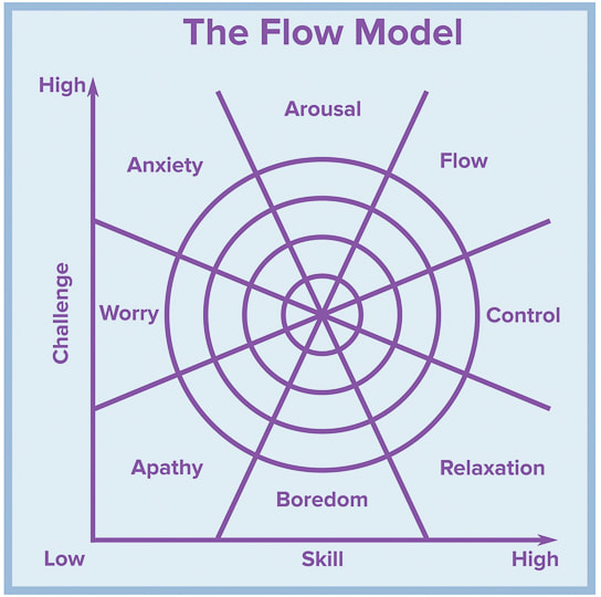
What is flow and how can we achieve it? How it helps us through challenging times. Related: Pahrump Point Hike and Tecopa Hot Springs, California Southern Utah Hiking and Biking in a Pandemic: Wire Mesa, Snow Canyon, Zion NP 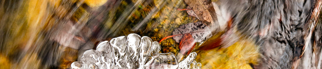 Feeling "Flow" - The Theory of Optimal Experience If it wasn't for a friend who reads my hiking posts, I probably would have never heard of "flow", the feeling of immense joy felt during an intrinsically rewarding task whereby the focus is not on the self, but on the activity. He knew that I would be interested in the article he sent me, "Why does Experiencing 'Flow' feel so good? A Communication Scientist Explains", because it relates to my passion for hiking and nature. It helped me question more specifically why hiking makes me happy and turns on my creativity. Is this happiness caused by flow or the release of serotonin, the body's natural mood stabilizer, or both? Is it simply the rhythm of walking? Or is it because nature is inherently relaxing? Did hiking help me through the COVID-19 pandemic? It has led to a cascade of great articles and books to peruse. Mihály Csíkszentmihályi, in the 1970's, asked the question "what is enjoyment?" when he saw that many Europeans were traumatized by World War II. He decided to find out what makes life worthwhile after he attended Carl Jung's presentation about Hindu mandalas as a technique to gain a sense of order. After that, his life was devoted to answering the question, "how can we achieve a state of optimal experience?" and studying positive psychology. He interviewed athletes, artists, composers, surgeons and CEOs of large companies to ascertain what made their lives meaningful and describe how they felt during happy, intense experiences. Many used the metaphor of feeling like they were carried by a current - like the flow of water. Others achieve flow with yoga, snowboarding, playing chess, and writing. Mountain climbers are among the 8,000 people around the world who have been interviewed for flow research, as well as blind nuns, Navajo shepherds and Dominican monks. He found that regardless of culture, education, vocation, etc., seven conditions appear when a person is in flow. Flow happens when we complete an activity and feel self-assurance, satisfaction, and joy. An activity in which you can achieve flow is one that is worth doing for its own sake. A website with a great name, "Happiness Lessons," indicates that if we can find this activity, we will be able to move society and humanity forward. hover for locations
 Trinity Mountains, Idaho
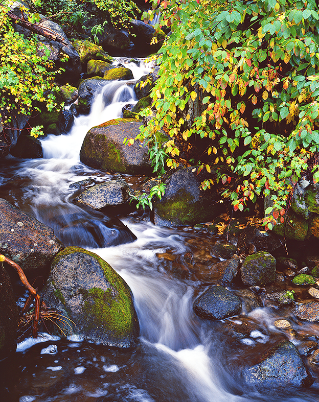
Not surprisingly, research shows how people with stronger feelings of flow felt better during COVID-19 quarantine compared to people with weaker experiences because knowing how to get into flow distracted them from worry. Flow refocuses thoughts away from stressful circumstances to more positive and enjoyable ones, and it can decrease depression and burnout. I believe that if you know what to do in order to experience flow and optimal well-being, then you have more confidence and less fear. Your brain during flow The brain actually changes its network configuration during flow, says Richard Huskey, the author of this article. He is Assistant Professor of Communication and Cognitive Science, University of California, Davis, and has studied flow for 10 years in his lab. This network change helps people adapt to difficult tasks. Three activities occur during flow that lead to well-being. We stop thinking about ourselves and our negative thoughts decrease because that structure of the brain becomes suppressed. Conversely, with flow, the brain is thought to increase activation in reward-processing regions. At this time, however, this has not been proven; these brain responses are associated with flow, but we can't yet conclude that these responses cause flow. So, yes, I would have to conclude I do feel flow on most of my hikes, as long as I don't get stuck on a ledge, or in a thunderstorm, or have to climb Class 4 rocks. There's probably a bit of serotonin mixed in. Hiking with my husband and friends creates "optimal happiness." For a few hours we can can leave negative thoughts behind and feed our souls. There's something about moving in nature and witnessing extraordinary scenes in the American west that bonds us together.  Old Growth Trail - Kokanee Creek - just outside of Kokanee Glacier Provincial Park, Nelson, British Columbia photo by Ann Amberg - annamberg.com References
Mihaly Csikszentmihalyi: Distinguished Professor Emeritus of Psychology and Management Founder, Co-Director, Quality of Life Research Center. Retrieved from https://www.cgu.edu/people/mihaly-csikszentmihalyi/ Huskey, R. January 4, 2022. Why does Experiencing 'flow' feel so good? A communication scientist explains. Retrieved from The Conversation. Stanford researches find mental health prescription: Nature. 6/30/15. Stanford News. TED Talk . February 2004. https://www.ted.com/talks/mihaly_csikszentmihalyi_flow_the_secret_to_happiness
2 Comments
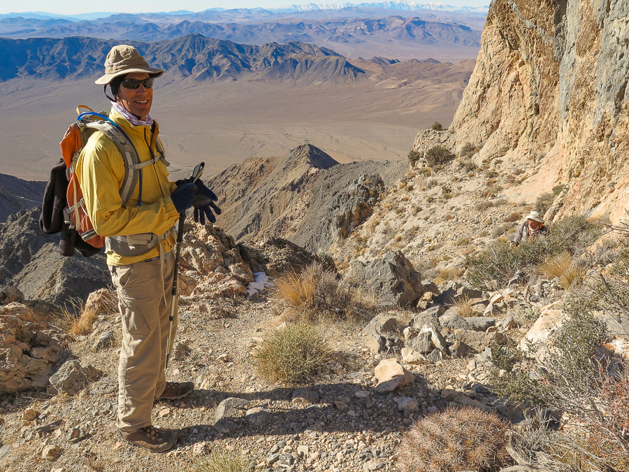
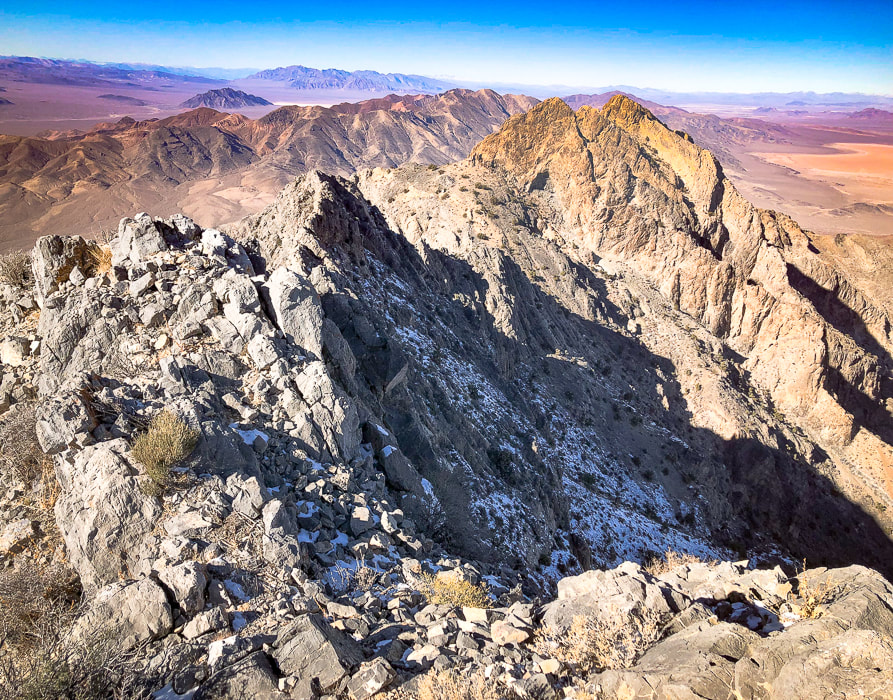
Another rugged summit from the Sierra Club Desert Peaks Section's list completed! On this narrow perch above desert valleys thousands of feet below, we saw spectacular views of Nevada and southeastern California and experienced "flow" - the secret to happiness.
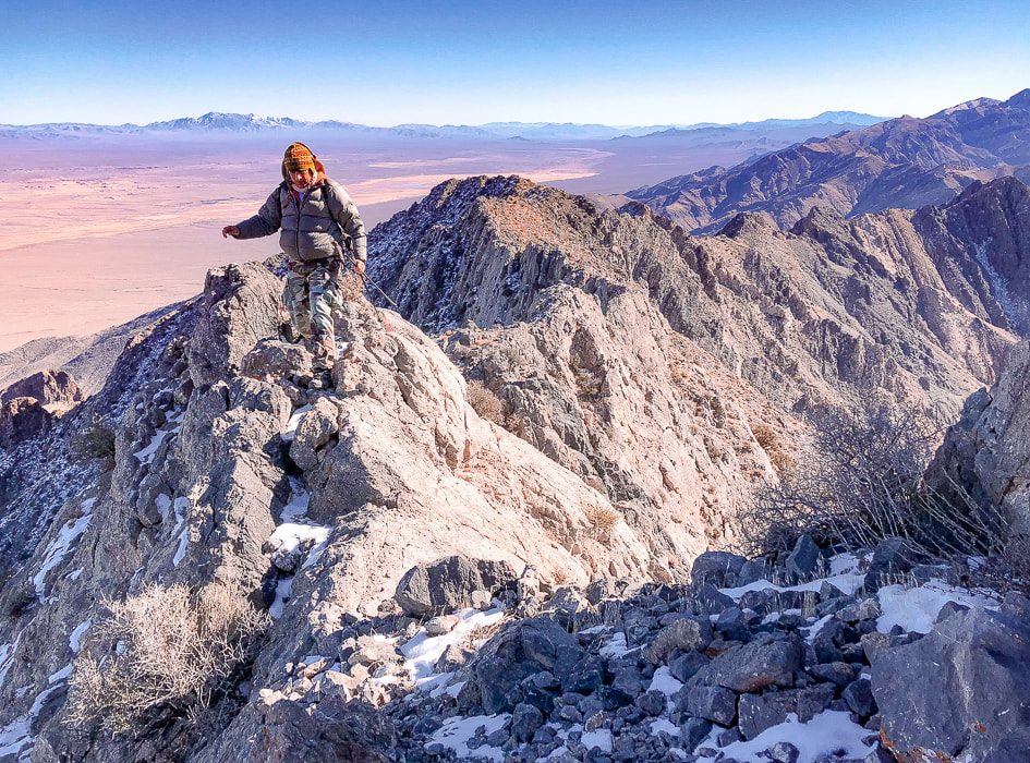
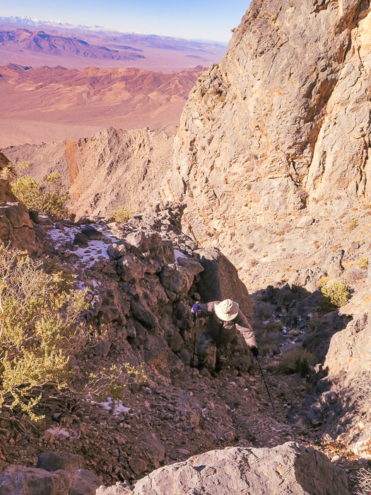
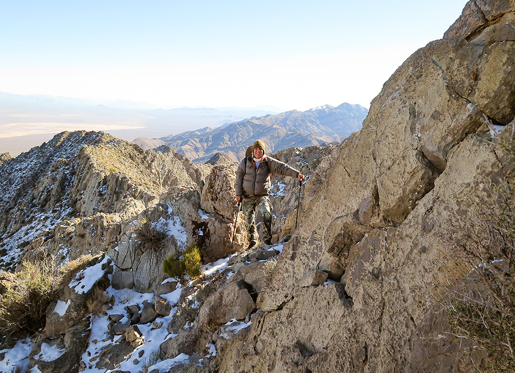
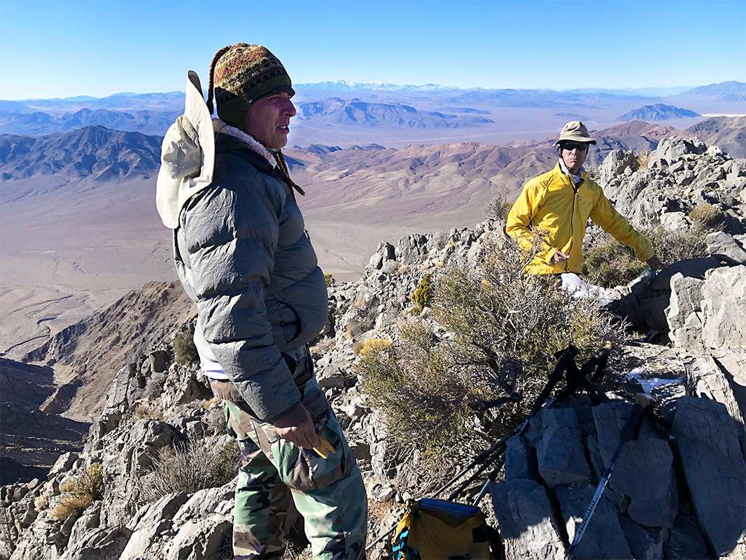
Scott on Pahrump Point's southeast ridge just under the summit.
Trip Stats
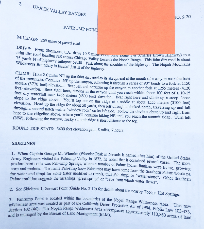
Overview: This classic Mojave desert hike begins on an alluvial fan, ascends through boulders up an ever-narrowing canyon, switchbacks up a talus slope to emerge onto Pahrump Point's southwest ridge for a huge view of the summit's steep walls. From here, the route winds up a gully and treks through a few "passages" in its steep face to gain its narrow summit ridge crest. See fossils and plenty of rough limestone, as well as fantastic views of Telescope Peak in Death Valley, Mt. Charleston near Las Vegas, and the town of Pahrump. Attention to hike directions and navigation crucial to finding correct route. Location: Pahrump Point is in the remote Nopah Range Wilderness Area is just over the California/Nevada border, east of Death Valley National Park. Its rough and rocky summit rises above Pahrump, Nevada. Distance/Elevation Gain: 7.6 miles roundtrip from CA Hwy. 178 trailhead to summit; less distance if you can drive in further on gravel road leading to canyon. Elevation gain from highway = 3,400'. We began hike at 2,600'. Summit is 5,410'. Difficulty: Strenuous Class 2+ with occasional use of hand for balance. Lat/Long: Trailhead at Hwy 178: (UTM) 11S 0573213E 3992648 N. Summit: 0577422E 3995282N. Navigational aids: AllTrails map with GPS tracks, Sierra Club Desert Peaks Section hike directions - Pahrump Point. Date Hiked: December 17, 2021. History: "Pahrump" is a derivation from the Southern Paiute Pah-Rimpi term meaning "Water Rock" describing the abundant natural artesian wells in the area.
Pahrump Point trailhead location.
Aprés Hike
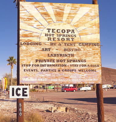
One of the best things about this hike is the delightful hot spring pool we soaked our weary bodies in afterwards at Tecopa Hot Springs Resort. We met our friend Scott to camp there on a few unseasonably cold December days. This resort, just outside of Death Valley and near the Nevada/California border had been abandoned for 10 years before the current owner purchased it, and it still wears the characteristics of an old-time hot springs resort, with original buildings, nothing fancy here - very remote and bohemian, complete with a 40-foot labyrinth. With no cell service or internet, it was heaven for three days. One of its mission statements:
"We see ourselves as stewards of sacred land and ambassadors of goodwill."
The Southern Paiute tribe discovered these hot springs hundreds of years ago. One night, after a soak, we enjoyed live music on an outdoor stage, standing around a fire pit sending smoke up into a cold and starry desert sky. The next morning we had excellent huevos rancheros in Tecopa Hot Springs Resort Bistro.
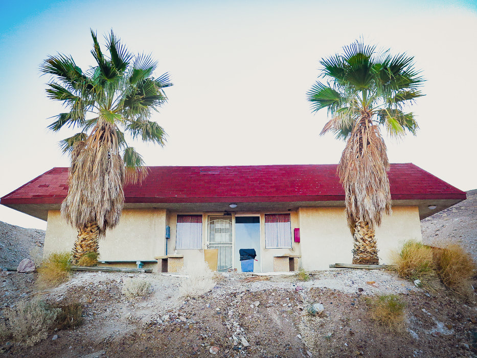
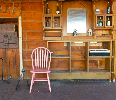
Bath house with 2 hot springs pools at Tecopa Hot Springs Resort, California.
Our Hike
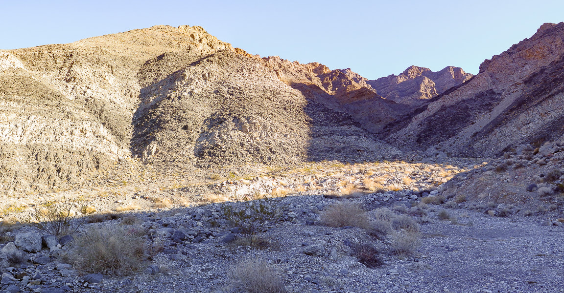
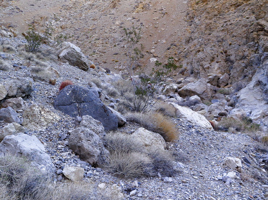
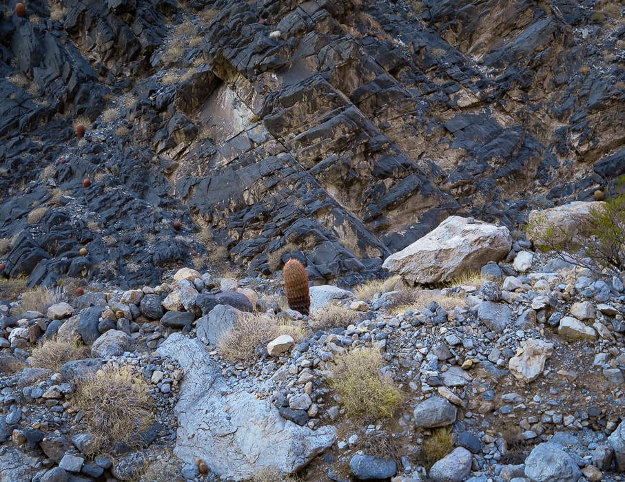
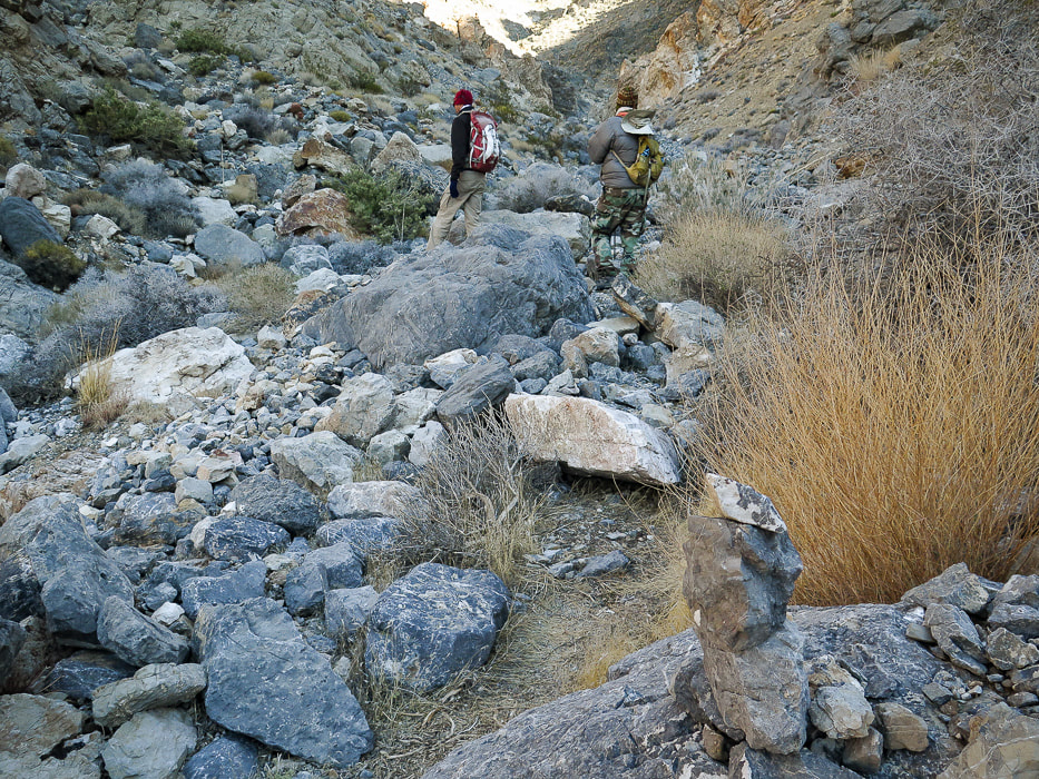
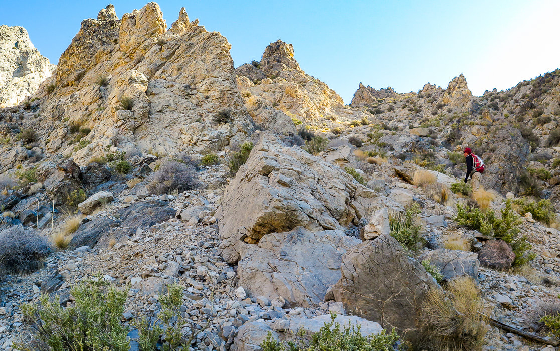
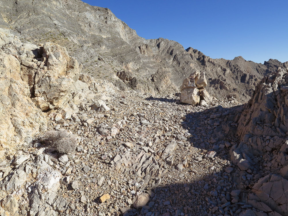
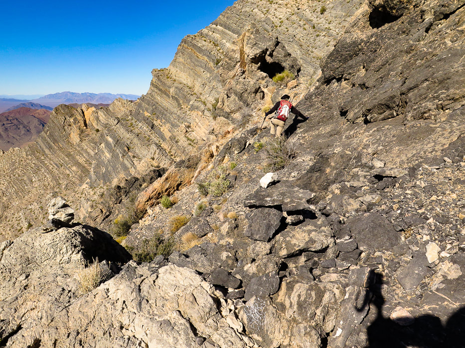
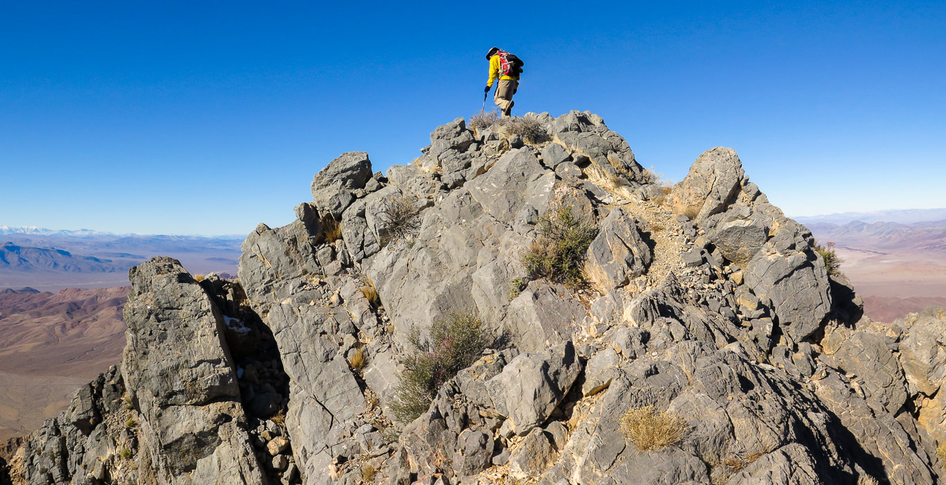
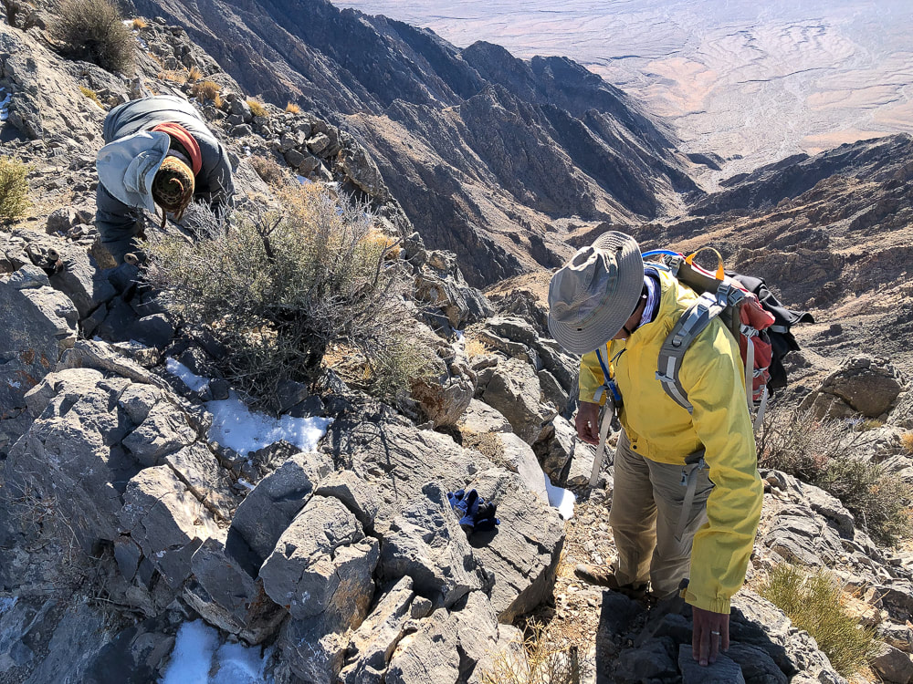
In the classic Mojave desert fashion, this rocky peak rises abruptly from the desert floor with dramatic, unobstructed views from a small, almost precarious perch at the summit. Pahrump Point looks difficult if not impossible from a distance, so it's fun to find the route through its steep cliff face. I'm glad Scott brought along the hike description from Desert Peaks Section manual. There are three crucial points along this route that you need to recognize in order to negotiate the rocky gullies, canyons and ridges to find most efficient way to the summit. The hike switches from Pahrump Point's southwest ridge to its southeast ridge where an easier route is present, just under the summit. Trip reports describe starting this hike just off of CA Highway 178 and the road leading to the mouth of the canyon, the distance of 1.8 miles. With our high-clearance truck, we drove just under one mile up this gravel road and parked to walk the rest of the way to its end at the mouth of the canyon framed on each side by alternating light-and dark colored Cambrian rock layers. A few cairns identify the trail throughout the completely rocky canyon bottom. A path initially goes along the toe of the left canyon wall, and then to the right, but most of the time is spent maneuvering through rocks and boulders in the canyon bottom. Once topping off on the southwest ridge after climbing a talus slope out of the canyon, the peak's cliffs come clearly into view, as well as a long and deep canyon to the south. To make the switch to the southeast ridge to summit, there are a few very important and prominent cairns for direction. The last few hundred feet climb to the summit is fun - you go by a hole in the rock that looks down into another steep canyon, then up a steep, short gulley. This empties you onto the final Class 2+ climb up Pahrump Point's manageable face, where you reach a fun and short summit ridge that is only slightly spooky. The narrow summit elevates you thousands of feet over desert playas, with a clear view of snow-covered Telescope Peak - the highest in Death Valley. The ridge to the next high point to the north seemed treacherous, so being content with our accomplishment, we basked in the nearly winter solstice sun. We occasionally cursed the loose rock on the return talus slope, after getting off the ridge. I wondered if age has caused me to be slower on this terrain. Picking our way through the boulders in the canyon, looking for cairns to give us a clue for a better route. Exiting the canyon onto the immense Chicago Valley, we turned back to see the Nopah Mountain range a fiery yellow/orange of sunset. Looking forward to dinner at the Crowbar Cafe and Saloon in Shoshone to celebrate another adventure - three friends who (still) like to hike together after all these years. It was great to hike once again with Scott, who said at the summit, "This is good for my soul!" Hiking to these amazing places with your friends and overcoming physical and mental obstacles together is good for your soul and can help you experience "flow" - the secret to happiness and optimal experience. The concept of "flow" is getting more attention lately and is the subject of my next post, as well as positive psychology, body movement science, enhancement of goal pursuit and well-being .
"Into the forest I go, to lose my mind and find my soul."
- John Muir 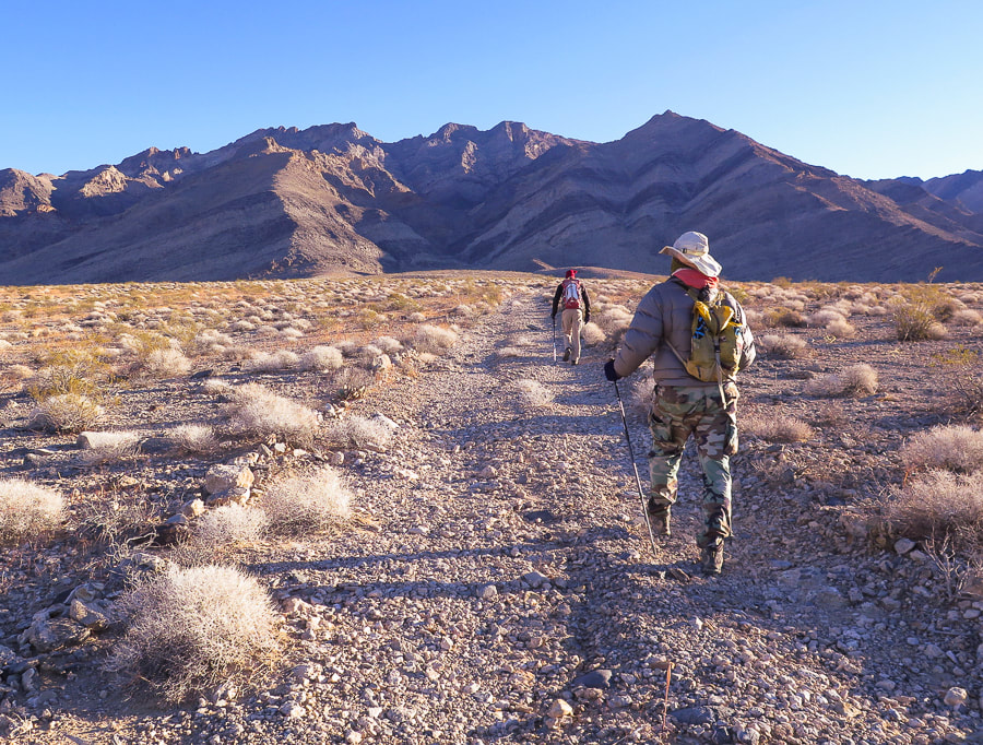
Initial approach through Chicago Valley up gravel road to mouth of canyon and then to Pahrump Point, just right of middle horizon. Cold and windy December morning in the Mojave.
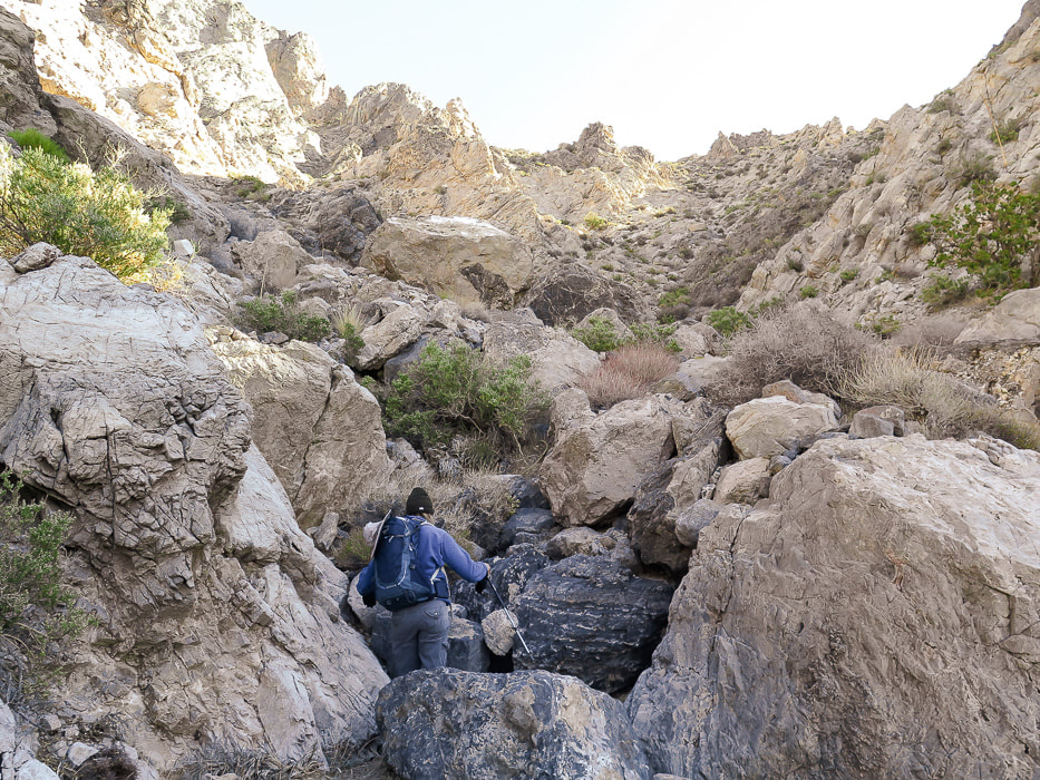
End of road, trail goes up wash. Here, trail is seen on left side of canyon; it switches to the right side further up.
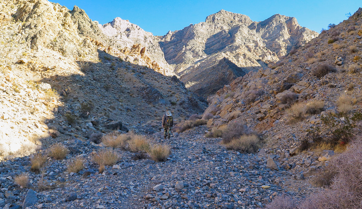
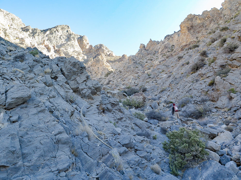
Initial main canyon walk alternates between canyon floor and side trails.
Trail seen on left side of canyon initially.
Coming down from a trail on the right side of the canyon, then up bottom of canyon to left and right fork; take right fork.
Tall cairn at 4,120' elevation that indicates to take the canyon to the right.
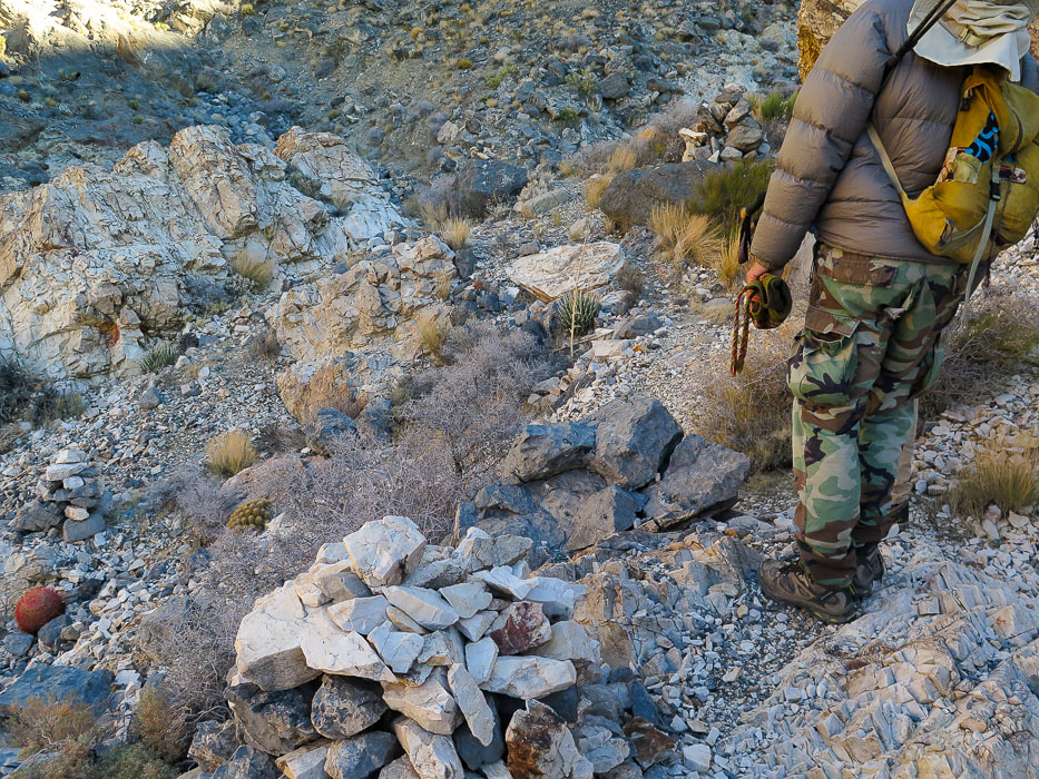
Trail then ascends up right side of canyon to 2 large cairns. From here, trail traverses slope and then drops you to the base of talus slope and ridge saddle.
Heading up canyon to the right at intersection with main canyon. This right fork takes you up talus slope to saddle at ridgeline.
Getting closer to the ridge
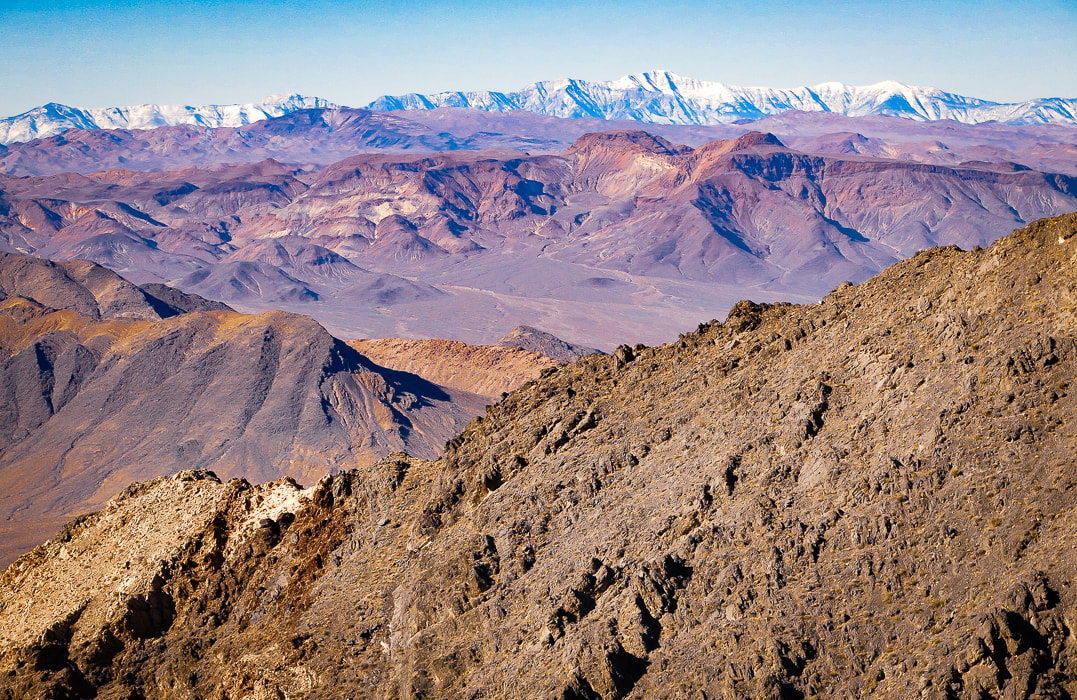
A look back toward Telescope Peak in Death Valley to the northwest.
On a moderately loose talus slope, getting closer to notch on ridge; then peak clearly seen to the left.
Large cairn marking saddle on ridge at top of scree slope. Peak is seen clearly at this point.
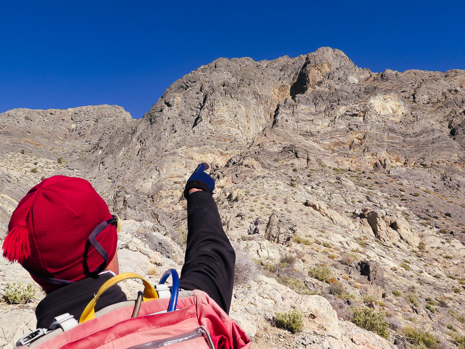
Once on ridge at 5,100 feet, see summit, and another 300-foot ascent to it; continue following ridge shortly to a ducked/cairned notch - head left through that notch to traverse to the left through another marked notch where there is a "window rock" on its left side. The route avoids the steep cliff face under the summit.
Cairn on left marks the traverse to the notch with "window rock".
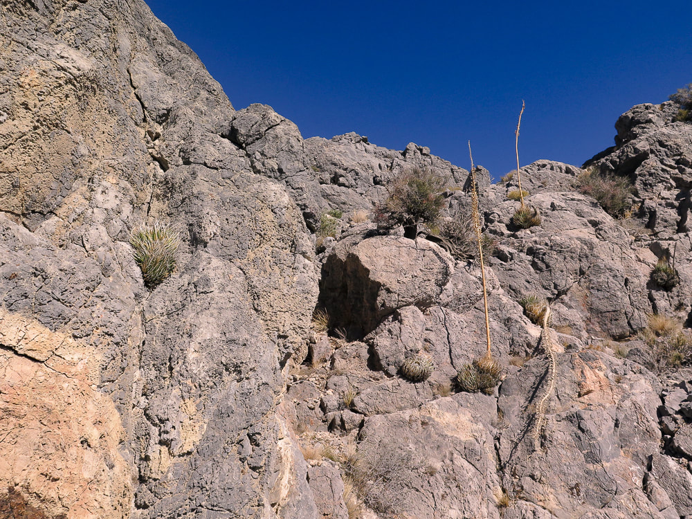
Gully just after "window rock" which is on the left side of trail.
Out of short gully and now fun Class 2+ on final ascent.
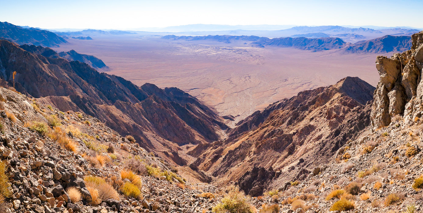
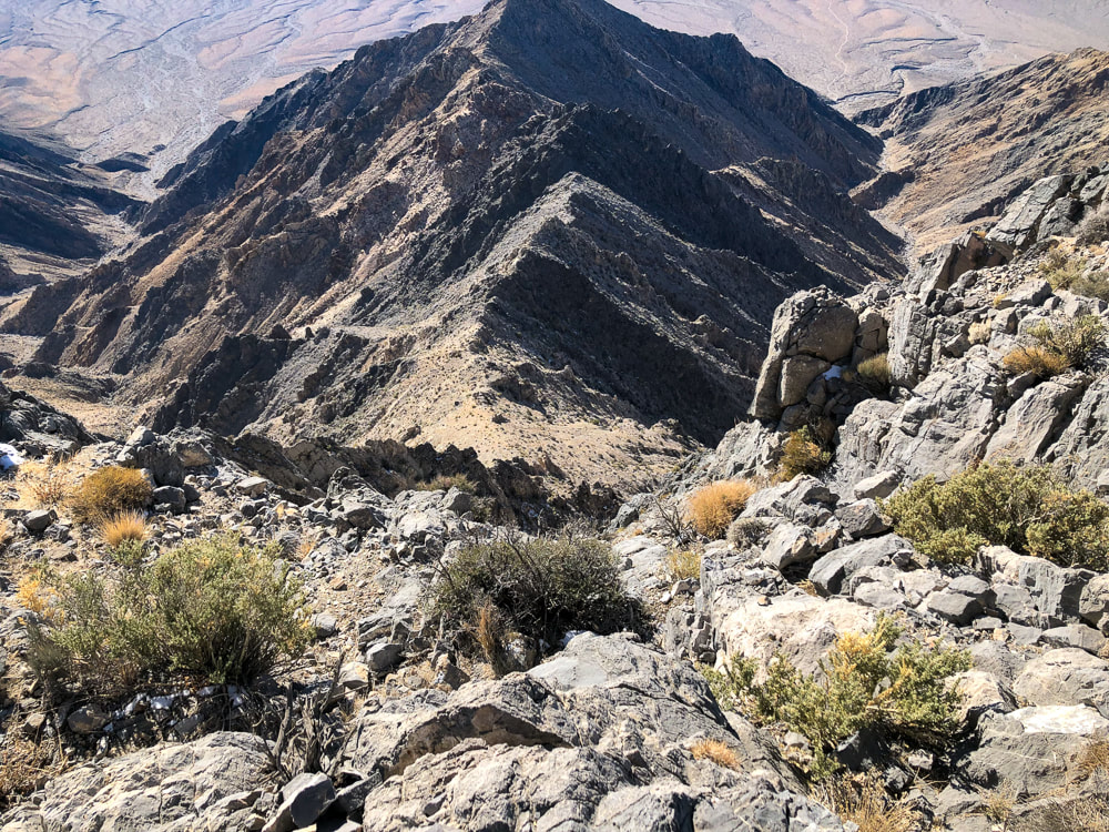
Looking down canyon toward Chicago Valley to the south.
Entry up face of summit block on the summit's right side.
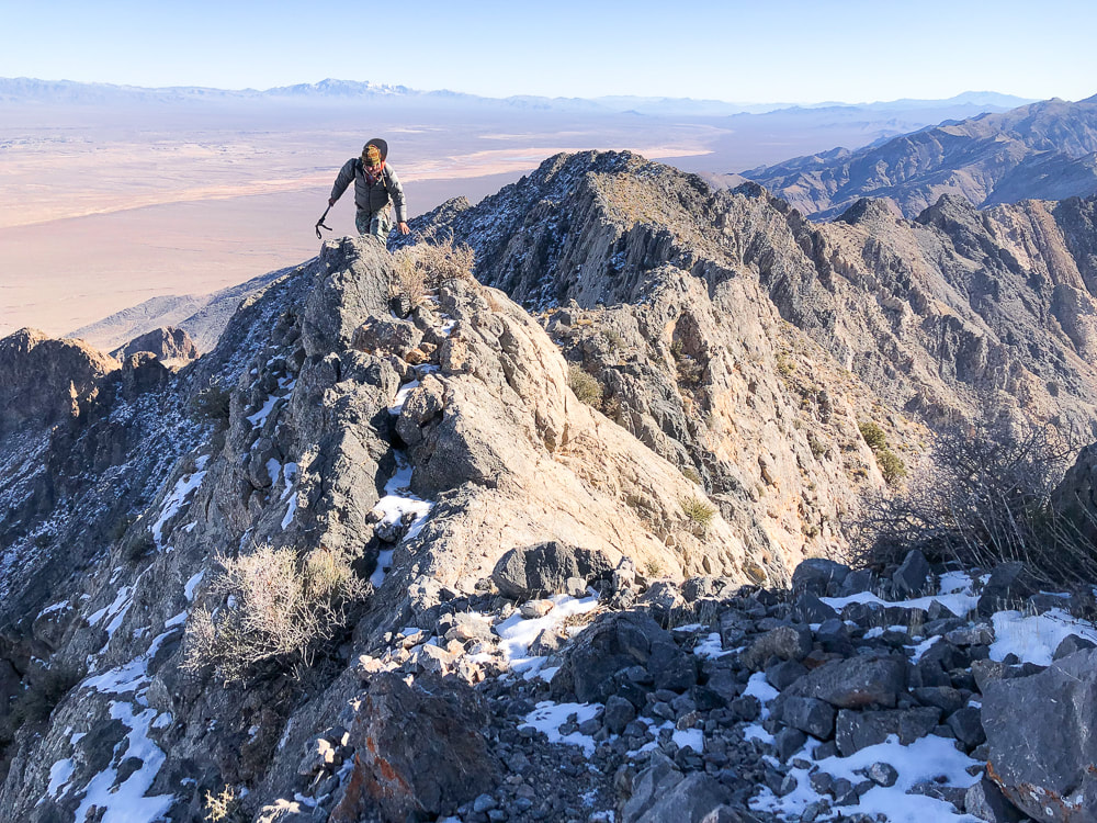
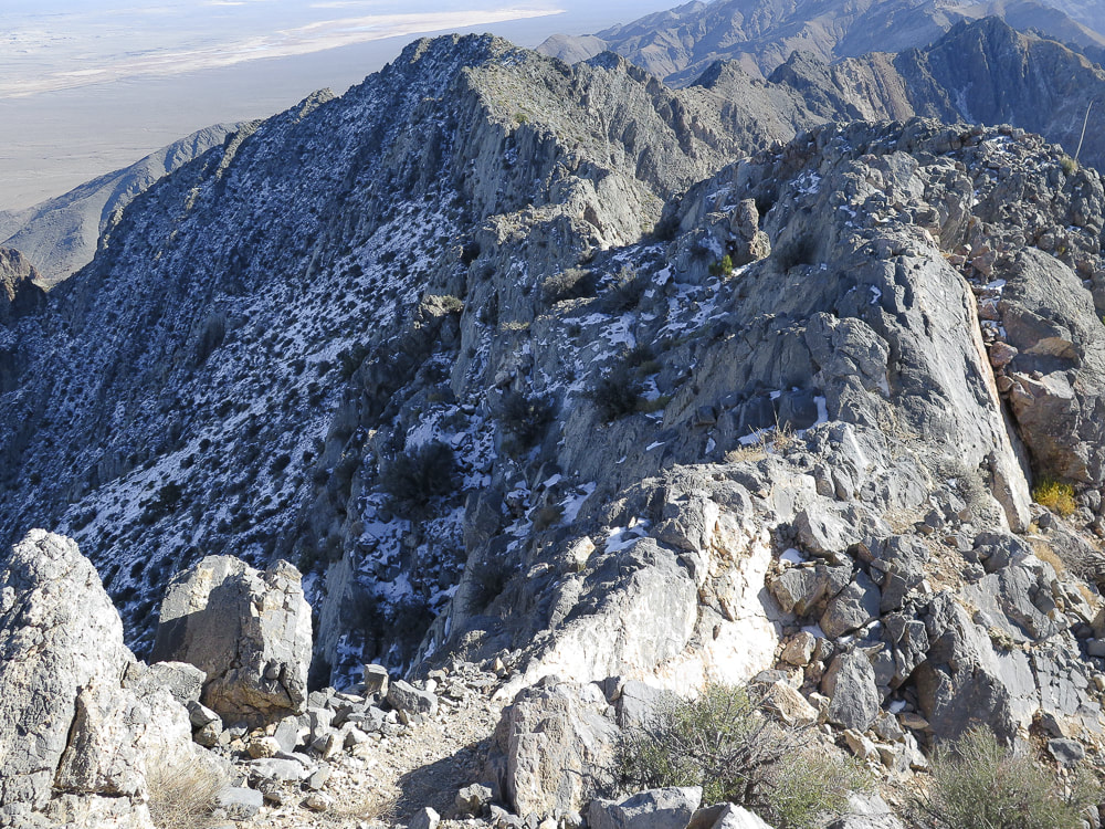
Reaching the summit ridge.
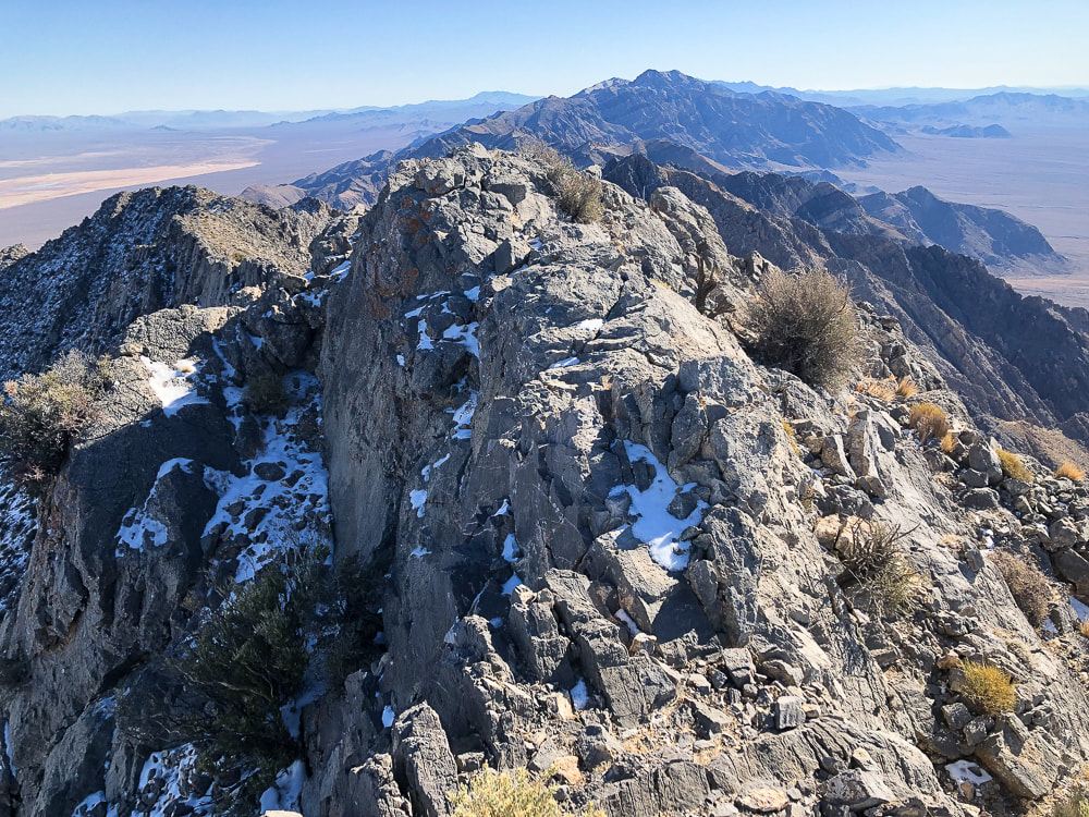
Southeast ridge just under the summit.
At the summit; trail goes through the snow on left side of this ridge in photo.
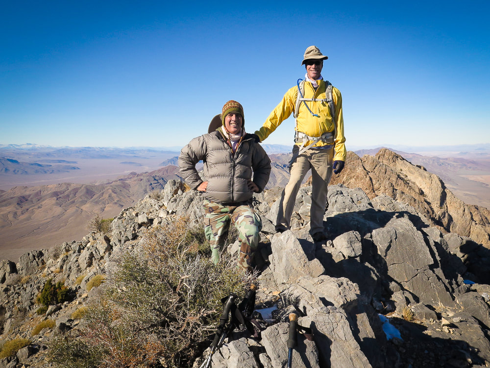
Scott and Fred on the summit of Pahrump Point - 5,410 feet!
Looking southeast down the Nopah range.
Mt. Charleston, north of Las Vegas, in background.
On Pahrump Point's summit.
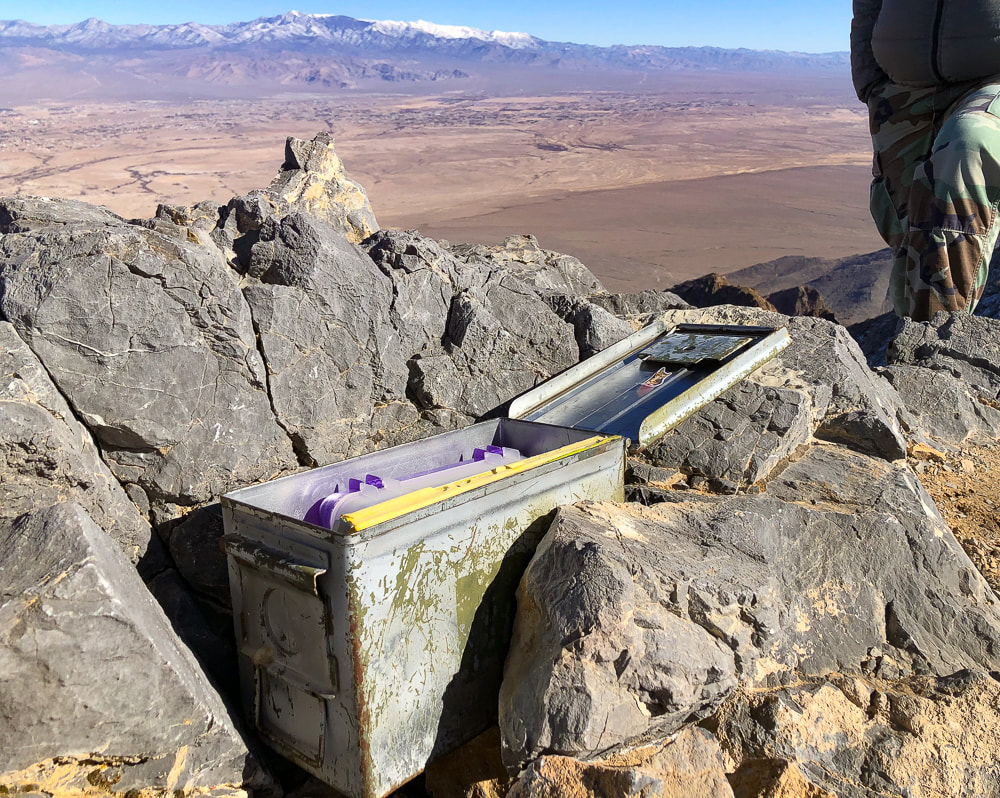
A very organized peak register.
Trail on ridge - working our way back down.
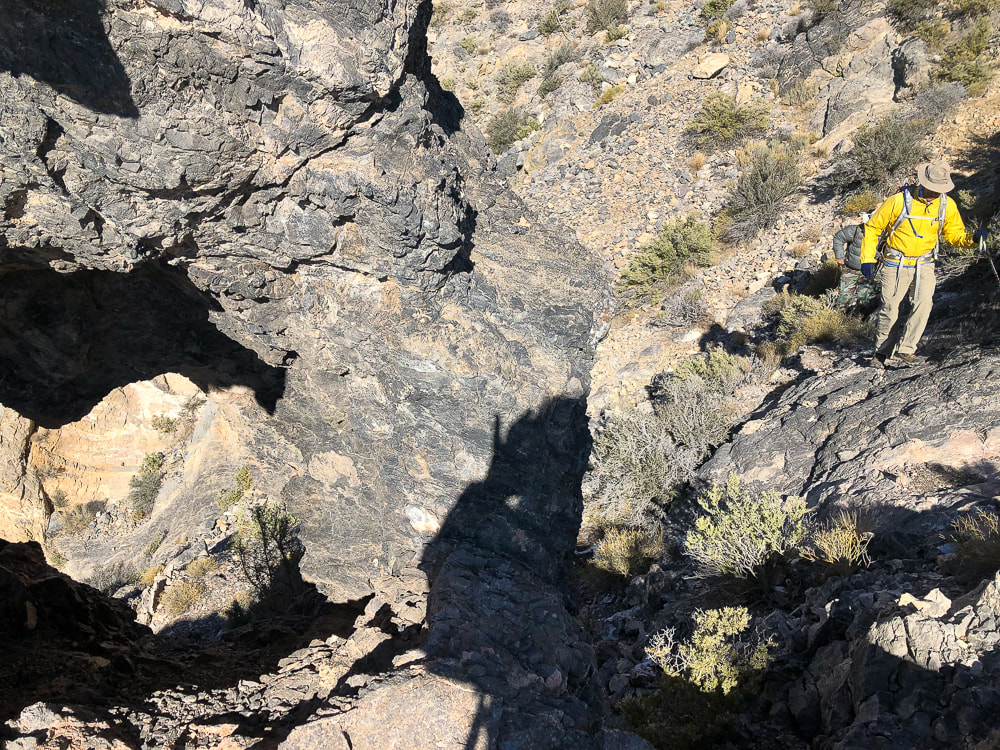
"Window rock" on left side of trail is a landmark to navigate trail.
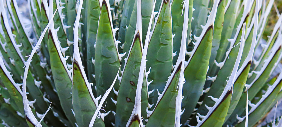
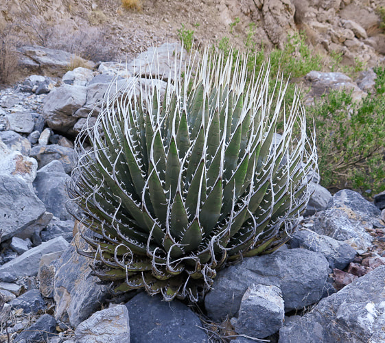
Ivory-spined agave
Some cool stuff on the trail.
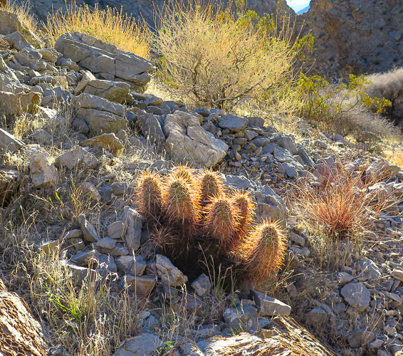
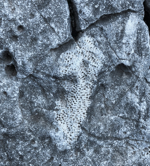
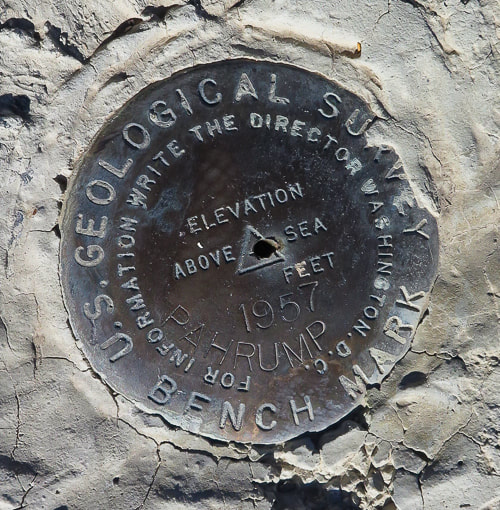
(clockwise from top left) Hedgehog cactus, bryozoan fossil, ivory-spined agave, triangulation survey marker at Pahrump Point's summit. 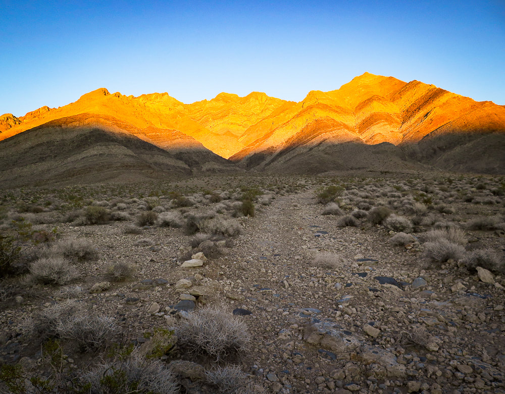
Parting shot - sunset on Pahrump Point in the Nopah Range.
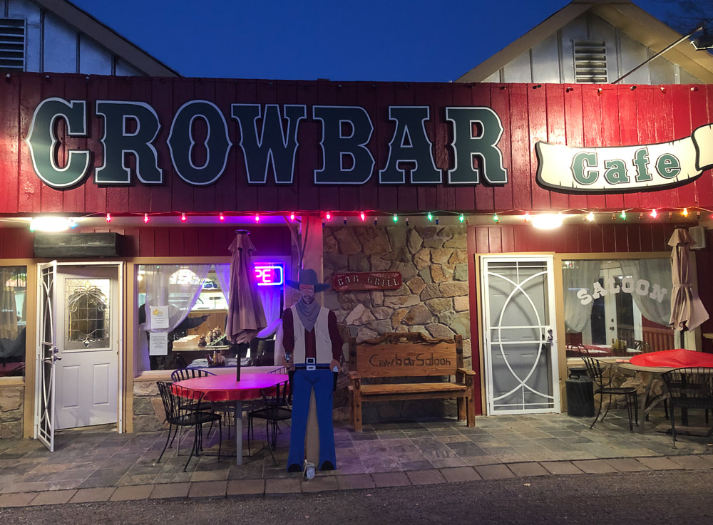
Celebratory dinner at the Crowbar Cafe and Saloon in Shoshone, a few miles from Tecopa Hot Springs, CA.
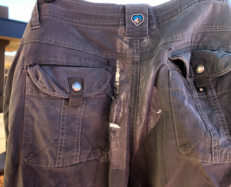
Sad to see these go - the limestone proved to be too rough for these worn KUHL pants.
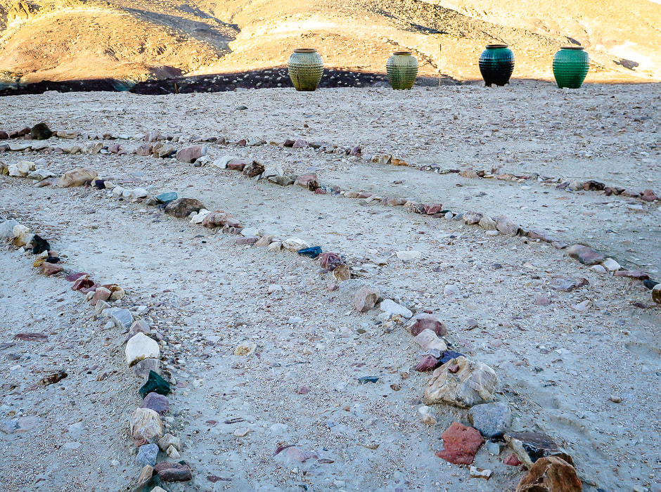
Labyrinth at Tecopa Hot Springs Resort
Tecopa Hot Springs Resort
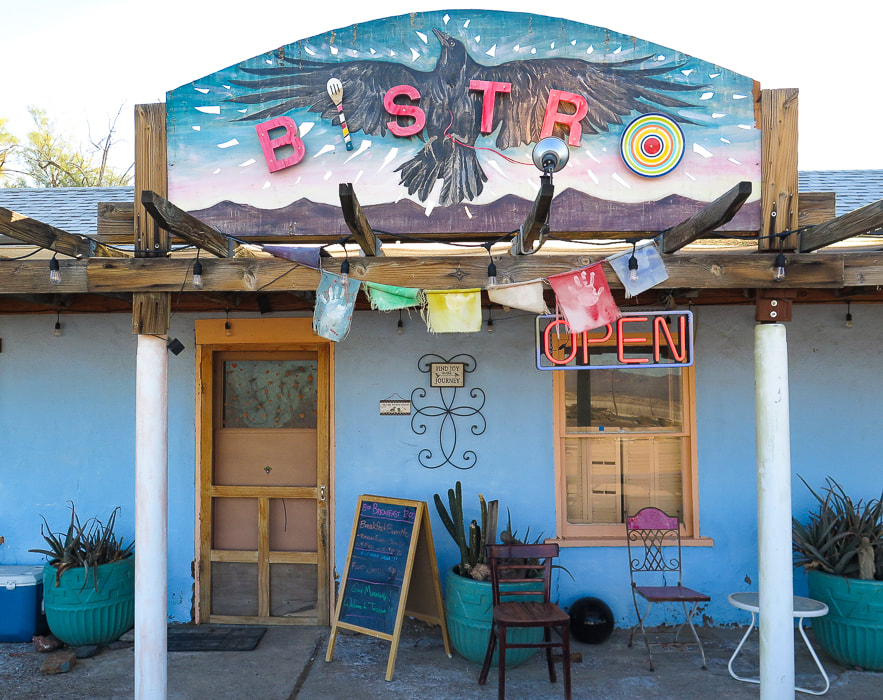
Tecopa Hot Springs Resort Bistro - the best huevos rancheros for breakfast!
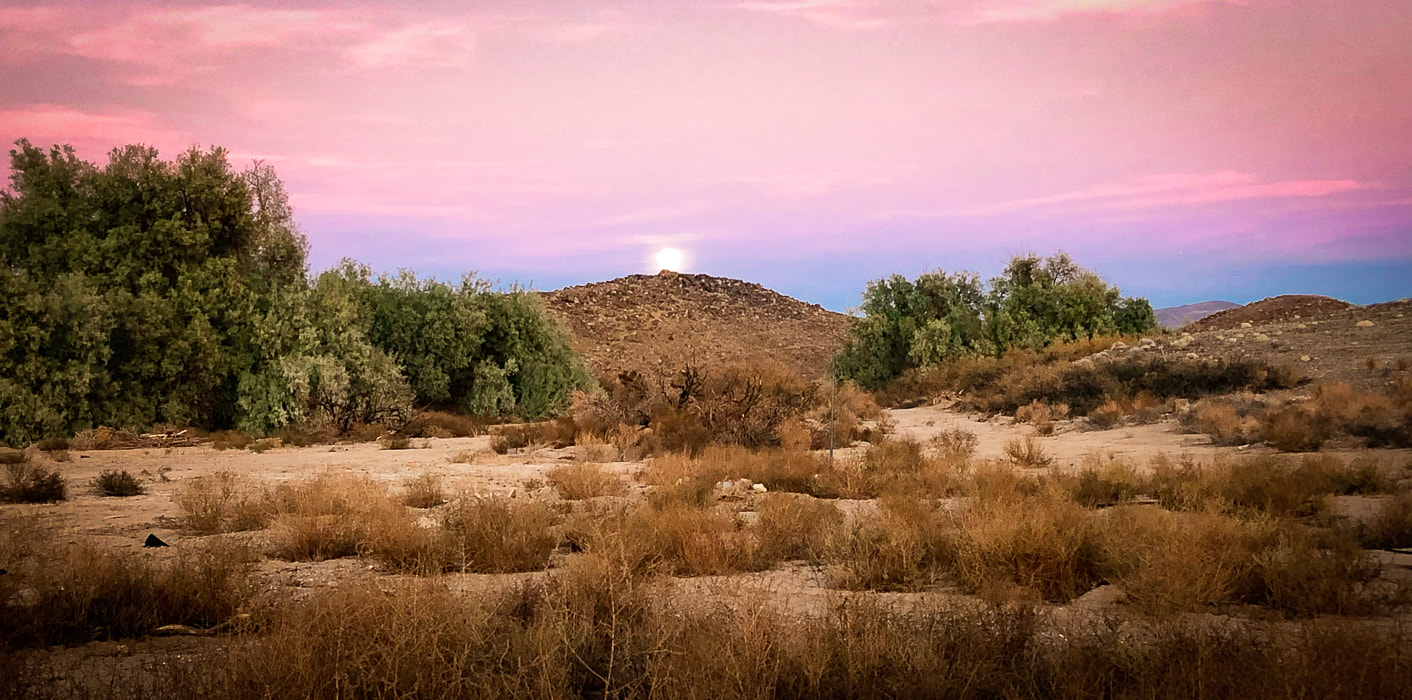
Moonrise in Tecopa, California.
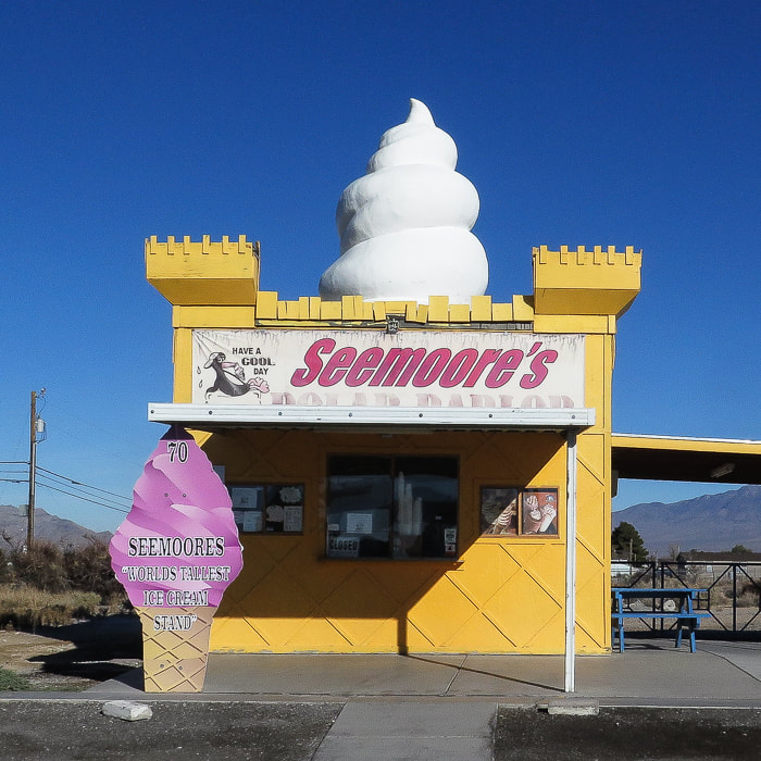
Seemoore's Ice Cream - "The World's Tallest Ice Cream Stand"
Pahrump, Nevada. 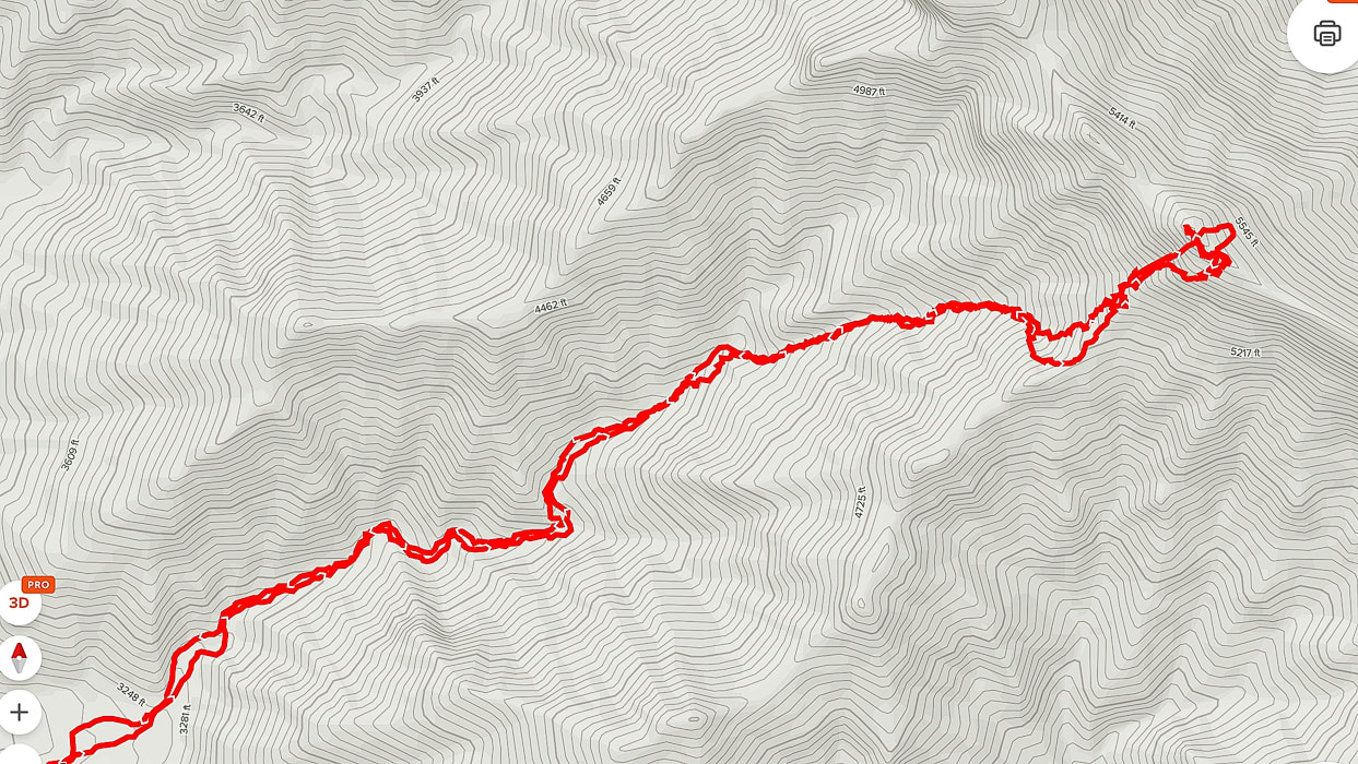
AllTrails GPS tracks from beginning of canyon (lower left) to Pahrump Point.
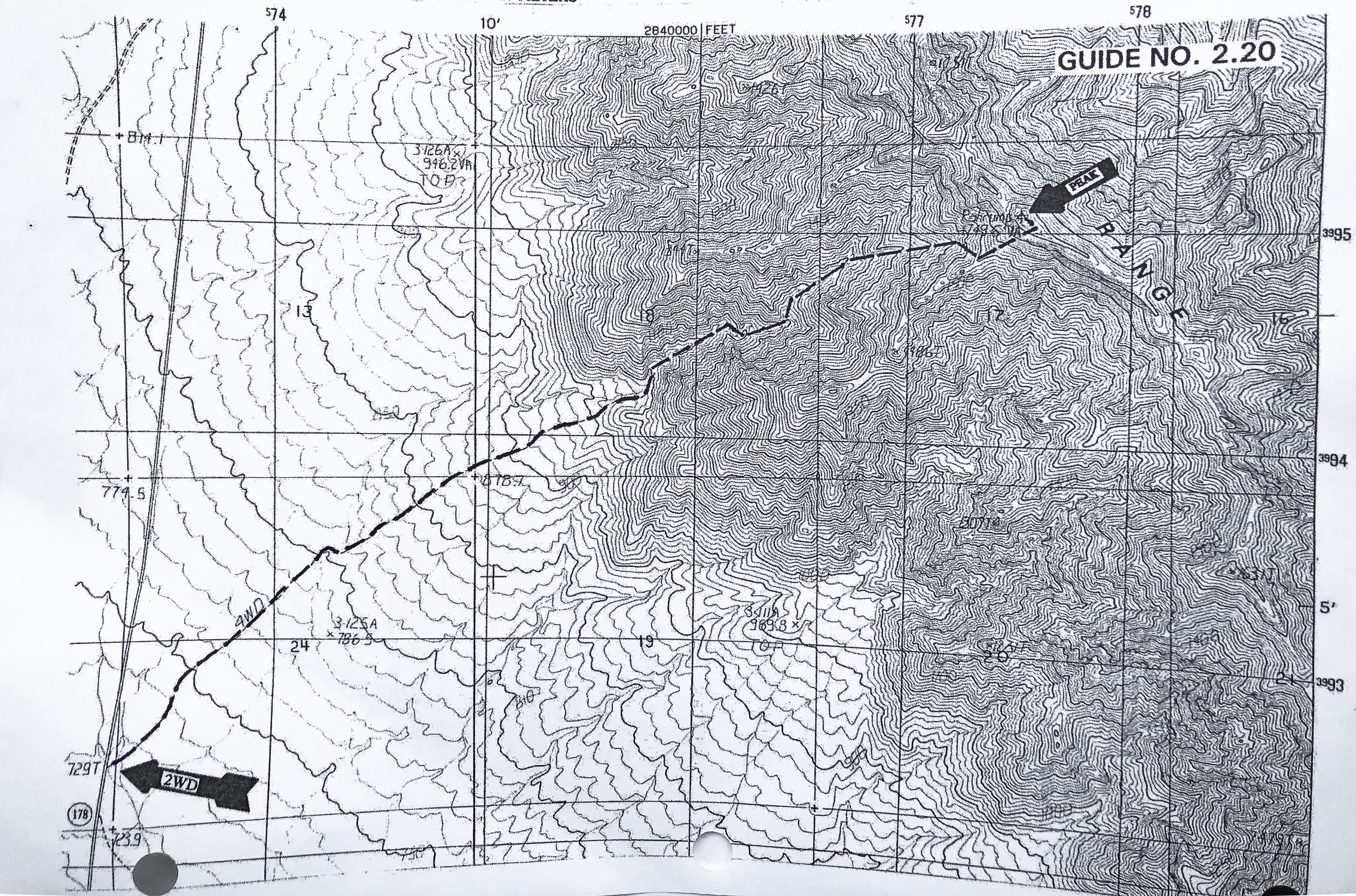
Route map from Sierra Club Desert Peaks Section
click for larger view
References
Wikipedia. Pahrump, Nevada. Jennings, C.W. 1958. Geologic Map of California Death Valley sheet. Why Does Experiencing 'Flow' Feel so Good? A Communication Scientist Explains. theconversation.com. Flow Theory: An Overview. sciencedirect.com. |
Categories
All

Sue and Fred

About this blogExploration documentaries – "explorumentaries" list trip stats and highlights of each hike or bike ride, often with some interesting history or geology. Years ago, I wrote these for friends and family to let them know what my husband, Fred and I were up to on weekends, and also to showcase the incredible land of the west.
To Subscribe to Explorumentary adventure blog and receive new posts by email:
Happy Summer!

About the Author
|


