|
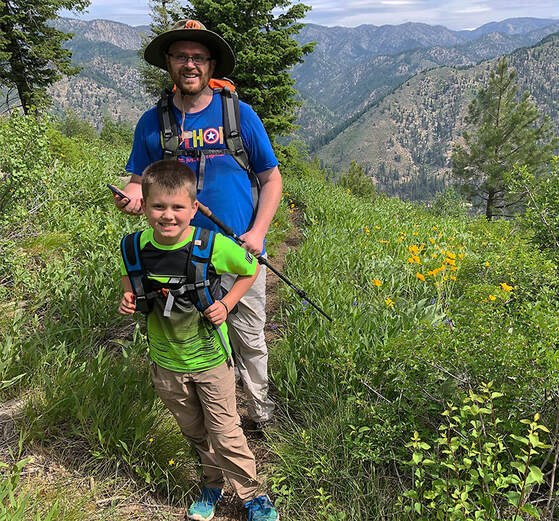
There's a lot to explore in Mackay, Idaho: a hike to Mackay Peak for a view of Idaho's highest peaks in the Lost River Range and a mine tour that illustrates the area's rich mining history.
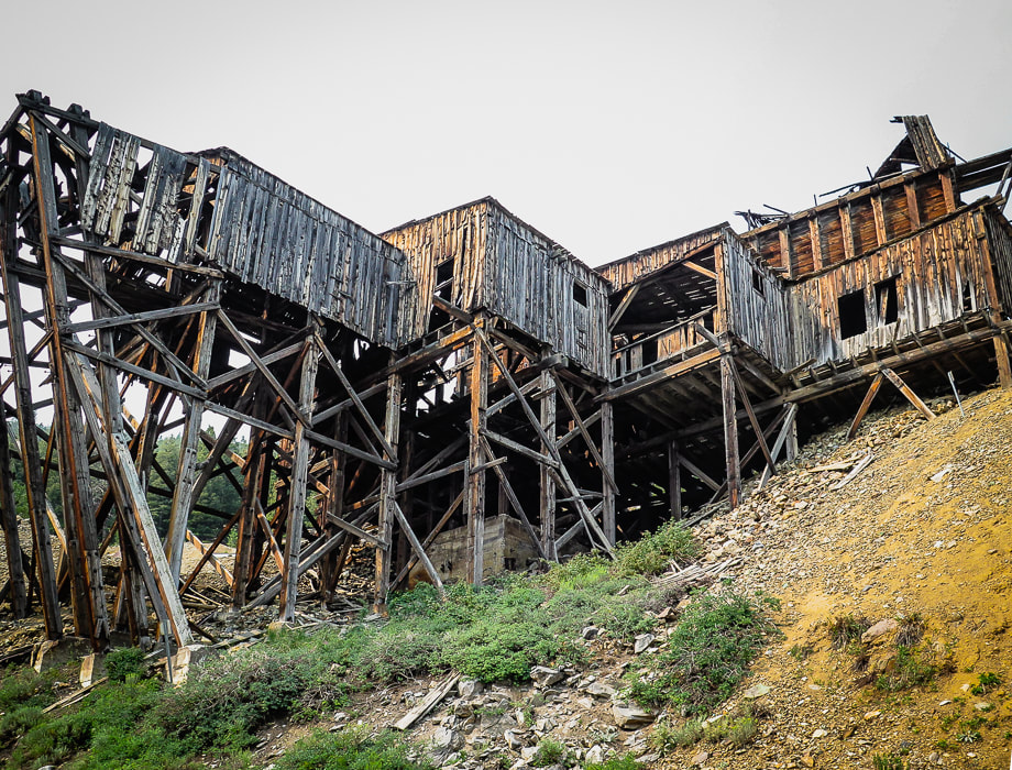
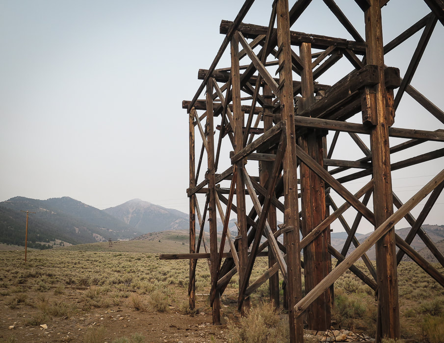
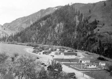
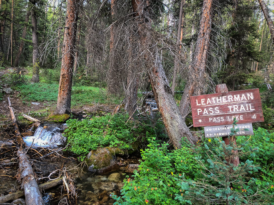
Aerial Tramway Headhouse - Mackay Mine Hill
The Mackay Mine Hill tramway replaced a mining railroad in 1918. It transported ore buckets to the smelter located in the valley below using a steel cable loop that was six miles long supported on 36 wooden towers.
Trip Stats for Mackay Peak Hike
Location: Mackay Peak is 4 miles west of Mackay in the Salmon-Challis National Forest, in the White Knob Mountains in east-central Idaho. There are two summits for Mackay Peak. We hiked up the north slope to the benchmark (the eastern high point). Distance and elevation: 3.6 miles round trip with an elevation gain of 2,200 feet. Elevation Mackay Peak (east summit) = 10,256', Mackay Peak (west summit) = 10,272'. Difficulty: Strenuous Class 2 off-trail scrambling and route-finding, easy Class 3 last 200 feet to summit. We didn't see the summit most of the way up, so we used a combination of compass, topo map and GPS. Date hiked: July 9, 2021. Map: USGS 7.5 minute Mackay Reservoir, ID topo map Coordinates: Mackay Peak = 43.88940 113.70046 Driving Directions: Drive southwest on Main St. in Mackay which becomes Smelter Ave. Cross the Big Lost River, then at another 0.8 miles, see the large "Mackay Mine Hill Tour" sign near the large smelter building. The road becomes MK-207, goes by a few relict tramway towers, enters the Challis National Forest and becomes FSR-207. Reach a junction FSR-207 and FSR-207A. We stayed straight onto FSR-207 (passenger car passable) and went past 2 green "4" signs that denote Horseshoe Mine. We parked in a pull-out right after the second "4" sign, at the base of Mackay Peak's north slope, near the Horseshoe Mine. We climbed the north slope, and followed a SSW azimuth. History: Mackay is named after John Mackay, financier of the smelter for White Knob Mining Company which began operations in the late 1890's. Wayne Darlington, president and general manager planned the town and he named it after Mackay to show his loyalty. Mackay officially became a town in 1901, but John Mackay never saw the town in Idaho named after him.
Mackay Peak Hike
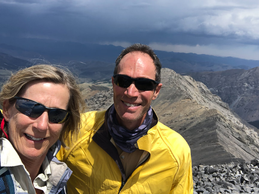
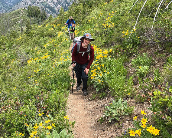
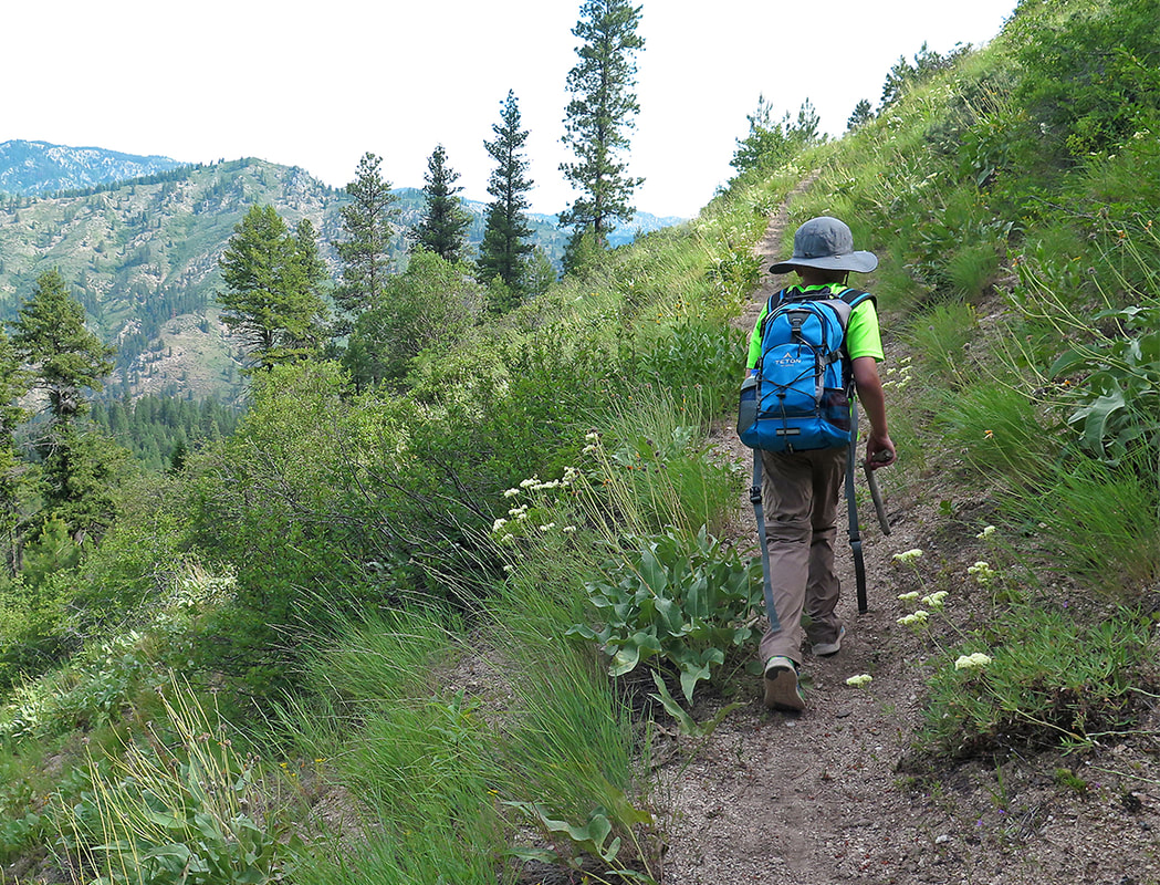
To a lot of Boiseans, summer means it's time to get out of the heat to explore some of the many rugged Idaho mountain ranges. Instead of our usual Ketchum/Stanley trip for hiking, biking and camping, Fred and I decided to go to a less crowded, small town and explore a different mountain range. A place we could actually find a spot to park our Chalet trailer for 5 days. We chose the mountain range with the highest peaks in Idaho - the Lost River Range - and the historic mining town of Mackay with close-up views of this spectacular mountain range. We climbed Leatherman Peak and Mackay Peak, toured Mackay Mine Hill, and did a good deal of talking with the "locals" - very kind and friendly people.
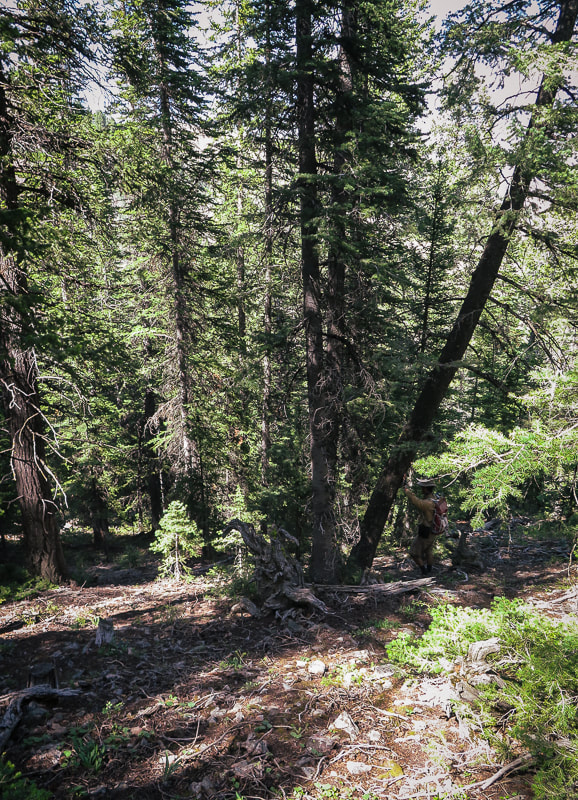
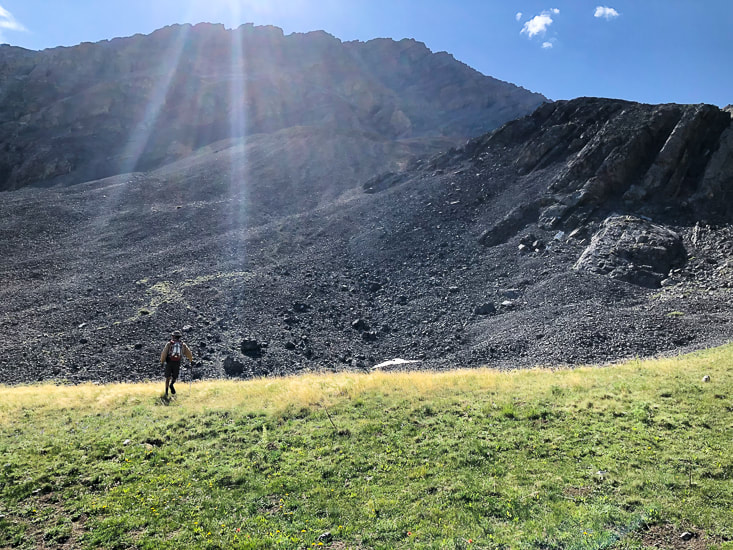
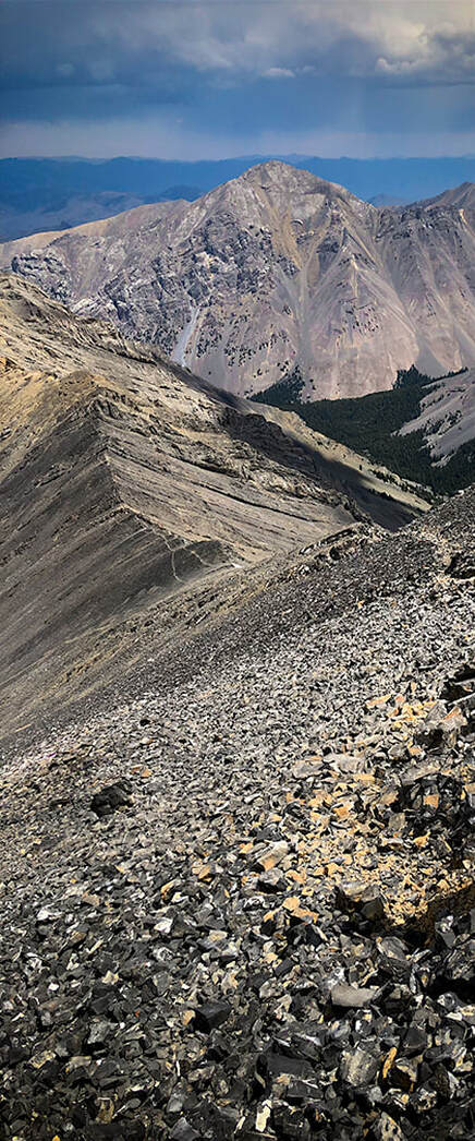
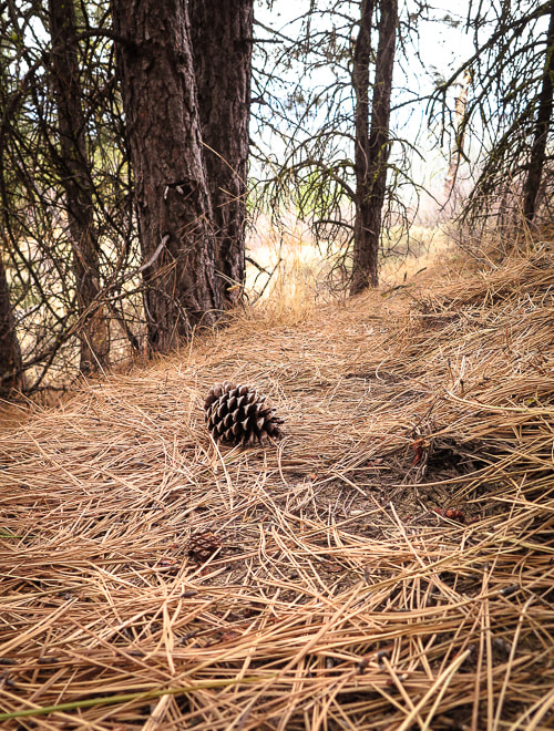
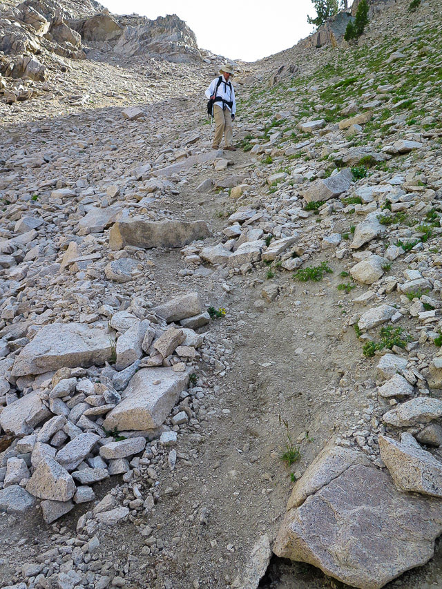
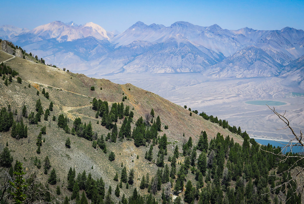
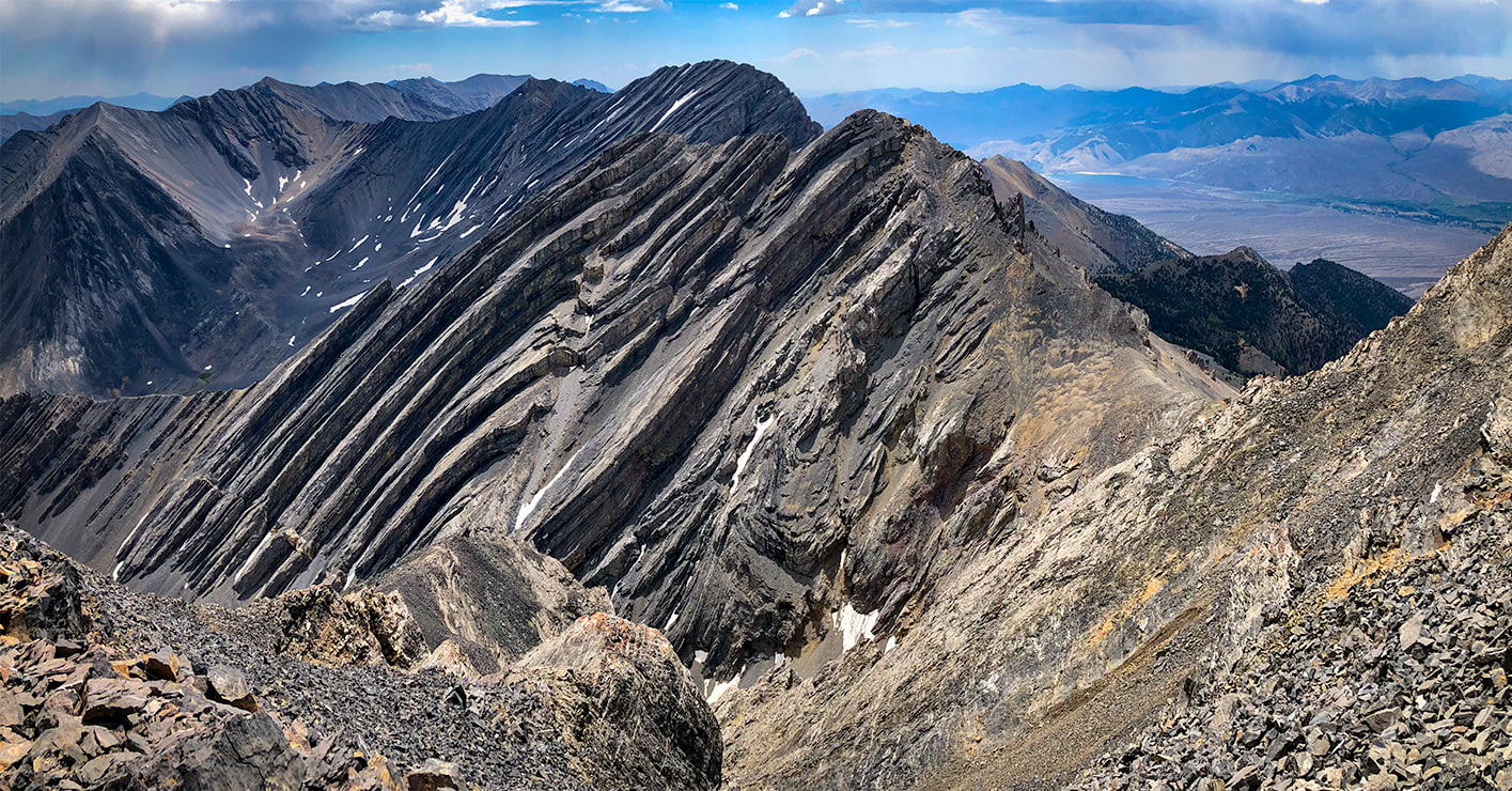
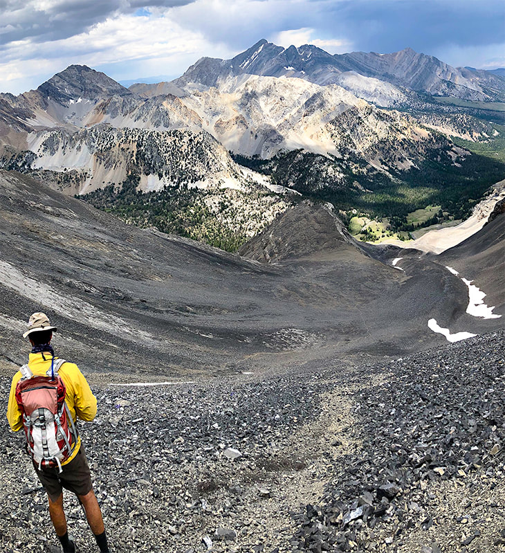
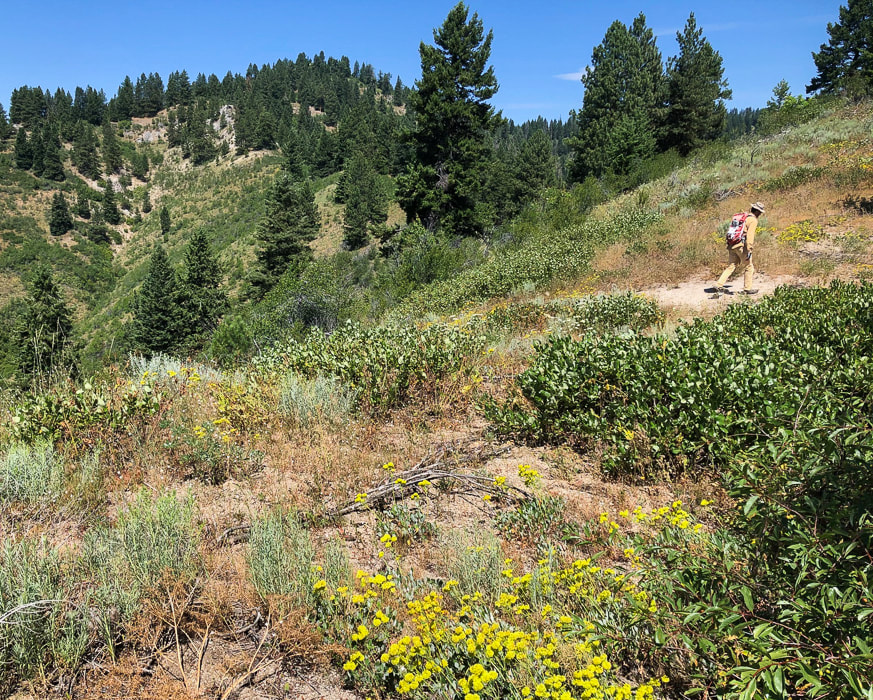
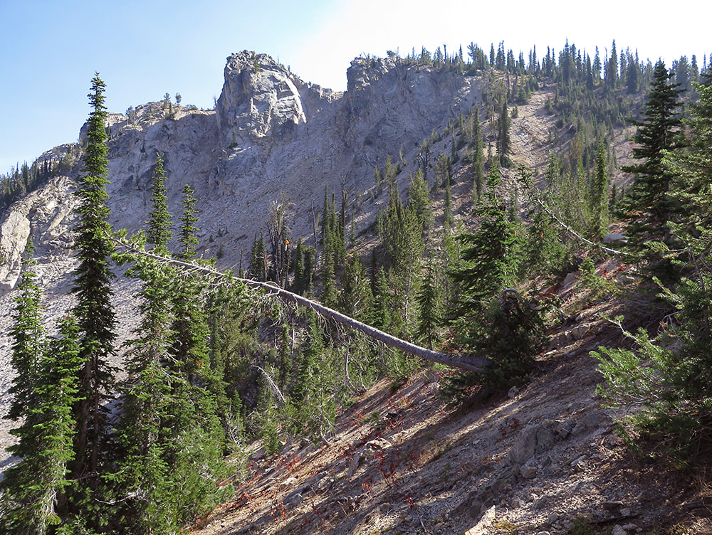
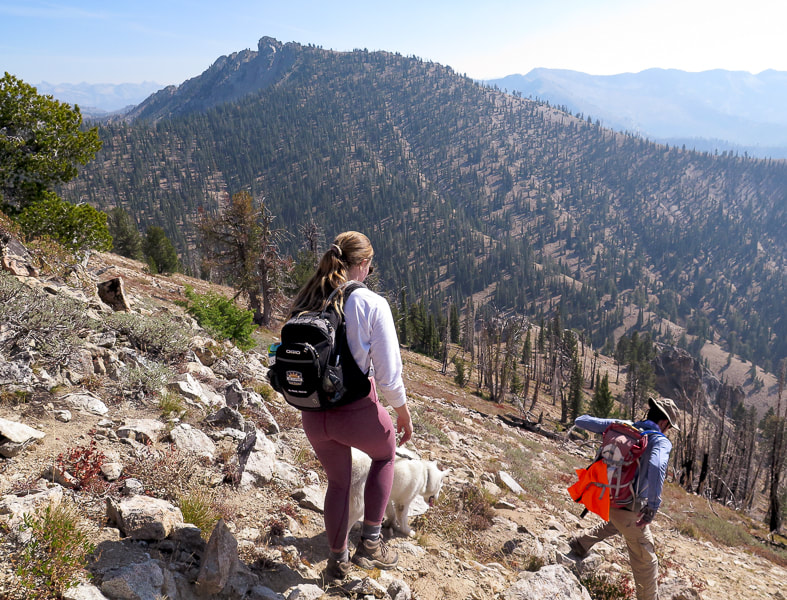
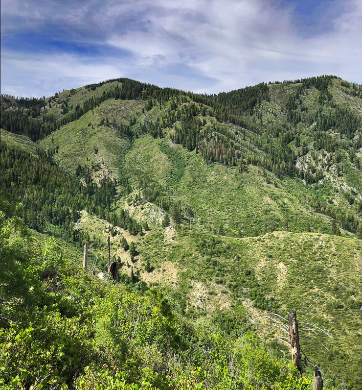
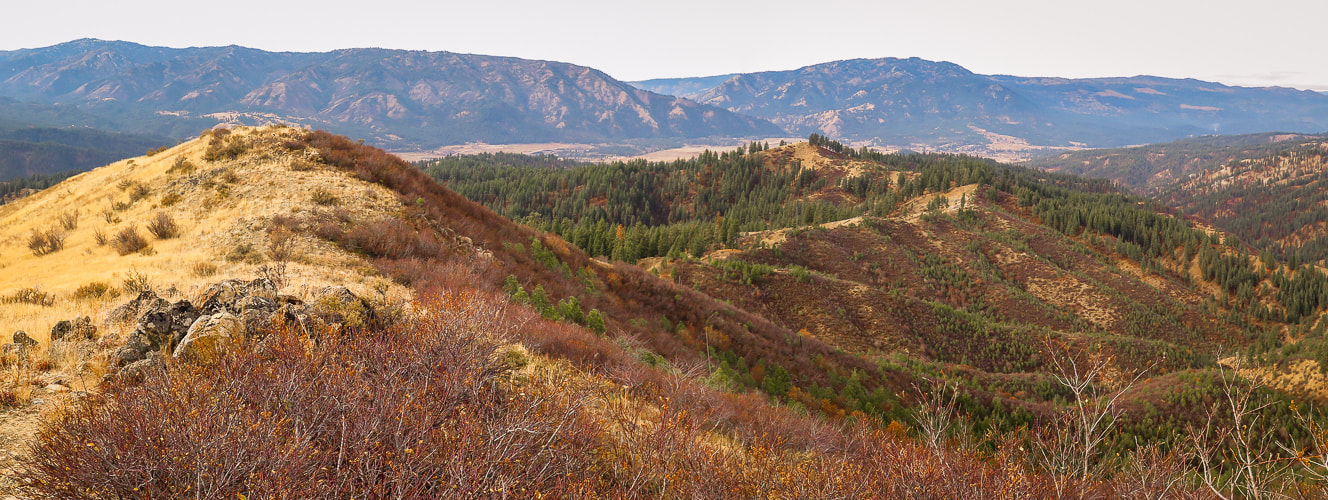
We got as close as we could to the base of the north slope of Mackay Peak on Mackay Mine Hill Tour Road #207 in the Rio Grande Canyon, just southwest of the town of Mackay, and hiked south, straight up through the forest toward the saddle between its two high points (see driving directions). Since we couldn't see the summit for most of the way, we followed an azimuth SSW using our compasses. I have seen a trip report describing climbing the open northeast slope. Mackay Peak has two summits separated by about one quarter of a mile. The forest hike was dense at times with prickly thickets, and we saw one shallow pit dug in the slope and a few mine claim posts. We hiked through some small clearings where trees had been cut many years ago. Turning to look northwest to the Lost River Range, we could see Leatherman Peak, the second highest in Idaho, where we had been on two days before, as well as the blue of Mackay Reservoir.
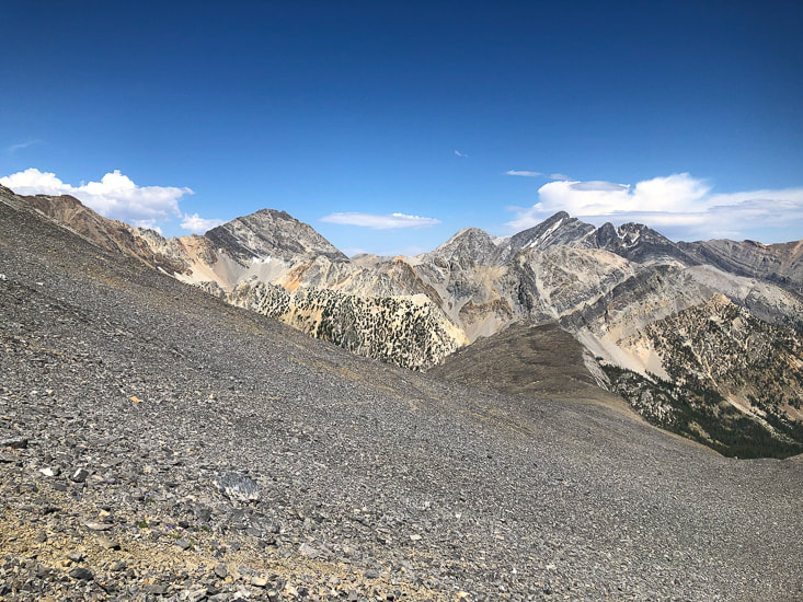
From the northwest slope of Mackay Peak looking at the Lost River Range
White Cap Peak (the lightest-colored peak on left horizon), Leatherman Peak to its right with Leatherman Pass on saddle between them. 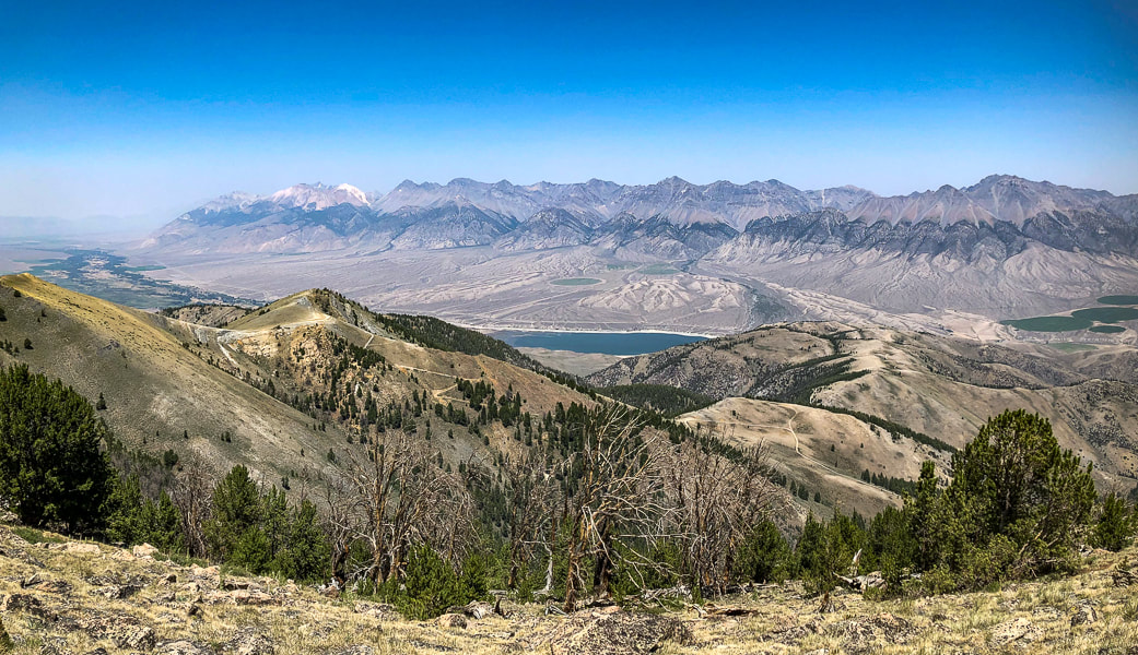
Getting near Mackay Peak's summit with a view of the Lost River Range, home to seven of the nine Idaho "12-ers" - peaks over 12,000' elevation.
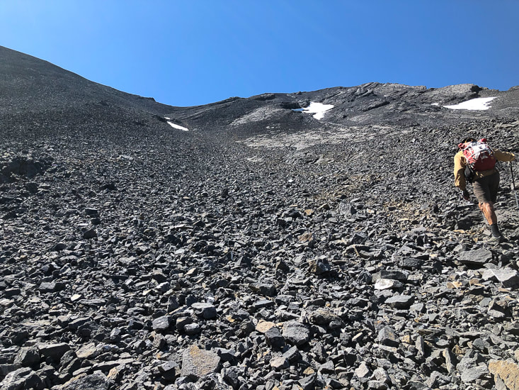
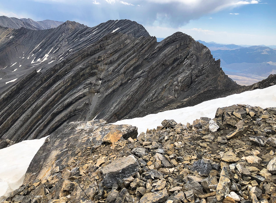
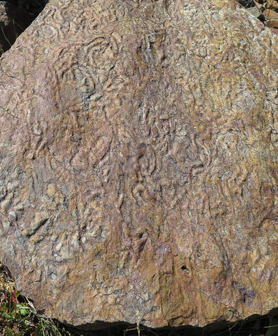
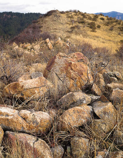
At about 9,600' of elevation, the forest thins to reveal a mantle of sharp-edged boulders scattered and wedged just below the summit. The actual summit is still not in view. The rocks are Mackay granite from the Challis igneous intrusive events that occurred 34 - 56 million years ago, providing the heat that produced copper at the contact between the intruding granite and the existing limestone. Sixty million pounds of copper were produced from the Alder Creek (Mackay) mines; silver, gold, zinc and lead were also produced. On the way up, we could hear the steady humming of one of Phoenix Global Mining drill rigs working to fulfill its planned open-pit copper mining project (see more info below in Mackay Mine Hill Tour).
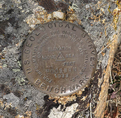
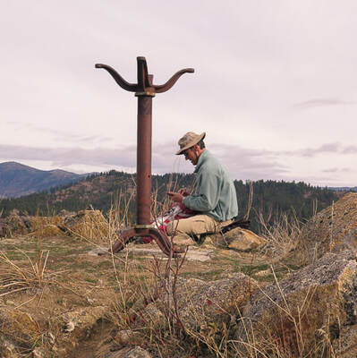
Once at the Mackay Benchmark, we found the brass geodetic marker in a granite boulder and its wooden triangulation tripod on its side. Looking toward the west/northwest, we saw Mackey Peak's other high point. It looked about the same elevation, but actually it is about 16' higher. We were content with the high point we summited, so we took our time and lazed in the sun, enjoying the view. Quite a different experience from two days before, when we had to hurriedly get off Leatherman Peak because of threatening thunderstorms. We hiked straight down through a lot of steep deadfall terrain. This hike's celebration drink/dinner was at Mineshaft Cookhouse and Watering Hole in Mackay where we got a great burger, gin and tonic, and manhattan. Life is good. Being able to explore Idaho and the American West is truly a gift. 
Mackay Peak Benchmark, the eastern high point.
Mackay granite on two Mackay Peak summits: the second summit (just above the wooden triangulation tripod) is actually about 16 feet higher according to a topographical map.
Mackay Peak geodetic survey marker
The "NO 2" refers to the number of the reference mark. The arrow points to the primary benchmark, usually 50 feet away.
Sue on top of Mackay Peak and making our way down through the forest
Dark Green Fritillary on a gray rabbitbrush
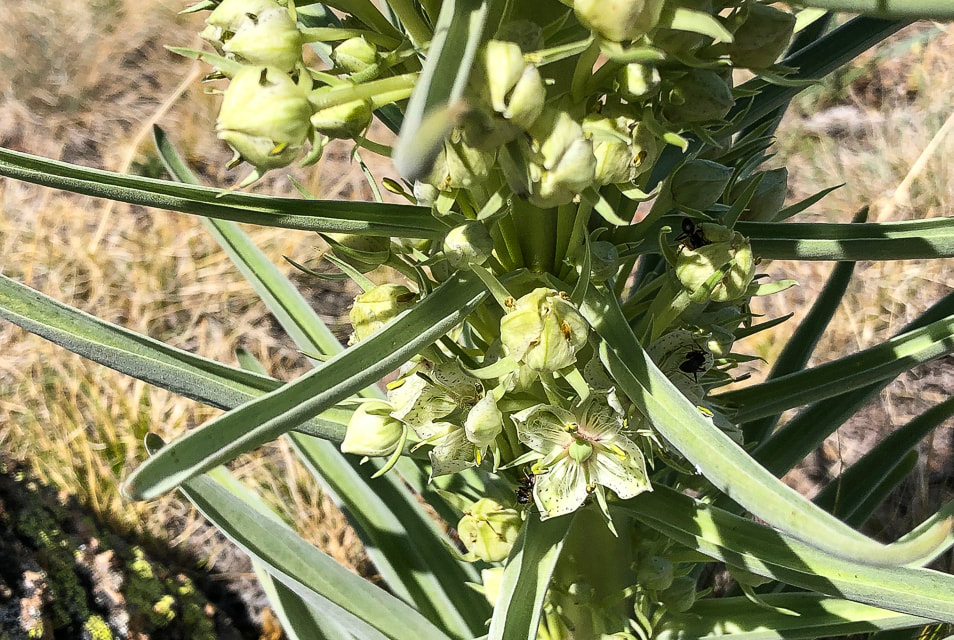
Monument plant
Frasera speciosa
Interactive map with our GPS tracks to Mackay Peak summit.
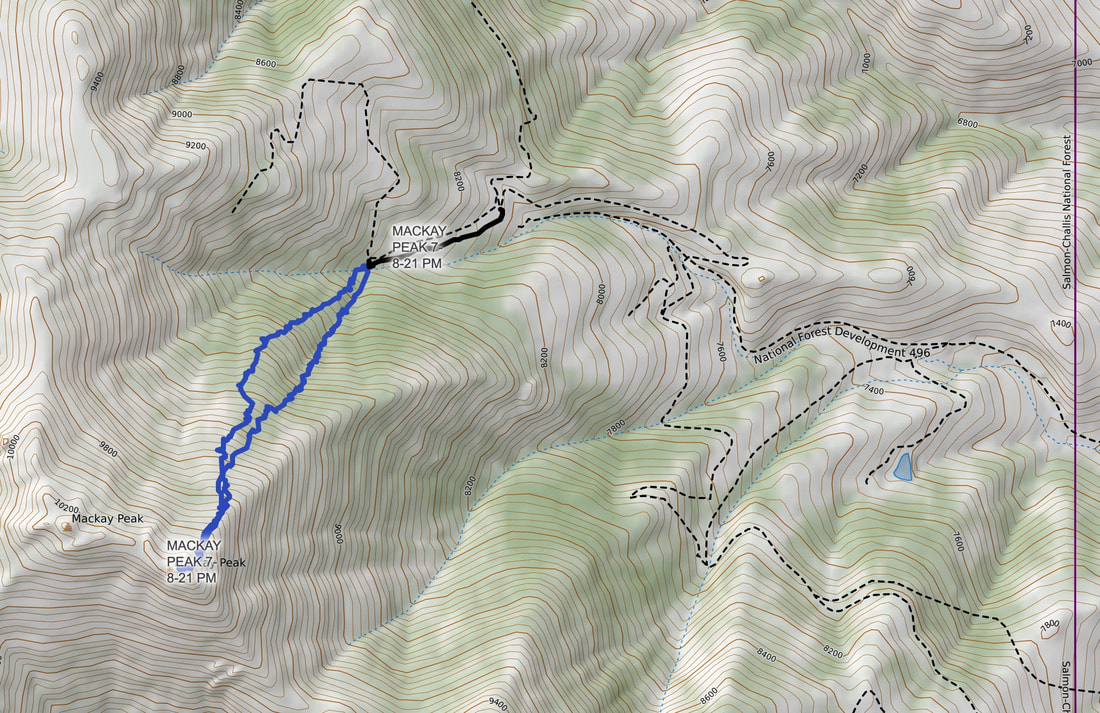
Our GPS tracks and gravel roads in Mackay Mine Hill Tour area.
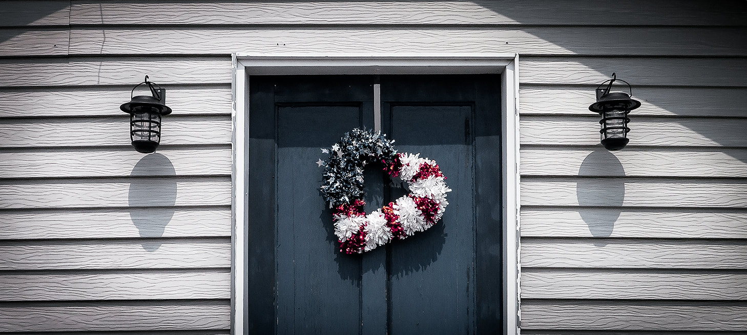
Mackay patriot
Trip Stats for Mackay Mine Hill Tour
BLM Mackay Mine Hill Tour Map - (can be picked up at the U.S. Forest Service building on Custer St., the Lost River Museum, Wagon Wheel RV Park, City Hall, Liars Den Bait and Tackle Shop). To get to the beginning of the mine hill tour (smelter site and hardrock mining exhibit), take Main St. south through the town of Mackay. Main Street becomes Smelter Avenue. Pass over the Big Lost River, then reach the large "Mackey Mine Hill" sign. The tour map features 3 routes depending on transportation mode. The red route is open only to ATV, bicycles, dirt bikes, horses or hikers. The green route is accessible to all transportation modes. Landowners include private owners, BLM and U.S. Forest Service.
Mackay Mine Hill Tour
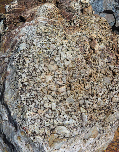
The Mackay Mine Hill has a rich and productive history dating back to 1884 that yielded mostly copper as well as zinc, silver, gold and lead. According to Mackay's Mine Hill Tour guide, almost a million tons of ore have been removed from this mine hill, located in the Alder Creek Mining District. However, a more recent drilling project shows there is much more ore available at "surface" depths. Phoenix Global Mining has five drill rigs operating in the Empire Mine on Mackay Mine Hill. This underground mine produced 700,000 tons of copper from 1901 - 1947. Empire was mined to depths of 1,100 feet. Currently, Phoenix Global has plans to establish low-cost and open-pit production of copper cathode from the current oxide. Apparently, only 5% of the potential ore resources have been explored, so there is a lot of exploration potential. Gold recovery was successful using "environmentally friendly" ammonium thiosulphate. Phoenix Global even re-opened two historic mining adits (horizontal underground mine passage) to conduct underground mapping and sampling. It seems that Mackay citizens are open to the new mining activity; at least I didn't see signs of protest in the town. While eating a tasty breakfast at the Liar's Den Bait and Tackle Shop, we talked to a long-time Mackay resident, having his morning coffee and talking to the owner of the shop. He filled us in on the new exploration on the mine hill. He indicated that Mackay residents were rightfully concerned about mining activity on the hill because that is their water supply. The CEO of Phoenix Global Mining, Dennis Thomas, says in an article that "You could not find a more supportive regime anywhere in the world than what we have there locally, with the local people and council." So it appears that Mackay is entering into the world of modern mineral exploration.
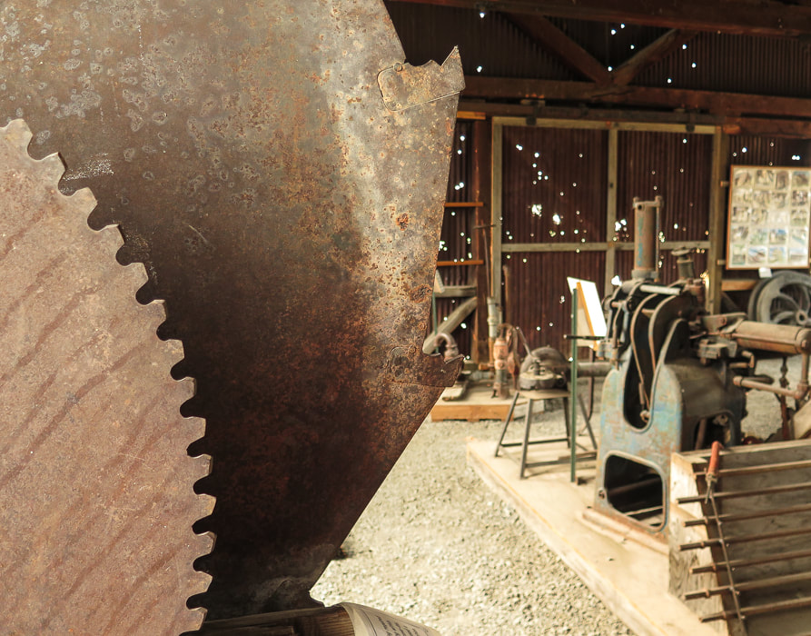
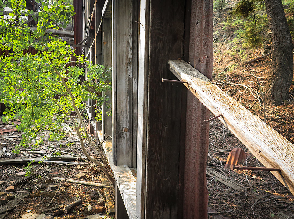
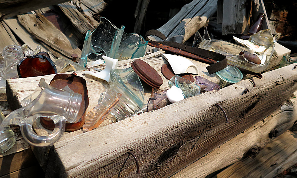
Scenes from the Hardrock Mining Exhibit, point of interest #1 at beginning of Mackay's Mine Hill Tour, and a surviving wooden tower from the Aerial Tramway (lower left).
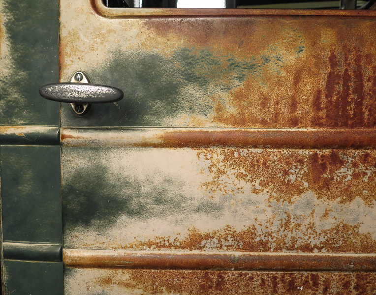
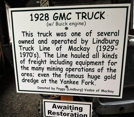
Door of truck from by Lindburg Truck Line of Mackay that hauled mining equipment.
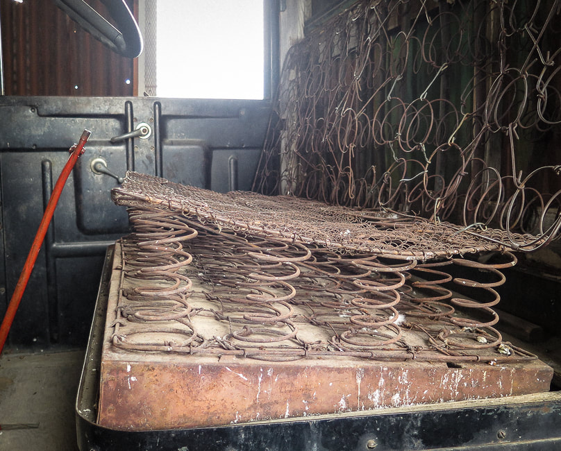
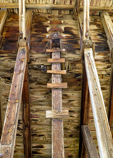
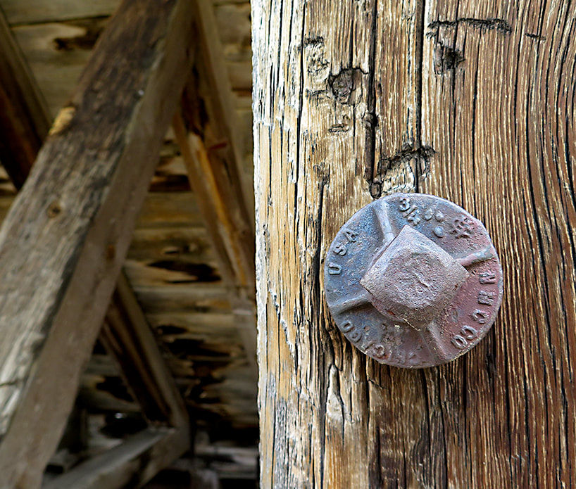
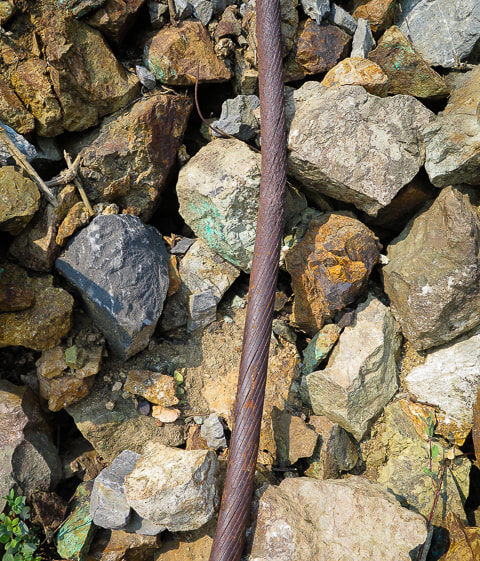
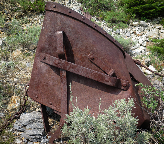
Scenes from Mackay's Mine Hill Tour
clockwise from top left: Cossack mine tunnel (the tour brochure states, "Caution: The tunnel is dangerous and prone to rock falls. Stay Clear"; supporting pole in the aerial tramway headhouse; tramway and tramhouse; upper terminal tramhouse; ore bucket; part of 6-mile cable that transported ore buckets.
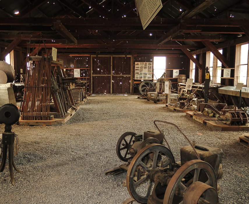
If you have limited time for the Mackay Mine Hill Tour, I suggest visiting the Hardrock Mining Exhibit at the beginning of the tour, not far from the town center. The exhibits show many examples of mining equipment that seems like it was just pulled out of the field. Informative interpretive signs describe every aspect of mining in Mackay, and illustrations and photos document how mining was done. I am amazed at how strong the miners had to be to handle heavy hand drills before the invention of the mechanical drill. You will get a great idea of the hardships of hardrock mining and how many steps were involved in finding and processing ore to produce valuable minerals.
The Lost River Museum in Mackay is a definite must-see. For a small town, this award-winning museum is exceptional. The volunteers at the front desk are down-home friendly and told us a few Living in Mackay tales including enduring winters and their early ranching experiences. It is well-organized and informative; you can tell that this museum was created out of the pride, care and love of Mackay citizens. From vintage ball gowns and flapper dresses owned by past Mackay ladies to a Basque sheepherder exhibit including sound effects, and a moonshine exhibit, the museum is comfortable, organized, but most important of all, interesting! 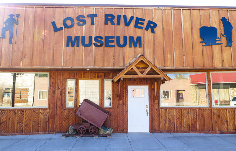
Award-winning Lost River Museum in Mackay, Idaho
References
Carey, R.L. About Survey Monuments and Benchmarks. Skipp, B, Kuntz, M. A. 2009. Geologic Map of the Arco 30 x 60 Minute Quadrangle, South-Central Idaho. (article text). Skipp, B, Kuntz, M. A. Geologic Map of the Arco 30 x 60 Minute Quadrangle, South-Central Idaho. (geologic map). Official Website of the Mayor and Council of the City of Mackay Mining Technology in the Nineteenth Century. Online Nevada Encyclopedia. Phoenix Set to Rise on Mackay's Mine Hill. Mining Journal, 6/28/18. Phoenix Copper Limited - The Empire Mine, Mackay, Idaho.
2 Comments
A challenging climb up the loose-rock north side of Idaho's second tallest peak for spectacular views from the "roof" of Idaho.
Related Posts
Idaho Summits (see Categories in sidebar) Mackay Peak, 10, 273' and Mackay Mine Hill Tour Cowboys and Hotsprings Alpine Peak 9,861' - Sawtooth Wilderness: Never Stop Climbing Mountains Reward Peak: 10,074' via Upper Redfish Lakes, Sawtooth Wilderness 
Lunch break at 12,000 feet.
Lunch spot on Leatherman Peak's north slope
Mt. Borah, Idaho's tallest peak at 12,667' on left horizon. Road approaching trailhead at upper right; trail goes through pleasant forest in valley.
Trip Stats
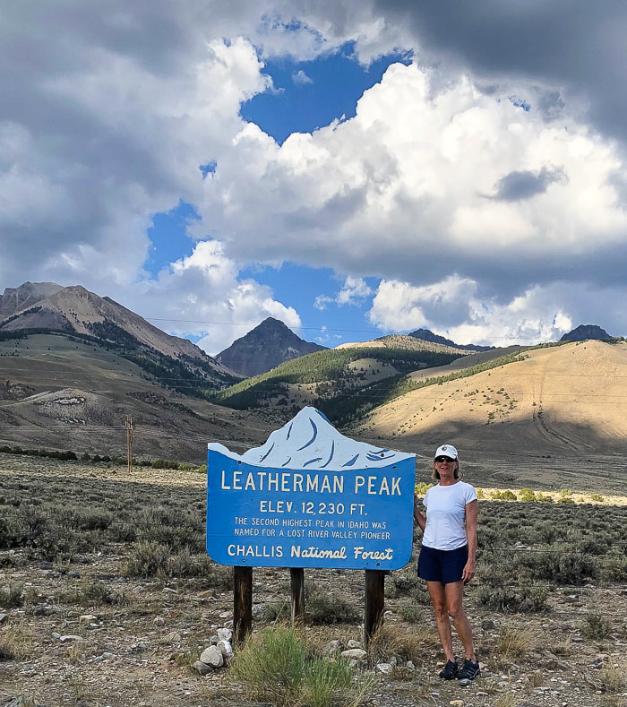
Location: Leatherman Peak, Idaho's second highest, is located in the Lost River Range in the Salmon-Challis National Forest just northeast of Mackay in east-central Idaho. This rugged range includes seven of the nine "12-ers" - the highest peaks in Idaho. Two main approaches: south approach from Leatherman Pass (Lost River Valley) that climbs the west ridge, and north approach from Pahsimeroi Valley and West Fork Pahsimeroi Road climbs the east ridge (our approach). Distance: 8.7 miles round-trip. Elevation Gain: Trailhead = 8,171'; Leatherman summit = 12,228: Gain = 4,000'. Date Hiked: July 7, 2021 Difficulty: Moderate Class 1 for first 1,000 feet gain, then Very Strenuous Class 2 on loose rock with some route-finding. Considerations: This is a very strenuous hike that is exposed most of the way - start hike early! Obvious trails extend through the talus and on the ridge. Experience with steep loose-rock climbing and route finding is essential. Coordinates: Trailhead at end of West Fork Pahsimeroi Road: 44.1292 N 113.7271 W. Leatherman Peak: 44.0820 N 113.7330 W. Maps and Apps: USGS Leatherman 7.5 min quad topo, AllTrails GPS tracks. Interactive Map and Google Earth image of our GPS tracks below. Geology: Sedimentary rocks - marine limestone of Mississippian carbonate banks and turbiditic sandstone and mudstone and conglomerate of Antler flysch trough ~350 Ma (Million years ago). Crinoid and coral fossils. Leatherman Peak is a sharp horn carved from Mississippian Scott Peak Formation. Some of these rocks were intruded with dikes that baked the rock ~ 45-50 Ma, producing flourite veins. This section of the Lost River range rose due to the Mackay section of the Lost River Fault. History: Leatherman Peak is named after Henry Leatherman, one of the Lost River Valley's pioneers from the 1860's. For more interesting history of this region, see last photo below.
Our Hike
The raw and starkly beautiful Lost River Range that rises steeply from the Lost River Valley in east-central Idaho contains seven of Idaho's nine highest peaks over 12,000 feet. It reflects the complex geological processes of folding and faulting that have occurred over eons, creating formidable steep talus slopes, cliffs and crumbling limestone; however each year sees more climbers logging in their nine "12'ers". These giants make up the roof of Idaho. Leatherman Peak can be summited from either the Pahsimeroi Valley to its north, or Lost River Valley to its south. Idaho's highest, Borah Peak at 12,667', has become so popular that the campground at its trailhead is being enlarged. After Fred and I summited Borah Peak years ago, I had heard that the second highest peak, Leatherman involved more "technical" skills. So I put that climb into the back of my mind, subconsciously knowing someday I was bound to do it, but the word "technical" prevented me. We each turned 60 this year, felt it was time to climb another Lost River range peak, so Leatherman it was. We climbed the "easier" eastern route that included a slow and steady slog for a 3,000-foot gain on steep loose scree and talus, at times grabbing for fossil-covered limestone outcrops for stability. There was no "easy" part except for the walk back down through the forest; this was a challenging climb for us. As we got within 500 feet of the summit, distant purple-blue skies to the north rumbled with occasional thunder, so our scramble to the top had to be quick but also careful. 
Morning glimpse of our goal: the far dark gray peak on horizon, left side of saddle.
From Mackay, we drove 2 hours and 10 minutes to our trailhead at the end of the West Fork Pahsimeroi Road, via Doublesprings Pass and Horseheaven Pass in the Pahsimeroi Valley. Here, steep limestone cliffs, some folded and tilted loom above a pleasant sagebrush steppe. A high-clearance 4WD vehicle is recommended as there are a lot of rocks on the last half of the drive with some slow-going. I entered the coordinates for the trailhead into Avenza and also followed the directions from the guide book, "Trails of Eastern Idaho" by Margaret Fuller and Jerry Painter. Included in this guide is a section Scrambling up Idaho's 12,000 foot Peaks . A few scenes from the drive into the northeast side of the Lost River Range:
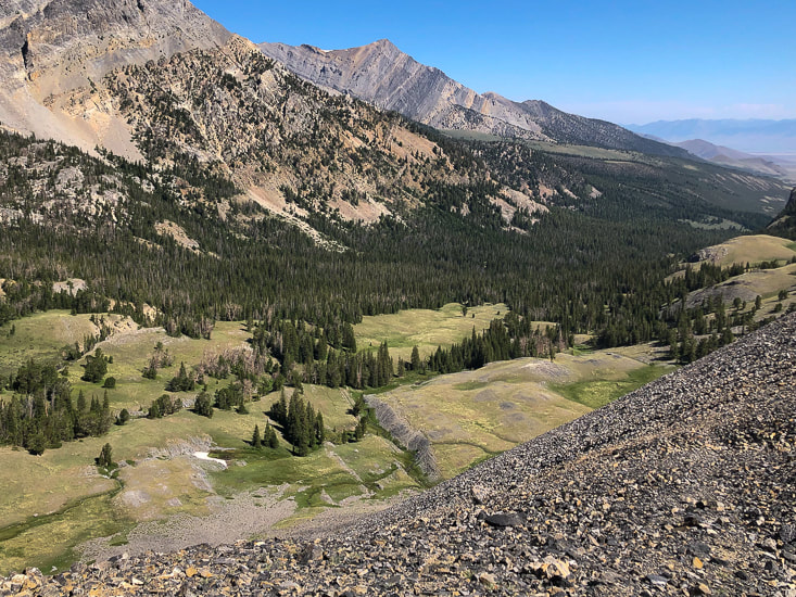
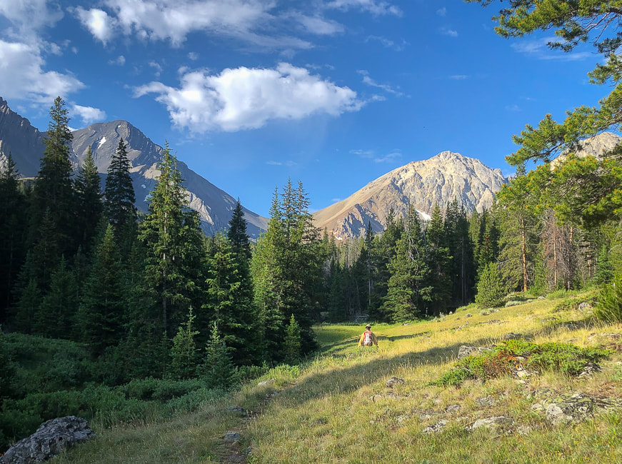
The first mile of the hike climbs a manageable 1,000 feet in 2.5 miles along the clear and rushing West Fork of the Pahsimeroi River through a beautiful forest that opens up onto a spacious wildflower-filled valley. Ahead, the black, towering spectacle of Leatherman Peak rises straight up from the meadow, connected to White Cap Peak by Leatherman Pass.
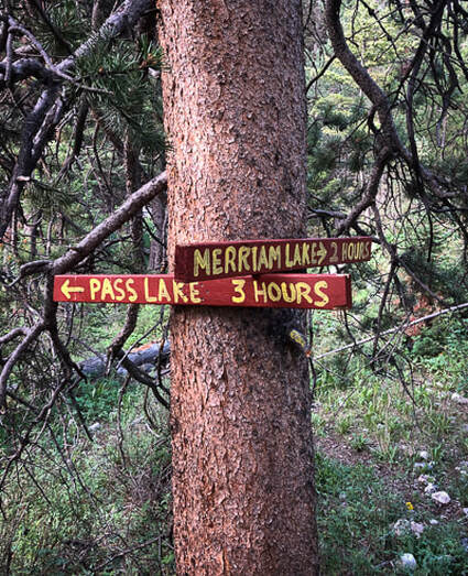
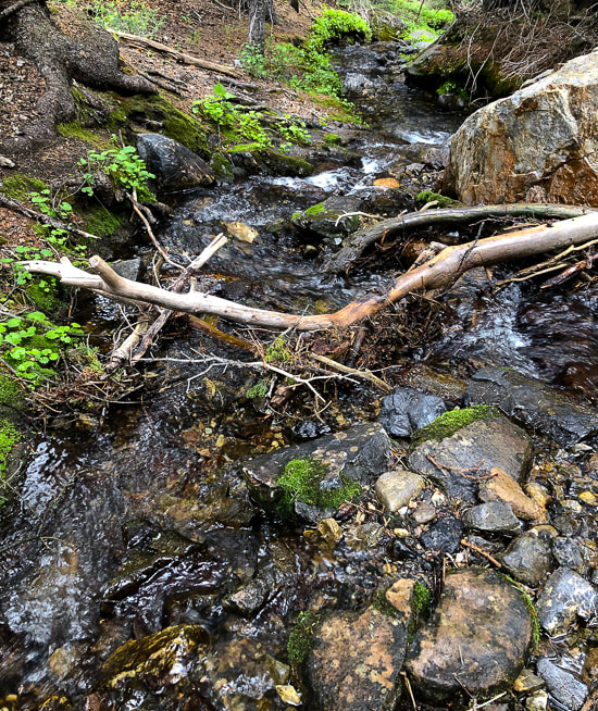
Just after trailhead, cross stream coming from Merriam Lake that flows into West Fork Pahsimeroi River.
Our route takes a left (east) to hike Leatherman's north slope, leaving the Pass Trail before it reaches Leatherman Pass. Sawmill Gulch is the southern approach from Lost River Valley.
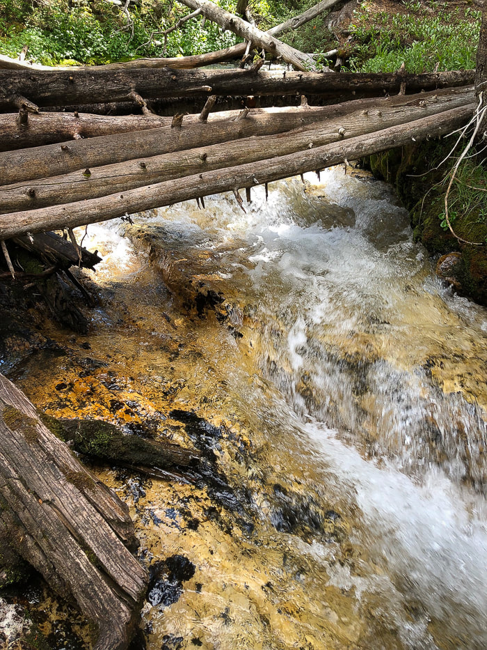
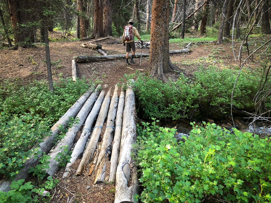
Thank-you for the bridges!
The first glimpse of Leatherman (left); and White Cap Peak (A.K.A. Mount Obsession) on the right.
Continue on trail until you reach a large valley opening and the steep gray gully of Leatherman to the left.
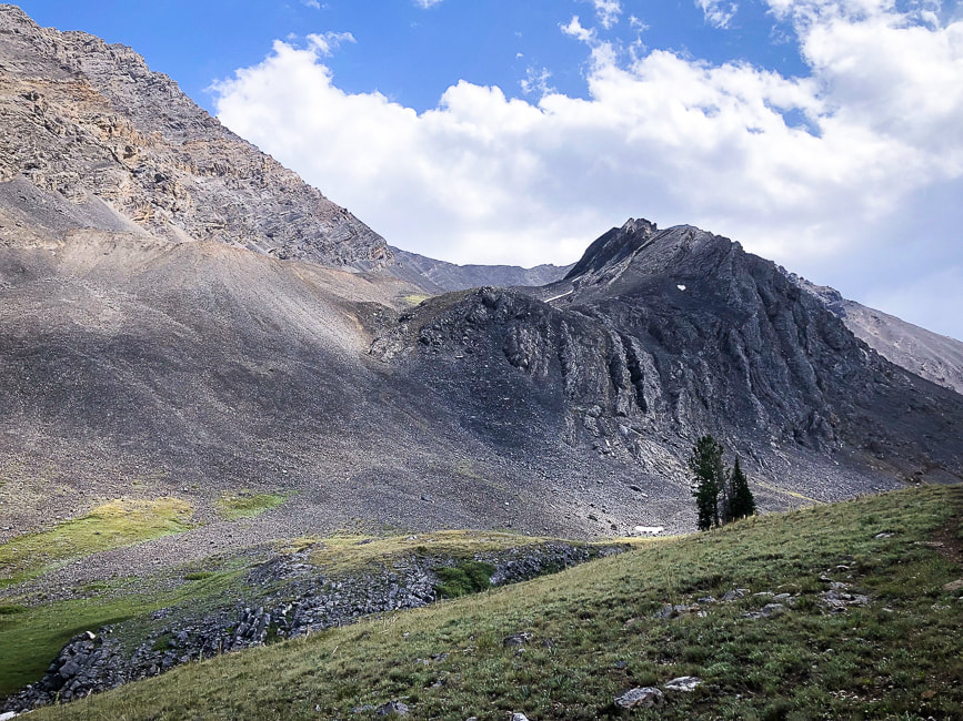
We went too far up-valley toward the pass, so we had to back track to find our gully route, east of the prominent north ridge. Not the best thing to do, since time is precious in the mountains above tree line. Once you get to the large meadow, 2.5 miles from the trailhead, leave the trail and start hiking left toward the steep loose-rock gulley below the ridge made mostly of talus that takes you to the ridge. A human-made trail winds up through this immense gray slope. After getting up the first steep part of this gulley, doing the rest-step to conserve energy, we took a brief rest to scope out a route to the top. A trail heads straight up to the lowest part of the ridge line through what seems acres of loose talus. Fred would have no part of that, so instead we climbed more to the right, using a combination of talus and stable limestone outcrops to scramble up to the ridge. As we got to almost 12,000 feet, sheets of rain extended in slight curves from blue clouds and distant thunder rumbled. We climbed to some protective outcrops in case we had to hunker down because of weather. The storm seemed to be moving across Pahsimeroi and Lemhi Valleys further to the east. We kept our focus up the steep slope, for looking down with sketchy footing was a bit unnerving. Glad the limestone, besides having some cool fossils, was rough and grippy.
Leave trail to make initial steep climb into Leatherman's northern gulley; this leads you to the cirque under the ridge.
Leatherman is behind the black outcrop. 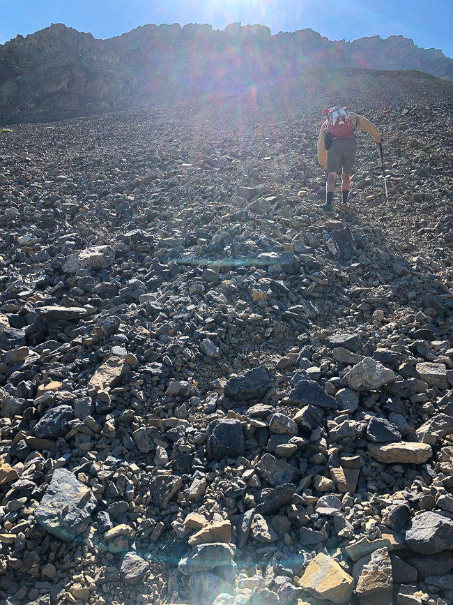
A "sea" of rocks - initial talus climb to gulley
Wait - why do we do this again?
Navigating through a gray rock sea - 3,000' gain
Yes! It was worth it 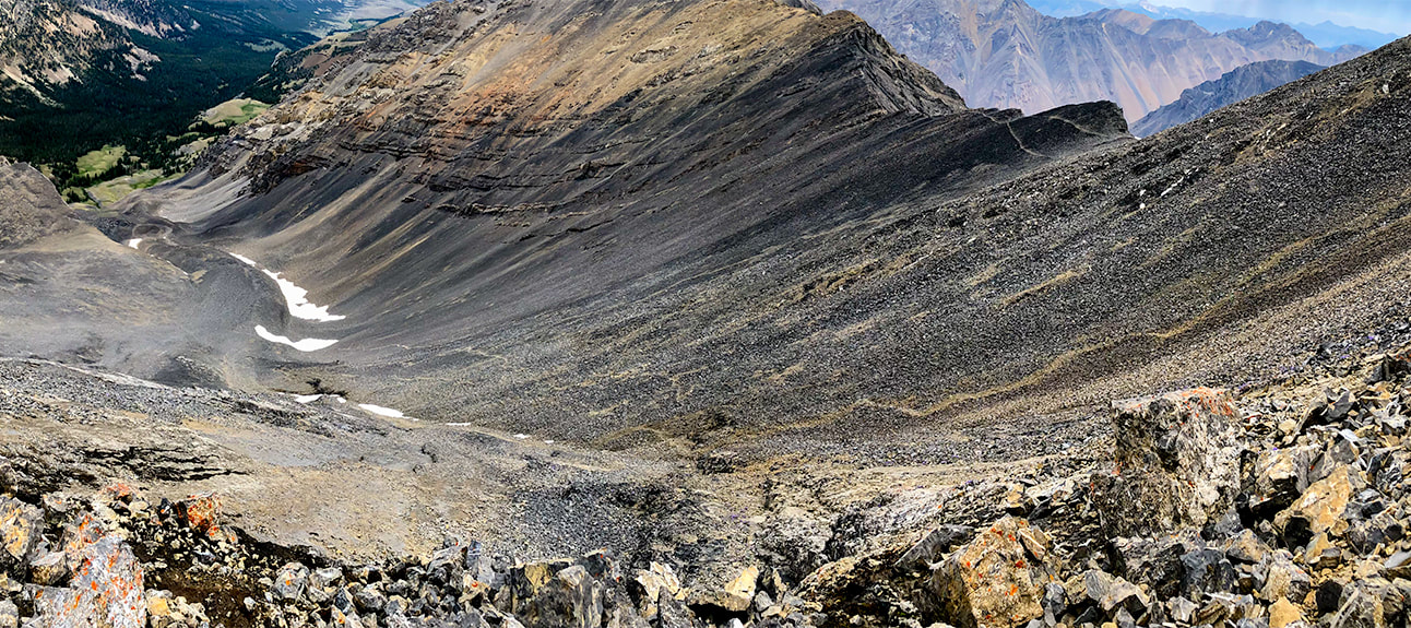
Working our way up larger boulders and outcrops of Leatherman Peak below the ridge; looking north onto gulley we ascended from forest below.
We descended via the path through the talus on the right. 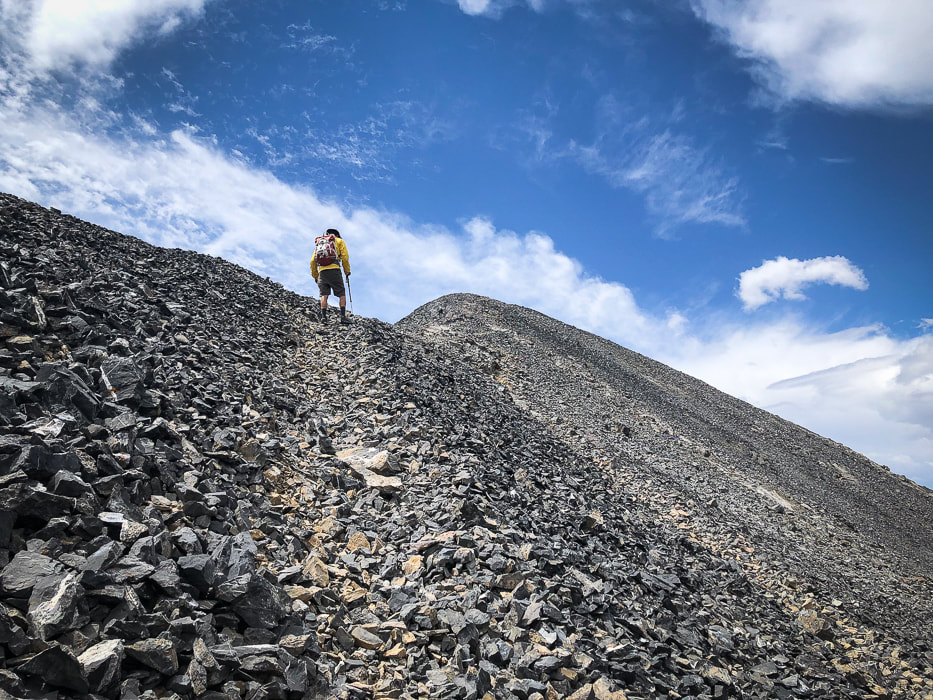
Final ridge climb - Leatherman Peak summit
Sue and Fred at 12,228' - another Idaho 12'er for the books!
Bad Rock Peak on ridge between Leatherman Peak and Mount Church
Tom Lopez, in his book Idaho: A Climbing Guide says of this peak, "Every approach crosses loose scree/talus that will make some climbers sob." 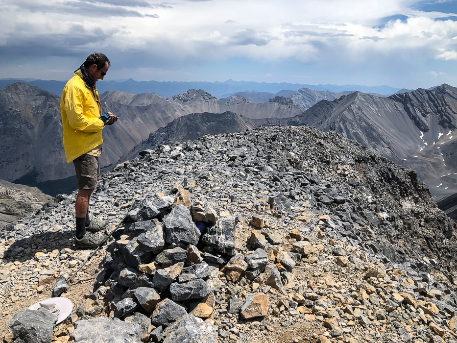
Leatherman Peak's summit - 12,228'
A few bypasses on the rocky road out helped to avoid a few slippery and steep sections. The gravel road passes through Mahogany Creek, which had not gained water volume since our morning crossing.
Getting down slope from ridge; route in gully below
Now we have summited three of the nine Idaho "12'ers". Getting to the top of the rest of the six: Mount Church, Mount Idaho, Lost River Peak, Donaldson, Diamond Peak, and Mount Breitenbach would surely qualify as a "kedge", especially for a couple of 60-year old "geezers"!
That night in Mackay, we celebrated with pizza and beer at the Bear Bottom Restaurant's bar and talked to some of the "locals" who had finished their day's work. We got some tips on great things to see in the area, like the Mackay Mine Hill Tour. So much to explore, so little time. We are lucky to have opportunities and freedom to explore our beautiful state and also this beautiful country. Never stop exploring and climbing mountains! 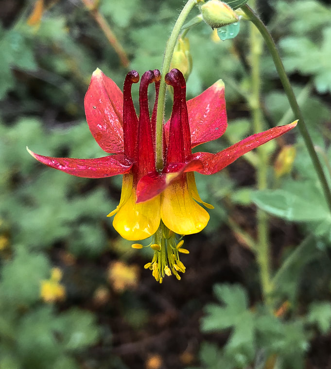
Red Columbine after rain shower
A welcome sight after all of that gray limestone! 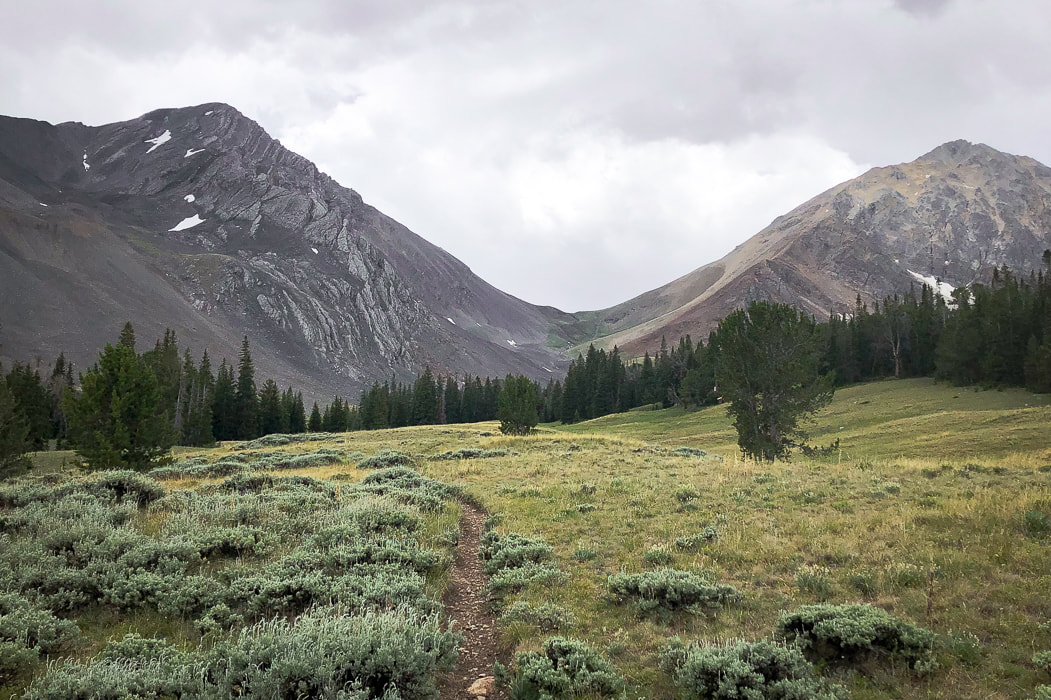
Parting shot of Leatherman Peak with clouds rolling in
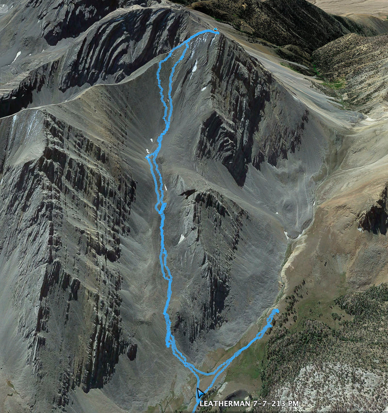
Our route up Leatherman's north gully/eastern ridge approach
We went too far toward Leatherman Pass, so had to backtrack.
References
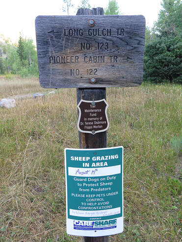
Custer County, Idaho, GenWeb Project - Mackay's Mount McCaleb Geologic Map of the Borah Peak, Burnt Creek, Elkhorn Creek, and Leatherman Peak 7.5-min quadrangles, Custer and Lemhi Counties, Idaho. Idaho Geological Survey. Link, P.K., and Janecke, S.U. 1995. Geology of East-Central Idaho: Geologic Roadlogs for the Big and Little Lost River, Lemhi, and Salmon River Valleys. Henry Leatherman - Find a Grave website. Get a taste of true Idaho wilderness on this short climb to a lush and undisturbed summit with a Civilian Conservation Corps (CCC) history. Just be prepared for some challenging bushwhacking! Related: Bald Mountain via Station Creek, Garden Valley, Idaho Jackson Peak Lookout: 8,124' - Boise National Forest Wolf Mountain and Point 8,610 via Jennie Lake 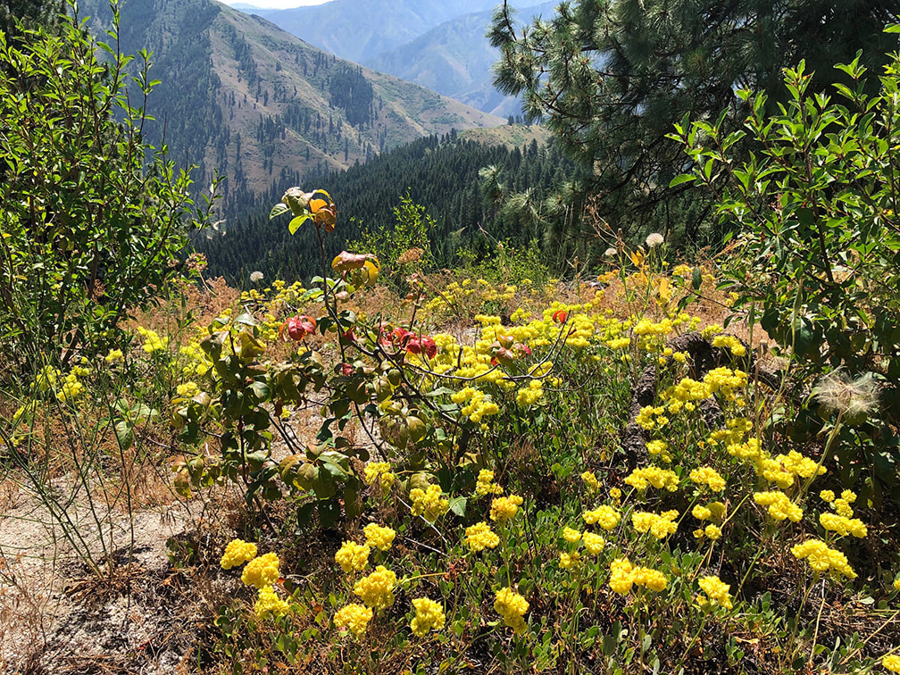 Buckwheat on ridge between Big Gallagher and Little Gallagher Creek drainages 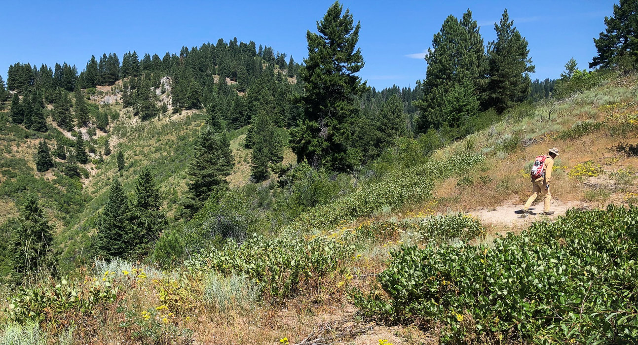 Undisturbed by fire - Gallagher Benchmark - 6,100' Trip Stats for southeast ridge access/Little Gallagher Creek
Overview: This seldom-visited, shrubby summit easily accessed from the Banks-Lowman Highway is a steep climb through a combination of open grassy, lush forest and thick shrub vegetation undisturbed by fire. Abundant wildflowers in August - however, dense shrubs require bushwhacking to a small rocky summit camouflaged by large pines. Date Hiked: August 2, 2020. Location: Southwest corner of Salmon River Mountains in Boise National Forest - east of Garden Valley, Idaho, just north of South Fork of Payette River and the Banks-Lowman Highway # 17. Distance/Elevation Gain: 6.0 total miles out and back. Trailhead = 3,435', Summit = 6,074', for a gain of 2,639'. Average gain/mile = 880'/mile. Difficulty: Strenuous Class 2 with moderate navigation; no maintained trail; persistence required to get through shrub thickets. Coordinates: Gallagher Peak: 44.1060°N -115.7855°W Maps: USGS Grimes Pass 7.5 min. topo map, Boise National Forest - USDA - Forest Service. Boise National Forest Large Fire History 1980 - 2018List of all peaks in Salmon River Mountains Driving Directions - trailhead is located 22 miles east of Banks, Idaho on Banks-Lowman Hwy.Geology: Biotite granodiorite and two-mica granite (Cretaceous). 85-67 Ma. Atlanta Lobe of the intrusive (igneous) Idaho Batholith. Idaho Geology - Geological Map of Deadwood River. History of Gallagher Civilian Conservation Corps Camp
In 1933, the Forest Service established a CCC camp at Gallagher Flat, near trailhead parking. The CCC was created by President Franklin D. Roosevelt during the 1930's Great Depression to assist young men in learning skills and finding jobs in the Emergency Conservation Work Program. Their labor was utilized in constructive improvements in public forest, park and range lands. In return, they learned valuable skills such as carpentry, heavy machinery operation as well as journalism, first aid, and photography. Donald Tanasoca, a Payette National Forest CCC worker from New Jersey wrote in his journal:
Gallagher CCC troops built a new guard station and improved the Banks-Lowman road (called the South Fork Payette River Road at the time). They also developed "public service sites" at campgrounds and built the Deadwood and Scott Mountain fire lookouts. Gallagher Camp was closed in 1939. More history and photos on the Historical Marker Database "Because when you stop and look around, this life is pretty amazing." -Dr. Seuss Overview What it lacks in summit grandeur, Gallagher Peak rewards with solitude and a grand view of the rugged Salmon River Mountains, the second largest of the Idaho Batholith mountain groups. The combination of lush wildflower-filled forest and open grassy slopes undisturbed by fire is the most remarkable feature of this short and steep hike. You won't arrive to a towering granite outcrop; instead, the partially-hidden summit benchmark sits under shrubs. The forest understory was so abundant that we got stuck in thickets a few times trying to navigate. When we hiked in August, large patches of yellow, orange and crimson buckwheat wildflowers topped granite outcrops on the ridge. The Boise National Forest Large Fire History map - 1980 - 2018, shows that Gallagher Peak has managed to escape past large fires. The Salmon River Mountain Range covers a massive territory in central Idaho - 8,900 square miles. The main Salmon River and its tributaries defines the boundaries of its six subranges. Numerous waterways form a natural maze through Idaho Batholith rocks that ultimately drain into the Snake River. The Middle Fork of the Salmon River is famous world-wide for its week-long raft trips through mostly untouched wilderness. The Frank Church River of No Return Wilderness covers nearly 2 million acres of the Salmon River Mountains. Long gravel and dirt roads lead into its interior; some peaks are close to roads, like Gallagher, and some peaks take days to find. A worthy goal would be to scale all of the Salmon River Mountain Range's summits (I lost track when counting on Tom Lopez's list - it was near 300!). Or maybe conquer its highest: White Mountain at 10,442' - a relatively easy access out of Challis, Idaho. Many of its tallest peaks are in the eastern section of this range. A list of its peaks, access and climbing information is posted on Idaho: A Climbing Guide. 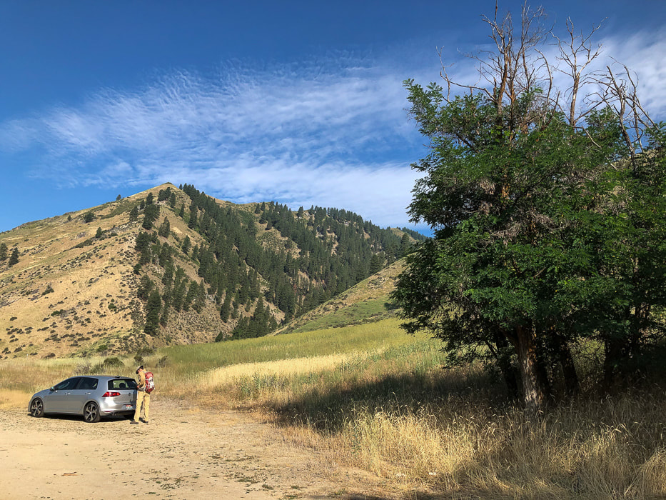 Parking just off Banks-Lowman Highway near Garden Valley, Idaho. The deep valley is Big Gallagher Creek drainage. Hike up the Little Gallagher Creek drainage to the right, behind trees. Our Hike - battling shrub thickets while searching for a trail Even though the distance to the summit is only three miles from the Banks-Lowman highway, it is a challenging peak to get to because it's steep, there's no formal trail, and you will fight your way through vegetation to get there. A previous trip report of this climb advised to hike along Little Gallagher Creek to its end and the ridge, but instead, we left the valley early and zipped straight up the steep grassy slope to the ridge top between Little Gallagher and Big Gallagher Creeks (see our GPS tracks below). Usually ridges seem to have a little less vegetation - but not this one! We soon found ourselves fighting large patches of shrubs interspersed with bare areas. At Point 5578, we briefly found a trail but then got sucked into thickets again. At this point, the ridge turns in a more northwesterly direction to the summit. 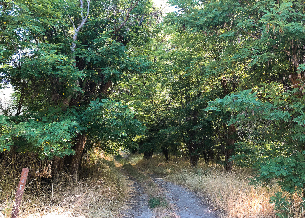 Short road goes to the open valley of Little Gallagher Creek 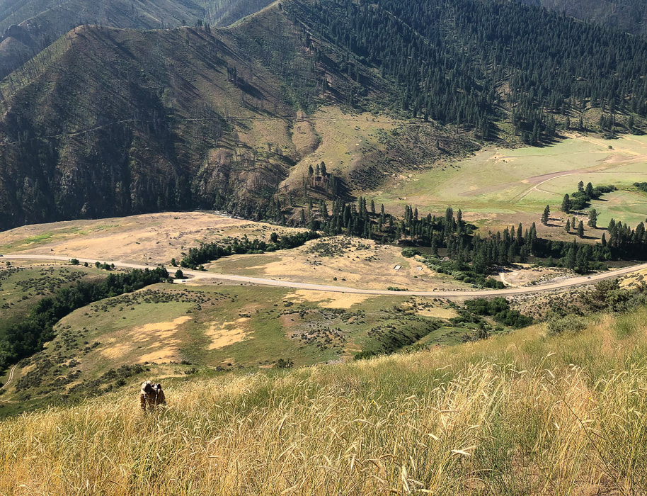 Heading up ridge to left (west) of Little Gallagher Creek (row of trees on left side of image). South Fork of the Payette River and Banks-Lowman Highway at bottom of valley.  Lots of large Antelope bitterbrush (Purshia tridentata) on this steep slope. This shrub provides important spring and winter food for elk, deer and antelope.  Finally on the ridge between Little Gallagher and Big Gallagher Creeks. Gallager Peak is between trees on left in image. 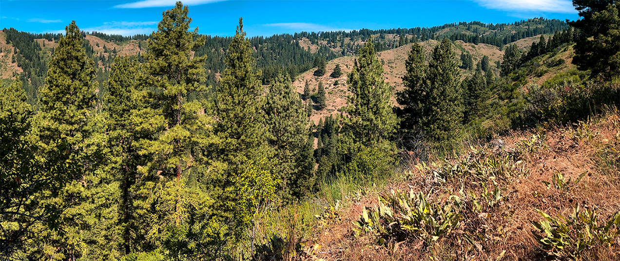 On ridge looking northwest with Big Gallagher Creek drainage to the left 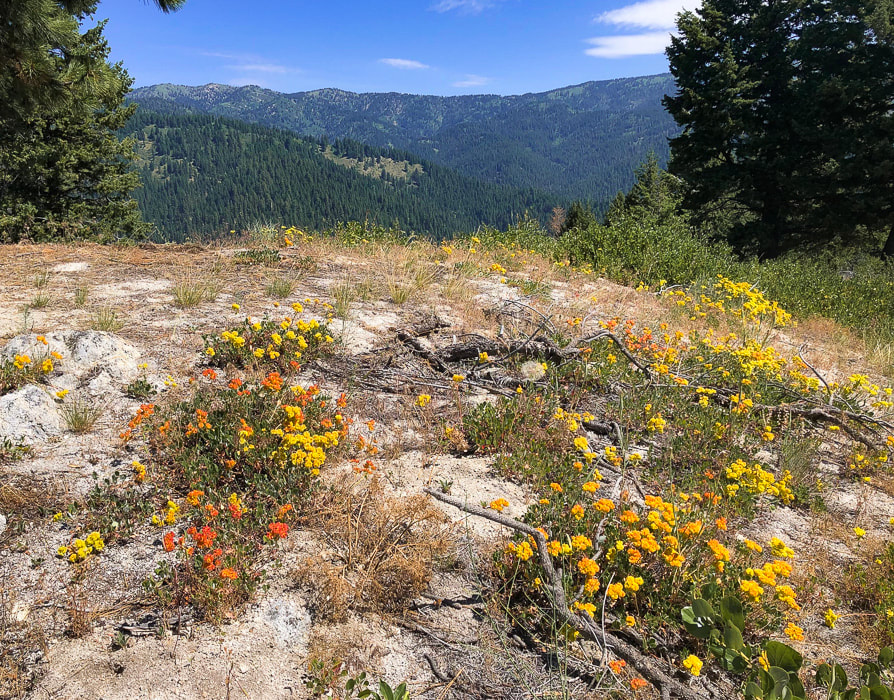 Buckwheat on granitic outcrops - looking to the north 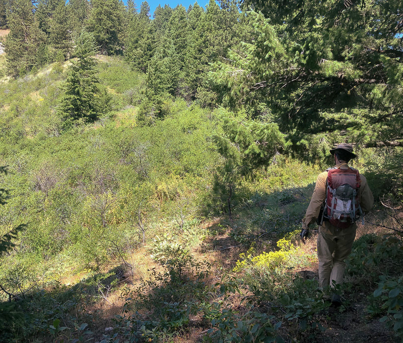 Trying to find a way through thickets and lots of trees
 Gallagher Peak on horizon - getting up to its southeast ridge. 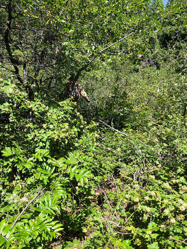 Fighting our way through thickets just below summit 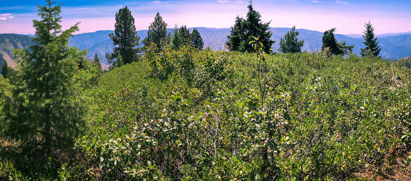 Gallagher Peak summit - 6,074' We arrived at the most unassuming summit - no grand granite spires here! We uncovered the geological survey marker. The blue and green undulating mountains of Boise National Forest surrounded us. Numerous creeks with great names such as Deadwood Jim, Whiskey, Slaughterhouse, Josie, Applejack, Cup and Black Bear have cut deep valleys into these granitic mountains. Bald Mountain, a summit we climb via Station Creek lies to the west. We found a faint trail descending the ridge with less vegetation. We were too far to the left (west) of the ridge on the way up; stay on the top of the ridge. Care must be taken to go down the correct ridge when you get to Point 5578; head down the due south ridge and not onto the due east ridge, otherwise you might end up in Pine Creek Campground. Out of the healthy forest, down to Little Gallagher Creek through tall and thick grasses. Another Boise National Forest peak under our belts with a few scrapes to prove it. Getting to know and appreciate Idaho one hike at a time. I wonder what workers in the Civilian Conservation Corps thought of this wilderness, and if they climbed this peak. Donald Tanasoca, CCC worker from New Jersey (see CCC history, above) said, "A city boy learns that the world is larger than just the city." As for me, each Idaho summit I get to is a gift, whether on a straight-forward clear-cut Class 1 trail or a frustrating and hard-won bushwhack. The views from the top are always awe-inspiring. Like Dr. Seuss says: "....this life is pretty amazing." 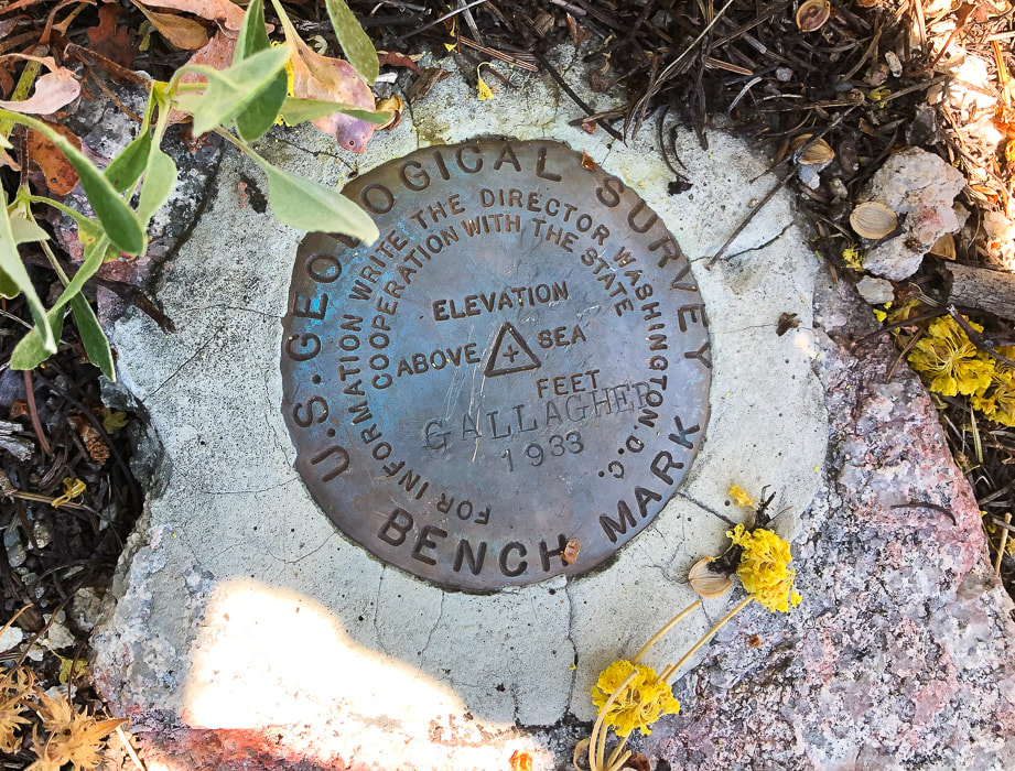 Benchmark on summit that is a triangulation station as indicated by triangle. It is the main station probably surrounded by three reference disks that have an arrow inscribed into them pointing toward the main station. Date on marker - 1933 - coincides with opening of Gallagher CCC camp. 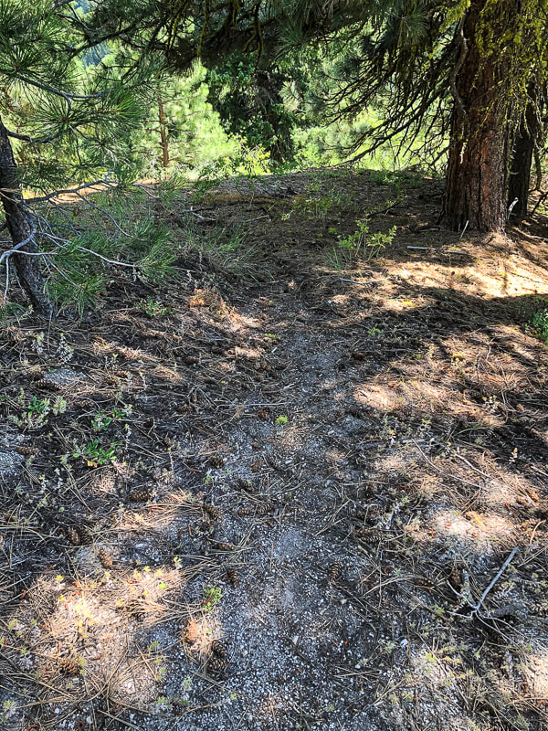 Faint trail on ridge above Point 5578 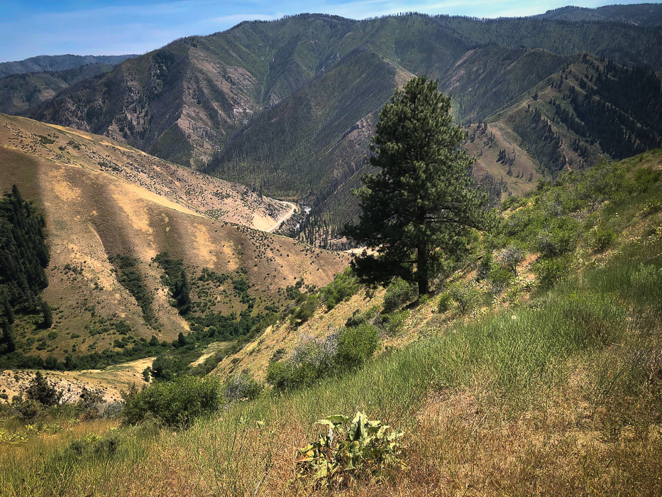 The way back down ridge - Little Gallagher Creek in valley; Idaho Highway 17 wrapping around toe of ridge in center of photo. Next time - hike up Little Gallagher Creek all the way before getting on ridge. 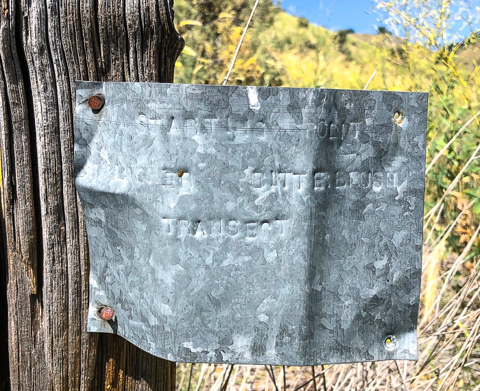 Marker for previous vegetation survey: "Starting Point Gallagher Bitterbrush Transect." 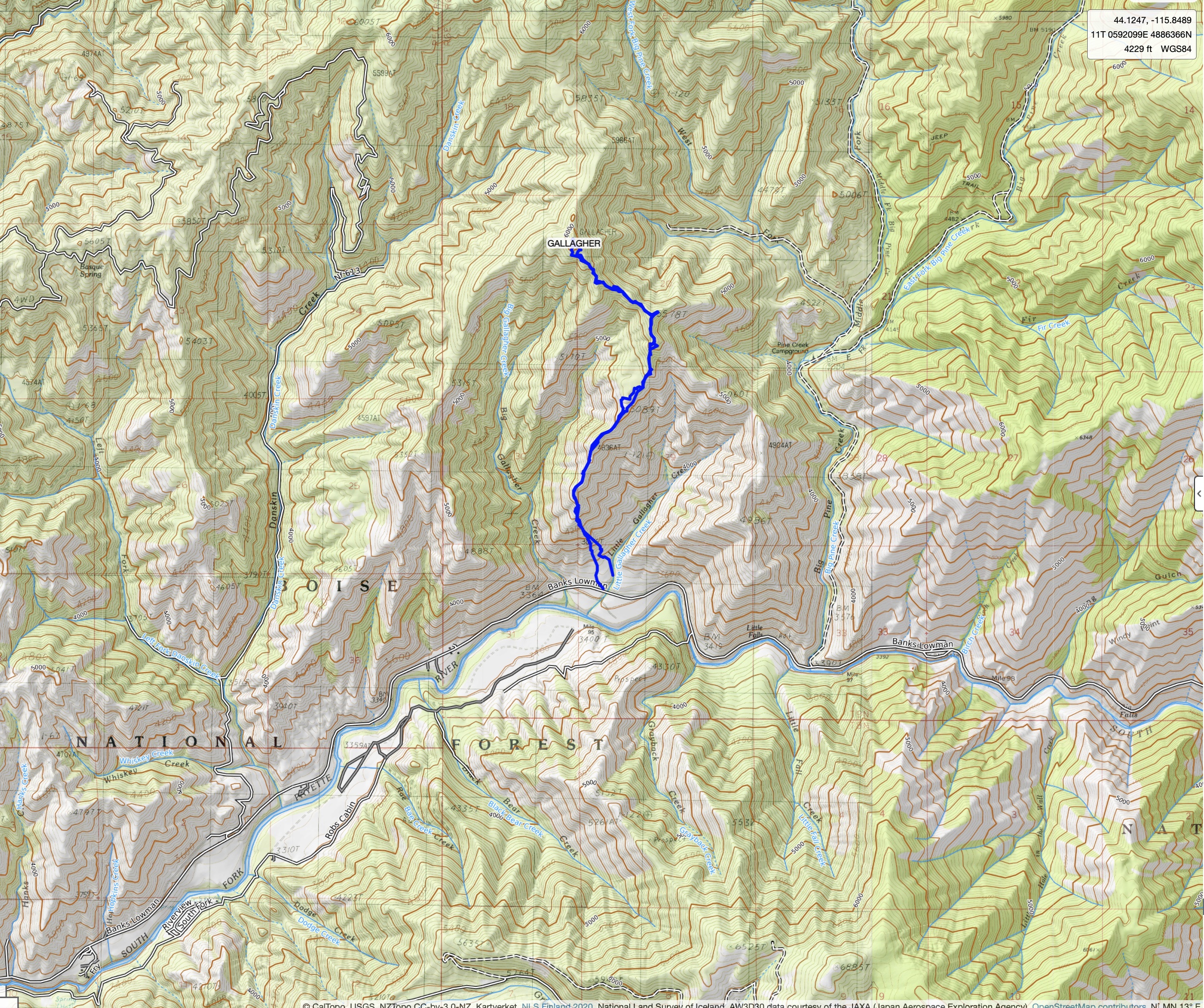 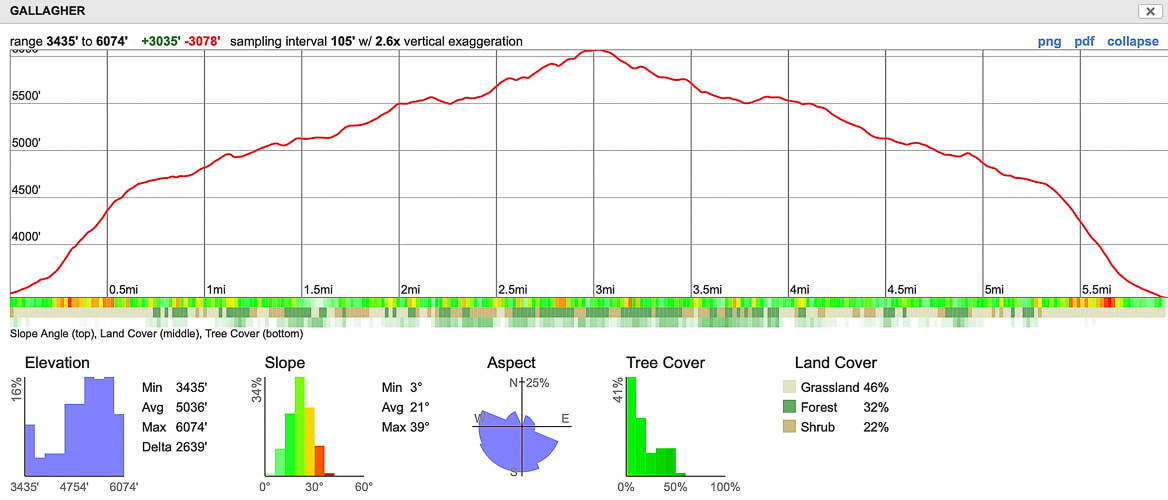 Our GPS tracks and elevation profile click on topo map for larger image 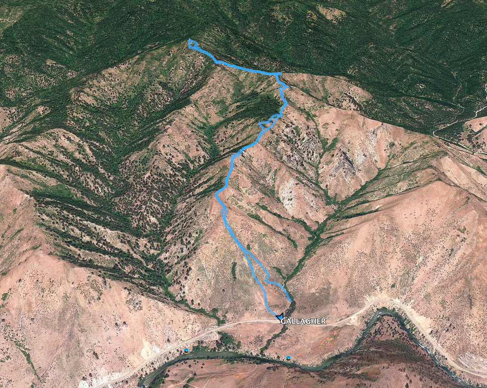 References
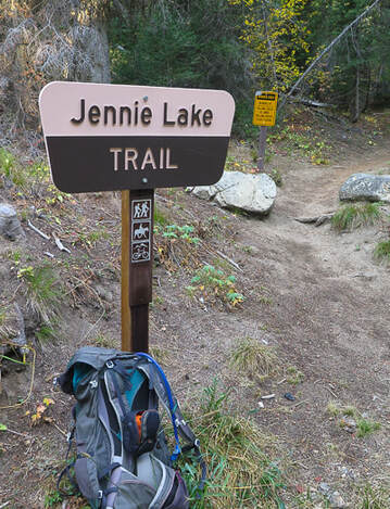
Boise National Forest Large Fire History - 1980 - 2018. Idaho Fire info - BLM.gov. Boise National Forest Fire History - 1900 - 2016-September-19. fs.usda.gov Historical marker Database: CCC Shapes the Payette Drainage lib.uidaho.edu. Civilian Conservation Corps in Idaho Collection Lopez, T. 2000. Idaho: A Climbing Guide, pp. 108-112. Gallagher Ranger Station. USDA Forest Service, Boise National Forest. Smith, E.M. History of the Boise National Forest - 1905 - 1976 Seldom summited, this remote, jagged mountain out of Jennie Lake with views of Idaho's Sawtooth Mountains is a rewarding Class 2-3 hike, and is not as intimidating as it looks. Bag Points 8610 and 8568 on the way.
 North face of Wolf Mountain, Boise National Forest, 8,876'. Trip Stats
Location: Northeast of Idaho City near central Idaho, Boise National Forest. Distance/Elevation Gain: 12.5 miles round-trip, 3,800' net elevation gain including recovering lost elevation if you do both Wolf Mountain and Peak 8610. Trailhead = 6,080', Summit of Wolf Mountain = 8,876'. Difficulty: Moderate Class 1 for 4.4 miles to Jennie Lake; Strenuous Class 2 scramble past Jennie Lake; Class 2+ minimal exposure using hands to propel up rocks last 30' to summit. Coordinates: Trailhead = 43.991472 -115.451525, Wolf Peak Summit = 44.0099 -115.3882 Date Hiked: 10/02/20. Maps: Boise National Forest Map - USDA, Jackson Peak Quadrangle, 7.5 min topo map, Boise National Forest Map (U.S. Forest Service), our GPS tracks below. Driving directions: Jennie Lake Trailhead. Drive 21 north from Boise past Idaho City. Pass over Mores Creek Summit and descend. Just past Whoop-um-up park and ski area, turn east (right) onto forest road 384. The road is well-maintained, follow 384 for 6.3 miles to the junction with FS 348, just before the Willow Creek campground. Follow 348 for 7.4 miles, to a sign reading "road closed 0.2 miles". Take this and park at the trailhead to Jennie Lake. Geology: Challis intrusive rocks (Eocene, 50 million years ago). See "geocurious" box below. Considerations: Jennie Lake is a popular backpacking/hiking destination to view spring/summer wildflowers. History of the name "Wolf Mountain": Arval Anderson, who made the first maps of the Sawtooth Wilderness Area for the Forestry Service in 1927, saw wolves on this mountain. The brass benchmark on top of Wolf Mountain is engraved with the date "1926" (see below). From Idaho: A Climbing Guide - Arval Anderson, Early Sawtooth Explorer and Surveyor."
On the way back from the summit
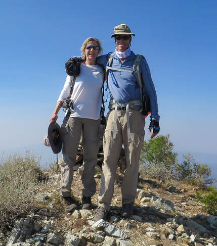
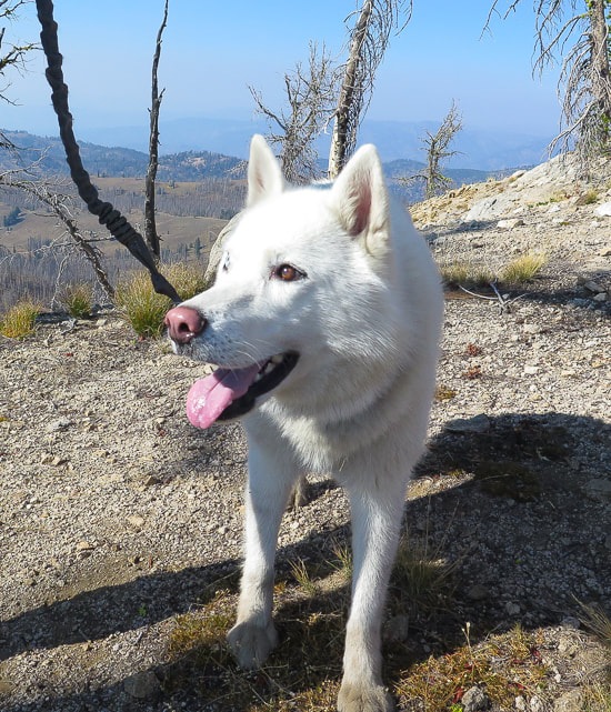
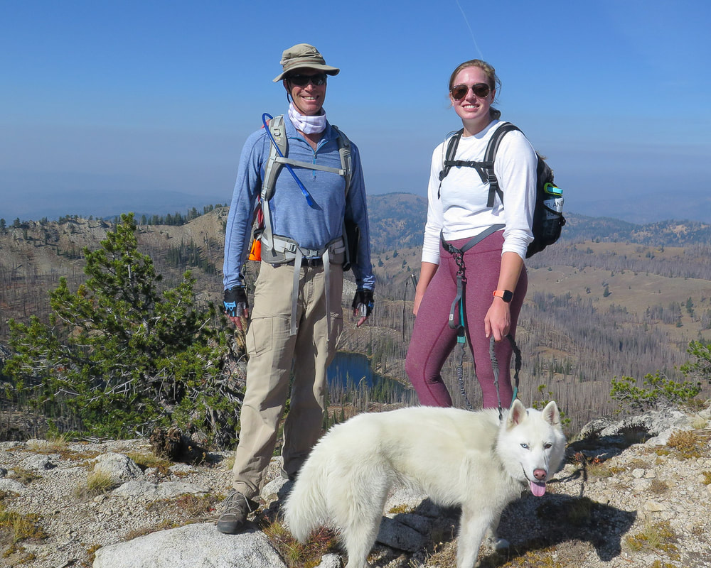 Fred, Anna, and Sylvie the dog On ridge between Wolf Mountain and Jennie Lake basin (behind). Points 8568 and 8610 can be summited on this ridge in addition to summiting Wolf Mountain! 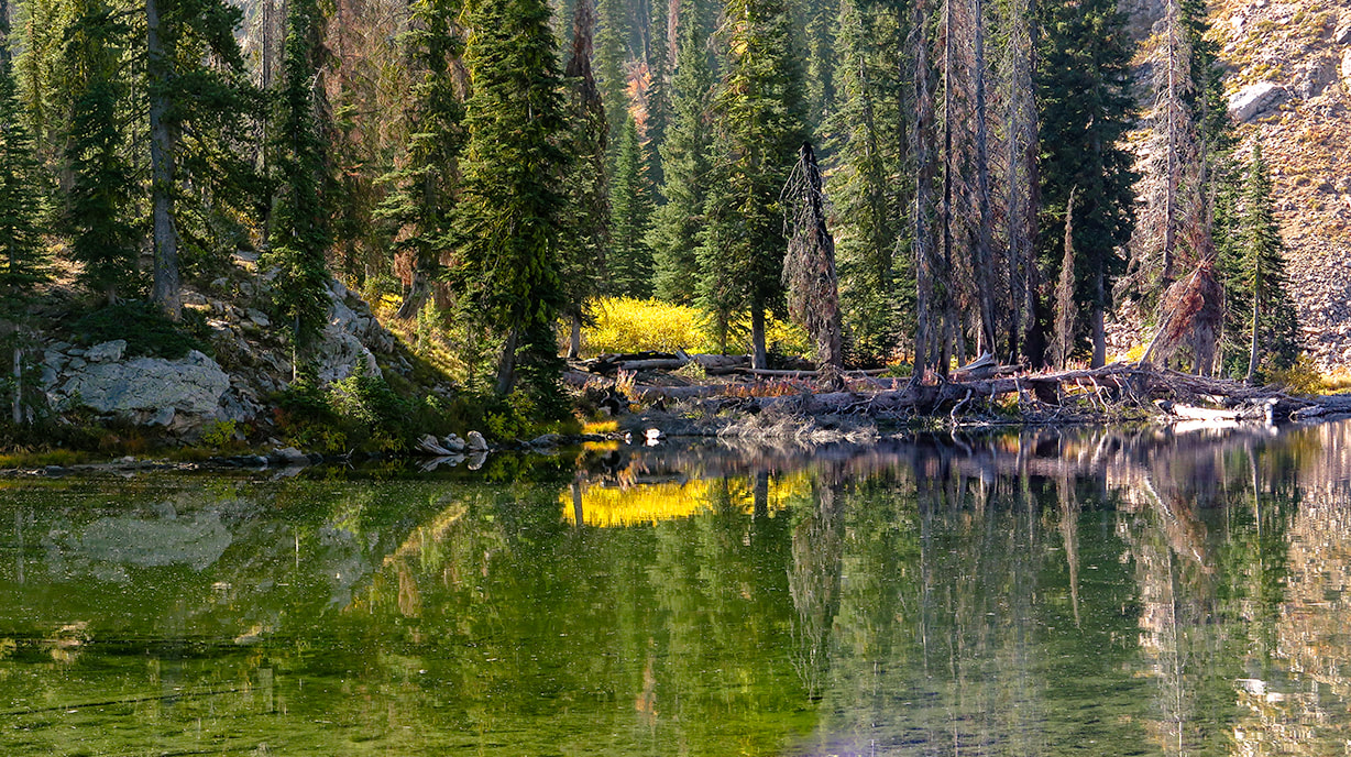 Jennie Lake We ascended ridge to the left of lake entrance, hiking due east At the lake entrance, we scouted the lowest saddle to the left on the lake's surrounding wall and made a beeline towards it, walking around the lake briefly to the left/south, then due east up the ridge. It's a heart-pounding steep 600' climb to the ridge overlooking Jennie Lake through autumn bunch grasses, red shrubs and rocks that all too easily dislodge under your boot. Once on the ridge, there is no mistaking Wolf Mountain's location to the southeast. We ended up just north of Point 8568 and continued southwest 0.6 miles on the ridge to cairned Point 8610, Jennie Lake surrounded by trees below us to the right, and Wolf Mountain looming across the deep Rockey Creek streambed to our left. We would have to lose some elevation (260') and then regain it to get to Wolf's summit. The view was hazy due to smoke from Oregon and California wildfires.  Ridge to southeast of Jennie Lake; we headed up toward high point on the left. Hazy smoke due to CA and OR fires. Many trees burned around Jennie Lake due to previous fire.  Climbing to the ridge overlooking Jennie Lake  First look at Wolf Mountain's north face from ridge above Jennie Lake Point 8568 is to the far right in the image  Anna and Sylvie summiting Point 8610 on ridge that divides Jennie Lake basin (left) and Wolf Mountain's northern ridge (right).
 Route-finding from Point 8610 on ridge to Wolf Mountain's north ridge (upper left ). 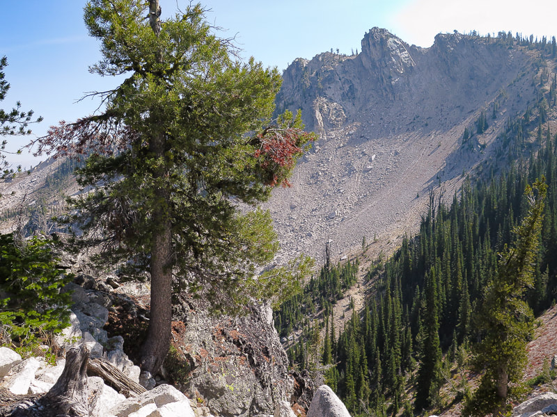 On Wolf Mountain's north ridge To summit Wolf after summiting Point 8610, walk back down the ridge to just before Point 8568 where Wolf's north ridge is seen and drop down into deep stream gulley, cross this dry streambed and then head straight up aiming toward Wolf Mountain's northern ridge. After this climb out, an opening in the trees provides views of the sudden drop into the crater-like bowl of raw talus slopes and the granite block of the summit. Hike on the margin of the talus field, just above the steep cliffs to the left. 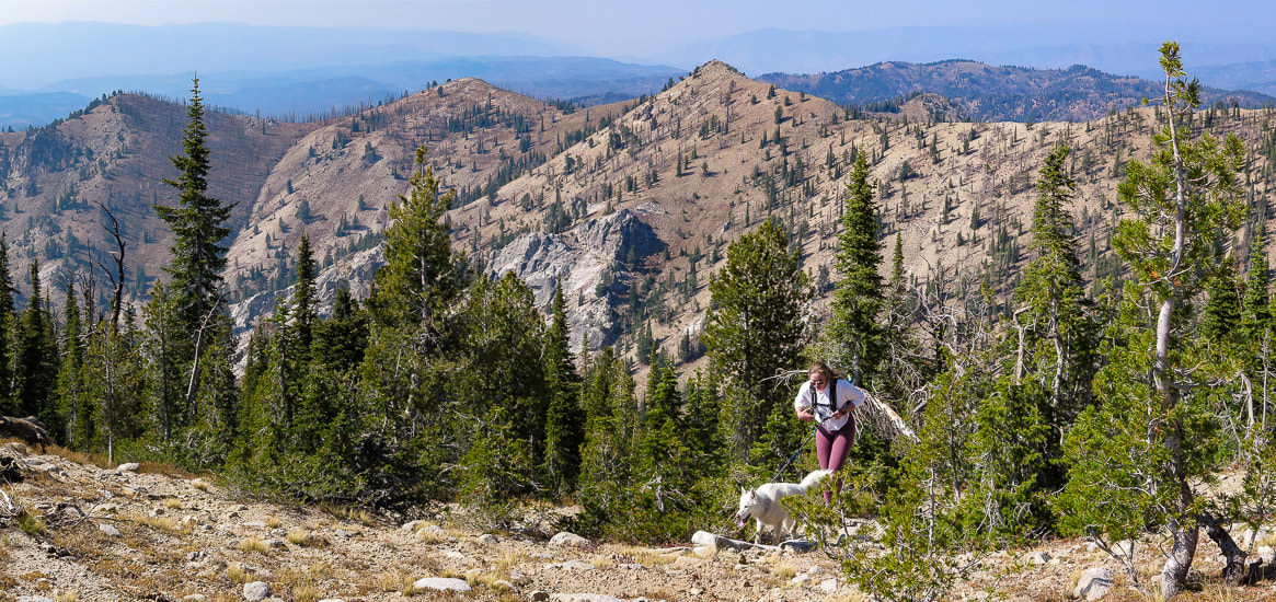 Anna and Sylvie arriving at base of Wolf Mountain's summit block. We had walked over from Point 8610 along ridge behind her. Anna and Sylvie had to wait just below the vertical rocks of the summit since this last challenge requires Class 2+ scrambling using hands (photo below). Fred and I scrambled to the narrow summit with a prominence of almost 900 feet. We were elevated far above this part of central Idaho, looking north to Jackson Peak. Steep cliffs drop to the north and south. We wished Anna and Sylvie could be with us because it is these small summits that make you feel slightly precarious that are the best. 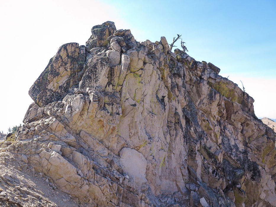 Final summit climb For the Geocurious The rocks of Wolf Mountain were created by the Farallon Plate sliding under (subduction) the North American Plate on North America's west coast causing the earth's crust to spread, triggering the intrusion of magma to form shallow granitic plutons ~52 million years ago. It would be great to check out this rock more closely to determine what this pluton is made of: granodiorite (> 20% quartz), quartz monzodiorite, or granite? Another distinctive feature of this Eocene granite is the planar, high-angle jointing; and Wolf Mountain is a great example. Many spectacular peaks in central Idaho are in steeply jointed Eocene granite, which weathers to sharp peaks and steep topography. 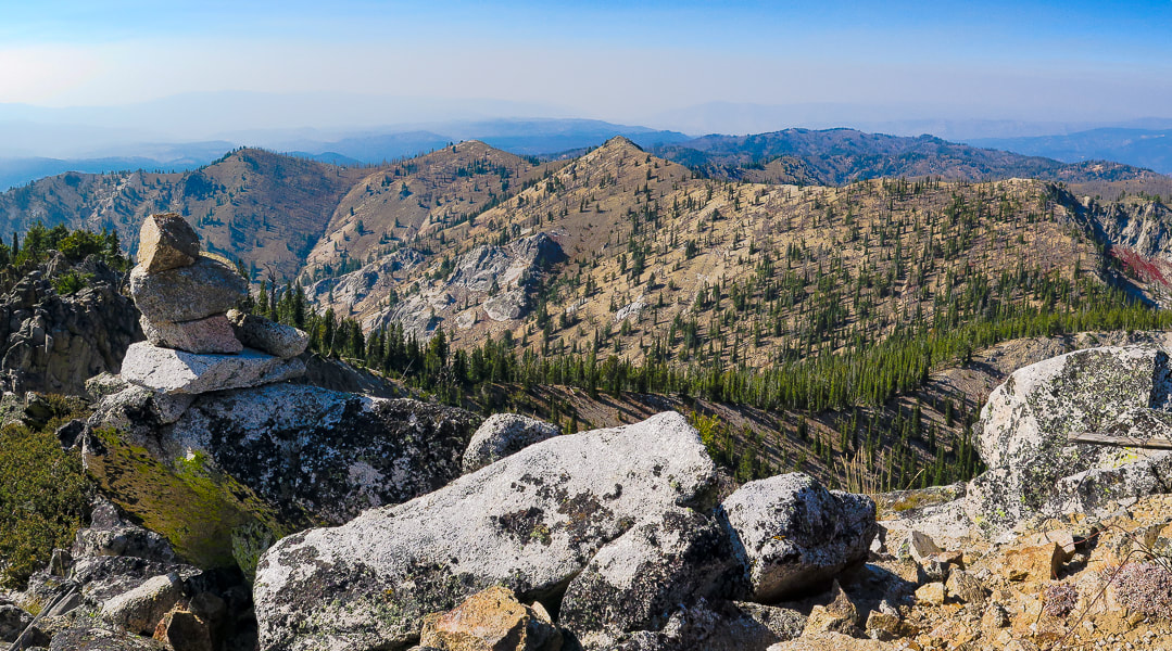 View of Point 8610 (mid-image) from the summit of Wolf Mountain. We were just there! 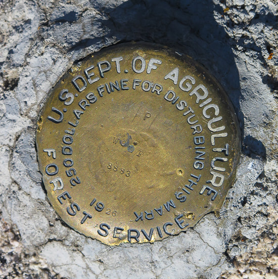 Survey benchmark possibly installed by Arval Anderson, who made the first maps for the Sawtooth Wilderness Area. Award-winning author and adventurer Lucy Jane Bledsoe articulates her thoughts on achieving a mountain summit: "Perhaps it isn't will at all that fuels a person to the top of a mountain. Perhaps it's the ache for beauty. A desire to be dangled over the canyon of nothingness. To, in fact, lose one's will for a moment." Robert MacFarlane, author of Mountains of the Mind: Adventures in Reaching the Summit says, “Mountains seem to answer an increasing imaginative need in the West. More and more people are discovering a desire for them, and a powerful solace in them. One forgets that there are environments which do not respond to the flick of a switch or the twist of a dial, and which have their own rhythms and orders of existence." The feeling of standing on a summit far above all else is difficult to articulate, but one word that occurs to me repeatedly is "freedom". It's room, it's space, a feeling of no constraints, and the freedom of overcoming self-imposed constraints such as "that peak looks too hard to do." It is also the knowledge that this mountain has been here a lot longer than I, and will be here a lot longer after I go. It is the freedom to be able to see what that mountain sees. It's a feeling so unlike our everyday occurrences that I savor those moments and the ability to experience something that is so different. There is the matter of conquering, achieving and getting to the top, as George Mallory, the English mountaineer who was part of the first Mount Everest British expeditions in the 1920's says. He answers the question, "what is the use of climbing mountains?" in his quote: “For the stone from the top for geologists, the knowledge of the limits of endurance for the doctors, but above all for the spirit of adventure to keep alive the soul of man.” ― George Mallory 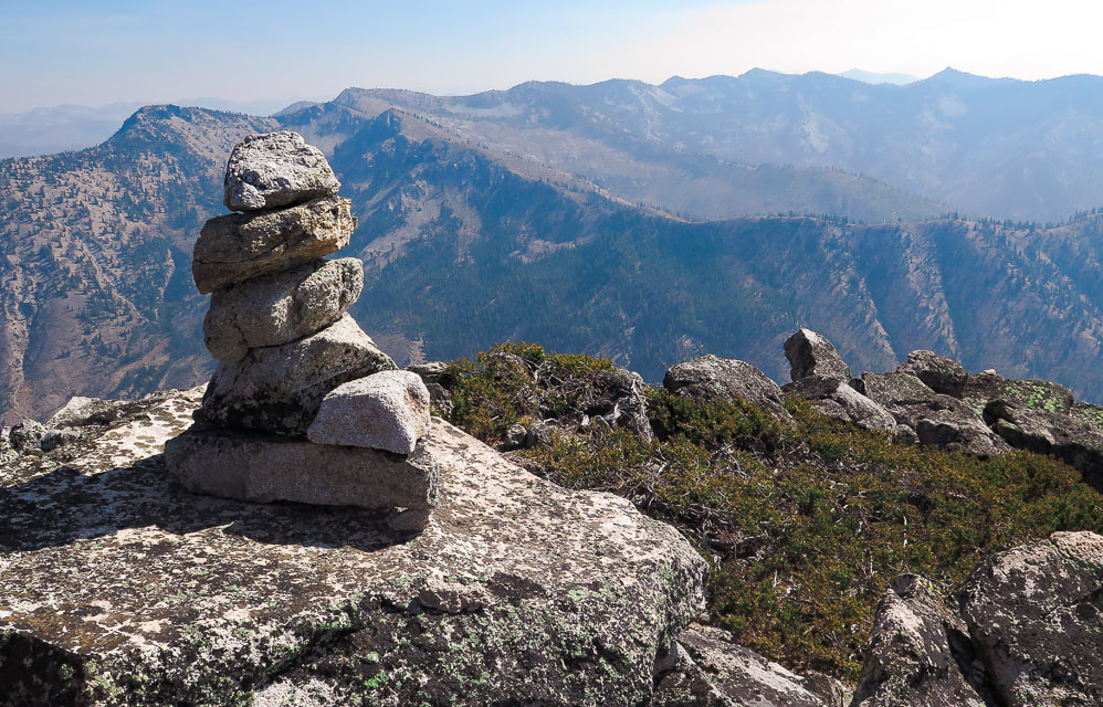 Always a welcome sight - the cairn at the top! 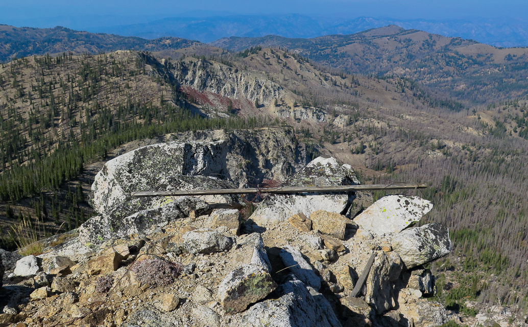 Summit of Wolf Mountain looking northwest On the return, we had to climb out of the deep stream bed at Wolf's northern base and back up towards Point 8568 overlooking Jennie Lake. We made our way down that steep ridge into Jennie's basin. We made a quick hike back down the trail to the truck, it seemed a long way, as we had all run out of water. Bear Creek was still flowing next to us, even this late in the season! We were all dusty, especially Sylvie who normally has a white coat, but emerged out of that forest with a tan tinge to her hair. Sure made the day even better to be able to hike with her and Anna. 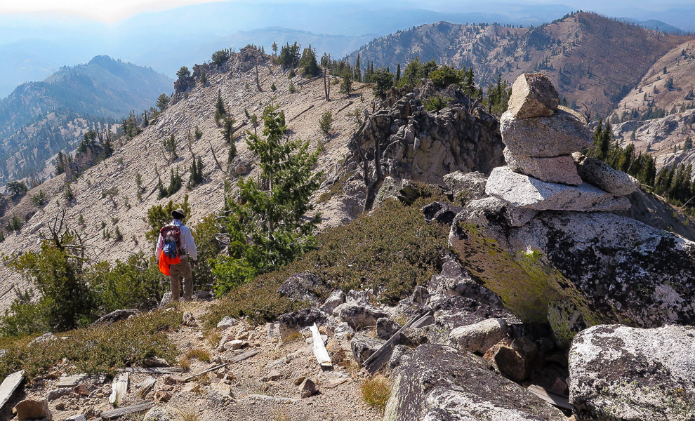 Heading back down   On the homestretch! - Jennie Lake Trail  Wolf Mountain and Peak 8610 via Jennie Lake Trailhead Topo Map After gaining the ridge southeast of Jennie Lake, we walked along it to summit Point 8610; we then descended into Rockey Creek and then back up to summit Wolf Mountain via its north ridge. click for larger image References
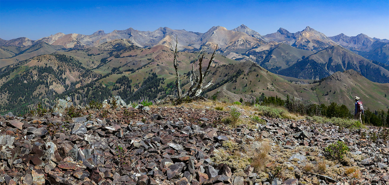
Boise National Forest Large Fire History: 1980 - 2018. DeGrey, L., Link, P. Digital Geology of Idaho: Challis Magmatic Episode. retrieved from internet. Interactive Map. Idaho Geological Society. Retrieved from the internet. Johnson, K. M., Lewis, R.S., Bennett, E.H., Kiilsgaard, T.H. Cretaceous and Tertiary Intrusive Rocks of South-Central Idaho. Moye, F.J., Hackett, W.R., Blakley, J.D., Snider, L.G. Regional Geologic Setting and Volcanic Stratigraphy of the Challis Volcanic Field, Central Idaho. Navigate off Pioneer Cabin Trail's beaten path to walk on Johnstone's rocky east ridge for a massive view of Idaho's rugged Pioneer Mountains. We returned to this hike we dedicated to the memory of our great friend Henry Brown. 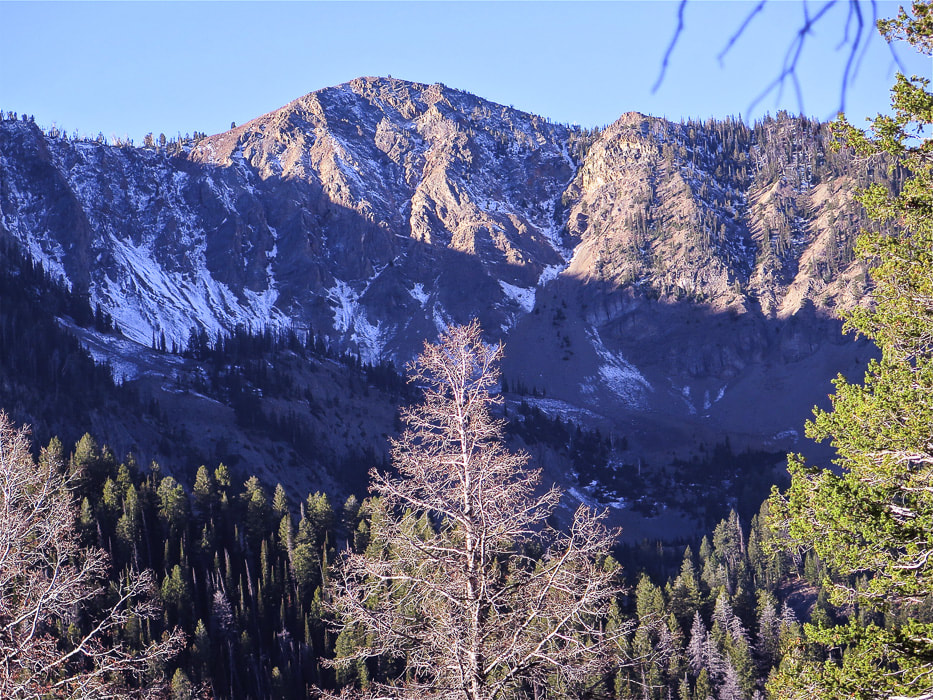 Johnstone Peak, 9,949' from Pioneer Cabin Trail near Ketchum, Idaho Walk across talus field on hike to Johnstone Peak with view of Pioneer Mountains
Trip Stats Location: Western Pioneer Mountain Range near Ketchum, Idaho in the Sawtooth National Forest. Great views of the raw and rugged main crest of the Pioneers await as you traverse the ridge to the bare talus summit of Johnstone. Distance/Elevation Gain: 5.3 miles out = 10.6 miles roundtrip. Trailhead = 6,950'; Summit = 9,949'. Elevation gain = 3,000'. Difficulty: moderate Class 1, moderate-strenuous Class 2 scrambling with minimal exposure on ridge and talus slopes. Summit: 43.7170 -114.2324 Maps: Cal Topo 7.5' interactive map, our GPS tracks (below), Sun Valley, Idaho Trail Map - www.adventuremaps.net Hiking Directions:
Driving Directions: From Sun Valley, Idaho, travel ~ 3.5 miles northeast up Trail Creek Road. Turn right at Corral Creek and travel on gravel road 3.7 miles to Pioneer Cabin Trailhead. Latest date hiked: August 29, 2020. Geology: Paleozoic sedimentary rocks (Permian and Pennsylvanian - 323 - 248 Ma): shale, chert, sandstone, carbonaceous mudstone and limestone of the Snaky Canyon Formation and Sun Valley and Oquirrh groups. 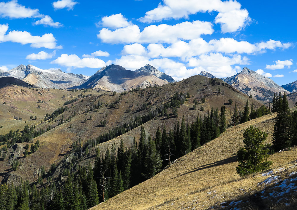 On Johnstone's east ridge looking east to main crest of Pioneer Mountain Range. Goat Mountain far left horizon. 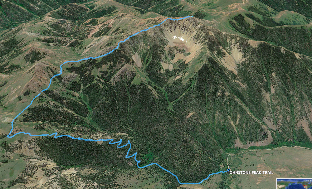 Our GPS tracks Our Hike There are several ways to get up to Johnstone Peak, an almost 10,000-footer near Ketchum, Idaho. Its summit is in view for most of the way when approaching it from the north on Pioneer Cabin Trail where the final 1,000-foot gain involves route-finding on a faint, unmarked and rocky trail. At the top, we met two people who had ascended from Bear Gulch, to its south. It's an inspiring peak to us, not only for the breathtaking views of the main Pioneer Mountain crest, but also for remembering our friend Henry Brown. In 2016, we dedicated this hike to Henry because of his love for Idaho's wilderness (This Hike for Henry Brown).
 Corral Creek near Pioneer Cabin Trailhead 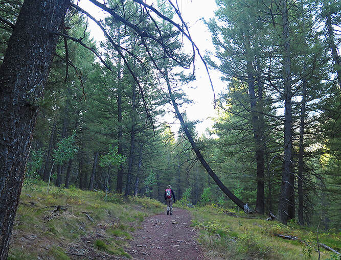 First two miles of hike through shady forest  Reach ridge for first glimpse of Johnstone Peak and its northern-facing steep rock chutes Trail blaze (marker) on tree at right  On the one-mile stretch of Johnstone Creek Trail with Johnstone Peak in view  Beginning of Johnstone's east ridge climb after one mile on Johnstone Creek Trail View of Johnstone's summit is blocked by highest point on the horizon, however trail goes over this A faint trail extends towards Johnstone's east ridge after the saddle at Johnstone Creek Trail is reached, just before its descent. The westward 1.6-mile climb to the summit first traverses the shady north side of the ridge, and then because of the northern steep chutes, it switches to the south side, going over a few talus fields. The summit is one large stable talus pile. Having done this hike a few times before, we know now to stay close to the ridge; when it begins to pull you to the south, keep west at about 260 degrees. The trail passes over a large talus field of a "pseudo peak"; and upon mounting it, you see Johnstone's summit across yet another talus field.  Faint trail (in foreground) heading west up Johnstone's east ridge; it goes through the trees on the right and then on the top/left side of highest prominence on the left.  View of Pioneer Mountains to the northeast  O! Lovely talus field - at least it is stable! Some gorgeous textures and colors
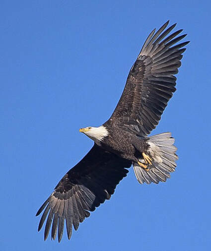
 Just when you are done climbing high points, the real summit is still on the horizon (Johnstone on right) Except for a few stunted trees, the summit is bare and exposed, but it rises far above everything else, marking the area between the Wood River Valley and famous Mt. Baldy's ski mountain to the south and central Idaho's peaks to the north. Four years ago, after the first dusting of snow, Fred and I stood on Johnstone's summit with a sign proclaiming "This Hike for Henry Brown". Henry, in his mid-50's had passed in August from lung cancer. He was a West Point grad, avid outdoorsman and excellent bow and rifle hunter, and had spent his last years in Hailey, south of Ketchum in the Wood River Valley. It was especially hard for Fred to lose his great friend, one that had shared his passion for wilderness and taught him valuable hunting skills. When Henry had moved back to Idaho, there was hope for many hikes in Idaho's beautiful wilderness. But these never happened and we were reminded that life can be cut short. More than ever we know that we are lucky to be able to walk the forests and rocky summits of Idaho and look forward to the next American West adventure. In 2016, as we were on Johnstone's summit remembering Henry, an eagle flew high above, a symbol of Henry's spirit. And this time again as we were descending, an eagle, soaring effortlessly above the northern side of the peak made us stop as it passed by and out of sight. I had said the next time we summited Johnstone, we would be looking for an eagle. Once again we saw one, and felt Henry's presence.  Summit of Johnstone looking at Pioneer Mountain Range to the east 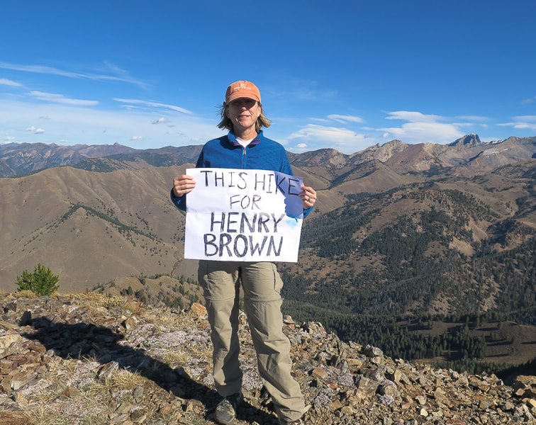 In 2016 on Johnstone Peak, in Henry Brown's "neck of the woods" We will always remember Henry's friendship and his love of Idaho's wilderness Johnstone Peak: This Hike for Henry Brown (2016)
 Descending Johnstone with main crest of Pioneer Mountains to the northeast  Pioneer Cabin Trail Pioneer Cabin built in 1938 by Sun Valley Company for the Alpine Touring branch of the ski school 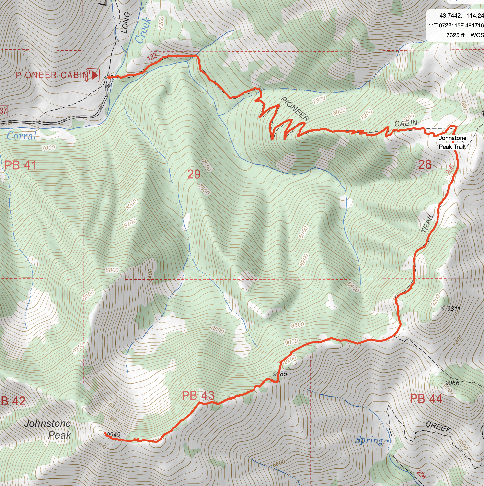 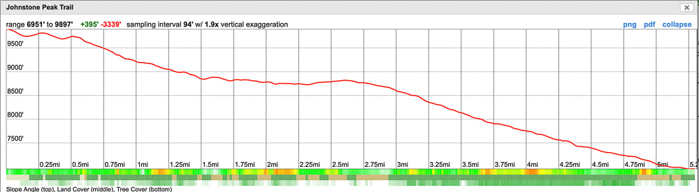 Our GPS tracks from Pioneer Cabin trail head to Johnstone Peak summit, and Elevation Profile (profile from summit to trailhead) - 3,000' gain. Total mileage out and back = 10.3 miles. click on map and profile for larger PDF images References
Geologic Map Of Idaho. Geologic Map of Blaine County. Idaho State University. https://digitalatlas.cose.isu.edu/counties/blaine/geomap.htm Trailing of the Sheep Festival - History of the Festival https://trailingofthesheep.org/about/history/ Wust, S. L., Link, P.K. 1988. Field Guide to the Pioneer Mountains Core Complex, South-Central Idaho. A lightly-traveled serene single-track hike through lush green forest and wildflowers to a fire lookout near Lowman, Idaho. Views extend all the way to the northern Sawtooth Peaks.
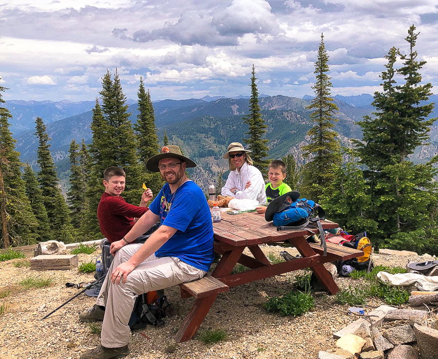 Deacon, Greg, Fred and Kaleb on Jackson Peak's summit - 8,124'. Sawtooth Peaks on the horizon. Trip Stats Location: Boise National Forest - Lowman, Idaho Distance and Elevation gain: 4.7 miles one way, 9.4 miles round-trip. Trailhead = 4,650', summit = 8,124' for a gain of 3,474'. Summit: 44.07806° N 115.41306°W. Trailhead: 44.1092, 115.4140 Trail: Jackson Peak Trail #151; lightly used out and back. Difficulty: Moderate Class 1 with a few short steep sections. Maps: USDA Forest Service: Boise National Forest, Interactive Map USDA Forest Service, PDF Jacskson Peak Trail, Topozone Jackson Peak, our tracks (below). Date hiked: 6/27/20 Considerations: No water, exposed ridge (lightning), no permit, fire lookout staffed during summer months. Geology: Challis intrusive rocks (Eocene). Shallow roots of Challis volcanic field. Older suite of granodiorite and quartz monzodiorite and subordinate diorite, granite, and subvolcanic dacite; includes Jackson Peak, Beaver Creek, Marsh Creek, and Summit Creek stocks (49-45 Ma). (From Idaho Geological Survey and Digital Geology of Idaho).
Descending Jackson Peak  Our Hike Fred and I jumped on the opportunity to hike with Greg and his two boys, Deacon and Kaleb to Jackson Peak Fire Lookout in northern Boise National Forest on a perfect-weather wildflower-filled June day, a great time to explore rugged central Idaho. We had all hiked Mt. Heinen near Arrowrock Reservoir, one of the four "Grand Slam Peaks" near Boise. They are now training for Mt. Borah, Idaho's highest, and Hyndman Peak, the highest in the Pioneer Mountains. Kaleb and Deacon are impressive; not many kids their age are up to such challenging hikes. Their positive attitude and motivation was a joy. The nearly 3,500' elevation gain is not as tough as the same gain on Mt. Heinen because it is a steady climb with not much elevation loss on the way up. We have hiked this peak many times the past 20 years in several conditions: thunderstorms, through snowfields and in hot temps. We have talked to the tenants of the fire lookouts over the years and been able to stand on its top floor to see a 360-degree view of the Boise National Forest and as far away as the Sawtooth Mountains. This year we were prohibited from getting on the fire lookout building due to coronavirus restrictions. My low-clearance passenger car made it up the mile-long dirt road to the trailhead from the Lowman Ponds parking area. In some years, the road is rutted and a high-clearance vehicle is needed. Great to hop into your vehicle at the trailhead at hike's end rather than walk that extra mile to the parking area at Lowman Ponds!  Jackson Peak Trailhead, one mile up Forest Road #530 from Lowman Ponds. Jackson Peak Trail - Boise National Forest for more specific hike directions. Jackson Peak Trail is well-marked and maintained. The first 1/2 mile treks through Oregon coast-like lushness with fern-lined tributaries leading to Richard's Creek noisily flowing below. After 0.75 miles, the trail swings southeast away and above this creek and switch-backs to the ridge through remnants of the 1988 Willis Gulch Fire, continuing up and around Richards Creek watershed source just below Jackson Peak. At the intersection with Forest Road #598, the locked gate to Jackson Peak lookout straddles this watershed to the north and Jackson Creek and the expansive lands of the Boise National Forest to the south. Boise National Forest Large Fire History Map, 1980-2018. 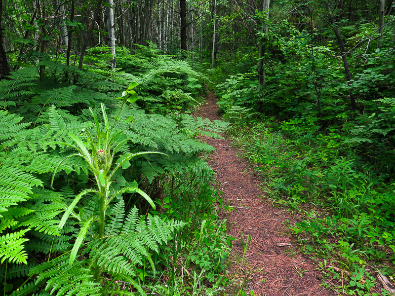 First mile of hike near Richards Creek
  Jackson Peak (left) 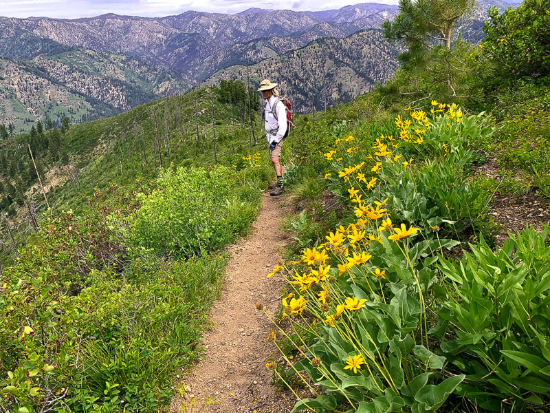 After switchbacks, trail goes through Willis Gulch Fire (1988) - burned trees on ridge leading to the summit. Arrowleaf Balsamroot (Balsamorhiza sagittata) 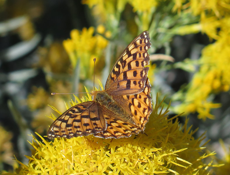 Dark Green Fritillary on Grey Rabbitbrush bloom 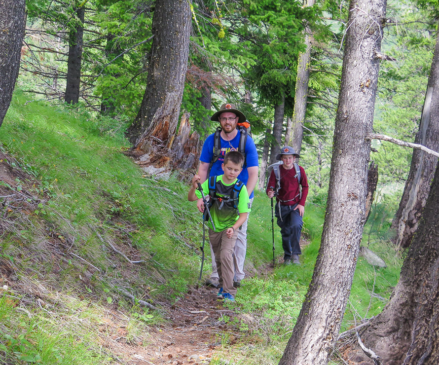 These guys are awesome!   Just before intersection with Forest Road #598 overlooking Richards Creek watershed - late summer. From the gate, walk up the final 0.35 mile to the lookout, and lots of communication towers and a helipad. Although this detracts from a wilderness experience, it's a great reward to stand above everything else for miles. The unmistakable jagged northern Sawtooth peaks cut the horizon to the northeast, and the immense land of the Boise National Forest spanning 2.5 million acres of mountains, valleys and access roads spreads to the south. We all sat at the picnic table near the lookout, celebrating our hike, thankful for the trail camaraderie and the peace of central Idaho. Hearing Deacon's and Kaleb's dreams of summiting higher peaks reminded Fred and I of our previous summit goals. Wistfully, I tell them that they have plenty of years ahead of them with so many mountains in the American west to climb. So many mountains to climb, wilderness to experience, trails to walk, but not as much time for Fred and I. The recurring topic discussed during the descent was what flavor ice cream we would have at the Sourdough Lodge in Lowman afterwards to celebrate our summit success. Love Idaho. Never stop climbing mountains. "I think probably one of the important things that happened to me was growing up in Idaho in the mountains, in the woods, and having a very strong presence of the wilderness around me. That never felt like emptiness. It always felt like presence." - Marilynne Robinson, novelist - winner of 2005 Pulitzer prize for novel Gilead 360-degree view on Jackson Peak summit - complete with barking dog in top floor of lookout.  Summit view northeast to Sawtooth Mountains  Sue at Jackson Peak Lookout, Boise National Forest Late summer when rabbitbrush bloom History of Jackson Peak Fire Lookout A two-story, glass-walled log structure was erected in 1927 according to the Idaho Statesman newspaper. It was anchored by half-inch steel cables at each corner due to continuous high-speed winds. In 1981, a two-story flat roof house was installed. The 1988 Willis Gulch Fire threatened the lookout. In 1990, a new modified hip roof where all sides slope downwards to the walls was installed (From ronkemnow.weebly.com). A strong relationship between the National Forest and the Southern Idaho Timber Protective Organization was established in 1925. It was then that Idaho state forestry law provided for a State Forestry Board that would enforce fire regulations. For a thorough history of fire management in Boise National Forest, check out History of the Boise National Forest 1905 - 1976 by Elizabeth M. Smith, p. 111. Rex's Fire Lookout Page USDA Forest Service information on staffed and unstaffed fire lookouts  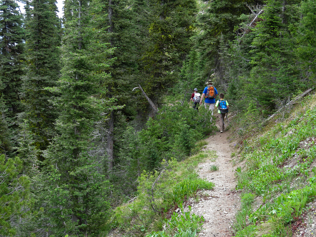  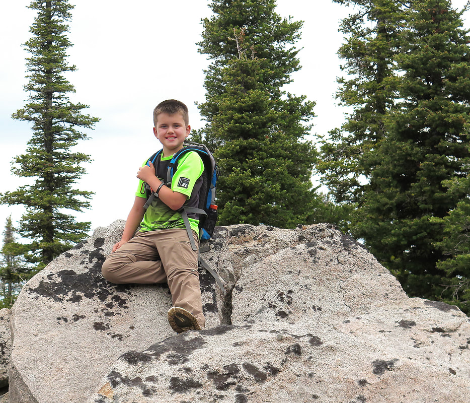 Kaleb on summit of Jackson Peak, 8,124'  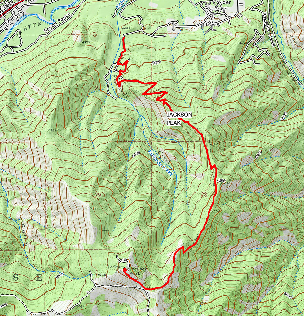 Our GPS tracks click on map for larger interactive map of region References
Boise National Forest - Home - USDA Forest Service - retrieved from the internet Boise National Forest Large Fire History - 1980 - 2018. Forest Lookouts. ronkemnow.weebly.com Idaho Geological Survey - Interactive Map - retrieved from internet Idaho Statesman. May 29, 2018. Across the U.S., reports of tick-borne illness are rising. Here's what's happening in Idaho. Smith, Elizabeth M. History of the Boise National Forest, 1905 - 1976. Idaho State Historical Society - Boise, 1983. From doorstep to summit in just a few hours, this hike close to Boise offers a quiet Ponderosa pine forest, a good climb and great views of Boise National Forest. 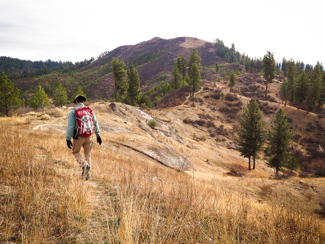 Final approach to Bald Mountain's (aka Poorman) summit; Little Anderson watershed to the left and drainage into Poorman Creek to the right. Nice exposures of Idaho batholith granite. Elevation - 5,134 feet. Trip Stats:
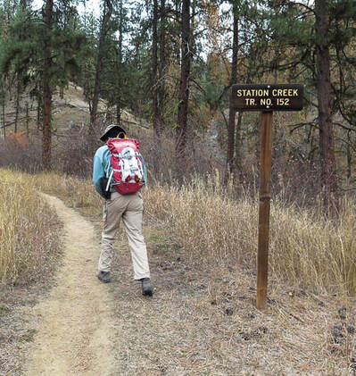
Location: Southwest Salmon River Mountains in the Boise National Forest, with North Fork of the Payette River to the west and South Fork Payette River to the south. Just over one hour's drive from Boise, near Garden Valley, Idaho. Distance: 7.6 miles round-trip. Elevation gain: Trailhead = 3,190 feet, summit = 5,134 feet. Total net gain = 2,500 feet. Difficulty: Moderate Class 1 single track trail. Trail location: Station Creek Trail #152. Trailhead just across from Garden Valley Ranger Station on the Banks-Lowman Road, Hwy 17 (Wildlife Canyon Scenic Byway). Permit: None Map: Boise National Forest - U.S. Forest Service and USDA. See our GPS tracks on topo map below. Date Hiked: November 16, 2019. Alternate route: 2 loops below the summit - Stueby's Outdoor Journal. Summit location: 44.0815 -1158890 Geology: Atlanta Lobe of the Idaho Batholith; granodiorite and two-mica granite - Cretaceous (85-67 Ma). Boise National Forest - History and Culture. USDA
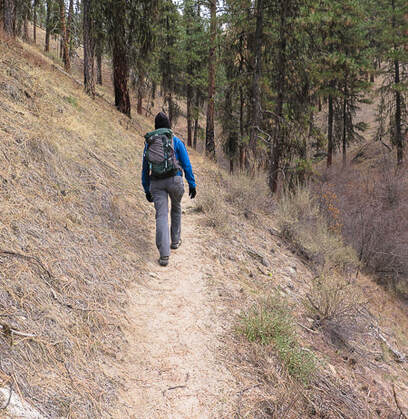
One of Idaho's greatest assets is the ability to find forest solitude in a short amount of time. After an hour's drive north from Boise, we started our walk on the Station Creek Trail in the Boise National Forest's 2.5 million acres, weaving through a Ponderosa pine forest to a ridge with a view of Bald Mountain. The summit feels grander than its relatively low elevation would suggest. It stands high above Little Anderson Creek to the north, and Poorman Creek to the south, with views of snow-dusted Salmon River Mountains to the northeast. Everything is good on this adventure - beautiful drive, challenging grade on a relatively short distance with great views. "Poorman" is engraved on Bald Mountain's summit benchmark, a triangulation station established by the U.S. Geological Survey in 1933. The History of the Boise National Forest - 1905-1976, an informative document, covers many subjects from the area's Native Americans, to the creation and administration of the Boise National Forest, its resources and its settlement. The Sawtooth Forest Reserve was created in 1905 by President Theodore Roosevelt. A combination of the west portion of this reserve and the 1.5-million acre Payette Forest Reserve created the Boise National Forest July 1, 1908. Idaho is one of the top states that has a large percentage of publicly-owned lands - 62% of it under federal jurisdiction of BLM and Forest Service. This does not include state-owned land. The Payette River was named after Francois Payette, a French-Canadian Hudson Bay Company fur trapper who explored southwestern Idaho. Bald Mountain is tucked in between the main waterways of North Fork and South Fork of Payette River. 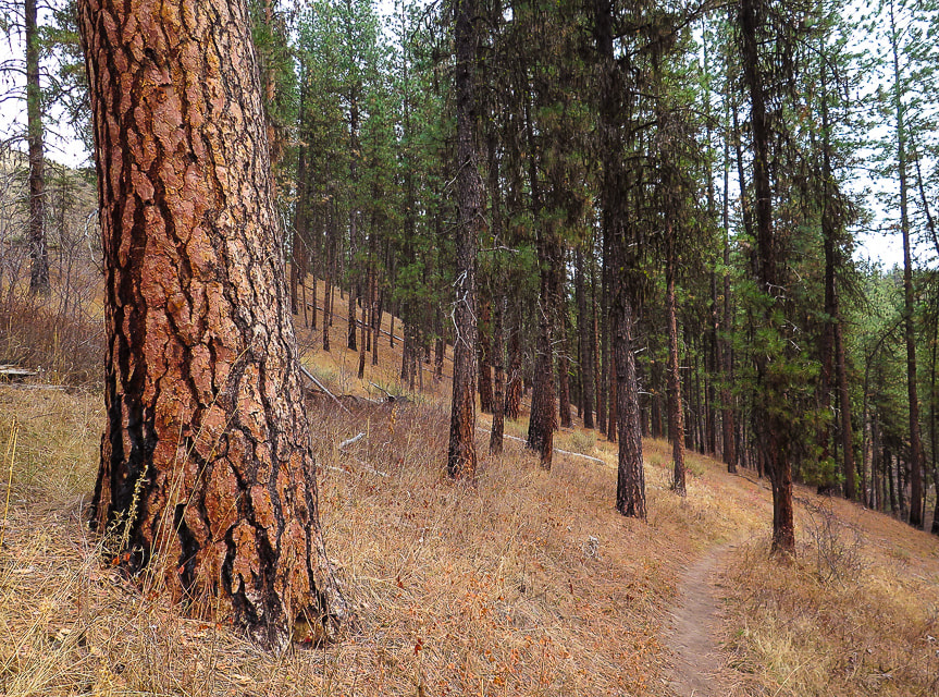 The stately Ponderosa pine is easy to recognize because of its orange-brown bark arranged in large vertical plates. In the spring, the tree's sap produces a vanilla scent. The needles are 5-10 inches long and grow in clusters of three. Access the Station Creek trailhead just off the Banks-Lowman Highway, right across from Garden City Ranger Station and heliport, past Mile 12 and Boise National Forest sign. The trail treks north as it follows Station Creek, crosses it at 0.8 miles, then climbs the ridge that separates Station Creek and Poorman Creek. At mile 2.6, this ridge tops out at Point 4,772 with bare-topped Bald Mountain in full view.  Single track over combination of pine needles and gravel on ridge between Station Creek and Poorman Creek leading to Point 4,772. 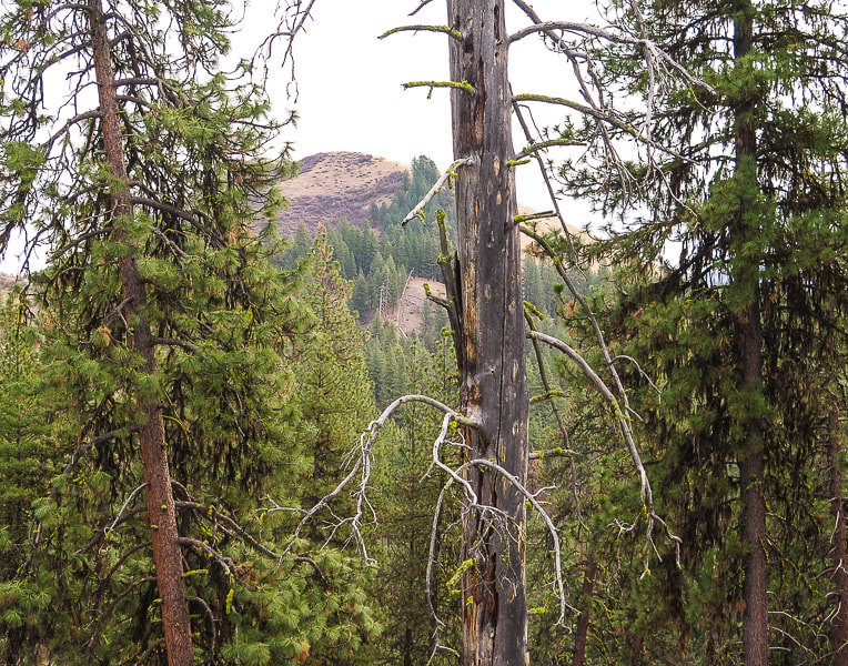 View of Bald Mountain from ridge From point 4,772, hike 1.2 miles east/southeast to Bald Mountain's summit past some exposed granite outcrops. The trail becomes less defined as it traverses across the top of the watershed for Little Anderson Creek, then through a tall shady stand of Ponderosa pines. The trail then climbs the steep, open and grassy western slope to Bald Mountain's granite summit surrounded by the fall hues of red, yellow and orange senescent buckwheat and lomatium flowers. Bald Mountain stands above Garden Valley to the west and deep South Fork of the Payette River to the south and the snow-dusted Salmon River Mountains to the north. For a peak close to home, it feels and looks like wilderness - a quick nature fix. An iron stand bolted into cement on the summit looks like it might have supported something, or is merely a marker. I was unable to find information on this and the origin of the word "Poorman", although it could be in reference to previous mining activity. Many Ponderosa pine trunks are blackened from the 18,000-acre West Anderson fire that occurred due to a lightning strike in August of 1986. Four firefighters from New Mexico died when their truck tumbled down a dry creek bed near Crouch as they were driving from their fire camp. Map of Boise National Forest fire history. In the spring, this trail is bright with wildflowers, but autumn produces muted colors and textures, just as beautiful. There are two loops that can be hiked instead of summiting Bald Mountain (Stueby's Outdoor Journal). 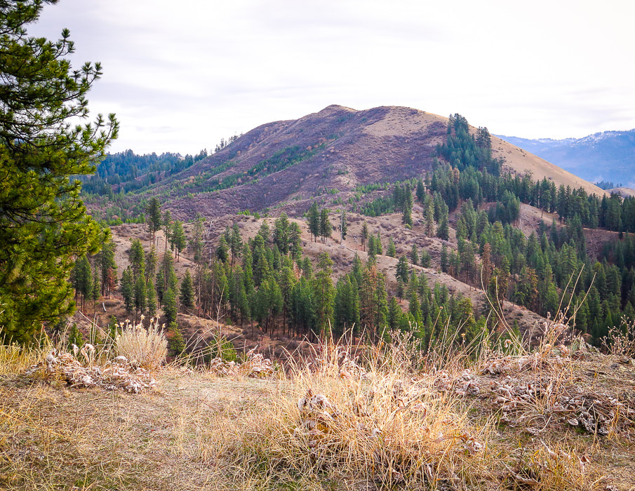
Poorman triangulation marker on Bald Mountain's summit placed in 1933.
  Autumn lomatium
 From the summit - view of Garden Valley to the west  Descending just off summit - I Love Idaho!  Our GPS tracks from Station Creek Trailhead to Bald Mountain Summit click on map for larger image References:
Boise National Forest Large Fire History, 1980-2018 (Map). https://www.idahofireinfo.blm.gov › southwest › documents › maps › BOF... Smith, E.M. 1986. History of the Boise National Forest, 1905-1976. Idaho State Historical Society. Our History. Garden Valley Chamber of Commerce website. Ponderosa pine. US Forest Service. A "grudge peak" no more, we summited Norton Peak this time in the Smokys, a mountain range that has less visitors and more solitude than its illustrious neighbor to the north - the Sawtooth Mountains. Related: Miner Lake - Smoky Mountains, Idaho  Norton Peak is a triangulation station for the Geodetic Survey; this wooden triangle-shaped tower with "10,336" engraved on it could have been placed on the summit to signify this fact. The brass disc marker was placed in 1967 (see below). Trip Stats: Location: The Smoky Mountain Range is located west and northwest of Ketchum, Idaho. Its northern boundary meets with the Sawtooth Mountains, its southern border extends to the Camas Prairie. Its eastern boundary is at the Big Wood River just west of Highway 75, the west border is the South Fork of the Boise River and the Soldier Mountains. It is administered by the Sawtooth National Forest (south) and Sawtooth National Recreation Area (north). Distance: 11.6 miles out and back (5.8 miles trailhead to summit). Elevation gain: Trailhead = 7,500', Summit = 10,336': Total gain = 2,836'. Difficulty: First 2.3 miles to Miner Lake trail intersection is easy-moderate Class 1. Climbing up Miner Canyon to Miner Lake at 4.1 miles is moderate with a few short strenuous intervals. From Miner Lake to Norton Peak summit is strenuous Class 1 with short distance of Class 2 at top of ridge crest. Trail more faint from Miner Lake to top, but can be followed with attention to tree blazes. Trails: #134 from TH to intersection, #135 from intersection to saddle that divides the Miner Lake and Norton Lake drainages. Spur trail to summit. Permit: No permit needed at Prairie Creek trailhead: there is a sign-in sheet. For info: Sawtooth NRA Headquarters (208) 727-5000. Map: Sun Valley, Idaho Trail Map - Adventuremaps.net. Interactive Map: Prairie Creek Trailhead, Sawtooth National Forest. Date hiked: 9/6/2019. Considerations: Last 0.35 miles on ridge; exposure to lightning if threat of storms. Potential high run-off at Prairie Creek crossing in early season. Water can be pumped from Prairie Creek. Dogs not required to be on leash, however it is a good practice due to multiple-use of this trail. Fishing: Idaho Fish and Game stocked Miner Lake with Westslope cutthroat trout 8/27/19. Driving directions: Drive 20 miles north from Ketchum on Highway 75. Turn left on Prairie Creek Road (FS 179) and drive 2.5 miles on good gravel road (passenger cars ok) to trailhead with large parking area. Hike directions: Cross West Fork Prairie Creek within a few hundred yards of trailhead, walk on a moderately-used trail for 2.3 miles on the west side of Prairie Creek to intersection of Trail #135 to Miner Lake. Hike Trail #135 for 1.8 miles to Miner Lake. From lake, hike southeast on Trail #135 for 1.2 miles to saddle that divides Miner Lake and Upper Norton Lake, seen from across the lake to the southeast. Trail faint near lake shore; look for tree blazes. From saddle, climb northeast up to ridge and then north along ridge to Norton Peak for 0.5 miles, going past a stand of pines, leveling off with an extended walk across exposed ridge to summit. Option: instead of hiking back to Prairie Creek Trailhead, hike down to saddle and continue walking on Trail #135 southeastward past Norton Lakes to Baker Creek trailhead: a car shuttle would have to be arranged in this case. Lat/Long: Trailhead: 43.7897 N -114.6604 W Norton Peak: 43.7620 N -114.6534 W 
Geology and Mining History of Idaho's Smoky Mountains 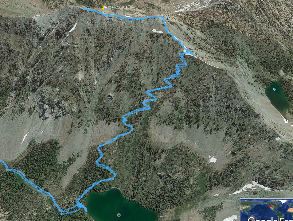 Our GPS tracks from Miner Lake to switchbacks up to saddle overlooking Norton Lakes to the right, to Norton Peak summit along ridge more maps below Our Hike Norton Peak became somewhat of a "grudge peak" after a failed attempt to summit it two years ago when a September storm left heavy snow and we got only as far as Miner Lake. Even without snow, the trail was reportedly faint, so we decided not to continue on to the summit not knowing where it was in 1-2 feet of snow. The contrast of fresh snow surrounding a green Miner Lake, thickly layering late summer's green vegetation was memorable. Norton Peak, the third highest point in Idaho's Smoky Mountains is a great hike for so many reasons: there's a potential of seeing mountain goats, there are few people on the trails, its meadows and streams are beautiful, its summits are challenging Class 2 scrambles, and you have the opportunity to celebrate in Ketchum afterward with great food, drink, and fun. The best of both worlds - that's why we love Ketchum. Across the valley to the northeast you get a great perspective of the entire Boulder Mountain range and emerald lakes. Both sides of the ridge as you approach the summit drop down steeply, so there is a feeling of walking on top of the range. Perhaps the Smokys are over-shadowed by the more famous and extolled Sawtooth Mountains just to their north, and as a result, there are less visitors. I was pleasantly surprised at their beauty and solitude. We have seen mountain bikers and horse-riders on this trail, as well as motorbike riders on Trail #134 to Prairie Lakes, so it is an area that is enjoyed by various modes of transportation. Trail #135 to Miner Lake prohibits motor vehicles. The Sawtooth National Recreation Area was created in 1972 by Congress as a result of national protests over the development of a proposed molybdenum mine with roads and an open pit at the base of Castle Peak, the highest in the White Cloud Mountains. The law established the SNRA, covering 756,000 acres and banned mining. Norton Peak and Prairie Creek trailhead are near the southern border of the SNRA. Trailhead (7,500') to Miner Lake (8,776') After spending the night in Wood River Campground, north of Ketchum, we drove to the Prairie Creek trailhead, happy that we had a clear day ahead of us. The morning was crisp as we made our way through a frosted and shaded forest - temperature 37 degrees. The first 2.3 miles on Trail #134 is a level hike along Prairie Creek through shade, except for a large meadow where steep eastern talus slopes caused by faulting are revealed. Prairie creek riffles over rocks making small waterfalls, even in September. Take the less-traveled Trail #135 to Miner Lake at the intersection. It will soon come to Prairie Creek with a wide crossing under large firs and pines.  Hikers, bikers, horse riders, and motorcycle riders enjoy this area of the Smoky Mountains  Intersection of Trail #134 to Prairie Lakes and Trail #135 to Miner Lake  Prairie Creek crossing on Trail #135 to Miner Lake just after intersection with Prairie Creek Trail #134, 2.3 miles into hike After crossing Prairie creek at 7,640' elevation, climb 1.8 miles to Miner Lake at 8,780', making a 1,140' gain. The trail crosses over the creek running through Miner Canyon, then climbs up to overlook the deep canyon far below to the east with at least one waterfall. A few steep pitches up this part, then the trail crosses the point where an open meadow meets with the mouth of the canyon, and it emerges from the trees for the first view of Norton Peak to the southeast. It was here that our walk in the snow two years ago became unforgettably beautiful. Steep, gray talus slopes tumble down a U-shaped valley. Firs and pines tower as you head south toward Miner Lake. A few small crossings over the creek draining Miner Lake, a silent and pine-needle padded walk on level ground past some well-kept campsites, and you are at the edge of a steep-walled green lake. What a difference 1,140 feet of elevation can make! A photo below of our Miner Lake trip in the snow two years ago.... 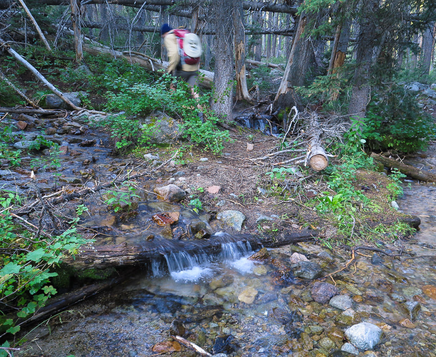 After Prairie Creek crossing, heading up Miner Canyon   Miner Lake and Norton Peak on horizon  Miner Lake - Smoky Mountains, Idaho Walking through the shaded forest, a small bright light ahead slowly becomes more prominent, and as you emerge from the shade to the open shore, one by one the features of this beautiful lake come into focus. Dense stands of fir from the ridge overlooking the lake curve down to water's edge, interspersed with the raw, bare rock and talus slopes of the Idaho batholith. Bleached tree trunks lie horizontally, surrounded by reflections. But it's the jade green color that is so striking. On this morning, the lake is perfectly still, with nothing to disturb its glassy surface. Miner Lake to Norton Peak Return to Trail #135 on the east side of the lake to follow tree blazes marking the trail and traverse steeply through switchbacks of alternating tree stands and rocks. We reached the saddle, coming out of the shade of Miner Lake's cirque wall to full sunlight and a view of Norton Lakes on the other side to the southeast. From the saddle, take a left off Trail #135 (north/northwest), and head up a narrow, but well-defined trail to Norton Peak's south ridge. Trail #135 continues over the saddle and descends to Norton Lakes and ultimately to the Baker Creek trailhead. Although I had read that this was one of the best places in Idaho to see mountain goats, we saw none. We saw three other people on the summit that had hiked up from Norton Lakes. 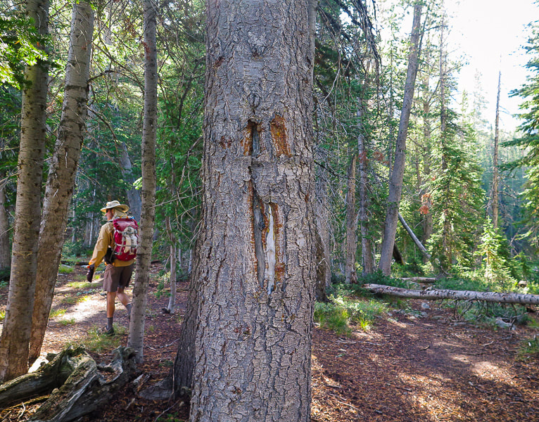 Tree blazes mark trail 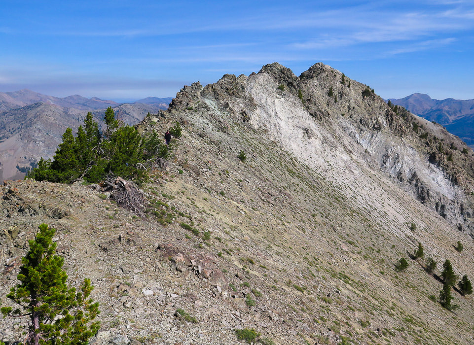 After the climb up from the saddle to the ridge along a defined trail, Class 2 scramble along ridge to Norton Peak (furthest right) A defined trail leads to the "sawtooth" rocks where there is mild-moderate exposure on the ridge. A three-foot tall wooden structure with "10,336" carved on it lies on its side at the summit, along with the peak register. The most striking view is that of the Boulder Mountains to the northeast, where a long hike will take you to the interesting remnants of the Golden Glow mine and the Boulder Historic Site, where galena ore (AKA lead sulfide) was mined. Supposedly the Smokys got their name from frequent forest fire smoke in the region. On the summit, we had time to sign the register, identify the surrounding mountain ranges, and celebrate; Norton was no longer a grudge peak! I spotted an interesting rock between the saddle and the ridge that looked like limestone. After research of the rock layers in the Smokys, I thought the rock was a sandy limestone of the Wood River Formation of Paleozoic sedimentary rocks. This was confirmed by a geologist at the Idaho Museum of Mining and Geology. This rock exhibits calcite crystals (Geology and Mining History of Idaho's Smoky Mountains). On the way down, we got a good look at Norton Lakes on the other side of the saddle. The next hike to Norton Peak will be via these lakes and Baker Creek trailhead. So much to explore, so little time! We celebrated in Ketchum with a juicy rib-eye, a whiskey sour (for me) and a Manhattan (for Fred). Life is good here in Idaho. I think I will stay awhile. 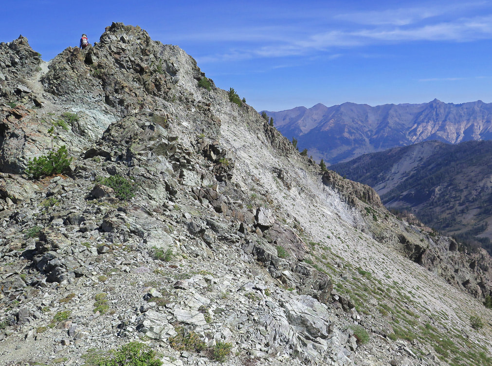 Trail on ridge is defined  View of Miner Lake and western Smoky Mountains from Norton Peak summit 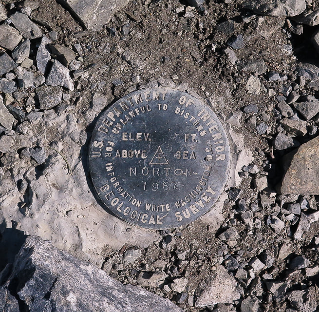 Norton Peak is a triangulation station as noted by the triangle on this geodetic brass disc. There are three reference markers that have arrows engraved on them on other high points that point back to this station. They are used for map-making. 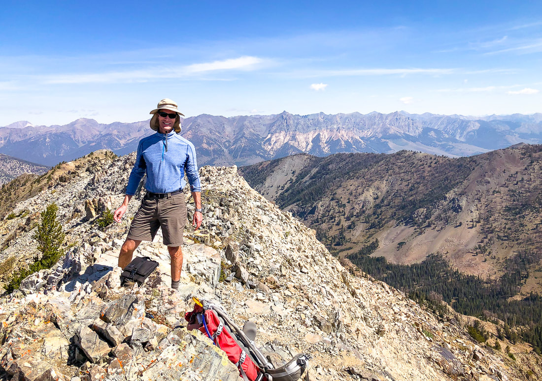 Boulder Mountain range and Castle Peak in the White Cloud Mountains (furthest left peak on horizon) behind Fred. 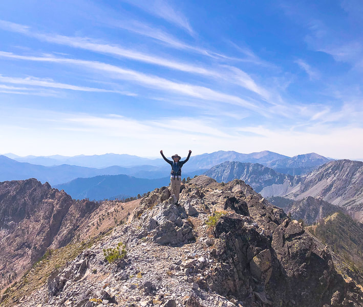 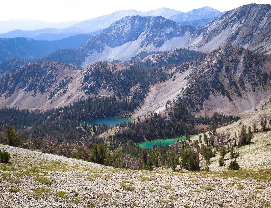 Norton Lakes on other side of saddle from Miner Lake. Trail #135 treks over the saddle, connecting these lakes  Descending toward saddle
L'arbre est tres magnifique!  Tracks from trailhead (north) to Norton Peak; hike distance = 5.8 miles to summit Miner Lake lower right, switchbacks to saddle, then north on ridge to the summit (Top of image is east).  GPS tracks from trailhead to Norton Peak Click on map for larger view References:
Wutz, Katherine. 2010. In Late 1800's, Mining was King: Remnants of Silver Boom dot the Wood River Valley. Idaho Mountain Express. (Internet). USDA Forest Service - Sawtooth National Recreation Area Structural and Stratigraphic Transect of South-Central Idaho: A Field Guide to the Lost River, White Knob, Pioneer, Boulder, and Smoky Mountains. citeseerx.ist.psu.edu/viewdoc/download?doi=10.1.1.731.8163&rep=rep1&type=pdf Additional references on Geology and Mining History of Idaho's Smoky Mountains page. Hike cross-country from Alpine Lake and Upper Redfish Lakes to one of the best views in the Sawtooth Wilderness. The rewards are solitude and Idaho beauty. Related: Sawtooth Mountain Wilderness: Upper Redfish Lakes Cross-Country Hike (2017). Alpine Peak: 9,861' - Sawtooth Wilderness: Never Stop Climbing Mountains 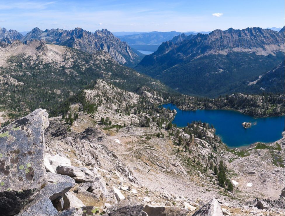 On Reward Peak's north ridge looking east to Lake Kathryn. Redfish Lake in the distance. From Reward Peak's summit Trip Stats Location: Sawtooth National Forest, Idaho Distance: 3.5 miles from Alpine Lake to Reward Peak, 7 miles round-trip. Elevation gain to Peak: From 8,383 ' at Alpine Lake to 10,075' at Reward Peak's summit. Total gain = 2,300 feet. Total loss = 575 feet. Difficulty: Moderate to strenuous Class 2 until the summit block, Class 3 last 40 feet to the summit. Trail type: Out and back Permit: Self-issued Sawtooth Wilderness Permit obtained at Redfish Inlet Transfer Camp trailhead. For more info: Sawtooth National Forest Map: Sawtooth Wilderness Hiking Map and Guide from Earthwalk Press. Our GPS tracks below. Date Hiked: 8/14/2019. Considerations: Can pump water from lakes/streams. No Campfire Zone around Alpine Lake. Dogs on leash in Sawtooth Wilderness trails July 1 - Labor Day. How to get to the trailhead: From Redfish Lake Marina at Redfish Lake Lodge, 6 miles south of Stanley, Idaho, just off Highway 75, take boat shuttle to Redfish Inlet Transfer Camp at south end of Redfish Lake OR hike Trail #101 along Redfish Lake's west shore to the end of Redfish Lake instead of taking the shuttle. This adds about 2-3 miles on to the hike. Hike directions: Trail #101 to Alpine Lake/Cramer Lakes from Redfish Inlet Transfer Camp. At intersection with Trail #154 to Cramer Lakes, take a right and stay on Trail #101 to Alpine Lake. Cross-country trail to Upper Redfish Lakes is accessed from southeast end of Alpine Lake, shortly after reaching the lake from the trail. Climb and follow the south ridge above Alpine Lake to an elevation of ~ 8,760 feet to enter gully. Climb gully to saddle at 9,200 feet, just west of Point 9337. Descend southward toward the first Upper Redfish Lake at 8,670 feet. From end of middle Upper Redfish Lake, hike west for a short distance, then ascend large drainage to Reward Peak. 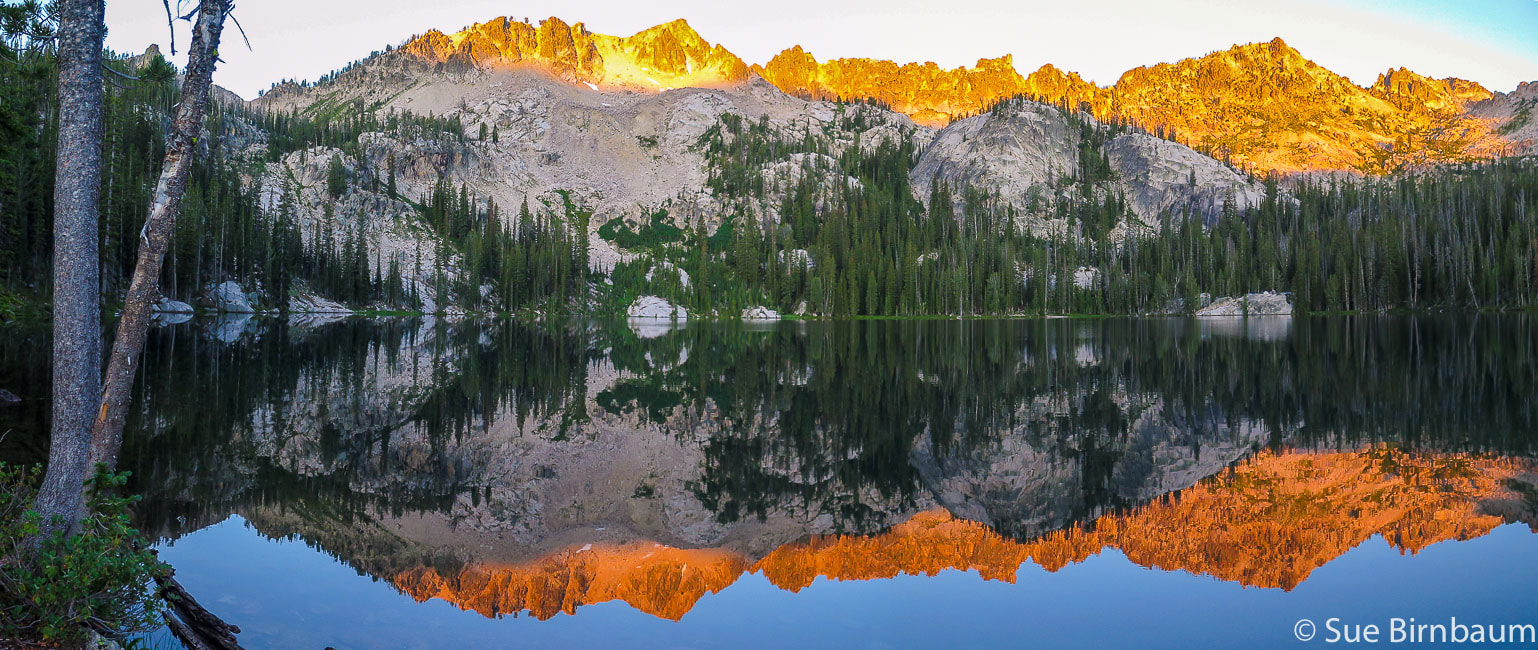 6:30 a.m. - Alpine Lake Our Hike - Overview After taking the motorboat shuttle across the long, deep blue Redfish Lake, we disembarked at the Redfish Inlet Transfer Camp underneath the towering Grand Mogul, an intimidating peak that signals you are now approaching wilderness. The hike to Alpine Lake is through a beautiful glacier-cut valley with towering rock cathedrals, creeks and wildflowers. At Alpine Lake, we found the best camping spot with plenty of room, with no one else around, and giant flat rocks on the shore on which to sit. That night was incredible: I woke to see the inside of our tent lit up. I looked outside at the most amazing sight: peaks brightly illuminated, glowing from a full moonrise with crystal-clear stars above. The next morning, we hiked off-trail, navigating straight up to the ridge overlooking the lake on soil and pine needles still damp with morning dew. We climbed up a challenging rock-filled gulley that descends to emerald lakes below, and then up another rock and snow-filled gulley to one of the most incredible views. A sunny and windless 10,000-foot summit, with no threat of thunderstorms. Lounge on the rocks - eat lunch, take photos, read the summit register. Serrated ridges, deep bottomless canyons, and sapphire-blue Lake Kathryn drop below our feet. We took our time to return to camp, meandering through bright green wildflower-filled meadows and on granite over a stream murmuring somewhere deep underneath. I once heard someone say, "It's not material things that matter, it's the experiences you have that matter." The scenario described above was actually the experience Fred and I had last month in the paradise that is the Sawtooth Wilderness. We summited Reward Peak during a glorious 3-day backpacking trip. In 1927, Arval Anderson, surveying for the USGS found a note on the summit dated in 1925 which offered the finder a $25 reward for returning the note. "I never knew a man who felt self-important in the morning after spending the night in the open on an Idaho mountainside under a star-studded summer sky." - Frank Church, former U.S. Senator from Idaho 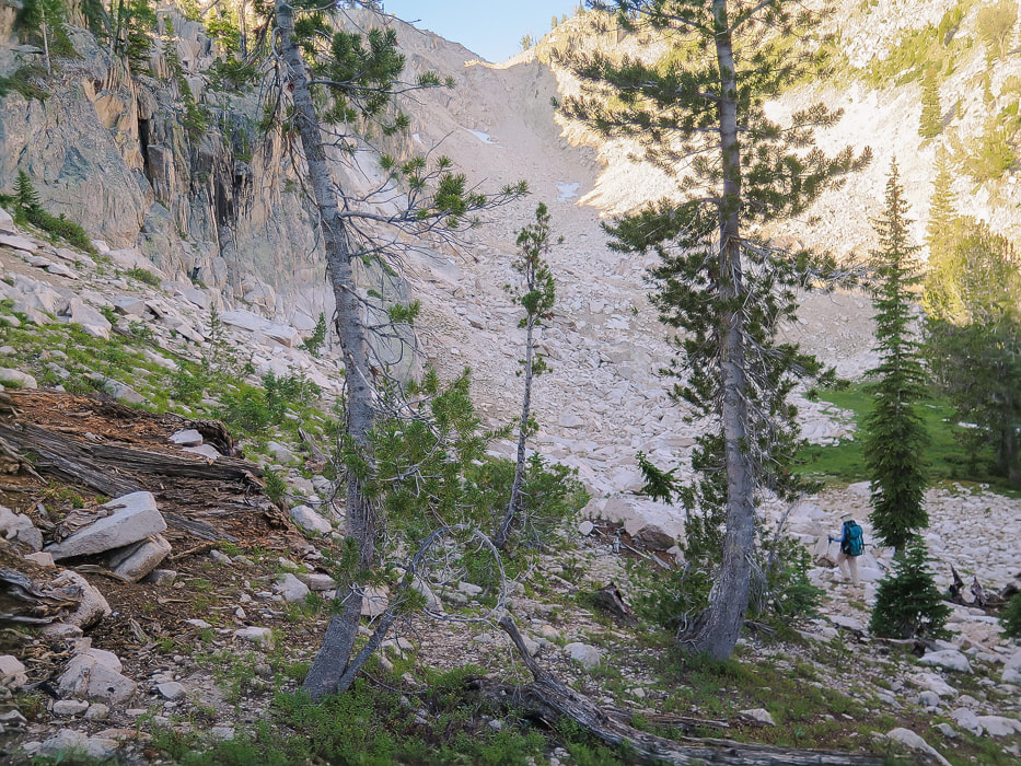 Entry point (8,760 feet elevation) from ridge above Alpine Lake's southeast side into gulley. The saddle at top of gulley overlooks Upper Redfish Lakes with Reward Peak on the horizon. Alpine Lake (8,330') to Upper Redfish Lakes (8,660') This part of the hike climbs the steep gulley seen from the south end of Alpine Lake, then descends through forest to two Upper Redfish Lakes divided by a a granite strip with rocks showing glacial striations and chatter marks, and a few sweet camp sites. From the southeast shore of Alpine Lake, hike south 450 feet up to ridge to follow it to the gulley entrance at about 8,760 feet. The gulley is steep with stable rock at bottom and loose rock and scree middle-to-top. From the ridge saddle, Reward Peak can be seen to the southwest on the horizon. Point 9337 sits just above the east side of the gulley. 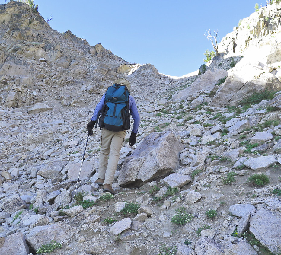 Ascending gulley from Alpine Lake to ridge overlooking Upper Redfish Lakes and Reward Peak on horizon 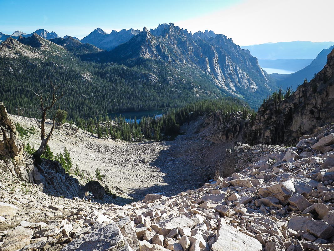 Fred (lower left) nearing saddle at top of gulley from Alpine Lake, below. Redfish Lake and moraine seen in distance upper right. 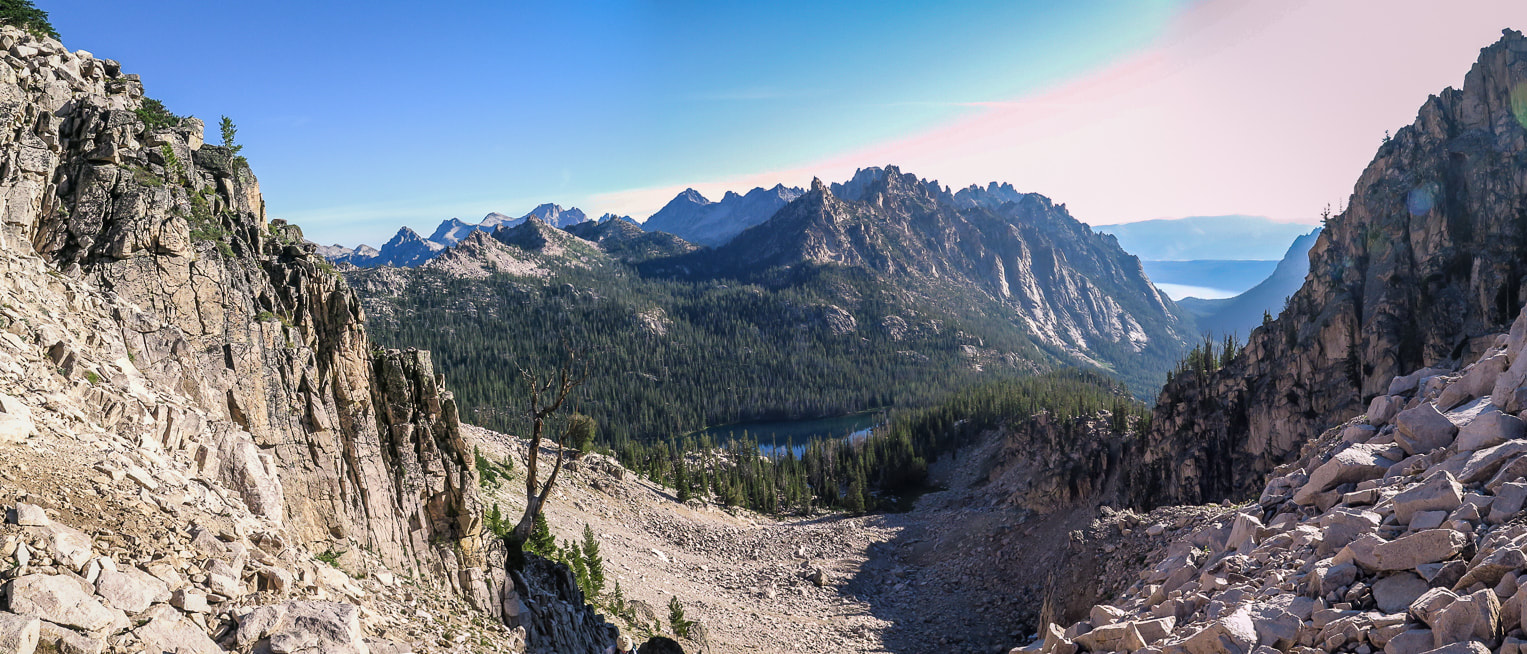 From saddle on ridge separating Alpine Lake and Upper Redfish Lakes drainages, looking north to Alpine Lake. 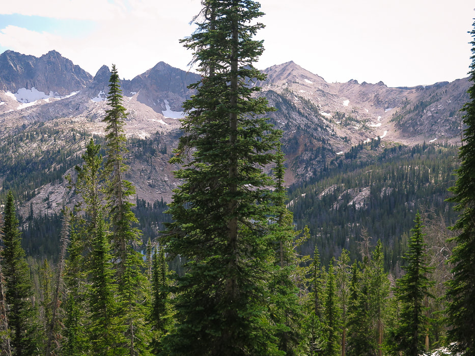 From saddle after first gulley climb; looking south to Reward Peak on horizon right side of largest tree in photo. Walk up gulley with a few snow patches to its summit. Upper Redfish Lakes in basin below. Once you complete the steep and tedious climb out of the gulley from Alpine Lake, and descend into the basin that contains Upper Redfish Lakes, it feels like true wilderness with negligible signs of human impact. The first two lakes are visible below. A narrow trail follows the wide granite outcropping situated between two lakes. The morning colors of blues, yellows and greens were vivid on the lake as we filtered water. The land is pristine, the large smooth white rocks still cool from the night before. Due south of the second Upper Redfish Lake is Lake Kathryn, considered the third Upper Redfish Lake, situated on the other side of the cirque's ridge. Lake Kathryn is a beautiful lake, deep blue with a small island in the middle. Lake Kathryn is named after Kathryn Mills, according to Iowa State University's archives of the Vandervelde Family Papers. This fact leads me to consider whether Kathryn Mills was associated with the Iowa Mountaineers, a group important to the Sawtooth Mountains' climbing history. This group led mountain ascents all over the world from 1940 until 1996. The Iowa Mountaineers claimed first-time ascents of 18 peaks in the Sawtooth Mountains in 1940's, including Warbonnet Peak in 1947, a challenging sheer-wall spire where all routes to the top are Class 5 climbing. Lake Kathryn is located ~ 5 miles southeast of Warbonnet Peak, and at the base of Reward Peak. 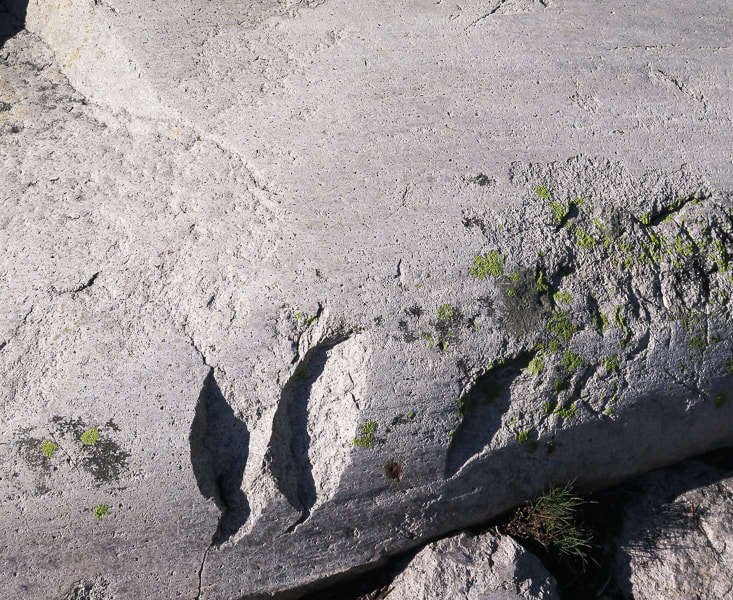 Three glacial landforms in granite: Glacial polish, striations and chatter marks. As the glacier moves downstream, the boulders and coarse gravel trapped under it abrade and chip bedrock. Chatter marks are crescent-shaped and oriented at right angles to glacial movement. Striations are parallel to glacial movement. 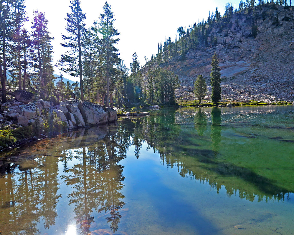 Morning at second Upper Redfish Lake 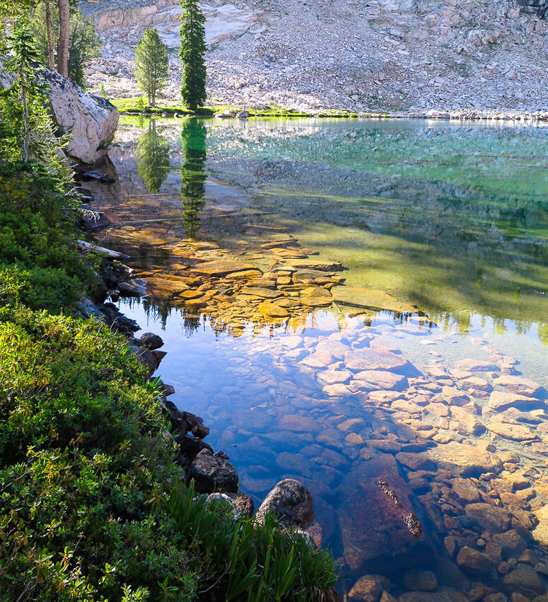 Upper Redfish Lakes to Reward Peak From the south end of middle Upper Redfish Lake, hike west for a short distance to the large ridge that contains Packrat Peak, and then south to enter into the wide rock-filled drainage that goes directly to Reward Peak, a pyramid-shaped peak at top of drainage. We hiked west into a beautiful forest with intermittent meadows and wildflowers, across and along the creek with bubbling small falls stepping down toward the Upper Redfish Lakes. Large granite rocks are stable throughout the drainage ascent, with brief snow patches to walk through, or around. We got lucky with the cooler-than-usual August temperatures. We hiked up to Reward's northeast ridge to look over the other side to Kathryn Lake. Large granite boulders dominate the last 40 feet to the summit, requiring using hands to maneuver around them. Paths lead through the scree and talus toward Lake Kathryn. Climb a small rock chute to find yourself on a surprisingly wide and flat summit. The view is expansive everywhere you look. Walk west of the summit's register and USGS marker. The mountain drops off in a towering cliff below your feet, and when you look down, you cannot see its sheer walls. Lake Kathryn looks like a smooth lapis lazuli gemstone embedded in rough granite. It feels like the top of the Sawtooth Mountains here, with distant serrated dark peaks lining a 360- degree horizon; however Thompson Peak, the highest Sawtooth peak to the north is almost 700 feet higher. Packrat Lake sits in a deep basin to the north. The view is so spectacular I think of Lucy Jane Bledsoe's quote from her book, The Ice Cave:
Beautiful meadows and streams between Upper Redfish Lakes and drainage to Reward Peak 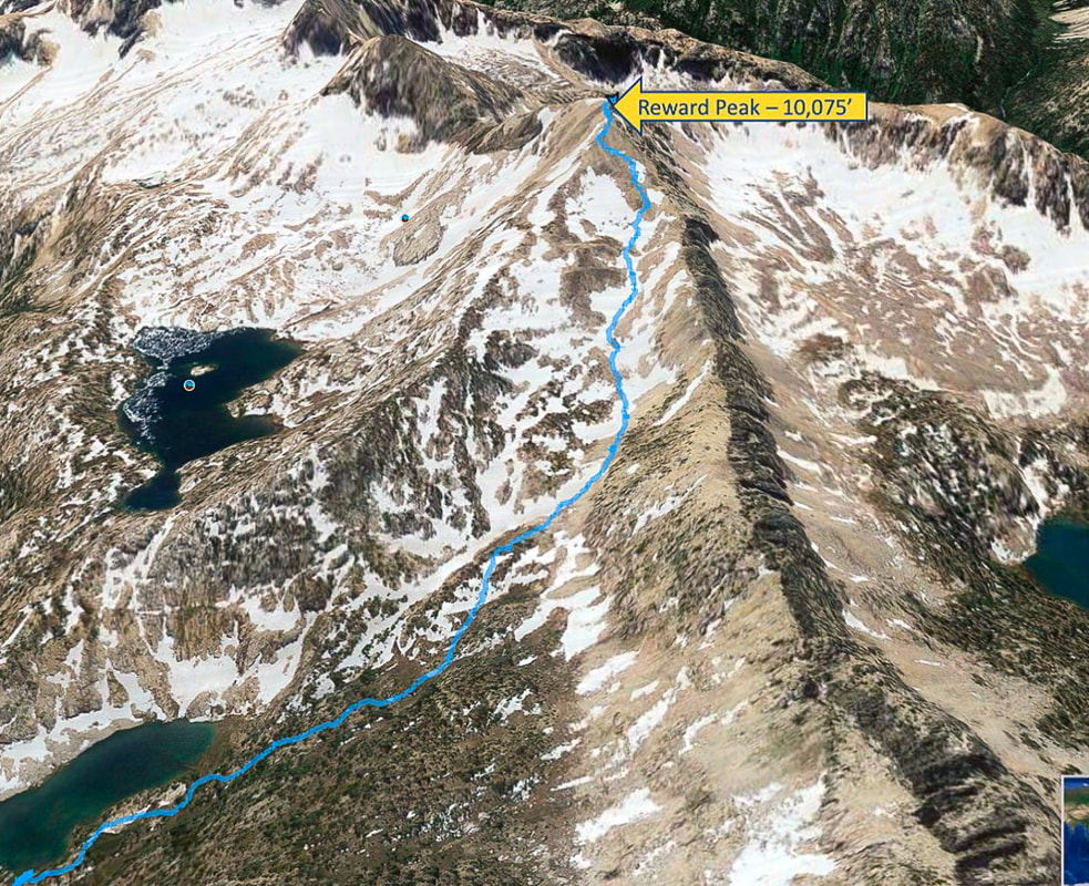 Our route from middle Upper Redfish Lake (lower left) to summit of Reward Peak From the lake, hike west toward long ridge that contains Packrat Peak, then south up wide gulley Lake Kathryn middle left in photo 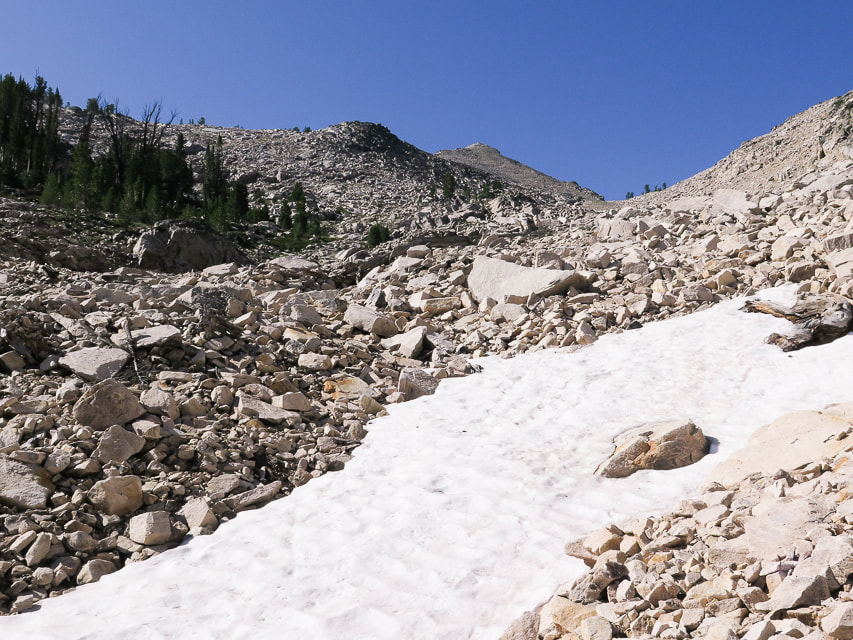 Drainage to Reward Peak, furthest peak on horizon 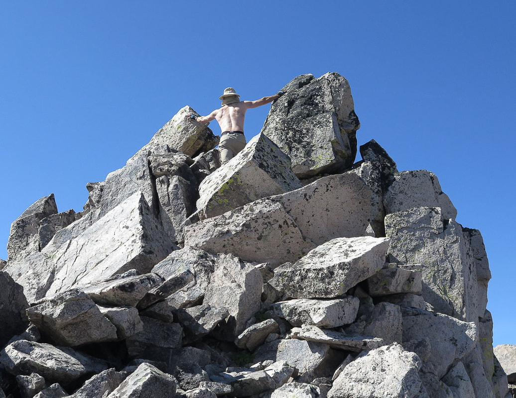 After a break upon reaching top of Reward's north ridge - step through large boulders last 30 - 40 feet to summit 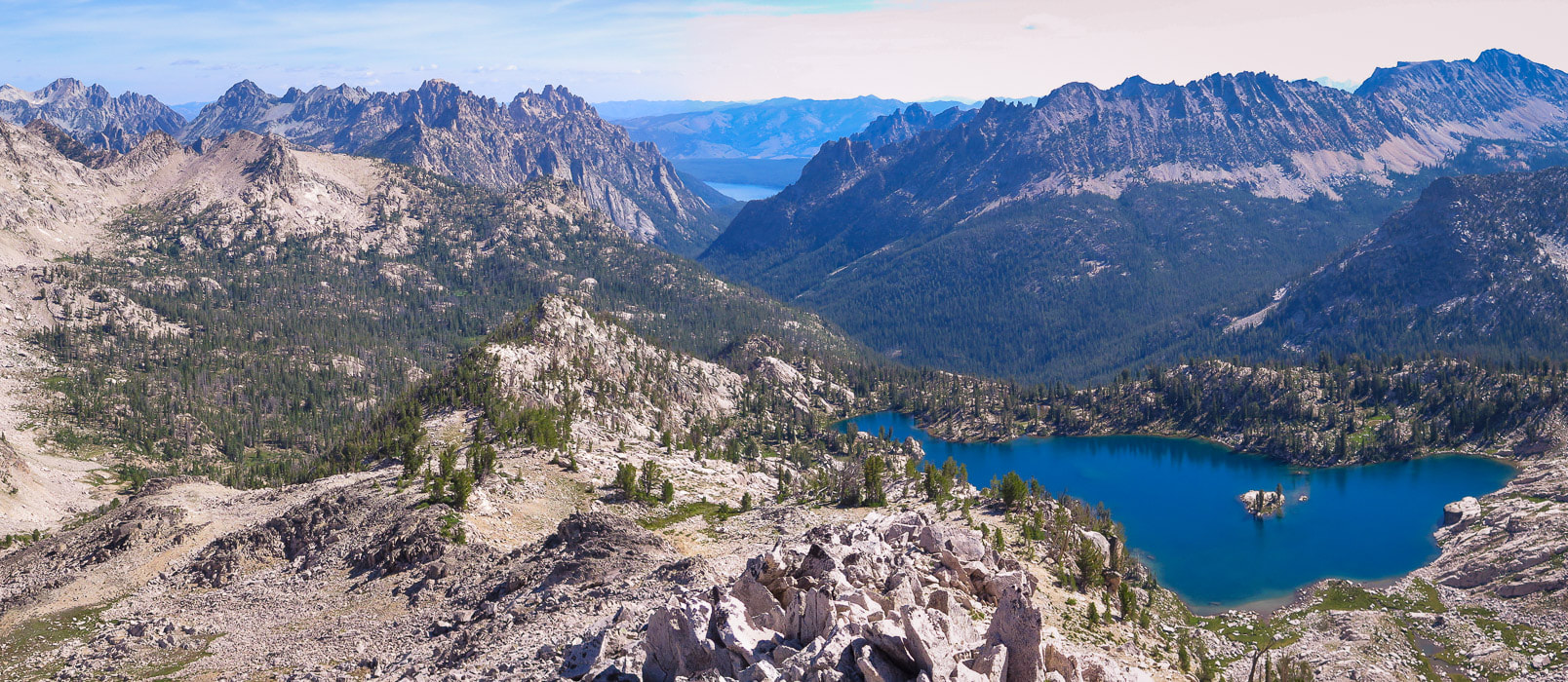 Lake Kathryn from Reward Peak's north ridge 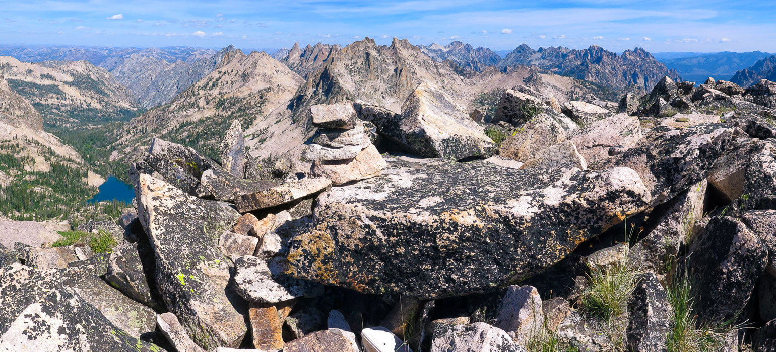 Reward Peak summit - 10, 074 feet looking north. Packrat Lake at left; summit register under large flat boulder. 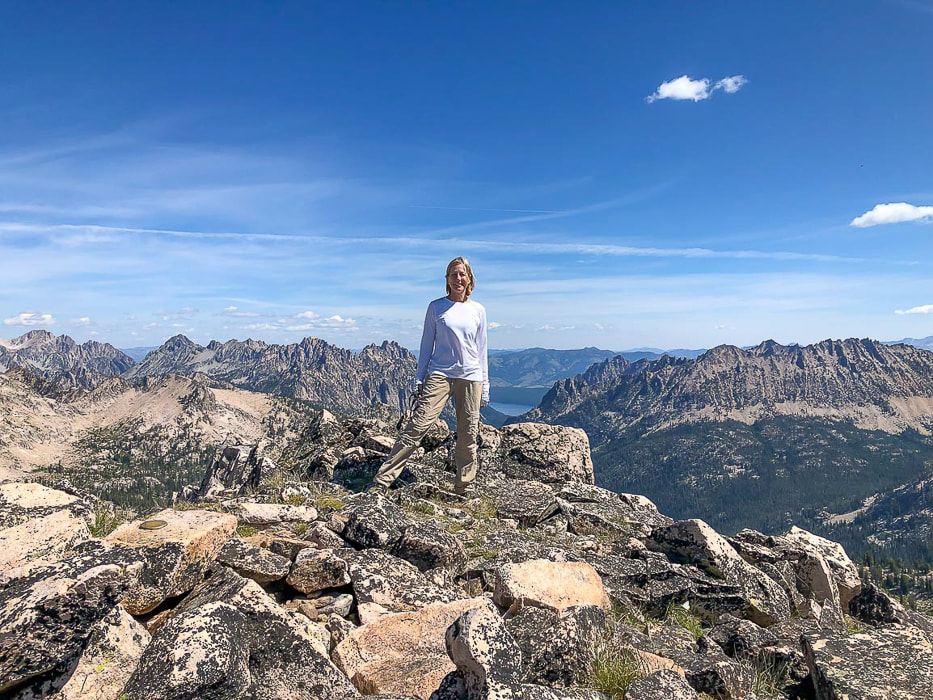 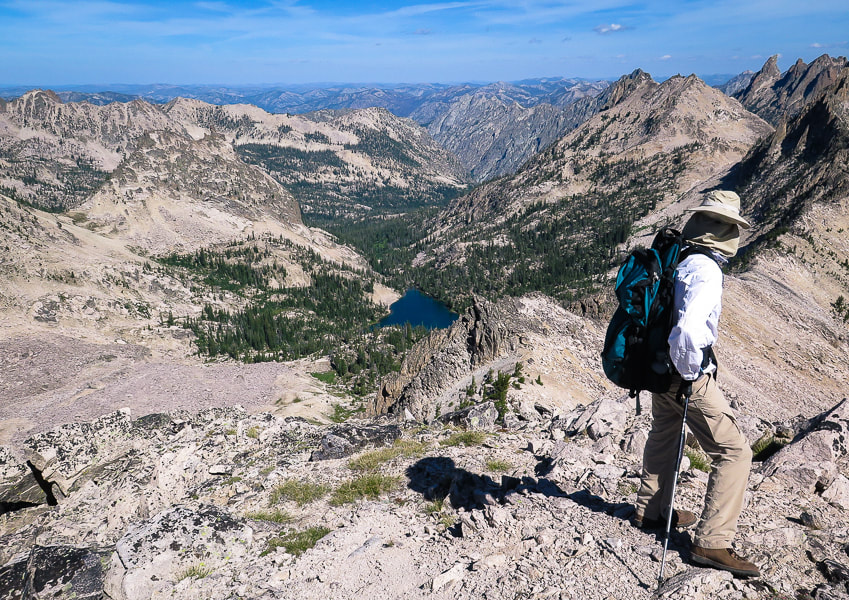 Packrat Lake and Packrat Peak above it upper right in photo The descent is not too difficult - just a lot of picking through boulders until you reach the forest and meadows surrounding Upper Redfish Lakes. Not in a rush to get back to camp, we took a long break sitting in the soft meadow grass as we listened to the melodic stream. When climbing steeply out of Upper Redfish Lakes basin, the saddle and gulley overlooking Alpine Lake is toward the right (northeast), just left of the furthest point to the right on the ridge as you climb - Point 9337. From below, it is difficult to get bearings because you can't see the top. Once on the saddle, the lowest point on the ridge above, the gulley down to Alpine Lake is steep and tedious, rocks slide as you step down, and the large boulders at the bottom take some navigation unless you can circumvent these and stay higher on the gulley slope. We heard a pika chirping its alarm as we clumsily made our way down. The gulley ends in a beautiful meadow, where we hiked steeply down, back to camp. The two ducks on the lake quacked and paddled toward each other as dusk settled in. We were in our sleeping bags before twilight. The glow in the tent awoke me again, I checked the mountains above the lake. They weren't as spectacularly lit as the previous night; the moon not as high yet, but still a memorable sight. Commit the scene to memory. Never stop climbing mountains. 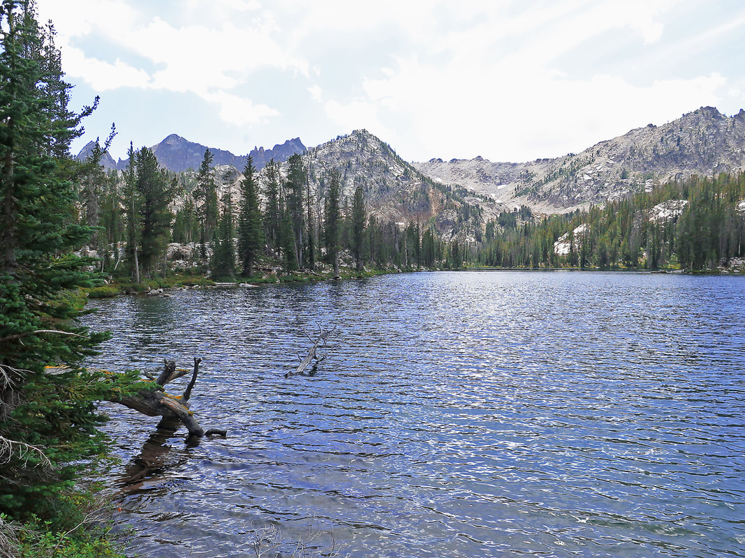 Parting shot of first Upper Redfish Lake with wide drainage that leads to Reward Peak, behind the closest peak in photo
Descending gulley back to Alpine Lake 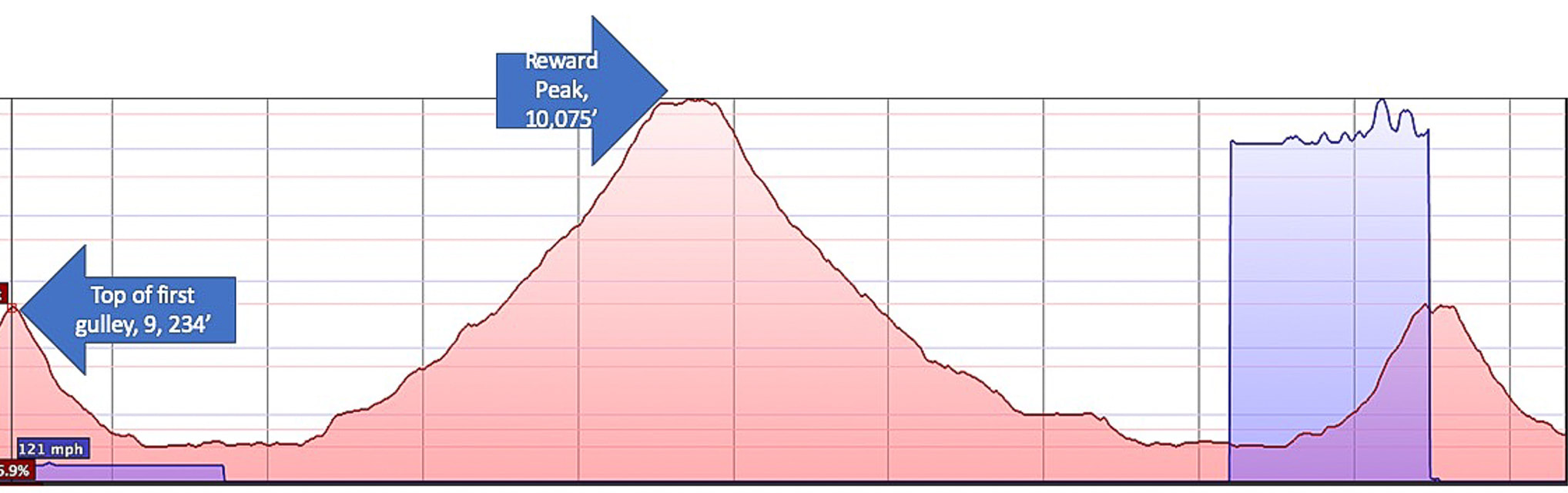 Elevation profile from top of gulley on ridge separating Alpine Lake and Upper Redfish Lakes to Reward Peak summit and back down, then up again to top of gulley. Each vertical line represents 0.5 miles. Red horizontal line interval = 250 feet of elevation. 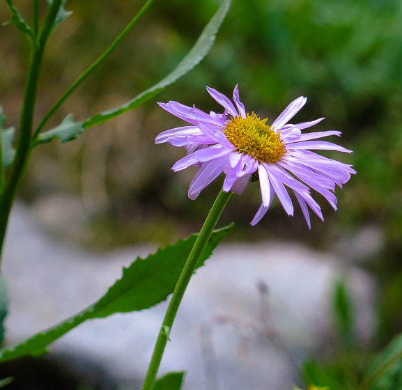 References:
Lopez, Tom. Idaho: A Climbing Guide - Climbs, Scrambles and Hikes. 2000. The Mountaineers Books. Vandervelde Family Papers. Iowa State University. Summit Alpine Peak in Idaho's gorgeous Sawtooth Wilderness for a stunning view of dozens of Sawtooth peaks, Mount Regan's steep north face, and beautiful Sawtooth Lake at your feet. 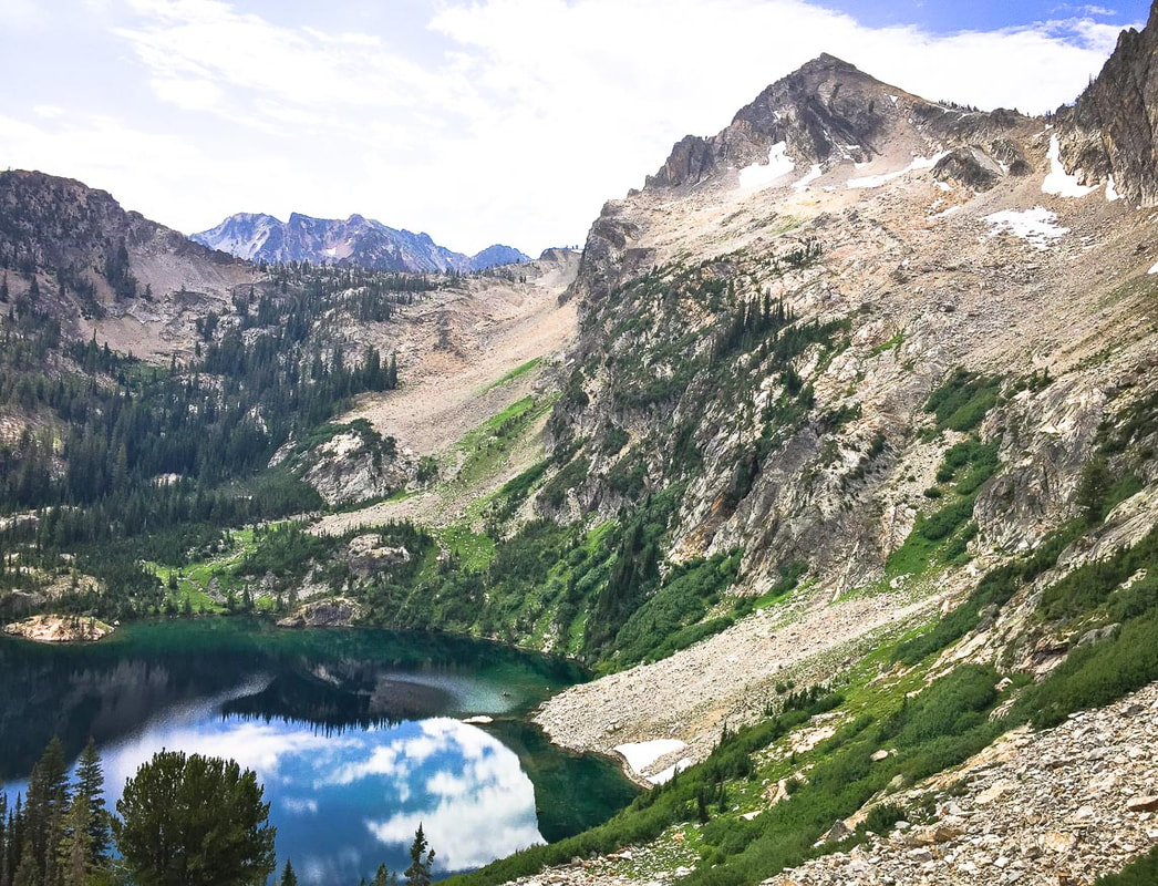 Alpine Peak (right - elevation 9,861') rises 2,000 feet above Alpine Lake, Sawtooth Wilderness 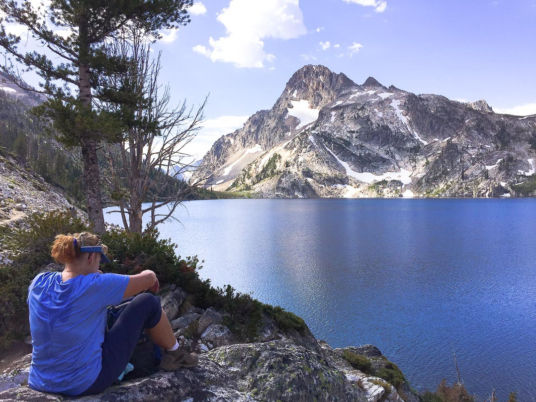 Val taking a break at Sawtooth Lake - looking across to Mount Regan's north face Trip Stats Location: Sawtooth Wilderness. Trailhead out of Stanley, Idaho. Distance/Elevation gain: 12.6 miles/3,151' Summit elevation: 9,861' Difficulty: Moderate Class 1 to Sawtooth Lake, Strenuous Class 2-3 from end of Sawtooth Lake to summit traveling over talus toward summit. Trail Type: Out and back: can hike a loop from trail to summit approach. Trails: Trail #640 4.5 miles to Sawtooth Lake; Trail #478 to end of Sawtooth Lake; cross-country from lake to Alpine Peak. Lat/Long: Trailhead: 44.1986 -115.013, Alpine Peak: 44.1713 -115.0497 Water: Can filter water from creeks and Sawtooth Lake. Permit: Sawtooth Wilderness permit at Iron Creek Trailhead kiosk. Maps: Sawtooth Wilderness Hiking Map and Guide: Earthwalk Press (Our GPS tracks below). Date Hiked: August 2, 2019 Considerations: Dogs required to be on leash July 1 - Labor Day. Link to USDA Sawtooth Wilderness information Link to Idaho Outdoors Forum for mountain conditions information Stanley Ranger Station: (208) 774-3000 Snow may still be present around Sawtooth Lake in June. Driving Directions: From Stanley, drive 2 miles west on ID 21 to turnoff for Iron Creek trailhead (FR 619) on the left. Drive on asphalt/dirt/gravel road 3 mi. to trailhead parking lot. Hike Directions: Iron Creek Trailhead: Trail #640 to intersection with trail to Stanley Lake, continue left at the sign to Sawtooth Lake. At ~ 3.5 miles, come to intersection with spur trail to Alpine Lake, keep straight on Trail #640 to Sawtooth Lake. At Sawtooth Lake's outlet, head south on the lake's east side on Trail #478 for ~ 0.90 miles to the end of the lake. Climb east up to Alpine Peak's southwest ridge to summit, ~ 0.75 miles. 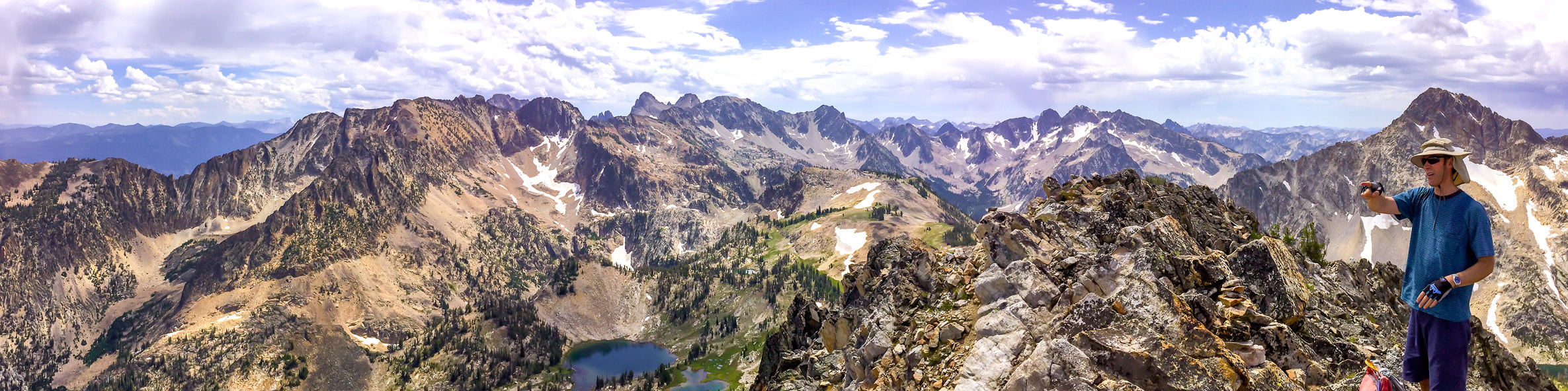 "You Should Never Stop Climbing Mountains", Andy Rooney proclaimed in one of his commentaries from the television show 60 minutes. Many years ago, my sister sent me a written copy of this excerpt along with photos of my hiking adventures neatly arranged in two connected frames. I still have it displayed along with other old hiking photos. In this segment, Rooney describes how he climbed Pilot Knob Mountain behind his cottage on Lake George in New York 4 or 5 times each summer during his childhood, and later climbed it with his kids. One day, he came across old photos of he and his kids on top of Pilot Knob, and it occurred to him that he had stopped climbing mountains, just like he had stopped doing "...a half a dozen things." He tells a few stories of some of his memories on this mountain and then sums up his commentary with "I may never climb Pilot Knob again. I never should have stopped." A few weeks ago, Val, Fred, John and I took Rooney's advice to climb another mountain together: Alpine Peak summit in the gorgeous Sawtooth Wilderness in the heart of Idaho. We four had done a phenomenal hike to Goat Mountain in Idaho's Pioneer Mountains last autumn. Fred and I had summited Alpine Peak 6 years ago, so we knew where to get off the trail that treks along Sawtooth Lake's east side for the 1,400-foot climb to the summit. We have been hiking this trail over the past 19 years. It's so beautiful that many others have discovered it and for a weekday it was busier than ever. However, not many ventured past Sawtooth Lake, and no one else climbed Alpine Peak that day. 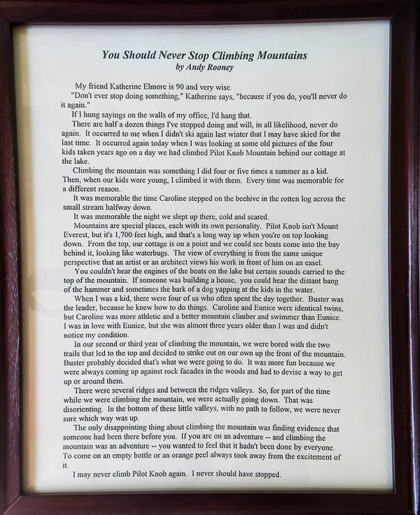 My sister gave me this written copy of Andy Rooney's excerpt from 60 Minutes years ago. Our Hike The first part of the trail is a pleasant and easy climb along Iron Creek with its gentle melodic waterfalls through pines, firs and green understory. Near the intersection with the trail to Alpine Lake, Alpine Peak rises 2,000 feet over the lake's cirque to the south. As the trail switch-backs out of the forest, views open, becoming more stunning with each step. To the northeast, a perfectly U-shaped thickly forested valley carved by glaciers from the Little Ice Age extends below. After reaching Sawtooth Lake, the real feel for this terrain and its breathtaking views become apparent with the steep and rocky Class 2-3 climb to the summit. Mile 0 to Mile 3.5 at intersection of trail to Alpine Lake 8:15 a.m: We obtained our Sawtooth Wilderness permit at the trailhead kiosk. It was a bit early for John, but Val, Fred and I were excited about the hike and ready to go. This section gains 1,200 feet, crossing over Iron Creek as it approaches Alpine Lake, a perfect mirror of the clouds above. On the way to Alpine Lake turnoff, pass two trail intersections. An old, classic wooden trail sign, splitting through the middle, indicates the way to Stanley Lake. An intersection before that indicates Trail #528 to Marshall Lakes (this trail goes to Goat Lake, an excellent hike). Crossing over the creek before the switchbacks up to Alpine Lake must be interesting in the late spring with the increased run-off of that cold, crystal clear water. 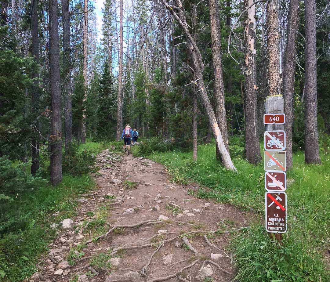 Iron Creek Trailhead 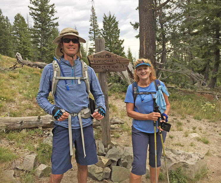 Fred and Val at intersection of Trail #640 to Sawtooth Lake and Trail #528 to Stanley Lake Mile 3.5 to Mile 4.5 at Sawtooth Lake's outlet (northeast side) Although the trail signs indicate Sawtooth Lake is over 5 miles from Iron Creek Trailhead, my GPS read 4.5 miles. The trail gains 530 feet in about one mile between the intersection of Alpine Lake's spur trail and the first view of scenic Sawtooth Lake. The views of Alpine Peak improve until you work your way around the ridge that contains it, and then it becomes hidden while standing at Sawtooth Lake. Passing the lake's outlet log jam, the trail traverses through huge white granite boulders. This is a wonderful place to eat lunch - on an elevated bank looking across the bright blue water to Mount Regan with its formidable north-facing vertical wall. Though all around there is a riot of bright colors: red, purple, yellow wildflowers, fresh granite edges, and sparkling water, everything in is harmony, and it has a calming effect. John hides a water bottle among boulders; Fred bets he won't find it again. John is fully awake now and impatient to end our break and get back on the trail. 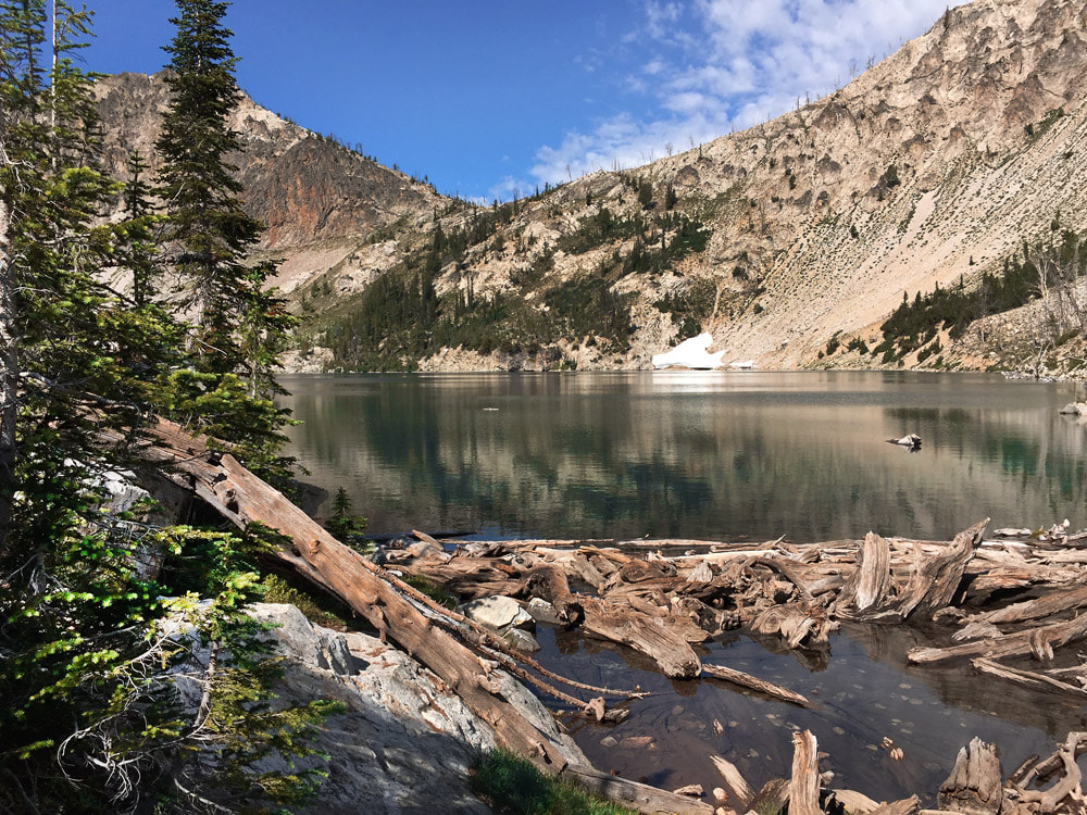 First view of Sawtooth Lake ~ 4.5 miles from trailhead 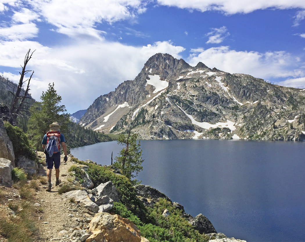 Starting out on 0.9-mile trek along Sawtooth Lake's east side to its end - August 2019 Compare the snow level on Mt. Regan with identical photo below taken in 2013. 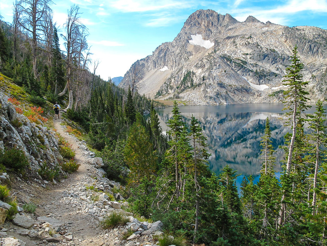 Sawtooth Lake and Mt. Regan July 2013 - less snow this year!  Near beginning of 1,400-foot ascent to Alpine Peak Walk to the end of Sawtooth Lake (above) and head straight up. Mile 4.5 (Sawtooth Lake's outlet) to Alpine Peak Summit The easy part is over and we focus on the tough part of the day - getting to the summit. Best to have a topo map to find the easiest way up, although Alpine Peak is one of the least technically challenging Sawtooth summits. From Sawtooth Lake, walk the trail along the east side of the lake, initially making a few switchbacks to rise above the lake. Walk 0.9 miles to the lake's end, then start climbing off-trail for 0.75 miles to Alpine Peak (see our GPS tracks below), up any one of the gullies to ridge. After reaching ridge, hike along it north to summit. On our way up, we left the trail a bit too early, which made the climb steeper, but also more interesting. Gaining 1,400 feet in 0.8 miles means heart-pounding steep, and grasping for tree branches was necessary at times. John went up a rocky gulley directly under the peak. Fred, Val and I slowly picked our way to the saddle just west of the summit then stepped through a stable boulder/talus field, grasping onto rock outcrops and angling toward the summit. Underneath me I could see Val and the lake grow smaller as I climbed. We could see the summit high above us and all the broken rock we had to navigate before getting there. We met victoriously with John, already at the top. From the summit, the view of the Sawtooth Mountain Range's many sharp-toothed peaks, a close-up of Mount Regan and the town of Stanley with specks for buildings is tremendous. Sawtooth Lake is a sapphire oval far below us. We hunted for it, but could not find the peak register. 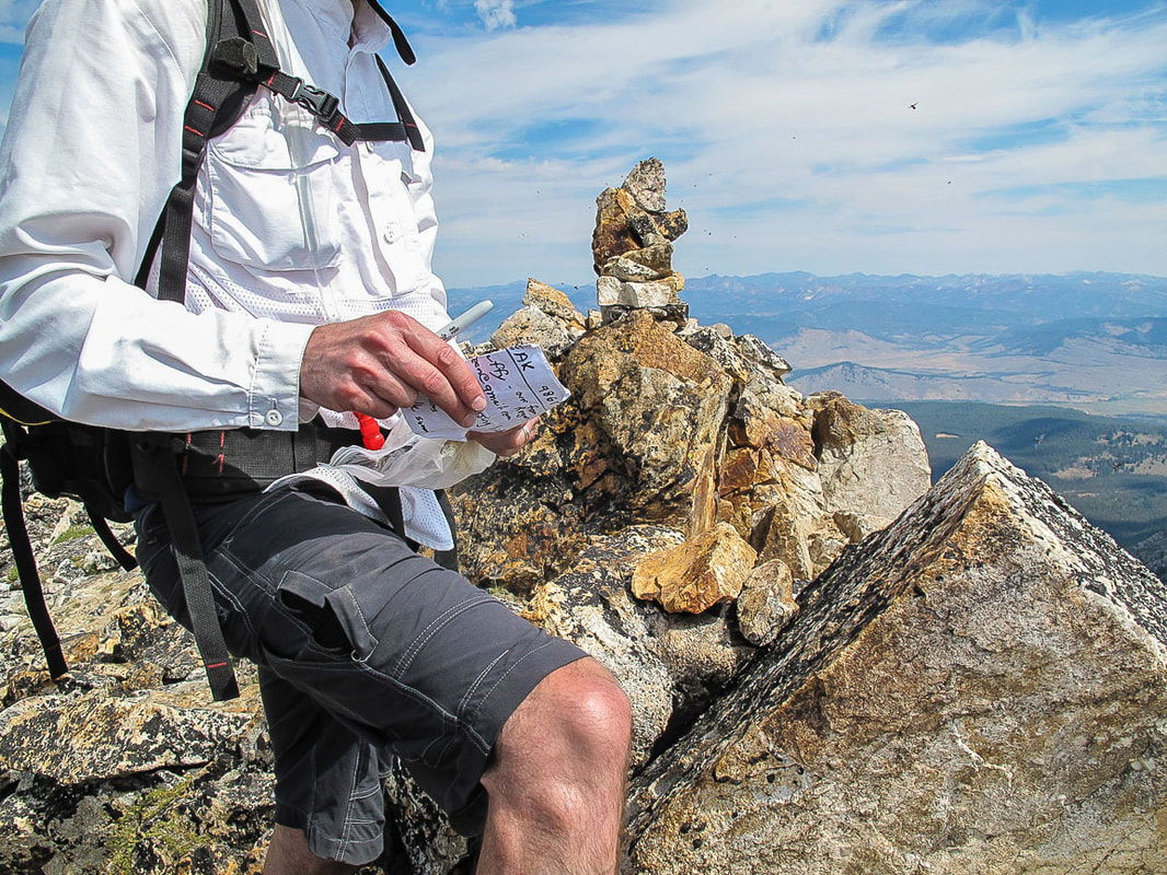 Alpine Peak's summit register in 2013; we didn't find it in 2019 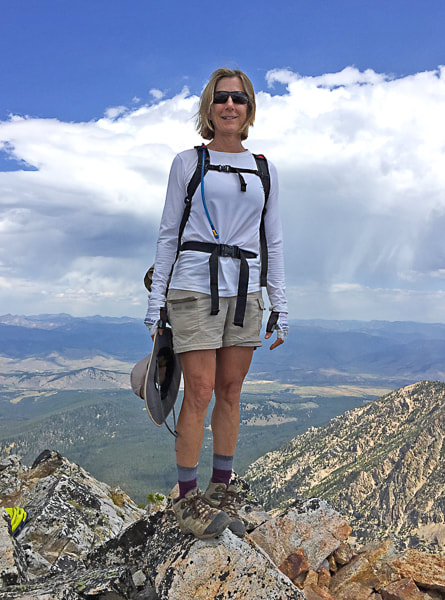 Sue on Alpine Peak's summit. 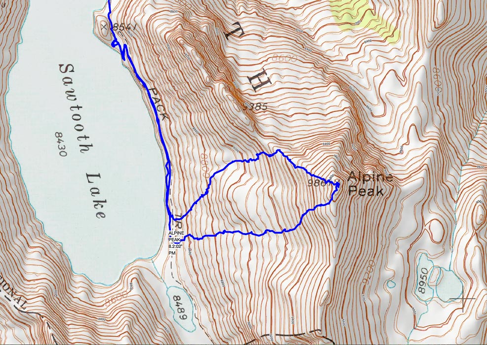 The summit becomes visible half-way up the climb from Sawtooth Lake The upper track is our ascent, the lower track our descent 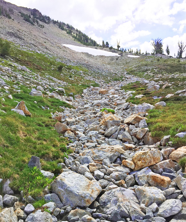 Ascending Alpine Peak from Sawtooth Lake - 1,400' gain in 0.75-0.8 miles 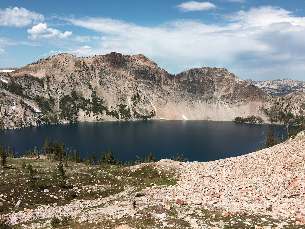 Fred on the way up Alpine Peak 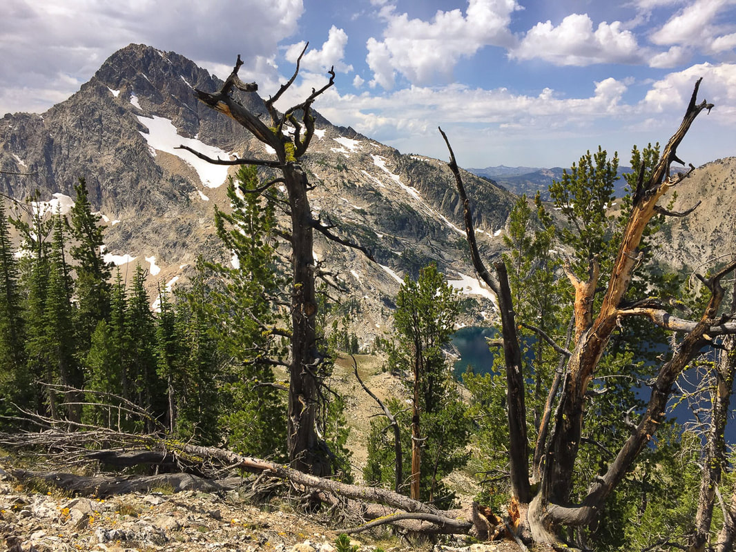 On the ascent from Sawtooth Lake - Mt. Regan 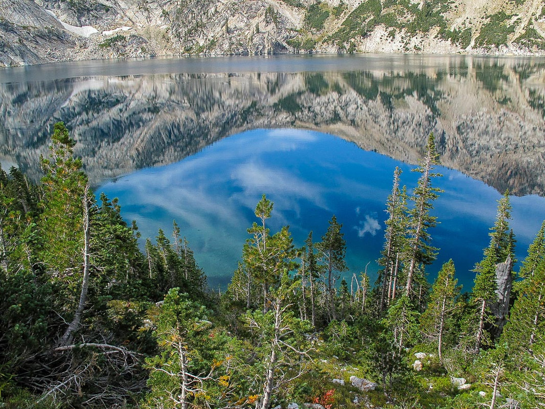 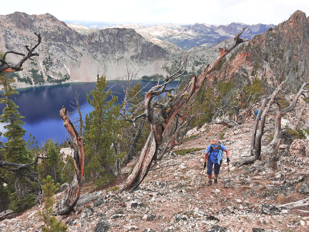 Val making her way up Alpine Peak's northwest ridge 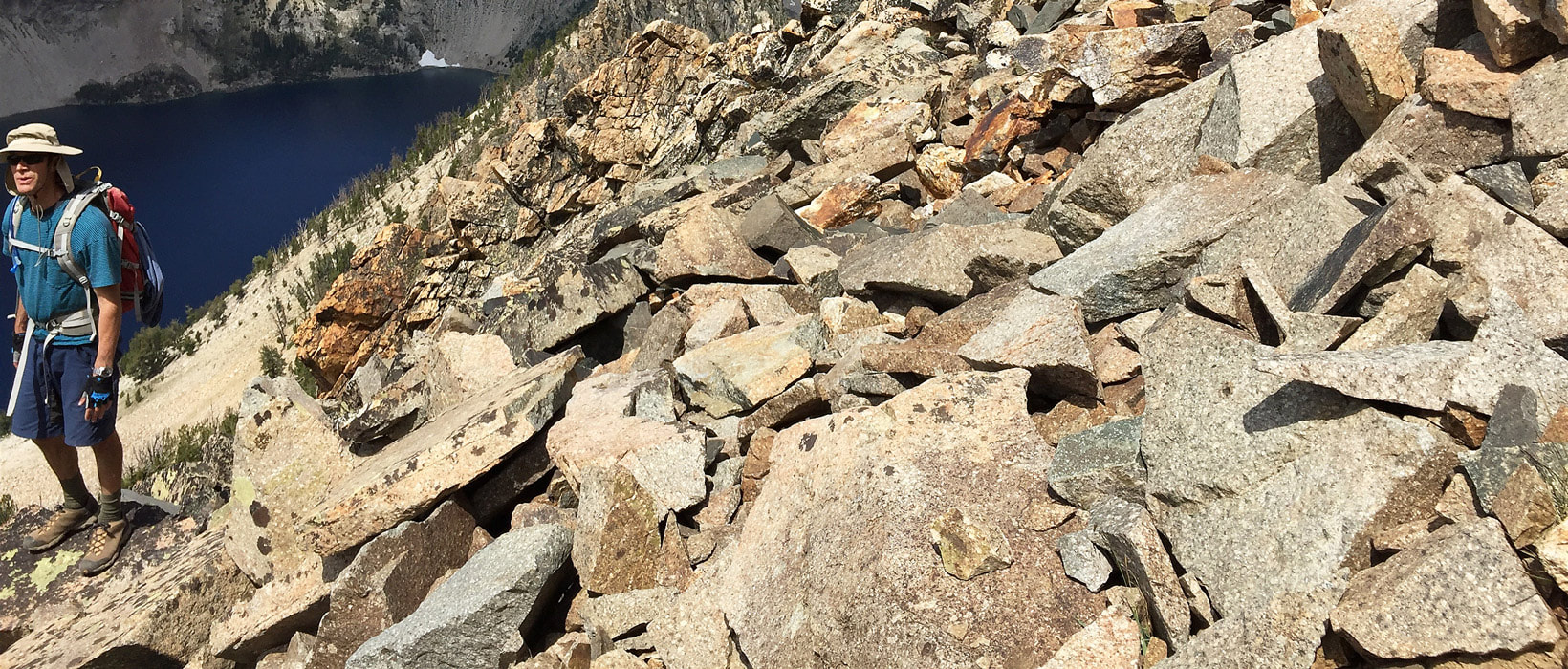 Maneuvering talus slope on ascent. 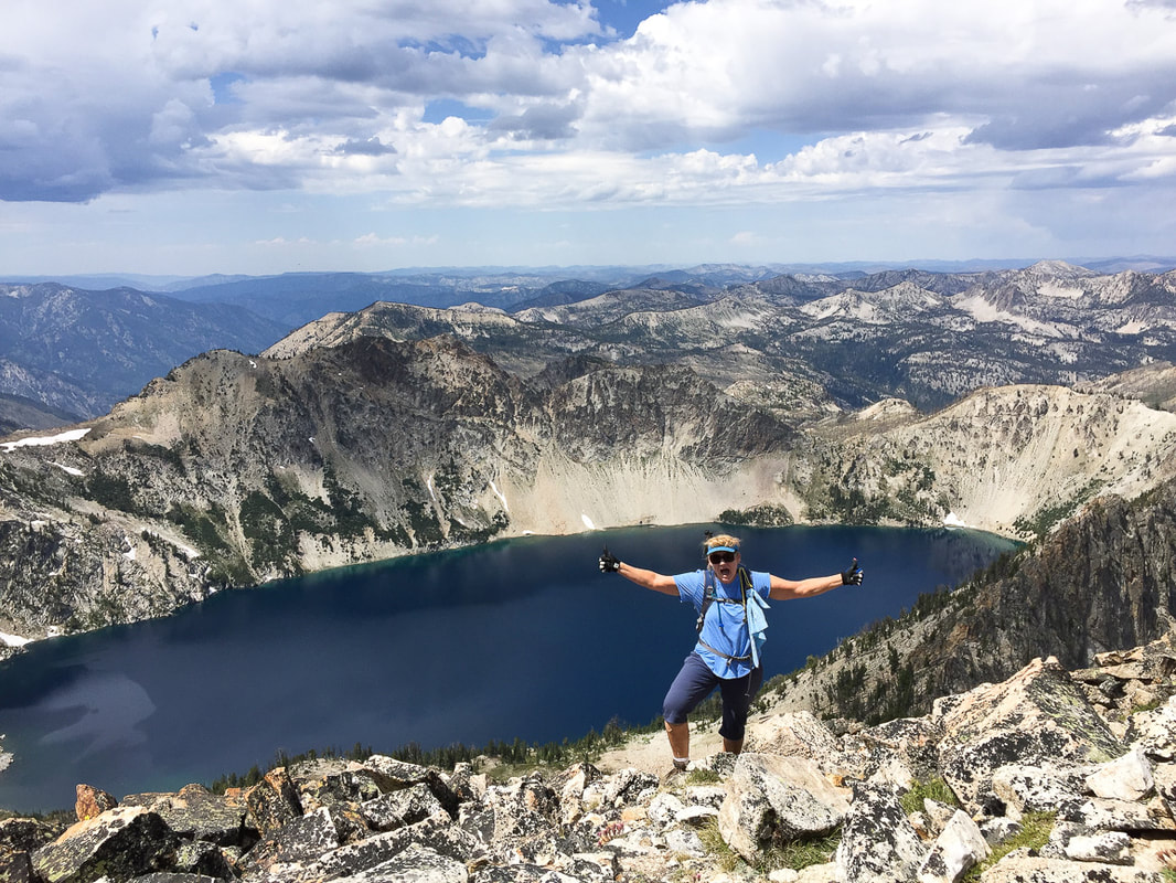 Val reaching summit! 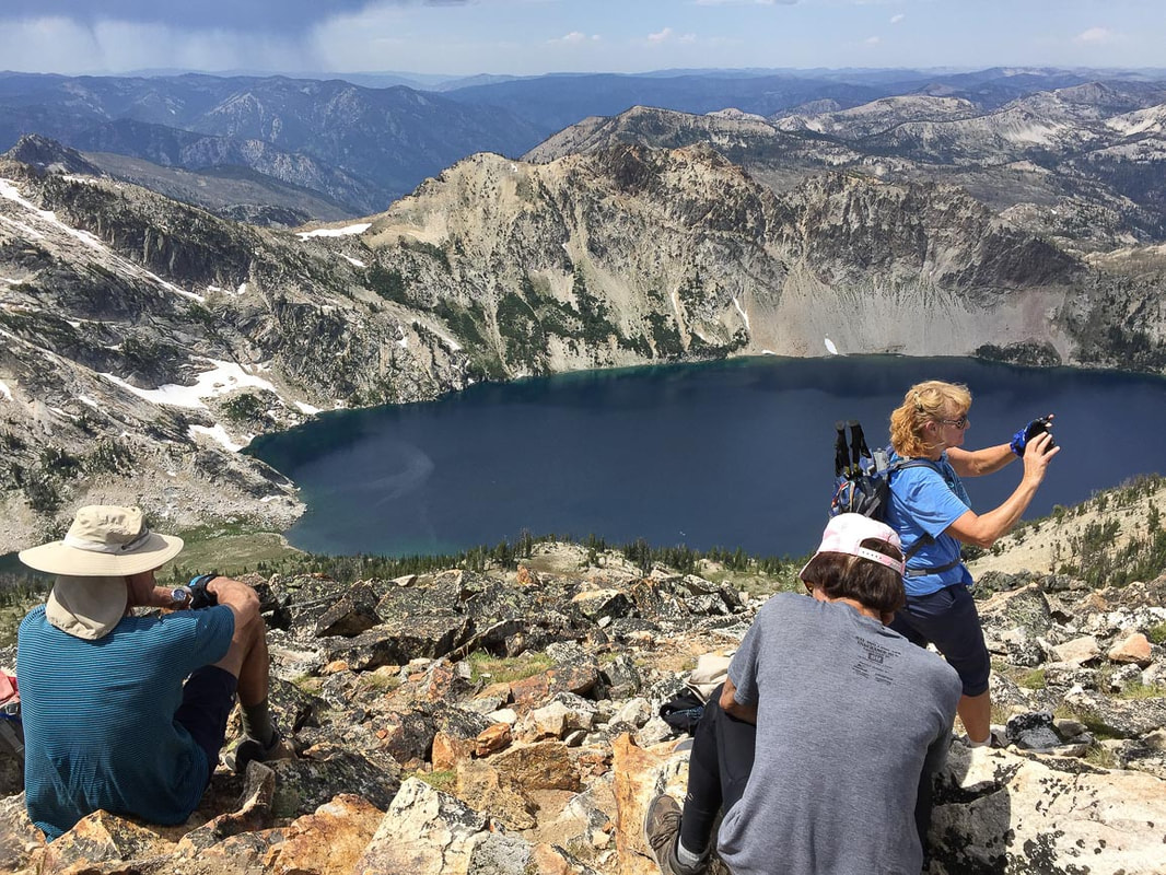 Fred, John, Val at Alpine Peak Summit - 1,400 feet above Sawtooth Lake 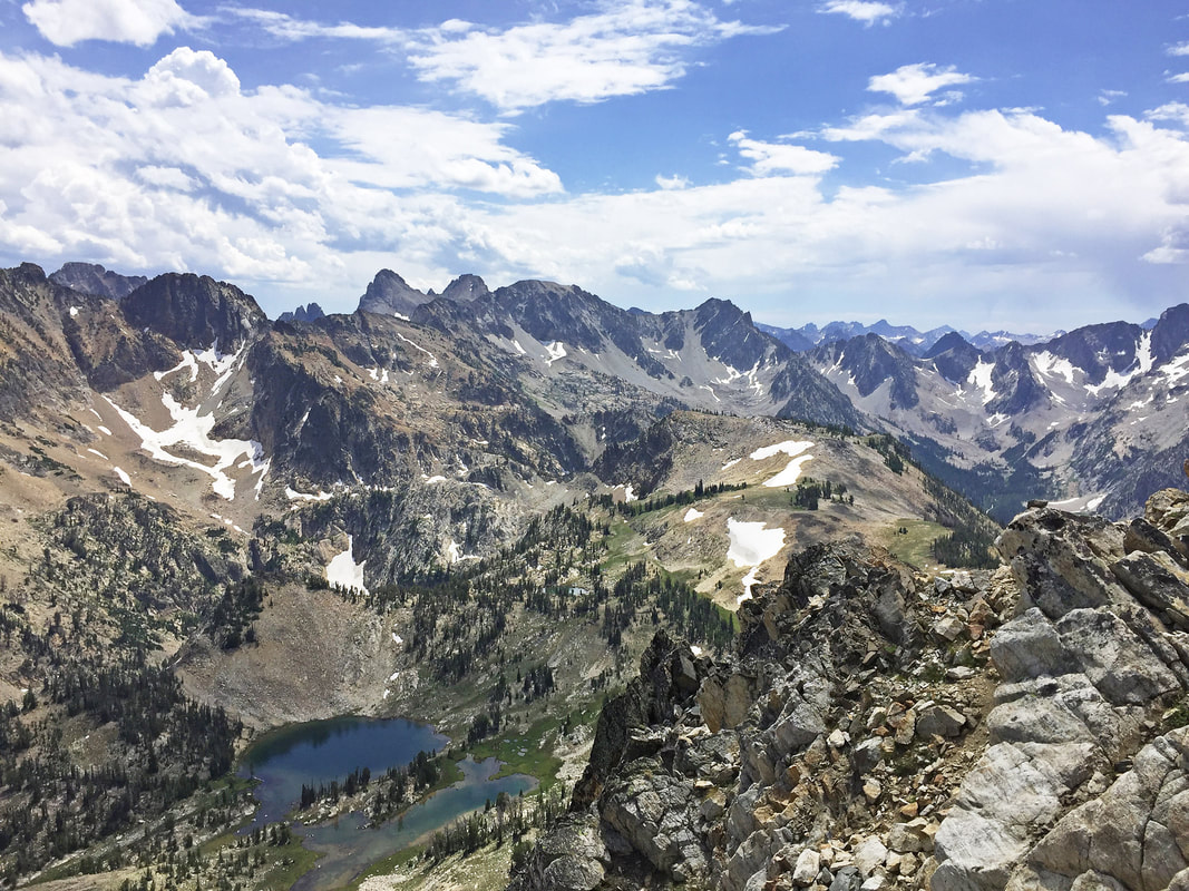 View southeast toward Williams, Merritt and Thompson Peaks 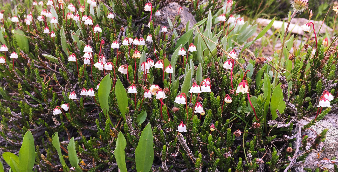 Western moss heather Cassiope mertensiana subsp. gracilis 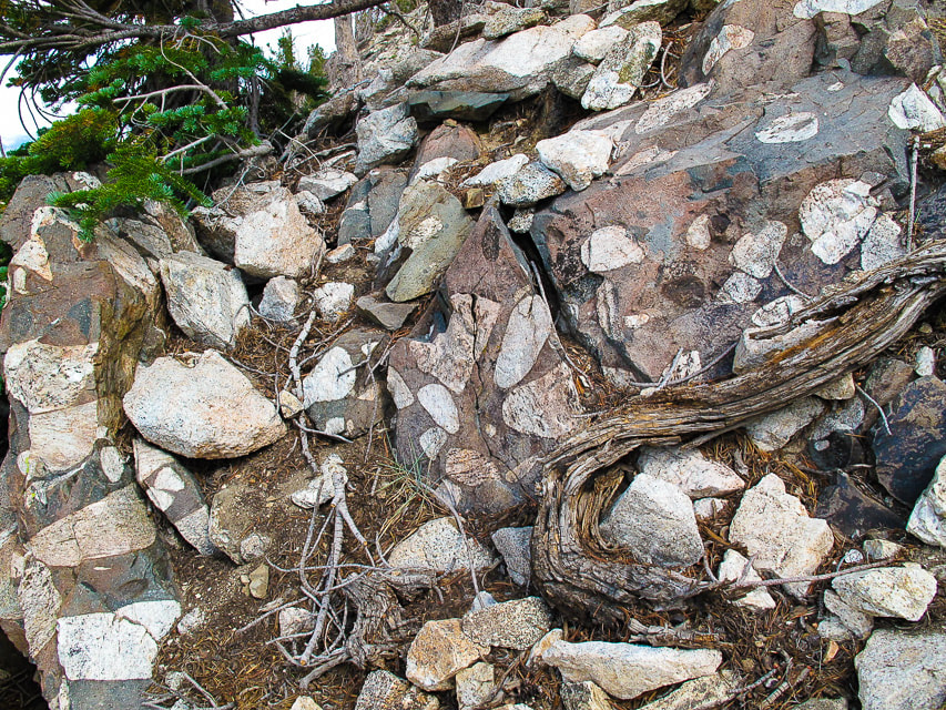 Matrix-supported conglomerate seen on the ascent 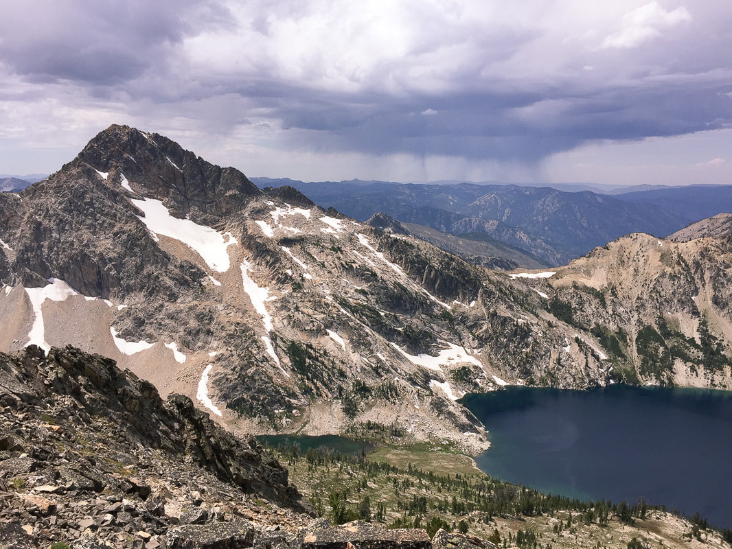 Heading down toward Sawtooth Lake Dark purple clouds with rain sheets underneath had gathered during our summit celebration. When we heard distant thunder, we decided to get down. Although lightening was just over the ridge, we were spared the storm. We hiked south along the ridge for a short distance and then aimed for the south end of Sawtooth Lake. This way treks over alternating tree islands and boulder/talus fields, and it's fun to "skate" down through the scree. Again, John descended by his own route, through more rock, it seemed. We found him at the bottom on the trail, a bit scraped up and bleeding from a fall. But John is tough with a lot of experience with falling (he and Val are skydivers), so we resumed our hike along Sawtooth Lake. Before heading away from Sawtooth Lake, we cooled our feet in splashing crystal clear outlet creek. Walking down the trail with the wide valley spread at our feet, we passed uphill hikers, on their way to that extraordinary lake. But what we four had just seen, hiking above and beyond, few people get to witness. "What should our next summit be?" I asked. Maybe in the future the mountains I climb will have less rise and distance and the summit easier to obtain. As long as I am able, I will never stop climbing mountains. I bet we four will continue to climb them as long as we can. By the way, we eventually found John's water bottle. "Everyone wants to live on top of the mountain, but all the happiness and growth occurs while you're climbing it." - Andy Rooney 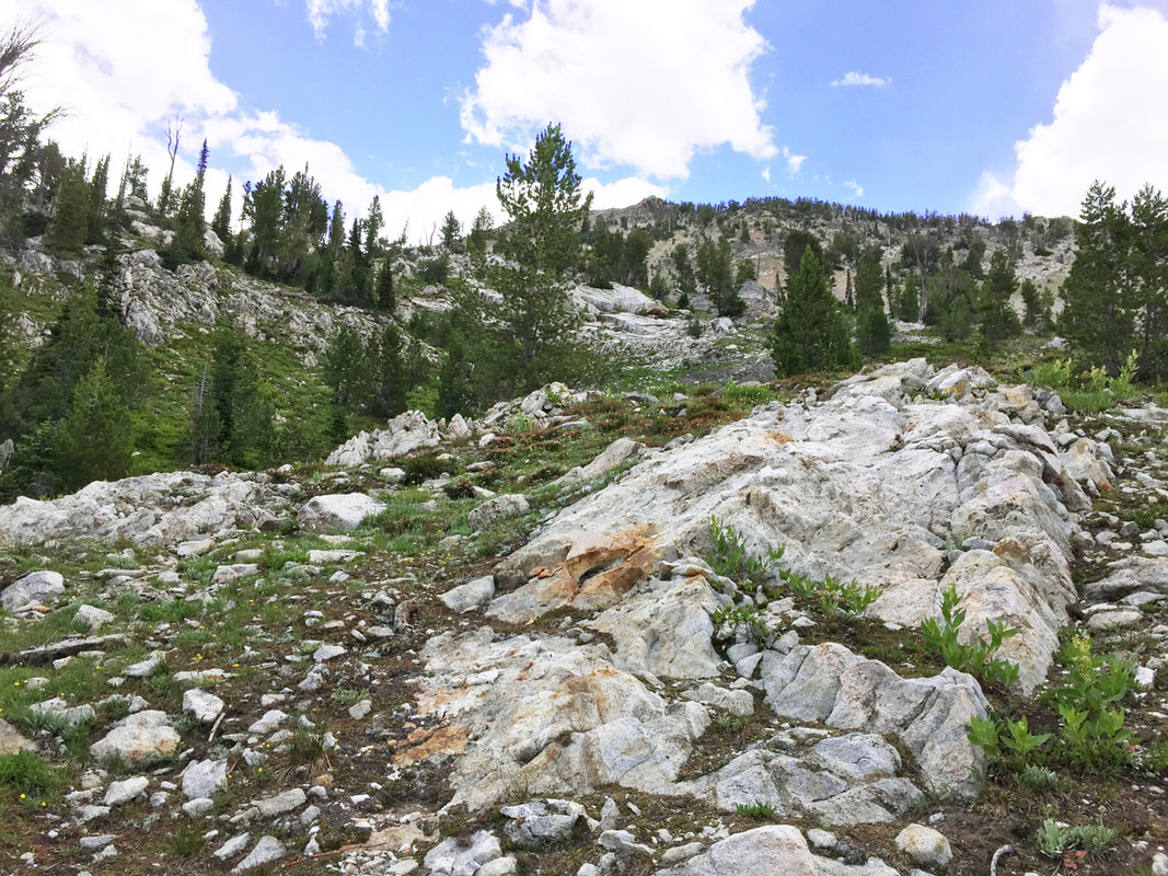 Great way to head up to the summit - from end of lake, head up to saddle on the horizon, then hang a left (north) on the ridge to summit.  Sawtooth Lake's outlet creek  U-shaped valley cut by Pleistocene glacier  Hike from Iron Creek trailhead to Alpine Peak click on above map for larger view Special thanks to Cecilia Lynn Kinter, PhD, Idaho Department of Fish and Game, Boise, Idaho for identifying Cassiope mertensiana.
|
Categories
All

Sue and Fred

About this blogExploration documentaries – "explorumentaries" list trip stats and highlights of each hike or bike ride, often with some interesting history or geology. Years ago, I wrote these for friends and family to let them know what my husband, Fred and I were up to on weekends, and also to showcase the incredible land of the west.
To Subscribe to Explorumentary adventure blog and receive new posts by email:
Happy Summer!

About the Author
|