|
A high point in one of the Basin and Range mountain ranges, Davidson Peak is a fun ridge scramble on ancient sea limestone with great views of eastern Nevada and western Arizona. 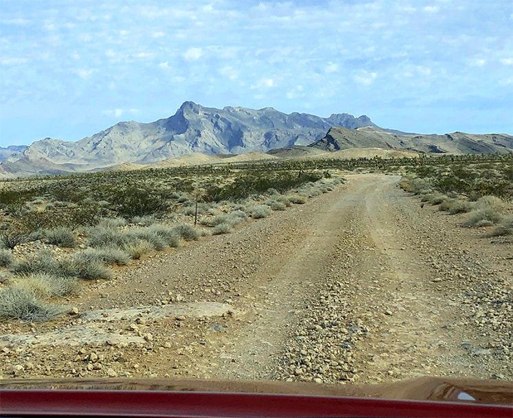 Approaching Davidson Peak from the south on Sheep Pens Road. Trip Stats
Overview: Observe in solitude the raw geologic events and forces that shaped the eastern Great Basin from the tilted limestone sediment summit of Davidson Peak. The fun, rocky scramble up its east ridge has a steep "limestone slickrock" section and circumvents the huge gulch stretching down from the peak. Pass over bryozoan and bright orange brachiopods on slopes with healthy Joshua trees and hedgehog cacti. Location: East Mormon Mountains in Mormon Mountain Wilderness BLM, near Mesquite, Nevada. Distance/Elevation: 5 miles round trip; 2,200' elevation gain. Start = 3,163', summit = 5,315'. Difficulty: Moderate-strenuous Class 2 ridge hike. Coordinates: Trailhead = Sheep Pens Road = 36°53'59.14" N 114°17'51.92" W. Summit = 36°53'45.36" N 114°19'27.51" W. Navigational aids: Bureau of Land Management - Nevada/Overton topo map, Stav is Lost's trip report. Date Hiked: 4/3/22 Geology: East-tilted Cambrian through Pennsylvanian block rooted to its Precambrian basement rocks. Related Posts:
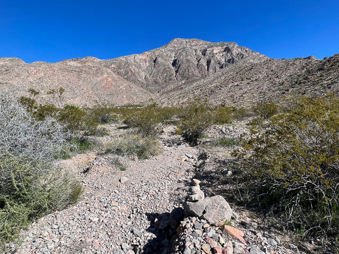
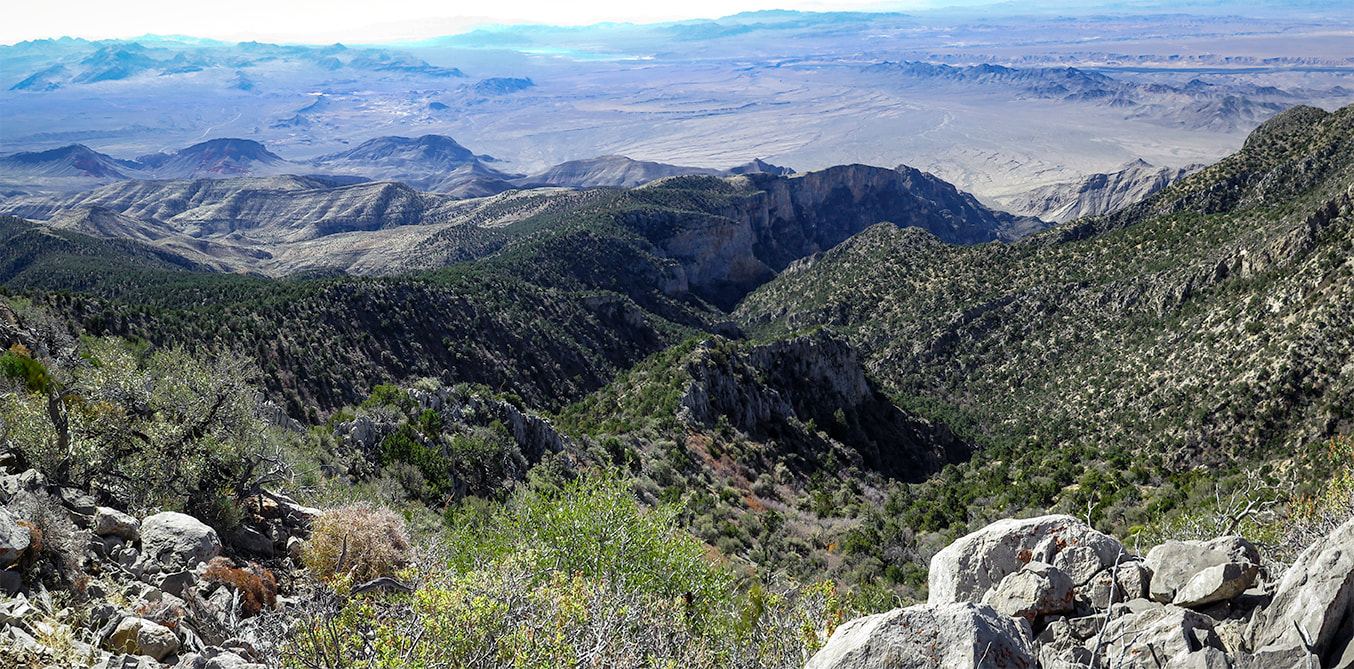
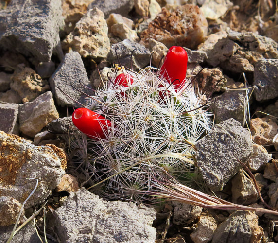
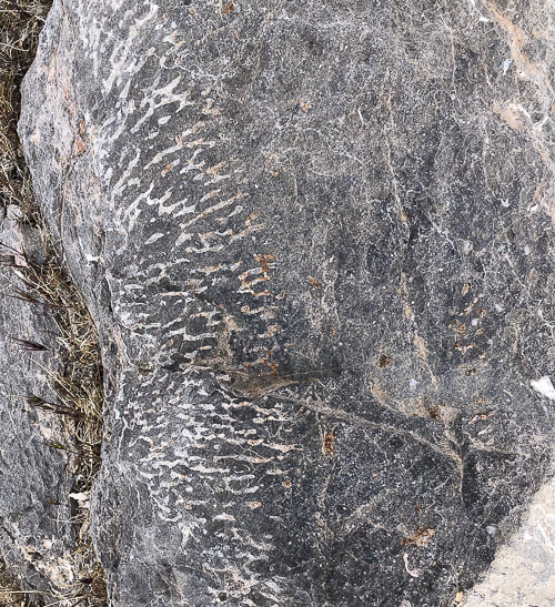
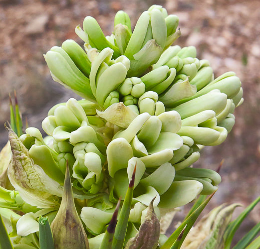
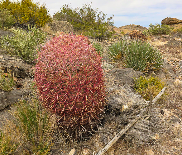
“A million years is a short time - the shortest worth messing with for most problems. You begin tuning your mind to a time scale that is the planet's time scale. For me, it is almost unconscious now and is a kind of companionship with the earth.” - John McPhee, Basin and Range A high point to one of the many parallel Great Basin mountain ranges, the horn-shaped summit of Davidson Peak with its steep west-facing cliffs rises solitary over the expansive Mojave desert as you drive on I-15 heading north from Las Vegas. Formed during the time of shallow seas, when North America was closer to the equator, its rocks are 500 - 300 million years old and contain coral and brachiopod fossils. This hike is a ridge ramble for the entire 2.5 miles to the summit, gaining roughly 1,000 feet per mile, and is surprisingly scenic and full of intriguing sights, like bright orange fossils and a gaping, seemingly bottomless gulch. Our goal this year is to hike to as many high points of the Great Basin mountain ranges as we can, and Davidson is our third. We hiked Wheeler Peak and Virgin Peak last autumn, both in the eastern-most Basin and Range region. From Davidson's summit, we could see another target summit, Mormon Peak, the highest point in the Mormon Mountain Wilderness, northwest of Mesquite, a town on the border of Nevada and Arizona. Nevada is the most mountainous state, so we have a lot of choices! Another planned summit is North Schell Peak, a nearly 12,000-foot high point near Ely, Nevada. Our Hike The hike begins after a 12-mile drive north from I-15 that initially follows the Old Spanish Trail. It is a good gravel road but nevertheless slow-going. We parked on Sheep Pens Road just north of the radio towers. A short spur road takes you to the base of Davidson's east ridge. We walked to the end of this road and started up the ridge on the left side of a wide gulch; a few cairns were present. About 1/3 of the way up, we encountered large rocks, so we skirted the left side of the ridge. After skirting the ridge top, enter a beautiful valley/saddle with great places to take a break and enjoy very healthy Joshua trees, red barrel and prickly pear cacti. Ahead, confront a steep climb to remain on the east ridge. On the way up, we circumvented the actual ridge top to the right, looking down into the deep and wide gulch coming from the peak. Davidson Peak is an easy scramble straight ahead. However, it is not too difficult to stay on top of the ridge, requiring some use of hands for hoisting and balance, but mostly a Class 2. The ridge to the summit is long and flat. Summit Views Mormon Peak is seen to the northwest, and the solitary hulk of Moapa Peak to the southwest. The west side drops almost straight down . We could see Virgin Peak to the southeast, an 8,000' summit we hiked last autumn, out of the Gold Butte National Monument. On the way down, we stayed on top of the ridge all the way to the saddle, hiking over a fun, steep, smooth and relatively rockless limestone slab which elevated us high above steep drops on both sides. We stayed for the most part on the ridge the rest of the way down and then descended through a shallow canyon to arrive at the spur road lined with yellow poppies. The ancient Basin and Range mountain ranges rise above a stark and dusty desert; it appears as if there is not much there to discover. But when you get into the "heart" of them, walk over their scratchy limestone and volcanic rocks, circumvent sharp yucca leaves and cactus spines, catch the sudden crimson blooms of a claret cup hedgehog, and feel the desert space you know you are in a special, unique and maybe even spiritual place. Keep On Exploring! From Davidson Peak summit; looking at the ridge we ascended and Moapa Peak in the distance. 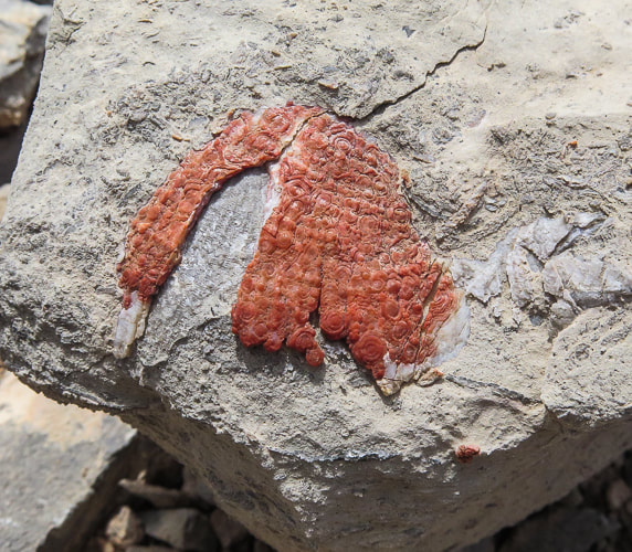 I'm not sure what this is - appears to be a fossil that has been exposed to a lot of iron - maybe a brachiopod? If anyone knows what this may be, please let me know! 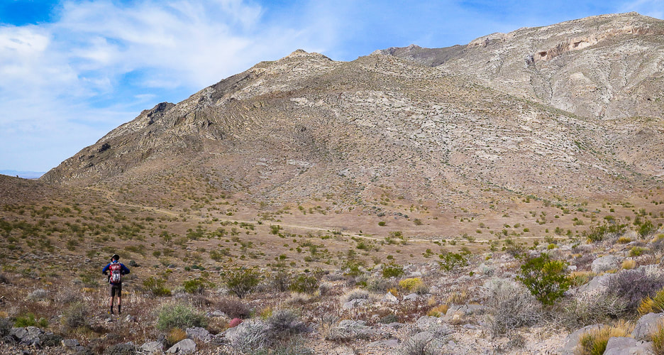 Start of hike; we parked on Sheep Pens Road before it ascended to communication towers and walked cross-country to a spur road from Sheep Pens that led to the base of Davidson's east ridge (right on photo). Davidson Peak is highest point on the right. 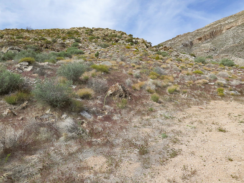 At end of spur road, we hiked up this east ridge with the large gulch to the right. Stay on ridge to the top. 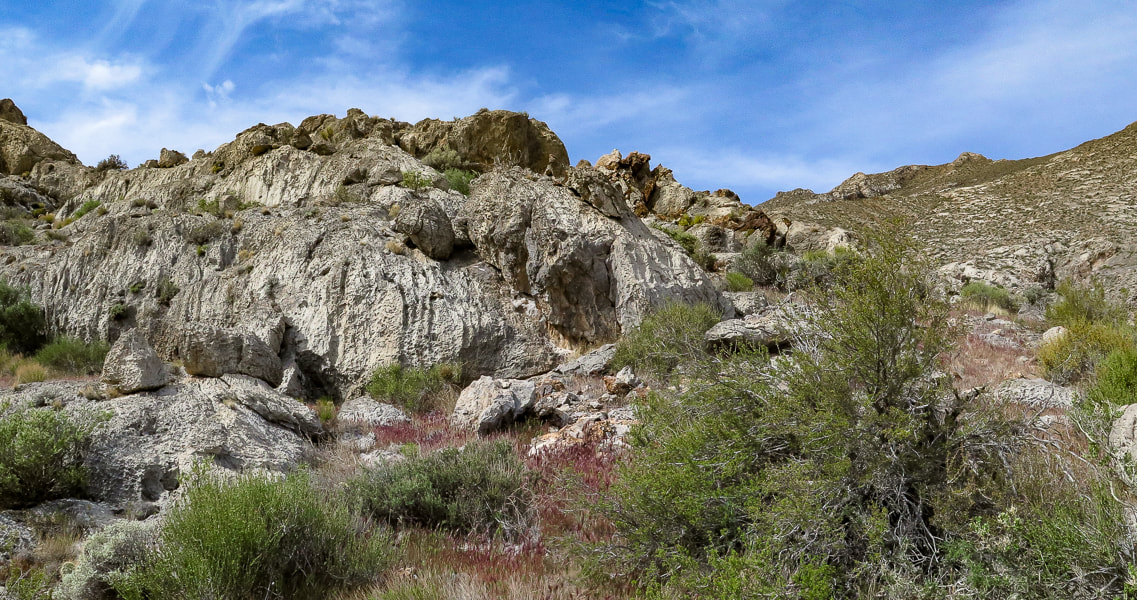 On the ridge 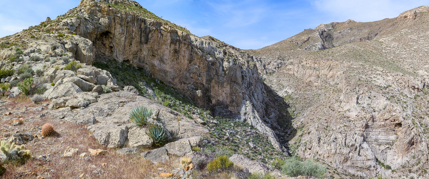 On the ridge, gulch below - summit far right 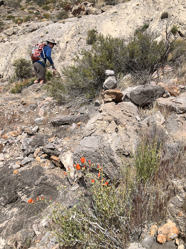 Skirting top of ridge cliffs by hiking on the left side of it ~ 1/3 of the way up. 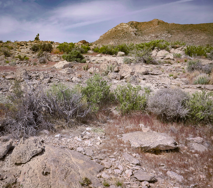 After skirting to the left side of cliffs, regain the ridge to arrive at beautiful saddle. 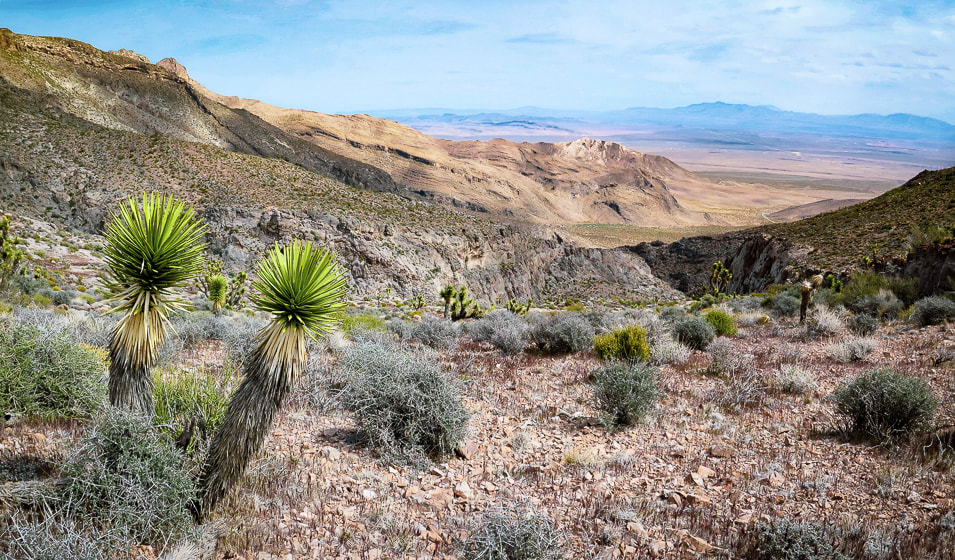 On saddle looking back at ridge on the right and large gully - approach road faintly seen on desert floor. 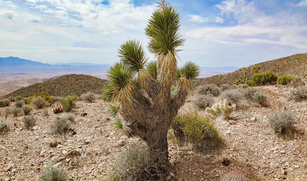 Taking a break on the saddle; Joshua tree, hedgehog cactus, and prickly pear. Some cool stuff on the trail: Fishhook cactus, Indian Paintbrush on the summit, two photos of fossils (corals?), Joshua tree bloom, red barrel cactus. 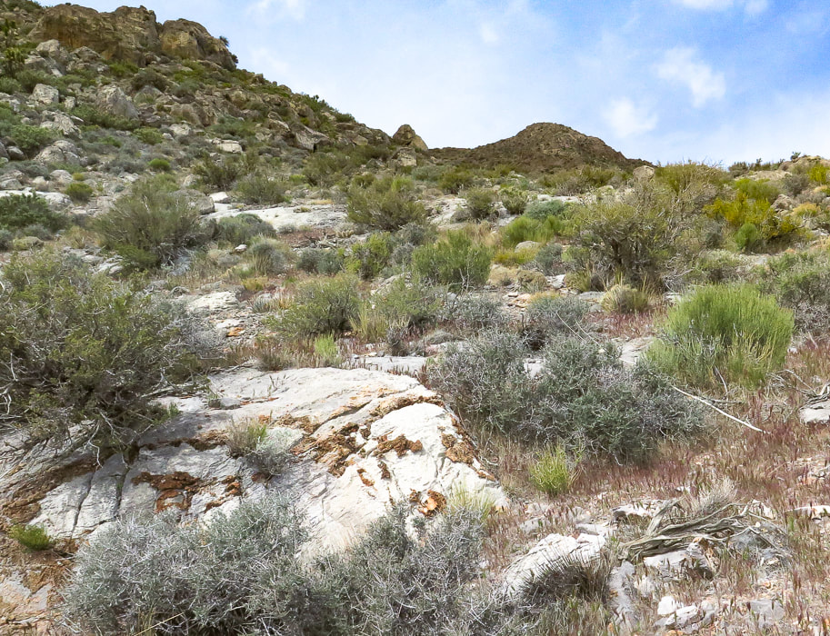 The climb from the saddle up to the summit - about one mile to go! Note limestone with brown chert (microcrystalline quartz) nodules. 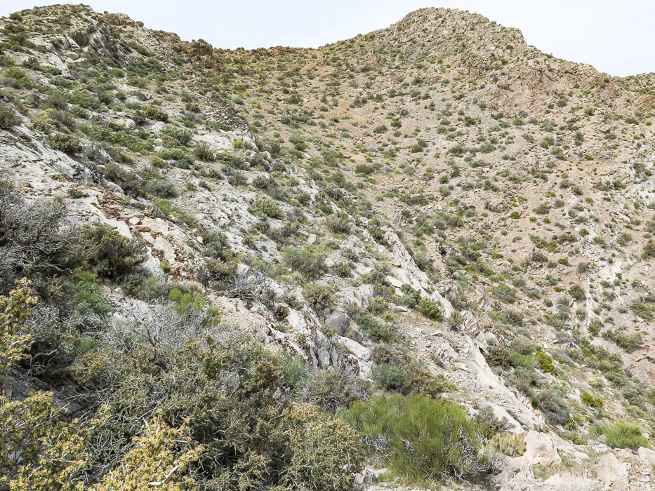 A good look at the summit - easy enough to stay on ridge. 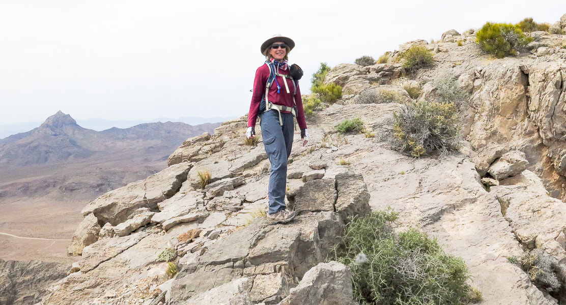 Sue on fun "slickrock" section on ridge - Moapa Peak in background. 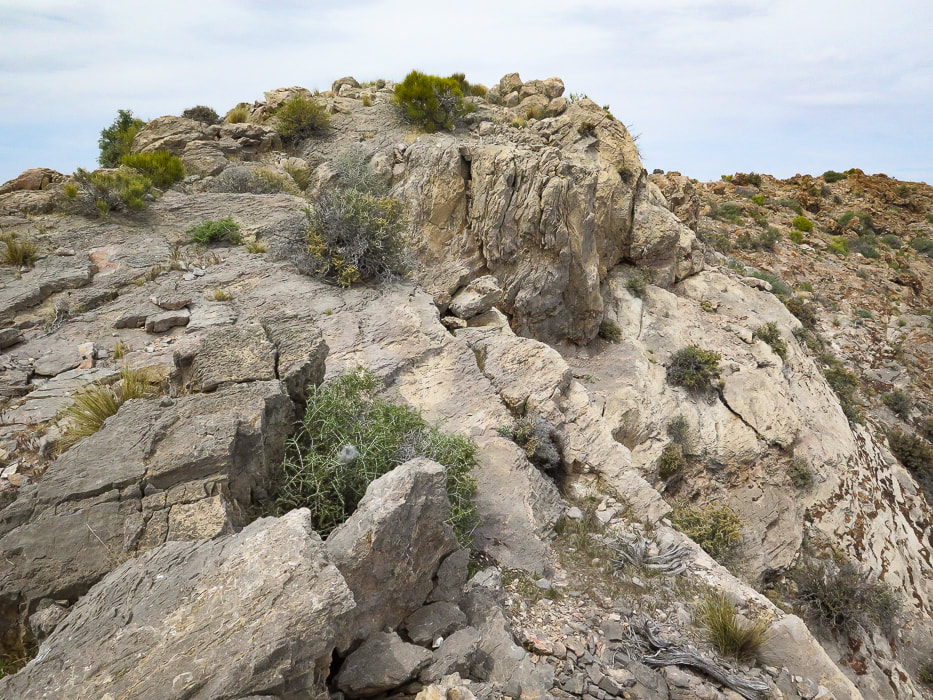 Fun walking on ridge line 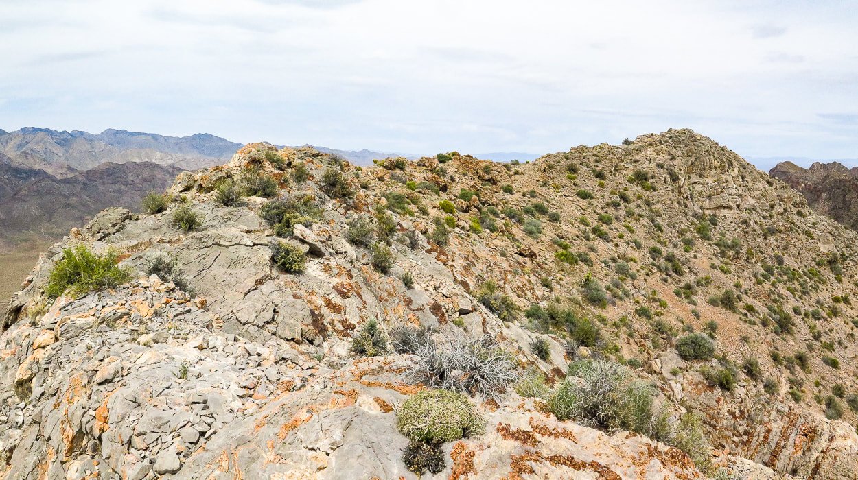 Summit ridge - summit at right 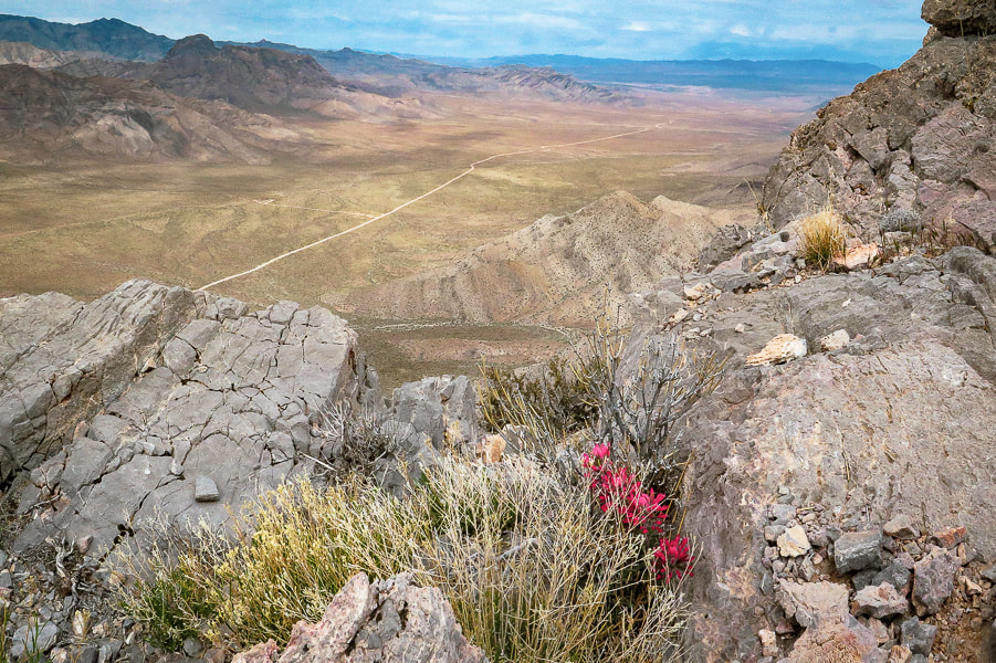 Indian paintbrush on summit. looking northwest to the Mormon Mountains. 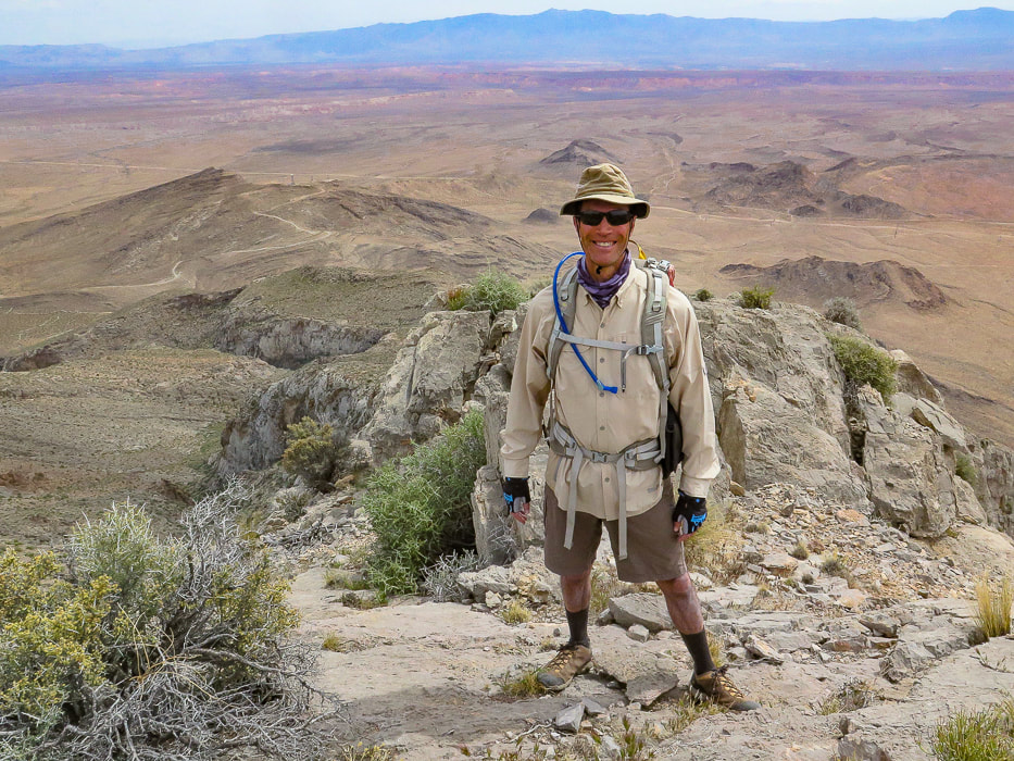 Fred on Davidson Peak summit - what better way to spend Sunday afternoon than summit a Basin and Range peak? 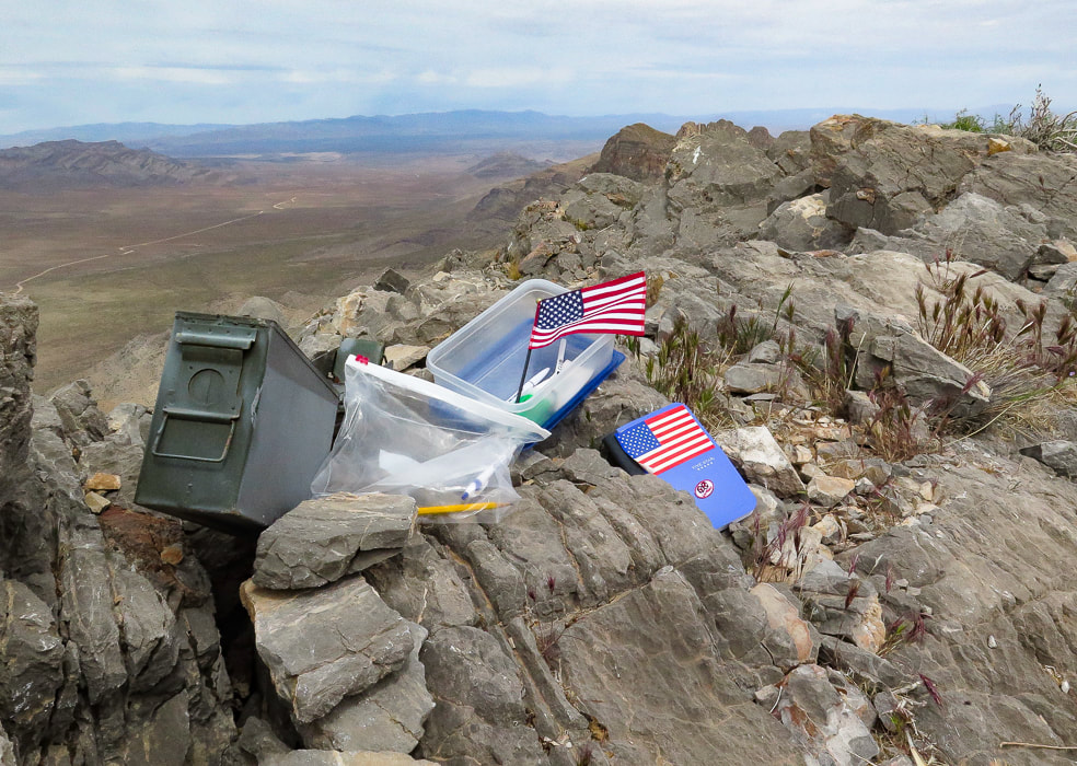 A very patriotic and organized peak register. 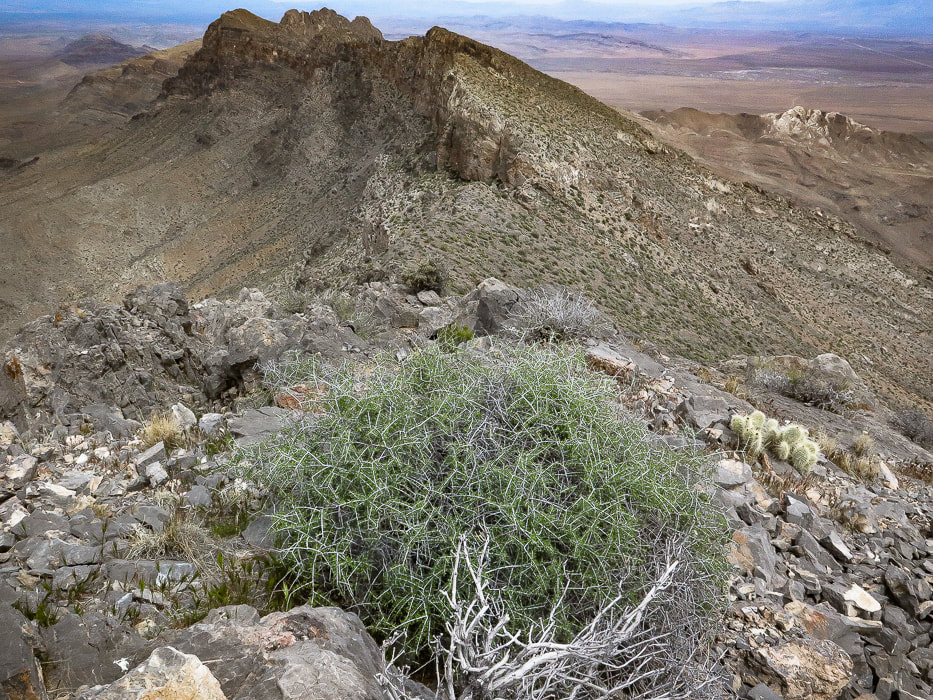 On summit looking north at the East Mormon Mountains ridge. 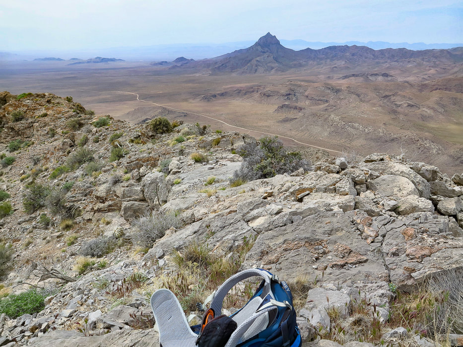 On summit looking at Moapa Peak to the southwest, south of Mormon Mountains. (looks like a fun peak to climb). 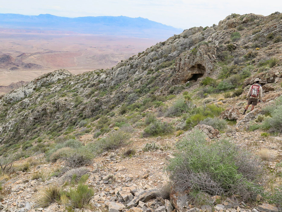 Descending from the summit to follow the ridge back down. 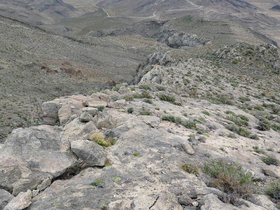 Limestone "slickrock" section! 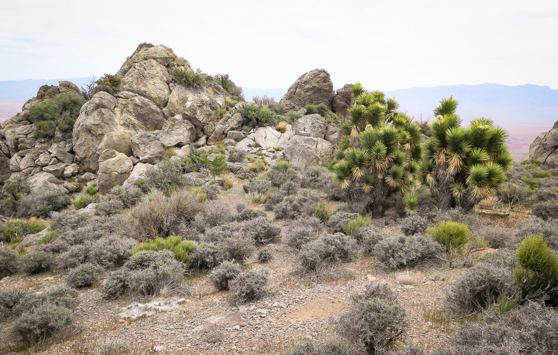 Back to the Joshua trees in the saddle or flat part of the ridge. We went around to the right.  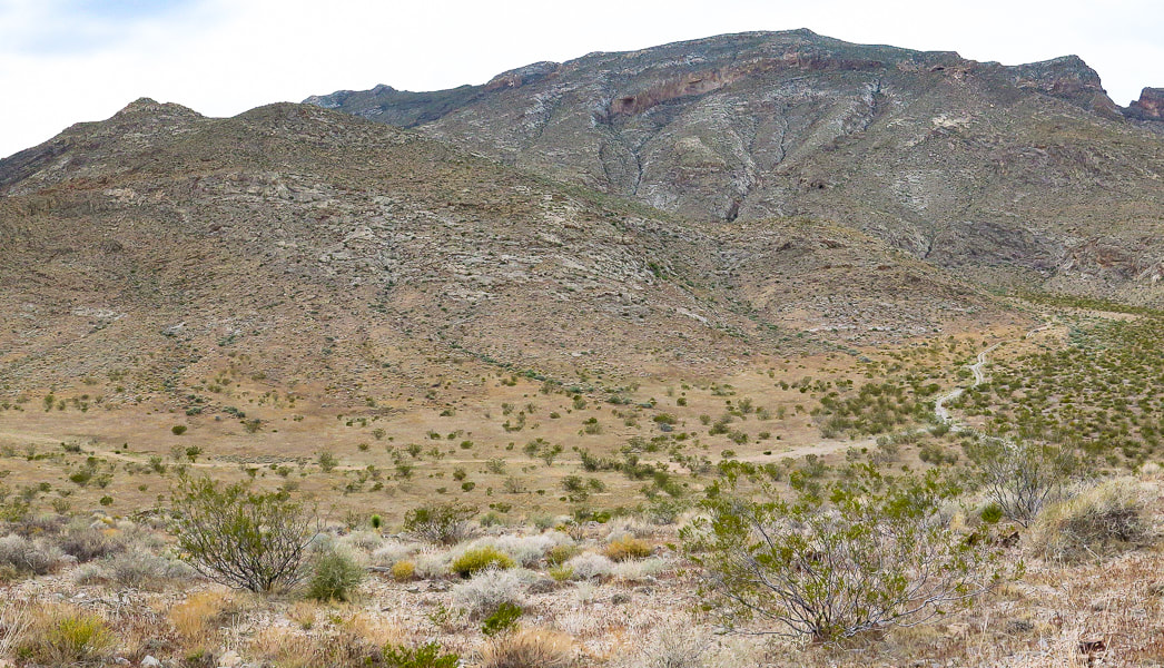 Looking back - we came down the small gulley just off the ridge instead of following ridge to toe. 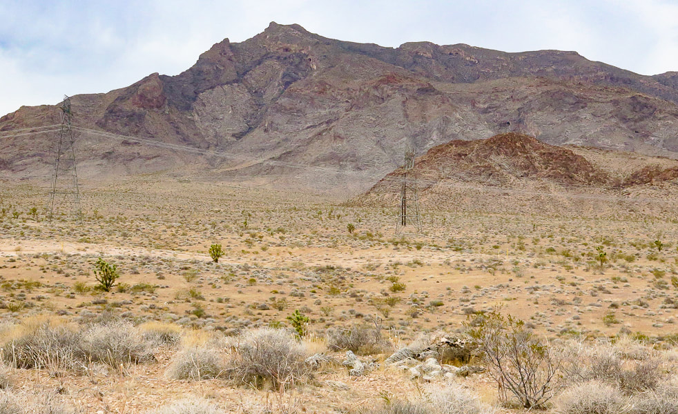 Parting shot of Davidson Peak. 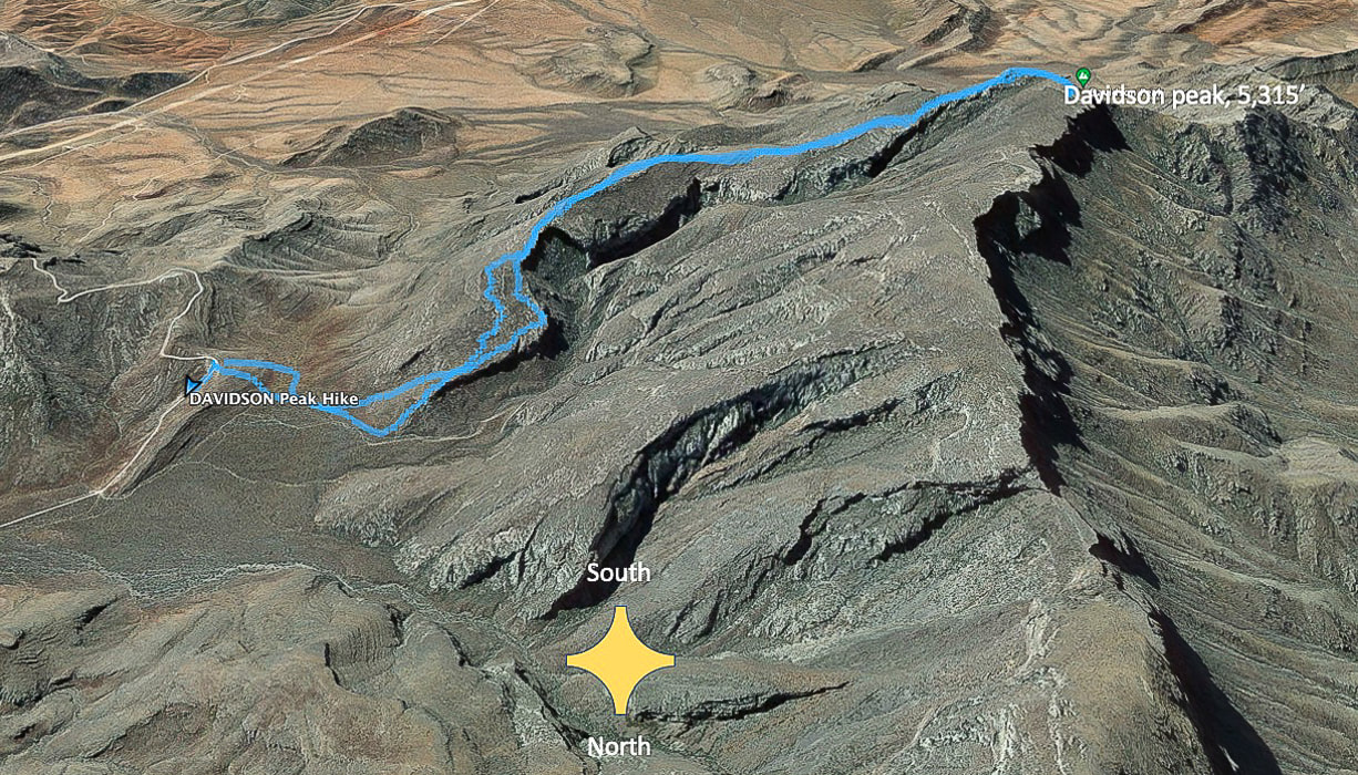 Our tracks - South direction at top of map. The road we started at is Sheep Pens Road; there is a spur road off of Sheep Pen that a good 4-WD vehicle could drive to the base of Davidson's east ridge. 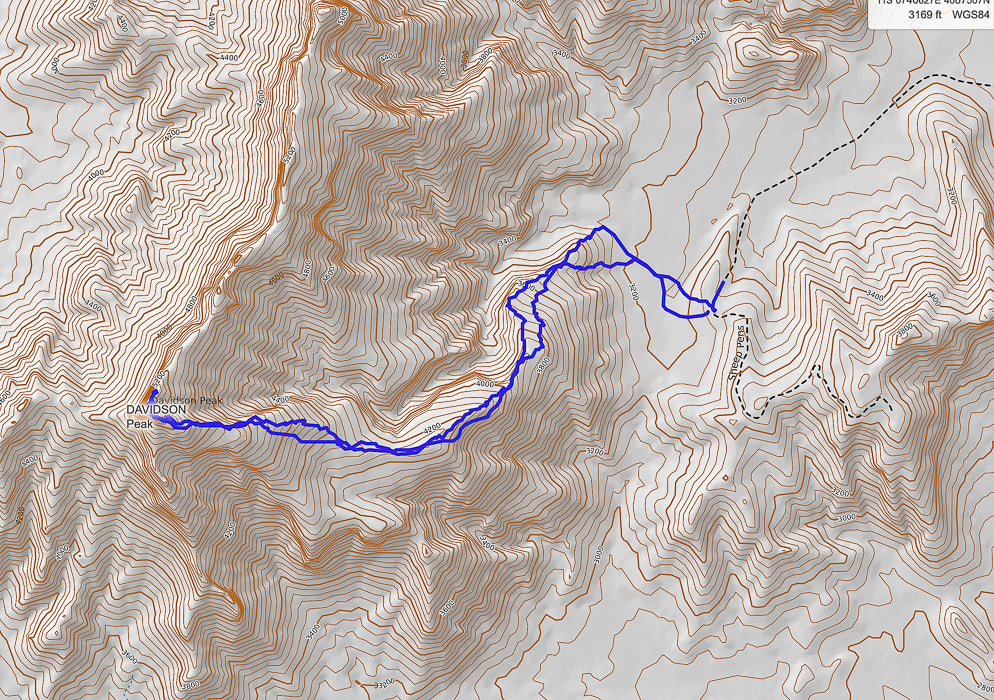 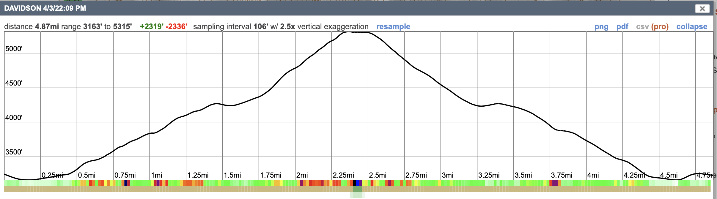 GPS tracks and profile. References
Axen, G.J. , Wernicke, B.P., Skelly, M.F., Taylor, W.J. 1990. Mesozoic and Cenozoic tectonics of the Sevier thrust belt in the Virgin River Valley area, southern Nevada. Geological Society of America - Memoir 176. In the book, Basin and Range Extensional Tectonics near the latitude of Las Vegas, Nevada. Simplified geologic map of the Mormon Mountains - Tule Springs Hills - Beaver Dam Mountains transect. Uploaded by Gary Axen. www.ResearchGate.net.
2 Comments
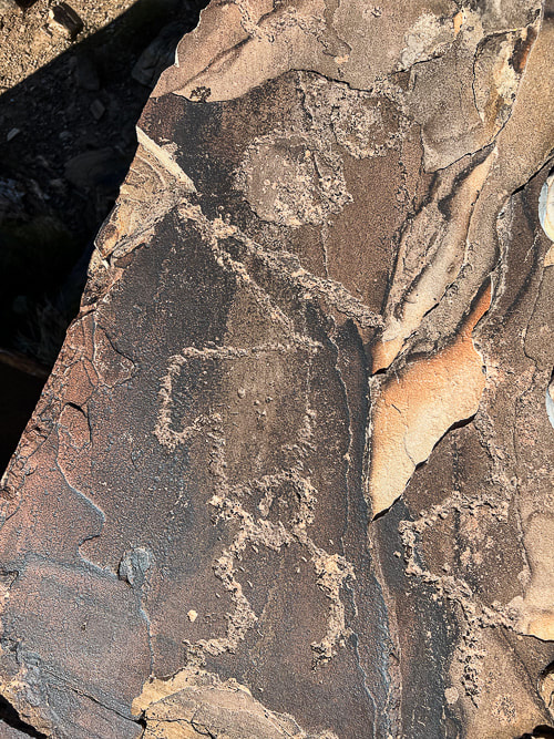
We found the hidden and amazing "rattlesnake" petroglyph in the Santa Clara River Reserve which led to discoveries of a mix of representational and abstract-geometric designs in the St. George, Utah area. Utah is the Rock Art State. On March 6, 2017, Utah's governor signed into law designating Native American rock art as Utah's official works of art.
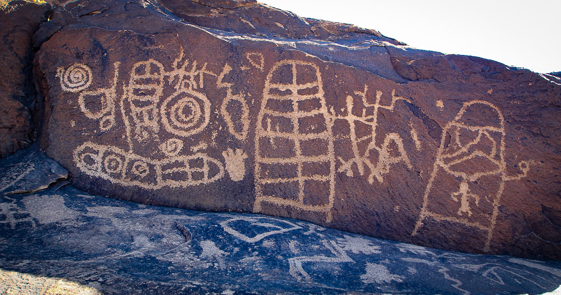
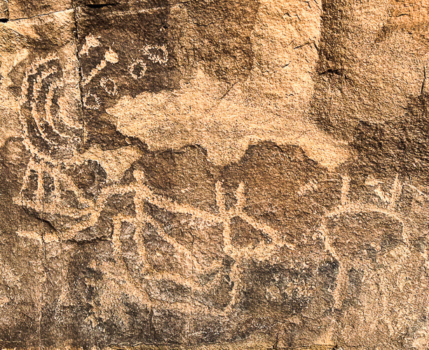
Panel of petroglyphs high above the Santa Clara River on the Anasazi Trail in Ivins, Utah. This area was used by both Ancestral Puebloans and Southern Paiutes.
Related posts:
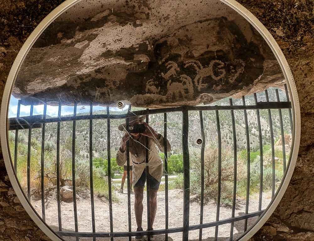
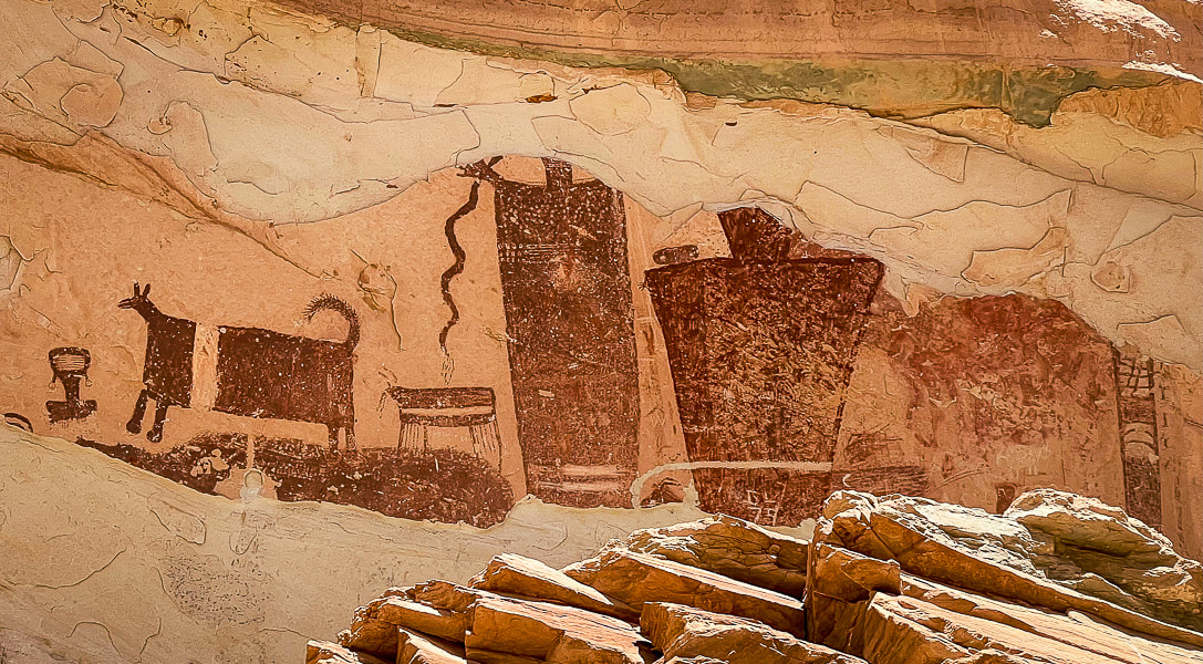
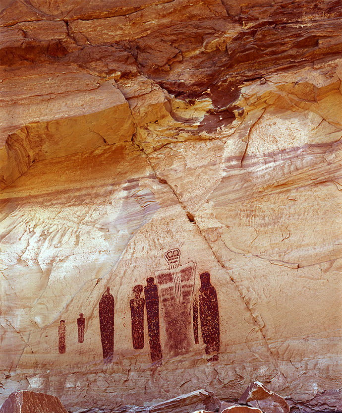
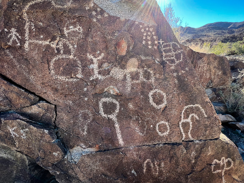
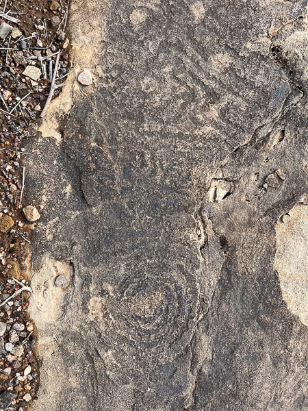
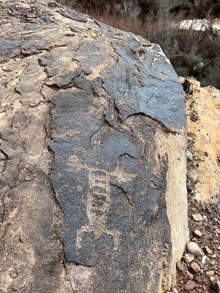
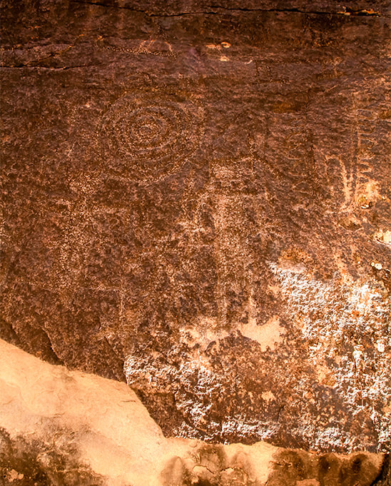
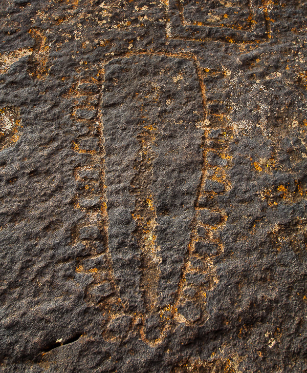
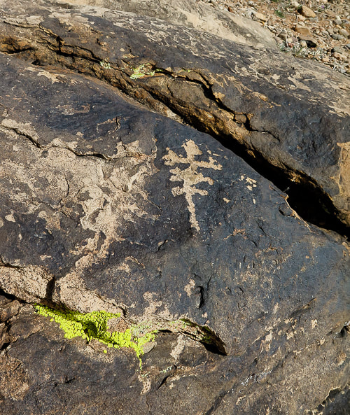
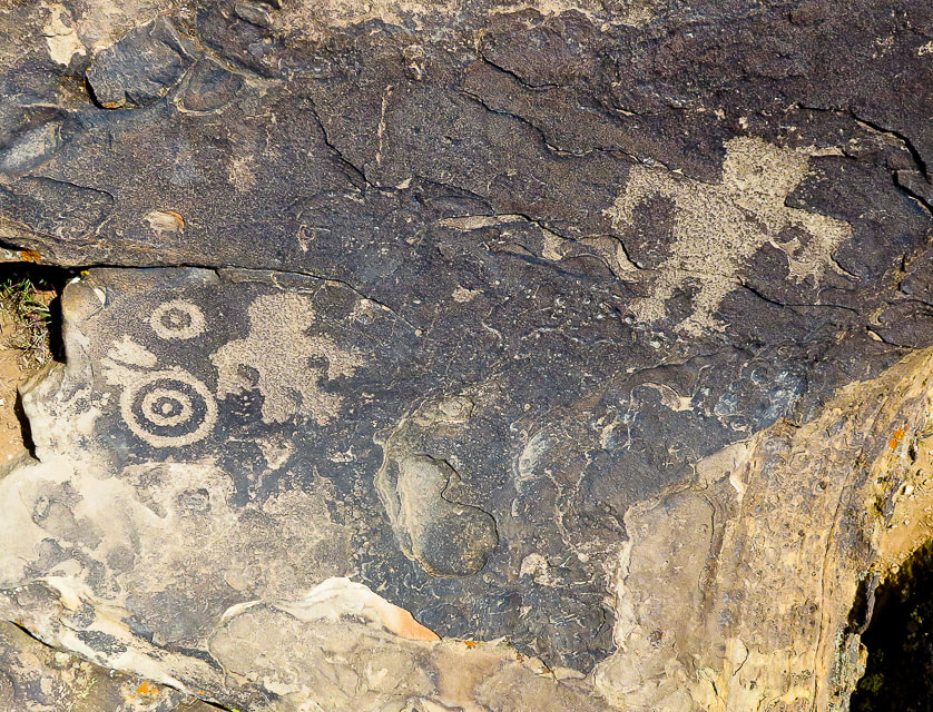
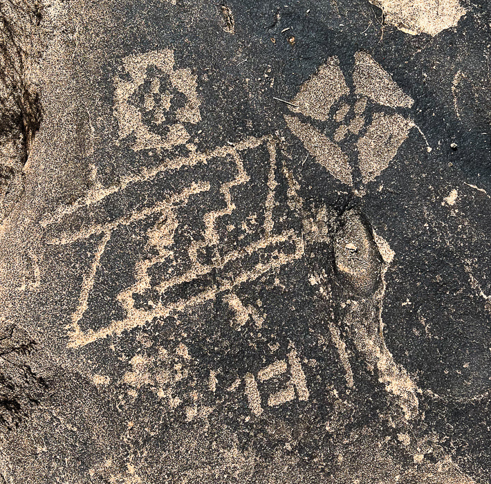
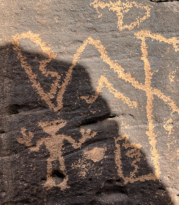
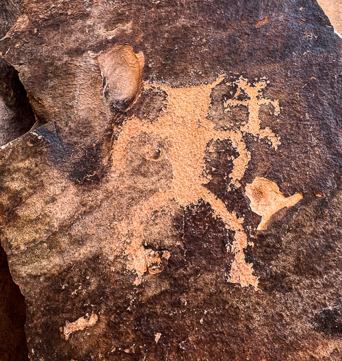
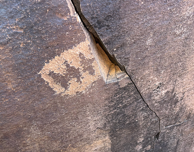
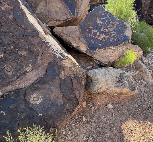
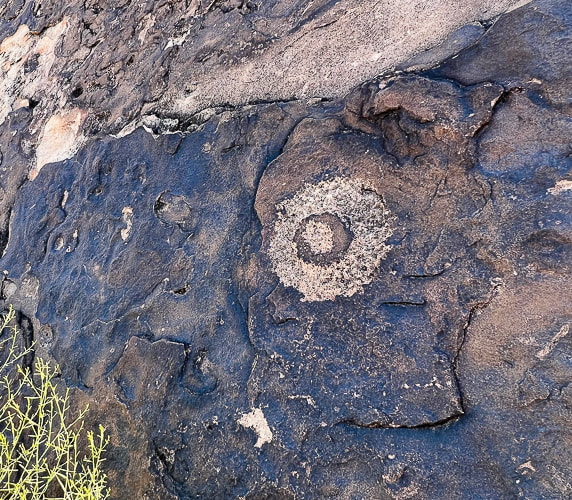
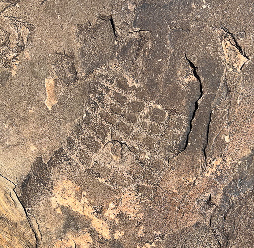
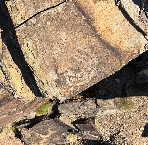
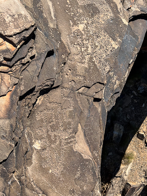
What do they "mean"? Thirty years ago, I liked to hike to a single large boulder with a petroglyph of a rattlesnake curved around a recumbent human reaching for a cross in the Indian Canyons of Palm Springs, California (see below). It's made of connected squares, a concentric circle, and a line-enclosed cross. At least that was my interpretation of this petroglyph in the Agua Caliente Band of Cahuilla Indians Reservation. But after reading more about petroglyphs, I've discovered that it might not represent a rattlesnake at all, but a series of connected abstract shapes such as chained squares. Many archaeologists have concluded that questions of "what does this mean?" cannot be answered, especially regarding abstract geometric rock carvings. Instead of attempting to decipher meanings and assign symbols, scientists try to identify similarities in rock art and its occurrence in certain southwestern regions. In some cases, however, a definitive symbol or meaning can be attributed to certain petroglyph images, like zigzags that portray lightning to the present-day Hopi Indians. The spiral petroglyph is consistently interpreted as multiple migrations. In his book, Other Truths not Guessed: The Story of the Sevier Fremont Indian, Kenneth Olsen Kohler says, "The study to interpret the meaning of this pecking or painting may never be found as it lies hidden in the heart of those who understood what they wanted to communicate upon the rock." ** Since writing this post, a reader, who is passionate about petroglyph sites, contacted me with a book recommendation that I found helpful: A Field Guide to Rock Art Symbols of the Greater Southwest by Alex Patterson. It is a comprehensive guide to identifying petroglyph symbolism for human-like, animal-like and abstract forms. It illustrates and explains a large array of petroglyphs. Thanks for the suggestion! 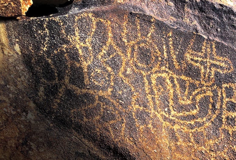 Petroglyph in Indian Canyons, Agua Caliente Indian Reservation, Palm Springs, California. Photograph by Anthony W. Purnel, featured in Palm Springs Life Magazine (see reference below). 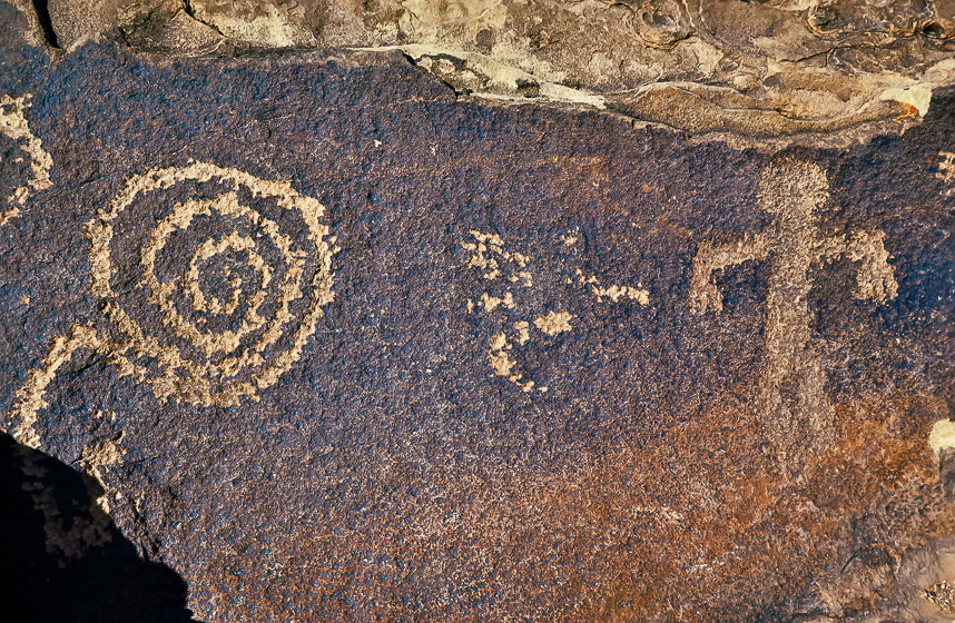 A spiral petroglyph on Anasazi Valley Trail, Ivins, Utah The Search for the Rattlesnake A few months ago, Fred and I met a Bureau of Land Management guy patrolling 4-wheel drive roads near St. George, Utah. He gave us a "tip" about a "rattlesnake" petroglyph on a giant boulder overlooking the Santa Clara River. A short bike ride took us to what might be the boulder we were searching for, but there were no petroglyphs on the side facing the river. It had tumbled down from the vertical cliffs above. We grounded our bikes and made a short steep hike to its backside facing the cliff and there it was - a serpentine form weaving around different abstract images, most of them ovals of connected circles, reminding me of necklaces. The whole rock, petroglyphs included are covered with lichen. The bottom markings are mostly obscured by desert varnish, a thin dark coating made of clay minerals and manganese and iron oxides - more so than the top petroglyphs. We were amazed that most of this boulder was covered with various carved shapes, including animals, perhaps desert bighorn sheep, which are among the most prevalent animal petroglyphs in the southwest. The lower petroglyphs could have been made before the upper petroglyphs, because they were covered with desert varnish. 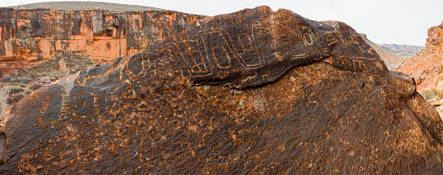 Huge boulder with lots of abstract-geometric petroglyphs in the Santa Clara River Reserve near St. George, Utah. The lower petroglyphs are covered more with rock varnish than the top markings. 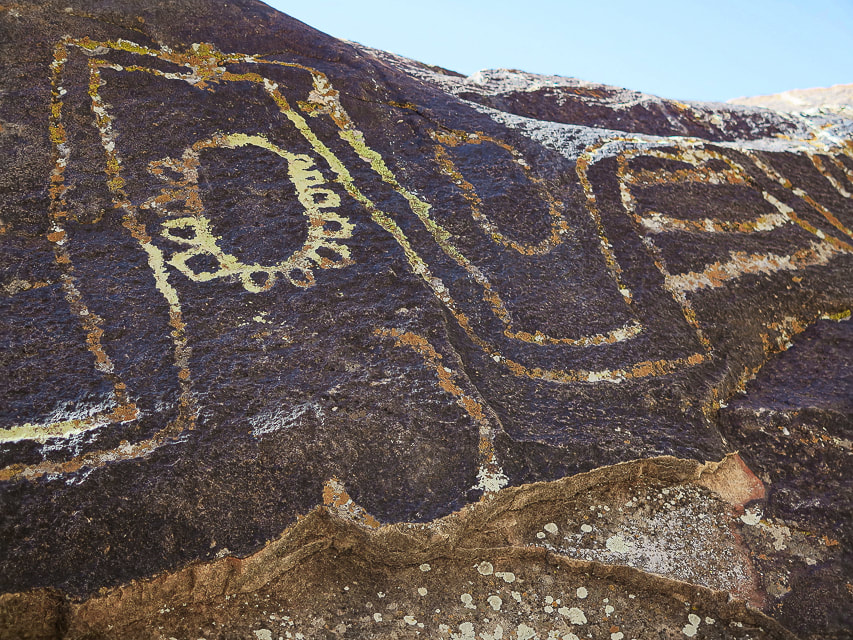 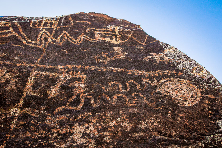 Both images above are close-ups of "rattlesnake" boulder in Santa Clara River Reserve. Most of the petroglyphs shown here are located in the Santa Clara River Reserve, administered by the Bureau of Land Management near St. George, Utah. The Anasazi Valley Trail (Tempi'po'op) leads to petroglyphs on tops and sides of sandstone boulders. Many were made about 1,000 years ago by ancestral Puebloans who were farmers in permanent settlements. It must have been an inspiring site for these ancient people because it overlooks the Santa Clara River far below, steadily eroding a route over the millennia, a huge valley of tilted layered rock mesas and drainages, and the Beaver Dam Mountains, snow-covered in winter. Since moving to the St. George area, petroglyph-finding missions have yielded not only fascinating ancient rock art, but also countless places to explore and a growing appreciation of southern Utah as one of the most beautiful places on Earth. 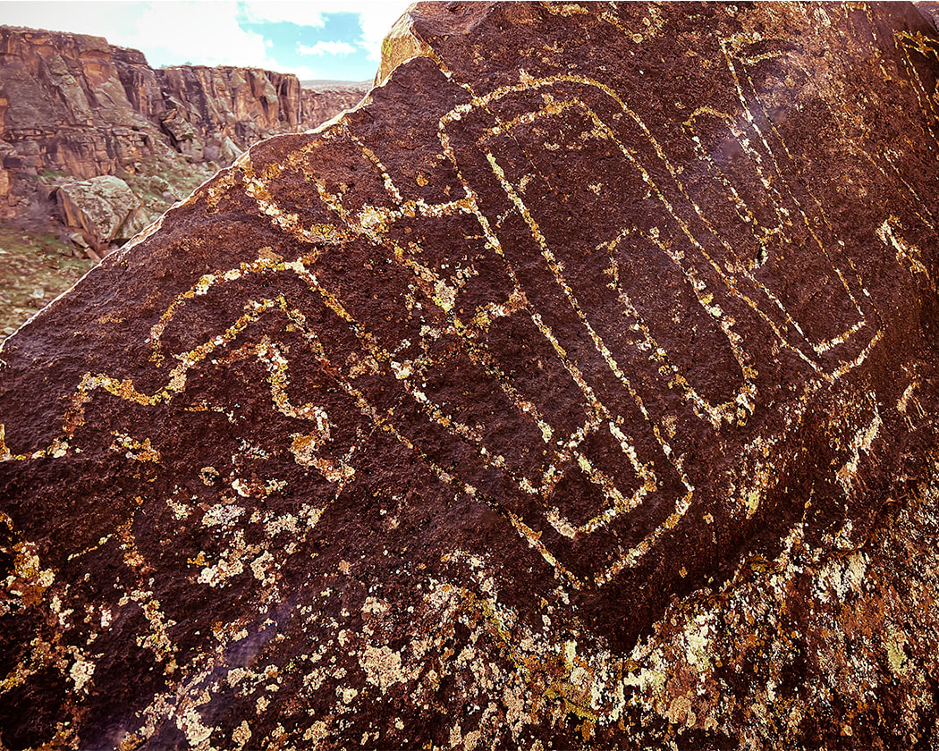 Looks like the head of a snake? 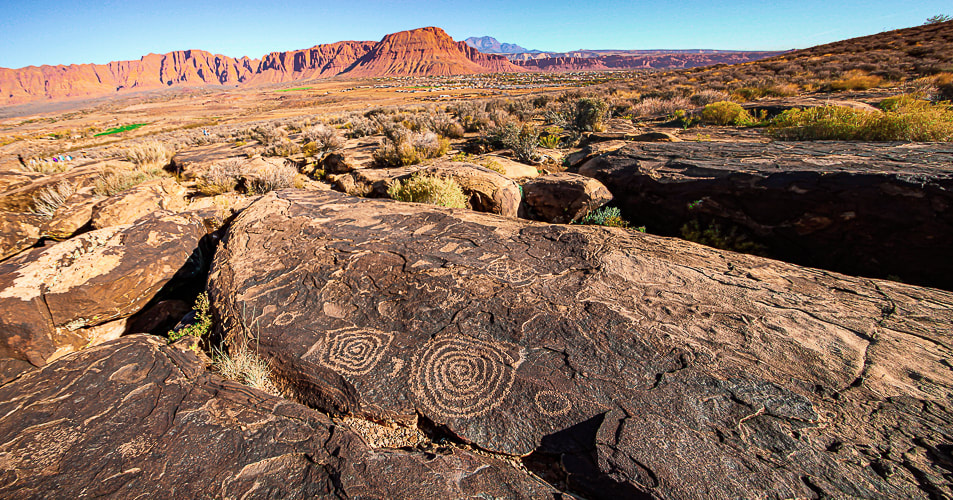 The Tempi'po'op (means "rock writing" in Southern Paiute language) trail near Ivins, Utah. Red Mountain and Snow Canyon State Park in the distance. The "Geometric Enigma" Some of the oldest petroglyphs in the New World are 13,000 - 14,000 years old - coinciding with the final stages of the last ice age (Pleistocene epoch). An excellent book, Early Rock Art of the American West: The Geometric Enigma thoroughly discusses abstract-geometric petroglyphs, the oldest form of rock art. In the American West, the authors call this art the "Western Archaic Tradition." It preceded figurative art such as human and animal forms. The authors, who have written other books on prehistoric art, propose theories as to why early American West inhabitants created art, and discuss ancestral minds and symbolism and hypotheses regarding the "peopling" of the Americas. This book proposes a number of hypotheses explaining why prehistoric humans made abstract markings. The Sexual Duality Hypothesis identified a sexual polarity symbolism which included male signs of dots, barbed elements, short strokes, and spear-thrower signs. Female geometric designs included oval, triangular and quadrangular shapes. The Shamanistic hypothesis indicates that shamans acted as a connection to the spiritual world through altered states of consciousness. The initial stage of the shamanistic trance identifies geometric mental images such as grids, sets of parallel lines, dots and flecks, and zigzags. After emerging from the third stage of shamanistic trance, a participant would pay tribute to their visionary experiences by engraving them on rock surfaces. Yet a third hypothesis is the Neurovisual Resonance Theory, whose premise is that geometric shapes and patterns are appealing to humans, and they were built into the neural structuring part of our brain millions of years ago. Making these petroglyphs helped humans to feel emotionally rewarded and reinforce survival behavior. The brain's visual cortex "resonates" when geometric shapes and patterns are made and a feedback loop is created that provides the stimulus for making abstract marks. We may never know exactly why these abstract-geometric designs were made and what specific purposes they had, but we may conclude that they are evidence of the artist's desire to to find meaning by presenting it in a tangible form - a petroglyph. Viewing petroglyphs in an inspirational setting causes one to suspend time for a few minutes and imagine how it was made hundreds and thousands of years ago. I added some images of petroglyphs from my post Utah's Red Rock Country from other adventures in southeast Utah. For the Geocurious - The Rock Varnish Enigma Many petroglyphs are created by carving, pecking, and hammering through a very thin (measured in nanometers), dark coating of desert varnish to reveal the lighter-colored rock underneath. This coating is enriched with iron and manganese oxides that cement clay minerals to the rock and is abundant in arid regions. Some scientists say that it is a sedimentary layer that contains bacterial microorganisms, so it has a microbial origin. How exactly desert varnish is formed is still under debate. Studies use microscale imaging techniques to try and figure out its ingredients. Do microorganisms create varnish or do they use varnish as a habitat? Varnish contains 2 to 3 times more manganese than the underlying rock indicating manganese enrichment. Varnish grows slowly - tens of microns over a thousand years. Lately scientists have considered rock varnish to be of environmental significance because it could show change in paleoclimate through the varying thickness of its manganese layers. 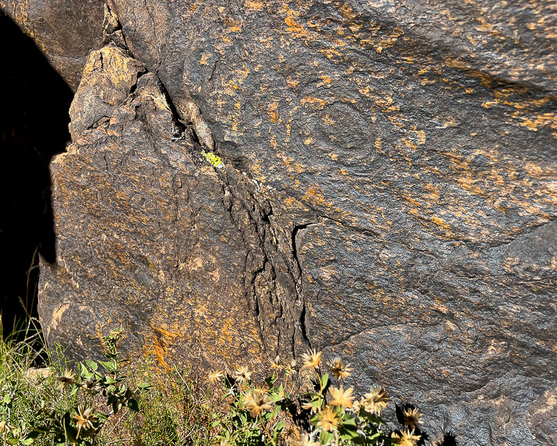 Fully re-patinated spiral on Tempi'po'op Trail. The rock also exhibits slickensides: smooth polished rock surface as a result of frictional movement of rocks along a fault. The direction of the lines runs from top left to bottom right. 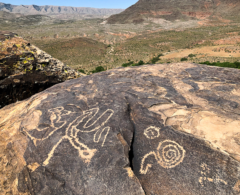  The Holy Ghost panel in the Great Gallery, Horseshoe Canyon, Utah The tallest painted figure is called the Holy Ghost and is ~ 8 feet in height. These figures are thought to represent spirits. Utah's Red Rock Country 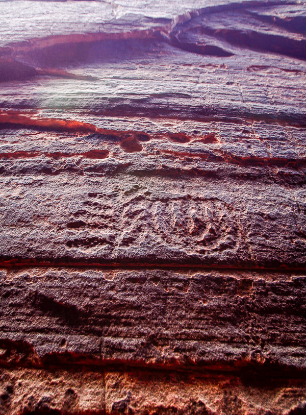 Slot canyon in Snow Canyon State Park 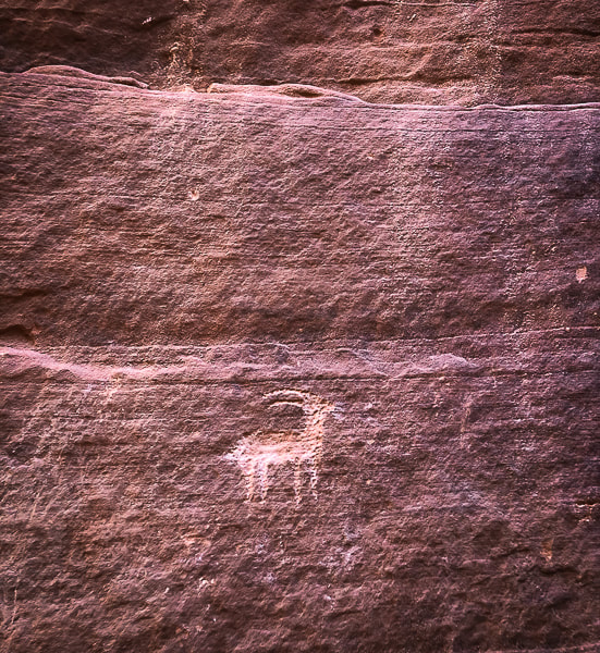 Wire Pass near Buckskin Gulch in Paria Canyon-Vermillion Cliffs Wilderness Area. 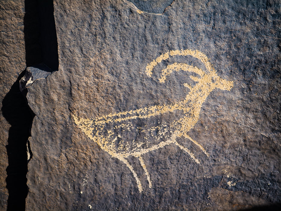
Recently added to this post: Every time I go to the Santa Clara River Reserve, I find more petroglyphs! 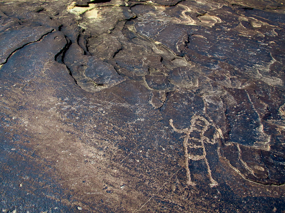 Ancestral Puebloan-style petroglyph on the Anasazi Valley Trail, overlooking the Santa Clara River. Petroglyphs from Tempi'po'op Trail The top two images are from the "rattlesnake" petroglyph in Santa Clara River Reserve. They are positioned on the bottom of the boulder where the carvings appear to have more desert varnish than the upper petroglyphs. 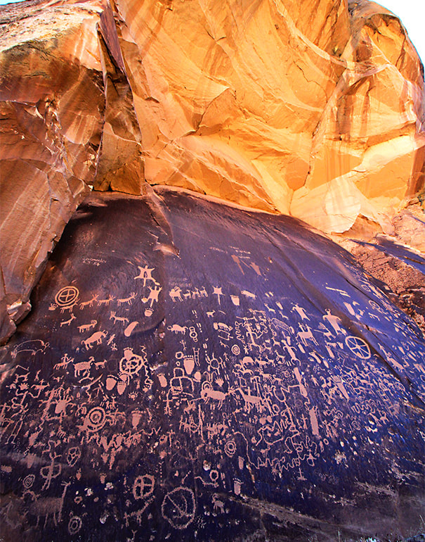 Newspaper Rock Newspaper Rock State Historic Monument, Utah. 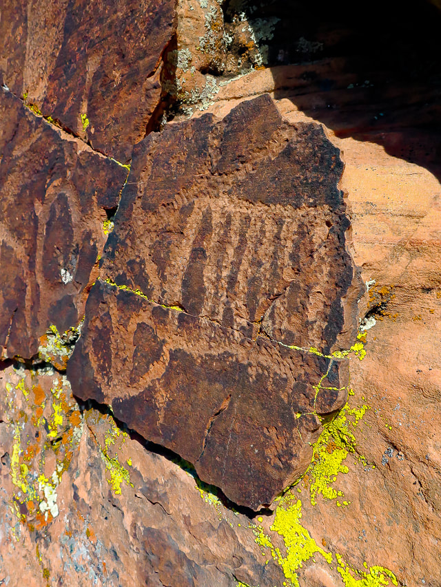 Geometric petroglyphs near Snow Canyon State Park, Utah. 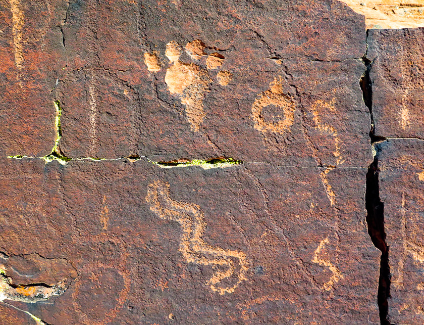 Near Snow Canyon State Park. Note the petroglyph on the left is covered with varnish more so than the petroglyphs to the right. 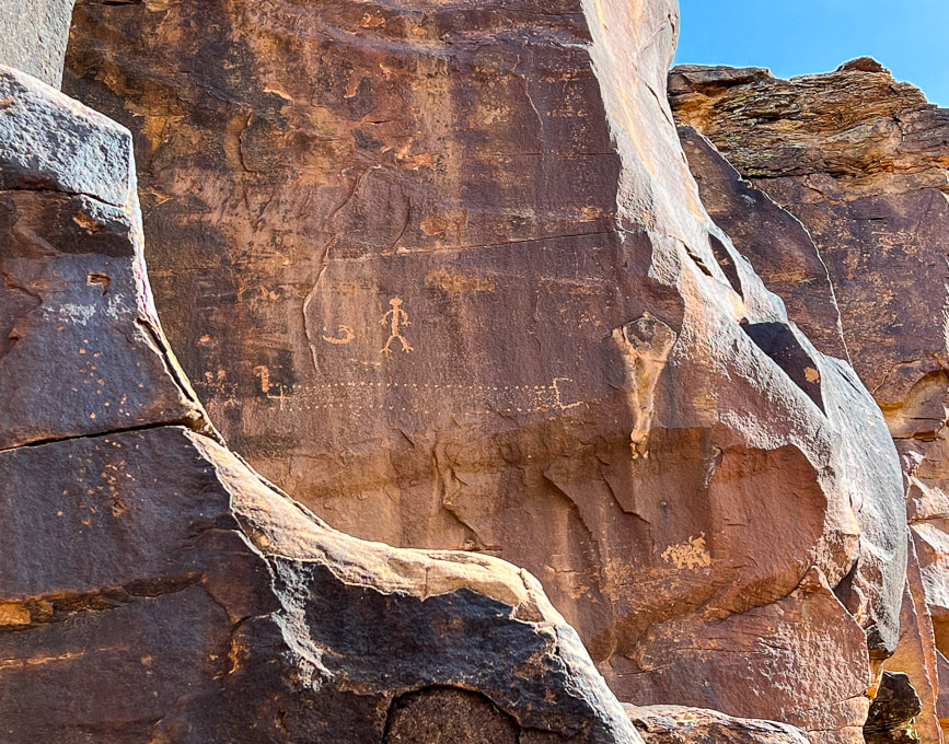 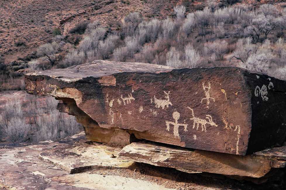 Ancestral Puebloan panel on the Tempi'po'op Trail. 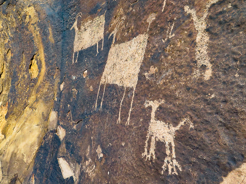 Anasazi Valley Trail 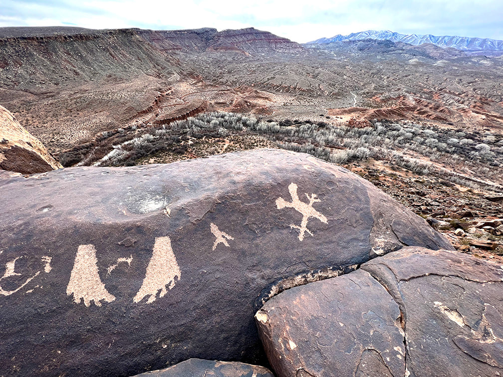 Looking toward the west from the Anasazi Valley Trail over Santa Clara River and Beaver Dam Mountains on the horizon. 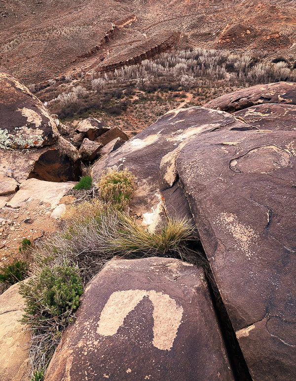 These may be an example of the "fat footprints" representative of the Western Virgin Kayenta Style that appear in Puebloan sites in the St. George, Utah area. Overlooking the Santa Clara River. 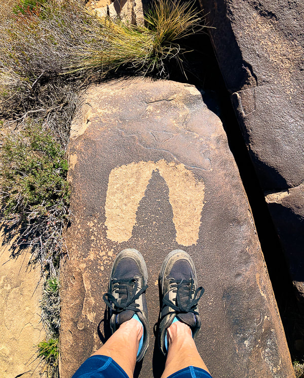 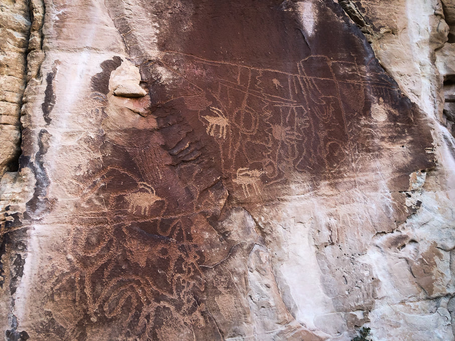 You can tell the older from the "newer". Near Snow Canyon 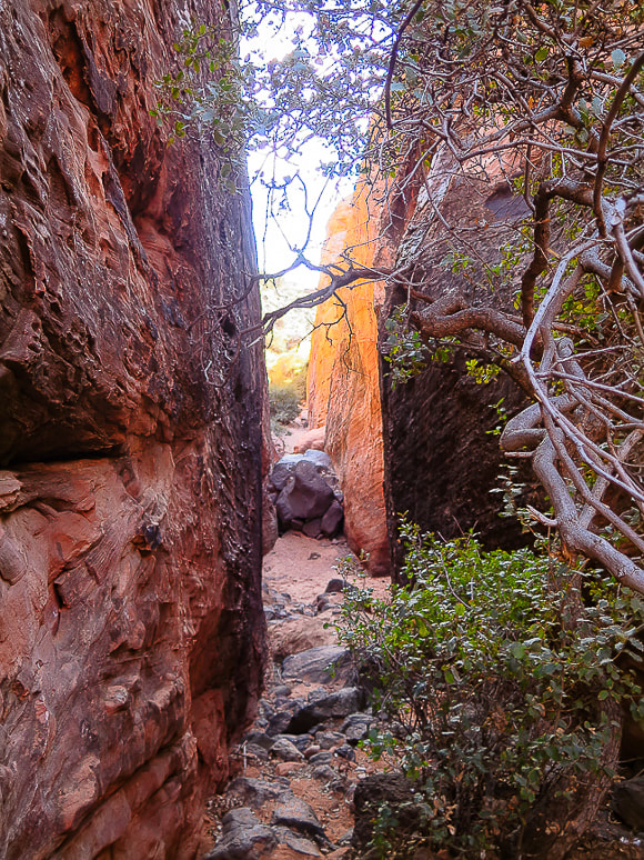 Canyon leading to petroglyphs in Snow Canyon State Park, Utah. 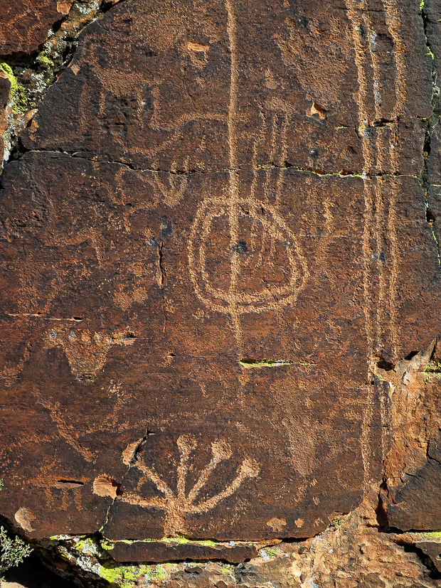 Petroglyphs just off the Gila Trail in Snow Canyon State Park. Some appear to be older than others. 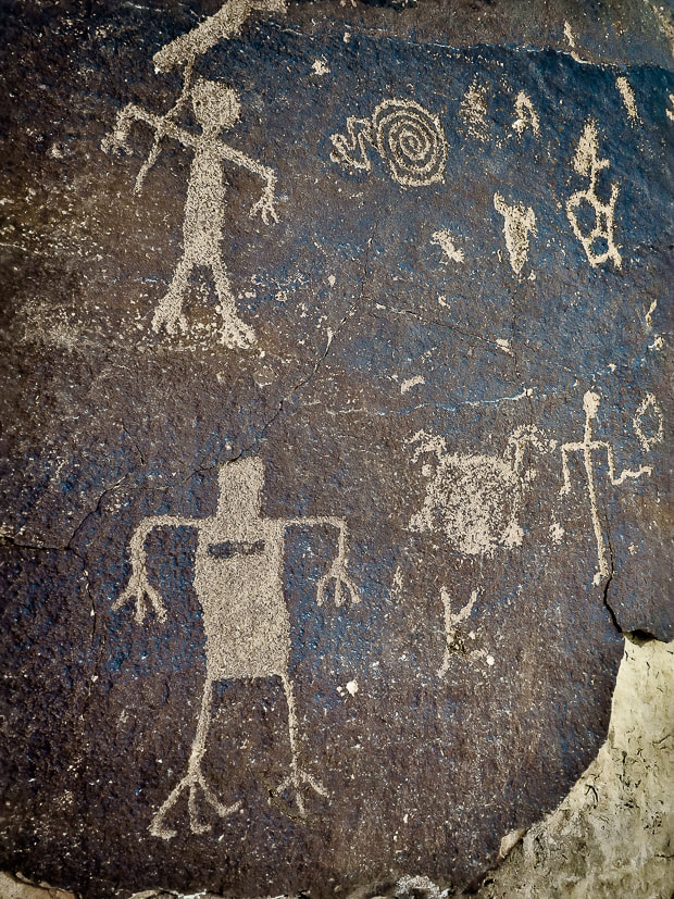  Deeply pecked abstract geometric petroglyphs near Gila Trail in Snow Canyon. 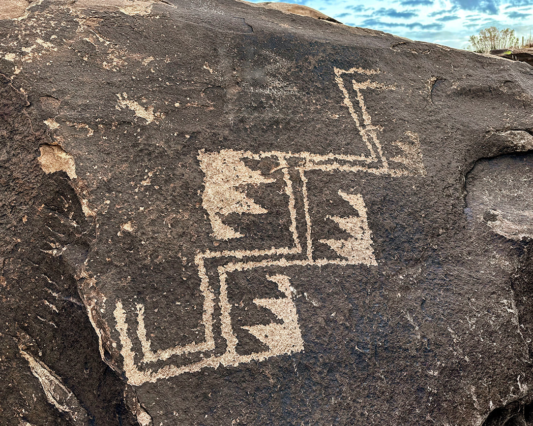 Overlooking the Santa Clara River near Ivins.
I recently found these and keep adding to the collection of images on this post. I find new petroglyphs quite often at the Tempi'po'op Trail. These appear to be re-patinated. 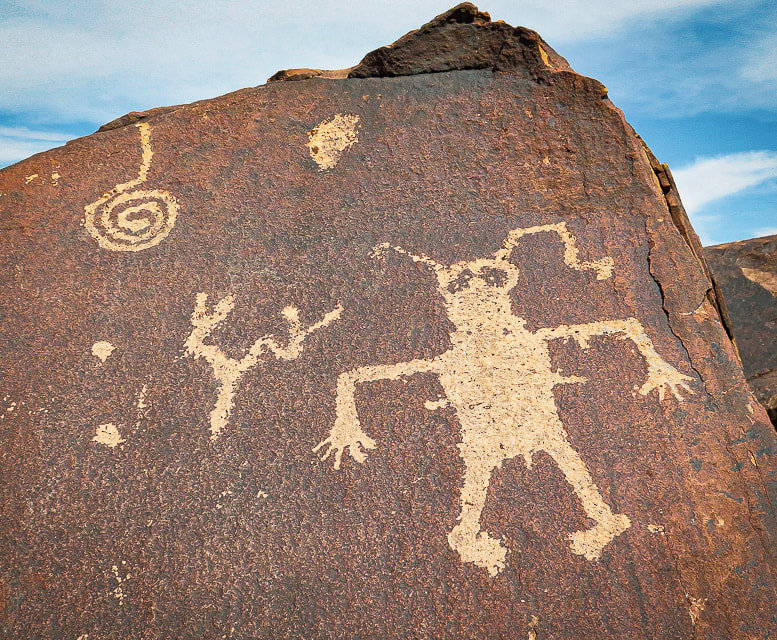 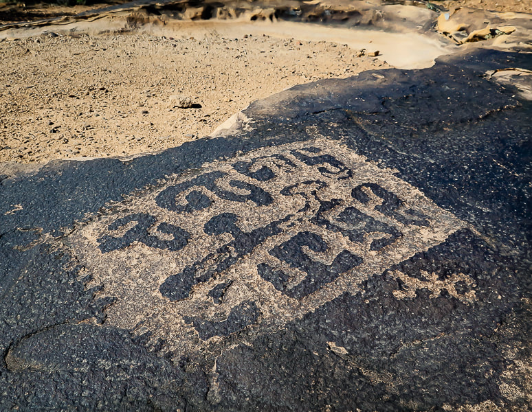 I just happened to stumble upon this amazing petroglyph as I was trying to find a trail down to my house. 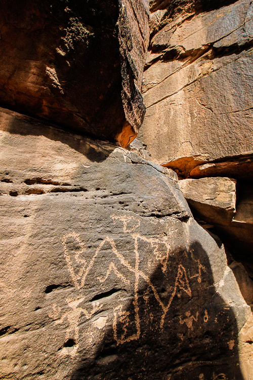 You have to climb through two narrow openings to get to this one, and then there are more petroglyphs higher than this that I was not able to climb to.  I couldn't climb up to this one; this is my best attempt at sticking my camera over my head.  How did they get to these places? Obviously better climbers than me! 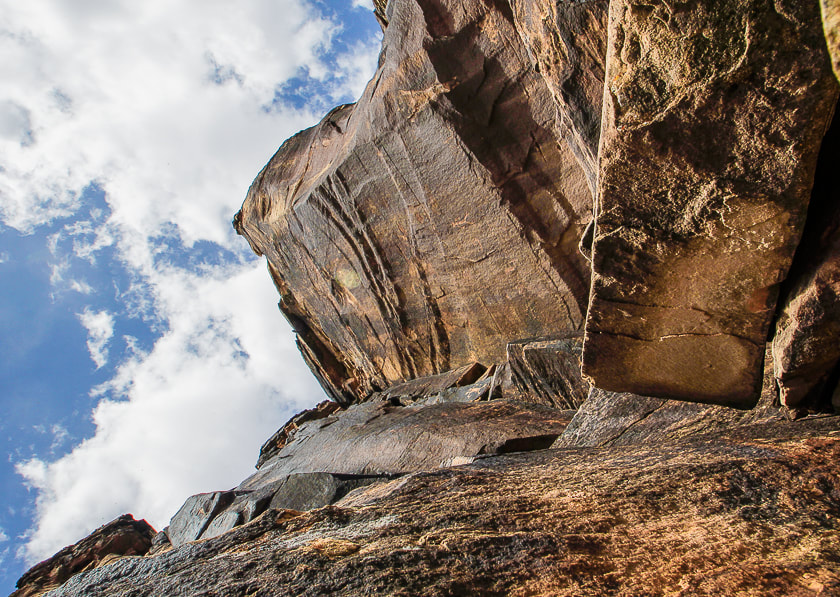 There are a few small petroglyphs on this wall. 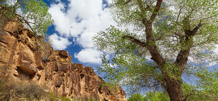 Cottonwoods along Santa Clara River are just beginning to leaf out. 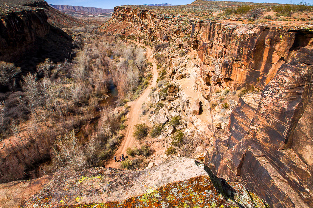 Santa Clara River Reserve - note petroglyphs on cliffs to the right.  Ivins Reservoir and Red Mountain References
Breeding, A. 2019. Written in Stone. Palm Springs Life Magazine. Desert Publications, Inc. Jones, K. 2019. Standing on the Walls of Time: Ancient Art of Utah's Cliffs and Canyons. University of Utah Press. Lingappa, U., Yeager, C., Sharma, A., Fischer, W. 6/14/2021. An Ecophysiological Explanation for Manganese Enrichment in Rock Varnish. Proceedings of the National Academy of Sciences. (from the internet). Malotki, E., Dissanayake, E. 2018. Early Rock Art of the American West: A Geometric Enigma. University of Washington Press. |
Categories
All

Sue and Fred

About this blogExploration documentaries – "explorumentaries" list trip stats and highlights of each hike or bike ride, often with some interesting history or geology. Years ago, I wrote these for friends and family to let them know what my husband, Fred and I were up to on weekends, and also to showcase the incredible land of the west.
To Subscribe to Explorumentary adventure blog and receive new posts by email:
Happy Summer!

About the Author
|