EXPLORUMENTARY
  • Home
    • Cactus to Clouds Hike
    • More Quotes
    • Ann Zwinger Quotes
    • Mary Oliver Poems
  • Hikes by State
    • Southern Utah
    • Idaho
    • Arizona
    • California Desert
    • Nevada
    • Wyoming and New Hampshire
  • Petroglyphs and Pictographs
  • BLOG
    • Adventure Blog
  • GALLERY
    • DESERT PLANTS >
      • Beavertail cactus
      • Brittlebush
      • Christmas Cactus
      • Arizona Barrel Cactus
      • Parry's penstemon
      • Agave
      • Arizona Rainbow Hedgehog
      • Claret Cup Hedgehog
      • Desert Agave
      • Palmer's Penstemon
      • Silver Cholla
      • Cristate Saguaro
      • Indian Paintbrush
      • Ocotillo
      • Santa Rita Prickly Pear
      • Spiny Cliffbrake
      • California Barrel Cactus
      • Engelmann Prickly Pear
      • Velvet Mesquite
      • Joshua Tree
      • Buckhorn Cholla
      • Hedgehog Cactus
      • Fishhook cactus
      • Thompson's Woolly Locoweed
    • NATURE
    • BOISE
    • EARTH + SKY
    • URBAN
    • WATER
    • PATRIOT
    • ORCHIDS
  • Fit After 50
    • Brian Holgate
    • Fred Birnbaum
    • Dave Brasuell
    • Bus' Little Black Book
    • Mike Carlson
    • Ray Wilson
    • Bryan Krouse
    • Vickie Kearney
    • Maria Keezer
    • DOUG TRAUBEL
    • Boise Cross Fit Masters Ladies
    • Tim Clemens
    • Marcia Bondy
    • Becky Borczon Blake >
      • Becky B Downtown
    • Jennifer Cera and Sue Birnbaum
    • Dave Brasuell
    • Vance Powell
  • Contact

In Search of the Santa Clara Petroglyphs:  The Abstract Enigma

3/23/2024

6 Comments

 
Unravelling the mysteries of two unique, older petroglyph sites that I found along the Santa Clara River in Utah.
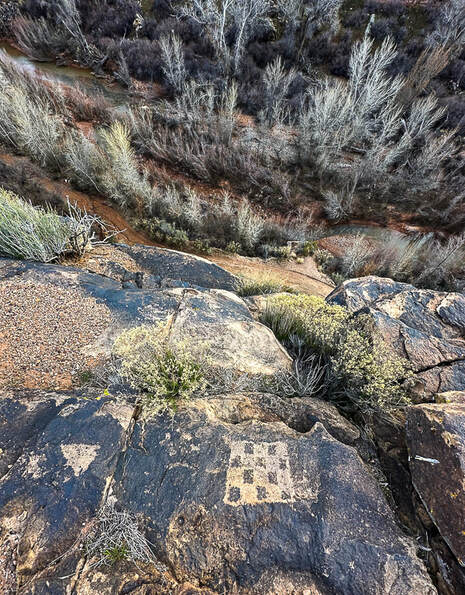
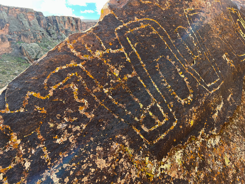
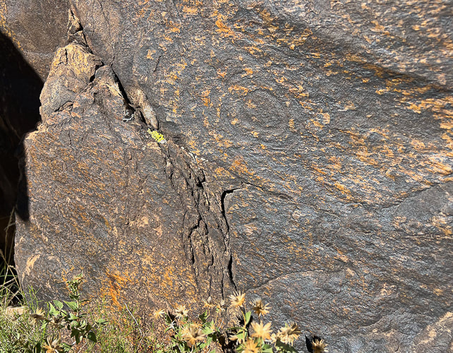
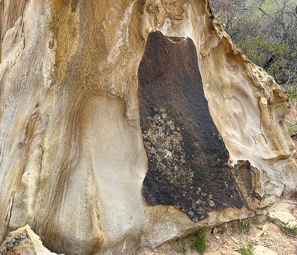
Picture
Picture
Land Hill petroglyphs overlooking the Santa Clara River in the Santa Clara River Reserve. 
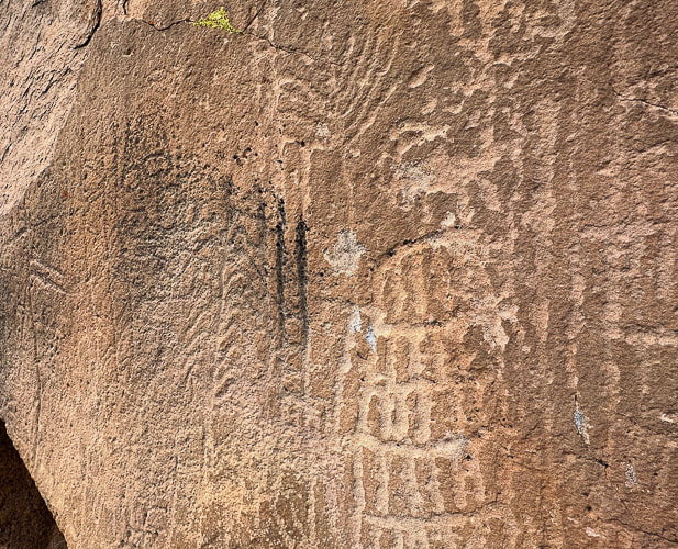
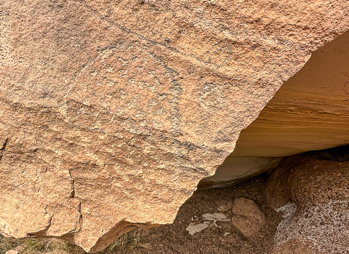
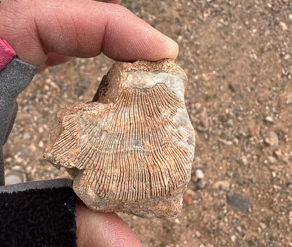
This design on the right closely resembles an Ancestral Puebloan (formerly Anasazi) petroglyph found in Arizona.
Checkerboard designs are associated with Glen Canyon Style 5 made before 1050 A.D. by Ancestral Puebloans including Basketmaker cuture.
Related Posts:
Rattlesnake Petroglyph
Fremont Indian State Park
Parowan Gap
Corn Springs
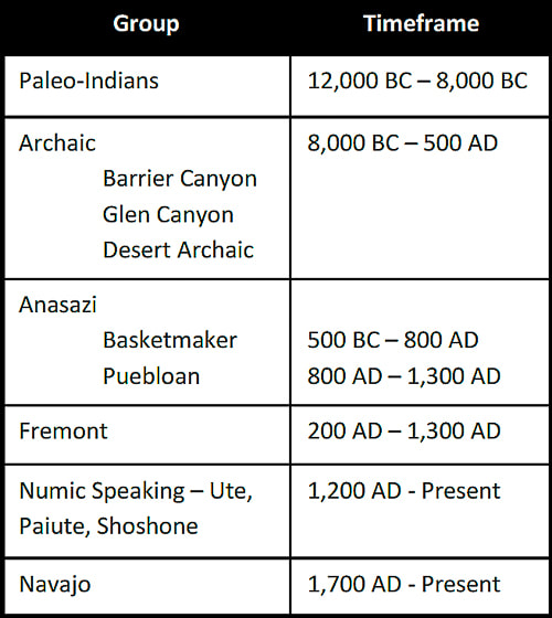
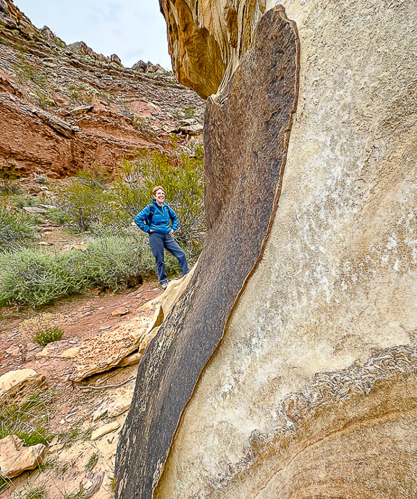
Trip Stats
Location:  Santa Clara River Reserve near Ivins and Santa Clara, Utah - Land Hill.
Trailheads:  Anasazi Valley Trailhead (north) and Tukupetsi Trailhead (south).
Distance:  The distance that includes all of the petroglyphs described here is ~ 5+ miles (top of Land Hill and along the Santa Clara River).
Some interesting books:
A Field Guide to Rock Art Symbols of the Greater Southwest by Alex Patterson.
Early Rock Art of the American West:  The Geometric Enigma by Ekkehart Malotki and Ellen Dissanayake.
The Rock Art of Utah by Polly Schaafsma
Links:  Santa Clara River Reserve Map

Santa Clara/Land Hill is designated as an Area of Critical Environmental Concern (ACEC).
Geology:  Petroglyphs are located in the oldest rocks of the Santa Clara Quadrangle Geologic Map:
- Shinarump Member Upper Sandstone unit and Shinarump Conglomerate Member of the Chinle Formation:  Upper Triassic (~ 200 million years ago).  Petroglyphs in sandstone and dinosaur tracks in conglomerate.
-Cliffs below Land Hill along the Santa Clara River:  Upper Red Member of the Moenkopi Formation:  Lower Triassic
(~ 250 million years ago).
 
​The fascinating rock art on the Tempi'po'op Trail (Anasazi Valley Trail) in Ivins, Utah, made by the Virgin Ancestral Puebloan and Southern Paiute cultures hundreds and possibly thousands of years ago can be discovered for more than two miles along the cliffs of Land Hill, overlooking the Santa Clara River.  Additionally, many more petroglyphs are pecked into huge boulders and sheer walls beneath Land Hill, next to  the river.  Each time I explore this part of the Santa Clara River Reserve, I find new petroglyphs. ​
On a recent wander, I discovered two intriguing petroglyph sites that I had previously passed by. ​
Site #1 - Geometric-Abstract
A huge boulder propped upon a conglomerate rock pedestal in a flat and open space next to the river features very old and eroded petroglyphs covering almost one entire side of it (see images below).  Abstract, geometric designs predominate:  straight and curvilinear parallel lines, chevrons, and a round circle glyph containing radial lines connecting boundary to center.  There's a line-encircled group of small pits.   It wasn't until the second visit to this site that I found petroglyphs on top of this boulder.  I circled it to find a route to the top; the only possibility was a wall on the side away from the river, with shallow sloping ledges on a steep face.  To get to the top, you would have to be rather spry, and brave, too!
Picture
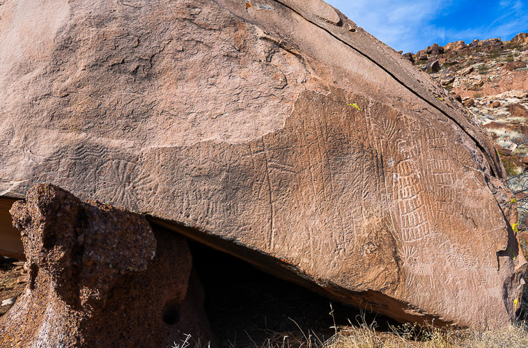
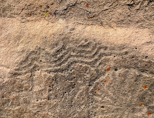
Five bighorn sheep on the right side of the boulder along with two large columns made with parallel vertical lines bisected incrementally with horizontal lines are pecked next to the older-appearing, lichen-filled and more highly eroded geometric glyphs.

​Who made these abstract/geometric petroglyphs and what do they "mean"?  Various theories include shamanistic visions, recording of phosphenes, and communication of vital information like water sources. 
 The Paiute word for them, Tumpituxwinap, translates roughly as "storied rocks."
Site #2 - Representational - Fremont Rock Art?
After I climbed a passage through the cliffs from river to the top of Land Hill to the  Een'oog Trail (means "old ones" in Southern Paiute language), I found another intriguing petroglyph of a figure with hairbobs and a trapezoidal body, with a squiggly, serpentine-like line that ends at its leg.  It is revarnished with wide-set eyes.  The second time I visited this site, I shared it with a goose who was communicating with its mates across the river.
I also found a bilvalve fossil (see photos below).

Flipping through Polly Schaafsma's book Indian Rock Art of the Southwest, I found a petroglyph that closely resembled this one on Land Hill.  It is the Fremont Southern San Rafael Style.  It resembles those in Capitol Reef National Park.  The hallmarks of Fremont rock art is the tapering torso in ceremonial regalia with large ornamental hairbobs, sashes, and necklaces.  Fingers are splayed.  
Picture
Although this petroglyph doesn't have head gear or ornamental adornment, it does have other features of Fremont rock art:  splayed fingers and earrings or "hairbobs."  The serpentine figure to its left, ending at its leg resembles the "rattlesnake" petroglyph located just below on a boulder facing Land Hill's cliffs.
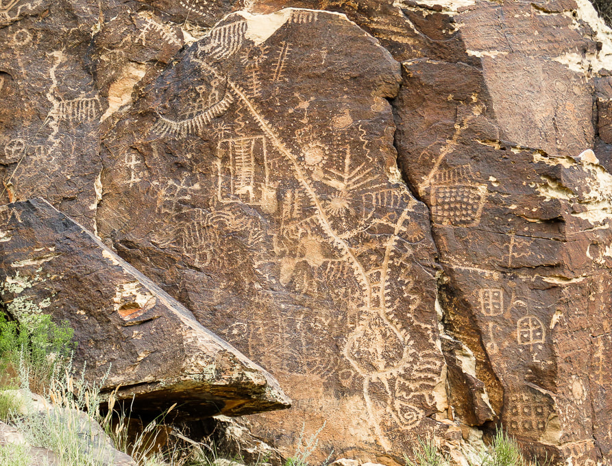
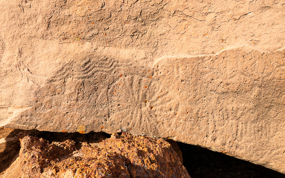
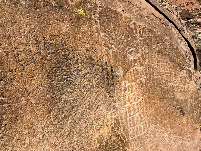
Huge boulder on flat area near Santa Clara River predominated by abstract/geometric petroglyphs, possibly of the Great Basin Curvilinear and Rectilinear style.  
Picture
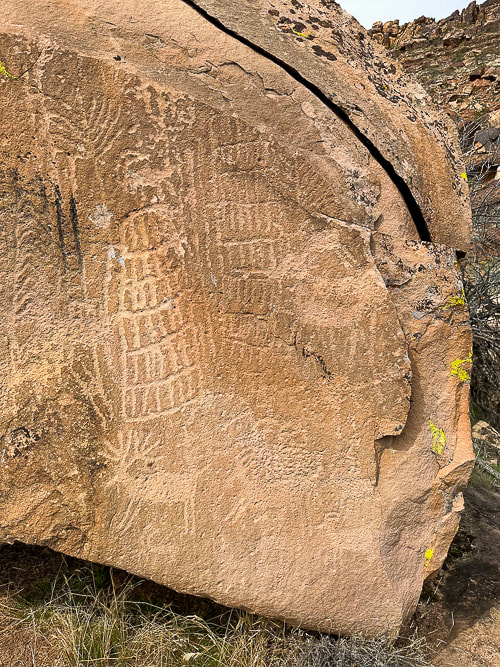
The right side of the boulder; these deer and sheep petroglyphs seem to be younger than those on the left side because they are not as eroded.  The plant-like image (upper left) looks like a corn tassle to me.
Picture
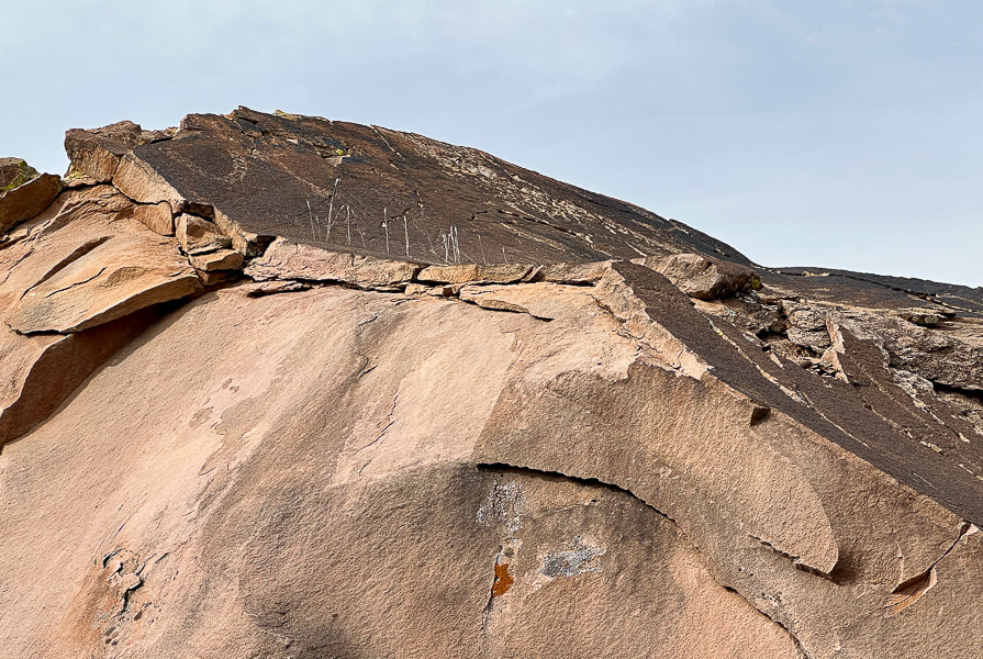
Petroglyph on top of boulder (left).  It reminds me of a necklace:  it's similar to those that are pecked into a boulder nearby.  It looks like a chain of circles, which might indicate the Great Basin Curvilinear style.
​In Search of the Rattlesnake Petroglyph.
Picture
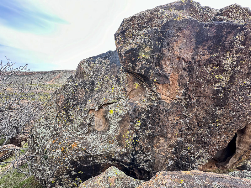
Back of boulder with what I could find as the easiest route to the top.
Early Rock Art:  Abstract/Geometric Designs
One of my earlier posts, In Search of the Rattlesnake Petroglyph, discusses theories on the creation of geometric rock art.  The book Early Rock Art:  The Geometric Enigma is a great source to consult.  Abstract/geometric designs (nonfigurative) came before iconic or representational designs, like bighorn sheep and anthropomorphs (stylized human figure).  Lifeways of Archaic cultural groups changed, due to competition for resources and increased population, to more permanent settlements with farming and planting, and social complexity.  This perpetuated the shift from abstract images to representational images, occurring not only in the American Southwest, but worldwide.
The Western Archaic Geocentric Tradition (from Malotki's Archaic Rock Art of Arizona)
​Even though there's solid evidence that big game hunters roamed the American Southwest before 7000 B.C., big-game animals were not depicted.  There may have been a strict taboo against creation of realistic game and humans during this Paleoindian time.
Picture
The people who have inhabited Utah.
from Troy Scotter and Nina Bowen's paper, 
The Rock Art of Utah.
A new way of living after this era consisted of gathering wild foods and small-game hunting.  The first abstract-geometric rock markings appeared then in what is known as the "Western Archaic Geocentric Tradition," spanning ~ 6000 B.C. and lasting to as late as A.D. 500.  Markings include rakes, lattices, sets of parallel lines, concentric circles, arcs, grids and meanders.  These designs are often revarnished and heavily eroded deeply pecked into low cliffs and boulders.

There are old petroglyphs in the Santa Clara River Reserve that may have been created during this Archaic time, before or near the beginning the Ancestral Puebloan culture.
Picture
Barely perceptible repatinated petroglyph.
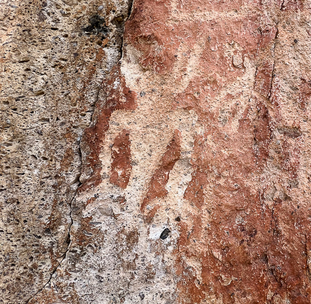
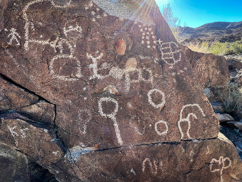
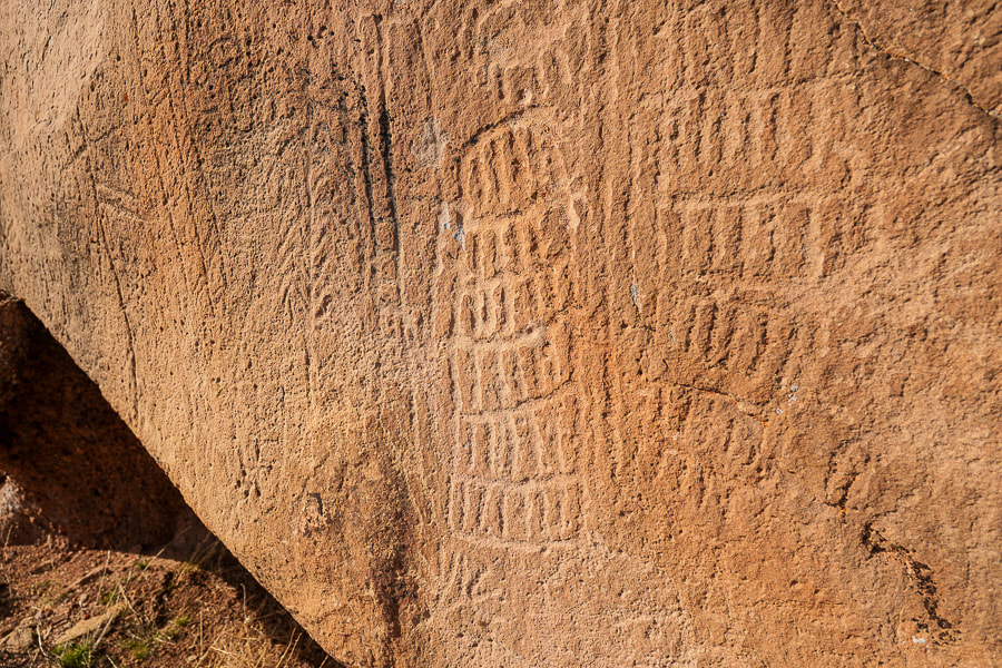
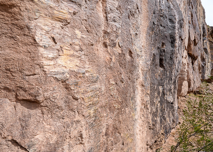
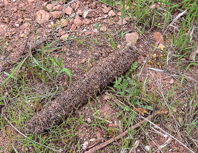
Phosphenes are lately being proposed by scientists as the catalyst for the creation of abstract designs.  All humans experience phosphenes that occur during hyperventilation, migraine headaches, meditation, use of hallucinatory drugs, fatigue and hunger and pressure put on a closed eye.  The idea is that geometric petroglyphs and pictographs depict an innate visual grammar (Engel in Fein, 1993) that we all share, ingrained in the biology of our brains.   My earlier post Corn Springs Petroglyphs:  Vision Quests, Steamboats, and Ringing Rocks  explains a few theories for the creation of the Western Archaic Tradition rock art.

​The Santa Clara Boulder and the "Abstract Enigma"
I found two photos of petroglyphs very similar to that of the spoked circle design on the large boulder by the river.  One illustrates the Western Virgin Kayenta style and the other illustrates Great Basin Carved Abstract petroglyphs.  This spoked circle seems less prevalent than the spiral petroglyphs that appear frequently on the cliffs above the river.  

Great Basin Abstract tradition rock art spans the Archaic and the Late Prehistoric (8,000-150 years ago).

The Great Basin Carved Abstract style occurs in St. George, Utah area.  It's characterized by purely geometric petroglyphs that fill boulders so that little unmarked space is left.  Art includes various circle configurations, grooves, grids, lattices, herringbone shapes, ladder-like shapes, chevron, hatchmarks and dots.  This boulder along the Santa Clara River contains some of these elements.  Since this style is found not only in Nevada's Great Basin, but throughout the American West, some scientists call it "Carved Abstract".  The rows of vertical lines cut with horizontal lines, surrounded by a line are similar to "gridiron" petroglyphs seen in New Mexico.  

​The parallel wavy lines above the spoked circle are considered Great Basin Curvilinear, which I read is another way to say Great Basin Carved Abstract.  The grids and cross-hatchings, and perpendicular form is known as "rectilinear."  These styles are associated with the Archaic style and also occur in styles associated with Puebloan and Fremont groups.

Two authors state that the Great Basin Abstract petroglyphs appear to be made as a part of "magic hunting ritual and were related to subsistence practices..." (Heizer and Baumhoff).  Abstract designs predominate this style, with a limited depiction of animals.  The most common animal portrayed is the bighorn sheep.

​I also noticed what appeared to be cupules (pit and groove style) on the back side of the boulder.  Or are these holes just natural weathering?  Or both?  One pit placed on the side of the boulder looks too symmetrical to be made by weathering.  Theories for their creation include fertility enhancement and the use of powder produced from making them.
Picture
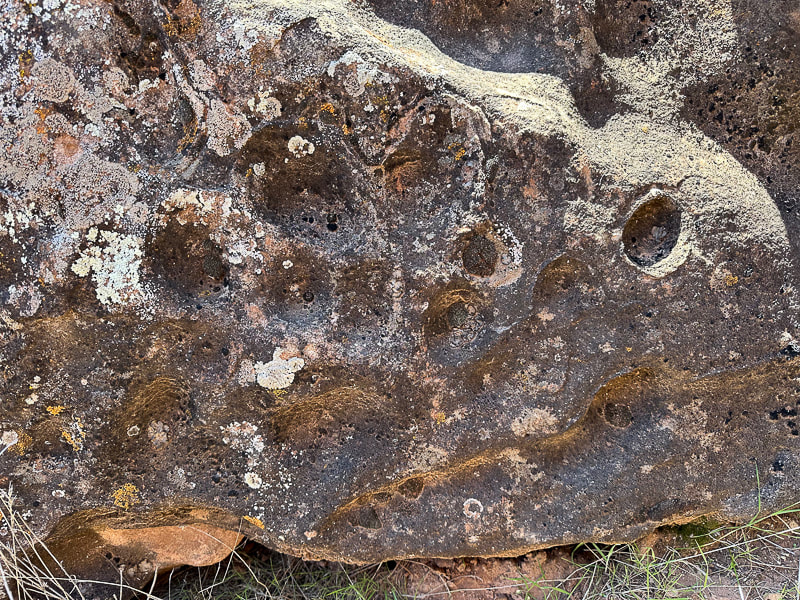
Cupules or natural weathering?  Cupules are associated with very early Carved Abstract Style.
It's assumed that cupule sites identify places of significance.

Picture
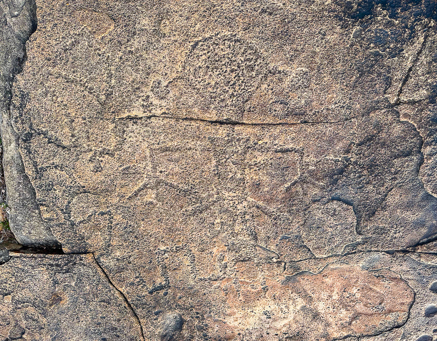
 Anthropomorphic (Human-like) petroglyph on a flat boulder near the Een'oog Trail and the cliffs overlooking the Santa Clara River.  Size is ~ 14 inches tall.
Is a Snake Biting the Figure with the Drooping Hands?
The second amazing petroglyph I found is on top of Land Hill along the Een'oog Trail, on the cliffs above the Santa Clara River.
It's totally repatinated, blends into the rock, so it's easily missed (see above).  Its drooping arms, termed "pendant" by scientists, round head, hair bobs, long rectangular or slightly trapezoidal (wider at the shoulders), and feet and hands pointing down match the description I found of the Anasazi Basketmaker culture - 500 BC - 800 AD.  The term "Anasazi" has now been replaced by "Ancestral Puebloan."

A serpentine-like line winds its way from the left side of the figure to the figure's leg.  

These “representational” styles are typically associated with Fremont and Western Puebloan cultures (ca. 2,000-750 years ago) in southeastern Nevada, Utah, and the Colorado Plateau. These semi-horticultural groups made rock art that featured  human-like forms portrayed by trapezoidal, rectangular, or triangular body shapes. These were often portrayed with bodily decoration such as headgear, jewelry, or decorated clothing.  

In my research, I found the Classic Vernal-Style (a sub-set of Fremont Style) Anthropomorph has large heads and trapezoidal torsos with well-defined extremities.  The Fremont style tends to have round earbobs and arms and hands held down, commonly with splayed fingers.

In western Utah, there is an intermix of Great Basin Curvilinear and Fremont styles.

Ancestral Puebloan farmers lived in the Land Hill area in permanent settlements ~ 1,000 years ago.  The Santa Clara River gave them a good water supply to irrigate their crops.  During A.D. 700 - 1100, population on Land Hill thrived, but then around 1200 A.D., population decreased possibly due to changing climatic conditions.

I found an old corn cob in a grassy area beneath the cliffs next to the river (see photo below).  Every kernel had been removed.  It couldn't have survived hundreds of years!  Or could it have been exhumed after the record-setting rains of 2022-2023 that caused a major landslide at an area close to it?  
A Land Rich in Culture, Stories, and Mystery
​
Dinosaur tracks have been documented on Land Hill.  At first glance, you wouldn't imagine that the Santa Clara River Reserve holds so many stories among its cliffs, plateaus, and rock art.  If you look closely, you will see abstract and representational communication made by different cultures during different times.  In my quest to figure out who made these fascinating petroglyphs and why, I realize that if anything, they still remain an enigma.

I'll let you  know if I find the dinosaur tracks and more corn cobs!
Keep Exploring!
Picture
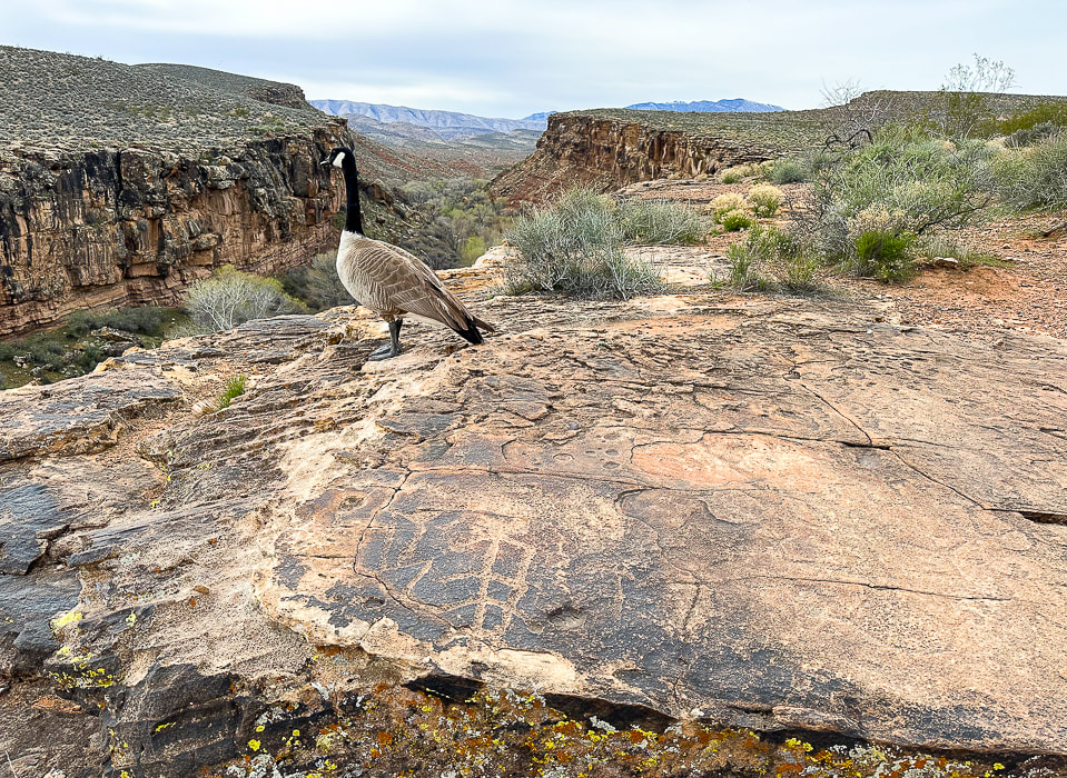
When I went to look at the figure with the round head and the ear bobs again (lower right), I shared the petroglyph rock with a goose.
Picture
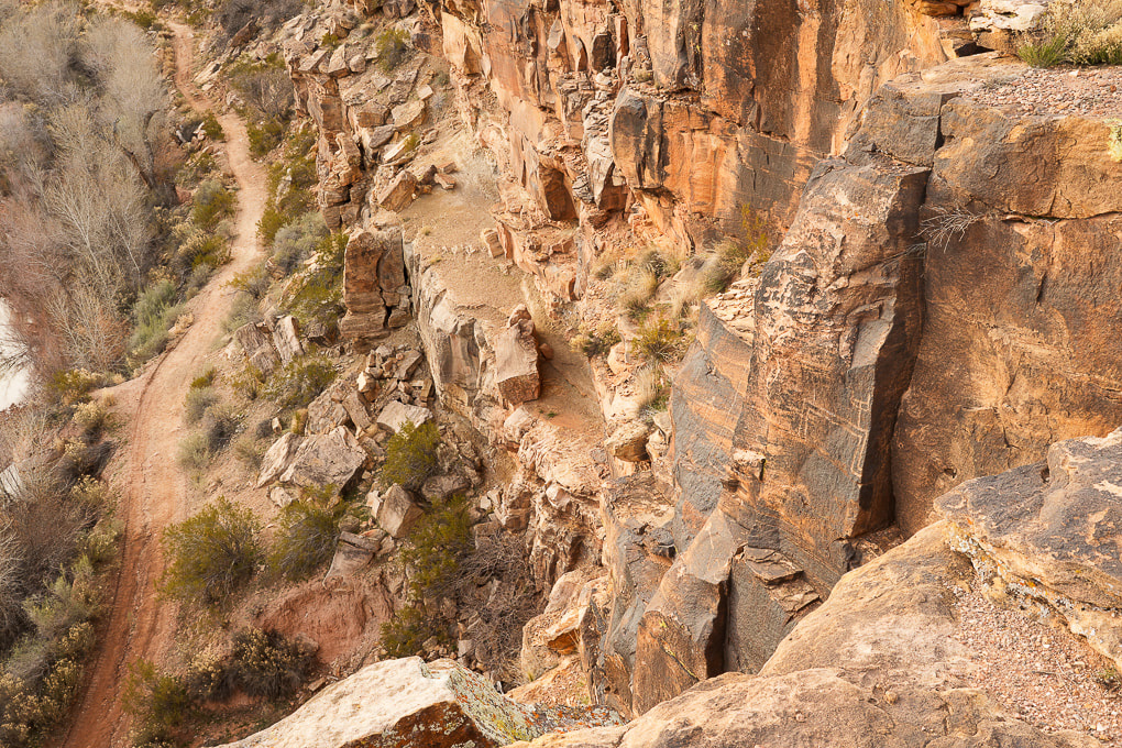
Petroglyphs (walls on right) overlooking the Santa Clara River.
Picture
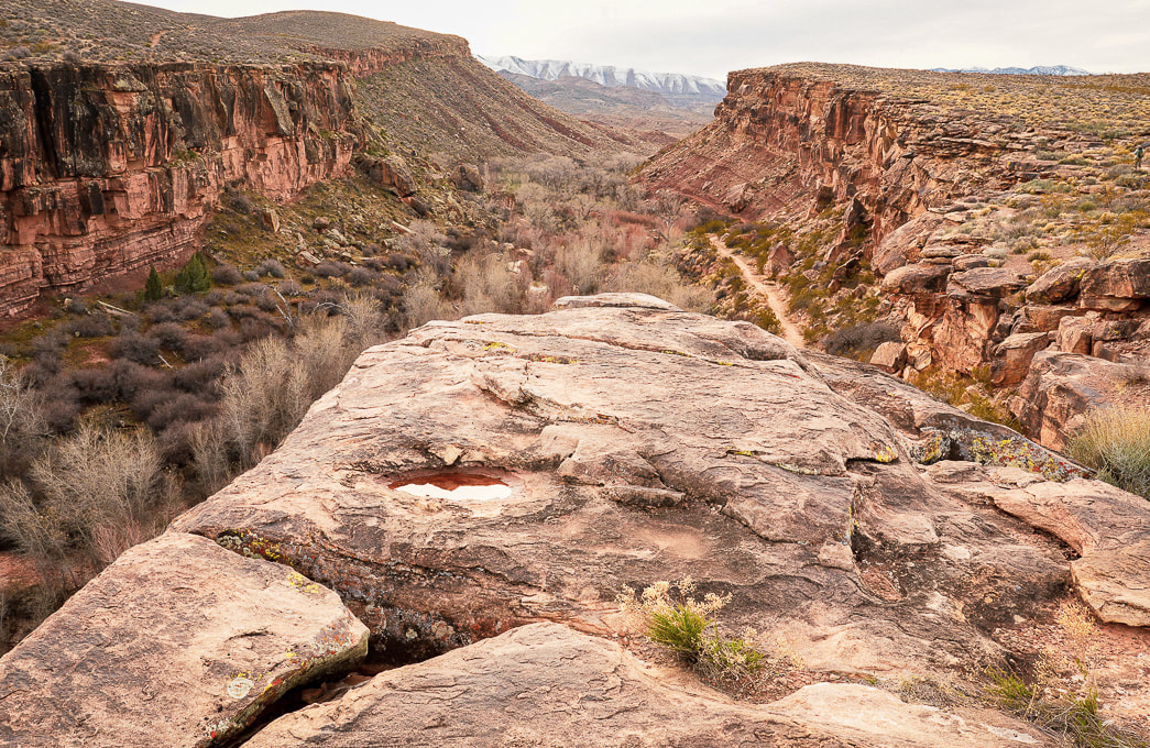
Land Hill on the right and a path that runs along the Santa Clara River.  Beaver Dam Mountains in the distance.  Petroglyphs are found on the flat surface rocks, in the steep cliffs of Land Hill, and on boulders along the river.
Picture
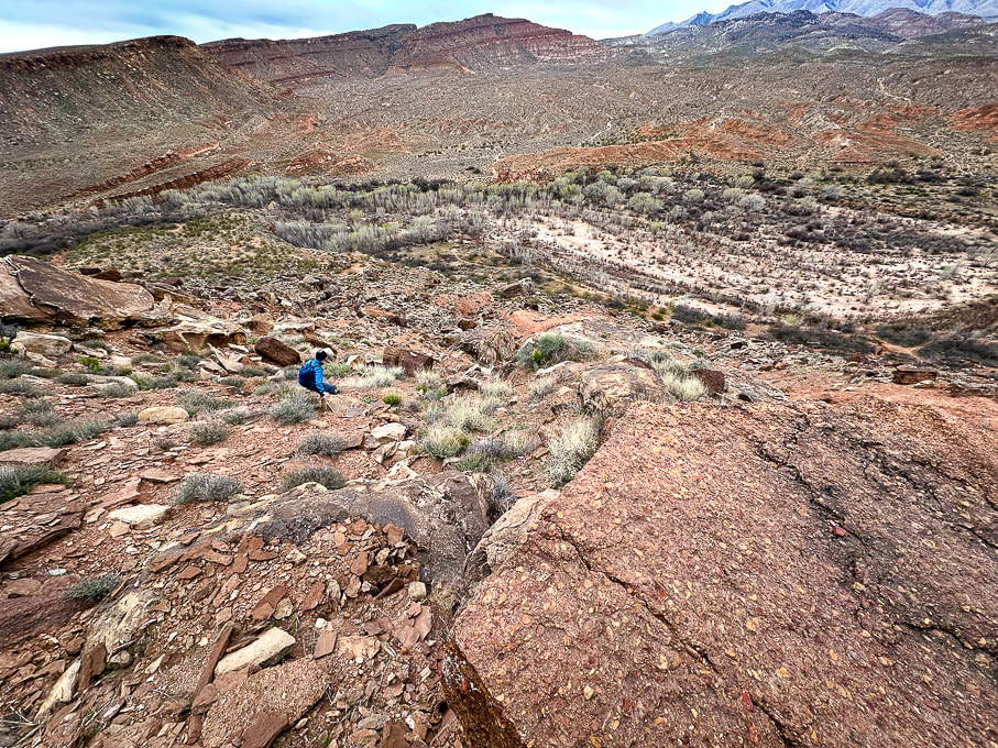
Finding a route down from the top of Land Hill with my friend Laura.  We are headed to the Santa Clara River below.
Notice the Shinarump conglomerate rock in the right foreground.
Picture
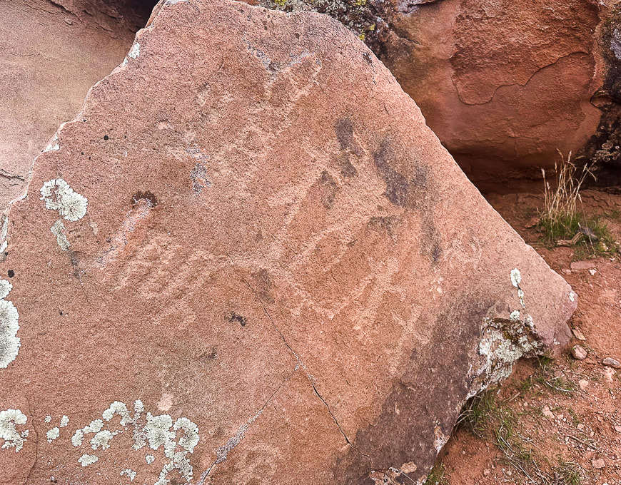
When we got near the river, we found this boulder with what looks like Great Basin Curvilinear style and a family of anthropomorphs (human-like) figures.  We now call this the "family rock" for location reference.
Picture
Great Basin Curvilinear?
Picture
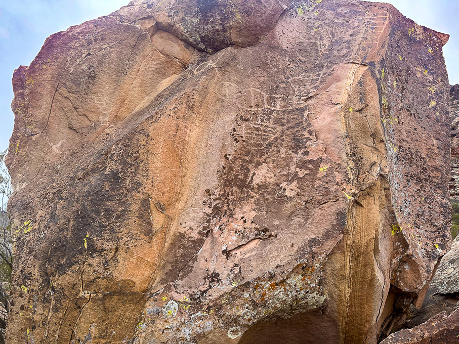
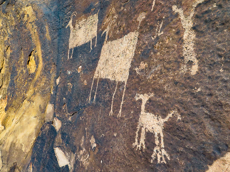
Petroglyphs on the Anasazi Valley Trail in Ivins, Utah.
 The Glen Canyon Style 5 (Ethnic groups are Early Puebloan and Basketmaker).
Bighorn sheep have large rectangular bodies disproportionately large compared to their small heads, tail and legs.  
Picture
Picture
Laura and some really cool sandstone boulders along the Santa Clara River.
Some Cool Stuff on the Trail
Clockwise from upper left:  smooth striations, or slickensides created from scraping against other rocks in a fault, bivalve fossil near the Een'oog Trail, a corn cob, a desert-varnished panel on an eroded sandstone boulder.
Picture
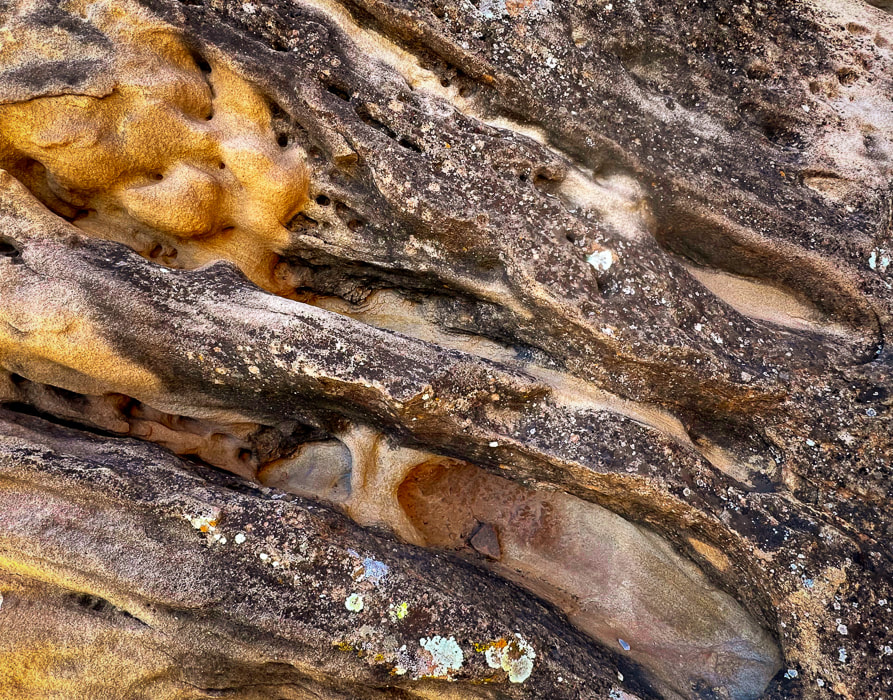
Sandstone boulder detail.
References
Bureau of Land Management.  Land Hill Heritage Site.
Malotki, Ekkehart.  The Rock Art of Arizona:  Art for LIfe's Sake.  From website:  Bradshaw Foundation.
Mangum, M.E. 2018.  Lithics and Mobility at Land Hill and Hidden Hills:  A Study of the Stone Tools and Debitage at Sites in the Santa Clara River Basin and on the Shivwits Plateau.  Brigham Young University ProQuest Dissertations Publishing,  2018. 28107515.
National Park Service.  Reading Rock Markings.
​Schaafsma, P.  1971.  The Rock Art of Utah.
Schaafsma, P.  1980.  Indian Rock Art of the Southwest.
​Scotter, T. Bowen , N.  2017.  The Rock Art of Utah.
​The Nevada Rock Art Foundation - Styles and Themes

​Willis, J.C., Hayden, J.M.  2015.  Geologic Map of the Santa Clara Quadrangle, Washington County, Utah.
6 Comments

    Categories

    All
    Arizona Hikes
    California-desert-hiking
    California-desert-hiking
    Idaho Summits
    Nevada Hikes
    Petroglyphspictographs
    Snowshoe Hikes
    Southern Utah Hikesbikes

    To Subscribe to Explorumentary adventure blog and receive new posts by email:

    submit
    Picture
    Sue and Fred
    Picture

    About this blog

    Exploration documentaries          –  "explorumentaries"  list trip stats and highlights of each hike or bike ride, often with some interesting history or geology.  Years ago, I wrote these for friends and family to let them know what my husband, Fred and I were up to on weekends, and also to showcase the incredible land of the west.  
    Picture
    Happy Spring!
    Picture

    About the Author
    Sue Birnbaum

    A  trip to Jumbo Rocks Campground in Joshua Tree National Monument 40 years ago sparked my passion for hiking, exploring, and learning about desert ecosystems.  I met my husband Fred on Mt. San Jacinto.  We've explored the American West together; we love this land and I hope to inspire you to get out and explore through my photographs and trip descriptions.
    In 1992, Ray Wilson and I conceived the first Cactus to Clouds hike which climbs over 10,000 feet in one day to the summit of Mt. San Jacinto near Palm Springs, California.
    CACTUS TO CLOUDS HIKE 
    READ MORE
    ABOUT SUE
    Some of my favorite websites:
    ​

    ​Awkward Botany
    ​amateur botany for the phytocurious

    Bird and Hike

    ​"Intended to encourage people to visit, learn about, and fall in love with the desert."
    ​

    Draw and Shoot
    Beautiful Photography

    Daring Dayhikes
    "Interesting places you can visit with a daypack."  Terrific Tucson and other desert hikes and East Coast, too.


    Earthline: The American West
    Debra "writes to extol our beloved Earth." Detailed hike info, excellently written.
    ​

    Geologypics.com
    Geology and Geologic Time through Photographs

    Glenn Suokko
    Vermont artist's paintings "inspired by a place based on the land .... drawn to painting the representation and abstraction of nature."

    In the Company of Plants and Rocks
    ​A natural history blog about botany, plant ecology, and geology.


    MishMoments:  Joy of Photography
    this website is "
    about capturing that special moment in life’s journey and making the most of the time we have."

    Nature's Depths
    Walking through nature with John Palka, a neuroscientist who loves plants and ponders big questions.


    Rangewriter - What Comes Next?
    ​Linda's excellent writing brings to life her interesting adventures, "curiosities and thoughts", post-retirement.

    SeekingLost - Hiking and Backpacking Adventures.

    Stav Is Lost- Unconventional, out-of-the way hikes in the American West.


    Uprooted Magnolia
    ​Leah Yetter's beautiful "photo journal on life, love, and the spirit of Wyoming."

    Archives

    April 2025
    March 2025
    January 2025
    December 2024
    November 2024
    October 2024
    September 2024
    August 2024
    July 2024
    June 2024
    May 2024
    April 2024
    March 2024
    January 2024
    December 2023
    November 2023
    October 2023
    September 2023
    August 2023
    July 2023
    June 2023
    May 2023
    April 2023
    February 2023
    January 2023
    December 2022
    November 2022
    October 2022
    September 2022
    August 2022
    July 2022
    June 2022
    May 2022
    April 2022
    February 2022
    January 2022
    December 2021
    November 2021
    October 2021
    August 2021
    July 2021
    May 2021
    March 2021
    February 2021
    January 2021
    November 2020
    October 2020
    August 2020
    July 2020
    June 2020
    April 2020
    March 2020
    February 2020
    January 2020
    November 2019
    October 2019
    September 2019
    August 2019
    July 2019
    June 2019
    May 2019
    April 2019
    February 2019
    December 2018
    November 2018
    October 2018
    September 2018
    July 2018
    June 2018
    May 2018
    April 2018
    March 2018
    February 2018
    January 2018
    December 2017
    November 2017
    October 2017
    September 2017
    August 2017
    July 2017
    June 2017
    April 2017
    February 2017
    November 2013
    August 2013
    July 2013

HOME

Cactus to Clouds Hike
More Quotes
​
Mary Oliver Poems
Ann Zwinger Quotes
HIKES BY STATE

Idaho Hikes
Utah Hikes/Bikes
​Arizona Hikes
​California Desert Hikes
​Wyoming Hikes
​Nevada Hikes

BLOGS

Adventure Blog
Women and the Land
GEAR REVIEWS
FIT AFTER 50
Fred Birnbaum
Dave Brasuell
Bus' Little Black Book
​Mike Carlson
​Ray Wilson
​Marcia Bondy
Bryan Krouse
​Maria Keezer
​Tim Clemens
​Doug Traubel
​Brian Holgate
​
Becky Borczon Blake
​Jennifer Cera and
​Sue Birnbaum

​Vance Powell
​Boise Cross Fit Masters Ladies
​Vickie Kearney

GALLERY

Desert Plants
Nature
Earth + Sky
Urban
Water
Patriot 
​Orchids
Boise
​
  ABOUT
    Contact

​
© 2017 - 2025 by Sue Birnbaum.  Photos on this website are the sole property of Sue Birnbaum unless otherwise indicated.  Please receive permission before publishing my trip reports and photos.
I try my best to be accurate with my hike descriptions; please research your adventures, always bring a map and compass and know how to read them, be prepared!  All of these hikes can be dangerous; hike at your own risk.  ALWAYS carry the Ten Essentials with you on hikes. 
​Please feel free to contact me with comments or questions, or if you see any errors that need attention.
Thank-you for stopping by!


EXPLORUMENTARY.com
  • Home
    • Cactus to Clouds Hike
    • More Quotes
    • Ann Zwinger Quotes
    • Mary Oliver Poems
  • Hikes by State
    • Southern Utah
    • Idaho
    • Arizona
    • California Desert
    • Nevada
    • Wyoming and New Hampshire
  • Petroglyphs and Pictographs
  • BLOG
    • Adventure Blog
  • GALLERY
    • DESERT PLANTS >
      • Beavertail cactus
      • Brittlebush
      • Christmas Cactus
      • Arizona Barrel Cactus
      • Parry's penstemon
      • Agave
      • Arizona Rainbow Hedgehog
      • Claret Cup Hedgehog
      • Desert Agave
      • Palmer's Penstemon
      • Silver Cholla
      • Cristate Saguaro
      • Indian Paintbrush
      • Ocotillo
      • Santa Rita Prickly Pear
      • Spiny Cliffbrake
      • California Barrel Cactus
      • Engelmann Prickly Pear
      • Velvet Mesquite
      • Joshua Tree
      • Buckhorn Cholla
      • Hedgehog Cactus
      • Fishhook cactus
      • Thompson's Woolly Locoweed
    • NATURE
    • BOISE
    • EARTH + SKY
    • URBAN
    • WATER
    • PATRIOT
    • ORCHIDS
  • Fit After 50
    • Brian Holgate
    • Fred Birnbaum
    • Dave Brasuell
    • Bus' Little Black Book
    • Mike Carlson
    • Ray Wilson
    • Bryan Krouse
    • Vickie Kearney
    • Maria Keezer
    • DOUG TRAUBEL
    • Boise Cross Fit Masters Ladies
    • Tim Clemens
    • Marcia Bondy
    • Becky Borczon Blake >
      • Becky B Downtown
    • Jennifer Cera and Sue Birnbaum
    • Dave Brasuell
    • Vance Powell
  • Contact