|
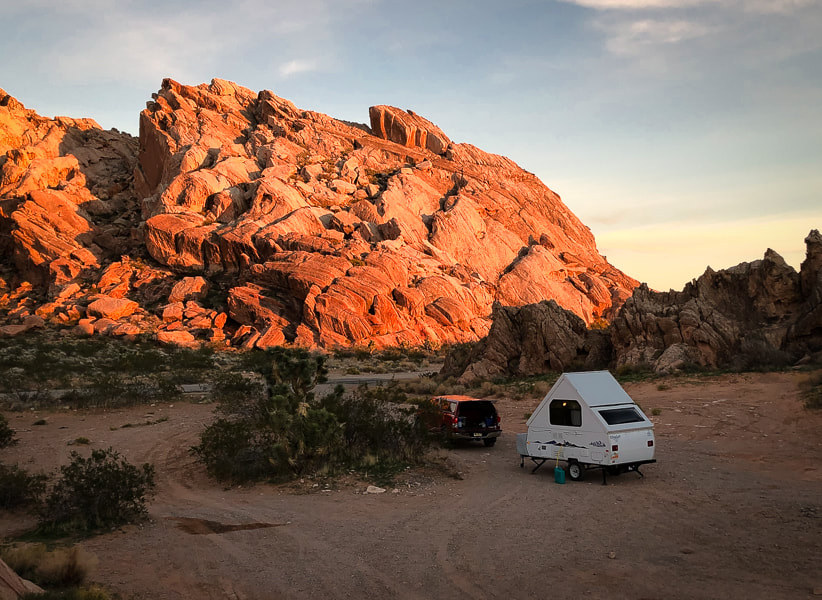
Remote ridge ramble on fossil-filled limestone northeast of Lake Mead and south of Mesquite in Nevada. Camping the night before among the dramatic sandstone formations at Whitney Pocket in beautiful Gold Butte National Monument enhanced this experience.
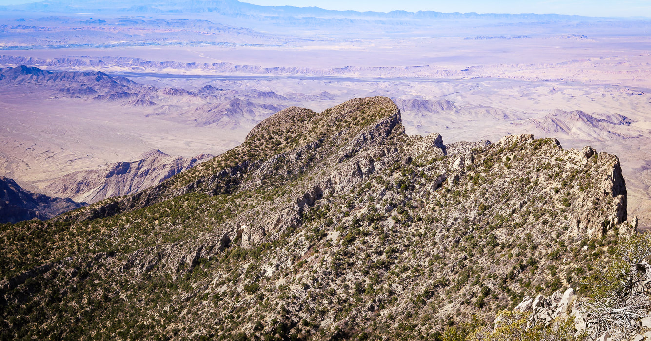
Virgin Peak summit, looking north toward town of Mesquite, Nevada and Mormon Mountains on left horizon.
Trip Stats
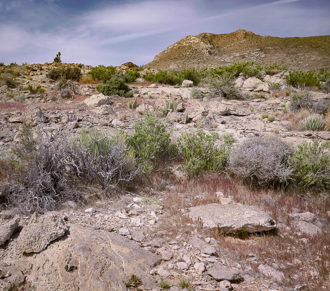
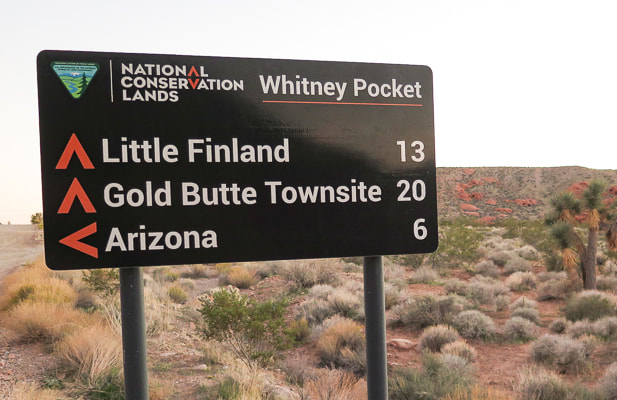
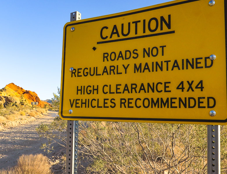
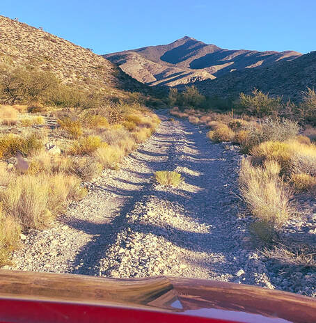
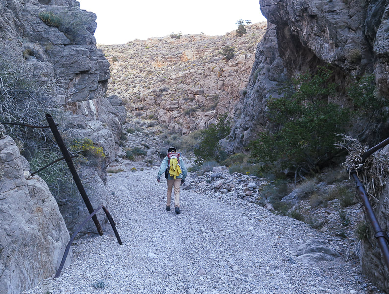
Location/Overview: Virgin Mountains Instant Study Area, Gold Butte National Monument, southeast Nevada, northeastern edge of Mojave desert. The approach to this remote hike begins with a drive through ancient bright orange sand dunes at Whitney Pocket, rising abruptly over Joshua tree-filled valleys, providing private primitive camping coves. The southeast ridge hike has three main sections. The first is a high-clearance 4 WD road that utilizes a deep wash on the right (east) side of the ridge. Next, a steep scramble gains 500 feet from the wash/jeep road to the summit's southeast ridge where the third section is a 2.3-mile, 2,000'-gain beautiful ridge hike to the summit, with many examples of Mississippian-age fossils in limestone, and spectacular views of northern Lake Mead, Valley of Fire, Beaver Dam Mountains to the north. Distance/Elevation Gain: varies depending on how far you can drive up 4 WD road; our distance was 10.85 miles out and back. Our starting elevation: 4,355'. Summit: 8,071', for a gain of 3,700'. Difficulty: Moderate hike on 4 WD road, moderate-strenuous Class 2 ridge to summit on faint trail occasionally marked by cairns. Coordinates: See waypoints table below. Maps and Apps: Virgin Peak, Southeast Ridge - birdandhike.com, Avenza app on GPS with Arizona Strip Map, Gold Butte NM Area Map (purchased at St. George BLM). Permits/Camping: No permits or fees required. Dry camping at Whitney Pocket in Gold Butte NM. Date Hiked: November 3, 2021. Considerations: Long pants advised due to a lot of bushwhacking through shrubs and trees, exposed ridge (thunderstorms), the higher the clearance of your 4 WD vehicle, the nearer your access to trailhead at Cowboy Campsite. Geology: On southeast ridge and on summit, you will be walking on Rogers Spring Limestone AKA Monte Cristo Group (Mississippian period ~ 340 million years ago). Canyon walls on the way up to ridge are Devonian (~ 400 mya) and Cambrian (~500 mya). Geologic map of the Virgin Mountains Instant Study Area, Clark County, Nevada
Related Posts:
“The Mojave Desert is a harsh, but very spiritual, place. As children growing up in the Mojave, we chased lizards and snakes, instead of frogs and squirrels. There is an arid openness about it, and a true feeling of being alone, that you don’t get in any other type of environment.”
- James Stanford, from Shimmering Zen 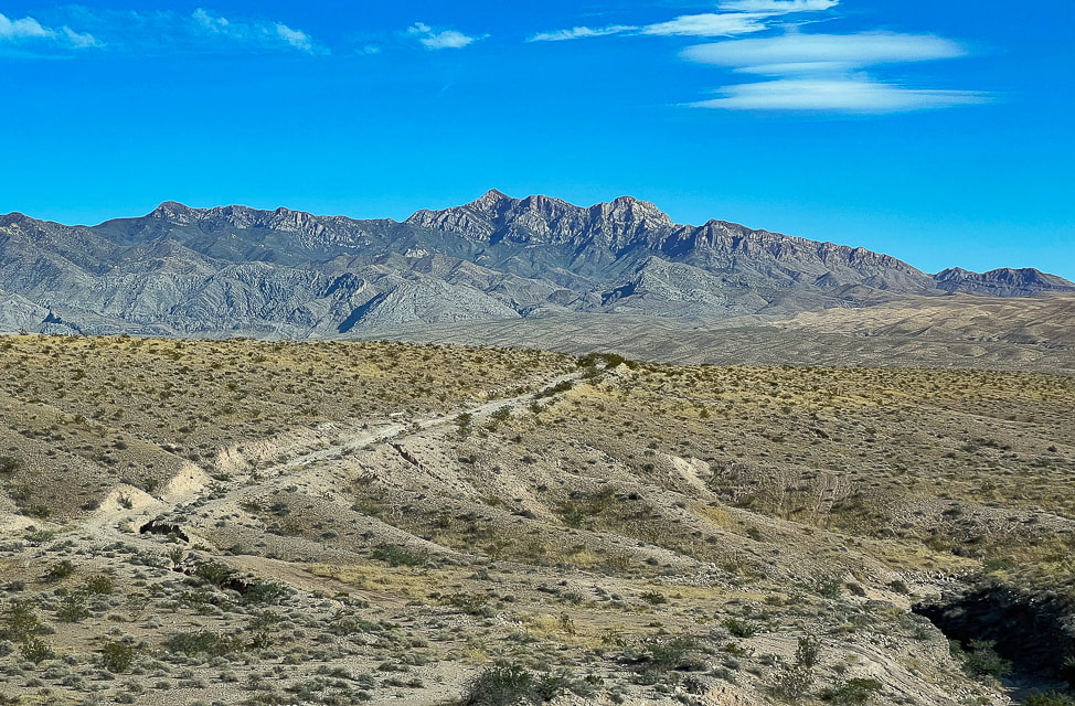
Virgin Peak from Interstate 15 in Nevada.
Our Hike
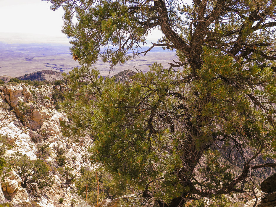
In our quest this year to explore "off the beaten path" areas in southwestern Utah, away from crowded national and state parks, we have seen some sublime, amazing and sometimes astonishing wilderness beyond park borders, almost always in solitude. Last month, we explored part of the Beaver Dam Mountains. Our adventure this month landed us on the highest summit in the Virgin Mountains, a remote "sky island", rising more than 6,000 feet above the dusty desert floor of southeastern Nevada, a little over an hour's drive from Las Vegas. Extra work goes into figuring out approaches and routes to these less-traveled places, but I find this more meaningful and fun than hiking in well-traveled parks. In 1993, the first time I visited Zion National Park, there were a total of 2.4 million visitors. This year, 2021, looks like it will top 5 million visitors. When I visited Zion in May this year, I noticed the trails were much wider and literally trampled. On Virgin Peak's ridge, we had to focus on finding the trail, as it is not well-defined. I wondered, as we drove on Gold Butte Road to our camping spot from the city of Mesquite, what was so special about this area to make it a National Monument and why so many cared enough to form the Friends of Gold Butte organization. After 20 miles of driving, then suddenly coming upon Whitney Pocket, I understood why. Large, bright orange and red sandstone domes scattered about, anchored into the green creosote and Joshua tree-covered valleys. These large cross-bedded domes glowing orange in the setting sun are remnants of a huge desert formed 180 million years ago, and are the same rock unit as the cliff-forming Zion National Park sandstone. In Utah, this sandstone is called Navajo; the correlative unit of sandstone in Nevada is called Aztec. 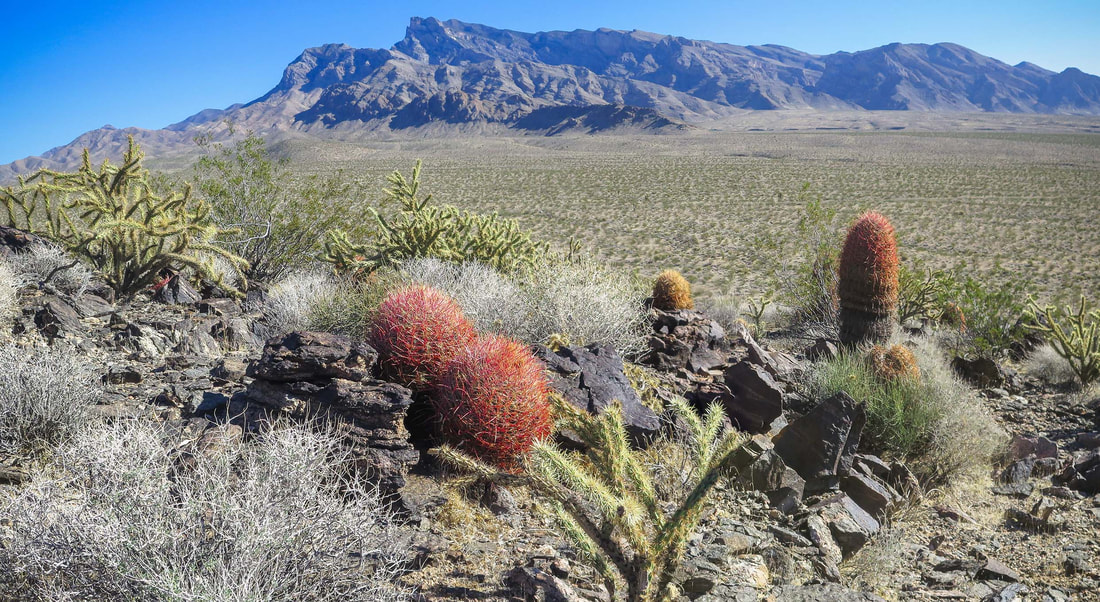
View of Virgin Peak and its southeast ridge from Little Virgin Peak.
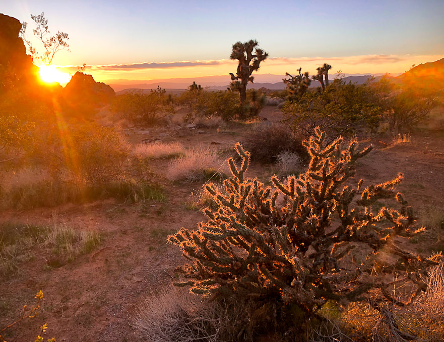
Mojave desert sunset at Whitney Pocket in Gold Butte National Monument, Nevada.
You can't beat the sublime Mojave Desert sunsets.
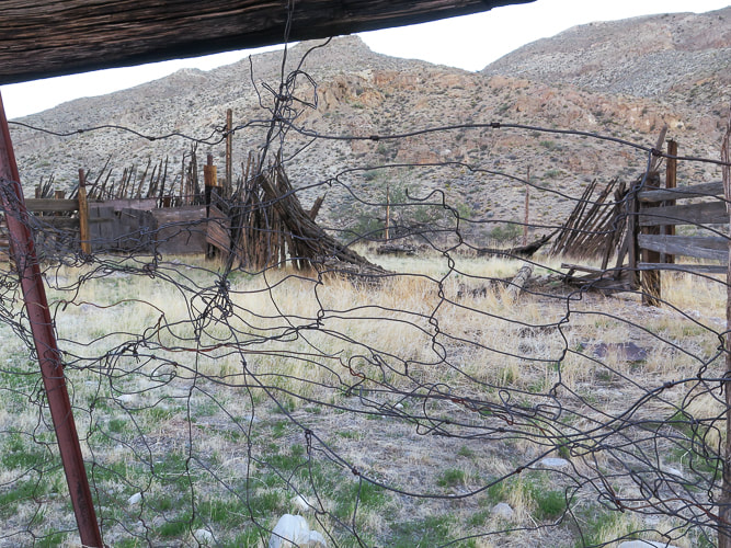
Whitney Corral - a glimpse of past ranching. The spring that once provided for cattle is reportedly dried up.
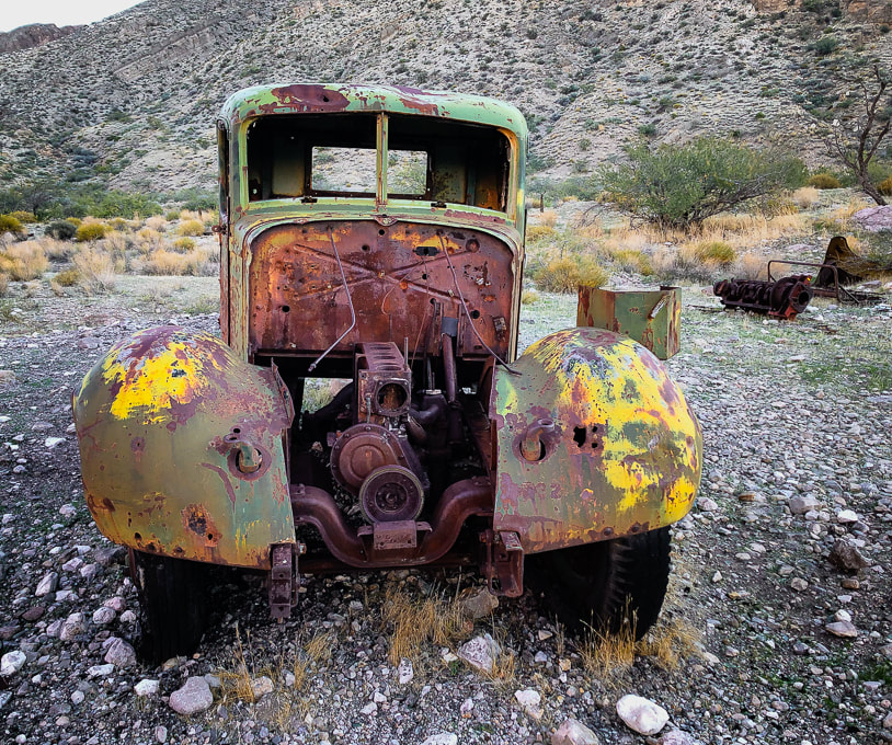
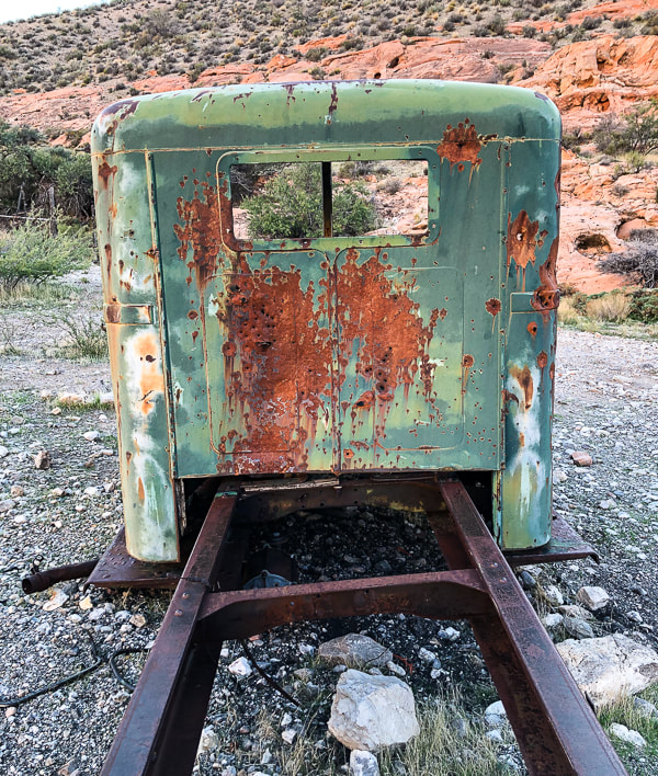
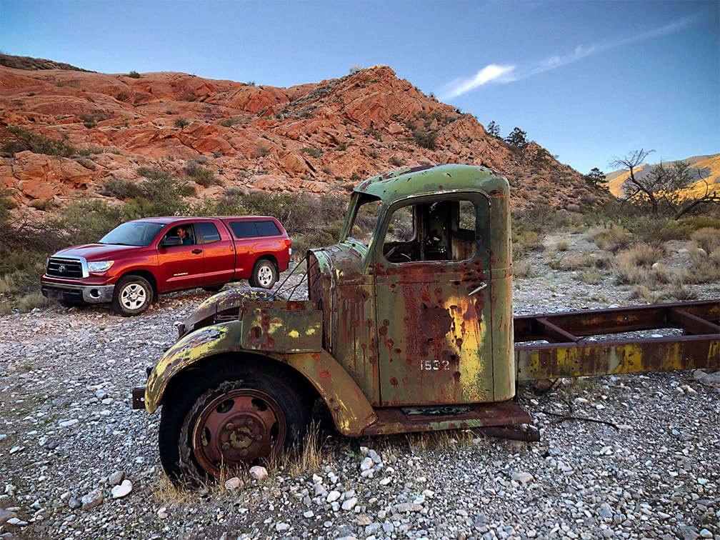
A thing of beauty - look at that patina!
Narrower, high clearance vehicles would be able to get up the road further than we did.
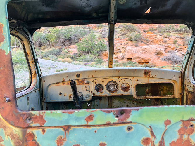
I used the waypoints from birdandhike.com and Avenza with the Arizona Strip Map loaded to make sure I was at Cowboy Campsite. Stay on the main road. Two spur roads take off to the right, but you want to stay left near the ridge you will be mounting. Near the Cowboy Campsite, three miles from the corral, remnants of ranching gear appear: old truck tires, water troughs, the metal skeleton of a chair and various other rusted relics and another old truck! See my waypoints table below or check out birdandhike.com waypoints.
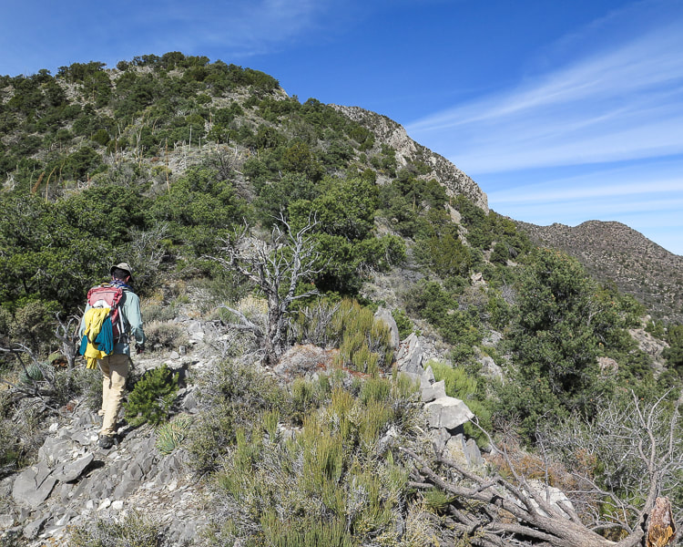
From Cowboy Campsite you turn left onto an obscure spur road ascending toward ridge through trees and shrubs that runs southwest as you climb overlooking the canyon and road you just climbed.
Near Cowboy Campsite with view of Virgin Peak's southwest ridge to climb. Road goes left at intersection with wash.
Second Segment: Cowboy Campsite to Virgin Peak's southwest ridge.
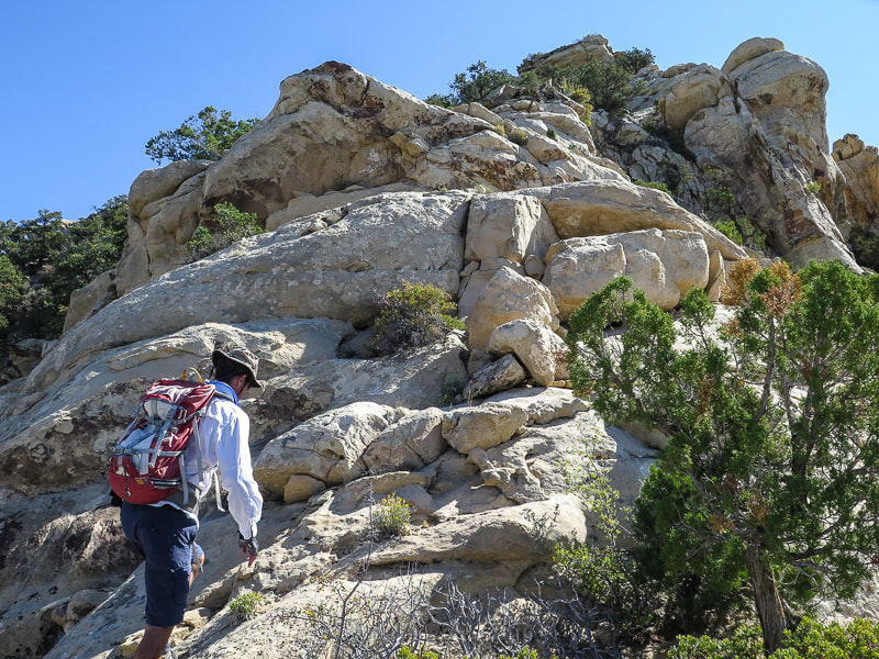
We turned right (west) off the spur road at its highest point and started ascending through junipers and brush toward the ridge, eventually got above this forest and saw limestone cliffs at ridgeline. The climb is 500 feet in ~ 0.3 miles. We hiked to the right of the cliffs to get onto the ridge instead of hiking to the lowest point on the ridge to the left of cliffs. We did, however, descend on our way back from the lowest point on the ridge down to Cowboy Campsite. 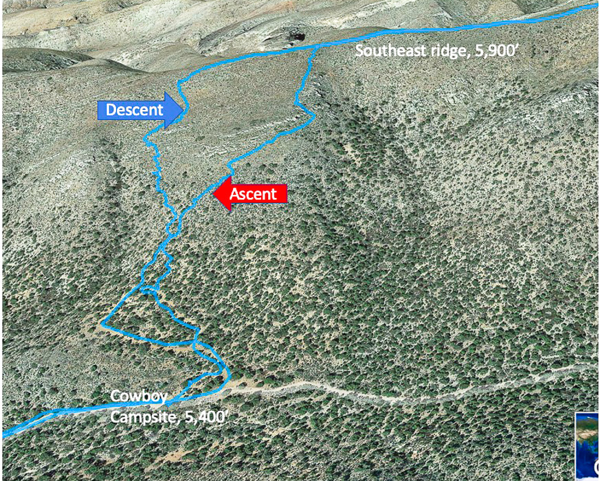
Ascent/descent from Cowboy Campsite and 4 WD road to Virgin Peak's southwest ridge. Ascended right tracks, descended left tracks. Top of map is west, ascend ridge walking west, then turn north to hike to summit.
Some Cool Stuff on the Trail
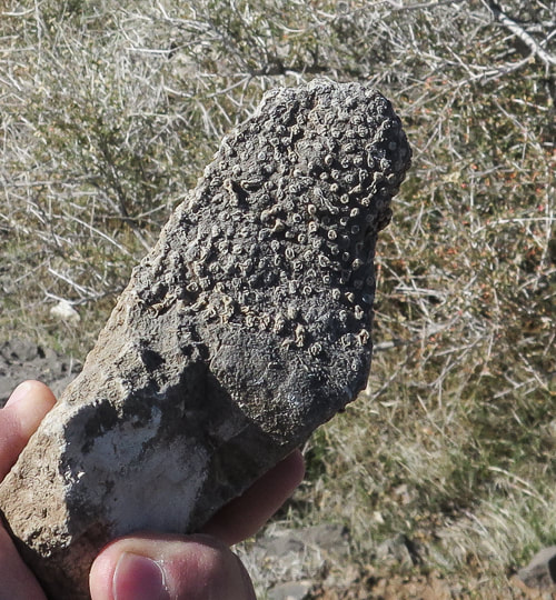
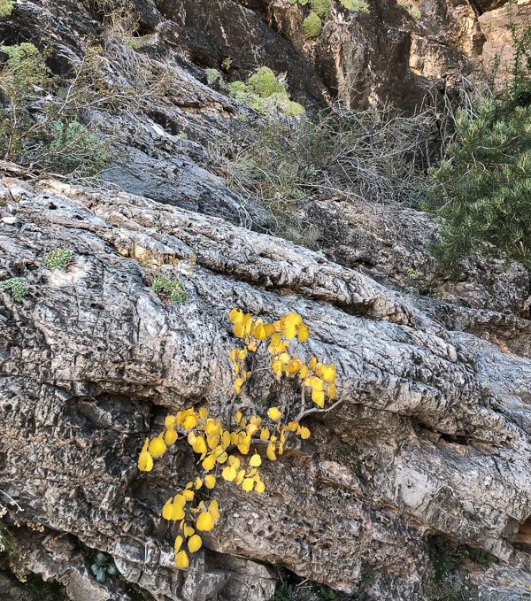
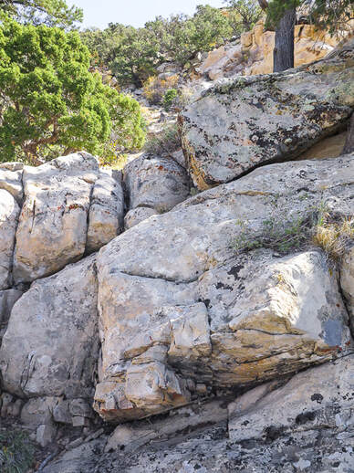
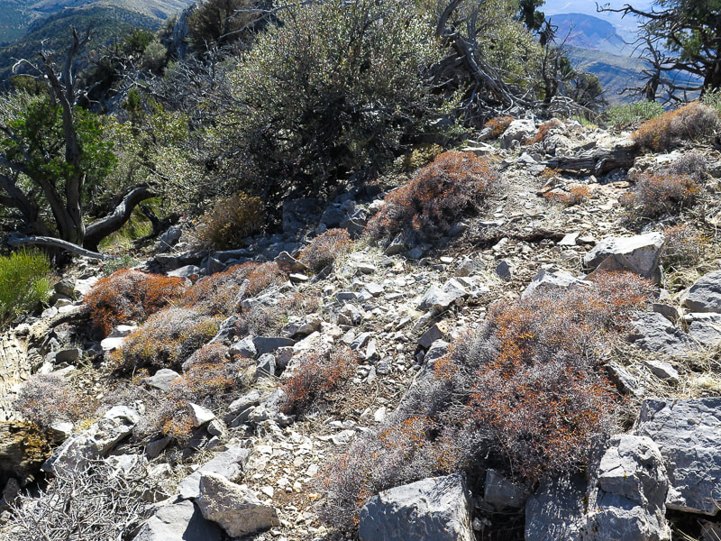
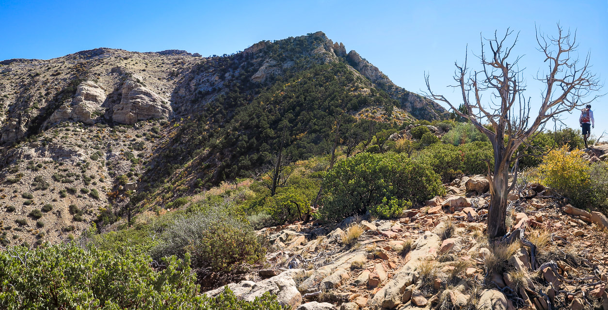
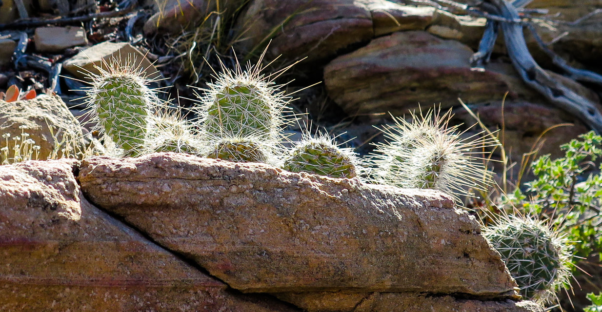
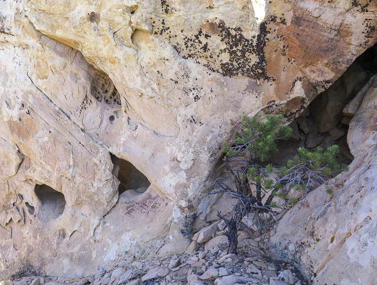
On Virgin's ridge: lots of fossils including brachiopods and corals, a small burn area probably from 2020 fire caused by lightning. I believe the upper right plant is a Utah agave; I have never seen a flower stalk quite like that before!
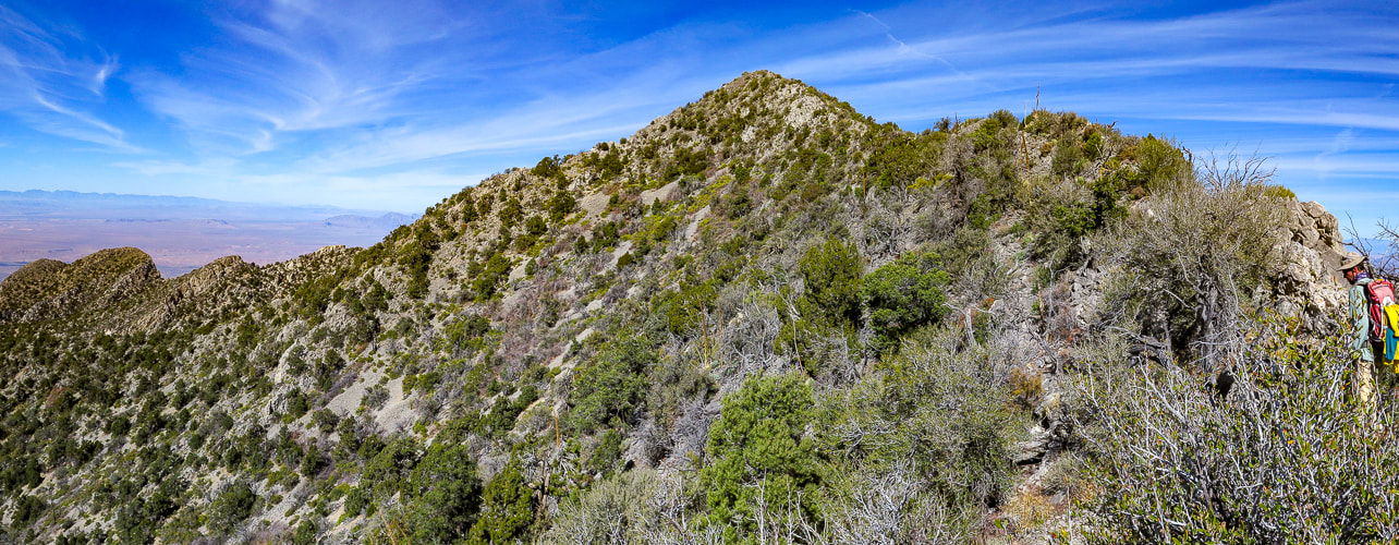
Final Segment: Ridge to Summit
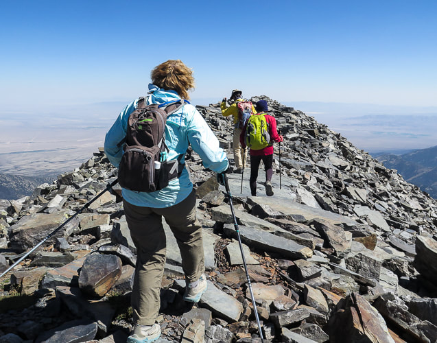
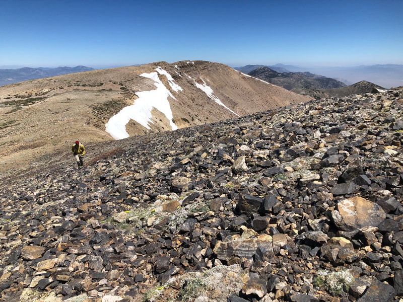
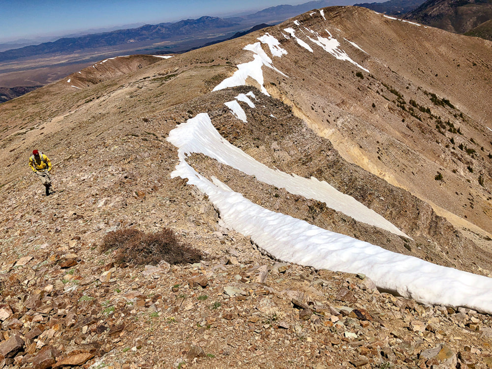
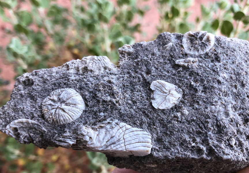
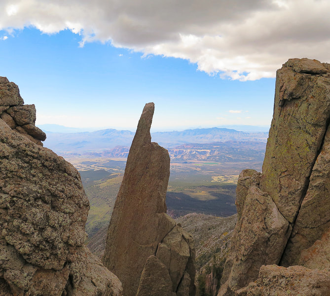
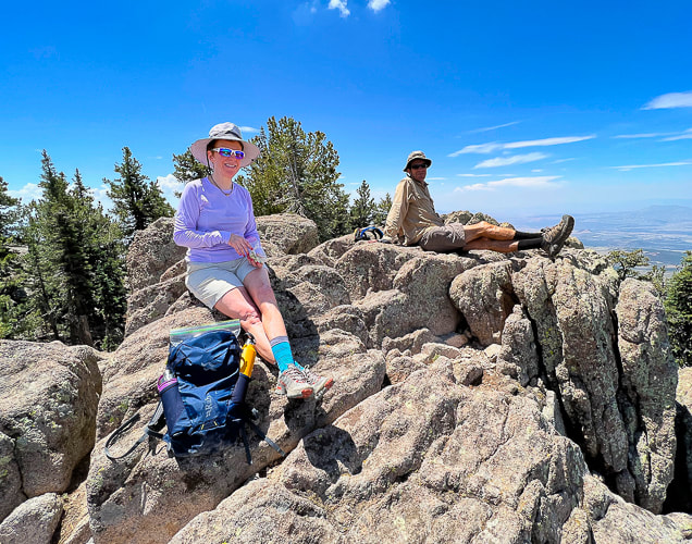
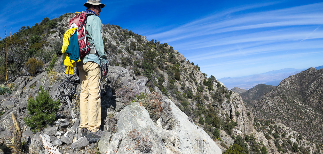
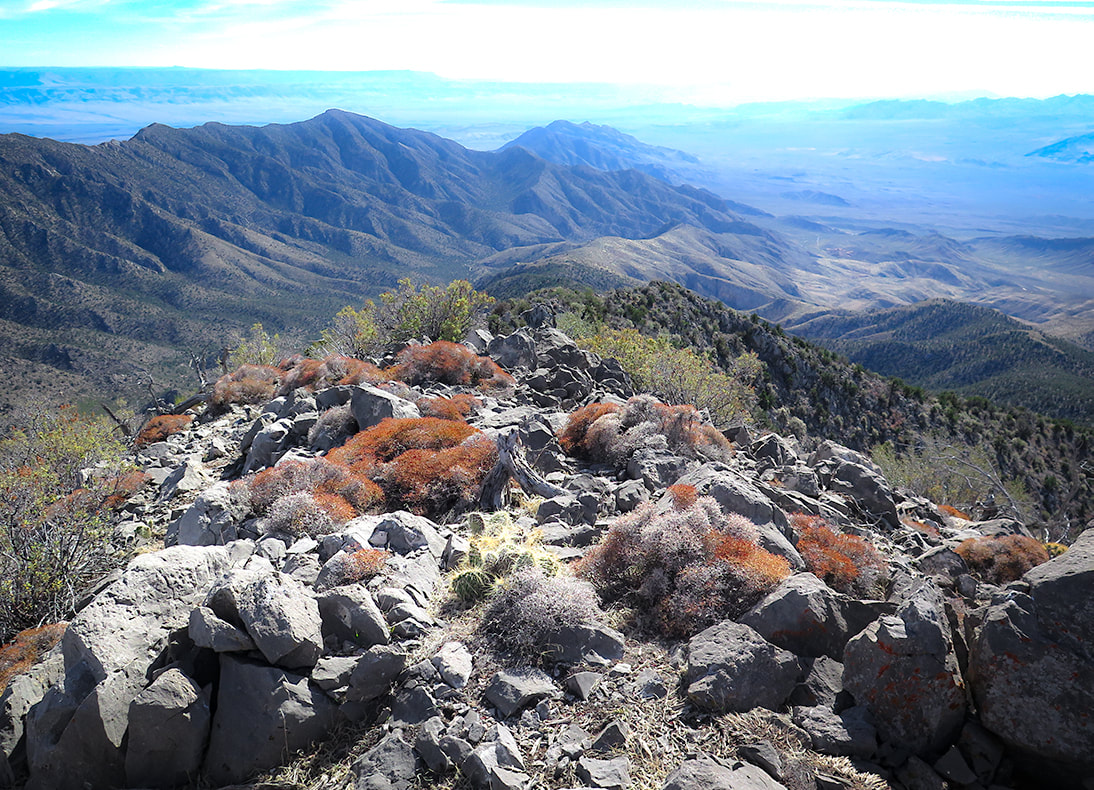
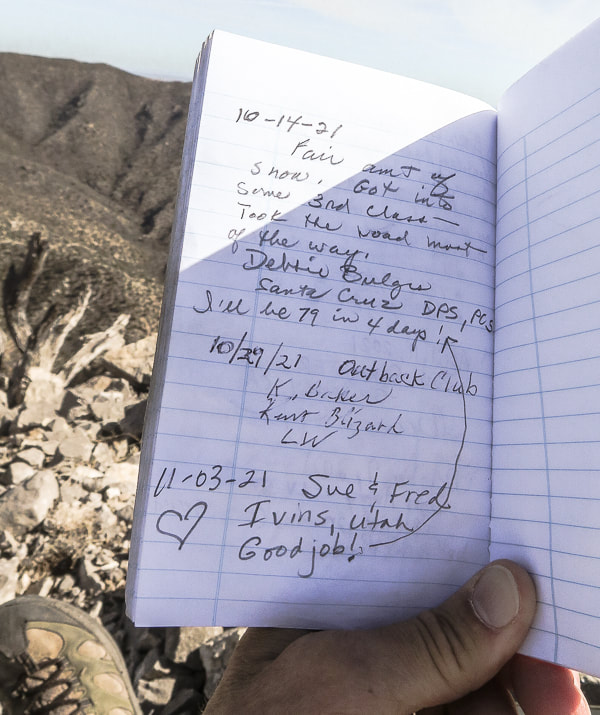
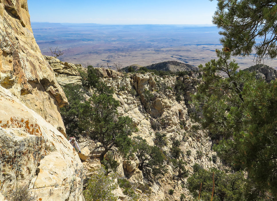
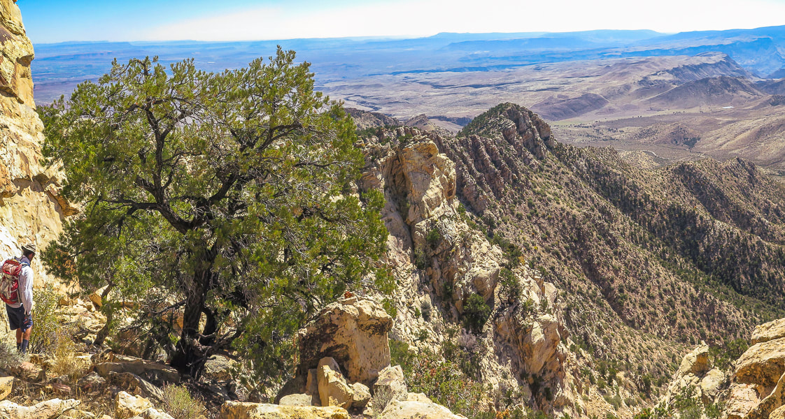
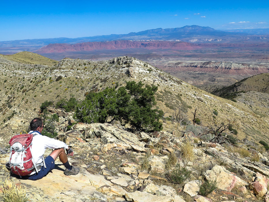
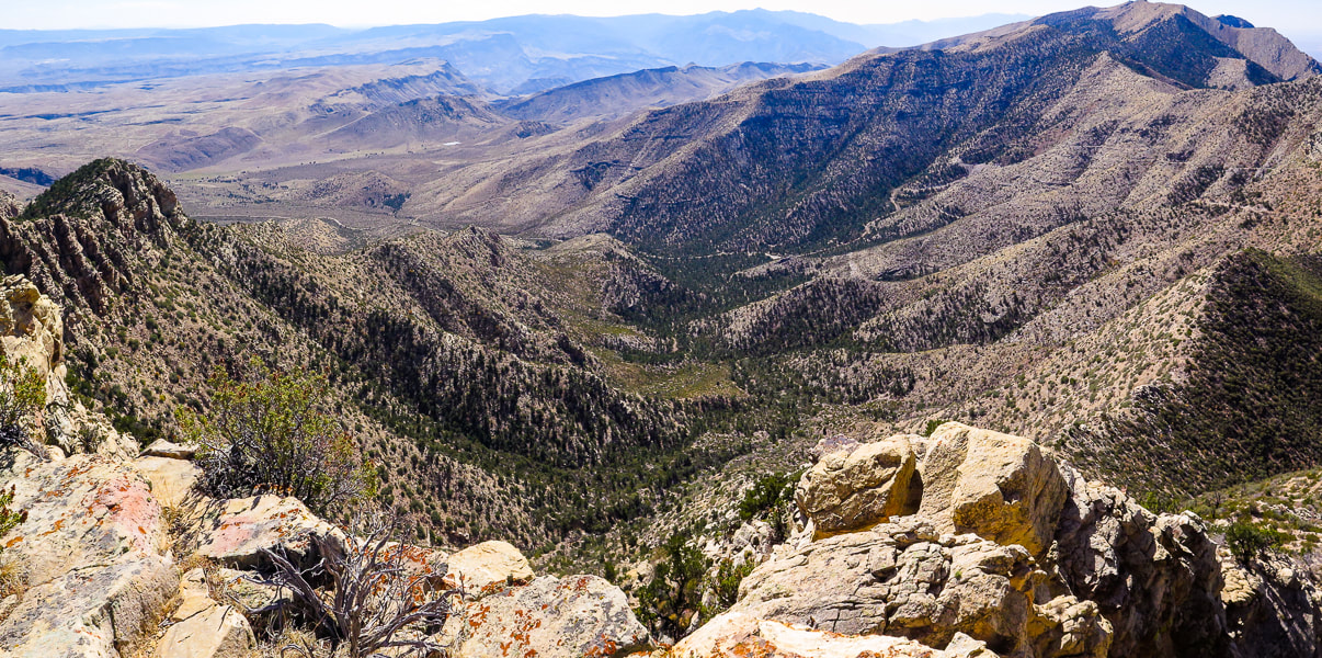
Once on the ridge, follow it 2.3 miles to the summit. The view to the west opens up; Lake Mead is seen (it looks really low) as you ascend the ridge. The ridge heads north to the summit. Wide at first, the ridge narrows and becomes steep to its right (east) side as you ascend. A trail can be seen, especially as you get toward the summit. There are numerous fossils including brachiopods and various corals. Occasionally the light-colored summit is seen behind other "pseudo" peaks or high points on the ridge. There are a few trails that lead downward off the ridge; try to stay on top of the ridge or slightly below it to the west. You will do a fair amount of bushwhacking through trees and cacti. There are a few times hands are used to maneuver up/down rocks. From the summit, the small city of Mesquite, Nevada is due north. The yellow sand washes of Arizona's western Grand Canyon-Parashant National Monument spread to the east. Lake Mead, the largest U.S. reservoir that supplies water to 40 million people, is a small blue line to the southwest. A good view of Pleistocene relict Douglas fir forests are seen in isolated patches just below on Virgin's northeast ridge. The peak's register contains a few small notebooks - one from the Desert Peaks Section of the Sierra Club inside an old ammo box. Two other groups had signed it in October. One of the entries proclaimed, "I'll be 79 in 4 days!". Remarkable. I hope I will be able to write that entry into a remote peak register some day, far above the desert floor. 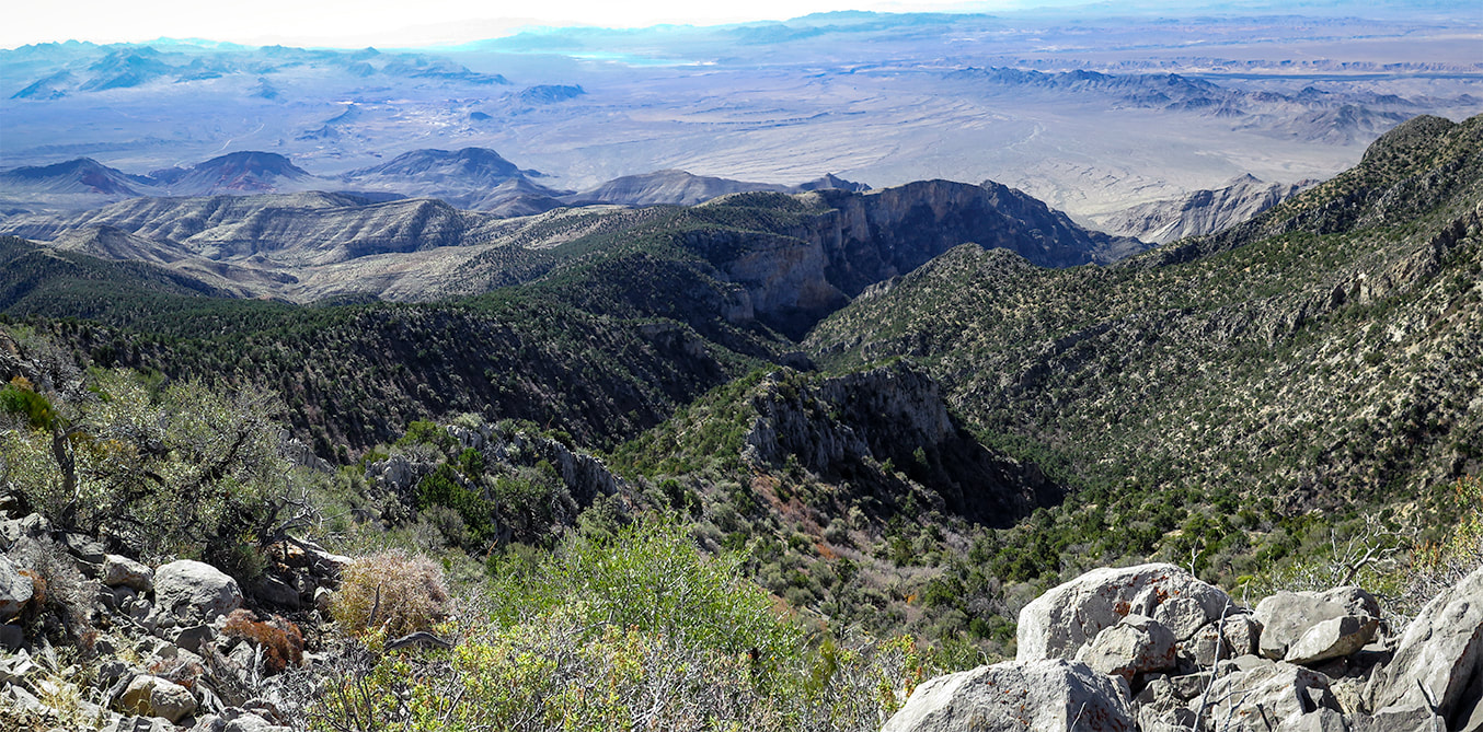
View of Lake Mead to the southwest at top of image.
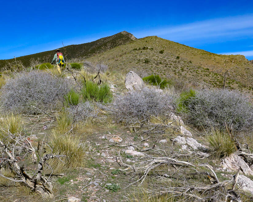
A view of Virgin Peak ahead.
One last rise to climb before the final summit climb (just to the right of this rise).
Getting up there! Ridge is a series of rises.
The last climb to the summit over increasingly steep and rocky terrain - just under 8,000 feet here.
Virgin Peak summit looking south: South Virgin Peak Ridge on the left, Whitney Ridge behind it, Arizona top of image.
Tilted limestone beds to the west.

Virgin Peak register box.
Summit register: an official Desert Peaks Section of Sierra Club notebook.
Solitude in the Mojave Desert
One of the great American nature writing classics, The Desert: Further Studies in Natural Appearances by John C. Van Dyke has been in continuous publication since 1901. Through his descriptions of his travels in the deserts of California, Arizona and Mexico, Van Dyke changed the popular perception that the desert was a hostile wasteland. The book is a bit monotonous, like Thoreau's On Walden Pond, but Van Dyke helped us to see and appreciate the remarkable beauty of deserts. I can relate to his quote and falling in love with what I call "the desert":
"The weird solitude, the great silence, the grim desolation, are the very things with which every desert wanderer eventually falls in love. You think that strange perhaps? Well, the beauty of the ugly was sometime a paradox, but to-day people admit its truth; and the grandeur of the desolate is just as paradoxical, yet the desert gives it proof."
After seeing no one else on the trail, having our own private camping spot the night before, and walking through a few life zones gaining almost 4,000 feet to look over mountains and valleys, we felt as light and as "in balance" as the surrounding environment, in-tune to the rhythms of the living desert. Each hike and each peak has its own personality, and once you understand the desert's "personality" and ways that its plants and animals survive harsh conditions, you can oftentimes relate and then be amazed. What a great way to reset and rejuvenate and relax. We are lucky to live in America's southwest desert in which there are many places to find abundant peace.
Never Stop Exploring Nature!
On the way down
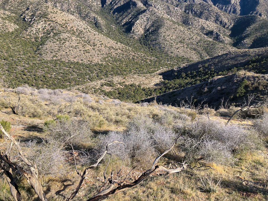
Near point on ridge to descend to Cowboy Campsite in wash below.
Signs of autumn on the way down.
The new and the very old.
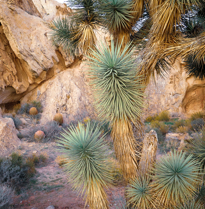
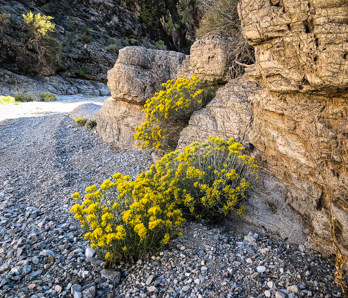
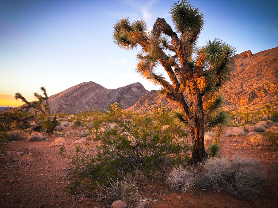
Joshua trees at Whitney Pocket.
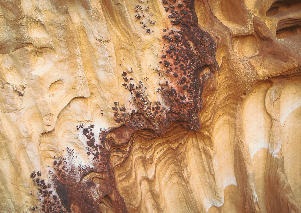
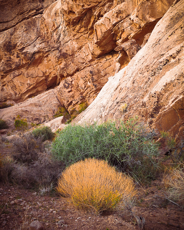
Detail in sandstone at Whitney Pocket
Iron oxide concretions caused by precipitation of iron in paleogroundwater through sandstone 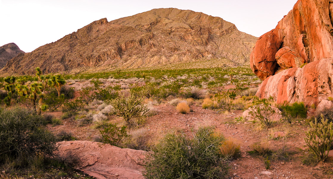
At Whitney Pocket in Gold Butte National Monument: Younger orange sandstone and very old limestone ridge on each side of a cholla and joshua tree-filled valley.
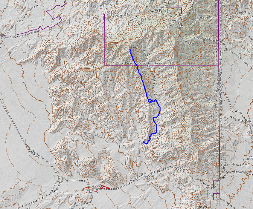
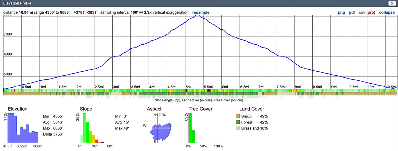
Our GPS tracks and profile. Top of the map is north.
References
The Geology of Gold Butte National Monument - a thumbnail sketch. Friends of Gold Butte.org. Geologic Formations of Utah. Navajo Sandstone. UtahGeology.com. Recreation visits by month, Zion NP. nps.gov. Hiking around Las Vegas and Gold Butte National Monument. birdandhike.com Lake Mead Drops to a Record Low. NASA Earth Observatory. Stringfellow, J. 2015. John C. Van Dyke and the Desert Wasteland. mojaveproject.org. Whitney Pocket. The American Southwest.
7 Comments
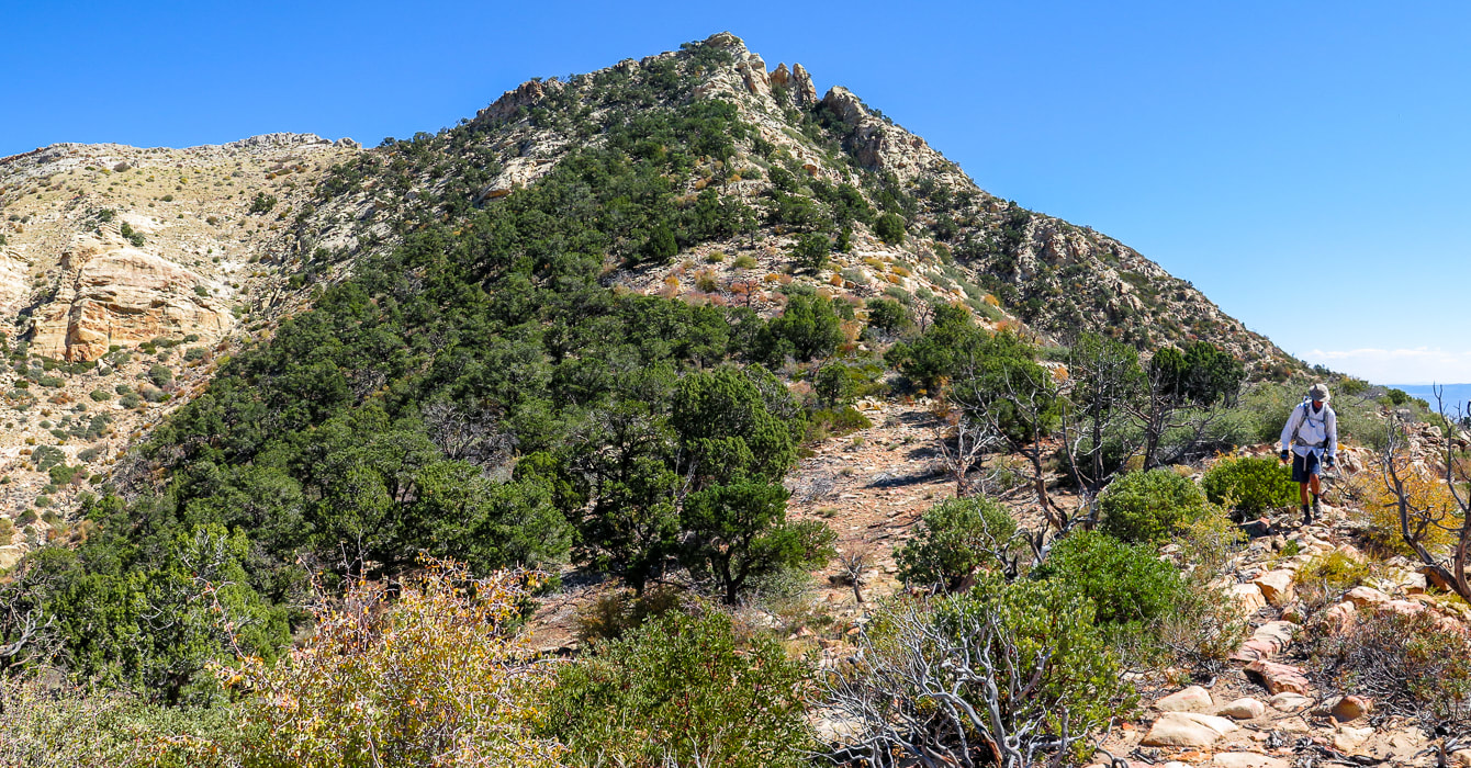
Break out of the "typical" southwestern Utah hike to discover more remote and interesting backcountry adventures. A short hike up Jarvis' northwest ridge rewards with expansive views of two distinct physiographic regions: the Colorado plateau to the east and the Mojave Desert to the southwest.
Approaching the final ascent on Jarvis Peak's northwest ridge.
Easier route switchbacks just left of summit through pinyons and junipers. Want a more "exciting" ascent? - go around to the right beneath the crags. 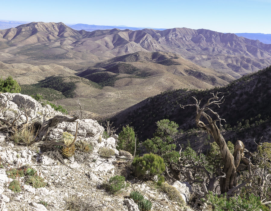
View of Jarvis Peak (highest point on the left side of range) from near summit of West Mountain - Beaver Dam Mountains.
Trip Stats
Location: Beaver Dam Mountains, west of St. George, Utah. This mountain range extends into northern Arizona. Distance/Elevation Gain: 2 miles out and back: 1,100' gain. Start of ridge = 5,453', summit = 6,533'. Coordinates: Trailhead: UTM 12S 0250585E 4108377 N (WGS84). Jarvis Peak: 0251503E 4107770 N. Difficulty: Moderate Class 1 and Class 2 with minimal exposure if use north route around summit block; Class 3 moderate exposure south route. Maps: USGS 7.5 min topo map - Jarvis Peak, Arizona Strip Visitor Map from BLM, All Trails app. for Jarvis Peak. Date Hiked: October 2, 2021 Considerations: High-clearance 4WD needed on access road to base of Jarvis' west ridge, due to rocks and ruts. Walking the road adds 1.7 miles one way. Driving Directions: From St. George, drive northwest on Old Highway 91. Soon after you pass Ivins and cross over the Santa Clara River, reach a junction with Hwy 91 and Gunlock Reservoir. Take a left to stay on Hwy 91. Travel 7.1 miles to the Utah Summit. At the pull-off parking area to the left (east), follow gravel road (not marked and steep and rocky in parts) east for 1.7 miles to a pull-off to the right at a sharp left switchback in the road and park. Jarvis' western ridge to the left is gained in a few hundred feet of walking further on this road. Hike Directions: shortly after parking, walk up road a few hundred feet to see a path on left side of gravel road to gain Jarvis' ridge. Trail is seen most of the hike, with occasional rock cairns - basically stay more or less on top of the ridge. On the way up, the trail treks slightly left of the ridge to avoid cliffs to the right. At the final saddle below the last steep ascent, go up through the trees to the left of the summit for an easier route. We went around the summit's right (south) side but found it difficult to reach summit due to Class 3-4 climb up final summit block.
Related:
Overview
You would think that a spectacular 360-degree multi-state and multi-region view from a summit is earned only after a long and arduous hike, but not true with Jarvis Peak. After a short drive from St. George in southwestern Utah and a short one-mile hike, we were looking at Arizona on one side, and Utah on the other. To the northeast, a fantastic view of Red Mountain's cliffs stands out in a long crimson row beneath the snow-dusted peaks of the Pine Valley Mountain Wilderness. The rock towers of Zion Canyon capture the horizon to the east. The huge, dry and rugged Arizona Strip, north of the Grand Canyon with its mountain ranges and alluvial fans spreads to the south. West Mountain Peak with its communication towers, the highest point in the Beaver Dam Mountains (7,680'), is seen not far away to the northwest. The Beaver Dam mountain range is a "sky island" that rises high above a sea of thinly vegetated, dusty, stark, and monotone desert, with the exception of the bright red sandstone in the St. George area. It's great that we can choose either mountains or low desert, according to seasons. It feels like wilderness until you see the cities of Ivins and St. George to the east. The Beaver Dam Mountain range straddles three distinct physiographic regions (provinces) of the southwest -a "geologic triple junction": the Mojave Desert, the Colorado Plateau and Nevada's Great Basin. If you live in St. George, you have access to all of these regions. I know the grandeur of Zion National Park can't be beat (except by the Grand Canyon), but the solitude, beauty, and geologic features of the remote backcountry and wilderness surrounding it is just as noteworthy. Fred and I are discovering that this huge region of southwestern Utah is an adventurer's paradise. And since I am a self-described "geology nerd", there is a lot of area to study and learn about in this region (see "For the Geo-curious" below). 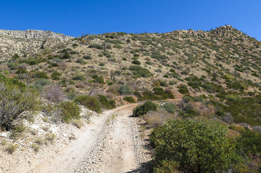
Beginning of hike, just a few hundred yards from parking on this road; trail leading up to top of ridge - Jarvis Peak behind ridge in this photo.
Quite possibly Mojave prickly pear, AKA Old Man prickly pear.
Our Hike
The huge view of southern Utah and northern Arizona from Jarvis Peak is just a one-mile hike from start to summit. It's not everywhere you can get a grand view in such a short distance. The gradual climb up the northwest ridge is not hugely exciting, but if you go around the right (south) side of the mountain it gets a lot more interesting with Class 3 climbing up final cliff to summit. We summited using the left (northwest) side of the peak. The 1.7-mile 4-wheel drive road from Utah Hill on Highway 91 to the base of Jarvis Peak's northwest ridge gradually becomes steeper, more narrow with ruts and rocks. If you choose to walk the road, the total hike distance out and back would be ~ 5.5 miles. The trail to Jarvis Peak begins just a few hundred yards after parking up the gravel road. It gains the ridge pretty quickly and then stays on it, going through thickets of manzanita and ducking under junipers and pinyon pines. It is marked occasionally by rock cairns as it meanders in sand around and on top of sandstone rocks. The greens of prickly pear, pines, juniper and lichens mix perfectly with the reds of manzanita branches, stained sandstone and pinyon pine cones to create a pleasing southwest desert landscape. 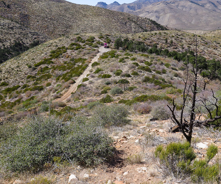
Trail (bottom) not far from where we parked (top of image).
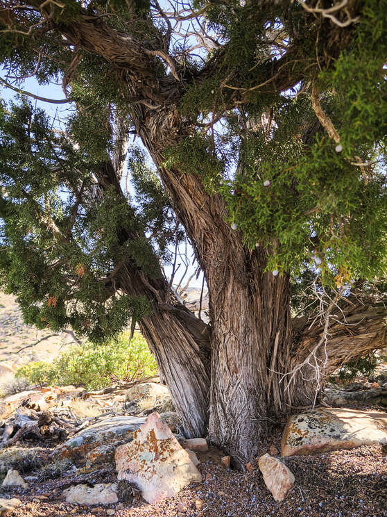
One of the largest junipers I have ever seen!
We stayed as close to the crest of the ridge as possible. This hike rambles up a series of short climbs and short saddles. Upon reaching the last saddle at the base of the final summit ascent, there is a large rock cairn placed toward the left side of the base. We ignored its subtle direction, telling us to go left. Instead, we first went to the right around the south side of Jarvis Peak, stepping quickly across a loose-rocked steep gully to the back of the peak. I found the short and final Class 3 climb up a vertical crack in cream-colored Queantoweap sandstone was too exposed, because the platform is narrow, slippery and drops steeply. So, we retraced our steps and went by some cool-looking sandstone caves, back to the rock cairn and then found our way up through a gentler, but still steep slope to easily gain the summit.
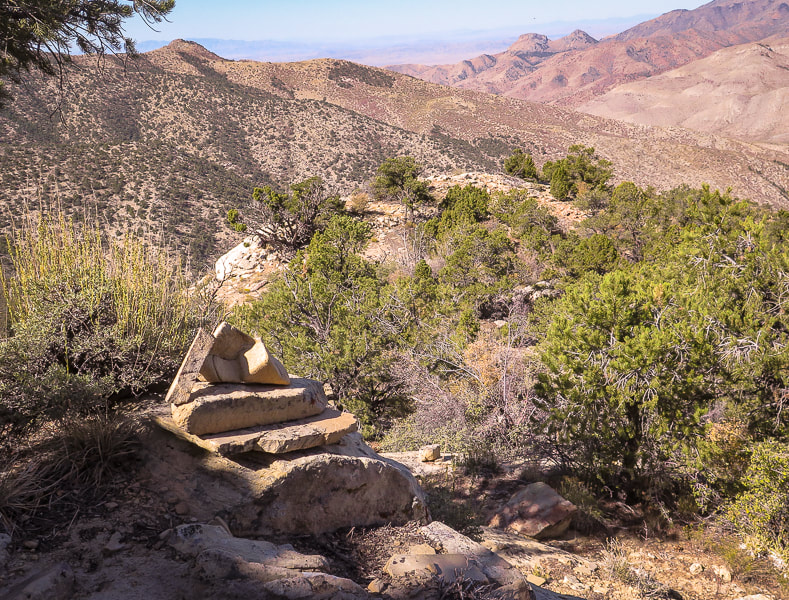
A rock cairn marks the base of the final peak ascent, directing you to the left side of the summit, up through trees.
We originally went around to the right - up the canyon in shadow with two pinnacles, but I found that final summit cliff too daunting; we came back down and climbed to left of summit through the trees.
Heading toward south side of Jarvis Peak
Maneuvering around the steep back side of summit - Fred behind sandstone ourcrop lower left.
The backside (east-facing) of Jarvis Peak with the sandstone cliffs on east side of its summit.
Jarvis Peak summit looking to the east: Red Mountain near St. George and Pine Valley Mountains on horizon.
Huge pine tree on southeast side of summit.
For the Geo-curious
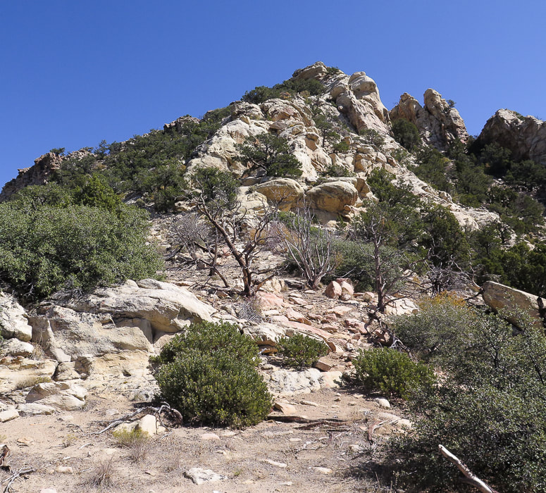
Jarvis Peak is located in the eastern Beaver Dam Mountains where a "magnificent set of sedimentary rocks" is described by authors of Geologic Map of the Shivwits Quadrangle, Washington County, Utah. This area of southwestern Utah/Northern Arizona is geologically significant not only because it includes all the major rock types - igneous, sedimentary, and metamorphic, it also sits between the Colorado Plateau to the west which includes the red and orange rocks of Zion National Park, the Great Basin and Range Province to the west, most easily described as parallel mountain ranges caused by spreading, and the Mojave desert to the south. The geology in the Beaver Dam Mountains is certainly not lacking in variety; it includes major folds as well as structures caused by the earth spreading, alluvial fans and just about every kind of fault. The Redwall Limestone forms impressive cliffs and has abundant coral fossils. It was easy to find geologic maps. You will be hiking on Queantoweap Sandstone (Permian period) on the way up to and including Jarvis Peak, and on its west side look over siltstone and limestone containing fossils. This sandstone is massive (homogenous, lacking internal structure), cliff- and ledge-forming, gray to pink in color, best seen on the right (south) side of peak.
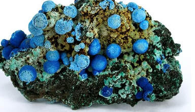
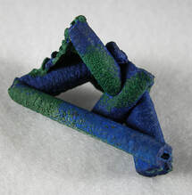
Apex Mine - just one mile south of Jarvis Peak. More recently, ore was mined for its gallium and germanium content. Gallium is used in semi conductors and electronics. Germanium's uses range from infrared optics to cloth and food containers. Copper and silver were originally taken from this mine 1884 - 1962. These are samples of azurite found in this mine. Photos from mindat.org.
Queantoweap Sandstone on Jarvis Peak
Note the honeycomb weathering in upper cavernous recess.
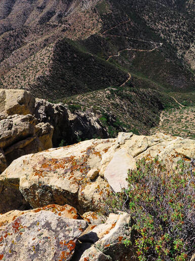
View from the top - road possibly to Apex Mine.
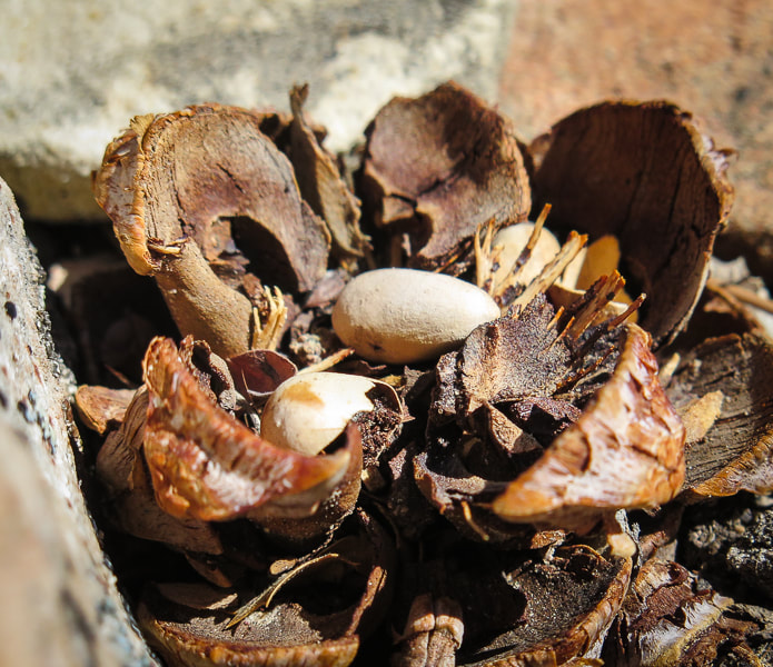
Pinyon pine cone and its seeds - AKA pine nuts
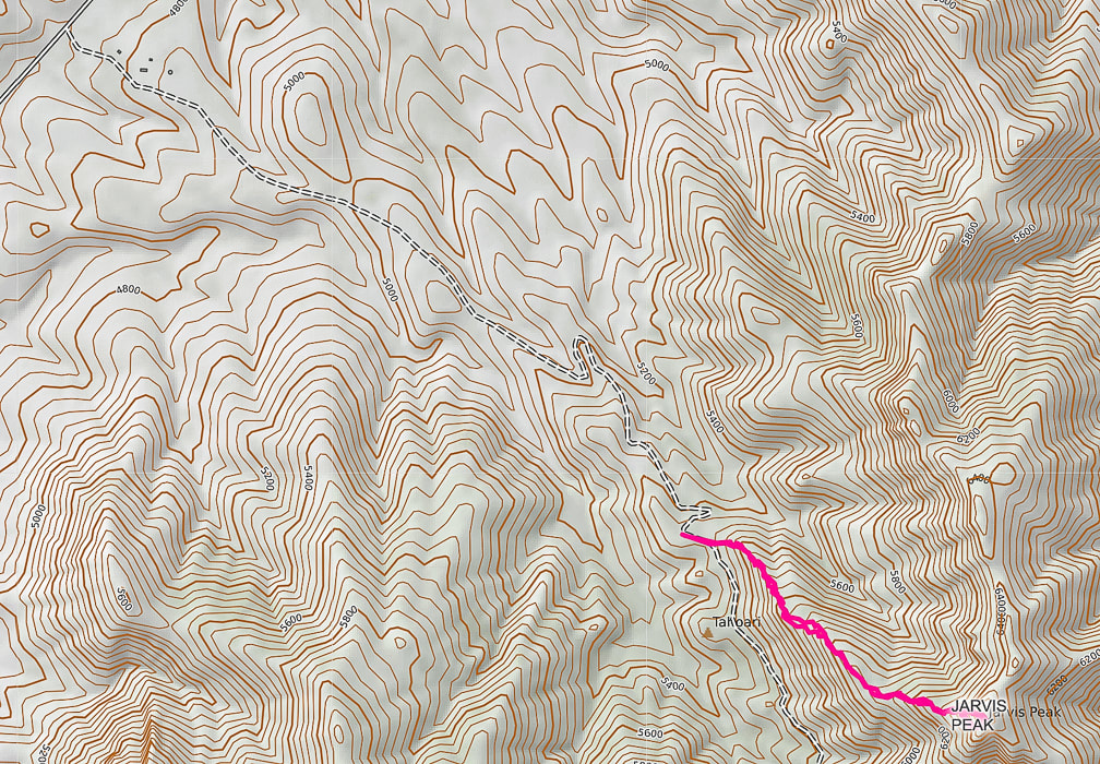
Interactive Google map for Jarvis Peak hike.
Our GPS tracks from access road leading from Utah summit on Hwy 91 to Jarvis Peak.
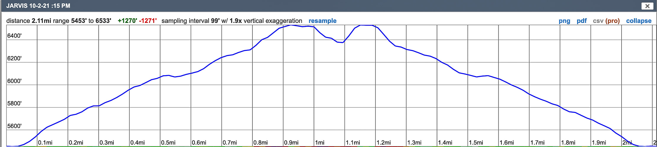
Profile for Jarvis Peak: only one mile to the summit.
The dip in the profile at the summit shows that we reversed our course and went around to the other side to reach summit.
References
BackroadsWestTrip blogs - Unique Landscapes of the Southwest - backroadswest.com. Hammond, B.J. Geologic Map of the Jarvis Peak Quadrangle, Washington County, Utah. Hintze, L.F., Hammond, B.J. 1994. Geologic Map of the Shivwits Quadrangle, Washington County, Utah. Utah Geologic Survey. McNair, A.H. 1951. Paleozoic stratigraphy of part of Northwestern Arizona: American Association of Petroleum Geologists Bulletin, v. 35, no. 3. Mindat.org. Apex Mine. Washington County Historical Society. The Apex Mine (from internet). |
Categories
All

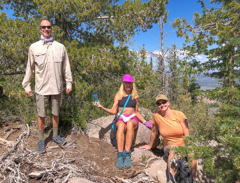
Sue and Fred

About this blogExploration documentaries – "explorumentaries" list trip stats and highlights of each hike or bike ride, often with some interesting history or geology. Years ago, I wrote these for friends and family to let them know what my husband, Fred and I were up to on weekends, and also to showcase the incredible land of the west.
To Subscribe to Explorumentary adventure blog and receive new posts by email:
Happy Summer!

About the Author
|