|
Hike three high points and view the historic Lost Horse Mine along this western Joshua Tree NP trail.
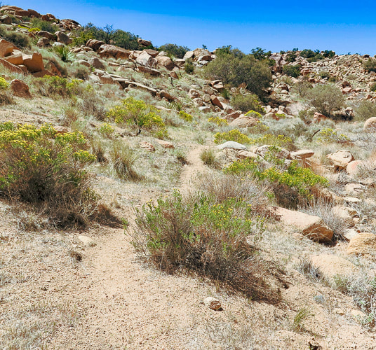
Starting in Quail Wash.
Trip Stats
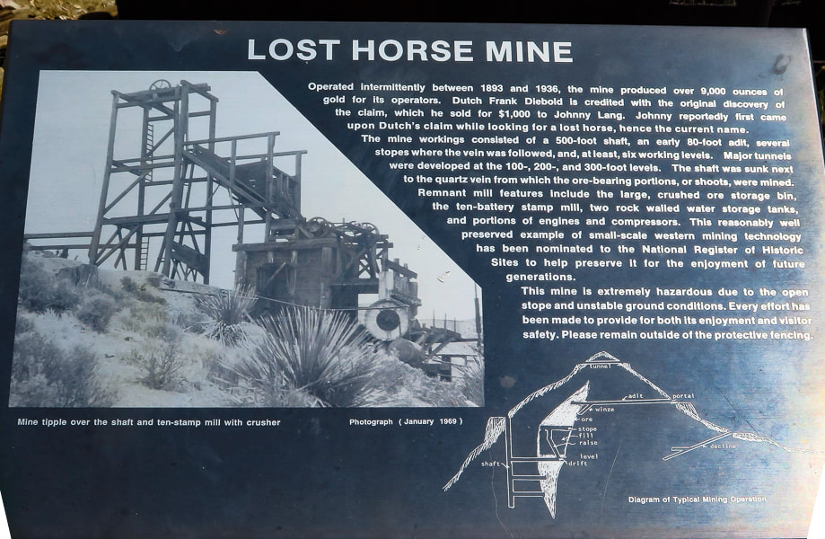
Overview: Make the Lost Horse Loop hike even more interesting by bagging a few peaks along its route to get a feeling of the vastness of Joshua Tree NP and wilderness, with views of San Jacinto Peak in Palm Springs. Check out the plaque that commemorates Lost Horse Mine stamp mill, one of the best-preserved of its kind in our national park system. Coordinates: Lost Horse Mountain = 33°.56'13.74" N 116°.08'10.01" W.
Navigational aids: Trails Illustrated Joshua Tree National Park #226 map.
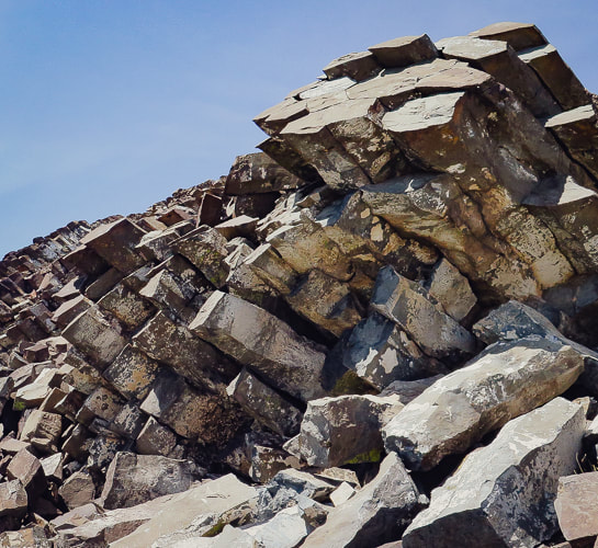
Date Hiked: 4/10/22 Geology: The Lost Horse Loop trail and mine is located in granitic quartz biotite gneiss (metamorphic) related to Pinto gneiss age 1.7 billion years ago - some of the oldest rocks in California. Biotite is dark mica mineral. The Lost Horse Mountains are one of only three occurrences of basalt in Joshua Tree NP.
Cattle rustlers and Gold Mining in Lost Horse Valley
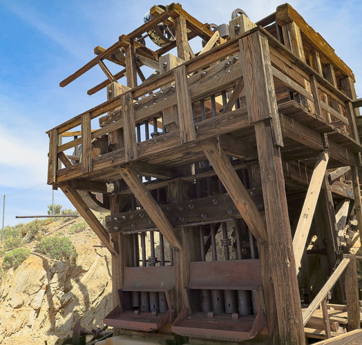
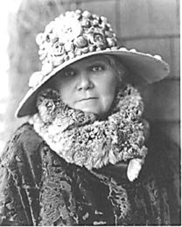
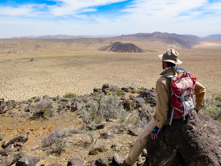
If you were a cattle rustler in the 1870's southwest, you would look for a remote and hidden area with enough water and good stands of trees and plenty of native grasses and other vegetation to feed your "stock". A place where the nearest law enforcement officials were at least 50 miles away. For the McHaney brothers, this place turned out to be the higher, western side of what is now Joshua Tree National Park, in Lost Horse Valley and Hidden Valley. Bill McHaney's gang took cattle from Mexico and Arizona to hide them in other Joshua Tree valleys as well, then returned stolen horses. Johnny Lang also drove cattle into Lost Horse Valley after his brother was gunned down in New Mexico. He woke up one morning to find his horse gone. He tracked it to the McHaney's place but was told to leave the area. Luckily, Lang met "Dutch" Frank who had discovered a mining claim, but was afraid to set up mining operations because he was also being hassled by the McHaney gang. Lang bought the rights to the mine and called it "Lost Horse", after enlisting three partners to protect the claim against claim jumpers in 1893. The Lost Horse Mine ultimately produced 10,500 ounces of gold and 16,000 ounces of silver. Today, the Lost Horse Mine stamp mill is considered one of the best preserved in a National Park service unit. We hiked three high points along this loop. The most interesting summit was Peak 5196 because of the columnar basalt at the top. In a land dominated by granite, this is one of only three occurrences of basalt. From its summit, just northeast of the trailhead, are extensive views of Queen Valley to the east and Lost Horse Valley to the west. A few days before, we had hiked Mt. Minerva Hoyt, named after the woman instrumental in President Franklin Roosevelt's proclamation to designate Joshua Tree National Monument.
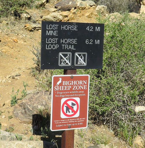
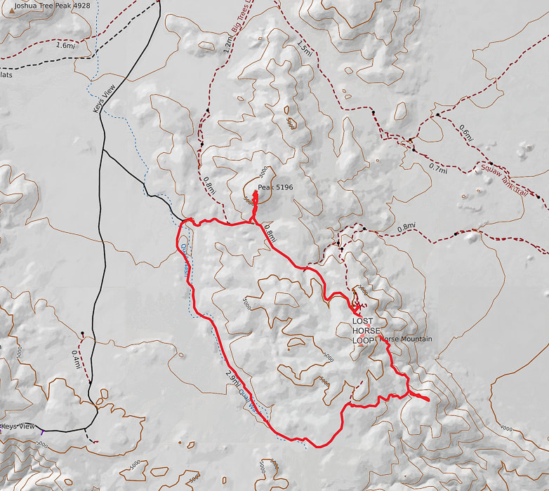
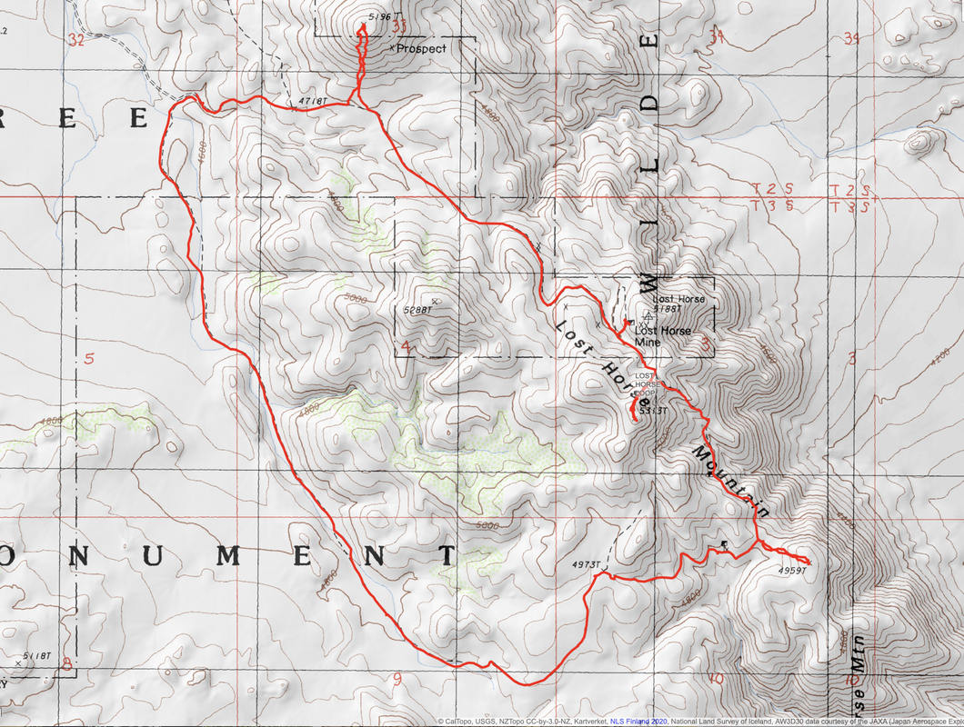
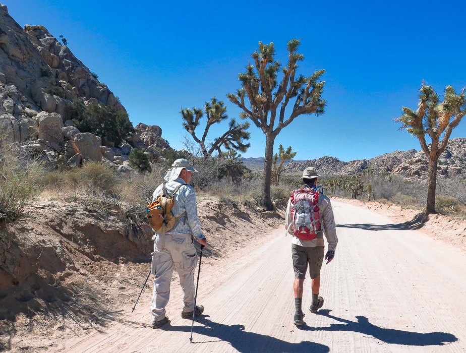
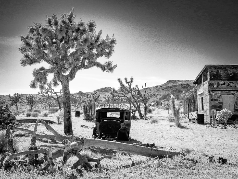
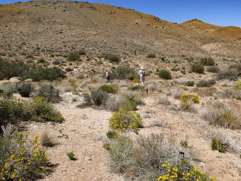
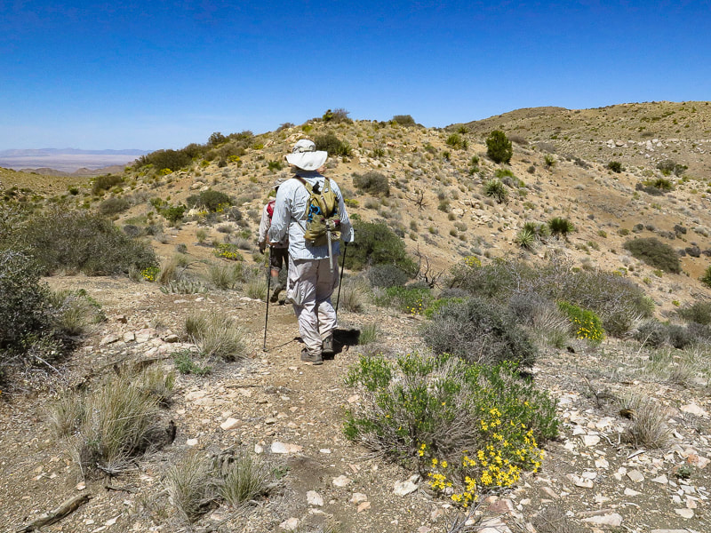
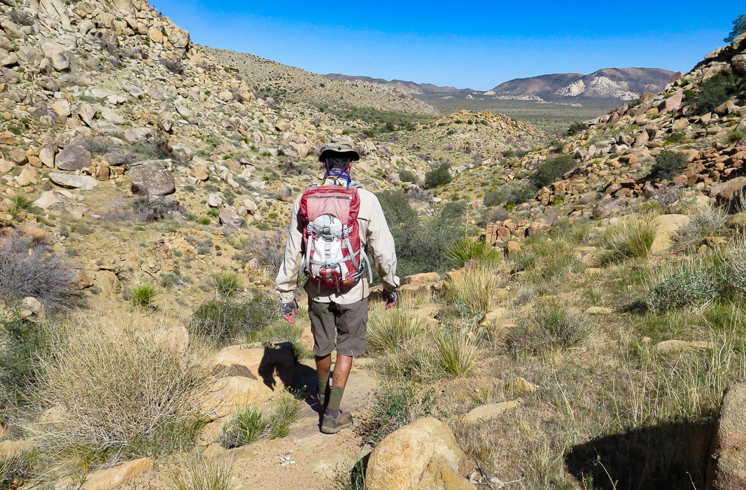
Sign at trailhead. We hiked the trail counter-clockwise.
Our Hike in the Mojave
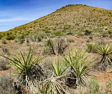
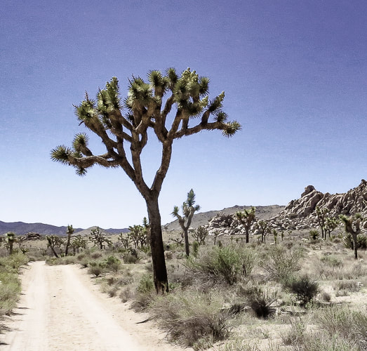
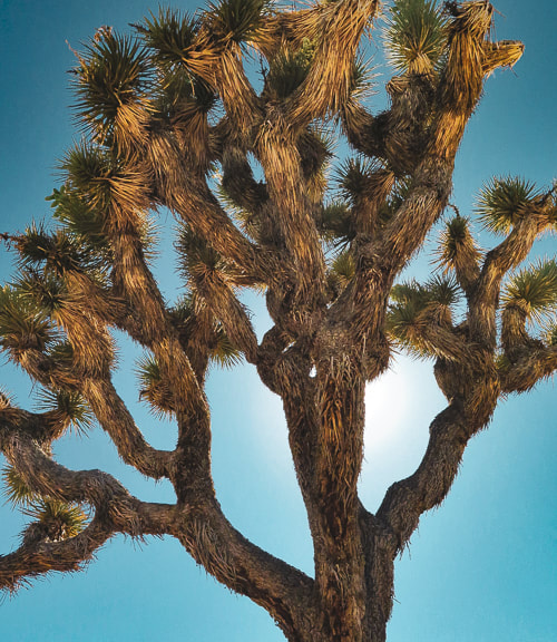
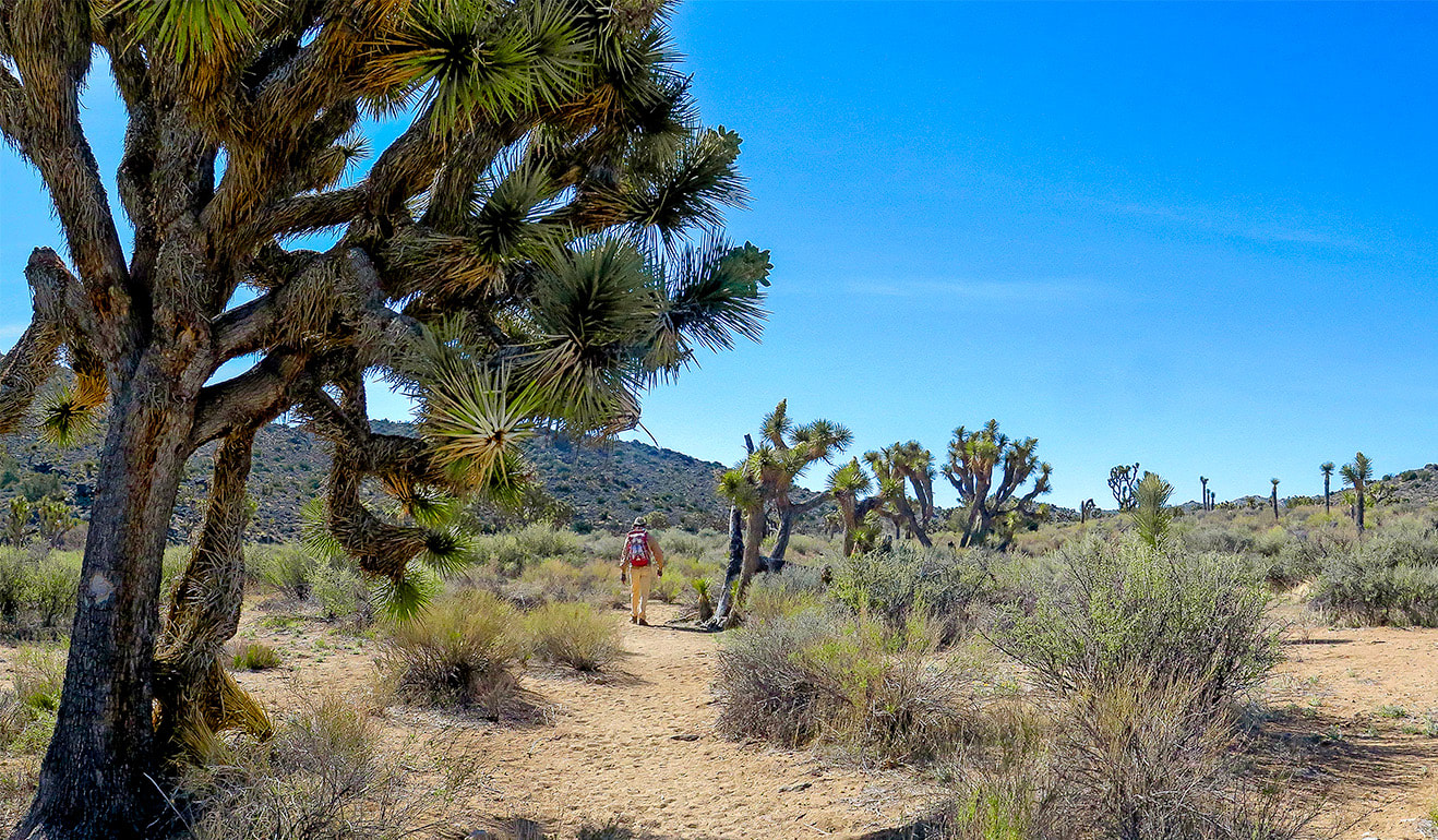
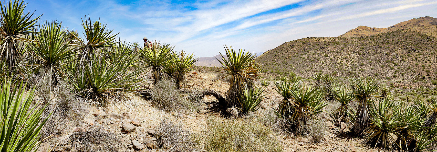
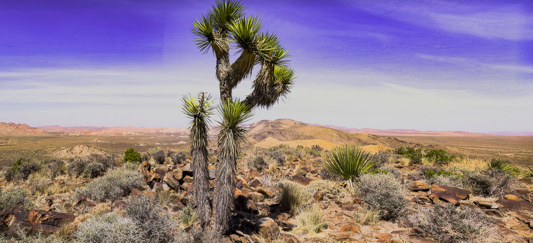
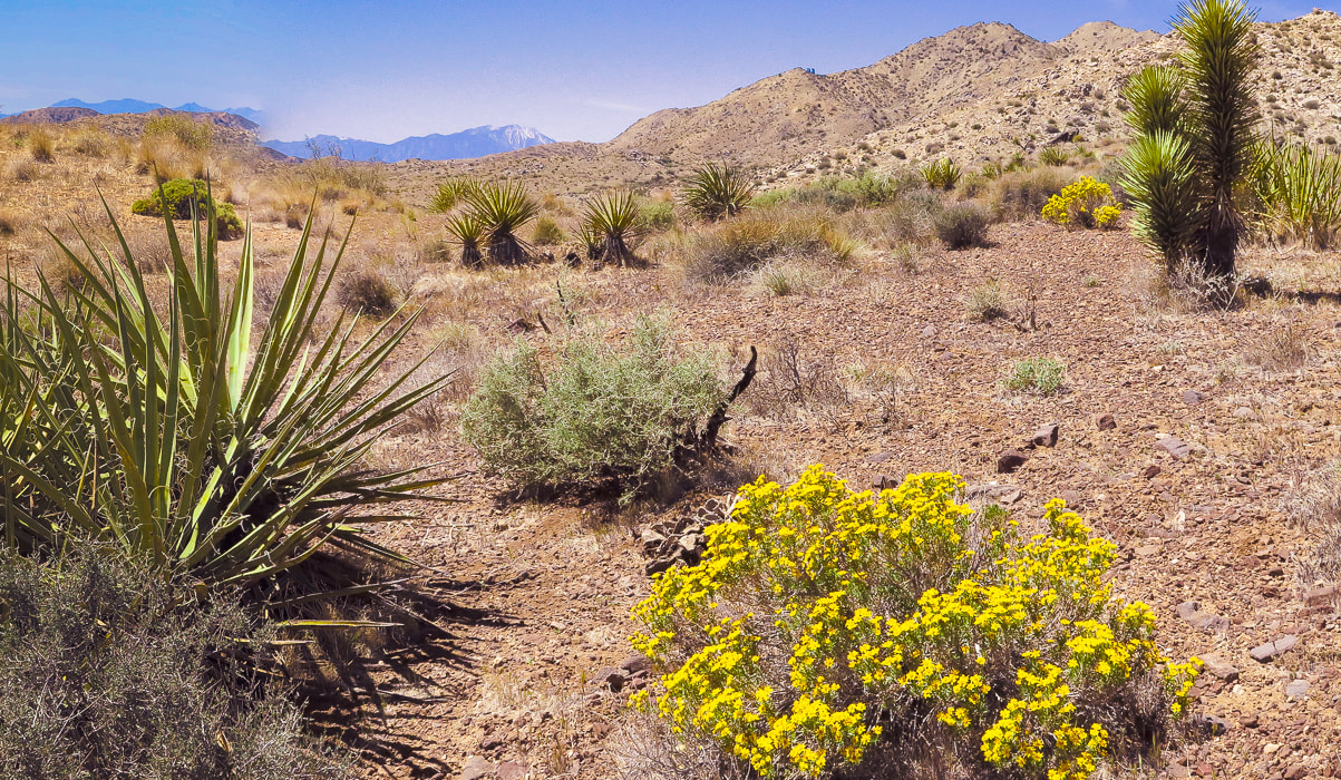
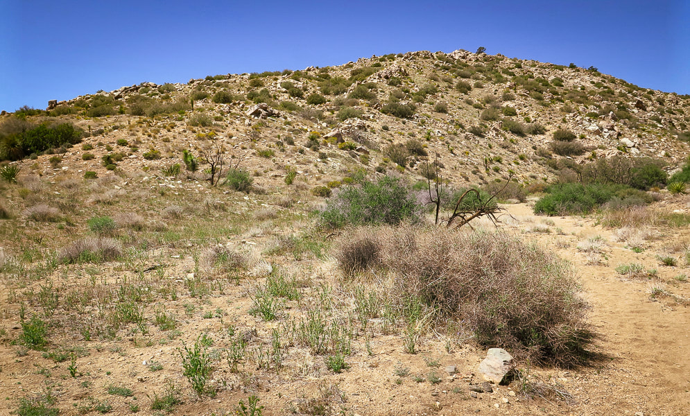
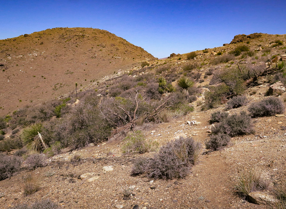
As the road to Lost Horse Trail climbs to around 4,000 feet elevation in the western, Mojave desert section of Joshua Tree NP, the amount of Joshua trees, junipers and yuccas is more prevalent compared to lower, dryer Sonoran desert Pinto Basin to the east at 1,700 feet. Although it's a moderately-used trail, you get the feeling of remoteness surrounded by mountain ranges. The trail circles Lost Horse Mountain, trekking through Quail Wash and over juniper and shrub-covered hills darkly punctuated by scattered gneiss boulders.
By the time we got back to the trailhead parking lot, it was full. Another fun day in Joshua Tree's Mojave desert. The three extra summits were the "icing on the cake" - worth the effort.
Time and Space in the Desert
Joshua Tree is an awe-inspiring land shaped by Earth's events spanning the Proterozoic alteration of pre-existing rocks into gneiss, to the five Proterozoic through Cretaceous intrusions of plutons that produced gold and silver and its famous sculpted rocks, to the relatively recent faulting that uplifted mountains and blocked canyons. A landscape that has a tumultuous origin, but a relaxing presence. Dark and rubbly mountains spring out of flat, buff - colored valleys. A slight haze of dust still hangs in the air after last night's wind storm. I stand looking over it all - breathing space. Back straightens, chest raises, diaphragm brings in creosote and sand-scented air. To some, this expanse and space feels intimidating; to me it feels comfortable. To some it looks formidable with its hot, dry stillness and sharp- spined cacti; but I admire their motivation to survive under the hot, penetrating sun. To walk in browns and buffs for awhile and then suddenly come upon magenta and bright yellow cactus blooms is cause for celebration. I remember liking these ragged and gangly Joshua trees and contrasting smooth, rounded boulders the first time I saw them 38 years ago. I revel in the sublime space and quiet that calms my mind. Grateful for the feeling of being connected to this land.
"Time and space. In the desert there is space. Space is the twin sister of time. If we have open space then we have open time to breathe, to dream, to dare, to play, to pray to move freely, so freely, in a world our minds have forgotten but our bodies remember. We remember why we love the desert; it is our tactile response to light, to silence, and to stillness."
- Terry Tempest Williams
Never Stop Exploring!
From summit of Point 4959, looking at Malapai Hill.
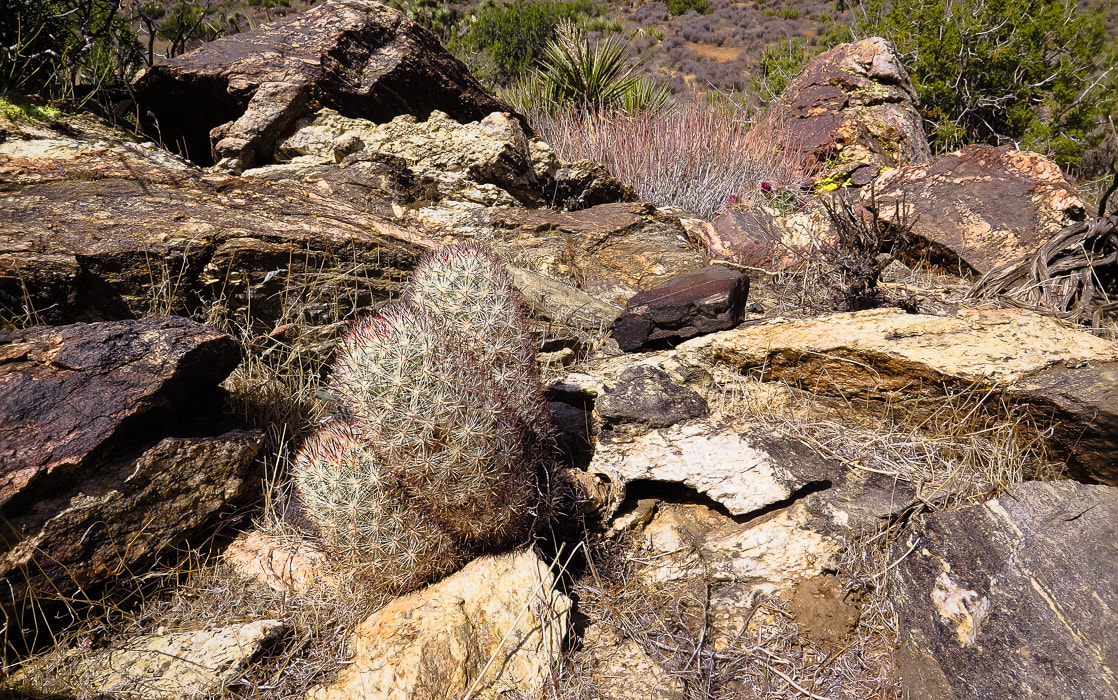
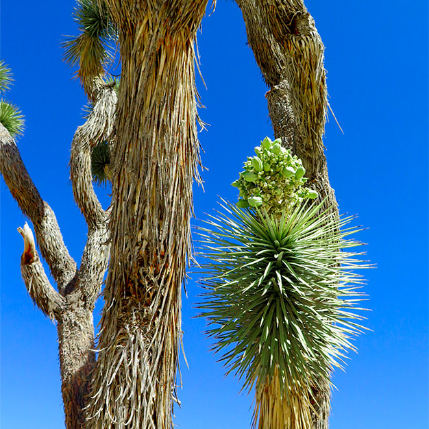
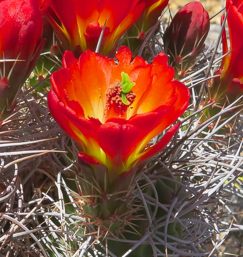
Beautiful 1.7 billion-year old gneiss - and hedgehog (?) cactus.
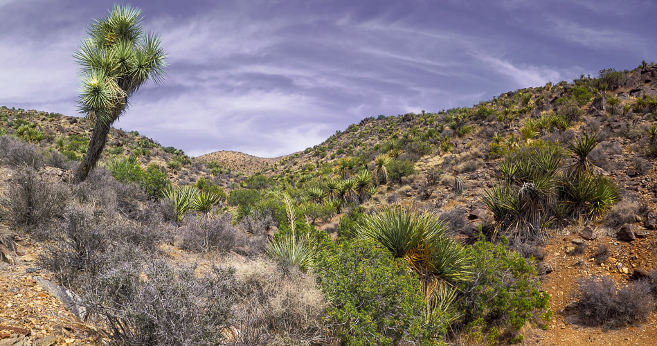
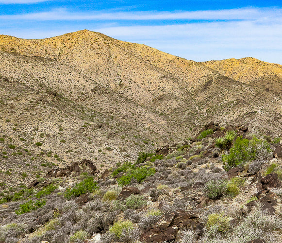
Circling around Lost Horse Mountain (on far horizon) to hike up its northeast ridge.
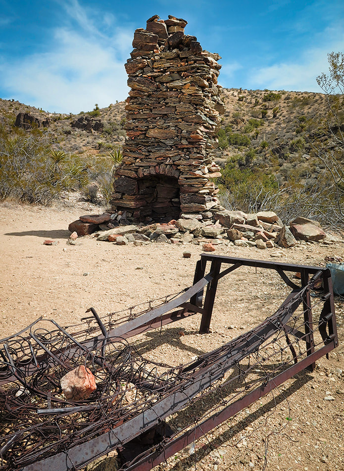
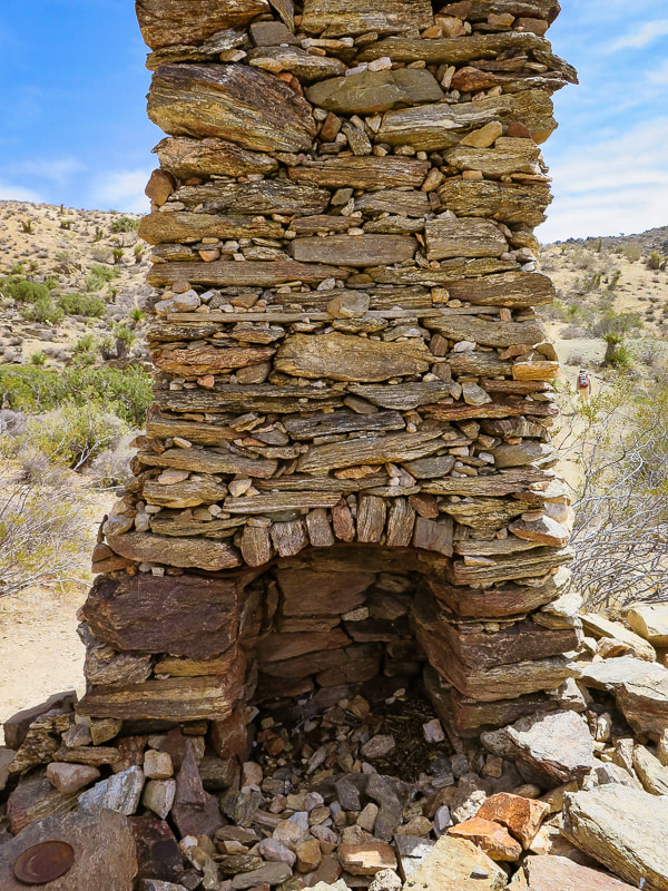
Remains of a very sturdy fire place and bed frame.

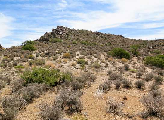
Our first summit - Point 4959.
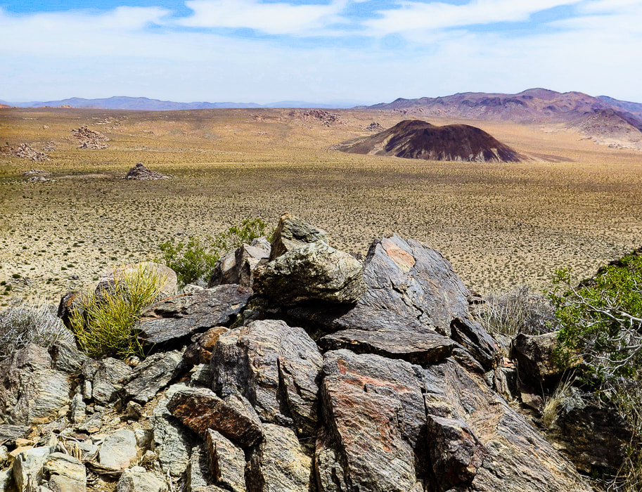
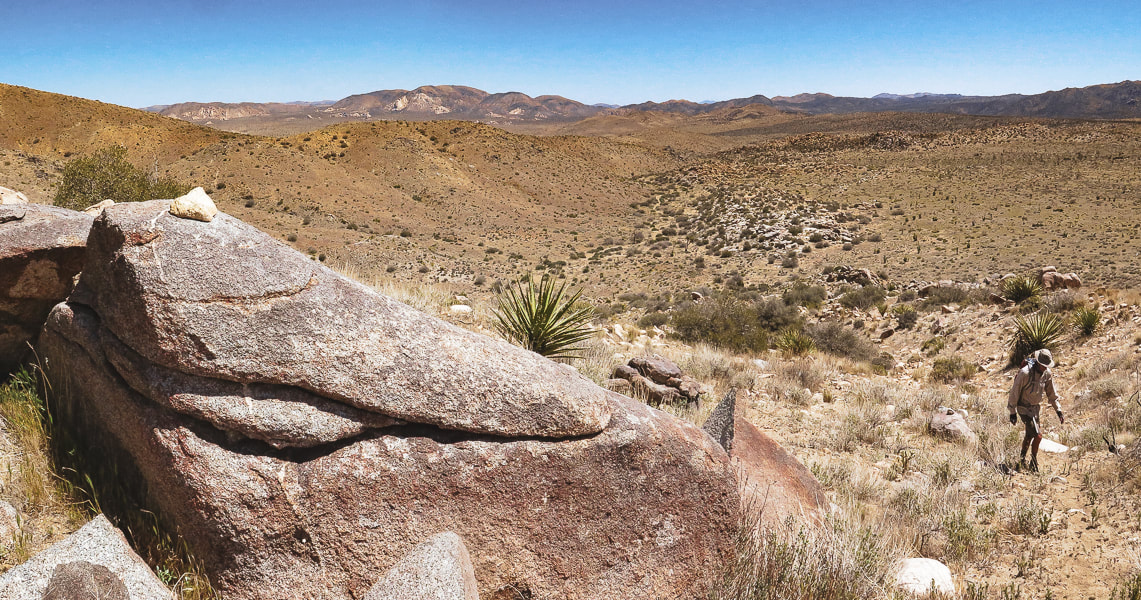
Three types of rock: great example of gneissic banding - a textural lineation of minerals in metamorphic rock created by pressure and intense heat (foreground). Malapai Hill in middle of valley created by magma. Valley rock is monzogranite.
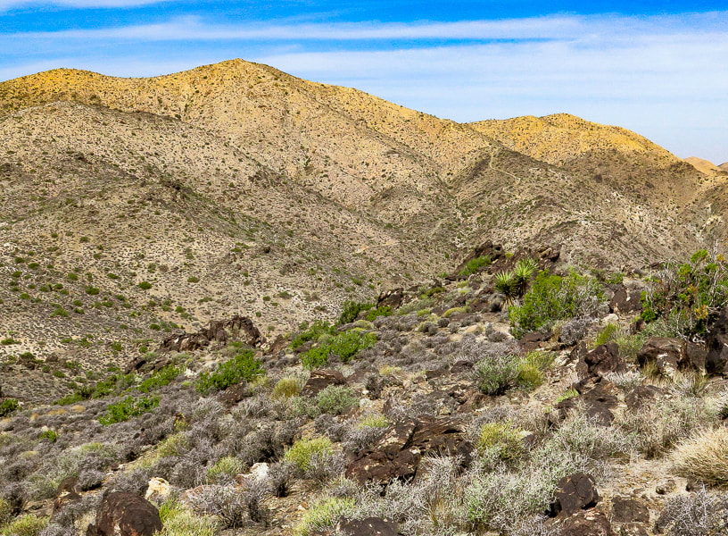
Looking at Lost Horse Mountain from the slopes of Point 4959. You can see Lost Horse Trail as it climbs to the saddle on its northeast ridge. Hike that ridge to the summit.
Some cool stuff on the trail.
Summit of Lost Horse Mountain
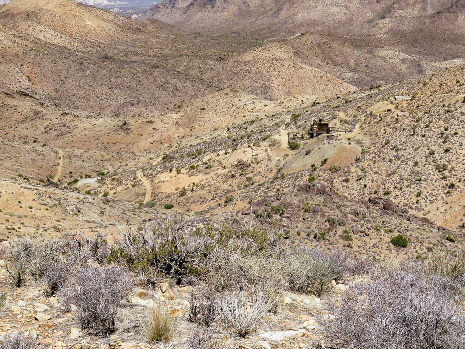
From Lost Horse Mountain's ridge: a view of Lost Horse Mine.
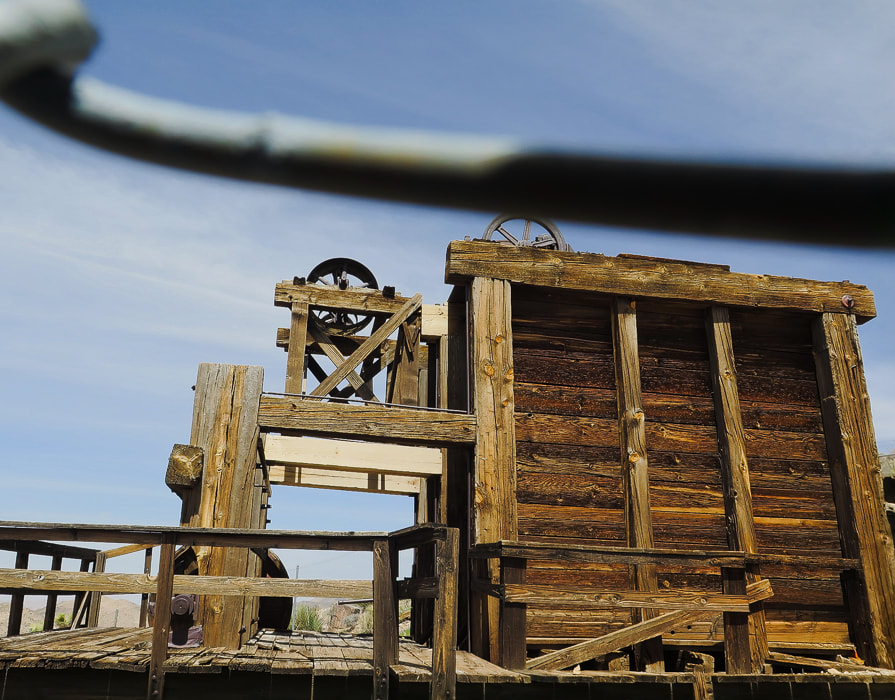
Lost Horse Mine stamp mill through chain-link fence.
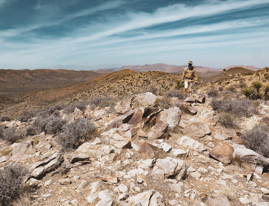
Walking up to Point 5196.
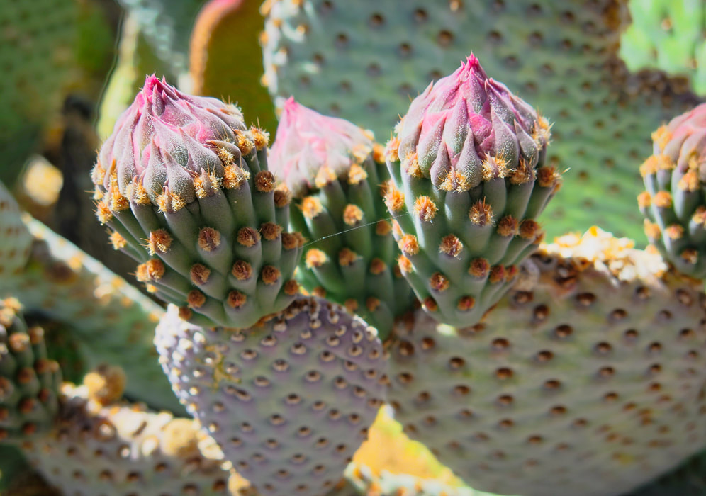
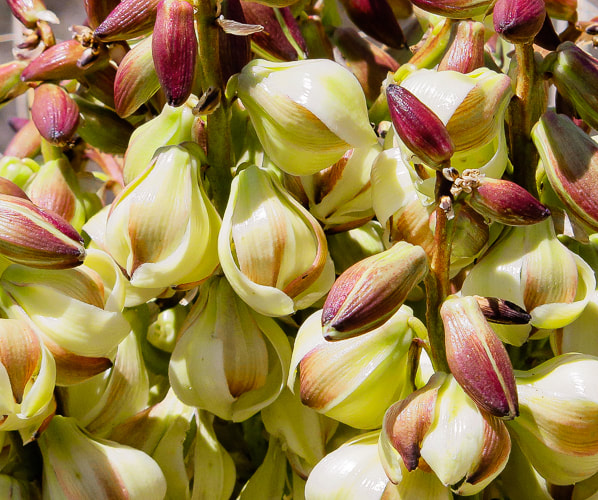
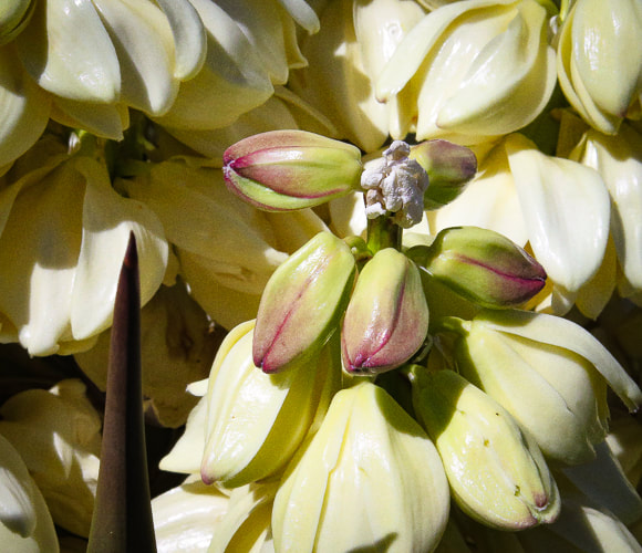
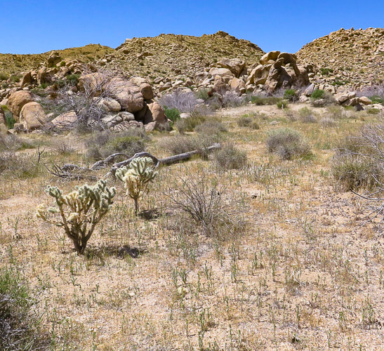
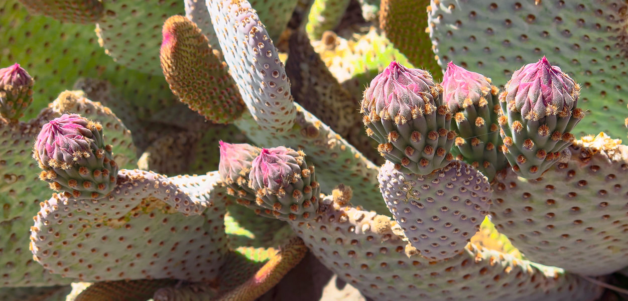
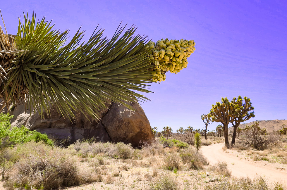
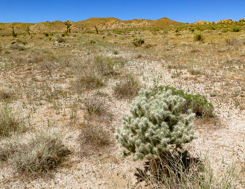
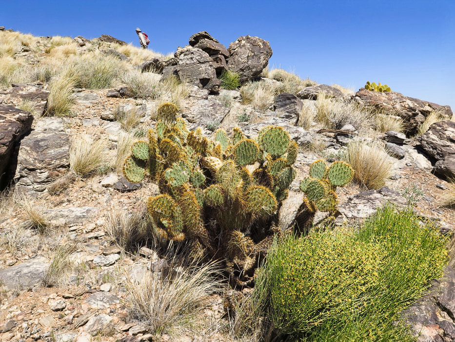
Beavertail cactus just before the blooms.
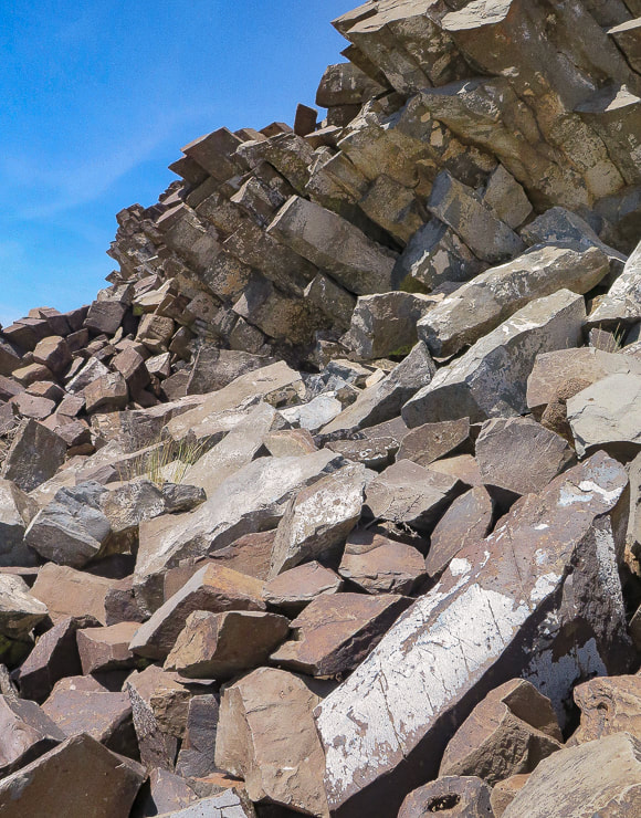
Columnar basalt on Point 5196.
References
California Geology. 1998. Department of Conservation, Division of Mines and Geology. Dilsaver, L.M. 2015. Joshua Tree National Park: A History of Preserving the Desert. Prepared for National Park Service, Joshua Tree National Park, Twentynine Palms. Joshua Tree Geology Tour Road. Joshua Tree National Park Geology - Rock Types. Digital-Desert: Mojave Desert. Trent, D.D. Geology and History of MInes, Joshua Tree National Park.
4 Comments
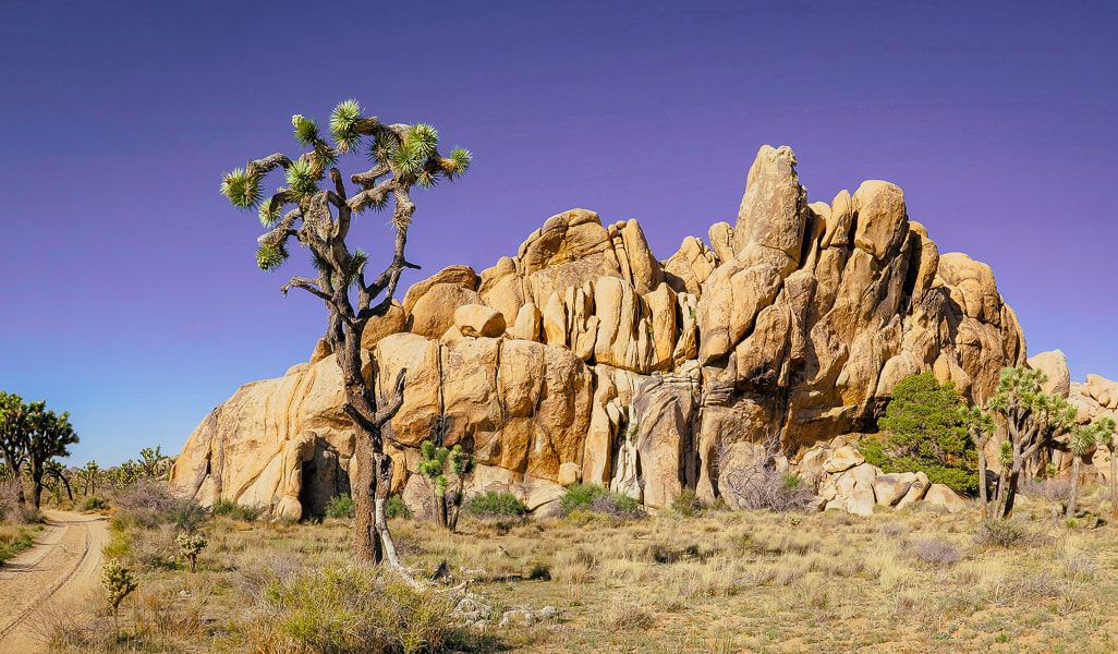
Named after the woman who lead conservation efforts for what is now Joshua Tree National Park, Mount Minerva Hoyt looks over wide, sandy valleys of Joshua trees and piles of weathered granite boulders, famous for their climbing routes.
Trip Stats
Overview: To honor the woman behind Joshua Tree NP's conservation campaign, hike to her namesake summit. Bag nearby Quail Mountain, Joshua Tree's highest summit, for a tour of two peaks and great views on top of Joshua Tree. Experience all of the famed attributes: Joshua tree groves, rock climbers scaling eroded granite, a glimpse of the private historic Randolph Ranch, a beautiful wildflower-filled canyon and an enjoyable ridge walk. Location: Joshua Tree National Park/Wilderness - North Entrance Station out of Joshua Tree, Southern California. Distance/Elevation gain: 12 miles out and back. Trailhead = 4,061', Summit = 5,405'. Net gain = 1,700'. Coordinates: Parking = 34.02926 N -116.17905 W. Summit = 34.01347 N -116.22694 W. Difficulty: Moderate Class 1-2 Fees/Permit: $30 entrance fee, good for 7 days. Navigational aids: AllTrails map, Trails Illustrated Joshua Tree National Park #226. Date Hiked: 4/9/2022. Geology: Begin in the eroded boulder piles of monzogranite, a deep intrusive igneous rock uplifted and eroded to create large depths of coarse rock-fill in the valleys. Monzogranites are a biotite (mica) granite that are the final crystallized product of magma, after other minerals have solidified (like olivine). Mount Minerva Hoyt summit is made of orthogneiss, a metamorphic igneous rock. Interesting to note that the summit of nearby Quail Mountain is not made of this gneiss, but instead made up of monzogranite. Good explanation of magma crystallization. 
Hike Summary
There's a few ways to hike to Mount Minerva Hoyt and nearby Quail Mountain, Joshua Tree NP's highest. Both are listed on Sierra Club's Hundred Peaks Section. Years ago, Roger and Maria Keezer led us up Quail Mountain from the west. This time Fred, Scott and I approached from the east, parking at a lot on Park Drive, ~ one mile south of the Boy Scout Trailhead reached from Joshua Tree's west entrance. You could also begin the hike from the Hidden Valley Nature Trail parking. The weather was perfect - sunny and warm. Scott met us for the hike, as he has for many over the years. We have recently hiked Monument Mountain and Pinto Mountain in Joshua Tree together, and Pahrump Point near Death Valley. Hiking Directions
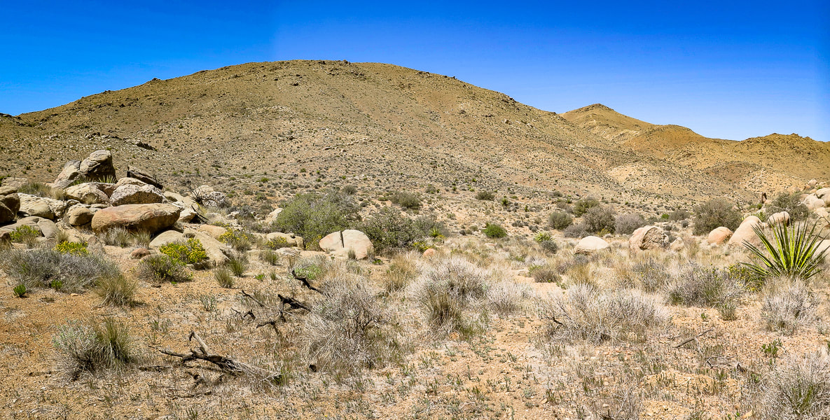
Joshua Tree NP's area is 795,000 acres, slightly bigger than the state of Rhode Island. Thankfully, almost 430,000 acres of it is wilderness, so there is a lot of space to roam and discover. If you want solitude, you can quickly get away from popular spots. If you want to climb to get a view, there are six mountain ranges. Pay attention to maps and apps, because you can easily get disoriented in this huge desert. By getting out there, smelling, touching, and seeing the life of the Mojave, you will gain a sense of wonder and admiration for the species that survive there.
The land in Joshua Tree has had a varied and interesting history, from the Pinto Culture, its initial transitory hunter-gatherer inhabitants to the miners and ranchers that arrived in the 1800's, to people seeking wellness from tuberculosis, and today's recreational visitors. The year 2021 saw the first time that park visitors totaled more than three million. Minerva Hoyt created a desert conservation exhibit for the Garden Club of America show in New York in 1928 that also appeared in London, England. Her magnificent exhibits not only stressed the beauty of these American deserts, but also the fragility and potential dangers. The widespread attention her exhibits brought influenced many southern California residents to decorate their own gardens with transplanted cacti. Vegetation was taken from the natural desert gardens in the pass entering Palm Springs, California, easily accessible to those traveling on the major highway between that city and Los Angeles. Commercial florists added to this theft. The same occurred in the Mojave desert, where small Joshua trees were uprooted and planted in yards, and larger Joshua trees were harvested for their wood. Joshua trees were set ablaze so that people could signal to each other. Today, it's hard to believe this destruction actually occurred, because we have learned to respect these beautiful deserts - appreciation has grown significantly. It took this destruction to motivate Minerva Hoyt into action to preserve this awesome park. When I lived and worked in the Palm Springs area in the 1990's, I was fortunate to be a volunteer to survey desert tortoises along with my hiking friends. We worked with the Joshua Tree National Monument's biologist, walking through the Pinto Basin, a vast sublime open desert. Upon coming across a tortoise, we weighed it, counted its scutes, measured it and glued an identification tag onto its shell, so it could be tracked. This was the beginning of my fascination for desert ecology, and of great memories that we friends still recall today.
Keep Exploring our Deserts!
Starting off on road that leaves from parking area off Park Boulevard near Hidden Valley. This road leads to an intersection with a trail that leads 0.5 miles to the Hidden Valley picnic area, another place to start this hike.
Our GPS tracks leading from Park Boulevard to a loop ascending Mount Minerva Hoyt.
Continuing west along Old Lost Horse Trail
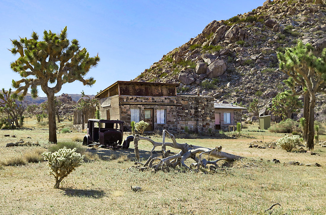
Old Randolph Ranch - go around fenced property. I could not find much on the history of this ranch. It appears the owner had a sense of humor (see photo below).
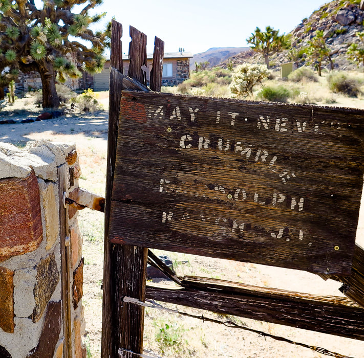
Randolph Ranch - "May it Never Crumble".
Randolph Ranch, a private inholding in Joshua Tree NP.
Hiking west up Lost Horse Valley past Randolph Ranch. Mount Minerva Hoyt is dark-covered peak on the right.
Some cool stuff on the trail.
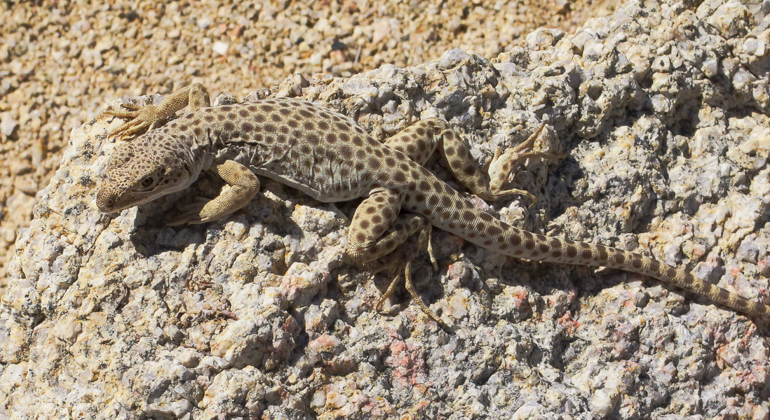
Long-nosed leopard lizard
Gambelia wislizenii
The end of Lost Horse Valley funnels you into a small canyon or draw with visible path leading to saddle where you then descend into wash at base of Mt. Minerva Hoyt and Quail Mountain.
Arriving at the saddle before the drop into the wash at base of mountains. We climbed this ridge westward toward Quail Mountain and then headed northeast on the cross country trail between Quail and Minerva Hoyt to hike Mt. Minerva's southwest ridge to the summit (point on horizon to the right).
Dropping 200' down into wash after saddle. Mount MInerva Hoyt on the right horizon. On the way up, we ascended the ridge in front of us in this photo; we descended Minerva Hoyt's east ridge seen on horizon to end up in this wash.
View of Mt. San Jacinto (overlooking Palm Springs), still covered with a lot of snow.
Walking up ridge toward Quail Mountain after getting out of wash.
Looks like a trail marker on the ridge up. Looking back at the saddle we crossed over to get into wash below.
Scott on ridge trail.
Hiking on cross-country trail that connects Quail Mountain to Mt. Minerva Hoyt. Summit on the left - there is a guy standing up there!
The last 200' climb to the summit is easy, punctuated with beautiful metamorphic boulders and cactus gardens, plus a spectacular view of the desert that Minerva Hoyt fought so hard to protect.
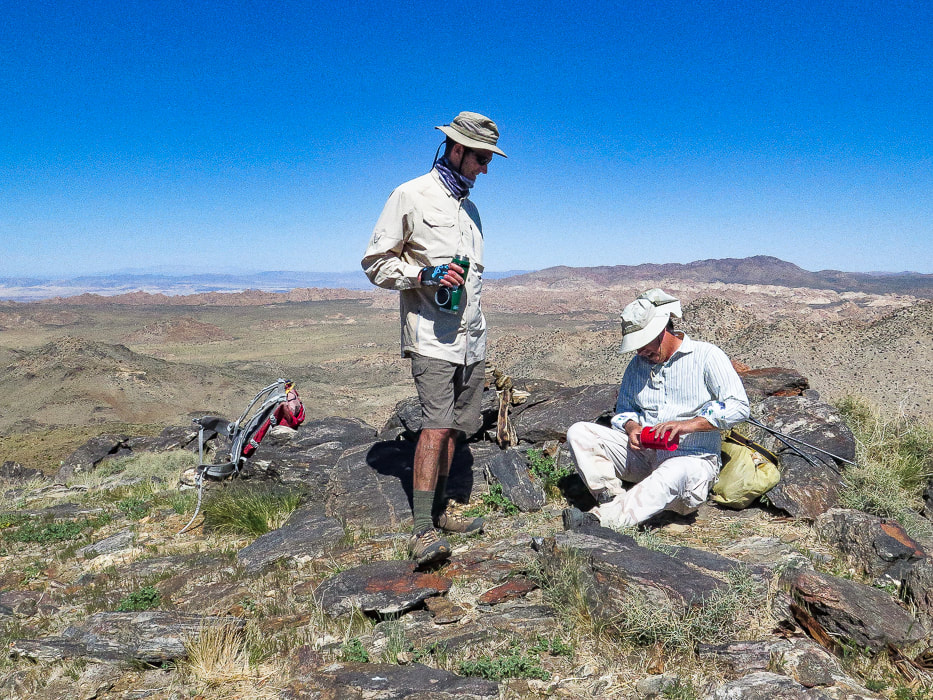
Fred and Scott signing summit register.
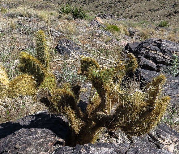
One of the beautiful "cactus gardens" on the summit.
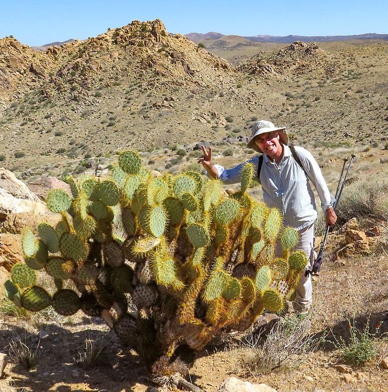
One of the biggest prickly pears (may be a dollarjoint prickly pear) I have seen! The saddle that we ascended is just above Scott's head and slightly to the right under the two rock summits - aiming for that landmark on our way back!
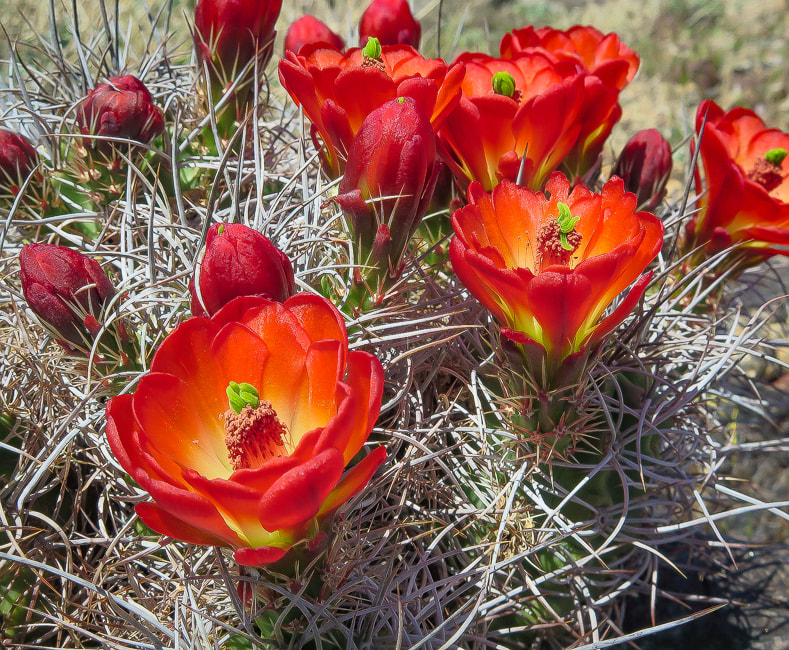
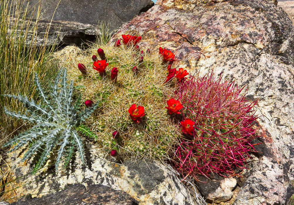
Claret cup hedgehog
Echinocereus triglochidiatus 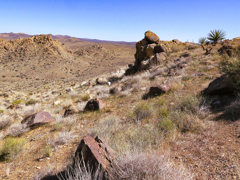
Minerva Hoyt's east ridge path - headed toward wash below.
Getting near wash and saddle, our entry point into Lost Horse Valley.
On the way back.
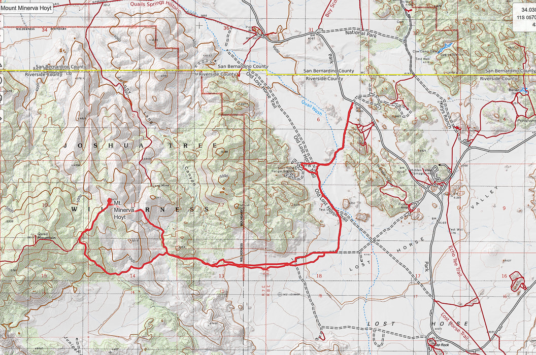
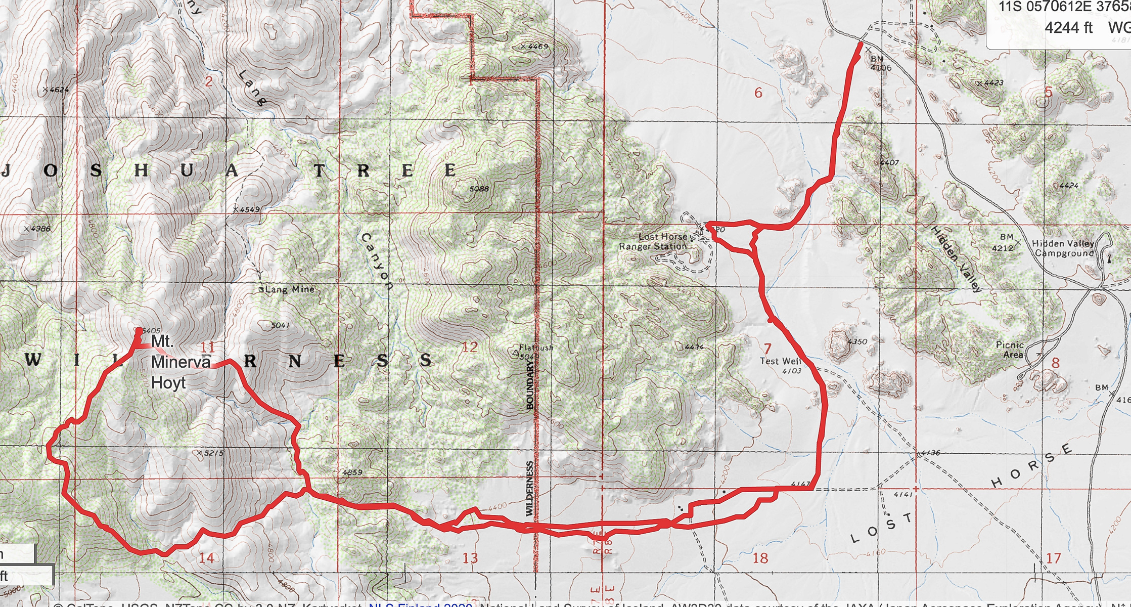
Our GPS tracks
Click for larger map 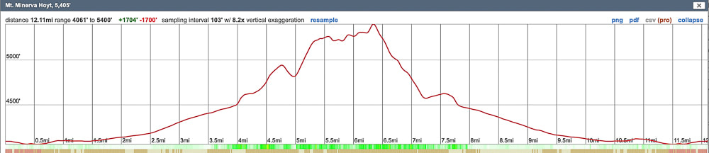
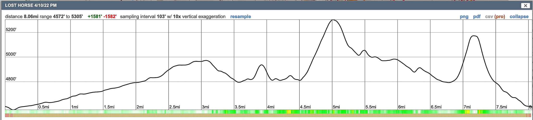
Elevation profile
References
Earle, S. Crystallization of Magma from Physical Geology. BC Campus. Minerva Hoyt. National Park Service. 2015. Dilsaver, L.M. 2015. Joshua Tree National Park: A History of Preserving the Desert. Prepared for National Park Service, Joshua Tree National Park, Twentynine Palms. |
Categories
All

Sue and Fred

About this blogExploration documentaries – "explorumentaries" list trip stats and highlights of each hike or bike ride, often with some interesting history or geology. Years ago, I wrote these for friends and family to let them know what my husband, Fred and I were up to on weekends, and also to showcase the incredible land of the west.
To Subscribe to Explorumentary adventure blog and receive new posts by email:
Happy Summer!

About the Author
|