|
In search of new routes and solitude on Lucky Peak, an historic mining district, amidst burgeoning Boise trail use.
 Adelmann Mine in Boise River Wildlife Management Area Trip Stats
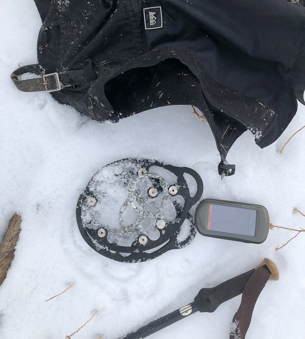
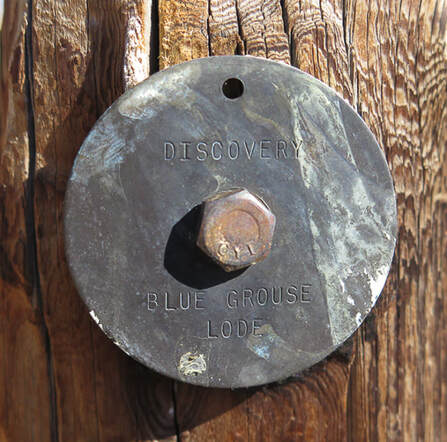
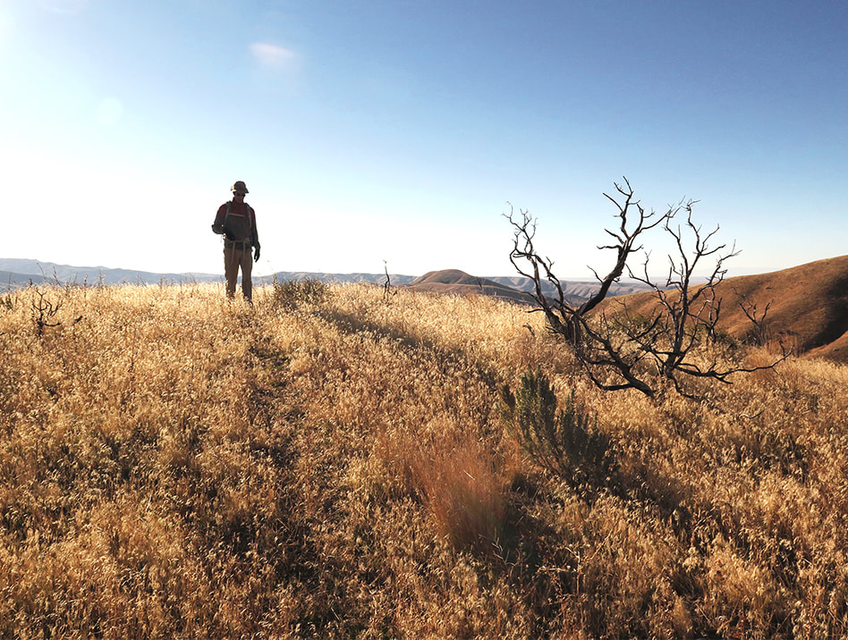
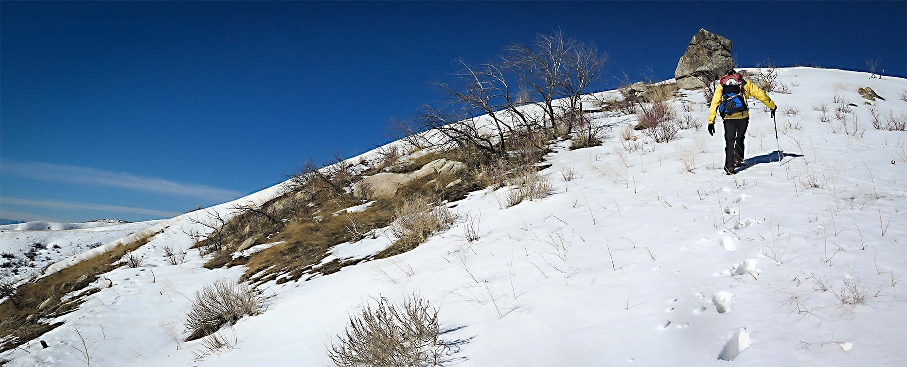
History of the Adelmann Mine Owned by the Adelmann brothers, one of which was Richard Adelmann, a German miner and Civil War Veteran who also built the Adelmann Building in downtown Boise at Capitol and Idaho Street in 1902. Gold was the primary commodity, followed by extraction of silver and zinc. The Adelmann Group was part of the Black Hornet District. The Black Hornet Mine is located directly south of the Adelmann Mine in Boise River WMA. The deposit was an underground vein in a host rock of Atlanta Lobe of the Idaho Batholith - two mica granite of Cretaceous age. A very thorough report by the Idaho Geological Survey includes Black Hornet Mine and Queen Mine from the Lucky Peak area: Site Inspection Report for Abandoned and Inactive Mines on Land Administered by the U.S. Bureau of Land Management in the Boise Resource Area, Idaho: Boise Foothills, Ada County, and Osborne Mine, Gem County Gear Snow boots, snowshoes, gaiters, GPS, Yaktrax Pro diamondgrip, walking pole. Helpful technique - The Rest Step When breaking trail up a steep snow slope, the rest step helps you to conserve energy and prevents your legs from getting too quickly fatigued. It is a rhythmical gait, resting momentarily with each step by putting your weight onto a straight back leg and letting your other leg swing forward. The idea is to decrease the use of muscles with every step and let your weight be supported by leg bones instead. Take small steps. REI snow travel techniques. Our Hike The ability to leave city life - temporarily - and get a taste of early 1900's mining life is one of the great advantages of hiking Lucky Peak. Even if you don't go to the Adelmann or Black Hornet mines, you can stumble onto some old rusted equipment, or an old mining claim like the one in the photograph below of the Blue Grouse Lode discovery. Lucky Peak, a.k.a. Shaw Mountain in Boise has been a "staple" hike for us the past 20 years because we gain a good amount of elevation - 3,000 feet - in 4.5 miles and it's close to home. With the influx of people moving into the Boise area and subsequent increased trail traffic, we have added four additional routes to its summit in search of more solitude. We call each route by a different name. There's the "backside" route from the Wilderness Management Area headquarters (Lucky Peak: The Ridge Less Traveled). There's two ridge hikes we use to hike and snowshoe. Then, there's the Pruett route, named after our friend and his two boys whom we took up one cold early spring day. Most photos on this post represent different hikes/snowshoe hikes up the same southeast ridge. This route is a steep ascent that overlooks the road to Adelmann Mine, often "crowded" with hikers. The primary purpose of the Boise River Wildlife Management Area is to "Provide winter habitat for mule deer and elk, and year-round habitat for other wildlife species." This WMA supports the largest wintering mule deer herd in Idaho. Elk sign is present, especially during the winter months. Once we saw a majestic bull elk silhouetted on the next ridge over, his large herd of cows watching us, then they disappeared over the ridge. The view of the mountainous Boise National Forest is spectacular most of the way, especially in winter. 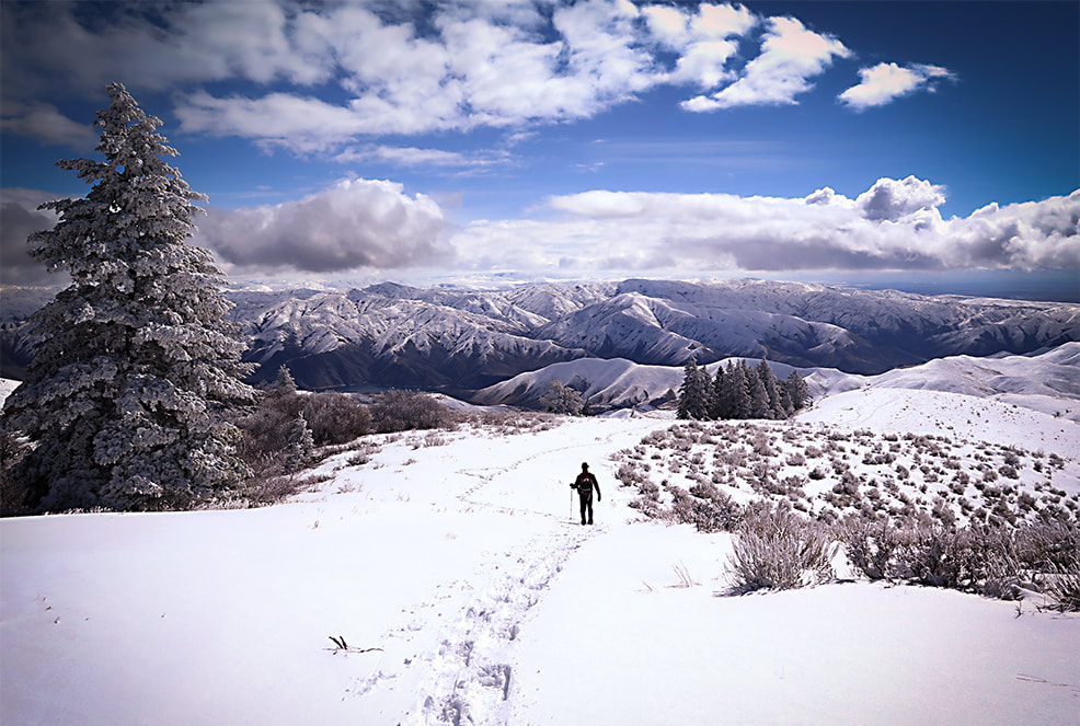 Boise National Forest peaks to the northeast 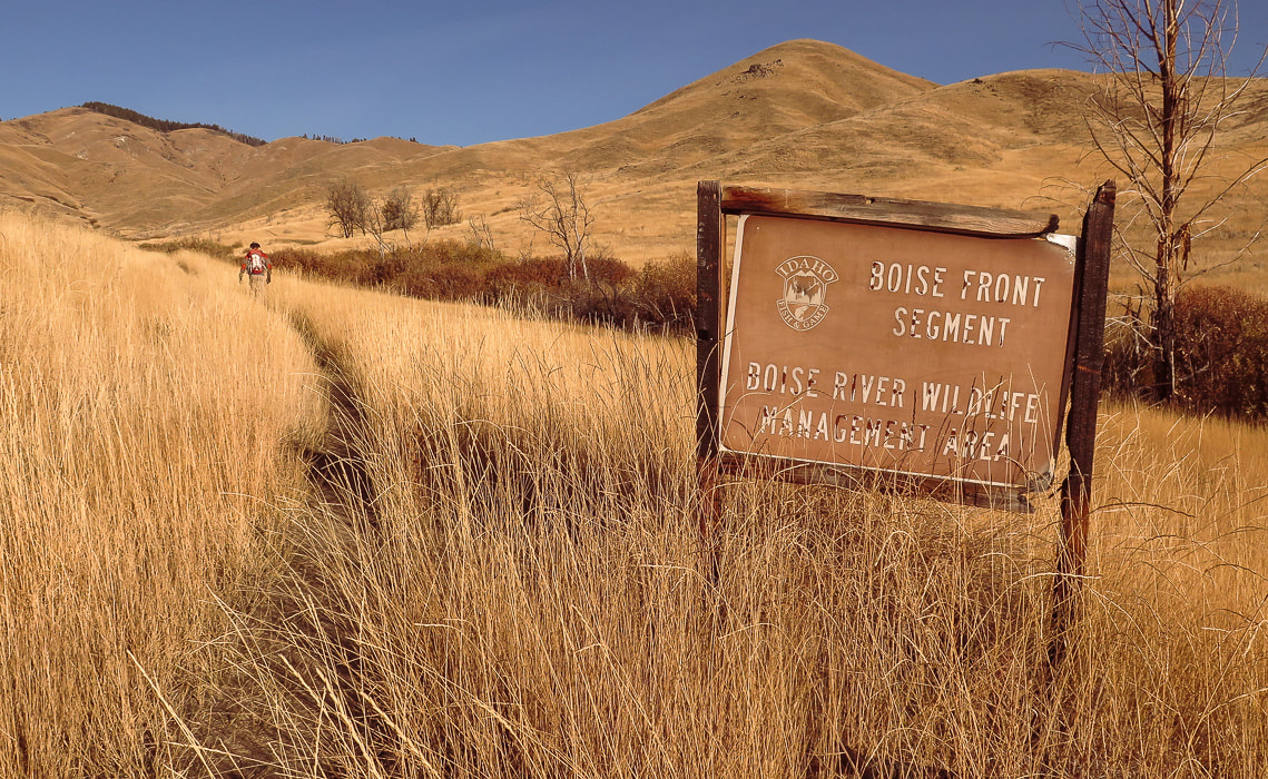 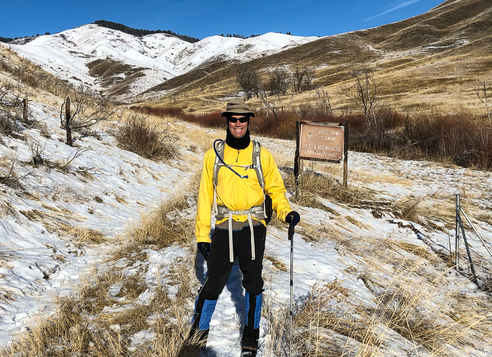 At Trailhead: An early November 2020 hike (above), and a hike on 1/1/21 (bottom). Follow ridge to tree line - the highest point on the horizon is Point 5645, 2.7 miles from trailhead.
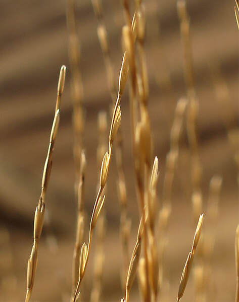
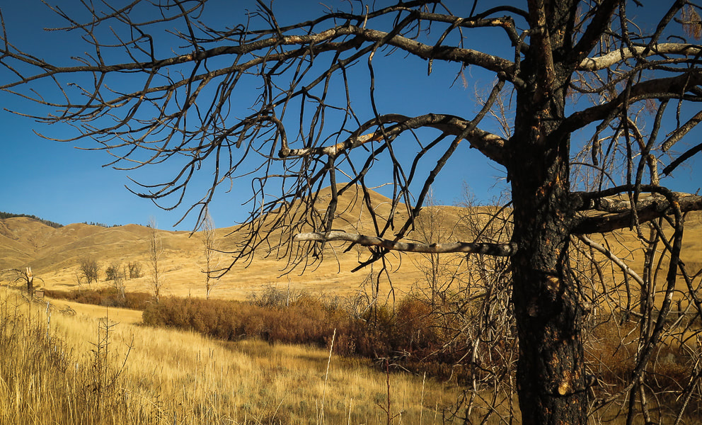 Native as well as invasive grasses carpet the valley the first 0.8 mile of the ridge approach. Signs of the 2016 Mile Marker 14 fire.
 Many sagebrush have been burned by the Mile Marker 14 Fire in 2016 which closed the Boise River Wildlife Management Area at that time.
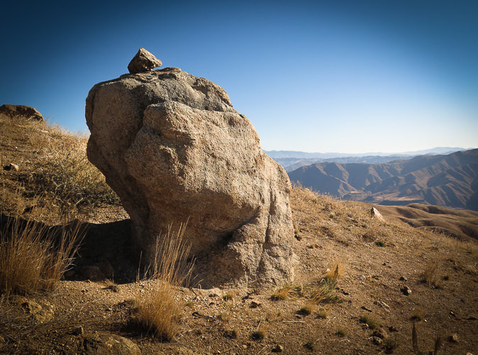
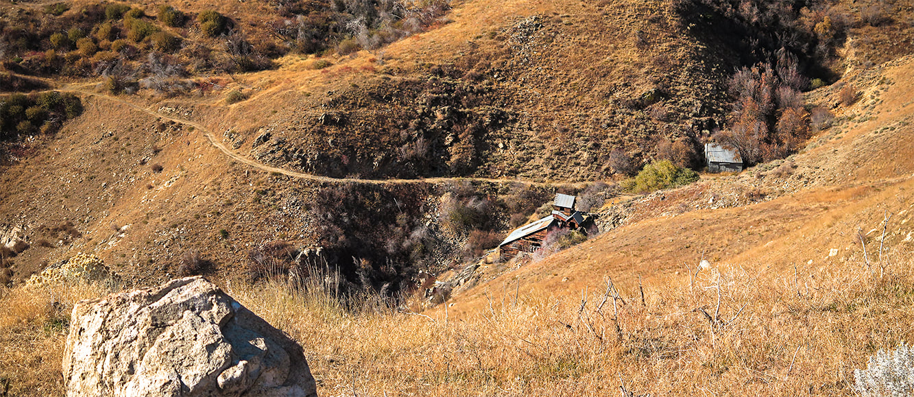
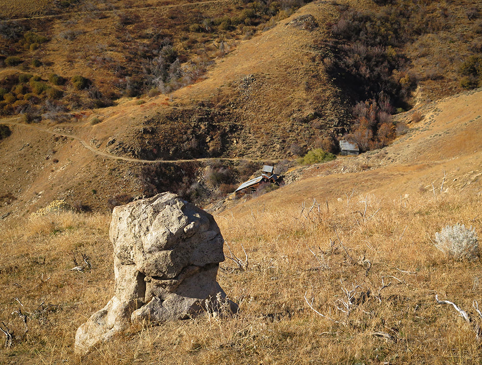 Core stone looking over Adelmann Mine buildings at 5,000 feet elevation. Primary commodity - gold 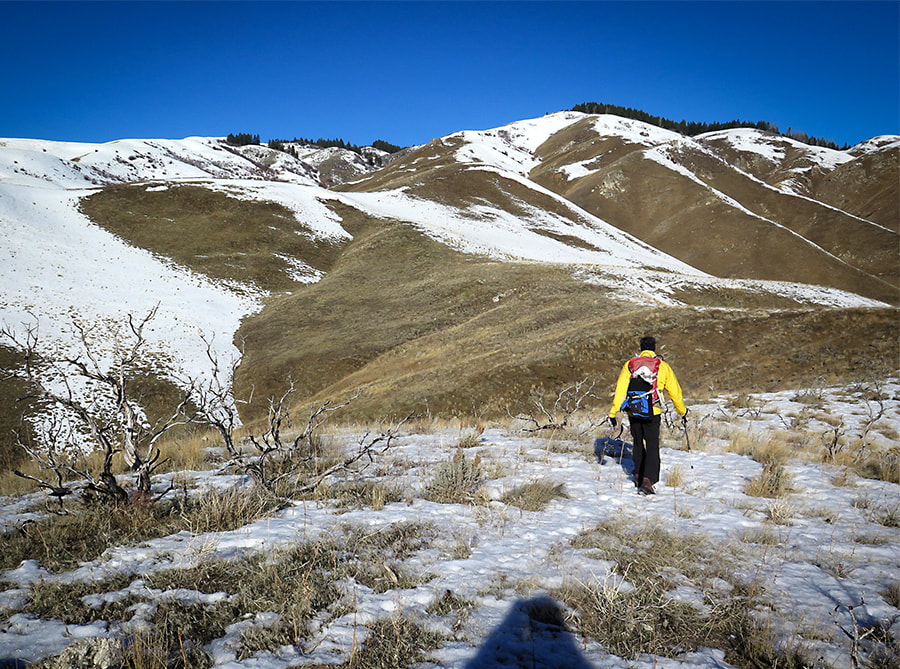 Going up middle southeast ridge to Point 5645 on horizon with row of trees, which is 2.7 miles into hike
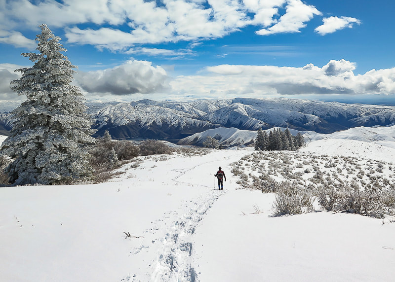
 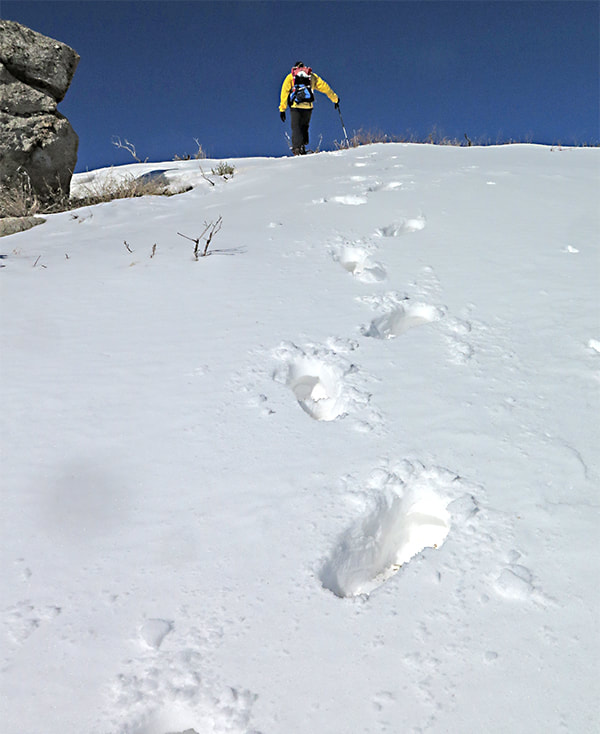 Good place to use the Rest Step technique! (see above) 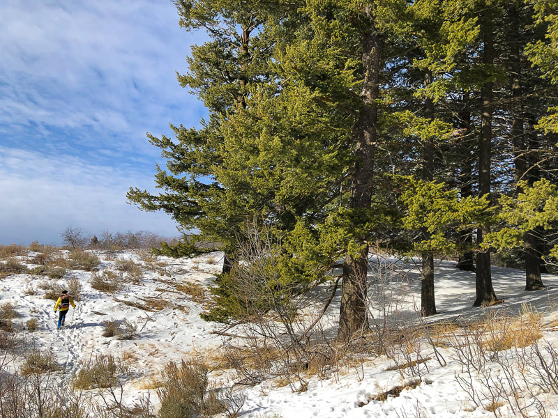 Reach tree line at 5,600 feet elevation At the forested ridge, Lucky's summit is only another 300' gain. Metal posts mark Boise National Forest boundary and can be followed to a road that arises from Adelmann Mine. At the high point of this road, at a shaded saddle with a view toward Shafer Butte near Bogus Basin Ski Area to the north, a trail ascends to the west, passing by a few tent campsites. One more short climb to the summit and you are rewarded with a 360-degree view, mostly of the flat Snake River Plain and civilization at your feet. The mountainous Boise National Forest lies to the north. We relinquish our solitude for a few moments on the summit as 4 groups of hikers come and go. Then we are back on our own as we descend the ridge less traveled, intersecting elk trails in the snow. The descent is steep in parts as we pass by mining relicts. Try to imagine the gold miners on these ridges. Return to "civilization." Lucky to have the best of both worlds. 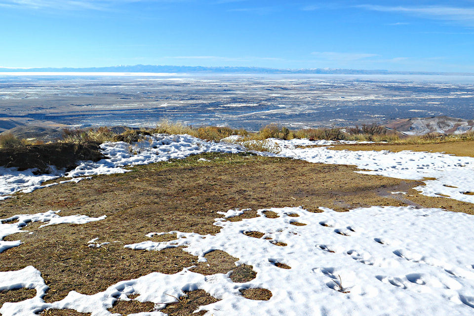 View of Treasure Valley in the Snake River Plain from Lucky Peak's summit. Owyhee Mountain range on the horizon. 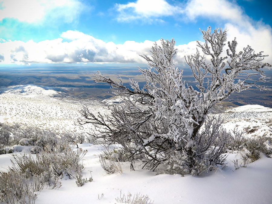 Antelope bitterbrush overlooking the Snake River Plain  From Lucky Peak summit looking north to Shafer Butte (left) near Bogus Basin Ski Area 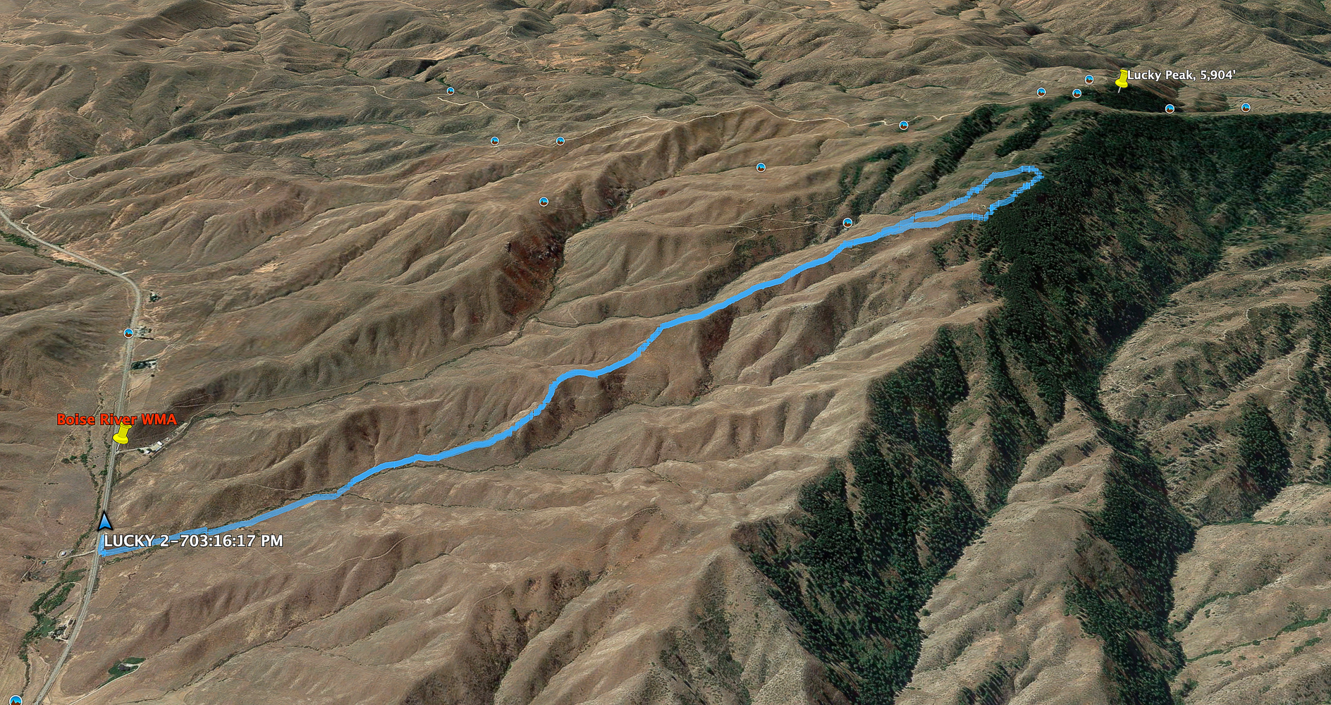 We didn't make it all the way to the summit on this southeast ridge hike. North is to right of image - click for larger image 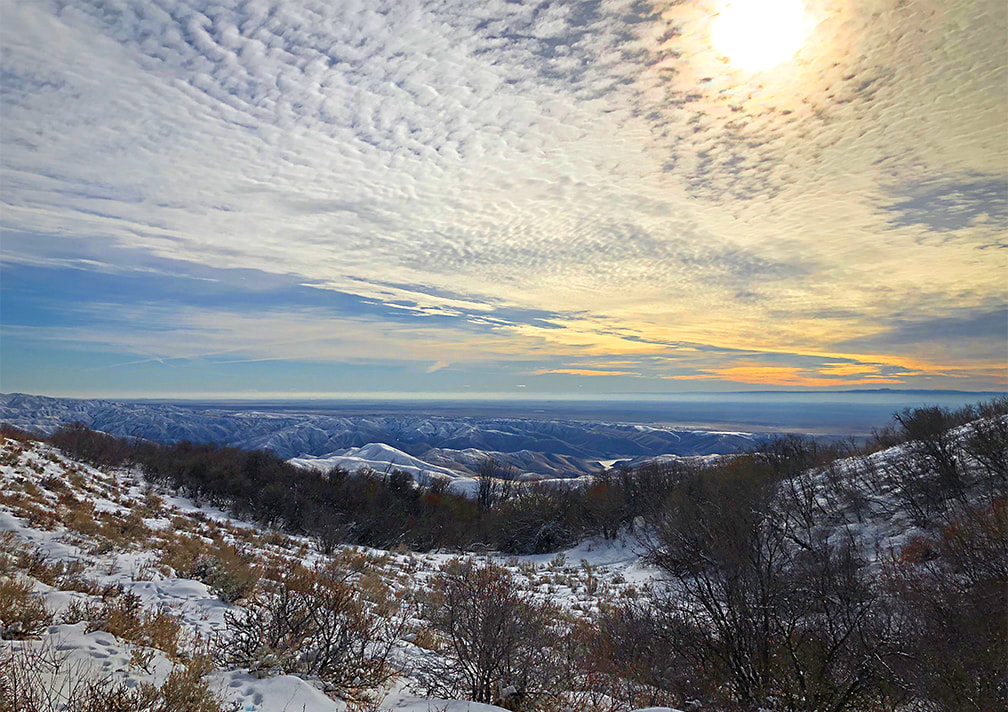 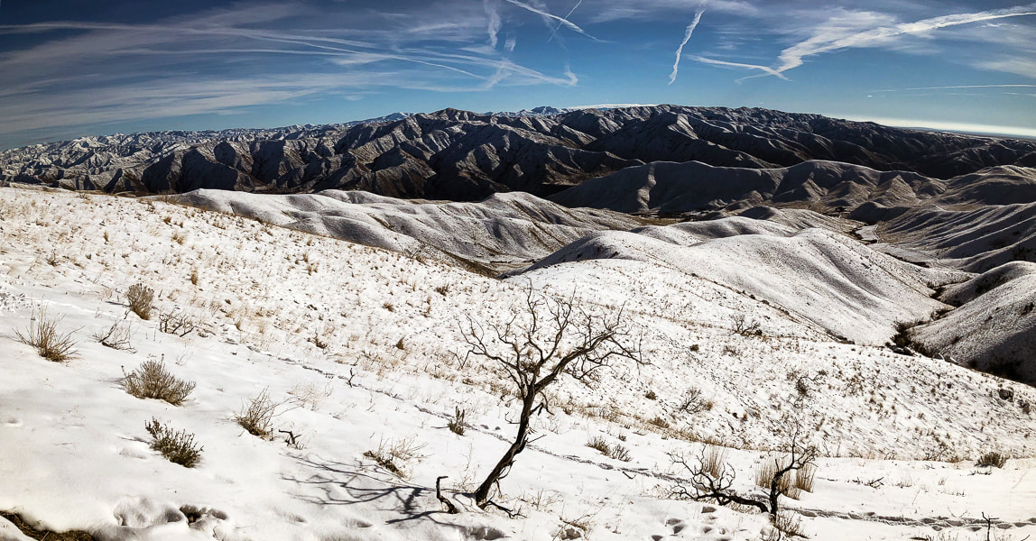 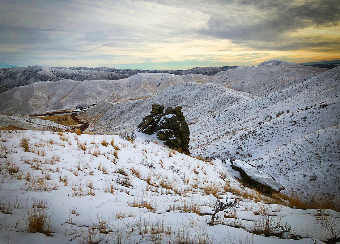 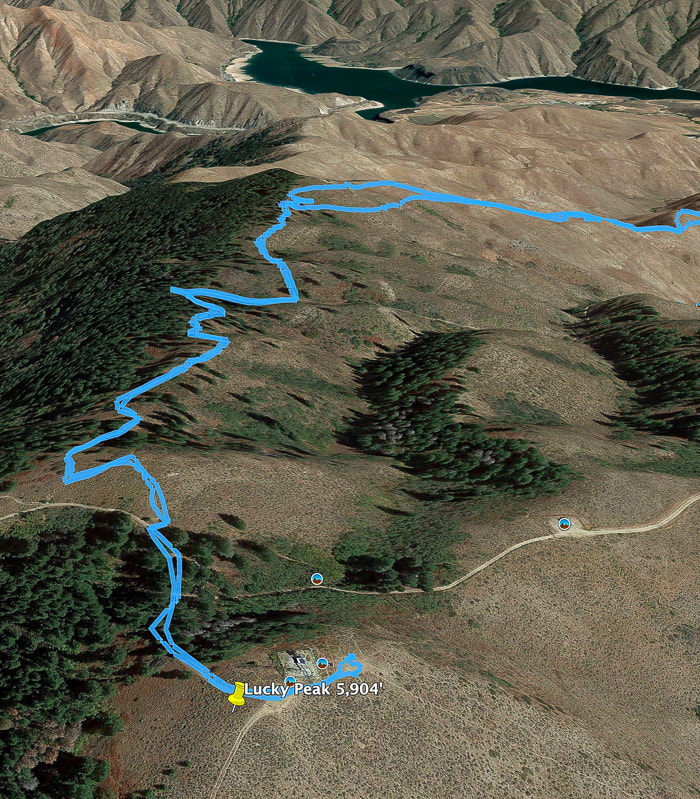 Our GPS tracks to/from summit Lucky Peak Reservoir in distance 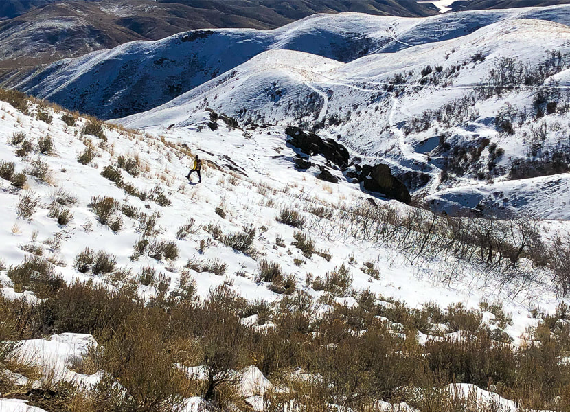 Going back down: slow going through brush on lower slope. Lower road leads to Adelmann Mine 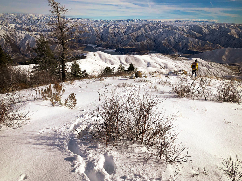 Overlooking Lucky Peak Reservoir 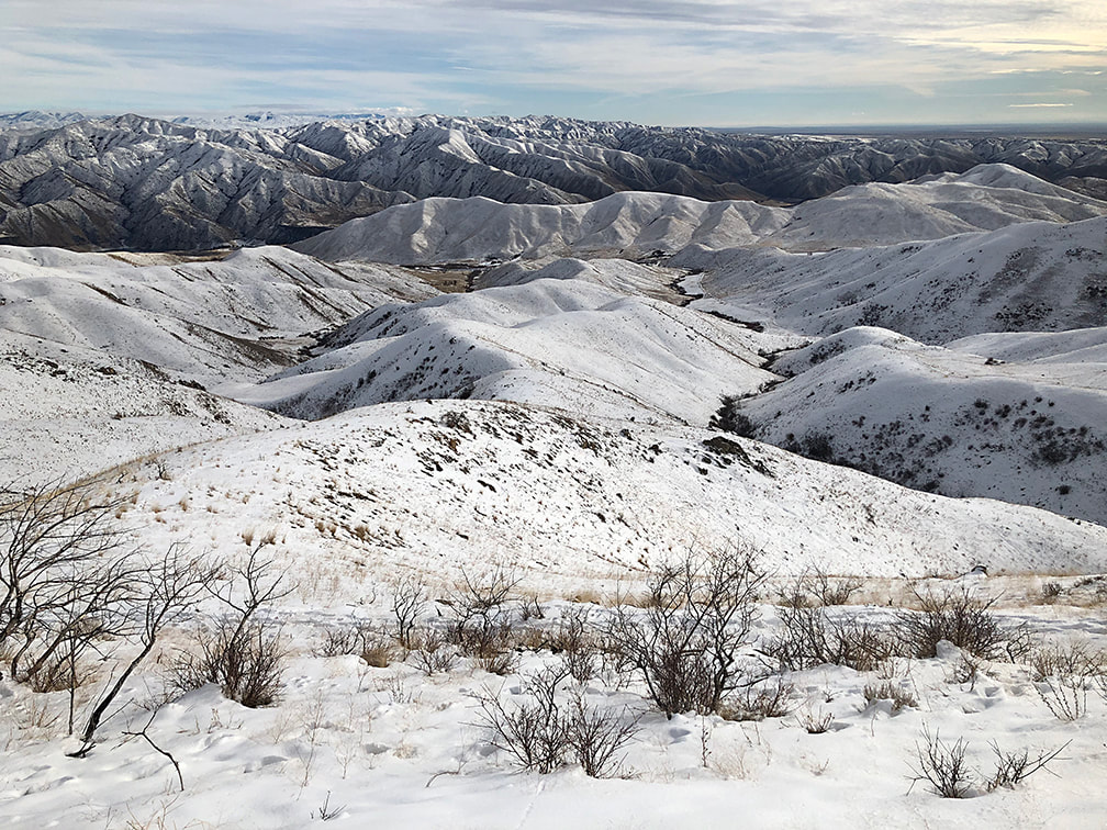 Heading down ridge - Boise River WMA in valley on right. Our trailhead in valley on left.  Beautiful valley at end of hike This image is as taken - no editing  Great way to end the hike!  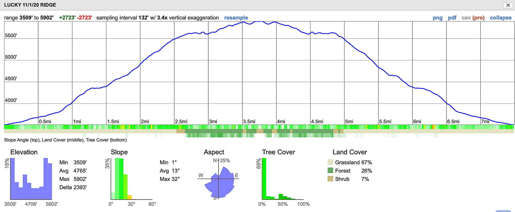 Our GPS track from Idaho Hwy 21 to Lucky Peak Summit click on map for larger image References
The Diggings - Adelmann Group Western Mining History - Adelmann Group - westernmininghistory.com Maley, T. 1994. Field Geology Illustrated, 2nd ed. Mineral Land Publications, Boise, Idaho.
1 Comment
We put our own spin on Robert Frost's sentiments in his poem, "The Road Not Taken," and hiked a ridge less traveled to summit Lucky Peak in the Boise River Wildlife Management Area, and that made all the difference. Related - The 4 "Grand Slam Peaks" in Boise National Forest: Mt. Heinen: Grand Slam Peaks Completed! Kepros Mountain Hike Cervidae Peak - Southeast Ridge Lucky Peak Hike - Winter Ascent Lucky Peak: The Ridge Less Traveled II 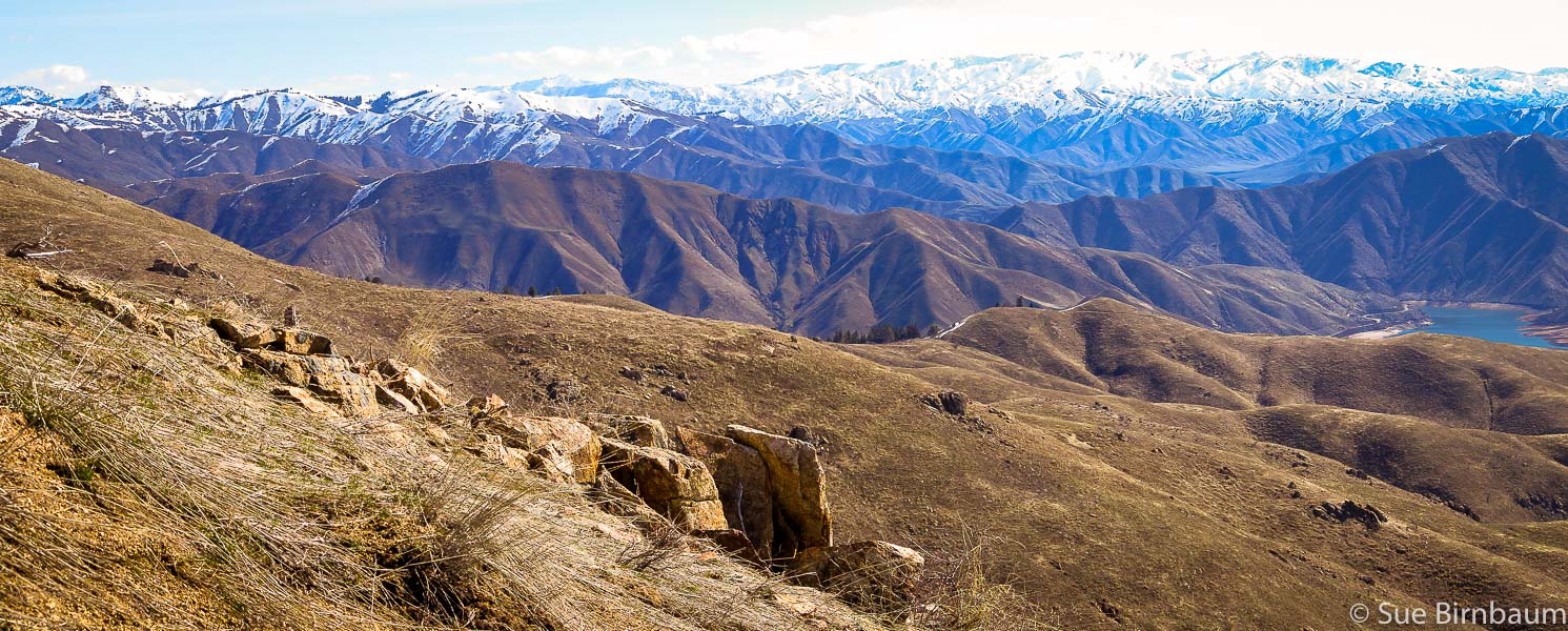 On Lucky Peak's (AKA Shaw Mountain) southeast ridge looking toward the northeast at Boise National Forest and Lucky Peak Lake 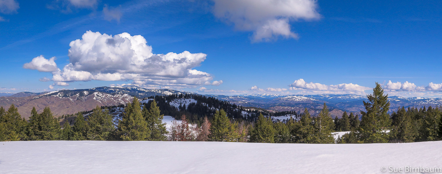 View from snow-covered Lucky Peak summit (5,904') of Shafer Butte to the northwest
Trip Stats
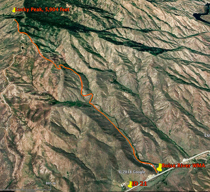 Route to Lucky Peak summit from Boise River Wildlife Management Area building on ID-21 We gain ridge just after intersection to the road to Adelmann Mine at 4,800 feet, a little less than 2/3 distance of hike, climb on ridge 1,100 feet to summit. This route intersects with E. Shaw Mountain Rd. as seen on this map, and then follows it to Lucky Peak summit. Many years ago, when we lived in New Hampshire, Fred would read to me Robert Frost poems in front of an old fireplace, lit with crackling orange flames burning wood collected locally. New England winter nights were cold and damp and the thick forest outside our door mysterious, so the warmth was comforting as we settled in with pillows on a wide-planked wooden floor and The Poetry of Robert Frost, a thick volume with a cover photo of a low rock wall extending over a green field. Our favorite poems were "After Apple Picking" and "Stopping By Woods on a Snowy Evening." The Robert Frost Farm, where Frost wrote his early poems was just 20 minutes away in Derry, New Hampshire. Through our explorations into the New Hampshire woods, we could directly experience the moods and scenes of Frost's poems. Frost's most famous poem, "The Road Not Taken" is a testament to his choosing the unconventional road of writing poetry instead of farming; he put some effort into the latter career, but found passion and talent for the former. Farmers were expected to work hard and rise early but Frost seldom fit that expectation. He chose a different path, and grateful that he did, for we have his writings that reflect his deep connection to the nature and land of New England. Unlike the extensive and deep, dark woods of New England, the summits near Boise are open; landmarks are easily seen to guide off-trail hiking. With a good topo map in hand, we have taken several ridges to the summit of Lucky Peak, making our own path to see what we can discover along the way. In winter, we like to hike Lucky Peak using the southeast ridge approach that begins at the Boise River Wilderness Management Area building on Idaho Highway 21. Sometimes we are able to get to the summit - sometimes not because of weather. In February, a snowshoe hike that started with sparse snow flakes quickly developed into a snowstorm with limited visibility. The storm became worse as each minute passed, and by the time we got up to the intersection with the road to Adelmann Mine, breaking trail through 8 inches of snow, the visibility was about 60 feet. Instead of pressing on into this white void and deep snow to the summit, another 1,100-foot climb, we turned around to find our way back down, the snow working quickly to fill our snowshoe tracks. When hiking the ridge, we use Douglas Firs that are just to the right of the ridge as a landmark.  Fred at intersection of road leading from Boise River Wilderness Management Area buildings and trail to Adelmann Mine in February snowstorm What a difference 5 weeks can make! We hiked the same route In March and summited Lucky Peak under blue skies without snowshoes on packed snow; it was as if none of the February storm had happened. This ridge approach begins just after the mining apparatus up the hill from the Adelmann Mine junction (see previous post, Lucky Peak Hike - Winter Ascent). Before we get onto the ridge, we follow a dirt road from the WMA building to the junction. It's a direct (and therefore steeper) climb to the summit up the southeast ridge that intersects with Shaw Mountain Road. Spectacular views of Treasure Valley and the Owyhee Mountains to the south, the white-capped mountains of the Boise National Forest and the teal-colored and basalt-lined Lucky Peak Lake to the north make this ridge route more fun than continuing up road that leads up over the mine and through the north side of Lucky through the forest to the summit. 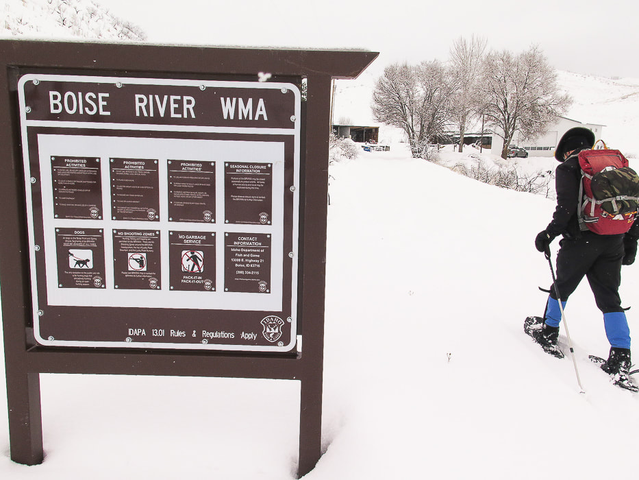 Boise River WMA on Idaho Highway 21, just past Highland Summit as you drive north from Boise No snowfall at beginning of hike, but that quickly changed and got progressively worse 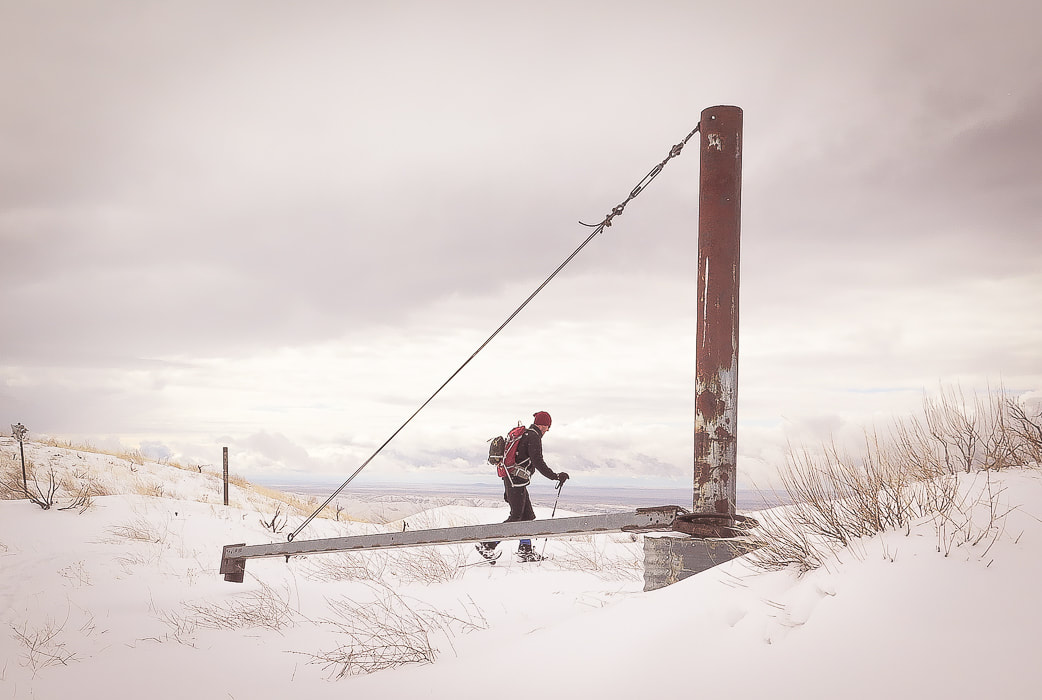 Structure on ridge between Black Hornet and Adelmann Mines, on last year's Lucky Peak winter hike Shortly after this, we start climbing ridge to summit of Lucky Peak 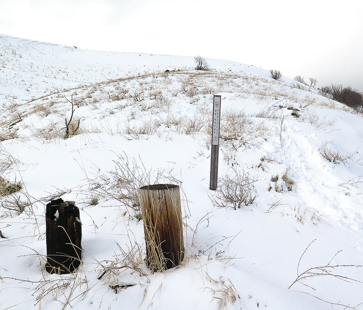 Where we leave road to ascend ridge - this hike on a day with clearing storm Rewards for climbing the ridge instead of the road abound. First of all, finding your own way is a challenge. The off-trail route for this hike is not difficult - you keep going up, but you don't want to waste too much time recovering from a loss in elevation. Also, you often see things that you wouldn't see following someone else's tracks. Thousands of elk tracks, making deep divots in the moist, squishy soil made our steep ascent to the ridge slow and bumpy, but once onto it, we found a faint human trail. The first wildflowers of the season were poking through last year's dead grasses - spots of bright green among thick faded brown mats. Up higher and onto the snow, our route intersected a wide elk trail - deep hoof prints heading down a steep ravine. Last year, we witnessed a huge herd of elk, led by one bull elk with enormous antlers traverse a large hillside to a ridge top while we approached Lucky Peak summit from a different ridge to the east. For a few moments, the bull elk's silhouette stood on the ridge against the sky, and then was gone. Once, a large, fast-moving shadow floating over a gulch and then ascending a ridge caught my eye. In the azure blue sky a golden eagle slowly flapped its long wings, a dark and graceful presence moving effortlessly. 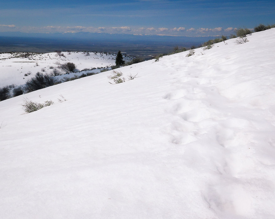 We intersected a trail of elk tracks on our March Lucky Peak summit hike In March, we navigated over the snow easily, barely sinking but still making discernible prints on the surface as we climbed over three rises to meet with Shaw Mountain Road, a birdhouse at its intersection. The Douglas fir trees on the right side of the ridge have become familiar now, and there is one huge Doug fir that stands out from the rest, a sentinel that looks to the rugged snow-capped mountains of the Boise National Forest. The view from Lucky Peak summit is awe-inspiring: Shafer Butte and Bogus Basin Ski area to the northwest, and Boise is seen in the flat darkness of the Treasure Valley. 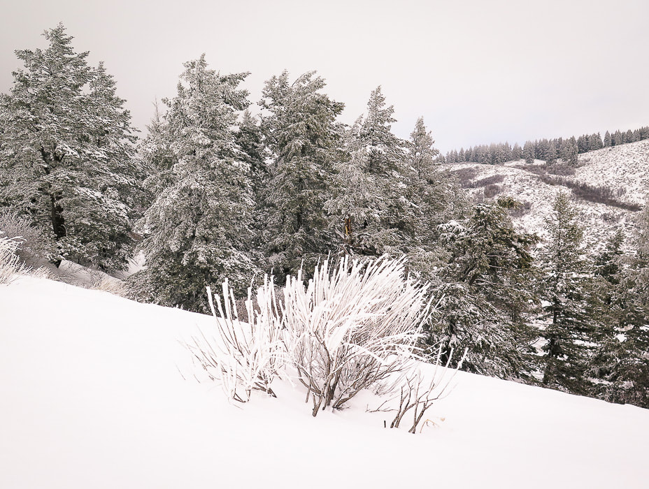 Douglas fir trees as guide to ascending southeast ridge to Lucky Peak 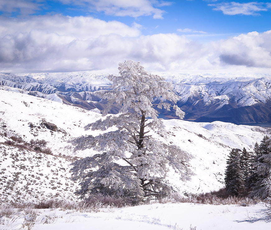 On southeast ridge to Lucky Peak looking north to Boise National Forest 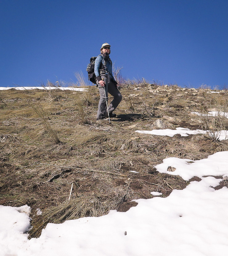 Taking the ridge less traveled Frost heaves, elk hoof divots and last season's dead bunch grasses contribute to uneven ground off-trail 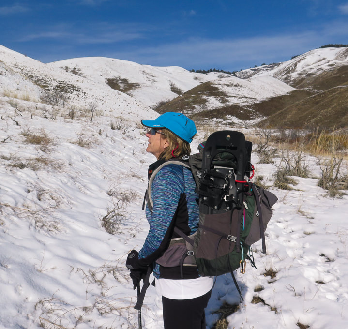 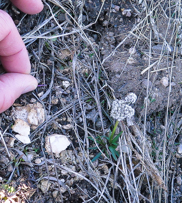 One of the first forbs of the season Sure, getting up to the proper ridge is pretty intense work usually. But once on top, the world drops on either side, and you follow the narrow land and wide sky up. After intersecting with Shaw Mountain Road, Lucky Peak's summit looms with its numerous antennas. A fun loop hike would be ascend the same ridge, and then descend Shaw Mountain Road to either East or West Highland Valley Road, necessitating a car shuttle. We initially ascended the "wrong" ridge on our way to summit Pinto Mountain in Joshua Tree Wilderness a few months ago and found a large circle of rocks making me wonder who made this and why? Trekking through the gulch to this spot, we found a vibrant and lush green garden spilling with vines and bright red barrel cactus, out of place in the stark and barren brown Pinto Mountains. You find the most interesting things off the beaten path. Many times we have hiked the standard Lucky Peak Trail to the south of the summit. It's great to meet people along the way, but hiking Lucky's "backside" is more rewarding because it feels remote in comparison, as if we have it to ourselves. It's a distinct feeling of fulfillment and a deeper connection to our local environment to walk the ridge less traveled; and as Robert Frost writes, "...that has made all the difference." 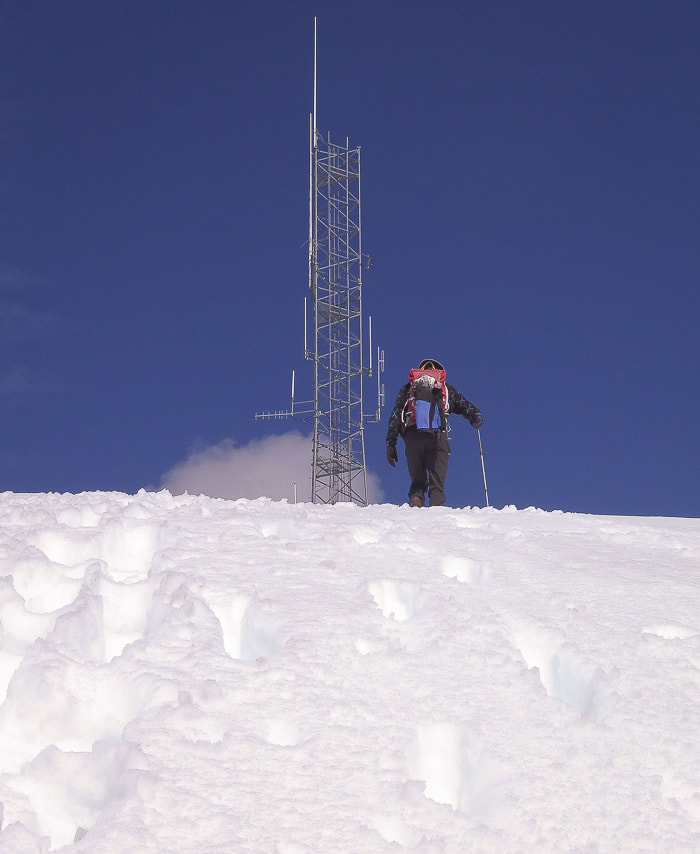 Last approach to Lucky Peak summit 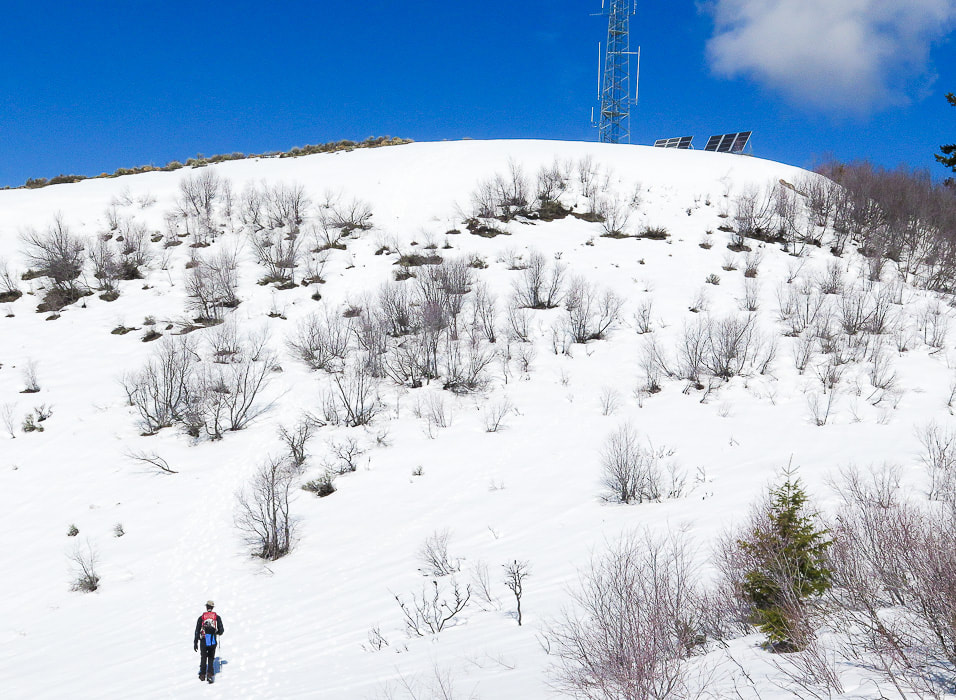 Approaching Lucky Peak summit from southeast ridge 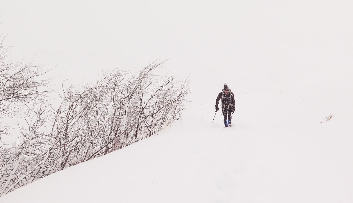 February snowstorm 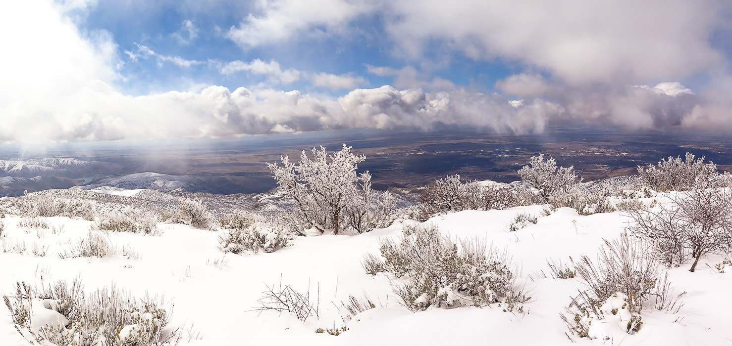 Treasure Valley from Lucky Peak's south ridge
Snowshoe climb to Lucky Peak from Boise River Wilderness Management Area after a March snowstorm.
 Trekking down from summit of Lucky Peak on southeast ridge Boise National Forest on horizon Trip Stats Overview: This southeast approach to Lucky Peak (AKA Shaw Mountain) begins at the Boise River WMA following a dirt road that travels northwest along creek with burned vegetation from the Mile Marker 14 Fire July 2016. It has less usage and more trees than the Homestead Trail approach from the southwest. It passes an intersection to a road leading to Adelmann Mine, then climbs ridge to the summit. Elk herds and deer often present. Spectacular views of Treasure Valley and Boise National Forest close to Boise. Side trip to Adelmann Mine with historic buildings not far from main road. Difficulty: moderate with no snow; moderate - strenuous with snow. Route-finding skills needed if going off road and onto ridge. Elevation gain: Boise River Wilderness Management Area (trailhead) at 3,624': Lucky Peak elevation 5,904' = ~ 2,280 feet. Lucky Peak Coordinates: 43°36'18.82"N, 116°03'39.98"W. Boise River Wilderness Management Area Coordinates: 43°34'26.7"N, 116°1'18.62"W Map: USGS Lucky Peak quad, 7.5-min series Distance: 7 miles out and back. Directions to trailhead: Boise River WMA is on the west side of ID-21, 6.8 miles from E. Warm Springs Rd. and ID-21 intersection east of Boise. It is a left hand turn to a small parking area with a gate just after Highland Valley Summit if you are heading north. Geology: Granite of Idaho Batholith, Cretaceous age 117 - 62 million years ago. History: Adelmann Mine's primary mineral was gold. Our Hike A good friend commented, after reading my last post on Cervidae Peak, that Fred and I were "lucky" to have Lucky Peak as a training mountain. We've hiked it many times during the 18 years that we have lived in Boise. When we hike "the front side" of Lucky via Homestead Trail, the elevation gain is 3,000 feet and we always try to improve our time. This time we snowshoed what we call the "back side" after a late winter snowstorm. Snow depths varied from a few inches at the trailhead to ~ 12 inches at the summit. A steady breeze from the northwest provided a good headwind for most of the climb. The visibility at the summit was 300 yards, and hard rime ice created by heavy fog coated fir branches and last season's blue-bunch wheatgrass. Fred and I took turns breaking trail through untracked snow. On our way down, the clouds broke revealing a spectacular winter scene with views of the Boise National Forest to the northeast, Lucky Peak Lake to the southeast, and the Owyhee Mountain range to the south. The contrast between the flat, dark Treasure Valley under shifting clouds and the bright white snow of mountains stretching to the horizon was of jaw-dropping beauty, the kind that makes you stop in your tracks. Idaho is an incredible place! 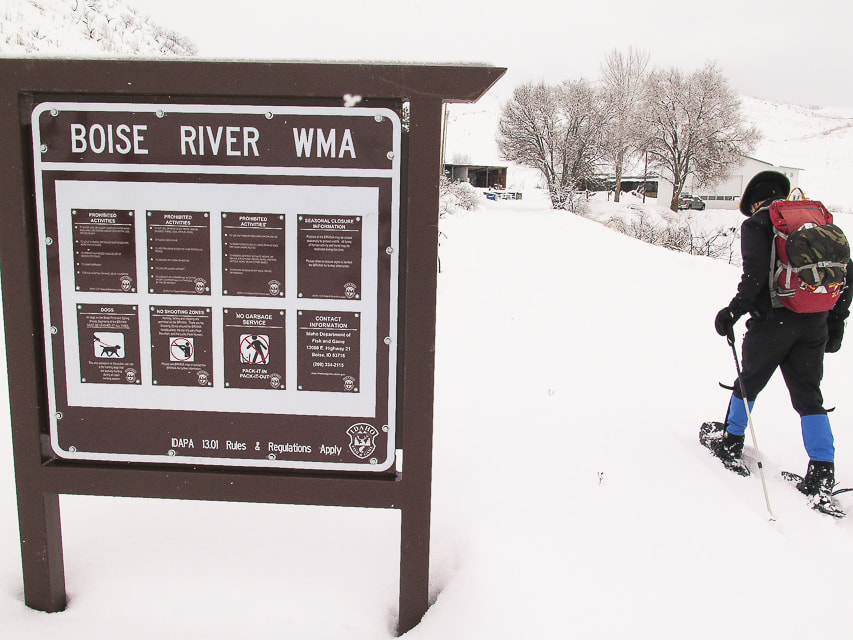 Boise River Wildlife Management Area sign at trailhead at ID Highway 21  Fred at start of ridge climb, 2 miles from trailhead, after intersection with trail to Adelmann Mine. 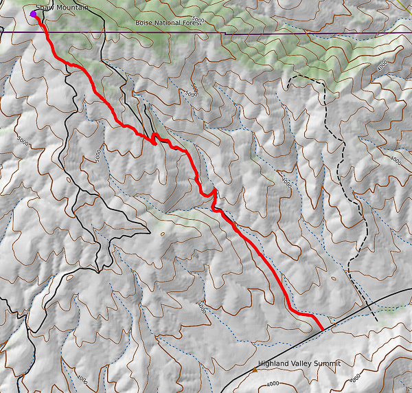 GPS tracks from WMA Headquarters trailhead on ID Hwy 21 to Lucky Peak (AKA Shaw Mountain) Follow road for 2 miles, then onto ridge to summit.  Our route to Lucky Peak (AKA Shaw Mountain) from Boise River WMA on ID Highway 21. This route intersects with Route E. Shaw Mountain Road near the summit (on left). Total hiking distance ~ 3.5 miles to summit with 2,280 feet of elevation gain. This trail begins at the Boise River WMA buildings, following an often-muddy road in a northwest direction, with the tree line of Lucky Peak coming into view in about .5 miles. It crosses a creek, then begins a steep climb for 1 mile to the intersection of the road that leads to the abandoned buildings of Adelmann mine. At this intersection, take the road to the left for a short climb to a ridge overlooking the valley to the south. The road continues to the northwest and can be followed to the summit; it's here that we get off the road and take the more direct ridge route, beginning at two log stumps and a "No Motor Vehicles" sign. We gain the ridge where the snow is wind-blown and not as deep and follow it towards the tree line on the right. Toward the top, there is an intersection with E. Shaw Mountain Road, marked by a wooden birdhouse. Our route continues on this road to an outhouse with the radio towers of Lucky Peak in view, then a short steep climb to the top. 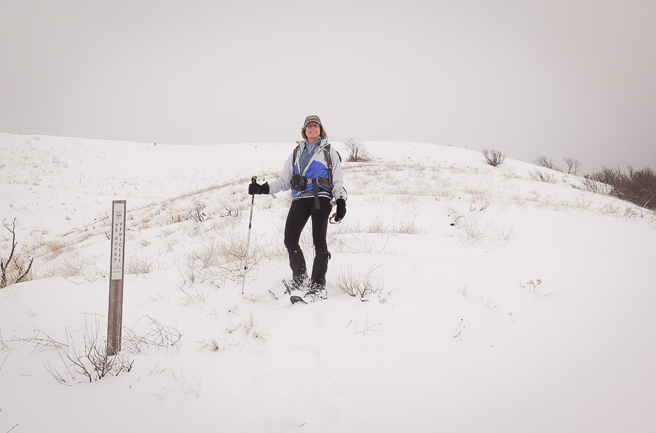 Point at which we leave the road to climb to ridge: this is on a saddle separating Adelmann Mine to the north and Black Hornet Mine to the south 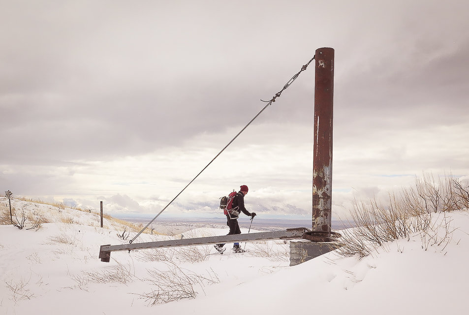 Mine apparatus (?) or gate (?) at ridge between Black Hornet Mine and Adelmann Mine, shortly after intersection of road to Adelmann Mine. This marks the point on our route where we get off the road and climb Lucky Peak's southeast ridge 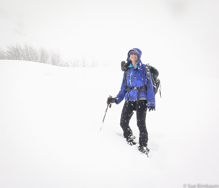 Lucky Peak hike February 2019 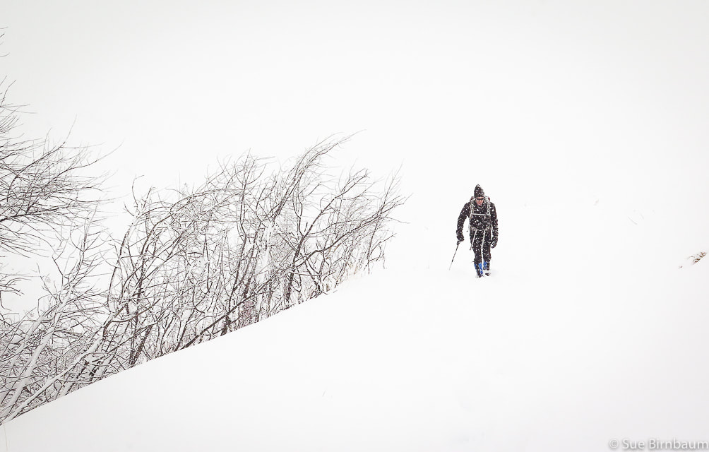 Lucky Peak hike during snowstorm - February 2019 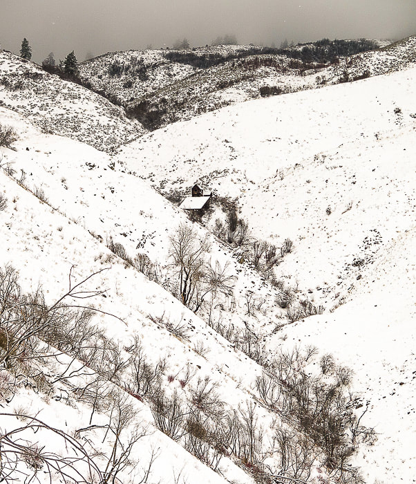 Building at Adelmann Mine 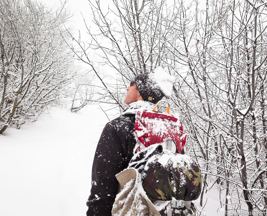 At intersection with road that leads to Adelmann Mine 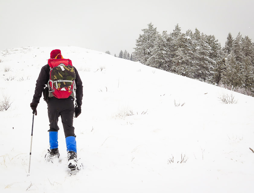 Hike up ridge toward Lucky Peak with trees to the right 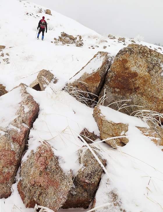 Granite of the Idaho Batholith Hard rime ice had accumulated on the windward side of everything enveloped in the fog at the top. We cleared a place in the snow, sat and ate lunch until we cooled down from the climb. As we hiked down, the clouds thinned, illuminating trees, grasses and shrubs in a golden light, and a little further down we found ourselves in bright white fresh snow, walking toward the dark blue and white peaks of the Boise National Forest. Since Lucky Peak is the highest point for miles around, it gives you the feeling that you are walking above almost everything else. 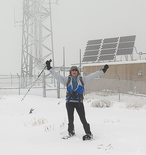 Radio Towers on summit of Lucky Peak - 5,904 feet 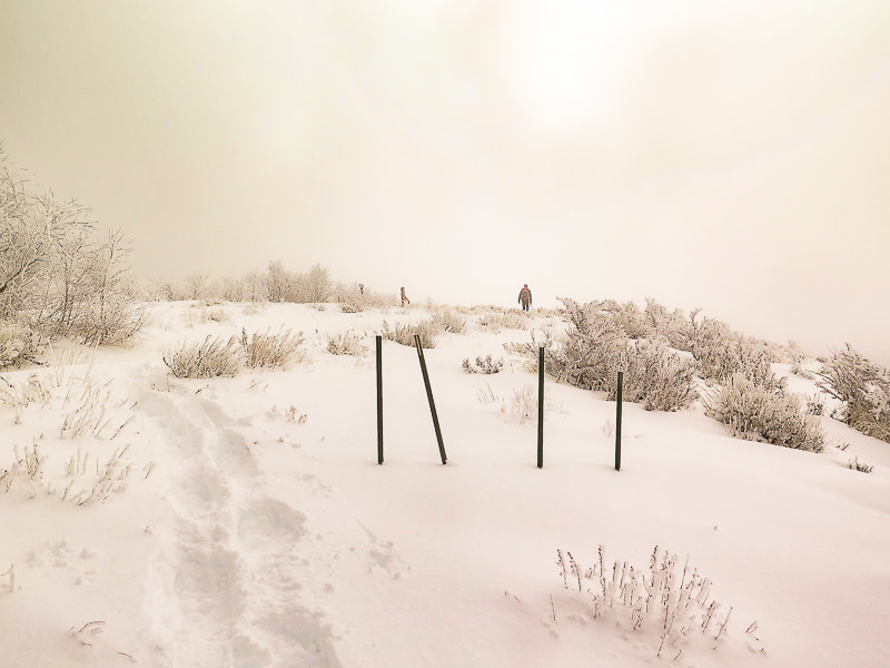 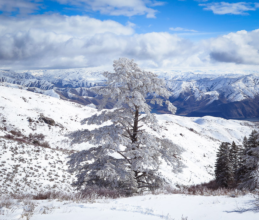 Douglas Fir with hard rime ice at higher elevations on Lucky Peak, looking northeast to Boise National Forest. 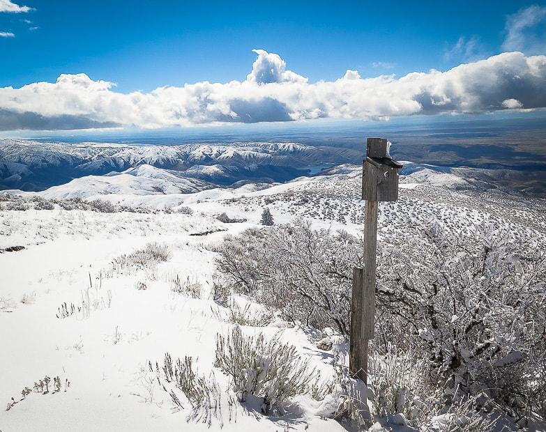 At intersection of our route and Route E. Shaw Mountain Road - follow this road to the summit of Lucky Peak 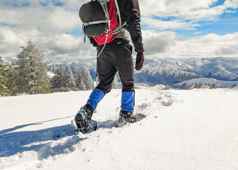 Great views of Boise National Forest and Lucky Peak Lake on the way down 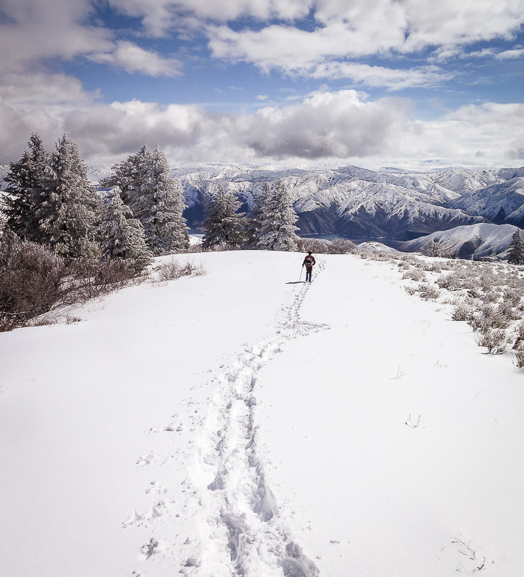 Clouds clearing on the way down- walking toward Lucky Peak Lake and Boise National Forest 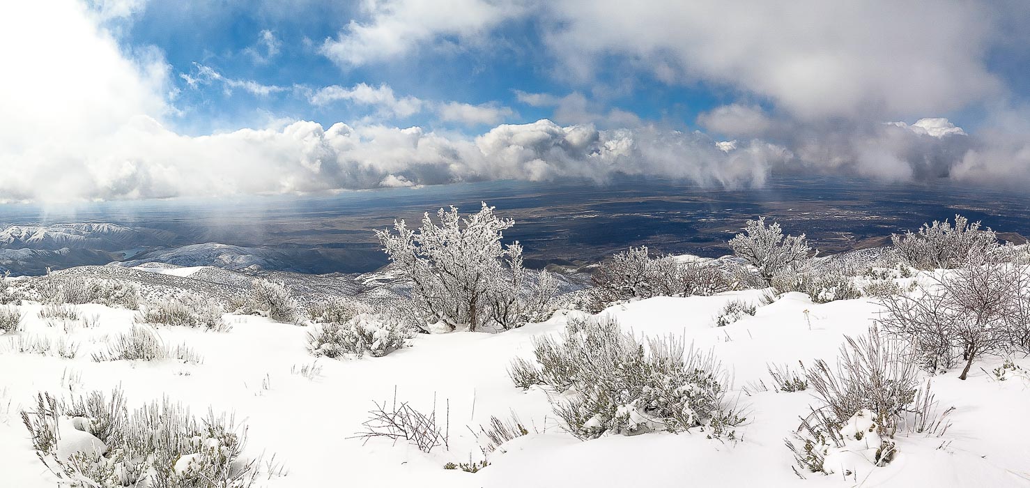 Antelope bitterbrush overlooking the Treasure Valley including Boise, Idaho. 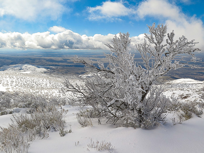 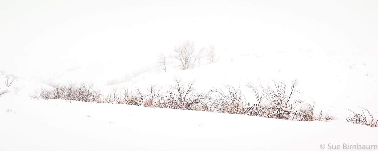 There's lots of advantages to snowshoeing vs. hiking with no snow: vegetation is not damaged, you sharpen navigational and preparation skills, and best of all, quiet and solitude. We went up into the clouds facing a steady headwind and came down in sun and breaking clouds with warmer temperatures. We are lucky in Boise to have the opportunity to experience great snowshoeing treks.
An early, deep autumn snow created a spectacular scene at Miner Lake north of Ketchum, Idaho. 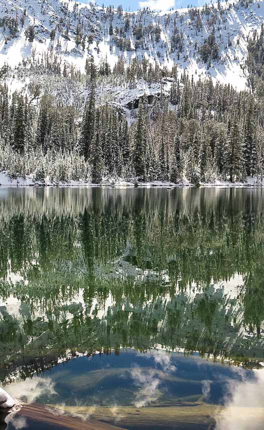 Miner Lake, Smoky Mountains, Central Idaho Trip Stats
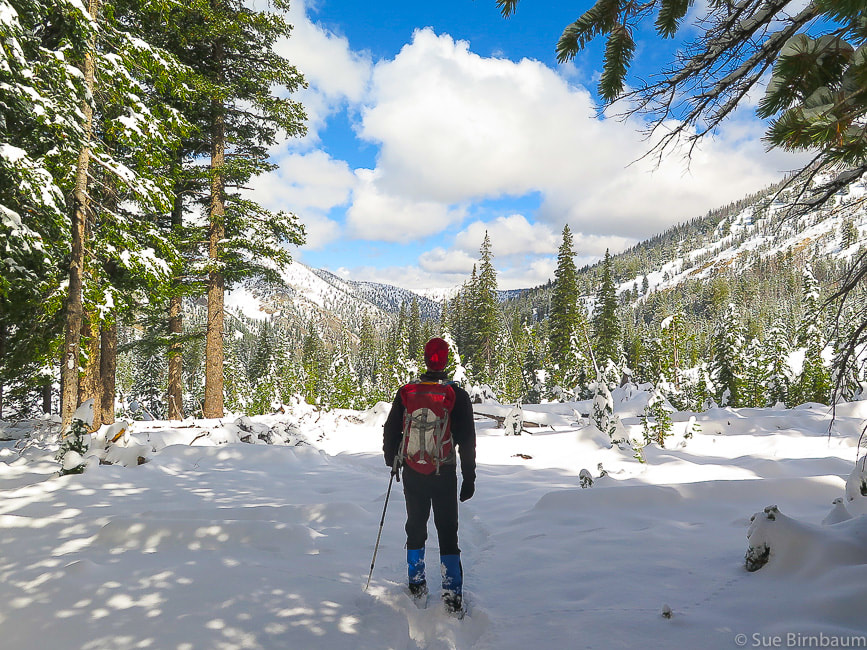 Our Hike This hike begins on a relatively flat trail. Once you take a left at the intersection to Miner Lake, it climbs until you reach the basin that Miner Lake is in, and then it becomes less steep as you approach the lake. Surprises, unplanned elements, the unexpected - these things make some adventures more memorable than others. Filed in the “special adventure” part of my memory is the hike where I fell into a cold Imogene Lake in the Sawtooths while walking on an unstable log bridge, and the time Fred and I were caught in a summit lightning storm on Engineer Peak near Durango, Colorado. There was the snowstorm we walked in as we hiked toward Sunset Mountain Lookout in Idaho – and across the valley, a couple would spend the night in the freezing wilderness after getting lost in that same storm. 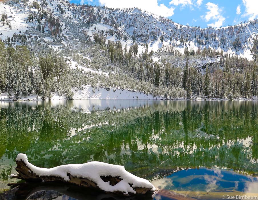 Miner Lake in the Smoky Mountains north of Ketchum, Idaho at 8,770 feet 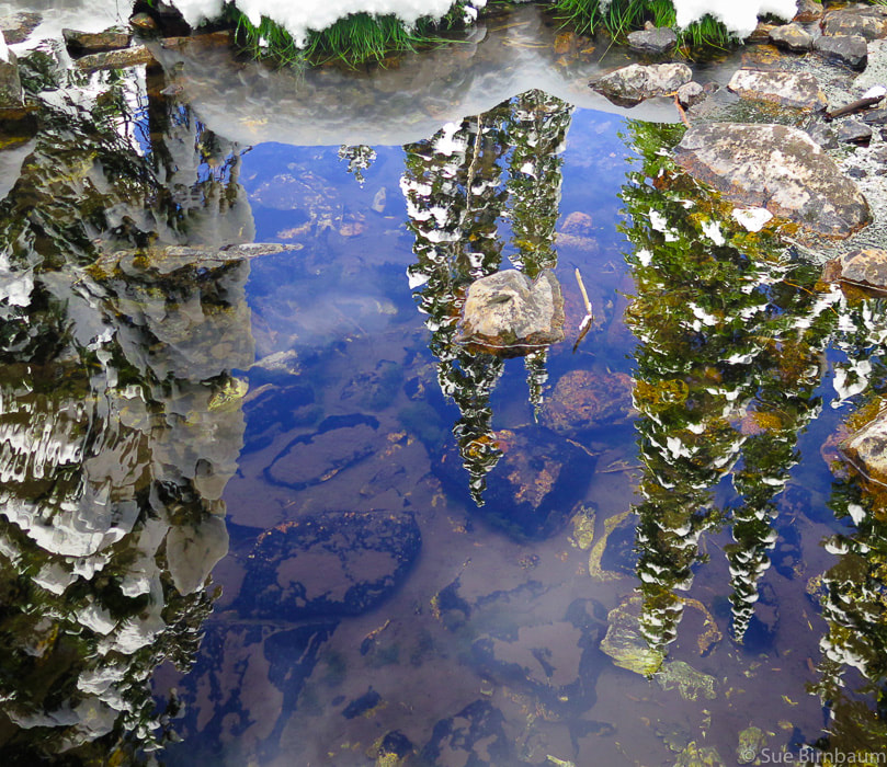 Reflection in Miner Creek A September snowstorm changed our plans to climb Norton Peak in the Smoky Mountains northwest of Ketchum, Idaho last weekend. When we got to Miner Lake just below the peak, the snow was 18 inches deep at 8,770 feet elevation, we realized we would need crampons to hike the rest of the route to Norton Peak, at an elevation of 10,300 feet. What we saw at the lake was incredibly stark and beautiful. Fred and I noticed immediately the lack of sound – no wind, no water, no leaves rustling, no animal sounds. Thick powdery snow covered green shrubs and grasses, and it weighed down fir branches. It was a winter scene that looked strange with the angle of the late summer sun. 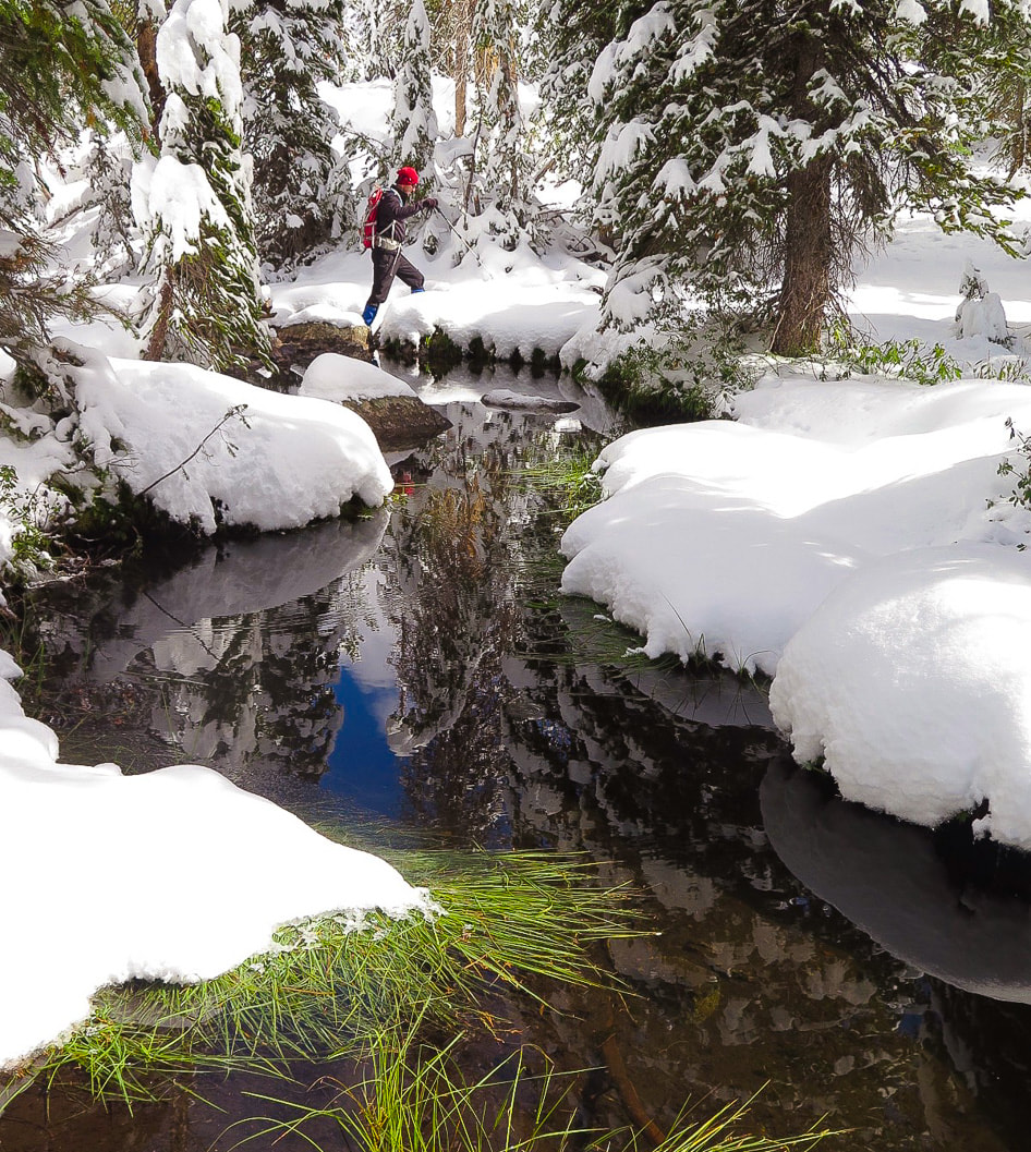  The Prairie Lakes trail was easy to follow for the first 2 miles. Prairie Creek still had enough water to require rock and log-hopping to get across in order to keep dry boots. When we crossed this trail earlier this year on the Prairie Lakes/Miner Lake loop, the water was deep and we doffed boots in order to cross. As soon as we crossed Prairie Creek and started to climb south to Miner Lake, we found our way through ever-deepening snow by following tree blazes. Fred led the way by following a faint trough in the snow that marked the trail. Coming out of the trees, a glaciated valley opens up with flanks sweeping up toward Norton Peak. Most of the rock was covered by deep snow. As we neared Miner Creek, the air was crystal clear and we could see still reflections of heavily snow-laden fir trees upside down in the water. The white-covered branches stood out against the azure blue waters. We had an easy trek through deep, light, fluffy snow to the shore of Miner Lake. The more you get out there, the greater chance you have at seeing a pristine, just-after-a snowstorm scene. We hit it just perfectly that day. Silver and gold mines nearest to Miner Lake are the Solace, Weblock and Vienna mines near Smiley Creek, to the northwest. To the south, the abandoned mining town of Carrietown lies near the Big and Little Smoky Rosetta district where ores rich in silver, zinc, and lead were discovered in the 1880’s. Mining was the impetus for the Wood River Valley’s initial prosperity. 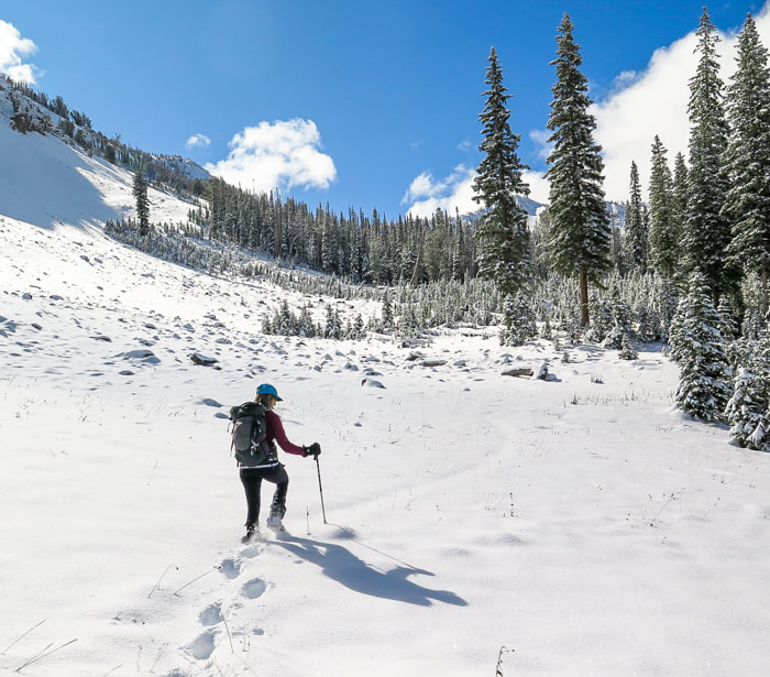 Approaching Miner Lake 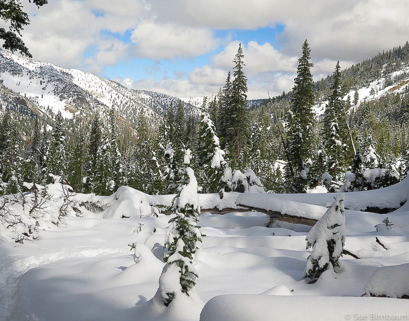 During the last mile of this hike, as with all of our other adventures, Fred and I realize how much we love to hike together. We discuss what we just have experienced – the silence, the snow condition, the clear lake water. To be able to hike with my husband gives me even more happiness than the gorgeous nature of Idaho Mountains. It’s then that I realize I wouldn’t want to be anywhere else, but where I am at that moment. 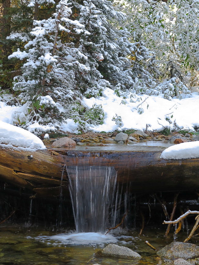 Prairie Creek  The snowshoe hike to Sunset Mountain Lookout from Mores Creek Summit north of Idaho City, Idaho allows for solitude and beauty on the way to the deep snow of the summit. You will work to get there, but the spectacular view at the top is worth it. This explorumentary features photos from multiple hikes throughout the years Related: Silver City, Idaho Snowshoe 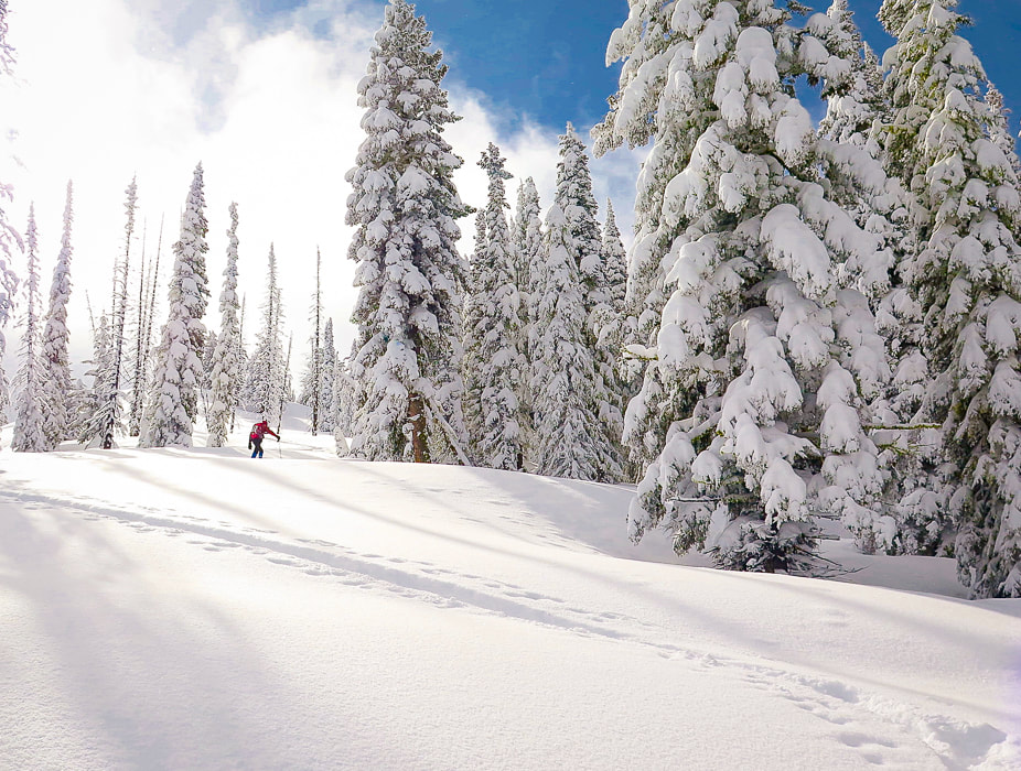 Trip stats
Hike Directions
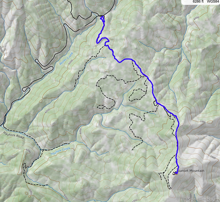 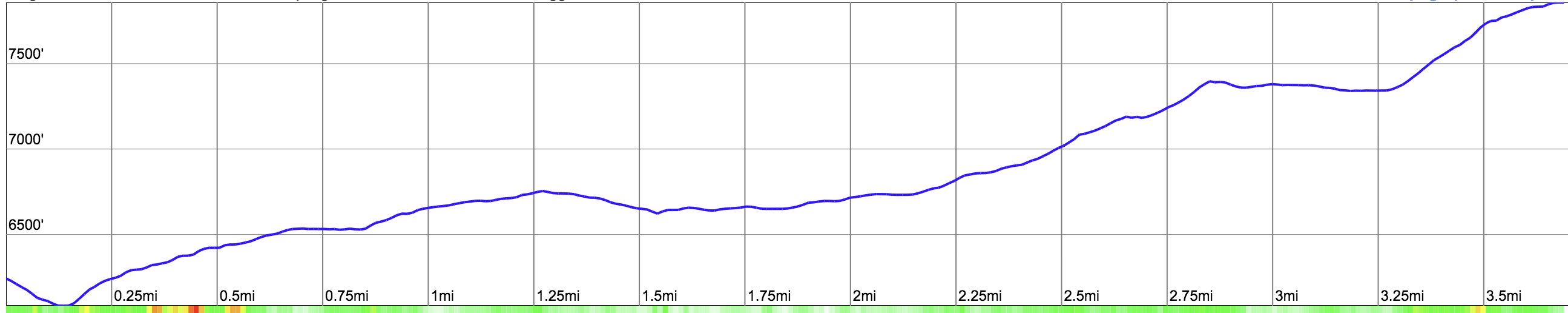 Our route and elevation profile from ID 21 parking at More's Creek Summit to the summit of Sunset Mountain Lookout (blue line). Most of hike follows Sunset Mountain Road (FR #316) We follow the forest road, then climb to ridge and go south, short-cutting the road and head straight up last approach (0.75 miles) to summit. 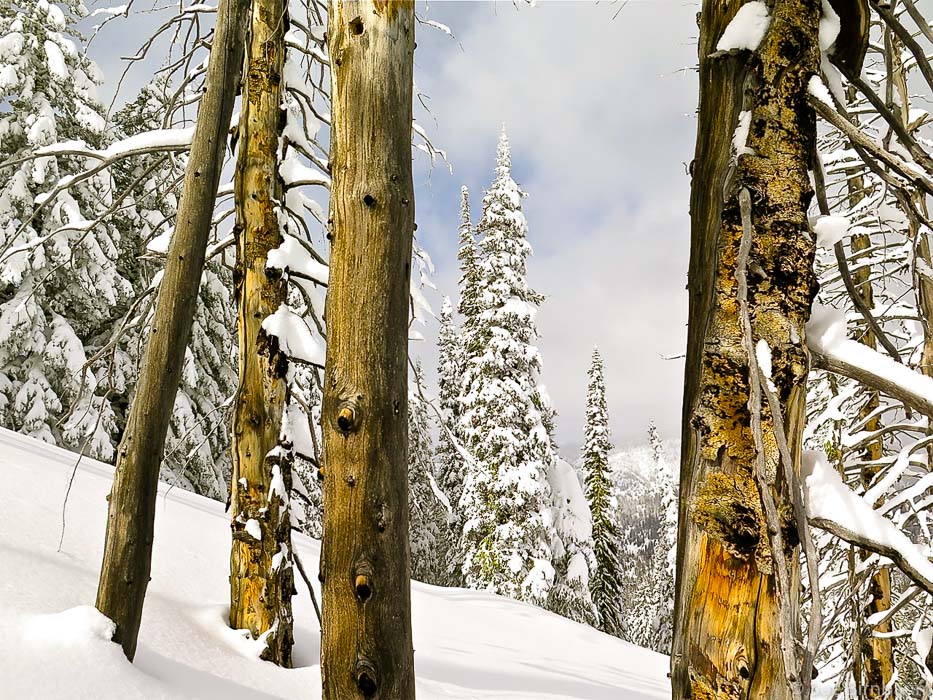 Eighteen years ago, on our first snowshoe hike to Sunset Mountain Lookout, we ran into a skier coming down from the mountain. He said, as he turned and pointed, "turn left at the tall fir tree when you get to the clearing at the top of this rise." It was a bright sunny day and one of our first snowshoe hikes in Idaho. Every time I do this hike, I remember those directions and that tree, although we know the route so well after having hiked it once or twice a year for 18 years. Over the years, the snow-filled parking lot at Mores Creek Summit, which is plowed, has more and more vehicles and trailers of snowmobilers, skiers and snowshoers. This is where two trailheads are located. The snow machines mostly run on the trail to Pilot Peak, on the north side of ID 21, as well as some skiers, while most snowshoers go up to Sunset Lookout on the south side. Getting up over the berm of snow from the parking lot and onto Forest Road #316 is a bit steep, but once you find the tracks and groove of the road, it climbs at a moderate incline. It heads south and southeastward up and then down a wide creek valley, then up to a clearing at the top of a ridge where the road then heads to the left (northeast) briefly before heading through the forest in a southeastward direction. The first view of Sunset Mountain Lookout can be seen - the building a small speck on the highest rise to the south. 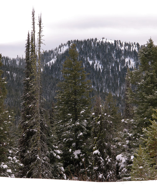 First view of Sunset Lookout to the south - building on top of mountain with clearing of trees at its base After this clearing, the trail descends briefly and is level for ~ 0.5 miles before it begins to climb again. Clearings show the immensity of the Boise National Forest to the northeast, with mountains, deep valleys and tall trees with snow-covered branches. The only sound on this hike is our snowshoes crunching through the snow; the forest is blissfully quiet. The last half of the hike is a steady climb that gets steeper as the road approaches the lookout. We short-cut the road and switchback straight up the open, steep slope just below the final rise to the lookout. Once up this steep rise, we meet with the forest road and follow it more or less the last few hundred yards to the top. This winter’s snowshoe hike to Sunset Lookout proved to be one of the most spectacular trips this season because of record snowfall in Idaho and a recent storm that provided 5 inches of new, fluffy powder over a firm base. On the last 1/2 mile to the summit, we followed a skier’s track that made small switchbacks up the steep, final face to the top, where an expansive 360-degree view of white and grey mountains surrounded us. The fir trees were white, too, with only a few inches of green showing beneath branches under thick snow cover. Grey clouds floated by us, now and then obstructing our view. It was a surreal scene that not many get to witness. 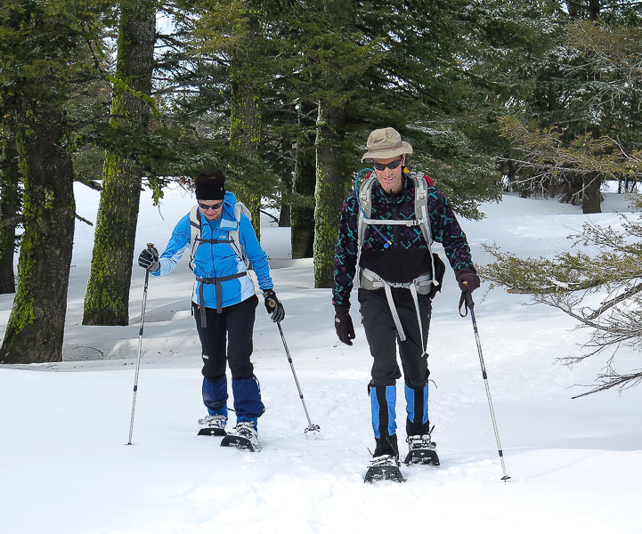 Beth and Fred on trail to Sunset Mountain Lookout 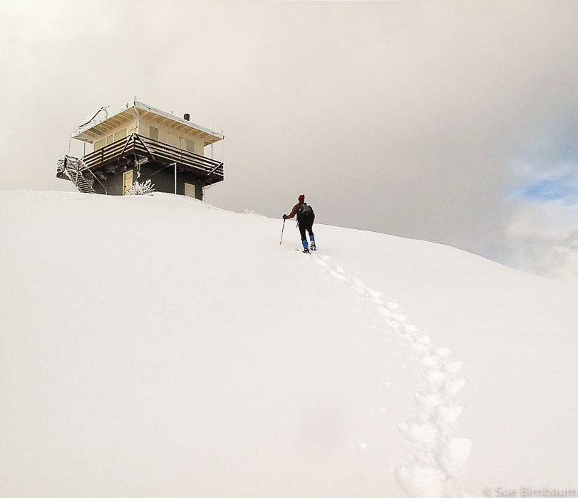 Sunset Mountain Lookout - 7,869 feet - 4 .0 miles one-way from ID 21 to lookout - 1,700-foot elevation gain Fred and I make this trek every winter. We rarely see others, except the occasional backcountry skier. Once away from the parking lot, the noise from the snow machines that run to Pilot Peak on the other side of the summit quickly dies away. Once we saw a snowmobiler, by himself near the top of Sunset Mountain years ago. We dug him out of a snow hole. 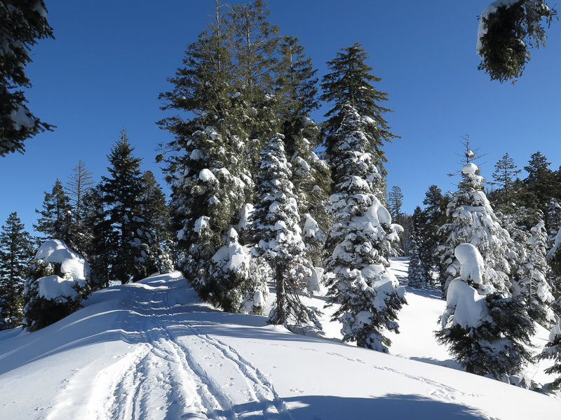 After an initial climb for 1.5 miles, the hike levels out as it traverses across a broad, flat area through a Ponderosa pine and Douglas fir forest in a southeasterly direction. A break in the forest allows a first glimpse of Sunset Mountain Fire Lookout. At about 2 miles, you find yourself on a ridge overlooking a stunning valley with the Boise National Forest at your feet. Unfortunately, much of this area was burned in the Pioneer Fire in August 2016. As the trail starts to climb again, you can choose to stay on the path the road takes leading to the right, or stay on the ridge with steeper hiking to the left (east of forest road). Further up, ridge and road meet at a small flat area where the top of Sunset Mountain finally comes back into view. This is where the real climbing begins. We hike straight up the final mountain face, instead of taking the gentler, longer road to the top.  Final steep approach to return to high road near summit - switchback to the right of the face near forest This steep approach climbs 500 feet in 0.25 miles 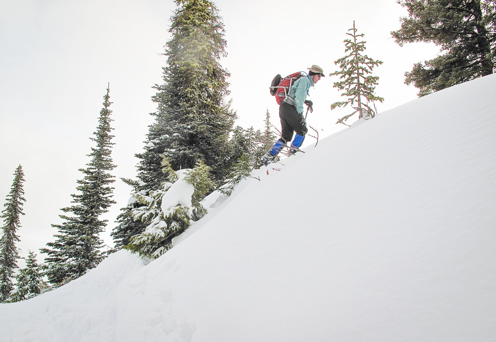 Ascending the last steep pitch just below Sunset Fire Lookout 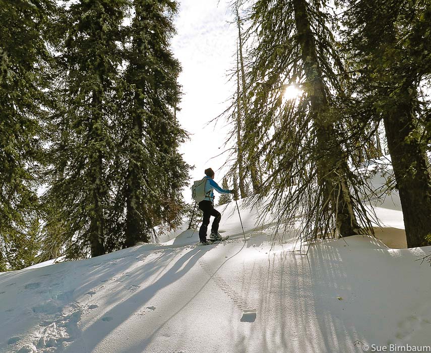 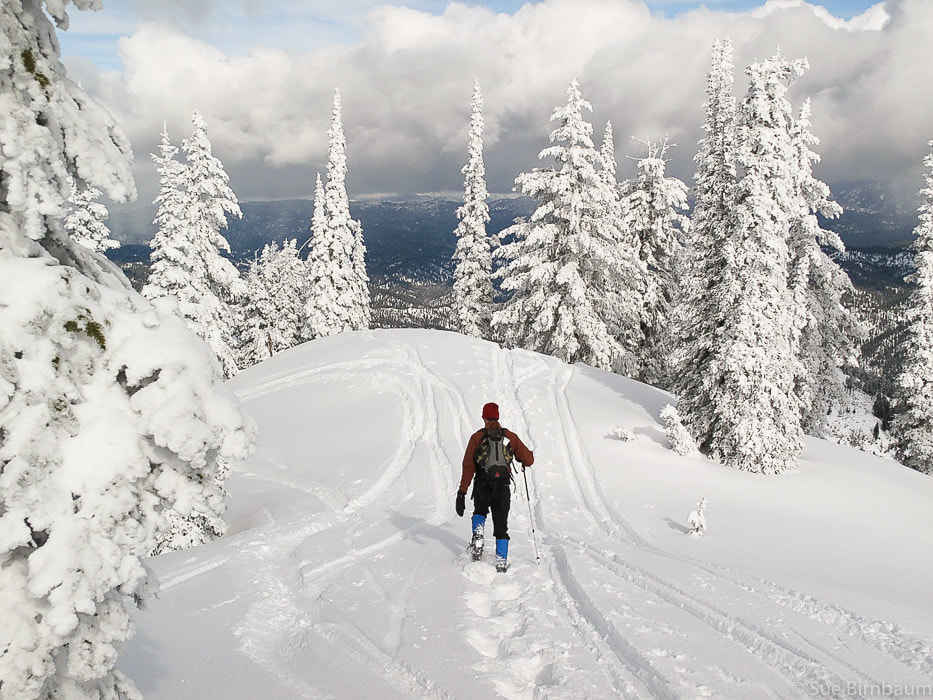 Once on top, the breeze is colder and the snow is deeper, for the elevation at the fire lookout, which is manned in the summer is 7,869 feet. The incredible view of multiple mountain ranges is worth the effort. The edge of the Sawtooth Mountains can be seen toward the northeast. We wish we could hang out at the top longer on those winter days. We decide to get some pie at Trudy’s Kitchen in Idaho City. We’ve definitely earned it. The thought of warm home made apple pie and the stinging in our hands motivates us to start descending the 1,700 feet down to the parking lot. 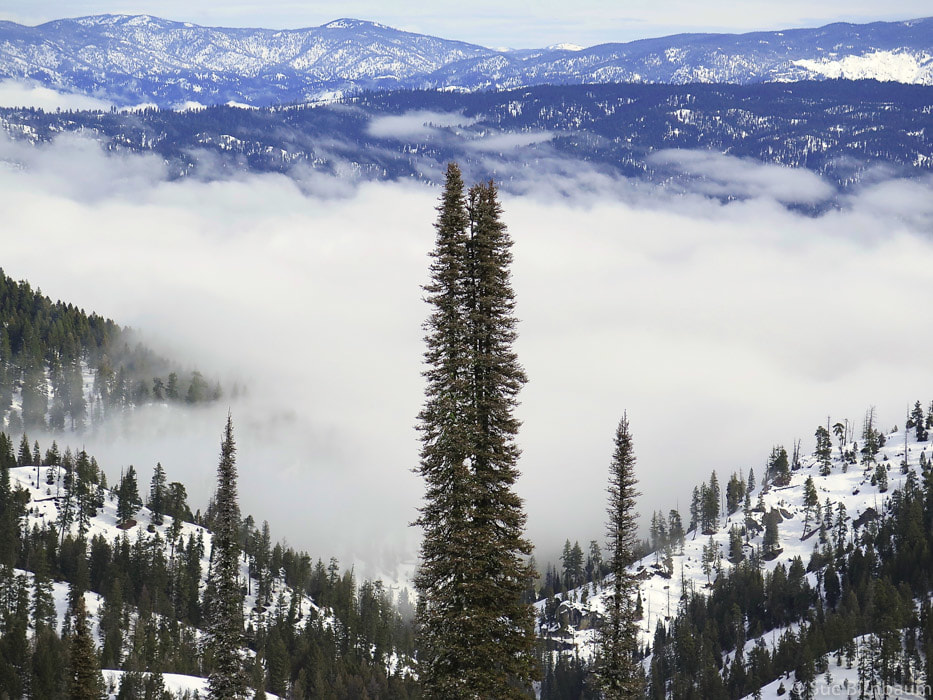 Looking east over Boise National Forest ~ 2 miles into hike 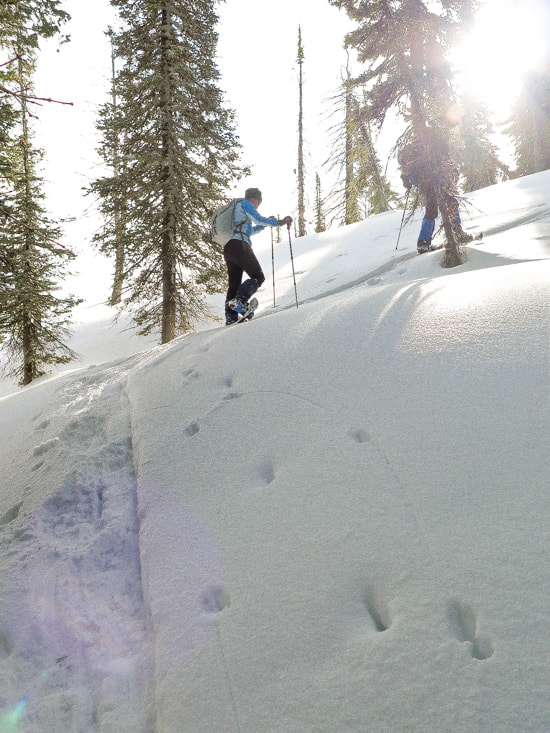 Steep final approach short-cutting road to top 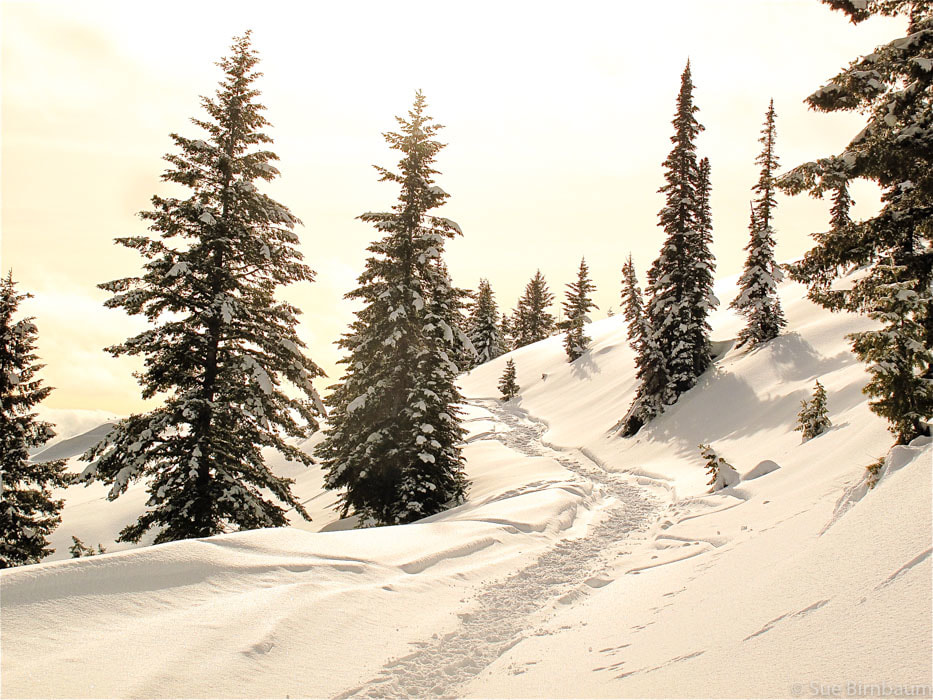 Final climb to summit lookout - back on road after steep climb that bypasses road 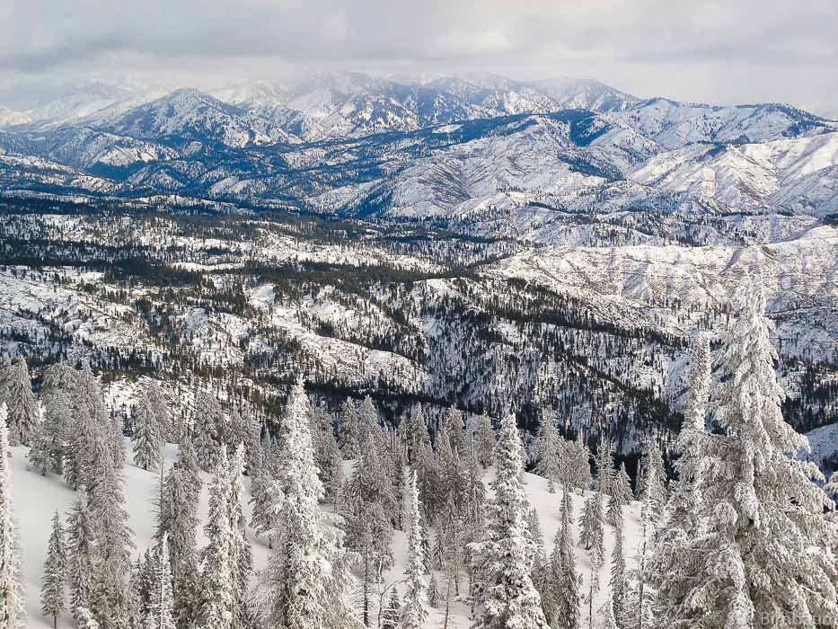 View of Sawtooth Mountains in the distance from top of Sunset Mountain Lookout 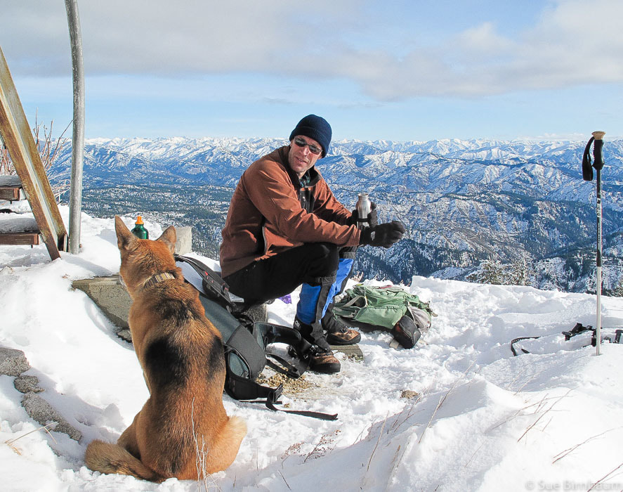 You never know who you're going to meet on the top of a mountain 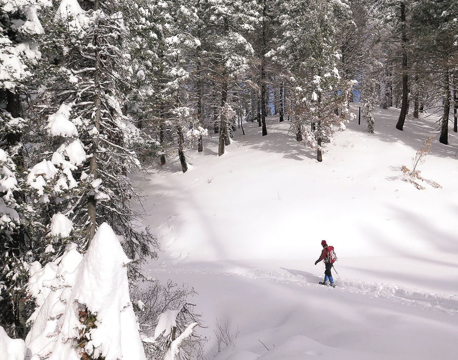 Walking back to trailhead 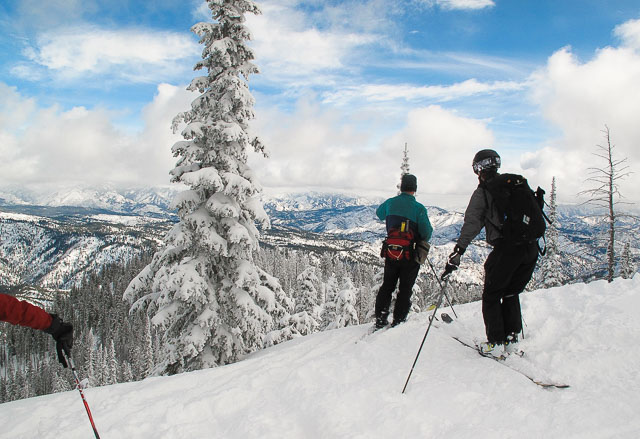  The best way to experience the ghost mining town of Silver City is during the winter. If snow levels are low, you can snowshoe into this town and have it mostly to yourself.  Silver City Road during Idaho's "snowmageddon" winter of 2017. We couldn't make it into Silver City this year. Trip Stats Driving distance from Boise to Silver City Road is about 53 miles; Silver City Road to Silver City, Idaho is 23 miles on a combination of asphalt at lower elevations and gravel at higher elevations. From Idaho Hwy 78 past Murphy, Idaho, (mile marker 34), head south on Silver City Road. Two interpretive sign boards are present at the turnoff: War Eagle Mine and Diamond Gulch. Road conditions on Silver City Road in the winter are usually muddy and snowy, necessitating a 4-wheel drive vehicle. Elevation gain of Silver City Road is about 3,400 feet from Idaho Highway 78 to Silver City. Silver City elevation is 6,200 feet. Snowshoeing mileage varies each winter with amount of snowfall - our round trip hikes are usually 8 - 10 miles. The Idaho Hotel and Bar is not open in the winter.  Entering Silver City, Idaho on snowshoes. 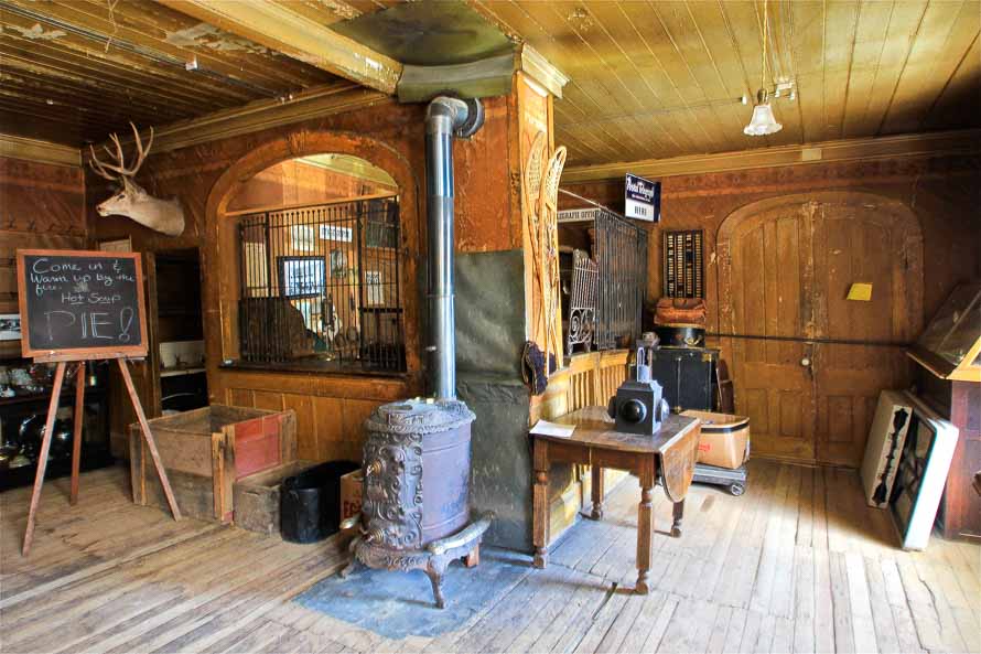 The Idaho Hotel and Bar, Silver City, Idaho Silver City, Idaho History Violence, shootings, claim disputes, The Owyhee “war” of 1868, and the extraction of millions of dollars of gold and silver ore are a few of the subjects for the storied past of Silver City, a preserved ghost town tucked high in the Owyhee Mountains in southwestern Idaho. In 1863, gold was discovered in Jordan Creek, a pleasant stream that cuts the valley in which this town lies by a party of gold prospectors from Boise Basin. Legend has it that gold nuggets were found earlier in nearby Sinker Creek, named so by emigrants on their way to Oregon who used these for sinkers on their fishing lines. Rich veins were discovered after prospectors traced placer gravels near Sinker Creek to their source near War Eagle Mountain, southeast of the town. Two periods of lucrative and frenzied mining activity took place in Silver City between 1863–1914, resulting in mines such as the Poorman, Golden Chariot, Mahogany, and Afterthought.  At its peak, Silver City had about 75 businesses, 300 homes and a population of 2,500. Currently, there are about 75 remaining structures, many of them restored. The Idaho Hotel, moved from Ruby City to its present location in 1866 is open during the summer months, so you can rent a room and have some great meals; however, watch out – rumor has it that the hotel is inhabited by ghosts. The kitchen at the Idaho Hotel serves delicious homemade pies in the summer months. Our Snowshoe Hike Fred and I like to snowshoe into Silver City in the winter, along with a few other hardy souls that venture in on their snow machines or skis. It takes more effort than in summer months, but the rewards are worth it, like the scenery of snow-covered Florida Mountain and War Eagle Mountain. We get the whole town to ourselves to explore. Because of Idaho's "Snowmageddon" this year (2017), we haven’t been able to get close to the town because of the record snowfall this winter. We attempted to snowshoe in at the beginning of February, but asphalt road that leads to higher elevation wasn’t plowed, so we had to park our truck only one mile up Silver City Road from the intersection of Hwy 78 southeast of Murphy, leaving us 22 miles from the town. In past years, we are able to park our truck within 4 or 5 miles of the town and then snowshoe in. The only drawback to Silver City in the winter is that Hotel Idaho is closed, so there is no pie. Last March, we drove up Silver City Road to where the snow began, parked and walked 4 miles into the town on firm snow, so walking did not necessitate wearing snowshoes, although we carried them just in case. We ran into a snow-cat group who were playing in the snow because they couldn’t get their machine over the steep and deep New York Summit, the pass into Silver City. 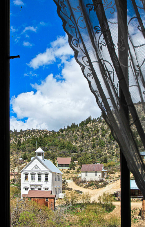 Silver City Schoolhouse (in summer) 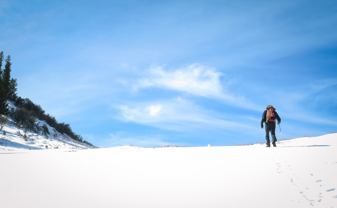 New York Summit - after this, road drops into Silver City. 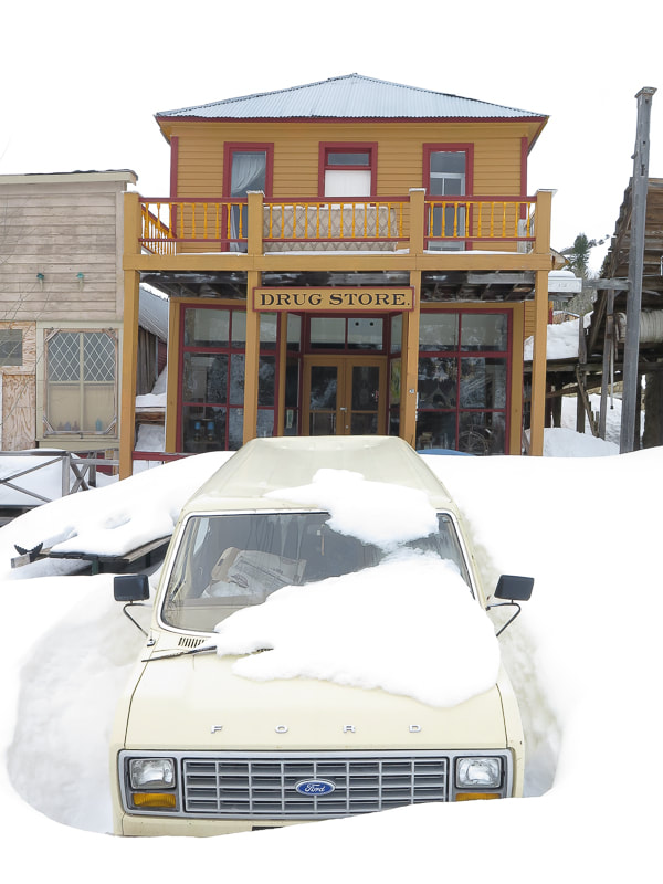  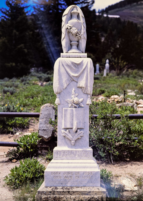 Silver City Citizens Cemetery There has always been a “watchman” on duty during the winter, or as in the case when we walked in four years ago, a “watch husband and wife” that were so happy to see us they gave us warm blueberry muffins. The streets are usually packed snow from snow machines, so walking around the town is usually easy. Last year, the watchman stood in front of his residence at the entrance to town, ready to check us out. You can’t miss the large sign on the road across from his place. It reads, “Welcome to Silver City, Idaho. Security on duty. Winter visitors must check in with Watchman”. A camera near the town entrance detects movement. You can learn a lot in just a few minutes of chatting with someone who winters mostly by himself for months with the ghosts and old buildings of Silver City. This hike is a great opportunity to take a day off from the city, and be in a quiet place where you can experience an important chapter in Idaho’s history and imagine what mining life was like in Silver City in the 1800’s. Fresh air, solitude, history, exercise – what could be better? By the way, the word "Owyhee" is an anglicization of the word Hawai'i. Three Native Hawaiian fur trappers went missing in the Owyhee Mountains in the winter of 1819 - 1820. They were presumed dead. In memory of these fur trappers from Hawai'i, this region was called "Owyhee" by British fur trappers. 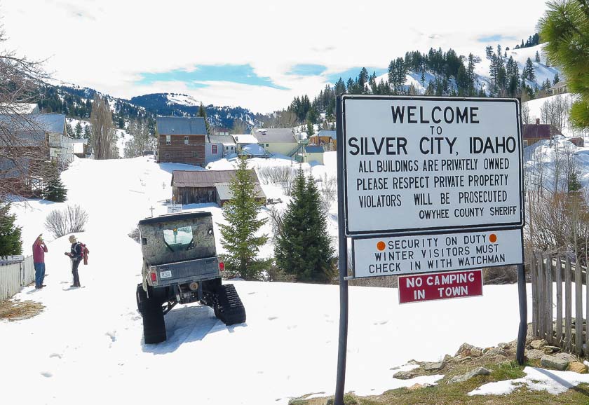 This year's watchman checking us out. 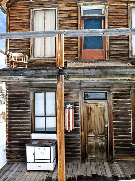 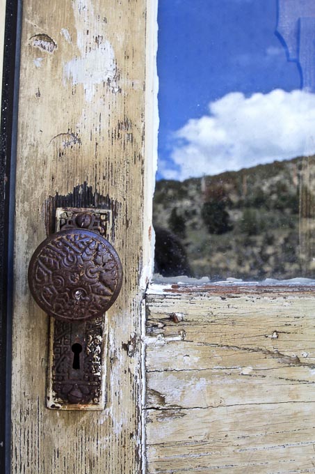 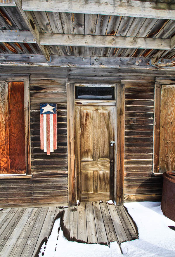 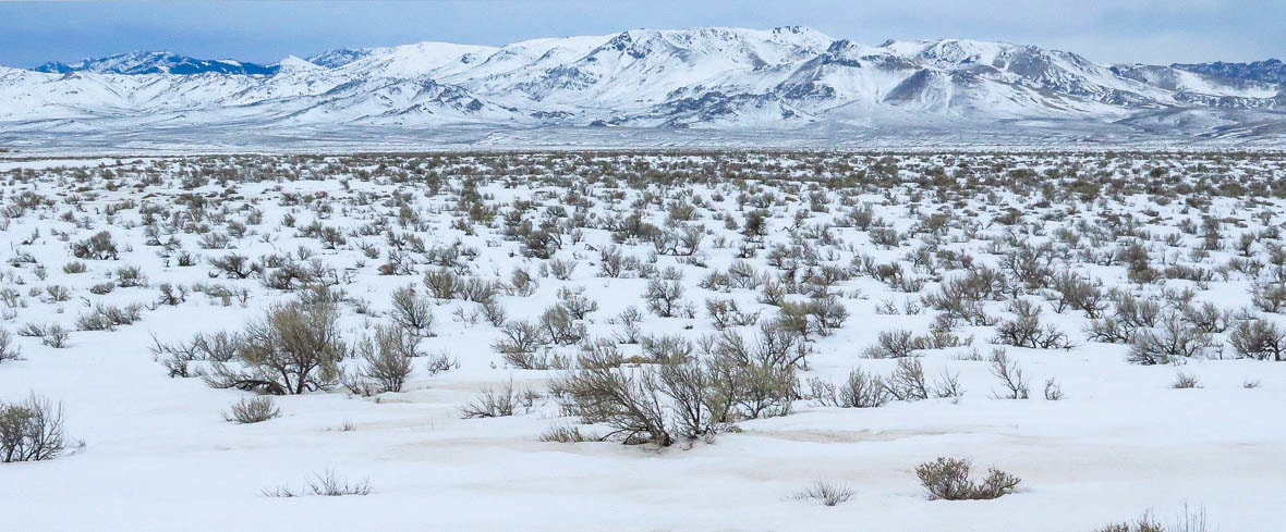 The Owyhee Mountains, Southern Idaho References:
Conway Welch, J. (1982). Gold Town to Ghost Town: The story of Silver City, Idaho. Moscow, ID: University of Idaho Press. Asher, R. R. (1968) Geology and Mineral Resources of a Portion of the Silver City Region, Owyhee County, Idaho. Pamphlet #138 prepared for the Idaho Bureau of Mines and Geology, Moscow, Idaho. |
Categories
All

Sue and Fred

About this blogExploration documentaries – "explorumentaries" list trip stats and highlights of each hike or bike ride, often with some interesting history or geology. Years ago, I wrote these for friends and family to let them know what my husband, Fred and I were up to on weekends, and also to showcase the incredible land of the west.
To Subscribe to Explorumentary adventure blog and receive new posts by email:
Happy Summer!

About the Author
|