EXPLORUMENTARY
  • Home
    • Cactus to Clouds Hike
    • More Quotes
    • Ann Zwinger Quotes
    • Mary Oliver Poems
  • Hikes by State
    • Idaho
    • Southern Utah
    • Arizona
    • California Desert
    • Nevada
    • Wyoming
  • BLOGS
    • Adventure Blog
    • Women and the Land
  • GALLERY
    • DESERT PLANTS >
      • Beavertail cactus
      • Brittlebush
      • Christmas Cactus
      • Arizona Barrel Cactus
      • Parry's penstemon
      • Agave
      • Arizona Rainbow Hedgehog
      • Claret Cup Hedgehog
      • Desert Agave
      • Palmer's Penstemon
      • Silver Cholla
      • Cristate Saguaro
      • Indian Paintbrush
      • Ocotillo
      • Santa Rita Prickly Pear
      • Spiny Cliffbrake
      • California Barrel Cactus
      • Engelmann Prickly Pear
      • Velvet Mesquite
      • Joshua Tree
      • Buckhorn Cholla
      • Hedgehog Cactus
      • Fishhook cactus
      • Thompson's Woolly Locoweed
    • NATURE
    • BOISE
    • EARTH + SKY
    • URBAN
    • WATER
    • PATRIOT
    • ORCHIDS
  • Fit After 50
    • Brian Holgate
    • Fred Birnbaum
    • Dave Brasuell
    • Bus' Little Black Book
    • Mike Carlson
    • Ray Wilson
    • Bryan Krouse
    • Vickie Kearney
    • Maria Keezer
    • DOUG TRAUBEL
    • Boise Cross Fit Masters Ladies
    • Tim Clemens
    • Marcia Bondy
    • Becky Borczon Blake >
      • Becky B Downtown
    • Jennifer Cera and Sue Birnbaum
    • Dave Brasuell
    • Vance Powell
  • About
    • CONTACT

Lost Horse Mountain, Points 5,196' and 4,957' via Lost Horse Trail, Joshua Tree NP

5/30/2022

4 Comments

 
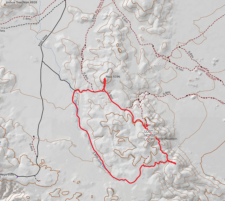
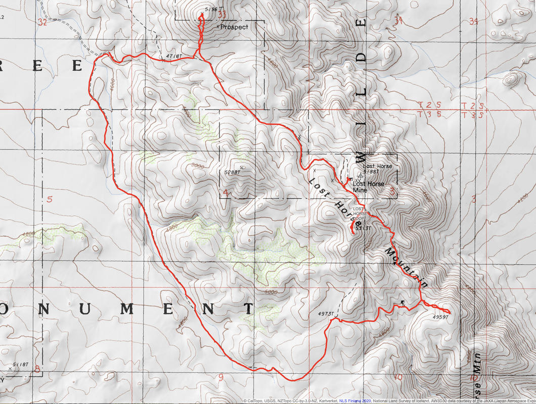
Hike three high points and view the historic Lost Horse Mine along this western Joshua Tree NP trail.
Related posts:
​Hike Mt. Minerva Hoyt, Joshua Tree Wilderness
​Monument Mountain, Joshua Tree NP
​Pinto Mountain, Joshua Tree Wilderness
Desert Plants photos
Picture
Starting in Quail Wash.
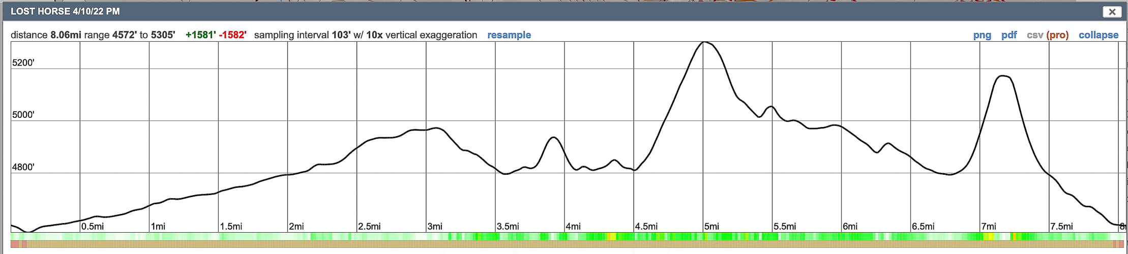
Trip Stats
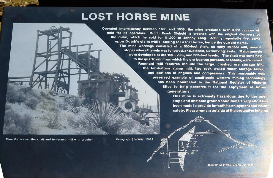
Overview:  
Make the Lost Horse Loop hike even more interesting by bagging a few peaks along its route to get a feeling of the vastness of Joshua Tree NP and wilderness, with views of San Jacinto Peak in Palm Springs.  Check out the plaque that commemorates Lost Horse Mine stamp mill, one of the best-preserved of its kind in our national park system.
Coordinates:   Lost Horse Mountain = 33°.56'13.74" N  116°.08'10.01" W.     
Distance/Elevation gain:  8 - mile loop, net 1,600' gain.  Highest point is Lost Horse Mountain at 5,305', lowest is trailhead at 4,572'.
Difficulty:  Moderate Class 1 on loop trail; moderate Class 2 scrambling to three high points.
​
Permit/Fee:  $30 for entrance fee for Joshua Tree NP, good for 7 days.
Picture
Trailhead QR code
Navigational aids:  Trails Illustrated Joshua Tree National Park #226 map.
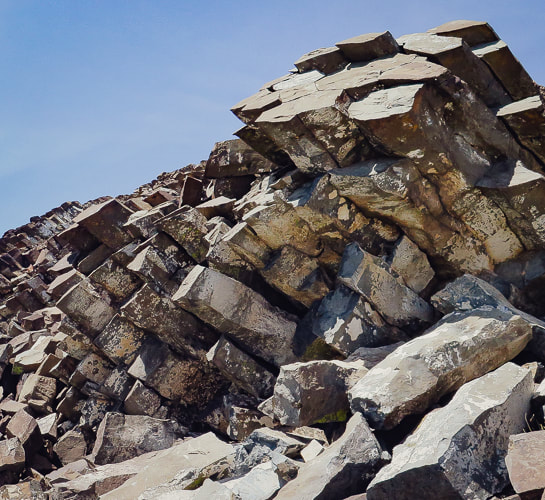
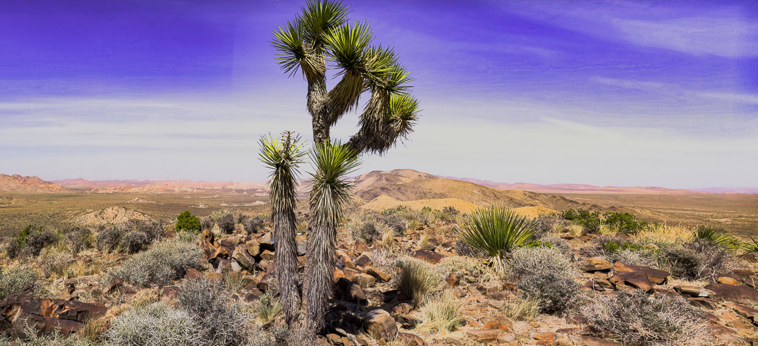
Date Hiked:  4/10/22

Geology:  The Lost Horse Loop trail and mine is located in granitic quartz biotite gneiss (metamorphic) related to Pinto gneiss age 1.7 billion years ago - some of the oldest rocks in California.  Biotite is dark mica mineral.  The Lost Horse Mountains are one of only three occurrences of basalt in Joshua Tree NP.
Cattle rustlers and Gold Mining in Lost Horse Valley
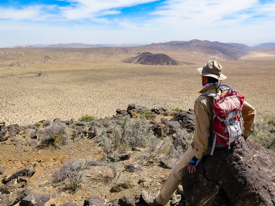
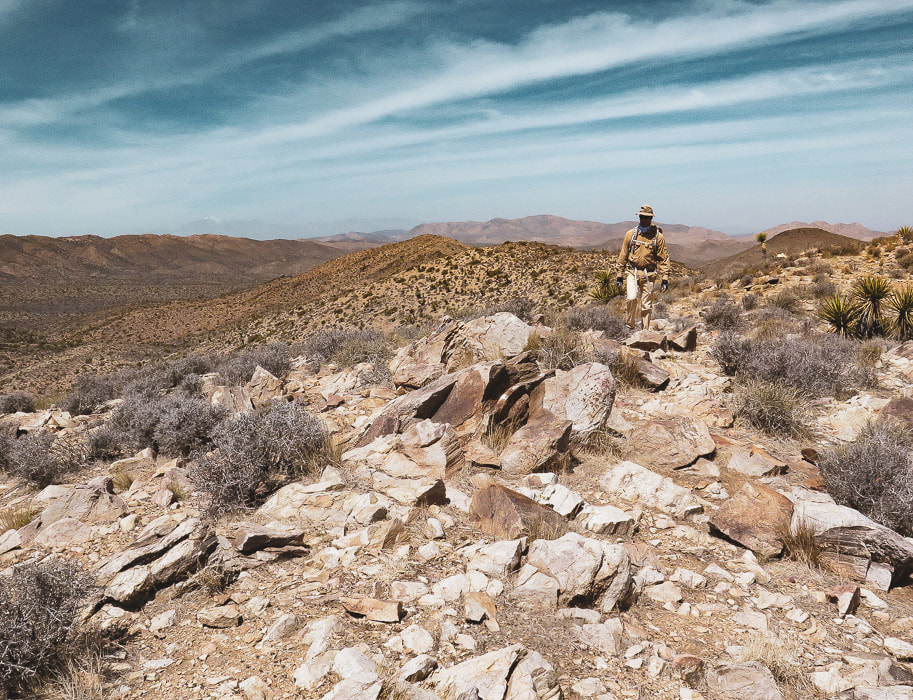
If you were a cattle rustler in the 1870's southwest, you would look for a remote and hidden area with enough water and good stands of trees and plenty of native grasses and other vegetation to feed your "stock".  A place where the nearest law enforcement officials were at least 50 miles away.  For the McHaney brothers, this place turned out to be the higher, western side of what is now Joshua Tree National Park, in Lost Horse Valley and Hidden Valley.  Bill McHaney's gang took cattle from Mexico and Arizona to hide them in other Joshua Tree valleys as well, then returned stolen horses.  

Johnny Lang also drove cattle into Lost Horse Valley after his brother was gunned down in New Mexico.  He woke up one morning to find his horse gone.  He tracked it to the McHaney's place but was told to leave the area.  Luckily, Lang met "Dutch" Frank who had discovered a mining claim, but was afraid to set up mining operations because he was also being hassled by the McHaney gang.  Lang bought the rights to the mine and called it "Lost Horse", after enlisting three partners to protect the claim against claim jumpers in 1893.  The Lost Horse Mine ultimately produced 10,500 ounces of gold and 16,000 ounces of silver.  Today, the Lost Horse Mine stamp mill is considered one of the best preserved in a National Park service unit.

We hiked three high points along this loop.  The most interesting summit was Peak 5196 because of the columnar basalt at the top.  In a land dominated by granite, this is one of only three occurrences of basalt.  From its summit, just northeast of the trailhead, are extensive views of Queen Valley to the east and Lost Horse Valley to the west.  A few days before, we had hiked Mt. Minerva Hoyt, named after the woman instrumental in President Franklin Roosevelt's proclamation to designate Joshua Tree National Monument.  
Joshua Tree National Park:
​A History of Preserving the Desert
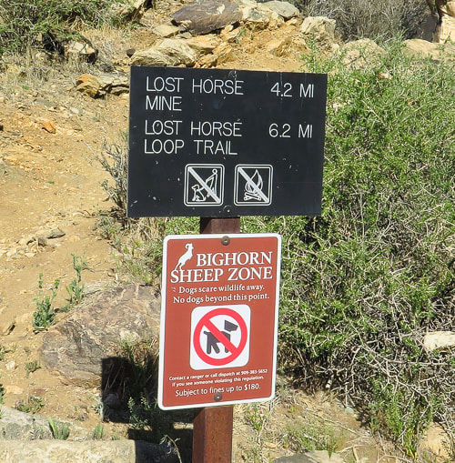
Sign at trailhead.  We hiked the trail counter-clockwise.
Our Hike in the Mojave
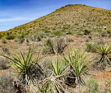
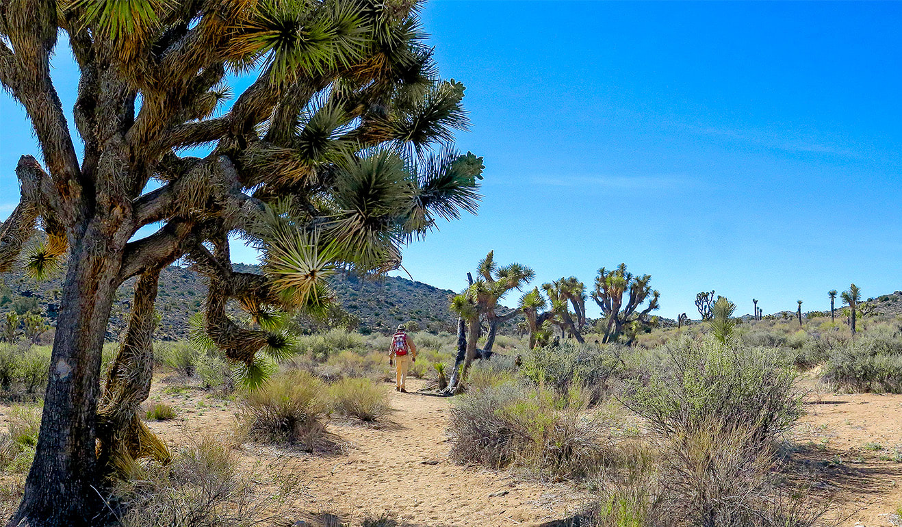
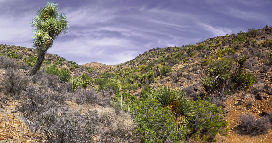
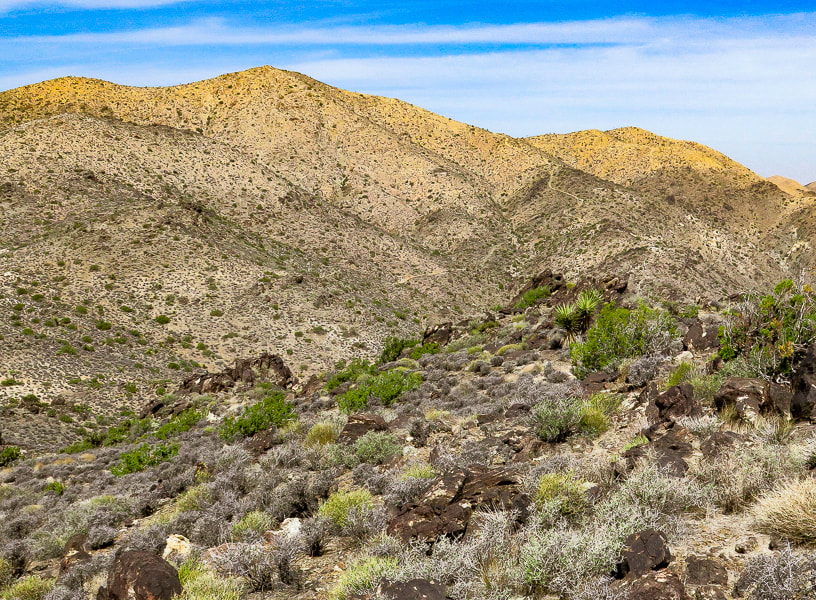
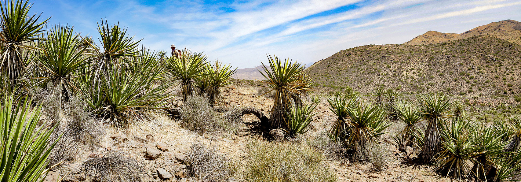
As the road to Lost Horse Trail climbs to around 4,000 feet elevation in the western, Mojave desert section of Joshua Tree NP, the amount of Joshua trees, junipers and yuccas is more prevalent compared to lower, dryer Sonoran desert Pinto Basin to the east at 1,700 feet.  Although it's a moderately-used trail, you get the feeling of remoteness surrounded by mountain ranges. The trail circles Lost Horse Mountain, trekking through Quail Wash and over juniper and shrub-covered hills darkly punctuated by scattered gneiss boulders.  
Point 4959
We made a short climb to our first and easiest summit, Point 4959, at 3.9 miles into our counterclockwise loop hike on Lost Horse Trail loop (right).  It was our first good view of Malapai Hill, a black mound surrounded by the flat yellow sand of Queen Valley (see photo below).   Was this 15-million year old cone of basalt a volcano or not?  It could have erupted at the surface, or it might have intruded and solidified underground and the biotite granite rocks into which it intruded may have eroded to expose it.
Picture
Lost Horse Mountain
Lost Horse Mountain, our next summit, was easily hiked up its northeast ridge from the saddle on Lost Horse Trail where it begins to descend to the remains of historic Lost Horse Mine.  From its summit, we could see a hazy view of snowy Mt. San Jacinto looming over Palm Springs, where Ray Wilson and I created the Cactus to Clouds Challenge hike in 1993, an epic adventure that gains over 10,000 feet in one day.  We met a hiker at Lost Horse summit who recommended Point 5196 near the trailhead.  Back on the trail, we checked out the Lost Horse Mine and its well-preserved stamp mill.  A rusted pipe extends toward Lost Horse Spring 3 miles away.  
Picture
Point 5196
Point 5196, 7.1 miles into on our loop, is the most interesting because of the tilted and shattered columnar basalt on the top.  This volcanic dome is one of the three occurrences of basalt in Joshua Tree, the others being Malapai Hill and near Pinto Basin to the east.  What's unique about these basalt columns is their thin white coating of calcium carbonate formed by the evaporation of water from the joints between columns.  Some of the basalt in the Lost Horse Mountains is derived from  the Earth's mantle, 30-50 miles below the surface.
A few names and messages are scratched into the summit's basalt boulders.
Picture
​By the time we got back to the trailhead parking lot, it was full.  Another fun day in Joshua Tree's Mojave desert.  The three extra summits were the "icing on the cake" -  worth the effort.​
 Time and Space in the Desert
Joshua Tree is an awe-inspiring land shaped by Earth's events spanning the Proterozoic alteration of pre-existing rocks into gneiss, to the five Proterozoic through Cretaceous intrusions of plutons that produced gold and silver and its famous sculpted rocks, to the relatively recent faulting that uplifted mountains and blocked canyons.  A landscape that has a tumultuous origin, but a relaxing presence.  Dark and rubbly mountains spring out of flat, buff - colored valleys.  A slight haze of dust still hangs in the air after last night's wind storm.  I stand looking over it all - breathing space.  Back straightens, chest raises, diaphragm brings in creosote and sand-scented air.  To some, this expanse and space feels intimidating; to me it feels comfortable.  To some it looks formidable with its hot, dry stillness and sharp- spined cacti; but I admire their motivation to survive under the hot, penetrating sun.  To walk in browns and buffs for awhile and then suddenly come upon magenta and bright yellow cactus blooms is cause for celebration.  I remember liking these ragged and gangly Joshua trees and contrasting smooth, rounded boulders the first time I saw them 38 years ago.  I revel in the sublime space and quiet that calms my mind.  Grateful for the feeling of being connected to this land.
"Time and space. In the desert there is space. Space is the twin sister of time. If we have open space then we have open time to breathe, to dream, to dare, to play, to pray to move freely, so freely, in a world our minds have forgotten but our bodies remember.  We remember why we love the desert; it is our tactile response to light, to silence, and to stillness."
        -  Terry Tempest Williams

Never Stop Exploring!
Picture
From summit of Point 4959, looking at Malapai Hill.
Picture
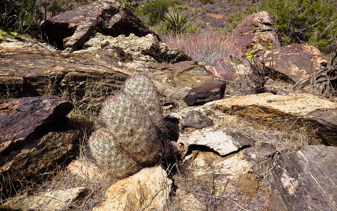
Beautiful 1.7 billion-year old gneiss - and hedgehog (?) cactus.
Picture
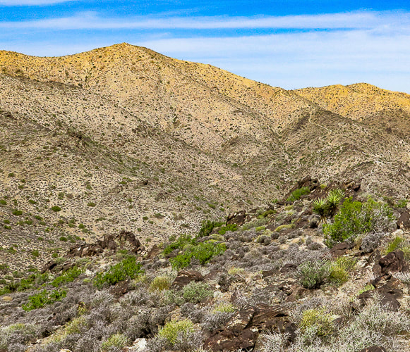
Circling around Lost Horse Mountain (on far horizon) to hike up its northeast ridge.
Picture
Picture
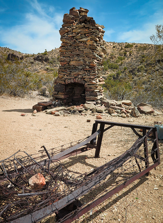
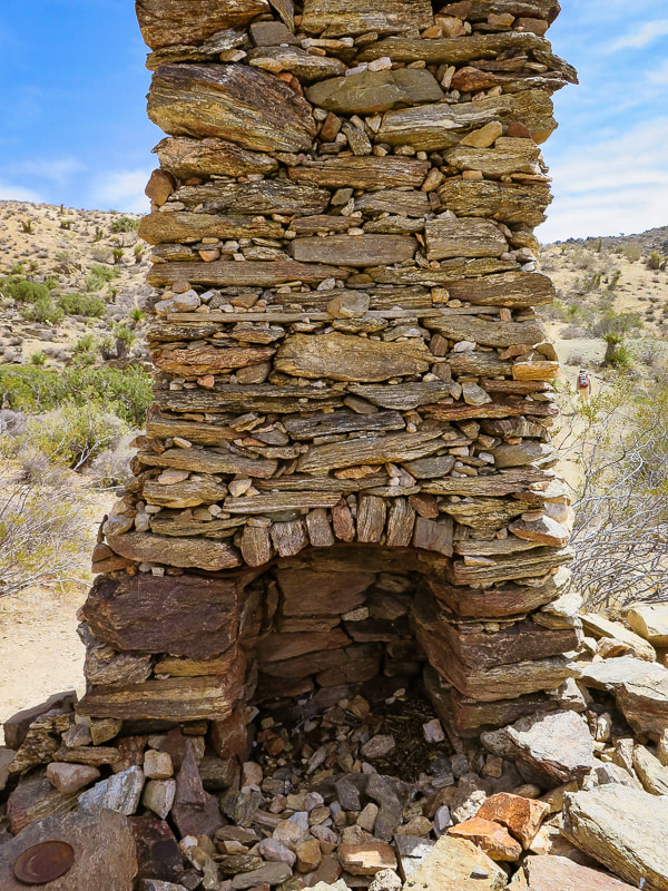
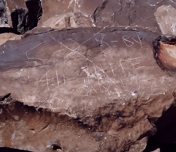
Remains of a very sturdy fire place and bed frame.
Picture
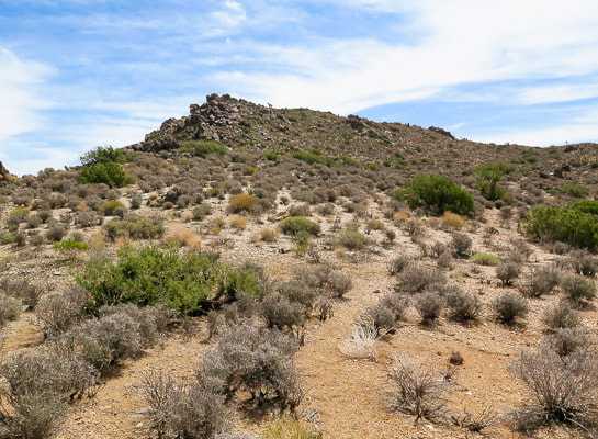
Our first summit - Point 4959.
Picture
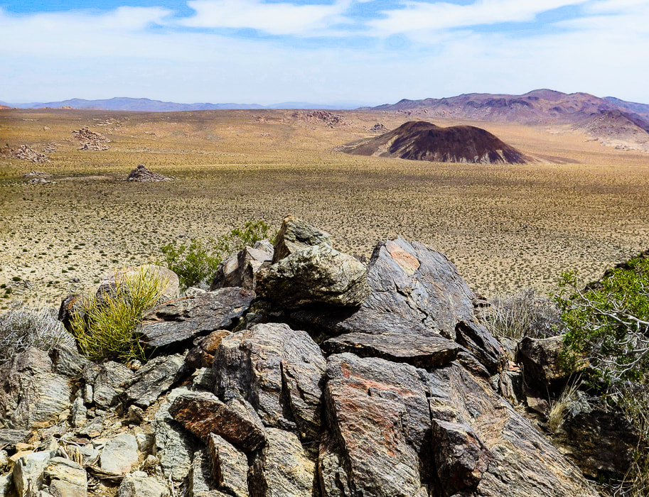
​Three types of rock:  great example of gneissic banding - a textural lineation of minerals in metamorphic rock created by pressure and intense heat (foreground).  Malapai Hill in middle of valley created by magma.  Valley rock is monzogranite.
Picture
Looking at Lost Horse Mountain from the slopes of Point 4959.  You can see Lost Horse Trail as it climbs to the saddle on its northeast ridge.  Hike that ridge to the summit.
Lost Horse Mine stamp mill
Columnar basalt
5/28/84 "Hi There James"
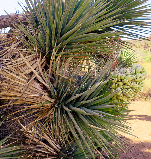
Some cool stuff on the trail.
Picture
Summit of Lost Horse Mountain
Picture
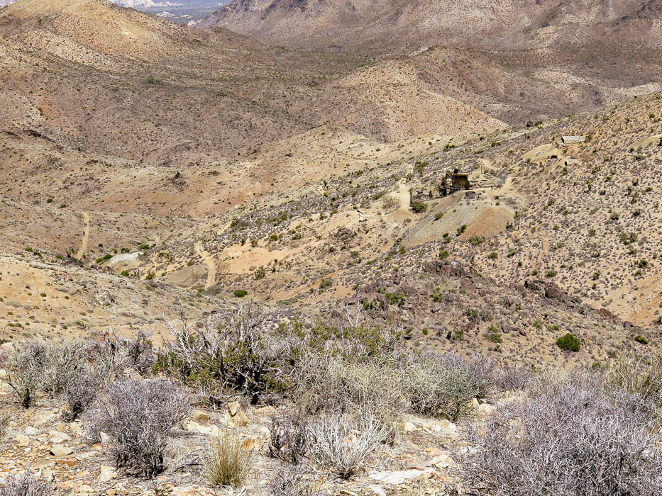
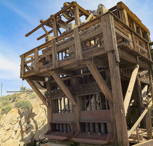
From Lost Horse Mountain's ridge:  a view of Lost Horse Mine.
Picture
Picture
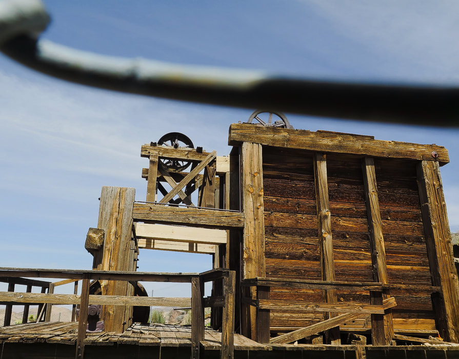
Lost Horse Mine stamp mill through chain-link fence.
Picture
Walking up to Point 5196.
Picture
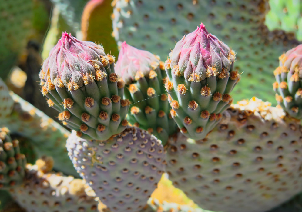
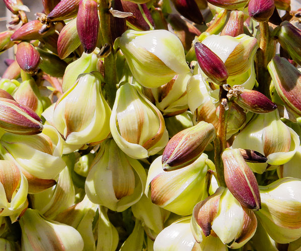
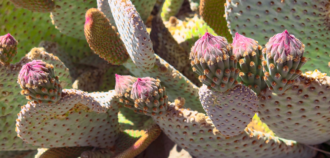
Beavertail cactus just before the blooms.
Picture
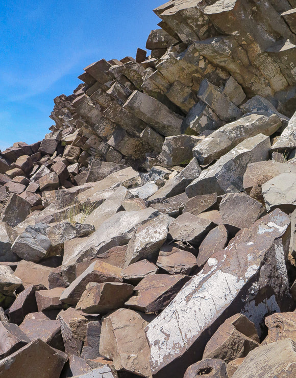
Columnar basalt on Point 5196.
Picture
Picture
Picture
Picture
Picture
References
California Geology. 1998.  Department of Conservation, Division of Mines and Geology.
Dilsaver, L.M.  2015.  Joshua Tree National Park:  A History of Preserving the Desert.  Prepared for National Park Service, Joshua Tree National Park, Twentynine Palms.
Joshua Tree Geology Tour Road.
​
Joshua Tree National Park Geology - Rock Types.  Digital-Desert:  Mojave Desert.
​Trent, D.D.  Geology and History of MInes, Joshua Tree National Park.
4 Comments
Maria Keezer
5/31/2022 07:54:42 am

Always a favorite hike for Roger and myself.. Good memories
Thank you Sue Bee

Reply
Linda Paul link
5/31/2022 11:16:54 am

Great historical narrative! You always find the beauty in the bleakest of country. A good eye and a wonderful spirit. I love the way you captured the Beavertail Cacti.

Reply
Sue link
5/31/2022 11:31:13 am

Thanks Linda for your compliments! They help me to keep doing these posts. I really love Mojave cacti!!

What influences my love of Joshua Tree is all the good memories of hiking there with my great friends. I wish I would have learned more about its history back then and the more I read about its geology and history, the more interesting that area is! That is a great point, and potential piece to write about - finding beauty in a bleak landscape.

Reply
Sue link
5/31/2022 11:18:36 am

One of the reasons I love this place and feel comfortable in it is because of you and Roge' and our hiking gang. I agree, so many good memories of being with you on the trails there that I will cherish the rest of my life! I can see why you two liked this hike - Joshua Tree is really a unique and special place. The bed springs are still there, but how would you carry those heavy things out of there! In fact, how did they get there??

Thanks Maria, so happy to get your comment.

Reply


Leave a Reply.

    Categories

    All
    Arizona Hikes
    California Desert Hiking
    Idaho Summits
    Nevada Hikes
    Snowshoe Hikes
    Southern Utah Hikes/Bikes

    Complete list of Hikes/Bikes on HOME page
    Picture
    Sue and Fred
    Picture

    About this blog

    Exploration documentaries          –  "explorumentaries"  list trip stats and highlights of each hike or bike ride, often with some interesting history or geology.  Years ago, I wrote these for friends and family to let them know what my husband, Fred and I were up to on weekends, and also to showcase the incredible land of the west.  

    To Subscribe to Explorumentary adventure blog and receive new posts by email:

    submit
    Picture
    Happy Spring!
    Picture

    About the Author
    Sue Birnbaum

    A  trip to Jumbo Rocks Campground in Joshua Tree National Monument 38 years ago sparked my passion for hiking, exploring, and learning about desert ecosystems.  For the past 25 years, my husband Fred and I have explored the American West together; we love this land and I hope to inspire you to get out and explore through my photographs and trip descriptions.
    In 1992, Ray Wilson and I conceived the first Cactus to Clouds hike which climbs over 10,000 feet in one day to the summit of Mt. San Jacinto near Palm Springs, California.
    CACTUS TO CLOUDS HIKE 
    READ MORE
    ABOUT SUE

    Archives

    February 2023
    January 2023
    December 2022
    November 2022
    October 2022
    September 2022
    August 2022
    July 2022
    June 2022
    May 2022
    April 2022
    February 2022
    January 2022
    December 2021
    November 2021
    October 2021
    August 2021
    July 2021
    May 2021
    March 2021
    February 2021
    January 2021
    November 2020
    October 2020
    August 2020
    July 2020
    June 2020
    April 2020
    March 2020
    February 2020
    January 2020
    November 2019
    October 2019
    September 2019
    August 2019
    July 2019
    June 2019
    May 2019
    April 2019
    February 2019
    December 2018
    November 2018
    October 2018
    September 2018
    July 2018
    June 2018
    May 2018
    April 2018
    March 2018
    February 2018
    January 2018
    December 2017
    November 2017
    October 2017
    September 2017
    August 2017
    July 2017
    June 2017
    April 2017
    February 2017
    November 2013
    August 2013
    July 2013

    Some of my favorite websites:
    Awkward Botany
    ​citizen botany for the phytocurious

    Bird and Hike

    ​"Intended to encourage people to visit, learn about, and fall in love with the desert."
    ​

    Draw and Shoot
    Beautiful Photography

    Earthline: The American West
    Debra "writes to extol our beloved Earth." Detailed hike info, excellently written.
    ​

    Geologypics.com
    Geology and Geologic Time through Photographs

    Glenn Suokko
    Vermont artist's paintings "inspired by a place based on the land .... drawn to painting the representation and abstraction of nature."

    In the Company of Plants and Rocks
    ​A natural history blog about botany, plant ecology, and geology.

    Nature's Depths

    Walking through nature with John Palka, a neuroscientist who loves plants and ponders big questions

    Rangewriter - What Comes Next?
    ​With excellent writing, Linda tells the story of her unique mother's life including WWII era; with beautiful photographs.

    SeekingLost - Hiking and Backpacking Adventures.

    Stav Is Lost- Unconventional, out-of-the way hikes in the American West.


    Uprooted Magnolia
    ​Leah Yetter's beautiful "photo journal on life, love, and the spirit of Wyoming."
HOME

Cactus to Clouds Hike
More Quotes
HIKES BY STATE

Idaho Hikes
Utah Hikes/Bikes
​Arizona Hikes
​California Desert Hikes
​Wyoming Hikes
​Nevada Hikes

BLOGS

Adventure Blog
Women and the Land
GEAR REVIEWS
FIT AFTER 50
Fred Birnbaum
Dave Brasuell
Bus' Little Black Book
​Mike Carlson
​Ray Wilson
​Marcia Bondy
Bryan Krouse
​Maria Keezer
​Tim Clemens
​Doug Traubel
​Brian Holgate
​
Becky Borczon Blake
​Jennifer Cera and
​Sue Birnbaum

​Vance Powell
​Boise Cross Fit Masters Ladies
​Vickie Kearney

GALLERY

Desert Plants
Nature
Earth + Sky
Urban
Water
Patriot 
​Orchids
Boise
​
  ABOUT
    Contact

​
© 2017 - 2023 by Sue Birnbaum.  Photos on this website are the sole property of Sue Birnbaum unless otherwise indicated.  Please receive permission before publishing my trip reports and photos.
I try my best to be accurate with my hike descriptions; please research your adventures, always bring a map and compass and know how to read them, be prepared!  All of these hikes can be dangerous; hike at your own risk.  ALWAYS carry the Ten Essentials with you on hikes. 
​Please feel free to contact me with comments or questions, or if you see any errors that need attention.
Thank-you for stopping by!


EXPLORUMENTARY.com
  • Home
    • Cactus to Clouds Hike
    • More Quotes
    • Ann Zwinger Quotes
    • Mary Oliver Poems
  • Hikes by State
    • Idaho
    • Southern Utah
    • Arizona
    • California Desert
    • Nevada
    • Wyoming
  • BLOGS
    • Adventure Blog
    • Women and the Land
  • GALLERY
    • DESERT PLANTS >
      • Beavertail cactus
      • Brittlebush
      • Christmas Cactus
      • Arizona Barrel Cactus
      • Parry's penstemon
      • Agave
      • Arizona Rainbow Hedgehog
      • Claret Cup Hedgehog
      • Desert Agave
      • Palmer's Penstemon
      • Silver Cholla
      • Cristate Saguaro
      • Indian Paintbrush
      • Ocotillo
      • Santa Rita Prickly Pear
      • Spiny Cliffbrake
      • California Barrel Cactus
      • Engelmann Prickly Pear
      • Velvet Mesquite
      • Joshua Tree
      • Buckhorn Cholla
      • Hedgehog Cactus
      • Fishhook cactus
      • Thompson's Woolly Locoweed
    • NATURE
    • BOISE
    • EARTH + SKY
    • URBAN
    • WATER
    • PATRIOT
    • ORCHIDS
  • Fit After 50
    • Brian Holgate
    • Fred Birnbaum
    • Dave Brasuell
    • Bus' Little Black Book
    • Mike Carlson
    • Ray Wilson
    • Bryan Krouse
    • Vickie Kearney
    • Maria Keezer
    • DOUG TRAUBEL
    • Boise Cross Fit Masters Ladies
    • Tim Clemens
    • Marcia Bondy
    • Becky Borczon Blake >
      • Becky B Downtown
    • Jennifer Cera and Sue Birnbaum
    • Dave Brasuell
    • Vance Powell
  • About
    • CONTACT