EXPLORUMENTARY
  • Home
    • Cactus to Clouds Hike
    • More Quotes
    • Ann Zwinger Quotes
    • Mary Oliver Poems
  • Hikes by State
    • Idaho
    • Southern Utah
    • Arizona
    • California Desert
    • Nevada
    • Wyoming
  • BLOGS
    • Adventure Blog
    • Women and the Land
  • GALLERY
    • DESERT PLANTS >
      • Beavertail cactus
      • Brittlebush
      • Christmas Cactus
      • Arizona Barrel Cactus
      • Parry's penstemon
      • Agave
      • Arizona Rainbow Hedgehog
      • Claret Cup Hedgehog
      • Desert Agave
      • Palmer's Penstemon
      • Silver Cholla
      • Cristate Saguaro
      • Indian Paintbrush
      • Ocotillo
      • Santa Rita Prickly Pear
      • Spiny Cliffbrake
      • California Barrel Cactus
      • Engelmann Prickly Pear
      • Velvet Mesquite
      • Joshua Tree
      • Buckhorn Cholla
      • Hedgehog Cactus
      • Fishhook cactus
      • Thompson's Woolly Locoweed
    • NATURE
    • BOISE
    • EARTH + SKY
    • URBAN
    • WATER
    • PATRIOT
    • ORCHIDS
  • Fit After 50
    • Brian Holgate
    • Fred Birnbaum
    • Dave Brasuell
    • Bus' Little Black Book
    • Mike Carlson
    • Ray Wilson
    • Bryan Krouse
    • Vickie Kearney
    • Maria Keezer
    • DOUG TRAUBEL
    • Boise Cross Fit Masters Ladies
    • Tim Clemens
    • Marcia Bondy
    • Becky Borczon Blake >
      • Becky B Downtown
    • Jennifer Cera and Sue Birnbaum
    • Dave Brasuell
    • Vance Powell
  • About
    • CONTACT

Dry Creek - Shingle Creek Loop in the Boise Foothills

12/11/2017

0 Comments

 
Dry Creek and Shingle Creek trails, close to downtown Boise, are relatively lush with vegetation and a great place to run, hike or bike in all seasons.
Related:  Four "Grand Slam Peaks" near Boise:
Mt. Heinen, Grand Slam Peaks Completed!
Kepros Mountain Hike
Cervidae Peak
Lucky Peak Winter Ascent
Trip Stats:
  • Location:  Middle portion of Ridge to Rivers Trail System, north of downtown Boise, Idaho; this loop occurs in both Ada and Boise counties.
  • Dry Creek Trailheads :   
  • Lower Trailhead: 4.7 miles north from intersection of N. Bogus Basin Rd/Harrison Blvd and Hill Road.  Pass Mile Marker 4 on N. Bogus Basin Road and start looking for parallel dirt parking under large power lines. 
  • Upper Trailhead at intersection with Sweet Connie Trail:  If there is no parking at lower trailhead, continue up N. Bogus Basin Rd for 3 more road switchbacks to find large parking on right side of road for Dry Creek Trail heading south and Sweet Connie Trail heading north.  This is the official Ridge to Rivers parking for these trails.
  • Distance:  entire Dry Creek/Shingle Creek loop = 13.88 miles according to my GPS.
  • Total elevation change: ~ 2,600 feet net elevation gain/loss. Trailhead = 3,454 feet; highest elevation in loop near junction with Trail 78 leading to Boise Ridge Road = ~ 5, 540 feet.
  • Dry Creek Trail #78 intersects with Shingle Creek Trail #79 at 1.9 miles from trailhead - take either trail if you want to complete the loop; they connect at the highest point in the loop near Boise Ridge Road, 2,000 feet higher.
  • Map:  Ridge to Rivers interactive map
  • Dogs:  Controlled Off-leash trail.  Ridge To Rivers stipulations:  
  • ​Owners must carry a leash with them at all times.
  • Dogs remain within 30 feet of owners, and under strict sight and voice control.
  • Dogs are prevented from harassing people, wildlife or other pets.
  • There are many creek crossings with flat logs and new bridges over Dry Creek after the intersection heading up towards Boise Ridge Road.  More creek crossings on Dry Creek than on Shingle Creek.
  • Vegetation varies during the 2,000 foot climb from riparian ecosystem including willows, Wood's Rose, Bitterbrush and Rabbitbrush at lower elevations, to Ponderosa Pine and Douglas Fir at higher elevations.
  • Geology and Hydrology:  Beautiful granite outcrops from the Idaho Batholith seen along Upper Dry Creek.  Much data including stream output in Dry Creek is monitored by the Dry Creek Experimental Watershed of Boise State University.
  • Popular trail for runners and mountain bikers.                              
Picture
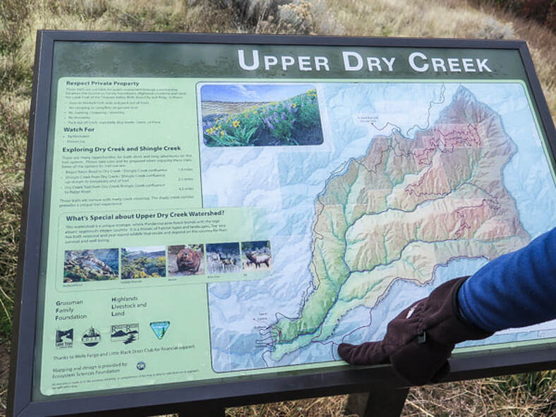
Interpretive sign illustrating trails in the Dry Creek Experimental Watershed, monitored by Boise State University
Picture
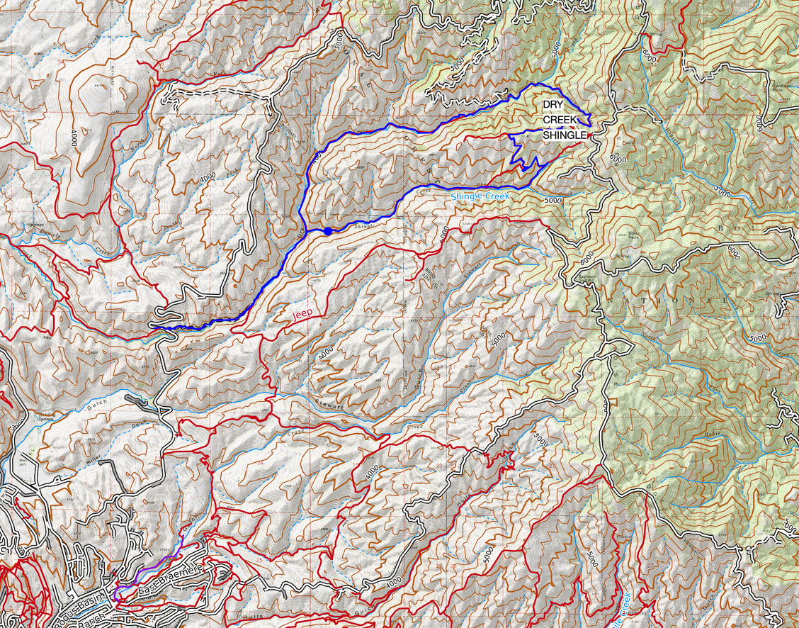
Dry Creek/Shingle Creek Loop from "lower" trailhead - 13.88 miles total
click on map for larger image

Picture
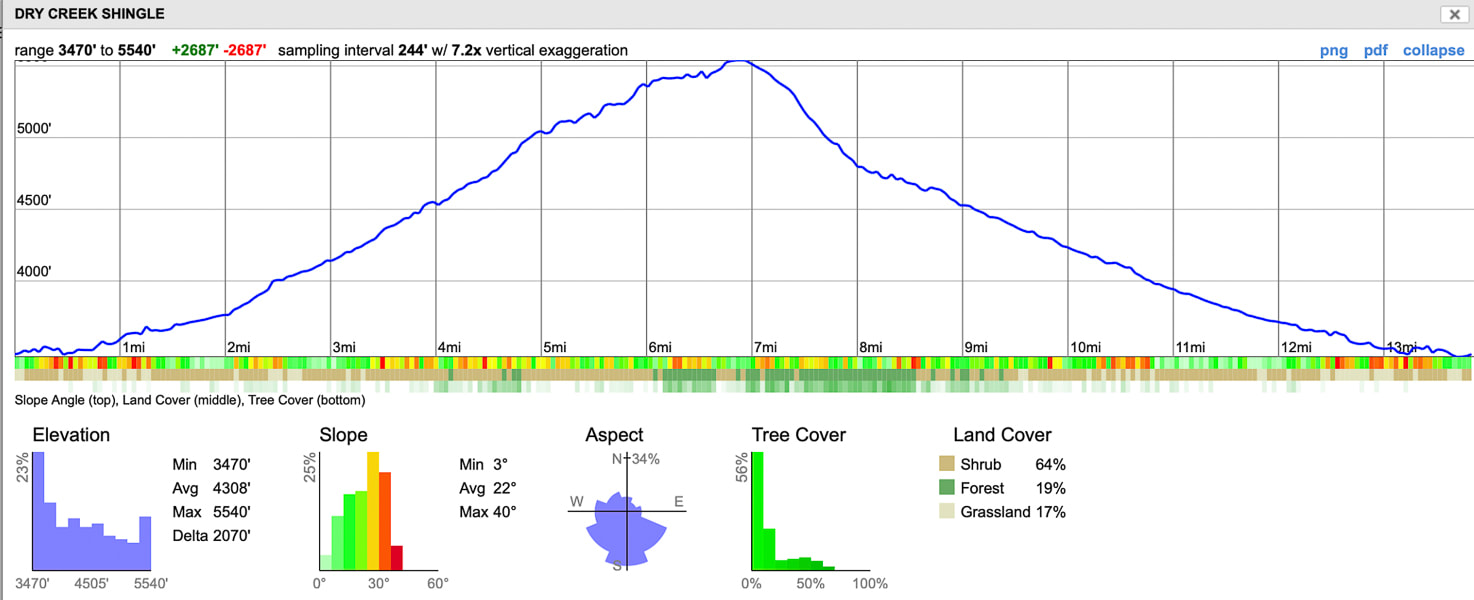
Elevation profile for Dry Creek/Shingle Creek loop in Boise foothills:  Shingle Creek first half of profile, Dry Creek second half of profile
Highest elevation near spur road that leads to Boise Ridge Road = 5,540'
Our hike
The Dry Creek/Shingle Creek loop is a unique trail close to Boise for so many reasons.  There's a surprising variety of vegetation as you climb 2,000 feet.  You get a beautiful creek ecosystem and a ridge ecosystem.  You make many stream crossings over Dry Creek Trail with bunch grasses, sagebrush and Woods Rose by your side as you begin, only to end up above this in a breezy forest of Ponderosa Pine and Douglas Fir overlooking the Treasure Valley.  We did this hike in November and still heard the sounds of rushing water and boots sloshing through shallow crossings in the creek.
Picture
Picture
Picture
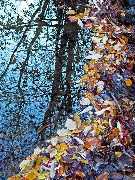
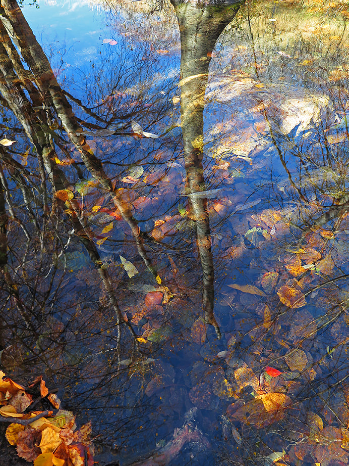
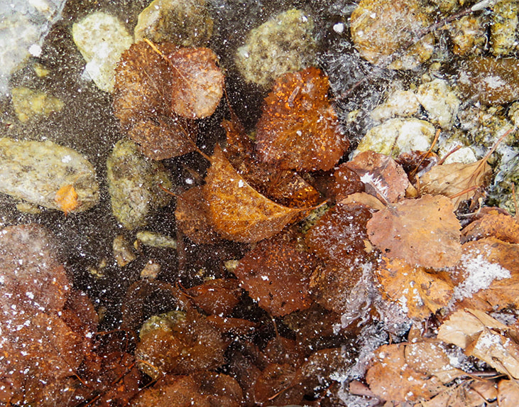
Dry Creek in December - Boise Foothills
We start at the trailhead just beyond MM 4 along N. Bogus Basin Road.  The trailhead sign illustrates the features and map of the Upper Dry Creek Watershed.  For the first 1.9 miles, the elevation gain is just under 300 feet.  After the intersection, the trail climbs another 1,780 feet to the highest point at which it intersects with the Boise Ridge Road.  The feature rock in this watershed is granite from the Atlanta Lobe of the Idaho Batholith; weathered outcrops stand along the Dry Creek Trail.  This intruded during Cretaceous time - 75 - 85 million years ago.  I've seen large pieces of muscovite along this trail.  
Picture
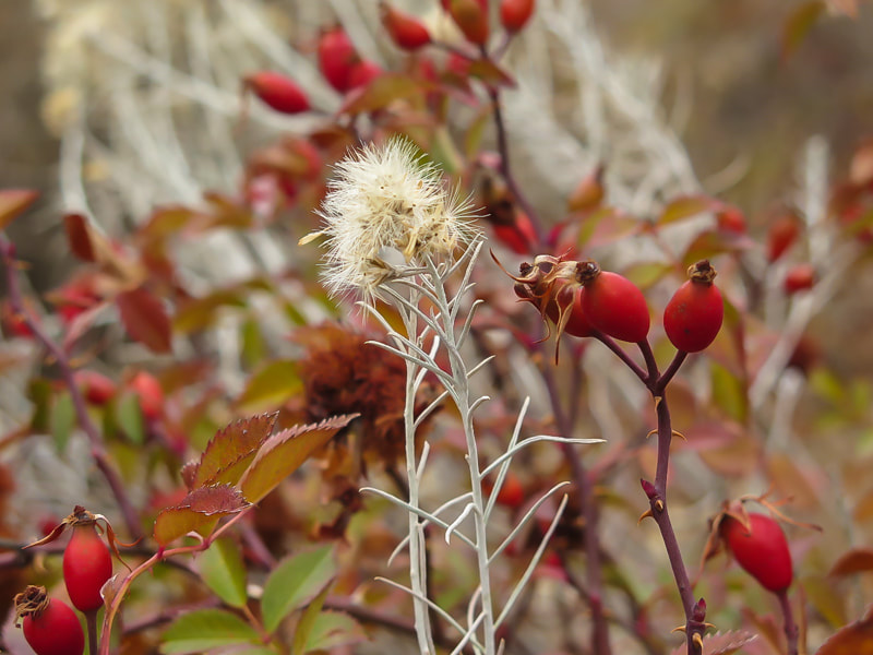
Autumn along Upper Dry Creek
Picture
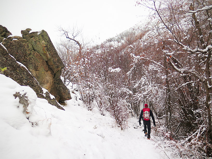
Dry Creek Trail after intersection with Shingle Creek
At the Dry Creek/Shingle Creek intersection 1.9 miles from the trailhead, we hiked up Dry Creek Trail #78 (to the left) and came back on Shingle Creek Trail #79 to complete the loop.  The topography got steeper as we neared the ridge.  Most bridges across the creek are flat-topped logs especially helpful during elevated spring run-offs.  Numerous waterfalls and moss, a forest thick with trees and brush make this Boise foothills hike enjoyable.  Such a beautiful riparian environment so close to home!
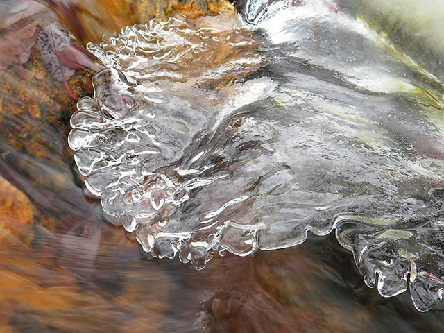
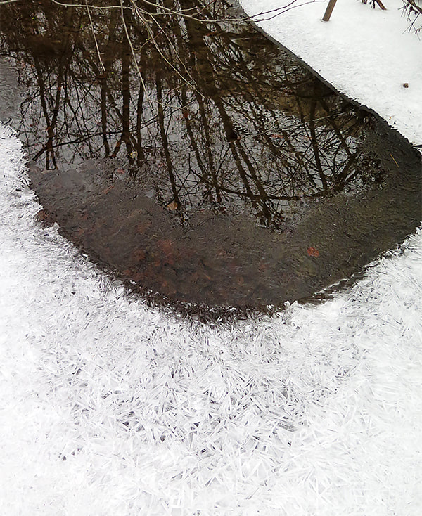
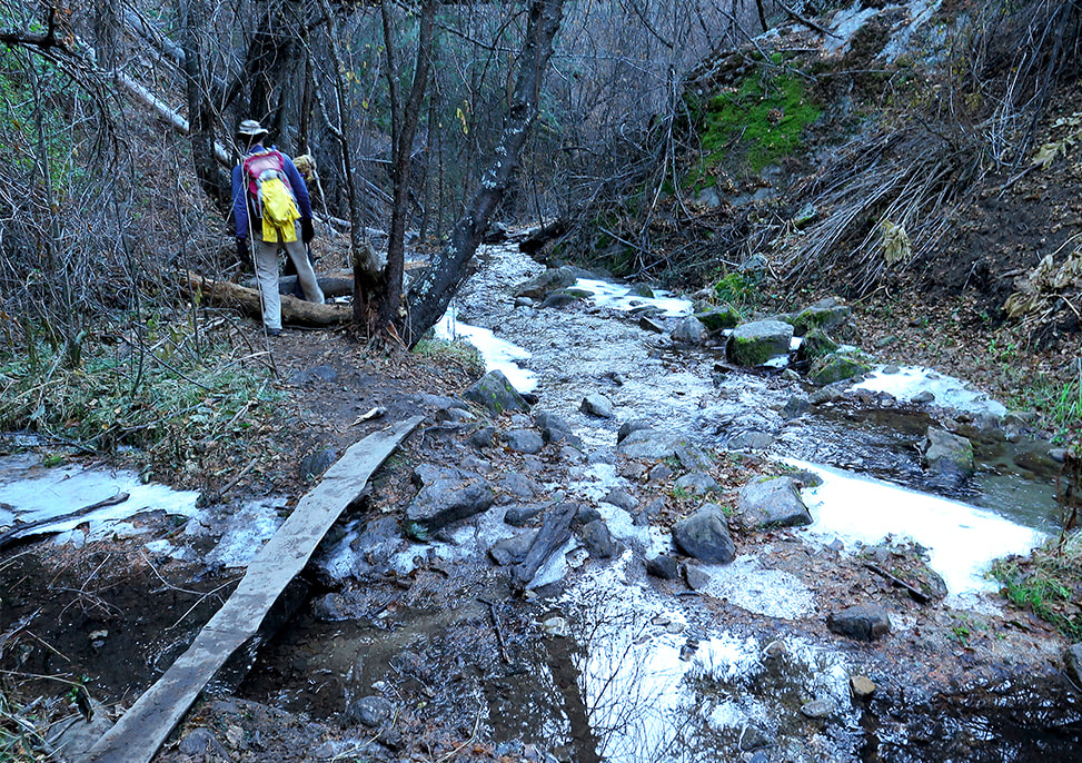
Picture
Picture
Picture
Dry Creek
Picture
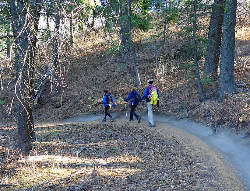
Heading down from Shingle Creek Trail and Dry Creek Trail intersection
After 2,000 feet of climbing, the ridge lies at ~ 5,600 feet in elevation, where the sound of water rushing over rocks is replaced by wind flowing through Douglas Fir and Ponderosa Pine branches.   At the trail junction sign, a short 0.4 mile spur continues to the southeast to join Boise Ridge Road.  To continue to Shingle Creek, head on Trail 79 to the west.  Soon the Treasure Valley is seen through the opening in the canyon.  
Picture
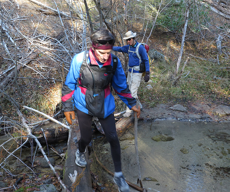
Many crossings over Dry Creek
Picture
Picture
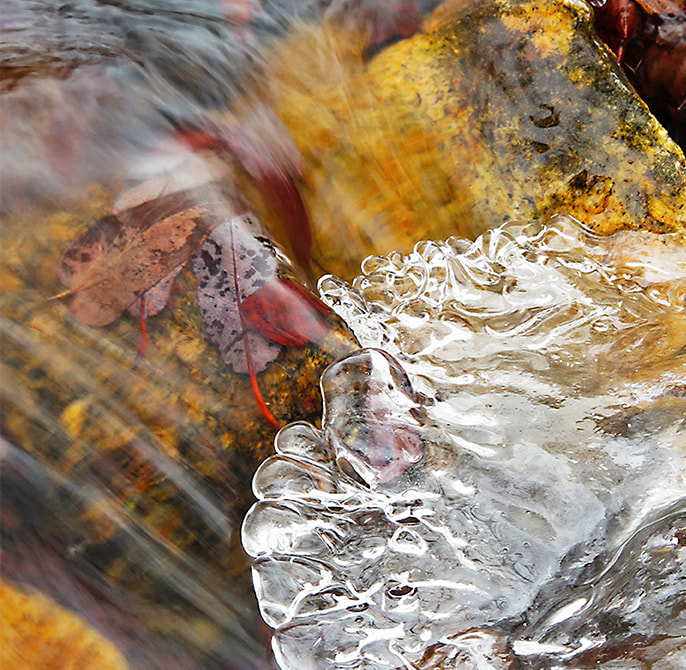
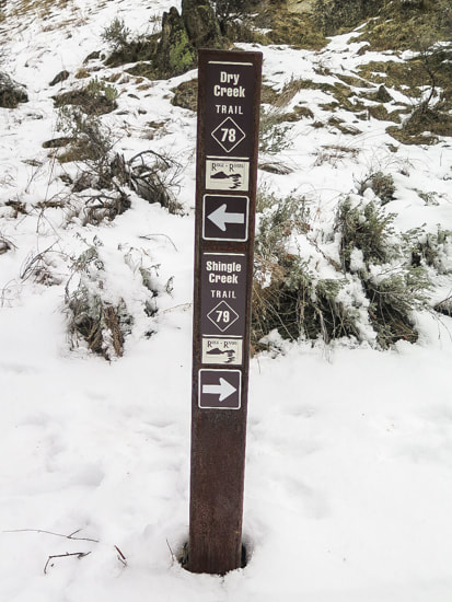
Trail junction sign at top of Ridge 0.4 miles from Boise Ridge Road
Picture
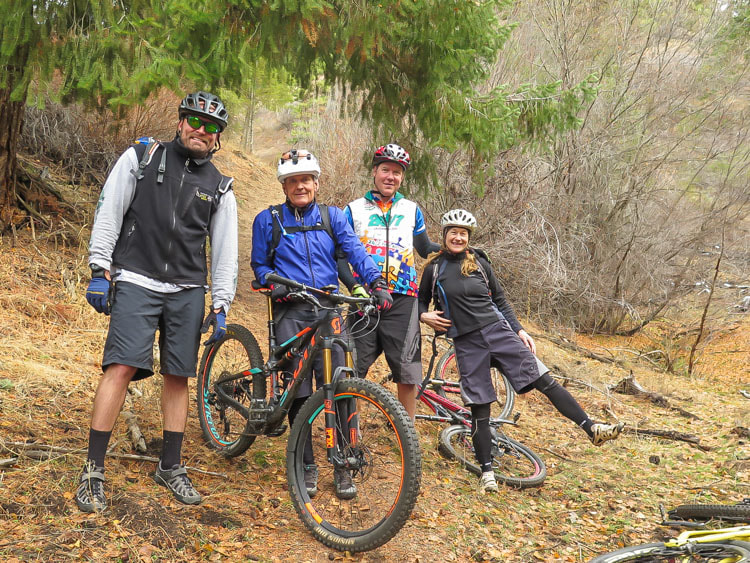
Fun bikers near where Shingle Creek Trail starts to climb
After zig-zagging down Shingle Creek Trail #79 from the ridge, the trail finally meets up with Shingle Creek, a narrower creek compared to Dry Creek.  A couple of runners whizzed by us.  Shortly after that, we met up with 4 bikers (above) that weren't doing the whole loop but were having a great time.  This part of the trail seems a bit long as it returns to lower elevation ecosystem of perennial bunch grasses and rabbitbrush.
Last week, Boise was stuck in a nasty ​temperature inversion.  For those who don't know what that is, click on the preceding link, but if you are from the Treasure Valley, you definitely know what an "inversion" is!  The smart folks drive to Bogus Basin to get above it for warmer temps and blue skies.  On a separate hike during an inversion, we hiked far enough along Dry Creek to see blue skies.  We didn't hike the entire loop this time, but  seeing  blue when we looked up made us feel a little better - not to mention the beauty of snow on branches, and the feel of walking on soft snow.
Picture
Picture
Picture
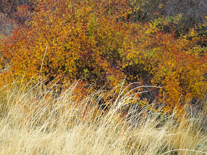
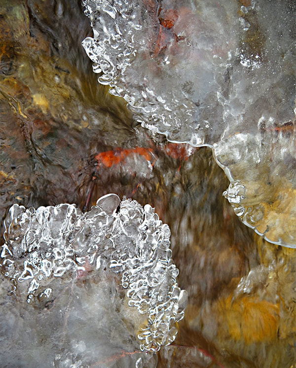
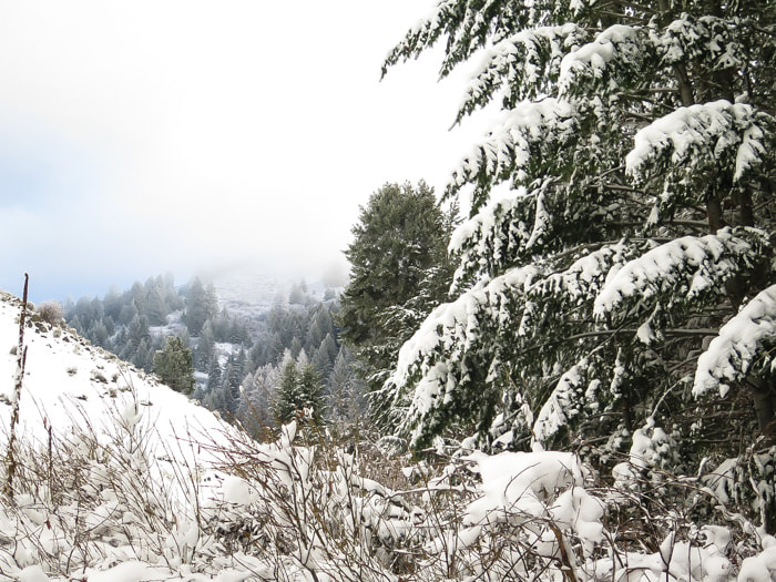
Heading northeast up Dry Creek Trail 
References:
Boise State University - Watershed Description
Digital Geology of Idaho/Mesozoic Idaho Batholith
0 Comments

    Categories

    All
    Arizona Hikes
    California Desert Hiking
    Idaho Summits
    Nevada Hikes
    Snowshoe Hikes
    Southern Utah Hikes/Bikes

    Complete list of Hikes/Bikes on HOME page
    Picture
    Sue and Fred
    Picture

    About this blog

    Exploration documentaries          –  "explorumentaries"  list trip stats and highlights of each hike or bike ride, often with some interesting history or geology.  Years ago, I wrote these for friends and family to let them know what my husband, Fred and I were up to on weekends, and also to showcase the incredible land of the west.  

    To Subscribe to Explorumentary adventure blog and receive new posts by email:

    submit
    Picture
    Happy Spring!
    Picture

    About the Author
    Sue Birnbaum

    A  trip to Jumbo Rocks Campground in Joshua Tree National Monument 38 years ago sparked my passion for hiking, exploring, and learning about desert ecosystems.  For the past 25 years, my husband Fred and I have explored the American West together; we love this land and I hope to inspire you to get out and explore through my photographs and trip descriptions.
    In 1992, Ray Wilson and I conceived the first Cactus to Clouds hike which climbs over 10,000 feet in one day to the summit of Mt. San Jacinto near Palm Springs, California.
    CACTUS TO CLOUDS HIKE 
    READ MORE
    ABOUT SUE

    Archives

    February 2023
    January 2023
    December 2022
    November 2022
    October 2022
    September 2022
    August 2022
    July 2022
    June 2022
    May 2022
    April 2022
    February 2022
    January 2022
    December 2021
    November 2021
    October 2021
    August 2021
    July 2021
    May 2021
    March 2021
    February 2021
    January 2021
    November 2020
    October 2020
    August 2020
    July 2020
    June 2020
    April 2020
    March 2020
    February 2020
    January 2020
    November 2019
    October 2019
    September 2019
    August 2019
    July 2019
    June 2019
    May 2019
    April 2019
    February 2019
    December 2018
    November 2018
    October 2018
    September 2018
    July 2018
    June 2018
    May 2018
    April 2018
    March 2018
    February 2018
    January 2018
    December 2017
    November 2017
    October 2017
    September 2017
    August 2017
    July 2017
    June 2017
    April 2017
    February 2017
    November 2013
    August 2013
    July 2013

    Some of my favorite websites:
    Awkward Botany
    ​citizen botany for the phytocurious

    Bird and Hike

    ​"Intended to encourage people to visit, learn about, and fall in love with the desert."
    ​

    Draw and Shoot
    Beautiful Photography

    Earthline: The American West
    Debra "writes to extol our beloved Earth." Detailed hike info, excellently written.
    ​

    Geologypics.com
    Geology and Geologic Time through Photographs

    Glenn Suokko
    Vermont artist's paintings "inspired by a place based on the land .... drawn to painting the representation and abstraction of nature."

    In the Company of Plants and Rocks
    ​A natural history blog about botany, plant ecology, and geology.

    Nature's Depths

    Walking through nature with John Palka, a neuroscientist who loves plants and ponders big questions

    Rangewriter - What Comes Next?
    ​With excellent writing, Linda tells the story of her unique mother's life including WWII era; with beautiful photographs.

    SeekingLost - Hiking and Backpacking Adventures.

    Stav Is Lost- Unconventional, out-of-the way hikes in the American West.


    Uprooted Magnolia
    ​Leah Yetter's beautiful "photo journal on life, love, and the spirit of Wyoming."
HOME

Cactus to Clouds Hike
More Quotes
HIKES BY STATE

Idaho Hikes
Utah Hikes/Bikes
​Arizona Hikes
​California Desert Hikes
​Wyoming Hikes
​Nevada Hikes

BLOGS

Adventure Blog
Women and the Land
GEAR REVIEWS
FIT AFTER 50
Fred Birnbaum
Dave Brasuell
Bus' Little Black Book
​Mike Carlson
​Ray Wilson
​Marcia Bondy
Bryan Krouse
​Maria Keezer
​Tim Clemens
​Doug Traubel
​Brian Holgate
​
Becky Borczon Blake
​Jennifer Cera and
​Sue Birnbaum

​Vance Powell
​Boise Cross Fit Masters Ladies
​Vickie Kearney

GALLERY

Desert Plants
Nature
Earth + Sky
Urban
Water
Patriot 
​Orchids
Boise
​
  ABOUT
    Contact

​
© 2017 - 2023 by Sue Birnbaum.  Photos on this website are the sole property of Sue Birnbaum unless otherwise indicated.  Please receive permission before publishing my trip reports and photos.
I try my best to be accurate with my hike descriptions; please research your adventures, always bring a map and compass and know how to read them, be prepared!  All of these hikes can be dangerous; hike at your own risk.  ALWAYS carry the Ten Essentials with you on hikes. 
​Please feel free to contact me with comments or questions, or if you see any errors that need attention.
Thank-you for stopping by!


EXPLORUMENTARY.com
  • Home
    • Cactus to Clouds Hike
    • More Quotes
    • Ann Zwinger Quotes
    • Mary Oliver Poems
  • Hikes by State
    • Idaho
    • Southern Utah
    • Arizona
    • California Desert
    • Nevada
    • Wyoming
  • BLOGS
    • Adventure Blog
    • Women and the Land
  • GALLERY
    • DESERT PLANTS >
      • Beavertail cactus
      • Brittlebush
      • Christmas Cactus
      • Arizona Barrel Cactus
      • Parry's penstemon
      • Agave
      • Arizona Rainbow Hedgehog
      • Claret Cup Hedgehog
      • Desert Agave
      • Palmer's Penstemon
      • Silver Cholla
      • Cristate Saguaro
      • Indian Paintbrush
      • Ocotillo
      • Santa Rita Prickly Pear
      • Spiny Cliffbrake
      • California Barrel Cactus
      • Engelmann Prickly Pear
      • Velvet Mesquite
      • Joshua Tree
      • Buckhorn Cholla
      • Hedgehog Cactus
      • Fishhook cactus
      • Thompson's Woolly Locoweed
    • NATURE
    • BOISE
    • EARTH + SKY
    • URBAN
    • WATER
    • PATRIOT
    • ORCHIDS
  • Fit After 50
    • Brian Holgate
    • Fred Birnbaum
    • Dave Brasuell
    • Bus' Little Black Book
    • Mike Carlson
    • Ray Wilson
    • Bryan Krouse
    • Vickie Kearney
    • Maria Keezer
    • DOUG TRAUBEL
    • Boise Cross Fit Masters Ladies
    • Tim Clemens
    • Marcia Bondy
    • Becky Borczon Blake >
      • Becky B Downtown
    • Jennifer Cera and Sue Birnbaum
    • Dave Brasuell
    • Vance Powell
  • About
    • CONTACT