|
Our annual California desert peak hike with our friend Scott - this year to isolated and rugged Pinto Mountain in Joshua Tree Wilderness. 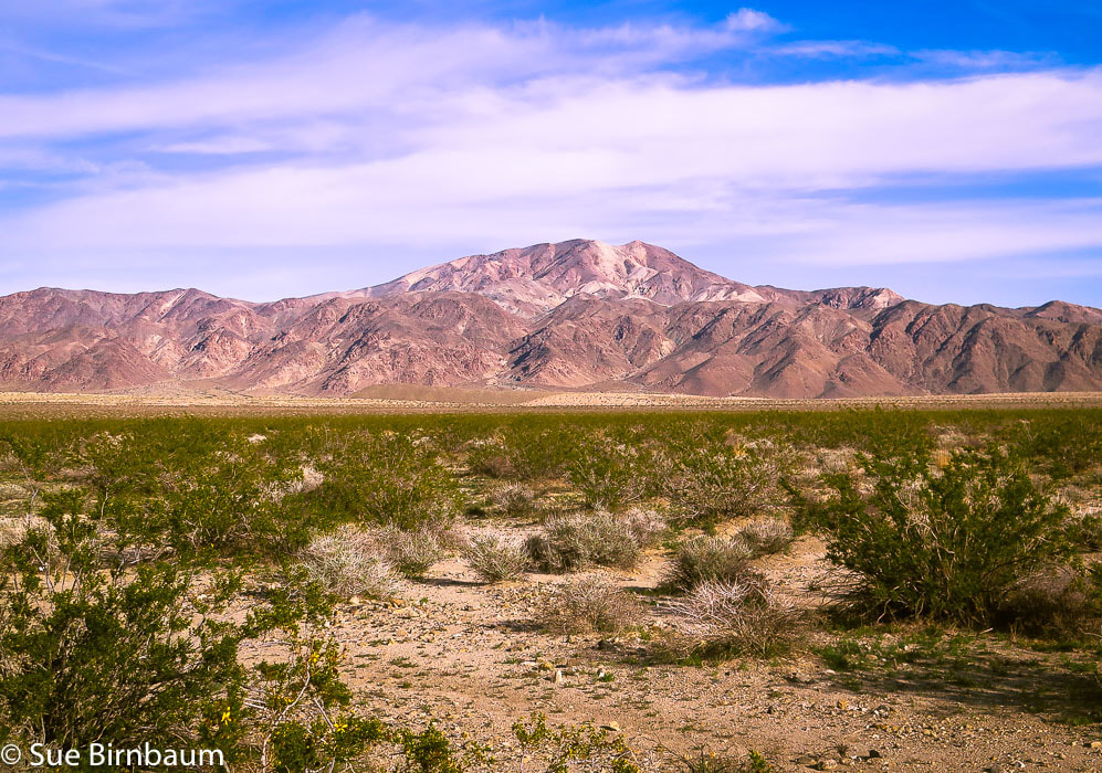 Pinto Mountain - eastern Joshua Tree National Park in the Pinto Mountain Range Trip Stats Overview: The reward for the long walk across Pinto Basin followed by the rocky climb is the outstanding 360° views of the Mojave desert mountain ranges and the bright red barrel cacti that stand out in contrast. And, there's a sculpture on the summit! Distance: 4.8 miles to summit; round-trip 9.6 miles (out and back). Elevation Gain: Turkey Flats parking at 1,785 feet; Pinto Mountain at 3,983 feet = ~ 2,200 foot gain + regaining lost elevation = ~ 2,600 feet total. Maps: Trails Illustrated Joshua Tree National Park #226, USGS 7.5 min Quad Pinto Mountain. Entrance Fee Joshua Tree NP. Sierra Club Desert Peaks Section map of GPS tracks. Coordinates: Pinto Mountain summit: 33°57'12.23"N 115°48'10"W. Trailhead at Turkey Flats Backcountry Board: N33 54.109 W115 50.098. Difficulty: Easy across Pinto Basin; moderate to strenuous ridge climb - Class 1-2. CAUTION: Be prepared with GPS track and a good topo map - there is a lightly used trail on ridge but it's essential to have route-finding skills. Very hot/no shade mid-May through September. Date Hiked: 12/23/2018 Driving Directions From California I-10 East out of Indio, take Exit 168 into South Entrance of Joshua Tree National Park. Drive north 20 miles on Cottonwood Springs Road/Pinto Basin Road (past Joshua Tree Visitor Center) to Turkey Flats parking area and sign board on right side of road. Hike Directions
For the geocurious This hike treks through an array of different types of rock units ranging from Holocene cover (10,000 years ago to now) to Proterozoic Era (up to 2.5 billion years ago). A geologist's dream. It passes through some of California's oldest rocks; these rocks also top Monument Mountain, across Pinto Basin to the southwest.
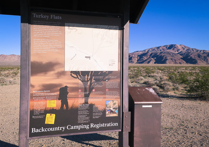 Trailhead and parking at Turkey Flats, 20 miles from Interstate 10 in Joshua Tree Pinto Mountain on horizon 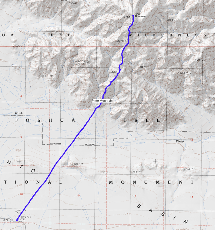 Sierra Club Desert Peaks Section map of GPS tracks. Topo map and elevation profile of hike to summit of Pinto Mountain, Joshua Tree NP. The hike begins at Turkey Flats trailhead on Cottonwood Springs Road/Pinto Basin Road. The last half of this hike climbs 2,200 feet in 2.3 miles to summit elevation of 3,983 feet. 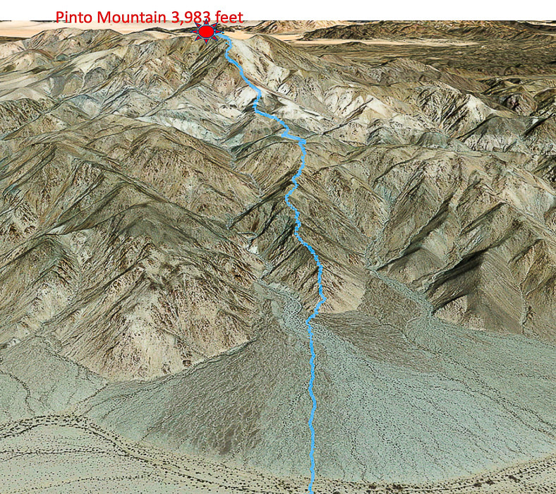 Our route across the alluvial fan at base of ridge; the trail travels on spine of ridge all the way to summit of Pinto Mountain in a north/northeast direction (looking at southwest-facing slopes) Pinto Wash at base of fan 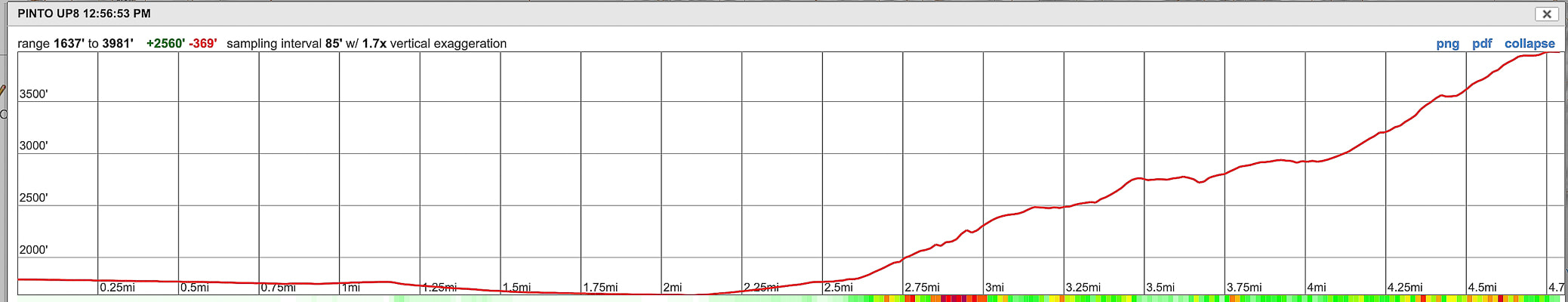 Elevation profile for ascent. Our Hike Some of our best and most memorable adventures have been on hikes to desert summits in Southern California with our friend Scott, a Desert Peaks Section hiking veteran. Last year we hiked Monument Mountain in Joshua Tree National Park. This year, drawn to Joshua Tree again, we stepped it up (literally) with a tougher hike to Pinto Mountain summit. We parked at the Turkey Flats trailhead and signboard, a 20-mile drive into Joshua Tree National Park south entrance from California I-10. Scott had good directions for locating the ridge we would ascend: locate the summit at 32° then locate our ridge climb at 36°. Pretty straightforward direction and approach. We made a beeline toward the smaller ridge to the right of a large, shadowed canyon which is just to the right of Pinto Mountain summit (see directions, above). The flat 2.5 mile distance to the toe of the ridge accentuates the immensity of this sublime desert. A feeling of space and solitude. To hike Pinto Mountain is to experience two distinctly different terrain types with very little transition in between: flat, soft and casual to steep and rocky. The last half climbs 2,000+ feet over rough and angular rocks and also requires route-finding, occasionally reaching for a handhold. The easy walk across Pinto Basin takes you through soft sand flats and beautifully rippled "dunes", through minor washes before crossing Pinto Wash. We saw a desert tortoise burrow near the dunes. I was surprised at the bright purple blooms of sand verbena vines draped across the sand dunes and an abundance of bright green vegetation in December. The fractured and curled "clayey" soils in Pinto Wash also give a clue to recent saturating rains. As you make the short descent off the dunes, stay just to the left (west) of a long low hill cut by a wash. 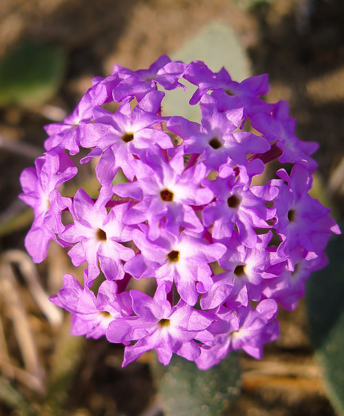 Desert Sand Verbena Abronia villosa 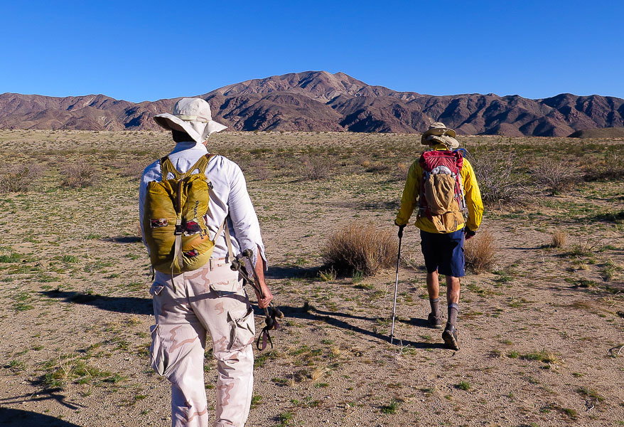 Scott (left) and Fred heading out in morning to Pinto Mountain summit The ridge to ascend is just to the left of Fred with the shadows to its left side 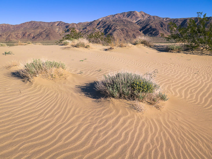 Sand dunes ~ halfway between Turkey Flats trailhead to base of Pinto Mountain Shortly after crossing Pinto Wash, the hike ascends an ever-increasing amount of coarse gravel and boulders, the characteristic feature of alluvial fans where heavier rocks drop out early in its deposition and smaller rocks are deposited at the toe of the fan. We maneuver down through stream cuts and around rocks on the upper alluvial fan as we finally reach the bottom of our ridge. We missed the cairn indicating the start of the ridge trail on our way up and started the climb on the ridge spine, which was alright because we soon ran into the light-to-moderately tracked trail on the ridge. Don't be tempted to descend down the canyon on either side of the ridge - when in doubt, stay on top of the ridge. There are a few places along the 2.3-mile ridge hike where the trail bypasses a high point, however. 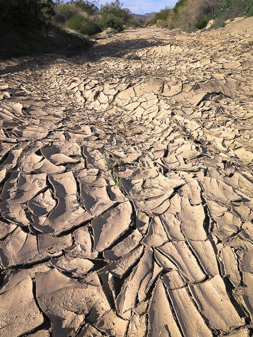 Pinto Wash just before base of alluvial fan Clayey soil that has been recently saturated with water and then has dried and formed fractures into polygonal sections as well as "mud peels" caused by a fracture of clay parallel to its surface. 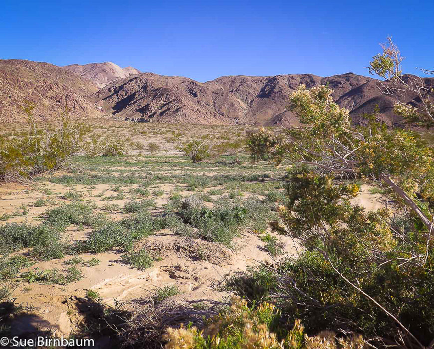 Approaching alluvial fan deposited from canyon on the left Hike up ridge to the right of this canyon, and just to the right of Pinto, with vertical rocks and shadows to Pinto Mountain with its white quartzite slopes. Pinto Wash in foreground. 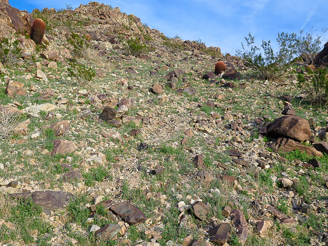 Beginning of ridge trail Small cairn on the large rock on the right, faint trail in middle of photo heads to ridge 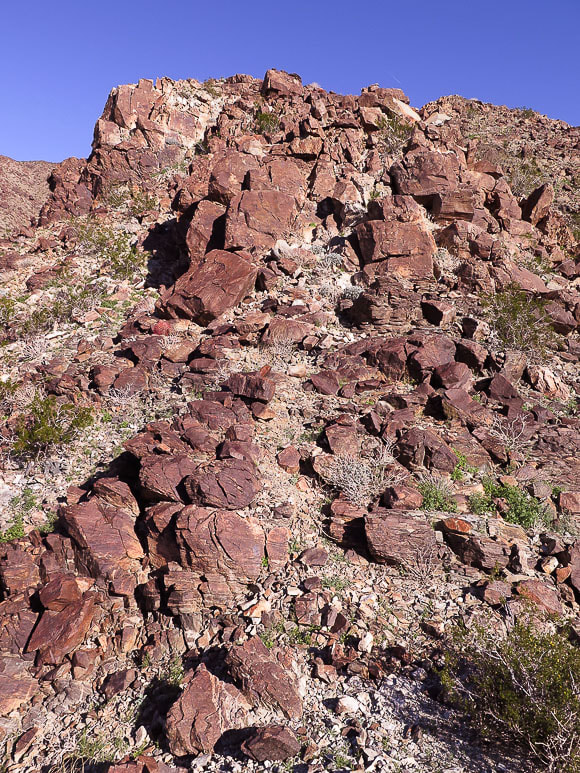 We started here at toe of ridge The ridge walk was very windy, especially on the saddles. We took a lunch break on the lee side of a bump on the ridge to avoid being battered by the wind. From our spot we could see the alternating light and dark rock; although we couldn't see a trail, we could see our ridge to the top. Rocks and Joshua trees define Joshua Tree National Park, but if you look closely, you will find among them smaller creatures and plants brightly colored in contrast to the neutral tones. Groups of red barrel cacti randomly dot the landscape, with mounds of curved red spines spectacularly lit by the sun. Scott pointed out a tiny round cactus with a bright red fruit and sharp white spines, sheltered by a "shelf" of equally sharp quartzite - a common fishhook cactus. There was a strange black caterpillar with bright yellow dots and stripes that went from crawling to a curled position as soon as I cast my shadow over it. The best match I could find for this caterpillar is the white-lined sphinx moth, AKA hummingbird moth that has a long proboscis to reach deep for nectar in penstemons, among other flowers. 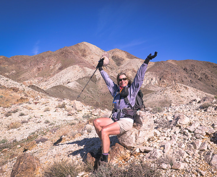 No other place I'd rather be at that moment! Rock with flat surface provides a "chair" to sit and rest Pinto Mountain left (highest) summit 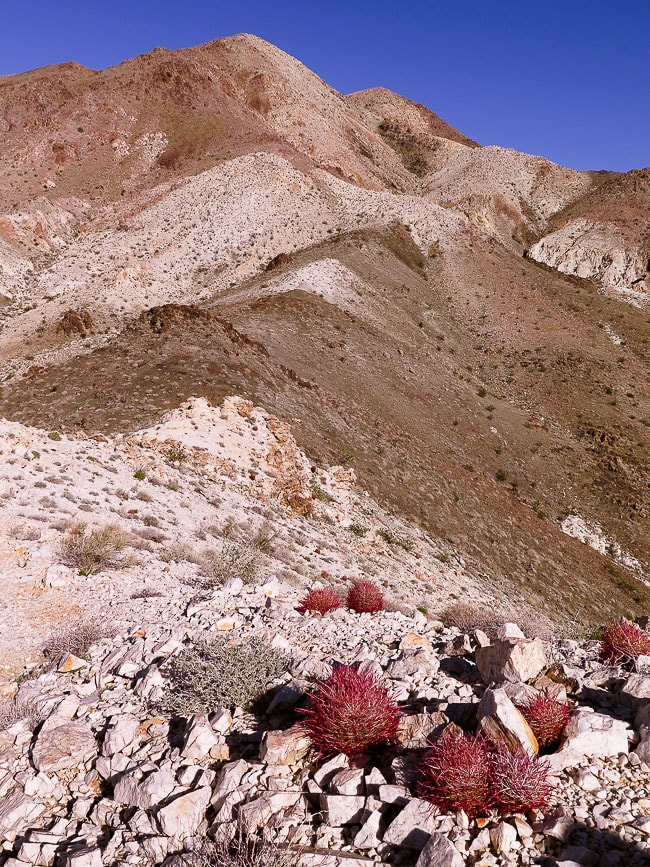 Alternating light and dark rocks correspond with varied rock units (see Geology, above) 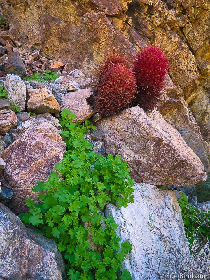 Red barrel cactus Ferocactus cylindraceus 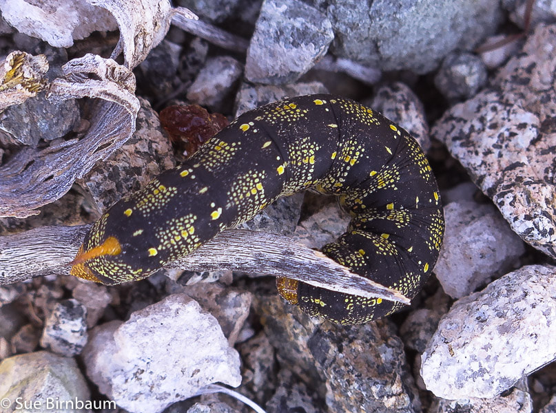 White-lined sphinx caterpillar Hyles lineata 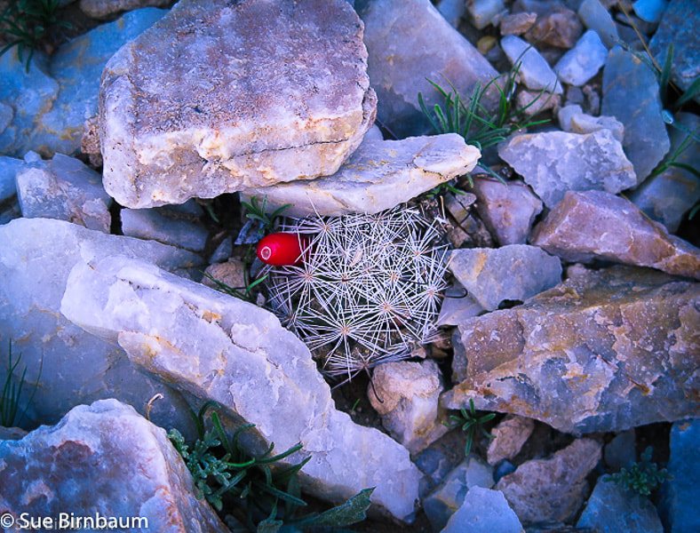 Common Fishhook cactus in quartzite Mammillaria tetrancistra Nothing gets in the way of the expansive views of mountain ranges perched on the desert floor in every direction as you near the summit. It doesn't take long before you feel like you are standing far above the immense basin. Creosote bushes make tiny dots on the smooth floor below and washes braid toward the low point of Pinto Basin. The hike goes through several rock units. Sharp and angular quartzite crunches and clinks under boots and becomes loose and steep as you near the summit. A few trails can be seen through the steep section where I had to hold onto fractured rocks; they all make their way up the ridge line. I looked down the trail to see that Scott had temporarily disappeared under the crags I was on, so I waited until he climbed and appeared again. Suddenly, the flat crown of the summit appears as you emerge from the steep rocks and take a short walk to the summit cairn. We took shelter from the persistent northwest wind at the lee side of the cairn, procured the metal box containing the summit register, and found a page to put our entry for 12/26/2018: "PEACE - from Sue, Scott and Fred - 3 friends who like to hike together". 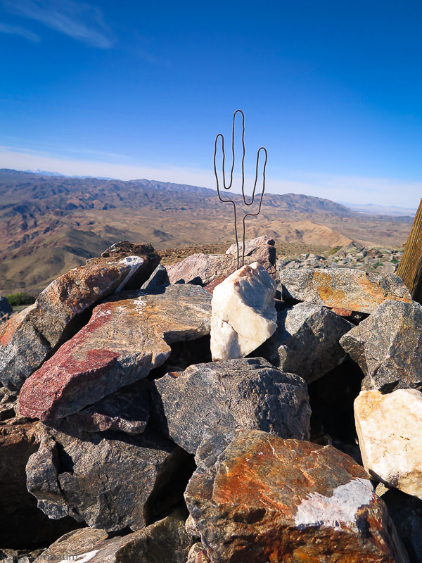 Summit of Pinto Mountain, 3,983 feet looking northwest Saguaro cactus sculpture from old wire present on top of the mountain 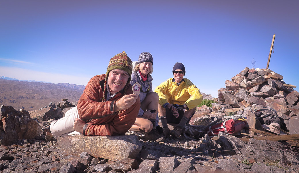 Scott, Sue and Fred on Pinto Mountain summit Scott is holding a rock found on the summit with a painted cat from Jamestown Kind Rocks Project, whose goal is to "promote random acts of kindness to unsuspecting people by painting and dropping inspirational rocks or some other cool way to bring kindness." Scott brought the rock on our hike to Thimble Peak in Tucson and we left it near the summit. 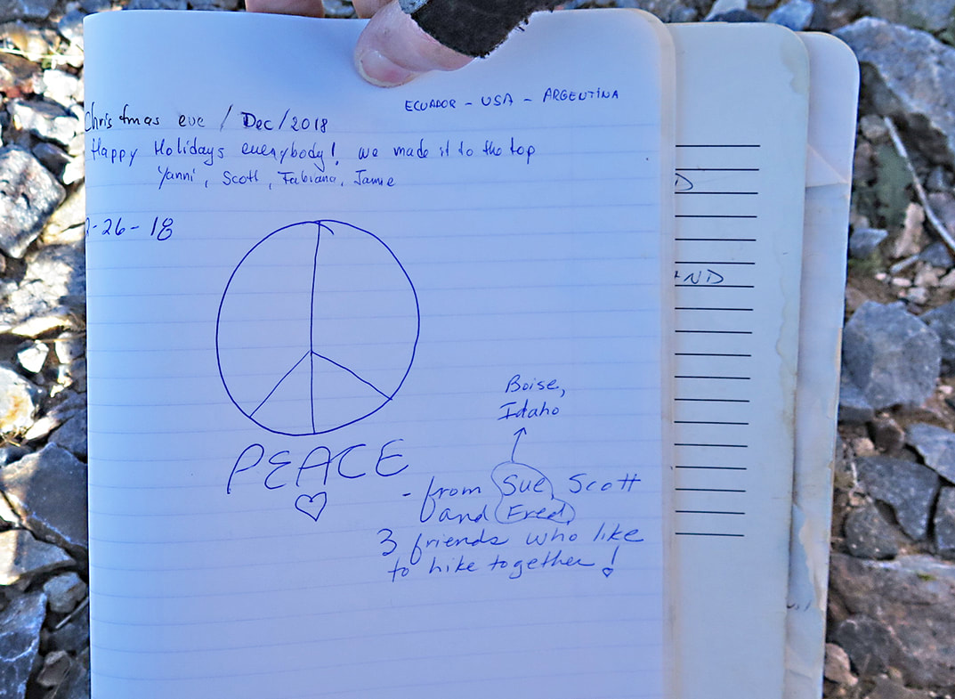 Our summit register entry for 12-26-18 The entry above ours: "Christmas Eve/Dec/2018 - Happy Holidays everybody! We made it to the top". - Ecuador, USA, Argentina 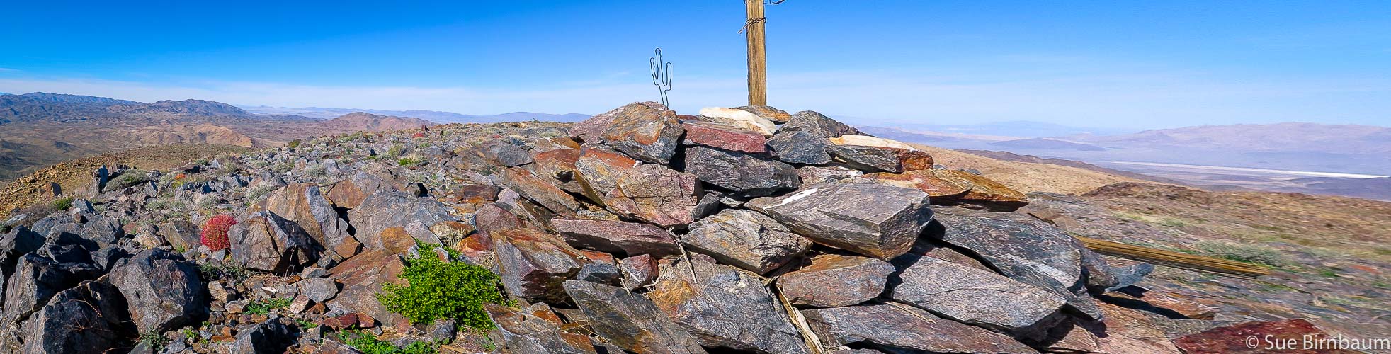 Summit looking north 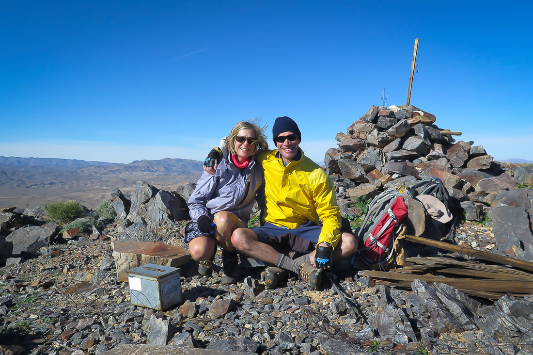 Together, another summit and memorable day in the beautiful American West! 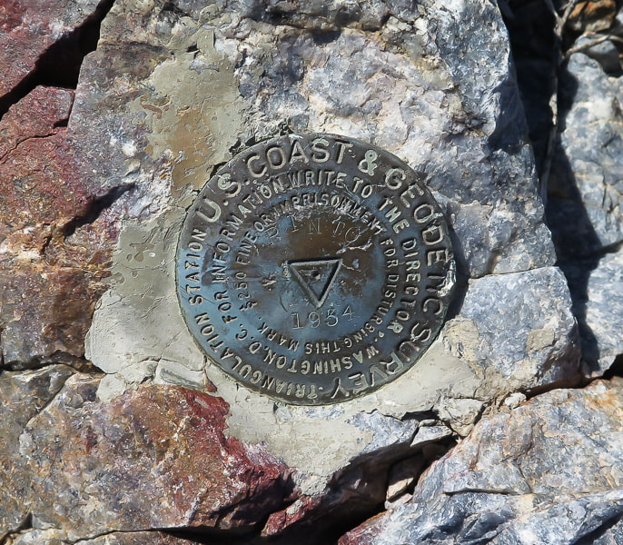 U.S. Coast and Geodetic Survey marker on Pinto used for triangulation station (main station) for land survey The wind was cold and blowing steadily, so we stayed long enough to get our photos, revel in our accomplishment, and grab some food for the journey down. The bumpy ridge extended from our feet to the basin. The walk across the alluvial fan, then across Pinto Wash was a welcome change from the quad-burning descent down the last part of the ridge. This time we followed the trail all the way down and found a cairn marking the entry to the ridge. In the late afternoon, the wind finally stopped blowing; we took another rest, lounging on the rocks and basking in the sun before our flat and long walk across the sand. Colors became more vibrant as we walked toward the sun lowering toward the hulk of mountains across the valley. The light yellow sand we walked in the morning was now a deep golden hue, and the sky above Pinto Mountain now held wispy light gray clouds, tinged with purple. I turned a few times to watch the light changes on Pinto; the white summit, where we had just been a few hours ago, was glowing. The next time I turned around, it was blue-gray in the dusk shadow. The temperature dropped as we walked across soft sand, avoiding burrows. Getting back to the parking lot and throwing off boots, a few cars drove up and people got out to snap a quick photo of Pinto. We got to be on top of that beautiful place today. We were the lucky ones - three friends who like to hike together. "It is enough to know why I came here: to breathe in the solitude and the silence." - Ann Zwinger, Wind in the Rock: The Canyonlands of Southeastern Utah 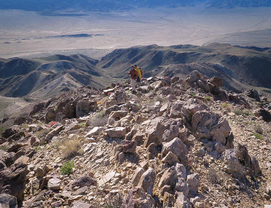 On the way down - Scott and Fred - descend ridge to the left with saddles in between high points 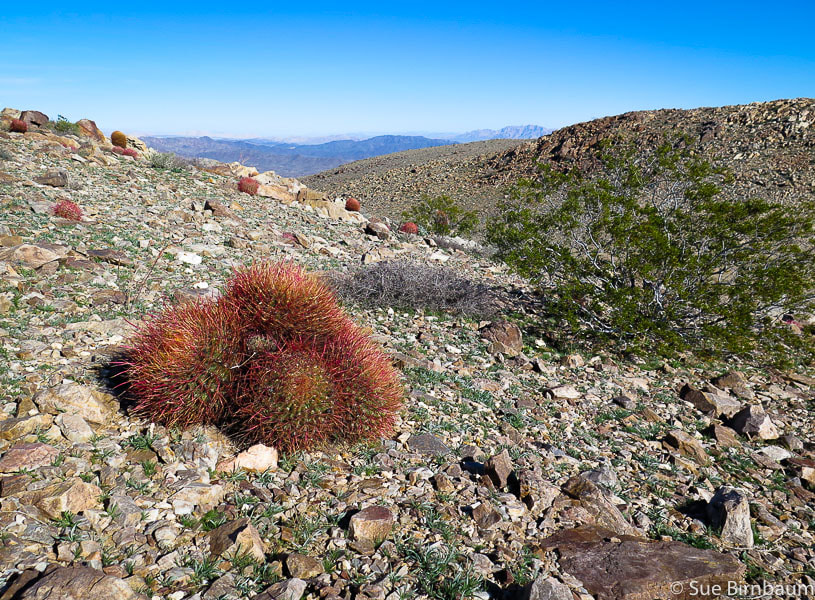 Late afternoon sun and deep red hues of barrel cactus 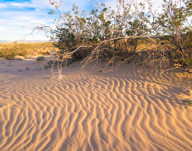 Not officially dunes, but an accumulation of blowing sand adjacent to mountain range 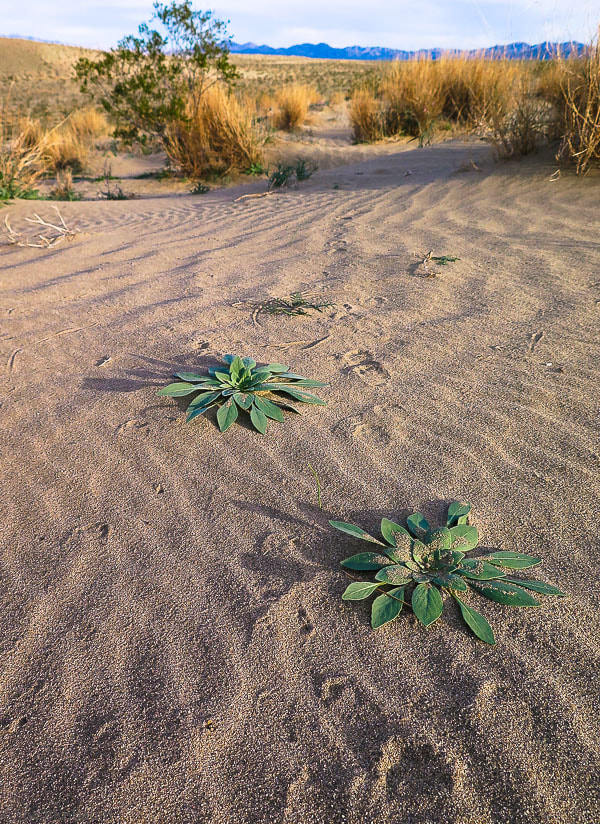 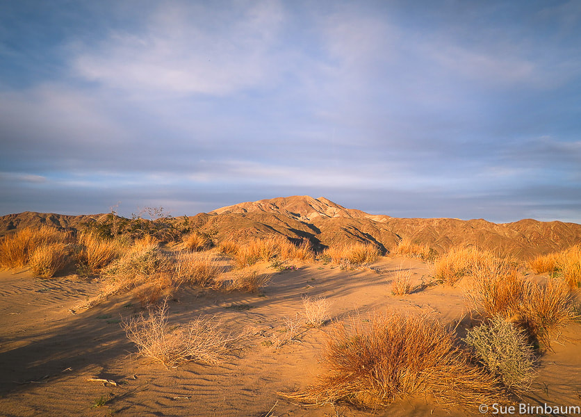 Pinto Mountain in late afternoon - "dunes" in foreground References
14 Comments
Thanks Linda,
Jim
1/13/2019 09:01:52 am
Awesome trek, incredible photos.
Lynn
1/13/2019 08:04:03 pm
What a great trip! Loved your pictures of cacti and sand verbena! Thanks, Sue!
Thanks for reading, Lynn! 4/5/2019 08:04:29 pm
I've done hiking for the first time last warm and I must say that it's not a joke! The effort you will be exerting could be too much on your case, but it's still not enough that's why you really need to prepare your body, But if you are going to see this beautiful view after a very tiring hiking, then everything might be worth it! The way I see it, Eastern Joshua Tree National Park in the Pinto Mountain Range is an exciting place to hike, that's why you should really make an effort to be there at the top! Yes, it's true - the climb up is more enjoyable if you are fit and you have prepared or trained your body. I am lucky that I have the health and fitness to see some of the most beautiful sights. Eastern Joshua Tree is a very special place - so big and full of mountain ranges - it is a place where you feel free and you can stretch and breathe. It's definitely worth going to, and good to know how to use a topo map. Thank-you for your comment and for reading the post! 7/30/2021 06:07:52 am
Good post....thanks for sharing.. very useful for me i will bookmark this for my future needs. Thanks.
John T.
6/1/2022 12:46:39 pm
Thank you very much for this write up, very informative.
John,
John
6/1/2022 04:51:12 pm
Thanks for your reply Sue! Leave a Reply. |
Categories
All

Sue and Fred

About this blogExploration documentaries – "explorumentaries" list trip stats and highlights of each hike or bike ride, often with some interesting history or geology. Years ago, I wrote these for friends and family to let them know what my husband, Fred and I were up to on weekends, and also to showcase the incredible land of the west.
To Subscribe to Explorumentary adventure blog and receive new posts by email:
Happy Summer!

About the Author
|