|
Expansive views of southern Utah and northern Arizona, cool canyon narrows, Pueblo II petroglyphs, a deep sand slog and delicious quiche in Kanab, "Utah's Little Hollywood."
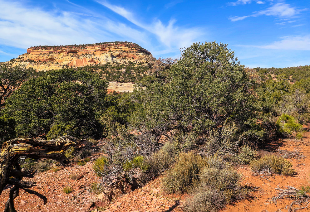
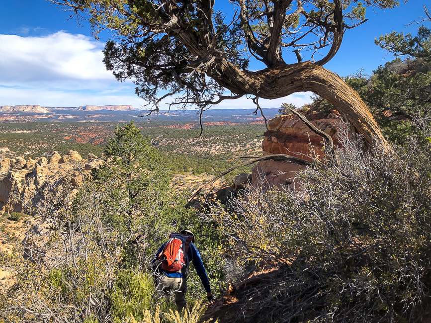
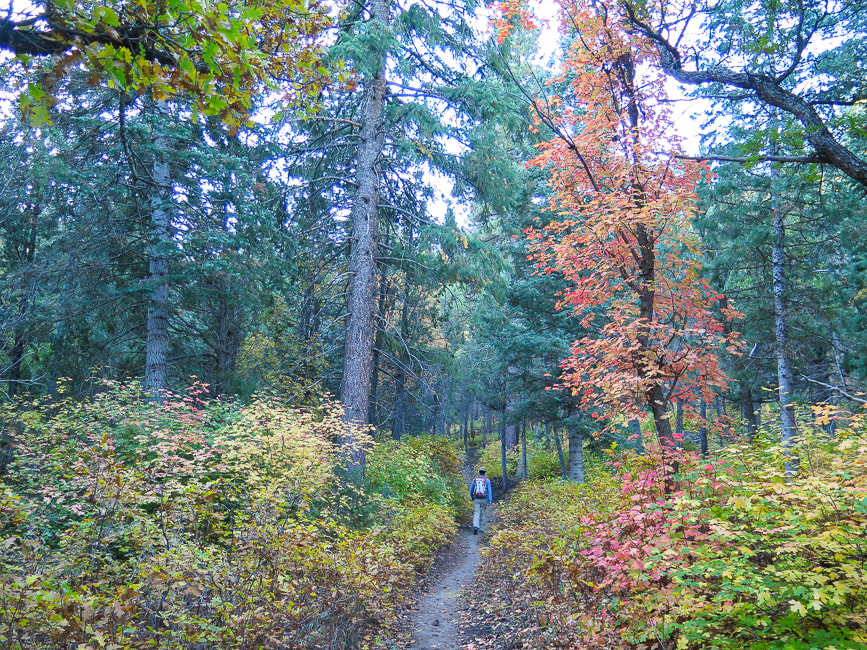
On the trail to Mansard Benchmark (mesa on the left).
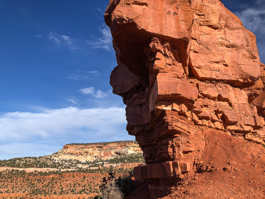
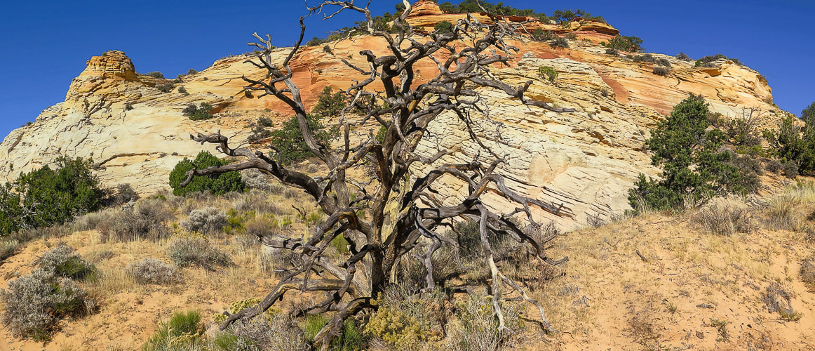
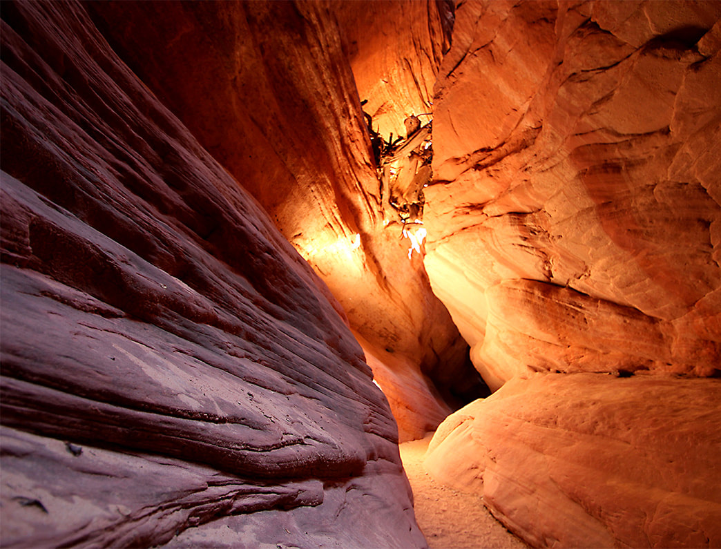
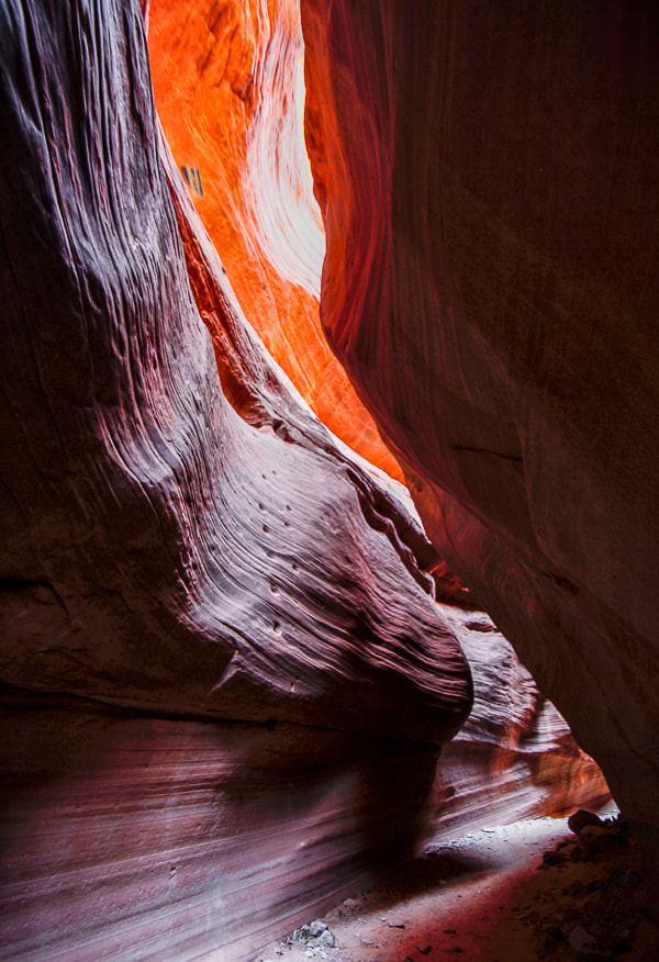
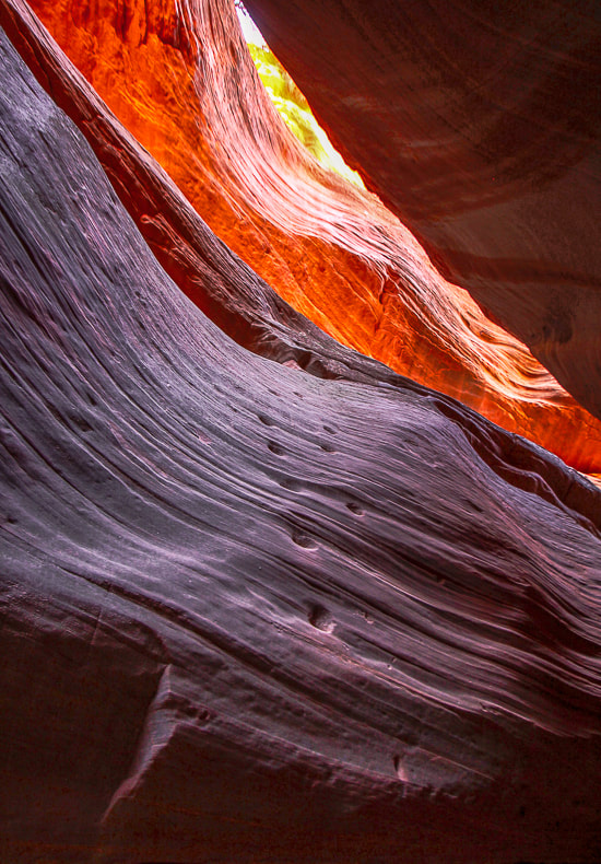
Ancient Moqui steps carved into Red Canyon (AKA Peekaboo)
Also called "moki" steps, these were carved into sandstone to access alcove above. The lowest step is about 5 feet from the canyon floor. Handmade ropes and ladders were possibly used to access the steps, or sediment has washed away, making the access higher. There may have been a granary in the alcove. more Peekaboo photos below Trip Stats - Mansard Benchmark and East Mansard Peak
Overview: Hike to petroglyphs tucked in a alcove overlooking northern Arizona, scramble up a weakness in Mansard Benchmark's cliffs to top out for a huge view. Summit #2 is a fun slickrock climb up East Mansard to look over multi-hued mesas to snow-covered mountains to the northwest.
Location: Vermilion Cliffs, Bureau of Land Management Distance/Elevation gain: 6.2 miles/1,450' cumulative gain. Coordinates: Trailhead = 37.03414 -112.42366. Mansard Benchmark = 37.04925 -112.43087 Difficulty: Moderate Class 1 to bases of the two summits, Class 2, 2+, and one Class 3 move onto Mansard Benchmark. Maps and Apps: Stav is Lost's trip report, AllTrails GPX tracks, Kanab map from BLM. Directions to trailhead: BLM website. Date Hiked: 10/29/22 Trip Stats - Peekaboo Slot Canyon
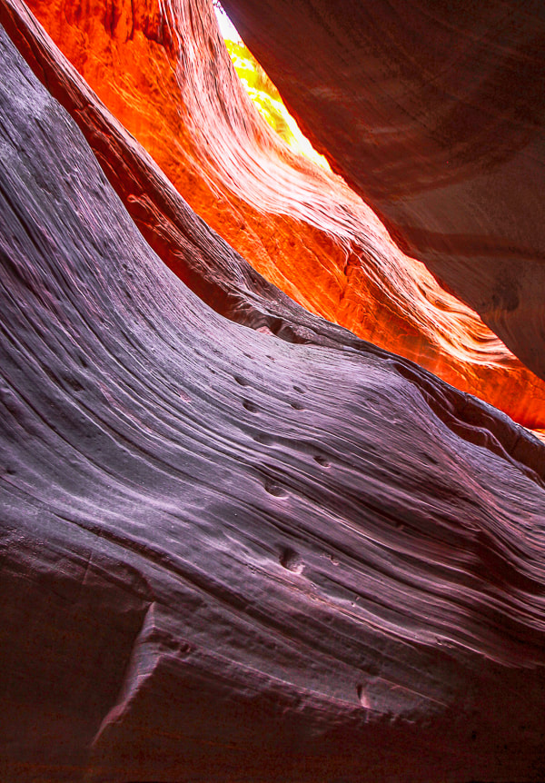
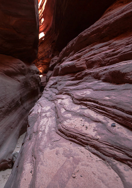
Overview: Experience gorgeous shapes, textures and ever-changing colors as you wind through sandstone narrows. It's also fun to walk along the canyon rim for views of the White Tower to the north and the "White Wave".
Location: Trailhead is 9 miles north of Kanab on Highway 89 - Bureau of Land Management. Entrance to canyon: 37.17928616, -112.5597135. Distance: 6.3 miles out and back if starting from trailhead on Highway 89, north of Kanab; 0.7 miles if you drive to canyon entrance. Maps and Apps: AllTrails tracks. Considerations: Sandy road (2.8 miles) to Peekaboo Canyon entrance requires 4WD and tires with good traction in sand. Directions to trailhead: BLM website. Date Hiked: 10/30/22
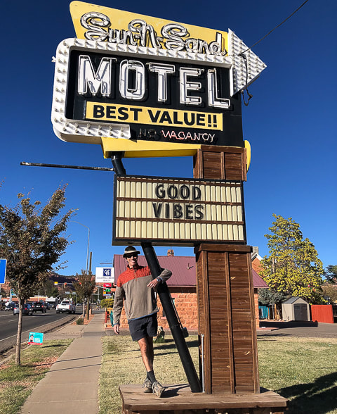
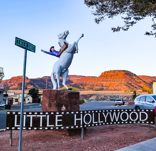
Kanab, "The Greatest Earth on Show" is adventure-central for southern Utah and a nice little city with good restaurants, a museum, and a great bakery. We stayed in an RV park with our small trailer for two nights, walked into town for dinner one night, and did two hikes. Mansard Benchmark and East Mansard Peak were just out of city limits, and a great way to get the lay of the land for miles around. The Peekaboo Canyon hike was a slog through deep sand to get to the slot canyon (we didn't have the right tires on our pick-up). Kanab has adventure companies galore that will take you to Antelope Canyon, Horseshoe Bend, Peakaboo Canyon and the Grand Canyon. It's not far from the now world-famous "The Wave" in Vermillion Cliffs, as well as Buckskin Gulch and Wire Pass. It used to be easier to get into "The Wave"; Fred and I have gone twice about 20 years ago, when all we had to do was to be the first in line at the Kanab Ranger Station by 8:00 a.m. to get two of the limited number of permits. Now you have to go through a lottery system.
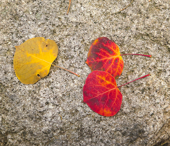
There's a reason you may feel invigorated after visiting Kanab. There's a lot of orange. Orange is the color of warmth, vitality, and creativity. According to Color Theory, orange increases our activity levels and gives us a sharper awareness of our surroundings.
Mansard Benchmark and East Mansard Peak
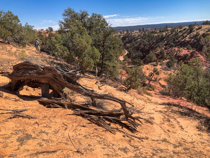
This short hike combines most of the great attributes of southern Utah: slickrock scrambling, spectacular views, petroglyphs, striking landforms and geology, junipers and pinyon pines, and some route-finding. A couple of weaknesses in the north cliffs proved a bit daunting for me to climb, but then we found a rope that assisted me up and down the cliff band. Hike Summary
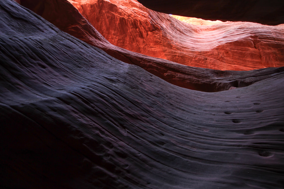
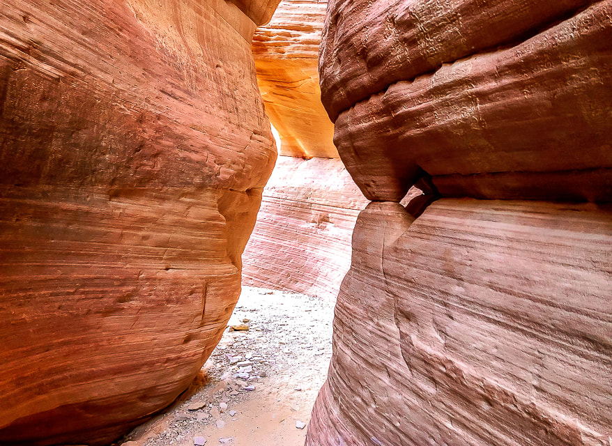
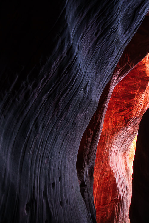
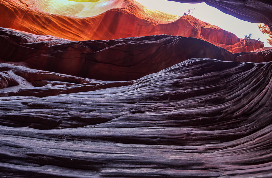
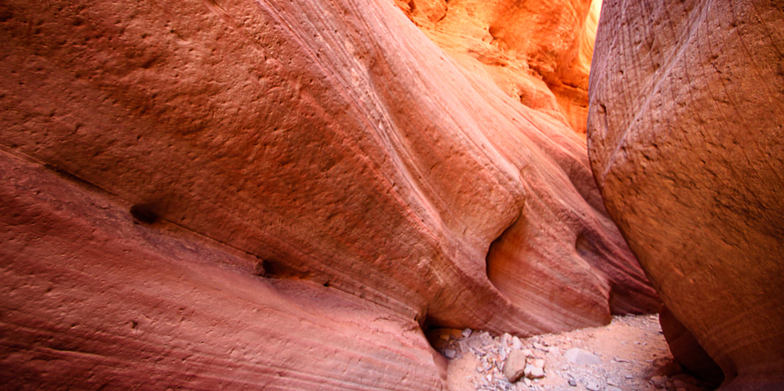
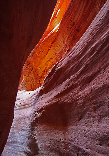
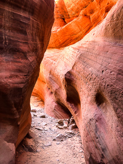
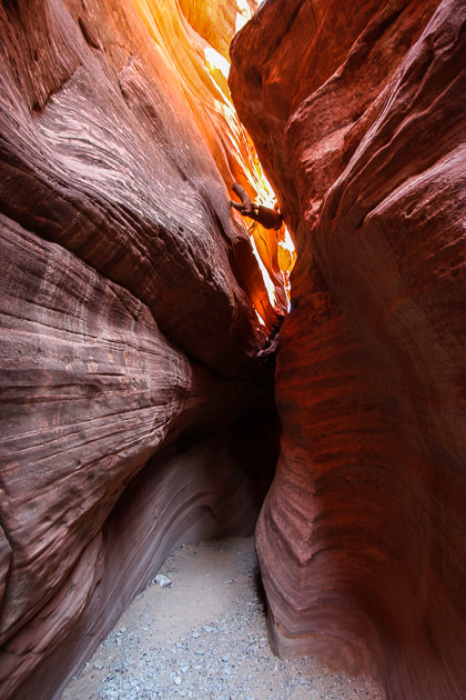
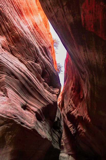
Peekaboo Slot Canyon (Red Canyon)
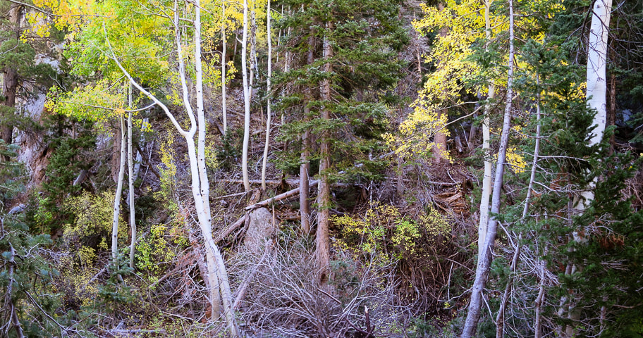
We didn't trust our truck's tires on the jeep/ATV road's deep sand (Road 102 from the highway trailhead), so we walked that 2.8-mile distance to the entrance of Peekaboo, which admittedly got a bit frustrating on the last mile back. But it was worth it. Within the confines of towering 80-foot high walls, you enter a silent, almost mysterious world. It's mind-boggling to consider how many millions of years it took for water to carve this Navajo Sandstone. We walked through at optimal light that shifted orange, red and purple hues during our time in the slot. So many compositions of curves, textures, lines can be captured with a camera. It becomes darker as you progress to the end, requiring a tripod if using a digital camera to capture sharp images. The moqui steps carved into a vertical wall by Native Americans were the most amazing feature. They clearly lead to a ledge, at this time illuminated with a fiery orange. Stripped and bleached tree trunks wedged between narrow sandstone spaces above attest to past waters moving fast enough to deposit them there. Oh, yes. I mentioned we had the best quiche at Kanab Creek Bakery, which prepares food using "traditional European" methods. Their croissants looked so good. We got there when it opened at 8:00 a.m., and soon after there was already a line for breakfast. The best modes of transportation to explore the desert around Kanab and Grand Staircase are jeeps and UTV side-by-sides. White Pocket in northern Arizona's Vermilion Cliffs is our next goal - just outside of Kanab near the famous "Wave" in Coyote Buttes. We just need to talk our neighbor, who has a jeep, into going with us.
Keep On Exploring!!
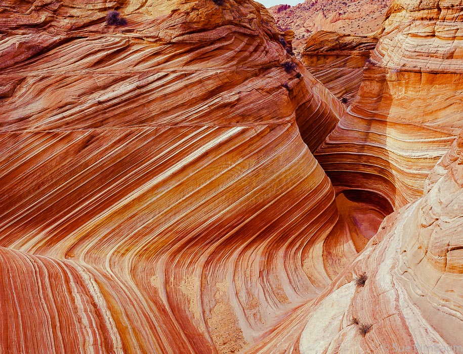
"The Wave" in Coyote Buttes North - Paria Canyon-Vermilion Cliffs Wilderness, Bureau of Land Management.
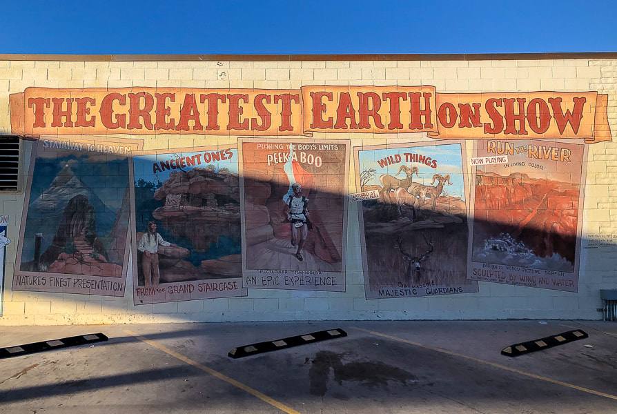
Mural in Kanab.
(more city of Kanab images at end of post) Mansard Benchmark and East Mansard Peak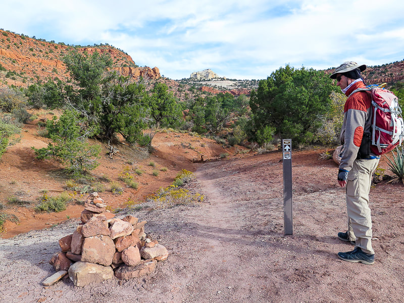
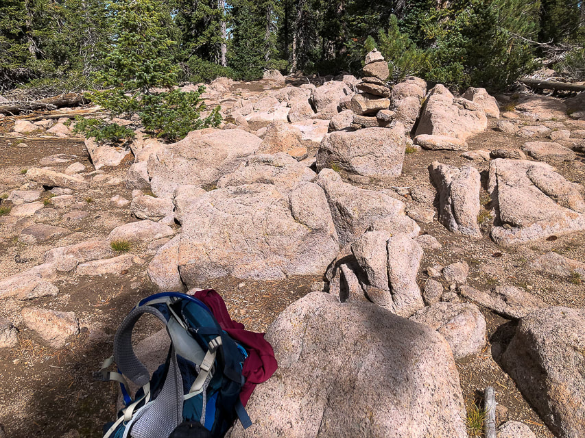
Cairn a short distance from parking lot. East Mansard Peak is center horizon.
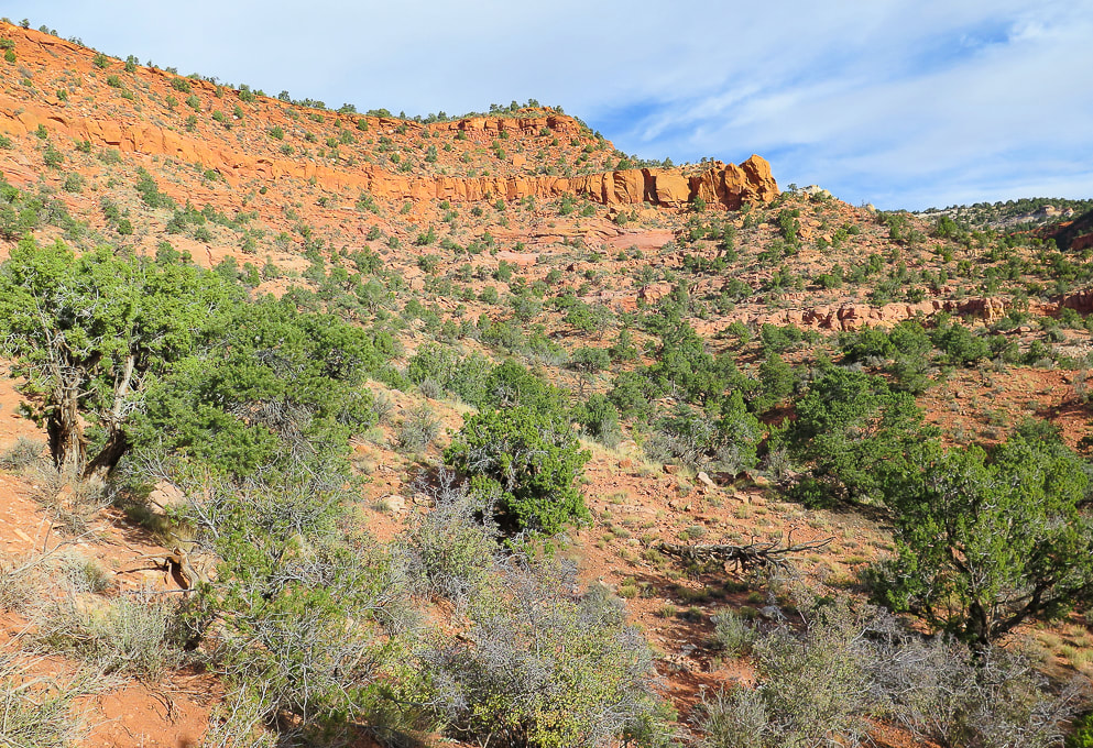
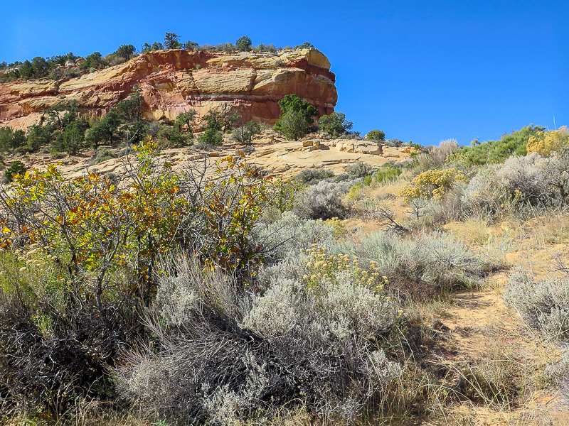
Vermilion Cliffs: first mile of trail switch-backs up to the top where it heads north toward saddle between Mansard Benchmark and East Mansard Peak.
Mansard Trail switchbacks.
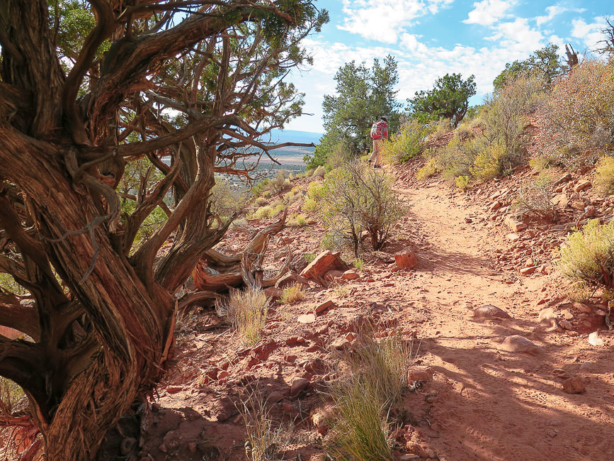
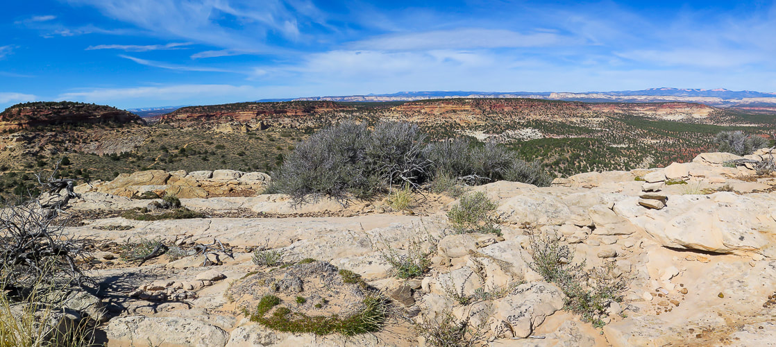
Off the switchbacks, onto the plateau. East Mansard Peak on the right.
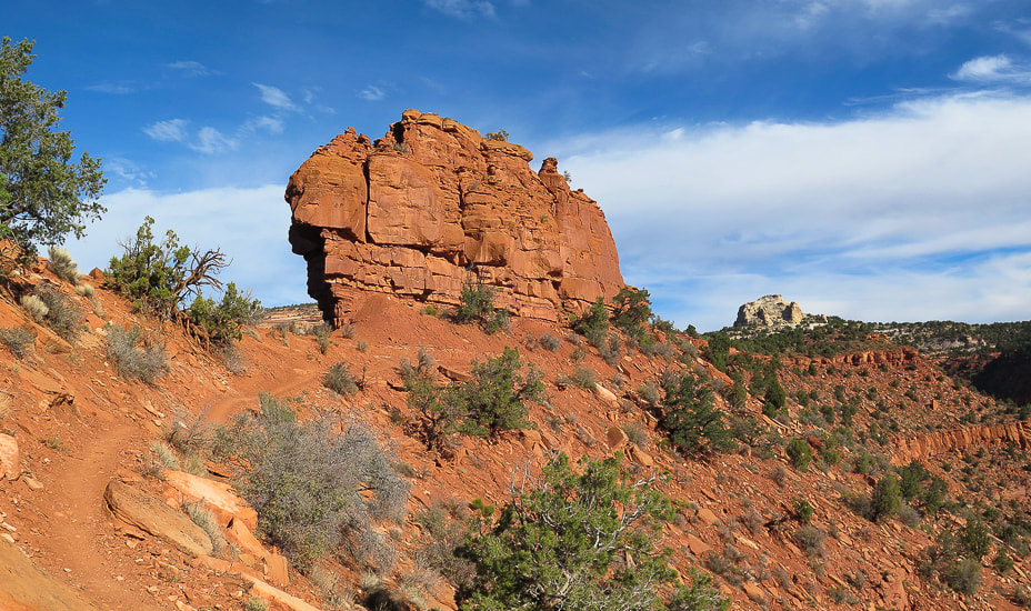
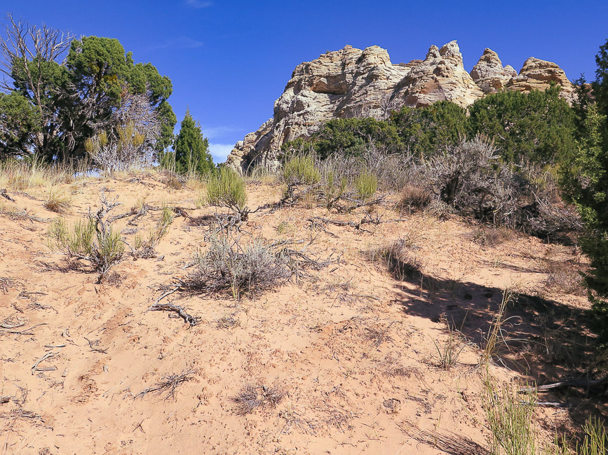
Mansard Benchmark seen once on top of the plateau. The route to summit this is from the other (north) side of this mesa.
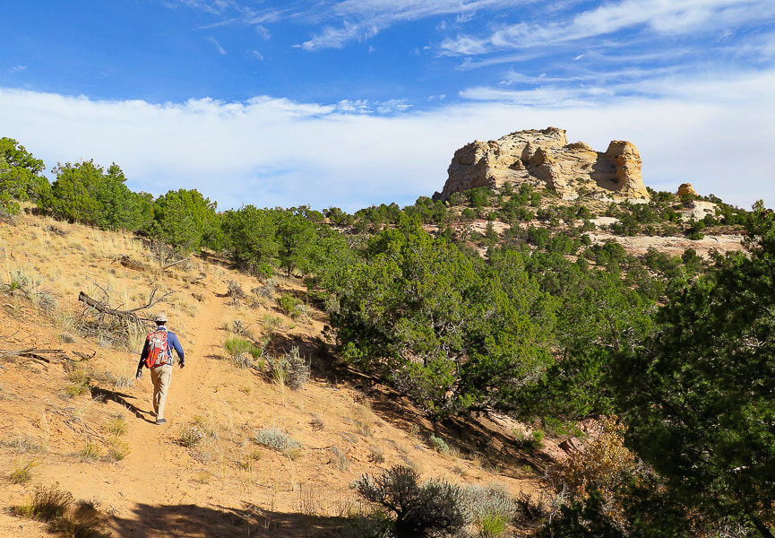
Pleasant stroll - East Mansard Peak seen here.
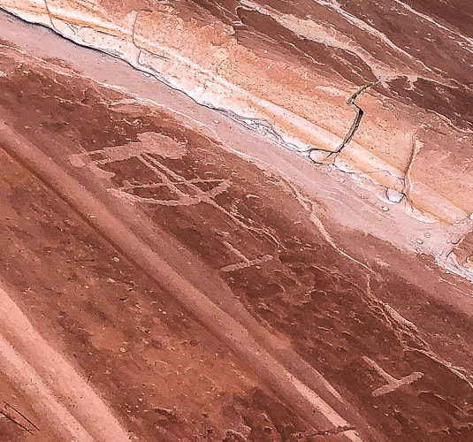
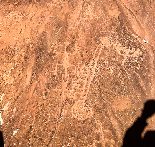
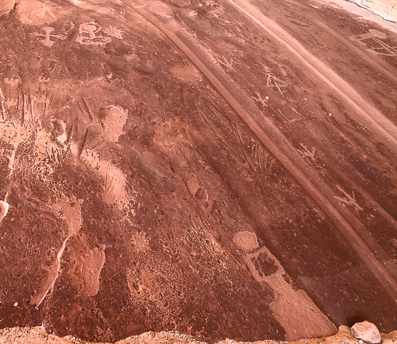
On the way to petroglyph site on south side of Mansard Benchmark.
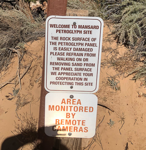
Mansard Trail petroglyphs are ~ 870 - 1,070 years old according to Bureau of Land Management Mansard Trail page.
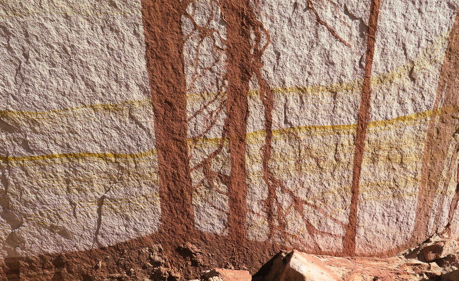
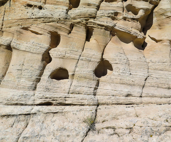
Detail in sandstone wall near petroglyph site.
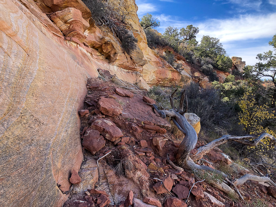
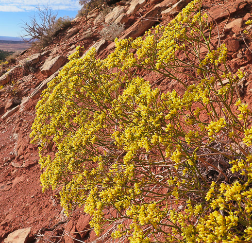
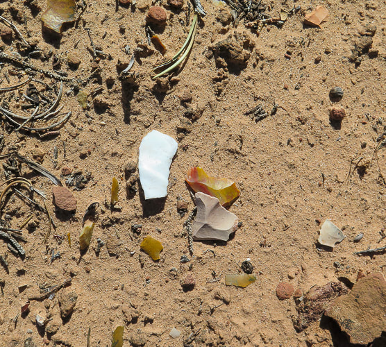
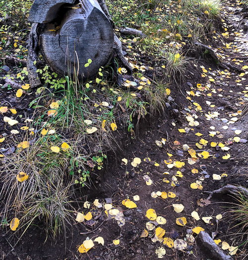
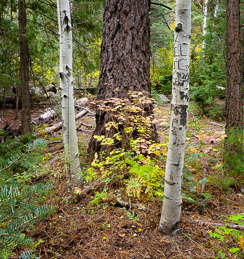
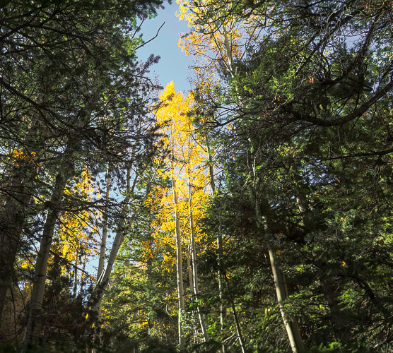
Some cool stuff on the trail.
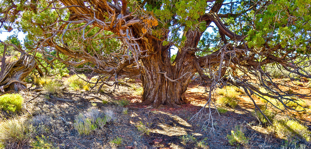
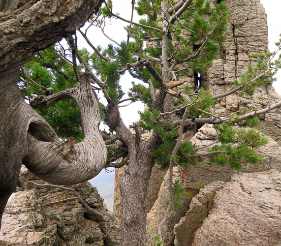
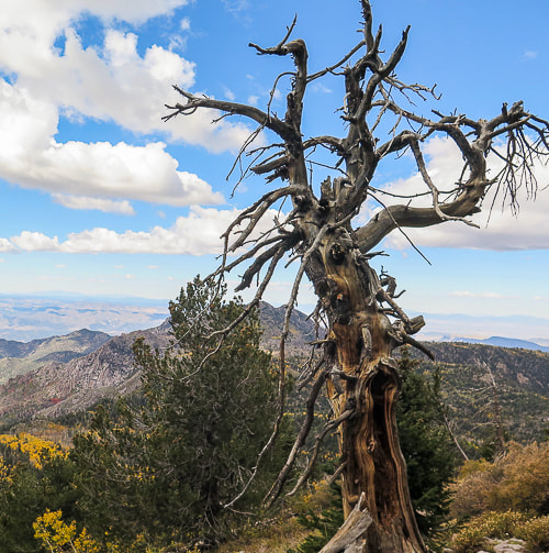
Just had to photograph (in high dynamic range) this beautiful, huge juniper!
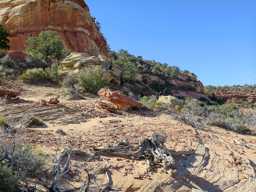
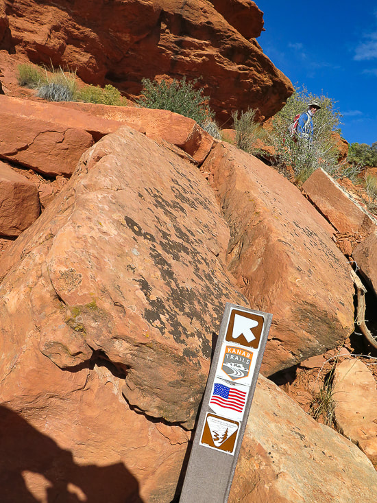
Point at which we left the sandy road and headed toward Mansard Benchmark's north cliffs.
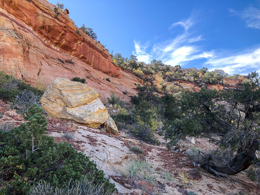
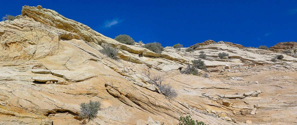
Approaching north cliffs.
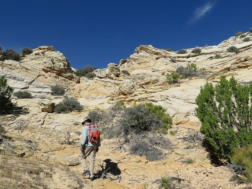
Looking for a route to the top.
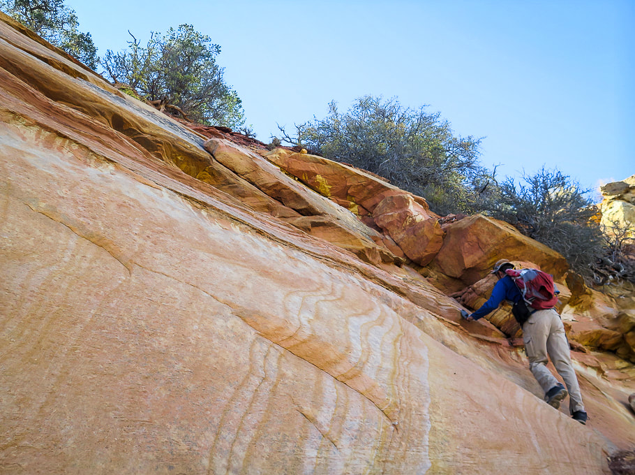
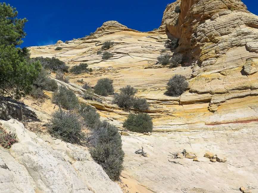
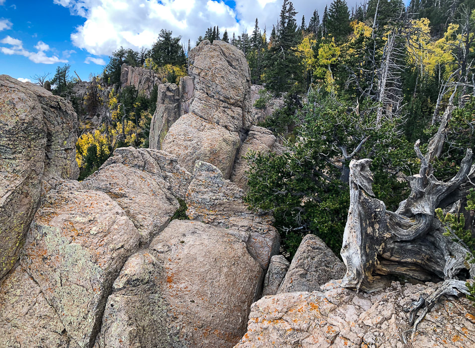
Get to climb beautiful slick rock!
Walking along cliff base to find a Class 3 weakness.
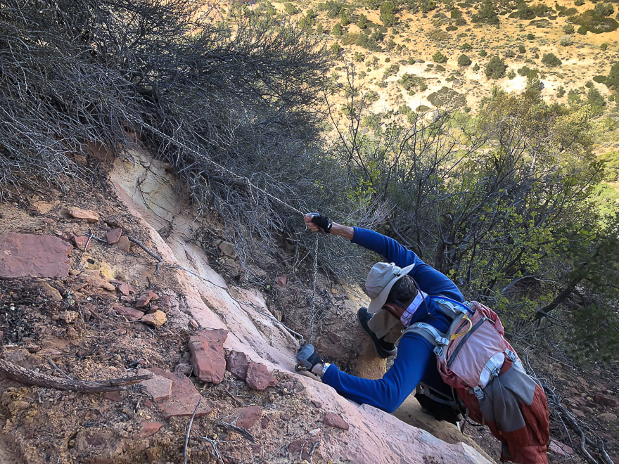
Found this rope: Fred used it only to climb down. He climbed up a weakness in the cliff just before this.
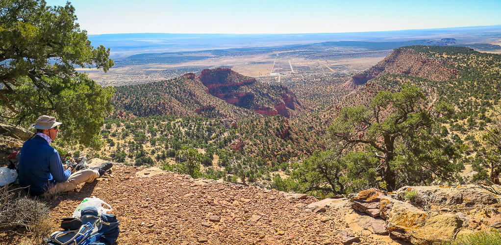
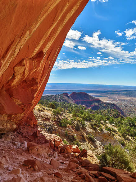
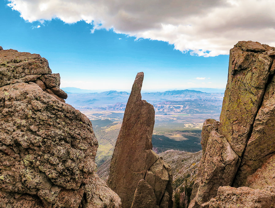
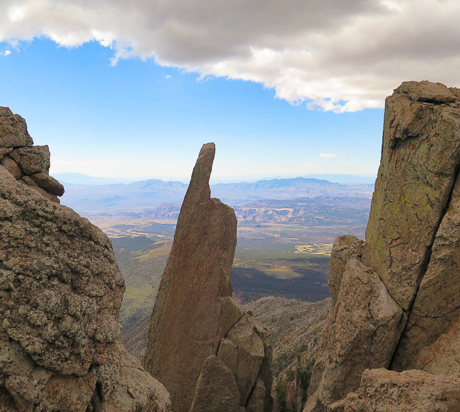
At the top of Mansard Benchmark looking over Kanab and Kanab Plateau into northern Arizona.
Heading down: large juniper marks where we ascended the cliff band.
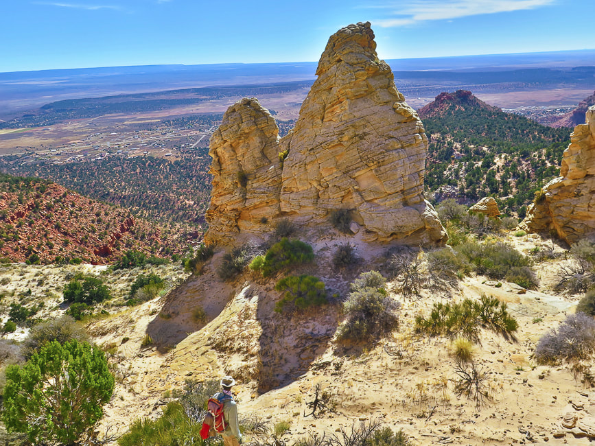
Looking up at East Mansard Peak.
Social trail takes you from main Mansard Trail to base of East Mansard; begin climbing through sand/on sandstone to the left.
Maneuvering over sandstone to ridge and then following it to the right.
Summit at the right.
Cairn on summit. View includes Mansard Benchmark (left). Grand Staircase/Escalante National Monument on right in photo.
Base of East Mansard Peak.

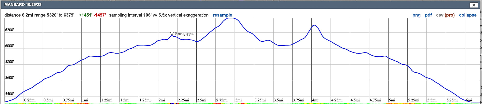
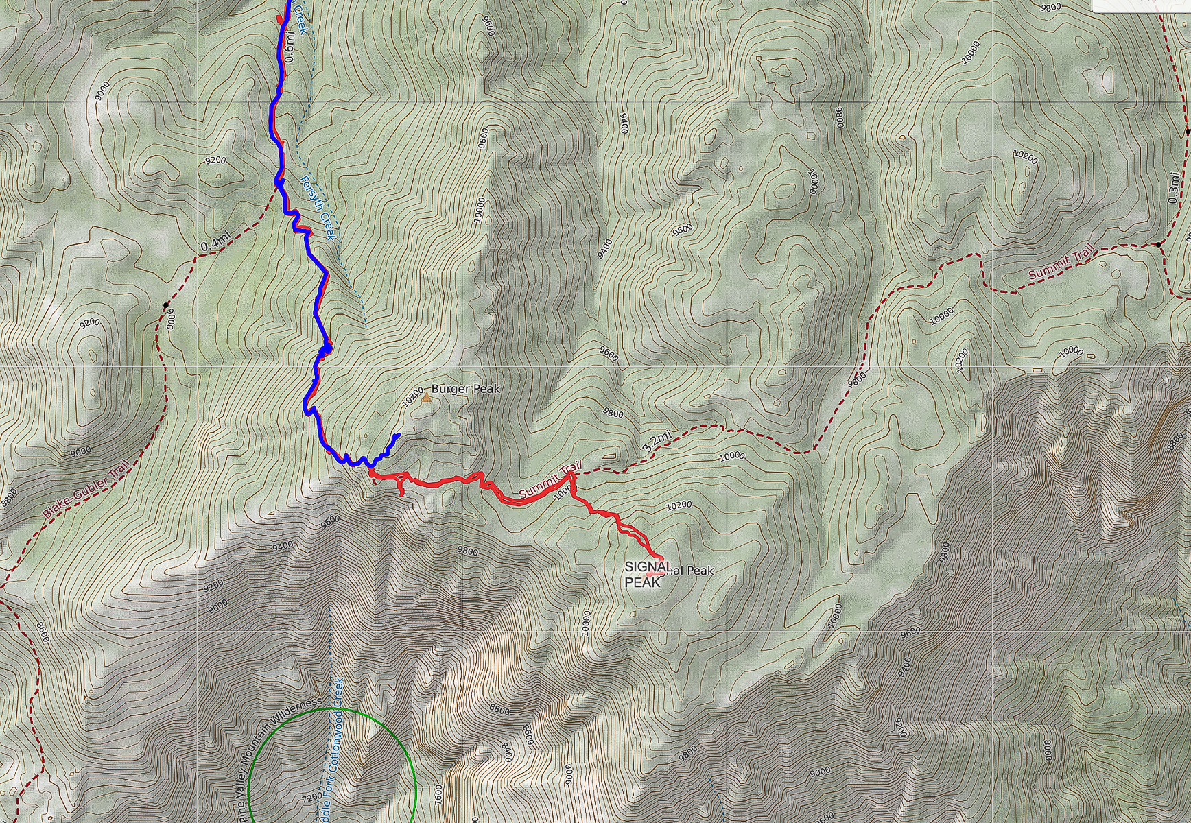
Our GPS tracks and elevation profile
click on map for larger view Peekaboo Slot Canyon, Kanab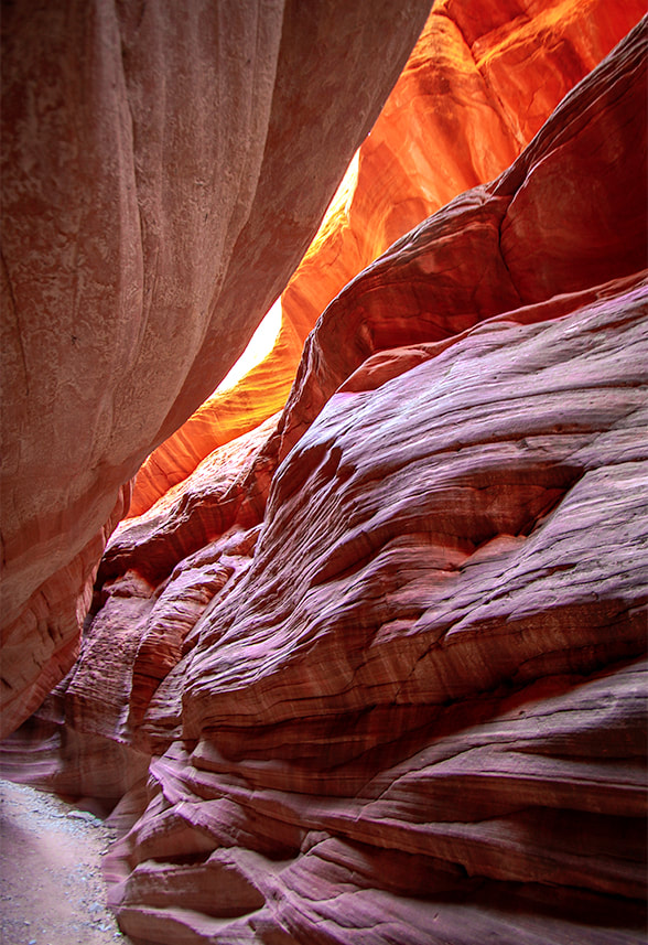
Walking on Peekaboo's rim.
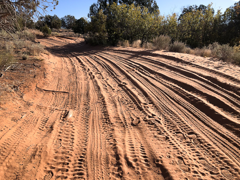
The road leading to Peekaboo from the trailhead off Highway 89. Sand gets deeper than this in some parts of this road.
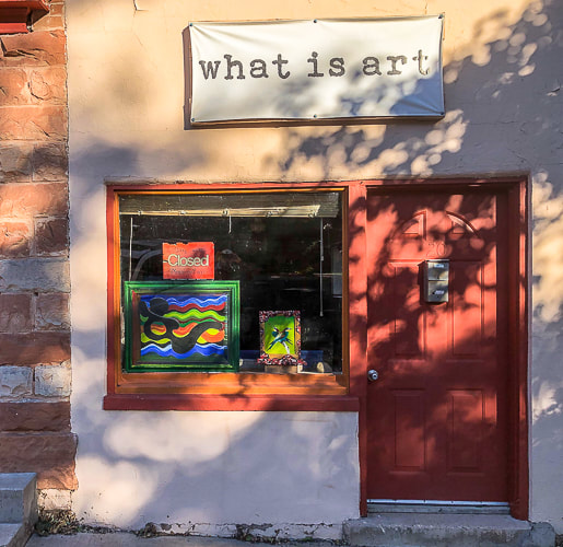
Some cool stuff in Kanab.
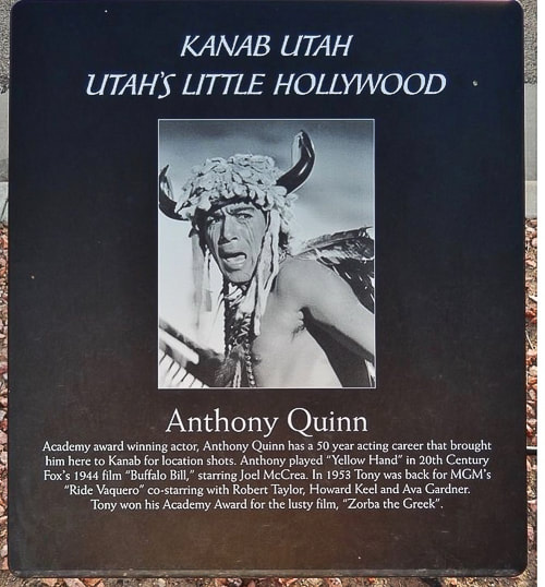
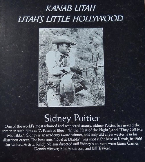
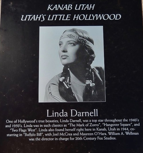
More than 100 movies and television shows, like Gunsmoke were filmed in Kanab and vicinity. It was the setting for The Lone Ranger, Billy the Kid, The Outlaw Josey Wales and even Planet of the Apes. A walking tour of "downtown" Kanab presents many nice-quality plaques that feature actors like John Wayne, Frank Sinatra, Dale Evans, Jack Nicholson, Clint Eastwood, Ronald Reagan, and many other stars who came to Kanab to film movies.
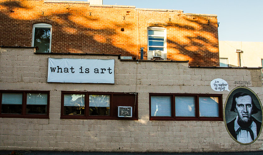
"Love Thy Neighbor as Thyself"......Jacob Hamblin, Buckskin Apostle.
References
|

| Related: Burger Peak, 10,320' - Pine Valley Mountains Gardner Peak, The Summit Less Traveled List of Utah Hikes | |
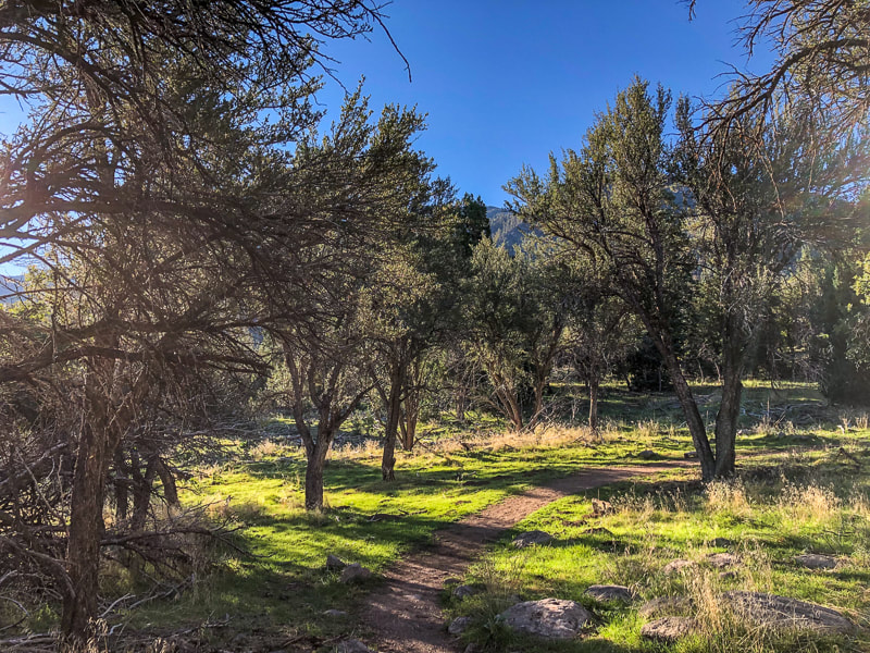
Overview: Hike to the high point of Utah's fourth largest wilderness that has the most diverse flora of any other Utah range (1,000 species). You can summit Burger Peak on the way to forested Signal Peak. Start in mountain mahogany, walk along Forsyth Creek through aspens and ponderosa pines to summit of firs and pines. A spectacular view of the Red Cliffs National Conservation Area and mountains in Arizona is seen as you climb out of the forest near the base of Burger Peak.
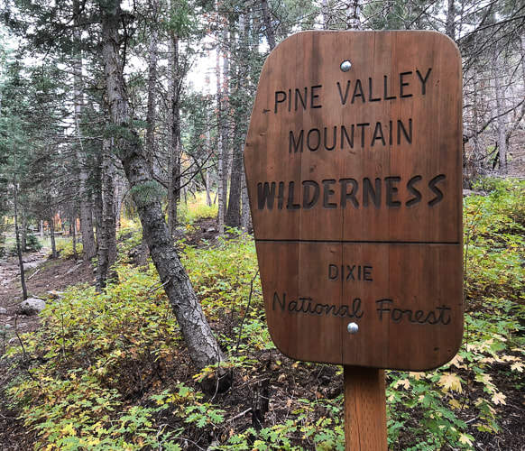
Location: Dixie National Forest, Pine Valley Mountain Wilderness, out of Pine Valley, north of St. George, Utah.
Distance/Elevation gain: 14 miles out and back/3,900' cumulative gain. Trailhead = 6,650', Summit = 10,369'.
Difficulty: Moderate - Strenuous on Class 1 to base of Signal Peak; Class 2 to summit (no trail).
Prominence: 4,485'.
Coordinates: Forsyth Trailhead = 37.38331 -113.50682. Signal Peak: 37.3197, -113.49162.
Trails: Forsyth Trail (#31012) to Summit Trail (#31021).
Maps and Apps: Trails Illustrated #715 - St. George-Pine Valley Mountains, Garmin GPS, Avenza (St. George/Springdale/Hurricane map).
Date Hiked: 10/7/22
History: Pine Valley was discovered by Mormon pioneers Gunlock Bill Hamblin, Jacob Hamblin, and Isaac Riddle when they were moving cattle north of Santa Clara for summer grazing. A sawmill to process lumber was erected in 1856. The tall white Pine Valley Chapel stands out as you drive through town. Built in 1868 according to Ebenezer Bryce's plan, it is the oldest meetinghouse in continuous use of the Church of Jesus Christ of Latter Day Saints. Bryce reportedly followed a lost cow later into a beautiful canyon - the now famous Bryce Canyon National Park. Bryce's experience in Scotland as a shipbuilder was the impetus for the well-constructed chapel.
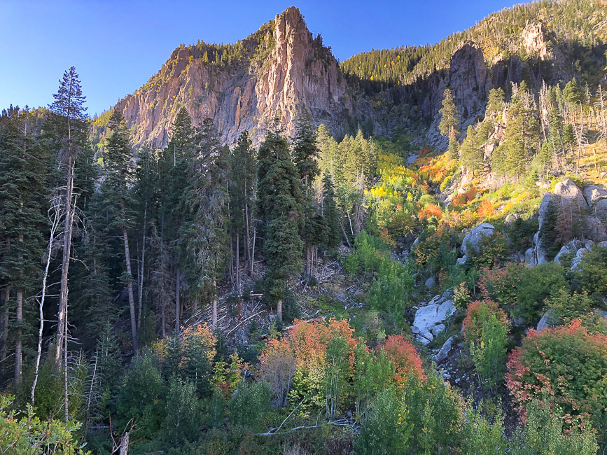
Geology: The Pine Valley Mountain range is the largest laccolith in the U.S., and perhaps the world. Molten rock was injected into existing strata 20 million years ago; top layers eroded to reveal this large body of monzonite rock (similar to granite). This monzonite porphyry (coarse-grained) rock was deposited over the famous Claron formation, the rock that is seen in the form of hoodoos in Bryce Canyon.
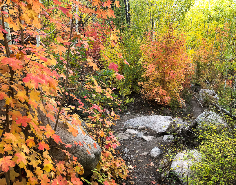
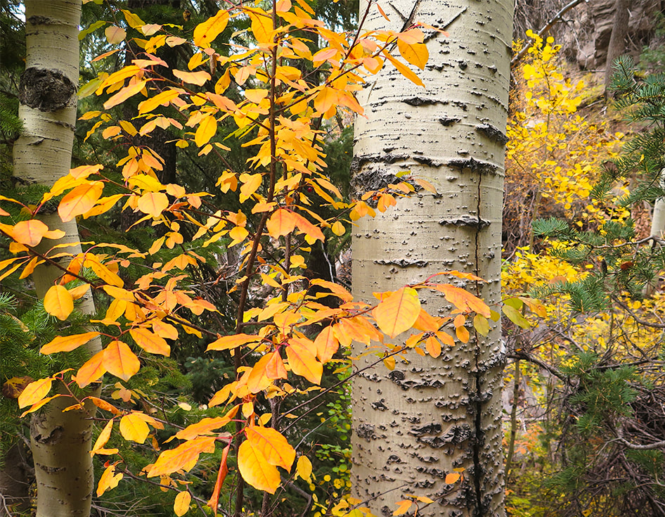
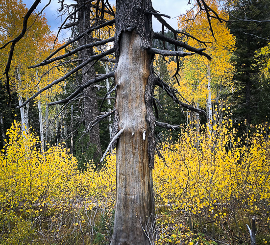
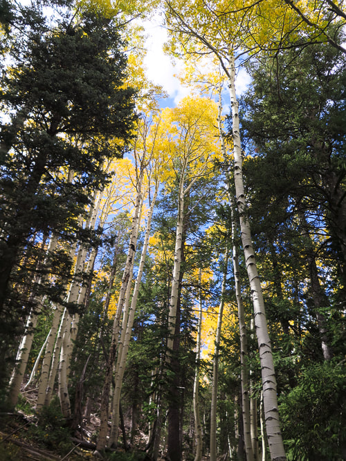
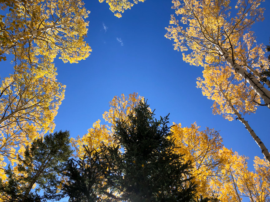
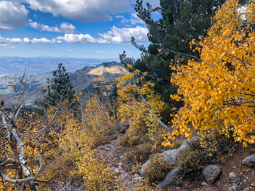
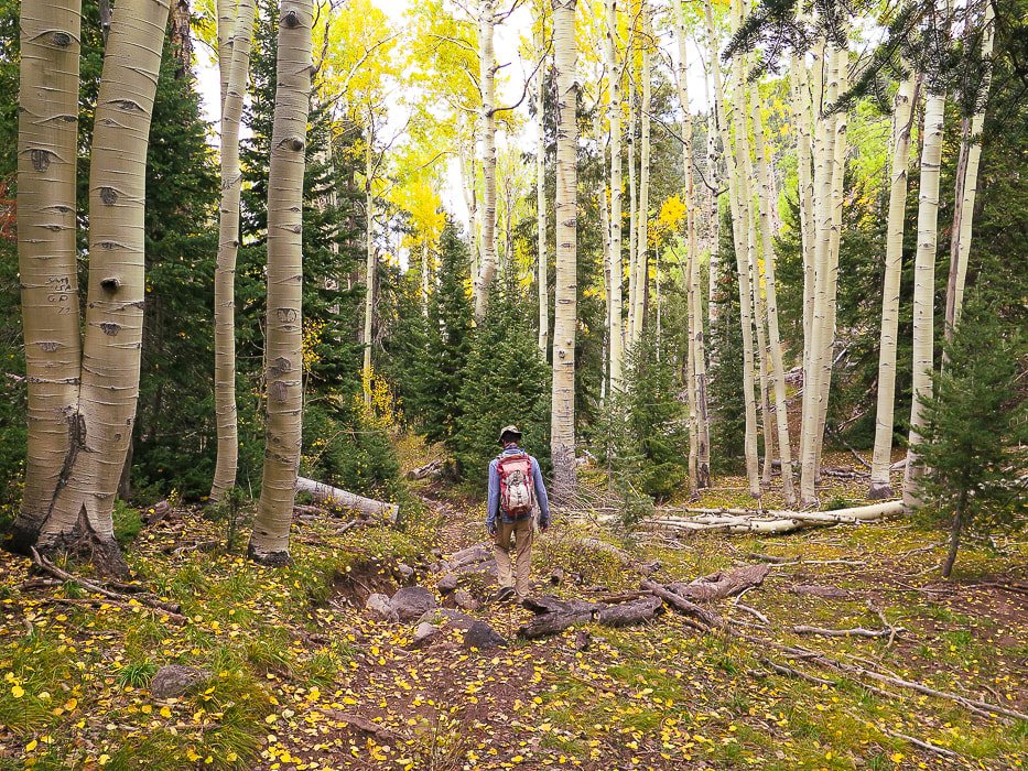
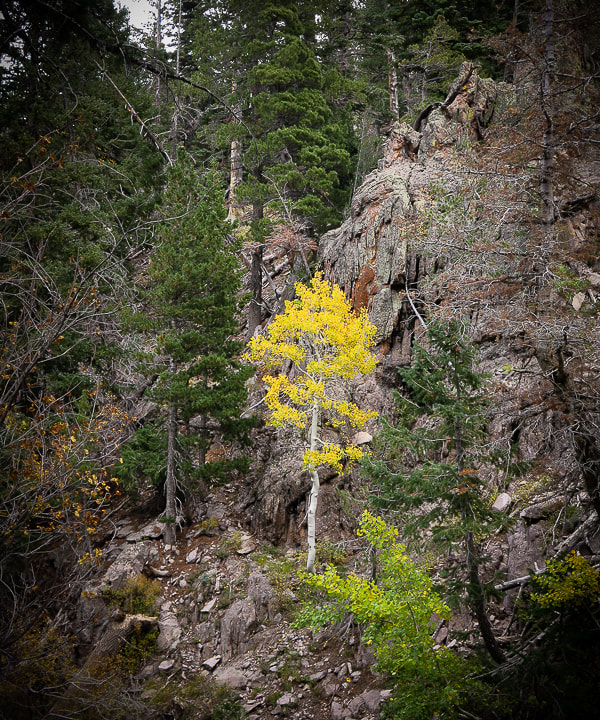
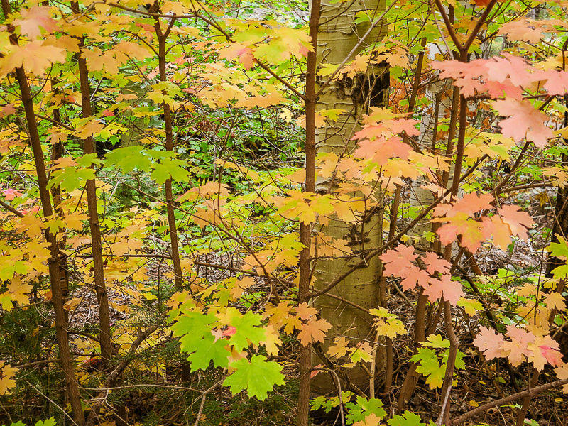
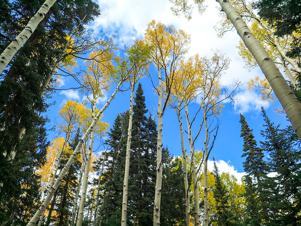
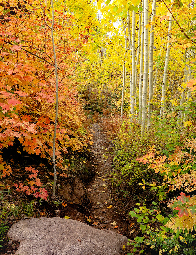
If you ever happen to be in southwestern Utah the first week of October, I highly recommend this hike. The onset of autumn makes an enchanting forest in the Pine Valley Mountains; it reminds me of the spectacular autumn foliage we saw when we lived in New Hampshire.
In my last post, I indicated that most people aren't aware of the hidden, magical world of southern Utah's Ashdown Gorge beneath the highway out of Cedar City. It's the same with the steep and rugged Pine Valley Mountain Wilderness just north of St. George. In this case, you can see this "sky island" rising like a hulk over red sandstone and black cinder cones, but it's not until you actually get into the heart of this wilderness that you realize its extraordinary beauty and find solitude.
We timed our hike to the highest point in the Pine Valley Mountains - Signal Peak - perfectly. The autumn colors were at their optimum, adding variety and depth to this dense forest. We had already summited Burger Peak, the second-highest in this beautiful, lightly-traveled mountain range, navigating deep snow banks in the spring. Lucky for me, afternoon clouds provided the best light that made these colors glow, so I spent a lot of time yelling ahead to Fred that I had stopped to photograph. We saw only three other hikers who were also enjoying the "zen" of this enchanting forest.
We are frequent visitors to this range that is remarkable for having the most botanical species than any other Utah mountain range - including three new species to Utah recently identified. We hiked Gardner Peak, a summit not often traveled a few months ago with friends.
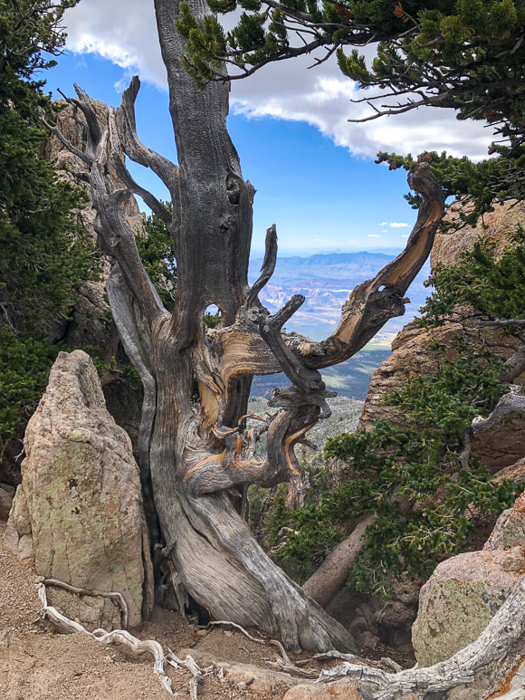
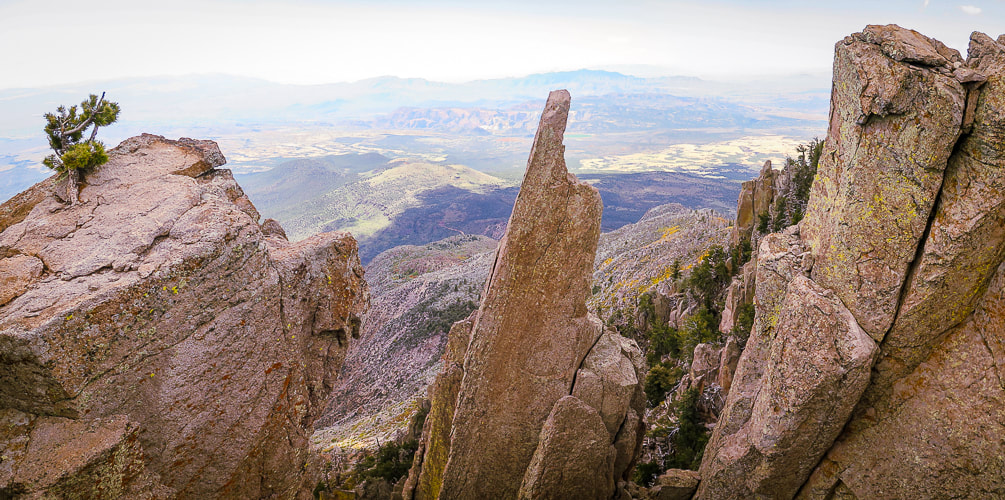
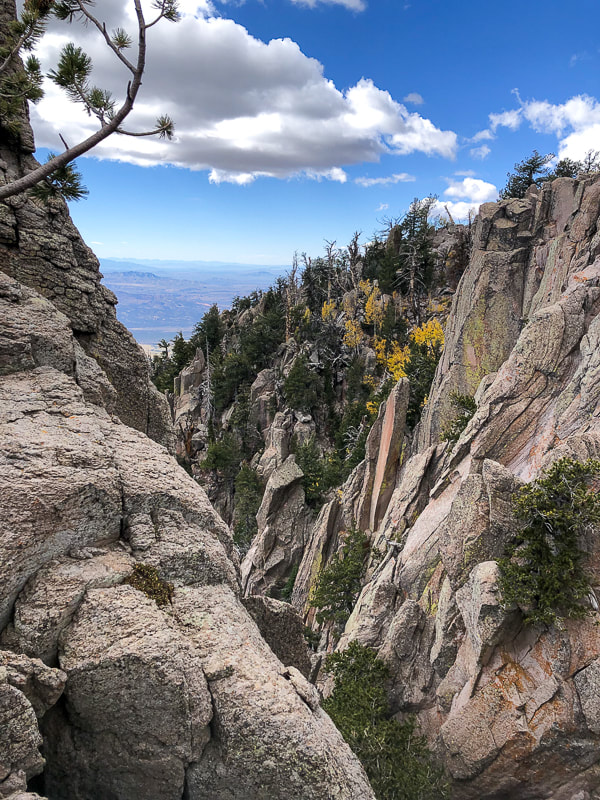
Striking rock formations growing gnarly old trees form steep cliffs with almost vertical valleys that drop toward the south when you finally emerge from the forest for a huge view of Southern Arizona and the red and yellow rocks near St. George at about 10,000 feet elevation. It's a brief view near the base of Burger Peak, and then it's back into the forest for the one-mile walk to Signal Peak summit. The spur trail to Burger Peak, ~ one mile before Signal Peak, is marked by an easy-to-miss two-rocked duck.
| Hike Summary
| 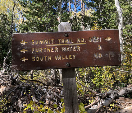 |
We found Summit Trail to be well-marked with cairns and tree blazes. I took a waypoint on my Garmin as we left the Summit Trail to make sure we would catch it again on the descent. There is no marked trail to the summit. If you pay attention on your descent from Signal, you will see Summit Trail, but it may not be obvious. I used Avenza app to find the summit. The peak is forested, so there's no great view.
| It had been awhile since Fred and I had hiked 14 miles with such a gain. Doubts about whether I could do this hike with the same pace I have in the past crossed my mind. Even though we are 61, we hiked as we had 20 years ago. Well, maybe I was a bit more tired than I would have been 20 years ago. Guess our legs are so used to it. I believe our bodies, in many instances, can be pushed more than we think. And there are usually rewards that come with challenges: a stronger and happier body and mind! Don't wait - just go! - Next post: Adventures in Kanab “There’s a constant tension in climbing, and really all exploration, between pushing yourself into the unknown but trying not to push too far. The best any of us can do is to tread that line carefully.” – Alex Honnold, the first person to free solo El Capitan in Yosemite National Park |  |

Peakaboo slot canyon
Click for larger image
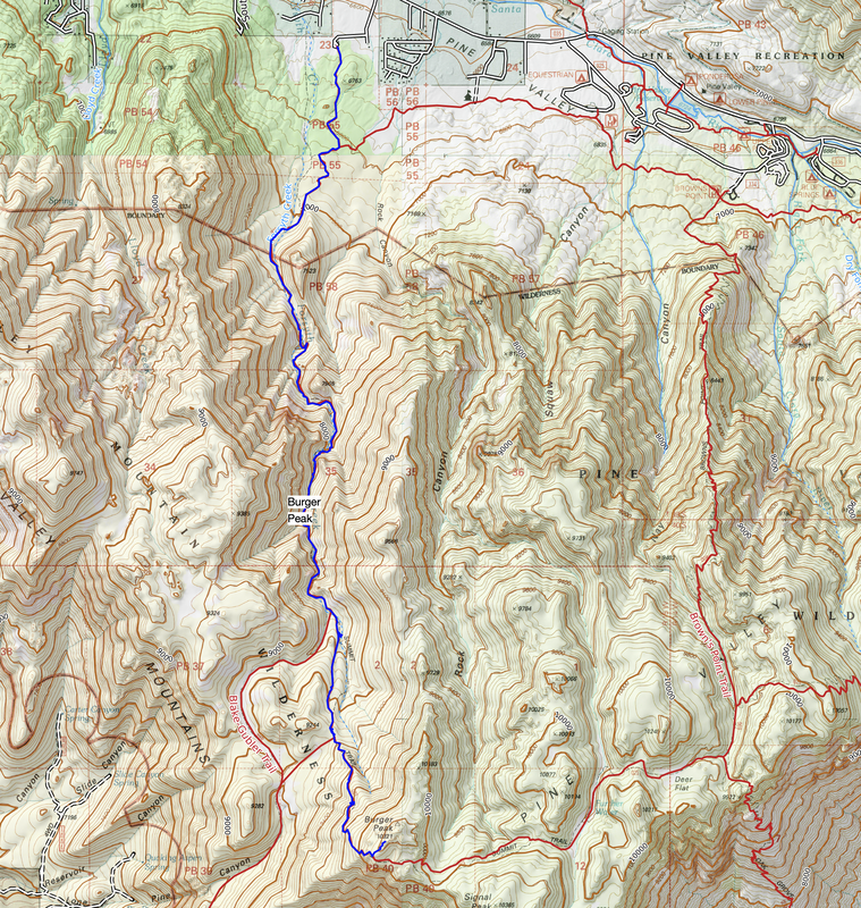
For Google Earth view of our tracks, click Burger Peak post.
Miller, Rick. Our Geological Wonderland: The Pine Valley Mountain Laccolith. The Independent.
Categories
All
Arizona Hikes
California Desert Hiking
Idaho Summits
Nevada Hikes
Petroglyphs/Pictographs
Snowshoe Hikes
Southern Utah Hikes/Bikes


About this blog
To Subscribe to Explorumentary adventure blog and receive new posts by email:


About the Author
Sue Birnbaum
In 1992, Ray Wilson and I conceived the first Cactus to Clouds hike which climbs over 10,000 feet in one day to the summit of Mt. San Jacinto near Palm Springs, California.
Awkward Botany
amateur botany for the phytocurious
Bird and Hike
"Intended to encourage people to visit, learn about, and fall in love with the desert."
Draw and Shoot
Beautiful Photography
Daring Dayhikes
"Interesting places you can visit with a daypack." Terrific Tucson and other desert hikes and East Coast, too.
Earthline: The American West
Debra "writes to extol our beloved Earth." Detailed hike info, excellently written.
Geologypics.com
Geology and Geologic Time through Photographs
Glenn Suokko
Vermont artist's paintings "inspired by a place based on the land .... drawn to painting the representation and abstraction of nature."
In the Company of Plants and Rocks
A natural history blog about botany, plant ecology, and geology.
MishMoments: Joy of Photography
this website is "about capturing that special moment in life’s journey and making the most of the time we have."
Nature's Depths
Walking through nature with John Palka, a neuroscientist who loves plants and ponders big questions.
Rangewriter - What Comes Next?
Linda's excellent writing brings to life her interesting adventures, "curiosities and thoughts", post-retirement.
SeekingLost - Hiking and Backpacking Adventures.
Stav Is Lost- Unconventional, out-of-the way hikes in the American West.
Uprooted Magnolia
Leah Yetter's beautiful "photo journal on life, love, and the spirit of Wyoming."
Archives
July 2024
June 2024
May 2024
April 2024
March 2024
January 2024
December 2023
November 2023
October 2023
September 2023
August 2023
July 2023
June 2023
May 2023
April 2023
February 2023
January 2023
December 2022
November 2022
October 2022
September 2022
August 2022
July 2022
June 2022
May 2022
April 2022
February 2022
January 2022
December 2021
November 2021
October 2021
August 2021
July 2021
May 2021
March 2021
February 2021
January 2021
November 2020
October 2020
August 2020
July 2020
June 2020
April 2020
March 2020
February 2020
January 2020
November 2019
October 2019
September 2019
August 2019
July 2019
June 2019
May 2019
April 2019
February 2019
December 2018
November 2018
October 2018
September 2018
July 2018
June 2018
May 2018
April 2018
March 2018
February 2018
January 2018
December 2017
November 2017
October 2017
September 2017
August 2017
July 2017
June 2017
April 2017
February 2017
November 2013
August 2013
July 2013