|
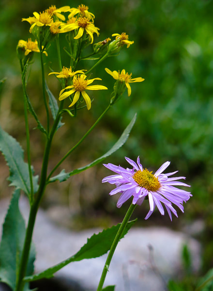
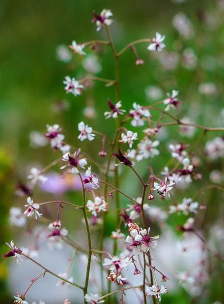
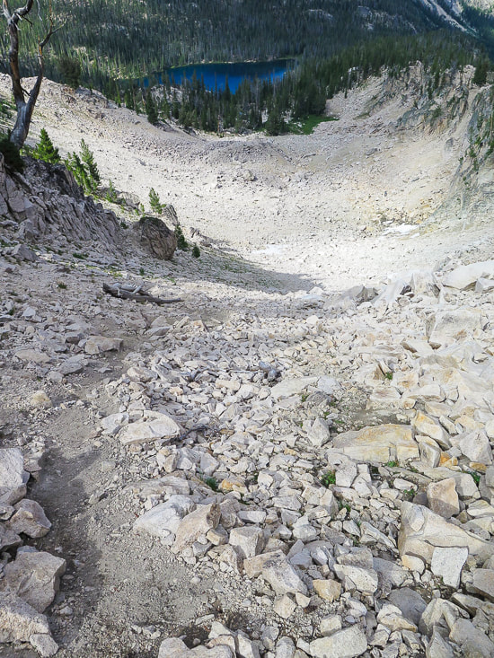
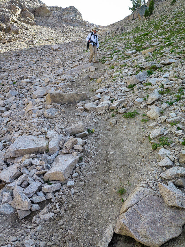
Hike cross-country from Alpine Lake and Upper Redfish Lakes to one of the best views in the Sawtooth Wilderness. The rewards are solitude and Idaho beauty. Related: Sawtooth Mountain Wilderness: Upper Redfish Lakes Cross-Country Hike (2017). Alpine Peak: 9,861' - Sawtooth Wilderness: Never Stop Climbing Mountains 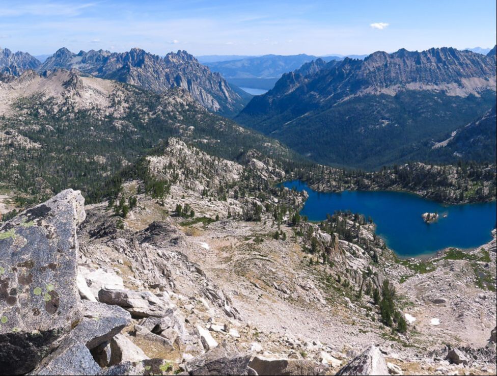 On Reward Peak's north ridge looking east to Lake Kathryn. Redfish Lake in the distance. From Reward Peak's summit Trip Stats Location: Sawtooth National Forest, Idaho Distance: 3.5 miles from Alpine Lake to Reward Peak, 7 miles round-trip. Elevation gain to Peak: From 8,383 ' at Alpine Lake to 10,075' at Reward Peak's summit. Total gain = 2,300 feet. Total loss = 575 feet. Difficulty: Moderate to strenuous Class 2 until the summit block, Class 3 last 40 feet to the summit. Trail type: Out and back Permit: Self-issued Sawtooth Wilderness Permit obtained at Redfish Inlet Transfer Camp trailhead. For more info: Sawtooth National Forest Map: Sawtooth Wilderness Hiking Map and Guide from Earthwalk Press. Our GPS tracks below. Date Hiked: 8/14/2019. Considerations: Can pump water from lakes/streams. No Campfire Zone around Alpine Lake. Dogs on leash in Sawtooth Wilderness trails July 1 - Labor Day. How to get to the trailhead: From Redfish Lake Marina at Redfish Lake Lodge, 6 miles south of Stanley, Idaho, just off Highway 75, take boat shuttle to Redfish Inlet Transfer Camp at south end of Redfish Lake OR hike Trail #101 along Redfish Lake's west shore to the end of Redfish Lake instead of taking the shuttle. This adds about 2-3 miles on to the hike. Hike directions: Trail #101 to Alpine Lake/Cramer Lakes from Redfish Inlet Transfer Camp. At intersection with Trail #154 to Cramer Lakes, take a right and stay on Trail #101 to Alpine Lake. Cross-country trail to Upper Redfish Lakes is accessed from southeast end of Alpine Lake, shortly after reaching the lake from the trail. Climb and follow the south ridge above Alpine Lake to an elevation of ~ 8,760 feet to enter gully. Climb gully to saddle at 9,200 feet, just west of Point 9337. Descend southward toward the first Upper Redfish Lake at 8,670 feet. From end of middle Upper Redfish Lake, hike west for a short distance, then ascend large drainage to Reward Peak. 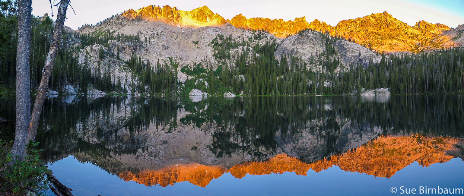 6:30 a.m. - Alpine Lake Our Hike - Overview After taking the motorboat shuttle across the long, deep blue Redfish Lake, we disembarked at the Redfish Inlet Transfer Camp underneath the towering Grand Mogul, an intimidating peak that signals you are now approaching wilderness. The hike to Alpine Lake is through a beautiful glacier-cut valley with towering rock cathedrals, creeks and wildflowers. At Alpine Lake, we found the best camping spot with plenty of room, with no one else around, and giant flat rocks on the shore on which to sit. That night was incredible: I woke to see the inside of our tent lit up. I looked outside at the most amazing sight: peaks brightly illuminated, glowing from a full moonrise with crystal-clear stars above. The next morning, we hiked off-trail, navigating straight up to the ridge overlooking the lake on soil and pine needles still damp with morning dew. We climbed up a challenging rock-filled gulley that descends to emerald lakes below, and then up another rock and snow-filled gulley to one of the most incredible views. A sunny and windless 10,000-foot summit, with no threat of thunderstorms. Lounge on the rocks - eat lunch, take photos, read the summit register. Serrated ridges, deep bottomless canyons, and sapphire-blue Lake Kathryn drop below our feet. We took our time to return to camp, meandering through bright green wildflower-filled meadows and on granite over a stream murmuring somewhere deep underneath. I once heard someone say, "It's not material things that matter, it's the experiences you have that matter." The scenario described above was actually the experience Fred and I had last month in the paradise that is the Sawtooth Wilderness. We summited Reward Peak during a glorious 3-day backpacking trip. In 1927, Arval Anderson, surveying for the USGS found a note on the summit dated in 1925 which offered the finder a $25 reward for returning the note. "I never knew a man who felt self-important in the morning after spending the night in the open on an Idaho mountainside under a star-studded summer sky." - Frank Church, former U.S. Senator from Idaho 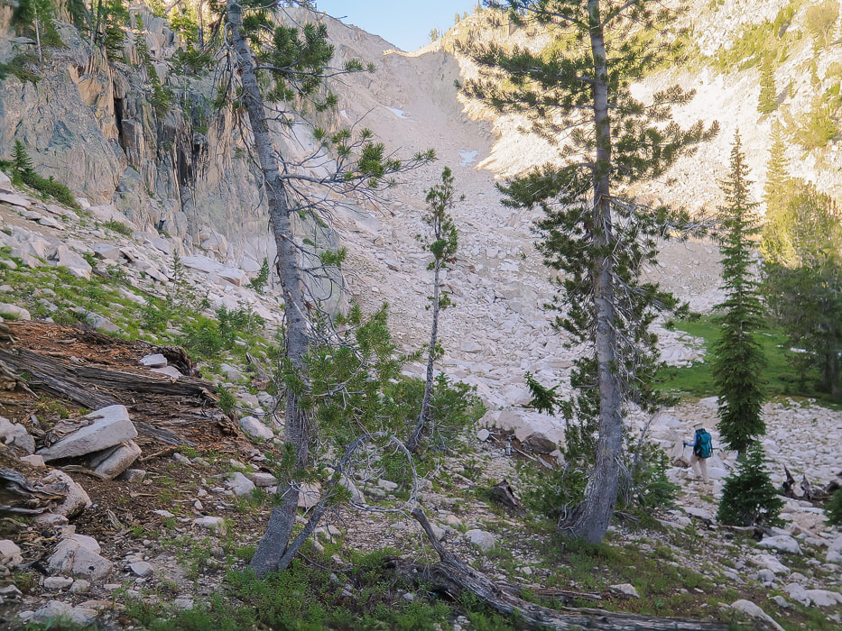 Entry point (8,760 feet elevation) from ridge above Alpine Lake's southeast side into gulley. The saddle at top of gulley overlooks Upper Redfish Lakes with Reward Peak on the horizon. Alpine Lake (8,330') to Upper Redfish Lakes (8,660') This part of the hike climbs the steep gulley seen from the south end of Alpine Lake, then descends through forest to two Upper Redfish Lakes divided by a a granite strip with rocks showing glacial striations and chatter marks, and a few sweet camp sites. From the southeast shore of Alpine Lake, hike south 450 feet up to ridge to follow it to the gulley entrance at about 8,760 feet. The gulley is steep with stable rock at bottom and loose rock and scree middle-to-top. From the ridge saddle, Reward Peak can be seen to the southwest on the horizon. Point 9337 sits just above the east side of the gulley. 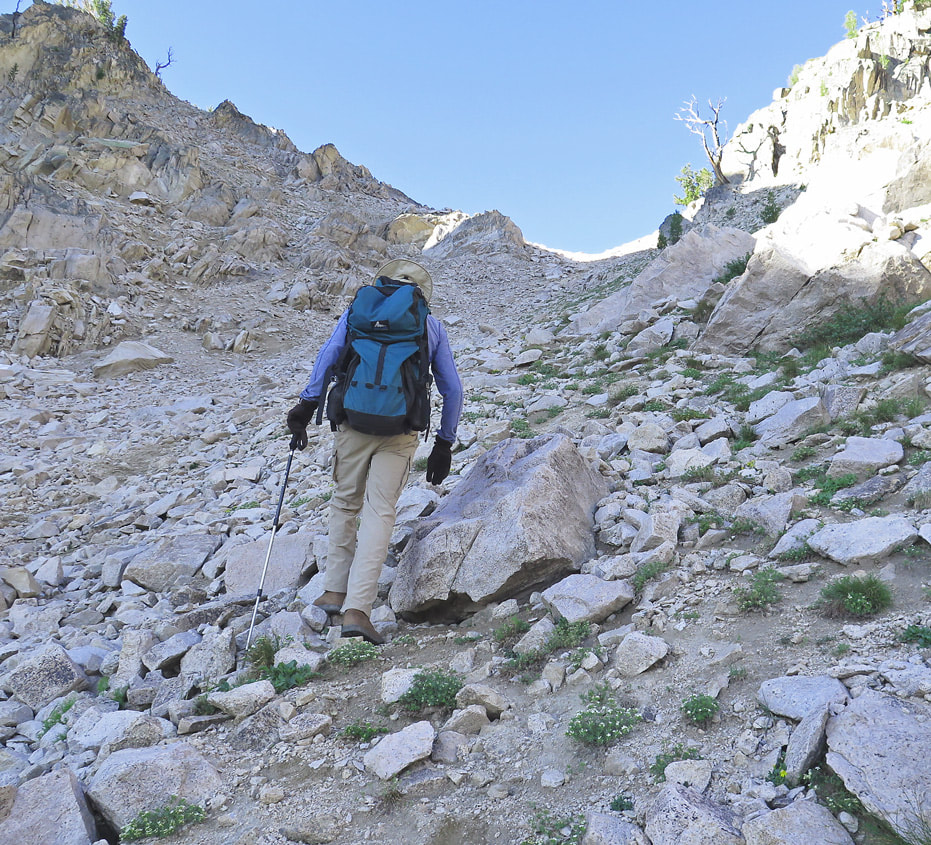 Ascending gulley from Alpine Lake to ridge overlooking Upper Redfish Lakes and Reward Peak on horizon 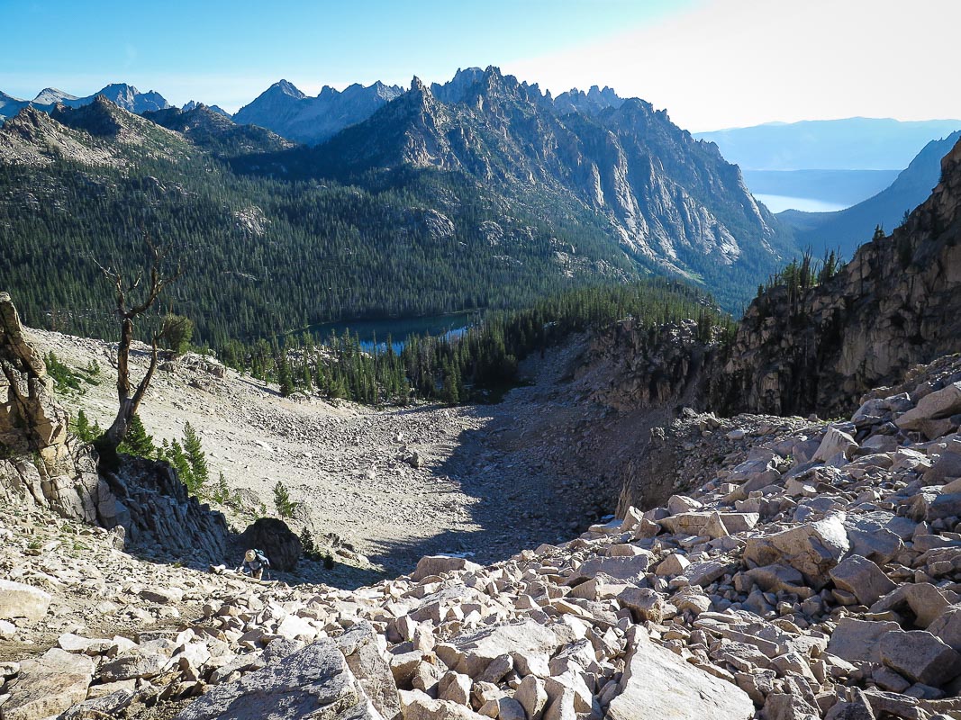 Fred (lower left) nearing saddle at top of gulley from Alpine Lake, below. Redfish Lake and moraine seen in distance upper right. 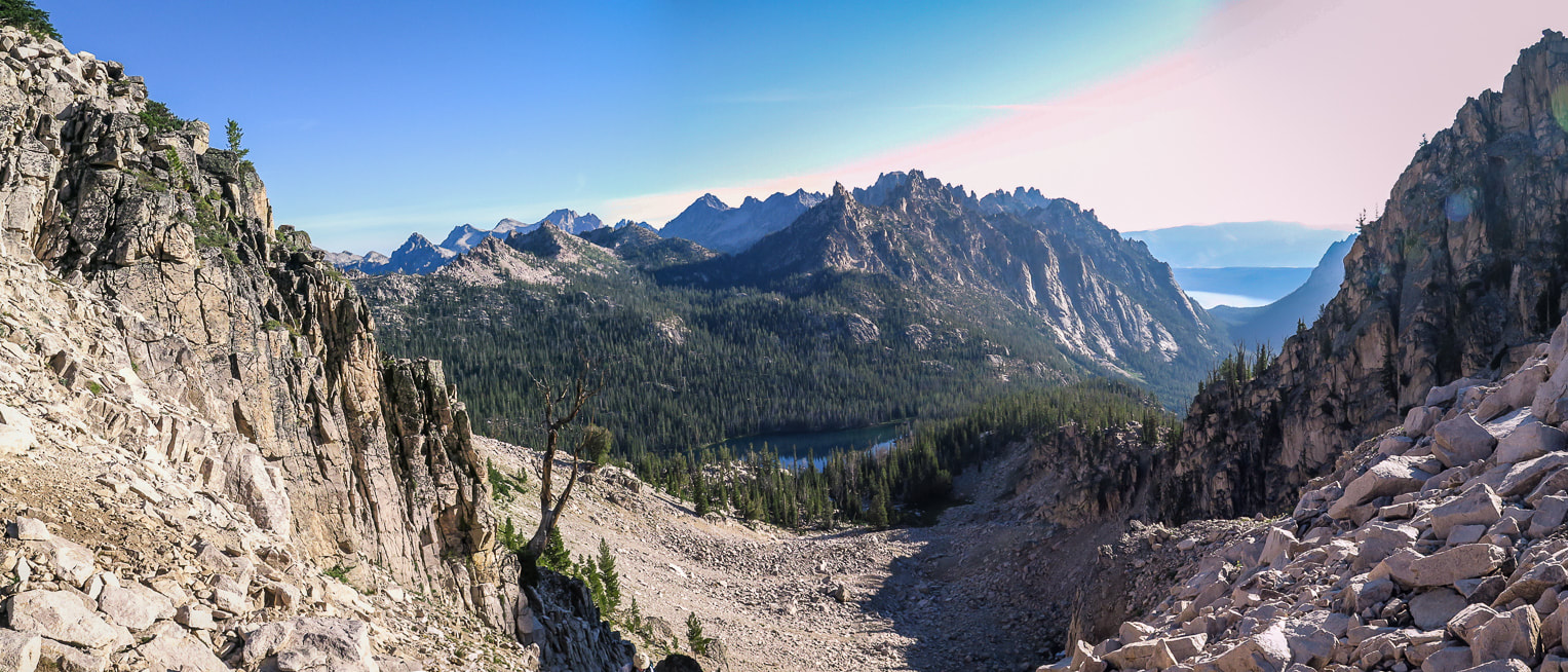 From saddle on ridge separating Alpine Lake and Upper Redfish Lakes drainages, looking north to Alpine Lake.  From saddle after first gulley climb; looking south to Reward Peak on horizon right side of largest tree in photo. Walk up gulley with a few snow patches to its summit. Upper Redfish Lakes in basin below. Once you complete the steep and tedious climb out of the gulley from Alpine Lake, and descend into the basin that contains Upper Redfish Lakes, it feels like true wilderness with negligible signs of human impact. The first two lakes are visible below. A narrow trail follows the wide granite outcropping situated between two lakes. The morning colors of blues, yellows and greens were vivid on the lake as we filtered water. The land is pristine, the large smooth white rocks still cool from the night before. Due south of the second Upper Redfish Lake is Lake Kathryn, considered the third Upper Redfish Lake, situated on the other side of the cirque's ridge. Lake Kathryn is a beautiful lake, deep blue with a small island in the middle. Lake Kathryn is named after Kathryn Mills, according to Iowa State University's archives of the Vandervelde Family Papers. This fact leads me to consider whether Kathryn Mills was associated with the Iowa Mountaineers, a group important to the Sawtooth Mountains' climbing history. This group led mountain ascents all over the world from 1940 until 1996. The Iowa Mountaineers claimed first-time ascents of 18 peaks in the Sawtooth Mountains in 1940's, including Warbonnet Peak in 1947, a challenging sheer-wall spire where all routes to the top are Class 5 climbing. Lake Kathryn is located ~ 5 miles southeast of Warbonnet Peak, and at the base of Reward Peak. 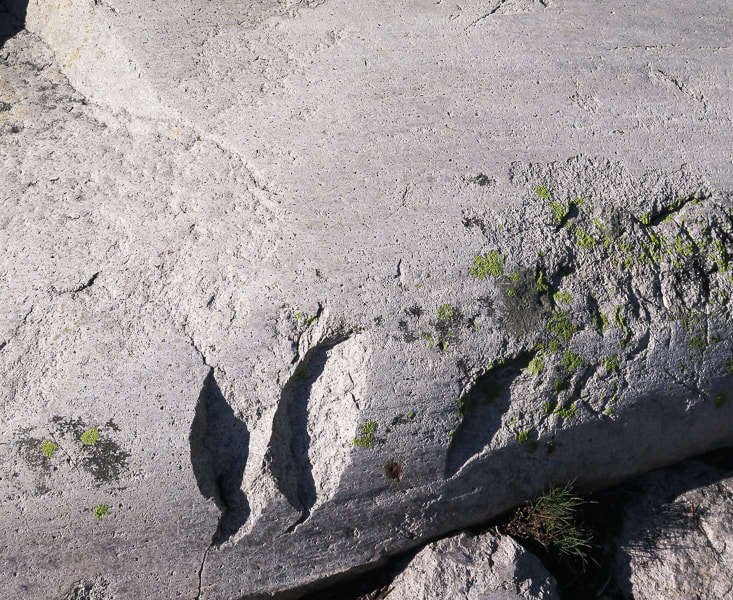 Three glacial landforms in granite: Glacial polish, striations and chatter marks. As the glacier moves downstream, the boulders and coarse gravel trapped under it abrade and chip bedrock. Chatter marks are crescent-shaped and oriented at right angles to glacial movement. Striations are parallel to glacial movement. 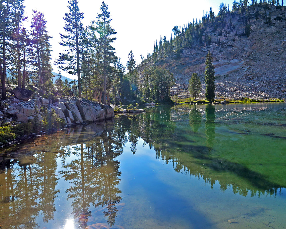 Morning at second Upper Redfish Lake 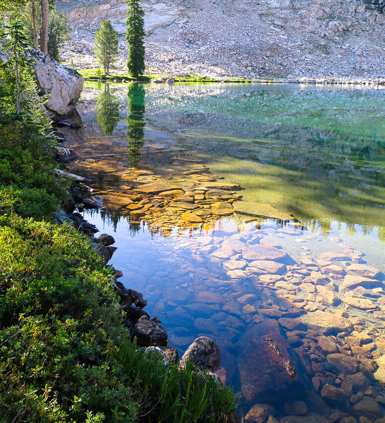 Upper Redfish Lakes to Reward Peak From the south end of middle Upper Redfish Lake, hike west for a short distance to the large ridge that contains Packrat Peak, and then south to enter into the wide rock-filled drainage that goes directly to Reward Peak, a pyramid-shaped peak at top of drainage. We hiked west into a beautiful forest with intermittent meadows and wildflowers, across and along the creek with bubbling small falls stepping down toward the Upper Redfish Lakes. Large granite rocks are stable throughout the drainage ascent, with brief snow patches to walk through, or around. We got lucky with the cooler-than-usual August temperatures. We hiked up to Reward's northeast ridge to look over the other side to Kathryn Lake. Large granite boulders dominate the last 40 feet to the summit, requiring using hands to maneuver around them. Paths lead through the scree and talus toward Lake Kathryn. Climb a small rock chute to find yourself on a surprisingly wide and flat summit. The view is expansive everywhere you look. Walk west of the summit's register and USGS marker. The mountain drops off in a towering cliff below your feet, and when you look down, you cannot see its sheer walls. Lake Kathryn looks like a smooth lapis lazuli gemstone embedded in rough granite. It feels like the top of the Sawtooth Mountains here, with distant serrated dark peaks lining a 360- degree horizon; however Thompson Peak, the highest Sawtooth peak to the north is almost 700 feet higher. Packrat Lake sits in a deep basin to the north. The view is so spectacular I think of Lucy Jane Bledsoe's quote from her book, The Ice Cave:
Beautiful meadows and streams between Upper Redfish Lakes and drainage to Reward Peak 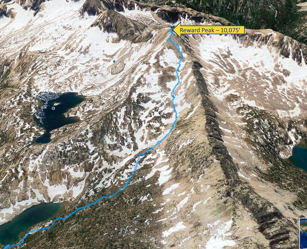 Our route from middle Upper Redfish Lake (lower left) to summit of Reward Peak From the lake, hike west toward long ridge that contains Packrat Peak, then south up wide gulley Lake Kathryn middle left in photo 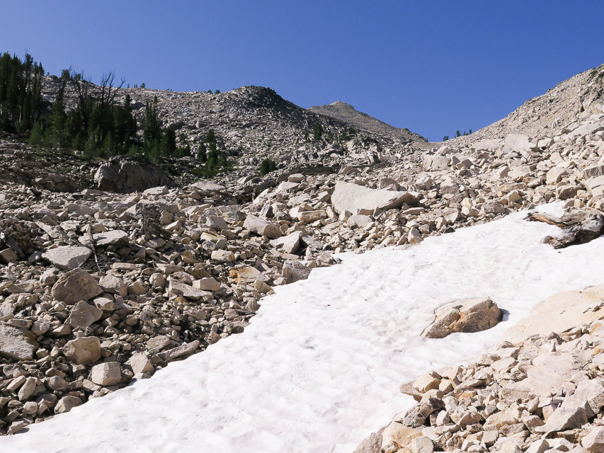 Drainage to Reward Peak, furthest peak on horizon 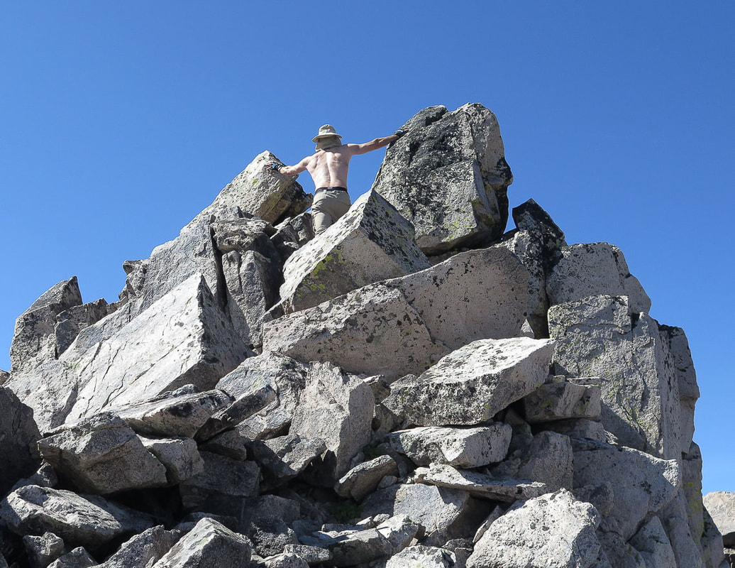 After a break upon reaching top of Reward's north ridge - step through large boulders last 30 - 40 feet to summit 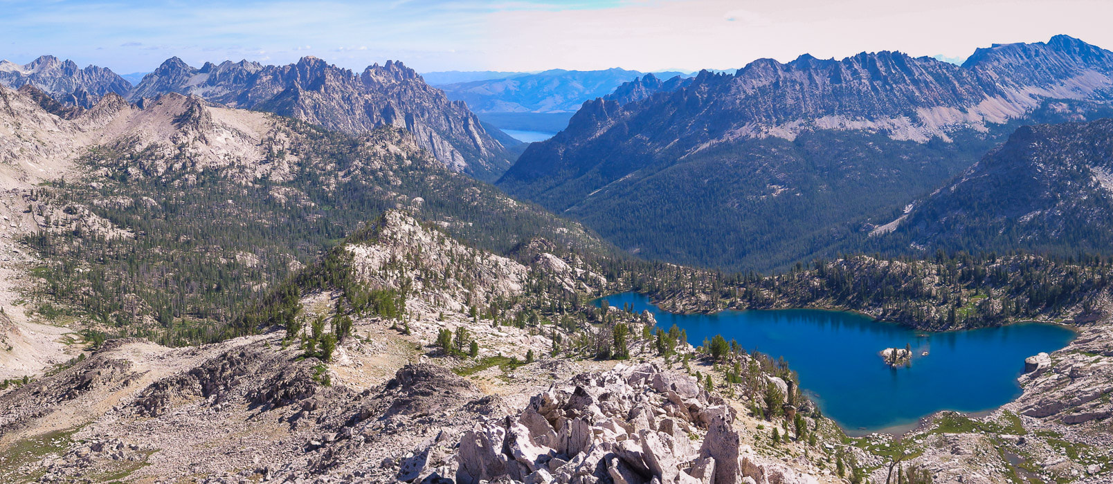 Lake Kathryn from Reward Peak's north ridge 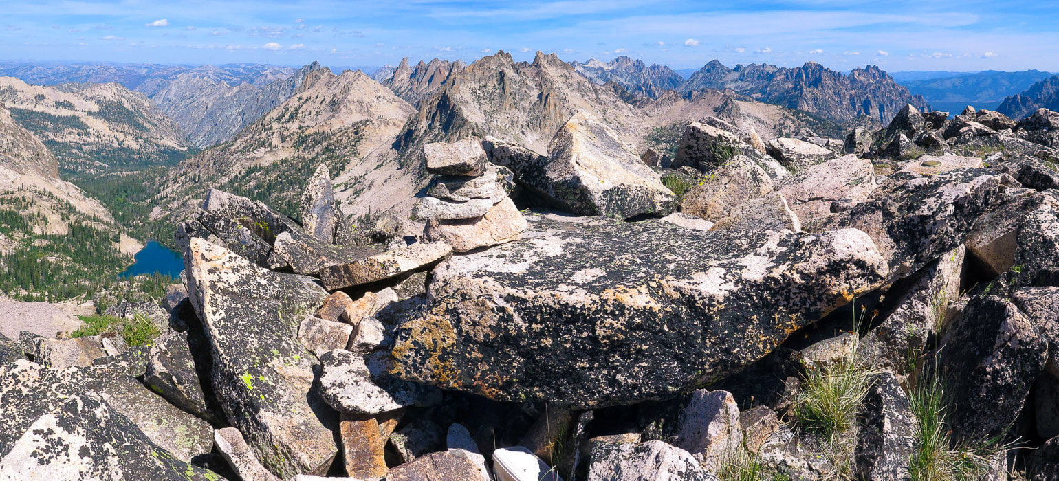 Reward Peak summit - 10, 074 feet looking north. Packrat Lake at left; summit register under large flat boulder. 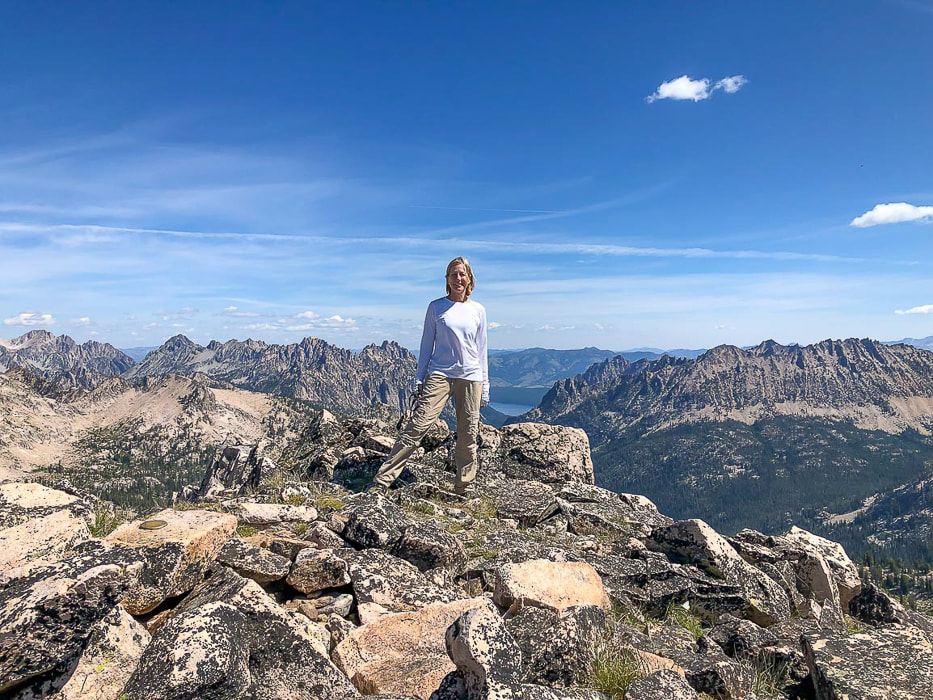 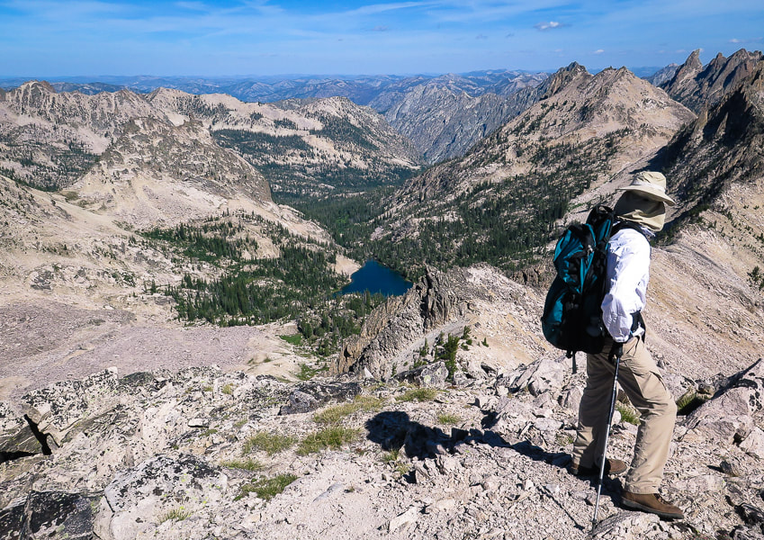 Packrat Lake and Packrat Peak above it upper right in photo The descent is not too difficult - just a lot of picking through boulders until you reach the forest and meadows surrounding Upper Redfish Lakes. Not in a rush to get back to camp, we took a long break sitting in the soft meadow grass as we listened to the melodic stream. When climbing steeply out of Upper Redfish Lakes basin, the saddle and gulley overlooking Alpine Lake is toward the right (northeast), just left of the furthest point to the right on the ridge as you climb - Point 9337. From below, it is difficult to get bearings because you can't see the top. Once on the saddle, the lowest point on the ridge above, the gulley down to Alpine Lake is steep and tedious, rocks slide as you step down, and the large boulders at the bottom take some navigation unless you can circumvent these and stay higher on the gulley slope. We heard a pika chirping its alarm as we clumsily made our way down. The gulley ends in a beautiful meadow, where we hiked steeply down, back to camp. The two ducks on the lake quacked and paddled toward each other as dusk settled in. We were in our sleeping bags before twilight. The glow in the tent awoke me again, I checked the mountains above the lake. They weren't as spectacularly lit as the previous night; the moon not as high yet, but still a memorable sight. Commit the scene to memory. Never stop climbing mountains. 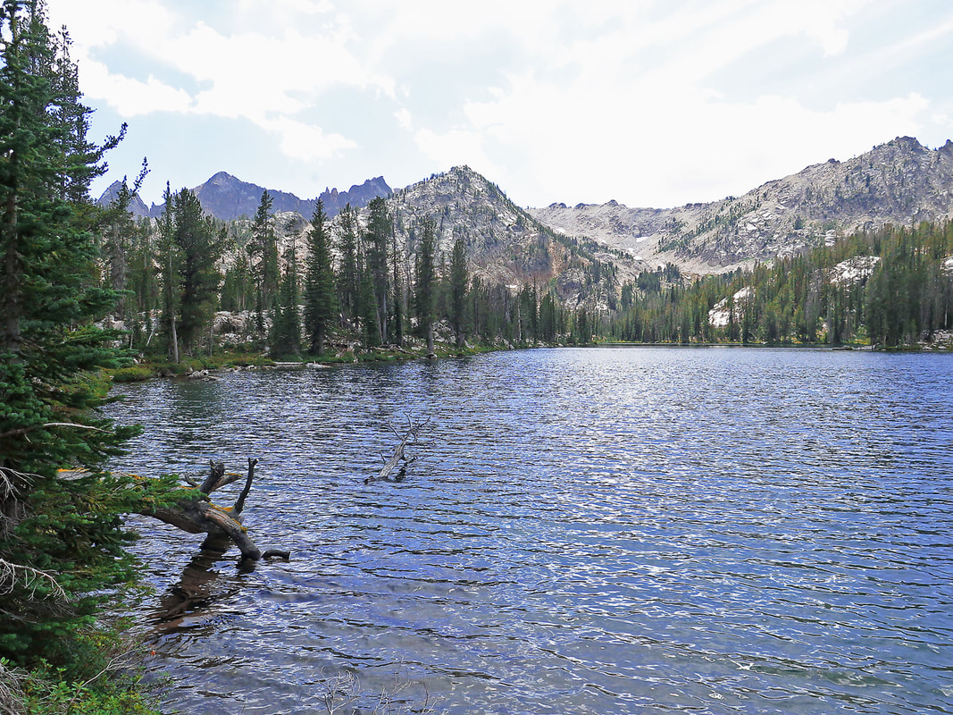 Parting shot of first Upper Redfish Lake with wide drainage that leads to Reward Peak, behind the closest peak in photo
Descending gulley back to Alpine Lake 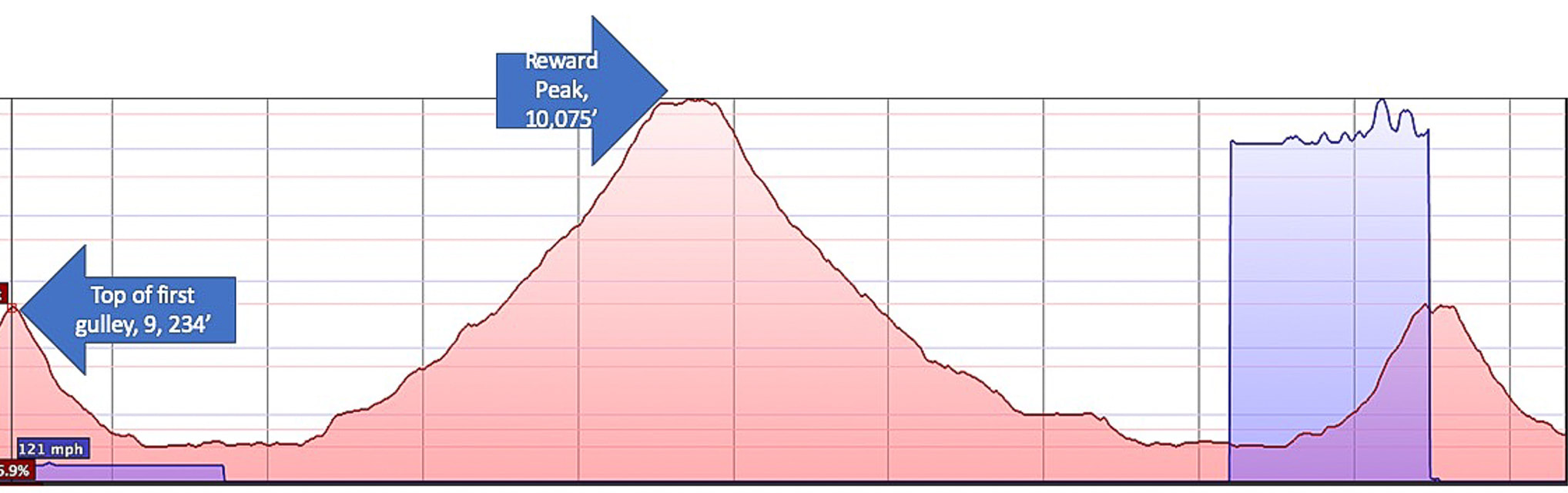 Elevation profile from top of gulley on ridge separating Alpine Lake and Upper Redfish Lakes to Reward Peak summit and back down, then up again to top of gulley. Each vertical line represents 0.5 miles. Red horizontal line interval = 250 feet of elevation.  References:
Lopez, Tom. Idaho: A Climbing Guide - Climbs, Scrambles and Hikes. 2000. The Mountaineers Books. Vandervelde Family Papers. Iowa State University.
4 Comments
|
Categories
All

Sue and Fred

About this blogExploration documentaries – "explorumentaries" list trip stats and highlights of each hike or bike ride, often with some interesting history or geology. Years ago, I wrote these for friends and family to let them know what my husband, Fred and I were up to on weekends, and also to showcase the incredible land of the west.
To Subscribe to Explorumentary adventure blog and receive new posts by email:
Happy Summer!

About the Author
|