|
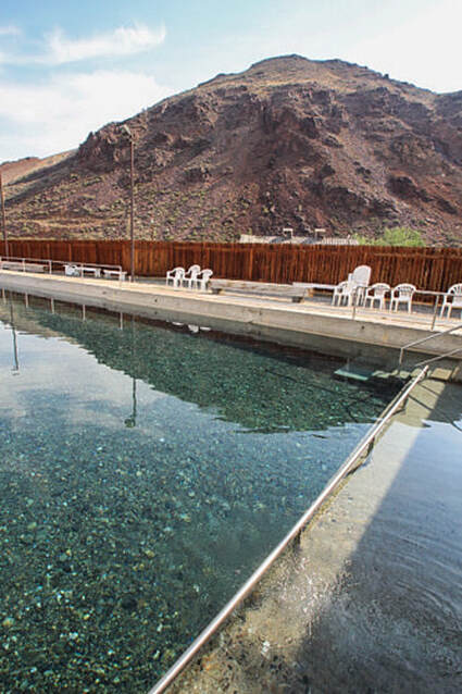
Our adventures out of Challis, Idaho on a 4th of July weekend: hike to Merriam Lake beneath Idaho's highest peaks, soak in Goldbug Hot Springs, and talk (at least try) to Pahsimeroi Valley cowboys. Trip Stats: Goldbug Hot Springs - Salmon-Challis National Forest
Merriam Lake - Lost River Range, Idaho - Salmon-Challis National Forest
Driving Directions to Merriam Lake trailhead: (Recommend map for driving and verify with other sources).
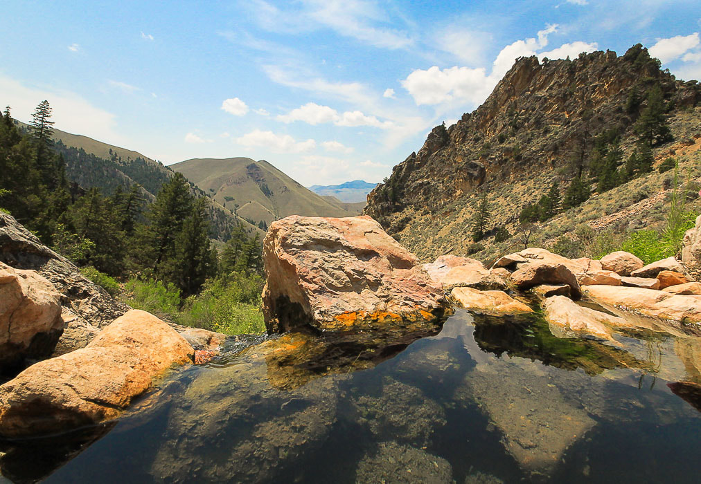 One of the pools at Gold Bug Hot Springs out of Salmon, Idaho Goldbug and Challis Hot Springs "Hot Springs in the Pacific Northwest" is a great guide to take with us on our extended Idaho adventures. For 4 hot days in June, we camped at Challis Hot Springs Campground in Challis, Idaho with our tent trailer. One day we drove north of Challis and walked on a dusty trail to Goldbug Hot Springs, and to our delight found glorious warm waterfalls and hot pools. After a HOT and STEEP two mile hike up a scenic canyon, we came upon a paradise of old cedar trees, hot waterfalls and multiple pools of varying temperature, all dammed with rocks. Mixtures of the hot springs and cold creek water have been craftily captured into clear pools for the enjoyment of all. Lucky for us, there were only 4 other people up there, so we splashed and hopped from one pool to the next. We have had some great soaks in beautiful Idaho hot springs. Bonneville Hot Springs near Lowman has an old-fashioned white bathtub in a wooden shack, and the hike to Weir Creek Hot Springs passes through cedar trees. Goldbug is our favorite for so many reasons. To be able to sit under waterfalls in pools with perfect temperature and look down a gorgeous, open valley is relaxation at its finest and pure heaven. Makes you downright proud to live in Idaho! After this soak and the hot hike back to the truck, we drove to Salmon and hung out in the library for a couple of hours to cool off. 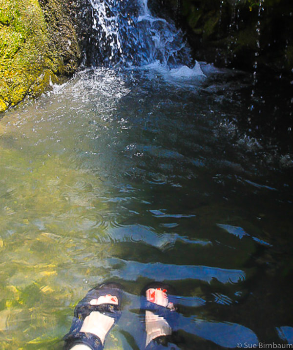
 View of Salmon River from Challis Hot Springs Campground - Challis, Idaho 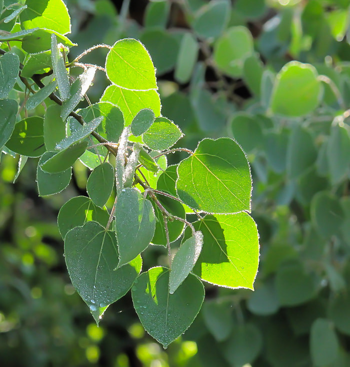 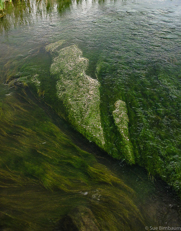 Stream near Challis Hot Springs Merriam Lake Hike One day we decided to hike up to Merriam Lake, at almost 10,000 feet. Getting to the trailhead to start the hike was an adventure in itself! You drive on Doublespring Pass, which is a good gravel road that connects 2 valleys on either side of the Lost River Mountain Range. A network of somewhat confusing 4 wheel drive roads branch off from this, and although we became temporarily bewildered (not lost), we kept heading toward the mountains. We saw some cowboys herding cattle through the sagebrush and asked them if we were heading in the right direction. 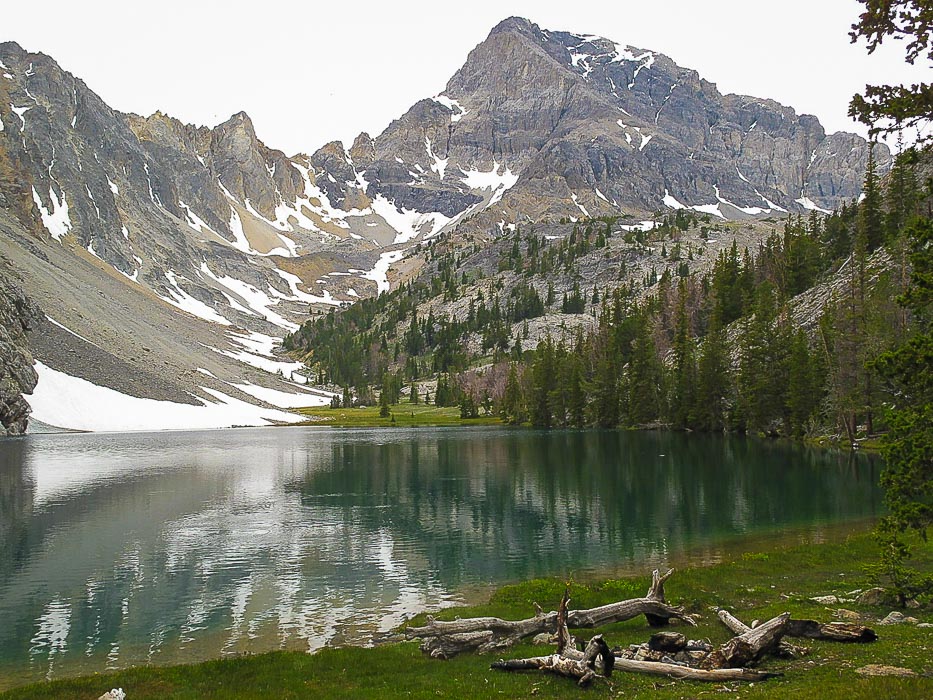 Merriam Lake, elevation 9,590 feet at the base of Mount Idaho, Idaho's 7th tallest mountain at 12, 065 feet 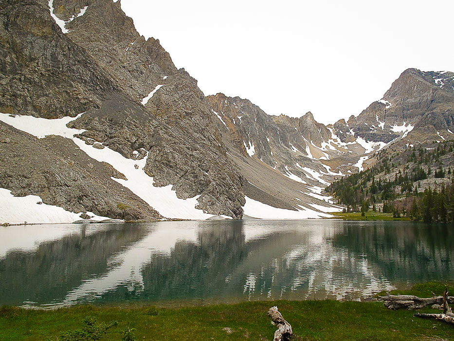 Merriam Lake - a long drive and short hike will get you here! 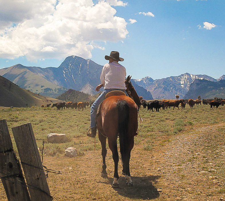 Pahsimeroi Valley, near Mt. Borah in the Lost River Range, Idaho There were 3 generations of cowboys present, and the eldest cowboy sparingly answered our questions as he sat on top of his horse. It was so hot that we had seen one of their dogs under some willows at the creek about 1/2 mile back. Apparently, one of the cowboys told us the dog “won’t come on”. I can't recall if I've ever seen cattle grazing beneath majestic mountains before - but here we did. The cowboys mostly kept their backs turned toward us - after all, they were working. We got back on our way across the Pahsimeroi Valley. Eventually, we found our way to Merriam Lake trailhead and hiked to it, but by then the monsoonal weather had come in and we ended up in thunder, rain, and then our truck slid almost sideways out of control down a saturated clay road on the drive back. The hike into the lake is only 2 miles. I've seen a lot of mountain lakes in my hiking career - Merriam Lake has to be one of the most outstanding. The curves of the U-shaped glaciated valley leading into the lake from Mount Idaho contrasts with the rugged limestone peaks and crags. The dark green water reflected the color of the firs around it, and the snowfields on the talus slopes still present in early July. On the long drive back to Doublespring Pass, the cowboys were gone, and their dog must have "come on" because he wasn't wading underneath the willows in the creek when we passed over it. 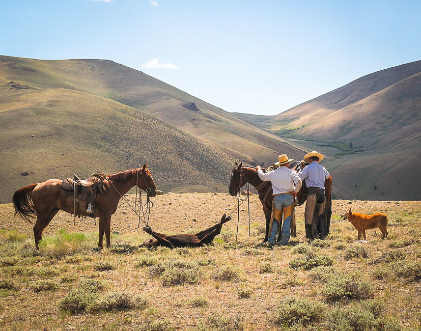 Pahsimeroi Valley, Eastern Idaho 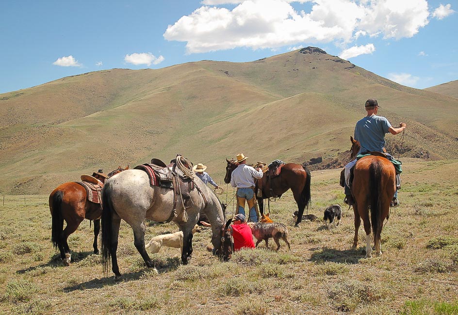 Pahsimeroi Valley 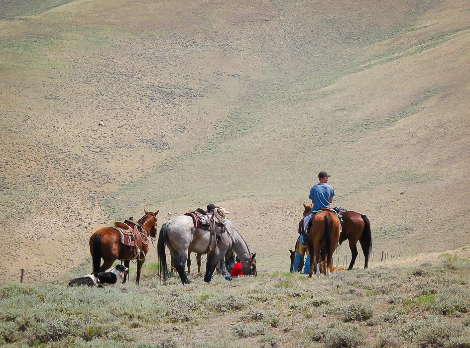
4 Comments
|
Categories
All

Sue and Fred

About this blogExploration documentaries – "explorumentaries" list trip stats and highlights of each hike or bike ride, often with some interesting history or geology. Years ago, I wrote these for friends and family to let them know what my husband, Fred and I were up to on weekends, and also to showcase the incredible land of the west.
To Subscribe to Explorumentary adventure blog and receive new posts by email:
Happy Summer!

About the Author
|