|
Get a taste of true Idaho wilderness on this short climb to a lush and undisturbed summit with a Civilian Conservation Corps (CCC) history. Just be prepared for some challenging bushwhacking! Related: Bald Mountain via Station Creek, Garden Valley, Idaho Jackson Peak Lookout: 8,124' - Boise National Forest Wolf Mountain and Point 8,610 via Jennie Lake 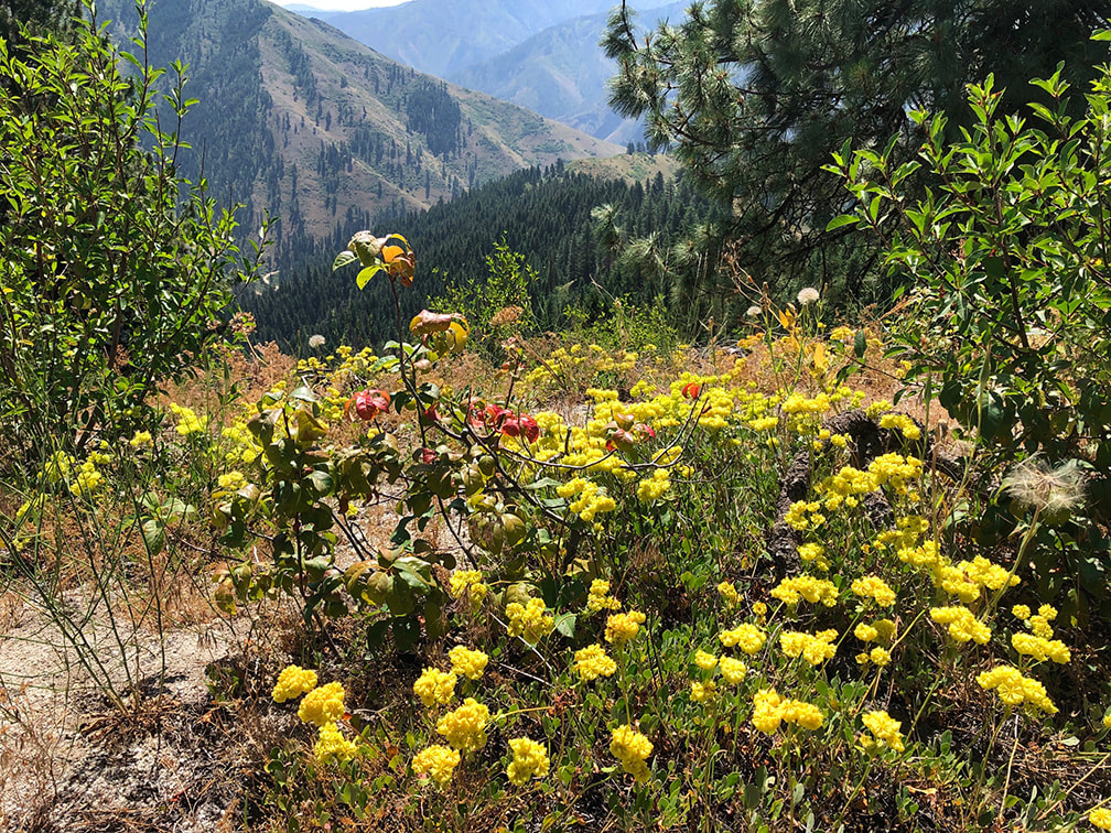 Buckwheat on ridge between Big Gallagher and Little Gallagher Creek drainages 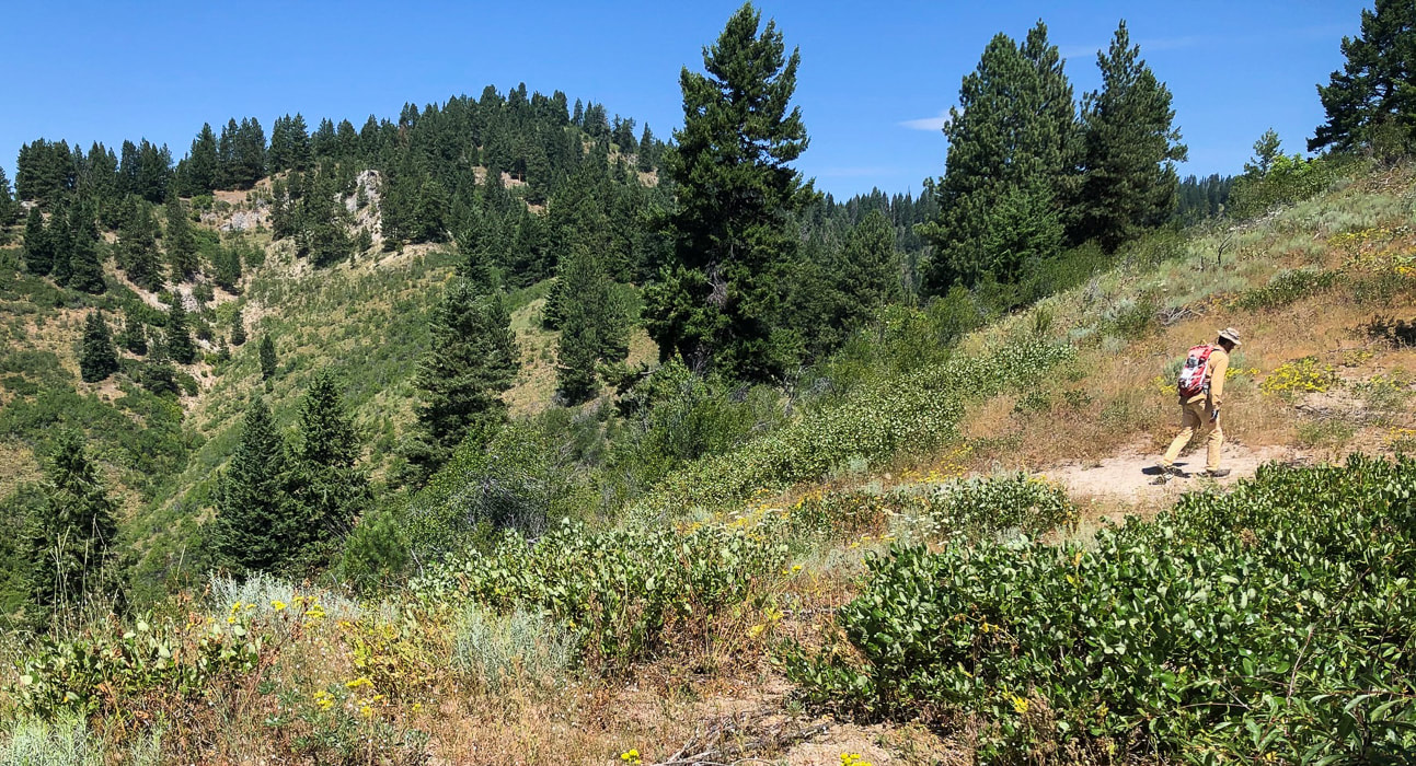 Undisturbed by fire - Gallagher Benchmark - 6,100' Trip Stats for southeast ridge access/Little Gallagher Creek
Overview: This seldom-visited, shrubby summit easily accessed from the Banks-Lowman Highway is a steep climb through a combination of open grassy, lush forest and thick shrub vegetation undisturbed by fire. Abundant wildflowers in August - however, dense shrubs require bushwhacking to a small rocky summit camouflaged by large pines. Date Hiked: August 2, 2020. Location: Southwest corner of Salmon River Mountains in Boise National Forest - east of Garden Valley, Idaho, just north of South Fork of Payette River and the Banks-Lowman Highway # 17. Distance/Elevation Gain: 6.0 total miles out and back. Trailhead = 3,435', Summit = 6,074', for a gain of 2,639'. Average gain/mile = 880'/mile. Difficulty: Strenuous Class 2 with moderate navigation; no maintained trail; persistence required to get through shrub thickets. Coordinates: Gallagher Peak: 44.1060°N -115.7855°W Maps: USGS Grimes Pass 7.5 min. topo map, Boise National Forest - USDA - Forest Service. Boise National Forest Large Fire History 1980 - 2018List of all peaks in Salmon River Mountains Driving Directions - trailhead is located 22 miles east of Banks, Idaho on Banks-Lowman Hwy.Geology: Biotite granodiorite and two-mica granite (Cretaceous). 85-67 Ma. Atlanta Lobe of the intrusive (igneous) Idaho Batholith. Idaho Geology - Geological Map of Deadwood River. History of Gallagher Civilian Conservation Corps Camp
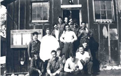
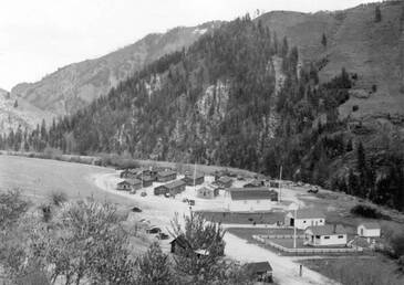
In 1933, the Forest Service established a CCC camp at Gallagher Flat, near trailhead parking. The CCC was created by President Franklin D. Roosevelt during the 1930's Great Depression to assist young men in learning skills and finding jobs in the Emergency Conservation Work Program. Their labor was utilized in constructive improvements in public forest, park and range lands. In return, they learned valuable skills such as carpentry, heavy machinery operation as well as journalism, first aid, and photography. Donald Tanasoca, a Payette National Forest CCC worker from New Jersey wrote in his journal:
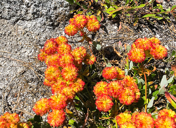
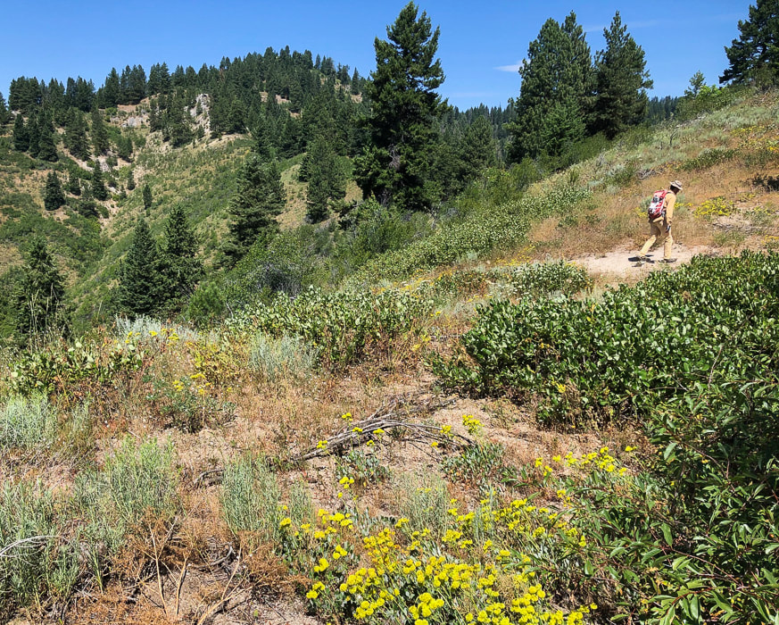
Gallagher CCC troops built a new guard station and improved the Banks-Lowman road (called the South Fork Payette River Road at the time). They also developed "public service sites" at campgrounds and built the Deadwood and Scott Mountain fire lookouts. Gallagher Camp was closed in 1939. More history and photos on the Historical Marker Database "Because when you stop and look around, this life is pretty amazing." -Dr. Seuss Overview What it lacks in summit grandeur, Gallagher Peak rewards with solitude and a grand view of the rugged Salmon River Mountains, the second largest of the Idaho Batholith mountain groups. The combination of lush wildflower-filled forest and open grassy slopes undisturbed by fire is the most remarkable feature of this short and steep hike. You won't arrive to a towering granite outcrop; instead, the partially-hidden summit benchmark sits under shrubs. The forest understory was so abundant that we got stuck in thickets a few times trying to navigate. When we hiked in August, large patches of yellow, orange and crimson buckwheat wildflowers topped granite outcrops on the ridge. The Boise National Forest Large Fire History map - 1980 - 2018, shows that Gallagher Peak has managed to escape past large fires. The Salmon River Mountain Range covers a massive territory in central Idaho - 8,900 square miles. The main Salmon River and its tributaries defines the boundaries of its six subranges. Numerous waterways form a natural maze through Idaho Batholith rocks that ultimately drain into the Snake River. The Middle Fork of the Salmon River is famous world-wide for its week-long raft trips through mostly untouched wilderness. The Frank Church River of No Return Wilderness covers nearly 2 million acres of the Salmon River Mountains. Long gravel and dirt roads lead into its interior; some peaks are close to roads, like Gallagher, and some peaks take days to find. A worthy goal would be to scale all of the Salmon River Mountain Range's summits (I lost track when counting on Tom Lopez's list - it was near 300!). Or maybe conquer its highest: White Mountain at 10,442' - a relatively easy access out of Challis, Idaho. Many of its tallest peaks are in the eastern section of this range. A list of its peaks, access and climbing information is posted on Idaho: A Climbing Guide. 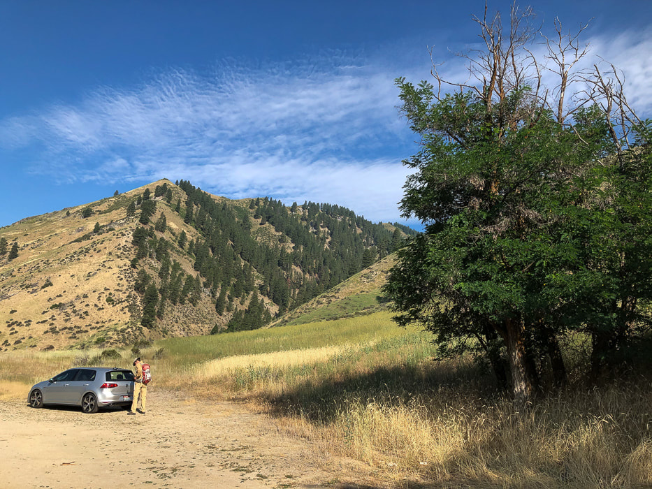 Parking just off Banks-Lowman Highway near Garden Valley, Idaho. The deep valley is Big Gallagher Creek drainage. Hike up the Little Gallagher Creek drainage to the right, behind trees. Our Hike - battling shrub thickets while searching for a trail Even though the distance to the summit is only three miles from the Banks-Lowman highway, it is a challenging peak to get to because it's steep, there's no formal trail, and you will fight your way through vegetation to get there. A previous trip report of this climb advised to hike along Little Gallagher Creek to its end and the ridge, but instead, we left the valley early and zipped straight up the steep grassy slope to the ridge top between Little Gallagher and Big Gallagher Creeks (see our GPS tracks below). Usually ridges seem to have a little less vegetation - but not this one! We soon found ourselves fighting large patches of shrubs interspersed with bare areas. At Point 5578, we briefly found a trail but then got sucked into thickets again. At this point, the ridge turns in a more northwesterly direction to the summit. 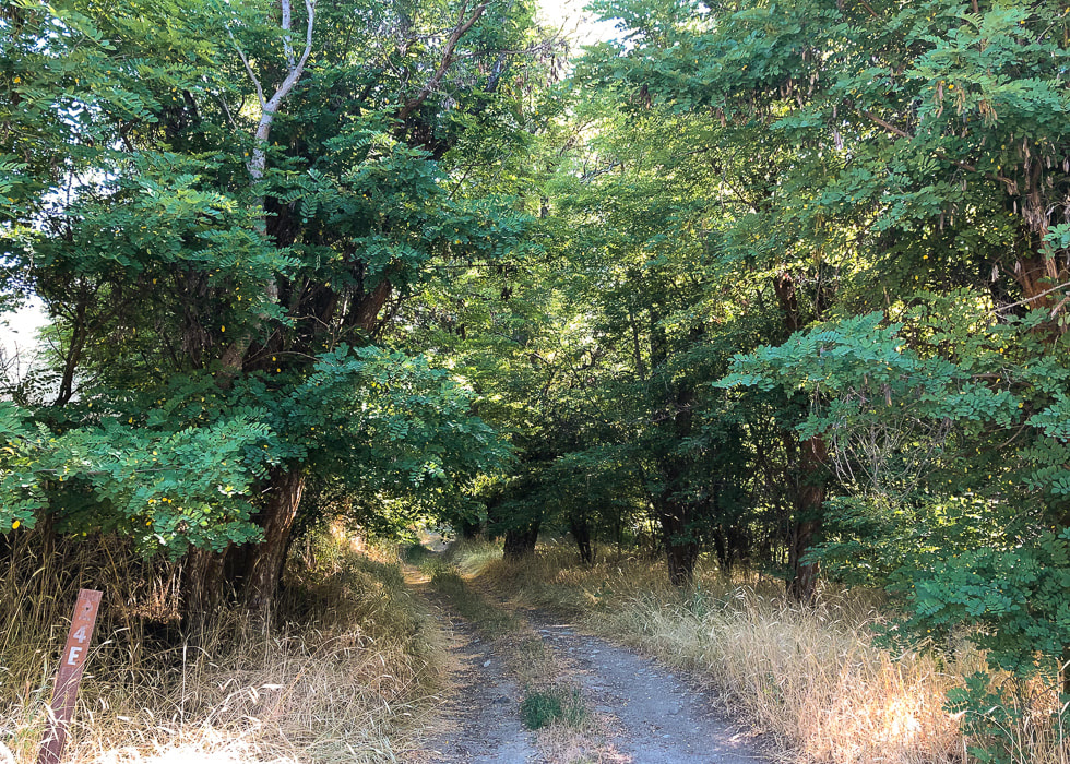 Short road goes to the open valley of Little Gallagher Creek 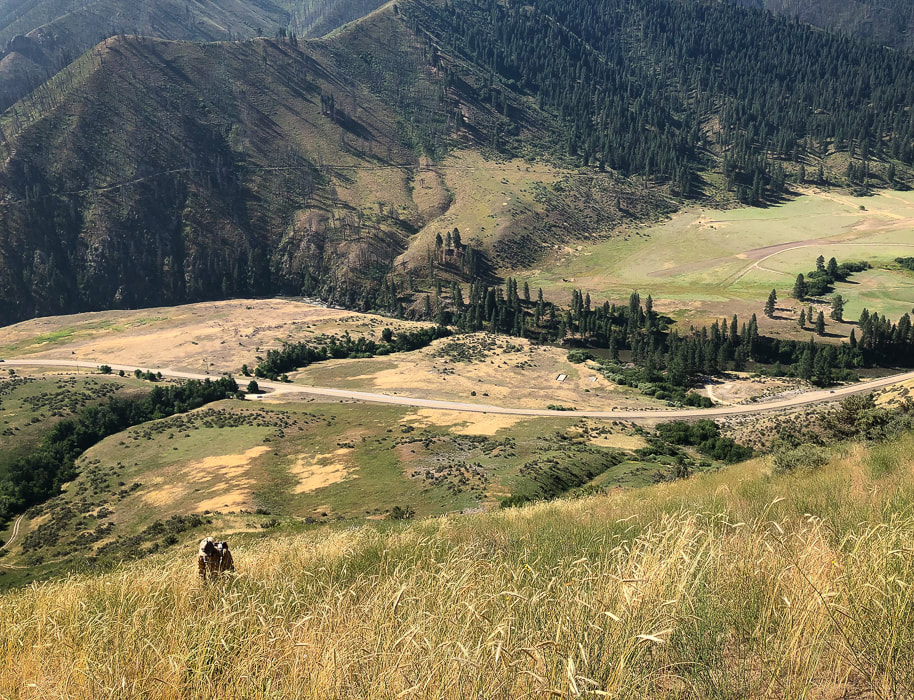 Heading up ridge to left (west) of Little Gallagher Creek (row of trees on left side of image). South Fork of the Payette River and Banks-Lowman Highway at bottom of valley. 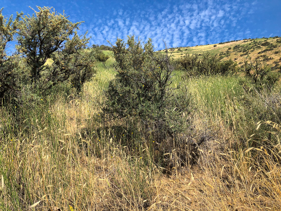 Lots of large Antelope bitterbrush (Purshia tridentata) on this steep slope. This shrub provides important spring and winter food for elk, deer and antelope. 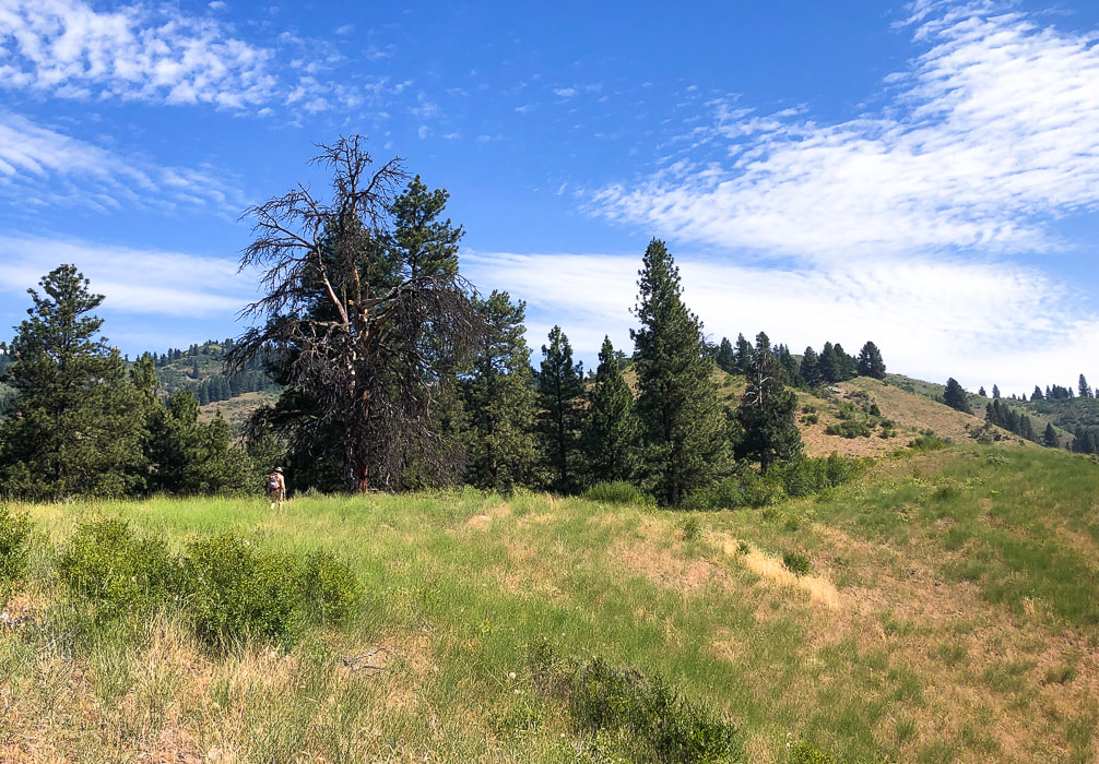 Finally on the ridge between Little Gallagher and Big Gallagher Creeks. Gallager Peak is between trees on left in image. 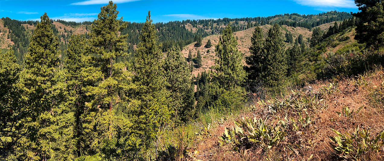 On ridge looking northwest with Big Gallagher Creek drainage to the left 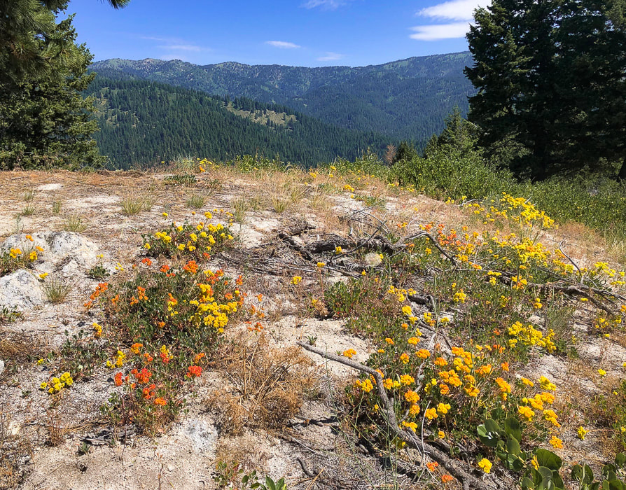 Buckwheat on granitic outcrops - looking to the north 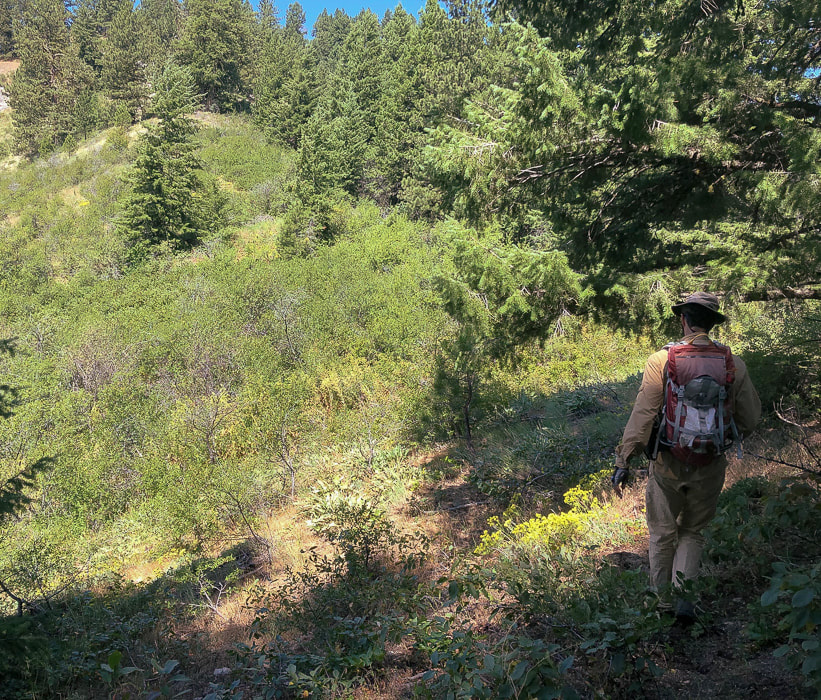 Trying to find a way through thickets and lots of trees
 Gallagher Peak on horizon - getting up to its southeast ridge. 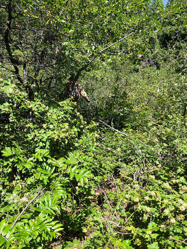 Fighting our way through thickets just below summit 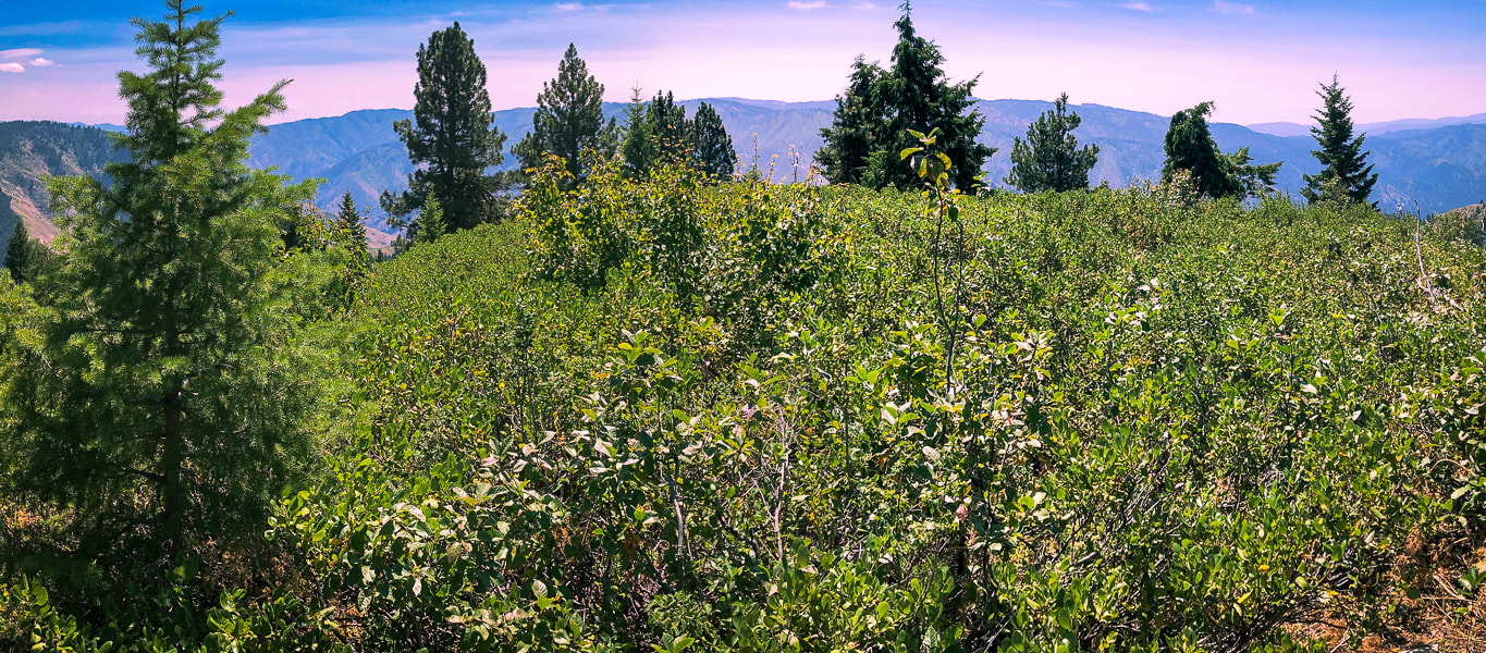 Gallagher Peak summit - 6,074' We arrived at the most unassuming summit - no grand granite spires here! We uncovered the geological survey marker. The blue and green undulating mountains of Boise National Forest surrounded us. Numerous creeks with great names such as Deadwood Jim, Whiskey, Slaughterhouse, Josie, Applejack, Cup and Black Bear have cut deep valleys into these granitic mountains. Bald Mountain, a summit we climb via Station Creek lies to the west. We found a faint trail descending the ridge with less vegetation. We were too far to the left (west) of the ridge on the way up; stay on the top of the ridge. Care must be taken to go down the correct ridge when you get to Point 5578; head down the due south ridge and not onto the due east ridge, otherwise you might end up in Pine Creek Campground. Out of the healthy forest, down to Little Gallagher Creek through tall and thick grasses. Another Boise National Forest peak under our belts with a few scrapes to prove it. Getting to know and appreciate Idaho one hike at a time. I wonder what workers in the Civilian Conservation Corps thought of this wilderness, and if they climbed this peak. Donald Tanasoca, CCC worker from New Jersey (see CCC history, above) said, "A city boy learns that the world is larger than just the city." As for me, each Idaho summit I get to is a gift, whether on a straight-forward clear-cut Class 1 trail or a frustrating and hard-won bushwhack. The views from the top are always awe-inspiring. Like Dr. Seuss says: "....this life is pretty amazing." 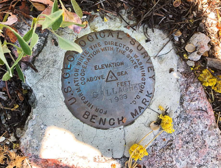 Benchmark on summit that is a triangulation station as indicated by triangle. It is the main station probably surrounded by three reference disks that have an arrow inscribed into them pointing toward the main station. Date on marker - 1933 - coincides with opening of Gallagher CCC camp. 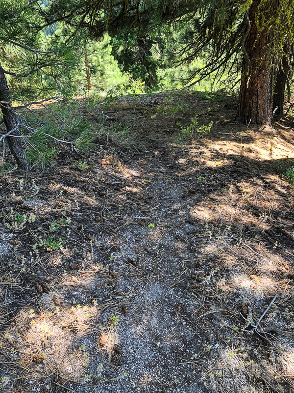 Faint trail on ridge above Point 5578 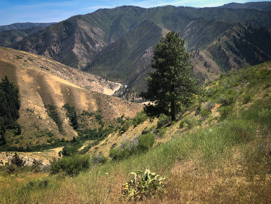 The way back down ridge - Little Gallagher Creek in valley; Idaho Highway 17 wrapping around toe of ridge in center of photo. Next time - hike up Little Gallagher Creek all the way before getting on ridge. 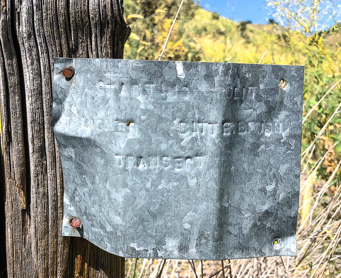 Marker for previous vegetation survey: "Starting Point Gallagher Bitterbrush Transect." 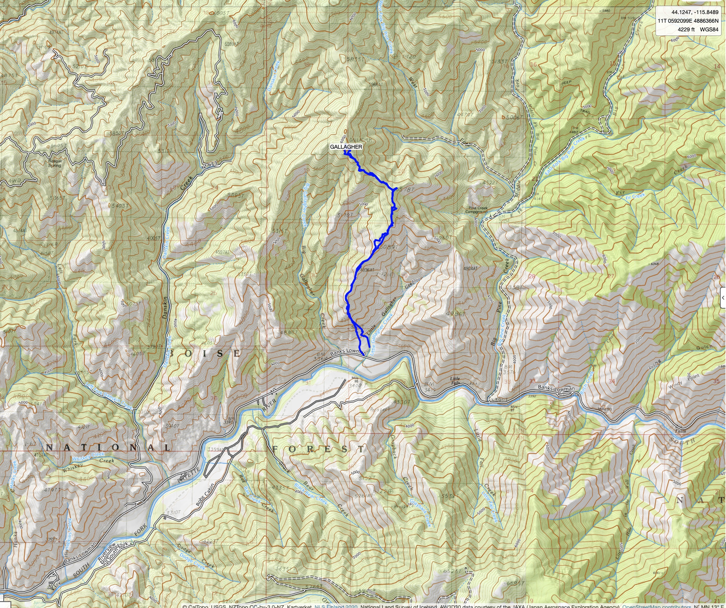 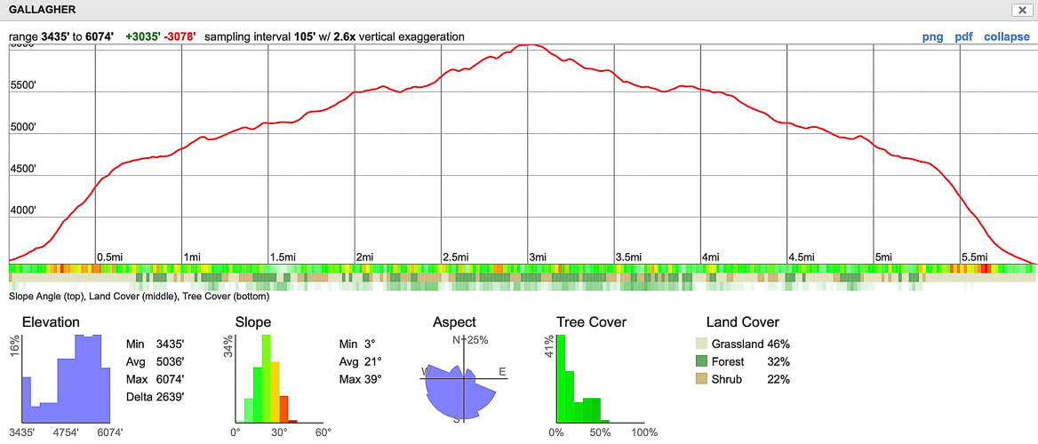 Our GPS tracks and elevation profile click on topo map for larger image 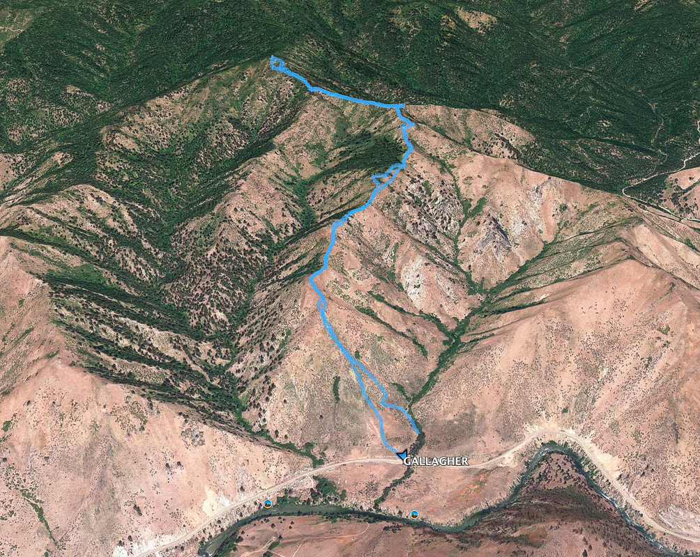 References
Boise National Forest Large Fire History - 1980 - 2018. Idaho Fire info - BLM.gov. Boise National Forest Fire History - 1900 - 2016-September-19. fs.usda.gov Historical marker Database: CCC Shapes the Payette Drainage lib.uidaho.edu. Civilian Conservation Corps in Idaho Collection Lopez, T. 2000. Idaho: A Climbing Guide, pp. 108-112. Gallagher Ranger Station. USDA Forest Service, Boise National Forest. Smith, E.M. History of the Boise National Forest - 1905 - 1976
2 Comments
|
Categories
All

Sue and Fred

About this blogExploration documentaries – "explorumentaries" list trip stats and highlights of each hike or bike ride, often with some interesting history or geology. Years ago, I wrote these for friends and family to let them know what my husband, Fred and I were up to on weekends, and also to showcase the incredible land of the west.
To Subscribe to Explorumentary adventure blog and receive new posts by email:
Happy Summer!

About the Author
|