EXPLORUMENTARY
  • Home
    • Cactus to Clouds Hike
    • More Quotes
    • Ann Zwinger Quotes
    • Mary Oliver Poems
  • Hikes by State
    • Southern Utah
    • Idaho
    • Arizona
    • California Desert
    • Nevada
    • Wyoming and New Hampshire
  • Petroglyphs and Pictographs
  • BLOG
    • Adventure Blog
  • GALLERY
    • DESERT PLANTS >
      • Beavertail cactus
      • Brittlebush
      • Christmas Cactus
      • Arizona Barrel Cactus
      • Parry's penstemon
      • Agave
      • Arizona Rainbow Hedgehog
      • Claret Cup Hedgehog
      • Desert Agave
      • Palmer's Penstemon
      • Silver Cholla
      • Cristate Saguaro
      • Indian Paintbrush
      • Ocotillo
      • Santa Rita Prickly Pear
      • Spiny Cliffbrake
      • California Barrel Cactus
      • Engelmann Prickly Pear
      • Velvet Mesquite
      • Joshua Tree
      • Buckhorn Cholla
      • Hedgehog Cactus
      • Fishhook cactus
      • Thompson's Woolly Locoweed
    • NATURE
    • BOISE
    • EARTH + SKY
    • URBAN
    • WATER
    • PATRIOT
    • ORCHIDS
  • Fit After 50
    • Brian Holgate
    • Fred Birnbaum
    • Dave Brasuell
    • Bus' Little Black Book
    • Mike Carlson
    • Ray Wilson
    • Bryan Krouse
    • Vickie Kearney
    • Maria Keezer
    • DOUG TRAUBEL
    • Boise Cross Fit Masters Ladies
    • Tim Clemens
    • Marcia Bondy
    • Becky Borczon Blake >
      • Becky B Downtown
    • Jennifer Cera and Sue Birnbaum
    • Dave Brasuell
    • Vance Powell
  • Contact

Kepros Mountain Hike - Boise National Forest

5/6/2018

6 Comments

 
A spacious ridge ramble in the Danskin Mountains with abundant wildflowers and views of snow-covered Trinity Mountains and Arrowrock Reservoir.
Related posts: 
Mt. Heinen - Grand Slam Peaks Completed!
Lucky Peak Winter Ascent
Lucky Peak - The Ridge Less Traveled
Cervidae Peak - Southeast Ridge Route
​
The 10 Essentials to Carry with You on Every Hike
Picture
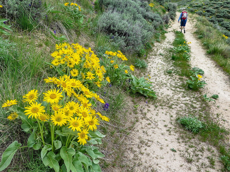
Trip Stats
Overview:  Take a solitary and refreshing walk along a lush and undisturbed landscape close to Boise with views of Shafer Butte, Trinity Mountains and Lucky Peak Lake.  Trail begins at Blacks Creek Road summit on a steep single-track motorcycle trail with some steep ascents and descents, then meets with a jeep trail that ends at the summit of Kepros Mountain.
Distance:  9.7 miles out and back (4.85 miles to Kepros Mountain).
Elevation:  Trailhead 4,780 feet, Kepros 5,422 feet.  Net gain to summit is 1,540 feet; net loss to summit is 930 feet.
Map:  USGS topo - Arrowrock Dam, ID 7.5 min.
Coordinates:   Kepros Mountain:  43.33.33'36.06"N, -115.56'21.71"W,  Trailhead:  43.49851, -115.92379
Difficulty:  Moderate effort; trail is not marked but path easy to find.  Compass and topo map helpful.  Some short steep climbs on return from summit.
Dates Hiked:  May 5, 2018,  April 18, 2021.
Directions to trailhead:  Drive I-84 east of Boise and exit Blacks Creek Road (Exit 64). Take a left (north) onto Blacks Creek Road and travel 6.4 miles to intersection with signs for Prairie, Idaho.  Take a left at this intersection driving toward Prairie. Shortly, the road becomes gravel. From this intersection, travel another 4.6 miles to the summit of Blacks Creek Road and park in large lot to the right of road (you will pass a parking lot to the right 0.6 miles before this second large parking lot).  This is a popular ATV trailhead with the ATV road heading to the right (east).  Cross Blacks  Creek Road (west) to get on Kepros Mountain trailhead.              
​Total distance from beginning of exit ramp off I-84 to trailhead parking = 11.1 miles
​
Geology:  Granite from Atlanta Lobe of Idaho Batholith - Cretaceous age (85 - 67 Ma).
Picture
Picture
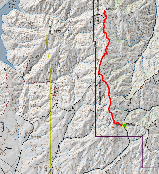
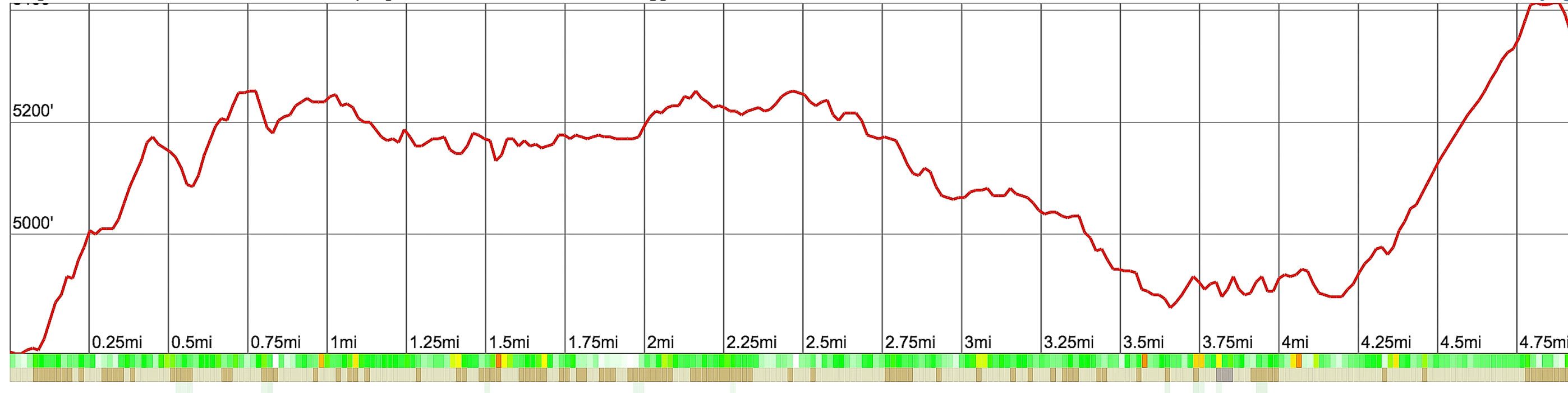
Kepros Mountain Hiking Route and Elevation Profile
Trailhead (green circle) begins at summit of Blacks Creek Road from large parking lot.  It initially climbs a steep motorcycle track whose tread can be seen on 3 short hills from parking lot.  Trailhead at 4,780 feet, summit at 5,422 feet
Picture
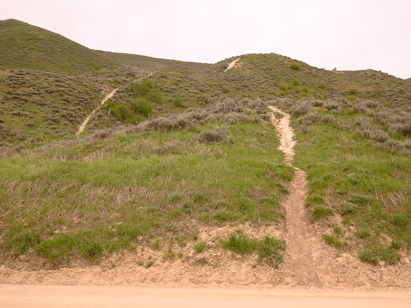
Trailhead for Kepros Mountain looking west - motorcycle trail can be seen on 3 short and steep hills
Blacks Creek Road in foreground
"Even though age diminishes our physical capacities, it will happen even faster if we don't test ourselves."
- 
Mike Carlson, Five-time Race to Robie Creek Champion
Three down and one to go after summiting Kepros Mountain - that is, Fred and I have completed three of the "Grand Slam Peaks" that Tom Lopez describes in his website, Idaho:  A Climbing Guide.  Lucky Peak, one of the Grand Slam Peaks is our frequent training hike.  Cervidae Peak is another that I posted on my website.  Kepros is the third.  Mount Heinen is the fourth and final peak of the "Grand Slam" we will  summit in the next few weeks.
Picture
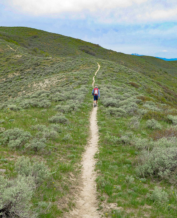
Initial single track trail
Top of Shafer Butte north of Boise on distant horizon

The ecology in these foothills near Blacks Creek Road may be described as "reference" - an area with mostly native plants that shows us what this land looked like in the past; an area that has not been disturbed.  I didn't see many invasive plants and two species of astragalus were healthy.  It was a delight to walk on a trail near Boise devoid of cheatgrass, in a landscape full of sagebrush and native grasses.

This unmarked trailhead is 11 miles north from the exit ramp off I-84 on Blacks Creek Road, whereupon you reach a summit with a dirt parking area to the right, and the beginning of Kepros hike to the left (see trip stats, above).  The trail to Kepros Mountain begins on a single track going straight up 3 short steep hills to the west off Blacks Creek Road. 

​From beginning to end, this hike in late April is a wonderland of green and vivid hues of purple and yellow dotted throughout.  Hiking through these sagebrush hills gave me a light feeling of air and space and a renewed appreciation for the landscapes of southern Idaho.
Picture
Picture
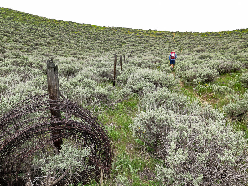
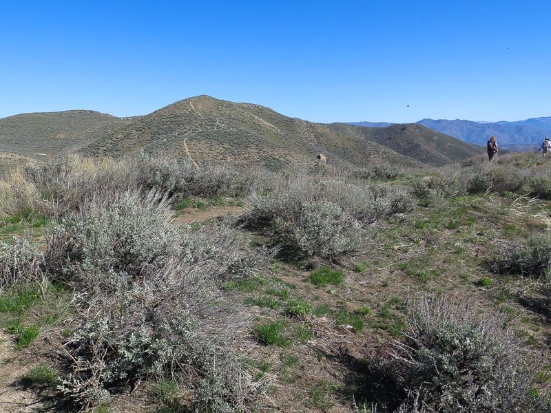
Top off onto ridge after initial steep climb: take a right to hike north along ridge.
Picture
Picture
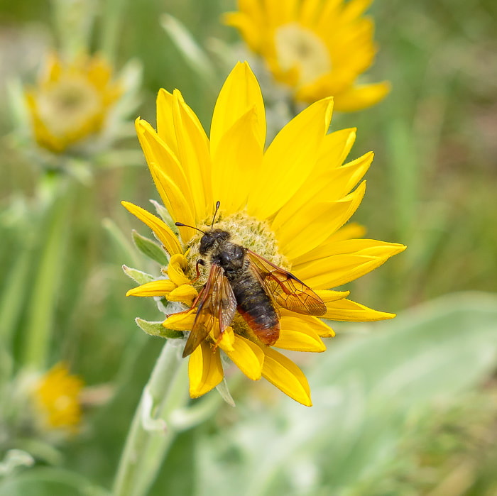
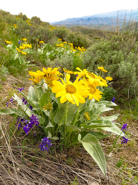
Larkspur and Arrowleaf Balsamroot
The initial single-track trail winds through a sea of sagebrush over rolling hills and past rusted metal signs and occasional core stones of granite.  There are some bypasses around the highest elevations:  we took a good one that met up with the ridge jeep trail to avoid more climbing​, about 2 miles into the hike on the east (right) of the ridge.  The bypass was not at this time marked with a cairn, however, the path it took was clear.  At this point we saw our first view of Lucky Peak Lake and Boise to the west.  Along most of the hike the snow-capped Trinity Mountains loom on the east horizon.  As we climbed, vegetation became even more thick and green.  The trail intersects a creek near the summit with pines lining its sloping banks that was tempting to explore.
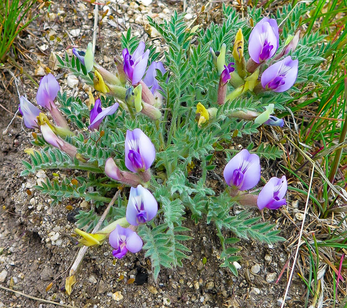
Picture
Astragalus purshii
Picture
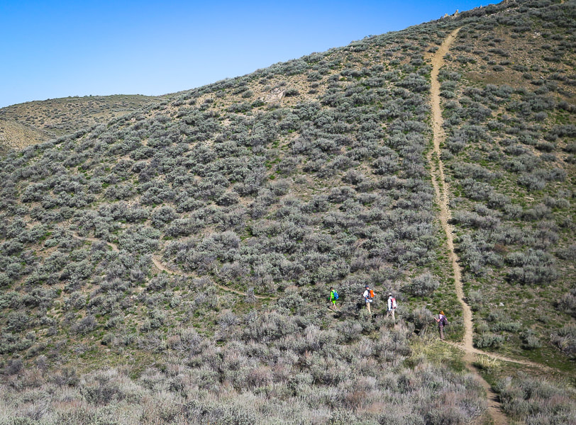
The first bypass.  Previous motorcycle tracks go straight up to the top of hills, there are 3 or 4 bypasses along the way to the peak (unless you want extra training!!).
Picture
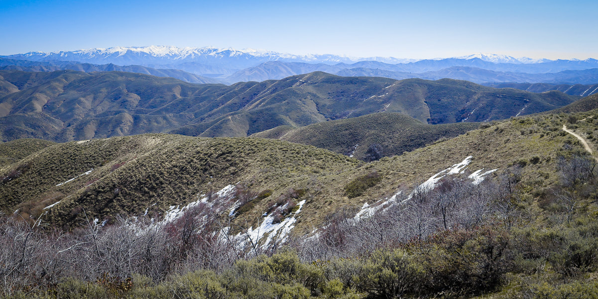
Looking east toward Trinity Mountains
Picture
Picture
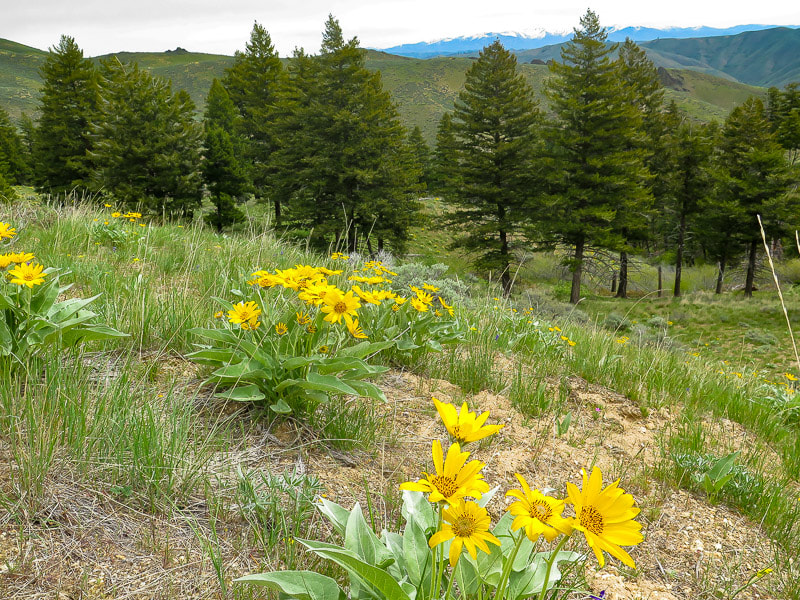
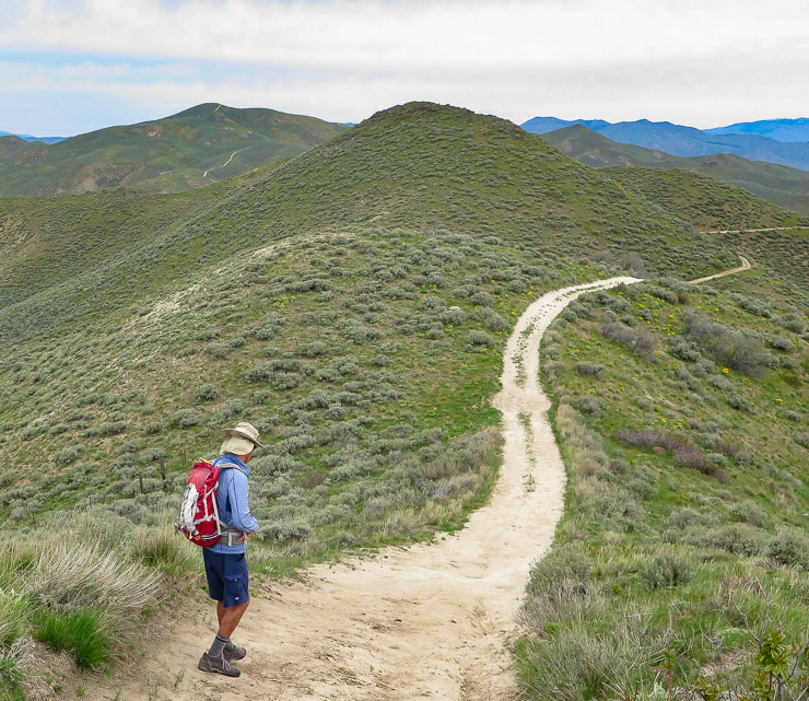
Single track trail meets with jeep trail ~ 2 miles into hike; it stays level, then winds up and down to Kepros Mountain on left-center horizon.
Picture
Arrowleaf Balsamroot
Balsamorhiza sagittata

Picture
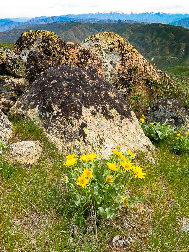
Idaho Batholith granite - Trinity Mountains on horizon
Picture
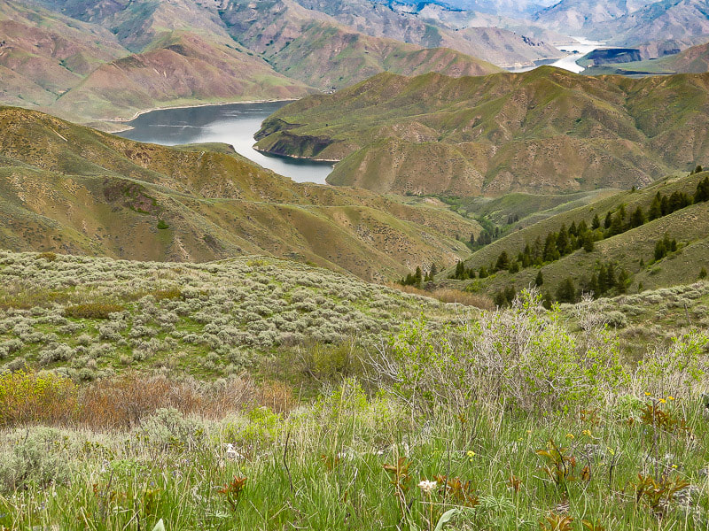
Lucky Peak Lake from summit of Kepros Mountain.
Picture
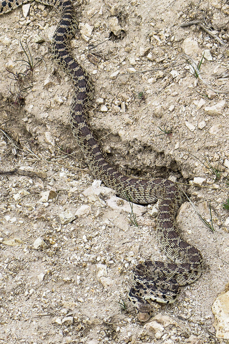
Pretty sure this is a gopher snake - looks like a rattler but this one had no rattle.
Picture
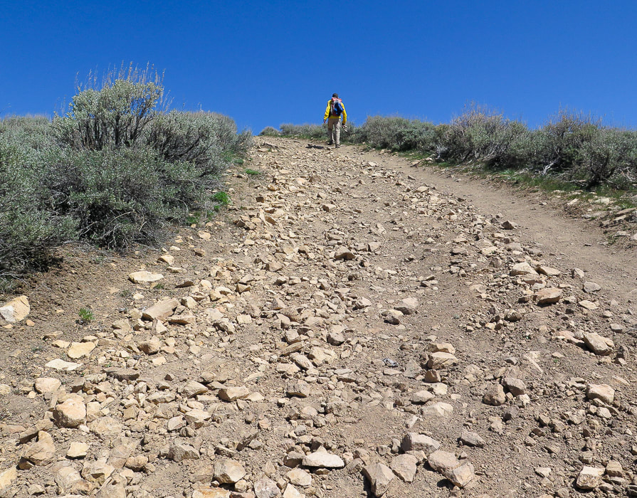
Last steep climb to the summit
Picture
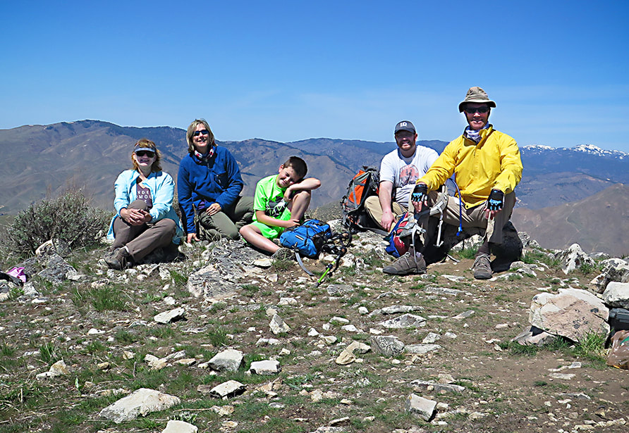
Top of Mt. Kepros - Boise National Forest - April 18, 2021.
Picture
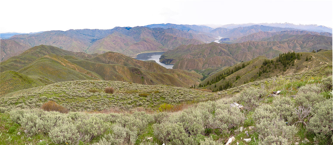
From Kepros Mountain summit looking northeast to Arrowrock Reservoir.
George Kepros, according to Idaho:  A Climbing Guide website,  homesteaded in this area and this is how the Mountain got its name.  I looked into the history of this land and found a George N. Kepros, who is buried in Boise died at age 92 in 1973.  He may be the man that Kepros Mountain is named after.

The final push to the summit is steep.  Fred and I hit this summit on the perfect day - high clouds, expansive 360 degree views that we were unaccustomed to seeing, as we hadn't been in this "neck of the woods" before.  This perspective of Lucky Peak, a summit we have been on many times, is unique because the north side is so forested - this is not seen from Boise looking at its south slopes.


After signing the summit register and enjoying a peaceful break, we hiked the nearly 5-mile trek back to our truck.  There's some climbing on the way back.  We took the same bypass on the east side of the trail that we took earlier to the single track.  So peaceful is this hike, and late April/early May probably the best time to do it.  Fall hunting season probably not a good time.

So far Kepros is our favorite of the four Grand Slam Peaks - but we haven't hiked Mount Heinen yet.  We will let you know what we think after we summit Heinen, the  last of the Grand Slam Peaks!
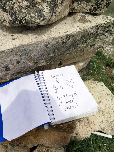
Picture
Summit register
Picture
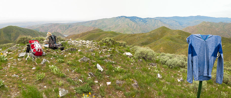
Kepros Mountain summit looking west - Lucky Peak mid-horizon
Picture
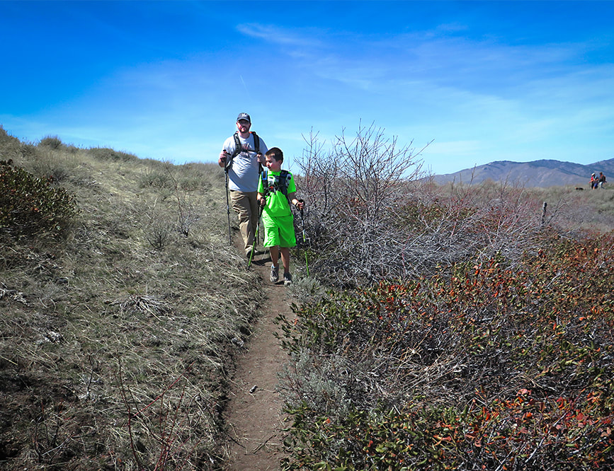
Greg and Kaleb on bypass heading down
Picture
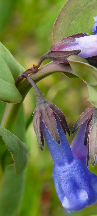
Mertensia (Mountain Bluebells) on top of Kepros Mountain
6 Comments

    Categories

    All
    Arizona Hikes
    California-desert-hiking
    California-desert-hiking
    Idaho Summits
    Nevada Hikes
    Petroglyphspictographs
    Snowshoe Hikes
    Southern Utah Hikesbikes

    To Subscribe to Explorumentary adventure blog and receive new posts by email:

    submit
    Picture
    Sue and Fred
    Picture

    About this blog

    Exploration documentaries          –  "explorumentaries"  list trip stats and highlights of each hike or bike ride, often with some interesting history or geology.  Years ago, I wrote these for friends and family to let them know what my husband, Fred and I were up to on weekends, and also to showcase the incredible land of the west.  
    Picture
    Happy Spring!
    Picture

    About the Author
    Sue Birnbaum

    A  trip to Jumbo Rocks Campground in Joshua Tree National Monument 40 years ago sparked my passion for hiking, exploring, and learning about desert ecosystems.  I met my husband Fred on Mt. San Jacinto.  We've explored the American West together; we love this land and I hope to inspire you to get out and explore through my photographs and trip descriptions.
    In 1992, Ray Wilson and I conceived the first Cactus to Clouds hike which climbs over 10,000 feet in one day to the summit of Mt. San Jacinto near Palm Springs, California.
    CACTUS TO CLOUDS HIKE 
    READ MORE
    ABOUT SUE
    Some of my favorite websites:
    ​

    ​Awkward Botany
    ​amateur botany for the phytocurious

    Bird and Hike

    ​"Intended to encourage people to visit, learn about, and fall in love with the desert."
    ​

    Draw and Shoot
    Beautiful Photography

    Daring Dayhikes
    "Interesting places you can visit with a daypack."  Terrific Tucson and other desert hikes and East Coast, too.


    Earthline: The American West
    Debra "writes to extol our beloved Earth." Detailed hike info, excellently written.
    ​

    Geologypics.com
    Geology and Geologic Time through Photographs

    Glenn Suokko
    Vermont artist's paintings "inspired by a place based on the land .... drawn to painting the representation and abstraction of nature."

    In the Company of Plants and Rocks
    ​A natural history blog about botany, plant ecology, and geology.


    MishMoments:  Joy of Photography
    this website is "
    about capturing that special moment in life’s journey and making the most of the time we have."

    Nature's Depths
    Walking through nature with John Palka, a neuroscientist who loves plants and ponders big questions.


    Rangewriter - What Comes Next?
    ​Linda's excellent writing brings to life her interesting adventures, "curiosities and thoughts", post-retirement.

    SeekingLost - Hiking and Backpacking Adventures.

    Stav Is Lost- Unconventional, out-of-the way hikes in the American West.


    Uprooted Magnolia
    ​Leah Yetter's beautiful "photo journal on life, love, and the spirit of Wyoming."

    Archives

    April 2025
    March 2025
    January 2025
    December 2024
    November 2024
    October 2024
    September 2024
    August 2024
    July 2024
    June 2024
    May 2024
    April 2024
    March 2024
    January 2024
    December 2023
    November 2023
    October 2023
    September 2023
    August 2023
    July 2023
    June 2023
    May 2023
    April 2023
    February 2023
    January 2023
    December 2022
    November 2022
    October 2022
    September 2022
    August 2022
    July 2022
    June 2022
    May 2022
    April 2022
    February 2022
    January 2022
    December 2021
    November 2021
    October 2021
    August 2021
    July 2021
    May 2021
    March 2021
    February 2021
    January 2021
    November 2020
    October 2020
    August 2020
    July 2020
    June 2020
    April 2020
    March 2020
    February 2020
    January 2020
    November 2019
    October 2019
    September 2019
    August 2019
    July 2019
    June 2019
    May 2019
    April 2019
    February 2019
    December 2018
    November 2018
    October 2018
    September 2018
    July 2018
    June 2018
    May 2018
    April 2018
    March 2018
    February 2018
    January 2018
    December 2017
    November 2017
    October 2017
    September 2017
    August 2017
    July 2017
    June 2017
    April 2017
    February 2017
    November 2013
    August 2013
    July 2013

HOME

Cactus to Clouds Hike
More Quotes
​
Mary Oliver Poems
Ann Zwinger Quotes
HIKES BY STATE

Idaho Hikes
Utah Hikes/Bikes
​Arizona Hikes
​California Desert Hikes
​Wyoming Hikes
​Nevada Hikes

BLOGS

Adventure Blog
Women and the Land
GEAR REVIEWS
FIT AFTER 50
Fred Birnbaum
Dave Brasuell
Bus' Little Black Book
​Mike Carlson
​Ray Wilson
​Marcia Bondy
Bryan Krouse
​Maria Keezer
​Tim Clemens
​Doug Traubel
​Brian Holgate
​
Becky Borczon Blake
​Jennifer Cera and
​Sue Birnbaum

​Vance Powell
​Boise Cross Fit Masters Ladies
​Vickie Kearney

GALLERY

Desert Plants
Nature
Earth + Sky
Urban
Water
Patriot 
​Orchids
Boise
​
  ABOUT
    Contact

​
© 2017 - 2025 by Sue Birnbaum.  Photos on this website are the sole property of Sue Birnbaum unless otherwise indicated.  Please receive permission before publishing my trip reports and photos.
I try my best to be accurate with my hike descriptions; please research your adventures, always bring a map and compass and know how to read them, be prepared!  All of these hikes can be dangerous; hike at your own risk.  ALWAYS carry the Ten Essentials with you on hikes. 
​Please feel free to contact me with comments or questions, or if you see any errors that need attention.
Thank-you for stopping by!


EXPLORUMENTARY.com
  • Home
    • Cactus to Clouds Hike
    • More Quotes
    • Ann Zwinger Quotes
    • Mary Oliver Poems
  • Hikes by State
    • Southern Utah
    • Idaho
    • Arizona
    • California Desert
    • Nevada
    • Wyoming and New Hampshire
  • Petroglyphs and Pictographs
  • BLOG
    • Adventure Blog
  • GALLERY
    • DESERT PLANTS >
      • Beavertail cactus
      • Brittlebush
      • Christmas Cactus
      • Arizona Barrel Cactus
      • Parry's penstemon
      • Agave
      • Arizona Rainbow Hedgehog
      • Claret Cup Hedgehog
      • Desert Agave
      • Palmer's Penstemon
      • Silver Cholla
      • Cristate Saguaro
      • Indian Paintbrush
      • Ocotillo
      • Santa Rita Prickly Pear
      • Spiny Cliffbrake
      • California Barrel Cactus
      • Engelmann Prickly Pear
      • Velvet Mesquite
      • Joshua Tree
      • Buckhorn Cholla
      • Hedgehog Cactus
      • Fishhook cactus
      • Thompson's Woolly Locoweed
    • NATURE
    • BOISE
    • EARTH + SKY
    • URBAN
    • WATER
    • PATRIOT
    • ORCHIDS
  • Fit After 50
    • Brian Holgate
    • Fred Birnbaum
    • Dave Brasuell
    • Bus' Little Black Book
    • Mike Carlson
    • Ray Wilson
    • Bryan Krouse
    • Vickie Kearney
    • Maria Keezer
    • DOUG TRAUBEL
    • Boise Cross Fit Masters Ladies
    • Tim Clemens
    • Marcia Bondy
    • Becky Borczon Blake >
      • Becky B Downtown
    • Jennifer Cera and Sue Birnbaum
    • Dave Brasuell
    • Vance Powell
  • Contact