|
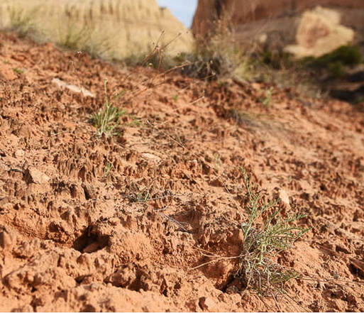
Our attempt at a relentless 3,500-foot gain, sections of Class 3-4 climbing, and route-finding journey under cliffs and over ridges make this fabled summit complete with petroglyphs elusive for now. I recommend this tough, extraordinary hike even if you don't intend on summiting. But do your research first. Related: Utah Mountain Biking: The Cowbell and the Cryptobionic Highway (cryptobiotic crusts) Angels Landing in Zion: Not for the Faint of Heart Southern Utah Hiking and Biking in a Pandemic: Zion, Wire Mesa, and Snow Canyon Canaan Mountain via Squirrel Canyon Red Mountain Primitive Trail - St. George Desert Plant photos 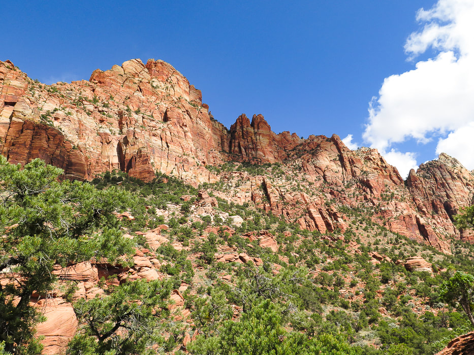 East cliff face below Mt. Kinesava. Summit cannot be seen from this vantage point. Route goes through trees at base of cliffs in shadow, then up to the right following trees to notch. After this, still hundreds of feet climb to summit.
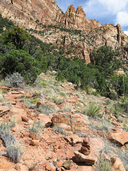
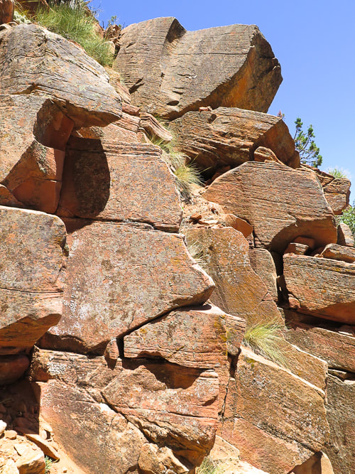
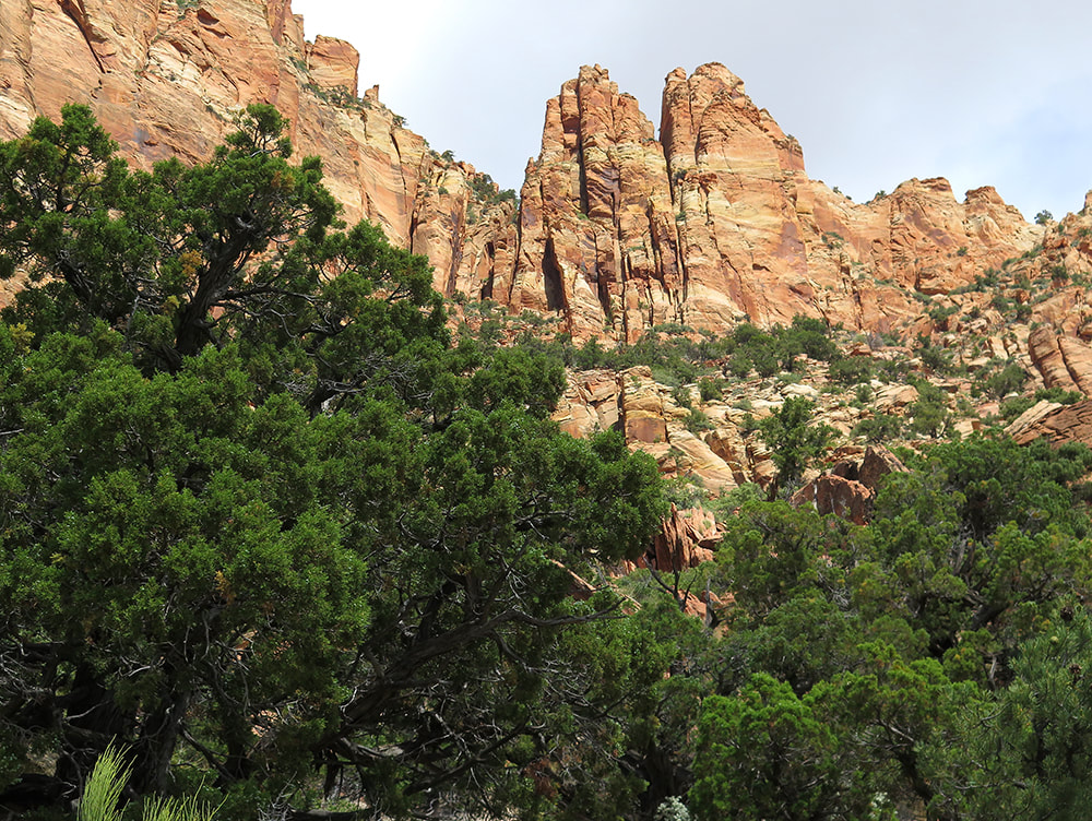
Our Hike Fred and I decided to hike Mt. Kinesava when we saw it towering over the southern entrance to Zion National Park while riding on the Wire Pass Trail near Springdale, Utah. When we finally had a cool day during a more recent hike/bike vacation, we gave it a try. Even though we didn't make it, this mountain is one of the most memorable I have ever hiked. Majestic Mt. Kinesava remains elusive, invincible, its petroglyphs unreachable, at least to us. A grudge peak. Kinesava is more than a hike, it's an experience. The view of red and orange cliffs and pinnacles that tower the more you climb, the increasingly spectacular views of Zion Canyon behind you and the ever-shrinking town of Springdale below create a unique "surround-view" experience of being "perched" for hours. Kinesava's refusal to let just anyone walk on her summit may be the reason why Native Americans chose this place to carve petroglyphs on the mesa just above these challenging rock walls. Landmarks in Zion, like Mt. Kinesava and Sinawava are named after Paiute deities. You have to do your homework for this cross-country hike, but there are few summit reports available. There is a break in the cliff band that surrounds Kinesava's base created by an apparent old landslide where you can enter the terrain that will take you up to the cliffs. You must catch this same entry point on your exit, so a good idea to look back to note where this is by looking at landmarks. Rock cairns mark faint trails, but it seems like you usually find these more often on the way down. Cairns left by previous hikers were helpful in the Class 3-4 sections. For a more detailed hike description, click on "Trip Stats" above. You have to navigate over three ridges before you get to the base of the sheer walls, where you scramble and climb across narrow sections of the cliff in a horizontal/diagonal direction following the line of trees. Here, the climb is Class 3 (climbing with use of hands) up more or less vertical rocks, making your way to the right along cliff base. Where we reached too much exposure (Class 4), we backtracked to find a safer route. It took us longer than we wanted to navigate through the horizontal band of trees under the pinnacled vertical cliffs. We reached a comfortable platform with a good view of the "catwalk", a very narrow section that must be traversed to gain access to the final climb up the diagonal band of trees to the notch that lands you on the plateau above. This is where we stopped; it looked pretty difficult and we didn't have enough time to summit AND get down (see image below). Once on the plateau, Mt. Kinesava's summit is another 300-400 foot climb. (See our GPS tracks below). 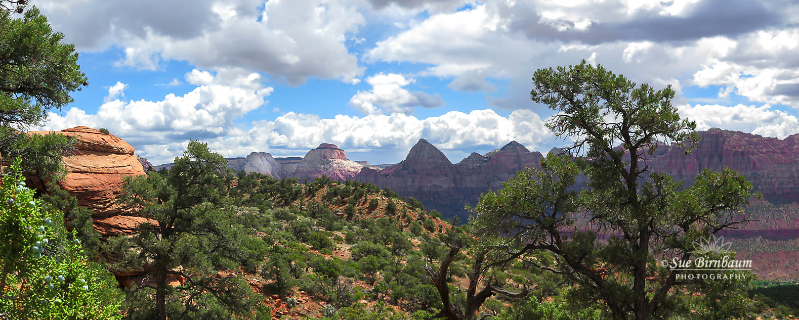 Zion Canyon from east face of Mt. Kinesava 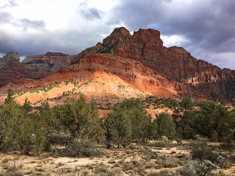 Mt. Kinesava from Chinle Trail (on a different hike) 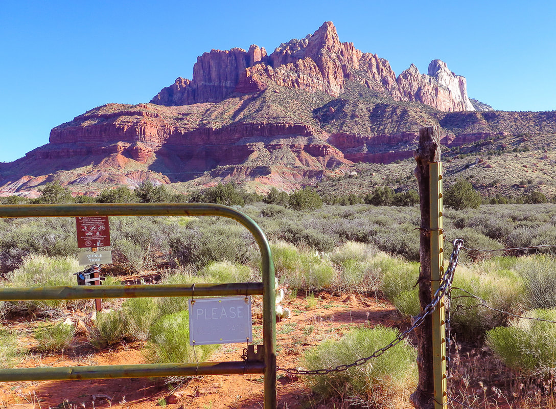 Looking at east face of Mt. Kinesava in the morning. The summit is just behind the largest prominence, mostly hidden from this view. Gate, 1.1 miles from Chinle Trailhead marks Zion National Park boundary. Chinle trail continues to the left. The route goes up the fan-shaped debris slide through the trees, continuing through trees to right of prominence up to notch. 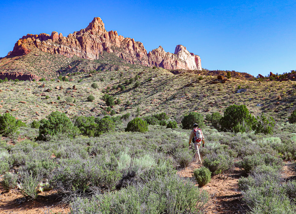 First set of Ridges just after Zion NP Boundary Heading cross-country towards 3 main lower ridges. We went up the ridge to the right in the photo. 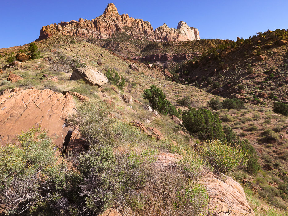 We ascended the left (west) ridge, and descended the right (middle) ridge on the way back. At the top of the ridge to the right is a trail and the 3 telephone poles at entry through break in cliff band to arrive at plateau above cliff. I would ascend via the right ridge next time. 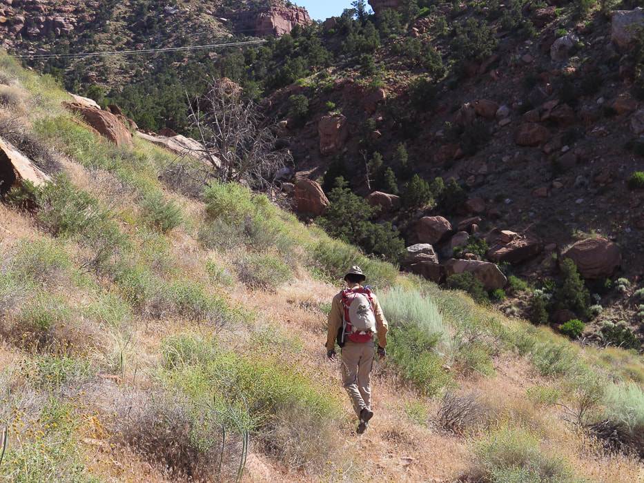 We had to lose some elevation and side-hill the left ridge into the small canyon. Aim for the telephone wires and 3 large poles on middle ridge saddle just under passage through cliff band. 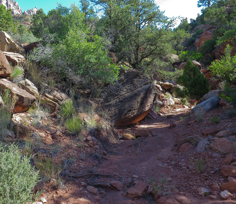 Small canyon between left and middle ridges. After descending from west, or left ridge into this canyon, it took us right up to saddle with 3 telephone poles. 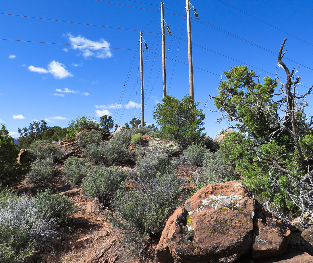 Aim for three telephone poles at base of trail that goes through cliff break landslide. On our way back down, we stayed on the ridge that these poles are on, to the right of this image (the "middle" ridge). 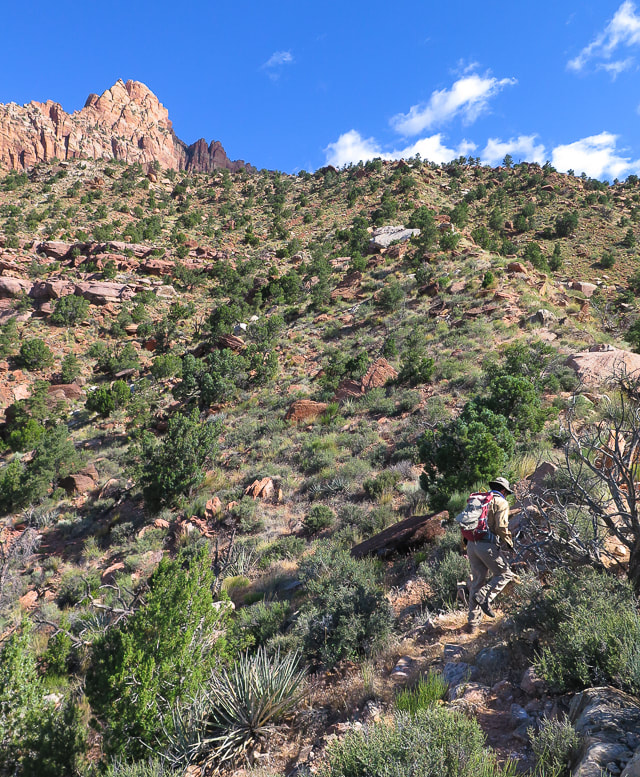 Second Ridge Rock slide over bottom cliff base is entry/exit onto plateau above. Defined trail here. 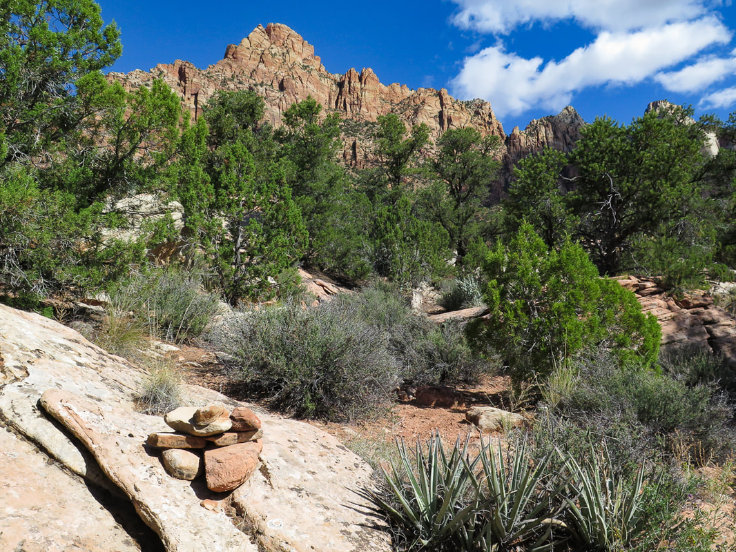 Cairn that marks entry from steep second ridge through lower cliffs to plateau above. These white rocks can be seen above to aim for on the way down off the plateau.
 Third Ridge Approaching horizontal band of trees under sheer cliffs 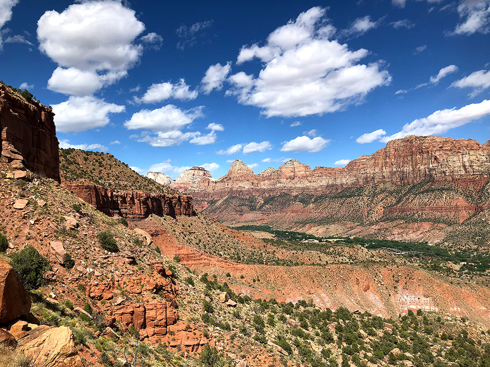 Everywhere you look, it's spectacular! Zion Canyon 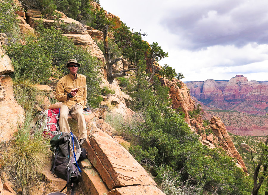 Reached horizontal band of trees for a cliffside lunch - Zion Canyon view. 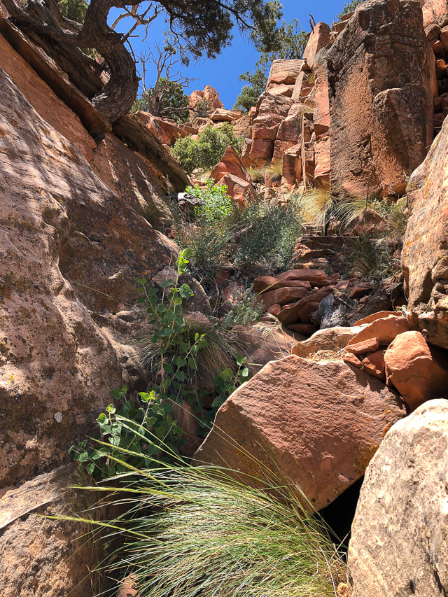 Fun "passageway" to to get to vertical rocks 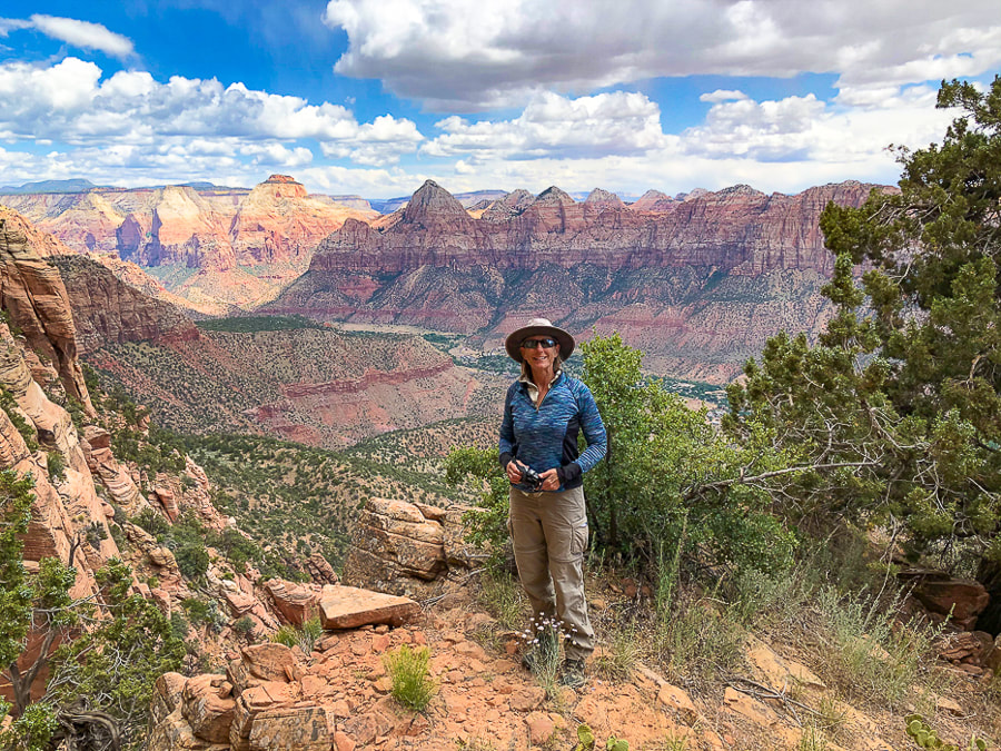 Zion Canyon from cliffs of Mt. Kinesava - 6,400 feet Keep on Exploring - Never Stop Climbing Mountains! 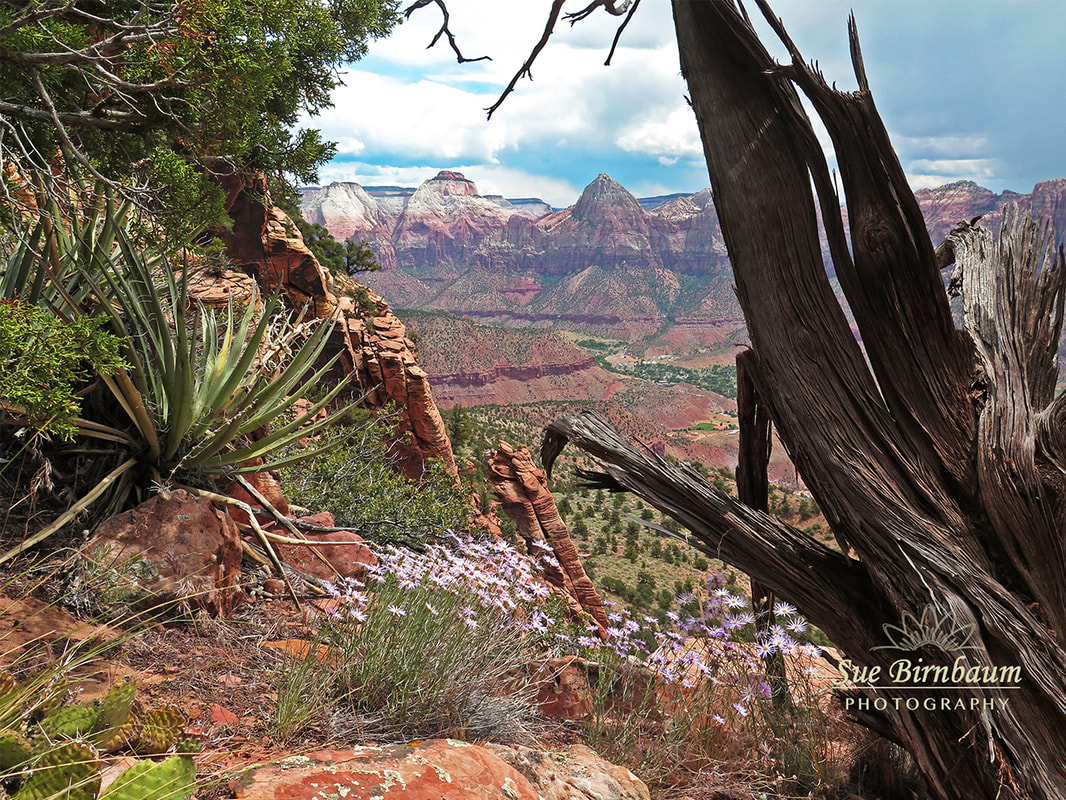 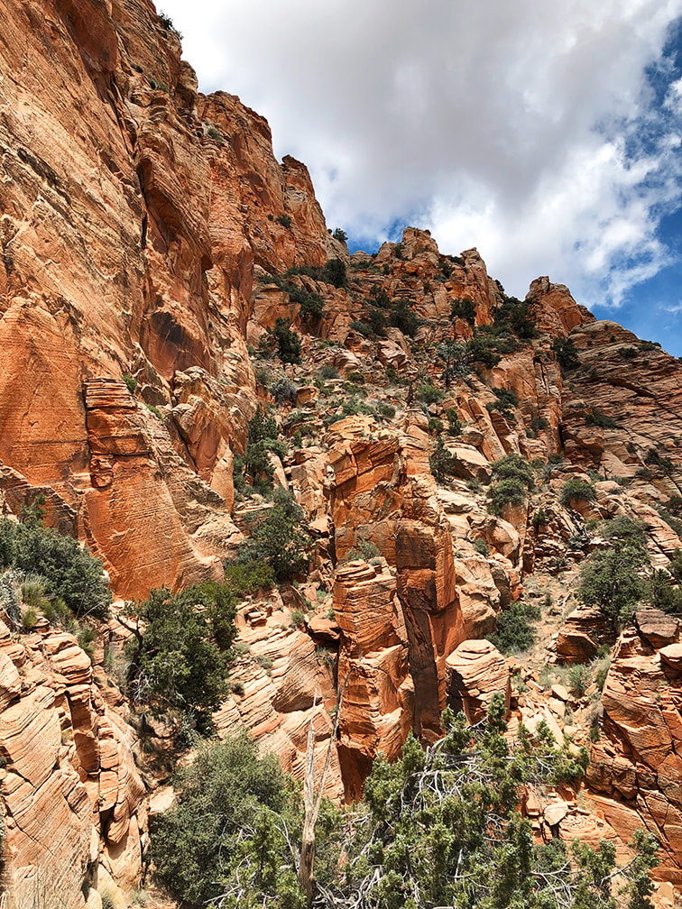 This is where we stopped. Trail continues through trees on far left, over the "catwalk" and up through trees to notch. The Way Down The view of the cliff-hugging narrow "catwalk" and vertical rock towers is intimidating. It's a different feeling entirely as I sit here at my desk writing this post, where I am not facing this astonishing scene of exposed walls and loose rocks to climb - it's easy to think now I can do it. Edward Abbey, in his book Desert Solitaire said that Southern Utah "is the most beautiful place on earth." My words don't do justice when describing what it's like to hike in this extraordinary place, where all natural elements seem to fit almost magically together. The orange and green, the soft sand and the hard cross-bedded rocks, the cliffs and the undulating lowlands and streams. The expansive desert with steep mesas standing like platforms under a wide sky. Places to rest and absorb the views among imposing and rugged terrain. Prickly cacti and slender, waving penstemon. We caught a defined trail on the way down that took us a bit too far to the west. The most important thing to remember is to aim for the large white boulders on the edge of plateau; it's your exit point to the ridges below. Hopefully next time I attempt this hike, we will be able to conquer this section, see the petroglyphs on the plateau above, and summit. I already feel lucky to be able to see these sights that not many others have seen before, and to be able to hike with my husband. We have fun! Life is really good. "Freedom begins between the ears." - Edward Abbey, environmental advocate and author of Desert Solitaire 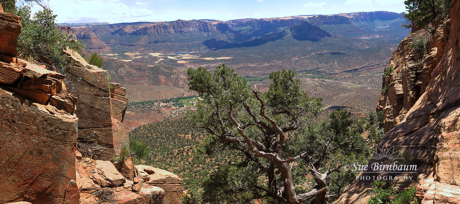 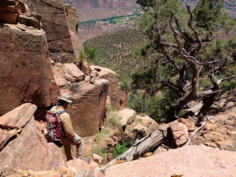 Heading down! 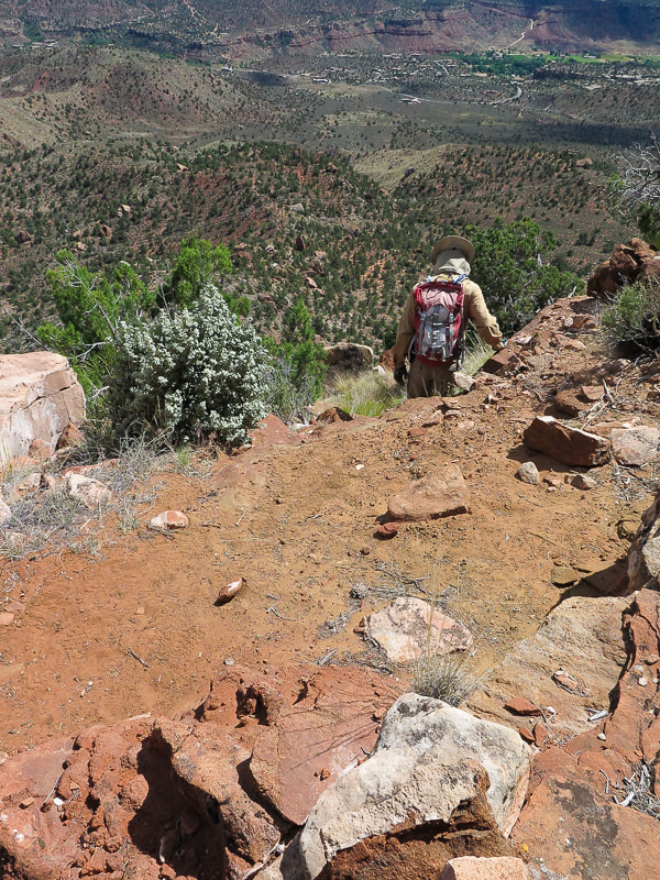 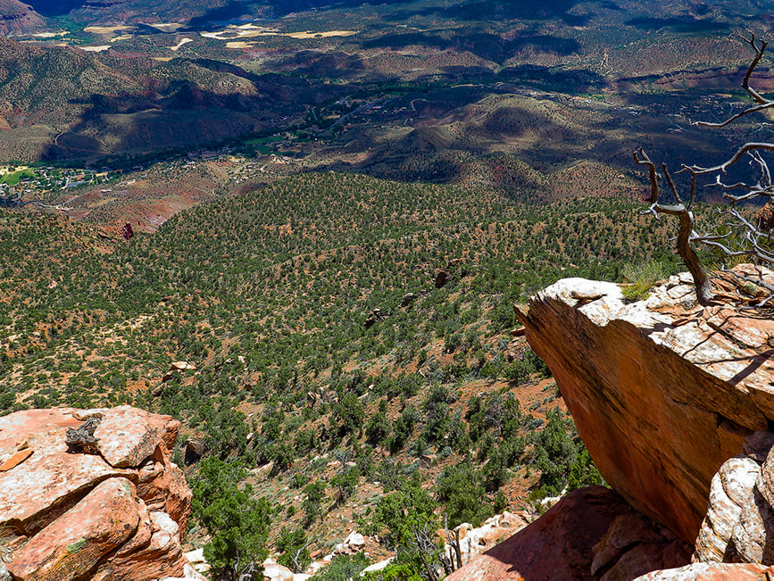 Heading off cliffs onto "third ridge". Springdale, Utah below in river bottom with Virgin River "Our updated trailhead will add 2 hours to the trip, which means that now fewer of you should ever attempt it. DO NOT GET STUCK ON THIS ROUTE IN THE DARK!!!!!"
- zionnational-park.com Trip Stats
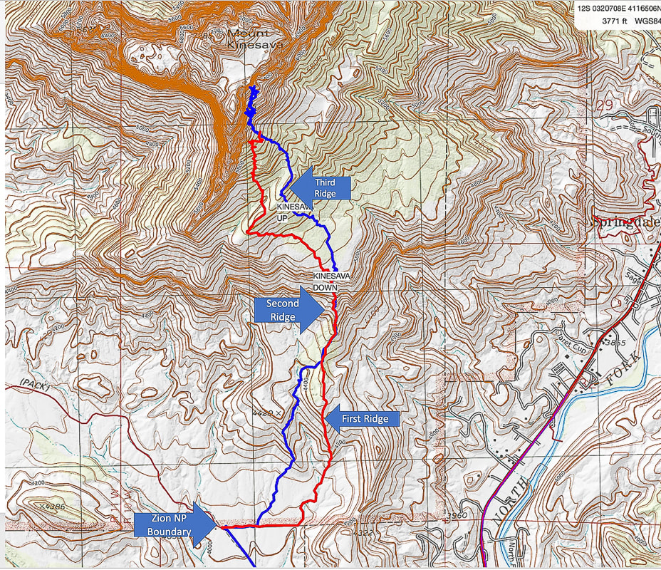 Our route up (blue) and route down (red) Bottom of map shows approach to Zion National Park boundary fence via Chinle Trail (Trailhead on Utah State 9 Highway just before Springdale). I recommend using the ridge that the red trail traverses just after fenceline. 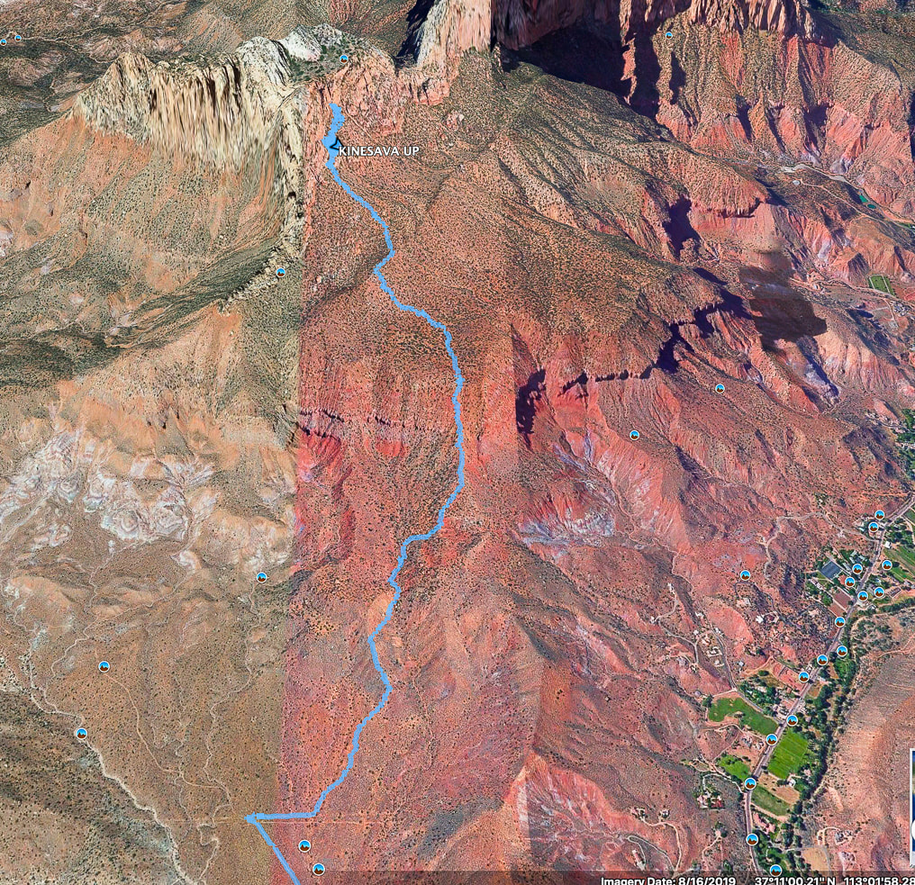 Google Earth image of our hike up after crossing Zion NP boundary fence To avoid losing elevation on the way up, better to take the ridge to the right (east) of the one we took up. This leads up to only break in the cliffs that surround the bottom. Town of Springdale at lower right. References
Chesher, Greer K. Zion Canyon: A Storied Land. 2007. The University of Arizona Press. Quarnstrom, Evan. Zion National Park: Tackling Mt. Kinesava. Website: Evan Quarnstrom: Stories of Travel and Adventure. The Hiker's Code: Brush Up on Trail Etiquette in Time for Hiking Season. Posted 11/5/19 on Utah.com Zion: Mt. Kinesava. Favorite Hikes In and Around Zion National Park. zionnational-park.com
3 Comments
8/19/2022 02:27:45 am
This uneven route is in the far Southwestern nook of Zion where the height is low and the temperatures rises up. Choose to hike this during the cooler months, but after the ice on the mountain side has been changed into liquid form. Start this route at the Chine Trailhead. Superb route discovering expertise is mandatory. There is 4th class scrambling ahead of the ramp to the end of the hike. The award at the top is a jaw-dropping view of Zion, far below and some archaic petroglyphs that are seldom noticed by anyone. We accept if you are going to do this arduous of a hike you respect ancient rock are, so we have added up the directions. Keep in mind that the minimum touch can ruin the ancient rock art. Treat it with the honor you would a piece of art in a museum. The ridge winds to the south of the large sewerage, below on the north. Hike southwest, remaining on top of the ridge, started toward the power line pole. Get on top of the ridge at the power line pole; turn to the northwest, chasing up the ridge toward the juniper table top. Leave a Reply. |
Categories
All

Sue and Fred

About this blogExploration documentaries – "explorumentaries" list trip stats and highlights of each hike or bike ride, often with some interesting history or geology. Years ago, I wrote these for friends and family to let them know what my husband, Fred and I were up to on weekends, and also to showcase the incredible land of the west.
To Subscribe to Explorumentary adventure blog and receive new posts by email:
Happy Summer!

About the Author
|