EXPLORUMENTARY
  • Home
    • Cactus to Clouds Hike
    • More Quotes
    • Ann Zwinger Quotes
    • Mary Oliver Poems
  • Hikes by State
    • Southern Utah
    • Idaho
    • Arizona
    • California Desert
    • Nevada
    • Wyoming and New Hampshire
  • Petroglyphs and Pictographs
  • BLOG
    • Adventure Blog
  • GALLERY
    • DESERT PLANTS >
      • Beavertail cactus
      • Brittlebush
      • Christmas Cactus
      • Arizona Barrel Cactus
      • Parry's penstemon
      • Agave
      • Arizona Rainbow Hedgehog
      • Claret Cup Hedgehog
      • Desert Agave
      • Palmer's Penstemon
      • Silver Cholla
      • Cristate Saguaro
      • Indian Paintbrush
      • Ocotillo
      • Santa Rita Prickly Pear
      • Spiny Cliffbrake
      • California Barrel Cactus
      • Engelmann Prickly Pear
      • Velvet Mesquite
      • Joshua Tree
      • Buckhorn Cholla
      • Hedgehog Cactus
      • Fishhook cactus
      • Thompson's Woolly Locoweed
    • NATURE
    • BOISE
    • EARTH + SKY
    • URBAN
    • WATER
    • PATRIOT
    • ORCHIDS
  • Fit After 50
    • Brian Holgate
    • Fred Birnbaum
    • Dave Brasuell
    • Bus' Little Black Book
    • Mike Carlson
    • Ray Wilson
    • Bryan Krouse
    • Vickie Kearney
    • Maria Keezer
    • DOUG TRAUBEL
    • Boise Cross Fit Masters Ladies
    • Tim Clemens
    • Marcia Bondy
    • Becky Borczon Blake >
      • Becky B Downtown
    • Jennifer Cera and Sue Birnbaum
    • Dave Brasuell
    • Vance Powell
  • Contact

Hike Moapa Peak, 6,471':  Knife's Edge Excitement

5/1/2023

2 Comments

 
We met our match on Moapa Peak's fabled "knife edge" final ascent, and came within 160 feet of the summit.
Picture
Picture
Picture
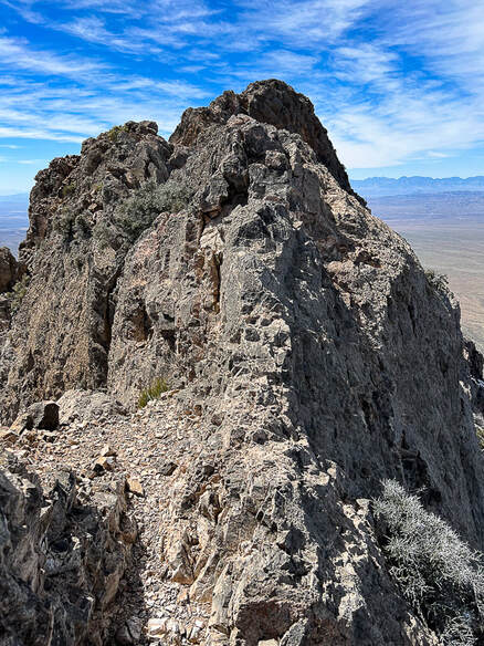
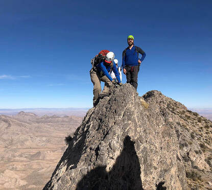
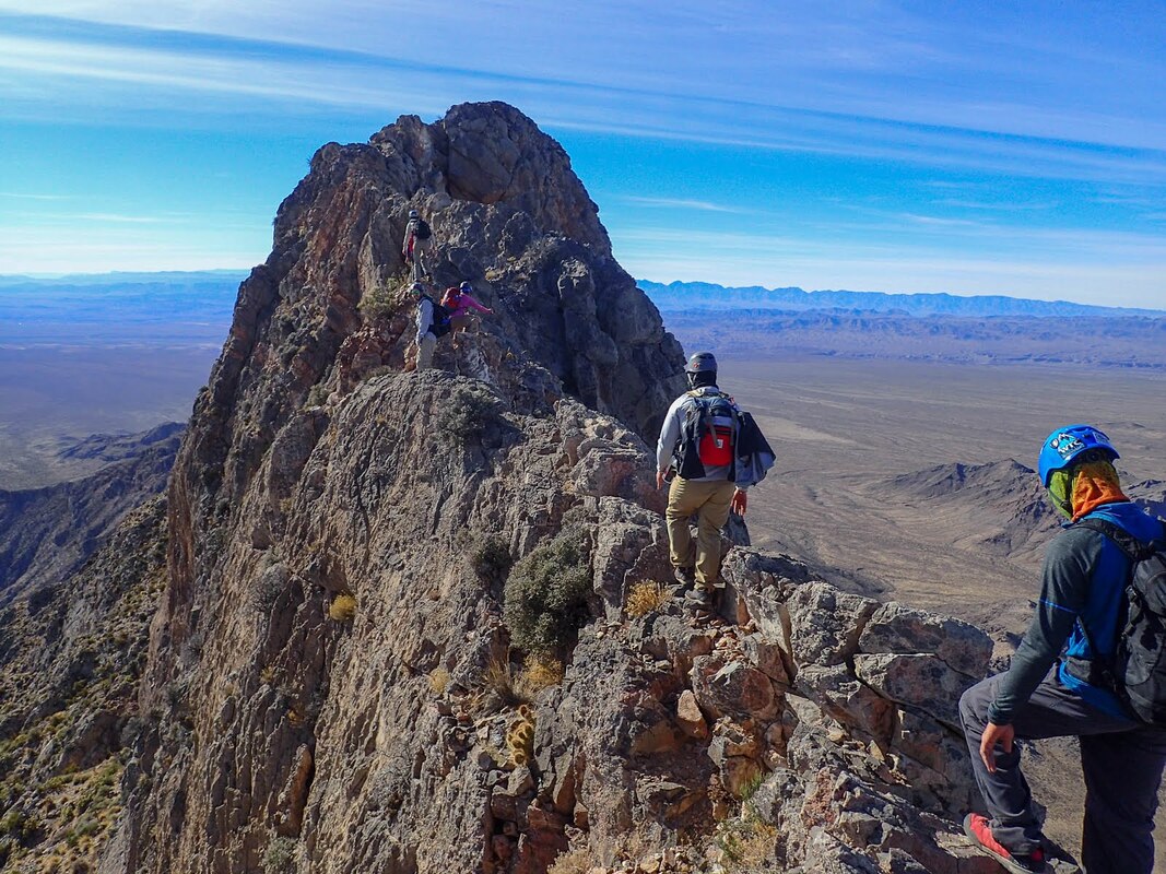
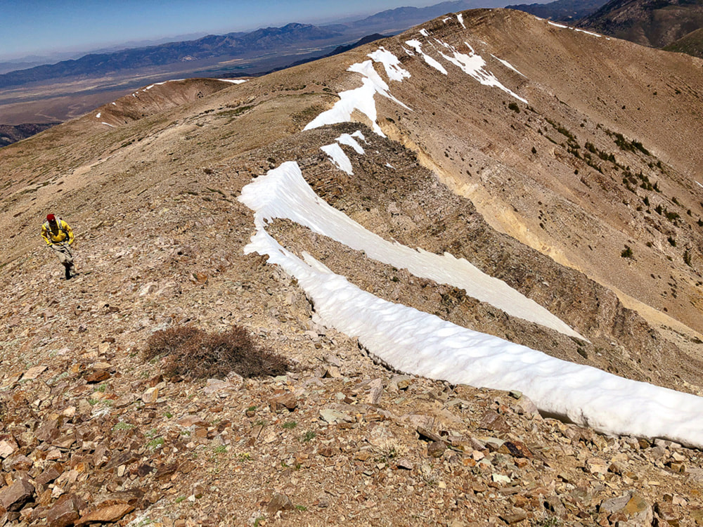
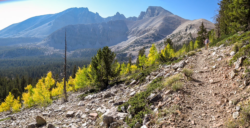
Left photo:  the final ridge to Moapa's summit.  We climbed 3,200' to the high point in the foreground (seen just under the summit in photo), then turned around because this knife's edge seemed too exposed.
Right Photos:  knife edge from The First Church of the Masochist website, whose party made the summit.
Trip Stats
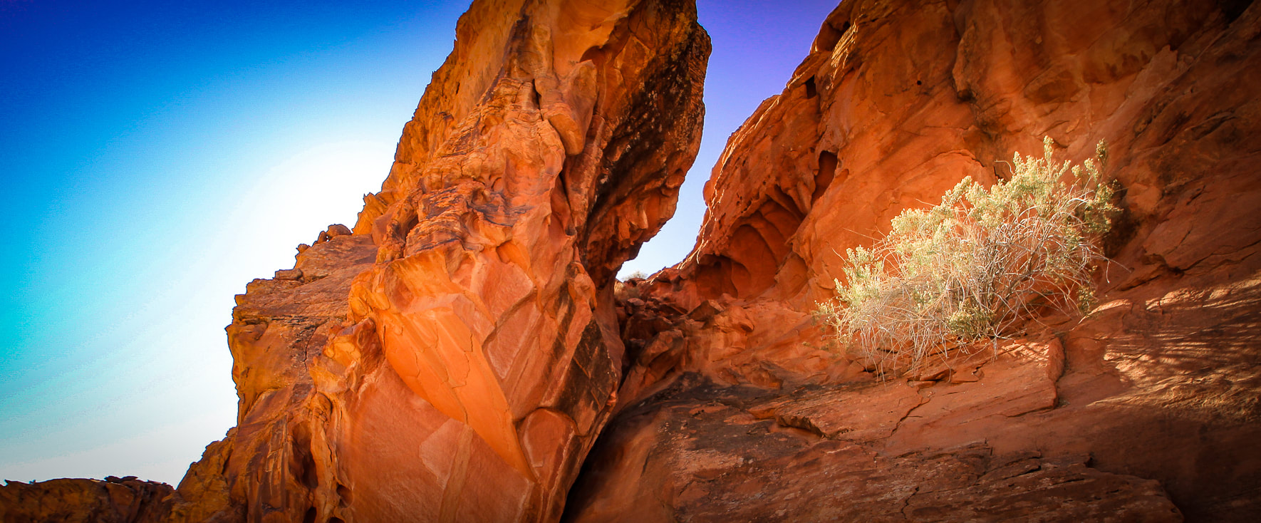
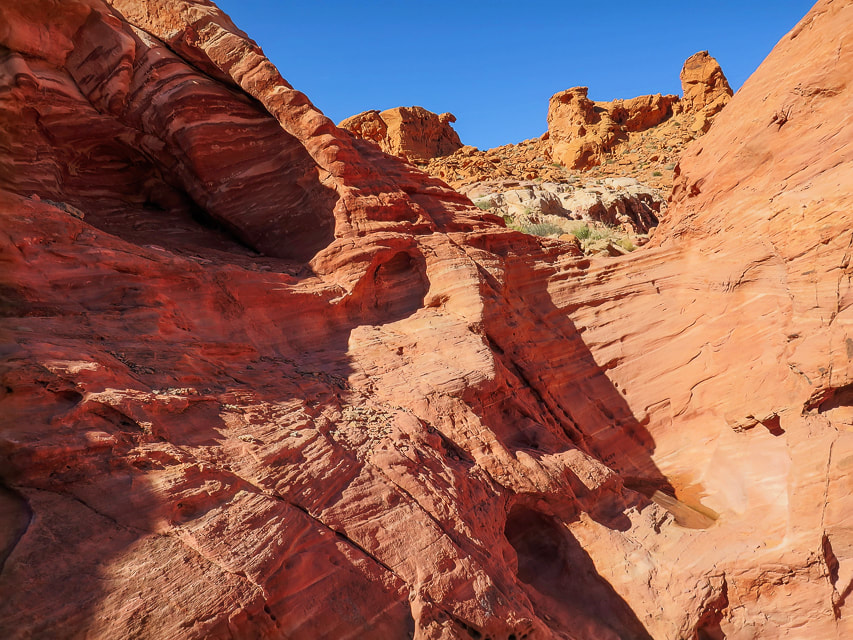
Overview:  An enormous gray fin sticking out of the desert floor, Moapa Peak's knife-edge ridge tests the hiker's fear-of-heights-and-exposure factor.  Ascend a pretty braided stream wash and then prepare for a steep, rugged climb over sharp limestone the rest of the way, negotiating a few Class 3 rock faces, paying close attention to rock cairns that mark an elusive trail that aggressively elevates you to sneak under Moapa's southern summit block.  Gashes, chasms and sheer walls appear as you hike, with spectacular views of the empty desert far below.  Descriptions of the final exposed ridge to the top include "exhilirating", "thrilling", and "incredibly fun."
Location:  Southeast Nevada, Mormon Mountains - Bureau of Land Management.
Distance/Elevation gain:  Trailhead = 3,134'.  Summit = 6,471'.  Our hike = 7 miles to 6,310'.   To the summit = 7.3 miles.
Difficulty/Navigation/Exposure:  easy - moderate effort through wash, strenuous Class 2 and Class 3 on cairned trail, moderate to significant exposure (cliff edges or drop-offs 2-3 feet away) on final ridge.  Navigation moderately challenging.
Coordinates:  Trailhead =  36.83395,-114.44132.   Summit = 36.85856,-114.45.
Date Hiked:  April 2, 2023.

Prominence:  1,671'
Maps and Apps:  Stavislost hike report, Bureau of Land Management - Nevada/Overton topo map.​
Geology:  Paleozoic rocks of Mississippian period - 340 mya.  Normal faulting due to Great Basin extension.
Lists that contain Moapa Peak:  Las Vegas Mountaineers Classics (rank #46), Sierra Club Desert Peaks Section (#52).
History:  Moapa Valley, south of Moapa Peak is famous for the cantaloupes it produces from its farmlands.  Native American word "Mo-a-pa" means a valley or canyon with a large stream of water flowing through it.
Related Posts:
Davidson Peak
North Schell Peak
Virgin Peak
Sunflower Mountain
Wheeler Peak
Nevada Hikes
Gold Butte NM
Bowl of Fire - Lake Mead
Picture
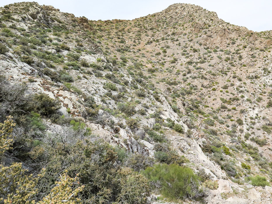
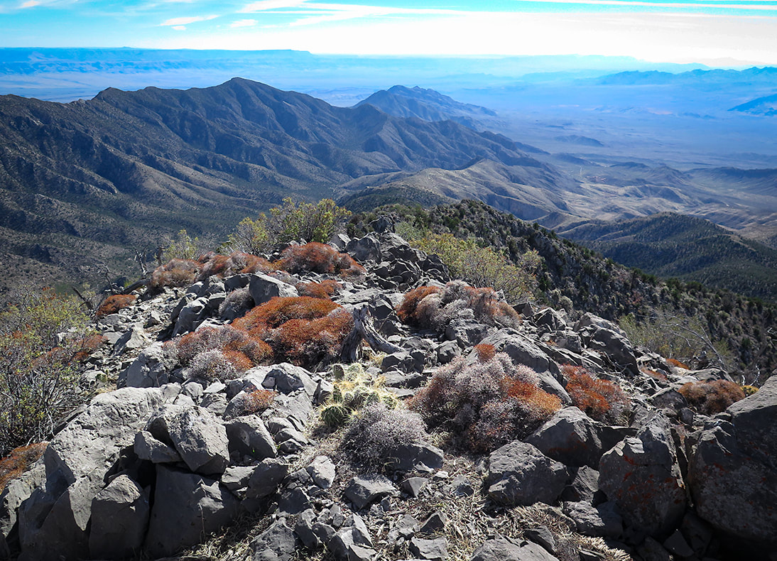
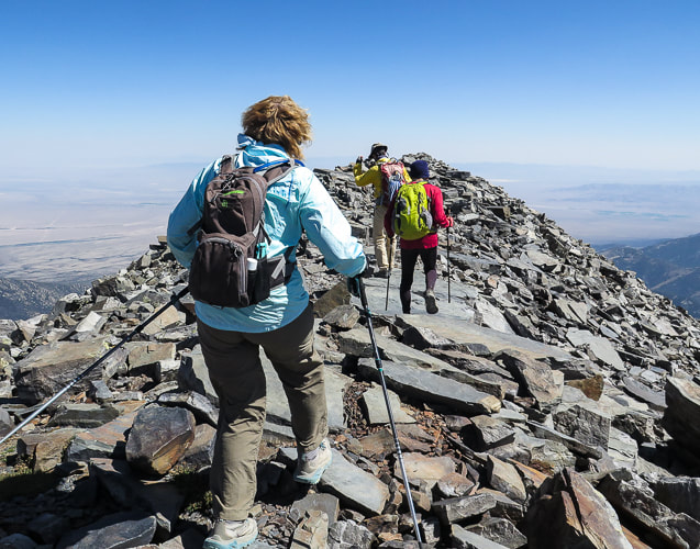
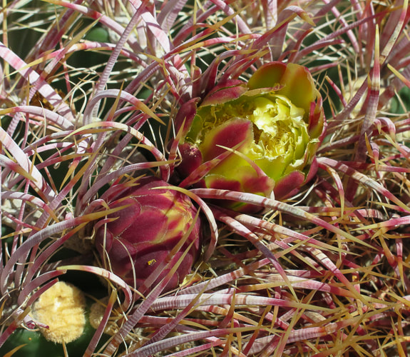
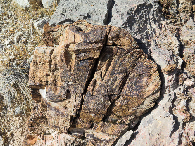
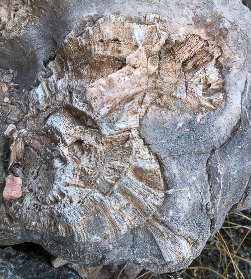
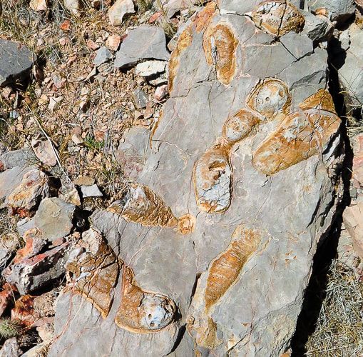
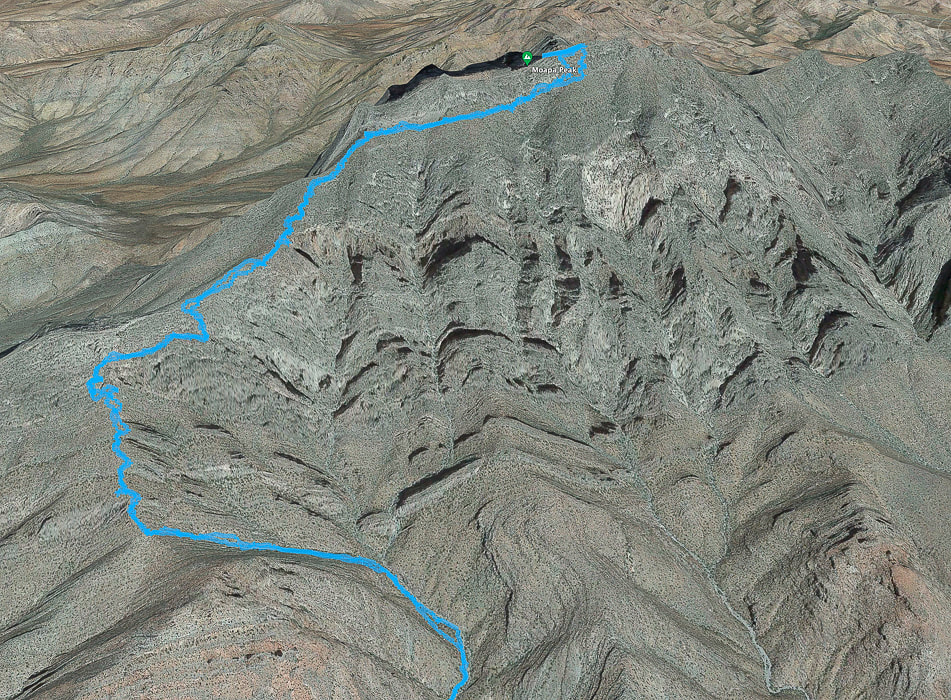
Our GPS tracks from narrow point of wash (bottom) to near Moapa Peak's summit. Out of the wash, the trail climbs to saddle (lower left), then ascends over rock ledges, some of them Class 3, continues along southern base of summit block, then curves around at base of final ridge to summit.
more GPX track maps at end of this post

Moapa Peak, included on the Sierra Club Desert Peaks Section list is a distinguished, stand-alone hulk of narrow limestone noticeable on the north side of  I-15 north of Las Vegas.  It's a classic desert peak, well-fortified by a series of almost vertical ramparts at its base.  It's one of the more memorable and exposed hikes I've done.   Trip reports reveal hikers who have summited, as well as those who reportedly turned around when they saw the final exposed "knife-edge" ridge to gain the last 160'.  After skirting around the south cliff face, the route wraps briefly to the north at a saddle, where the Class 3 climbing up the final ridge begins.  Although the narrow ridge proved too daunting for Fred and I, the hike was worthwhile because the steep drop-offs give the slight feeling that a few missteps may plunge you into the chasms and canyons below.  We found the "trail" mostly stable and easy to follow.  The views of the ribs of dark and sharp mountain ranges rising from flat and buff-colored desert washes are spectacular.
​
Occasional fossils appear in this Paleozoic limestone (see photos below).   I'm not sure what they are, so if someone knows, please contact me!  One of them looks like fish, another looks like petrified wood.
Harder than Mt. Katahdin's knife edge?
​
Maine's Mt. Katahdin, it's highest, has a famous "knife's edge" traverse to the summit.  Fred and I summited Katahdin when we lived in New England and felt it wasn't too scary.  Reports say that it narrows to four feet of width in a few places.  I think Moapa Peak, which reportedly narrows to one foot, is more intimidating. 

Side note:  Mt. Katahdin is the northern terminus for the Appalachian Trail.  While we were on the summit, we saw a hiker who had just completed the entire trail arrive at the famous terminus sign.  I'll never forget the look on his face!  Some of his family was there to greet him.​
Hike Summary
  • from Moapa Peak trailhead, the road leads past walls of dark chert layers in limestone and up a slight hill, where you see the wide braided-stream wash that leads the way to Moapa Peak.  Hike up the wash in a NE direction for ~ 1.5 miles to end of wash and beginning of climb to saddle.  We saw occasional cairns.  The wash narrows and boulders appear near head of wash.  Cairn on left side of wash marks trail that gets you out of the wash and heads toward saddle above.  The trail crosses the drainage shortly and continues steeply to the saddle on the right side of the drainage.  Saddle is 1.9 miles, 4,483'.
  • Climb a series of ledges, two of them Class 3, looking for cairns that mark trail switchbacking up the steep slope.
  • At 2.4 miles arrive at platform (less steep climb) to ascend northeast over another small saddle marked with a cairn to see the trail at base of south side of summit block.  At 2.8 miles, skirt around base.
  • At 3.5 miles arrive at saddle between 2 high points on Moapa's eastern ridge.  Just as you go around to the north side, locate a cairn to guide you up Class 3 climb up a cleft to final ridge climb to summit.
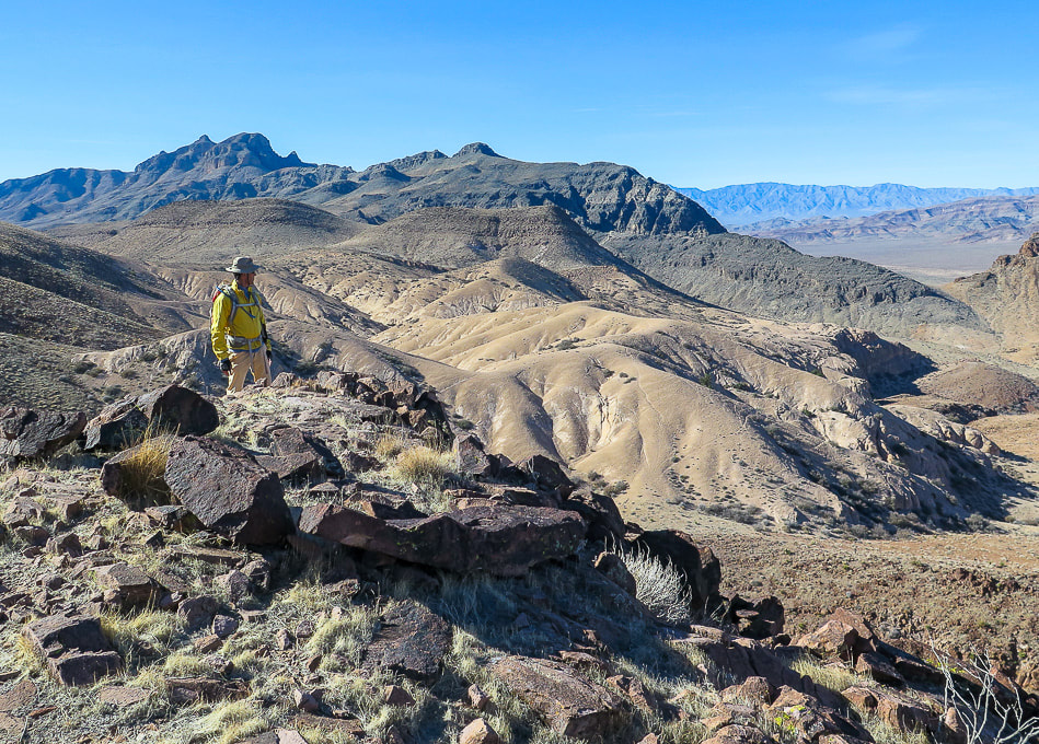
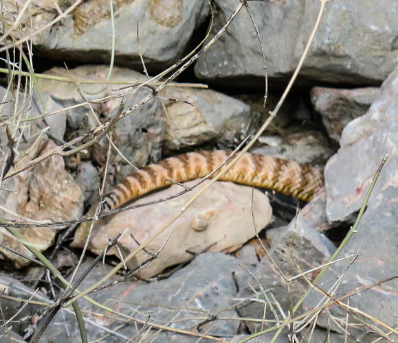
I would avoid doing this hike in the summer months.  I know from experience, since we roasted on this hike last summer and turned around at the saddle because of the heat and intense sun.   

This is a unique hike that not many get to experience.   This beautiful mountain won't make it easy for you to gain its summit, or even get to its approach ridge.  The Nevada desert is stark and hard and the limestone unforgiving.  And, the only flat spot is found briefly on the saddle above the approach drainage.   Fred and I are lucky to be able to explore this exquisite part of the southwest.  Now when we see Moapa from I-15, we can see how high we got on that very vertical mountain.
Keep on Exploring!  Get It While You Can!
Picture
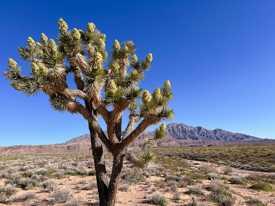
Driving toward Moapa Peak:  Joshua Tree in spectacular bloom after a very rainy and cooler than usual 2022-23 winter.
Picture
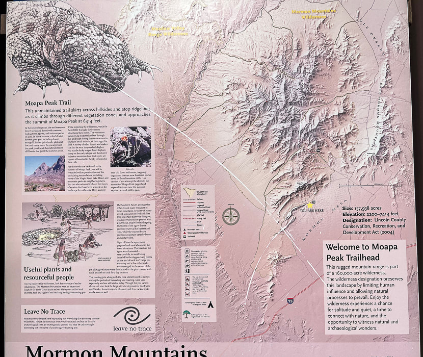
Park near trailhead sign.
Picture
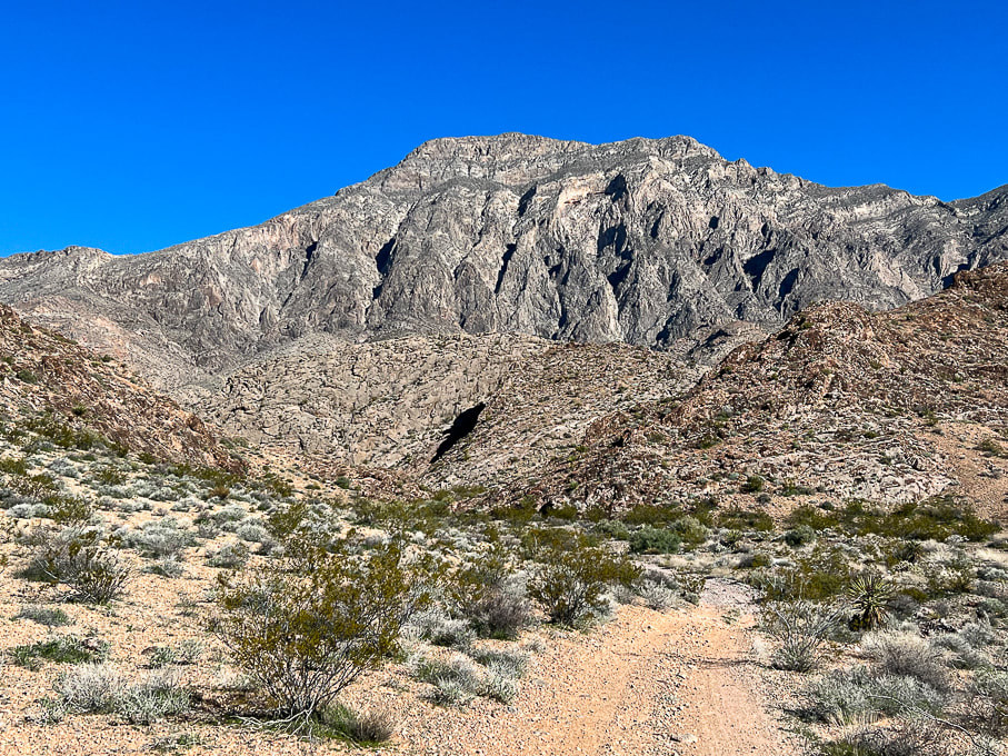
Start by walking on road that leads to approach drainage.  Look at what we get to climb!
Picture
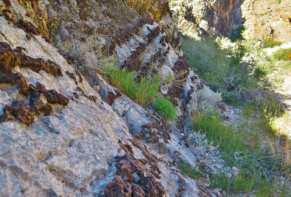
Road passes by impressive display of layered chert in limestone.
Picture
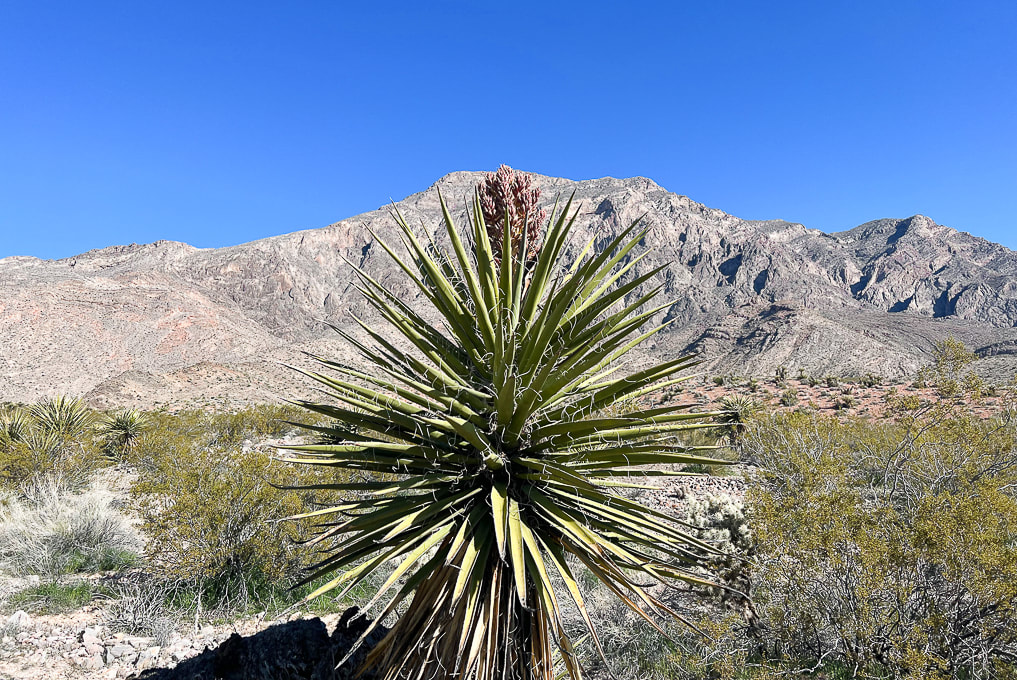
Yucca with bloom in wash - heading to low hill on left side of photo.
Picture
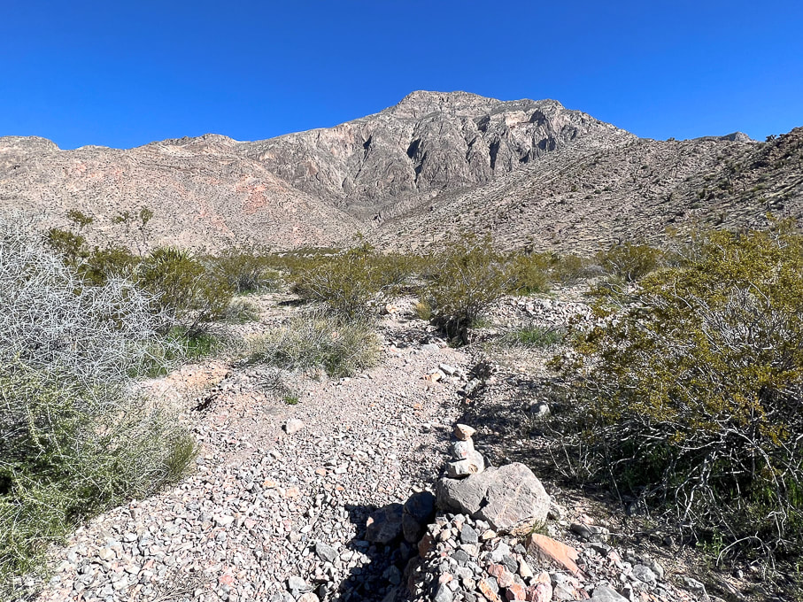
Occasional cairns mark way up braided stream drainage.
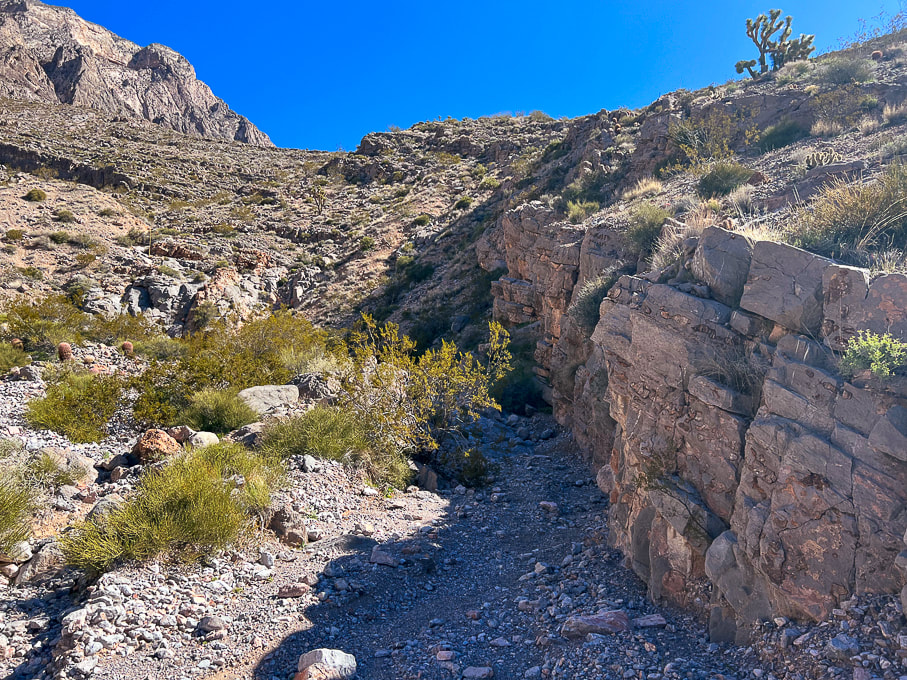
Picture
Drainage narrows.
Picture
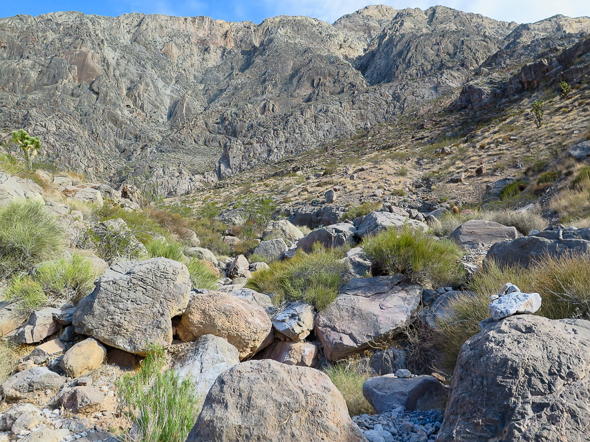
A bit of boulder-hopping and maneuvering as you get closer to head of drainage.  Duck on the right boulder.
Picture
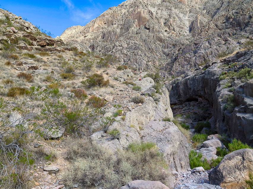
Trail continues left of large dry waterfall - entry to this trail that takes you out of the wash is marked by a cairn.
Picture
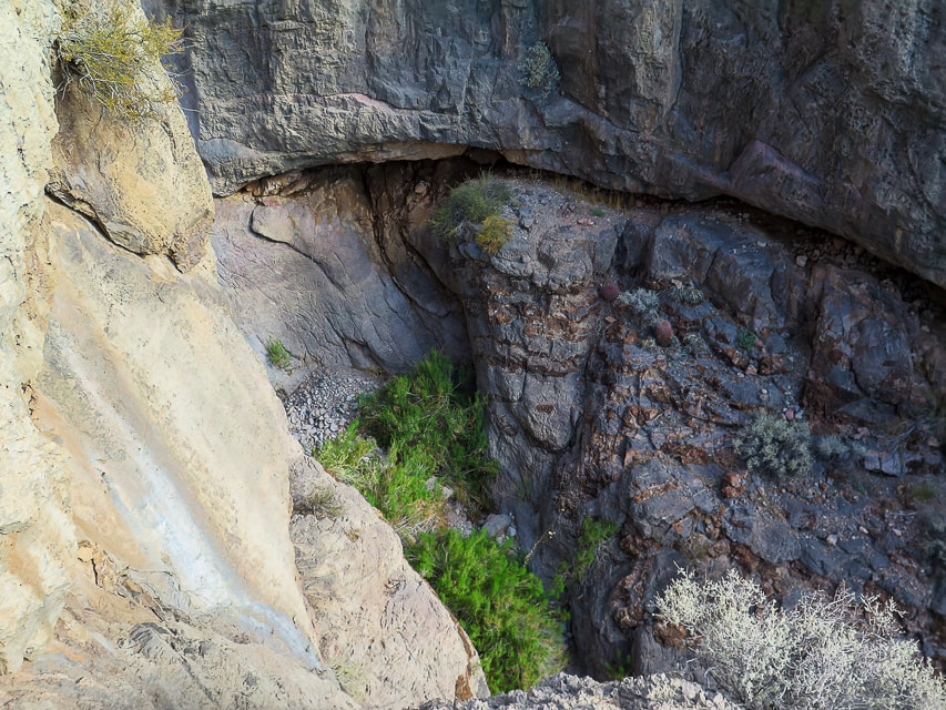
Once out of the wash, everything here is steep!
Picture
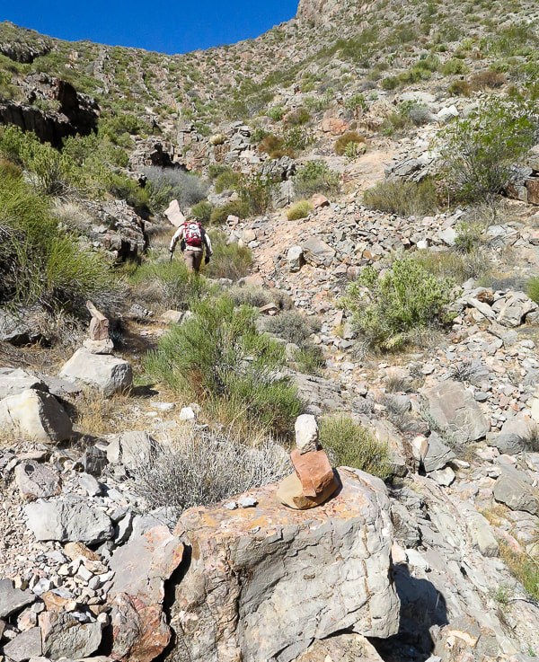
Cairns mark trail that continues up to saddle (top of photo).
Picture
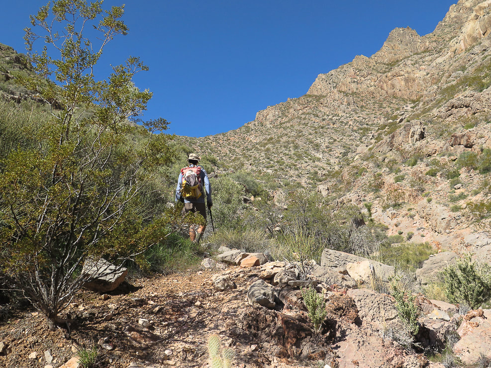
Getting closer to saddle, then the trail goes up and works around the rock ledges ascending from saddle on the right.
Picture
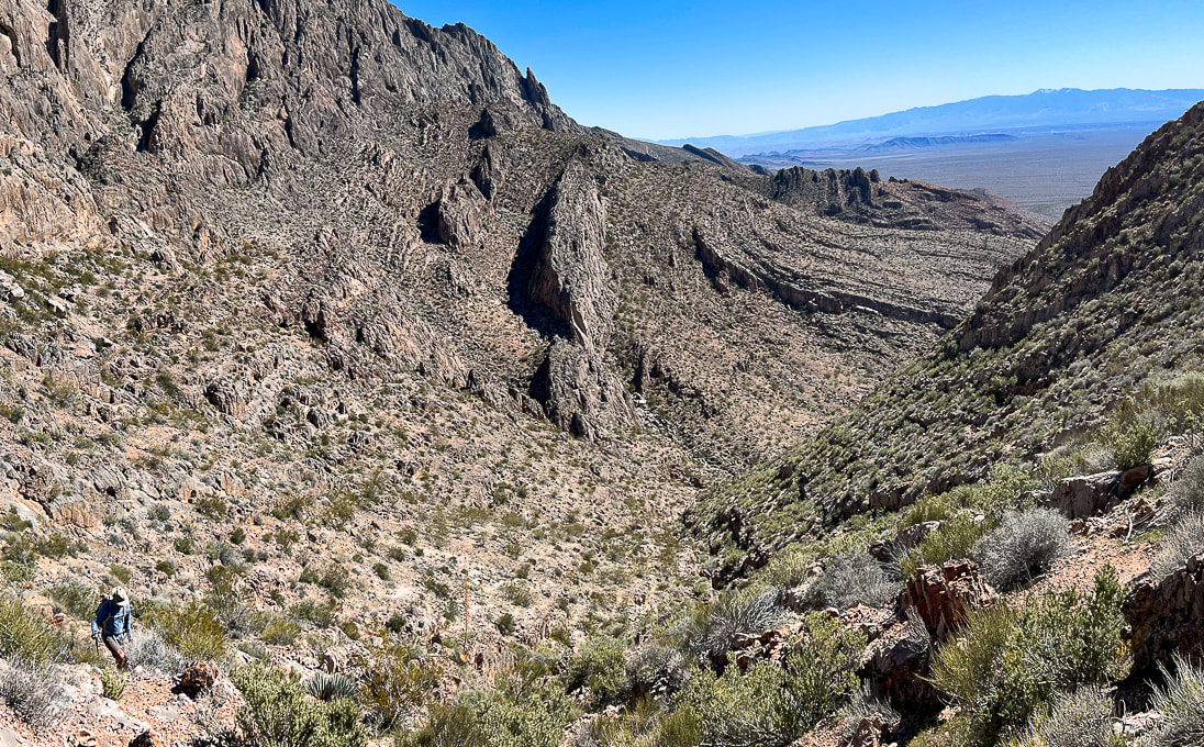
Looking back down toward end of wash from the saddle.
Picture
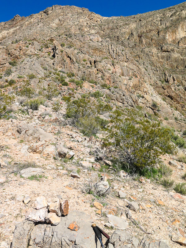
At saddle, cairns mark trail that ascends the ledges and walls to the north, with some Class 3 climbing.
Picture
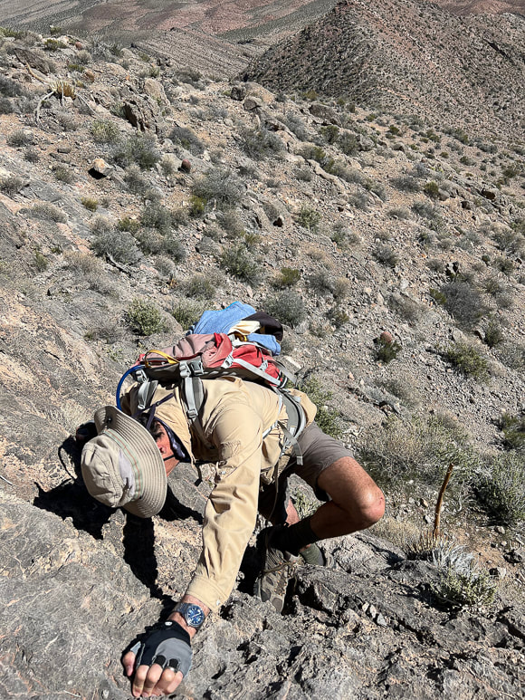
One of the walls to climb to get up over the ledges.
Picture
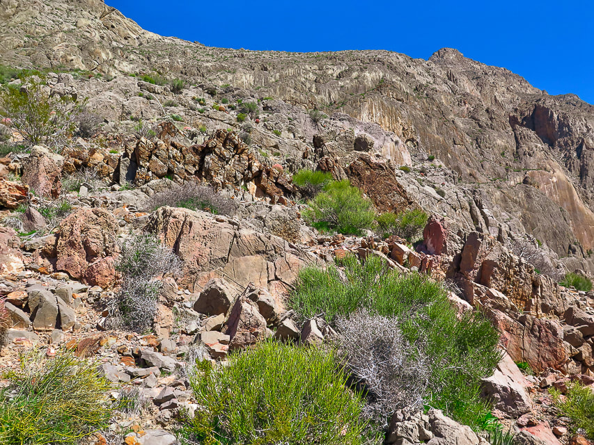
The trail continues over these ledges to the less-steep and more open terrain above at top-middle photo.
Picture
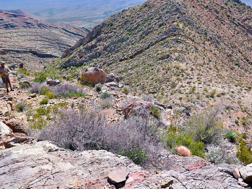
On the ledges section looking back down at the saddle above drainage.
Picture
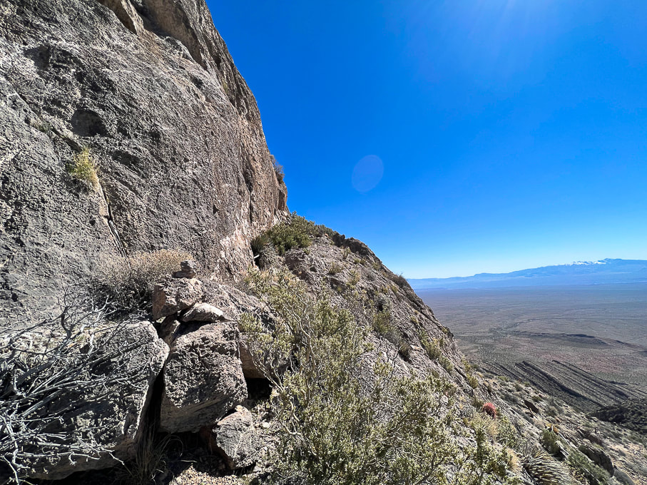
The trail ascends to the left of this huge wall.
Picture
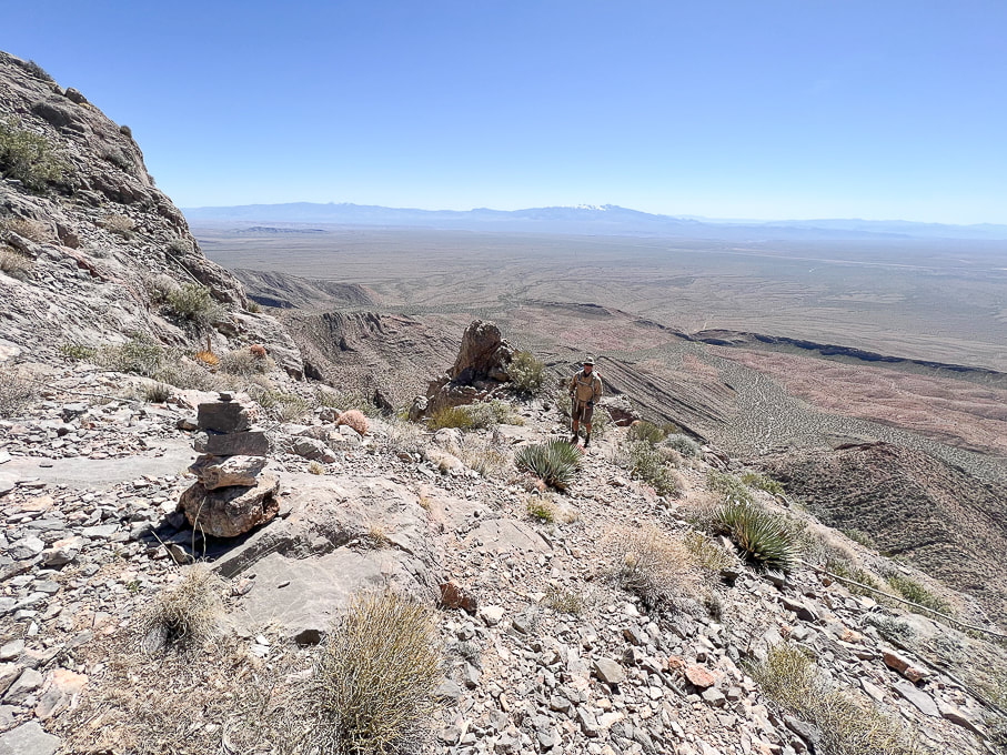
Cairns mark trail as it transitions from the steep ledges to less-steep but narrow "platform".
Picture
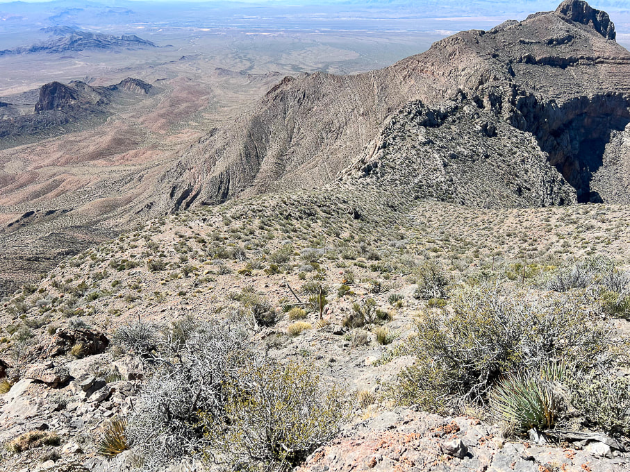
Looking back at relatively flat platform above ledge section.
Picture
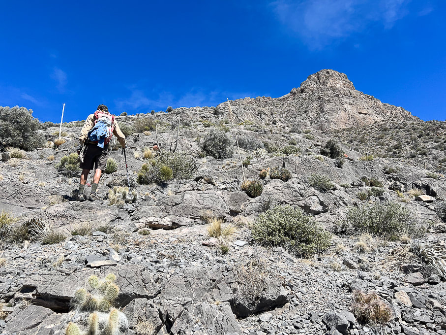
Getting closer to the summit!
Picture
Picture
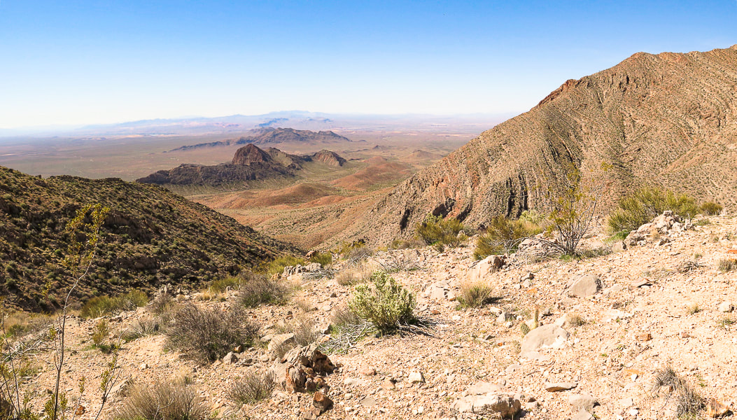
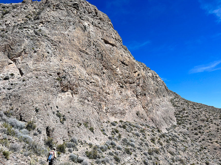
Walking around south face of summit block.
Picture
Picture
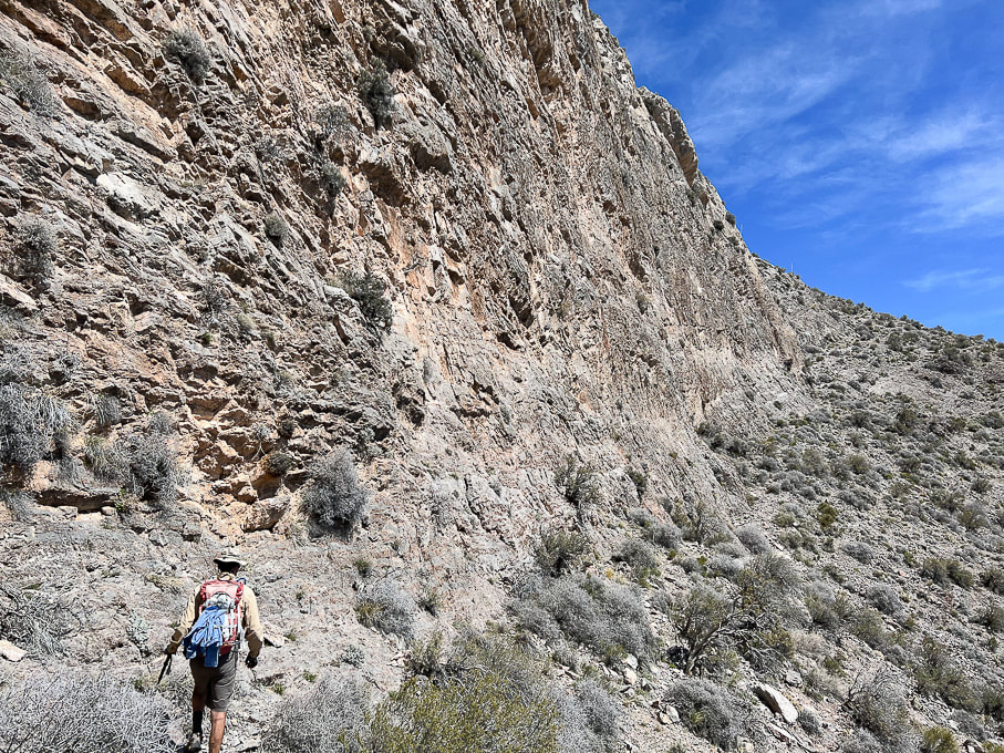
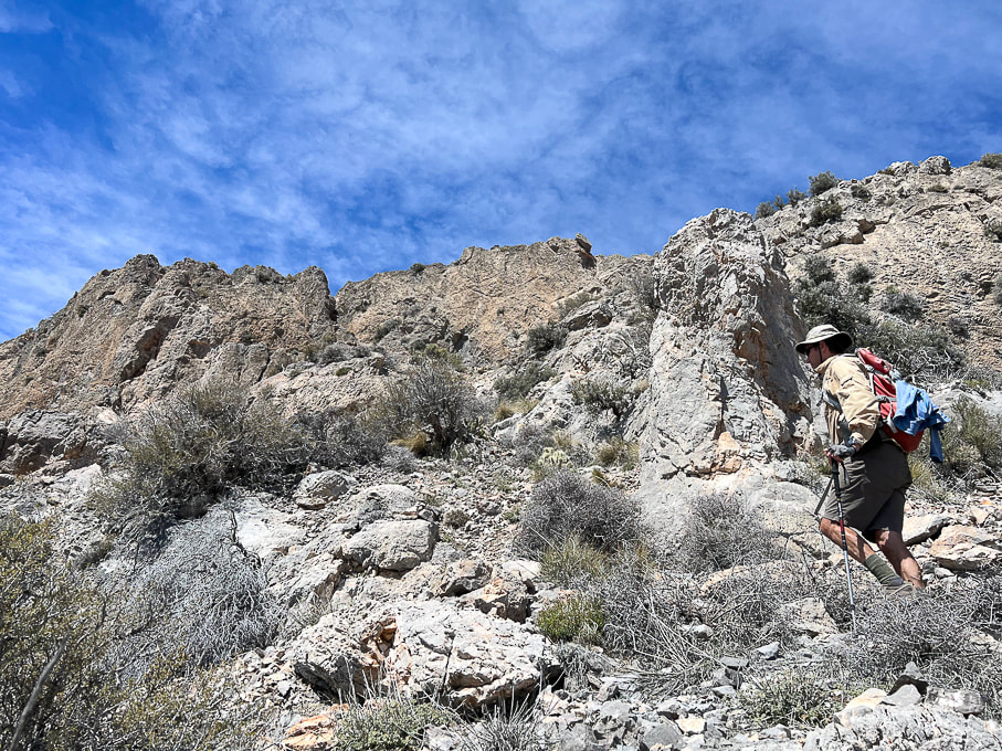
Continuing up toward summit ridge after the walk around south face.
Picture
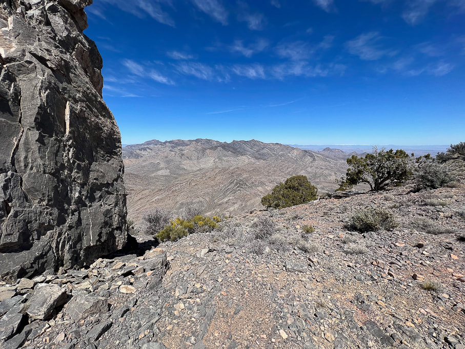
Reach Moapa's east ridge for spectacular views to the north - Mormon Mountains.  Travel a short distance around Moapa's east ridge to the left to find cairn marking entry onto the final ridge to summit climb.
Picture
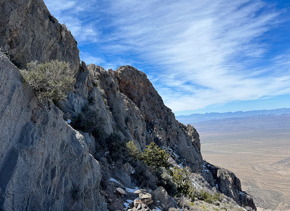
The northwest-facing side of Moapa Peak summit seen here.  At first, we missed the cairn to lead us up the walls on the left, so we kept walking along this north side for a short distance.  When we didn't see any footprints in the snow here (earlier we met a climber who was on his way down from the peak) and no more cairns, we went back to beginning of the ridge and found the cairn (bottom of photo) marking entry onto the knife's edge part of final ridge ascent.  It's here you take a left to find another cairn in the cleft on the left.
Picture
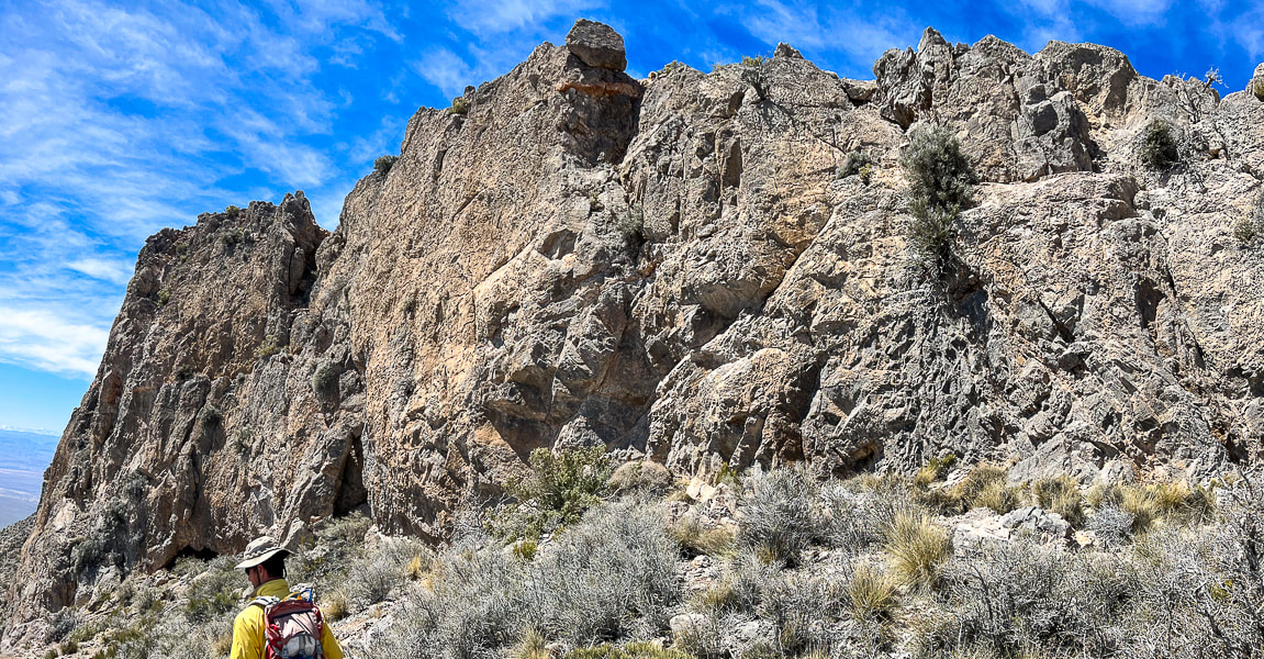
Making our way back down after turning around at scary knife's edge!  A bit disappointed we didn't summit, but still really happy we got that far on this unique hike with its breathtaking views and drop-offs, and steep, narrow approach.
Picture
Picture
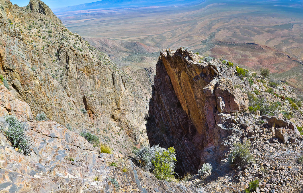
Trail comes close to this deep chasm.
Picture
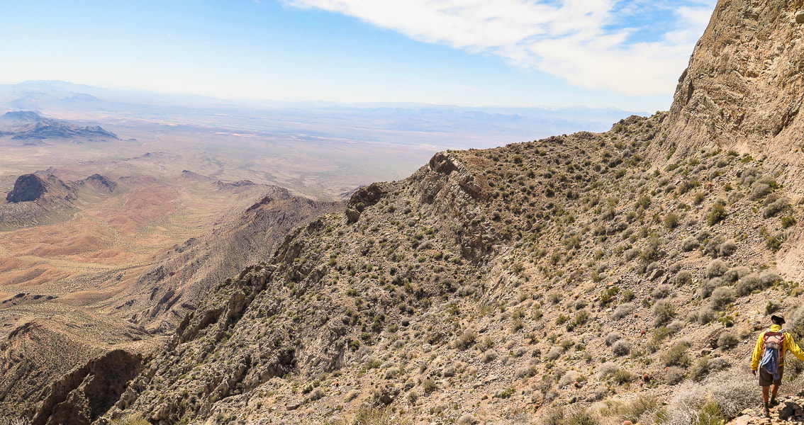
On the way back heading toward saddle that leads to platform above the ledges section.
Picture
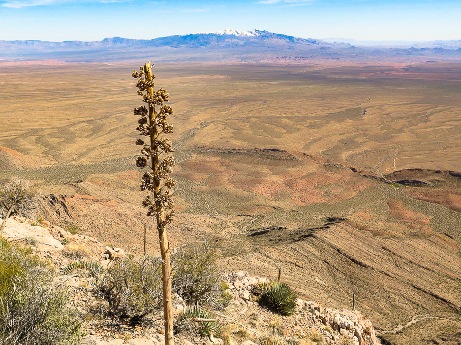
Snow-covered Virgin  Peak in the distance to the east.
Picture
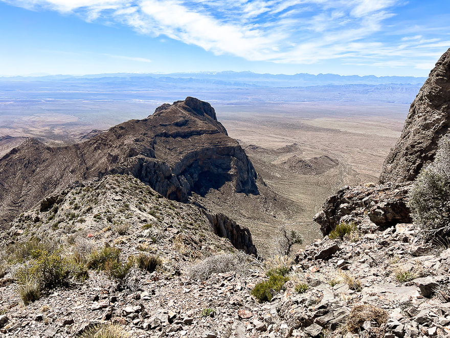
On the way down:  view to the west of Nevada's parallel mountain ranges caused by extension in the Great Basin tectonic province.  Great Basin rifting (extension) is the second major tectonic episode that shapes this area; it began ~ 30 mya and continues today.  Normal faults result from extension - a pulling-apart of Earth's crust.
Picture
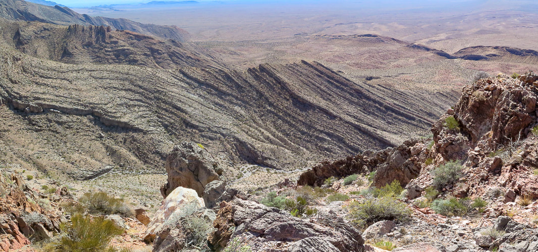
Tilted sedimentary beds.  Nevada is interesting because it has undergone major tectonic forces of mountain building, shearing, faulting and rifting.
Picture
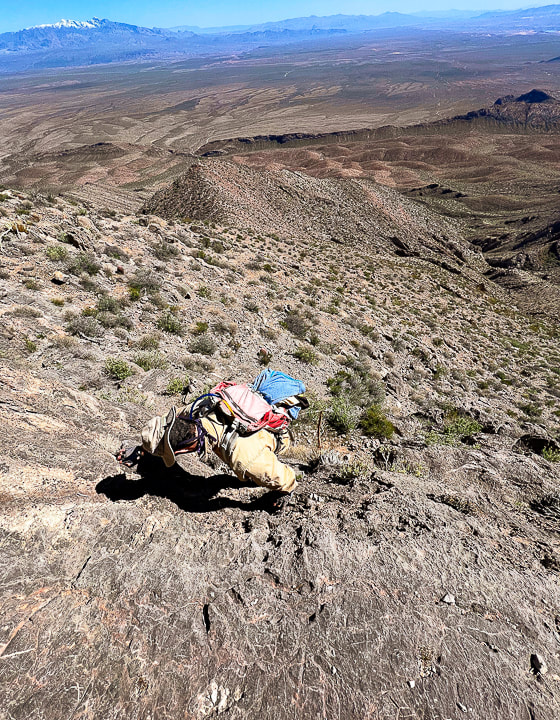
Descending down the ledges section.  Virgin Peak on the horizon.
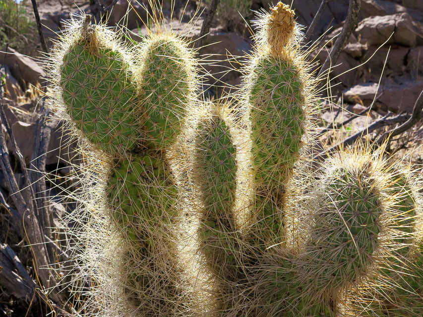
Picture
Mojave Prickly Pear
Picture
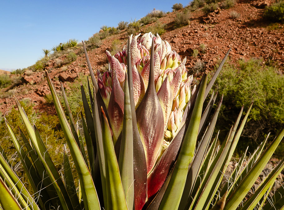
Mojave Yucca
Some cool stuff on the trail.
Picture
Picture
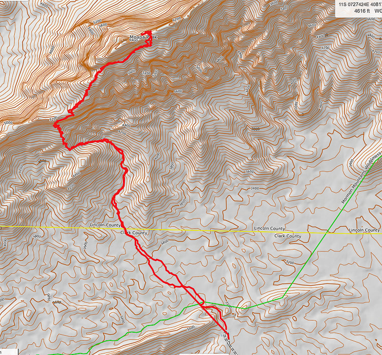
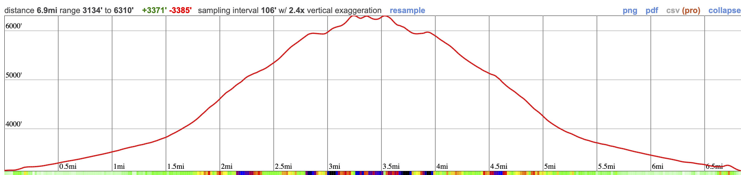
Our GPX tracks and elevation profile on Caltopo maps.
Picture
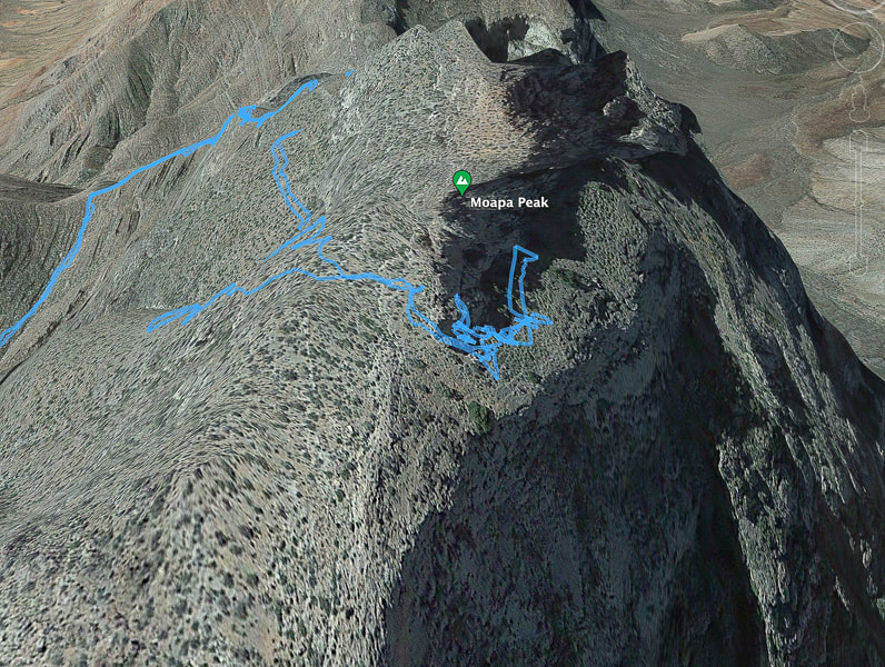
Our GPX tracks walking around Moapa's east ridge and final ascent.  The tracks show that initially we went too far along the north face and then we turned around to find the entry to the ridge.
References:
Indian Names in Utah Geography.  From Utah Historical Quarterly Volume 1, Number 1-4, 1928 by Utah State History.

Carpenter, J.A., 1989. Structure of the southern Mormon Mountains, Clark County, Nevada and regional structural synthesis : fold-thrust and basin-range structure in southern Nevada, southwest Utah, and northwest Arizona.  Master's thesis dissertation from Oregon State University.
2 Comments
Linda Paul link
5/2/2023 04:00:23 pm

Yeepers! What an adventure! I'm glad you made it as far as you did and equally glad that you are wise enough to be satisfied with how far you made it.

I can't help but marvel at the way in which you find and appreciate beauty in this (sorry but...) god-forsaken landscape. There's obvious beauty there, because you photographed it that way. But I don't think there'd be enough gold at the end of the rainbow to compel me to take on this hike. Your accomplishments, both physical and artistic are commendable.

I'm also glad you provided the image of Fred descending. That actually sent an electrical bolt to my toes. Going up is one thing. Coming down.....ayeyaiyai!

Reply
Sue link
5/3/2023 01:33:33 pm

Yes, a good word - "wise". Although I still keep on thinking "if I tried again, maybe I could make it! But then Fred and I look at each other and say "nahhh".

It is a stark landscape with grey and brown hues but it is so sublime. I love open spaces, so it suits me. There's alway life that you stumble upon that has adapted to this harsh environment. A hard-scrabble existence! I guess one thing you get good at in this part of the country (southwest desert) is descending backwards down rock faces!

Also, I have so many fond memories of desert hiking with dear friends that goes back 35 years! So I naturally love the desert.
Thanks for your comment!

Reply


Leave a Reply.

    Categories

    All
    Arizona Hikes
    California-desert-hiking
    California-desert-hiking
    Idaho Summits
    Nevada Hikes
    Petroglyphspictographs
    Snowshoe Hikes
    Southern Utah Hikesbikes

    To Subscribe to Explorumentary adventure blog and receive new posts by email:

    submit
    Picture
    Sue and Fred
    Picture

    About this blog

    Exploration documentaries          –  "explorumentaries"  list trip stats and highlights of each hike or bike ride, often with some interesting history or geology.  Years ago, I wrote these for friends and family to let them know what my husband, Fred and I were up to on weekends, and also to showcase the incredible land of the west.  
    Picture
    Happy Spring!
    Picture

    About the Author
    Sue Birnbaum

    A  trip to Jumbo Rocks Campground in Joshua Tree National Monument 40 years ago sparked my passion for hiking, exploring, and learning about desert ecosystems.  I met my husband Fred on Mt. San Jacinto.  We've explored the American West together; we love this land and I hope to inspire you to get out and explore through my photographs and trip descriptions.
    In 1992, Ray Wilson and I conceived the first Cactus to Clouds hike which climbs over 10,000 feet in one day to the summit of Mt. San Jacinto near Palm Springs, California.
    CACTUS TO CLOUDS HIKE 
    READ MORE
    ABOUT SUE
    Some of my favorite websites:
    ​

    ​Awkward Botany
    ​amateur botany for the phytocurious

    Bird and Hike

    ​"Intended to encourage people to visit, learn about, and fall in love with the desert."
    ​

    Draw and Shoot
    Beautiful Photography

    Daring Dayhikes
    "Interesting places you can visit with a daypack."  Terrific Tucson and other desert hikes and East Coast, too.


    Earthline: The American West
    Debra "writes to extol our beloved Earth." Detailed hike info, excellently written.
    ​

    Geologypics.com
    Geology and Geologic Time through Photographs

    Glenn Suokko
    Vermont artist's paintings "inspired by a place based on the land .... drawn to painting the representation and abstraction of nature."

    In the Company of Plants and Rocks
    ​A natural history blog about botany, plant ecology, and geology.


    MishMoments:  Joy of Photography
    this website is "
    about capturing that special moment in life’s journey and making the most of the time we have."

    Nature's Depths
    Walking through nature with John Palka, a neuroscientist who loves plants and ponders big questions.


    Rangewriter - What Comes Next?
    ​Linda's excellent writing brings to life her interesting adventures, "curiosities and thoughts", post-retirement.

    SeekingLost - Hiking and Backpacking Adventures.

    Stav Is Lost- Unconventional, out-of-the way hikes in the American West.


    Uprooted Magnolia
    ​Leah Yetter's beautiful "photo journal on life, love, and the spirit of Wyoming."

    Archives

    April 2025
    March 2025
    January 2025
    December 2024
    November 2024
    October 2024
    September 2024
    August 2024
    July 2024
    June 2024
    May 2024
    April 2024
    March 2024
    January 2024
    December 2023
    November 2023
    October 2023
    September 2023
    August 2023
    July 2023
    June 2023
    May 2023
    April 2023
    February 2023
    January 2023
    December 2022
    November 2022
    October 2022
    September 2022
    August 2022
    July 2022
    June 2022
    May 2022
    April 2022
    February 2022
    January 2022
    December 2021
    November 2021
    October 2021
    August 2021
    July 2021
    May 2021
    March 2021
    February 2021
    January 2021
    November 2020
    October 2020
    August 2020
    July 2020
    June 2020
    April 2020
    March 2020
    February 2020
    January 2020
    November 2019
    October 2019
    September 2019
    August 2019
    July 2019
    June 2019
    May 2019
    April 2019
    February 2019
    December 2018
    November 2018
    October 2018
    September 2018
    July 2018
    June 2018
    May 2018
    April 2018
    March 2018
    February 2018
    January 2018
    December 2017
    November 2017
    October 2017
    September 2017
    August 2017
    July 2017
    June 2017
    April 2017
    February 2017
    November 2013
    August 2013
    July 2013

HOME

Cactus to Clouds Hike
More Quotes
​
Mary Oliver Poems
Ann Zwinger Quotes
HIKES BY STATE

Idaho Hikes
Utah Hikes/Bikes
​Arizona Hikes
​California Desert Hikes
​Wyoming Hikes
​Nevada Hikes

BLOGS

Adventure Blog
Women and the Land
GEAR REVIEWS
FIT AFTER 50
Fred Birnbaum
Dave Brasuell
Bus' Little Black Book
​Mike Carlson
​Ray Wilson
​Marcia Bondy
Bryan Krouse
​Maria Keezer
​Tim Clemens
​Doug Traubel
​Brian Holgate
​
Becky Borczon Blake
​Jennifer Cera and
​Sue Birnbaum

​Vance Powell
​Boise Cross Fit Masters Ladies
​Vickie Kearney

GALLERY

Desert Plants
Nature
Earth + Sky
Urban
Water
Patriot 
​Orchids
Boise
​
  ABOUT
    Contact

​
© 2017 - 2025 by Sue Birnbaum.  Photos on this website are the sole property of Sue Birnbaum unless otherwise indicated.  Please receive permission before publishing my trip reports and photos.
I try my best to be accurate with my hike descriptions; please research your adventures, always bring a map and compass and know how to read them, be prepared!  All of these hikes can be dangerous; hike at your own risk.  ALWAYS carry the Ten Essentials with you on hikes. 
​Please feel free to contact me with comments or questions, or if you see any errors that need attention.
Thank-you for stopping by!


EXPLORUMENTARY.com
  • Home
    • Cactus to Clouds Hike
    • More Quotes
    • Ann Zwinger Quotes
    • Mary Oliver Poems
  • Hikes by State
    • Southern Utah
    • Idaho
    • Arizona
    • California Desert
    • Nevada
    • Wyoming and New Hampshire
  • Petroglyphs and Pictographs
  • BLOG
    • Adventure Blog
  • GALLERY
    • DESERT PLANTS >
      • Beavertail cactus
      • Brittlebush
      • Christmas Cactus
      • Arizona Barrel Cactus
      • Parry's penstemon
      • Agave
      • Arizona Rainbow Hedgehog
      • Claret Cup Hedgehog
      • Desert Agave
      • Palmer's Penstemon
      • Silver Cholla
      • Cristate Saguaro
      • Indian Paintbrush
      • Ocotillo
      • Santa Rita Prickly Pear
      • Spiny Cliffbrake
      • California Barrel Cactus
      • Engelmann Prickly Pear
      • Velvet Mesquite
      • Joshua Tree
      • Buckhorn Cholla
      • Hedgehog Cactus
      • Fishhook cactus
      • Thompson's Woolly Locoweed
    • NATURE
    • BOISE
    • EARTH + SKY
    • URBAN
    • WATER
    • PATRIOT
    • ORCHIDS
  • Fit After 50
    • Brian Holgate
    • Fred Birnbaum
    • Dave Brasuell
    • Bus' Little Black Book
    • Mike Carlson
    • Ray Wilson
    • Bryan Krouse
    • Vickie Kearney
    • Maria Keezer
    • DOUG TRAUBEL
    • Boise Cross Fit Masters Ladies
    • Tim Clemens
    • Marcia Bondy
    • Becky Borczon Blake >
      • Becky B Downtown
    • Jennifer Cera and Sue Birnbaum
    • Dave Brasuell
    • Vance Powell
  • Contact