|
Cross-country hike to summit of Monument Mountain with expansive views in Joshua Tree National Park, and some of the oldest rocks in California.
Trip Stats (from Pinkham Canyon Road approach, off of Cottonwood Springs Road)
Geology
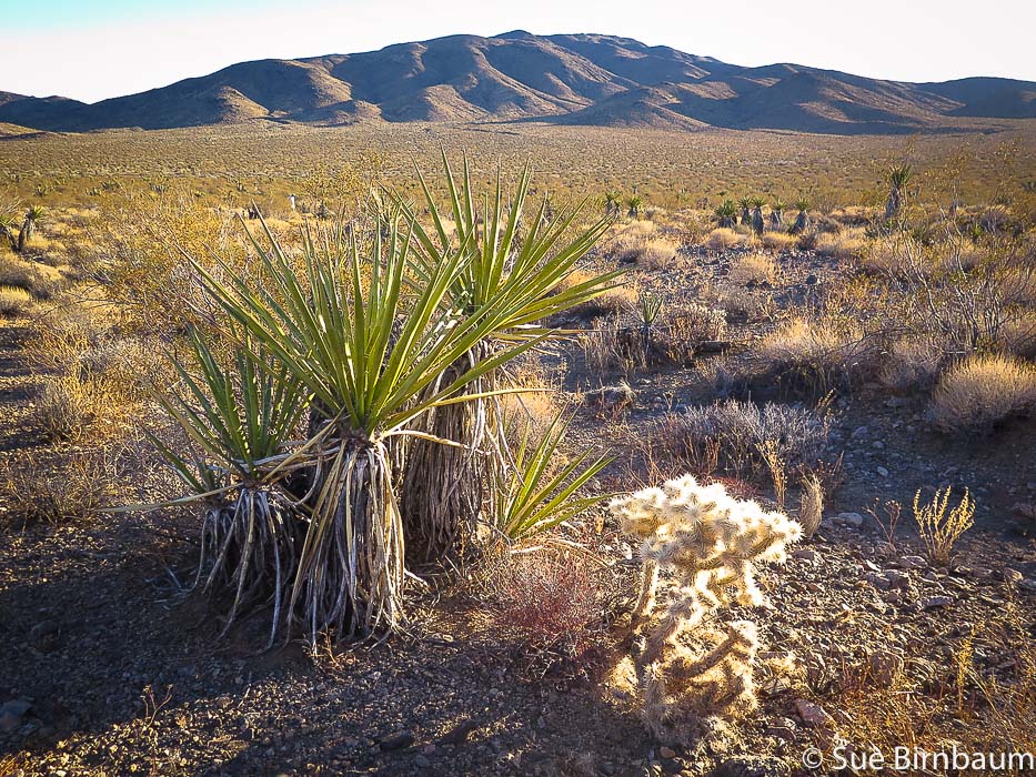 Yucca and cholla cactus Near Pinkham Canyon Road looking southeast toward Cottonwood Mountains, southern part of Joshua Tree Wilderness "Mind expanding" is what designer Jonathan Adler calls Joshua Tree. For those who have traveled deserts in Southern California, hiked the dry washes, climbed rust-red and brown rocks and seen valleys that extend nearly to the horizon backed by mountain ranges, Joshua Tree is a special place. It's an expansive and sublime wonderland. It was our long-time friend Scott's idea to summit Monument Mountain in southern Joshua Tree National Park around New Year's Eve 2017. Scott has hiked many peaks on the Desert Peaks Section Peak List, and he has tons of experience hiking cross country. The views from the mountain's south ridge are incredible, and about 1/2 way to the summit, if you turn around and look to the south, you can see the Salton Sea, a large lake formed from overflow of the Colorado river when engineers in 1905 were attempting to deliver more water to irrigation canals . The weather was perfect: sunny, no wind, and 70 degrees. Fred and I had arrived from Boise for our yearly desert holiday fix. After driving up Cottonwood Springs Road from Joshua Tree NP's southern entrance, we headed left (west) onto the sand/gravel Pinkham Canyon Road that begins adjacent from the Cottonwood Visitors Center. The road was in good condition, but I would still recommend a 4-wheel drive vehicle because there was soft sand in parts. We piled out of Scott's red pick-up 5 miles down Pinkham Canyon Road and stood in a sun-flooded broad valley of yucca, cholla and creosote surrounded by mountain ranges on all sides. Looking north to our destination, we could see our ridge to the summit, but Monument Mountain was not in view. We started walking across the wash due north. 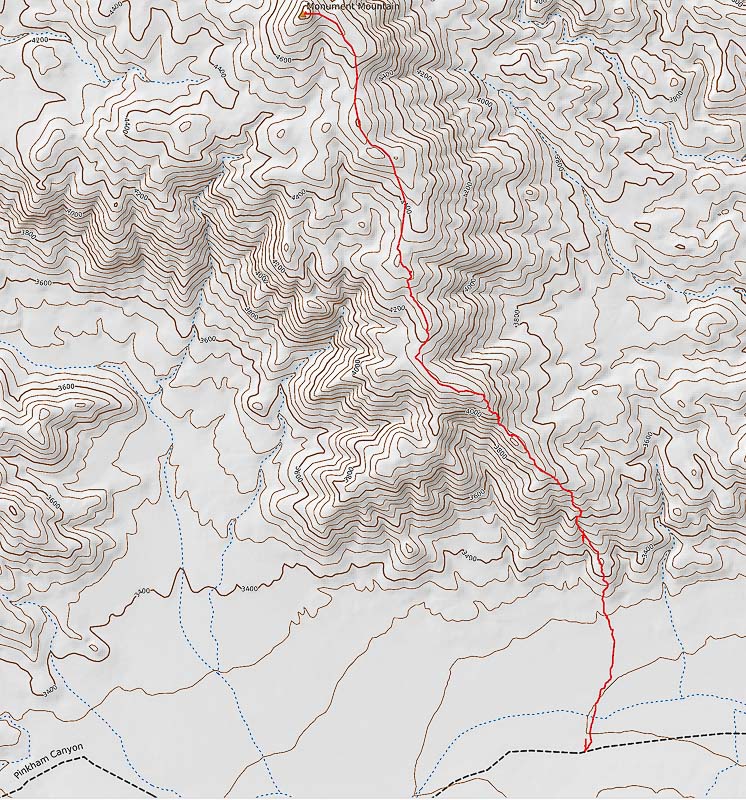 Our route down from summit of Monument Mountain from Pinkham Canyon Road (black dashed line), Joshua Tree NP (North at top of map) 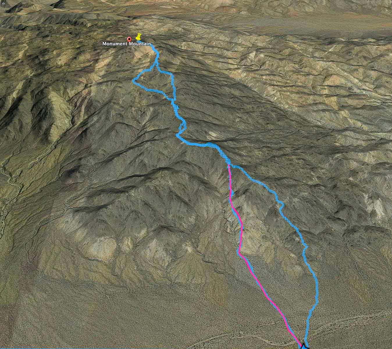 Google Earth image of our two routes: pink line represents our ascent to main ridge trail; Blue line represents our descent. On our way down, we took a ridge to the west and then joined back on the main trail (seen on map at upper "loop"). The blue line route down is easiest: the path wasn't apparent when we started. We parked ~ 5 miles down Pinkham Canyon Road (bottom of image). click on map for larger image 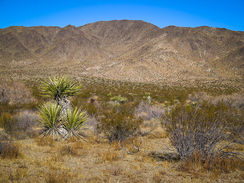 View to the north of the Monument Mountain's south ridge. Cross the wash and head for toe of ridge 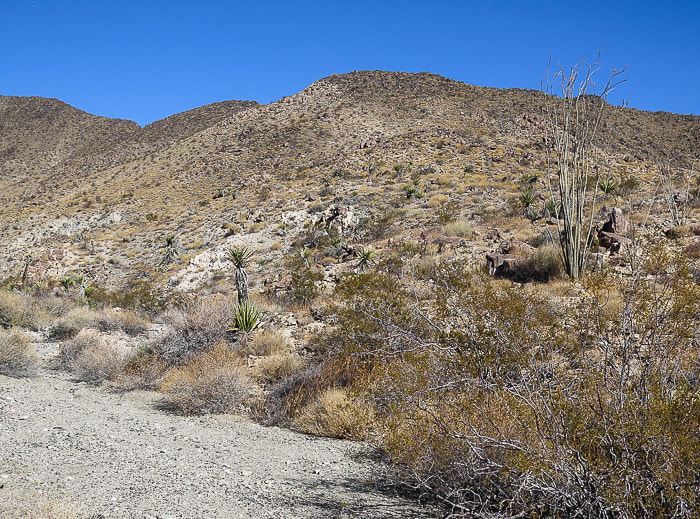 From edge of wash, climb up first hill to the south ridge of Monument Mountain The flatter valley wash soon turns into an alluvial fan with larger rocks and braided channels at the toe of the ridge. As you look north, you see a rise and it is best to get to the top of it and onto the ridge as soon as possible; that will take you to the top of Monument Mountain. Walking on the ridge is pleasant with less vegetation and rocks to navigate than walking on the slopes beneath the ridge. The trail on top of the ridge is faint and marked at somewhat regular intervals with small cairns. Once on the ridge, the route is a gentle rolling climb to the summit cone of rocks with washes on both sides. Some dry washes have deep rock cuts at the top. As seen from the Google Earth map above, we took a less efficient way up (pink line), side-hilling and navigating rocks. Sometimes you don't figure out the "right" way up until you go down! 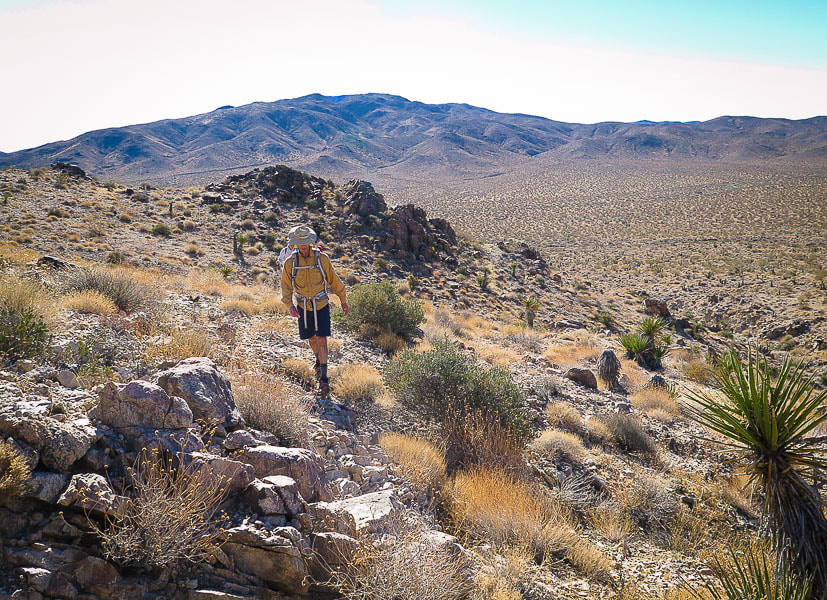 Fred ascending to ridge from Pinkham Canyon Road in valley below 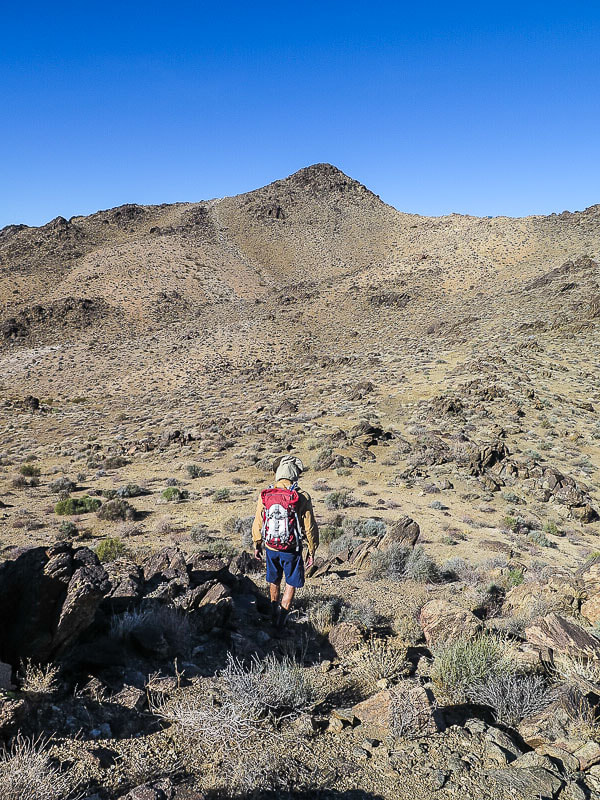 Looking at Monument Mountain summit, 4,837 feet elevation About 2/3 of hike distance, (1.7 - 2.0 miles), Monument Mountain finally comes into view. You can see faint trail leading up to the ridge after descending slightly down from the ridge into a broad sloping valley on your left and a saddle to your right. The climb up the stable metamorphic rocks to the summit is relatively easy. Nothing matches the feeling of so much desert around you, and unobstructed, airy 360-degree views. 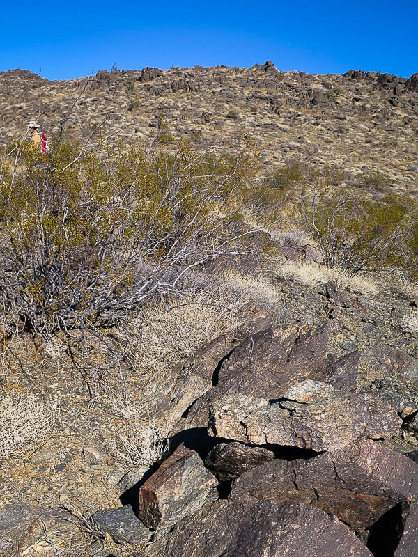 Augen gneiss - some of the oldest rocks in California at early and middle Proterozoic age 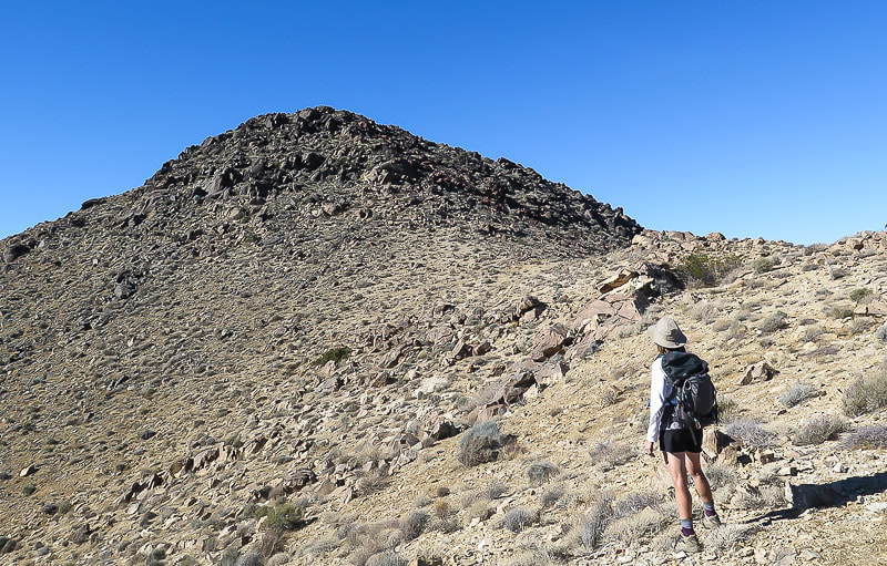 Monument Mountain summit 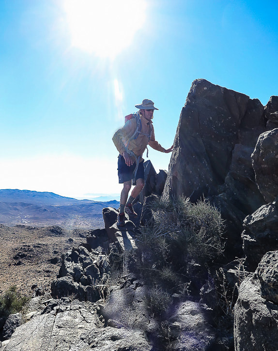 Augen gneiss at summit of Monument Mountain, some of the oldest rocks in California, age 1.65 bya (billion years ago) Light-colored feldspar mineral fragments in metamorphic rock 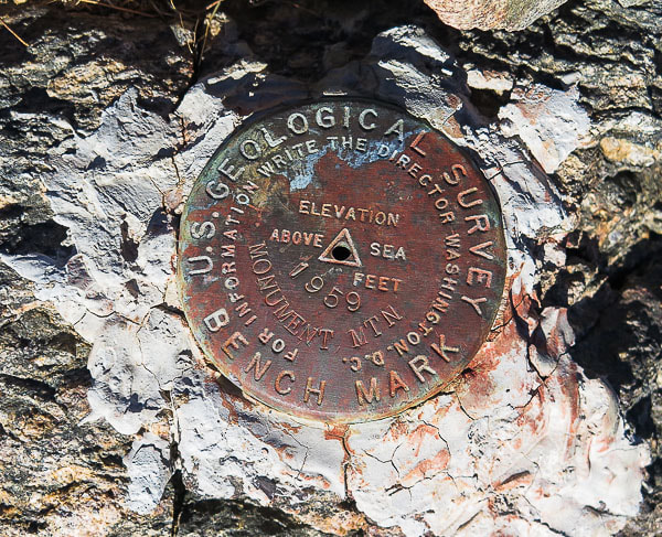 The survey marker on Monument Mountain is a triangulation station (or main station), as indicated by the triangle inscribed in the middle of the disc. This is surrounded by three other survey markers in distant locations that have inscribed arrows that point directly back to this main station. Upon reaching the summit, we were somewhat surprised to see 2 people from the San Francisco Bay area that had hiked up via Porcupine Wash, from the northeast direction. I was surprised because this peak is so isolated and is located in the wilderness area. When I exclaimed, "There's the red can!", one of them commented that it was just trash left on a mountain. I explained to him that it was a summit register, whereupon he signed his name. I told him that the register at Cowboy Camp in the Santa Rosa Mountains still had the entry I had written almost 20 years ago! Mt. San Jacinto, the towering presence over Palm Springs can be seen to the west. The rock at the summit looks and feels old because it is old! These rocks record the earliest geologic events in Joshua Tree National Park - originated as sedimentary and igneous rocks that underwent metamorphism and then a couple of continent-building episodes finally to be uplifted during the Mesozoic tectonic events where it became fragmented. There are 4 units of this metamorphic complex within Joshua Tree. The augen gneiss on Monument Mountain is a metamorphic granite containing elliptically-shaped feldspar porphyroclasts in its layering (augen in German means "eye"). You can see these lighter grains of feldspar embedded in the dark rock. This type of rock has undergone Uranium-Lead geochronology from the zircon grains it contains to arrive at a date of 1.65 billion years ago, making these some of the oldest-known rocks in California. 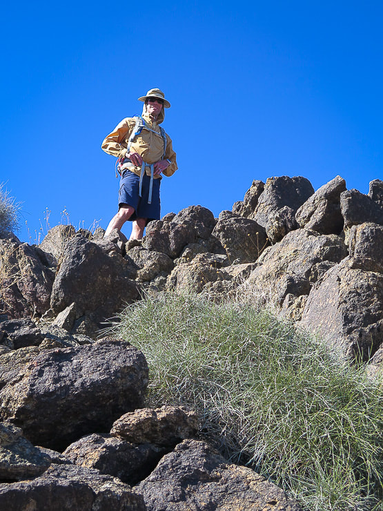 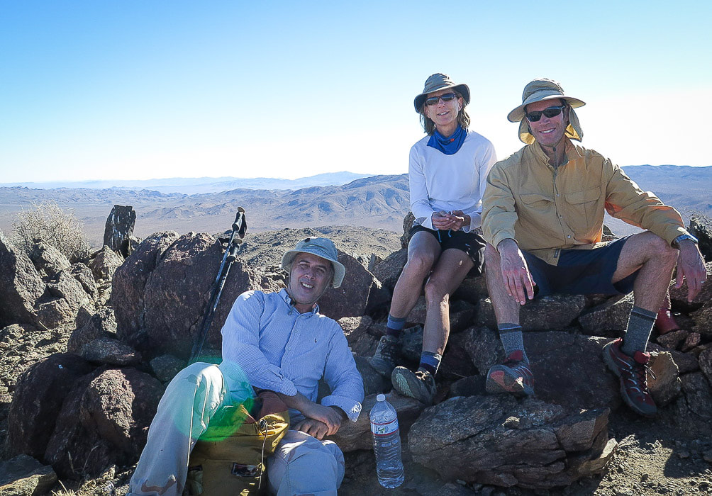 Scott, Sue and Fred on summit of Monument Mountain 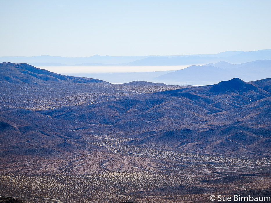 View to the south of the Salton Sea from the summit 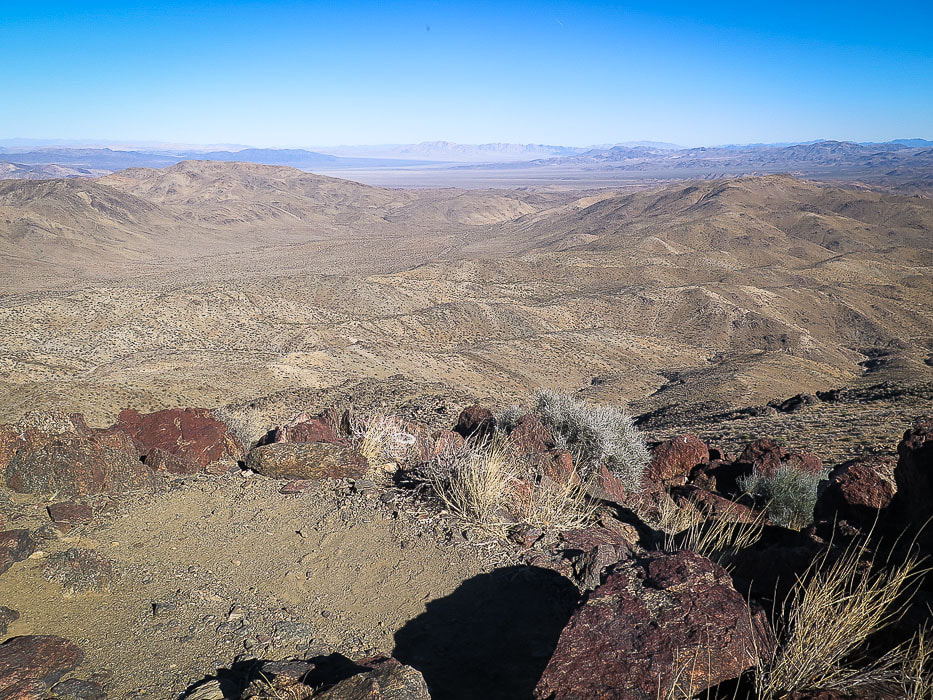 View from the summit to the southeast 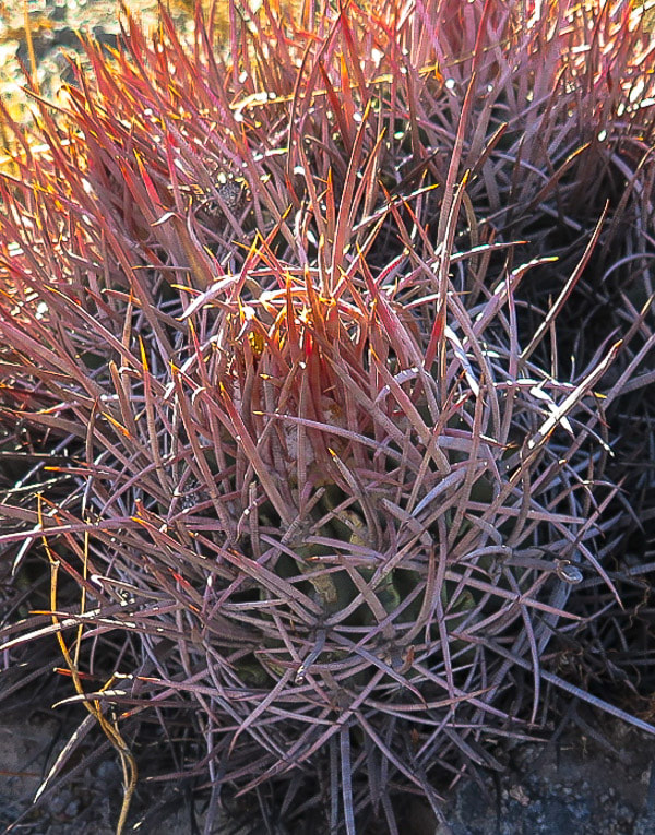 Red Barrel Cactus Ferocactus cylindraceus 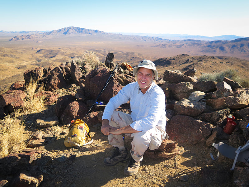 Scott next to summit register, Eagle Mountains in the distance 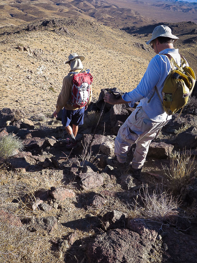 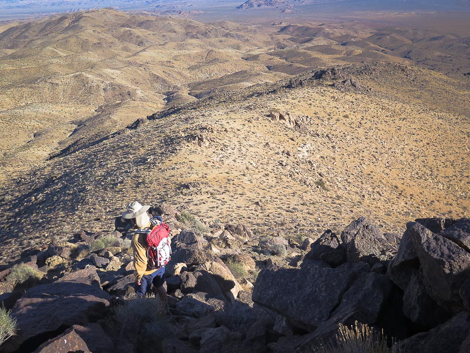 Heading down; we ascended on faint path seen to the right side of the ridge in this photo The way down is straightforward - follow the ridge! This is a good first-time cross country hike for the hiker that wants to get off a well-trodden path and do some fairly easy navigation with a good topo map. There's a smaller ridge to the right (southwest) as you head down and we took it for a little while about 1/2 mile down, but then got back on the main ridge. To avoid being pulled off the ridge and side-hilling over rock-cluttered and vegetation-thick (watch for the cactus spines!), sighting in the next cairn as one is passed is helpful. As we got closer to the valley, we got sucked into a canyon - easy to do if you get off the ridge. By this time, we could see a glint of sunlight off the truck that was far across the wash. Further down we regained the ridge that at its end was a broad slope we descended easily to the alluvial fan and then finally to the wash. The walk across the broad valley passes over many small channels, through cholla and yucca. Once we finally found the truck on Pinkham Canyon Road, we savored the setting sun illuminating the cholla cactus making them glow among the yucca and creosote. 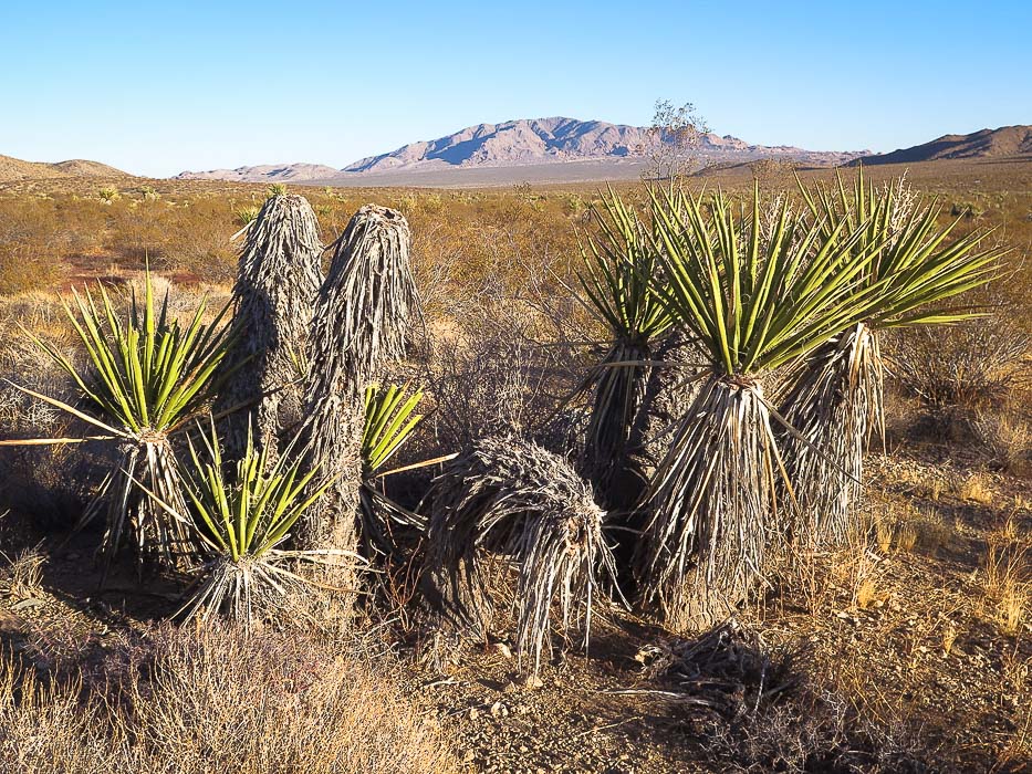 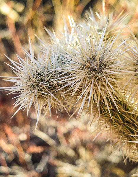 References
Kaiser, J. 2017. How Geology formed Joshua Tree National Park. Retrieved from https://jameskaiser.com/joshua-tree-guide/geology/ Powell, Robert E. 2001. Geologic Map And Digital Database of the Porcupine Wash 7.5 minute quadrangle, Riverside County, California, U.S. Geological Survey Open-file Report 01-030, scale 1:24,000, U.S. Dept. of the Interior, U.S. Geological Survey. Trent, D.D. 1998. Geology of Joshua Tree National Park, from California Geology, Dept. of Conservation, Divsion of Mines and Geology.
0 Comments
|
Categories
All

Sue and Fred

About this blogExploration documentaries – "explorumentaries" list trip stats and highlights of each hike or bike ride, often with some interesting history or geology. Years ago, I wrote these for friends and family to let them know what my husband, Fred and I were up to on weekends, and also to showcase the incredible land of the west.
To Subscribe to Explorumentary adventure blog and receive new posts by email:
Happy Summer!

About the Author
|