|
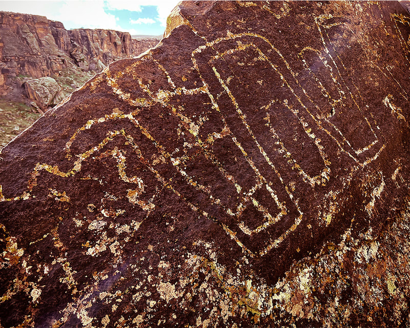
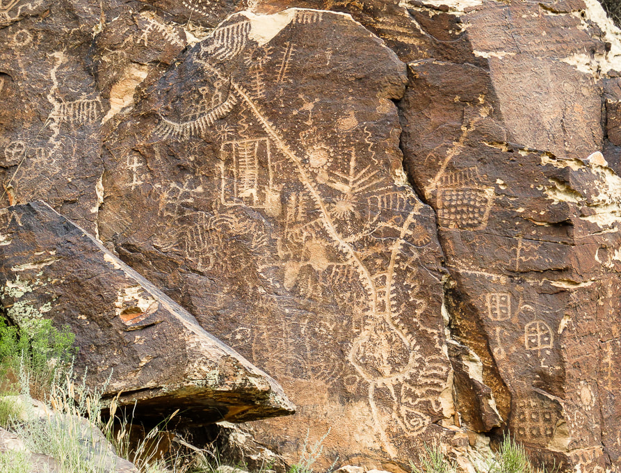
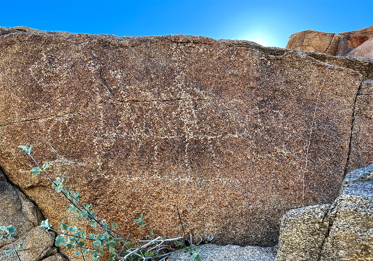
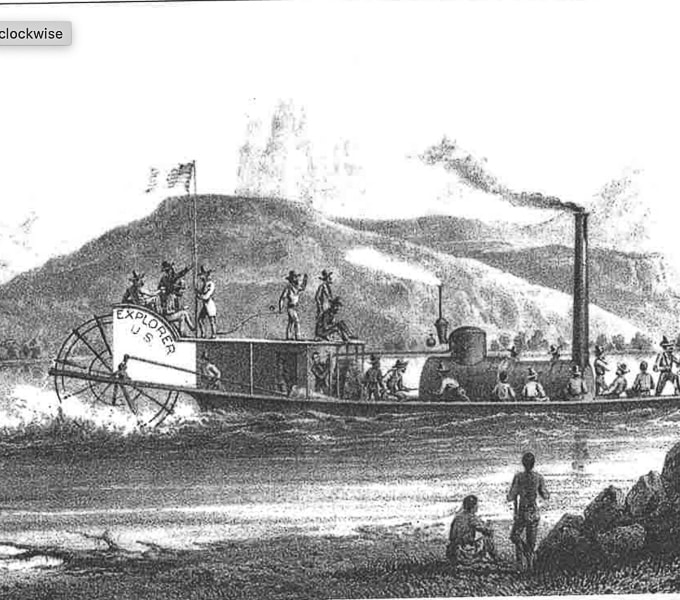
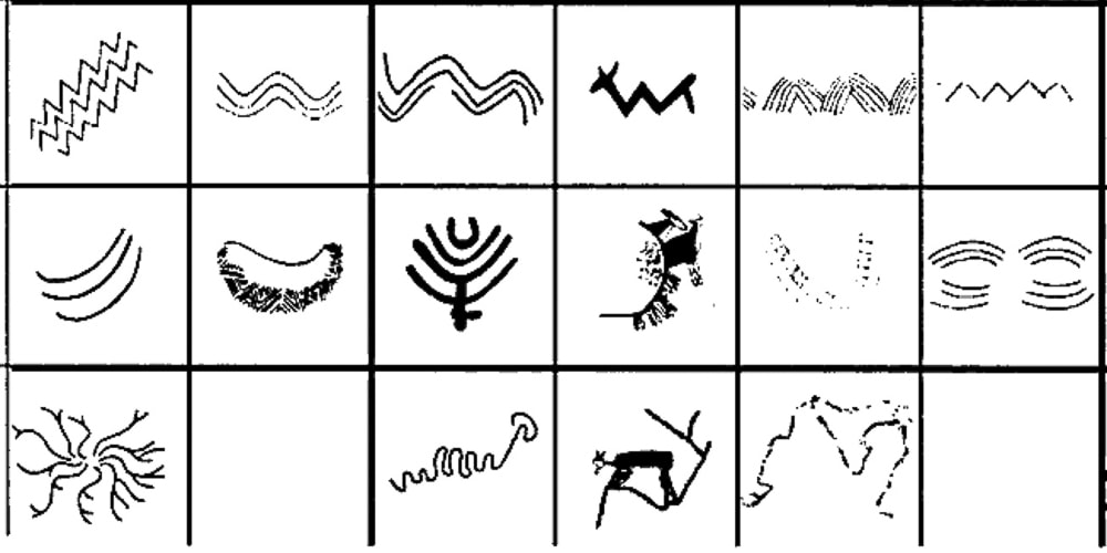
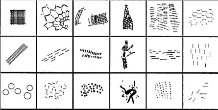
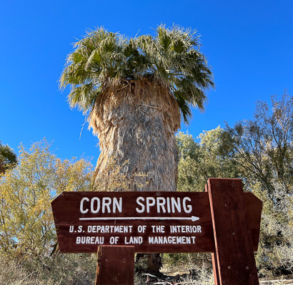
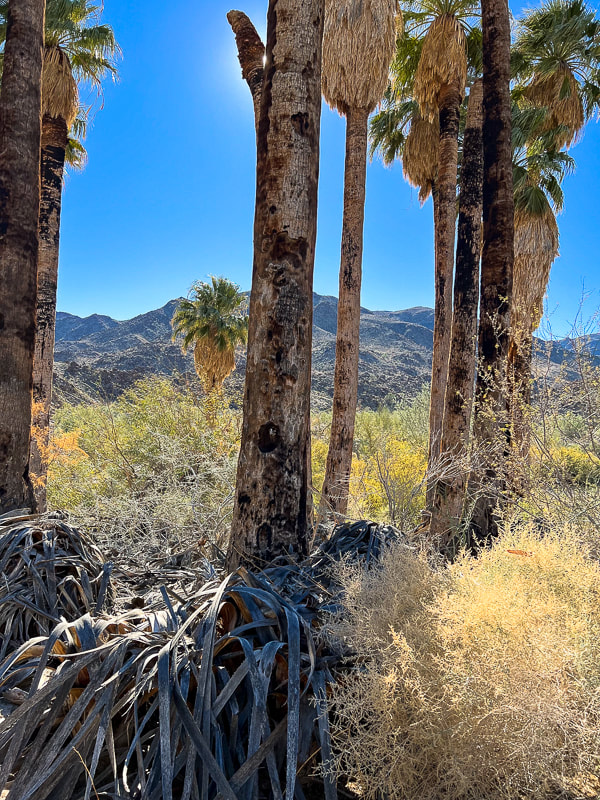
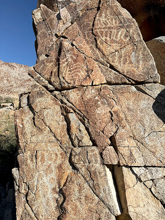
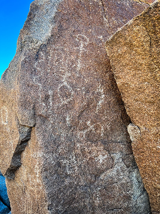
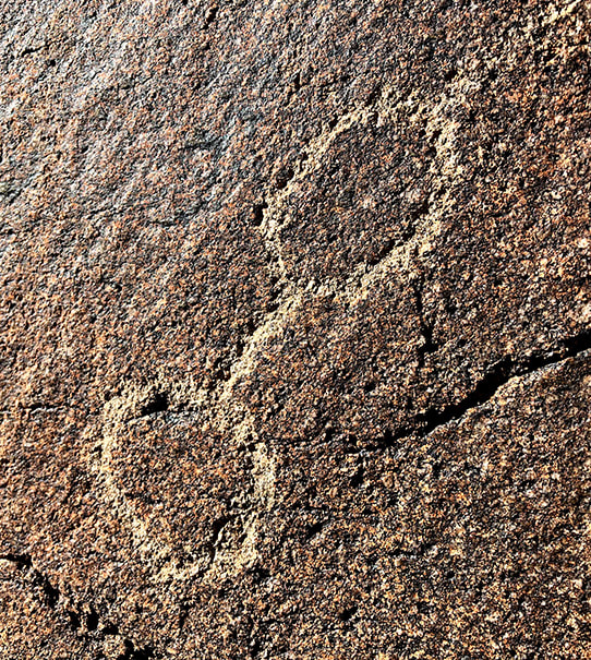
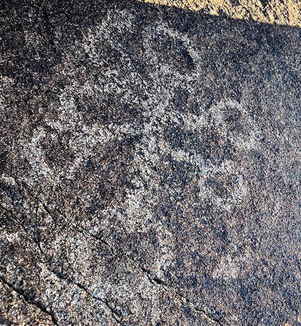
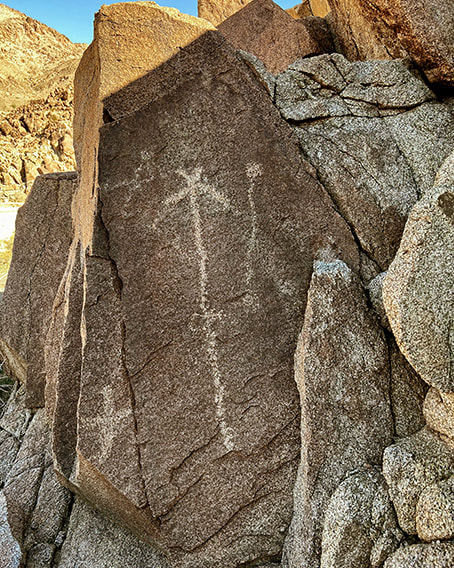
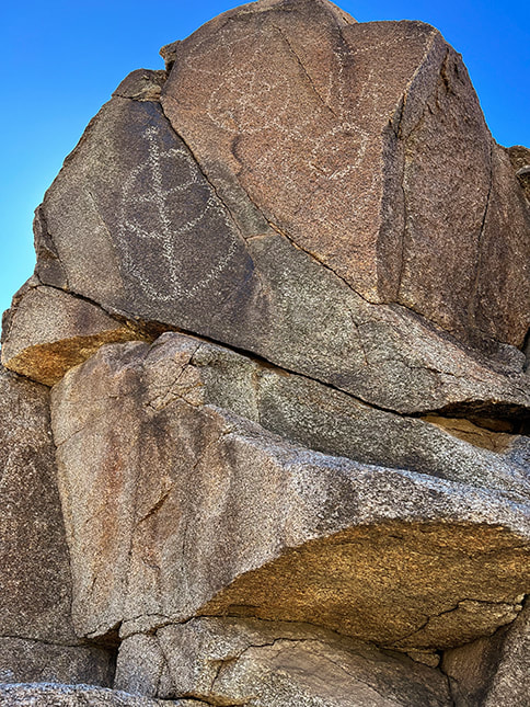
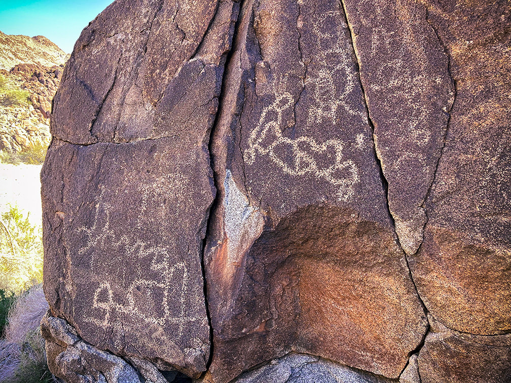
One of the best petroglyph sites in the Colorado Desert, Corn Springs has rock art dating back 10,000 years and was a major water stop by traveling Chemehuevi, Cahuilla, and Yuma Native Americans. Vision quests may have occurred here. Related: 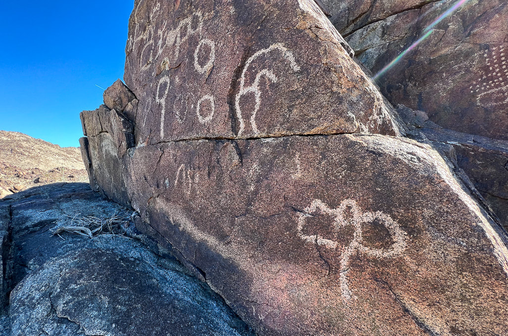 Trip Stats Location: Colorado Desert section of the Sonoran Desert - Southern California, Chuckwalla Mountains, Corn Springs Wash. What: Bureau of Land Management Corn Springs Campground, at a California palm oasis that was a major occupation site for prehistoric Native Americans. Petroglyphs are on east and west side of the wash. BLM information and interpretive trail guide. Driving: Graded gravel road 10 miles south of CA interstate 10, near Desert Center, east of Joshua Tree NP south entrance (link for driving directions in BLM site above). Coordinates: 33.626046, -115.324935. Geology: The Corn Springs Wash is a strike/slip (transverse) fault, as are many other faults in southern California, including the nearby San Andreas Fault. The petroglyphs are carved into granitic rocks that include dikes of felsic (light-colored rocks), and mafic (dark-colored rocks) that cross-cut them (see photos below). Corn Springs Site scientific inventory: Clewlow, C. Rock Art at CA-RIV-981: Chronology, Imagery, and Function Great Comments on this Post If it wasn't for a petroglyph enthusiast who commented on my post In Search of the Rattlesnake Petroglyph, I might not have known about the fantastic Corn Springs rock art. He gave me good tips about where to find extraordinary petroglyphs and suggested I read the book, A Field Guide to Rock Art Symbols of the Greater Southwest, by Alex Patterson. I'm sure glad he contacted me; it's great to find someone who shares the same passion, curiosity, and appreciation of petroglyphs and the Native Americans' way of life. James Ponder also contacted me with links to two awesome feature articles he wrote for Inland Empire Magazine: -Aztlán in Our Backyard: The Southern California Origins of a Vanished Empire. (May 2023, p. 54). -Touring Coyote Hole: A look at Efforts to Preserve Ancestral Lands and Sacred Spaces in the California Desert. (January 2023, p. 62). He loves the Corn Springs site and writes about the work of the Native American Land Conservancy. Check out his Aztlán article - he reveals a concept that I hadn't heard of before - that the Aztec culture birthplace was near Desert Center (30 mins drive from Corn Springs site) and Blythe in California. He introduces Alfredo Acosta Figueroa's book, Ancient Footprints of the Colorado River: La Cuna de Aztlán, one that I'm planning to read. (His comments at end of this post). Fred and I were headed down to our annual Palm Springs, California visit anyway, so we added it to our agenda. Corn Springs is a 1.5-hour drive from Palm Springs, east on I-10, past the entrance to Joshua Tree National Park, near the Salton Sea, and well worth the trip if you are interested in American southwest history. Corn Springs was a reliable water source for Chemehuevi, Cahuilla, and Yuma Native Americans traveling between the Colorado River to the east and coastal areas and the Coachella Valley. Petroglyphs date as far back as 10,000 years, according to the BLM. This ancient trail has been traced to the Mule Mountains near Blythe, California. Steamboat Influences A noteworthy petroglyph appears to be a river paddle-wheel steamboat. My post reader suggested I try to find this petroglyph and sent me an interesting report, "Steamboats on the Colorado River, 1852 - 1916" by Richard E. Lingenfelter. Uncle Sam, a small steam tug was the first of many vessels to run the Colorado River, transporting miners, soldiers, ranchers, and merchants and their tools, supplies and millions of dollars of gold and silver extracted from mines. Native Americans, such as the Yuma and Mojave, depended on Colorado River resources witnessed the invasion of the Gold Rush of 1849. This steam boat mode of transportation caused the change and suppression of these ancient river peoples. Interestingly, the Yumas operated their own ferry at Yuma Crossing. Extensive steam boat travel on the Colorado and its tributaries ceased when the Southern Pacific Railroad completed tracks to Yuma in 1877, providing faster and cheaper shipping of goods. But river commerce still held on after that with the introduction of gas-powered boats and gold dredges. All river trade was finally ended with the damming of the Colorado River. Petroglyph of what may be a Colorado River paddle-wheel steamboat (left) and a drawing of the Explorer on the Colorado River in 1858 (right), from Steamboats of the Colorado River: 1852 - 1916. Vision Quests and Ringing Rocks In my quest to learn more about the Corn Springs petroglyphs, one article or research paper led to another and then another and soon I found myself reading about shamans, hallucinogens, and trance states. Sort of like falling down the Google Scholar rabbit hole. I hadn't intended on writing about suppositions that these petroglyphs are a result of vision quests and that one rock might have been used for acoustics, but it's too interesting and fun to pass up. Unlike Utah rock art with its many representational human- and animal-like forms, Corn Springs petroglyphs are geometric and abstract shapes and patterns that some rock art researchers believe are illustrations of trance-state mental imagery. The realm of neuroscience more formally defines these patterns as "entoptic" (within vision) and phosphenes, which some say is the universal language of the human brain throughout all cultures, since our nervous system has remained the same through human history. Entoptic images are visual effects that originate within the visual processing system anywhere between the eyes and the brain cortex. Certain symbols are common throughout locations all over the world. There seem to be quite a few entoptic images etched in these boulders. Rituals using dance, music, chanting and psychoactive substances to induce trance states where ancestors were visited and wisdom was enhanced may have occurred at Corn Springs. Visions and images were then recorded in the rock etchings. Grid, parallel lines, dots, zigzag lines, nested curves, and filigrees (thin meandering lines) are the six common forms seen in Upper Paleolithic art as a result of drug-induced visions, according to some researchers. Some say that a shaman would act as an intermediary between mortals and the supernatural by gathering power through the spiritual world. I attempted to correlate some of the petroglyphs in my images below to information I found in my search. But we can't assume that we know for sure what the intent was of the people who engraved these petroglyphs. We can only speculate. Some of these symbols may have been made to create communication for a good food harvest or for fertility. These ancient symbols were here long before the advent of formal language (for an interesting book on human relationship to the natural world and language, check out The Spell of the Sensuous: Perception and Language in a More-than-Human World by David Abram).
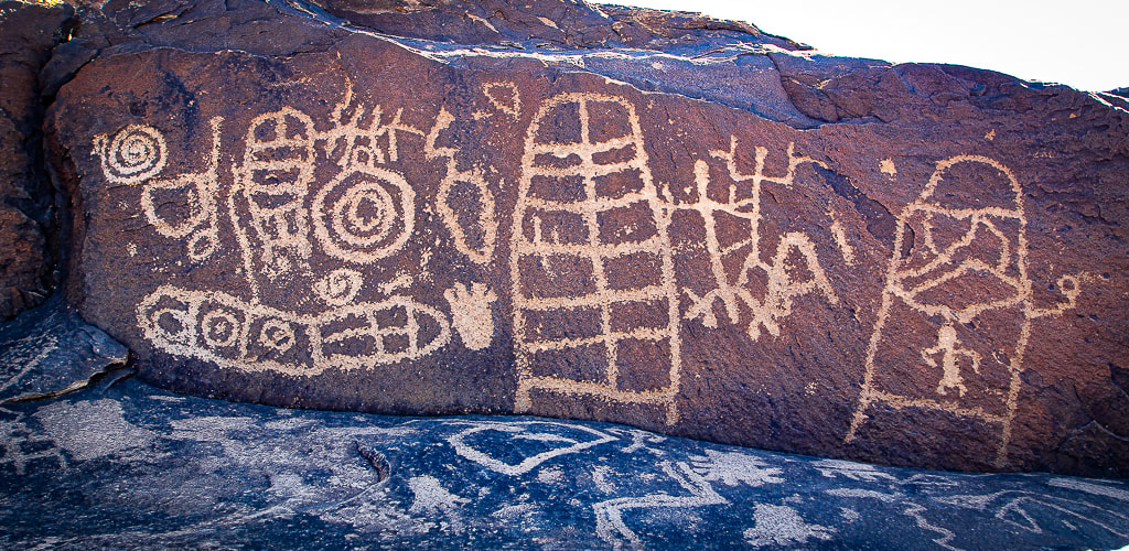
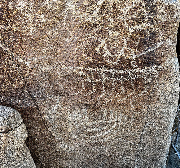
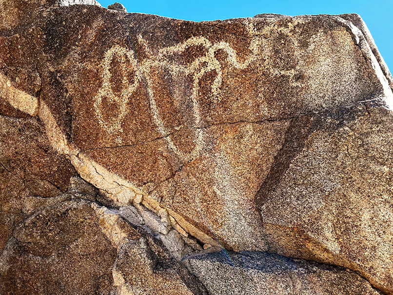
Common entoptic forms as a result of drug-induced visions as recognized by contemporary researchers. from Altered States: The Origin of Art in Entoptic Phenomena by Eric Pettifor (who adapted from Lewis-Williams and Dowson). 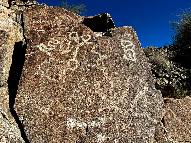 The curvy petroglyph upper left resembles a filigree form (examples on third row of first column in chart above) as does the large petroglyph bottom right that seems to radiate from a central point. A large flat rock, supported by small rocks, protruding from a small recess in the massive granitic outcrop on the west side of Corn Springs Wash amidst the biggest concentration of rock art is said to be a "ringing rock." A horizontal line of pecked marks extends across the top of this rock. "Ringing rocks," when struck with a small hammer-stone produce metallic, ringing, or gong-like sounds. Not much research has been done to understand exactly why some rocks are "ringers." One explanation is that clay minerals on the surface of the rock weather and cause a molecular-level change in the crust, which then increases new internal stresses. I need to go back to Corn Springs to see if that rock will ring, and while I'm there, climb the high summits in the Chuckwallas. 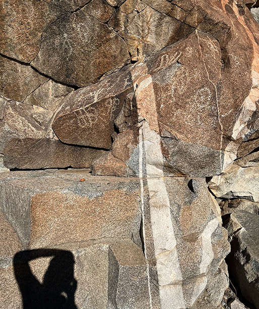 The supposed "ringing rock" is the flat, slanted gray rock in the right of this photo. 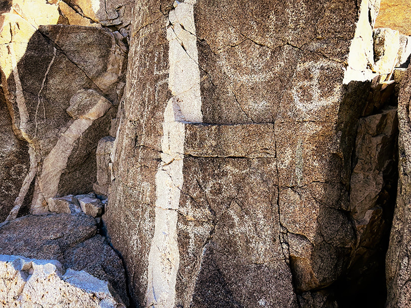 Probably a pegmatite dike cutting through granite. One source said that some petroglyphs seem to relate to these dikes. Fault (seismic) activity influences the water table and hence the availability of water for California fan palm trees. The infamous San Andreas Fault, a horizontally-moving fault where North American and Pacific tectonic plates meet extends just southwest of the Chuckwalla mountains. This desert has two personalities: peaceful, quiet and sedate, while at the same time unstable, waiting for its earth to move and shake things up. The Chuckwalla Mountains have an interesting gold mining history from the late 1800's, and in a separate hike in adjacent Orocopia Mountains (Spanish translation: "lots of gold"), Fred and I found what looked like an old miner's dwelling at the top of a long wash (see below), now called "Hotel California." Corn Springs was so named because early white visitors found feral corn plants grown by Native Americans, who at times were able to use the springs for growing food during years when water was abundant. The Love of Deserts: Liberation and Peace Nearby Chuckwalla Mountain and Black Butte, accessed by the historic Bradshaw Trail (now the Bradshaw Trail National Backcountry Byway), are two summits we added to our "to do" list. William Bradshaw built this trail in 1862, the first route across Riverside County, California to the Colorado River; it was used to transport miners to Arizona. "The love of mountains is best," a quote included in my Quotes on Nature page, was inscribed in Greek on one of the Swiss Alps summits in 1558. Perhaps I will inscribe "the love of deserts is best." on a lonely and bare desert summit someday. Corn Springs is a place to find solitude, and recharge if you need breathing space and respite from cities, televisions and smart phones. The desert allows you this: calm (usually), liberation, perspective and peace. "In sublimity - the superlative degree of beauty - what land can equal the desert with its wide plains, grim mountains, and its expanding canopy of sky!" - John C. Van Dyke, The Desert 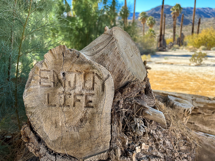 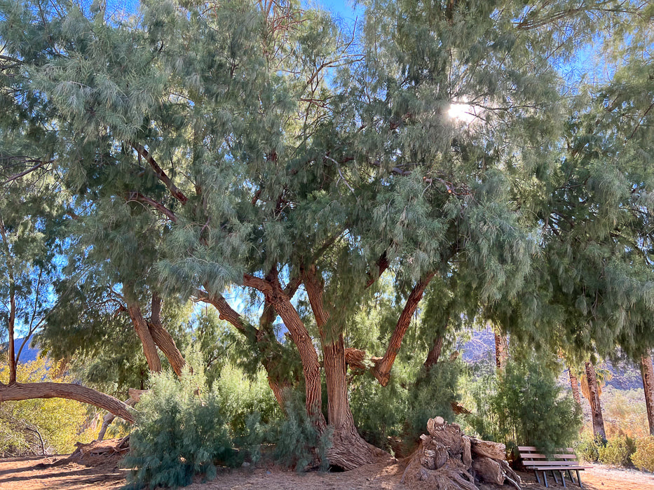 Huge tamarisk tree at Corn Springs. 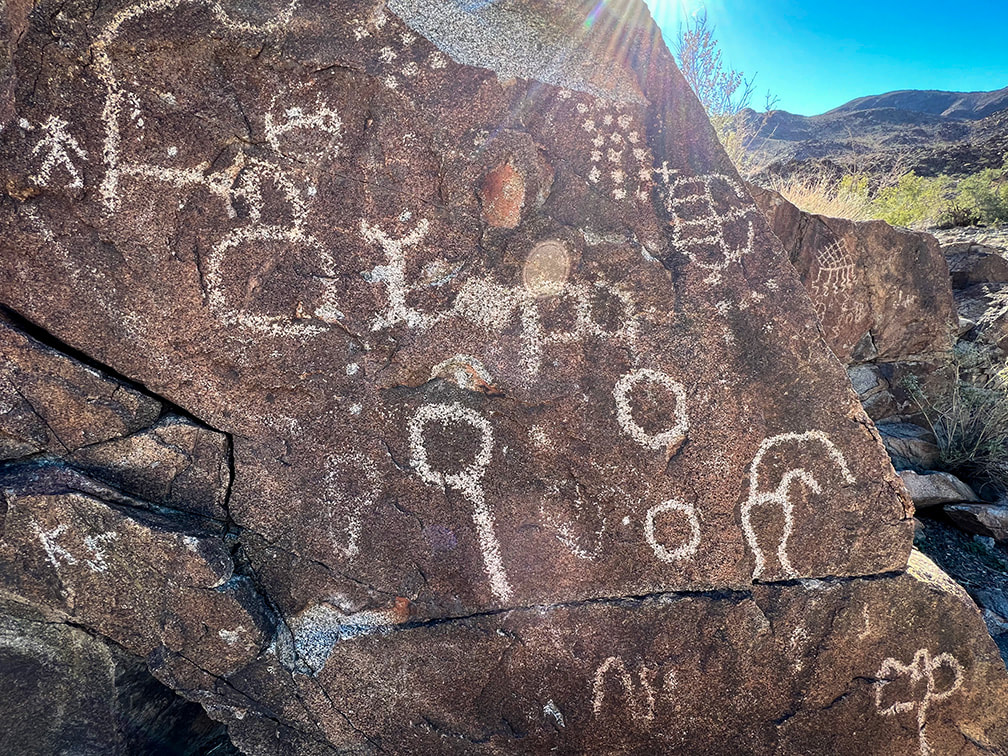 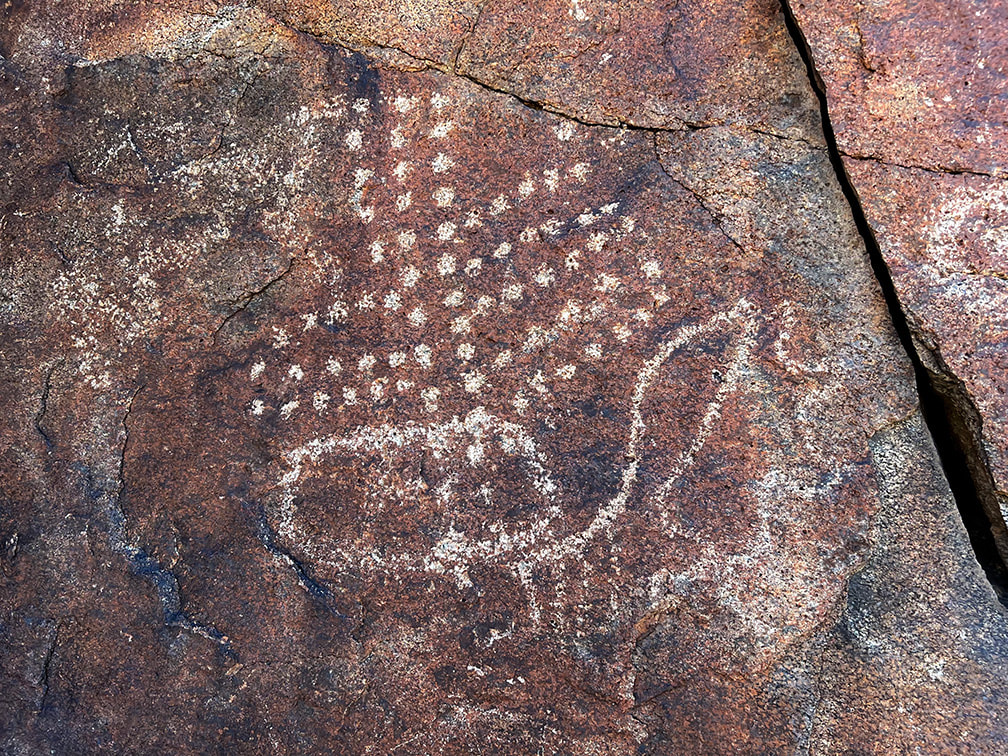 Dot images are one of the six common entoptic forms produced when in a trance or during vision quest. Some researchers claim dots indicate corn kernels, stars or rain. 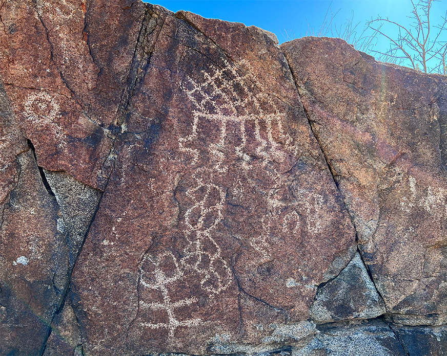 The top figure with horizontal line (sky line) and the six lines descending from (rain) it is thought to be a rain symbol. The slanted lattice is considered to be a basic entoptic (within vision) design.
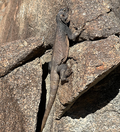
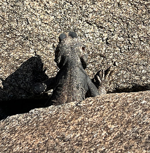
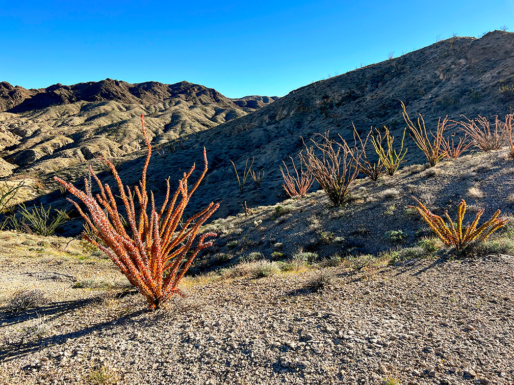
  The horizontal line with parallel vertical lines under it (lower left) may represent rain. Beautiful dike cutting through granite. Some cool stuff at the site. Chuckwalla lizards have the ability to inflate their lungs to wedge themselves into rock cracks as a defense mechanism against predators, like the red-tailed hawks and coyotes. Native Americans used sticks made from the ironwood trees for retrieving chuckwallas from the cracks. The stick had a spear and hook, so the chuckwalla would be stabbed to deflate the lungs, and then would be pulled out of the crack using the hook. 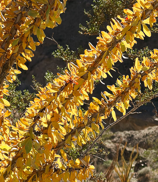 Fall colors of an ocotillo (Fouquieria splendens) preparing to go dormant for the winter. Yellow and red leaves are caused by a wet summer followed by a slow autumn drying period. 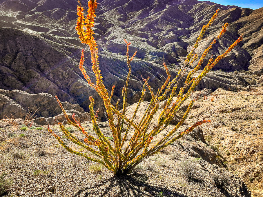 Ocotillo in Orocopia Mountains. The orange and yellow leaves seem to occur when there is more late-season rain than usual. 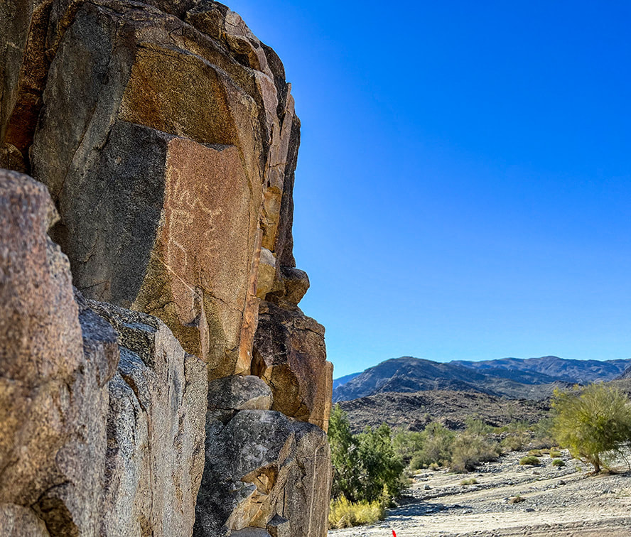 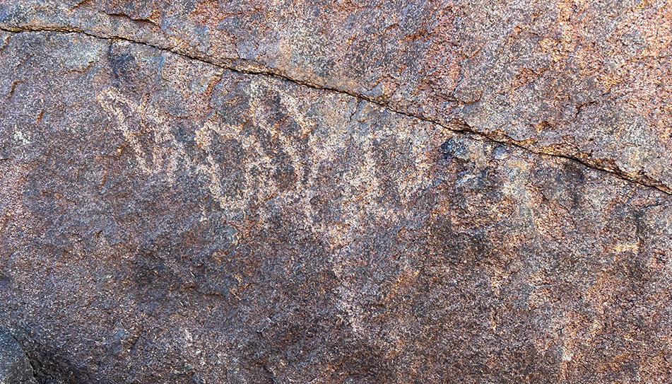 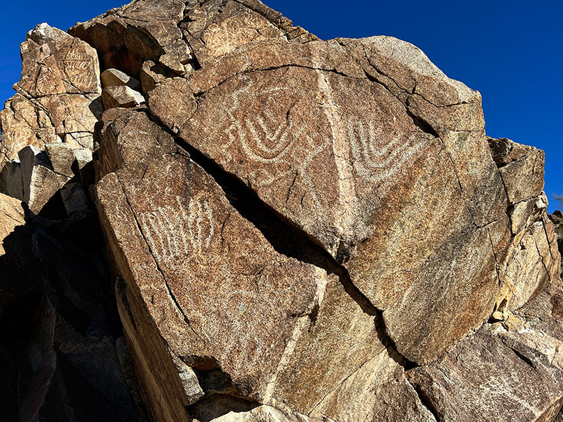 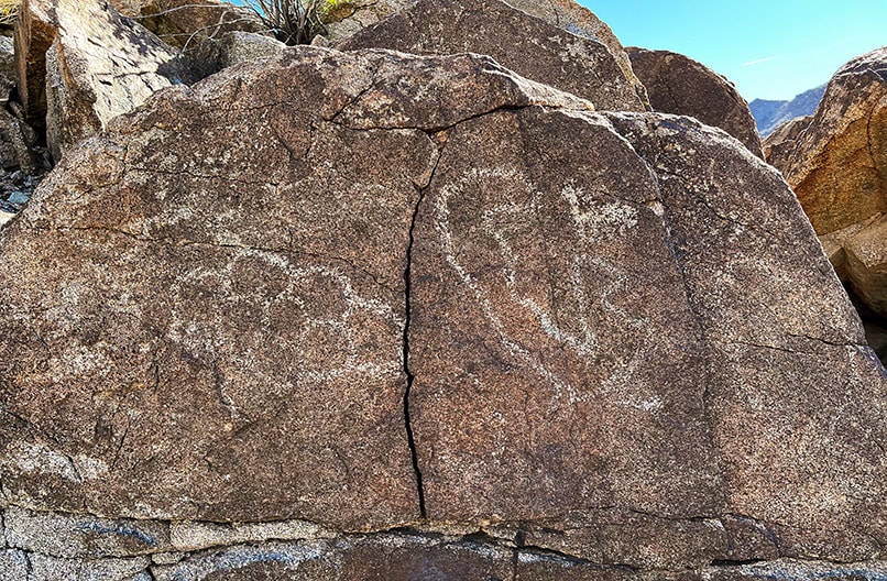 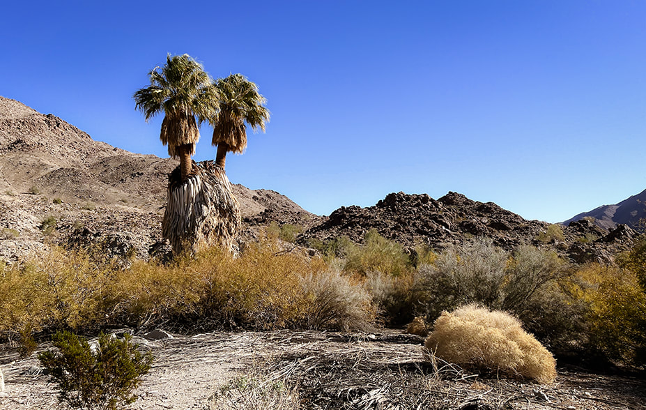 California fan palms (Washingtonia filifera) at Corn Springs.
  Ocotillos on Orocopia Mountains, a range west of the Chuckwalla Mountains.  "Hotel California" is inscribed on a plaque nailed to this rock house. 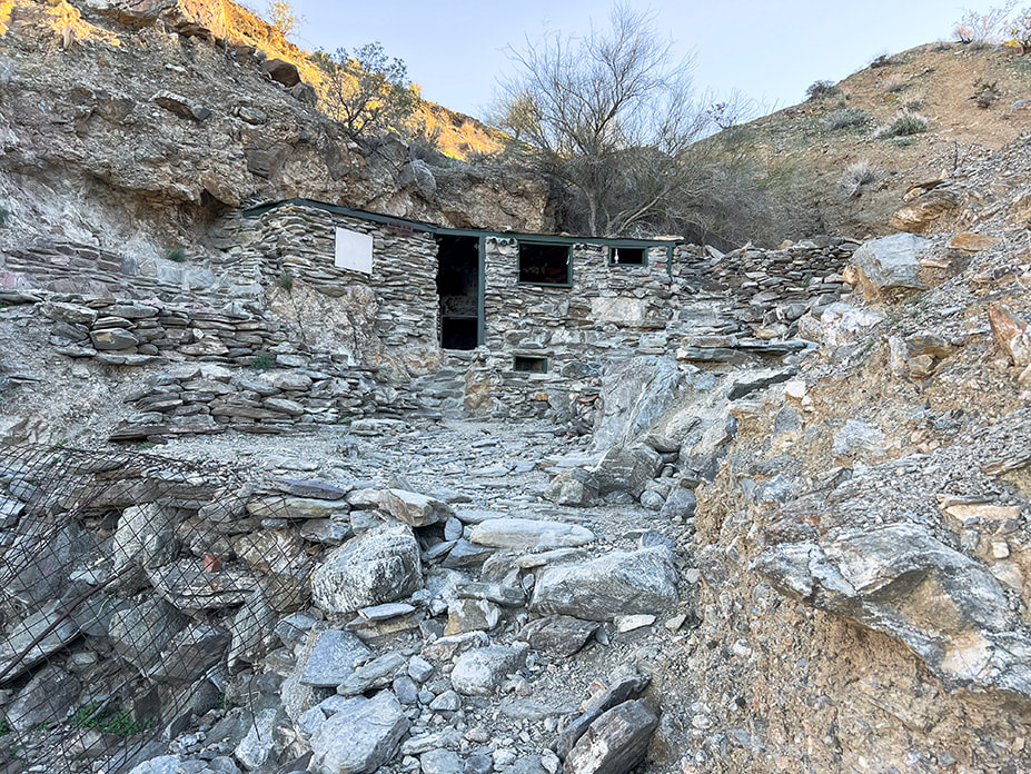 "Hotel California", located up long wash in the Orocopia Mountains near Joshua Tree National Park's southern entrance. References
Carter, L. 2021. Ancient rock art and psychedelics.., The language that connects us all. From website: www.roXiva.com. Corn Springs - Wikipedia. Crowell, J., et al. 1979. Tectonics of the Juncture Between the San Andreas Fault System and the Salton Trough, Southeastern California. Dept. of Geological Sciences, University of California - Santa Barbara. Devereux, P. 2008. The Association of Prehistoric Rock Art and Rock Selection with Acoustically Significant Landscape Locations. The Archaeology of Semiotics and the Social Order of Things. BAR International Series #1833. Freers, S. 2018. Simply Scratching the Surface: Petroglyph Chronology in the Colorado Desert. San Diego Rock Art Association. Rock Art Papers, Vol. 19. Gough, G. Sacred Landscape and Native American Rock Art. Lingenfelter, R. 1978. Steamboats on the Colorado River: 1852 - 1916. The University of Arizona Press. Powell, R. 1981. Geologic map of the crystalline basement complex in the southern half of the eastern Transverse Ranges, Southern California: Supplement 1 from "Geology of the Crystalline Basement Complex, Eastern Transverse Ranges, Southern California: Constraints on Regional Tectonic Interpretation". Ringing Rocks and Sonorous Stones. 2020. From website Spooky Geology. https://spookygeology.com/ringing-rocks-and-sonorous-stones/
7 Comments
3/2/2023 11:02:55 am
Petroglyphs are endlessly fascinating. They represent the ubiquitous urge for humans to communicate, to record a piece of themselves and the world around them. Interpreting those ancient peckings is challenging and humbling. We have a hard enough time interpreting what our own native language means from speaker to listener, let alone trying to understand what the ancients are saying. It is a humbling task. And being in the presence of this ancient evidence of humanity is a lot like walking into an old, European cathedral to hear someone practicing Bach on the church organ. Skin prickling.
Yes! You say it so well - petroglyphs are fascinating and I think it would be a stretch for one to say they know the meaning for sure. The reader I referred to in this post thinks that we really aren't meant to know the exact meaning - they are feelings, etc. that are expressed as art. Some sources I read said that we can't know for sure, and others actually have the meanings for the spiral, or cross with an outline around it, for instance. I always wonder what the person was like who etched that petroglyph.
Laura Hubbard
3/2/2023 01:13:25 pm
Wow-fabulous report. I'll look for some of those references. And, I'm inspired to get on the road again. Thanks so much for sharing your adventures and the knowledge.
Laura - thanks so much for your comment and appreciating this post! It encourages me to get out there, keep taking photos and write about what is interesting to me and then find that it interests others!
James Ponder
5/8/2023 06:41:40 am
I love the Corn Springs site! It has become my new sanctuary for whenever I need to get outdoors and contemplate mysteries and reconnect with a more primal understanding of life. See my article on Aztlan in the May 2023 edition of Inland Empire magazine for the alleged connection of Corn Springs to the roots of the Aztec Empire.
James,
James Ponder
5/12/2023 04:46:23 pm
Hi Sue, glad you enjoyed the article. Prior to discovering Figueroa's book, I was pretty clueless about the prehistory of this area, but now believe a lot more happened here than I ever knew about. If you guys decide to go to Corn Springs again, hit me back. I'd love to meet both of you and talk petroglyphs with people who are as fascinated by rock imagery as I am. Love your blog and look forward to reading more from you in the future. BTW, I have another article you might enjoy reading. It's called "Touring Coyote Hole," and it appears in the January 2023 edition of Inland Empire magazine. It's about a property owned by the Native American Land Conservancy, which is an awesome organization. Leave a Reply. |
Categories
All

Sue and Fred

About this blogExploration documentaries – "explorumentaries" list trip stats and highlights of each hike or bike ride, often with some interesting history or geology. Years ago, I wrote these for friends and family to let them know what my husband, Fred and I were up to on weekends, and also to showcase the incredible land of the west.
To Subscribe to Explorumentary adventure blog and receive new posts by email:
Happy Summer!

About the Author
|