|
This superb steep ridge hike out of Arrowrock Reservoir in the Boise Mountains treks through blankets of wildflowers and provides an exhilarating view of water and mountain ranges. It's our final "Grand Slam Peak".
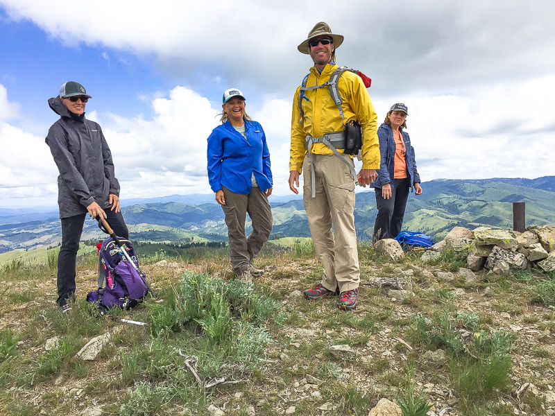 Fred and members of the Summit Sisters on summit of Mt. Heinen - 6,336 feet Trip Stats (Southeast Ridge Approach): Overview: A challenging, uncrowded hike with open views through native bunch grasses, Ponderosa Pines and wildflowers, and smooth Arrowrock Reservoir at your feet. Distance: 10 miles round-trip Elevation gain: trailhead elevation = 3,200 feet; Mt. Heinen = 6,336 feet. Add to this ~ 560 feet of re-capturing elevation lost in descents on the way up: total elevation gain to summit ~ 3,700 feet. Difficulty: Very strenuous first 3 miles - then moderate last 1-2 miles. Mostly Class 1 single- track Dates hiked: 5/26/2018, 9/30/2018 and 11/17/2018 Maps: USGS quads: Dunnigan Creek, Arrowrock Reservoir NE, and Grape Mountain Lat/Long Mt. Heinen: 43°39'43" N 115°52'33" W Directions to trailhead: from Boise, drive ID 21 north past Lucky Peak Dam, over Highland Valley Summit, then cross the bridge over Mores Creek (steep basalt cliffs). Turn immediately right after bridge with signs to Atlanta onto FR-268 and travel 14 miles on this road past Arrowrock Dam. Road becomes gravel and places are narrow. At mile marker 14, park at small lot next to Irish Creek Campground on right side. Sign on right side of road just adjacent to trailhead reads "2681C". There are a few pull-outs on this short road to Irish Spring campground. Hike directions: Trailhead (unmarked) located directly across FR-268 from Irish Creek Campground. Trail clearly ascends steeply to the northwest over sand and gravel. It levels off in 1.8 miles at Point 5402 with a gain of over 2,000 feet, then descends briefly before climbing again. Reach Point 6137 at 3.3 miles. Hike around to the west of this knob. Mt. Heinen is finally seen as the highest rise on the left of the ridge. The trail turns north around this point and ascends/descends 1.7 more miles to the summit. We found one good bypass that avoided climbing to a point on the ridge; when in doubt, stay on the ridge. (Recommend hiking poles for last 2 miles of steep descent on the way back on gravelly surface). CAUTION: Trail mostly on exposed ridge - be aware of weather forecast (thunderstorms). Geology: Granodiorite and two-mica granite - Atlanta Lobe of Idaho Batholith, Cretaceous age. "In the end you won't remember the time you spent working in your office or mowing your lawn. Climb that goddamn mountain." - Jack Kerouac 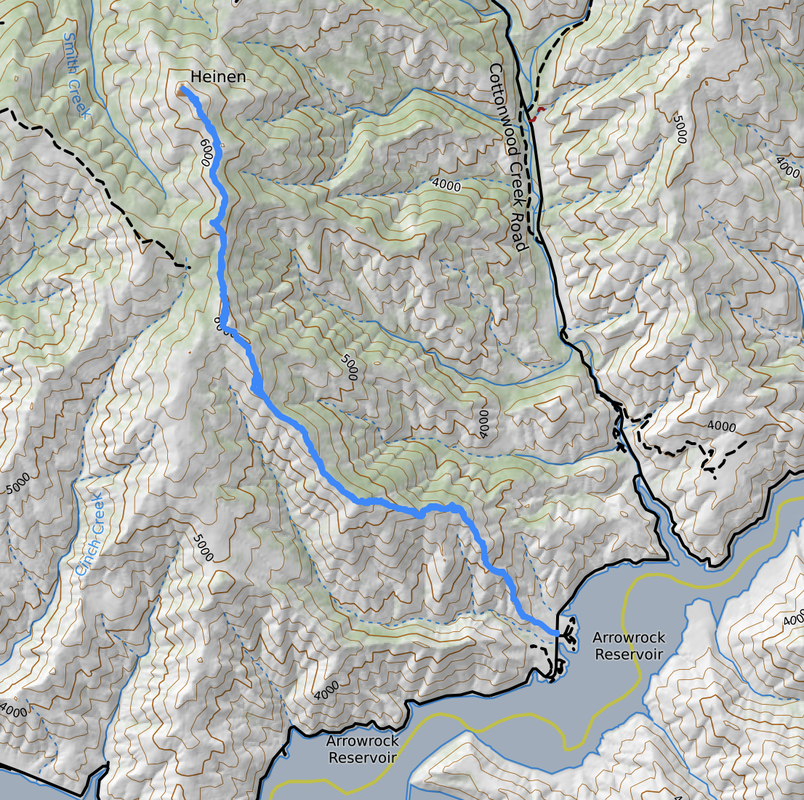 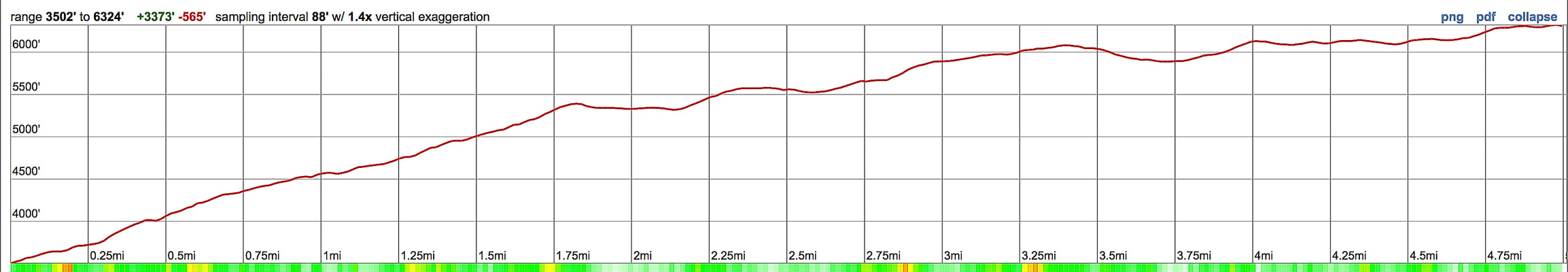 Our route and elevation profile up Mt. Heinen's southeast ridge 5 miles to summit with cumulative 3,700 feet of elevation gain Arrowrock Reservoir is lower right - hike begins adjacent to the Irish Creek Campground located 14 miles in on FR-268 from turn-off of ID 21. click on map for PDF Our Hike Stepping onto a mountain summit, no matter how high, is always cause for celebration. The top of Mt. Heinen was even sweeter because Fred and I celebrated the completion of the four "Grand Slam Peaks" with members of the Summit Sisters, a women's hiking group who were doing the same in May, 2018. Since then, we have summited Mt. Heinen two other times this year: in September we took a friend and his two boys, Deacon and Kaleb and in November we took our friends Val and John. Deacon and Kaleb were working on completing their four Grand Slam Peaks. We had recently summited Goat Mountain with Val and John, a very tough hike, and now we were on another tough hike up Mt. Heinen. Tom Lopez, author of the website Idaho: A Climbing Guide hikes four summits for spring training: Mt. Heinen is the toughest. The other Grand Slam Peaks are Lucky Peak, Cervidae Peak, and Kepros Mountain. Fred and I use Lucky Peak for training, and we will definitely be back on Heinen because it's skinny single-track, perched on a ridge most of the way is surrounded by knee-high wildflowers, peaks, and views of Arrowrock Reservoir. The green and lush vegetation reminded me a bit of Crested Butte, Colorado hikes. 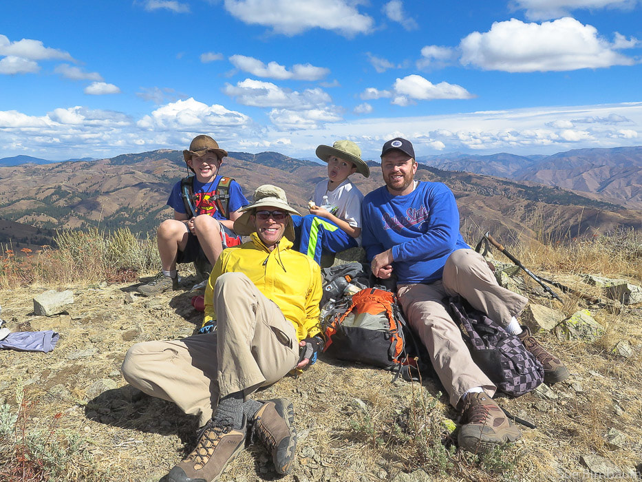 Deacon, Fred, Kaleb and Greg on summit of Mt. Heinen - September 30, 2018 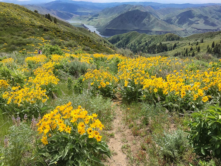 Arrowleaf Balsamroot with Arrowrock Reservoir in the distance 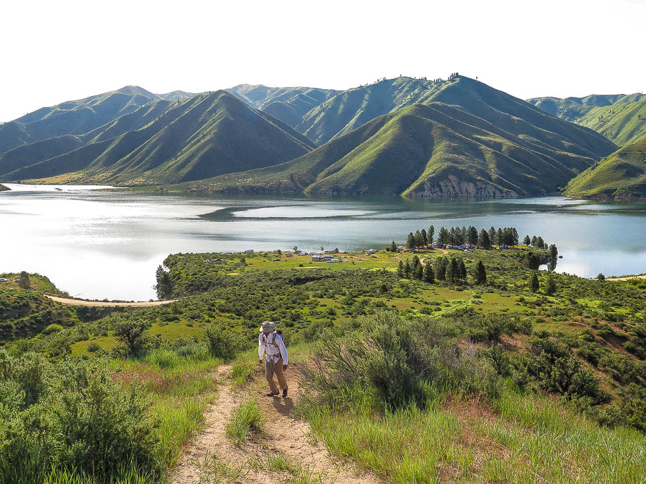 Initial steep climb out of Irish Creek Campground, on the shores of Arrowrock Reservoir The trail in sight starting at FR-268 adjacent to Irish Creek Campground on Arrowrock Reservoir is steep and straight up - it vanishes over the ridge on the horizon. To know that this is only the beginning of the climb and that there is so much more elevation gain is the fun part of the challenge. The initial climb levels off into a beautiful meadow, but only for a short distance and then it climbs unmercifully again utilizing a few short switchbacks, to finally top off at Point 5402 at 1.8 miles where perspective can be gained. Mt. Heinen still can't be seen, not for another mile or so. It is at this top-off before descending into a shallow saddle where Point 6137 comes into view as the left-most of twin points on the horizon. It has one tree on top. That is the landmark for the trail, as it contours around the left (west) side of this point and then heads almost due north. The wildflowers - mostly Arrowleaf Balsamroot - were at optimum blooming the end of May. Threadleaf phacelia and bright purple penstemon were so lush and healthy. At times the vegetation grew so abundantly over the trail that we had to pay attention to where we were going. This is a ridge hike, open and airy as you walk above the landscape as the hillsides below fall away into undulating blankets of green and yellow with distant blue-gray mountain ranges surrounding. The trail is easy to follow most of the way but it gains a few "false summits" before Mt. Heinen comes into view. Closer to the peak it becomes less wide. Like Mount Kepros, after the initial steep ascent and onto the ridge, the trail makes a series of hill climbs and saddle descents. Near the summit, the trail treks through Idaho Batholith granite. 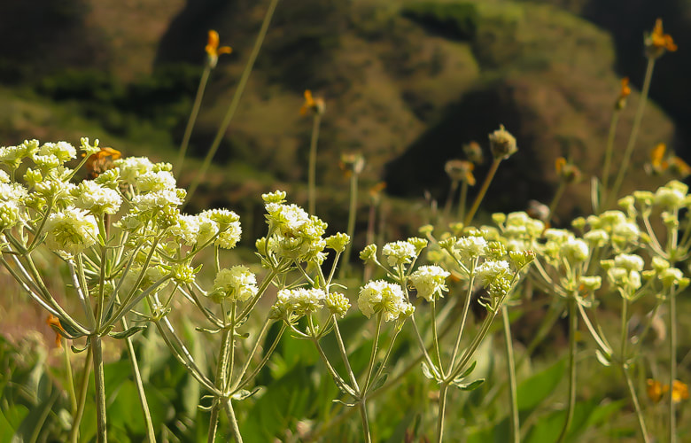 Parsnipflower Buckwheat or Whorled Buckwheat Eriogonum heracleoides 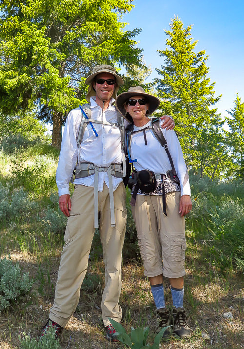 Fred and Sue on trail to Mt. Heinen 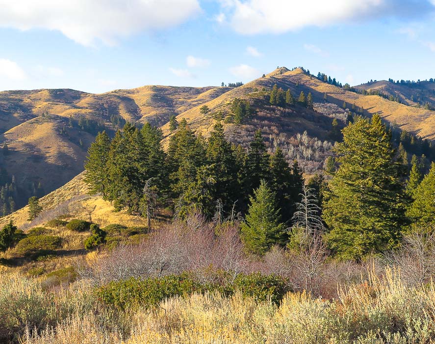 View from crest of initial climb, 1.8 miles from trailhead Point 6137 is first seen as the left point on the horizon with the single tree on it - trail goes on the left (west) flank of this point and then heads due north to summit On the way down, stay on the ridge you ascended by walking around this point to the left and staying on ridge that leads southeast 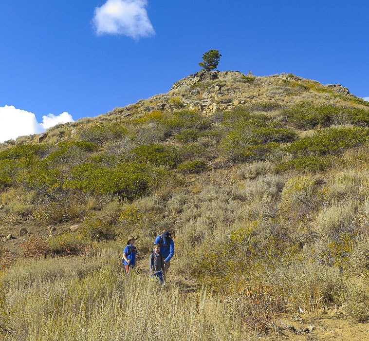 Point 6137 - trail changes direction from NW to north as the trail curves around the base of this point on its west side At Point 6137, we passed a group of three people who had decided they would turn around, except for one hiker, a member of the Summit Sisters who hiked with us for a while and then joined up with the rest of the Summit Sisters members on the trail further up. It is at this pointed rise with a single tree that Mt. Heinen can finally be seen - the furthest peak on the left/end of the ridge. It is here that the trail winds around Point 6137 to the west and then heads straight north to Mt. Heinen. On the autumn hike with Greg, Deacon and Kaleb, I became "temporarily bewildered" and walked down a small trail to the west of Point 6137. On the return hike, make sure to walk completely around Point 6137 (eastern ridge). Avoid the ridge that descends to your right (west). At the base of Point 6137, the trail continues down the east ridge, east of large drainage that separates two major ridges (see topo map above). On the spring hike, we made the 5.0-mile hike to the summit in 2 hours and 50 minutes. One by one the Summit Sisters joined us in celebration. By then, an ominous dark cloud came over us, so we all decided to descend. I recalled Lucy Jane Bledsoe’s quote: "Perhaps climbing a mountain is nothing more than an act of worship, and reaching the barren perch of a summit is to experience pure awe." - Lucy Jane Bledsoe, The Ice Cave Admittedly, some summits are more spectacular than others, but each summit is cause for celebration. Mt. Heinen is the last on the ridge that runs to the northeast of Irish Creek and there is ultimate satisfaction in getting to the end of the ridge. Most peaks are hard-won, or in other words gained by hard work and effort, overcoming obstacles that get in your way, whatever they may be (in my case, tired legs and burning quads!). I was impressed with Deacon and Kaleb on our second Mt. Heinen hike; they have been getting fit by hiking Kepros and Cervidae. They did great on this tough hike and we had a celebration at the top in the warm autumn sun surrounded by hillsides dotted with shrubs whose leaves were turning yellow. The last mile to the summit is a ridge ramble on moderately difficult terrain, at times maneuvering around or on top of granite rocks. The summit geological marker post can be seen from a distance. Grand Slam peaks are done! The May Mt Heinen summit got us in shape for a summer of summit hiking. Mt. Heinen also gave us a new perspective on the land of Southern Idaho and the vastness of the Boise National Forest. The last mile of descent was the most difficult part of the hike because it is so steep on loose gravel and rocks. A walking stick is helpful for this part. When I needed a rest, I had an awesome scene in front of me of the Arrowrock Reservoir. 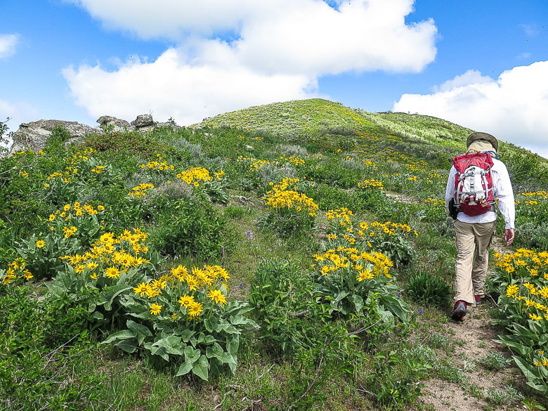 Walking toward a "false summit", or as I like to call them "pseudo summit" 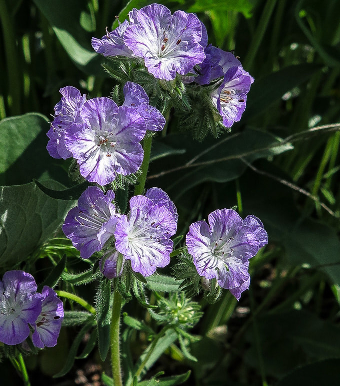 Threadleaf Phacelia Phacelia linearis 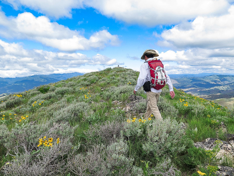 Approaching summit USDA geological marker placed in 1946 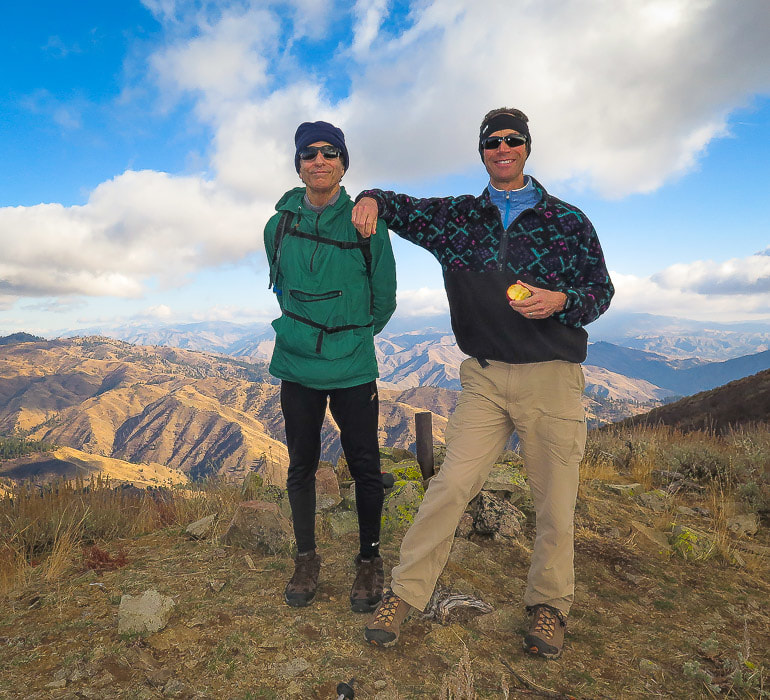 John and Fred on summit of Mt. Heinen - November 2018 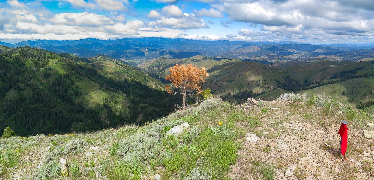 Summit of Mt. Heinen looking north with red felt flag attached to marker 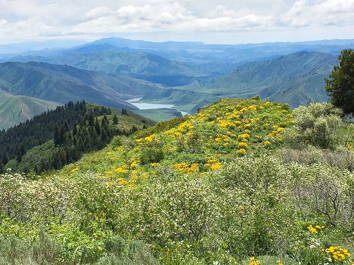 View from summit of Mt. Heinen looking east 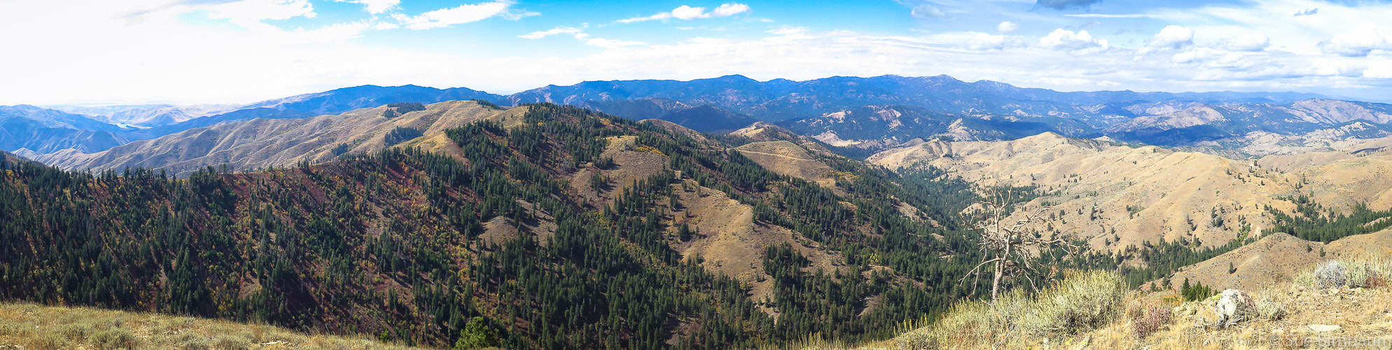 View to NW from Mt. Heinen summit 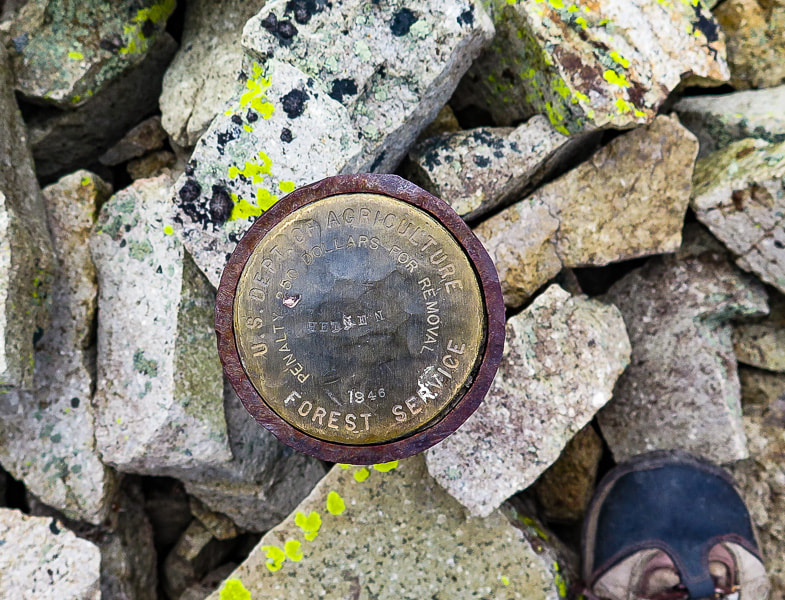 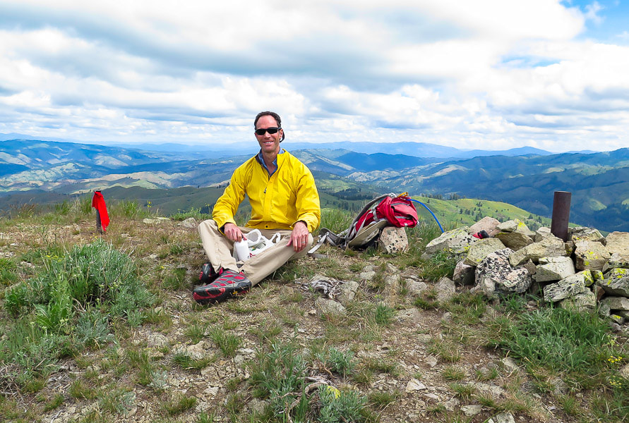 Fred on summit of Mt. Heinen 4 Grand Slam Peaks Completed! 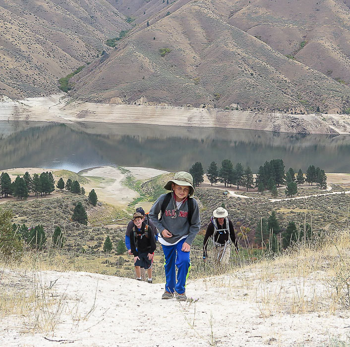 Greg, Deacon, Kaleb and Fred on initial climb to Mt. Heinen 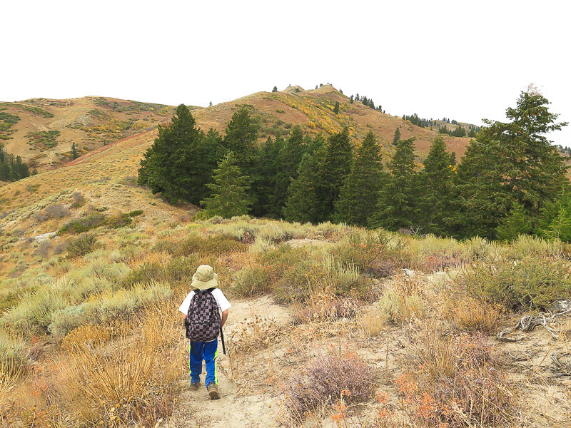 Kaleb is about 2.25 miles into the hike - headed to the rise on the horizon 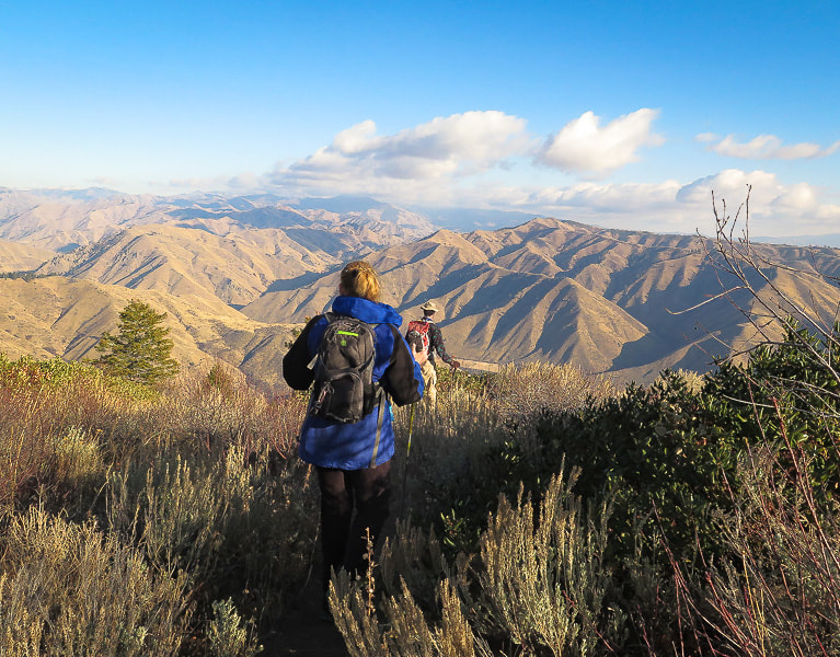 Val and Fred heading down toward Arrowrock Reservoir 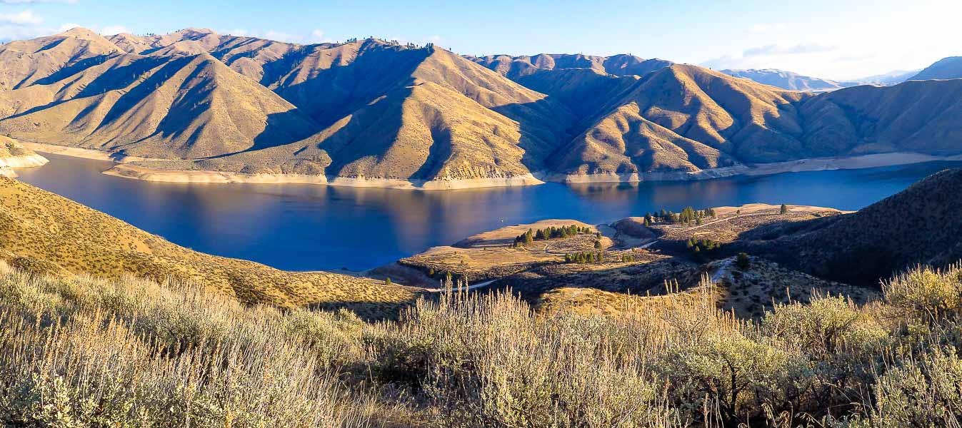 Arrowrock Reservoir and Irish Spring Campground/dock on the way down the trail
2 Comments
|
Categories
All

Sue and Fred

About this blogExploration documentaries – "explorumentaries" list trip stats and highlights of each hike or bike ride, often with some interesting history or geology. Years ago, I wrote these for friends and family to let them know what my husband, Fred and I were up to on weekends, and also to showcase the incredible land of the west.
To Subscribe to Explorumentary adventure blog and receive new posts by email:
Happy Summer!

About the Author
|