EXPLORUMENTARY
  • Home
    • Cactus to Clouds Hike
    • More Quotes
    • Ann Zwinger Quotes
    • Mary Oliver Poems
  • Hikes by State
    • Idaho
    • Southern Utah
    • Arizona
    • California Desert
    • Nevada
    • Wyoming
  • BLOGS
    • Adventure Blog
    • Women and the Land
  • GALLERY
    • DESERT PLANTS >
      • Beavertail cactus
      • Brittlebush
      • Christmas Cactus
      • Arizona Barrel Cactus
      • Parry's penstemon
      • Agave
      • Arizona Rainbow Hedgehog
      • Claret Cup Hedgehog
      • Desert Agave
      • Palmer's Penstemon
      • Silver Cholla
      • Cristate Saguaro
      • Indian Paintbrush
      • Ocotillo
      • Santa Rita Prickly Pear
      • Spiny Cliffbrake
      • California Barrel Cactus
      • Engelmann Prickly Pear
      • Velvet Mesquite
      • Joshua Tree
      • Hedgehog Cactus
    • NATURE
    • BOISE
    • EARTH + SKY
    • URBAN
    • WATER
    • PATRIOT
    • ORCHIDS
  • Fit After 50
    • Brian Holgate
    • Fred Birnbaum
    • Dave Brasuell
    • Bus' Little Black Book
    • Mike Carlson
    • Ray Wilson
    • Bryan Krouse
    • Vickie Kearney
    • Maria Keezer
    • DOUG TRAUBEL
    • Boise Cross Fit Masters Ladies
    • Tim Clemens
    • Marcia Bondy
    • Becky Borczon Blake >
      • Becky B Downtown
    • Jennifer Cera and Sue Birnbaum
    • Dave Brasuell
    • Vance Powell
  • About
    • CONTACT

Hike Freeman Peak Trail to the Continental Divide - Salmon, Idaho

8/10/2022

4 Comments

 
Follow Freeman Creek in the lush Beaverhead Mountains to a high pass on the Idaho/Montana border to look over Upper Miner Lakes, still partially covered by snow in July.
Picture
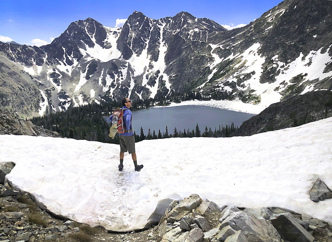
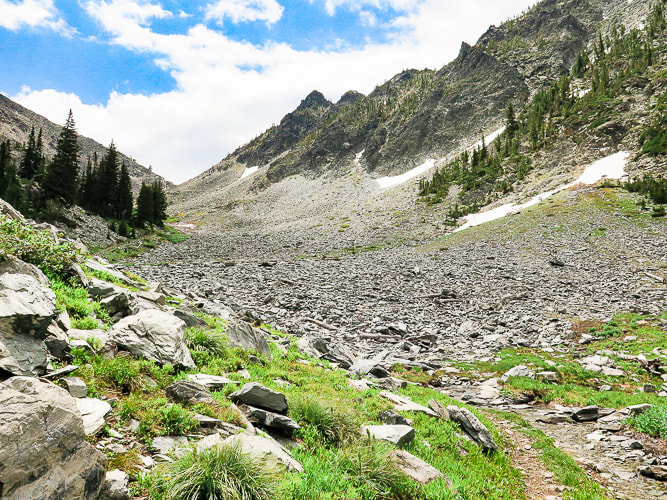
Standing on the Continental Divide - Montana/Idaho border overlooking the highest of the Upper Miner Lakes and Sacajawea Peaks across the lake.
Related in Explorumentary
Alpine Peak, 9,861':  Sawtooth Mountain Wilderness -  Never Stop Climbing Mountains
​Leatherman Peak, 12,228':  On Top of Idaho
​Mackay Peak, 10,273', and Mackay Mine Hill Tour - Idaho
Reward Peak,  10,074' via Upper Redfish Lakes -  Sawtooth Mountain Wilderness
Complete list of Idaho hikes on this website
​Upper Redfish Lakes Cross-Country Hike - Sawtooth Mountain Wilderness
Moving Makes You Feel Better:   The Latest Research
Trip Stats
Location: 
Salmon-Challis National Forest, Beaverhead Mountains, Bitterroot Range, Idaho.
Distance/Elevation gain:  11.8 miles round-trip.  Trailhead elevation = 5,330',  Continental Divide Trail at Montana border = 9,200'.  Total gain = 3,900'.
Difficulty:  Moderate-strenuous effort on Class 1 (old mining road) and Class 1-2 (scramble/faint trail above treeline).
Coordinates:  Trailhead = 45.26574  -113.76137.   Pass at Montana border = 45.27297  -113.68483
Picture
QR code Freeman Trail TH
Date hiked:  7/10/22
Dogs:  do not have to be on leash.  Salmon-Challis NF: 208-756-5100.
Maps and Apps:  AllTrails Freeman Peak Trail, USDA Salmon - Challis National Forest map.
Weather forecast:  mountain-forecast.com
Geology:  Miner Lake-Beaverhead Divide Fault Zone is directly behind Freeman Peak, where Freeman Peak Trail traverses.  This faulting helped develop the minerals mined from the Ore Cash Mine (see "For the Geocurious" below).
Picture
QR code Salmon-Challis NF Visitor Atlas (road map to trailhead p. 11)
Freeman Peak Trail Route maps
Overview
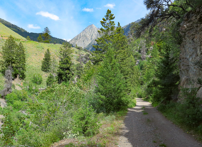
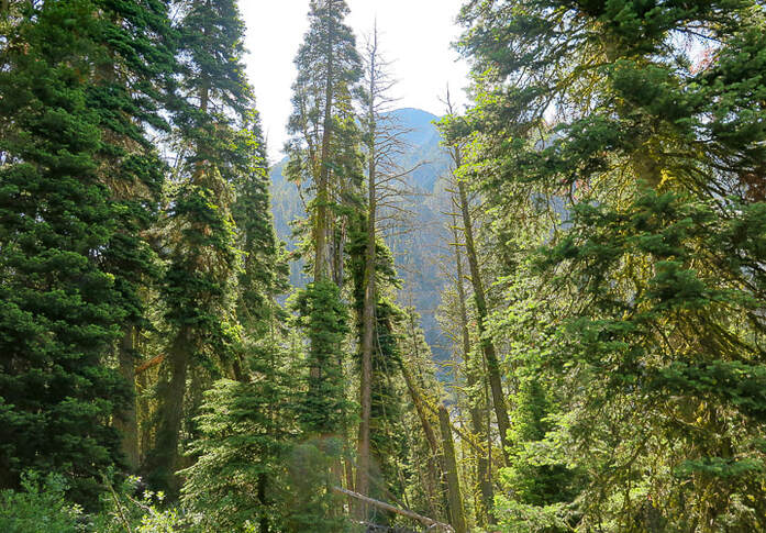
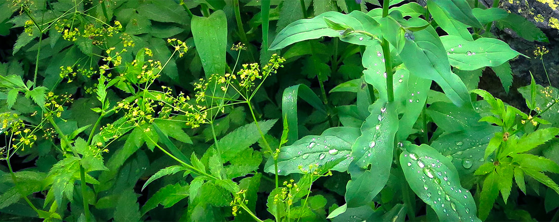
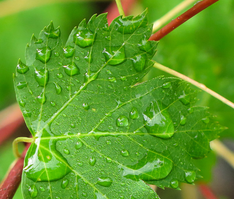
The Freeman Peak Trail (#6033) out of Carmen, Idaho, just north of Salmon, follows an old mining road past the climbing route to Freeman Peak's east flank, through a glaciated cirque to the 3,100-mile Continental Divide Trail on the Idaho/Montana border.  The pass affords a "wow!" moment with a great view of Montana's Upper Miner Lake, 400 feet below, surrounded by snow-covered jagged mountains.  During its almost 4,000-foot gain, this hike will take you from relatively dry and sparse woodlands, through a lush forest with water tumbling over the trail, to alpine tundra above tree line.  Rain storms the past few days seemed to leave water everywhere:  white water rumbled in Freeman Creek and drops of moisture dotted leaves.  Freeman Peak dominates the Salmon skyline to the northeast.

The Salmon-Challis National Forest is a pretty incredible place.  It's one of the largest national forests in the lower 48 states.  It contains most of the land mass of the second-largest wilderness in all of the U.S., named Frank Church River of No Return Wilderness.  The Middle Fork of the Salmon River runs unrestricted through this wilderness - "perhaps the best river trip in the world" - according to the website, Whitewater Guidebook.

Our trip to escape southern Utah's searing heat included a climb up the Wasatch range's highest summit, Mount Nebo on the way up to Salmon, Idaho.  We were familiar with this "neck of the woods" since we had spent 20 fantastic years living in Boise, and had done many hikes in Idaho.  We stayed at a wonderful Carmen Airbnb that had beautiful horses and green pastures.
Our Hike
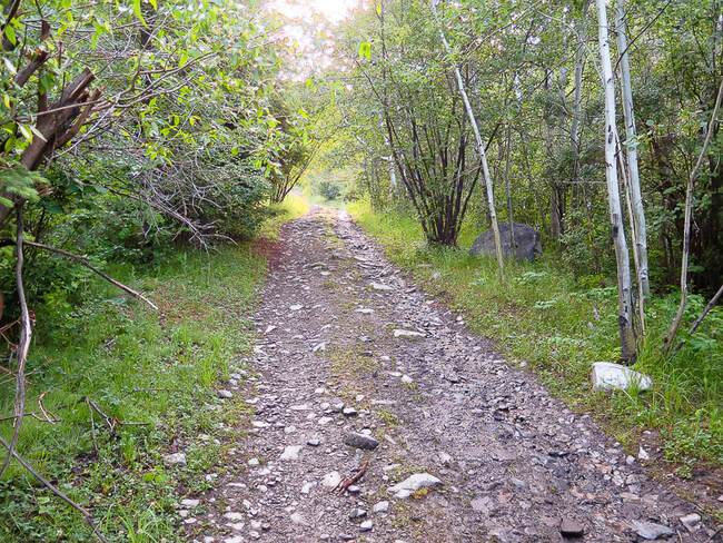
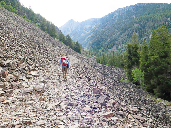
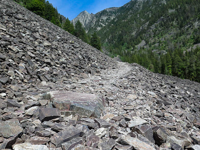
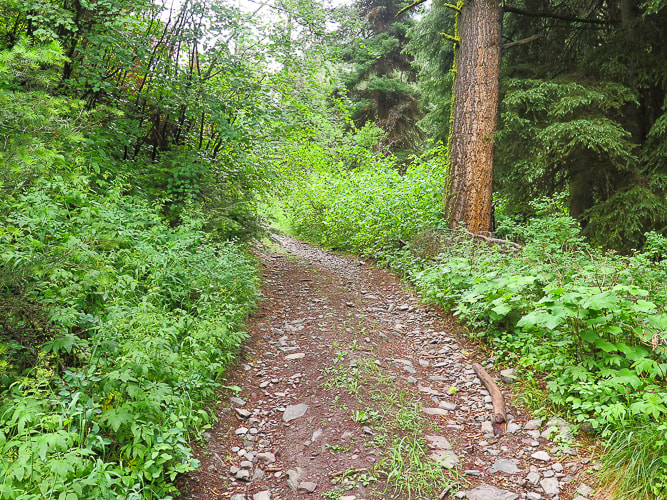
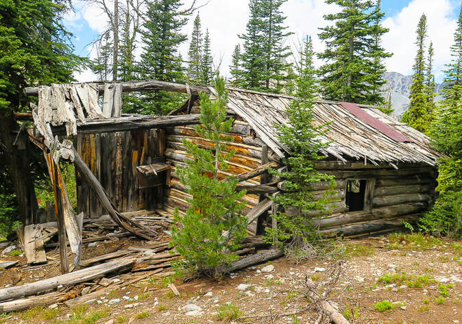
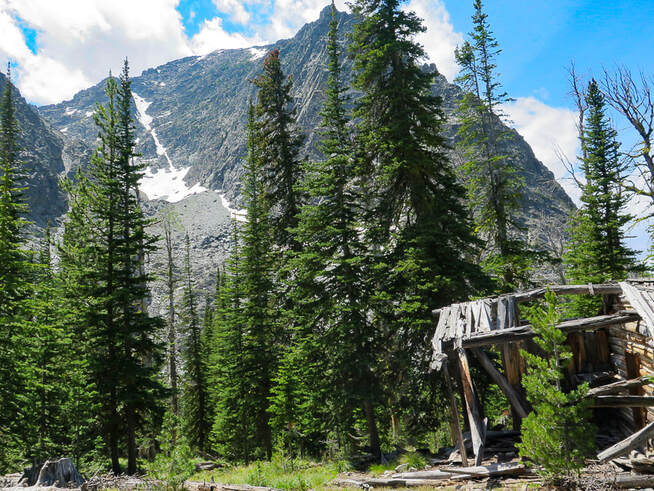
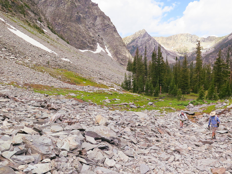
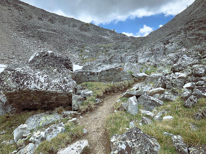
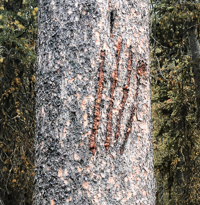
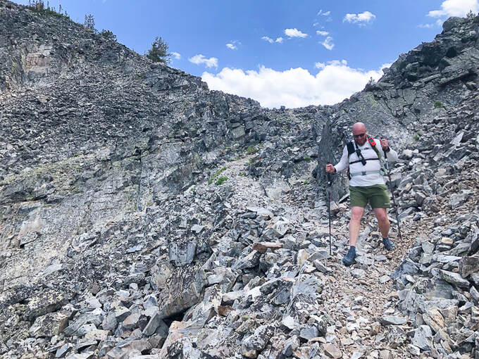
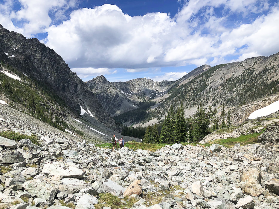
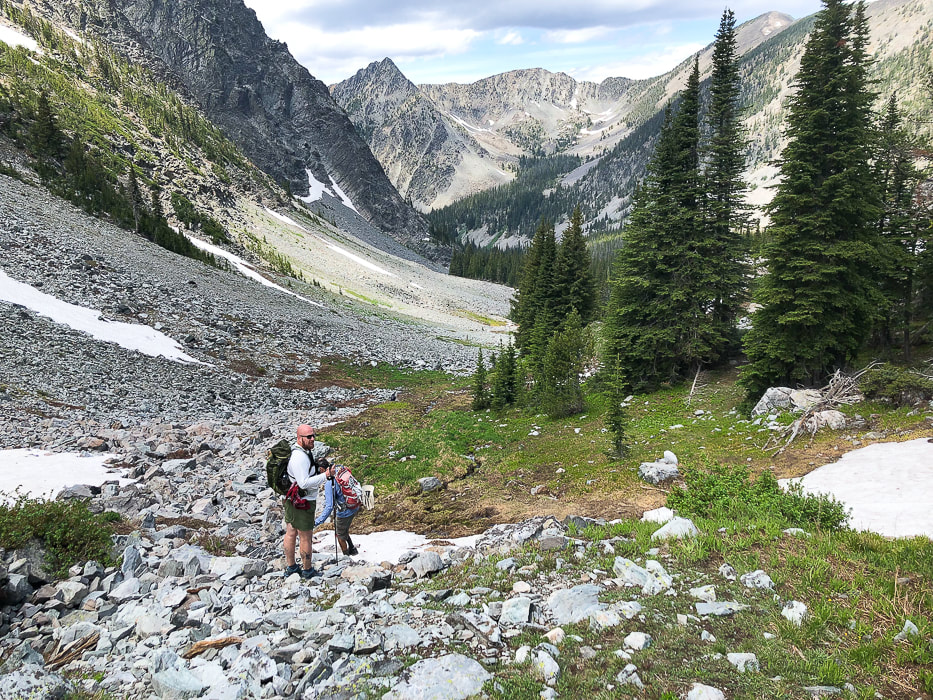
Trailhead to cabin at base of Freeman Peak - 4.6 miles
​To avoid driving on the steep, narrow access road along Freeman Creek, we parked at the "flat" intersection of Freeman Creek Road and a road that heads due south toward Golway and Kirtley Creek (three miles after taking a right off of Carmen Creek Road).  You can drive up further than we did, and we saw a small pick-up parked higher up on the way back, but it gets pretty narrow.  Our walk took us quickly to Freeman Creek rushing noisily beside us, thick vegetation blocking our view of waterfalls.  

The road/trail climbs steadily east-northeast with one good view of the small stepped waterfalls in Freeman Creek.  As with many mining roads in Idaho, it traverses a large talus slope, flattening its base as it goes, and then enters the dense forest.  We met Eric, a hiker that caught up to us while we took a break.  He had his bear spray canister mounted on his pack's chest strap.  We had seen bear claw scratches on one tree (see below).  He ended up hiking with us the rest of the way in this bear country - safety in numbers!  He was a great hiking companion and he said his wife felt better knowing he was with other hikers.

Run-off from side creeks flowed over the road for a few stretches.  The looming point of Freeman Peak comes into view through the trees.  A sturdy log cabin sits at its base looking at the steep, snow-filled couloir, the daunting route up Freeman Peak.  According to a hiker we met on the trail who had summited it a few times, it's better to climb it with someone who has done it before.   It seemed a bit much for me, but I could be talked into trying Freeman Peak with a guide.  Tom Lopez, in his book Idaho: A Climbing Guide, states that "This route involves sustained Class 3 climbing and route-finding difficulties.  The route can be very slippery when wet or icy."  Ore Cash Mine, extracting gold from 1897-1912 is near this site.

Cabin to Continental Divide at 5.9 miles
​​The road continues past the cabin, ending at tree line.  From here, hiking toward the lowest point on the horizon (the pass), we eventually found a trail that ascends to the pass for ~ 0.5 miles.  We picked our way through this alpine terrain strewn with rocks and low-profile wildflowers, including one of my
 favorites, Western Moss Heather.  It also grows on the slopes of Alpine Peak in the Sawtooth Mountain Wilderness.  It was great to have Eric hiking with us because we got another source of encouragement.  

The view we three saw from the Continental Divide was about as picture-perfect as you can get.   We stood on packed snow overlooking a small steel-blue lake surrounded by the Beaverhead Mountains, with snow clinging to steep talus fields and couloirs, the clouds reflecting in the water.  The actual Continental Divide Trail avoids these high peaks and steep terrain; it heads in an easterly direction just north of Freeman peak to traverse by lakes.  


In Summary....
There's a feeling of celebration when you head back to the trail head, a subconscious bonding with your fellow hikers.  Inspiring scenes, camaraderie and movement combine to create a certain elation, not to mention the good brain chemicals that are released during exercise in nature.  Movement makes you feel better!   On our way down the alpine valley, most of the clouds had drifted away, and the forest we had ascended was now illuminated by the sun.  It's one of those transient scenes - a fleeting moment of time that I add on to all of the treasured memories I have accumulated while feeling so small in the grandeur of the American West.
"I never knew a man who felt self-important in the morning after spending the night in the open on an Idaho mountainside under a star-studded summer sky."
         -  Frank Church, former U.S. Senator from Idaho, instrumental in creation of Idaho's River of No Return Wilderness in 1980.
Stay Curious!  Keep On Exploring!
For the Geocurious: Ore Cash Mine  
This trail gets close to the remains of cabins and some equipment of the Ore Cash Mine.  Gold was the primary mineral mined from Oro Cache Mine (on map called "Ore Cash" mine) between 1897 and 1912.  The host rock was quartzite (metamorphic quartz sandstone) of neoproterozoic age (1/2 to 1 billion years ago).  The deposits were from four veins; the Oro Cache vein was 4-6 feet wide in a shear zone (zone of strong rock deformation).  There were 9 adits that became inaccessible in 1976.
Picture
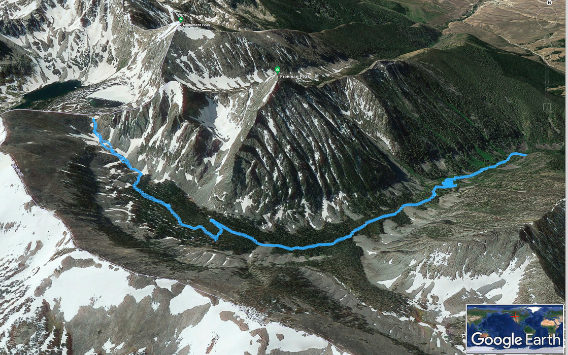
Our GPS tracks on Freeman Peak Trail, trailhead to the right, trekking around the base of Freeman Peak to the Continental Divide on left side of map.  North points toward bottom of photo.  Salmon, Idaho is in valley to the south, at top right in photo.
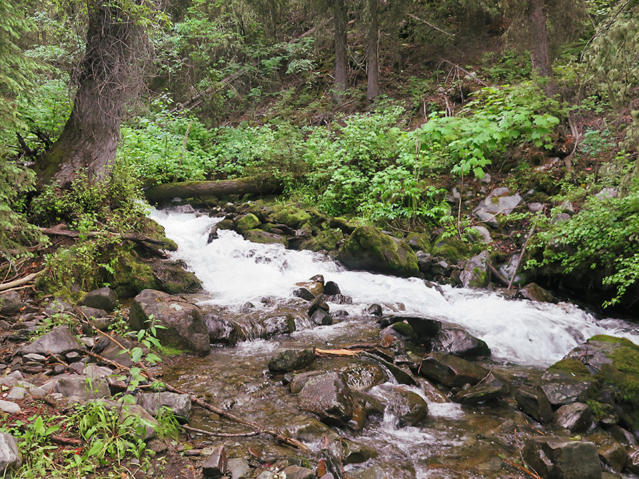
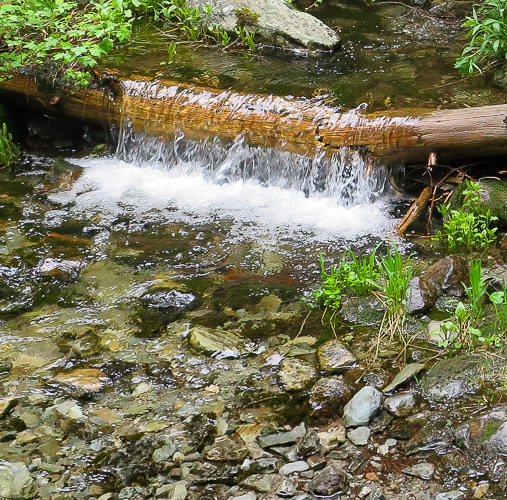
Picture
View of Freeman Peak from beginning of hike up road along Freeman Creek.
Picture
Hiking on road.   Freeman Creek is to the right.
Picture
Freeman Creek
Picture
Road traverses base of long talus slope.
Picture
Getting further up valley with Freeman Peak on horizon.
Picture
Forest becomes more lush as you climb.
Picture
Picture
Picture
Picture
Picture
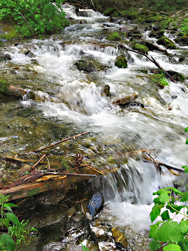
Freeman Creek in July!
Picture
Looking at Freeman Peak.
Picture
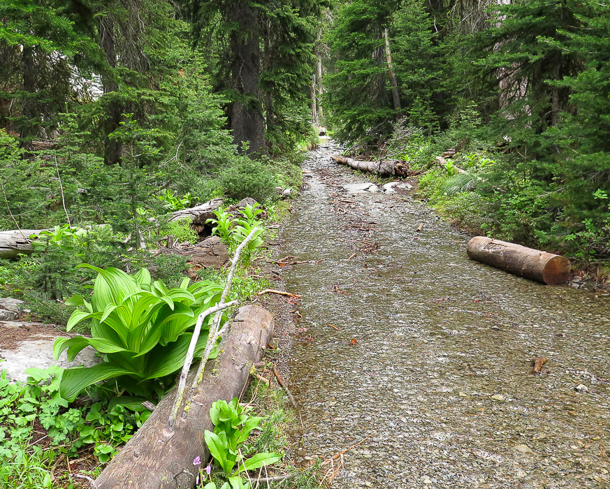
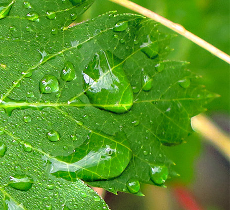
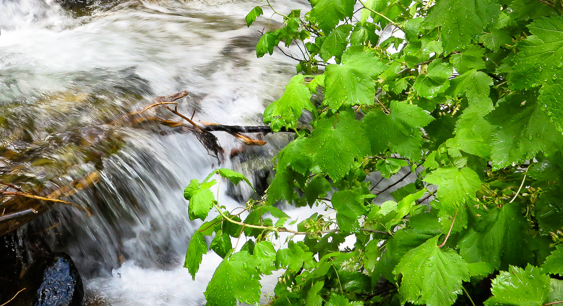
Water flowing over trail in a few places.
Picture
Picture
Cabin near Oro Cache Mine at base of Freeman Peak, ~ 4.6 miles into hike.

Picture
Looking at couloir/talus slope climbing route to Freeman Peak summit.
Picture
Near the end of the road; follow trail to pass on horizon.
Picture
Finding a trail through the rocks
Picture
Nearing the pass at the continental divide.  Once you find the trail, it's easy to follow.
bear claw marks
Door to cabin near Oro Cache MIne
Moisture!
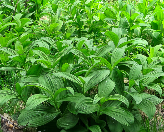
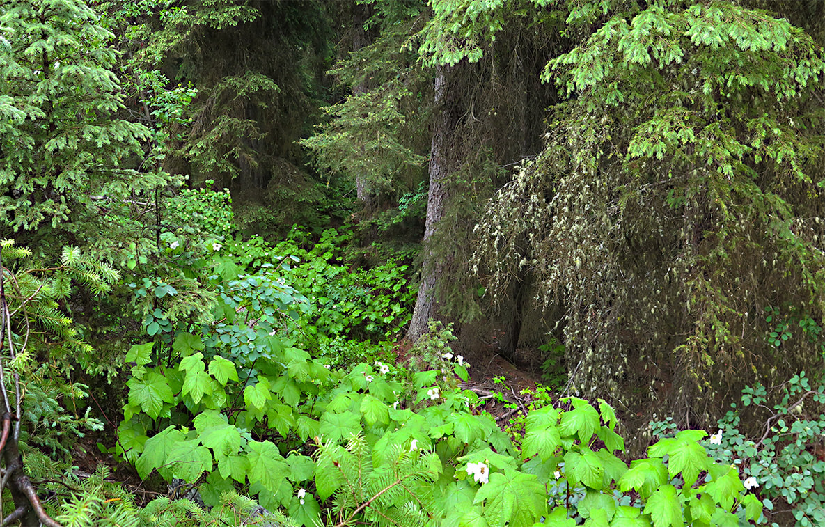
Some cool stuff on the trail.
Picture
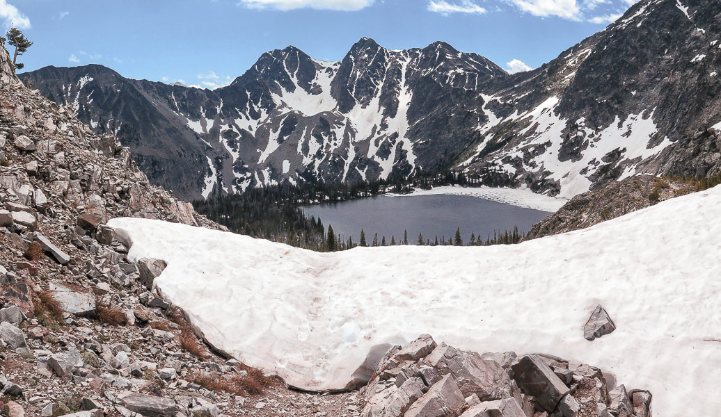
Reaching the pass at the continental divide;  Montana's Upper Miner Lake below.
Picture
Eric hiking back from pass at divide.
Picture
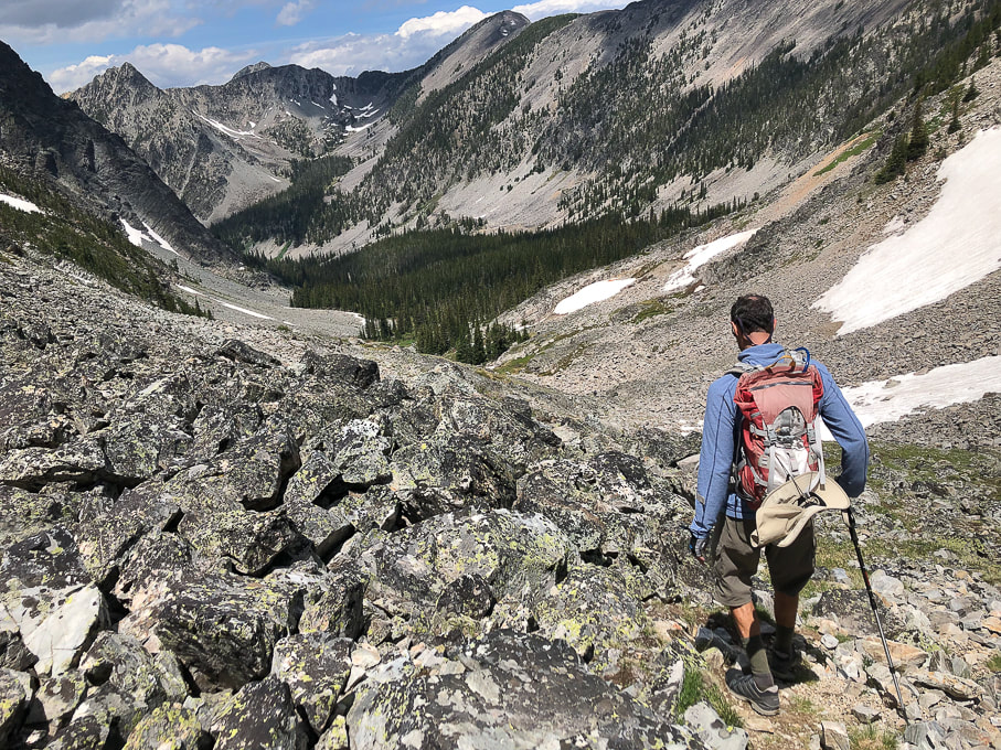
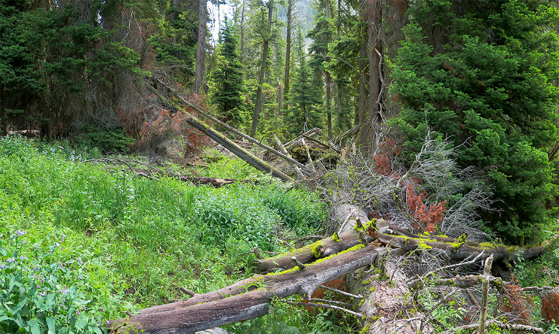
Heading back toward Freeman Creek head waters.
Picture
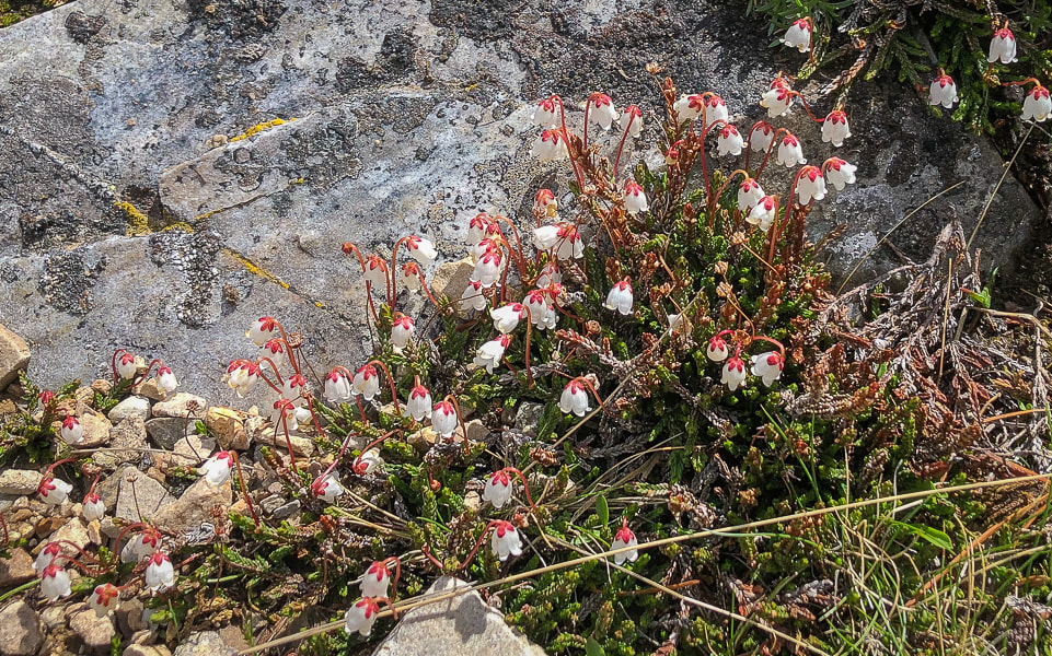
Western moss heather
Picture
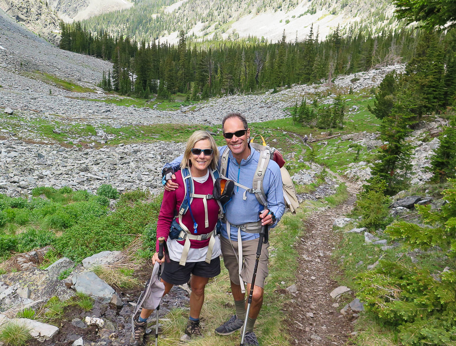
Sue and Fred on the way down towards remains of Ore Cash Mine.
Picture
Picture
Looking northwest to Copperhead Peak (right horizon) - another peak seen from Salmon, Idaho.
 
Click on interactive map of our GPS tracks.
Picture
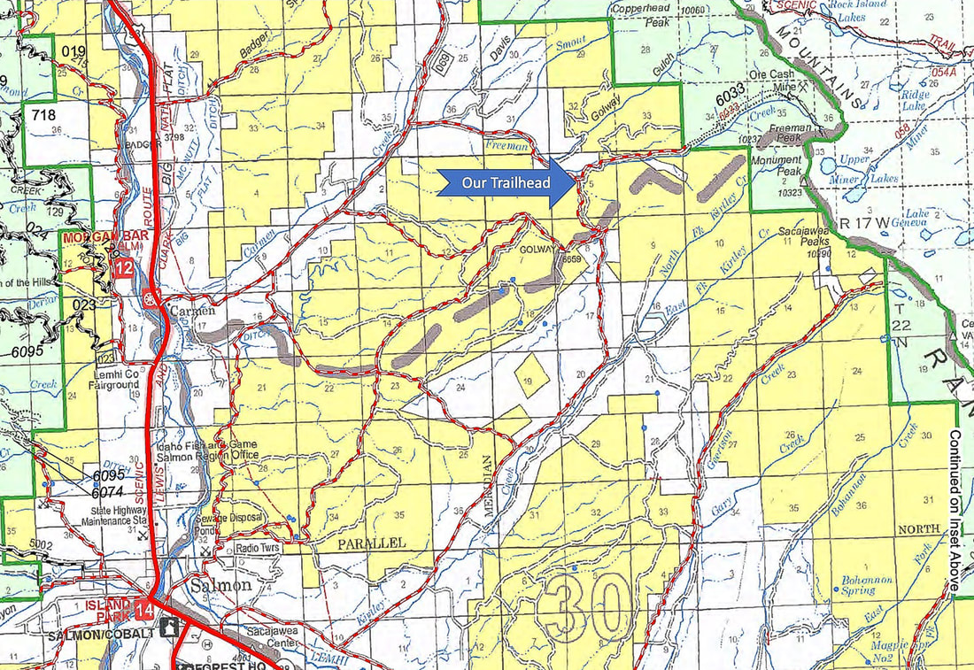
Map of roads from Salmon, Idaho to our trailhead.
from Salmon-Challis National Forest, Idaho - Visitor Atlas 2020.
Picture
Picture
Picture
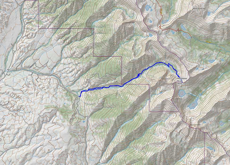
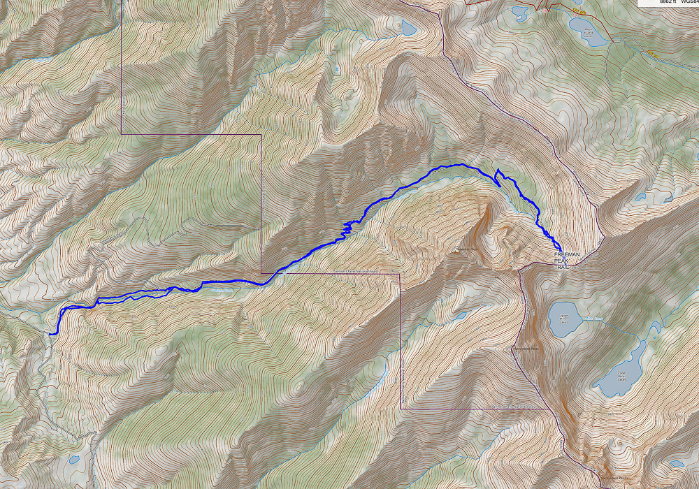
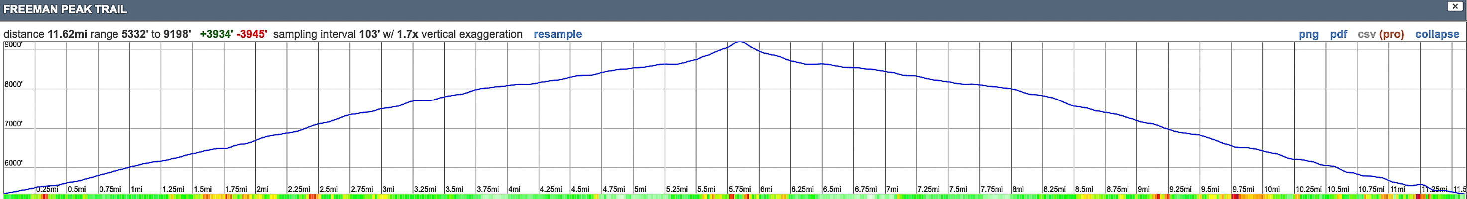
Our GPS tracks and elevation profile for Freeman Peak Trail hike.  North points to top of map.  Trail head on left; Continental Divide (Idaho/Montana border) on right.
References
Oro Cache Mine.  Western Mining History (website).
​
Link, P.K., Janecke, S.U.  
Geology of East-Central Idaho: Geologic Roadlogs for the Big and Little Lost River, Lemhi, and Salmon River Valleys.
4 Comments
Lynn K
8/13/2022 07:10:46 pm

Thanks for this wonderful account! What a great place!

Reply
Sue link
8/13/2022 08:02:13 pm

Lynn!
thanks for reading and commenting - I thought about you when I saw the Western Moss Heather - I know it's not rare, but I don't see it that often and the only time I've seen it is in Idaho high country, like in the Sawtooths. Being able to see these delicate and beautiful plants to me is a gift and one of the things that make these hikes worthwhile. I was surprised that the Beaverheads were this lush and green, but I haven't hiked these mountains much. So much to see, so little time..........

Reply
Linda Paul link
8/14/2022 02:12:19 pm

That is such beautiful country up there. It looks like perhaps you beat the smoke from that Moose fire west of Salmon. Or at least the wind was your friend and blew it the other direction.

This looks like a spectacular way to escape the southern heat for a bit. And I love your quote from Frank Church.

Reply
Sue link
8/14/2022 03:14:49 pm

Yes, we missed it by one week. I saw info of the Moose fire on the Salmon-Challis National Forest website, You prompted me to put a link on this post for alerts and notices for the forest and that the Moose fire was still burning. Thanks! It is close to Carmen.

Yes it is such beautiful country in central/northern Idaho and not many people. I still haven't gotten around to floating the Middle Fork of the Salmon! Sure glad I "landed" in Idaho - a great chapter in my life.

Reply


Leave a Reply.

    Categories

    All
    Arizona Hikes
    California Desert Hiking
    Idaho Summits
    Nevada Hikes
    Snowshoe Hikes
    Southern Utah Hikes/Bikes

    Complete list of Hikes/Bikes on HOME page
    Picture
    Sue and Fred
    Picture

    About this blog

    Exploration documentaries          –  "explorumentaries"  list trip stats and highlights of each hike or bike ride, often with some interesting history or geology.  Years ago, I wrote these for friends and family to let them know what my husband, Fred and I were up to on weekends, and also to showcase the incredible land of the west.  

    To Subscribe to Explorumentary adventure blog and receive new posts by email:

    submit
    Picture
    Happy Winter!
    Picture

    About the Author
    Sue Birnbaum

    A  trip to Jumbo Rocks Campground in Joshua Tree National Monument 38 years ago sparked my passion for hiking, exploring, and learning about desert ecosystems.  For the past 25 years, my husband Fred and I have explored the American West together; we love this land and I hope to inspire you to get out and explore through my photographs and trip descriptions.
    In 1992, Ray Wilson and I conceived the first Cactus to Clouds hike which climbs over 10,000 feet in one day to the summit of Mt. San Jacinto near Palm Springs, California.
    CACTUS TO CLOUDS HIKE 
    READ MORE
    ABOUT SUE

    Archives

    January 2023
    December 2022
    November 2022
    October 2022
    September 2022
    August 2022
    July 2022
    June 2022
    May 2022
    April 2022
    February 2022
    January 2022
    December 2021
    November 2021
    October 2021
    August 2021
    July 2021
    May 2021
    March 2021
    February 2021
    January 2021
    November 2020
    October 2020
    August 2020
    July 2020
    June 2020
    April 2020
    March 2020
    February 2020
    January 2020
    November 2019
    October 2019
    September 2019
    August 2019
    July 2019
    June 2019
    May 2019
    April 2019
    February 2019
    December 2018
    November 2018
    October 2018
    September 2018
    July 2018
    June 2018
    May 2018
    April 2018
    March 2018
    February 2018
    January 2018
    December 2017
    November 2017
    October 2017
    September 2017
    August 2017
    July 2017
    June 2017
    April 2017
    February 2017
    November 2013
    August 2013
    July 2013

    Some of my favorite websites:
    Awkward Botany
    ​citizen botany for the phytocurious

    Bird and Hike

    ​"Intended to encourage people to visit, learn about, and fall in love with the desert."
    ​

    Draw and Shoot
    Beautiful Photography

    Earthline: The American West
    Debra "writes to extol our beloved Earth." Detailed hike info, excellently written.
    ​

    Geologypics.com
    Geology and Geologic Time through Photographs

    Glenn Suokko
    Vermont artist's paintings "inspired by a place based on the land .... drawn to painting the representation and abstraction of nature."

    In the Company of Plants and Rocks
    ​A natural history blog about botany, plant ecology, and geology.

    Nature's Depths

    Walking through nature with John Palka, a neuroscientist who loves plants and ponders big questions

    Rangewriter - What Comes Next?
    ​With excellent writing, Linda tells the story of her unique mother's life including WWII era; with beautiful photographs.

    SeekingLost - Hiking and Backpacking Adventures.

    Stav Is Lost- Unconventional, out-of-the way hikes in the American West.


    Uprooted Magnolia
    ​Leah Yetter's beautiful "photo journal on life, love, and the spirit of Wyoming."
HOME

Cactus to Clouds Hike
More Quotes
HIKES BY STATE

Idaho Hikes
Utah Hikes/Bikes
​Arizona Hikes
​California Desert Hikes
​Wyoming Hikes
​Nevada Hikes

BLOGS

Adventure Blog
Women and the Land
GEAR REVIEWS
FIT AFTER 50
Fred Birnbaum
Dave Brasuell
Bus' Little Black Book
​Mike Carlson
​Ray Wilson
​Marcia Bondy
Bryan Krouse
​Maria Keezer
​Tim Clemens
​Doug Traubel
​Brian Holgate
​
Becky Borczon Blake
​Jennifer Cera and
​Sue Birnbaum

​Vance Powell
​Boise Cross Fit Masters Ladies
​Vickie Kearney

GALLERY

Desert Plants
Nature
Earth + Sky
Urban
Water
Patriot 
​Orchids
Boise
​
  ABOUT
    Contact

​
© 2017 - 2023 by Sue Birnbaum.  Photos on this website are the sole property of Sue Birnbaum unless otherwise indicated.  Please receive permission before publishing my trip reports and photos.
I try my best to be accurate with my hike descriptions; please research your adventures, always bring a map and compass and know how to read them, be prepared!  All of these hikes can be dangerous; hike at your own risk.  ALWAYS carry the Ten Essentials with you on hikes. 
​Please feel free to contact me with comments or questions, or if you see any errors that need attention.
Thank-you for stopping by!


EXPLORUMENTARY.com
  • Home
    • Cactus to Clouds Hike
    • More Quotes
    • Ann Zwinger Quotes
    • Mary Oliver Poems
  • Hikes by State
    • Idaho
    • Southern Utah
    • Arizona
    • California Desert
    • Nevada
    • Wyoming
  • BLOGS
    • Adventure Blog
    • Women and the Land
  • GALLERY
    • DESERT PLANTS >
      • Beavertail cactus
      • Brittlebush
      • Christmas Cactus
      • Arizona Barrel Cactus
      • Parry's penstemon
      • Agave
      • Arizona Rainbow Hedgehog
      • Claret Cup Hedgehog
      • Desert Agave
      • Palmer's Penstemon
      • Silver Cholla
      • Cristate Saguaro
      • Indian Paintbrush
      • Ocotillo
      • Santa Rita Prickly Pear
      • Spiny Cliffbrake
      • California Barrel Cactus
      • Engelmann Prickly Pear
      • Velvet Mesquite
      • Joshua Tree
      • Hedgehog Cactus
    • NATURE
    • BOISE
    • EARTH + SKY
    • URBAN
    • WATER
    • PATRIOT
    • ORCHIDS
  • Fit After 50
    • Brian Holgate
    • Fred Birnbaum
    • Dave Brasuell
    • Bus' Little Black Book
    • Mike Carlson
    • Ray Wilson
    • Bryan Krouse
    • Vickie Kearney
    • Maria Keezer
    • DOUG TRAUBEL
    • Boise Cross Fit Masters Ladies
    • Tim Clemens
    • Marcia Bondy
    • Becky Borczon Blake >
      • Becky B Downtown
    • Jennifer Cera and Sue Birnbaum
    • Dave Brasuell
    • Vance Powell
  • About
    • CONTACT