|
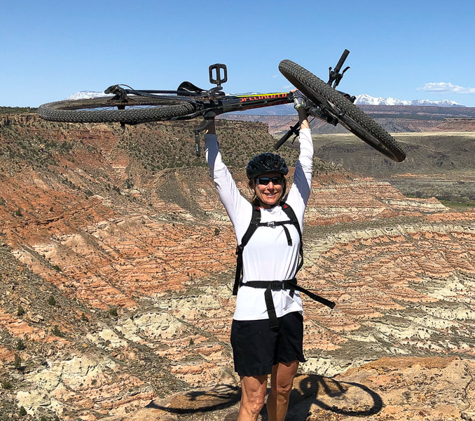
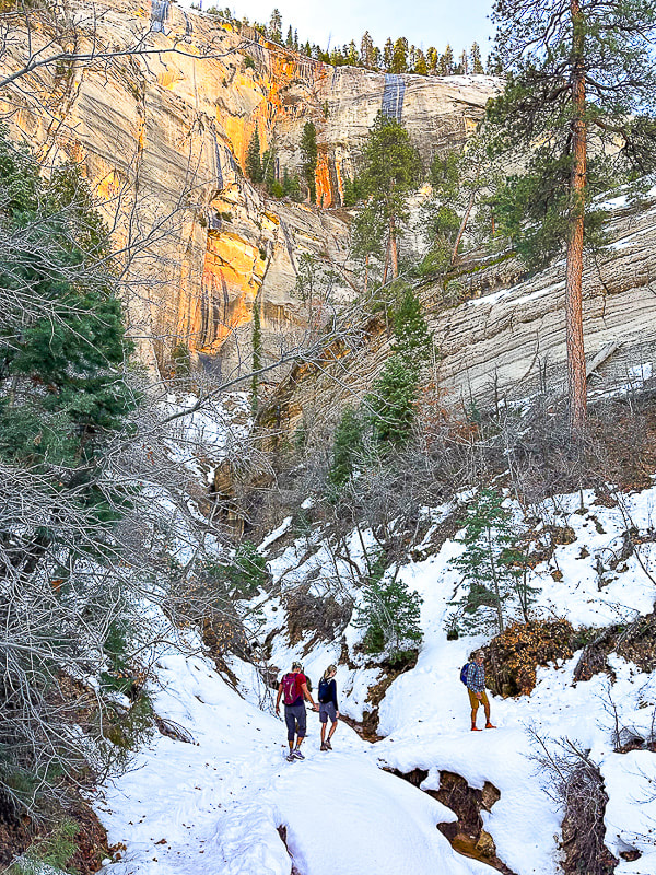
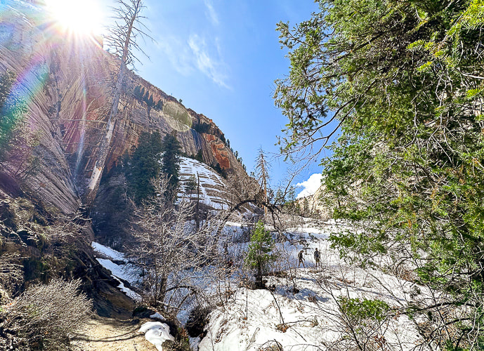
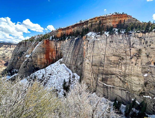
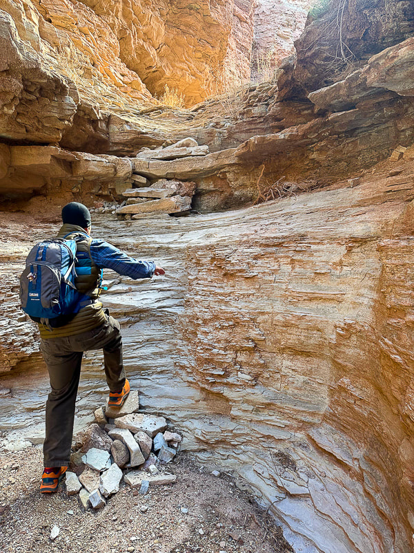
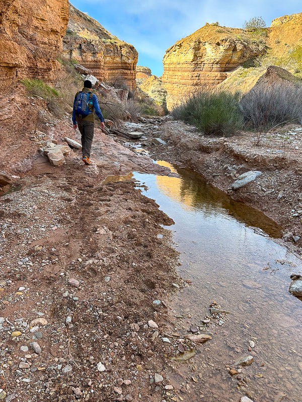
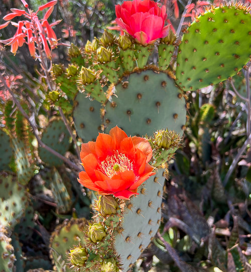
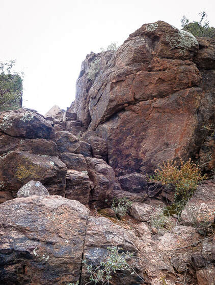
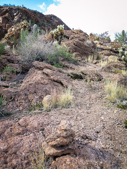
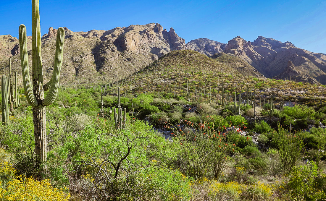
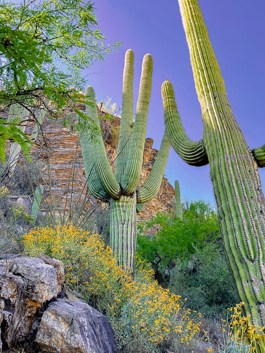
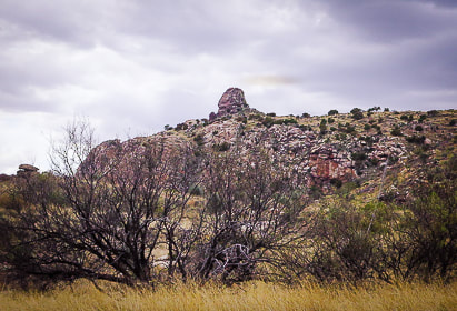
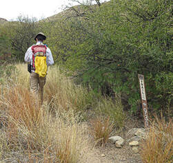
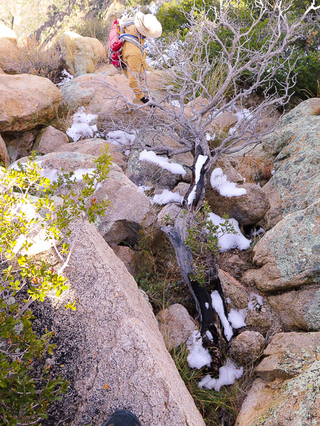
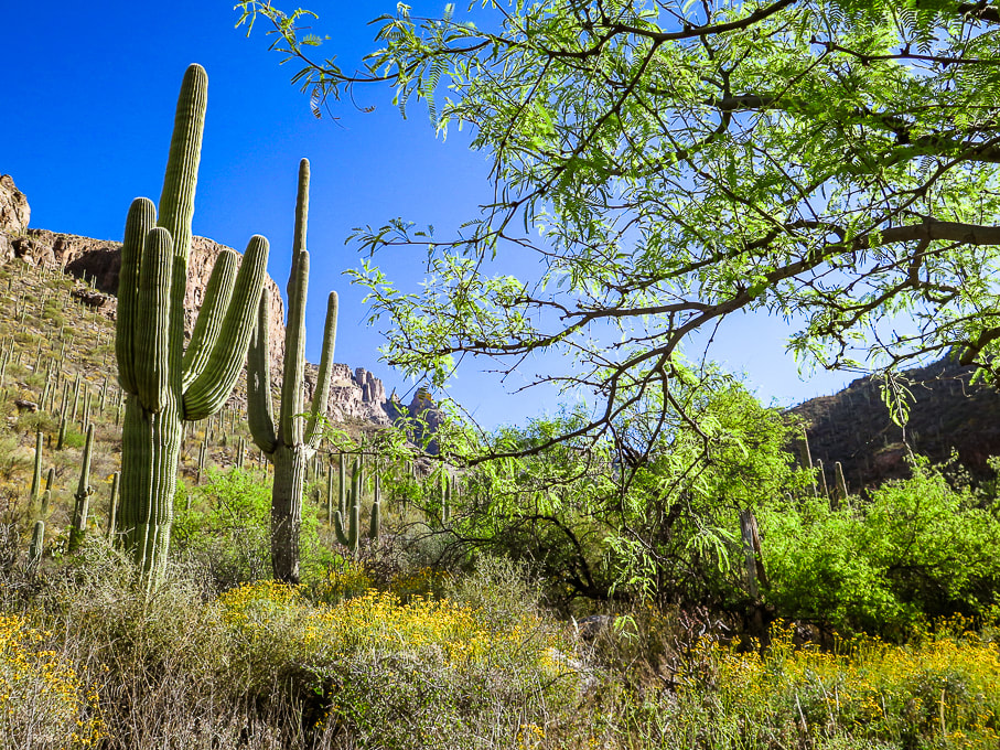
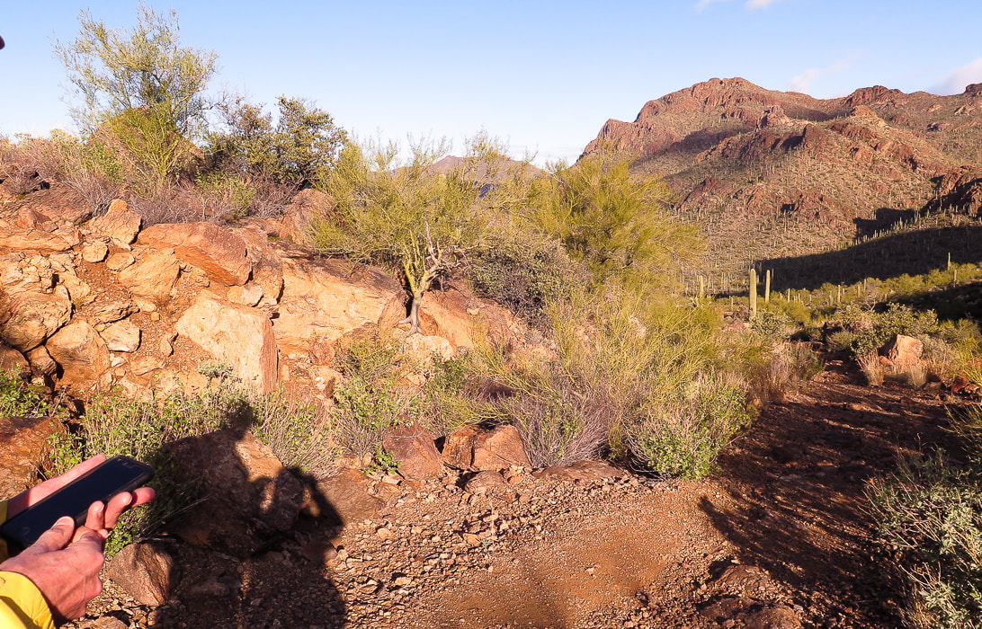
Sweet single track in the Kaibab Plateau's glorious high forest.  Arizona Trail, Kaibab National Forest, Northern Arizona Related Riding instead of Hiking We decided to switch up our usual mode of adventure - hiking - and get on our mountain bikes. After our epic Grand Canyon rim to rim in one day journey a few weeks ago, we noticed the beauty around Jacob Lake and GC's north rim in northern Arizona. Only a few hours drive from St. George, Utah, we got out of the heat to explore the cool, aspen-filled forest on the Kaibab plateau. So many aspens that it reminded me of Colorado high country. We stayed at Kaibab Lodge, five miles from the entrance to the north rim of the Grand Canyon National Park in a spartan "hiker's" cabin, the last place available there. Maybe a rim-to-rim hiker had cancelled at the last minute. The dinner and breakfast buffets were a bit spendy, but then again this is a pretty remote location. The Arizona National Scenic Trail links Mexico to Utah through 800 miles of prime Arizona deserts, mountains, and canyons. It's divided into 43 sections, or "passages." At the Mexico border, it begins in the Huachuca Mountains, trekking through grasslands to gain 3,000 feet to a ponderosa pine forest. The final passage is through Buckskin Mountain to the Utah border, where you can see the Vermillion Cliffs. It's open to hikers, mountain bikers and equestrians. We rode a gorgeous section of this trail through pristine forest and meadows in the Kaibab National Forest on a splendid single track to a viewpoint of the east rim of the Grand Canyon, making a loop by riding back on perfect gravel roads. No other vehicles - we had it to ourselves. The day before this, we just picked gravel roads to explore and ended up at an old cabin, possibly a line shack for ranchers. Our friend Jeff is an avid mountain biker. We hiked the rim to rim trail with him. When I showed him photos of this single track, he said, "Looks great. Let's go." That's the spirit! Looking forward to another northern Arizona adventure!
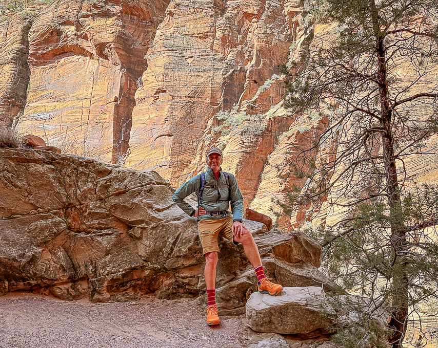
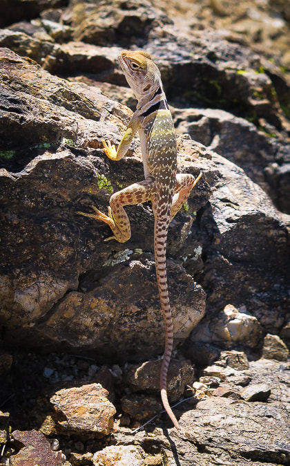
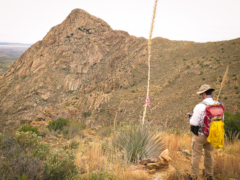
  Single track nirvana.   Arizona Trail near Jacob Lake, Arizona.  Kaibab Lodge, five miles from Grand Canyon entrance to the north rim. Elevation 8,770 feet, it's a beautiful spot to escape to when it's hot "below."  At Grand Canyon East Rim Viewpoint - bonus butterfly on the right!  Looking at the Saddle Mountain Wilderness. There's a trail into the canyon below - trailhead right behind us.
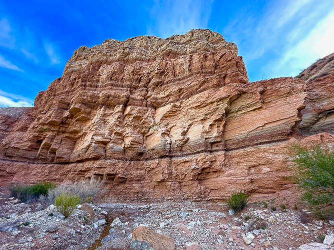
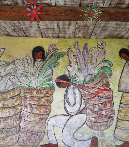
 Grand Canyon East Rim Viewpoint on the Arizona National Scenic Trail.  Sooooo many aspens! This will be a great place in autumn. 

4 Comments
A journey through one of the World's Seven Natural Wonders. Standard north → south route for Grand Canyon Rim to Rim in one day (North Kaibab Trail and Bright Angel Trail)
Total Distance = 23.5 miles North Kaibab Trail = 14 miles/5,700 feet loss. Bright Angel Trail = 9.5 miles/4,350 feet gain. Note: I've seen various estimates of "net elevation gain" that are higher. Since there is not any major regaining of lost elevation, I am estimating gain by difference between Colorado River and south rim. Elevations: north rim = 8,200 feet, south rim at Bright Angel Trailhead = 6,850', Colorado river = 2,500'. Date Hiked: May 23, 2024 Total elapsed time: 10:58 hours. Geology: The deepest rocks are metamorphic Vishnu Basement rocks on the lower part of North Kaibab trail as it enters the Box and Phantom Ranch and at Colorado River (Brama Schist, granite intrusive volcanics, pegmatite and aplite dikes). These are crystalline rocks (1.7 billion years), formed during Early Proterozoic time when continents were colliding, causing compression and mountain-building (orogeny). Theses are jumbled, interlayered shists and gneisses. Rim to Rim Resources: NPS: Critical Backcountry Updates - Grand Canyon NPS: Grand Canyon Backcountry Trail Distances Arizona State University. North Kaibab Trail - Nature, Culture and History at the Grand Canyon. Considerations: Fred and I recommend anyone undertaking this hike should train and be able to walk at least 15 miles continuously and hike 4,000 feet of elevation gain. We hiked this 23 years ago with 100-degree temps at Phantom ranch which slowed us down, but we had experience hiking in hot weather. "Endure. In enduring, grow strong." - Chris Avellone "It is a lovely and terrible wilderness, such a wilderness as Christ and the prophets went out into; harshly and beautifully colored, broken and worn until its bones are exposed . . . and in hidden corners and pockets under its cliffs the sudden poetry of springs." - Wallace Stegner  View of Grand Canyon from two miles below Bright Angel Trailhead  Jeff, Sue and Fred ready to go at the North Kaibab Trailhead at Grand Canyon's north rim, 6:00 am., temperature 41 degrees. Epic Adventure We did it! Three months of training on southern Utah trails, in St. George and Zion National Park, and on the Skyline Trail in Palm Springs helped Jeff, Fred and I conquer the Grand Canyon rim to rim hike. Two things helped us: training for distance and at least 4,000-foot of elevation gain, and we were lucky with weather. It was cooler than usual! To observe the Grand Canyon, one of the seven natural wonders of the world from its rim is a memorable experience. But to walk all the way through the depths of it - almost 24 miles from north rim to south rim along the clear and roaring Bright Angel Creek is epic. Your ability to tolerate a 50 or 60-degree temperature variation, drink enough water, and climb steep, relentless switchbacks will be tested. We took longer to do this hike this time (just shy of 11 hours), compared to our last time 13 years ago (9:50). I felt really tired the last mile up to Bright Angel Trailhead. I think I slowed Jeff and Fred down a bit! North Kaibab Trail → Phantom Ranch Lindy dropped us off at North Kaibab Trailhead on the north rim at 6:00 a.m. As we descended from a fir, spruce and ponderosa pine forest into a rocky color-layered paradise, she drove around to the south rim, descended 4 miles on the Bright Angel Trail to meet us later in the day. In the shadow of the north rim, we walked along verdant Roaring Springs Canyon to the bright yellow light below, reaching Supai Tunnel, the first restroom and water stop, at 1.7 miles. Wild roses bloomed against yellow and red walls. We didn't need a water re-fill until 5.4 miles down the trail at Manzanita Rest Area, a beautiful spot past Roaring Springs. We powered our way down the steep portion, through the wide Bright Angel Canyon, tracing the clear and loud Bright Angel Creek with its occasional waterfalls, hiking through Cottonwood Campground. The prickly pear were so full and healthy; it seemed the creek was flowing much more than we remember from our rim to rim hike 13 years ago. It appears the southwest has had more rainfall in the past few years. We hiked rim to rim 23 years ago and then again 13 years ago and it seems Bright Angel Creek was higher this year. We were happy to see Bright Angel Campground and Phantom Ranch at the bottom of the canyon where we re-filled our water and made sure to drink electrolytes. The temperature was 85 degrees. We took 20 minutes in the shade to eat and muster the energy to start the long, warm and steep hike to the south rim. The dark red, brown and grey Vishnu Basement rocks are one of my favorites of this hike, as you enter the core of the Grand Canyon. It forms the rough, contorted, massive base for the prettier rock layers above. It's not often that you get to walk in some of the Earth's oldest rocks; in this case the Vishnu schists, gneiss and granite are 1.7 billion years old. You get to see the rapids of the green Colorado River through the mesh floor of the long suspension bridge as it passes a huge swirling eddy near the shore, delivering you to the Bright Angel Trail and a long, arduous hike out. Water stops along the North Kaibab Trail: distances from North Kaibab Trailhead. Grand Canyon Critical Backcountry Updates
 Walking through the north rim's highest rock strata: the Toroweap's cliff-forming limestone and the red siltstone and sandstone Hermit Formation (below).  North Kaibab Trail switchbacks through Roaring Springs Canyon, crosses it at bridge below, heads around cliffs to drop further down-canyon.  Jeff approaching bridge over Roaring Springs Canyon, constructed in 1966 after a flood. This marks the transition between Supai Formation and the Redwall Limestone rock units.   Fred on north rim  The Manzanita Rest Area, 5.4 miles from North Kaibab Trailhead, has pit toilets, water, shade and a lot of space for hikers to spread out and rest.  Bees love yucca blooms!  Bright Angel Creek - more water in it than our previous GC hikes, but northern Arizona/Southern Utah has had more snowfall in the past two years.  In Bright Angel Canyon on the North Kaibab Trail near Cottonwood Campground.   The "box" after Phantom Creek entrance into the Bright Angel Creek, on the left. Metamorphic Vishnu basement rocks surround.  Suspension bridge spanning the Colorado with the Grand Canyon's crystalline basement rocks surrounding, linking north and south rim trails. Phantom Ranch → Bright Angel Trail Water stops along the Bright Angel Trail
We finally reached Havasupai Gardens, our last water stop (we knew the resthouses above did not have water) with 4.7 more miles to go! Dousing my hat in the cold water from the "community" faucet and letting it drip down my head felt so good! Shortly after eyeing the south rim's steep cliffs above that will be our trail, we resumed and were excited to see Lindy, who had descended 4.5 miles to meet us. Climbing higher, along Garden Creek, legs are tired, yet the terrain gets more challenging. We step over countless old juniper logs and rock bars used to stabilize the trail on forever switchbacks. We are trying to make it in under 11 hours. Dozens of short-distance south rim hikers congest the last half-mile. Don't want to lose momentum. Endure and grow stronger! Lindy spotted an incredible sandstone boulder along the trail that has fossilized tracks in it. They are the oldest vertebrate tracks in the Grand Canyon and the earliest evidence of vertebrate animals walking on sand dunes. They date to 300 million years ago, when Arizona was a coastal plain near the equator. This article in Smithsonian has a great illustration of how this reptile walks laterally, creating the diagonal footprints: Fallen Boulder at Grand Canyon reveals Prehistoric Reptile Footprints.  Fossilized footprints found in Manakacha Formation - 313 million years old. And then the land above the canyon opens up and we arrive at the rim - WE'VE DONE IT!! We walk victoriously to the Bright Angel Trailhead sign where Lindy snaps our photo. Margaritas, beer, and burgers follow. I'm grateful we trained for this epic hike. I'm even more grateful that I am able to do this hike and witness this natural wonder - up close and personal, step after step, one foot in front of the other.
 Suspension bridge over the Colorado River. A short hike on the River Trail to the right takes you to Bright Angel Trail.  In the Grand Canyon's Vishnu crystalline basement rocks: Jeff and Fred heading along the Colorado River to Bright Angel Trail.  This may be a Duffel Service mule train that carries Bright Angel hikers' packs to Phantom Ranch. One company that provides this service is Xanterra.    Looking for shade, waiting to reach Havasupai Gardens, and looking ahead to the rim we get to climb on the Bright Angel.  We've finally met Lindy, who was hiking down from the south rim after driving around from the north rim! Look at those beautiful switchbacks above!    Fred somewhere on the Bright Angel Trail. He doesn't even look tired (I sure was!).  South Rim grandeur.  Mile-and-a-Half Resthouse is, you guessed it, 1.5 miles from the south rim. No water here this time.  Sue, Fred and Jeff celebrating on the south rim - 23.5 miles and almost 11 hours since start.  Hike Celebration on the South Rim of the Grand Canyon: Sue, Fred, Lindy and Jeff. Already planning the next challenge. Standard route for Grand Canyon North Rim to South Rim in one day (North Kaibab Trail and Bright Angel Trail) Distances/Elevation gain/loss: North Kaibab Trail = 14 miles/5,700 feet loss. Bright Angel Trail = 9.4 miles/4,350 feet gain. Note: I've seen various estimates of "net elevation gain" that are higher. Since there is not any major regaining of lost elevation, I am estimating gain by difference between Colorado River and south rim. Elevations: north rim = 8,200 feet, south rim = 6,850', Colorado river = 2,500'. Related Posts
All Fired up! As Pat Benatar's song goes, we're "All Fired Up" for next week's Grand Canyon rim to rim hike! Her song is a fitting accompaniment to the goblet squat video below. Fred and I needed elevation training, so we went to Palm Springs, my old stomping grounds, and hiked the Skyline Trail for a gain of 4,700 feet, the same Bright Angel Trail gain on the south rim of the Grand Canyon. We encountered too much snow at 8,000 feet in the Pine Valley Mountains just to the north of St. George, preventing a good elevation gain. My last post, Grand Canyon Rim to Rim In One Day: Training in St. George, Utah, explains how we got creative with emulating distance and elevation. We did great on the Skyline; we're now ready for the big hike!
New goal: hike to the tram this October with some of our hiking buddies. Oh, the nostalgia and the beauty of this mountain! I'm grateful that I can still be hiking it 31 years later - let's say that the Advil this time was very helpful! La Verkin Creek Trail to Kolob Arch - Zion NP This long hike features attributes found in Zion National Park's main canyon, including an arch, sandstone cliffs and a river but without the throngs of people. It's in the northern Kolob Canyons section, has a spur trail to impressive Kolob Arch, and also meets up with the Hop Valley Trail, a route to the main Zion Canyon. We hiked 7 miles in to Kolob Arch and back for a total of 14 miles, the same distance as Grand Canyon's North Kaibab Trail. It drops down from the parking lot at Lee Pass Trailhead into the La Verkin Creek drainage. The same mileage as our Skyline Trail hike, but not nearly the same elevation gain. We've got one more training hike on Zion's West Rim Trail this week with Lindy and Jeff, and then we should be good to go for the Grand Canyon. We are lucky to have such inspirational places, some of the most beautiful on Earth, in which to train! Strengthening exercise for powerful hill climbing: Goblet Squats I have found that since I started doing CrossFit and working on strengthening my legs, I have more stability and power for steeper hiking. Goblet squats can be done with a kettlebell as well as two dumbbells, each resting on your shoulders. Strengthens your core (trunk) muscles, glutes and hips. Points to remember:
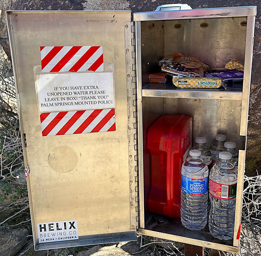
Forsyth Creek - Pine Valley Mountains in mid-May. It's a late spring here; ran into packed snow on the trail at 8,000 feet. Trees are just starting to bud. photos captured with my new Sony mirrorless camera.  La Verkin Creek in Kolob Canyons section of Zion National Park.  At the beginning of La Verkin Creek Trail - Kolob Canyons of Zion National Park.  Jeff and Fred on La Verkin Creek Trail - Zion National Park. This morning was cold starting out - 31 degrees!   Kolob Arch, 7 miles from Lee Pass on the La Verkin Creek Trail. La Verkin is the name of a nearby city between both entrances to Zion National Park. Origins for its name may have come from an alteration of the Spanish word for the nearby Virgin River -- la virgen.  Mile #14 - on the way back to the Lee Pass trailhead! Beautiful Zion hike.  Scott and Fred on the Skyline Trail overlooking Palm Springs and the Coachella Valley, California.  Near the beginning of the Skyline Trail. Prepare before you go far on the Skyline! The steepest part is the "traverse" at the end of the hike. I have seen a person in serious trouble on one of our Cactus to Clouds hikes.  Getting higher - overlooking Palm Springs.  Oh beautiful yucca!  At ~ 4,000-foot elevation on the Skyline looking at the final climb to the Palm Springs Aerial Tram on far ridge.  One of the first views of the San Jacinto Wilderness, where the Skyline Trail that leads to the Palm Springs Aerial Tramway Mountain Station terminates on the ridge way up there! We are heading to the ridge on the right.  Chaparral Yucca on the Skyline Trail with the Little San Bernardino Mountain Range across the Coachella Valley in the background. A good look at what is to come on the Skyline Trail. The tram station is just to the right of the arrow. Coffmans Crag, the white granite just below and to the right of the arrow, is a good landmark to see the final "traverse", a green and steep spot of trees to the left of it in this photo. The Skyline Trail is not one to be taken lightly. People have died on this trail. On one of our Cactus to Clouds hikes, a man caught up to us who had lost his hiking party. He was severely dehydrated - required a helicopter rescue. Left, right from top to bottom: Ribbon Wood tree (Adenostoma sparsifolium), Chaparral yucca, North Lykken trailhead sign, metal sign commemorating Jane Lykken Hoff, "trail boss" of the Desert Riders, contents of Rescue Box 1, Skyline warning sign, Rescue box 1, and boulder sign at the intersection of North Lykken Trail and Skyline Trail.
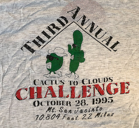
 Yucca and Ribbonwood trees.  Celebrating long friendships with our hiking buddies in Palm Springs. I have known these friends for over 30 years! We have shared many miles on desert trails and many memories. Love you guys! from left to right: Scott, Vickie, Maria, Sue and Fred. Vickie, Maria and I are in the photo below - 31 years ago!  The First Cactus to Clouds Challenge - October 1993
Summit of Mt. San Jacinto, 10,804'. From left to right: Sue Birnbaum, (don't remember his name), Roger Keezer, Maria Keezer, Ray Wilson, and Vickie Kearney seated in the middle. Getting creative with hikes in Southwestern Utah to prepare for the Grand Canyon. Grand Canyon North Rim to South Rim Hike Facts:
Standard route north to south (North Kaibab Trail and Bright Angel Trail). Distances/Elevation gain/loss: North Kaibab Trail = 14 miles/5,700 feet loss. Bright Angel Trail = 9.4 miles/4,350 feet gain. Note: I've seen various estimates of "net elevation gain" that are higher. Since there is not any major regaining of lost elevation, I am estimating gain by difference between Colorado River and south rim. Elevations: north rim = 8,200 feet, south rim = 6,850', Colorado river = 2,500'. Geology: Oldest rocks are Vishnu Schist, an early Paleoproterozoic basement rock (2 billion years ago) at bottom of Grand Canyon. Youngest rock is the Kaibab Limestone on the top of the rim, a cream and white sandy limestone. "By far the most sublime of all earthly spectacles . . . the sublimest thing on Earth." - Clarence Dutton referring to the Grand Canyon. Related Posts
On May 23, we will be walking Grand Canyon from its north rim to its south rim in one day - again. Fred and I first hiked this 23 years ago, to celebrate birthday #40 for both of us. We hiked it on our 50th. We talked about doing it for our 60th, but it wasn't until our friend Robin asked us to go that we got our motivation to train for rim to rim #3. Jeff will do it too, and Lindy will train with us but when it comes to the big day, she has generously offered to drop us off at the north rim and drive all the way around to the south rim to pick us up. Since January, Fred, Jeff, Lindy, Robin and I have been hiking the most challenging trails near St. George, Utah and in Zion National park. Creative planning like linking trails together ensures optimal distance and elevation training. We need to be able to cover 23 miles and a 4,500' gain for rim to rim. Just when your legs are tired from descending 14 miles on North Kaibab Trail, you face the biggest challenge: climbing up Bright Angel Trail for another 9.4 miles. And temperatures on the climb out can be hot, which was the case when we did this hike 23 years ago. We ended up soaking our hats in streams on the way up to cool off. Fred drank 9 liters of water! The next day, we hiked back to the north rim. Some of Our Training Hikes
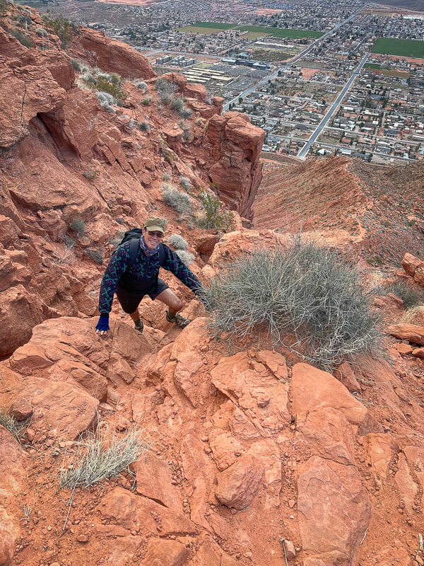
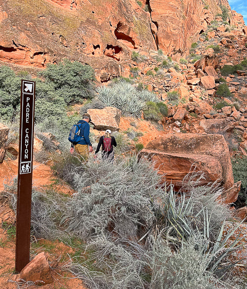
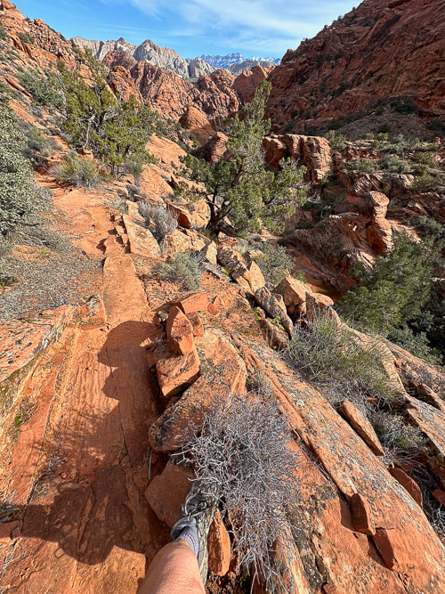
Strengthening for Hill Climbing - Walking Lunge with Overhead Weight Climbing out of the Grand Canyon requires strong glutes! The most important function of your gluteus medius during hiking is to stabilize your pelvis to keep it level while standing on one leg (stance phase of walking). The stronger they are, the better protection for your knees, and the more efficiently they work, the less energy you waste. Walking lunges challenge your glute and core strength. Holding a weight over your head adds more challenge to your core musculature including abdominals and back extensors, as well as your shoulder girdle stabilizers (rhomboids, trapezius, serratus). Good training for scrambling hikes where you have to use hands to propel up rocks. Action: Hold dumbell or kettlebell overhead with elbow straight, next to your ear. Or, you could hold the weight in a "goblet" position next to your chest. Take a large step forward, that knee should not go ahead of your foot. Opposite knee taps the ground. Squeeze glute on stance leg to raise to lunge with opposite leg. Here's some scenes from three of our training hikes: Snow Canyon from Bottom to Top and Then Some: Berm Trail to Joan's Bones (12 miles RT, ~1600' net gain) Berm Trail → Padre' Canyon Trail → Red Sands Trail → West Rim Trail → Lava Flow Trail → Whiterocks Trail →Joan's Bones → car at Whiterocks Trailhead. Living near Utah's Snow Canyon State Park sure has its advantages. Each time I hike in this Navajo Sandstone paradise, I love it more. We started near where we live, caught the berm trail and walked to the Whiterocks Trail on the north side of the park, then walked east to almost the top of Joan's Bones. This route features gorgeous pools in cross bedded sandstone, soaring orange and red towers, petrified sand dunes, and pristine white sandstone slickrock strewn with black basalt boulders. Joan's Bones hike is on AllTrails (misspelled as "Jones Bones").  Snow Canyon training! Robin, Lindy and Jeff at top of Padre' Canyon. Scenes from Snow Canyon State Park, except upper right photo is from Joan's Bones Trail to the east. 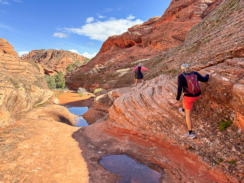 Jeff, Robin and Lindy on the Padre' Canyon Trail.
Fred climbing up cliff band on Red Mountain Trail, backside of Padre' Canyon. 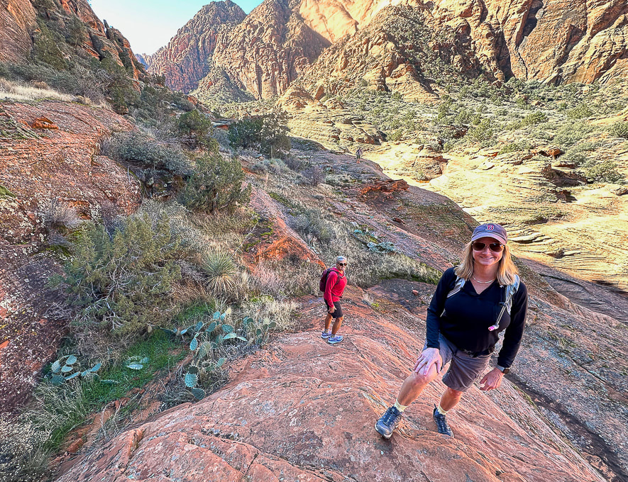 Exploring off the Padre' Canyon Trail.   Moss after a rain near Padre' Canyon. 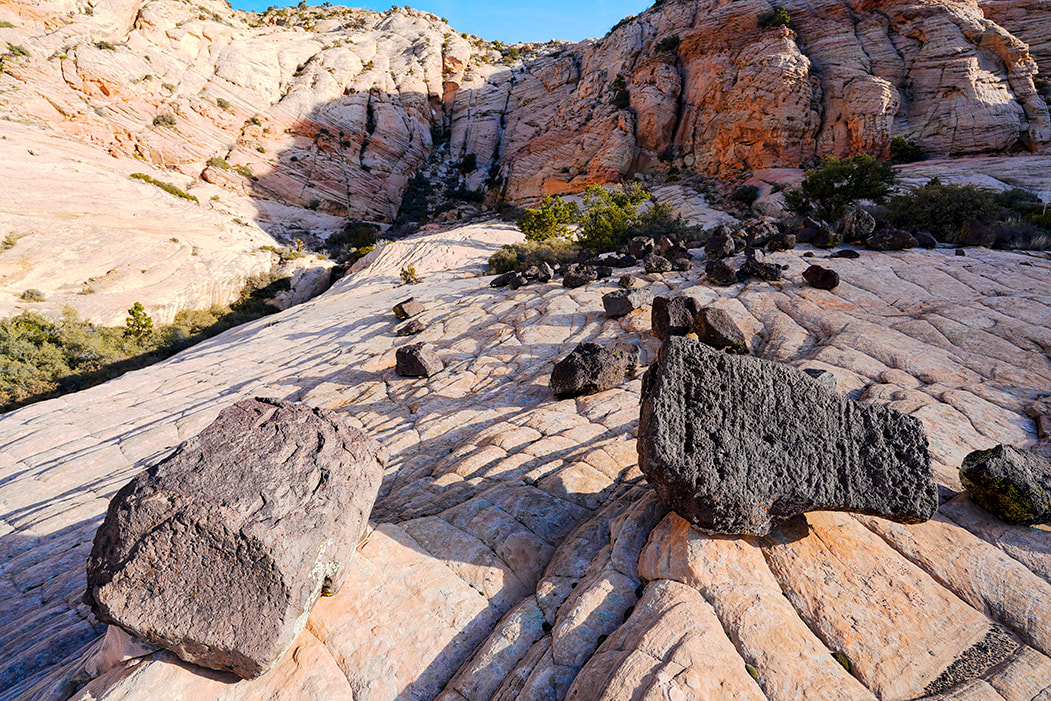 Hiking up toward Joan's Bones - basalt and sandstone. 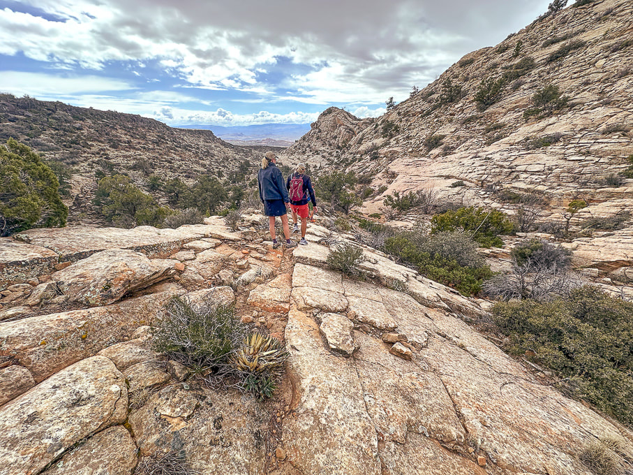 Descending Joan's Bones Trail. 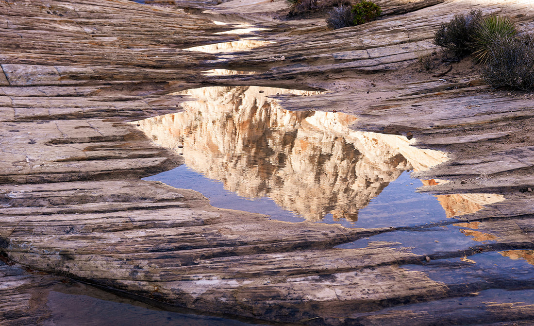 Reflection at Whiterocks Amphitheater  Old juniper on Butterfly Trail in Snow Canyon State Park, Utah 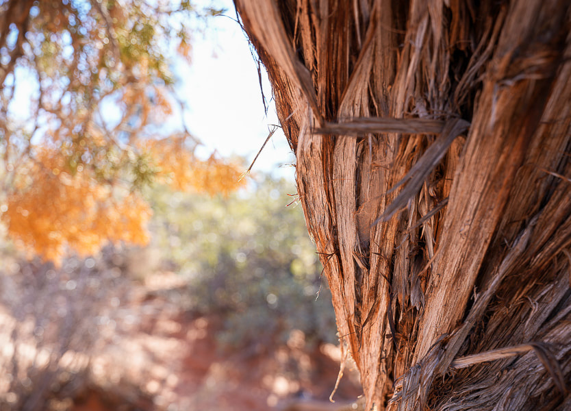 Old juniper image shot with my new Sony mirrorless, full frame sensor camera!!  Zion National Park - West Rim Trail to Horse Pasture Plateau (10 miles, 3,000' gain). Right after the shuttle service opened in early March, Lindy, Robin, Jeff and I headed to Zion to get some elevation training in. Starting at the Grotto Trailhead, 4,300' elevation, we hiked up West Rim Trail, past Angels Landing to the entrance into Horse Pasture Plateau at 6,713', at the intersection with Telephone Canyon Trail. After regaining ~ 300' of elevation loss to and from, I calculated our gain to be ~3,000 feet. We hiked on some icy snow. Down in the canyon and at the plateau, temperatures were a bit chilly. Zion was not especially busy with visitors that day. We celebrated afterwards in Springdale with beer and burgers at Porter's restaurant. 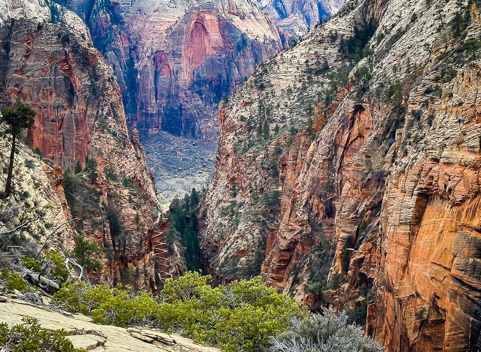 A view of Walter's Wiggles, tight switchbacks up through Refrigerator Canyon on the way to Angels Landing. Named after Walter Ruesch, Zion National Park's first superintendent who helped construct the trail in 1926.
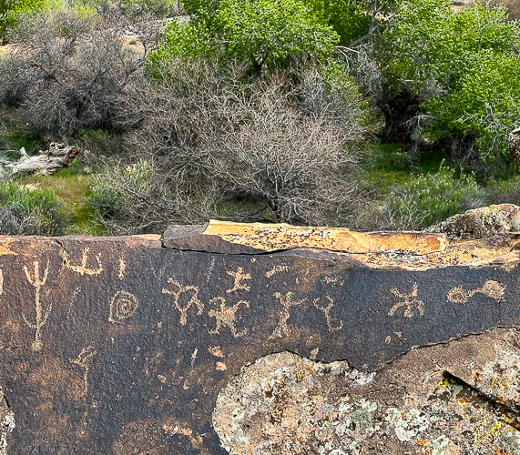
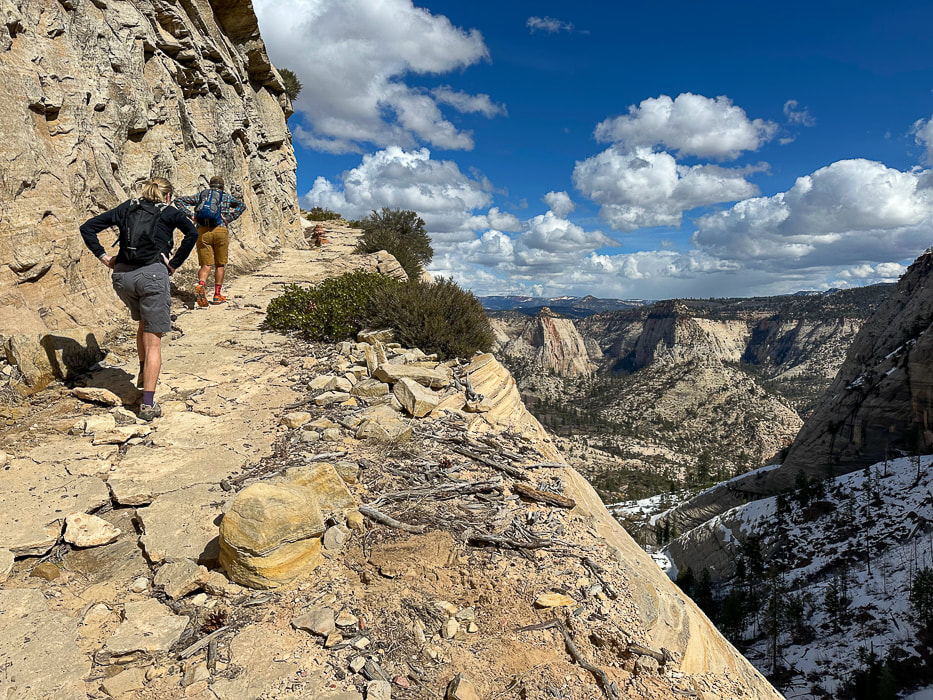 One of the last switchbacks up to intersection of West Rim Trail and Telephone Canyon Trail on Horse Pasture Plateau.  Looking at Zion's West Rim Trail and Angels Landing (orange fin beneath Great White Throne). Aprés hike brew and burgers! More scenes from Zion, and Jeff on Walter's Wiggles on the way to Angels Landing.  Ascending Walter's Wiggles, Refrigerator Canyon to the right. Ivins and Santa Clara, Utah: Suicidal Tendencies Trail and the "Badlands." The "badlands" is my nickname for the landscape west of Land Hill in Ivins, and east of the Beaver Dam Mountains because it reminds me of South Dakota's badlands. A spectacular view of this formidable-looking red and white striped land cracked by crooked canyons and washes and plateaus with well-established biological soils can be savored from the top of Land Hill. We hiked Wittwer Canyon, a major tributary that washes into Santa Clara River. Fred and I put together a 10-mile hike that linked the petroglyph trails on Land Hill to cross the Santa Clara River, to wander through the "badlands" to find a way to link to the Barrel Roll Trail in the Cove Wash Trails. In just one hike, Fred and I saw all the "cool stuff on this trail," (see photos below) and then some. A conglomerate boulder hanging on the steep wall under Land Hill looks like it has embedded dinosaur tracks. I called the local paleontologist; stay tuned!
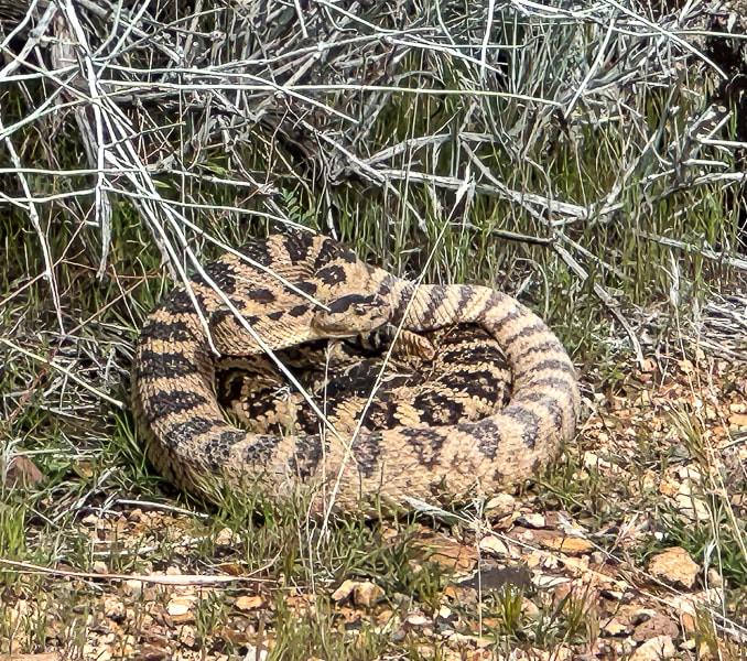
We're fortunate to have Colorado Plateau hiking to the east of us and Mojave Desert hiking to the west. One day we hiked the 11-mile Suicidal Tendencies, a popular mountain bike trail with scary drop-offs. The more we hike this part of Utah, the more we find to explore. Not only are the views magnificent - black lava flows blend with red and orange cliffs, signs of past cultures and geological events adds a lot character to this part of southern Utah. My next post (rim to rim training, part 2) will highlight another Zion hike and Red Mountain Traverse. Getting Ready for the Big Day! Keep On Exploring!!! Cool Stuff on the Trail One angry rattler, Santa Clara petroglyphs, preserved ripples, beaver dam on the Santa Clara River, dinosaur tracks(?) in Shinarump Conglomerate, a well-developed biological soil crust in the "badlands."  The "badlands" west of Ivins, Utah. Top of Suicidal Tendencies is on the left butte. Fred and I descended down to the cottonwood trees below and crossed the Santa Clara River, found a path through the badlands to the left and looped back using Cove Wash trails.
Jeff climbing a dry waterfall in Wittwer Canyon, finding our way up-canyon.  Wittwer Canyon: upper part is located in the Shivwits Band of Paiutes Land. 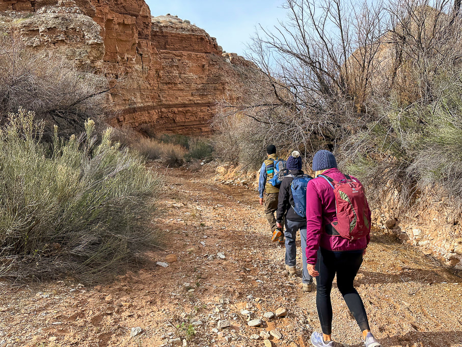 Wittwer Canyon - Santa Clara River Reserve on a cold and windy day. 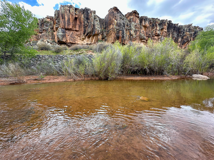 Western cliffs along the Santa Clara River - the rattlesnake is up there! 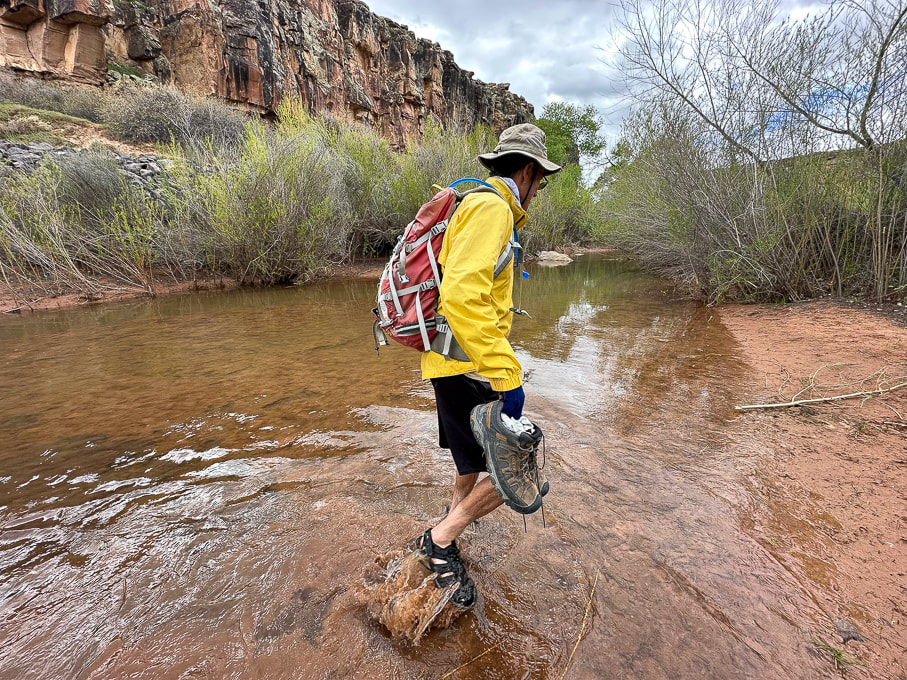 Fred and I found a shallow crossing on the Santa Clara. 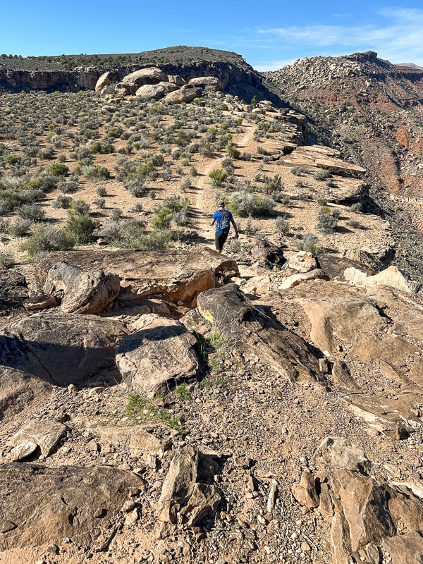 Jeff walking toward top of Suicidal Tendencies Trail (green plateau).  From Suicidal Tendencies Trail looking north across "badlands" to Red Mountain and Ivins, Utah. Snow-covered Pine Valley Mountains on the right horizon. On the top of Suicidal Tendencies - a survey marker that has "Santa Clara" and "1954" stamped onto it.
Become immersed in classic Tucson Sonoran Desert landscape, passing through three life-zones on a long hike to a small, refreshing waterfall, and tour the great DeGrazia Gallery In the Sun Museum.  Desert scrub biome on the lower Esperero Trail. Common plants in Sonoran desert scrub Biome of the Sonoran Desert include creosote, mesquite, palo verde, barrel cactus, agave, prickly pear and cholla cacti. Related Posts Trip Stats
Location: Coronado National Forest, Santa Catalina Mountains, Pusch Ridge Wilderness, Tucson, Sabino Canyon Recreation Area. Distance/Elevation gain: 12 miles out and back/2,525'. Trailhead = 2,775', Bridalveil Falls = 5,300'. Difficulty/Trail # : Class 1 (defined trail) moderate effort - out and back. Overflow Parking Trail to Esperero Canyon Trail #25. Parking/trailhead: Sabino Canyon R.A. overflow parking. Map: Santa Catalina Mountains - Green Trails Maps #2886S Date Hiked: April 20, 2023. Dogs: Dogs are not allowed in the Sabino Canyon Rec. Area or the Pusch Ridge Wilderness. Links: Coronado National Forest - Esperero Trail DeGrazia Gallery in the Sun
One of the characteristics I look forward to with Tucson hiking is the wide flora variety and diversity. Along this 2,500-foot gain, Esperero Trail passes through three biomes, or habitats identified by their dominant life forms: Sonoran desert scrub, desert grassland, and Madrean evergreen woodland. The most obvious change happens after the steep climb to Cardiac Gap, at 4,400 feet, when saguaros and creosote have given way to oaks and grass. We arrived at Esperero Canyon's Bridalveil Falls after six miles of warm hiking and enjoyed the cold water dripping and spraying off the rocks. The falls must look like a veil during run-off after a storm, but at the end of April, they were reduced to small rivulets. The canyon here is wildly picturesque with huge rounded and dike-streaked boulders, pinyon pines and oaks, wildflowers and towering rock formations above. Yuccas are interspersed among junipers. If you keep climbing up-canyon, in another mile, you reach Cathedral Rock Trail, which heads northeast. Esperero Trail continues west toward Window Peak. Our Hike We parked at the large overflow parking lot for Sabino Canyon Recreation Area and began walking southeast past trailhead signs. (However, there is a shorter trail from the north end of the overflow lot; it heads north to meet up with Esperero Trail, avoiding the picnic area). The mileage that follows is from the trail that we took.
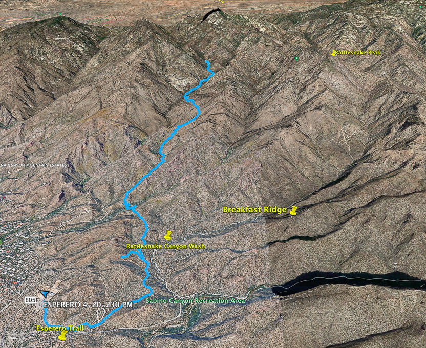 Google Earth image of our tracks beginning at Sabino Canyon Rec. Area overflow parking (lower left) and traveling up Esperero Canyon to its end at Bridalveil Falls. Topo map and elevation profile at end of post  Starting from Sabino Canyon Rec. Area overflow parking onto trail that links to Esperero Trail. Thimble Peak on the far horizon. 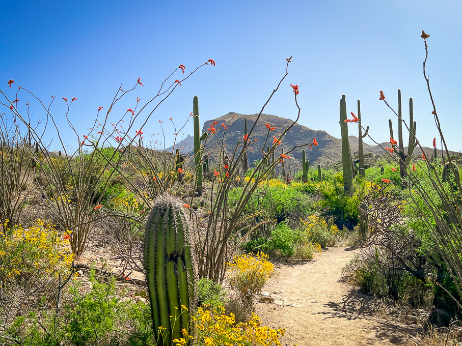 Continuing on Overflow Parking Trail toward Cactus Picnic Area, where it meets with Esperero Trail. 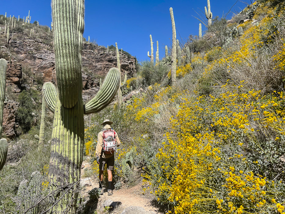 Esperero Trail beauty in April.  Brittlebush (yellow), hedgehog (magenta), cholla, ocotillo.  Pink fairyduster along the rocky trail. 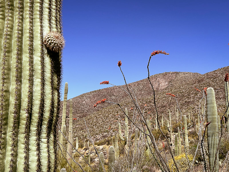 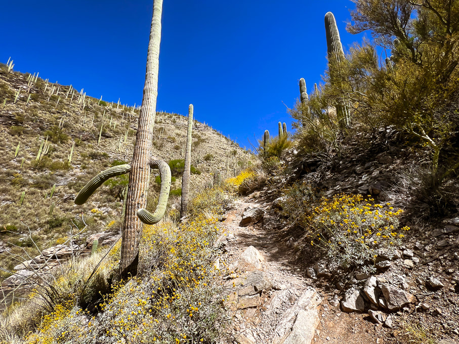 Esperero Trail beginning to steepen. This trail stays narrow all the way up into Esperero Canyon.  Cholla cactus  Heading up toward Cardiac Gap. 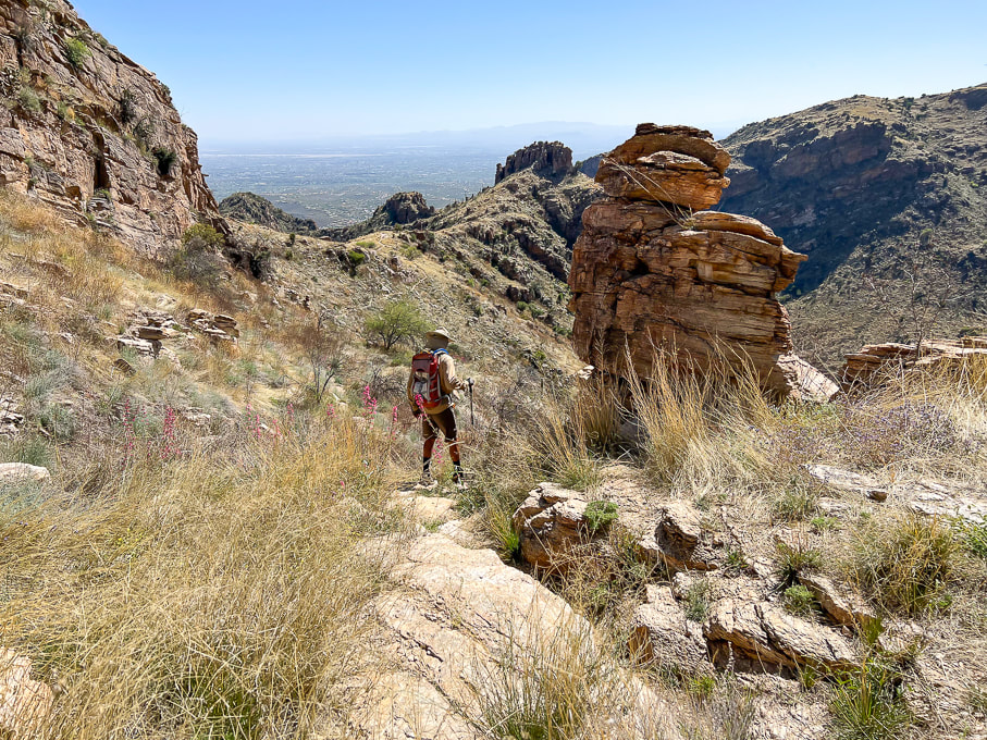 Looking back at Cardiac Gap (saddle) that overlooks Tucson. 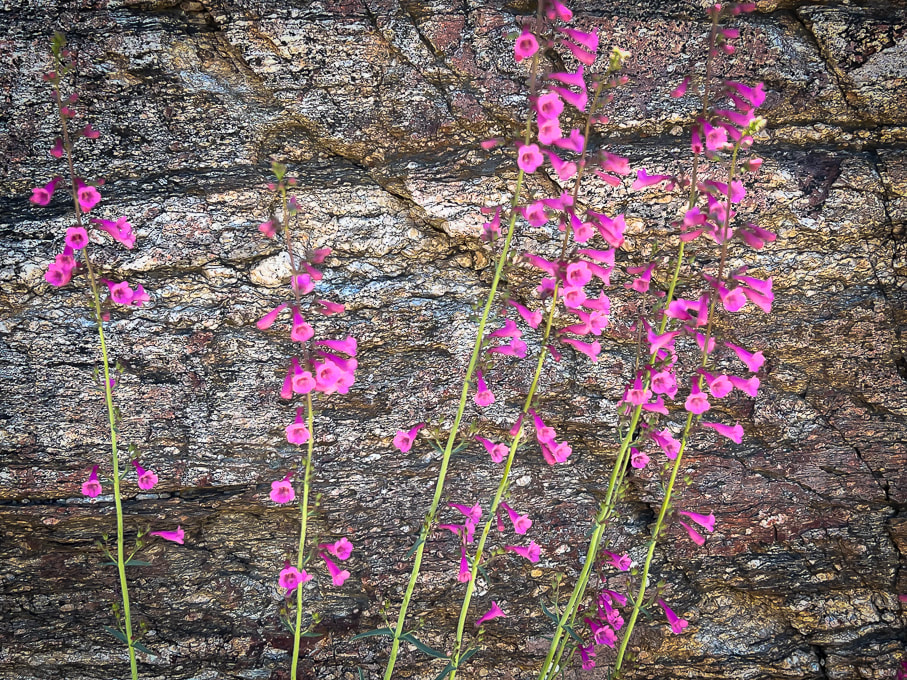 Parry's penstemon provides splashes of color in the semi-desert grassland life zone.  View from Cardiac Gap northward: Esperero Trail (Fred walking up on right side) stays high over Esperero Canyon as it travels through grassland for one mile before it drops down into the floor of the canyon.  Approaching the drop into the floor of Esperero Canyon to the left. 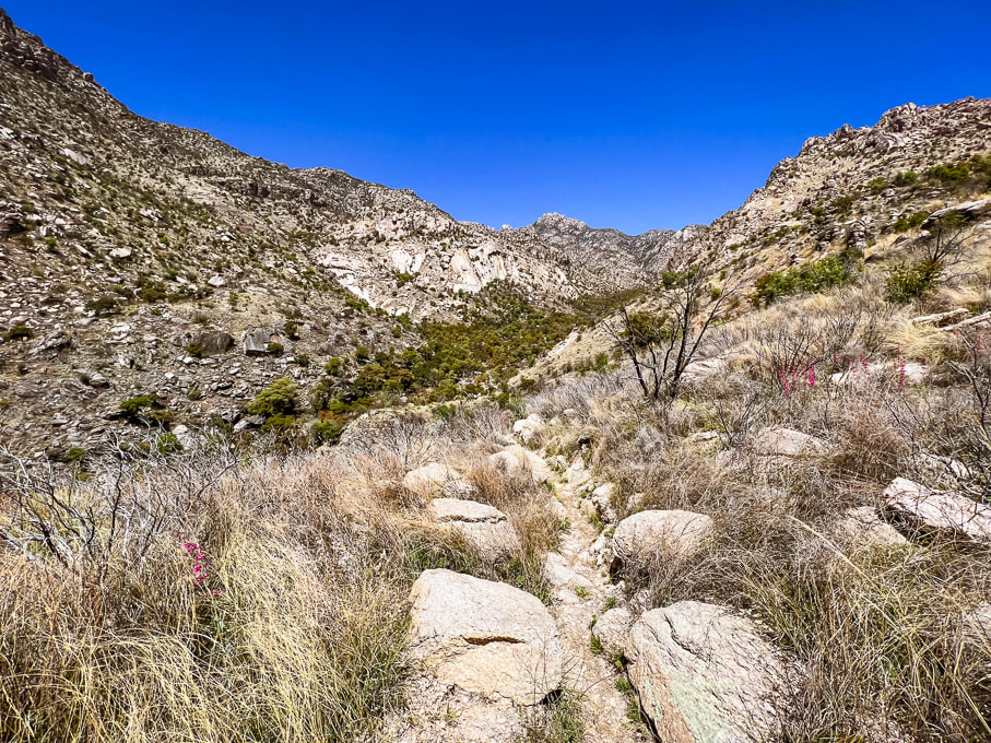 Near the drop-in point of Esperero Canyon. 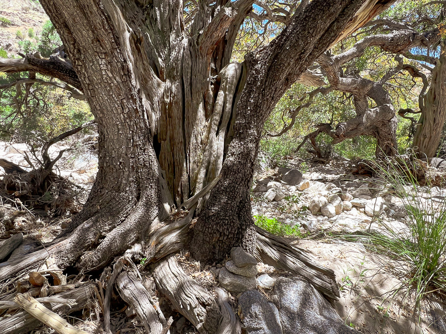 HUGE alligator juniper in Esperero Canyon. Notice the cairn at its foot marking the trail as it weaves through white sand in the Madrean Woodland life zone. Common species in this life zone are Emory, Mexican Blue, Arizona and silverleaf oaks. Pines include Mexican pinyon and Apache pines. Agaves, manzanita, and bear grass make up some of the subcanopy.  Looking at rock formations above from the floor of Esperero Canyon.  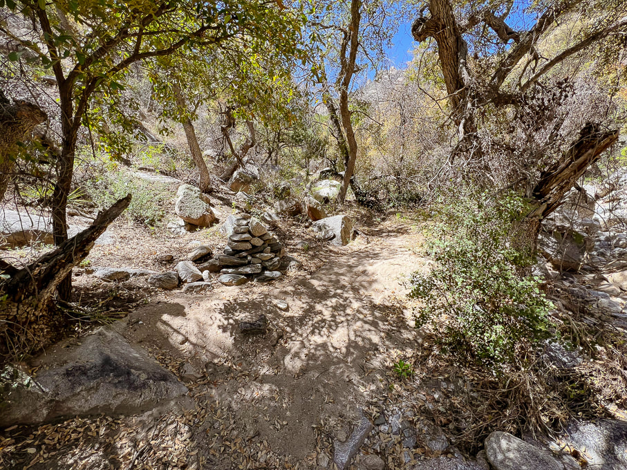 Large cairn marking trail through bottom of Esperero Canyon - approaching Mormon Spring, ~0.5 mile from Bridalveil Falls. 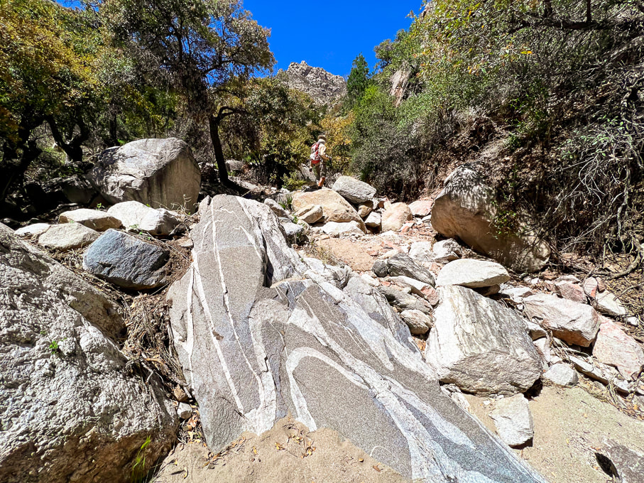 Folded pegmatite (?) dike in leucogranite (?) in Esperero Canyon.  Bridalveil Falls finally! The only water we saw on this six-mile-in hike.   Portion of Bridalveil Falls - fun playing with Photoshop filters.  Refreshing Bridalveil Falls in Esperero Canyon.  Santa Catalina Indian Paintbrush castilleja tenuiflora  Found this near the falls with these rocks holding it down.  Heading back. 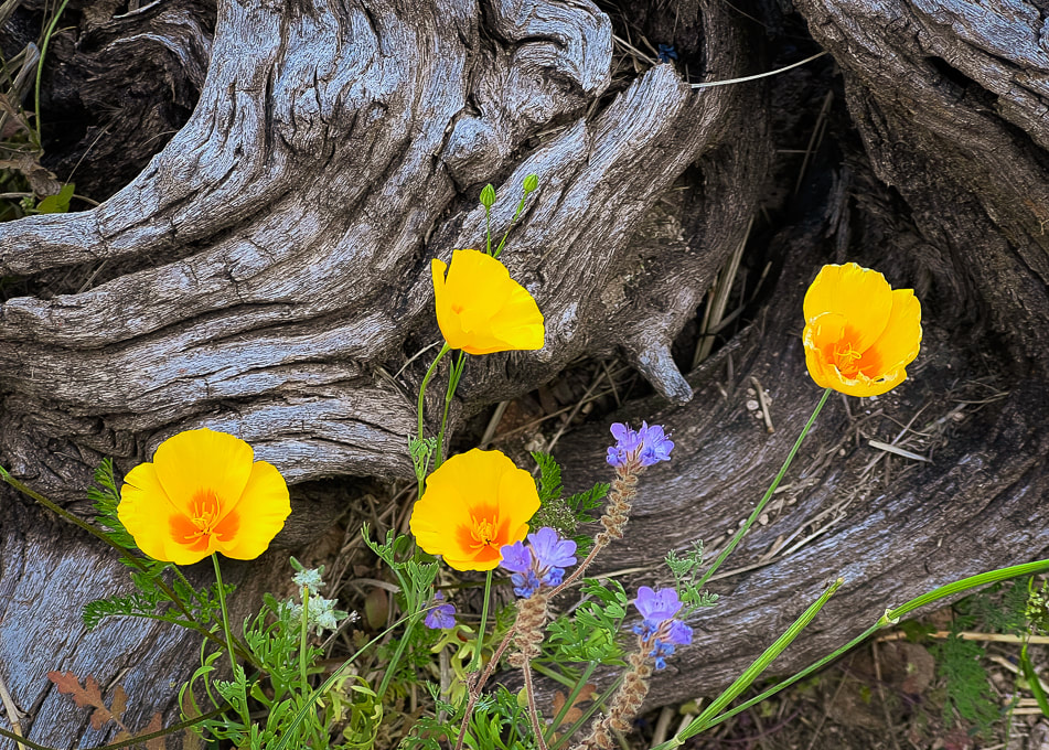  Saguaro and brittlebush     DeGrazia Gallery in the Sun Museum - TucsonScenes from DeGrazia Gallery in the Sun - Tucson.  A quote from Ettore DeGrazia, posted up on the wall along with dozens of his paintings in the Gallery of the Sun Museum in Tucson.
 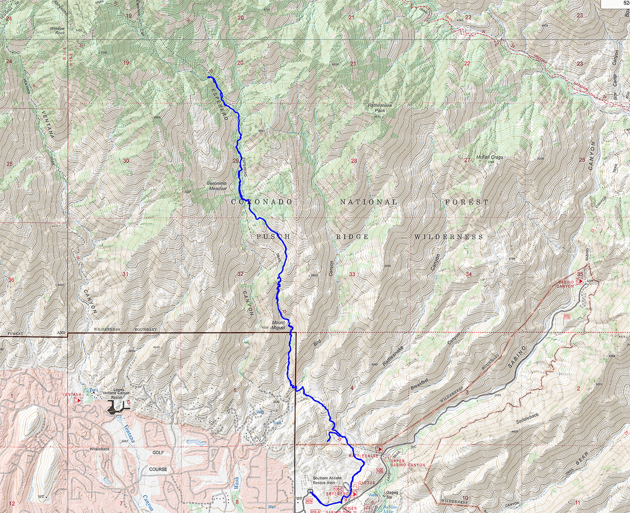 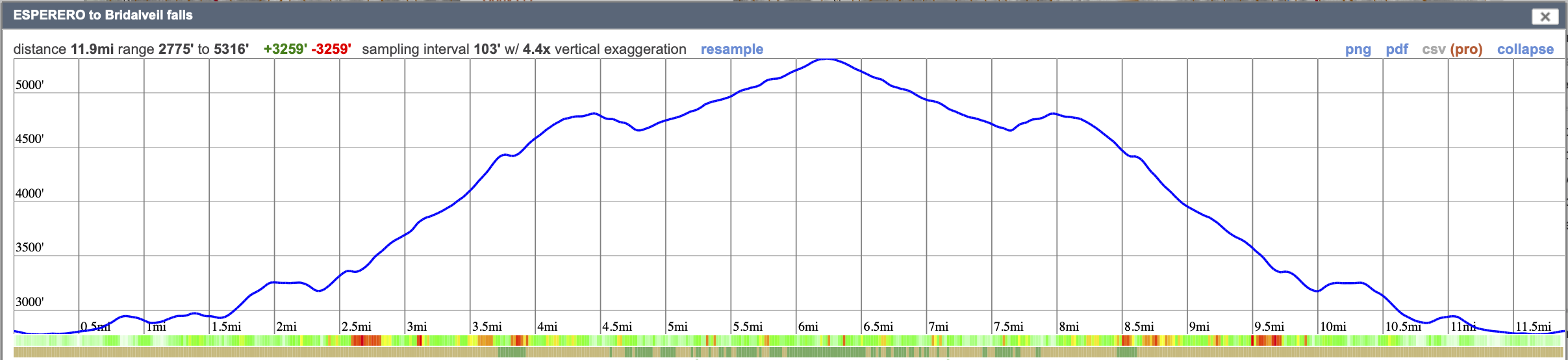 Our GPS tracks and elevation profile for Esperero Trail to Bridalveil Falls.
Click on map for larger image. From saguaros to pines, walk through five Sonoran biomes to get to this "sky island" that stands almost one vertical mile over Tucson. 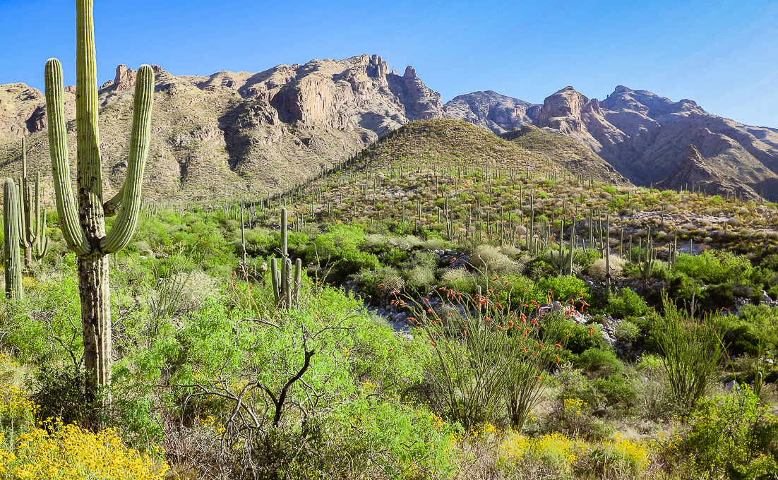 Beginning of hike with view of Mt. Kimball (rounded green peak in the distance). The brittlebush and ocotillos are in peak bloom. We were a bit too early for the saguaro blooms. Trip Stats Overview: Walk up Finger Rock Canyon, keeping its namesake spire in view, among many saguaros and ocotillos followed by a steep, rocky climb along the canyon's east wall. At a grassy plateau, arrive at the path to Finger Rock. Keep climbing, passing Linda Vista, finally entering into a forest of alligator juniper and ponderosa pines. Stand far above Tucson and mountain ranges to the south and even with the high points of the northwest Santa Catalinas. Location: Coronado National Forest - Santa Catalina Mountains - Pusch Ridge Wilderness - Tucson Distance/Elevation gain: 9.7 miles out and back/4,200'. Trailhead = 3,051', Summit = 7,258'. Difficulty: Challenging Class 1 Coordinates: Trailhead (Finger Rock/Pontatoc parking lot) = 32.33658, -110.91. Summit = 32.37728, -110.87904 Maps and Apps: Green Trails Maps: Santa Catalina Mountains Prominence: 1,098' Considerations: No dogs allowed in Pusch Ridge Wilderness Bighorn Sheep closure area, a portion of the Pusch Ridge Wilderness. Native peoples: Desert Archaic (2500 BC - 200 AD). Followed by Hohokam, who were "masters of the desert" until AD 1450, and O'odham peoples who still inhabit southern Arizona. O'odham means "the people". History: Named after Frederick E. Kimball, a land developer who influenced the building of road up to the Santa Catalina's highest summit, Mt. Lemmon. The Finger Rock Canyon trail to Mt. Kimball, one of the highest in the Santa Catalina Mountains, treks through gorgeous Sonoran landscape, meandering through wash and canyon lowlands, close to saguaros, gaining 400' in the first mile. That easy grade ends abruptly at mile two, when you encounter the first of many rock steps on a steep trail that climbs an average of 950' per mile to the summit. The south summit slope bestows a birds-eye view of Tucson, the north side a perched outcrop view of canyons below your feet and the rugged peaks of the western Santa Catalinas. Fred and I have been hiking this mountain ever since we started visiting Tucson to get out of Idaho high country's somber and snowy springs. This established Class 1 trail was a welcome change from the past few months of non-trail, route-finding, scrambling ascents in Utah and Nevada. Great to not have to navigate or continuously hunt for a route or the trail, but instead let the trail take us to the top. On this trip, we first stopped near Kingman, Arizona to attempt Mt. Tipton, but the unmarked 3,500' gain entailed miles and of shrubby terrain clogged with scrub oak and junipers, so we turned around. Islands in the Sky The ability to see the changing scenery of multiple life zones is one of the great features of southern Arizona hiking. The rewards are saguaros and yuccas at the beginning and end, and pine and juniper at the top of your hike, if you are willing to make the thousands-of-feet elevation journey. The Santa Catalina Mountains are but one of the many "sky islands" that rise above the desert. From the Chiricahua mountains in southeastern Arizona to the Sierra San Luis Mountains in Mexico's Chihuahua mountains, these unique, rugged environments support some of the highest levels of biodiversity in the world. Below is a summary of what I learned about biomes and sky islands. I also wrote about this in my Tanque Verde Peak - Saguaro Wilderness post. Southern Arizona mountains are a hiker's paradise. With waterfalls, rugged gneiss and granite rock outcrops to climb over, and wildflowers in spring that represent all of the color spectrum, this desert is surprisingly lush. It is a spectacular land where all elements work together in harmony through monsoons, rains, and killer heat waves, and cool winters. On Mt. Kimball's descent, the other side of the canyon is strewn with hundreds of saguaros clinging to rocky ledges, illuminated by the setting sun. This sight makes you forget about your tired legs. Hike Summary (GPS tracks at end of this post)
 Frost gelato has become a Tucson post-hike tradition! Biomes of the Sonoran Desert
The Santa Catalina Mountains are in the Arizona Uplands, the highest and coldest portion of the Sonoran Desert.
Biome - "Coarse ecological units based on the phenology, lifeform, and physiognomy of the dominant vegetation. - Sonoran Desert Inventory and Monitoring Network - National Park Service. Biomes are determined primarily by temperature and rainfall, and are based on vegetation because plants are easily recognizable components of a biological community. (Dimmitt, 2015). 
Biomes of Sonoran Desert Network Parks
-from Sonoran Desert Inventory and Monitoring Network - National Park Service Desert
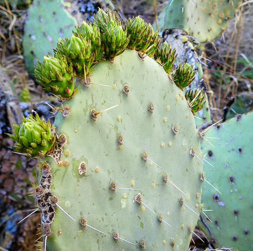
At around 3,000' elevation, the first mile or so of this hike begins where the desert biome is transitioning into the thornscrub biome. It wanders through a gorgeous landscape of saguaros, cholla, barrel cactus, and yucca succulents as well as mesquite, creosote bush and paloverdes shrubs. A great biome because plants are tough yet beautiful at the same time. Tough because plants have devised strategies to help them survive, such as thorns as a physical defense against predators, and hair on leaves to shield the relentless sun. Thorns and bristles act to shade and insulate certain crucial parts of cacti. Creosote bush adapts to the hot sun with wax-coated leaves to avoid loss of water. Thornscrub Before ascending the canyon wall at ~ 3,500', the landscape is transitioning to this biome, continuing with mesquite trees and catclaw (acacia) shrubs. Thornscrub has short trees with cacti, and is denser than desert biome. Vegetation grows lush with a lot of wildflowers. The climate is nearly frost-free (tropical). Plants shed leaves during dry season (drought-deciduous). Semi-desert grassland As the trail climbs just past 4,000 feet, a noticeable change in vegetation occurs: saguaros become scarce as the ridge is dominated by ever-increasing fields of bunchgrasses, oak and juniper. Calming, muted and soft neutral grey/greens replace bright primary colors of the lively, unrestrained desertscrub. Sotol, creosote and agave mix with a diverse array of grasses. As the trail gradually climbs, junipers become more prevalent. This land supports more succulents and shrubs. Hot pink Parry's penstemon add color to this landscape. Madrean Evergreen/Pine/Oak Woodland At the intersection with the trail to Finger Rock, ~ 5,200', larger trees such as alligator juniper appear. Evergreen oaks like Emory oak and Arizona white oak along with Mexican pinyon pine dominate this biome, named after its origin in the Sierra Madre mountain range that runs through Mexico and along the Gulf of California. These are subtropical woodlands. Temperate Forest A unique characteristic of the Sonoran temperate forest biome, officially beginning at around 6,000 feet elevation, is the cohabitation of lower-elevation desert plants, such as the yucca with spruces, pines, firs and maples. Species diversity reigns, although seemingly not to the degree of the desertscrub biome. Temperate forests are very cold-hardy and confined to cooler sites above the Madrean evergreen woodland. One of my favorite parts of this trail is where it crosses the creek to climb up to the intersection. The forest has some Ponderosa pines (reminds me of Idaho). At the top of Pima Trail, just below Kimball's summit, there are large alligator junipers to admire. 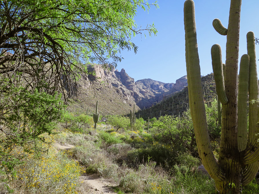
 Beginning the canyon climb with Finger Rock on the opposite canyon rim (small rock tower just left of tree on horizon). 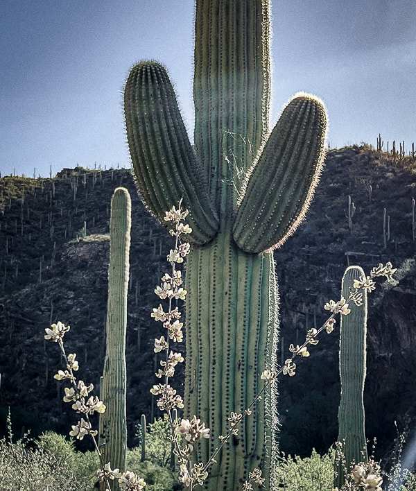  The promise of a super-bloom after an unusually wet winter. This photo was taken at our rental property in Tucson.  Near beginning of east canyon wall climb. 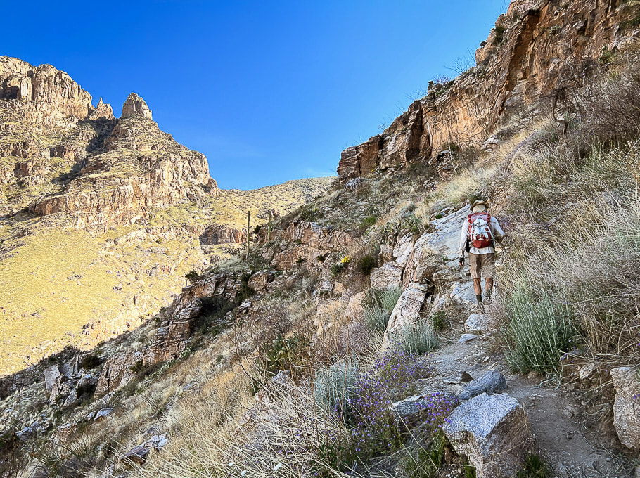 On east canyon wall entering semi-desert grassland biome. Getting closer to Finger Rock on the horizon. 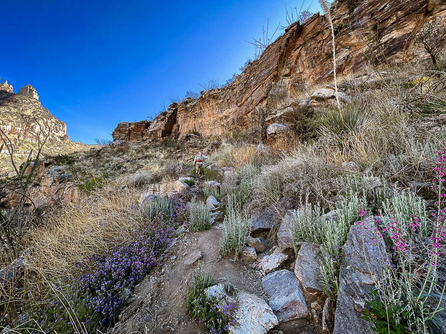 Finger Rock at far left. 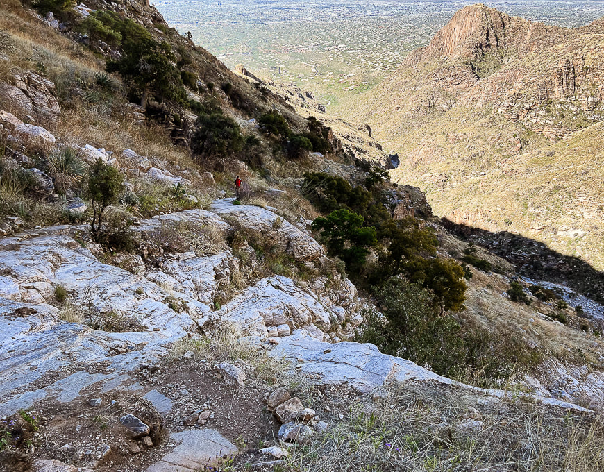 Looking down-canyon at city of Tucson.  Climbing up toward intersection with side trail that goes to Finger Rock. Walk on bedrock this portion of the hike. 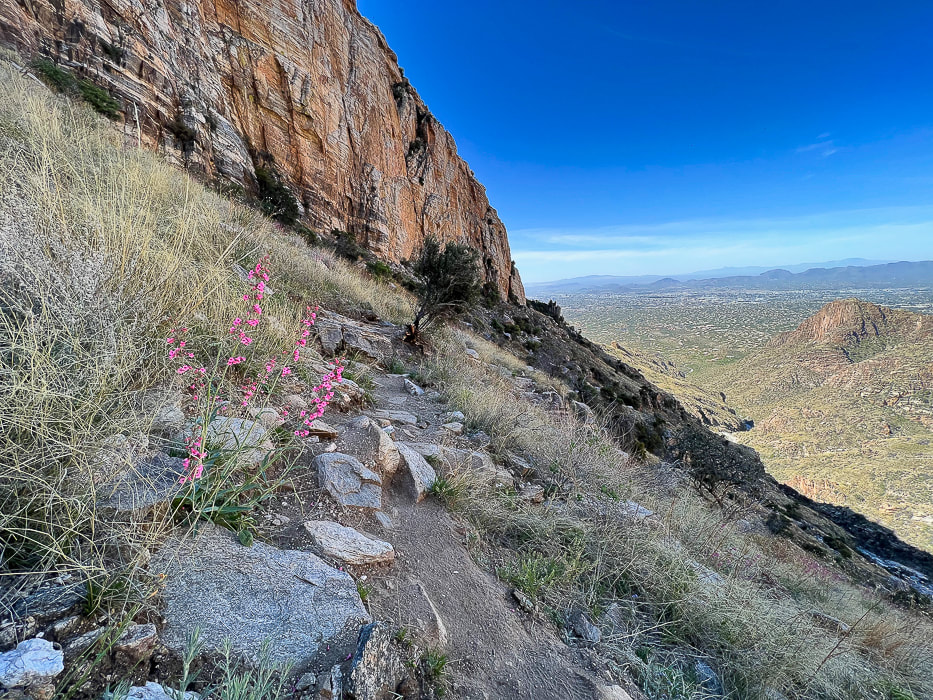 Looking back down canyon with Parrys penstemon in grassland biome. 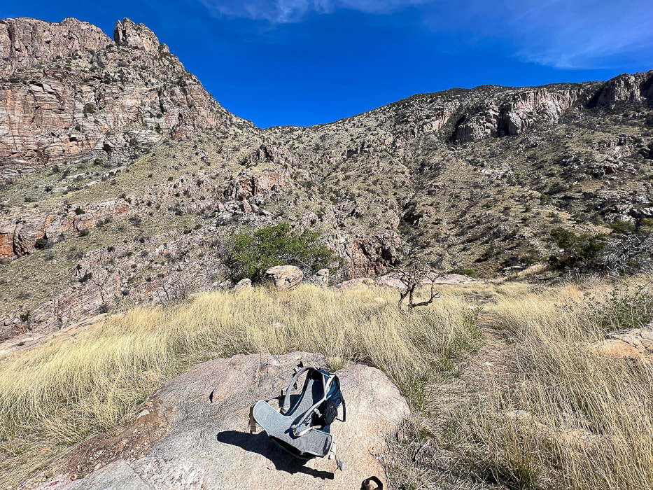 Intersection of our trail (Finger Rock Trail) and a trail that leads to Finger Rock on left side of canyon.  If this old alligator juniper could talk....  Continuing up to saddle and some awesome rock formations. 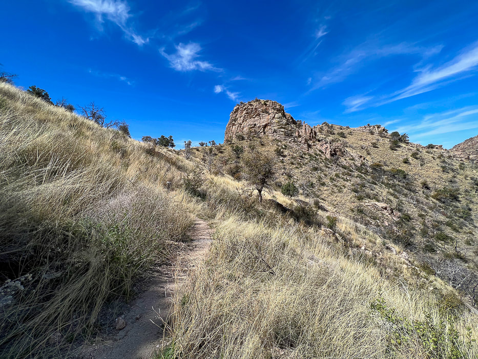 Looking back at Linda Vista; there's a short trail that goes to the saddle at mid-horizon for a great view of Tucson.  Getting closer to the intersection with the Pima Canyon Trail. Looking at Mt. Kimball's thick pine/oak/chaparral vegetation at left horizon.   Looking back down Finger Rock Canyon; the prickly pear are studded with lots of flowers. 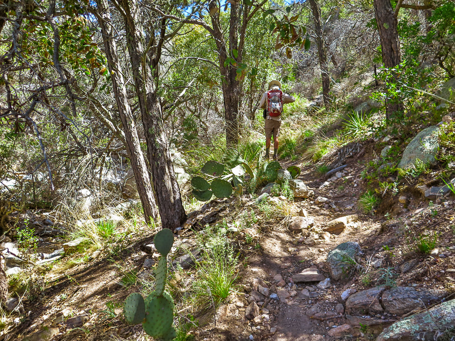 Madrean Evergreen/Pine/Oak Woodland Madrean refers to the Sierra Madre mountain range that runs through Mexico and along the Gulf of California. 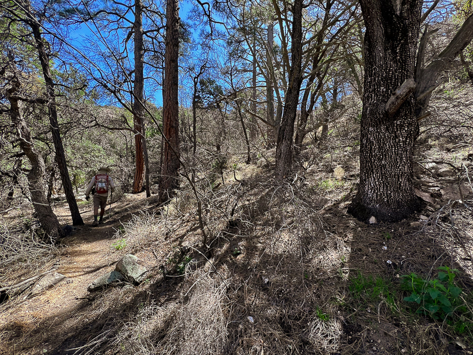 Temperate forest - one of my favorite portions of this hike, however sadly affected by recent wildfire. 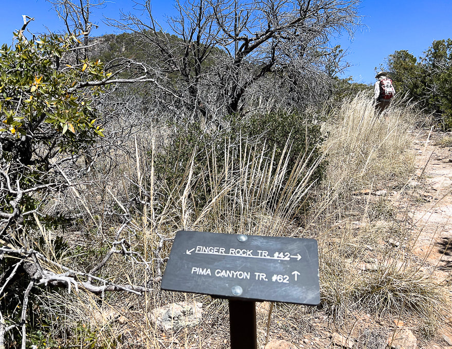 Intersection of Finger Rock Trail and Pima Canyon Trail. Finger Rock Trail continues to Window Peak and intersection with Ventana Canyon to the east. Follow Pima Canyon trail. Mt. Kimball seen above! 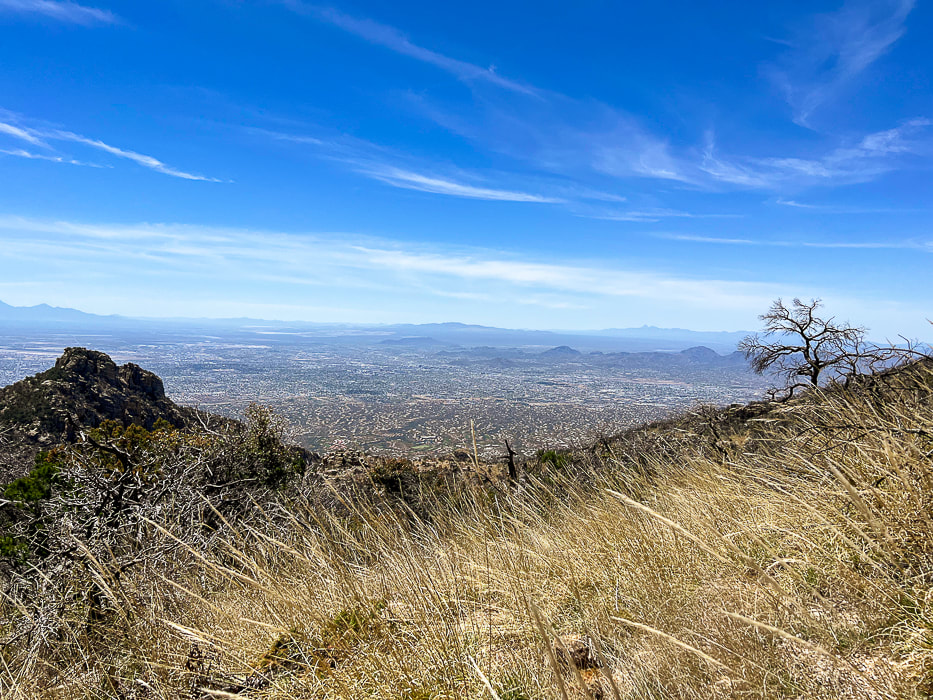 Nearing the summit - killer views of Tucson and mountain ranges to the south and southwest. 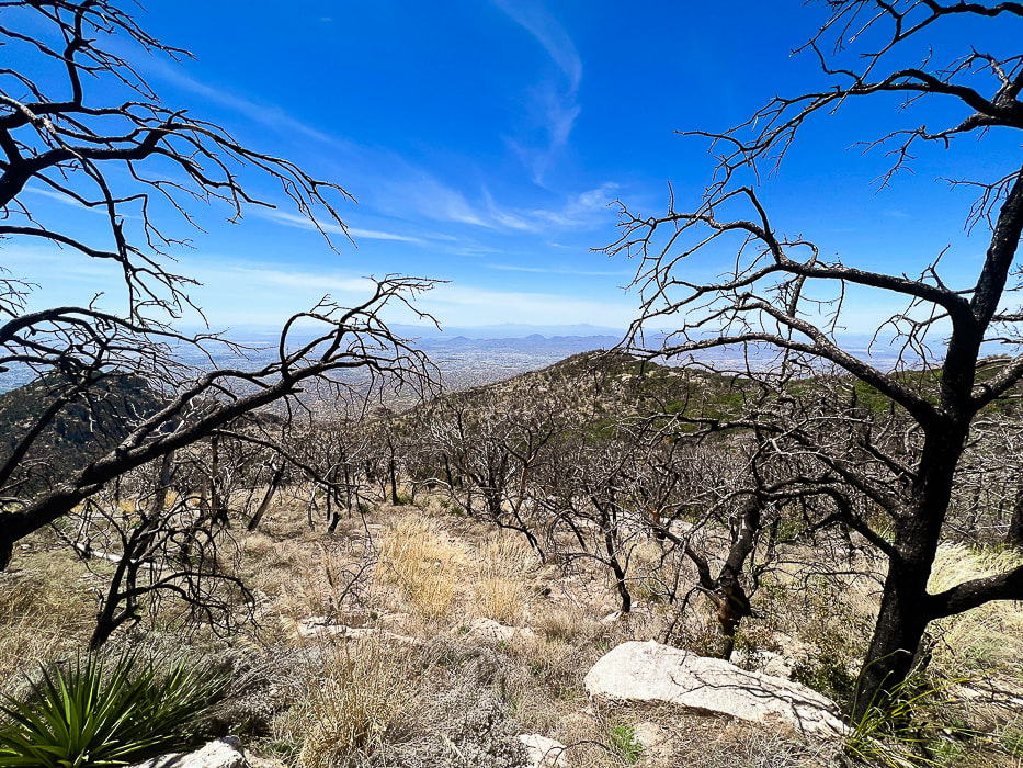 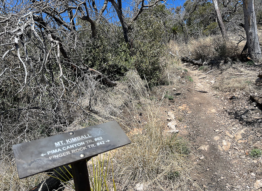 The point at which you turn off the Pima Canyon Trail and hike on this spur trail to Mt. Kimball's summit. 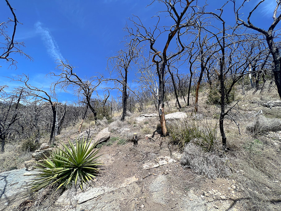 We left Pima Canyon Trail early, before the sign that indicates Mt. Kimball on the way up and went through this badly burned area. On the way down, we hiked the more-traveled spur trail to the sign. 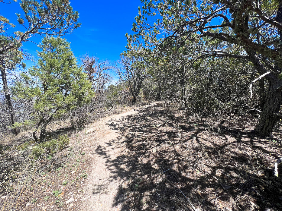 Spur trail to summit 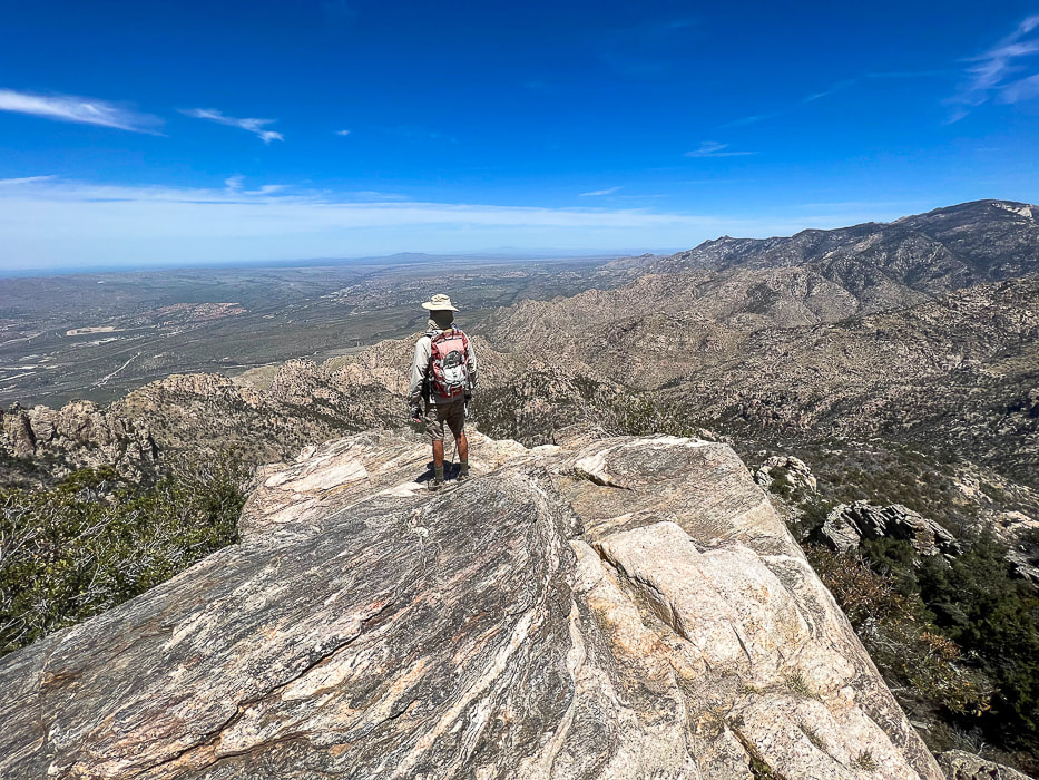 The summit of Mt. Kimball once again! View to the north toward Catalina State Park and the western Santa Catalinas. 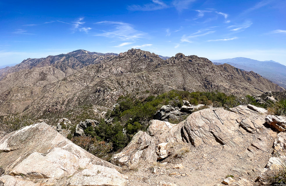 View of the southwestern Santa Catalinas and Tanque Verde ridge east of Tuscon on far horizon.  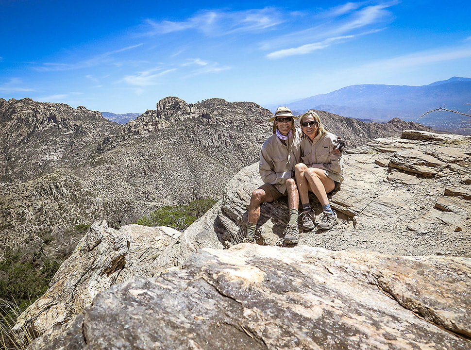 Fred and Sue: happy that we can still hike this summit! 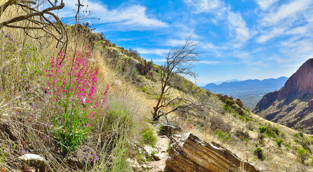 On the way back down; my favorite forb - pink Parry's penstemon.  Finger Canyon's southeast-facing wall on the way down. Thinking about the Frost Gelato in our near future at this point.  The beauty of the desert/thornscrub biome: saguaros, brittlebush, ocotillo, cholla and prickly pear. Cool stuff on the trail.  Parting shot: sun shining on The Finger left side of canyon and Mt. Kimball. Getting really close to that Frost Gelato! Great day on this sky island with beautiful weather.  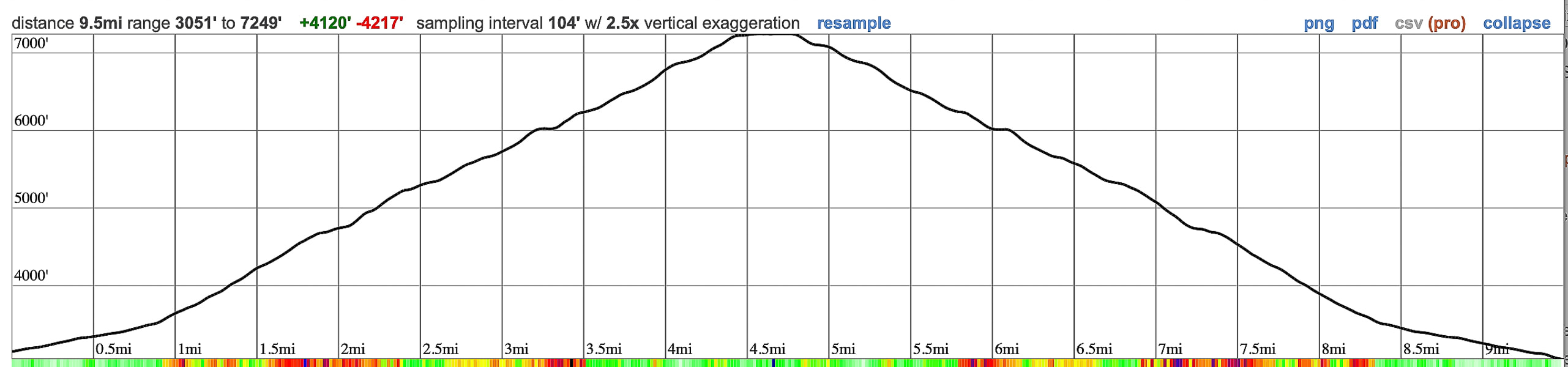 GPS tracks and elevation profile for Mt. Kimball, Pusch Ridge Wilderness, from CalTopo. 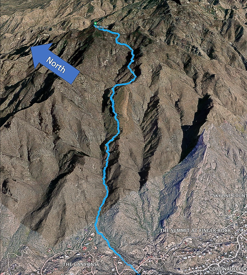 Google Earth image of our GPS tracks. References
Bezy, J. V. 2016. A Guide to the Geology of the Santa Catalina Mountains, Arizona: The Geology and Life Zones of a Madrean Sky Island. Arizona Geological Survey. Mt. Kimball. Summit Post website. Dimmitt, et al. 2015. A Natural History of the Sonoran Desert. Arizona-Sonora Desert Museum Press and University of California Press. The Sky Islands. From website: Sky Island Alliance. Summit an ancient caldera remnant in the "Tucson Mountain Chaos" just south of Saguaro National Park - just be careful of the "jumping cholla". Related: Tucson Mountains Tour: Golden Gate Mountain, Bobcat Ridge, and Little Cat Mountain Elephant Head Peak - Santa Rita Mountains, Southern Arizona Desert Plants
Trip Stats
Overview: Climb the seemingly unclimbable ash tuff rocks of Cat Mountain for a dual view of the sprawling city of Tucson and the rugged peaks of Saguaro National Park and other high points in this ancient caldera. Become immersed in the beautiful Lower Sonoran ecosystem of robust saguaros, various types of cholla cacti and mesquite. Location: Tucson Mountain Park administered by Pima County Parks and Recreation, just south of Saguaro National Park near Tucson, Arizona. Date hiked: December 28, 2019. Distance: 11.5 miles round-trip. Elevation gain: 1,160' net gain to summit. Trailhead = 2,980'; summit = 3,852'. Trails: Yetman -> Sarasota ->Explorer (frequently traveled single-track). Difficulty: Easy to moderate on park trails; moderate to strenuous Class 2 off trail to summit, one Class 3 maneuver near summit, mostly no-mild exposure. Maps: National Geographic Trails Illustrated #237: Saguaro National Park, Tucson Mountain Park trail map. Driving directions: From I-10 in Tucson, take Speedway Blvd West which turns into Gates Pass Rd. at intersection with Camino de Oeste. From this intersection, drive ~ 4.5 miles to Gates Pass Overlook, descend down ~0.4 miles past the pass: Yetman Trailhead is on the left in a large parking lot at a sharp right turn in the road. Considerations: Trail head kiosk, no permit needed. No dogs allowed. Multi-use: mountain biking, hiking and equestrian use. Coordinates: Yetman Trailhead: 32.2173 N -111.1029 W. Cat Mountain summit: 32.1841 N -111.0607 W. Geology: Tucson Mountains Caldera. Summit is Cat Mountain Tuff (consolidated volcanic ash), valleys are landslide breccia (rock made of angular minerals or rock cemented together in a fine-grained matrix) deposits (referred to as Tucson Mountain Chaos). Hike Summary
We started on the Yetman Trailhead, not far from Golden Gate Mountain, instead of the Sarasota Trailhead which is closer to Cat Mountain so we could spend as much time as possible walking through this beautiful Tucson Mountain Park encompassing much of an ancient caldera, and weave around thorny saguaros and jumping chollas. We had also started at the Yetman trail a few days before, when we hiked three high points in this park: Golden Gate Mountain, Little Cat Mountain and Bobcat Ridge. All four peaks could be summited in one long day. 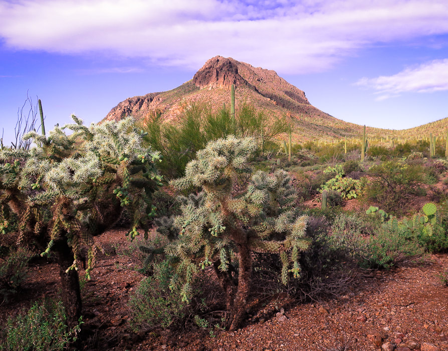 Golden Gate Mountain's southeast slopes and cholla. 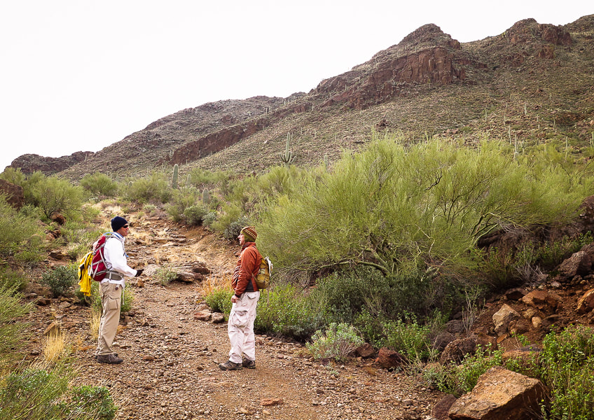 Fred and Scott near Yetman trailhead under the north cliffs of Golden Gate Mountain Reach the saddle between Golden Gate Mountain and Bren Peak at 0.4 miles from Yetman trailhead, an excellent place to get a perspective on three high points: Bobcat Ridge, Little Cat Mountain and Cat Mountain. A textured green carpet sweeps down valley and up the slopes of these brooding, rugged mountains. The only thing that distracts from this scene is the housing development in the valley to the west. This pleasant view makes it difficult to imagine the sudden event of a magma chamber spewing the searing ash that formed this ancient caldera landscape. Tucson Mountain Chaos is the term given by geologists to the valley rocks that underlie the Cat Mountain Tuff, the compacted ash that forms these peaks. There is no definite answer to the thousands-feet thickness of this Cretaceous-age tuff. Were these rocks below the Cat Mountain Tuff rafted from deeper levels by the rising magma? Or, was this rock caused by a landslide in a caldera that had accumulated the tuff? To make the geologic puzzle even more complicated, spreading of the Earth during Basin and Range faulting makes the geologist's task of identifying the age relationship of the rocks more difficult. 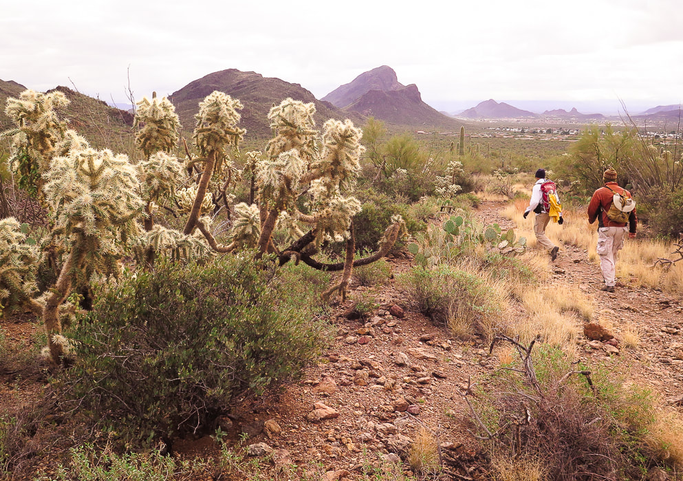 Yetman Trail heads to three summits from left to right: Bobcat Ridge, Cat Mountain in middle horizon with Little Cat in front of it. At 1.6 miles, Yetman intersects with Sarasota Trail. Bobcat Ridge is gained by going left and staying on Yetman Trail. For Cat Mountain, turn sharp right (south) onto Sarasota. In 1.4 miles, Explorer Trail intersects with Sarasota. You can hike on either trail to get to Cat Mountain. On our approach, we took Explorer Trail which wraps around the base of Little Cat Mountain for 0.8 miles to meet up again with Sarasota and also Starr Pass Trail. 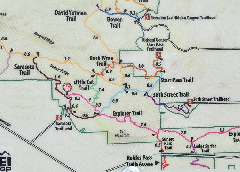 The worn-out "You are Here" red dot marks the intersection of Sarasota and Explorer Trails. Our route: Explorer (pink) trail to pass under the north flank of Cat Mountain.  Arizona Barrel Cactus 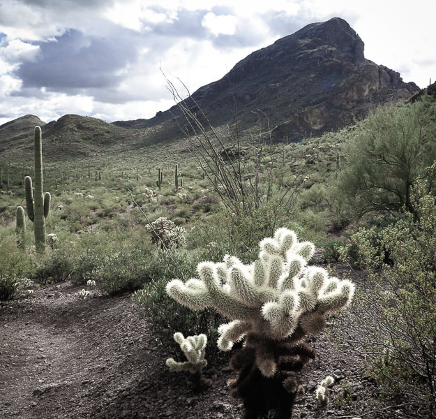 Cat Mountain from Explorer Trail on its north side. We went up low saddle to the left of the summit block to gain lower ridge. From our vantage point on the Explorer trail, we could see the gentler rise of Cat Mountain's east ridge. The three-trail intersection (Starr Pass, Explorer and Sarasota) is well-marked as are other intersections in this well-cared-for park. We continued on the Explorer trail for 0.6 miles until we saw a manageable route to the ridge, leaving it earlier than the standard cairned route (1.0 miles past 3-way junction), making our own path. A sea of detached teddy bear cholla branches, those little mobile yellow ovals armored with extremely sharp spines made us pick our footsteps carefully. However, I wasn't careful enough; one jumped up and stuck my pant leg to my calf. I remembered a hike many years ago when we used a metal comb to remove a cholla piece from a dog's leg. Scott and Fred somehow got the prickly thing off me and we resumed our cross-country hike with no serious injury except for a few red spots on my skin. The day grew colder and cloudier. The broken dark red and tan rocks deposited on the slopes from the tuff cliffs above crunched under our boots. The occasional cactus spine scraped against our packs and in some cases grabbed on. 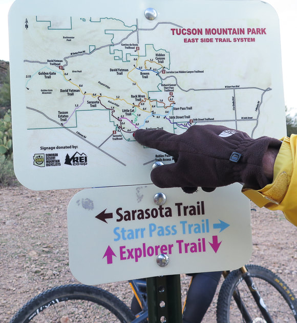 Three-way intersection. From here, exit Explorer Trail for more difficult ascent up Cat Mountain's northwest ridge. "Standard" and less difficult route leaves Explorer 1.0 mile after this intersection. 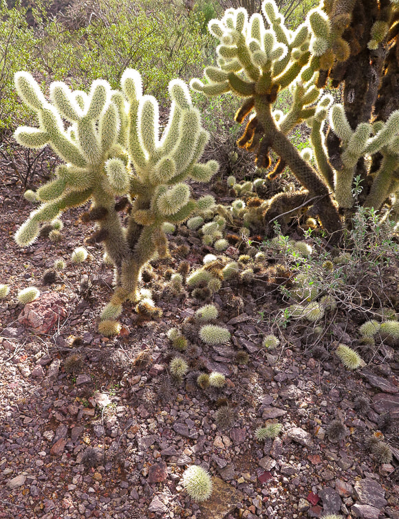 "Teddy Bear Cholla" Cylindropuntia bigelovii After getting off Explorer, we looked for the best way up. Rocks formed a natural staircase. Four or five Coues Whitetail deer perched far above on steep cliffs stopped to watch us, curious at three humans stumbling through the cacti. The ridge walk was straightforward and it felt good to follow its natural route and rhythm, using hands when needed. We came upon cairns marking the final ascent to the summit and a complete change of view of the open sky and the sprawl of Tucson far below us. There's just one Class 3 crack with mild exposure to navigate, with just enough ledges to place feet and hands. Frequent rock cairns mark an obvious path. 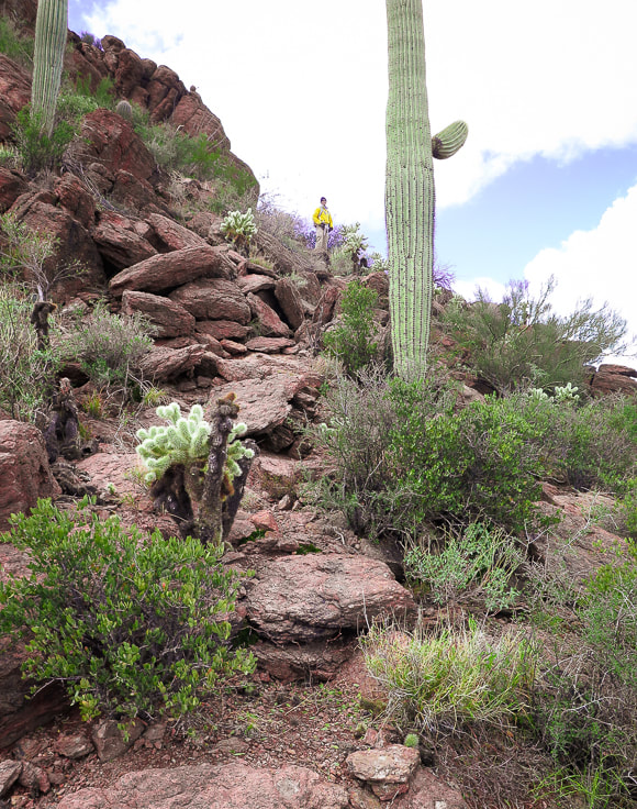 Picking our way to Cat Mountain's east ridge. 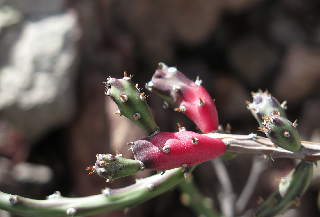 Christmas Cactus
 Saguaro and cholla garden below last summit approach  Scott ascending the last part of ridge climb  Sweet cactus garden before final ascent. 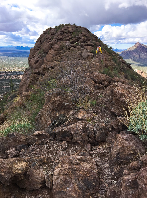 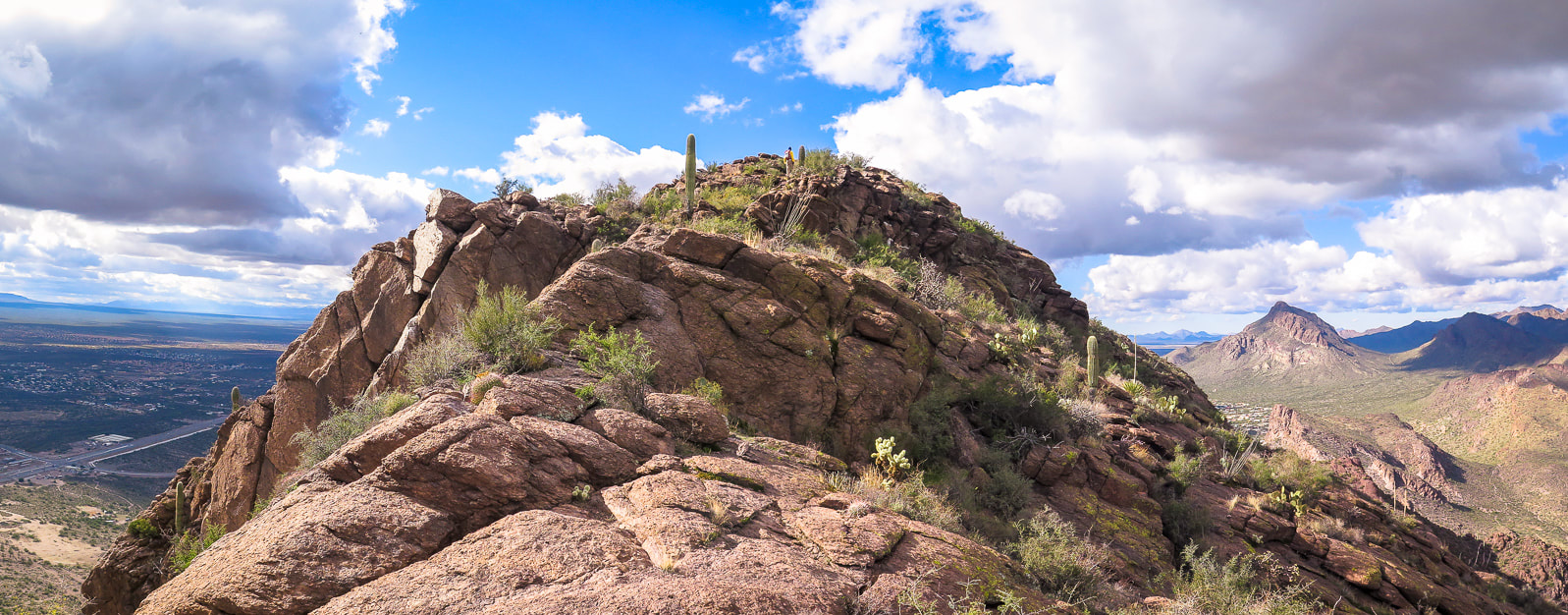 Fred on the summit of Cat Mountain Golden Gate Mountain on the right; Yetman Trail goes through the saddle to its right. Every ridge scramble, every summit has its own unique personality. The scramble up Cat Mountain's east ridge is challenging yet not scary, exposed but safe, with the right amount of rocks and cactus gardens making it aesthetically friendly. You're never bored with looking at saguaros and chollas because with each one, there is a different size or form. This summit has one very unusual feature - a plastic white boulder that houses a radio repeater. Looking at Cat Mountain from Tucson area, you would not suspect the spacious flat areas on its summit. A steady cold wind cut short our time lounging on the top, but we got a good look at Golden Gate Mountain to the northwest and the steep drop-off to the south. As we walked down, the clouds closed again, the temperature dropped, and the wind chilled. We hiked back via Sarasota Trail at the three-way intersection. We added another summit to our "three friends who like to hike" resume', and more stories for reminiscing. This will go down in the books as one of our more mellow hikes together. Never stop climbing mountains!   Scott and Fred 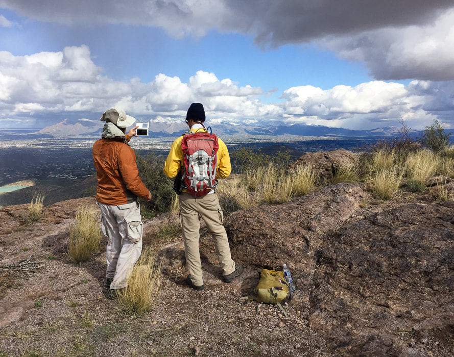 Looking at Santa Catalina Mountains north of Tucson and Rincon Mountains on right horizon. 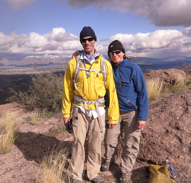 Fred and Sue on Cat! 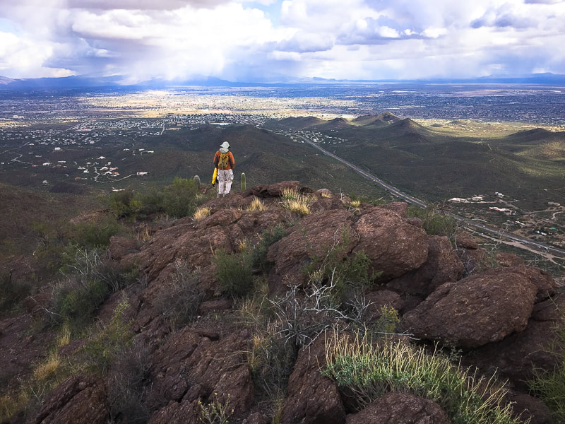  Parting shot of Cat Mountain from Sarasota Trail. 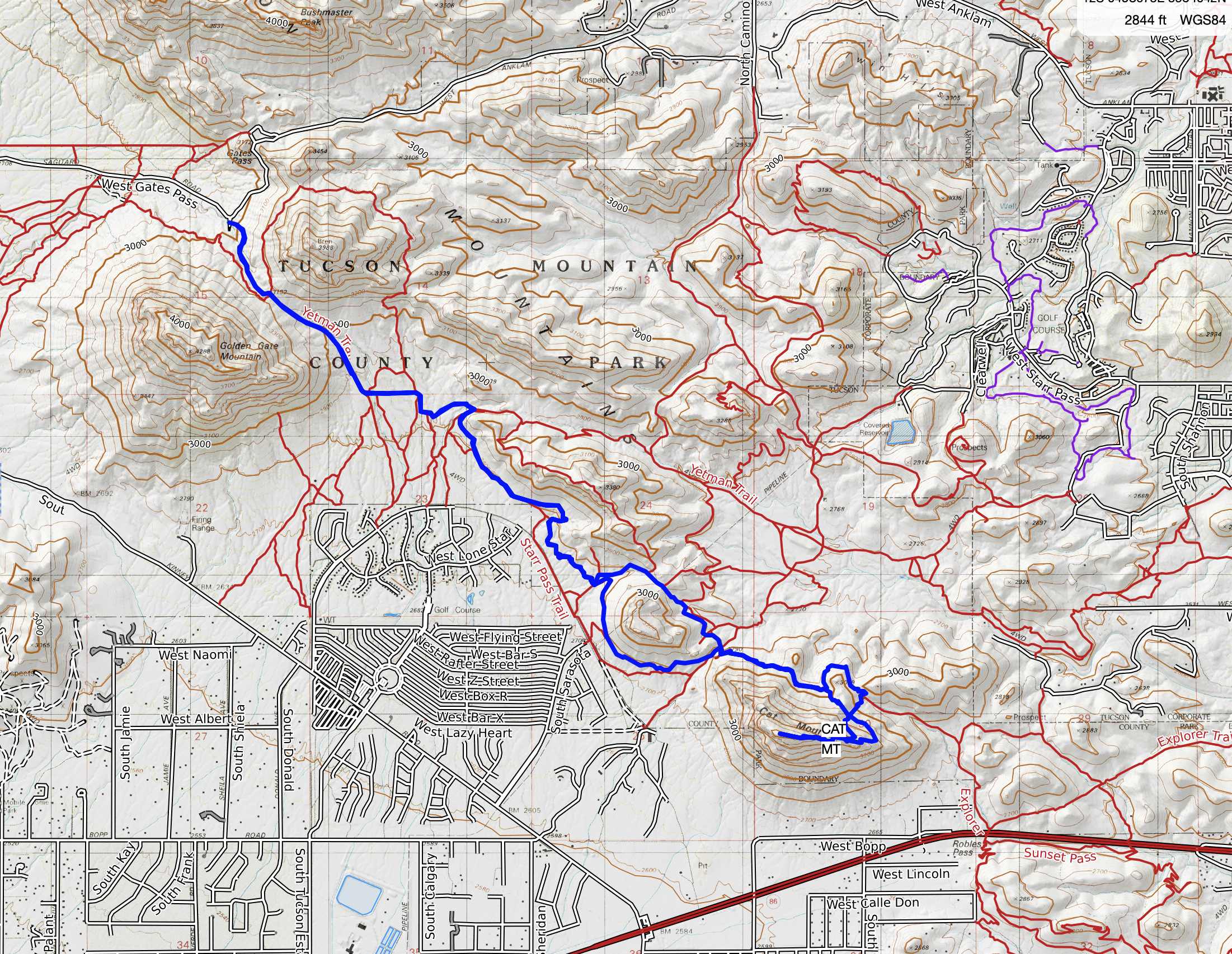 Our GPS tracks to Cat Mountain from Yetman Trailhead Red line is our Class 2 ascent route; blue line is cairned trail and our descent. 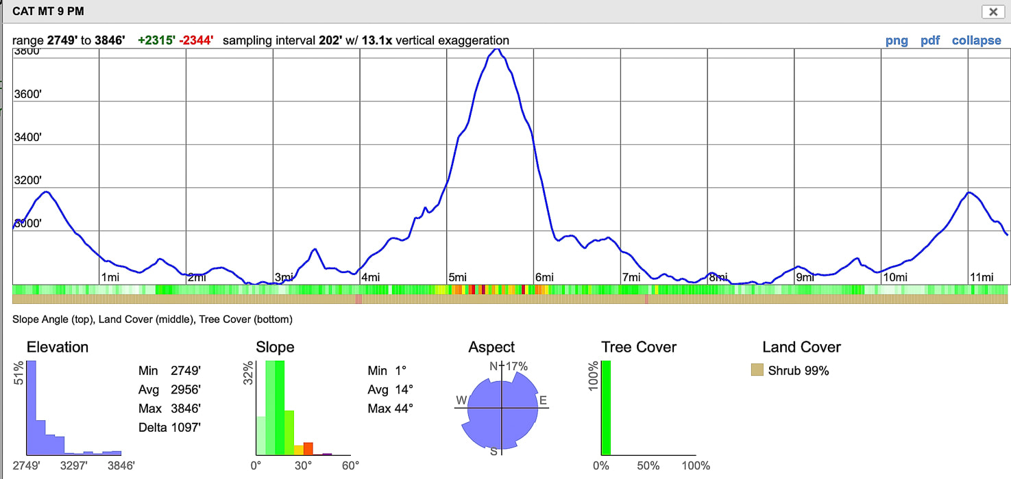 Elevation profile over entire 11.5-mile hike.
With a second try, we made it to the lonesome summit of Elephant Head in the sparsely traveled Santa Rita Mountains, south of Tucson. Related: 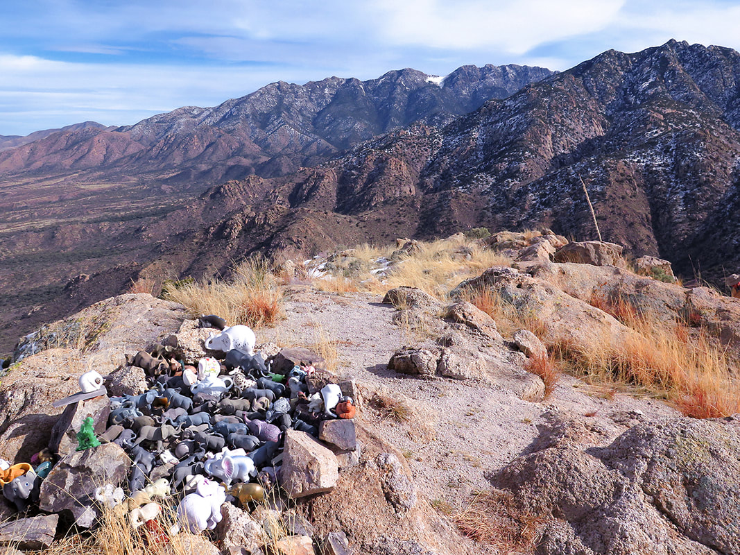 Elephant Head Peak summit - Santa Rita Mountains Trip Stats
Overview: Climb the bare-boned, steep ridge of Elephant Head Peak to witness the Shrine of the Elephant with a close backdrop of the higher forested Santa Rita Mountain range. You must first climb through old oak trees, hike out of two canyons and walk an old mining road with huge Santa Rita Prickly Pear along the way. Location: Mt. Wrightson Wilderness - Santa Rita Mountains - Coronado National Forest - Arizona Distance/Type: 6.8 miles round-trip. Elevation: Trailhead = 4,508', Elephant Head summit = 5,641'. Net elevation gain to summit = 2,000'. Difficulty: Moderate effort on defined trail, moderate-strenuous off-trail Class 2+ with one Class 3 pitch near summit. Experience with off-trail navigation necessary. Reference: We used Earthline's hike directions. Maps: Green Trails Maps Santa Rita Mountains (#2962S), our GPS tracks (below). Considerations: No permit, no trail register. Driving Directions: Trailhead. Leave Interstate 19 at the Canoa Road Exit near Green Valley. Take the east frontage road 3 miles south to Elephant Head Road and turn east 1.6 miles to the Mt. Hopkins Road. Drive 4.5 miles to FR 183. Turn north on this dirt road about 2.4 miles to a circular parking area with a large oak - just before the road crosses the streambed. Park here and travel back down the road a few paces to a sign that marks Trail #930 on right (north) side of road. Coordinates at parking: 31.6956 , -110.9288. Geology: Elephant Head Quartz Monzonite (Cretaceous ~70 Ma). Not to be mistaken for granite which contains > 20% quartz, monzonite contains 5-20% quartz. Large grains indicate slow cooling below Earth's surface. Flora: Desert grassland and oak-grassland biomes of Arizona's sky island region. *** 1/29/23: I received a comment from someone who hiked this trail last year - she saw forestry employees who told her to remove any elephants she might find on this trail in order to keep this beautiful area more pristine. Hike Summary
"Mountains complement desert as desert complements city, as wilderness complements and completes civilization." - Edward Abbey - from Desert Solitaire Our Hike On our first attempt at summiting Elephant Head Peak, a huge winter storm was blowing into southern Arizona, so by the time we reached the saddle just below the exposed ridge to the summit, we staggered against a roaring wind bent on toppling us over. We had to go back down. The storm produced a thick white blanket over the tops of the Santa Catalina and Rincon Mountain ranges overlooking Tucson. Six days later we reached Elephant Head summit on a warm, calm and sunny day, but the Santa Rita Mountain range behind us still held large patches of snow. The almost ghostly figure of bare Elephant Head Peak stands out in stark contrast against the base of the dark brown and green Santa Rita Mountains in the Santa Cruz Valley near the southern Arizona border. The Cretaceous-age Elephant Head formed much later than the Triassic-age Mt. Wrightson rocks at the higher elevations of these mountains.  Elephant Head Peak, 5, 641' in Mt. Wrightson Wilderness in the northwest Santa Rita Mountains 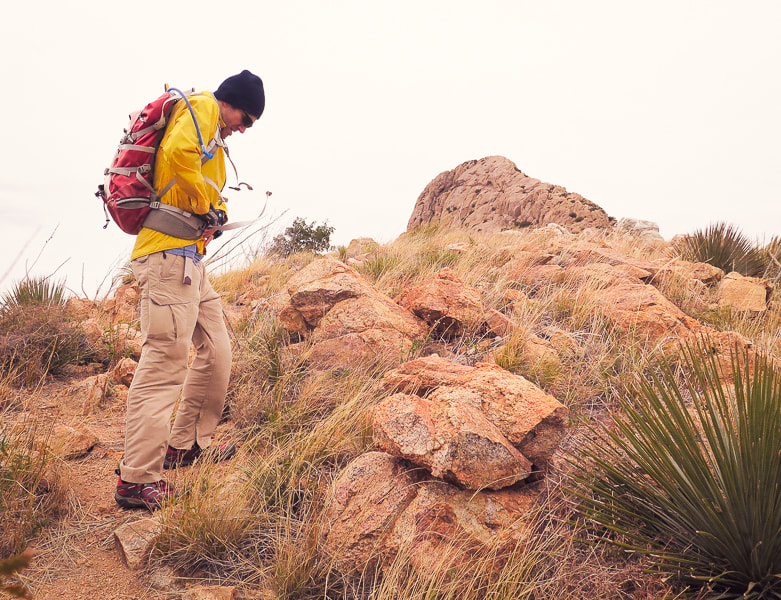 First attempt: bracing against the wind on saddle beneath Elephant Head Peak, 5,641'. 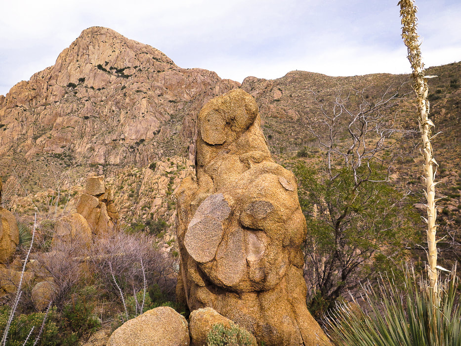 On the way to the bottom of Chino Canyon looking at Elephant Head Peak. Hike to saddle on the right following cairns. This hike packs in a wide variety of plants, views and terrain for its relatively short distance and manageable elevation gain. Begin by crossing the stream in Agua Caliente Canyon to walk through knee-high bunch grasses, then pass by the intersection for Little Elephant Head (Peak 5,139'). Catch the first glimpse of Elephant Head Peak on the horizon. Magenta and red fruits of huge Santa Rita prickly pear cacti dot the sides of the trail. Tall rock walls that support an old mining road still stand looking down Chino Canyon. Suddenly, around a corner, an enormous view of the pinkish-tan hulk of Elephant Head Peak overlooks deep Chino Canyon, its rounded rocks and southern cliffs dotted with green shrubs and a few trees. A steep drop with occasional Arizona Rainbow cacti growing in moss brings you to a soothing waterfall. The final ridge climb is the funnest part of the hike, as it requires using old oak tree branches and plenty of rock hand-holds. The rock affords great traction as the ridge drops on both sides for a huge view of all the major ranges to the north, including Baboquivari Peak, the native Tohono O'odham peoples' most sacred place. A close-up to the east of the rugged Santa Rita Mountains provides a beautiful backdrop. 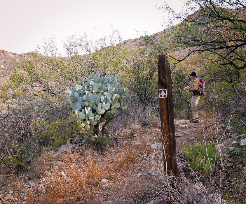 One mile into the hike, intersect with mining road built in the early 1900's and an old Santa Rita prickly pear and take a right past sign.
 Cairn marking cross-country trail that crosses Chino Canyon to ascend to saddle to the right (southeast) of Elephant Head Peak. 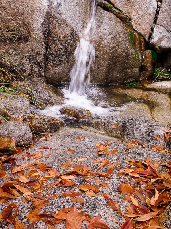 Chino Canyon at creek crossing
This elevation is too high and cool for saguaros to grow. This hike travels through the transition between desert grassland and oak grassland biomes of Arizona's Sky Island region. The ocotillo "forests" are remarkable and so are the mature Santa Rita Prickly Pears; they tolerate the cooler winters. Their pads can turn purple during the winter. So many things make this a repeat-hike in the future: solitude, desert wilderness, route-finding, fun Class 2-3 climbing, and views. Plans: Elephant Head Peak plus Little Elephant Head (Peak 5,149'). 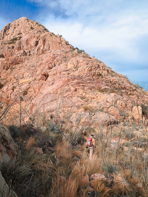 On Elephant Head's east ridge looking at the final climb: trail goes around just to the right side of ridge.
Yep! This is the trail! See the cairns......  Near the summit looking down the east ridge to saddle (top of image) where trail ascends.  Santa Rita Prickly Pear 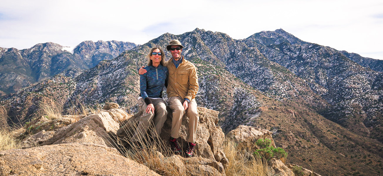 Summit of Elephant Head Peak - Santa Rita Mountains Mt. Wrightson on horizon  Devils's Cashbox - limestone butte south of Elephant Head Peak 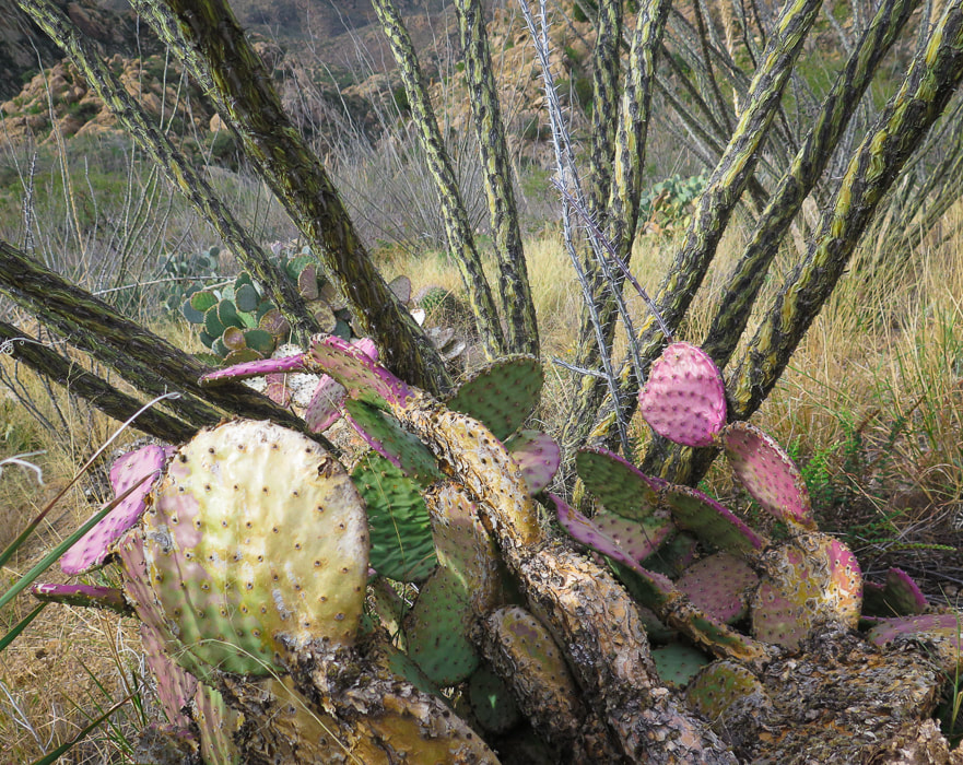 Ocotillo and Santa Rita Prickly Pear 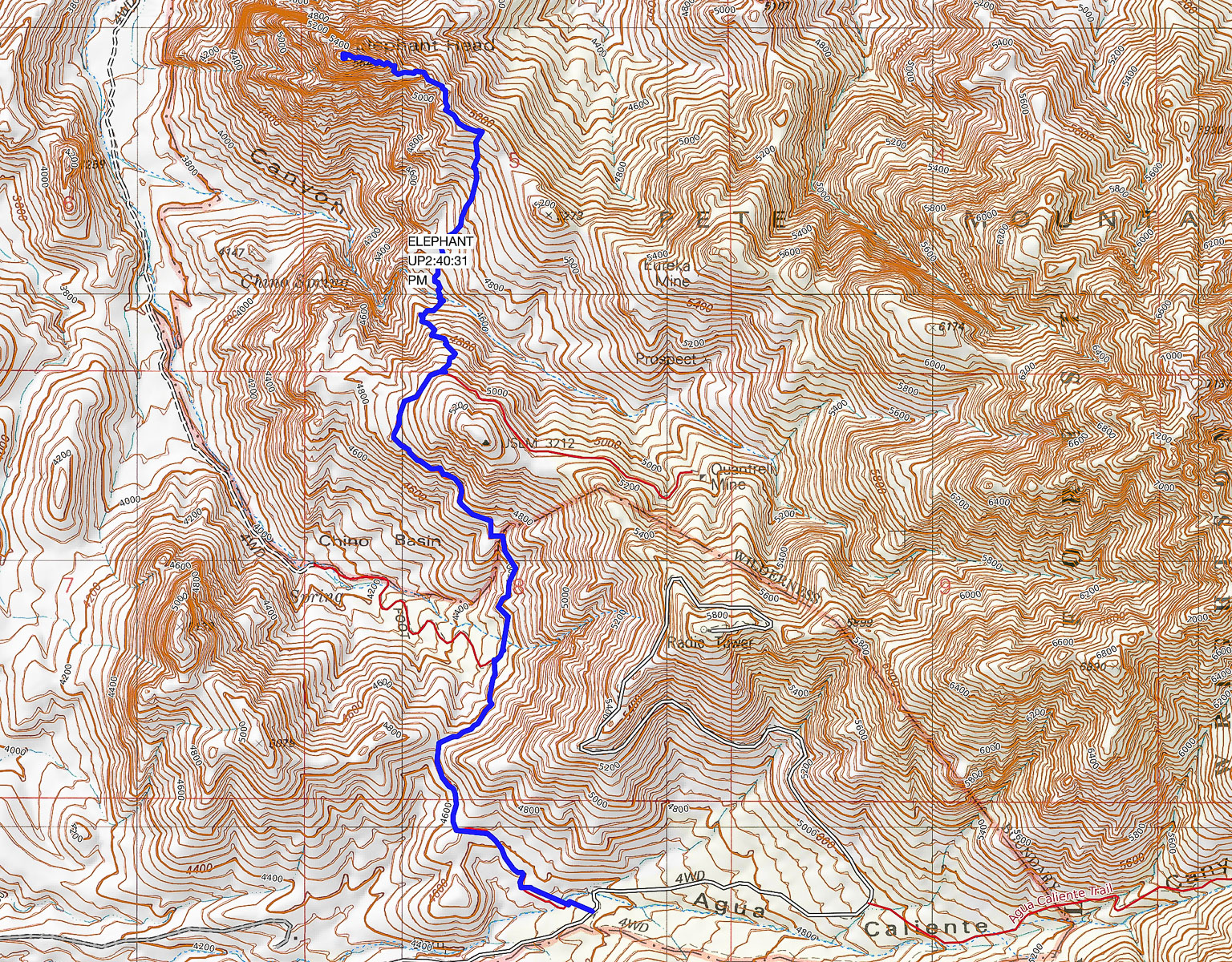 Our GPS tracks from Trail #930 Trailhead (south) to Elephant Head Peak (north) Contour intervals = 40'. click on map for larger image 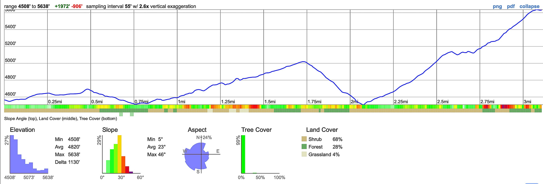 Profile for ascent: 3.4 miles with 2,000' net elevation gain 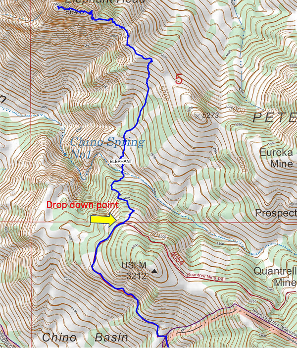 Point at which you leave Quantrell Mine Trail and descend into Chino Canyon - there may or may not be a cairn at this point. 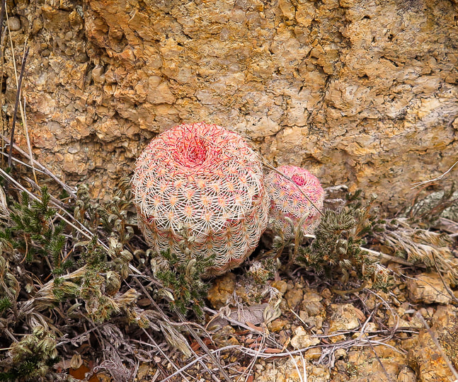 References
An Archipelago in a Cordilleran Gap - The Sky Islands of Arizona and Sonora. Brusca, R., Moore, W. https://www.rickbrusca.com/http___www.rickbrusca.com_index.html/The_Sky_Islands.html Ganesha: Hindu Diety. Doniger, W. Encyclopaedia Britannica. https://www.britannica.com/topic/Ganesha Geologic Map of the Mt. Wrightson Quadrangle. https://ngmdb.usgs.gov/Prodesc/proddesc_9405.htm Mesozoic Stratigraphy of the Santa Rita Mountains, Southeast of Tucson, Arizona. Drewes, H. 1971. https://pubs.usgs.gov/pp/0658c/report.pdf Plutonic Rocks of the Santa Rita Mountains, Southeast of Tucson, Arizona. Drewes, H. 1976. Geological Survey Professional Paper 915. https://pubs.usgs.gov/pp/0915/report.pdf Quantrell Mine Trail. Coronado National Forest. U.S. Dept. of Agriculture, Forest Service. https://www.fs.usda.gov/recarea/coronado/recreation/recarea/?recid=25770&actid=50 Summit three scenic high points in the "Tucson Mountain Chaos" using a combination of established trails and off-trail climbs through exquisite Lower Sonoran desert ecosystem. 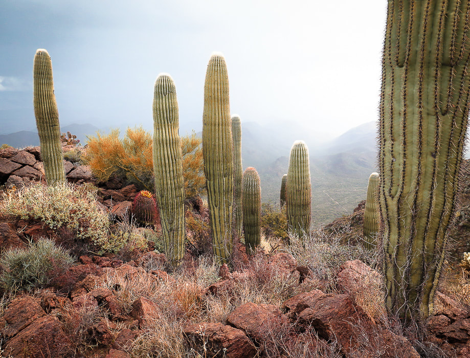 Saguaros at Golden Gate Mountain summit Trip Stats
Overview: Close to Tucson, this mountain park feels almost like wilderness as trails wind through the colors, textures and dramatic mountain cliffs of volcanic peaks in prime Sonoran desert ecosystem. This tour uses established trails to access cross-country routes to peaks with spectacular views of southern Arizona's "sky islands". Location: Yetman trailhead, Tucson Mountain Park, Pima County, Arizona. Distance/Type: 9.25 miles out and back including a loop. Elevation gain: Total 3,130 feet. Highest point = Golden Gate Mountain at 4,288 feet. Difficulty: Easy to moderate Class 1 established trails; strenuous Class 1-2 cairned off-trail, navigation moderate. Maps: Saguaro National Park - Trails Illustrated #237. PDF of TMP Recreation Trails. Topo map our tracks below. Considerations: Great winter hike, carry plenty of water, no fees or trail register. No dogs allowed. Date hiked: Christmas day, 2019. Reference: We used Earthline's hike directions for this hike. Driving directions: From I-10 in Tucson, take Speedway Blvd West which turns into Gates Pass Rd. at intersection with Camino de Oeste. From this intersection, drive ~ 4.5 miles to Gates Pass Overlook, descend down ~0.4 miles past the pass: Yetman Trailhead is on the left in a large parking lot at a sharp right turn in the road. Geology: Tucson Mountains Caldera. High points are Cat Mountain Tuff (consolidated volcanic ash), valleys are landslide breccia deposits (referred to as Tucson Mountain Chaos). Hike Summary Golden Gate Mountain Summit, 4,288 feet- located on the right side of trail.
 Yetman Trailhead and Golden Gate Mountain Our Hike It's not every day you can hike through valleys with rocks formally called "Tucson Mountain Chaos" and climb mountains made of compacted ash spewed from a huge volcanic eruption that created a 12-mile wide caldera whose floor collapsed onto an emptied magma chamber. At least this seems to be the current theory of the geologically complex Tucson Mountain Park. Geologists still debate and puzzle over the formation of this area. If you do this hike that I describe here, you will travel on the caldera floor through a beautiful Sonoran desert ecosystem. On this yearly Tucson visit, Fred and I were looking for different peaks in the area to summit. Not that we are tired of peaks in the Santa Catalinas and Rincon Mountains. A winter storm had dumped a lot of snow at elevations above 5,000 feet, so we opted for a warmer experience instead. Tucson Mountain Park is managed by Pima County. Its great website has an interactive map and lists features and activities in this 20,000-acre park that is "one of the largest natural resource areas owned and managed by a local government in the U.S." Outdoor activities range from picnicking to hiking, mountain bike riding and wildlife viewing. On Cat Mountain (a few days after this hike), we were lucky to see five grey Coues whitetail deer, atop steep and rocky rust-colored cliffs. I love celebrating holidays on the trail. There is a certain fellowship that occurs with greetings of "Merry Christmas" or "Happy New Year!" On this Christmas morning, the chill wind stung our faces, but it wasn't long before we felt warmth from the winter sun. 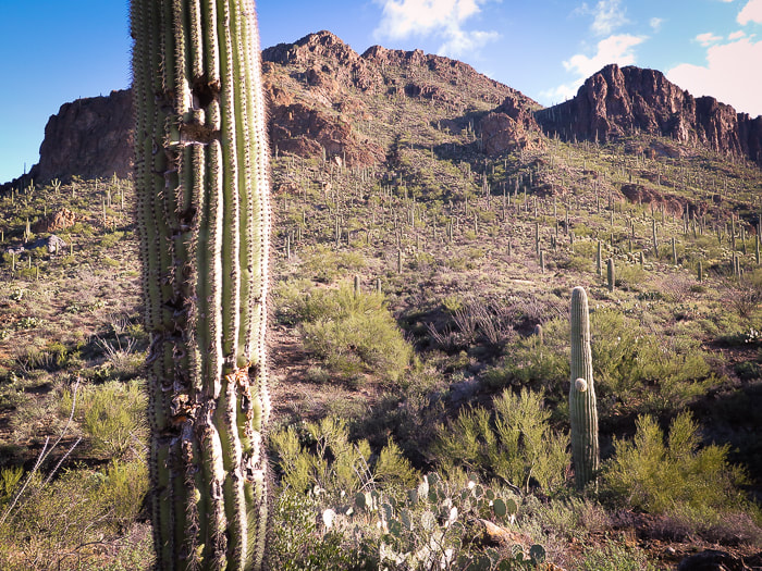 The north walls of Golden Gate Mountain, the first summit of our Tucson Mountain Park tour Golden Gate Mountain At the Yetman trailhead, we set out to discover a new area with hike directions from Earthline. At the saddle between Golden Gate Mountain and Bren's Benchmark, 0.4 miles from the trailhead, we oriented ourselves and looked southeast to mountain summits, not yet knowing which ones we would be climbing. We took a right 0.1 miles past the saddle at the cairned trail that gains the Golden Gate through a break between cliffs, and began our climb to Golden Gate Mountain, our highest summit at 4,288 feet (see photo below). The golden color of the rocks perhaps gave this peak its name. Cat Mountain Tuff, a thick layer of consolidated ash, makes up the bulk of these peaks. Tucson Mountain Chaos is the term given by geologists to the rocks that underlie the Cat Mountain Tuff, seen in the valleys. There is no definite answer to the thousands-feet thickness of this Cretaceous-age tuff. Were these rocks below the Cat Mountain Tuff rafted from deeper levels by the rising magma? Or, was this rock caused by a landslide in a caldera that had accumulated the tuff? Of course, when you throw in the geometry of faulting that occurred later when Basin and Range was spreading, it makes the geologist's task of identifying the age relationship of the rocks more difficult.
Dodging teddy bear chollas and barrel cactus spines, we marveled at a rare cristate saguaro thrusting up from a steep, south-facing slope under orange cliffs. Theories for the abnormal crest growth range from genetic mutations to lightning strikes. The trail threads between welded tuff towers and tops out, weaves to the left following cairns to the summit. Tucson spreads below, mountain ranges surround on the horizon. Below us, a white cloud moved across the valley and swept over us, briefly covering the peak with fog that created a rare, softly illuminated desert scene. Light rain produced vivid oranges, yellows and greens. Return to Yetman Trail via the same path.  Cristate saguaro on left. Bren Benchmark across valley.
Scenes from the summit of Golden Gate Mountain, Tucson Mountain Park View of Golden Gate Mountain from Yetman Trail (looking west). Yetman Trail runs through lowest point on saddle to the right.  Peak 3,380' on Bobcat Ridge From return to Yetman trail, hike down-valley 1.15 miles to the intersection with the Sarasota Trail. Stay on Yetman to the left (east) for 0.2 miles to arrive at a flat saddle. Bobcat Ridge trail (not marked with signs but obvious) takes off to the right (southwest). The views of Tucson open up as you near the top, Peak 3,380'. It is a relaxed summit with beautiful vegetation, a favorite local hiker destination. From this summit, the steep northern walls of Little Cat Mountain comes into clear view; there's a lot of descending before the climb. To its left (southeast), the dark, enormous hulk that is Cat Mountain will have to be summited another day. Total mileage = 4.3 miles. 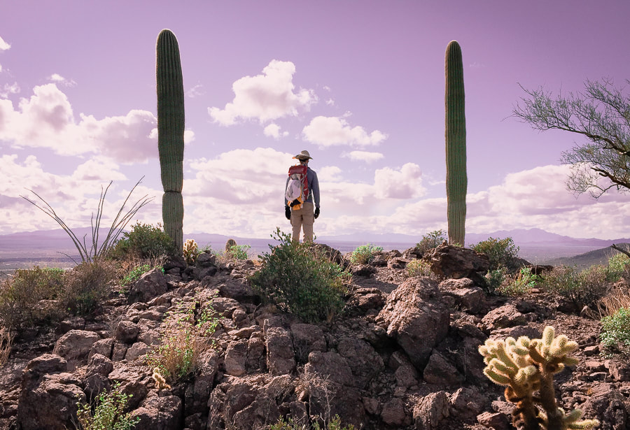 Bobcat Ridge near Peak 3,380 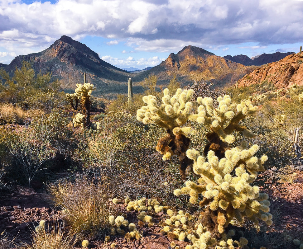 From Bobcat Ridge looking northwest to saddle between Golden Gate Mountain (left) and Bren's Benchmark (right). The Yetman Trail traverses the saddle.  Bobcat Ridge Trail leading away from Peak 3,380 toward Little Cat Mountain behind saguaros. Cat Mountain on the left. Little Cat Mountain From Peak 3,380, continue southeast on Bobcat Ridge Trail 0.7 miles to intersection with Explorer Trail; total mileage = 5.0 miles. Turn left (southeast) to climb to saddle in a short distance. At top of saddle, at arrow sign for Explorer Trail, hike up to saddle of Little Cat Mountain to the right (south). Fewer cairns than those of Golden Gate mark this off-trail approach which climbs a quick 400' to the summit, passing a relatively flat grassy area once the trail tops the saddle. From this summit, look to your left; an outrageous view of dark orange and black volcanic Cat Mountain appears as you stand on a cliff overlooking Tucson. The lowering sun and long shadows made this scene even more dramatic. We returned via our ascent to Explorer trail (signs with pink arrow), then made a loop around base of Bobcat Ridge by following Sarasota Trail (signs with maroon arrow), then finally on Yetman Trail to trailhead. Total distance: 9.25 miles. We vowed to climb Cat Mountain, then returned to its summit a few days later with our friend Scott, to celebrate the New Year and plan for hikes together in the beautiful southwestern deserts.  Saddle near summit of Little Cat Mountain - faint trails ascend from this saddle between Bobcat Ridge and Little Cat on Explorer Trail. 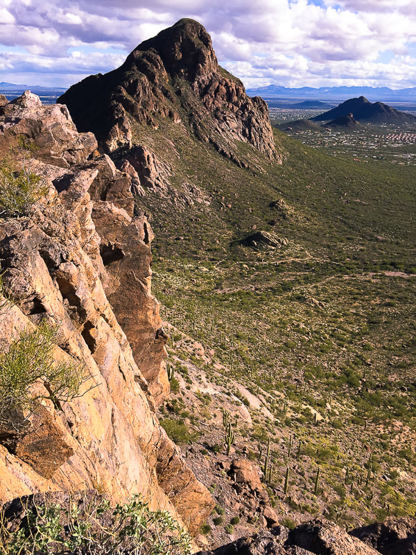 View of Cat Mountain from summit of Little Cat Mountain 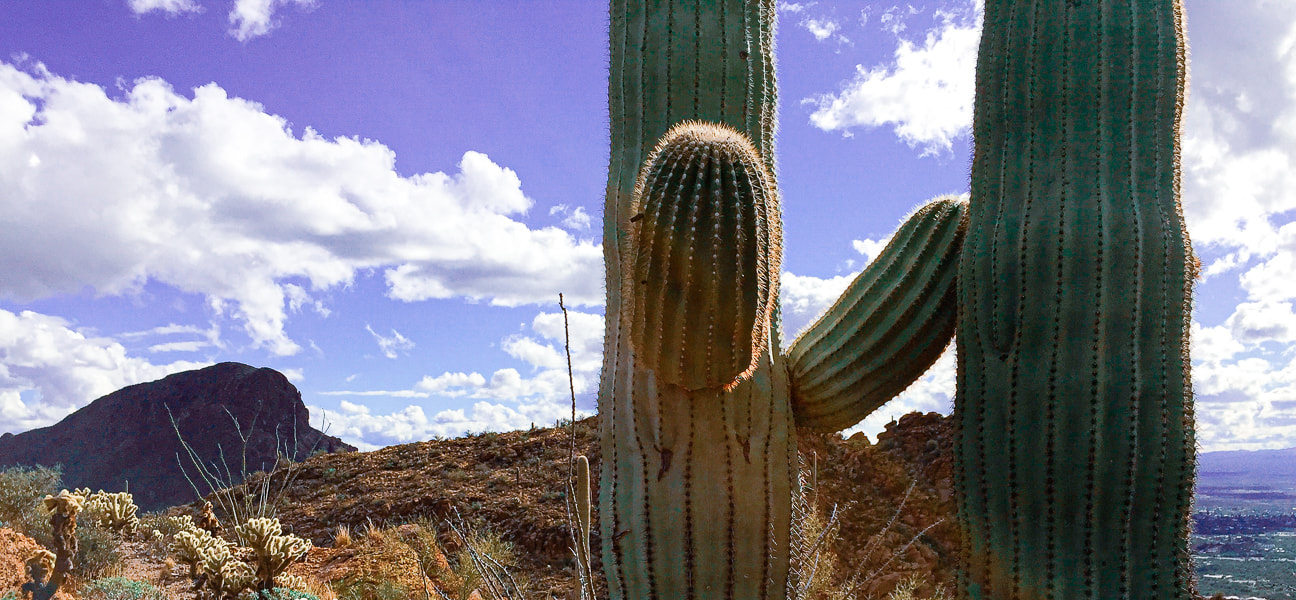 Cat Mountain on the left (we hiked that peak a few days later) Little Cat is behind the saguaro  Our GPS tracks 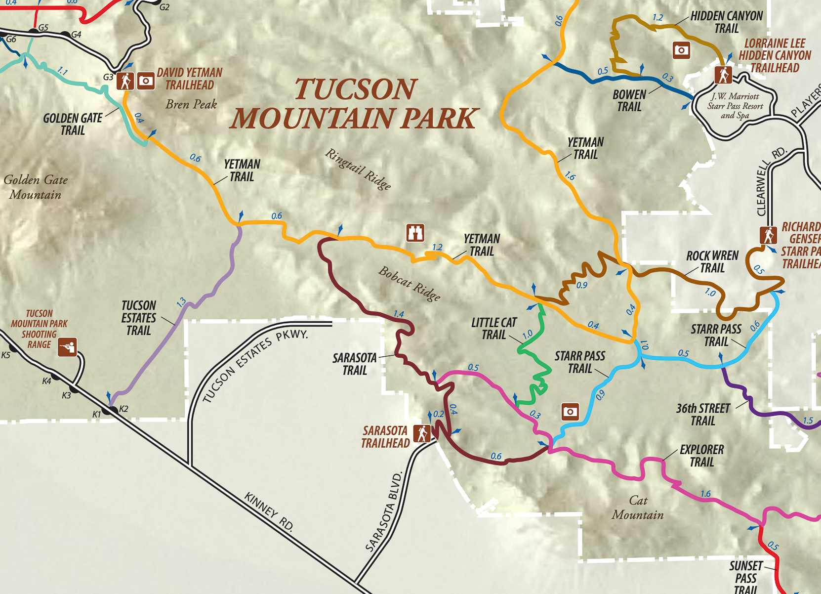 Trails in southeastern Tucson Mountain Park click on map for larger image References:
Lipman, P.W. 1994. Tucson Mountains Caldera: A Cretaceous Ash Flow Caldera in Southern Arizona. USGS Research on Mineral Resources 1994: Part B, Guidebook for Field Trips. U.S. Geological Survey. Tucson Mountains Geology: Complex and Controversial. Lipman, P.W. Geologic Map of the Tucson Mountains Caldera, Southern Arizona. Tucson Mountain Chaos. Arizona State Geology: Blog of the State Geologist of Arizona. Retrieved from internet. http://arizonageology.blogspot.com/2009/04/tucson-mountain-chaos.html On this exceptional 18-mile round-trip hike, experience remarkable biological diversity beginning in the saguaros and desert scrub, ending in the evergreen oaks and alligator juniper of the pine-oak woodlands. The reward is an immense view of mountain ranges in southern Arizona. 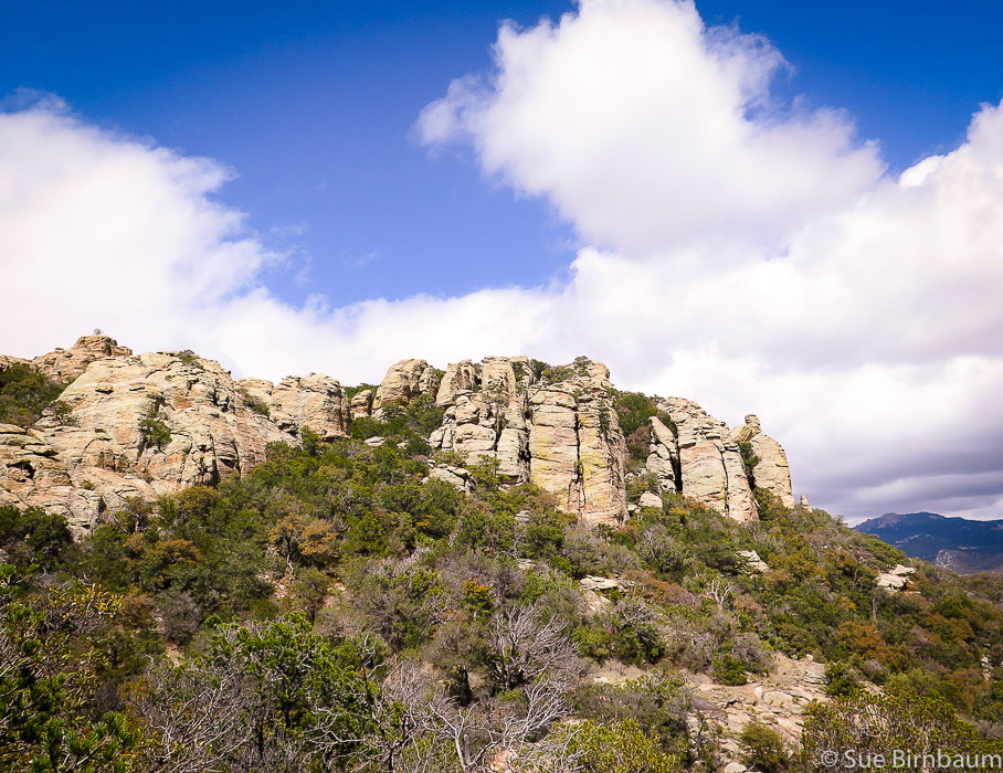 Tanque Verde Peak - Saguaro National Park East - Rincon Mountain District Trip Stats Overview: Rich in diversity, this hike treks through four Desert Sonoran biomes, beginning in the wild and colorful desertscrub, climbing through mellow chaparral and grassland and ending in the pine-scented temperate forest. Distance: 18 miles round-trip. Elevation gain: Tanque Verde Ridge Trailhead = 3,140 feet, Tanque Verde Peak = 7,049 feet. Gain including recovering from elevation loss both directions = 4,700 feet. Difficulty: Moderate to strenuous Class 1 trail entire distance marked with signs at intersections. Short Class 3 climb requiring hands on summit rocks. Date Hiked: April 18, 2019. Map: Trails Illustrated No. 237, Saguaro National Park. See map of trail at end of post. Considerations: Plan to carry all of your water needed for 18 miles. Gates at Saguaro NP East are open at 7:00 am. No dogs allowed on trail. Directions to trailhead: In Tucson, from Old Spanish Trail, turn into marked entrance for Saguaro NP. After entrance station, take the first right after sign for Javelina Picnic Area. The Tanque Verde Ridge Trail is on the right of the parking area. Definition Biome - "A large community of plants and animals that occupies a distinct region. A complex biotic community characterized by distinctive plant and animal species and maintained under the climatic conditions of the region." - Dictionary.com 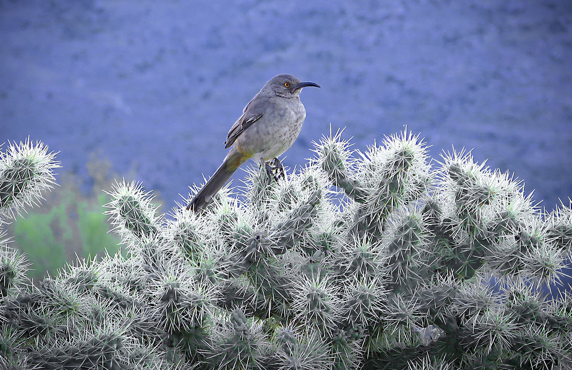 Curve-billed thrasher Tanque Verde Ridge in background If I had to pick only one word that best describes the essence of the hike to Tanque Verde Peak in the Saguaro Wilderness, I would choose "diversity". This nine-mile portion of the Tanque Verde Ridge Trail that begins at the Javelina trailhead in Saguaro National Park east of Tucson and ends 4,000 feet higher at Tanque Verde's summit treks through four biotic communities, each containing its characteristic plant and animal species. These "life zones" -Sonoran desertscrub, semi-desert grassland, Madrean evergreen woodland, and temperate forest overlap, so that prickly pear cactus grows alongside bunch grasses in transition zones. An evening of April thunderstorms and light rain the previous night had created a chill and freshness to the morning air. Fred and I had hiked this trail 6.9 miles to Juniper Basin the year before. This year, we were determined to hike the full nine miles to the peak. The trail, initially hard and rocky, winds through stately saguaros, barrel cactus and prickly pear cacti filled to the brim with new flower buds (in April), straightens and gains elevation through tall bunchgrasses, bear grass, and finally oak trees. Leaving the desert scrub behind, the trail rises and falls through an ever-increasing amount of oaks. It goes through lovely Juniper Flat, through the cool shade of Ponderosa and Pinyon pines along with Alligator juniper toward the summit of Tanque Verde Peak where the tread is soft with accumulated pine needles. Grasping the rough and weathered granite on the last few feet of the summit block, you hoist yourself up a huge boulder to see the dark, immense summit of Rincon Mountain on the south ridge and the breathtaking view of southern Arizona's mountain ranges. The only bad part is the sore feet after this 18-mile hike; however, a small price to pay for this unique experience. Tanque Verde, or "green tank" refers to the green algae present in a large tank of water used for stock in the 1800's. It is now the name given to the valley east of Tucson that is bordered by the Santa Catalina Mountains to the north and the Rincon Mountains to the east. The Pima Indians lived there in the 1600's, and Tanque Verde Ranch was established in the 1800's. 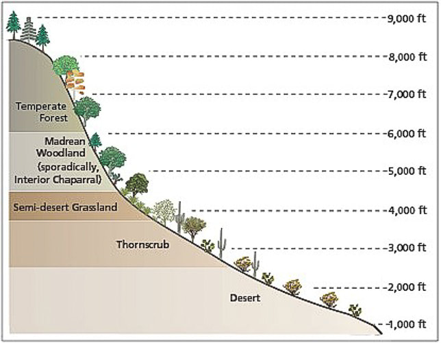 Biomes of Sonoran Desert Network Parks Symbols courtesy of the Integration and Application Network, University of Maryland Center for Environmental Science (ian.umces.edu/symbols/). -Taken from Sonoran Desert Inventory and Monitoring Network - National Park Service Sonoran Desertscrub (a.k.a. Thornscrub) This hike begins at the Javelina picnic area in East Saguaro National Park - elevation 3,100 feet, in the creosote-scented Sonoran desertscrub biome. A great biome because plants are tough yet beautiful at the same time. Tough because plants have devised strategies to help them survive, such as thorns as a physical defense against predators, and hair on leaves to shield the relentless sun. Thorns and bristles act to shade and insulate certain crucial parts of cacti. Thorny saguaros dominate this community, along with cacti of various forms, such as the flower bud-studded prickly pear. Bright colors of wildflowers in spring line the path: coral/red claret cup flowers of the hedgehog cactus, yellow prickly pear flowers, pink fairyduster, bright orange ocotillo, and peach-colored globemallow flowers. Mesquite and Palo Verde trees are present in the Sonoran desertscrub biome which is intermediate between the desert and tropical forest biomes. The cheerful yellow flowers of Encelia farinosa, or brittlebush add bursts of color among the red-brown rocks and green cacti. After the trail register, the trail begins to climb, with sweeping views of Tucson basin. Before emerging out of the desertscrub biome into grassland, at about two miles, the trail provides unobstructed views of the mountain ranges west and south of Tucson. From here, the trail stays on the wide ridge, rounding hills at some intervals, or heading straight up and then down, causing mild losses in elevation. It gains 700 feet in the 1.4 miles after the trail register. Just after 4,000 feet elevation, saguaros become more scarce, and grass more prominent, as it transitions into semi-desert grassland ecosystem.  Trail head sign at Javalina Picnic area - Saguaro National Park East 9 miles and 4 biomes ahead of us!  Ocotillo and prickly pear in Sonoran desertsrub biome  Brittlebush - Encelia farinosa  Scolopendra heros - giant desert centipede (we saw one of these on our way back) - taken from Wikipedia  Near Javelina picnic area - Saguaro National Park East  Desertscrub (recently named Thornscrub) biome in Sonoran desert about 3,000 - 4,000 feet elevation
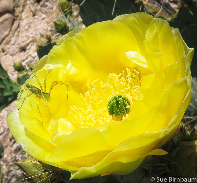 Green lynx spider on prickly pear blossom 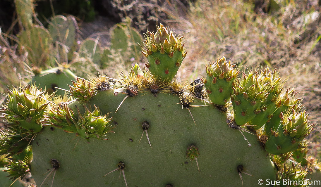 Prickly Pear Cactus with buds on leaves in April 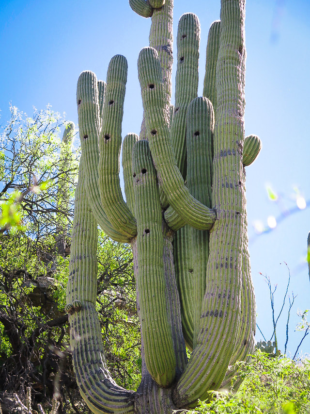 Saguaro National Park According to a reader of this post: "Holes are made from Gila Woodpeckers and Gilded Flickers and other birds and animals use the nest holes when the woodpeckers leave." Semi-desert grassland As the trail climbs just past 4,000 feet, a noticeable change in vegetation occurs: saguaros become scarce as the ridge is dominated by ever-increasing fields of bunchgrasses, oak and juniper. Calming, muted and soft neutral grey/greens replace bright primary colors of the lively, unrestrained desertscrub. Sotol, creosote and agave mix with a diverse array of grasses. As the trail gradually climbs, junipers become more prevalent. Tanque Verde Peak is still six miles away and not visible. The manzanita and oak species are prevalent in the oak savannah community as the trail ascends, transitioning into pine/oak woodland. 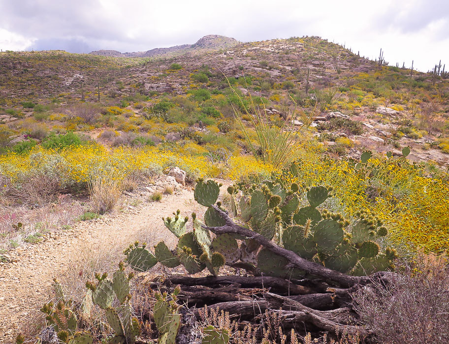 Transition between Sonoran desertscrub and semi-desert grasslands 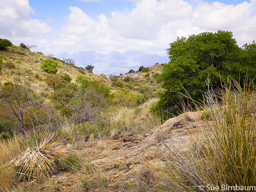 Oaks begin to appear in semi-desert grassland biome Santa Catalina Mountains, north of Tucson on horizon Madrean Evergreen/Pine/Oak Woodland At about four miles, at mid-elevation that is between the desertscrub and the temperate forest biomes, the trail ascends and descends through ever-increasing oaks. At 5.9 miles, the trail drops to make its long entrance into Juniper Basin Campground, crossing beautiful Box Canyon with rock cairns to guide you through stretches of rock floors. At 5,940 feet elevation, Juniper Basin Campground is an airy and spacious place with towering Pinyon pines and oaks and my favorite - the alligator juniper with its scaly square-patterned bark. There's an outhouse and food box for overnight campers. Evergreen oaks such as Emory oak and Arizona white oak along with Mexican pinyon pine dominate this biome, named after its origin in the Sierra Madre mountain range that runs through Mexico and along the Gulf of California. Understory perennial grasses rustle, adding to the peace of this place. The elevation gain to Juniper Basin Campground is 2,840 feet in 6.9 miles. Tanque Verde Peak is another 2.1 miles and 1,100 feet in gain. Such a long, arduous adventure; it's tempting to turn back and call it good, but the additional effort to get to the summit is worth it. We summon our motivation and resume our quest not knowing at this time how we would quickly forget our tired legs once on Tanque Verde summit, and how the forest and view would exceed our expectations. Signs indicate the trail continues northeastward from Juniper Basin. Finally, Tanque Verde Peak comes into view, but seems far away. Orange blazes on trees occasionally mark the trail, easy to follow. 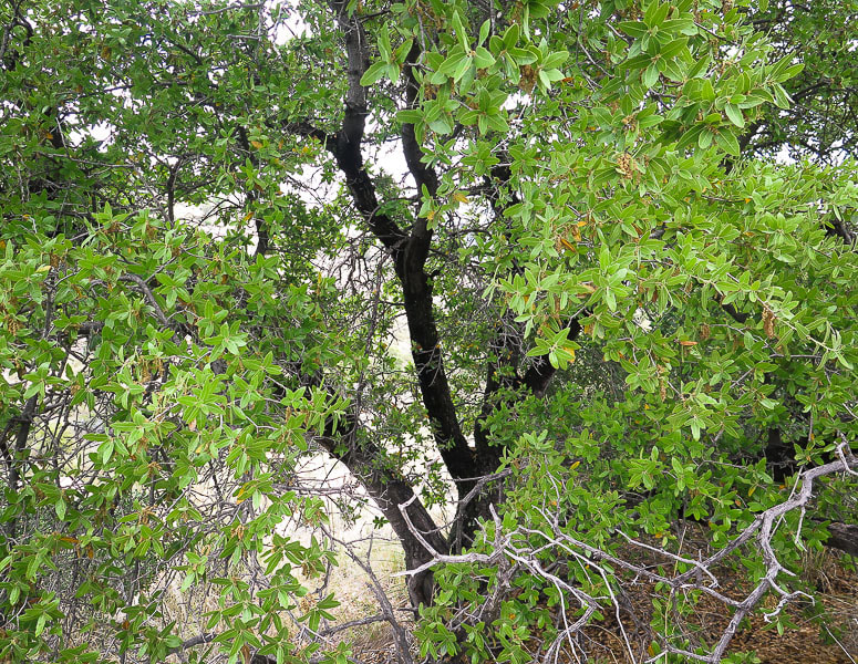 Oak in Madrean Evergreen Woodland biome - near Juniper Basin Campground - 6,000 feet "Madrean" is the word taken from the Sierra Madre Mountain range in Mexico 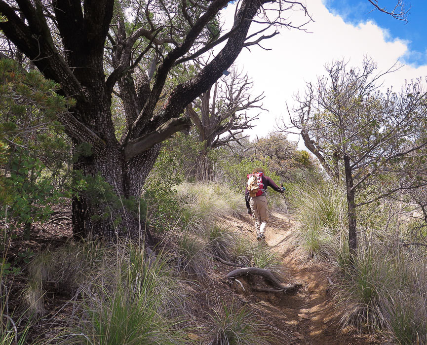 Huge alligator juniper (Juniperus deppeana) along trail between Juniper Basin and Tanque Verde Peak. The checkerboard-patterned bark is distinctive in this large evergreen which is used for fenceposts. 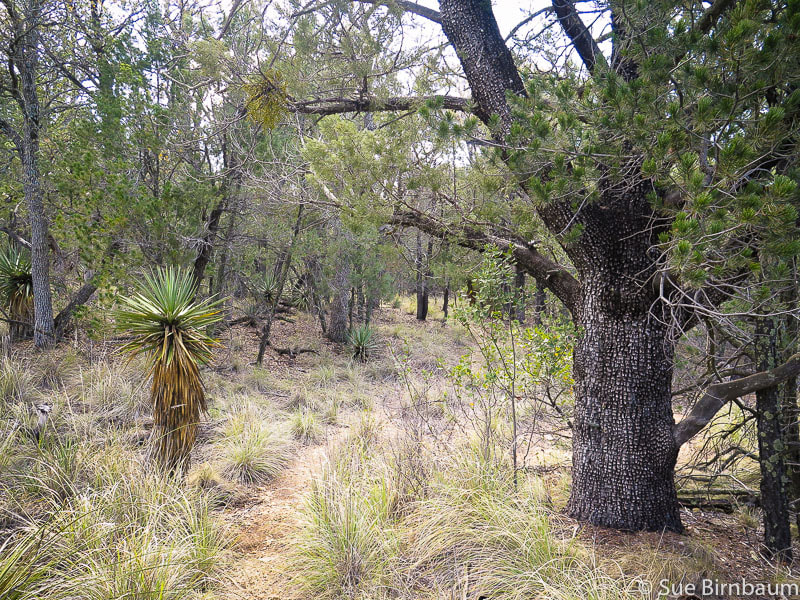 Yucca on the left and alligator juniper share space in the Madrean Evergreen Woodland biome Temperate Forest A unique characteristic of the Sonoran temperate forest biome, officially beginning at around 6,000 feet elevation, is the cohabitation of lower-elevation desert plants, such as the yucca with spruces, pines, firs and maples. Species diversity reigns, although seemingly not to the degree of the desertscrub biome. Temperate forests are very cold-hardy and confined to cooler sites above the Madrean evergreen woodland. We catch glimpses of Tanque Verde Peak as we climb on a well-traveled path through the shade, scent and rough texture of this forest. Emerging out of the dense forest into an open wide ridge, Tanque Verde's many columnar rocks and crevices comes into sharp view at about 6,500 feet. The trail weaves around large boulders and manzanita: the metal summit sign is seen to the east at about 8.7 miles. Reach an old signed intersection that points the way to Cow Head Saddle which is another 2.5 miles on the ridge; continue straight ahead to Tanque Verde. Somehow I forget my tired legs when we reach the summit, where the spectacular scene doesn't reveal itself until you scale a looming boulder that stands in your way, a short climb that feels like the final test for this summit conquer. 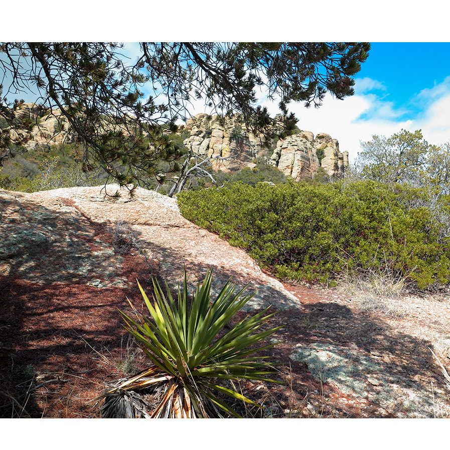 Tanque Verde Summit 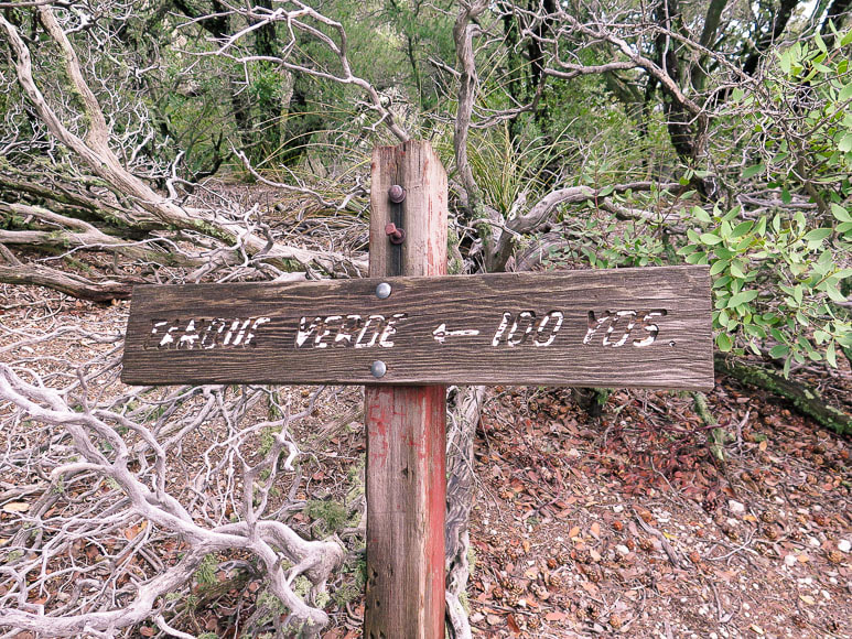 Old sign near trail intersection with hike to Cow Head Saddle continuing on Tanque Verde Ridge. 100 yards from the summit! The view is spectacular. It takes a few seconds to fully comprehend how high this peak rises above the surrounding desert floor and the layers of mountain ranges visible. Mexico is to the south, the Santa Rita and Galiuro Mountain ranges to the southeast. The Santa Catalina Mountains thrust up rocky prominences to the northwest. Rincon Peak is just across the valley to the east, its massive hulk in the shadow of clouds. We relish the view and accomplishment and the wonder and beauty that the Sonoran desert brings. The wind is brisk and cool, but by the time we get down to the desertscrub and walk through the saguaro stands, seven miles away, it will be warmer, even with the sun setting. There are about four or five hills to climb on the long walk out, scaled with a bit more determination than on the way in. Glad we are getting back at sunset, for above the golden Tanque Verde Ridge slowly becoming covered by shadows, a nearly full moon is rising. 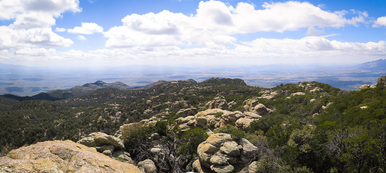 Tucson Basin to the southwest from summit of Tanque Verde Peak - 7,047 feet
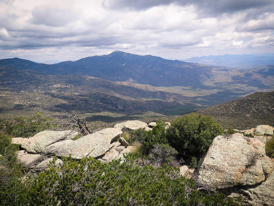 Rincon Peak southeast of Tanque Verde Peak in eastern Rincon Mountains - also a great hike! 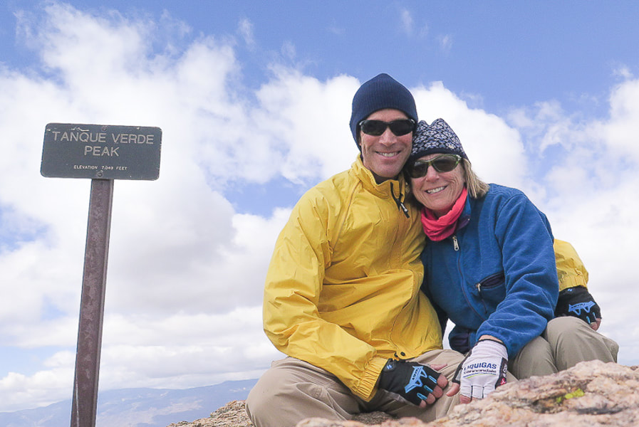 Fred and Sue - 7,047 feet - if you've got the endurance (and plenty of water), we recommend this hike! Nine miles done and nine more to go! 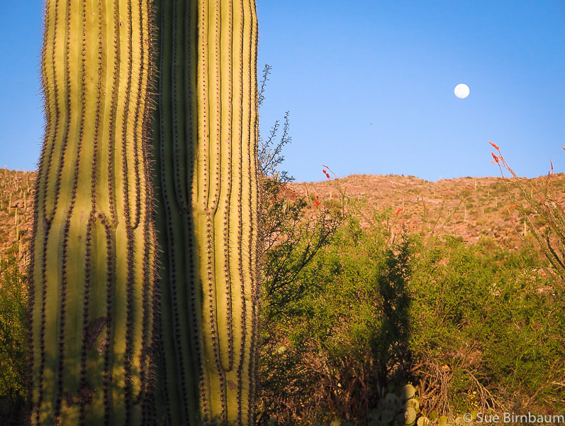 Close to Javelina trailhead, Saguaro National Park East 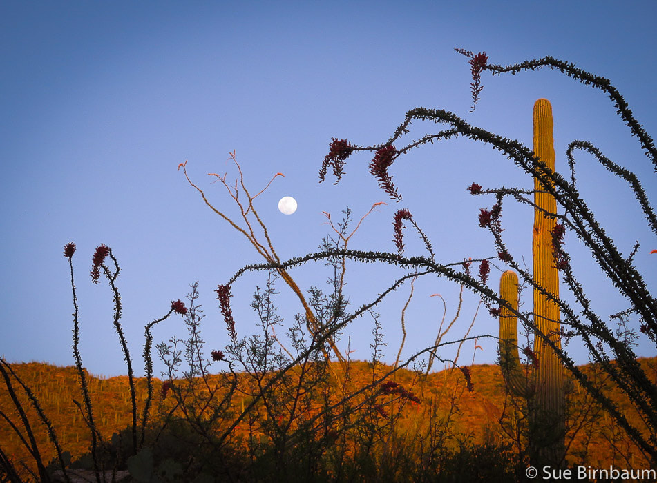 Getting back to trailhead at moonrise - ocotillos in foreground  Always a Frost gelato after a Tucson hike 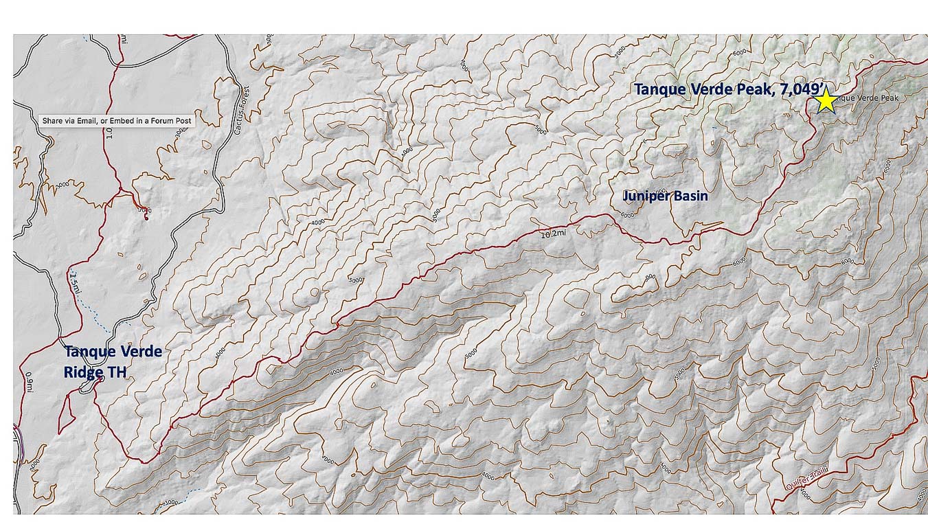 Tanque Verde Ridge Trail (in red) from trailhead at Javelina picnic area in Saguaro NP East to Tanque Verde Peak click on map for larger image References:
Buckley, Steve, ed. 2011. Common Plants of Saguaro National Park Levengood, Betty. Tucson Hiking Guide. 2012. West Wind Press, Portland, Oregon. Natural Resources Monitoring at Saguaro National Park. https://www.nps.gov/im/sodn/sagu.htm Sonoran Desert Network Ecosystems. https://www.nps.gov/im/sodn/ecosystems.htm#CP_JUMP_5423053 USGS - Southwest Biological Science Center. 2006. Vascular Plant and Vertebrate Inventory of Saguaro National Park, Rincon Mountain District rincon_vegetation.pdf. Tanque Verde Ranch website, https://www.tanqueverderanch.com/ U.S. Department of the Interior, National Park Service, Saguaro. Geology of the Rincon Mountains. https://www.nps.gov/sagu/planyourvisit/upload/Geology%20of%20the%20Rincon%20Mountains.pdf. |
Categories
All

Sue and Fred

About this blogExploration documentaries – "explorumentaries" list trip stats and highlights of each hike or bike ride, often with some interesting history or geology. Years ago, I wrote these for friends and family to let them know what my husband, Fred and I were up to on weekends, and also to showcase the incredible land of the west.
To Subscribe to Explorumentary adventure blog and receive new posts by email:
Happy Summer!

About the Author
|