EXPLORUMENTARY
  • Home
    • Cactus to Clouds Hike
    • More Quotes
    • Ann Zwinger Quotes
    • Mary Oliver Poems
  • Hikes by State
    • Idaho
    • Southern Utah
    • Arizona
    • California Desert
    • Nevada
    • Wyoming
  • BLOGS
    • Adventure Blog
    • Women and the Land
  • GALLERY
    • DESERT PLANTS >
      • Beavertail cactus
      • Brittlebush
      • Christmas Cactus
      • Arizona Barrel Cactus
      • Parry's penstemon
      • Agave
      • Arizona Rainbow Hedgehog
      • Claret Cup Hedgehog
      • Desert Agave
      • Palmer's Penstemon
      • Silver Cholla
      • Cristate Saguaro
      • Indian Paintbrush
      • Ocotillo
      • Santa Rita Prickly Pear
      • Spiny Cliffbrake
      • California Barrel Cactus
      • Engelmann Prickly Pear
      • Velvet Mesquite
      • Joshua Tree
      • Buckhorn Cholla
      • Hedgehog Cactus
      • Fishhook cactus
      • Thompson's Woolly Locoweed
    • NATURE
    • BOISE
    • EARTH + SKY
    • URBAN
    • WATER
    • PATRIOT
    • ORCHIDS
  • Fit After 50
    • Brian Holgate
    • Fred Birnbaum
    • Dave Brasuell
    • Bus' Little Black Book
    • Mike Carlson
    • Ray Wilson
    • Bryan Krouse
    • Vickie Kearney
    • Maria Keezer
    • DOUG TRAUBEL
    • Boise Cross Fit Masters Ladies
    • Tim Clemens
    • Marcia Bondy
    • Becky Borczon Blake >
      • Becky B Downtown
    • Jennifer Cera and Sue Birnbaum
    • Dave Brasuell
    • Vance Powell
  • About
    • CONTACT

Hike Leatherman Peak:  12,228' -  On top of Idaho

7/19/2021

2 Comments

 
A challenging climb up the loose-rock north side of Idaho's second tallest peak for spectacular views from the "roof" of Idaho.
Related Posts
Idaho Summits (see Categories in sidebar)
Mackay Peak, 10, 273' and Mackay Mine Hill Tour
Cowboys and Hotsprings
Alpine Peak 9,861' - Sawtooth Wilderness: Never Stop Climbing Mountains
​Reward Peak:  10,074' via Upper Redfish Lakes, Sawtooth Wilderness
Picture
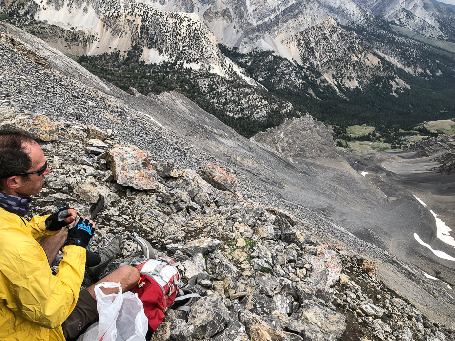
Lunch break at 12,000 feet.
Picture
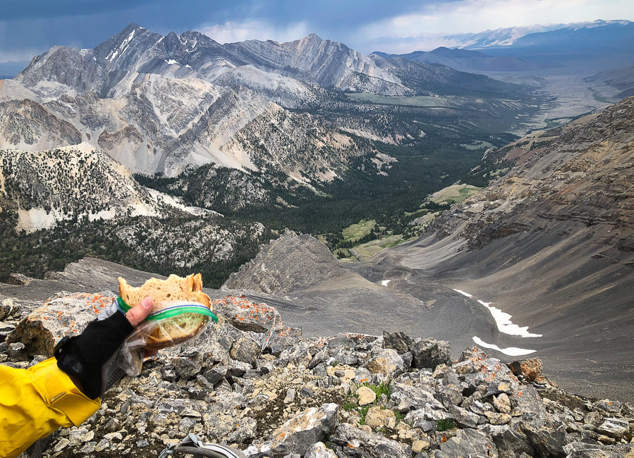
Lunch spot on Leatherman Peak's north slope 
Mt. Borah, Idaho's tallest peak at 12,667' on left horizon.
Road approaching trailhead at upper right; trail goes through pleasant forest in valley.
Trip Stats
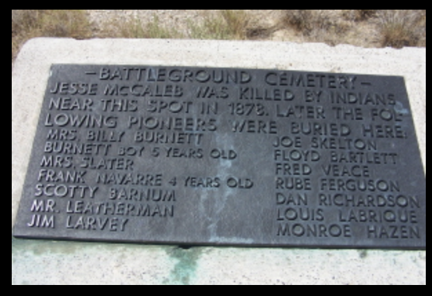
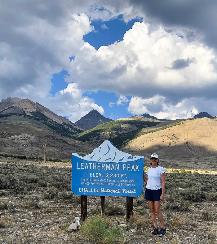
Location: 
Leatherman Peak, Idaho's second highest, is located in the Lost River Range in the Salmon-Challis National Forest just northeast of Mackay in east-central Idaho.   This rugged range includes seven of the nine "12-ers" - the highest peaks in Idaho.  Two main approaches:  south approach from Leatherman Pass (Lost River Valley) that climbs the west ridge, and north approach from Pahsimeroi Valley and West Fork Pahsimeroi Road climbs the east ridge (our approach).
Distance:  8.7 miles round-trip.
Elevation Gain:  Trailhead = 8,171';   Leatherman summit = 12,228:  Gain = 4,000'.
Date Hiked:  July 7, 2021
Difficulty:   Moderate Class 1 for first 1,000 feet gain, then Very Strenuous Class 2 on loose rock with some route-finding.
Considerations:   This is a very strenuous hike that is exposed most of the way - start hike early!  Obvious trails extend through the talus and on the ridge.  Experience with steep loose-rock climbing and route finding is essential.
Coordinates:  Trailhead at end of West Fork Pahsimeroi Road:  44.1292  N    113.7271 W.       
Leatherman Peak:  44.0820 N  113.7330 W.
Maps and Apps:  USGS Leatherman 7.5 min quad topo, AllTrails GPS tracks.  Interactive Map and Google Earth image of our GPS tracks below.
​
Geology:  Sedimentary rocks - marine limestone of Mississippian carbonate banks and turbiditic sandstone and mudstone and conglomerate of Antler flysch trough ~350 Ma (Million years ago).  Crinoid and coral fossils.  Leatherman Peak is a sharp horn carved from Mississippian Scott Peak Formation.  Some of these rocks were intruded with dikes that baked the rock ~ 45-50 Ma, producing flourite veins.  This section of the Lost River range rose due to the Mackay section of the Lost River Fault.
History:  Leatherman Peak is named after Henry Leatherman, one of the Lost River Valley's pioneers from the 1860's.  For more interesting history of this region, see last photo below.
Driving Directions
Hiking Directions
Our Hike
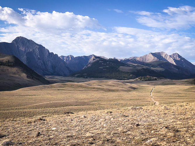
The raw and starkly beautiful Lost River Range that rises steeply from the Lost River Valley in east-central Idaho contains  seven of Idaho's nine highest peaks over 12,000 feet.  It reflects the complex geological processes of folding and faulting that have occurred over eons, creating formidable steep talus slopes, cliffs and crumbling limestone; however each year sees more climbers logging in their nine "12'ers".   These giants make up the roof of Idaho.  Leatherman Peak can be summited from either the Pahsimeroi Valley to its north, or Lost River Valley to its south.  Idaho's highest, Borah Peak at 12,667', has become so popular that the campground at its trailhead is being enlarged.

After Fred and I summited Borah Peak years ago, I had heard that the second highest peak, Leatherman involved more "technical" skills.  So I put that climb into the back of my mind, subconsciously knowing someday I was bound to do it,  but the word "technical" prevented me.   We each turned 60 this year, felt it was time to climb another Lost River range peak, so Leatherman it was.  We climbed the "easier" eastern route that included a slow and steady slog for a 3,000-foot gain on steep loose scree and talus, at times grabbing for fossil-covered limestone outcrops for stability.  There was no "easy" part except for the walk back down through the forest;  this was a challenging climb for us.  As we got within 500 feet of the summit, distant purple-blue skies to the north rumbled with occasional thunder, so our scramble to the top had to be quick but also careful.
Picture
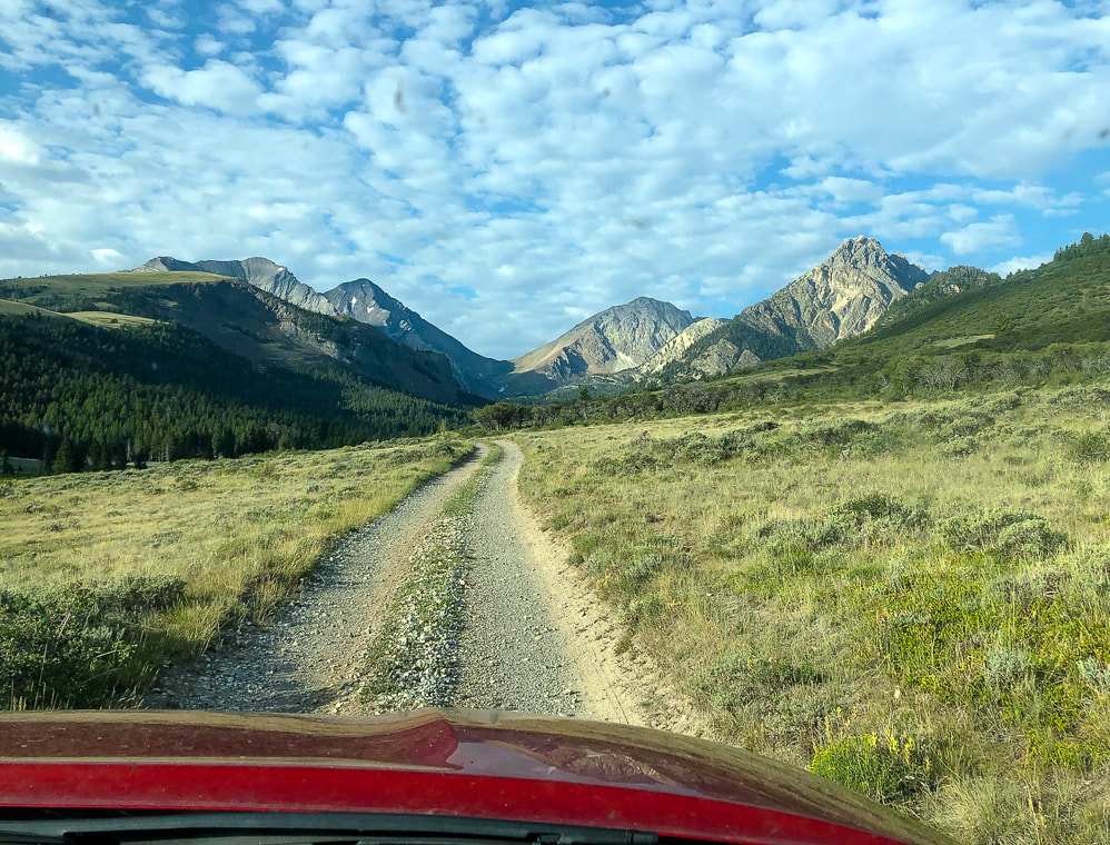
Morning glimpse of our goal:  the far dark gray peak on horizon, left side of saddle.
In their book "Younger Next Year", Chris Crowley and Henry Lodge, MD advocate for setting challenging goals they call "kedges" in order to stay youthful.  They call it "ordinary people doing extraordinary things."  A kedge is a light anchor that is dropped ahead of a motionless ship.  Then, raw muscle power is used to pull on the line attached to the anchor, thereby moving the ship forward.  Crowley advocates in order to stay young, we should train six days a week for the rest of our lives (wow!), so a kedge, or goal out of the ordinary will be needed occasionally for motivation.  I wouldn't call Leatherman Peak a full kedge for Fred and I; instead, it is what we call a "mini-kedge."  We had been training on a few summits and hoped we were up for this challenge mentally and physically.
Picture
From Mackay, we drove 2 hours and 10 minutes to our trailhead at the end of the West Fork Pahsimeroi Road, via Doublesprings Pass and Horseheaven Pass in the Pahsimeroi Valley.  Here, steep limestone cliffs, some folded and tilted loom above a pleasant sagebrush steppe.  A high-clearance 4WD vehicle is recommended as there are a lot of rocks on the last half of the drive with some slow-going.  I entered the coordinates for the trailhead into Avenza and also followed the directions from the guide book, "Trails of Eastern Idaho" by Margaret Fuller and Jerry Painter.  Included in this guide is a section Scrambling up Idaho's 12,000 foot Peaks .   A few scenes from the drive into the northeast side of the Lost River Range:
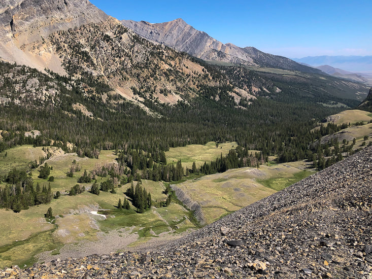
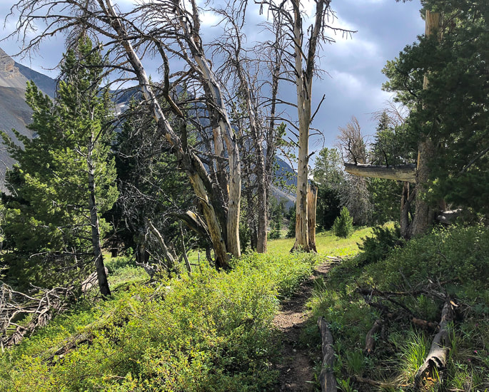
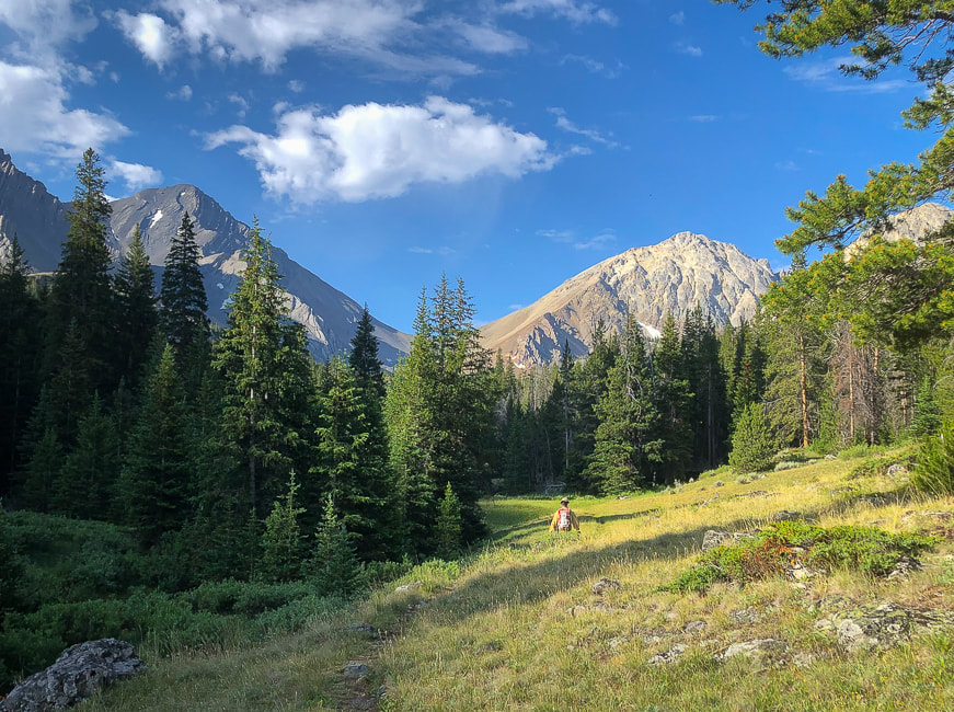
The first mile of the hike climbs a manageable 1,000 feet in 2.5 miles along the clear and rushing West Fork of the Pahsimeroi River through a beautiful forest that opens up onto a spacious wildflower-filled valley.  Ahead, the black, towering spectacle of Leatherman Peak rises straight up from the meadow, connected to White Cap Peak by Leatherman Pass.
Picture
Trailhead sign for Merriam Lake, Pass Lake, and Leatherman Pass
Picture
Junction for trails to Pass Lake and Merriam Lake.  Take Pass Lake trail to Leatherman Peak.
Picture
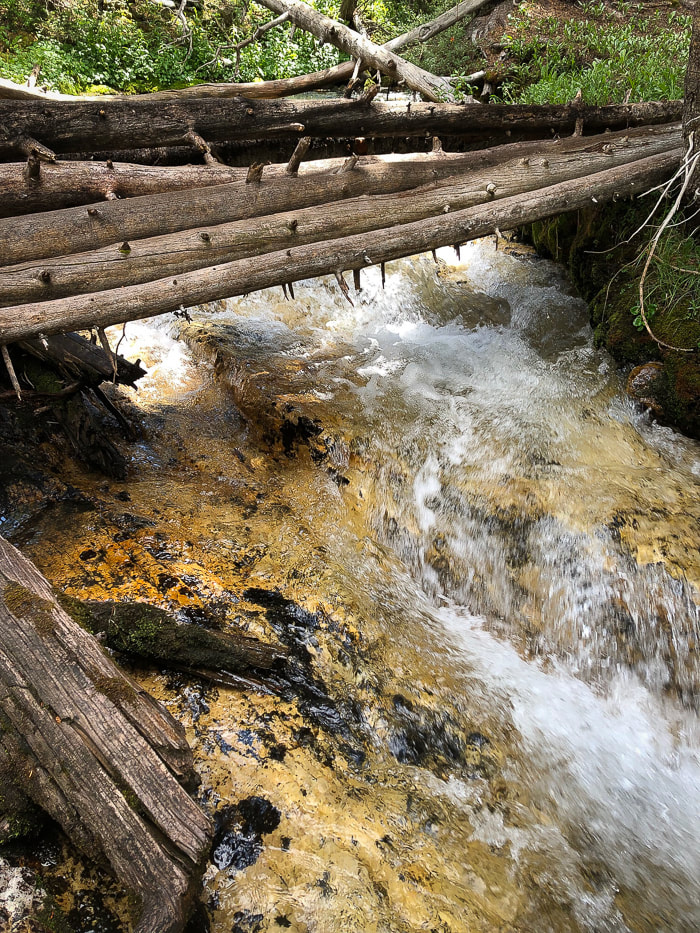
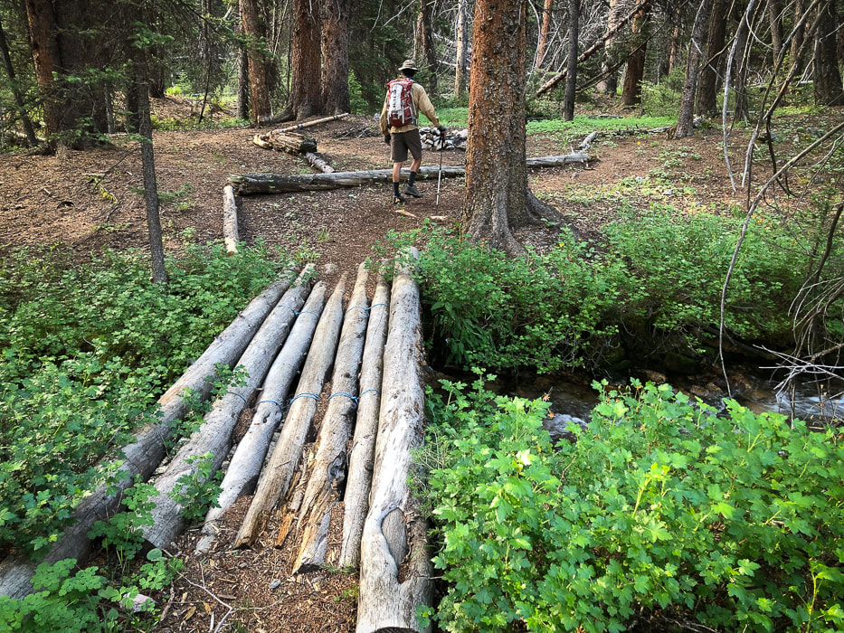
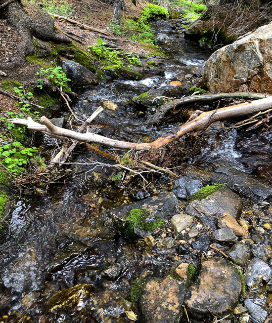
Just after trailhead, cross stream coming from Merriam Lake that flows into West Fork Pahsimeroi River.
Picture
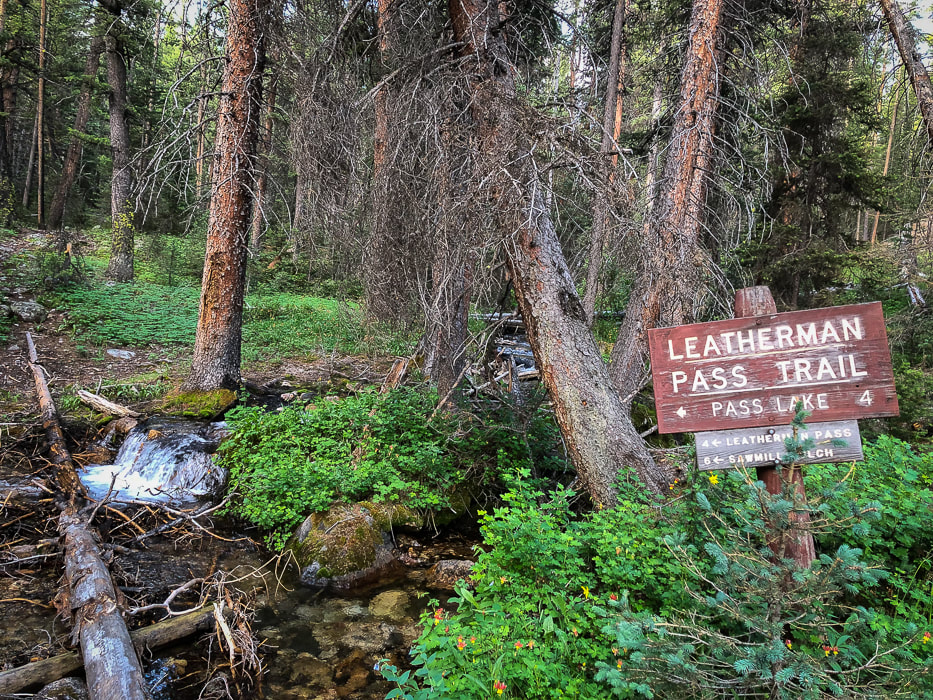
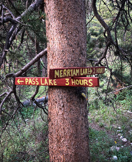
Our route takes a left (east) to hike Leatherman's north slope, leaving the Pass Trail before it reaches Leatherman Pass.   Sawmill Gulch is the southern approach from Lost River Valley.
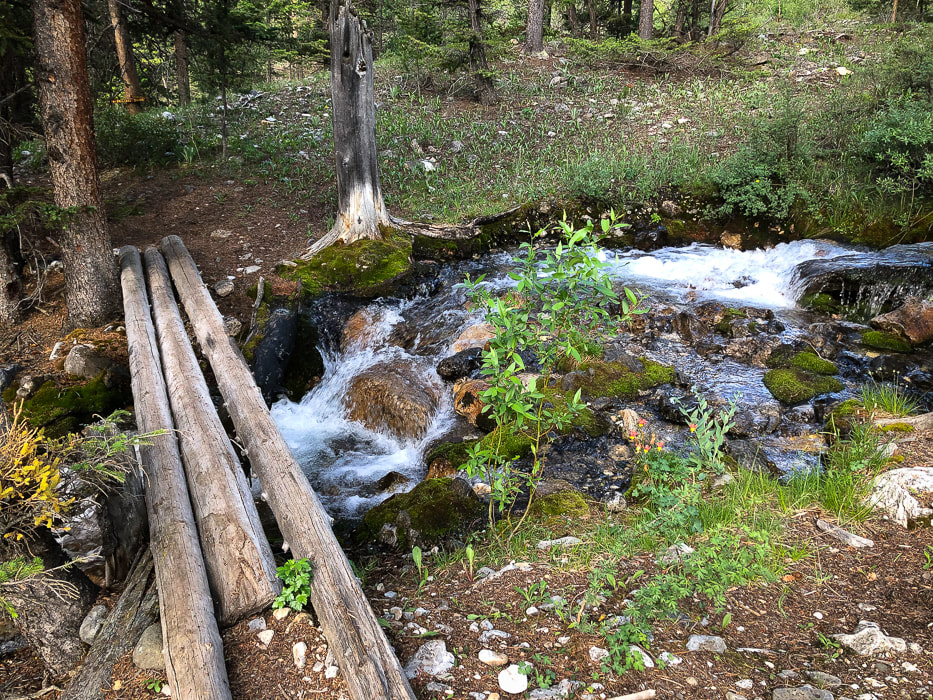
Thank-you for the bridges!
Picture
The first glimpse of Leatherman (left); and White Cap Peak (A.K.A. Mount Obsession) on the right.
Continue on trail until you reach a large valley opening and the steep gray gully of Leatherman to the left.
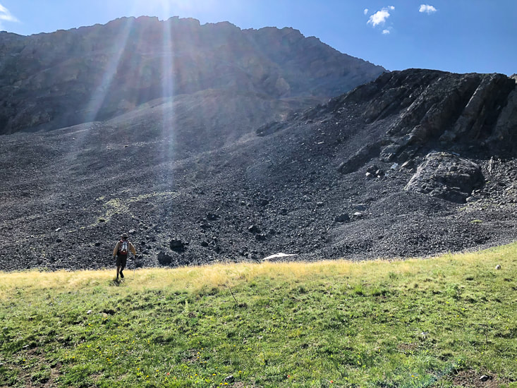
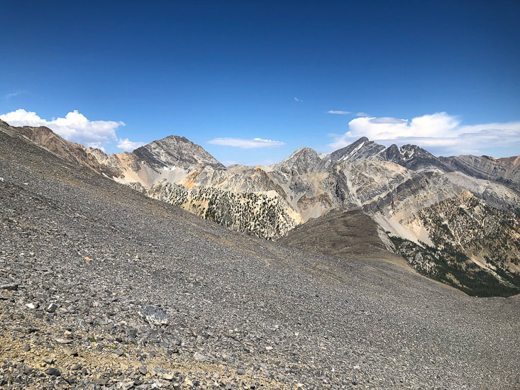
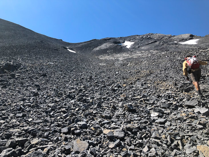
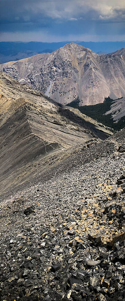
We went too far up-valley toward the pass, so we had to back track to find our gully route, east of the prominent north ridge.  Not the best thing to do, since time is precious in the mountains above tree line.  Once you get to the large meadow, 2.5 miles from the trailhead, leave the trail and start hiking left toward the steep loose-rock gulley below the ridge made mostly of talus that takes you to the ridge.  A human-made trail winds up through this immense gray slope.  After getting up the first steep part of this gulley, doing the rest-step to conserve energy, we took a brief rest to scope out a route to the top.  A trail heads straight up to the lowest part of the ridge line through what seems acres of loose talus.  Fred would have no part of that, so instead we climbed more to the right, using a combination of talus and stable limestone outcrops to scramble up to the ridge.  As we got to almost 12,000 feet, sheets of rain extended in slight curves from blue clouds and distant thunder rumbled.  We climbed to some protective outcrops in case we had to hunker down because of weather.  The storm seemed to be moving across Pahsimeroi and Lemhi Valleys further to the east.  We kept our focus up the steep slope, for looking down with sketchy footing was a bit unnerving.  Glad the limestone, besides having some cool fossils, was rough and grippy.
Picture
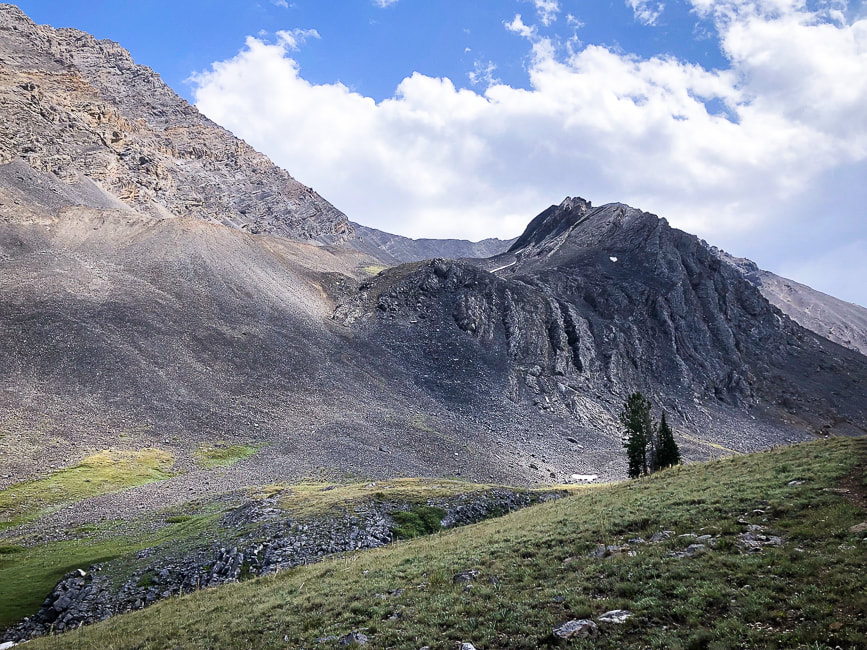
Leave trail to make initial steep climb into Leatherman's northern gulley; this leads you to the cirque under the ridge.
​Leatherman is behind the black outcrop.

Picture
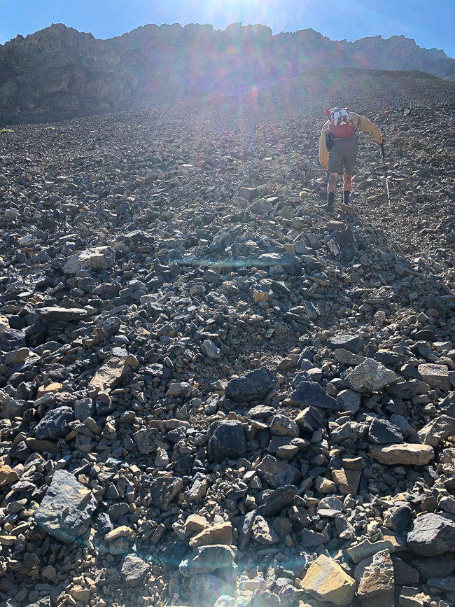
A "sea" of rocks - initial talus climb to gulley
Wait - why do we do this again?
Navigating through a gray rock sea - 3,000' gain
Yes!  It was worth it
Picture
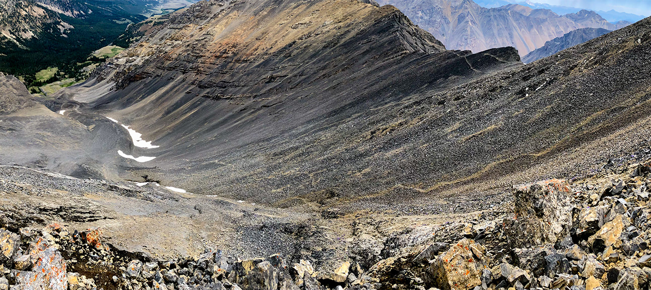
Working our way up larger boulders and outcrops of Leatherman Peak below the ridge; looking north onto gulley we ascended from forest below.
We descended via the path through the talus on the right.
Picture
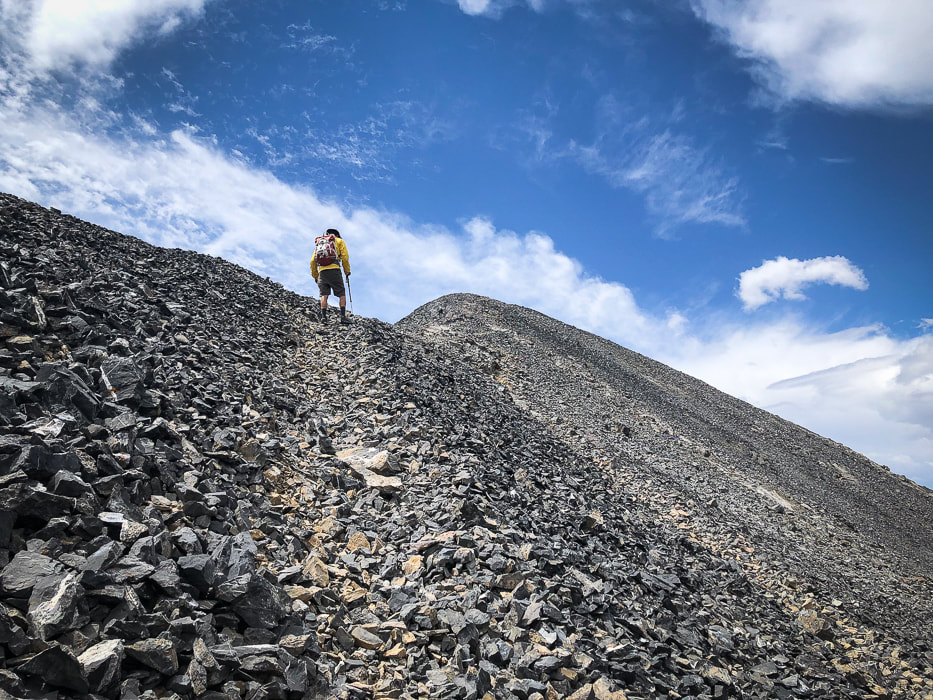
Final ridge climb - Leatherman Peak summit
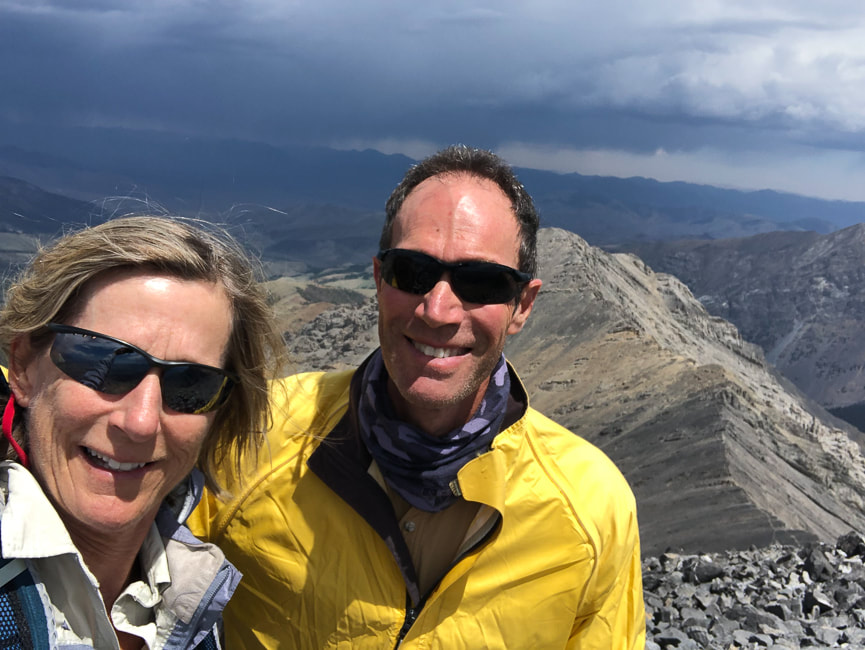
Sue and Fred at 12,228' - another Idaho 12'er for the books!
Picture
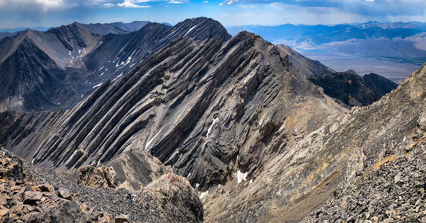
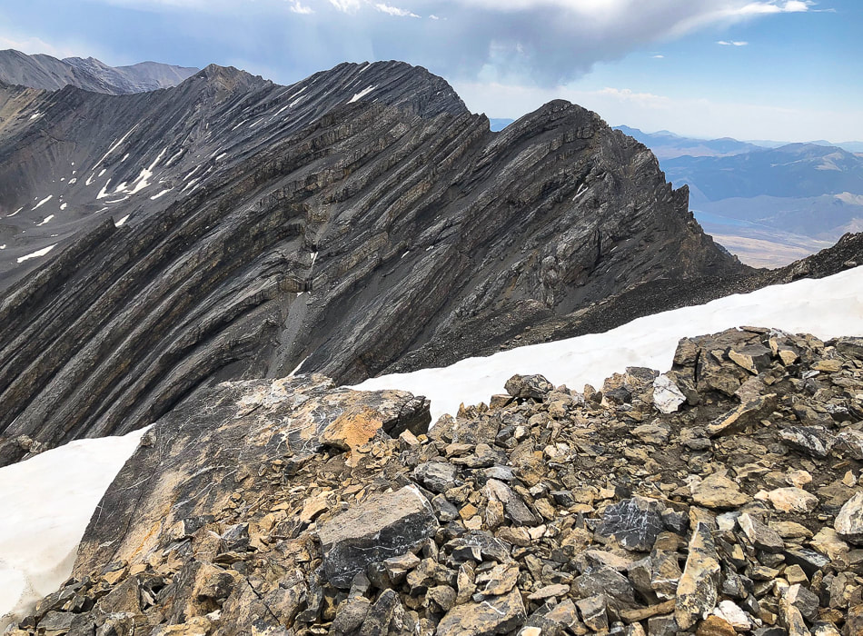
Bad Rock Peak on ridge between Leatherman Peak and Mount Church
Tom Lopez, in his book Idaho: A Climbing Guide says of this peak,  "Every approach crosses loose scree/talus that will make some climbers sob."
Picture
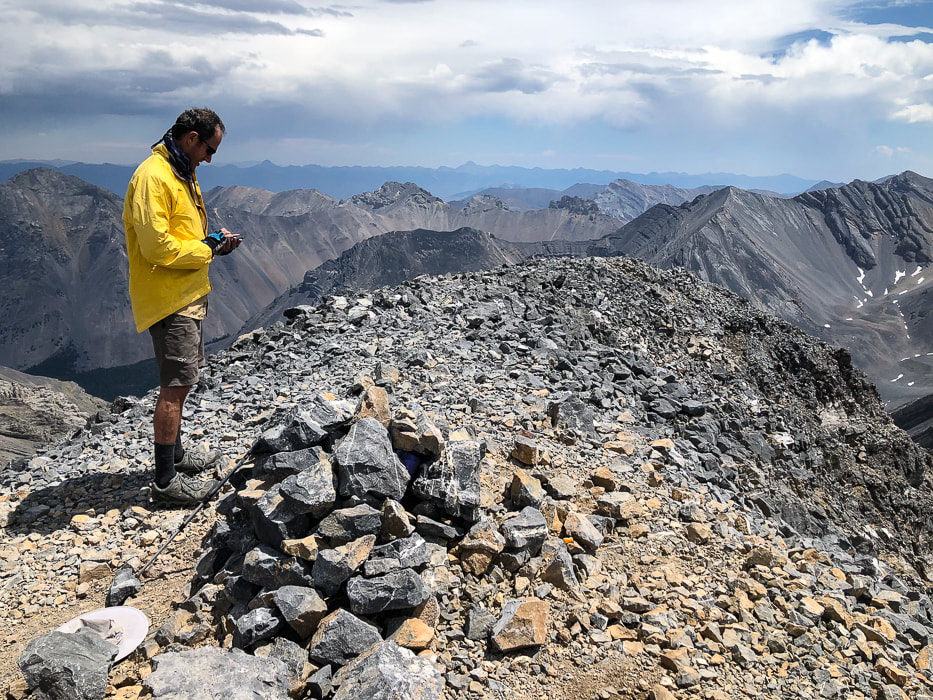
Leatherman Peak's summit - 12,228'
Picture
Descending from summit along ridge to descend at saddle.
There's that magical, unforgettable moment when climbing a high, treeless peak and you suddenly see the enormity of what is on the other side of the ridge you have worked so hard to ascend.  In this case, the view on the other side of Leatherman was breathtaking!  We were on top of Idaho, save for Mt. Borah, looking down on Bad Rock Peak and its crazy folds, and over the rest of the Lost River peaks.  We could see the three parallel valleys and their associated mountain ranges of east-central Idaho.  Gray curtains of rain hung over the distant Lemhi range.  Mackay Reservoir was a blue dot in the Lost River Valley.   Lucy Jane Bledsoe, in her book,  The Ice Cave said, "Perhaps climbing a mountain is nothing more than an act of worship, and reaching the barren perch of a summit is to experience pure awe."  Pure awe, indeed!

Once on the ridge, the way was easy to the summit cairn of rocks, we heard thunder again to the north and saw clouds gathering to the southwest, too.  Not a great time to hang out on the summit for long, so we snapped photos and signed our names on one of the crumpled pieces of paper stuffed into a water bottle.  Later we found out that lightning strikes from this storm sparked wildfires near Challis to the northwest.

Watching the darkening sky, we followed the ridge trail further down past the point at which we entered it.  Exiting the ridge and kicking our heels into the loose rock with a little added "scree skiing" got us down the main wall to the gully below, lined with low limestone walls at intervals.  As lightning and thunder drew closer, we tried to keep a low profile, but finally had to hunker down under a large outcrop wall in the gully as lightning flashed above and huge raindrops pelted the rocks around us and the forest below.

By the time we got down to the Leatherman Pass Trail, the rain-soaked trees and yellow and red wildflowers in the meadow glistened in the sun.  During the rest of the two miles through the fresh forest, the weather changed again.  Thunder literally followed us out to the trailhead, so we drove out ahead of the storm, huge raindrops again pelting the windshield.
A few bypasses on the rocky road out helped to avoid a few  slippery and steep sections.  The gravel road passes through Mahogany Creek, which had not gained water volume since our morning crossing.
Picture
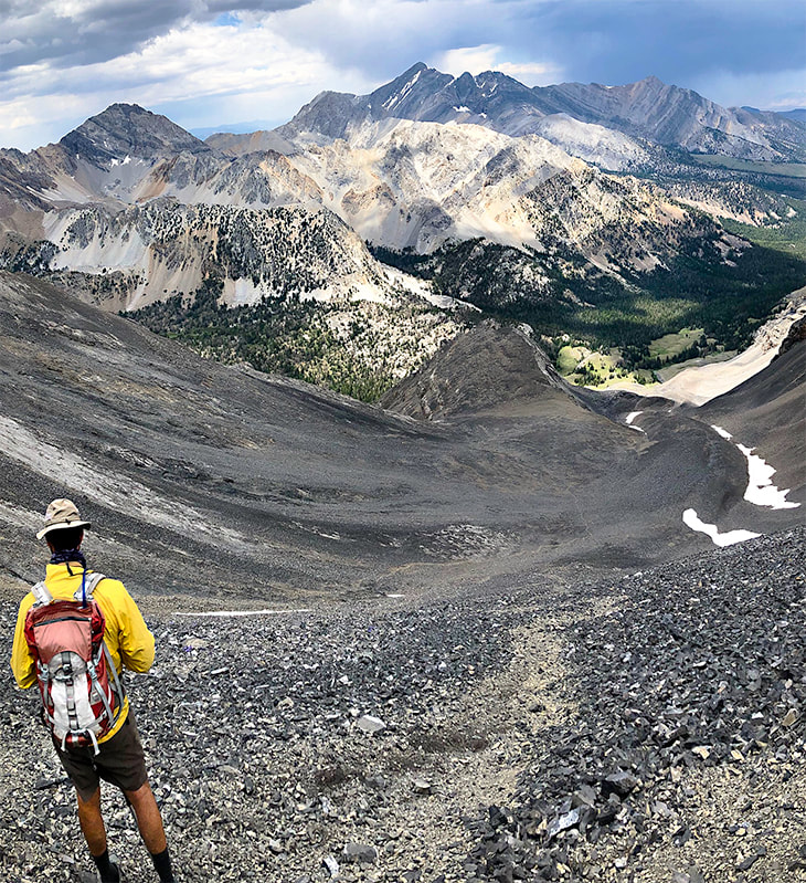
Getting down slope from ridge; route in gully below
Now we have summited three of the nine Idaho "12'ers".   Getting to the top of the rest of the six:  Mount Church, Mount Idaho,  Lost River Peak, Donaldson, Diamond Peak, and Mount Breitenbach would surely qualify as a "kedge", especially for a couple of 60-year old "geezers"!

That night in Mackay, we celebrated with pizza and beer at the Bear Bottom Restaurant's bar and talked to some of the "locals" who had finished their day's work.  We got some tips on great things to see in the area, like the Mackay Mine Hill Tour.  So much to explore, so little time.  We are lucky to have opportunities and freedom to explore our beautiful state and also this beautiful country.  Never stop exploring and climbing mountains!
Picture
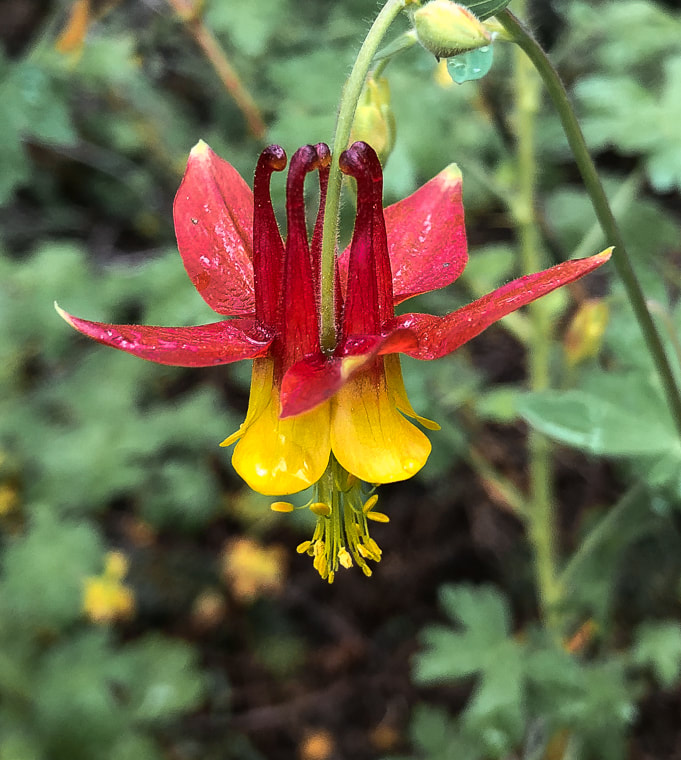
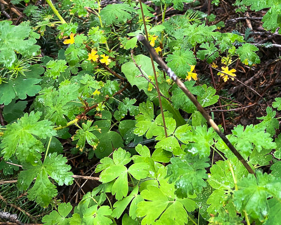
Red Columbine after rain shower
A welcome sight after all of that gray limestone!
Picture
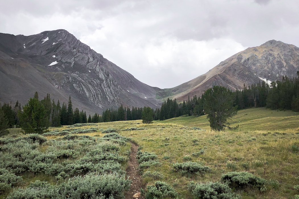
Parting shot of Leatherman Peak with clouds rolling in
Picture
Picture
This peak is named after Henry Leatherman, a nineteenth century hunter, trapper, teamster and freight carrier in the Lost River Valley.  He was buried in Battle Ground Cemetery with a large plaque that lists 15 people buried there.  The plaque reads, "Battleground Cemetery - Jesse McCaleb was killed by Indians near this spot in 1878.  Later the following pioneers were buried here."  Captain Jesse McCaleb came to Idaho from Tennessee after the Civil War in 1866, where he would become sheriff of Lemhi County.  He was the only settler killed in the skirmish that lasted two days.  For more on this interesting history, see Custer County, Idaho - GenWeb Project.
Picture
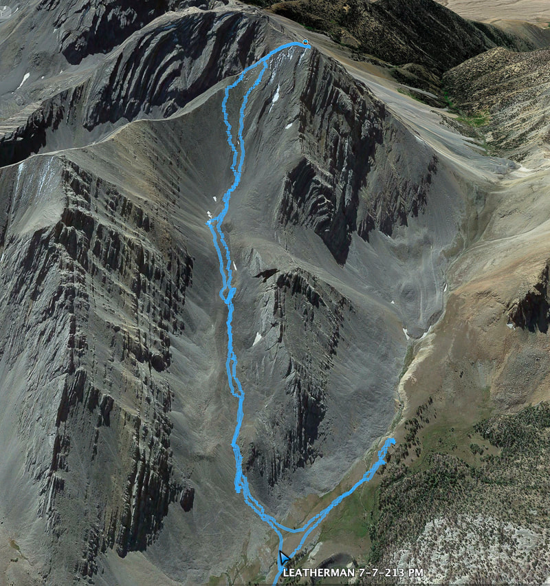
Our route up Leatherman's north gully/eastern ridge approach
​We went too far toward Leatherman Pass, so had to backtrack.

References
Custer County, Idaho, GenWeb Project - Mackay's Mount McCaleb
Geologic Map of the Borah Peak, Burnt Creek, Elkhorn Creek, and Leatherman Peak 7.5-min quadrangles, Custer and Lemhi Counties, Idaho.  Idaho Geological Survey.
Link, P.K., and Janecke, S.U.  1995.  Geology of East-Central Idaho: Geologic Roadlogs for the Big and Little Lost River, Lemhi, and Salmon River Valleys.
Henry Leatherman - Find a Grave website.


2 Comments

    Categories

    All
    Arizona Hikes
    California Desert Hiking
    Idaho Summits
    Nevada Hikes
    Snowshoe Hikes
    Southern Utah Hikes/Bikes

    Complete list of Hikes/Bikes on HOME page
    Picture
    Sue and Fred
    Picture

    About this blog

    Exploration documentaries          –  "explorumentaries"  list trip stats and highlights of each hike or bike ride, often with some interesting history or geology.  Years ago, I wrote these for friends and family to let them know what my husband, Fred and I were up to on weekends, and also to showcase the incredible land of the west.  

    To Subscribe to Explorumentary adventure blog and receive new posts by email:

    submit
    Picture
    Happy Spring!
    Picture

    About the Author
    Sue Birnbaum

    A  trip to Jumbo Rocks Campground in Joshua Tree National Monument 38 years ago sparked my passion for hiking, exploring, and learning about desert ecosystems.  For the past 25 years, my husband Fred and I have explored the American West together; we love this land and I hope to inspire you to get out and explore through my photographs and trip descriptions.
    In 1992, Ray Wilson and I conceived the first Cactus to Clouds hike which climbs over 10,000 feet in one day to the summit of Mt. San Jacinto near Palm Springs, California.
    CACTUS TO CLOUDS HIKE 
    READ MORE
    ABOUT SUE

    Archives

    February 2023
    January 2023
    December 2022
    November 2022
    October 2022
    September 2022
    August 2022
    July 2022
    June 2022
    May 2022
    April 2022
    February 2022
    January 2022
    December 2021
    November 2021
    October 2021
    August 2021
    July 2021
    May 2021
    March 2021
    February 2021
    January 2021
    November 2020
    October 2020
    August 2020
    July 2020
    June 2020
    April 2020
    March 2020
    February 2020
    January 2020
    November 2019
    October 2019
    September 2019
    August 2019
    July 2019
    June 2019
    May 2019
    April 2019
    February 2019
    December 2018
    November 2018
    October 2018
    September 2018
    July 2018
    June 2018
    May 2018
    April 2018
    March 2018
    February 2018
    January 2018
    December 2017
    November 2017
    October 2017
    September 2017
    August 2017
    July 2017
    June 2017
    April 2017
    February 2017
    November 2013
    August 2013
    July 2013

    Some of my favorite websites:
    Awkward Botany
    ​citizen botany for the phytocurious

    Bird and Hike

    ​"Intended to encourage people to visit, learn about, and fall in love with the desert."
    ​

    Draw and Shoot
    Beautiful Photography

    Earthline: The American West
    Debra "writes to extol our beloved Earth." Detailed hike info, excellently written.
    ​

    Geologypics.com
    Geology and Geologic Time through Photographs

    Glenn Suokko
    Vermont artist's paintings "inspired by a place based on the land .... drawn to painting the representation and abstraction of nature."

    In the Company of Plants and Rocks
    ​A natural history blog about botany, plant ecology, and geology.

    Nature's Depths

    Walking through nature with John Palka, a neuroscientist who loves plants and ponders big questions

    Rangewriter - What Comes Next?
    ​With excellent writing, Linda tells the story of her unique mother's life including WWII era; with beautiful photographs.

    SeekingLost - Hiking and Backpacking Adventures.

    Stav Is Lost- Unconventional, out-of-the way hikes in the American West.


    Uprooted Magnolia
    ​Leah Yetter's beautiful "photo journal on life, love, and the spirit of Wyoming."
HOME

Cactus to Clouds Hike
More Quotes
HIKES BY STATE

Idaho Hikes
Utah Hikes/Bikes
​Arizona Hikes
​California Desert Hikes
​Wyoming Hikes
​Nevada Hikes

BLOGS

Adventure Blog
Women and the Land
GEAR REVIEWS
FIT AFTER 50
Fred Birnbaum
Dave Brasuell
Bus' Little Black Book
​Mike Carlson
​Ray Wilson
​Marcia Bondy
Bryan Krouse
​Maria Keezer
​Tim Clemens
​Doug Traubel
​Brian Holgate
​
Becky Borczon Blake
​Jennifer Cera and
​Sue Birnbaum

​Vance Powell
​Boise Cross Fit Masters Ladies
​Vickie Kearney

GALLERY

Desert Plants
Nature
Earth + Sky
Urban
Water
Patriot 
​Orchids
Boise
​
  ABOUT
    Contact

​
© 2017 - 2023 by Sue Birnbaum.  Photos on this website are the sole property of Sue Birnbaum unless otherwise indicated.  Please receive permission before publishing my trip reports and photos.
I try my best to be accurate with my hike descriptions; please research your adventures, always bring a map and compass and know how to read them, be prepared!  All of these hikes can be dangerous; hike at your own risk.  ALWAYS carry the Ten Essentials with you on hikes. 
​Please feel free to contact me with comments or questions, or if you see any errors that need attention.
Thank-you for stopping by!


EXPLORUMENTARY.com
  • Home
    • Cactus to Clouds Hike
    • More Quotes
    • Ann Zwinger Quotes
    • Mary Oliver Poems
  • Hikes by State
    • Idaho
    • Southern Utah
    • Arizona
    • California Desert
    • Nevada
    • Wyoming
  • BLOGS
    • Adventure Blog
    • Women and the Land
  • GALLERY
    • DESERT PLANTS >
      • Beavertail cactus
      • Brittlebush
      • Christmas Cactus
      • Arizona Barrel Cactus
      • Parry's penstemon
      • Agave
      • Arizona Rainbow Hedgehog
      • Claret Cup Hedgehog
      • Desert Agave
      • Palmer's Penstemon
      • Silver Cholla
      • Cristate Saguaro
      • Indian Paintbrush
      • Ocotillo
      • Santa Rita Prickly Pear
      • Spiny Cliffbrake
      • California Barrel Cactus
      • Engelmann Prickly Pear
      • Velvet Mesquite
      • Joshua Tree
      • Buckhorn Cholla
      • Hedgehog Cactus
      • Fishhook cactus
      • Thompson's Woolly Locoweed
    • NATURE
    • BOISE
    • EARTH + SKY
    • URBAN
    • WATER
    • PATRIOT
    • ORCHIDS
  • Fit After 50
    • Brian Holgate
    • Fred Birnbaum
    • Dave Brasuell
    • Bus' Little Black Book
    • Mike Carlson
    • Ray Wilson
    • Bryan Krouse
    • Vickie Kearney
    • Maria Keezer
    • DOUG TRAUBEL
    • Boise Cross Fit Masters Ladies
    • Tim Clemens
    • Marcia Bondy
    • Becky Borczon Blake >
      • Becky B Downtown
    • Jennifer Cera and Sue Birnbaum
    • Dave Brasuell
    • Vance Powell
  • About
    • CONTACT