|
Explore this "hidden gem" in the Red Mountain Wilderness; a primitive trail that quickly elevates the hiker from city to a spectacular and peaceful plateau in the southern Utah red rock wilderness. 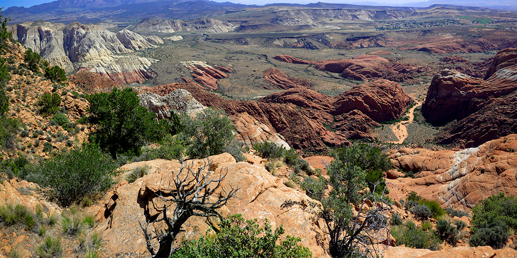 On top of Red Mountain overlooking Red Sands Trail (wash), part of the Padre' Canyon Loop in Snow Canyon State Park. Considerations: The first mile from the Ivins trailhead is Class 1 with two short Class 3 maneuvers. Once the trail tops out, there is no marked trail. Experience with navigation and route-finding using a compass/GPS and topo maps is required after top of Red Mountain is reached to avoid getting lost. A sign at this trailhead reads, "Hazardous, unmaintained route with steep exposed slopes: your safety is your responsibility." Recommend taking a GPS waypoint at critical points on the trail such as point where you enter the plateau from the cliffs. Search and rescue operations for lost hikers have occurred. Be prepared if you have to spend the night! Research this route thoroughly!
2/5/23: Three rescues in Washington County on the same Day (St. George News). Trip Stats - Ivins Trailhead Overview: Within a few steps of Red Mountain's steep cliffs overlooking the bustling desert cities of Ivins and St. George, Utah, enter a quiet and sublime wilderness of pinyons, junipers and mule deer that is unmarked except for an occasional cairn. The Red Mountain Primitive Trail extends for 11 miles in the Red Mountain Wilderness through saddles crossed by washes and slickrock basins between rocky sandstone spires and crags, with spectacular views of Snow Canyon State Park We hiked this trail's southern 3.5 miles. Location: Red Cliffs National Conservation Area (BLM) in the Red Mountain Wilderness north of Ivins, Utah. Southern trailhead starts at intersection with Toe Trail, at the north end of North 200 E Street in Ivins. North trailhead is just off Highway 18, 15 miles north of Bluff Road in St. George, north of Snow Canyon State Park. Distance: We hiked 3.6 miles of the 11-mile trail, out and back for a total of 7.2 miles. Elevation: Southern trailhead = 3,189': our top point = 4,930'. Difficulty: Mostly strenuous Class 1 on first 0.8 miles; a short section is Class 3 using hand- and foot-holds to maneuver up rocks with mild-moderate exposure. Once on top, navigation and route-finding on unmarked terrain Class 2. Lat/Long: Ivins Trailhead (south): 37.1754 -113.6772. Top point of our hike overlooking Snow Canyon: 37.2129 -113.6707. Trail at Ivins descent (top out onto plateau): 37.1842 -113.6783. Water: Plan on packing in your water. Permit: None Date Hiked: May 9, 2021. Maps: Google Maps Interactive map below Trail Map and Guide for: St. George, Hurricane and Zion NP, Utah - Adventure Maps.net Santa Clara 7.5 minute topo map (PDF). BLM Red Mountain Wilderness Map. See maps of our tracks below. Geology: Red Mountain's lower slopes are from the Kayenta Formation, the oldest rock in Snow Canyon State Park (190 million years). The horizontal sediment layers are made from rivers depositing mudstone, siltstone and sandstone. The upper slopes, cliffs and top of Red Mountain are a great block of Navajo Sandstone that is younger (180 million years), also seen as a major rock unit of Zion National Park. This Navajo Sandstone exhibits large, sweeping cross-bed features - horizontal and dipping layers of ancient sand dunes deposited in a vast eolian (wind carried) dune field. Red Mountain is bounded by the Gunlock Fault on its west side. It merges with an extensive field of 2.4 million - 2,000 year old basalt flows to the northeast. The Gunlock Fault is a normal fault with the down-drop on its west side (See references below). Desert Tortoise Habitat Conservation and Large Solar Plants
Mojave Desert Tortoise near Toe Trail at base of Red Mountain Don't get to see these very often - as tortoises can spend as much as 95% of their lives underground in burrows. The U.S. Fish and Wildlife Service has listed this species as "threatened". Recent News: The Sierra Club is one of several environmental groups opposing the massive solar plant project, "Gemini", which would cover 14 square miles (the equivalent of 7,000 football fields) with solar panels, northeast of Las Vegas, Nevada, prime desert tortoise habitat. The Interior Department approved the project, stipulating Arevia Power would have to relocate tortoises to a new habitat. "U.S. Fish and Wildlife Service estimates 15,390 tortoises stand to lose nearly 70,000 acres of habitat in solar projects planned for the Southwestern Deserts." - From The Wall Street Journal, 6/5/2021. 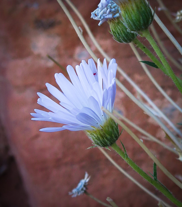
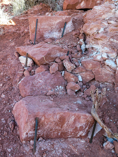
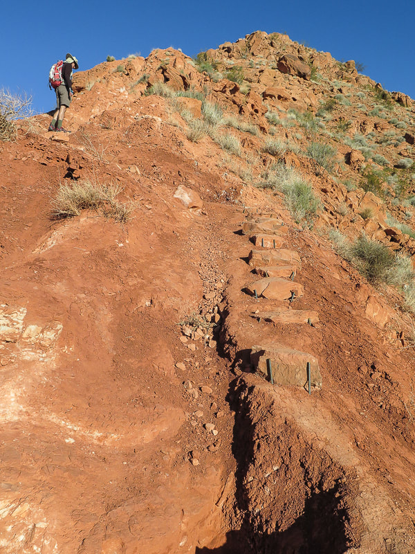
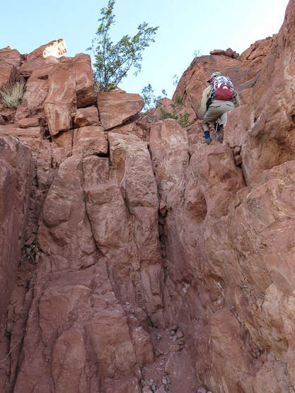
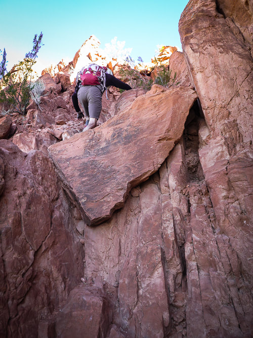
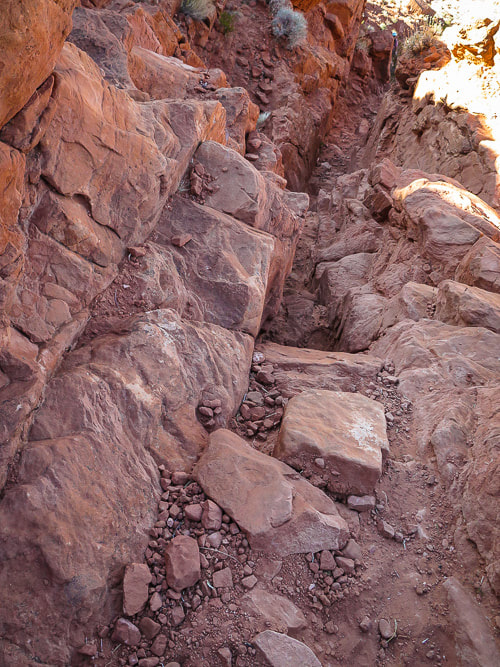
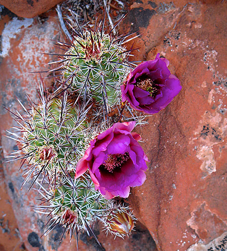
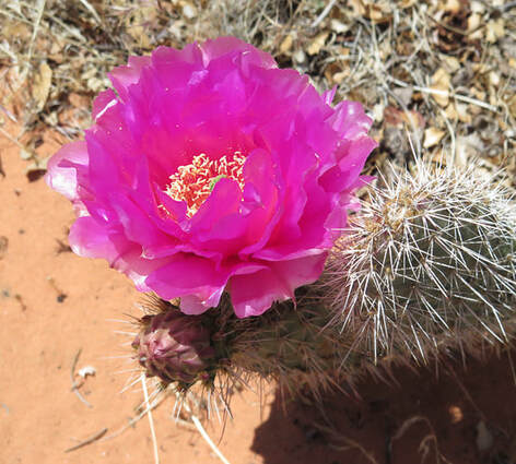
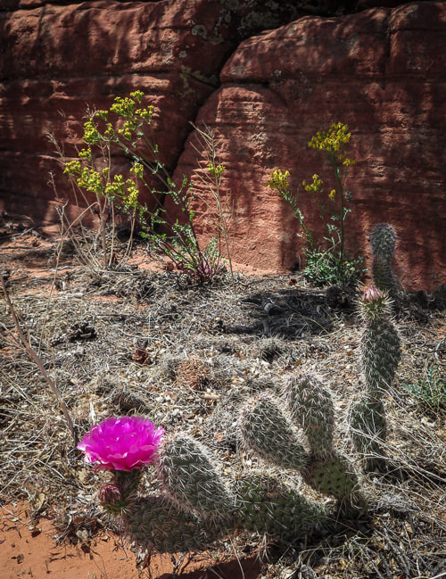
Our Hike (from Ivins trailhead) It looks impossible to climb, but If you can get up the steep side of Red Mountain and maneuver through its short sandstone cliffs to the dune-like pink-orange sand at the top, you will enter into a beautiful and seldom-visited shrub and woodland ecoregion. Most are satisfied to end their hike in this soft sand to see the cities of Ivins and St. George sprawling 1,400 feet below. Very few venture beyond this onto Red Mountain's long plateau made of washes, spires, wildflowers, pinyon pines, junipers, scrub oak and slick rock basins. This is designated as a "primitive" trail; it is not officially marked. If you want to get some mileage in, you must hike pretty much due north, avoiding deep canyons to the west and east. We found saddles and washes to get us to a large sandstone ridge with a faint trail on top and killer views of Snow Canyon State park to the east, where we stopped for lunch. Occasional boot print paths in the sand go a short distance and then disappear; rock cairn trail markers are few and far between. What makes this hike exquisite is that it combines vegetation from both the Central Basin and Range to its north and Mojave Basin and Range to its south, creating a great diversity of flora and fauna. This, along with dramatic views witnessed in solitude makes this hike special. 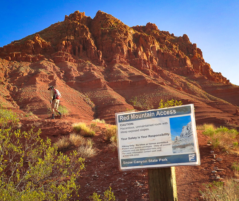 The southern end of Red Mountain A good example of two different rock units: the older Kayenta Formation deposited in large streams at the bottom, and the Navajo Sandstone vertical cliffs and ancient sand dunes deposited mid-slope and on top by wind-carried sand. Initial Climb - 1,400 feet in 0.8 miles The initial climb to the top of Red Mountain from the city of Ivins is nearly 1,400 feet in 0.8 miles. Someone during the past year has expertly placed rebar and other metal posts to hold the fast-eroding slopes in place. Rock cairns mark the initial trail. Fun Class 3 climbing (I say "fun" because there are enough hand-and foot-holds so it's not too scary) is required in two spots mid-mountain to get through its cliff band. The path has a few switchbacks, but mainly climbs straight up. At the top, progress is slowed as you trudge through deep pink sand; then there is suddenly no trail. Junipers, prickly pears, yuccas and manzanita are scattered about in the sand and on sandstone bluffs and ledges. After climbing through the cliff band, a few small spray-painted white dots on rocks direct you to ascend to the right. I think too many people were going up to the left or straight up at this point, so following the route decreases erosion on this very erosion-prone hike. Before you get to the cliff band, look for the rebar-stabilized rocks - that's the trail.
Rebar holding rocks in place on the steep initial ascent
The trail tops out on ridge overlooking Ivins and Santa Clara, Utah (left), and Class 3 climbing (right).
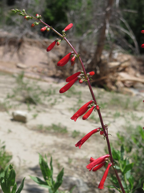
Class 3 climbing through cliff band 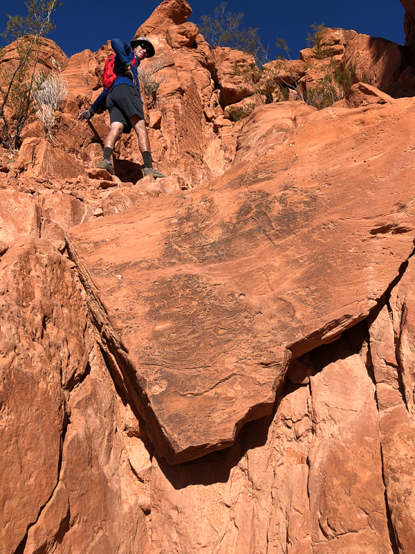 Climb up the left side of this "triangle rock" in the cliff band, about 1/2 way up face of Red Mountain. 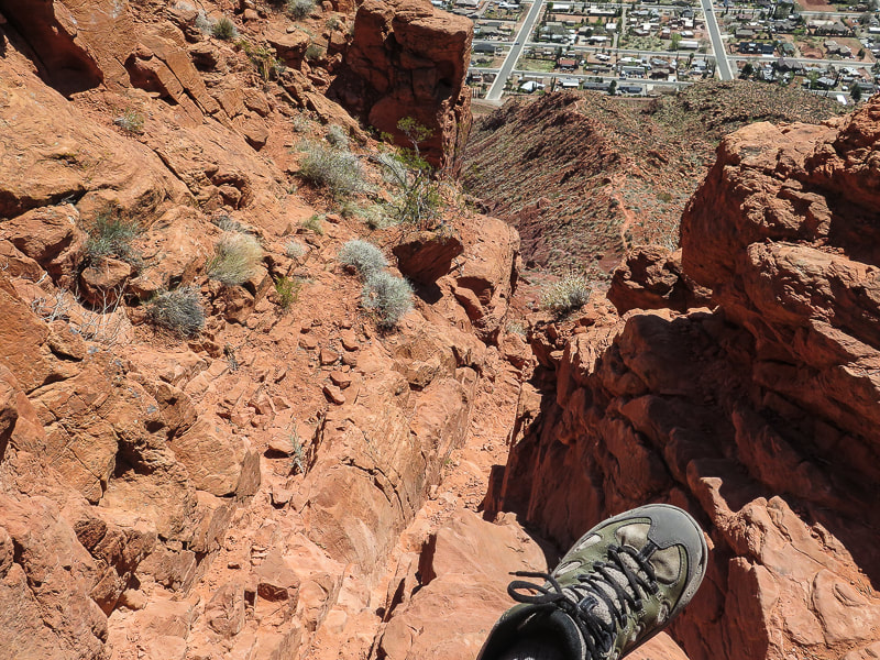 Climb through cliff band: Trail on ridge below Lots of foot and hand holds 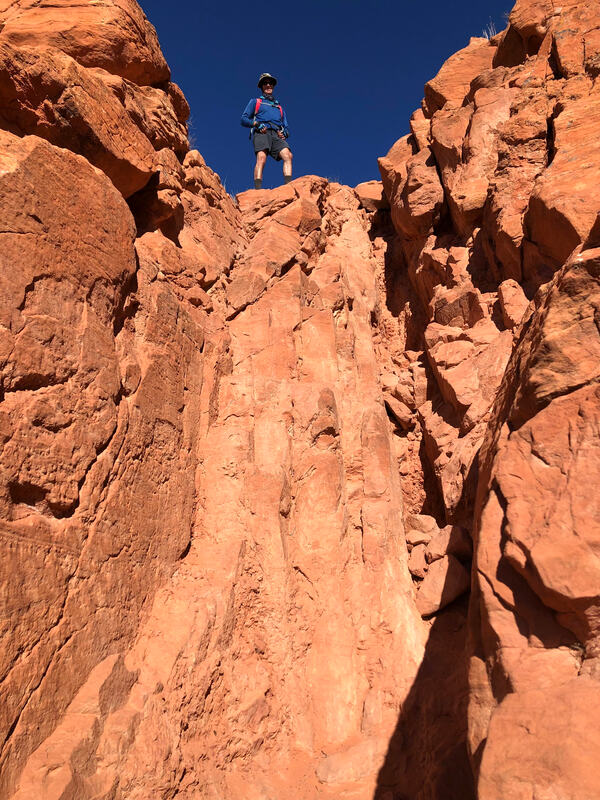 Top of cliff band section 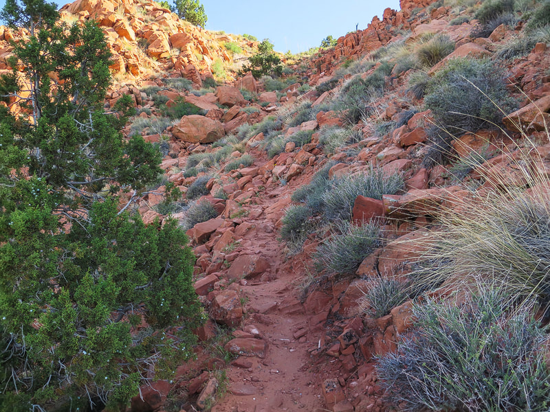 Final climb to top of Red Mountain entry onto its plateau Journey on top of Red Mountain At the entry point onto the plateau, it's a good idea to take note of landmarks around you such as mountains - stay oriented. I also take a waypoint on my GPS. Leaving civilization and steep slopes behind, we entered a colorful and sublime woodland - shrub "ecoregion" filled with manzanita and junipers and started heading north. A high point of sandstone is reached 1/4 mile after entering the plateau, and then a beautiful sandy basin opens up 100 feet below, surrounded with rock piles and small domes. Descend down into the basin through short sandstone steps and shelves, turning from an easterly direction to a northerly direction. This little basin lulls you into it and makes you want to stay and enjoy the complementary colors of sky and sand, of juniper and bright red firecracker penstemon. Once in the basin, we aimed due north for a low, shrub-filled saddle on the horizon; we startled a mule deer that trotted away. We began heading north to this green saddle stretched between red and orange ridges and rock piles. Trudging up soft sand washes, we tried to stay close to the ridge on the right which had amazing views of Snow Canyon State Park's basalt flows and orange sandstone formations. We could see that by venturing too far to the left, we would run into Red Mountain's west cliffs. A slight movement in a shrub alerted us, and then a snake's head poked out. We stood and let it cross the wash in front of us as it gave a cursory rattle; it didn't appear too threatened. Navigating through unmarked wilderness takes more time than following an established trail, as we check topo map and compass a few times. It was not too difficult in this case because the "trail" heads north. The trick is to avoid getting sucked into cliff walls and canyons on the west and find the best way around high points on the east. It's satisfying to be able to figure out a way through unmarked territory, to become more wary of the terrain and to know chances are that where your boot falls, no other has fallen before. 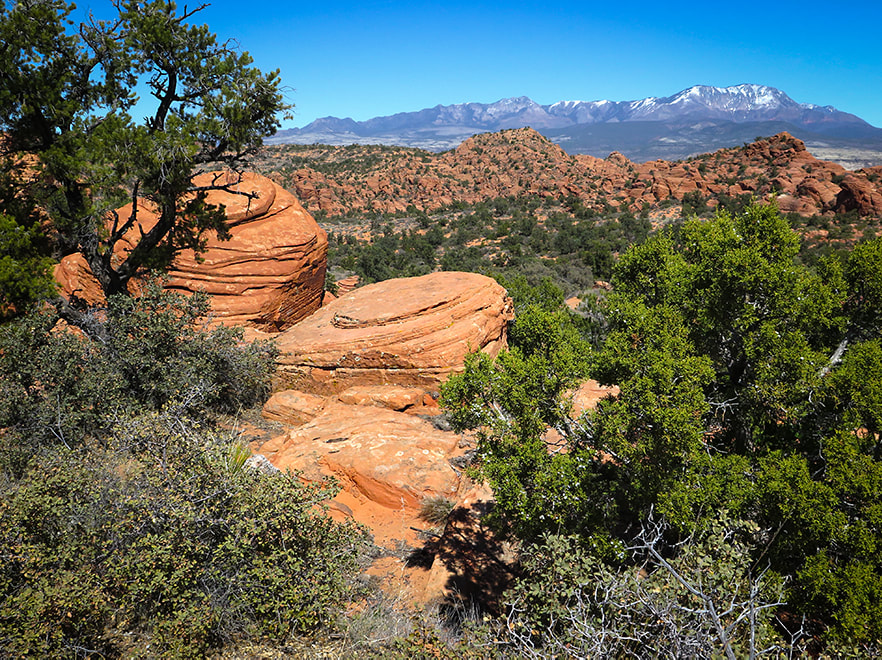 Within 0.25 miles of arriving at top of Red Mountain, reach a rim of weathered sandstone encircling a small sandy basin - head left through basin up saddle to the north. Pine Valley Mountain Wilderness on horizon to the northeast (Burger Peak, 10,320'). 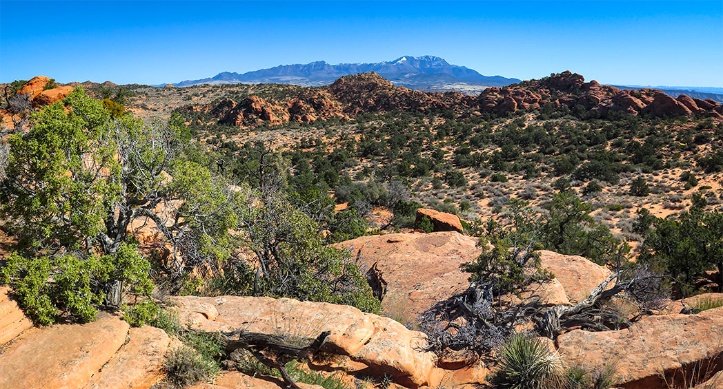 After topping off on plateau, reach this sandy basin surrounded by sandstone 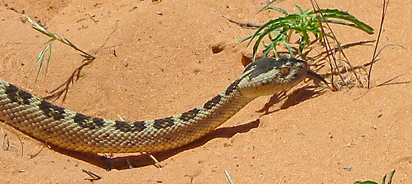 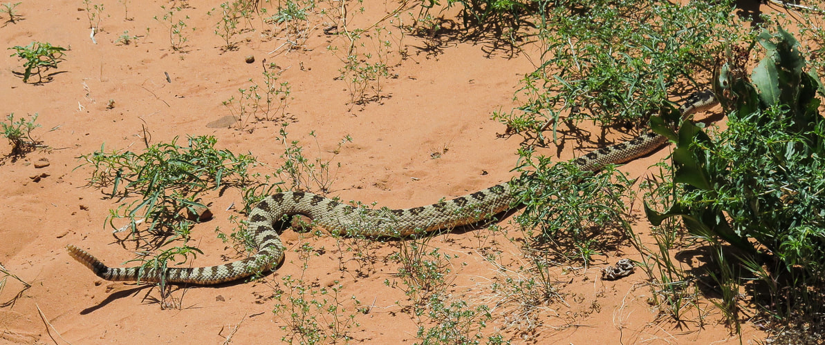
 On the east side of the sandy basin reached shortly after topping off onto Red Mountain. Aim toward the light-green shrub covered saddle on the horizon.
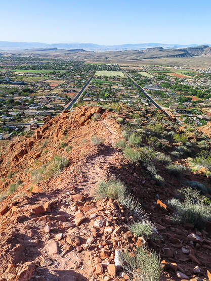
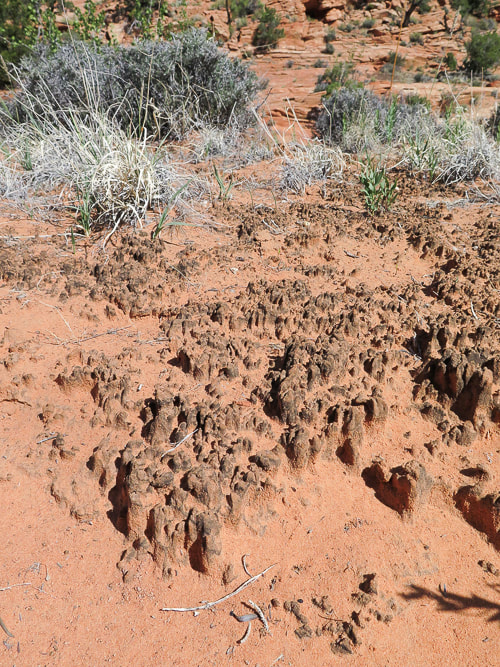
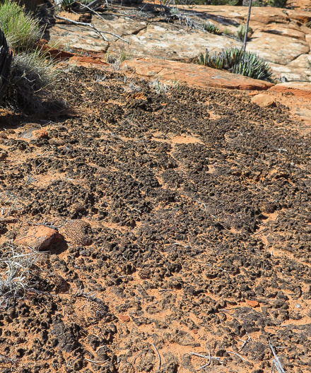
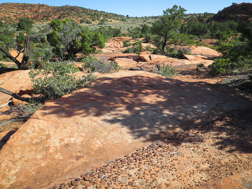
Cryptobiotic (biological) soil crusts, made of cyanobacteria, lichens and mosses. These form on easily eroded soils and increase stability and help provide more water infiltration and are the dominant source of nitrogen in pinyon-juniper ecosystems. These crusts hold the soil in place. Recovery of crusts that have been destroyed takes at least 45 years. 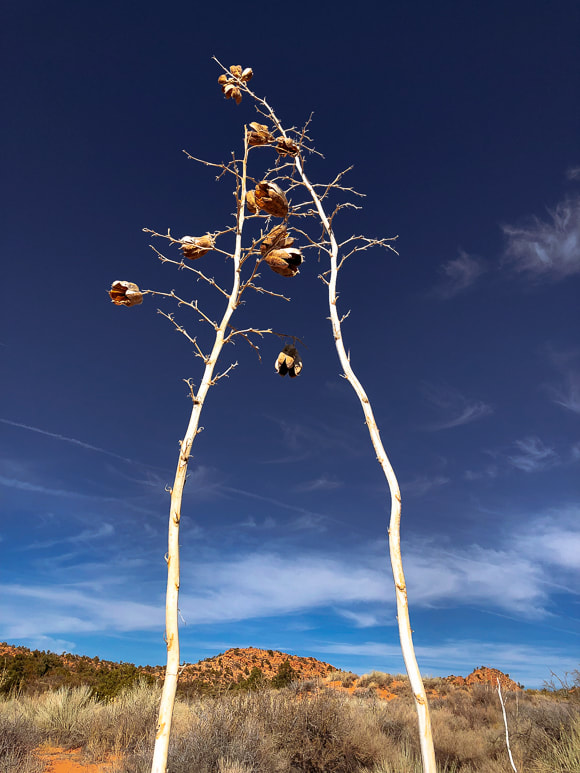 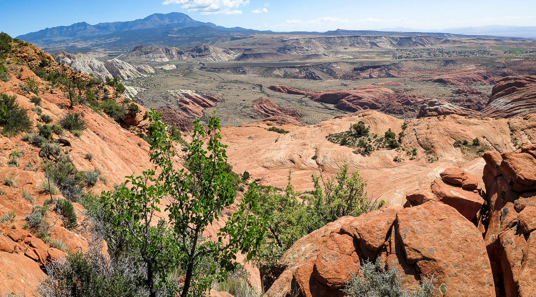 One of the first views of Snow Canyon State Park from ridge of Red Mountain primitive trail. Once we ascended the "green" saddle, we stayed to the right, avoiding slickrock basins to the left. We saw a faint trail that ascended through a beautiful steep-sided arroyo and followed it out onto a rocky hillside. This wash had funneled hikers and created a more defined trail at its head, where we negotiated a few rolling rock hills and topped off on the ridge overlooking Snow Canyon State Park where a few faint trails were present. Pinyon pines became more prevalent at we approached 5,000 feet elevation. A thorough look at Red Mountain Trail's 11-mile north/south traverse on Google Earth shows that there is no defined trail to follow on its southern end. However, a defined 2-track trail coming from Red Mountain's north trailhead can be seen. We ended our 3.6-mile hike on the ridge overlooking Snow Canyon, with a view of Red Sands Trail, a sandy wash that is part of the Padre' Canyon loop hike. Looking at Google Earth, I can see that the 2-track coming from the north can be reached through slickrock basins further to the left/west of our route, avoiding some of the high points along the ridge. Future goal: hike the entire 11-mile Red Mountain Trail. 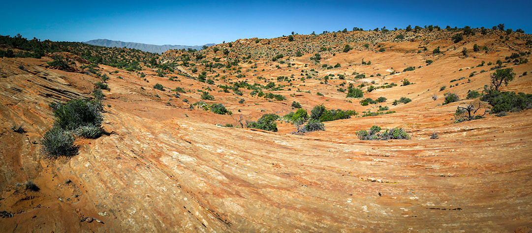 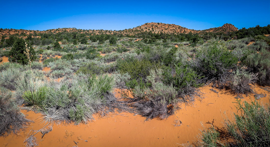 Once over the initial saddle, more washes and shrubs to traverse. Head north through a network of washes and shrubs to rock saddle between two high points on the horizon. 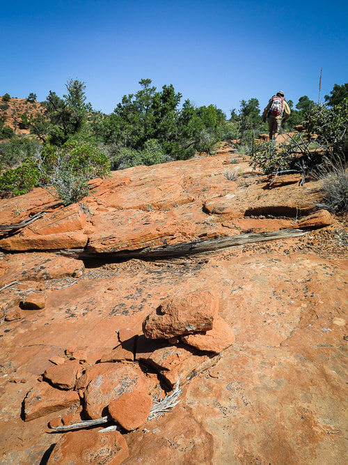 One of the few rock cairns along the way 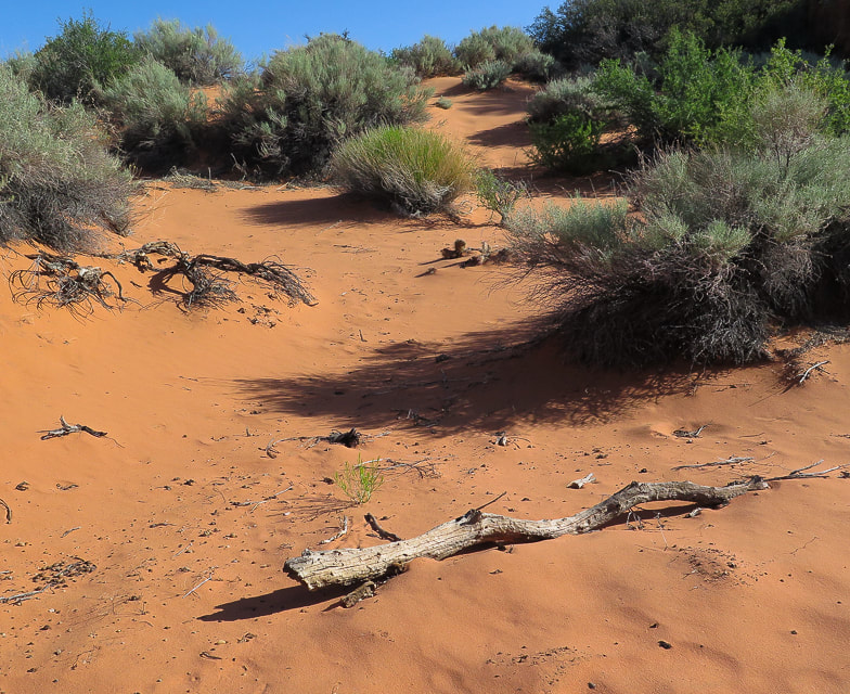 Finding a route through soft sand 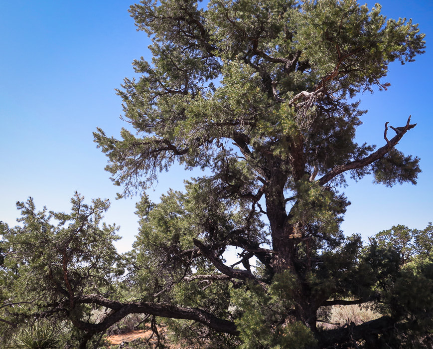 A beautiful example of a Pinyon pine  Small canyon to hike through between open areas. 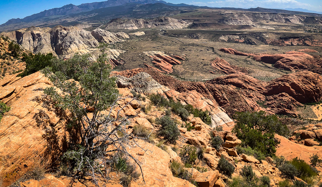 Lunch break view of Snow Canyon State Park and Pine Valley Mountain Wilderness on horizon Basalt flows fill sandstone valleys 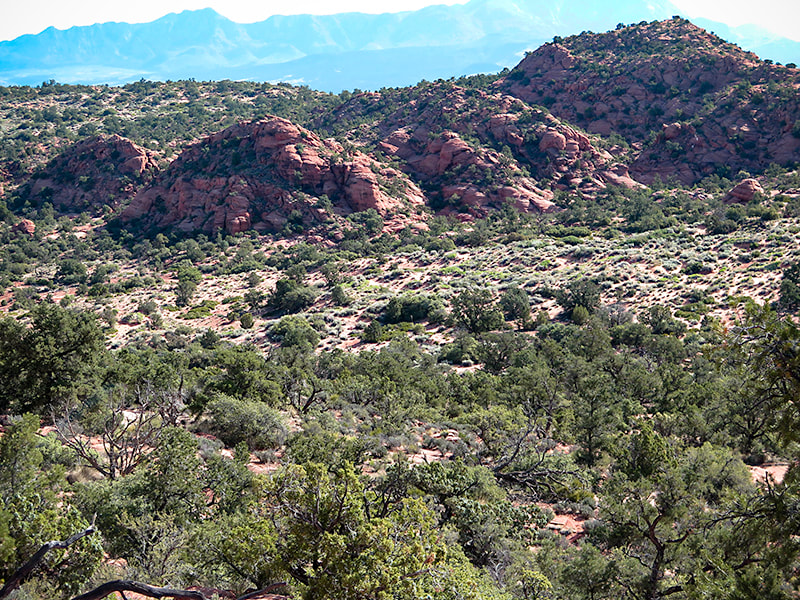 Jurassic sand dunes on top of Red Mountain Turnaround - return to Red Mountain Trail trailhead in Ivins Our lunch rock was elevated 1,550+ feet above the dramatic terrain of Snow Canyon State Park. The red and white Navajo Sandstone is cross-bedded and vertically jointed - remnants of ancient sand dunes. Water has cut valleys that were filled in much later with black basalt flows from the northeast. Looking to the northeast horizon, we could see Burger Peak in the Pine Valley Mountain Wilderness, elevation over 10,000 feet - a peak we climbed last year. Elevated above the surrounding desert, we had an airy 360-degree view. The sandstone we were sitting on was warm from the day's unobstructed sun. We used GPS to track back and use a waypoint to reach the sand dunes at the opening of the steep trail onto the plateau, overlapping our ingoing tracks a few times. The sun had warmed the orange-pink fine sand. I watched a fly, or was it a bee, or maybe a "bee-fly" with a long black proboscis collecting nectar from a yellow flower. It kept a connection with the flower as they both swayed back and forth together in the breeze. In full sun on the west side of Red Mountain, we made it through the Class 3 section, climbing down through the rocks backward and finding enough foot- and hand-holds on grippy sandstone layers. The square houses and street grid of the flat valley below are such a contrast to the irregular and varied shapes on Red Mountain. Back to busy civilization from the serene and beautiful world atop Red Mountain. An added bonus to this hike: buy a thirst-quenching drink from a turquoise-painted refrigerator with the red words, "Cold Drinks" at the side of the house next to the trailhead. That is among the many things to look forward to on this adventure. 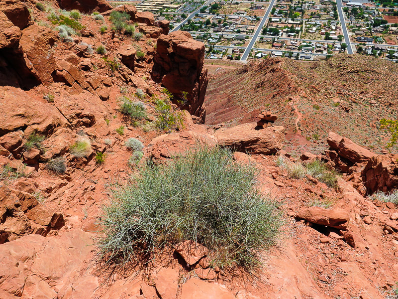 Back to civilization: Descending cliff band of steep side of Red Mountain overlooking Ivins 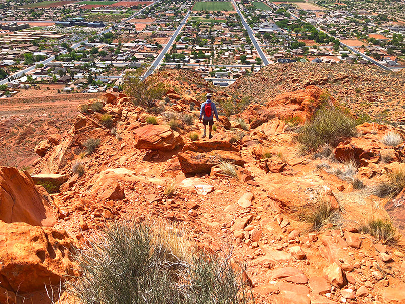 Descending to trailhead at Ivins.  Cold Drinks at southern trailhead - just deposit 25 cents for water and $1.00 for energy drinks!!  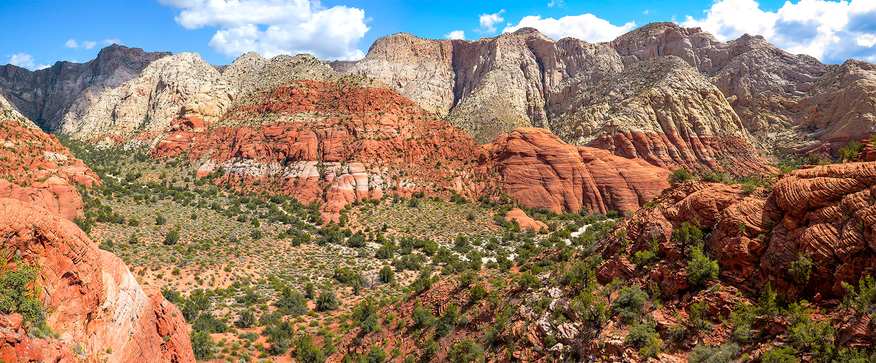 Snow Canyon State Park, Utah 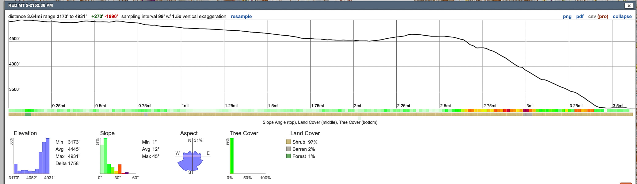 Elevation and distance profile of our hike from top point back to trailhead. We gained almost 2,000 feet total in 3.65 miles. 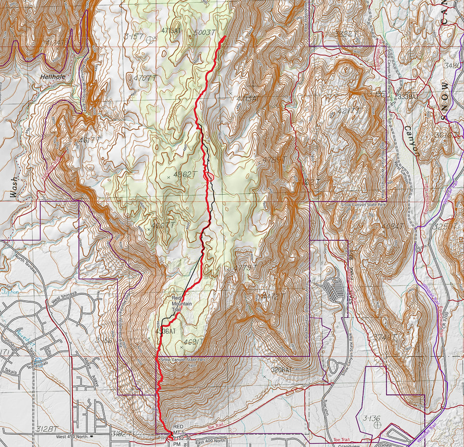 Our hike (red line) on southern portion of the Red Mountain Trail from Ivins, Utah. 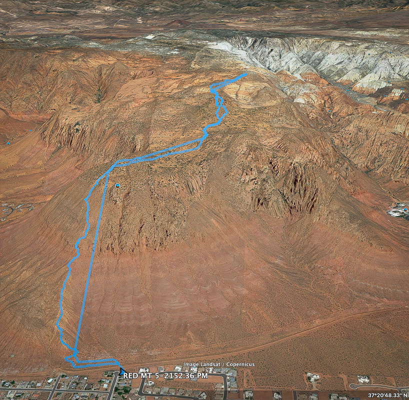 Google Earth image of our GPS tracks from southern Red Mountain trailhead in Ivins, Utah . Resources:
Bugden, M. Geology of Snow Canyon State Park Cryptobiotic Soils: Jayne Belnap. Holding the Place in Place - USGS: Impacts of Climate Change on Life and Ecosystems. Red Mountain Wilderness Maps - Wilderness Connect Ecoregions of Utah - usgs.gov Geologic Map of the St. George and East Part of the Clover Mountains 30' x 60' quadrangles, Washington and Iron Counties, Utah. Biek, R.F., and others. USGS publications. Miller, R. Our Geological Wonderland: Snow Canyon State Park Mojave Desert Tortoise - Nevada Fish and Wildlife Service
2 Comments
|
Categories
All

Sue and Fred

About this blogExploration documentaries – "explorumentaries" list trip stats and highlights of each hike or bike ride, often with some interesting history or geology. Years ago, I wrote these for friends and family to let them know what my husband, Fred and I were up to on weekends, and also to showcase the incredible land of the west.
To Subscribe to Explorumentary adventure blog and receive new posts by email:
Happy Summer!

About the Author
|