|
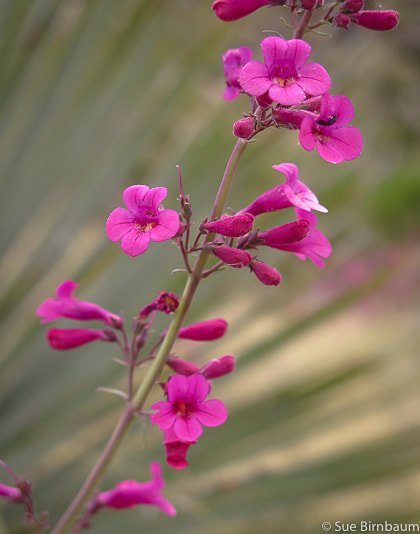
Hike through beautiful Upper Sonoran chaparral ecosystem to a distinguished Tucson landmark with steep rock chutes in the Santa Catalina Mountains. Related: Tucson Mountain Tour: Golden Gate Mountain, Point 3380, Little Cat Mountain Cat Mountain - Tucson Mountain Park Elephant Head Peak - Santa Rita Mountains Desert Plants Breakfast Ridge via Sabino Canyon 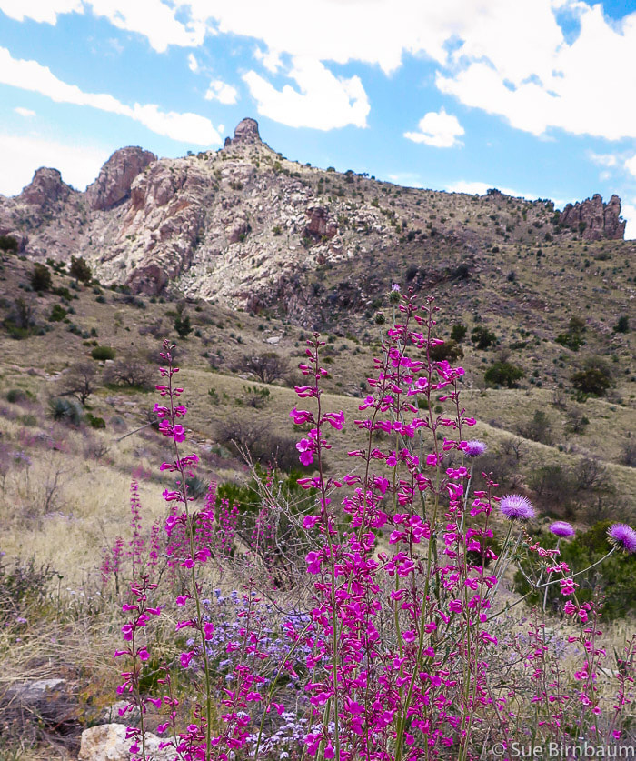 Thimble Peak with penstemon and native thistle Pusch Ridge Wilderness - Santa Catalina Mountains - Tucson Trip Stats
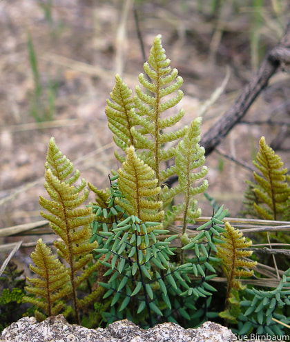
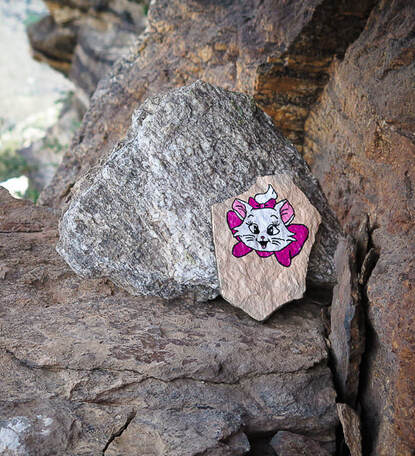
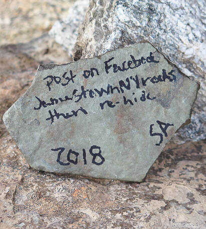
Overview: Scenic ramble through oak and juniper woodlands studded with yuccas and penstemon via Sycamore Canyon to the northeast side of Thimble Peak, requiring a Class 3 - 4 scramble to summit. Some off-trail navigation is moderate with trail well-marked with cairns the entire distance. Thimble Peak is a well-known landmark easily seen from Sabino Canyon trails and Bear Canyon which also provide approaches to the summit. Distance: 10.8 miles round-trip. Elevation gain: Thimble Peak = 5,323', Hirabayashi trailhead = 4,847'. Total elevation gain round-trip = 2,500 feet, including the 670-foot climb on the way back to Shreve Saddle. Coordinates: Thimble Peak: 32°20'14"N 110°46'26"W Maps: Pusch Ridge Wilderness, Coronado National Forest, USDA Forest Service, and Green Trails Maps #2886S - Santa Catalina Mountains. Difficulty: Moderate on Class 1 trails, Experience with navigation off-trail, Class 3-4 climbing summit block with exposure. As of April 2019, a steel ladder is placed on the last wall of climb up main Thimble summit. Climbers/hikers who opt out of the highest part of the summit can still climb the more accessible and less daunting lower rocks using a different cleft located to the east of main cleft. Considerations: Water crossing at Sycamore Creek may be deep in early spring. Bring a good topo map. Dogs not allowed in the Pusch Ridge Wilderness (boundary at Shreve Saddle). Another great blog post for reference: Earthline: The American West - Thimble Peak and Pretend Thimble from Hirabayashi Trailhead. 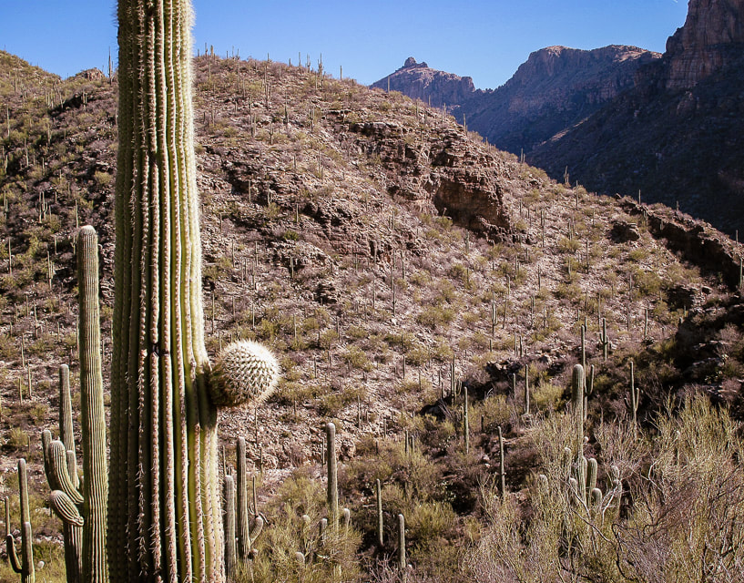 Thimble Peak on horizon. 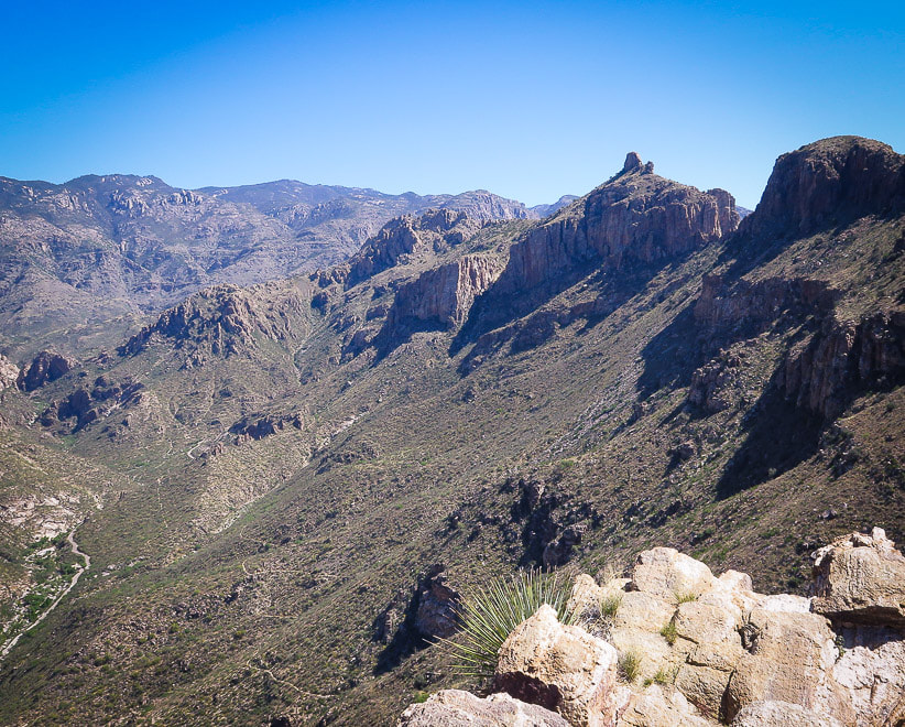 Thimble Peak (second peak from the right), a prominent landmark seen from Sabino Canyon Trail (far left) and Phoneline Trail (faint, winding trail on slope under ridge). We hiked to Thimble Peak from the opposite direction and approached it from "behind". 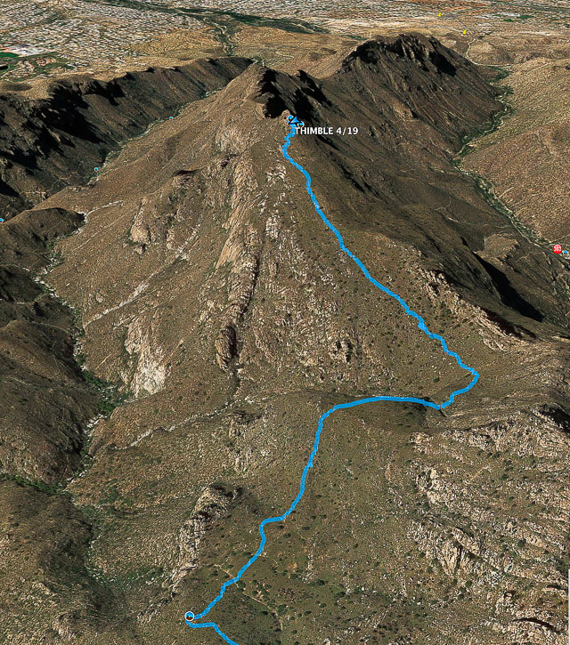 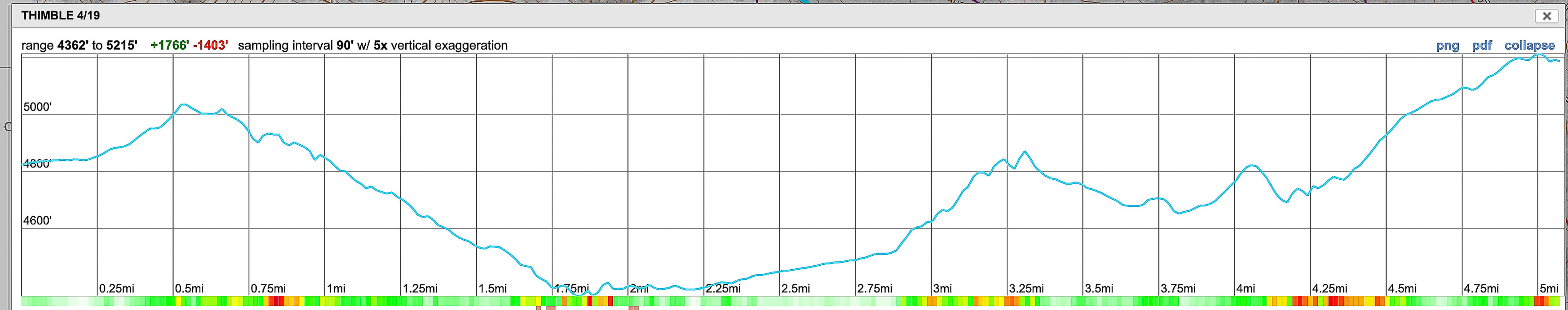 Final approach to Thimble Peak on the section that turns off of Bear Canyon Trail Elevation profile from 0.4 miles from trail head to peak. Bear Canyon to the left (southeast), Sabino Canyon to the right (northwest), Blacketts Ridge upper right. Full GPS tracks map below Our Hike On a warm and lush April day in Tucson, Scott, Fred and I hit the trail to Thimble Peak with two main goals: summit the peak via a climbing class 4 vertical crack, and leave upon it a rock that we had found on Pinto Mountain's summit in Joshua Tree four months earlier. The rock, painted with a cartoon image of a cat, belongs to the Jamestown Kind Rocks Project, whose goal is to "promote random acts of kindness to unsuspecting people by painting and dropping inspirational rocks or some other cool way to bring kindness." Scott had found it in Pinto's summit register box and kept it. Now it was time to pass on the kindness. 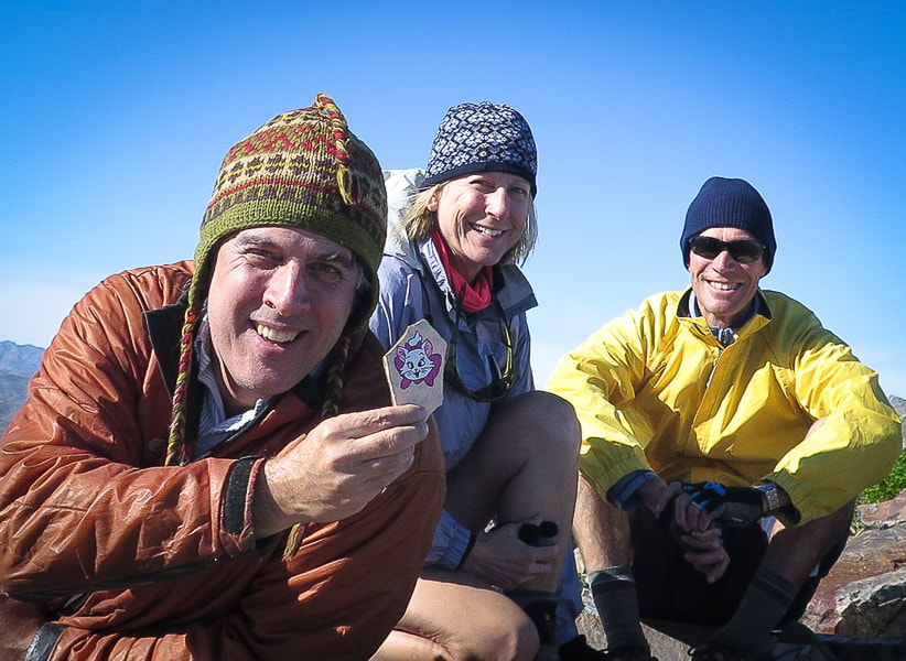 Scott, Sue and Fred on Pinto Mountain summit in Joshua Tree, December 2018 Rock from Jamestown Kind Rocks Project Pinto Mountain Hike "Lush" and Tucson don't normally go together in the same sentence, but as I stood at four different high-points overlooking the Tucson basin a few weeks ago, a carpet of forest green spread below. Tucson received above average rainfall this past winter and spring, and now the wildflowers were robust and plentiful, bursting with buds and flowers. All of the space atop each prickly pear cactus leaf pad was filled to maximum capacity with new flower buds. This ramble through juniper and oak was colored with the purples, pinks, reds, and oranges of penstemon, globe mallow, thistle, and pink fairy duster.
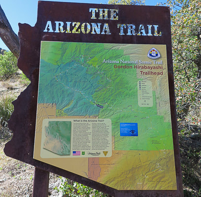 Sign at Gordon Hirabayashi trailhead. This hike initially follows the Molino Basin Trail #11 to the Sycamore Trail #39 which is part of the Arizona Trail. 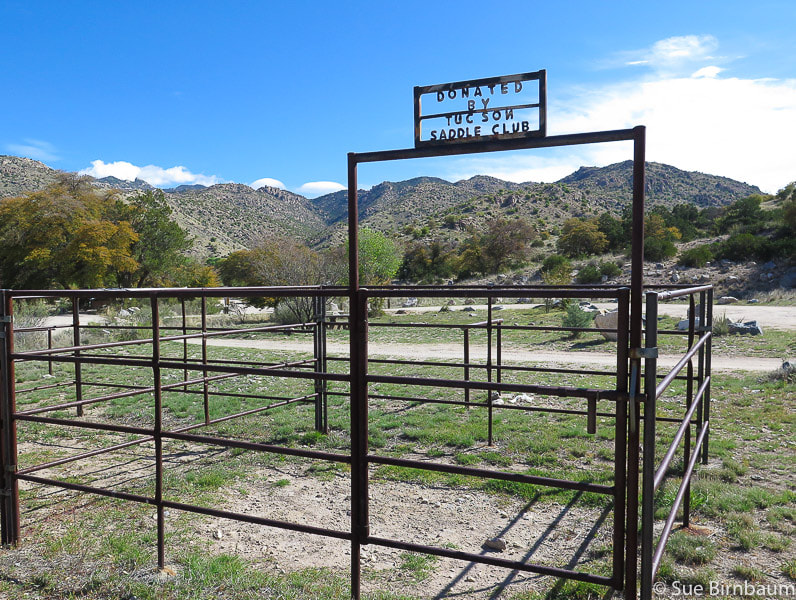 One of the horse corrals at the end of the road to Gordon Hirabayashi Recreation Site. Trailhead parking near this turn-around. From the Gordon Hirabayashi Trailhead we hiked west and quickly came to our first intersection with Soldier Canyon Trail #53 and the remains of the Tucson Federal Prison Camp that housed Japanese Americans during WWII that built the Catalina Highway (Sky Island Scenic Byway). In the next few miles, we saw the remains of structures: foundations and rock towers in Sycamore Canyon that may have been used to hoist pipes for the water supply to the camp from Sycamore Reservoir below. From the intersection, the sandy and wide trail to Shreve Saddle is pleasant with a subtle beauty, with just the right mix of bunch grasses, oaks, yucca, manzanita and juniper - the Upper Sonoran Life Zone that includes oak woodland and chaparral. The top of Shreve Saddle seems to hang on the horizon; as the trail reaches it, an expansive view westward of beautiful Sycamore Canyon and ridges and peaks of the Sabino Canyon area opens up. A sign for Sycamore Reservoir Trail #39 indicates the trail descends Sycamore Canyon on the left (south) side. At this point the trail enters the Pusch Ridge Wilderness; it feels like wilderness except for a few prisoner-constructed cemented rock towers. Further down the trail, a bedrock grinding mortar sits on a high, smooth boulder next to the trail, evidence of ancient peoples' production of mesquite and palo verde seed pods and other plants. These represent an important food resource for prehistoric people, and also sites for social interaction. 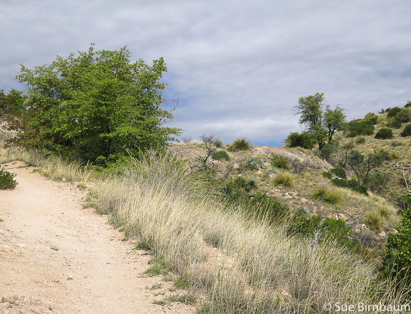 Shreve Saddle and Pusch Ridge Wilderness boundary, about one mile from trailhead 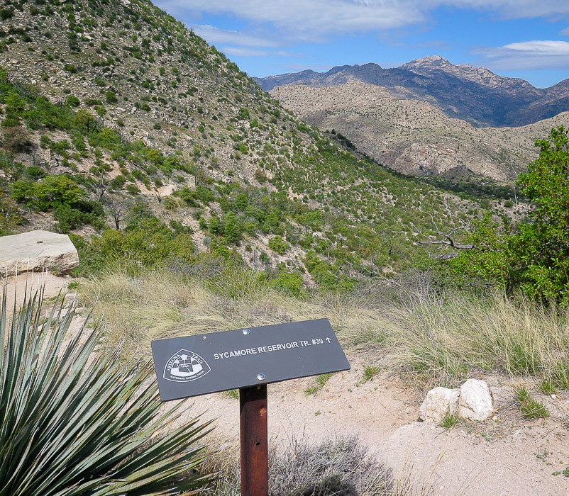 Top of Shreve Saddle looking west. Follow this trail to bottom of canyon, ~ 1 mile. 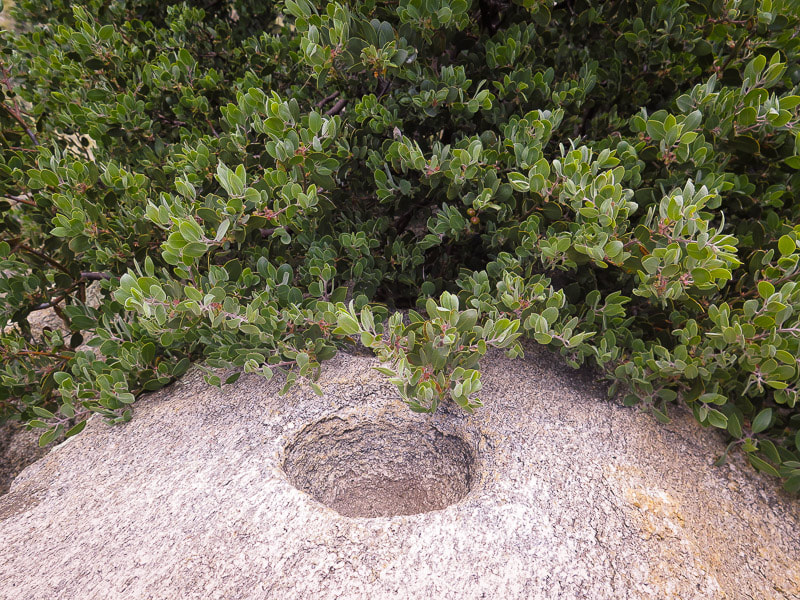 Bedrock mortar (mortero) and manzanita Native Americans in the Santa Catalina Mountains that may have created this for grinding seeds and pods are the Cochise who inhabited the area 8,000 years ago, or the Hohokam who were farmers. These inhabitants were replaced by the Pima and Tohono O'odham Indians. The descent from Shreve Saddle to Sycamore Reservoir is one mile through a perfect balance of views, beautiful chaparral vegetation, and occasional sparks of color from wildflowers as it gently lulls you to Sycamore Creek. It's great to descend, but the knowledge that you will have to make up for this pleasure on the way back– in this case, a 600- foot climb out of the canyon after a summit hike is an added challenge. Luckily, we had drifting clouds that created an ever-changing landscape of shadows and light on the mountains ahead. 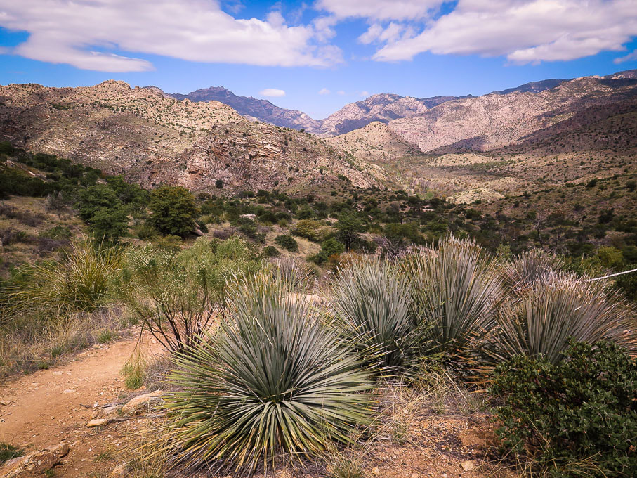 Descending from Shreve Saddle through the lovely Upper Sonoran zone of oak woodland Sycamore Canyon looking west  Sycamore Canyon bottom From the bottom, trail heads to the right (northwest) along Sycamore Creek A large rock cairn sits near the sign at the bottom of Sycamore Canyon. For a short side trip, turn left and check out the remains of Sycamore Reservoir and the impressive rock dam wall. To continue onto the trail to Thimble, turn right (northwest) at the sign and rock cairn (as you face the reservoir) and walk through the shade of towering trees and along the banks of the creek toward the northwest. The trail is marked by rock cairns. From this intersection, it’s a 0.6-mile walk along the north side of Sycamore Creek to a large rock cairn marking the “v” intersection where a well-marked trail that goes to the left short-cuts onto Bear Canyon Trail. Take the left. Our boots didn’t get wet as we crossed low-water Sycamore Creek at this intersection. The creek bottom is boulder-strewn, broad and dry. 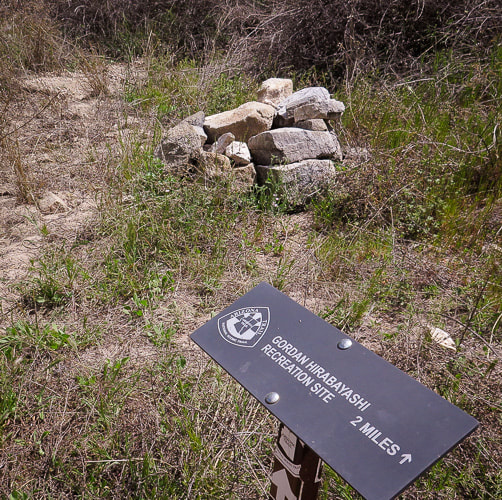 Sign at bottom of Sycamore Canyon Continue to the right (west) past the rock cairn to hike across the sandy wash of Sycamore Canyon 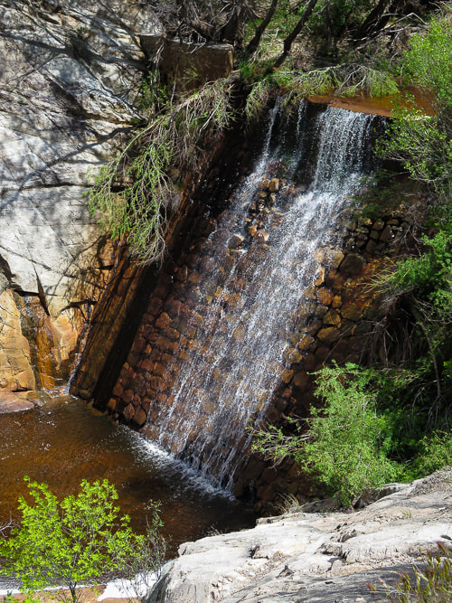 Sycamore Canyon Dam This is a short hike from the sign at bottom of Sycamore Canyon that indicates direction to Hirabayashi trailhead 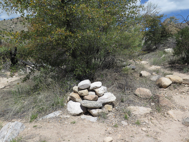 Large cairn marking intersection of spur trail after 0.6-miles from Sycamore Reservoir Turn left (west) here to hike across Sycamore Creek and ascend up a trail marked with cairns that intersects with the Bear Canyon Trail From here, the trail climbs steadily, another 0.6 miles to meet up with the popular Bear Canyon Tail through pretty country of oak and Manzanita and tall stands of fuschia and purple penstemon (in April). A huge green racer skimmed across the trail in front of me and slithered its way up a tree. From the flanks of a an eroded hill, Fred pointed across the arroyo to a huge stand of purple penstemon, looking more like a shrub than a perennial forb. At the "t" intersection, turn left (south) onto Bear Canyon Trail. 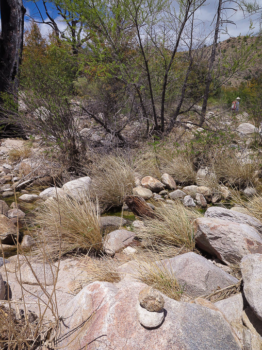 Crossing Sycamore Creek just after large rock cairn indicating intersection of short-cut trail to Bear Canyon Trail. This crossing takes you off the East Fork Trail #39 at this point and then joins up with the Bear Canyon Trail. 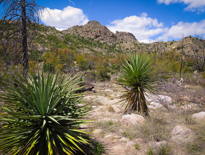 Ascending west to saddle under two buttes on horizon after crossing creek Leading to intersection with Bear Canyon Trail 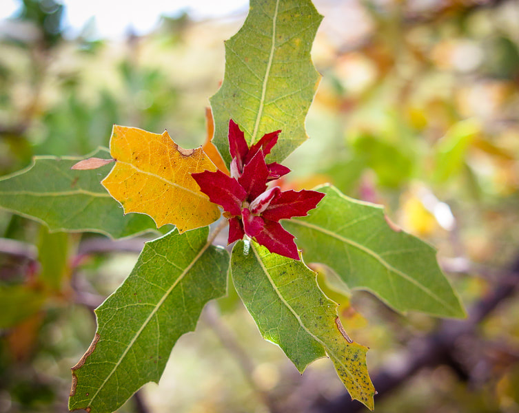 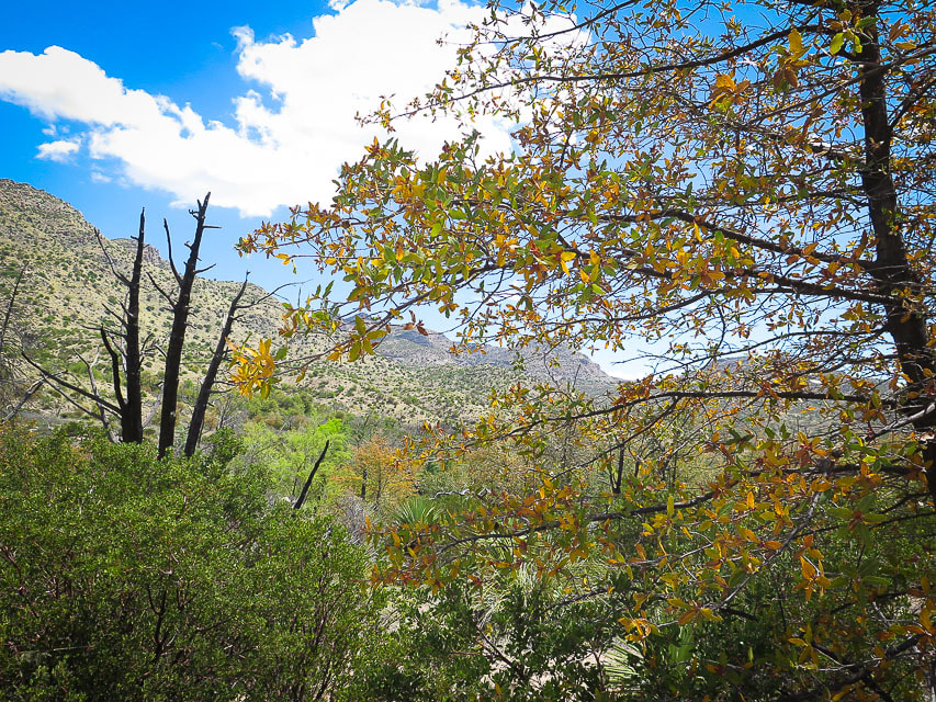 Ascending spur trail toward intersection with Bear Canyon Trail - view northward Once on Bear Canyon Trail, climb up along a gentle grade 0.2 miles to Thimble Saddle at 4,800 feet, turn a corner and finally, the unmistakable shape of Thimble Peak comes into view, 3.7 miles from the trailhead. It looks like, well, a thimble on a long rocky ridge thrust up between two deep canyons. Thimble Flat and the grassy and rocky ascent to the base of its summit can be seen from Bear Canyon Trail. A pile of branches in April 2019 marked the junction of the spur trail to Thimble Peak and Bear Canyon Trail, its purpose to steer Bear Canyon hikers away from the Thimble Peak trail. From the saddle, descend to Thimble Flat and turn right onto the Thimble spur trail right before the Bear Canyon Trail descends steeply into the canyon. 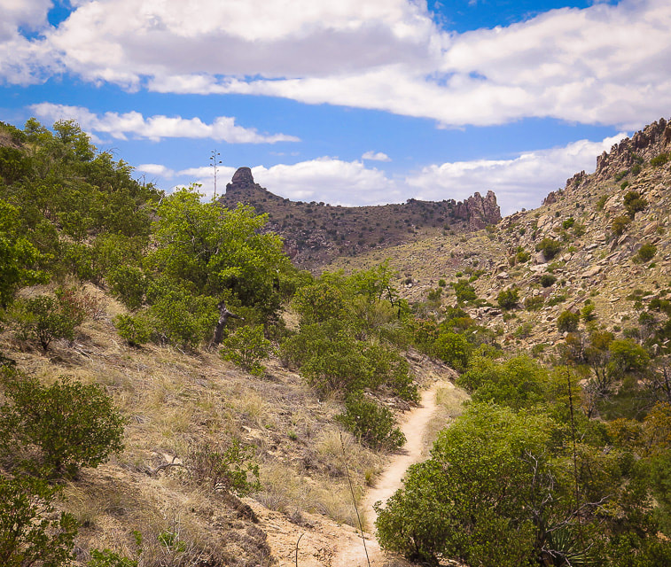 First view of Thimble Peak from Bear Canyon Trail looking southwest, ~ 3.6 miles from Hirabayashi trailhead. 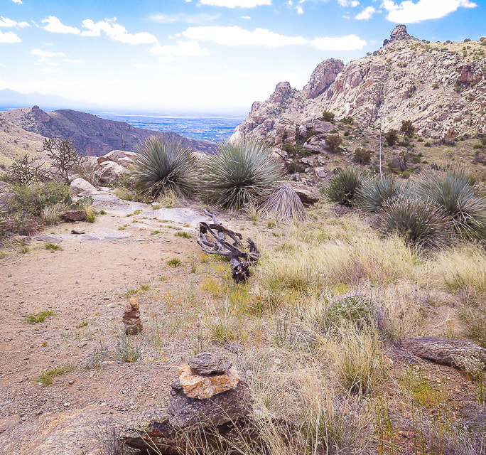 Thimble Flat at 4,700 feet Point where trail leaves Bear Canyon Trail - turn right onto faint trail to walk west/southwest to Thimble Peak, upper right on horizon. Bear Canyon Trail continues to the left and shortly descends steeply into Bear Canyon, seen on the left. Delights abound on this 1.2-mile trail to the base of Thimble. Sharp and toothy yucca leaves contrast with soft, billowy bunch grasses. The light, chunky spires of Thimble Peak seem small compared to the immense dark walls of Bear Canyon and the towering Gibbon Mountain to the east. The trail has just the right steepness as it passes through grass and boulders, and is thin but easy to follow with cairns to mark the way. Reach the base of Thimble at ~ 5.2 miles. Another 110 vertical feet to climb to top of Thimble. 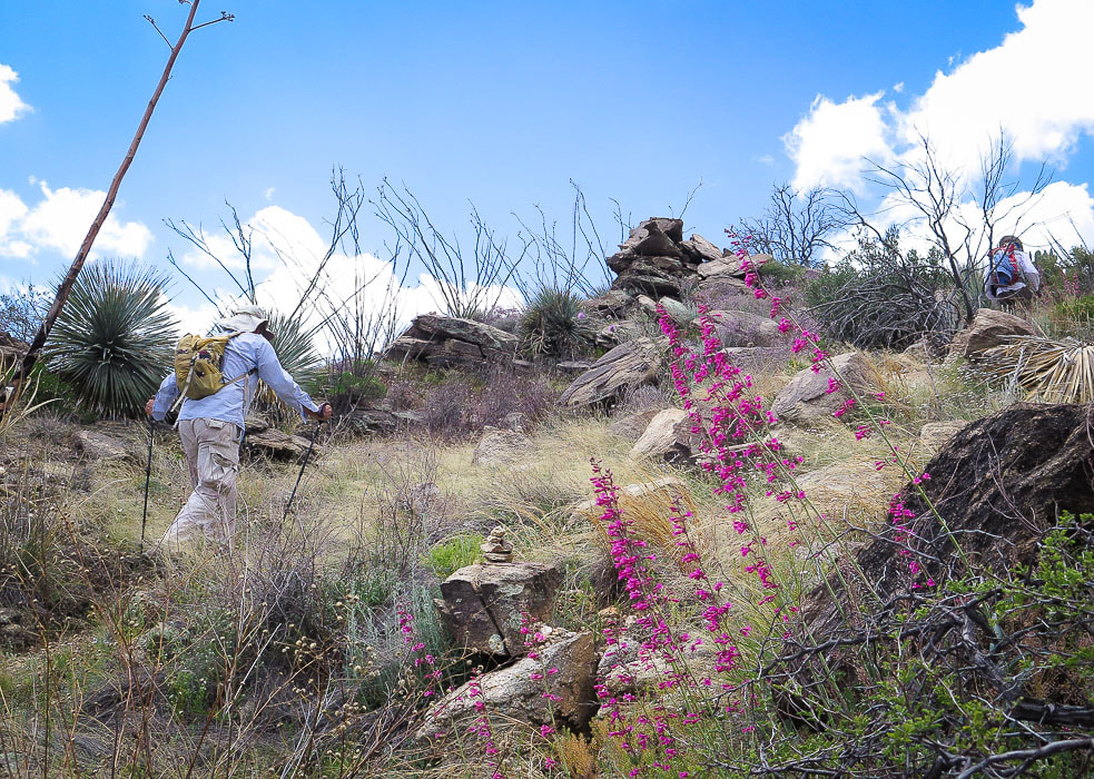 Scott and Fred heading toward base of Thimble Peak 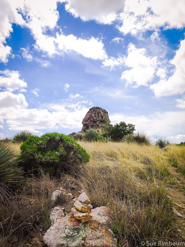 Last approach to the base through grassland, yucca and Arizona Oak Did we make it to the top? Once at the base, walk 70 or so feet to the right (west) to the easily-recognizable cleft with a large boulder imbedded close to the bottom on the north side of Thimble. This is the route to the highest point that includes a Class 4 pitch, according to sources I read. Scott climbed the lower spires of Thimble, its cleft route to the left (east) of the main Thimble approach. He looked across to the highest point and saw the chain ladder that was placed there recently. I found the main rock chute too intimidating from the start; was able to start climbing the second chute, but I didn’t top out. What I would have seen had I made it to the top is, "the full-circle, ridgetop view from Thimble is spectacular...Pusch Ridge, the Santa Catalina Mountains, Tucson, endless sky islands. They are all about. It is heart-rattling to look west, right down the remarkable (and ultra familiar) ridgeline over which Thimble Peak presides: Saddleback, Blacketts, the desert floor,“ according to the blog post from Earthline: The American West. Still, this hike was worth seeing the dramatic perspective of canyons and peaks and the Tucson basin even if I didn't get to the very top. Impressive Rattlesnake Peak which lies to the west is another goal that will have to wait until our next Tucson visit. So, no one in our party made it to the highest part of the summit - but that's o.k. 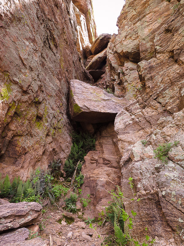 Final Class 4 climb to the western-most and highest summit of Thimble at 5,323 feet. As of April 2019, there is a chain ladder placed at the top where there is a sheer 10-foot wall that otherwise requires a rope. 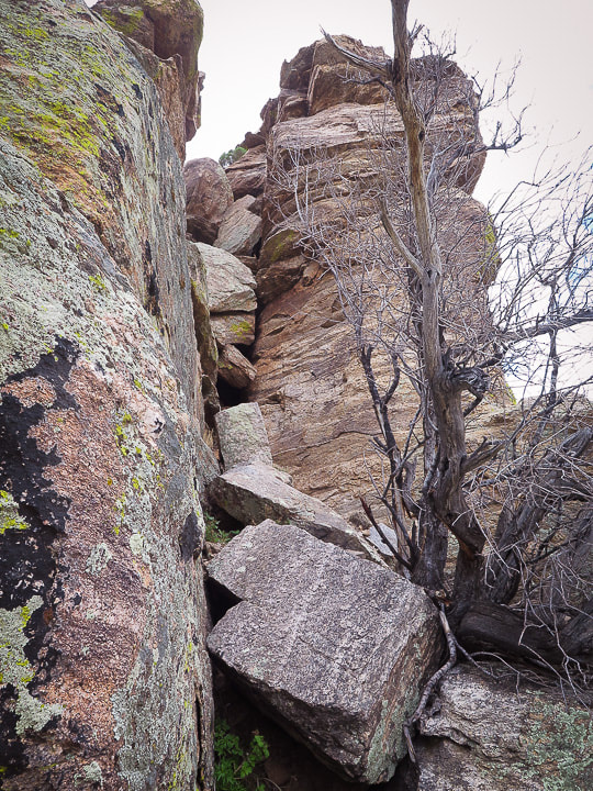 Cleft to lower summit of Thimble (5,310 feet). This is located to the left (east) of the crack that is used to climb to the highest part of Thimble summit (photo above).
Jamestown Kind Rock we found on Pinto Mountain in Joshua Tree Wilderness and now placed on Thimble Peak We hadn't forgotten about the Jamestown Kind Rock painted with a white cat wearing a pink bow. Scott placed it carefully on a rock shelf under a protective overhang, tilting it up so the next Thimble climber would see it. Not only is it a gesture to remind us how important "kindness" is, it also represents the enduring friendship that we three hikers - Scott, Fred and I have. We had found it together four months earlier on Pinto Mountain in Joshua Tree, now together we were placing it on another mountain in hopes that the next discoverer(s) would do the same. I wonder where it is now! We retraced our steps back as the sky was darkening, climbing out of Sycamore Canyon bottom 600 feet up to Shreve Saddle. I tried to find the grinding mortar again, but didn’t. We returned to the Hirabayashi trailhead as rain drops pelted. That night we celebrated with a delicious home-made chicken curry and spring roll dinner with friends as some initial lightning and then a steady rain descended upon Tucson for most of the night. The next morning, clouds hung midway up the Rincon Mountain range as we looked at our goal for that day arising above the clouds – Tanque Verde Peak. Stay tuned for the blog post about the trip to that fabulous summit. We made it to the top of that one! 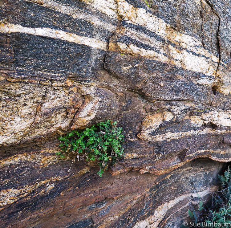 Foliated gneiss - Rocks are beautiful!! 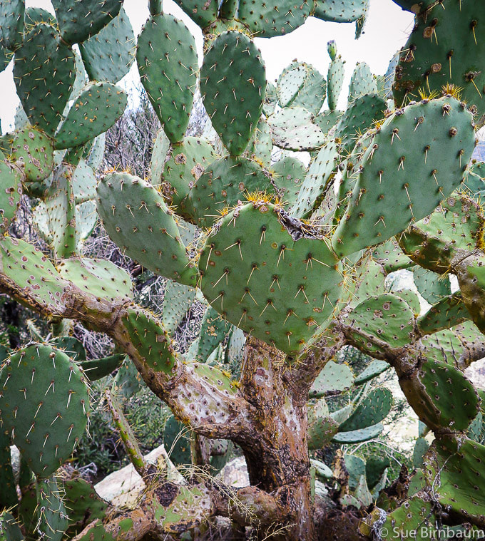 Opuntia - Prickly Pear Cactus This one was huge! 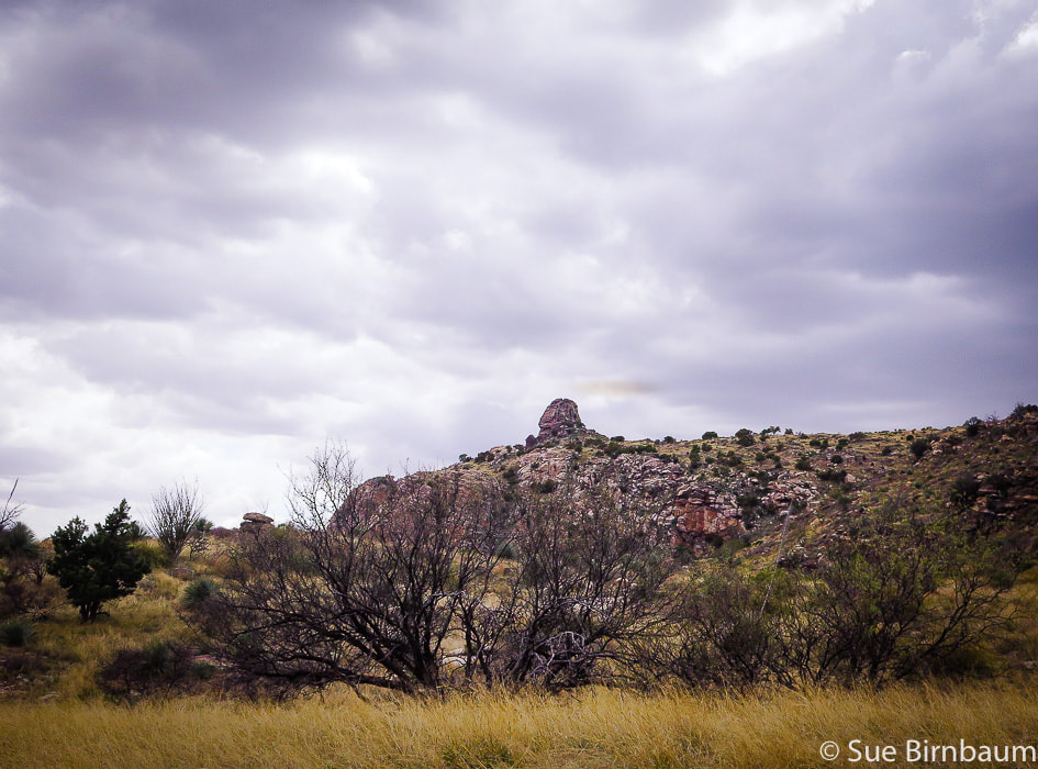 Parting shot of Thimble Peak as clouds quickly moved in. 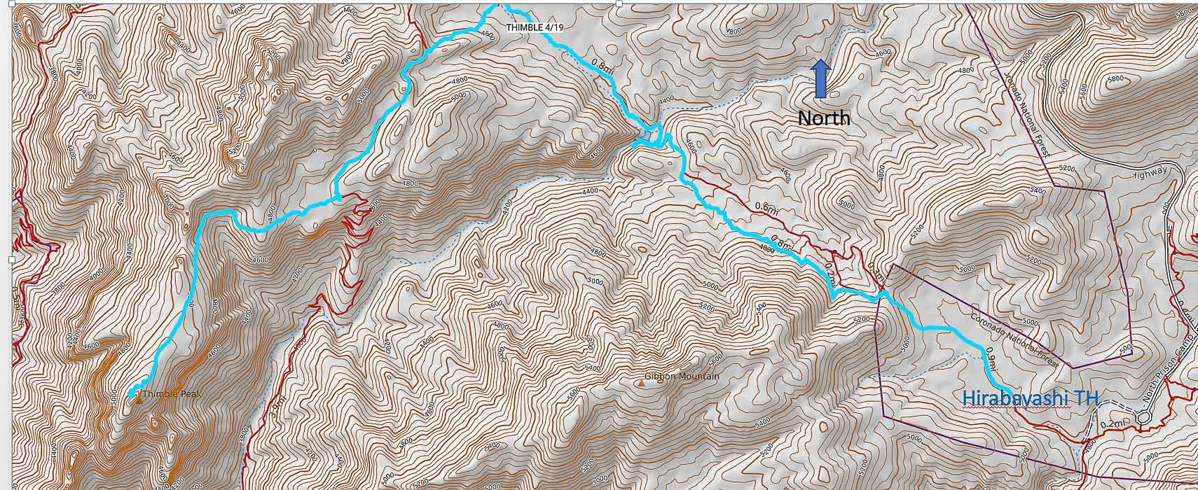 Google Earth image of trail from Gordon Hirayabashi trailhead to Thimble Peak, due west via Sycamore Canyon. Tucson basin upper left in image. Hike Directions
Geology and History
References:
Bezy, John. 2004. A Guide to the Geology of Sabino Canyon and the Catalina Highway. Arizona Geological Survey. http://repository.azgs.az.gov/sites/default/files/dlio/files/nid1526/dte-17_sabino_canyon-red.pdf Dickinson, William R. 1992. Geologic Map of Catalina Core Complex and San Pedro Trough. Arizona Geological Survey, Contributed Map CM-92-C. Kreutz, Doug. 2011. Ancient Grinding Holes Offer Hard Clues to Past. Arizona Daily Star. https://tucson.com/news/local/ancient-grinding-holes-offer-hard-clues-to-past/article_14cbc931-f23c-5aba-9101-779322043849.html LocalWiki: Tucson. Catalina Federal Honor Camp. Taken from internet 5/9/19. Richard, S.M., Reynolds, S.J., Spencer, J.E., and Pearthree, P.A. Geologic Map of Arizona. 2000. Arizona Geologic Survey, Map 35. Sabino Canyon: Our Desert Oasis - Through Our Parents Eyes. Taken from the internet 5/2019. Takami, David. 2/17/99. HistoryLink.org Essay 2070 - Hirabayashi, Gordon K. (1918-2012). Taken from internet 5/9/19.
8 Comments
|
Categories
All

Sue and Fred

About this blogExploration documentaries – "explorumentaries" list trip stats and highlights of each hike or bike ride, often with some interesting history or geology. Years ago, I wrote these for friends and family to let them know what my husband, Fred and I were up to on weekends, and also to showcase the incredible land of the west.
To Subscribe to Explorumentary adventure blog and receive new posts by email:
Happy Summer!

About the Author
|