|
Snowshoe climb to Lucky Peak from Boise River Wilderness Management Area after a March snowstorm.
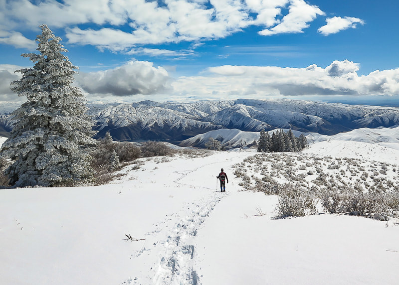 Trekking down from summit of Lucky Peak on southeast ridge Boise National Forest on horizon Trip Stats Overview: This southeast approach to Lucky Peak (AKA Shaw Mountain) begins at the Boise River WMA following a dirt road that travels northwest along creek with burned vegetation from the Mile Marker 14 Fire July 2016. It has less usage and more trees than the Homestead Trail approach from the southwest. It passes an intersection to a road leading to Adelmann Mine, then climbs ridge to the summit. Elk herds and deer often present. Spectacular views of Treasure Valley and Boise National Forest close to Boise. Side trip to Adelmann Mine with historic buildings not far from main road. Difficulty: moderate with no snow; moderate - strenuous with snow. Route-finding skills needed if going off road and onto ridge. Elevation gain: Boise River Wilderness Management Area (trailhead) at 3,624': Lucky Peak elevation 5,904' = ~ 2,280 feet. Lucky Peak Coordinates: 43°36'18.82"N, 116°03'39.98"W. Boise River Wilderness Management Area Coordinates: 43°34'26.7"N, 116°1'18.62"W Map: USGS Lucky Peak quad, 7.5-min series Distance: 7 miles out and back. Directions to trailhead: Boise River WMA is on the west side of ID-21, 6.8 miles from E. Warm Springs Rd. and ID-21 intersection east of Boise. It is a left hand turn to a small parking area with a gate just after Highland Valley Summit if you are heading north. Geology: Granite of Idaho Batholith, Cretaceous age 117 - 62 million years ago. History: Adelmann Mine's primary mineral was gold. Our Hike A good friend commented, after reading my last post on Cervidae Peak, that Fred and I were "lucky" to have Lucky Peak as a training mountain. We've hiked it many times during the 18 years that we have lived in Boise. When we hike "the front side" of Lucky via Homestead Trail, the elevation gain is 3,000 feet and we always try to improve our time. This time we snowshoed what we call the "back side" after a late winter snowstorm. Snow depths varied from a few inches at the trailhead to ~ 12 inches at the summit. A steady breeze from the northwest provided a good headwind for most of the climb. The visibility at the summit was 300 yards, and hard rime ice created by heavy fog coated fir branches and last season's blue-bunch wheatgrass. Fred and I took turns breaking trail through untracked snow. On our way down, the clouds broke revealing a spectacular winter scene with views of the Boise National Forest to the northeast, Lucky Peak Lake to the southeast, and the Owyhee Mountain range to the south. The contrast between the flat, dark Treasure Valley under shifting clouds and the bright white snow of mountains stretching to the horizon was of jaw-dropping beauty, the kind that makes you stop in your tracks. Idaho is an incredible place! 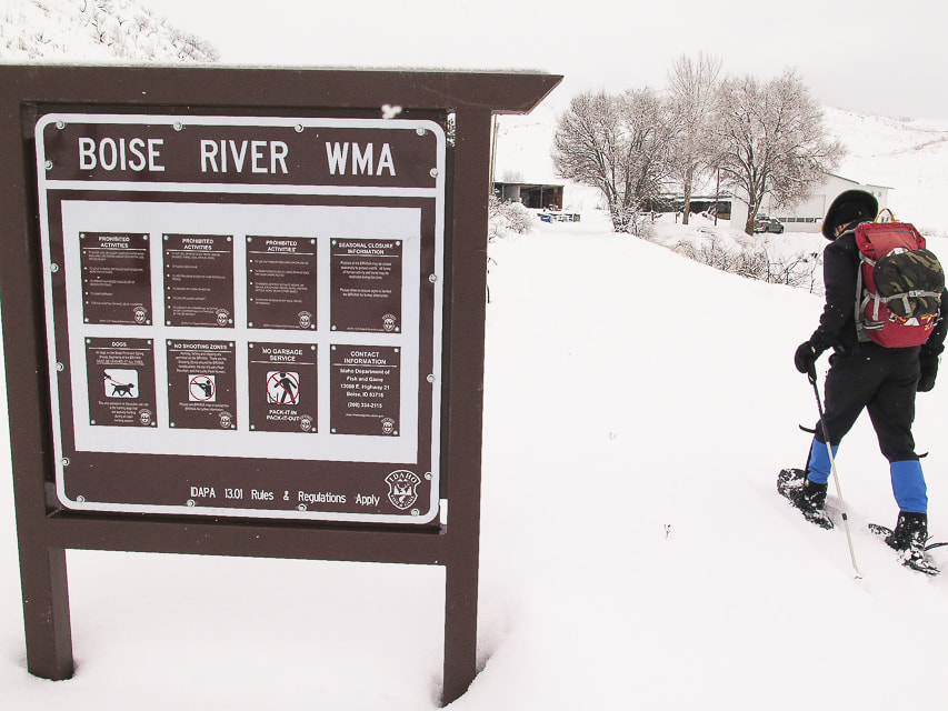 Boise River Wildlife Management Area sign at trailhead at ID Highway 21  Fred at start of ridge climb, 2 miles from trailhead, after intersection with trail to Adelmann Mine. 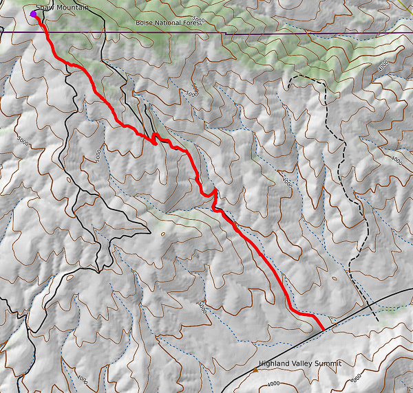 GPS tracks from WMA Headquarters trailhead on ID Hwy 21 to Lucky Peak (AKA Shaw Mountain) Follow road for 2 miles, then onto ridge to summit. 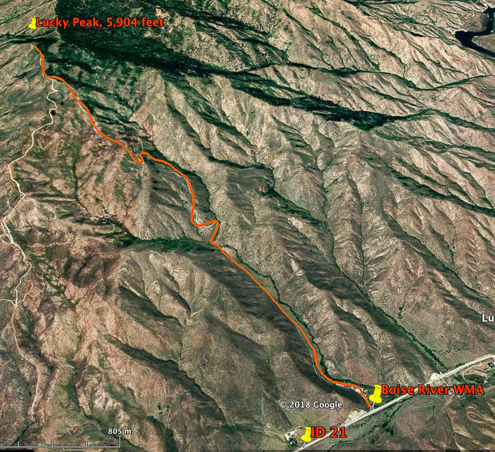 Our route to Lucky Peak (AKA Shaw Mountain) from Boise River WMA on ID Highway 21. This route intersects with Route E. Shaw Mountain Road near the summit (on left). Total hiking distance ~ 3.5 miles to summit with 2,280 feet of elevation gain. This trail begins at the Boise River WMA buildings, following an often-muddy road in a northwest direction, with the tree line of Lucky Peak coming into view in about .5 miles. It crosses a creek, then begins a steep climb for 1 mile to the intersection of the road that leads to the abandoned buildings of Adelmann mine. At this intersection, take the road to the left for a short climb to a ridge overlooking the valley to the south. The road continues to the northwest and can be followed to the summit; it's here that we get off the road and take the more direct ridge route, beginning at two log stumps and a "No Motor Vehicles" sign. We gain the ridge where the snow is wind-blown and not as deep and follow it towards the tree line on the right. Toward the top, there is an intersection with E. Shaw Mountain Road, marked by a wooden birdhouse. Our route continues on this road to an outhouse with the radio towers of Lucky Peak in view, then a short steep climb to the top. 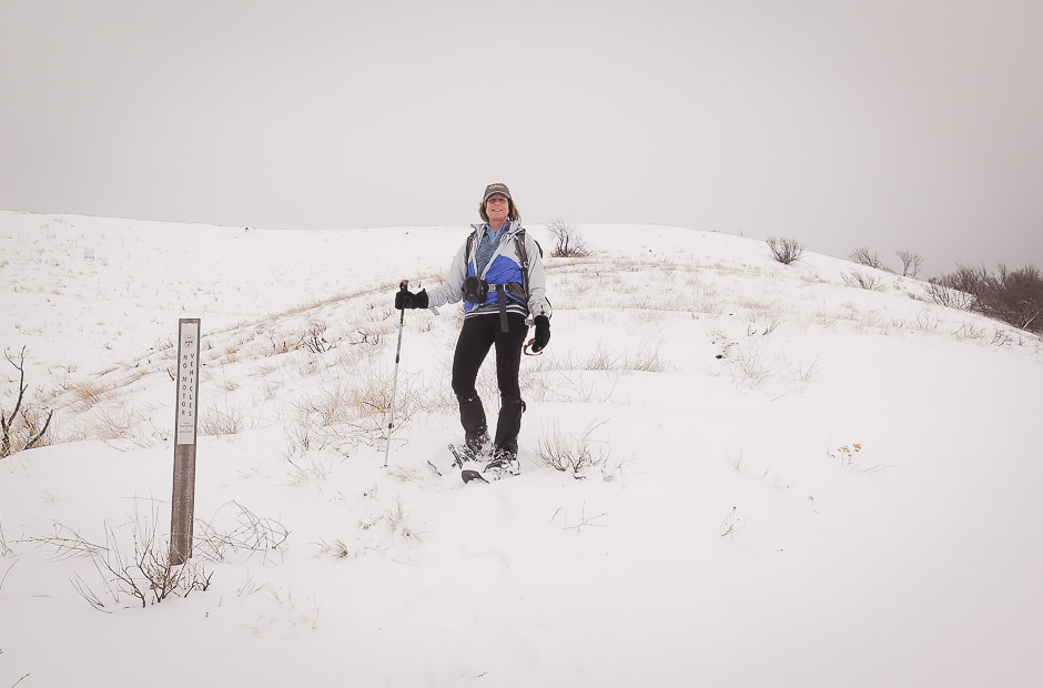 Point at which we leave the road to climb to ridge: this is on a saddle separating Adelmann Mine to the north and Black Hornet Mine to the south 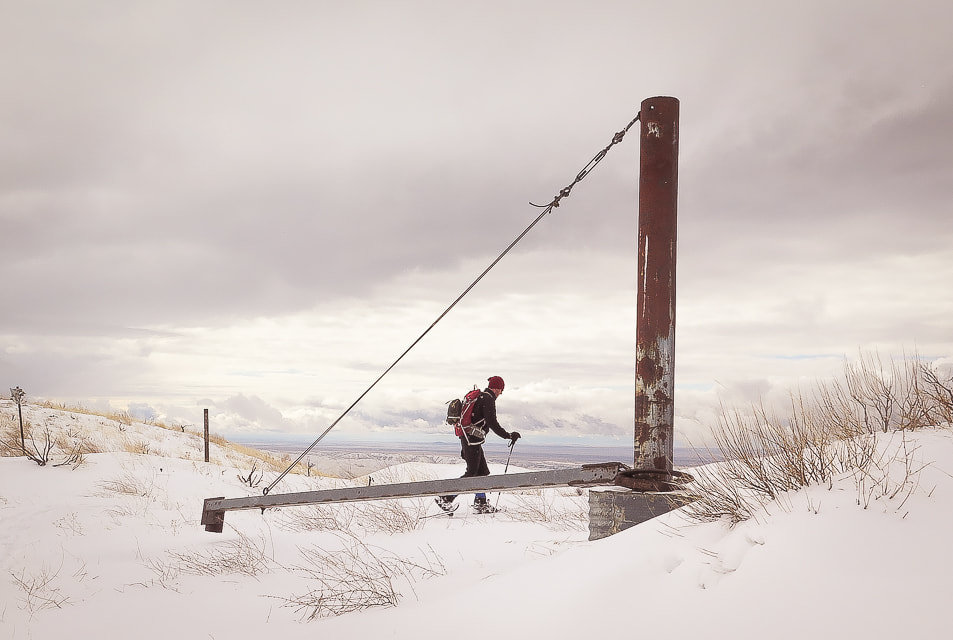 Mine apparatus (?) or gate (?) at ridge between Black Hornet Mine and Adelmann Mine, shortly after intersection of road to Adelmann Mine. This marks the point on our route where we get off the road and climb Lucky Peak's southeast ridge 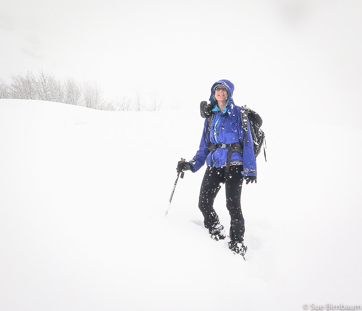 Lucky Peak hike February 2019 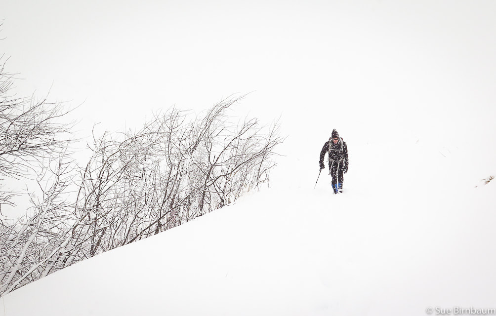 Lucky Peak hike during snowstorm - February 2019 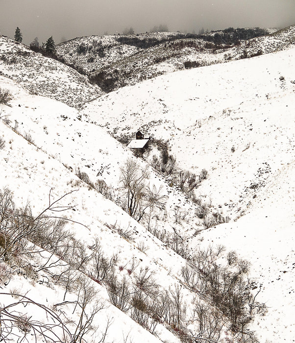 Building at Adelmann Mine 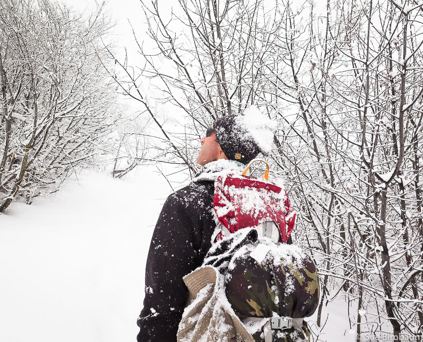 At intersection with road that leads to Adelmann Mine 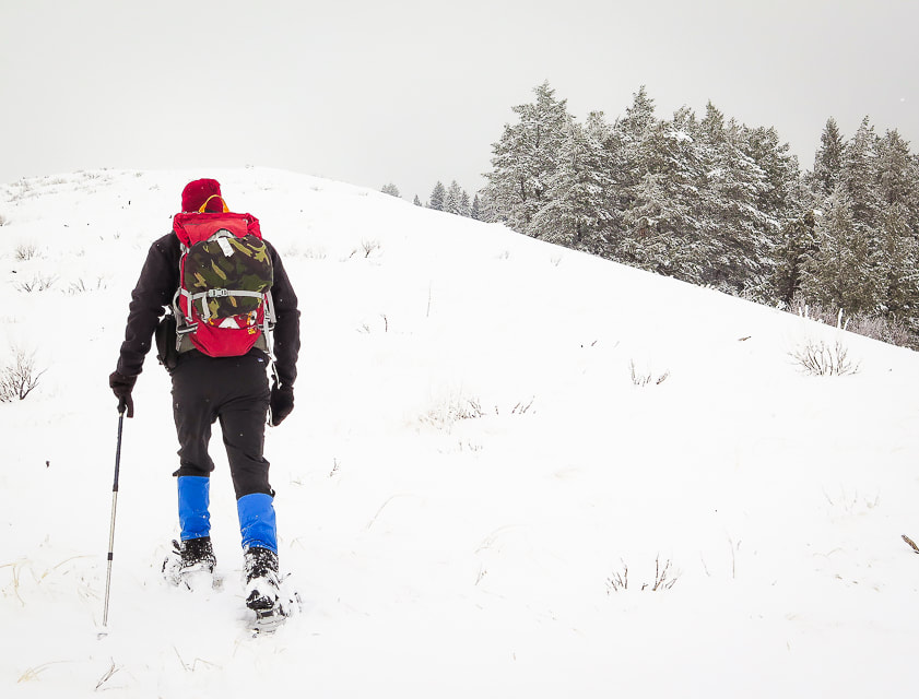 Hike up ridge toward Lucky Peak with trees to the right 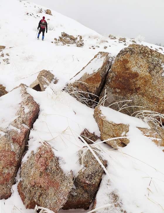 Granite of the Idaho Batholith Hard rime ice had accumulated on the windward side of everything enveloped in the fog at the top. We cleared a place in the snow, sat and ate lunch until we cooled down from the climb. As we hiked down, the clouds thinned, illuminating trees, grasses and shrubs in a golden light, and a little further down we found ourselves in bright white fresh snow, walking toward the dark blue and white peaks of the Boise National Forest. Since Lucky Peak is the highest point for miles around, it gives you the feeling that you are walking above almost everything else. 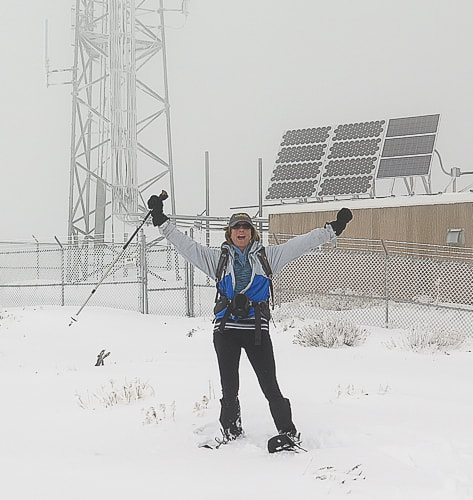 Radio Towers on summit of Lucky Peak - 5,904 feet 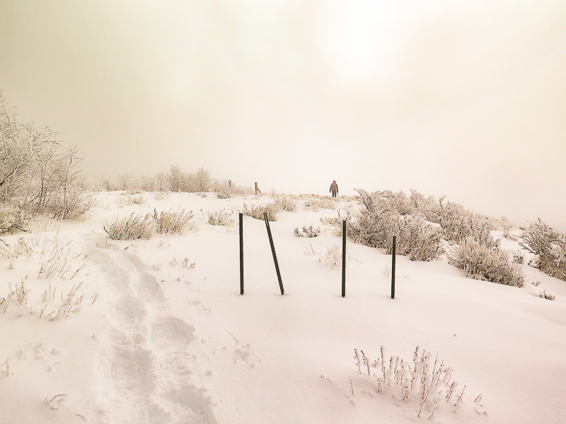 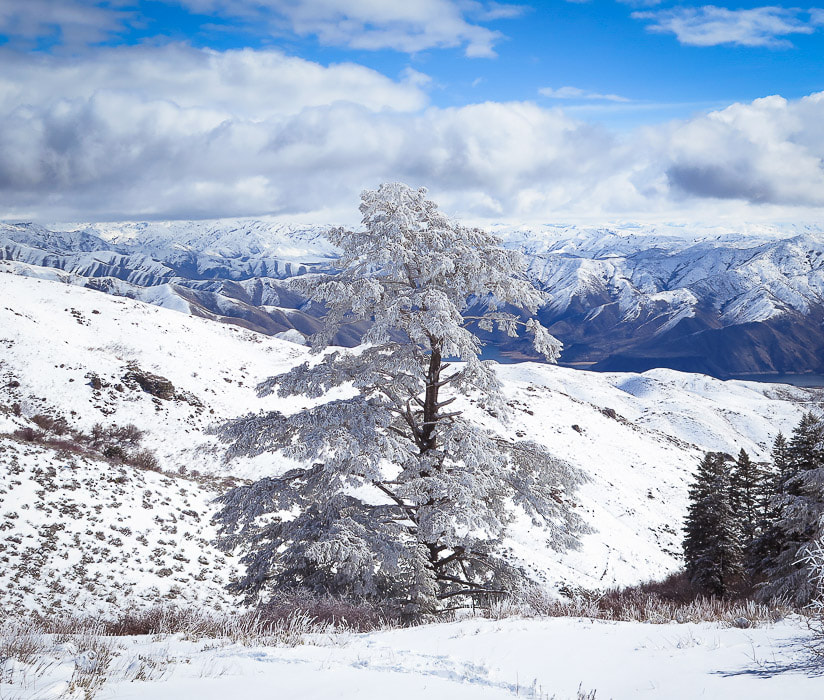 Douglas Fir with hard rime ice at higher elevations on Lucky Peak, looking northeast to Boise National Forest. 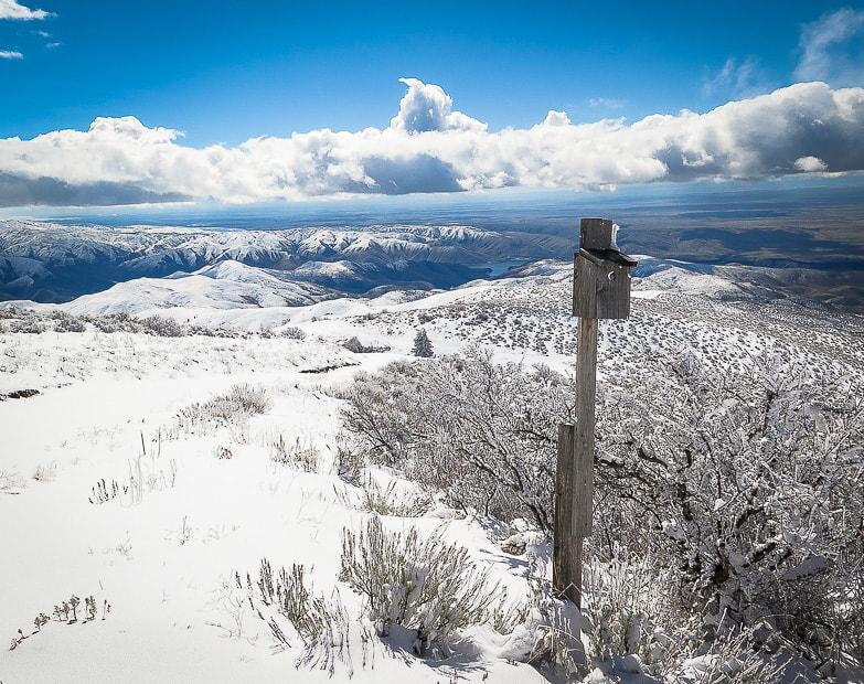 At intersection of our route and Route E. Shaw Mountain Road - follow this road to the summit of Lucky Peak 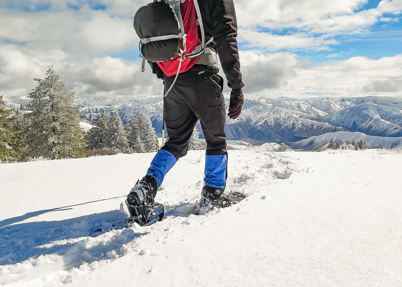 Great views of Boise National Forest and Lucky Peak Lake on the way down 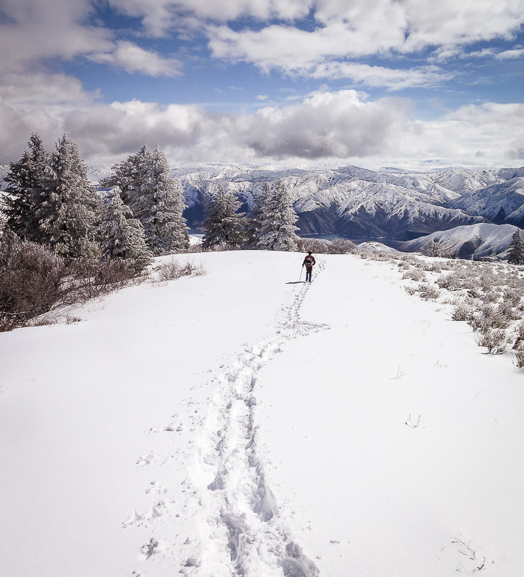 Clouds clearing on the way down- walking toward Lucky Peak Lake and Boise National Forest 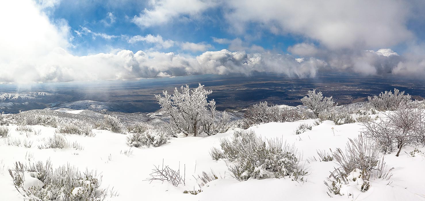 Antelope bitterbrush overlooking the Treasure Valley including Boise, Idaho. 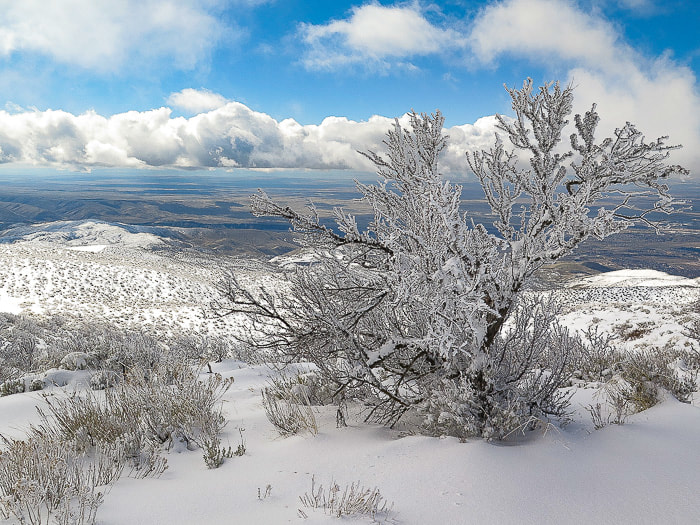 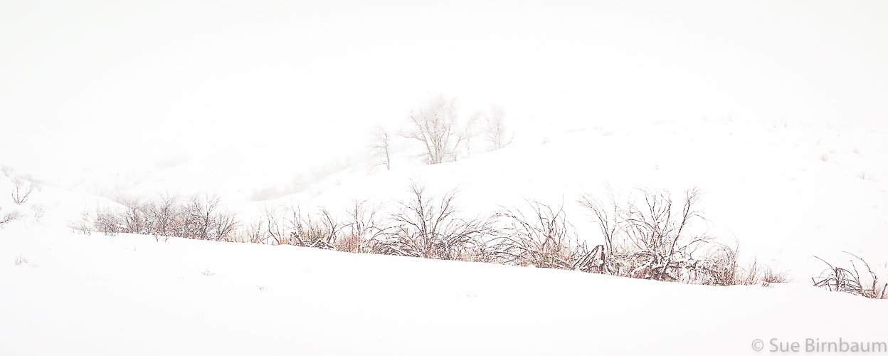 There's lots of advantages to snowshoeing vs. hiking with no snow: vegetation is not damaged, you sharpen navigational and preparation skills, and best of all, quiet and solitude. We went up into the clouds facing a steady headwind and came down in sun and breaking clouds with warmer temperatures. We are lucky in Boise to have the opportunity to experience great snowshoeing treks.
3 Comments
Short and steep hike along ridge overlooking Lucky Peak Reservoir with great views, Boise National Forest
Trip Stats Overview: Trail to Cervidae Peak is only 17 miles east of Boise and traverses along the ridge between Mores Creek to the west and Lucky Peak Reservoir to the south. Vegetation includes bunch grasses, rabbitbrush, antelope bitterbrush and sagebrush. Spectacular views of Spring Shores Marina and Lucky Peak Reservoir to the south, Lucky Peak to the west, and Shafer Butte to the northwest. Distance: 2.3 miles to summit (according to my GPS) Elevation Gain: Trailhead at 3,120 feet, summit at 4,987 feet = 1,867 feet. Add to this ~ 120 feet of elevation due to loss/gain on ridge - Total elevation gain ~ 2,000 feet in 2.3 miles. Coordinates: Cervidae Peak: 43°36'50.66"N, 115°58'26.75"W. Driving Directions: Drive ID-21 north from Boise past Lucky Peak Dam, over Highland Summit. Cross over the High Bridge that crosses Mores Creek with vertical basalt cliffs. Almost immediately after the bridge, turn right on FS-269 that leads to Spring Shores Marina and Atlanta. About 2 miles past the marina, park on the right in a large pull-out. Trailhead at large gate across road. Trail: After passing the gate, the trail starts to the left of a short gravel road, where it contours the bottom of the southeast ridge heading east and then turns to the northwest, gaining the ridge. The trail is well-worn and heads straight up the southeast ridge to the summit. 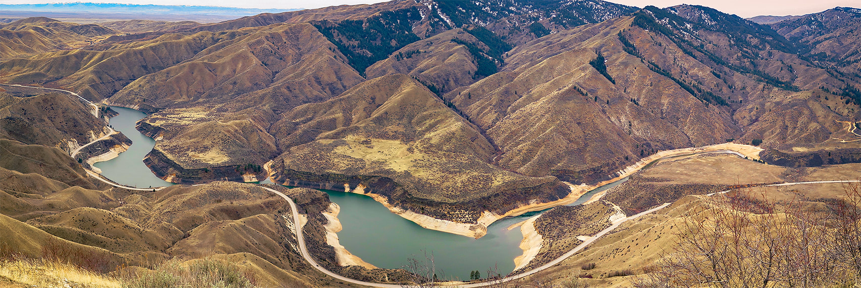 View of Lucky Peak Lake and Lucky Peak from Cervidae Mountain trail 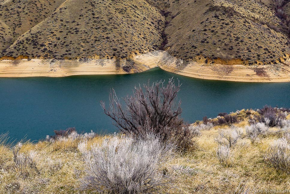 View from east side of ridge Cervidae Peak is one of the 4 "Grand Slam Peaks" that Tom Lopez, author of Idaho: A Climbing Guide describes. The other 3 peaks are Mt. Heinen, Kepros Mountain, and Lucky Peak, all close to Boise. As Tom Lopez does, Fred and I use Cervidae and Lucky Peak to train for our summer mountain summit hikes. We discovered Cervidae when we wanted to add variety to our usual Lucky Peak training. Cervidae Peak is great for a lot of reasons: it's close to Boise, the trail is steep with no switchbacks once you get on the ridge, so you can get a decent work-out in a short amount of time and see some awesome views. It's a great opportunity to get a good view of Lucky Peak Reservoir and identify landmarks at the 360 degree view at the top. The family Cervidae is a scientific classification that includes deer, elk, moose and reindeer. 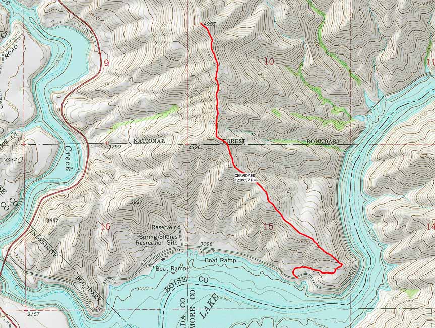 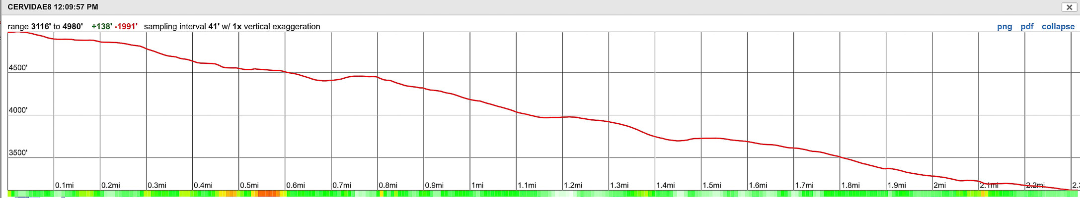 Southeast Ridge route and summit to trailhead elevation profile - Cervidae Peak (4,987 feet) Lucky Peak Lake at bottom of photo - High Bridge over Mores Creek (ID-21) lower left Distance = 2.3 miles one way with elevation gain of ~ 2,000 feet 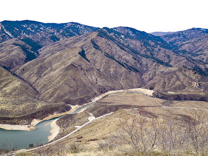 Lucky Peak Reservoir Lucky Peak (high forested peak on left) 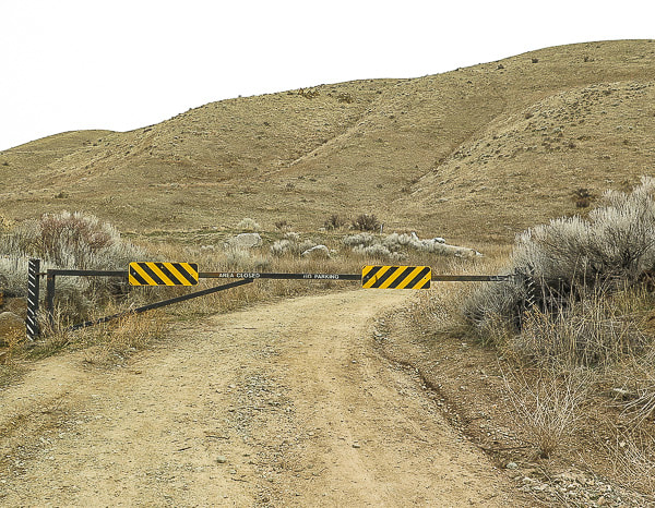 Gate at start of Cervidae Peak hike - follow gravel road to right, in about 200 yards, the trail starts on the left side of the road History The Lucky Peak Dam was built in 1955 to be included in the system of flood control and use of irrigation water from the Boise River. This was done mainly as an assurance to water users of the Boise River system that their supply of water would be protected and the Arrowrock Dam and Anderson Ranch Dam above the Lucky Peak Dam could be drained down during flood control measures. It was a way of adding water capacity; building Anderson Ranch and Lucky Peak reservoirs were moves toward multiple-use reservoirs. The Reclamation Service, a U.S. Federal government agency started construction of Arrowrock Dam, a few miles further upstream from Cervidae's trailhead on the Boise River for the purpose of storing water for irrigation in the early 1900's. Arrowrock Dam was dedicated in 1915 by Reclamation; it was the tallest dam in the world at that time and 4,000 people gathered to witness the dedication. The report, History of Boise River Reservoir Operations gives a great history and overview of management of the Boise River. Geology Large granitic intrusions during Cretaceous time (144 - 65 mya) that formed the Idaho Batholith make up the bedrock of Cervidae and the upper Boise River drainage. Cervidae Peak can also be summited from its west ridge; it's near this access where basalt dikes that cut through the granitic basement are seen along the east side of ID 21 a few miles past the high bridge that spans vertical basalt cliffs. 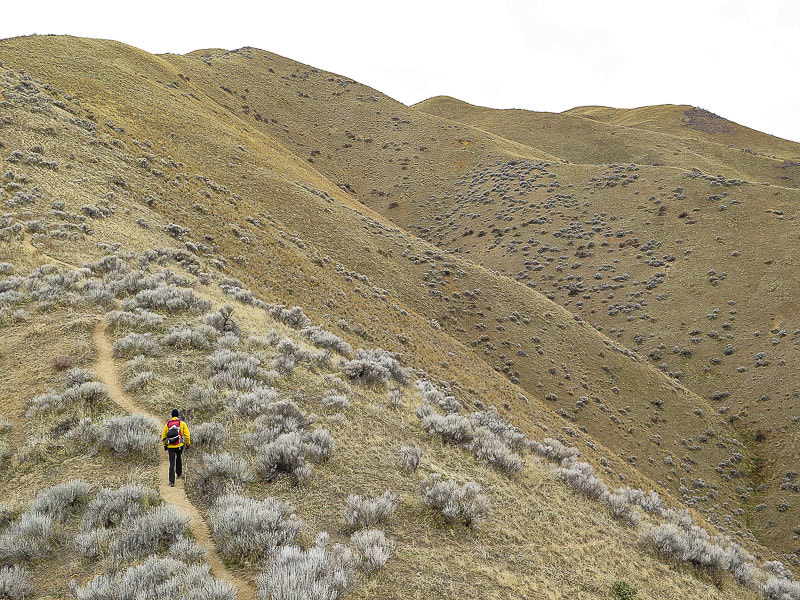 No switchbacks here - Cervidae is on right side of ridgeline 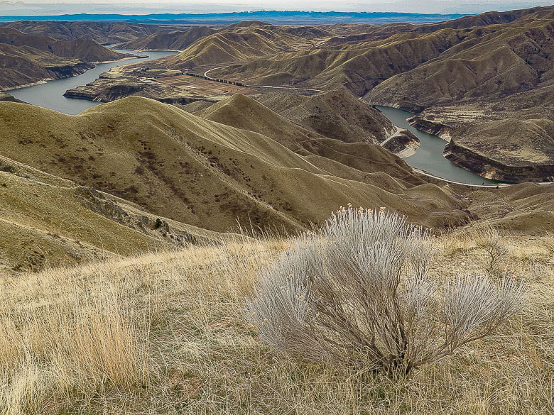 Native Grey Rabbitbrush and bunchgrass overlooking Lucky Peak Reservoir Owhyee Mountains to the south on far horizon Most of the trail is steep and it's about all that you can see in front of you at times, but then you get to a rise on the ridge and see expansive views. About 3/4 of the way up this trail, the trail from the west side of the ridge intersects. This trail is accessed from Highway 21 and provides a more direct hike to the summit. The trail loses some elevation near the summit only to regain it, followed by less steep terrain toward the top. We found a register at the summit pile of granite. A steady, bitter cold breeze had made us cold despite having climbed almost 2,000 feet. Surprisingly, the summit was calm but cold. Looking toward the northeast, we tried to identify Mount Heinen, a climb on our spring bucket list. We did this hike with 2 friends a couple of summers ago - in the afternoon! Not the best time to do this hike - it was hot and there's no shade. This is a good late winter/early spring hike. 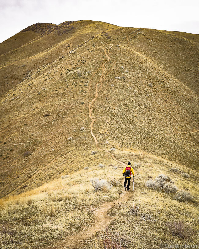 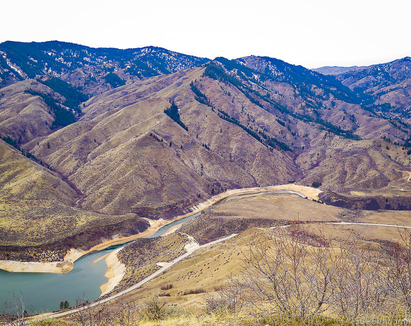 View of Lucky Peak (far left) ~ 900 feet higher in elevation than Cervidae Peak Lucky Peak elevation = 5,904 feet 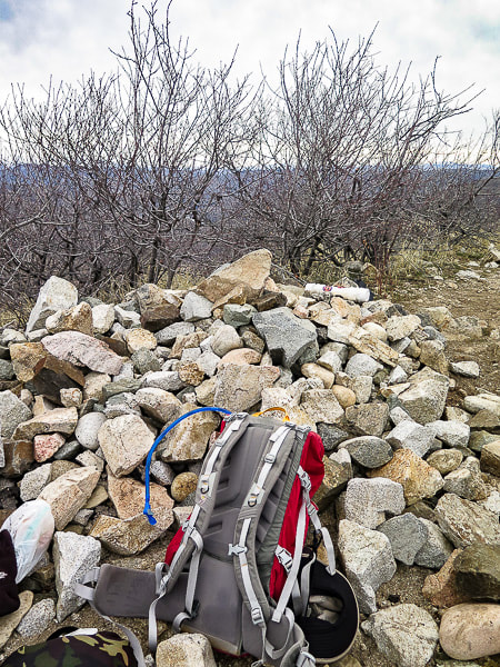 Cervidae Peak summit - 4,987 feet 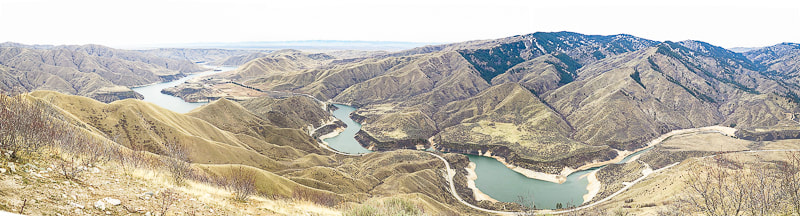 References
Bliss, James D., and Phillip R. Moyle. 2001. Assessment of the Sand and Gravel Resources of the Lower Boise River Valley Area, Idaho. U.S. Dept. of the Interior - U.S. Geological Survey, 41 pages. Idaho Batholith: Idaho's Natural History Online from Idaho Museum of Natural History/Idaho State University. Retrieved from: http://imnh.isu.edu/digitalatlas/geo/bathlith/bathdex.htm. Othberg, Kurt L. and Willis L. Burnham. 1990. Geologic Map of the Lucky Peak Quadrangle, Ada County, Idaho. Idaho Geological Survey, University of Idaho, Moscow, ID, 13 pages. Stevens, Jennifer. 2015. History of Boise River Reservoir Operations, 1912-1995. Stevens Historical Research Associates, 67 pages. |
Categories
All

Sue and Fred

About this blogExploration documentaries – "explorumentaries" list trip stats and highlights of each hike or bike ride, often with some interesting history or geology. Years ago, I wrote these for friends and family to let them know what my husband, Fred and I were up to on weekends, and also to showcase the incredible land of the west.
To Subscribe to Explorumentary adventure blog and receive new posts by email:
Happy Summer!

About the Author
|