|
Images of sensational slickrock journeys in southwestern Utah. 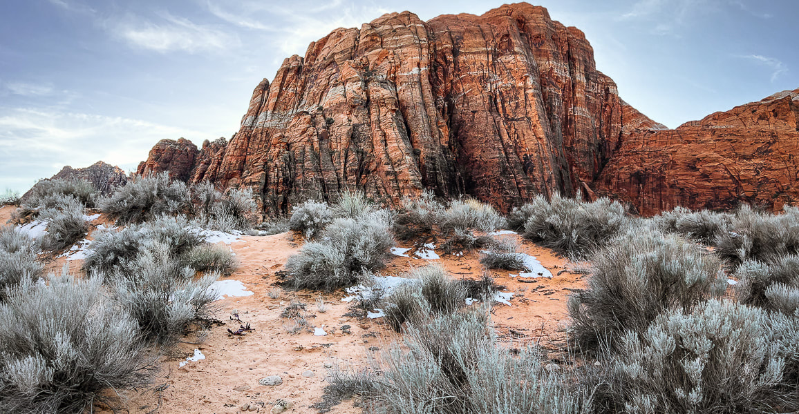 We've made a refreshing change in our mode of hiking and exploring. After years of using established trails, we are doing more hikes "cross-country" over slickrock or remote desert, where markers are few or none. We've been fortunate to hike with a fellow southern Utah explorer who has discovered the routes illustrated in the slickrock slideshows below. I still appreciate rock cairn markers over miles-long treks in slickrock seas, like Boulder Mail Trail to Death Hollow in Grand Staircase-Escalante. And, as the southwestern deserts heat up, we will find ourselves in higher elevations on signed forest trails. Navigation through slickrock country is a fun way to explore, but extra precautions are needed. You can use dead-reckoning and a compass to travel, but using a topo map helps you discover the canyons and plateaus between you and your destination. I've started using Topo Maps US, an iphone and ipad compatible navigation application (version 12.0 or later). With this app, you can download maps for areas in which you will be hiking, record and save your tracks. I also always use my Garmin GPS to record our tracks, and occasionally Avenza Maps. Don't Walk on the Crypto! (more info at end of this post).
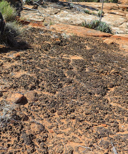
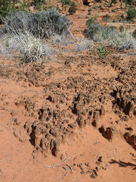
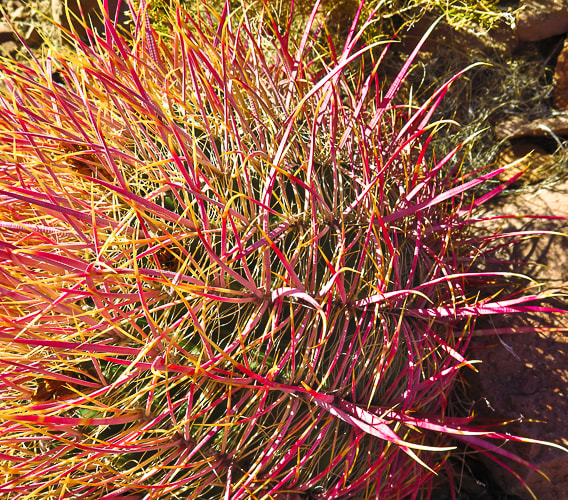
As in Slickrock Nirvana - Part One, the following slideshows contain images from our unique excursions. More images follow the slideshows. “Instructions for living a life. Pay attention. Be astonished. Tell about it.” ― Mary Oliver Yant Flat and areas around St. George, Utah Red Mountain Wilderness 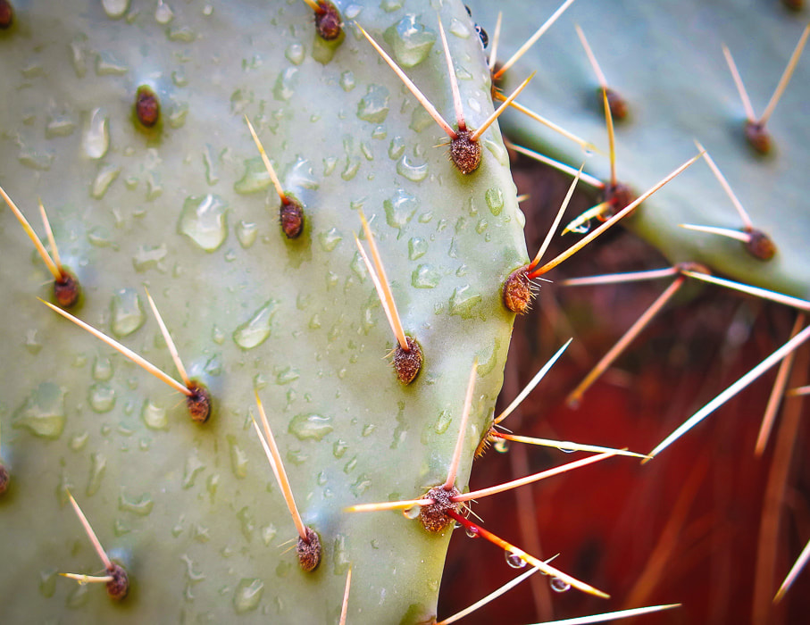 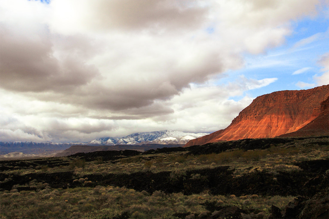 Snow Canyon State Park - basalt flows, Navajo Sandstone, and snow-covered Beaver Dam Mountains (limestone). 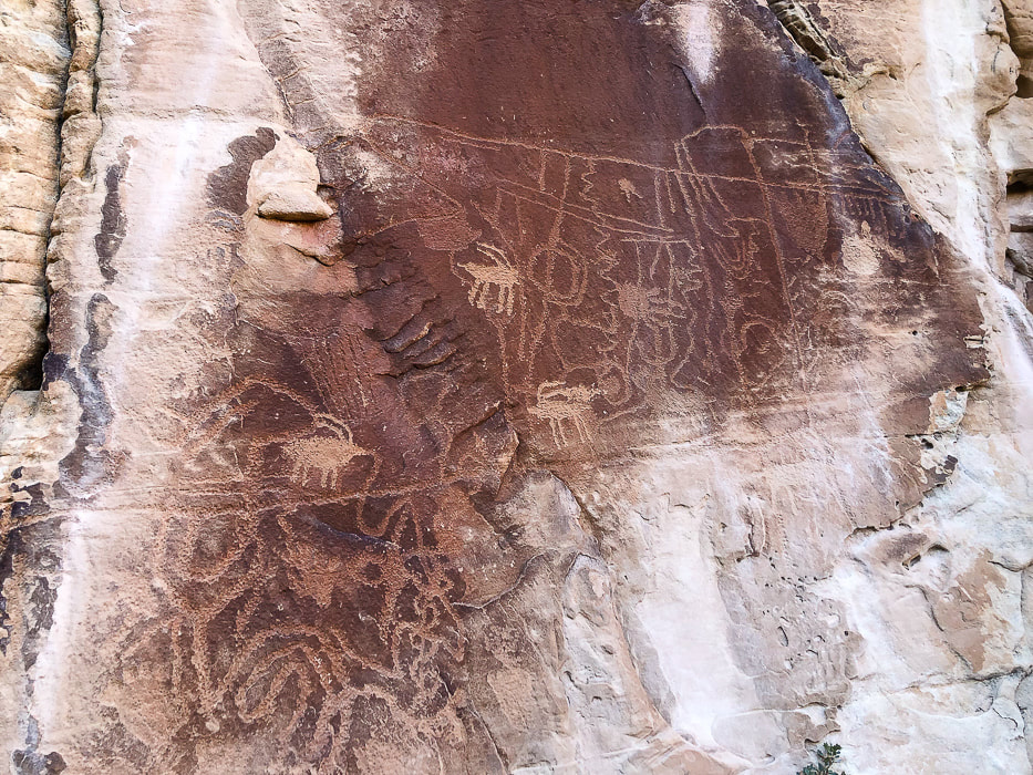 For more on petroglyphs: In Search of the Rattlesnake Petroglyph 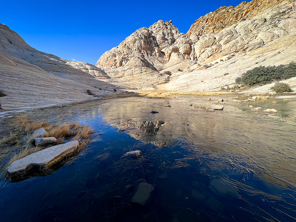 Don't Walk on the Crypto! A subscriber to my posts asked a great question: "I wonder if you worry about the cryptobiotic crusts?" We had to dodge and maneuver around these amazing stabilizing soil crusts to avoid stepping on them. They're an important part of the ecology in desert ecosystems, and take many years to rebuild if destroyed. Cryptobiotic (biological) Soil Crusts
Cryptobiotic (biological) soil crusts, made of cyanobacteria, lichens and mosses. These form on easily eroded soils and increase stability and help provide more water infiltration and are the dominant source of nitrogen in pinyon-juniper ecosystems. These crusts hold the soil in place. Recovery of crusts that have been destroyed takes at least 45 years. 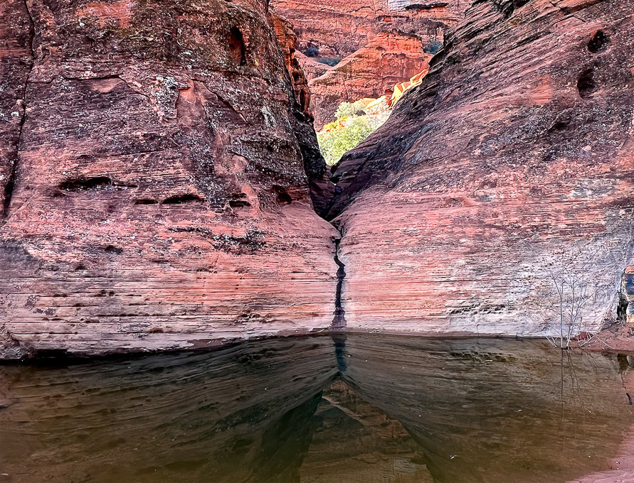 References
Loope, D. et al. 2016. Sandstones and Utah’s canyon country: Deposition, diagenesis, exhumation, and landscape evolution. University of Nebraska - Lincoln.
2 Comments
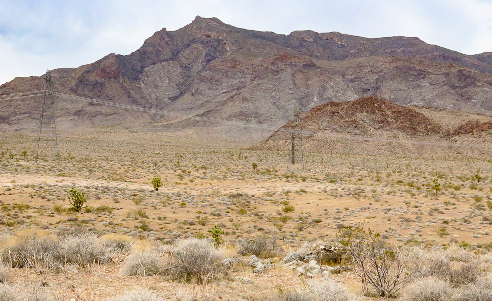
Hike the only named mountain in this obscure, remote and rugged Nevada mountain range. 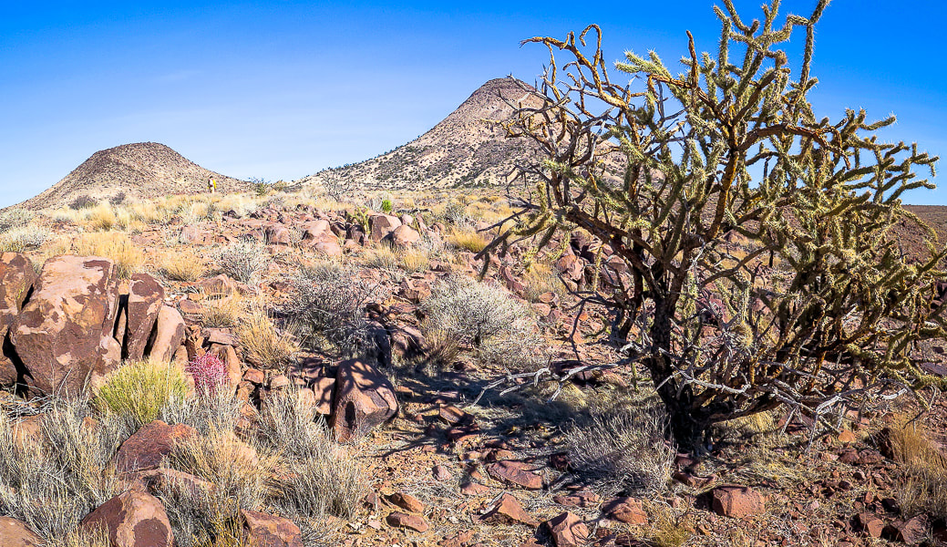 Approaching the base of Sunflower Mountain (right), a volcano that erupted 14 million years ago (m.y.a.). Trip Stats
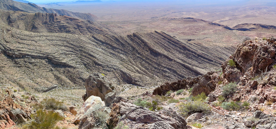
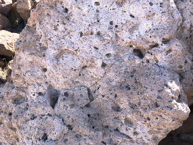
Location: Meadow Valley Range Wilderness (BLM) - southeastern Nevada. Overview: Make your own loop-hike in solitude to the summit of Sunflower Mountain in a mountain range infrequently traveled, with the option to continue northeast along tilted cliffs to Kane Benchmark. Distance/Elevation Gain: 5.3 miles/1,670'. Prominence: 842'. Difficulty: Moderate effort Class 2, no cairns, not marked, no discernible trail - must be experienced with navigation. Coordinates: Trailhead: 37.06787,-114.76415. Sunflower Mountain: 37.07292,-114.73997. Maps and Apps: Printed map from CalTopo.com, Stavislost.com., Topo Maps U.S. Date Hiked: 11/25/22. Geology: Sunflower Mountain's volcanic eruptions (14.7 million years ago) produced rhyolite, a silica-rich rock formed from granitic magma, which is more viscous than iron- and magnesium-rich basaltic magma. Rocks associated with rhyolite are tuff and pumice, present on Sunflower's flanks. The Meadow Valley Range is underlain by folded and faulted Cambrian (500 mya) through Triassic (250 mya) age rocks. On the drive from Moapa, Nevada, this rock is especially exposed in the southern part of the range as limestone cliffs. Related Posts:
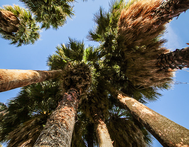
Open Spaces If you relish wide open spaces with minimal human influence, like the freedom to chart your own path to discover features that others haven't, and don't mind the occasional cactus spine jabs and rough rock-hopping, this rugged land is for you. It's a place for open space "aficionados". Sunflower Mountain's summit allows you to see what's going on in the Great Basin desert of Nevada: raw, contorted, ripped and tilted geography as a result of earth's spreading and faulting. Some say this desert land is too spare, but each plant must fight for survival, changing to adapt. This clever determination earns respect and admiration. Many times you find unexpected things like fossils, springs and weird rocks. I've found what looked like a miner's crucible and pottery sherds in remote deserts. Surprise and unpredictability separate this biome from others. A scene from the t.v. series Yellowstone prompted me to pull The Solace of Open Spaces by Gretel Ehrlich out of my bookcase. In this scene, Beth, the daughter of John Dutton, the Montana ranch owner, is reading this book, wondering how to find solace. "Solace must be discovered," her dad tells her. Early in the book, Ehrlich states "Space has a spiritual equivalent and can heal what is divided and burdensome in us. Space represents sanity, not a life purified dull, or "spaced out" but one that might accommodate intelligently any idea or situation." She writes about the extreme weather and landscapes of Wyoming, and its people. Ehrlich found solace in Wyoming after a tragic event in her life . Some people find solace and revitalization in remote, open spaces. Others find the same in the hubbub of big cities. Is it an acquired preference that grows out of an appreciation for open spaces after you spend some time in them? Or are some people more naturally attracted to them? At any rate, the American West is rich with opportunities for solitude, solace, freedom, discovery. The list goes on.... "The extreme clarity of the desert light is equaled by the extreme individuation of desert life forms. Love flowers best in openness and freedom." - Edward Abbey "The farther one gets into the wilderness, the greater is the attraction of its lonely freedom." - Theodore Roosevelt "Give me silence, water, hope. Give me struggle, iron, volcanoes."- Pablo Neruda We also stopped by the Moapa Valley National Wildlife Refuge. It is a tranquil place with many old California palm trees (see end of this post). It was created to protect the endangered Moapa dace - a small fish endemic only to this area. A sign here indicated Las Vegas showgirls used to frolic in these hot springs - there was an old cabana from years past - before it became a wilderness reserve. Our Hike (see topo map at end of post) - 5.3 miles round-trip
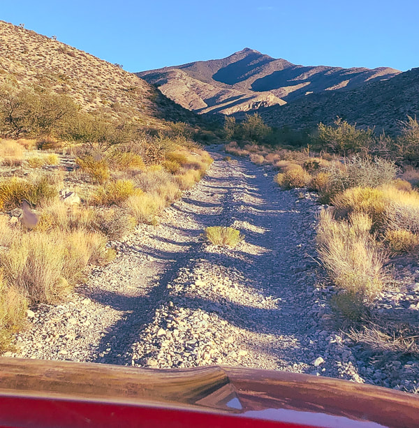
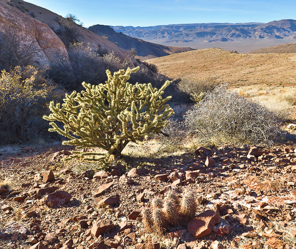
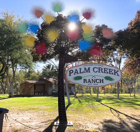
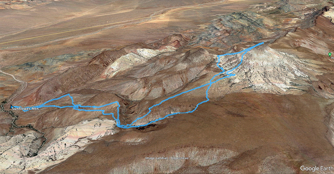 Our tracks from trailhead (left) to Sunflower's summit. We drove up road accessible by high-clearance from Kane Springs Road, seen as straight line in valley below (upper left). We approached via climbing the plateau that lead to the base and returned via a fun scrambling canyon. Meadow Valley Range is one of the most obscure of Nevada's over 300 mountain ranges. North is at top of map 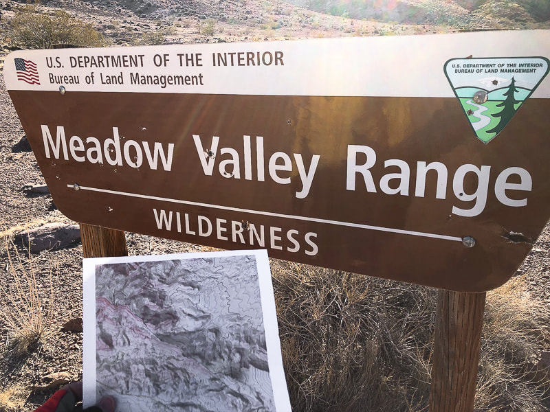 Got my printed topo map ready! You can park near this sign if you have high clearance vehicle. 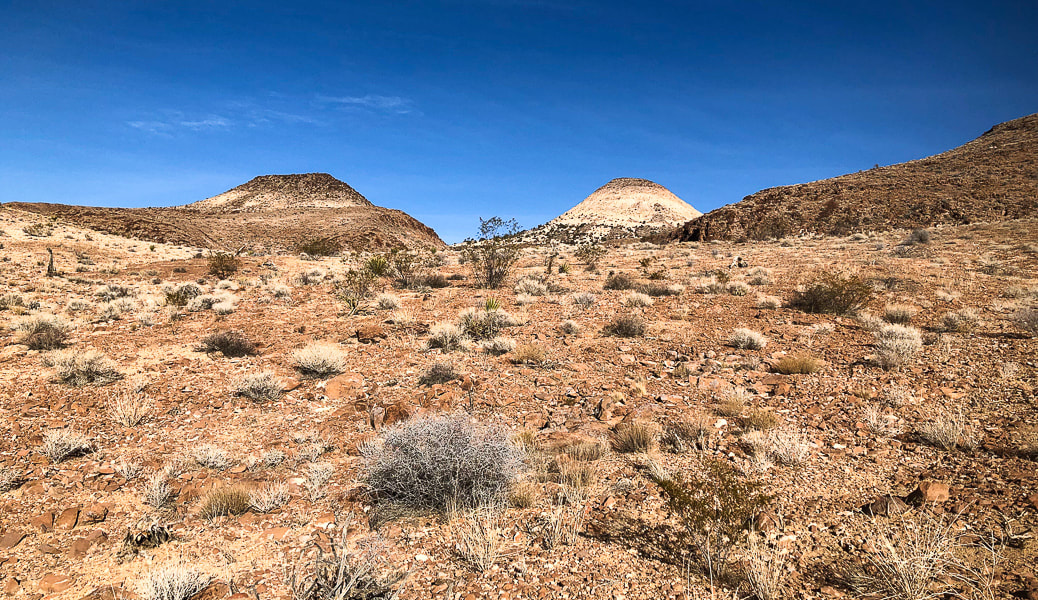 Can't get enough of photographing this cool-looking extinct volcano, the only named peak in this range- Sunflower Mountain. 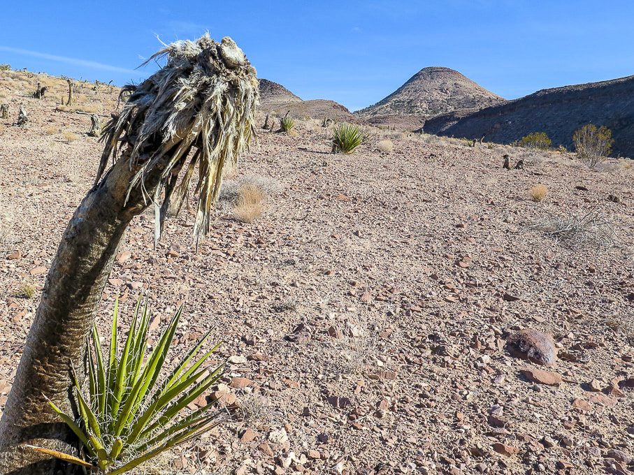 Heading east from trailhead - a lot of dead yuccas, apparently from a fire, dotted this landscape. The new growth is a good sign. 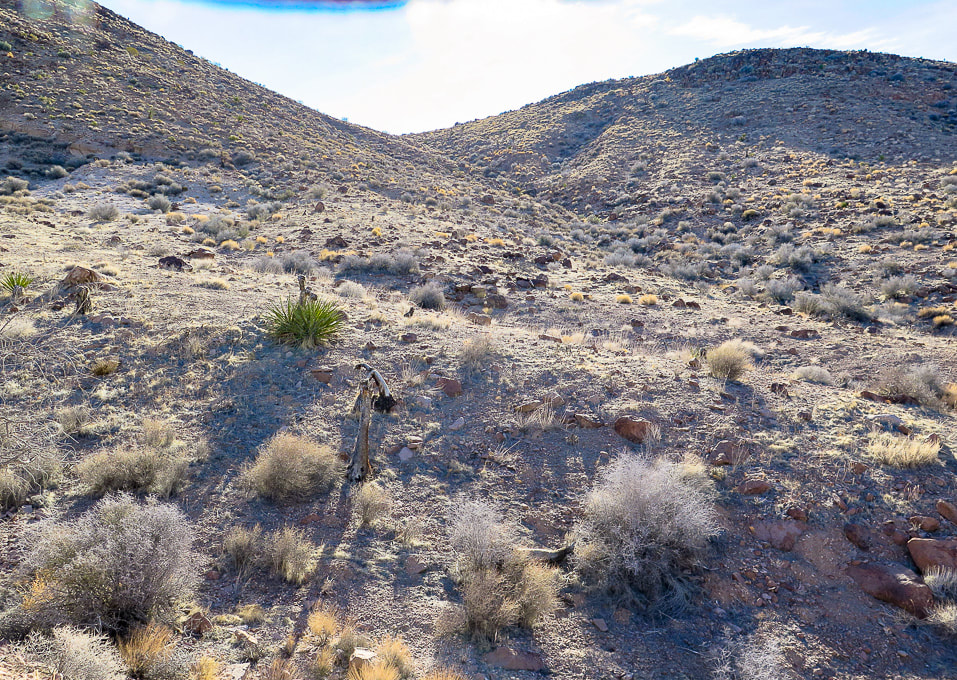 From the BLM sign, we headed east to a shallow drainage that led to a saddle. We headed south into a shallow drainage and the opening of the small canyon that we would hike down on our return. 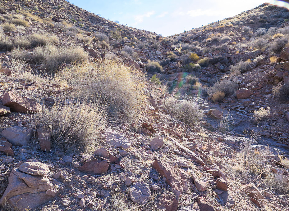 Getting closer to the saddle. 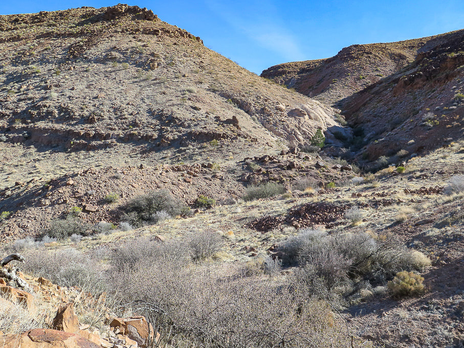 From the saddle, dropping into the drainage. On our ascent, we climbed the hill on the left; on our descent we hiked down the drainage on the right. 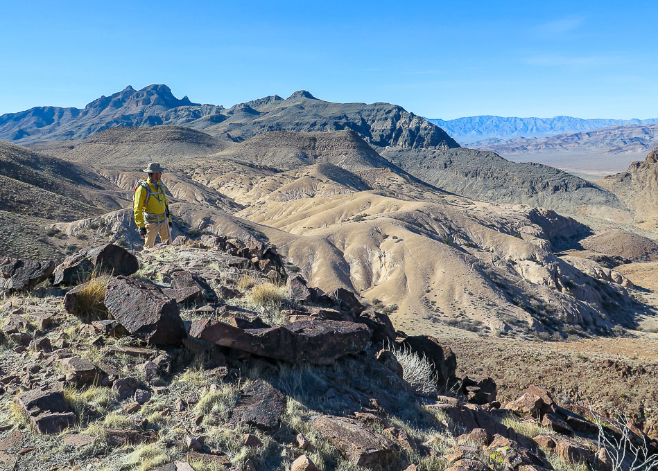 Reaching the top of the hill out of the drainage; from here, a long flat plateau leads to the base of Sunflower. Looking back at flat area we just ascended. 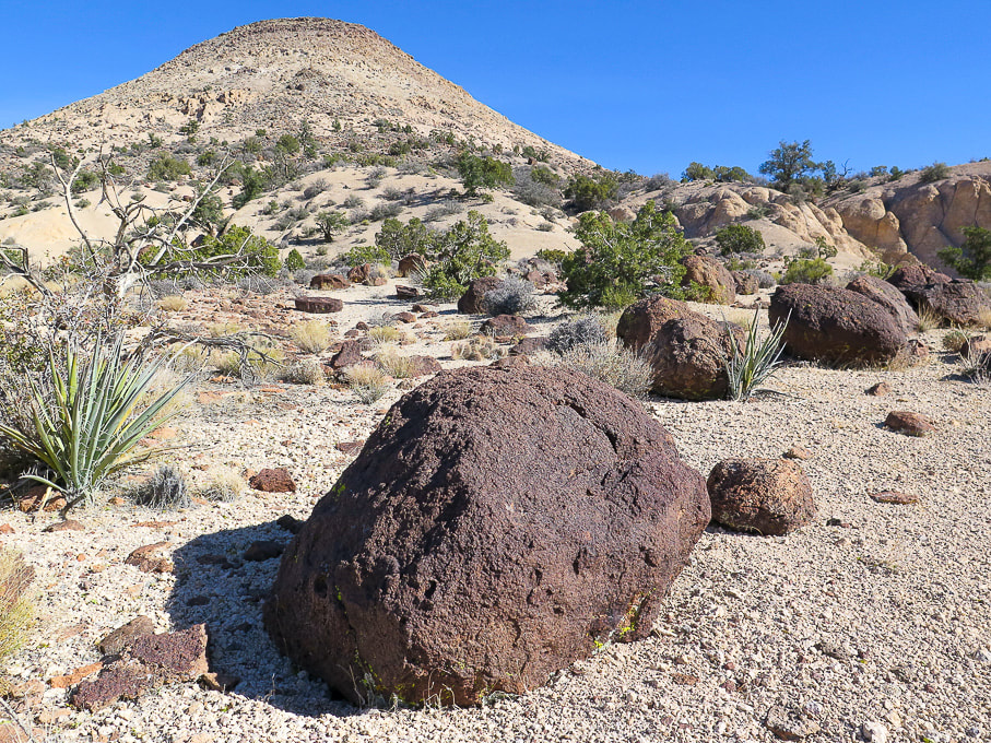 The flanks of Sunflower mountain contain lots of light-colored tuff (consolidated ash). 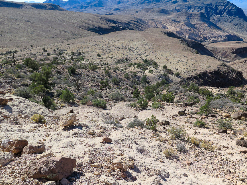 Climbing Sunflower and looking back at the plateau we just crossed. 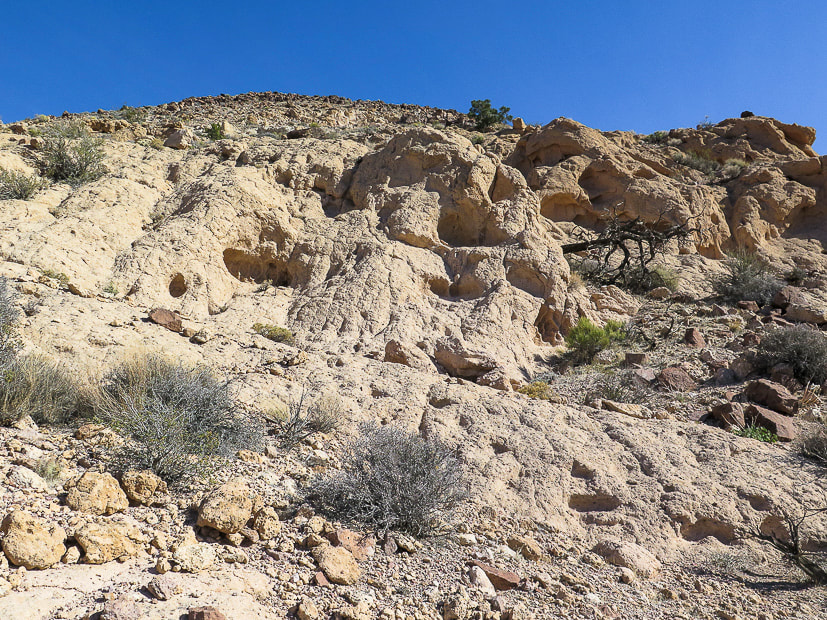 Tuff - consolidated ash. Rock is loose in some spots, but not too bad. 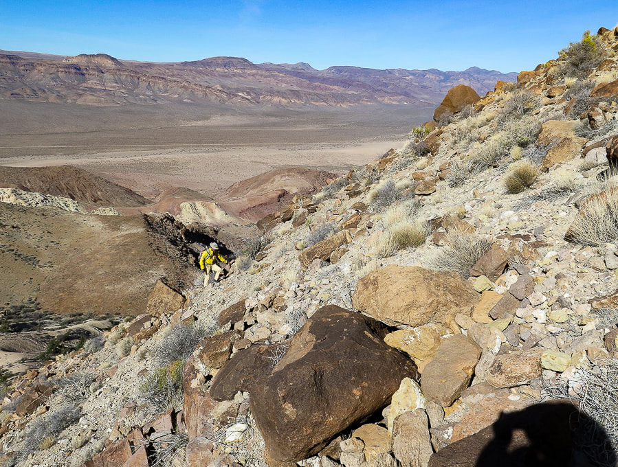 Climbing an old volcano! Great view of Kane Springs Valley and the Delamar Mountain range across the valley. 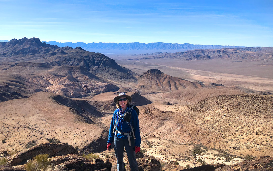 Top of Sunflower Mountain looking back to Kane Springs Valley and road we drove up on (Kane Springs road). 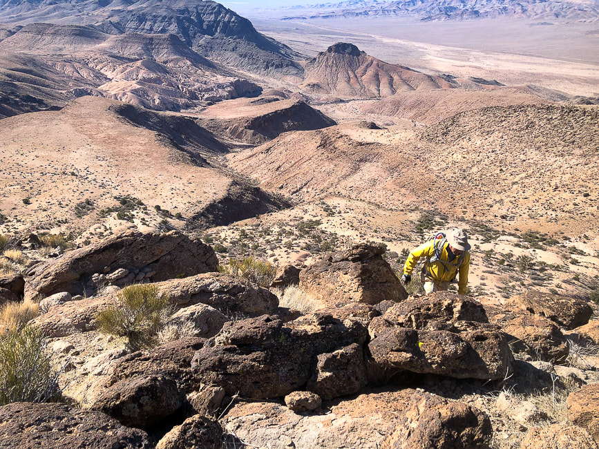 View southwest from summit of Meadow Valley Mountain range. 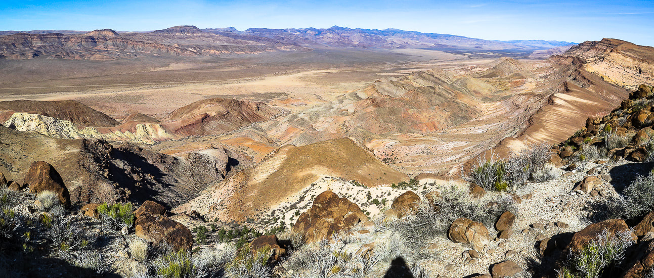 View northeast to Kane Benchmark (upper right high point). We didn't see any traffic on Kane Springs Road in valley. 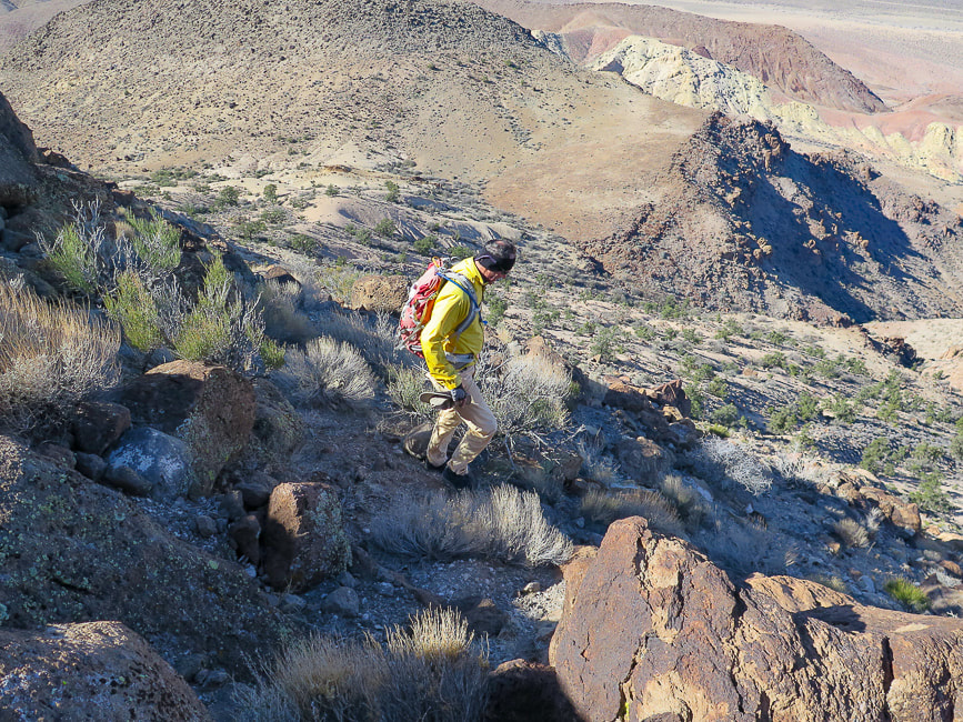 Heading off summit on the west flank to the flat spot just behind Fred in the saddle. 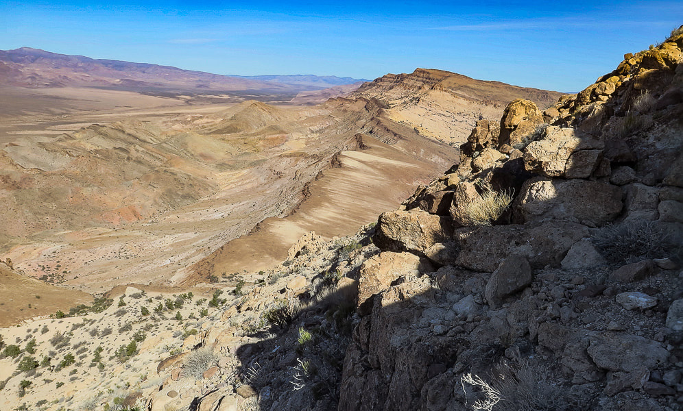 View of Kane Benchmark (high point on horizon) from west slope of Sunflower. 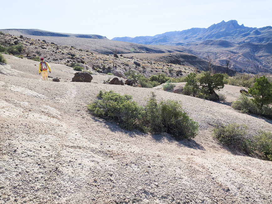 Walking along base of Sunflower back to approach plateau. 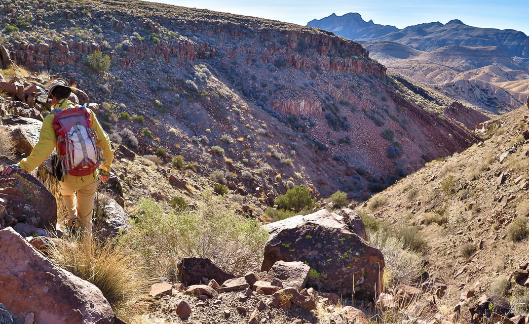 Hiking down drainage under (to the south) of plateau we climbed for approach to Sunflower's base. 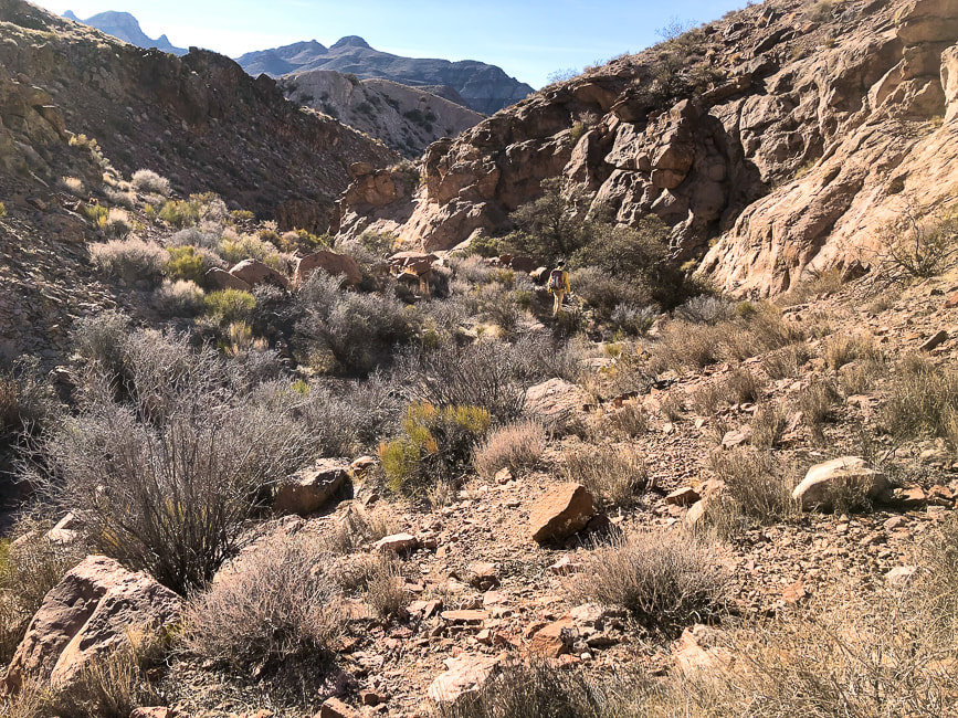 Progressing down the drainage. 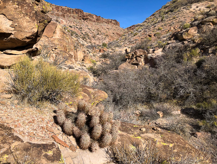 Looking back at entry point into drainage and the plateau we climbed earlier on our approach to Sunflower.  Some cool stuff on the trail. Moapa Valley National Wildlife Refuge and Palm Creek Ranch in Moapa, Nevada 60 miles north of Las Vegas 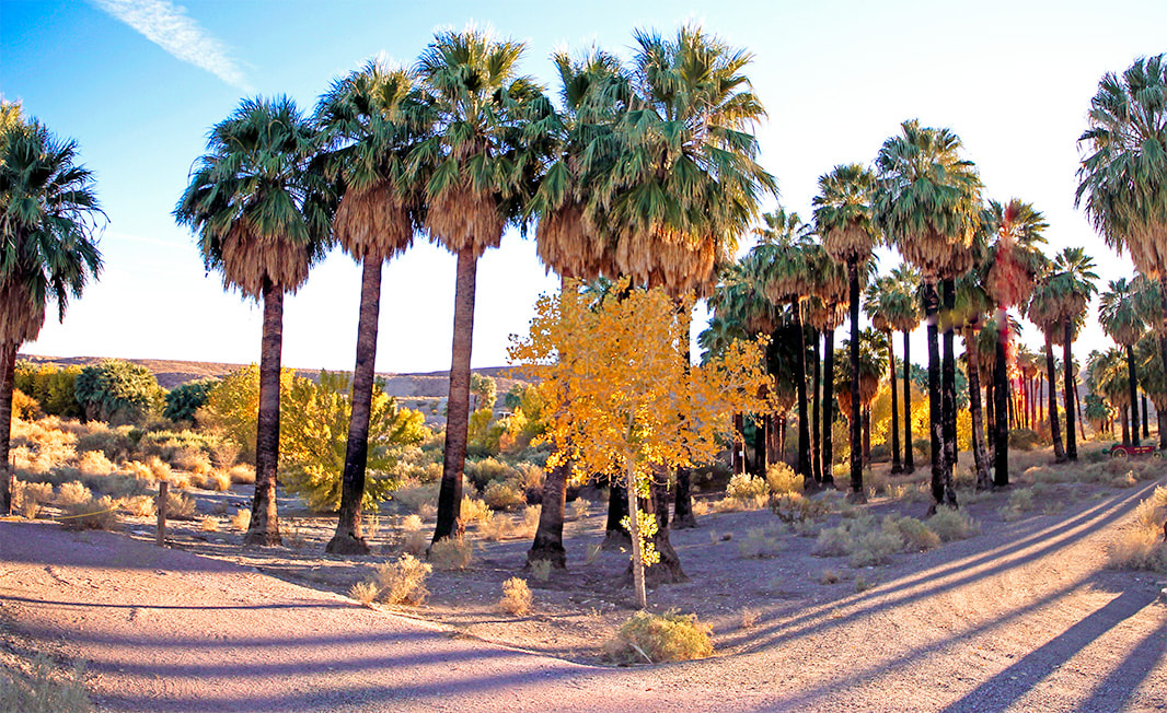 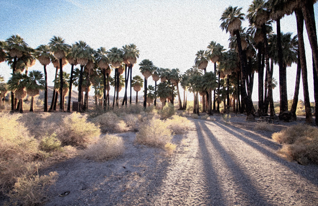 We stayed in our trailer two nights at Palm Creek Ranch in Moapa, Nevada. It is a natural desert oasis. The water is warm! 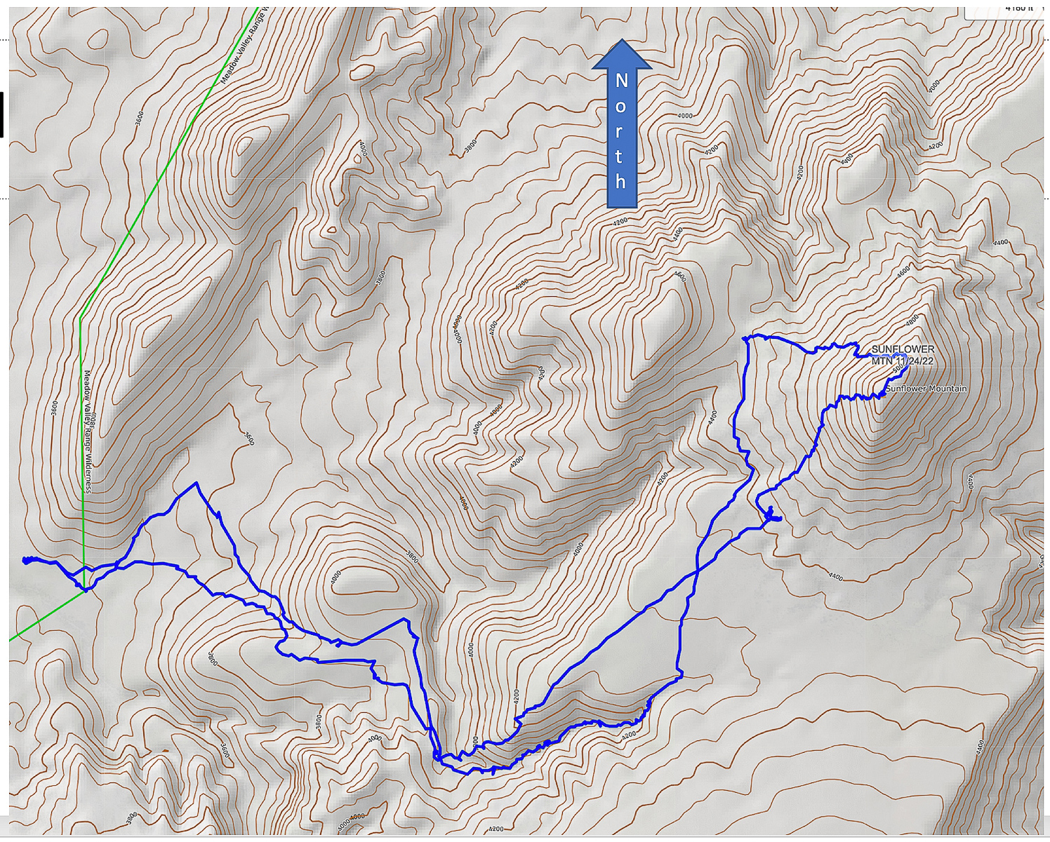 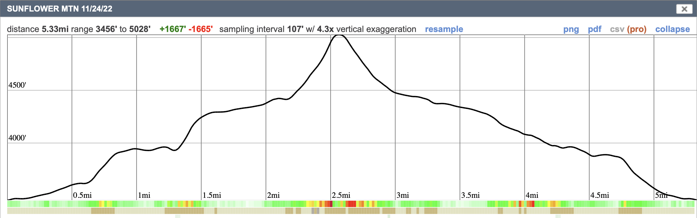 Our GPS tracks on CalTopo map, and elevation profile. Click on map for larger file References
Lahren, M., Trexler, J. Crustal Evolution of the Great Basin and the Sierra Nevada. 1993. Dept. of Geological Sciences, Mackay School of Mines, University of Nevada, Reno. Pampeyan, E. H. Geologic Map of the Meadow Valley Mountains, Lincoln and Clark Counties, Nevada. 1993. USGS. One day's journey into southern Utah's wild slickrock paradise.
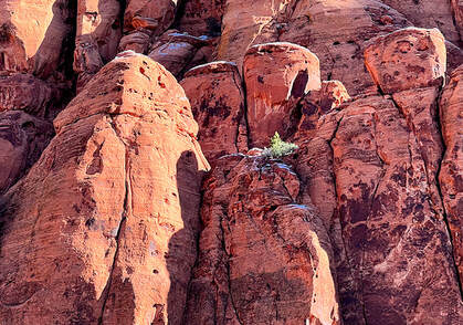
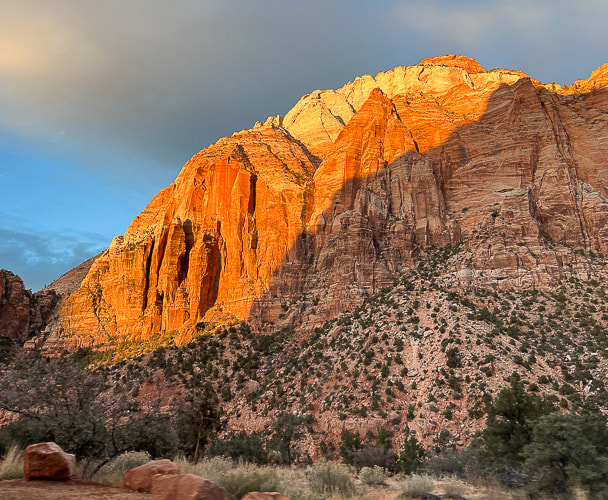
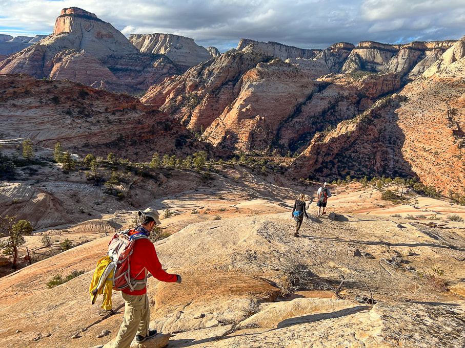 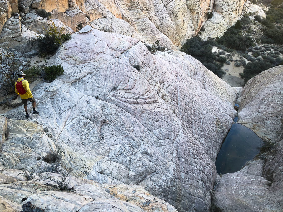 I have often wondered why the term "slickrock" is used to describe smooth-surfaced sandstone. My boots didn't slip on it; in fact I found it rather grippy while hiking across it, up it, or down it. Unless it is covered by a thin coat of ice or damp moss, it wasn't slippery. My mountain bike tires held firmly on Moab's Slickrock Trail. "Slick" was the term that early pioneers of the southwest region gave this multi-colored, cross-bedded rock because metal horseshoes and wheel rims had poor traction on this terrain. We have been fortunate to meet two friends who are showing us some routes in the magical and ever-changing southern Utah slickrock country. These routes are not marked; no cairns, no signs. They are wild and untrammeled and untrampled, a welcome change from southern Utah's over-traveled national parks. The landscape is remarkable because there are so many things to see - from small-scale ferns, moqui marbles, and mountain lion tracks, to large-scale towers, blazing orange temples, hoo-doos and spires. Colors vary from black desert-varnished and stained sandstone to blue pool refections in white slickrock. This land is unpredictable. When you reach the top of a smooth sandstone bowl or cross-bedded steps, you may find a cliffed-out canyon, or more slickrock flats, or a rocky pass with gnarled ponderosa pines and junipers to negotiate to reach the sand washes below. "Nirvana" is the final goal of enlightenment in Buddhism, a state of transcendence where there is no suffering, desire or sense of self. It's also a term used to describe paradise, a place of perfect peace and happiness - an "idyllic" place. After a few nights backpacking in the Sawtooth Mountains, I would call that range in central Idaho "paradise". Low, green valleys and sawtooth peaks all formed by glaciers, and plentiful lakes, so many that you could walk to a few of them in a day or spend each night at a different one. Southern Utah's Red Rock Country might be described as paradise, or nirvana, at least by me. It's a place where you can immerse yourself in the extraordinary beauty that's the artwork of millions of years of shaping and carving an ancient sand sea. I'm grateful to be able to experience these places - to have the companionship of my husband and friends, to have strong legs to get there and be able to share our adventures with others. We have available limitless adventures, but limited time. The slickrock slideshow and other images that follow highlight scenes from one day's journey into slickrock paradise. Slickrock Slideshow 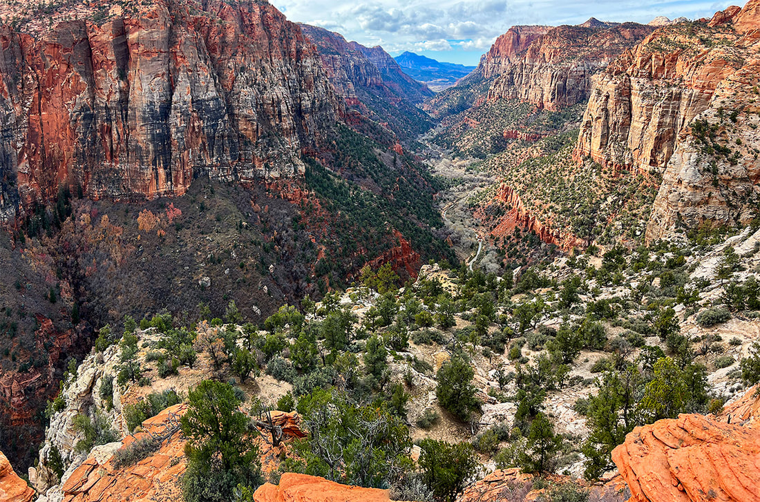 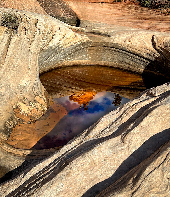 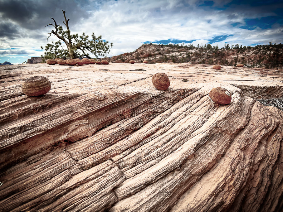 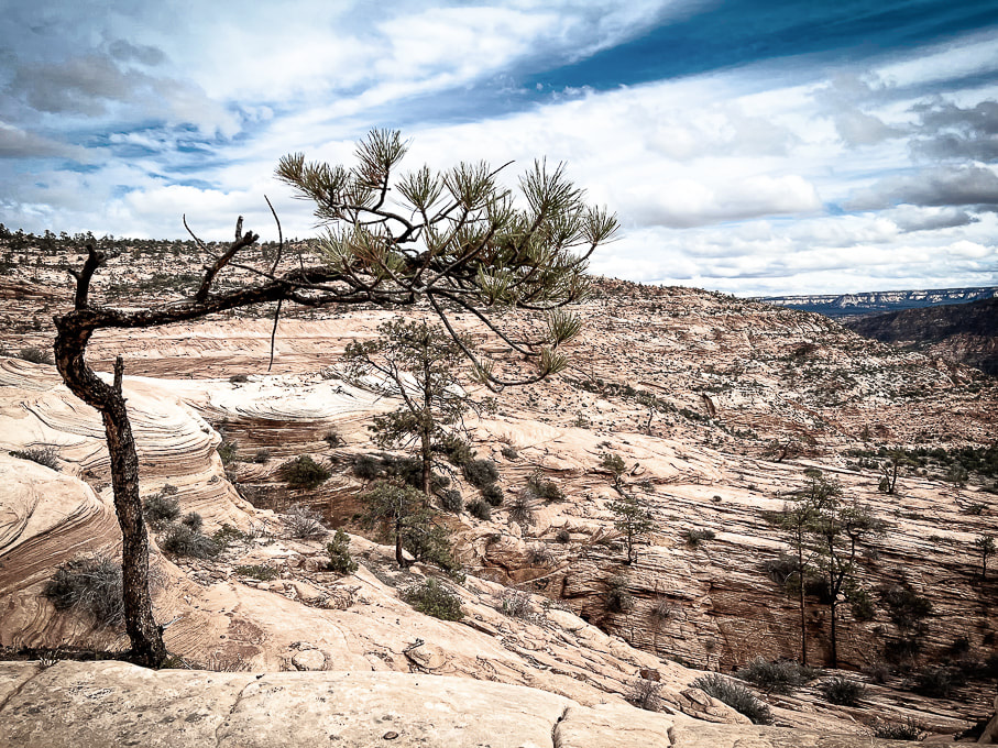 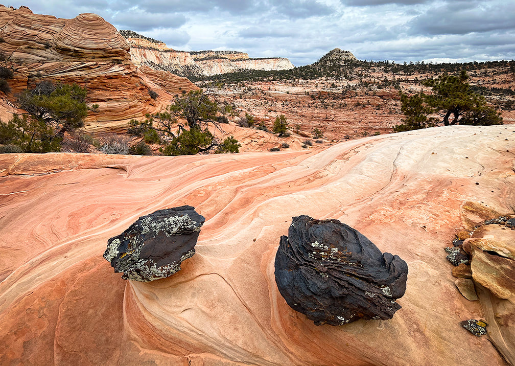 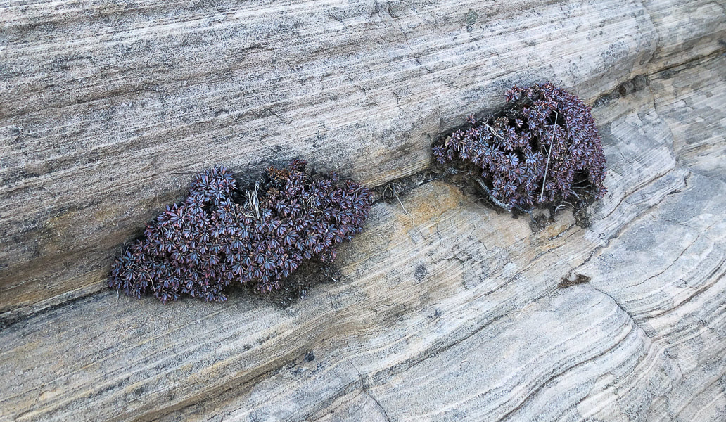 |
Categories
All

Sue and Fred

About this blogExploration documentaries – "explorumentaries" list trip stats and highlights of each hike or bike ride, often with some interesting history or geology. Years ago, I wrote these for friends and family to let them know what my husband, Fred and I were up to on weekends, and also to showcase the incredible land of the west.
To Subscribe to Explorumentary adventure blog and receive new posts by email:
Happy Summer!

About the Author
|