|
A rugged and beautiful off-trail trek up Breakfast Ridge in the Pusch Ridge Wilderness through a saguaro, palo verde and ocotillo "forest". Related: Thimble Peak, Pusch Ridge Wilderness, Tucson Desert Plant photos Cat Mountain - Tucson Mountain Park Tucson Mountains Tour: Golden Gate Mountain, Peak 3,380', Little Cat Mountain 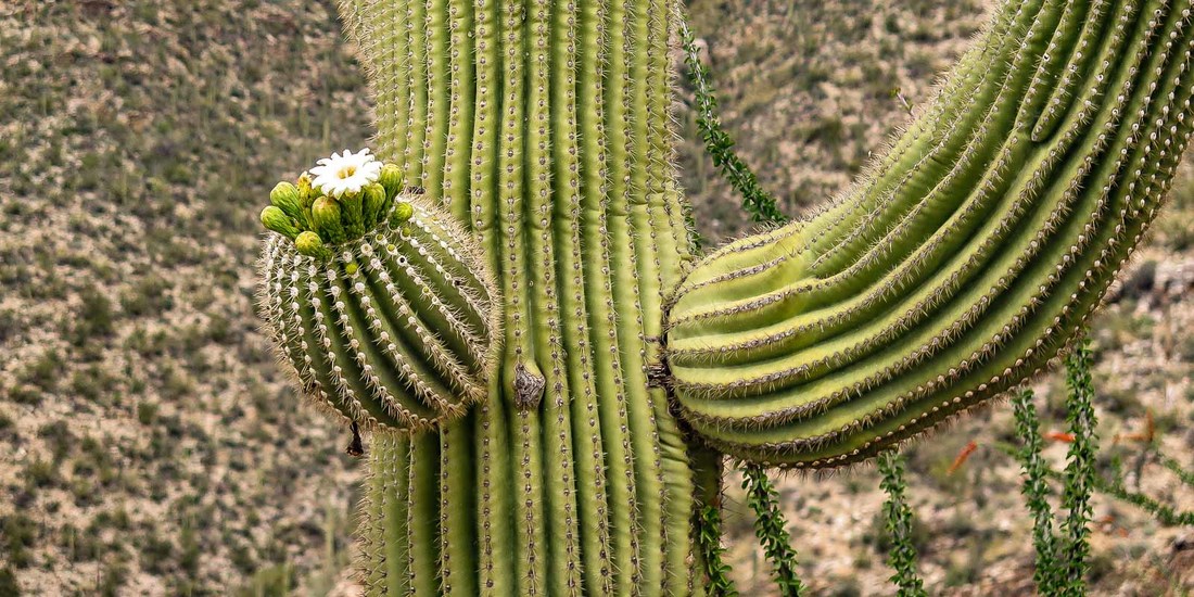 Trip Stats Overview: Abandon a well-trodden trail for the superlative experience of exploring a "remote" and wild route-finding trek on a relatively easy-to-travel ridge between Breakfast Canyon and Rattlesnake Canyon out of Sabino Canyon Visitor Center. Robust and thick vegetation includes prickly pear, cholla and hedgehog cacti. Sweeping views of Tucson to the south with expansive views of rugged crags and peaks to the north; deep canyons drop off on either side. Map: USGS Sabino Canyon, AZ 7.5 quad Breakfast Ridge leads to McFall Crags and Rattlesnake Peak to the north, as described in a loop hike on Earthline: The American West blog. Second major rise on Breakfast Ridge at 4,420 feet: 32°20'30.79"N , 110°47'45.24"W Difficulty: Route on Breakfast Ridge not formally marked or signed; Class 2 scrambling through thick and thorny vegetation. Moderate-strenuous effort on Breakfast Ridge. Experienced route-finding skills and a topo map a necessity. Cairns are present occasionally on top of ridge. Be prepared with headlamp and plenty of water. Sabino Canyon Recreation Area: Visitor Center located at Sabino Canyon Road and Sunrise Drive in northeast Tucson. This link provides the tram schedule information (tram has stops along its route from the Visitor Center to the Sabino Canyon Trailhead). Our Route
Geology Sabino Creek follows the deep cut of the Sabino Canyon Fault in metamorphic core complex rocks of Mylonitic Oracle Granite (gneiss) and Mylonitic Wilderness Suite Granite (gneiss) that formed 25-35 million years ago. 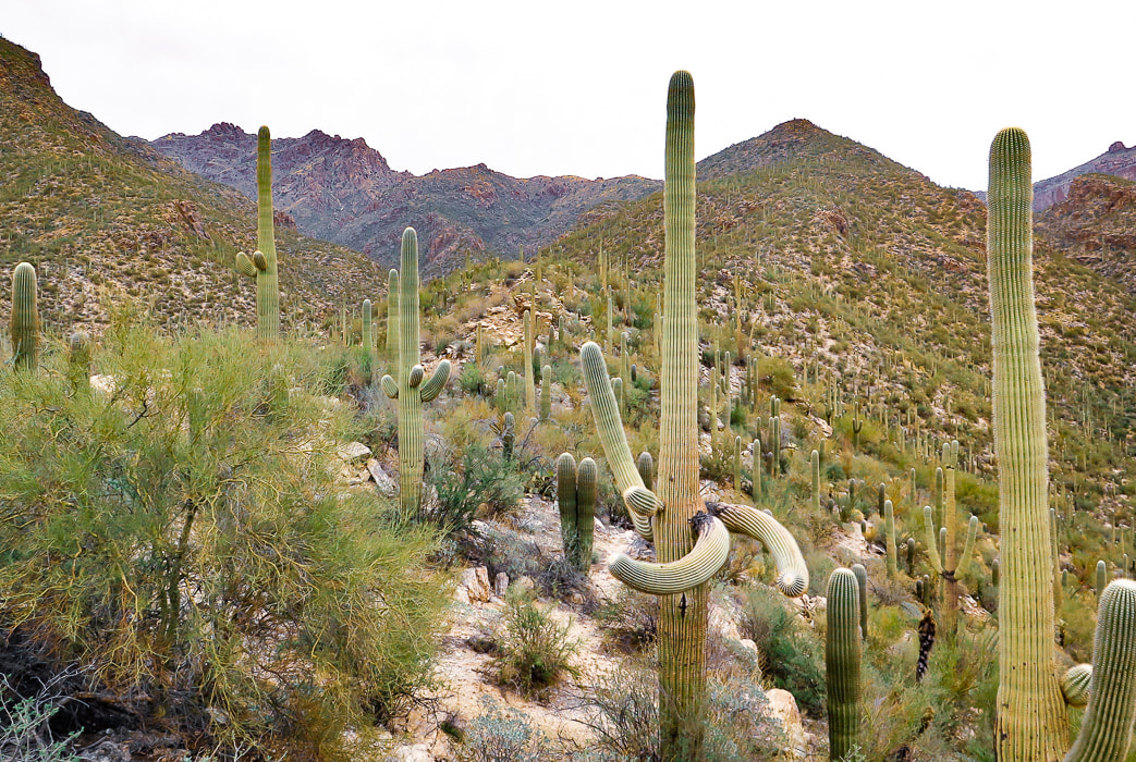 On Breakfast Ridge parallel to Sabino Canyon facing north McFall Crags on most distant left horizon. This route treks over the first major rise (4,000 feet) between two large saguaros in this photo "As for me, I am tormented by an everlasting itch for things remote." -Herman Melville, from Moby Dick We used route directions detailed in Earthline: The American West. "Remote" is a relative term: this hike takes you into the spectacular canyon country of the Pusch Ridge Wilderness where you will not likely see anyone else, however it starts among the throngs of visitors at the Sabino Canyon Visitor Center. As the ridge climbs higher, the view of the Tucson metropolis opens up to the south, but to the north loom rugged crags, canyons and domes. The reward for charting the best route around tangles of thorny Palo Verde trees and long prickly pear spines on a trek with little or no signs of human impact is a more intimate connection with and a greater awareness of this rugged land. 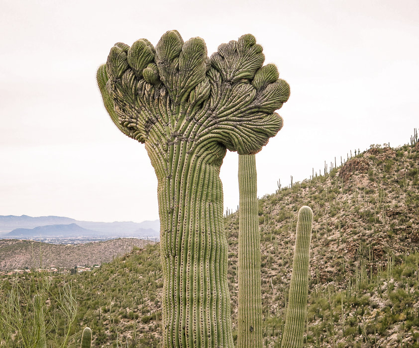 A rare Crested (cristate) Saguaro Following the detailed directions from Earthline's McFall Crags and Rattlesnake Peaks blog post, we set out with quick pace on the Esperero Trail from the visitor's center for 1.3 miles and entered Rattlesnake Canyon wash. The map below shows our route ascending the east flank of Breakfast Ridge and then a parallel route of our descent off Breakfast Ridge and into Rattlesnake Canyon wash to the west of Breakfast Canyon. Next time, I would just ascend and descend the wider Rattlesnake Canyon to the west - it is a beautiful and easy walk marked with footprints and cairns. Or, get onto Breakfast Ridge sooner out of the wash for more firm footing, as described in Earthline blog. Figuring out which wash to go into and which ridge to mount can be confusing; experience with using a topo map is necessary. As we walked up the ridge, Fred noticed a saguaro with a weirdly-shaped crown (photo above). Crested saguaros are relatively rare and are caused by an unusual mutation where cells divide outward instead of in a circular pattern. The Crested Saguaro Society has counted ~ 3,000 cristate saguaros. 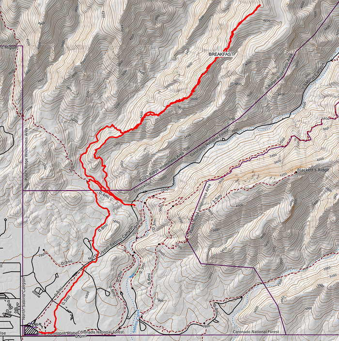 Our GPS tracks. We ascended Breakfast Ridge on its east side and descended it on its west side 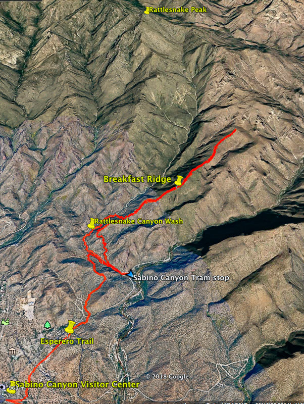 Our route to second major rise (4,420 feet) on Breakfast Ridge Shown is our ascent to the east up onto Breakfast Ridge and our descent to the west off the ridge and into Rattlesnake Canyon wash. I recommend using Rattlesnake Canyon wash to the west of Breakfast Ridge to climb east onto the ridge. Knowing we had a Frost gelato as our reward, we continued up the ridge, trying to avoid thorns and spines, but getting scratched anyway. I should know to wear pants when bushwacking in Arizona, but Idaho hiking is a whole different animal, and long pants aren't required unless it's cold. This is a trek of beauty everywhere you look. Breakfast Ridge is a route to many intriguing places to experience and summit, with pretty steep canyons on either side. At the top of the first major rise at 4,000 feet, we found ourselves at eye-level with a blooming saguaro. Go straight up and over the first rise with occasional hand holds onto gneiss for balance. Rocks are stable on this short and steep section. 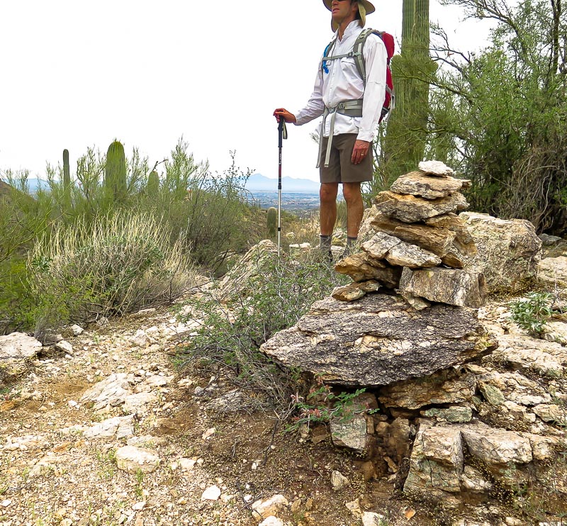 Gneiss cairn on Breakfast Ridge 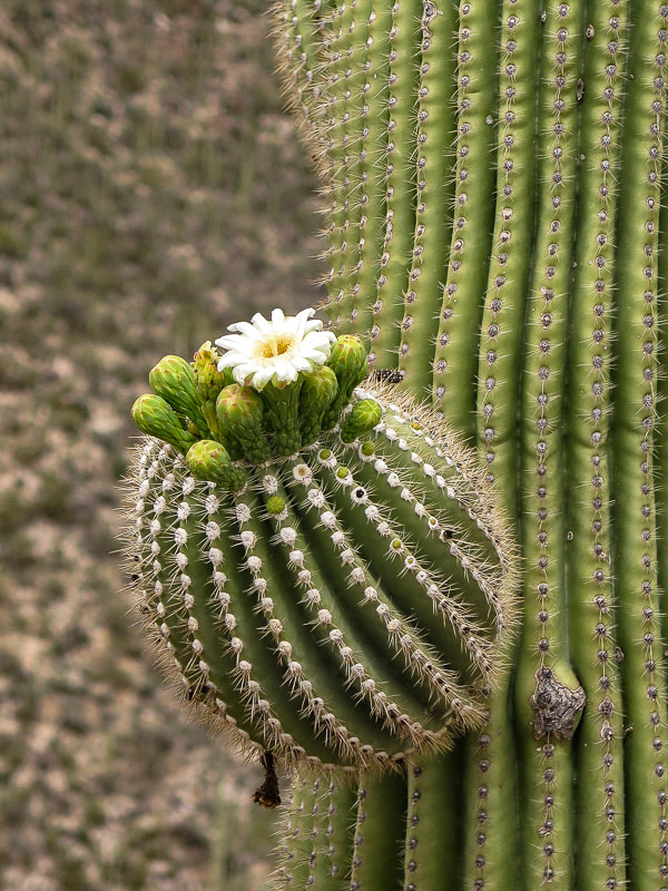 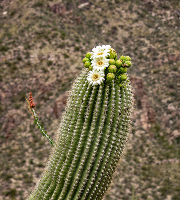 From the first rise, walk down to a saddle and then up again toward the second major rise, with somewhat more open routes to take around clumps of prickly pear, palo verde and ocotillos. From the second rise at 4,420 feet, we could see Rattlesnake Peak and McFall Crags. Sabino Canyon Trail #23 traverses down the wall of Sabino Canyon to the east. I didn't see any hikers on that trail, adding to the feeling of "remoteness". Unfortunately, we were running out of time and turned back at this point. Next time we will start much earlier so we can summit Rattlesnake Peak. 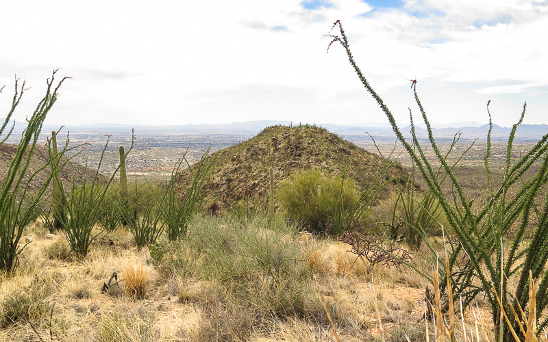 First major rise at 4,000 feet on Breakfast Ridge facing south (return hike) On the descent, we got off Breakfast Ridge and into Rattlesnake wash - a great way to observe geology: foliated gneiss cliffs and rounded boulders while walking through soft sand. Ending our "remote" hike, we walked down the tram road to the Visitor Center - Frost gelato, here we come! 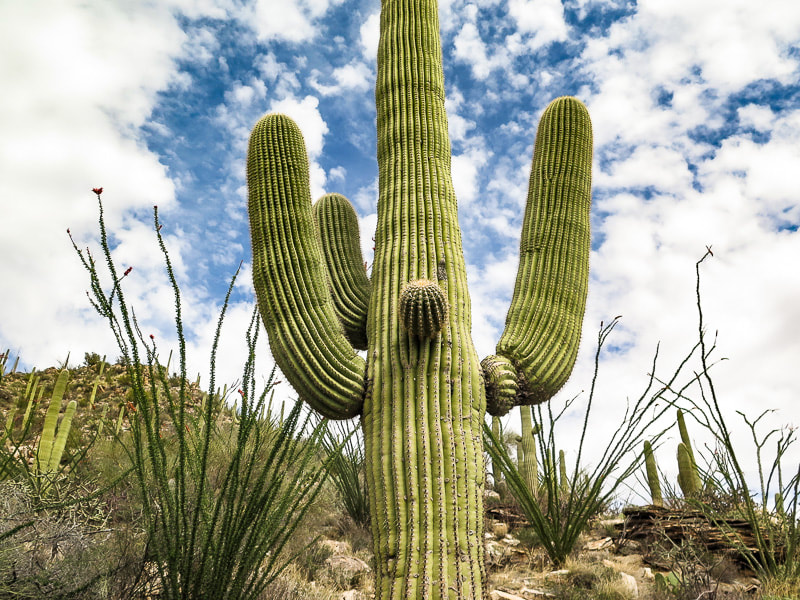 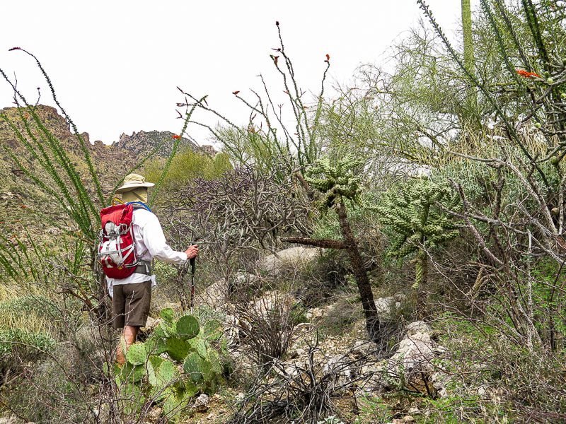 Route-finding on ridge around thick vegetation 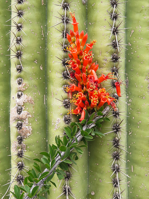 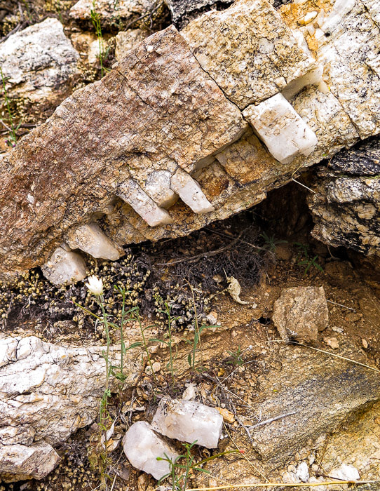 Quartz vein in mylonite 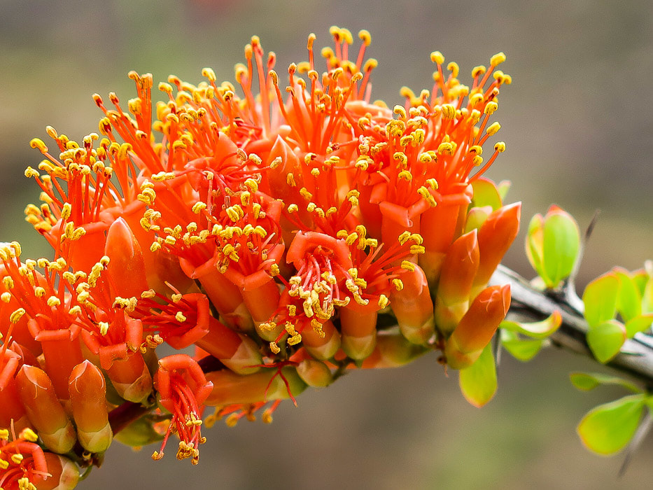 Ocotillo (Fouquieria splendens) blooms 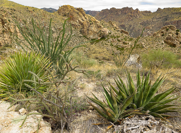 So much to climb! On Breakfast Ridge near second main rise at 4,420 feet  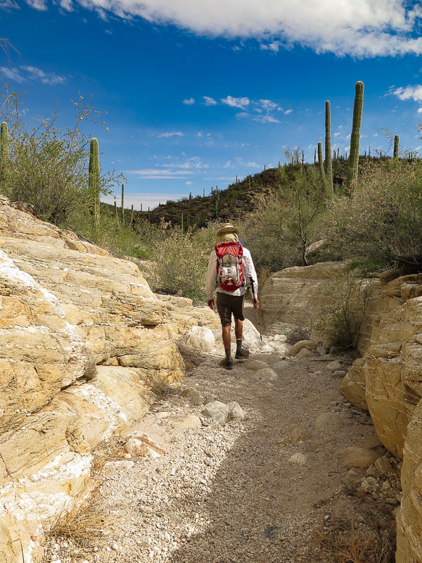 Descending Rattlesnake Canyon 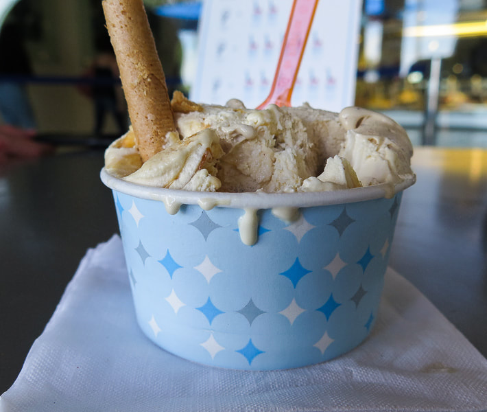 One of Tucson's highlights and reward for tired and scratched legs - a Frost gelato References:
Bezy, John V. 2004. A Guide to the Geology of Sabino Canyon and the Catalina Highway, Coronado National Forest. Arizona Geological Survey, Tucson, AZ. 56 pp. Cristate Saguaros. 2013. Resource Brief - National Park Service - Saguaro National Park, Resource Management Division.
9 Comments
|
Categories
All

Sue and Fred

About this blogExploration documentaries – "explorumentaries" list trip stats and highlights of each hike or bike ride, often with some interesting history or geology. Years ago, I wrote these for friends and family to let them know what my husband, Fred and I were up to on weekends, and also to showcase the incredible land of the west.
To Subscribe to Explorumentary adventure blog and receive new posts by email:
Happy Summer!

About the Author
|