EXPLORUMENTARY
  • Home
    • Cactus to Clouds Hike
    • More Quotes
    • Ann Zwinger Quotes
    • Mary Oliver Poems
  • Hikes by State
    • Idaho
    • Southern Utah
    • Arizona
    • California Desert
    • Nevada
    • Wyoming
  • BLOGS
    • Adventure Blog
    • Women and the Land
  • GALLERY
    • DESERT PLANTS >
      • Beavertail cactus
      • Brittlebush
      • Christmas Cactus
      • Arizona Barrel Cactus
      • Parry's penstemon
      • Agave
      • Arizona Rainbow Hedgehog
      • Claret Cup Hedgehog
      • Desert Agave
      • Palmer's Penstemon
      • Silver Cholla
      • Cristate Saguaro
      • Indian Paintbrush
      • Ocotillo
      • Santa Rita Prickly Pear
      • Spiny Cliffbrake
      • California Barrel Cactus
      • Engelmann Prickly Pear
      • Velvet Mesquite
      • Joshua Tree
      • Buckhorn Cholla
      • Hedgehog Cactus
      • Fishhook cactus
      • Thompson's Woolly Locoweed
    • NATURE
    • BOISE
    • EARTH + SKY
    • URBAN
    • WATER
    • PATRIOT
    • ORCHIDS
  • Fit After 50
    • Brian Holgate
    • Fred Birnbaum
    • Dave Brasuell
    • Bus' Little Black Book
    • Mike Carlson
    • Ray Wilson
    • Bryan Krouse
    • Vickie Kearney
    • Maria Keezer
    • DOUG TRAUBEL
    • Boise Cross Fit Masters Ladies
    • Tim Clemens
    • Marcia Bondy
    • Becky Borczon Blake >
      • Becky B Downtown
    • Jennifer Cera and Sue Birnbaum
    • Dave Brasuell
    • Vance Powell
  • About
    • CONTACT

Lucky Peak Hike, Boise - The Ridge Less Traveled II

2/20/2021

0 Comments

 
In search of new routes and solitude on Lucky Peak, an historic mining district, amidst burgeoning Boise trail use.
Related: 
Lucky Peak, the Ridge Less Traveled
Lucky Peak HIke - Winter Ascent
The 10 Essentials to carry with you on day hikes
Picture
Adelmann Mine in Boise River Wildlife Management Area
Trip Stats
  • Overview:  This Lucky Peak southeast ridge hike begins in open, rolling grass and shrub terrain and ends in a Ponderosa pine forest, with a colossal view of Boise and the Owyhee Mountains to the south from the summit.  Trail goes straight up - no switchbacks here!  It's hard work but the solitude, route-finding, and opportunity to see wildlife is worth the effort.
  • Location:  Boise River Wildlife Management Area and Boise National Forest, Idaho.  Administered by Idaho Dept. of Fish and Game.
  • Distance/Elevation gain:  7.5 miles total out and back.   Trailhead is 3,509',  Lucky Peak Summit is 5,904' for a gain of 2,723' including ~ 300' of regaining elevation lost.  This equates to > 700' average gain/mile.
  • Difficulty:  Moderate - Strenuous Class 2 with off-trail navigation.
  • Map:   USGS Lucky Peak Quad 7.5 minute series.
  • ​More info:  Boise River WMA.  Map of Boise River WMA.       
  • Hike Directions:  Walk through relatively flat valley on 2-track dirt road, crossing creek twice.  Arrive at toe of ridge at 0.8 miles, just past wooden fence with opening.  A more defined trail angles to the right along steep-sided v-shaped valley; however follow faint path left, straight up ridge in a northwest direction, staying on the ridge mostly; losing a little bit of elevation when descending to a few saddles.  Head toward line of trees.  Reach Point 5645 at 2.7 miles,  and go around the left of it to the line of trees.   The ridge turns more westerly, with steep terrain dropping to the north.  Reach the Boise National Forest boundary marked by orange metal posts at 2.8 miles.  Follow ridge to saddle with road at 3.0 miles.  Continue through trees past a few Bird Observatory campsites on a trail, then up final short steep ascent to radio towers and summit at 3.75 miles.
  • CAUTION:  Experience with off-trail navigation necessary.
  • Dogs are required to be on a leash in the Boise Front segment of the Boise River WMA.  Lucky Peak and this hike is in the Boise Front segment.
  • Trailhead:  Traveling north on Idaho Hwy 21 from Boise, go past Highland summit.  This route begins at brown metal gate at small parking area, just past Boise River Wildlife Management Area (WMA) headquarters parking lot.
  • Geology:  Granodiorite and two-mica (biotite and muscovite) granite from the Cretaceous age.  Includes bulk of Atlanta Lobe batholith of intrusive igneous rocks (85-67 Mya).
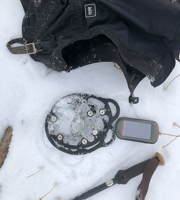
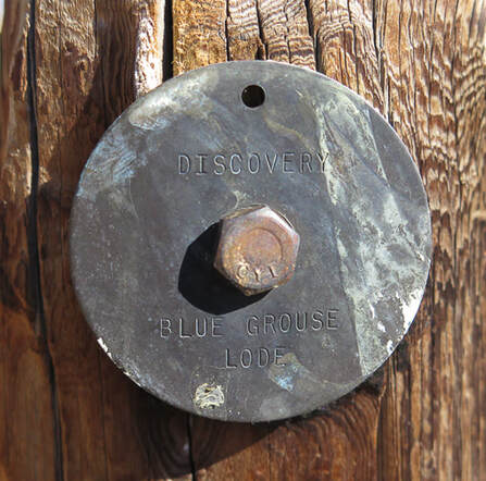
History of the Adelmann Mine
Owned by the Adelmann brothers, one of which was Richard Adelmann, a German miner and Civil War Veteran who also built the Adelmann Building in downtown Boise at Capitol and Idaho Street in 1902.   Gold was the primary commodity, followed by extraction of silver and zinc.  The Adelmann Group was part of the Black Hornet District.  The Black Hornet Mine is located directly south of the Adelmann Mine in Boise River WMA.  The deposit was an underground vein in a host rock of Atlanta Lobe of the Idaho Batholith - two mica granite of Cretaceous age.
A very thorough report by the Idaho Geological Survey includes Black Hornet Mine and Queen Mine from the Lucky Peak area:
Site Inspection Report for Abandoned and Inactive Mines on Land Administered by the U.S. Bureau of Land Management in the Boise Resource Area, Idaho:  Boise Foothills, Ada County, and Osborne Mine, Gem County 
Gear
Snow boots, snowshoes, gaiters, GPS, Yaktrax Pro diamondgrip, walking pole.

Helpful technique - The Rest Step
When breaking trail up a steep snow slope, the rest step helps you to conserve energy and prevents your legs from getting too quickly fatigued.  It is a rhythmical gait, resting momentarily with each step by putting your weight onto a straight back leg and letting your other leg swing forward.  The idea is to decrease the use of muscles with every step and let your weight be supported by leg bones instead.  Take small steps.  REI snow travel techniques.
 Our Hike
The ability to leave city life - temporarily - and get a taste of early 1900's mining life is one of the great advantages of hiking Lucky Peak.  Even if you don't go to the Adelmann or Black Hornet mines, you can stumble onto some old rusted equipment, or an old mining claim like the one in the photograph below of the Blue Grouse Lode discovery.

Lucky Peak, a.k.a. Shaw Mountain in Boise has been a "staple" hike for us the past 20 years because we gain a good amount of elevation - 3,000 feet - in 4.5 miles and it's close to home.   With the influx of people moving into the Boise area and subsequent increased trail traffic, we have added four additional routes to its summit in search of more solitude.    We call each route by a different name.  There's the "backside" route from the Wilderness Management Area headquarters (Lucky Peak:  The Ridge Less Traveled).  There's two ridge hikes we use to hike and snowshoe.  Then, there's the Pruett route, named after our friend and his two boys whom we took up one cold early spring day.   Most photos on this post represent different hikes/snowshoe hikes up the same southeast ridge.
 
This route is a steep ascent that overlooks the road to Adelmann Mine, often "crowded" with hikers.   The primary purpose of the Boise River Wildlife Management Area is to "Provide winter habitat for mule deer and elk, and year-round habitat for other wildlife species."   This WMA supports the largest wintering mule deer herd in Idaho.  Elk sign is present, especially during the winter months.  Once we saw a majestic bull elk silhouetted on the next ridge over, his large herd of cows watching us, then they disappeared over the ridge.  The view of the mountainous Boise National Forest is spectacular most of the way, especially in winter.
Picture
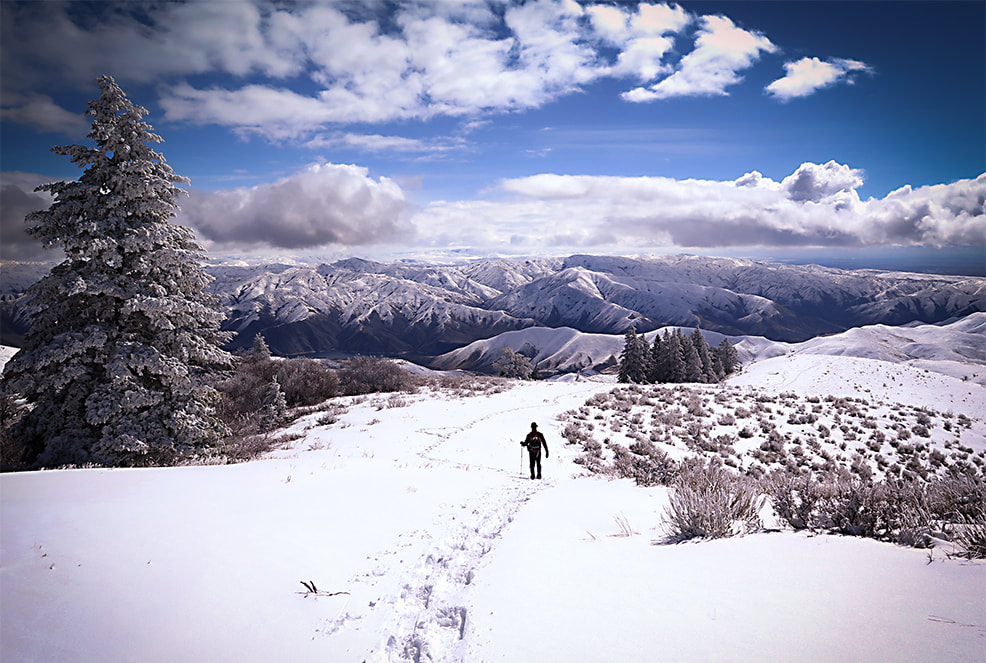
Boise National Forest peaks to the northeast
Picture
Picture
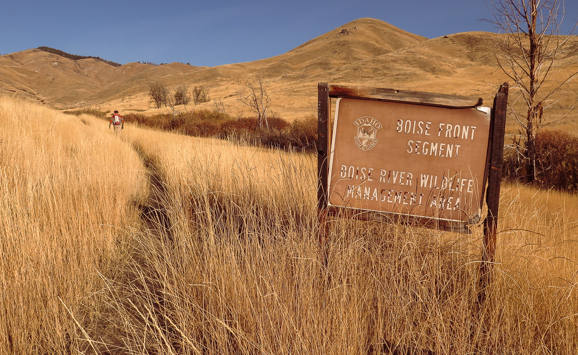
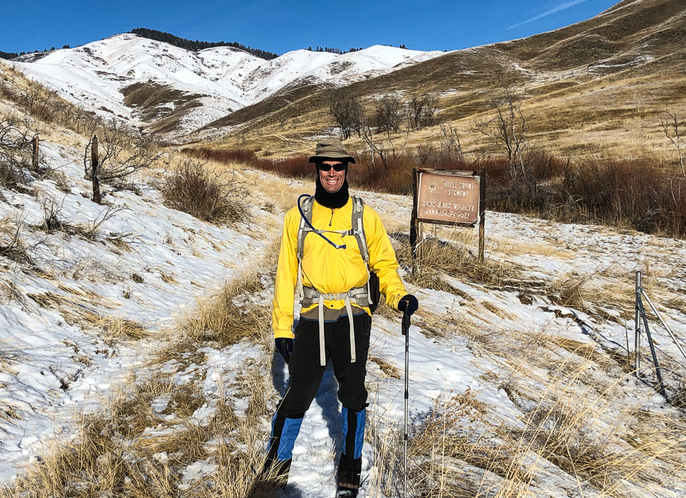
At Trailhead:  An early November 2020 hike (above), and a hike on 1/1/21 (bottom).
Follow ridge to tree line - the highest point on the horizon is Point 5645, 2.7 miles from trailhead.
Picture
The hike begins on a Boise River WMA access road and treks through a pretty native grassland valley, crosses a creek twice before ending at the toe of an undulating  ridge at about 0.80 miles.  At this point we leave the trail and head straight up a faint trail, staying mostly on the top of the ridge, aiming northwest for the forest on the horizon,  where the Lucky Peak radio towers can be seen at a distance.   A  walk over a few saddles, and a final climb to the summit gets you to an expansive view of Boise and the entire Treasure Valley.  The Owyhee Mountains line up on the southwest horizon.  Most years in the fall, we will see the Boise State University's Intermountain Bird Observatory scientists on the summit with their binoculars.  The Lucky Peak Station accepts visitors and posts directions for driving a dirt road to the summit  on their web page.
Picture
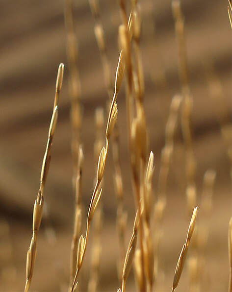
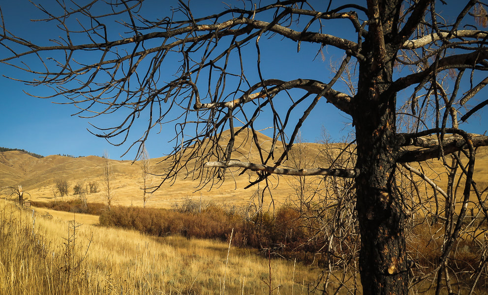
Native as well as invasive grasses carpet the valley the first 0.8 mile of the ridge approach.
​Signs of the 2016 Mile Marker 14 fire.
Picture
Picture
Picture
Many sagebrush have been burned by the Mile Marker 14 Fire in 2016 which closed the Boise River Wildlife Management Area at that time.
Picture
The terrain drops steeply on each side of the ridge in a few spots.  Once I can see Adelmann Mine at 2.1 miles in a deep valley to my left, I know we are nearly at the tree line.  The mine buildings are well-camouflaged.  
There are also a number of bare rock outcrops on the ridge that look like core stones, or tors.  Their rate of weathering seems to be slower than that of the granite previously surrounding them that has weathered away.  Maybe the grains in this granite are more cemented, or the joints further apart than the rock that has been weathered and eroded.  At any rate, they look like sentinels guarding the ridge.
Picture
Picture
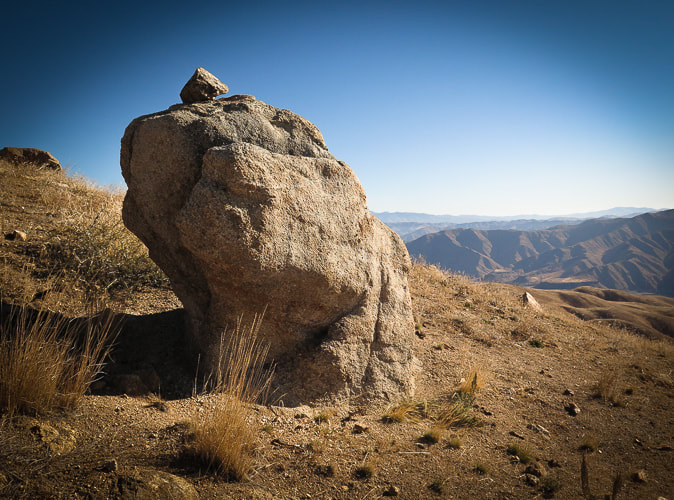
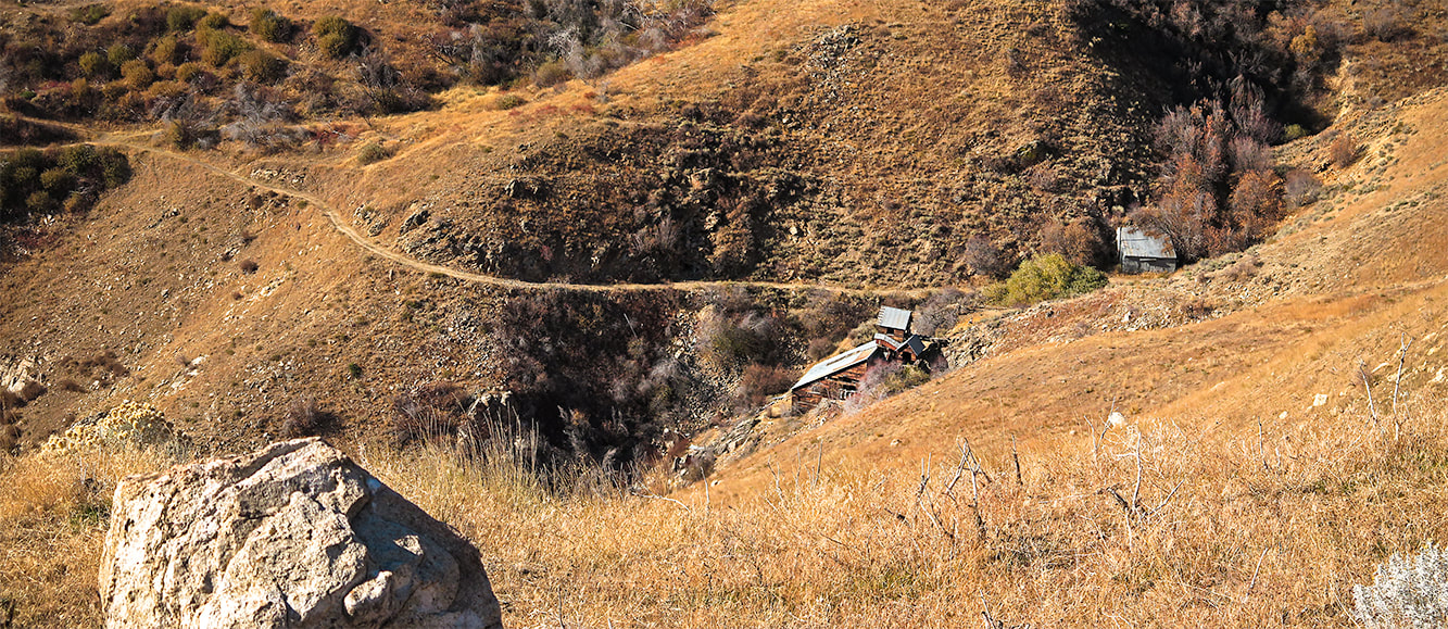
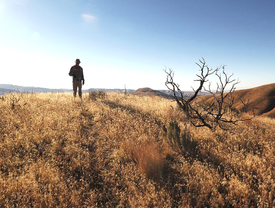
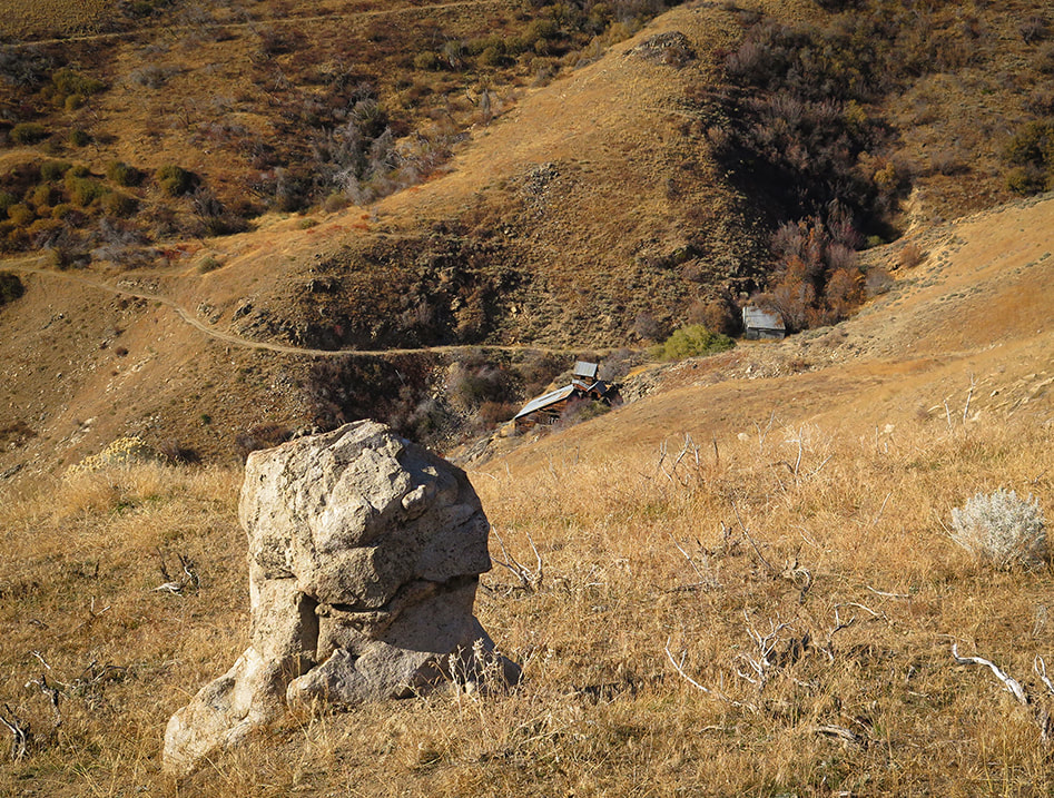
Core stone looking over Adelmann Mine buildings at 5,000 feet elevation.
Primary commodity - gold

Picture
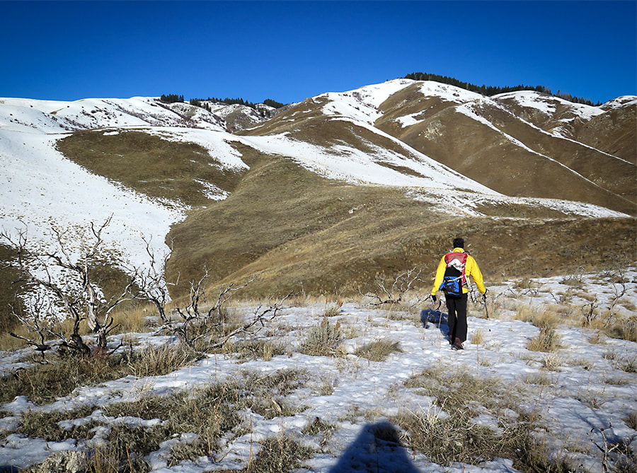
Going up middle southeast ridge to Point 5645 on horizon with row of trees, which is 2.7 miles into hike
Picture
Picture
Picture
 Idaho!
Picture
Picture
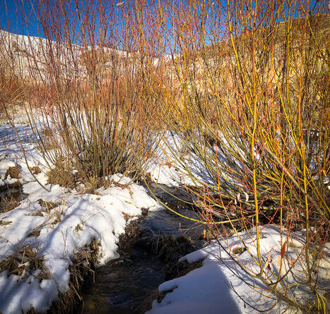
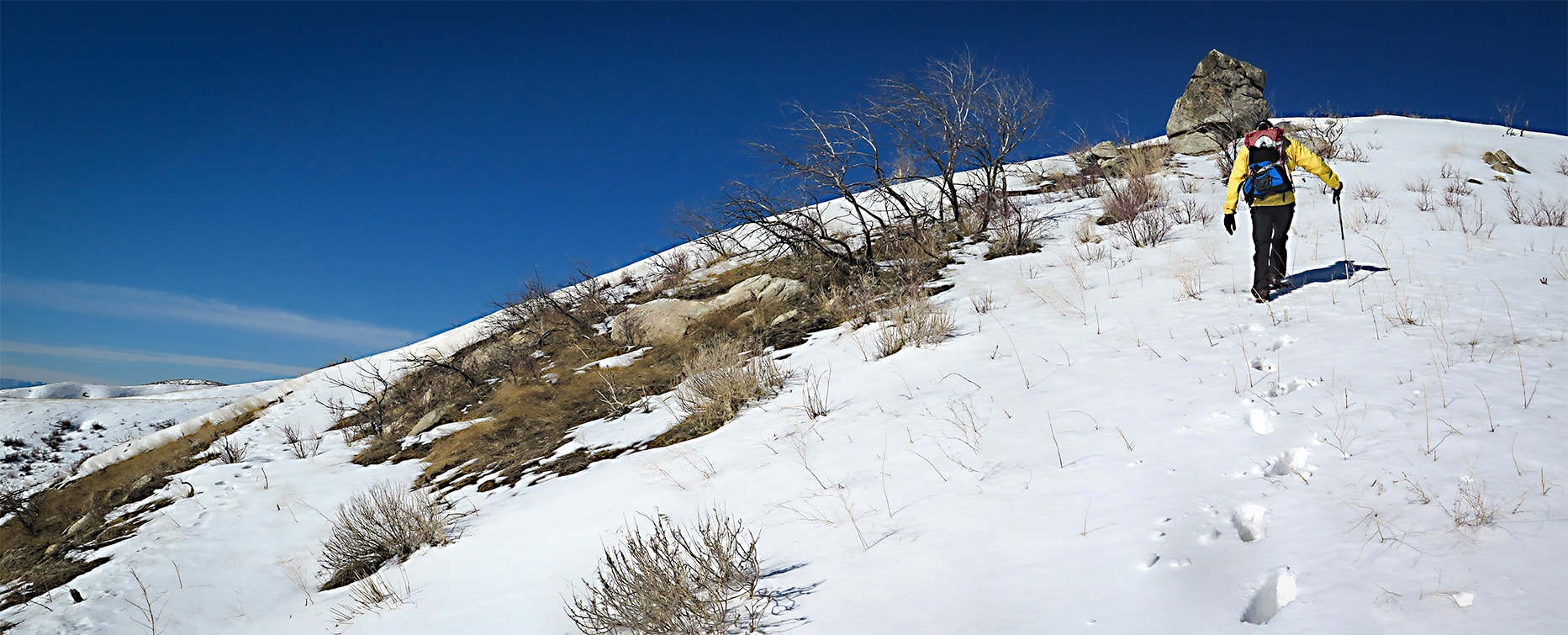
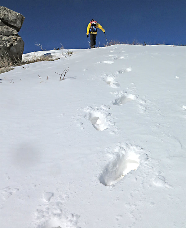
Good place to use the Rest Step technique!
(see above)

Picture
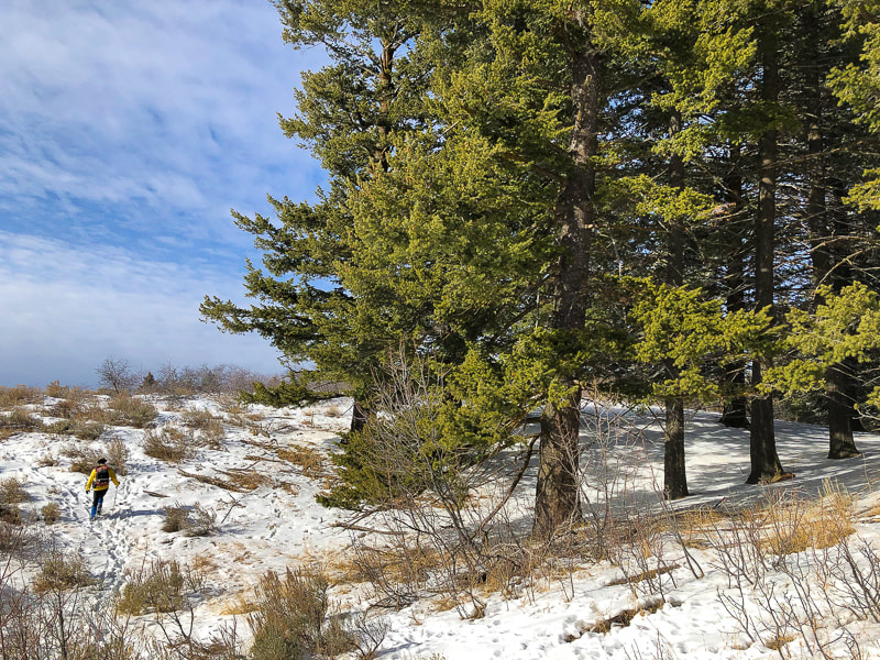
Reach tree line at 5,600 feet elevation 
At the forested ridge, Lucky's summit is only another 300' gain.    Metal posts mark Boise National Forest boundary and can be followed to a road that arises from Adelmann Mine.   At the high point of this road, at a shaded saddle with a view toward Shafer Butte near Bogus Basin Ski Area to the north, a trail ascends to the west, passing by a few tent campsites.  One more short climb to the summit and you are rewarded with a 360-degree view, mostly of the flat Snake River Plain and civilization at your feet.  The mountainous  Boise National Forest lies to the north.

We relinquish our solitude for a few moments on the summit as 4 groups of hikers come and go.  Then we are back on our own as we descend the ridge less traveled, intersecting elk trails in the snow.   The descent is steep in parts as we pass by mining relicts.  Try to imagine the gold miners on these ridges.  Return to "civilization."  Lucky to have the best of both worlds.
Picture
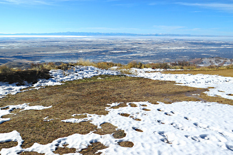
View of Treasure Valley in the Snake River Plain from Lucky Peak's summit.
Owyhee Mountain range on the horizon.

Picture
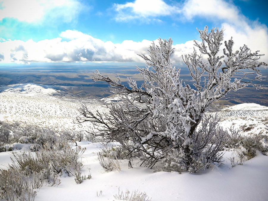
Antelope bitterbrush overlooking the Snake River Plain
Picture
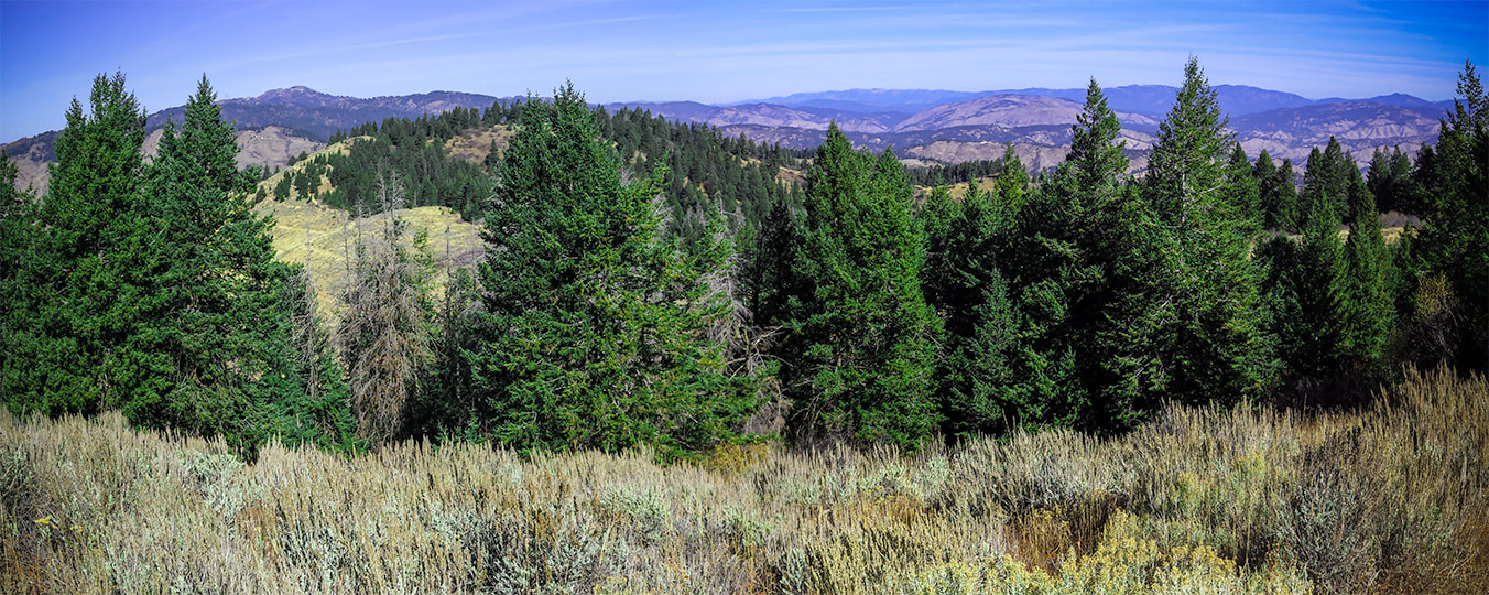
From Lucky Peak summit looking north to Shafer Butte (left) near Bogus Basin Ski Area 
Picture
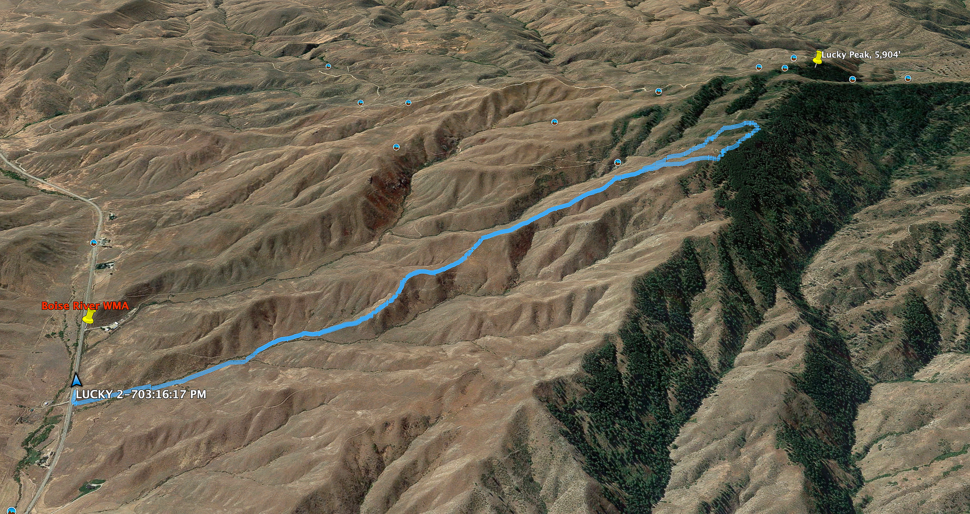
We didn't make it all the way to the summit on this southeast ridge hike. 
​North is to right of image - click for larger image
Picture
Picture
Picture
Picture
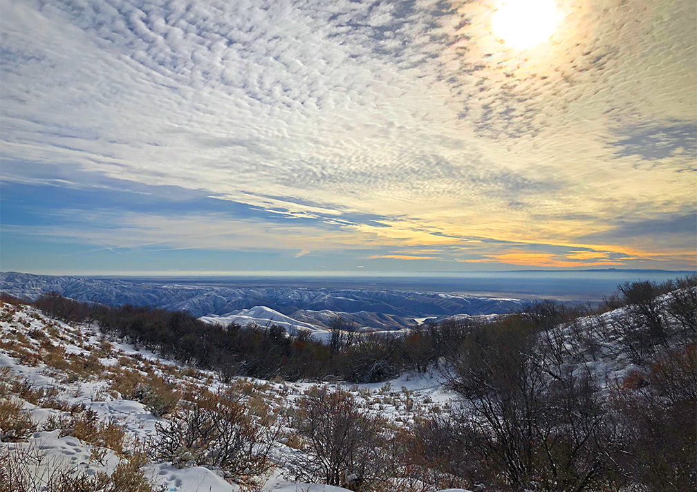
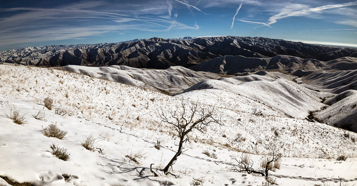
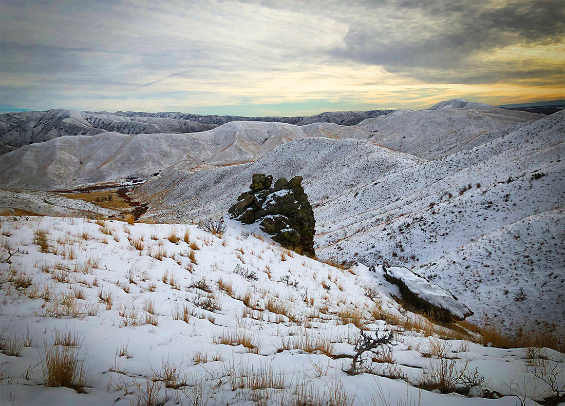
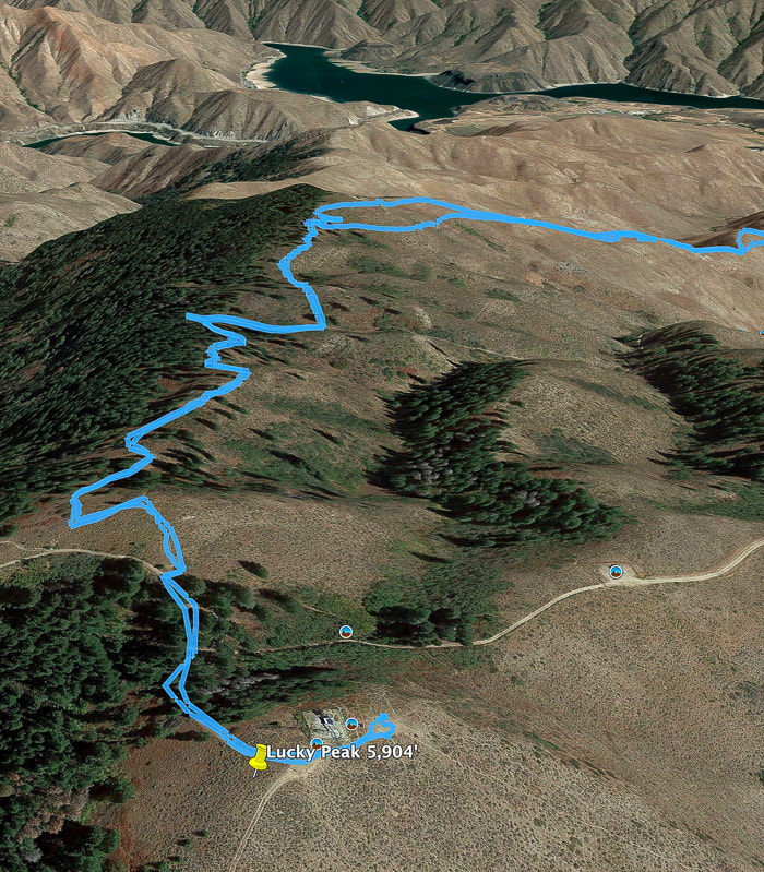
Our GPS tracks to/from summit
Lucky Peak Reservoir in distance

Picture
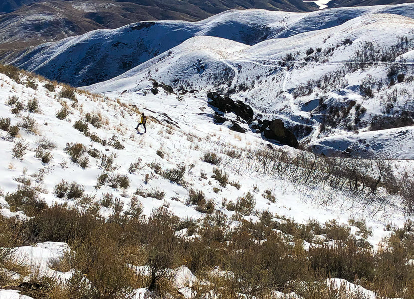
Going back down:  slow going through brush on lower slope.
​Lower road leads to Adelmann Mine
Picture
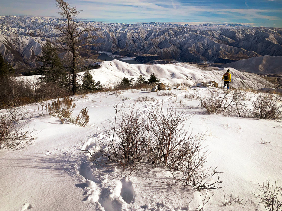
Overlooking Lucky Peak Reservoir
Picture
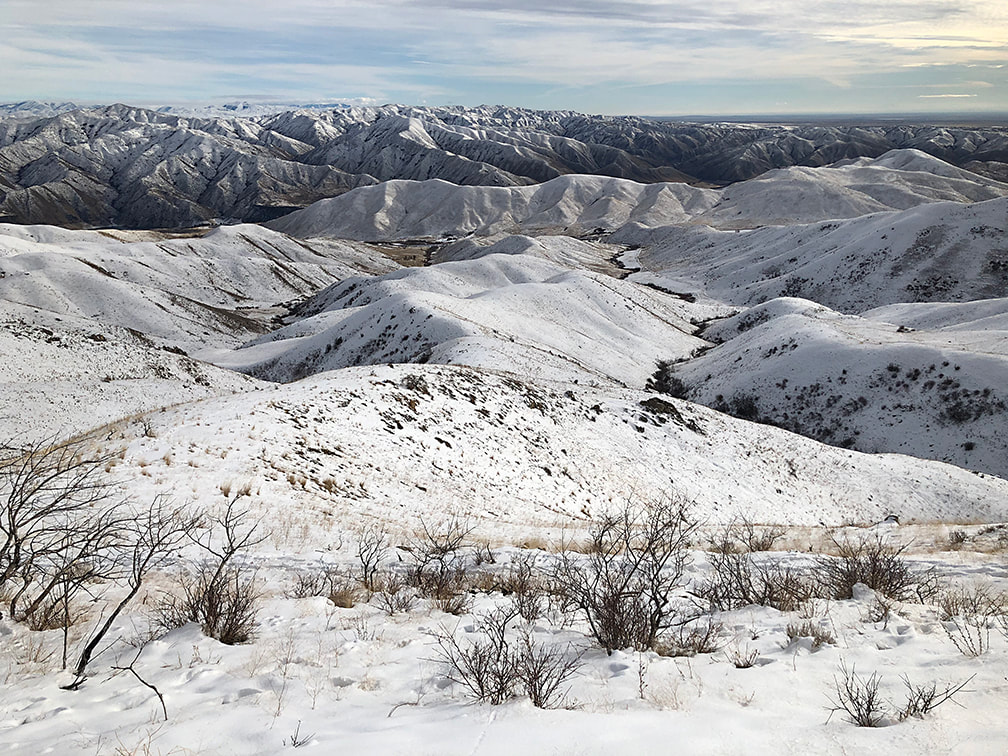
Heading down ridge - Boise River WMA in valley on right.  Our trailhead in valley on left.
Picture
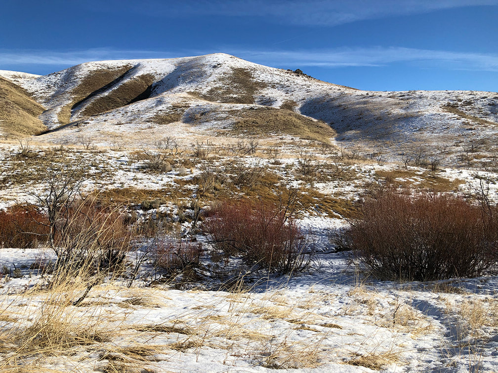
Beautiful valley at end of hike
This image is as taken - no editing

Picture
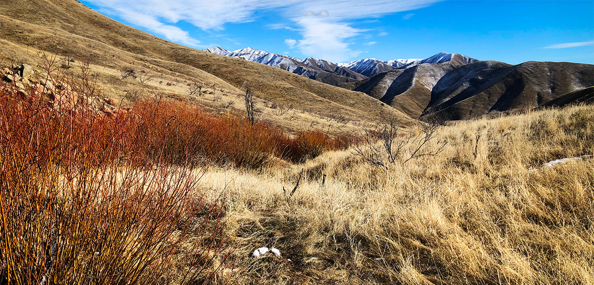
Great way to end the hike!
Picture
Picture
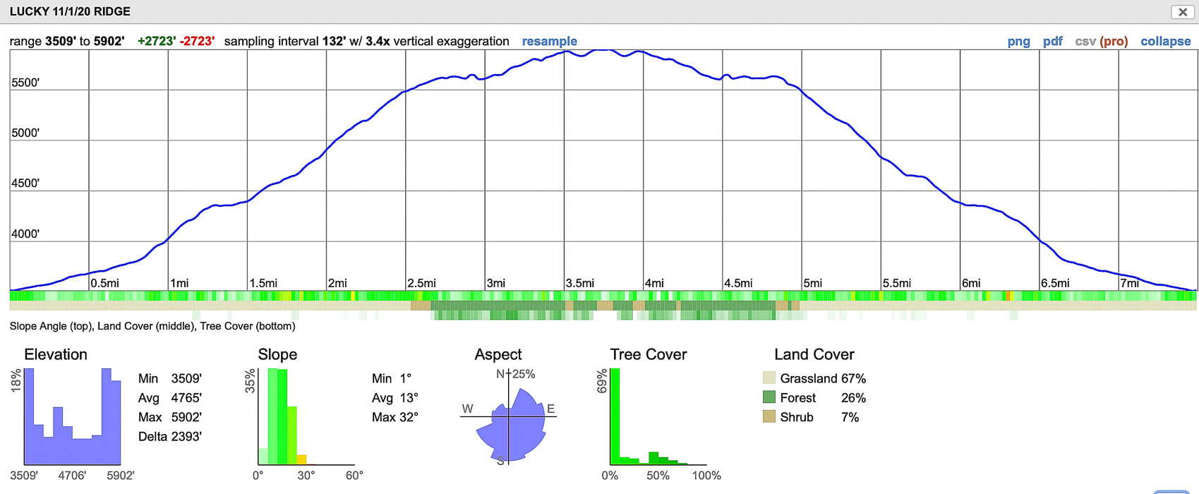
Our GPS track from Idaho Hwy 21 to Lucky Peak Summit
click on map for larger image

References

The Diggings - Adelmann Group
​
Western Mining History - Adelmann Group - westernmininghistory.com
Maley, T.  1994.  Field Geology Illustrated, 2nd ed.  Mineral Land Publications, Boise, Idaho.
0 Comments

    Categories

    All
    Arizona Hikes
    California Desert Hiking
    Idaho Summits
    Nevada Hikes
    Snowshoe Hikes
    Southern Utah Hikes/Bikes

    Complete list of Hikes/Bikes on HOME page
    Picture
    Sue and Fred
    Picture

    About this blog

    Exploration documentaries          –  "explorumentaries"  list trip stats and highlights of each hike or bike ride, often with some interesting history or geology.  Years ago, I wrote these for friends and family to let them know what my husband, Fred and I were up to on weekends, and also to showcase the incredible land of the west.  

    To Subscribe to Explorumentary adventure blog and receive new posts by email:

    submit
    Picture
    Happy Spring!
    Picture

    About the Author
    Sue Birnbaum

    A  trip to Jumbo Rocks Campground in Joshua Tree National Monument 38 years ago sparked my passion for hiking, exploring, and learning about desert ecosystems.  For the past 25 years, my husband Fred and I have explored the American West together; we love this land and I hope to inspire you to get out and explore through my photographs and trip descriptions.
    In 1992, Ray Wilson and I conceived the first Cactus to Clouds hike which climbs over 10,000 feet in one day to the summit of Mt. San Jacinto near Palm Springs, California.
    CACTUS TO CLOUDS HIKE 
    READ MORE
    ABOUT SUE

    Archives

    February 2023
    January 2023
    December 2022
    November 2022
    October 2022
    September 2022
    August 2022
    July 2022
    June 2022
    May 2022
    April 2022
    February 2022
    January 2022
    December 2021
    November 2021
    October 2021
    August 2021
    July 2021
    May 2021
    March 2021
    February 2021
    January 2021
    November 2020
    October 2020
    August 2020
    July 2020
    June 2020
    April 2020
    March 2020
    February 2020
    January 2020
    November 2019
    October 2019
    September 2019
    August 2019
    July 2019
    June 2019
    May 2019
    April 2019
    February 2019
    December 2018
    November 2018
    October 2018
    September 2018
    July 2018
    June 2018
    May 2018
    April 2018
    March 2018
    February 2018
    January 2018
    December 2017
    November 2017
    October 2017
    September 2017
    August 2017
    July 2017
    June 2017
    April 2017
    February 2017
    November 2013
    August 2013
    July 2013

    Some of my favorite websites:
    Awkward Botany
    ​citizen botany for the phytocurious

    Bird and Hike

    ​"Intended to encourage people to visit, learn about, and fall in love with the desert."
    ​

    Draw and Shoot
    Beautiful Photography

    Earthline: The American West
    Debra "writes to extol our beloved Earth." Detailed hike info, excellently written.
    ​

    Geologypics.com
    Geology and Geologic Time through Photographs

    Glenn Suokko
    Vermont artist's paintings "inspired by a place based on the land .... drawn to painting the representation and abstraction of nature."

    In the Company of Plants and Rocks
    ​A natural history blog about botany, plant ecology, and geology.

    Nature's Depths

    Walking through nature with John Palka, a neuroscientist who loves plants and ponders big questions

    Rangewriter - What Comes Next?
    ​With excellent writing, Linda tells the story of her unique mother's life including WWII era; with beautiful photographs.

    SeekingLost - Hiking and Backpacking Adventures.

    Stav Is Lost- Unconventional, out-of-the way hikes in the American West.


    Uprooted Magnolia
    ​Leah Yetter's beautiful "photo journal on life, love, and the spirit of Wyoming."
HOME

Cactus to Clouds Hike
More Quotes
HIKES BY STATE

Idaho Hikes
Utah Hikes/Bikes
​Arizona Hikes
​California Desert Hikes
​Wyoming Hikes
​Nevada Hikes

BLOGS

Adventure Blog
Women and the Land
GEAR REVIEWS
FIT AFTER 50
Fred Birnbaum
Dave Brasuell
Bus' Little Black Book
​Mike Carlson
​Ray Wilson
​Marcia Bondy
Bryan Krouse
​Maria Keezer
​Tim Clemens
​Doug Traubel
​Brian Holgate
​
Becky Borczon Blake
​Jennifer Cera and
​Sue Birnbaum

​Vance Powell
​Boise Cross Fit Masters Ladies
​Vickie Kearney

GALLERY

Desert Plants
Nature
Earth + Sky
Urban
Water
Patriot 
​Orchids
Boise
​
  ABOUT
    Contact

​
© 2017 - 2023 by Sue Birnbaum.  Photos on this website are the sole property of Sue Birnbaum unless otherwise indicated.  Please receive permission before publishing my trip reports and photos.
I try my best to be accurate with my hike descriptions; please research your adventures, always bring a map and compass and know how to read them, be prepared!  All of these hikes can be dangerous; hike at your own risk.  ALWAYS carry the Ten Essentials with you on hikes. 
​Please feel free to contact me with comments or questions, or if you see any errors that need attention.
Thank-you for stopping by!


EXPLORUMENTARY.com
  • Home
    • Cactus to Clouds Hike
    • More Quotes
    • Ann Zwinger Quotes
    • Mary Oliver Poems
  • Hikes by State
    • Idaho
    • Southern Utah
    • Arizona
    • California Desert
    • Nevada
    • Wyoming
  • BLOGS
    • Adventure Blog
    • Women and the Land
  • GALLERY
    • DESERT PLANTS >
      • Beavertail cactus
      • Brittlebush
      • Christmas Cactus
      • Arizona Barrel Cactus
      • Parry's penstemon
      • Agave
      • Arizona Rainbow Hedgehog
      • Claret Cup Hedgehog
      • Desert Agave
      • Palmer's Penstemon
      • Silver Cholla
      • Cristate Saguaro
      • Indian Paintbrush
      • Ocotillo
      • Santa Rita Prickly Pear
      • Spiny Cliffbrake
      • California Barrel Cactus
      • Engelmann Prickly Pear
      • Velvet Mesquite
      • Joshua Tree
      • Buckhorn Cholla
      • Hedgehog Cactus
      • Fishhook cactus
      • Thompson's Woolly Locoweed
    • NATURE
    • BOISE
    • EARTH + SKY
    • URBAN
    • WATER
    • PATRIOT
    • ORCHIDS
  • Fit After 50
    • Brian Holgate
    • Fred Birnbaum
    • Dave Brasuell
    • Bus' Little Black Book
    • Mike Carlson
    • Ray Wilson
    • Bryan Krouse
    • Vickie Kearney
    • Maria Keezer
    • DOUG TRAUBEL
    • Boise Cross Fit Masters Ladies
    • Tim Clemens
    • Marcia Bondy
    • Becky Borczon Blake >
      • Becky B Downtown
    • Jennifer Cera and Sue Birnbaum
    • Dave Brasuell
    • Vance Powell
  • About
    • CONTACT