|
One of the "ultra-prominent peaks" in the lower 48 states, this excellent hike treks through blankets of wildflowers, up a steep slope and across a long, thin ridge to the summit of the Wasatch Range's highest peak.
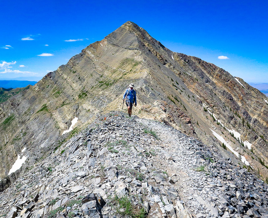
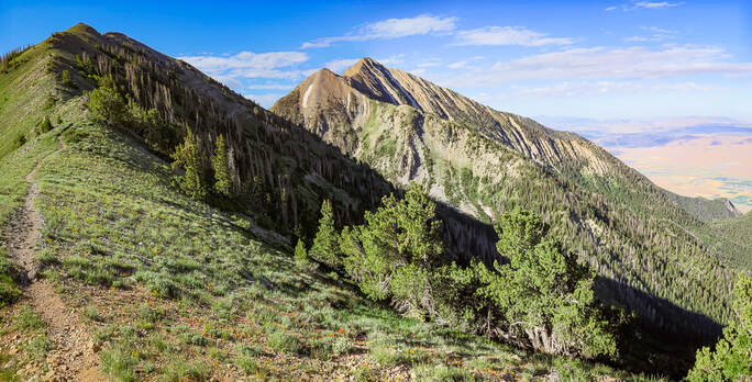
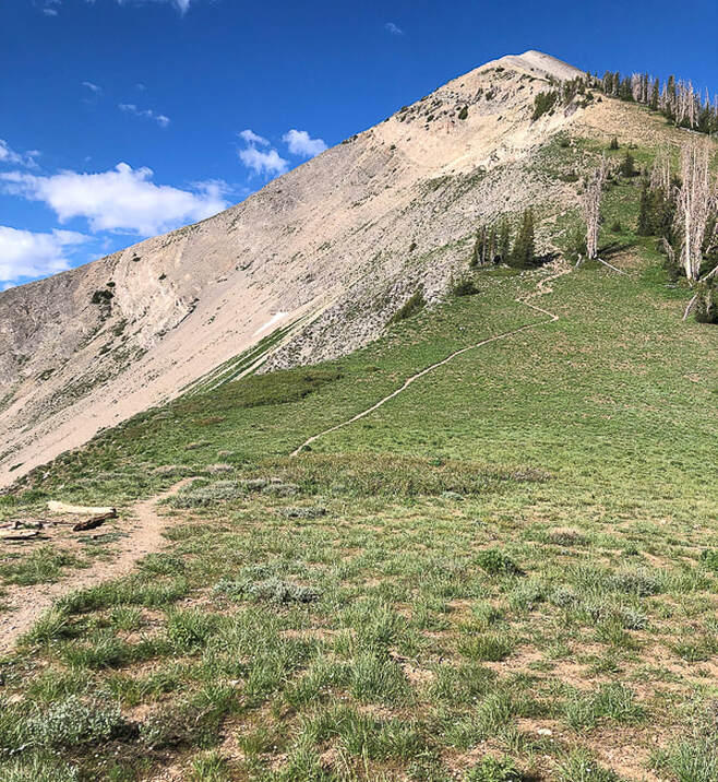
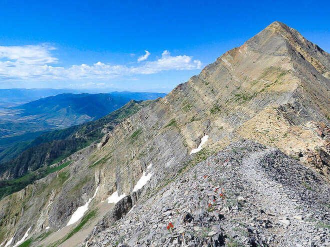
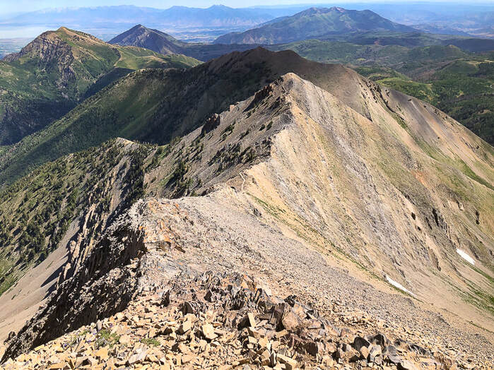
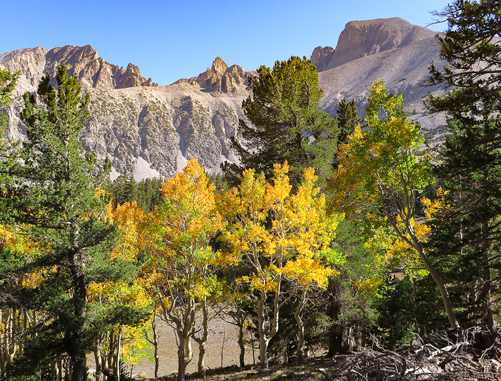
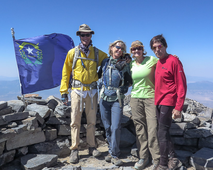
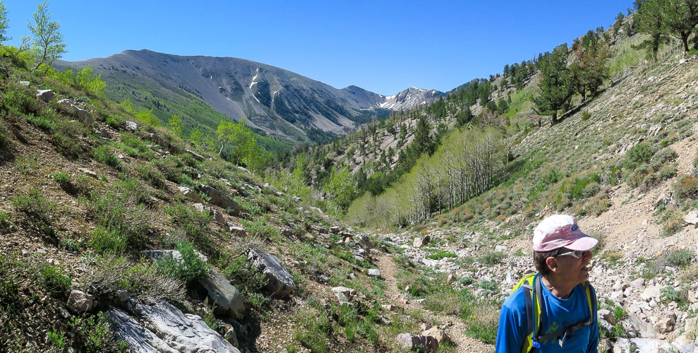
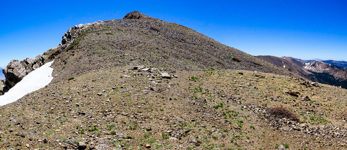
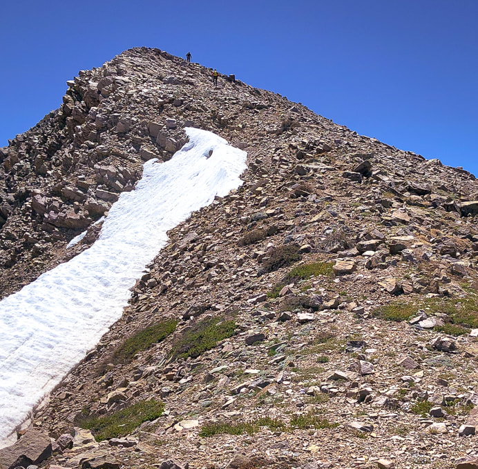
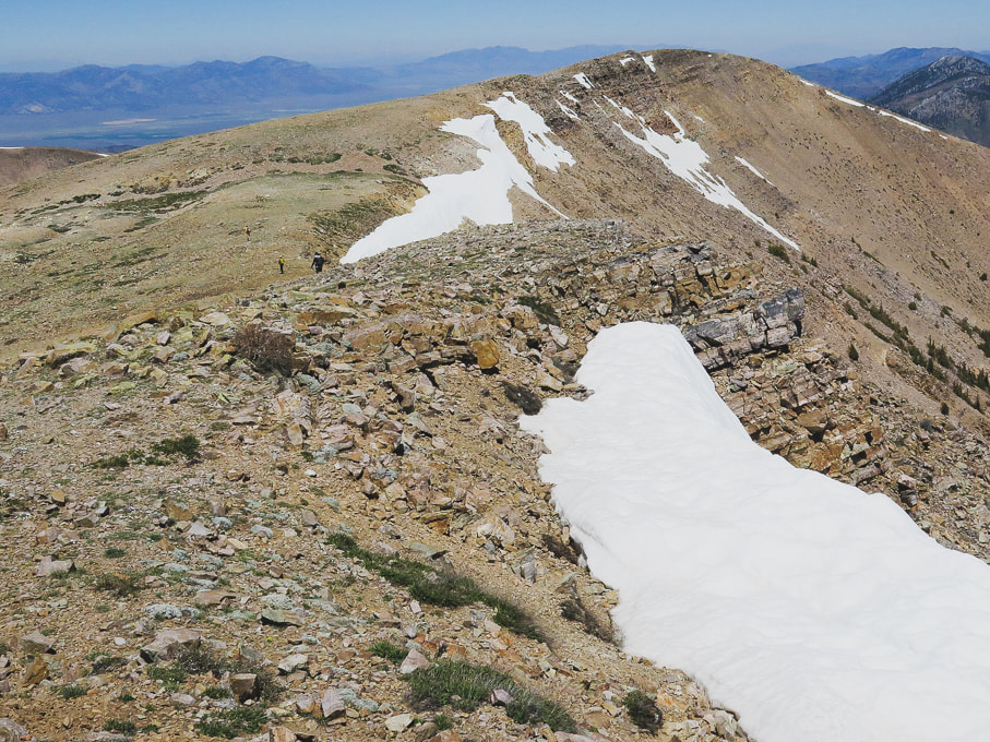
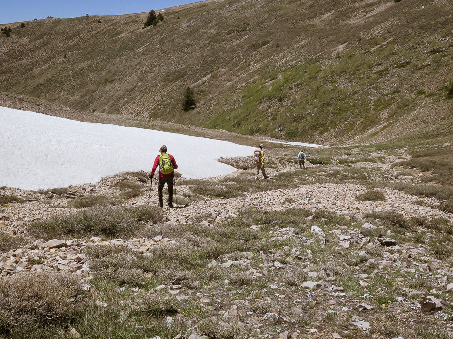
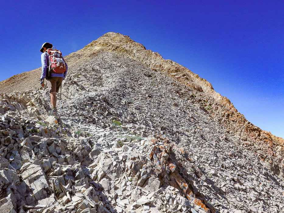
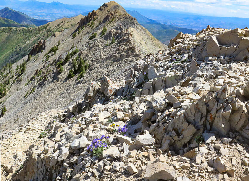
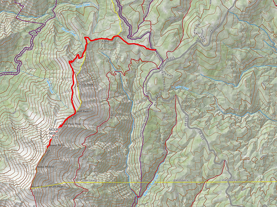
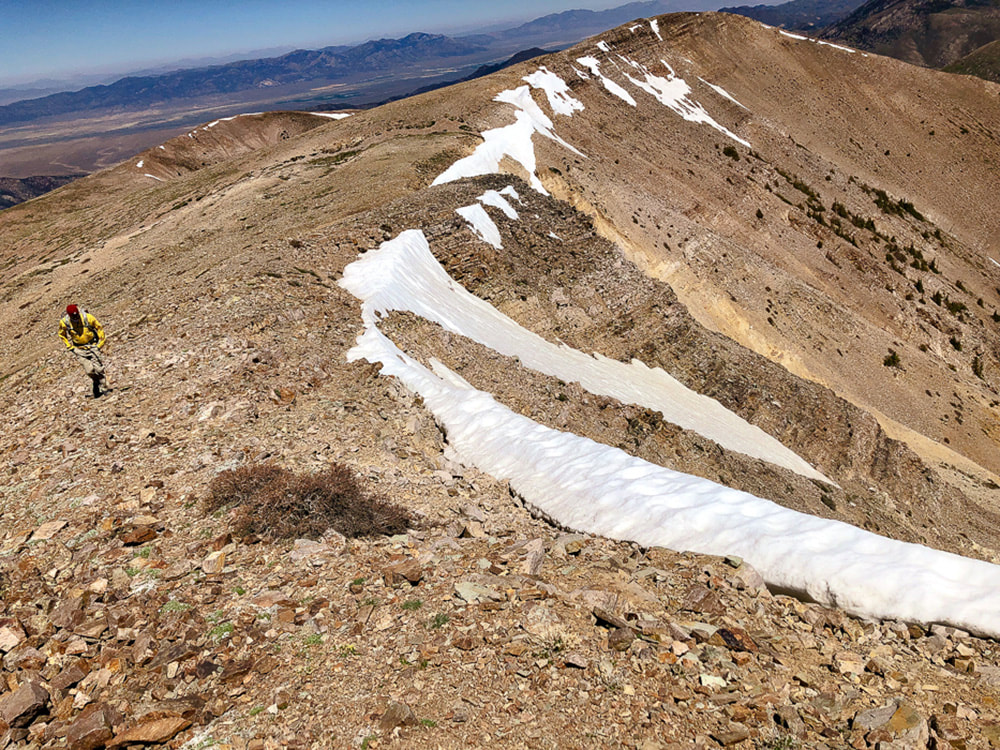
Fred walking over Wolf Pass Peak, with Mount Nebo behind him. Actual summit is just behind the high point in the photo.
Related in Explorumentary
Utah Hikes: List and Links Utah's Red Rock Country Moving Makes You Feel Better: The Latest Research Experiencing "Flow" - The Secret to Happiness
Maps and Apps: Trails Illustrated Wasatch Front South #701, AllTrails track.
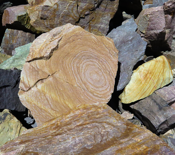
Weather forecast: mountain-forecast.com Date Hiked: July 6, 2022. Directions to trailhead from Nephi, Utah: From the town of Nephi, take UT 132 (I-15 exit 225) east. Drive 4.8 miles from I-15 to Mount Nebo Scenic Loop Road (FR 015), take a left. Drive 13.4 miles to junction of Mona Pole Road (FR 160), at Monument Trailhead. Take Mona Pole road - drive 0.4 miles on good dirt road to parking area on left. Geology: Mount Nebo is comprised of the Oquirrh Formation: interbedded limestone and sandstone.
Overview
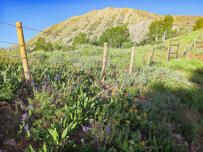
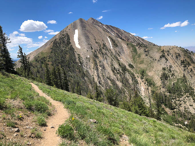
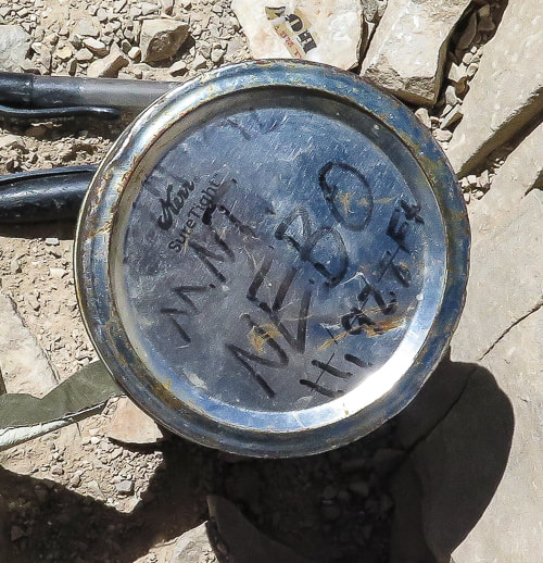
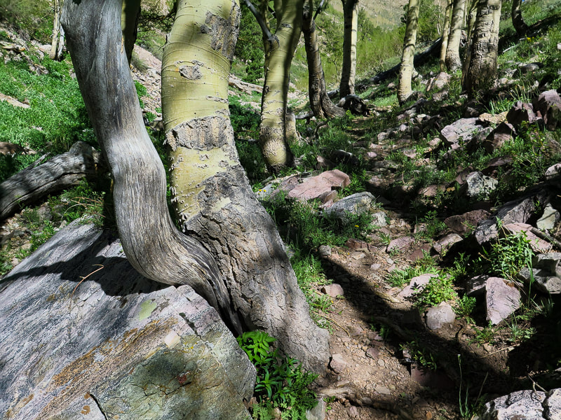
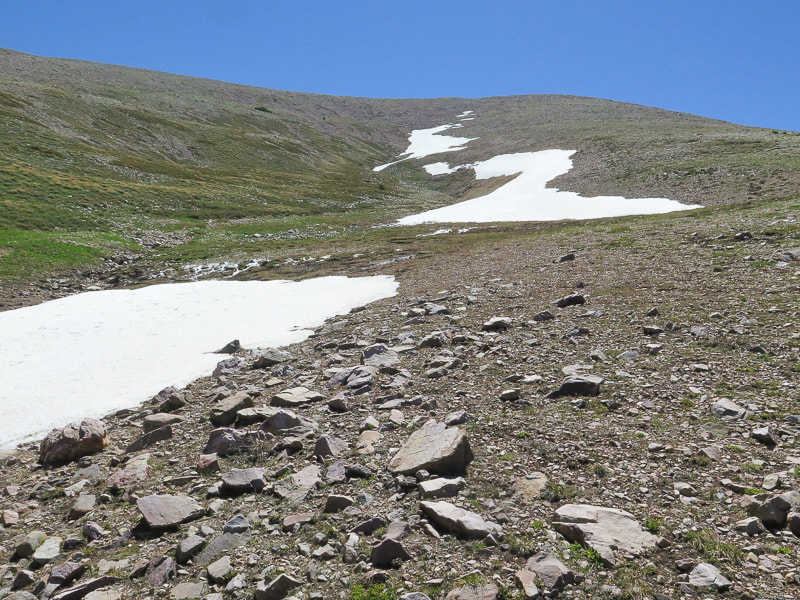
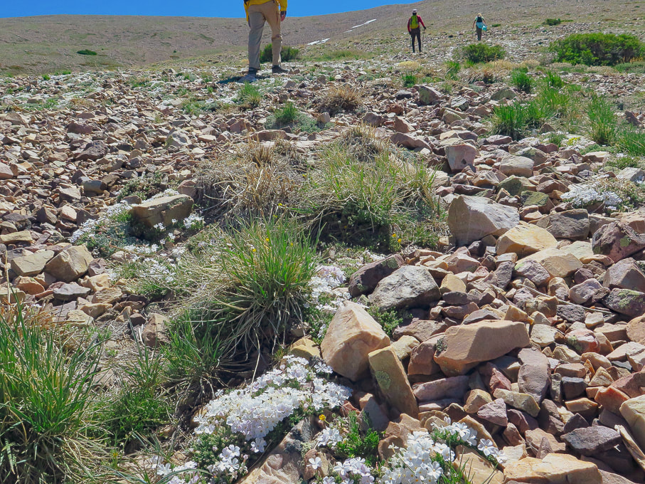
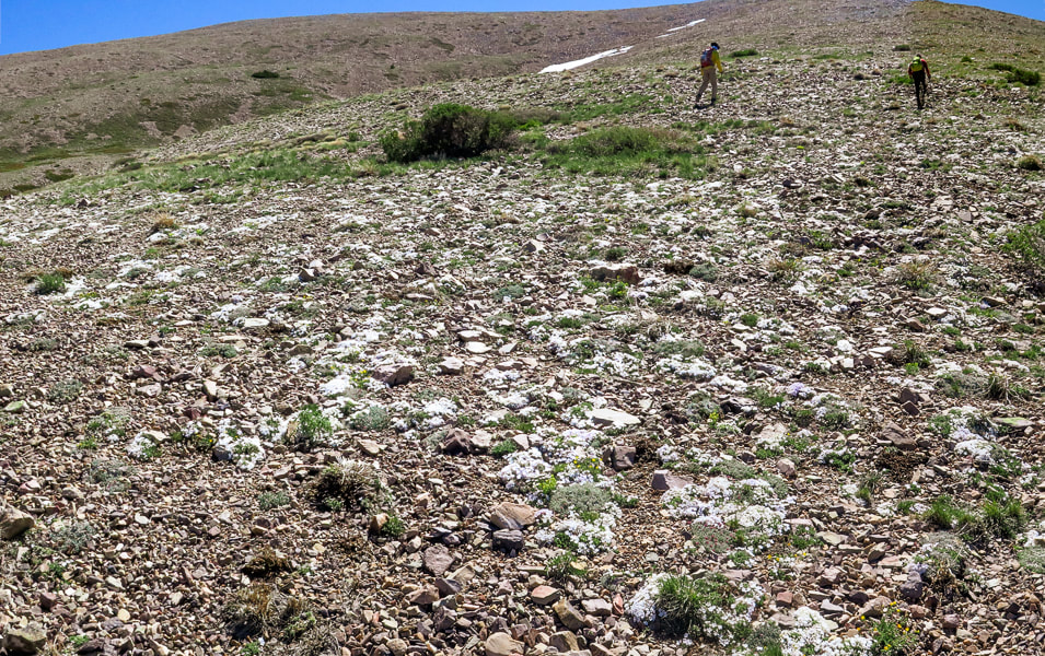
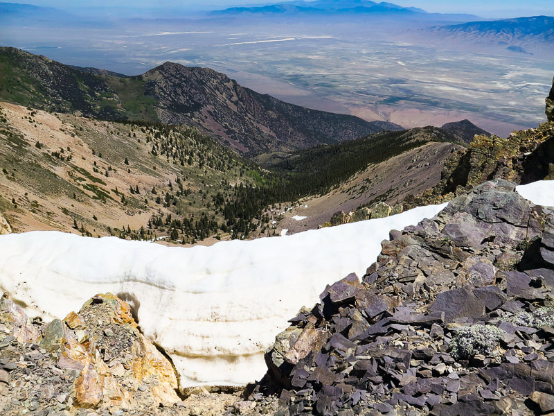
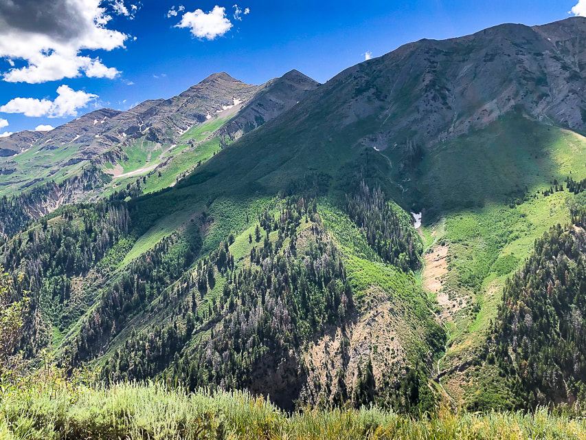
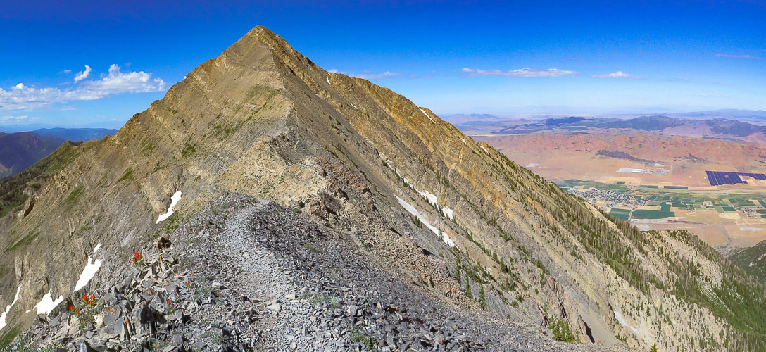
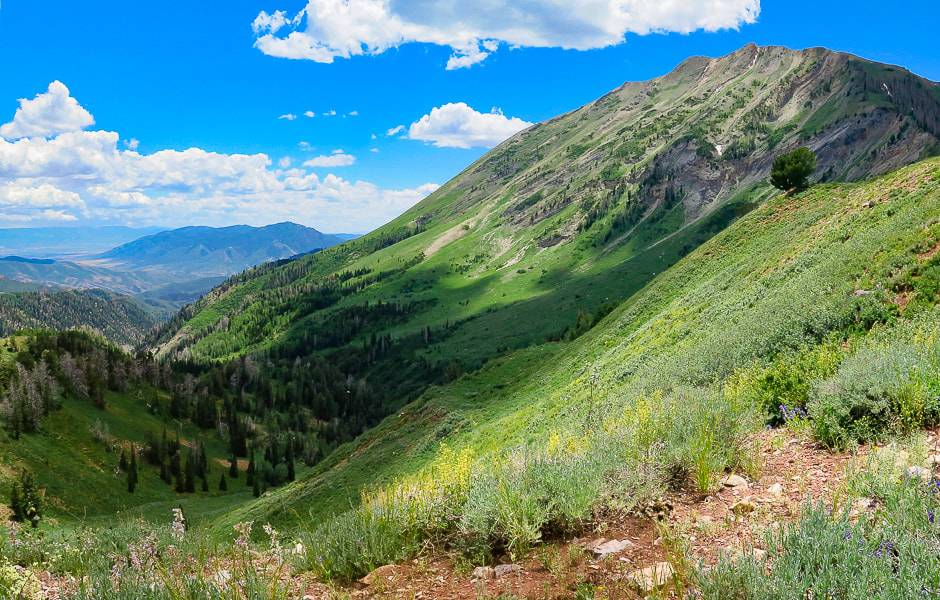
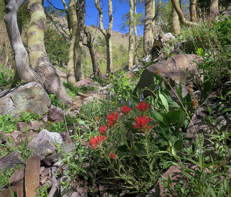
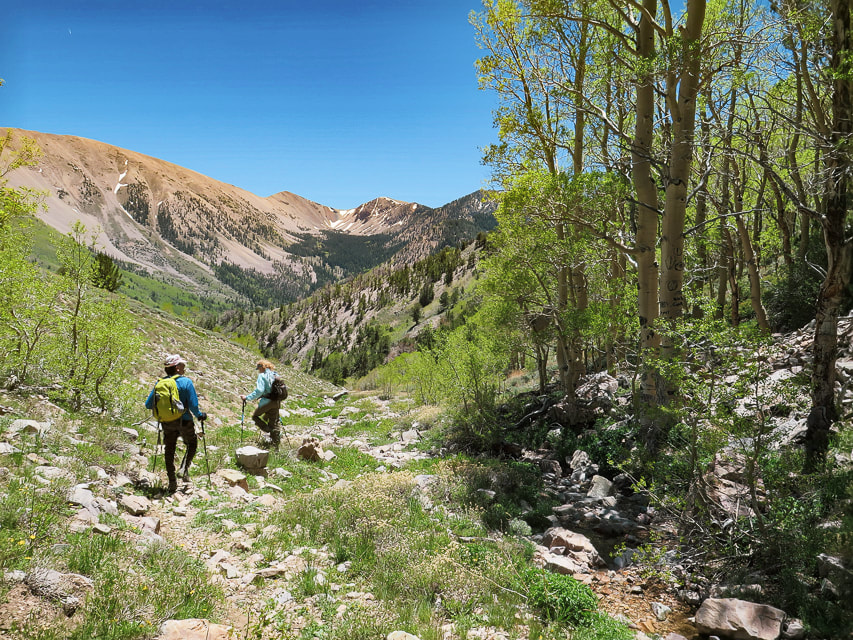
Mount Nebo, a towering bare hunk of tilted limestone, is aptly named to mean "Sentinel of God" by early Mormon pioneers. You can't miss this impressive-looking mountain that dominates the Nephi (pronounced NEE-fy) skyline, close to Utah's I-15. Some people think Mt. Timpanogos, another impressive peak near Provo, is the highest in the Wasatch range; however it is 179 feet lower than Mount Nebo. I was advised by a sales associate at The Desert Rat, St. George's outdoor specialty store to NOT summit Nebo via the southern route, Nebo Peak Trail. After telling me to hike the North Peak Trail, its trailhead north of Mount Nebo, he said, "You should probably see some great wildflowers." He was right on both accounts: the trail was great and profuse wildflowers of every color covered the forest understory. The trailhead is at 9,254 feet and the summit is 11,928 feet. However, you lose elevation on the way to the summit and gain elevation on the way back, making the cumulative gain 3,700 feet. The trail passes over Wolf Pass Peak (Point 11,440') first before it tackles the great pyramid-shaped Mount Nebo. There's a really steep pitch on Wolf Pass Peak's northeast slope. It's short switchbacks make for a heart-pounding climb of over 800 feet in just 0.4 miles. Glad I had my hiking pole for the way down! We hiked Nebo on a weekday and ran into four other parties. I imagine this is a busy trail on weekends. But that would not deter me - this hike is fantastic! Mount Nebo is #39 out of 57 ultra-prominence peaks in the lower 48 states. To qualify as"ultra-prominence", the summit of a peak has to rise at least 1,500 meters (4,921 feet) above its key saddle, which is the lowest contour that encircles it, and no other peak.
Our Hike
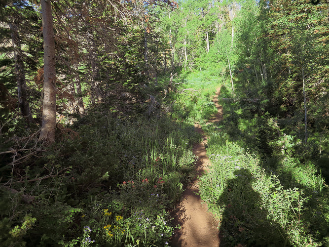
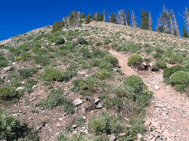
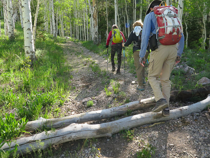
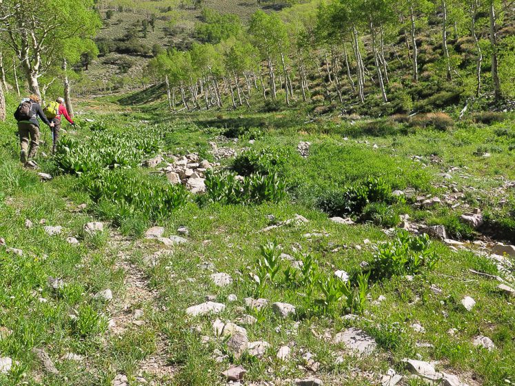
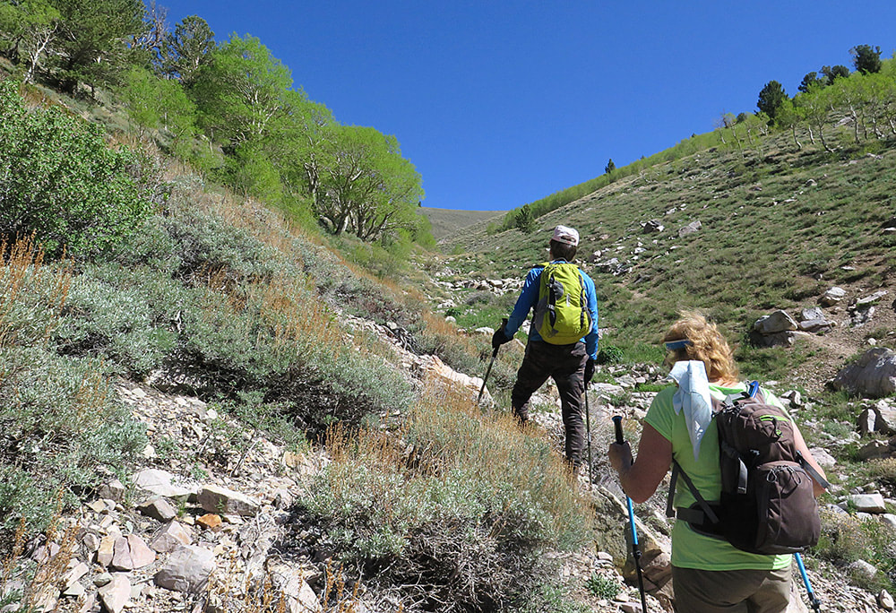
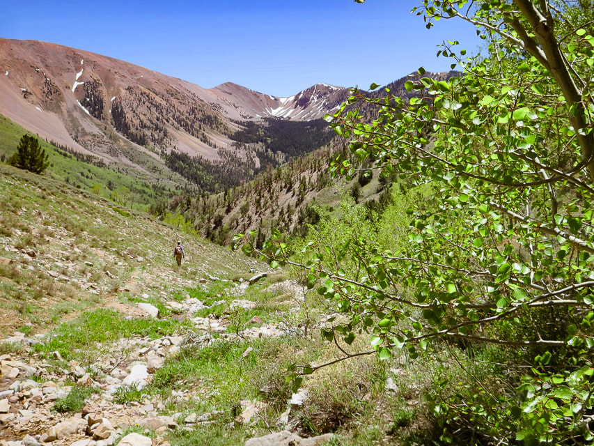
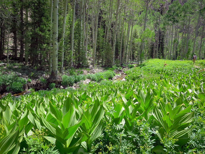
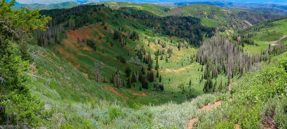
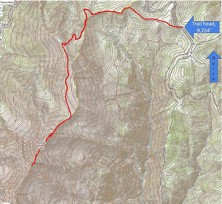
North Peak Trailhead to Wolf Pass: Miles 0 - 3.5 with a 1,350' gain We began our hike at 7:20 a.m. to ensure we would be off the most exposed part of the peak around noon. The North Peak Trail ascends through a lush forest with lots of wildflowers and vegetation spilling over to arrive at a bare avalanche area where we crossed a small snow field and continued steeply up to a saddle on North Peak's north ridge for the first incredible view of Mount Nebo. You also get a great view of Juab Valley and Mona Reservoir to the west. From here, the trail splits in 0.2 miles to the left to summit North Mountain. Keep right on the main trail to traverse North Mountain's shady west flank to arrive at Wolf Pass, just south of North Mountain. Here's a place with great views to both the west and the east, and an opportunity to rest a bit before tackling Wolf Pass Peak.
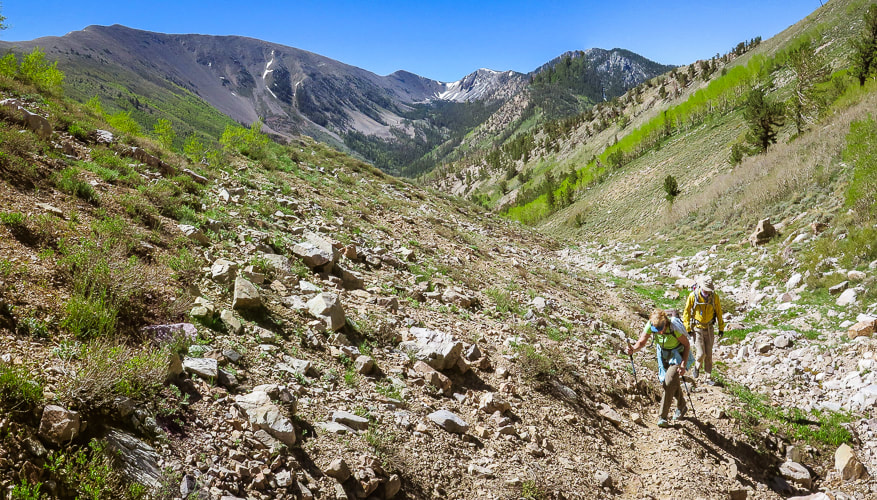
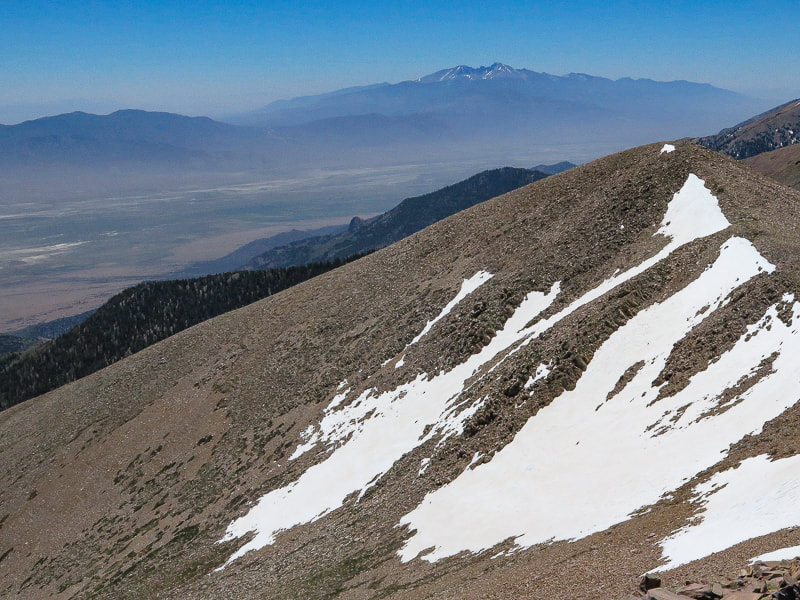
Wolf Pass to Mount Nebo summit: Miles 3.5 - 4.5 with a 1,300' gain
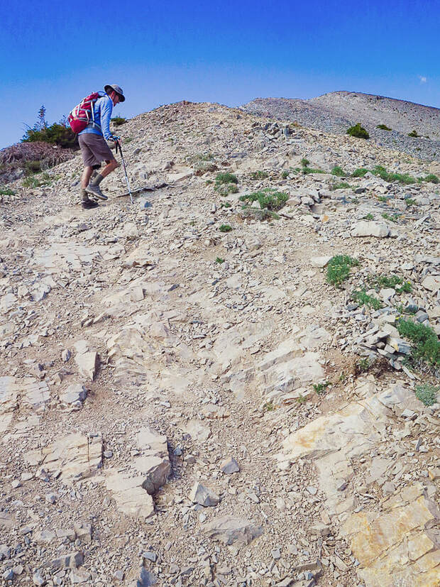
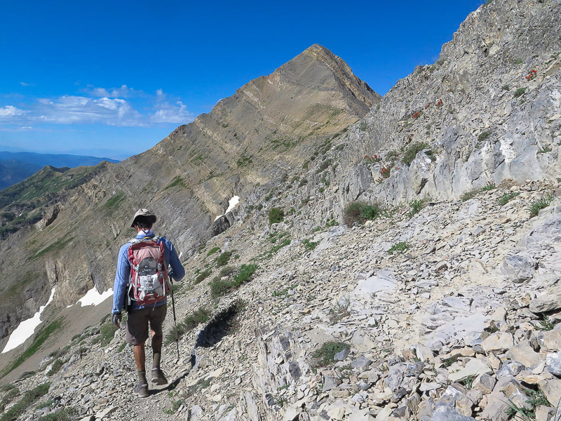
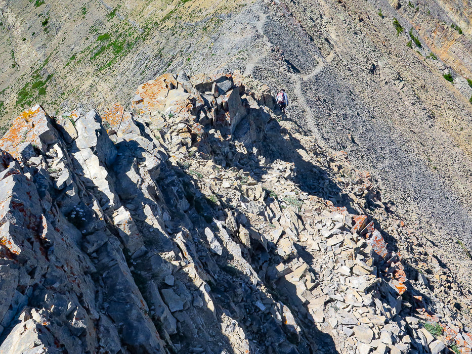
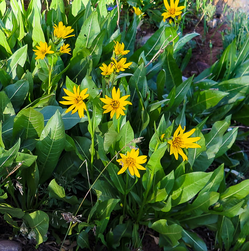
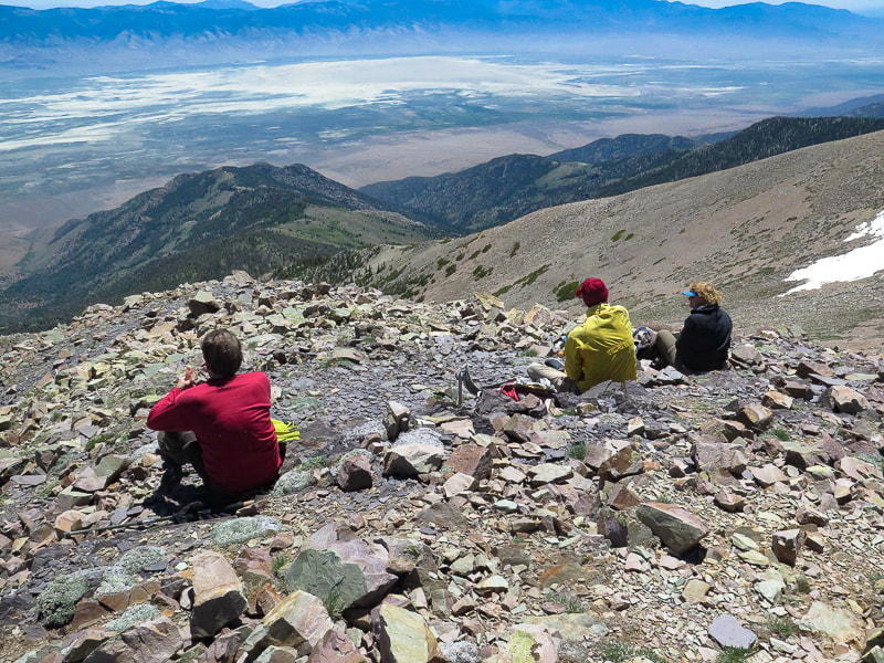
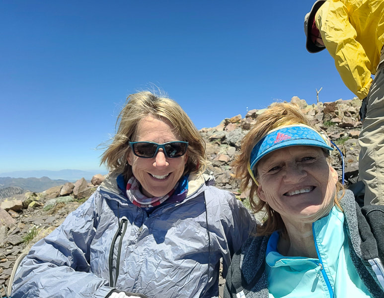
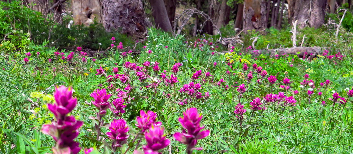
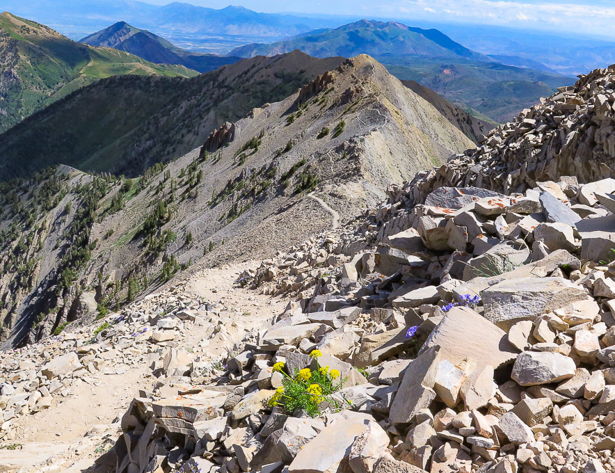
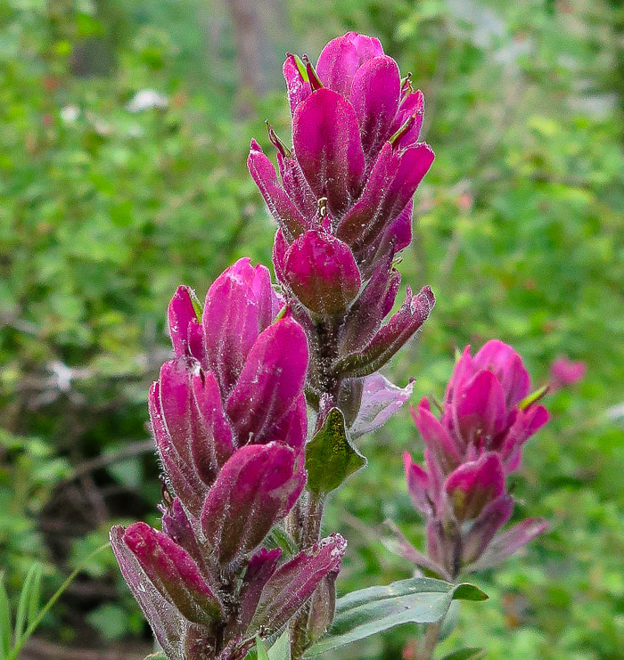
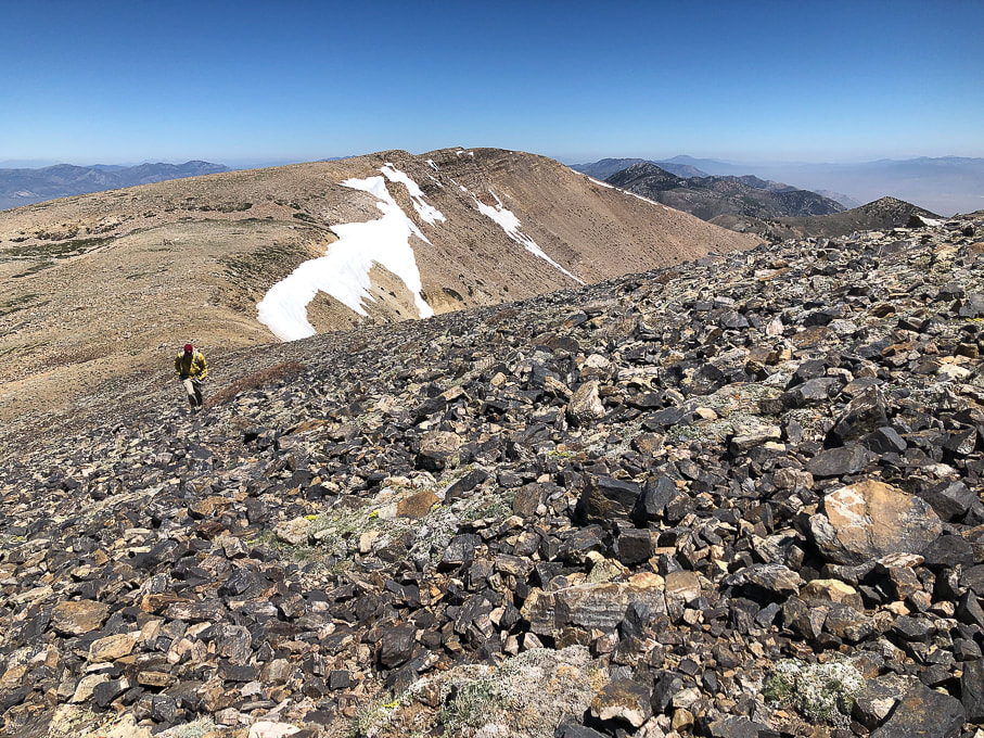
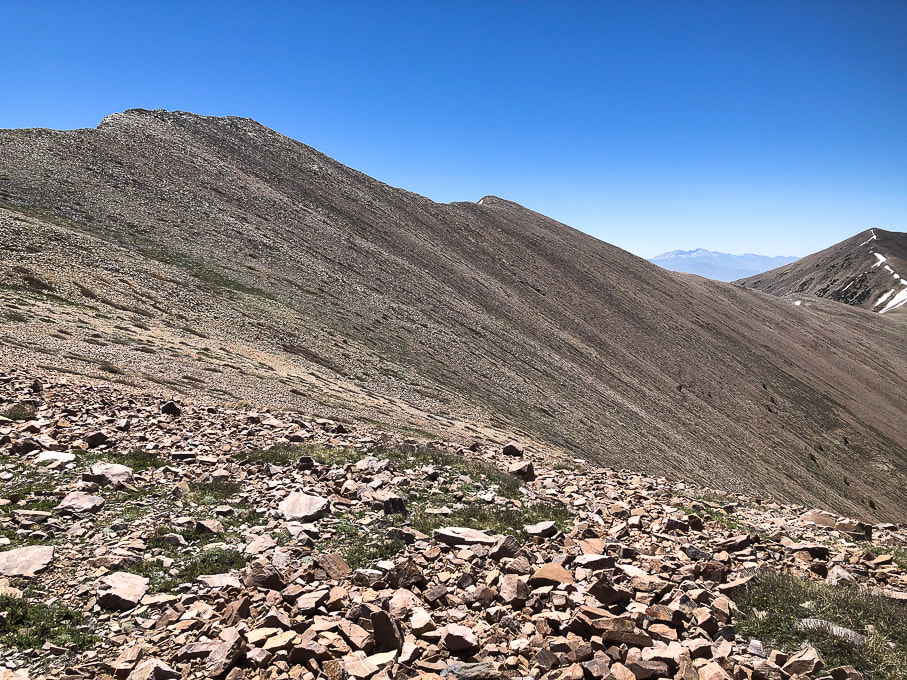
I felt quite small standing on Wolf Pass, an immediate 800 feet of climbing staring me in the face. We put our heads down and used a modified rest-step to get up this steep and rocky pitch efficiently. We use this technique for long, steep pitches, especially at elevation to save energy: use momentum to kick your foot forward while keeping back knee straight - rest a second and repeat with other leg, going in a measured, rhythmical gait, not over-using your quads or glutes. Before topping off on Wolf Pass Peak, we followed a trail going left, traversing just under the summit for a short distance. We had to scramble back up to the ridge just after the summit. We avoided that on the way back and just stayed on the ridge over Wolf Pass Peak. The walk on the ridge to Mount Nebo's summit was divine. A feeling of being on the top of everything else in the region with steep basins and canyons with names like Hell Hole, Middle, North and South Basin dropping for a long way on both sides. Occasional scant stands of scraggly trees line a few steep couloirs. The ridge trail is wide and stable enough so it doesn't feel precarious or scary. As soon as we reached what we thought was the summit, suddenly there was the "true" summit just behind it, only about 40 feet higher. The summit is narrow and long, a trail leads to the next high point to the south, Nebo Middle and then after that, Mount Nebo South Peak. The summit register consisted of a glass mason jar stuffed with sticky notes with lots of names, dates, and comments. A couple of things were remarkable about the descent. The first was Wolf Pass Peak's steep, rocky pitch - it reminded me of a short version of Mt. Borah's (the highest peak in Idaho) descent - steep and slippery. The second was the abundant wildflowers, reminding me of Colorado hikes. We didn't know that Utah's high country could be so beautiful. Our adventure possibilities have just expanded - again. Wouldn't it be great if the years of our lives expanded accordingly? I guess the key is in living in the moment and fully appreciating that we have the ability to get to the "top of the world" and see Indian paintbrush splash the forest with magenta.
"So, if you cannot understand that there is something in man which responds to the challenge of this mountain and goes out to meet it, that the struggle is the struggle of life itself upward and forever upward, then you won’t see why we go. What we get from this adventure is just sheer joy. And joy is, after all, the end of life. To struggle and to understand. Never the last without the first. That is the law."
- George Mallory, mountaineer who climbed with the first three British expeditions to Mt. Everest in the 1920's.
Keep on Moving! Keep on Exploring!
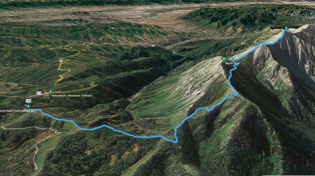
Google Earth image of our tracks heading from North Peak Trailhead west to ridge, then south to Mount Nebo summit on the right. Mount Nebo Scenic Loop road (015) approaches trailhead upper left. South points to the upper right.
View of Mount Nebo from Mount Nebo Scenic Loop Road.
Indian paintbrush
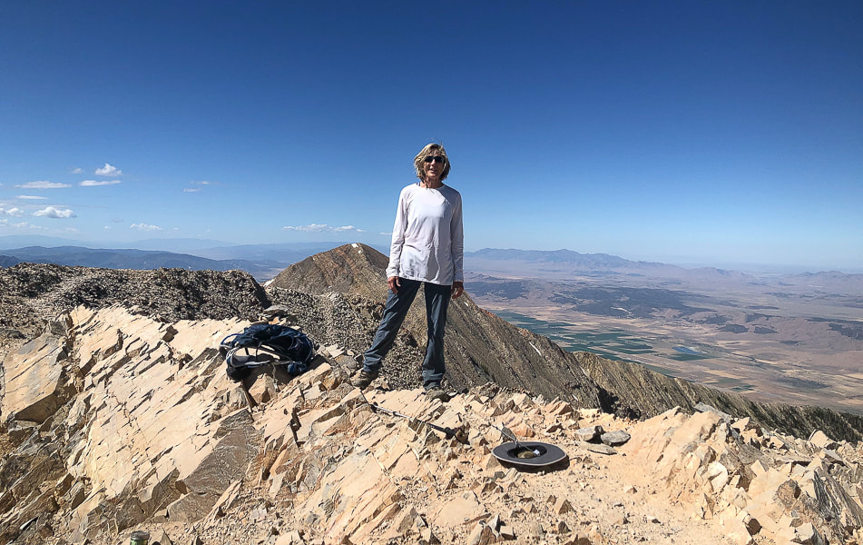
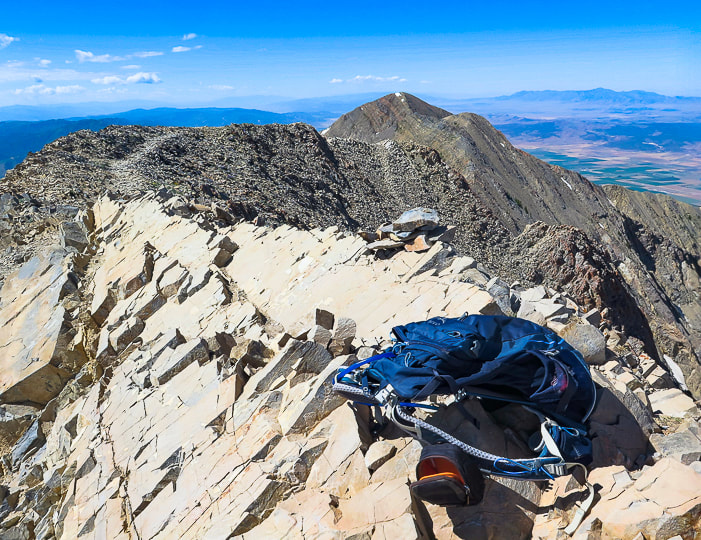
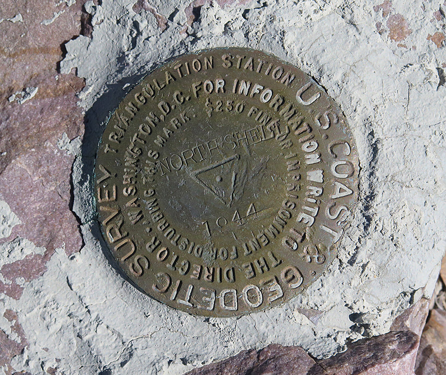
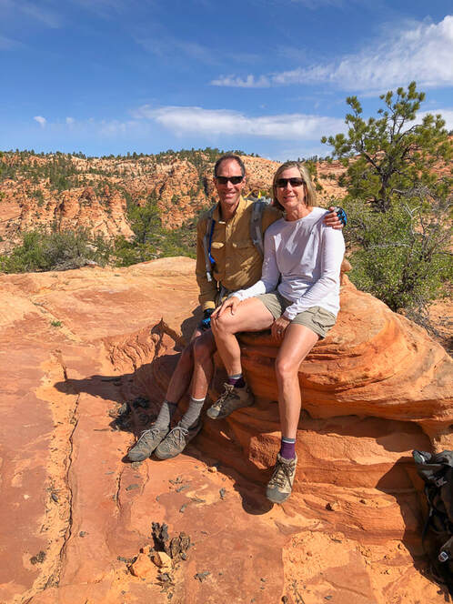
Gorgeous summit!
On Mount Nebo's summit looking east.
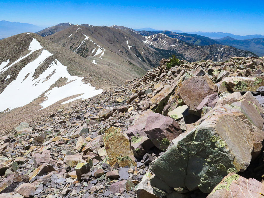
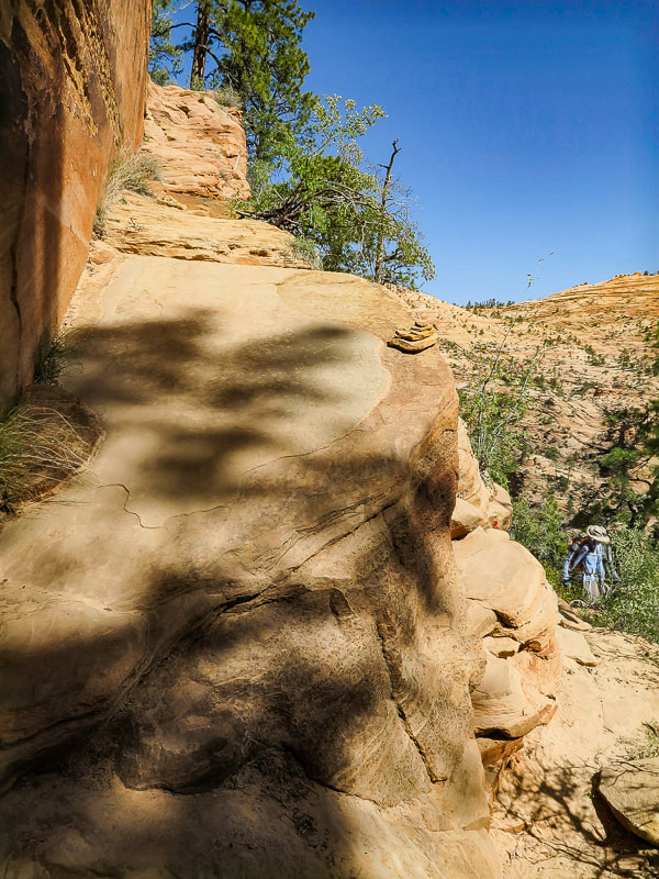
Heading back - trail goes over the top of Wolf Pass Peak (Point 11,440').
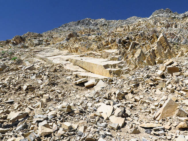
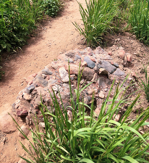
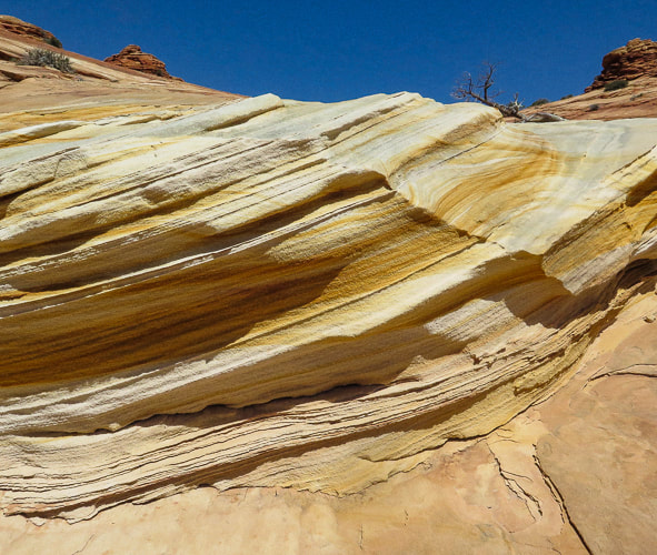
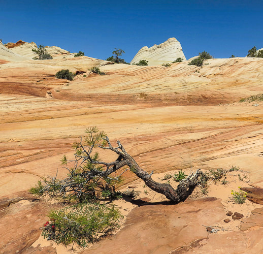
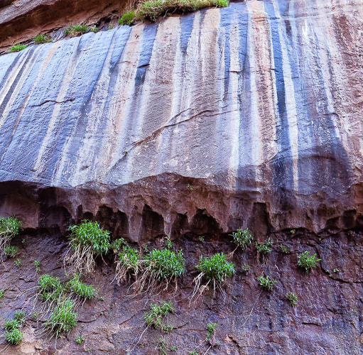
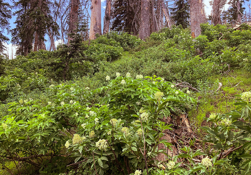
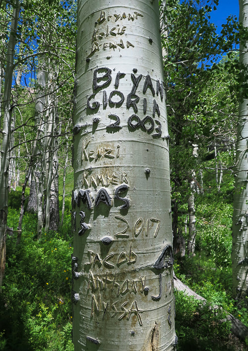
Some cool stuff on the trail.
On the way down
North Mountain from near the trailhead.
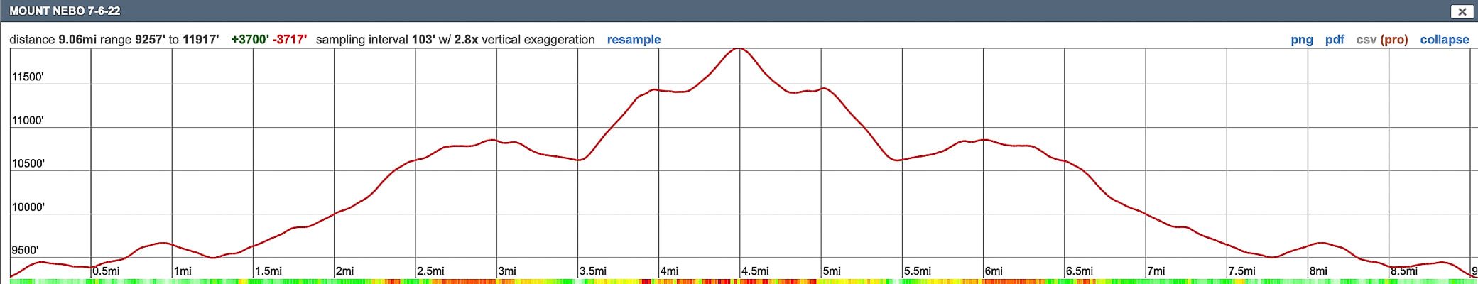
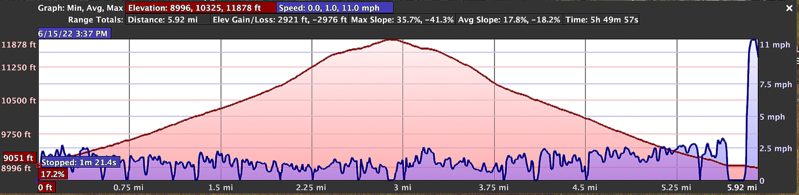
Our GPS tracks and elevation profile for Mount Nebo.
4 Comments
This short hike to the fifth most prominent peak in Nevada rewards you with solitude and a dramatic view of Wheeler Peak and eastern Great Basin mountain ranges and valleys.
Approaching Schell Creek Range summit ridge just under North Schell Peak.
Trailhead directions from Summitpost.org: From Ely, drive north on US 93 to McGill. From McGill, drive north on US 93 about five more miles, then turn right onto NV 486. Drive east on NV 486 through the Gallagher Gap, then south through a valley. After about eight miles, turn left onto the signed Forest Road 425 to Timber Creek. Drive east on Forest Road 425 about four miles to the Timber Creek Campground. The road is blocked off a short distance past the campground.
Difficulty: Moderate Class 1-2 on discernible but unmarked trail; scrambling and easy route-finding on firm talus. Coordinates: Trailhead = 39.40025 -114.61907. Summit = 39.41332 -114.59959. Maps and Apps: (see our tracks below). Avenza High Schells Wilderness, Humboldt-Toiyabe Wilderness - USFS, Stav Is Lost's hike description, USGS topo map Date Hiked: June 15, 2022.
Related Posts:
Our GPS tracks for 6.2 miles out and back to North Schell Peak.
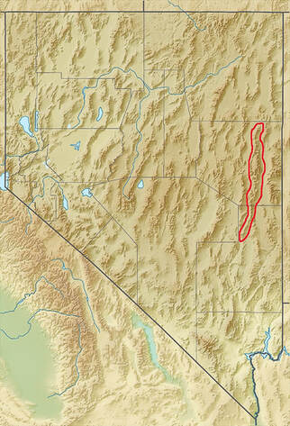
Nevada is a remarkable state for many reasons - Las Vegas is the "Entertainment Capital of the World", and Elko sponsors the National Cowboy Poetry Gathering. It also contains the most mountains of any state, most arranged in long parallel north/south trending ranges, with low valleys in between. The forces that made the earth spread starting 50 million years ago produced normal faults that formed horsts and grabens, making parallel valleys and raising mountains so we can hike them today. This spreading and faulting has doubled the width of Nevada in those millions of years.
Our Hike
After an early morning drive from Ely to the south, we passed a few primitive campgrounds along the good forest road whose end is the trailhead and a brown kiosk signboard. Start walking on the road after parking. It turns north (left) into a discernible path that ascends an aspen-forested valley and stays near the stream, crossing it a few times. The aspen forest opens to the head of this creek and North Schell's western talus/grass slopes. The trail, not marked is easy to follow. Once we got to the head of the creek and the end of the dirt path, we took the steeper, rockier and shorter way to Schell Creek ridge, taking more of an acute right-hand turn heading east/southeast than we needed to. When we descended, we stayed further north, following the grassy areas as much as we could just under the ridge to avoid the prolonged talus slopes (see map of our tracks, below). The talus slope was filled with patches of abundant and robust wildflowers - mats of phlox and buckwheat. We headed to the saddle left (north) of the dark North Schell summit and encountered freezing winds which required a slight wardrobe change into windbreakers and warmer hats (or no hats!). A short walk on the ridge brought us to the summit block. When we reached the summit, walking on a path through the rocks, wind was no longer a problem. We identified Wheeler Peak in the Snake Range - the next parallel range to the southeast. The Schell Creek range ridge south to the next high points - one of them Middle Schell Peak, looked inviting; follow it and you can walk on top of eastern Nevada for a few more miles! The eye-catching view on the way down is that of the cirque above the headwaters of Timber Creek to the south. Its U-shaped valley and the peaks above it look inviting. We passed a few small snow patches in the grass/talus and then easily located the path along the creek to head back to the trailhead. Val and John are training for Mt. Idaho, Idaho's seventh tallest peak. Fred and I just hiked Mt. Nebo, the highest peak in Utah's Wasatch range. Maybe we go a little bit slower than the 20-somethings, but we can get to the "top of the world" and savor it, if just for a few moments.
"The greatest danger in life is not to take the adventure."
- George Mallory, took part in the first three British expeditions to Mt. Everest in the 1920's.
Never Stop Climbing Mountains! Keep On Exploring!

Low-profile and abundant wildflower gardens - phlox and buckwheat.
Fred approaching summit.
Looking at North Schell Peak from under its saddle.
Summit celebration!
Some cool stuff on the trail.

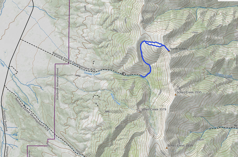
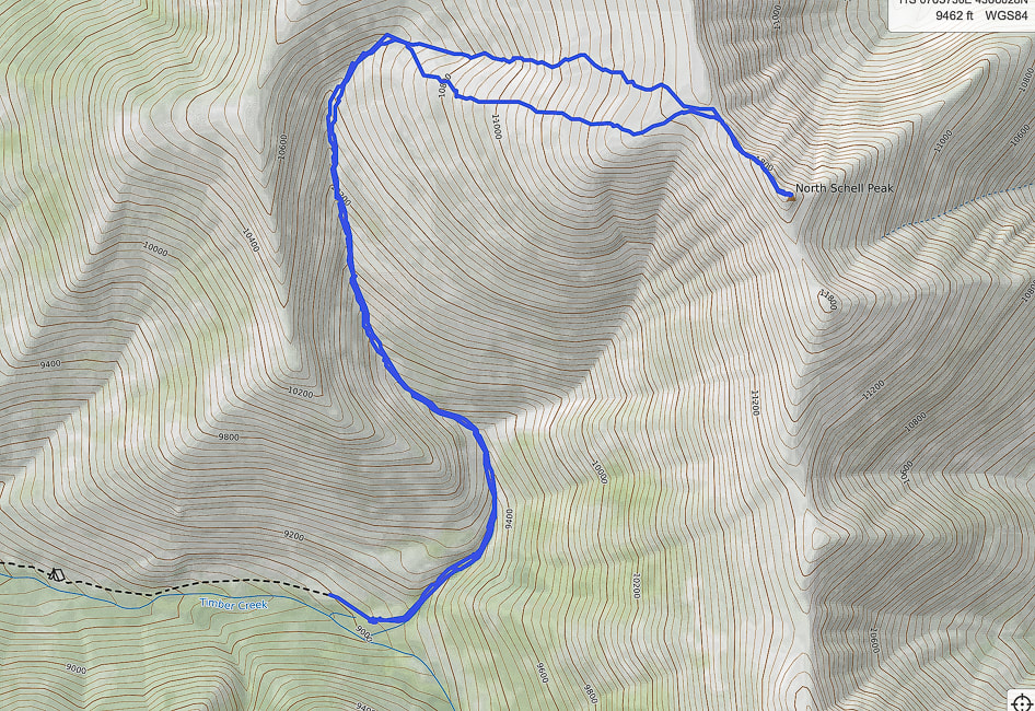
Our GPS tracks from trailhead (south) to North Schell Peak. The southern-most route was our ascent. The northern route was our descent; it avoided much of the continuous talus we encountered on our ascent.
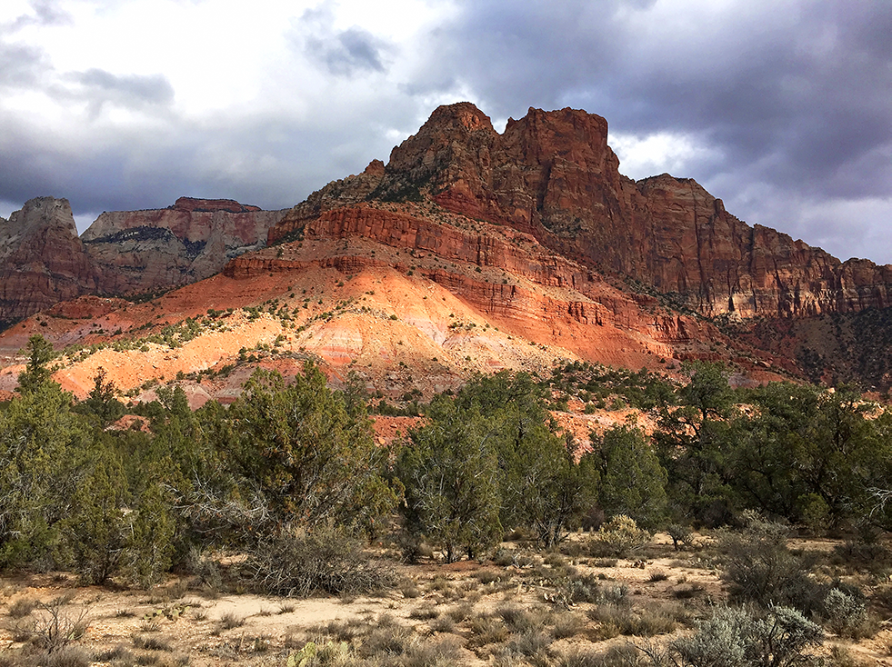
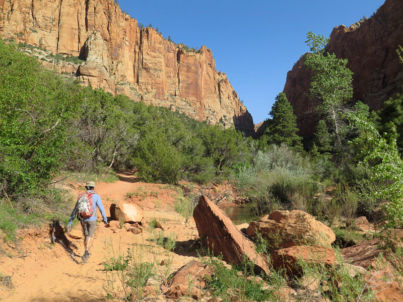
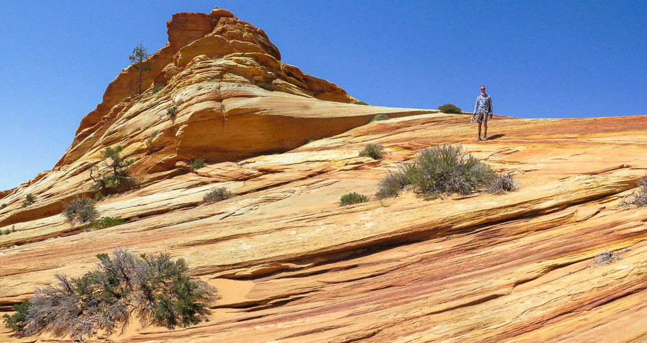
Walk on the surreal slick rock of White Domes, near the top of Canaan Mountain as you climb out of Water Canyon. This is a an extraordinary hike in a gorgeous, remote and rugged wilderness.
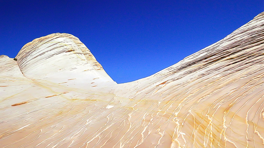
White Domes - Canaan Mountain, Utah
Related in Explorumentary:
Canaan Mountain via Squirrel Canyon Utah's Red Rock Country Southern Utah Hiking and Biking in a Pandemic: Wire Mesa, Snow Canyon, Zion National Park Mt. Kinesava Hike - Zion NP Angels Landing in Zion - Not for the Faint of Heart Utah Hikes
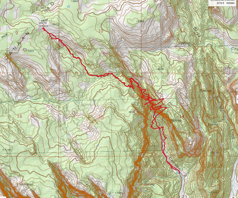
Coordinates: Trailhead = 37.03681, -112.95364. White Domes = 37.06259, -112.98348.
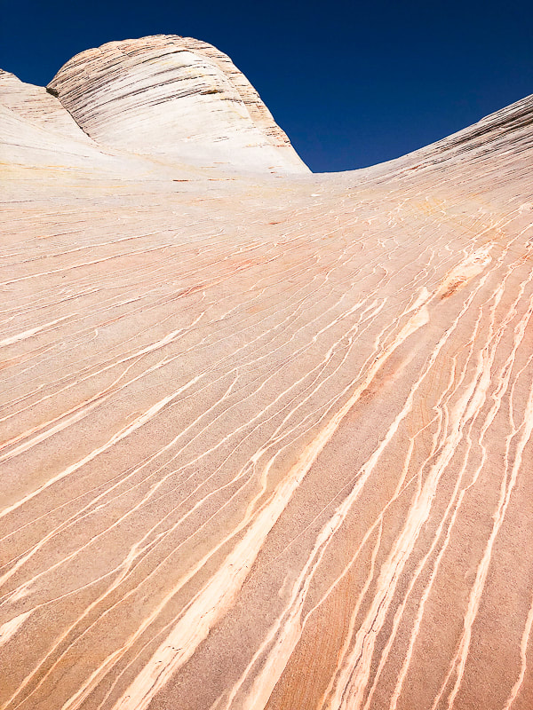
Maps and Apps: (See topo maps of our trail at end of post). USGS 7.5 min topo, Hildale, Utah-Arizona, AllTrails White Domes via Water Canyon Trail, Avenza and physical map of St. George, Springdale, Hurricane & Zion NP, Utah by Adventure Maps, Inc. Link to Zion topo Map of Canaan Mountain Considerations: Take GPS coordinates when you top off out of Water Canyon so you can return to the same point to descend. Once on the plateau, experience with navigation using physical topo maps as well as smart phone apps is advised; trails are not marked and "social trails" go in various directions. There are limited openings through the Water Canyon cliffs, so you must return to the same point at which you entered the wilderness above the cliffs. Allow enough time to get off the mountain. Date Hiked: May 8, 2022. Directions to Water Canyon Trailhead: From Hwy 59 in the border town of Hildale, Utah, turn left on Utah Ave., which heads 2 miles east before turning north (left) onto Canyon St. In less than a mile, turn right at the intersection of Maxwell Canyon Rd. and Water Canyon Rd. Follow this dirt road for another 2 miles to park at one of two parking lots at the trailhead. Can be treacherous driving on this road if it is wet. Geology: Block of Navajo sandstone originally deposited on the continent of Pangea, which included today's North America, Africa, Europe, and South America, existing as a single continent. Sand was wind-blown and deposited in a huge sand sea - creating the petrified sand dunes seen in many Utah state and national parks. The parallel sand layers are cross-beds: the inclination of the layering was caused by aeolian (wind-blown) sand, migrating down-wind. Related:
Overview - Canaan Mountain Wilderness
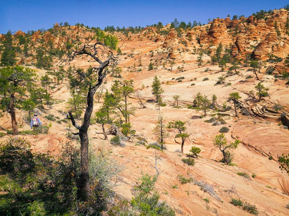
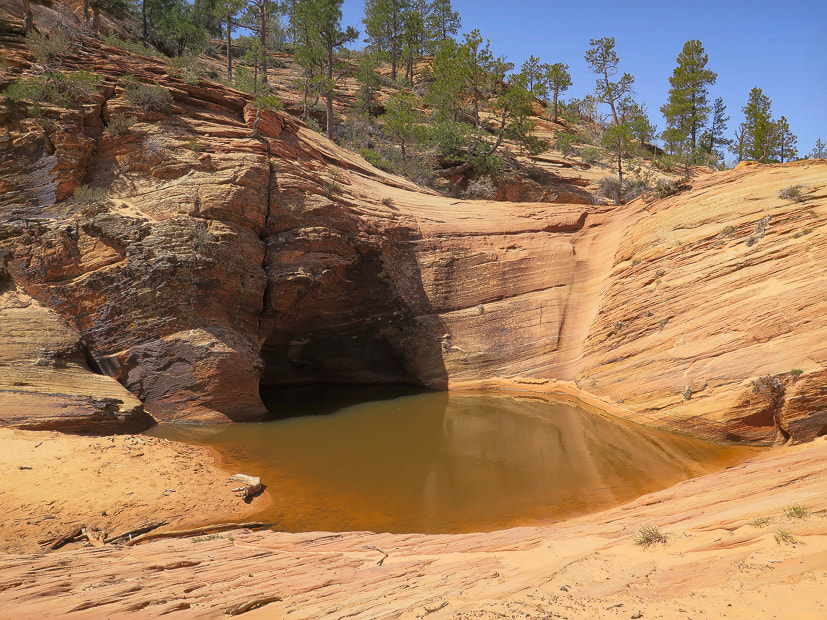
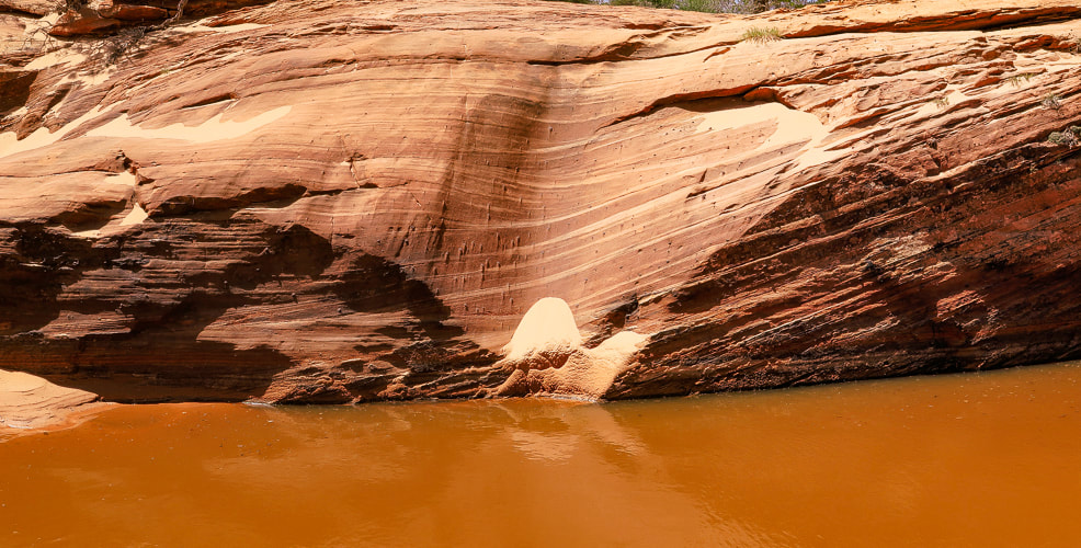
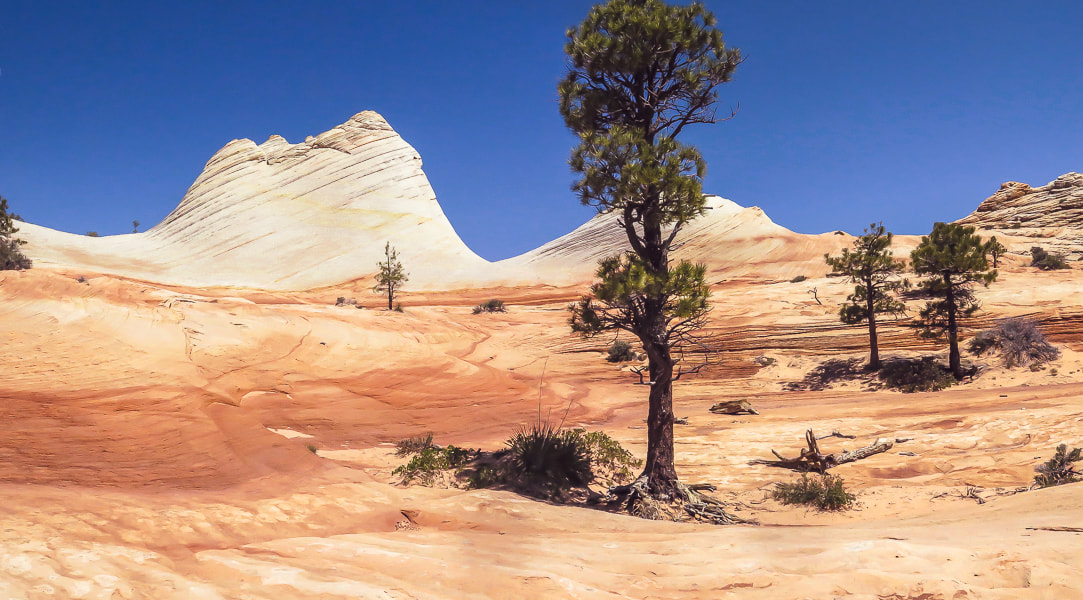
Navajo Sandstone cliffs, 2,000 feet high, surround Canaan Mountain on three sides, making this an exceptional wilderness with limited access. The landscape is always interesting and gorgeous; around every corner, atop every plateau and rising up out of sandy washes are the various landforms sculpted by wind, water and ice erosion. The red and orange Vermillion Cliffs form its base. The cream, yellow, red, orange and white colors compliment greens of scattered ponderosa and pinyon pines, scrub oak and gambel oak, creating a striking color palette. Cross-bedded cliff walls, pinnacles, domes, slot canyons, hoodoos, natural arches, ledges, open slickrock, waterfalls, seeps with hanging gardens, and carved pools are some of the things you see in this extraordinary land. It has only a few primitive routes, with one rocky and sandy 4WD road, the Sawmill Trail/Canaan Mountain Trail, a historic logging route that enters from the east. To us it is comparable in beauty to Zion NP, and we get to practice our navigation skills.
Hike Summary
Miles 0 - 2.2: Water Canyon trailhead to top of cliffs/entry onto mesa at "Top Rock". Miles 2.2 - 3.9: "Top Rock" through mesa to White Domes/Canaan Mountain Ridge. Fred and I got "temporarily bewildered", not exactly lost, when we attempted this hike a few years ago. We neglected to take a waypoint at our Water Canyon exit onto Canaan Mountain plateau's unmarked wilderness. We followed the wrong path and found ourselves further from the White Domes. When we decided to head back to the canyon rim, we took a waypoint just in case because there were a few paths there, but nothing marked - no cairns or signs. We came close to our entry at the canyon rim but missed it by a short distance. So, we returned back (one mile!) to our waypoint, carefully retraced our footsteps, and finally got back to our entry, the only way we knew to get back down. The lesson: when hiking in Southern Utah's canyon country, there may be only one entrance/exit point and it is crucial to know how to navigate back to that point when there is no marked trail. This wild and spectacular country is filled with numerous washes, pedestal rocks, slick rock, and boulders; it can turn into a maze where landmarks can look similar. This time we were ready, armed with AllTrails and Avenza maps, as well as our physical map. My Garmin GPS insured we were backtracking successfully. We took the crucial waypoint at Top Rock (see below). We followed Joe's Guide to Zion NP - Water Canyon and Canaan Mountain hike directions. Occasional rock cairns helped, too.
Interactive map. The large-amplitude swings in GPS tracks are the GPS trying to find satellites while deep in Water Canyon.
See more topo maps at end of post 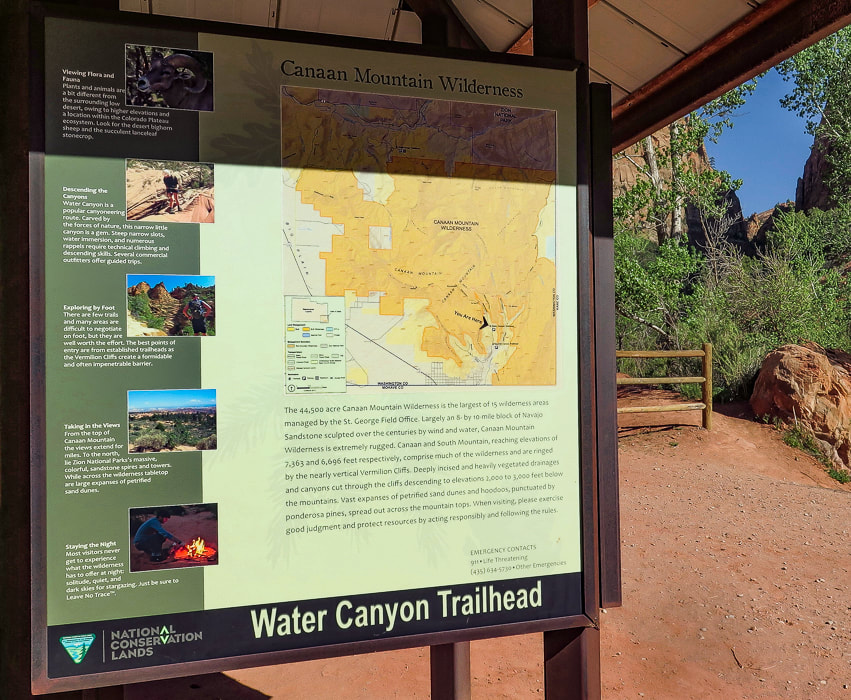
Starting out - Water Canyon to the right.
Climbing out of Water Canyon
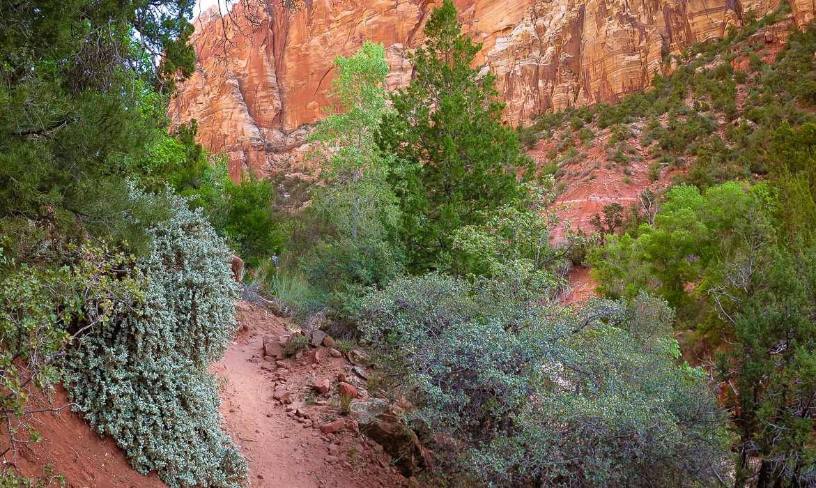
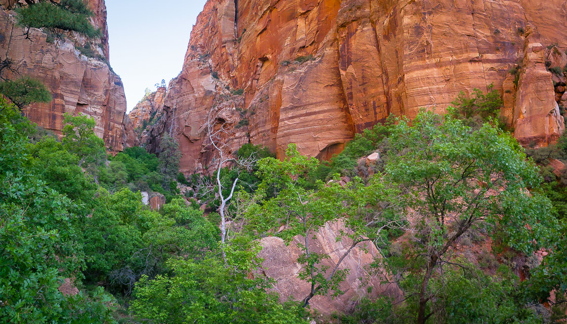
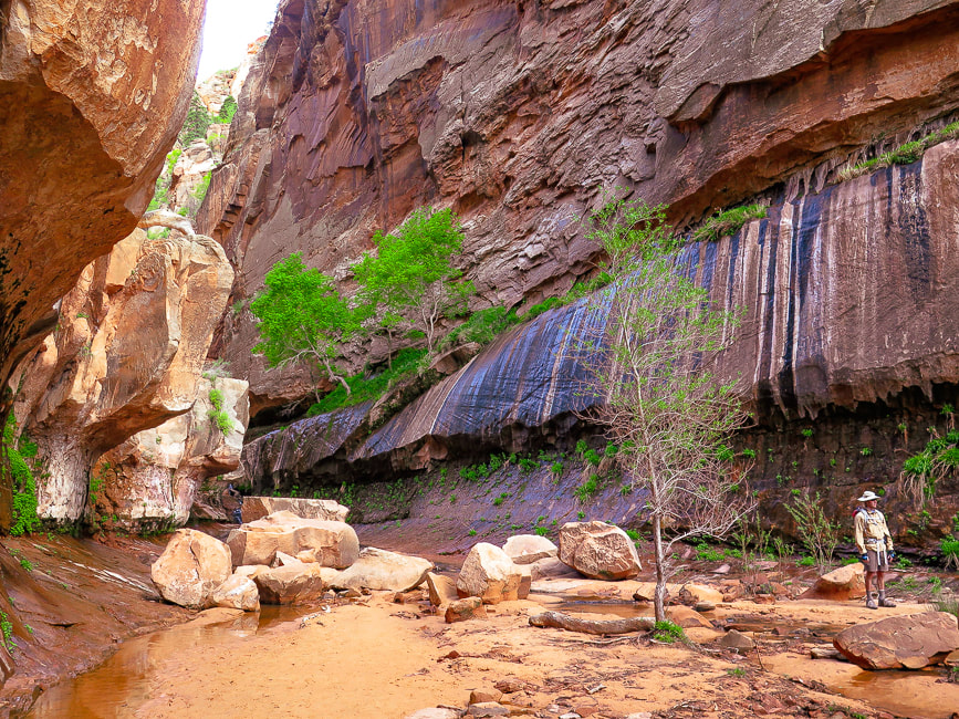
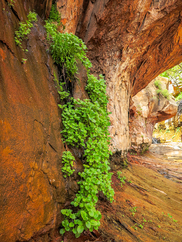
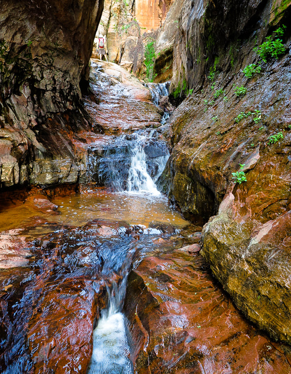
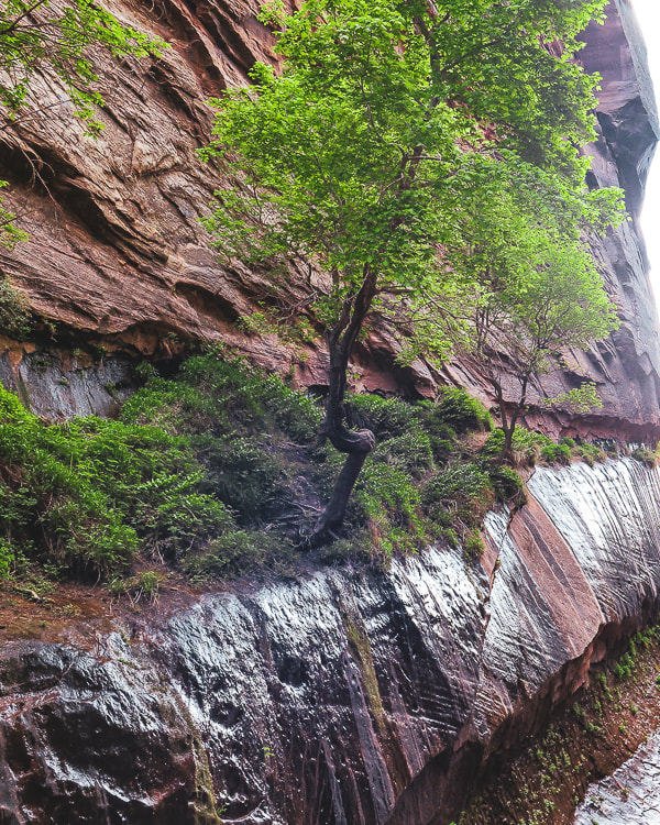
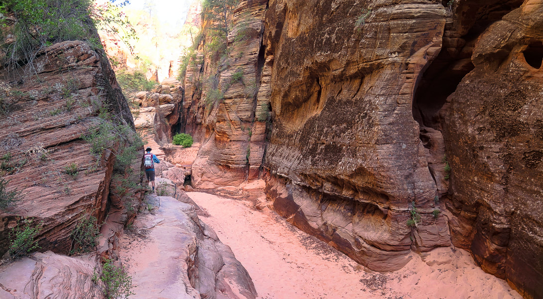
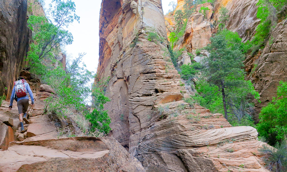
Fred and I began trudging (at times) through sand, passing under canopies of pine and juniper to the picturesque waterfall section of Water Canyon. Here, the canyon is dark and narrow; walls drip water onto bright green leaves, and a series of small waterfalls tumble over sandstone. Long striped walls on both sides converge at a slot where you walk through the shallow stream. Just past this, at about one mile into the hike, you start to climb steeply up the west (left) cliffs of Water Canyon, passing more waterfalls, walking over a series of rock ledges, hoisting over boulders now and then, and even walking over a log propped against a ledge to gain access to the top of it. This trail to the plateau above is a masterfully-planned route through available ledges and passages with the canyon at times dropping steeply below to the right, but you won't feel overly exposed. There are some rock cairns to follow. At about 1.9 miles into the hike, the trail makes a U-turn and heads south to ascend the final wall to the opening into the plateau, and to Canaan Mountain Wilderness boundary. Impressive towering walls of cross-bedded sandstone seem close as the canyon widens. Shortly, "Top Rock" is reached - a large, weathered sandstone rock on a flat area (see Fred and I sitting on it, below). A few websites and topographical maps refer to this landmark as Top Rock. RECORD YOUR COORDINATES NEAR PLATEAU ENTRY - We recorded "Top Rock" coordinates for a waypoint.
Canaan Mountain plateau to White Domes
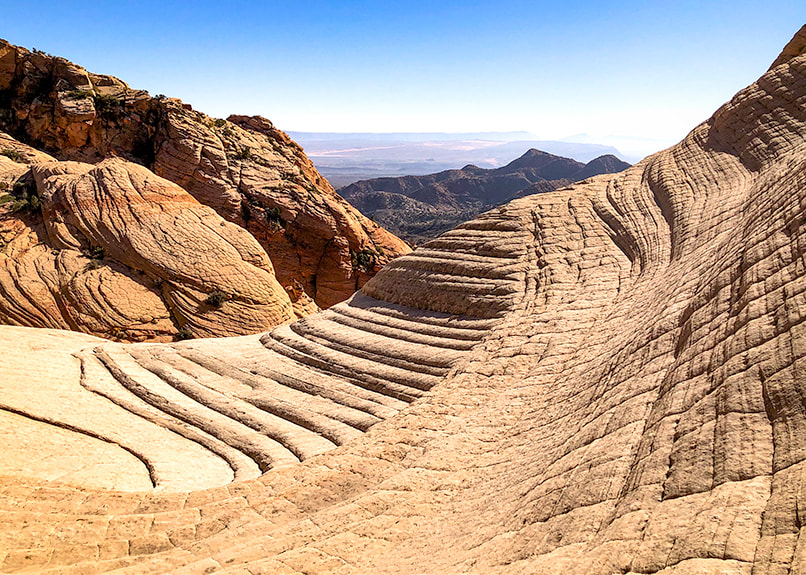
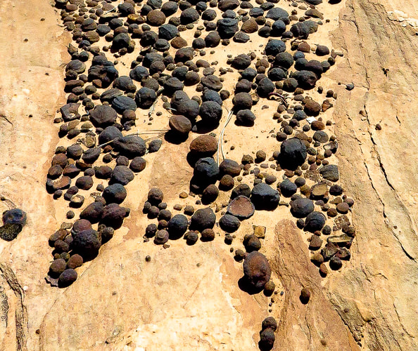
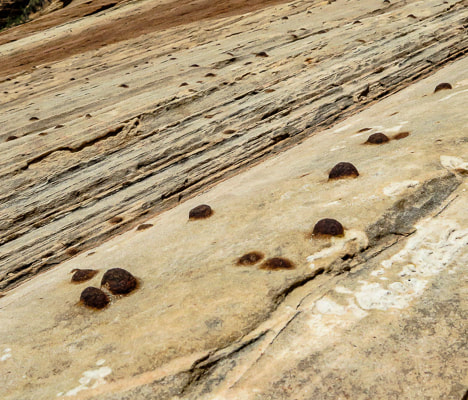
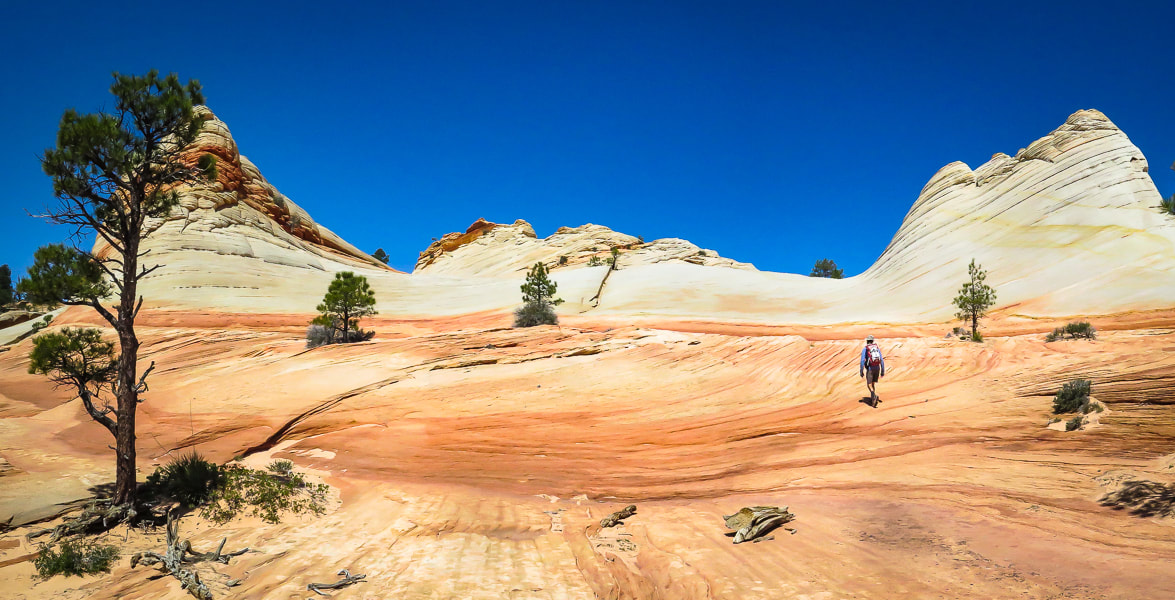
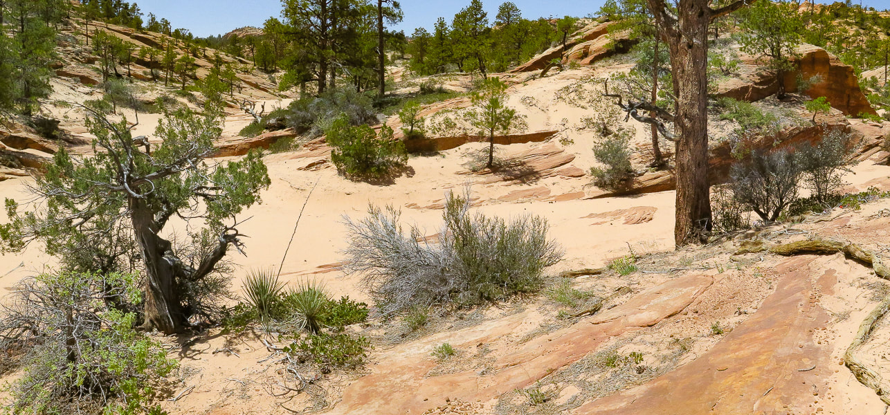
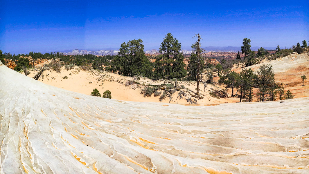
As you stand at Top Rock, the White Domes on Canaan Mountain's ridge to the northwest are 400 feet higher. We walked straight towards them, initially descending, finding a discernible path marked often by small rock cairns, hiking in a northwest direction. Our route took us through the forest, down through small drainages and short stretches of slick rock into a larger sandy wash (upper Water Canyon), where I placed some tree branches to mark our entry into the wash. We followed this creek west upstream for ~ 0.25 miles, going around a few dry waterfalls to their north (right) side. Reach a wide intersection between two washes; take the side wash to the right (NW) and follow it for ~1.0 mile to the domes. Walking over sand and slick rock is exquisite as you pass by sandstone walls and moqui marble collections - round sandstone balls coated with dark red or black iron oxide. As you near the top of this side wash, White Domes come into view - you exit the canyon and start hiking steeply up pure white sandstone. Top out on Canaan Mountain's ridge between these layered domes to see the temples and mountains of Zion National Park to the north. Walking on the bright white, bare sandstone with cream-colored veins flowing through it and bright blue sky above is an almost surreal experience. The curves between the domes have been masterfully formed by wind and water, and make it easy to walk around them. A website describes this area as "wondrous" - I would have to agree. We returned, using my GPS to backtrack, as there are a few shallow canyons coming down from White Domes, and no rock cairns. I'm glad I marked the exit out of the upper Water Canyon wash with branches because the distance back in the wash seemed shorter than the morning's distance. From White Domes, the Sawmill Trail, an old jeep road continues west toward a few more landmarks that represent Canaan Mountain's lumber history. The trail leads to the southwestern edge of Canaan Mountain to the windlass ruins, the remains of a cable system that lowered timber to the valley floor. It continues to the highest point on Canaan Mountain at 7,363' (~400' higher than White Domes) and Sawmill Spring, the remains of the sawmill. Again, we feel lucky to be able to hike to these awesome places. So many adventures to be had, so many beautiful things to see, so much appreciation for the American west. Ah, but so little time.....
Keep Moving and Keep Exploring!

CrossFit athlete at CrossFit Dixie in St. George, Utah.
Getting deeper into the canyon.
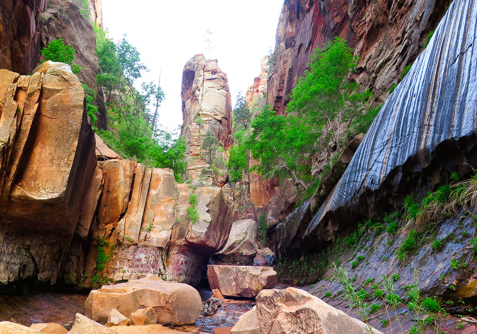
Reaching waterfall section where walls converge to make slot to walk through.
Dripping walls at waterfalls section of Water Canyon.
Walk through shallow stream at slot.
Walking above the waterfall section, about ready to start climbing west canyon wall.
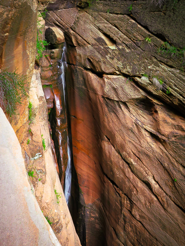
Long, narrow waterfalls as you ascend Water Canyon.
Starting to climb canyon wall.
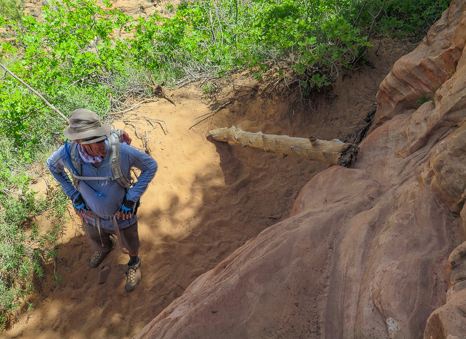
Very helpful way to get up this tall ledge!
Rock cairn marking ledge up west cliff climb; nearing the canyon opening at the top.
Fred and Sue on "Top Rock", at entrance to plateau from Water Canyon. 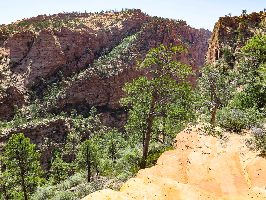
Looking down Water Canyon from near top of its west wall.
Looking across to Water Canyon's east wall.
View from "Top Rock" above exit from Water Canyon of White Domes on Canaan Mountain.
Descending down into upper Water Canyon wash, then we walked 1/4 mile west to intersection with wash that leads NW to White Domes.
Waterfall #1
Waterfall #2
Intersection of washes - we took the wash on the right, out of the main wash; it leads up to White Domes ~ 1.1 mile.
Slick rock scenes on ascent to White Domes.
On the way to White Domes
Looking at Zion NP to the north.
Some cool stuff on the trail.
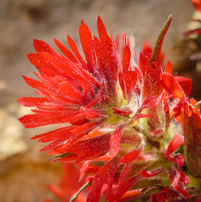
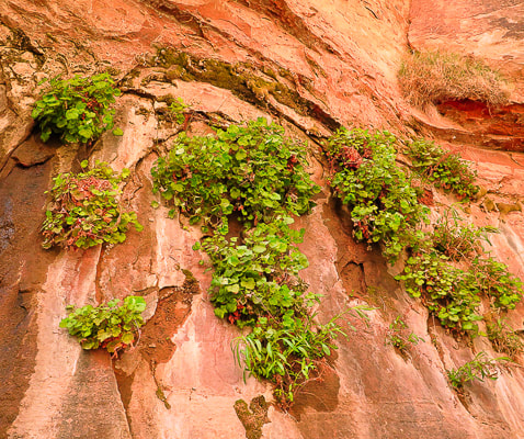
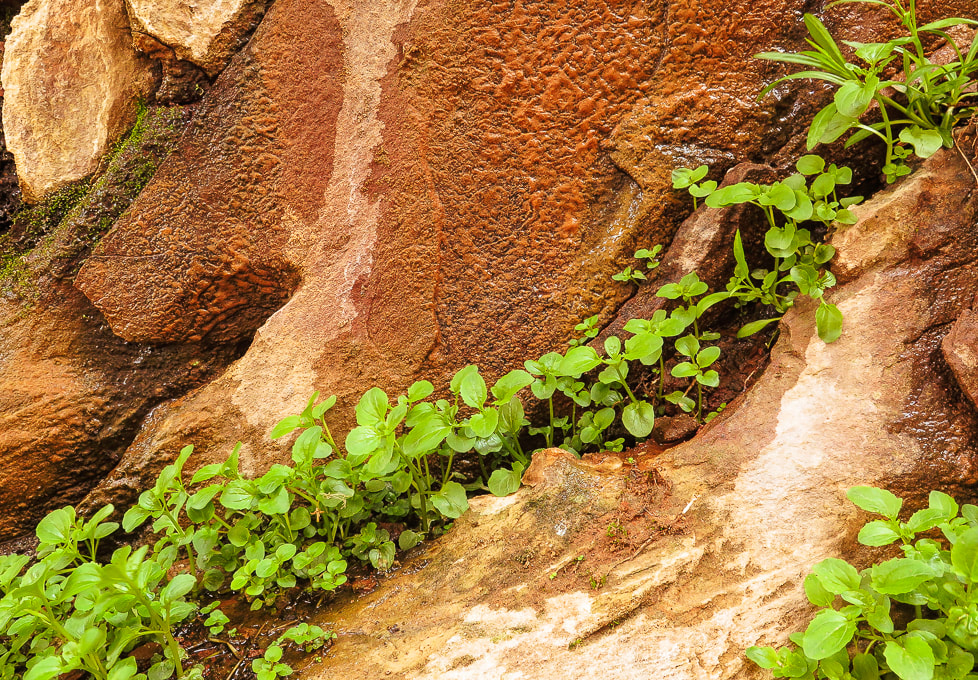
Indian paintbrush (Castilleja)
DESERT PLANTS 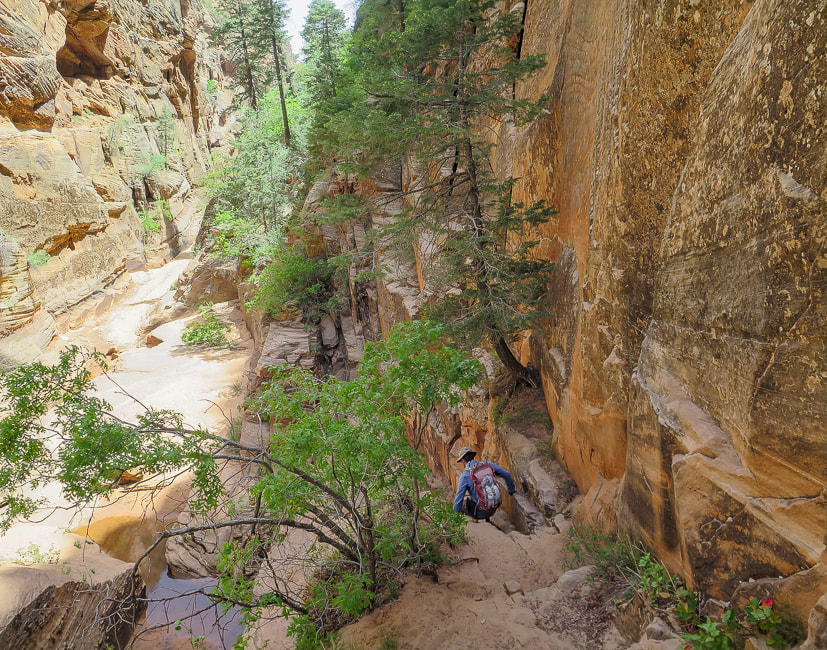
Heading back down.
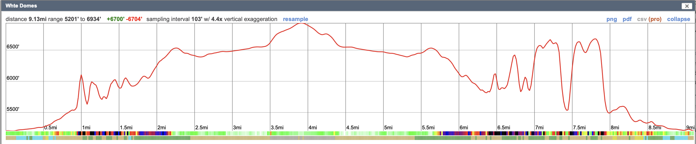
Our GPS tracks reflect an inaccuracy due to inadequate number of satellites signals while hiking in the canyon. According to CalTopo, it takes a minimum of 4 satellites communicating with your GPS to get accurate elevation and location measurements. It's not uncommon for satellites to be close to the horizon, so they may be blocked depending on the terrain you're hiking on.
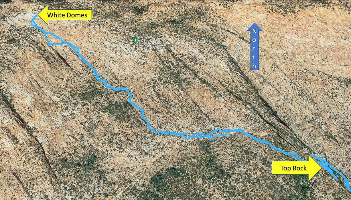
Google Earth image of our route from Top Rock just out of Water Canyon to White Domes, going cross-country to drop down into upper Water Canyon wash, then following side wash straight to White Domes in NW direction. Distance from Top Rock to White Domes = ~ 1.7 miles.
|
Categories
All

Sue and Fred

About this blogExploration documentaries – "explorumentaries" list trip stats and highlights of each hike or bike ride, often with some interesting history or geology. Years ago, I wrote these for friends and family to let them know what my husband, Fred and I were up to on weekends, and also to showcase the incredible land of the west.
To Subscribe to Explorumentary adventure blog and receive new posts by email:
Happy Summer!

About the Author
|