|
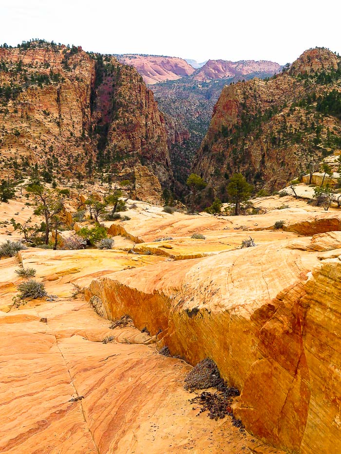
Canaan Mountain, a towering plateau of Navajo Sandstone is a classic southern Utah adventure through red sand, forested canyons and over ancient sand dune slickrock. Located south of Zion National Park, it is wild and beautiful. Related: Mt. Kinesava - Zion National Park Double Arch Alcove Hike - Zion National Park Angels Landing In Zion - Not for the Faint of Heart White Domes via Water Canyon - Canaan Mountain Wilderness Southern Utah Hikes 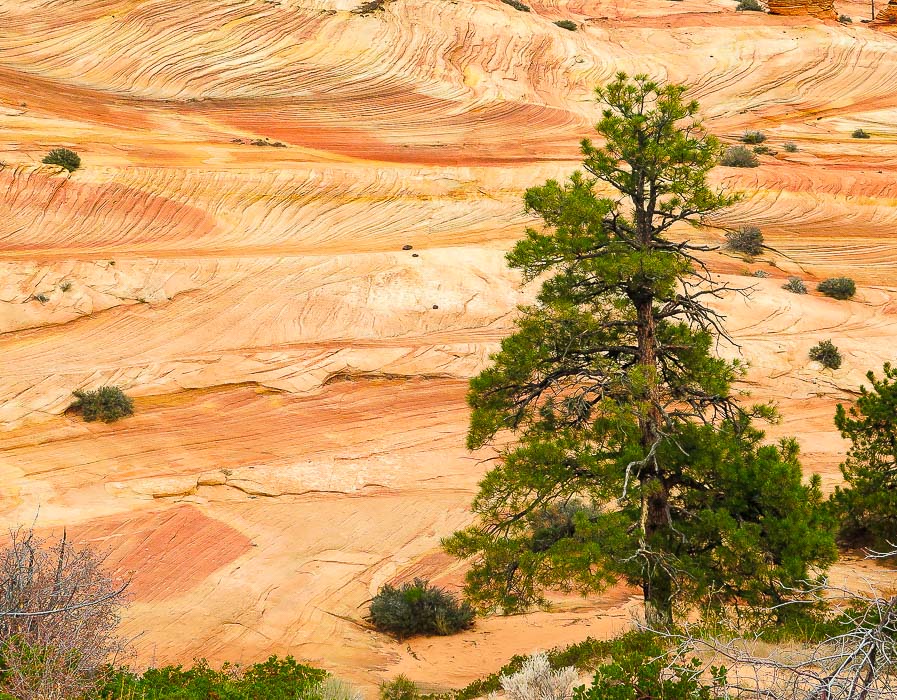 Ponderosa Pine and petrified sand dune on plateau below Canaan Mountain Trip Stats Overview: Experience a variety of colors and terrain on a hike that treks up a steep canyon to Navajo Sandstone pinnacles, domes, and hoo-doos. Walk through a broad canyon bottom with a stream and towering cottonwood trees, then up a beautifully forested canyon with waterfalls and hanging gardens. The trail then tops off onto a plateau with spectacular sandstone features and deep canyons; further climbing on open slickrock gets you to the summit of Canaan Mountain. Located several miles south of Zion National Park, Canaan Mountain Wilderness is on BLM land. Spectacular and wild without the crowds. Elevation gain: Canaan Mountain is a towering plateau measuring 8 miles by 10 miles; the highest point = 7,363 feet. We hiked to 6,863 feet. Trailhead elevation = 5,120 feet. Our elevation gain = 1,740 feet. Elevation gain to highest point on summit from Squirrel Creek Trailhead = 2, 242 feet. Distance: variable depending on which part of summit you access. Our round -trip distance = 12.5 miles. To go to Sawmill Spring at higher elevation, add ~ 3 miles one way. Location: highest point on summit: 37.0739° N / 113.0375°W Difficulty: Moderate; Squirrel Canyon steep toward top, requiring some light hand-support, route finding on Sawmill Trail is necessary as there are few cairn markers. Maps: USGS 7.5 min topo - Hildale, Utah-Arizona, Trail Map and Guide for St. George, Hurricane, and Zion NP, Utah by www.AdventureMaps.net, Topozone map. Links: BLM Canaan Mountain Wilderness, Cedar and Sand blogspot. Caution: Trail mostly in wilderness; there are no signs; be prepared with topo map and hike directions. Cairns mark route up Squirrel Canyon and then at intersection with Sawmill Trail. "It is not enough to fight for the land; it is even more important to enjoy it. While you can. While it’s still here. So get out there and hunt and fish and mess around with your friends, ramble out yonder and explore the forests, climb the mountains, bag the peaks, run the rivers, breathe deep of that yet sweet and lucid air, sit quietly for a while and contemplate the precious stillness, the lovely, mysterious, and awesome space." - Edward Abbey Driving Directions (from Hurricane, Utah) Traveling east/southeast on Utah Highway 59, turn left (east) onto Utah Avenue (right before Subway restaurant in 2018) in Hildale. Continue on pavement for ~ 2 miles, then Utah Avenue curves left (north) and becomes Canyon Street. At 2.5 miles from highway 59, turn right onto Water Canyon Road (road becomes dirt). Travel ~ 1 mile to a sign on the right of the road that reads "Squirrel Canyon Trailhead". Trailhead parking is just ahead.
Hike Directions
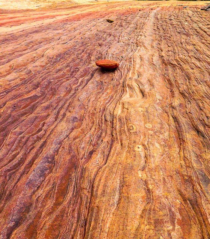
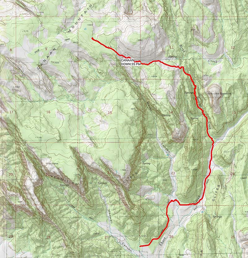 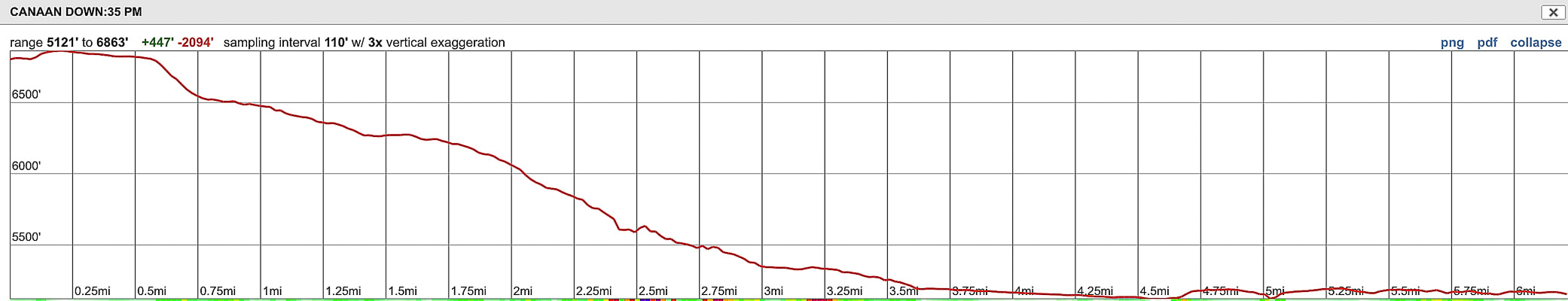 Our route up Squirrel Canyon to lower elevation of Canaan Mountain We ascended to 6,900 feet; the summit is 7,363 feet (note: profile illustrates trail starting at our highest point and descending back to trailhead) 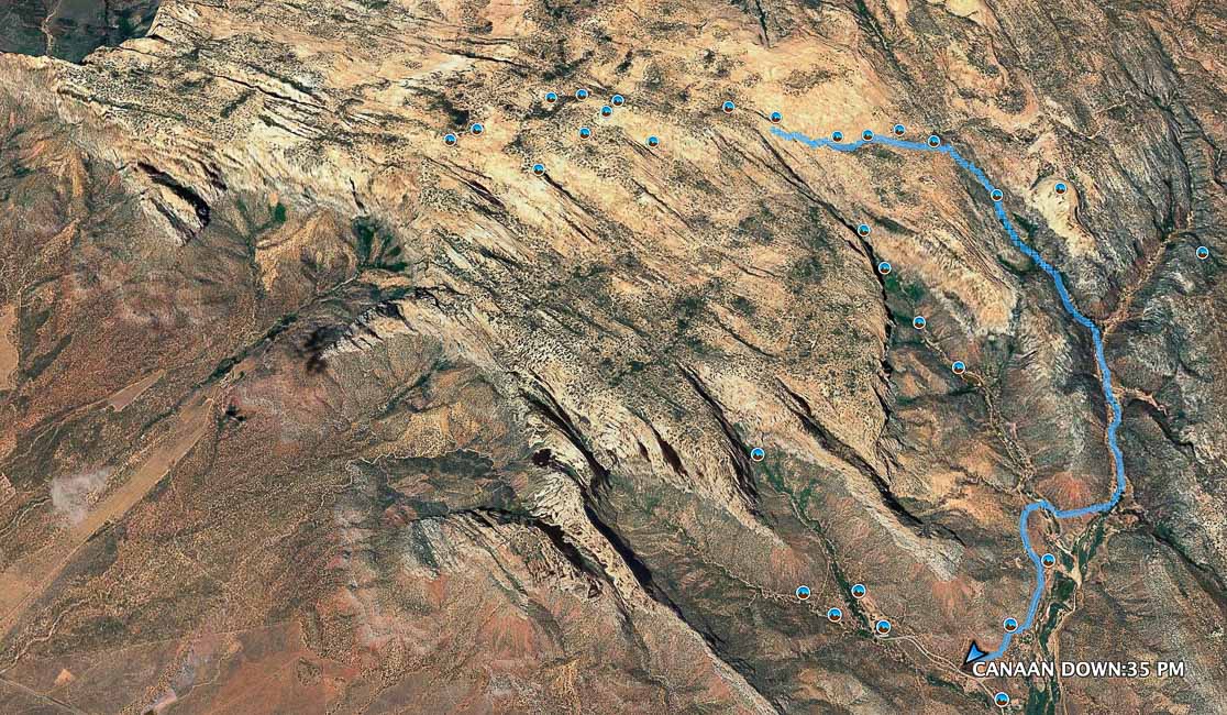 Our route up Short Canyon to Squirrel Canyon to summit of Canaan Mountain at 6,900 feet. The highest elevation of the summit is to the left (west) at 7,363 feet Beginning of trail at Squirrel Canyon Trailhead in foreground, red arrow points to trail that bears right around red bluff on left to go down into Short Creek in ~ 0.5 miles Our Hike We became "temporarily bewildered" when we didn't see the continuation of the trail just after the descent into the first wash (see photo above), so we lost some time with a little backtracking. This costs precious time, especially when days are short and the hike to the summit is long. We re-oriented and found the trail continued out of the wash and around the red bluff to the left, on its way to Short Canyon. There are no signs or trail markers until the climb up Squirrel Canyon, as this a wilderness area (an advantage: not many people on the trail!) We would still make Canaan Mountain, but not the highest point on its summit which is a longer hike. We stayed in Hurricane, Utah for Thanksgiving weekend in an old Zion NP ranger's cabin. Hiking in and near Zion National Park is a great way to celebrate the holidays. I have been hiking in Zion since the early 1990's. We avoided crowds this time by choosing hikes outside of the park. I was very impressed by the Canaan Mountain Wilderness because of its rugged beauty and all of the sandstone features throughout, and the fact that we basically had the place to ourselves. My kind of holiday! 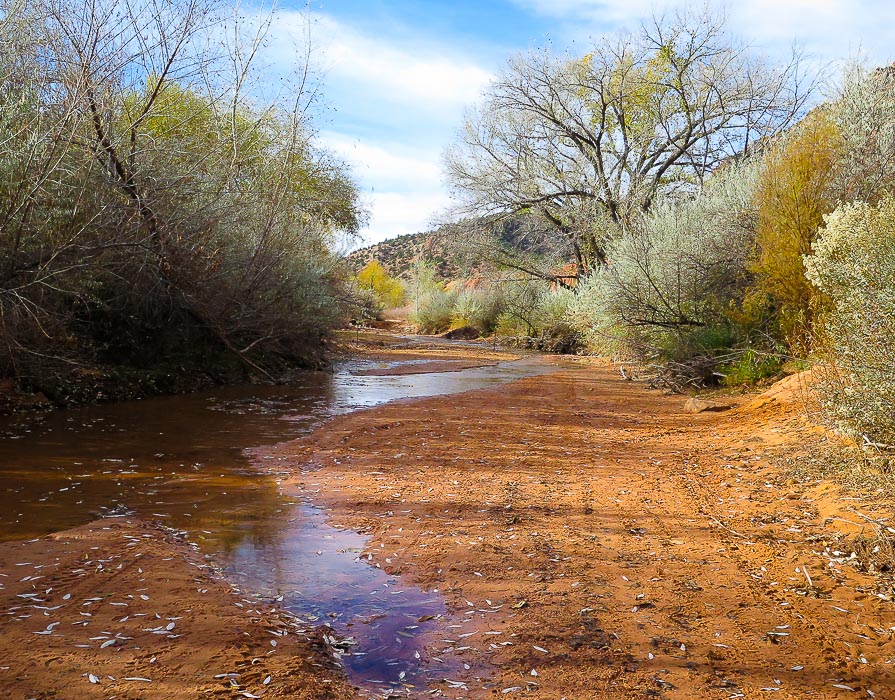 Entrance into Short Creek Entrance to Squirrel Canyon one mile upstream from this - hike along ATV road on right side of creek The hike starts by descending through deep orange sand, across a wash, and continues on the orange sand straight ahead. It rounds the red bluff to the left and then drops into Short Creek, ~ 0.5 miles from trailhead. There were a few people riding ATVs on the trails and washes; they looked like they were having fun. The steep canyon walls shaded Short Creek and its huge Cottonwood trees in the morning. This scene looked much different in the afternoon on the way back to the trailhead with the yellow leaves brightly glowing in the direct sunlight streaming through the canyon. The brief walk up the creek before the trail scrambles up a small bank under a huge grove of Cottonwoods is beautiful. Sand ripples alternating red and black lie under shallow water reflecting the sky. The trail then follows a 4 WD road along the creek, passing by plenty of grey rabbitbrush shrubs whose flower heads glow a cream color in the sun. Patches of white sand are deposited on the bank above the stream, possibly sediment from the white Navajo Sandstone layer further upstream. The entrance into Squirrel Canyon, about one mile upstream is obvious, as the ATV/hiking trail crosses Short Creek. A wide and relatively flat area at the entrance was covered with autumn leaves. The trail ascends Squirrel via the 4WD road and then a single track trail as the canyon narrows. Oak and maple trees surround and form an autumn canopy of red, brown and green, while green moss and maidenhair ferns dripped water seeping from vertical sandstone walls. The trail transitions from the soft tread of seasons of leaves to hard and angular slabs of sandstone to soft white sand as it emerges from the canyon then tops out on a beautiful plateau underneath The Beehive, an ancient sand dune. In a short distance from emerging, the canyon trail intersects with the Sawmill Trail with a pile of rocks marking this point. As we turned left at this point (west), I glanced back to make sure I wouldn't miss this intersection on the way down. 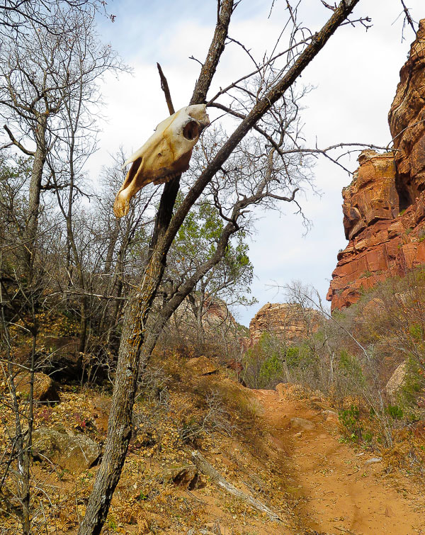 A somewhat ominous entrance into Squirrel Canyon 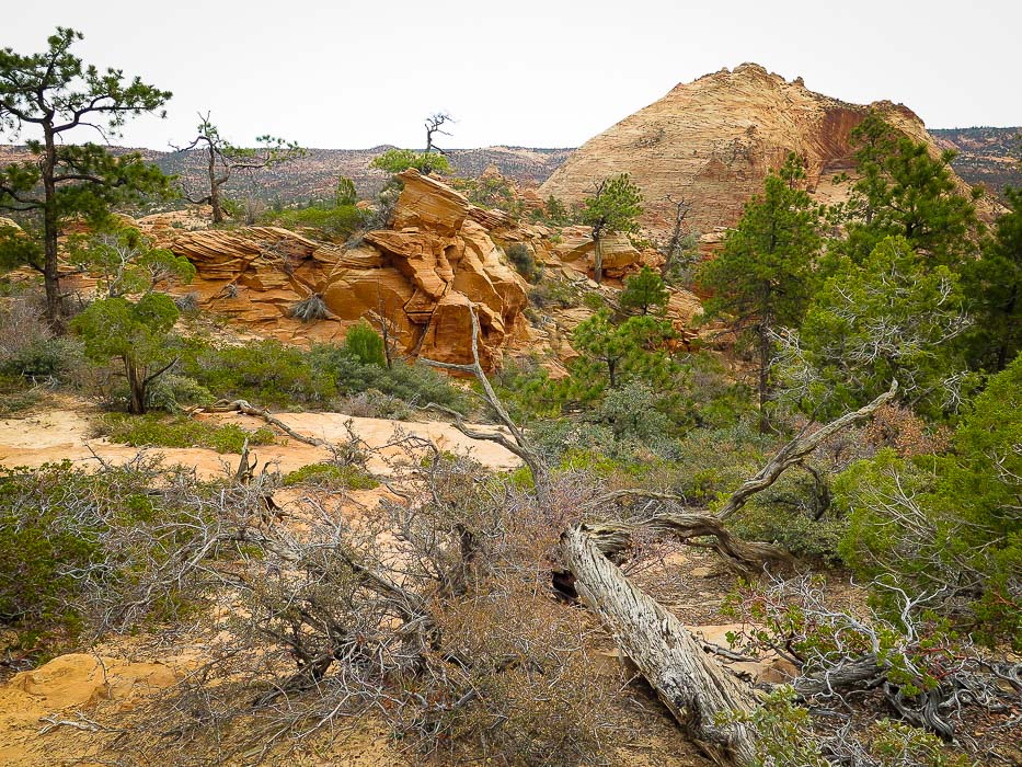 The Beehive, elevation 6,476 feet Seen as Squirrel Canyon Trail opens up onto plateau above canyon website for climbing The Beehive 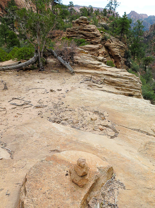 Cairns mark route over sandstone while going up Squirrel Canyon An excellent feature of this hike is that it gains enough elevation to walk through at least two geologic formations. The top of Canaan Mountain consists of the massive Navajo Sandstone which is also observed in the towering walls of Zion National Park. The hike appears to be starting in the red cliffs of the Kayenta Formation (mudstone) that lies below the Navajo Sandstone. The transition I noticed was in leaving the red sands and cliffs behind in Squirrel Canyon and ending up on the white rocks and white sand on the plateau above. The upper walls of Canaan Mountain are the White Cliffs of Navajo Sandstone, and at the base are the Vermilion Cliffs which can be seen at the trailhead. These cliffs are widespread throughout southern Utah and Northern Arizona. At this location, they face southeast, and in the morning sun the walls are ablaze with intense orange, yellow and red (read more about geology of this area below). The plateau above the canyon is a wondrous world of layered, cross-bedded, curving cream-colored and orange sandstone, with never-ending examples of eroded Navajo Sandstone features. Huge junipers make you wonder how old they are. Dark and light-striped hoo-doos, domes and platforms in all shapes and sizes are so plentiful - I wished that I was camping up there so I could spend more time looking. Ponderosa pine and juniper contrast against the frozen-in-time deeply angled and curving sand dune cross-beds. The spectacular dark and forested V-shape of the entrance into Water Canyon looms to the south. Time was getting short. We left Sawmill Trail and scrambled up ledges of slickrock to the highest point on the summit north of us, which is not the highest on Canaan Mountain. We found ourselves in yet another world of a flat-topped forested plateau with soft white sand. Only a few hours of daylight left - we had to get back. Sawmill Trail required close attention because it was marked by cairns sparsely at best, requiring us to "hunt" for the trail sometimes. The trail alternated between soft sand and slickrock, steep in parts. Tire tread from a recent jeep was helpful to navigate the way. With each turn, rise and descent, there is almost an overload of beautiful, stark, weird, unusual sights along with the feeling of elevated space and expanse in every direction. 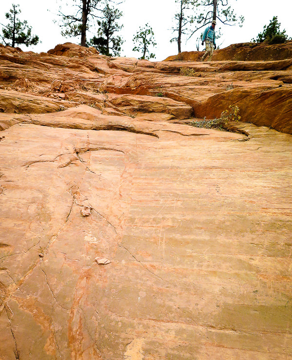 At this point on Sawmill Trail, the only marker for the trail was these scrapes in the slickrock. It rose steeply over the rocks on this rise 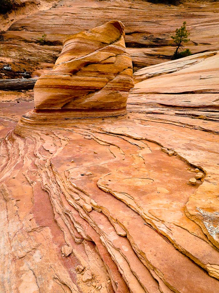 Sawmill Trail weaves in and out of soft sand and cross-bedded Navajo Sandstone 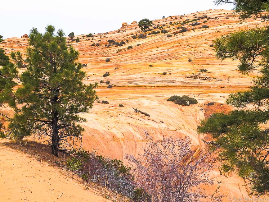 Sand of Sawmill Trail lower left hand corner. We hiked to the right, up to the top 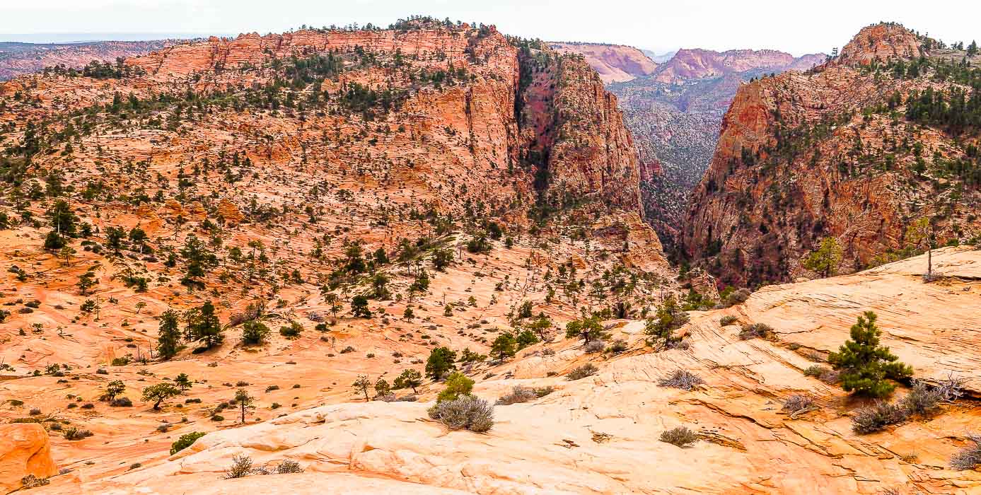 At 6,500 feet with view of the Notch toward the south 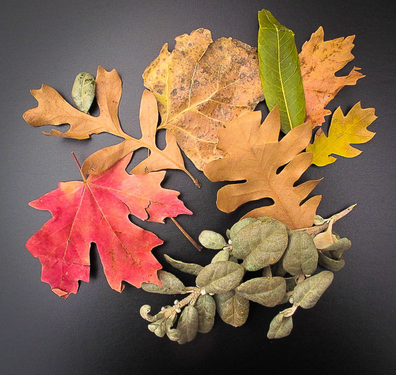 Leaves found on Squirrel Canyon floor Common trees of southern Utah canyons are Canyon Maple, Boxelder, Fremont Cottonwood, Scrub Oak, and Gambel Oak. Ponderosa Pine, Pinyon Pine, Gambel Oak, Manzanita, and Douglas Fir grow on slickrock. 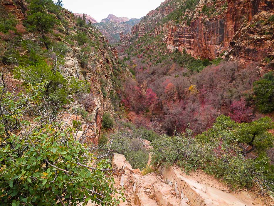 Heading down Squirrel Canyon Beautiful canyon with bright green moss, clear pools and waterfalls, thick canopy of oak and maple trees We saw no one else in the canyon and on the slickrock plateau. It was easy to get sidetracked in Squirrel Canyon while getting almost hypnotized by watching oak leaves floating in clear pools that had ripples on the bottom. As we made our way back to the trailhead, on the ATV trail that runs along Short Creek, a large group of young backpackers were plodding towards us in the deep red sand, laughing and smiling, silhouetted by the late afternoon sun. Huge Cottonwoods, strong and rooted along the white-sand bank with leaves glowing yellow lined our way back down Short Creek. These had massive trunks - the vegetation in this area is so robust and healthy. I'm going back - I can see why the party of backpackers looked so joyous! Next time - Water Canyon! Geology and History The age of rocks on Canaan Mountain are Lower Jurassic (201 - 174 Ma). It is capped by 1,300-foot cliffs of Navajo Sandstone. The Kayenta Formation underlies the Navajo. The Kayenta is then underlain by the Moenave Formation. The base of the White Cliffs of Canaan Mountain is part of the greater extent of the Vermilion Cliffs, which extend over a large area of Utah and Arizona.
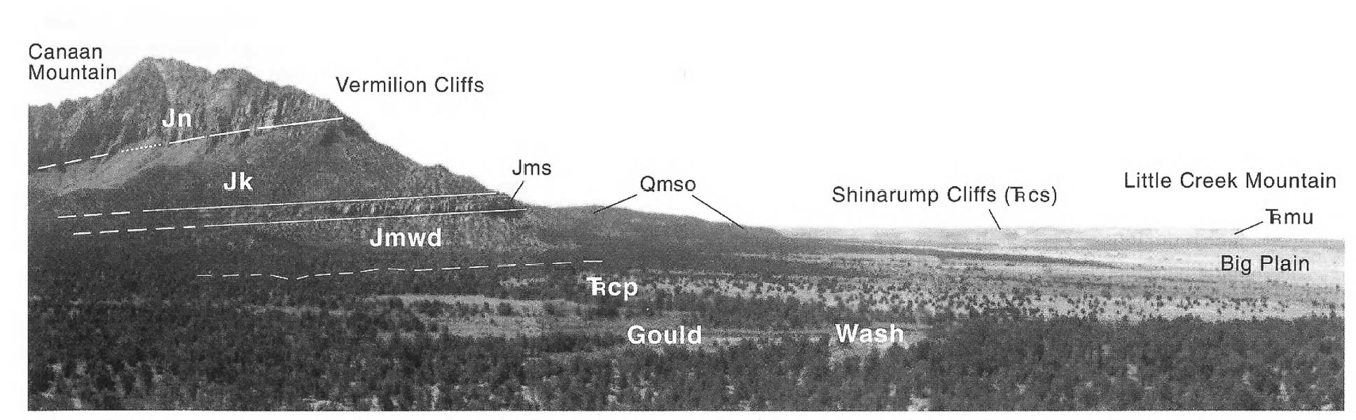 Key to stratigraphic units in above photo: Eroded Navajo Sandstone on cap of Canaan Mountain 1,200 feet thick; Canaan Mountain is ~ 2,000 feet higher than the plain (Jn). Kayenta Formation (Jk), Moenave Formation consisting of the Springdale Sandstone member (Jms), Whitmore Point and Dinosaur Canyon members (Jmwd). (From Geologic Map of the Smithsonian Butte Quadrangle, cited below). References:
  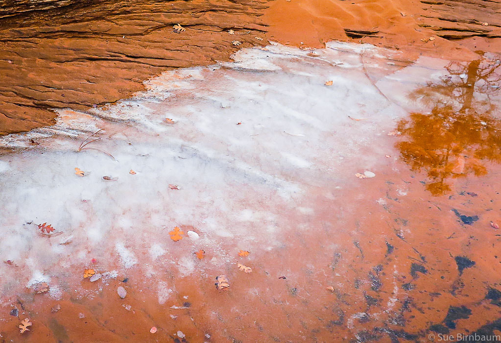 Temps in the 20's at night at ~ 6,200 feet in late November 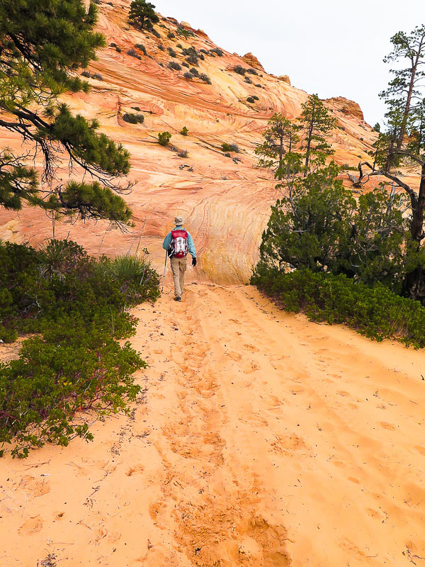 Sawmill Trail treks through sand and sandstone  Cairns mark first trail off of Sawmill Trail that treks to the lower reaches of Canaan Mountain summit 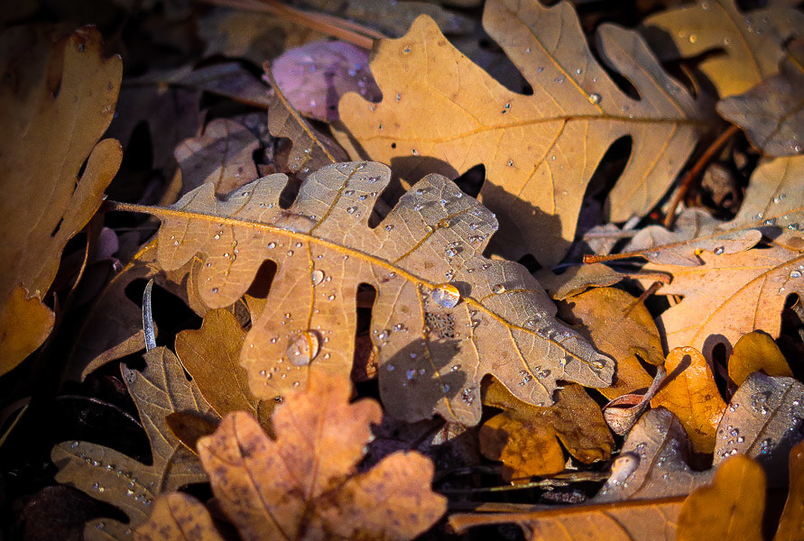 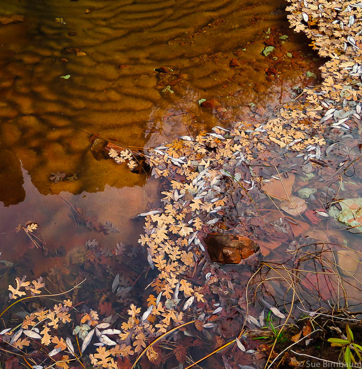 Pool in Squirrel Canyon 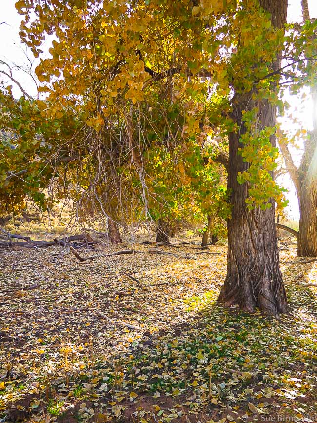 Along Short Creek
2 Comments
|
Categories
All

Sue and Fred

About this blogExploration documentaries – "explorumentaries" list trip stats and highlights of each hike or bike ride, often with some interesting history or geology. Years ago, I wrote these for friends and family to let them know what my husband, Fred and I were up to on weekends, and also to showcase the incredible land of the west.
To Subscribe to Explorumentary adventure blog and receive new posts by email:
Happy Summer!

About the Author
|