EXPLORUMENTARY
  • Home
    • Cactus to Clouds Hike
    • More Quotes
    • Ann Zwinger Quotes
    • Mary Oliver Poems
  • Hikes by State
    • Idaho
    • Southern Utah
    • Arizona
    • California Desert
    • Nevada
    • Wyoming
  • BLOGS
    • Adventure Blog
    • Women and the Land
  • GALLERY
    • DESERT PLANTS >
      • Beavertail cactus
      • Brittlebush
      • Christmas Cactus
      • Arizona Barrel Cactus
      • Parry's penstemon
      • Agave
      • Arizona Rainbow Hedgehog
      • Claret Cup Hedgehog
      • Desert Agave
      • Palmer's Penstemon
      • Silver Cholla
      • Cristate Saguaro
      • Indian Paintbrush
      • Ocotillo
      • Santa Rita Prickly Pear
      • Spiny Cliffbrake
      • California Barrel Cactus
      • Engelmann Prickly Pear
      • Velvet Mesquite
      • Joshua Tree
      • Buckhorn Cholla
      • Hedgehog Cactus
      • Fishhook cactus
      • Thompson's Woolly Locoweed
    • NATURE
    • BOISE
    • EARTH + SKY
    • URBAN
    • WATER
    • PATRIOT
    • ORCHIDS
  • Fit After 50
    • Brian Holgate
    • Fred Birnbaum
    • Dave Brasuell
    • Bus' Little Black Book
    • Mike Carlson
    • Ray Wilson
    • Bryan Krouse
    • Vickie Kearney
    • Maria Keezer
    • DOUG TRAUBEL
    • Boise Cross Fit Masters Ladies
    • Tim Clemens
    • Marcia Bondy
    • Becky Borczon Blake >
      • Becky B Downtown
    • Jennifer Cera and Sue Birnbaum
    • Dave Brasuell
    • Vance Powell
  • About
    • CONTACT

Tucson Mountains Tour:  Golden Gate Mountain, Peak 3,380, Little Cat Mountain

1/29/2020

5 Comments

 
Summit three scenic high points in the "Tucson Mountain Chaos" using a combination of established trails and off-trail climbs through exquisite Lower Sonoran desert ecosystem.  
Related:
Cat Mountain, 3,852' - Tucson Mountain Park
​Desert Plants photos
​List of Arizona hikes 
Picture
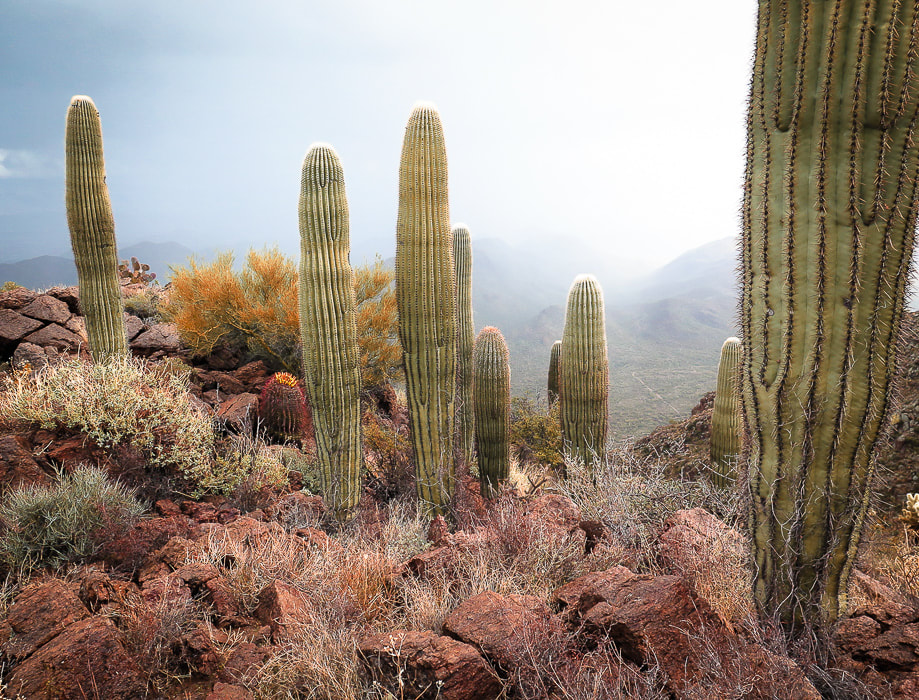
Saguaros at Golden Gate Mountain summit
Trip Stats
Overview:  Close to Tucson, this mountain park feels almost like wilderness as trails wind through the colors, textures and dramatic mountain cliffs of volcanic peaks in prime Sonoran desert ecosystem.  This tour uses established trails to access cross-country routes to peaks with spectacular views of southern Arizona's "sky islands".
Location:  Yetman trailhead, Tucson Mountain Park, Pima County, Arizona.
Distance/Type:  9.25 miles out and back including a loop.
Elevation gain:  Total 3,130 feet.  Highest point = Golden Gate Mountain at 4,288 feet.
Difficulty: Easy to moderate Class 1 established trails; strenuous Class 1-2 cairned off-trail, navigation moderate.
Maps:   Saguaro National Park - Trails Illustrated #237.  PDF of TMP Recreation Trails.  Topo map our tracks below.
Considerations:  Great winter hike, carry plenty of water, no fees or trail register.  No dogs allowed.
Date hiked:  Christmas day, 2019.
Reference:  We used Earthline's hike directions for this hike.
Driving directions:  From I-10 in Tucson, take Speedway Blvd West which turns into Gates Pass Rd. at intersection with Camino de Oeste.  From this intersection, drive ~ 4.5 miles to Gates Pass Overlook, descend down ~0.4 miles past the pass: Yetman Trailhead is on the left in a large parking lot at a sharp right turn in the road.
Geology:  Tucson Mountains Caldera.  High points are Cat Mountain Tuff (consolidated volcanic ash), valleys are landslide breccia deposits (referred to as Tucson Mountain Chaos).
Hike Summary
Golden Gate Mountain Summit, 4,288 feet- located on the right side of trail.
  • From Yetman trailhead:  walk 0.5 miles to cairned access trail on your right (south),  follow cairns to summit.
  • Return to Yetman Trail using the same path.  Total mileage = 2.0 miles.  Total elevation gain = 1,328'.
Peak 3,380 on Bobcat Ridge
  • From return to Yetman Trail, hike Yetman Trail to intersection with Sarasota Trail (labeled Starr Pass Trail on 2014 Saguaro NP Trails Illustrated map);  keep to left to stay on Yetman for 0.2 miles to flat spot at 2,925 feet where Bobcat Ridge is gained by an obvious unnamed path heading up draw to your right (south).  Total mileage = 3.5 miles.
  • Take this ridge trail at right to top of ridge 0.8 miles to Peak 3,380.  Total mileage = 4.3 miles, elevation gain from ridge turn-off to top = 430 feet.
  • Continue on Bobcat ridge trail as it descends from Peak 3,380 to meet up with Explorer Trail, 0.7 miles.  Total mileage =  5.0 miles.  Take a left (southeast) and hike 0.1 mile up to saddle with Little Cat on your right.
Little Cat Mountain, 3,310 feet
  • At saddle, follow faint path to the right with occasional cairns.  Path leads up draw southwest to saddle between two prominences, then over grassy area to summit for 0.17 miles and 390- foot climb.  Total mileage = 5.3 miles.
  • Descend Little Cat Mountain via same route as ascent to return to Explorer Trail, take left to return to saddle.
Return to Yetman Trailhead
  • Continue on Explorer trail, then onto Sarasota trail, then back onto Yetman trail to Yetman Trailhead.
Picture
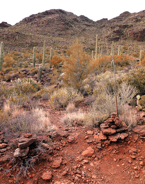
Yetman Trailhead and Golden Gate Mountain 
Our Hike
It's not every day you can hike through valleys with rocks formally called "Tucson Mountain Chaos" and climb mountains made of compacted ash spewed from a huge volcanic eruption that created a 12-mile wide caldera whose floor collapsed onto an emptied magma chamber.  At least this seems to be the current theory of the geologically complex Tucson Mountain Park.  Geologists still debate and puzzle over the formation of this area.  If you do this hike that I describe here, you will travel on the caldera floor through a beautiful Sonoran desert ecosystem.

On this yearly Tucson visit, Fred and I were looking for different peaks in the area to summit.  Not that we are tired of peaks in the Santa Catalinas and Rincon Mountains.   A winter storm had dumped a lot of snow at elevations above 5,000 feet, so we opted for a warmer experience instead.  Tucson Mountain Park is managed by Pima County.  Its great website has an interactive map and lists features and activities in this 20,000-acre park
 that is "one of the largest natural resource areas owned and managed by a local government in the U.S."   Outdoor activities range from picnicking to hiking, mountain bike riding and wildlife viewing.   On Cat Mountain (a few days after this hike), we were lucky to see five grey Coues whitetail deer, atop steep and rocky rust-colored cliffs.  

I love celebrating holidays on the trail.  There is a certain fellowship that occurs with greetings of "Merry Christmas" or "Happy New Year!"   On this Christmas morning, the chill wind stung our faces, but it wasn't long before we felt warmth from the winter sun.  
Picture
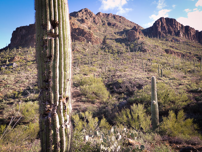
The north walls of Golden Gate Mountain, the first summit of our Tucson Mountain Park tour
Golden Gate Mountain
At the Yetman trailhead, we set out to discover a new area with hike directions from Earthline.  At the saddle between Golden Gate Mountain and Bren's Benchmark, 0.4 miles from the trailhead, we oriented ourselves and looked southeast to mountain summits, not yet knowing which ones we would be climbing.  We took a right 0.1 miles past the saddle at the cairned trail that gains the Golden Gate through a break between cliffs, and began our climb to Golden Gate Mountain, our highest summit at 4,288 feet (see photo below).

The golden color of the rocks perhaps gave this peak its name.  Cat Mountain Tuff, a thick layer of consolidated ash, makes up the bulk of these peaks.
​
Tucson Mountain Chaos is the term given by geologists to the rocks that underlie the Cat Mountain Tuff, seen in the valleys.  There is no definite answer to the thousands-feet thickness of this Cretaceous-age tuff.  Were these rocks below the Cat Mountain Tuff rafted from deeper levels by the rising magma?  Or, was this rock caused by a landslide in a caldera that had accumulated the tuff?  Of course, when you throw in the geometry of faulting that occurred later when Basin and Range was spreading, it makes the geologist's task of identifying the age relationship of the rocks more difficult.
Picture
Cairns on each side of access trail to Golden Gate Mountain, 0.5 miles from Yetman trailhead; trail goes up through swale between two high points.
Picture
Teddy bear cholla
Cylindropuntia bigelovii
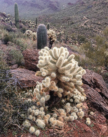
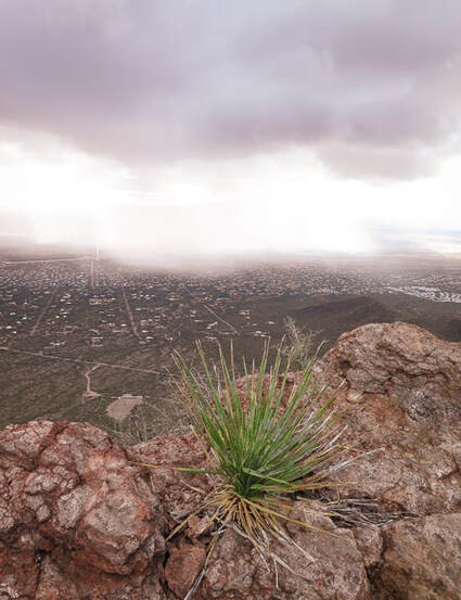
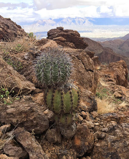
Dodging teddy bear chollas and barrel cactus spines, we marveled at a rare cristate saguaro thrusting up from a steep, south-facing slope under orange cliffs.  Theories for the abnormal crest growth range from genetic mutations to lightning strikes.  The trail threads between welded tuff towers and tops out, weaves to the left following cairns to the summit.  Tucson spreads below, mountain ranges surround on the horizon.  Below us, a white cloud moved across the valley and swept over us, briefly covering the peak with fog that created a rare, softly illuminated desert scene.  Light rain produced vivid oranges, yellows and greens.  Return to Yetman Trail via the same path.
Picture
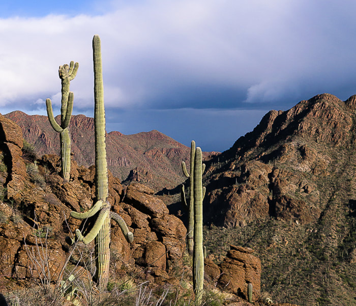
Cristate saguaro on left.  Bren Benchmark across valley.
Picture
Picture
Scenes from the summit of Golden Gate Mountain, Tucson Mountain Park
Picture
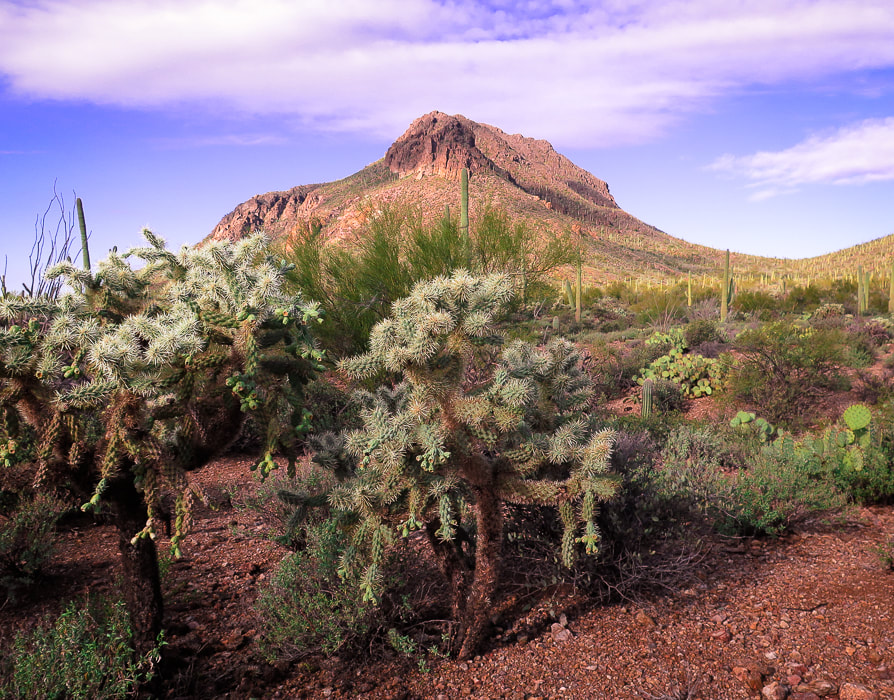
View of Golden Gate Mountain from Yetman Trail (looking west).
Yetman Trail runs through lowest point on saddle to the right.

Picture
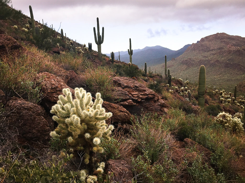
Peak 3,380' on Bobcat Ridge
From return to Yetman trail, hike down-valley 1.15 miles to the intersection with the Sarasota Trail.  Stay on Yetman to the left (east) for 0.2 miles to arrive at a flat saddle.  Bobcat Ridge trail (not marked with signs but obvious) takes off to the right (southwest).   The views of Tucson open up as you near the top, Peak 3,380'.  It is a relaxed summit with beautiful vegetation, a favorite local hiker destination.  From this summit,  the steep northern walls of Little Cat Mountain comes into clear view; there's a lot of descending before the climb.  To its left (southeast), the dark, enormous hulk that is Cat Mountain will have to be summited another day.  Total mileage = 4.3 miles.
Picture
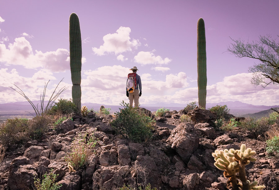
Bobcat Ridge near Peak 3,380
Picture
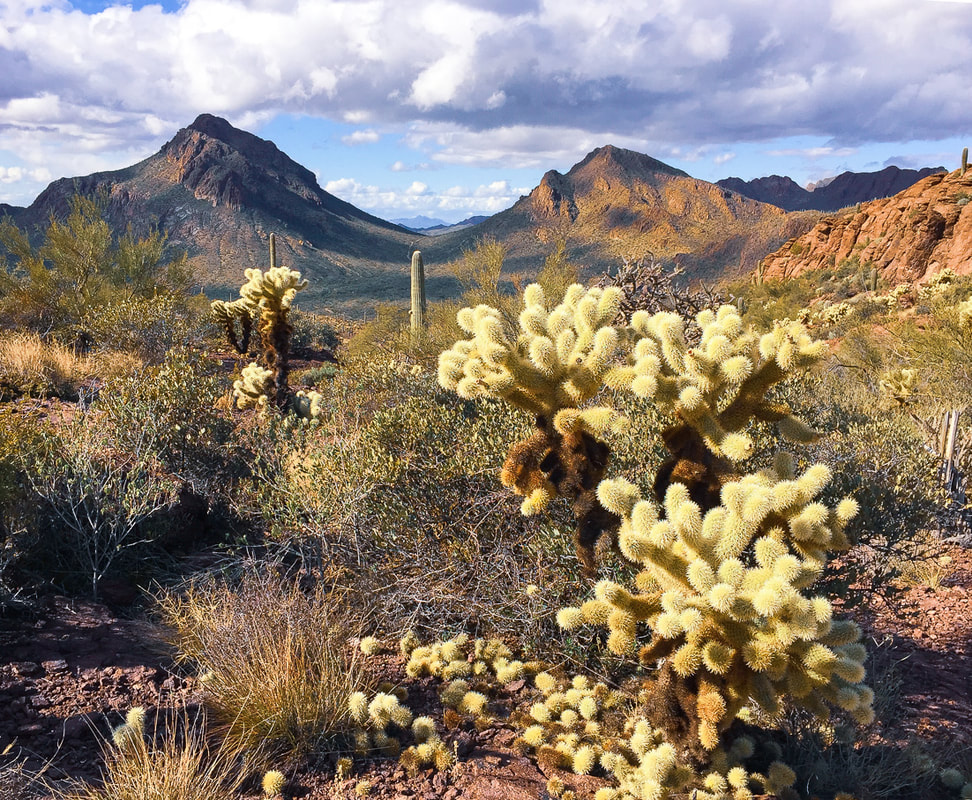
From Bobcat Ridge looking northwest to saddle between Golden Gate Mountain (left) and Bren's Benchmark (right).
The Yetman Trail traverses the saddle.

Picture
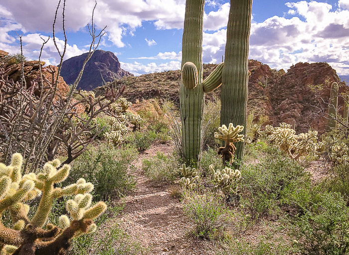
Bobcat Ridge Trail leading away from Peak 3,380 toward Little Cat Mountain behind saguaros.  Cat Mountain on the left.
Little Cat Mountain
From Peak 3,380, continue southeast on Bobcat Ridge Trail 0.7 miles to intersection with Explorer Trail; total mileage = 5.0 miles.  Turn left (southeast) to climb to saddle in a short distance.  At top of saddle, at arrow sign for Explorer Trail, hike up to saddle of Little Cat Mountain to the right (south).  Fewer cairns than those of Golden Gate mark this off-trail approach which climbs a quick 400' to the summit, passing a relatively flat grassy area once the trail tops the saddle.  From this summit, look to your left;  an outrageous view of dark orange and black volcanic Cat Mountain appears as you stand on a cliff overlooking Tucson.  The lowering sun and long shadows made this scene even more dramatic.  

We returned via our ascent to Explorer trail (signs with pink arrow), then made a loop around base of Bobcat Ridge by following Sarasota Trail (signs with maroon arrow), then finally on Yetman Trail to trailhead.  Total distance:  9.25 miles.  
We vowed to climb Cat Mountain, then returned to its summit a few days later with our friend Scott, to celebrate the New Year and plan for hikes together in the beautiful southwestern deserts.
Picture
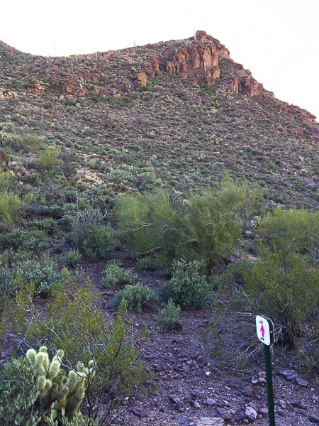
Saddle near summit of Little Cat Mountain - faint trails ascend from this saddle between Bobcat Ridge and Little Cat on Explorer Trail.
Picture
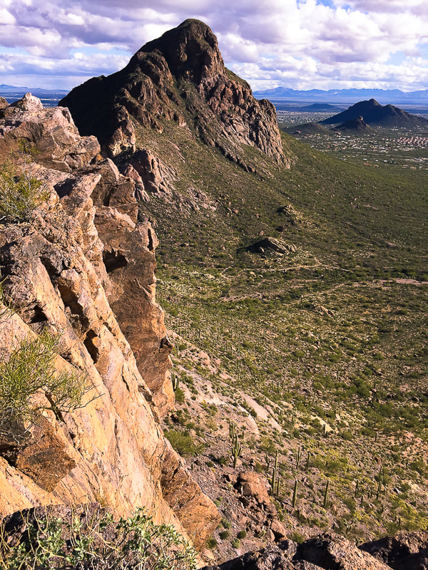
View of Cat Mountain from summit of Little Cat Mountain
Picture
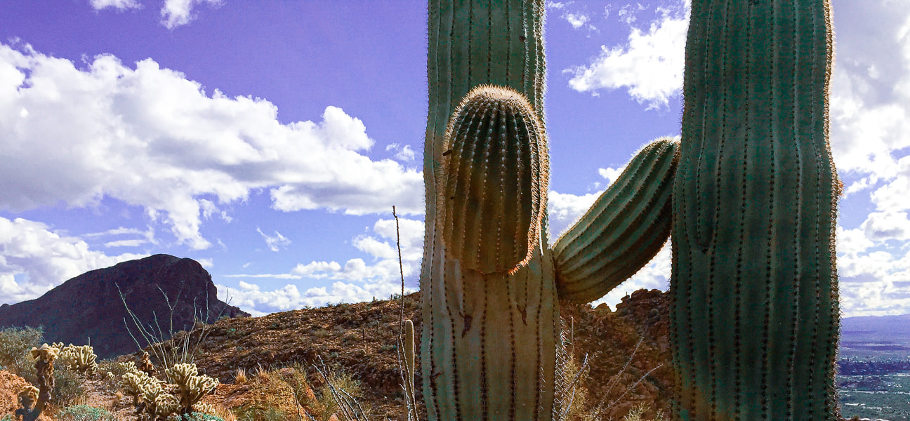
Cat Mountain on the left (we hiked that peak a few days later)
Little Cat is behind the saguaro
Picture
Our GPS tracks 
Picture
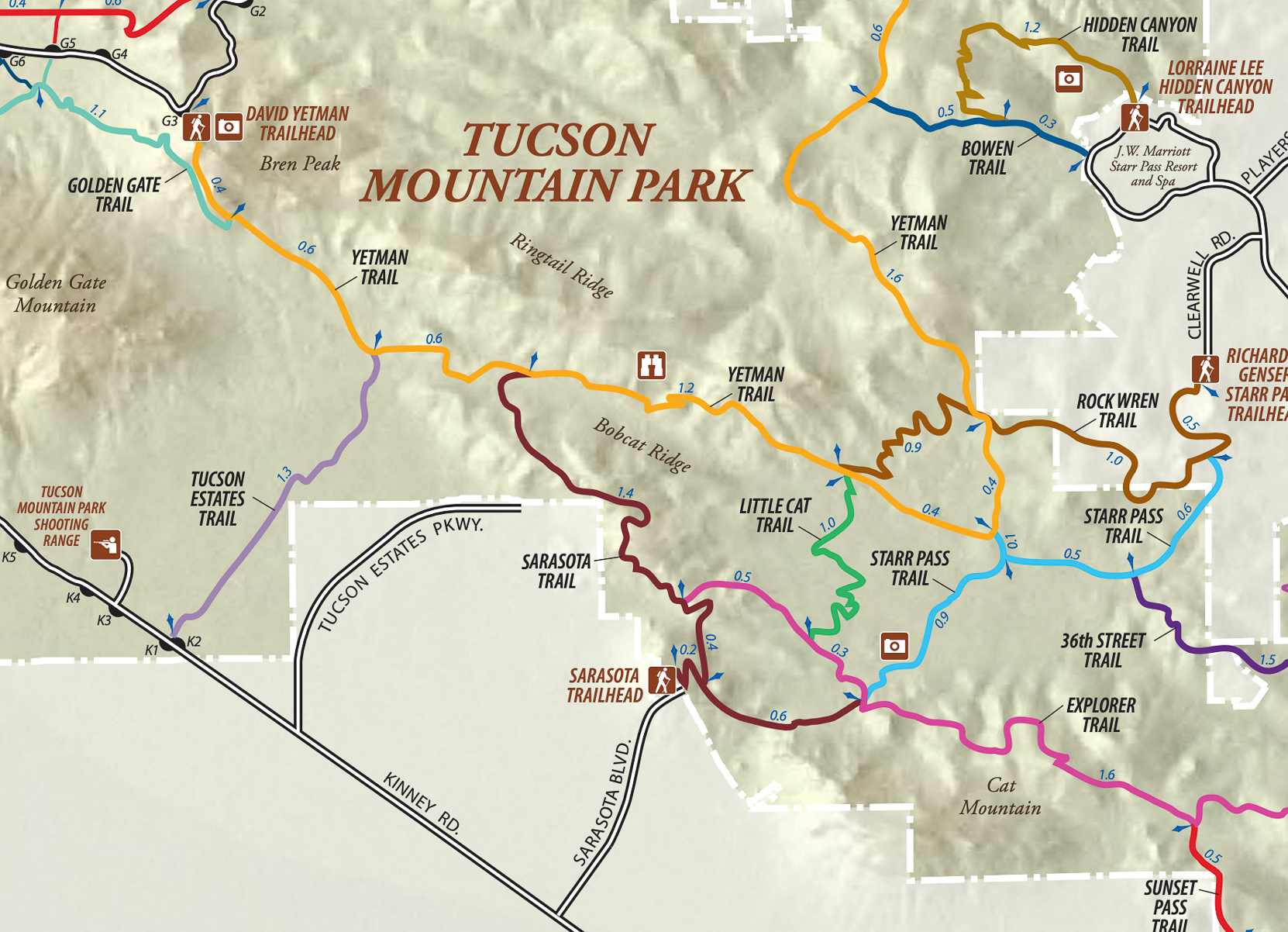
Trails in southeastern Tucson Mountain Park
click on map for larger image
References:
Lipman, P.W.  1994.  Tucson Mountains Caldera:  A Cretaceous Ash Flow Caldera in Southern Arizona.  USGS Research on Mineral Resources 1994:  Part B, Guidebook for Field Trips.  U.S. Geological Survey.

​Tucson Mountains Geology:  Complex and Controversial.

Lipman, P.W.  Geologic Map of the Tucson Mountains Caldera, Southern Arizona.

Tucson Mountain Chaos.  Arizona State Geology: Blog of the State Geologist of Arizona.  Retrieved from internet. ​http://arizonageology.blogspot.com/2009/04/tucson-mountain-chaos.html
5 Comments

    Categories

    All
    Arizona Hikes
    California Desert Hiking
    Idaho Summits
    Nevada Hikes
    Snowshoe Hikes
    Southern Utah Hikes/Bikes

    Complete list of Hikes/Bikes on HOME page
    Picture
    Sue and Fred
    Picture

    About this blog

    Exploration documentaries          –  "explorumentaries"  list trip stats and highlights of each hike or bike ride, often with some interesting history or geology.  Years ago, I wrote these for friends and family to let them know what my husband, Fred and I were up to on weekends, and also to showcase the incredible land of the west.  

    To Subscribe to Explorumentary adventure blog and receive new posts by email:

    submit
    Picture
    Happy Spring!
    Picture

    About the Author
    Sue Birnbaum

    A  trip to Jumbo Rocks Campground in Joshua Tree National Monument 38 years ago sparked my passion for hiking, exploring, and learning about desert ecosystems.  For the past 25 years, my husband Fred and I have explored the American West together; we love this land and I hope to inspire you to get out and explore through my photographs and trip descriptions.
    In 1992, Ray Wilson and I conceived the first Cactus to Clouds hike which climbs over 10,000 feet in one day to the summit of Mt. San Jacinto near Palm Springs, California.
    CACTUS TO CLOUDS HIKE 
    READ MORE
    ABOUT SUE

    Archives

    February 2023
    January 2023
    December 2022
    November 2022
    October 2022
    September 2022
    August 2022
    July 2022
    June 2022
    May 2022
    April 2022
    February 2022
    January 2022
    December 2021
    November 2021
    October 2021
    August 2021
    July 2021
    May 2021
    March 2021
    February 2021
    January 2021
    November 2020
    October 2020
    August 2020
    July 2020
    June 2020
    April 2020
    March 2020
    February 2020
    January 2020
    November 2019
    October 2019
    September 2019
    August 2019
    July 2019
    June 2019
    May 2019
    April 2019
    February 2019
    December 2018
    November 2018
    October 2018
    September 2018
    July 2018
    June 2018
    May 2018
    April 2018
    March 2018
    February 2018
    January 2018
    December 2017
    November 2017
    October 2017
    September 2017
    August 2017
    July 2017
    June 2017
    April 2017
    February 2017
    November 2013
    August 2013
    July 2013

    Some of my favorite websites:
    Awkward Botany
    ​citizen botany for the phytocurious

    Bird and Hike

    ​"Intended to encourage people to visit, learn about, and fall in love with the desert."
    ​

    Draw and Shoot
    Beautiful Photography

    Earthline: The American West
    Debra "writes to extol our beloved Earth." Detailed hike info, excellently written.
    ​

    Geologypics.com
    Geology and Geologic Time through Photographs

    Glenn Suokko
    Vermont artist's paintings "inspired by a place based on the land .... drawn to painting the representation and abstraction of nature."

    In the Company of Plants and Rocks
    ​A natural history blog about botany, plant ecology, and geology.

    Nature's Depths

    Walking through nature with John Palka, a neuroscientist who loves plants and ponders big questions

    Rangewriter - What Comes Next?
    ​With excellent writing, Linda tells the story of her unique mother's life including WWII era; with beautiful photographs.

    SeekingLost - Hiking and Backpacking Adventures.

    Stav Is Lost- Unconventional, out-of-the way hikes in the American West.


    Uprooted Magnolia
    ​Leah Yetter's beautiful "photo journal on life, love, and the spirit of Wyoming."
HOME

Cactus to Clouds Hike
More Quotes
HIKES BY STATE

Idaho Hikes
Utah Hikes/Bikes
​Arizona Hikes
​California Desert Hikes
​Wyoming Hikes
​Nevada Hikes

BLOGS

Adventure Blog
Women and the Land
GEAR REVIEWS
FIT AFTER 50
Fred Birnbaum
Dave Brasuell
Bus' Little Black Book
​Mike Carlson
​Ray Wilson
​Marcia Bondy
Bryan Krouse
​Maria Keezer
​Tim Clemens
​Doug Traubel
​Brian Holgate
​
Becky Borczon Blake
​Jennifer Cera and
​Sue Birnbaum

​Vance Powell
​Boise Cross Fit Masters Ladies
​Vickie Kearney

GALLERY

Desert Plants
Nature
Earth + Sky
Urban
Water
Patriot 
​Orchids
Boise
​
  ABOUT
    Contact

​
© 2017 - 2023 by Sue Birnbaum.  Photos on this website are the sole property of Sue Birnbaum unless otherwise indicated.  Please receive permission before publishing my trip reports and photos.
I try my best to be accurate with my hike descriptions; please research your adventures, always bring a map and compass and know how to read them, be prepared!  All of these hikes can be dangerous; hike at your own risk.  ALWAYS carry the Ten Essentials with you on hikes. 
​Please feel free to contact me with comments or questions, or if you see any errors that need attention.
Thank-you for stopping by!


EXPLORUMENTARY.com
  • Home
    • Cactus to Clouds Hike
    • More Quotes
    • Ann Zwinger Quotes
    • Mary Oliver Poems
  • Hikes by State
    • Idaho
    • Southern Utah
    • Arizona
    • California Desert
    • Nevada
    • Wyoming
  • BLOGS
    • Adventure Blog
    • Women and the Land
  • GALLERY
    • DESERT PLANTS >
      • Beavertail cactus
      • Brittlebush
      • Christmas Cactus
      • Arizona Barrel Cactus
      • Parry's penstemon
      • Agave
      • Arizona Rainbow Hedgehog
      • Claret Cup Hedgehog
      • Desert Agave
      • Palmer's Penstemon
      • Silver Cholla
      • Cristate Saguaro
      • Indian Paintbrush
      • Ocotillo
      • Santa Rita Prickly Pear
      • Spiny Cliffbrake
      • California Barrel Cactus
      • Engelmann Prickly Pear
      • Velvet Mesquite
      • Joshua Tree
      • Buckhorn Cholla
      • Hedgehog Cactus
      • Fishhook cactus
      • Thompson's Woolly Locoweed
    • NATURE
    • BOISE
    • EARTH + SKY
    • URBAN
    • WATER
    • PATRIOT
    • ORCHIDS
  • Fit After 50
    • Brian Holgate
    • Fred Birnbaum
    • Dave Brasuell
    • Bus' Little Black Book
    • Mike Carlson
    • Ray Wilson
    • Bryan Krouse
    • Vickie Kearney
    • Maria Keezer
    • DOUG TRAUBEL
    • Boise Cross Fit Masters Ladies
    • Tim Clemens
    • Marcia Bondy
    • Becky Borczon Blake >
      • Becky B Downtown
    • Jennifer Cera and Sue Birnbaum
    • Dave Brasuell
    • Vance Powell
  • About
    • CONTACT