|
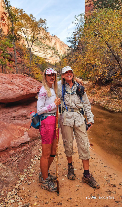
Explore one of southern Utah's famous and extraordinary places - the enchanting "Subway" and its beautiful waterfalls. 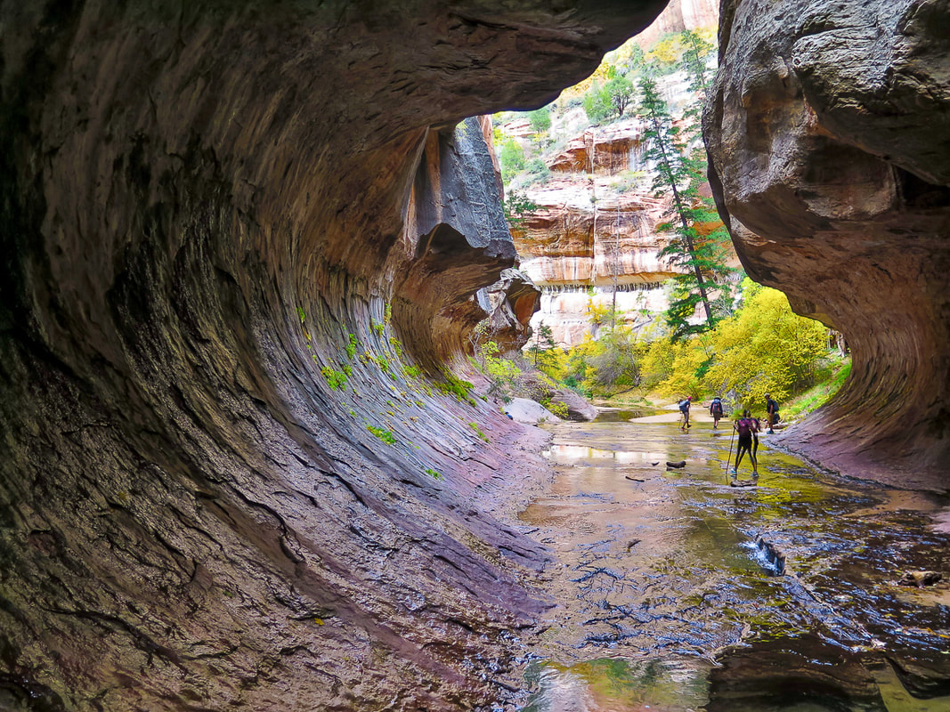 Walking into the "Subway", one of Zion National Park's iconic places. Trip Stats for bottom-up (non-technical hike)
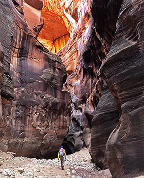
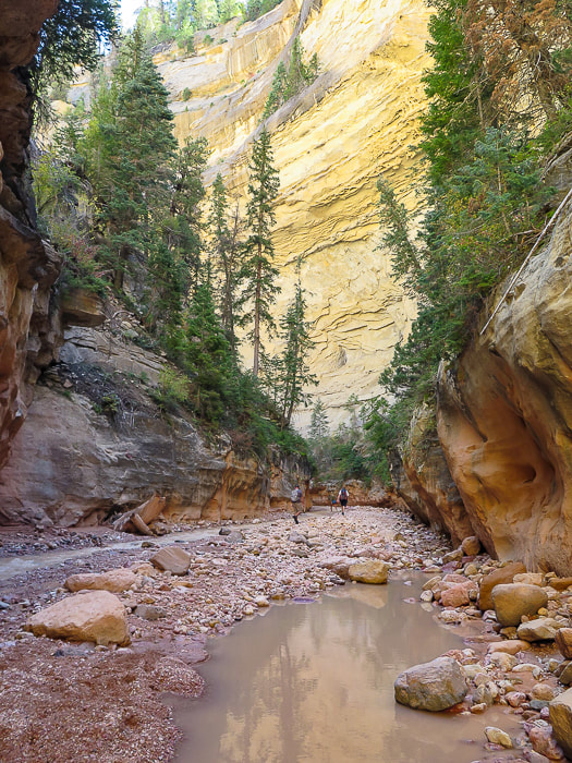
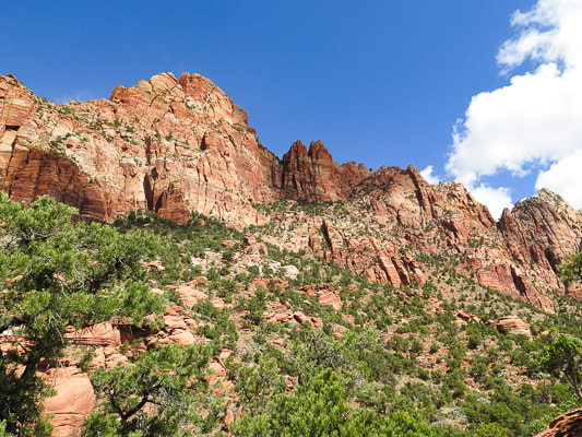
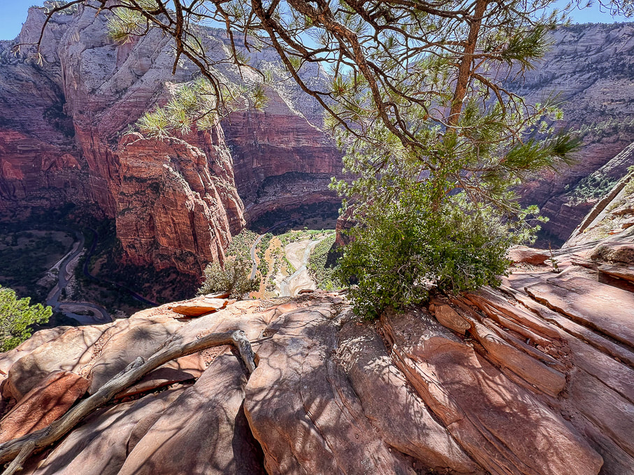
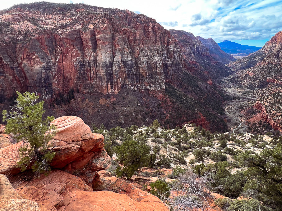
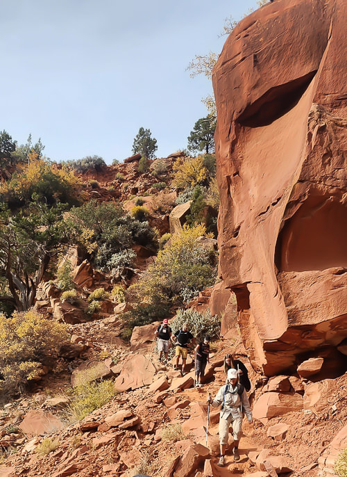
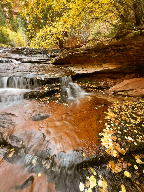
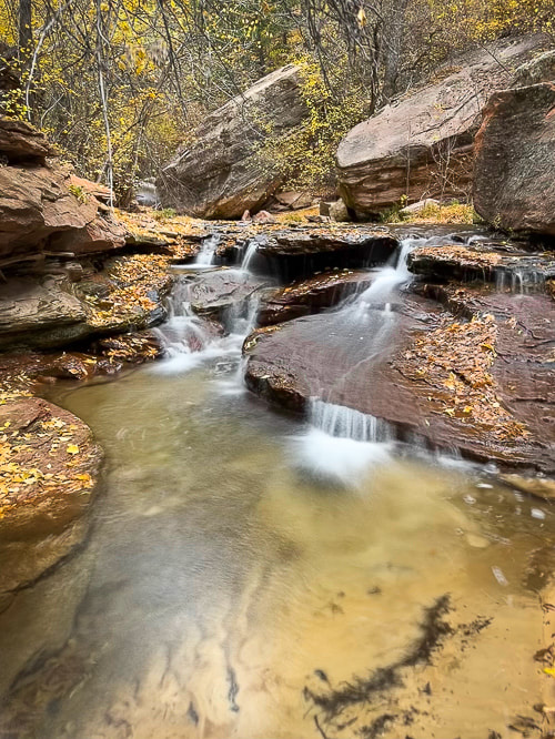
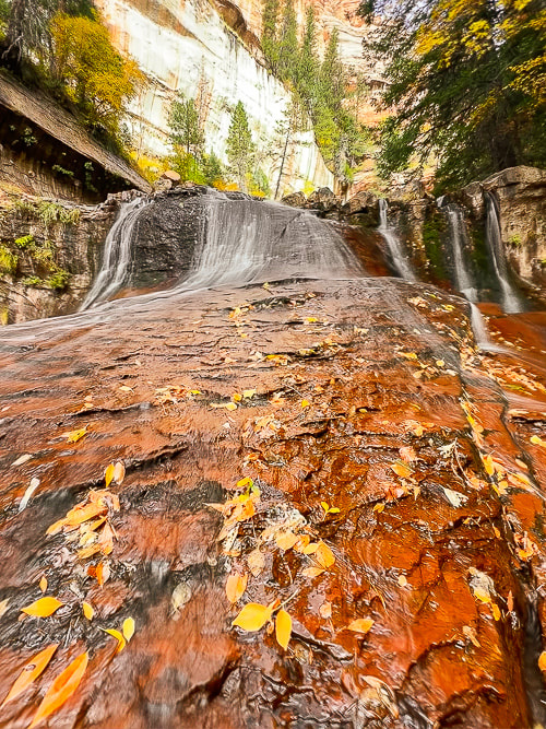
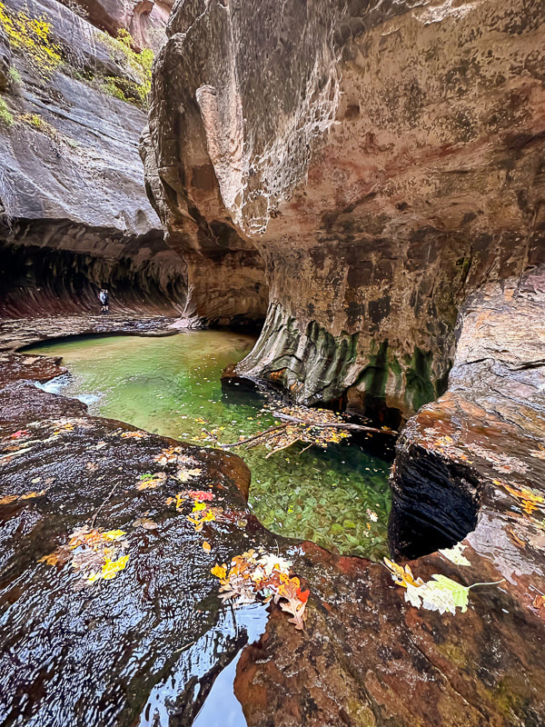
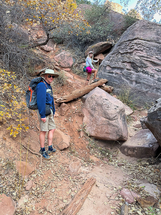
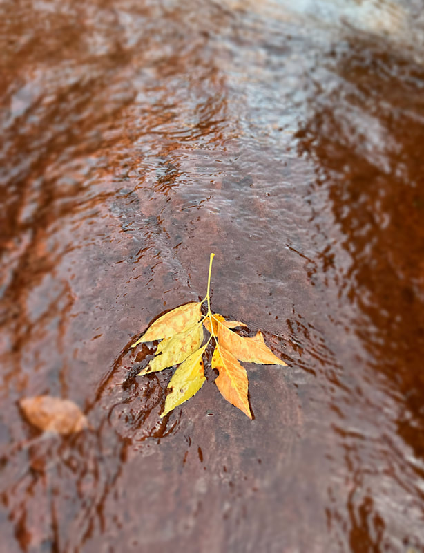
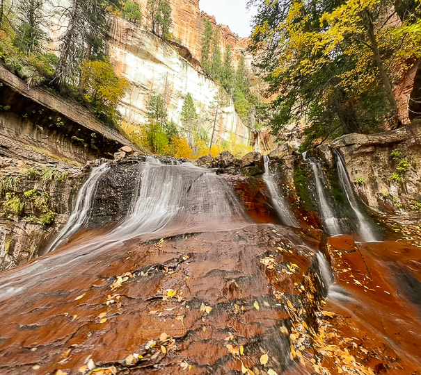
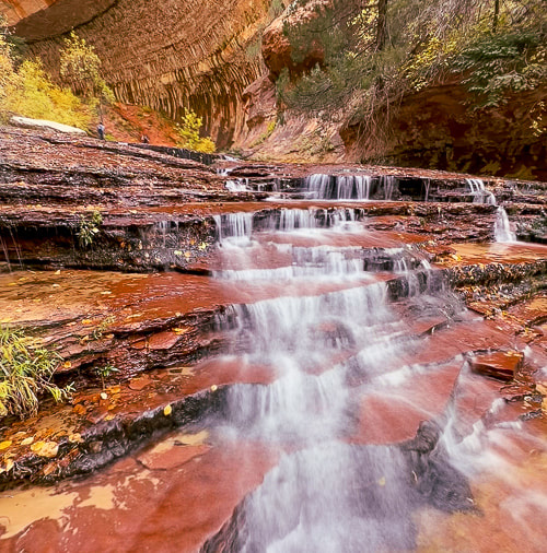
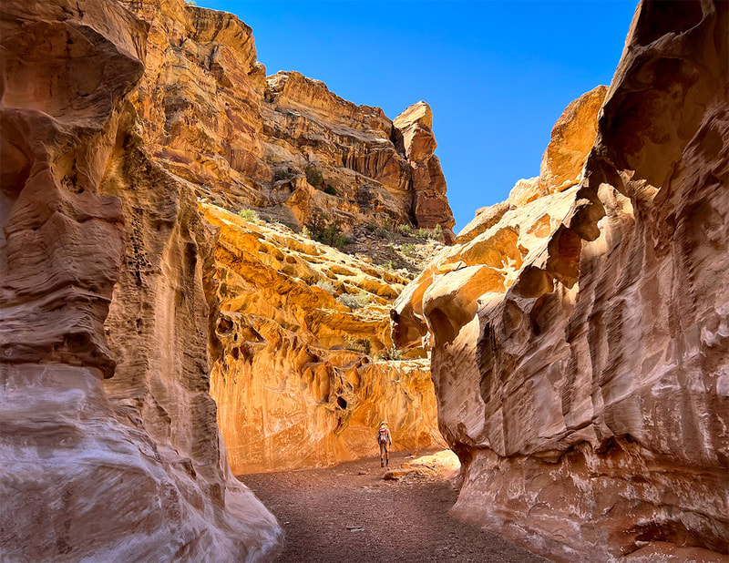
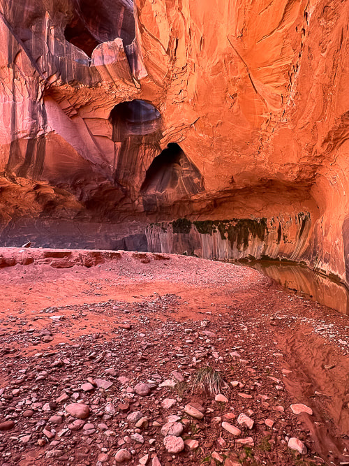
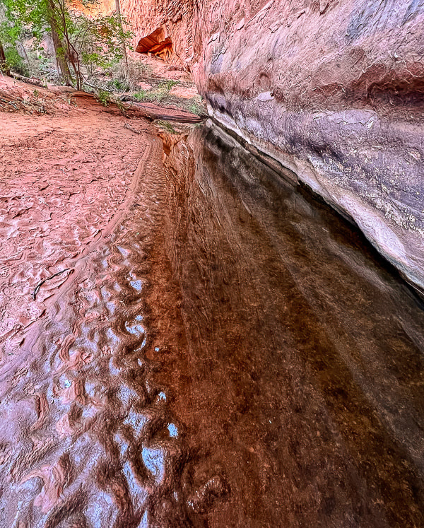
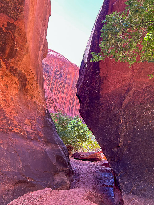
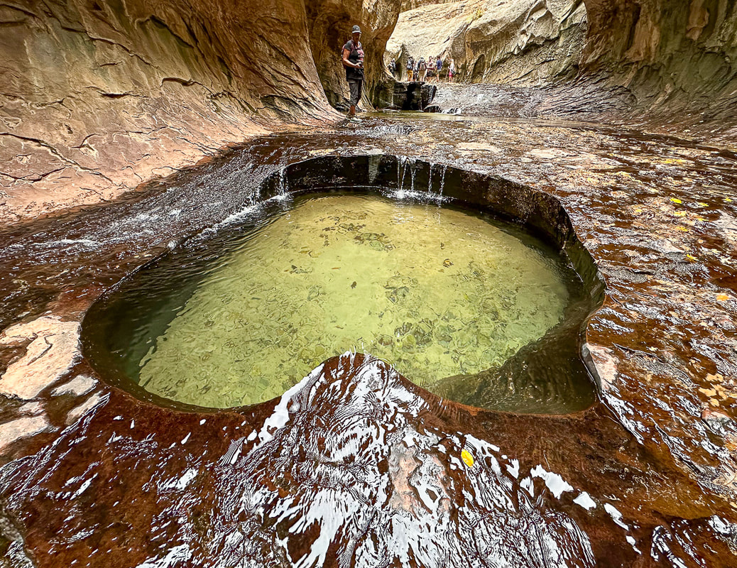
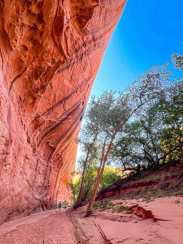
Location: Zion National Park - Kolob Terrace - Left Fork of North Creek Distance: ~ 8 miles out and back Difficulty: Moderate - strenuous boulder-hopping, stream wading and walking on slippery/uneven surfaces. Permit: permit required for all Left Fork/Subway hikes. Zion Wilderness Permits for Left Fork Subway. Date Hiked: November 5, 2023. Maps/Apps: AllTrails, Topo Maps U.S., USGS The Guardian Angels 7.5 min Topo Map Photo Advice: Summer: best light is mid-morning or mid-afternoon (pools are in full sun at mid-day). Autumn: mid-day is best light. Geology: Volcanic flow < 500,000 years from vent located north of trailhead: descend into Kayenta Formation (sandstone and mudstone). Navajo Sandstone towers overhead. Considerations: * Do not hike this canyon if there is a threat of rain/thunderstorms. * Make sure to take a waypoint of the canyon entry/exit and look at where you descended from the rim to get a good mental picture so you don't miss the exit point on the way back. There are signs but they may be easy to miss. Related Posts 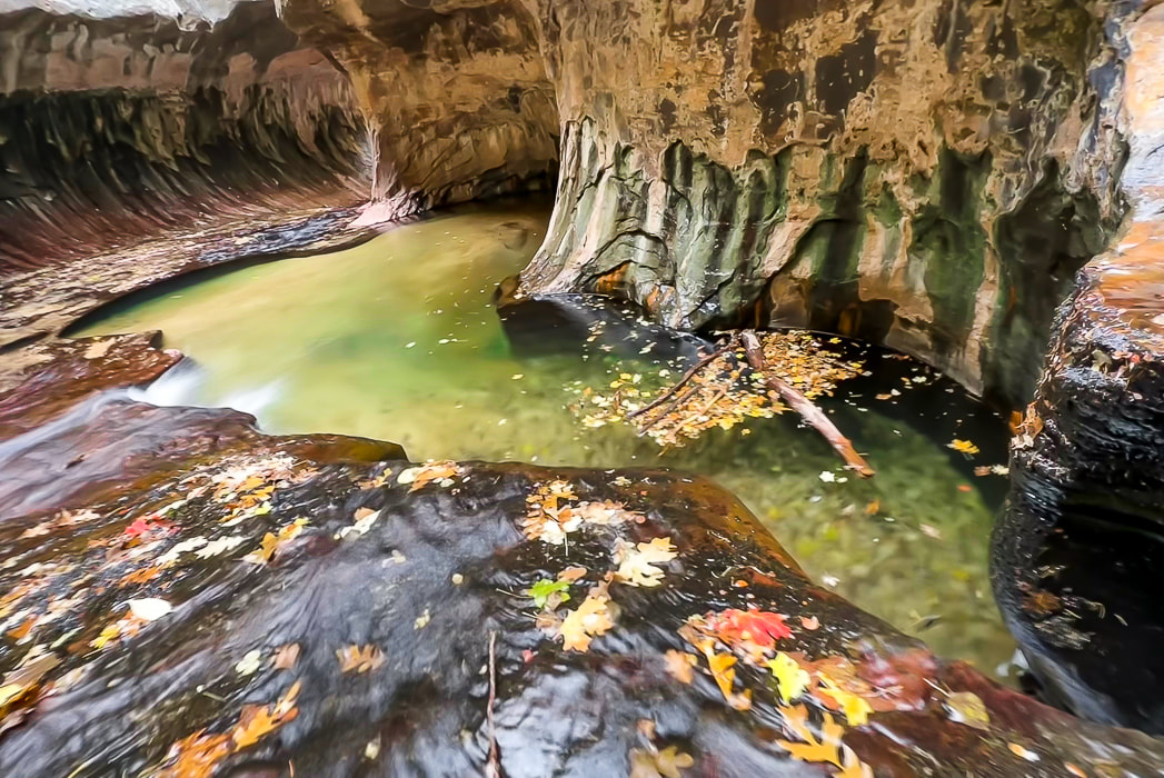 "The Subway" at the end of a four-mile hike from the Left Fork Trailhead. Waters over the millennia have carved out tube through this sandstone. This ultra-popular journey through Zion National Park's Left Fork of North Creek to the "Subway" and all of its gorgeous and calming water cascades - one after the other - exceeded my expectations and turned out to be a favorite hike for 2023. Having scored a permit only two weeks before, we were able to park in the Left Fork Trailhead parking lot (you have to put a permit tag on your dashboard), descend from Kolob Terrace to travel this stream to a magical world of green pools, red waterfalls and a tunnel of fern-covered sandstone walls. It takes about three miles of boulder-hopping and clear stream wading to get to the spectacular stuff, but it's so well worth it. I went with three friends who knew the route, and other friends who were seeing Subway for the first time also. The pathway up the Left Fork is pretty straight forward: it heads up-canyon, and around a major waterfall in about 3.5 miles from the trailhead. Much time is spent walking in the crystal-clear water. Less-Traveled Kolob Terrace: Beautiful Forests, Wondrous Canyons and Colorful Sandstone Peaks Compared to Zion Canyon, which received a record number of visitors - five million in 2021 - Kolob Terrace, Zion's west section, is a much-less visited area of Zion National Park. It's accessed via Kolob Terrace Road that ultimately ends at the Kolob Reservoir at an elevation of 8,100 feet - a marvelous place to see in autumn with the blue water and yellow cottonwood trees. A good list of adventures is posted in Joe Braun's Hikes in the Kolob Terrace. Kolob Terrace is also a great place for star-gazing and astrophotography. Zion NP became certified as an International Dark Sky Park in 2021. Das Boot is another classic Zion canyon on Kolob Terrace. It involves dark, convoluted narrows and long swims. If you prefer to be above the land instead of below, there are knolls named Spendlove, Cave and Tinaja to climb. Peak time on the Subway hike for fall color is late October/early November to capture the bright red and yellow leaves that fall in the round potholes and decorate the deep red sandstone cascades. Looking down into the Left Fork from the rim, yellow cottonwood trees line the bottom water course. The hike begins in a volcanic rock flow for ~ 0.5 miles from trailhead to rim, and in fact, it's important to note these black volcanic rocks on the rim when you get down into the creek, so you have a mental picture of the place you came down, and you don't pass it up on the way back out of the water. The 400' descent from the rim is steep and slippery in a few places. As you hike upstream, negotiating many pools, boulders and rocks, you occasionally catch glimpses of the magnificent Navajo Sandstone formations on the plateau above. We didn't pause too long because we had four miles of relatively slow hiking and the day was short. Amazing Place! And then you reach the almost supernatural world of the "Subway". Hanging ferns thrive on the dripping curved walls and round-sculpted lime green pools appear with water continuously pouring in and out. How did this stream sculpt this almost perfect tunnel? Crimson sandstone, polished by continuous water flow is slippery, I saw a few other hikers take minor tumbles. A few in our party waded through the cold deeper pools at the end of this section to a small waterfall. A few climbers with full wetsuits were descending from the Subway top down route which involves rappelling and deep water swims - the canyoneering route that begins further upstream. Sounds like a worthy goal for a future hike! Finding the point at which the trail leaves the canyon to ascend steeply to the rim was not difficult. I had the waypoint recorded on my GPS, so I knew we were getting close. Signs mark the way out of the stream, but it's best to remember the scene you memorized on the way in: the black volcanic rocks next to the orange sandstone on the rim. Grateful to be hiking in the American West - Keep Exploring! 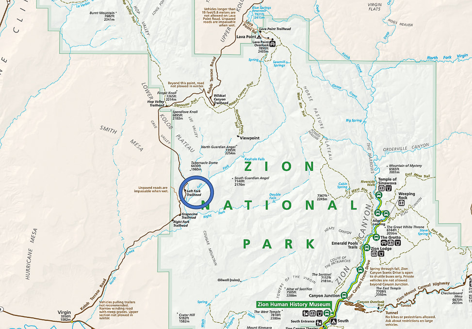 The Subway (Left Fork) hike is located west of the main Zion Canyon in the Lower Kolob Plateau. Left Fork Trailhead (blue circle) is 8 miles up Kolob Terrace Road. 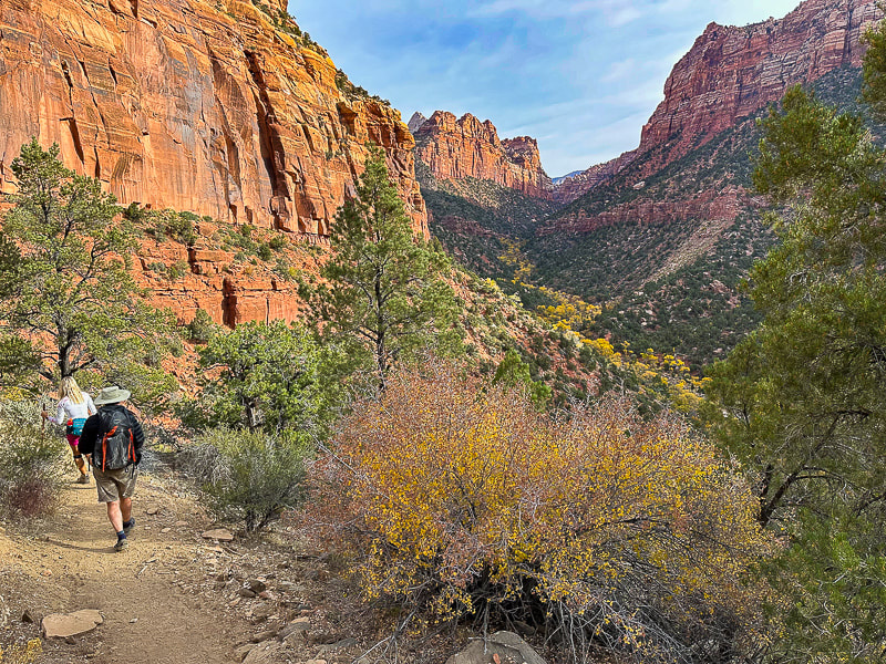 Beginning the descent into the Left Fork - looking forward to getting closer to those yellow cottonwood trees! 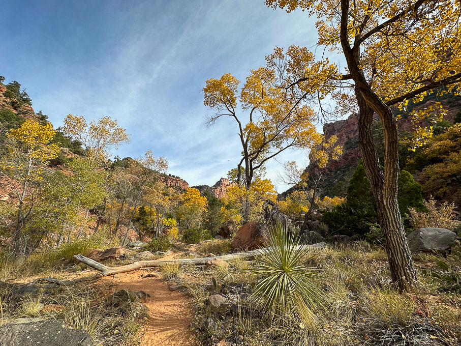 Once into the canyon, the autumn colors are beautiful and the sandy trail is easy to follow. 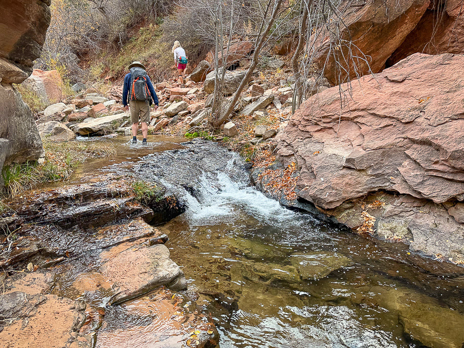 The canyon begins to narrow after ~ 1 mile and you get to walk by/through many pools past waterfalls.
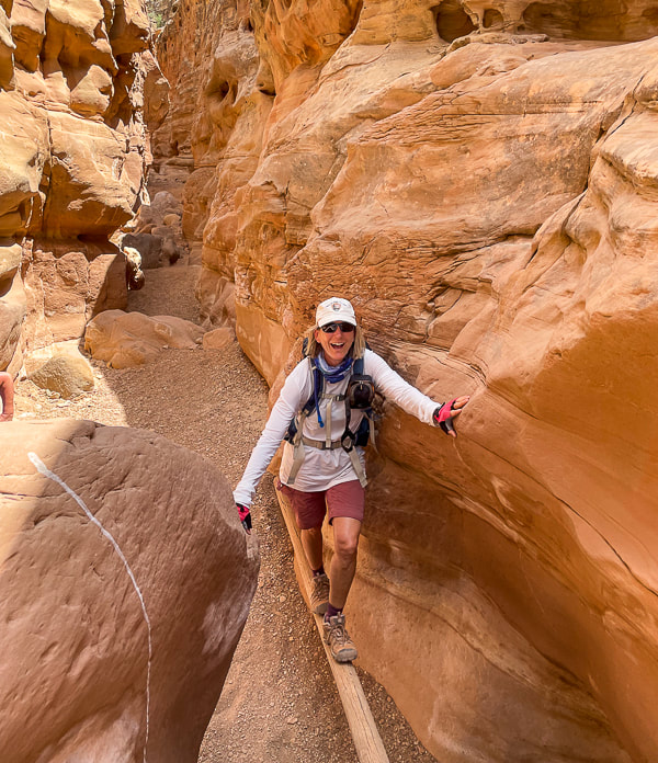
 The shade, constant water flow, ferns and green pools create cool and calm. 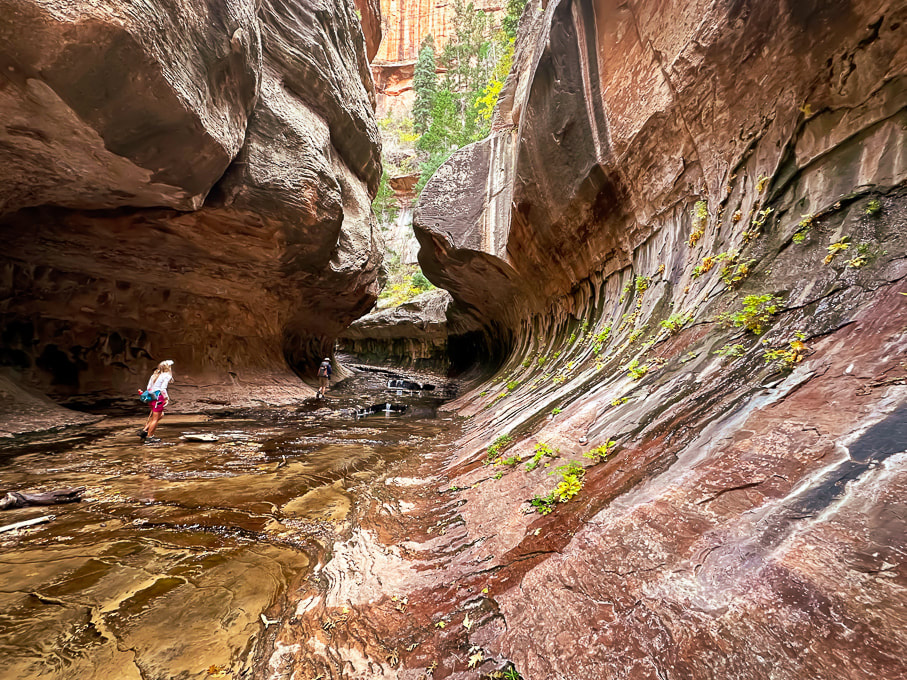 Lydia and Colin walking through the Subway. 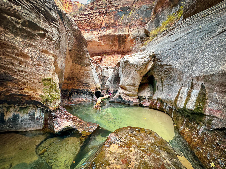 The end of the Subway hike from lower trailhead. You can walk in those gorgeous pools to a small waterfall. If you look at the middle of this photo closely , Lydia is wading in the cold pools! 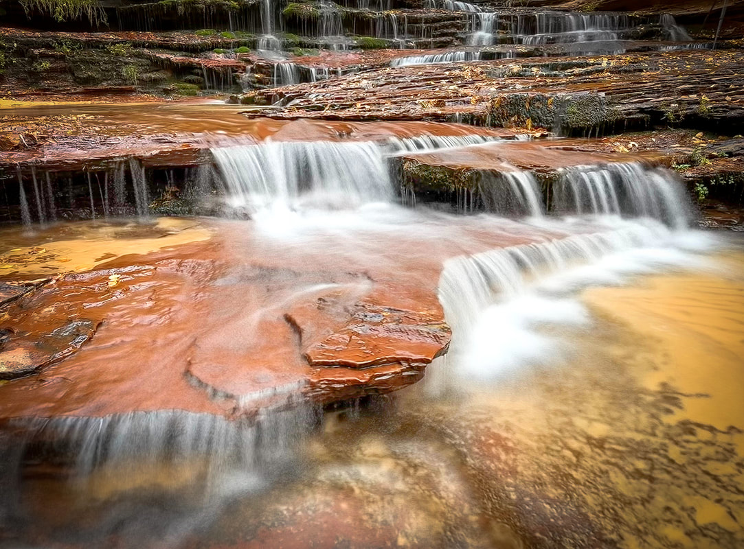 Archangel Falls 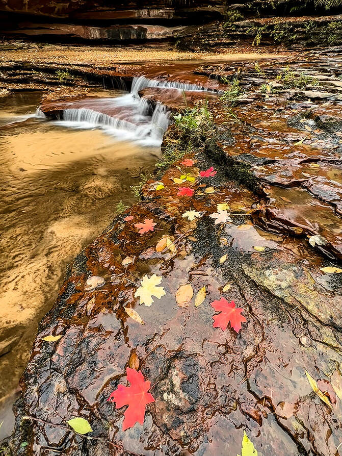 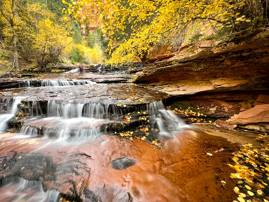 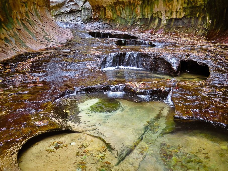 The beautiful emerald pools in the Subway. 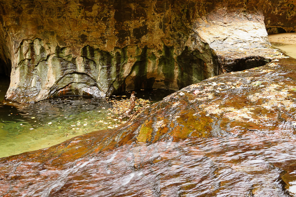 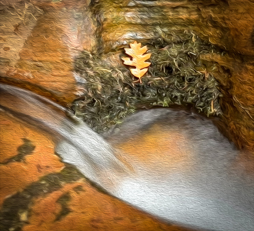 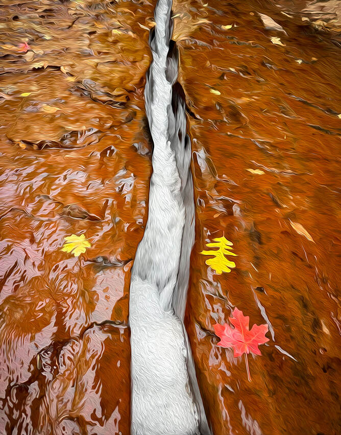 Both images above: having fun with Photoshop oil paint filter. 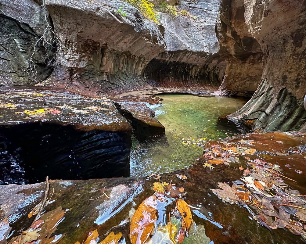 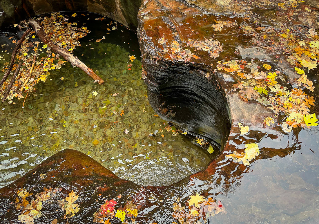 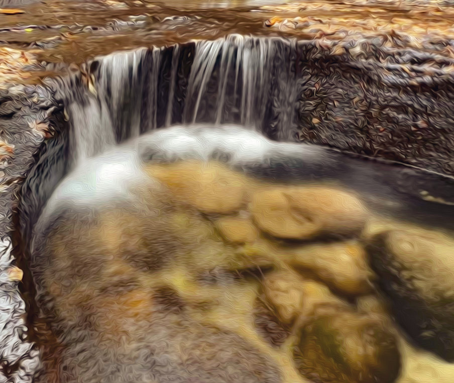 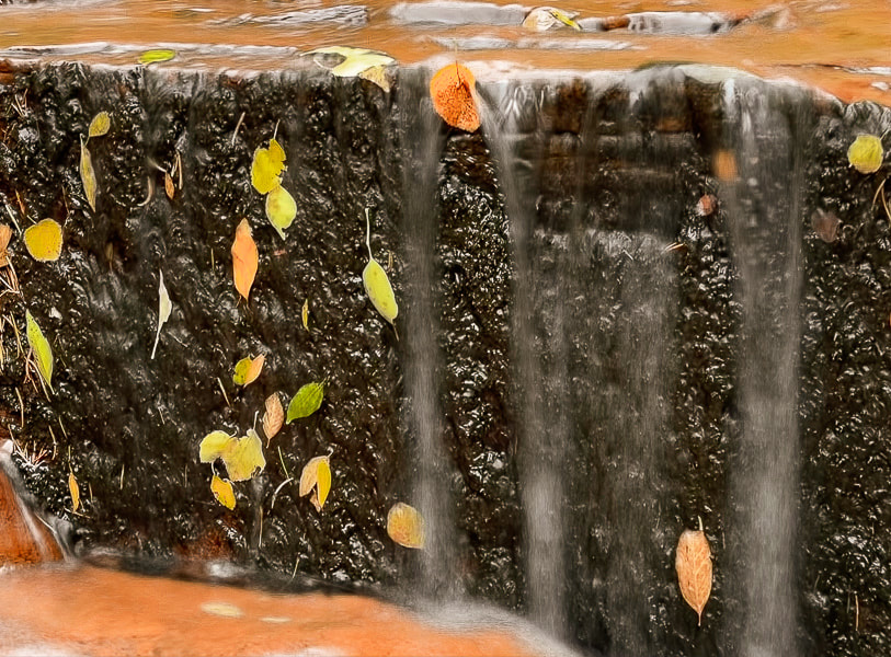 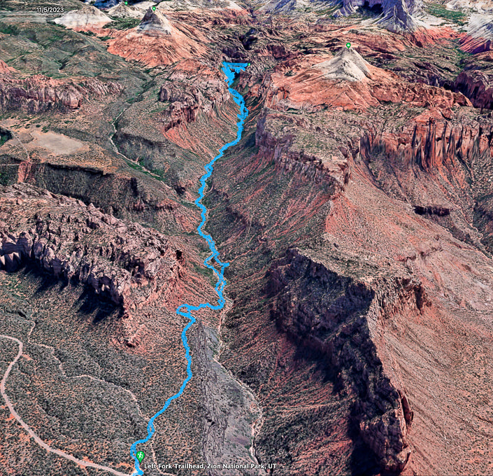 Google Earth map of my GPS tracks, beginning at Left Fork Trailhead, descending into canyon, and reaching the "Subway" after four miles. You pass under the North Guardian Angel and the South Guardian Angel (two peaks at end of this hike). 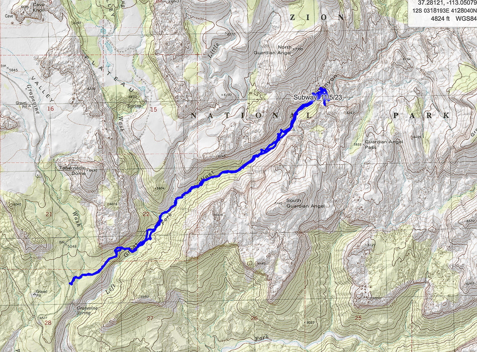 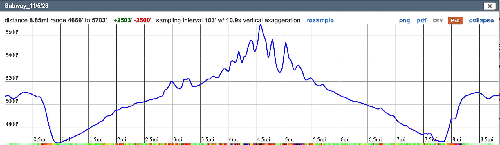 My GPS tracks and elevation profile on CalTopo Maps.
Note that the inaccuracy of GPS (extra-long lines that deviate away from actual hike course) occurs in a deep canyon because the GPS device cannot connect to all the satellites that are required to give an accurate position. This overestimates the hike distance.
2 Comments
Walk across Egypt bench and wade through Escalante River in Glen Canyon National Recreation Area to a glowing grotto at the end of a luminous Wingate Sandstone canyon. 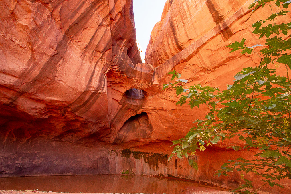 Stunning Golden Cathedral at the end of Neon Canyon Erosion of Wingate Sandstone (Jurrasic, ~ 150-200 million years ago) over the millennia has created three skylights in this glowing grotto. 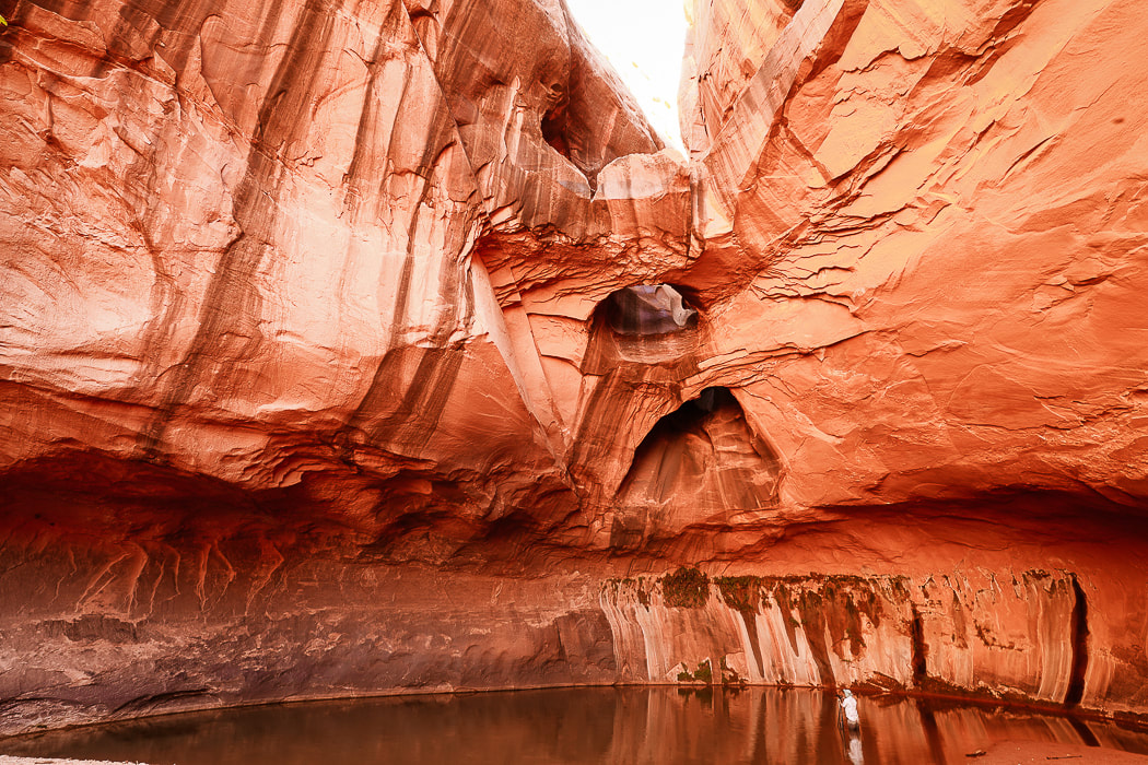 Photographer Mish at Golden Cathedral. MishMoments.com photography website. 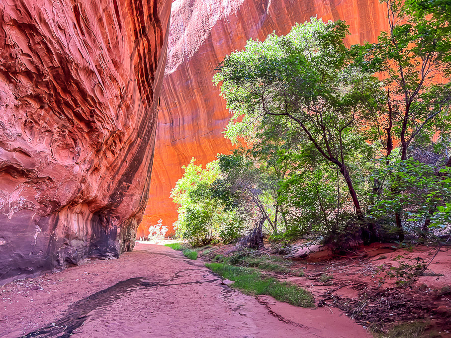 Walking out through the overhanging walls of Neon Canyon. Trip Stats
Location: Southeast of Escalante, Utah in Glen Canyon National Recreation Area. Distance/Elevation gain: 10 miles out and back/~1,200' of gain. Mileage will vary slightly depending on if you take the standard route to Fence Canyon or the "Beeline" route. Difficulty: Moderate effort across pockets of sand; navigation off-trail moderately challenging. Coordinates: Trailhead: 37.59448 -111.22040. Neon Canyon opening: 37.60668 -111.16798. Trailhead: Traveling east on Highway 12 from Escalante, Utah, turn right onto the gravel Hole in the Rock Road a few miles out of town. Drive 16.7 miles, turn left (heading east) at the sign for "Egypt, 10 mi." Zero-out your trip odometer. Stay straight on main road. At 3.5 miles, cross Twentyfive Mile Wash. At 9 miles, a culvert identifies the Egypt 3 slot. At 9.5 miles, turn right at intersection. In ten miles park in large lot. It took us 1:40 from Escalante. Date Hiked: 9/26/23 Maps/Apps: Trails Illustrated Canyons of the Escalante #710, Alltrails, Topo Maps U.S., USGS 7.5 quad topo, Egypt, UT. Considerations: Do not attempt Neon Canyon if there is a chance of rain, and/or flash flood. Driving on road to trailhead requires moderate-clearance 4WD. Beeline Trail crosses Escalante River once. Too hot in summer months. Bring adequate water. Photo advice: Best time to photograph Golden Cathedral is between 11 am and 2 pm depending on the season. Most desirable to have the entire grotto in shade. Light from upper Neon Canyon reflects into the grotto creates glow on walls. At mid-day, light beams shine onto the dark green water on the floor. Links: Escalante Interagency Visitor Center (BLM) Earthline's blog post on this hike Escalante Petrified Forest SP Related Posts
Beeline Route Out and Back
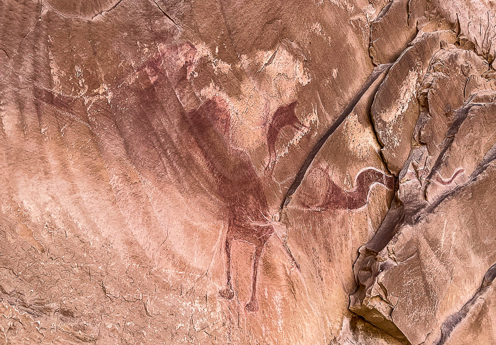
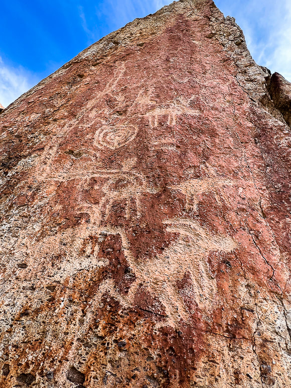
Now I can see how Neon Canyon got its name. The colors are intense. Canyoneers rappel through the opening, getting access from a trail on its west rim. Stav is Lost website has a good canyoneering trip description of Neon Canyon. Fred and I got close to this remote marvel a few weeks before, but we heard thunder and saw clouds building when we got near Neon's opening, so we nixed the plan of going up this narrow canyon and headed back to the trailhead via Beeline Trail. On that hike, we checked out the huge petroglyph panel along the Escalante River, approaching from the Fence Canyon route. From the trailhead, identify Point 5270, a round dome to the east. That is your landmark to hike toward, as Neon Canyon is just to its left. The terrain that spreads before you is "Egypt," an elevated bench above the Escalante River, which flows right in front of Point 5270. The "Standard" Golden Cathedral Trail aims toward and travels along the north rim of Fence Canyon on the left in image below. The Beeline Trail goes in a more or less straight line toward Point 5270. A map of our GPS tracks hiking the Standard/Beeline loop is on my last post Neon Canyon/Escalante River Petroglyphs Hiking Directions. 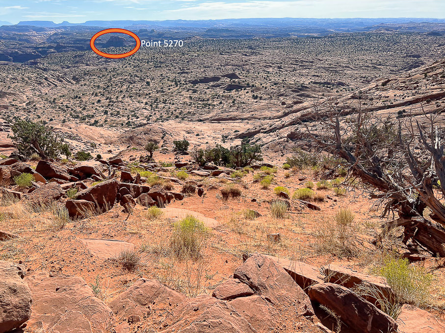 Looking east from Egypt Trailhead: Descend down through bowl onto Egypt Bench and make a Beeline toward Point 5270, the landmark just east of the opening to Neon Canyon. The alternate "Standard" trail heads to the left of Fence Canyon, seen at left in image.
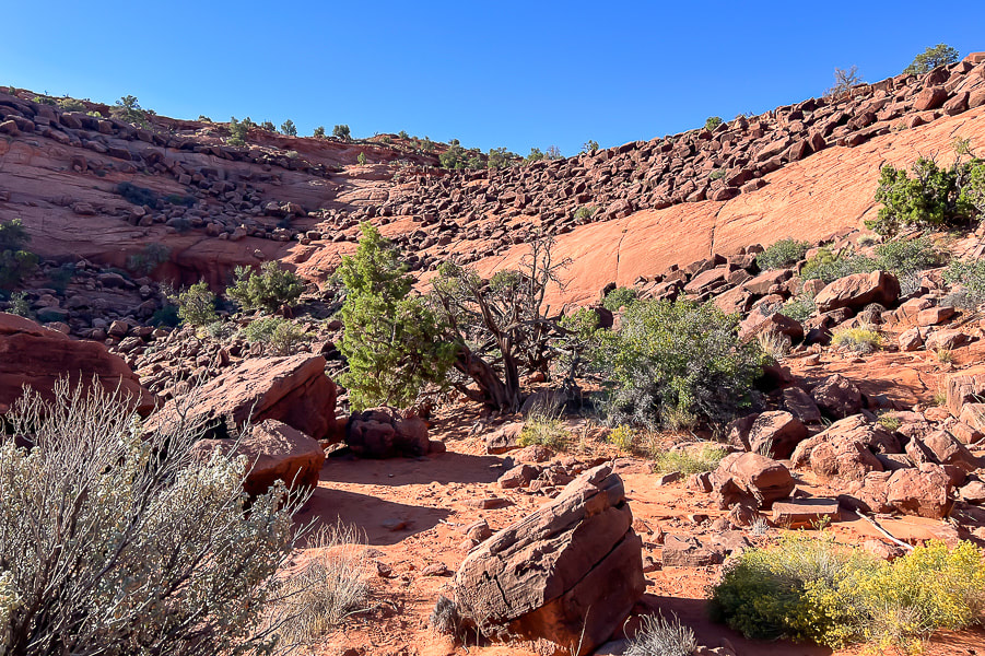 Looking back up at Egypt Trailhead. The dark brown boulders are the landmark to look for when returning from Neon Canyon. They are from the Carmel Formation and made mostly of limestone. The underlying rock strata is Navajo Sandstone. 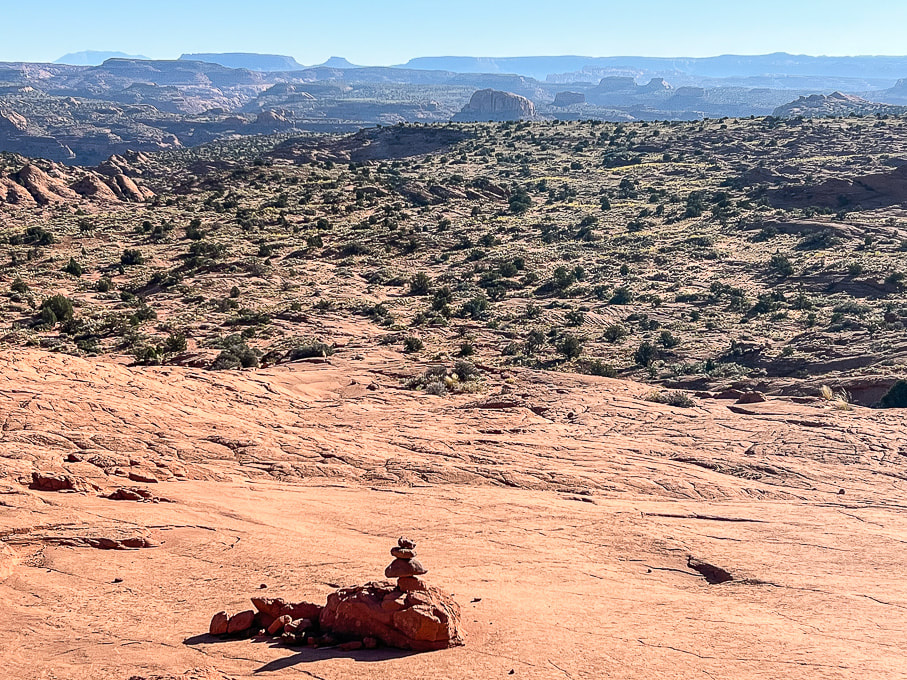 Approaching the base of the Navajo Sandstone bowl and getting closer to the dome. This cairn marks the Beeline route. Cairns are few and far between and easily missed. 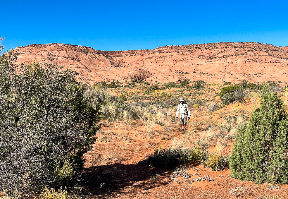 Heading across Egypt Bench on trail that is discernible here and there. We saw footprints on the sandy Beeline Trail. The cleft with the large brown boulders on the plateau's rim is the landmark for the return hike. In September, abundant wildflowers speckled the hummocks and sand dunes. 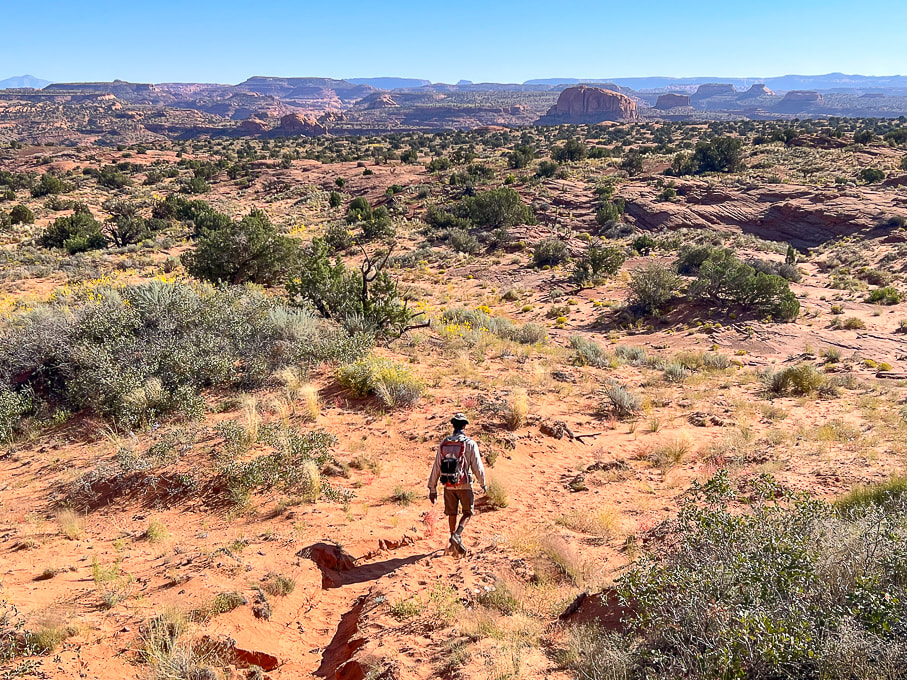 A definite trail through the sand. 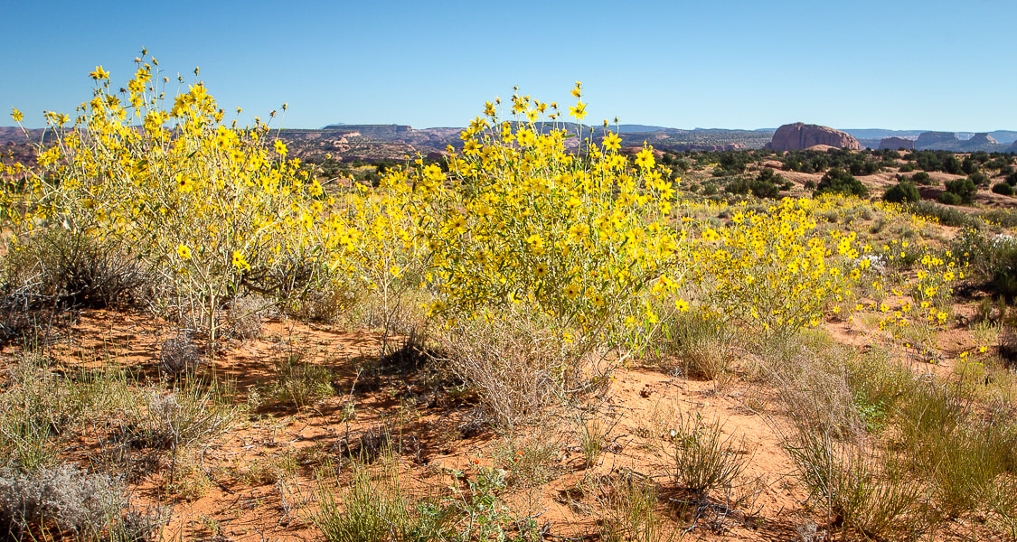 Longleaf false goldeneye? 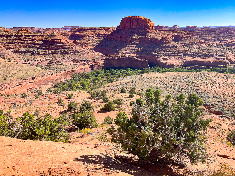 The beginning of the descent off the main Egypt Bench: stepping off of firm slabs of sandstone onto the soft deep sands of a lower bench or terrace just above the Escalante River. First really good view of the Point 5270 dome. Cottonwood trees fill the river bed. Neon Canyon opening is the notch under the dome. 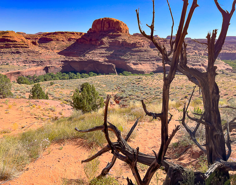 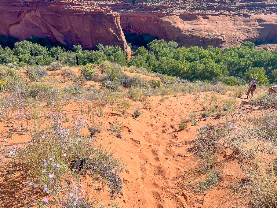 Not a problem descending this deep sand on the way to the river, but a pain to walk up it on the way back! Now we can see the opening of beautiful Neon Canyon. 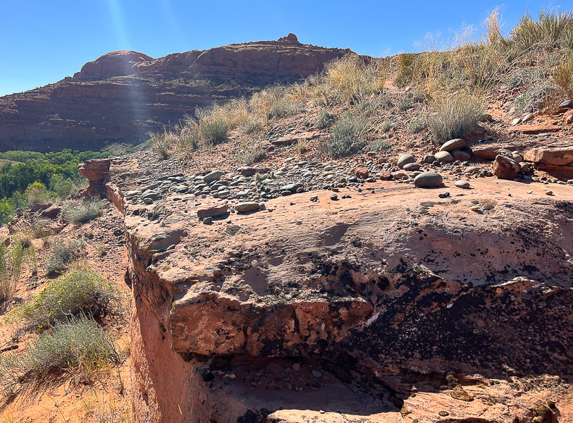 Just above the river bottom: the rounded rocks are a sign that the river probably once ran on this terrace. 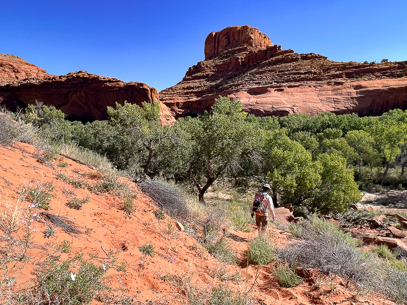 Nearing the cottonwood trees of the Escalante River bottom - would be great to see these when the leaves turn yellow! 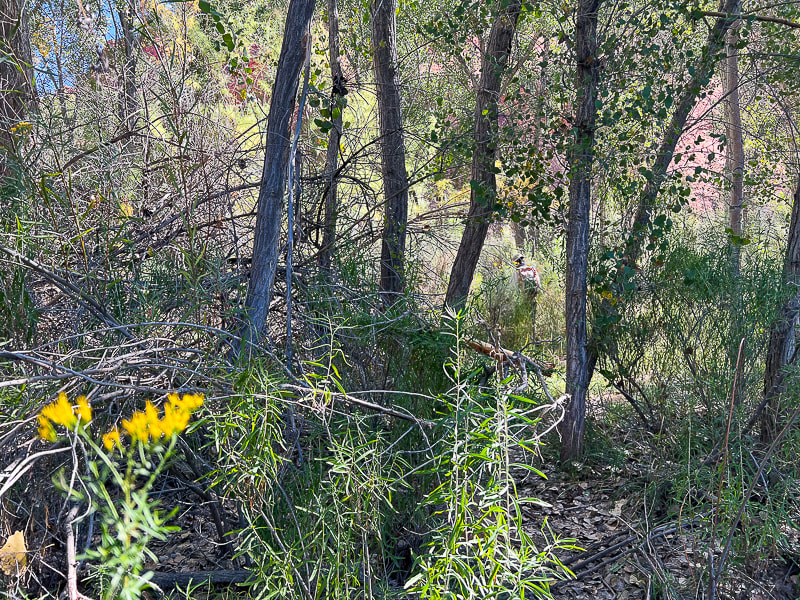 Weaving through brush and trees to the river. 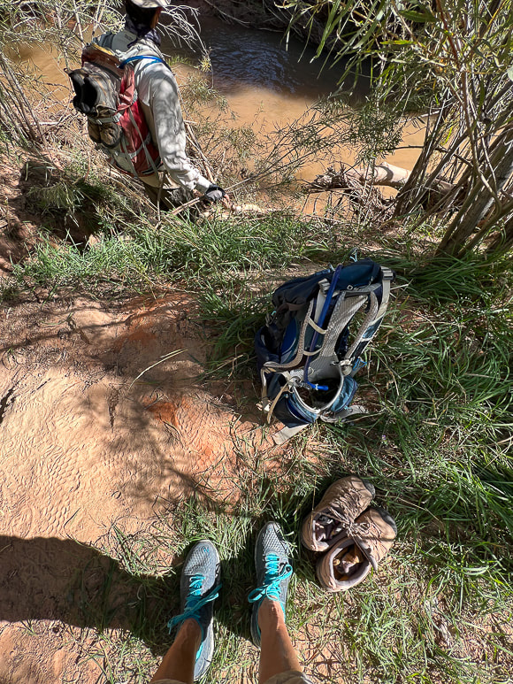 On the bank of the Escalante: switching from boots to trail running shoes. Only two short river crossings both ways, might as well keep boots dry for the hike. The canyon walls at Neon's opening and all the way through are stunning; trees growing against them seem small in scale. A path leads through a garden of wildflowers in September. A trail on the left side of the first bend in the canyon takes you above Neon's west rim and to the beginning of the canyoneering route. After a walk in the cool shade of Neon, reach Golden Cathedral in a little over a mile. We saw evidence of a recent flash flood in the fresh carved sand on the stream banks. The pool reflects the three skylights above. We stayed for awhile, appreciating the serenity, until the sun started to fill the canyon, shining on part of the grotto. The best time to photograph Golden Cathedral is before the sun hits it, so you don't get too much contrast. The reflected light from the upper Neon through the skylights is what gives the glow to these beautiful walls. With every Escalante visit, our to-do list grows exponentially in this land of remarkable personality. There's so much out there to explore! 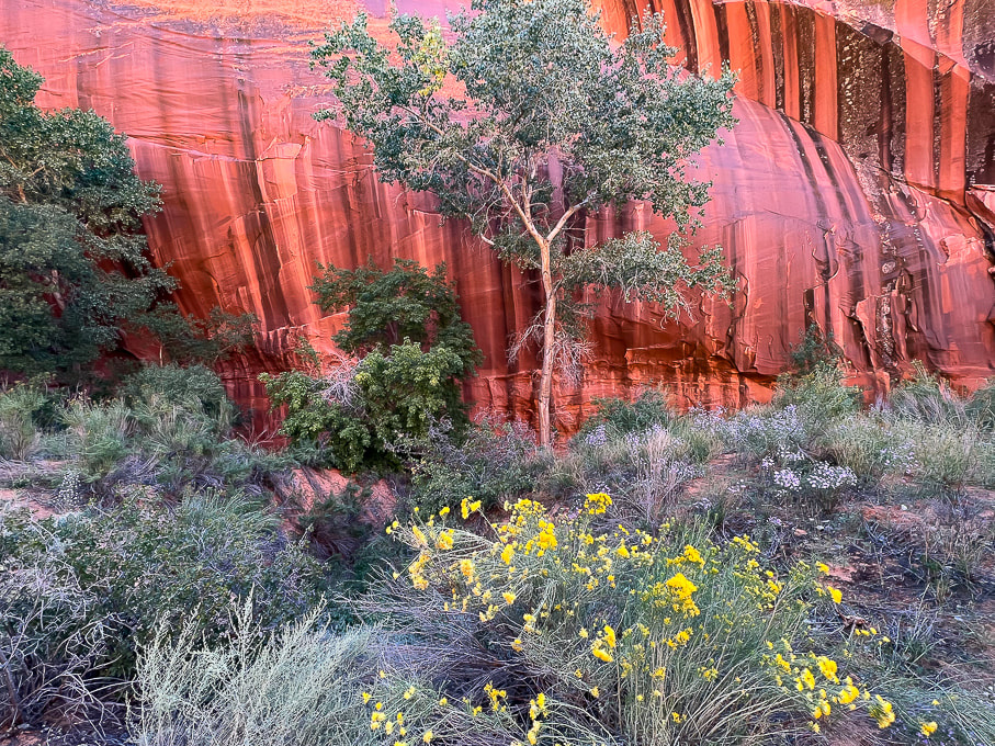 Intense colors near Neon's opening. 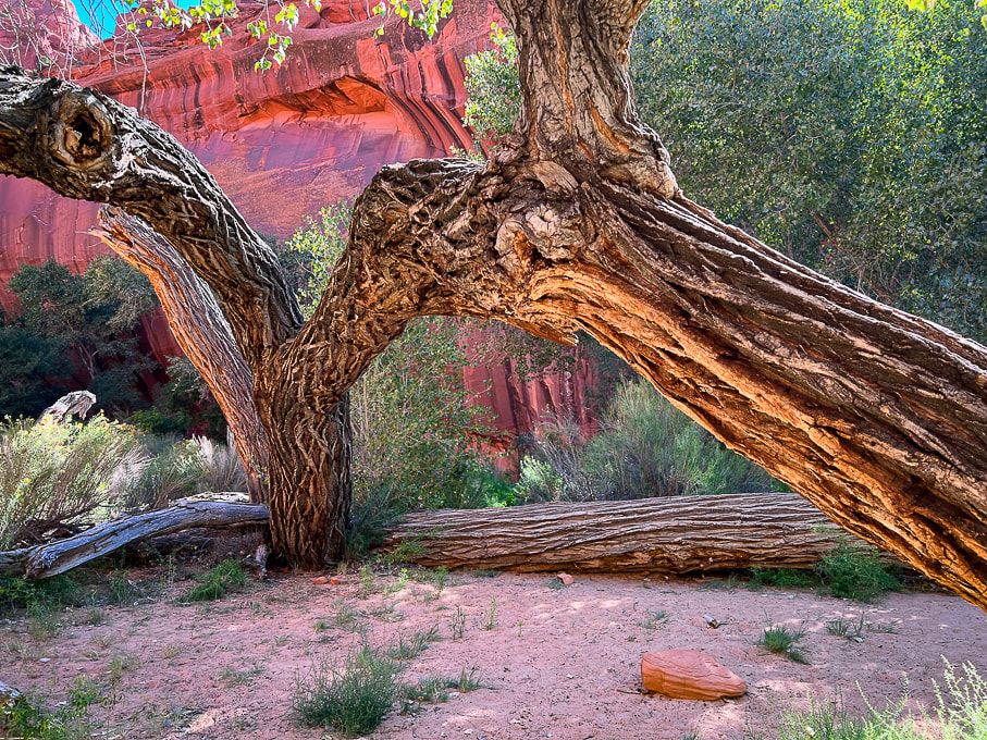 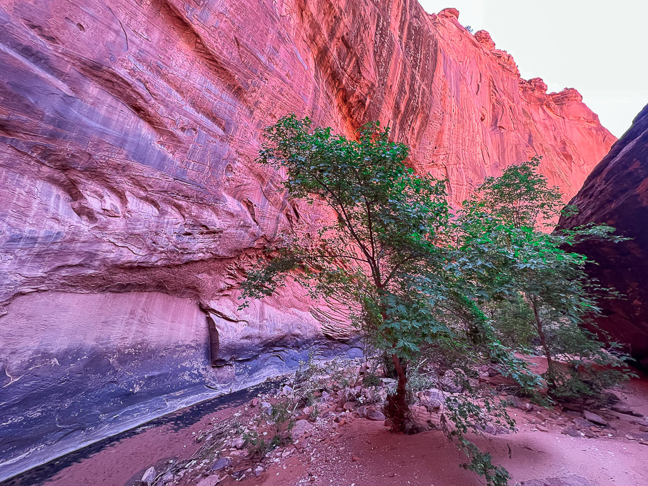 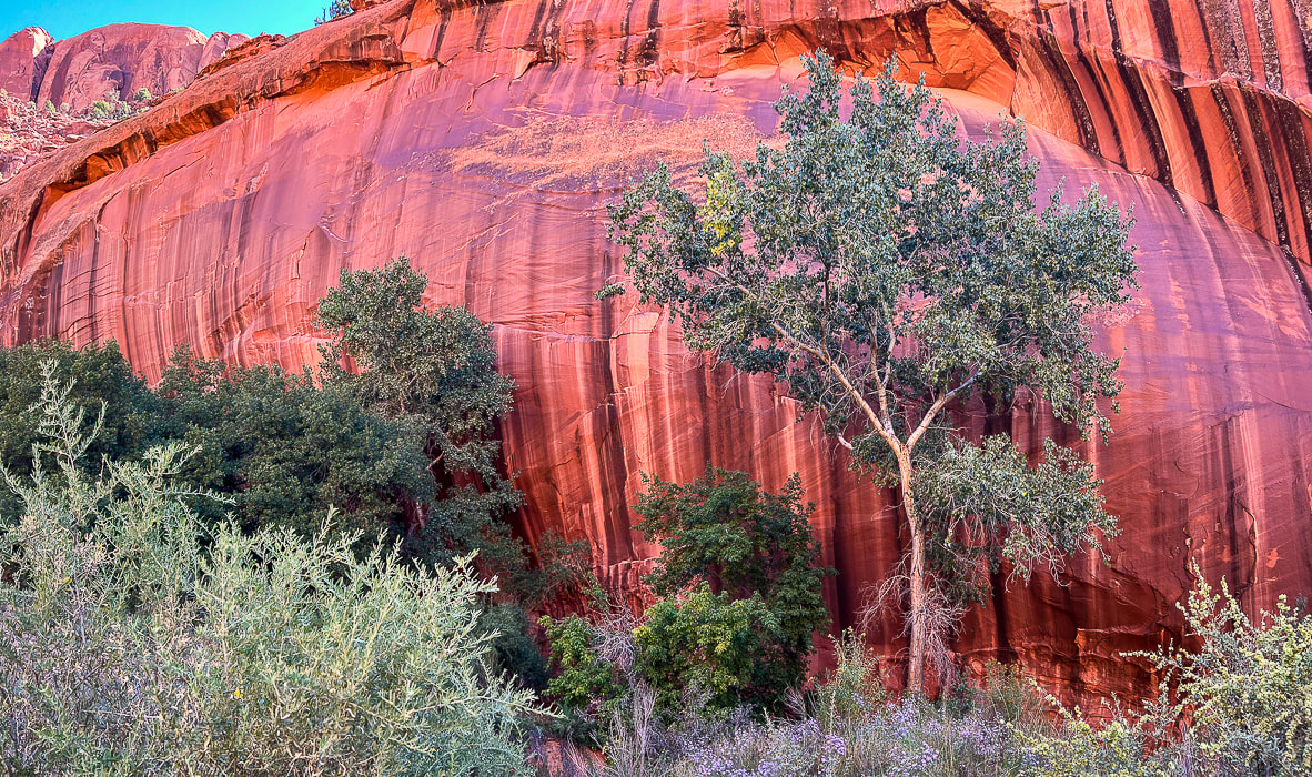 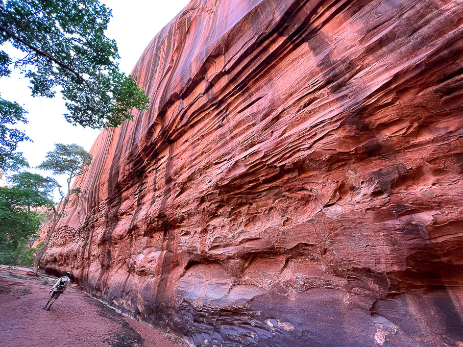 A wide-angle shot of Neon walls. 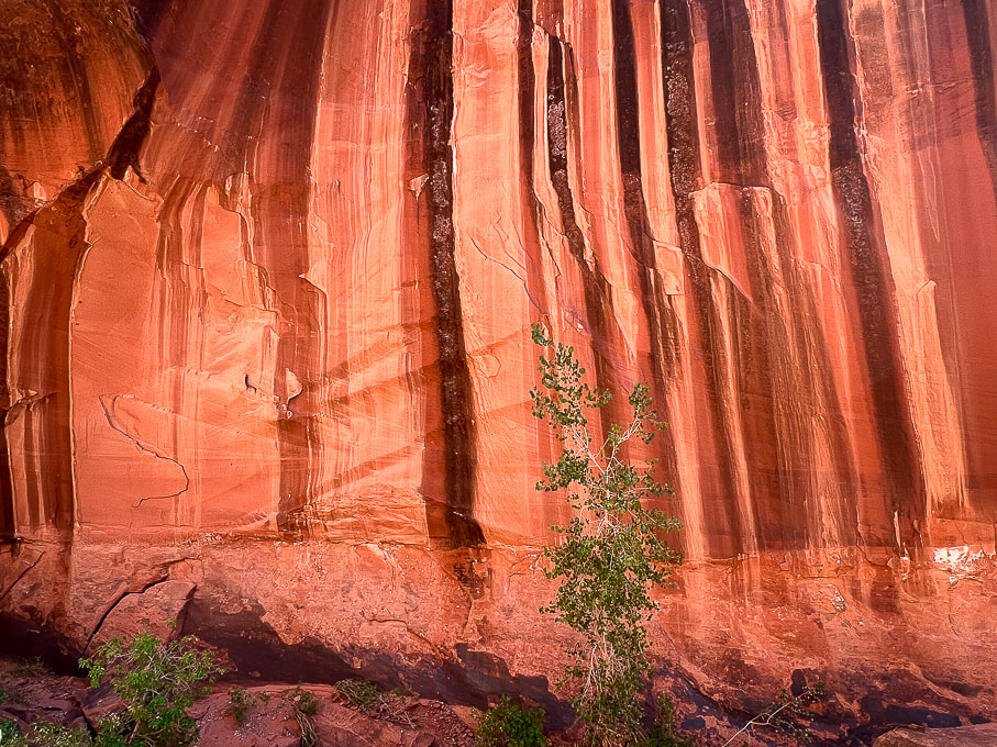
 Fred walking out. 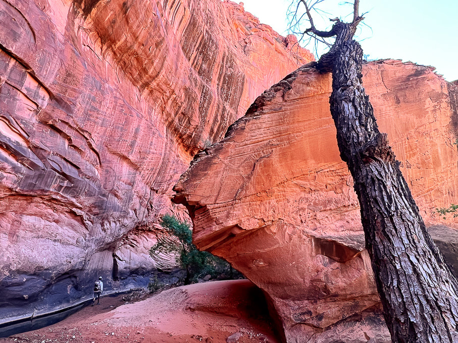 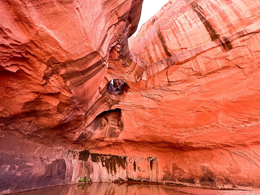 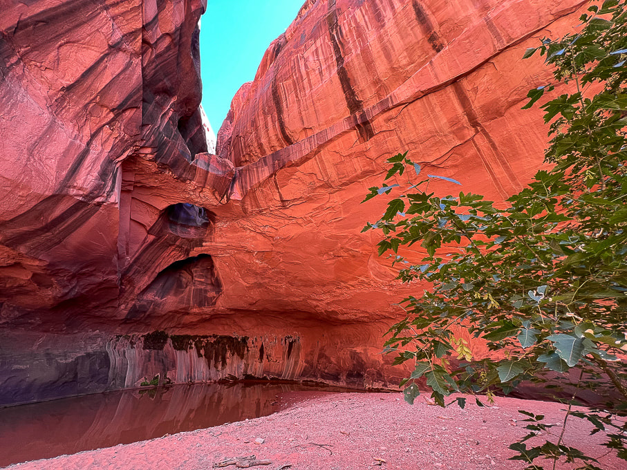 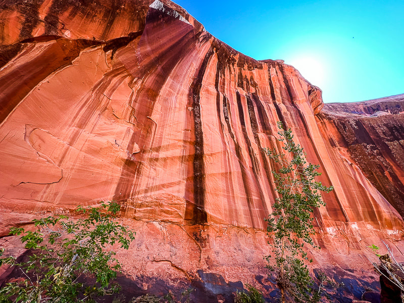 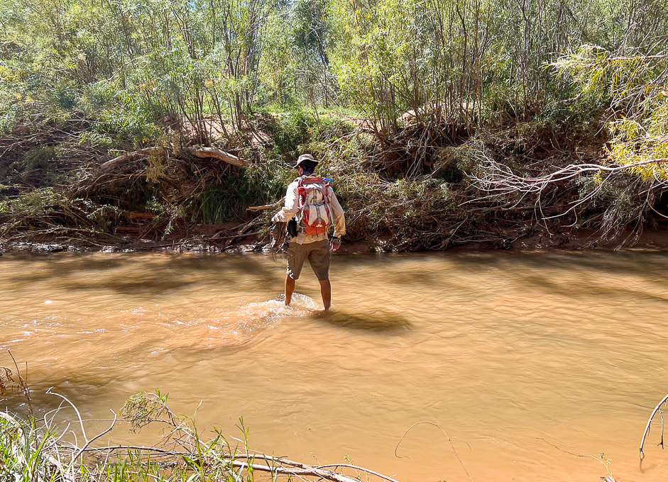 Crossing through Escalante River back to Beeline Route.
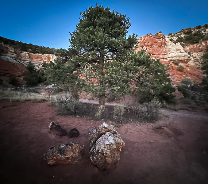
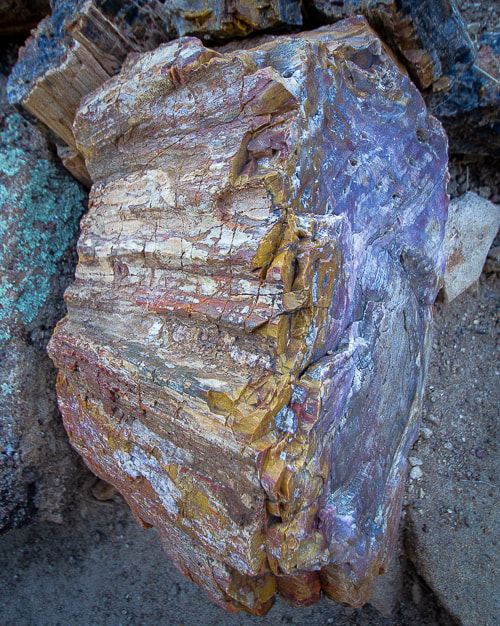
Carmel Formation (deposited ~ 170 million years ago) boulders strewn over Navajo Sandstone. Note the difference in textures: the limestone in the Carmel makes the rock more sharp and rough.  Scenes from Escalante Petrified Forest State Park, where we stayed with our trailer.
|
Categories
All

Sue and Fred

About this blogExploration documentaries – "explorumentaries" list trip stats and highlights of each hike or bike ride, often with some interesting history or geology. Years ago, I wrote these for friends and family to let them know what my husband, Fred and I were up to on weekends, and also to showcase the incredible land of the west.
To Subscribe to Explorumentary adventure blog and receive new posts by email:
Happy Summer!

About the Author
|