|
Crack Canyon, with its narrows and soaring sandstone walls is a non-technical, scenic joy to hike. It's one of the over 30 remote and hidden canyons transecting the San Rafael Reef. Bonus: you might have it all to yourself.
Related posts:
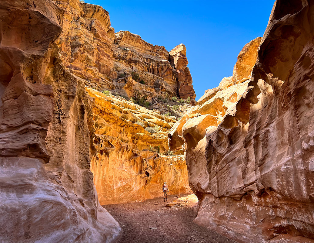
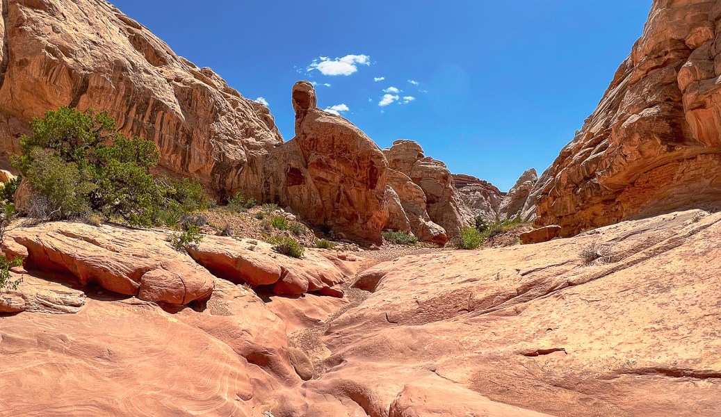
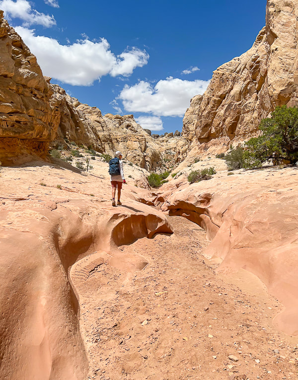
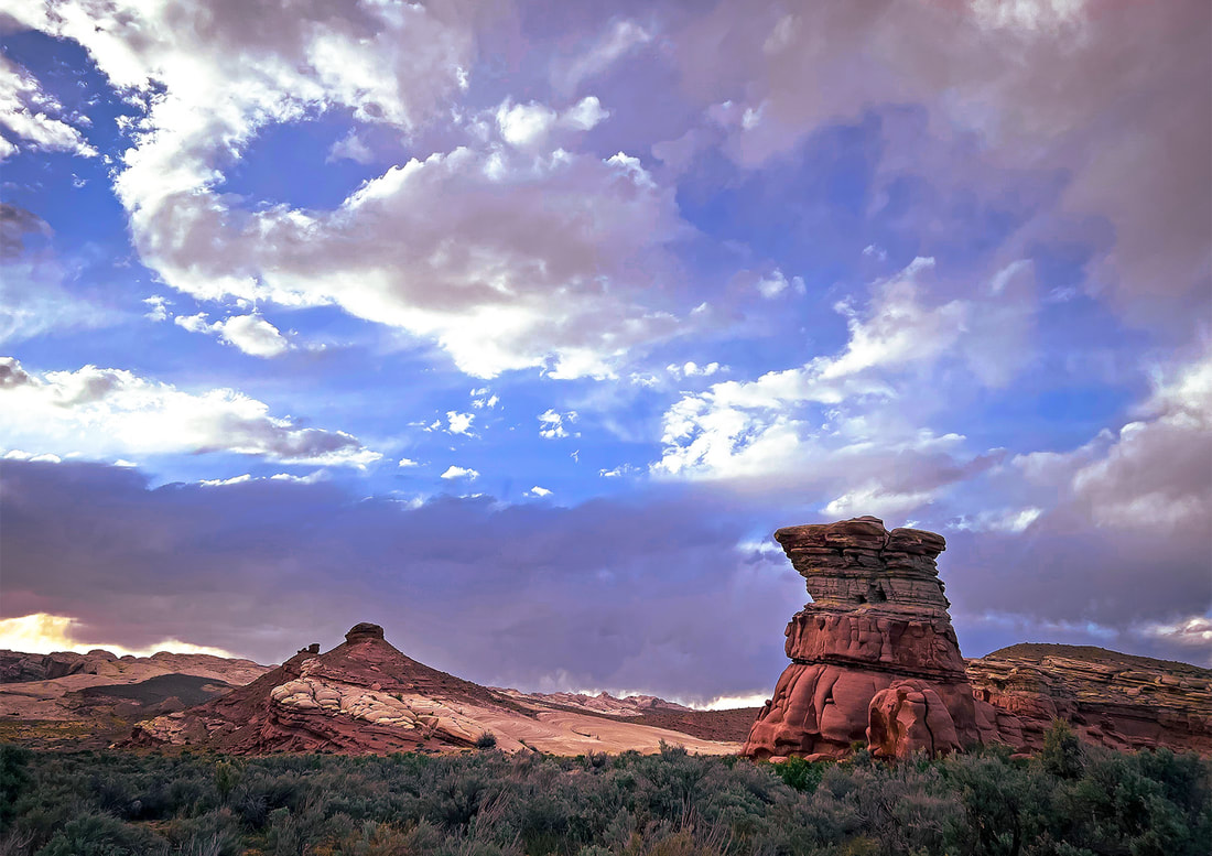
Entrance into Crack Canyon, San Rafael Reef.
Trip Stats
Location: Central Utah, Bureau of Land Management - Price Field Office - Southeast San Rafael Swell - Crack Canyon Wilderness Study Area. Overview: Penetrate the San Rafael Reef through one of its spectacular slot canyons as waters have for millions of years, with new discoveries around every corner, including a few narrows. This delightful "hands-on" hike navigates boulders, walls and slick rock. A cool cave awaits at the mouth of Crack Canyon, if you go far enough. Distance/Elevation gain: We began 0.4 miles from trailhead. Our hike = 8.0 miles round-trip. Elevation goes from 5,600' at top to ~ 5,000' at mouth. Difficulty: Easy/moderate with a few Class 3 moves and one Class 3-4 on short walls and boulders (one has a bypass). Coordinates: Trailhead on Behind the Reef Road: 38.64315 -110.74504 Maps/Books: Trails Illustrated #712 - San Rafael Swell - BLM - Price Field Office/Hiking and Exploring Utah's San Rafael Swell, 4th Ed., by Michael R. Kelsey. Caltopo map of our GPS tracks at end of post. Directions to Trailhead: From Green River, Utah on I-70 head west and take Hwy 24 exit toward Hanksville. At milepost 135 on Hwy 24, follow signed road toward Goblin Valley State Park (west). Follow this road to junction (5.1 miles); continue straight. At 7.2 miles from Hwy 24, turn left on a good graded road (Behind the Reef Road). Reset your odometer and travel 4.1 miles to Crack Canyon TH, passing the TH to Wild Horse Creek at 1.6 miles. We drove the old sandy road 0.4 miles down canyon in our 4x4 truck. High clearance 2WD ok on Behind the Reef Road. Date Hiked: May 11, 2023.
Our tracks down-canyon and back, beginning in the north just off of Behind the Reef Road.
The northwest Colorado plateau's San Rafael Swell and its huge, tilted reef of sandstone has much to offer the intrepid explorer who will boldly go where not a lot of people go. It's an extraordinary place of sublime topography and deep, dark canyons, some that contain pools to swim through. I've heard of this area for years, especially with reference to Native American petroglyphs and pictographs. Fred and I stayed at Goblin Valley State Park years ago to hike Canyonland National Park's remote Horseshoe Canyon to witness the amazing Great Gallery/Holy Ghost pictograph panel and dinosaur print. Relatively unknown compared to Utah's well-visited parks like Capitol Reef, there's a lot to do and see as evidenced in Michael Kelsey's book Hiking and Exploring Utah's San Rafael Swell.
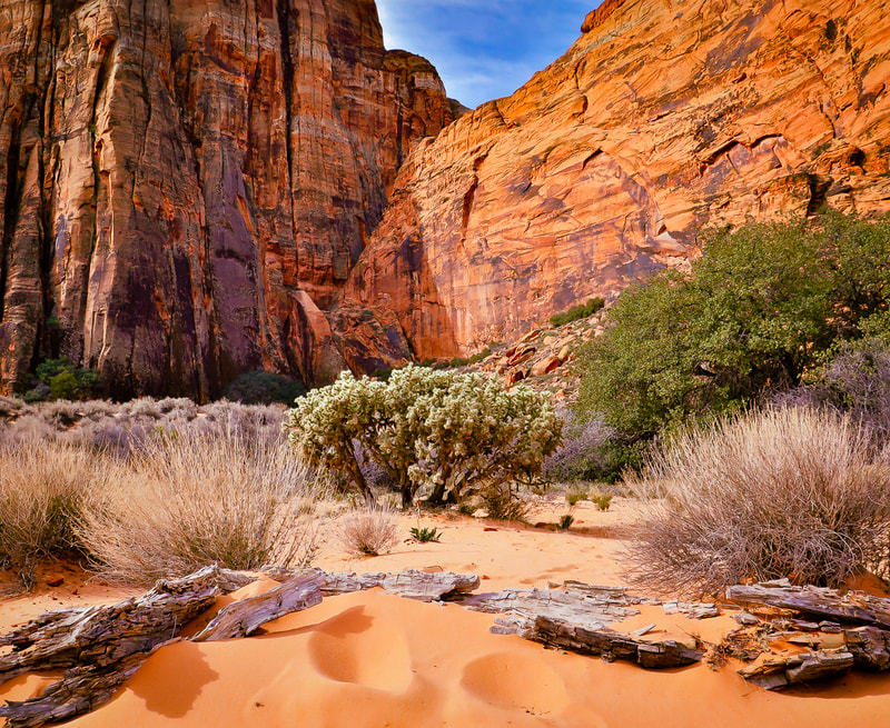
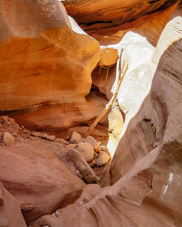
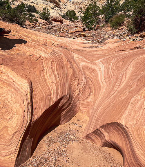
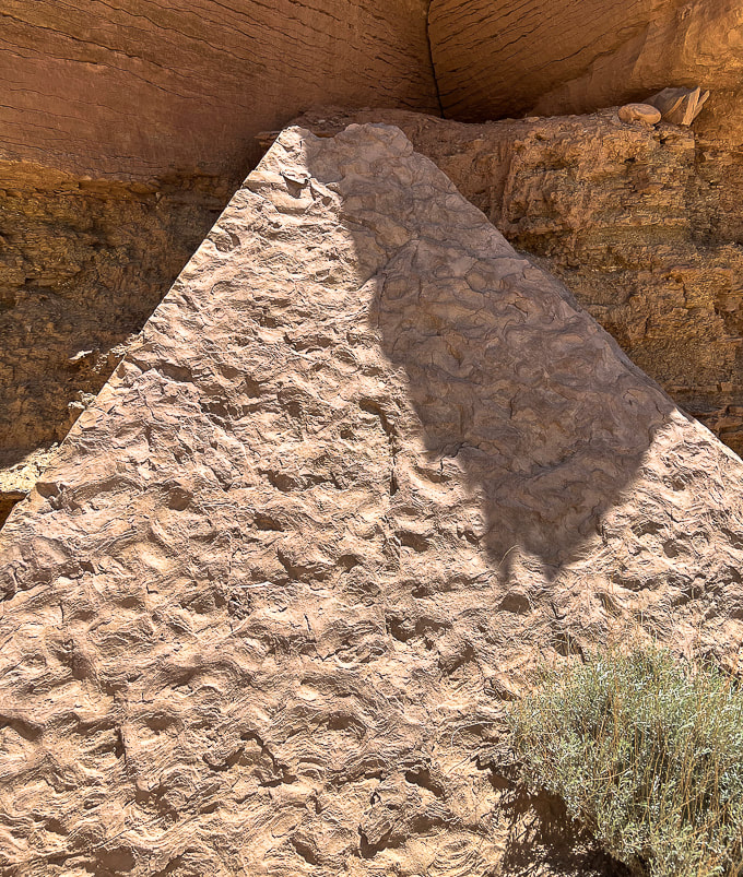
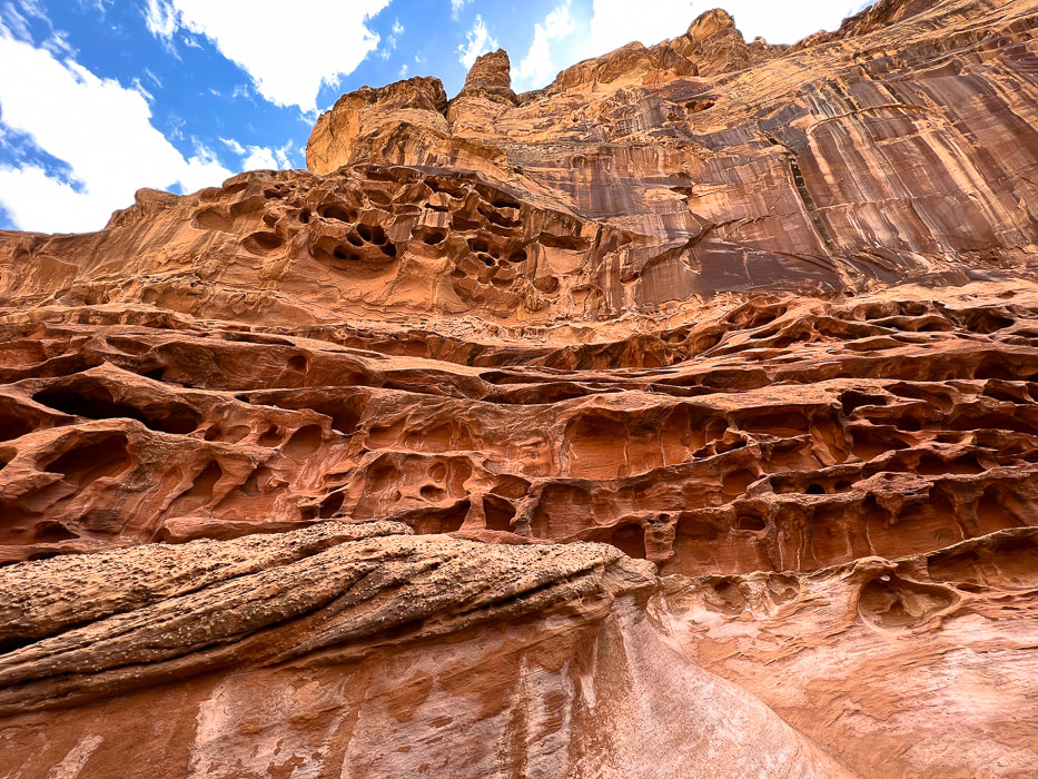
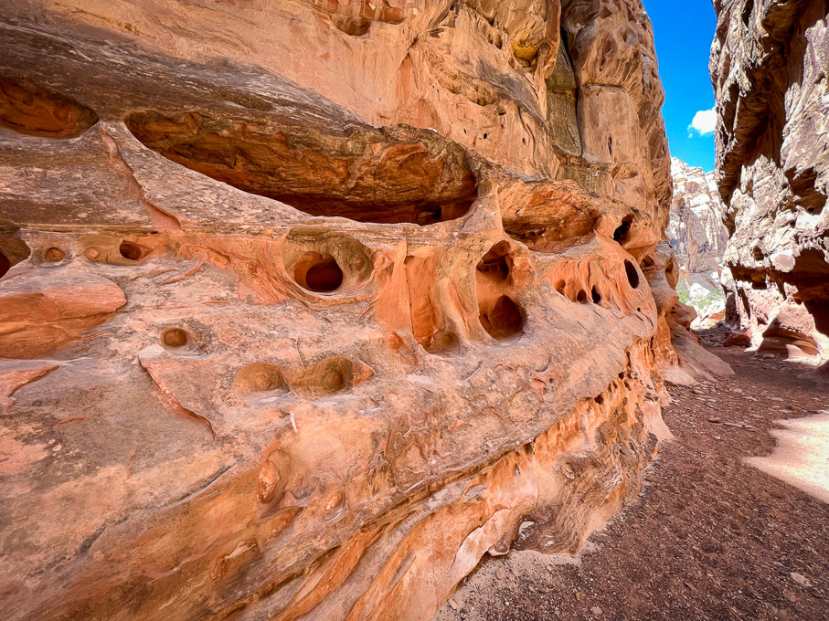
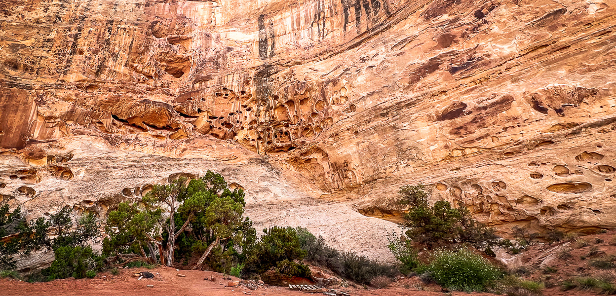
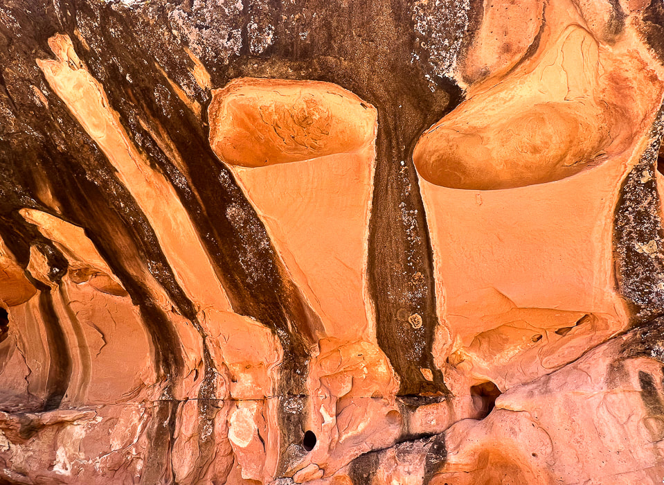
Mexican Mountain, Sids Mountain, Devils Canyon, and Muddy Creek are among the seven wilderness study areas in the San Rafael Swell. The reef on the eastern side of San Rafael is bisected by around 30 slot canyons, many of them requiring technical climbing and navigating skills. A few days before Crack, we went to see the amazing pictographs in Black Dragon Canyon and walked up-canyon from there past an old uranium mine. I'm not exactly sure how Crack Canyon got its name but I can guess two reasons. At the beginning, as the canyon begins to narrow, there is a "crack" in a tunnel ceiling, only a few feet wide. Further down, the honeycombed walls are so tall on each side at portions there is a "crack" of sky, especially in the narrows. What sets this canyon apart from other slots is the amount of extensive weathering in the form of honeycombs and caverns.
Features of Crack Canyon Hike
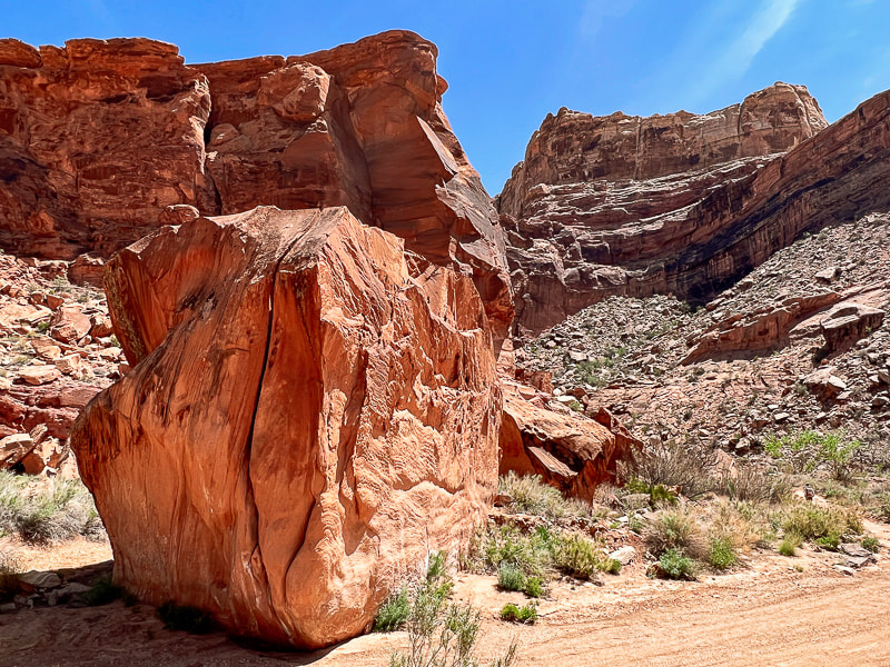
Although there's parking at the trailhead to Crack Canyon on Behind the Reef Road, we drove our 4x4 truck ~ 0.4 miles and parked when the canyon narrowed. It was a stellar day - azure skies with tall glowing, cavernous-weathered sandstone walls on both sides. We encountered only eight people on this Thursday. We ran into two older San Rafael-experienced gentlemen who recommended the Little Wildhorse Canyon/Bell Canyon loop, a bit further to the southwest. We've got lots of plans for when we return to this unique, contorted and high-cliffed desert less-traveled.
“Standing there, gaping at this monstrous and inhumane spectacle of rock and cloud and sky and space, I feel a ridiculous greed and possessiveness come over me. I want to know it all, posess it all, embrace the entire scene intimately, deeply, totally...”
- Edward Abbey, Desert Solitaire Never Stop Exploring! 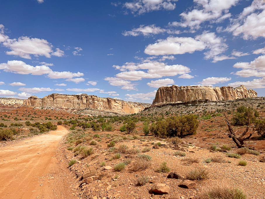
The graded Behind the Reef Road on the west side of the San Rafael Reef that takes you to Crack Canyon Trailhead. Looking northeast toward Temple Mountain.
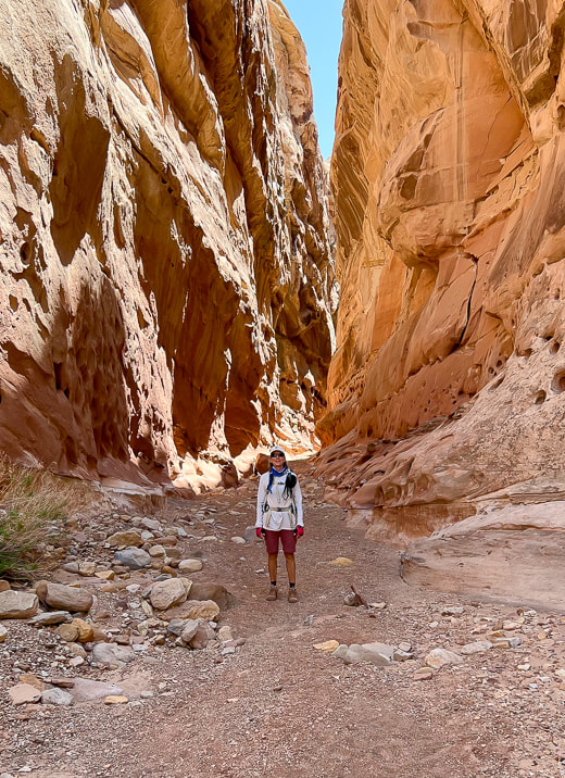
Start of hike after we drove ~0.4 miles down canyon from trailhead on Behind the Reef Road.
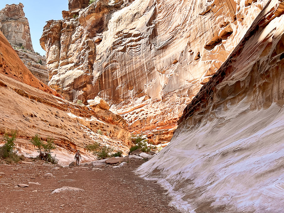
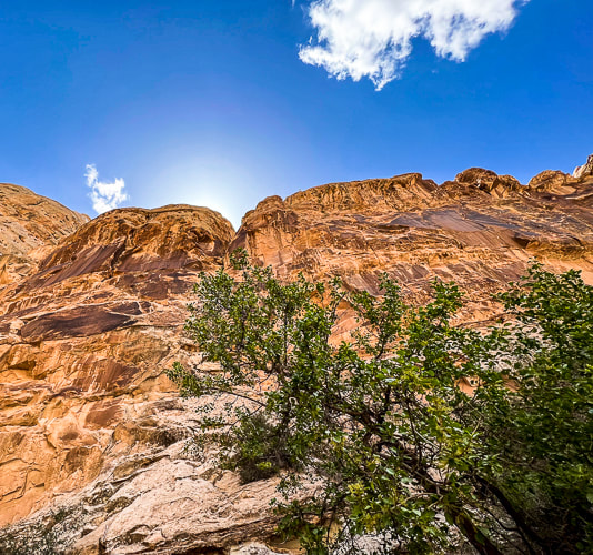
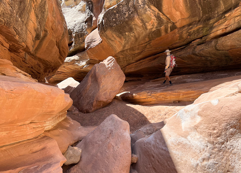
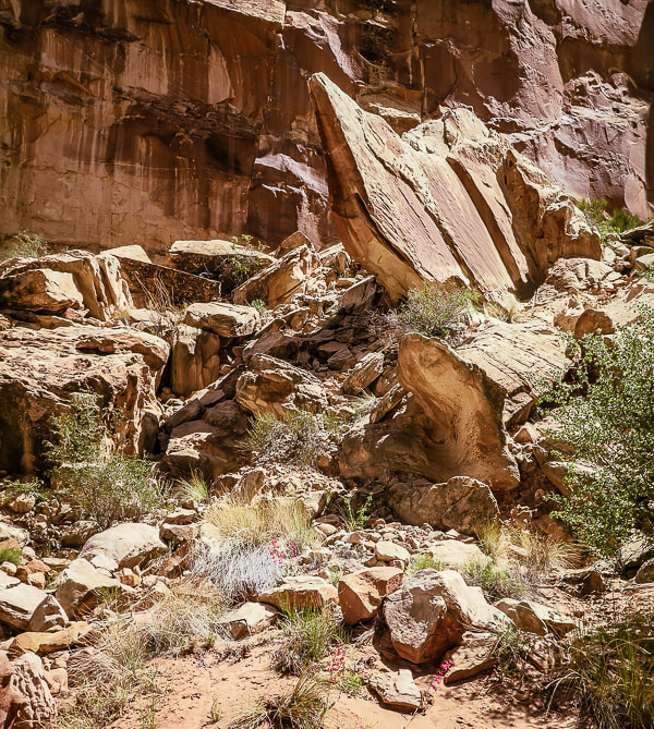
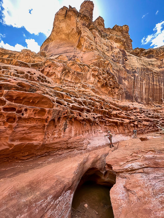
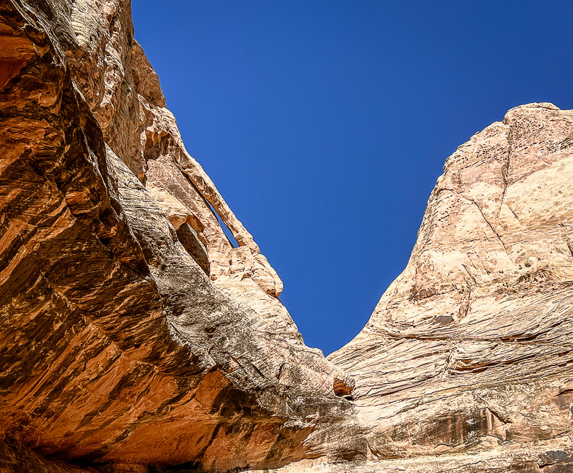
Crack Canyon's immense wall entrance.
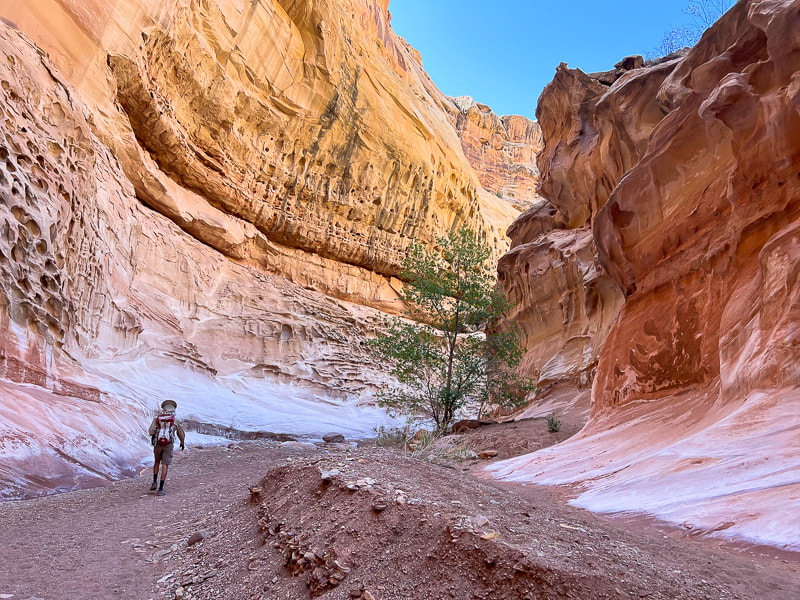
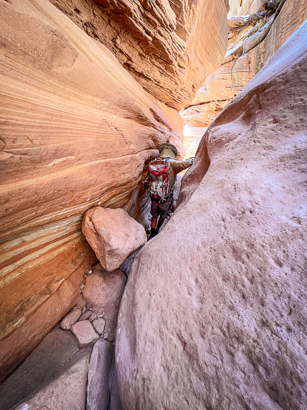
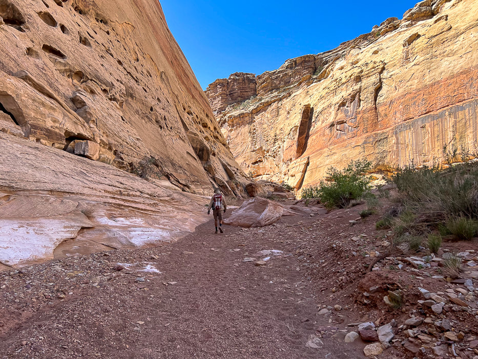
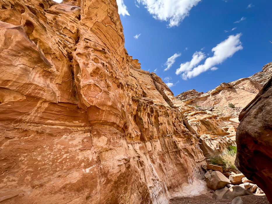
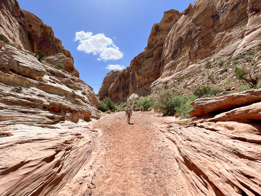
Crack Canyon starting to narrow.
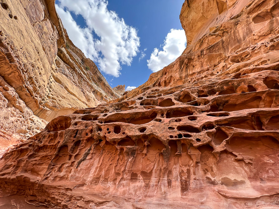
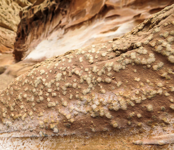
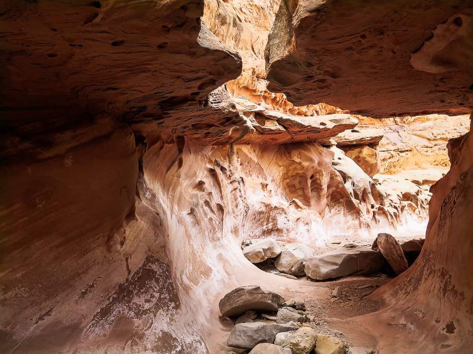
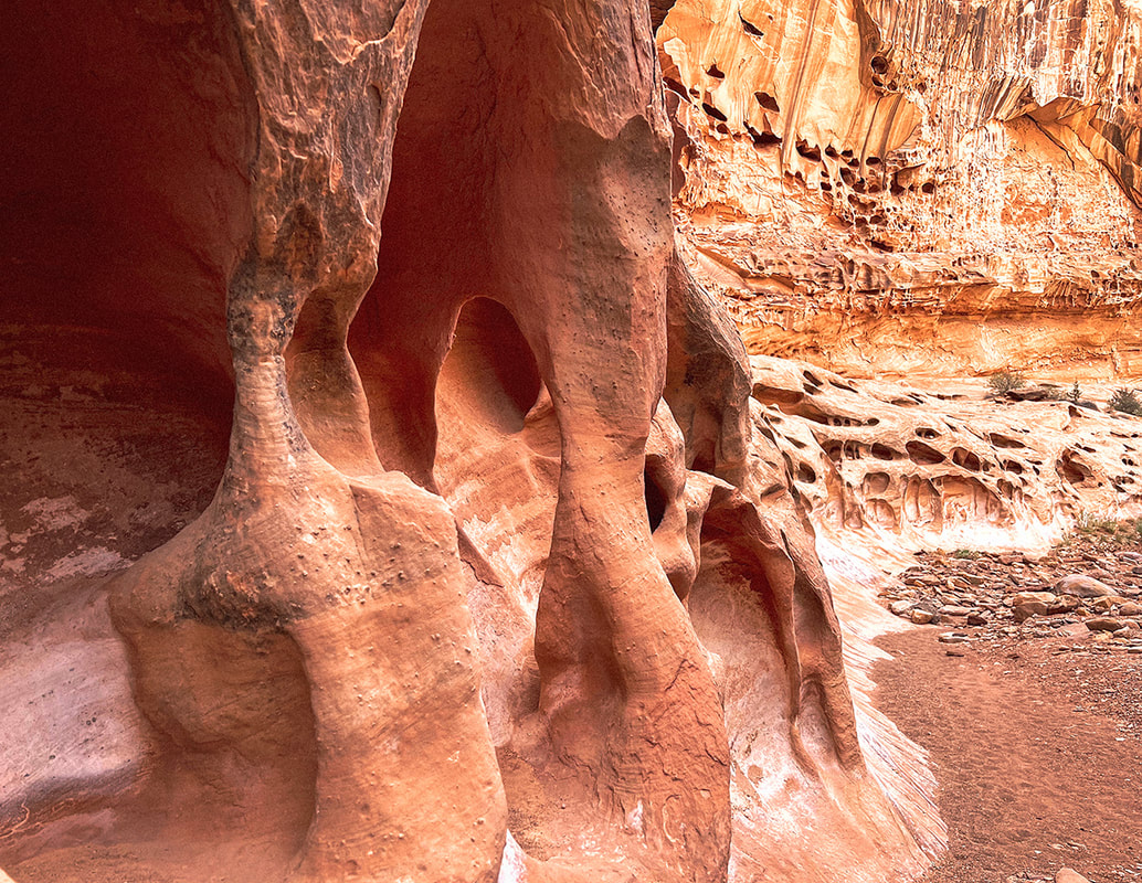
Cavernous weathering (tafoni) in sandstone caused by salt crystallization ("salt weathering") and physical processes such as wind and water weathering. Dissolution of the calcite cement between sand grains may take place, weakening the bonds between sand grains. The factors influencing cavernous weathering are seasonal wetting and drying, aeolian (wind-blown) salt, and water vapor.
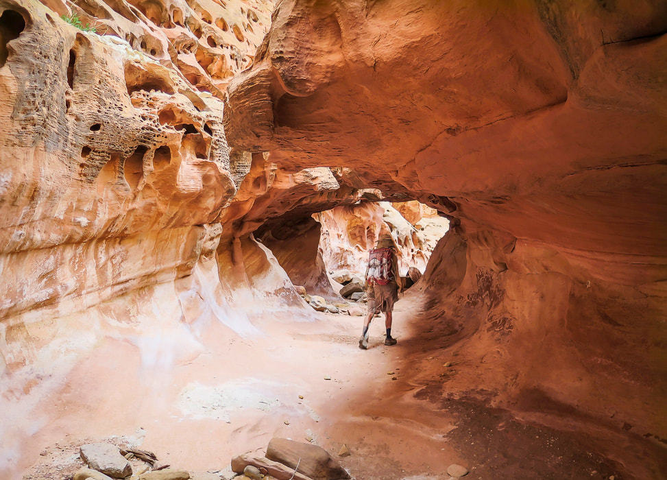
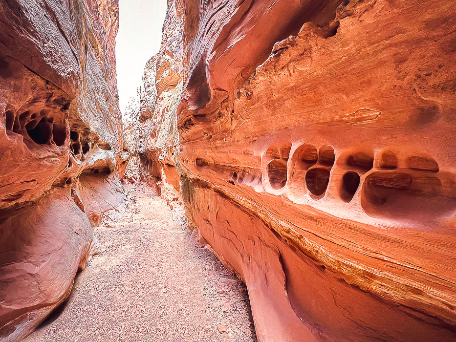
Entering "tunnel" with crack in its ceiling.
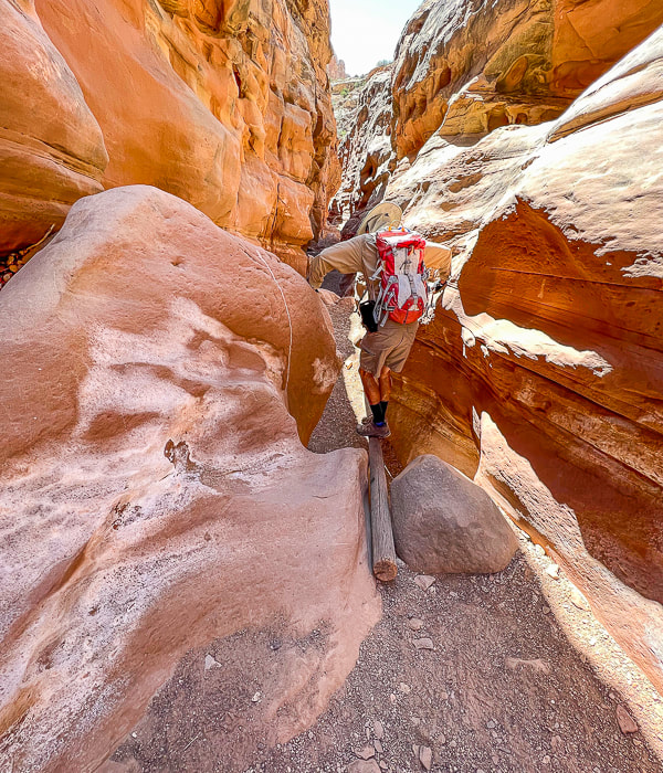
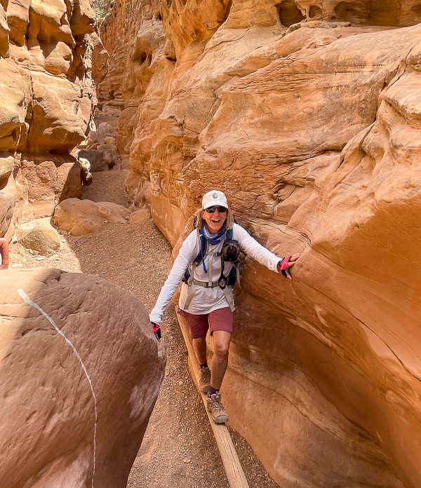
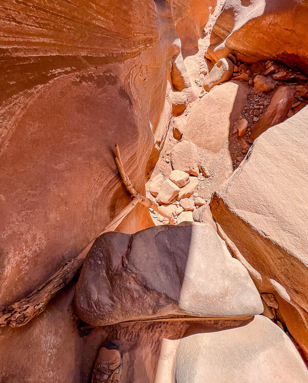
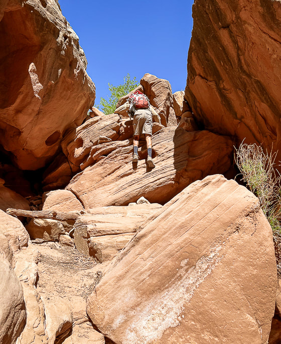
Log to ascend/descend sheer boulder wall (top of image in the sunlight).
Fun things in the canyon: a log helps to descend a sudden drop-off.
Fred going down, Sue going up. 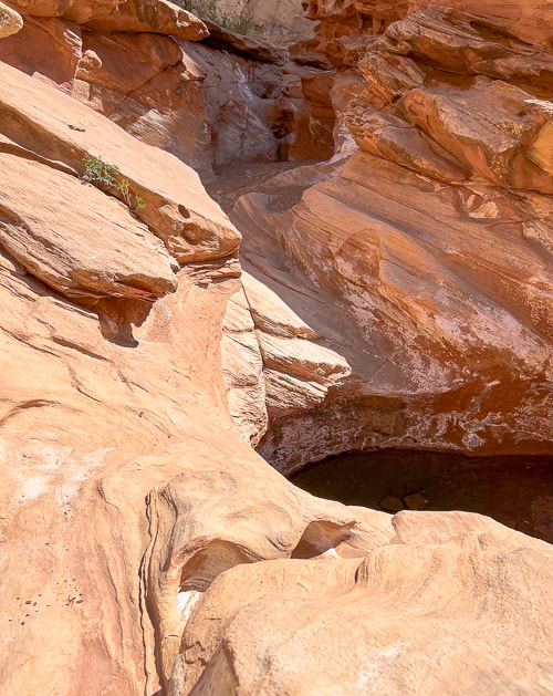
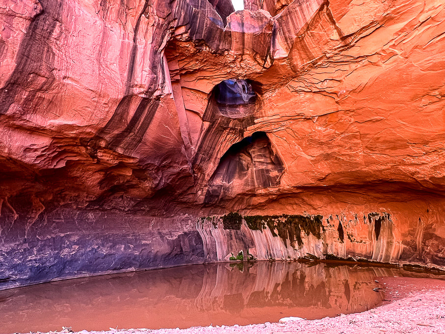
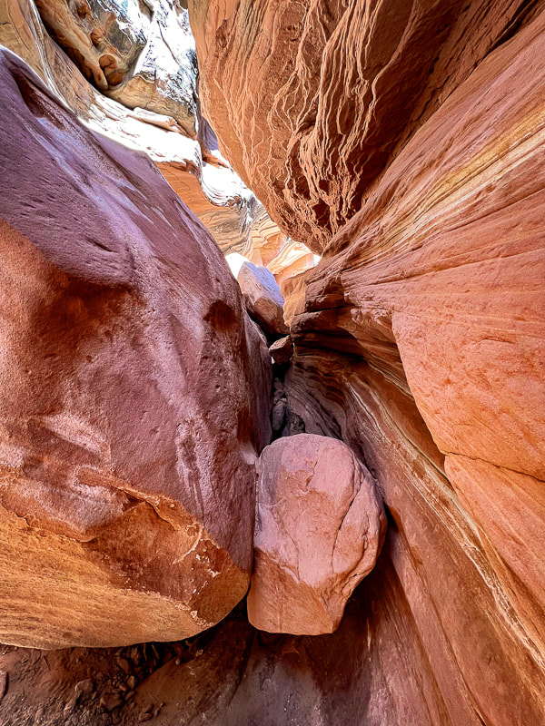
After descending a short wall above in this photo, you skirt around this pool of water walking on sandstone.
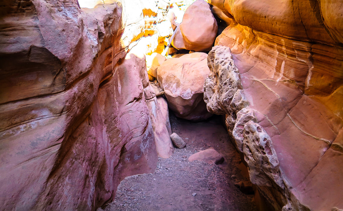
Looking at both ends of this boulder-navigating obstacle.
Climbing down short wall.
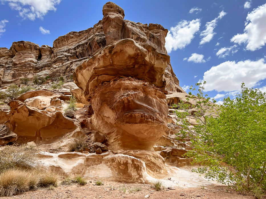
Really cool rock formations in a wide part of the canyon.
Walk by this huge alcove.
Cairned-marked up-canyon bypass around the most exposed Class 3-4 section. The bypass is short and well-marked.
Looking down at the most difficult obstacle with tree branch to help ascend/descend and webbing around boulder (left) and view looking up-canyon of same obstacle (right). There's a bypass around this obstacle a few hundred feet up-canyon on the east wall. Look for cairns that lead up through a crack to a ledge.
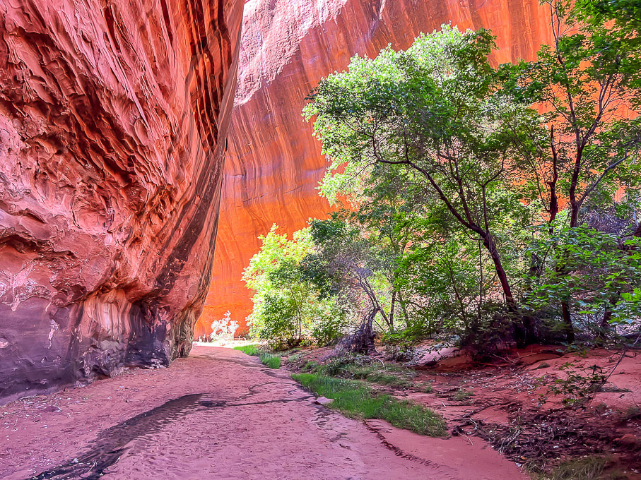
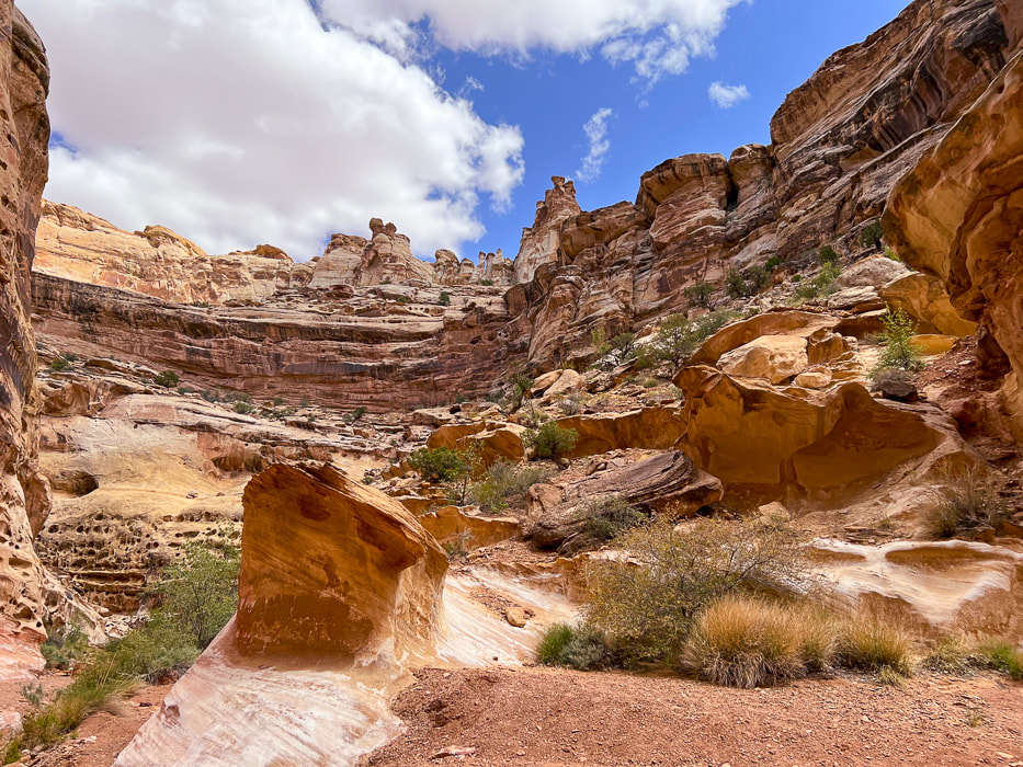
Canyon opens further down.
Carved slickrock at bottom of canyon.
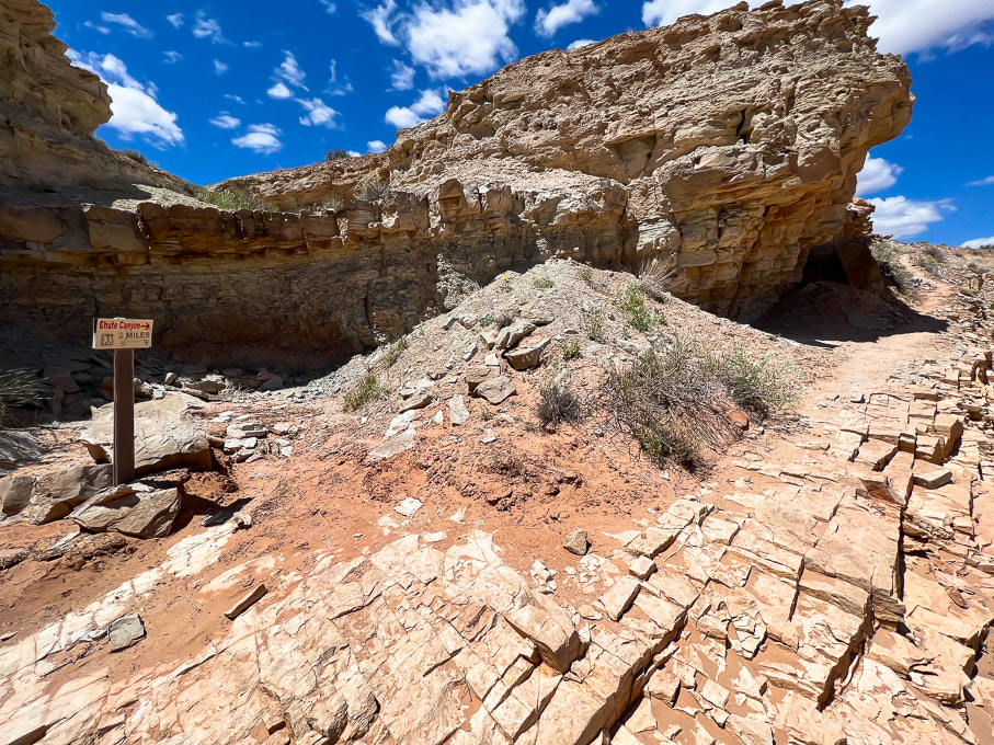
Sign at intersection of lower Crack Canyon with overland trail to lower Chute Canyon (2 miles from Crack to Chute).
Rock arrow pointing toward steep trail (above) that leads to a great lookout.
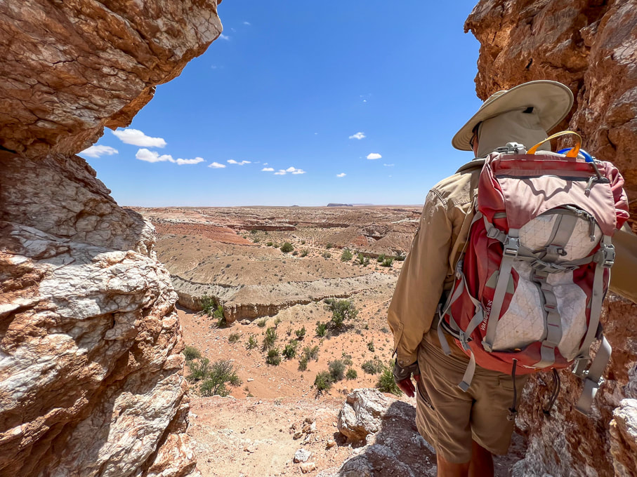
Lookout over the San Rafael Desert toward the southeast.
Looking down into Crack Canyon.
Heading back up-canyon.
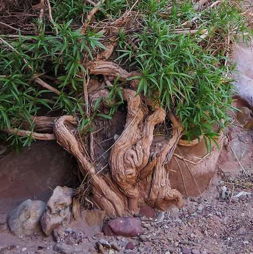
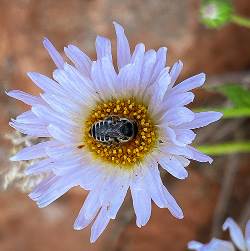
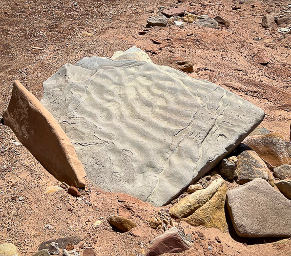
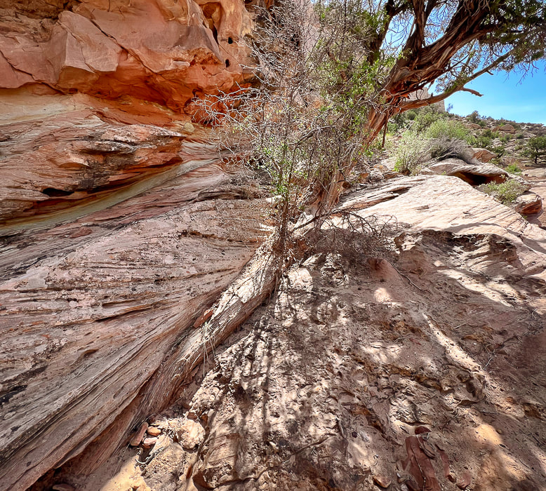
Some cool stuff on the trail.
The purple flower is actually from the Red Mountain Primitive Trail near St. George, Utah. 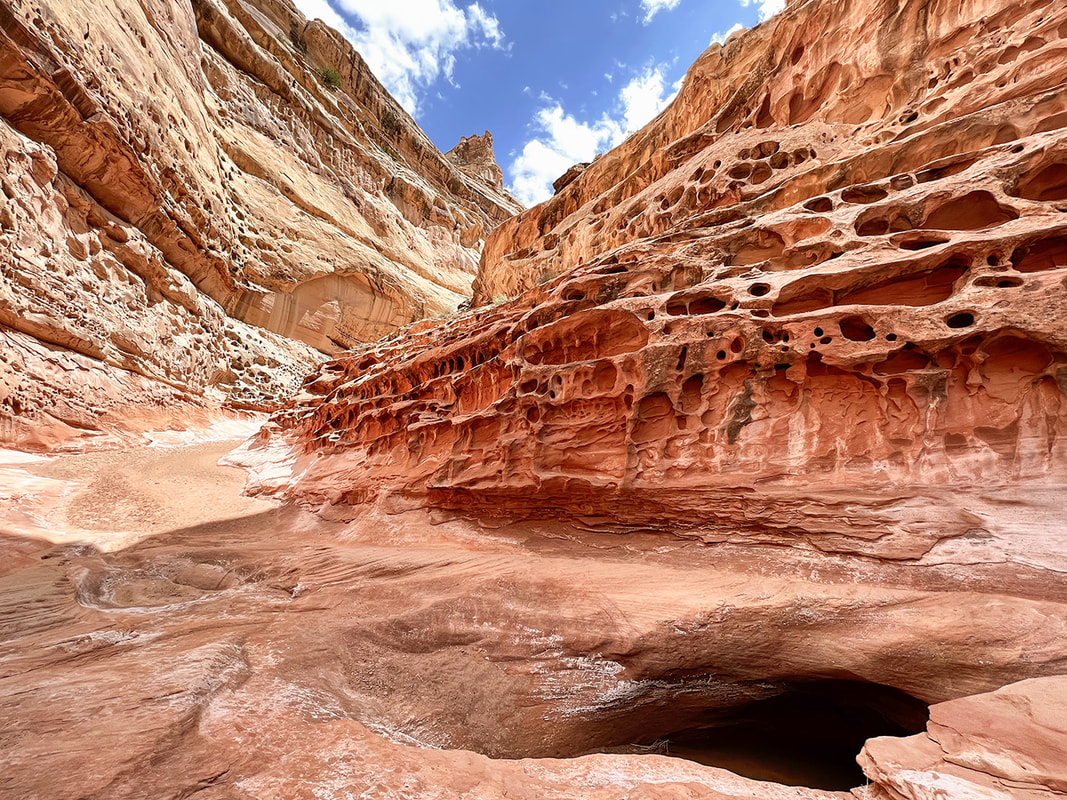
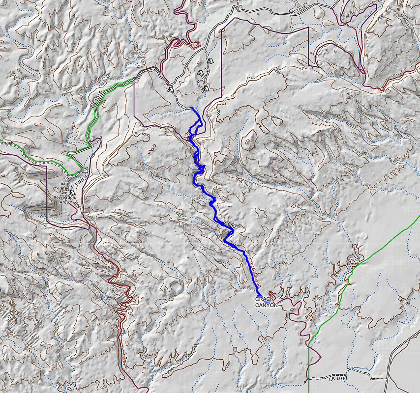
North points straight up - beginning of hike at top just south of Behind the Reef Road (CR 1016): hike down canyon SSE direction.
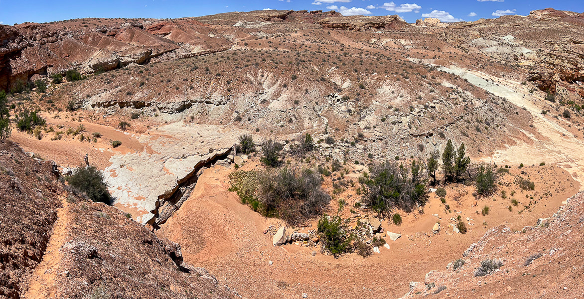
We hiked to the mouth of Crack, just beyond the intersection with trail leading to Chute Canyon (next canyon on the left), so a loop could be done.
6 Comments
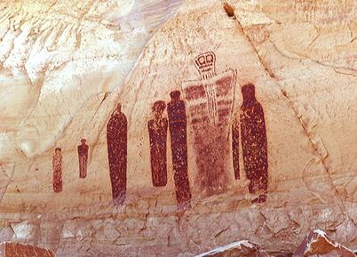
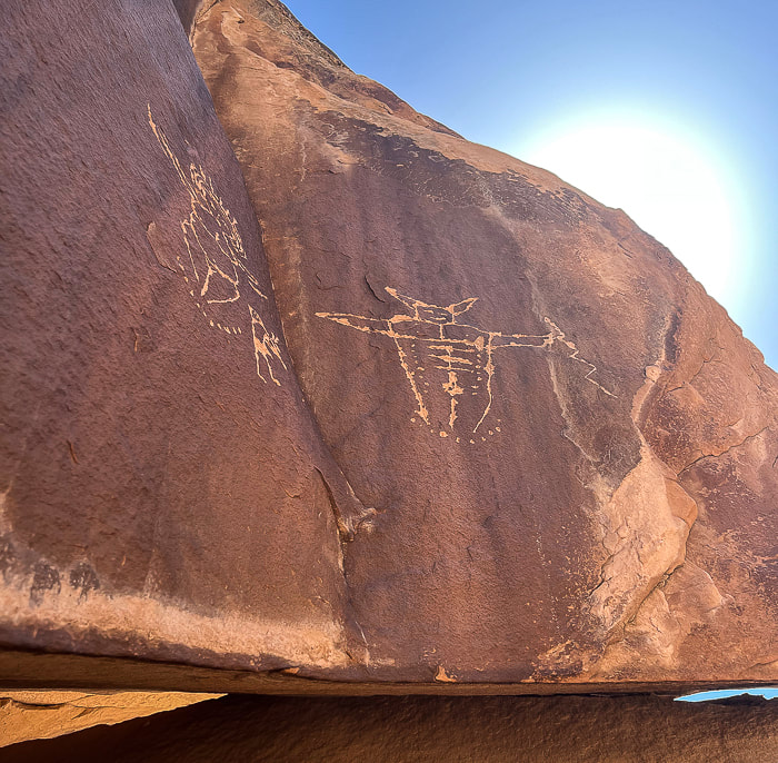
Utah's quiet San Rafael Swell has awe-inspiring Archaic Period pictographs and the alleged "winged monster" high on the walls of Black Dragon Canyon.
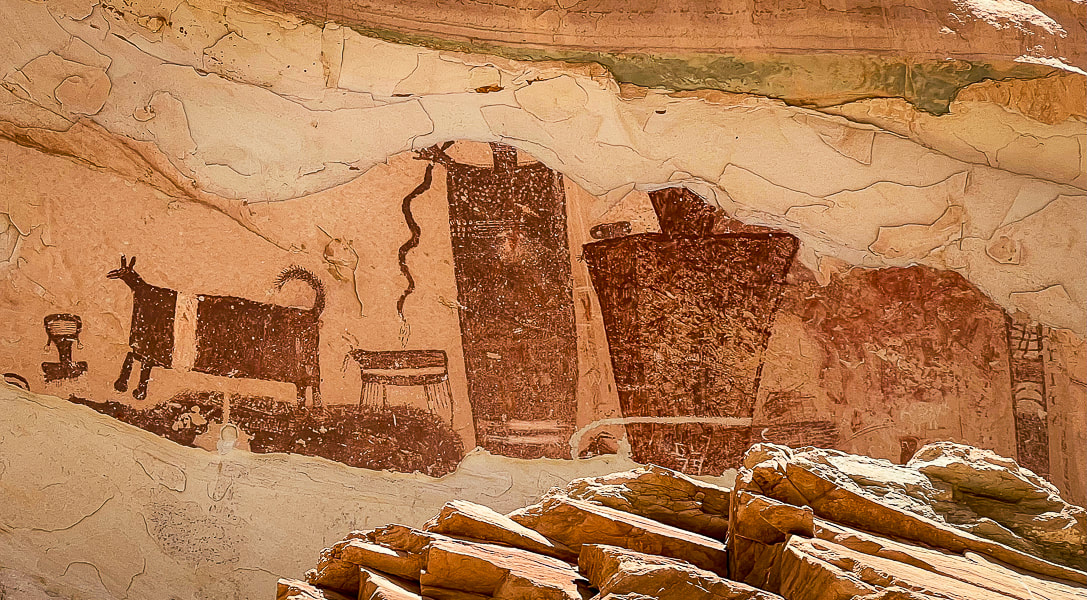
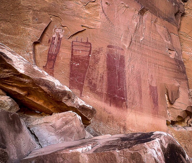
Temple Mountain Wash pictographs near Goblin Valley State Park
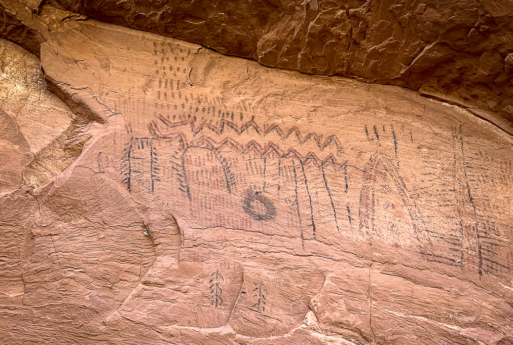
These figures are Barrier Canyon Style and date to the Archaic Period: several proposed dates include as far back as 8,000 BC or a younger time of 1,100 AD (see interpretive sign below).
Trip Stats
Black Dragon Canyon: (Northeastern San Rafael Reef) Driving west on I-70, 12.5 miles from Green River, Utah, turn off at mile marker 147 onto a dirt road with a closed gate. Close the gate after entering. The road quickly crosses over the wash on the left. We went a short distance along the right side of the wash until we found a better crossing and got back on the main, well-traveled road that heads north in the direction of the reef. The entrance to Black Dragon Wash is on the left at the Mexican Mountain Wilderness sign, 1.1 mile from the interstate. We drove 4x4 truck on good sand to the fenced at base of pictographs and parked. Temple Mountain Wash: (Southeastern San Rafael Reef) From Green River, Utah on I-70, travel west to the junction with highway 24 that goes to Hanksville. Go toward Hanksville (south) for about 25 miles to Mile Post 135. Turn left (west) at road to Goblin Valley State Park and drive 5.1 miles to junction. Drive straight for 1.0 mile - the panel is on your right with an interpretive sign. Maps/Books: Hiking and Exploring Utah's San Rafael Swell by Michael R. Kelsey/San Rafael Swell Map (Price Field Office)- National Geographic Trails Illustrated #712. Dates Hiked: May 9-11, 2023. 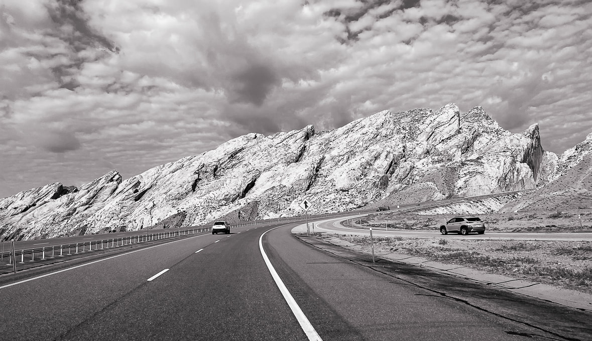
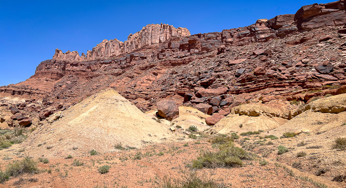
Utah I-70 piercing the San Rafael Reef (tilted light sandstone).
The Swell was caused by a vertical fault in ancient Precambrian basement rocks that lifted the western block higher than the eastern block of the fault, causing the younger layers of overlying rocks to drape over the fault zone creating an anticline, or "swell".
The San Rafael Swell and its near-vertical tilted sandstone beds named the San Rafael Reef is a Utah adventurer's paradise. Many steep and scenic canyons like Crack, Chute, and Zero Gravity cut through the reef. There's the Upper and Lower Black Boxes, old homesteads, mines, the San Rafael Knob, pictographs and petroglyphs from Archaic and Fremont cultures. The last time Fred and I visited this area, we stayed in Goblin Valley Campground and explored the Archaic Great Gallery/Holy Ghost pictograph panels in remote Horseshoe Canyon.
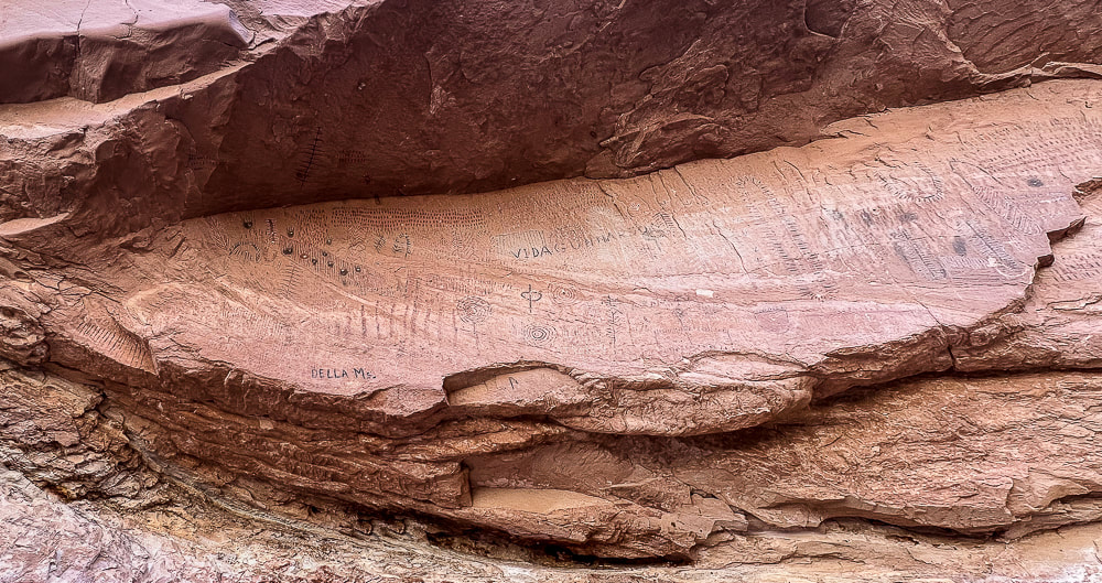
You're on your own in this remote part of Utah; there aren't many services, campgrounds or signs in the San Rafael Recreation Area (which has several official Wilderness Areas). And not many people ;). We barely scratched the surface with a few hikes and petroglyph/pictograph viewings. We trailer-camped in nearby Green Valley, Utah. One day, we stumbled upon the amazing Temple Mountain Wash pictographs when driving to hike Wild Horse Creek Trail. You can see where much of the pictograph panel has spalled off because of the elements of water and minerals. On another day, we drove the sandy roads to see the Spring Canyon petroglyphs and the Black Dragon Canyon pictographs and then walked up-canyon from there. It was here we saw the fabled "winged monster", a disconcerting pictograph that prompted scientists to unravel its mystery. 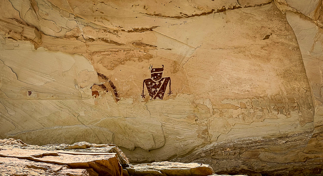
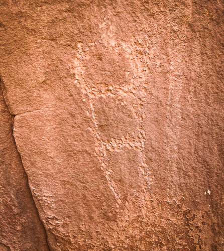
Temple Mountain Wash panel
These pictographs are Fremont style (AD 100 - AD 1300) and located to the left of the Barrier Canyon pictographs (above). Spalling, the breaking off of the surface of the rock, has removed previously-painted pictographs. 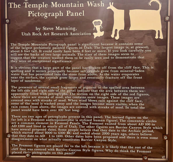
Interpretive sign at the site.
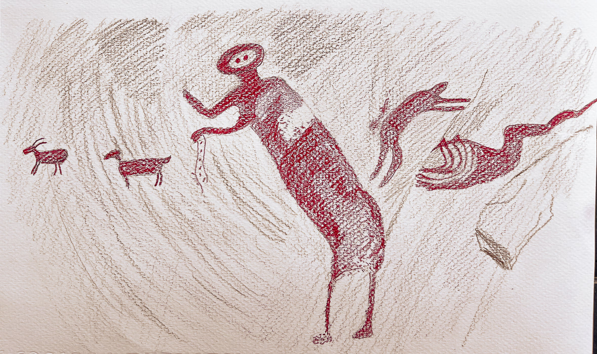
The "Dragon" Controversy In Black Dragon Canyon: a winged monster, a man, a grebe - what is it?
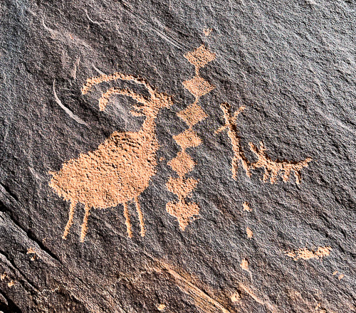
The sandy road leading to the pictographs in high-walled Black Dragon Canyon was in good shape, so we were able to park in the large space adjacent to these astounding pictographs. The left-most figures are in the characteristic Archaic Barrier Canyon style, with tall dark red mysterious-looking figures. To the right of these are Fremont Style pictographs featuring animals, abstract lines including concentric circles, lines, dots and zig-zags. It's always fun to imagine how the native peoples applied these red pigments. In this case, however, it wasn't fun to see the annoying white chalk lines drawn around some of the weathered pictographs. A large rockfall under the Archaic pictographs allowed the creators to paint their images high on the wall. There's a camera present with a sign. With apparent wings and a long tail, an unusual pictograph looks like a dragon/dinosaur creature, hence the name Black Dragon Canyon. In 1928, it got a reputation as a "winged monster", when amateurs discovered it. In the 1940's, John Simonson drew a chalk line defining his interpretation of a winged monster or dragon, and published a paper describing his methods. Decades later, a geologist said it resembled a pterodactyl, so the Young Earth Creationists started using this as evidence that Native Americans and pterodactyls lived at the same time. 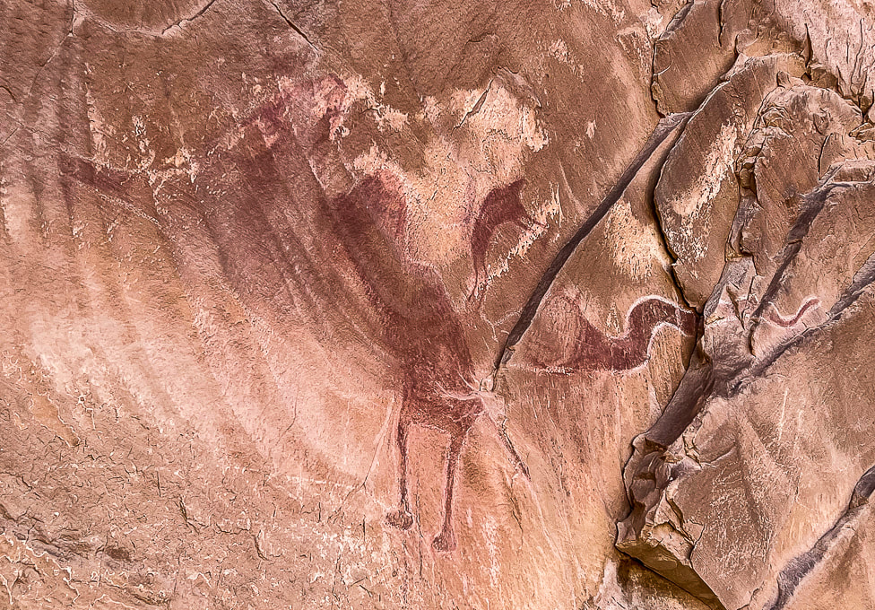
The "dragon" in Black Dragon Canyon - mistaken identity
Chalk lines drawn around separate Fremont style pictographs to define a dragon. Modern diagnostic techniques revealed five separate pictographs that were previously outlined together as one "winged monster" - possibly a pterodactyl. For instance, the "head" of this creature is actually a supplicating man. (I didn't include the furthest-left pictograph in this photo).
Enter modern technology: diagnostic tools to image the red pigment and iron that has faded over the years and not seen by the human eye. Dstretch enhances photographs of pictographs by revealing faded pigments, and x-ray fluorescence measures the iron concentration in the red pigment to see where Native Americans applied the pigment to the rock.
Conclusion: There are five separate pictographs encircled by the white chalk outline (see Dstretch illustration below), so the single "winged monster" pictograph has been debunked. From left to right: a bighorn sheep, a dog, a large, bug-eyed anthropomorph with a snake in his hand, a small man bent at the waist in supplication with his arms outstretched, and a large, sinuous horned snake. All five are the Barrier Canyon style. Simonson had converted the small man pictograph into the head and neck of a dragon.
I also found a paper (no date, but spoke of trips to the site in the 1990's) that stated this pictograph is a representation of an eared grebe, a type of waterfoul that breeds in the area and may have been hunted. The person who painted it may have been summoning the spirit of the grebe to bring more water. But now this interpretation has been debunked.
Photo of an eared grebe courtesy of the Cornell Lab of Ornithology - Macaulay Library.
Dstretch technique illustration of all five of the images found in the "dragon" pictograph in Black Dragon Canyon
(from left to right): Bighorn sheep, dog, a tall figure, a smaller figure with arms outstretched in supplication, and a horned snake. Chalk lines currently include all of these pictographs into one image of a "dragon". Compare this to the now-discredited "dragon" above. (I drew this image from a photo in "The Death of a Pterodactyl," by Jean-Loïc Le Quellec, Paul Bahn and Marvin Rowe, from Antiquity, Volume 89, p 872-884, 2015). Here is the link to the real picture: https://www.livescience.com/51886-winged-monster-rock-art-deciphered.html 
The largest Archaic Barrier Canyon style pictographs seen in Black Dragon Canyon.
Black Dragon Canyon pictograph panels
We walked up-canyon a few miles toward the Swell. Black Dragon Mine (uranium) is located on the south side of the canyon. We saw what looked to be the remains of an old truck and some mining tailings. We saw a few mountain bikers riding down-canyon; there's some great biking routes in the San Rafael Swell. So many reasons to love Utah and the American West: intriguing Native American rock art, infinite forms of warm-colored weathered sandstone, so much open area to move around in, and its beautiful peace.
As I write this post, I look forward to sharing our Crack Canyon adventure in this majestic and silent land. Silent, and I can feel every once in awhile the spirits of those who traveled these canyons and plateaus, who painted and pecked images on walls hundreds and thousands of years ago.
"Time and space. In the desert there is space. Space is the twin sister of time. If we have open space then we have open time to breathe, to dream, to dare, to play, to pray to move freely, so freely, in a world our minds have forgotten but our bodies remember. Time and space. This partnership is holy. In these redrock canyons, time creates space--an arch, an eye, this blue eye of sky. We remember why we love the desert; it is our tactile response to light, to silence, and to stillness."
- Terry Tempest Williams from Red: Passion and Patience in the Desert. 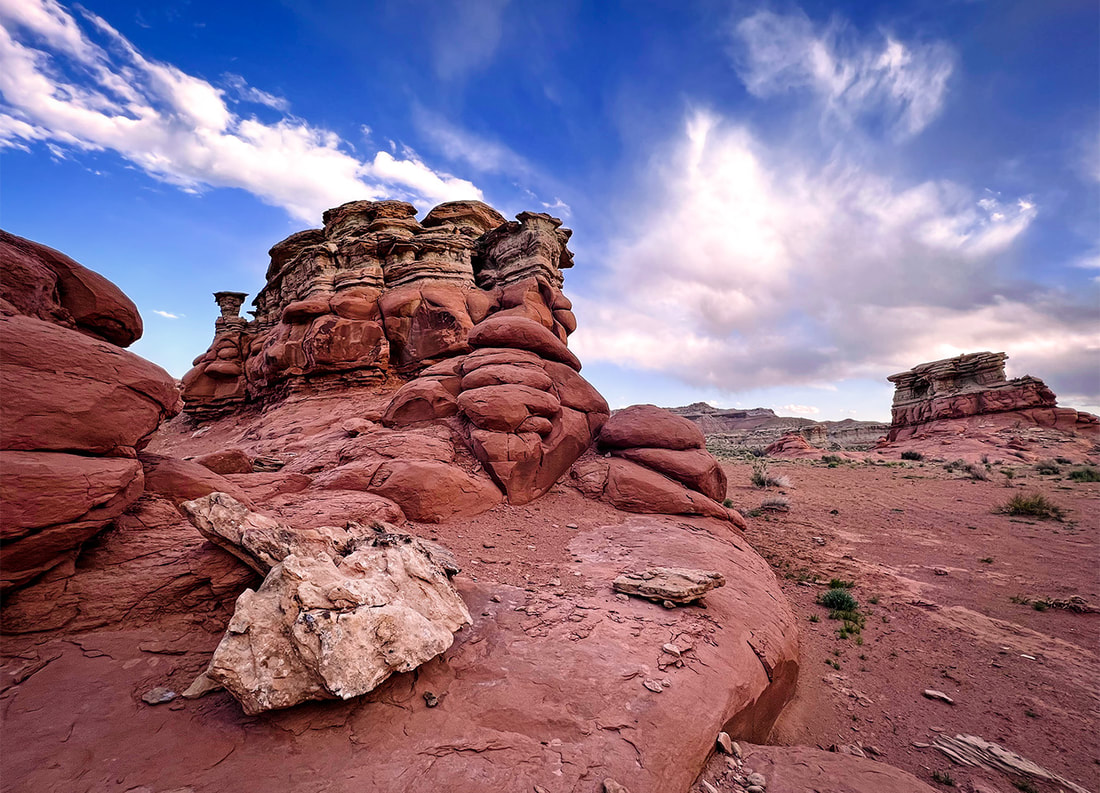
Both images above near Black Dragon Canyon at dusk.
Fertility petroglyphs?
Driving up Black Dragon Canyon a little further to park and hike up-canyon, we spotted these petroglyphs high up on a huge boulder - supposedly a man and a woman and Kokopelli, the fertility deity and flute player. The only reference I could find was a hiking website that described these as a "fertility scene". Kokopelli has a backpack with what might be seeds and the same small peck marks are arranged in a crescent shape beneath each figure, and on the man. 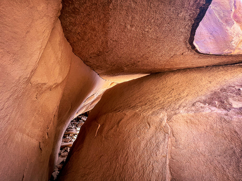
The hike up Black Dragon Road passes near the Black Dragon Mine, whose main commodity was uranium.
This road is a mountain-bike route to the plateau area of the San Rafael Swell. 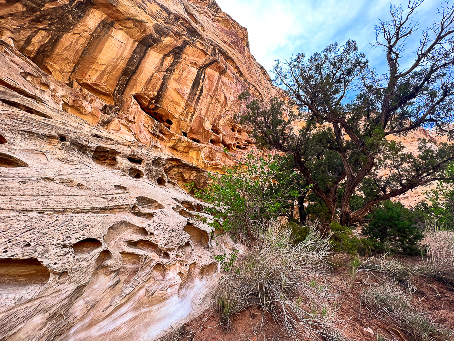
Wild Horse Creek in the reef south of Black Dragon Canyon.
A camping spot surrounded by tall walls of honeycomb weathering in Wild Horse Creek Trail, a creek south of Black Dragon Canyon that transects the reef.
Sandstone detail in Wild Horse Creek.
Along the mining exploration road leading out of Black Dragon Canyon. A great road for mountain biking.
Arches in Spring Canyon, on the way to Black Dragon Canyon.
Some cool stuff on the trail and in the Green River State Park Campground.
Juniper tree trunk blending with sandstone cross-beds.
References
Allee, P.A. et al. The Black Dragon Solar Solstice Markers and Calendar. utahrockart2.org. Demarco, E. 'Winged Monster' on Ancient Rock Art Debunked by Scientists. Science website, August 25, 2015. Geggel, L. 2015. "Winged Monster" Rock Art Finally Deciphered. from LiveScience website. The Eared Grebe. From the Cornell Lab All About Birds website. Mitton, J. 2020. Controversial Interpretations of the Black Dragon Pictograph. Colorado Arts and Sciences Magazine. University of Colorado - Boulder. Sucec, David. The B.C.S. Project: Barrier Canyon Rock Art Style. www.bcsproject.org/barrierstyle.html |
Categories
All

Sue and Fred

About this blogExploration documentaries – "explorumentaries" list trip stats and highlights of each hike or bike ride, often with some interesting history or geology. Years ago, I wrote these for friends and family to let them know what my husband, Fred and I were up to on weekends, and also to showcase the incredible land of the west.
To Subscribe to Explorumentary adventure blog and receive new posts by email:
Happy Summer!

About the Author
|