|
If you like short, Class 1 hikes to the highest summit of a spectacular mountain range, this hike in the unfrequented Tushar Mountains is for you. While you're there, sample the meadows and forests of the Skyline National Recreation Trail for a good dose of solitude.
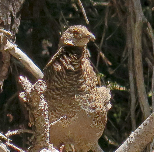
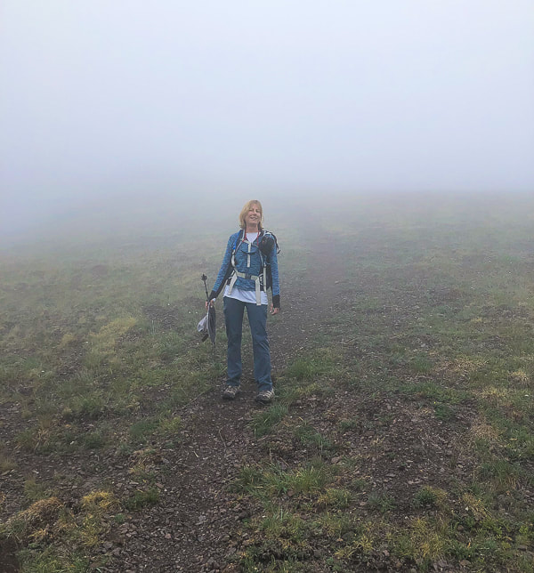
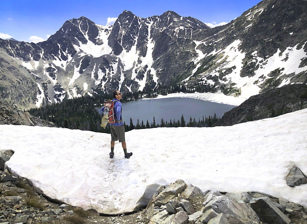
Looking like I'm going to fly away in Delano Peak's high winds.
Related in Explorumentary:
List with Links for Utah Hikes/Bikes Hike Mount Nebo - On Top of the Wasatch
Trip Stats for Delano Peak
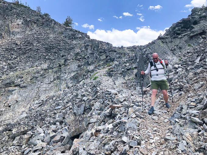
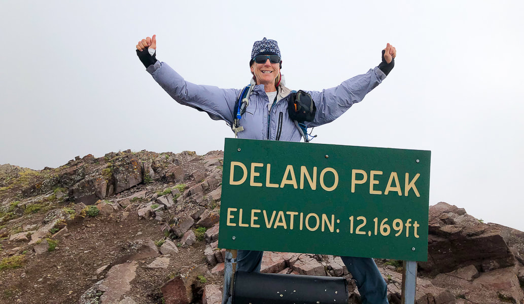
Location: Fishlake NF, Tushar Mountains, Trail #224, near Beaver, Utah. Fishlake National Forest - Beaver Ranger District. Prominence: 4,689'. Distance/Elevation gain: West ridge approach = 3 miles round trip - 1,625' gain. Trailhead = 10,500', summit = 12,169'. Difficulty: Moderate Class 1 on cairned trail to Delano Peak. Coordinates: Trail head = 38.36753, -112.39561 Delano Peak = 38.36917, -112.37137 Date Hiked: 8/1/22 Maps and Apps: AllTrails Delano Peak, Fishlake National Forest Beaver and Fillmore Ranger Districts Travel Map - USDA. Considerations: most passenger cars can drive the graded dirt/gravel road to trailhead (FR 123). This road is also part of the Paiute ATV trail, so there is some ATV use on roads nearby. No motorized vehicles allowed on hiking trails. History: named after Columbus Delano (1809–1896), Secretary of the Interior during the Grant administration. He was instrumental in establishing Yellowstone National Park after supervising the first federally-funded scientific expedition into Yellowstone in 1871, and the first Secretary of the Interior to request congress to protect preservation of a nationally important site (from Wikipedia). Geology: The Tushar Mountains are remnants of volcanos whose first eruption period was 22-35 million years ago (Bullion Canyon Volcanics) and second eruption 21 million years ago (Mt. Belknap Volcanics). Delano Peak resides in the Bullion Canyon Volcanics. It is the highest point on the edge of Big John's Caldera, a concealed structure on Delano's west side that subsided ~ 23 million years ago during ash flow eruptions. This caldera filled and eroded over time. The second eruption created the source rock for the mined uranium of the Marysvale mining district north and east of Delano Peak. (See "For the Geocurious" below).
The Skyline National Recreation Trail Links
Ramblers - Beaver County, Utah How to Day Hike Three Different Sections of the Scenic 23-Mile Skyline Trail - Utah - Life Elevated 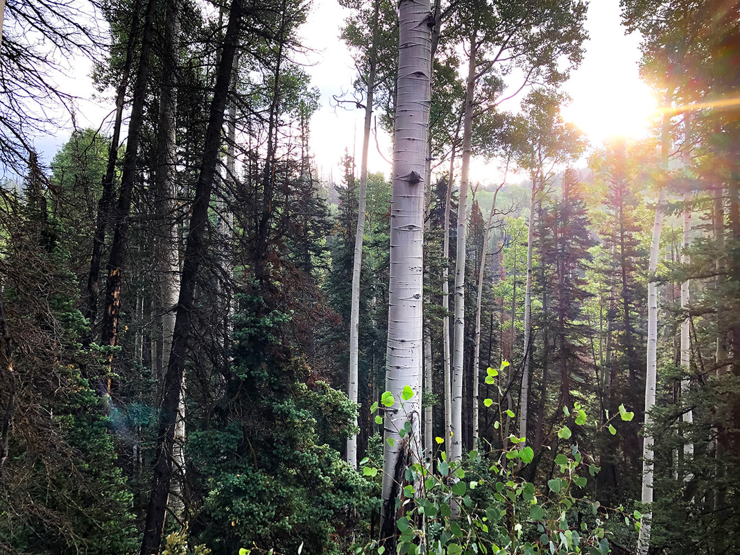
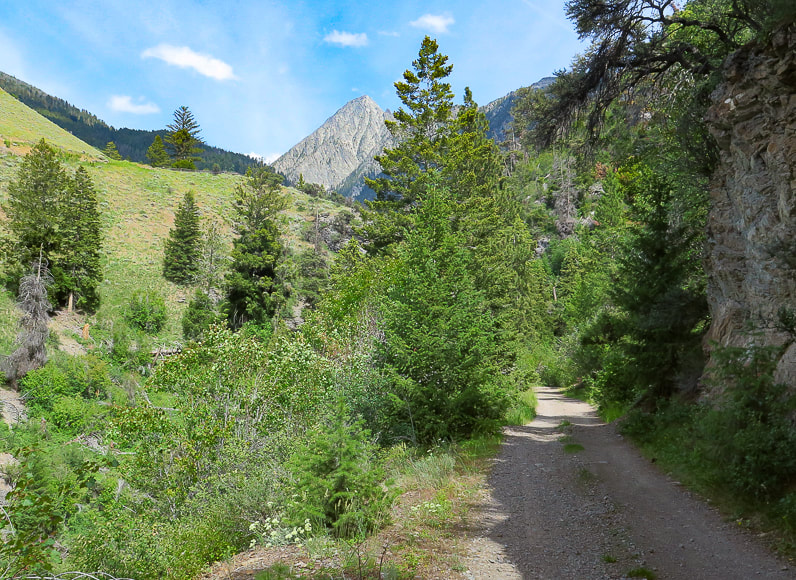
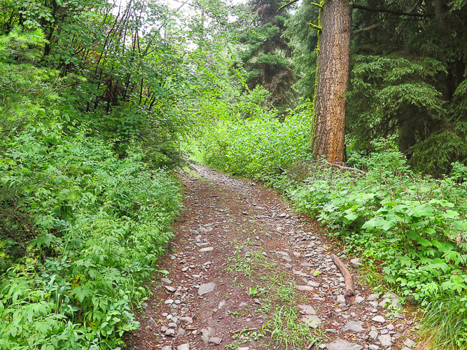
On the morning drive up FR 123 to the trailhead.
Delano Peak
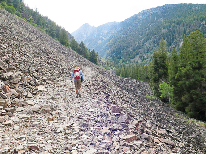
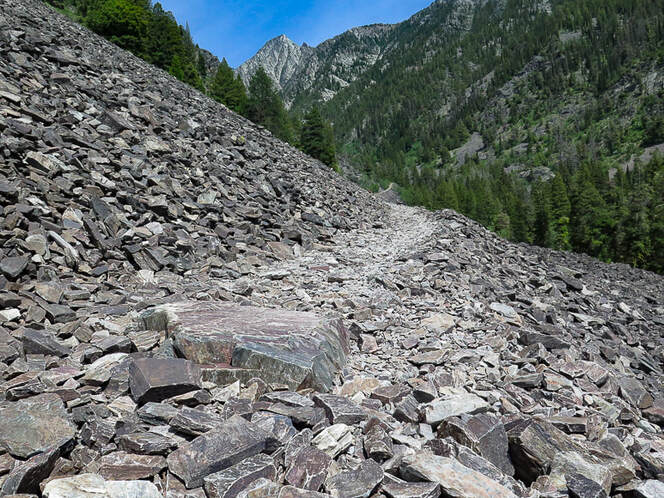
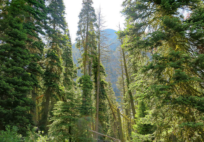
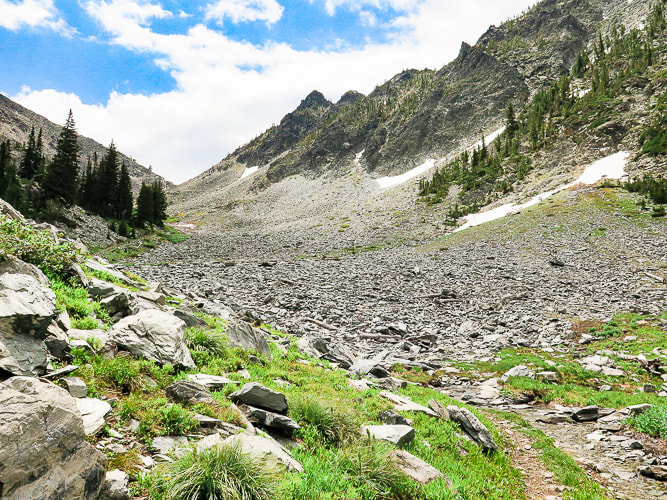
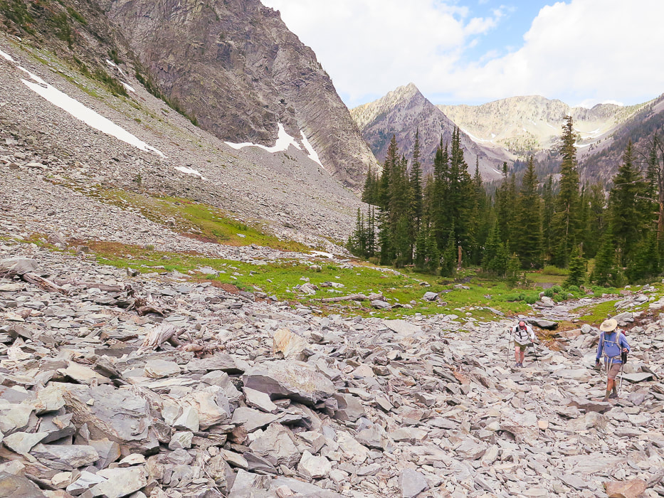
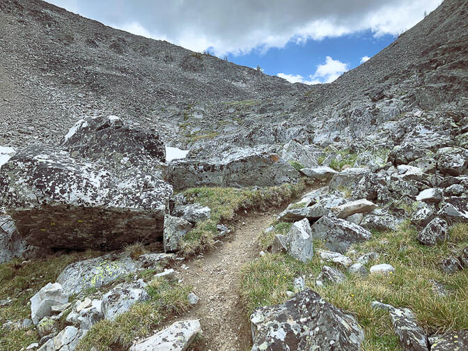
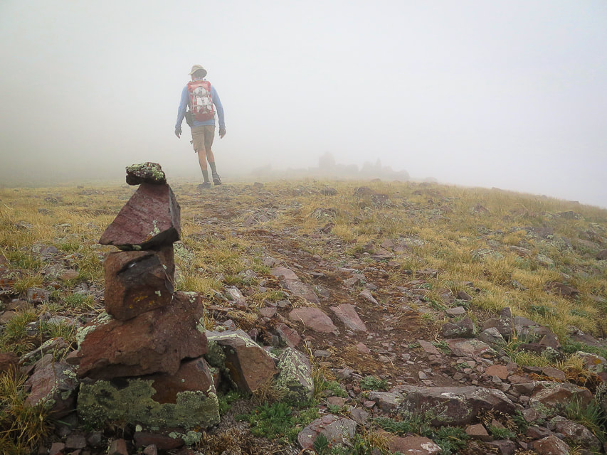
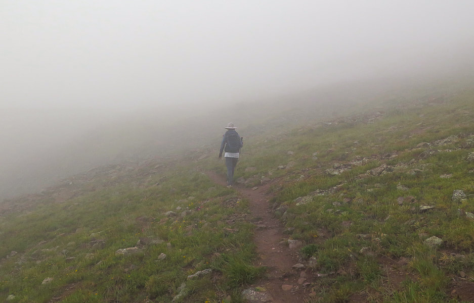
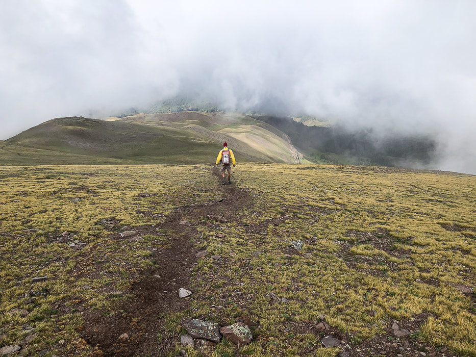
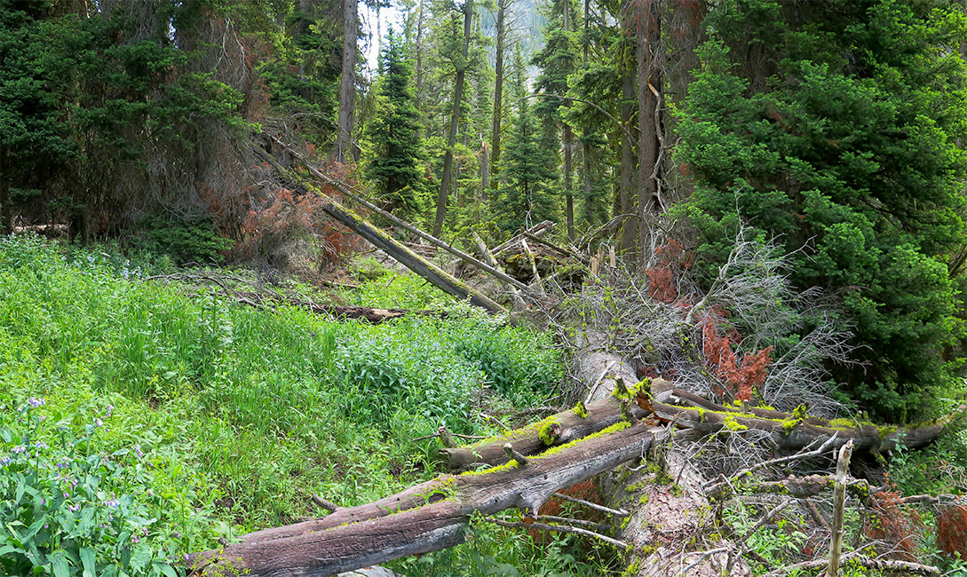
We had planned to hike a loop on on the Tushar range's highest ridge to Delano Peak and Mount Holly further down the ridge, but when we got to Delano's summit, we could barely see each other, let alone the ridge. A few times, Fred got ahead of me and vanished into the huge clouds that engulfed the summit. The terrain below was occasionally revealed as sunny and bright green, but not for long. Getting cold with the wind blowing us around, we descended the short trail to our truck and drove to the Skyline National Recreation Trail trailhead. Mount Holly can be accessed from this trail. Delano Peak is the highest summit in the Tushar Mountains - the third-highest range in Utah, after the Uinta and the La Sal Mountain ranges. The Geologic Map of the Tushar Mountains looks like a chaotic Jackson Pollock painting and one that would bring a sparkle to any geologist's eyes. It's a symphony of color blotches and random hatched lines that represent almost all major forms of volcanic rocks and structural features. Red Hills Tuff, Grey Hills Rhyolite and Blue Lake Rhyolite are just a few of the members of volcanic assemblages. Thrust faults, caldera walls and breakaway scarps scatter about this complicated terrain. Delano Peak's summit sits at the top of Big John Caldera. Four more calderas exist, as well as eight major mining centers. We were surprised that such a large, gorgeous wilderness area with more than a few peaks over 11,000 feet had so few visitors. While hikers flock to the Wasatch and Uinta ranges, the Tushars are not as well-known. There are ATV trails that course through parts of this range, but there are plenty of hiking trails where they are not allowed. This is a quick hike on a trail through grass and small rocks - only 1.5 miles to the summit. It is a bit challenging because you start at 10,000 feet. Delano Peak can also be summited from the northeast; in fact, this trail continues from the summit down to the base of Mt. Brigham. We plan on giving our loop another try.
Skyline National Recreation Trail
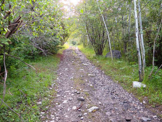
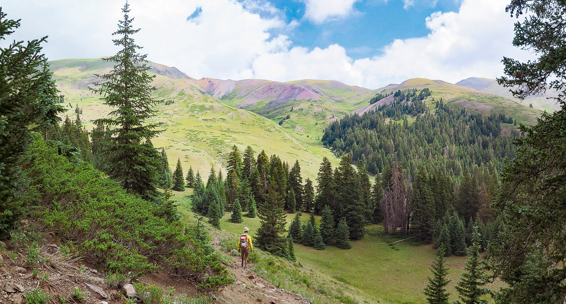
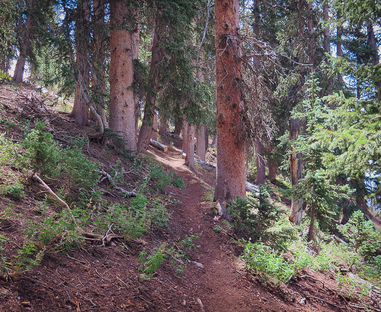
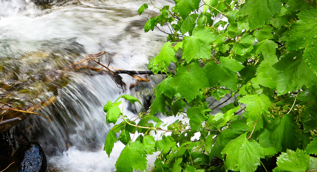
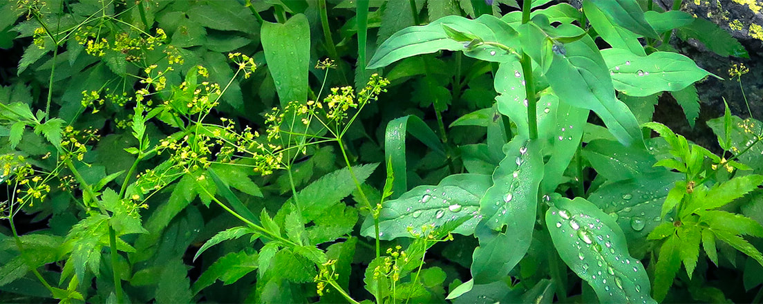
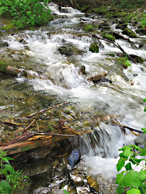
The SNRT is an 8.3-mile trail that is part of the panoramic Tushar Skyline Trail stretching 23 miles and passes under Delano Peak, the highest mountain in southwestern Utah. It takes you through streams, meadows, and forests. In 1986 and 1988, 25 mountain goats were introduced into the Tushars from the Wasatch range in northern Utah and Olympic National Park. They have prospered to number 120 goats, and some have been transplanted to other areas. They can be seen on the Delano-Holly ridge line. We entered the SNRT where it intersects with FR 123, ~ 1 mile south of Delano Peak trailhead and hiked toward Mt. Holly's base. The high Tushar's grassy slopes don't appear intimidating; no major cliffs or talus slopes. By this time, the clouds had retreated from the high ridge, but we decided to enjoy a rambling hike rather than a climb up Mount Holly. Ah, maybe we are getting soft in our "old age"!! Any time out in the wilderness, whether we get to our planned destination or not, is cherished.
"Why do they say we’re over the hill? I don’t even know what that means and why it’s a bad thing. When I go hiking and I get over the hill, that means I’m past the hard part and there’s a snack in my future."
- Ellen DeGeneres
Keep On Exploring! Keep Moving! Your Body and Mind will Love you for it!
For the Geocurious: Volcanos and the creation of Uranium
Just east of the Tushar Mountains, the Mount Belknap Volcanics erupted radioactive lava flows and ash-flow tuffs (rocks of consolidated ash) ~ 21 million years ago. Unique geologic processes then created the uranium deposits that formed in a shallow water vein system in the Central Mining Area near Marysvale, a short distance from the Tushars. The veins formed 19 million years ago above a magma chamber, filling in open spaces and fractures with fluids rich in fluorine, molybdenum, and uranium. Hydrothermal fluids and rock reacted to precipitate uranium. Nine mines in the Central Mining area produced uranium. Because of decreased demand for uranium, Utah's mines were closed before 2000. 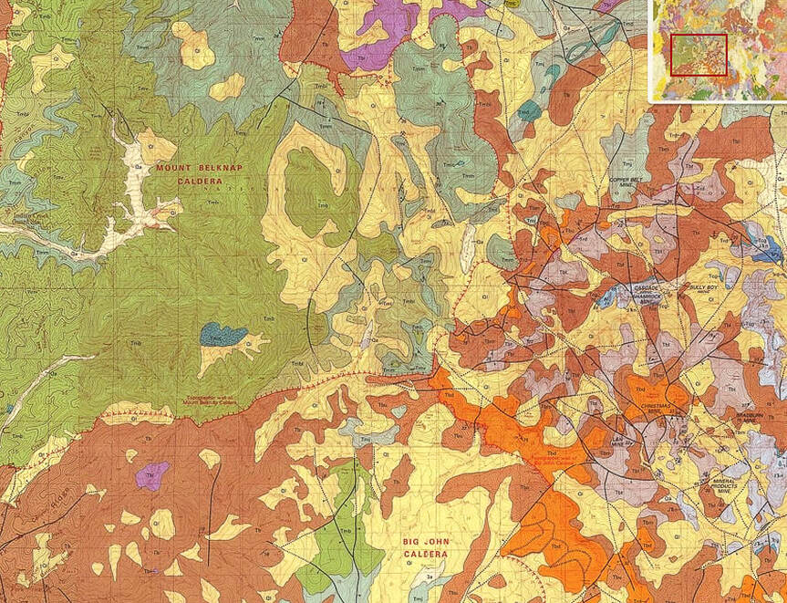
A small part of the geologic map of the Tushar Mountains that shows rock units and structural features of the highest part of the range.
click on photo for complete geologic map of the Tushar Mountains
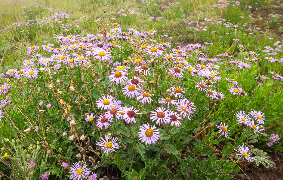
Fleabane
Liking the cool moist air!
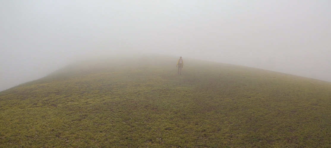
Are you sure this isn't Scotland?
Nearing Delano Peak's summit.
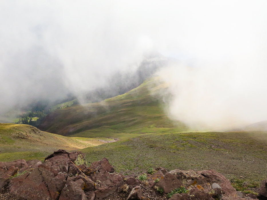
Looking down from near the summit.
Clouds beginning to clear on the lower hike down.
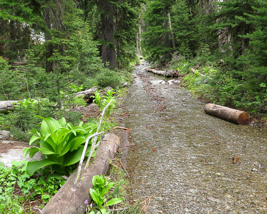
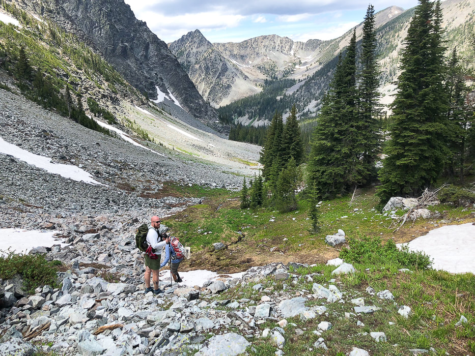
Some cool stuff on the trail.
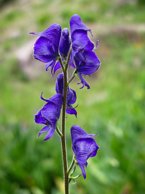
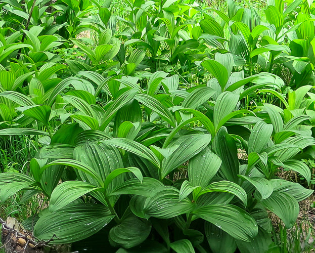
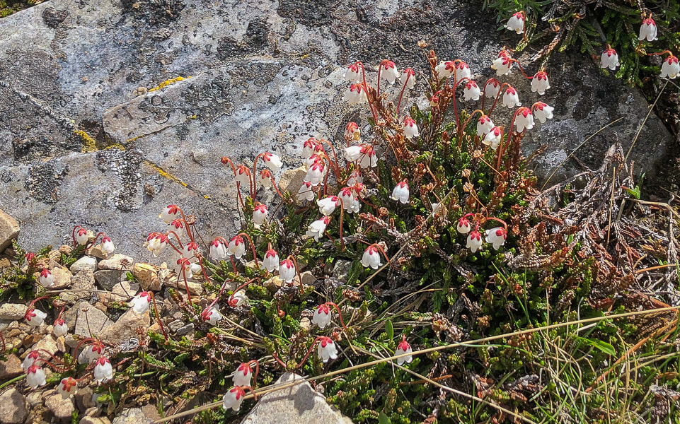
Columbian monkshood found near small streams.
These wildflowers like to grow in rich, moist soils - water use is high. They are poisonous to humans if ingested. 
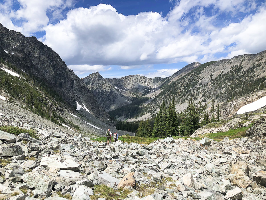
Skyline National Recreation Trail heading southeast toward Mt. Holly on right horizon.
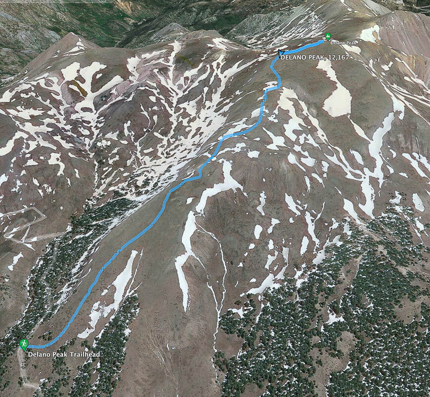
Google Earth image of our GPS tracks to Delano Peak. North points to the top left of the photo.
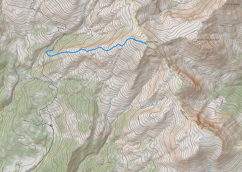
Caltopo image of our GPS tracks: North points to top of photo. Mount Holly located on ridge lower right.
AllTrails map with GPS tracks on the Skyline National Recreation Trail: Big Flat Trailhead (south) to Mud Lake (north).
click on map for link to AllTrails website.
References:
Cunningham, C.G., Rasmussen, J. D., Steven, T.A., Rye, R.O., Rowley. P.D., Romberger , S.B., Selverstone. J. 1998. Mineralium Deposita, 33:477. Delano Peak - Wikipedia Geologic map of the Tushar Mountains and adjoining areas, Marysvale volcanic field, Utah. USGS National Geologic Map Database. Mindat.org. Marysvale Mining District. Plant Database: Aconitum columbianum. The University of Texas at Austin website. Ringholz, R. C. Uranium Mining in Utah. Utah History Encyclopedia. Steven, T. 2013. Igneous Activity and Related Ore Deposits in the Western and Southern Tushar Mountains, Marysvale Volcanic Field, West-Central Utah: USGS Professional Paperback.
2 Comments
Follow Freeman Creek in the lush Beaverhead Mountains to a high pass on the Idaho/Montana border to look over Upper Miner Lakes, still partially covered by snow in July.
Standing on the Continental Divide - Montana/Idaho border overlooking the highest of the Upper Miner Lakes and Sacajawea Peaks across the lake.
Related in Explorumentary
Alpine Peak, 9,861': Sawtooth Mountain Wilderness - Never Stop Climbing Mountains Leatherman Peak, 12,228': On Top of Idaho Mackay Peak, 10,273', and Mackay Mine Hill Tour - Idaho Reward Peak, 10,074' via Upper Redfish Lakes - Sawtooth Mountain Wilderness Complete list of Idaho hikes on this website Upper Redfish Lakes Cross-Country Hike - Sawtooth Mountain Wilderness Moving Makes You Feel Better: The Latest Research
Overview
The Freeman Peak Trail (#6033) out of Carmen, Idaho, just north of Salmon, follows an old mining road past the climbing route to Freeman Peak's east flank, through a glaciated cirque to the 3,100-mile Continental Divide Trail on the Idaho/Montana border. The pass affords a "wow!" moment with a great view of Montana's Upper Miner Lake, 400 feet below, surrounded by snow-covered jagged mountains. During its almost 4,000-foot gain, this hike will take you from relatively dry and sparse woodlands, through a lush forest with water tumbling over the trail, to alpine tundra above tree line. Rain storms the past few days seemed to leave water everywhere: white water rumbled in Freeman Creek and drops of moisture dotted leaves. Freeman Peak dominates the Salmon skyline to the northeast. The Salmon-Challis National Forest is a pretty incredible place. It's one of the largest national forests in the lower 48 states. It contains most of the land mass of the second-largest wilderness in all of the U.S., named Frank Church River of No Return Wilderness. The Middle Fork of the Salmon River runs unrestricted through this wilderness - "perhaps the best river trip in the world" - according to the website, Whitewater Guidebook. Our trip to escape southern Utah's searing heat included a climb up the Wasatch range's highest summit, Mount Nebo on the way up to Salmon, Idaho. We were familiar with this "neck of the woods" since we had spent 20 fantastic years living in Boise, and had done many hikes in Idaho. We stayed at a wonderful Carmen Airbnb that had beautiful horses and green pastures.
Our Hike
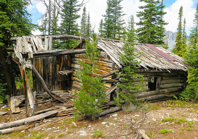
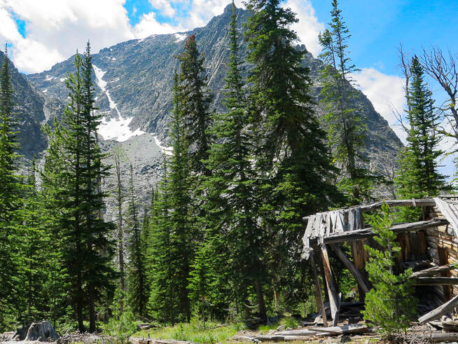
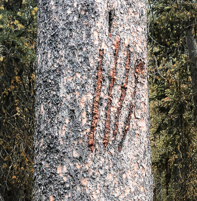
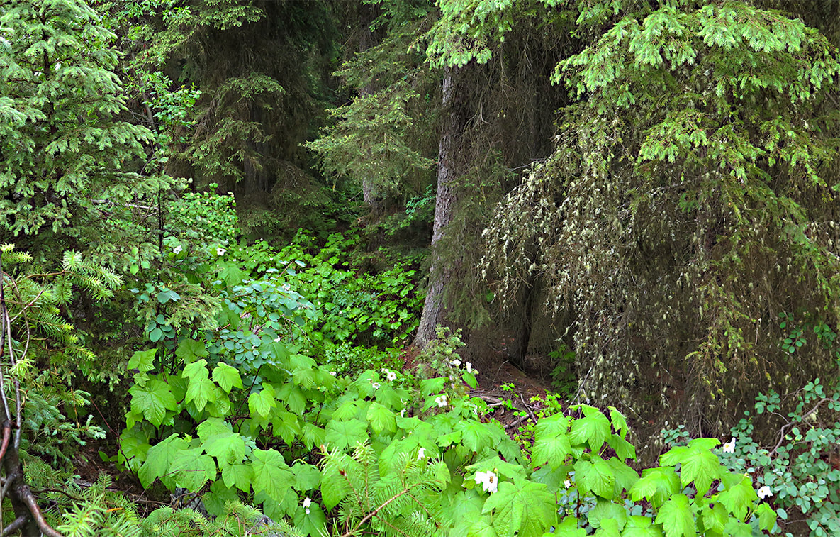
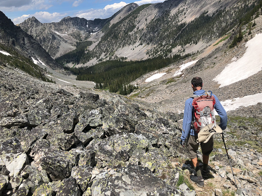
Trailhead to cabin at base of Freeman Peak - 4.6 miles To avoid driving on the steep, narrow access road along Freeman Creek, we parked at the "flat" intersection of Freeman Creek Road and a road that heads due south toward Golway and Kirtley Creek (three miles after taking a right off of Carmen Creek Road). You can drive up further than we did, and we saw a small pick-up parked higher up on the way back, but it gets pretty narrow. Our walk took us quickly to Freeman Creek rushing noisily beside us, thick vegetation blocking our view of waterfalls. The road/trail climbs steadily east-northeast with one good view of the small stepped waterfalls in Freeman Creek. As with many mining roads in Idaho, it traverses a large talus slope, flattening its base as it goes, and then enters the dense forest. We met Eric, a hiker that caught up to us while we took a break. He had his bear spray canister mounted on his pack's chest strap. We had seen bear claw scratches on one tree (see below). He ended up hiking with us the rest of the way in this bear country - safety in numbers! He was a great hiking companion and he said his wife felt better knowing he was with other hikers. Run-off from side creeks flowed over the road for a few stretches. The looming point of Freeman Peak comes into view through the trees. A sturdy log cabin sits at its base looking at the steep, snow-filled couloir, the daunting route up Freeman Peak. According to a hiker we met on the trail who had summited it a few times, it's better to climb it with someone who has done it before. It seemed a bit much for me, but I could be talked into trying Freeman Peak with a guide. Tom Lopez, in his book Idaho: A Climbing Guide, states that "This route involves sustained Class 3 climbing and route-finding difficulties. The route can be very slippery when wet or icy." Ore Cash Mine, extracting gold from 1897-1912 is near this site. Cabin to Continental Divide at 5.9 miles The road continues past the cabin, ending at tree line. From here, hiking toward the lowest point on the horizon (the pass), we eventually found a trail that ascends to the pass for ~ 0.5 miles. We picked our way through this alpine terrain strewn with rocks and low-profile wildflowers, including one of my favorites, Western Moss Heather. It also grows on the slopes of Alpine Peak in the Sawtooth Mountain Wilderness. It was great to have Eric hiking with us because we got another source of encouragement. The view we three saw from the Continental Divide was about as picture-perfect as you can get. We stood on packed snow overlooking a small steel-blue lake surrounded by the Beaverhead Mountains, with snow clinging to steep talus fields and couloirs, the clouds reflecting in the water. The actual Continental Divide Trail avoids these high peaks and steep terrain; it heads in an easterly direction just north of Freeman peak to traverse by lakes. In Summary.... There's a feeling of celebration when you head back to the trail head, a subconscious bonding with your fellow hikers. Inspiring scenes, camaraderie and movement combine to create a certain elation, not to mention the good brain chemicals that are released during exercise in nature. Movement makes you feel better! On our way down the alpine valley, most of the clouds had drifted away, and the forest we had ascended was now illuminated by the sun. It's one of those transient scenes - a fleeting moment of time that I add on to all of the treasured memories I have accumulated while feeling so small in the grandeur of the American West.
"I never knew a man who felt self-important in the morning after spending the night in the open on an Idaho mountainside under a star-studded summer sky."
- Frank Church, former U.S. Senator from Idaho, instrumental in creation of Idaho's River of No Return Wilderness in 1980.
Stay Curious! Keep On Exploring!
For the Geocurious: Ore Cash Mine
This trail gets close to the remains of cabins and some equipment of the Ore Cash Mine. Gold was the primary mineral mined from Oro Cache Mine (on map called "Ore Cash" mine) between 1897 and 1912. The host rock was quartzite (metamorphic quartz sandstone) of neoproterozoic age (1/2 to 1 billion years ago). The deposits were from four veins; the Oro Cache vein was 4-6 feet wide in a shear zone (zone of strong rock deformation). There were 9 adits that became inaccessible in 1976. 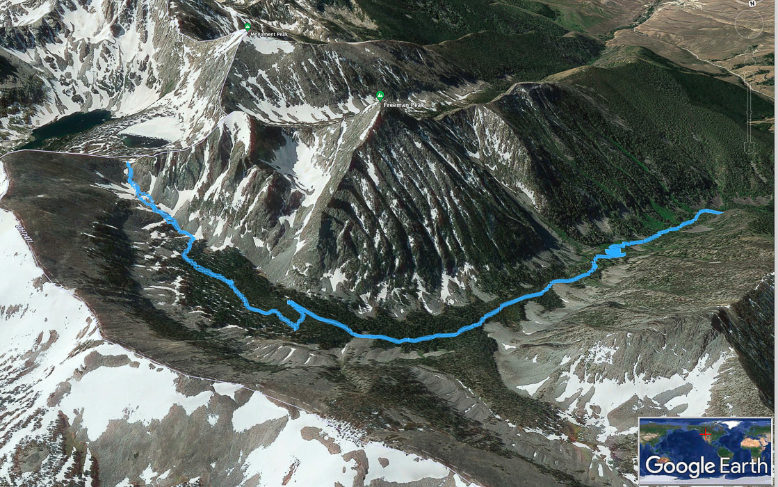
Our GPS tracks on Freeman Peak Trail, trailhead to the right, trekking around the base of Freeman Peak to the Continental Divide on left side of map. North points toward bottom of photo. Salmon, Idaho is in valley to the south, at top right in photo.
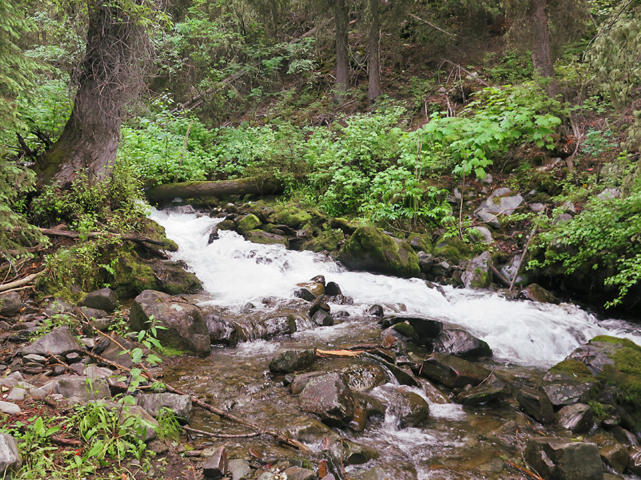
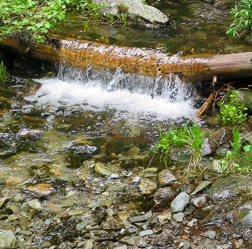
Freeman Creek
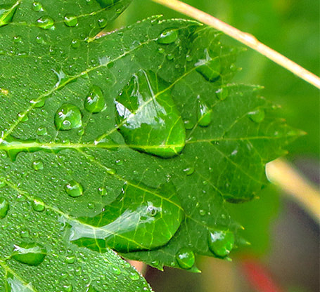
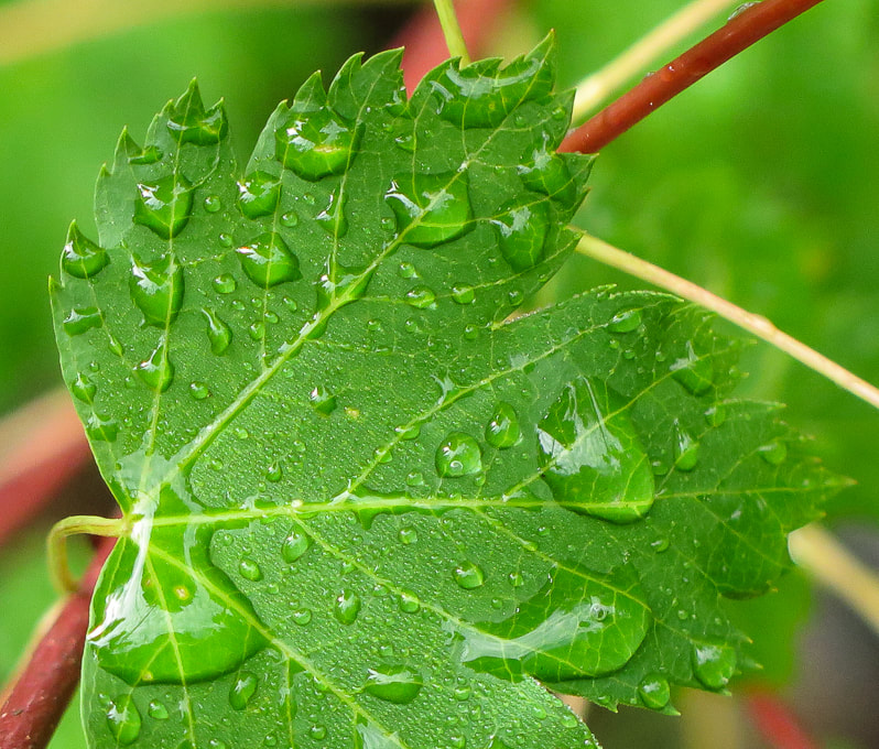
Freeman Creek in July!
Water flowing over trail in a few places.
Some cool stuff on the trail.
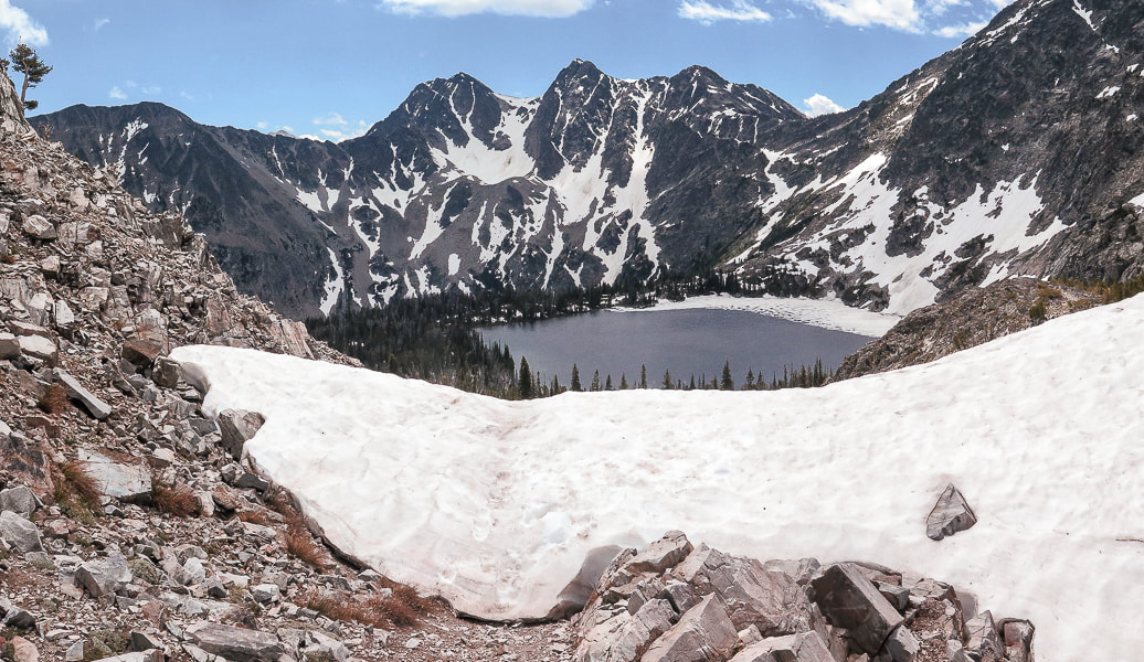
Reaching the pass at the continental divide; Montana's Upper Miner Lake below.
Heading back toward Freeman Creek head waters.
Western moss heather
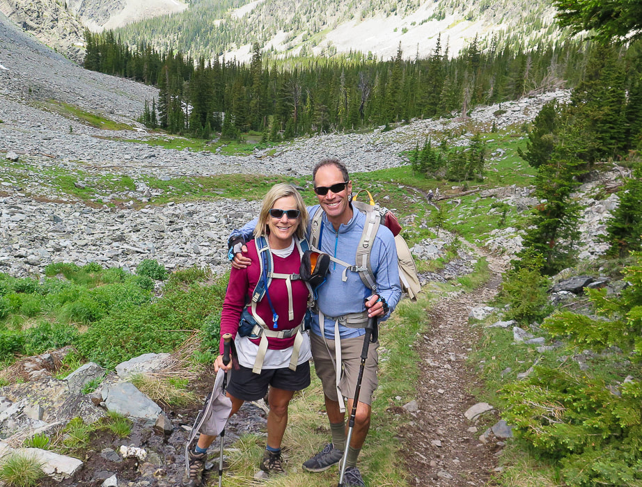
Sue and Fred on the way down towards remains of Ore Cash Mine.
Looking northwest to Copperhead Peak (right horizon) - another peak seen from Salmon, Idaho.
Click on interactive map of our GPS tracks.
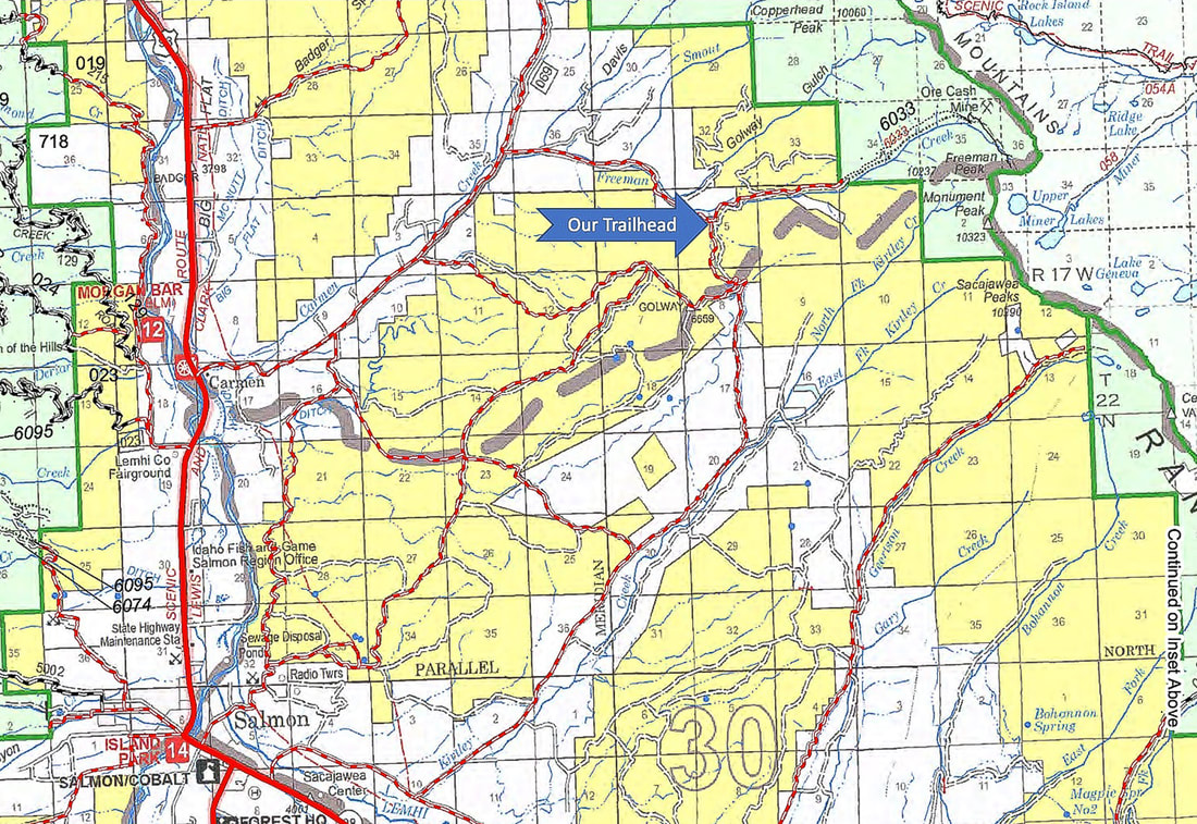
Map of roads from Salmon, Idaho to our trailhead.
from Salmon-Challis National Forest, Idaho - Visitor Atlas 2020. 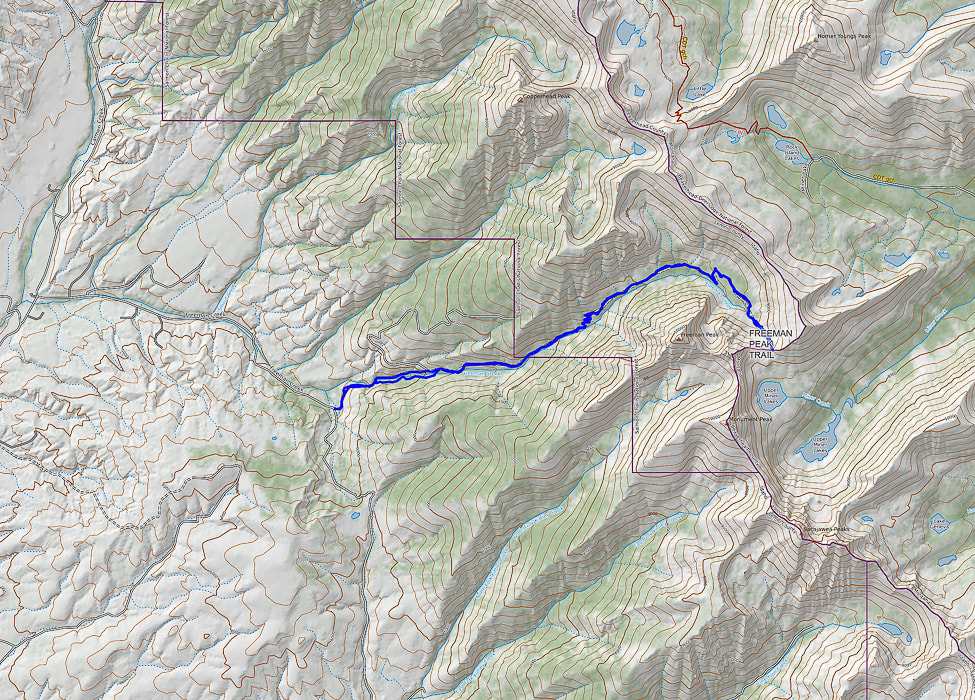
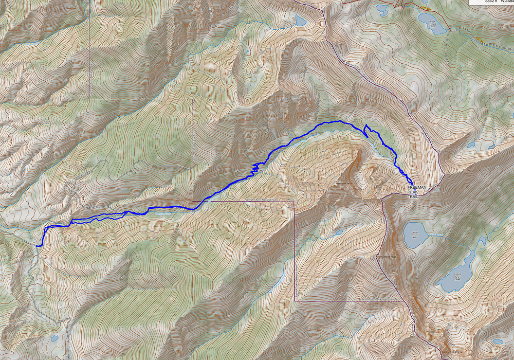
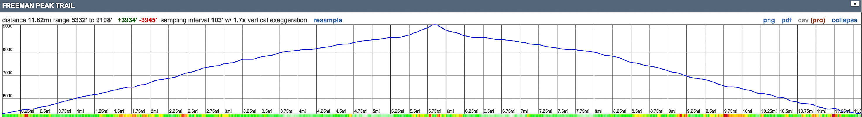
Our GPS tracks and elevation profile for Freeman Peak Trail hike. North points to top of map. Trail head on left; Continental Divide (Idaho/Montana border) on right.
|
Categories
All

Sue and Fred

About this blogExploration documentaries – "explorumentaries" list trip stats and highlights of each hike or bike ride, often with some interesting history or geology. Years ago, I wrote these for friends and family to let them know what my husband, Fred and I were up to on weekends, and also to showcase the incredible land of the west.
To Subscribe to Explorumentary adventure blog and receive new posts by email:
Happy Summer!

About the Author
|