|
Cassidy Arch is only one feature of many on this spectacular hike on the Waterpocket Fold that will capture your imagination and make you feel minuscule as you hike over open slickrock and between towering walls.
Related:
Utah's Red Rock Country Hiking Mt. Kinesava, Zion NP Southern Utah Hiking/Biking in a Pandemic: Snow Canyon State Park, Wire Mesa, and Zion NP Red Mountain Primitive Trail, St. George, Utah In Search of the Rattlesnake Petroglyph Desert Plant Photos 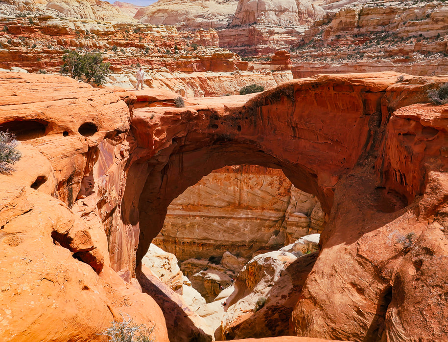
Fred (upper left) standing on top of Cassidy Arch, Capitol Reef NP.
Trip Stats
Overview: Maximize your already overloaded visual experience in Capitol Reef by hiking a trail less-traveled to Cassidy Arch, then descending through the soaring heights of Grand Wash. The only drawback on this spectacular loop is the 2.6-mile walk on the park's road (Hwy 24) back to the trailhead. Location: Hickman Bridge Trailhead, 2 miles from Capitol Reef NP visitor center on main park road. Coordinates: Trailhead: 38.287936, -111.226906.
Difficulty: Moderate Class 1 with signs and rock cairn markers.
Permit/Fee: $20 for private vehicle pass good for 7 days. Navigational aids: Hiking Map and Guide - Capitol Reef National Park (topo map), Stav Is Lost's route description. Date Hiked: April 28, 2022. Geology: Capitol Reef NP encompasses its main geologic feature - the Waterpocket Fold, a nearly 100-mile crimp in the Earth (see "For the Geocurious" below.)
Our Hike
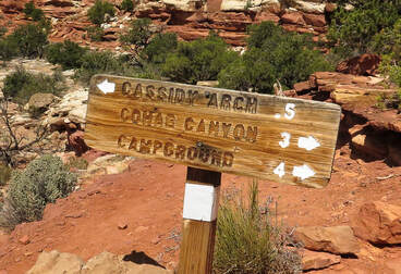
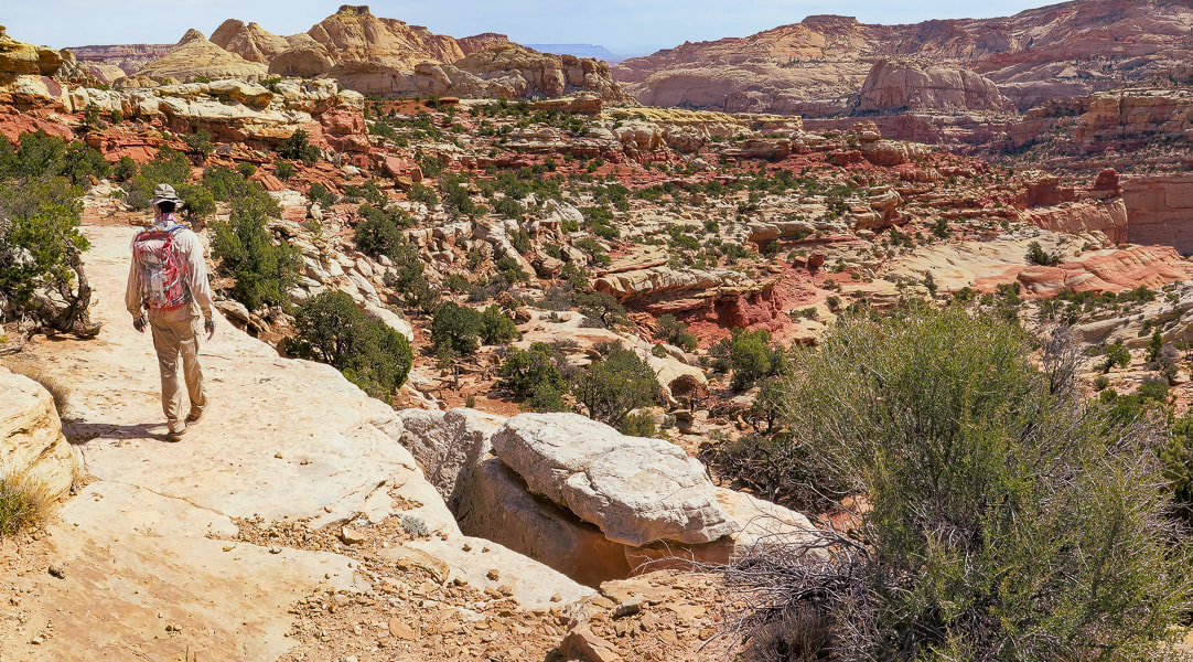
Seems like the last few hikes we've done have histories of late 1880's wild west rustlers and outlaws. Two of them - Mount Minerva Hoyt and Lost Horse Mountain in Joshua Tree NP look over valleys where cattle rustlers hid their "stock". Cassidy Arch, the premier feature of this hike is named after Butch Cassidy, leader of the "Wild Bunch" - bank robbers who hid in the remote canyons of Capitol Reef. Wild west characters - one of the many things I like about living in America's magnificent west. One of the best attributes of this hike is variety; Frying Pan Trail elevates you to a spectacular high point and a rock wonderland with eroding sandstone towers scattered about, then drops you down to the intersecting trail that leads you to Cassidy Arch's cavernous opening. The grand finale is a walk through a long deep canyon aptly named Grand Wash. To get back to our car, we had to walk on the main park road which snaps you out of a dream world of hoo-doos, warm-colored rock layers, scented junipers and ancient petroglyphs to bring you back to the real world of traffic and tourists. It would be optimal to have two vehicles - one at Hickman Bridge trailhead and one at Lower Grand Wash trailhead on Highway 24. Cohab Canyon/Frying Pan Trail Start at the sign for Frying Pan Trail/Cohab Canyon across and slightly down the main park road from Hickman Bridge parking. According to local lore, Cohab Canyon got its name because it was a polygamist hideout if lawmen came around. But, lack of diaries and documents from Fruita, the Mormon settlement at Cohab Canyon, indicate it's probably more lore than truth. Intersect with Frying Pan Trail in 0.55 miles, taking a left to head south under Frying Pan Peak. Cohab Canyon Trail continues to the right (west) to Fruita site.
Cassidy Arch Trail - out and back
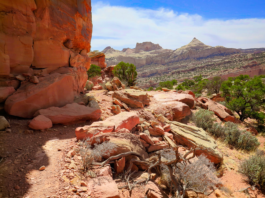
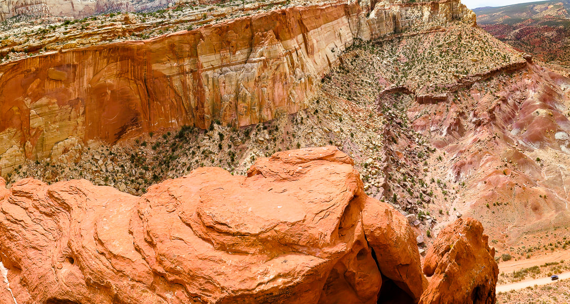
Hike over cairned and open slick rock 0.5 miles to Cassidy Arch where without warning the sandstone drops below to a spacious opening. It seems appropriate to be named after Butch Cassidy because it's hidden until you are practically on top of it. This a great place to take a break and watch people walk over its top. Stav is Lost describes a canyoneering trip report that begins next to the arch and does several rappels into narrows, a grotto and more arches, and ends up at Grand Wash Road and trailhead. Head back to intersection from which you came and take a right to descend on Frying Pan Trail for 1.0 mile to the intersection with Grand Wash Trail. Cassidy Arch looks like a big tunnel high up on the mesa overlooking Grand Wash. 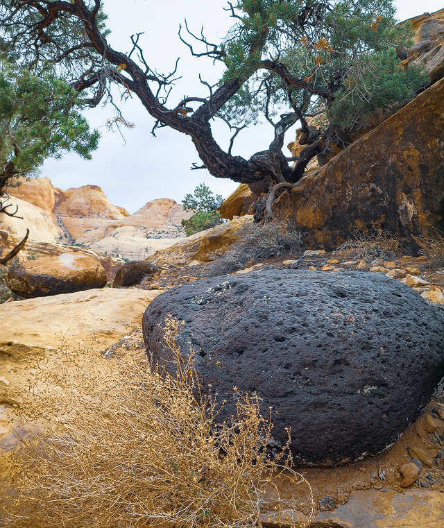
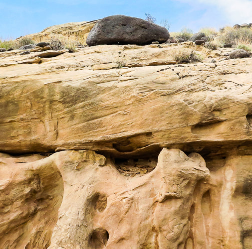
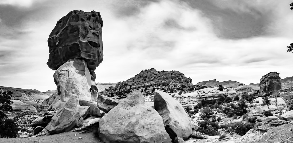
Large basalt flows erupted and accumulated in the Boulder Mountains, west of Capitol Reef 20 million years ago. These rounded and vesicular boulders are scattered about everywhere in Capitol Reef, brought there by melt-waters from glaciers that had spread out over the lava flows. Many miles of rolling and tumbling sculpted them into these beautiful shapes.
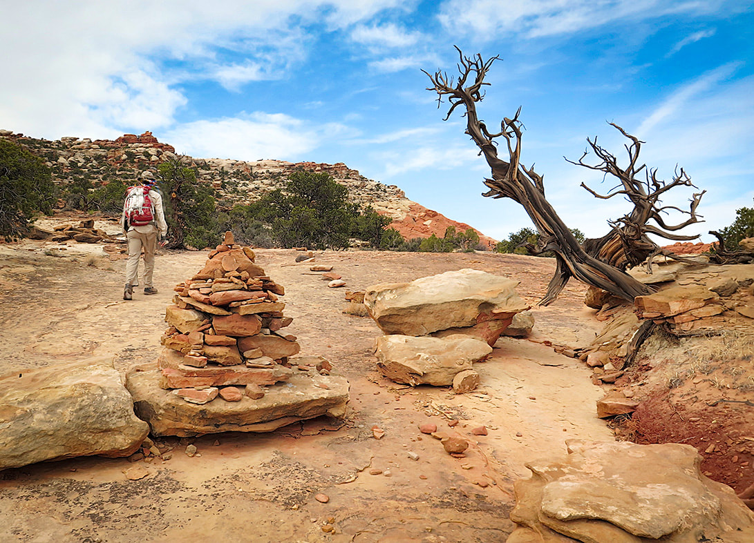
Frying Pan Trail is well-marked.
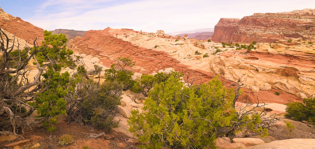
View from Frying Pan Trail to the southwest.
Those are some thick sandstone layers!
Topping off on Frying Pan Trail.
On the way down toward intersection with Cassidy Arch Trail. Fern's Nipple on the horizon. Great view of titled layers of the Waterpocket Fold.
Heading down toward intersection with Cassidy Arch Trail.
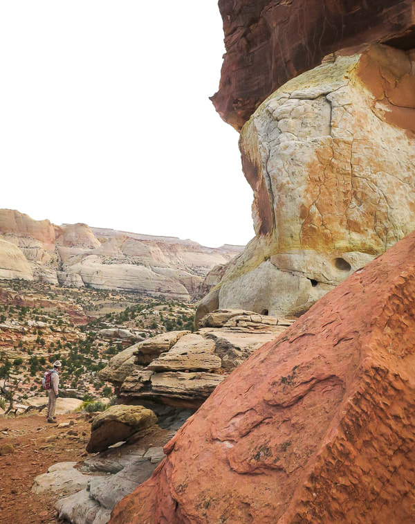
Cassidy Arch Trail swings down to the right: Cassidy Arch is under the sandstone on the right mesa - its opening on the left edge of that mesa. Fern's Nipple on left horizon.

Suddenly it's there: first view of Cassidy Arch.
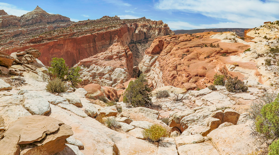
From Cassidy Arch looking down onto Grand Wash Road.
Grand Wash Trail
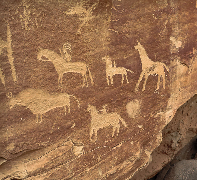
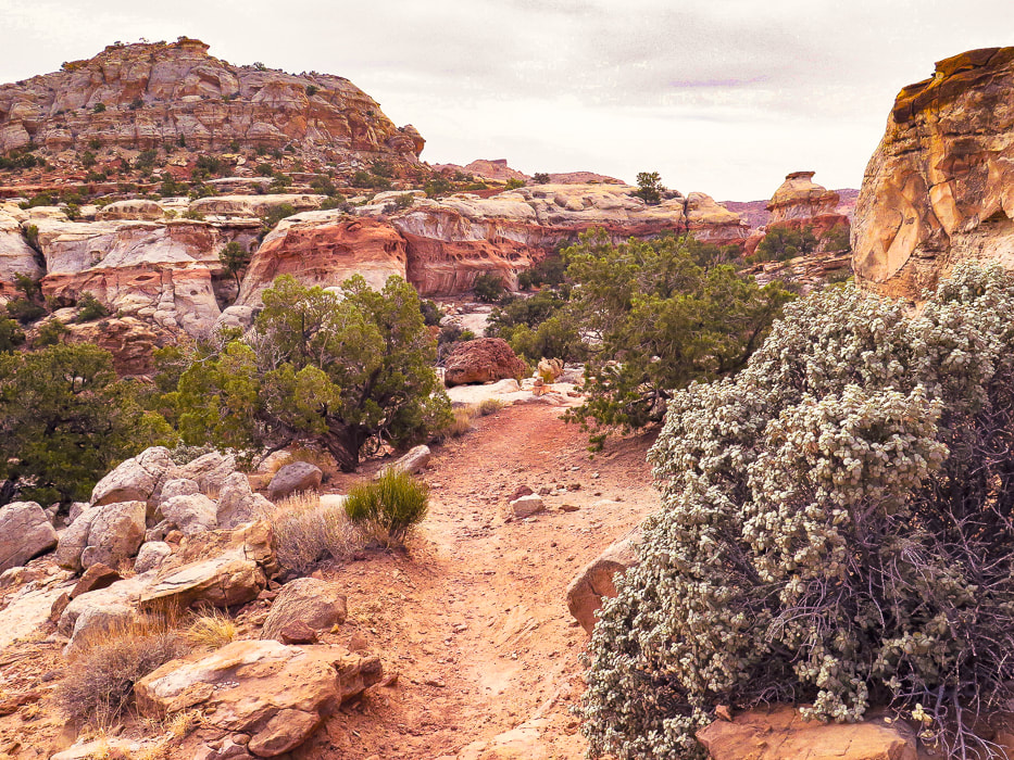
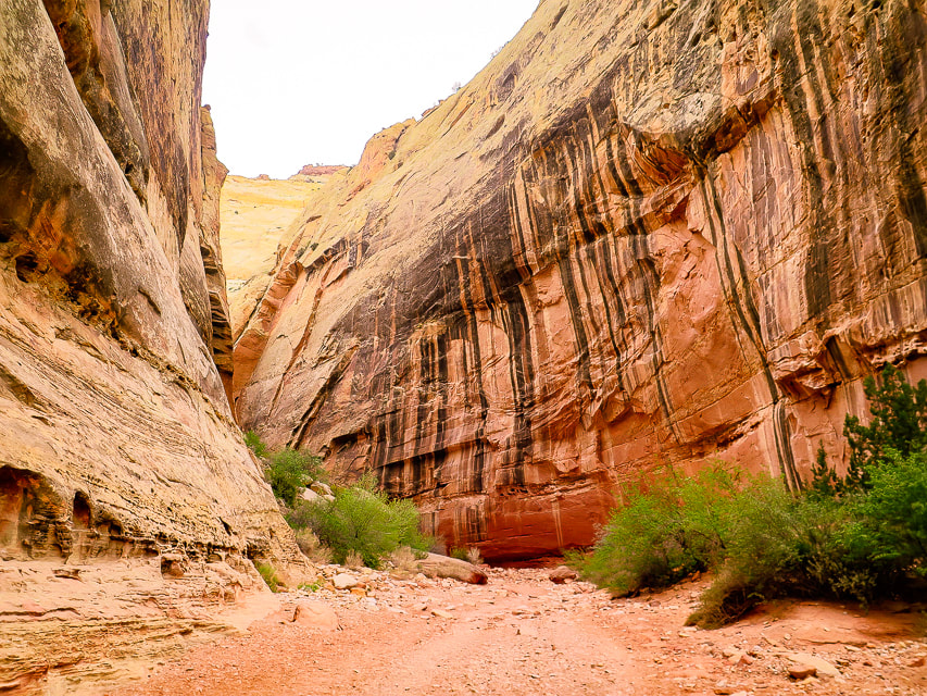
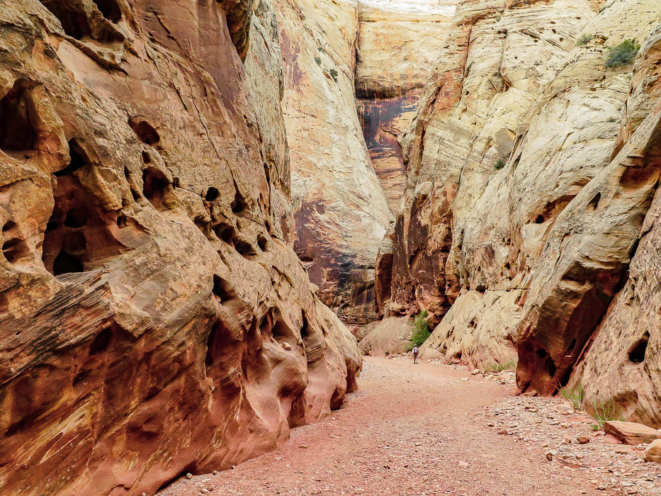
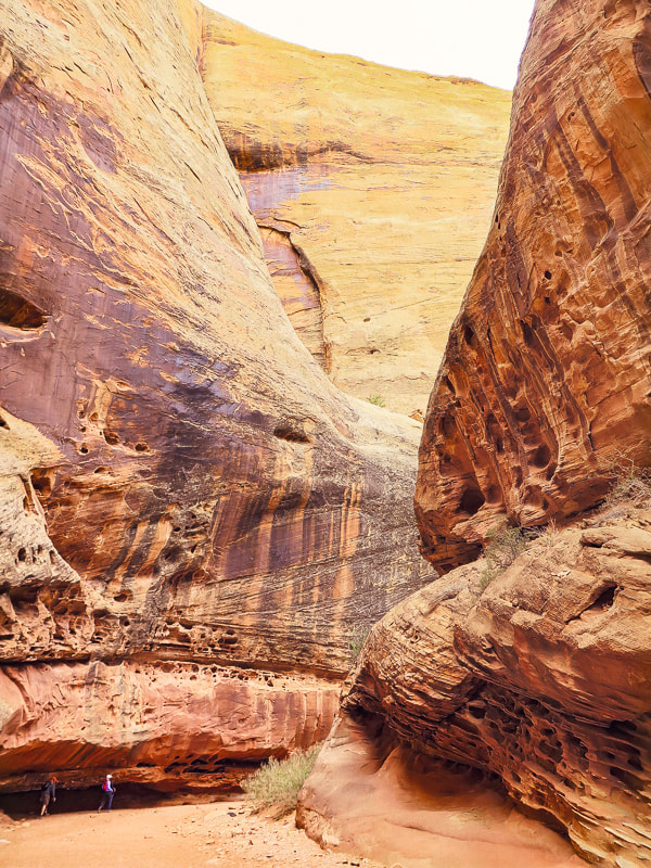
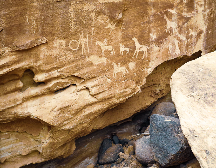
After you get back onto Frying Pan from Cassidy Arch, you'll probably run into hikers coming from the Grand Wash Trailhead to the southeast. Frying Pan Trail is longer but so beautiful and less populated. Grand Wash is a peaceful walk between high walls with dark stripes of manganese and iron minerals contrasting with orange and light yellow sandstone. There's many interesting erosion features such as honeycomb weathering, or tafoni - holes produced in the sandstone from water, wind and ice on surfaces facing the sun. Every turn, every bend brings another great sight to see. Petroglyphs, pecked into sandstone panels, appear near the end of the wash. I'm always intrigued by the people who made these - what did they look like? What tools did they use? What did they eat? I had a great time learning about them when I was writing my petroglyph post - In Search of the Rattlesnake Petroglyph. The road walk back to the trailhead was worth it - It's hard to top Frying Pan Trail - thanks to Stav is Lost for giving us the idea! There is so much more to explore in Capitol Reef, we plan on getting back to this incredible land. I recommend hiking Upper Muley Twist Trail off Burr Road in the southern part of Capitol Reef - it elevates you to an amazing view of the Waterpocket Fold.
Keep on Exploring!
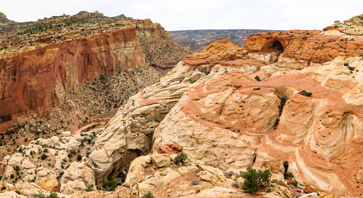
View of Cassidy Arch (top right) from Cassidy Arch Trail descending into wash with intersection to Grand Wash Trail.
Grand Wash
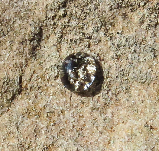
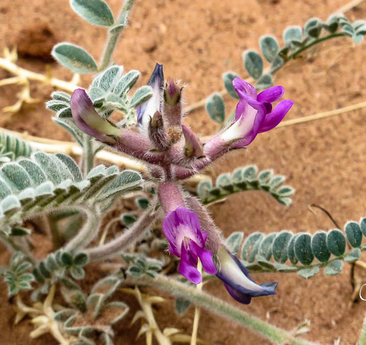
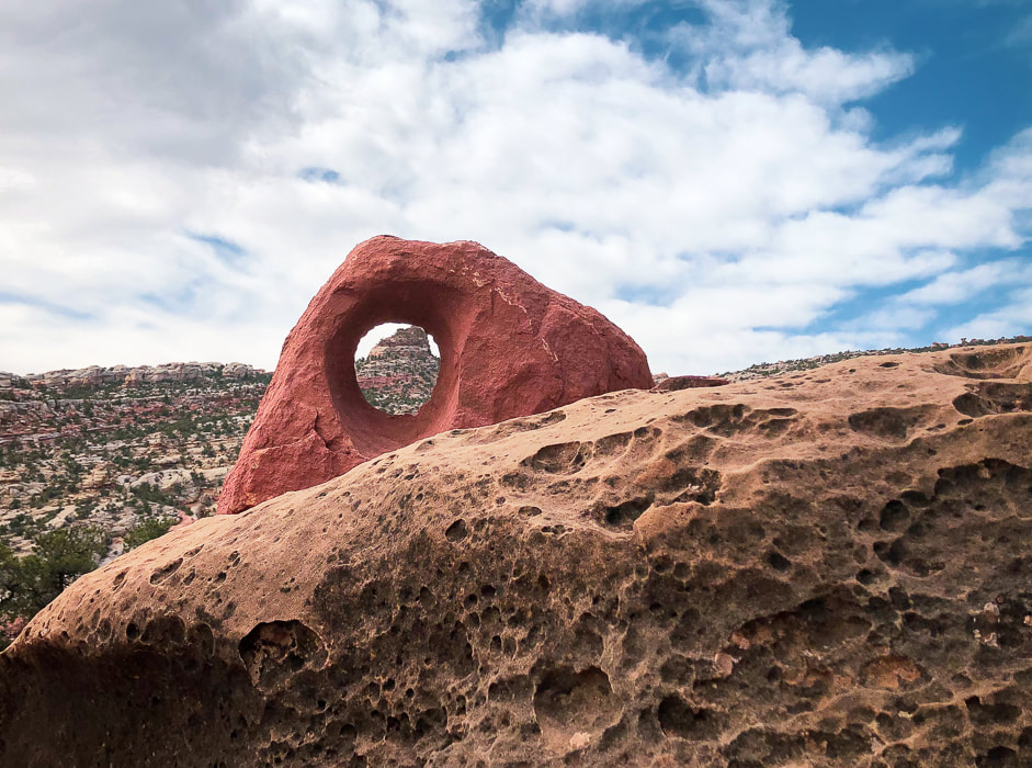
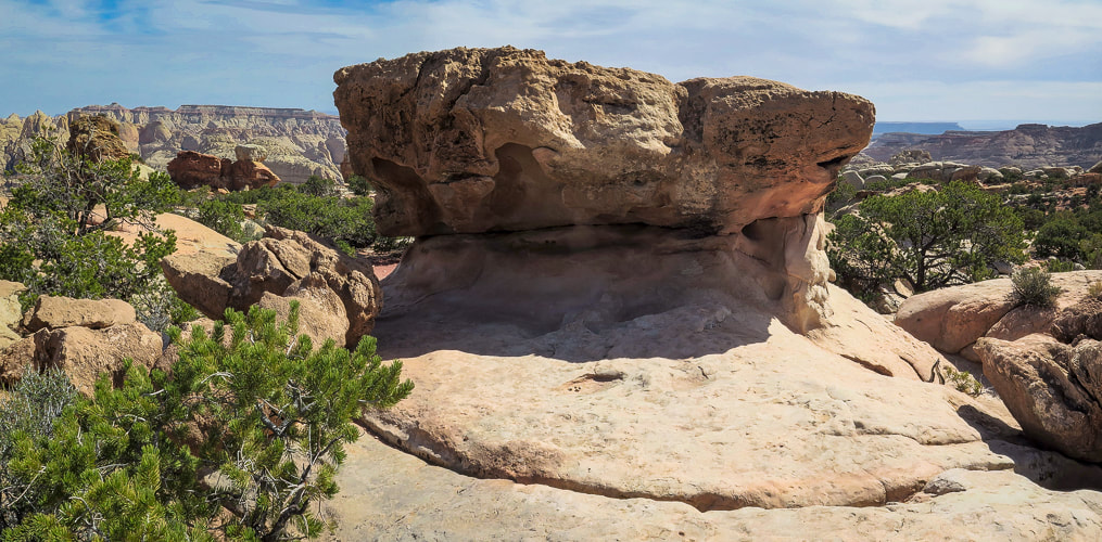
Some cool stuff on the trail: click on the milkvetch and petroglyph photos for more information.
For the Geocurious - The Waterpocket Fold
As national parks go, the map of Capitol Reef is unusual. It's long and vertical area encompasses the Waterpocket Fold, a part of the Earth created during the Rocky Mountain building phase ~ 70 - 50 million years ago. Horizontal rock layers were pushed up by compressional stresses on one side by an underlying fault, creating a classic monocline (mono = one, cline = incline), a steep "ramp" of rocks 4,000 feet higher on the west side than the east. It was further uplifted 15 million years ago, exposing more of the strata to erosion to create "waterpockets" - holes in the rock of varying sizes. Increased tilt of the layers created increased gradient of streams, which accelerated erosion. This unique geological phenomenon revealed strata laid down hundreds of millions years ago in red rock country that has weathered into domes, canyons, arches and cliffs. There are a few scenic loop drives in Capitol Reef NP - a popular drive is Notom-Bullfrog Road/Burr Trail/Scenic Highways 12 and 24 loop. Burr Road crosses the Waterpocket Fold and is incredibly scenic, giving ample geologic "feast for the eyes", especially for the "geocurious". 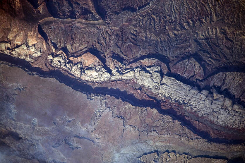
Image of Waterpocket Fold from NASA Earth Observatory
A good You Tube video features Capitol Reef park rangers describing in simple terms the creation of Waterpocket Fold:
Monocline Explained: Capitol Reef National Park 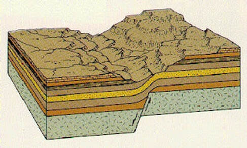
Illustration from Written In Stone - Seen Through My Lens of a classic monocline like the Waterpocket Fold. Compression in the brittle underlying bed rock causes faulting and folding with east-directed forces during mountain-building and the whole Colorado plateau was uplifted. The western block was pushed onto and over the east block causing the fold. This was initiated by the Farallon Plate sliding under the North American Plate.
Our GPS tracks for entire loop - on top of the Waterpocket Fold.
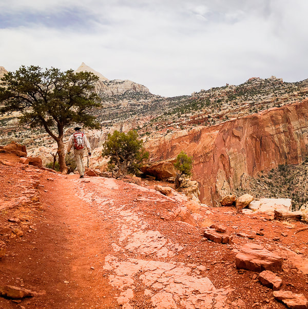
Fred in Grand Wash.
Grand Wash
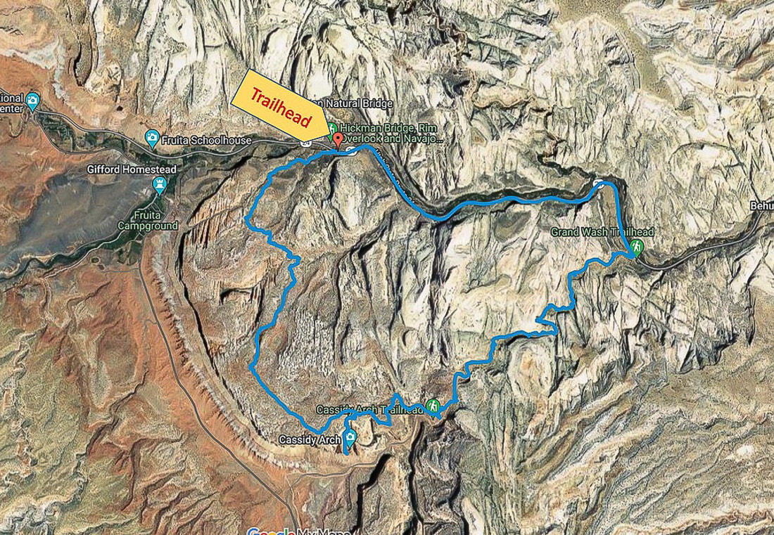
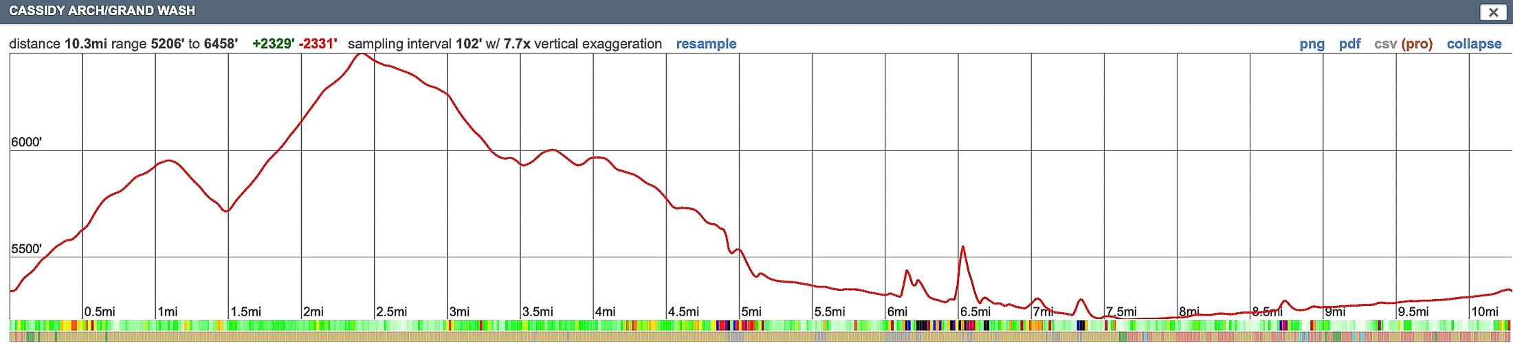
Our GPS tracks and profile. We hiked counterclockwise from Hickman Trailhead on Hwy 24 to Grand Wash Trailhead.
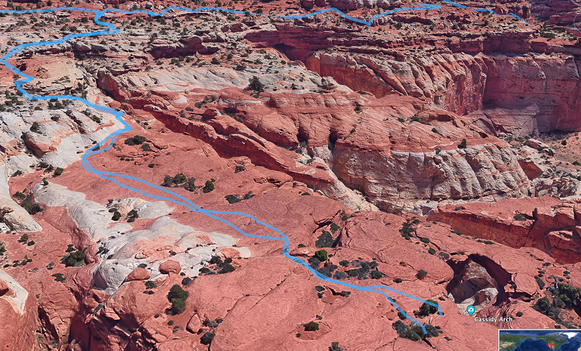
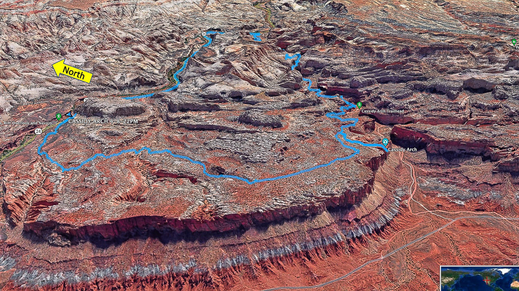
Google Earth image of our tracks from intersection of Cassidy Arch Trail/Frying Pan Trail (top left) to Cassidy Arch (bottom right).
References
Butch Cassidy- Outlaw - His Early Years. Capitol Reef Country (website). Wayne County Tourism. Capitol Reef Administrative History. Chapter 4: Mormon Settlement. U.S. National Park Service. Capitol Reef: The Waterpocket Fold. Capitol Reef Country. Flight Plan: Part II – Geology of the Circle Cliffs Uplift and the Waterpocket Fold at Capitol Reef National Park. From website: Written In Stone - Seen Through My Lens. NASA Earth Observatory. Traces of an Ancient Watery World In Capitol Reef. Website entry on 5/2/22. Olson, V, Olson, H. 1990. Capitol Reef: The Story Behind the Scenery. KC Publications, Inc.
2 Comments
|
Categories
All

Sue and Fred

About this blogExploration documentaries – "explorumentaries" list trip stats and highlights of each hike or bike ride, often with some interesting history or geology. Years ago, I wrote these for friends and family to let them know what my husband, Fred and I were up to on weekends, and also to showcase the incredible land of the west.
To Subscribe to Explorumentary adventure blog and receive new posts by email:
Happy Summer!

About the Author
|