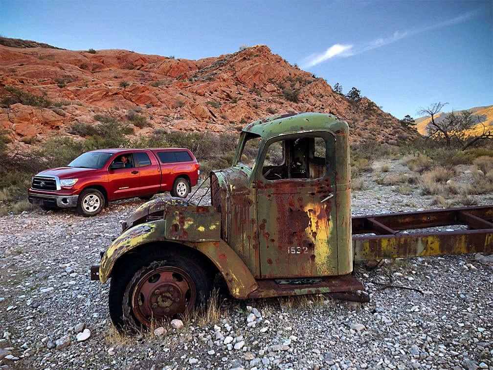
|
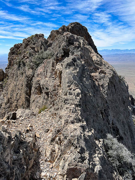
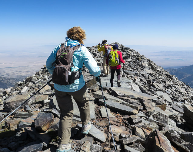
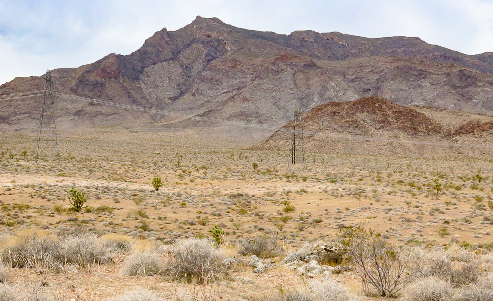
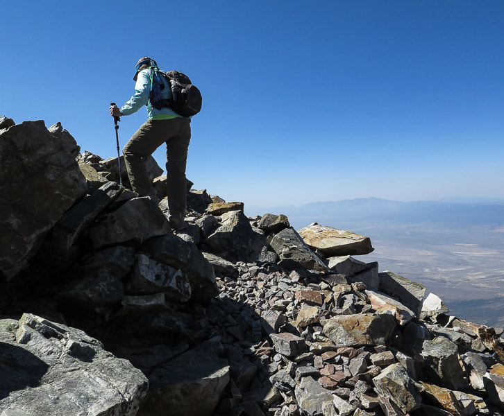
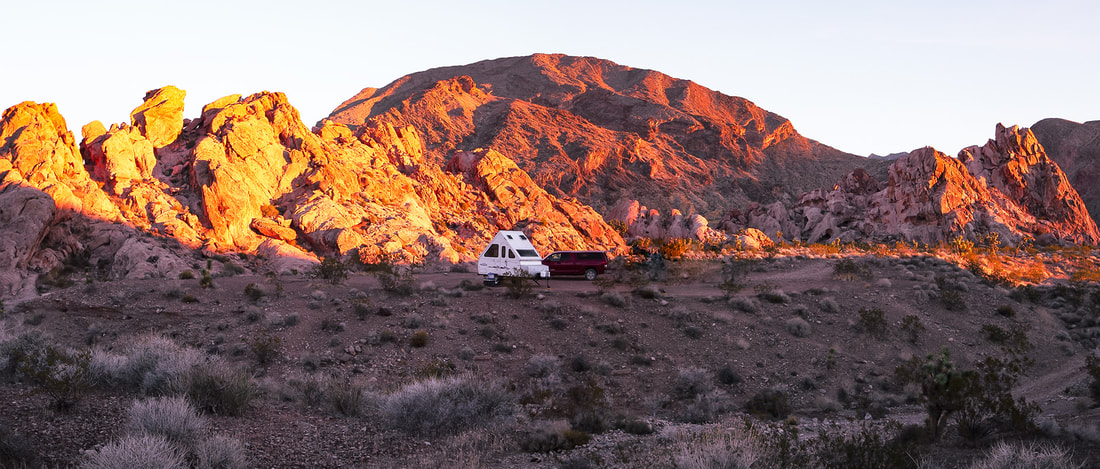
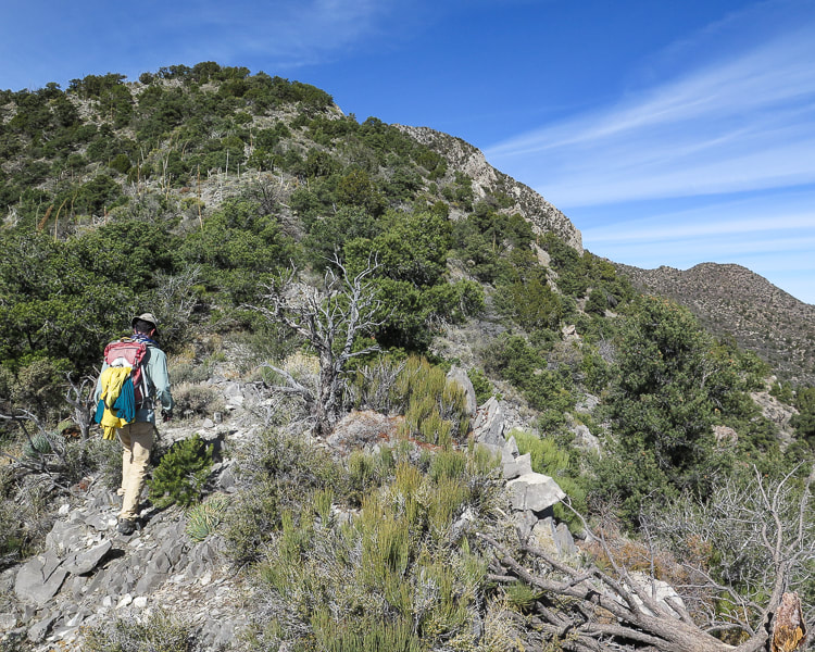
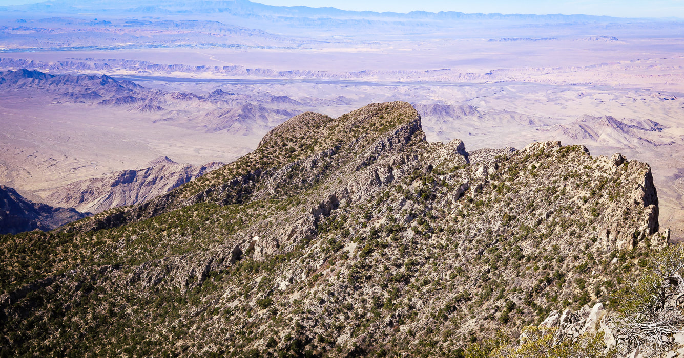
We met our match on Moapa Peak's fabled "knife edge" final ascent, and came within 160 feet of the summit.
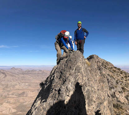
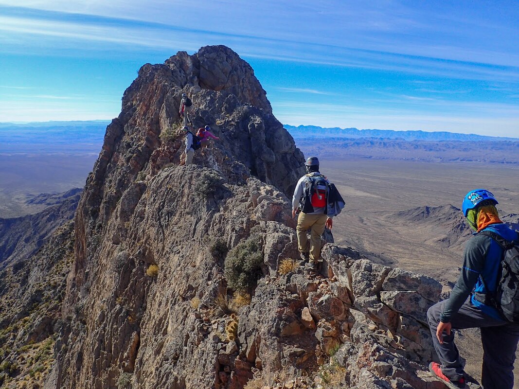
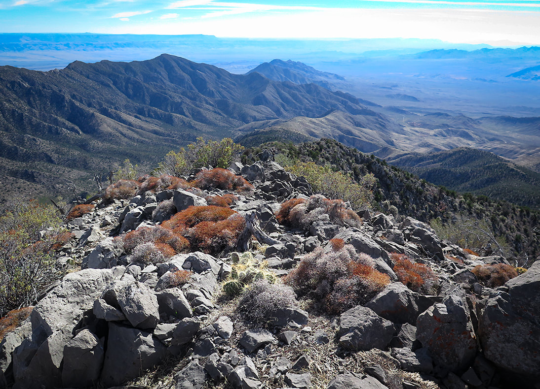
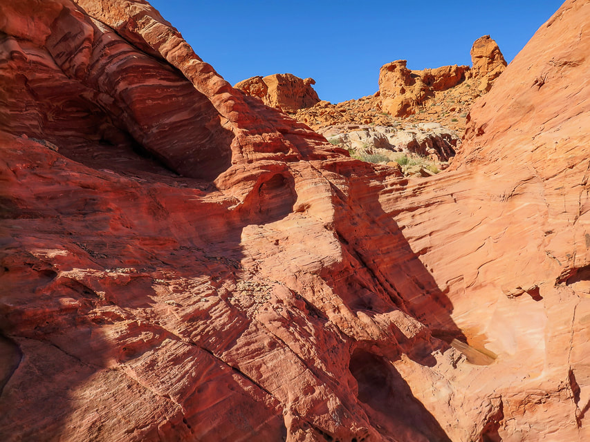
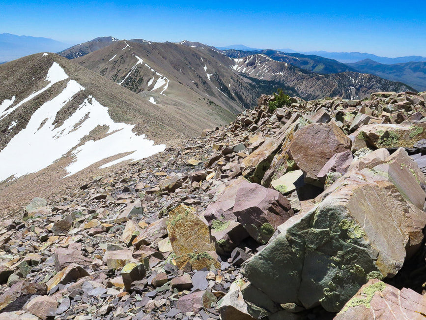
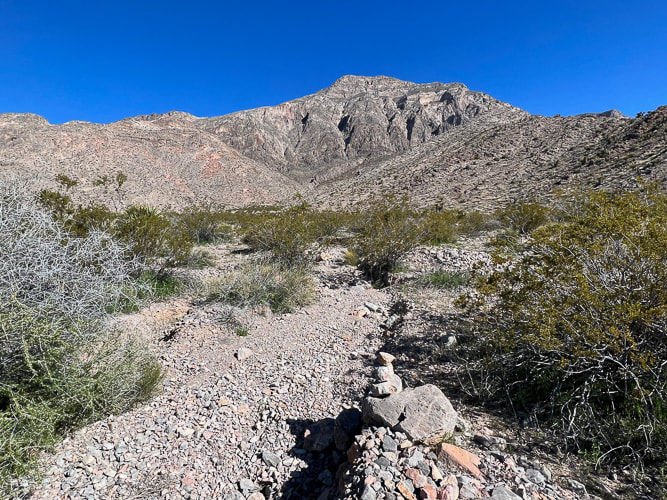
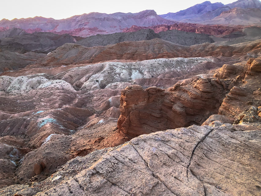
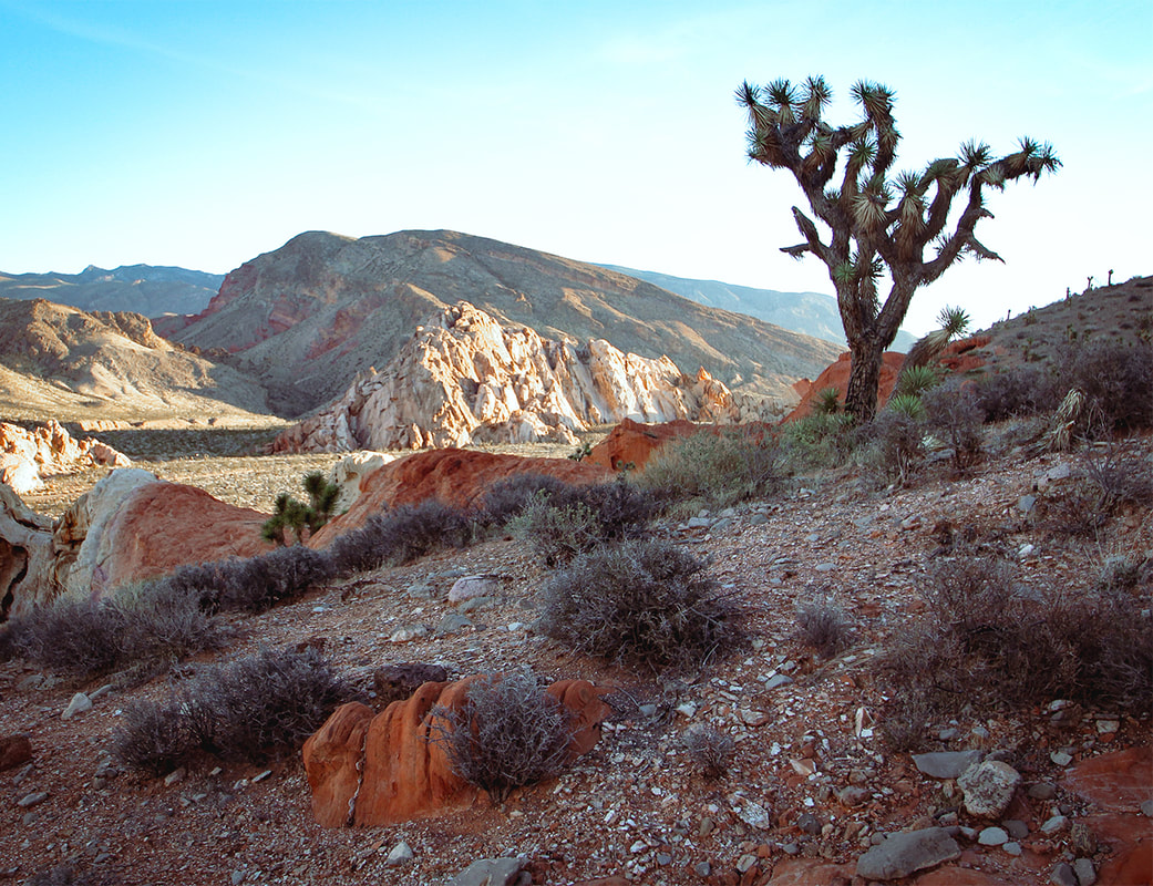
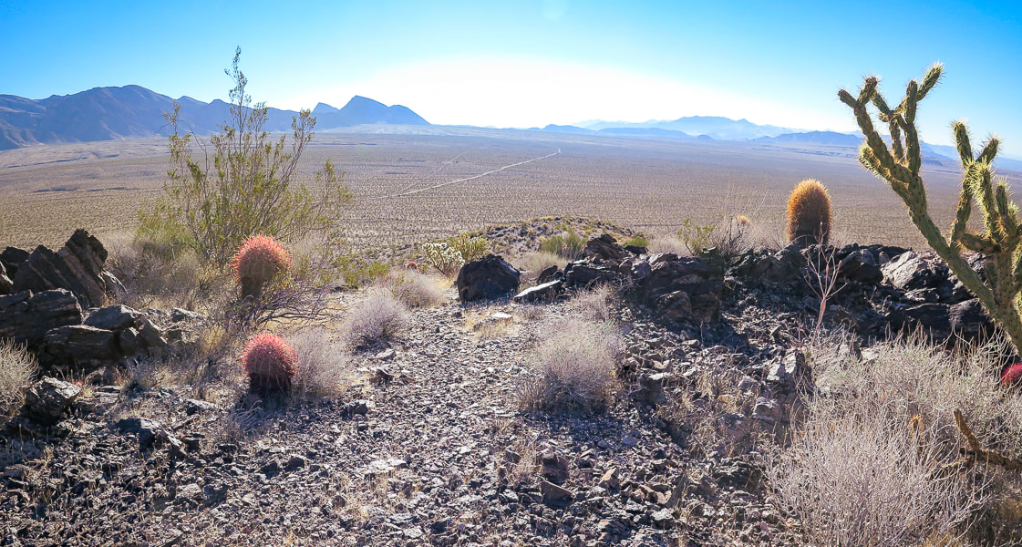
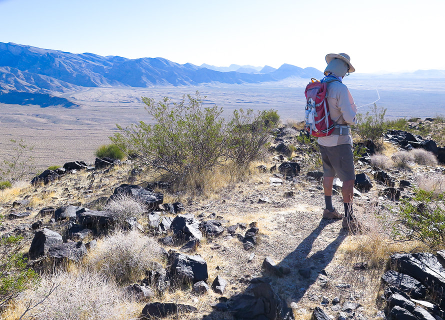
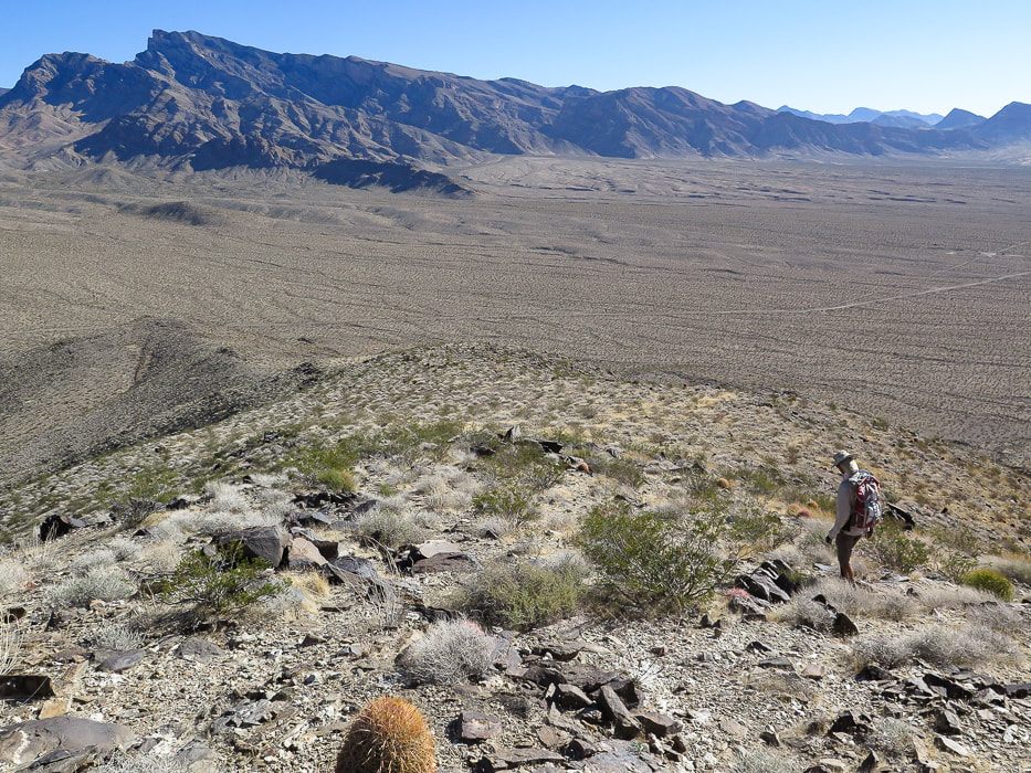
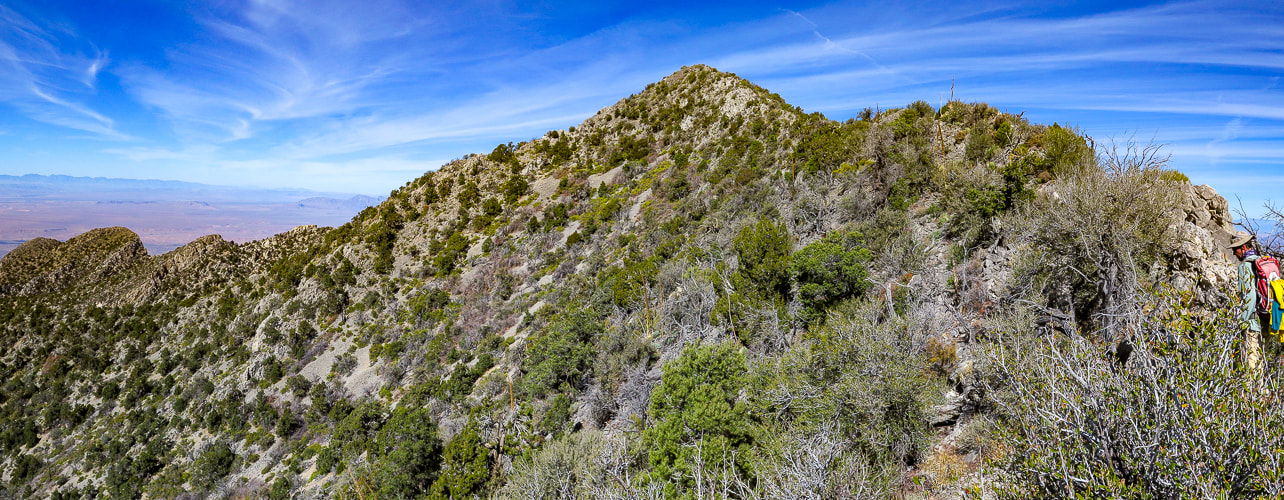
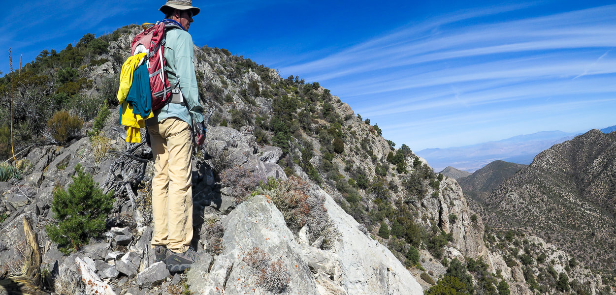
Left photo: the final ridge to Moapa's summit. We climbed 3,200' to the high point in the foreground (seen just under the summit in photo), then turned around because this knife's edge seemed too exposed. Right Photos: knife edge from The First Church of the Masochist website, whose party made the summit. Trip Stats
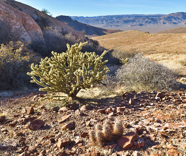
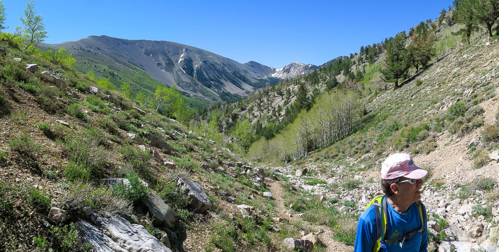
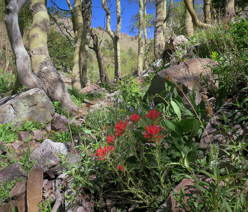
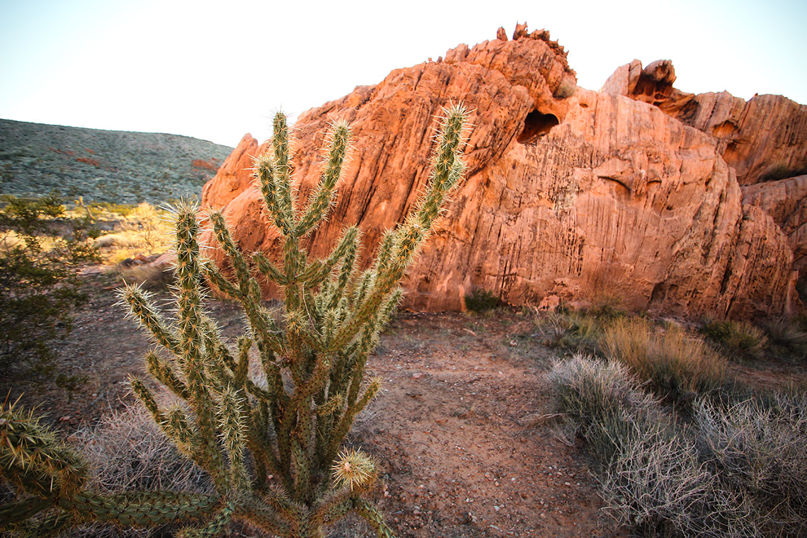
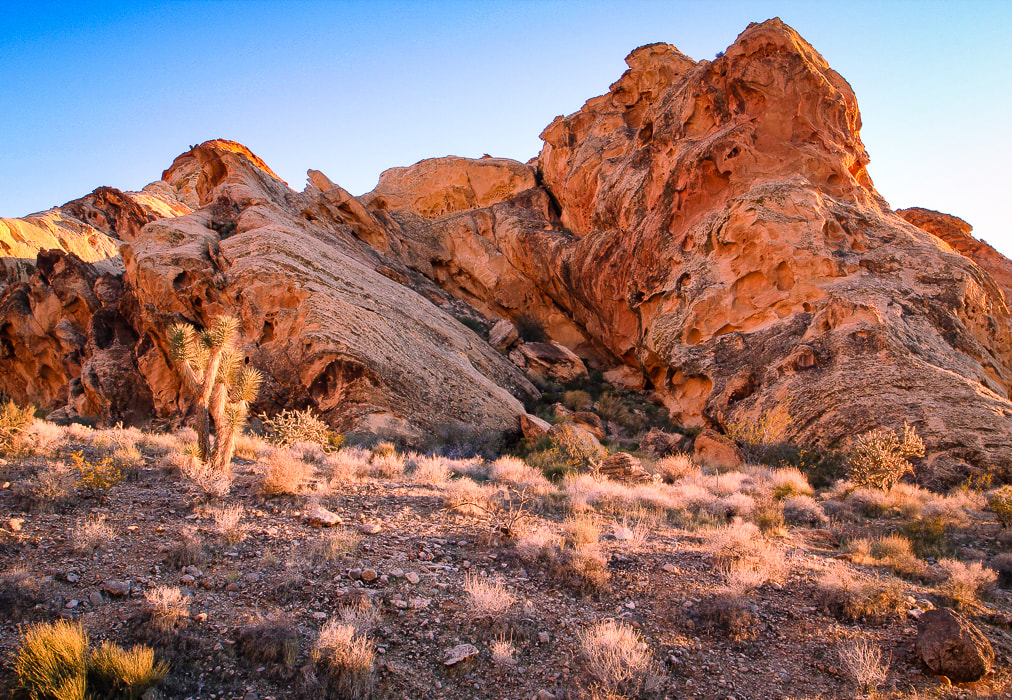
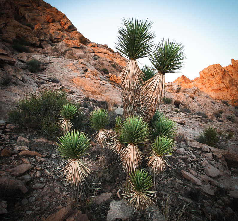
Overview: An enormous gray fin sticking out of the desert floor, Moapa Peak's knife-edge ridge tests the hiker's fear-of-heights-and-exposure factor. Ascend a pretty braided stream wash and then prepare for a steep, rugged climb over sharp limestone the rest of the way, negotiating a few Class 3 rock faces, paying close attention to rock cairns that mark an elusive trail that aggressively elevates you to sneak under Moapa's southern summit block. Gashes, chasms and sheer walls appear as you hike, with spectacular views of the empty desert far below. Descriptions of the final exposed ridge to the top include "exhilirating", "thrilling", and "incredibly fun." Location: Southeast Nevada, Mormon Mountains - Bureau of Land Management. Distance/Elevation gain: Trailhead = 3,134'. Summit = 6,471'. Our hike = 7 miles to 6,310'. To the summit = 7.3 miles. Difficulty/Navigation/Exposure: easy - moderate effort through wash, strenuous Class 2 and Class 3 on cairned trail, moderate to significant exposure (cliff edges or drop-offs 2-3 feet away) on final ridge. Navigation moderately challenging. Coordinates: Trailhead = 36.83395,-114.44132. Summit = 36.85856,-114.45. Date Hiked: April 2, 2023. Prominence: 1,671' Maps and Apps: Stavislost hike report, Bureau of Land Management - Nevada/Overton topo map. Geology: Paleozoic rocks of Mississippian period - 340 mya. Normal faulting due to Great Basin extension. Lists that contain Moapa Peak: Las Vegas Mountaineers Classics (rank #46), Sierra Club Desert Peaks Section (#52). History: Moapa Valley, south of Moapa Peak is famous for the cantaloupes it produces from its farmlands. Native American word "Mo-a-pa" means a valley or canyon with a large stream of water flowing through it. Related Posts:
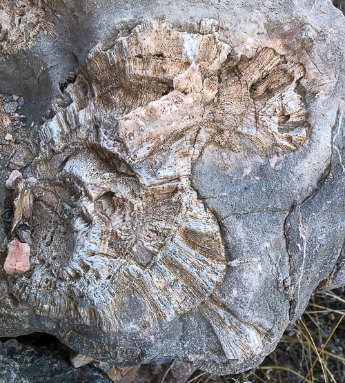
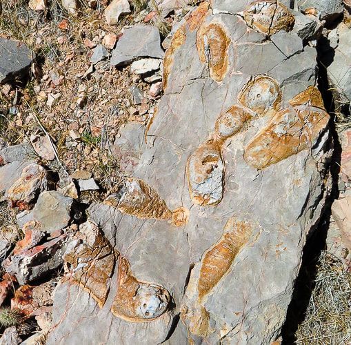
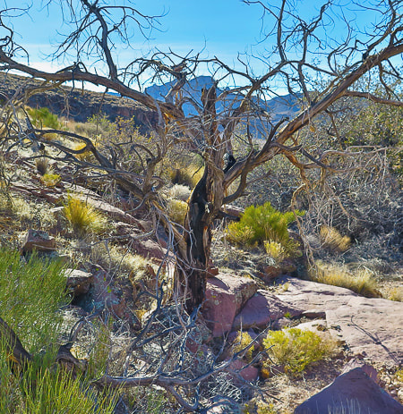
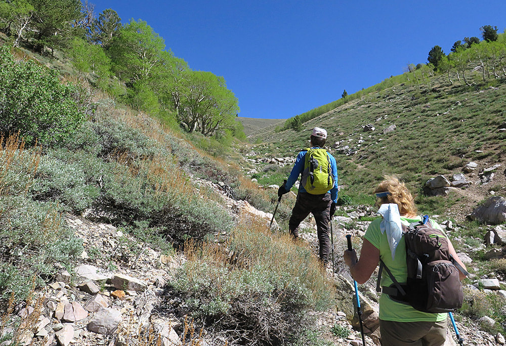
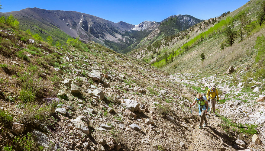
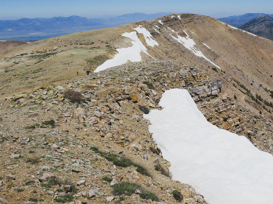
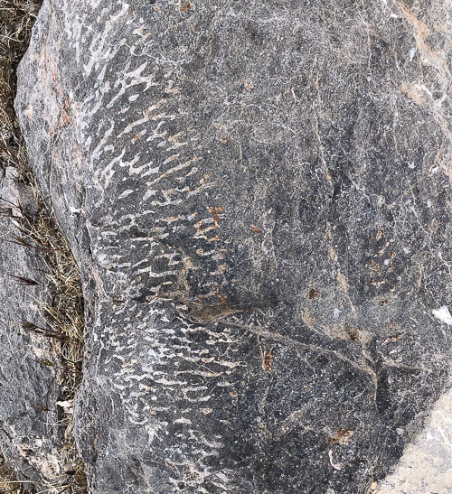
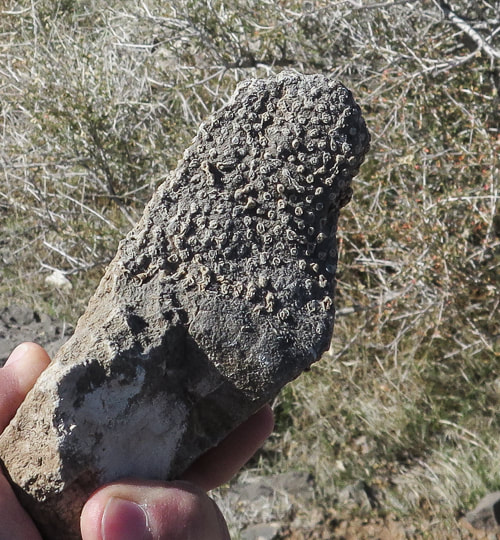
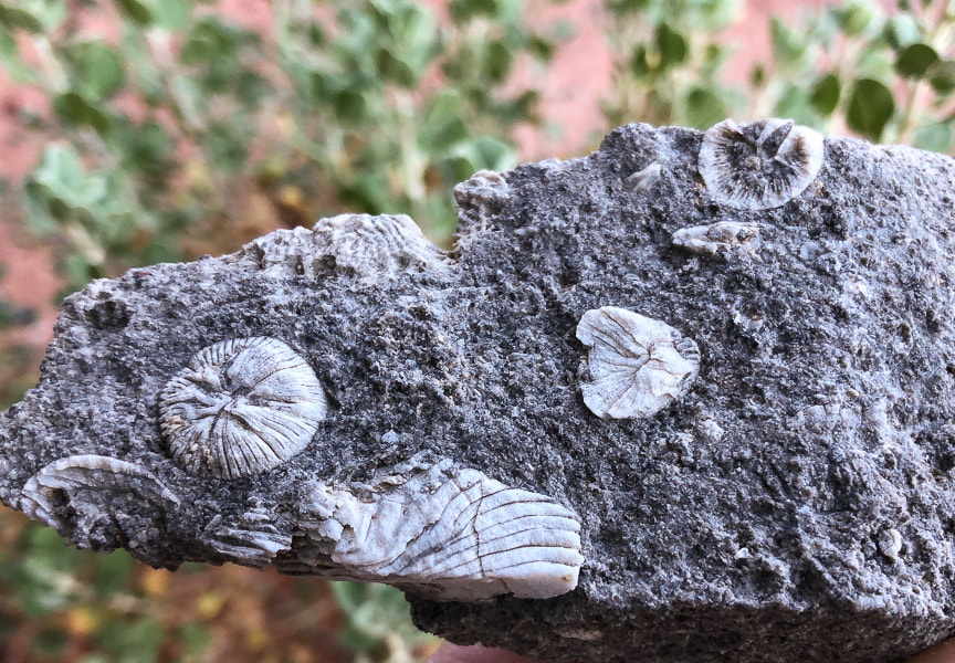
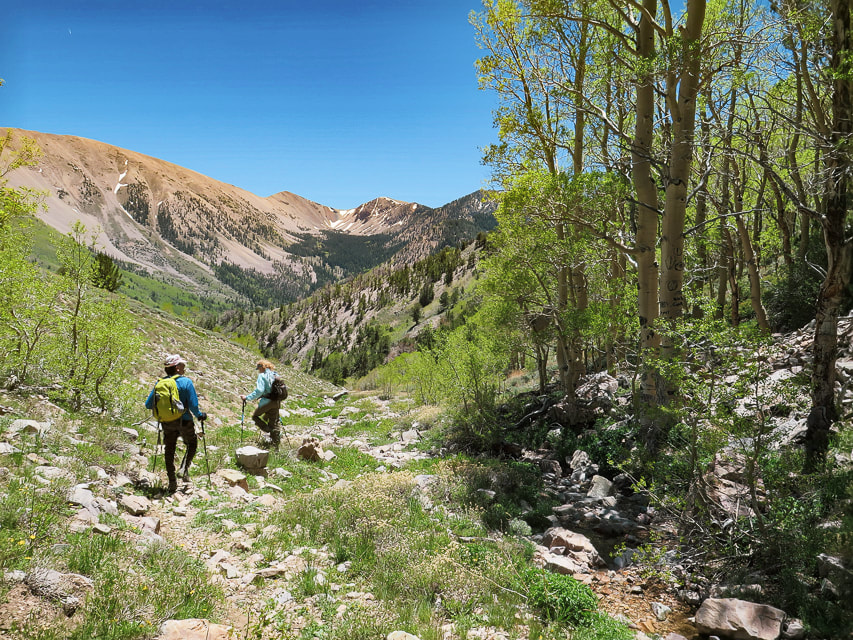
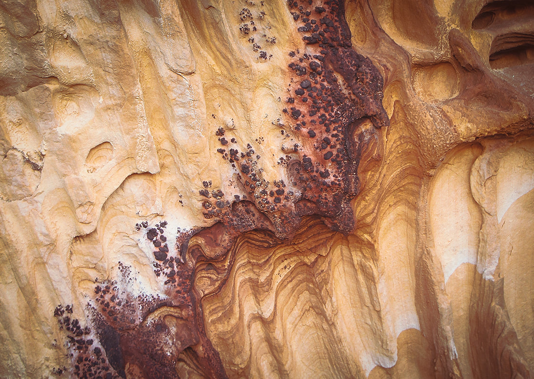
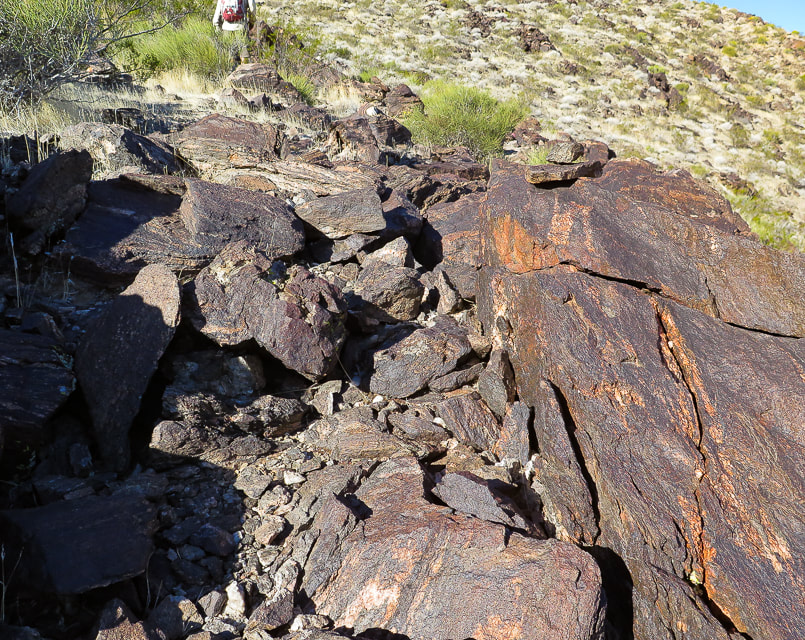
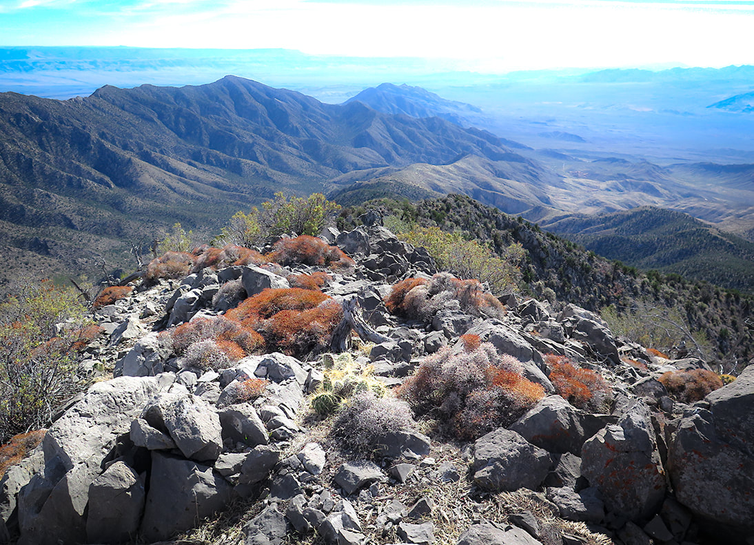
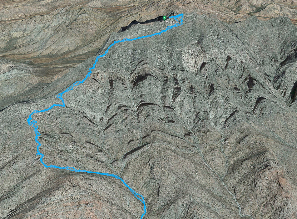 Our GPS tracks from narrow point of wash (bottom) to near Moapa Peak's summit. Out of the wash, the trail climbs to saddle (lower left), then ascends over rock ledges, some of them Class 3, continues along southern base of summit block, then curves around at base of final ridge to summit. more GPX track maps at end of this post Moapa Peak, included on the Sierra Club Desert Peaks Section list is a distinguished, stand-alone hulk of narrow limestone noticeable on the north side of I-15 north of Las Vegas. It's a classic desert peak, well-fortified by a series of almost vertical ramparts at its base. It's one of the more memorable and exposed hikes I've done. Trip reports reveal hikers who have summited, as well as those who reportedly turned around when they saw the final exposed "knife-edge" ridge to gain the last 160'. After skirting around the south cliff face, the route wraps briefly to the north at a saddle, where the Class 3 climbing up the final ridge begins. Although the narrow ridge proved too daunting for Fred and I, the hike was worthwhile because the steep drop-offs give the slight feeling that a few missteps may plunge you into the chasms and canyons below. We found the "trail" mostly stable and easy to follow. The views of the ribs of dark and sharp mountain ranges rising from flat and buff-colored desert washes are spectacular. Occasional fossils appear in this Paleozoic limestone (see photos below). I'm not sure what they are, so if someone knows, please contact me! One of them looks like fish, another looks like petrified wood. Harder than Mt. Katahdin's knife edge? Maine's Mt. Katahdin, it's highest, has a famous "knife's edge" traverse to the summit. Fred and I summited Katahdin when we lived in New England and felt it wasn't too scary. Reports say that it narrows to four feet of width in a few places. I think Moapa Peak, which reportedly narrows to one foot, is more intimidating. Side note: Mt. Katahdin is the northern terminus for the Appalachian Trail. While we were on the summit, we saw a hiker who had just completed the entire trail arrive at the famous terminus sign. I'll never forget the look on his face! Some of his family was there to greet him. Hike Summary
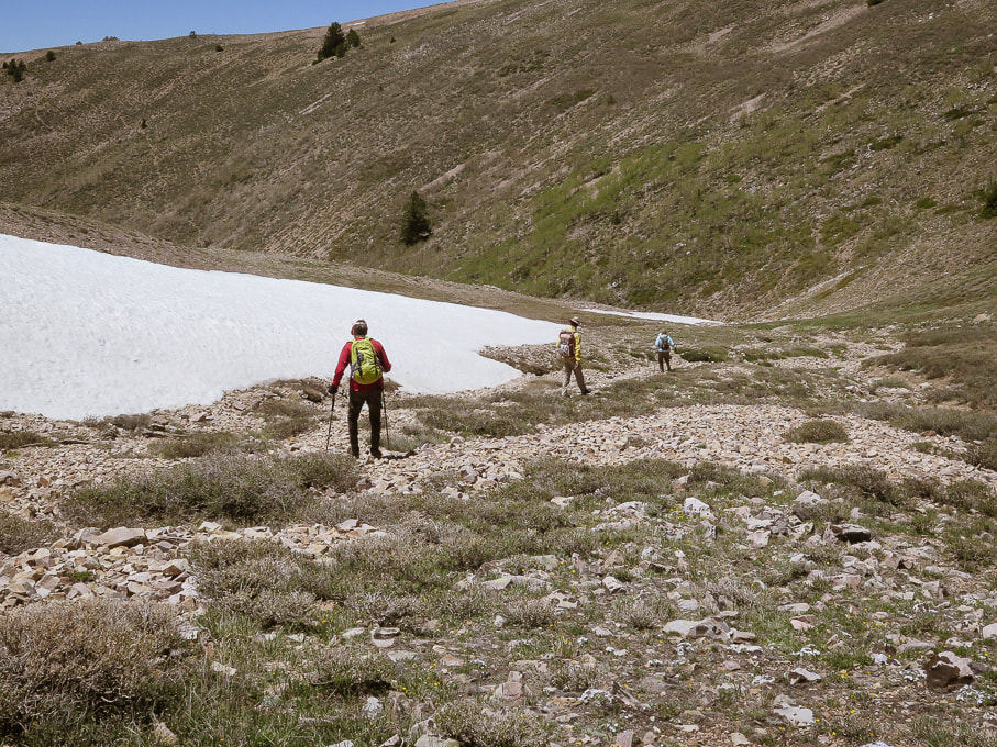
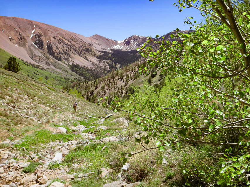
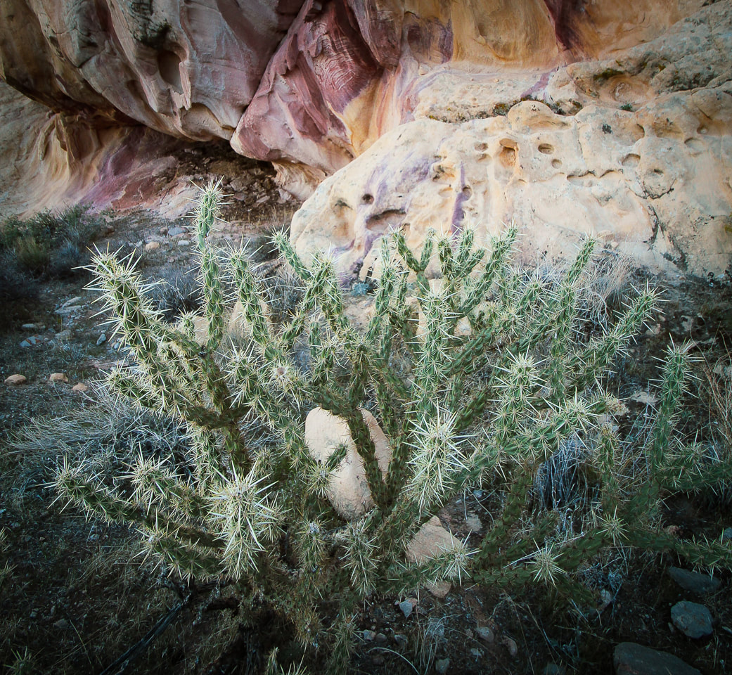
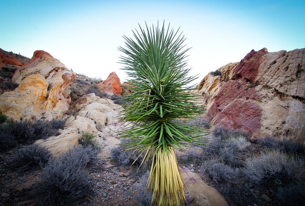
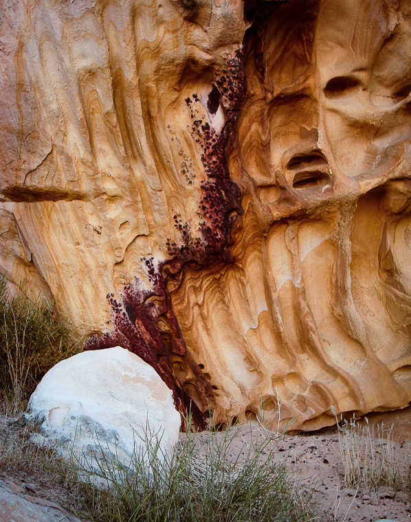
I would avoid doing this hike in the summer months. I know from experience, since we roasted on this hike last summer and turned around at the saddle because of the heat and intense sun. This is a unique hike that not many get to experience. This beautiful mountain won't make it easy for you to gain its summit, or even get to its approach ridge. The Nevada desert is stark and hard and the limestone unforgiving. And, the only flat spot is found briefly on the saddle above the approach drainage. Fred and I are lucky to be able to explore this exquisite part of the southwest. Now when we see Moapa from I-15, we can see how high we got on that very vertical mountain. Keep on Exploring! Get It While You Can!  Driving toward Moapa Peak: Joshua Tree in spectacular bloom after a very rainy and cooler than usual 2022-23 winter. 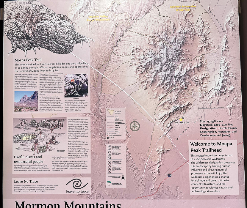 Park near trailhead sign. 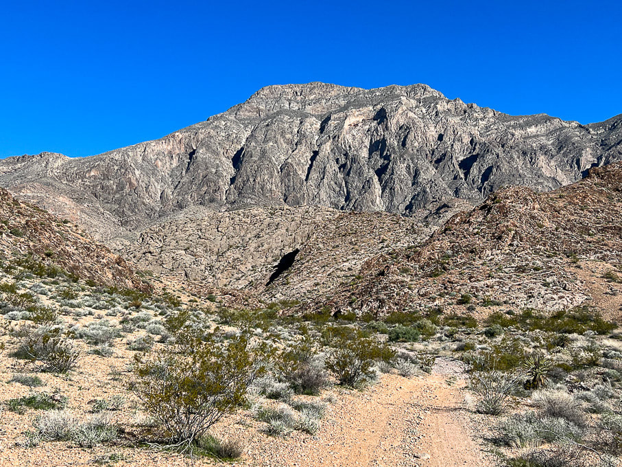 Start by walking on road that leads to approach drainage. Look at what we get to climb! 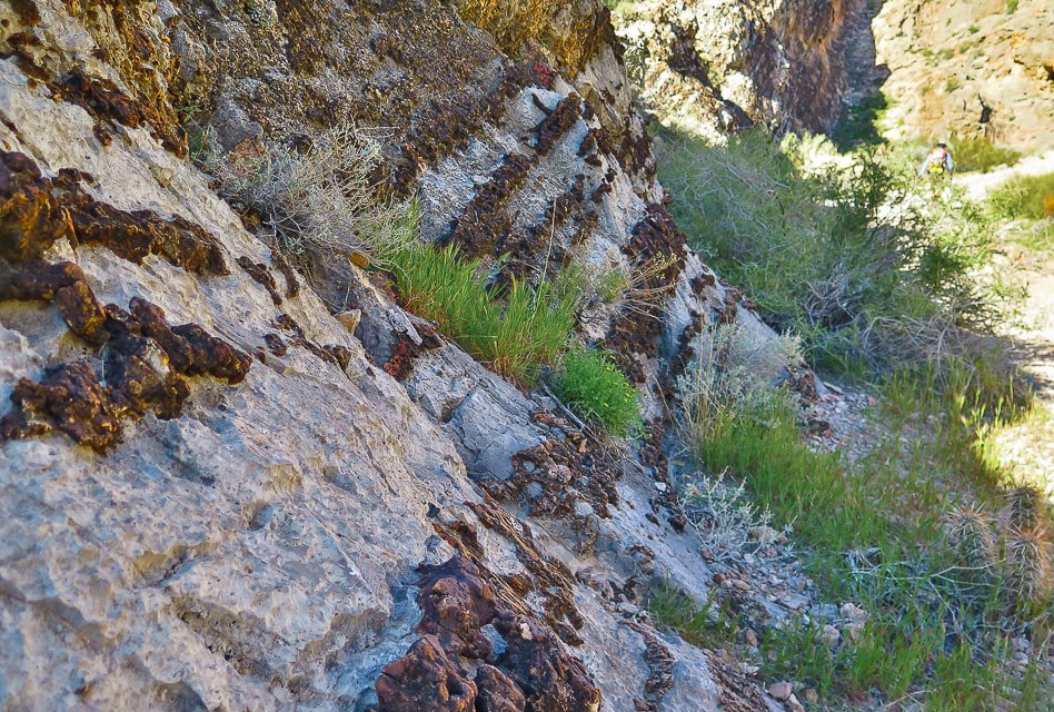 Road passes by impressive display of layered chert in limestone. 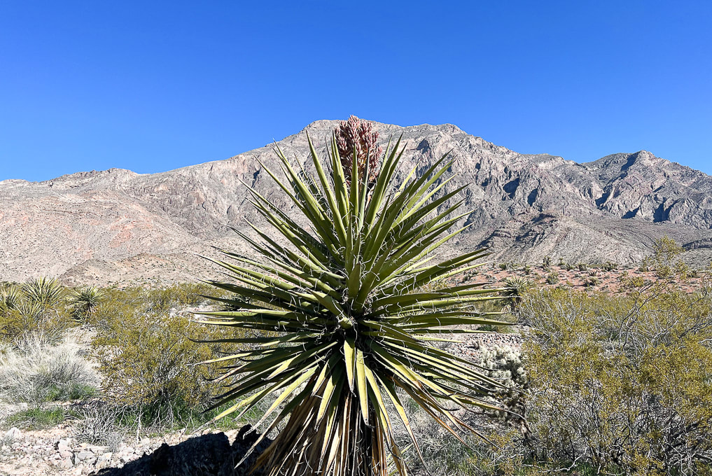 Yucca with bloom in wash - heading to low hill on left side of photo. 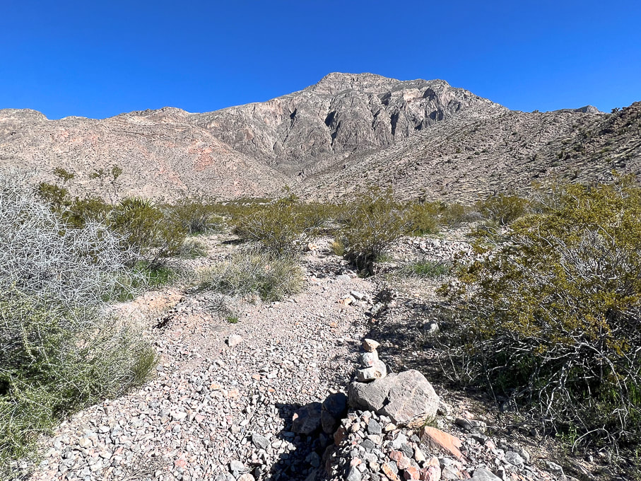 Occasional cairns mark way up braided stream drainage. 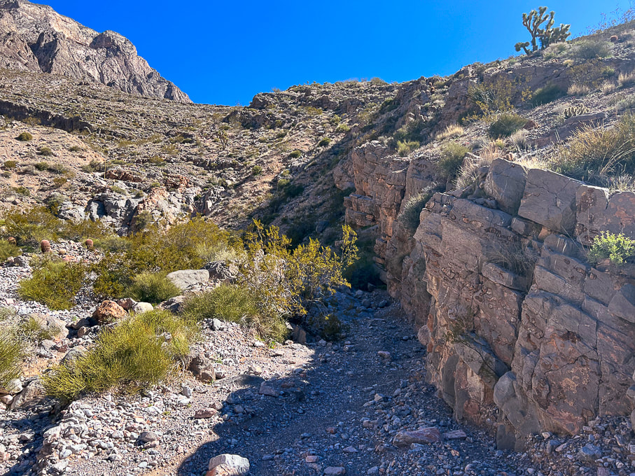 Drainage narrows. 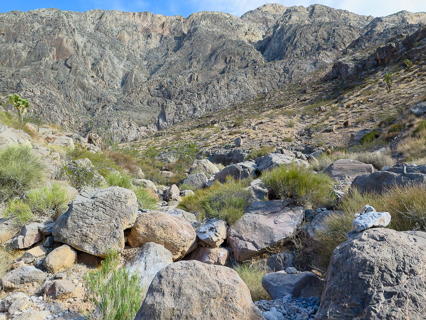 A bit of boulder-hopping and maneuvering as you get closer to head of drainage. Duck on the right boulder. 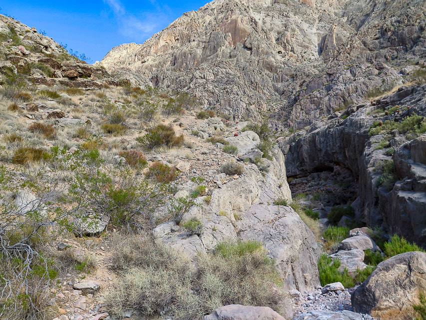 Trail continues left of large dry waterfall - entry to this trail that takes you out of the wash is marked by a cairn. 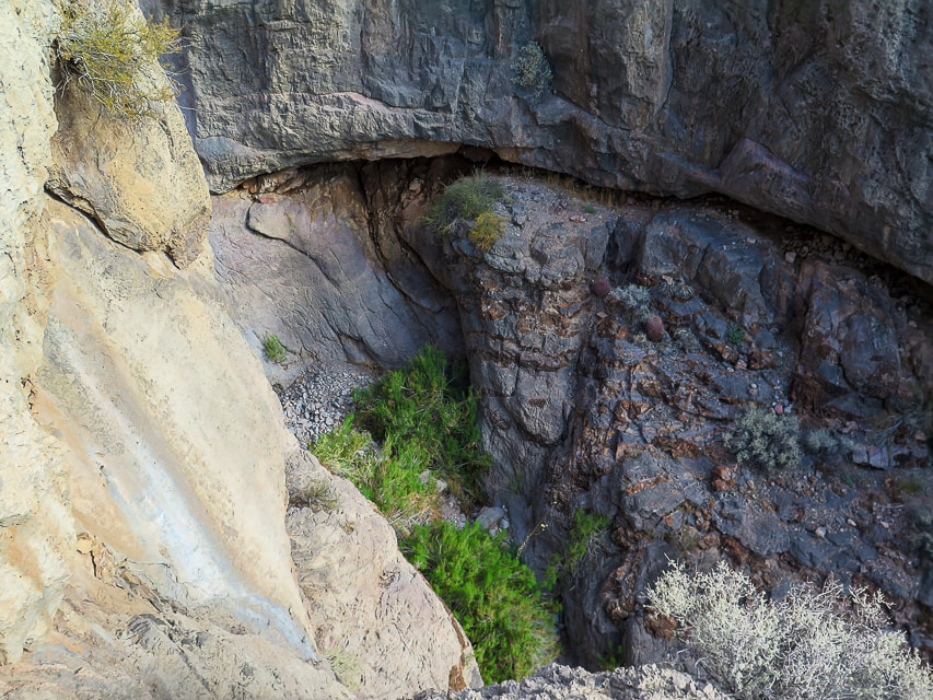 Once out of the wash, everything here is steep! 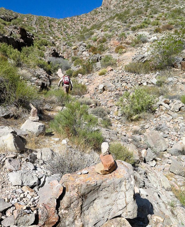 Cairns mark trail that continues up to saddle (top of photo). 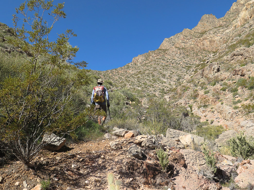 Getting closer to saddle, then the trail goes up and works around the rock ledges ascending from saddle on the right. 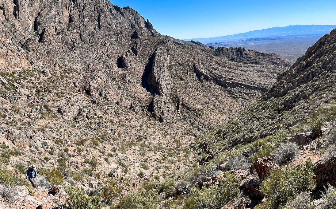 Looking back down toward end of wash from the saddle. 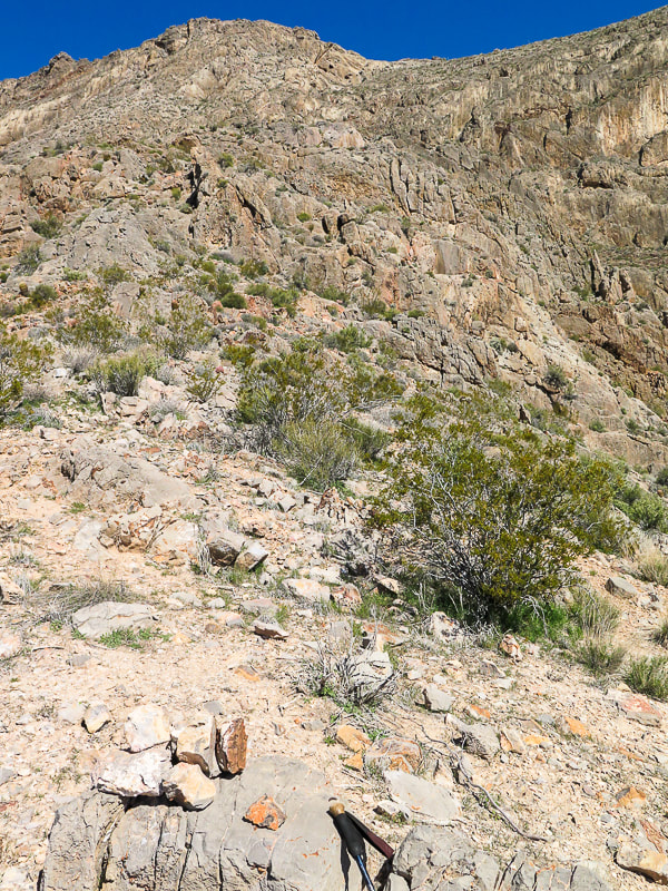 At saddle, cairns mark trail that ascends the ledges and walls to the north, with some Class 3 climbing. 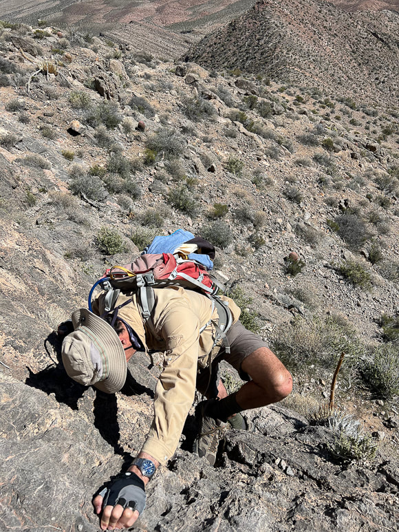 One of the walls to climb to get up over the ledges. 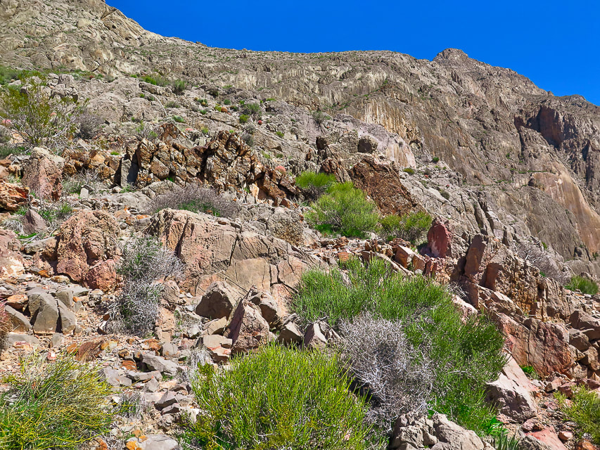 The trail continues over these ledges to the less-steep and more open terrain above at top-middle photo. 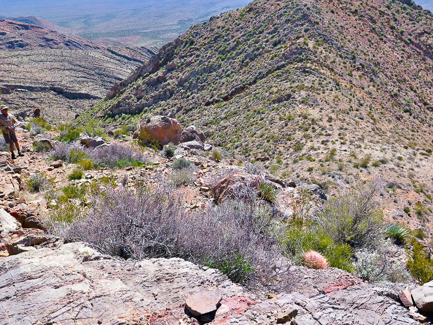 On the ledges section looking back down at the saddle above drainage. 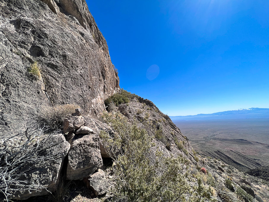 The trail ascends to the left of this huge wall. 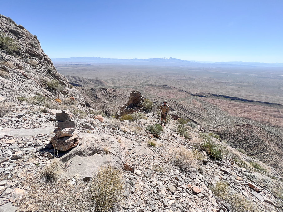 Cairns mark trail as it transitions from the steep ledges to less-steep but narrow "platform". 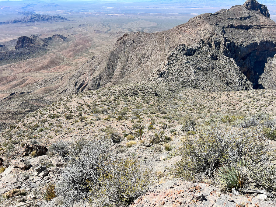 Looking back at relatively flat platform above ledge section. 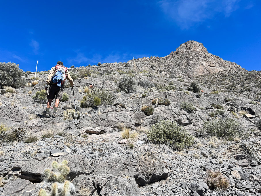 Getting closer to the summit! 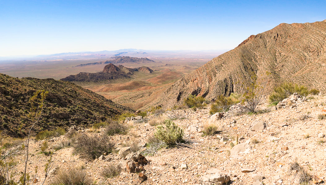 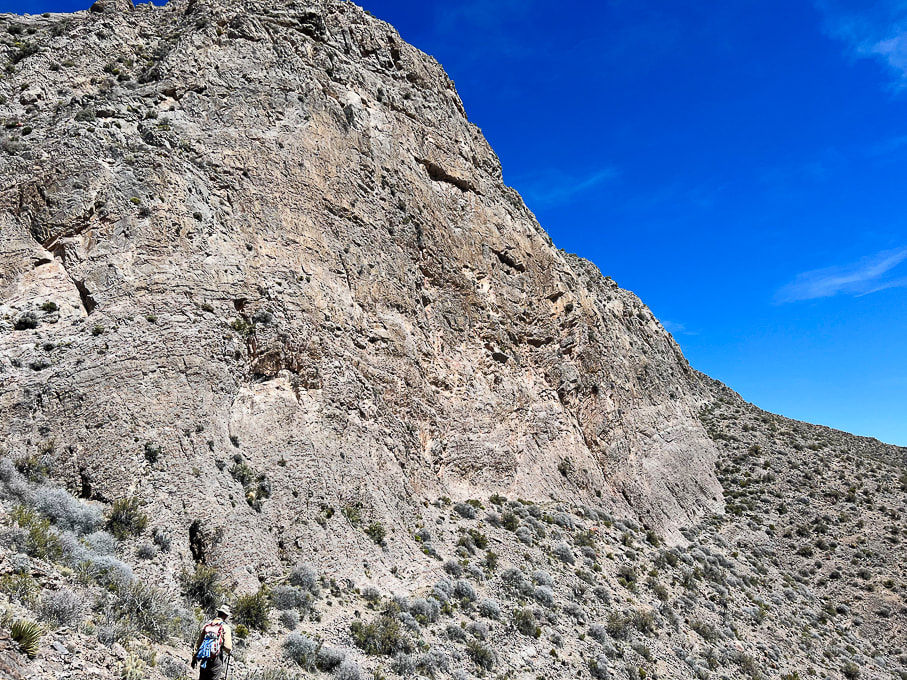 Walking around south face of summit block. 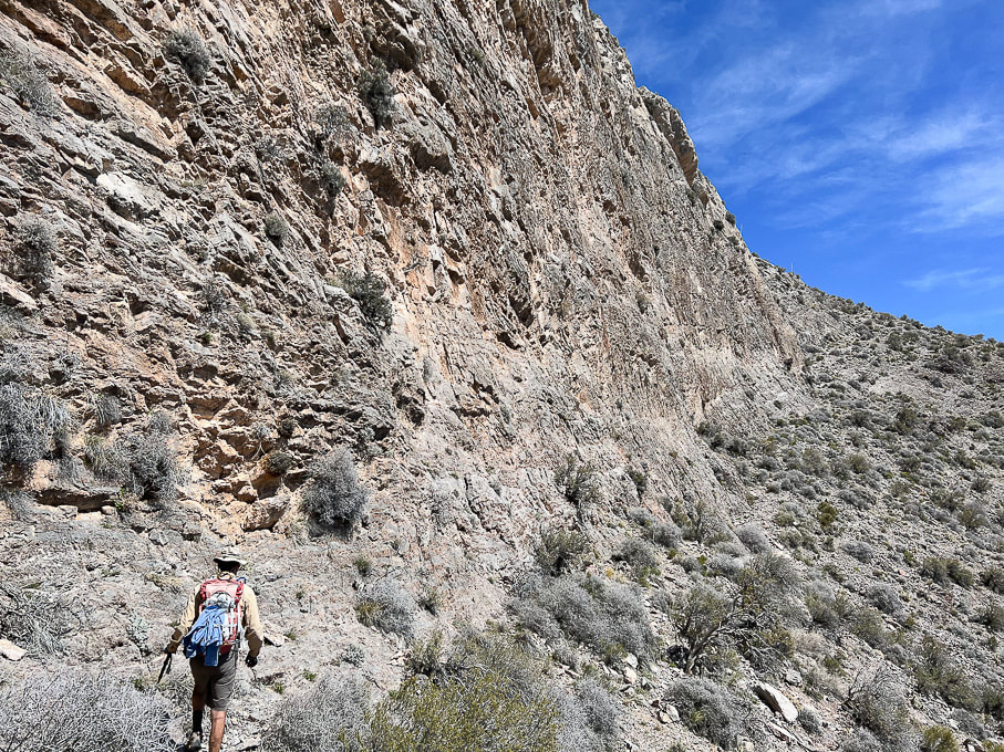 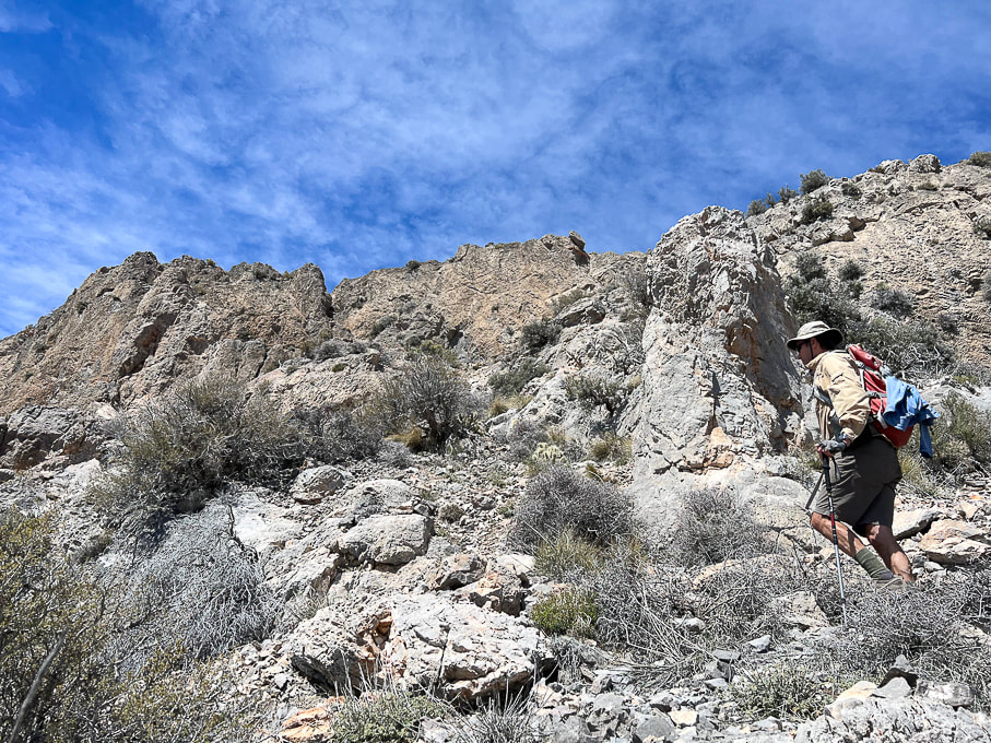 Continuing up toward summit ridge after the walk around south face. 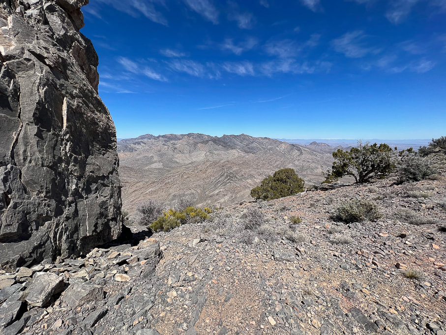 Reach Moapa's east ridge for spectacular views to the north - Mormon Mountains. Travel a short distance around Moapa's east ridge to the left to find cairn marking entry onto the final ridge to summit climb. 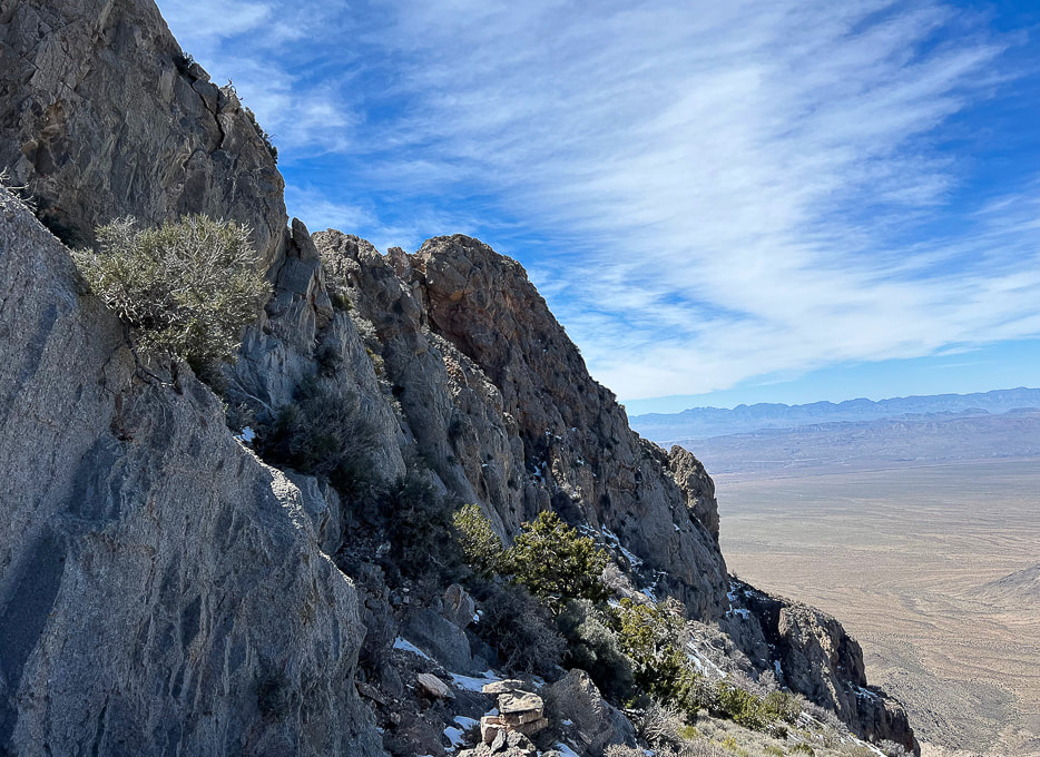 The northwest-facing side of Moapa Peak summit seen here. At first, we missed the cairn to lead us up the walls on the left, so we kept walking along this north side for a short distance. When we didn't see any footprints in the snow here (earlier we met a climber who was on his way down from the peak) and no more cairns, we went back to beginning of the ridge and found the cairn (bottom of photo) marking entry onto the knife's edge part of final ridge ascent. It's here you take a left to find another cairn in the cleft on the left. 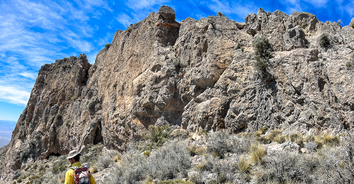 Making our way back down after turning around at scary knife's edge! A bit disappointed we didn't summit, but still really happy we got that far on this unique hike with its breathtaking views and drop-offs, and steep, narrow approach.  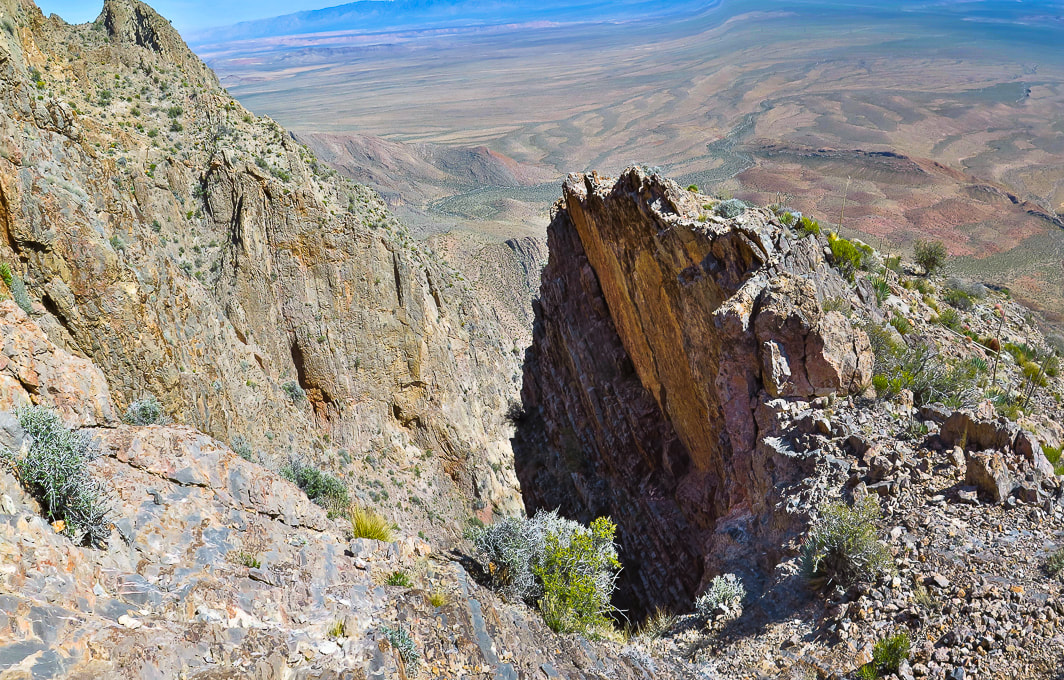 Trail comes close to this deep chasm. 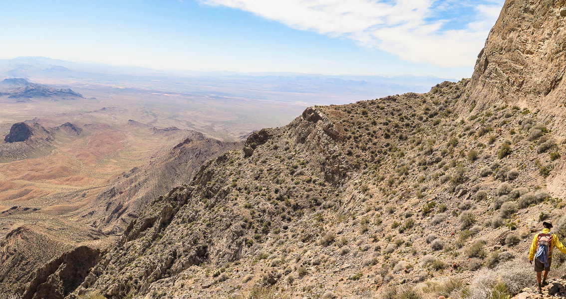 On the way back heading toward saddle that leads to platform above the ledges section. 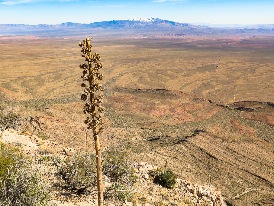 Snow-covered Virgin Peak in the distance to the east. 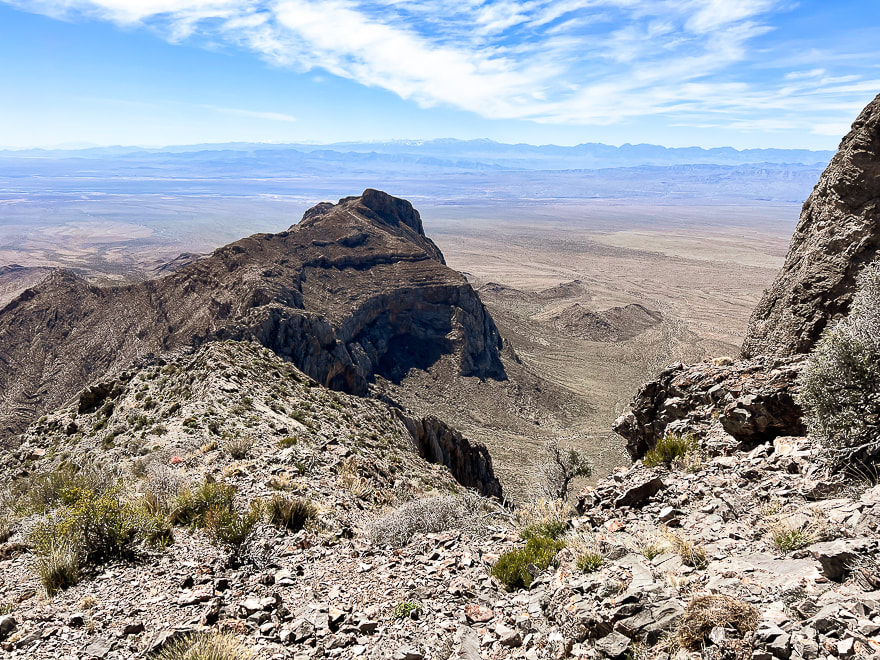 On the way down: view to the west of Nevada's parallel mountain ranges caused by extension in the Great Basin tectonic province. Great Basin rifting (extension) is the second major tectonic episode that shapes this area; it began ~ 30 mya and continues today. Normal faults result from extension - a pulling-apart of Earth's crust. 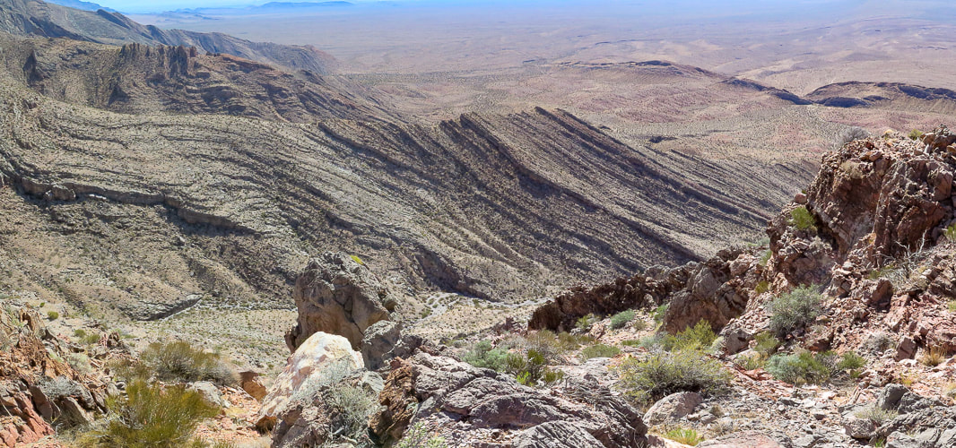 Tilted sedimentary beds. Nevada is interesting because it has undergone major tectonic forces of mountain building, shearing, faulting and rifting. 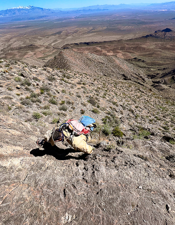 Descending down the ledges section. Virgin Peak on the horizon. 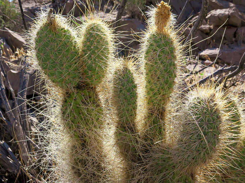 Mojave Prickly Pear 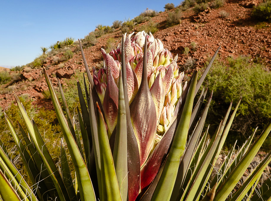 Mojave Yucca Some cool stuff on the trail. 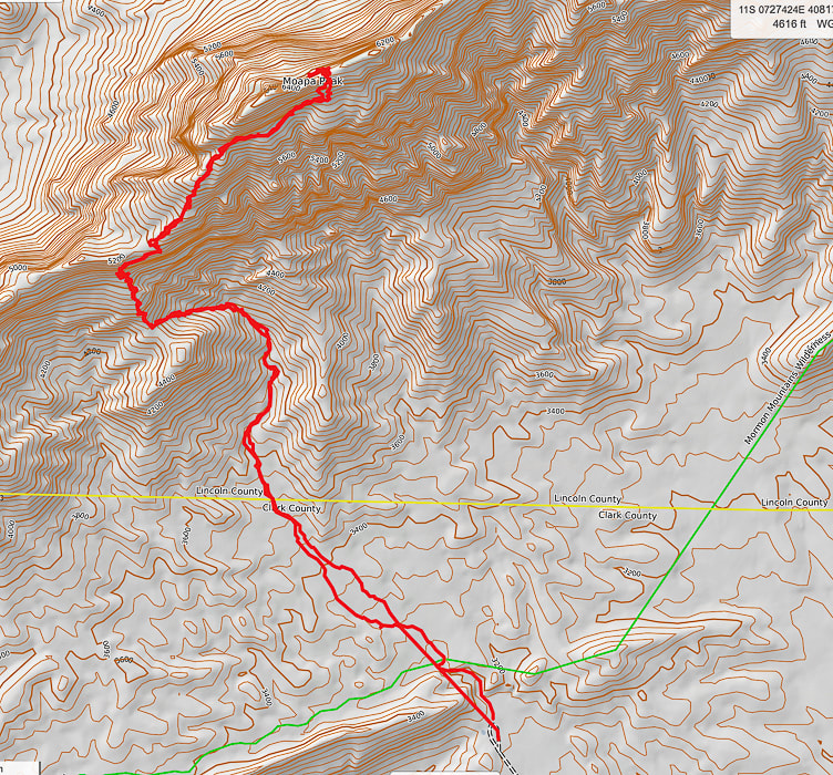 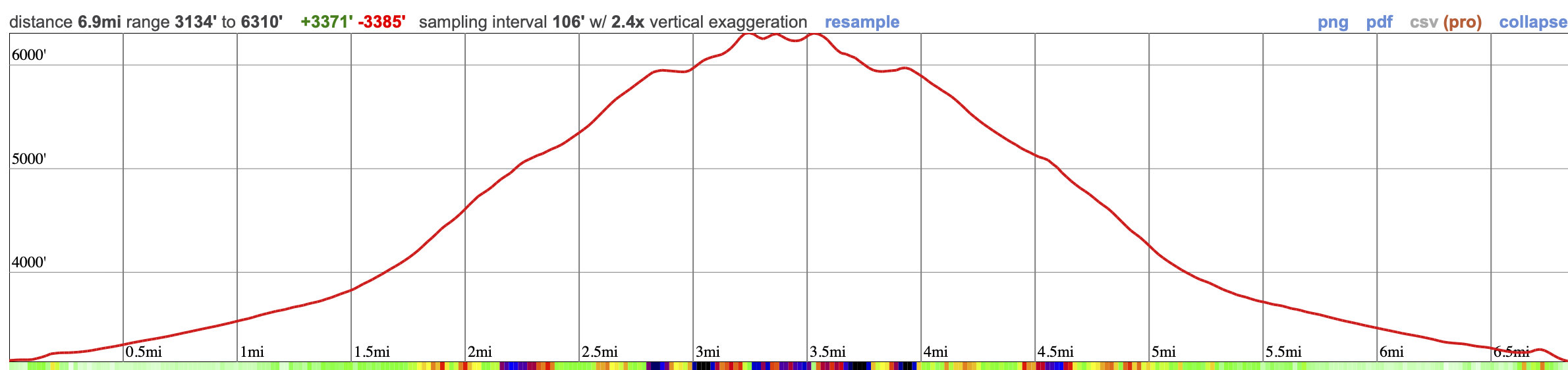 Our GPX tracks and elevation profile on Caltopo maps. 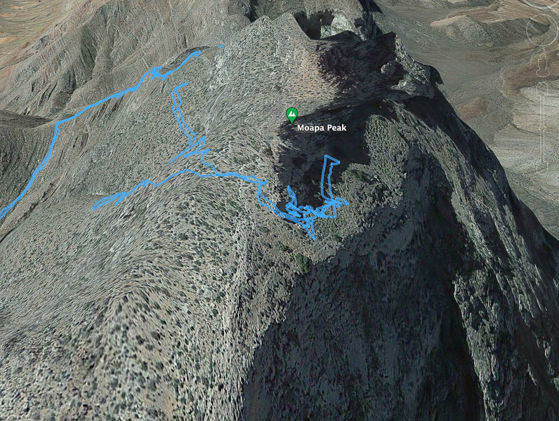 Our GPX tracks walking around Moapa's east ridge and final ascent. The tracks show that initially we went too far along the north face and then we turned around to find the entry to the ridge. References:
Indian Names in Utah Geography. From Utah Historical Quarterly Volume 1, Number 1-4, 1928 by Utah State History. Carpenter, J.A., 1989. Structure of the southern Mormon Mountains, Clark County, Nevada and regional structural synthesis : fold-thrust and basin-range structure in southern Nevada, southwest Utah, and northwest Arizona. Master's thesis dissertation from Oregon State University.
2 Comments
Hike the only named mountain in this obscure, remote and rugged Nevada mountain range. 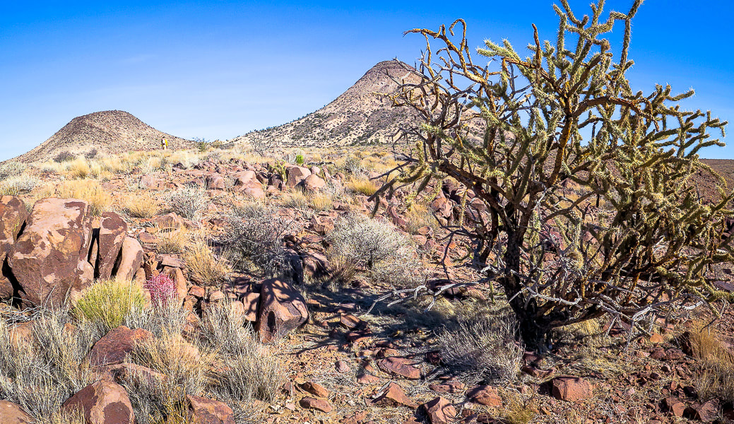 Approaching the base of Sunflower Mountain (right), a volcano that erupted 14 million years ago (m.y.a.). Trip Stats
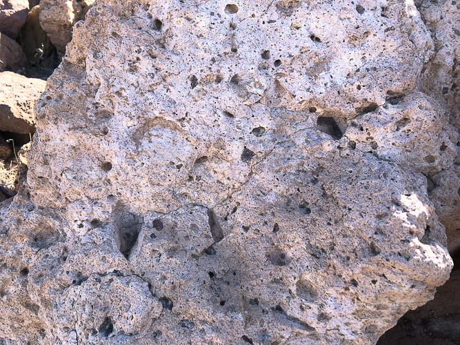
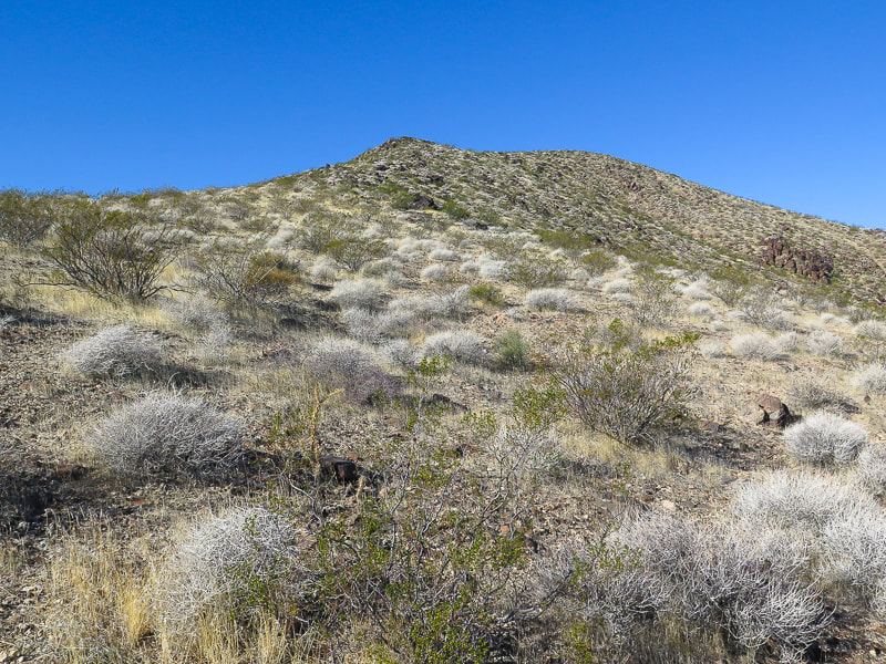
Location: Meadow Valley Range Wilderness (BLM) - southeastern Nevada. Overview: Make your own loop-hike in solitude to the summit of Sunflower Mountain in a mountain range infrequently traveled, with the option to continue northeast along tilted cliffs to Kane Benchmark. Distance/Elevation Gain: 5.3 miles/1,670'. Prominence: 842'. Difficulty: Moderate effort Class 2, no cairns, not marked, no discernible trail - must be experienced with navigation. Coordinates: Trailhead: 37.06787,-114.76415. Sunflower Mountain: 37.07292,-114.73997. Maps and Apps: Printed map from CalTopo.com, Stavislost.com., Topo Maps U.S. Date Hiked: 11/25/22. Geology: Sunflower Mountain's volcanic eruptions (14.7 million years ago) produced rhyolite, a silica-rich rock formed from granitic magma, which is more viscous than iron- and magnesium-rich basaltic magma. Rocks associated with rhyolite are tuff and pumice, present on Sunflower's flanks. The Meadow Valley Range is underlain by folded and faulted Cambrian (500 mya) through Triassic (250 mya) age rocks. On the drive from Moapa, Nevada, this rock is especially exposed in the southern part of the range as limestone cliffs. Related Posts:
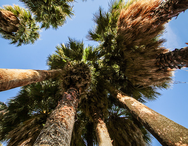
Open Spaces If you relish wide open spaces with minimal human influence, like the freedom to chart your own path to discover features that others haven't, and don't mind the occasional cactus spine jabs and rough rock-hopping, this rugged land is for you. It's a place for open space "aficionados". Sunflower Mountain's summit allows you to see what's going on in the Great Basin desert of Nevada: raw, contorted, ripped and tilted geography as a result of earth's spreading and faulting. Some say this desert land is too spare, but each plant must fight for survival, changing to adapt. This clever determination earns respect and admiration. Many times you find unexpected things like fossils, springs and weird rocks. I've found what looked like a miner's crucible and pottery sherds in remote deserts. Surprise and unpredictability separate this biome from others. A scene from the t.v. series Yellowstone prompted me to pull The Solace of Open Spaces by Gretel Ehrlich out of my bookcase. In this scene, Beth, the daughter of John Dutton, the Montana ranch owner, is reading this book, wondering how to find solace. "Solace must be discovered," her dad tells her. Early in the book, Ehrlich states "Space has a spiritual equivalent and can heal what is divided and burdensome in us. Space represents sanity, not a life purified dull, or "spaced out" but one that might accommodate intelligently any idea or situation." She writes about the extreme weather and landscapes of Wyoming, and its people. Ehrlich found solace in Wyoming after a tragic event in her life . Some people find solace and revitalization in remote, open spaces. Others find the same in the hubbub of big cities. Is it an acquired preference that grows out of an appreciation for open spaces after you spend some time in them? Or are some people more naturally attracted to them? At any rate, the American West is rich with opportunities for solitude, solace, freedom, discovery. The list goes on.... "The extreme clarity of the desert light is equaled by the extreme individuation of desert life forms. Love flowers best in openness and freedom." - Edward Abbey "The farther one gets into the wilderness, the greater is the attraction of its lonely freedom." - Theodore Roosevelt "Give me silence, water, hope. Give me struggle, iron, volcanoes."- Pablo Neruda We also stopped by the Moapa Valley National Wildlife Refuge. It is a tranquil place with many old California palm trees (see end of this post). It was created to protect the endangered Moapa dace - a small fish endemic only to this area. A sign here indicated Las Vegas showgirls used to frolic in these hot springs - there was an old cabana from years past - before it became a wilderness reserve. Our Hike (see topo map at end of post) - 5.3 miles round-trip
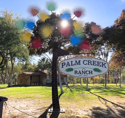
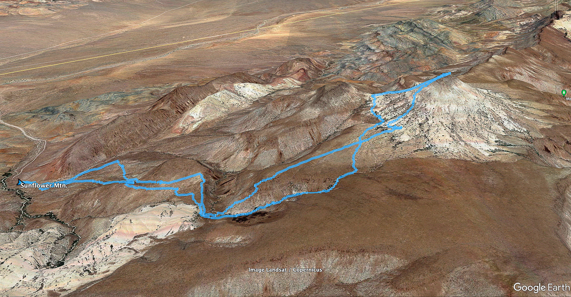 Our tracks from trailhead (left) to Sunflower's summit. We drove up road accessible by high-clearance from Kane Springs Road, seen as straight line in valley below (upper left). We approached via climbing the plateau that lead to the base and returned via a fun scrambling canyon. Meadow Valley Range is one of the most obscure of Nevada's over 300 mountain ranges. North is at top of map 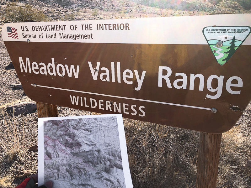 Got my printed topo map ready! You can park near this sign if you have high clearance vehicle. 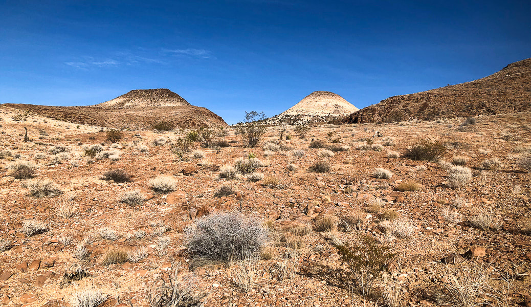 Can't get enough of photographing this cool-looking extinct volcano, the only named peak in this range- Sunflower Mountain. 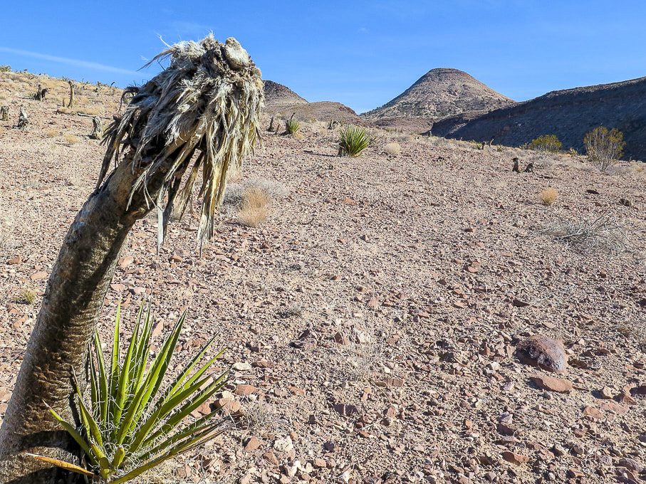 Heading east from trailhead - a lot of dead yuccas, apparently from a fire, dotted this landscape. The new growth is a good sign. 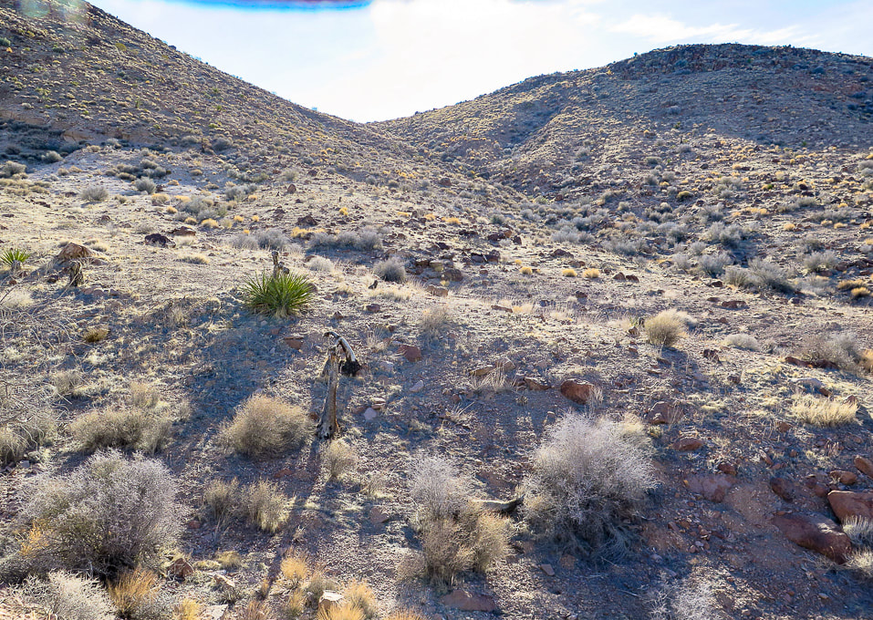 From the BLM sign, we headed east to a shallow drainage that led to a saddle. We headed south into a shallow drainage and the opening of the small canyon that we would hike down on our return. 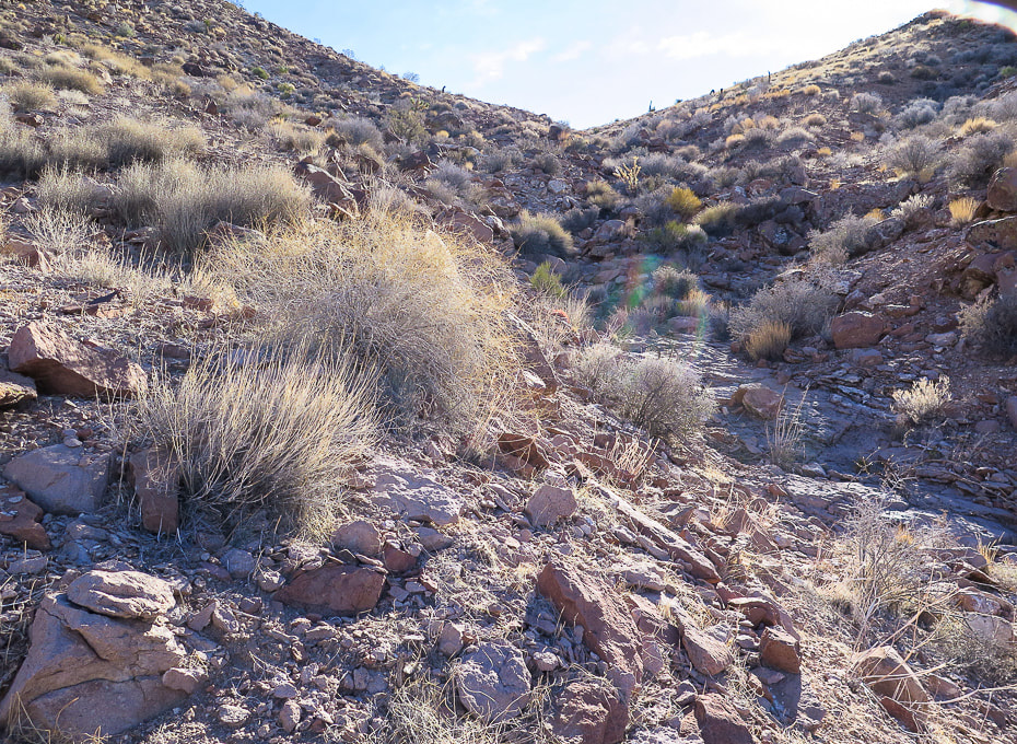 Getting closer to the saddle. 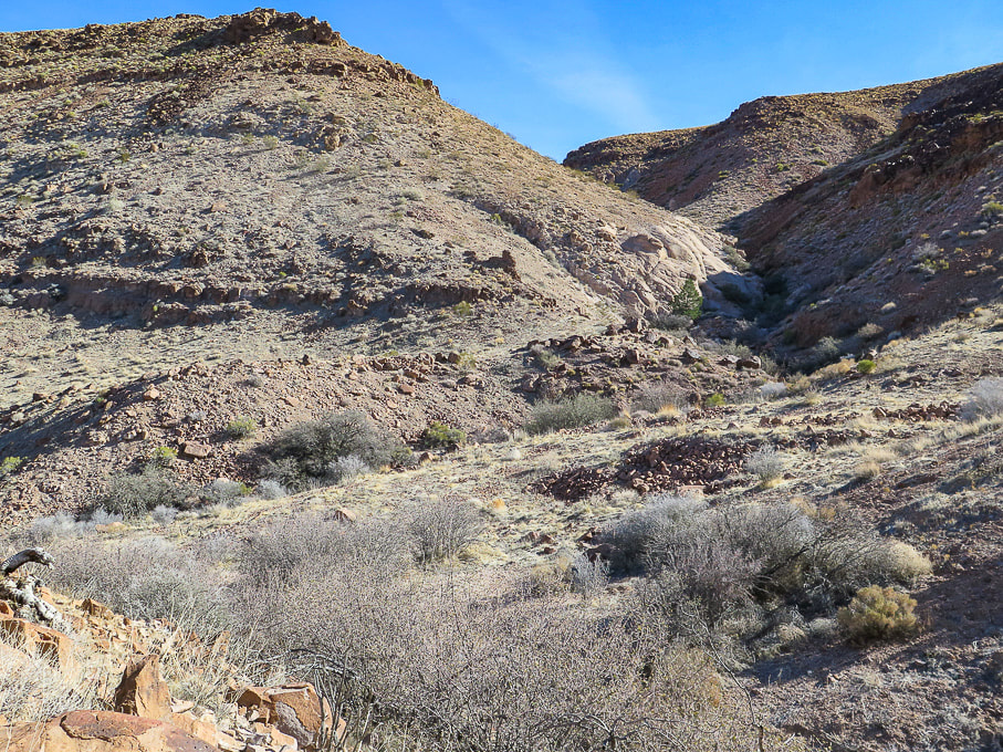 From the saddle, dropping into the drainage. On our ascent, we climbed the hill on the left; on our descent we hiked down the drainage on the right. 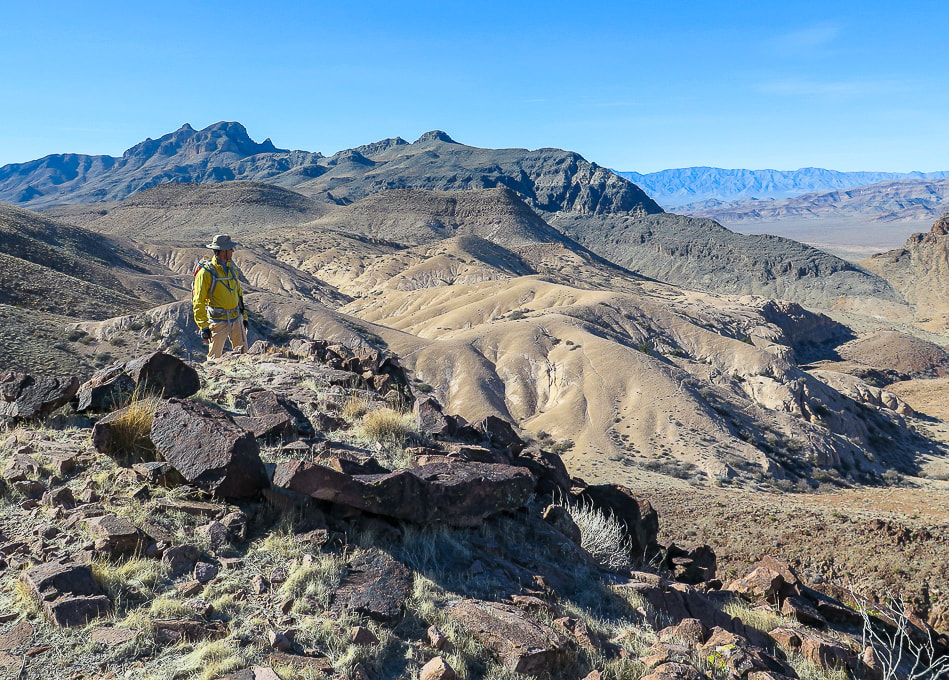 Reaching the top of the hill out of the drainage; from here, a long flat plateau leads to the base of Sunflower. Looking back at flat area we just ascended.  The flanks of Sunflower mountain contain lots of light-colored tuff (consolidated ash).  Climbing Sunflower and looking back at the plateau we just crossed.  Tuff - consolidated ash. Rock is loose in some spots, but not too bad.  Climbing an old volcano! Great view of Kane Springs Valley and the Delamar Mountain range across the valley.  Top of Sunflower Mountain looking back to Kane Springs Valley and road we drove up on (Kane Springs road).  View southwest from summit of Meadow Valley Mountain range.  View northeast to Kane Benchmark (upper right high point). We didn't see any traffic on Kane Springs Road in valley.  Heading off summit on the west flank to the flat spot just behind Fred in the saddle.  View of Kane Benchmark (high point on horizon) from west slope of Sunflower.  Walking along base of Sunflower back to approach plateau. 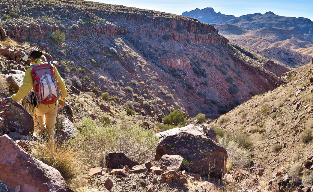 Hiking down drainage under (to the south) of plateau we climbed for approach to Sunflower's base. 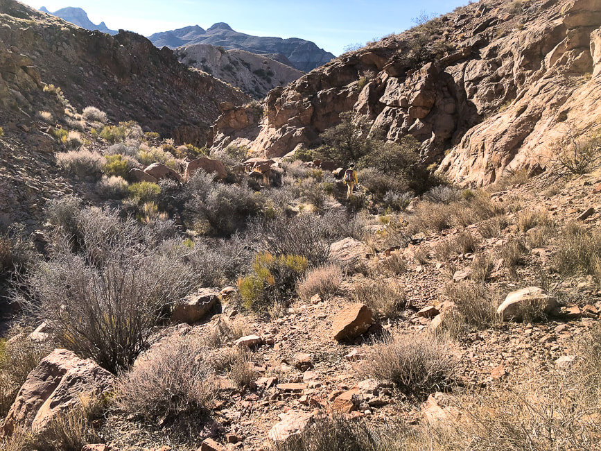 Progressing down the drainage. 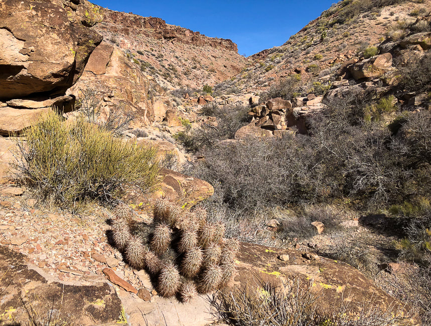 Looking back at entry point into drainage and the plateau we climbed earlier on our approach to Sunflower. 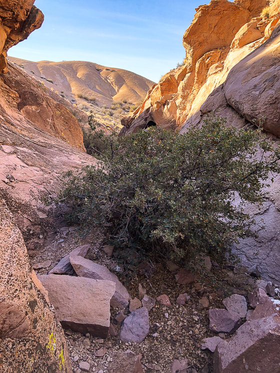 Some cool stuff on the trail. Moapa Valley National Wildlife Refuge and Palm Creek Ranch in Moapa, Nevada 60 miles north of Las Vegas 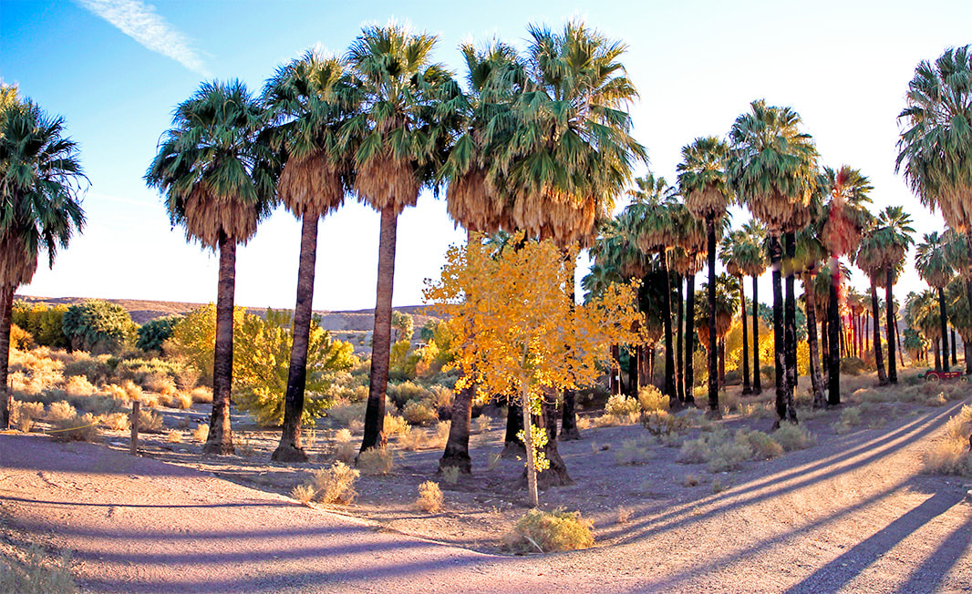 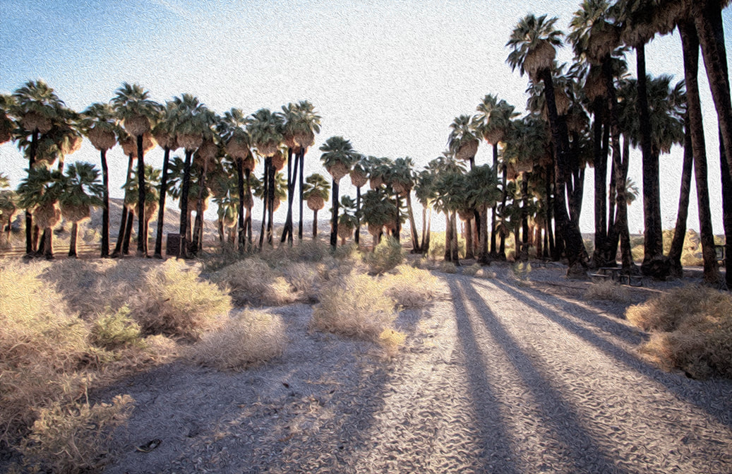 We stayed in our trailer two nights at Palm Creek Ranch in Moapa, Nevada. It is a natural desert oasis. The water is warm! 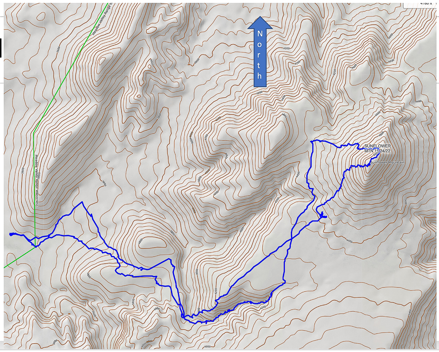 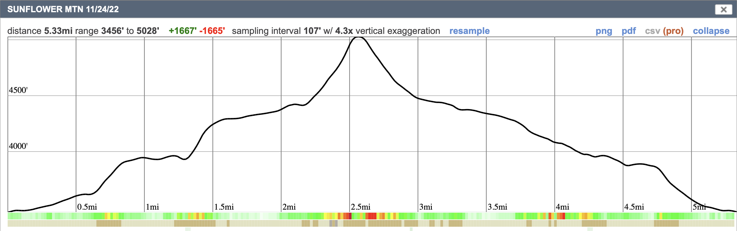 Our GPS tracks on CalTopo map, and elevation profile. Click on map for larger file References
Lahren, M., Trexler, J. Crustal Evolution of the Great Basin and the Sierra Nevada. 1993. Dept. of Geological Sciences, Mackay School of Mines, University of Nevada, Reno. Pampeyan, E. H. Geologic Map of the Meadow Valley Mountains, Lincoln and Clark Counties, Nevada. 1993. USGS.
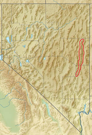
This short hike to the fifth most prominent peak in Nevada rewards you with solitude and a dramatic view of Wheeler Peak and eastern Great Basin mountain ranges and valleys.

Approaching Schell Creek Range summit ridge just under North Schell Peak.
Trailhead directions from Summitpost.org: From Ely, drive north on US 93 to McGill. From McGill, drive north on US 93 about five more miles, then turn right onto NV 486. Drive east on NV 486 through the Gallagher Gap, then south through a valley. After about eight miles, turn left onto the signed Forest Road 425 to Timber Creek. Drive east on Forest Road 425 about four miles to the Timber Creek Campground. The road is blocked off a short distance past the campground.
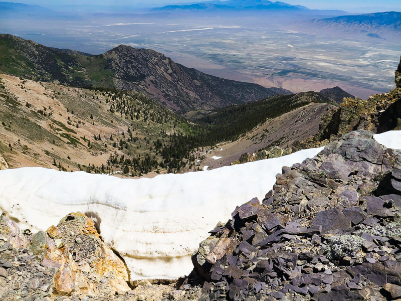
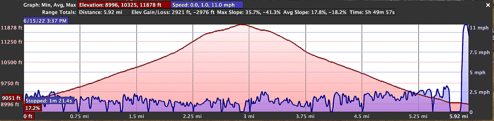
Difficulty: Moderate Class 1-2 on discernible but unmarked trail; scrambling and easy route-finding on firm talus. Coordinates: Trailhead = 39.40025 -114.61907. Summit = 39.41332 -114.59959. Maps and Apps: (see our tracks below). Avenza High Schells Wilderness, Humboldt-Toiyabe Wilderness - USFS, Stav Is Lost's hike description, USGS topo map Date Hiked: June 15, 2022.
Related Posts:
Our GPS tracks for 6.2 miles out and back to North Schell Peak.
Nevada is a remarkable state for many reasons - Las Vegas is the "Entertainment Capital of the World", and Elko sponsors the National Cowboy Poetry Gathering. It also contains the most mountains of any state, most arranged in long parallel north/south trending ranges, with low valleys in between. The forces that made the earth spread starting 50 million years ago produced normal faults that formed horsts and grabens, making parallel valleys and raising mountains so we can hike them today. This spreading and faulting has doubled the width of Nevada in those millions of years.
Our Hike
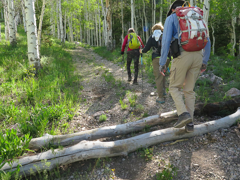
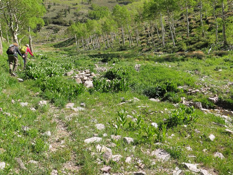
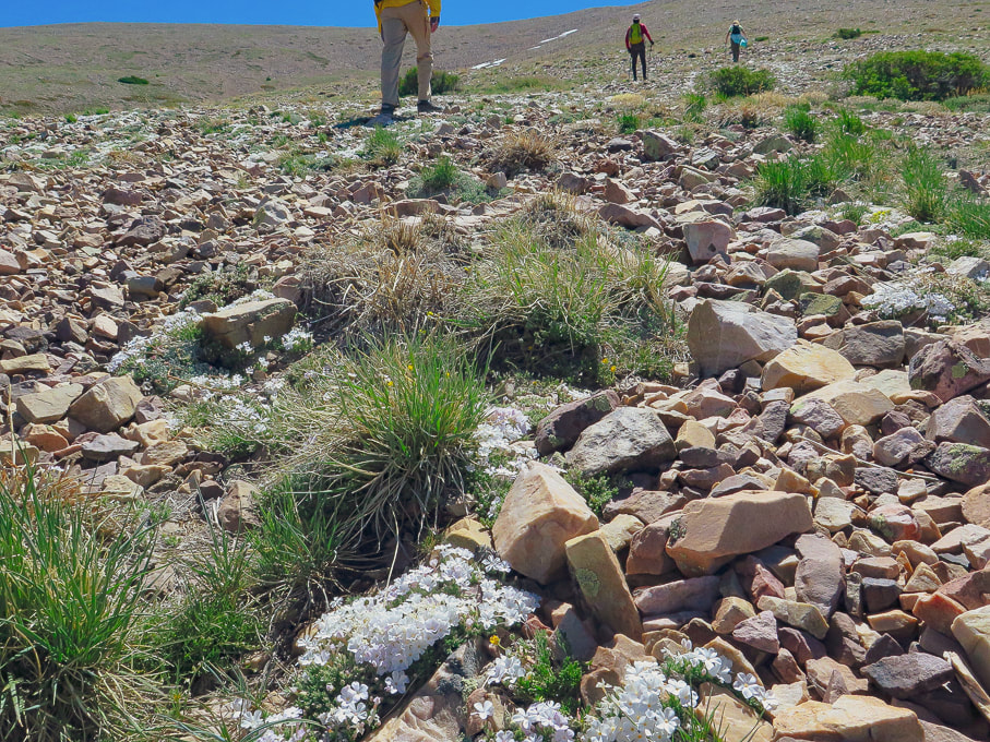
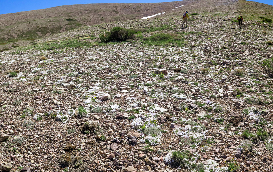
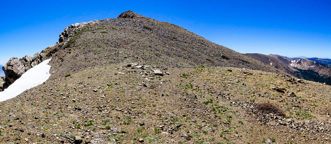
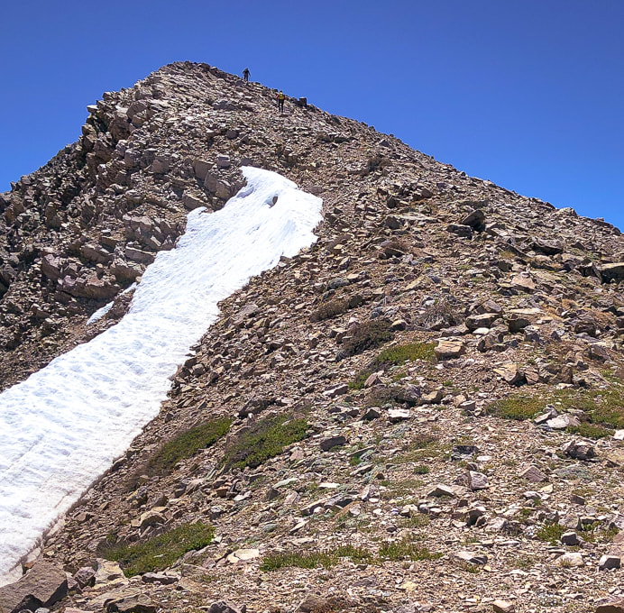
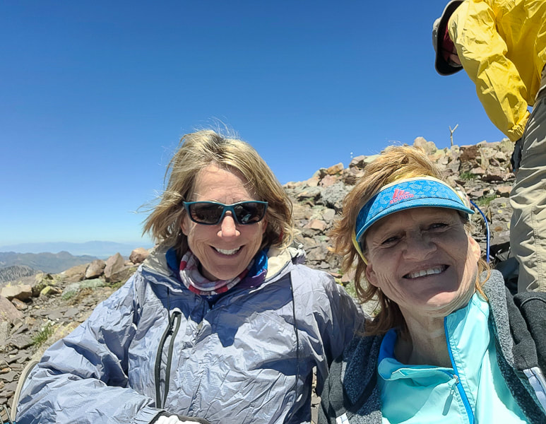
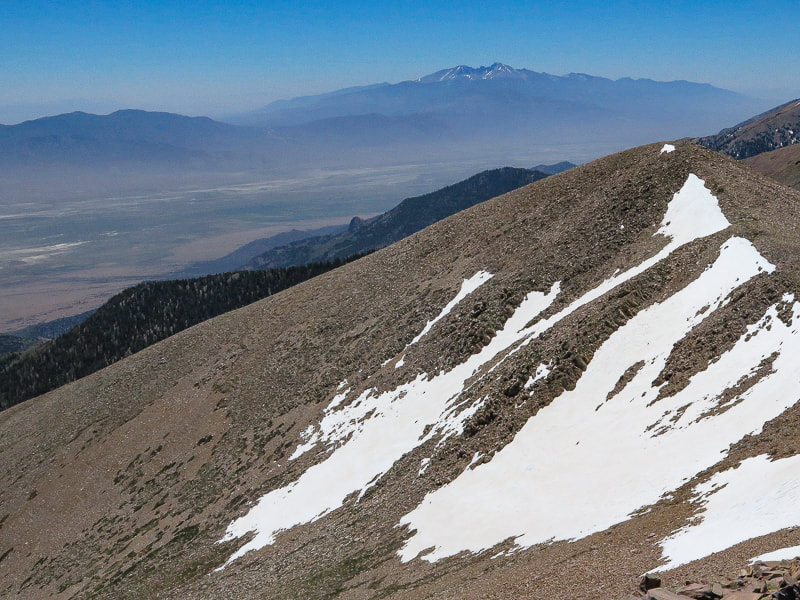
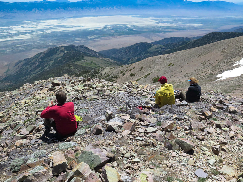
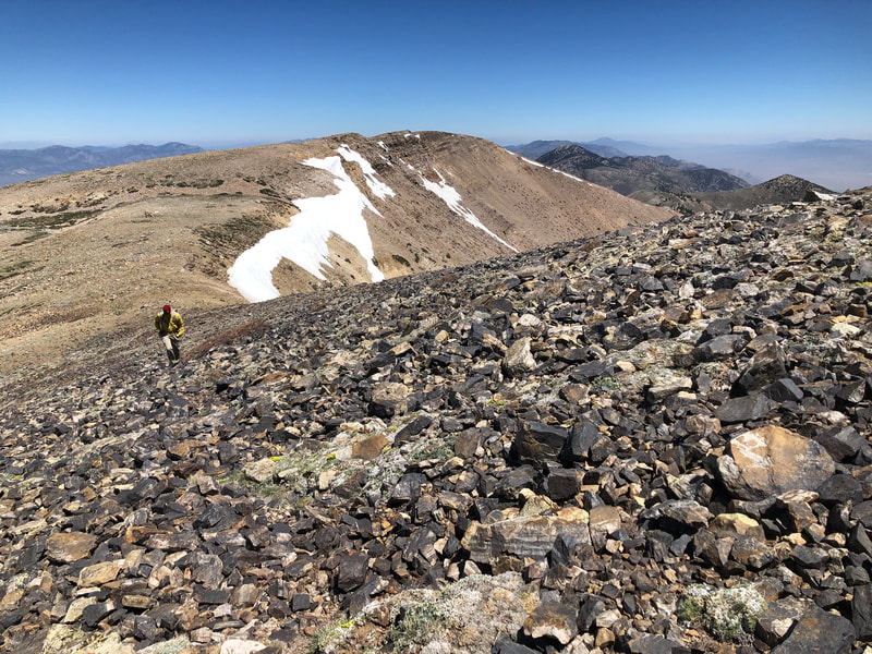
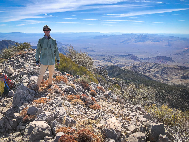
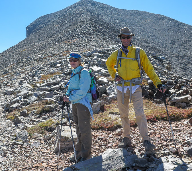
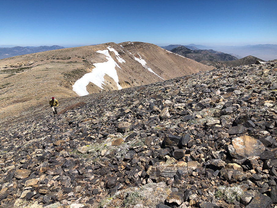
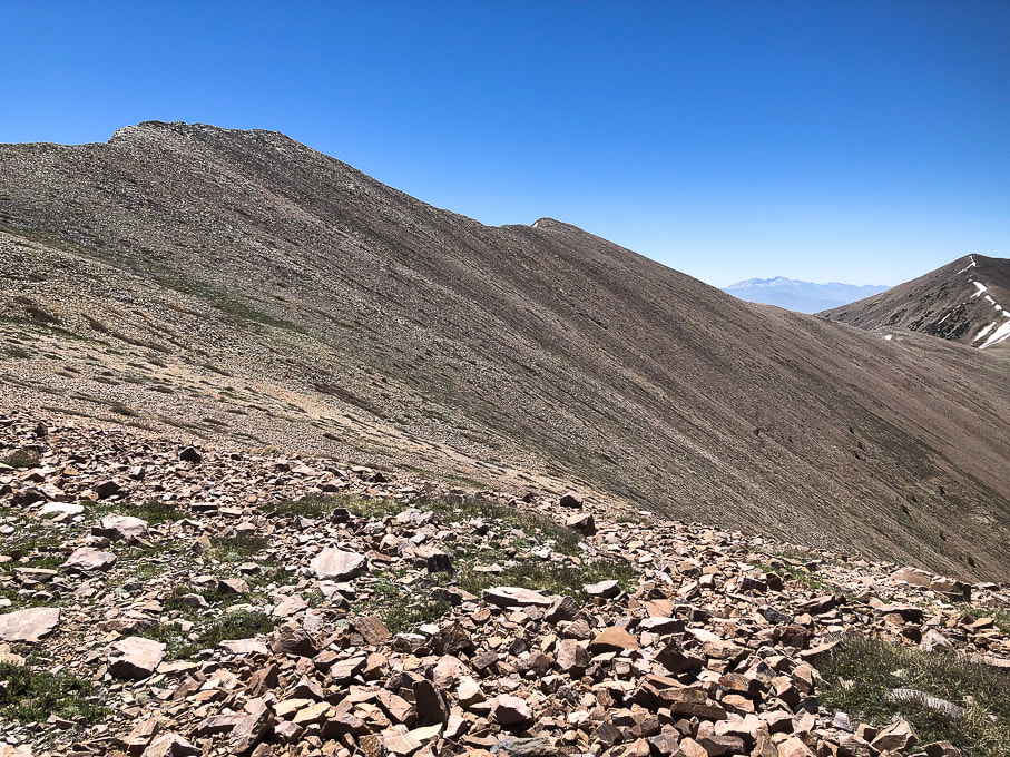
After an early morning drive from Ely to the south, we passed a few primitive campgrounds along the good forest road whose end is the trailhead and a brown kiosk signboard. Start walking on the road after parking. It turns north (left) into a discernible path that ascends an aspen-forested valley and stays near the stream, crossing it a few times. The aspen forest opens to the head of this creek and North Schell's western talus/grass slopes. The trail, not marked is easy to follow. Once we got to the head of the creek and the end of the dirt path, we took the steeper, rockier and shorter way to Schell Creek ridge, taking more of an acute right-hand turn heading east/southeast than we needed to. When we descended, we stayed further north, following the grassy areas as much as we could just under the ridge to avoid the prolonged talus slopes (see map of our tracks, below). The talus slope was filled with patches of abundant and robust wildflowers - mats of phlox and buckwheat. We headed to the saddle left (north) of the dark North Schell summit and encountered freezing winds which required a slight wardrobe change into windbreakers and warmer hats (or no hats!). A short walk on the ridge brought us to the summit block. When we reached the summit, walking on a path through the rocks, wind was no longer a problem. We identified Wheeler Peak in the Snake Range - the next parallel range to the southeast. The Schell Creek range ridge south to the next high points - one of them Middle Schell Peak, looked inviting; follow it and you can walk on top of eastern Nevada for a few more miles! The eye-catching view on the way down is that of the cirque above the headwaters of Timber Creek to the south. Its U-shaped valley and the peaks above it look inviting. We passed a few small snow patches in the grass/talus and then easily located the path along the creek to head back to the trailhead. Val and John are training for Mt. Idaho, Idaho's seventh tallest peak. Fred and I just hiked Mt. Nebo, the highest peak in Utah's Wasatch range. Maybe we go a little bit slower than the 20-somethings, but we can get to the "top of the world" and savor it, if just for a few moments.
"The greatest danger in life is not to take the adventure."
- George Mallory, took part in the first three British expeditions to Mt. Everest in the 1920's.
Never Stop Climbing Mountains! Keep On Exploring!

Low-profile and abundant wildflower gardens - phlox and buckwheat.
Fred approaching summit.
Looking at North Schell Peak from under its saddle.
Summit celebration!
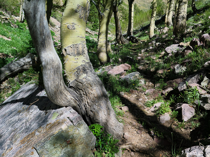
Some cool stuff on the trail.
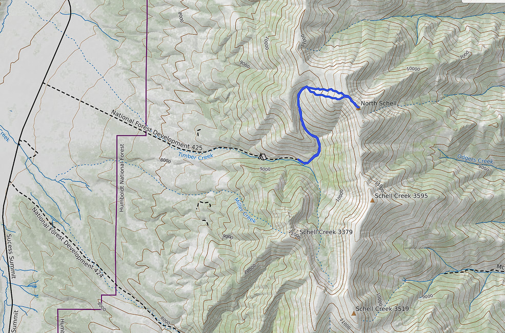
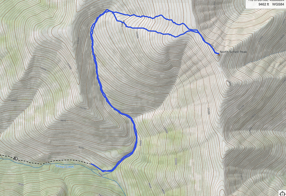
Our GPS tracks from trailhead (south) to North Schell Peak. The southern-most route was our ascent. The northern route was our descent; it avoided much of the continuous talus we encountered on our ascent.
A high point in one of the Basin and Range mountain ranges, Davidson Peak is a fun ridge scramble on ancient sea limestone with great views of eastern Nevada and western Arizona. 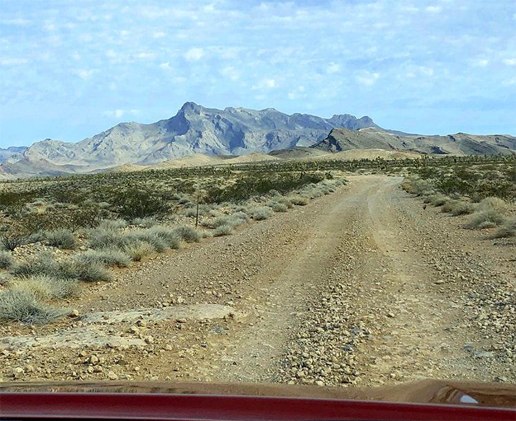 Approaching Davidson Peak from the south on Sheep Pens Road. Trip Stats
Overview: Observe in solitude the raw geologic events and forces that shaped the eastern Great Basin from the tilted limestone sediment summit of Davidson Peak. The fun, rocky scramble up its east ridge has a steep "limestone slickrock" section and circumvents the huge gulch stretching down from the peak. Pass over bryozoan and bright orange brachiopods on slopes with healthy Joshua trees and hedgehog cacti. Location: East Mormon Mountains in Mormon Mountain Wilderness BLM, near Mesquite, Nevada. Distance/Elevation: 5 miles round trip; 2,200' elevation gain. Start = 3,163', summit = 5,315'. Difficulty: Moderate-strenuous Class 2 ridge hike. Coordinates: Trailhead = Sheep Pens Road = 36°53'59.14" N 114°17'51.92" W. Summit = 36°53'45.36" N 114°19'27.51" W. Navigational aids: Bureau of Land Management - Nevada/Overton topo map, Stav is Lost's trip report. Date Hiked: 4/3/22 Geology: East-tilted Cambrian through Pennsylvanian block rooted to its Precambrian basement rocks. Related Posts:
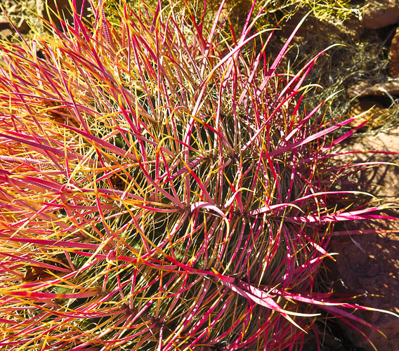
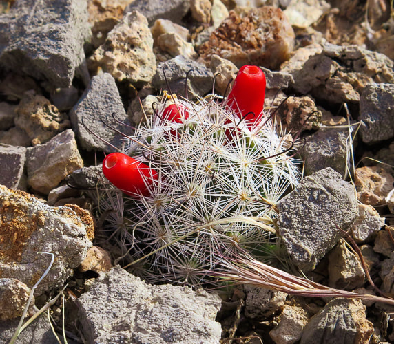
“A million years is a short time - the shortest worth messing with for most problems. You begin tuning your mind to a time scale that is the planet's time scale. For me, it is almost unconscious now and is a kind of companionship with the earth.” - John McPhee, Basin and Range A high point to one of the many parallel Great Basin mountain ranges, the horn-shaped summit of Davidson Peak with its steep west-facing cliffs rises solitary over the expansive Mojave desert as you drive on I-15 heading north from Las Vegas. Formed during the time of shallow seas, when North America was closer to the equator, its rocks are 500 - 300 million years old and contain coral and brachiopod fossils. This hike is a ridge ramble for the entire 2.5 miles to the summit, gaining roughly 1,000 feet per mile, and is surprisingly scenic and full of intriguing sights, like bright orange fossils and a gaping, seemingly bottomless gulch. Our goal this year is to hike to as many high points of the Great Basin mountain ranges as we can, and Davidson is our third. We hiked Wheeler Peak and Virgin Peak last autumn, both in the eastern-most Basin and Range region. From Davidson's summit, we could see another target summit, Mormon Peak, the highest point in the Mormon Mountain Wilderness, northwest of Mesquite, a town on the border of Nevada and Arizona. Nevada is the most mountainous state, so we have a lot of choices! Another planned summit is North Schell Peak, a nearly 12,000-foot high point near Ely, Nevada. Our Hike The hike begins after a 12-mile drive north from I-15 that initially follows the Old Spanish Trail. It is a good gravel road but nevertheless slow-going. We parked on Sheep Pens Road just north of the radio towers. A short spur road takes you to the base of Davidson's east ridge. We walked to the end of this road and started up the ridge on the left side of a wide gulch; a few cairns were present. About 1/3 of the way up, we encountered large rocks, so we skirted the left side of the ridge. After skirting the ridge top, enter a beautiful valley/saddle with great places to take a break and enjoy very healthy Joshua trees, red barrel and prickly pear cacti. Ahead, confront a steep climb to remain on the east ridge. On the way up, we circumvented the actual ridge top to the right, looking down into the deep and wide gulch coming from the peak. Davidson Peak is an easy scramble straight ahead. However, it is not too difficult to stay on top of the ridge, requiring some use of hands for hoisting and balance, but mostly a Class 2. The ridge to the summit is long and flat. Summit Views Mormon Peak is seen to the northwest, and the solitary hulk of Moapa Peak to the southwest. The west side drops almost straight down . We could see Virgin Peak to the southeast, an 8,000' summit we hiked last autumn, out of the Gold Butte National Monument. On the way down, we stayed on top of the ridge all the way to the saddle, hiking over a fun, steep, smooth and relatively rockless limestone slab which elevated us high above steep drops on both sides. We stayed for the most part on the ridge the rest of the way down and then descended through a shallow canyon to arrive at the spur road lined with yellow poppies. The ancient Basin and Range mountain ranges rise above a stark and dusty desert; it appears as if there is not much there to discover. But when you get into the "heart" of them, walk over their scratchy limestone and volcanic rocks, circumvent sharp yucca leaves and cactus spines, catch the sudden crimson blooms of a claret cup hedgehog, and feel the desert space you know you are in a special, unique and maybe even spiritual place. Keep On Exploring! From Davidson Peak summit; looking at the ridge we ascended and Moapa Peak in the distance. 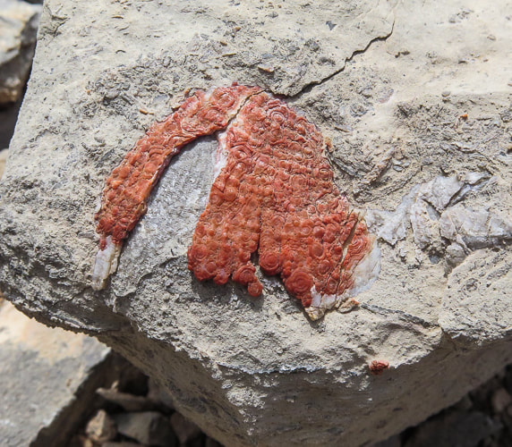 I'm not sure what this is - appears to be a fossil that has been exposed to a lot of iron - maybe a brachiopod? If anyone knows what this may be, please let me know! 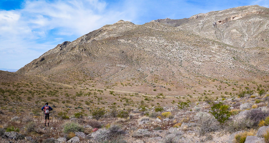 Start of hike; we parked on Sheep Pens Road before it ascended to communication towers and walked cross-country to a spur road from Sheep Pens that led to the base of Davidson's east ridge (right on photo). Davidson Peak is highest point on the right. 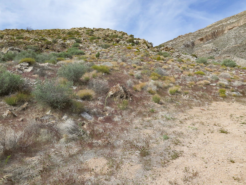 At end of spur road, we hiked up this east ridge with the large gulch to the right. Stay on ridge to the top. 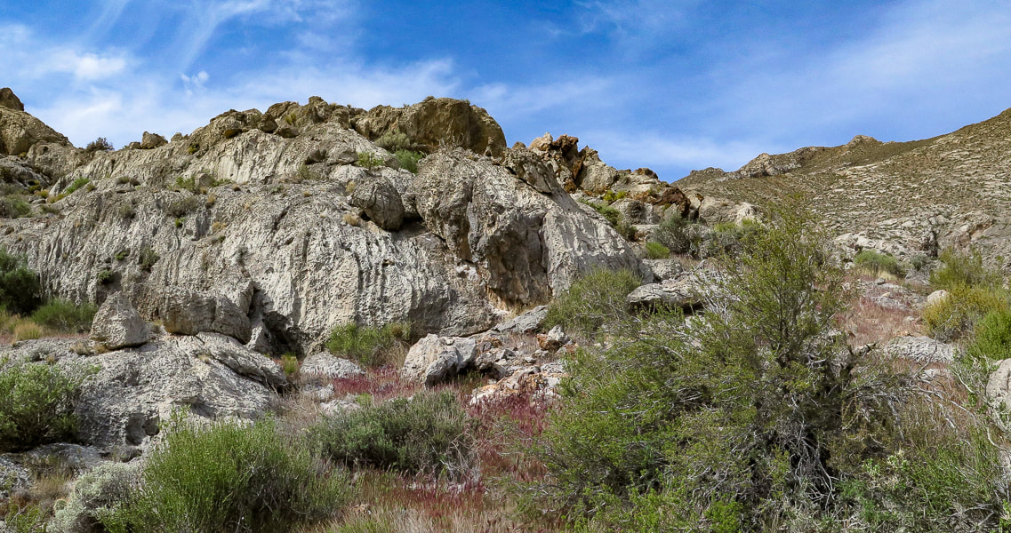 On the ridge 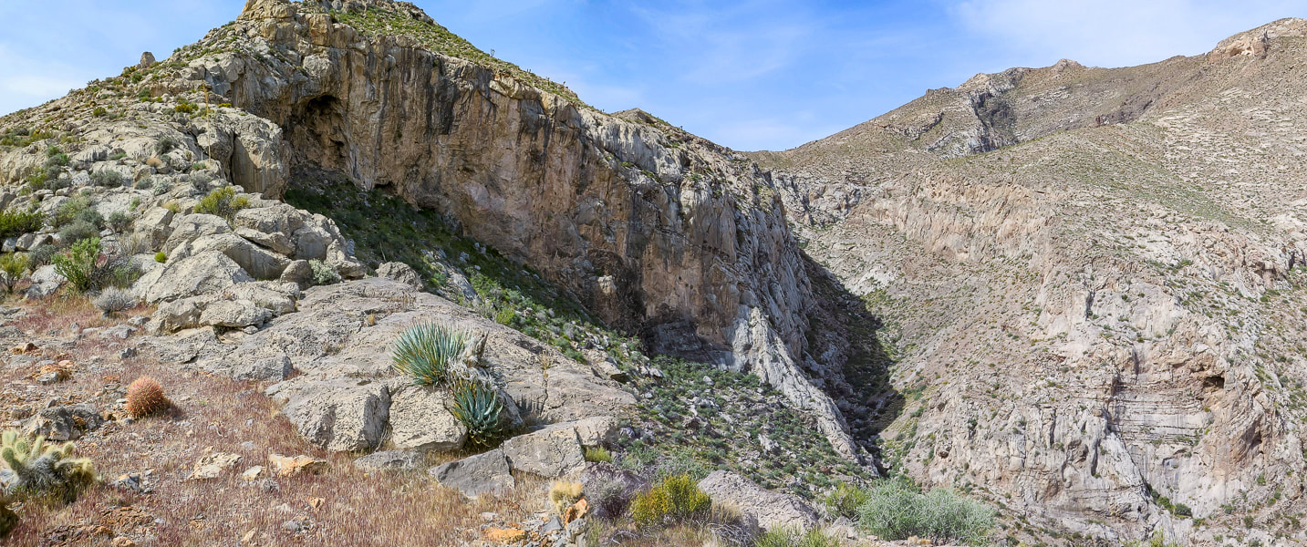 On the ridge, gulch below - summit far right 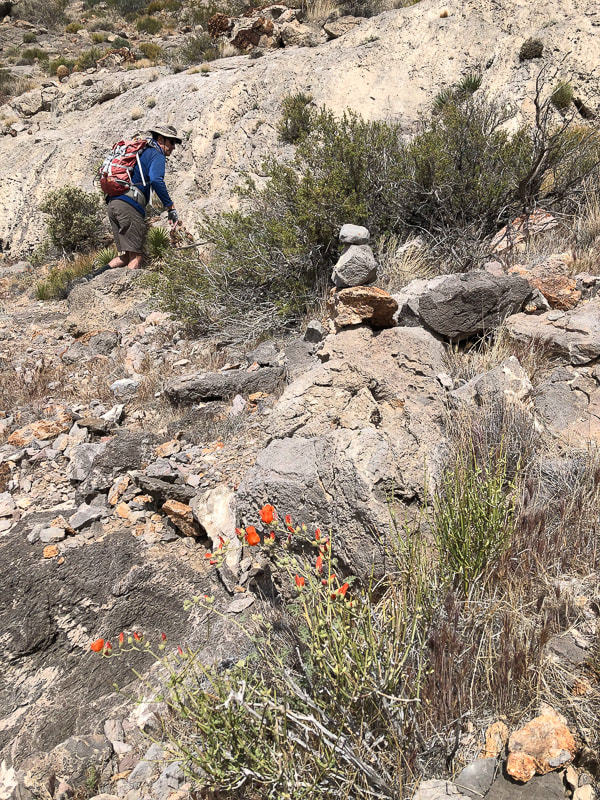 Skirting top of ridge cliffs by hiking on the left side of it ~ 1/3 of the way up. 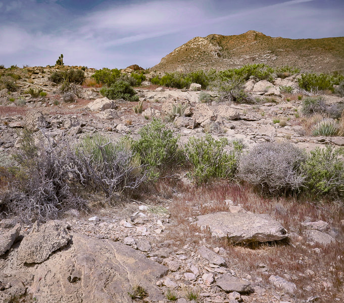 After skirting to the left side of cliffs, regain the ridge to arrive at beautiful saddle. 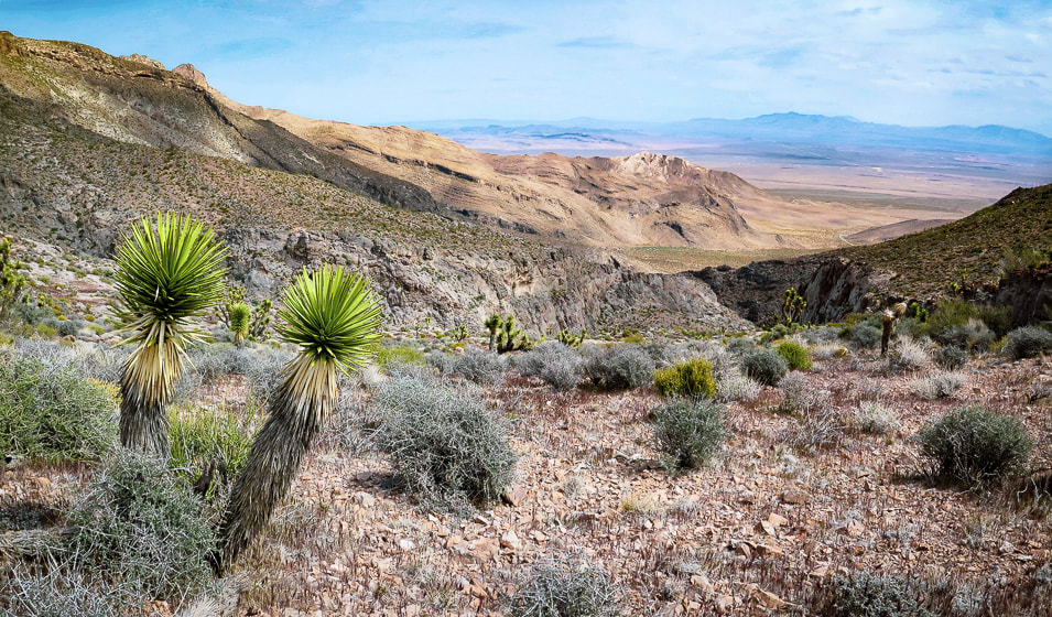 On saddle looking back at ridge on the right and large gully - approach road faintly seen on desert floor. 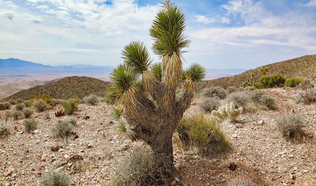 Taking a break on the saddle; Joshua tree, hedgehog cactus, and prickly pear. Some cool stuff on the trail: Fishhook cactus, Indian Paintbrush on the summit, two photos of fossils (corals?), Joshua tree bloom, red barrel cactus. 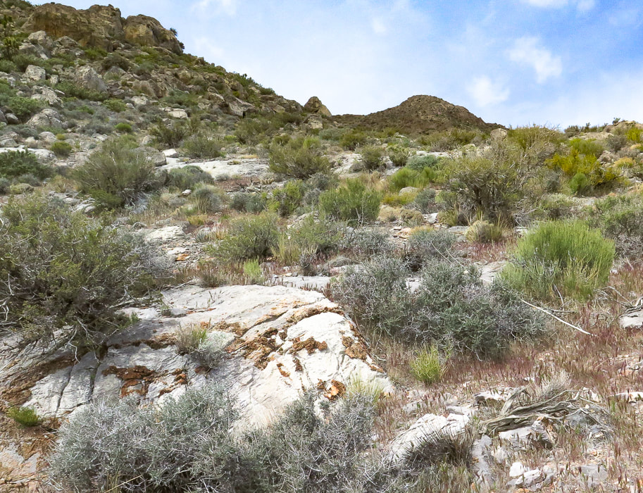 The climb from the saddle up to the summit - about one mile to go! Note limestone with brown chert (microcrystalline quartz) nodules. 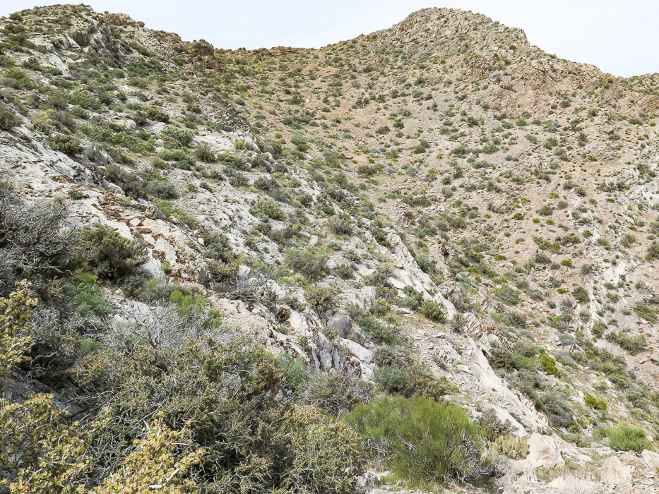 A good look at the summit - easy enough to stay on ridge. 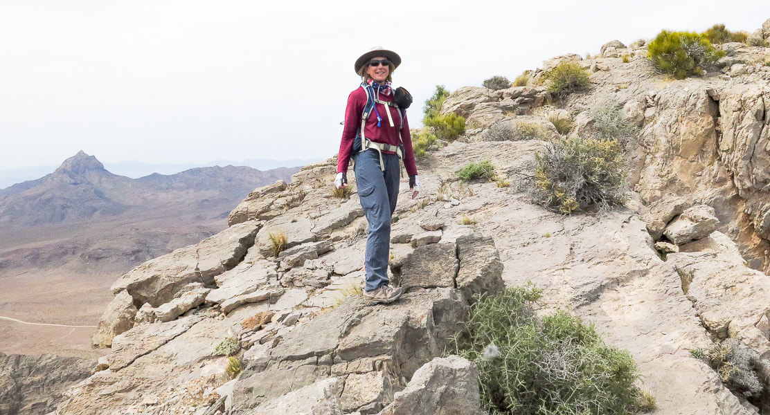 Sue on fun "slickrock" section on ridge - Moapa Peak in background.  Fun walking on ridge line 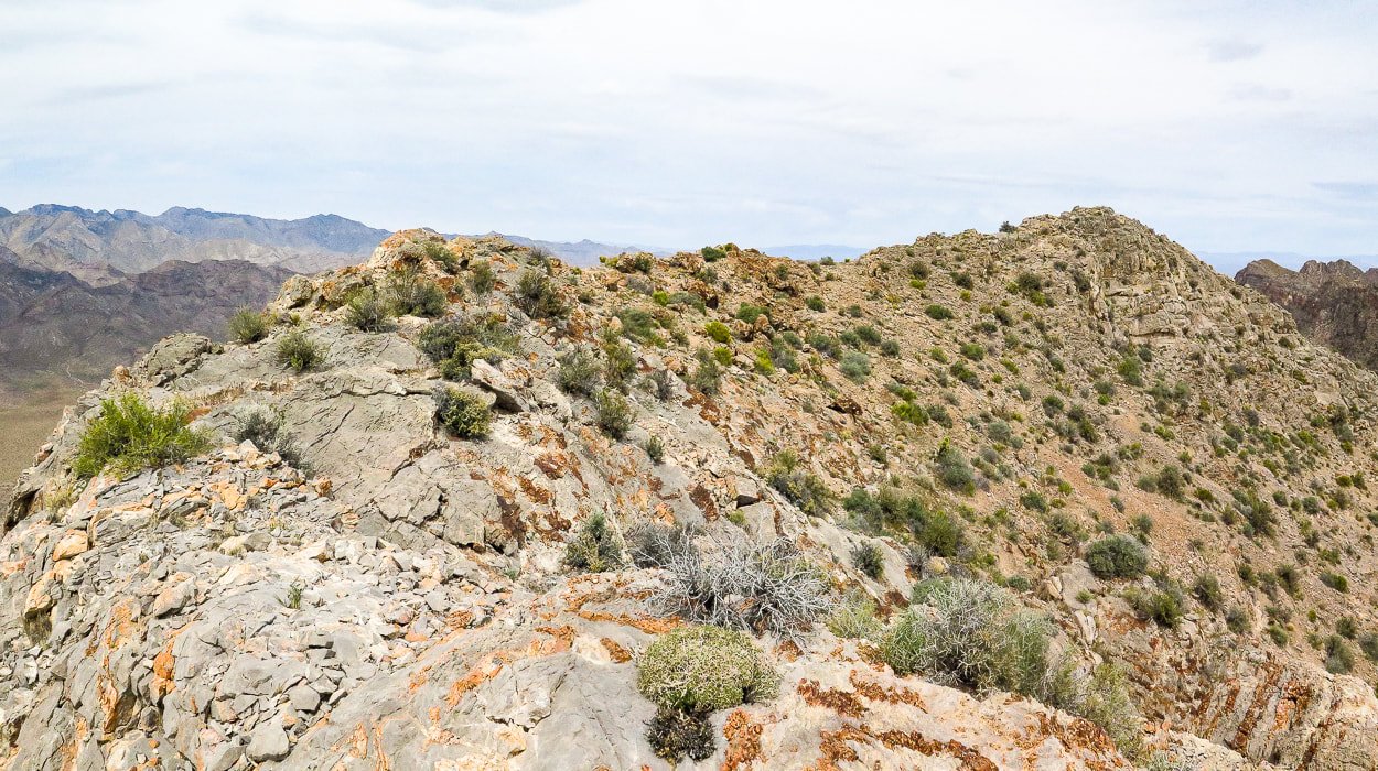 Summit ridge - summit at right 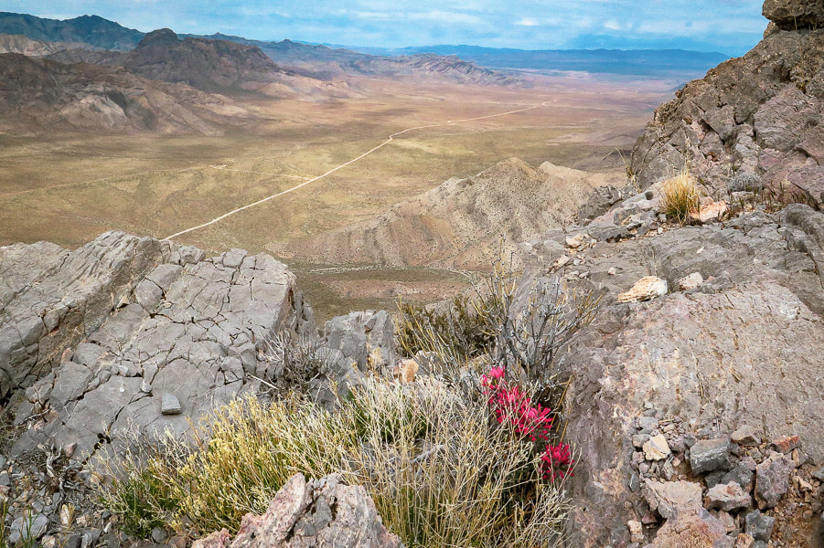 Indian paintbrush on summit. looking northwest to the Mormon Mountains. 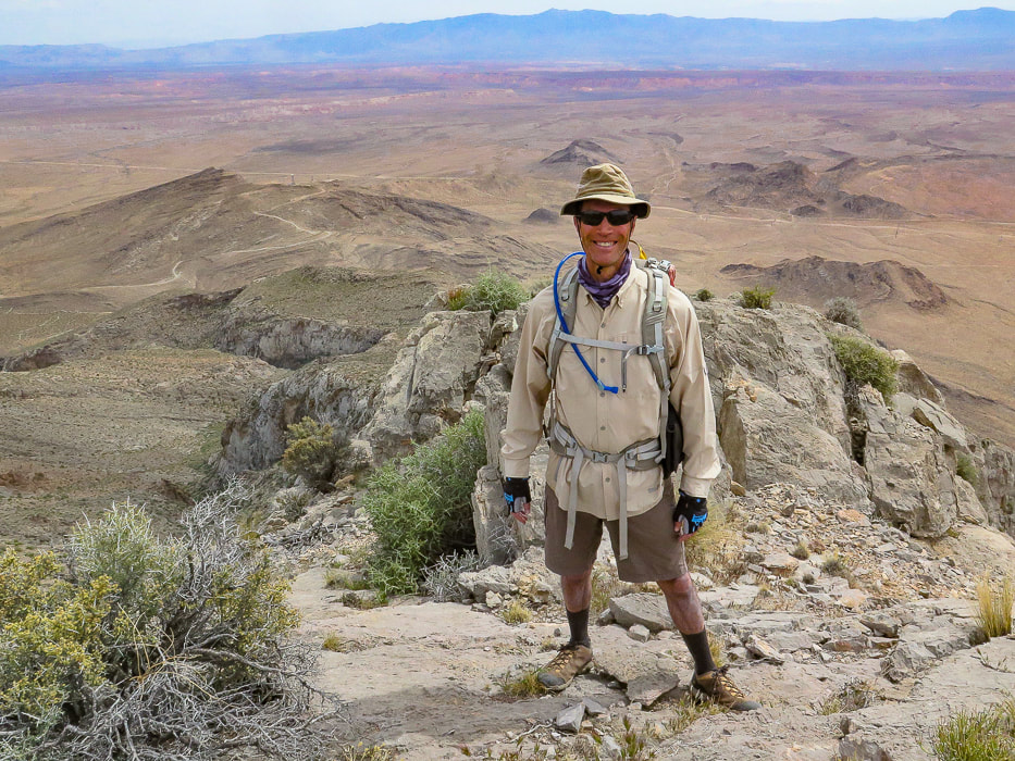 Fred on Davidson Peak summit - what better way to spend Sunday afternoon than summit a Basin and Range peak? 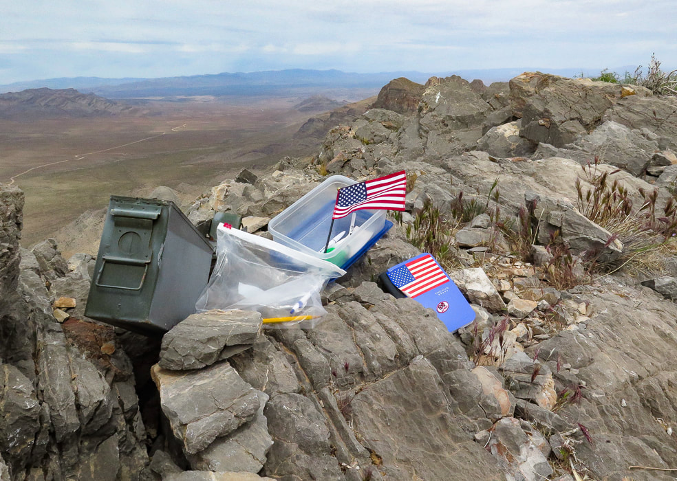 A very patriotic and organized peak register. 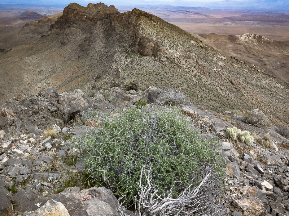 On summit looking north at the East Mormon Mountains ridge. 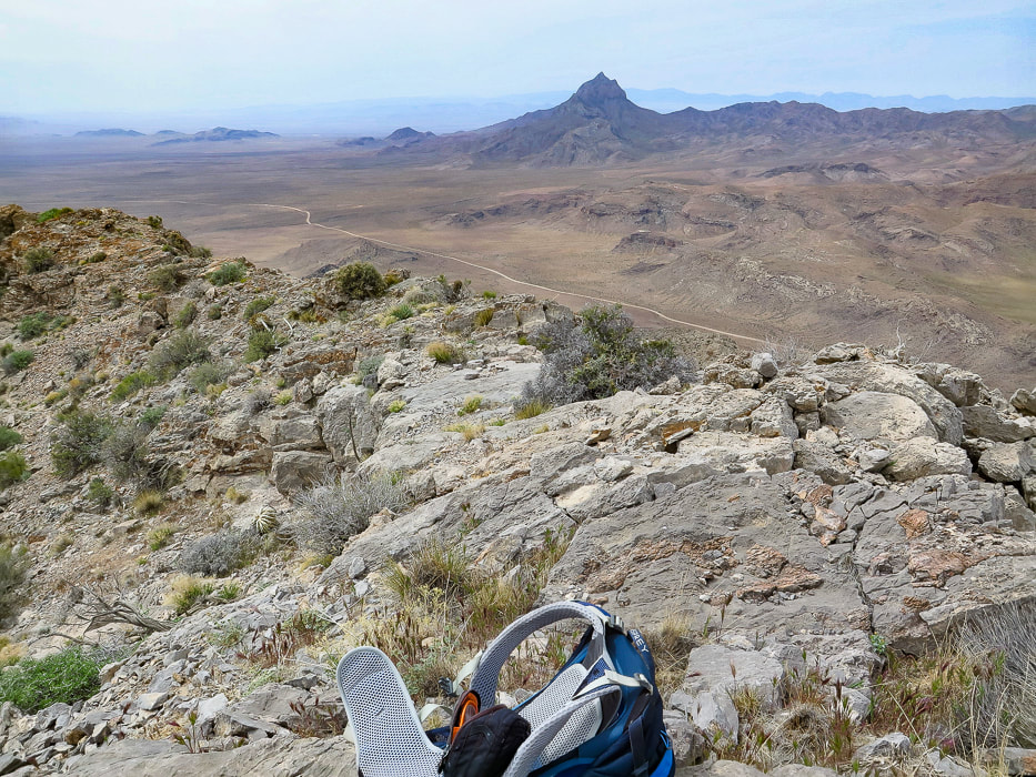 On summit looking at Moapa Peak to the southwest, south of Mormon Mountains. (looks like a fun peak to climb). 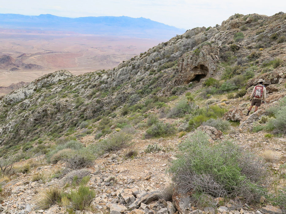 Descending from the summit to follow the ridge back down. 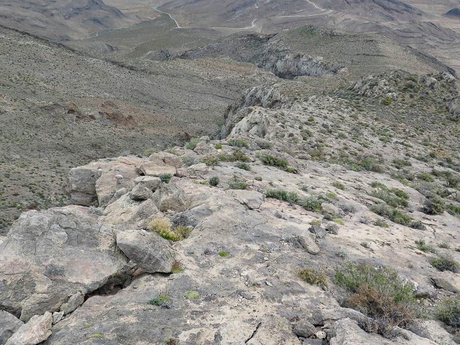 Limestone "slickrock" section!  Back to the Joshua trees in the saddle or flat part of the ridge. We went around to the right. 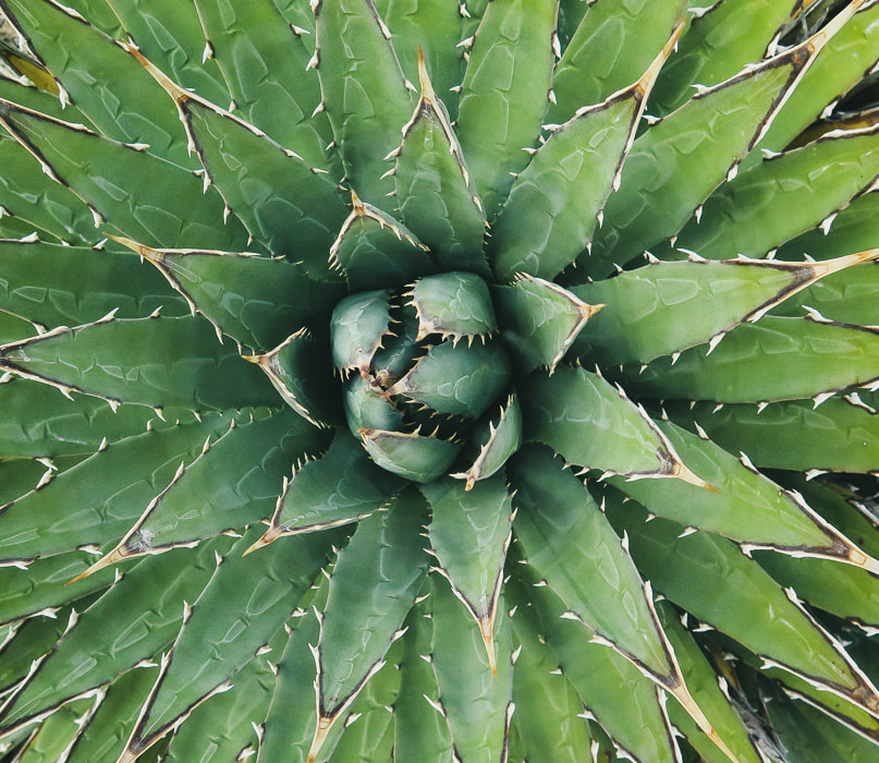 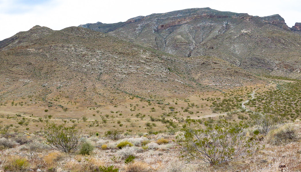 Looking back - we came down the small gulley just off the ridge instead of following ridge to toe.  Parting shot of Davidson Peak. 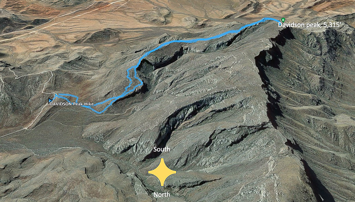 Our tracks - South direction at top of map. The road we started at is Sheep Pens Road; there is a spur road off of Sheep Pen that a good 4-WD vehicle could drive to the base of Davidson's east ridge. 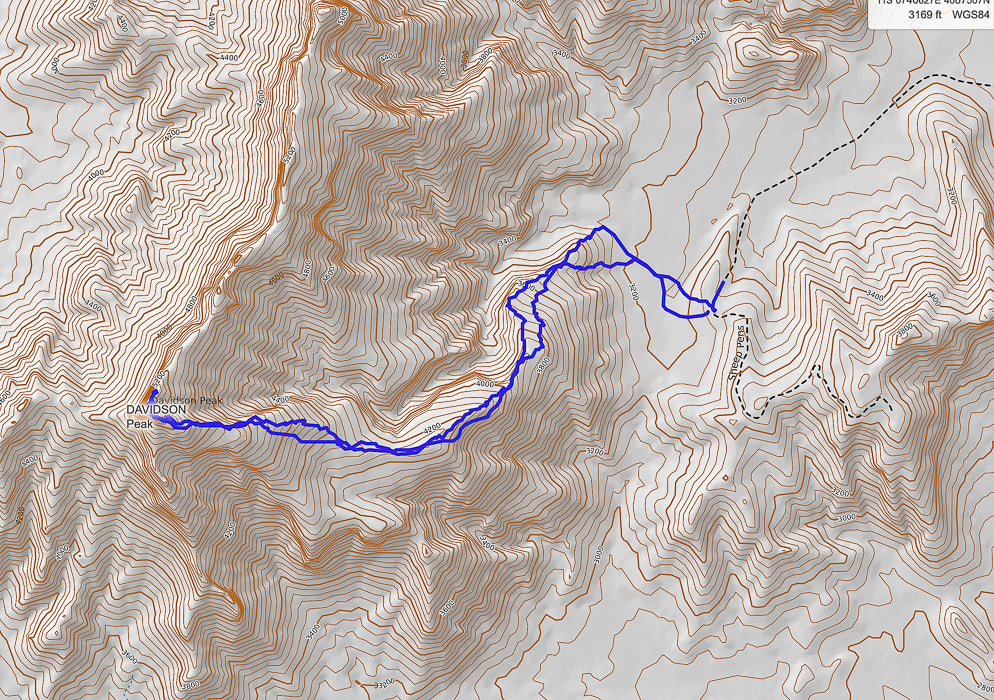 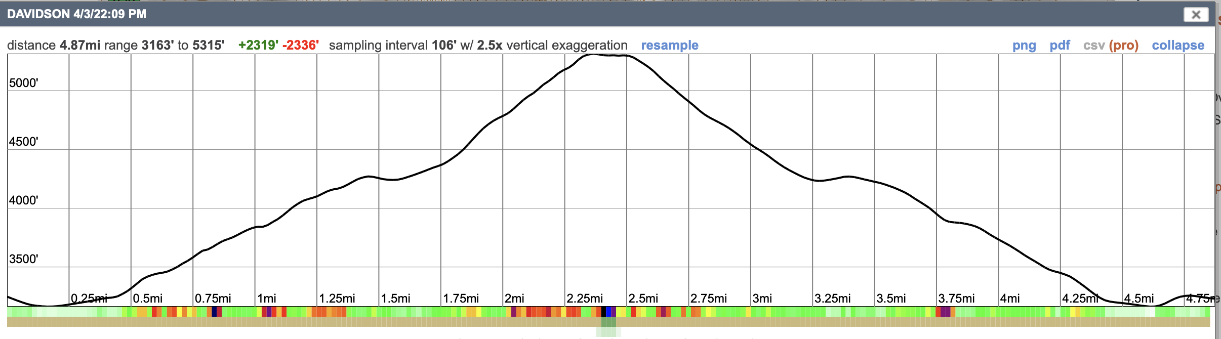 GPS tracks and profile. References
Axen, G.J. , Wernicke, B.P., Skelly, M.F., Taylor, W.J. 1990. Mesozoic and Cenozoic tectonics of the Sevier thrust belt in the Virgin River Valley area, southern Nevada. Geological Society of America - Memoir 176. In the book, Basin and Range Extensional Tectonics near the latitude of Las Vegas, Nevada. Simplified geologic map of the Mormon Mountains - Tule Springs Hills - Beaver Dam Mountains transect. Uploaded by Gary Axen. www.ResearchGate.net.
Making images in the photogenic northern Mojave Desert and a quick hike up Little Virgin Peak.
Related Posts:

We returned to Gold Butte National Monument, about an hour's drive from Las Vegas to explore, hike and photograph this land of meandering gravel roads leading to petroglyphs, weirdly-shaped sandstone spires, old mines, and thrusting sandstone domes. Just a month ago, we hiked Virgin Peak summit, the highest in Gold Butte, on an enjoyable fossil-filled ridge.
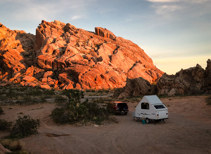
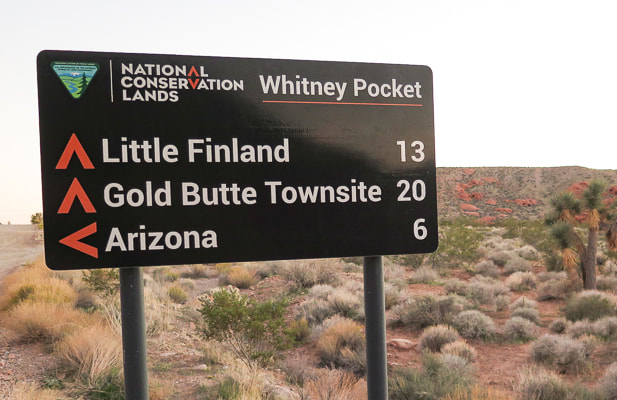
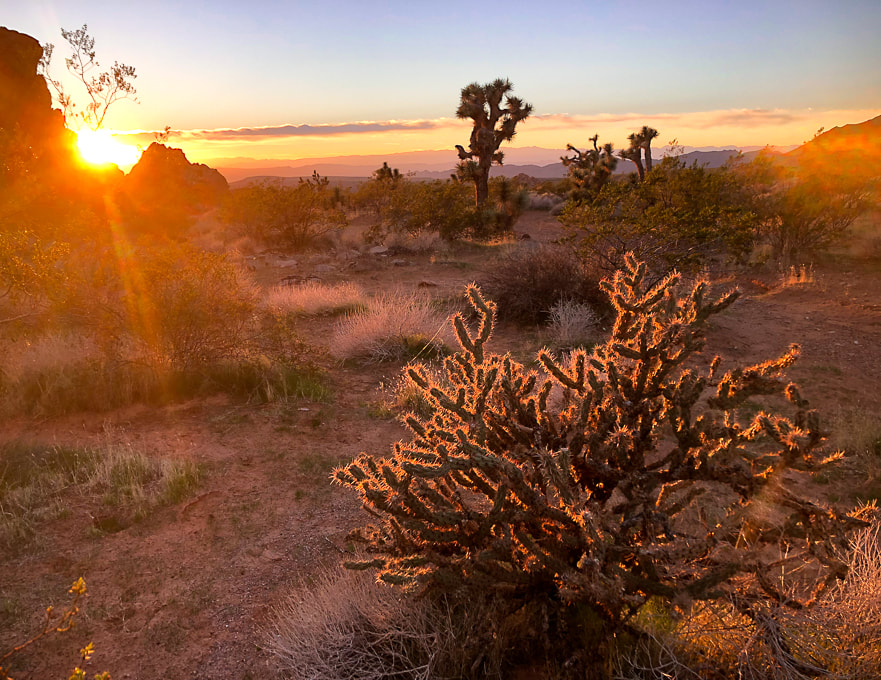
We scored a hidden campsite in Whitney Pocket perched at the end of a platform above a rocky wash on one side and a rough gravel road marked "designated route" on the other. One night we heard an animal walk around our trailer, maybe a deer. The night sky was illuminated by the milky way as well as a weird glow from distant Las Vegas. Gold Butte and recreational side-by-side ATV's make the perfect match. We saw a few large "jamborees" of riders churning through sand and gravel and meeting up at the end of the day to re-fill their deflated tires. While searching out the petroglyphs on the way to Little Finland, not one, not two, but about 15 open ATV's buzzed by us, their dust cloud giving away their whereabouts after vanishing behind a bend. These folks are outfitted with all of the necessary off-road devices: multiple navigational aids and emergency personal locators. On the summit of Little Virgin Peak, we watched another caravan buzzing down the road like ants leading to Lake Mead. This activity looks fun, but I will stick to using my legs and breathing fresh air. The images in my hike descriptions are what I call "photography on the run", where we are moving along and I usually don't have much time to plan or compose my photos. On this trip, however, I had the time in the mornings and evenings, sunrise and sunset, to wander around the beautiful sandstone alcoves and into washes, to take time making images. It is a meditative exercise and a luxury. We wanted to hike Mica Peak, but that meant another 20 miles on slow-going roads, so we saved it for another time. There's so much to see in the American west, Nevada, and this little corner of southeast Nevada. 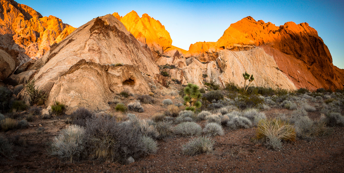
Aztec Sandstone at Whitney Pocket.
Buckhorn cholla at Whitney Pocket.
Detail in sandstone at Whitney Pocket
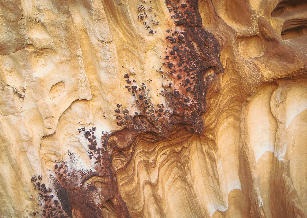
Iron oxide concretions caused by precipitation of iron in paleogroundwater through sandstone. 
Barrel cactus
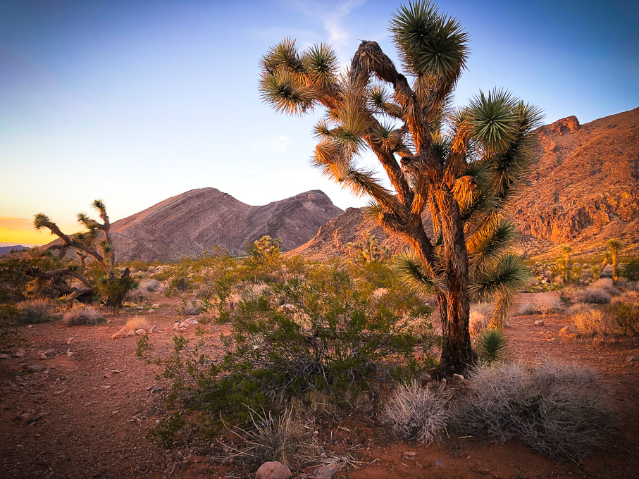
Joshua Tree - a Mojave Desert "indicator" species (a measure of environmental conditions in the Mojave).
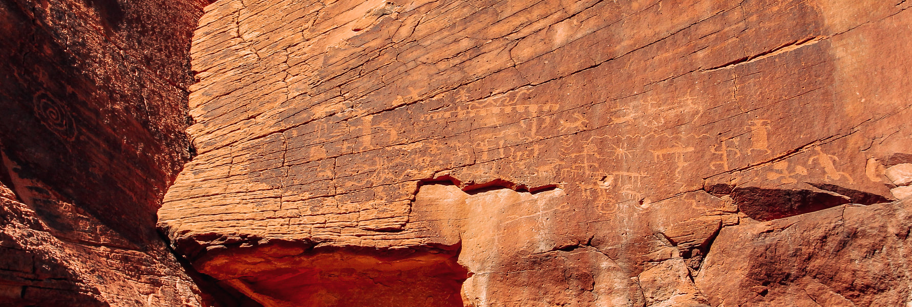
Mud Wash petroglyph panel near Little Finland in Gold Butte National Monument.
Whitney Pocket sunrise.
Whitney Pocket - Aztec sandstone at sunset.
Little Finland - a platform of sandstone features eroded into strange and intricate shapes hanging above a palm oasis.
Our own "private Mojave" hidden by Aztec sandstone in Whitney Pocket - at sunrise.
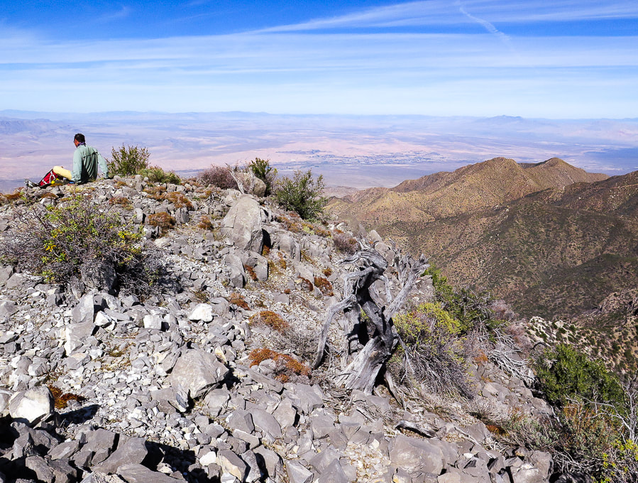
Little Virgin Peak Hike

Summit and rock cairn of Little Virgin Peak; Virgin Peak (8,071') on the horizon.
Trip Stats
Overview: Little Virgin's mellow southwest ridge is a relatively short and sweet way to get fantastic bird's-eye views of the stark northern Mojave desert filled with alluvial fans, washes and mountains of Gold Butte National Monument and Lake Mead National Recreation Area. Location: Gold Butte National Monument, Southeastern Nevada. Coordinates: Little Virgin summit = (UTM) 11S 0748307E 4054422N. Our trailhead = 0749437E 4053626N. Distance/Elevation gain: 2.2 miles out and back/860' gain. Difficulty: Moderate effort Class 2 scramble on faint trail once on ridge. Permit: None required; no entrance fee to Gold Butte NM. Map: Gold Butte National Monument Area Map by Friends of Gold Butte. Date Hiked: December 4, 2021. Driving Directions: From I-15 north of Las Vegas and just south of Mesquite, Nevada, take exit 112 in Bunkerville, onto Highway 170, traveling 3.5 miles, taking a right onto Gold Butte Backcountry Byway just after crossing Virgin River. Continue on Gold Butte Road about 13.8 miles to the base of Little Virgin on the right. We parked at the intersection of Gold Butte Road and the sandy Fisherman's Cove Road, marked with a sign. Hike Directions: Can use east or south ridge: we hiked up south ridge from intersection of Gold Butte Road and Fisherman's Cove Road. From this intersection, hike up slope to the north to gain Little Virgin's south ridge. Continue on ridge to the summit. There is a faint trail occasionally cairned once on ridge.
Our Hike
Gold Butte Road passes by Little Virgin Peak on the way to Whitney Point. The hike is short and sweet with great views of alluvial fans and valleys peppered with black, grey and white limestone rocks. The Virgin Mountain range to the east cascades downward from its highest point, Virgin Mountain in a descending series of saddles and rises, its foot embedded into the creosote-filled plains. The geology is vastly different on Virgin versus Little Virgin and the elevation, too (Virgin is 8,071' and Little Virgin is 3,514'). The Mississippian limestone on Virgin Peak's southeast ridge is younger than the schist and gneiss of Little Virgin. To the west, the view looks across Virgin River to Mormon Mesa and other ranges beyond. The east ridge could be hiked for more mileage. The red barrel cacti and green cholla contrast with the chocolate and rust-colored metamorphic rocks (Proterozoic basement rocks - gneiss and schist). We started walking from Gold Butte Road and Fisherman's Cove intersection through a wash at the base of Little Virgin and hiked up the hill to find the ridge. Once on the ridge, it is an easy walk to the summit, following occasional ducks and cairns along the way. The vegetation is healthy, with a few attractive cactus gardens of California barrel cacti (ferocactus) and buckhorn cholla on the ridge, as well as one of my favorite Mojave plants - creosote bush. It is a long-lived desert survivor with a lifespan of roughly 90 years. But the best attribute of creosote comes to life after a rain. Water penetrates the creosote leaves' waxy coatings to produce the wonderful smell of the Mojave desert. It was used by Native Americans to treat a variety of diseases and as an antiseptic. If you are lucky enough to stay at Whitney Pocket in Gold Butte and want a quick adventure, you won't be disappointed with Little Virgin Peak. Once again, as with every hike, we affirm our fortune of having the health, the legs and lungs, to get to these extraordinary places. 
Creosote bush
larrea tridentata 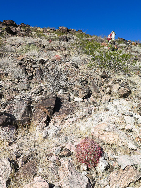
Heading up flank of south ridge.
View of summit
Barrel cactus and buckhorn cholla, metamorphic rock. View to the southeast of Gold Butte Road and Virgin Mountains on the left.
Small "duck" on rock at right to mark trail on ridge.
Summit of LIttle Virgin Peak, looking at Virgin Mountains.
Descending down south ridge to intersection of Gold Butte Road and Fisherman's Cove Road. Virgin Peak highest point on ridge left horizon.
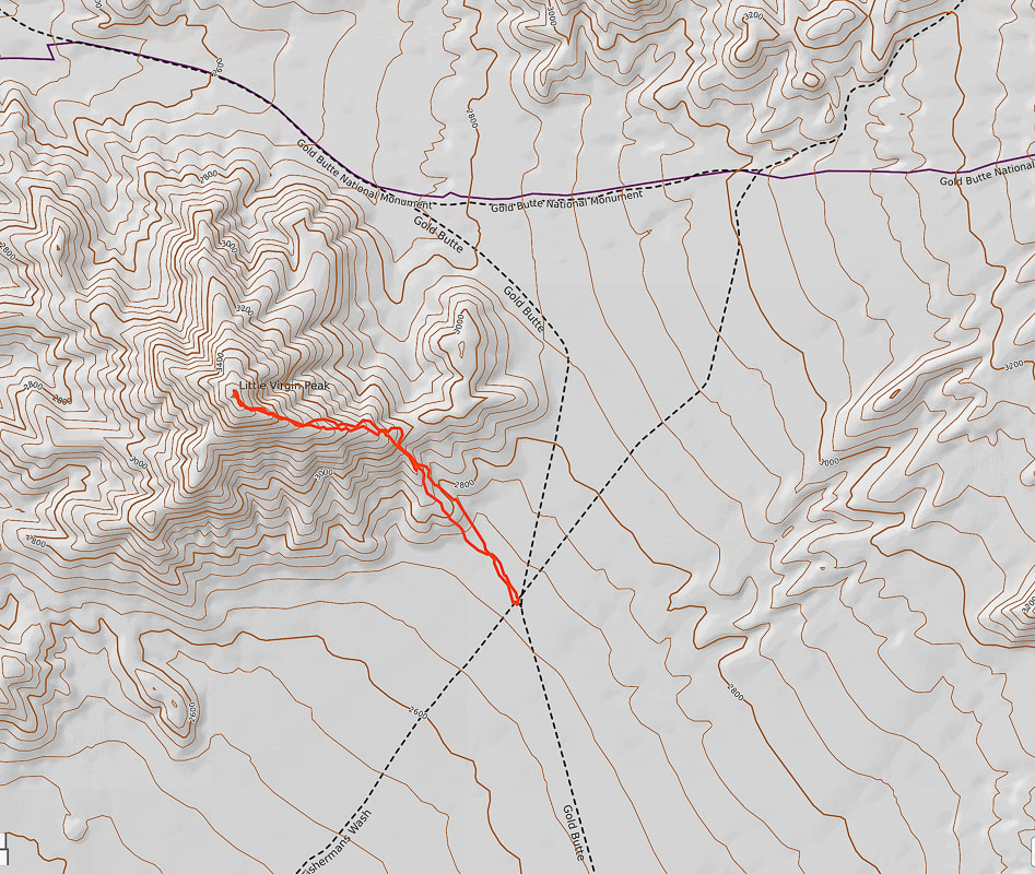
Our GPS tracks to Little Virgin Peak from intersection of Gold Butte Road and Fisherman's Cove Road.
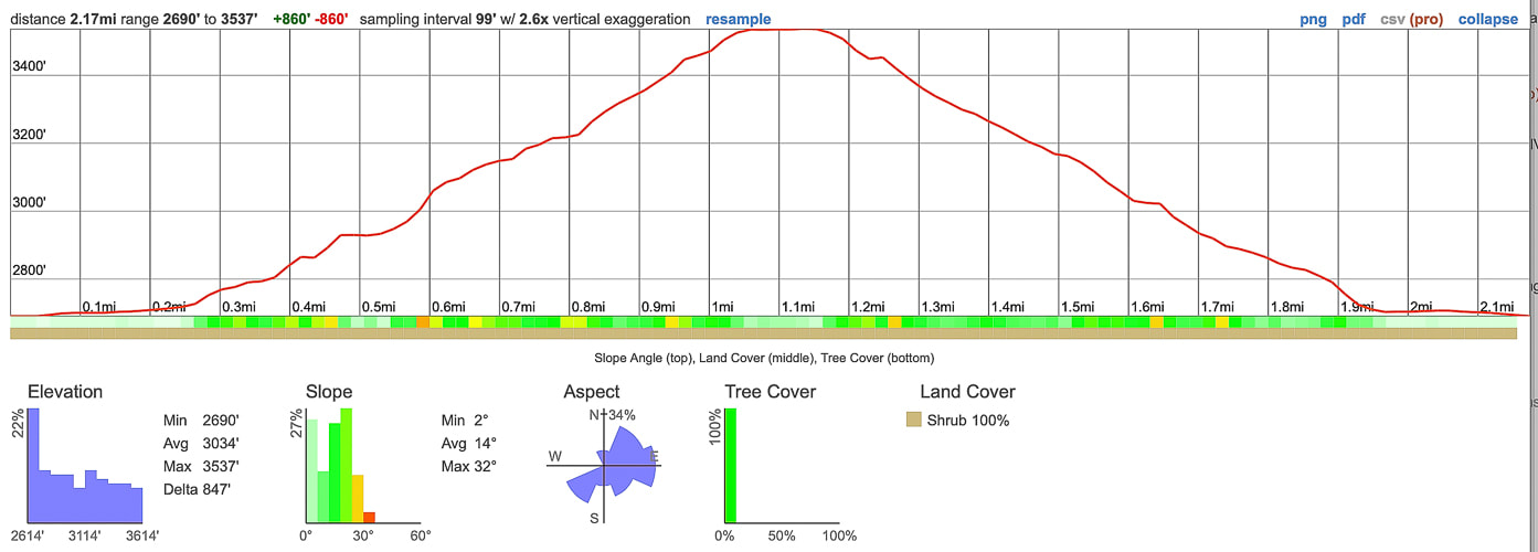
Elevation gain and mileage profile: 1.1 mile from road to summit - 850 feet gain.
References
Gardner, L. The Vegetation of the Mojave and Colorado Deserts. Nevada geology maps. Nevada Bureau of Mines and Geology. pitchstonewaters.com. Creosote Bush: An Unassuming But Ancient Form of Life All Around Us
Remote ridge ramble on fossil-filled limestone northeast of Lake Mead and south of Mesquite in Nevada. Camping the night before among the dramatic sandstone formations at Whitney Pocket in beautiful Gold Butte National Monument enhanced this experience.
Virgin Peak summit, looking north toward town of Mesquite, Nevada and Mormon Mountains on left horizon.
Trip Stats
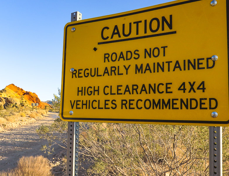
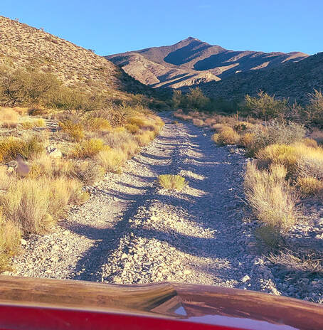
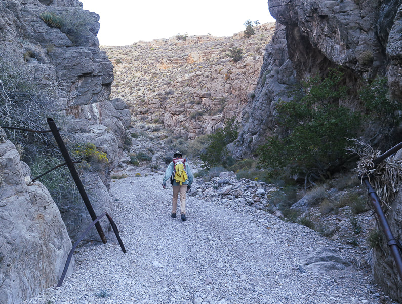
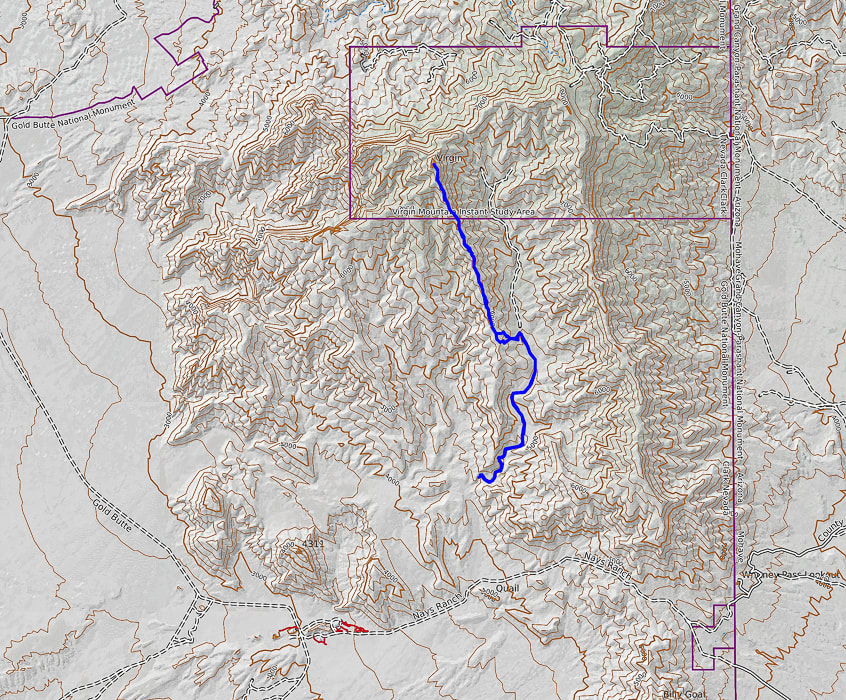
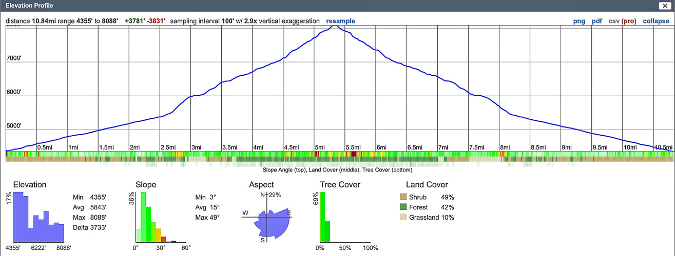
Location/Overview: Virgin Mountains Instant Study Area, Gold Butte National Monument, southeast Nevada, northeastern edge of Mojave desert. The approach to this remote hike begins with a drive through ancient bright orange sand dunes at Whitney Pocket, rising abruptly over Joshua tree-filled valleys, providing private primitive camping coves. The southeast ridge hike has three main sections. The first is a high-clearance 4 WD road that utilizes a deep wash on the right (east) side of the ridge. Next, a steep scramble gains 500 feet from the wash/jeep road to the summit's southeast ridge where the third section is a 2.3-mile, 2,000'-gain beautiful ridge hike to the summit, with many examples of Mississippian-age fossils in limestone, and spectacular views of northern Lake Mead, Valley of Fire, Beaver Dam Mountains to the north. Distance/Elevation Gain: varies depending on how far you can drive up 4 WD road; our distance was 10.85 miles out and back. Our starting elevation: 4,355'. Summit: 8,071', for a gain of 3,700'. Difficulty: Moderate hike on 4 WD road, moderate-strenuous Class 2 ridge to summit on faint trail occasionally marked by cairns. Coordinates: See waypoints table below. Maps and Apps: Virgin Peak, Southeast Ridge - birdandhike.com, Avenza app on GPS with Arizona Strip Map, Gold Butte NM Area Map (purchased at St. George BLM). Permits/Camping: No permits or fees required. Dry camping at Whitney Pocket in Gold Butte NM. Date Hiked: November 3, 2021. Considerations: Long pants advised due to a lot of bushwhacking through shrubs and trees, exposed ridge (thunderstorms), the higher the clearance of your 4 WD vehicle, the nearer your access to trailhead at Cowboy Campsite. Geology: On southeast ridge and on summit, you will be walking on Rogers Spring Limestone AKA Monte Cristo Group (Mississippian period ~ 340 million years ago). Canyon walls on the way up to ridge are Devonian (~ 400 mya) and Cambrian (~500 mya). Geologic map of the Virgin Mountains Instant Study Area, Clark County, Nevada
Related Posts:
“The Mojave Desert is a harsh, but very spiritual, place. As children growing up in the Mojave, we chased lizards and snakes, instead of frogs and squirrels. There is an arid openness about it, and a true feeling of being alone, that you don’t get in any other type of environment.”
- James Stanford, from Shimmering Zen 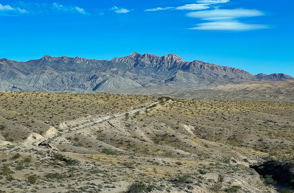
Virgin Peak from Interstate 15 in Nevada.
Our Hike
In our quest this year to explore "off the beaten path" areas in southwestern Utah, away from crowded national and state parks, we have seen some sublime, amazing and sometimes astonishing wilderness beyond park borders, almost always in solitude. Last month, we explored part of the Beaver Dam Mountains. Our adventure this month landed us on the highest summit in the Virgin Mountains, a remote "sky island", rising more than 6,000 feet above the dusty desert floor of southeastern Nevada, a little over an hour's drive from Las Vegas. Extra work goes into figuring out approaches and routes to these less-traveled places, but I find this more meaningful and fun than hiking in well-traveled parks. In 1993, the first time I visited Zion National Park, there were a total of 2.4 million visitors. This year, 2021, looks like it will top 5 million visitors. When I visited Zion in May this year, I noticed the trails were much wider and literally trampled. On Virgin Peak's ridge, we had to focus on finding the trail, as it is not well-defined. I wondered, as we drove on Gold Butte Road to our camping spot from the city of Mesquite, what was so special about this area to make it a National Monument and why so many cared enough to form the Friends of Gold Butte organization. After 20 miles of driving, then suddenly coming upon Whitney Pocket, I understood why. Large, bright orange and red sandstone domes scattered about, anchored into the green creosote and Joshua tree-covered valleys. These large cross-bedded domes glowing orange in the setting sun are remnants of a huge desert formed 180 million years ago, and are the same rock unit as the cliff-forming Zion National Park sandstone. In Utah, this sandstone is called Navajo; the correlative unit of sandstone in Nevada is called Aztec. 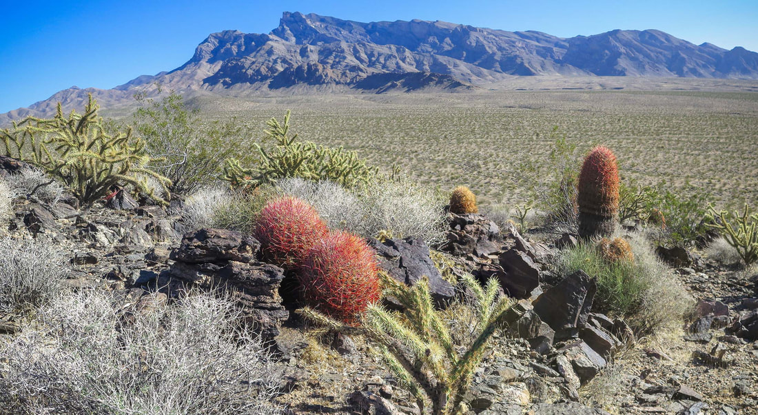
View of Virgin Peak and its southeast ridge from Little Virgin Peak.
Mojave desert sunset at Whitney Pocket in Gold Butte National Monument, Nevada.
You can't beat the sublime Mojave Desert sunsets.
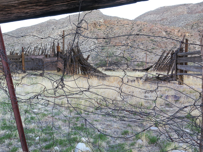
Whitney Corral - a glimpse of past ranching. The spring that once provided for cattle is reportedly dried up.
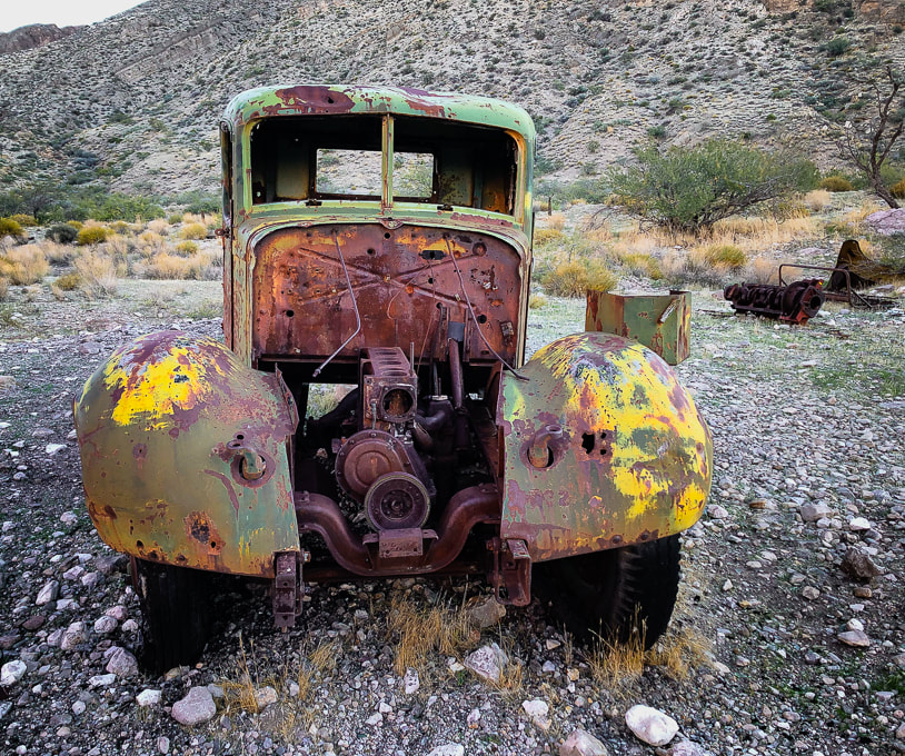
A thing of beauty - look at that patina!
Narrower, high clearance vehicles would be able to get up the road further than we did.
I used the waypoints from birdandhike.com and Avenza with the Arizona Strip Map loaded to make sure I was at Cowboy Campsite. Stay on the main road. Two spur roads take off to the right, but you want to stay left near the ridge you will be mounting. Near the Cowboy Campsite, three miles from the corral, remnants of ranching gear appear: old truck tires, water troughs, the metal skeleton of a chair and various other rusted relics and another old truck! See my waypoints table below or check out birdandhike.com waypoints.
From Cowboy Campsite you turn left onto an obscure spur road ascending toward ridge through trees and shrubs that runs southwest as you climb overlooking the canyon and road you just climbed.
Near Cowboy Campsite with view of Virgin Peak's southwest ridge to climb. Road goes left at intersection with wash.
Second Segment: Cowboy Campsite to Virgin Peak's southwest ridge.
We turned right (west) off the spur road at its highest point and started ascending through junipers and brush toward the ridge, eventually got above this forest and saw limestone cliffs at ridgeline. The climb is 500 feet in ~ 0.3 miles. We hiked to the right of the cliffs to get onto the ridge instead of hiking to the lowest point on the ridge to the left of cliffs. We did, however, descend on our way back from the lowest point on the ridge down to Cowboy Campsite. 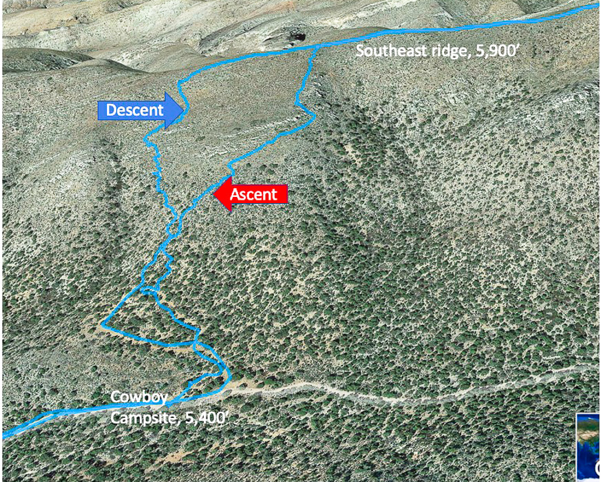
Ascent/descent from Cowboy Campsite and 4 WD road to Virgin Peak's southwest ridge. Ascended right tracks, descended left tracks. Top of map is west, ascend ridge walking west, then turn north to hike to summit.
Some Cool Stuff on the Trail
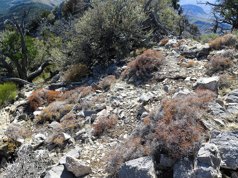
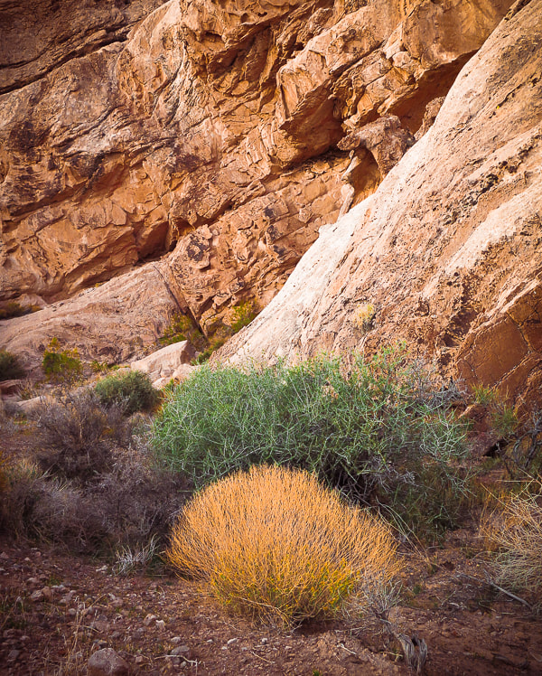
On Virgin's ridge: lots of fossils including brachiopods and corals, a small burn area probably from 2020 fire caused by lightning. I believe the upper right plant is a Utah agave; I have never seen a flower stalk quite like that before!
Final Segment: Ridge to Summit
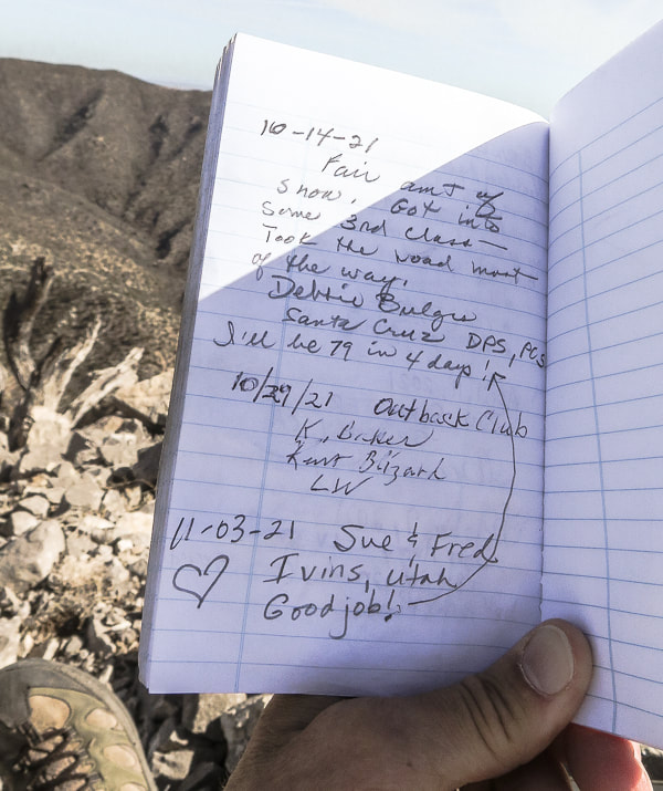
Once on the ridge, follow it 2.3 miles to the summit. The view to the west opens up; Lake Mead is seen (it looks really low) as you ascend the ridge. The ridge heads north to the summit. Wide at first, the ridge narrows and becomes steep to its right (east) side as you ascend. A trail can be seen, especially as you get toward the summit. There are numerous fossils including brachiopods and various corals. Occasionally the light-colored summit is seen behind other "pseudo" peaks or high points on the ridge. There are a few trails that lead downward off the ridge; try to stay on top of the ridge or slightly below it to the west. You will do a fair amount of bushwhacking through trees and cacti. There are a few times hands are used to maneuver up/down rocks. From the summit, the small city of Mesquite, Nevada is due north. The yellow sand washes of Arizona's western Grand Canyon-Parashant National Monument spread to the east. Lake Mead, the largest U.S. reservoir that supplies water to 40 million people, is a small blue line to the southwest. A good view of Pleistocene relict Douglas fir forests are seen in isolated patches just below on Virgin's northeast ridge. The peak's register contains a few small notebooks - one from the Desert Peaks Section of the Sierra Club inside an old ammo box. Two other groups had signed it in October. One of the entries proclaimed, "I'll be 79 in 4 days!". Remarkable. I hope I will be able to write that entry into a remote peak register some day, far above the desert floor. 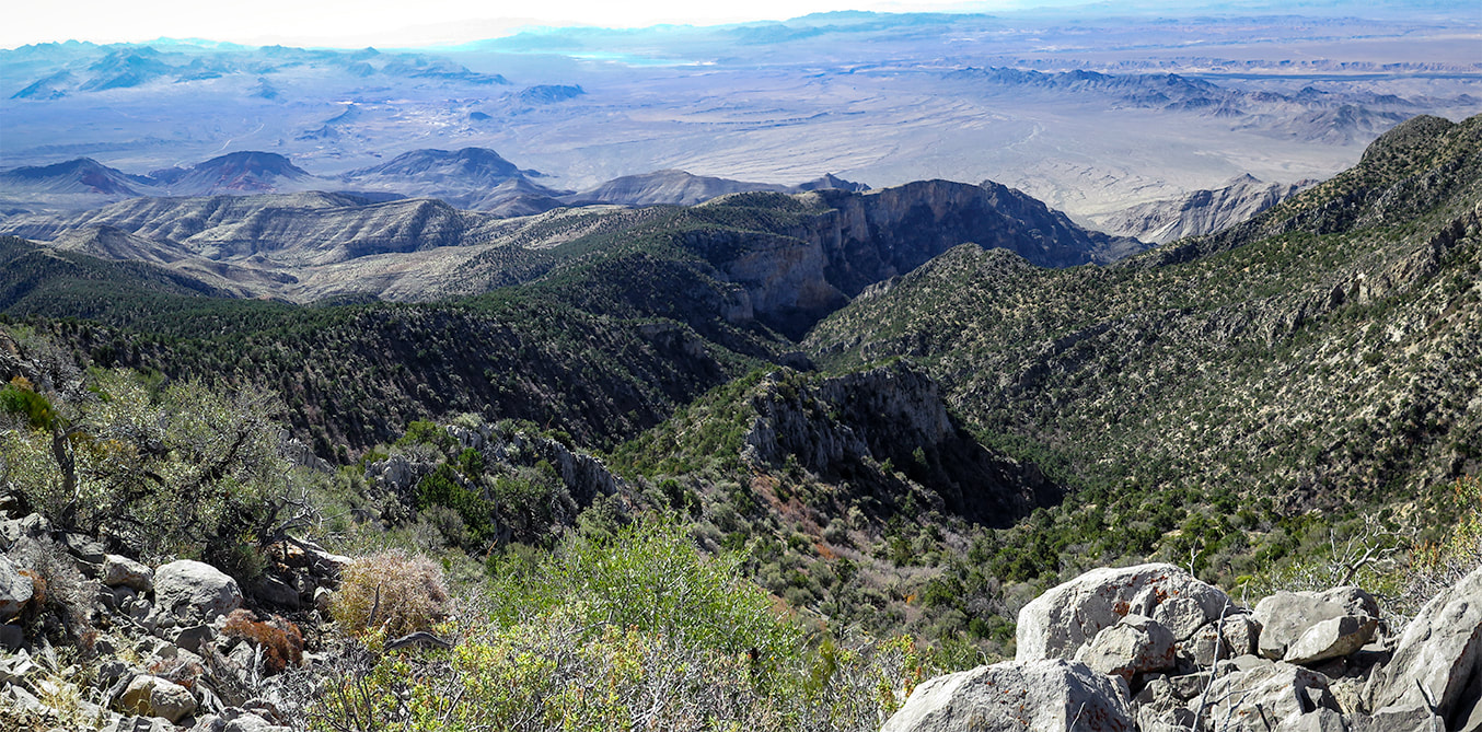
View of Lake Mead to the southwest at top of image.
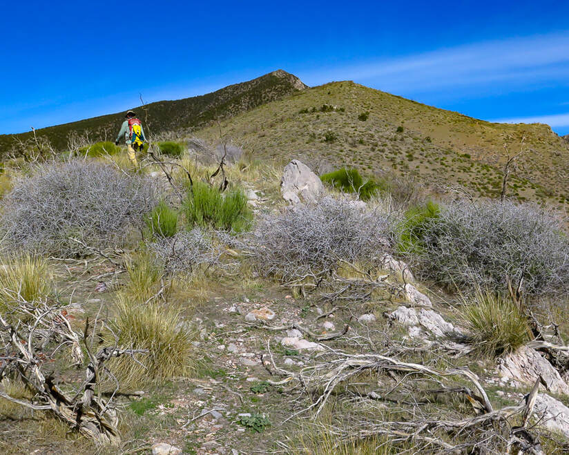
A view of Virgin Peak ahead.
One last rise to climb before the final summit climb (just to the right of this rise).
Getting up there! Ridge is a series of rises.
The last climb to the summit over increasingly steep and rocky terrain - just under 8,000 feet here.
Virgin Peak summit looking south: South Virgin Peak Ridge on the left, Whitney Ridge behind it, Arizona top of image.
Tilted limestone beds to the west.

Virgin Peak register box.
Summit register: an official Desert Peaks Section of Sierra Club notebook.
Solitude in the Mojave Desert
One of the great American nature writing classics, The Desert: Further Studies in Natural Appearances by John C. Van Dyke has been in continuous publication since 1901. Through his descriptions of his travels in the deserts of California, Arizona and Mexico, Van Dyke changed the popular perception that the desert was a hostile wasteland. The book is a bit monotonous, like Thoreau's On Walden Pond, but Van Dyke helped us to see and appreciate the remarkable beauty of deserts. I can relate to his quote and falling in love with what I call "the desert":
"The weird solitude, the great silence, the grim desolation, are the very things with which every desert wanderer eventually falls in love. You think that strange perhaps? Well, the beauty of the ugly was sometime a paradox, but to-day people admit its truth; and the grandeur of the desolate is just as paradoxical, yet the desert gives it proof."
After seeing no one else on the trail, having our own private camping spot the night before, and walking through a few life zones gaining almost 4,000 feet to look over mountains and valleys, we felt as light and as "in balance" as the surrounding environment, in-tune to the rhythms of the living desert. Each hike and each peak has its own personality, and once you understand the desert's "personality" and ways that its plants and animals survive harsh conditions, you can oftentimes relate and then be amazed. What a great way to reset and rejuvenate and relax. We are lucky to live in America's southwest desert in which there are many places to find abundant peace.
Never Stop Exploring Nature!
On the way down
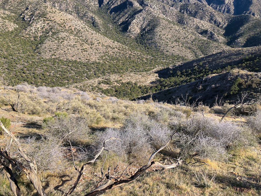
Near point on ridge to descend to Cowboy Campsite in wash below.
Signs of autumn on the way down.
The new and the very old.
Joshua trees at Whitney Pocket.
Detail in sandstone at Whitney Pocket
Iron oxide concretions caused by precipitation of iron in paleogroundwater through sandstone 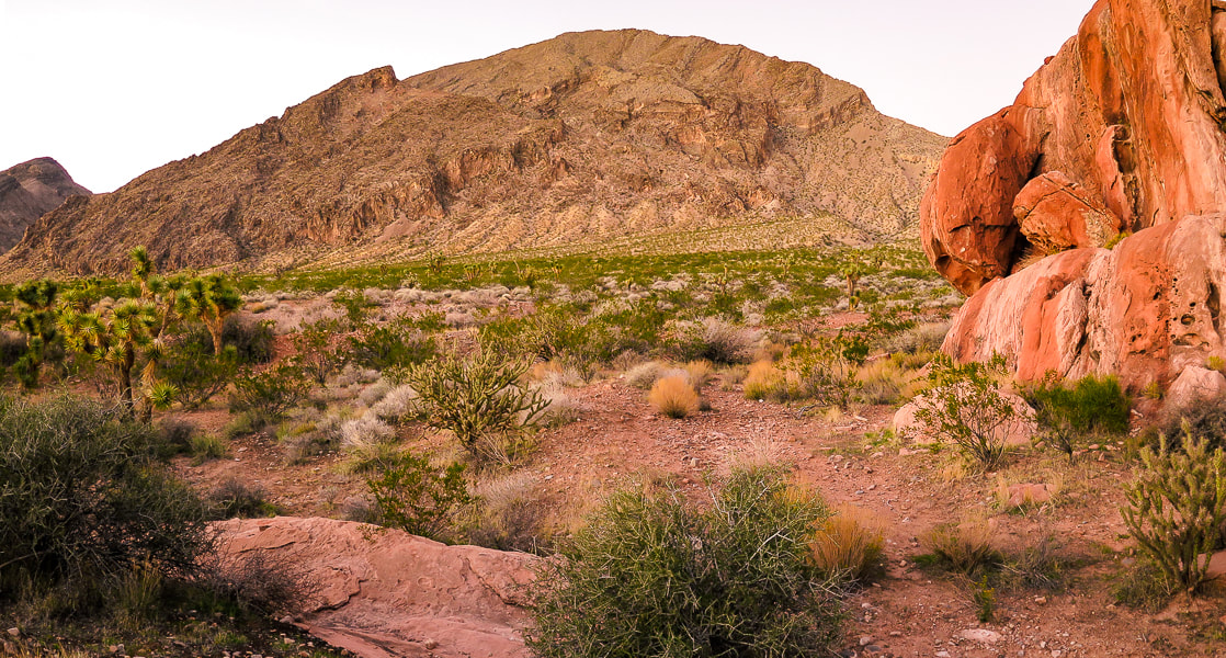
At Whitney Pocket in Gold Butte National Monument: Younger orange sandstone and very old limestone ridge on each side of a cholla and joshua tree-filled valley.
Our GPS tracks and profile. Top of the map is north.
References
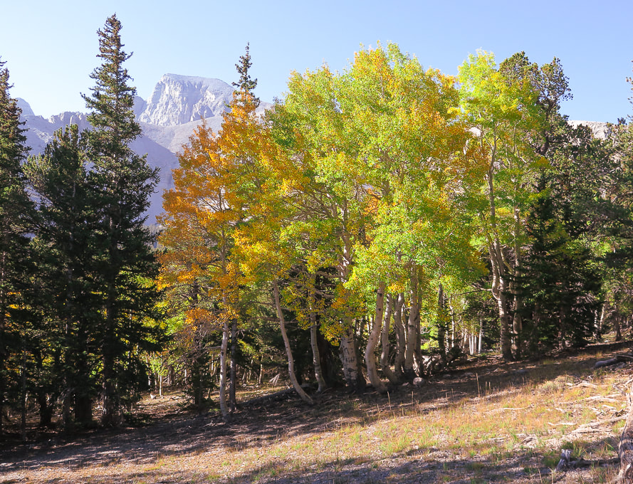
The Geology of Gold Butte National Monument - a thumbnail sketch. Friends of Gold Butte.org. Geologic Formations of Utah. Navajo Sandstone. UtahGeology.com. Recreation visits by month, Zion NP. nps.gov. Hiking around Las Vegas and Gold Butte National Monument. birdandhike.com Lake Mead Drops to a Record Low. NASA Earth Observatory. Stringfellow, J. 2015. John C. Van Dyke and the Desert Wasteland. mojaveproject.org. Whitney Pocket. The American Southwest. Great opportunity to see an astounding view of eastern Nevada from its second-highest peak way above tree line on a well-maintained trail. We picked a gorgeous late summer day when the aspens in the high country were changing color. 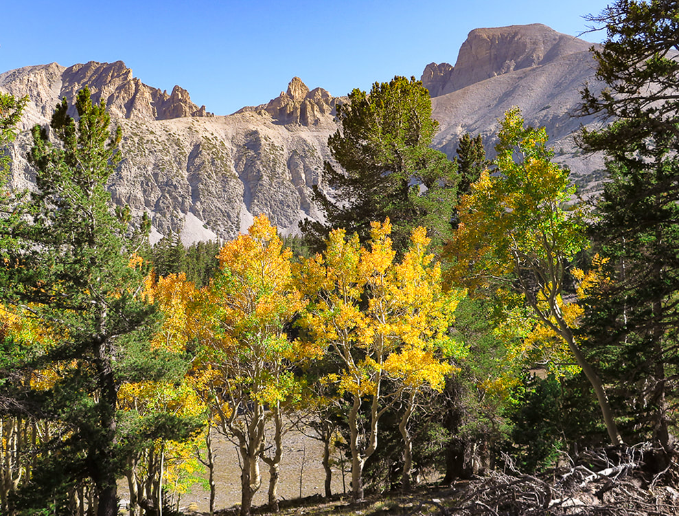 Wheeler Peak (right) on a beautiful September day. Trail follows ridge line on the right of peak. Trip Stats for hike via Alpine Lakes Loop Trail and Wheeler Peak Trail
Location: Snake Range, eastern Nevada, Great Basin National Park: closest towns are Baker and Ely. Trailhead: Bristlecone - Alpine Lakes Trailhead. Distance and Elevation Gain: 8.4 miles out and back for a 3,100' gain. Trailhead = 9,957', Summit = 13,063'. Difficulty: Moderate - Strenuous Class 1 Coordinates: Wheeler Peak Summit: 11S 0732663 E 4318632N Trailhead: 11S 0733174E 4321347N (UTM). Permit/Fees: No entrance fee, no permit required. Maps: Great Basin NP, Google Mymaps interactive map (below), Great Basin National Park - National Geographic Trails Illustrated map 269. Date Hiked: September 15, 2021. Considerations: Trail is exposed for last 2 miles (and 2,000 feet of elevation) to the summit - watch weather. There are 2 trailheads: Alpine Lakes Loop Trail and Wheeler Peak Summit Trail. See park map below. Ridge line is very windy. History: Named after George Wheeler of the Wheeler Expedition in charge of surveying southeastern and southern Nevada in 1869. He and a party consisting of a guide, the Nevada state geologist, and three others succeeded in reaching the summit and found, through careful barometric measurements, the elevation to be 13,063 feet above sea level. Measurements for the precise distance to other mountain peaks were conducted for four summers beginning in 1881. The survey, combined with other federal surveys, resulted in the first accurate network of surveyed points crossing the continent. Related Posts:
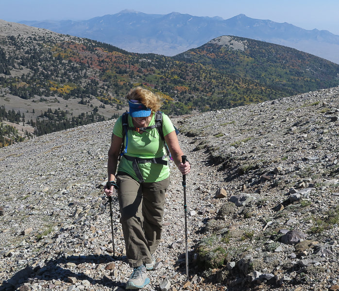
Video - the final climb to the top Overview Long before our turn-off to Ely from northbound Nevada Highway 93, we saw the point in the sky that we would be standing on the following day - the summit of the giant and majestic Wheeler Peak in eastern Nevada. Definitely worth a grin and a "wow" from two people who love to get to high places! Wheeler is the second-highest Nevada peak. Boundary Peak, close to the California border, is Nevada's highest. Stately Wheeler Peak stands with authority over lesser peaks of the Humboldt-Toiyabe National Forest, surrounded by miles of sagebrush in what is known as the Great Basin. We met our friends Val and John for the hike. All four of us had been on our share of immense loose and trail-less talus slopes this past summer while climbing some of Idaho's highest peaks in the Lost River Range (Leatherman Peak), so we were grateful for Wheeler's stable and well-defined trail to the summit. Yes, it is steep and rocky, but not intimidating. The forest thins at about 2 miles into the hike, and views of jagged Doso Doyabi ("white mountain" in Shoshone language), to the left (east) of Wheeler are spectacular. Steep, huge rock slopes cascade down from these high points, and at various times of the day they are hidden in shadows. The Wheeler Peak glacier sits protected in a cirque at 11,500 feet. It's pretty small (2 acres), and the only glacier in Nevada. Some of the fiercest winds I have ever encountered were on the ridge leading to the final steep ascent at about 2.5 miles into the hike, when Fred and I hiked this summit 18 years ago. This time the wind speed wasn't blowing us over, but it still had us holding onto our hats. In contrast, at the top an intermittent breeze wafted in and out of our summit celebration. 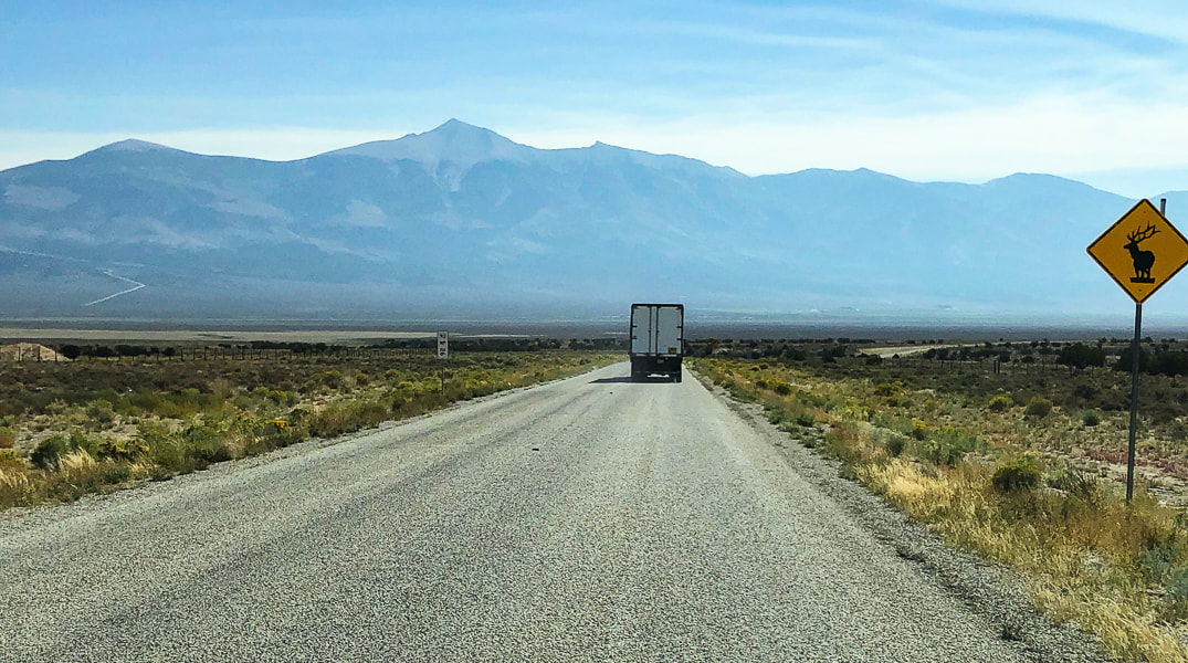 Wheeler Peak towers over the sagebrush steppes of eastern Nevada. This photo was taken while driving east from Ely, Nevada.  Val and Fred at trailhead
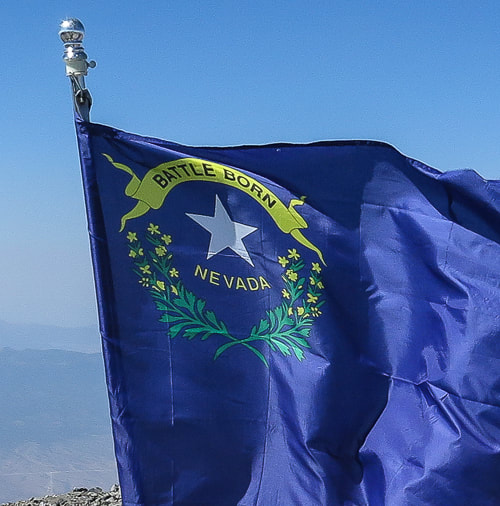
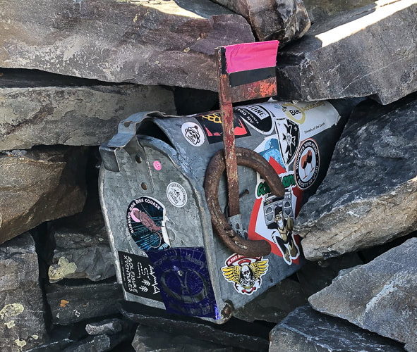
 First view of Wheeler Peak on Alpine Lakes Loop Trail 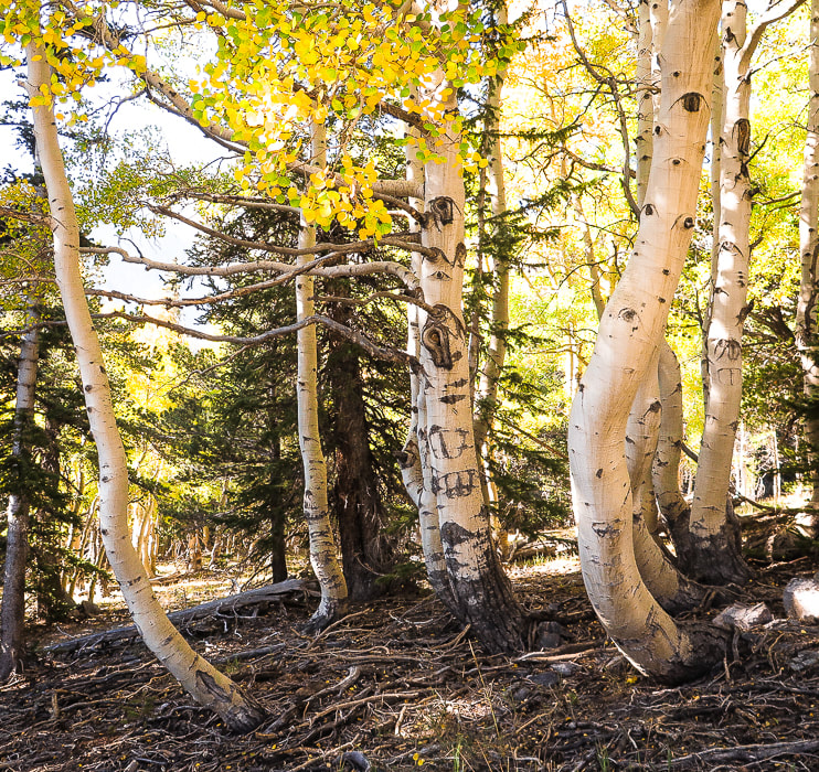  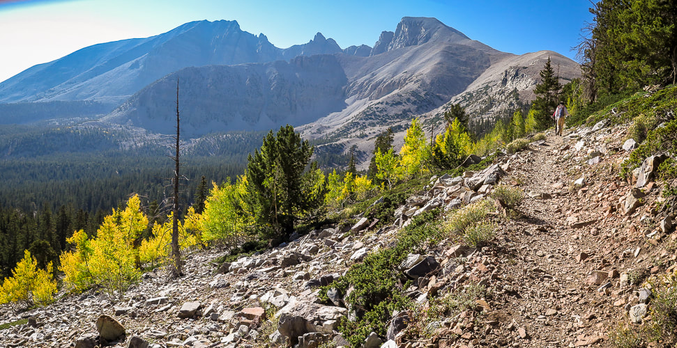 On the Wheeler Peak Trail: Doso Doyabi on the left and Wheeler Peak on the right. This trail emerges from tree line at ~ 11,500 feet. On the way up on trail through stable quartzite talus! As the trail emerges from the glacial valley, it climbs through quartzite, a metamorphic sandstone that tends to form resistant ridges and hilltops. A few rock shelters line the trail as it traverses Wheeler's northwest exposed ridge, built by hikers for wind protection. It's pretty darn windy on this section, so we had to shout in order to hear each other. No lightning worries - there wasn't a cloud in the sky. There were some shelters that appeared to be a bit larger, very level and well-constructed. These may have been the tent platforms built by the Wheeler Survey in 1881, according to Bruce Grubbs, from his book Exploring the Great Basin (see History, above). Val, Fred and I were sticking together, John was ahead. Quartzite is resistant to weathering and contains a high amount of silica which doesn't break down much to form soil. The scant amount of vegetation present seems to find small rock recesses to cling to. Arriving onto the north spine of the summit block, the winds calm and the trail steepens. It's just a matter of kicking one foot in front of the other to climb the last spiral path to the summit. A cobalt-blue Nevada state flag, it's edge frayed from the wind marks this significant point in Nevada. The flag's phrase "Battle Born" signifies Nevada's entrance into the union during the civil war. It also illustrates Nevada's state flower with two sagebrush branches. 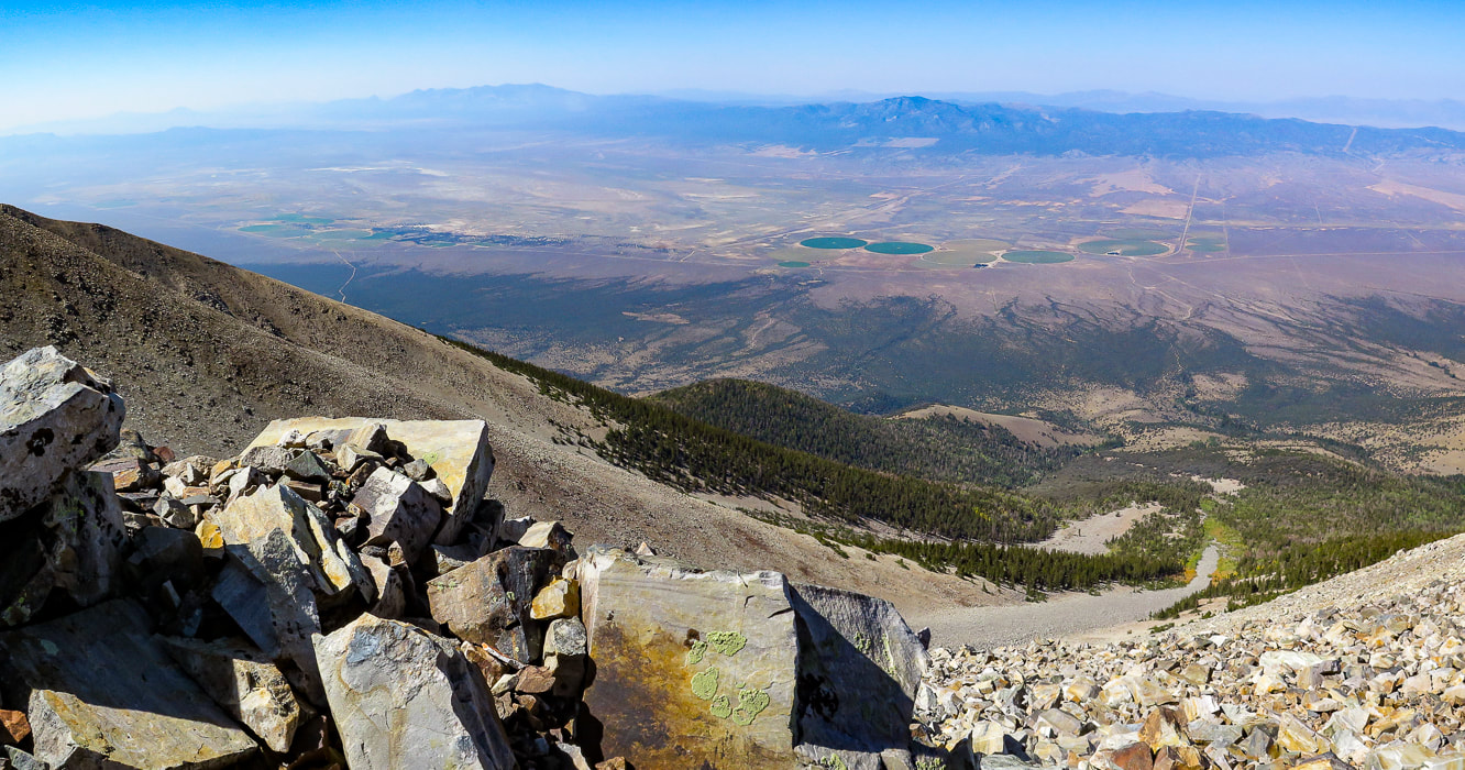 Looking northwest to Spring Valley and the Schell Creek Range 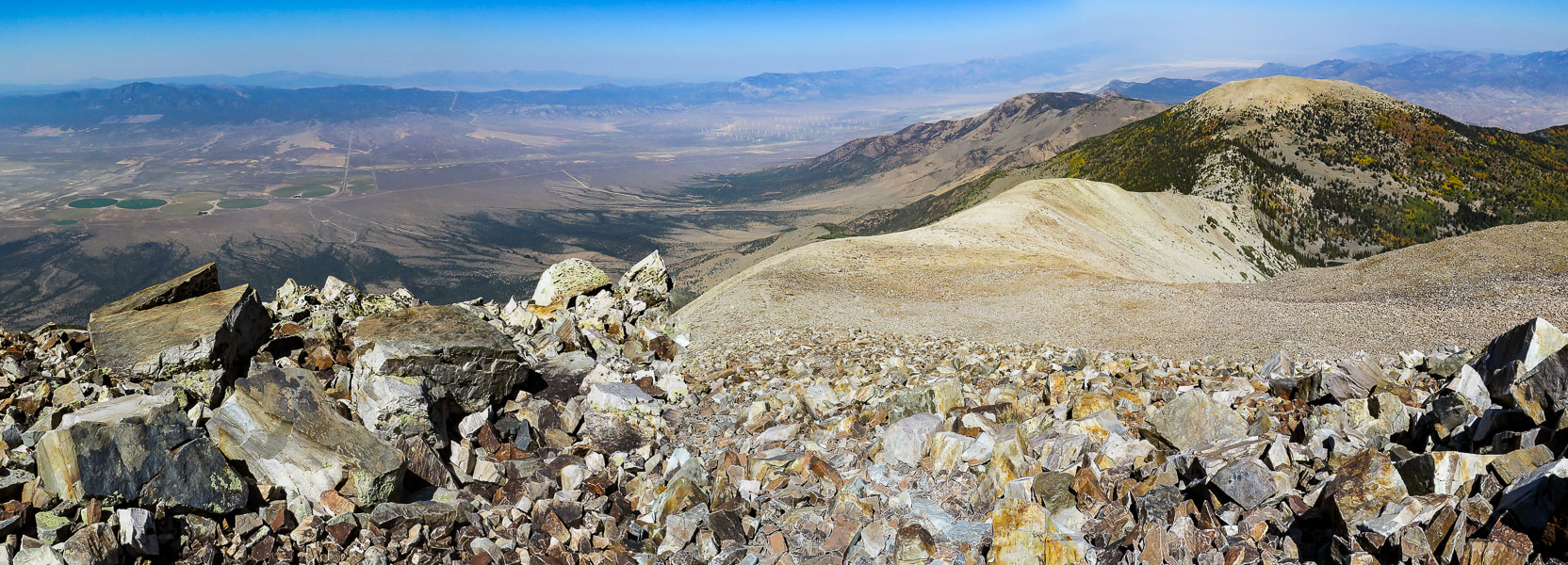 Looking north toward Bald Mountain and Schell Creek Range 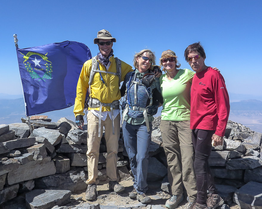 Next to Nevada state flag at 13,063 feet - Fred, Sue, Val, and John Nevada's flag pictures two sagebrush branches encircling a silver star with the words "Nevada" and Battle Born". On Wheeler Peak summit As usual, John summited first out of our group. This explains why I don't have as many photos of him. He is one of the fittest 71-year olds I know! We had a lot of time to enjoy the summit and talk to other hikers, bask in the sun and sign the summit register, a notepad stashed into a dented and decorated mail box. We were standing over the other mountains of the Snake Range. Utah was not far to the east. The next parallel mountain range to the west separated from us by the Spring Valley basin is the Schell Creek Range, with tempting high points. We plan to summit North Schell Peak, the range's highest at 11,883 feet. Hopefully we will get back to Nevada's Basin and Range soon. So many adventures to do, so little time, as I always like to say. Scenes from the summit 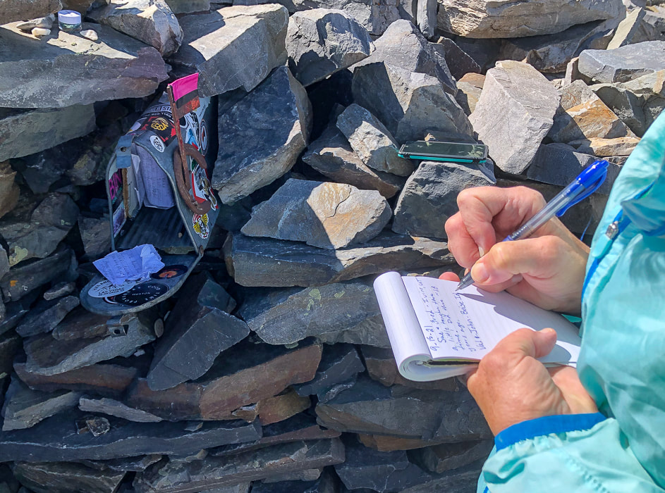 Signing the summit register. I don't recall seeing a "summit mailbox" before, but it's more fun than the standard water bottle or ammo box!   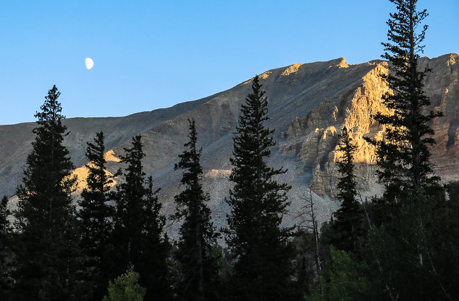 Doso Doyabi (White Mountain in Shoshone language), to the east of Wheeler Peak Post-hike dinner We celebrated at Kerouac's, a restaurant and bar at Stargazer Inn with exceptional food in the little town of Baker, just outside the entrance to the Great Basin National Park. The meatballs had a kick to them and were fantastic, their specialty cocktail of the night was a refreshing fresh peach bourbon sour called "Princess Peach". I highly recommend this place whose website states, "Kerouac's is an homage to life on the American road and to feeling at home in unexpected places." Obviously they are referring to Jack Kerouac and his legendary novel "On the Road", an account of his road trips across the country in the 1940's. The roads of the American West lead to all sorts of adventures, and as Kerouac said, "Because in the end you won't remember the time you spent in the office or mowing your lawn." But you will remember your times spent in nature. Keep on exploring!  The well-stocked Kerouac's Restaurant and Bar in Baker, Nevada. 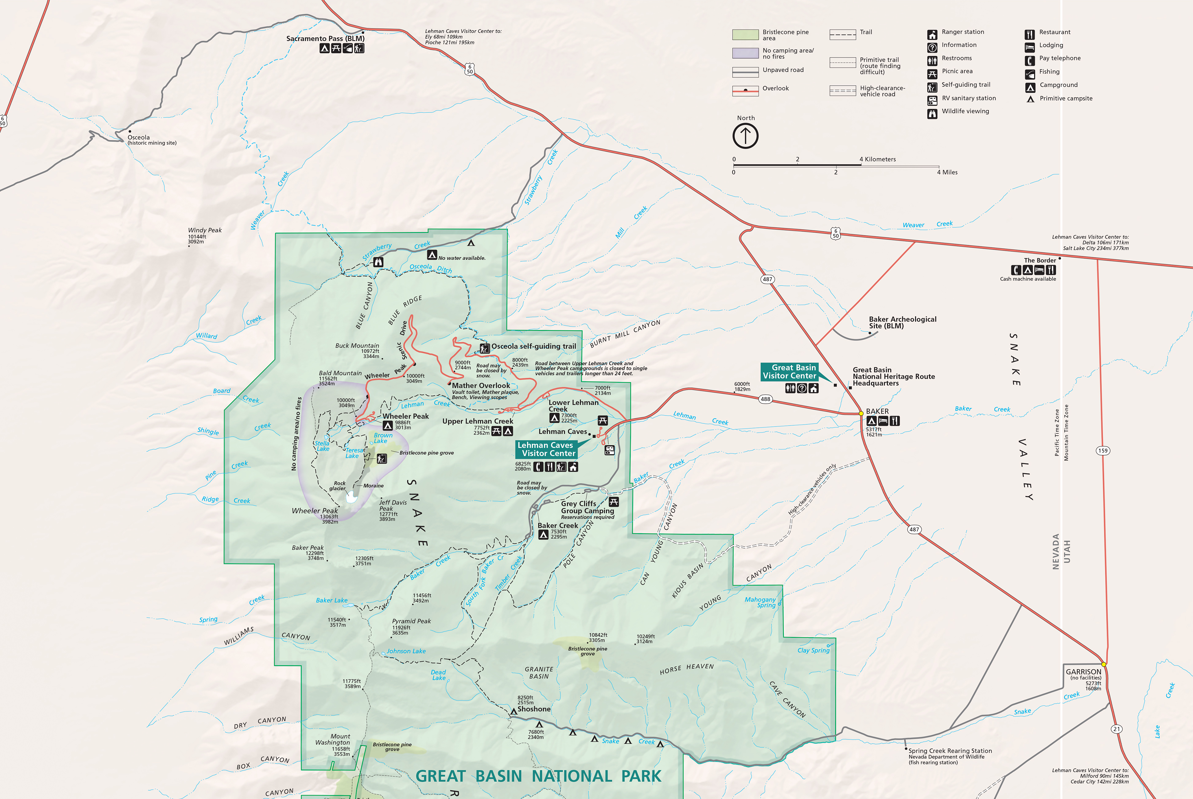 Great Basin National Park map click for larger image 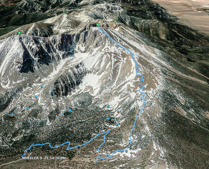 Google Earth image of our GPS tracks to Wheeler Peak summit from parking lot at Bristlecone - Alpine Lakes trailhead. Top of map is south. 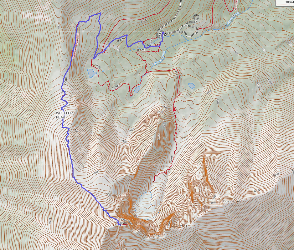 Our GPS tracks on Alpine Lakes Loop Trail, Wheeler Peak Summit Trail. Top of map is north. Wheeler Peak at bottom of map. 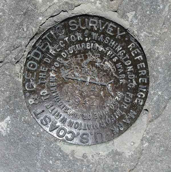 References
Grubbs, B. Exploring Great Basin National Park. 2010. Bright Angel Press, Flagstaff, AZ. Geologic Map of Great Basin National Park, Nevada. National Park Service. Historic Resource Study, Great Basin National Park, Nevada. Why Wheeler Peak? U.S. National Park Service. |
Categories
All

Sue and Fred

About this blogExploration documentaries – "explorumentaries" list trip stats and highlights of each hike or bike ride, often with some interesting history or geology. Years ago, I wrote these for friends and family to let them know what my husband, Fred and I were up to on weekends, and also to showcase the incredible land of the west.
To Subscribe to Explorumentary adventure blog and receive new posts by email:
Happy Summer!

About the Author
|