|
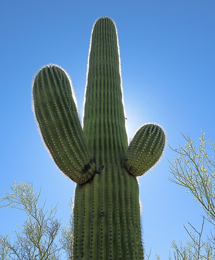
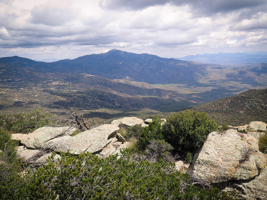
On this exceptional 18-mile round-trip hike, experience remarkable biological diversity beginning in the saguaros and desert scrub, ending in the evergreen oaks and alligator juniper of the pine-oak woodlands. The reward is an immense view of mountain ranges in southern Arizona. 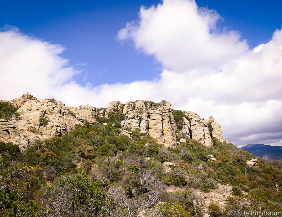 Tanque Verde Peak - Saguaro National Park East - Rincon Mountain District Trip Stats Overview: Rich in diversity, this hike treks through four Desert Sonoran biomes, beginning in the wild and colorful desertscrub, climbing through mellow chaparral and grassland and ending in the pine-scented temperate forest. Distance: 18 miles round-trip. Elevation gain: Tanque Verde Ridge Trailhead = 3,140 feet, Tanque Verde Peak = 7,049 feet. Gain including recovering from elevation loss both directions = 4,700 feet. Difficulty: Moderate to strenuous Class 1 trail entire distance marked with signs at intersections. Short Class 3 climb requiring hands on summit rocks. Date Hiked: April 18, 2019. Map: Trails Illustrated No. 237, Saguaro National Park. See map of trail at end of post. Considerations: Plan to carry all of your water needed for 18 miles. Gates at Saguaro NP East are open at 7:00 am. No dogs allowed on trail. Directions to trailhead: In Tucson, from Old Spanish Trail, turn into marked entrance for Saguaro NP. After entrance station, take the first right after sign for Javelina Picnic Area. The Tanque Verde Ridge Trail is on the right of the parking area. Definition Biome - "A large community of plants and animals that occupies a distinct region. A complex biotic community characterized by distinctive plant and animal species and maintained under the climatic conditions of the region." - Dictionary.com 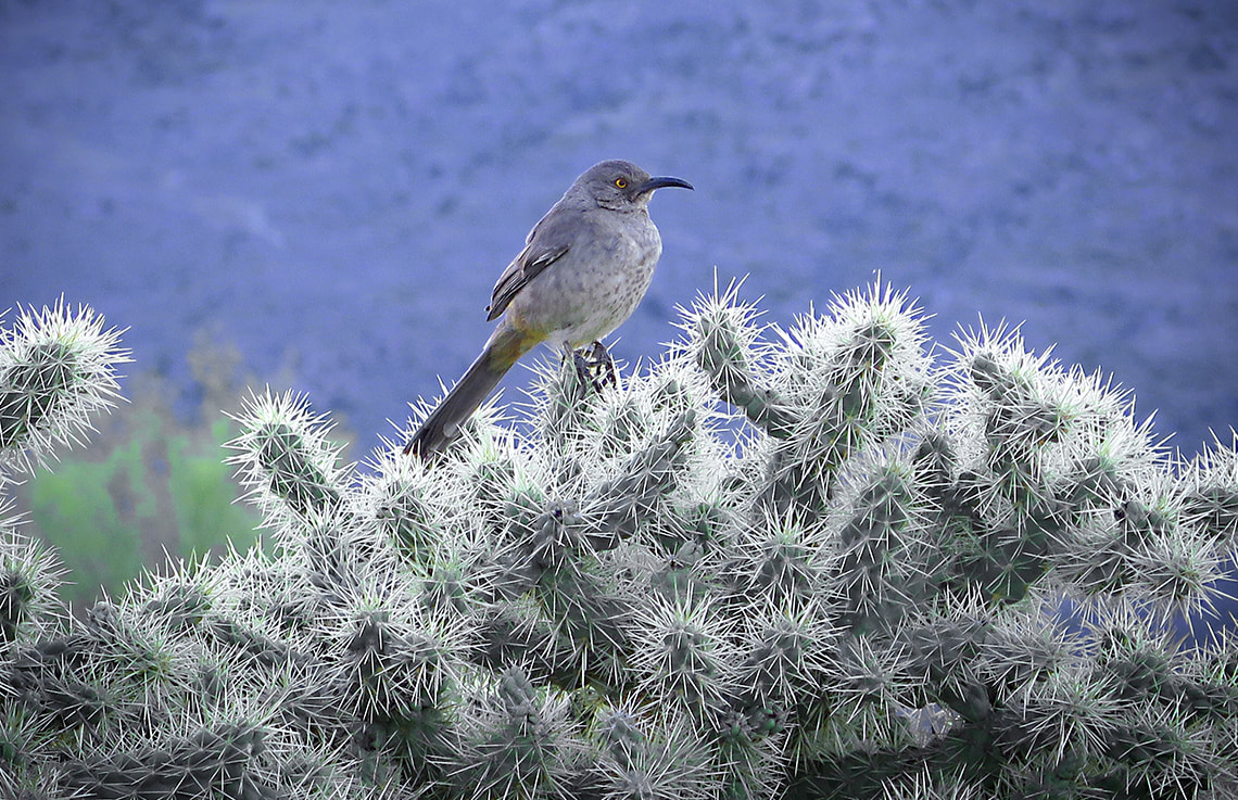 Curve-billed thrasher Tanque Verde Ridge in background If I had to pick only one word that best describes the essence of the hike to Tanque Verde Peak in the Saguaro Wilderness, I would choose "diversity". This nine-mile portion of the Tanque Verde Ridge Trail that begins at the Javelina trailhead in Saguaro National Park east of Tucson and ends 4,000 feet higher at Tanque Verde's summit treks through four biotic communities, each containing its characteristic plant and animal species. These "life zones" -Sonoran desertscrub, semi-desert grassland, Madrean evergreen woodland, and temperate forest overlap, so that prickly pear cactus grows alongside bunch grasses in transition zones. An evening of April thunderstorms and light rain the previous night had created a chill and freshness to the morning air. Fred and I had hiked this trail 6.9 miles to Juniper Basin the year before. This year, we were determined to hike the full nine miles to the peak. The trail, initially hard and rocky, winds through stately saguaros, barrel cactus and prickly pear cacti filled to the brim with new flower buds (in April), straightens and gains elevation through tall bunchgrasses, bear grass, and finally oak trees. Leaving the desert scrub behind, the trail rises and falls through an ever-increasing amount of oaks. It goes through lovely Juniper Flat, through the cool shade of Ponderosa and Pinyon pines along with Alligator juniper toward the summit of Tanque Verde Peak where the tread is soft with accumulated pine needles. Grasping the rough and weathered granite on the last few feet of the summit block, you hoist yourself up a huge boulder to see the dark, immense summit of Rincon Mountain on the south ridge and the breathtaking view of southern Arizona's mountain ranges. The only bad part is the sore feet after this 18-mile hike; however, a small price to pay for this unique experience. Tanque Verde, or "green tank" refers to the green algae present in a large tank of water used for stock in the 1800's. It is now the name given to the valley east of Tucson that is bordered by the Santa Catalina Mountains to the north and the Rincon Mountains to the east. The Pima Indians lived there in the 1600's, and Tanque Verde Ranch was established in the 1800's. 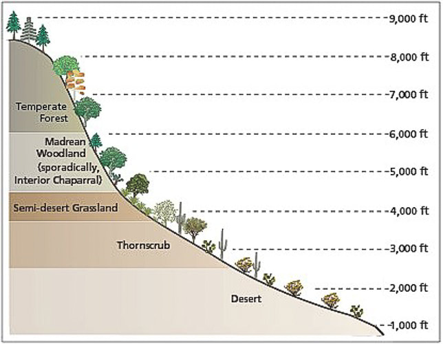 Biomes of Sonoran Desert Network Parks Symbols courtesy of the Integration and Application Network, University of Maryland Center for Environmental Science (ian.umces.edu/symbols/). -Taken from Sonoran Desert Inventory and Monitoring Network - National Park Service Sonoran Desertscrub (a.k.a. Thornscrub) This hike begins at the Javelina picnic area in East Saguaro National Park - elevation 3,100 feet, in the creosote-scented Sonoran desertscrub biome. A great biome because plants are tough yet beautiful at the same time. Tough because plants have devised strategies to help them survive, such as thorns as a physical defense against predators, and hair on leaves to shield the relentless sun. Thorns and bristles act to shade and insulate certain crucial parts of cacti. Thorny saguaros dominate this community, along with cacti of various forms, such as the flower bud-studded prickly pear. Bright colors of wildflowers in spring line the path: coral/red claret cup flowers of the hedgehog cactus, yellow prickly pear flowers, pink fairyduster, bright orange ocotillo, and peach-colored globemallow flowers. Mesquite and Palo Verde trees are present in the Sonoran desertscrub biome which is intermediate between the desert and tropical forest biomes. The cheerful yellow flowers of Encelia farinosa, or brittlebush add bursts of color among the red-brown rocks and green cacti. After the trail register, the trail begins to climb, with sweeping views of Tucson basin. Before emerging out of the desertscrub biome into grassland, at about two miles, the trail provides unobstructed views of the mountain ranges west and south of Tucson. From here, the trail stays on the wide ridge, rounding hills at some intervals, or heading straight up and then down, causing mild losses in elevation. It gains 700 feet in the 1.4 miles after the trail register. Just after 4,000 feet elevation, saguaros become more scarce, and grass more prominent, as it transitions into semi-desert grassland ecosystem. 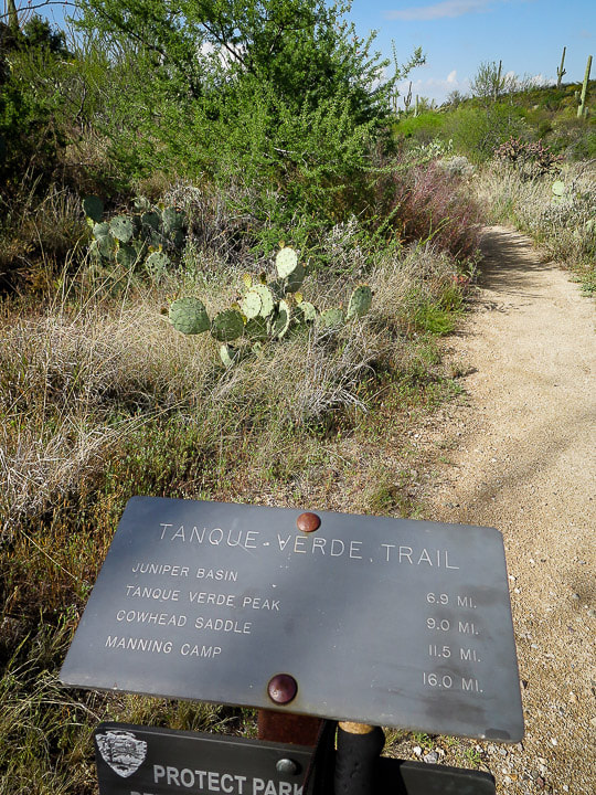 Trail head sign at Javalina Picnic area - Saguaro National Park East 9 miles and 4 biomes ahead of us! 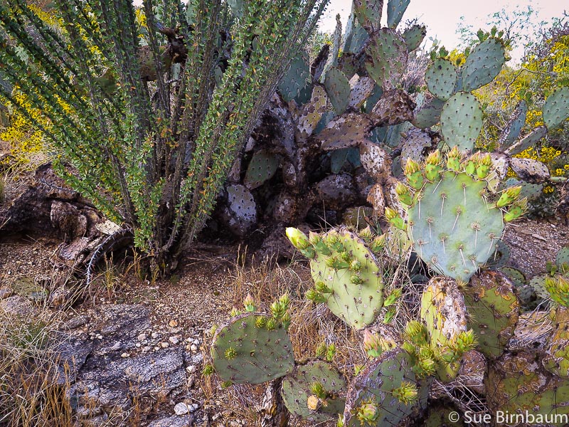 Ocotillo and prickly pear in Sonoran desertsrub biome 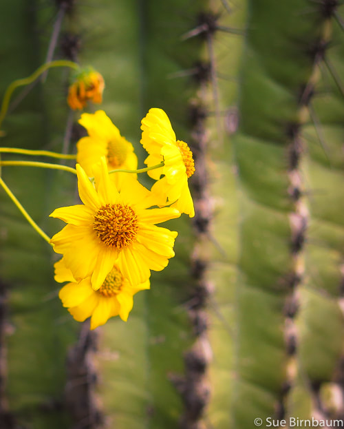 Brittlebush - Encelia farinosa 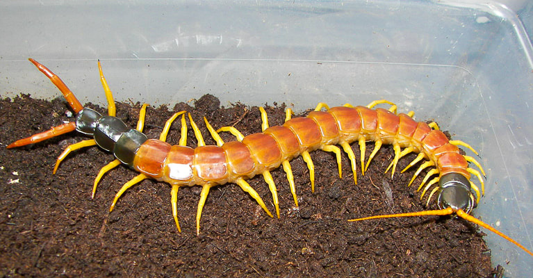 Scolopendra heros - giant desert centipede (we saw one of these on our way back) - taken from Wikipedia 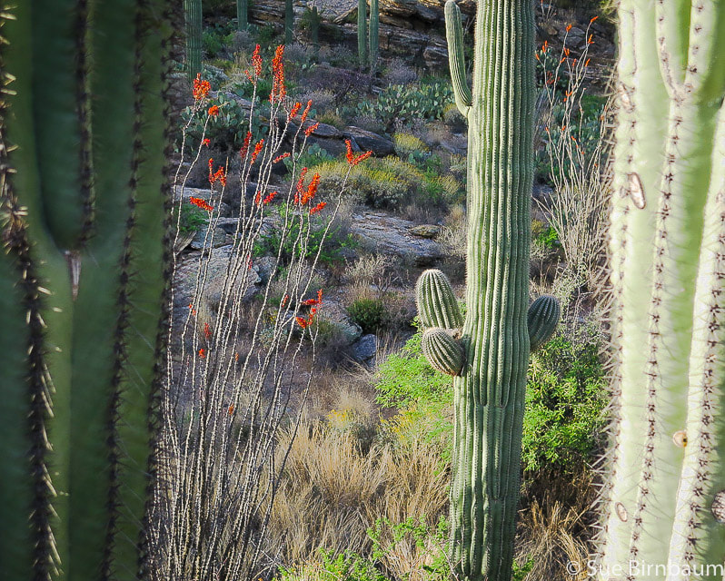 Near Javelina picnic area - Saguaro National Park East 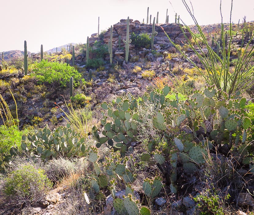 Desertscrub (recently named Thornscrub) biome in Sonoran desert about 3,000 - 4,000 feet elevation
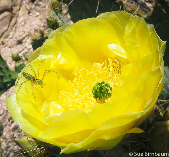 Green lynx spider on prickly pear blossom 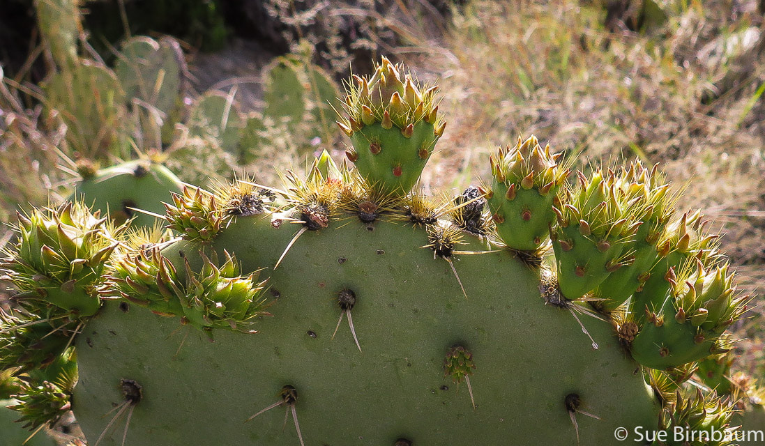 Prickly Pear Cactus with buds on leaves in April 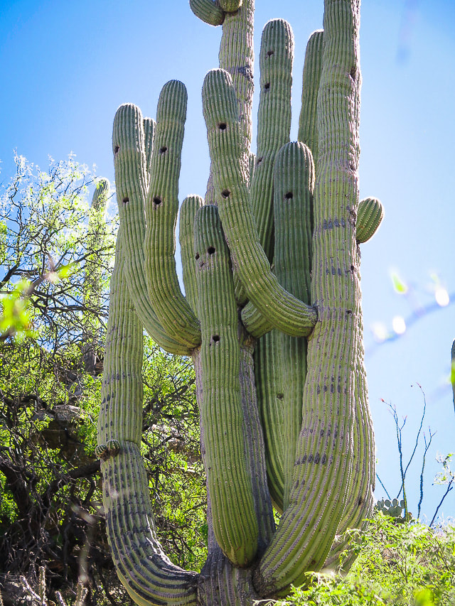 Saguaro National Park According to a reader of this post: "Holes are made from Gila Woodpeckers and Gilded Flickers and other birds and animals use the nest holes when the woodpeckers leave." Semi-desert grassland As the trail climbs just past 4,000 feet, a noticeable change in vegetation occurs: saguaros become scarce as the ridge is dominated by ever-increasing fields of bunchgrasses, oak and juniper. Calming, muted and soft neutral grey/greens replace bright primary colors of the lively, unrestrained desertscrub. Sotol, creosote and agave mix with a diverse array of grasses. As the trail gradually climbs, junipers become more prevalent. Tanque Verde Peak is still six miles away and not visible. The manzanita and oak species are prevalent in the oak savannah community as the trail ascends, transitioning into pine/oak woodland. 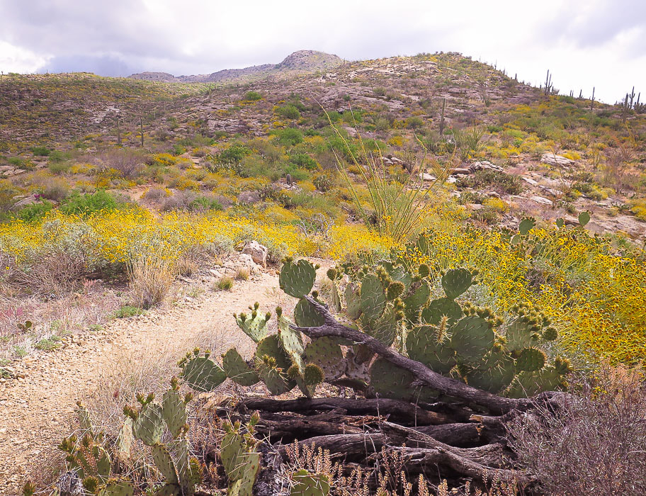 Transition between Sonoran desertscrub and semi-desert grasslands 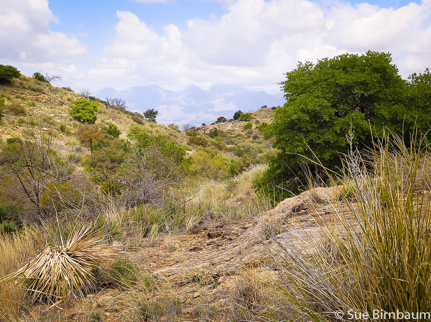 Oaks begin to appear in semi-desert grassland biome Santa Catalina Mountains, north of Tucson on horizon Madrean Evergreen/Pine/Oak Woodland At about four miles, at mid-elevation that is between the desertscrub and the temperate forest biomes, the trail ascends and descends through ever-increasing oaks. At 5.9 miles, the trail drops to make its long entrance into Juniper Basin Campground, crossing beautiful Box Canyon with rock cairns to guide you through stretches of rock floors. At 5,940 feet elevation, Juniper Basin Campground is an airy and spacious place with towering Pinyon pines and oaks and my favorite - the alligator juniper with its scaly square-patterned bark. There's an outhouse and food box for overnight campers. Evergreen oaks such as Emory oak and Arizona white oak along with Mexican pinyon pine dominate this biome, named after its origin in the Sierra Madre mountain range that runs through Mexico and along the Gulf of California. Understory perennial grasses rustle, adding to the peace of this place. The elevation gain to Juniper Basin Campground is 2,840 feet in 6.9 miles. Tanque Verde Peak is another 2.1 miles and 1,100 feet in gain. Such a long, arduous adventure; it's tempting to turn back and call it good, but the additional effort to get to the summit is worth it. We summon our motivation and resume our quest not knowing at this time how we would quickly forget our tired legs once on Tanque Verde summit, and how the forest and view would exceed our expectations. Signs indicate the trail continues northeastward from Juniper Basin. Finally, Tanque Verde Peak comes into view, but seems far away. Orange blazes on trees occasionally mark the trail, easy to follow. 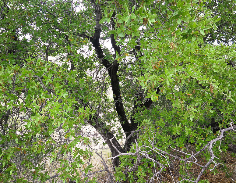 Oak in Madrean Evergreen Woodland biome - near Juniper Basin Campground - 6,000 feet "Madrean" is the word taken from the Sierra Madre Mountain range in Mexico 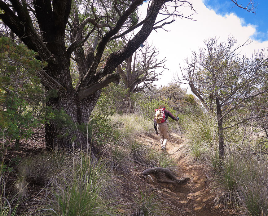 Huge alligator juniper (Juniperus deppeana) along trail between Juniper Basin and Tanque Verde Peak. The checkerboard-patterned bark is distinctive in this large evergreen which is used for fenceposts. 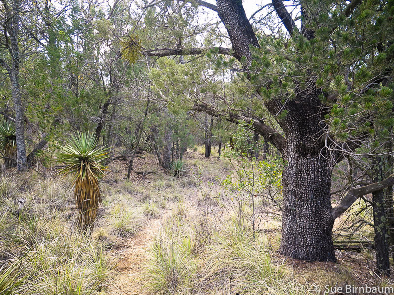 Yucca on the left and alligator juniper share space in the Madrean Evergreen Woodland biome Temperate Forest A unique characteristic of the Sonoran temperate forest biome, officially beginning at around 6,000 feet elevation, is the cohabitation of lower-elevation desert plants, such as the yucca with spruces, pines, firs and maples. Species diversity reigns, although seemingly not to the degree of the desertscrub biome. Temperate forests are very cold-hardy and confined to cooler sites above the Madrean evergreen woodland. We catch glimpses of Tanque Verde Peak as we climb on a well-traveled path through the shade, scent and rough texture of this forest. Emerging out of the dense forest into an open wide ridge, Tanque Verde's many columnar rocks and crevices comes into sharp view at about 6,500 feet. The trail weaves around large boulders and manzanita: the metal summit sign is seen to the east at about 8.7 miles. Reach an old signed intersection that points the way to Cow Head Saddle which is another 2.5 miles on the ridge; continue straight ahead to Tanque Verde. Somehow I forget my tired legs when we reach the summit, where the spectacular scene doesn't reveal itself until you scale a looming boulder that stands in your way, a short climb that feels like the final test for this summit conquer. 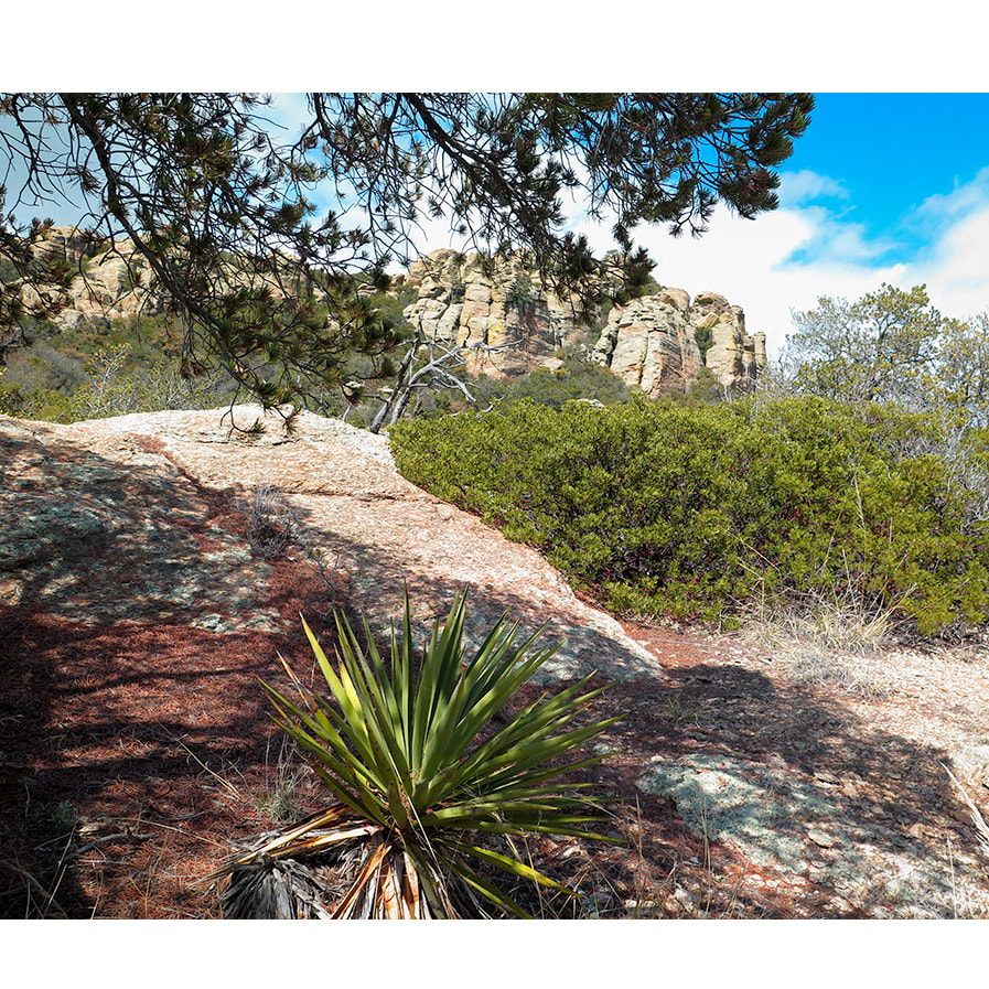 Tanque Verde Summit 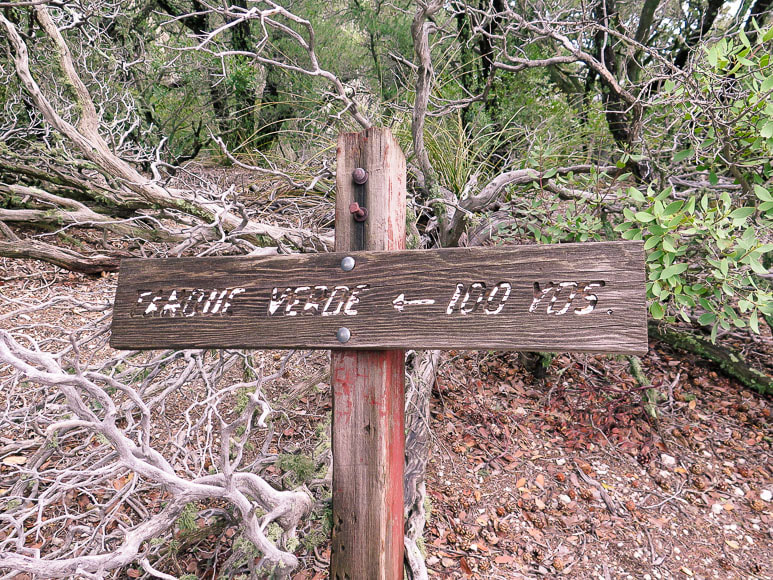 Old sign near trail intersection with hike to Cow Head Saddle continuing on Tanque Verde Ridge. 100 yards from the summit! The view is spectacular. It takes a few seconds to fully comprehend how high this peak rises above the surrounding desert floor and the layers of mountain ranges visible. Mexico is to the south, the Santa Rita and Galiuro Mountain ranges to the southeast. The Santa Catalina Mountains thrust up rocky prominences to the northwest. Rincon Peak is just across the valley to the east, its massive hulk in the shadow of clouds. We relish the view and accomplishment and the wonder and beauty that the Sonoran desert brings. The wind is brisk and cool, but by the time we get down to the desertscrub and walk through the saguaro stands, seven miles away, it will be warmer, even with the sun setting. There are about four or five hills to climb on the long walk out, scaled with a bit more determination than on the way in. Glad we are getting back at sunset, for above the golden Tanque Verde Ridge slowly becoming covered by shadows, a nearly full moon is rising. 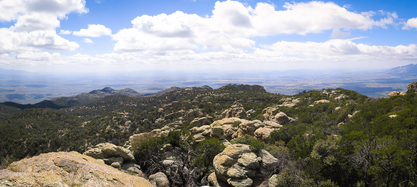 Tucson Basin to the southwest from summit of Tanque Verde Peak - 7,047 feet
 Rincon Peak southeast of Tanque Verde Peak in eastern Rincon Mountains - also a great hike! 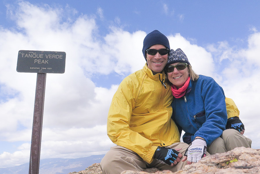 Fred and Sue - 7,047 feet - if you've got the endurance (and plenty of water), we recommend this hike! Nine miles done and nine more to go! 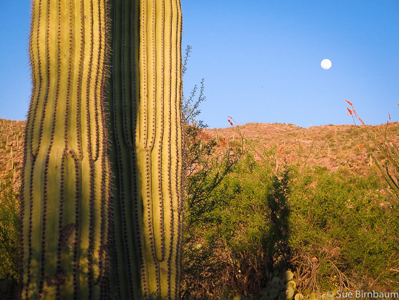 Close to Javelina trailhead, Saguaro National Park East 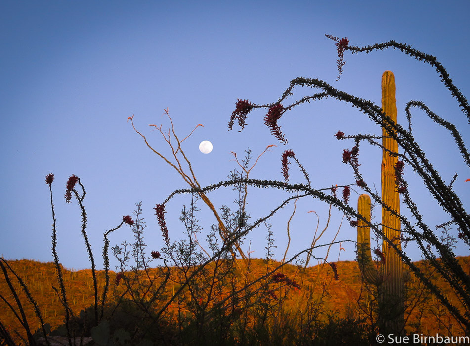 Getting back to trailhead at moonrise - ocotillos in foreground  Always a Frost gelato after a Tucson hike 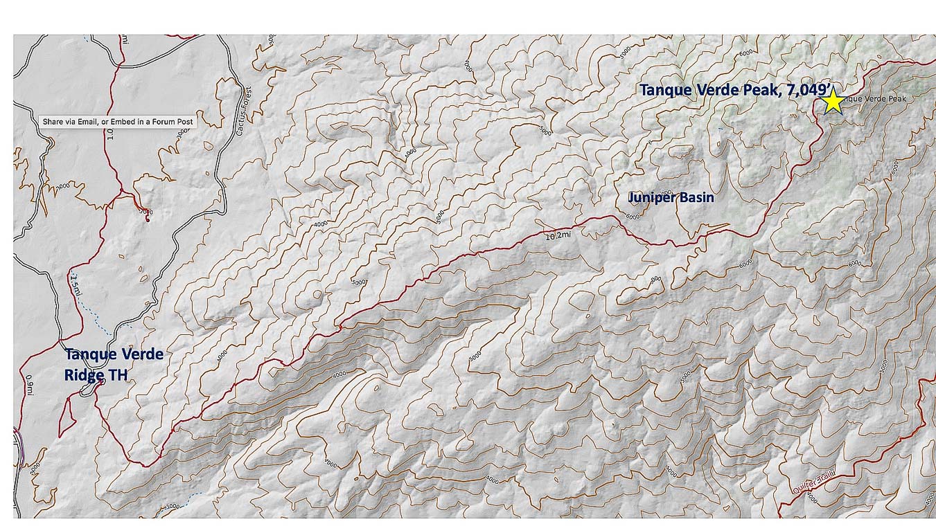 Tanque Verde Ridge Trail (in red) from trailhead at Javelina picnic area in Saguaro NP East to Tanque Verde Peak click on map for larger image References:
Buckley, Steve, ed. 2011. Common Plants of Saguaro National Park Levengood, Betty. Tucson Hiking Guide. 2012. West Wind Press, Portland, Oregon. Natural Resources Monitoring at Saguaro National Park. https://www.nps.gov/im/sodn/sagu.htm Sonoran Desert Network Ecosystems. https://www.nps.gov/im/sodn/ecosystems.htm#CP_JUMP_5423053 USGS - Southwest Biological Science Center. 2006. Vascular Plant and Vertebrate Inventory of Saguaro National Park, Rincon Mountain District rincon_vegetation.pdf. Tanque Verde Ranch website, https://www.tanqueverderanch.com/ U.S. Department of the Interior, National Park Service, Saguaro. Geology of the Rincon Mountains. https://www.nps.gov/sagu/planyourvisit/upload/Geology%20of%20the%20Rincon%20Mountains.pdf.
5 Comments
|
Categories
All

Sue and Fred

About this blogExploration documentaries – "explorumentaries" list trip stats and highlights of each hike or bike ride, often with some interesting history or geology. Years ago, I wrote these for friends and family to let them know what my husband, Fred and I were up to on weekends, and also to showcase the incredible land of the west.
To Subscribe to Explorumentary adventure blog and receive new posts by email:
Happy Summer!

About the Author
|