|
Walk on the surreal slick rock of White Domes, near the top of Canaan Mountain as you climb out of Water Canyon. This is a an extraordinary hike in a gorgeous, remote and rugged wilderness.
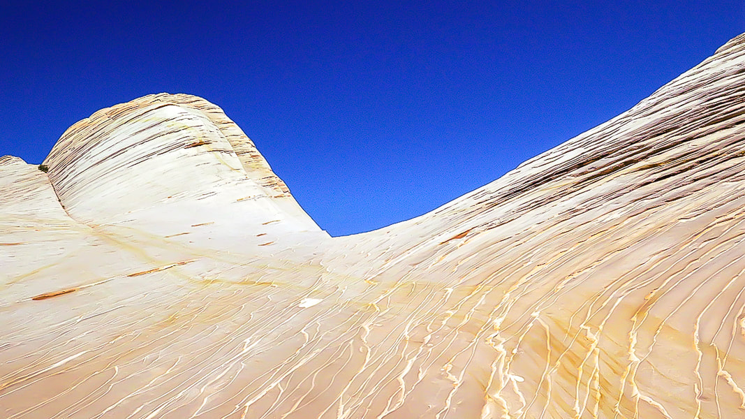
White Domes - Canaan Mountain, Utah
Related in Explorumentary:
Canaan Mountain via Squirrel Canyon Utah's Red Rock Country Southern Utah Hiking and Biking in a Pandemic: Wire Mesa, Snow Canyon, Zion National Park Mt. Kinesava Hike - Zion NP Angels Landing in Zion - Not for the Faint of Heart Utah Hikes
Coordinates: Trailhead = 37.03681, -112.95364. White Domes = 37.06259, -112.98348.
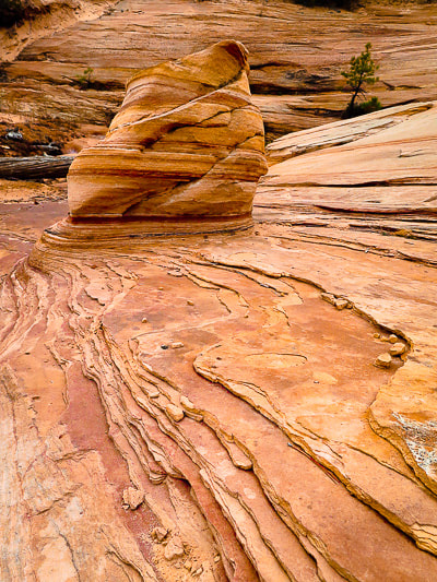
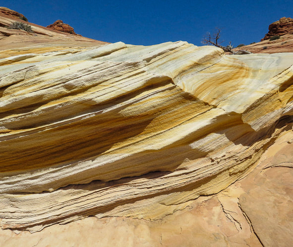
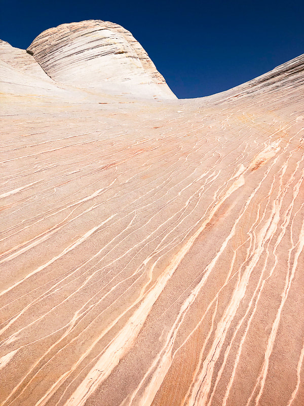
Maps and Apps: (See topo maps of our trail at end of post). USGS 7.5 min topo, Hildale, Utah-Arizona, AllTrails White Domes via Water Canyon Trail, Avenza and physical map of St. George, Springdale, Hurricane & Zion NP, Utah by Adventure Maps, Inc. Link to Zion topo Map of Canaan Mountain Considerations: Take GPS coordinates when you top off out of Water Canyon so you can return to the same point to descend. Once on the plateau, experience with navigation using physical topo maps as well as smart phone apps is advised; trails are not marked and "social trails" go in various directions. There are limited openings through the Water Canyon cliffs, so you must return to the same point at which you entered the wilderness above the cliffs. Allow enough time to get off the mountain. Date Hiked: May 8, 2022. Directions to Water Canyon Trailhead: From Hwy 59 in the border town of Hildale, Utah, turn left on Utah Ave., which heads 2 miles east before turning north (left) onto Canyon St. In less than a mile, turn right at the intersection of Maxwell Canyon Rd. and Water Canyon Rd. Follow this dirt road for another 2 miles to park at one of two parking lots at the trailhead. Can be treacherous driving on this road if it is wet. Geology: Block of Navajo sandstone originally deposited on the continent of Pangea, which included today's North America, Africa, Europe, and South America, existing as a single continent. Sand was wind-blown and deposited in a huge sand sea - creating the petrified sand dunes seen in many Utah state and national parks. The parallel sand layers are cross-beds: the inclination of the layering was caused by aeolian (wind-blown) sand, migrating down-wind. Related:
Overview - Canaan Mountain Wilderness
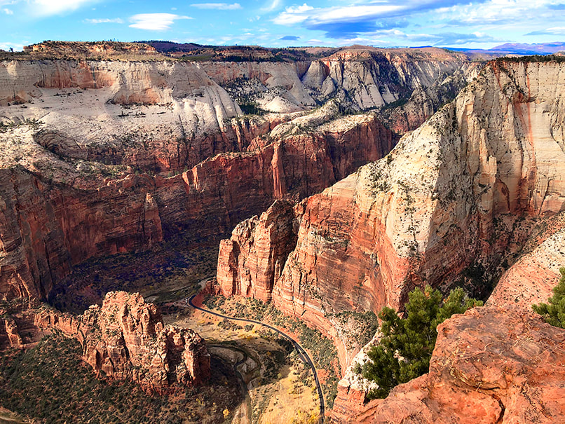
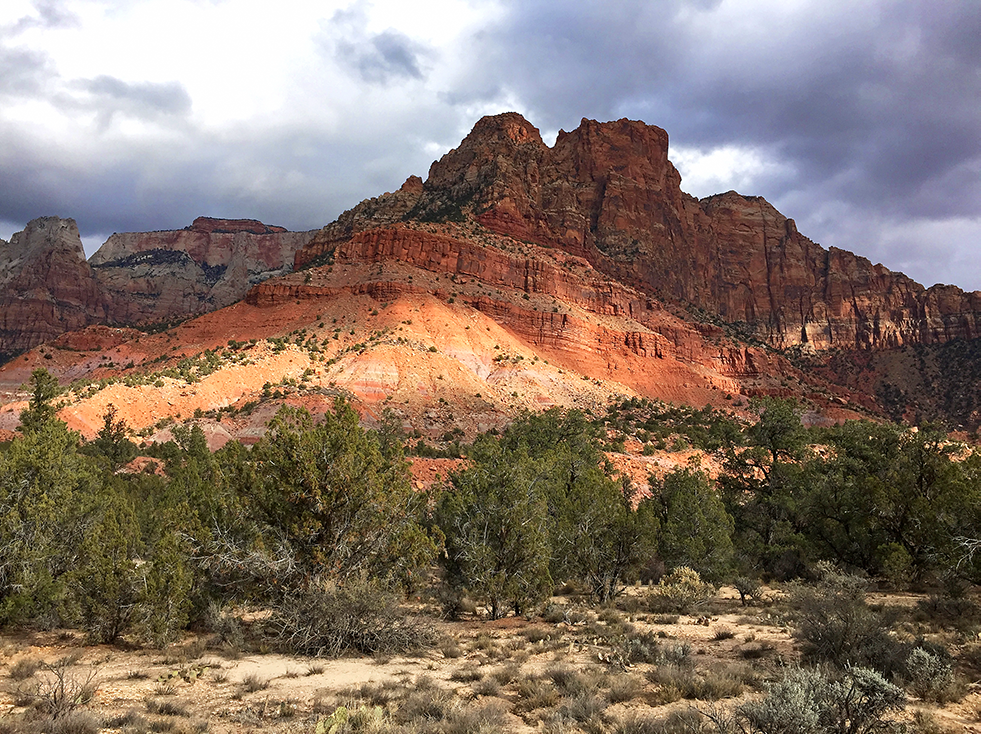
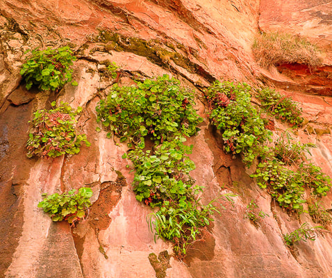
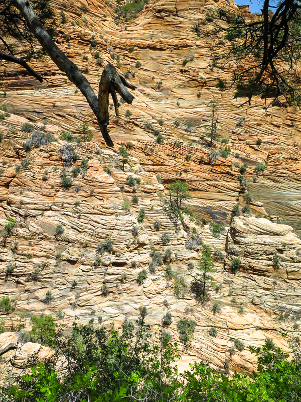
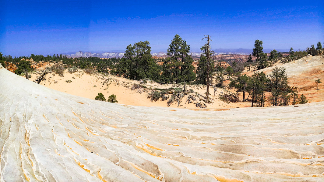
Navajo Sandstone cliffs, 2,000 feet high, surround Canaan Mountain on three sides, making this an exceptional wilderness with limited access. The landscape is always interesting and gorgeous; around every corner, atop every plateau and rising up out of sandy washes are the various landforms sculpted by wind, water and ice erosion. The red and orange Vermillion Cliffs form its base. The cream, yellow, red, orange and white colors compliment greens of scattered ponderosa and pinyon pines, scrub oak and gambel oak, creating a striking color palette. Cross-bedded cliff walls, pinnacles, domes, slot canyons, hoodoos, natural arches, ledges, open slickrock, waterfalls, seeps with hanging gardens, and carved pools are some of the things you see in this extraordinary land. It has only a few primitive routes, with one rocky and sandy 4WD road, the Sawmill Trail/Canaan Mountain Trail, a historic logging route that enters from the east. To us it is comparable in beauty to Zion NP, and we get to practice our navigation skills.
Hike Summary
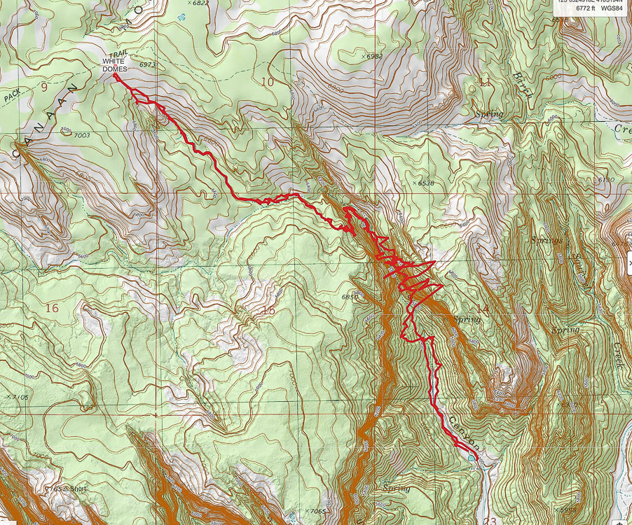
Miles 0 - 2.2: Water Canyon trailhead to top of cliffs/entry onto mesa at "Top Rock". Miles 2.2 - 3.9: "Top Rock" through mesa to White Domes/Canaan Mountain Ridge. Fred and I got "temporarily bewildered", not exactly lost, when we attempted this hike a few years ago. We neglected to take a waypoint at our Water Canyon exit onto Canaan Mountain plateau's unmarked wilderness. We followed the wrong path and found ourselves further from the White Domes. When we decided to head back to the canyon rim, we took a waypoint just in case because there were a few paths there, but nothing marked - no cairns or signs. We came close to our entry at the canyon rim but missed it by a short distance. So, we returned back (one mile!) to our waypoint, carefully retraced our footsteps, and finally got back to our entry, the only way we knew to get back down. The lesson: when hiking in Southern Utah's canyon country, there may be only one entrance/exit point and it is crucial to know how to navigate back to that point when there is no marked trail. This wild and spectacular country is filled with numerous washes, pedestal rocks, slick rock, and boulders; it can turn into a maze where landmarks can look similar. This time we were ready, armed with AllTrails and Avenza maps, as well as our physical map. My Garmin GPS insured we were backtracking successfully. We took the crucial waypoint at Top Rock (see below). We followed Joe's Guide to Zion NP - Water Canyon and Canaan Mountain hike directions. Occasional rock cairns helped, too.
Interactive map. The large-amplitude swings in GPS tracks are the GPS trying to find satellites while deep in Water Canyon.
See more topo maps at end of post 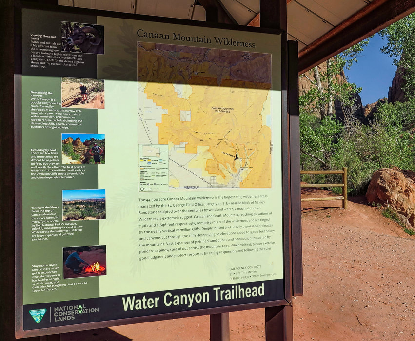
Starting out - Water Canyon to the right.
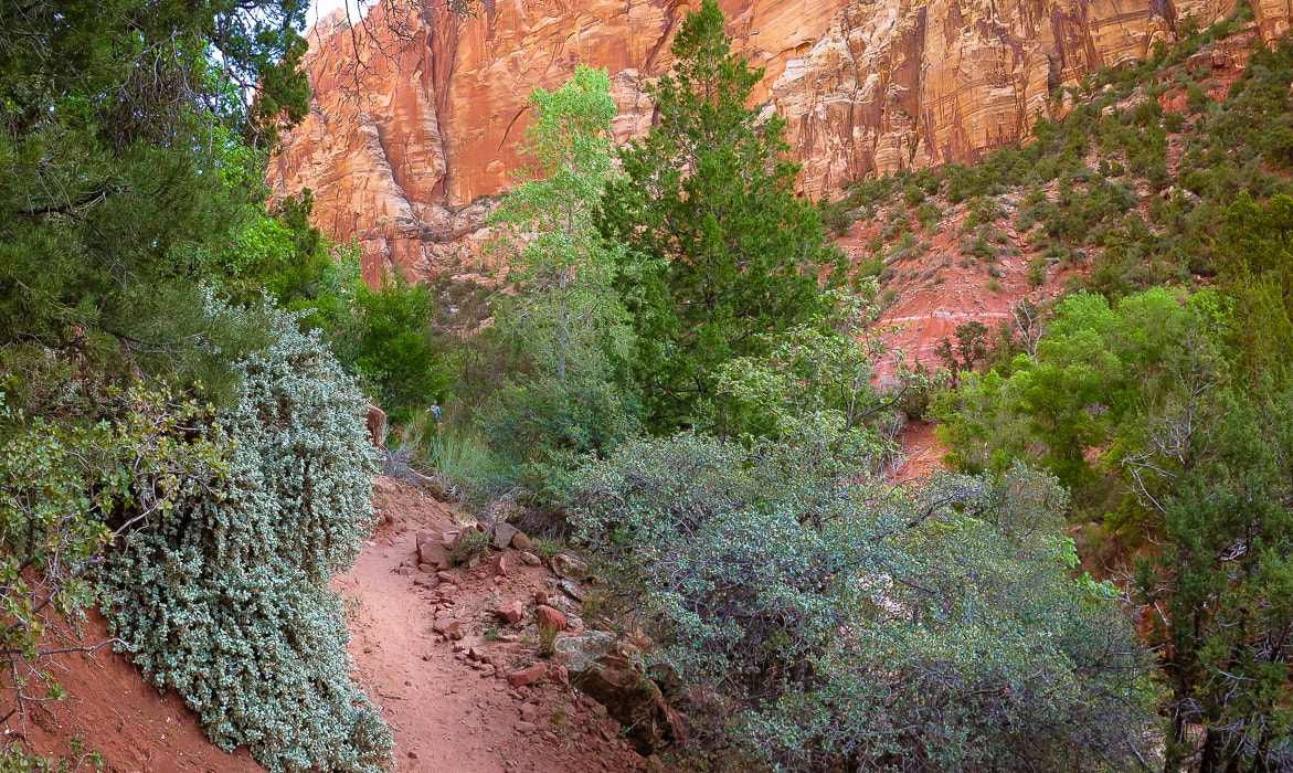
Climbing out of Water Canyon
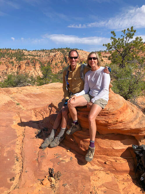
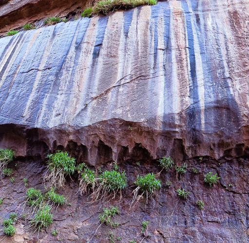
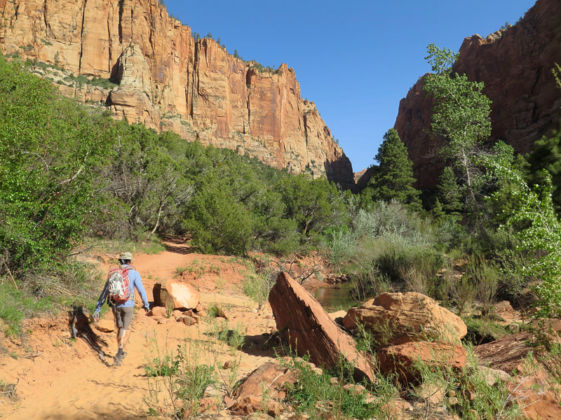
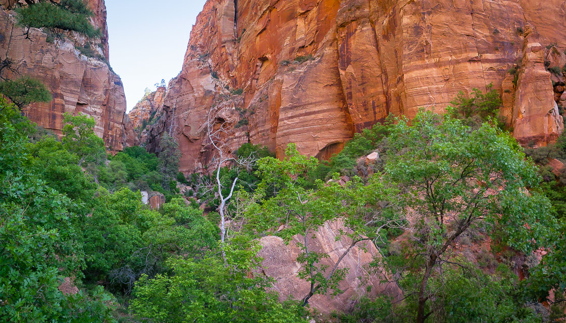
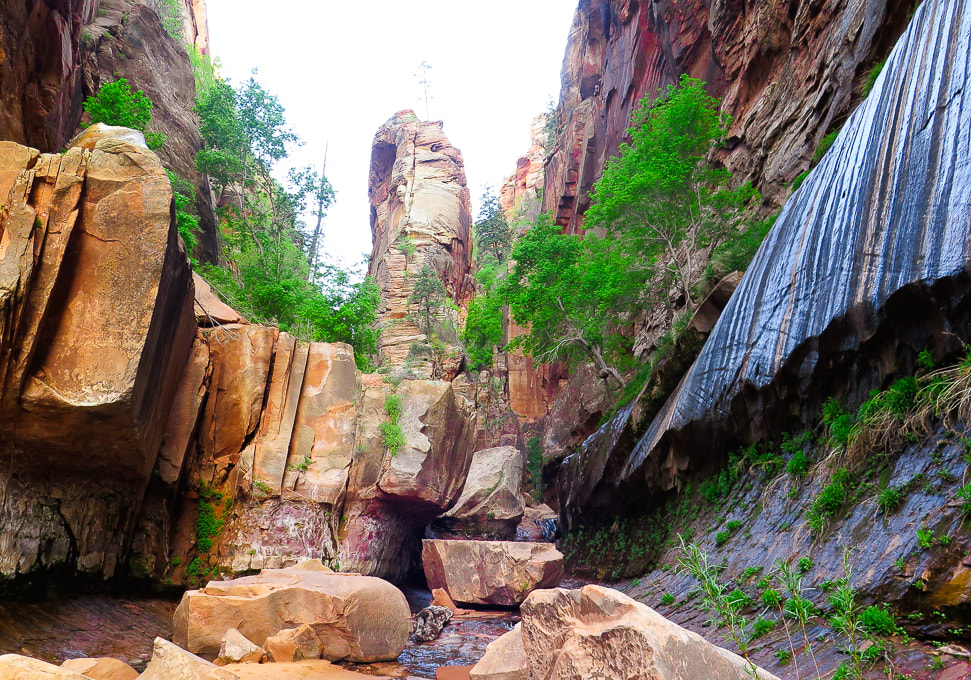
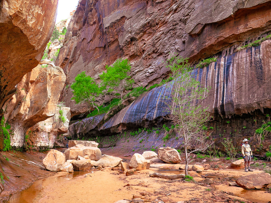
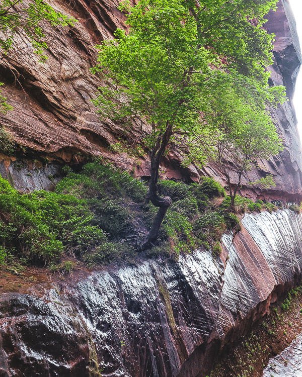
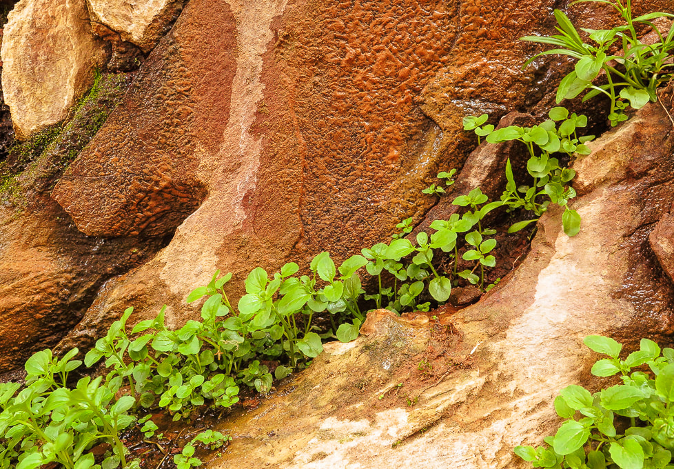
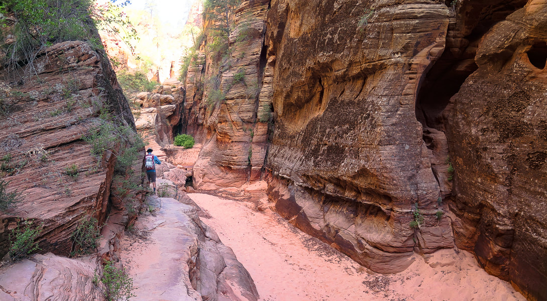
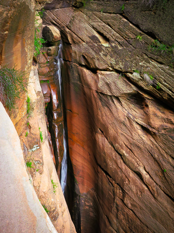
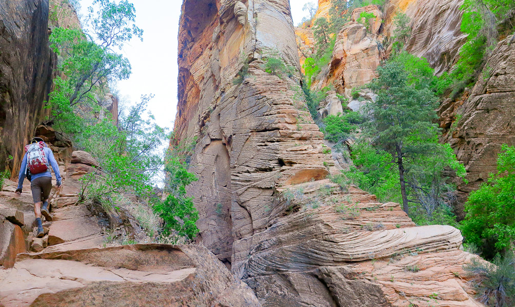
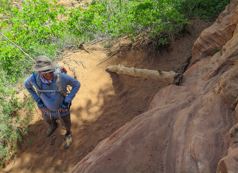
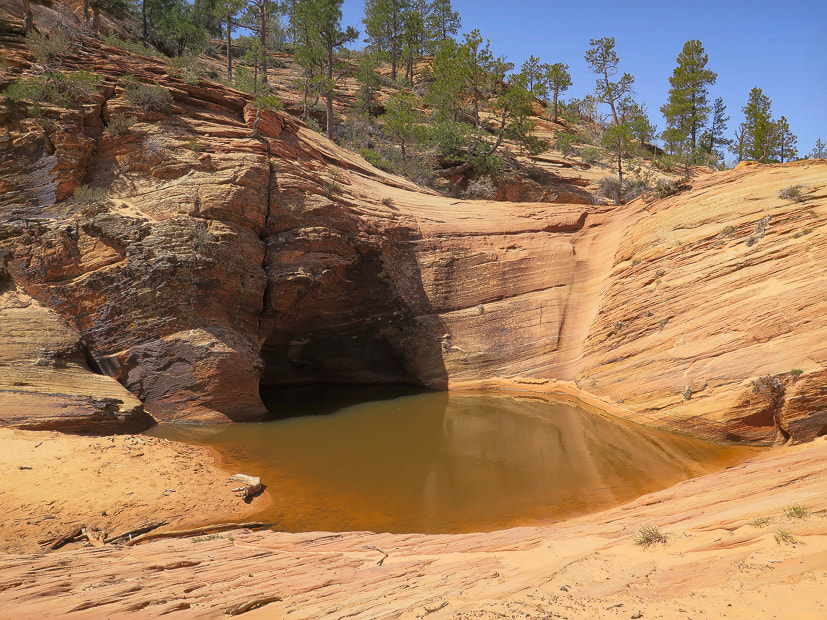
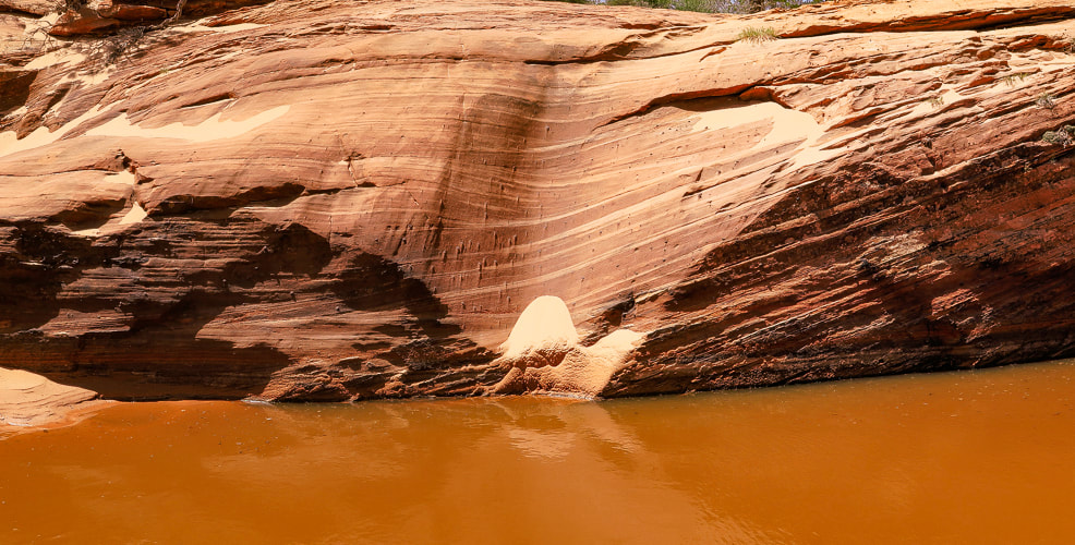
Fred and I began trudging (at times) through sand, passing under canopies of pine and juniper to the picturesque waterfall section of Water Canyon. Here, the canyon is dark and narrow; walls drip water onto bright green leaves, and a series of small waterfalls tumble over sandstone. Long striped walls on both sides converge at a slot where you walk through the shallow stream. Just past this, at about one mile into the hike, you start to climb steeply up the west (left) cliffs of Water Canyon, passing more waterfalls, walking over a series of rock ledges, hoisting over boulders now and then, and even walking over a log propped against a ledge to gain access to the top of it. This trail to the plateau above is a masterfully-planned route through available ledges and passages with the canyon at times dropping steeply below to the right, but you won't feel overly exposed. There are some rock cairns to follow. At about 1.9 miles into the hike, the trail makes a U-turn and heads south to ascend the final wall to the opening into the plateau, and to Canaan Mountain Wilderness boundary. Impressive towering walls of cross-bedded sandstone seem close as the canyon widens. Shortly, "Top Rock" is reached - a large, weathered sandstone rock on a flat area (see Fred and I sitting on it, below). A few websites and topographical maps refer to this landmark as Top Rock. RECORD YOUR COORDINATES NEAR PLATEAU ENTRY - We recorded "Top Rock" coordinates for a waypoint.
Canaan Mountain plateau to White Domes
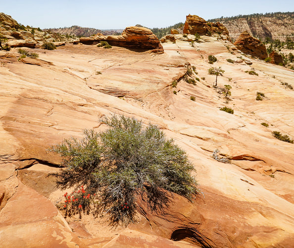
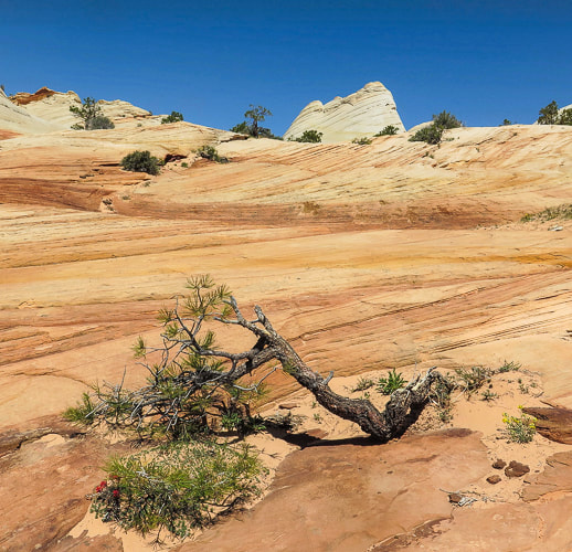
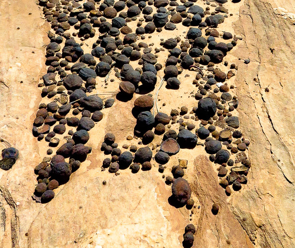
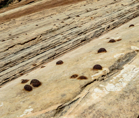
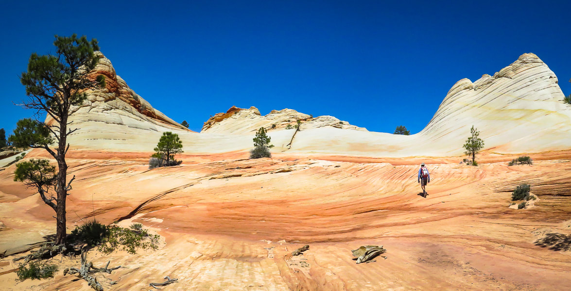
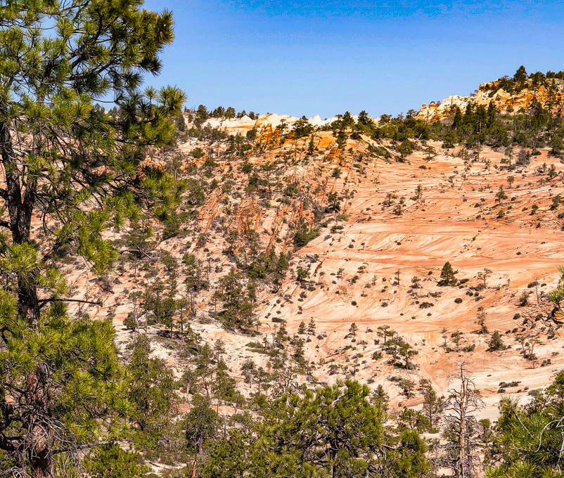
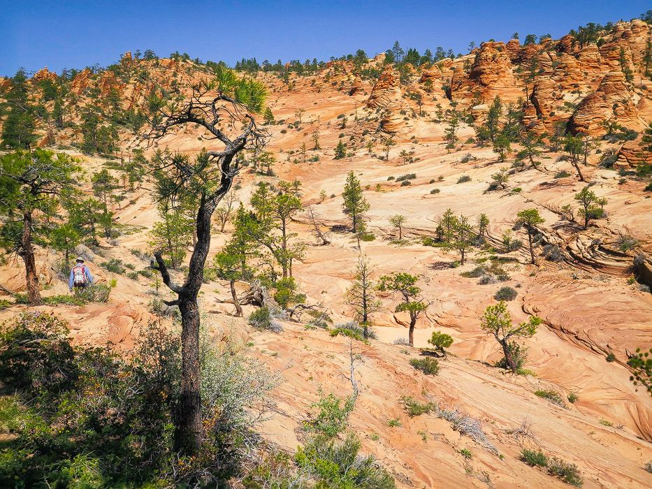
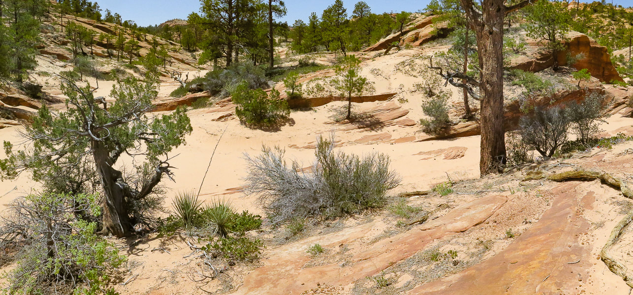
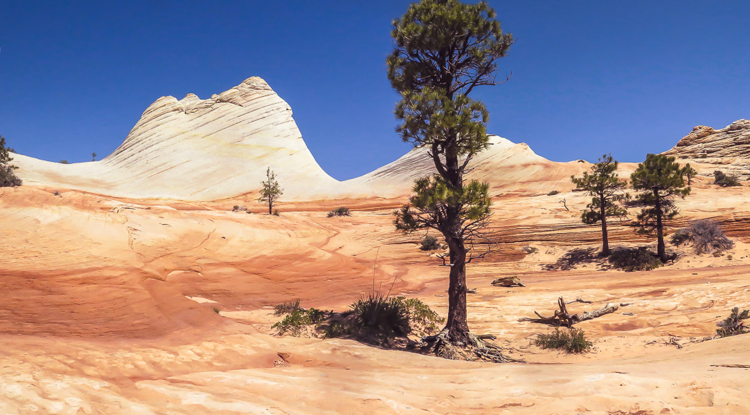
As you stand at Top Rock, the White Domes on Canaan Mountain's ridge to the northwest are 400 feet higher. We walked straight towards them, initially descending, finding a discernible path marked often by small rock cairns, hiking in a northwest direction. Our route took us through the forest, down through small drainages and short stretches of slick rock into a larger sandy wash (upper Water Canyon), where I placed some tree branches to mark our entry into the wash. We followed this creek west upstream for ~ 0.25 miles, going around a few dry waterfalls to their north (right) side. Reach a wide intersection between two washes; take the side wash to the right (NW) and follow it for ~1.0 mile to the domes. Walking over sand and slick rock is exquisite as you pass by sandstone walls and moqui marble collections - round sandstone balls coated with dark red or black iron oxide. As you near the top of this side wash, White Domes come into view - you exit the canyon and start hiking steeply up pure white sandstone. Top out on Canaan Mountain's ridge between these layered domes to see the temples and mountains of Zion National Park to the north. Walking on the bright white, bare sandstone with cream-colored veins flowing through it and bright blue sky above is an almost surreal experience. The curves between the domes have been masterfully formed by wind and water, and make it easy to walk around them. A website describes this area as "wondrous" - I would have to agree. We returned, using my GPS to backtrack, as there are a few shallow canyons coming down from White Domes, and no rock cairns. I'm glad I marked the exit out of the upper Water Canyon wash with branches because the distance back in the wash seemed shorter than the morning's distance. From White Domes, the Sawmill Trail, an old jeep road continues west toward a few more landmarks that represent Canaan Mountain's lumber history. The trail leads to the southwestern edge of Canaan Mountain to the windlass ruins, the remains of a cable system that lowered timber to the valley floor. It continues to the highest point on Canaan Mountain at 7,363' (~400' higher than White Domes) and Sawmill Spring, the remains of the sawmill. Again, we feel lucky to be able to hike to these awesome places. So many adventures to be had, so many beautiful things to see, so much appreciation for the American west. Ah, but so little time.....
Keep Moving and Keep Exploring!

CrossFit athlete at CrossFit Dixie in St. George, Utah.
Getting deeper into the canyon.
Reaching waterfall section where walls converge to make slot to walk through.
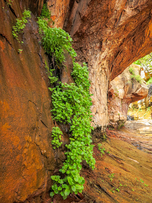
Dripping walls at waterfalls section of Water Canyon.
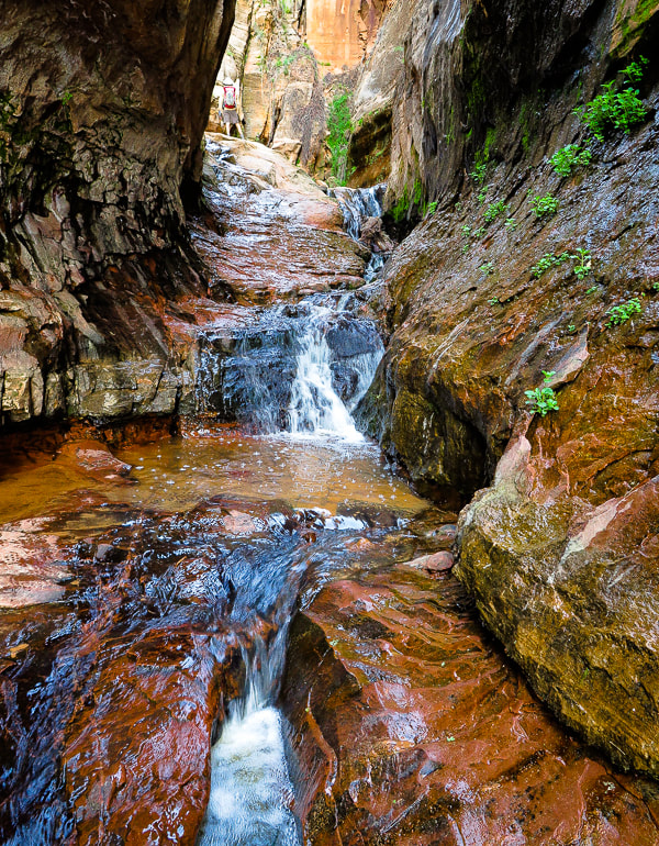
Walk through shallow stream at slot.
Walking above the waterfall section, about ready to start climbing west canyon wall.
Long, narrow waterfalls as you ascend Water Canyon.
Starting to climb canyon wall.
Very helpful way to get up this tall ledge!
Rock cairn marking ledge up west cliff climb; nearing the canyon opening at the top.
Fred and Sue on "Top Rock", at entrance to plateau from Water Canyon. 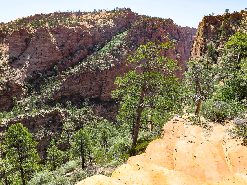
Looking down Water Canyon from near top of its west wall.
Looking across to Water Canyon's east wall.
View from "Top Rock" above exit from Water Canyon of White Domes on Canaan Mountain.
Descending down into upper Water Canyon wash, then we walked 1/4 mile west to intersection with wash that leads NW to White Domes.
Waterfall #1
Waterfall #2
Intersection of washes - we took the wash on the right, out of the main wash; it leads up to White Domes ~ 1.1 mile.
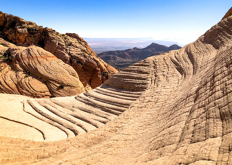
Slick rock scenes on ascent to White Domes.
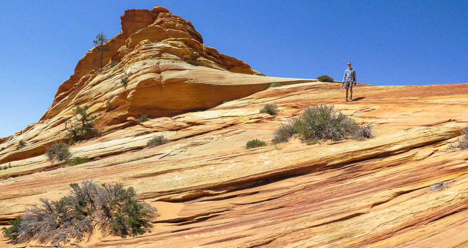
On the way to White Domes
Looking at Zion NP to the north.
Some cool stuff on the trail.
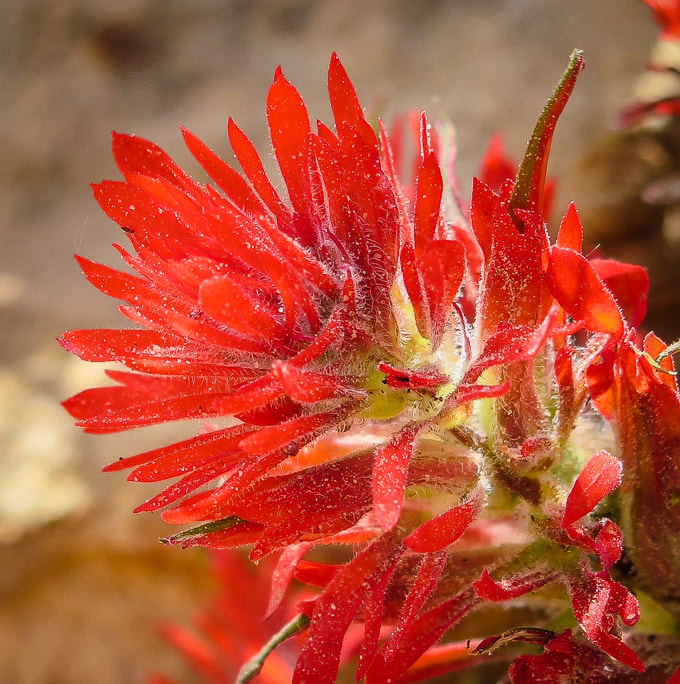
Indian paintbrush (Castilleja)
DESERT PLANTS 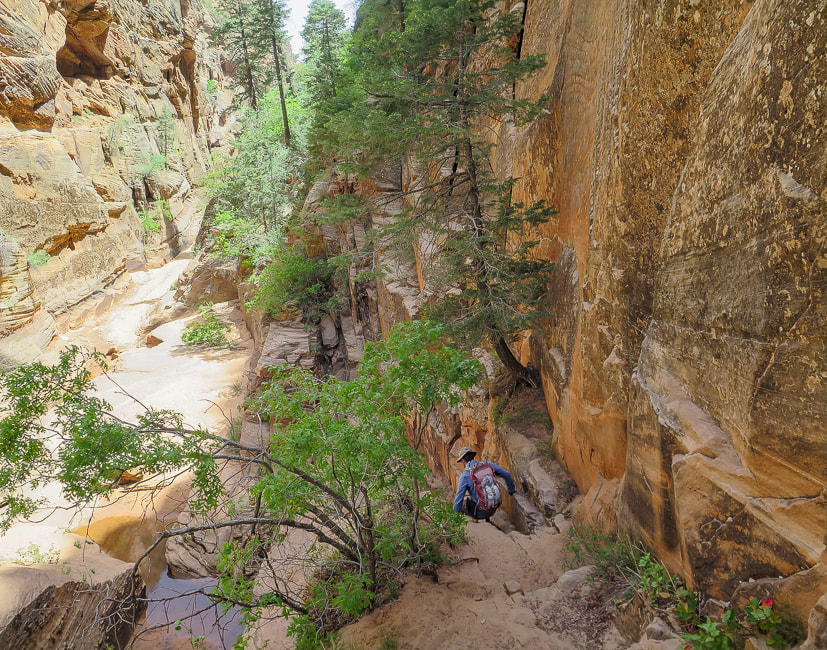
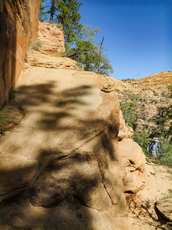
Heading back down.
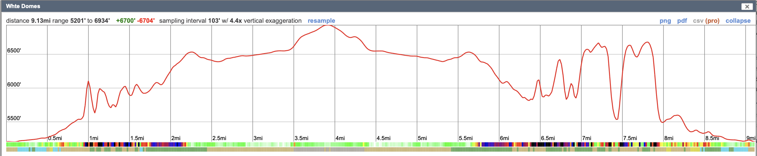
Our GPS tracks reflect an inaccuracy due to inadequate number of satellites signals while hiking in the canyon. According to CalTopo, it takes a minimum of 4 satellites communicating with your GPS to get accurate elevation and location measurements. It's not uncommon for satellites to be close to the horizon, so they may be blocked depending on the terrain you're hiking on.
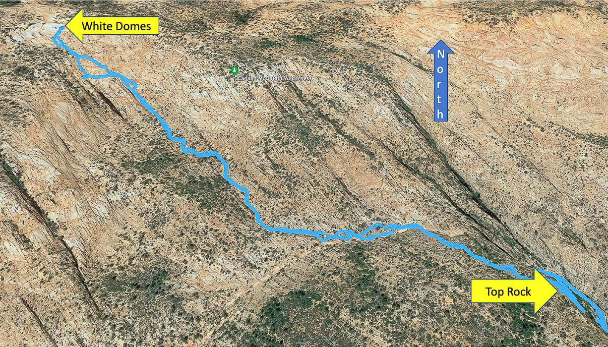
Google Earth image of our route from Top Rock just out of Water Canyon to White Domes, going cross-country to drop down into upper Water Canyon wash, then following side wash straight to White Domes in NW direction. Distance from Top Rock to White Domes = ~ 1.7 miles.
2 Comments
Laura Hubbard
7/5/2022 01:00:27 pm
Love following your adventures. Staying fit, while aiming to retire in December and start exploring more. Thanks
Laura, Leave a Reply. |
Categories
All

Sue and Fred

About this blogExploration documentaries – "explorumentaries" list trip stats and highlights of each hike or bike ride, often with some interesting history or geology. Years ago, I wrote these for friends and family to let them know what my husband, Fred and I were up to on weekends, and also to showcase the incredible land of the west.
To Subscribe to Explorumentary adventure blog and receive new posts by email:
Happy Summer!

About the Author
|