|
There's a lot to explore in Mackay, Idaho: a hike to Mackay Peak for a view of Idaho's highest peaks in the Lost River Range and a mine tour that illustrates the area's rich mining history.
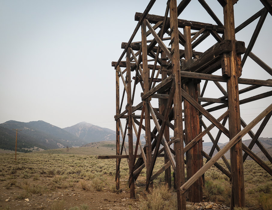
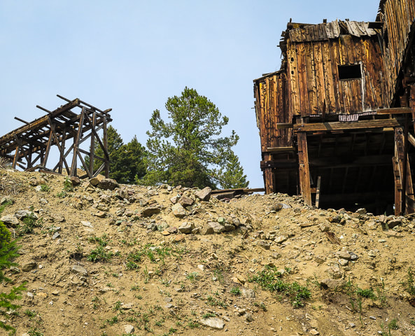
Aerial Tramway Headhouse - Mackay Mine Hill
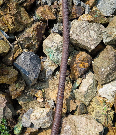
The Mackay Mine Hill tramway replaced a mining railroad in 1918. It transported ore buckets to the smelter located in the valley below using a steel cable loop that was six miles long supported on 36 wooden towers.
Trip Stats for Mackay Peak Hike
Location: Mackay Peak is 4 miles west of Mackay in the Salmon-Challis National Forest, in the White Knob Mountains in east-central Idaho. There are two summits for Mackay Peak. We hiked up the north slope to the benchmark (the eastern high point). Distance and elevation: 3.6 miles round trip with an elevation gain of 2,200 feet. Elevation Mackay Peak (east summit) = 10,256', Mackay Peak (west summit) = 10,272'. Difficulty: Strenuous Class 2 off-trail scrambling and route-finding, easy Class 3 last 200 feet to summit. We didn't see the summit most of the way up, so we used a combination of compass, topo map and GPS. Date hiked: July 9, 2021. Map: USGS 7.5 minute Mackay Reservoir, ID topo map Coordinates: Mackay Peak = 43.88940 113.70046 Driving Directions: Drive southwest on Main St. in Mackay which becomes Smelter Ave. Cross the Big Lost River, then at another 0.8 miles, see the large "Mackay Mine Hill Tour" sign near the large smelter building. The road becomes MK-207, goes by a few relict tramway towers, enters the Challis National Forest and becomes FSR-207. Reach a junction FSR-207 and FSR-207A. We stayed straight onto FSR-207 (passenger car passable) and went past 2 green "4" signs that denote Horseshoe Mine. We parked in a pull-out right after the second "4" sign, at the base of Mackay Peak's north slope, near the Horseshoe Mine. We climbed the north slope, and followed a SSW azimuth. History: Mackay is named after John Mackay, financier of the smelter for White Knob Mining Company which began operations in the late 1890's. Wayne Darlington, president and general manager planned the town and he named it after Mackay to show his loyalty. Mackay officially became a town in 1901, but John Mackay never saw the town in Idaho named after him.
Mackay Peak Hike
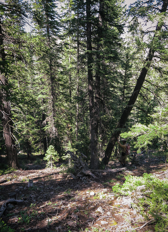
To a lot of Boiseans, summer means it's time to get out of the heat to explore some of the many rugged Idaho mountain ranges. Instead of our usual Ketchum/Stanley trip for hiking, biking and camping, Fred and I decided to go to a less crowded, small town and explore a different mountain range. A place we could actually find a spot to park our Chalet trailer for 5 days. We chose the mountain range with the highest peaks in Idaho - the Lost River Range - and the historic mining town of Mackay with close-up views of this spectacular mountain range. We climbed Leatherman Peak and Mackay Peak, toured Mackay Mine Hill, and did a good deal of talking with the "locals" - very kind and friendly people.
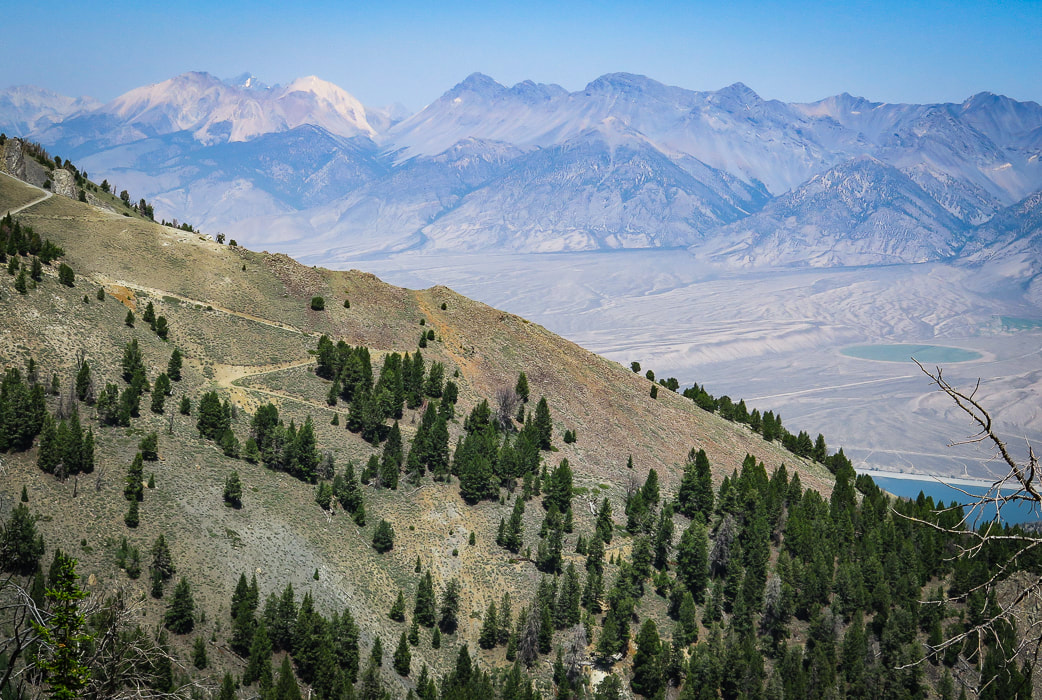
We got as close as we could to the base of the north slope of Mackay Peak on Mackay Mine Hill Tour Road #207 in the Rio Grande Canyon, just southwest of the town of Mackay, and hiked south, straight up through the forest toward the saddle between its two high points (see driving directions). Since we couldn't see the summit for most of the way, we followed an azimuth SSW using our compasses. I have seen a trip report describing climbing the open northeast slope. Mackay Peak has two summits separated by about one quarter of a mile. The forest hike was dense at times with prickly thickets, and we saw one shallow pit dug in the slope and a few mine claim posts. We hiked through some small clearings where trees had been cut many years ago. Turning to look northwest to the Lost River Range, we could see Leatherman Peak, the second highest in Idaho, where we had been on two days before, as well as the blue of Mackay Reservoir.
From the northwest slope of Mackay Peak looking at the Lost River Range
White Cap Peak (the lightest-colored peak on left horizon), Leatherman Peak to its right with Leatherman Pass on saddle between them. 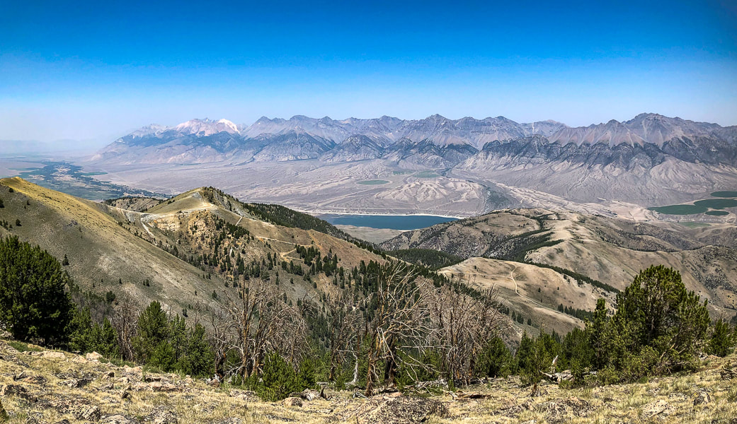
Getting near Mackay Peak's summit with a view of the Lost River Range, home to seven of the nine Idaho "12-ers" - peaks over 12,000' elevation.
At about 9,600' of elevation, the forest thins to reveal a mantle of sharp-edged boulders scattered and wedged just below the summit. The actual summit is still not in view. The rocks are Mackay granite from the Challis igneous intrusive events that occurred 34 - 56 million years ago, providing the heat that produced copper at the contact between the intruding granite and the existing limestone. Sixty million pounds of copper were produced from the Alder Creek (Mackay) mines; silver, gold, zinc and lead were also produced. On the way up, we could hear the steady humming of one of Phoenix Global Mining drill rigs working to fulfill its planned open-pit copper mining project (see more info below in Mackay Mine Hill Tour).
Once at the Mackay Benchmark, we found the brass geodetic marker in a granite boulder and its wooden triangulation tripod on its side. Looking toward the west/northwest, we saw Mackey Peak's other high point. It looked about the same elevation, but actually it is about 16' higher. We were content with the high point we summited, so we took our time and lazed in the sun, enjoying the view. Quite a different experience from two days before, when we had to hurriedly get off Leatherman Peak because of threatening thunderstorms. We hiked straight down through a lot of steep deadfall terrain. This hike's celebration drink/dinner was at Mineshaft Cookhouse and Watering Hole in Mackay where we got a great burger, gin and tonic, and manhattan. Life is good. Being able to explore Idaho and the American West is truly a gift. 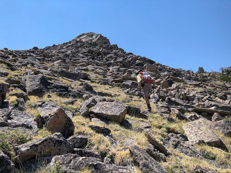
Mackay Peak Benchmark, the eastern high point.
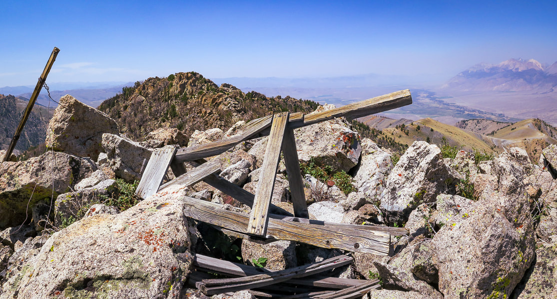
Mackay granite on two Mackay Peak summits: the second summit (just above the wooden triangulation tripod) is actually about 16 feet higher according to a topographical map.
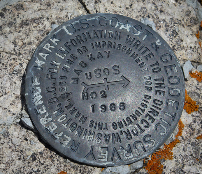
Mackay Peak geodetic survey marker
The "NO 2" refers to the number of the reference mark. The arrow points to the primary benchmark, usually 50 feet away.
Sue on top of Mackay Peak and making our way down through the forest
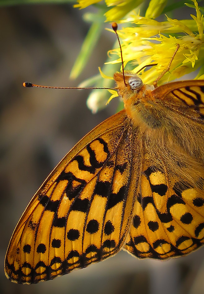
Dark Green Fritillary on a gray rabbitbrush
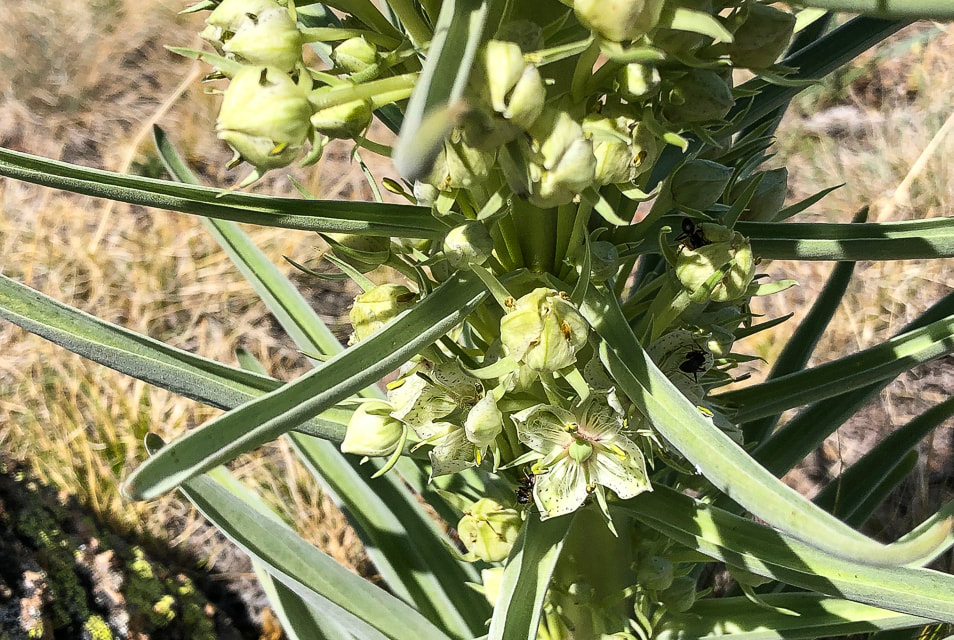
Monument plant
Frasera speciosa
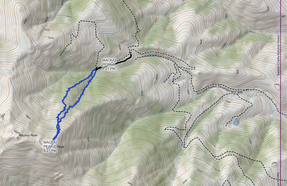
Interactive map with our GPS tracks to Mackay Peak summit.
Our GPS tracks and gravel roads in Mackay Mine Hill Tour area.
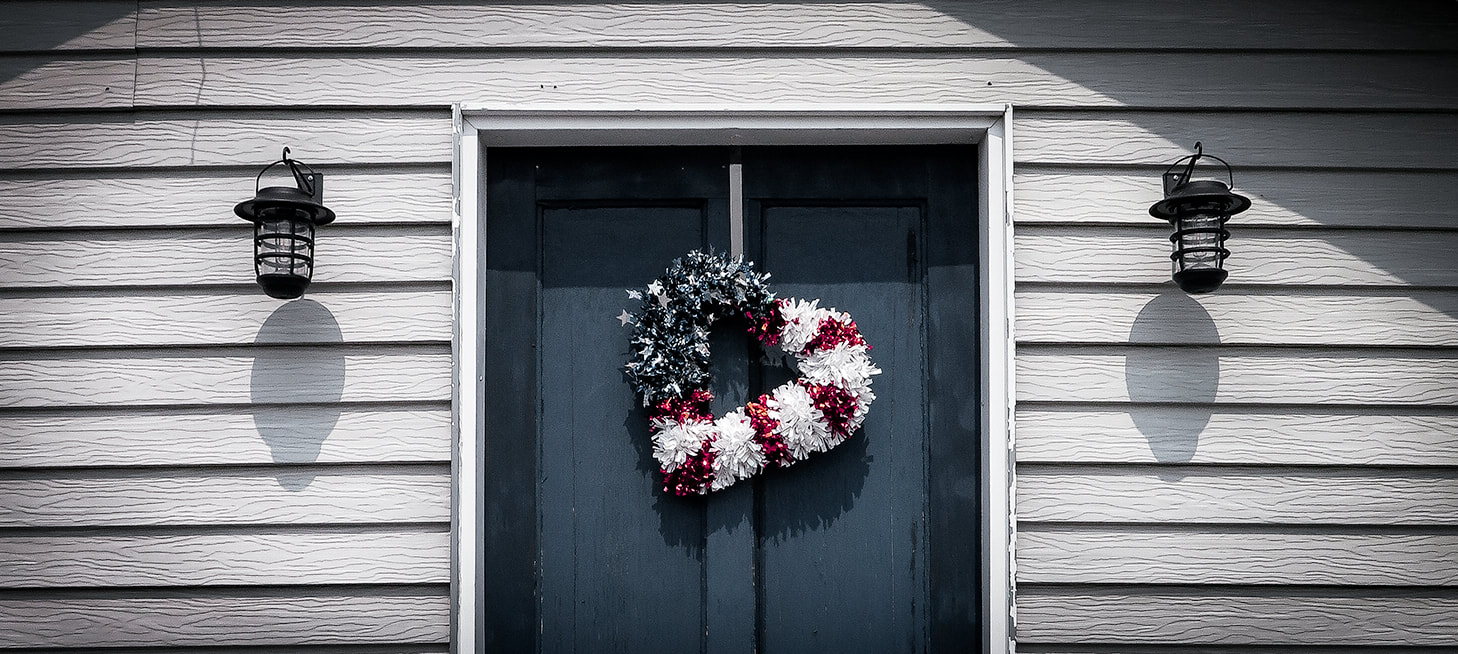
Mackay patriot
Trip Stats for Mackay Mine Hill Tour
BLM Mackay Mine Hill Tour Map - (can be picked up at the U.S. Forest Service building on Custer St., the Lost River Museum, Wagon Wheel RV Park, City Hall, Liars Den Bait and Tackle Shop). To get to the beginning of the mine hill tour (smelter site and hardrock mining exhibit), take Main St. south through the town of Mackay. Main Street becomes Smelter Avenue. Pass over the Big Lost River, then reach the large "Mackey Mine Hill" sign. The tour map features 3 routes depending on transportation mode. The red route is open only to ATV, bicycles, dirt bikes, horses or hikers. The green route is accessible to all transportation modes. Landowners include private owners, BLM and U.S. Forest Service.
Mackay Mine Hill Tour
The Mackay Mine Hill has a rich and productive history dating back to 1884 that yielded mostly copper as well as zinc, silver, gold and lead. According to Mackay's Mine Hill Tour guide, almost a million tons of ore have been removed from this mine hill, located in the Alder Creek Mining District. However, a more recent drilling project shows there is much more ore available at "surface" depths. Phoenix Global Mining has five drill rigs operating in the Empire Mine on Mackay Mine Hill. This underground mine produced 700,000 tons of copper from 1901 - 1947. Empire was mined to depths of 1,100 feet. Currently, Phoenix Global has plans to establish low-cost and open-pit production of copper cathode from the current oxide. Apparently, only 5% of the potential ore resources have been explored, so there is a lot of exploration potential. Gold recovery was successful using "environmentally friendly" ammonium thiosulphate. Phoenix Global even re-opened two historic mining adits (horizontal underground mine passage) to conduct underground mapping and sampling. It seems that Mackay citizens are open to the new mining activity; at least I didn't see signs of protest in the town. While eating a tasty breakfast at the Liar's Den Bait and Tackle Shop, we talked to a long-time Mackay resident, having his morning coffee and talking to the owner of the shop. He filled us in on the new exploration on the mine hill. He indicated that Mackay residents were rightfully concerned about mining activity on the hill because that is their water supply. The CEO of Phoenix Global Mining, Dennis Thomas, says in an article that "You could not find a more supportive regime anywhere in the world than what we have there locally, with the local people and council." So it appears that Mackay is entering into the world of modern mineral exploration.
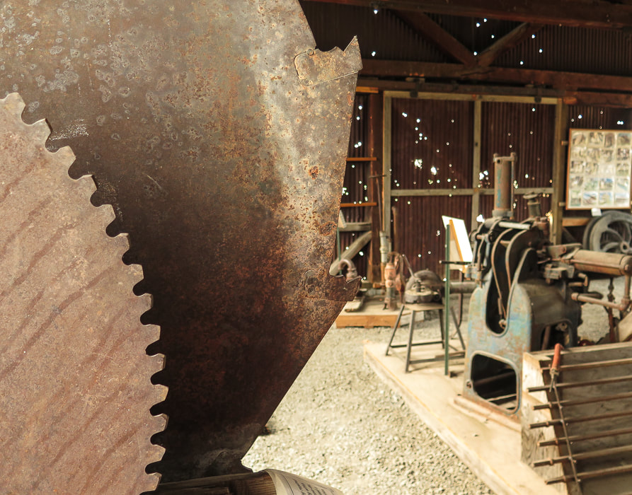
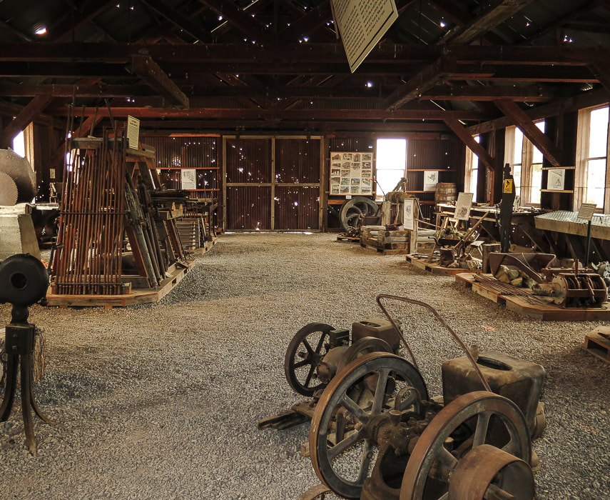
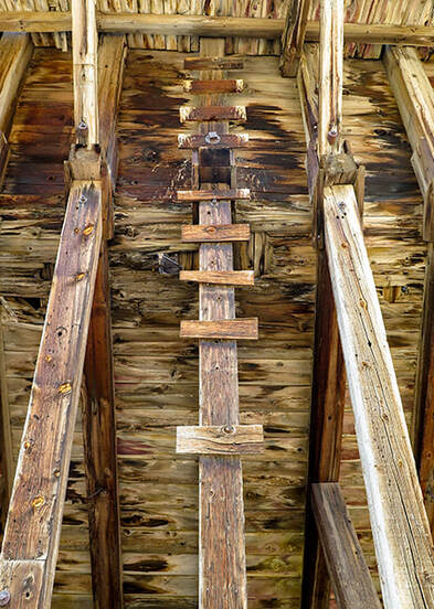
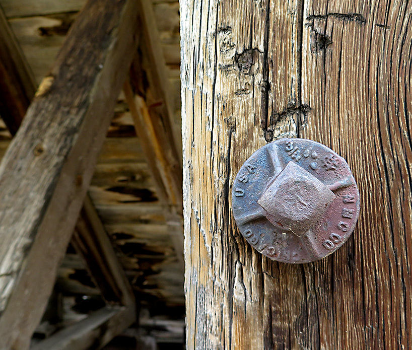
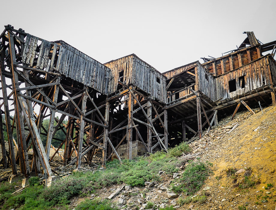
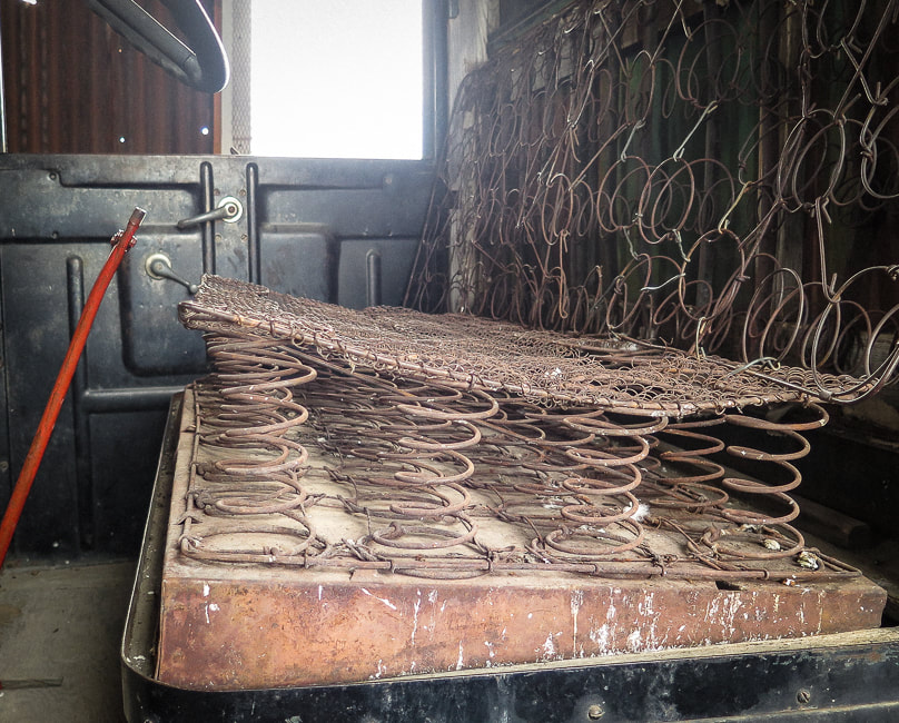
Scenes from the Hardrock Mining Exhibit, point of interest #1 at beginning of Mackay's Mine Hill Tour, and a surviving wooden tower from the Aerial Tramway (lower left).
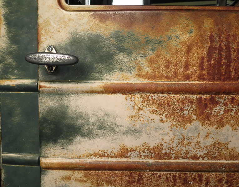
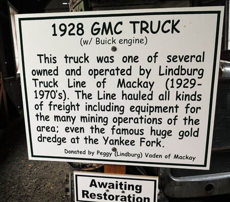
Door of truck from by Lindburg Truck Line of Mackay that hauled mining equipment.
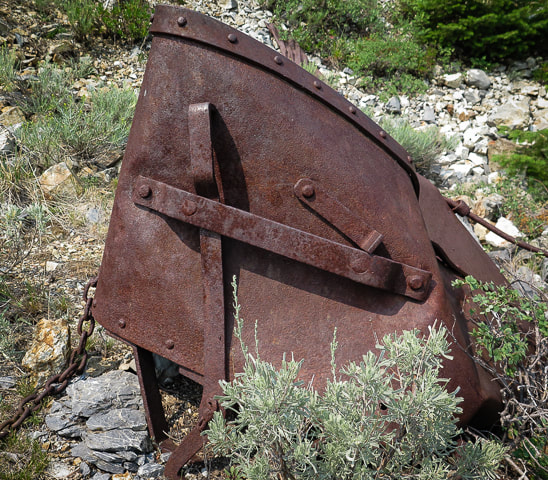
Scenes from Mackay's Mine Hill Tour
clockwise from top left: Cossack mine tunnel (the tour brochure states, "Caution: The tunnel is dangerous and prone to rock falls. Stay Clear"; supporting pole in the aerial tramway headhouse; tramway and tramhouse; upper terminal tramhouse; ore bucket; part of 6-mile cable that transported ore buckets.
If you have limited time for the Mackay Mine Hill Tour, I suggest visiting the Hardrock Mining Exhibit at the beginning of the tour, not far from the town center. The exhibits show many examples of mining equipment that seems like it was just pulled out of the field. Informative interpretive signs describe every aspect of mining in Mackay, and illustrations and photos document how mining was done. I am amazed at how strong the miners had to be to handle heavy hand drills before the invention of the mechanical drill. You will get a great idea of the hardships of hardrock mining and how many steps were involved in finding and processing ore to produce valuable minerals.
The Lost River Museum in Mackay is a definite must-see. For a small town, this award-winning museum is exceptional. The volunteers at the front desk are down-home friendly and told us a few Living in Mackay tales including enduring winters and their early ranching experiences. It is well-organized and informative; you can tell that this museum was created out of the pride, care and love of Mackay citizens. From vintage ball gowns and flapper dresses owned by past Mackay ladies to a Basque sheepherder exhibit including sound effects, and a moonshine exhibit, the museum is comfortable, organized, but most important of all, interesting! 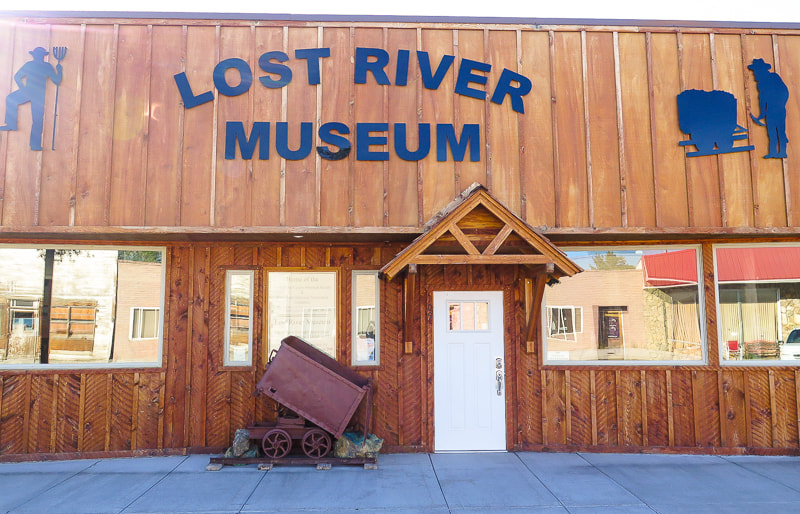
Award-winning Lost River Museum in Mackay, Idaho
References
Carey, R.L. About Survey Monuments and Benchmarks. Skipp, B, Kuntz, M. A. 2009. Geologic Map of the Arco 30 x 60 Minute Quadrangle, South-Central Idaho. (article text). Skipp, B, Kuntz, M. A. Geologic Map of the Arco 30 x 60 Minute Quadrangle, South-Central Idaho. (geologic map). Official Website of the Mayor and Council of the City of Mackay Mining Technology in the Nineteenth Century. Online Nevada Encyclopedia. Phoenix Set to Rise on Mackay's Mine Hill. Mining Journal, 6/28/18. Phoenix Copper Limited - The Empire Mine, Mackay, Idaho.
2 Comments
|
Categories
All

Sue and Fred

About this blogExploration documentaries – "explorumentaries" list trip stats and highlights of each hike or bike ride, often with some interesting history or geology. Years ago, I wrote these for friends and family to let them know what my husband, Fred and I were up to on weekends, and also to showcase the incredible land of the west.
To Subscribe to Explorumentary adventure blog and receive new posts by email:
Happy Summer!

About the Author
|