|
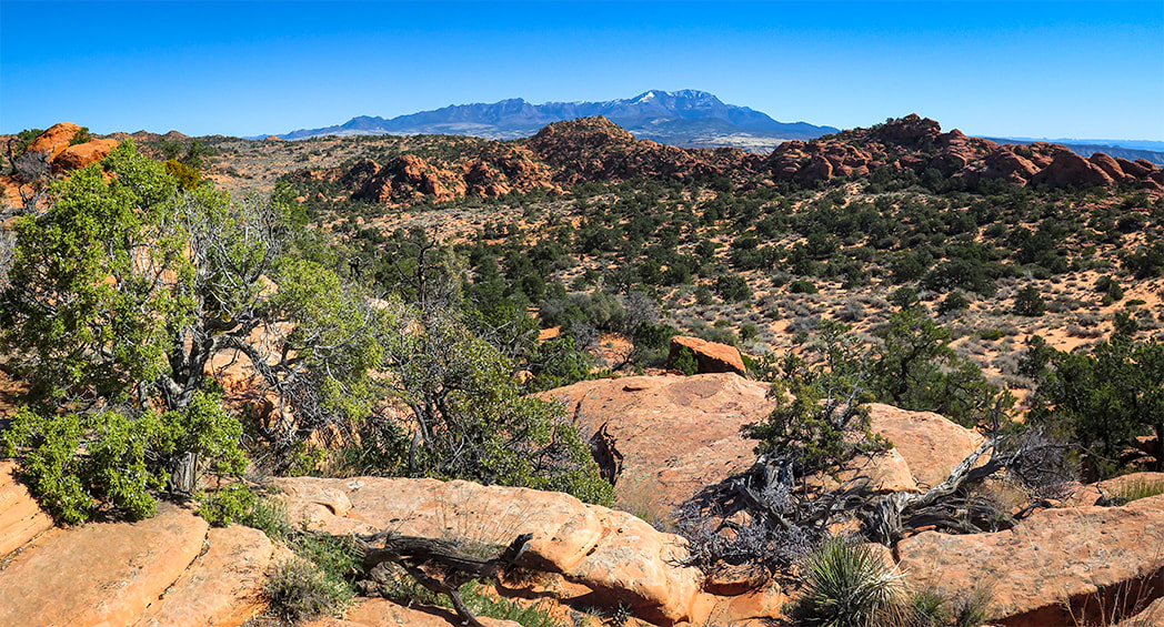
A New Year's Day 2024 journey through pinyon-juniper woodland on top of Red Mountain near St. George, Utah to a spectacular Snow Canyon overlook. 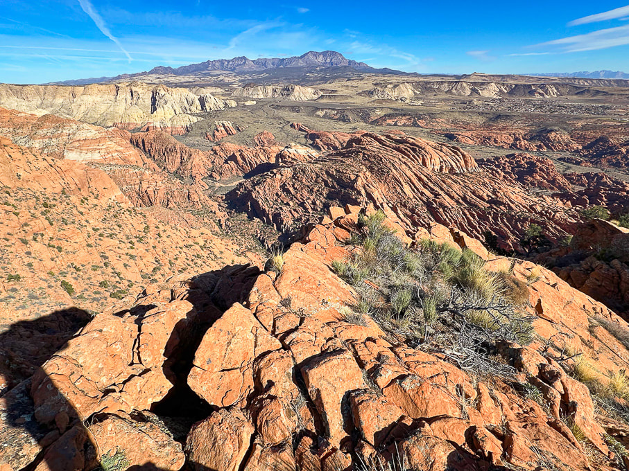 Looking north over Snow Canyon State Park from "On Top of the World" on Red Mountain. Pine Valley Mountains on the horizon. 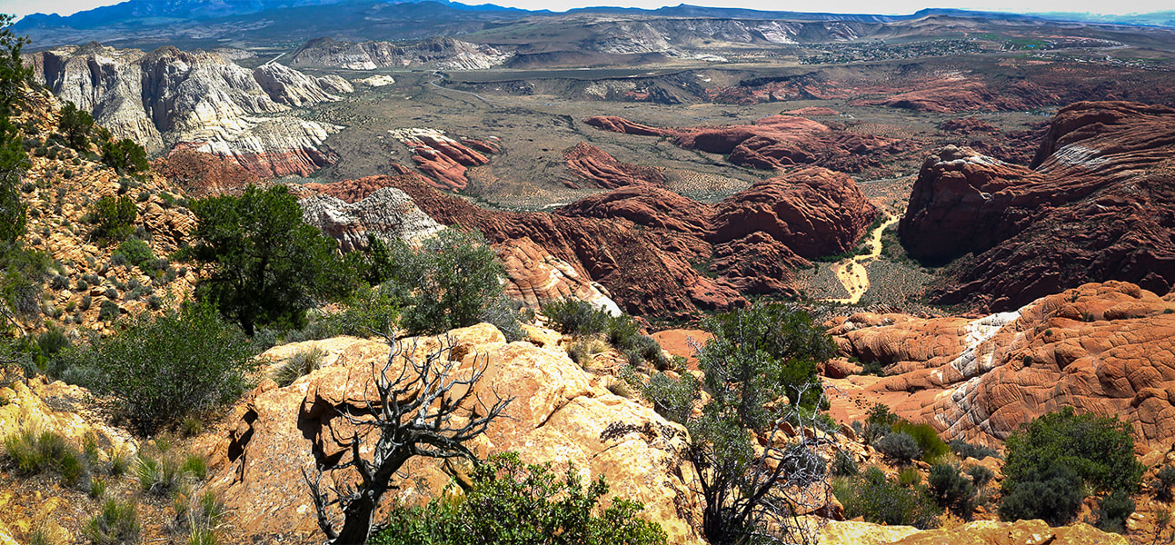 View of Red Sands Trail (right) in Snow Canyon SP from a previous hike - Red Mountain Primitive Trail. Trip Stats - Ivins Trailhead
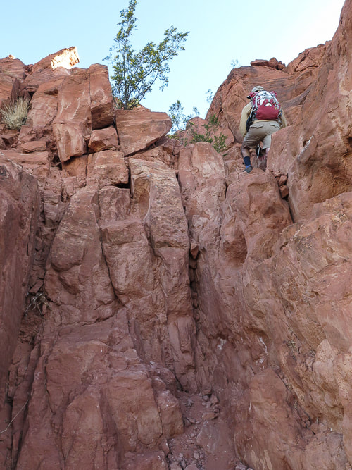
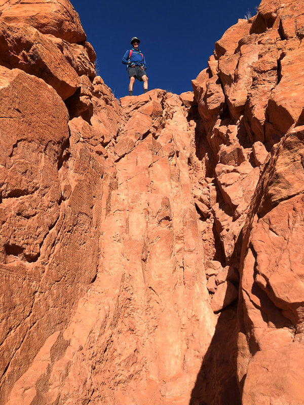
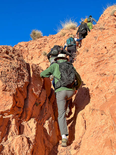
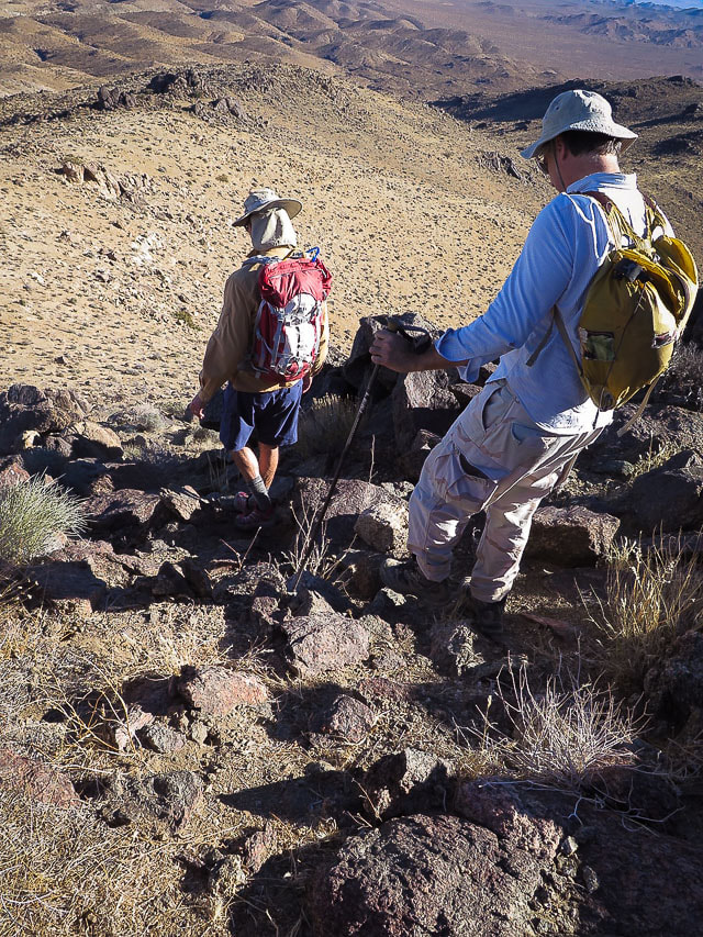
Overview/Location: This quiet, cross-country excursion through the gorgeous Red Mountain juniper woodland biome brings you to an expansive view of southern Utah's Snow Canyon State Park. A remote island of solitude in the Red Mountain Wilderness elevated above the cities of Ivins and St. George. Distance/Elevation gain: 5 miles out and back/1,575'. Coordinates/Elevation: Red Mountain Trailhead = 37.17519, -113.67755 (3,190'). Southern Red Mountain Primitive Trail out of Ivins. Top-off at 0.8 miles = 37.18375, -113.67849 (4,556'). Snow Canyon Overlook (On Top of the World) = 37.20116, -113.66671 (4,765'). Maps/Apps: Topo Maps U.S. app, Garmin GPS, BLM Utah Red Mountain Wilderness (Avenza app). Maps at end of this post. Difficulty/Trail: strenuous Class 1-3 climb up Red Mountain (mild exposure) for the first 0.8 mile, moderate cross-country Class 2 over slick rock and deep sand. Date Hiked: 1/1/2024. Geology: Red Mountain's lower slopes are the Kayenta Formation, the oldest rock in Snow Canyon State Park (190 million years). The horizontal sediment layers are made from rivers depositing mudstone, siltstone and sandstone. The upper slopes, cliffs and top of Red Mountain are a great block of Navajo Sandstone that is younger (180 million years), also seen as a major rock unit of Zion National Park. This Navajo Sandstone exhibits large, sweeping cross-bed features - horizontal and dipping layers of ancient sand dunes deposited in a vast eolian (wind carried) dune field. Red Mountain is bounded by the Gunlock Fault on its west side. It merges with an extensive field of 2.4 million - 2,000 year old basalt flows to the northeast. The Gunlock Fault is a normal fault with the down-drop on its west side (See references below). Considerations: The first mile from the Ivins trailhead is Class 1-2 with two short Class 3 maneuvers. Once the trail tops out, there is no marked trail. Experience with navigation and route-finding using a compass/GPS and topo maps is advised after top of Red Mountain is reached to avoid getting lost. A sign at this trailhead reads, "Hazardous, unmaintained route with steep exposed slopes: your safety is your responsibility." Recommend taking a GPS waypoint at critical points on the trail such as point where you enter the plateau from the cliffs. Search and rescue operations for lost hikers have occurred. Be prepared if you have to spend the night! Research this route thoroughly! 2/5/23: Three rescues in Washington County on the same Day (St. George News). Related Posts Our New Year's Day Hike Fred and I have a tradition of hiking on New Years Day. For 2024, we took friends to the top of Red Mountain and across its beautiful plateau to a high point dubbed "On Top of the World" by our friend Dan. From here, you stand 1,400 feet over an outstanding view of Snow Canyon's petrified yellow sand dunes and orange ridges, black basalt flows from northern volcanoes near Veyo. It's worth the orange sand trudge on the top to get there. This short, five-mile hike packs in a good variety of terrain. The first mile climbs steeply through a cliff band requiring some fun Class 3 (un-roped using hands to climb) maneuvers, gaining 1,300 feet. The next 1.5 miles initially descends through a beautiful juniper woodland bowl where Gunsight Pass can be reached to the southeast. You will trek through sand, washes, over slick rock then climb to a sandy saddle where our "On Top of the World" high point can finally be seen. Then it's a matter of making a ~0.5-mile beeline to it across relatively level terrain, traversing minor washes, dodging cacti and prickly shrubs. When you top-off onto Red Mountain's plateau, you initially follow the north/south Red Mountain Primitive Trail for ~1.2 miles, then a short jaunt off of it to the northeast to reach On Top of the World, elevation 4,765'. Red Mountain Primitive Trail's northern trailhead is located just north of Diamond Cinder Cone on Utah Highway 18. It's a fun little scramble to the cairned top, using your hands a few times to climb easy rocks, overlooking Padre Canyon and Tuacahn Center for the Arts to the southeast. Once you summit, the rugged terrain drops steeply below with a breathtaking view of Snow Canyon, with a few smooth slick rock benches above it that look interesting to explore or camp in. Can't think of a better way to celebrate the New Year: friends and the reward of finding our own way to a seldom-visited summit in one of the most beautiful places in the southwest. Great "medicine" for the soul, body and mind. Explore More in 2024!! 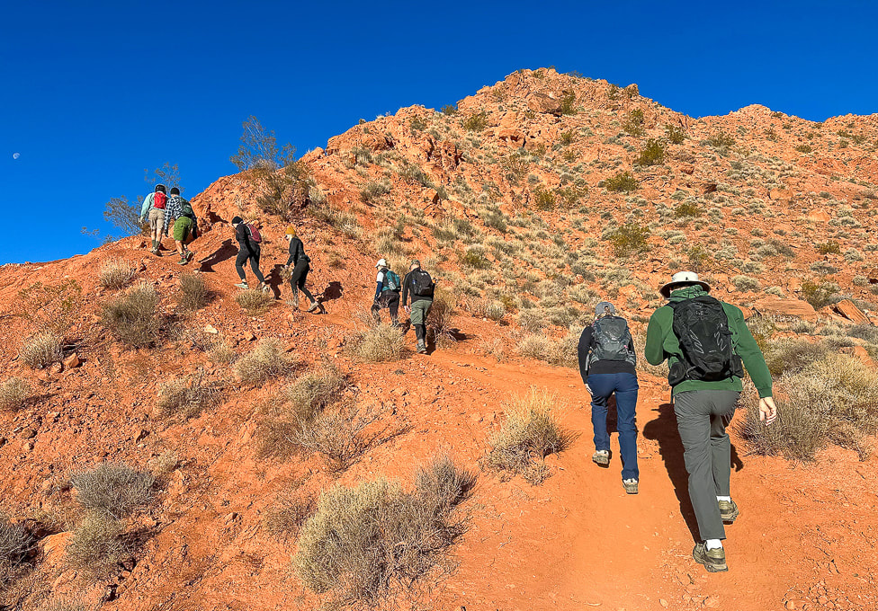 Southern Red Mountain trailhead in Ivins. The trail starts out steep! 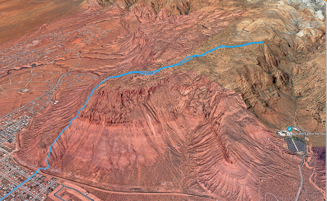 Google Earth view of our GPS tracks beginning at the Red Mountain Primitive Trail's southern trailhead in Ivins (lower left), going through the cliff-band about halfway up, getting onto Red Mountain, and traversing across plateau to "On Top of the World" overlooking Snow Canyon, Padre Canyon, and Tuacahn Center for the Arts. See more maps at the end of this post.
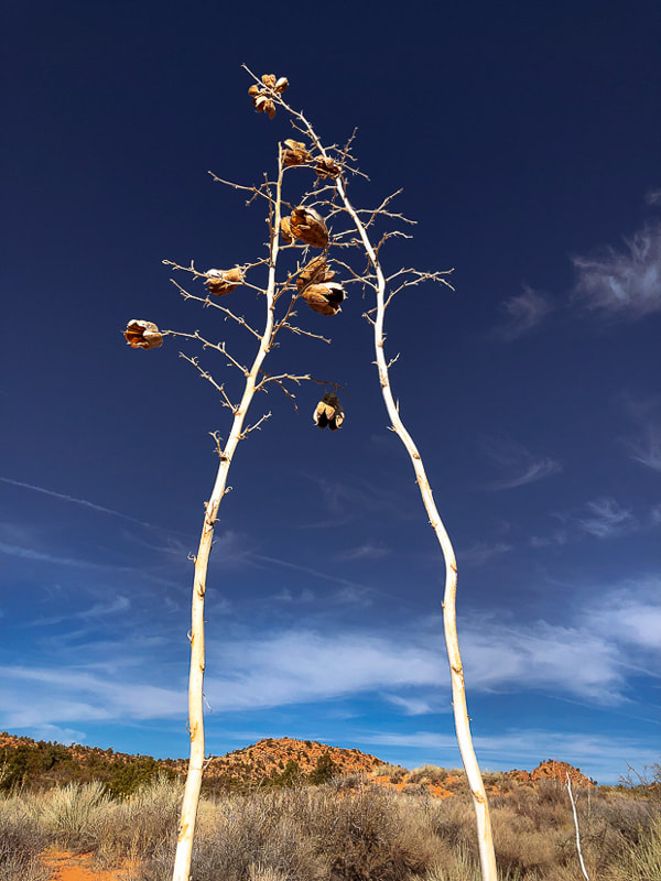
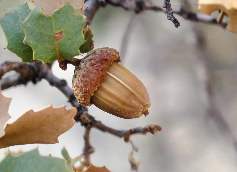
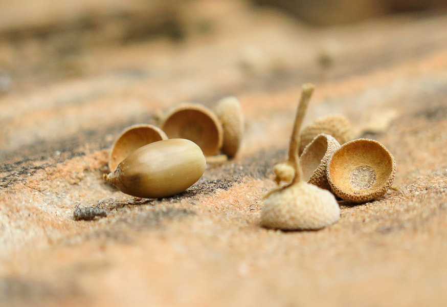
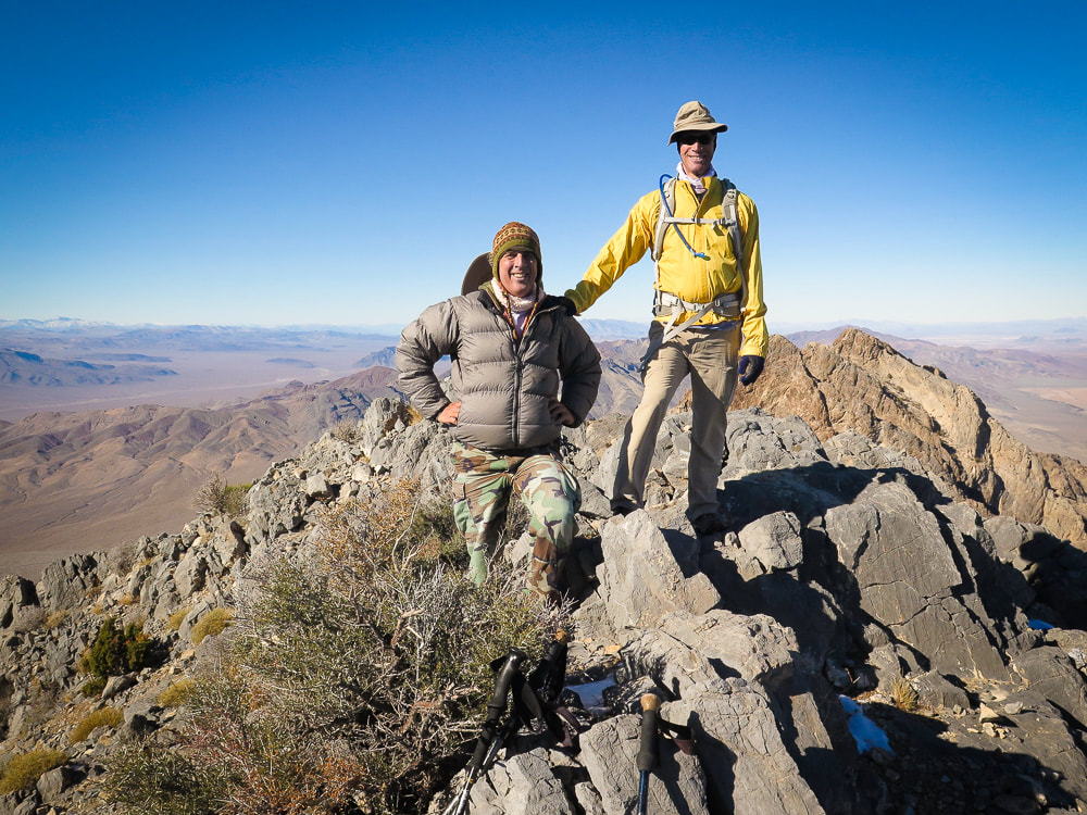
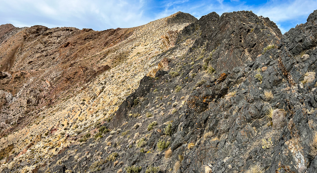
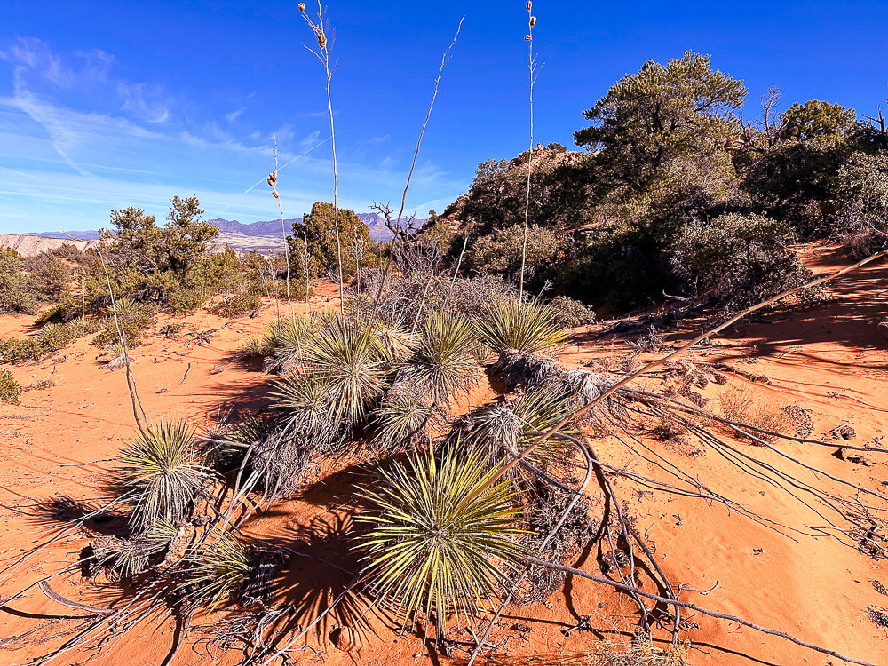 Utah yucca and pinyon pines, shrub live oak (Quercus turbinella) on Red Mountain's plateau. The name turbinella, meaning "like a little top", refers to the acorn, this plant's fruit which appears in summer. The reference to "turbinella" in the photo above prompted me to add these photos of the shrub live oak acorns. They're so cute! 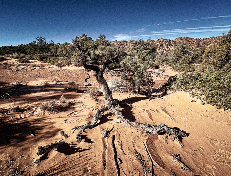 Life and death on the Colorado Plateau: beauty and grace in a dead juniper. 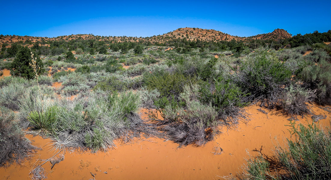 On top of Red Mountain: lots of sand and shrubs to negotiate. 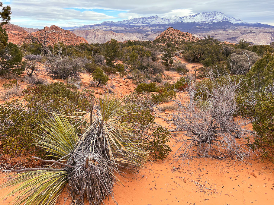 The first view of "On Top of the World" highpoint (red cone to the right). Snow-covered Pine Valley Mountains on the horizon. This photo was taken last winter when we had record snowfalls in southwestern Utah. 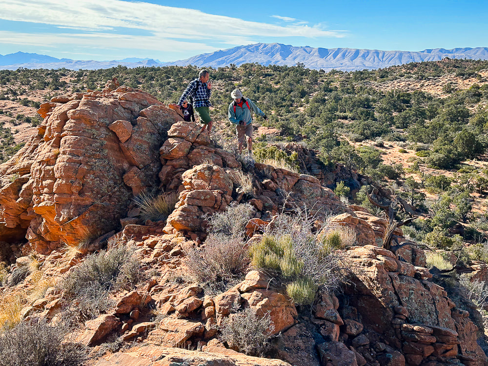 We have just walked across the pinyon/juniper scrub land behind Fred and Jeff and are starting up the ridge to our summit. Beaver Dam Mountains on the horizon to the west. 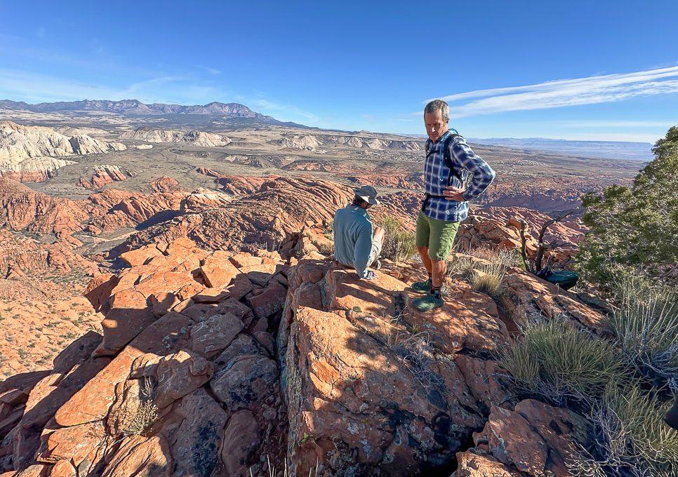 "On Top of the World!" 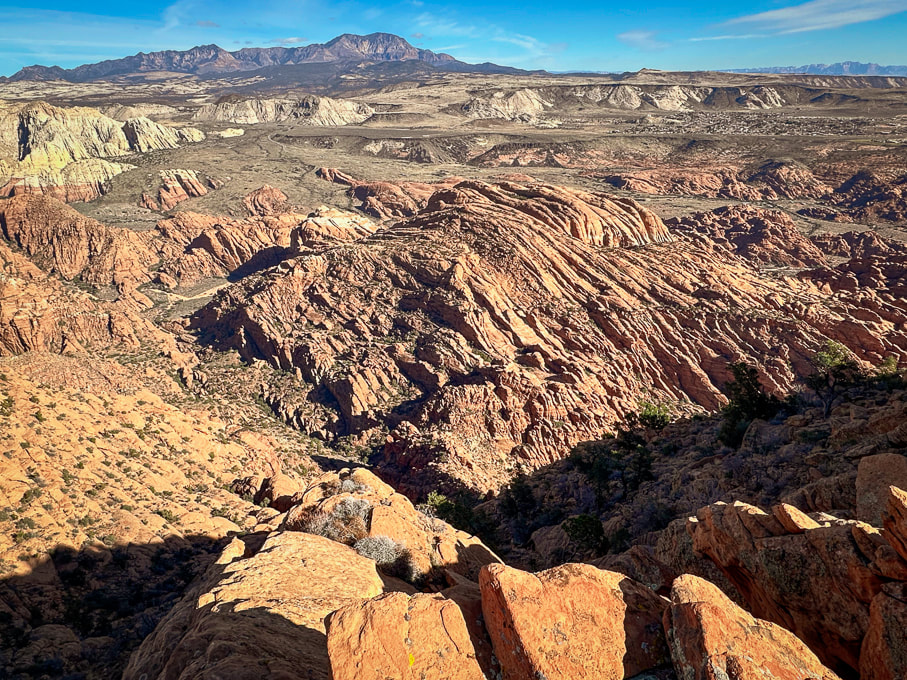 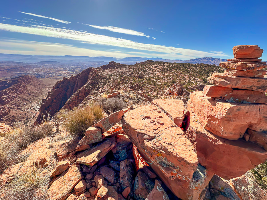 A cairn marking our summit and a view of Tuacahn Center for the Arts lower left. View is looking south at Ivins and St. George, Utah and toward Arizona on the horizon. 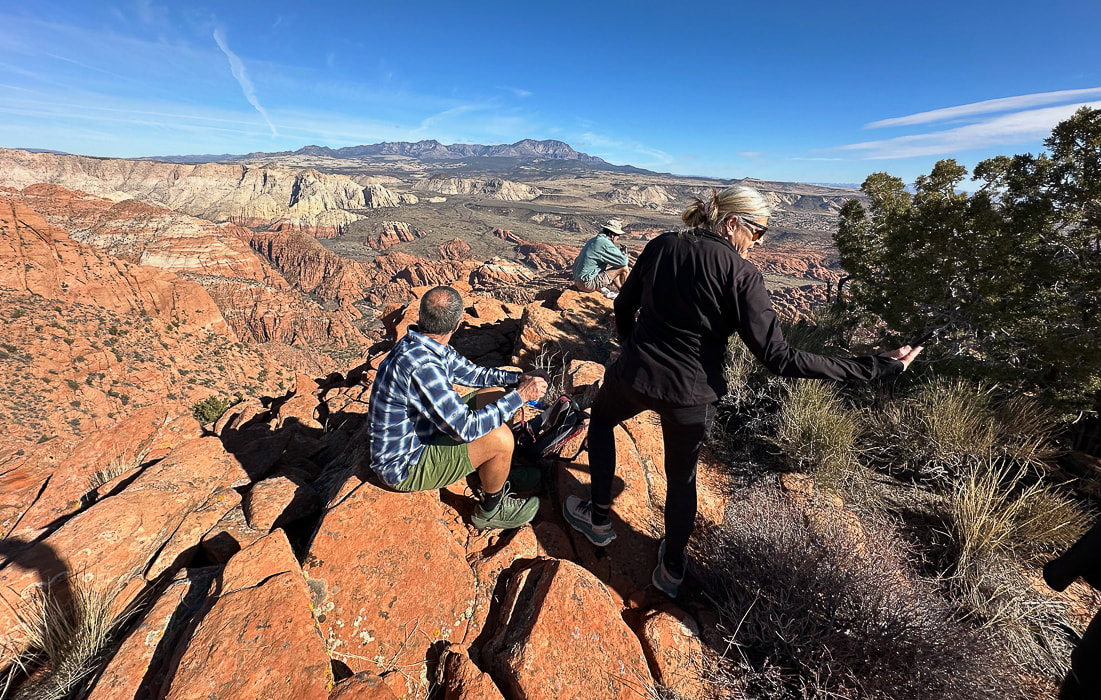 Jeff and Lindy - Happy New Years! 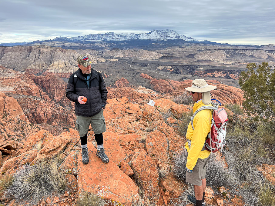 Dan (who named this summit "On Top of the World") in a photo from last winter. 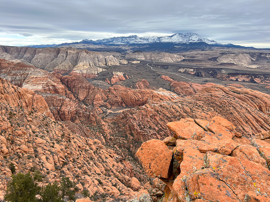 The road in the valley is the drive through Snow Canyon State Park. Note the black shrub-covered basalt flows mid/upper in photo, covering the Navajo Sandstone. 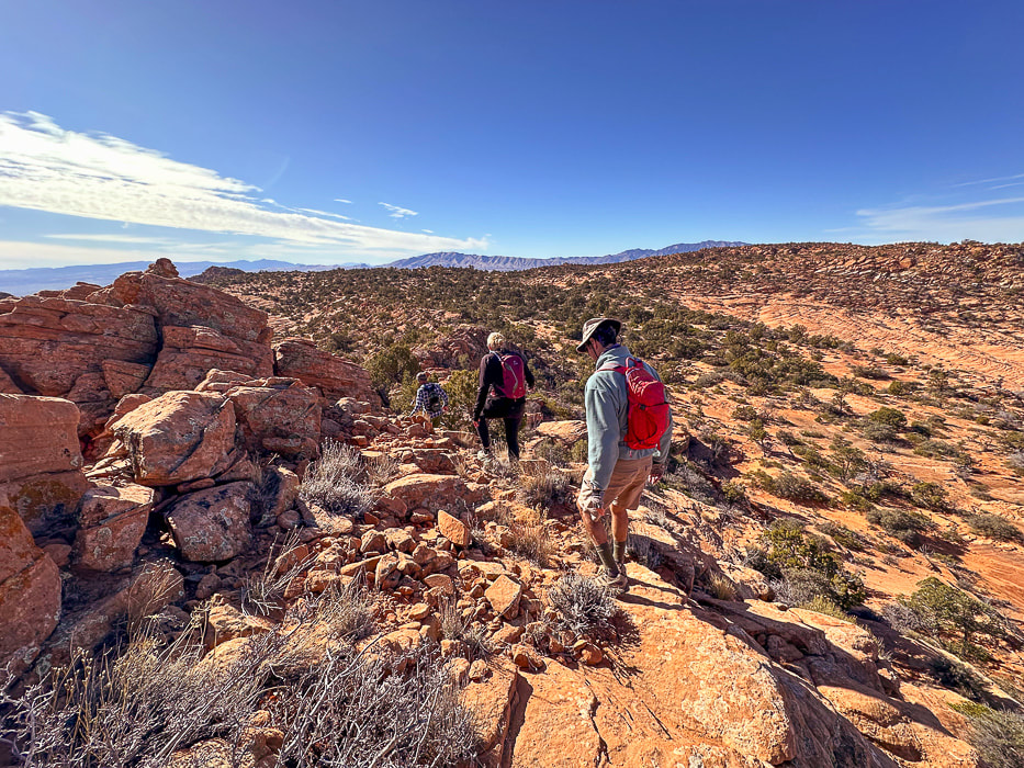 Heading back. As soon as you get over the saddle in the foreground, you drop into sand dunes and washes, then a brief climb up a sandstone ridge to find your entry point onto the plateau. Navigation experience on unmarked terrain is essential so you don't get lost. I recommend taking a GPS point when you finish the 0.8 mile climb from the trailhead to the plateau entry. 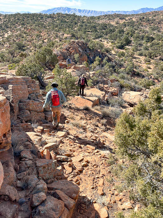 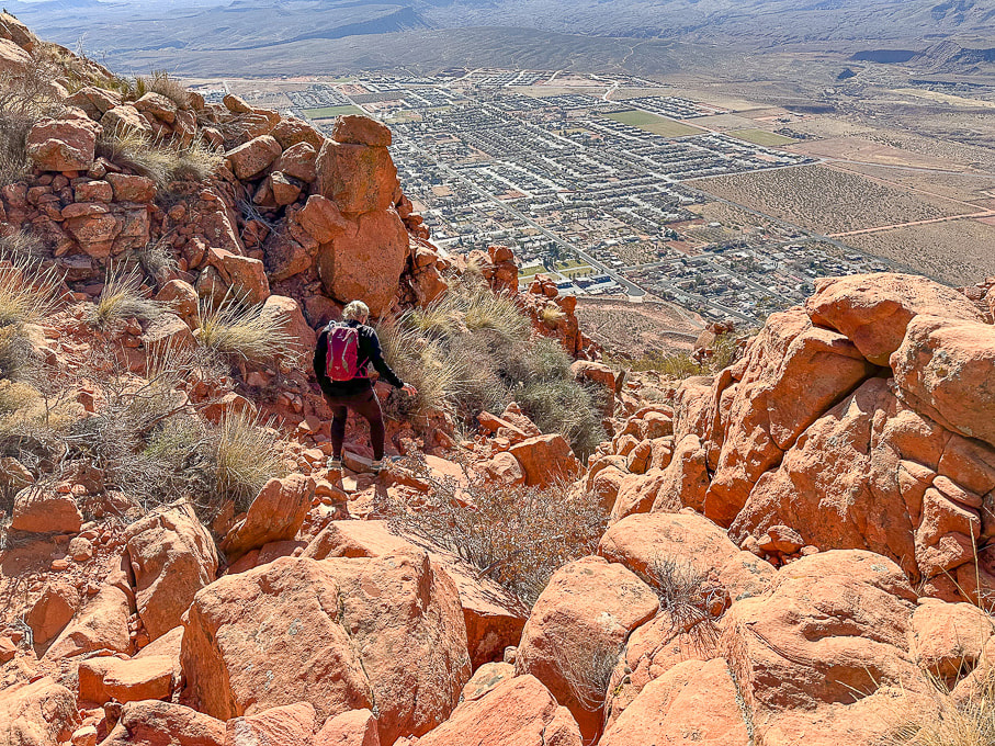 Heading down off the plateau of Red Mountain on Red Mountain Trail. Overlooking the city of Ivins. 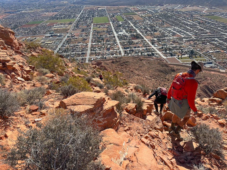 City of Ivins below. 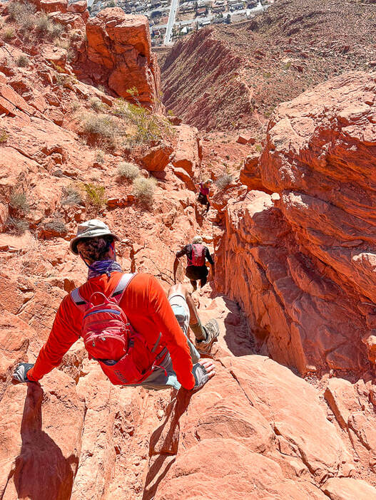 Descending through Class 2+/3 cliff band. Below us is the trail on top of the ridge. 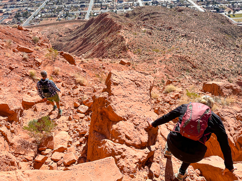 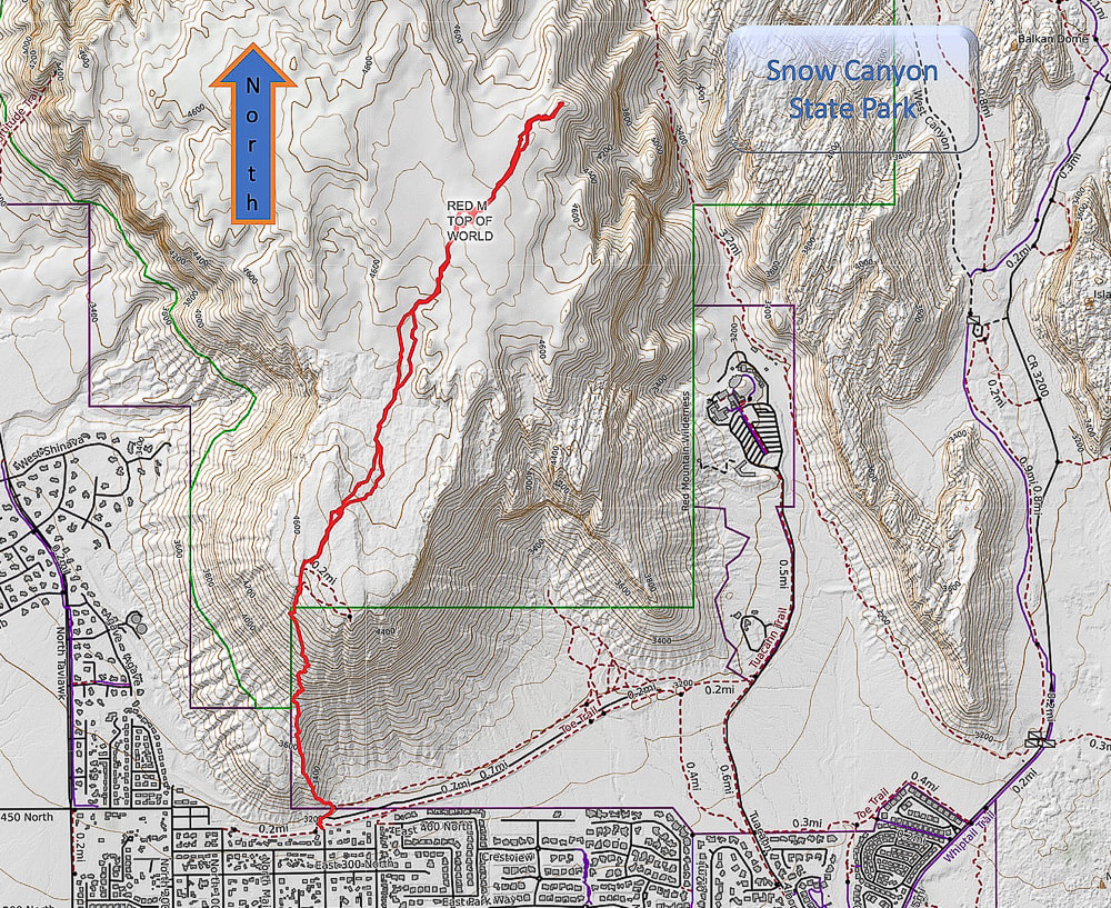 Caltopo Map of our GPS tracks. 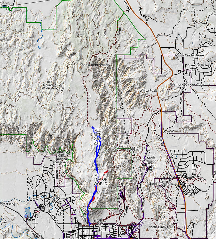 Caltopo map illustrating our hikes on the Red Mountain Primitive Trail. Red tracks = "On Top of the World" hike. Blue tracks = our hike on 2/4/23. Dashed line = continuation of Red Mountain Primitive Trail past Snow Benchmark, to intersection with Snow Canyon Overlook, then ending at its upper trailhead. References
Bugden, M. Geology of Snow Canyon State Park Cryptobiotic Soils: Jayne Belnap. Holding the Place in Place - USGS: Impacts of Climate Change on Life and Ecosystems. Red Mountain Wilderness Maps - Wilderness Connect Ecoregions of Utah - usgs.gov Geologic Map of the St. George and East Part of the Clover Mountains 30' x 60' quadrangles, Washington and Iron Counties, Utah. Biek, R.F., and others. USGS publications. Miller, R. Our Geological Wonderland: Snow Canyon State Park
2 Comments
A rare chance to walk in water in Badwater Basin, attempts to climb Artist Palette Peak and Sheephead Mountain, and a wrap-up of 2023 hikes. 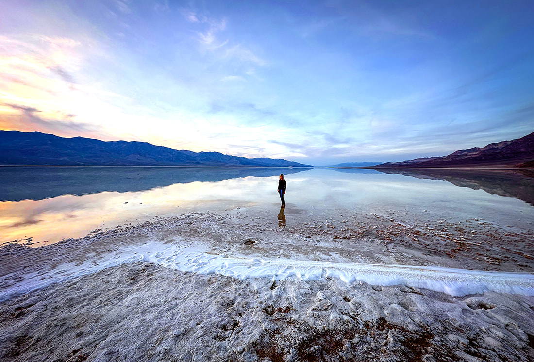 Sunset on Badwater Basin, Death Valley National Park, 12/23. photo by Fred Birnbaum Trip Stats
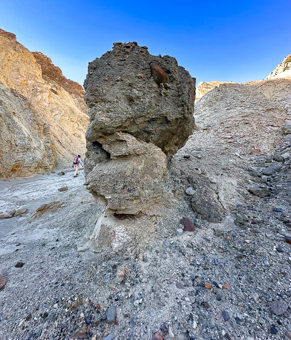
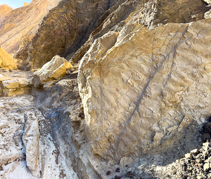
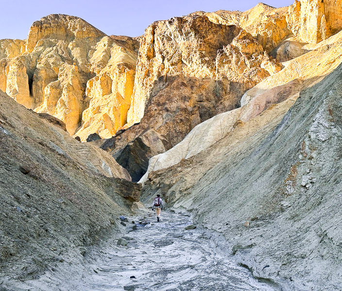
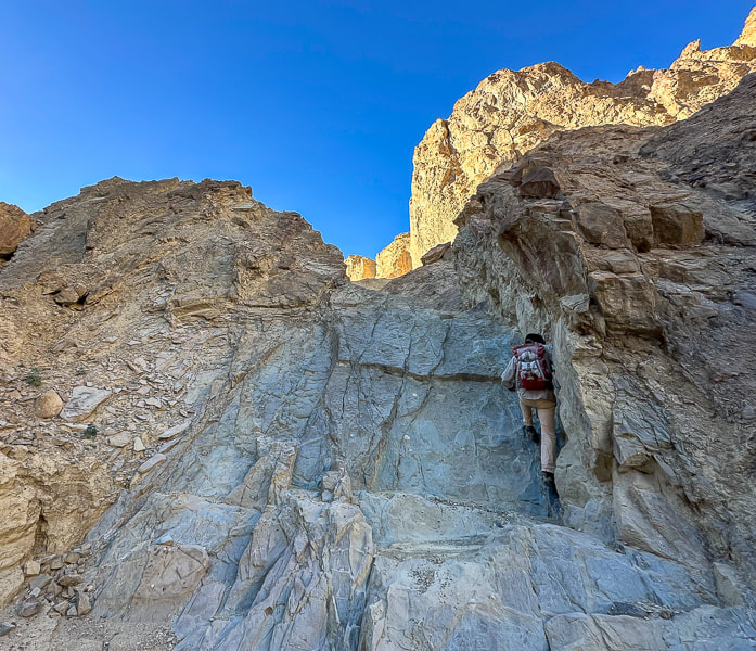
Peaks Attempted: Artist's Palette Peak, east Death Valley National Park, and Sheephead Mountain, Ibex Wilderness (southern Death Valley). Dates hiked: December 15 and 16, 2023. Maps and Apps: Trails Illustrated Death Valley National Park #221. Used Stavislost.com for Artist's Palette Peak and Sheephead Mountain routes. Lodging: Shoshone Inn at Shoshone Village, southwest of Death Valley NP. Geology: Tectonic processes relatively young; rocks are old Precambrian - 1.8 billion years ago. Schists and gneisses that have been uplifted and exposed, located in the Panamint Mountains to the west of Death Valley and Badwater Basin. Paleozoic - 550 million years ago. Limestone and dolomite in warm shallow seas. Late Paleozoic/Mesozoic - 225-65 million years ago. Pacific plate subducted under North American plate, causing melting ---> magma and volcanism. Jurassic and Cretaceous - magma chamber production ---> cooled intrusions that formed the Sierra Nevada mountains ---> some of these plutons spread eastward to Death Valley. Compression caused thrust faults (older rock thrust over younger rock). Cenozoic - 66 million years ago - present. Extension (spreading) caused volcanism Related Posts 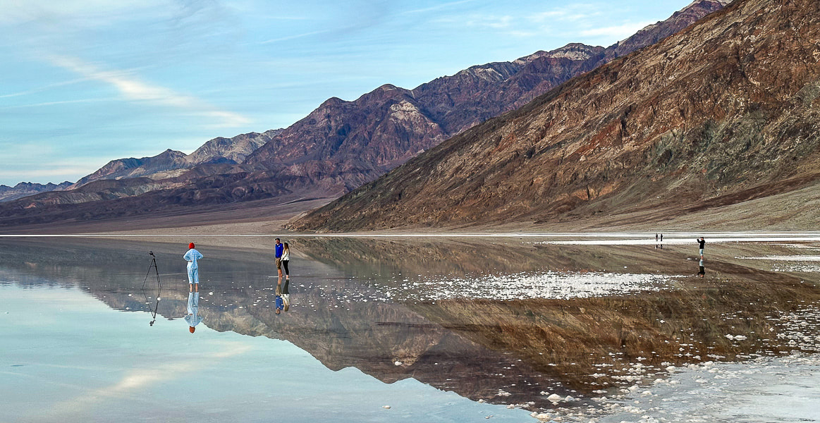 One of the photographers at Badwater Basin's lake. Our Trip - Badwater Basin, Artist's Palette Peak, Sheephead Mountain On August 20, 2023, Tropical Storm Hilary dumped a year's worth of rainfall on Death Valley National Park, transforming famous Badwater Basin into a spectacular sight: a huge turquoise-colored, salt-rimmed lake reflecting massive mountains on both sides. This rare occurrence is reminiscent of Pleistocene Lake Manly, a deep ice-age body of water that once filled this basin and dried up about 10,000 years ago. Although not as deep and extensive as its predecessor, it was still an amazing sight to see, especially at sunset. Badwater Basin, the lowest point in North America, is normally a salt flat cut into hexagons, and freeze/thaw hummocks - soft yet crunchy to walk on. Fred and I had hurried from Shoshone Village, a 45-minute drive to the southeast, to get there by sunset. There were a few other photographers, their mirror-images appearing unbroken in the still, shallow, and salty water. It was so quiet and remote that we could hear their conversations. For the past three years, we have stayed and hiked in the Death Valley National Park area during the Christmas holiday. In 2021, we hiked Pahrump Point out of Chicago Valley in the Nopah mountains with our friend Scott. In 2022, Fred and I hiked the awesome Pyramid Peak in the Funeral Mountains, and in 2023 we got to experience the magic of Badwater Basin's reflections and also hike Artists Palette Peak and Sheephead Mountain in the Ibex Wilderness. Hikes are challenging in Death Valley, a rough and rocky place - remote, stoic and mysterious. That's why we love it. A land that has experienced a lot of turmoil, yet stands defiant. 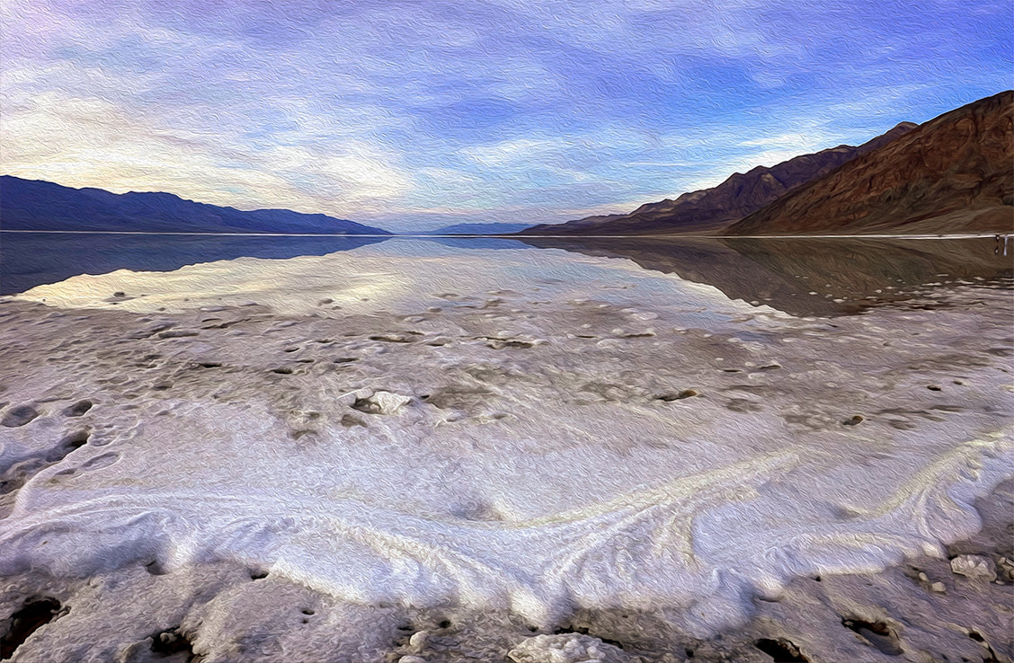 How Long will Badwater Basin's Lake Last? The depth of the lake was about four inches where I stood after walking through thick (and sharp!) salt deposits at the lake margins. The evaporation rate in Death Valley is 120-150 inches per year. I read one source that stated the depth was two feet right after the storm. The evaporation rate is the highest in the U.S., so get out and see it soon! The Landsat images below show relative evaporation in 10.5 weeks (images 2 and 3). Note that the northern, smaller body of water appears to have mostly dried up already. 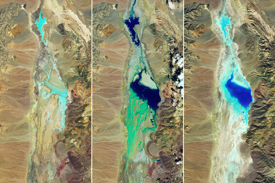 National Aeronautics and Space Administration (NASA) Landsat Images of Badwater Basin in Death Valley National Park. Water appears in shades of blue. Image #1 taken 7/5/23 shows little moisture. Image #2 taken 8/22/23, two days after Tropical Storm Hilary's record rainfall. Image #3 taken on 11/2/23, 10.5 weeks after the flooding, shows some evaporation. NASA Earth Observatory images by Wanmei Liang, using Landsat data from the U.S. Geological Survey. 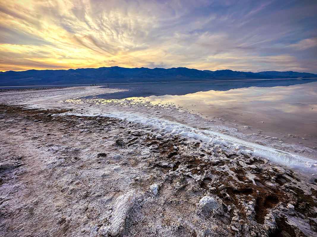 Sodium chloride (table salt) crystals accumulated around the perimeter of this year's lake that filled in part of Badwater Basin, a rare event. This lake has the greatest evaporation rate in the U.S. 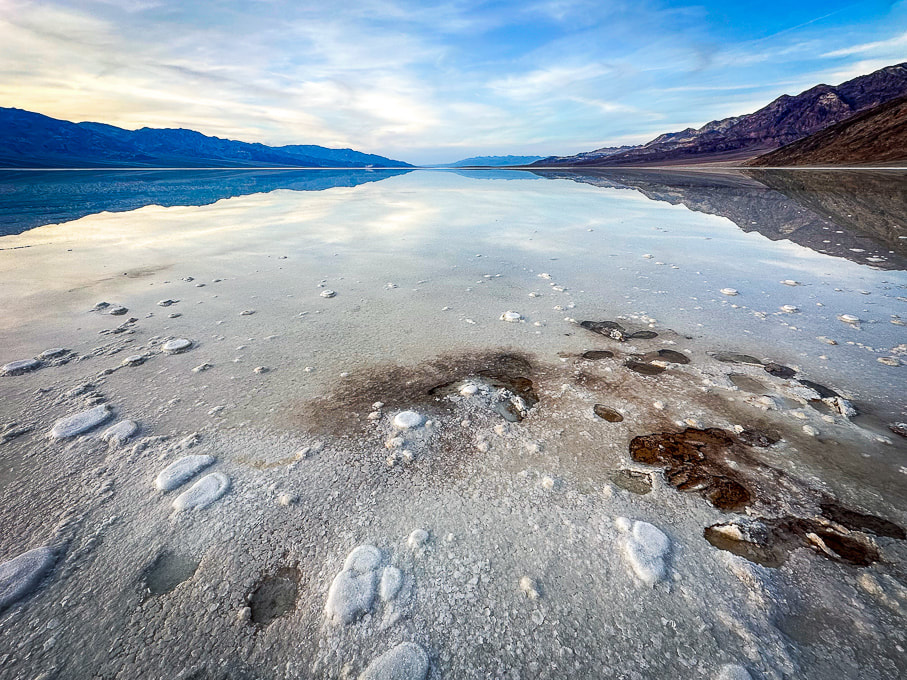 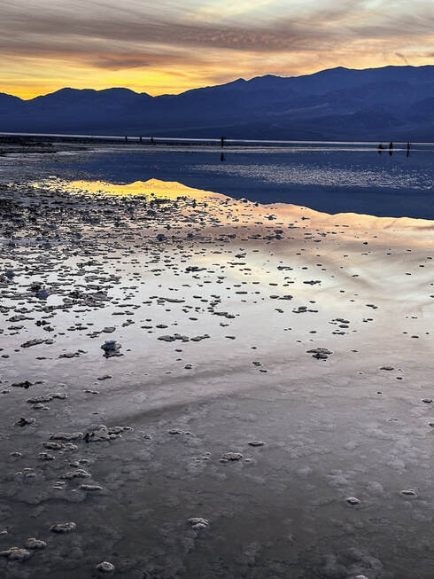 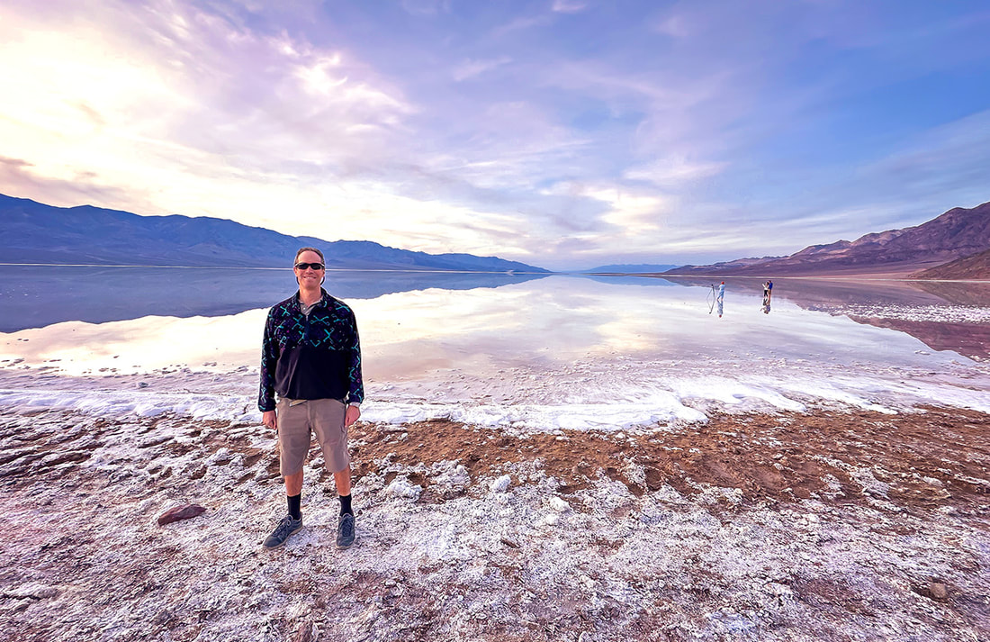 Fred at the salty Badwater Basin, the lowest point in North America - a sublime setting. 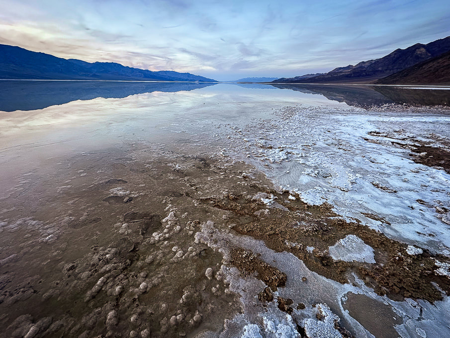 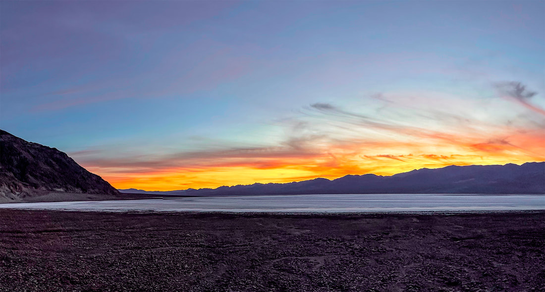 Artist's Palette Peak and Sheephead Mountain Our experience with gnarly-looking loose, slippery scree slopes (Idaho's Leatherman Peak is one) and Class 3 boulder obstacles made us turn back once we got closer to these summits. Both of these hikes involve Class 2 and 3+ route-finding, as there are no trails or markers. I frequently go to stavislost website to plan summits, and study topo maps to understand the terrain. Maybe we are, in our 60's, getting too old for these treacherous scrambles - or we just don't want to put ourselves through the frustration! Seems like we've had more "grudge peaks" than usual this year. 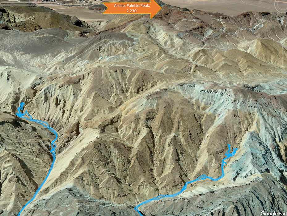 Tough Terrain to Artists Palette Peak, top of image (looking south). Another Grudge Peak! Our GPS tracks in blue. Twenty Team Mule Canyon to the left, we ran into Class 3+. Steep and loose talus slope out of canyon to the right. We began ascending Artist's Palette Peak via Twenty Mule Team Canyon heading mostly south, after parking on 20 Mule Team Road, accessed from Highway 190. Evidence of a recent heavy wash-out with a freshly-carved stream (maybe from Tropical Storm Hilary?) coursed through the canyon floor. Huge boulders had been dropped into the canyon. We scaled a small waterfall and had no difficulty until we reached a Class 3+ boulder obstacle, blocking our progress. Shortly before this, we were able to hoist ourselves over a huge tilted boulder by standing on unstable rocks piled up against it to make a platform (glad I had Fred to help me place my feet in the right spot on these tippy rocks on the way down!). Hoping we were golden but discovering we were not after the next canyon turn, we tried a few ways to get past the next boulder array but decided to descend and try a different canyon. It would have meant climbing a very steep and loose slope of gravel, where I was slipping more than I was ascending. 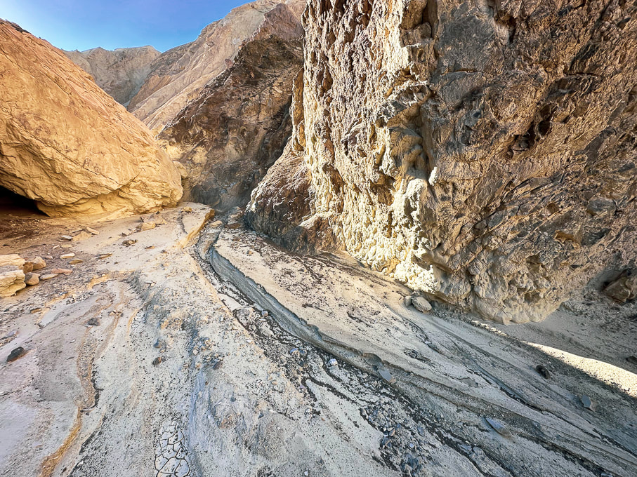 The canyon floor had signs of a recent wash-out. Twenty Mule Team Canyon 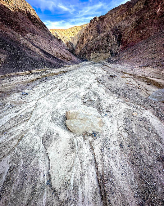 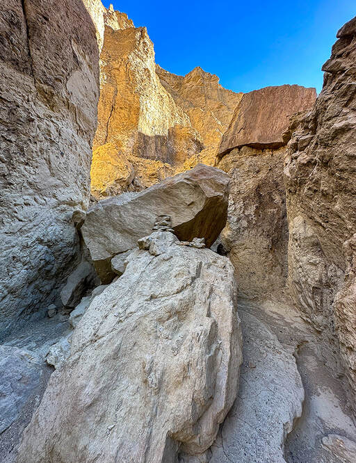 Toward the top of Twenty Mule Team Canyon - we were able to ascend this narrow, wobbly stack of rocks to hoist over this boulder but then met up with Class 3+ moves after this that proved too intimidating. The obstacle in the above photo is where another Artist's Palette Peak hiker who recorded his trip on Peakbagger website turned around. Stav Basis, in his route description of this hike advises that if you are hiking Twenty Mule Team Canyon to ascend it rather than descend it to make sure you can maneuver the Class 3+ stuff and you don't get stuck. The next canyon we attempted to the northwest of Twenty Mule Team Canyon had footprints in it, possibly from a group of hikers we saw at the trailhead. We followed it, fun scrambling over easy walls, until we were diverted out of the canyon to see a steep and loose talus slope with no end in sight. It's frustrating to know that "obstacles" like this get in your way of seeing your intended peaks and knowing there was less-steep terrain above. But that's why off-trail route finding in Death Valley is so rewarding - you have really earned the view from the summit and the access to the peak register. There is no other place like Death Valley's terrain - mostly devoid of vegetation. Rocks and sky predominate, but sometimes you get a remarkable surprise, like the blood red and magenta Desert five-spot flower growing in the gravel (photo below). 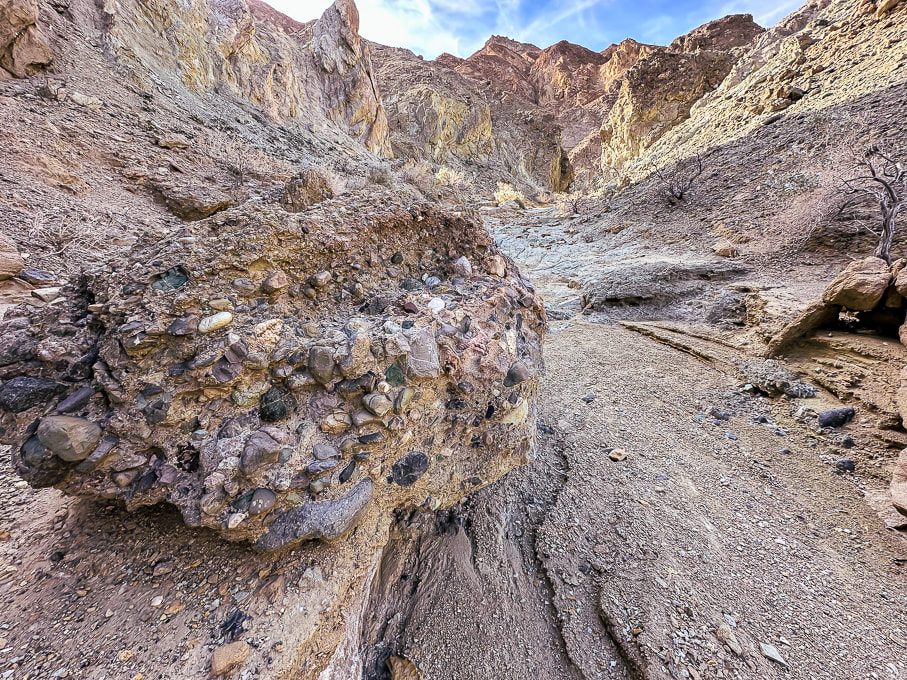 Conglomerate boulder containing mostly rounded cobbles from long-ago streams. 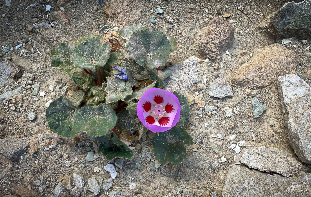 Desert five-spot Eremalche rotundifolia  Route up canyon on the right - fun scrambling.  Looking down a "rock ladder" we climbed from the canyon floor. Shortly after this we came to the steep and long loose talus slope and decided to turn back. Sheephead Mountain (13 ascents on Peakbagger - A Sierra Club Desert Peaks Section Peak) I had been looking forward to hiking in the Ibex Wilderness, so the next day when we hiked to Sheephead Mountain, we were remote and alone, except for the occasional motorist on Highway 178, which begins at Shoshone, then heads west through two passes to turn north as it becomes Badwater Road, hugging the east side of Death Valley. We parked in a pull-out at Salsberry Pass, about 12 miles from Shoshone. The faint trail that headed southeast toward Sheephead soon became non-existent, so the approach was a maze of red washes and rubbly hills. We located our daunting-looking mountain to the south. We ascended a rotten, slippery and steep ridge of yellow scree too soon. Once we got on top of this yellow high point, we realized it would have been easier to ascend the red ridge just to the south, leading more directly to the saddle on the final ridge to Sheephead, which looked like a tower with more loose scree slopes flanking its sides. We didn't have the motivation in us to attempt the rock piles. From the saddle we found an easier way down over a ridge and then dropping into a wash. We instead walked back to the highway, crossing it and wandering on a ridge toward Salsberry Peak, seeing occasional bighorn sheep signs. Wrap-Up of 2023 hiking - The Year of Grudge Peaks This year we did more remote desert route-planning and finding on unmarked terrain with no trails in Utah's Zion Wilderness and San Rafael Swell, Nevada and Death Valley. Occasionally we see cairns that let us know some other hardy souls had stood in the same place. Walking without a trail takes more time. As a result, we had more "grudge peaks" this year - ones where we did not make the summit. Mummy Mountain was the most frustrating; we were within 200 feet of the summit and ran into a deep and steep snow-filled gully with no great footing to get out of it to a narrow shelf to the top. Scott, Fred and I will hopefully try this summit again but from the more-used trail on other side of the mountain. Other "grudges" this year were Hepworth in Zion, and Bearing Peak in Lake Mead National Park. Moapa's knife's edge we're not sure we would attempt again. Successful summits included Shelly Baldy in the Tushars, Mt. Kimball in Tucson, Jackson Peak near Boise, and Burger Peak in Pine Valley Mountains. And, the summit of Angels Landing was sweet because we got to hike it with my sis and bro-in-law. One of my favorite authors, Willa Cather famously said, "The road is all, the end is nothing." As far as reaching summits, I would have to respectfully disagree. The way to the summit is a great experience, but to stand on the summit after you've worked hard to climb it is even sweeter. So, is it our age or the pursuit of more technically challenging hikes that are preventing us from reaching our goals? I like to think it's a little of the first and mostly the last of those two reasons. Should we focus less on goals and more on appreciating just "being out there?" - not to always define "success" as achieving a summit? Of course, I love being out there in our American West, but my goal-driven trait wants more. At any rate, it's been fun to try something different and work on navigation skills in more remote country. I count myself as one of the lucky ones who gets to even consider this conundrum in the first place. Keep On Exploring!  Walking southeast toward Sheephead Mountain (with notch on horizon 1/3 in from left). 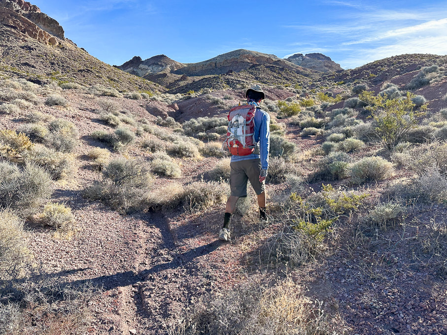 Sheephead Mountain on horizon to the right. 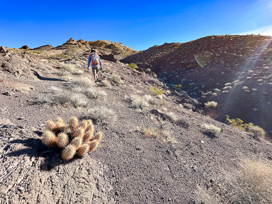 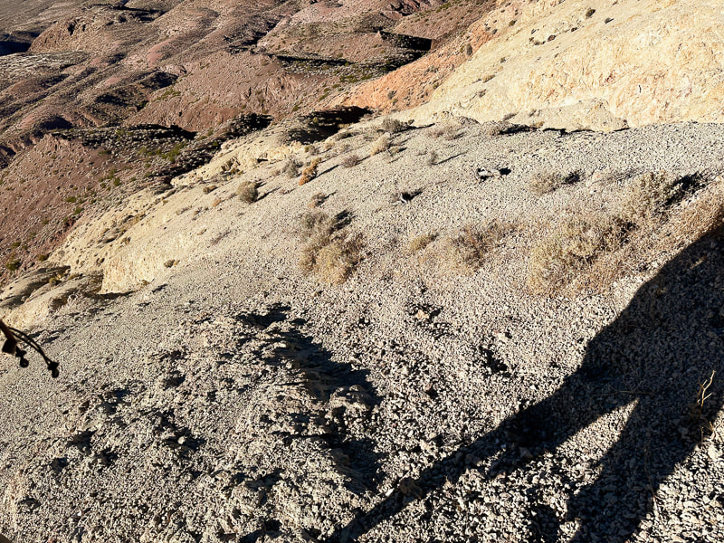 The loose and steep yellow scree slope we ascended, but didn't descend. 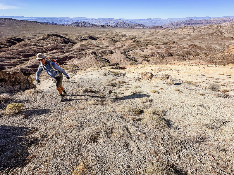 Reaching the top of the yellow scree slope and the ridge leading to Sheephead Mountain. 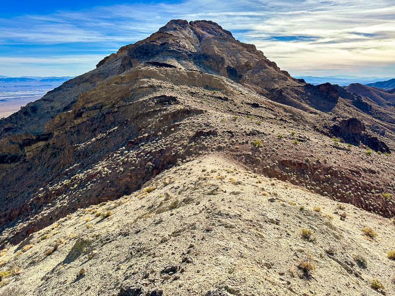 Ridge leading to Sheephead Mountain. We descended down the red slope to the right. 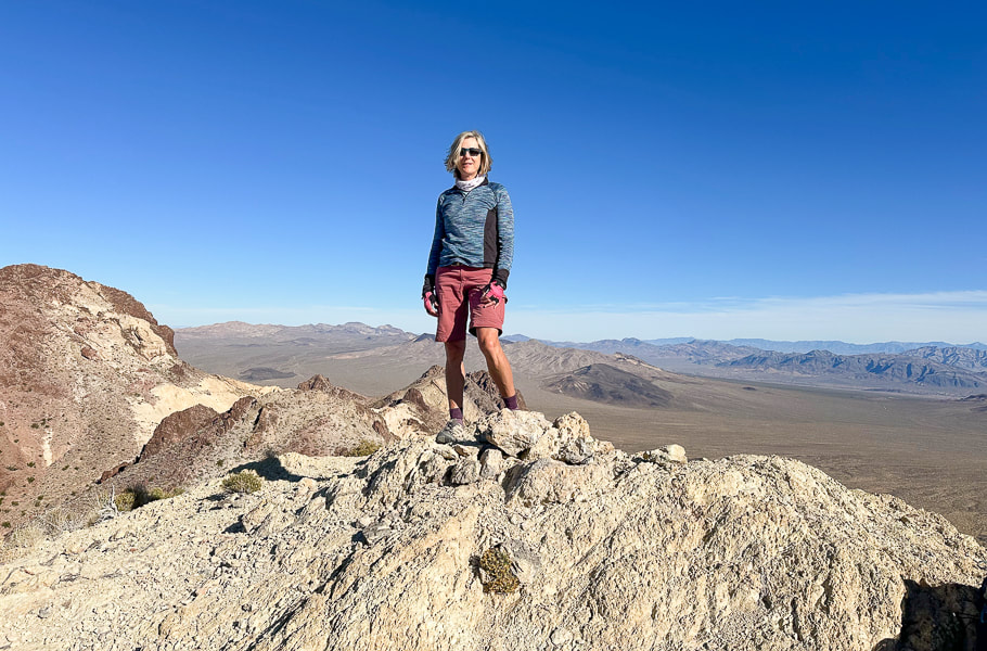 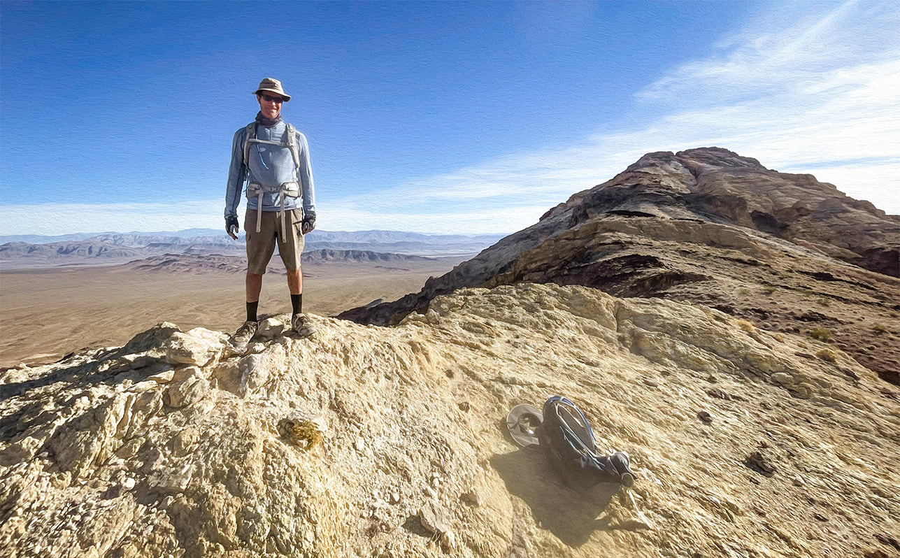 Fred at top of yellow ridge. Sheephead on horizon! 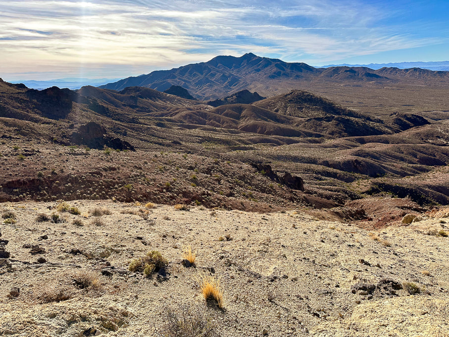 Looking southwest toward Talc Hills and Black Mountains. 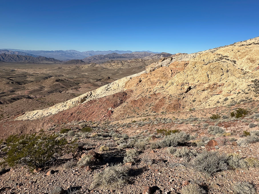 On our descent over red rocks - looking at our ascent over the not-so-fun loose yellow rock. Looking toward the northwest. 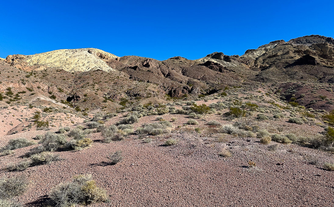 Parting shot - the ascent (Sheephead on the right) looks manageable from here! 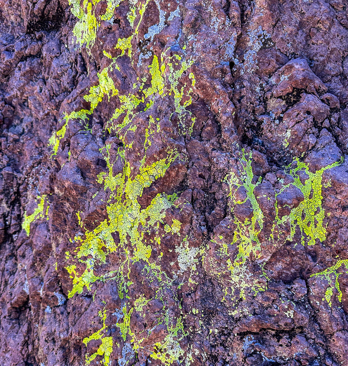 Bright cobblestone lichen? A few more images near Zabriskie Point in northeast Death Valley National Park...  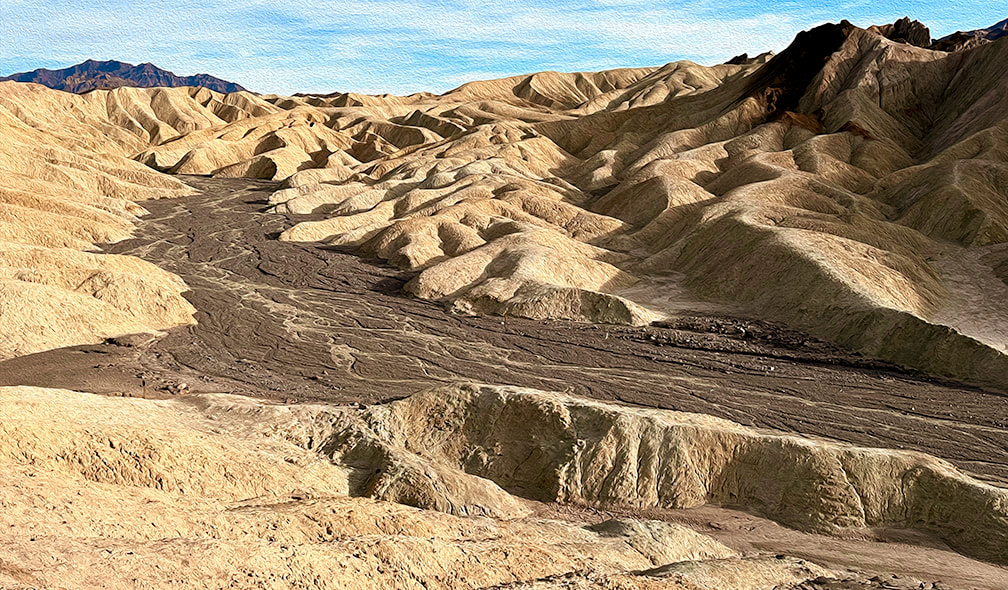 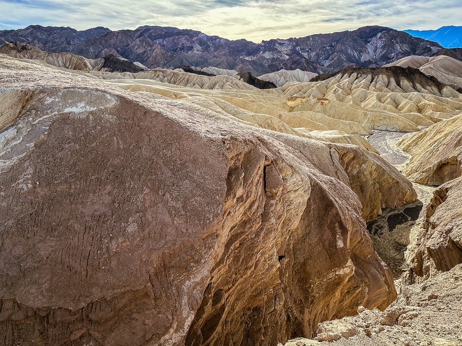 References
Fish, N. From Indiana University. https://sierra.sitehost.iu.edu/papers/2008/fish.html Doermann, L. NASA Earth Observatory. Floodwaters Fill Badwater Basin. Hunt, C.B., et al. 1966. Hydrologic Basin Death Valley California. Geological Survey Professional Paper 494-B. |
Categories
All

Sue and Fred

About this blogExploration documentaries – "explorumentaries" list trip stats and highlights of each hike or bike ride, often with some interesting history or geology. Years ago, I wrote these for friends and family to let them know what my husband, Fred and I were up to on weekends, and also to showcase the incredible land of the west.
To Subscribe to Explorumentary adventure blog and receive new posts by email:
Happy Summer!

About the Author
|