|
Near Cedar Breaks National Monument, journey through a stream that has carved a spectacular gorge through rocks laid down during the time of the Western Inland Sea. Related 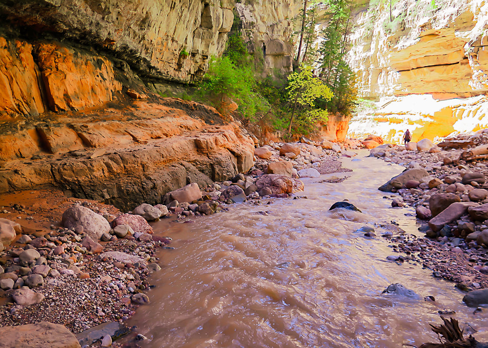 Hiking back from Rattlesnake Creek and Lake Creek waterfalls. Seeing Rattlesnake Falls for the first time with Lydia and Colin! Trip Stats
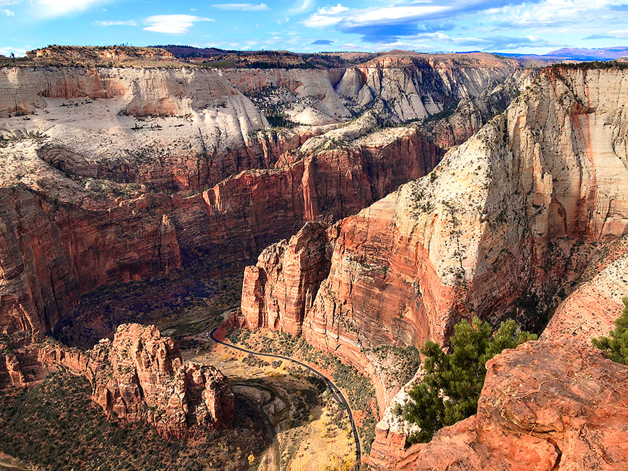
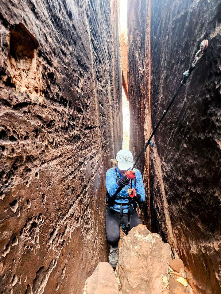
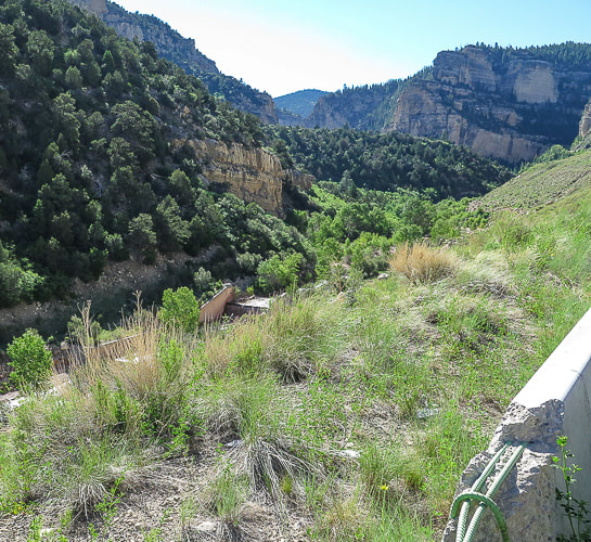
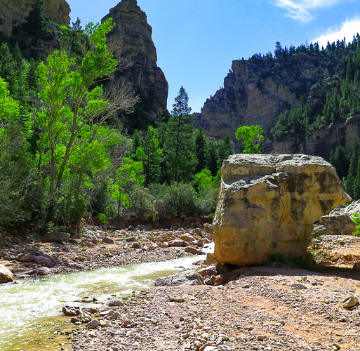
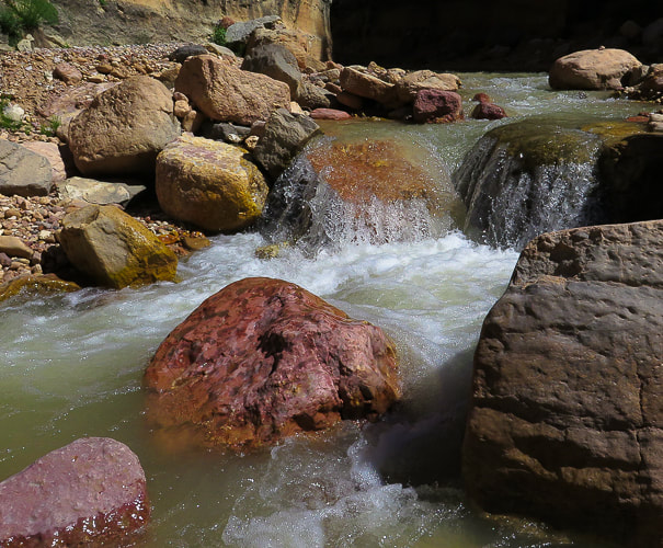
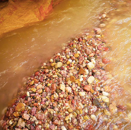
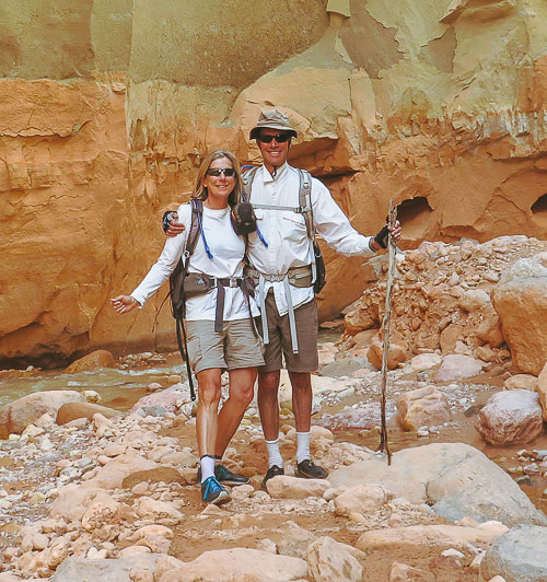
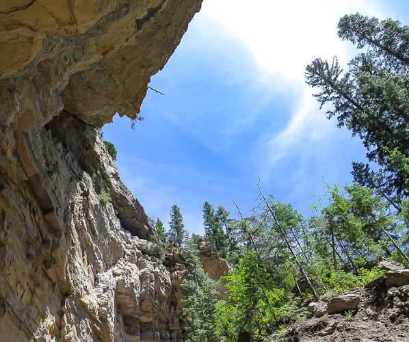
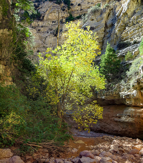
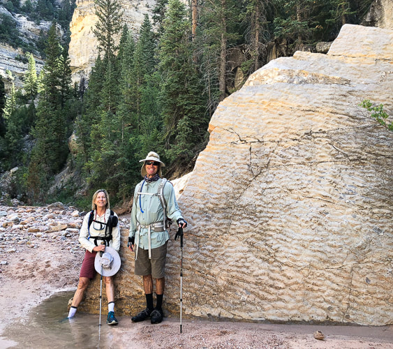
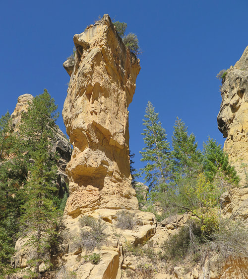
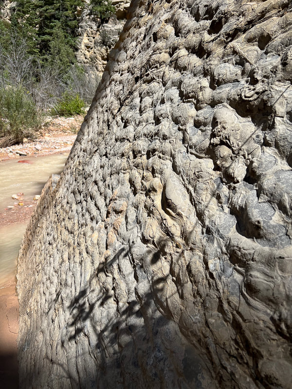
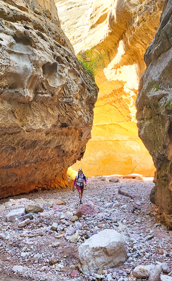
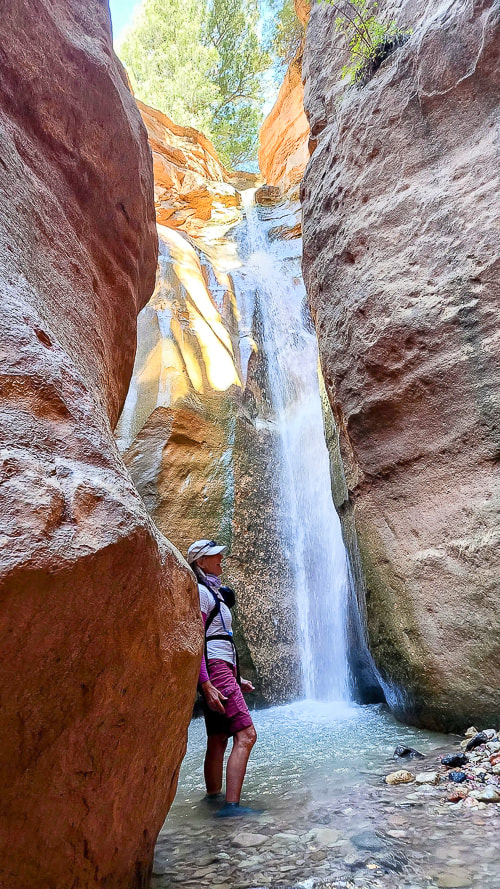
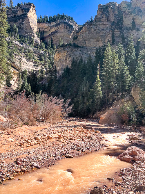
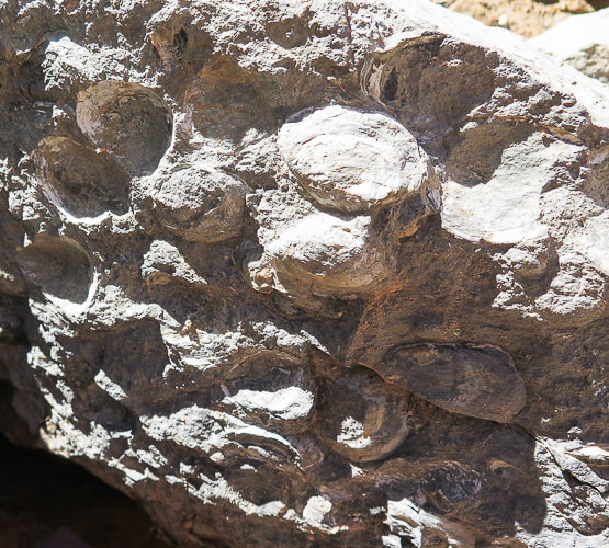
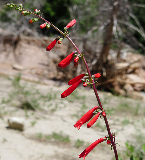
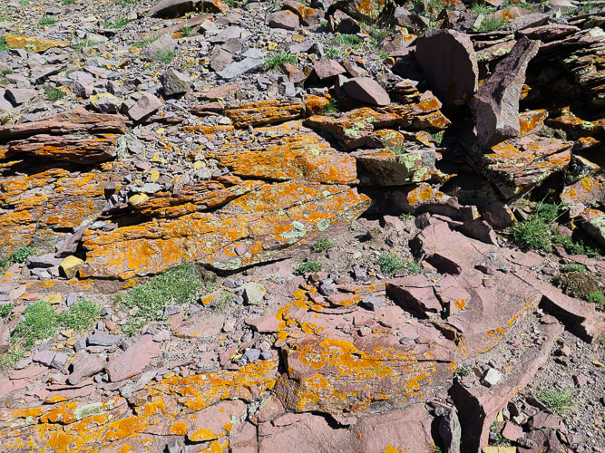
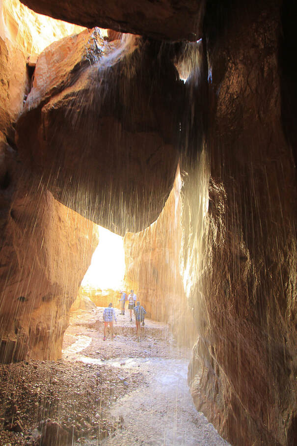
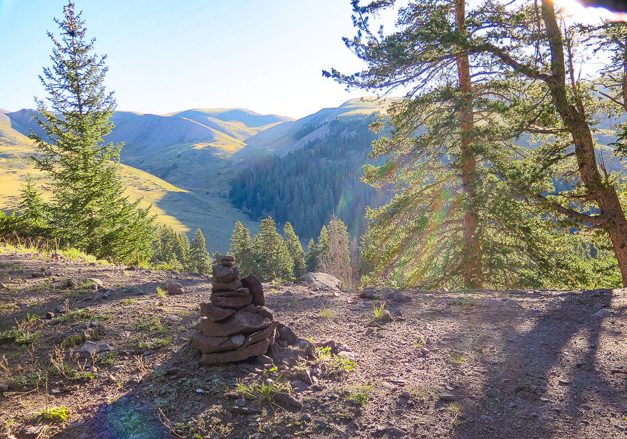
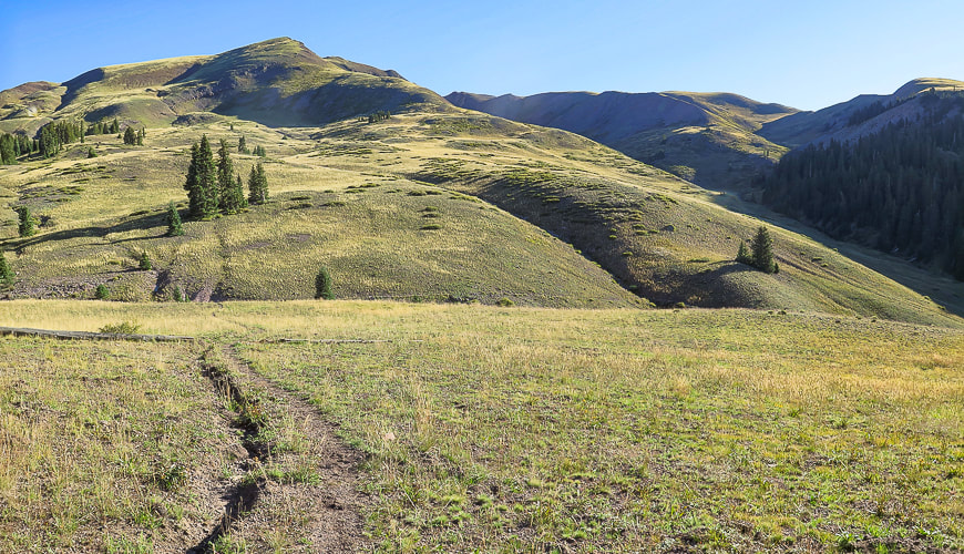
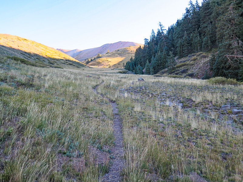
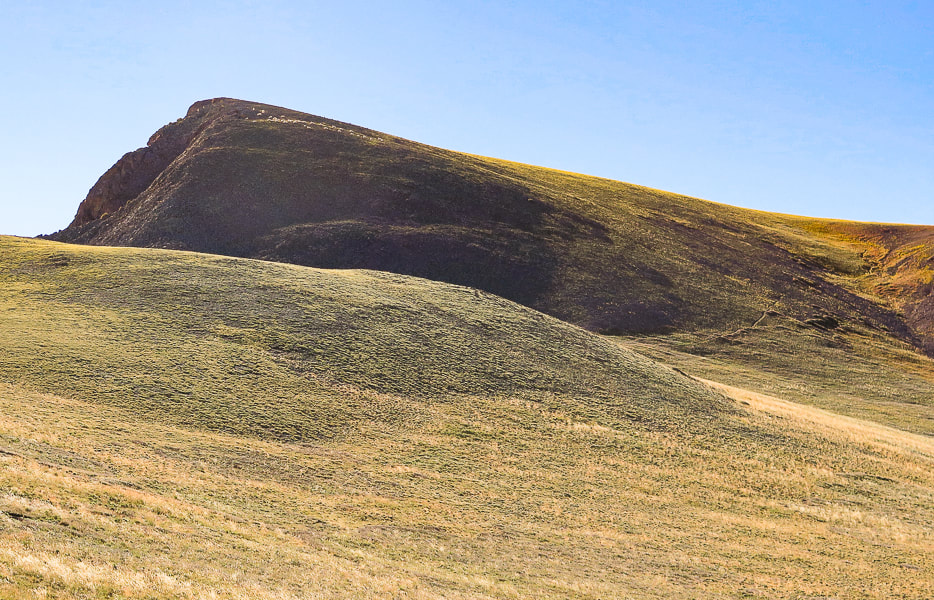
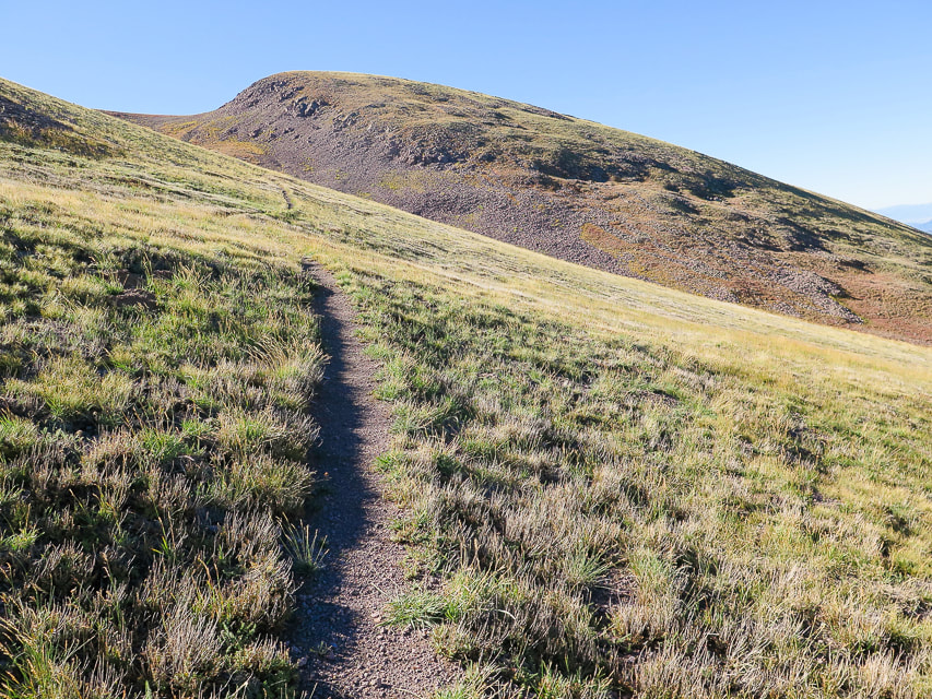
Highlights: Walk through a stream under spectacular sandstone walls to narrows and Lake Creek and Rattlesnake Creek waterfalls. Location: Utah's Dixie National Forest - Cedar City Ranger District, Ashdown Gorge Wilderness. Distance: Up to 8.8 miles round trip if you hike up to the end of both streams at confluence/fork, ~ 6.5 miles if just hiking left fork to the waterfalls. Difficulty: Easy effort walking on combination of rocks in stream and on stream banks. Walking more difficult with higher stream run-off. Maps and Apps: AllTrails tracks, Trails Illustrated Cedar City Markagunt Plateau #702. Coordinates: Trailhead on Utah Highway 14: 37.63463 -112.94357 Elevation: Trailhead = 7,000'. Rattlesnake Creek Falls and Lake Creek Falls = 7,672' Trailhead location google maps Considerations: Check weather forecast for nearby Cedar City and mountains above Ashdown to avoid possibility of being caught in flash floods in this canyon. I recommend old trail running shoes/closed-toed workout shoes with good tread and support. Dates hiked: 9/2/22, 9/24/22, 9/6/23. History: Named after George Ashdown who set up a sawmill there in 1898. 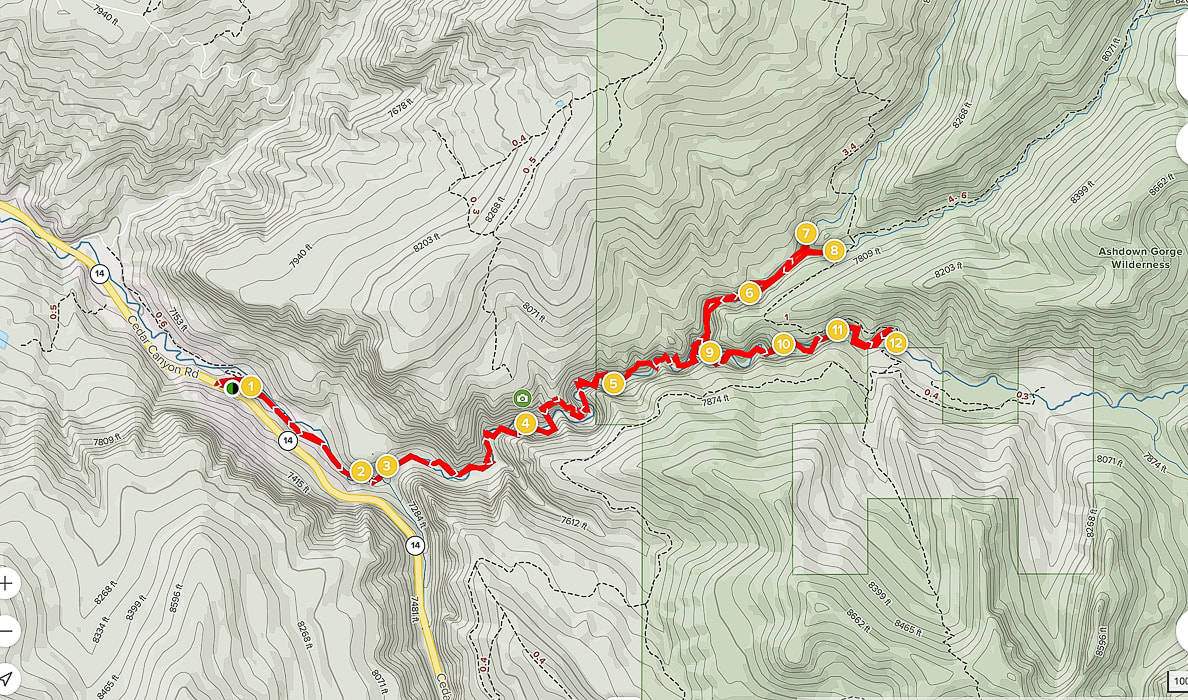 AllTrails tracks from trailhead on Highway 14 (left) going up Ashdown Gorge to confluence, with waterfalls on left (north) route (#7 is Lake Creek Waterfall and #8 is Rattlesnake Creek Falls). Ashdown Gorge is also accessed from Rattlesnake and Potato Hollow Trails higher up (Trailhead #12). Overview Most of those traveling Utah’s Highway 14 from Cedar City to the heights of the Markagunt plateau are unaware that a spectacular hidden world is tucked away in a canyon beneath their feet and that life millions of years ago is recorded in the rocks that the canyon’s waters, over the millennia, have worn through the plateau, pushing sand grains, scouring strata and revealing infinite colors to create beautiful Ashdown Gorge. To venture through Ashdown Gorge is to experience so many exquisite elements that make up the quintessential Utah non-technical canyon hike. Soaring, overhanging walls change shape, color and texture around every stream bend. Walk by small car-sized boulders and stream-carved rocks of nearly all hues of the color spectrum. As the canyon narrows, bright green ferns grow on moist walls; hidden grottos and alcoves are cool, dark places in which to retreat and watch the water flow melodically. Conifers cling to near-vertical walls. Walk by the occasional ancient panels of preserved ripples and oyster bed fossils. Lots to take in - you could go on this hike many times and see something new. The waters of Ashdown Gorge originate from an elevation of 10,000 feet in Cedar Breaks National Monument, coursing through the Ashdown Gorge Wilderness via Ashdown, Rattlesnake, and Lake Creeks, creating beautiful waterfalls at the end of the hike, after a walk through short narrows. Alternately, you can experience Ashdown after descending from Rattlesnake Trail, whose trailhead is just outside Cedar Breaks. Our Hike Each time I've hiked this gorge, water conditions have varied. This time, the stream was higher and clouded by salmon-colored silt; there must have been a storm that carried sand from Cedar Breaks higher up creating increased run-off. A large parking area on the left of Highway 14 is the access to the lower Ashdown Gorge (see Google Maps link above in Trip Stats). A spectacular chunk of preserved ancient shoreline ripples, tilted almost vertically, has been plunked down on the right side of the creek as you ascend. You weave in and out of the water, walking through gravel bars and around boulders, over fallen flood-deposited trees. It is a unique experience to feel so tiny with tall overhanging walls close by on each side, blocking out most of the sky. "Tom's Head", a noticeable 100-foot monolith greets you at the intersection between Ashdown Creek and Rattlesnake Creek. To see Rattlesnake Creek Falls, turn left at this confluence to follow Rattlesnake Creek. Shortly, another small confluence is seen; turn left and you hike a short distance to Lake Creek Falls. Turn right, hike through an ever-narrowing canyon, you hear Rattlesnake Falls before you see it - a long sheet of white water spilling into a multi-colored gravel pool. If, instead you turn right at Tom's Head, you will be continuing walking up Ashdown Creek ultimately to Ashdown Gorge Trailhead and onto High Mountain Trail and ultimately an intersection with Rattlesnake Creek Trail, which originates just north of Cedar Breaks National Park. Since moving to Utah, I have been amazed at how gorgeous and diverse the landscape is. This hike is just one example of how nature's elements fit together in harmony and draw us into a beautiful world. There's a lot to take in on this hike: textures, waterfalls, colors, something new around every bend. Interesting how a place can have so much to look at that it's almost overwhelming, but yet it is also so relaxing, and I can get to a state of "flow". I'll spend more time photographing and checking out the fossils and geology next time. For now, I will let the following images speak for themselves. Stay Close to Nature and Keep on Exploring! 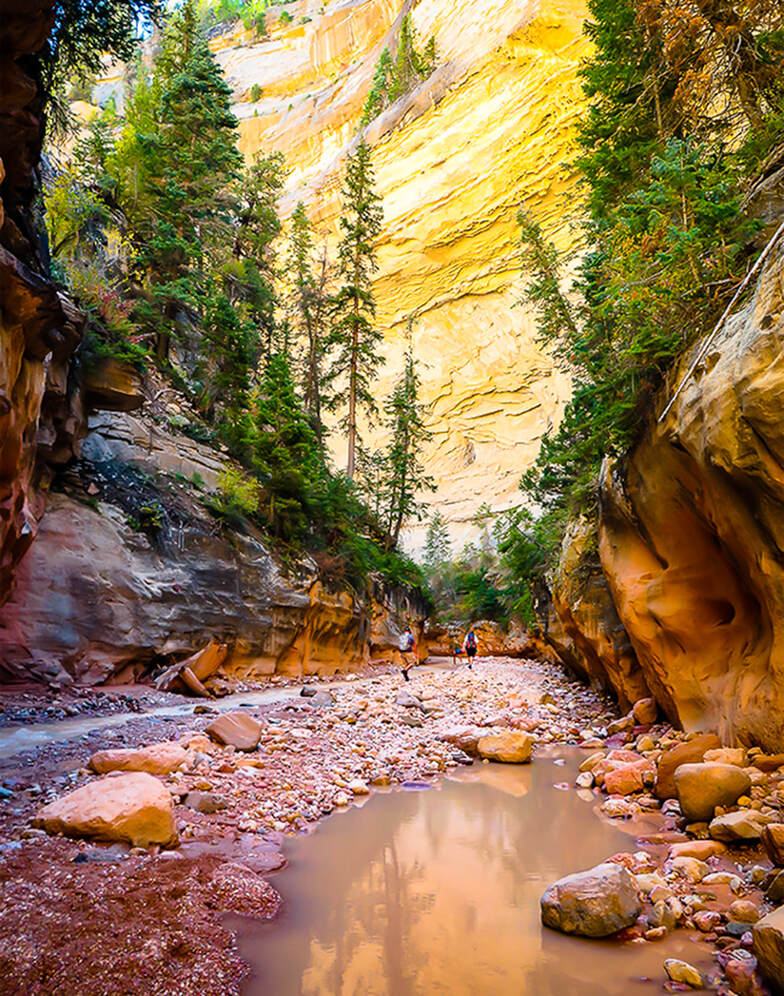 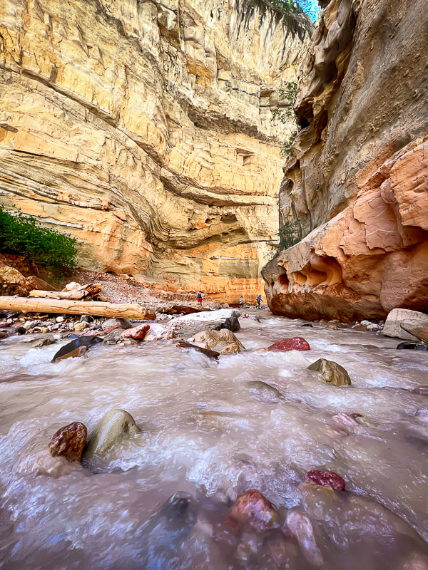 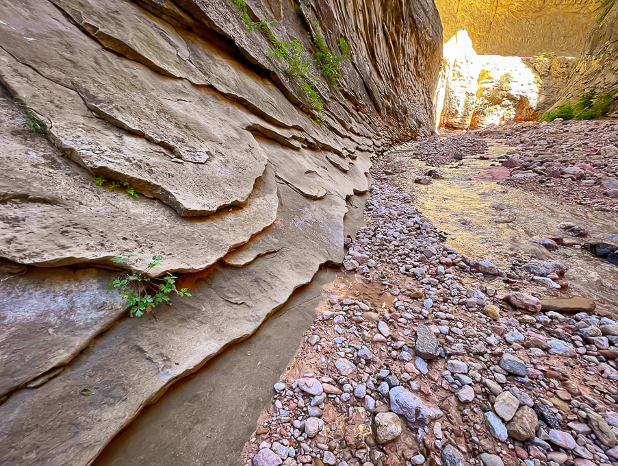 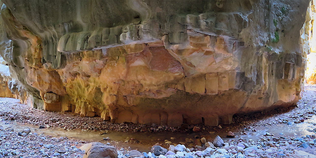 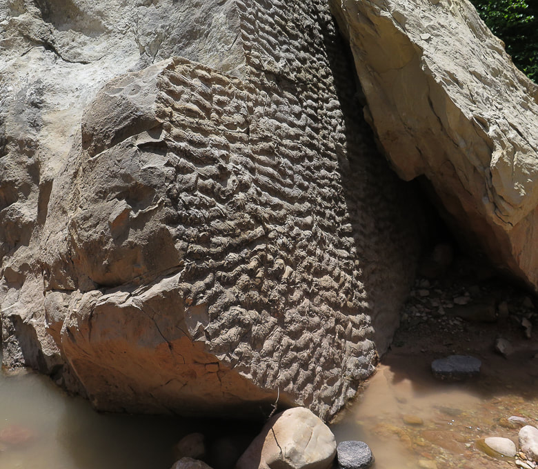 These ancient ripples appear to be mostly symmetrical, and are common in ancient shallow water sandstone environments where there is an oscillatory, back and forth current. 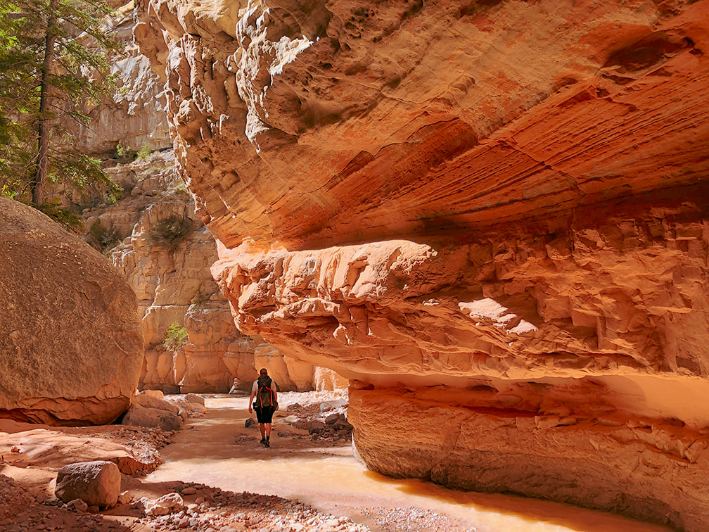 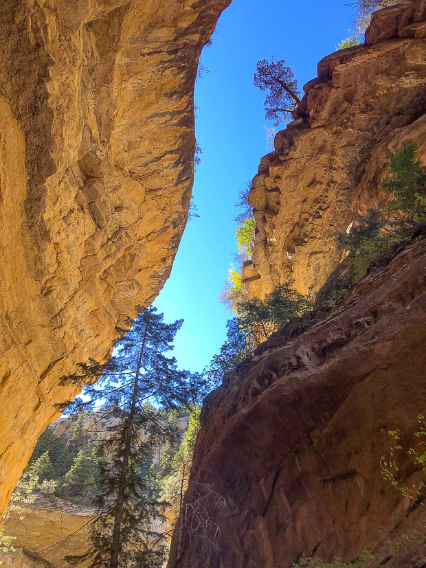 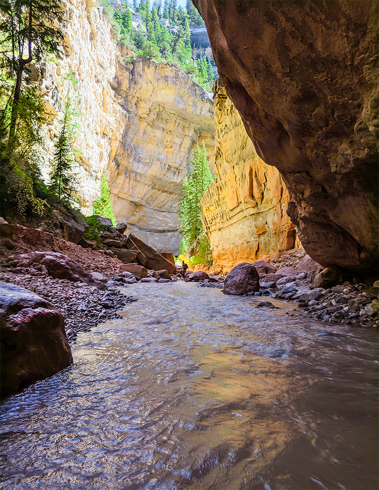 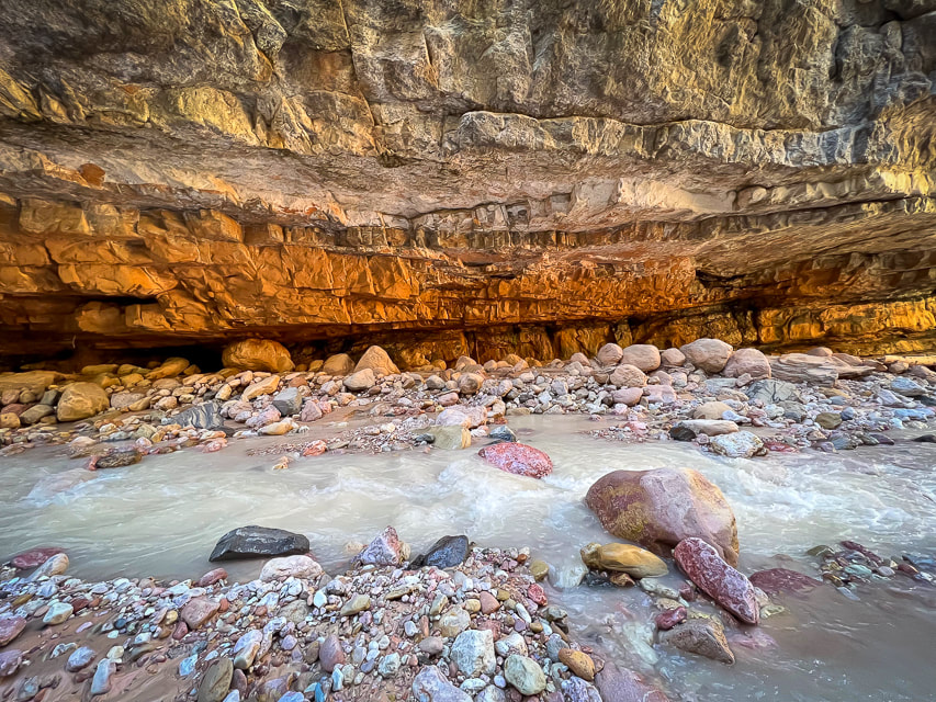 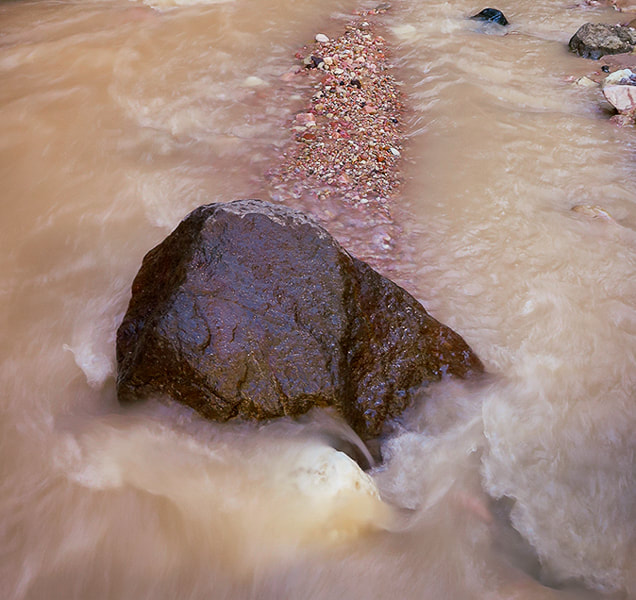 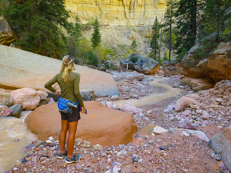 Lydia looking downstream. 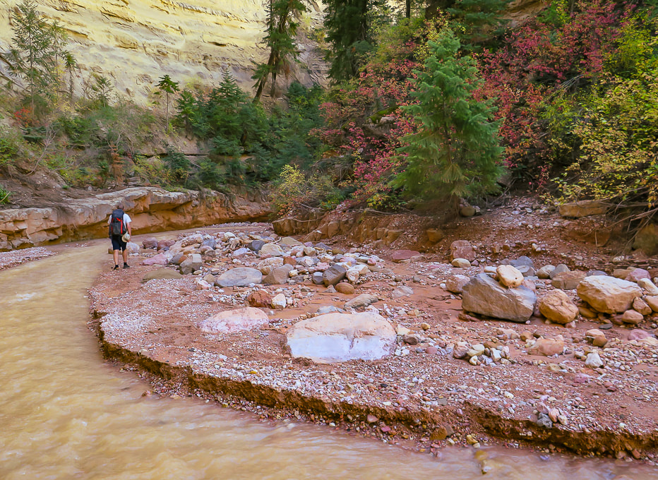
 Lake Creek Falls 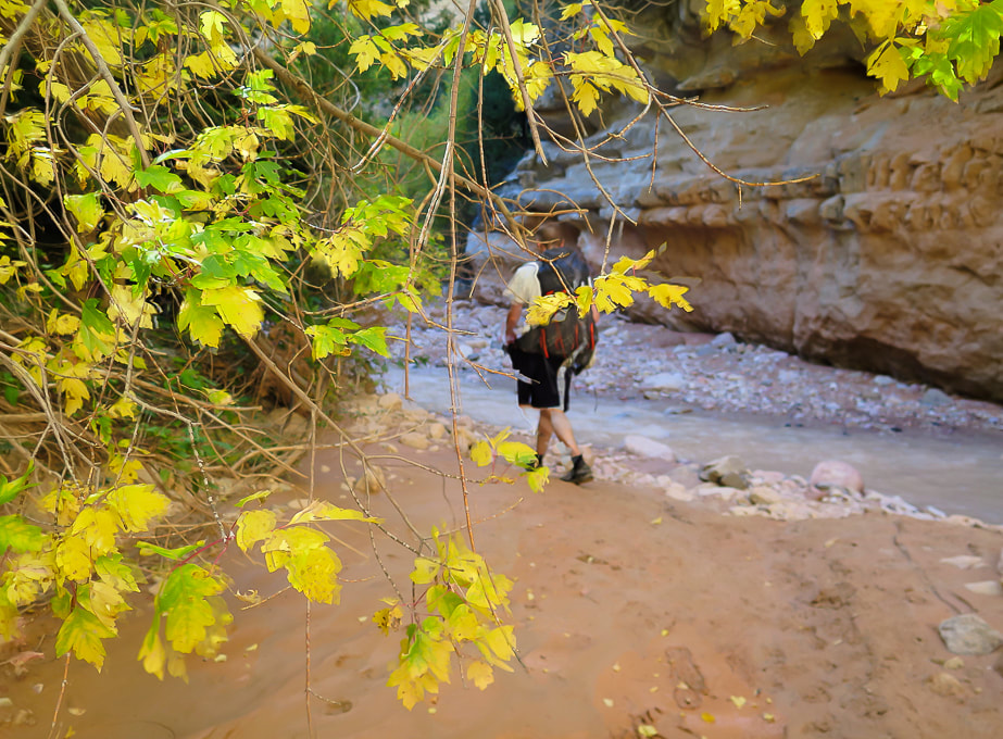 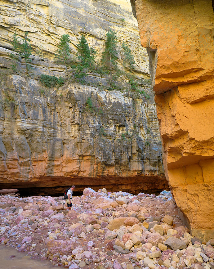 Colin heading downstream. 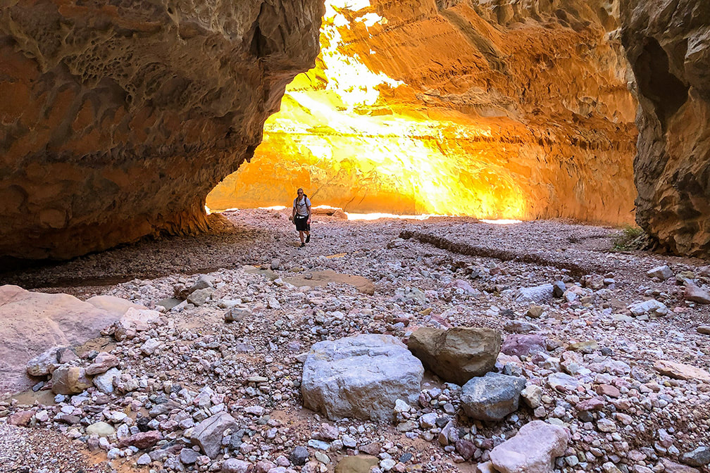 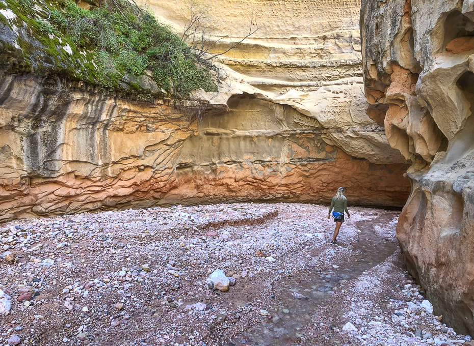 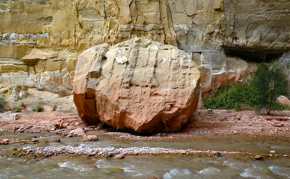 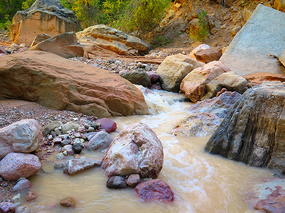
The Claron Formation, famous for its eroding hoo doos in Cedar Breaks and Bryce Canyon further to the east was deposited ~ 50 million years ago, rises still further above, reaching 10,000 feet of elevation at Cedar Breaks. The highest elevation on the Markagunt plateau is Brian Head Peak at over 11,000 feet.
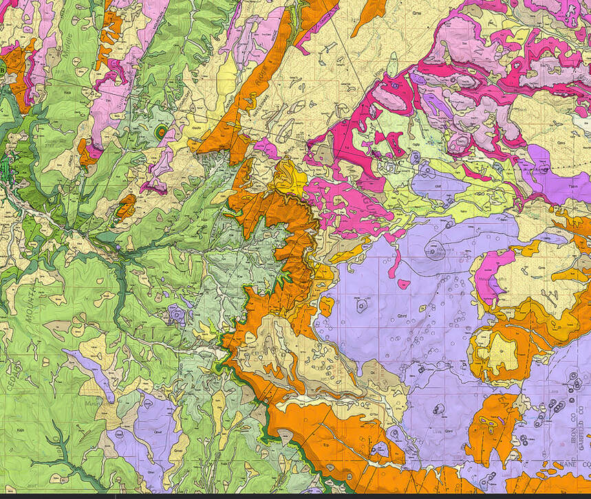
A portion of the geologic map (cited below) that shows Ashdown Gorge in the dark green tributaries middle left of this map and the Claron Formation of Cedar Breaks in the orange map unit in center of map. From Biek, R., et. al. 2015. Geologic Map of the Panguitch 30' x 60' Quadrangle, Garfield, Iron, and Kane Counties, Utah. Map 270DM, Utah Geological Society. 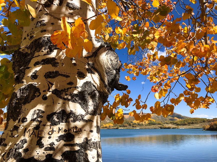 Bonus image: Kolob Reservoir near Zion National Park. Notice the engraving in tree trunk, lower left. More cool stuff on the trail. 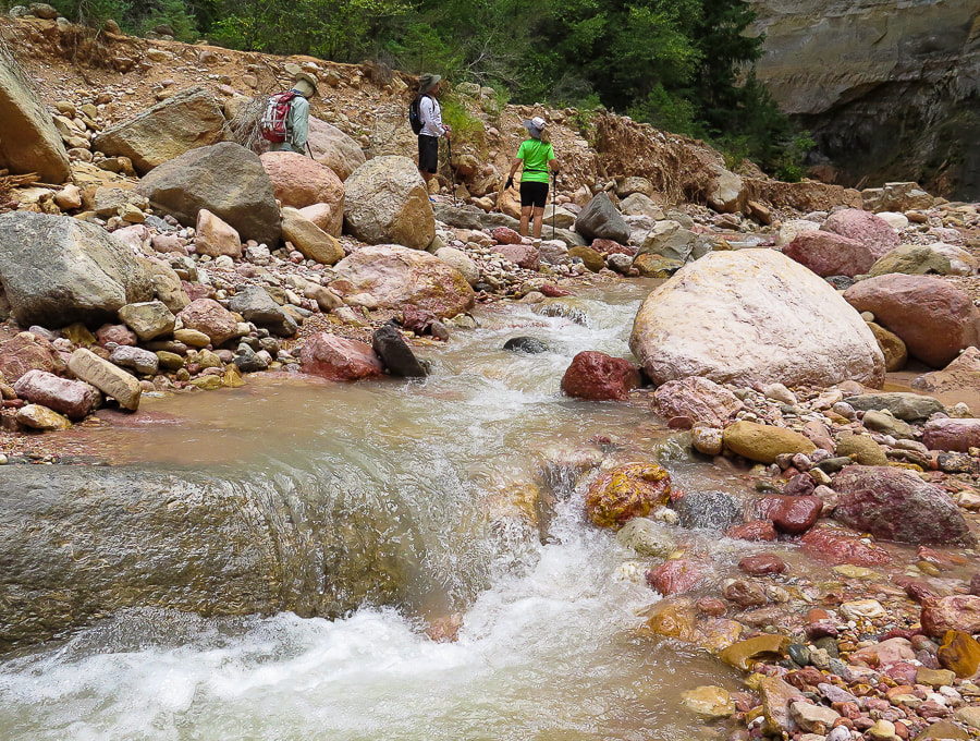 References:
Ashdown Gorge Wilderness - Wikipedia Biek, R., et. al. 2015. Geologic Map of the Panguitch 30' x 60' Quadrangle, Garfield, Iron, and Kane Counties, Utah. Map 270DM, Utah Geological Society. Cretaceous Atlas of Ancient Life: Geology of the Western Interior Seaway. National Science Foundation.
4 Comments
We summited two of the highest peaks in Utah's Tushar Mountains, sharing a raging wind storm with mountain goats.
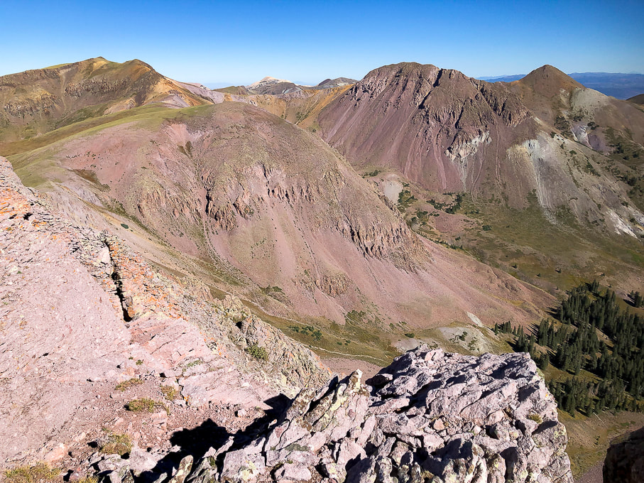
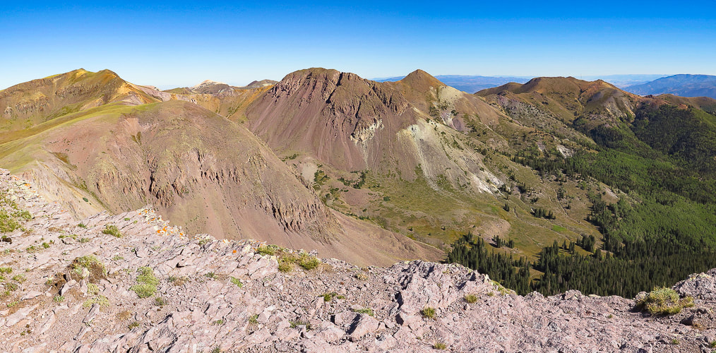
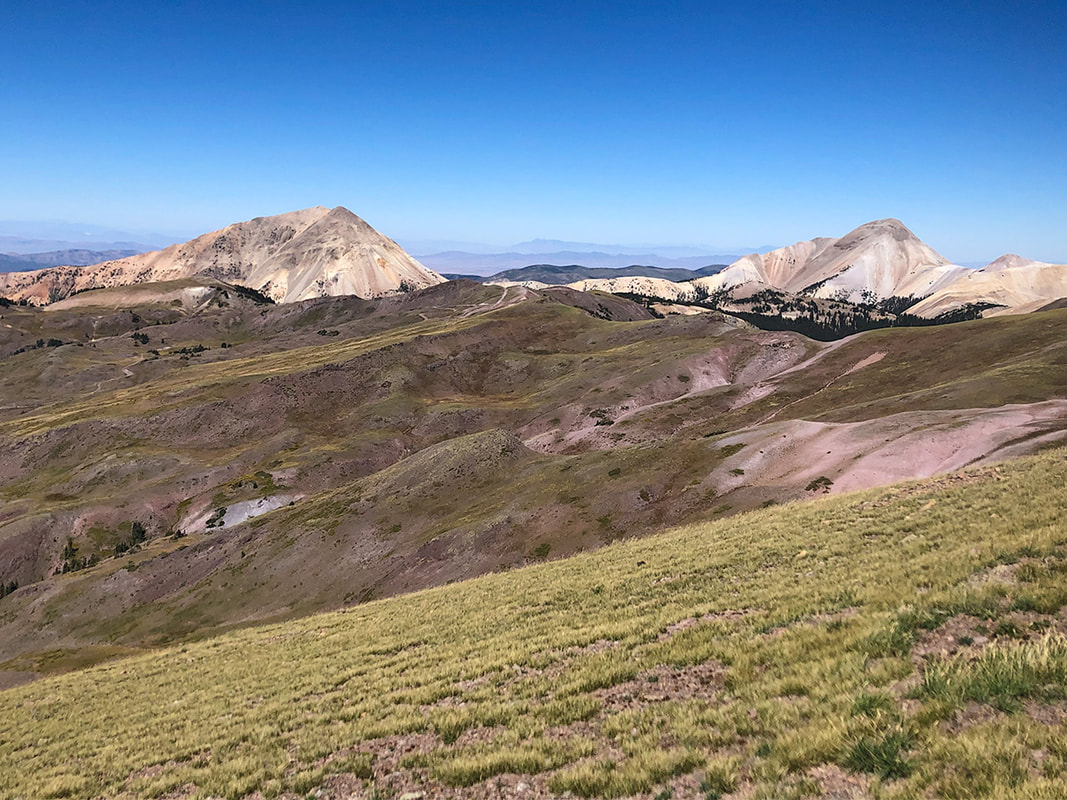
View north from Mount Holly to Delano Peak (left horizon) and the ridge to Delano Peak.
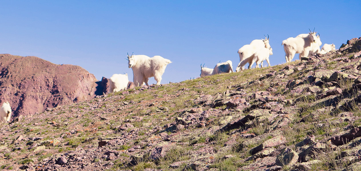
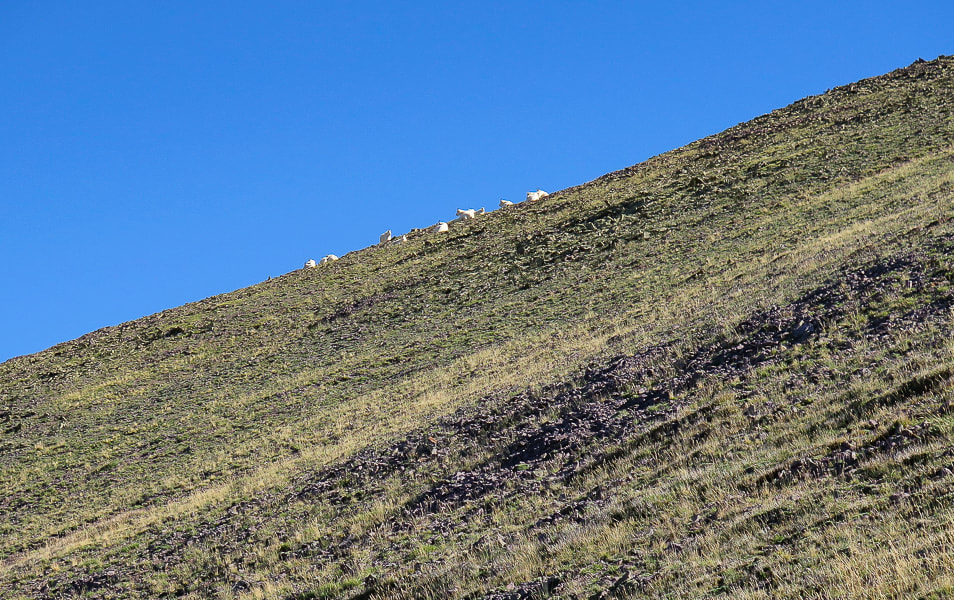
Mountain goats on Mt. Holly getting their hair blown in the strong gusts.
Trip Stats for Delano Peak/Mount Holly loop
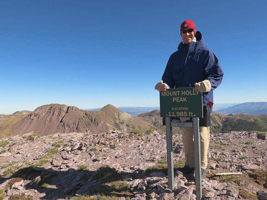
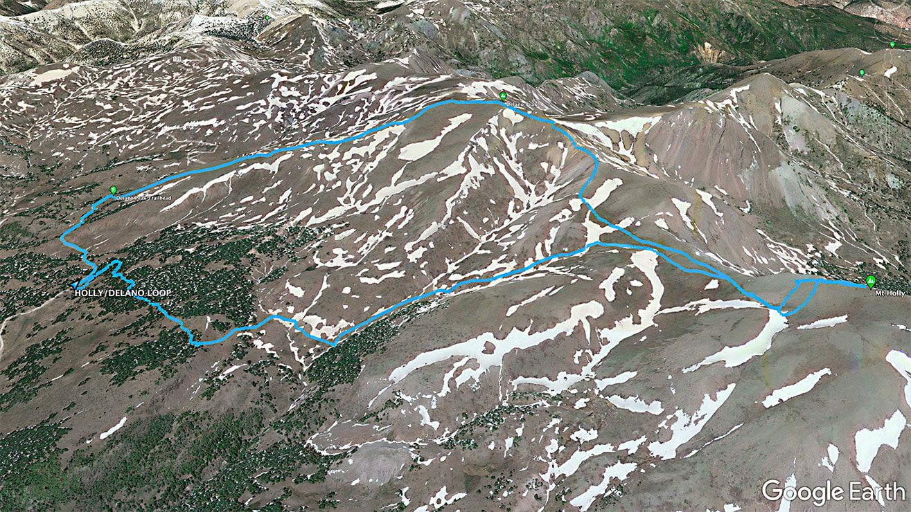
Location: Fishlake NF, Tushar Mountains, near Beaver, Utah. Fishlake National Forest - Beaver Ranger District. Distance/Elevation gain: 7.3 miles/2,500'. Trailhead = 10,400'. Delano Peak = 12,169'. Mt. Holly = 11,985'. Coordinates: Trailhead = 38.35896 -112.39289. Prominence: Delano Peak = 4,689'. Mt. Holly = 425'. Difficulty: Mostly moderate effort, Class 1. Trails: #225 (Skyline National Recreation Trail) for Holly approach, and #224 from Delano summit to road. Maps and Apps: Fishlake National Forest-Beaver and Fillmore Ranger Districts Travel Map -USDA, AllTrails tracks for Mt. Holly, route map from Stavislost.com. Date hiked: 9/19/22. Geology: The Tushar Mountains are remnants of volcanos whose first eruption period was 22-35 million years ago (Bullion Canyon Volcanics) and second eruption 21 million years ago (Mt. Belknap Volcanics). Delano Peak resides in the Bullion Canyon Volcanics. It is the highest point on the edge of Big John's Caldera, a concealed structure on Delano's west side that subsided ~ 23 million years ago during ash flow eruptions. This caldera filled and eroded over time. The second eruption created the source rock for the mined uranium of the Marysvale mining district north and east of Delano Peak. Native Peoples: Five native Paiute bands were present in Beaver County ~ 700 years ago: Tu-roon-quints band in the northeast corner of the county; the Qui-ump-uts band around Beaver and Adamsville; the Pa-moki-abs band in the vicinity of Minersville; the Toy-ehe-its band in the Milford area; and the Indian Peak band in the western part of the county and into Nevada. Evidence such as pottery, tools, weapons, and petroglyphs left by Paleo native Americans as far back as 12,000 years ago, at the end of the last ice age is present in Beaver County in which the Tushars are located. (from A History of Beaver County, by Martha Sonntag Bradley).
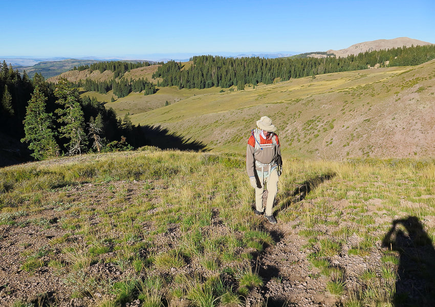
This loop hike on the highest ridge in southwestern Utah's volcanic Tushar Mountains offers magnificent vistas and solitude. Even though the Tushars are the third highest mountain range in Utah, they appear to be much less visited than Utah's higher ranges - the Uintas and La Sals. We saw more mountain goats than people. This was our second try; we previously turned back after summiting Delano Peak a few weeks ago with low visibility. This time, constant wind gales and gusts added a challenge as we staggered up Delano's summit. The trails that come from trailheads at 10,000 feet don't bother with switchbacks; they go straight to and from the summits.
"The area possesses a very high degree of naturalness, palpable solitude, and nearly unlimited opportunities for primitive and unconfined recreation," says Wikipedia. A variety of great things are packed into this 7-mile hike: forest, sustained spectacular ridge views, goats, aspens and meadows below, and a fun steep climb between peaks. After a nice forest hike from the Skyline Trail trailhead off of graded gravel road and #123, we came to a saddle where we descended into a beautiful valley with Mt. Holly on the horizon. Our route left the Skyline Trail at Merchant Creek, walking toward Holly on the left side of a prominence covered with pines to the right. Shortly, a defined trail appears in the grasses. It becomes less-defined as you arrive on wide expanse of the tundra, just below Mt. Holly and then becomes more defined as it traverses Mt. Holly's southwest flank. The mountain goats on Mt. Holly were hunkered down enduring the wind. They reluctantly got up as I got closer to them, and when we were on the ridge hiking toward Delano Peak, we saw that some of them had sought safer places on Holly's northwestern cliffs. We stayed on Mt. Holly long enough to sign the register, then descended back down out of the summit gusts to find a way to Delano Peak. We didn't see an obvious trail linking Mount Holly to the northwest ridge leading to Delano Peak; we probably could have gotten to the top of the ridge sooner than we did (see our route). We gained the ridge at a saddle between Delano and Holly where we found the ridge trail. We took a windy break observing a spectacular view of steep Cottonwood Creek to the east. We battled the winds up a short and somewhat loose ascent to a gentler tundra ridge walk. The trail was easy to follow to Delano Peak. We didn't want to stand too long on this highest point in the Tushars for fear of being blown over the edge. The walk down Trail # 224 is a quad burner, losing 1,700' of elevation in 1.8 miles. We then walked south on road #123, where the wind was less brisk, to our car at the trailhead, a short 0.6-mile distance. The definition of "grit" is achieving goals through passion, perseverance and commitment. An important attribute for many aspects of life. An important trait to teach our kids. With some "grit" we reached the summits during the windstorm, although I have to admit, the thought of going back down after Mount Holly briefly crossed my mind. I plan on getting back to this hike with some friends. If I go in the next few weeks, the forest will be splashed with stands of yellow aspens in a sea of dark green.
Keep on Exploring!
Walking southeast on Skyline National Recreation Trail whose Big John's Flat trailhead is just off of Forest Road #123.
Reach saddle on Skyline Trail to descend to valley; hike along Merchant Creek (along left side of trees) and then right to the ridge. Mount Holly is on horizon behind tree.
Approaching Merchant Creek on the right; Mt. Holly is high point on far right horizon.
Walking east along Merchant Creek.
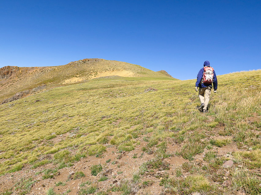
Trail breaks away from the creek and heads SSE through open tundra.
Mt. Holly and first glimpse of mountain goats near top (small white specks). The trail swings around its base to the right.
Heading southeast on Mt. Holly's southwest flank. Traverse this and trail then turns left (northeast) to make the final summit climb.
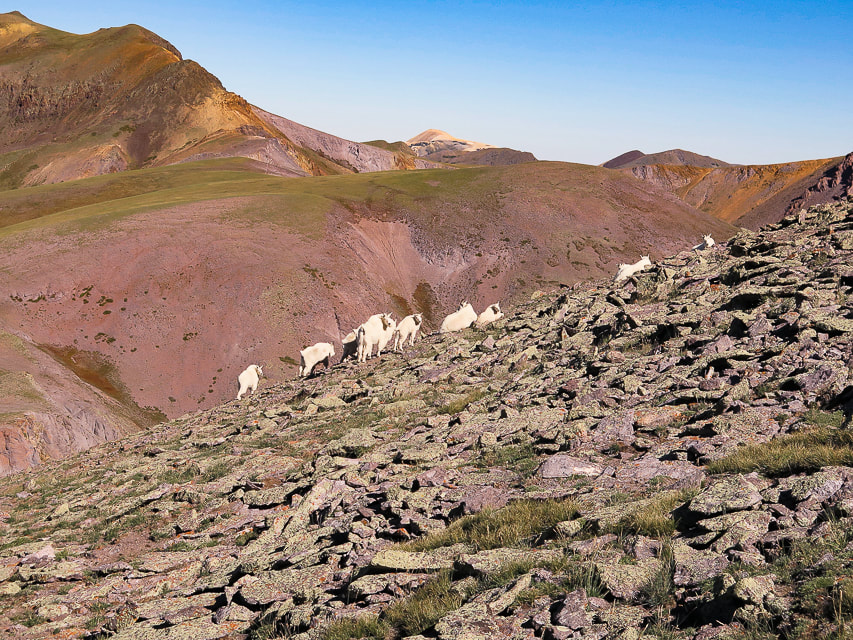
Mountain goats are wary of us. Delano Peak on upper left horizon.
From Mt. Holly summit, looking northwest to Delano Peak on left horizon.
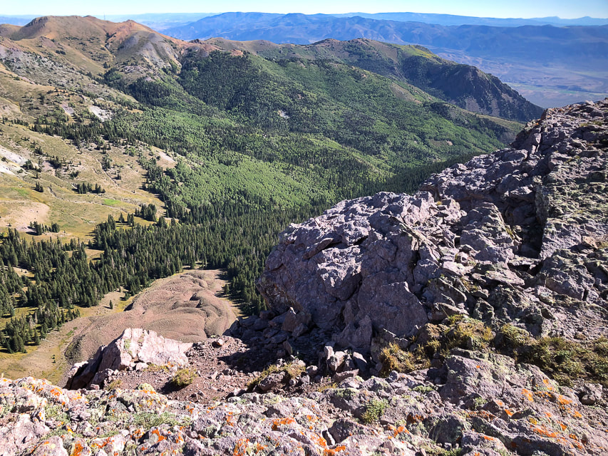
Looking down on Cottonwood Canyon from the ridge.
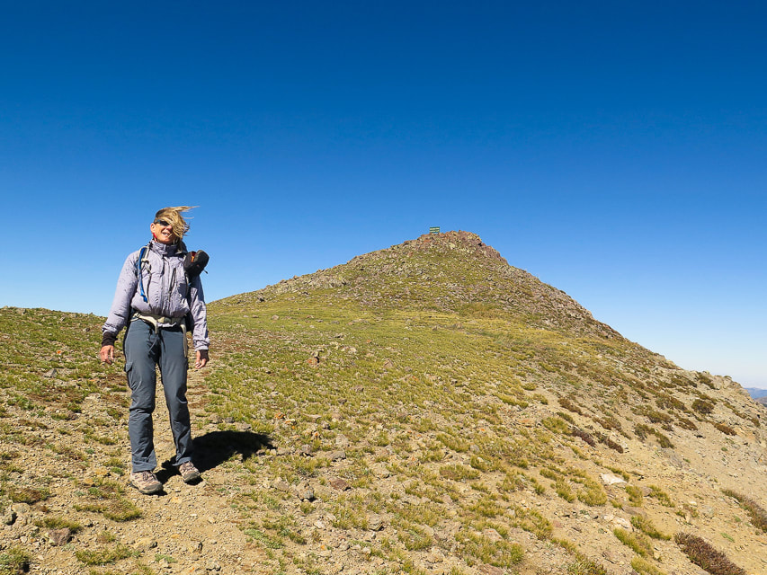
Ridge trail between Delano Peak and Mount Holly.
On the ridge trail - looking back at Mount Holly. We entered the trail from the animal trails on the right.
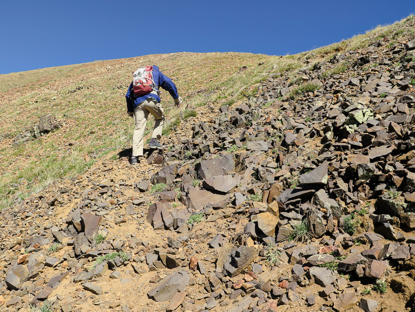
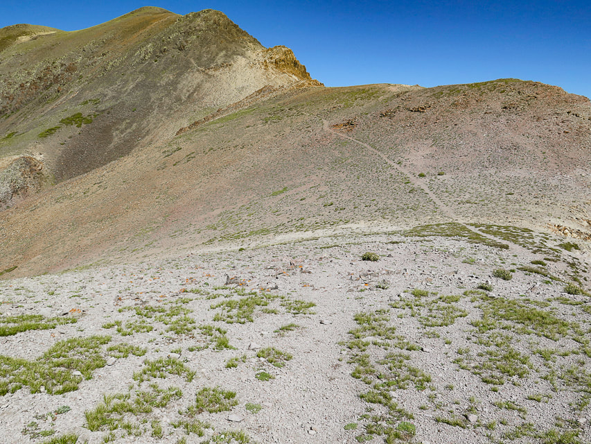
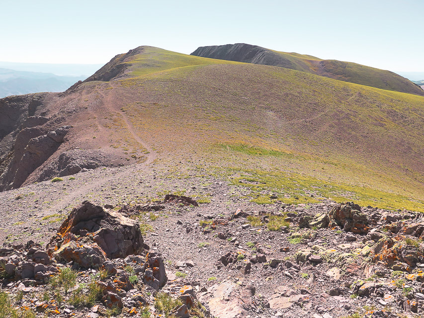
From saddle, trail climbs a rocky section to get to ridge just below Delano Peak.
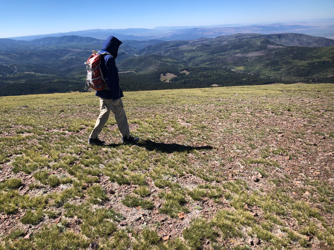
Mostly tundra the rest of the way; first view of Delano Peak on the horizon.
Catching gusts just below Delano's summit; no time for a hat!
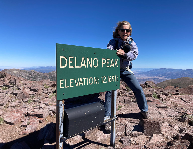
Stayed just long enough on summit to sign in to the register, a convenient mailbox.
On the way down from Delano Peak: Shelly Baldy Peak, 11,321' (left) and Mt. Baldy, 12,122' (right).
Just off Delano Peak - "get me out of this wind!"
Walking back to trailhead along Forest Road #123.
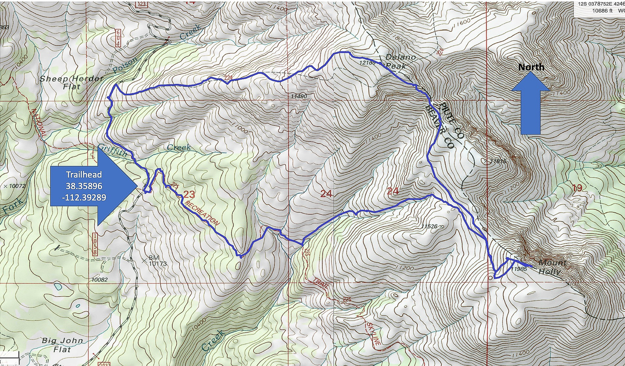
Our GPS tracks for Delano/Holly loop beginning at Road #123 at trailhead parking for Skyline National Recreation Trail
click on map for larger image 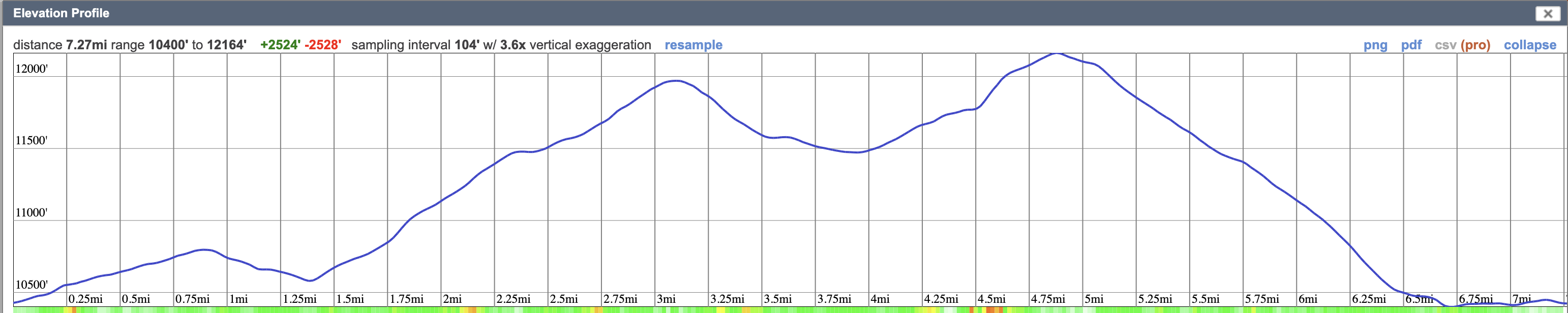
References
Sontag Bradley, M. A History of Beaver County. 1999. Utah State Historical Society Beaver County Commission. |
Categories
All

Sue and Fred

About this blogExploration documentaries – "explorumentaries" list trip stats and highlights of each hike or bike ride, often with some interesting history or geology. Years ago, I wrote these for friends and family to let them know what my husband, Fred and I were up to on weekends, and also to showcase the incredible land of the west.
To Subscribe to Explorumentary adventure blog and receive new posts by email:
Happy Summer!

About the Author
|