|
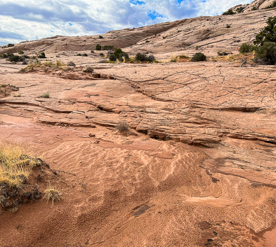
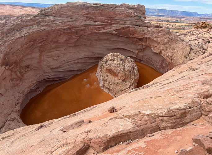
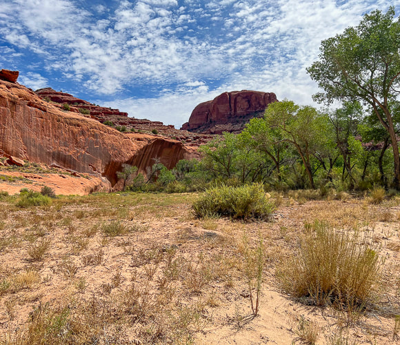
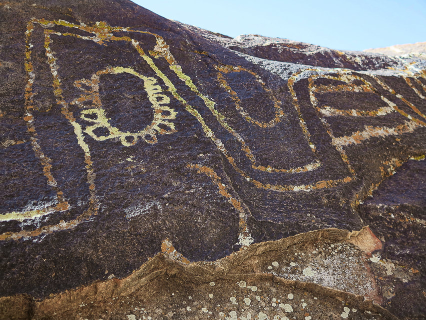
A four-mile journey across pristine slickrock brings you to this wondrous geologic feature in remote Grand Staircase-Escalante National Monument. Nearby, a huge petroglyph panel representing various cultures looks over the Escalante River near Neon Canyon. 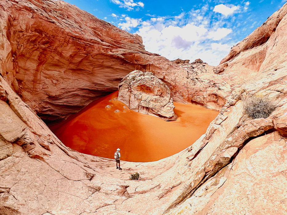 The Cosmic Ashtray, aka Cosmic Navel - a huge 200-foot wide pothole filled with orange sand. Small sample of many petroglyphs on huge panel near the confluence of Neon Canyon and Escalante River.
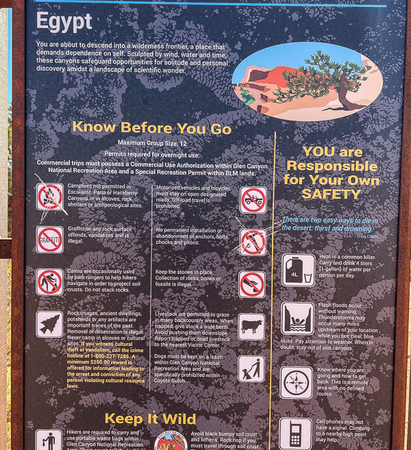
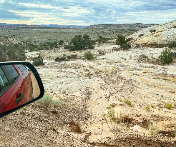
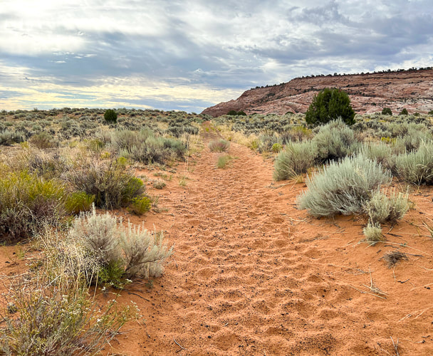
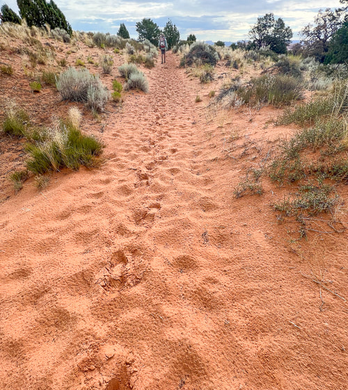
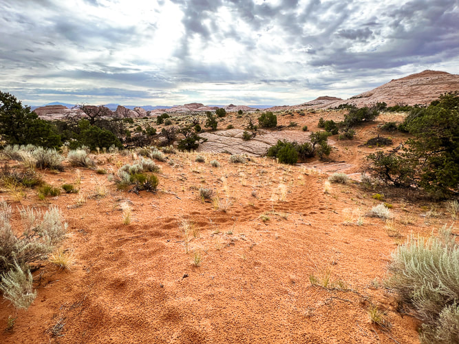
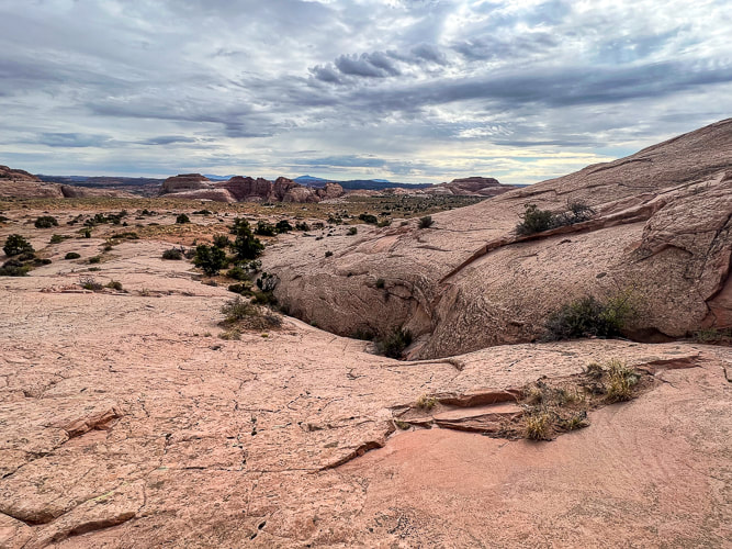
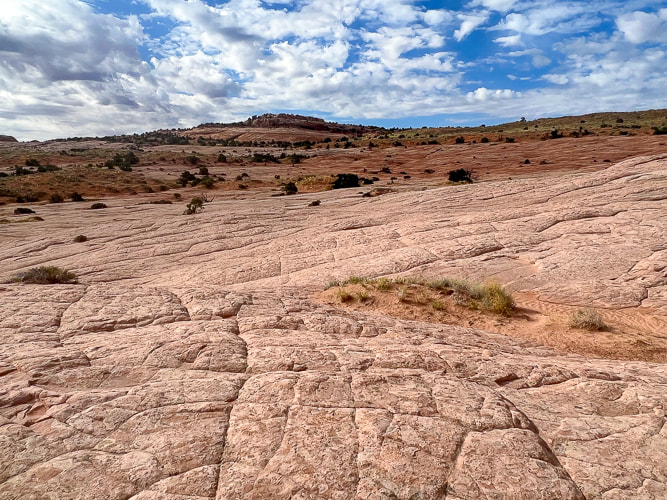
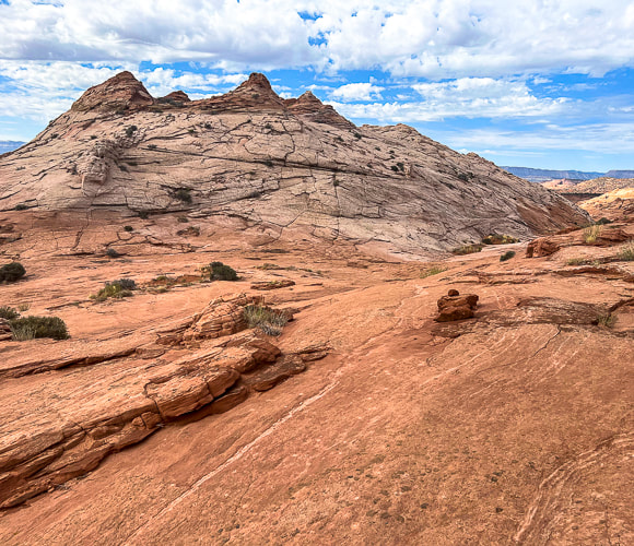
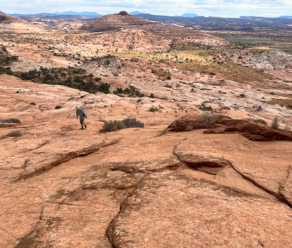
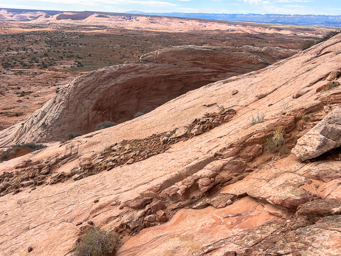
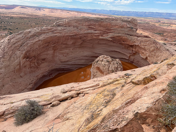
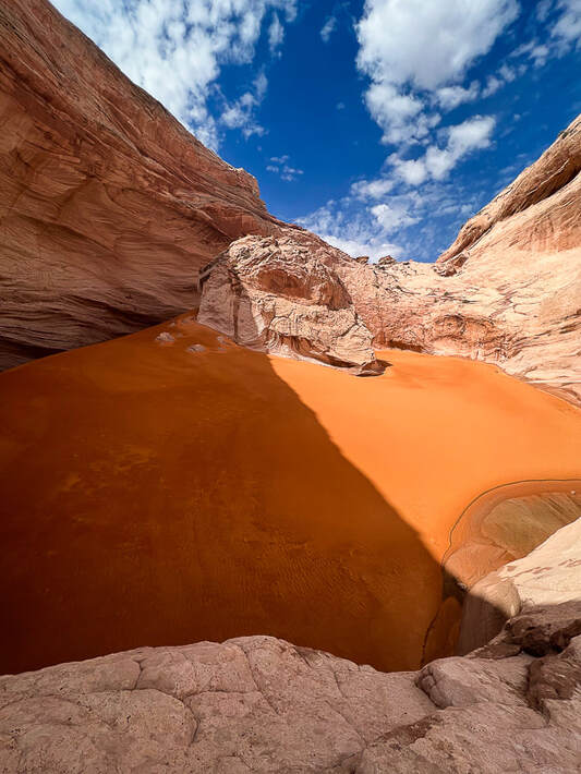
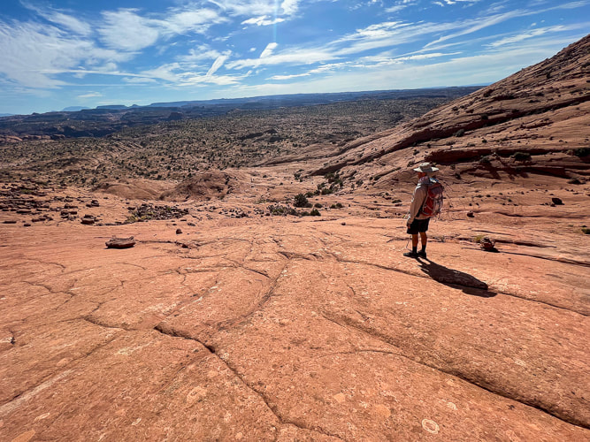
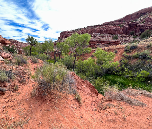
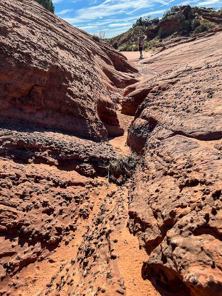
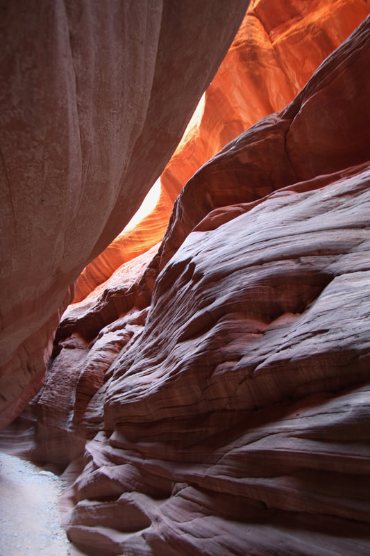
Cosmic Ashtray The Cosmic Ashtray, AKA "Cosmic Navel" is an astonishing sight to behold after a suspenseful four-mile hike across a sea of slick rock, when it suddenly appears as a huge white sandstone pothole filled with deep orange sand, a large rock stashed inside it. This "weathering pit", also called "Inselberg (island mountain) Pit" because of its 10-meter high rock pedestal is the largest on Earth. It has erosional features that resemble similar discoveries on Mars. Wind continually changes the pit dune's orange sand shape and depth. Based on Colorado River erosion rates, a study estimates this pit is 216,000 years old. We talked to a bartender, a life-long Escalante rancher who had hiked Cosmic a few times. He has climbed into the pit sand by tying a rope to a shrub! We didn't find a hook in the pit wall. We got to talking about Hole-In-the-Rock Road, one of the few that gives access to Grand Staircase-Escalante and the Egypt trailhead we used for Golden Cathedral. After we complained that the road was very wash-boardy and rough, he said the county (Garfield) used to keep it in better condition before it became a National Monument. We've been down this road several times and this time it appeared to be in the worst condition. If you look at an aerial photo of the Cosmic Ashtray (check out the Netoff study), an open tunnel into the pit indicates wind has carved this channel smooth, creating wind-abraded flutes on its sandstone walls. Cosmic Ashtray is situated on a topographical high, between bedrock knobs. Wind funnels through these sandstone knobs enhancing wind speed (the Venturi effect). The orange dune sand comes from distant areas; it's larger-grained and therefore heavier than the sand of the eroded pit walls, so it accumulates in the pit. Fred hadn't seen photos of the Cosmic Ashtray weathering pit so he was amazed when we came upon it. The beautiful journey across miles of undulating bare Navajo sandstone makes you feel small and remote in the middle of the Jurassic-age buttes, knobs, and deep, narrow canyons. Moqui marbles, black embedded half-shells of iron concretions, and weird stained patterns pop up in the bleached and orange slick rock. Polygonal fractures that resemble honeycombs decorate the white sandstone all the way to the top. It will be fun to take friends next time without showing them a "preview" of Cosmic Ashtray just to see their astonishment at the sight of it. A sequence of ducks (small rock pile trail markers) led us up a steep pitch where Cosmic slowly came into view as we climbed to a lookout (Point 5847). At first, the northern-facing pit wall appears, followed by the tip of the pedestal rock in its center, and then finally its orange sand pit. Great vantage point for photos. Then you can climb back down and access the pit from its north entrance.
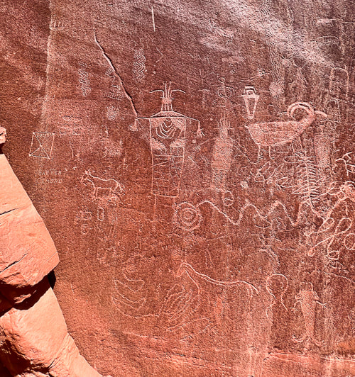
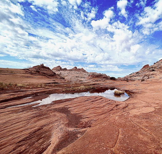
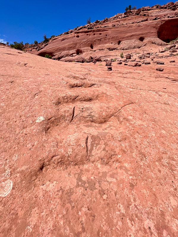
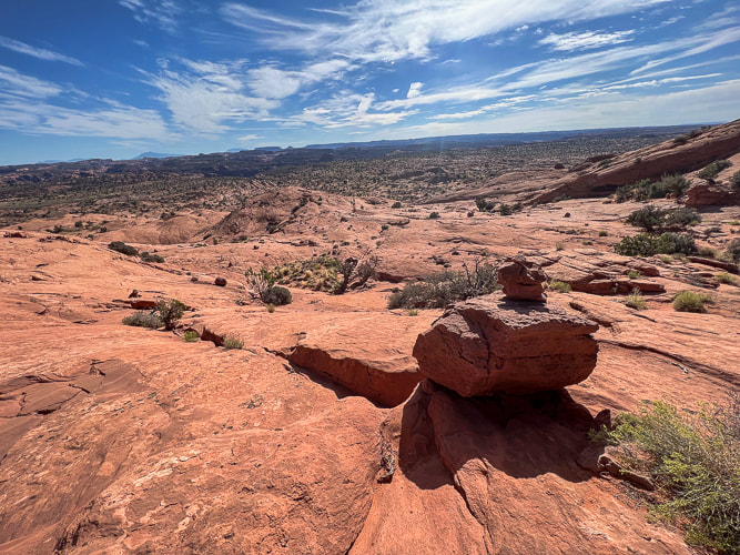
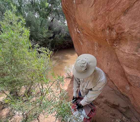
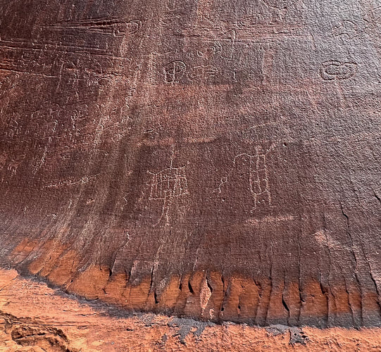
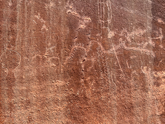
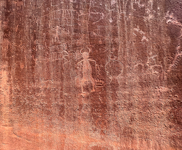
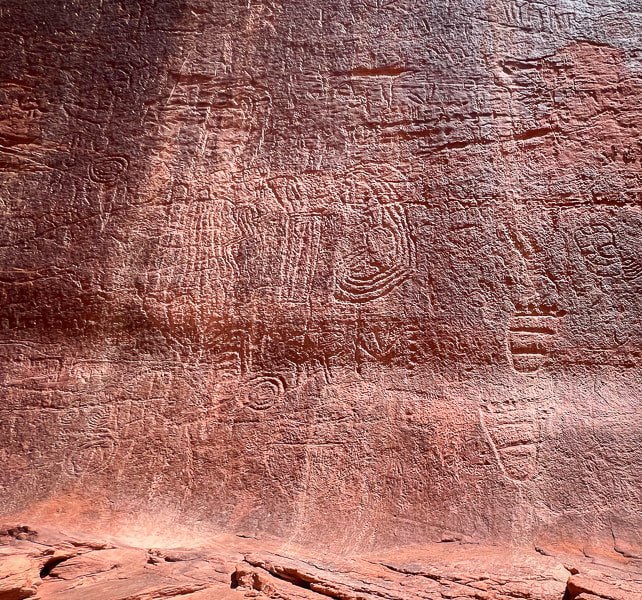
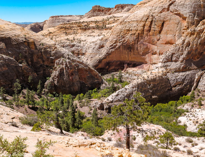
Deeply pecked abstract geometric petroglyphs from the Archaic culture (3,000 BCE) have been on this wall for so long that they are "re-patinated," or covered with dark desert varnish. Glen Canyon linear style anthropomorphs (resembling humans), and animals make up most of the glyphs. Bear paws and human feet march to the top of the slab. Ancestral Puebloans pecked bighorn sheep and broad-shouldered anthropomorphs during 1,000 BCE - 550 CE. We approached Neon Canyon from the Egypt trailhead along the "standard" trail which entailed three or four Escalante River crossings. BEWARE OF QUICKSAND when walking in low water levels. Our plan next time is to hike the Beeline route from Egypt trailhead to Golden Cathedral - this means only one river crossing near Neon Canyon entrance. With each Grand Staircase/Escalante visit, our list of places to explore expands as this spectacular ever-changing land seems to do. As I write this, I'm sitting in Las Vegas airport waiting for a Chicago flight. I keep thinking of the magnificent land of Grand Staircase-Escalante, feel a yearning to return to it. As its silty yellow and orange rivers flow, the scent of pine and juniper fill its air, and its landscape turns bright orange and vermillion with sunrises and sunsets, I wish I was there to see it. As always, so much to see and do, so little time.... Cosmic Ashtray Images 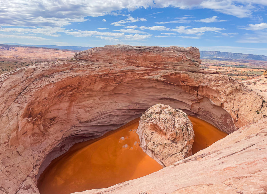 The "Cosmic Ashtray" is an inselberg pit (insel = island, berg = mountain in German). The orange sand blows in from remote places. The center pedestal is ~ 10 meters high. Climb knob 5847 to the north for a good view of its sand dune. photo by Fred Birnbaum 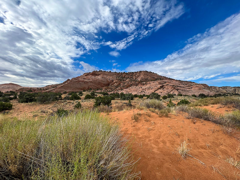 View of Red Breaks during first mile of hike. 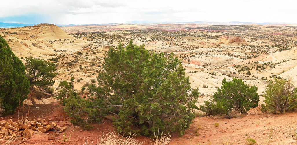 Vast juniper-dotted slickrock sea to the north. 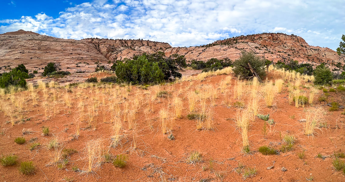 Indian Ricegrass haven and the Red Breaks. 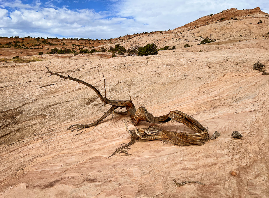 One beautiful reminder of life cycles in the slickrock desert. 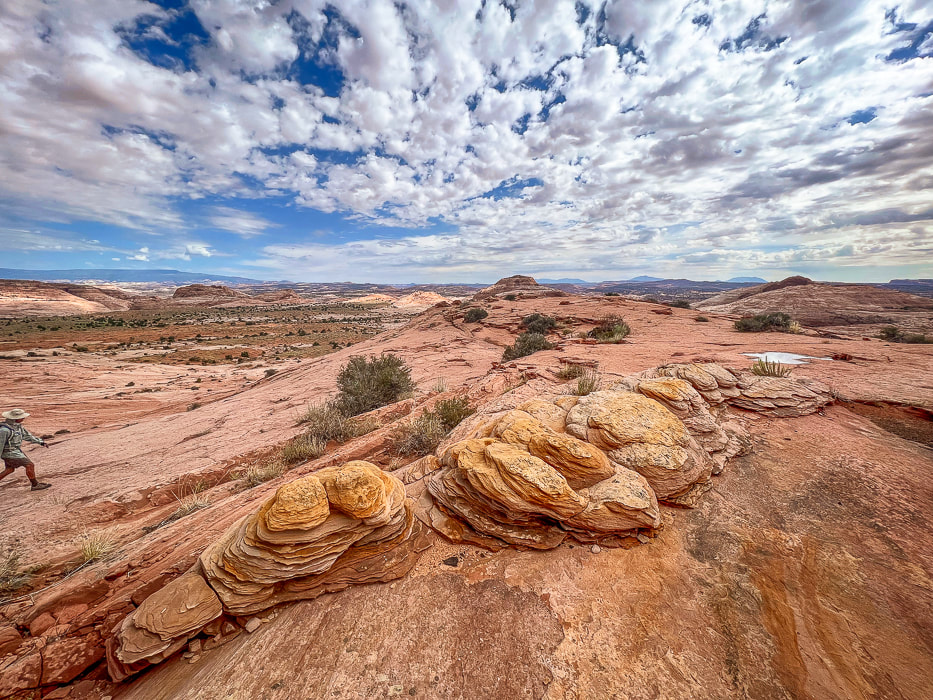 So many eroded Navajo sandstone features. Looking north toward flat "meadow." 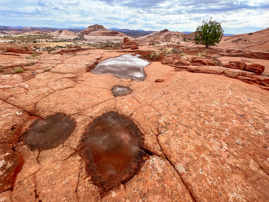 Potholes, tinajas, waterpockets, ephemeral pools are all names for these eroded sandstone depressions. 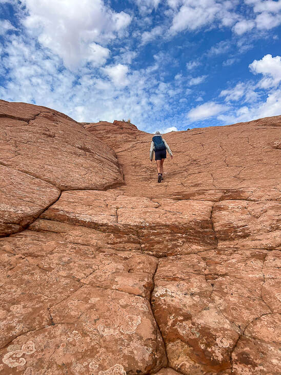 Following duck trail markers to the top of Point 5847 that looks directly into Cosmic Ashtray. The "unveiling" of Cosmic Ashtray, aka Inselberg Pit from Point 5847. 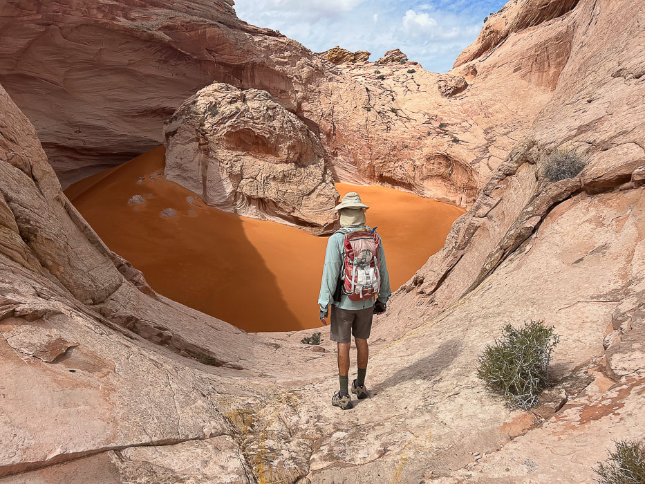
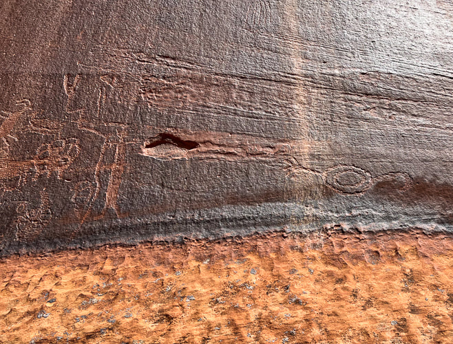
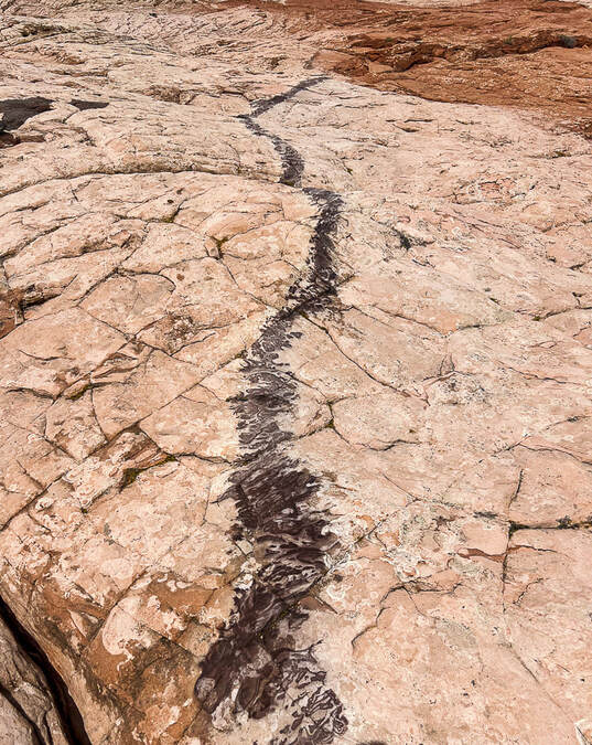
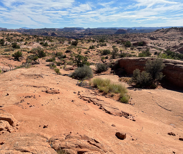
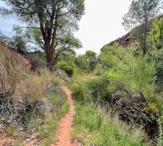
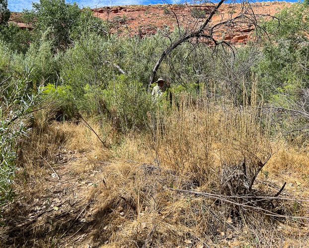
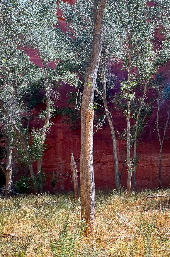
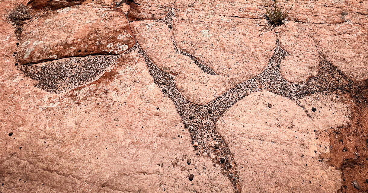 Moqui marbles and other weathered-out iron concretions making an interesting pattern. 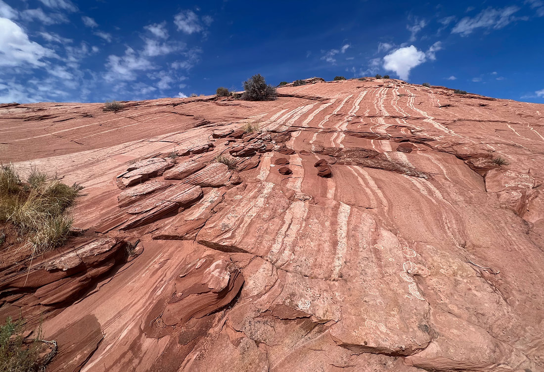 Movement of fluids through sandstones, especially Navajo Sandstone can create "bleaching" or removal of hematite (white bands). 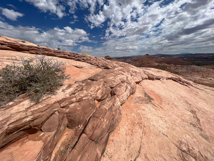 Neon Canyon/Escalante River Petroglyphs 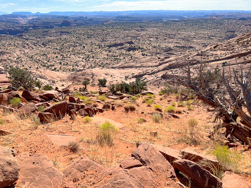 Looking down at "Egypt" from the trailhead. The route goes through alternating sand and slickrock. Aim toward the dark round dome upper left in photo - along the Escalante River. Neon Canyon's opening is at the base of this dome. I couldn't find the origin of the name "Egypt". This is an old stock route, so possibly an original rancher, upon seeing this wide, sandy bench said, "Sure the heck looks like Egypt!" 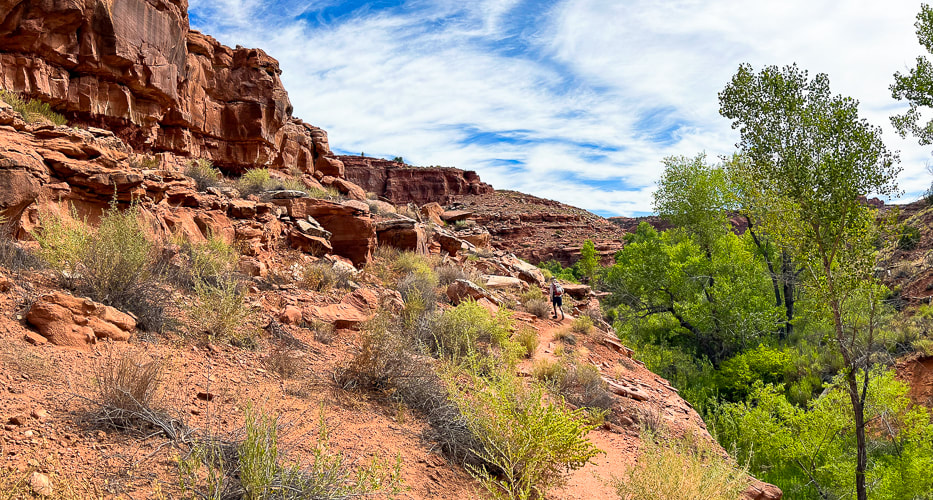 Walking from Egypt Bench into Fence Canyon, which empties into Escalante River. 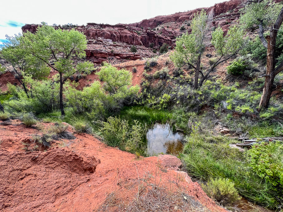 Dropping into Fence Canyon, where a short hike leads to Escalante River for a short river walk. 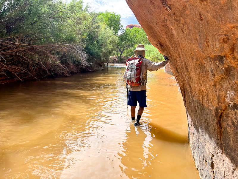 Short Escalante River wade before catching trail on right side of river. 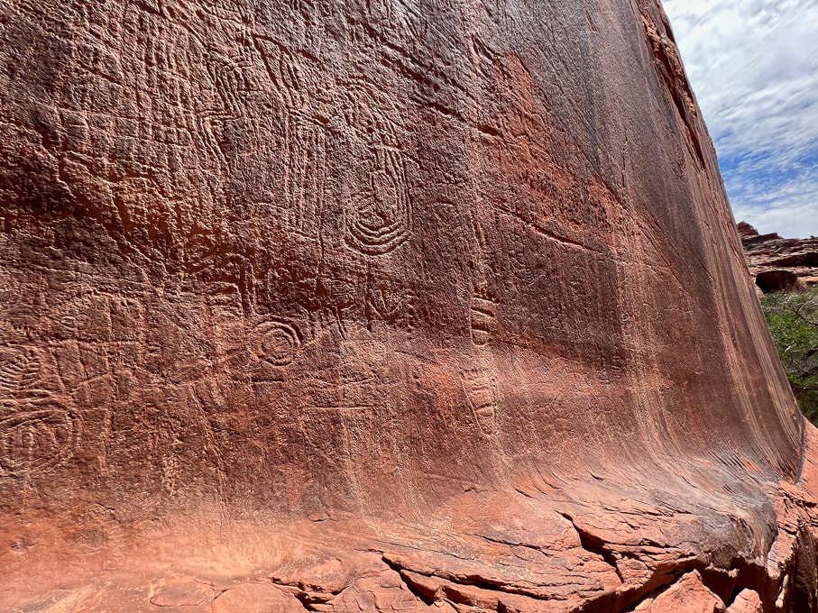 These abstract petroglyphs are more deeply incised and re-patinated (covered with desert varnish); they probably older than the anthropomorphic (representing humans) petroglyphs seen on left side of panel. 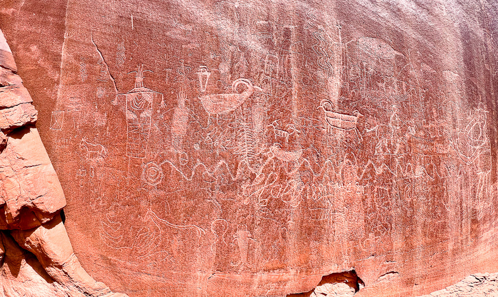 Lots of petroglyphs superimposed over older ones. Some of the more recent are from cowboy Charles Hall in 1881, who made his cursive signature under the undulating snake petroglyph. 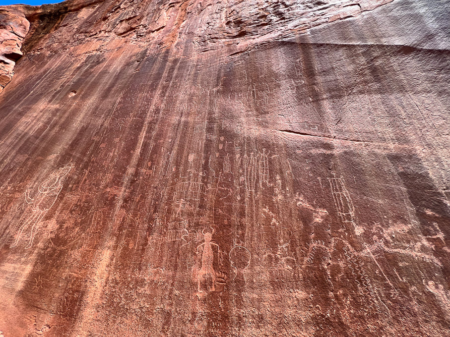 These petroglyphs are located toward the left part of the panel and are lighter (desert varnish has not fully re-covered them), so they are probably made more recently than the abstract, re-patinated images. 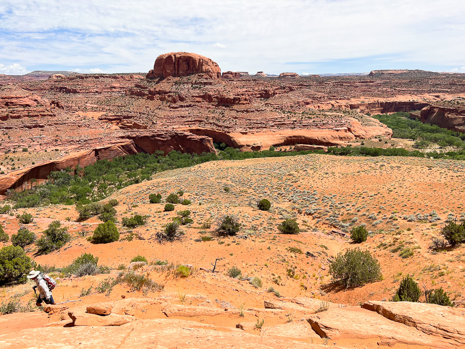 Hiking on Beeline Trail out of Escalante River, back to the trailhead. Petroglyph panel on left side of photo, Neon Canyon opening in notch below the round dome, aka Point 5,270'. 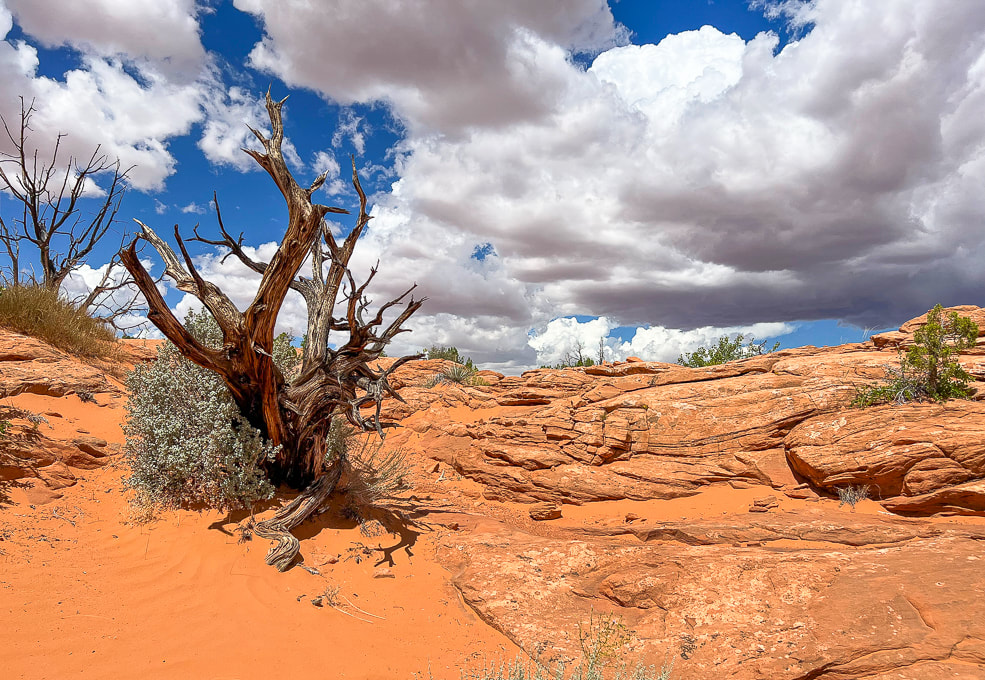 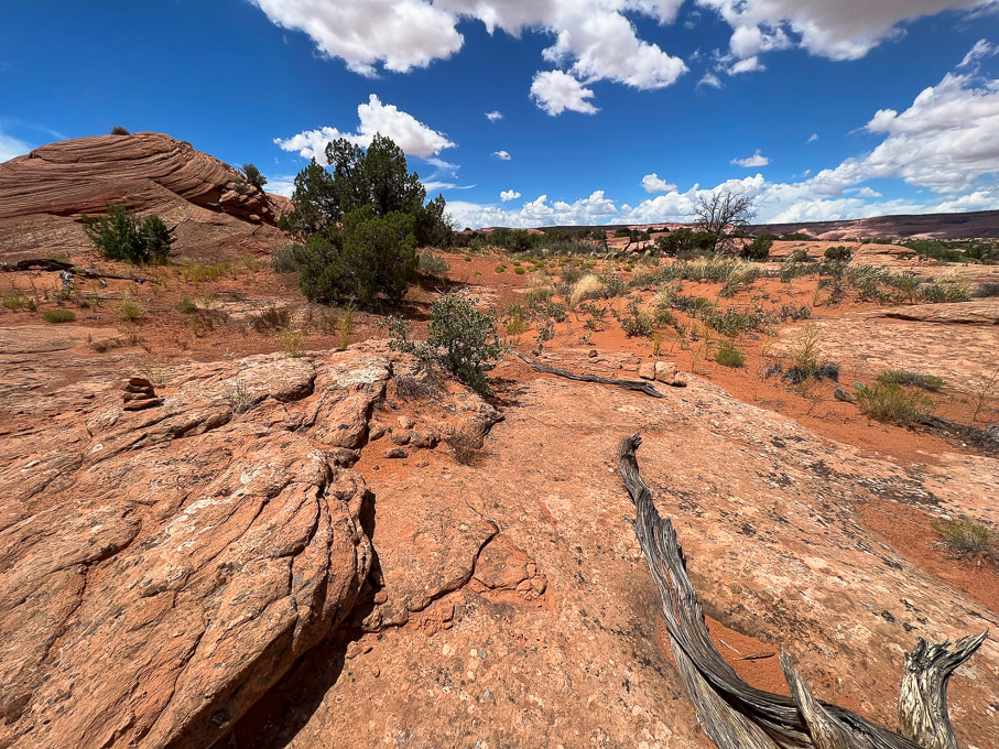 Duck (left) marking the Beeline Trail back to trailhead.
Related posts
4 Comments
|
Categories
All

Sue and Fred

About this blogExploration documentaries – "explorumentaries" list trip stats and highlights of each hike or bike ride, often with some interesting history or geology. Years ago, I wrote these for friends and family to let them know what my husband, Fred and I were up to on weekends, and also to showcase the incredible land of the west.
To Subscribe to Explorumentary adventure blog and receive new posts by email:
Happy Summer!

About the Author
|