|
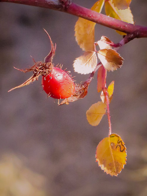
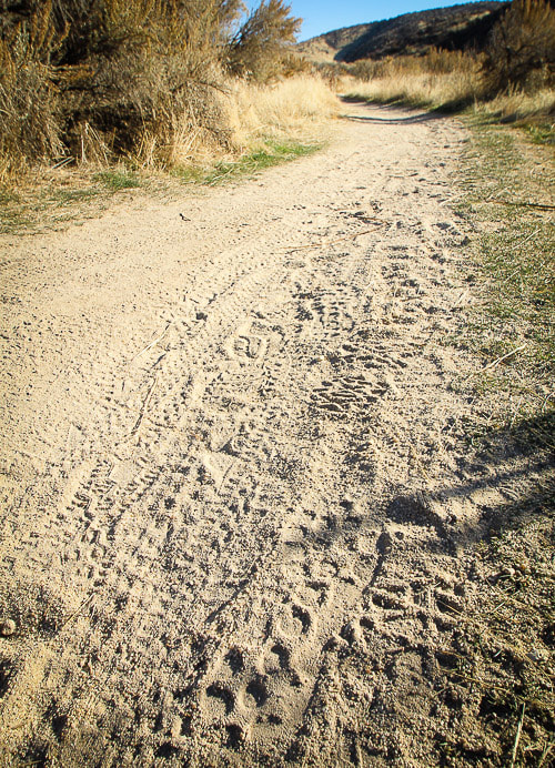
You don't have to go far from home for adventure and beauty. These scenes are within a one-mile radius of my house. "Wandering is an inexpensive ticket to another level of being..." - Ann Zwinger, from The Nearsighted Naturalist "Be careful going in search of adventure - it's ridiculously easy to find." - William Least Heat-Moon 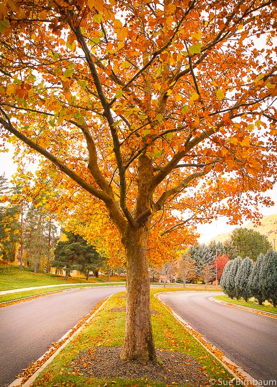 There's no place on Earth like the American West, where one can experience a wide variety of absolutely stunning places and adventures. The west has expansive spaces, solitude, jaw-dropping scenery - so spectacular, in fact, people come from all over the world to experience it. Hear the roar of Vernal Falls in May in Yosemite National Park, stand atop the narrow sandstone fin on Angel's Landing with Zion Canyon spread far below, or feel Virgin River's current against your legs in Zion's narrows with rock walls towering far above. The infinite Western Experiences list goes on. The scenery doesn't have to be as dramatic as this, though, to be memorable. The sea of sagebrush extending to the dark, flat basalt plateaus of the Great Basin can seem monotone at first glance, but walk through it during spring wildflower season, smell it just after a rain, watch a herd of antelope run swiftly by, or watch the sage grouse lek mating ritual; suddenly this "monotonous" place becomes spectacular. For a few days last autumn, I treated myself to wandering with my cameras. For me, it's a practice in meditation and like naturalist Ann Zwinger says, "another level of being." What a luxury it is, if you are a nature lover, to have the time to "see" the natural world around you, to follow where it beckons; a bird song, a path, colors, the dark spot under a bitterbrush, or a hill top scattered with bunches of bright yellow flowers of the balsamroot waving in the breeze. Here are a few images from "my neck of the woods." I'm lucky to live where nature is so close. But beauty is close to most of us if we just take the time to see. A Boise foothills trailhead is within a mile of my house, as well as two farms where one can buy and learn about native plants. My only limitation for this adventure was that all images are captured within a one-mile radius of my house. This post received a few comments from friends that I thought worthwhile to mention. One was that "Mother Earth is a gift." So true, and to me a gift I will always have. Also, some of the best images are captured "near home, where your familiarity can lead to shots that others would not see." For more Boise photos, check out Gallery --> Boise.  Northwest Boise foothills on an autumn afternoon 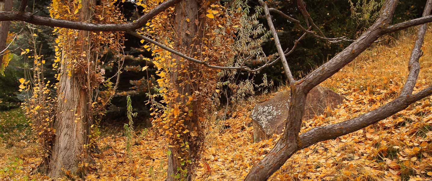 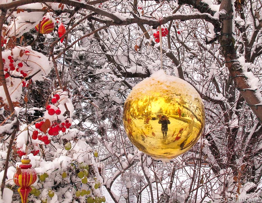 First snowstorm of the season 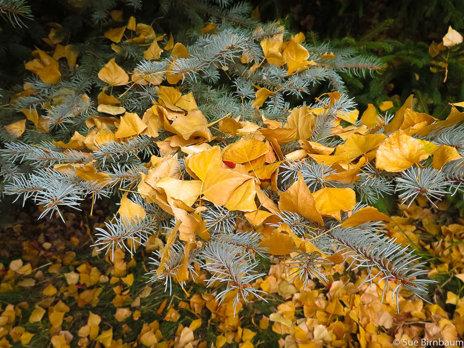 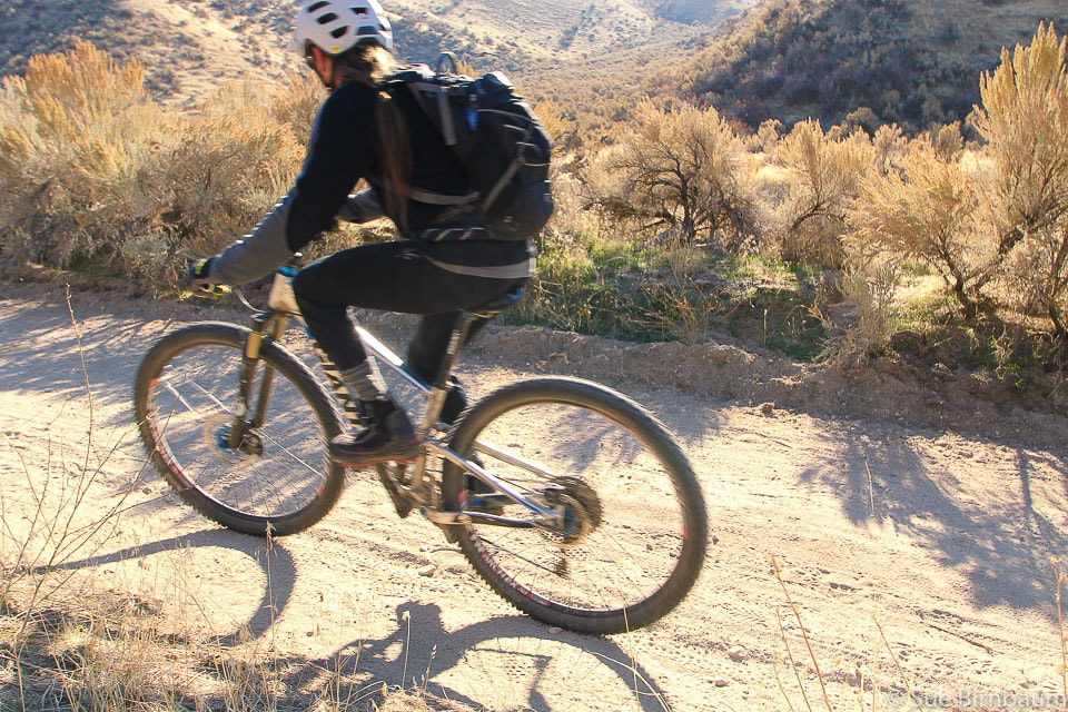 Sunny but chilly ride through sagebrush
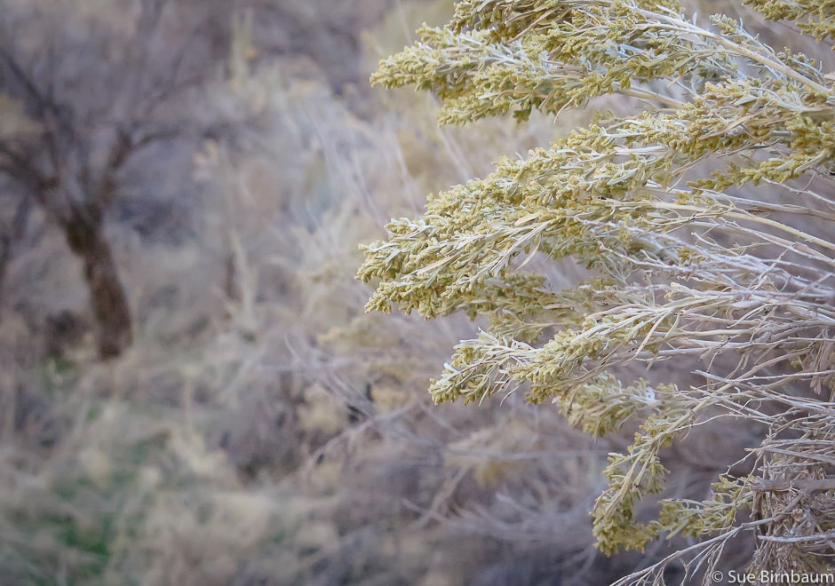 Artemisia tridentata in bloom 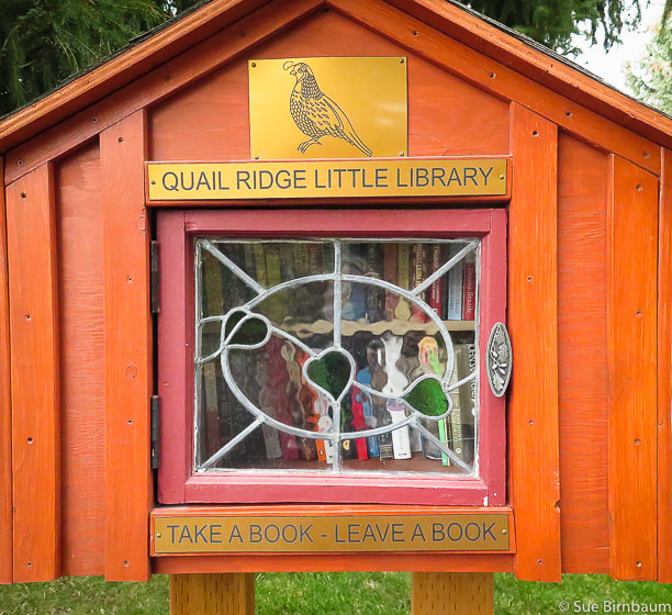 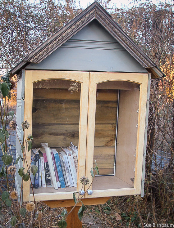 Gardening/Botany books at Draggin' Wing Farm Two outdoor libraries within one mile of my house - this is a special place, indeed! 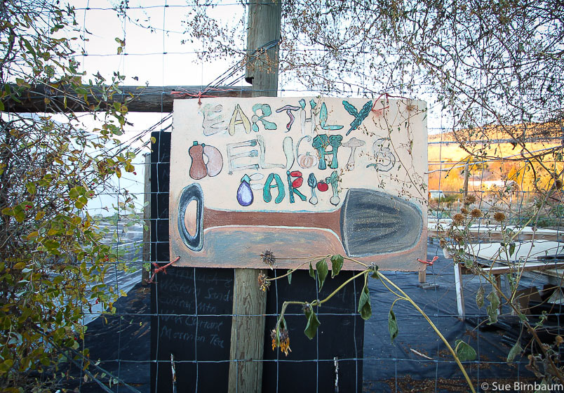 Earthly Delights Farm next to Draggin' Wing Farm 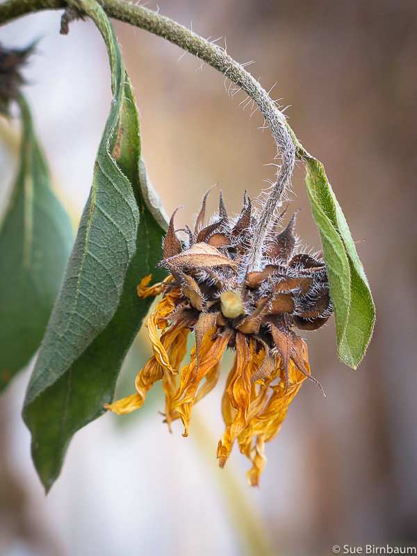 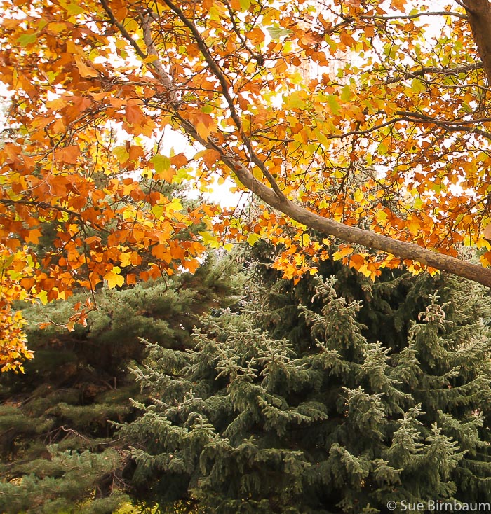 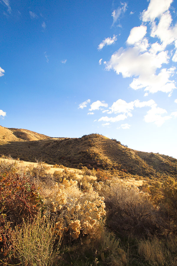  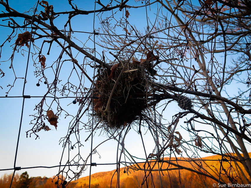 Sunset at Draggin' Wing Farm 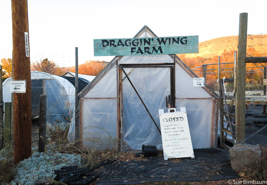 Alpenglow lighting Draggin' Wing Farm 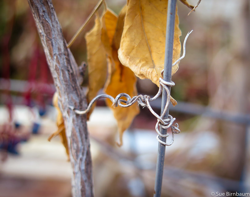 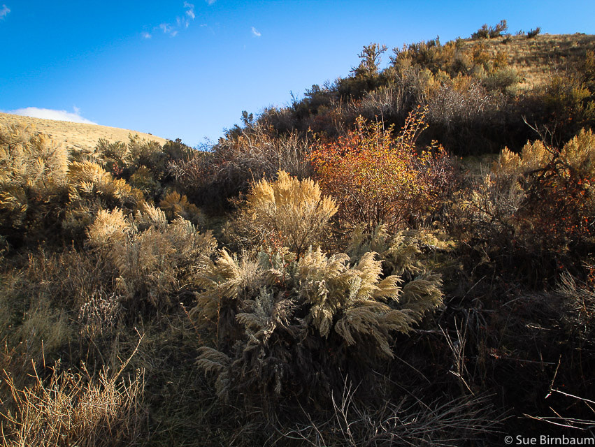 Textures and colors - native vegetation of the Boise foothills 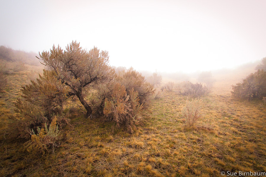 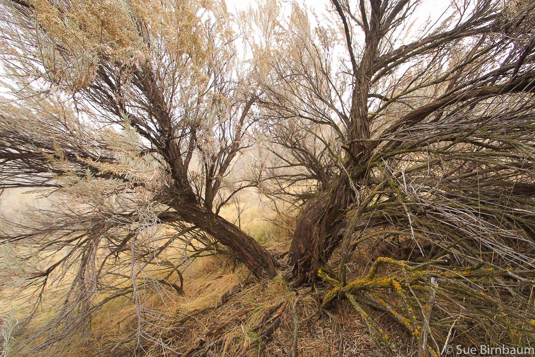 Huge sagebrush just up the hill I wonder how old it is.....  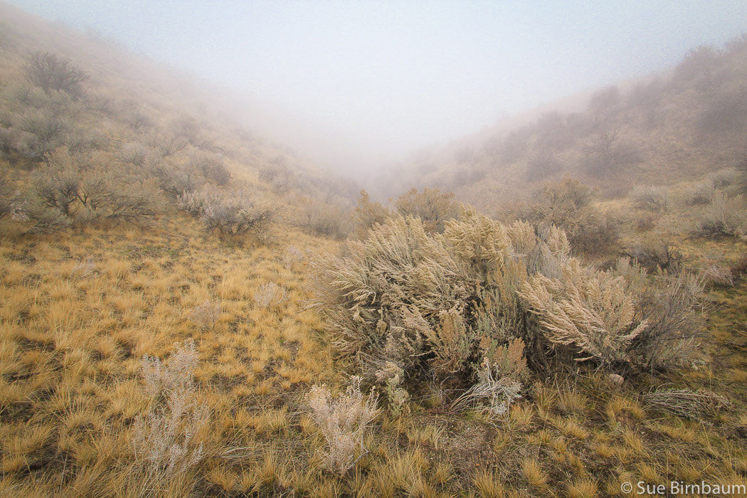 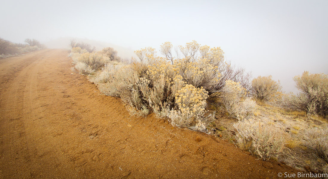 Horses' hoof prints, rabbit brush and clearing fog 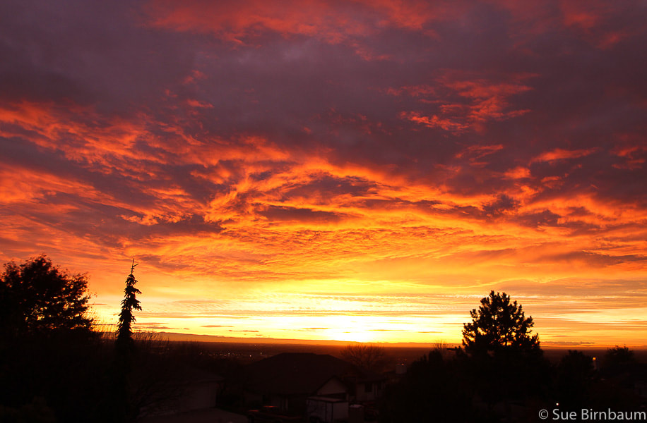 Another incredible Boise sunset
4 Comments
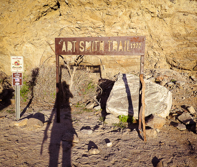
On Haystack, we found sun and solitude off of the Art Smith Trail in the Santa Rosa and San Jacinto Mountains National Monument, a spectacular view of Southern California's mountain ranges, and our old summit register entry from 2011. Related: First Cactus to Clouds Challenge - The Beginning of the Ultimate Desert Hike Pinto Mountain Hike - Joshua Tree Wilderness Desert Plants photos Monument Mountain Hike - Joshua Tree National Park In Memory of Roger Keezer 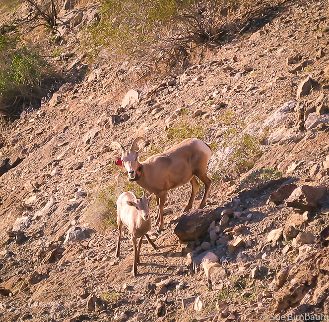 Peninsular Bighorn Sheep near Art Smith Trail, Palm Desert, CA Ovis canadensis nelsoni Listed in 1998 as Endangered Species due to substantial population decline from disease, predation, habitat loss and human disturbance Cross - country to Haystack Trip Stats:
Directions to Art Smith Trailhead: Travel south on CA State Route 74 (Palms to Pines Scenic Highway) from CA State Route 111 in Palm Desert 3.5 miles to long sandy parking area on right of road just as it starts to curve to the left to ascend switchbacks up hills to the south. The Santa Rosa and San Jacinto Mountains National Monument Visitor Center is adjacent to parking, across SR 74. Hike Directions: (Topo map of our route below)
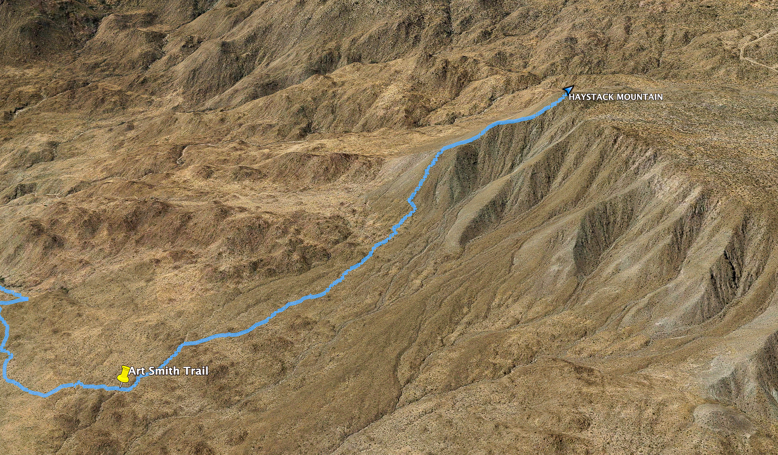 Cross-country route off of Art Smith Trail to summit of Haystack Mountain Yellow marker indicates point at which we left Art Smith and ascended wash Elevation at this point = 2,237 feet; ~1,600 feet to summit from turn-off Geology and History: The trail to Haystack Mountain treks through quartz diorite, a coarse-grained intrusive rock with 5-20% quartz (diorite has <5% quartz). It has the classic speckled black and white texture and large grain size. Quartz diorite is often confused with granite because they look similar. Both are intrusive rocks with a phaneritic texture in which mineral grains are visible without magnification. Granite, however contains 20-60% quartz. Quartz grains are not usually visible with quartz diorite, but can definitely be seen in a granite. This rock unit is Cretaceous age (144 to 65 mya). The efforts of Art Smith, a.k.a. "Trail Boss", a Desert Riders equestrian helped to establish the Desert Riders Trail Foundation, a non-profit trust for trail preservation and building. The Desert Riders equestrian club was initiated in 1931, has made 28 trails as of 2010, many of them follow ancient Cahuilla Indians' migratory hunting and gathering trails. "Probably I was too young and venturesome to feel dismay, but I know now what Mama must have felt as she looked out upon that savage scene of sand and rock and sky locked in the pitiless grip of desert summer." - Nina Paul Shumway, Your Desert and Mine, an account of her family's settlement and beginning of the date industry in the Coachella Valley.
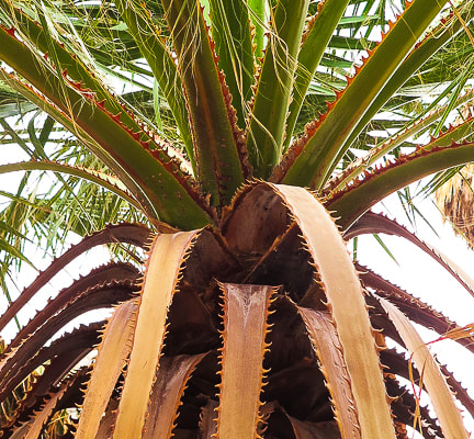
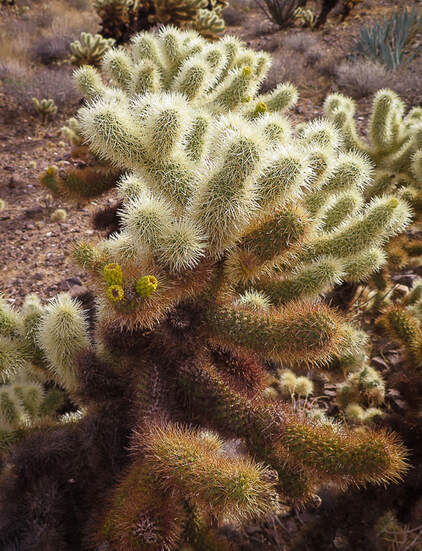
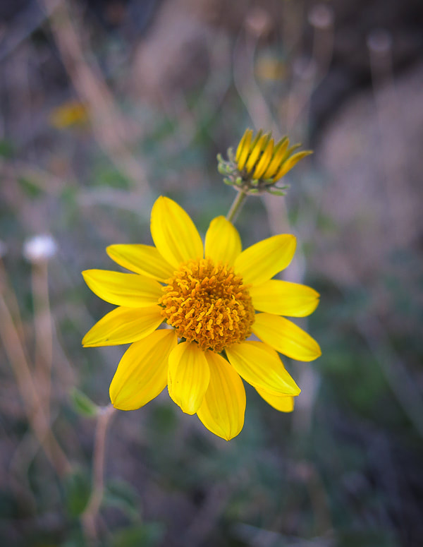
Our Hike The past few times we have hiked the Art Smith Trail, we have seen Peninsular bighorn sheep in Dead Indian Canyon near the rust-colored metal sign that marks the Art Smith trailhead, not far from the parking lot. They were listed as a federally endangered species in 1998. This morning, the sun shone brightly on the deep-walled Dead Indian Canyon and a group of ewes with their lambs. This trail, just west of Palm Desert, links to trails leading into the Indian Canyons in Palm Springs. The Coachella Valley is a special place for me and I carry memories of hiking all of its trails with dear friends that I will always keep in touch with. It's my "old stomping ground", or more aptly put, my old hiking ground. Living there in the 1980's and 1990's, we climbed, traversed, slid, sweat, laughed, got stuck with cactus spines, boulder-hopped, and celebrated our hikes and friendships. I am grateful I can still be able to hike these wonderful trails and when I do, all of the memories come back vividly. I met Fred on Mt. San Jacinto, and he automatically became a part of our hiking clan. Not many people venture off Art Smith to climb Haystack Mountain. To our surprise, we found the same notepad in which we had made our 2011 entry in the summit register can! I guess the dry climate and the sparse number of Haystack Mountain visitors helped preserve this small note pad. It's a simple message: "12/21/11 - Fred, Sue and Scott - old friends who love to hike." We missed Scott this year, but were looking forward to hiking with him to Pinto Mountain in the next few days. Walking on Art Smith Trail is a treat in itself, a meandering path with weathering rock piles, beavertail cactus and brittlebush blooming in the spring, and that satisfying crunch of gravel with each step. One can imagine Cahuilla Indians walking to water sources on the trail and equestrians from the Desert Riders on horseback winding through washes across the open desert. But to pick your own route cross country, dodging cholla cactus, sharp-toothed agave leaves and cat claw acacia shrubs, climbing up and sliding down boulders and dry waterfalls is the greatest satisfaction. Art Smith Trail was busy due to the Christmas holiday. This trail treks through a possible plutonic synform (a downward-closing or concave fold of topography). Shimmering green California fan palms pop up occasionally to the left of the trail, and the valley patchwork of forest green golf courses sprawl to your right. 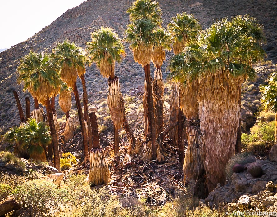 California fan palms Washingtonia filifera 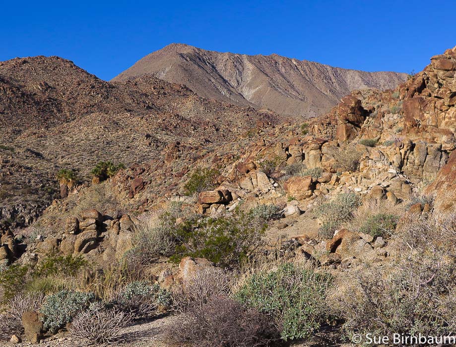 Haystack Mountain on the horizon as seen from near Art Smith Trail Leave trail at ~ 3.4 miles and hike to highest point at far left of long ridge Palm oasis in canyon on left We left Art Smith at 3.4 miles from the trailhead at a wide wash and headed west-southwest across relatively flat, open low desert. From here, it was 1.3 miles to the summit. We encountered no major rock barriers, only a few very small waterfalls and sandy benches covered with rounded boulders. I was surprised to see a few small junipers; the land is generously dotted with hedgehog cacti with their inch-long needle-spines. 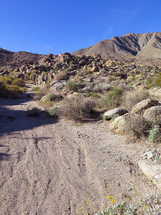 Wash ~ 3.4 miles in from Art Smith Trailhead at SR 74 in Palm Desert Climb up flank of cone to ridge - follow ridge to summit, seen in this photo 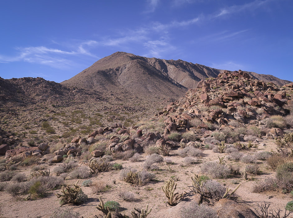 Getting closer to the base - climb cone to ridge and follow to summit 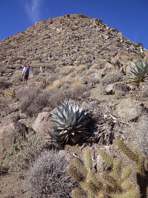 "False summit" on the ridge 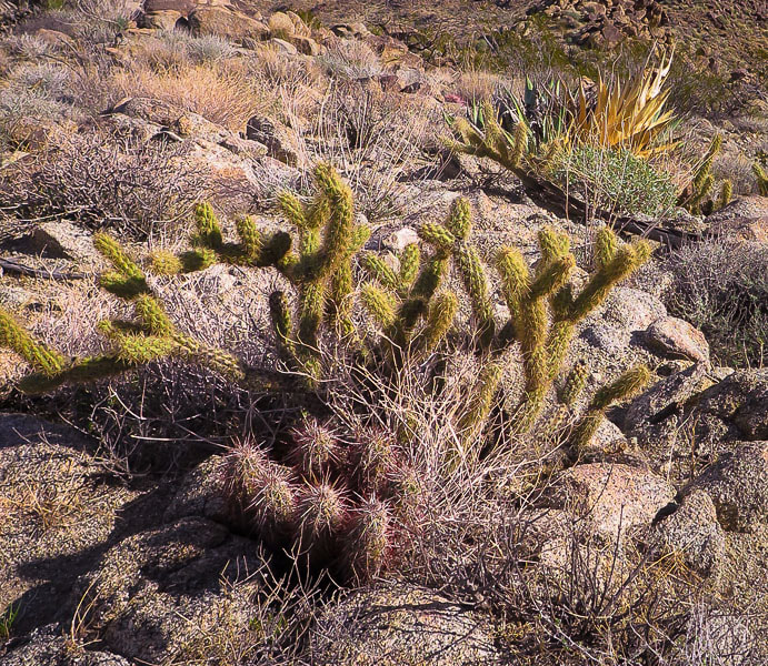 Hedgehog cactus (Echinocereus engelmannii) in foreground in front of cholla cactus Arriving at the base of Haystack, we gained its sunny east ridge by hiking straight up the steep flank to the left of the mountain, occasionally grasping rocks. The ridge is a Class 2 scramble with at least one "false peak" on the way up; not a long hike and the view at the summit is nothing short of spectacular. It is here you realize the enormity of this beautiful Colorado Desert and its mountain ranges. The controversial Dunn Road can be seen not far from the summit. It is a wide, sandy road that Mike Dunn carved out through the slopes of eastern Santa Rosa Mountains starting at Pinyon Flats in the 1960's and 70's. It traces around the contours of mountains, through what is now Santa Rosa and San Jacinto Mountains NM to Cathedral City. Because Dunn bulldozed some of his road on federal land, the BLM put a gate across the road. But Dunn would just bulldoze it down, and the BLM would fix it. I remember, when I lived in the Coachella Valley in the 1980's, Dunn Road was used for recreational jeep tours. Now of course since it is entirely on national monument land, it is only accessible to non-motorized travel. There were also differing opinions about whether Dunn Road compromised the bighorn sheep habitat. 360 - degree view from Haystack Mountain summit Summits include Mt. San Gorgonio, Mt. San Jacinto, Toro Peak, Martinez Mountain Also Little San Bernardino Mountains and southern Joshua Tree NP The summit view includes the highest points in the Santa Rosa Mountains: Martinez Mountain and Toro Peak, and also Mt. San Jacinto towering above Palm Springs. To the north lies Mt. San Gorgonio, the highest peak in Southern California, and the northeast the Little San Bernardino Mountains and the southern part of Joshua Tree National Monument. Ancient Lake Cahuilla filled the basin of the current Coachella Valley up until 500 years ago. This area is rich in culture and history - from the hunting/gathering Cahuilla Indians to the first settlers of this arid land, to the history of the date palm industry - not to mention the dramatic and substantial geologic history. The San Andreas Fault courses through the Coachella Valley. 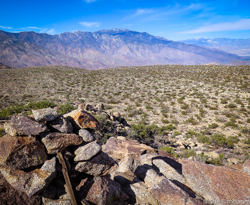 View from Haystack Mountain to the northwest Mt. San Jacinto (closer range) and Mt. San Gorgonio, the highest summit in Southern California (on horizon with snow) 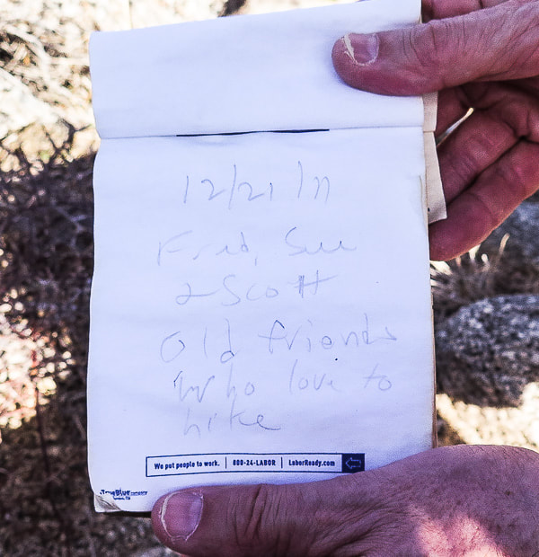 Our summit register entry from 12/21/2011: "Fred, Sue and Scott - Old friends who love to hike"
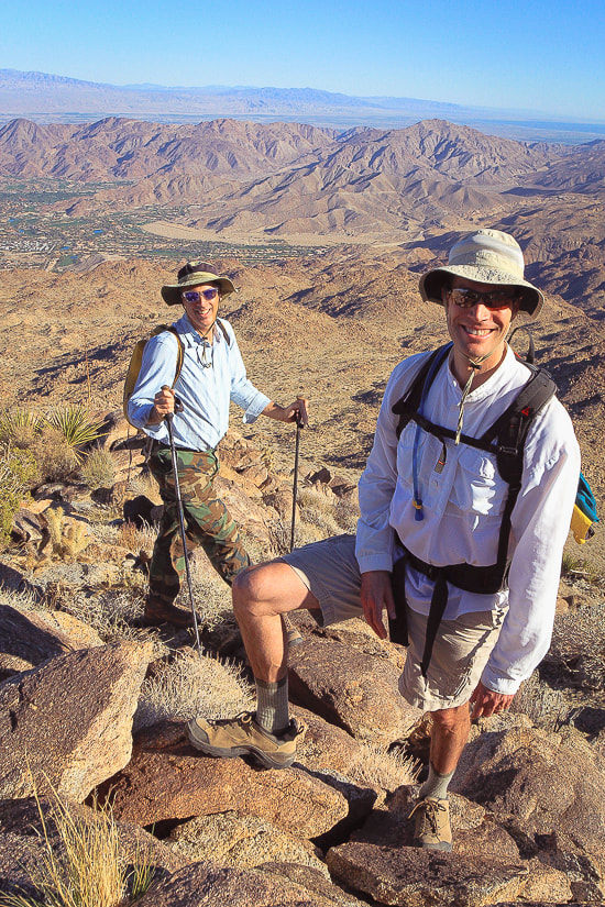 Scott and Fred near Haystack Mountain summit - 12/2011 Palm Desert in background on valley floor, Southern Joshua Tree NP on horizon I recommend returning by the same route unless you are open for more adventure and willing to negotiate the steeper and rockier terrain to the southeast. We did just that but also ended up in a thick and tangled palm oasis, the palm fronds clashing in the breeze. Briefly crossing the oasis, crunching through dead fronds, we found our way out by ascending a steep canyon wall. Out into the open again, we saw not far from us two mountain bikers on the Art Smith Trail. Back to civilization. As we hike back along this very familiar trail, I picture a scene from 25 years ago - a faint image of a group of friends, walking in rhythm, boots crunching, happy voices laughing and talking, celebrating friendship and this great land. I bet we find both of our summit register entries the next time we summit Haystack. 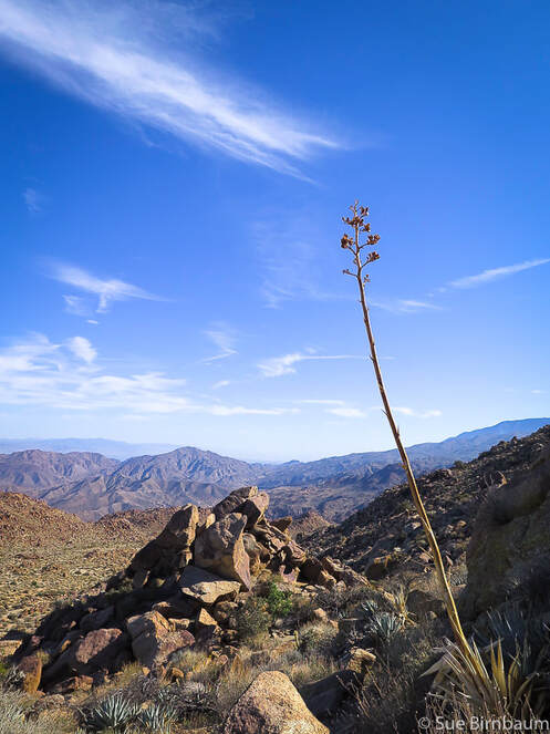 Desert agave The Cahuilla Indians roasted the heart of the agave in pits on rocky drainages 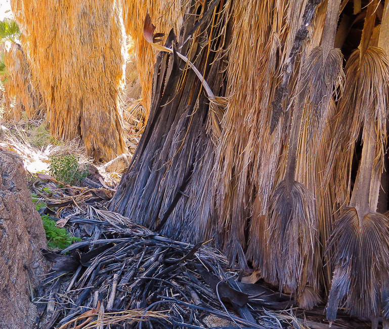 Desert Fan Palm fronds 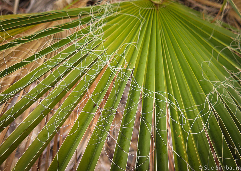 Washingtonia filifera "Filifera" describes the white filaments between the segments of the frond 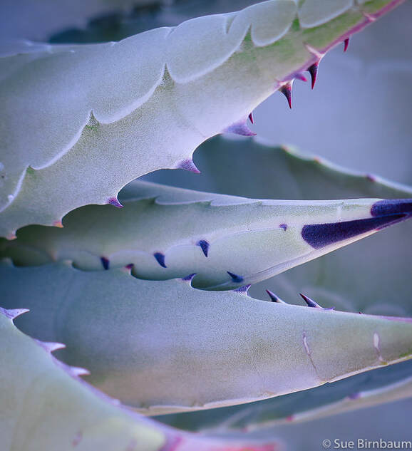 Agave deserti Santa Rosa and San Jacinto Mountains National Monument 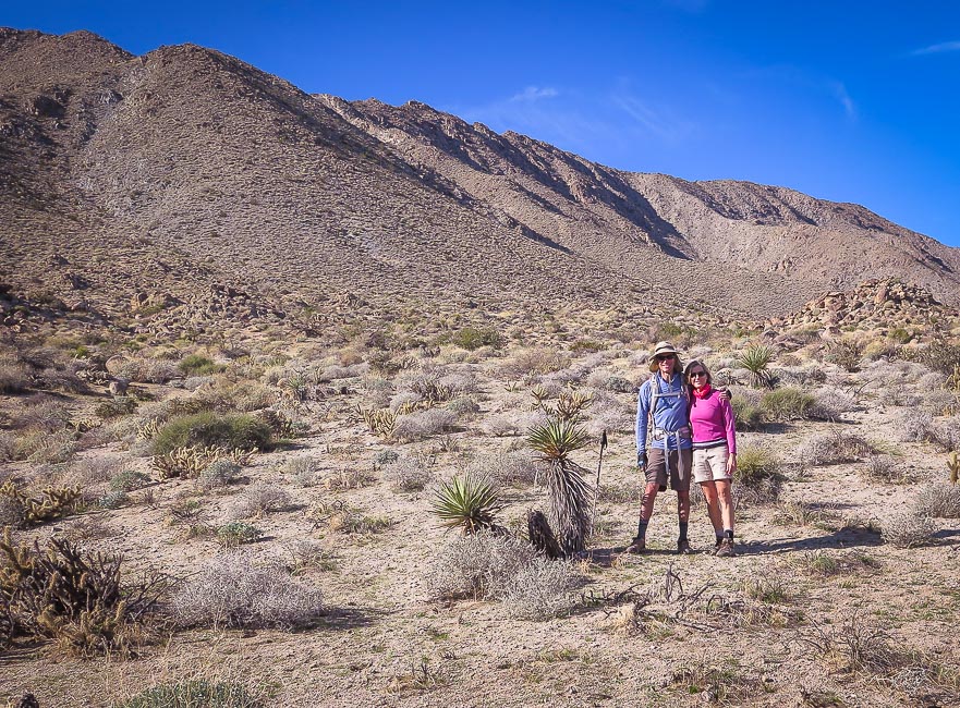 Fred and Sue on the way down - another beautiful hike in the desert! 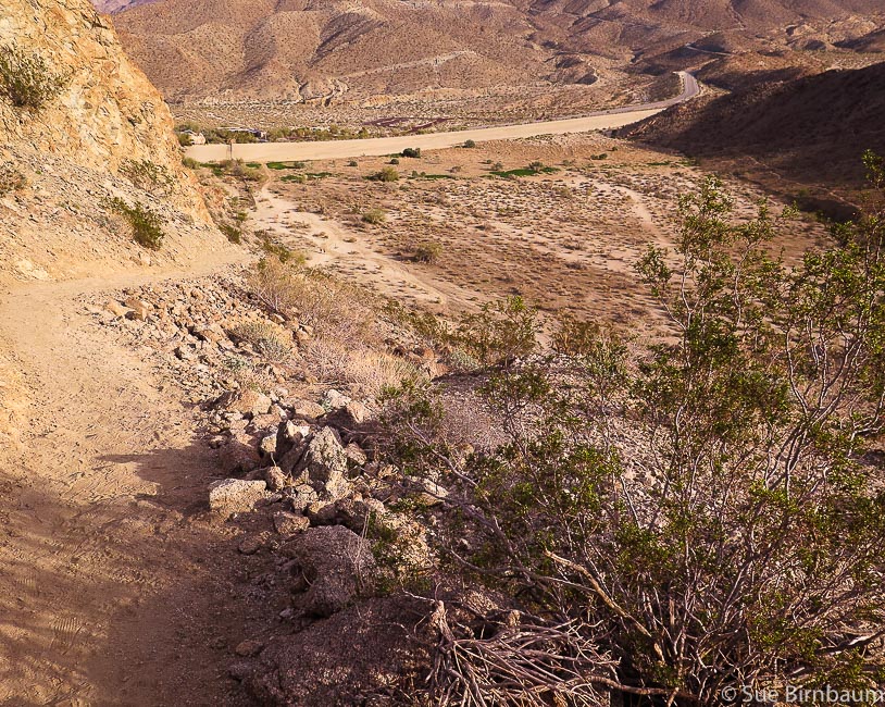 Beginning of Art Smith at its intersection with California SR 74. Metal trail sign below. Wide wash is entry to Dead Indian Canyon Maps  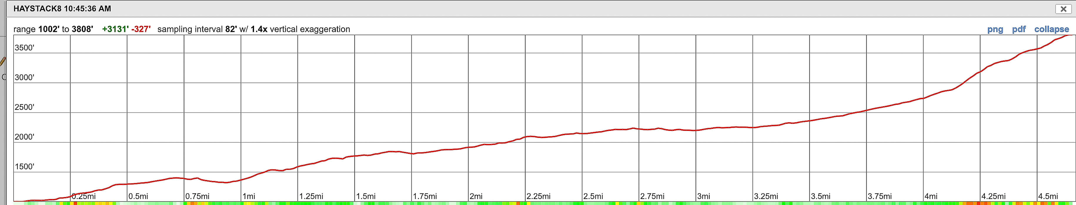 Topo map and our route and elevation profile to Haystack Mountain via Art Smith Trail and then traveling cross-country up east ridge Click on image for .jpg of topo map References:
Bighorn Institute. 2019. Endangered Peninsular Bighorn Sheep. Retrieved from https://www.bighorninstitute.org/endangered-peninsular-bighorn Dibblee, T.W., and Minch, J.A., 2008 Geologic map of the Palm Desert and Coachella 15-minute quadrangles, Riverside County, California. Dibblee Geological Foundation. Patten, Carolyn. "The Desert Riders." Palm Springs Life, October 1, 2010. Desert Publications, Inc. Retrieved from https://www.palmspringslife.com/the-desert-riders/ Pearce, Al. "Dunn's Road Could be One of the Most Beautiful in Desert." Desert Sun, Volume 45, Number 214, 11 April 1972. In website: UCR Center for Bibliographical Studies and Research. Retrieved from https://cdnc.ucr.edu/cgi-bin/cdnc?a=d&d=DS19720411.2.59&e=-------en--20--1--txt-txIN--------1 Schumann, W. 1993. Handbook of Rocks, Minerals and Gemstones. Harper-Collins Publishers and Houghton Mifflin Company. Taylor, Joan. "The Dunn Road: A Checkered Past." Desert Report, 2007. Sierra Club publication. Winter, John D. 2010. Principles of Igneous and Metamorphic Petrology, 2nd Ed. Pearson Education, Inc., New Jersey. |
Categories
All

Sue and Fred

About this blogExploration documentaries – "explorumentaries" list trip stats and highlights of each hike or bike ride, often with some interesting history or geology. Years ago, I wrote these for friends and family to let them know what my husband, Fred and I were up to on weekends, and also to showcase the incredible land of the west.
To Subscribe to Explorumentary adventure blog and receive new posts by email:
Happy Summer!

About the Author
|