|
Summit an ancient caldera remnant in the "Tucson Mountain Chaos" just south of Saguaro National Park - just be careful of the "jumping cholla". Related: Tucson Mountains Tour: Golden Gate Mountain, Bobcat Ridge, and Little Cat Mountain Elephant Head Peak - Santa Rita Mountains, Southern Arizona Desert Plants
Trip Stats
Overview: Climb the seemingly unclimbable ash tuff rocks of Cat Mountain for a dual view of the sprawling city of Tucson and the rugged peaks of Saguaro National Park and other high points in this ancient caldera. Become immersed in the beautiful Lower Sonoran ecosystem of robust saguaros, various types of cholla cacti and mesquite. Location: Tucson Mountain Park administered by Pima County Parks and Recreation, just south of Saguaro National Park near Tucson, Arizona. Date hiked: December 28, 2019. Distance: 11.5 miles round-trip. Elevation gain: 1,160' net gain to summit. Trailhead = 2,980'; summit = 3,852'. Trails: Yetman -> Sarasota ->Explorer (frequently traveled single-track). Difficulty: Easy to moderate on park trails; moderate to strenuous Class 2 off trail to summit, one Class 3 maneuver near summit, mostly no-mild exposure. Maps: National Geographic Trails Illustrated #237: Saguaro National Park, Tucson Mountain Park trail map. Driving directions: From I-10 in Tucson, take Speedway Blvd West which turns into Gates Pass Rd. at intersection with Camino de Oeste. From this intersection, drive ~ 4.5 miles to Gates Pass Overlook, descend down ~0.4 miles past the pass: Yetman Trailhead is on the left in a large parking lot at a sharp right turn in the road. Considerations: Trail head kiosk, no permit needed. No dogs allowed. Multi-use: mountain biking, hiking and equestrian use. Coordinates: Yetman Trailhead: 32.2173 N -111.1029 W. Cat Mountain summit: 32.1841 N -111.0607 W. Geology: Tucson Mountains Caldera. Summit is Cat Mountain Tuff (consolidated volcanic ash), valleys are landslide breccia (rock made of angular minerals or rock cemented together in a fine-grained matrix) deposits (referred to as Tucson Mountain Chaos). Hike Summary
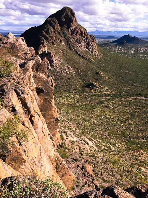
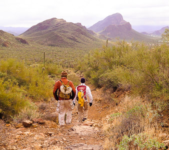
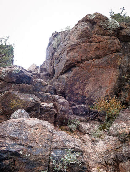
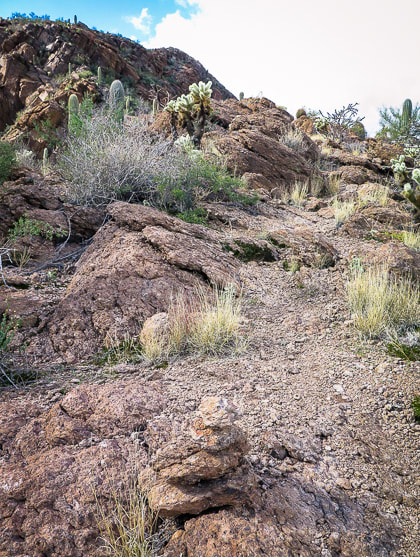
We started on the Yetman Trailhead, not far from Golden Gate Mountain, instead of the Sarasota Trailhead which is closer to Cat Mountain so we could spend as much time as possible walking through this beautiful Tucson Mountain Park encompassing much of an ancient caldera, and weave around thorny saguaros and jumping chollas. We had also started at the Yetman trail a few days before, when we hiked three high points in this park: Golden Gate Mountain, Little Cat Mountain and Bobcat Ridge. All four peaks could be summited in one long day. 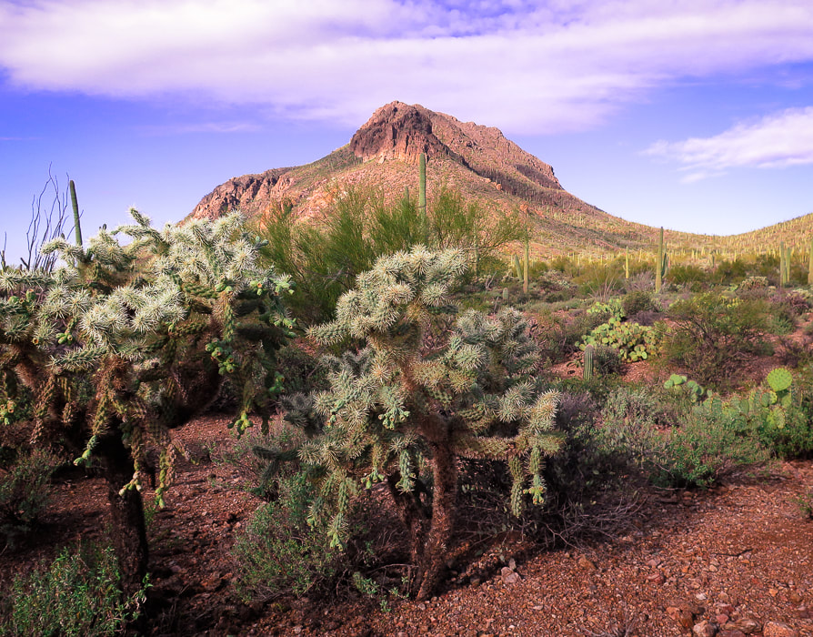 Golden Gate Mountain's southeast slopes and cholla. 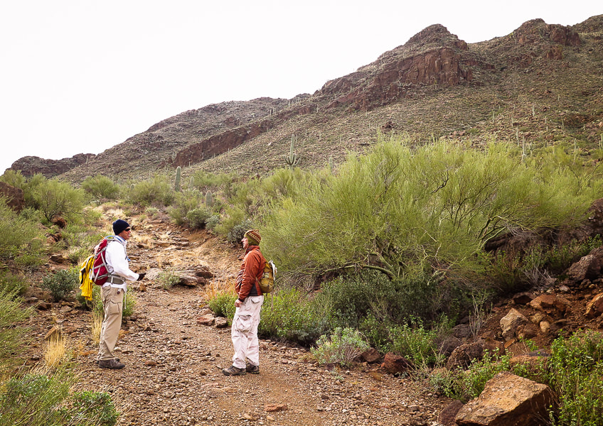 Fred and Scott near Yetman trailhead under the north cliffs of Golden Gate Mountain Reach the saddle between Golden Gate Mountain and Bren Peak at 0.4 miles from Yetman trailhead, an excellent place to get a perspective on three high points: Bobcat Ridge, Little Cat Mountain and Cat Mountain. A textured green carpet sweeps down valley and up the slopes of these brooding, rugged mountains. The only thing that distracts from this scene is the housing development in the valley to the west. This pleasant view makes it difficult to imagine the sudden event of a magma chamber spewing the searing ash that formed this ancient caldera landscape. Tucson Mountain Chaos is the term given by geologists to the valley rocks that underlie the Cat Mountain Tuff, the compacted ash that forms these peaks. There is no definite answer to the thousands-feet thickness of this Cretaceous-age tuff. Were these rocks below the Cat Mountain Tuff rafted from deeper levels by the rising magma? Or, was this rock caused by a landslide in a caldera that had accumulated the tuff? To make the geologic puzzle even more complicated, spreading of the Earth during Basin and Range faulting makes the geologist's task of identifying the age relationship of the rocks more difficult. 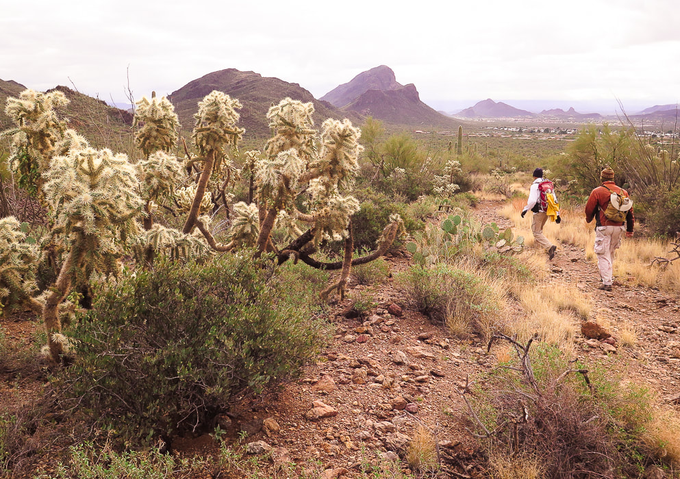 Yetman Trail heads to three summits from left to right: Bobcat Ridge, Cat Mountain in middle horizon with Little Cat in front of it. At 1.6 miles, Yetman intersects with Sarasota Trail. Bobcat Ridge is gained by going left and staying on Yetman Trail. For Cat Mountain, turn sharp right (south) onto Sarasota. In 1.4 miles, Explorer Trail intersects with Sarasota. You can hike on either trail to get to Cat Mountain. On our approach, we took Explorer Trail which wraps around the base of Little Cat Mountain for 0.8 miles to meet up again with Sarasota and also Starr Pass Trail. 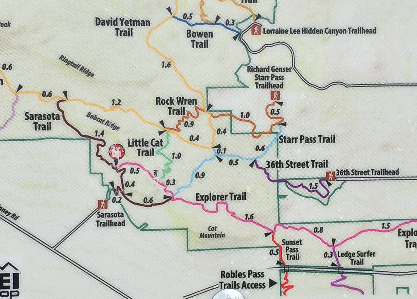 The worn-out "You are Here" red dot marks the intersection of Sarasota and Explorer Trails. Our route: Explorer (pink) trail to pass under the north flank of Cat Mountain. 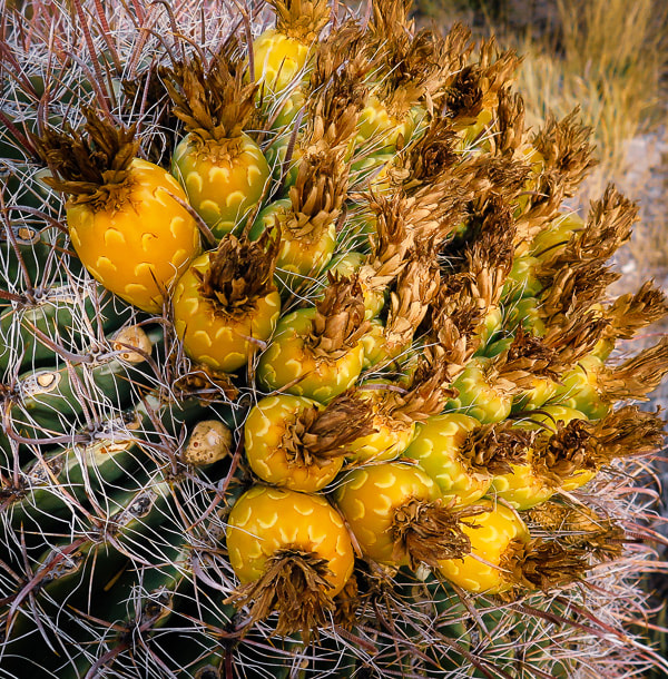 Arizona Barrel Cactus 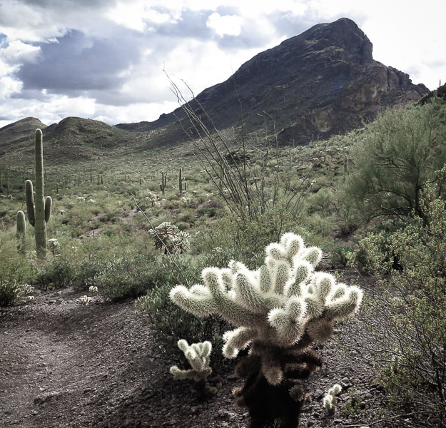 Cat Mountain from Explorer Trail on its north side. We went up low saddle to the left of the summit block to gain lower ridge. From our vantage point on the Explorer trail, we could see the gentler rise of Cat Mountain's east ridge. The three-trail intersection (Starr Pass, Explorer and Sarasota) is well-marked as are other intersections in this well-cared-for park. We continued on the Explorer trail for 0.6 miles until we saw a manageable route to the ridge, leaving it earlier than the standard cairned route (1.0 miles past 3-way junction), making our own path. A sea of detached teddy bear cholla branches, those little mobile yellow ovals armored with extremely sharp spines made us pick our footsteps carefully. However, I wasn't careful enough; one jumped up and stuck my pant leg to my calf. I remembered a hike many years ago when we used a metal comb to remove a cholla piece from a dog's leg. Scott and Fred somehow got the prickly thing off me and we resumed our cross-country hike with no serious injury except for a few red spots on my skin. The day grew colder and cloudier. The broken dark red and tan rocks deposited on the slopes from the tuff cliffs above crunched under our boots. The occasional cactus spine scraped against our packs and in some cases grabbed on. 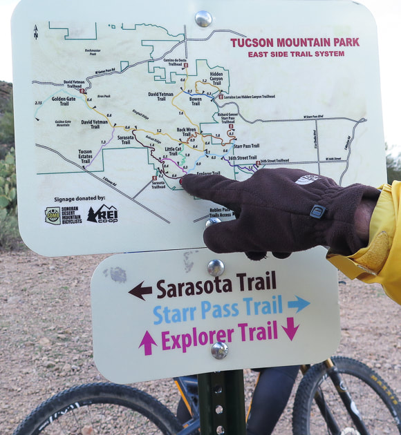 Three-way intersection. From here, exit Explorer Trail for more difficult ascent up Cat Mountain's northwest ridge. "Standard" and less difficult route leaves Explorer 1.0 mile after this intersection. 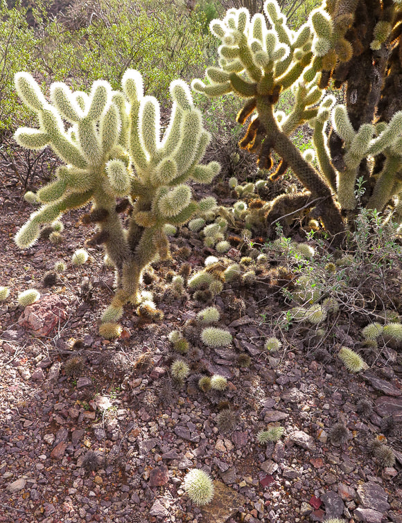 "Teddy Bear Cholla" Cylindropuntia bigelovii After getting off Explorer, we looked for the best way up. Rocks formed a natural staircase. Four or five Coues Whitetail deer perched far above on steep cliffs stopped to watch us, curious at three humans stumbling through the cacti. The ridge walk was straightforward and it felt good to follow its natural route and rhythm, using hands when needed. We came upon cairns marking the final ascent to the summit and a complete change of view of the open sky and the sprawl of Tucson far below us. There's just one Class 3 crack with mild exposure to navigate, with just enough ledges to place feet and hands. Frequent rock cairns mark an obvious path. 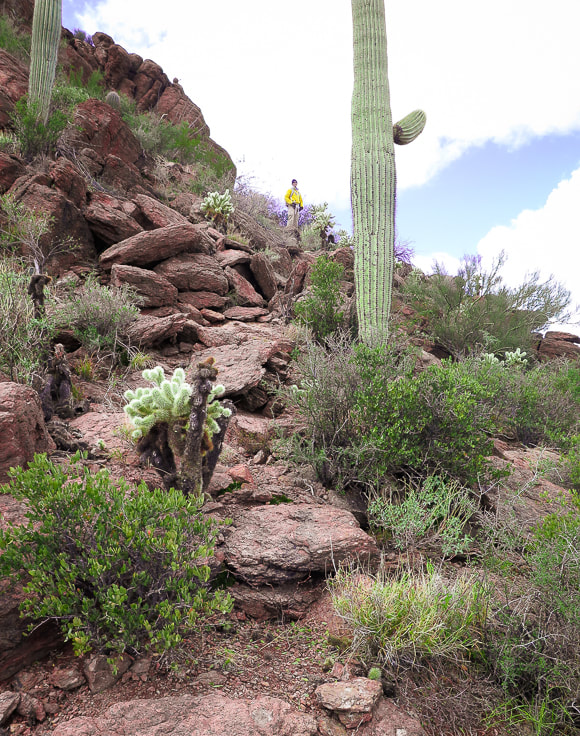 Picking our way to Cat Mountain's east ridge. 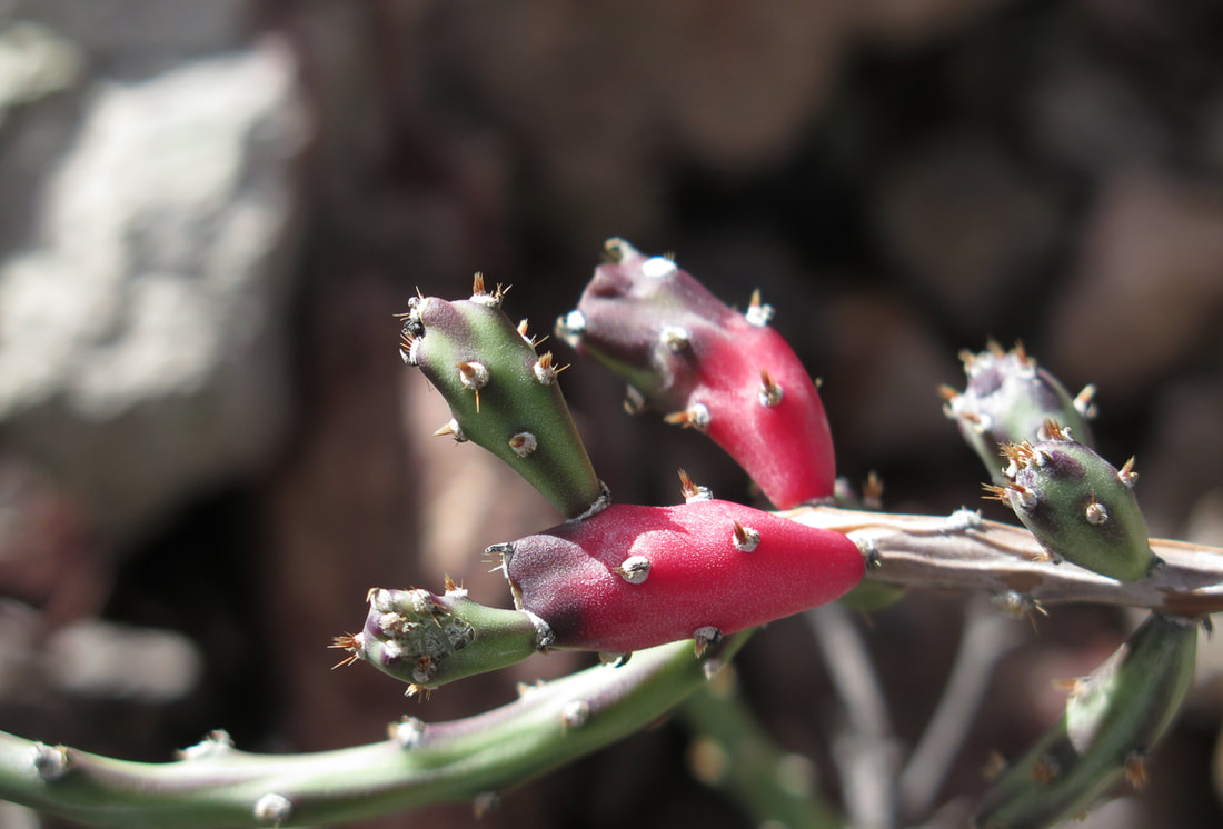 Christmas Cactus
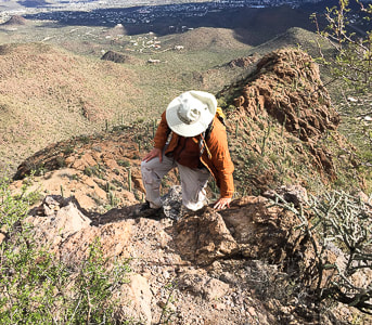
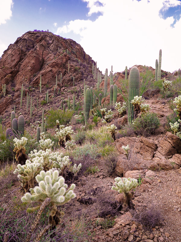 Saguaro and cholla garden below last summit approach 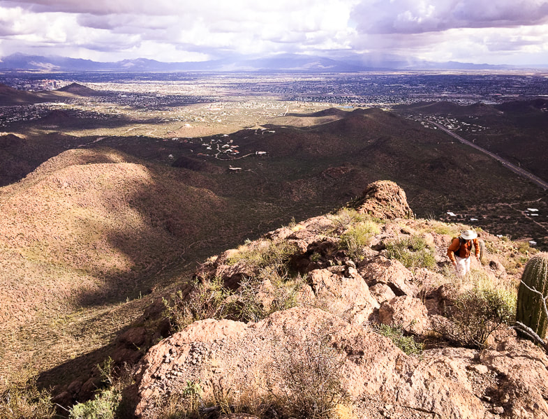 Scott ascending the last part of ridge climb 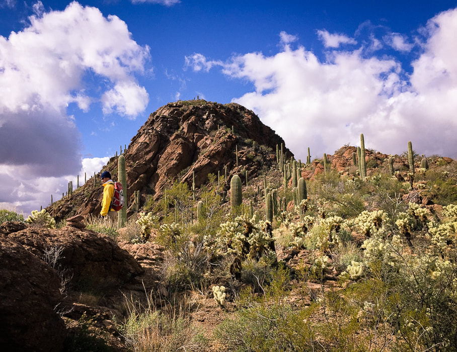 Sweet cactus garden before final ascent. 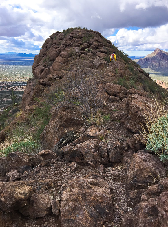 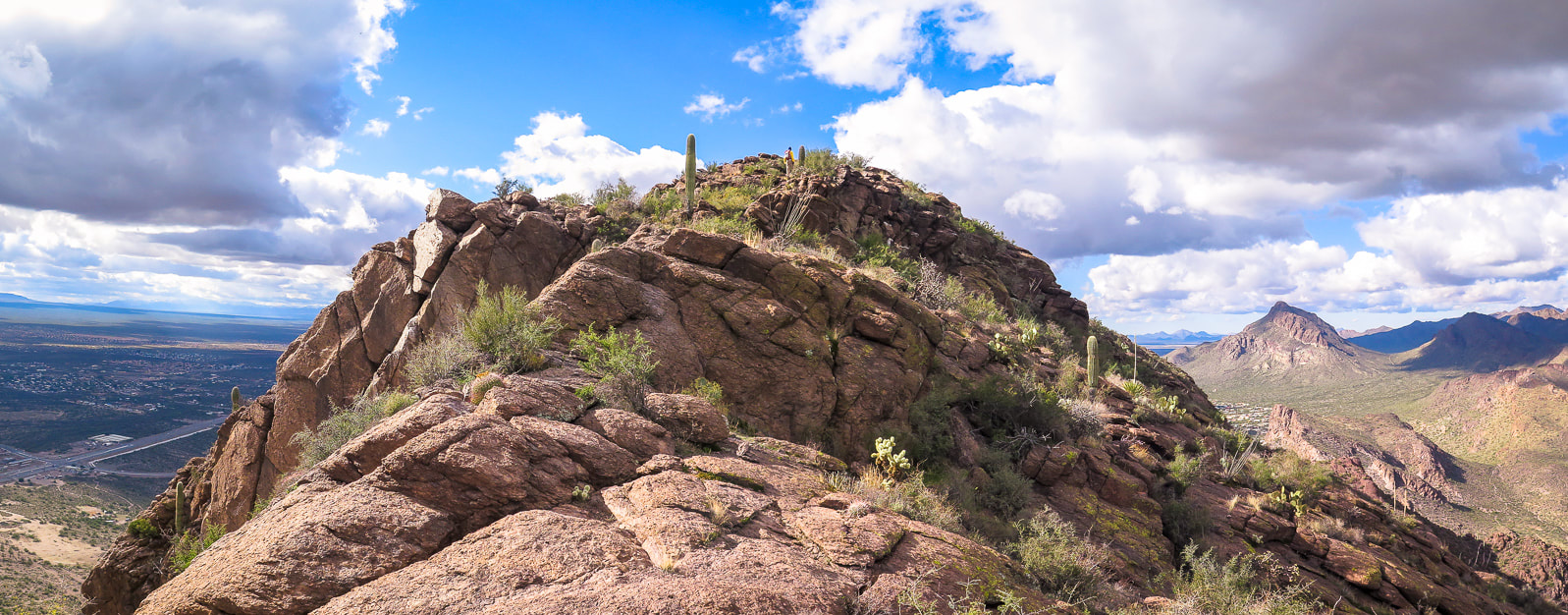 Fred on the summit of Cat Mountain Golden Gate Mountain on the right; Yetman Trail goes through the saddle to its right. Every ridge scramble, every summit has its own unique personality. The scramble up Cat Mountain's east ridge is challenging yet not scary, exposed but safe, with the right amount of rocks and cactus gardens making it aesthetically friendly. You're never bored with looking at saguaros and chollas because with each one, there is a different size or form. This summit has one very unusual feature - a plastic white boulder that houses a radio repeater. Looking at Cat Mountain from Tucson area, you would not suspect the spacious flat areas on its summit. A steady cold wind cut short our time lounging on the top, but we got a good look at Golden Gate Mountain to the northwest and the steep drop-off to the south. As we walked down, the clouds closed again, the temperature dropped, and the wind chilled. We hiked back via Sarasota Trail at the three-way intersection. We added another summit to our "three friends who like to hike" resume', and more stories for reminiscing. This will go down in the books as one of our more mellow hikes together. Never stop climbing mountains! 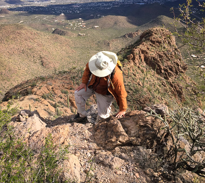 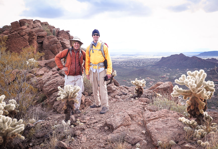 Scott and Fred 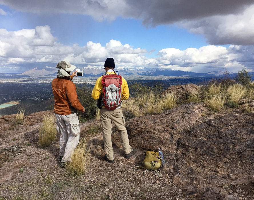 Looking at Santa Catalina Mountains north of Tucson and Rincon Mountains on right horizon. 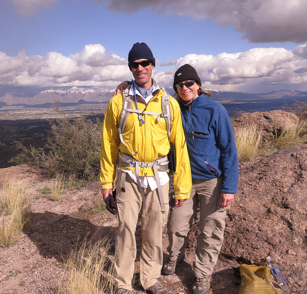 Fred and Sue on Cat! 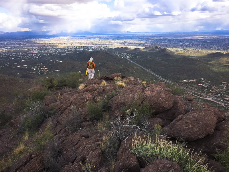 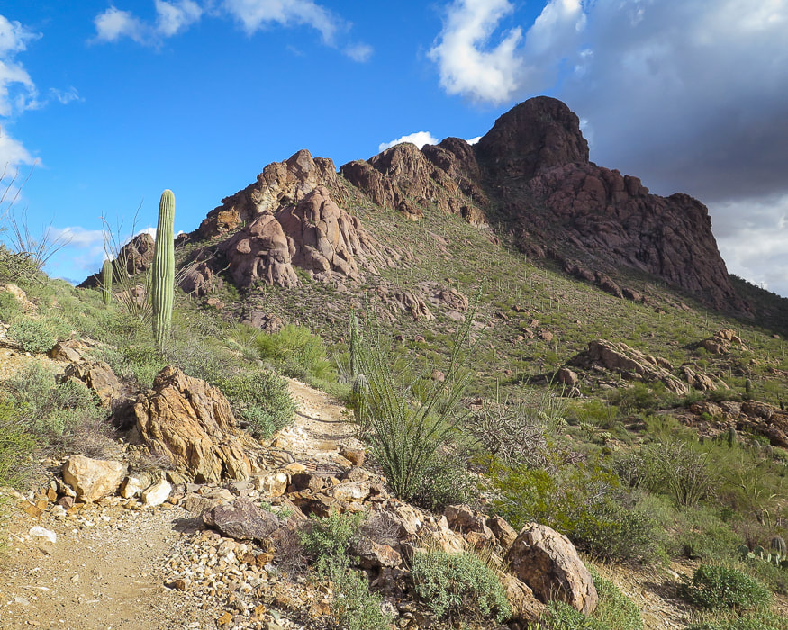 Parting shot of Cat Mountain from Sarasota Trail. 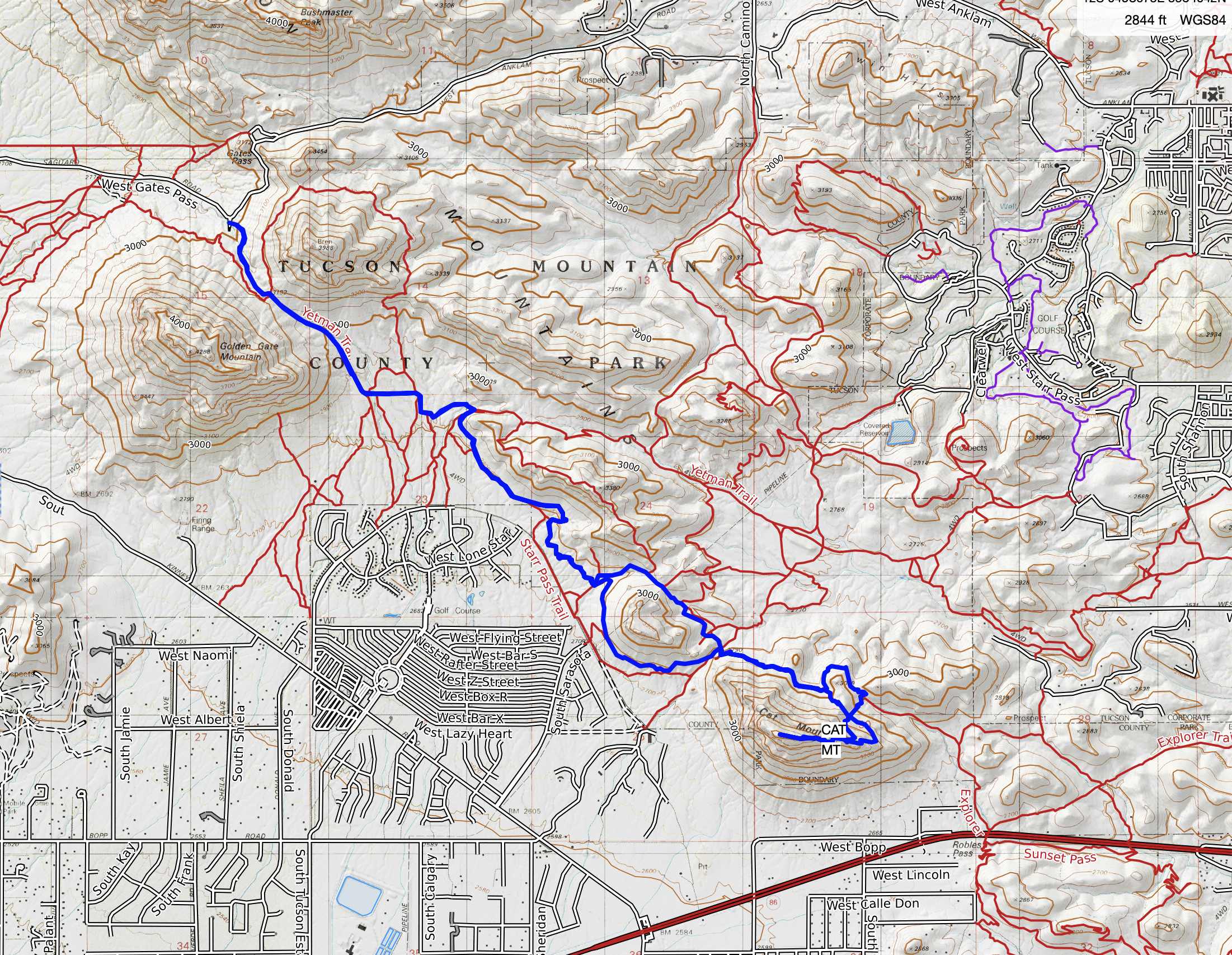 Our GPS tracks to Cat Mountain from Yetman Trailhead Red line is our Class 2 ascent route; blue line is cairned trail and our descent. 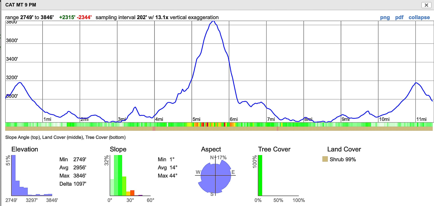 Elevation profile over entire 11.5-mile hike.
6 Comments
|
Categories
All

Sue and Fred

About this blogExploration documentaries – "explorumentaries" list trip stats and highlights of each hike or bike ride, often with some interesting history or geology. Years ago, I wrote these for friends and family to let them know what my husband, Fred and I were up to on weekends, and also to showcase the incredible land of the west.
To Subscribe to Explorumentary adventure blog and receive new posts by email:
Happy Summer!

About the Author
|