|
A memorable climb up a famous sandstone precipice with 1,000-foot drop-offs on either side of a narrow trail, and an up-close view of a California condor.
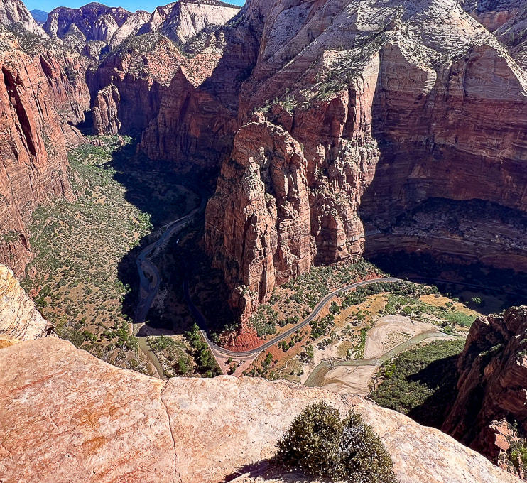
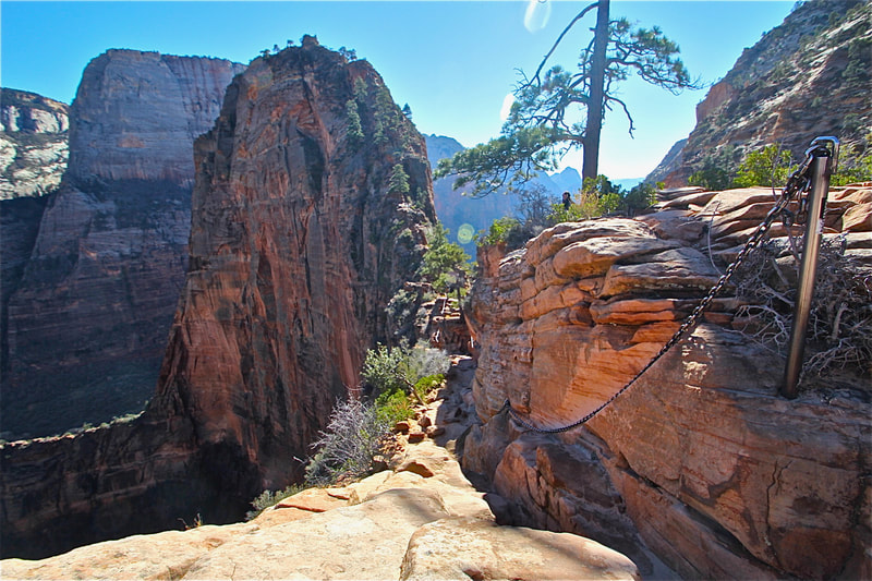
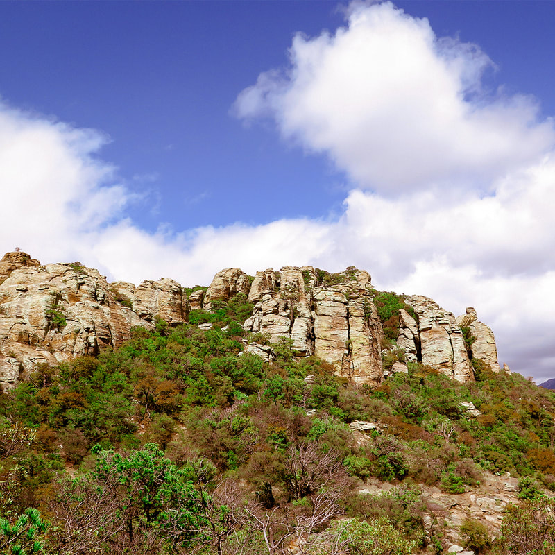
Trip Stats Overview: Begin on West Rim Trail from The Grotto at Zion Canyon shuttle stop #6; cross bridge over the Virgin River to access it. Walk along the Virgin River before climbing steep switchbacks that take you through Refrigerator Canyon. From here, work your way up short and steep Walter's Wiggles to Scout Lookout where a 0.4-mile spur trail extends over sandstone and straight up the ledges to Angels Landing. Distance/Elevation gain: 5.0 miles out and back/1,488' gain. Most recent date hiked: 7/06/23. Special Considerations: You must apply for permit via lottery system through recreation.gov. There are two check-point stations on the trail to verify your permit. Map: Trails Illustrated Map - Zion National Park #214 History: The 21 short and steep switchbacks leading to Scout Lookout were constructed by Walter Ruesch, the first Zion Park superintendent, in 1926. Geology: Angels Landing is a resistant fin of Jurassic age (~ 170 million years ago) Navajo Sandstone, carved by the North fork of the Virgin River. NPS link for permits Related Posts
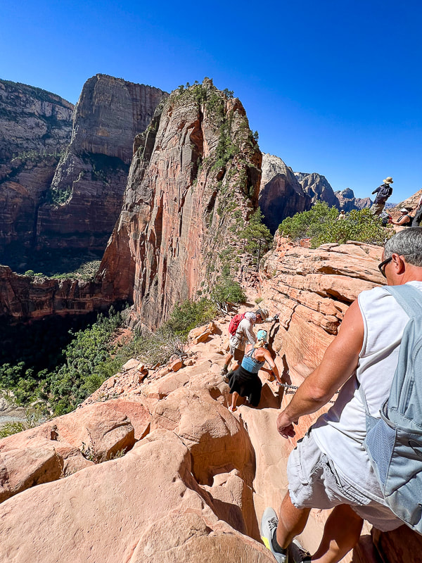
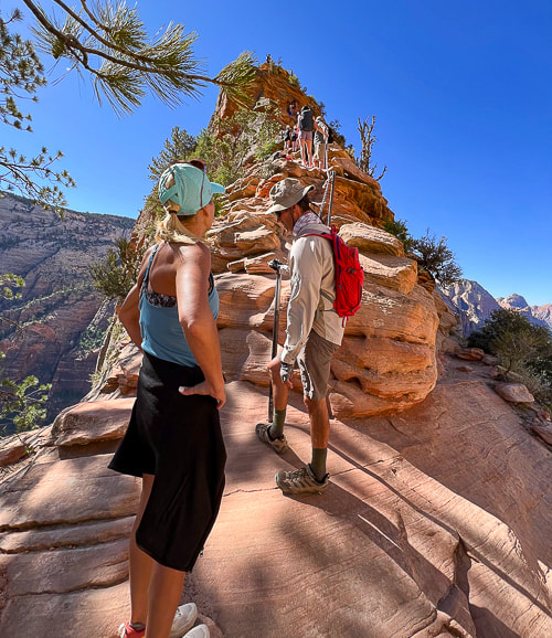
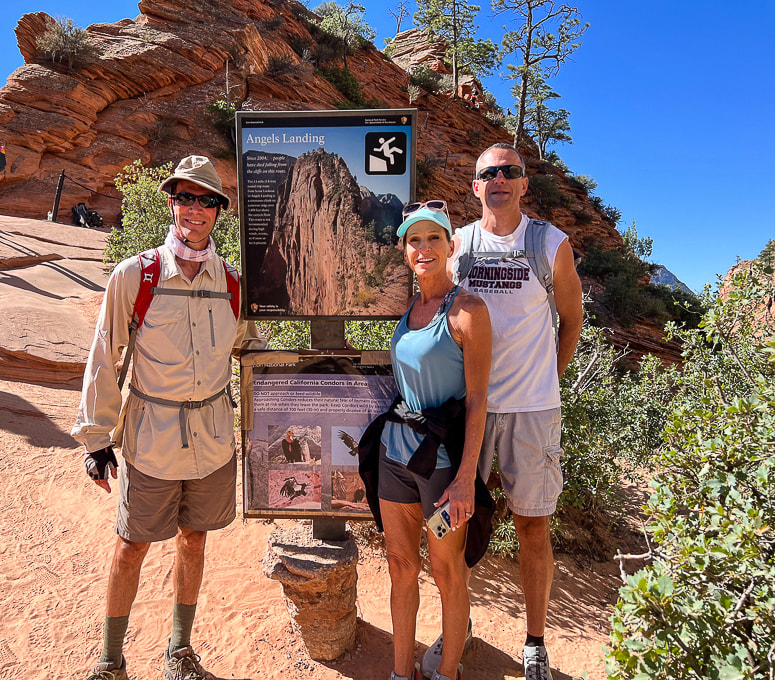
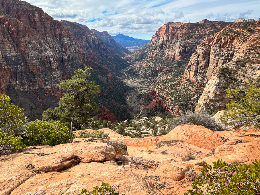
Described as "one of the most dangerous hikes in the country", and also "deadly", the hike to the precarious perch known as Angels Landing is in high demand. It looks impossible to climb, but it turns out that it isn't: 200,000 Angels Landing permits were issued in 2022, according to Zion National Park Service's website. As many as 1,000 hikers/day make the chained journey on worn sandstone to one of the most coveted and iconic views in the country - a 360-degree view of Zion Canyon. Actually, this hike is not as scary as it looks. The first time I hiked Angels Landing was 30 years ago, on a trip with the Coachella Valley Hiking Club. It held a certain mystique and peril among my fellow hikers. Back then, the chains that you hold onto for balance on the dizzying heights were thinner and it seems like there were less of them. I've hiked it a few more times since then, and hinted that it was not for those afraid of heights in a post I wrote a few years back: Angels Landing: Not for the Faint of Heart. Two years ago my sister from Omaha, Nebraska gave Angels Landing a try. She, Fred and I set out to conquer this beast. Just about everyone who arrives at Scout Lookout to gaze upon this narrow fin of sandstone towering 1,500 feet over Zion Canyon floor has to wonder how the heck they'll get to the top. Not having any experience with this kind of hiking, she made commendable progress to Angel's base, where the first drop-offs and slick rock test your resolve, but when we got to the vertical climb, the intimidating precipice got the best of Jen, so we didn't summit. Back in Omaha, she vowed that one day soon she would conquer Angels Landing. So she did. Pretty easily, I might add, with my brother-in-law Ray, coaching her from behind, and Fred leading the way. Our permits through recreation.gov allowed us to be at the permit checkpoint by 9:00 am. This July morning was perfect - just the right temperature and no clouds. By the time we descended, however, the trail was getting too crowded; but patience, good spirits and comradery worked well to get everyone up and down safely. Almost like a celebration. Now, I'm not surprised my sister made it this time. She's a conquerer, a goal-setter and achiever, not a person to sidestep challenges. Just do it. This was the best Angels Landing hike by far. I wouldn't have predicted, thirty years ago, when I was a beginning hiker, that I would be experiencing this with my sis and bro-in-law. But I did, and that is awesome! Years go by so fast and most things in life are unpredictable. Another "conquer" of sorts was when she and I finished a Spartan Sprint challenge in Boise a few years ago (we've got photos on my Fit After 50 page). As a bonus, we saw what I believe to be a California condor. It was a big black hulk of feathers with a small head, perched on gnarled pine tree branches on the summit. This one appeared to be a juvenile because of its black head - adults have a vibrant pink and orange-colored head. The photo below shows that condors have thick pointed ruff feathers that they raise to warm their necks in cold temperatures. The number of California condors plummeted to only 22 by the 1980's. In 1967, they were listed as an endangered species. Captive breeding has helped increase their numbers. We were pretty lucky to get our Angels Landing permits - apparently only 43% of applications are awarded. The lottery system to apply for permits began in 2022. As a great add-on to this already stellar experience, I recommend continuing to hike up the West Rim Trail past Scout Lookout; the views, in my opinion, are even more spectacular as you climb higher. Thanks for visiting. Keep on Moving - Keep on Exploring! California Condor 2022 Population Status
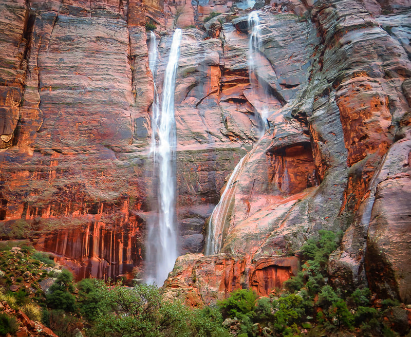
Total World Population = 561 (total captive = 214, total wild = 347). The Arizona/Utah flock has the largest number of California condors at 116 with 4 wild fledglings. There's also flocks in Southern, Central and Baja California. Numbers got as low as 22 birds in the 1980's. Condors today still die of lead poisoning, consuming litter and microtrash, and electrocution from power lines. Sources: National Park Service: All About Condors, World CA Condor Update 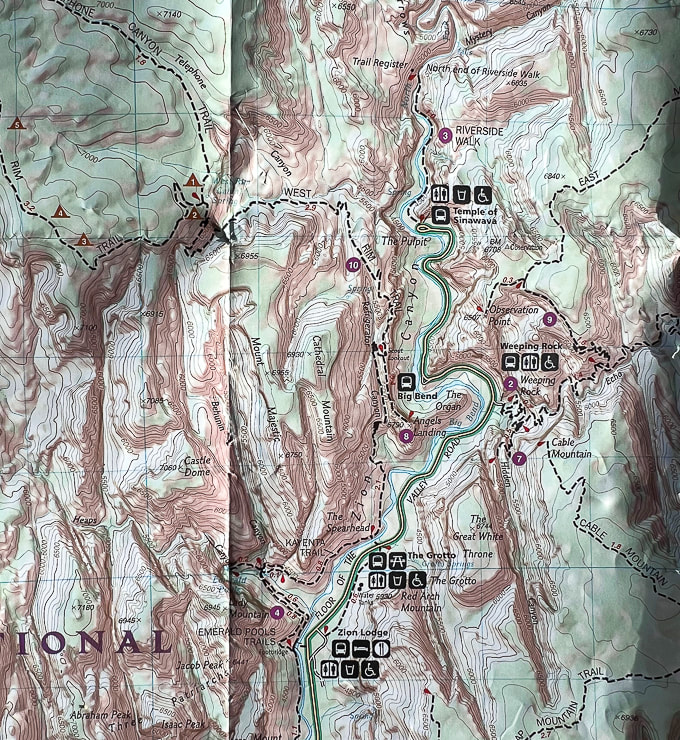 Partial topo map of Zion NP. Angels Landing hike begins across the Floor of the Valley Road from the Grotto on West Rim Trail. Hike north for 2.1 miles to arrive at Scout Lookout, where a 0.4 mile spur trail goes south to the top of Angels Landing. 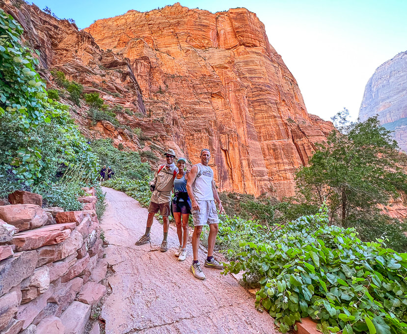 Fred , Jen and Ray starting the switchbacks out of Zion Canyon floor. Angels Landing above! 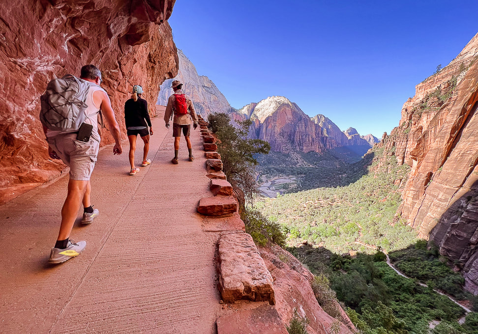 Switchbacks up to Refrigerator Canyon and Walter's Wiggles. Zion Canyon floor below. 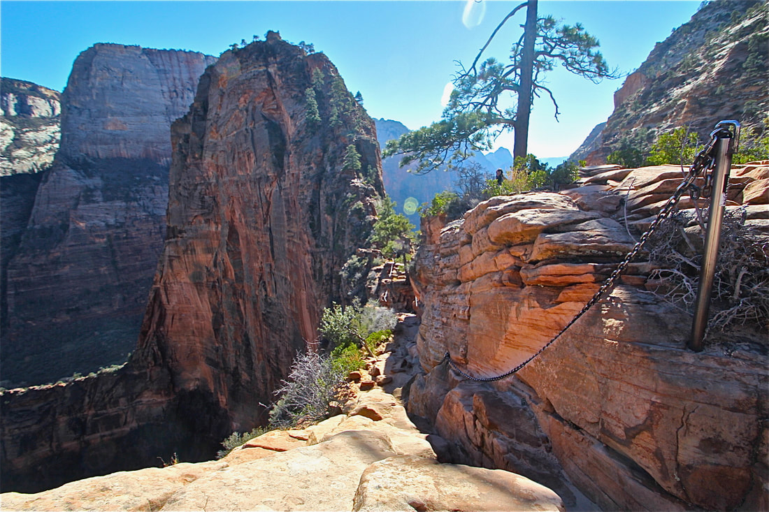 I took this photo on another Angels Landing climb....when it was not as well-traveled. 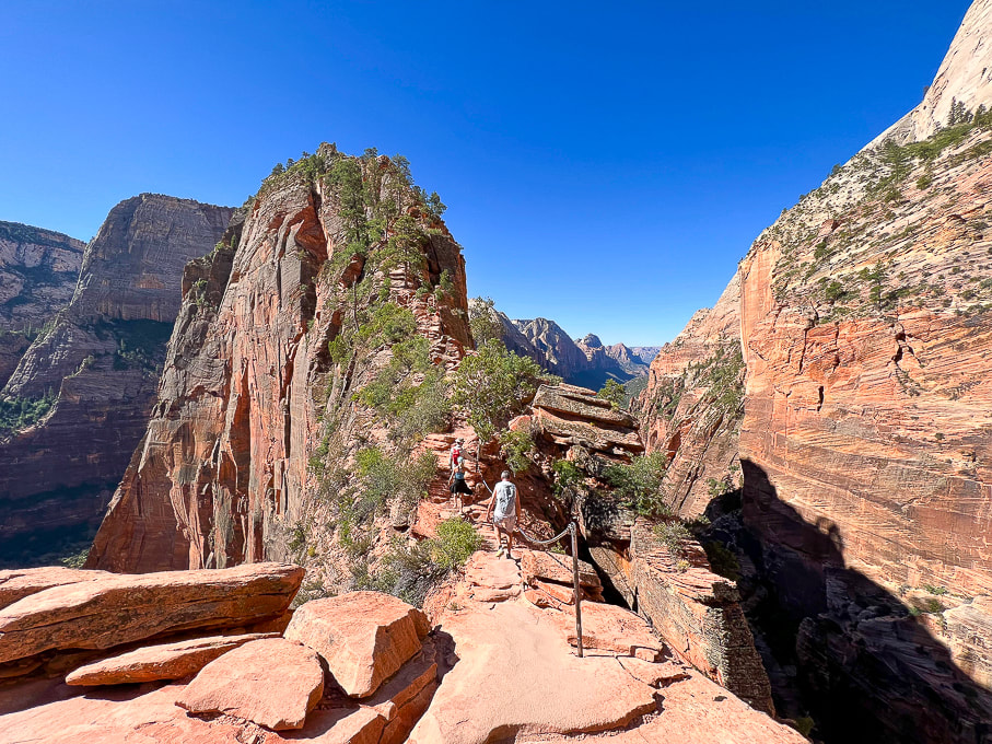 Not scary at all! Angels Landing. 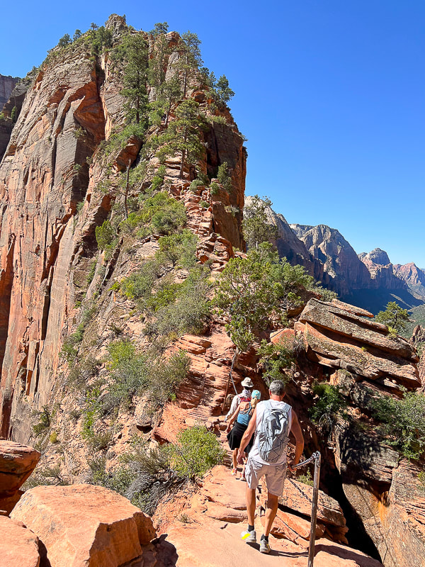 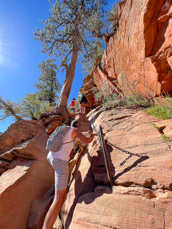 A bit of easy Class 3 climbing. 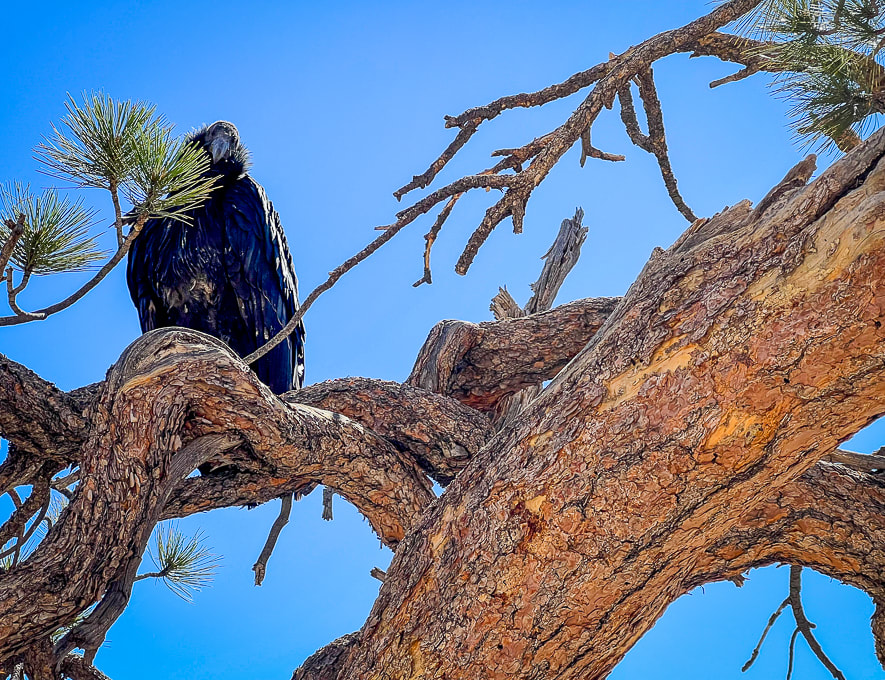 Probably a juvenile California condor near the summit of Angels Landing. I read that these are very curious birds. 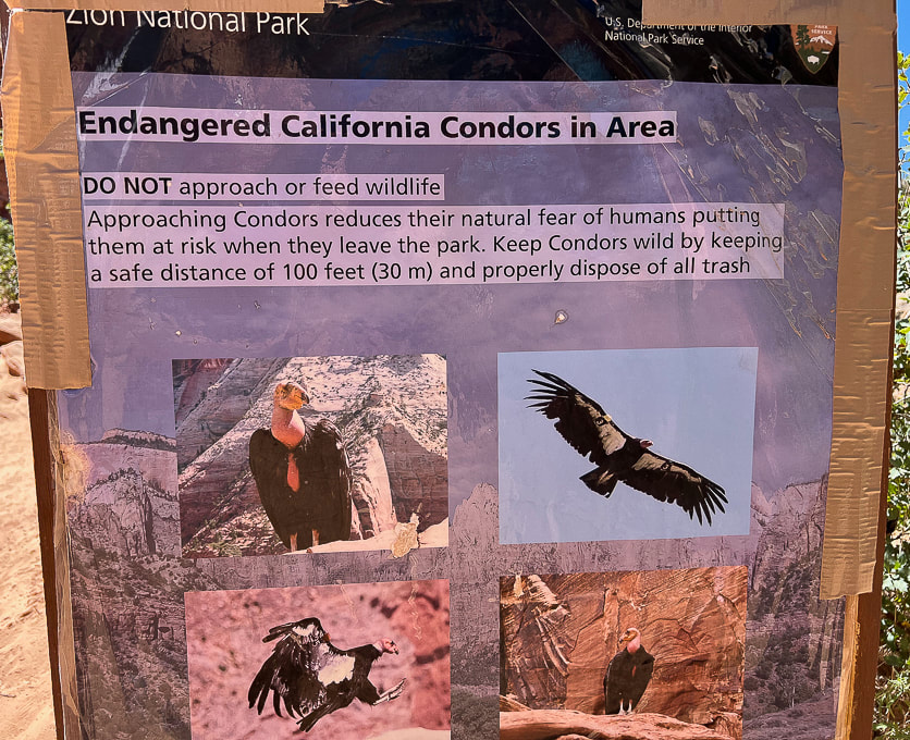 At the base of Angels Landing near Scout Lookout. 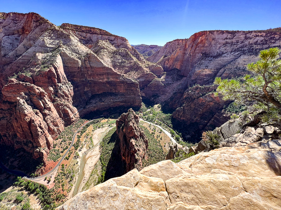 Looking down on Virgin River, the erosive force that created the narrow fin of sandstone known as Angels Landing. 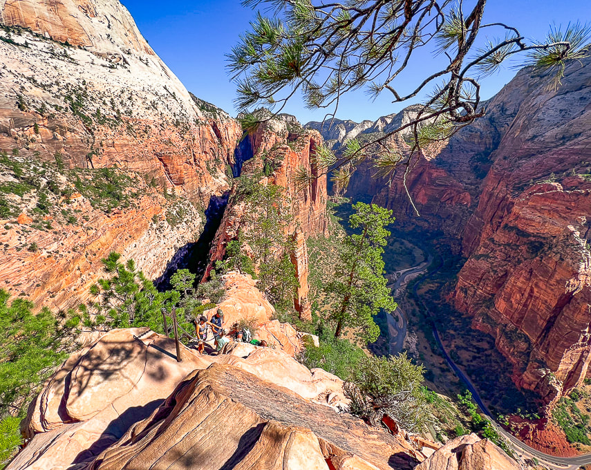 Really is a great feeling of lightness when you are on Angels Landing. 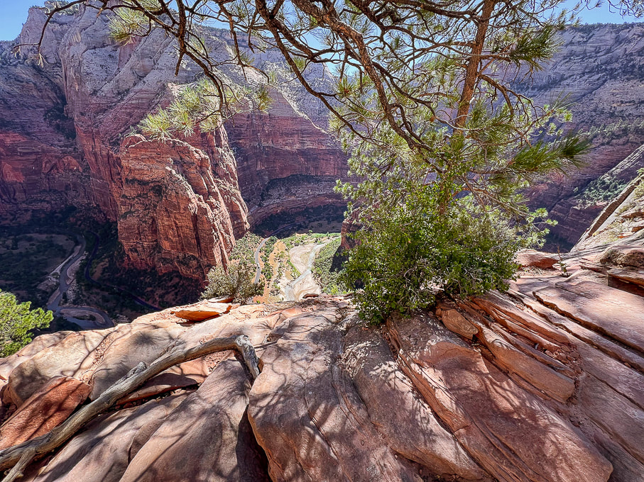 Virgin River below. 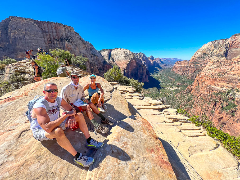 Ray, Fred and Jen on top of Angels Landing! Perfect day. 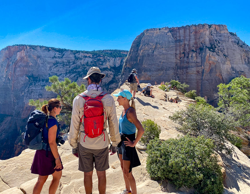 Half of the fun of this hike is talking to people at the top! The Great White Throne towers in the background. 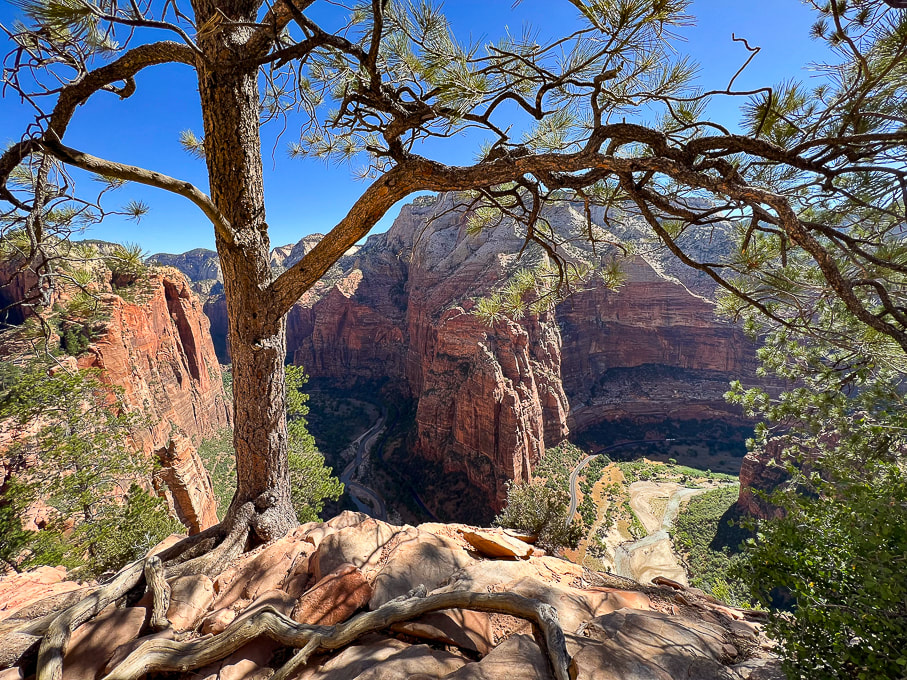 From Angels Landing looking at Big Bend. 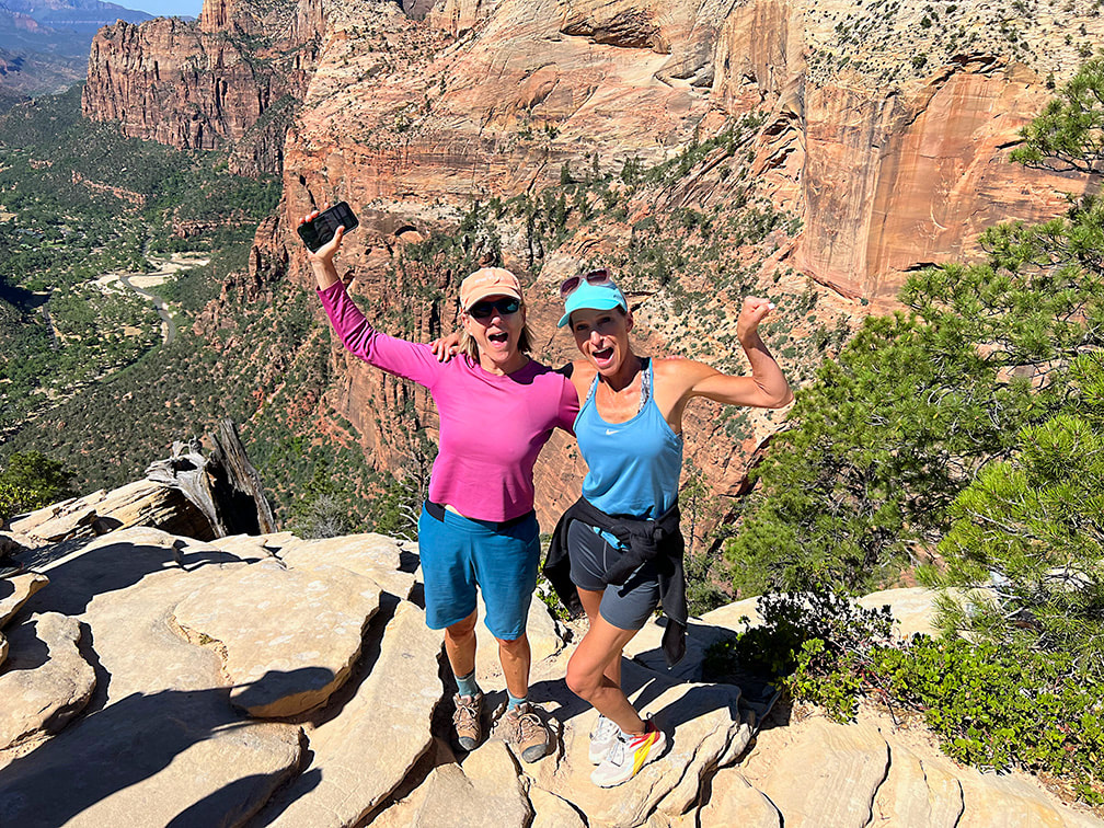 Two awesome sisters! (I tried to Photoshop the phone out of my hand......too much work!) 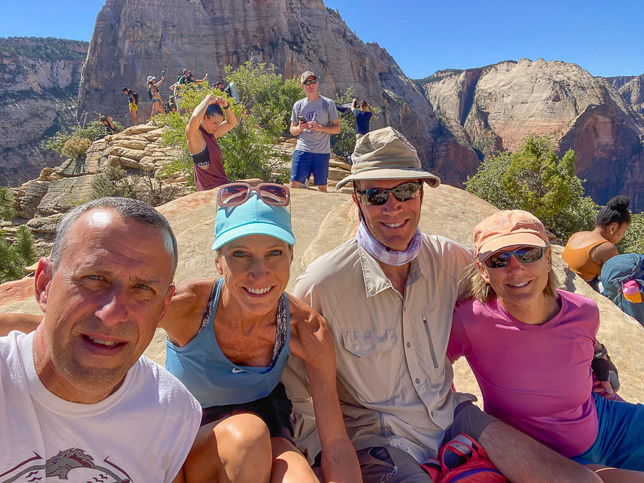 Ray, Jen, Fred, and Sue on Angels Landing - piece of cake! 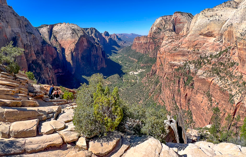 Top of Angels Landing looking down Zion Canyon. 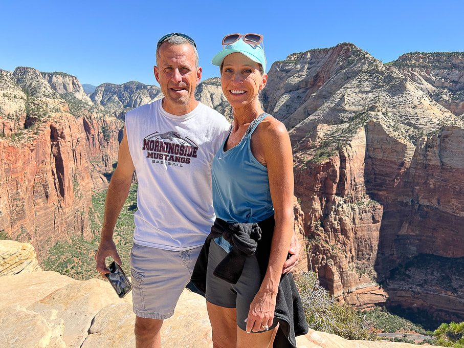 Ray and Jen - these guys made it look easy! 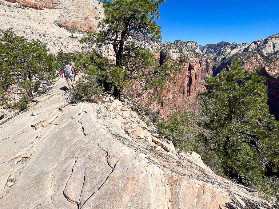 Heading back down this beautiful Navajo Sandstone. 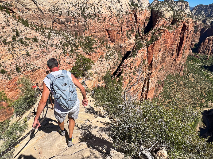 West Rim Trail winds up on top of the vertical sandstone slab upper right in photo. I highly recommend continuing north up this trail. 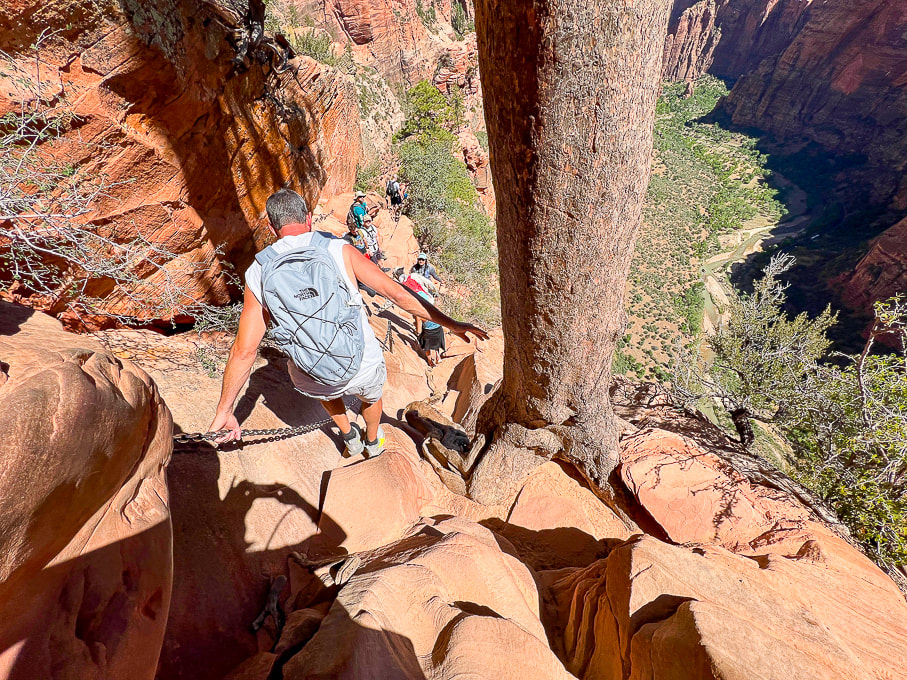 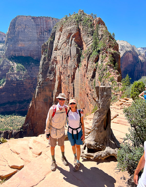 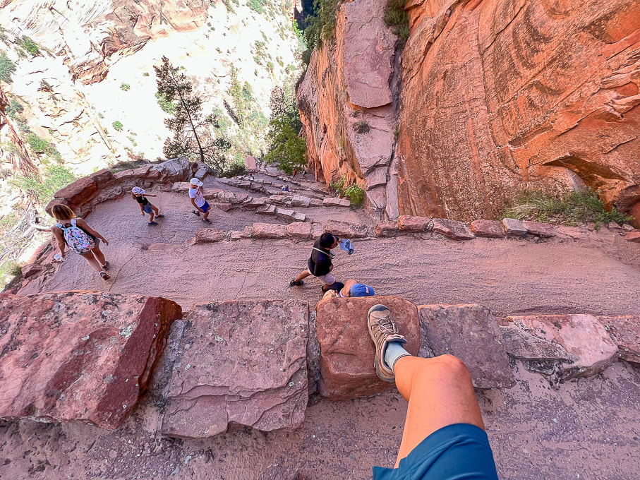 Walter's Wiggles and Refrigerator Canyon below. 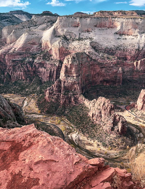 View of Angels Landing (center) and Floor of the Valley Road from Cable Mountain. 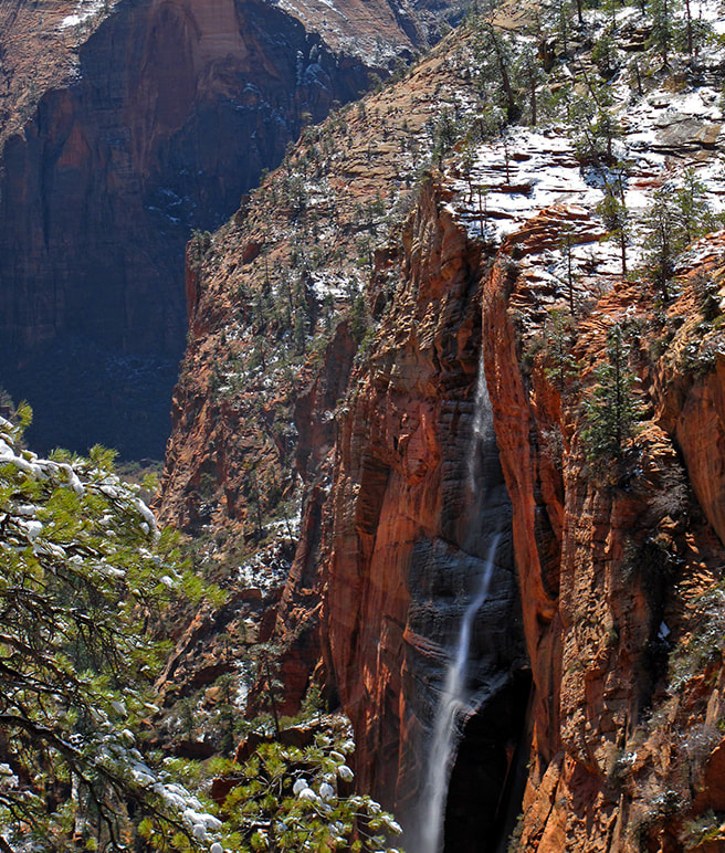 From West Rim Trail - waterfall after snowstorm. References
California Condors. National Park Service website.
6 Comments
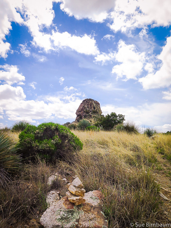
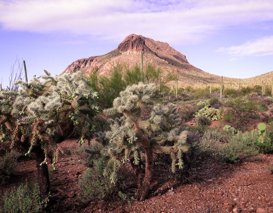
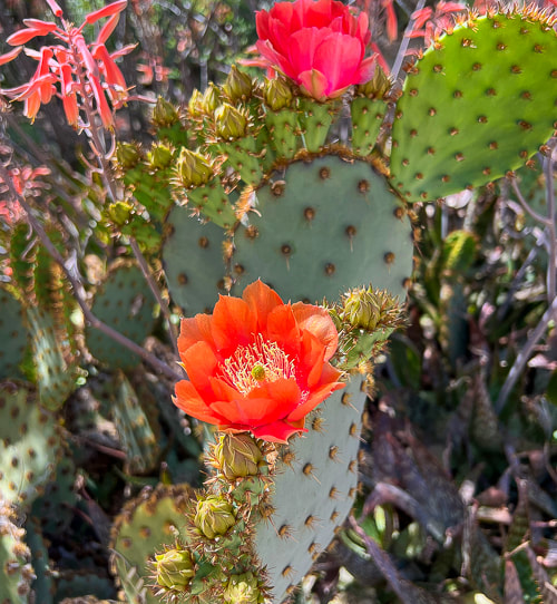
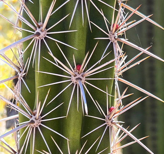
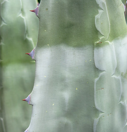
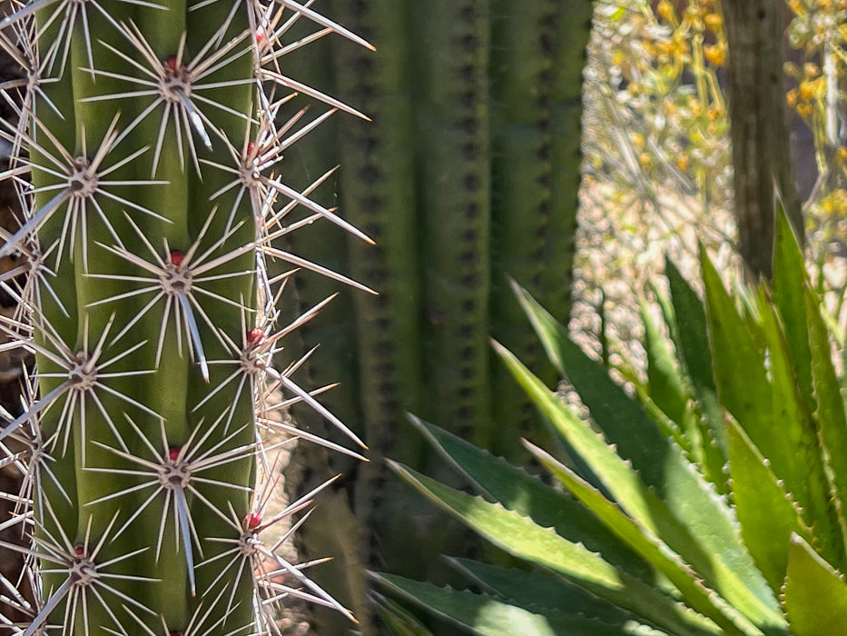
Become immersed in classic Tucson Sonoran Desert landscape, passing through three life-zones on a long hike to a small, refreshing waterfall, and tour the great DeGrazia Gallery In the Sun Museum. 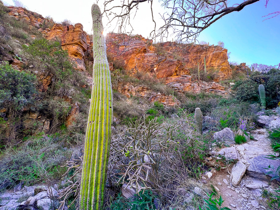 Desert scrub biome on the lower Esperero Trail. Common plants in Sonoran desert scrub Biome of the Sonoran Desert include creosote, mesquite, palo verde, barrel cactus, agave, prickly pear and cholla cacti. Related Posts Trip Stats
Location: Coronado National Forest, Santa Catalina Mountains, Pusch Ridge Wilderness, Tucson, Sabino Canyon Recreation Area. Distance/Elevation gain: 12 miles out and back/2,525'. Trailhead = 2,775', Bridalveil Falls = 5,300'. Difficulty/Trail # : Class 1 (defined trail) moderate effort - out and back. Overflow Parking Trail to Esperero Canyon Trail #25. Parking/trailhead: Sabino Canyon R.A. overflow parking. Map: Santa Catalina Mountains - Green Trails Maps #2886S Date Hiked: April 20, 2023. Dogs: Dogs are not allowed in the Sabino Canyon Rec. Area or the Pusch Ridge Wilderness. Links: Coronado National Forest - Esperero Trail DeGrazia Gallery in the Sun
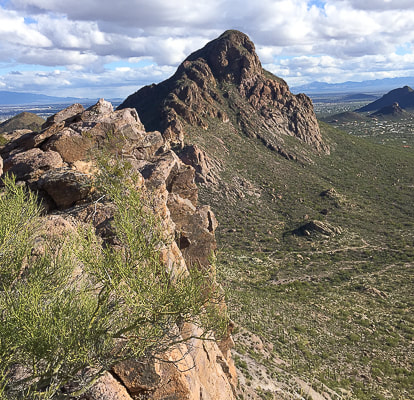
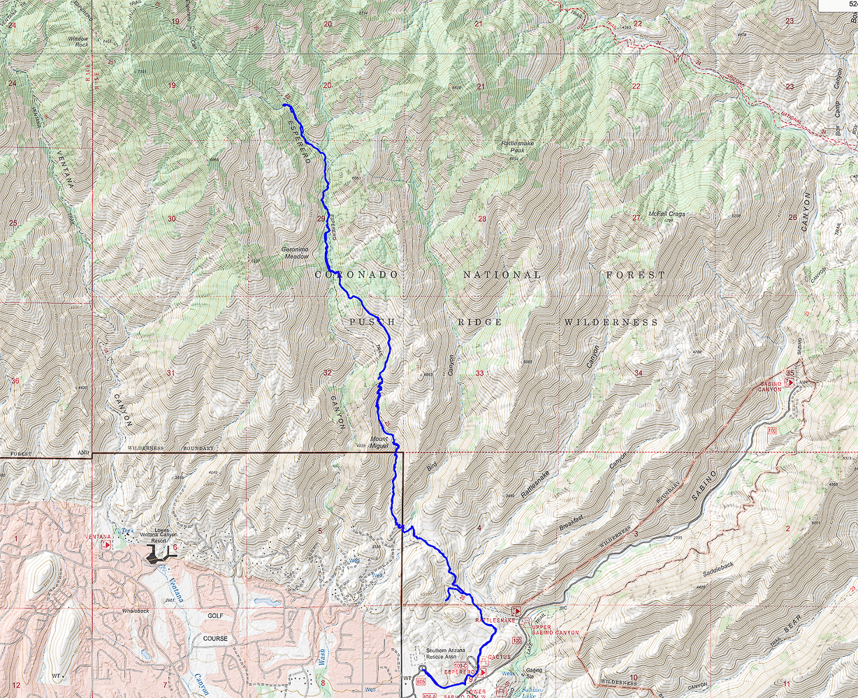
One of the characteristics I look forward to with Tucson hiking is the wide flora variety and diversity. Along this 2,500-foot gain, Esperero Trail passes through three biomes, or habitats identified by their dominant life forms: Sonoran desert scrub, desert grassland, and Madrean evergreen woodland. The most obvious change happens after the steep climb to Cardiac Gap, at 4,400 feet, when saguaros and creosote have given way to oaks and grass. We arrived at Esperero Canyon's Bridalveil Falls after six miles of warm hiking and enjoyed the cold water dripping and spraying off the rocks. The falls must look like a veil during run-off after a storm, but at the end of April, they were reduced to small rivulets. The canyon here is wildly picturesque with huge rounded and dike-streaked boulders, pinyon pines and oaks, wildflowers and towering rock formations above. Yuccas are interspersed among junipers. If you keep climbing up-canyon, in another mile, you reach Cathedral Rock Trail, which heads northeast. Esperero Trail continues west toward Window Peak. Our Hike We parked at the large overflow parking lot for Sabino Canyon Recreation Area and began walking southeast past trailhead signs. (However, there is a shorter trail from the north end of the overflow lot; it heads north to meet up with Esperero Trail, avoiding the picnic area). The mileage that follows is from the trail that we took.
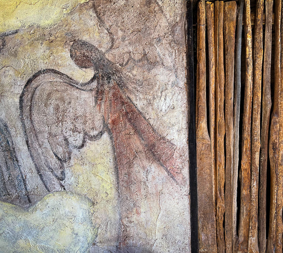
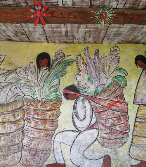
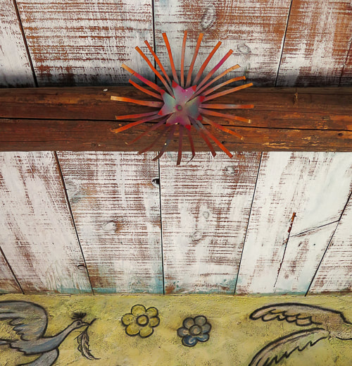
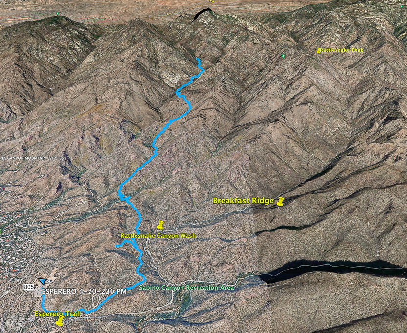 Google Earth image of our tracks beginning at Sabino Canyon Rec. Area overflow parking (lower left) and traveling up Esperero Canyon to its end at Bridalveil Falls. Topo map and elevation profile at end of post 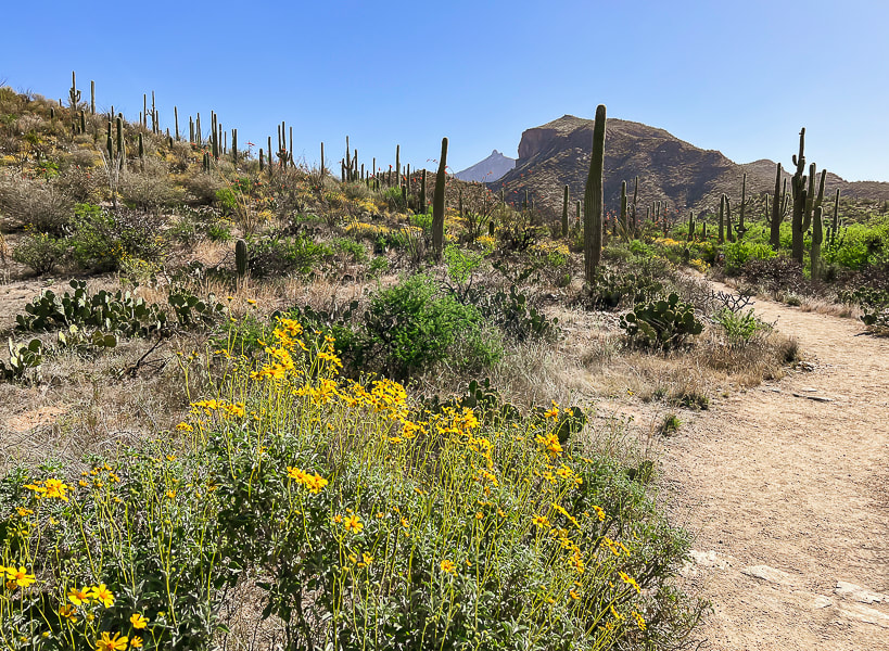 Starting from Sabino Canyon Rec. Area overflow parking onto trail that links to Esperero Trail. Thimble Peak on the far horizon. 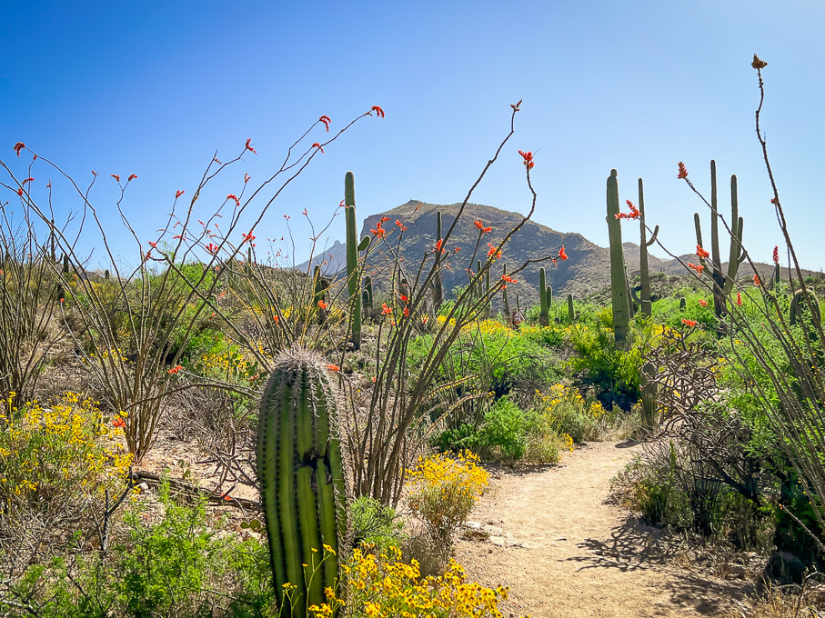 Continuing on Overflow Parking Trail toward Cactus Picnic Area, where it meets with Esperero Trail. 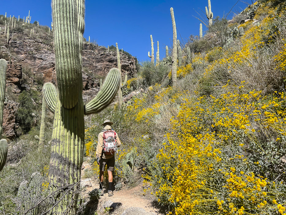 Esperero Trail beauty in April. 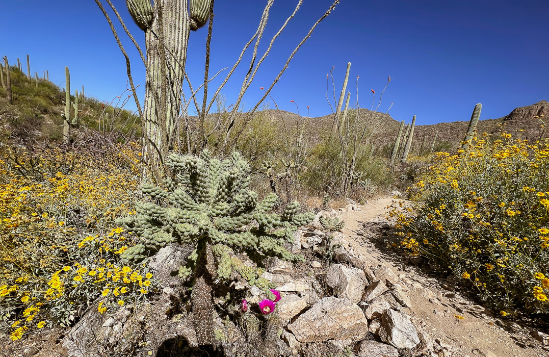 Brittlebush (yellow), hedgehog (magenta), cholla, ocotillo. 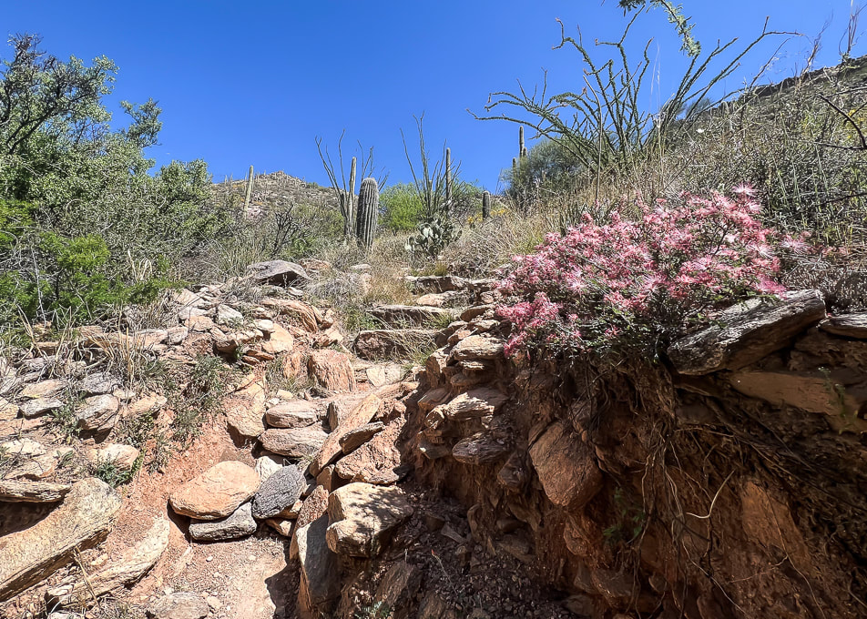 Pink fairyduster along the rocky trail. 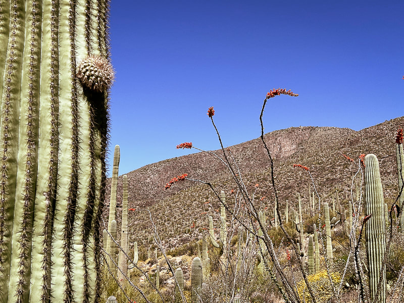 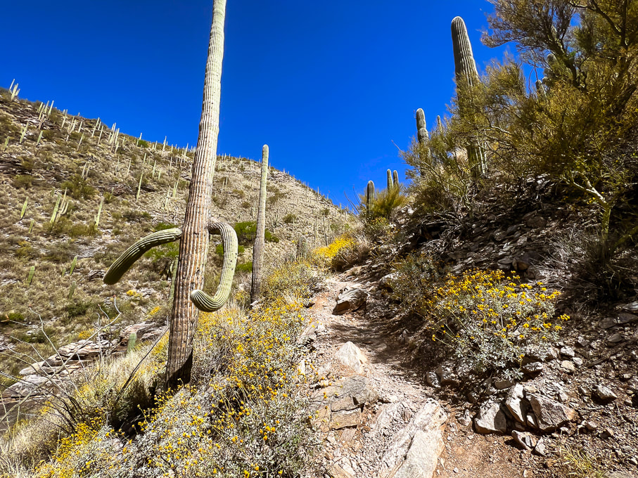 Esperero Trail beginning to steepen. This trail stays narrow all the way up into Esperero Canyon. 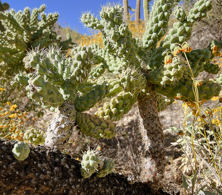 Cholla cactus 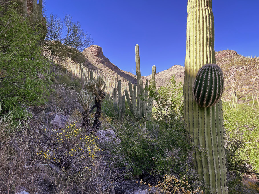 Heading up toward Cardiac Gap. 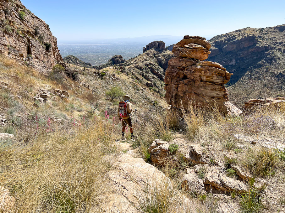 Looking back at Cardiac Gap (saddle) that overlooks Tucson. 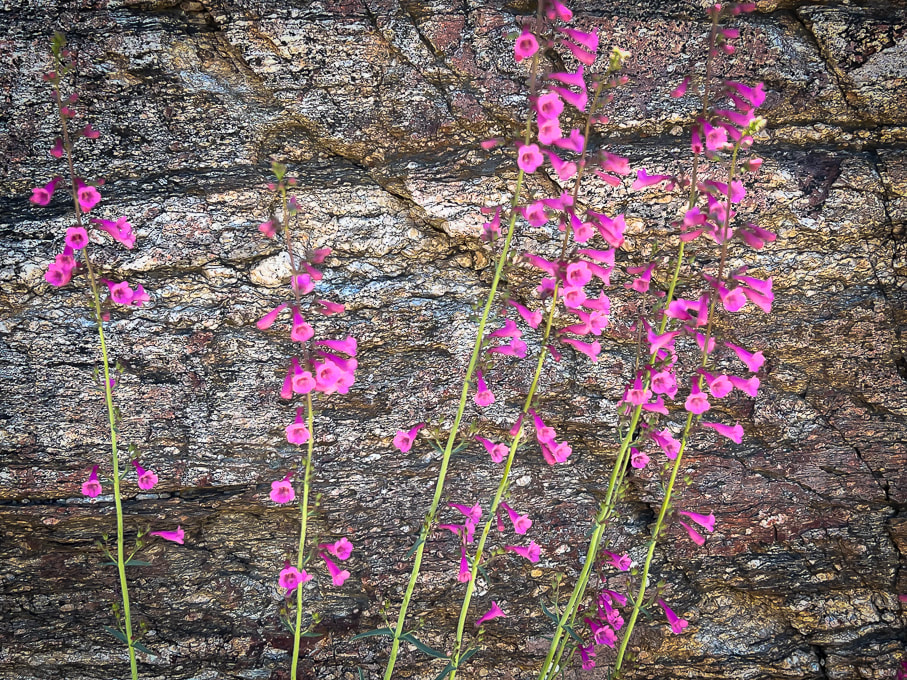 Parry's penstemon provides splashes of color in the semi-desert grassland life zone. 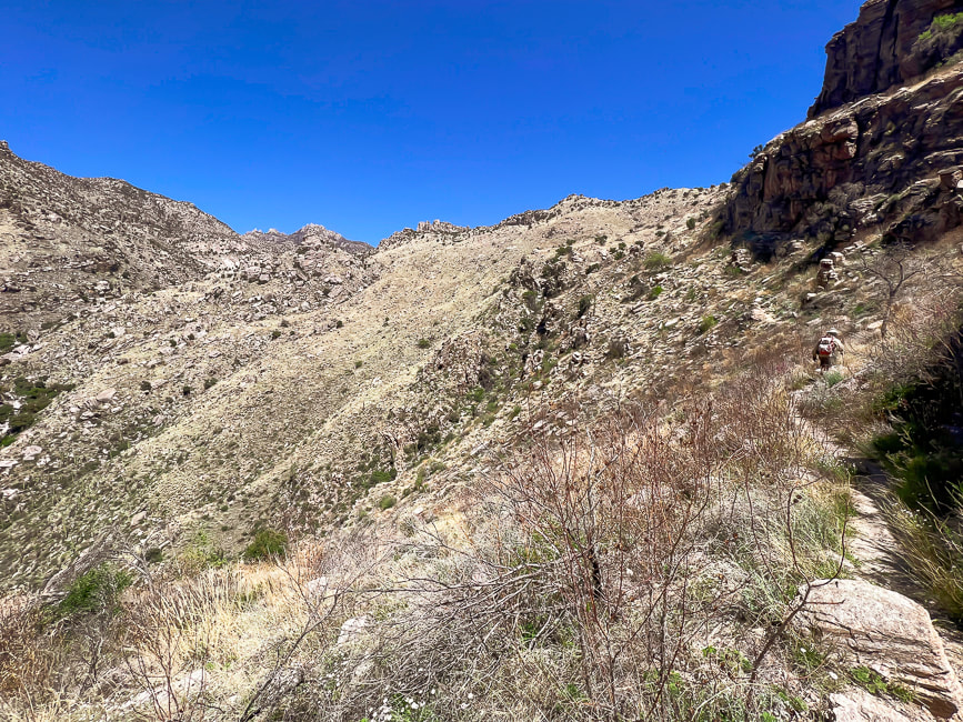 View from Cardiac Gap northward: Esperero Trail (Fred walking up on right side) stays high over Esperero Canyon as it travels through grassland for one mile before it drops down into the floor of the canyon. 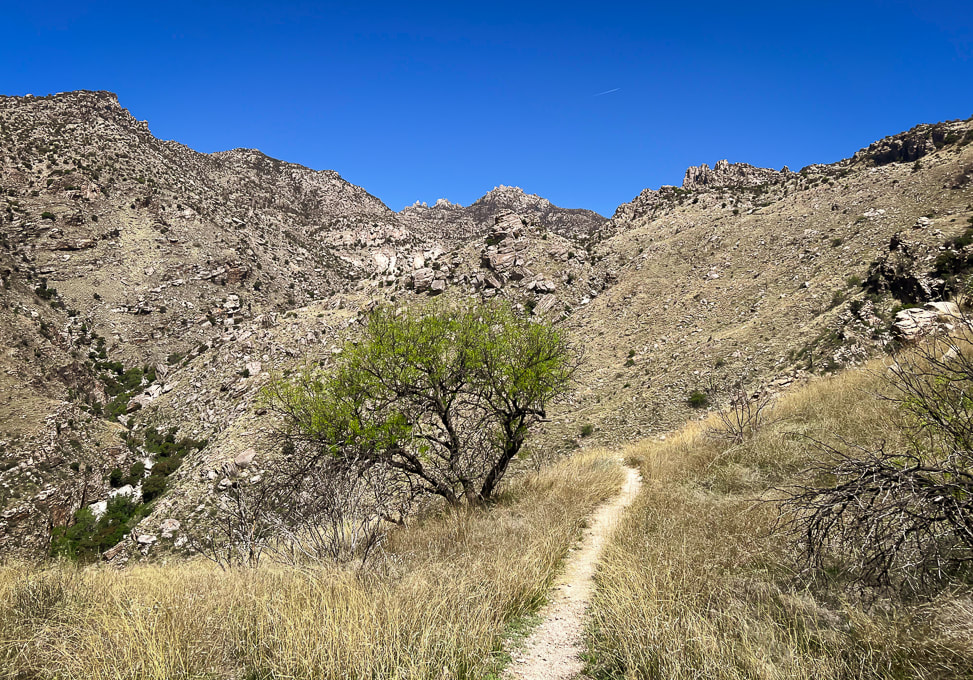 Approaching the drop into the floor of Esperero Canyon to the left. 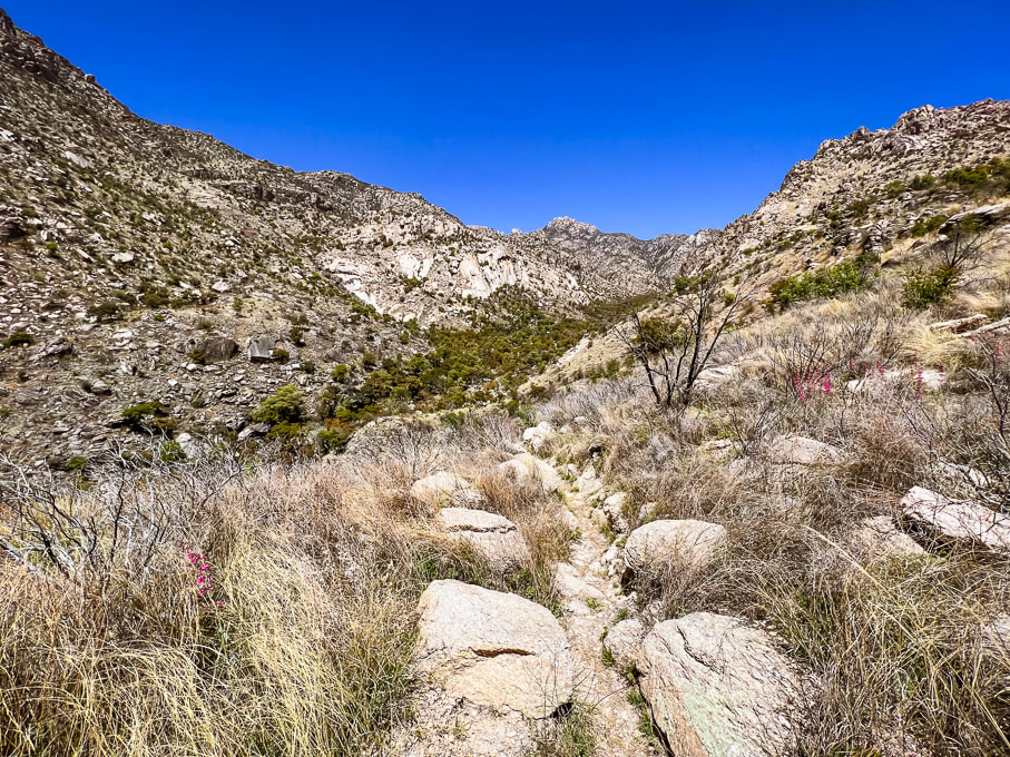 Near the drop-in point of Esperero Canyon. 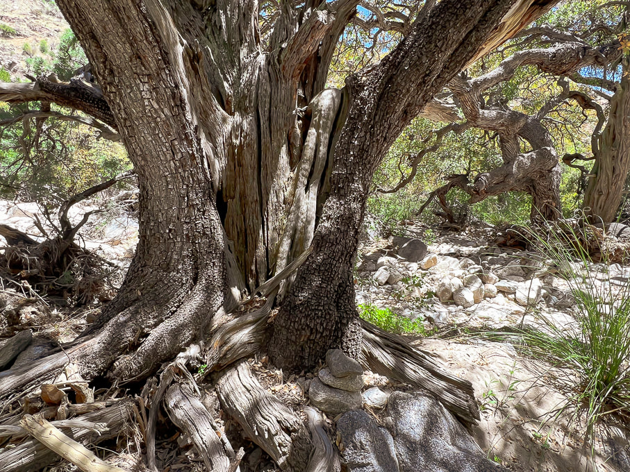 HUGE alligator juniper in Esperero Canyon. Notice the cairn at its foot marking the trail as it weaves through white sand in the Madrean Woodland life zone. Common species in this life zone are Emory, Mexican Blue, Arizona and silverleaf oaks. Pines include Mexican pinyon and Apache pines. Agaves, manzanita, and bear grass make up some of the subcanopy. 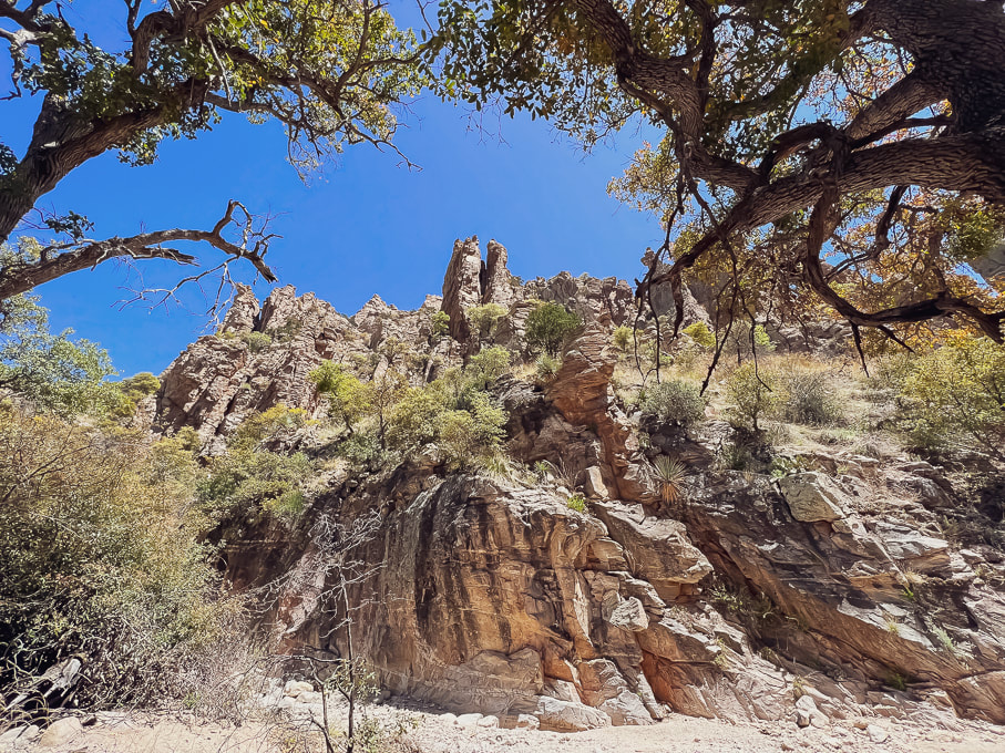 Looking at rock formations above from the floor of Esperero Canyon. 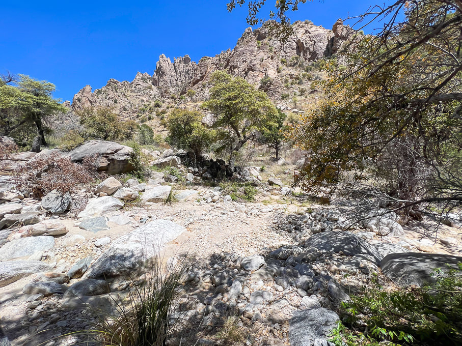 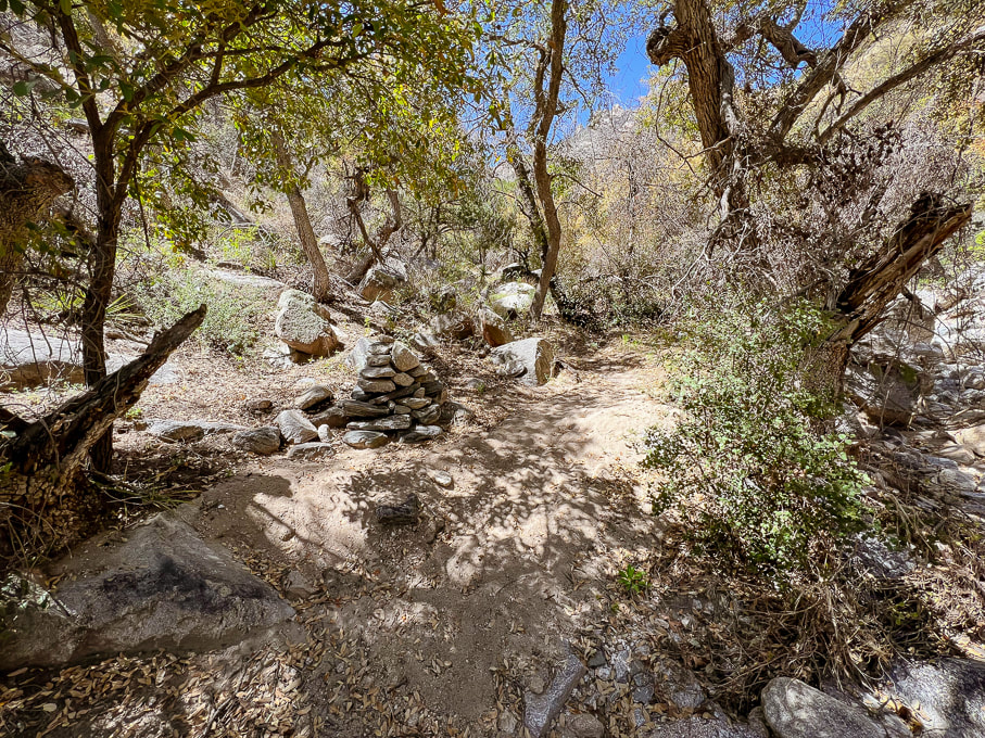 Large cairn marking trail through bottom of Esperero Canyon - approaching Mormon Spring, ~0.5 mile from Bridalveil Falls. 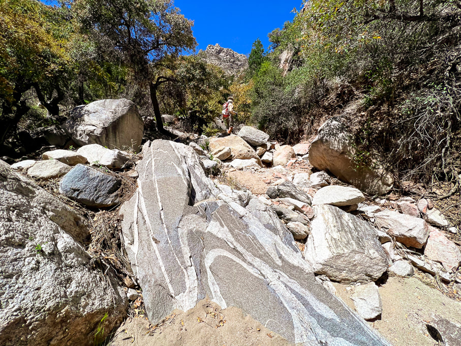 Folded pegmatite (?) dike in leucogranite (?) in Esperero Canyon. 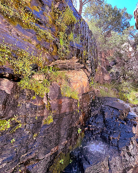 Bridalveil Falls finally! The only water we saw on this six-mile-in hike. 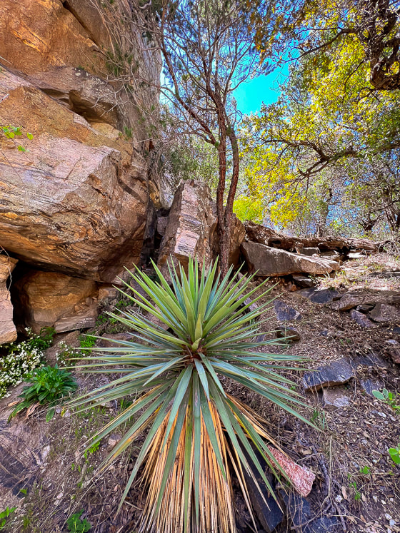 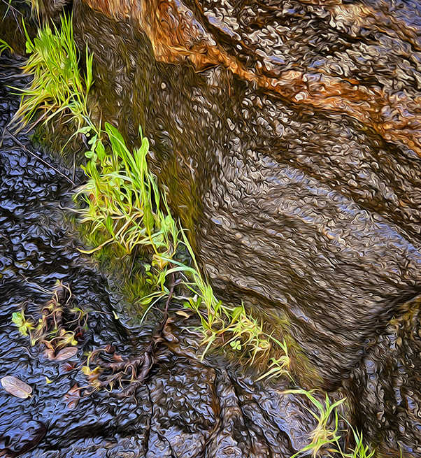 Portion of Bridalveil Falls - fun playing with Photoshop filters. 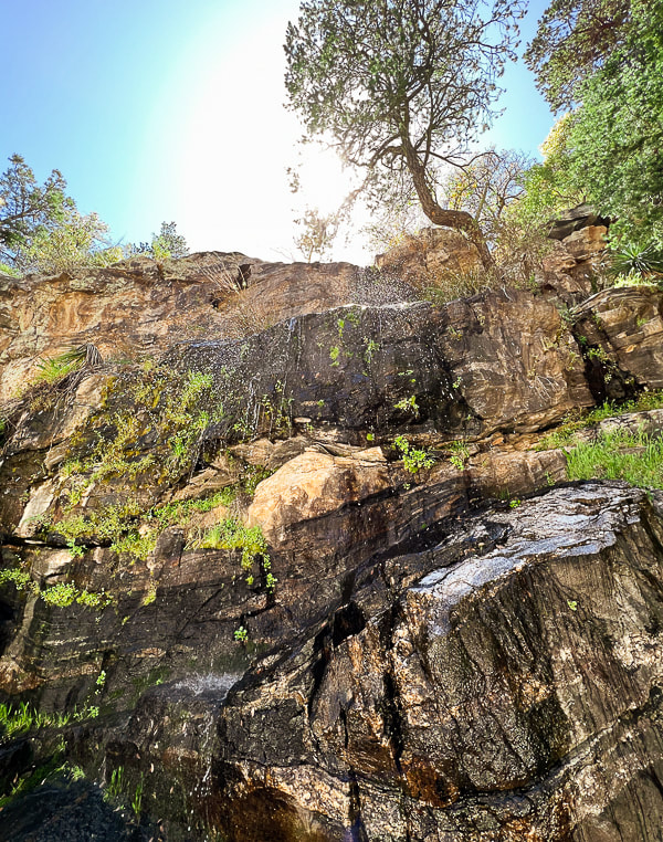 Refreshing Bridalveil Falls in Esperero Canyon. 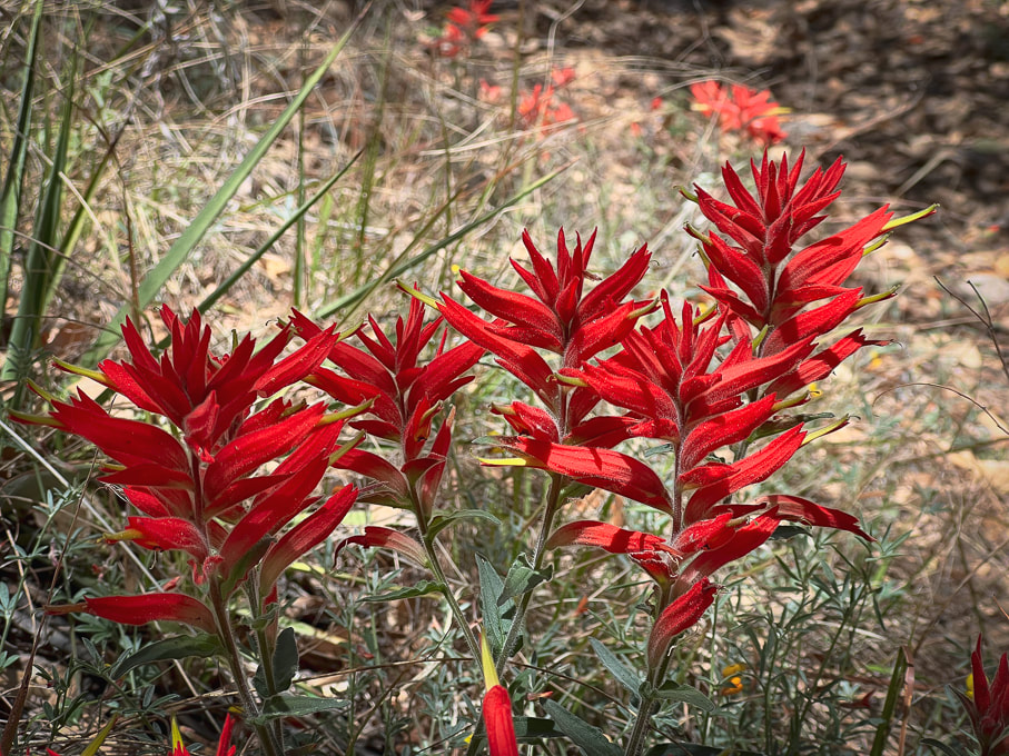 Santa Catalina Indian Paintbrush castilleja tenuiflora  Found this near the falls with these rocks holding it down. 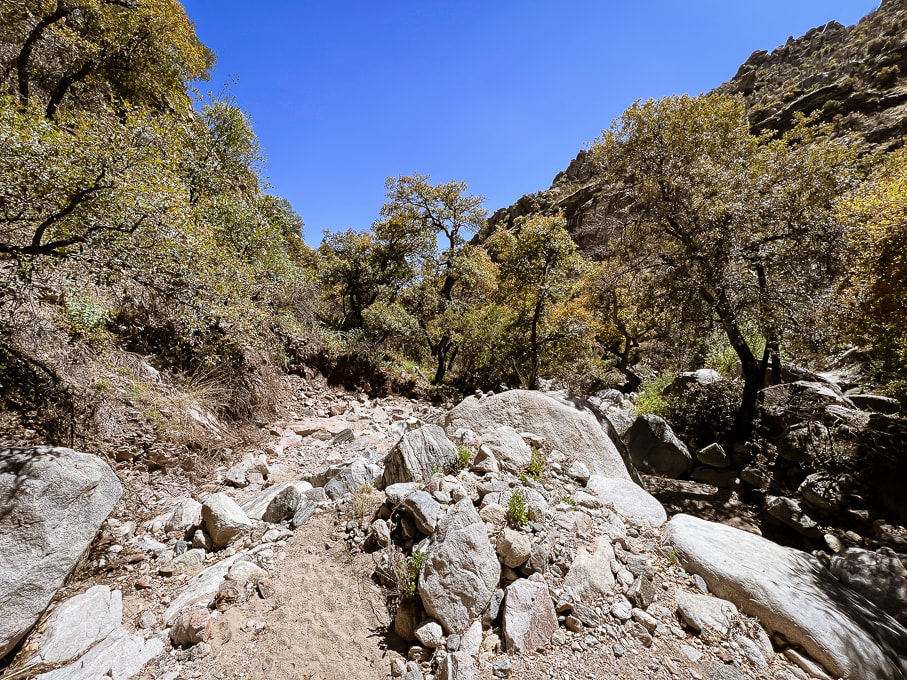 Heading back. 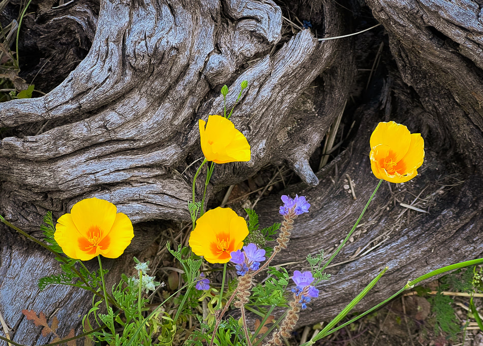 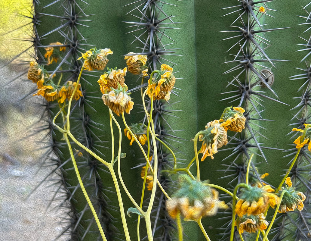 Saguaro and brittlebush 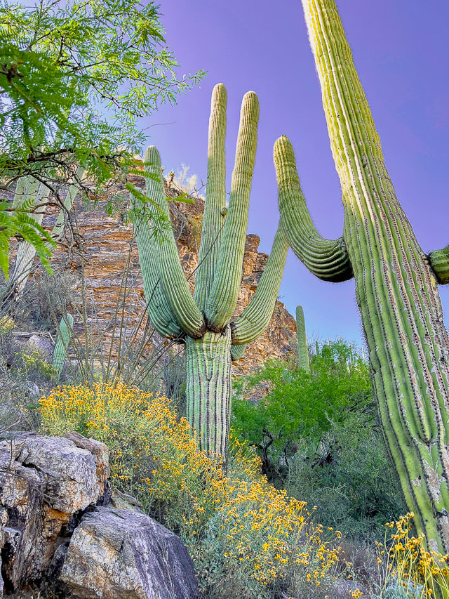 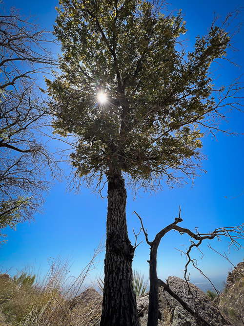 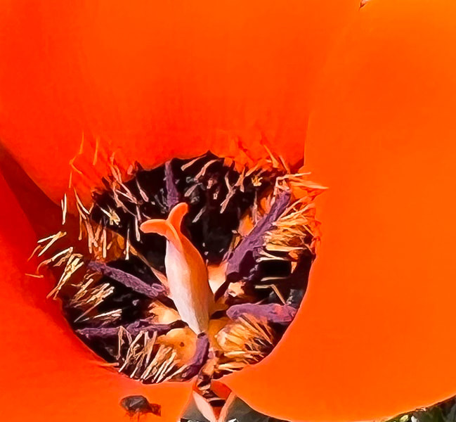 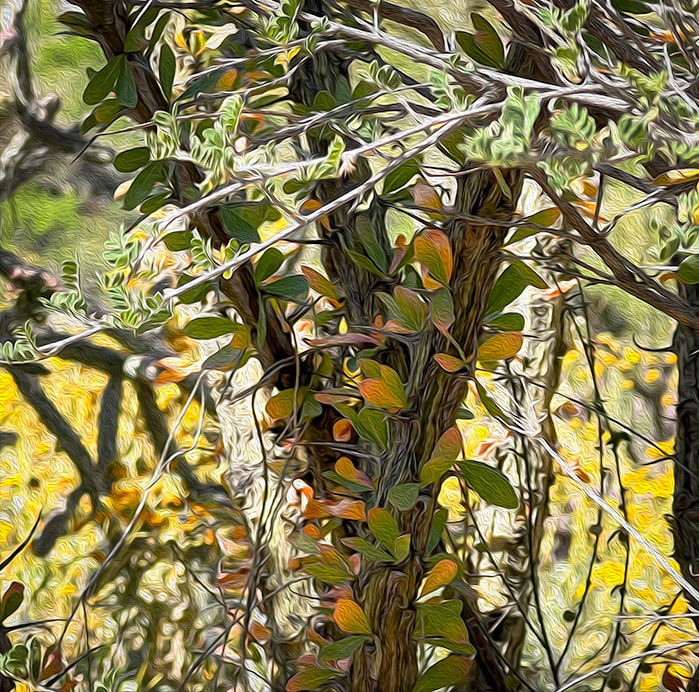 DeGrazia Gallery in the Sun Museum - TucsonScenes from DeGrazia Gallery in the Sun - Tucson.  A quote from Ettore DeGrazia, posted up on the wall along with dozens of his paintings in the Gallery of the Sun Museum in Tucson.
  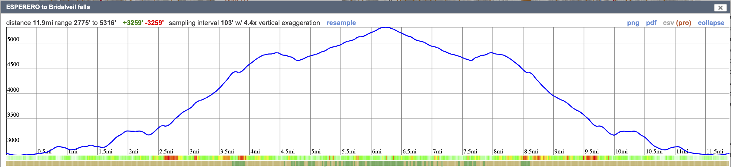 Our GPS tracks and elevation profile for Esperero Trail to Bridalveil Falls.
Click on map for larger image. |
Categories
All

Sue and Fred

About this blogExploration documentaries – "explorumentaries" list trip stats and highlights of each hike or bike ride, often with some interesting history or geology. Years ago, I wrote these for friends and family to let them know what my husband, Fred and I were up to on weekends, and also to showcase the incredible land of the west.
To Subscribe to Explorumentary adventure blog and receive new posts by email:
Happy Summer!

About the Author
|