|
We found the hidden and amazing "rattlesnake" petroglyph in the Santa Clara River Reserve which led to discoveries of a mix of representational and abstract-geometric designs in the St. George, Utah area. Utah is the Rock Art State. On March 6, 2017, Utah's governor signed into law designating Native American rock art as Utah's official works of art.
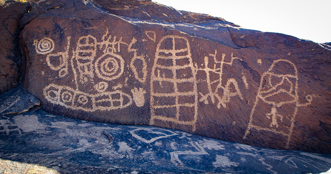
Panel of petroglyphs high above the Santa Clara River on the Anasazi Trail in Ivins, Utah. This area was used by both Ancestral Puebloans and Southern Paiutes.
Related posts:
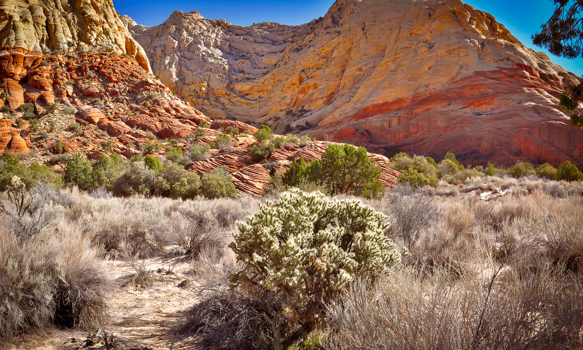
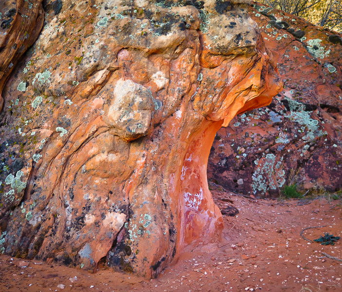
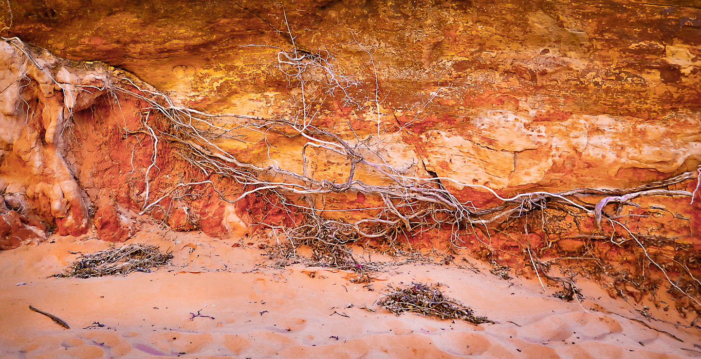
What do they "mean"? Thirty years ago, I liked to hike to a single large boulder with a petroglyph of a rattlesnake curved around a recumbent human reaching for a cross in the Indian Canyons of Palm Springs, California (see below). It's made of connected squares, a concentric circle, and a line-enclosed cross. At least that was my interpretation of this petroglyph in the Agua Caliente Band of Cahuilla Indians Reservation. But after reading more about petroglyphs, I've discovered that it might not represent a rattlesnake at all, but a series of connected abstract shapes such as chained squares. Many archaeologists have concluded that questions of "what does this mean?" cannot be answered, especially regarding abstract geometric rock carvings. Instead of attempting to decipher meanings and assign symbols, scientists try to identify similarities in rock art and its occurrence in certain southwestern regions. In some cases, however, a definitive symbol or meaning can be attributed to certain petroglyph images, like zigzags that portray lightning to the present-day Hopi Indians. The spiral petroglyph is consistently interpreted as multiple migrations. In his book, Other Truths not Guessed: The Story of the Sevier Fremont Indian, Kenneth Olsen Kohler says, "The study to interpret the meaning of this pecking or painting may never be found as it lies hidden in the heart of those who understood what they wanted to communicate upon the rock." ** Since writing this post, a reader, who is passionate about petroglyph sites, contacted me with a book recommendation that I found helpful: A Field Guide to Rock Art Symbols of the Greater Southwest by Alex Patterson. It is a comprehensive guide to identifying petroglyph symbolism for human-like, animal-like and abstract forms. It illustrates and explains a large array of petroglyphs. Thanks for the suggestion! 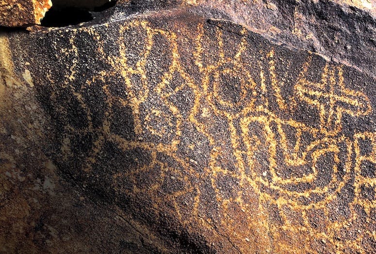 Petroglyph in Indian Canyons, Agua Caliente Indian Reservation, Palm Springs, California. Photograph by Anthony W. Purnel, featured in Palm Springs Life Magazine (see reference below). 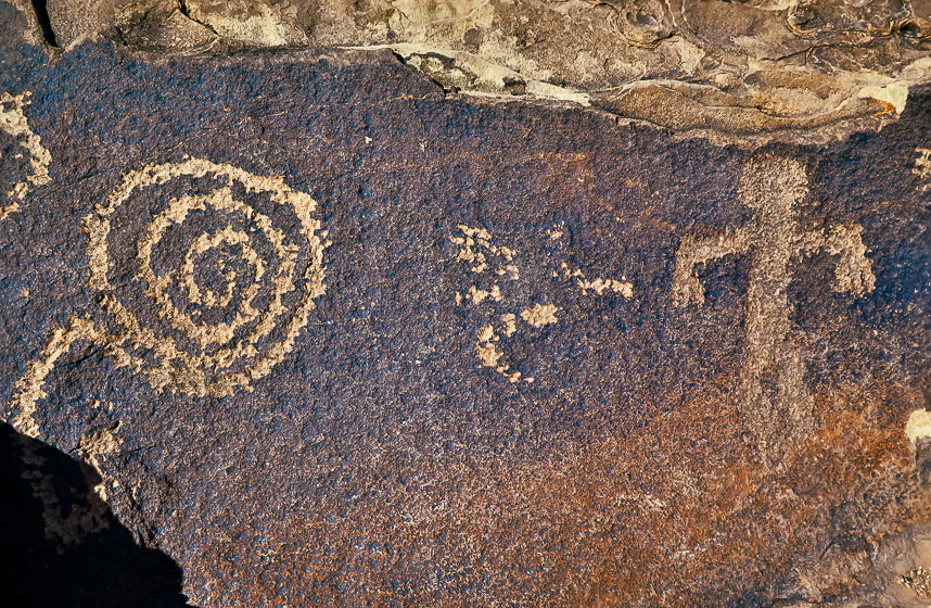 A spiral petroglyph on Anasazi Valley Trail, Ivins, Utah The Search for the Rattlesnake A few months ago, Fred and I met a Bureau of Land Management guy patrolling 4-wheel drive roads near St. George, Utah. He gave us a "tip" about a "rattlesnake" petroglyph on a giant boulder overlooking the Santa Clara River. A short bike ride took us to what might be the boulder we were searching for, but there were no petroglyphs on the side facing the river. It had tumbled down from the vertical cliffs above. We grounded our bikes and made a short steep hike to its backside facing the cliff and there it was - a serpentine form weaving around different abstract images, most of them ovals of connected circles, reminding me of necklaces. The whole rock, petroglyphs included are covered with lichen. The bottom markings are mostly obscured by desert varnish, a thin dark coating made of clay minerals and manganese and iron oxides - more so than the top petroglyphs. We were amazed that most of this boulder was covered with various carved shapes, including animals, perhaps desert bighorn sheep, which are among the most prevalent animal petroglyphs in the southwest. The lower petroglyphs could have been made before the upper petroglyphs, because they were covered with desert varnish. 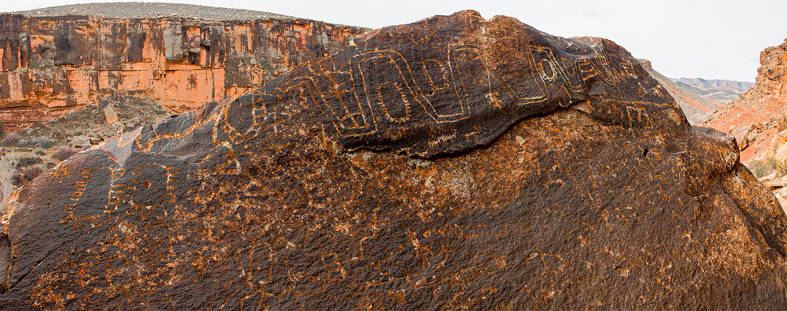 Huge boulder with lots of abstract-geometric petroglyphs in the Santa Clara River Reserve near St. George, Utah. The lower petroglyphs are covered more with rock varnish than the top markings. 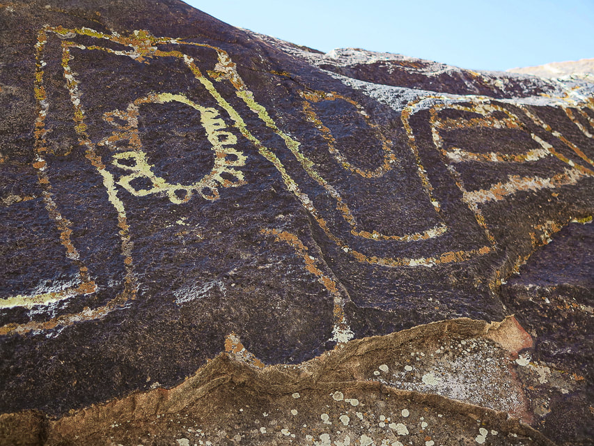 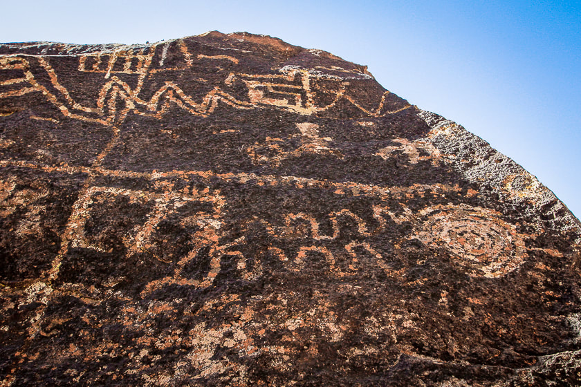 Both images above are close-ups of "rattlesnake" boulder in Santa Clara River Reserve. Most of the petroglyphs shown here are located in the Santa Clara River Reserve, administered by the Bureau of Land Management near St. George, Utah. The Anasazi Valley Trail (Tempi'po'op) leads to petroglyphs on tops and sides of sandstone boulders. Many were made about 1,000 years ago by ancestral Puebloans who were farmers in permanent settlements. It must have been an inspiring site for these ancient people because it overlooks the Santa Clara River far below, steadily eroding a route over the millennia, a huge valley of tilted layered rock mesas and drainages, and the Beaver Dam Mountains, snow-covered in winter. Since moving to the St. George area, petroglyph-finding missions have yielded not only fascinating ancient rock art, but also countless places to explore and a growing appreciation of southern Utah as one of the most beautiful places on Earth. 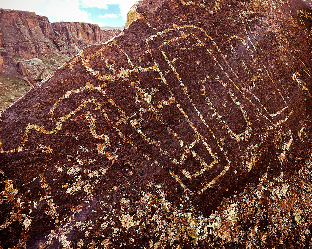 Looks like the head of a snake? 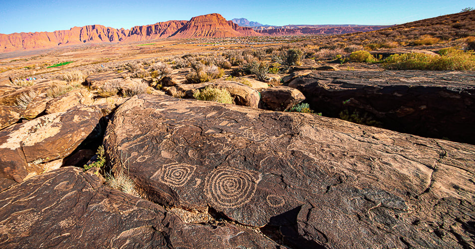 The Tempi'po'op (means "rock writing" in Southern Paiute language) trail near Ivins, Utah. Red Mountain and Snow Canyon State Park in the distance. The "Geometric Enigma" Some of the oldest petroglyphs in the New World are 13,000 - 14,000 years old - coinciding with the final stages of the last ice age (Pleistocene epoch). An excellent book, Early Rock Art of the American West: The Geometric Enigma thoroughly discusses abstract-geometric petroglyphs, the oldest form of rock art. In the American West, the authors call this art the "Western Archaic Tradition." It preceded figurative art such as human and animal forms. The authors, who have written other books on prehistoric art, propose theories as to why early American West inhabitants created art, and discuss ancestral minds and symbolism and hypotheses regarding the "peopling" of the Americas. This book proposes a number of hypotheses explaining why prehistoric humans made abstract markings. The Sexual Duality Hypothesis identified a sexual polarity symbolism which included male signs of dots, barbed elements, short strokes, and spear-thrower signs. Female geometric designs included oval, triangular and quadrangular shapes. The Shamanistic hypothesis indicates that shamans acted as a connection to the spiritual world through altered states of consciousness. The initial stage of the shamanistic trance identifies geometric mental images such as grids, sets of parallel lines, dots and flecks, and zigzags. After emerging from the third stage of shamanistic trance, a participant would pay tribute to their visionary experiences by engraving them on rock surfaces. Yet a third hypothesis is the Neurovisual Resonance Theory, whose premise is that geometric shapes and patterns are appealing to humans, and they were built into the neural structuring part of our brain millions of years ago. Making these petroglyphs helped humans to feel emotionally rewarded and reinforce survival behavior. The brain's visual cortex "resonates" when geometric shapes and patterns are made and a feedback loop is created that provides the stimulus for making abstract marks. We may never know exactly why these abstract-geometric designs were made and what specific purposes they had, but we may conclude that they are evidence of the artist's desire to to find meaning by presenting it in a tangible form - a petroglyph. Viewing petroglyphs in an inspirational setting causes one to suspend time for a few minutes and imagine how it was made hundreds and thousands of years ago. I added some images of petroglyphs from my post Utah's Red Rock Country from other adventures in southeast Utah. For the Geocurious - The Rock Varnish Enigma Many petroglyphs are created by carving, pecking, and hammering through a very thin (measured in nanometers), dark coating of desert varnish to reveal the lighter-colored rock underneath. This coating is enriched with iron and manganese oxides that cement clay minerals to the rock and is abundant in arid regions. Some scientists say that it is a sedimentary layer that contains bacterial microorganisms, so it has a microbial origin. How exactly desert varnish is formed is still under debate. Studies use microscale imaging techniques to try and figure out its ingredients. Do microorganisms create varnish or do they use varnish as a habitat? Varnish contains 2 to 3 times more manganese than the underlying rock indicating manganese enrichment. Varnish grows slowly - tens of microns over a thousand years. Lately scientists have considered rock varnish to be of environmental significance because it could show change in paleoclimate through the varying thickness of its manganese layers. 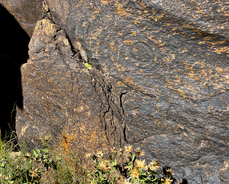 Fully re-patinated spiral on Tempi'po'op Trail. The rock also exhibits slickensides: smooth polished rock surface as a result of frictional movement of rocks along a fault. The direction of the lines runs from top left to bottom right. 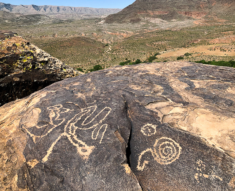  The Holy Ghost panel in the Great Gallery, Horseshoe Canyon, Utah The tallest painted figure is called the Holy Ghost and is ~ 8 feet in height. These figures are thought to represent spirits. Utah's Red Rock Country 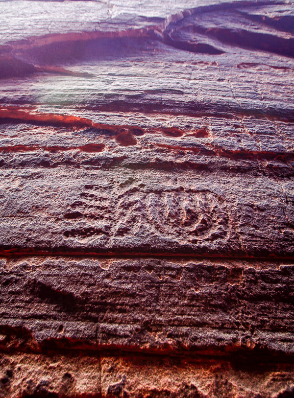 Slot canyon in Snow Canyon State Park 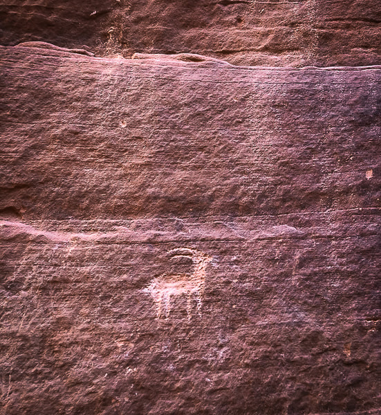 Wire Pass near Buckskin Gulch in Paria Canyon-Vermillion Cliffs Wilderness Area. 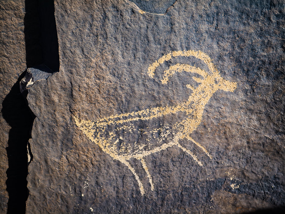
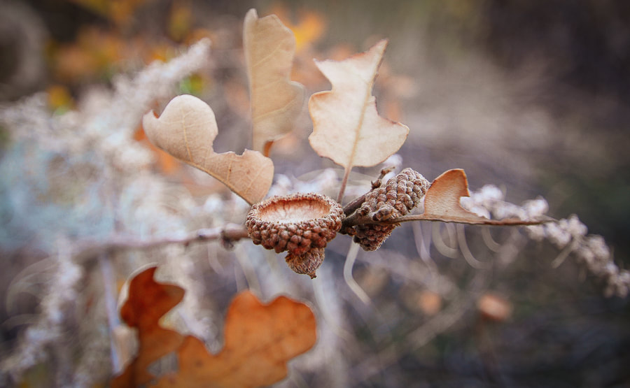
Recently added to this post: Every time I go to the Santa Clara River Reserve, I find more petroglyphs! 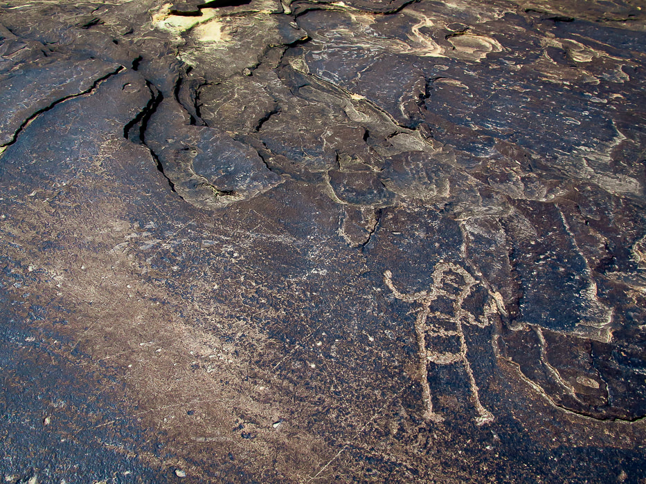 Ancestral Puebloan-style petroglyph on the Anasazi Valley Trail, overlooking the Santa Clara River. Petroglyphs from Tempi'po'op Trail The top two images are from the "rattlesnake" petroglyph in Santa Clara River Reserve. They are positioned on the bottom of the boulder where the carvings appear to have more desert varnish than the upper petroglyphs. 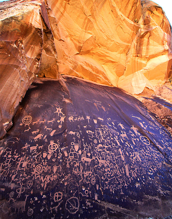 Newspaper Rock Newspaper Rock State Historic Monument, Utah. 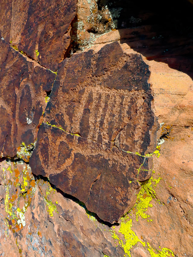 Geometric petroglyphs near Snow Canyon State Park, Utah. 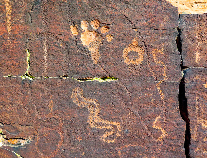 Near Snow Canyon State Park. Note the petroglyph on the left is covered with varnish more so than the petroglyphs to the right. 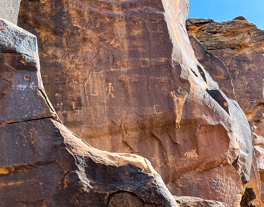 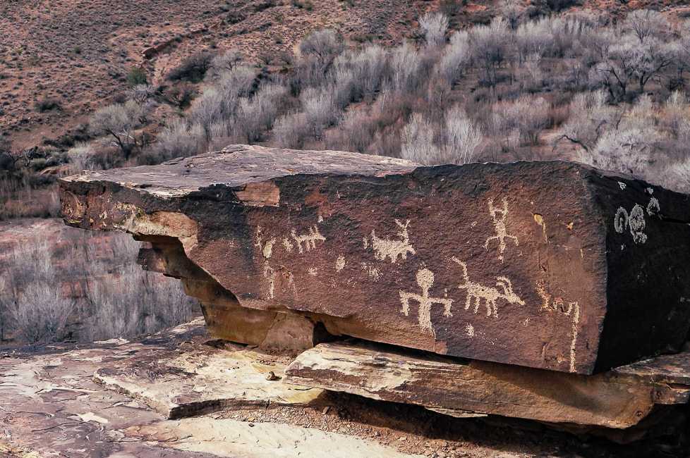 Ancestral Puebloan panel on the Tempi'po'op Trail. 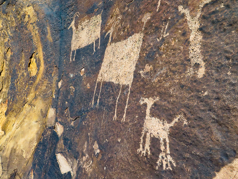 Anasazi Valley Trail 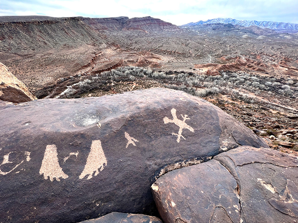 Looking toward the west from the Anasazi Valley Trail over Santa Clara River and Beaver Dam Mountains on the horizon. 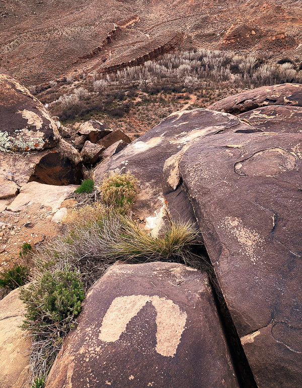 These may be an example of the "fat footprints" representative of the Western Virgin Kayenta Style that appear in Puebloan sites in the St. George, Utah area. Overlooking the Santa Clara River. 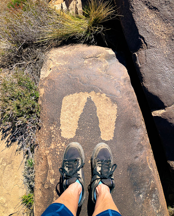 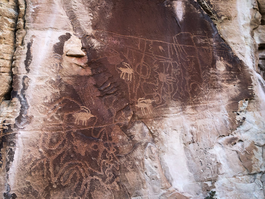 You can tell the older from the "newer". Near Snow Canyon 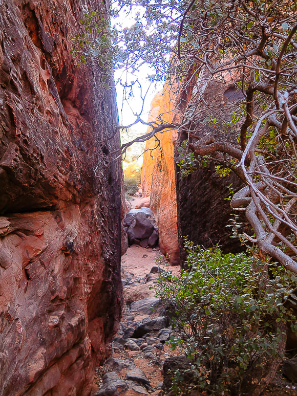 Canyon leading to petroglyphs in Snow Canyon State Park, Utah. 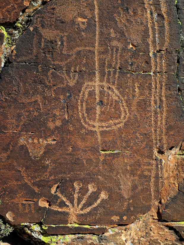 Petroglyphs just off the Gila Trail in Snow Canyon State Park. Some appear to be older than others. 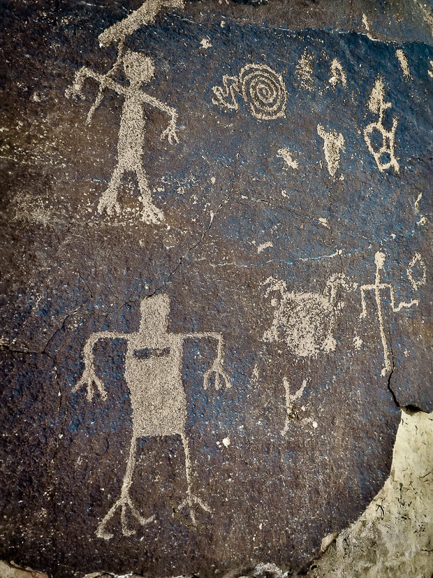 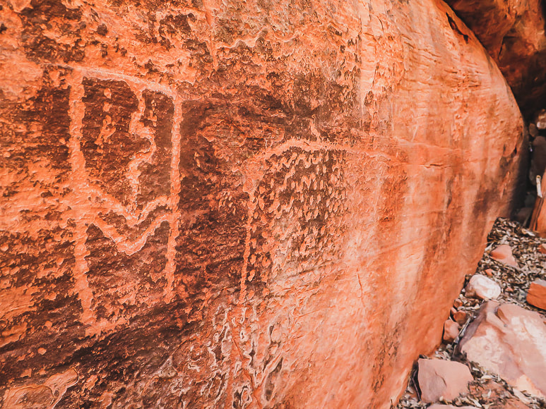 Deeply pecked abstract geometric petroglyphs near Gila Trail in Snow Canyon. 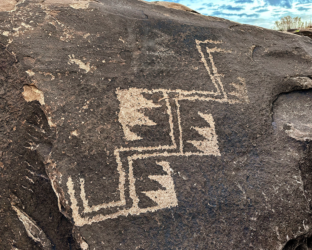 Overlooking the Santa Clara River near Ivins.
I recently found these and keep adding to the collection of images on this post. I find new petroglyphs quite often at the Tempi'po'op Trail. These appear to be re-patinated. 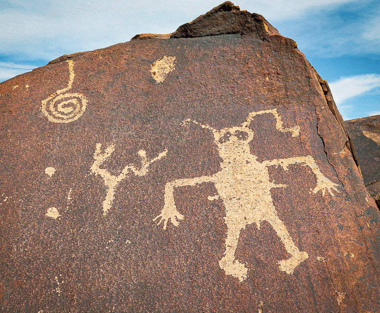 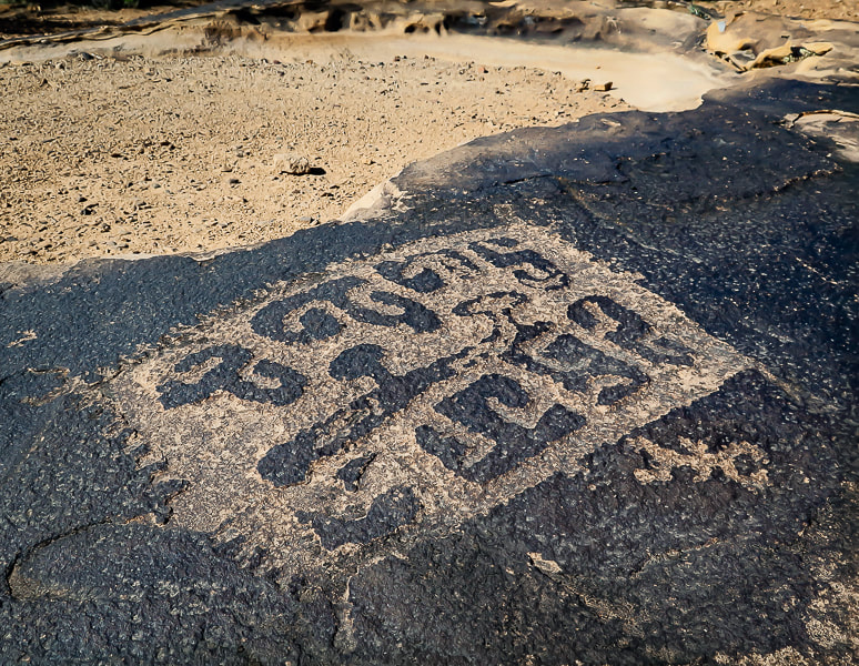 I just happened to stumble upon this amazing petroglyph as I was trying to find a trail down to my house. 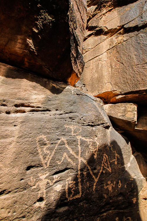 You have to climb through two narrow openings to get to this one, and then there are more petroglyphs higher than this that I was not able to climb to. 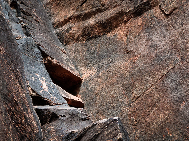 I couldn't climb up to this one; this is my best attempt at sticking my camera over my head. 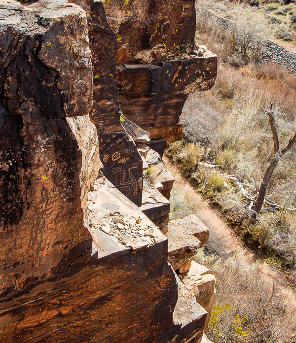 How did they get to these places? Obviously better climbers than me! 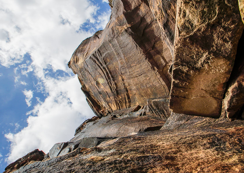 There are a few small petroglyphs on this wall. 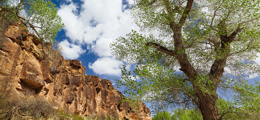 Cottonwoods along Santa Clara River are just beginning to leaf out. 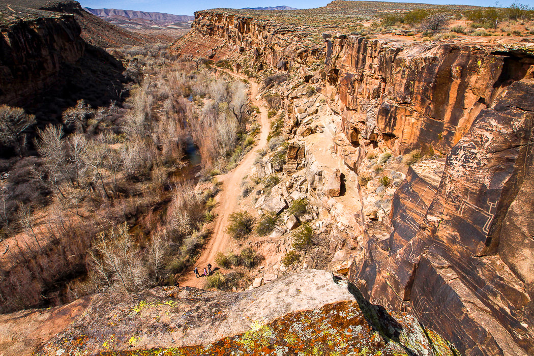 Santa Clara River Reserve - note petroglyphs on cliffs to the right. 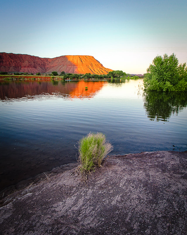 Ivins Reservoir and Red Mountain References
Breeding, A. 2019. Written in Stone. Palm Springs Life Magazine. Desert Publications, Inc. Jones, K. 2019. Standing on the Walls of Time: Ancient Art of Utah's Cliffs and Canyons. University of Utah Press. Lingappa, U., Yeager, C., Sharma, A., Fischer, W. 6/14/2021. An Ecophysiological Explanation for Manganese Enrichment in Rock Varnish. Proceedings of the National Academy of Sciences. (from the internet). Malotki, E., Dissanayake, E. 2018. Early Rock Art of the American West: A Geometric Enigma. University of Washington Press.
9 Comments
More evidence on how exercise helps our brain and immune system, increase our resiliency and decrease anxiety and depression, and how "nature experiences" decrease rumination, a negative emotion. Plus, scenes from a few walks in Snow Canyon State Park.
More resources on Exercise and Mental Health and the Neurofit Lab's Mental Health Tool Kit at end of this post.  Red Sands trail in Snow Canyon State Park Next month I will be back with another adventure post - in this and the last post, I wanted to pass along the positive news of the mind/body connection and how we can find strength, resiliency, optimism and better health. Many of us know the connection between a walk in nature and feelings of optimism, relaxation and happiness. Hiking elevates your mood, decreases anxiety, and helps open your mind for creativity. For the lucky ones, including me, nature is virtually outside my front door. I'm close to Snow Canyon State Park near St. George, where I can walk in the famous picturesque world of Utah's red rock country. However, you don't need this dramatic scenery in order to improve your mood. A study by Stanford University on nature experience and the brain has found that participants who walked in a grassland/oak/shrub environment "greenspace" reported greater feelings of well-being and less stress than those who walked in an urban setting. The question is, "what effect does living in an urban environment have on our mental health?" What surprised me is that humanity is removed from nature more than ever: more than 50% of people live in urban areas. The forecast for the proportion of urban dwellers in 2050 is 70%. Yikes!  "Running is Medicine for my Mind": All the Good Brain Neurochemicals In her Nike Trained: Mental Health Miniseries podcast, neuroscientist and expert in brain health, Jennifer Heisz, PhD. discusses her recent research that shows a definite connection between exercise and movement and the release of brain neurochemicals that decrease anxiety and depression. Her new book, Move the Body, Heal the Mind: Overcome Anxiety, Depression, and Dementia and Improve Focus, Creativity, and Sleep, highlights her latest research in her Canadian lab. Her biggest revelation is that exercise has been found to be equally as beneficial as medication for anxiety and depression, and in some cases, even better than meds. Those that need to stay on their medications, by additionally doing exercise, can lessen potential side-effects from the medications. Heisz also weaves into her book her personal journey of the mental benefits she obtained while training for an Ironman Triathlon - resiliency is one. She made the huge transition from a sedentary academic to a triathlete to experience first-hand exercise's effects on the brain. Because the Ironman Triathlon was cancelled due to the pandemic in 2020, she laid out and completed her own course! Dr. Heisz's website for her book and back story. Exercise, because it acts as an anti-inflammatory, has been found to strengthen the immune system to fight infections. Chronic stress that can cause stress-induced depression compromises the immune system. A health paradox that Heisz discovered from her research, especially apparent during the COVID pandemic, was that many of us wanted to exercise more to improve our mental health, but symptoms of depression and anxiety were getting in the way of doing so. A recent study found that active participants reported less stress during shelter-in-place than did non-active participants.
Endocannabinoids, our body's natural production of cannabis are produced during exercise, helping us to feel mellow, balanced, and content. Endorphins, the body's natural pain killer are also released. I like to say that hiking produces the vital nutrients to thrive - my medicine! In my last post, Experiencing "Flow": The Secret to Happiness, I wrote about what I've known for years: hiking and exercise is crucial for my mental health. Going to a Tai Chi class for eight years really helped me handle and the stress I felt from work. A boy in my class was learning how to utilize Tai Chi for his ADHD disorder, rather than use medications. High-Intensity Interval Training - HIIT During HIIT, you push your body through intervals of near maximal effort with rest in between. In almost all cases, high intensity interval training is beneficial for people with mental illnesses. By maintaining a certain level of stress, your body learns to adapt and then becomes stronger. There is one caveat: people who have anxiety sensitivity, or fear of the normal symptoms that accompany exercise may react negatively to HIIT. Some people are afraid of their hearts beating too fast, or of the feeling of trying to catch their breath, and they over-exaggerate their symptoms. These people benefit from lower intensity exercise, potentially increasing fitness by adapting to increments of challenging exercise.
Neurochemicals immediately released in your brain after exercise. 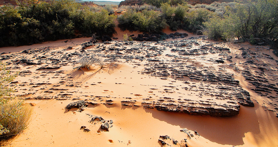 Basalt flowed into what is now Snow Canyon State Park, covering red and yellow sandstone.    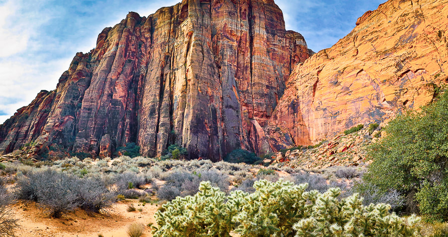 Reduce Rumination - Feel Better! The Stanford study set out to answer the question: "by what mechanism(s) might nature experience buffer against the development of mental illness?" (quoted from the study). It found that nature walks decreased rumination, a dysfunctional pattern of negative self-thought that's associated with depression and other mental illnesses. The subgenual prefrontal cortex becomes activated during rumination. Participants had a brain scan which showed blood flow to this part of the brain. The researchers' hypothesis was correct: blood flow in the subgenual prefrontal cortex decreased after the nature experience used in the study, thereby reducing rumination. This state of decreased rumination also occurs with experiencing "flow" where you are so wrapped up in an activity that you focus on the joy it brings, rather than yourself. Flow occurs in all sorts of people, in all sorts of endeavors where levels of challenge and skill are more or less are equal and at relatively high levels. Thousands of people have been interviewed to share their flow experiences: monks, writers, artists, mountain climbers, surgeons, etc. A common theme is reported - a feeling of optimal happiness and satisfaction. Mix in friends on your hike and nature walks and you have the perfect ingredients for contentment, hope, and happiness. We need to take care of our mental health just as much as we do our physical health, and the research linking movement and mental health is long overdue. Our bodies are a gift! These studies also illustrate the importance of "green spaces" in our urban areas to help reduce mental illnesses. For help with motivation, you can download the Mental Health Tool Kit from Dr. Heisz's Neurofit Lab that identifies problems encountered since the onset of COVID and solutions to get you going. Keep moving, keep hiking, keep exploring! "The wonderful things in life are the things you do, not the things you have." - Reinhold Messner, mountaineer
     Sunrise near Snow Canyon State Park's entrance. Books on Mind/Body Connection and Movement
On-Line Article The chronic stress of coronavirus is affecting your mental health. Here's how exercise can help. The Conversation. Dr. Heisz's Trained Podcast Dr. Heisz's book and back story website
References
Bratman, G., Hamilton, J.P., Hahn, K., Daily, G., Gross, J. 2015. Nature experience reduces rumination and subgenual prefrontal cortex activation. PNAS. Cirino, E. 2019. Ten Tips to Help You Stop Ruminating. Healthline website. Dusenbery, M. How Exercise Affects 2 Important 'Happy' Chemicals in your Brain. Livestrong.com NIH - National Library of Medicine. Physical activity and stress management during COVID-19: a longitudinal survey study. January 2022. Nike Trained: Body and Mind Mental Health Miniseries - Jennifer Heisz, PhD. Podcast: Season 9 Episode 9. Rogers, Marilyn. Doctors Tell Us How Hiking can Change our Brains. From website Lifehack. https://www.lifehack.org/363786/doctors-agree-hiking-good-for-your-mental-health What is flow and how can we achieve it? How it helps us through challenging times. Related: Pahrump Point Hike and Tecopa Hot Springs, California Southern Utah Hiking and Biking in a Pandemic: Wire Mesa, Snow Canyon, Zion NP  Feeling "Flow" - The Theory of Optimal Experience If it wasn't for a friend who reads my hiking posts, I probably would have never heard of "flow", the feeling of immense joy felt during an intrinsically rewarding task whereby the focus is not on the self, but on the activity. He knew that I would be interested in the article he sent me, "Why does Experiencing 'Flow' feel so good? A Communication Scientist Explains", because it relates to my passion for hiking and nature. It helped me question more specifically why hiking makes me happy and turns on my creativity. Is this happiness caused by flow or the release of serotonin, the body's natural mood stabilizer, or both? Is it simply the rhythm of walking? Or is it because nature is inherently relaxing? Did hiking help me through the COVID-19 pandemic? It has led to a cascade of great articles and books to peruse. Mihály Csíkszentmihályi, in the 1970's, asked the question "what is enjoyment?" when he saw that many Europeans were traumatized by World War II. He decided to find out what makes life worthwhile after he attended Carl Jung's presentation about Hindu mandalas as a technique to gain a sense of order. After that, his life was devoted to answering the question, "how can we achieve a state of optimal experience?" and studying positive psychology. He interviewed athletes, artists, composers, surgeons and CEOs of large companies to ascertain what made their lives meaningful and describe how they felt during happy, intense experiences. Many used the metaphor of feeling like they were carried by a current - like the flow of water. Others achieve flow with yoga, snowboarding, playing chess, and writing. Mountain climbers are among the 8,000 people around the world who have been interviewed for flow research, as well as blind nuns, Navajo shepherds and Dominican monks. He found that regardless of culture, education, vocation, etc., seven conditions appear when a person is in flow. Flow happens when we complete an activity and feel self-assurance, satisfaction, and joy. An activity in which you can achieve flow is one that is worth doing for its own sake. A website with a great name, "Happiness Lessons," indicates that if we can find this activity, we will be able to move society and humanity forward. hover for locations
 Trinity Mountains, Idaho
Not surprisingly, research shows how people with stronger feelings of flow felt better during COVID-19 quarantine compared to people with weaker experiences because knowing how to get into flow distracted them from worry. Flow refocuses thoughts away from stressful circumstances to more positive and enjoyable ones, and it can decrease depression and burnout. I believe that if you know what to do in order to experience flow and optimal well-being, then you have more confidence and less fear. Your brain during flow The brain actually changes its network configuration during flow, says Richard Huskey, the author of this article. He is Assistant Professor of Communication and Cognitive Science, University of California, Davis, and has studied flow for 10 years in his lab. This network change helps people adapt to difficult tasks. Three activities occur during flow that lead to well-being. We stop thinking about ourselves and our negative thoughts decrease because that structure of the brain becomes suppressed. Conversely, with flow, the brain is thought to increase activation in reward-processing regions. At this time, however, this has not been proven; these brain responses are associated with flow, but we can't yet conclude that these responses cause flow. So, yes, I would have to conclude I do feel flow on most of my hikes, as long as I don't get stuck on a ledge, or in a thunderstorm, or have to climb Class 4 rocks. There's probably a bit of serotonin mixed in. Hiking with my husband and friends creates "optimal happiness." For a few hours we can can leave negative thoughts behind and feed our souls. There's something about moving in nature and witnessing extraordinary scenes in the American west that bonds us together.  Old Growth Trail - Kokanee Creek - just outside of Kokanee Glacier Provincial Park, Nelson, British Columbia photo by Ann Amberg - annamberg.com References
Mihaly Csikszentmihalyi: Distinguished Professor Emeritus of Psychology and Management Founder, Co-Director, Quality of Life Research Center. Retrieved from https://www.cgu.edu/people/mihaly-csikszentmihalyi/ Huskey, R. January 4, 2022. Why does Experiencing 'flow' feel so good? A communication scientist explains. Retrieved from The Conversation. Stanford researches find mental health prescription: Nature. 6/30/15. Stanford News. TED Talk . February 2004. https://www.ted.com/talks/mihaly_csikszentmihalyi_flow_the_secret_to_happiness
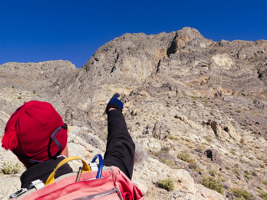
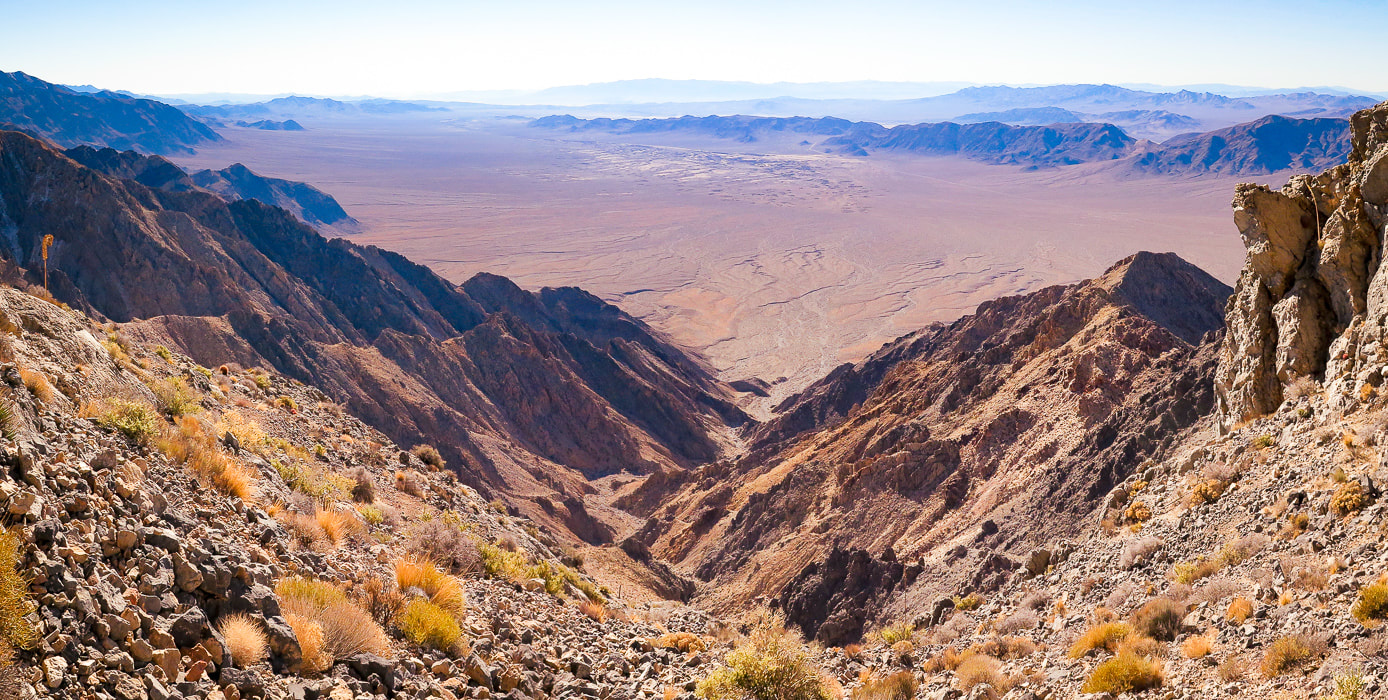
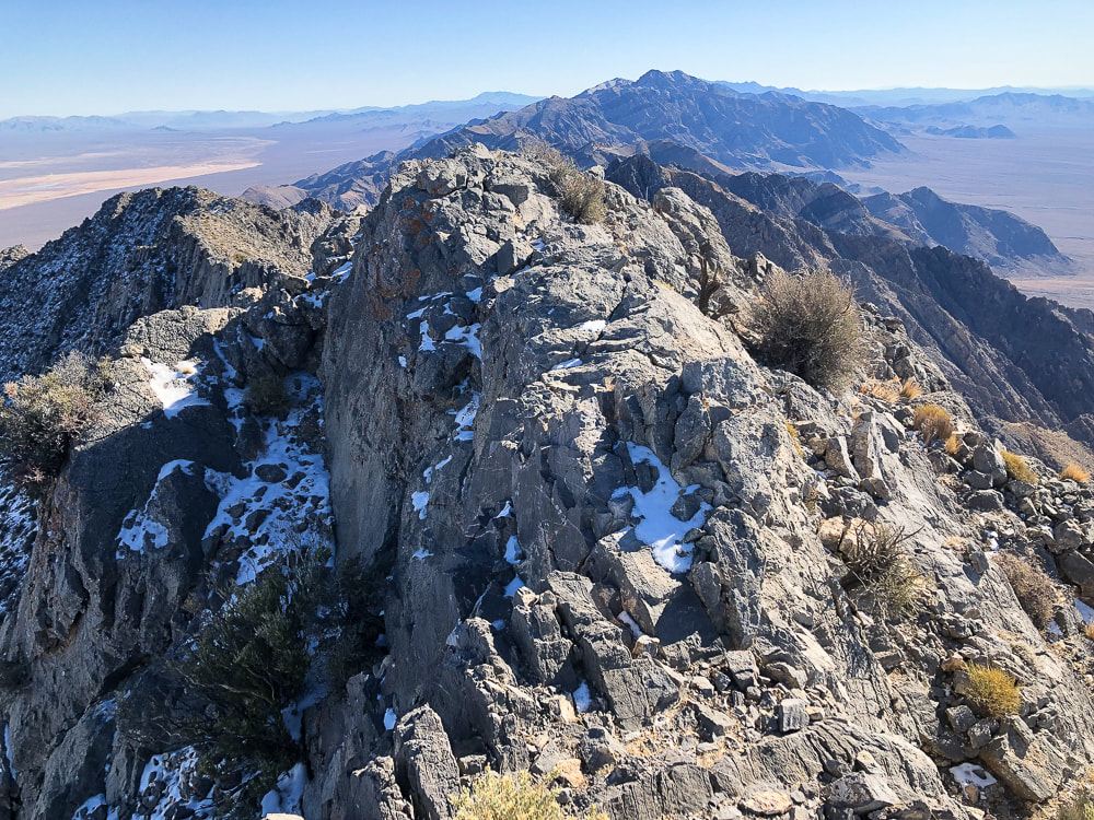
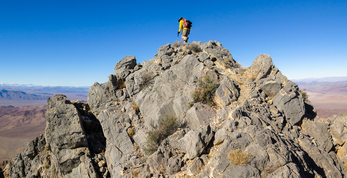
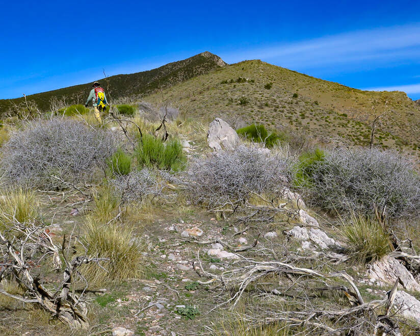
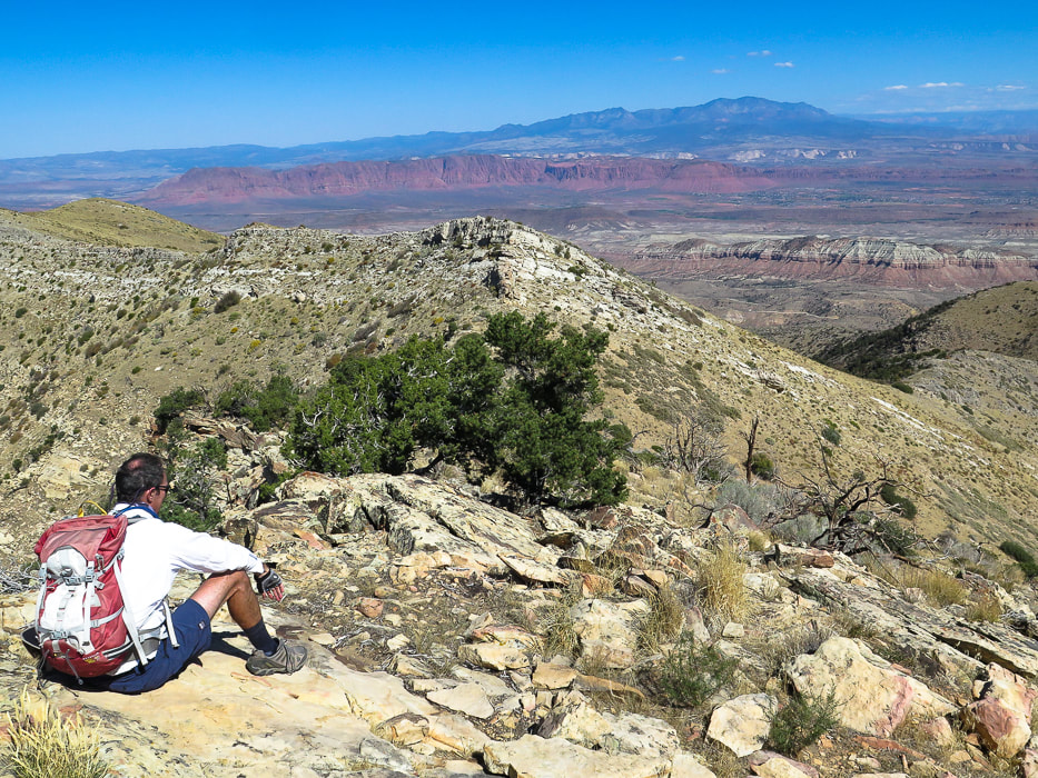
Another rugged summit from the Sierra Club Desert Peaks Section's list completed! On this narrow perch above desert valleys thousands of feet below, we saw spectacular views of Nevada and southeastern California and experienced "flow" - the secret to happiness.
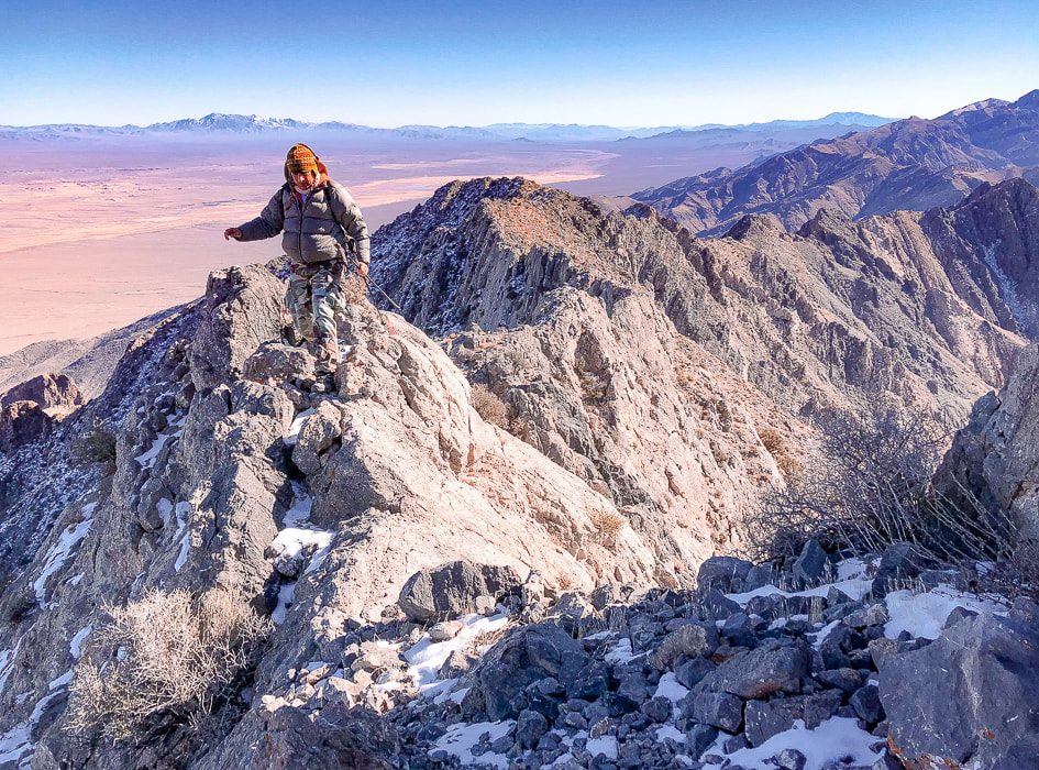
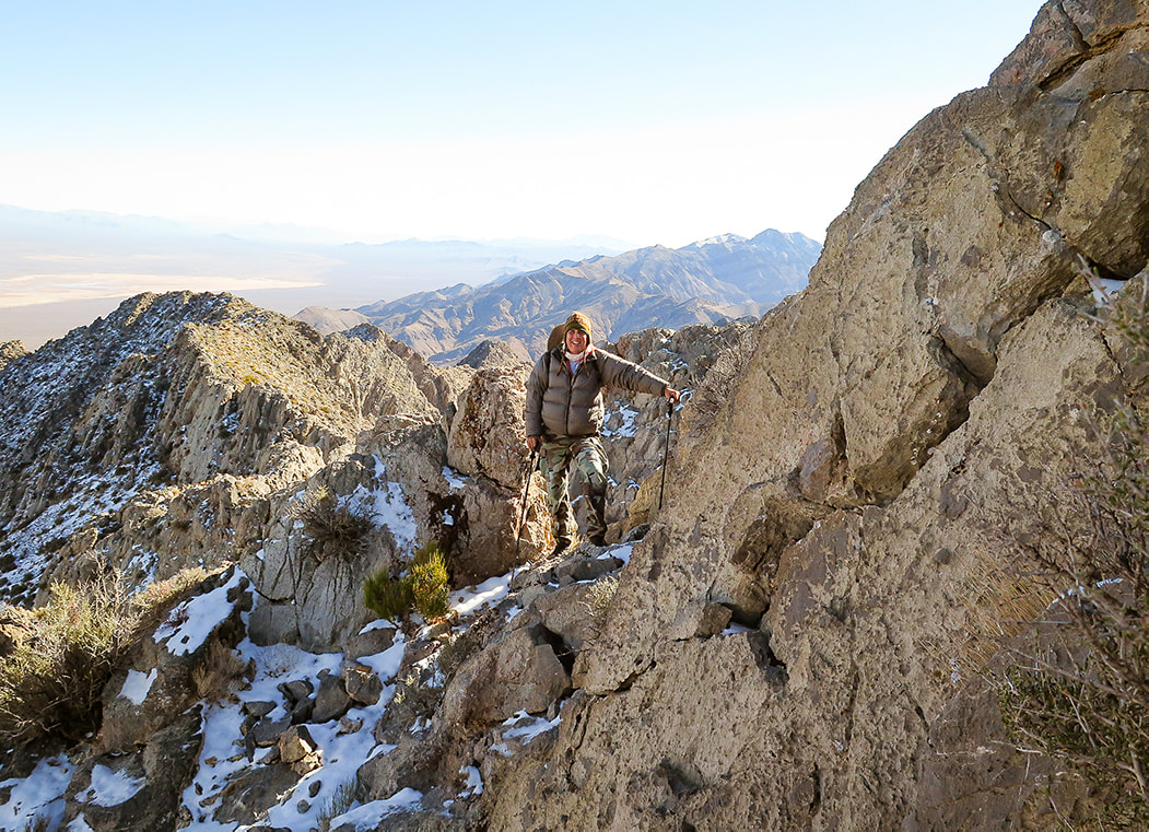
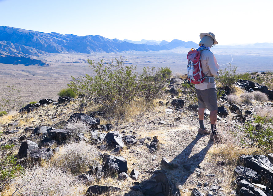
Scott on Pahrump Point's southeast ridge just under the summit.
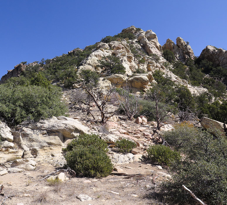
Trip Stats
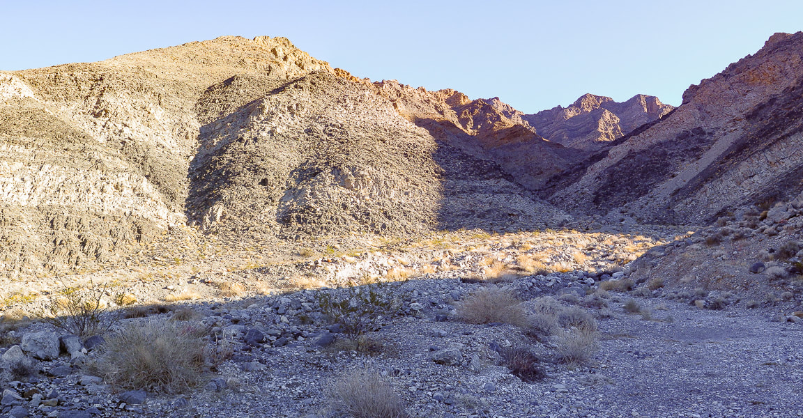
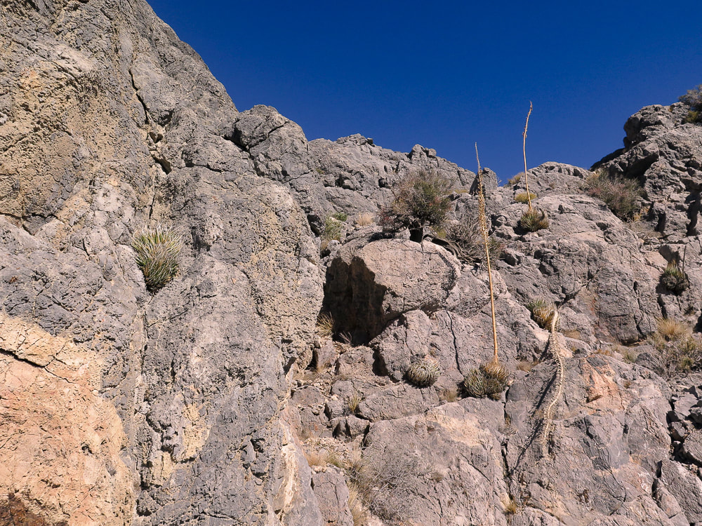
Overview: This classic Mojave desert hike begins on an alluvial fan, ascends through boulders up an ever-narrowing canyon, switchbacks up a talus slope to emerge onto Pahrump Point's southwest ridge for a huge view of the summit's steep walls. From here, the route winds up a gully and treks through a few "passages" in its steep face to gain its narrow summit ridge crest. See fossils and plenty of rough limestone, as well as fantastic views of Telescope Peak in Death Valley, Mt. Charleston near Las Vegas, and the town of Pahrump. Attention to hike directions and navigation crucial to finding correct route. Location: Pahrump Point is in the remote Nopah Range Wilderness Area is just over the California/Nevada border, east of Death Valley National Park. Its rough and rocky summit rises above Pahrump, Nevada. Distance/Elevation Gain: 7.6 miles roundtrip from CA Hwy. 178 trailhead to summit; less distance if you can drive in further on gravel road leading to canyon. Elevation gain from highway = 3,400'. We began hike at 2,600'. Summit is 5,410'. Difficulty: Strenuous Class 2+ with occasional use of hand for balance. Lat/Long: Trailhead at Hwy 178: (UTM) 11S 0573213E 3992648 N. Summit: 0577422E 3995282N. Navigational aids: AllTrails map with GPS tracks, Sierra Club Desert Peaks Section hike directions - Pahrump Point. Date Hiked: December 17, 2021. History: "Pahrump" is a derivation from the Southern Paiute Pah-Rimpi term meaning "Water Rock" describing the abundant natural artesian wells in the area.
Pahrump Point trailhead location.
Aprés Hike
One of the best things about this hike is the delightful hot spring pool we soaked our weary bodies in afterwards at Tecopa Hot Springs Resort. We met our friend Scott to camp there on a few unseasonably cold December days. This resort, just outside of Death Valley and near the Nevada/California border had been abandoned for 10 years before the current owner purchased it, and it still wears the characteristics of an old-time hot springs resort, with original buildings, nothing fancy here - very remote and bohemian, complete with a 40-foot labyrinth. With no cell service or internet, it was heaven for three days. One of its mission statements:
"We see ourselves as stewards of sacred land and ambassadors of goodwill."
The Southern Paiute tribe discovered these hot springs hundreds of years ago. One night, after a soak, we enjoyed live music on an outdoor stage, standing around a fire pit sending smoke up into a cold and starry desert sky. The next morning we had excellent huevos rancheros in Tecopa Hot Springs Resort Bistro.
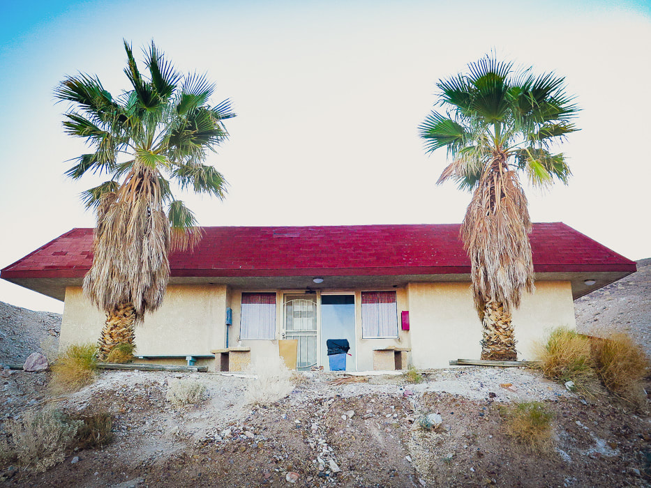
Bath house with 2 hot springs pools at Tecopa Hot Springs Resort, California.
Our Hike
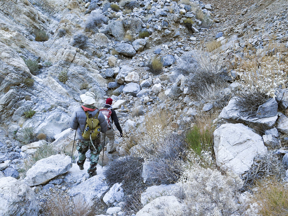
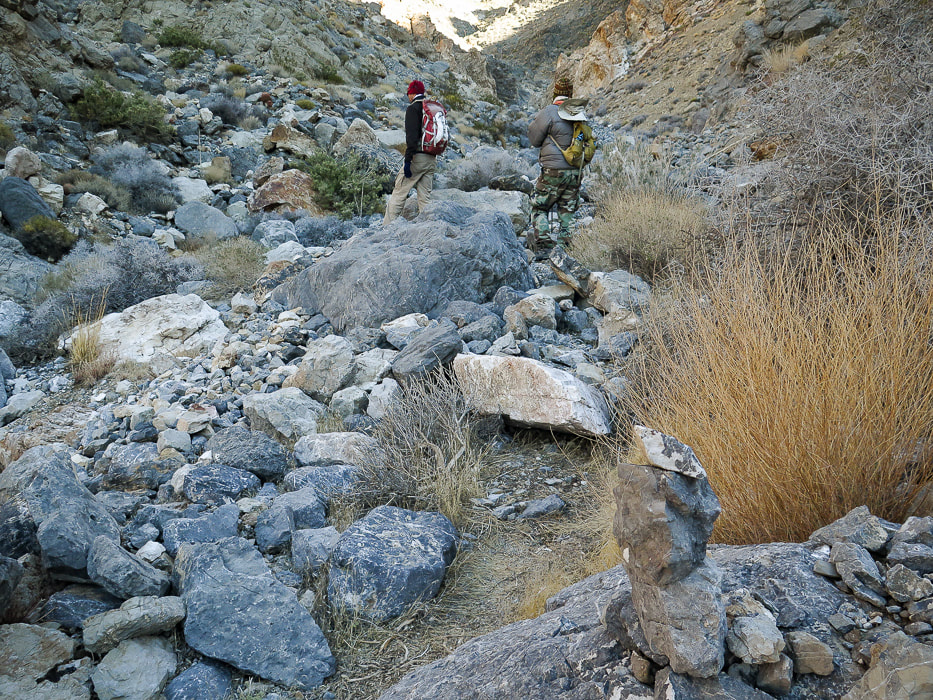
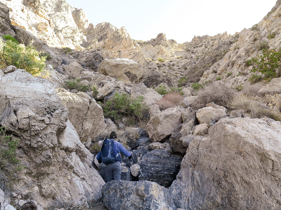
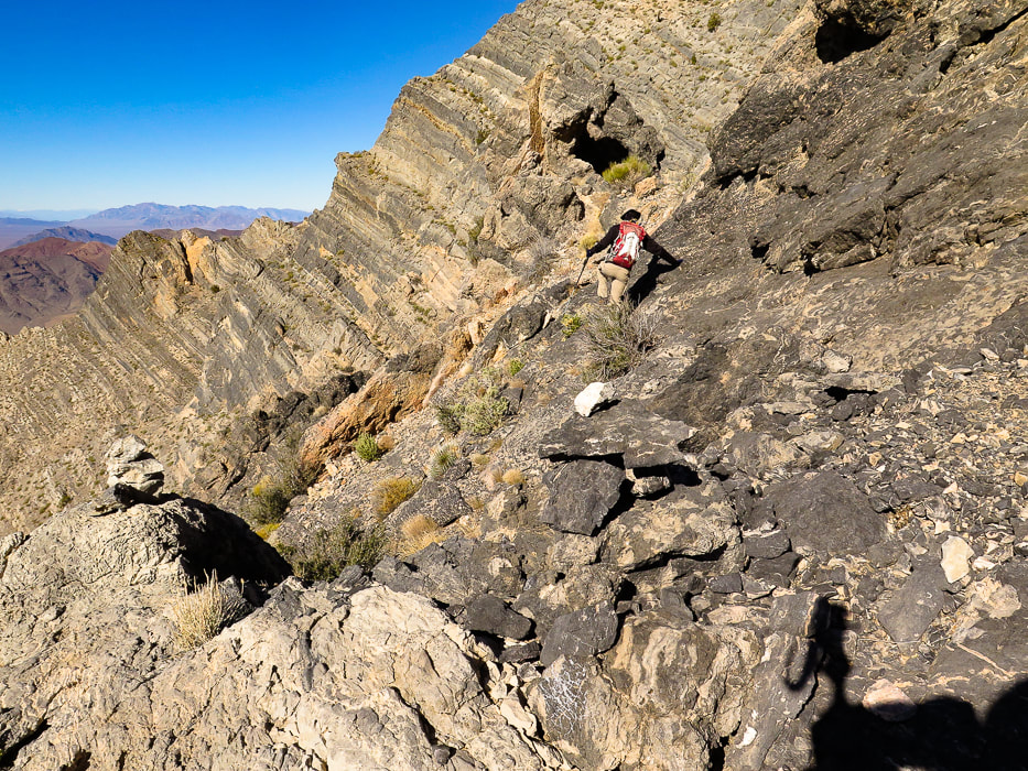
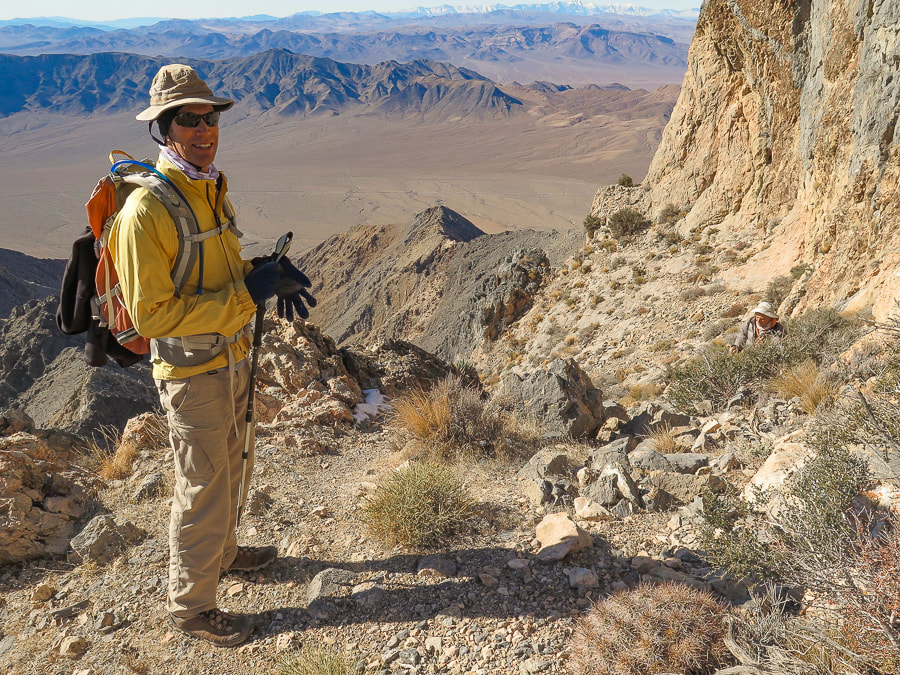
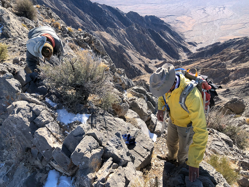
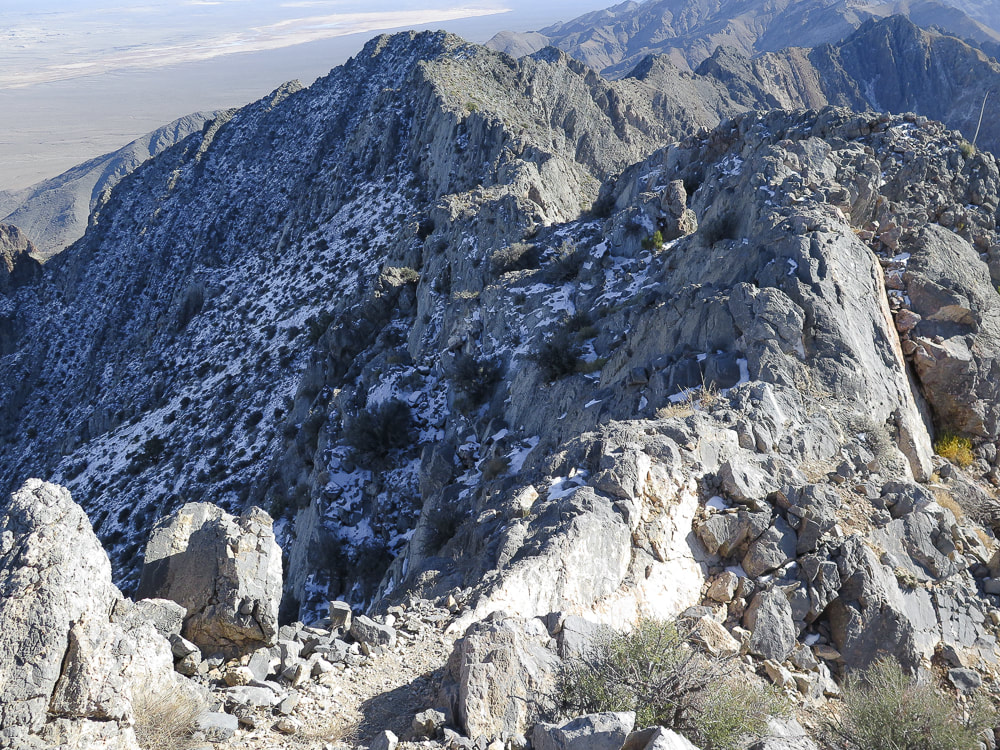
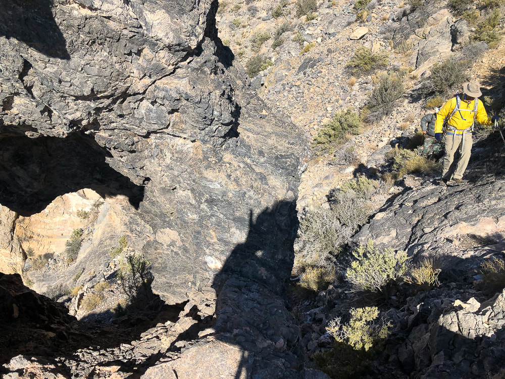
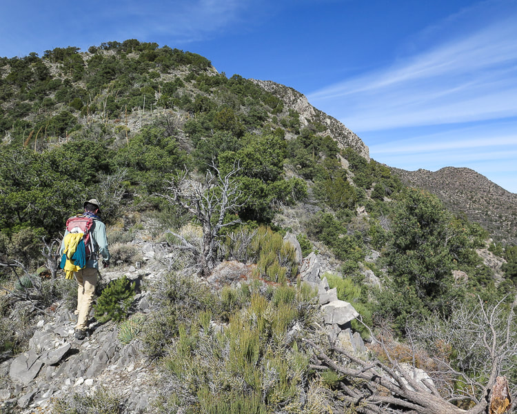
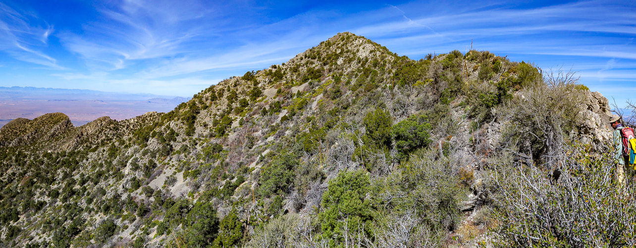
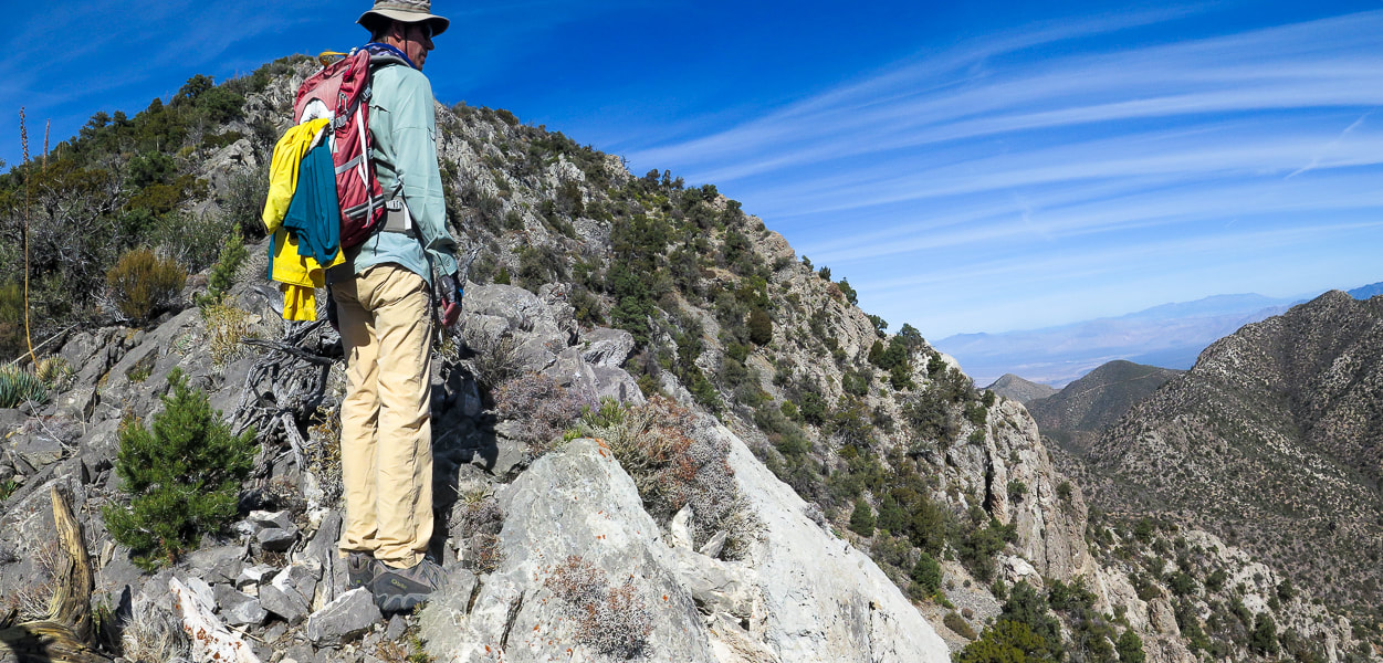
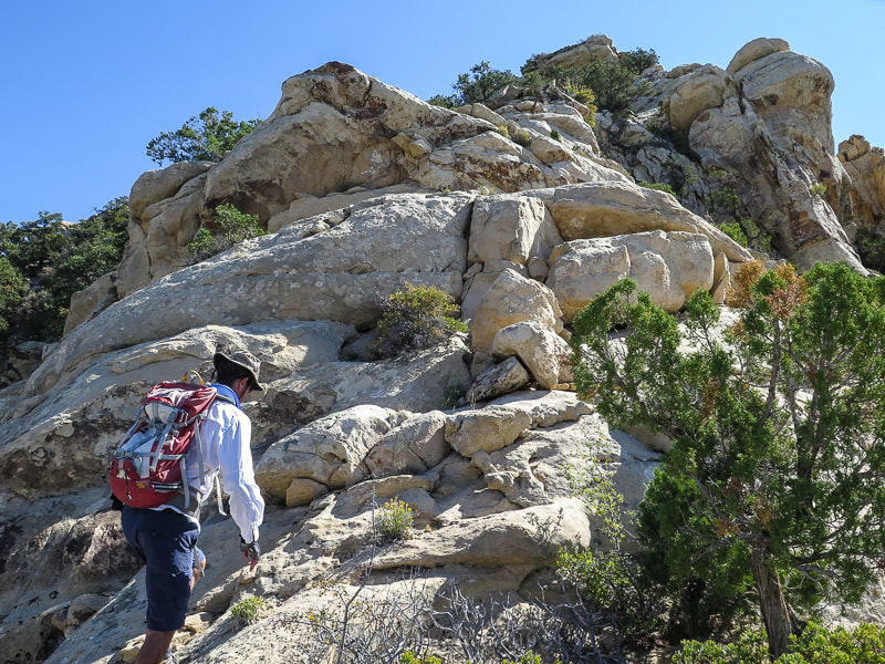
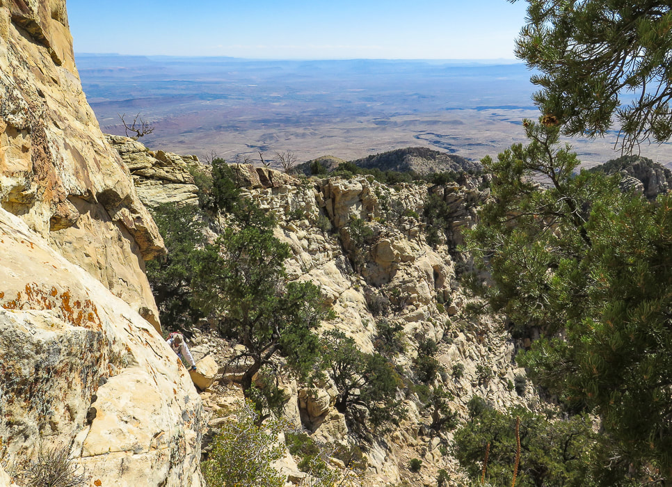
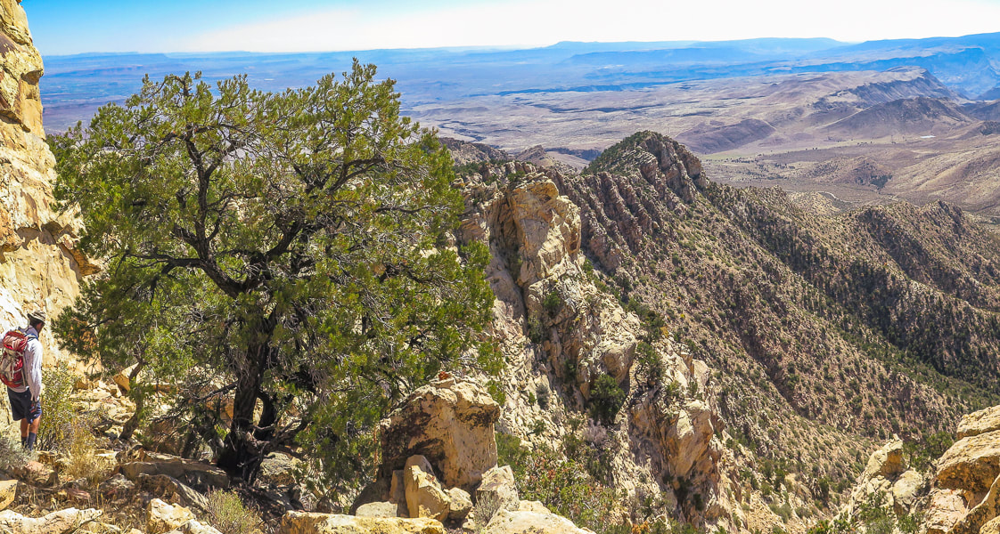
In the classic Mojave desert fashion, this rocky peak rises abruptly from the desert floor with dramatic, unobstructed views from a small, almost precarious perch at the summit. Pahrump Point looks difficult if not impossible from a distance, so it's fun to find the route through its steep cliff face. I'm glad Scott brought along the hike description from Desert Peaks Section manual. There are three crucial points along this route that you need to recognize in order to negotiate the rocky gullies, canyons and ridges to find most efficient way to the summit. The hike switches from Pahrump Point's southwest ridge to its southeast ridge where an easier route is present, just under the summit. Trip reports describe starting this hike just off of CA Highway 178 and the road leading to the mouth of the canyon, the distance of 1.8 miles. With our high-clearance truck, we drove just under one mile up this gravel road and parked to walk the rest of the way to its end at the mouth of the canyon framed on each side by alternating light-and dark colored Cambrian rock layers. A few cairns identify the trail throughout the completely rocky canyon bottom. A path initially goes along the toe of the left canyon wall, and then to the right, but most of the time is spent maneuvering through rocks and boulders in the canyon bottom. Once topping off on the southwest ridge after climbing a talus slope out of the canyon, the peak's cliffs come clearly into view, as well as a long and deep canyon to the south. To make the switch to the southeast ridge to summit, there are a few very important and prominent cairns for direction. The last few hundred feet climb to the summit is fun - you go by a hole in the rock that looks down into another steep canyon, then up a steep, short gulley. This empties you onto the final Class 2+ climb up Pahrump Point's manageable face, where you reach a fun and short summit ridge that is only slightly spooky. The narrow summit elevates you thousands of feet over desert playas, with a clear view of snow-covered Telescope Peak - the highest in Death Valley. The ridge to the next high point to the north seemed treacherous, so being content with our accomplishment, we basked in the nearly winter solstice sun. We occasionally cursed the loose rock on the return talus slope, after getting off the ridge. I wondered if age has caused me to be slower on this terrain. Picking our way through the boulders in the canyon, looking for cairns to give us a clue for a better route. Exiting the canyon onto the immense Chicago Valley, we turned back to see the Nopah Mountain range a fiery yellow/orange of sunset. Looking forward to dinner at the Crowbar Cafe and Saloon in Shoshone to celebrate another adventure - three friends who (still) like to hike together after all these years. It was great to hike once again with Scott, who said at the summit, "This is good for my soul!" Hiking to these amazing places with your friends and overcoming physical and mental obstacles together is good for your soul and can help you experience "flow" - the secret to happiness and optimal experience. The concept of "flow" is getting more attention lately and is the subject of my next post, as well as positive psychology, body movement science, enhancement of goal pursuit and well-being .
"Into the forest I go, to lose my mind and find my soul."
- John Muir 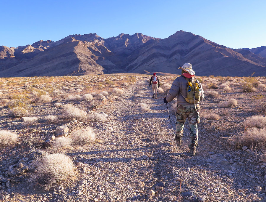
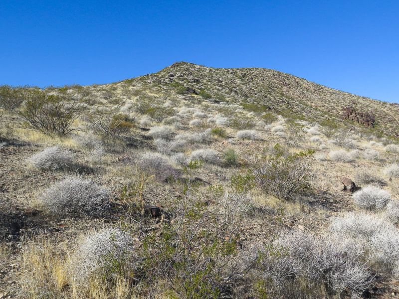
Initial approach through Chicago Valley up gravel road to mouth of canyon and then to Pahrump Point, just right of middle horizon. Cold and windy December morning in the Mojave.
End of road, trail goes up wash. Here, trail is seen on left side of canyon; it switches to the right side further up.
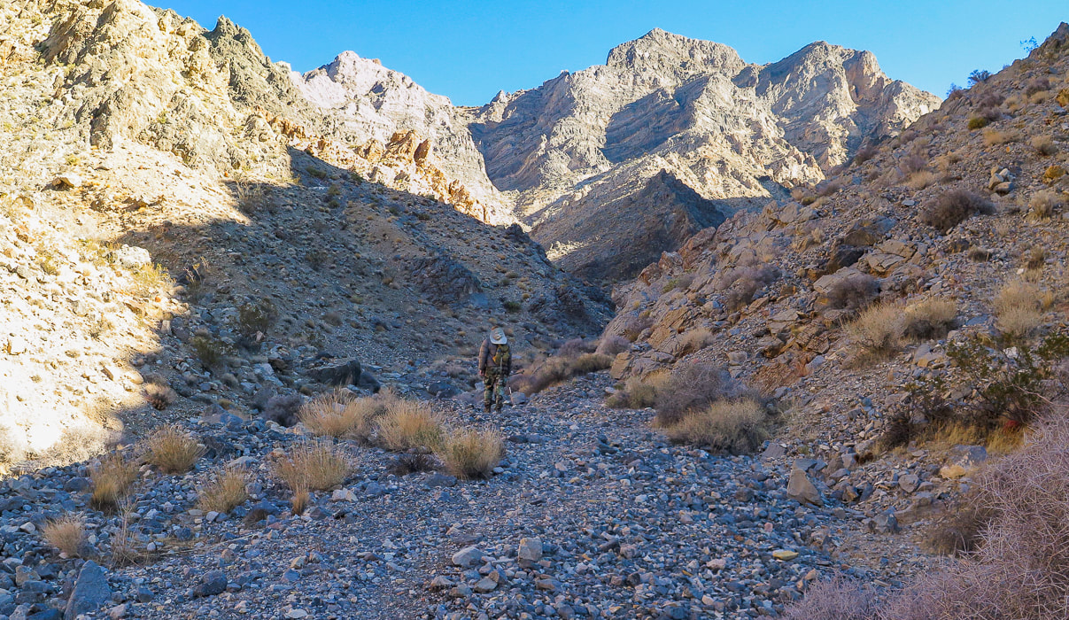
Initial main canyon walk alternates between canyon floor and side trails.
Trail seen on left side of canyon initially.
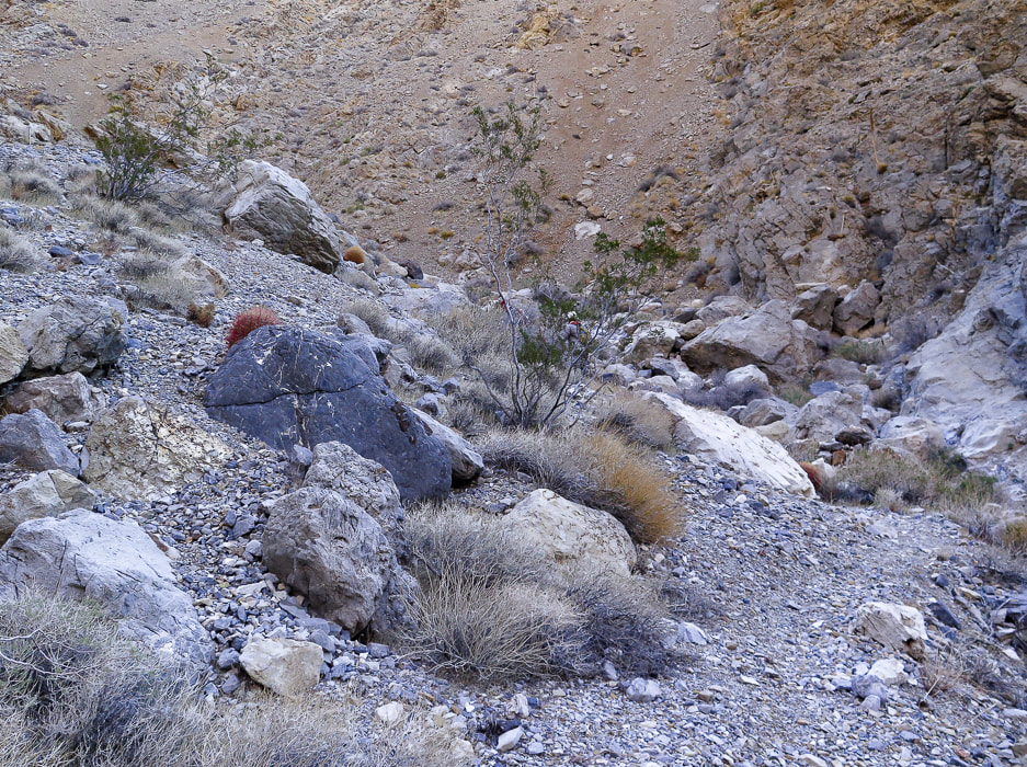
Coming down from a trail on the right side of the canyon, then up bottom of canyon to left and right fork; take right fork.
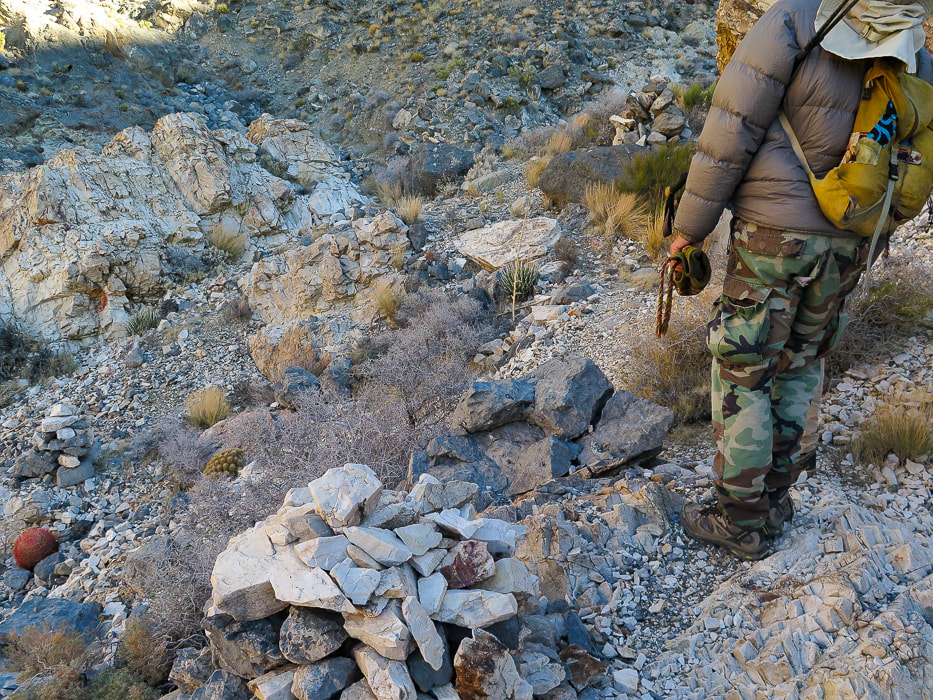
Tall cairn at 4,120' elevation that indicates to take the canyon to the right.
Trail then ascends up right side of canyon to 2 large cairns. From here, trail traverses slope and then drops you to the base of talus slope and ridge saddle.
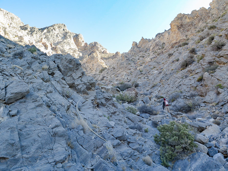
Heading up canyon to the right at intersection with main canyon. This right fork takes you up talus slope to saddle at ridgeline.
Getting closer to the ridge
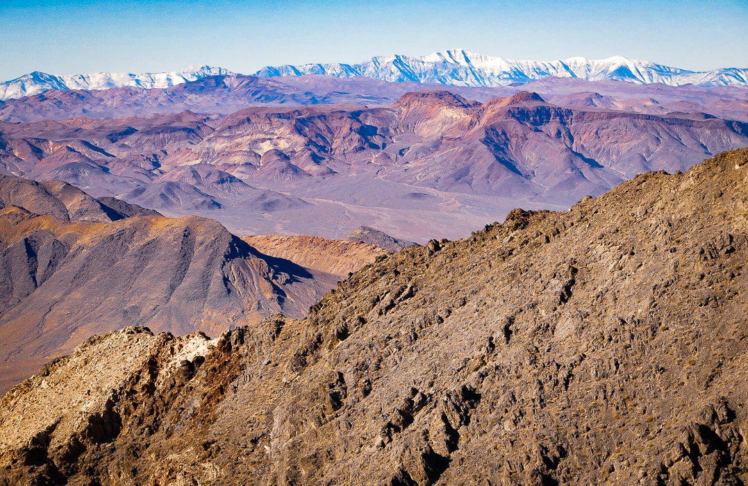
A look back toward Telescope Peak in Death Valley to the northwest.
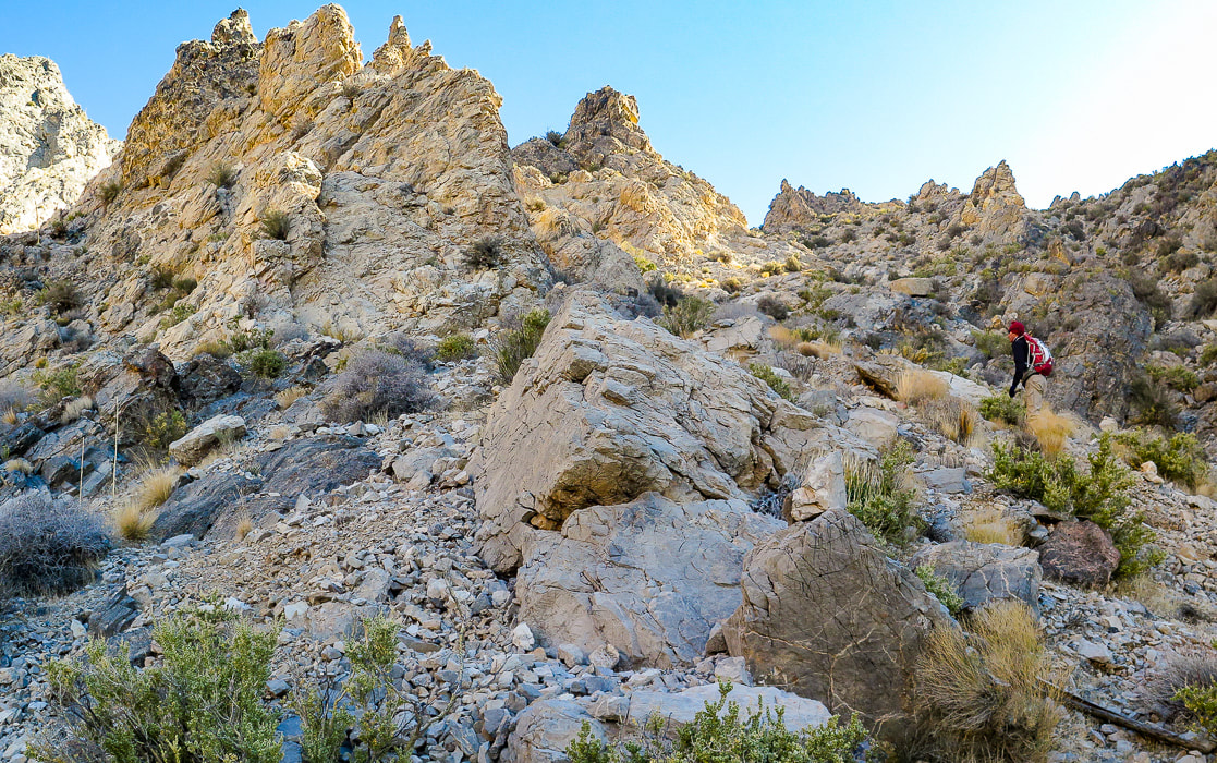
On a moderately loose talus slope, getting closer to notch on ridge; then peak clearly seen to the left.
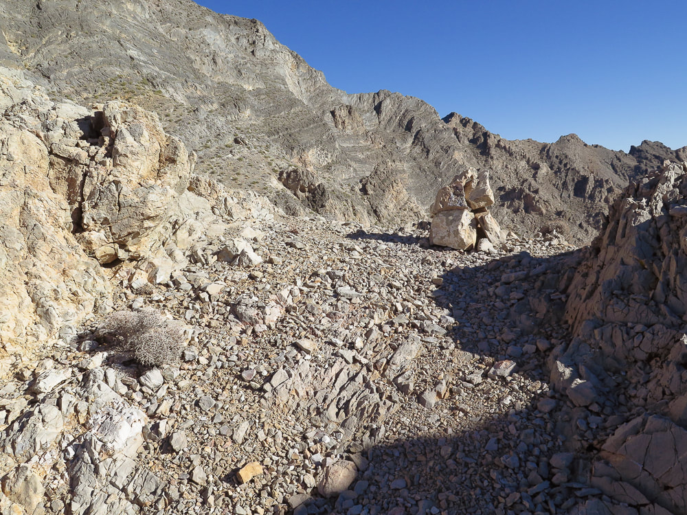
Large cairn marking saddle on ridge at top of scree slope. Peak is seen clearly at this point.
Once on ridge at 5,100 feet, see summit, and another 300-foot ascent to it; continue following ridge shortly to a ducked/cairned notch - head left through that notch to traverse to the left through another marked notch where there is a "window rock" on its left side. The route avoids the steep cliff face under the summit.
Cairn on left marks the traverse to the notch with "window rock".
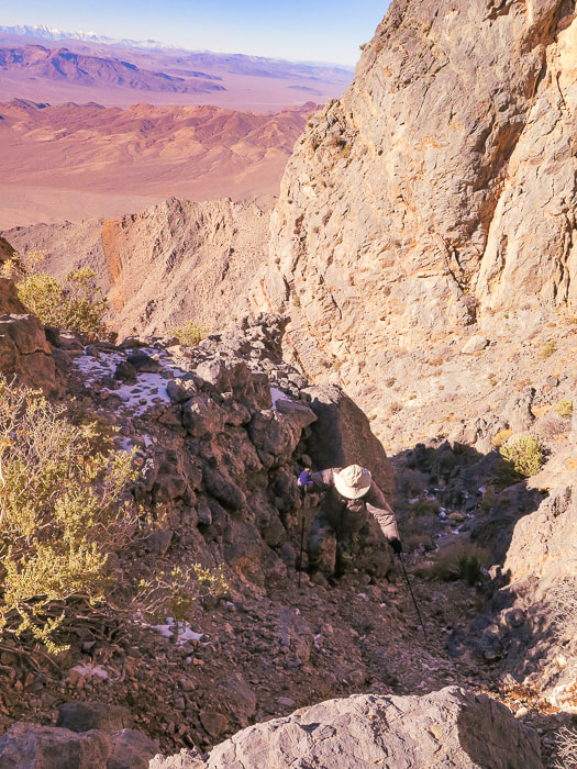
Gully just after "window rock" which is on the left side of trail.
Out of short gully and now fun Class 2+ on final ascent.
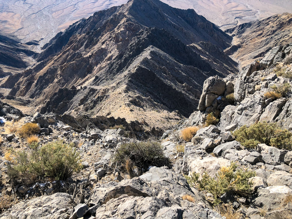
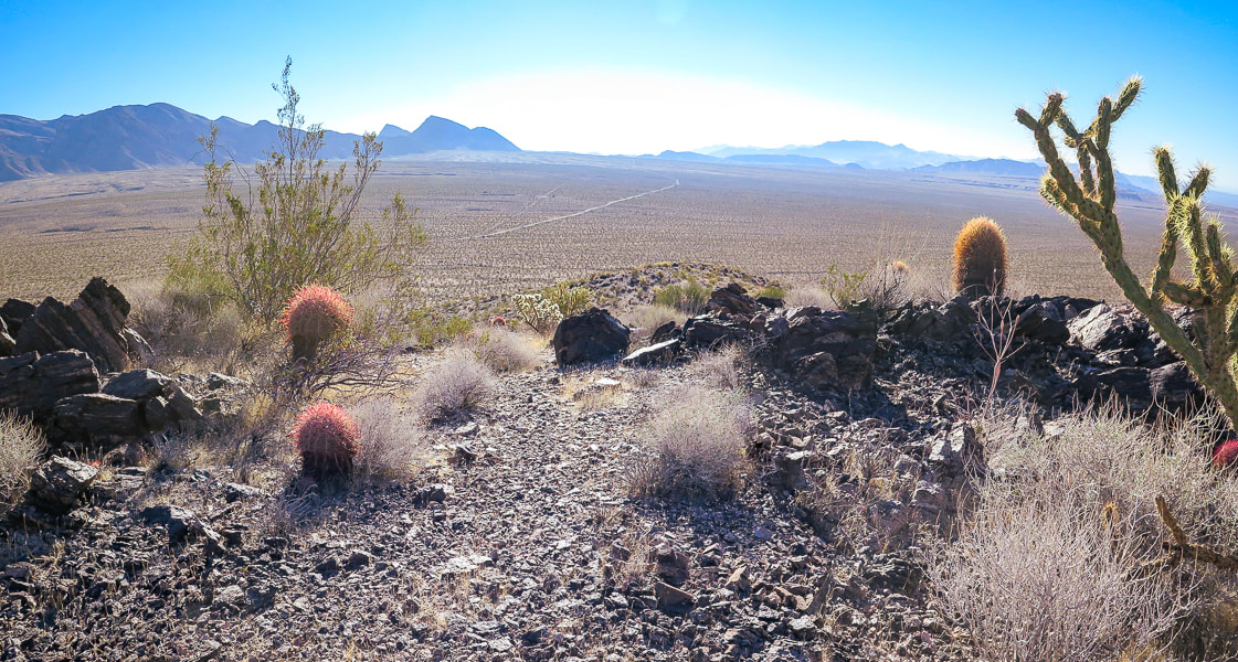
Looking down canyon toward Chicago Valley to the south.
Entry up face of summit block on the summit's right side.
Reaching the summit ridge.
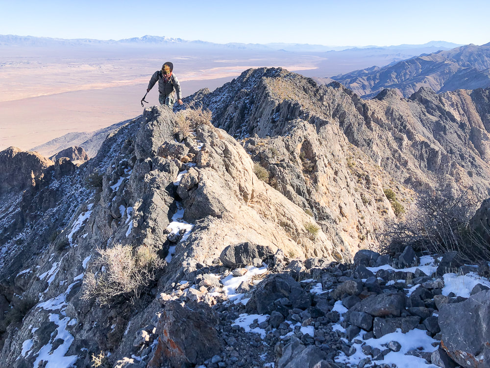
Southeast ridge just under the summit.
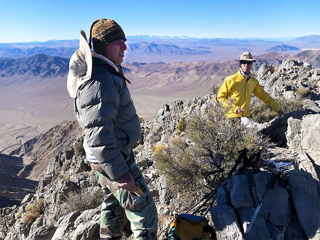
At the summit; trail goes through the snow on left side of this ridge in photo.
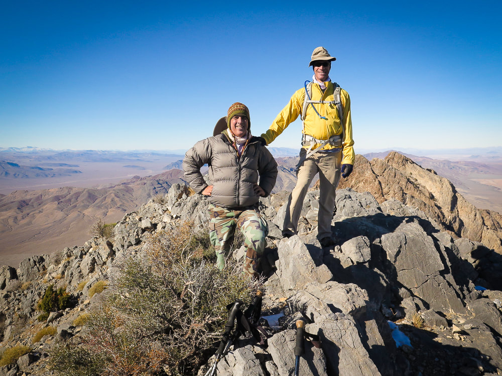
Scott and Fred on the summit of Pahrump Point - 5,410 feet!
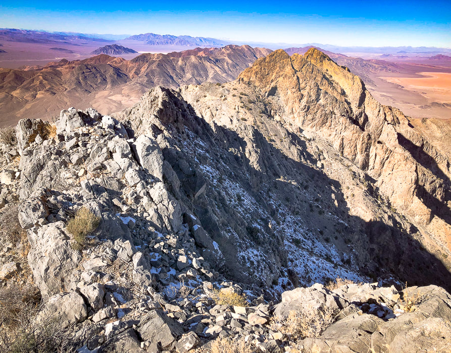
Looking southeast down the Nopah range.
Mt. Charleston, north of Las Vegas, in background.
On Pahrump Point's summit.
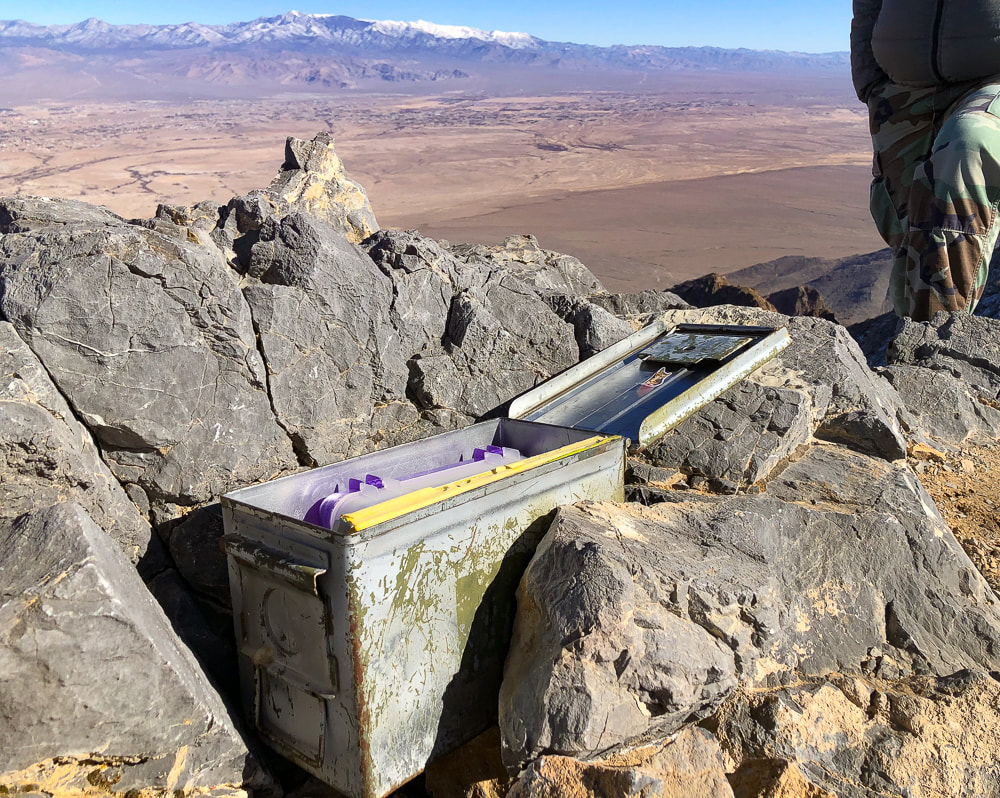
A very organized peak register.
Trail on ridge - working our way back down.
"Window rock" on left side of trail is a landmark to navigate trail.
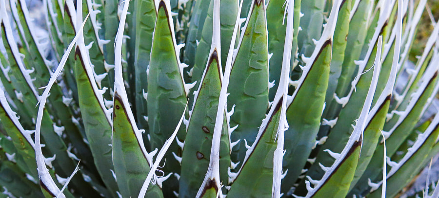
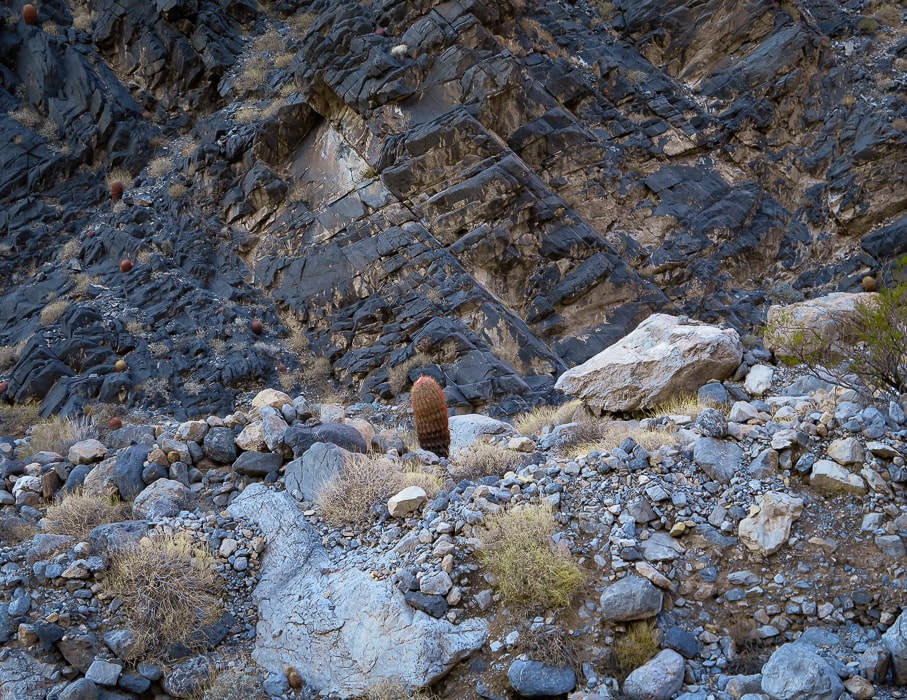
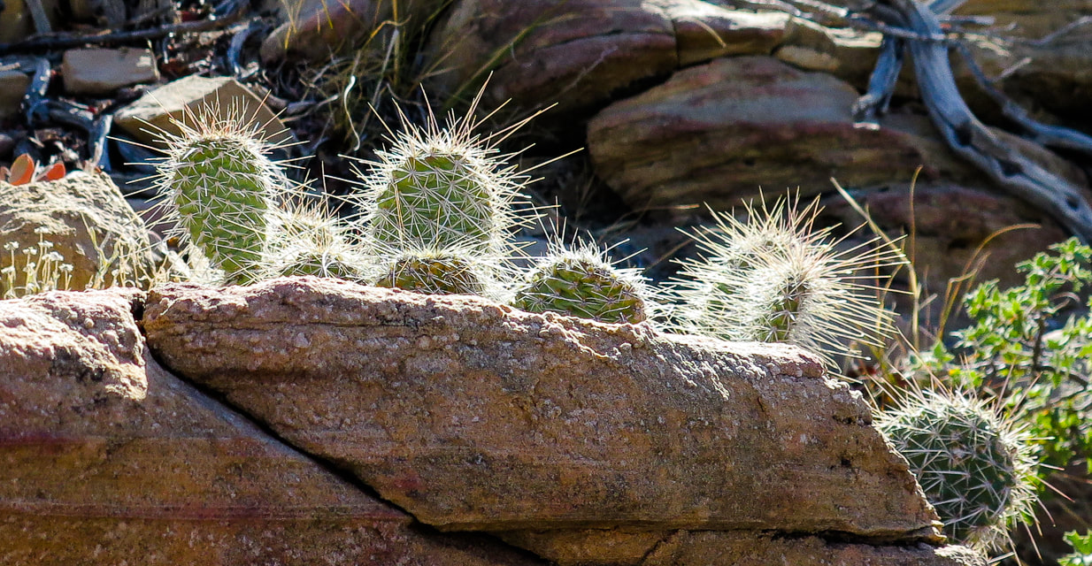
Ivory-spined agave
Some cool stuff on the trail.
(clockwise from top left) Hedgehog cactus, bryozoan fossil, ivory-spined agave, triangulation survey marker at Pahrump Point's summit. 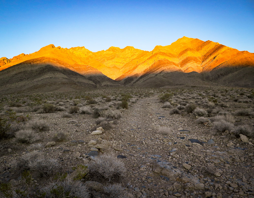
Parting shot - sunset on Pahrump Point in the Nopah Range.
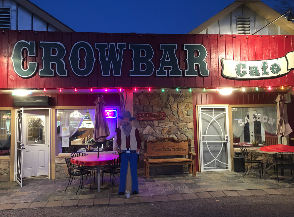
Celebratory dinner at the Crowbar Cafe and Saloon in Shoshone, a few miles from Tecopa Hot Springs, CA.
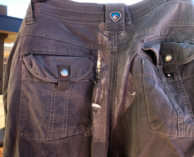
Sad to see these go - the limestone proved to be too rough for these worn KUHL pants.
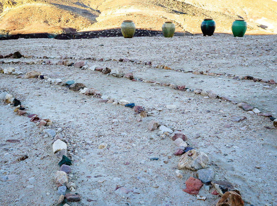
Labyrinth at Tecopa Hot Springs Resort
Tecopa Hot Springs Resort
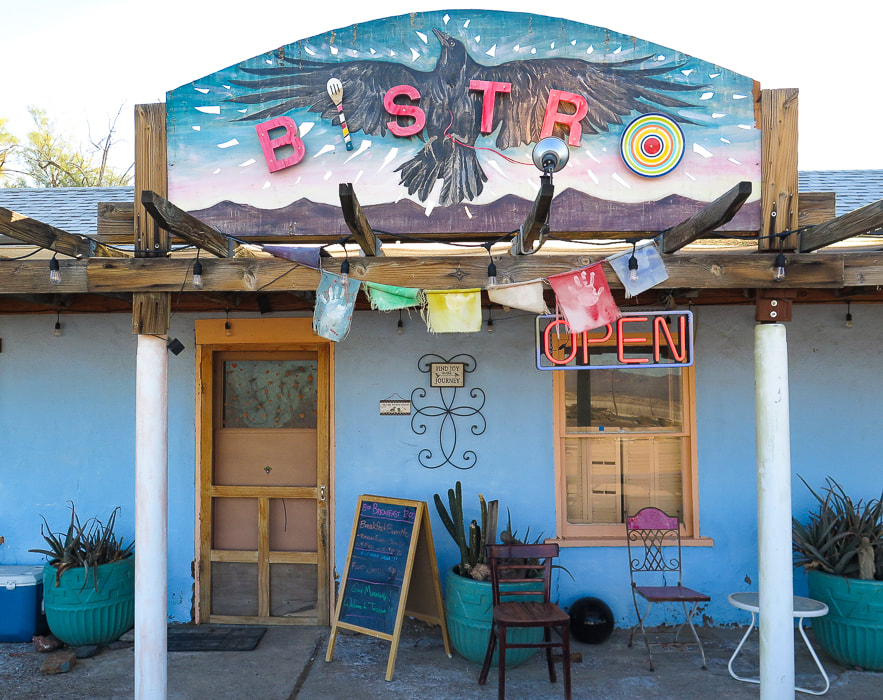
Tecopa Hot Springs Resort Bistro - the best huevos rancheros for breakfast!
Moonrise in Tecopa, California.
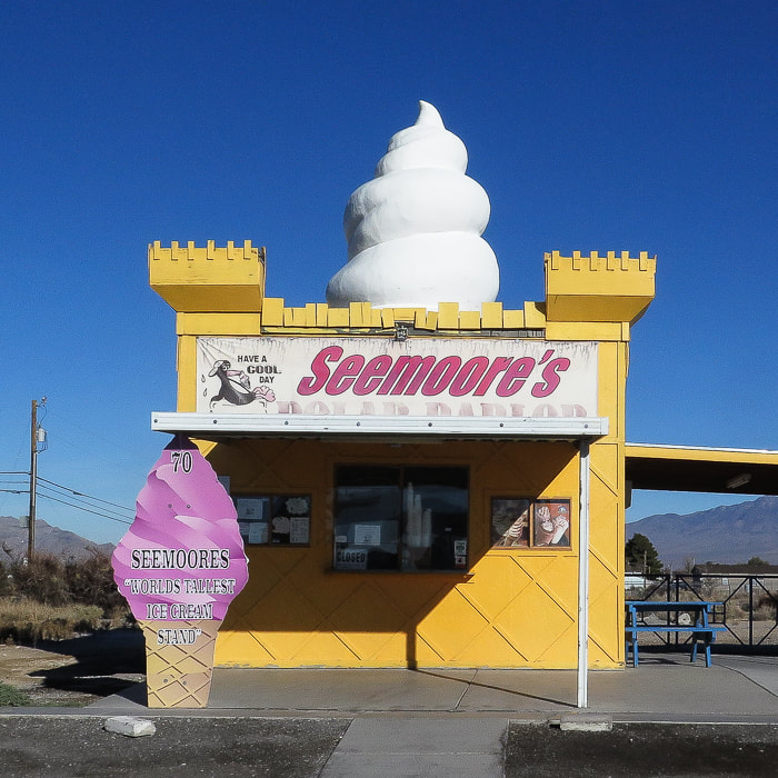
Seemoore's Ice Cream - "The World's Tallest Ice Cream Stand"
Pahrump, Nevada. 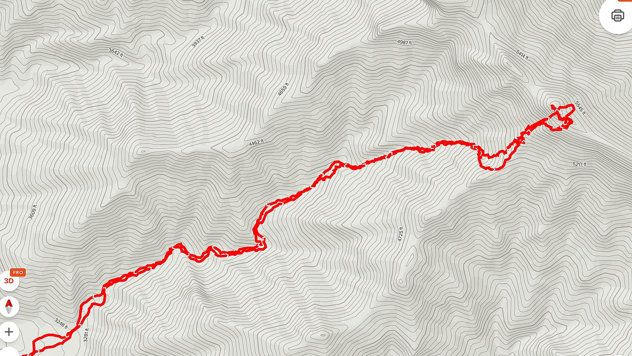
AllTrails GPS tracks from beginning of canyon (lower left) to Pahrump Point.
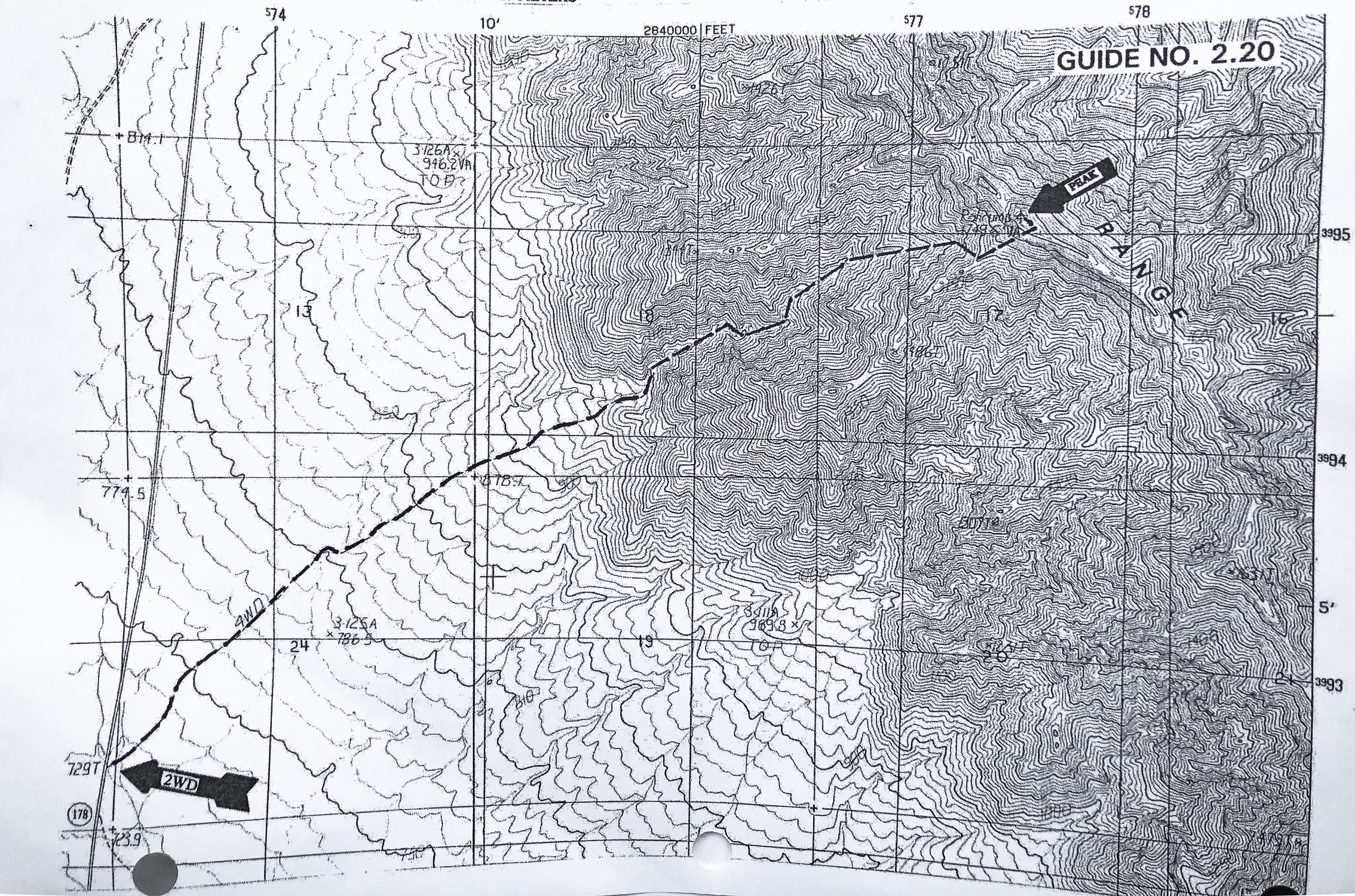
Route map from Sierra Club Desert Peaks Section
click for larger view
References
Wikipedia. Pahrump, Nevada. Jennings, C.W. 1958. Geologic Map of California Death Valley sheet. Why Does Experiencing 'Flow' Feel so Good? A Communication Scientist Explains. theconversation.com. Flow Theory: An Overview. sciencedirect.com.
Making images in the photogenic northern Mojave Desert and a quick hike up Little Virgin Peak.
Related Posts:
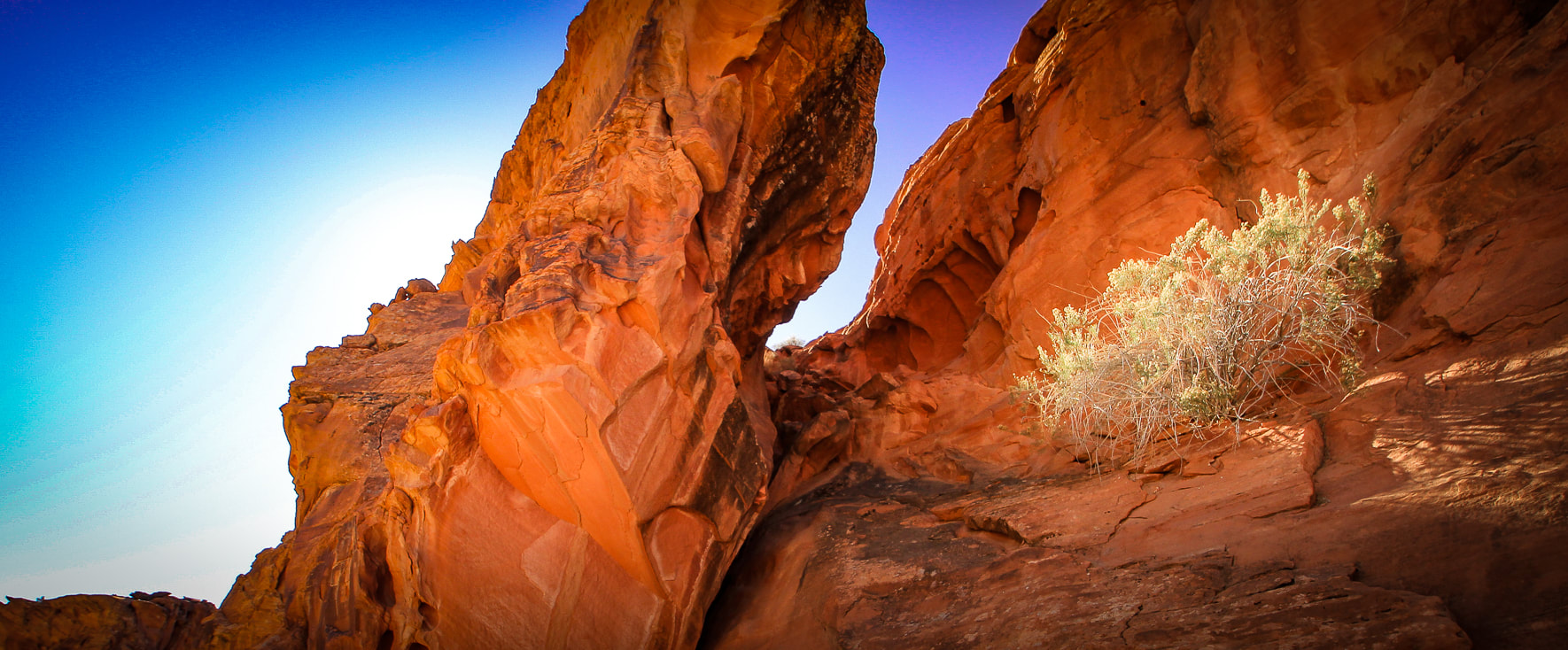
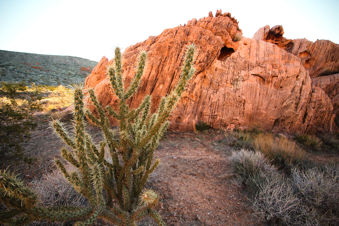
We returned to Gold Butte National Monument, about an hour's drive from Las Vegas to explore, hike and photograph this land of meandering gravel roads leading to petroglyphs, weirdly-shaped sandstone spires, old mines, and thrusting sandstone domes. Just a month ago, we hiked Virgin Peak summit, the highest in Gold Butte, on an enjoyable fossil-filled ridge.
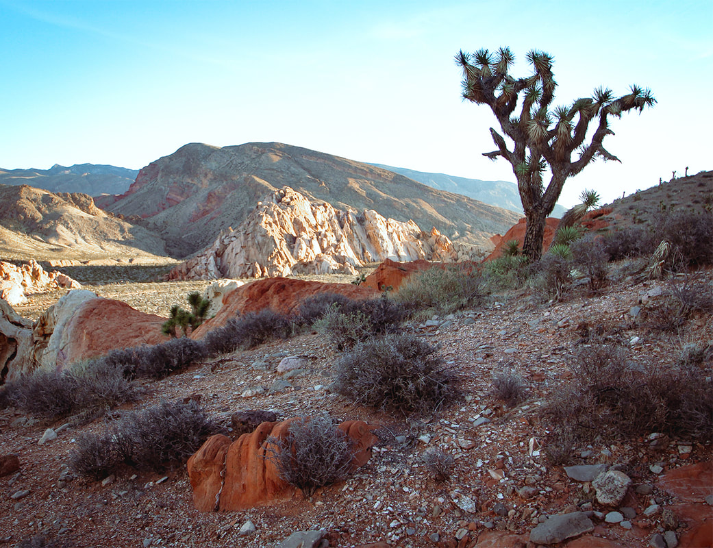
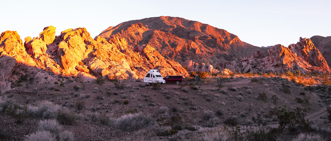
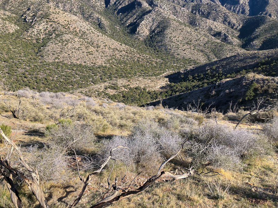
We scored a hidden campsite in Whitney Pocket perched at the end of a platform above a rocky wash on one side and a rough gravel road marked "designated route" on the other. One night we heard an animal walk around our trailer, maybe a deer. The night sky was illuminated by the milky way as well as a weird glow from distant Las Vegas. Gold Butte and recreational side-by-side ATV's make the perfect match. We saw a few large "jamborees" of riders churning through sand and gravel and meeting up at the end of the day to re-fill their deflated tires. While searching out the petroglyphs on the way to Little Finland, not one, not two, but about 15 open ATV's buzzed by us, their dust cloud giving away their whereabouts after vanishing behind a bend. These folks are outfitted with all of the necessary off-road devices: multiple navigational aids and emergency personal locators. On the summit of Little Virgin Peak, we watched another caravan buzzing down the road like ants leading to Lake Mead. This activity looks fun, but I will stick to using my legs and breathing fresh air. The images in my hike descriptions are what I call "photography on the run", where we are moving along and I usually don't have much time to plan or compose my photos. On this trip, however, I had the time in the mornings and evenings, sunrise and sunset, to wander around the beautiful sandstone alcoves and into washes, to take time making images. It is a meditative exercise and a luxury. We wanted to hike Mica Peak, but that meant another 20 miles on slow-going roads, so we saved it for another time. There's so much to see in the American west, Nevada, and this little corner of southeast Nevada. 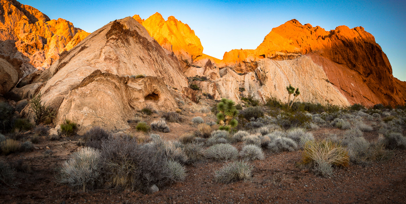
Aztec Sandstone at Whitney Pocket.
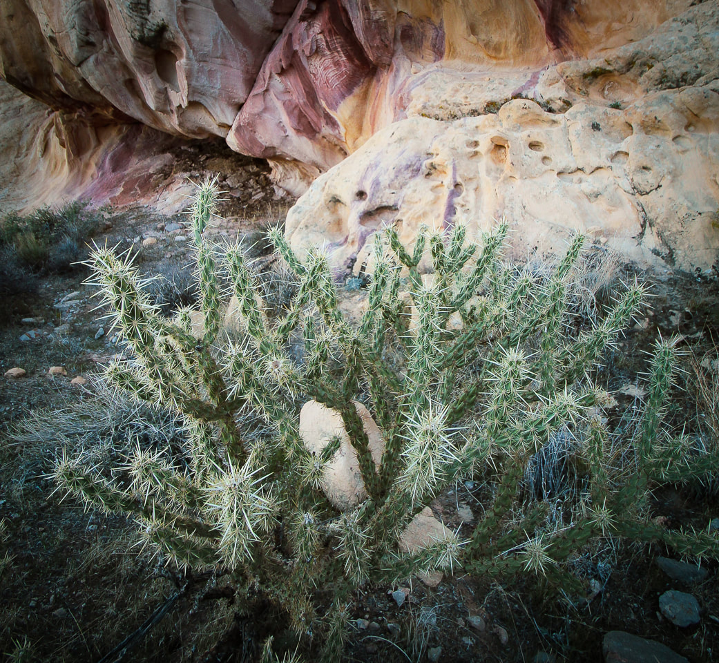
Buckhorn cholla at Whitney Pocket.
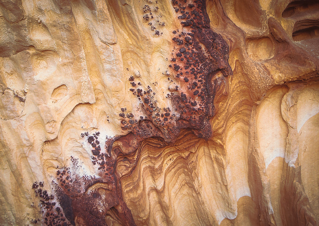
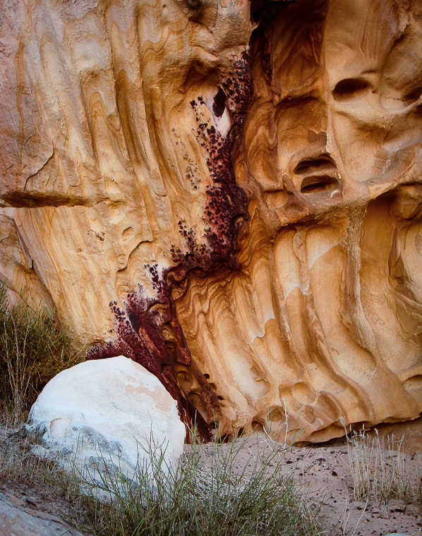
Detail in sandstone at Whitney Pocket
Iron oxide concretions caused by precipitation of iron in paleogroundwater through sandstone. 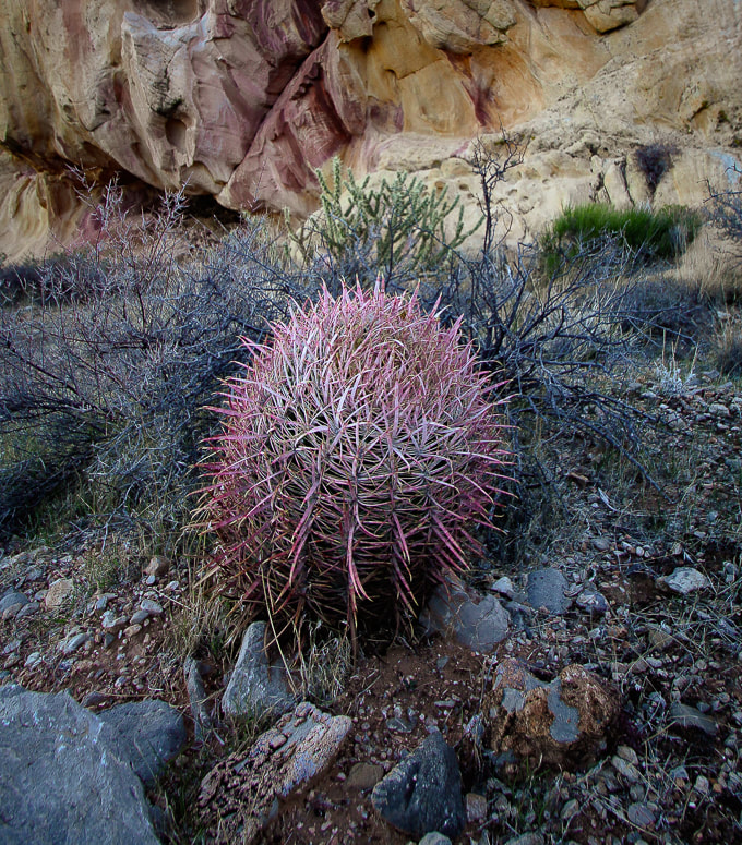
Barrel cactus
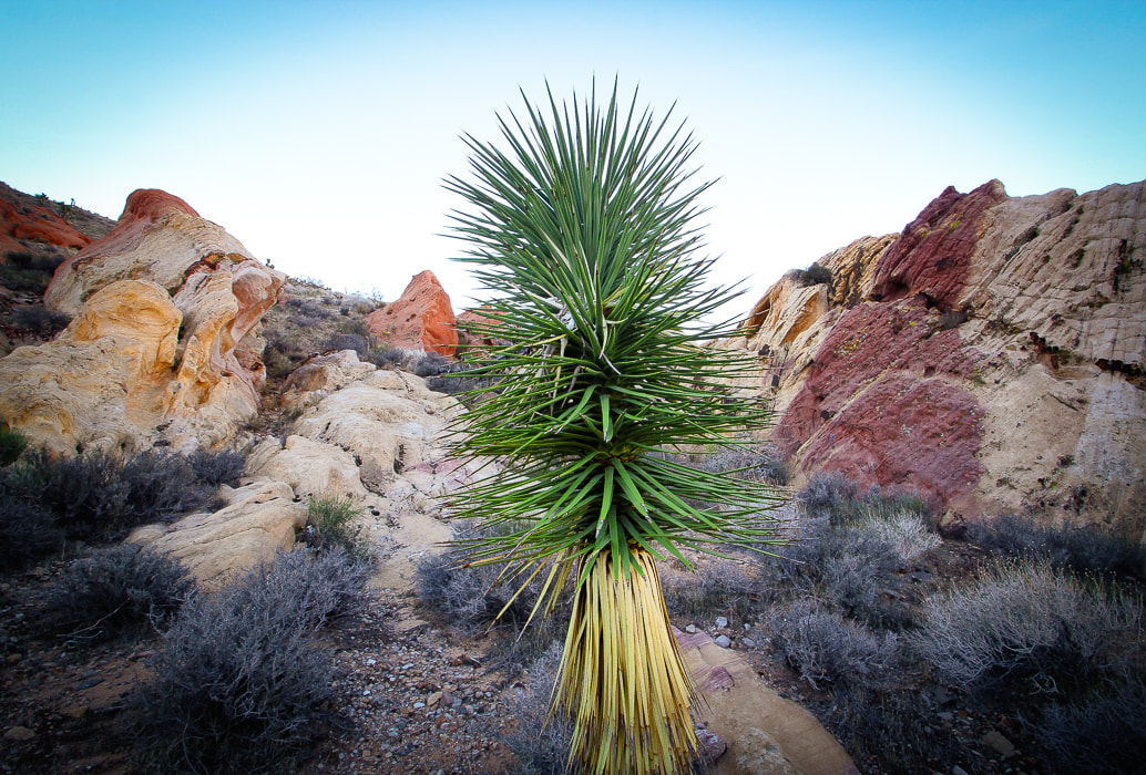
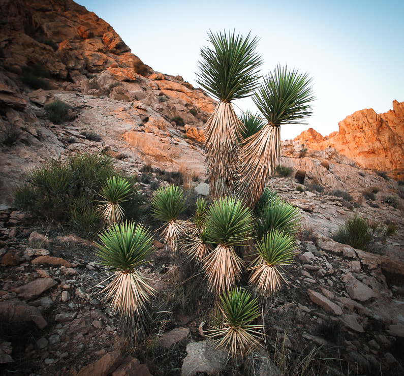
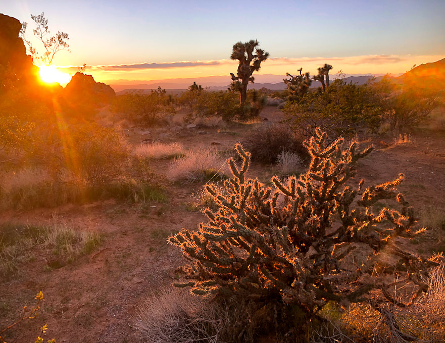
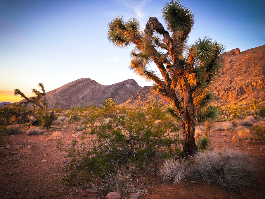
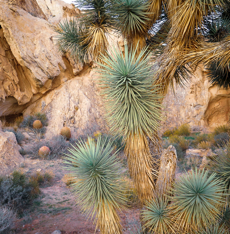
Joshua Tree - a Mojave Desert "indicator" species (a measure of environmental conditions in the Mojave).
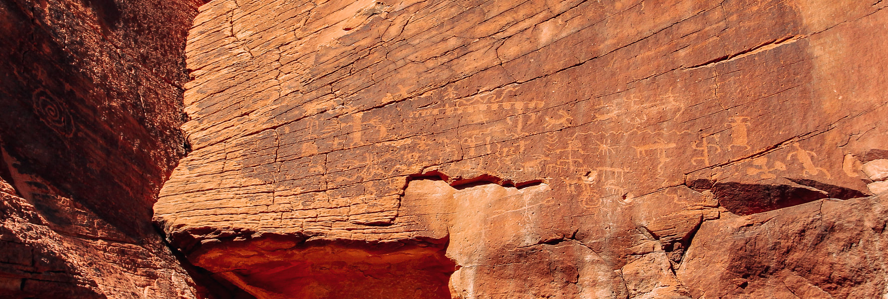
Mud Wash petroglyph panel near Little Finland in Gold Butte National Monument.
Whitney Pocket sunrise.
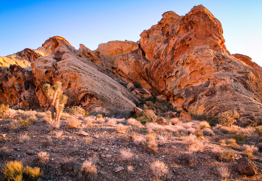
Whitney Pocket - Aztec sandstone at sunset.
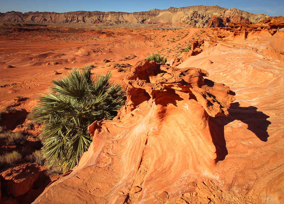
Little Finland - a platform of sandstone features eroded into strange and intricate shapes hanging above a palm oasis.
Our own "private Mojave" hidden by Aztec sandstone in Whitney Pocket - at sunrise.
Little Virgin Peak Hike

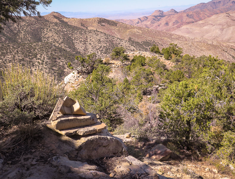
Summit and rock cairn of Little Virgin Peak; Virgin Peak (8,071') on the horizon.
Trip Stats
Overview: Little Virgin's mellow southwest ridge is a relatively short and sweet way to get fantastic bird's-eye views of the stark northern Mojave desert filled with alluvial fans, washes and mountains of Gold Butte National Monument and Lake Mead National Recreation Area. Location: Gold Butte National Monument, Southeastern Nevada. Coordinates: Little Virgin summit = (UTM) 11S 0748307E 4054422N. Our trailhead = 0749437E 4053626N. Distance/Elevation gain: 2.2 miles out and back/860' gain. Difficulty: Moderate effort Class 2 scramble on faint trail once on ridge. Permit: None required; no entrance fee to Gold Butte NM. Map: Gold Butte National Monument Area Map by Friends of Gold Butte. Date Hiked: December 4, 2021. Driving Directions: From I-15 north of Las Vegas and just south of Mesquite, Nevada, take exit 112 in Bunkerville, onto Highway 170, traveling 3.5 miles, taking a right onto Gold Butte Backcountry Byway just after crossing Virgin River. Continue on Gold Butte Road about 13.8 miles to the base of Little Virgin on the right. We parked at the intersection of Gold Butte Road and the sandy Fisherman's Cove Road, marked with a sign. Hike Directions: Can use east or south ridge: we hiked up south ridge from intersection of Gold Butte Road and Fisherman's Cove Road. From this intersection, hike up slope to the north to gain Little Virgin's south ridge. Continue on ridge to the summit. There is a faint trail occasionally cairned once on ridge.
Our Hike
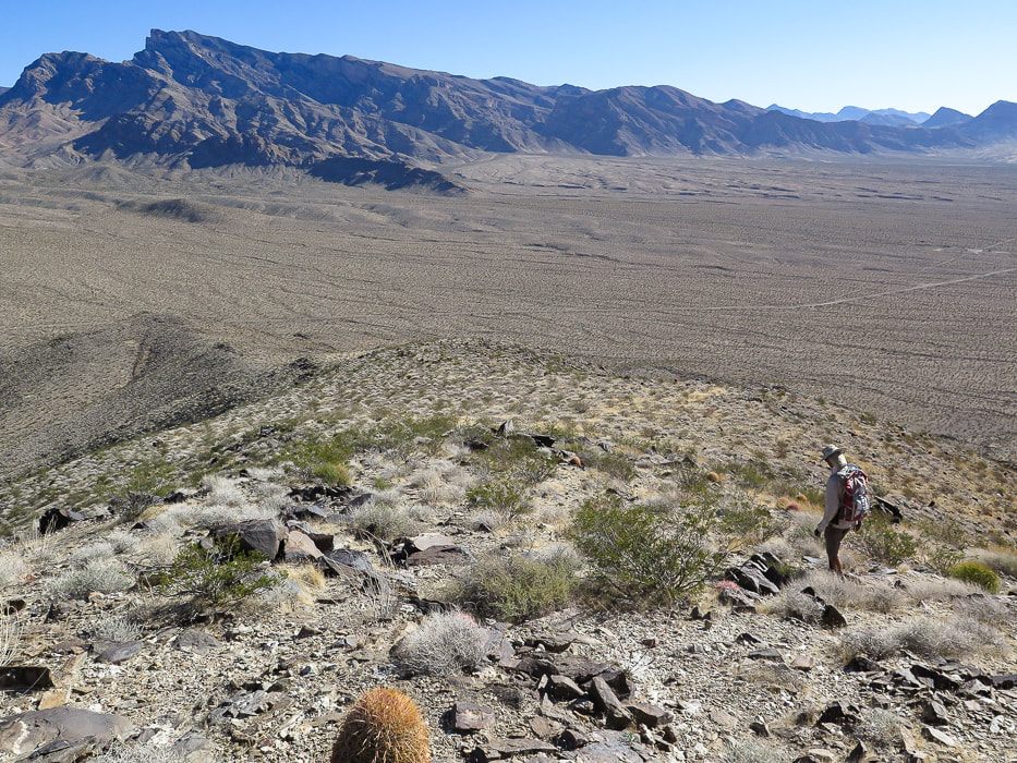
Gold Butte Road passes by Little Virgin Peak on the way to Whitney Point. The hike is short and sweet with great views of alluvial fans and valleys peppered with black, grey and white limestone rocks. The Virgin Mountain range to the east cascades downward from its highest point, Virgin Mountain in a descending series of saddles and rises, its foot embedded into the creosote-filled plains. The geology is vastly different on Virgin versus Little Virgin and the elevation, too (Virgin is 8,071' and Little Virgin is 3,514'). The Mississippian limestone on Virgin Peak's southeast ridge is younger than the schist and gneiss of Little Virgin. To the west, the view looks across Virgin River to Mormon Mesa and other ranges beyond. The east ridge could be hiked for more mileage. The red barrel cacti and green cholla contrast with the chocolate and rust-colored metamorphic rocks (Proterozoic basement rocks - gneiss and schist). We started walking from Gold Butte Road and Fisherman's Cove intersection through a wash at the base of Little Virgin and hiked up the hill to find the ridge. Once on the ridge, it is an easy walk to the summit, following occasional ducks and cairns along the way. The vegetation is healthy, with a few attractive cactus gardens of California barrel cacti (ferocactus) and buckhorn cholla on the ridge, as well as one of my favorite Mojave plants - creosote bush. It is a long-lived desert survivor with a lifespan of roughly 90 years. But the best attribute of creosote comes to life after a rain. Water penetrates the creosote leaves' waxy coatings to produce the wonderful smell of the Mojave desert. It was used by Native Americans to treat a variety of diseases and as an antiseptic. If you are lucky enough to stay at Whitney Pocket in Gold Butte and want a quick adventure, you won't be disappointed with Little Virgin Peak. Once again, as with every hike, we affirm our fortune of having the health, the legs and lungs, to get to these extraordinary places. 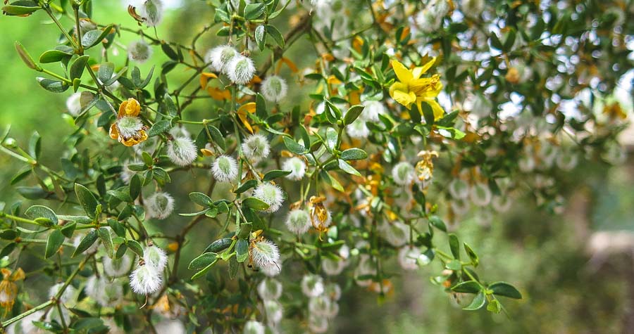
Creosote bush
larrea tridentata 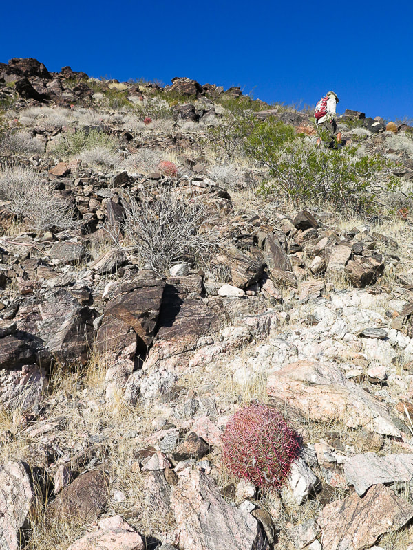
Heading up flank of south ridge.
View of summit
Barrel cactus and buckhorn cholla, metamorphic rock. View to the southeast of Gold Butte Road and Virgin Mountains on the left.
Small "duck" on rock at right to mark trail on ridge.
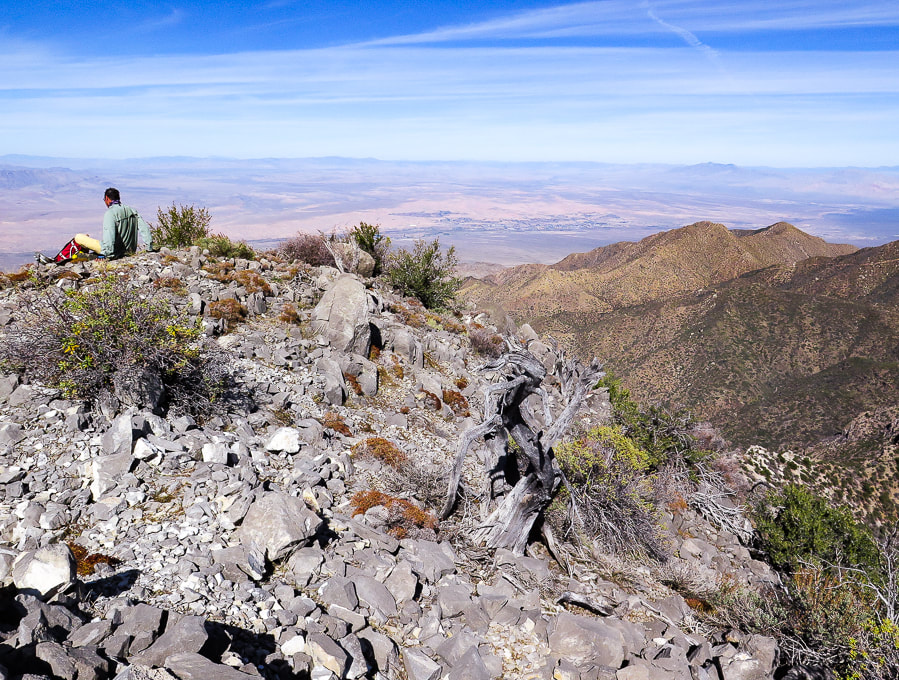
Summit of LIttle Virgin Peak, looking at Virgin Mountains.
Descending down south ridge to intersection of Gold Butte Road and Fisherman's Cove Road. Virgin Peak highest point on ridge left horizon.
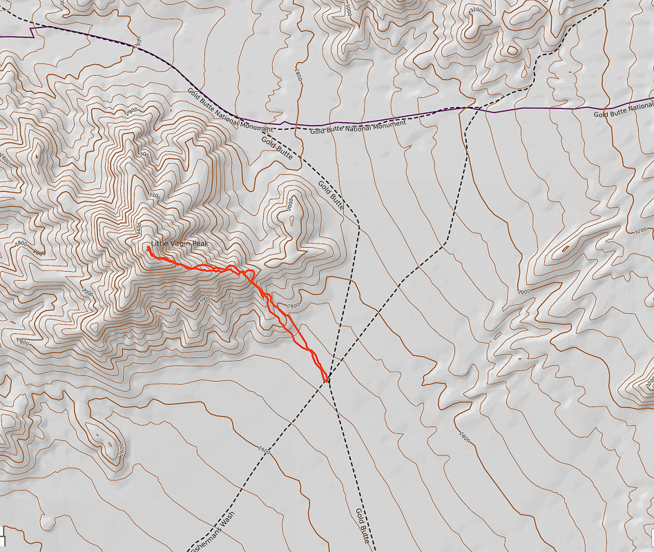
Our GPS tracks to Little Virgin Peak from intersection of Gold Butte Road and Fisherman's Cove Road.
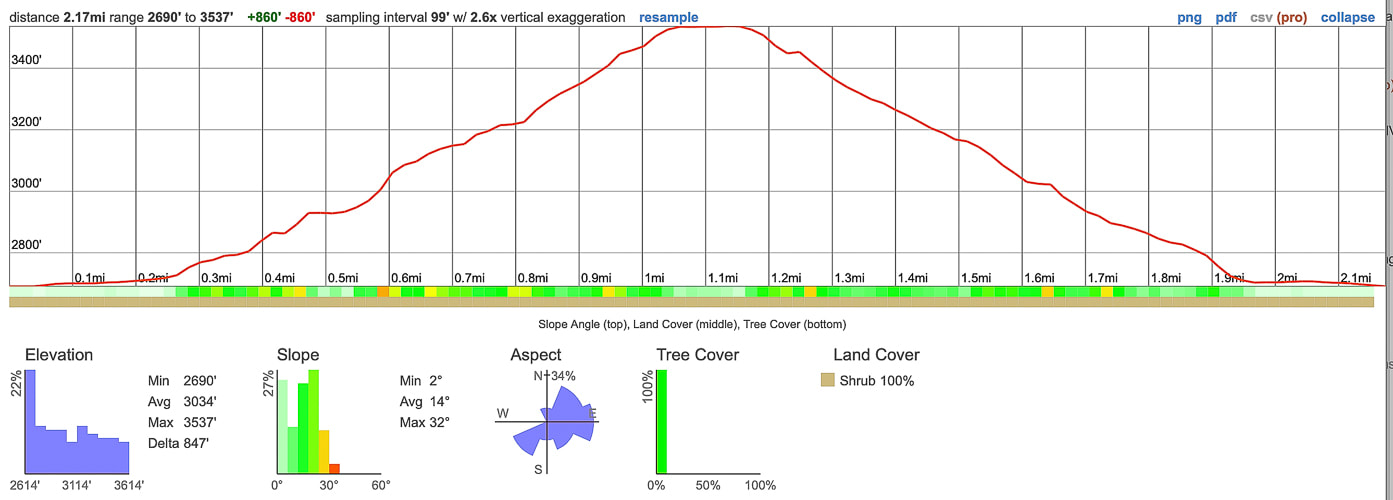
Elevation gain and mileage profile: 1.1 mile from road to summit - 850 feet gain.
References
Gardner, L. The Vegetation of the Mojave and Colorado Deserts. Nevada geology maps. Nevada Bureau of Mines and Geology. pitchstonewaters.com. Creosote Bush: An Unassuming But Ancient Form of Life All Around Us
Remote ridge ramble on fossil-filled limestone northeast of Lake Mead and south of Mesquite in Nevada. Camping the night before among the dramatic sandstone formations at Whitney Pocket in beautiful Gold Butte National Monument enhanced this experience.
Virgin Peak summit, looking north toward town of Mesquite, Nevada and Mormon Mountains on left horizon.
Trip Stats
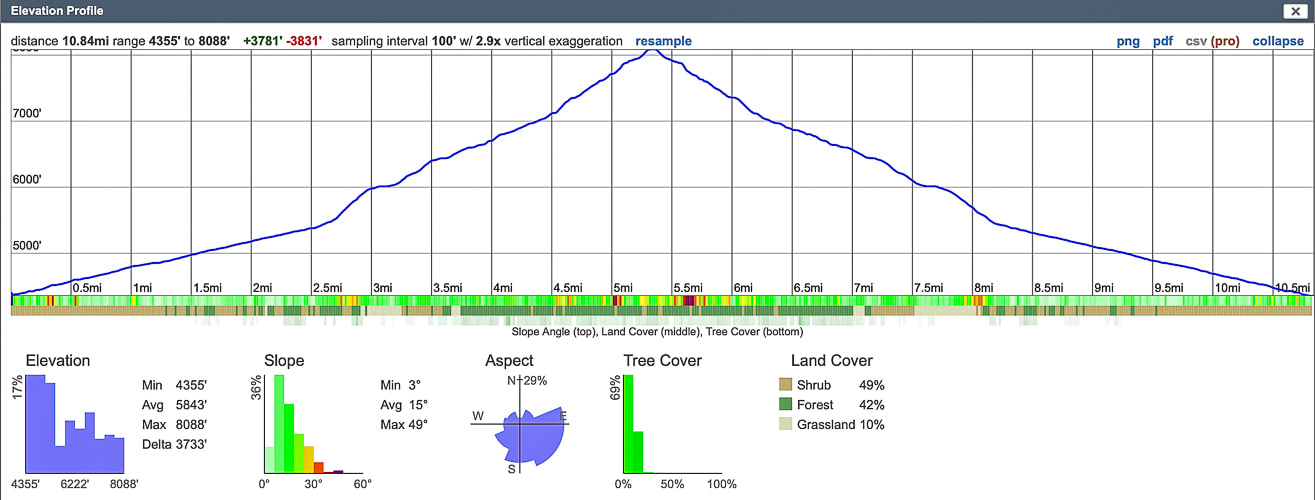
Location/Overview: Virgin Mountains Instant Study Area, Gold Butte National Monument, southeast Nevada, northeastern edge of Mojave desert. The approach to this remote hike begins with a drive through ancient bright orange sand dunes at Whitney Pocket, rising abruptly over Joshua tree-filled valleys, providing private primitive camping coves. The southeast ridge hike has three main sections. The first is a high-clearance 4 WD road that utilizes a deep wash on the right (east) side of the ridge. Next, a steep scramble gains 500 feet from the wash/jeep road to the summit's southeast ridge where the third section is a 2.3-mile, 2,000'-gain beautiful ridge hike to the summit, with many examples of Mississippian-age fossils in limestone, and spectacular views of northern Lake Mead, Valley of Fire, Beaver Dam Mountains to the north. Distance/Elevation Gain: varies depending on how far you can drive up 4 WD road; our distance was 10.85 miles out and back. Our starting elevation: 4,355'. Summit: 8,071', for a gain of 3,700'. Difficulty: Moderate hike on 4 WD road, moderate-strenuous Class 2 ridge to summit on faint trail occasionally marked by cairns. Coordinates: See waypoints table below. Maps and Apps: Virgin Peak, Southeast Ridge - birdandhike.com, Avenza app on GPS with Arizona Strip Map, Gold Butte NM Area Map (purchased at St. George BLM). Permits/Camping: No permits or fees required. Dry camping at Whitney Pocket in Gold Butte NM. Date Hiked: November 3, 2021. Considerations: Long pants advised due to a lot of bushwhacking through shrubs and trees, exposed ridge (thunderstorms), the higher the clearance of your 4 WD vehicle, the nearer your access to trailhead at Cowboy Campsite. Geology: On southeast ridge and on summit, you will be walking on Rogers Spring Limestone AKA Monte Cristo Group (Mississippian period ~ 340 million years ago). Canyon walls on the way up to ridge are Devonian (~ 400 mya) and Cambrian (~500 mya). Geologic map of the Virgin Mountains Instant Study Area, Clark County, Nevada
Related Posts:
“The Mojave Desert is a harsh, but very spiritual, place. As children growing up in the Mojave, we chased lizards and snakes, instead of frogs and squirrels. There is an arid openness about it, and a true feeling of being alone, that you don’t get in any other type of environment.”
- James Stanford, from Shimmering Zen 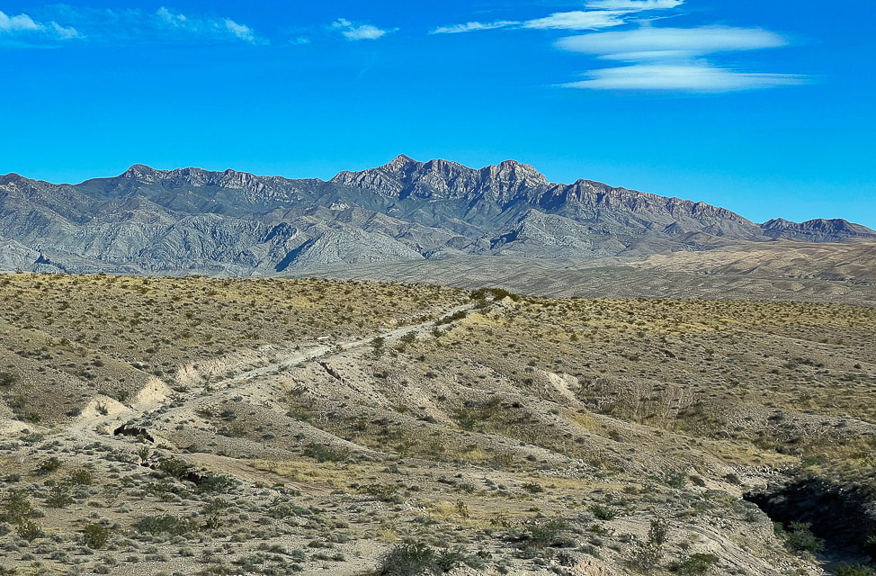
Virgin Peak from Interstate 15 in Nevada.
Our Hike
In our quest this year to explore "off the beaten path" areas in southwestern Utah, away from crowded national and state parks, we have seen some sublime, amazing and sometimes astonishing wilderness beyond park borders, almost always in solitude. Last month, we explored part of the Beaver Dam Mountains. Our adventure this month landed us on the highest summit in the Virgin Mountains, a remote "sky island", rising more than 6,000 feet above the dusty desert floor of southeastern Nevada, a little over an hour's drive from Las Vegas. Extra work goes into figuring out approaches and routes to these less-traveled places, but I find this more meaningful and fun than hiking in well-traveled parks. In 1993, the first time I visited Zion National Park, there were a total of 2.4 million visitors. This year, 2021, looks like it will top 5 million visitors. When I visited Zion in May this year, I noticed the trails were much wider and literally trampled. On Virgin Peak's ridge, we had to focus on finding the trail, as it is not well-defined. I wondered, as we drove on Gold Butte Road to our camping spot from the city of Mesquite, what was so special about this area to make it a National Monument and why so many cared enough to form the Friends of Gold Butte organization. After 20 miles of driving, then suddenly coming upon Whitney Pocket, I understood why. Large, bright orange and red sandstone domes scattered about, anchored into the green creosote and Joshua tree-covered valleys. These large cross-bedded domes glowing orange in the setting sun are remnants of a huge desert formed 180 million years ago, and are the same rock unit as the cliff-forming Zion National Park sandstone. In Utah, this sandstone is called Navajo; the correlative unit of sandstone in Nevada is called Aztec. 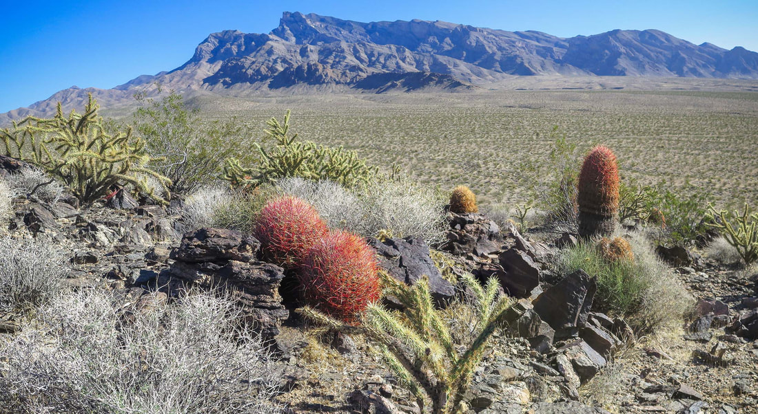
View of Virgin Peak and its southeast ridge from Little Virgin Peak.
Mojave desert sunset at Whitney Pocket in Gold Butte National Monument, Nevada.
You can't beat the sublime Mojave Desert sunsets.
Whitney Corral - a glimpse of past ranching. The spring that once provided for cattle is reportedly dried up.
A thing of beauty - look at that patina!
Narrower, high clearance vehicles would be able to get up the road further than we did.
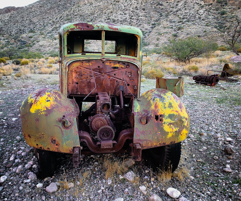
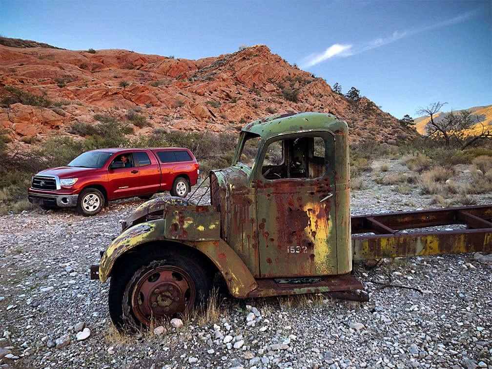
I used the waypoints from birdandhike.com and Avenza with the Arizona Strip Map loaded to make sure I was at Cowboy Campsite. Stay on the main road. Two spur roads take off to the right, but you want to stay left near the ridge you will be mounting. Near the Cowboy Campsite, three miles from the corral, remnants of ranching gear appear: old truck tires, water troughs, the metal skeleton of a chair and various other rusted relics and another old truck! See my waypoints table below or check out birdandhike.com waypoints.
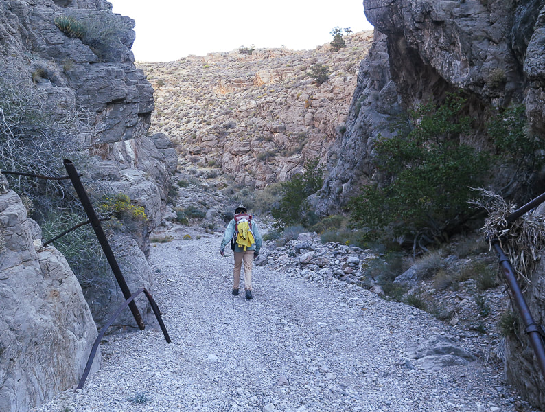
From Cowboy Campsite you turn left onto an obscure spur road ascending toward ridge through trees and shrubs that runs southwest as you climb overlooking the canyon and road you just climbed.
Near Cowboy Campsite with view of Virgin Peak's southwest ridge to climb. Road goes left at intersection with wash.
Second Segment: Cowboy Campsite to Virgin Peak's southwest ridge.
We turned right (west) off the spur road at its highest point and started ascending through junipers and brush toward the ridge, eventually got above this forest and saw limestone cliffs at ridgeline. The climb is 500 feet in ~ 0.3 miles. We hiked to the right of the cliffs to get onto the ridge instead of hiking to the lowest point on the ridge to the left of cliffs. We did, however, descend on our way back from the lowest point on the ridge down to Cowboy Campsite. 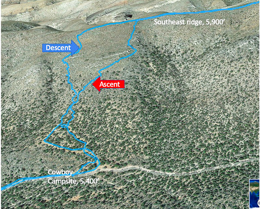
Ascent/descent from Cowboy Campsite and 4 WD road to Virgin Peak's southwest ridge. Ascended right tracks, descended left tracks. Top of map is west, ascend ridge walking west, then turn north to hike to summit.
Some Cool Stuff on the Trail
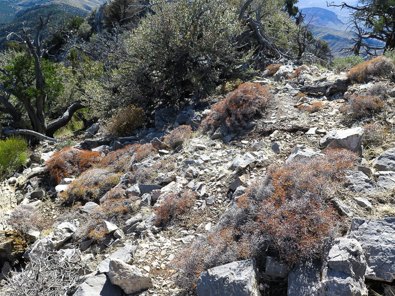
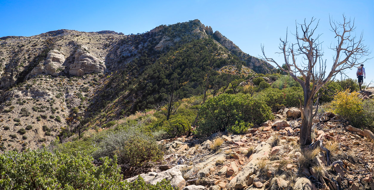
On Virgin's ridge: lots of fossils including brachiopods and corals, a small burn area probably from 2020 fire caused by lightning. I believe the upper right plant is a Utah agave; I have never seen a flower stalk quite like that before!
Final Segment: Ridge to Summit
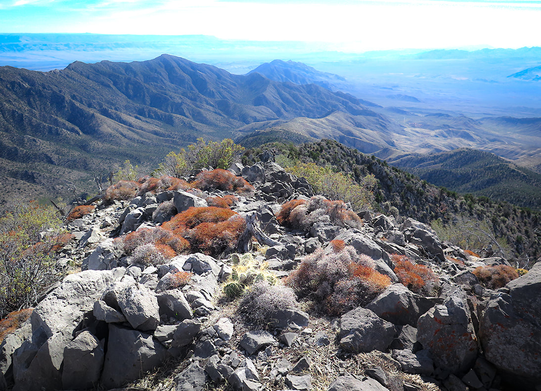
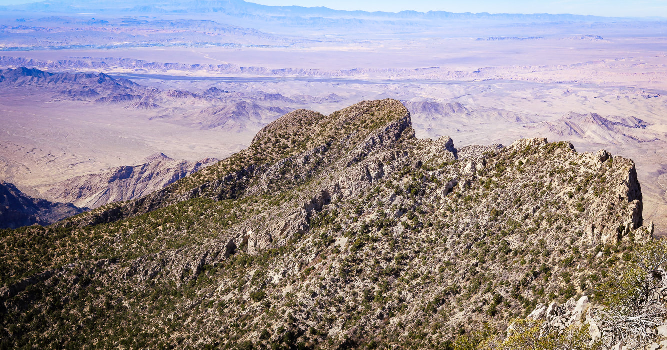
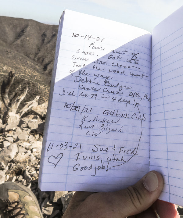
Once on the ridge, follow it 2.3 miles to the summit. The view to the west opens up; Lake Mead is seen (it looks really low) as you ascend the ridge. The ridge heads north to the summit. Wide at first, the ridge narrows and becomes steep to its right (east) side as you ascend. A trail can be seen, especially as you get toward the summit. There are numerous fossils including brachiopods and various corals. Occasionally the light-colored summit is seen behind other "pseudo" peaks or high points on the ridge. There are a few trails that lead downward off the ridge; try to stay on top of the ridge or slightly below it to the west. You will do a fair amount of bushwhacking through trees and cacti. There are a few times hands are used to maneuver up/down rocks. From the summit, the small city of Mesquite, Nevada is due north. The yellow sand washes of Arizona's western Grand Canyon-Parashant National Monument spread to the east. Lake Mead, the largest U.S. reservoir that supplies water to 40 million people, is a small blue line to the southwest. A good view of Pleistocene relict Douglas fir forests are seen in isolated patches just below on Virgin's northeast ridge. The peak's register contains a few small notebooks - one from the Desert Peaks Section of the Sierra Club inside an old ammo box. Two other groups had signed it in October. One of the entries proclaimed, "I'll be 79 in 4 days!". Remarkable. I hope I will be able to write that entry into a remote peak register some day, far above the desert floor. 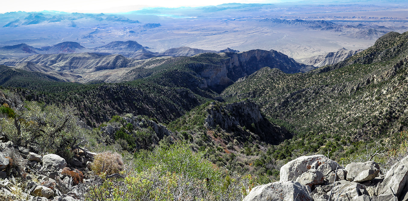
View of Lake Mead to the southwest at top of image.
A view of Virgin Peak ahead.
One last rise to climb before the final summit climb (just to the right of this rise).
Getting up there! Ridge is a series of rises.
The last climb to the summit over increasingly steep and rocky terrain - just under 8,000 feet here.
Virgin Peak summit looking south: South Virgin Peak Ridge on the left, Whitney Ridge behind it, Arizona top of image.
Tilted limestone beds to the west.

Virgin Peak register box.
Summit register: an official Desert Peaks Section of Sierra Club notebook.
Solitude in the Mojave Desert
One of the great American nature writing classics, The Desert: Further Studies in Natural Appearances by John C. Van Dyke has been in continuous publication since 1901. Through his descriptions of his travels in the deserts of California, Arizona and Mexico, Van Dyke changed the popular perception that the desert was a hostile wasteland. The book is a bit monotonous, like Thoreau's On Walden Pond, but Van Dyke helped us to see and appreciate the remarkable beauty of deserts. I can relate to his quote and falling in love with what I call "the desert":
"The weird solitude, the great silence, the grim desolation, are the very things with which every desert wanderer eventually falls in love. You think that strange perhaps? Well, the beauty of the ugly was sometime a paradox, but to-day people admit its truth; and the grandeur of the desolate is just as paradoxical, yet the desert gives it proof."
After seeing no one else on the trail, having our own private camping spot the night before, and walking through a few life zones gaining almost 4,000 feet to look over mountains and valleys, we felt as light and as "in balance" as the surrounding environment, in-tune to the rhythms of the living desert. Each hike and each peak has its own personality, and once you understand the desert's "personality" and ways that its plants and animals survive harsh conditions, you can oftentimes relate and then be amazed. What a great way to reset and rejuvenate and relax. We are lucky to live in America's southwest desert in which there are many places to find abundant peace.
Never Stop Exploring Nature!
On the way down
Near point on ridge to descend to Cowboy Campsite in wash below.
Signs of autumn on the way down.
The new and the very old.
Joshua trees at Whitney Pocket.
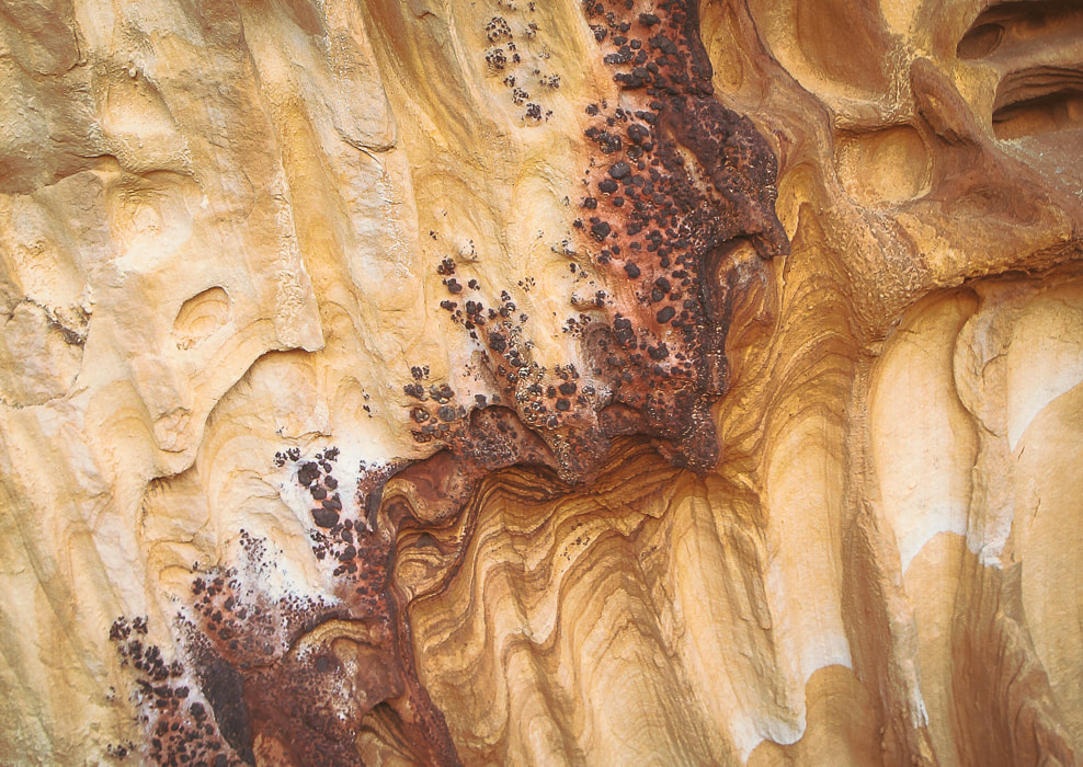
Detail in sandstone at Whitney Pocket
Iron oxide concretions caused by precipitation of iron in paleogroundwater through sandstone 
At Whitney Pocket in Gold Butte National Monument: Younger orange sandstone and very old limestone ridge on each side of a cholla and joshua tree-filled valley.
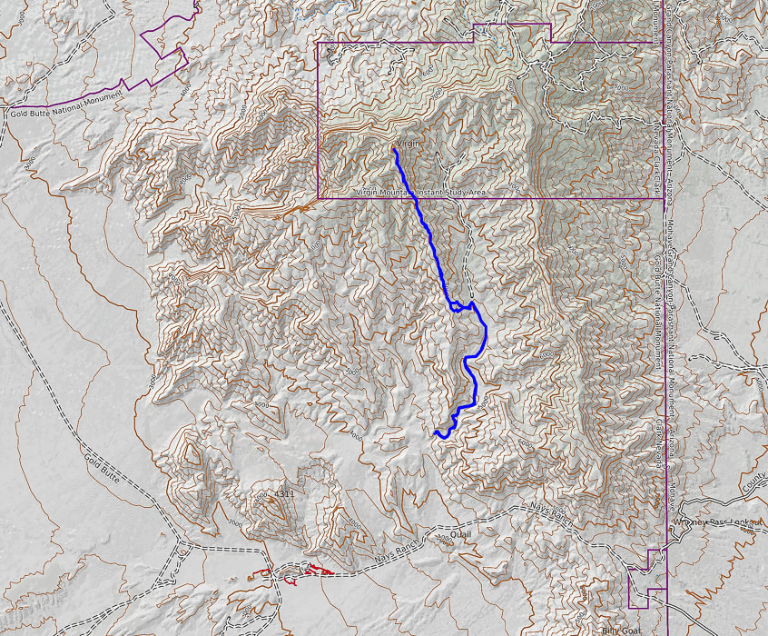
Our GPS tracks and profile. Top of the map is north.
References
The Geology of Gold Butte National Monument - a thumbnail sketch. Friends of Gold Butte.org. Geologic Formations of Utah. Navajo Sandstone. UtahGeology.com. Recreation visits by month, Zion NP. nps.gov. Hiking around Las Vegas and Gold Butte National Monument. birdandhike.com Lake Mead Drops to a Record Low. NASA Earth Observatory. Stringfellow, J. 2015. John C. Van Dyke and the Desert Wasteland. mojaveproject.org. Whitney Pocket. The American Southwest.
Break out of the "typical" southwestern Utah hike to discover more remote and interesting backcountry adventures. A short hike up Jarvis' northwest ridge rewards with expansive views of two distinct physiographic regions: the Colorado plateau to the east and the Mojave Desert to the southwest.
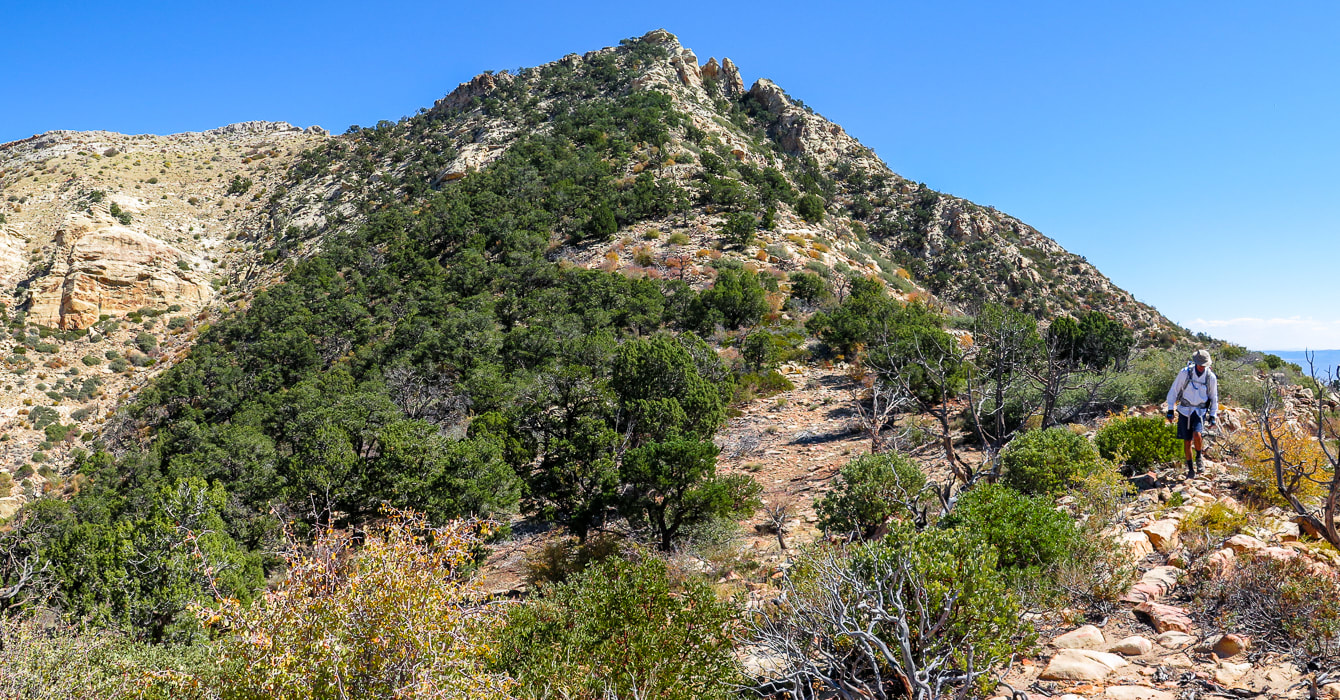
Approaching the final ascent on Jarvis Peak's northwest ridge.
Easier route switchbacks just left of summit through pinyons and junipers. Want a more "exciting" ascent? - go around to the right beneath the crags. 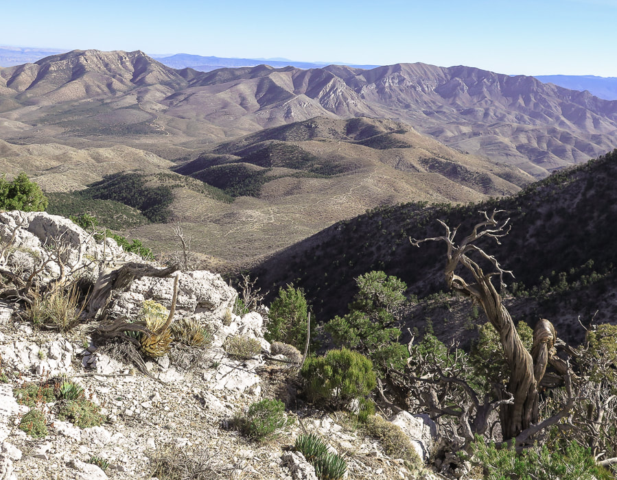
View of Jarvis Peak (highest point on the left side of range) from near summit of West Mountain - Beaver Dam Mountains.
Trip Stats
Location: Beaver Dam Mountains, west of St. George, Utah. This mountain range extends into northern Arizona. Distance/Elevation Gain: 2 miles out and back: 1,100' gain. Start of ridge = 5,453', summit = 6,533'. Coordinates: Trailhead: UTM 12S 0250585E 4108377 N (WGS84). Jarvis Peak: 0251503E 4107770 N. Difficulty: Moderate Class 1 and Class 2 with minimal exposure if use north route around summit block; Class 3 moderate exposure south route. Maps: USGS 7.5 min topo map - Jarvis Peak, Arizona Strip Visitor Map from BLM, All Trails app. for Jarvis Peak. Date Hiked: October 2, 2021 Considerations: High-clearance 4WD needed on access road to base of Jarvis' west ridge, due to rocks and ruts. Walking the road adds 1.7 miles one way. Driving Directions: From St. George, drive northwest on Old Highway 91. Soon after you pass Ivins and cross over the Santa Clara River, reach a junction with Hwy 91 and Gunlock Reservoir. Take a left to stay on Hwy 91. Travel 7.1 miles to the Utah Summit. At the pull-off parking area to the left (east), follow gravel road (not marked and steep and rocky in parts) east for 1.7 miles to a pull-off to the right at a sharp left switchback in the road and park. Jarvis' western ridge to the left is gained in a few hundred feet of walking further on this road. Hike Directions: shortly after parking, walk up road a few hundred feet to see a path on left side of gravel road to gain Jarvis' ridge. Trail is seen most of the hike, with occasional rock cairns - basically stay more or less on top of the ridge. On the way up, the trail treks slightly left of the ridge to avoid cliffs to the right. At the final saddle below the last steep ascent, go up through the trees to the left of the summit for an easier route. We went around the summit's right (south) side but found it difficult to reach summit due to Class 3-4 climb up final summit block.
Related:
Overview
You would think that a spectacular 360-degree multi-state and multi-region view from a summit is earned only after a long and arduous hike, but not true with Jarvis Peak. After a short drive from St. George in southwestern Utah and a short one-mile hike, we were looking at Arizona on one side, and Utah on the other. To the northeast, a fantastic view of Red Mountain's cliffs stands out in a long crimson row beneath the snow-dusted peaks of the Pine Valley Mountain Wilderness. The rock towers of Zion Canyon capture the horizon to the east. The huge, dry and rugged Arizona Strip, north of the Grand Canyon with its mountain ranges and alluvial fans spreads to the south. West Mountain Peak with its communication towers, the highest point in the Beaver Dam Mountains (7,680'), is seen not far away to the northwest. The Beaver Dam mountain range is a "sky island" that rises high above a sea of thinly vegetated, dusty, stark, and monotone desert, with the exception of the bright red sandstone in the St. George area. It's great that we can choose either mountains or low desert, according to seasons. It feels like wilderness until you see the cities of Ivins and St. George to the east. The Beaver Dam Mountain range straddles three distinct physiographic regions (provinces) of the southwest -a "geologic triple junction": the Mojave Desert, the Colorado Plateau and Nevada's Great Basin. If you live in St. George, you have access to all of these regions. I know the grandeur of Zion National Park can't be beat (except by the Grand Canyon), but the solitude, beauty, and geologic features of the remote backcountry and wilderness surrounding it is just as noteworthy. Fred and I are discovering that this huge region of southwestern Utah is an adventurer's paradise. And since I am a self-described "geology nerd", there is a lot of area to study and learn about in this region (see "For the Geo-curious" below). 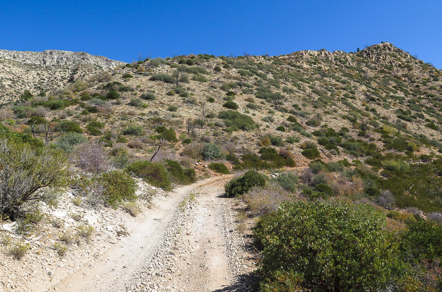
Beginning of hike, just a few hundred yards from parking on this road; trail leading up to top of ridge - Jarvis Peak behind ridge in this photo.
Quite possibly Mojave prickly pear, AKA Old Man prickly pear.
Our Hike
The huge view of southern Utah and northern Arizona from Jarvis Peak is just a one-mile hike from start to summit. It's not everywhere you can get a grand view in such a short distance. The gradual climb up the northwest ridge is not hugely exciting, but if you go around the right (south) side of the mountain it gets a lot more interesting with Class 3 climbing up final cliff to summit. We summited using the left (northwest) side of the peak. The 1.7-mile 4-wheel drive road from Utah Hill on Highway 91 to the base of Jarvis Peak's northwest ridge gradually becomes steeper, more narrow with ruts and rocks. If you choose to walk the road, the total hike distance out and back would be ~ 5.5 miles. The trail to Jarvis Peak begins just a few hundred yards after parking up the gravel road. It gains the ridge pretty quickly and then stays on it, going through thickets of manzanita and ducking under junipers and pinyon pines. It is marked occasionally by rock cairns as it meanders in sand around and on top of sandstone rocks. The greens of prickly pear, pines, juniper and lichens mix perfectly with the reds of manzanita branches, stained sandstone and pinyon pine cones to create a pleasing southwest desert landscape. 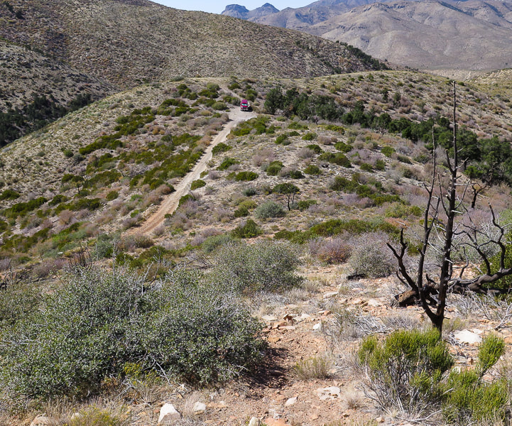
Trail (bottom) not far from where we parked (top of image).
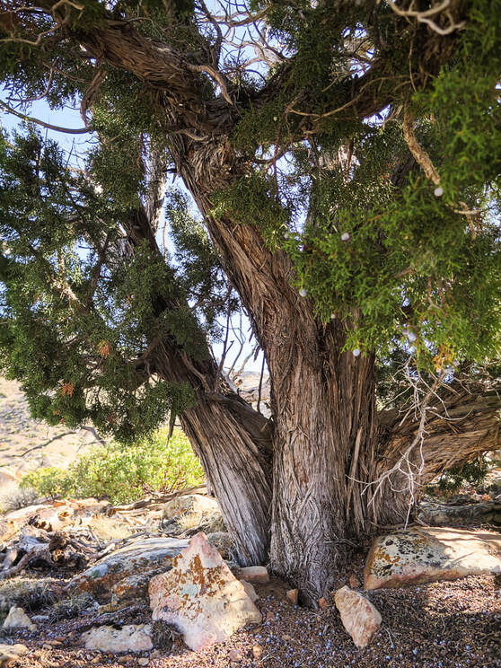
One of the largest junipers I have ever seen!
We stayed as close to the crest of the ridge as possible. This hike rambles up a series of short climbs and short saddles. Upon reaching the last saddle at the base of the final summit ascent, there is a large rock cairn placed toward the left side of the base. We ignored its subtle direction, telling us to go left. Instead, we first went to the right around the south side of Jarvis Peak, stepping quickly across a loose-rocked steep gully to the back of the peak. I found the short and final Class 3 climb up a vertical crack in cream-colored Queantoweap sandstone was too exposed, because the platform is narrow, slippery and drops steeply. So, we retraced our steps and went by some cool-looking sandstone caves, back to the rock cairn and then found our way up through a gentler, but still steep slope to easily gain the summit.
A rock cairn marks the base of the final peak ascent, directing you to the left side of the summit, up through trees.
We originally went around to the right - up the canyon in shadow with two pinnacles, but I found that final summit cliff too daunting; we came back down and climbed to left of summit through the trees.
Heading toward south side of Jarvis Peak
Maneuvering around the steep back side of summit - Fred behind sandstone ourcrop lower left.
The backside (east-facing) of Jarvis Peak with the sandstone cliffs on east side of its summit.
Jarvis Peak summit looking to the east: Red Mountain near St. George and Pine Valley Mountains on horizon.
Huge pine tree on southeast side of summit.
For the Geo-curious
Jarvis Peak is located in the eastern Beaver Dam Mountains where a "magnificent set of sedimentary rocks" is described by authors of Geologic Map of the Shivwits Quadrangle, Washington County, Utah. This area of southwestern Utah/Northern Arizona is geologically significant not only because it includes all the major rock types - igneous, sedimentary, and metamorphic, it also sits between the Colorado Plateau to the west which includes the red and orange rocks of Zion National Park, the Great Basin and Range Province to the west, most easily described as parallel mountain ranges caused by spreading, and the Mojave desert to the south. The geology in the Beaver Dam Mountains is certainly not lacking in variety; it includes major folds as well as structures caused by the earth spreading, alluvial fans and just about every kind of fault. The Redwall Limestone forms impressive cliffs and has abundant coral fossils. It was easy to find geologic maps. You will be hiking on Queantoweap Sandstone (Permian period) on the way up to and including Jarvis Peak, and on its west side look over siltstone and limestone containing fossils. This sandstone is massive (homogenous, lacking internal structure), cliff- and ledge-forming, gray to pink in color, best seen on the right (south) side of peak.
Apex Mine - just one mile south of Jarvis Peak. More recently, ore was mined for its gallium and germanium content. Gallium is used in semi conductors and electronics. Germanium's uses range from infrared optics to cloth and food containers. Copper and silver were originally taken from this mine 1884 - 1962. These are samples of azurite found in this mine. Photos from mindat.org.
Queantoweap Sandstone on Jarvis Peak
Note the honeycomb weathering in upper cavernous recess.
View from the top - road possibly to Apex Mine.
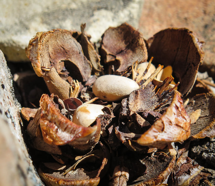
Pinyon pine cone and its seeds - AKA pine nuts
Interactive Google map for Jarvis Peak hike.
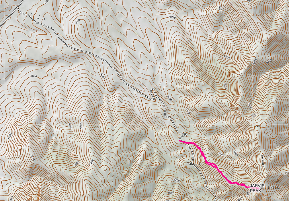
Our GPS tracks from access road leading from Utah summit on Hwy 91 to Jarvis Peak.
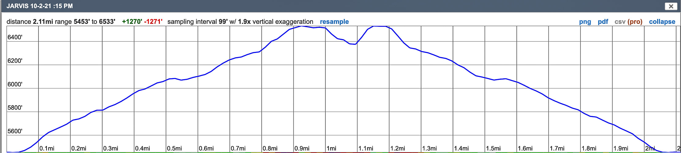
Profile for Jarvis Peak: only one mile to the summit.
The dip in the profile at the summit shows that we reversed our course and went around to the other side to reach summit.
References
BackroadsWestTrip blogs - Unique Landscapes of the Southwest - backroadswest.com. Hammond, B.J. Geologic Map of the Jarvis Peak Quadrangle, Washington County, Utah. Hintze, L.F., Hammond, B.J. 1994. Geologic Map of the Shivwits Quadrangle, Washington County, Utah. Utah Geologic Survey. McNair, A.H. 1951. Paleozoic stratigraphy of part of Northwestern Arizona: American Association of Petroleum Geologists Bulletin, v. 35, no. 3. Mindat.org. Apex Mine. Washington County Historical Society. The Apex Mine (from internet). Great opportunity to see an astounding view of eastern Nevada from its second-highest peak way above tree line on a well-maintained trail. We picked a gorgeous late summer day when the aspens in the high country were changing color. 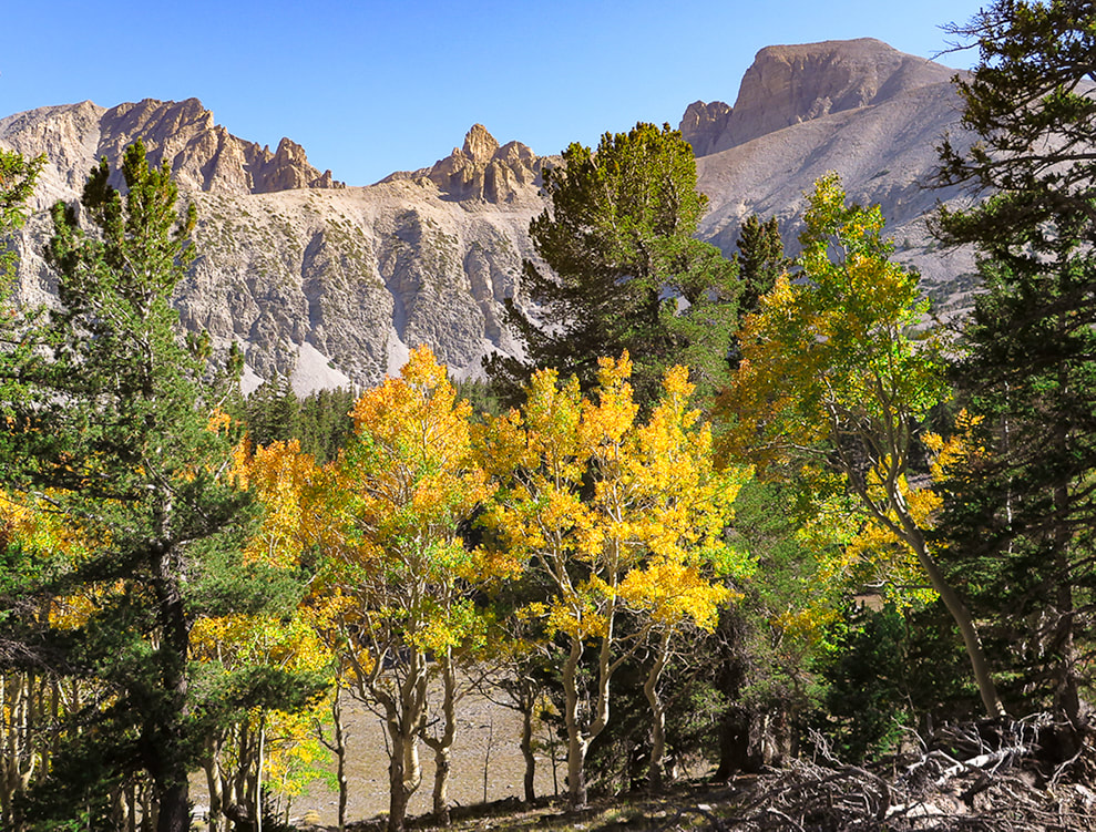 Wheeler Peak (right) on a beautiful September day. Trail follows ridge line on the right of peak. Trip Stats for hike via Alpine Lakes Loop Trail and Wheeler Peak Trail
Location: Snake Range, eastern Nevada, Great Basin National Park: closest towns are Baker and Ely. Trailhead: Bristlecone - Alpine Lakes Trailhead. Distance and Elevation Gain: 8.4 miles out and back for a 3,100' gain. Trailhead = 9,957', Summit = 13,063'. Difficulty: Moderate - Strenuous Class 1 Coordinates: Wheeler Peak Summit: 11S 0732663 E 4318632N Trailhead: 11S 0733174E 4321347N (UTM). Permit/Fees: No entrance fee, no permit required. Maps: Great Basin NP, Google Mymaps interactive map (below), Great Basin National Park - National Geographic Trails Illustrated map 269. Date Hiked: September 15, 2021. Considerations: Trail is exposed for last 2 miles (and 2,000 feet of elevation) to the summit - watch weather. There are 2 trailheads: Alpine Lakes Loop Trail and Wheeler Peak Summit Trail. See park map below. Ridge line is very windy. History: Named after George Wheeler of the Wheeler Expedition in charge of surveying southeastern and southern Nevada in 1869. He and a party consisting of a guide, the Nevada state geologist, and three others succeeded in reaching the summit and found, through careful barometric measurements, the elevation to be 13,063 feet above sea level. Measurements for the precise distance to other mountain peaks were conducted for four summers beginning in 1881. The survey, combined with other federal surveys, resulted in the first accurate network of surveyed points crossing the continent. Related Posts:
Video - the final climb to the top Overview Long before our turn-off to Ely from northbound Nevada Highway 93, we saw the point in the sky that we would be standing on the following day - the summit of the giant and majestic Wheeler Peak in eastern Nevada. Definitely worth a grin and a "wow" from two people who love to get to high places! Wheeler is the second-highest Nevada peak. Boundary Peak, close to the California border, is Nevada's highest. Stately Wheeler Peak stands with authority over lesser peaks of the Humboldt-Toiyabe National Forest, surrounded by miles of sagebrush in what is known as the Great Basin. We met our friends Val and John for the hike. All four of us had been on our share of immense loose and trail-less talus slopes this past summer while climbing some of Idaho's highest peaks in the Lost River Range (Leatherman Peak), so we were grateful for Wheeler's stable and well-defined trail to the summit. Yes, it is steep and rocky, but not intimidating. The forest thins at about 2 miles into the hike, and views of jagged Doso Doyabi ("white mountain" in Shoshone language), to the left (east) of Wheeler are spectacular. Steep, huge rock slopes cascade down from these high points, and at various times of the day they are hidden in shadows. The Wheeler Peak glacier sits protected in a cirque at 11,500 feet. It's pretty small (2 acres), and the only glacier in Nevada. Some of the fiercest winds I have ever encountered were on the ridge leading to the final steep ascent at about 2.5 miles into the hike, when Fred and I hiked this summit 18 years ago. This time the wind speed wasn't blowing us over, but it still had us holding onto our hats. In contrast, at the top an intermittent breeze wafted in and out of our summit celebration. 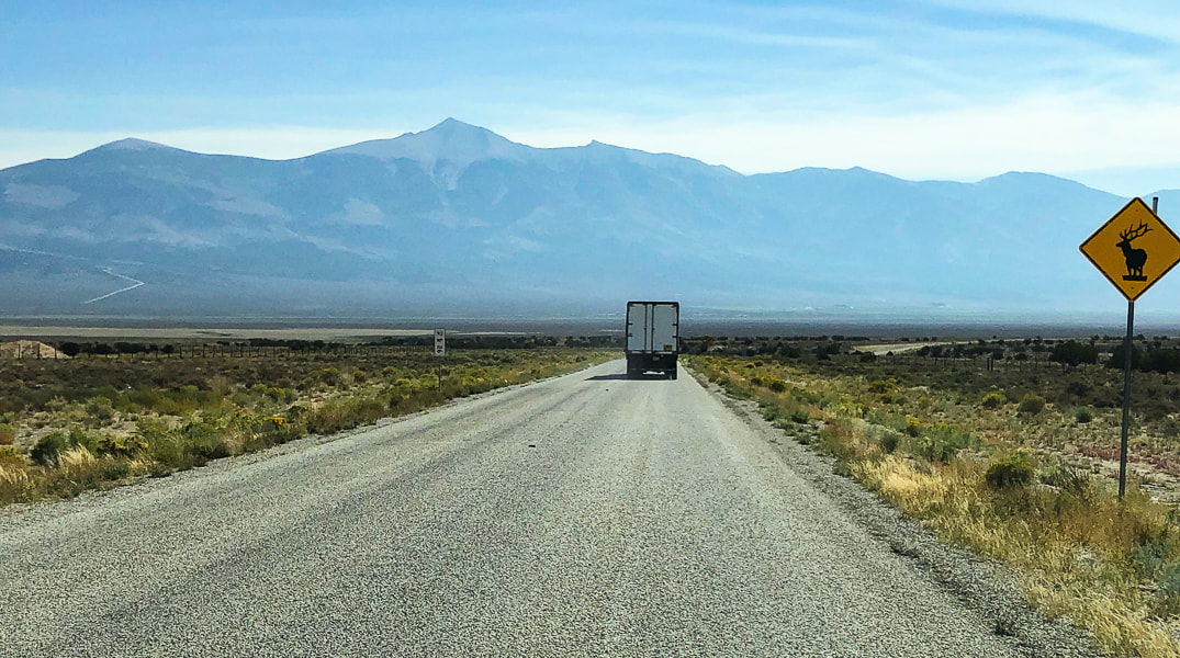 Wheeler Peak towers over the sagebrush steppes of eastern Nevada. This photo was taken while driving east from Ely, Nevada.  Val and Fred at trailhead
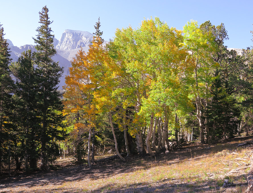 First view of Wheeler Peak on Alpine Lakes Loop Trail 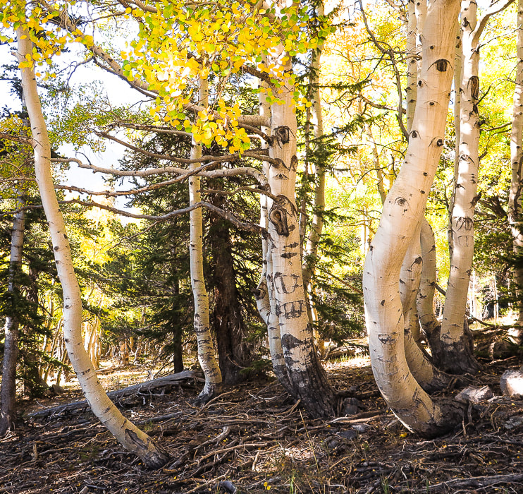 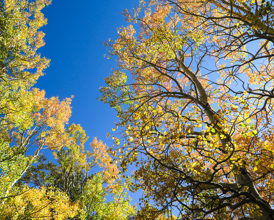 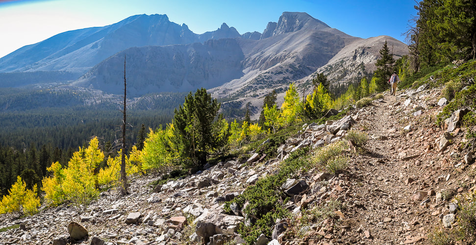 On the Wheeler Peak Trail: Doso Doyabi on the left and Wheeler Peak on the right. This trail emerges from tree line at ~ 11,500 feet. On the way up on trail through stable quartzite talus! As the trail emerges from the glacial valley, it climbs through quartzite, a metamorphic sandstone that tends to form resistant ridges and hilltops. A few rock shelters line the trail as it traverses Wheeler's northwest exposed ridge, built by hikers for wind protection. It's pretty darn windy on this section, so we had to shout in order to hear each other. No lightning worries - there wasn't a cloud in the sky. There were some shelters that appeared to be a bit larger, very level and well-constructed. These may have been the tent platforms built by the Wheeler Survey in 1881, according to Bruce Grubbs, from his book Exploring the Great Basin (see History, above). Val, Fred and I were sticking together, John was ahead. Quartzite is resistant to weathering and contains a high amount of silica which doesn't break down much to form soil. The scant amount of vegetation present seems to find small rock recesses to cling to. Arriving onto the north spine of the summit block, the winds calm and the trail steepens. It's just a matter of kicking one foot in front of the other to climb the last spiral path to the summit. A cobalt-blue Nevada state flag, it's edge frayed from the wind marks this significant point in Nevada. The flag's phrase "Battle Born" signifies Nevada's entrance into the union during the civil war. It also illustrates Nevada's state flower with two sagebrush branches. 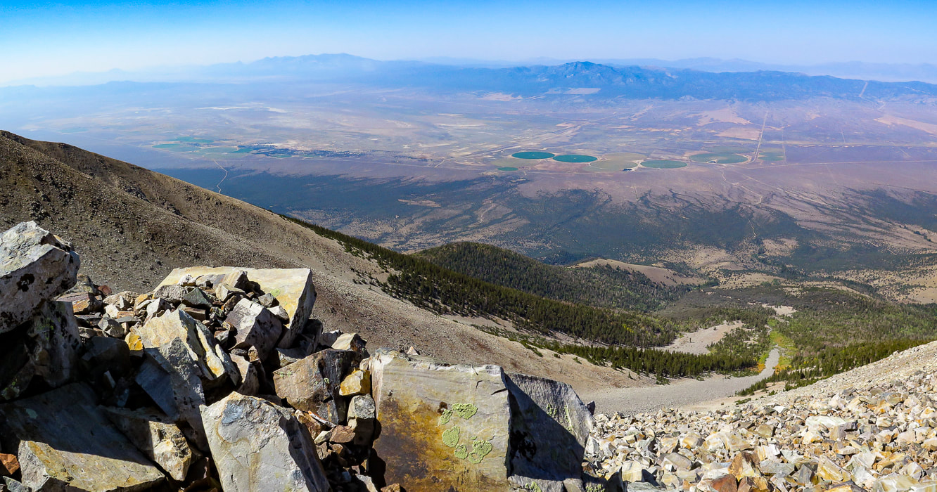 Looking northwest to Spring Valley and the Schell Creek Range 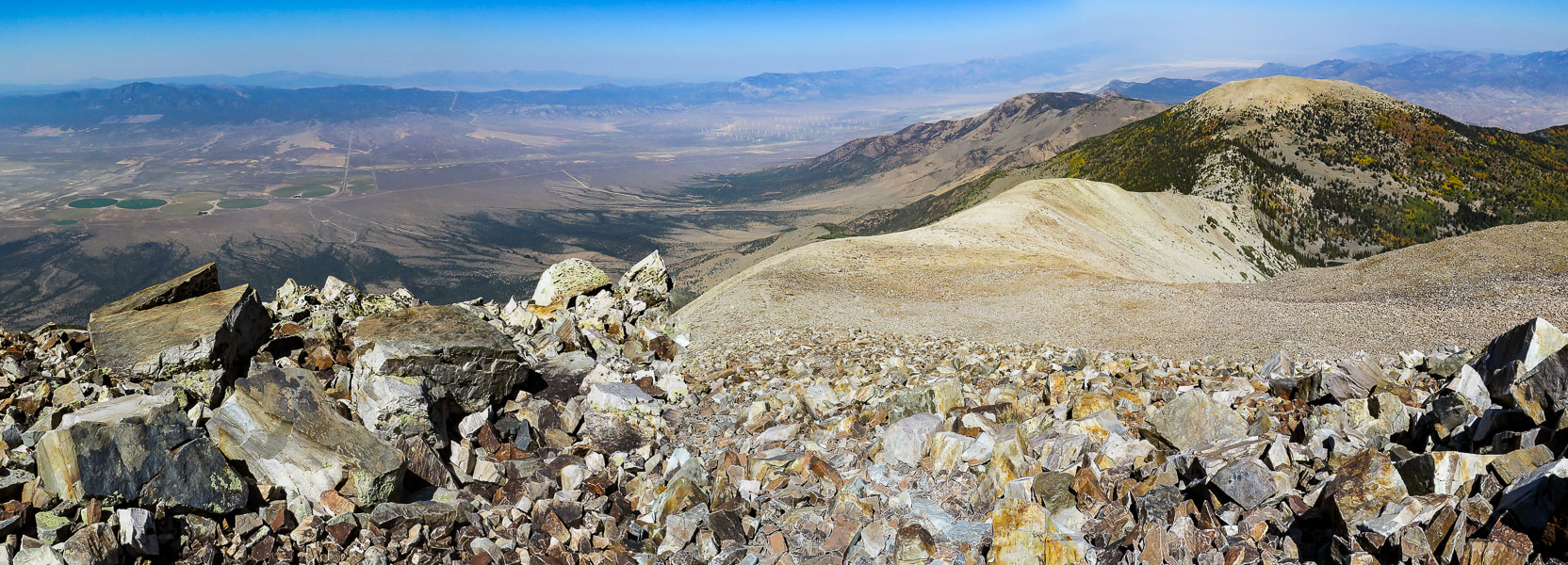 Looking north toward Bald Mountain and Schell Creek Range 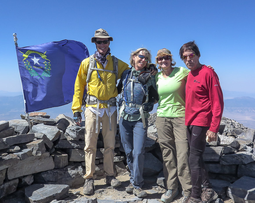 Next to Nevada state flag at 13,063 feet - Fred, Sue, Val, and John Nevada's flag pictures two sagebrush branches encircling a silver star with the words "Nevada" and Battle Born". On Wheeler Peak summit As usual, John summited first out of our group. This explains why I don't have as many photos of him. He is one of the fittest 71-year olds I know! We had a lot of time to enjoy the summit and talk to other hikers, bask in the sun and sign the summit register, a notepad stashed into a dented and decorated mail box. We were standing over the other mountains of the Snake Range. Utah was not far to the east. The next parallel mountain range to the west separated from us by the Spring Valley basin is the Schell Creek Range, with tempting high points. We plan to summit North Schell Peak, the range's highest at 11,883 feet. Hopefully we will get back to Nevada's Basin and Range soon. So many adventures to do, so little time, as I always like to say. Scenes from the summit 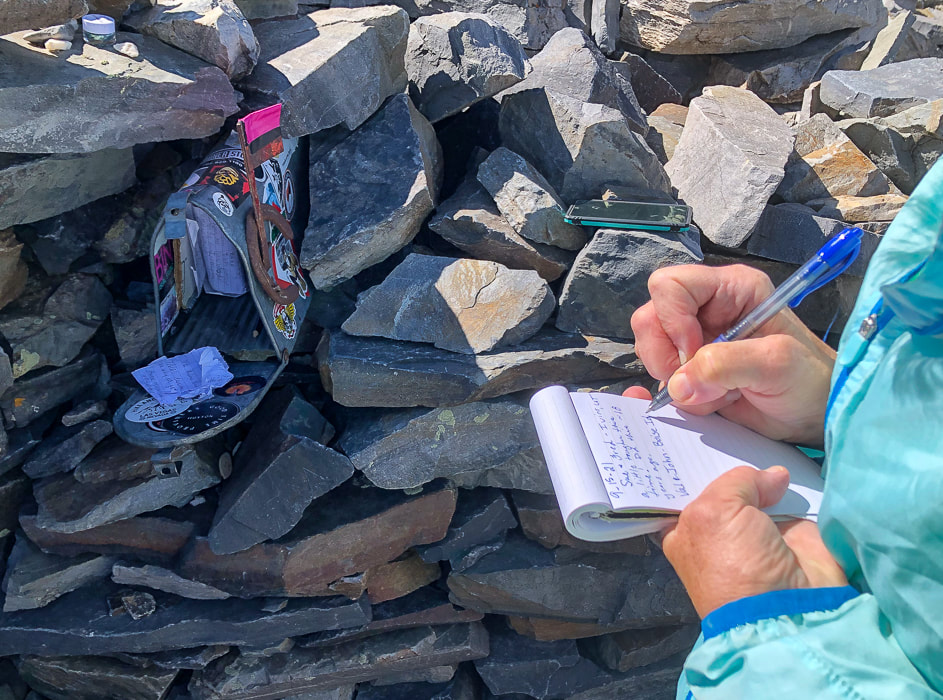 Signing the summit register. I don't recall seeing a "summit mailbox" before, but it's more fun than the standard water bottle or ammo box! 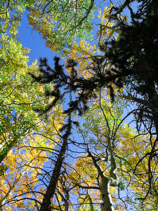 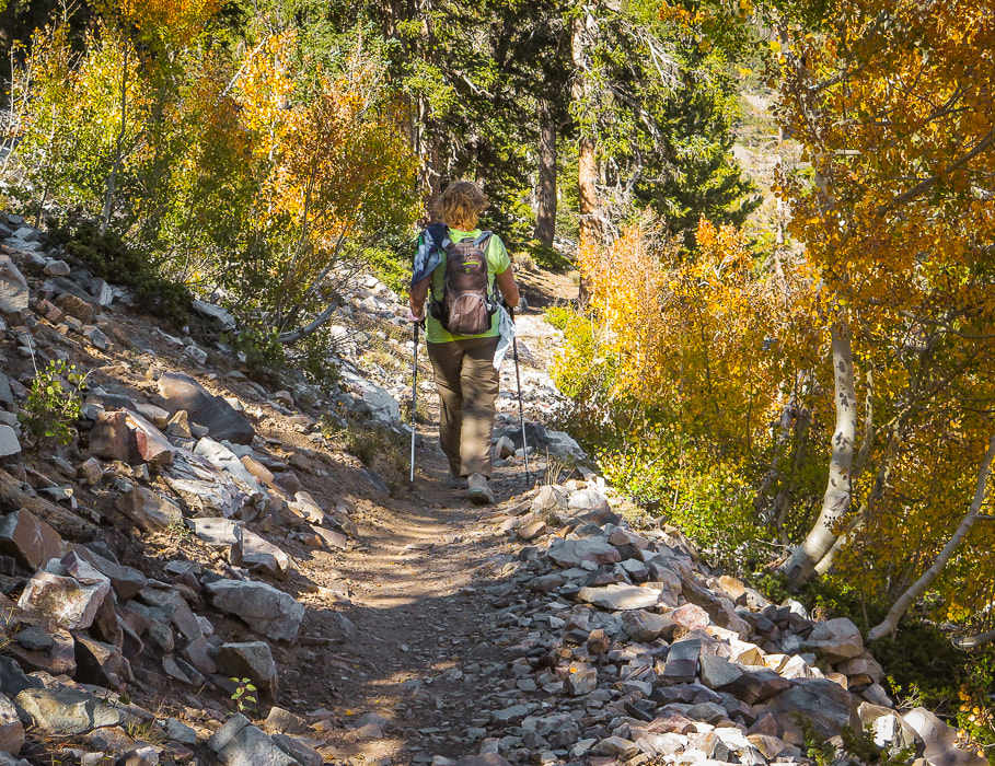 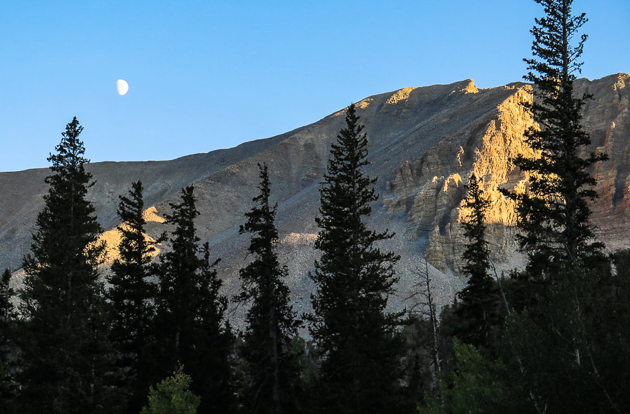 Doso Doyabi (White Mountain in Shoshone language), to the east of Wheeler Peak Post-hike dinner We celebrated at Kerouac's, a restaurant and bar at Stargazer Inn with exceptional food in the little town of Baker, just outside the entrance to the Great Basin National Park. The meatballs had a kick to them and were fantastic, their specialty cocktail of the night was a refreshing fresh peach bourbon sour called "Princess Peach". I highly recommend this place whose website states, "Kerouac's is an homage to life on the American road and to feeling at home in unexpected places." Obviously they are referring to Jack Kerouac and his legendary novel "On the Road", an account of his road trips across the country in the 1940's. The roads of the American West lead to all sorts of adventures, and as Kerouac said, "Because in the end you won't remember the time you spent in the office or mowing your lawn." But you will remember your times spent in nature. Keep on exploring!  The well-stocked Kerouac's Restaurant and Bar in Baker, Nevada. 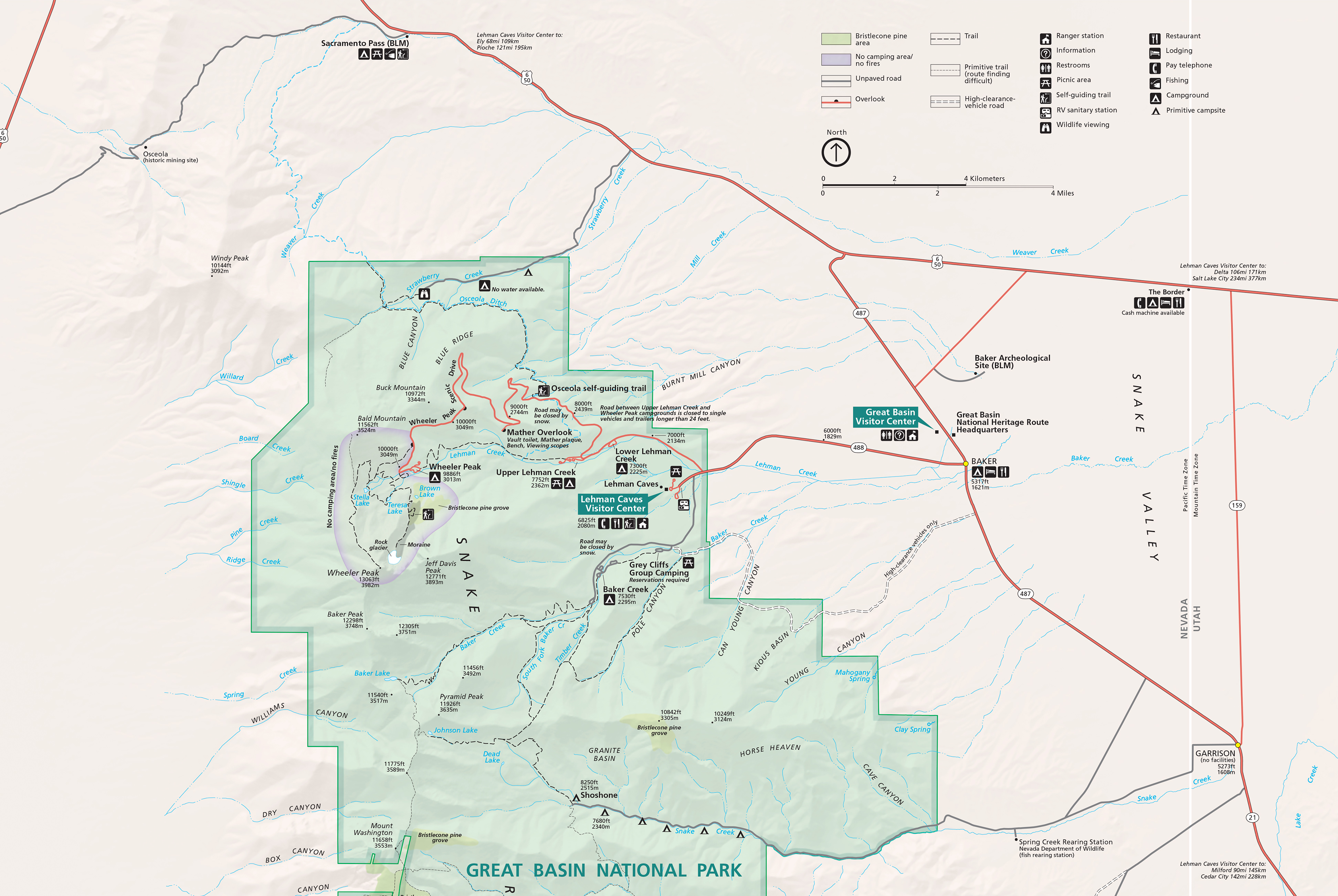 Great Basin National Park map click for larger image 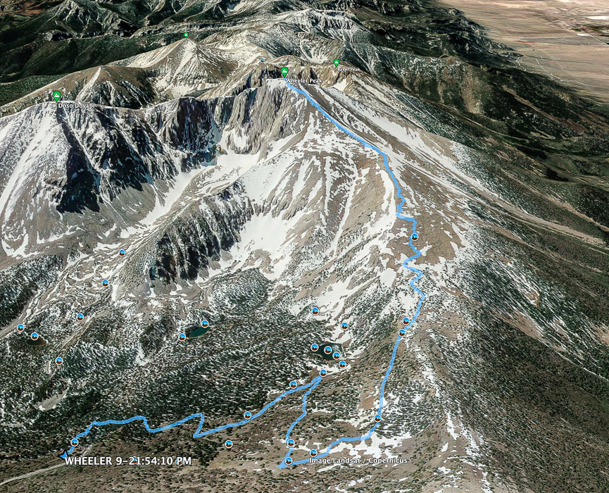 Google Earth image of our GPS tracks to Wheeler Peak summit from parking lot at Bristlecone - Alpine Lakes trailhead. Top of map is south. 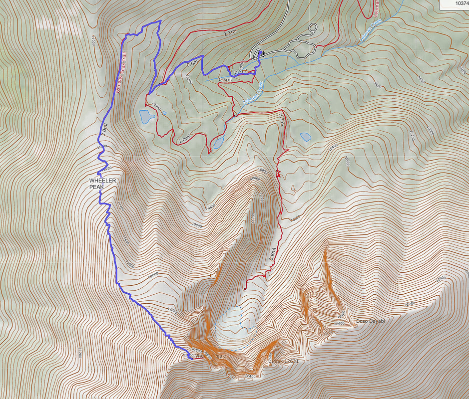 Our GPS tracks on Alpine Lakes Loop Trail, Wheeler Peak Summit Trail. Top of map is north. Wheeler Peak at bottom of map. 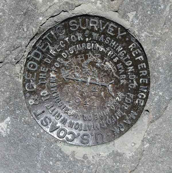 References
Grubbs, B. Exploring Great Basin National Park. 2010. Bright Angel Press, Flagstaff, AZ. Geologic Map of Great Basin National Park, Nevada. National Park Service. Historic Resource Study, Great Basin National Park, Nevada. Why Wheeler Peak? U.S. National Park Service.
There's a lot to explore in Mackay, Idaho: a hike to Mackay Peak for a view of Idaho's highest peaks in the Lost River Range and a mine tour that illustrates the area's rich mining history.
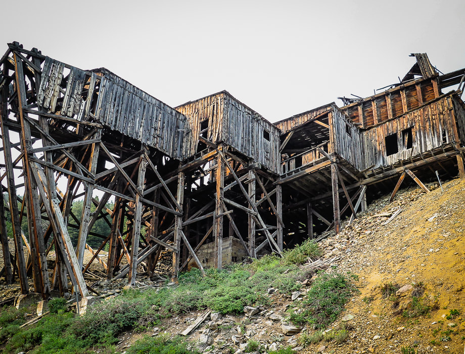
Aerial Tramway Headhouse - Mackay Mine Hill
The Mackay Mine Hill tramway replaced a mining railroad in 1918. It transported ore buckets to the smelter located in the valley below using a steel cable loop that was six miles long supported on 36 wooden towers.
Trip Stats for Mackay Peak Hike
Location: Mackay Peak is 4 miles west of Mackay in the Salmon-Challis National Forest, in the White Knob Mountains in east-central Idaho. There are two summits for Mackay Peak. We hiked up the north slope to the benchmark (the eastern high point). Distance and elevation: 3.6 miles round trip with an elevation gain of 2,200 feet. Elevation Mackay Peak (east summit) = 10,256', Mackay Peak (west summit) = 10,272'. Difficulty: Strenuous Class 2 off-trail scrambling and route-finding, easy Class 3 last 200 feet to summit. We didn't see the summit most of the way up, so we used a combination of compass, topo map and GPS. Date hiked: July 9, 2021. Map: USGS 7.5 minute Mackay Reservoir, ID topo map Coordinates: Mackay Peak = 43.88940 113.70046 Driving Directions: Drive southwest on Main St. in Mackay which becomes Smelter Ave. Cross the Big Lost River, then at another 0.8 miles, see the large "Mackay Mine Hill Tour" sign near the large smelter building. The road becomes MK-207, goes by a few relict tramway towers, enters the Challis National Forest and becomes FSR-207. Reach a junction FSR-207 and FSR-207A. We stayed straight onto FSR-207 (passenger car passable) and went past 2 green "4" signs that denote Horseshoe Mine. We parked in a pull-out right after the second "4" sign, at the base of Mackay Peak's north slope, near the Horseshoe Mine. We climbed the north slope, and followed a SSW azimuth. History: Mackay is named after John Mackay, financier of the smelter for White Knob Mining Company which began operations in the late 1890's. Wayne Darlington, president and general manager planned the town and he named it after Mackay to show his loyalty. Mackay officially became a town in 1901, but John Mackay never saw the town in Idaho named after him.
Mackay Peak Hike
To a lot of Boiseans, summer means it's time to get out of the heat to explore some of the many rugged Idaho mountain ranges. Instead of our usual Ketchum/Stanley trip for hiking, biking and camping, Fred and I decided to go to a less crowded, small town and explore a different mountain range. A place we could actually find a spot to park our Chalet trailer for 5 days. We chose the mountain range with the highest peaks in Idaho - the Lost River Range - and the historic mining town of Mackay with close-up views of this spectacular mountain range. We climbed Leatherman Peak and Mackay Peak, toured Mackay Mine Hill, and did a good deal of talking with the "locals" - very kind and friendly people.
We got as close as we could to the base of the north slope of Mackay Peak on Mackay Mine Hill Tour Road #207 in the Rio Grande Canyon, just southwest of the town of Mackay, and hiked south, straight up through the forest toward the saddle between its two high points (see driving directions). Since we couldn't see the summit for most of the way, we followed an azimuth SSW using our compasses. I have seen a trip report describing climbing the open northeast slope. Mackay Peak has two summits separated by about one quarter of a mile. The forest hike was dense at times with prickly thickets, and we saw one shallow pit dug in the slope and a few mine claim posts. We hiked through some small clearings where trees had been cut many years ago. Turning to look northwest to the Lost River Range, we could see Leatherman Peak, the second highest in Idaho, where we had been on two days before, as well as the blue of Mackay Reservoir.
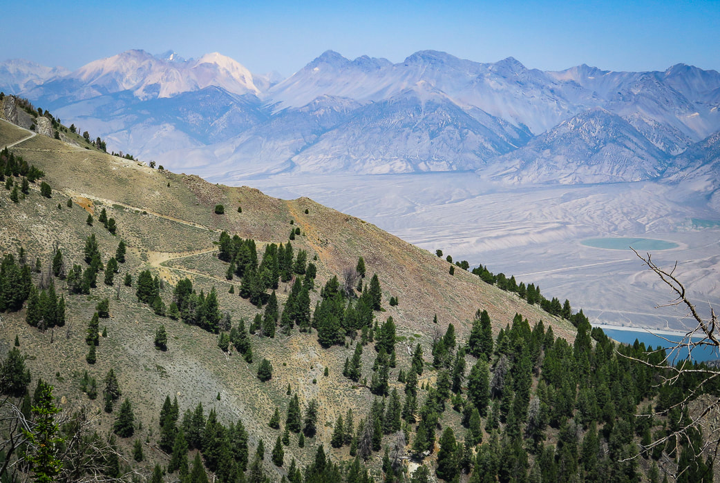
From the northwest slope of Mackay Peak looking at the Lost River Range
White Cap Peak (the lightest-colored peak on left horizon), Leatherman Peak to its right with Leatherman Pass on saddle between them. 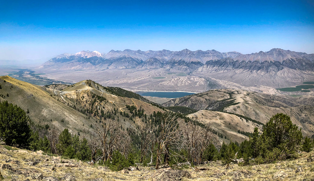
Getting near Mackay Peak's summit with a view of the Lost River Range, home to seven of the nine Idaho "12-ers" - peaks over 12,000' elevation.
At about 9,600' of elevation, the forest thins to reveal a mantle of sharp-edged boulders scattered and wedged just below the summit. The actual summit is still not in view. The rocks are Mackay granite from the Challis igneous intrusive events that occurred 34 - 56 million years ago, providing the heat that produced copper at the contact between the intruding granite and the existing limestone. Sixty million pounds of copper were produced from the Alder Creek (Mackay) mines; silver, gold, zinc and lead were also produced. On the way up, we could hear the steady humming of one of Phoenix Global Mining drill rigs working to fulfill its planned open-pit copper mining project (see more info below in Mackay Mine Hill Tour).
Once at the Mackay Benchmark, we found the brass geodetic marker in a granite boulder and its wooden triangulation tripod on its side. Looking toward the west/northwest, we saw Mackey Peak's other high point. It looked about the same elevation, but actually it is about 16' higher. We were content with the high point we summited, so we took our time and lazed in the sun, enjoying the view. Quite a different experience from two days before, when we had to hurriedly get off Leatherman Peak because of threatening thunderstorms. We hiked straight down through a lot of steep deadfall terrain. This hike's celebration drink/dinner was at Mineshaft Cookhouse and Watering Hole in Mackay where we got a great burger, gin and tonic, and manhattan. Life is good. Being able to explore Idaho and the American West is truly a gift. 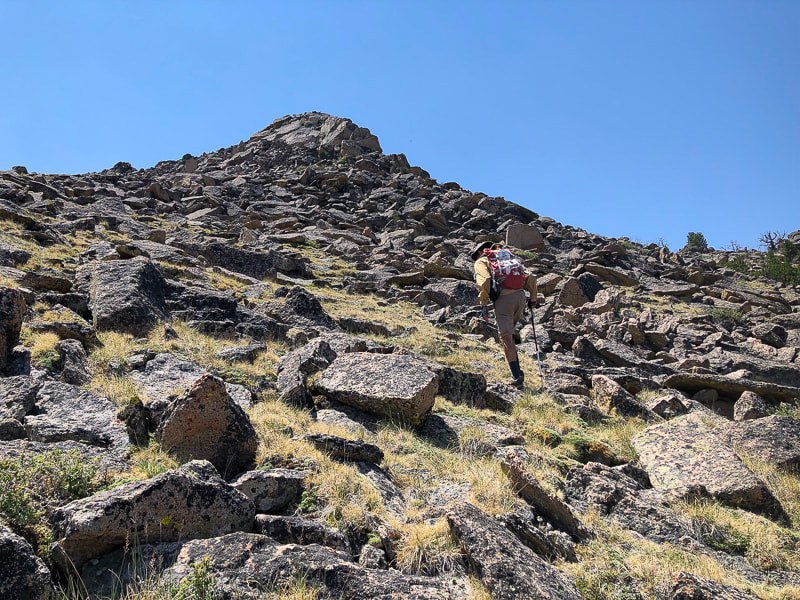
Mackay Peak Benchmark, the eastern high point.
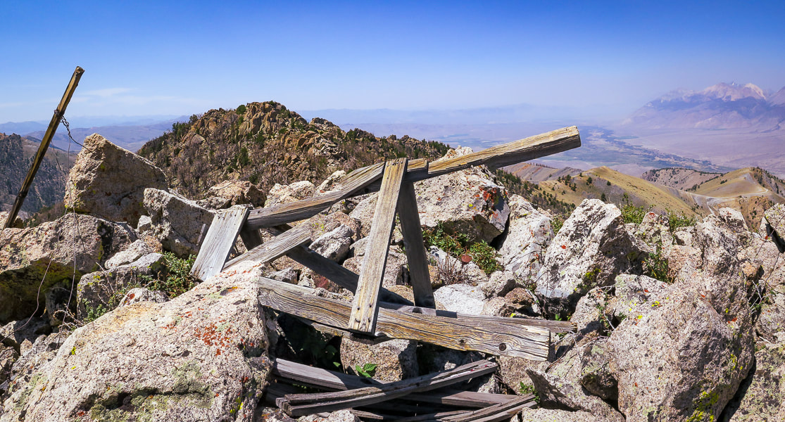
Mackay granite on two Mackay Peak summits: the second summit (just above the wooden triangulation tripod) is actually about 16 feet higher according to a topographical map.
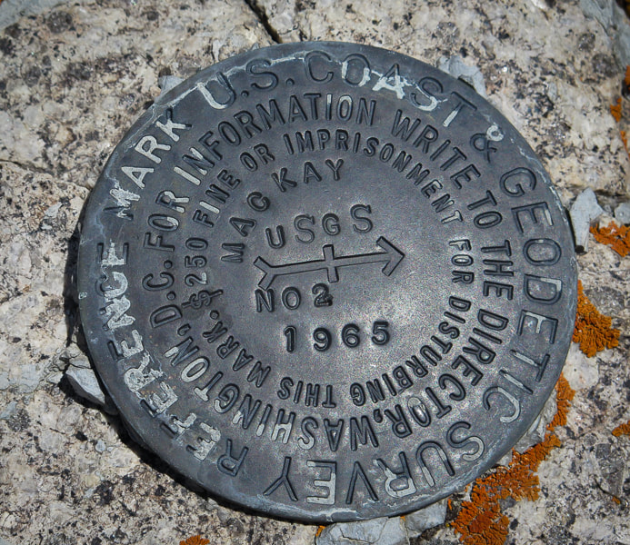
Mackay Peak geodetic survey marker
The "NO 2" refers to the number of the reference mark. The arrow points to the primary benchmark, usually 50 feet away.
Sue on top of Mackay Peak and making our way down through the forest
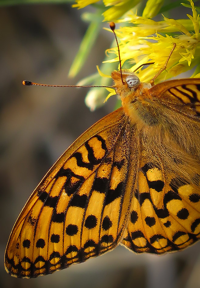
Dark Green Fritillary on a gray rabbitbrush
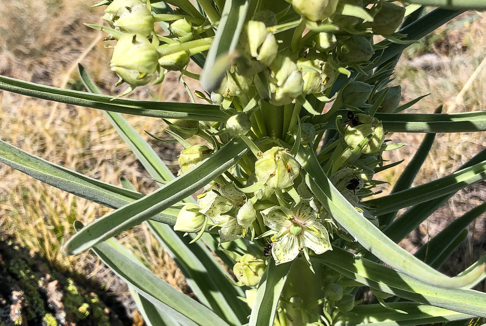
Monument plant
Frasera speciosa
Interactive map with our GPS tracks to Mackay Peak summit.
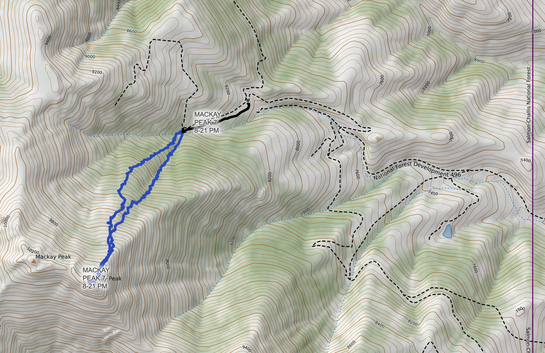
Our GPS tracks and gravel roads in Mackay Mine Hill Tour area.
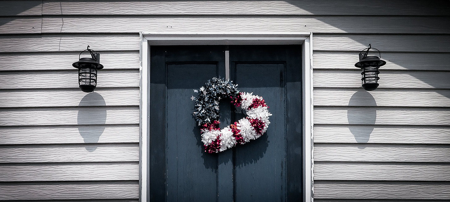
Mackay patriot
Trip Stats for Mackay Mine Hill Tour
BLM Mackay Mine Hill Tour Map - (can be picked up at the U.S. Forest Service building on Custer St., the Lost River Museum, Wagon Wheel RV Park, City Hall, Liars Den Bait and Tackle Shop). To get to the beginning of the mine hill tour (smelter site and hardrock mining exhibit), take Main St. south through the town of Mackay. Main Street becomes Smelter Avenue. Pass over the Big Lost River, then reach the large "Mackey Mine Hill" sign. The tour map features 3 routes depending on transportation mode. The red route is open only to ATV, bicycles, dirt bikes, horses or hikers. The green route is accessible to all transportation modes. Landowners include private owners, BLM and U.S. Forest Service.
Mackay Mine Hill Tour
The Mackay Mine Hill has a rich and productive history dating back to 1884 that yielded mostly copper as well as zinc, silver, gold and lead. According to Mackay's Mine Hill Tour guide, almost a million tons of ore have been removed from this mine hill, located in the Alder Creek Mining District. However, a more recent drilling project shows there is much more ore available at "surface" depths. Phoenix Global Mining has five drill rigs operating in the Empire Mine on Mackay Mine Hill. This underground mine produced 700,000 tons of copper from 1901 - 1947. Empire was mined to depths of 1,100 feet. Currently, Phoenix Global has plans to establish low-cost and open-pit production of copper cathode from the current oxide. Apparently, only 5% of the potential ore resources have been explored, so there is a lot of exploration potential. Gold recovery was successful using "environmentally friendly" ammonium thiosulphate. Phoenix Global even re-opened two historic mining adits (horizontal underground mine passage) to conduct underground mapping and sampling. It seems that Mackay citizens are open to the new mining activity; at least I didn't see signs of protest in the town. While eating a tasty breakfast at the Liar's Den Bait and Tackle Shop, we talked to a long-time Mackay resident, having his morning coffee and talking to the owner of the shop. He filled us in on the new exploration on the mine hill. He indicated that Mackay residents were rightfully concerned about mining activity on the hill because that is their water supply. The CEO of Phoenix Global Mining, Dennis Thomas, says in an article that "You could not find a more supportive regime anywhere in the world than what we have there locally, with the local people and council." So it appears that Mackay is entering into the world of modern mineral exploration.
Scenes from the Hardrock Mining Exhibit, point of interest #1 at beginning of Mackay's Mine Hill Tour, and a surviving wooden tower from the Aerial Tramway (lower left).
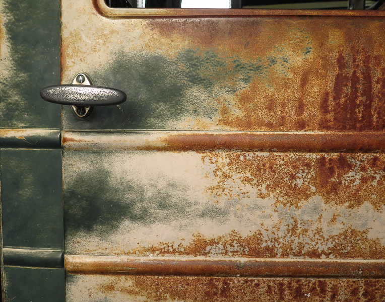
Door of truck from by Lindburg Truck Line of Mackay that hauled mining equipment.
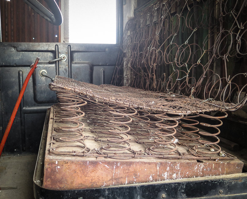
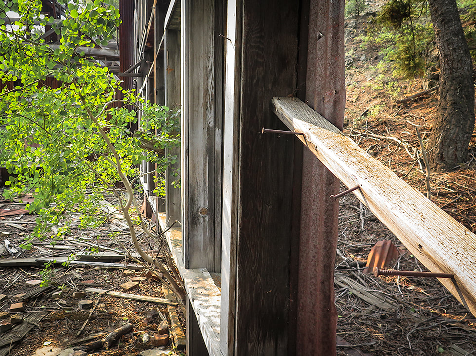
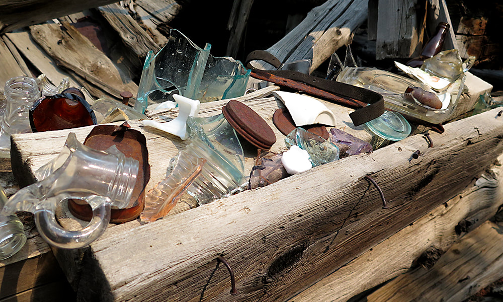
Scenes from Mackay's Mine Hill Tour
clockwise from top left: Cossack mine tunnel (the tour brochure states, "Caution: The tunnel is dangerous and prone to rock falls. Stay Clear"; supporting pole in the aerial tramway headhouse; tramway and tramhouse; upper terminal tramhouse; ore bucket; part of 6-mile cable that transported ore buckets.
If you have limited time for the Mackay Mine Hill Tour, I suggest visiting the Hardrock Mining Exhibit at the beginning of the tour, not far from the town center. The exhibits show many examples of mining equipment that seems like it was just pulled out of the field. Informative interpretive signs describe every aspect of mining in Mackay, and illustrations and photos document how mining was done. I am amazed at how strong the miners had to be to handle heavy hand drills before the invention of the mechanical drill. You will get a great idea of the hardships of hardrock mining and how many steps were involved in finding and processing ore to produce valuable minerals.
The Lost River Museum in Mackay is a definite must-see. For a small town, this award-winning museum is exceptional. The volunteers at the front desk are down-home friendly and told us a few Living in Mackay tales including enduring winters and their early ranching experiences. It is well-organized and informative; you can tell that this museum was created out of the pride, care and love of Mackay citizens. From vintage ball gowns and flapper dresses owned by past Mackay ladies to a Basque sheepherder exhibit including sound effects, and a moonshine exhibit, the museum is comfortable, organized, but most important of all, interesting! 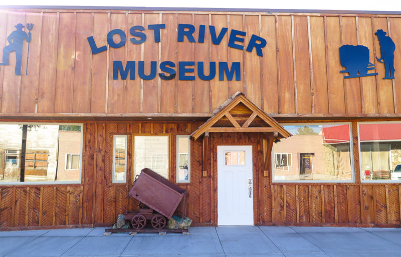
Award-winning Lost River Museum in Mackay, Idaho
References
Carey, R.L. About Survey Monuments and Benchmarks. Skipp, B, Kuntz, M. A. 2009. Geologic Map of the Arco 30 x 60 Minute Quadrangle, South-Central Idaho. (article text). Skipp, B, Kuntz, M. A. Geologic Map of the Arco 30 x 60 Minute Quadrangle, South-Central Idaho. (geologic map). Official Website of the Mayor and Council of the City of Mackay Mining Technology in the Nineteenth Century. Online Nevada Encyclopedia. Phoenix Set to Rise on Mackay's Mine Hill. Mining Journal, 6/28/18. Phoenix Copper Limited - The Empire Mine, Mackay, Idaho.
A challenging climb up the loose-rock north side of Idaho's second tallest peak for spectacular views from the "roof" of Idaho.
Related Posts
Idaho Summits (see Categories in sidebar) Mackay Peak, 10, 273' and Mackay Mine Hill Tour Cowboys and Hotsprings Alpine Peak 9,861' - Sawtooth Wilderness: Never Stop Climbing Mountains Reward Peak: 10,074' via Upper Redfish Lakes, Sawtooth Wilderness 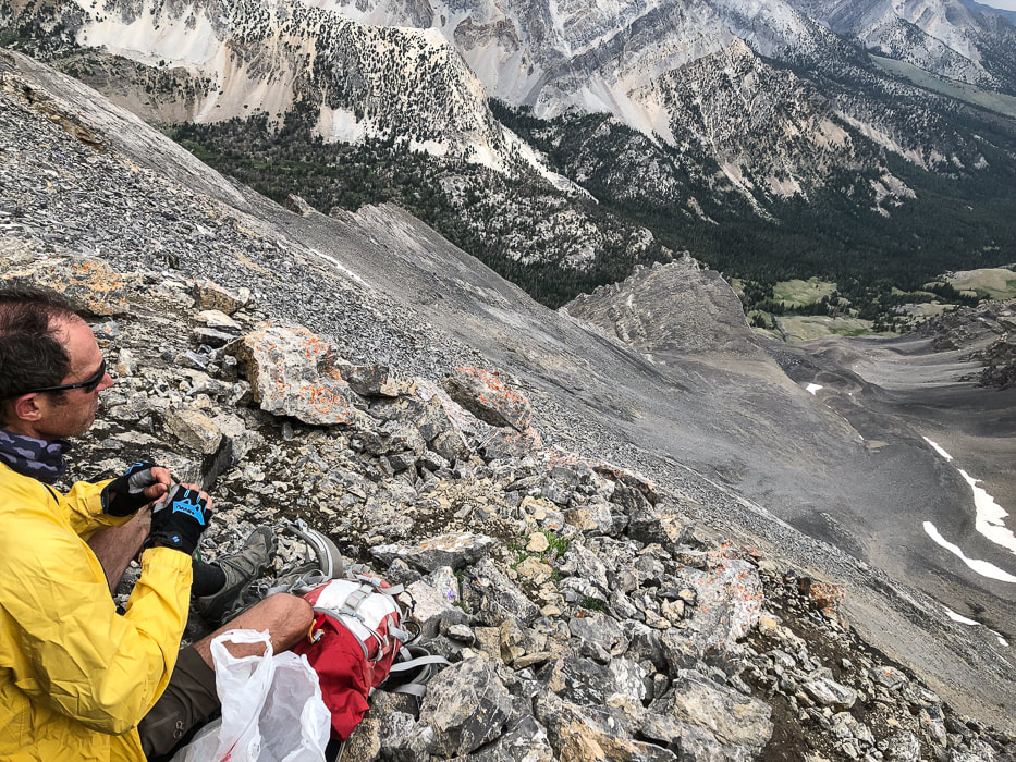
Lunch break at 12,000 feet.
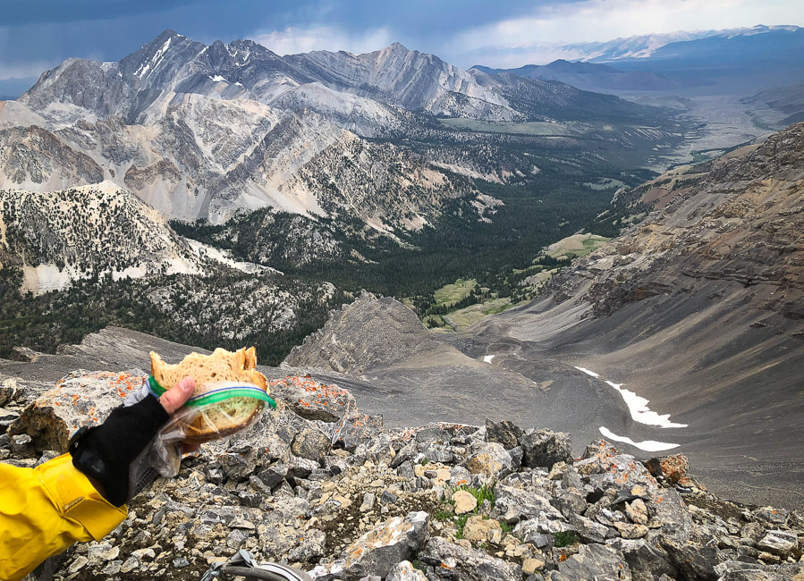
Lunch spot on Leatherman Peak's north slope
Mt. Borah, Idaho's tallest peak at 12,667' on left horizon. Road approaching trailhead at upper right; trail goes through pleasant forest in valley.
Trip Stats
Location: Leatherman Peak, Idaho's second highest, is located in the Lost River Range in the Salmon-Challis National Forest just northeast of Mackay in east-central Idaho. This rugged range includes seven of the nine "12-ers" - the highest peaks in Idaho. Two main approaches: south approach from Leatherman Pass (Lost River Valley) that climbs the west ridge, and north approach from Pahsimeroi Valley and West Fork Pahsimeroi Road climbs the east ridge (our approach). Distance: 8.7 miles round-trip. Elevation Gain: Trailhead = 8,171'; Leatherman summit = 12,228: Gain = 4,000'. Date Hiked: July 7, 2021 Difficulty: Moderate Class 1 for first 1,000 feet gain, then Very Strenuous Class 2 on loose rock with some route-finding. Considerations: This is a very strenuous hike that is exposed most of the way - start hike early! Obvious trails extend through the talus and on the ridge. Experience with steep loose-rock climbing and route finding is essential. Coordinates: Trailhead at end of West Fork Pahsimeroi Road: 44.1292 N 113.7271 W. Leatherman Peak: 44.0820 N 113.7330 W. Maps and Apps: USGS Leatherman 7.5 min quad topo, AllTrails GPS tracks. Interactive Map and Google Earth image of our GPS tracks below. Geology: Sedimentary rocks - marine limestone of Mississippian carbonate banks and turbiditic sandstone and mudstone and conglomerate of Antler flysch trough ~350 Ma (Million years ago). Crinoid and coral fossils. Leatherman Peak is a sharp horn carved from Mississippian Scott Peak Formation. Some of these rocks were intruded with dikes that baked the rock ~ 45-50 Ma, producing flourite veins. This section of the Lost River range rose due to the Mackay section of the Lost River Fault. History: Leatherman Peak is named after Henry Leatherman, one of the Lost River Valley's pioneers from the 1860's. For more interesting history of this region, see last photo below.
Our Hike
The raw and starkly beautiful Lost River Range that rises steeply from the Lost River Valley in east-central Idaho contains seven of Idaho's nine highest peaks over 12,000 feet. It reflects the complex geological processes of folding and faulting that have occurred over eons, creating formidable steep talus slopes, cliffs and crumbling limestone; however each year sees more climbers logging in their nine "12'ers". These giants make up the roof of Idaho. Leatherman Peak can be summited from either the Pahsimeroi Valley to its north, or Lost River Valley to its south. Idaho's highest, Borah Peak at 12,667', has become so popular that the campground at its trailhead is being enlarged. After Fred and I summited Borah Peak years ago, I had heard that the second highest peak, Leatherman involved more "technical" skills. So I put that climb into the back of my mind, subconsciously knowing someday I was bound to do it, but the word "technical" prevented me. We each turned 60 this year, felt it was time to climb another Lost River range peak, so Leatherman it was. We climbed the "easier" eastern route that included a slow and steady slog for a 3,000-foot gain on steep loose scree and talus, at times grabbing for fossil-covered limestone outcrops for stability. There was no "easy" part except for the walk back down through the forest; this was a challenging climb for us. As we got within 500 feet of the summit, distant purple-blue skies to the north rumbled with occasional thunder, so our scramble to the top had to be quick but also careful. 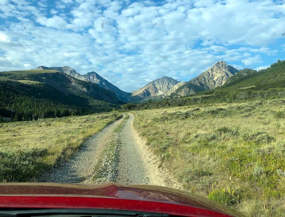
Morning glimpse of our goal: the far dark gray peak on horizon, left side of saddle.
From Mackay, we drove 2 hours and 10 minutes to our trailhead at the end of the West Fork Pahsimeroi Road, via Doublesprings Pass and Horseheaven Pass in the Pahsimeroi Valley. Here, steep limestone cliffs, some folded and tilted loom above a pleasant sagebrush steppe. A high-clearance 4WD vehicle is recommended as there are a lot of rocks on the last half of the drive with some slow-going. I entered the coordinates for the trailhead into Avenza and also followed the directions from the guide book, "Trails of Eastern Idaho" by Margaret Fuller and Jerry Painter. Included in this guide is a section Scrambling up Idaho's 12,000 foot Peaks . A few scenes from the drive into the northeast side of the Lost River Range:
The first mile of the hike climbs a manageable 1,000 feet in 2.5 miles along the clear and rushing West Fork of the Pahsimeroi River through a beautiful forest that opens up onto a spacious wildflower-filled valley. Ahead, the black, towering spectacle of Leatherman Peak rises straight up from the meadow, connected to White Cap Peak by Leatherman Pass.
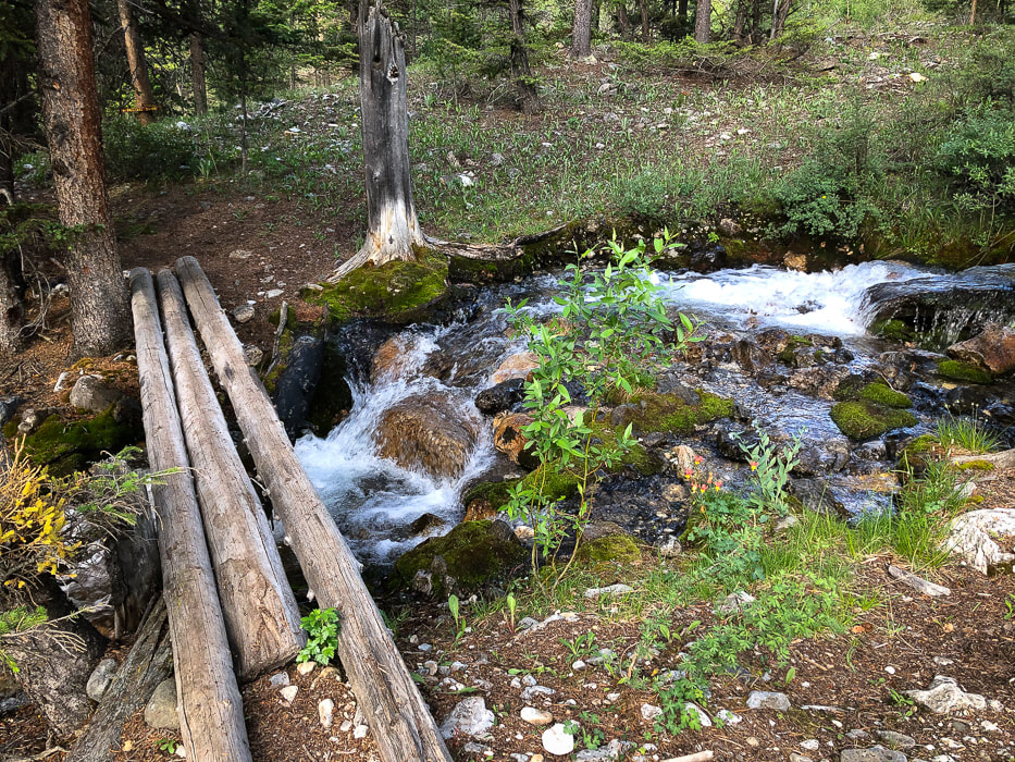
Just after trailhead, cross stream coming from Merriam Lake that flows into West Fork Pahsimeroi River.
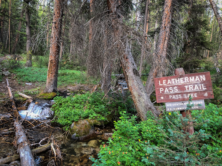
Our route takes a left (east) to hike Leatherman's north slope, leaving the Pass Trail before it reaches Leatherman Pass. Sawmill Gulch is the southern approach from Lost River Valley.
Thank-you for the bridges!
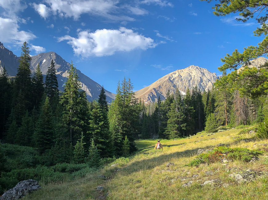
The first glimpse of Leatherman (left); and White Cap Peak (A.K.A. Mount Obsession) on the right.
Continue on trail until you reach a large valley opening and the steep gray gully of Leatherman to the left.
We went too far up-valley toward the pass, so we had to back track to find our gully route, east of the prominent north ridge. Not the best thing to do, since time is precious in the mountains above tree line. Once you get to the large meadow, 2.5 miles from the trailhead, leave the trail and start hiking left toward the steep loose-rock gulley below the ridge made mostly of talus that takes you to the ridge. A human-made trail winds up through this immense gray slope. After getting up the first steep part of this gulley, doing the rest-step to conserve energy, we took a brief rest to scope out a route to the top. A trail heads straight up to the lowest part of the ridge line through what seems acres of loose talus. Fred would have no part of that, so instead we climbed more to the right, using a combination of talus and stable limestone outcrops to scramble up to the ridge. As we got to almost 12,000 feet, sheets of rain extended in slight curves from blue clouds and distant thunder rumbled. We climbed to some protective outcrops in case we had to hunker down because of weather. The storm seemed to be moving across Pahsimeroi and Lemhi Valleys further to the east. We kept our focus up the steep slope, for looking down with sketchy footing was a bit unnerving. Glad the limestone, besides having some cool fossils, was rough and grippy.
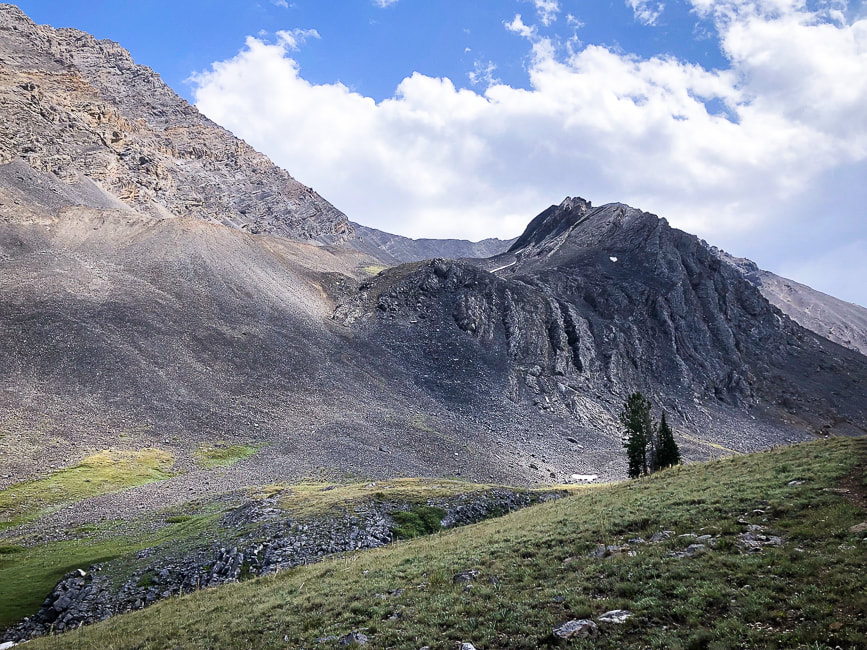
Leave trail to make initial steep climb into Leatherman's northern gulley; this leads you to the cirque under the ridge.
Leatherman is behind the black outcrop. 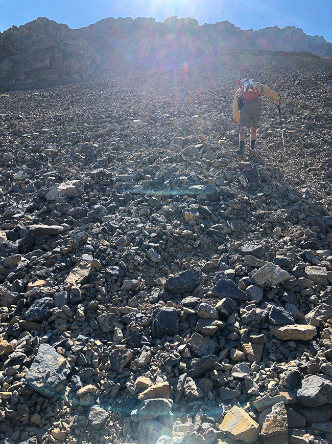
A "sea" of rocks - initial talus climb to gulley
Wait - why do we do this again?
Navigating through a gray rock sea - 3,000' gain
Yes! It was worth it 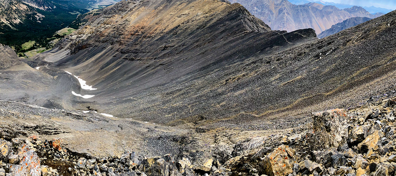
Working our way up larger boulders and outcrops of Leatherman Peak below the ridge; looking north onto gulley we ascended from forest below.
We descended via the path through the talus on the right. 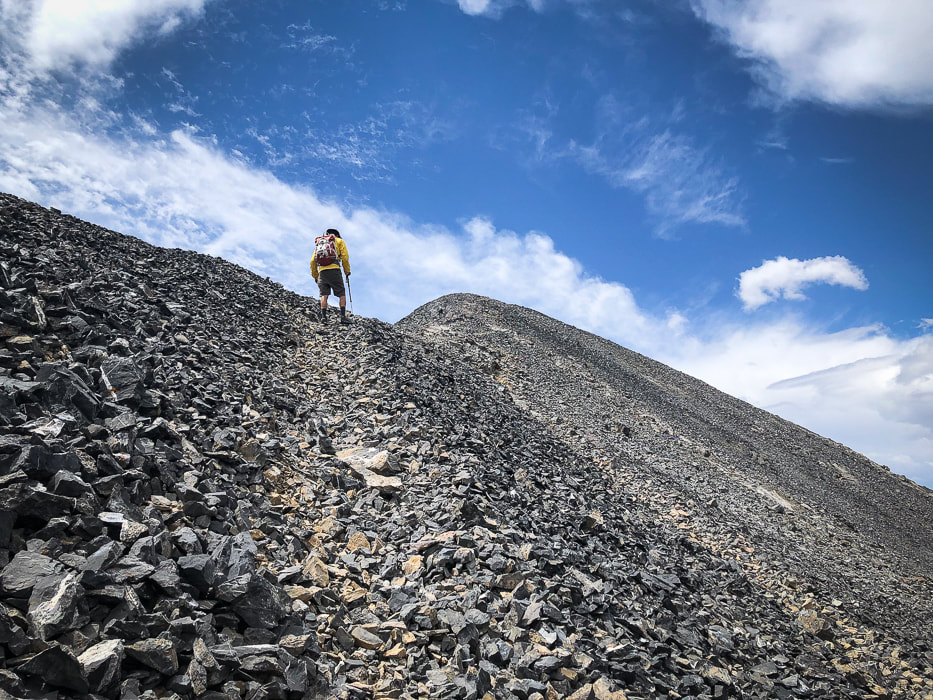
Final ridge climb - Leatherman Peak summit
Sue and Fred at 12,228' - another Idaho 12'er for the books!
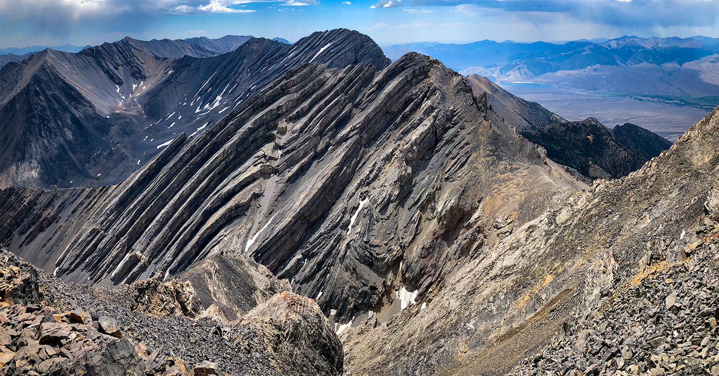
Bad Rock Peak on ridge between Leatherman Peak and Mount Church
Tom Lopez, in his book Idaho: A Climbing Guide says of this peak, "Every approach crosses loose scree/talus that will make some climbers sob." 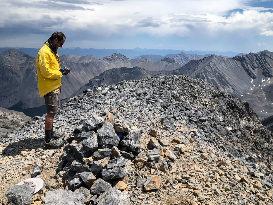
Leatherman Peak's summit - 12,228'
A few bypasses on the rocky road out helped to avoid a few slippery and steep sections. The gravel road passes through Mahogany Creek, which had not gained water volume since our morning crossing.
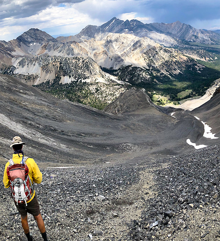
Getting down slope from ridge; route in gully below
Now we have summited three of the nine Idaho "12'ers". Getting to the top of the rest of the six: Mount Church, Mount Idaho, Lost River Peak, Donaldson, Diamond Peak, and Mount Breitenbach would surely qualify as a "kedge", especially for a couple of 60-year old "geezers"!
That night in Mackay, we celebrated with pizza and beer at the Bear Bottom Restaurant's bar and talked to some of the "locals" who had finished their day's work. We got some tips on great things to see in the area, like the Mackay Mine Hill Tour. So much to explore, so little time. We are lucky to have opportunities and freedom to explore our beautiful state and also this beautiful country. Never stop exploring and climbing mountains! 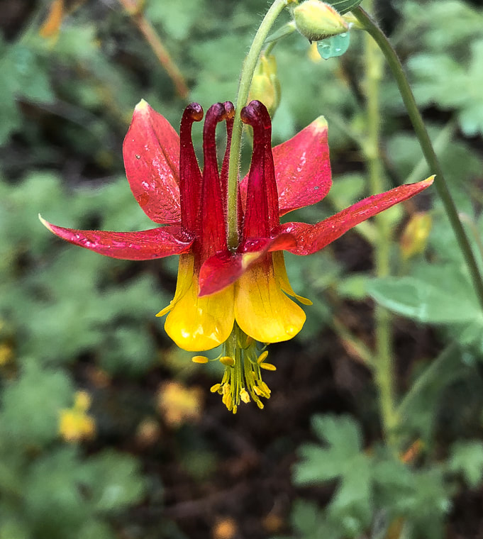
Red Columbine after rain shower
A welcome sight after all of that gray limestone! 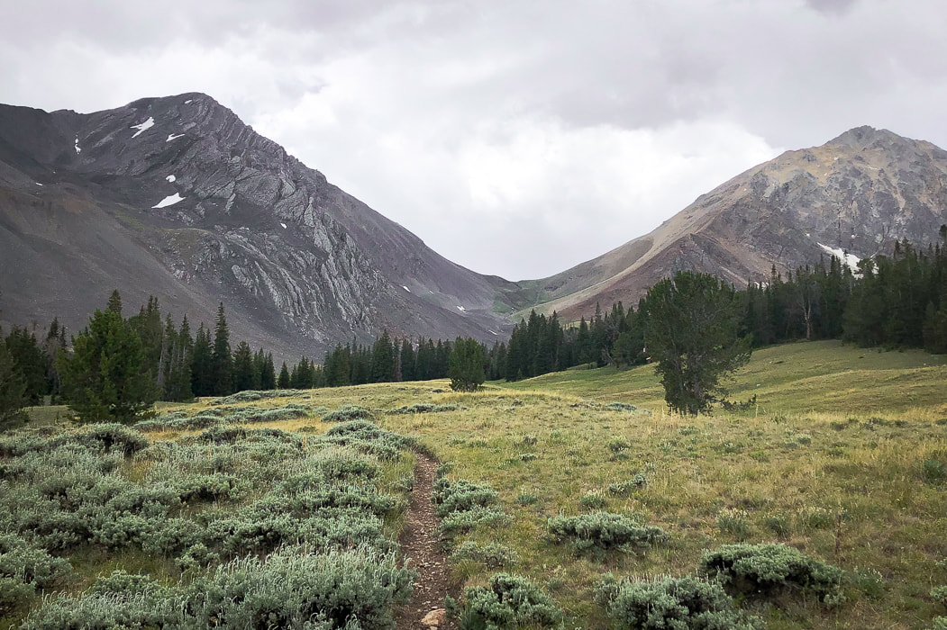
Parting shot of Leatherman Peak with clouds rolling in
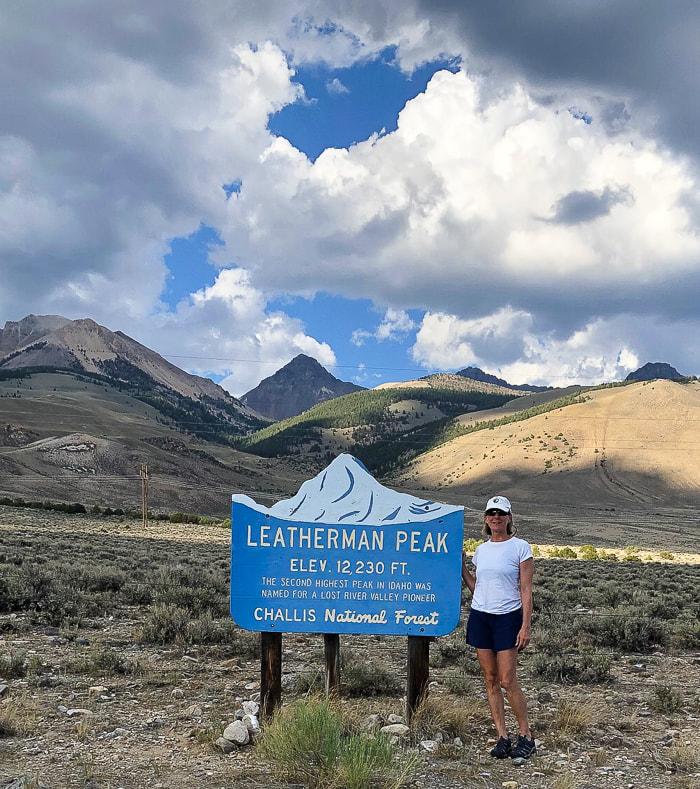
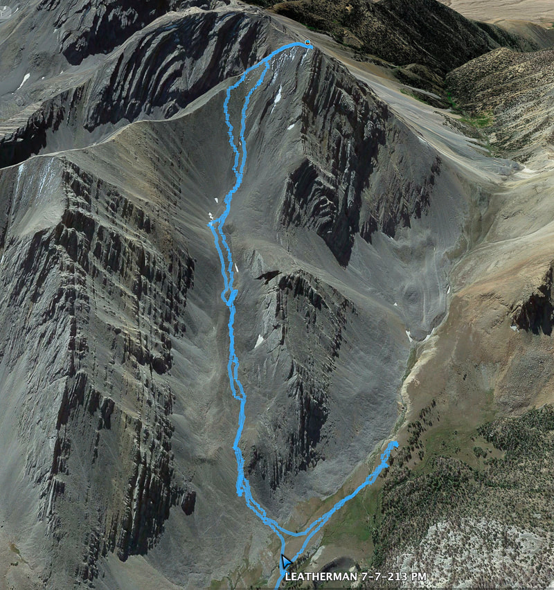
Our route up Leatherman's north gully/eastern ridge approach
We went too far toward Leatherman Pass, so had to backtrack.
References
Custer County, Idaho, GenWeb Project - Mackay's Mount McCaleb Geologic Map of the Borah Peak, Burnt Creek, Elkhorn Creek, and Leatherman Peak 7.5-min quadrangles, Custer and Lemhi Counties, Idaho. Idaho Geological Survey. Link, P.K., and Janecke, S.U. 1995. Geology of East-Central Idaho: Geologic Roadlogs for the Big and Little Lost River, Lemhi, and Salmon River Valleys. Henry Leatherman - Find a Grave website. |
Categories
All

Sue and Fred

About this blogExploration documentaries – "explorumentaries" list trip stats and highlights of each hike or bike ride, often with some interesting history or geology. Years ago, I wrote these for friends and family to let them know what my husband, Fred and I were up to on weekends, and also to showcase the incredible land of the west.
To Subscribe to Explorumentary adventure blog and receive new posts by email: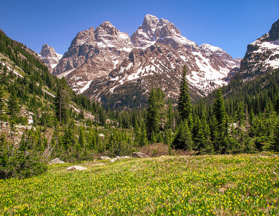
Happy Spring!

About the Author
|
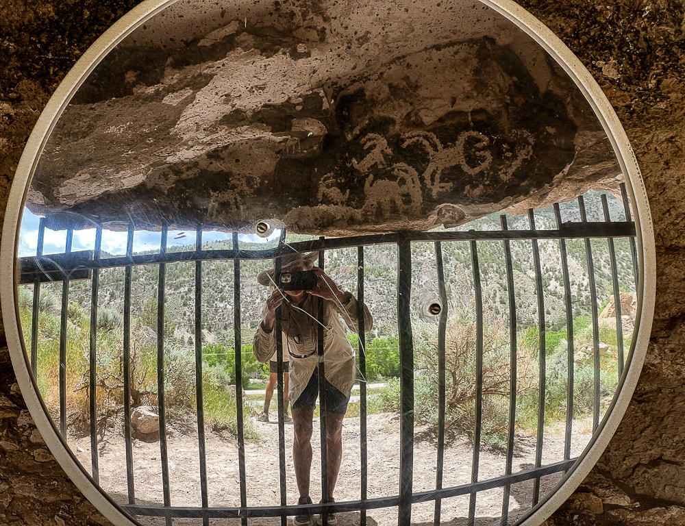
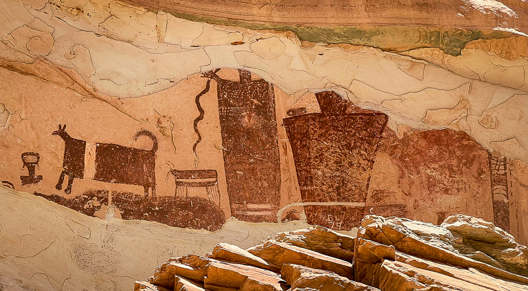
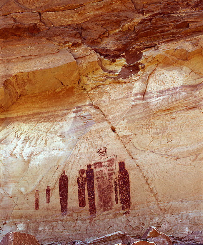
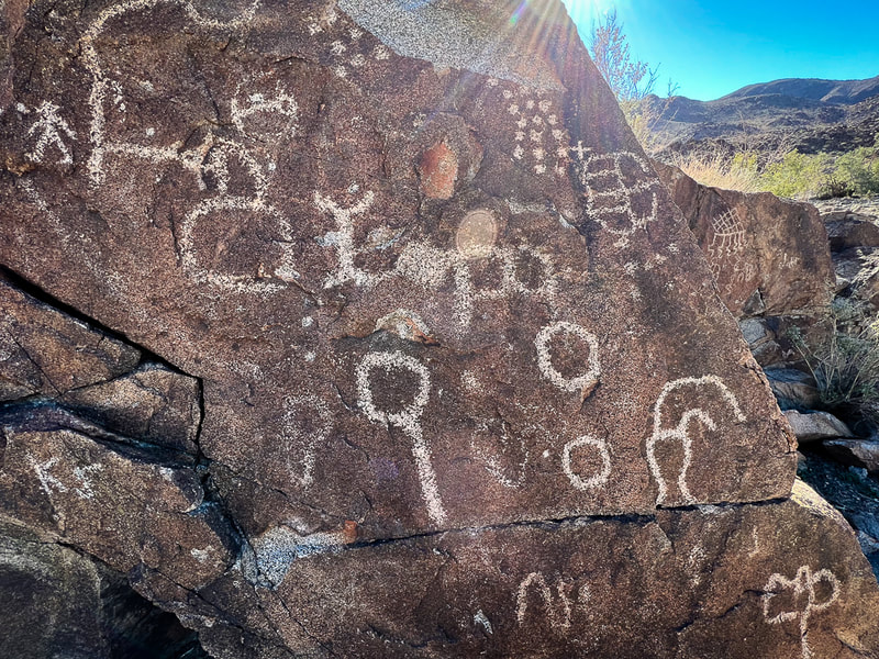
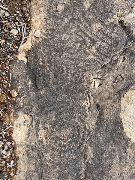
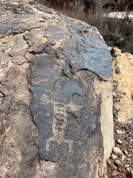
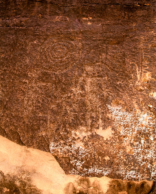
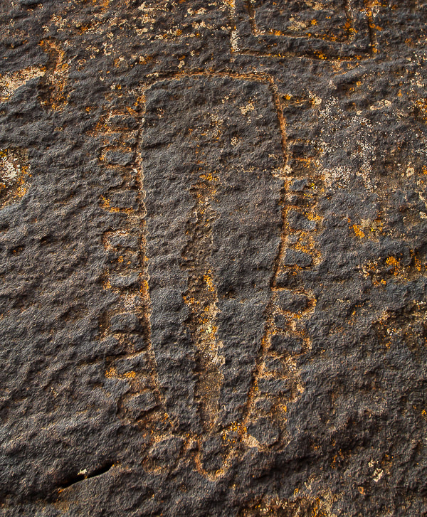
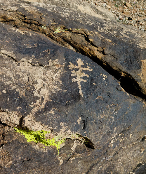

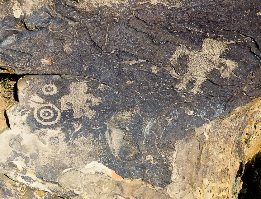
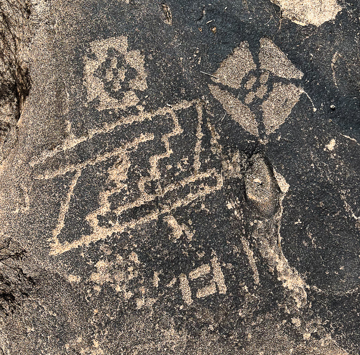
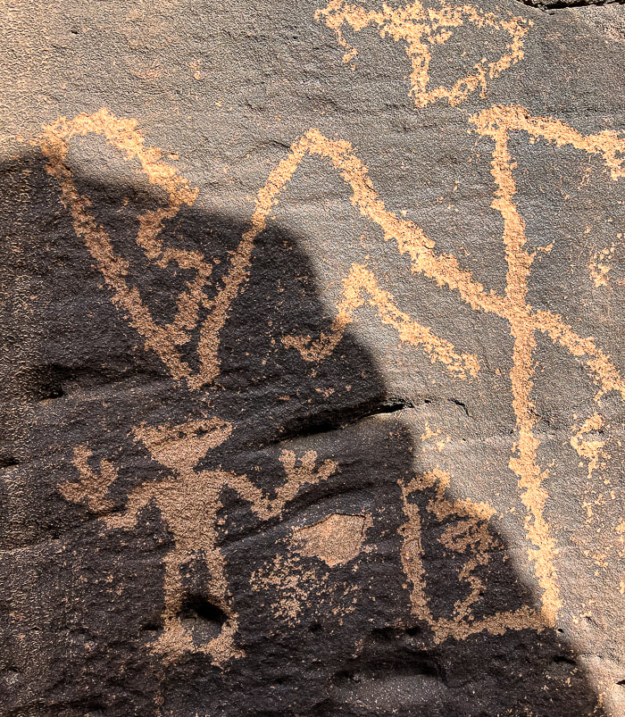
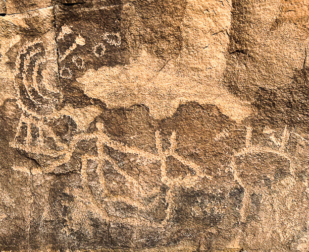
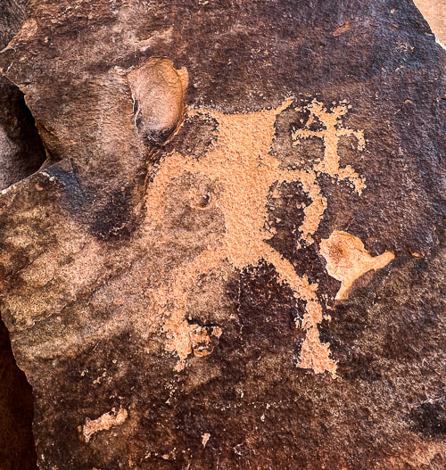
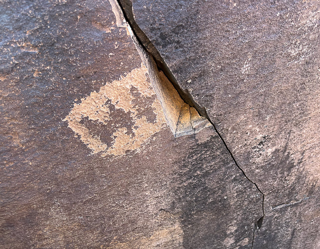
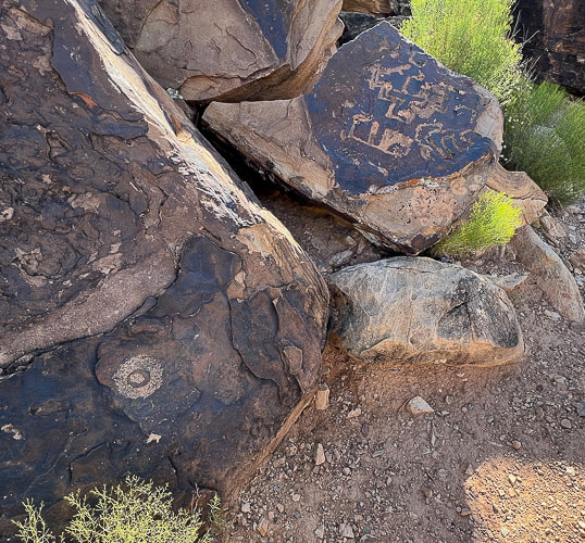
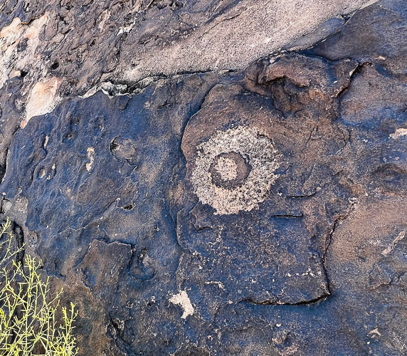
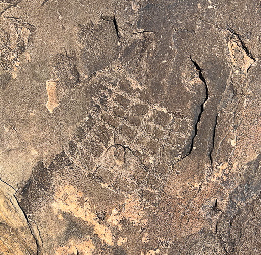
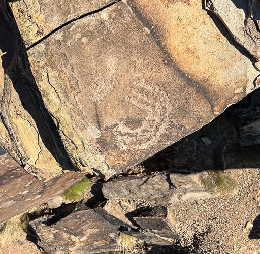
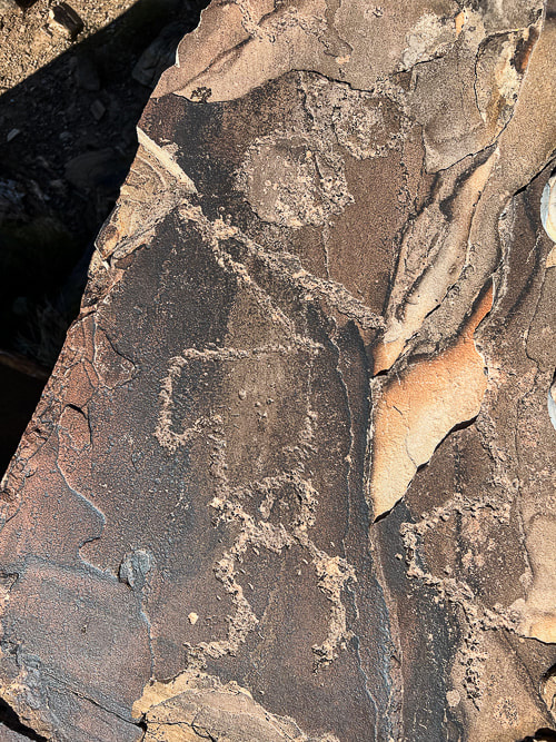
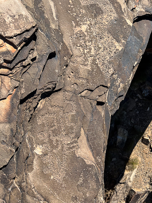
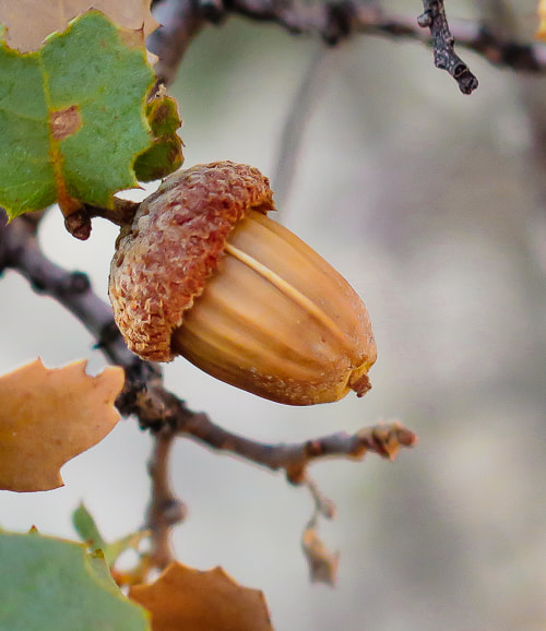
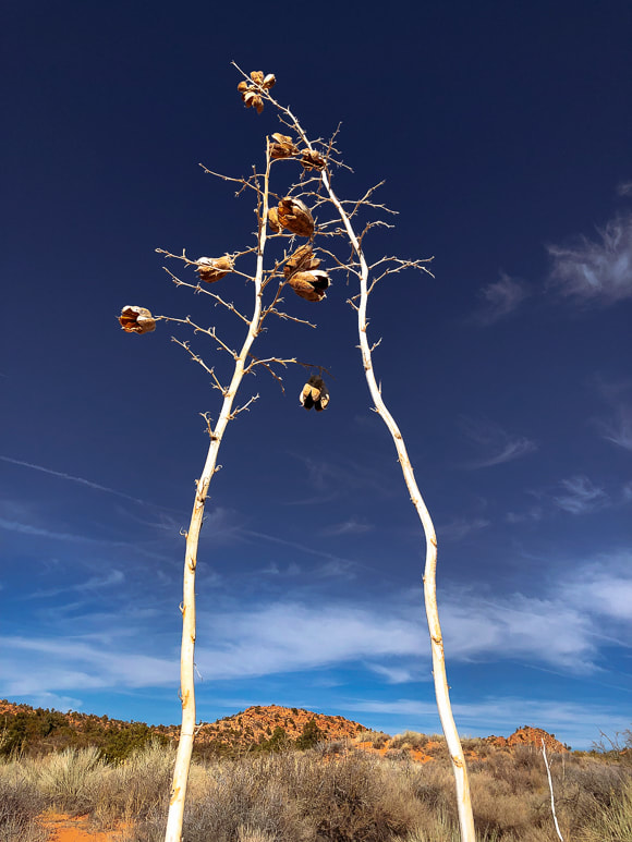
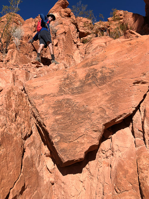
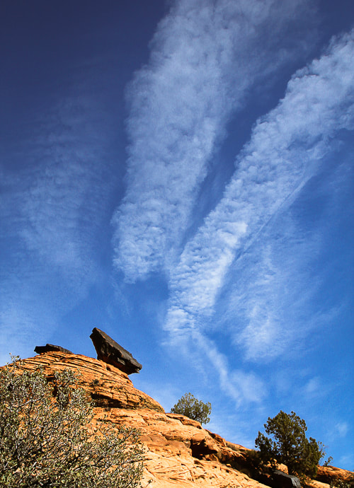
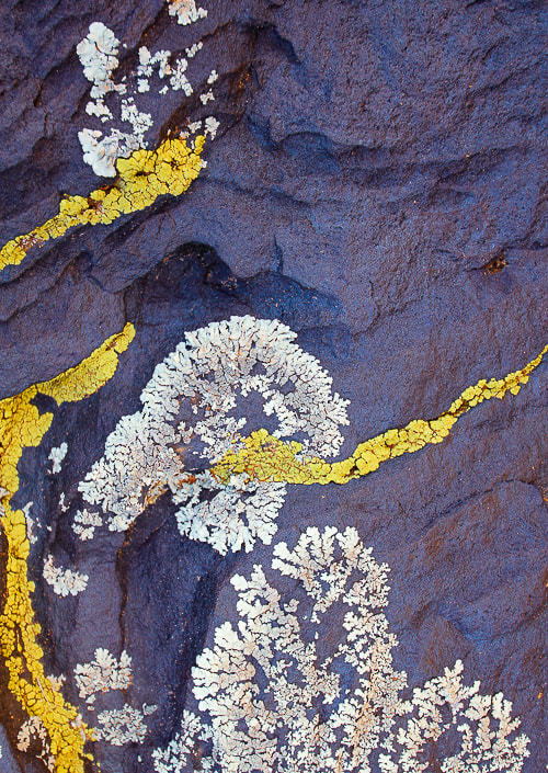
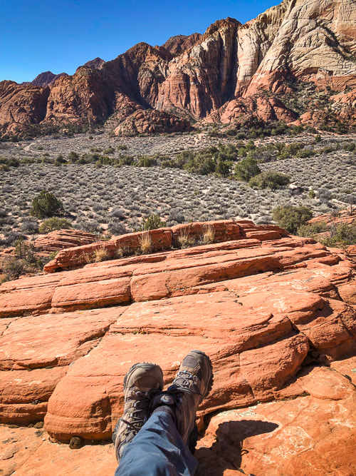

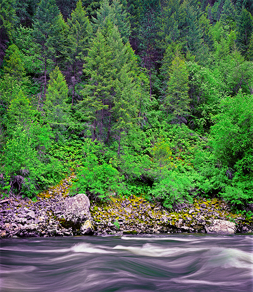
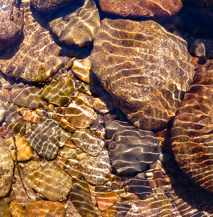
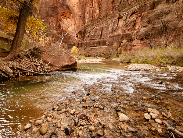
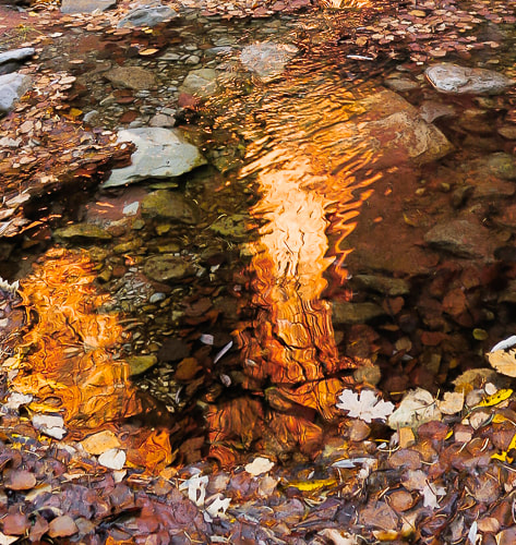
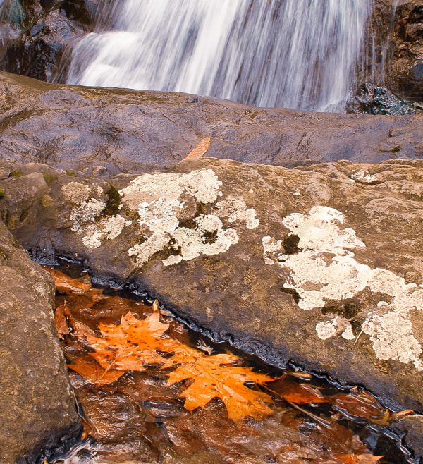
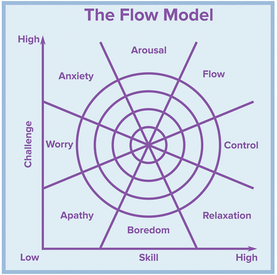
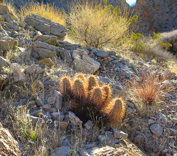
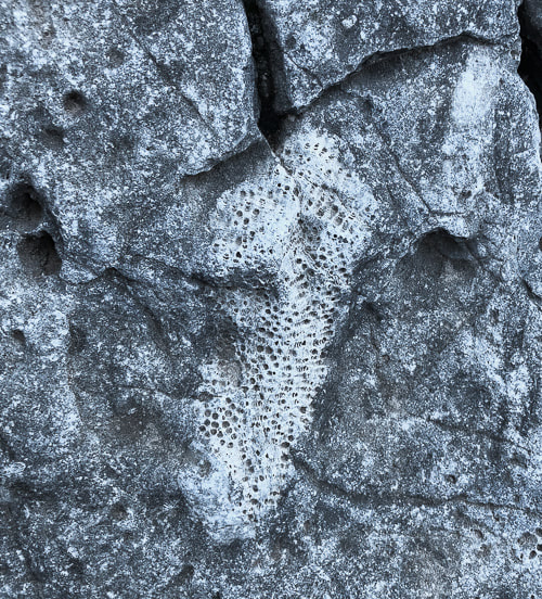
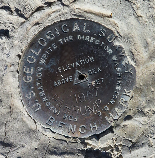
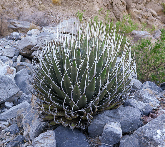
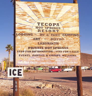
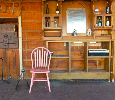


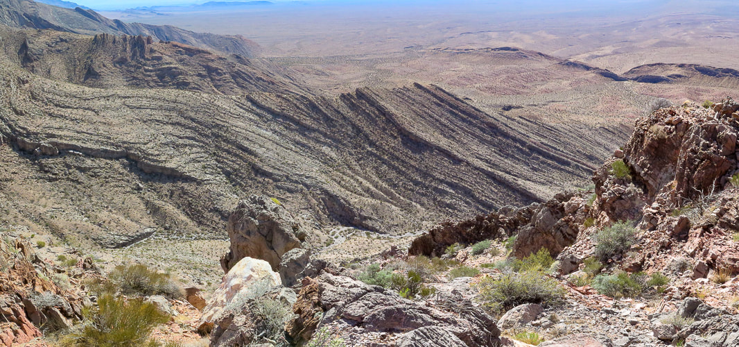
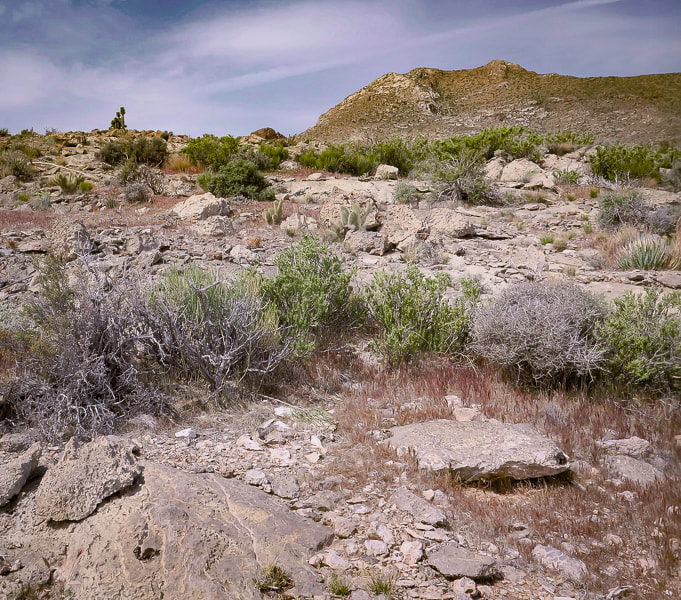
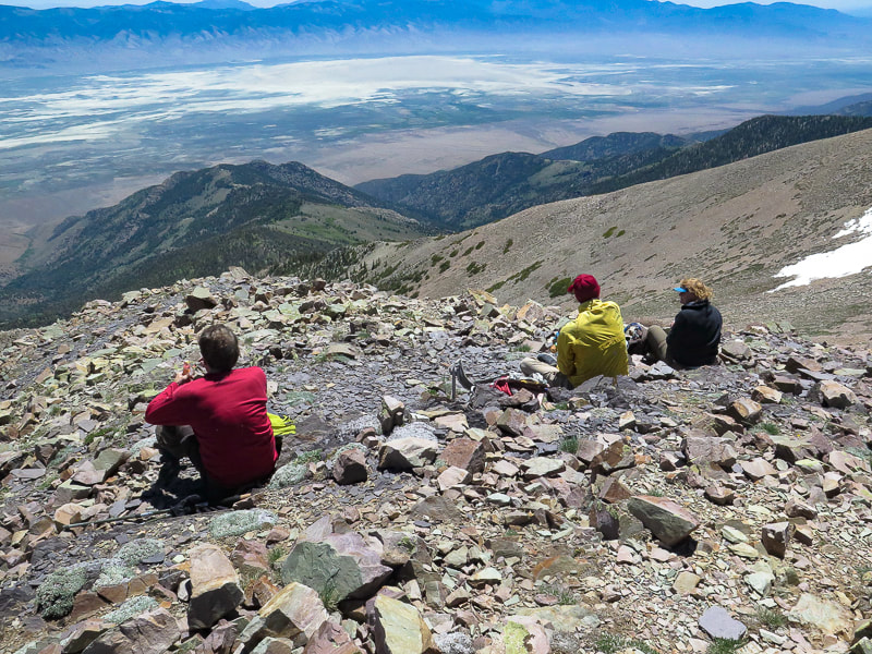
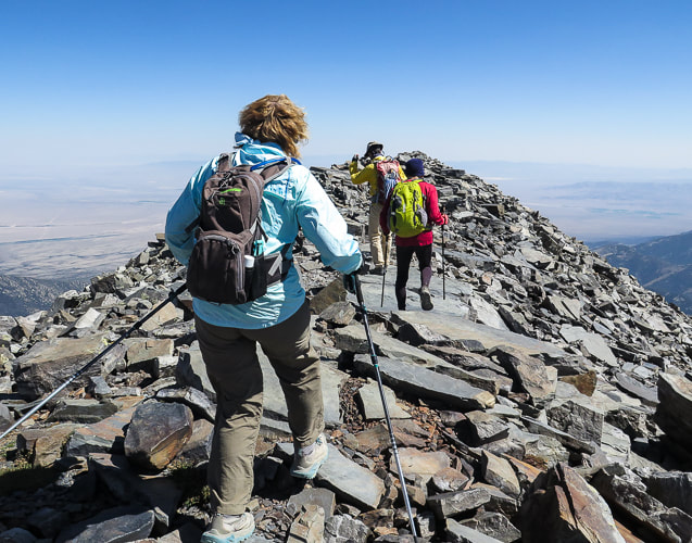
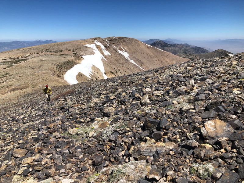
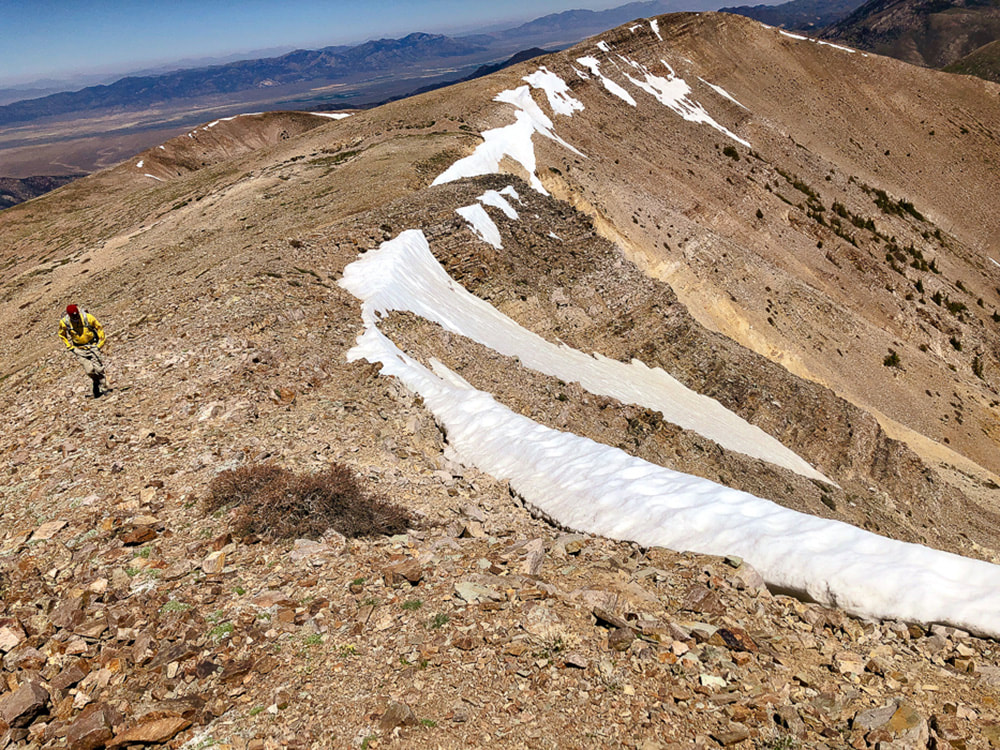
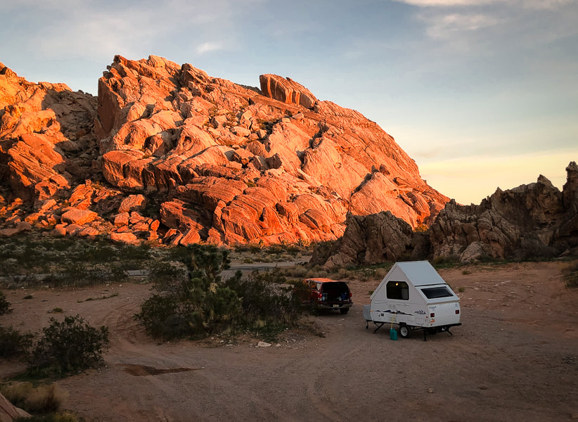
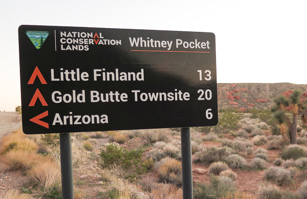
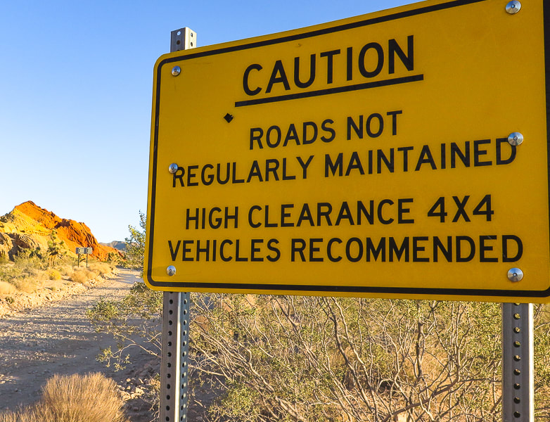
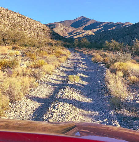
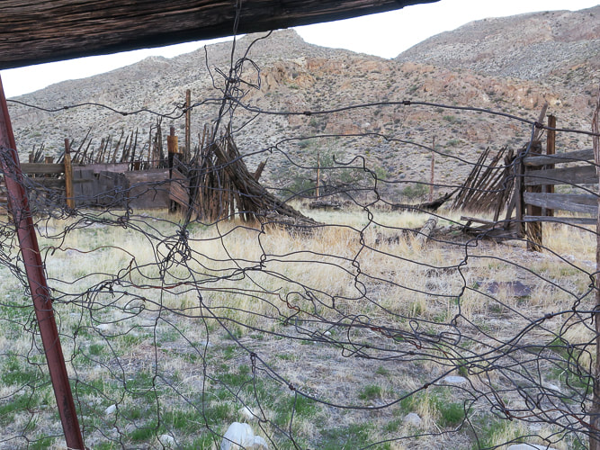
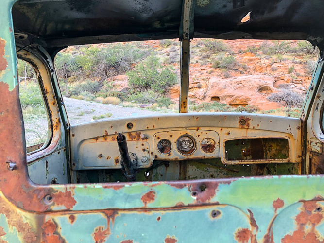
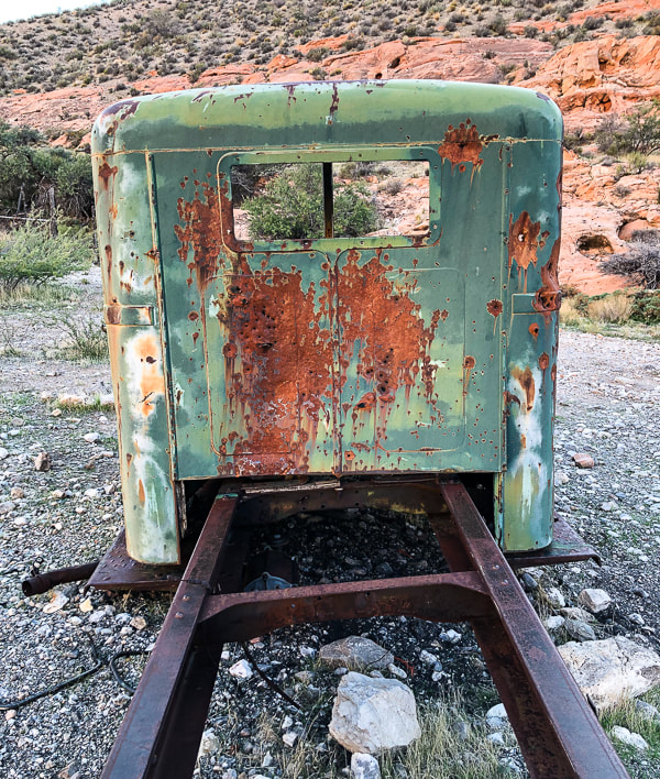

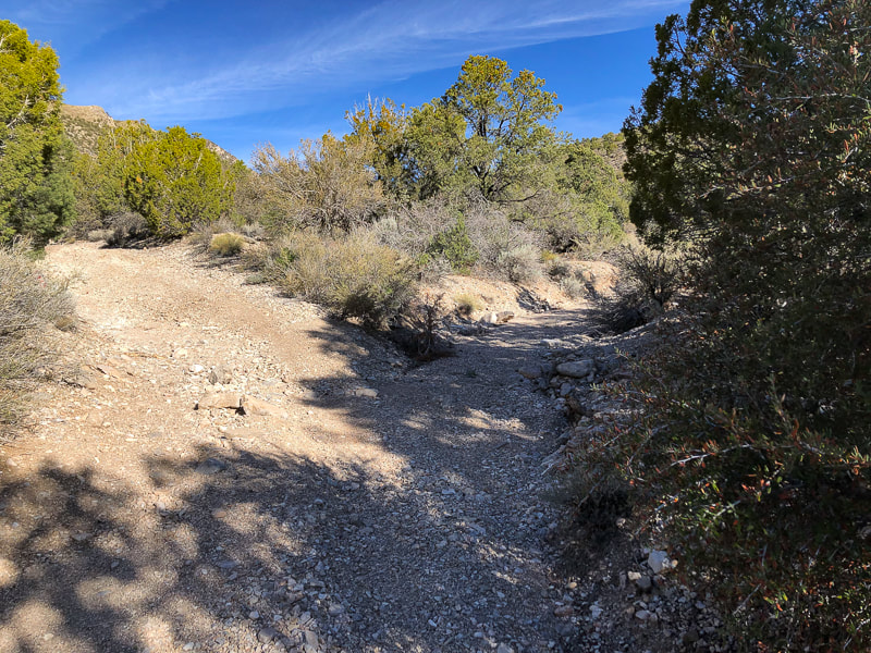

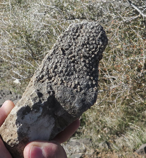

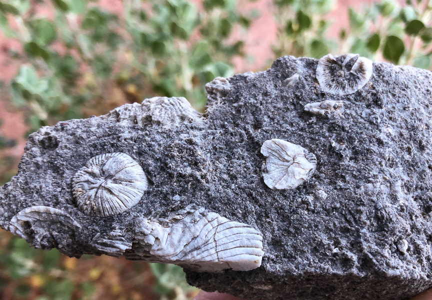
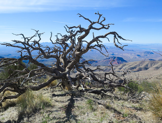
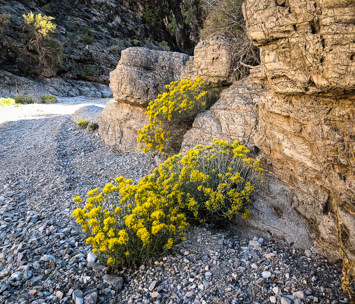
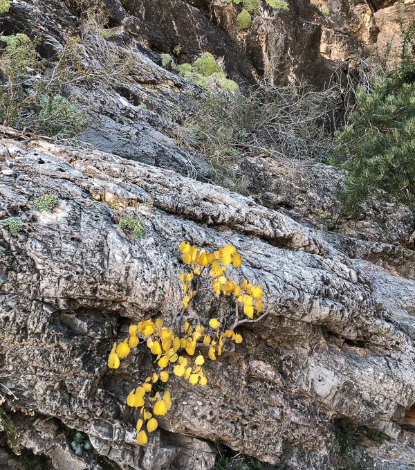
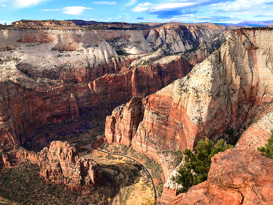
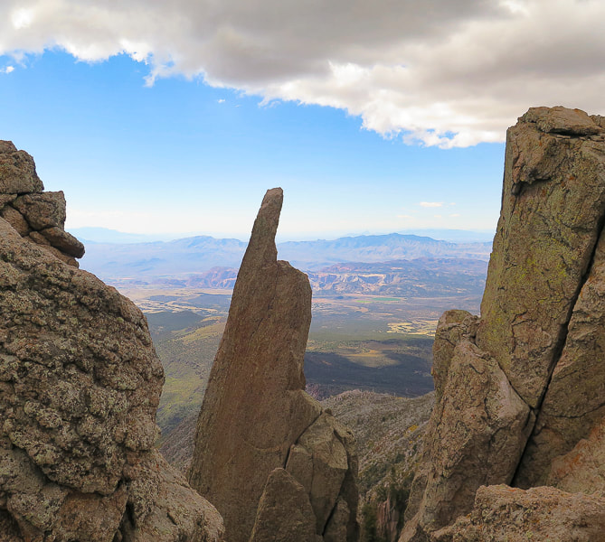
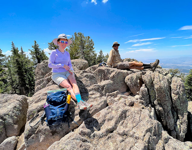
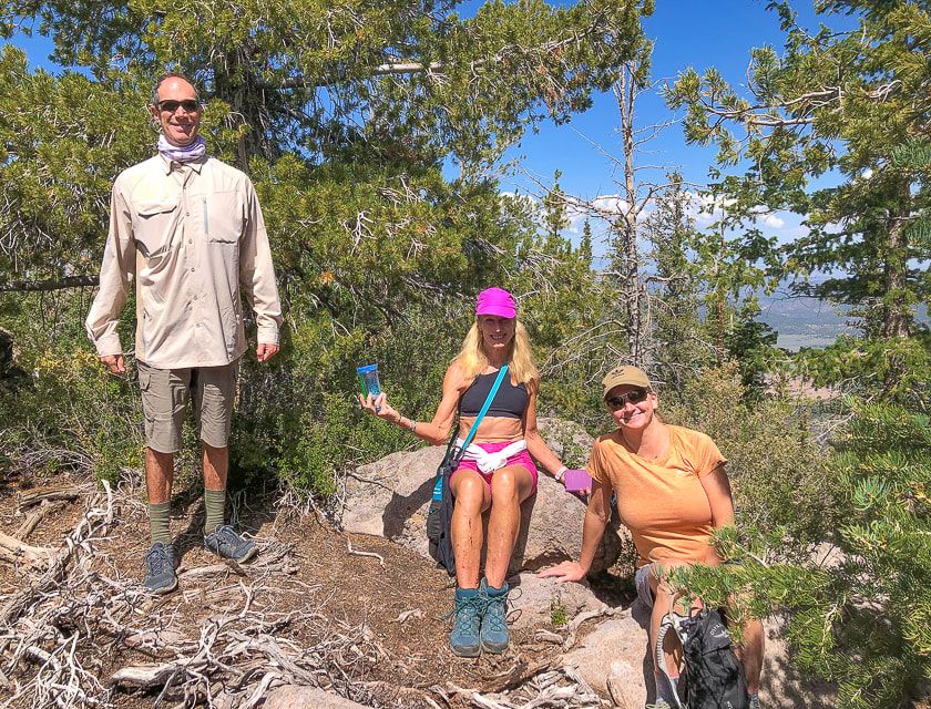
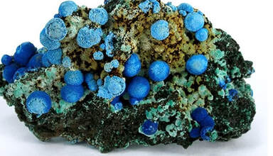
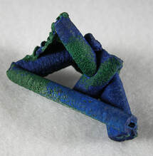
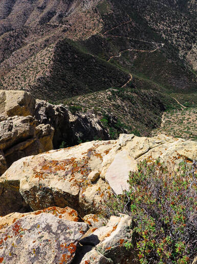
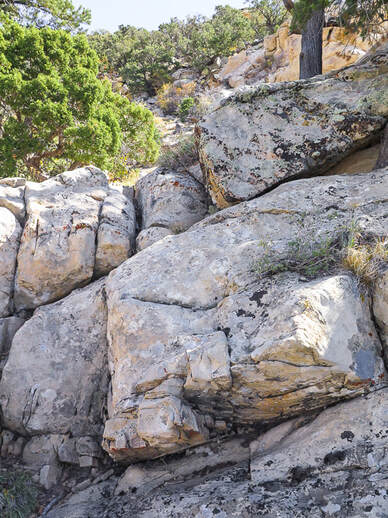
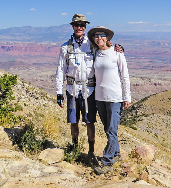
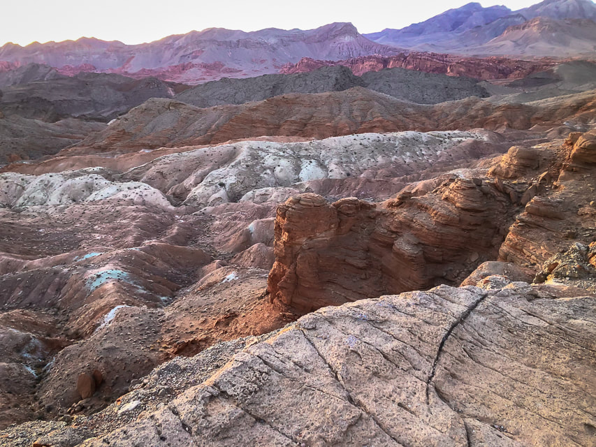

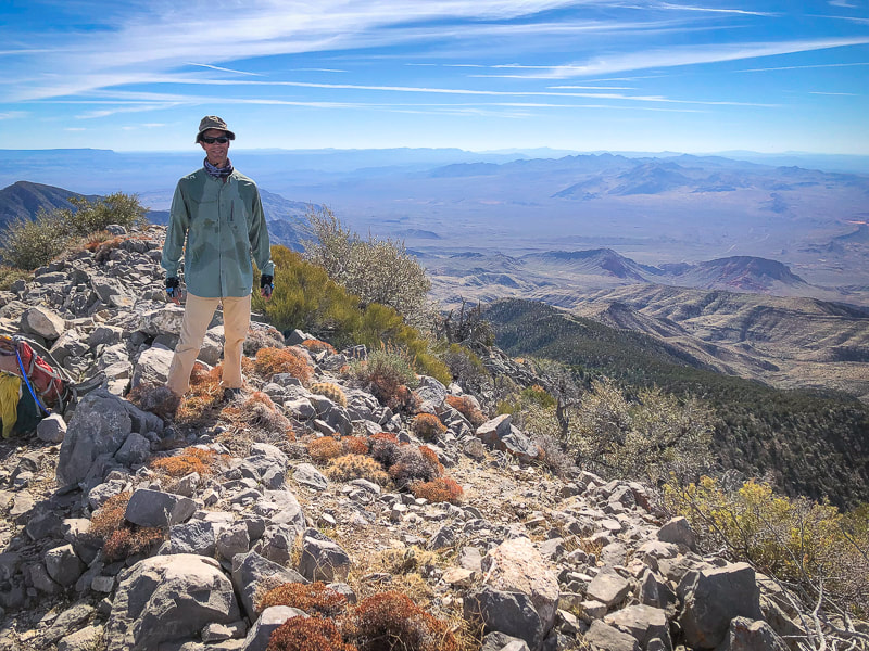
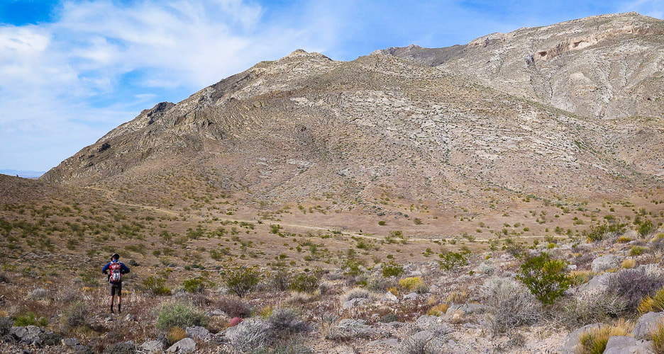
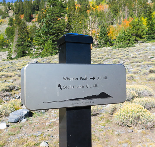

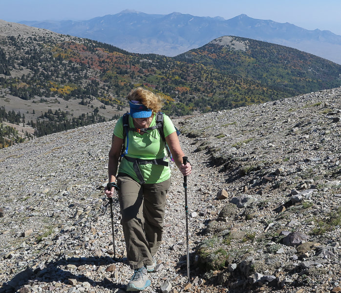
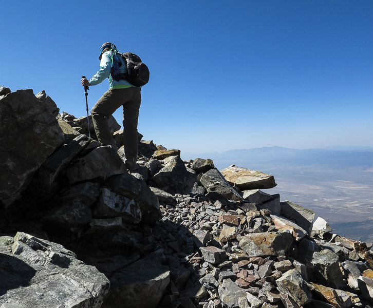
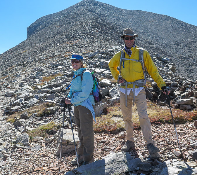

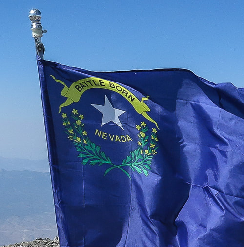


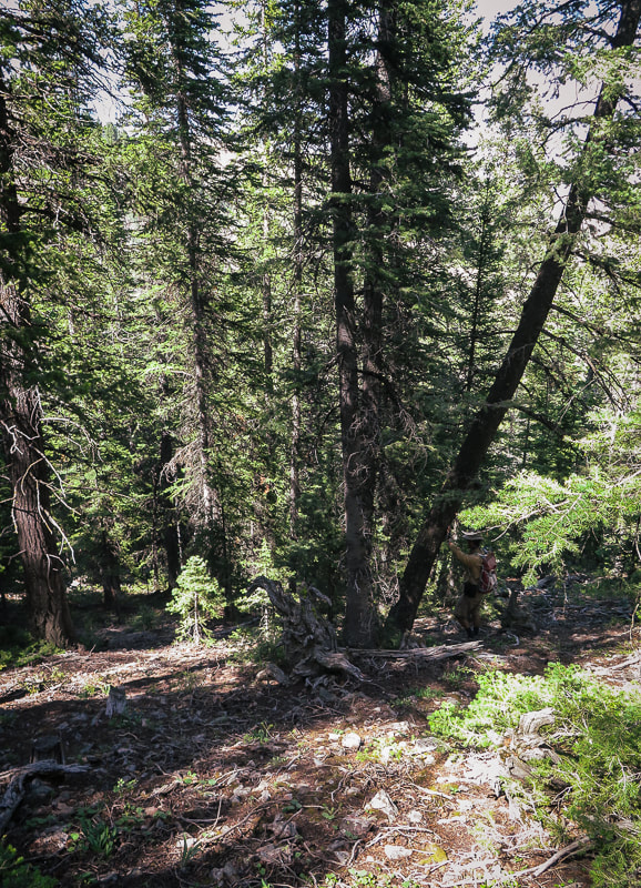

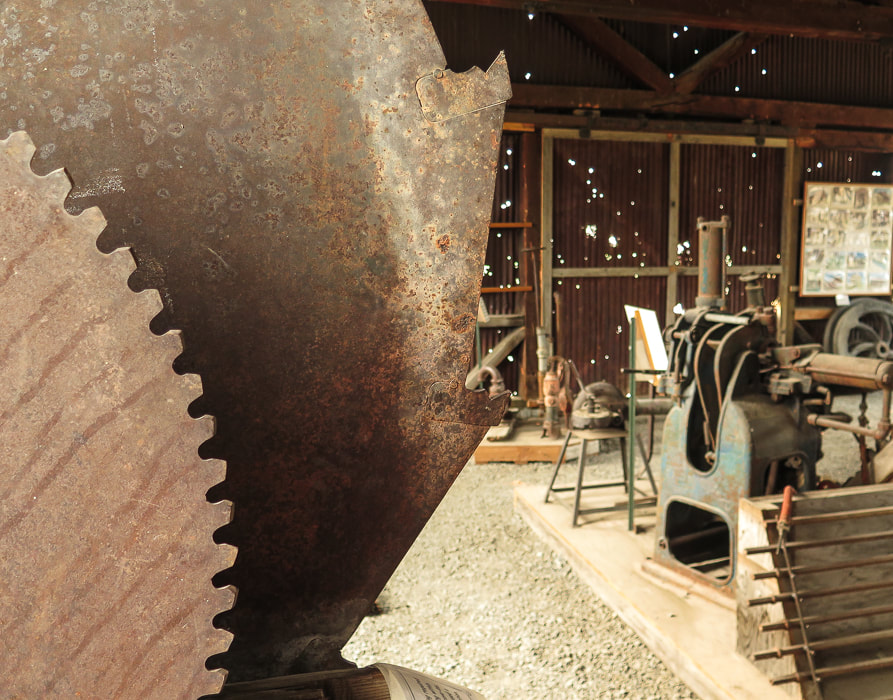
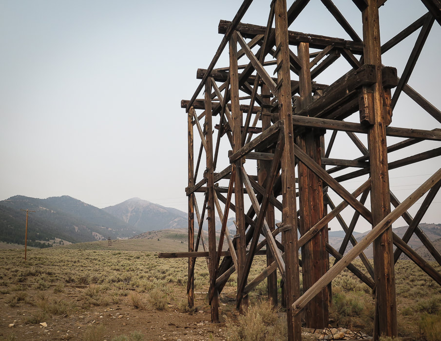
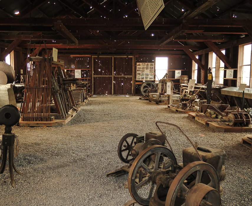
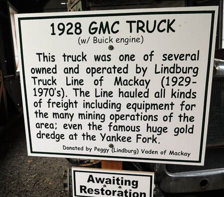
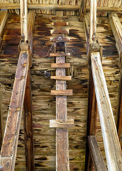

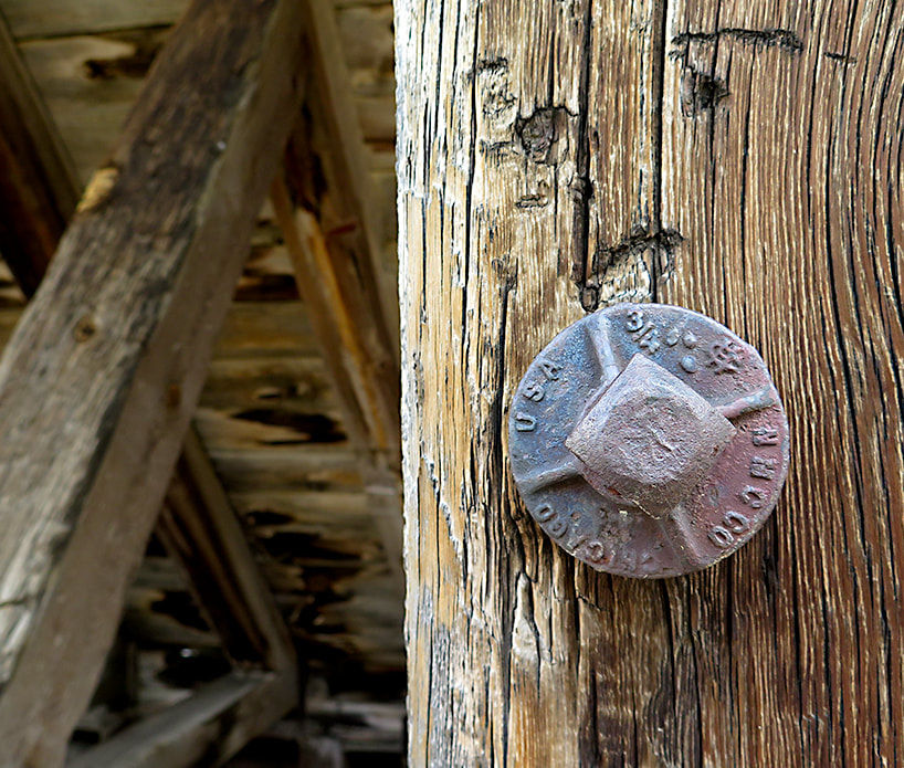
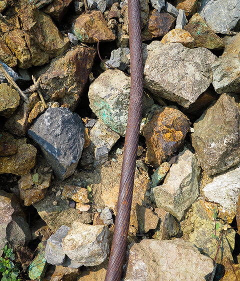
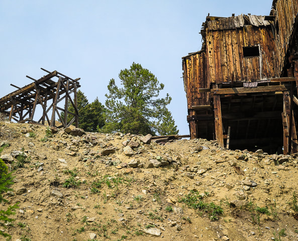
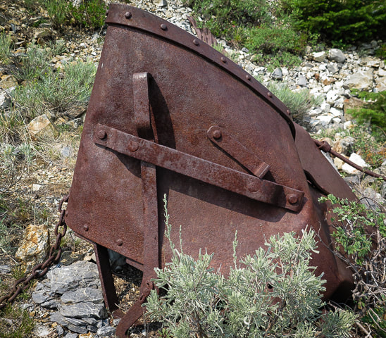

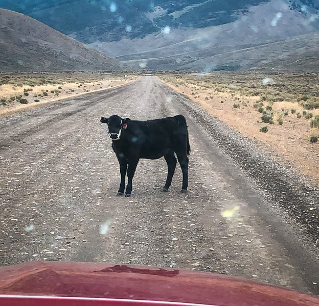
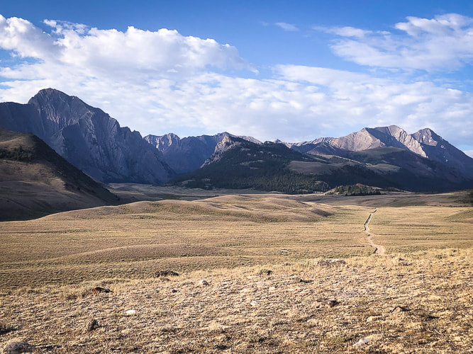
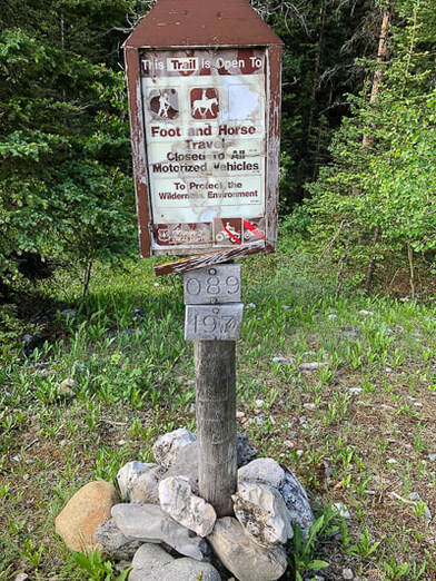
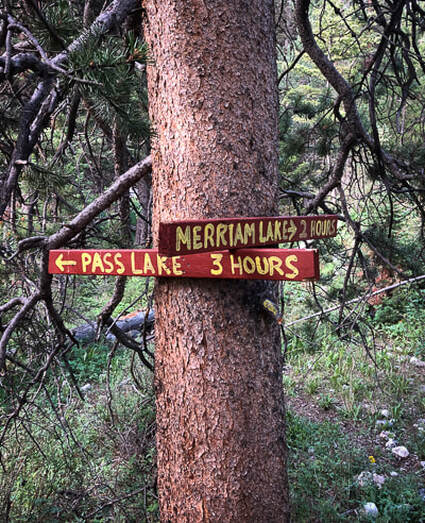
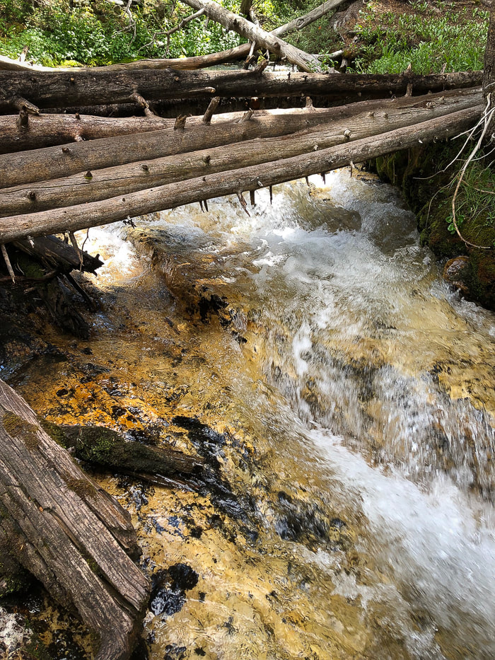
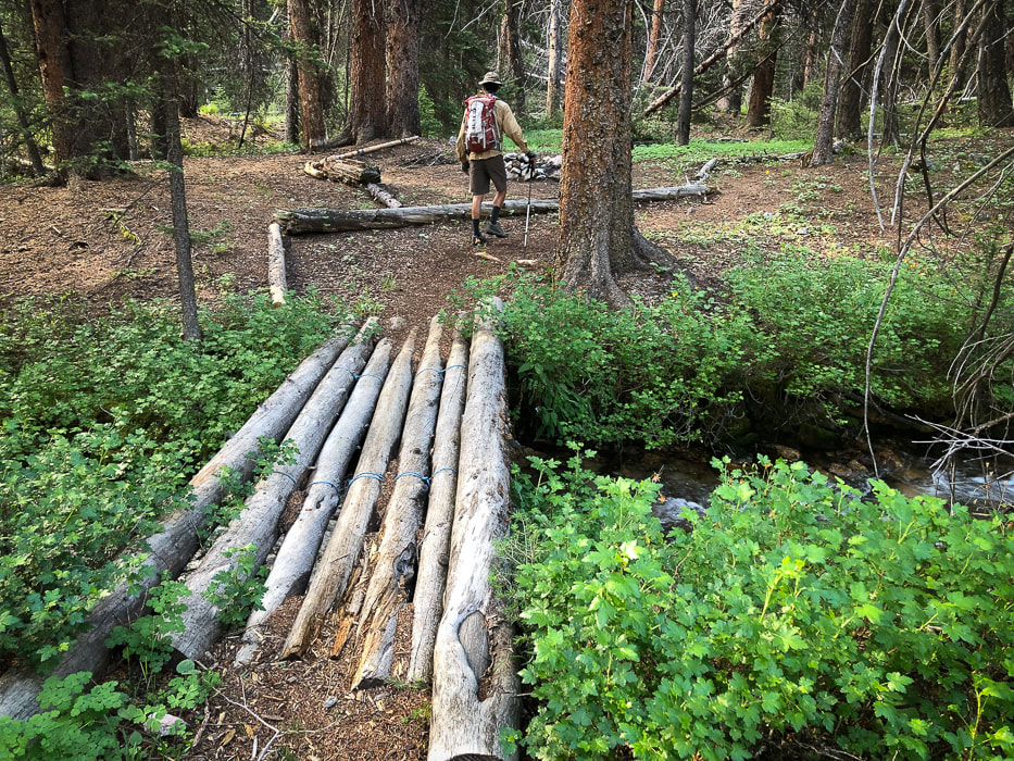
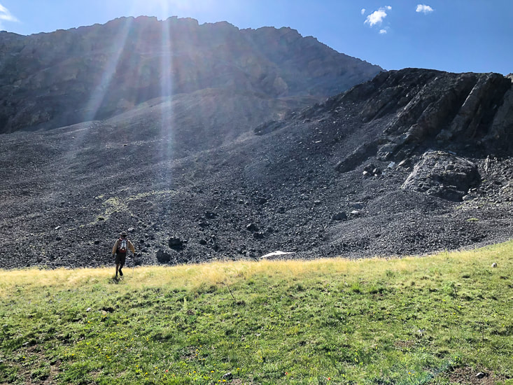


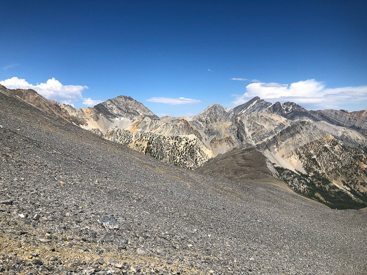
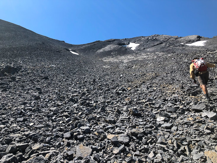
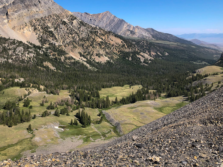
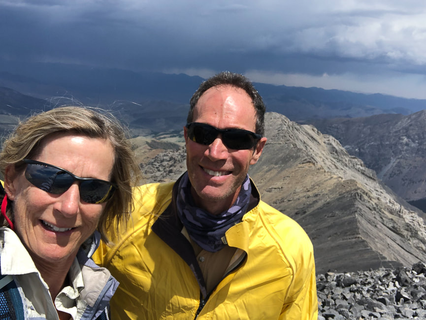
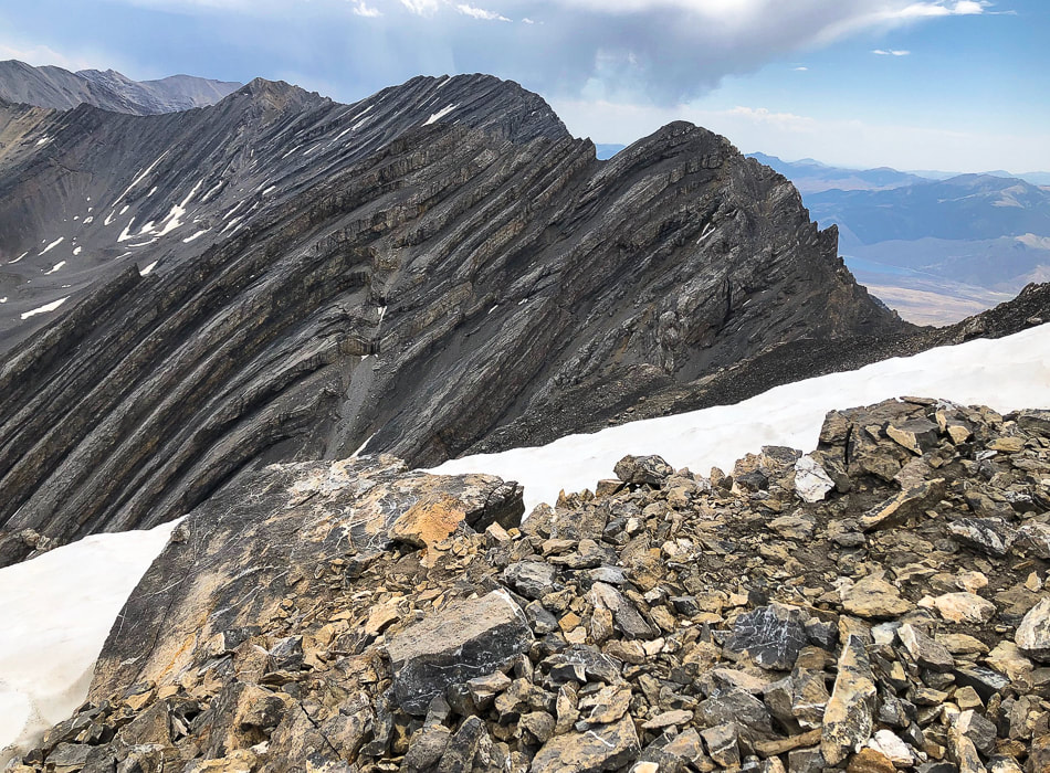
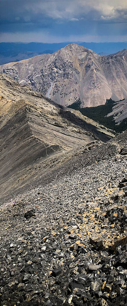
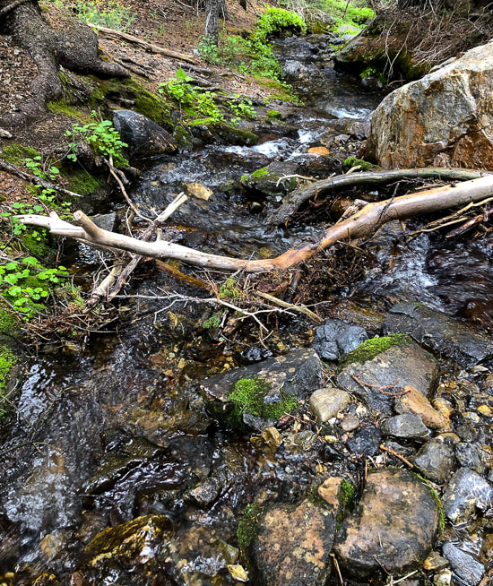

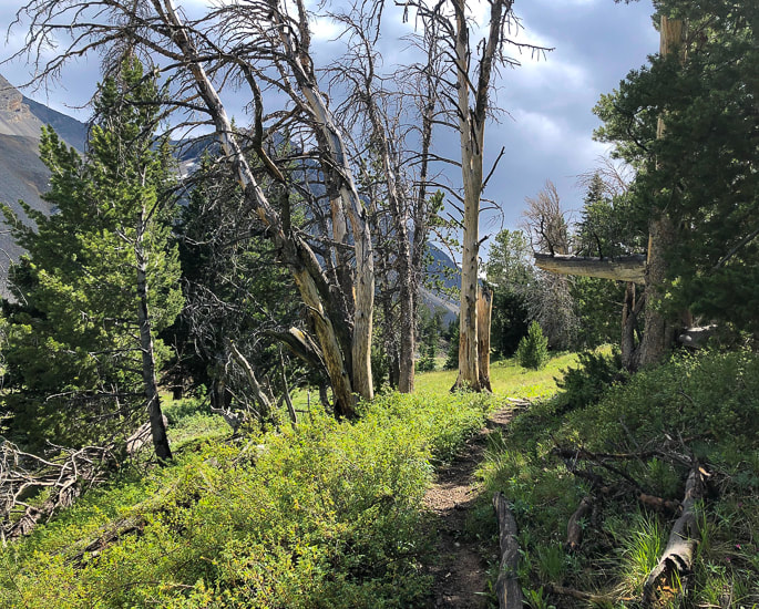
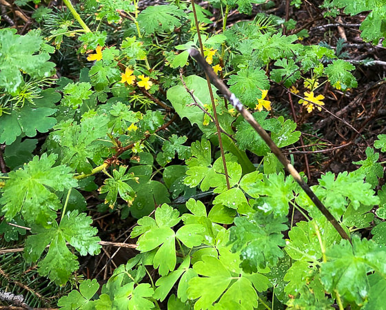
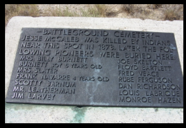