EXPLORUMENTARY
  • Home
    • Cactus to Clouds Hike
    • More Quotes
    • Ann Zwinger Quotes
    • Mary Oliver Poems
  • Hikes by State
    • Southern Utah
    • Idaho
    • Arizona
    • California Desert
    • Nevada
    • Wyoming and New Hampshire
  • Petroglyphs and Pictographs
  • BLOG
    • Adventure Blog
  • GALLERY
    • DESERT PLANTS >
      • Beavertail cactus
      • Brittlebush
      • Christmas Cactus
      • Arizona Barrel Cactus
      • Parry's penstemon
      • Agave
      • Arizona Rainbow Hedgehog
      • Claret Cup Hedgehog
      • Desert Agave
      • Palmer's Penstemon
      • Silver Cholla
      • Cristate Saguaro
      • Indian Paintbrush
      • Ocotillo
      • Santa Rita Prickly Pear
      • Spiny Cliffbrake
      • California Barrel Cactus
      • Engelmann Prickly Pear
      • Velvet Mesquite
      • Joshua Tree
      • Buckhorn Cholla
      • Hedgehog Cactus
      • Fishhook cactus
      • Thompson's Woolly Locoweed
    • NATURE
    • BOISE
    • EARTH + SKY
    • URBAN
    • WATER
    • PATRIOT
    • ORCHIDS
  • Fit After 50
    • Brian Holgate
    • Fred Birnbaum
    • Dave Brasuell
    • Bus' Little Black Book
    • Mike Carlson
    • Ray Wilson
    • Bryan Krouse
    • Vickie Kearney
    • Maria Keezer
    • DOUG TRAUBEL
    • Boise Cross Fit Masters Ladies
    • Tim Clemens
    • Marcia Bondy
    • Becky Borczon Blake >
      • Becky B Downtown
    • Jennifer Cera and Sue Birnbaum
    • Dave Brasuell
    • Vance Powell
  • Contact

Hike Pyramid Peak - Death Valley National Park

2/6/2023

1 Comment

 
We celebrated another Christmas with a sublime, scree-filled desert summit challenge and a Tecopa Hot Springs soak afterward.
Related:
California Desert Hikes
​Pinto Mountain Hike - Joshua Tree Wilderness
Pahrump Point and Tecopa Hot Springs, California
Desert Plants
Picture
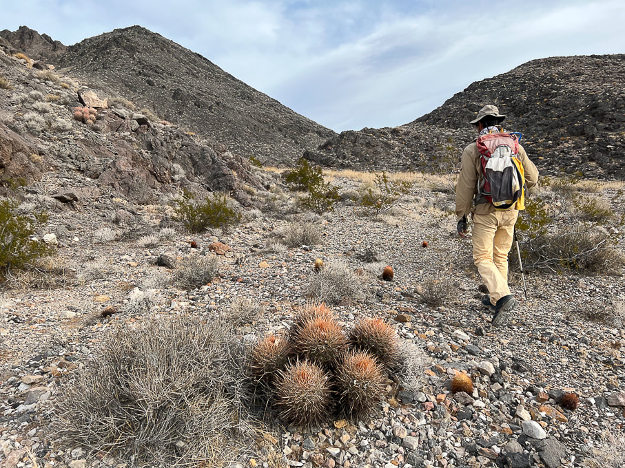
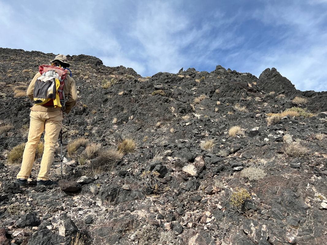
Ascending wash to walk between the black hills to the right and the two small hills just to the left of Fred.  
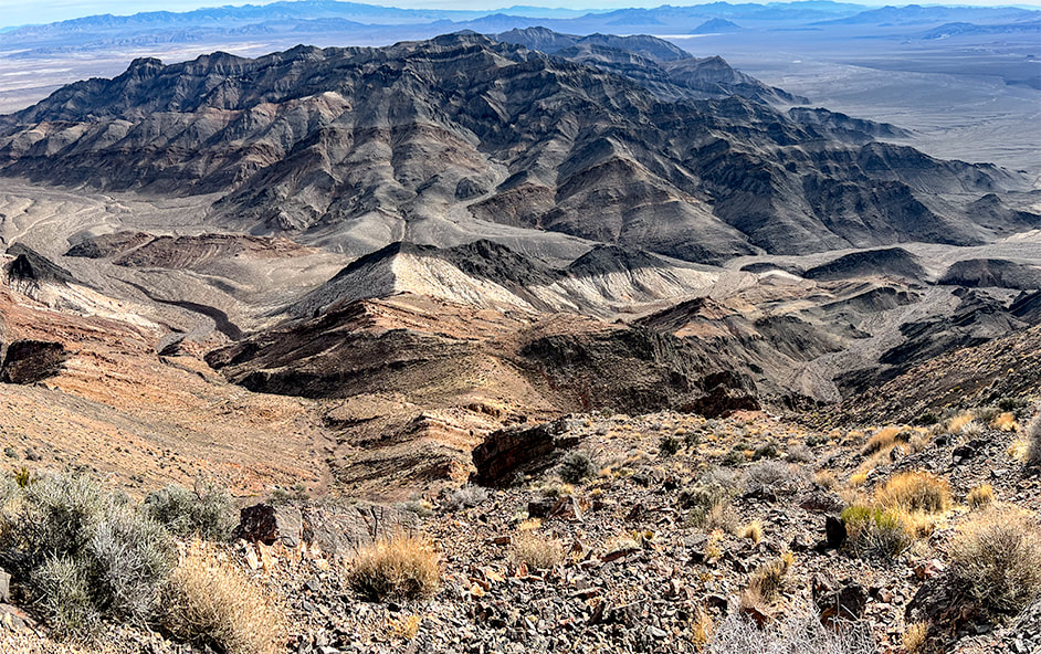
Pyramid Peak is black and white - on horizon.

Death Valley got its name from a wagon party trapped in the valley in the 1849 California gold rush.  One man perished in this hottest place on Earth.  One of the travelers was said to have proclaimed, "Goodbye, Death Valley" as they traveled west over the mountains.
Route Map
Trip Stats for Standard Route (Southeast Ridge)
Location:   
Amargosa Range, Funeral Mountains high point, Eastern Death Valley National Park.
Distance/Elevation Gain:  10.4 miles out and back/3,700'.  Trailhead = 3,041'.  Summit = 6,703'.
Difficulty:  moderate - strenuous effort Class 1-2:  most time is spent on three major rock/scree slopes.  Mostly discernible trail with rock cairns; occasionally requires focus as it becomes faint.

Prominence:  3,703'.
​
​Coordinates:  Trailhead at Hwy 190 = 36.34048, -116.59866.  Summit = 36.39196,  -116.61228.
Maps and Apps:  Topo Maps US app, StavIsLost route map, Garmin GPS.
Date Hiked:  12/26/22
Directions to trailhead:  Park on Highway 190 at an old RV/campground with Pyramid Peak in view.  If coming from Death Valley Junction (east), drive ~ 11 miles.  If coming from Furnace Creek in the park, drive 17-18 miles.

Geology:  The ​ridge hike is a journey through Ordovician-age (450 m.y.a.), heavily faulted limestone and dolomite (Ely Springs dolomite and Pogonip group carbonates).  Pyramid Peak summit is Eureka quartzite and Ely Springs dolomite. 
Overview
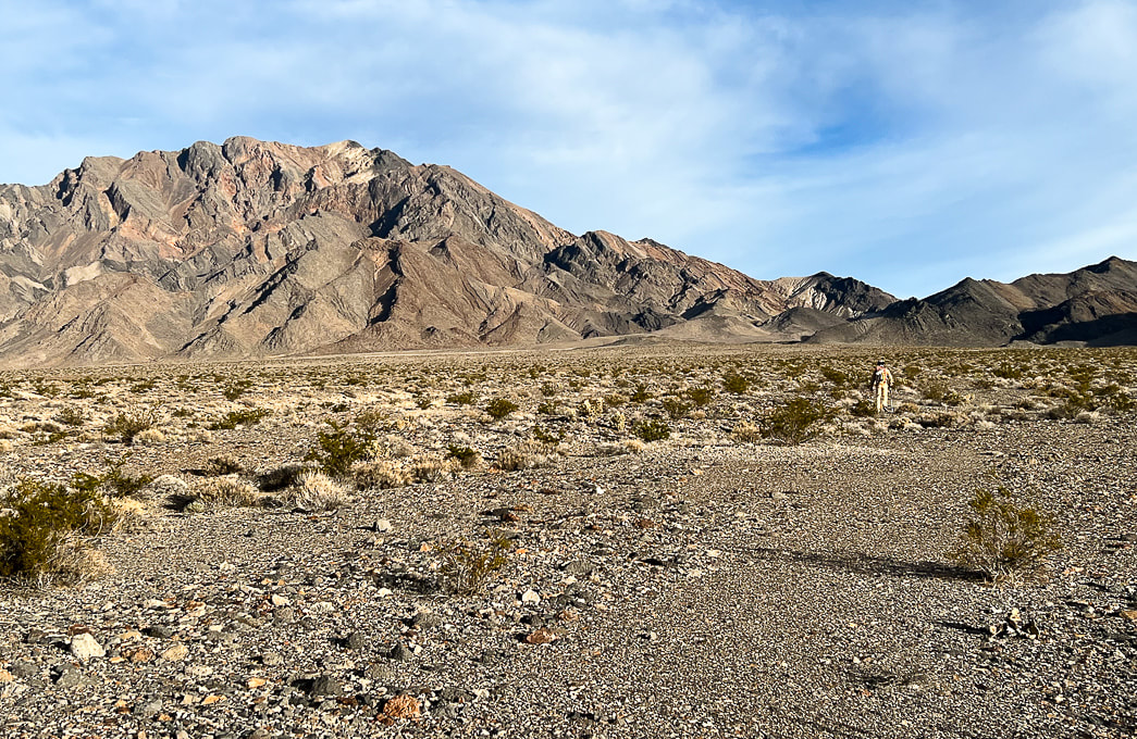
The words "Death Valley" may conjure up images of doom and foreboding, but it's really a land of mystique and fascination, and of extremes.  In winter, it's one of the warmest places in the country, making it one of my favorite places to explore.  You wouldn't want to be there in the summer, unless you want to experience an average July temperature of 116 degrees.  It has the record for the hottest temperature ever recorded on Earth — 134 degrees.  Last December, we hiked remote Pahrump Point with spectacular views of Death Valley's Telescope Peak on a cold and windy day, and warmed up in Tecopa Hot Springs Resort's hot springs.

​This year we "elevated" our summit challenge to hike the lonesome and talus-riddled slopes of Pyramid Peak in the Funeral Mountains, eastern Death Valley National Park.  It's listed on the Sierra Club's Desert Peaks section, hence the discernible trail.  I break this hike into four parts:  a long alluvial fan/wash approach, followed by three steep, loose-rock slopes.  Forbidding, massive dark grey limestone greets you at the top of the second loose-rock slope.  Pyramid's summit is not in sight until you get up this face and walk around it to the left, where you see more talus slopes under big black spires.

From its small quartzite perch, the summit affords a huge view of Death Valley's Panamint range capped by Telescope Peak, and into Nevada.  Stunning views surround you the entire ridge climb.  Sublime, raw, layered, folded, vast and lonely - the quintessential Mojave Desert.
Our Hike
  • From old RV site on Hwy 190, walk up alluvial fan for 2.8 miles, towards two small hills on the left.
  • Turn north/northwest (left) up wide drainage and walk 0.4 miles to the black rocks at its end.
  • Talus slope 1:  A cairn was present, a faint trail leads up the steep rock/scree slope; follow this to the saddle, mounting Pyramid Peak's southeast ridge.
  • At 4.0 miles, continue on easy ridge until the next steep climb.
  • Talus slope 2:  Climb through a mini-gulley and reasonable talus slope to the left of a super-steep scree slope.  Gain is ~ 800 ' in 0.4 miles.  Top out on a saddle overlooking a short flat area with dark grey rocks ahead.
  • Climb ~ 800' up black/grey rocks following trail as it leads to the left, around the outcrop's highest spire.
  • Talus slope 3:  follow trail along base of a series of pinnacles/spires, staying relatively close to the base.  Summit is a quick Class 2+ climb.  
Tecopa Hot Springs Resort
​The relaxed, laid-back attitude and marvelous hot springs brought us back to this resort again this holiday season.  We're already planning a return trip.  We celebrated with rib-eyes and beer and wine at Steaks and Beer restaurant, as we did last year.  Tired of Las Vegas, chef Eric Scott decided to keep it simple and serve the most delicious ribeyes from a limited menu in an old, down-to-earth, unpretentious place right there at Tecopa Hot Springs Resort.  Steaks are cast-iron seared, flame-grilled and finished with a balsamic reduction.  And...we had cherries jubilee for dessert!  More about Tecopa Hot Springs Resort in Pahrump Point Hike post.
Picture
What more could we ask for?  The opportunity, legs and strength to summit a Death Valley peak, the views to remember forever, a natural hot springs soak, and one of the best steak dinners ever - all in the middle of the quiet Mojave.  
We're living the dream!   Keep on Exploring - it's good for the body, mind and soul!
Picture
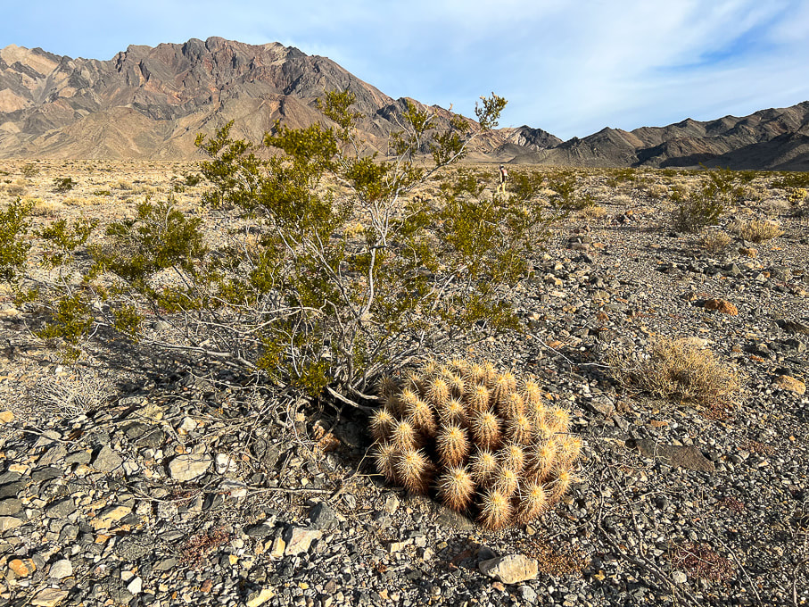
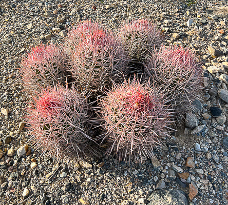
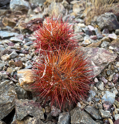
Healthy creosote bush and lots of hedgehog cactus clumps on the way up this alluvial fan.
Picture
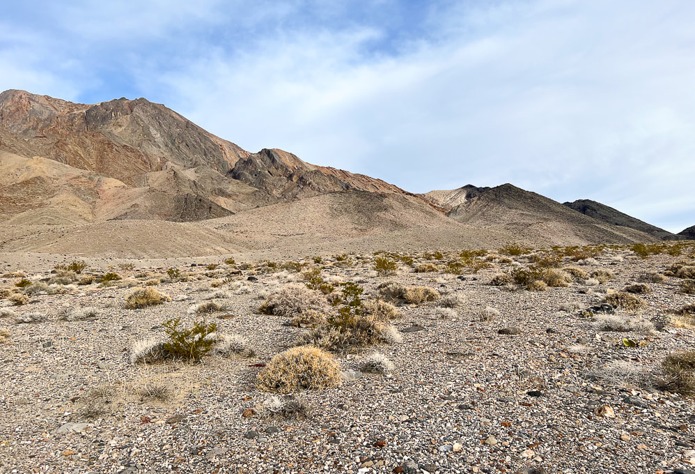
Almost at the small hills on the left - the approach continues along the base of these for 2.8 miles from trailhead where it turns NNW into a wide drainage/fan.
Picture
At the end of initial alluvial fan climb - taking a left around base of this hill to see large drainage.
Picture
Turning left into a major drainage with black rocks at the end of it - then the climb begins!
Picture
Finding a trail at the end of the wash that stays on the right side of the drainage to the left.
Picture
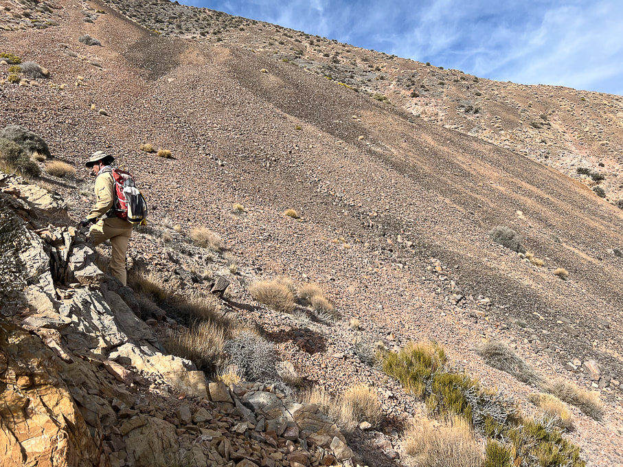
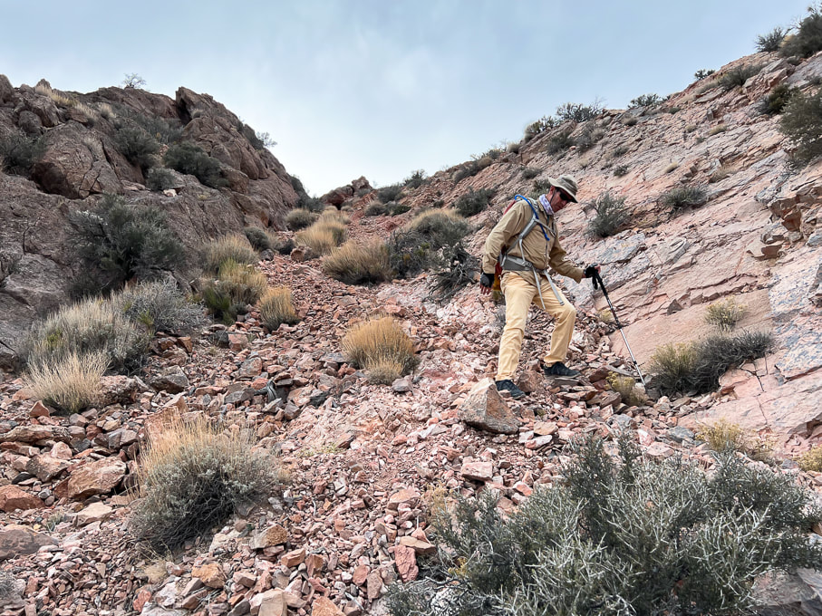
Trail heads up to the saddle above, with a good amount of loose rock.
Picture
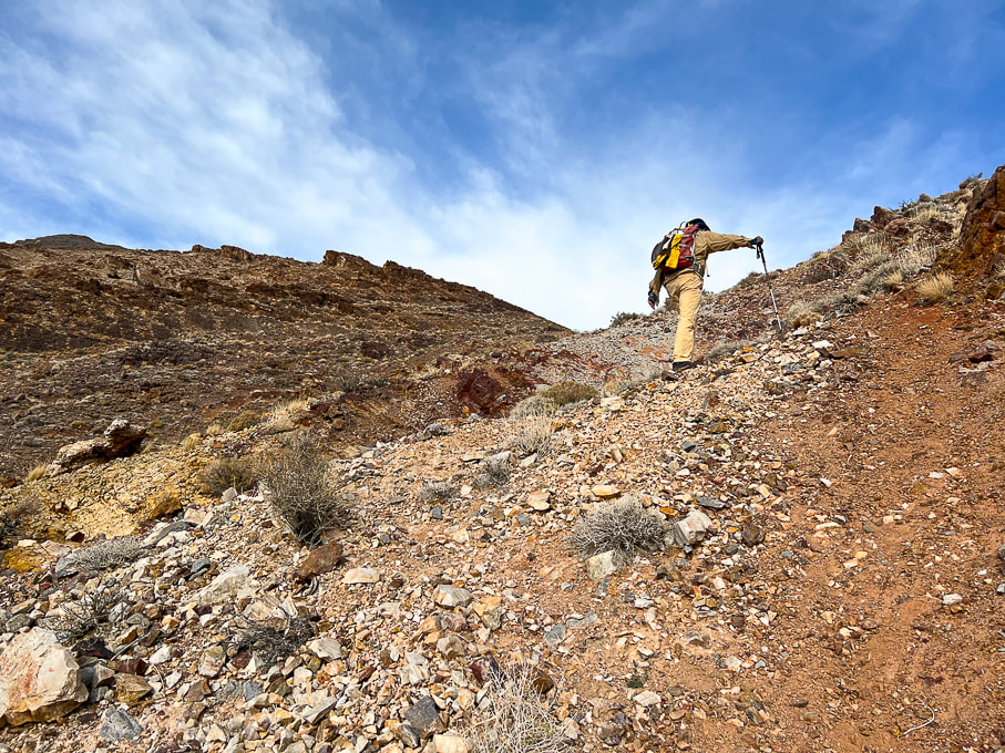
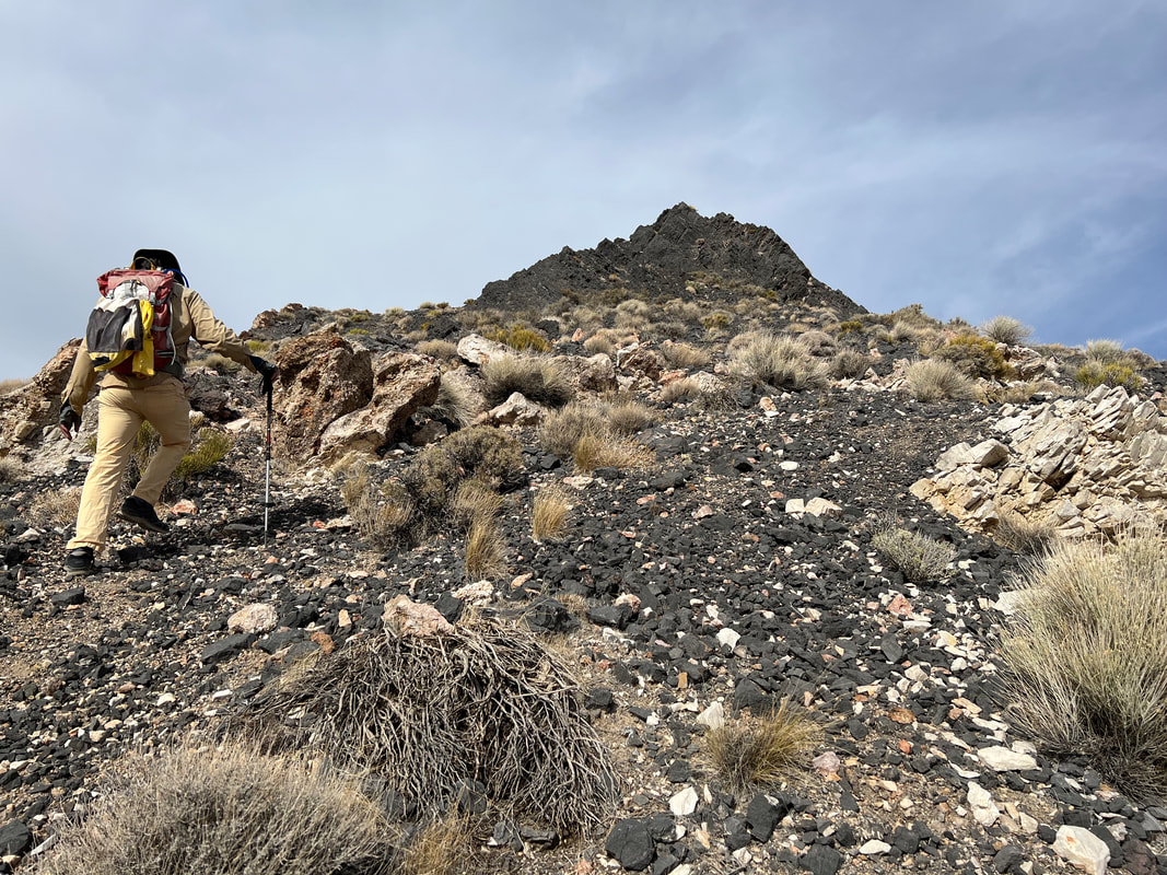
Fred making his way up steep and loose rock to saddle (Talus slope #1).
Picture
Looking down the first talus slope to the wide wash  we had turned into from approach alluvial fan.
Picture
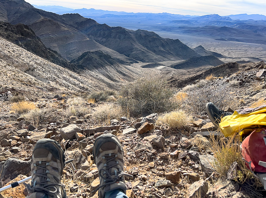
Done with the first talus slope!  Time for a break - looking back at the highway and valley we have just come up.
There's a few cairns to mark this first slope; afterwards, the trail is mostly discernible.
Picture
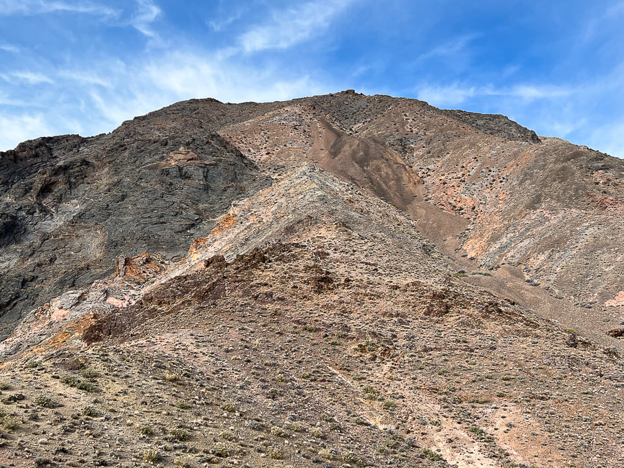
Looking ahead to the crazy, rugged mess of rocks we will ascend - glad there is a cairned trail!  Pyramid summit behind the ridge.  Go straight up the ridge in middle of photo, then bypass the brown-colored scree slope by hiking to its left, up through minor gully (center of photo).  Reach the top of this brown rock to ascend the dark grey rock.
Picture
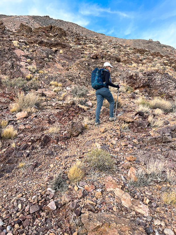
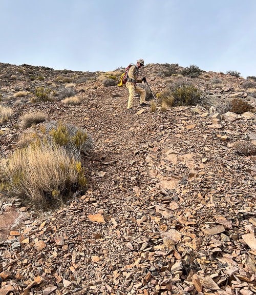
Continuing on less-steep portion of southeast ridge in between the steep talus slopes.
Picture
Picture
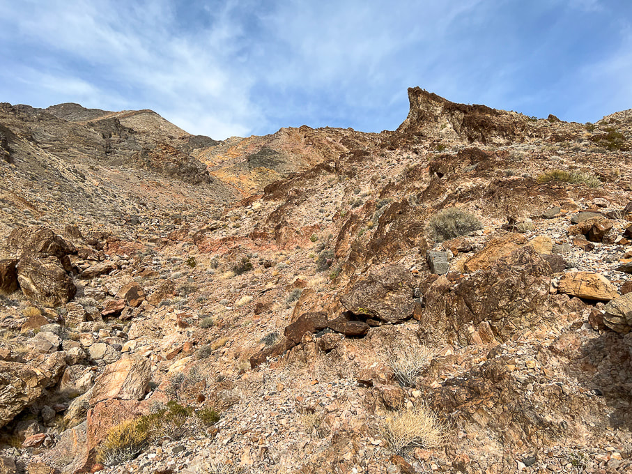
Getting through a minor limestone outcrop and looking at the fan we hiked up; walking under the two small hills at the upper left.
Picture
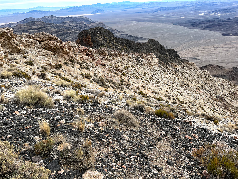
Look at that lovely scree field!  Trail goes to the left of this, through a small gulley and manageable talus slope, through pink, deep red and yellow rocks.
Picture
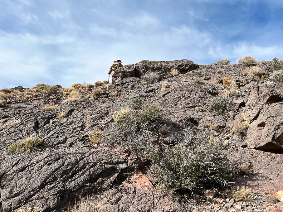
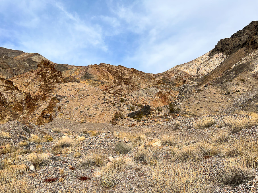
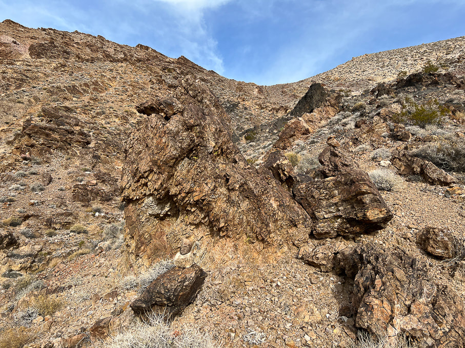
Getting up and over this sharp limestone, where it flattens out somewhat.
Picture
View south from ridge.
Picture
This is "Talus slope 2" - photo is taken on the way down.  This is on the left of the very steep scree slope.
Picture
Upper part of "Talus slope 2".  This photo is taken on our way down.
Picture
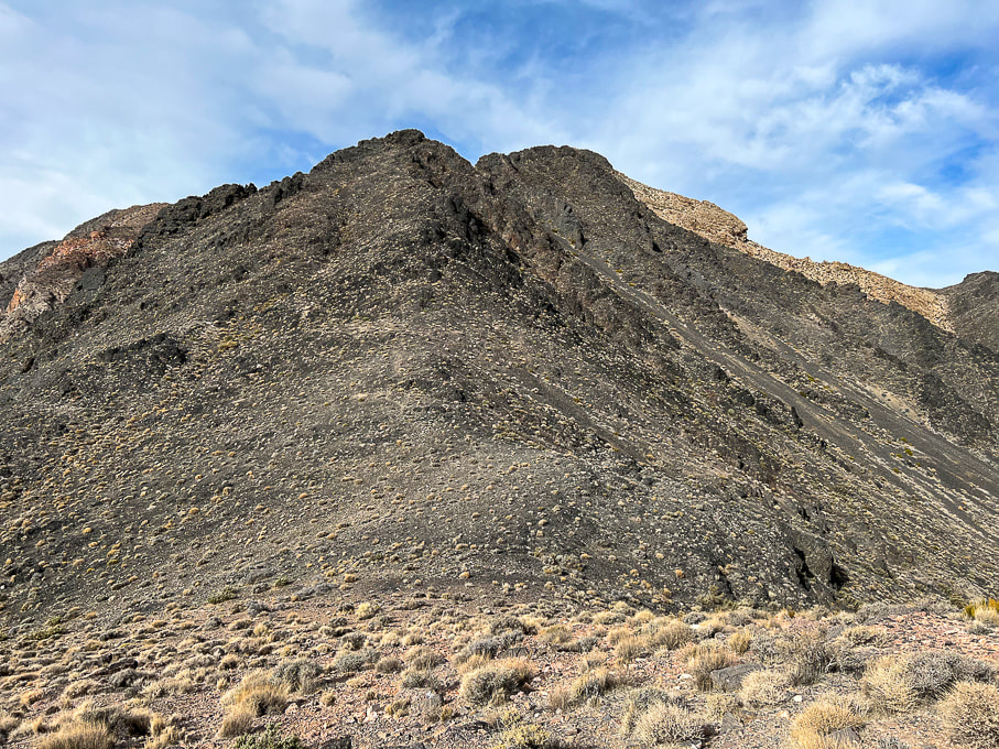
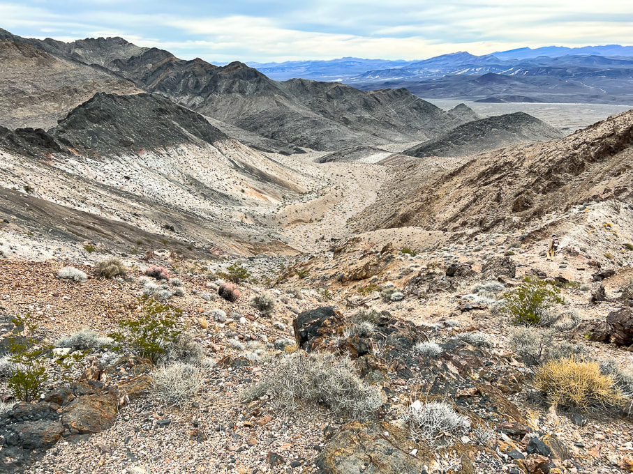
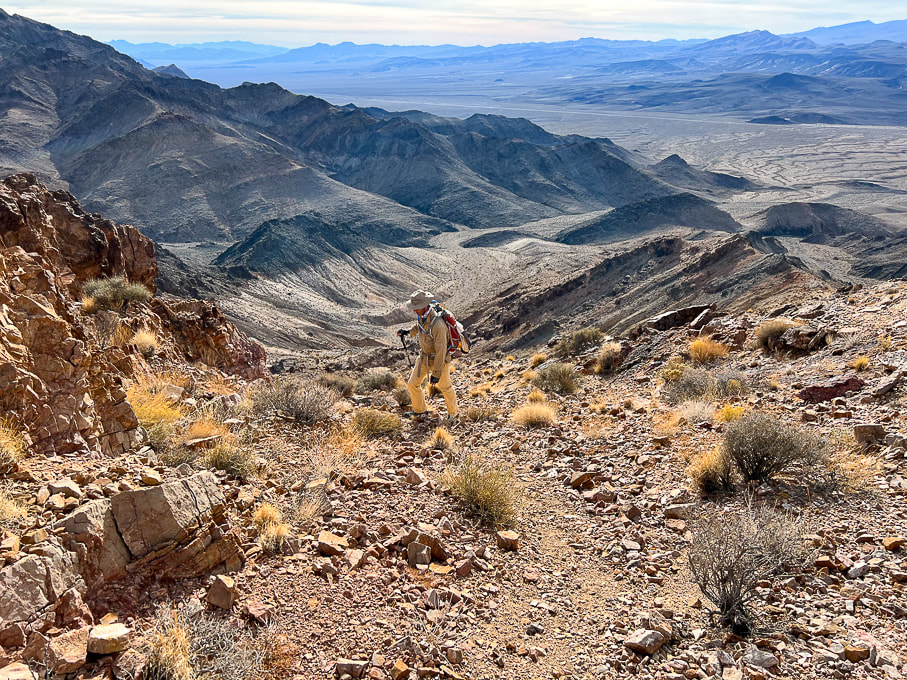
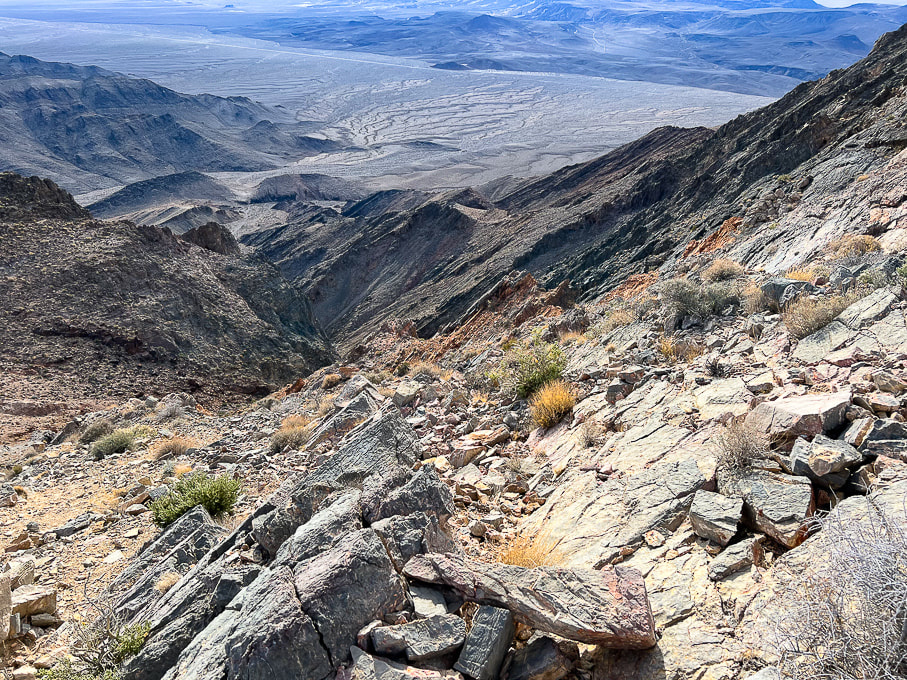
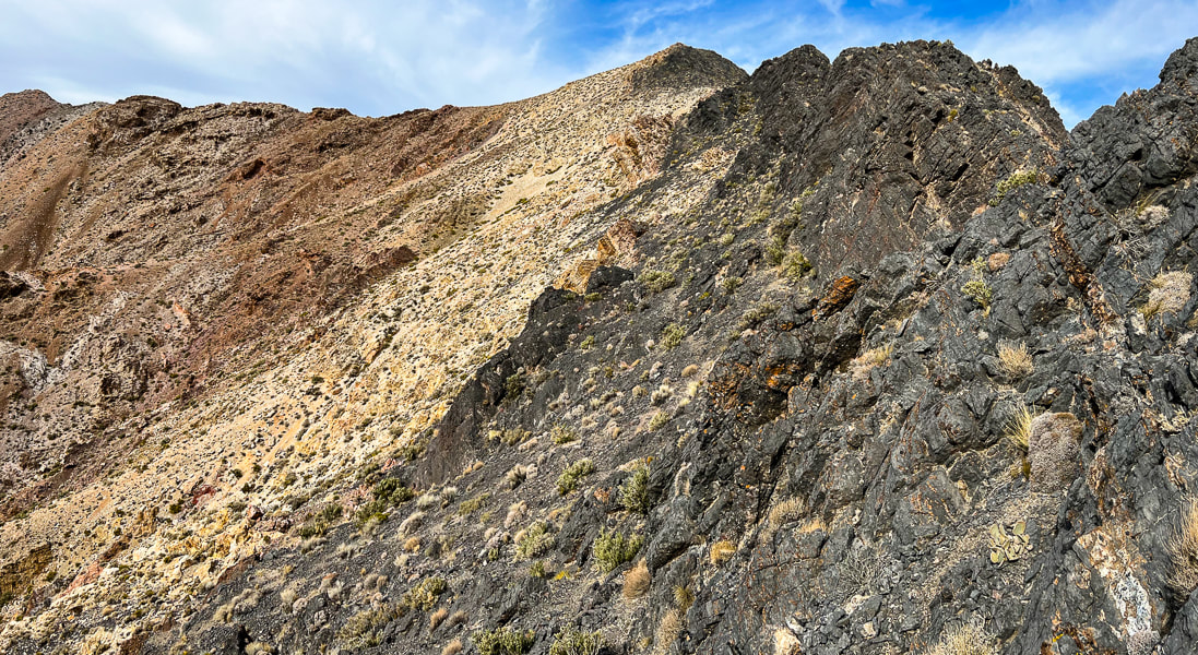
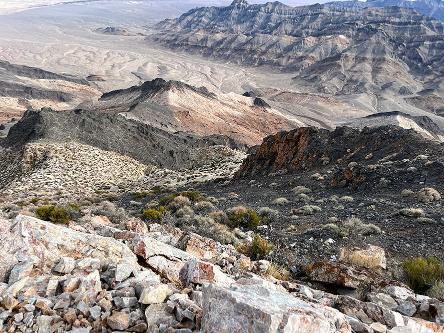
Forbidding sight after topping off on ridge after the second steep talus slope.  You can see the trail running in the middle of this, leading to the top of the left prominence, then skirts around it to the left, where you will see Pyramid Peak summit.
Picture
Looking back from the black rock ascent to the saddle we just came over and brief flat area.
Picture
Working our way up the black rock.
Picture
View of Pyramid Peak as trail traverses under left side of ridge walls.  
Picture
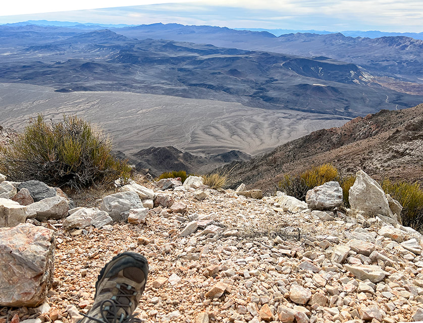
Climbing "Talus slope 3" near the base of the summit.
Picture
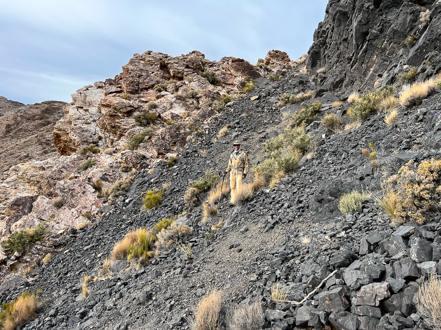
Trail along left side of ridge near the summit.
Picture
Looking back to approach valley and the black "knife" ridge we had passed under.
Picture
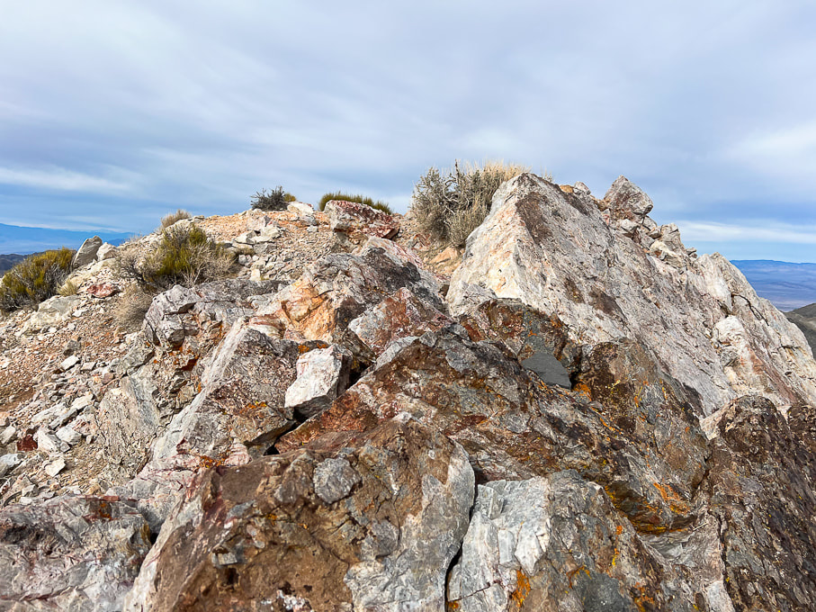
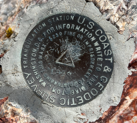
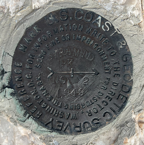
The beautiful Eureka Quartzite on the summit of Pyramid Peak.
Picture
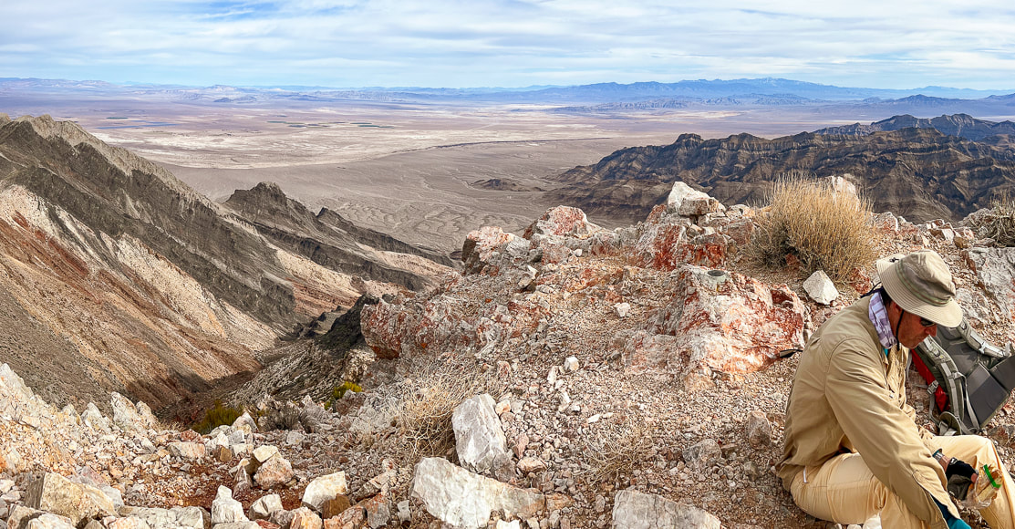
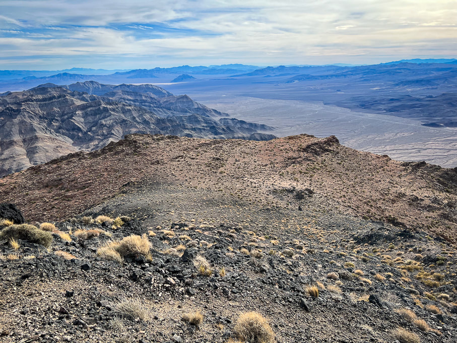
At Pyramid Peak's summit looking toward the east - Amargosa Desert.
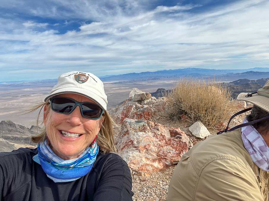
Picture
Pyramid's summit!
Picture
Pyramid's summit looking down on our alluvial fan approach and Highway 190.
Picture
From the summit looking  east toward the Amargosa Desert and Nevada. 
"Amargosa" is the Spanish word for "bitter", describing water in the Amargosa River, which courses through Amargosa Desert.
Picture
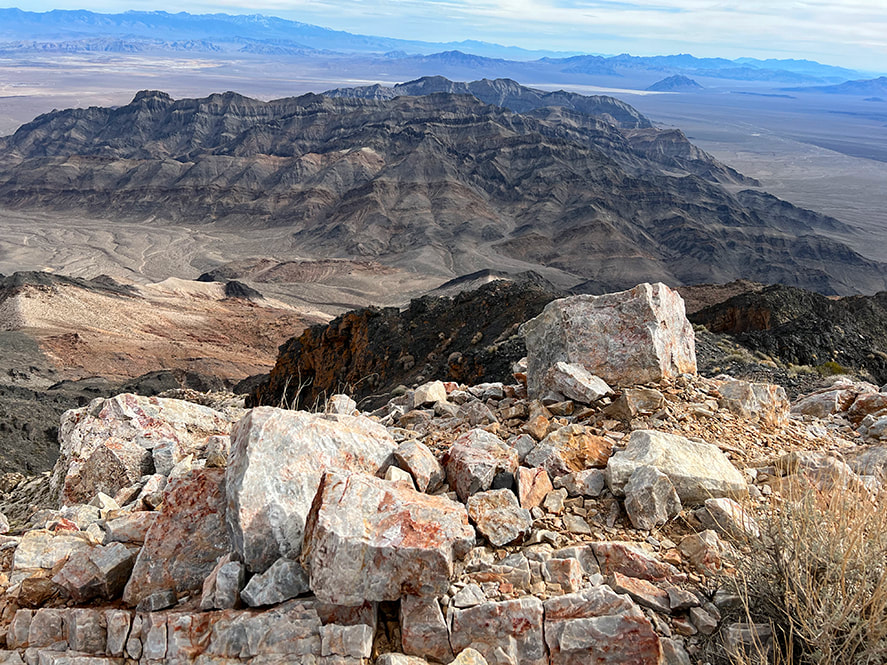
On the summit looking toward Furnace Creek wash and Artist's Pallette in Death Valley.
Picture
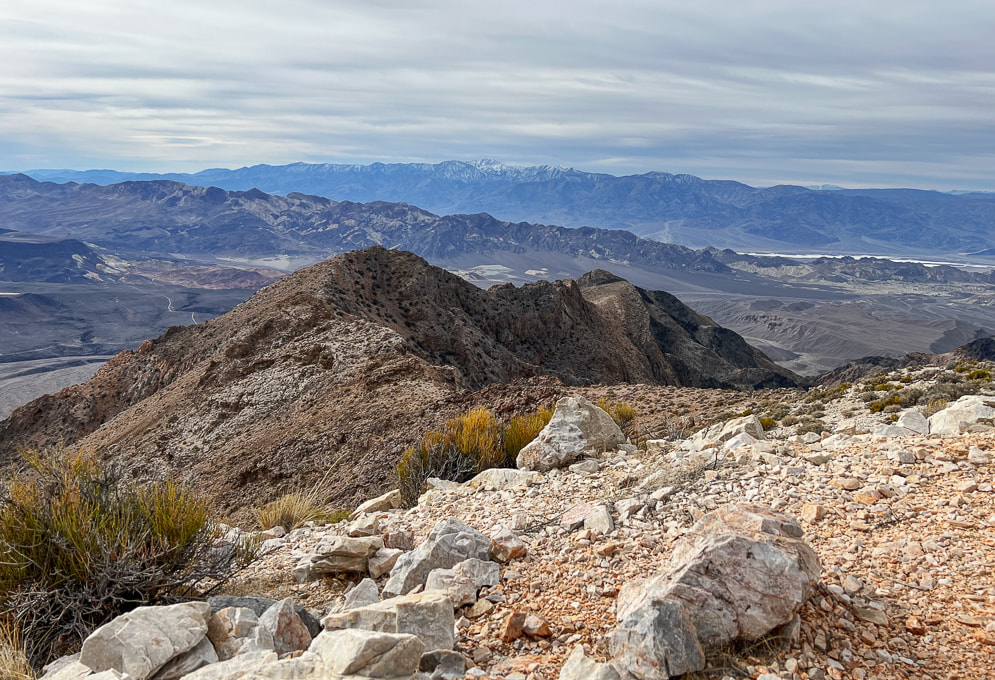
View west of the Panamint Range and Telescope Peak, the highest summit in Death Valley at 11,043'.
The summit of Pahrump Point provides a closer view of Telescope.
Triangulation station survey marker
Triangulation station reference marker
Trés beau!
Cairn
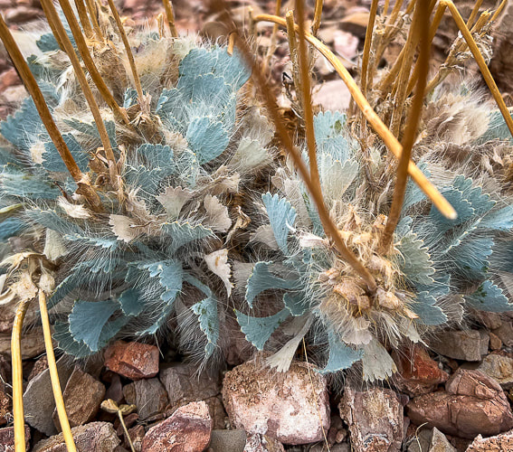
Some cool stuff on the trail.
Picture
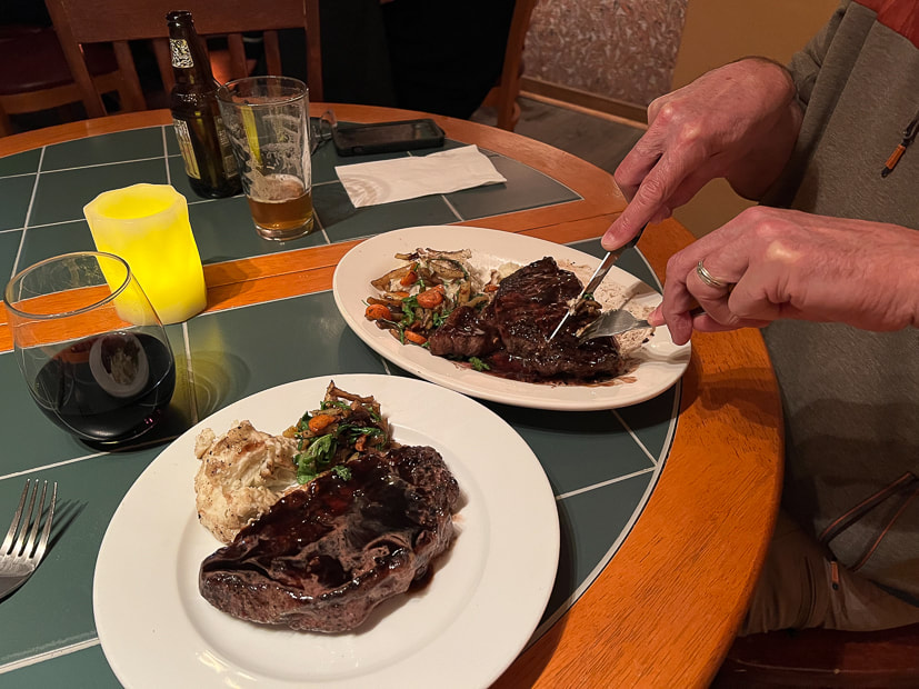
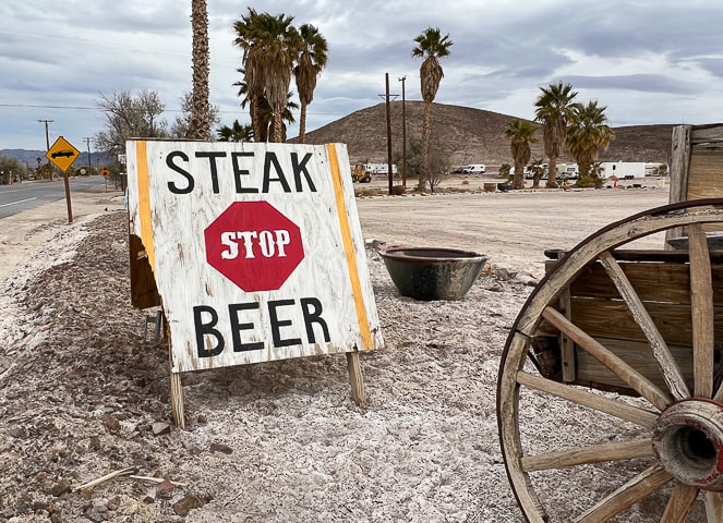
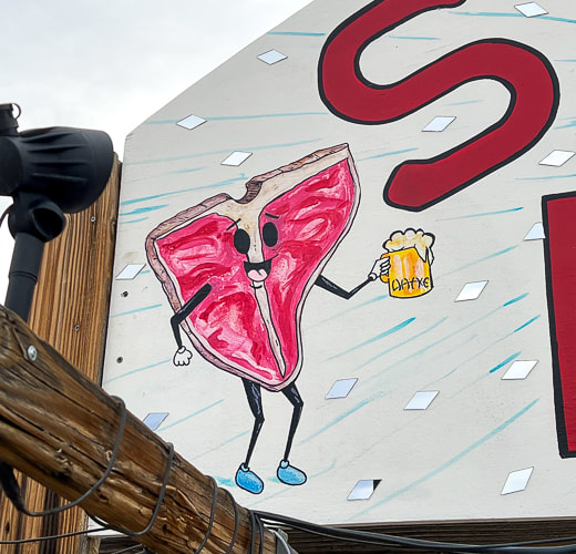
Celebratory rib-eye, beer and wine at Steaks and Beer in Tecopa, California - highly recommended for carnivores!!
Picture
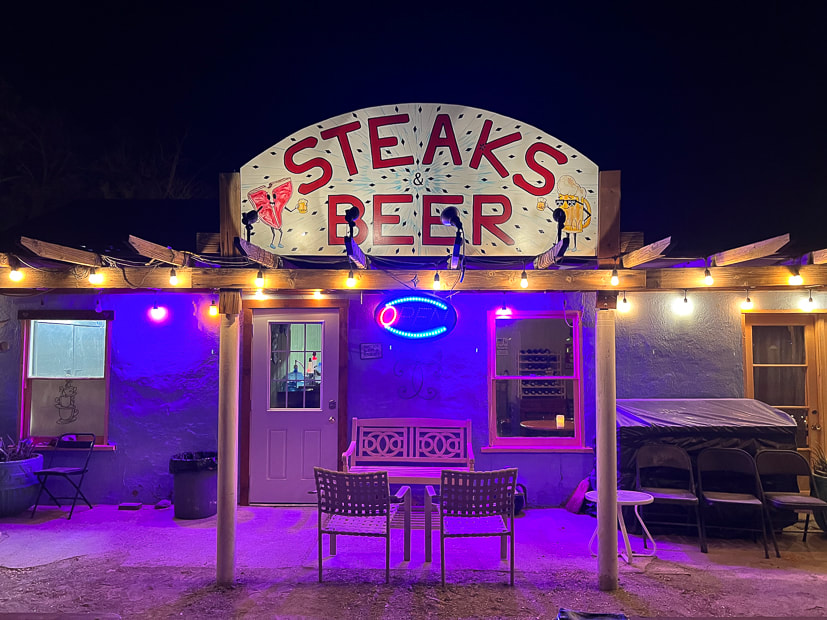
That night after the hike, we walked into Steaks and Beer for our delicious ribeye and cherries jubilee.
Steaks and Beer Restaurant
Wild Wheat Bakery and Cafe'
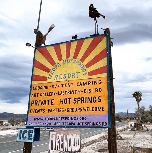
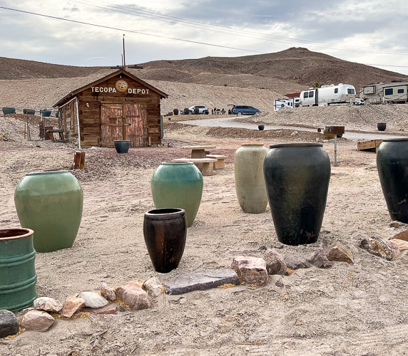
Tecopa Hot Springs Resort - Tecopa, CA.
Picture
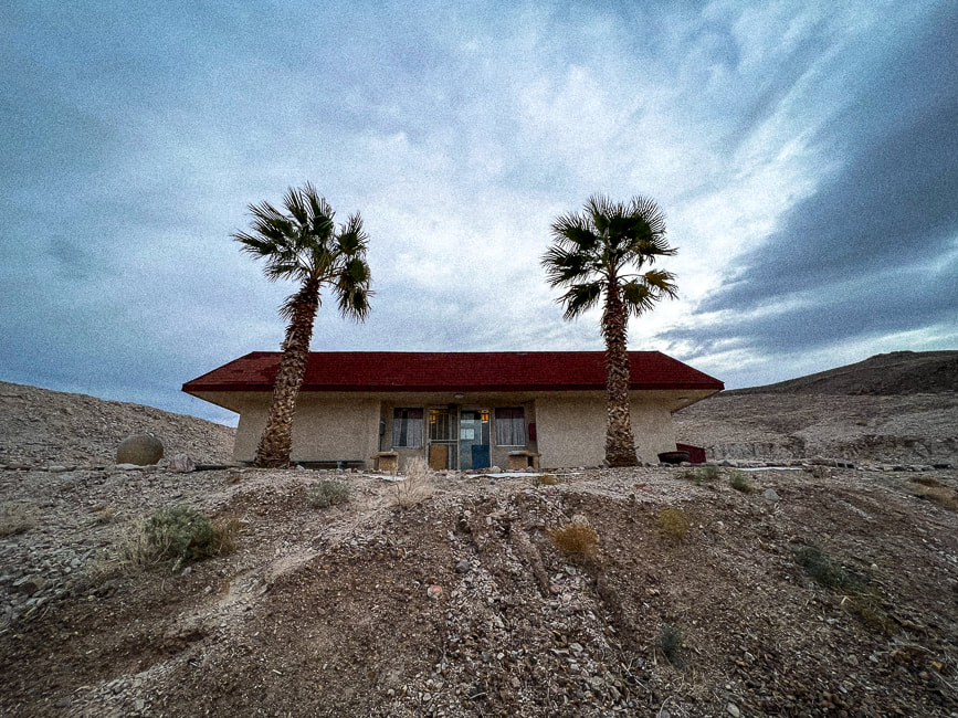
Early morning at Tecopa Hot Springs Resort's bath house.
Picture
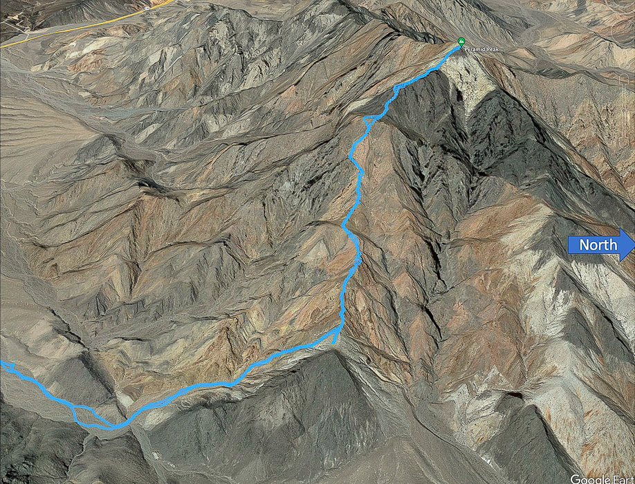
Our tracks on the ridge portion of the hike to Pyramid Peak.  Leaving major wash (lower left) to walk to the end of side wash to begin ridge climb.
Picture
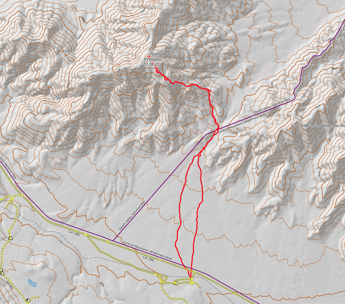
Our GPS tracks from parking at old campground on California Highway 190 to summit of Pyramid Peak (CalTopo maps).
Click on map for larger image
Picture
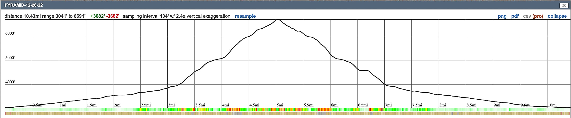
Elevation profile for out-and-back hike gaining 3,700' in 5.2 miles.  Hike up alluvial fan/wash for the first three miles.
References
Fridrich, C.J., et al.  Preliminary Geologic Map of the Southern Funeral Mountains and Adjacent Ground-Water Discharge Sites, Inyo County, California, and Nye County, Nevada.

Geologic Formations.  NPS - Death Valley website.
​
​
McAllister, J.  2009. 
Geologic Maps and Sections of a Strip from Pyramid Peak to the Southeast End of the Funeral Mountains, Ryan Quadrangle, California
1 Comment
Network Cabling Shingle Springs, CA link
12/19/2024 06:22:11 am

This article offers an exciting and detailed guide to hiking Pyramid Peak in Death Valley National Park, providing both practical tips and a sense of adventure. The vivid descriptions of the hike, from the rugged terrain to the rewarding panoramic views, make it clear why Pyramid Peak is such a sought-after destination for experienced hikers. I appreciate how the author emphasizes the importance of preparation, particularly for a challenging hike in such a harsh environment. This post is not only informative but also inspiring for anyone looking to take on this incredible adventure!

Reply


Leave a Reply.

    Categories

    All
    Arizona Hikes
    California-desert-hiking
    California-desert-hiking
    Idaho Summits
    Nevada Hikes
    Petroglyphspictographs
    Snowshoe Hikes
    Southern Utah Hikesbikes

    To Subscribe to Explorumentary adventure blog and receive new posts by email:

    submit
    Picture
    Sue and Fred
    Picture

    About this blog

    Exploration documentaries          –  "explorumentaries"  list trip stats and highlights of each hike or bike ride, often with some interesting history or geology.  Years ago, I wrote these for friends and family to let them know what my husband, Fred and I were up to on weekends, and also to showcase the incredible land of the west.  
    Picture
    Happy Spring!
    Picture

    About the Author
    Sue Birnbaum

    A  trip to Jumbo Rocks Campground in Joshua Tree National Monument 40 years ago sparked my passion for hiking, exploring, and learning about desert ecosystems.  I met my husband Fred on Mt. San Jacinto.  We've explored the American West together; we love this land and I hope to inspire you to get out and explore through my photographs and trip descriptions.
    In 1992, Ray Wilson and I conceived the first Cactus to Clouds hike which climbs over 10,000 feet in one day to the summit of Mt. San Jacinto near Palm Springs, California.
    CACTUS TO CLOUDS HIKE 
    READ MORE
    ABOUT SUE
    Some of my favorite websites:
    ​

    ​Awkward Botany
    ​amateur botany for the phytocurious

    Bird and Hike

    ​"Intended to encourage people to visit, learn about, and fall in love with the desert."
    ​

    Draw and Shoot
    Beautiful Photography

    Daring Dayhikes
    "Interesting places you can visit with a daypack."  Terrific Tucson and other desert hikes and East Coast, too.


    Earthline: The American West
    Debra "writes to extol our beloved Earth." Detailed hike info, excellently written.
    ​

    Geologypics.com
    Geology and Geologic Time through Photographs

    Glenn Suokko
    Vermont artist's paintings "inspired by a place based on the land .... drawn to painting the representation and abstraction of nature."

    In the Company of Plants and Rocks
    ​A natural history blog about botany, plant ecology, and geology.


    MishMoments:  Joy of Photography
    this website is "
    about capturing that special moment in life’s journey and making the most of the time we have."

    Nature's Depths
    Walking through nature with John Palka, a neuroscientist who loves plants and ponders big questions.


    Rangewriter - What Comes Next?
    ​Linda's excellent writing brings to life her interesting adventures, "curiosities and thoughts", post-retirement.

    SeekingLost - Hiking and Backpacking Adventures.

    Stav Is Lost- Unconventional, out-of-the way hikes in the American West.


    Uprooted Magnolia
    ​Leah Yetter's beautiful "photo journal on life, love, and the spirit of Wyoming."

    Archives

    April 2025
    March 2025
    January 2025
    December 2024
    November 2024
    October 2024
    September 2024
    August 2024
    July 2024
    June 2024
    May 2024
    April 2024
    March 2024
    January 2024
    December 2023
    November 2023
    October 2023
    September 2023
    August 2023
    July 2023
    June 2023
    May 2023
    April 2023
    February 2023
    January 2023
    December 2022
    November 2022
    October 2022
    September 2022
    August 2022
    July 2022
    June 2022
    May 2022
    April 2022
    February 2022
    January 2022
    December 2021
    November 2021
    October 2021
    August 2021
    July 2021
    May 2021
    March 2021
    February 2021
    January 2021
    November 2020
    October 2020
    August 2020
    July 2020
    June 2020
    April 2020
    March 2020
    February 2020
    January 2020
    November 2019
    October 2019
    September 2019
    August 2019
    July 2019
    June 2019
    May 2019
    April 2019
    February 2019
    December 2018
    November 2018
    October 2018
    September 2018
    July 2018
    June 2018
    May 2018
    April 2018
    March 2018
    February 2018
    January 2018
    December 2017
    November 2017
    October 2017
    September 2017
    August 2017
    July 2017
    June 2017
    April 2017
    February 2017
    November 2013
    August 2013
    July 2013

HOME

Cactus to Clouds Hike
More Quotes
​
Mary Oliver Poems
Ann Zwinger Quotes
HIKES BY STATE

Idaho Hikes
Utah Hikes/Bikes
​Arizona Hikes
​California Desert Hikes
​Wyoming Hikes
​Nevada Hikes

BLOGS

Adventure Blog
Women and the Land
GEAR REVIEWS
FIT AFTER 50
Fred Birnbaum
Dave Brasuell
Bus' Little Black Book
​Mike Carlson
​Ray Wilson
​Marcia Bondy
Bryan Krouse
​Maria Keezer
​Tim Clemens
​Doug Traubel
​Brian Holgate
​
Becky Borczon Blake
​Jennifer Cera and
​Sue Birnbaum

​Vance Powell
​Boise Cross Fit Masters Ladies
​Vickie Kearney

GALLERY

Desert Plants
Nature
Earth + Sky
Urban
Water
Patriot 
​Orchids
Boise
​
  ABOUT
    Contact

​
© 2017 - 2025 by Sue Birnbaum.  Photos on this website are the sole property of Sue Birnbaum unless otherwise indicated.  Please receive permission before publishing my trip reports and photos.
I try my best to be accurate with my hike descriptions; please research your adventures, always bring a map and compass and know how to read them, be prepared!  All of these hikes can be dangerous; hike at your own risk.  ALWAYS carry the Ten Essentials with you on hikes. 
​Please feel free to contact me with comments or questions, or if you see any errors that need attention.
Thank-you for stopping by!


EXPLORUMENTARY.com
  • Home
    • Cactus to Clouds Hike
    • More Quotes
    • Ann Zwinger Quotes
    • Mary Oliver Poems
  • Hikes by State
    • Southern Utah
    • Idaho
    • Arizona
    • California Desert
    • Nevada
    • Wyoming and New Hampshire
  • Petroglyphs and Pictographs
  • BLOG
    • Adventure Blog
  • GALLERY
    • DESERT PLANTS >
      • Beavertail cactus
      • Brittlebush
      • Christmas Cactus
      • Arizona Barrel Cactus
      • Parry's penstemon
      • Agave
      • Arizona Rainbow Hedgehog
      • Claret Cup Hedgehog
      • Desert Agave
      • Palmer's Penstemon
      • Silver Cholla
      • Cristate Saguaro
      • Indian Paintbrush
      • Ocotillo
      • Santa Rita Prickly Pear
      • Spiny Cliffbrake
      • California Barrel Cactus
      • Engelmann Prickly Pear
      • Velvet Mesquite
      • Joshua Tree
      • Buckhorn Cholla
      • Hedgehog Cactus
      • Fishhook cactus
      • Thompson's Woolly Locoweed
    • NATURE
    • BOISE
    • EARTH + SKY
    • URBAN
    • WATER
    • PATRIOT
    • ORCHIDS
  • Fit After 50
    • Brian Holgate
    • Fred Birnbaum
    • Dave Brasuell
    • Bus' Little Black Book
    • Mike Carlson
    • Ray Wilson
    • Bryan Krouse
    • Vickie Kearney
    • Maria Keezer
    • DOUG TRAUBEL
    • Boise Cross Fit Masters Ladies
    • Tim Clemens
    • Marcia Bondy
    • Becky Borczon Blake >
      • Becky B Downtown
    • Jennifer Cera and Sue Birnbaum
    • Dave Brasuell
    • Vance Powell
  • Contact